| 0 | NA 85346 | AC18-10 | Quercus nigra L. | North Carolina, United States | NA | | | 2018 | COLLECTED | 10/17/2018 | Stanly County; ; Parking lot off northbound Highway 49 at the edge of Badin Lake. | 35.50396000, -80.18595000 | 187 | | Wild material | | 2108878 | NA 85346 |
| 1 | NA 84486 | NA 84486 | Quercus nigra L. | Tennessee, United States | NA | | | 2017 | COLLECTED | 11/01/2014 | Reflection Riding Arboretum and Nature Center, 400 Garden Rd; tree growing near Lookout Creek. | 35.00163000, -85.30085000 | | | | | 1952867 | NA 84486 |
| 2 | NA 85007 | JDC/QB/2008/079/149 [related collection number] | Quercus bicolor Willd. | Iowa, United States | NA | | | 2018 | COLLECTED | 09/24/2015 | Chichaqua Wildlife Habitat Park bottoms, near Elkhart, NW 1/4 of NW 1/4 of Section 32, T81N, R22W, Loring Quad. | 41.79000000, -93.43972222 | 247 | | Wild material | Seedlings from seed collected at the same site as NA 81010, which was received in 2012 under collection number JDC/QB/2008/079/149, and also as Ames 29670. GRIN narrative: "A small proportion of seedlings during growout were noted to be Q. bicolor x Q. macrocarpa hybrids." Digital photographs of source trees available in GRIN under NA 85010/Ames 29670. | 2141805 | NA 85007 |
| 3 | NA 84689 | PCC17-TNKY-041 | Quercus lyrata Walter | Kentucky, United States | NA | | | 2017 | COLLECTED | 10/03/2017 | McCracken County; ; Metropolis Lake State Nature Preserve. | 37.14838000, -88.76861000 | 101 | 25 feet inland from edge of lake. | | One individual sampled. Seed set low, but acorns harvested from one quadrant of tree exposed to sun in canopy gap. | 2108786 | NA 84689 |
| 4 | NA 84644 | SAPPE-030 | Quercus imbricaria Michx. | North Carolina, United States | NA | | | 2017 | COLLECTED | 09/27/2016 | Macon County; Franklin; Along Rt. 28 north of Franklin, NC; tree growing in narrow strip between highway and Little Tennessee River. | 35.26733000, -83.41985000 | 605 | Open, mixed forest and scrubby roadside vegetation. Growing in open to 1/4 shade. | | Population distribution patchy, but frequent. | 2108757 | NA 84644 |
| 5 | NA 82039 | JDC/QM/2014/056/558 | Quercus michauxii Nutt. | Arkansas, United States | NA | 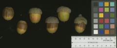 | | 2014 | COLLECTED | 09/20/2014 | Arkansas: Lee County; Near St. Francis and Lee County Line along US Highway 79. | 34.87867400, -90.56169000 | 58 | Roadside. Growing in association with Carya laciniosa, Carya illinoinenesis, Ulmus sp., Toxicodendron radicans, and Quercus nigra. | Wild material | Acorns rather green approximately 2-3 weeks away from peak maturity. Extremely large specimen approx. 100'+ in height. | 1922340 | NA 82039 |
| 6 | NA 82071 | JDC/QM/2014/103/605 | Quercus michauxii Nutt. | Mississippi, United States | NA | | | 2014 | COLLECTED | 09/25/2014 | Chinchahoma Creek watershed near Ennis Road. | 33.38574900, -88.92255600 | 98 | Wet, deciduous woods. | Wild material | Specimen sampled measured 26.75" d.b.h. and approximately 110' in height. Fruits still green. | 1922372 | NA 82071 |
| 7 | NA 81010 | JDC/QB/2008/079/149 | Quercus bicolor Willd. | Iowa, United States | NA |  | | 2008 | COLLECTED | 10/21/2008 | Chichaqua Wildlife Habitat Park bottoms, near Elkhart, NW 1/4 of NW 1/4 of Section 32, T81N, R22W, Loring Quad, Polk County. | 41.79000000, -93.43972222 | 247 | | Wild material | A couple of specimens are approximately 300 years in age. Very large mature specimens, approximately 70-90 feet in height and 4-5 feet d.b.h. Largest specimen sampled was 54.5" d.b.h. A small proportion of seedlings during grow out were noted to be Q. bicolor x Q. macrocarpa hybrids. | 1788225 | NA 81010 |
| 8 | PI 667059 | S. nigra ARM-02-121 | Sambucus nigra L. | Armenia | COR | | | 2002 | COLLECTED | 09/07/2002 | Dilijan National Park, Tavush Marz province. | 40.66306000, 45.00500000 | 1663 | Sunny opening in mature forest of Quercus macrantera, Fagus orientalis and Carpinus betulus. | Wild material | | 1643950 | PI 667059 |
| 9 | Ames 36024 | AS/FN/2023/011/221 | Fraxinus nigra Marshall | Wisconsin, United States | NC7 |  | | 2023 | COLLECTED | 02/26/2023 | Located just north of Leland approximately 0.70 miles along Hemlock Road, T10N R5E SW 1/4 NW 1/4 Sec. 18 | 43.34472800, -89.95099700 | 242 | Floodplain | Wild material | Single mother tree sample with signs of wood pecker damage on trunk. | 2141557 | Ames 36024 |
| 10 | Ames 35920 | AS/FN/2022/069/200 | Fraxinus nigra Marshall | Wisconsin, United States | NC7 |  | | 2022 | COLLECTED | 09/28/2022 | Chippewa County Forest Area approximately 4.0 miles south-southeast of intersection of County Highway M and State Highway 40, T32N R8W SE 1/4 Sec. 32. | 45.21053100, -91.38084600 | 348 | Northern hardwood forest in moraine lakes ecosystem. | Wild material | | 2139683 | Ames 35920 |
| 11 | Ames 35926 | AS/FN/2022/077/208 | Fraxinus nigra Marshall | Wisconsin, United States | NC7 |  | | 2022 | COLLECTED | 09/30/2022 | Approximately eight miles north-northeast of Cumberland at county line with Washburn County (collected on both sides of county line). Coordinates listed refer to the first plant sampled; coordinates for each specimen may be provided upon request. T36N R13W Sec. 3. | 45.63936700, -91.95952900 | 406 | Northern hardwood forest. | Wild material | | 2139689 | Ames 35926 |
| 12 | Ames 33358 | 730-1 | Betula nigra L. | Illinois, United States | NC7 |  | | 2016 | COLLECTED | 06/07/2016 | Momence wetlands - Kankakee River watershed, Kankakee County | 41.16335000, -87.52944100 | | Floodplain | Wild material | | 1940581 | Ames 33358 |
| 13 | Ames 32959 | JDC/FN/2015/045/702 | Fraxinus nigra Marshall | Iowa, United States | NC7 | | | 2015 | COLLECTED | 09/11/2015 | Ruby Woodland, T88N R19W NW 1/4 Sec. 8 Hardin County. | 42.45105400, -93.09686700 | 318 | Mid portions of north-facing slope (45 degrees) in cool, moist deciduous woods. Growing in association with Betula papyrifera, Staphylea trifolia, Carpinus caroliniana, Quercus rubra, Fraxinus americana, Acer saccharum, Cornus alternifolia, Carya ovata, Urtica dioica, Amelanchier arborea, Ostrya virginiana, Hepatica sp., and Allium tricoccum. | Wild material | | 1927429 | Ames 32959 |
| 14 | Ames 32387 | JDC/BN/2014/014/516 | Betula nigra L. | Iowa, United States | NC7 |  | | 2014 | COLLECTED | 06/05/2014 | Chia Fen, T81N R5W NW 1/4 of NW 1/4 Sec. 13. | 41.82947400, -91.38152400 | 226 | Sand prairie with likely high water table. | Wild material | | 1919308 | Ames 32387 |
| 15 | Ames 32388 | JDC/BN/2014/015/517 | Betula nigra L. | Iowa, United States | NC7 |  | | 2014 | COLLECTED | 06/05/2014 | Princeton Wildlife Management Area, T80N R5E NE 1/4 Sec. 35. | 41.69417800, -90.34158400 | 177 | Wet, heavy soil floodplain. | Wild material | | 1919309 | Ames 32388 |
| 16 | Ames 32390 | JDC/BN/2014/017/519 | Betula nigra L. | Iowa, United States | NC7 |  | | 2014 | COLLECTED | 06/06/2014 | Chariton River Watershed, T68N R17W NE 1/4 Sec. 3. | 40.72516900, -92.79660900 | 262 | Diverse areas of floodplain type habitats. | Wild material | | 1919311 | Ames 32390 |
| 17 | Ames 32096 | BA13009001 | Fraxinus nigra Marshall | Minnesota, United States | NC7 |  | | 2013 | COLLECTED | 09/23/2013 | T144N R38W, Clearwater County. | 47.25711000, -95.49000667 | 543 | Edges of lakes and forest edges. Growing in association with Fraxinus pennsylvanica, Quercus macrocarpa, Ulmus americana, Populus tremuloides, Populus balsamifera, Acer saccharum, Betula papyrifera, Salix sp., Larix laricina, Quercus rubra, Abies balsamea, Picea glauca, Sambucus canadensis, Cornus rugosa, Acer spicatum, Rosa sp., Viburnum opulus var. americanum, Viburnum dentatum, Alnus sp., Cornus canadensis, Corylus sp., Prunus virginiana, Ribes sp., Prunus pensylvanica, Rhamnus alnifolia, Equisetum sp., Carex sp., Rubus sp., Impatiens capensis, Bromus sp., and Thalictrum dasycarpum. | Wild material | D.B.H. ranged between 3 and 6 inches. | 1914713 | Ames 32096 |
| 18 | Ames 30619 | JDZ/2011/003/001 | Fraxinus nigra Marshall | Minnesota, United States | NC7 |  | | 2011 | COLLECTED | 09/16/2011 | Buffalo River watershed, Buffalo River State Park, Section 11 and Section 12, T139N, R46W, Downer Quad, Clay County. | 46.86650000, -96.45250000 | 306 | Bottomland/floodplain forest. | Wild material | | 1849377 | Ames 30619 |
| 19 | Ames 31213 | JDZ/2011/002/001 | Fraxinus nigra Marshall | North Dakota, United States | NC7 |  | | 2011 | COLLECTED | 09/09/2011 | Jay V. Wessels Wildlife Management Area, Pembina County. T162N R55W NW 1/4 Sec. 31, SE 1/4 SE 1/4 Sec. 25, and Sec. 20 Hallson Quad. | 48.82030000, -97.82040000 | 308 | Wetland. Sandy soils. | Wild material | Requests will be filled using inventory sample 11ncao05 (JDZ/2011/002/005) unless otherwise noted. | 1893359 | Ames 31213 |
| 20 | Ames 30620 | JDZ/2010/002/001 | Fraxinus nigra Marshall | Minnesota, United States | NC7 |  | | 2010 | COLLECTED | 09/11/2010 | Northeastern shore of Lake Ida east to eastern shore of Detroit Lake, Becker County. | 46.73107400, -95.94890000 | 413 | Along edge of roads and edge of mixed deciduous forests. Low spots, but not swampy. | Wild material | Unless otherwise noted, requests will be filled using a balanced sample. | 1849378 | Ames 30620 |
| 21 | PI 691215 | V. arboreum GN2018 Manatee Springs State Park1 | Vaccinium arboreum Marshall | Florida, United States | COR | | | 2019 | COLLECTED | 12/06/2018 | Manatee Springs State Park | 29.49358600, -82.97336900 | 23 | NNW exposure/aspect. Next to driving road by gate to the north trail.Vegetation nearby included; Crowngrass (Paspalum spp.), water oak (Quercus nigra), saw palmetto (Serenoa repens), longleaf pine (Pinus palustris), slash pine (pinus elliottii). | Wild material | Gerardo Nunez USDA plant collecting trip to Florida 2018, 2019 | 2094707 | PI 691215 |
| 22 | PI 691216 | V. arboreum GN2018 Manatee Springs State Park 2 | Vaccinium arboreum Marshall | Florida, United States | COR | | | 2019 | COLLECTED | 12/06/2018 | Manatee Springs State Park | 29.49414000, -82.97347400 | 19 | 200 m past north trail gate. Evidence of recent fire. Fallen trees around. Flood prone area. Not flooded at the time of collection. Vegetation nearby included; Water oak (Quercus nigra), saw palmetto (Serenoa repens), dollarweed (Hydrocotyle spp.), crowngrass (Paspalum spp.), bald cypress (Taxodium distichum). Native soil pH = 5.41. NNW exposure/aspect.
| Wild material | Gerardo Nunez USDA plant collecting trip to Florida 2018, 2019 | 2094708 | PI 691216 |
| 23 | PI 691224 | V. arboreum GN2018 Silver Springs State Park 5 | Vaccinium arboreum Marshall | Florida, United States | COR | | | 2019 | COLLECTED | 11/06/2018 | Silver Springs State Park | 29.20794900, -82.03667100 | 18 | SSE exposure/aspect. Return loop on Swamp trail (headed south). Scarce vegetation and leaf litter. Native soil pH = 5. Nearby vegetation included; Crowngrass (Paspalum spp.), laurel oak (Quercus laurifolia), water oak (Quercus nigra), V. myrsinites. | Wild material | Gerardo Nunez USDA plant collecting trip to Florida 2018, 2019 | 2094716 | PI 691224 |
| 24 | PI 710524 | MARSB-091 | Phytolacca americana L. | New York, United States | S9 | 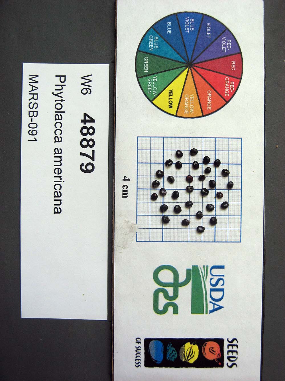 | | 2015 | | | | | | | Wild material | | 1922926 | PI 710524 |
| 25 | PI 664805 | JDC/HX/2010/035/305 | Helianthus mollis Lam. | Kansas, United States | NC7 | | | 2010 | COLLECTED | 09/14/2010 | Roadside along Kansas Rd, west of Hwy 3 south of Uniontown, Bourbon County. | 37.81978000, -94.98685000 | 325 | Uplands. Associated with Andropogon gerardii, Bidens polylepis, Chamaechrista fasciculata, Cornus, Diospyros virginiana, Gleditsia triacanthos, Juglans nigra, Maclura pomifera, Monarda, Pycnanthemum virginianum, Quercus, Rhus glabra, and Sorghastrum nutans. | Wild material | | 1848907 | PI 664805 |
| 26 | PI 664897 | JDC/PV/2008/061/131 | Prunella vulgaris L. | Illinois, United States | NC7 |  | | 2008 | COLLECTED | 10/12/2008 | Along 2150 North Road, east of Irvington, SW 1/4 of NE 1/4 of Section 15, T1S, R1E, Walnut Hill Quad, Jefferson County. | 38.43833333, -89.07833333 | 161 | Only on south side of road; northern exposure; mostly shaded due to woody vegetation. | Wild material | | 1788218 | PI 664897 |
| 27 | PI 653291 | R. argutus Lumberton | Rubus argutus Link | North Carolina, United States | COR |  | | 2007 | COLLECTED | 06/03/2007 | Robeson County, Lumberton, west of I-95 on SR 1536 (Carthage Road), east bank at crossing over Saddletree Swamp (Five Mile Branch of Lumber River). | 34.63527000, -79.02874000 | 18 | Dark organic sandy muck soil. Associated Plants: Quercus velutina, Campsus radicans, Pinus echinata, Acer rubrum, Vitis rotundifolia, Juglans nigra, Liquidamber and Juncus. | Wild material | Kim Hummer, Michael Dossett collection from North Carolina.
| 1730084 | PI 653291 |
| 28 | PI 653295 | R. argutus Keener HDF-2007-058 | Rubus argutus Link | Alabama, United States | COR |  | | 2007 | COLLECTED | 06/08/2007 | Etowah County, about 1 mile east of US 11 on Keener Gap Road. Power line right-of-way down to the road. Just west of junction with Scenic Highway at Keener Gap. | 34.15687000, -85.93532000 | 250 | Growing on a southwest facing slope (25 degrees), duff on grey soil from limestone outcrops. Associated Plants: Acer rubrum, Liriodendron tulipifera, Liquidambar styraceflua and Quercus nigra. | Wild material | Kim Hummer, Michael Dossett collection from Alabama.
| 1730100 | PI 653295 |
| 29 | PI 657224 | V. fuscatum Glassy Mt. HD-2007-021 | Vaccinium fuscatum Aiton | South Carolina, United States | COR |  | | 2007 | COLLECTED | 06/04/2007 | Glassy Mountain at home number 3786 Glassy Mountain Road, Greenville County. Edge of road. | 35.13435000, -82.36098000 | 675 | Sandy loam duff associated with: Acer rubrum, Vitis palmata, Erigeron annuus, Commelina virginiaca, Oxydendron arboreum, Platanus occidentalis, Phytolacca americana, Quercus nigra, Rubus argutus and R. trivialis. 45 degree southeast slope. | Wild material | Kim Hummer, Michael Dossett collected from South Carolina.
Jim Ballington reidentified this accession as V. fuscatum. Personal communication from 2 August 2021:
From the leaf shape, general yellow-green color of the leaves, and the distinctive size (relative to the size of the berries) and shape of the calyx, my conclusion is that this accession is probably not V. simulatum, but rather the blue-fruited Carolina foothills form of V. fuscatum. | 1730115 | PI 657224 |
| 30 | PI 657226 | V. pallidum Stumphouse HD-2007-025 | Vaccinium pallidum Aiton | South Carolina, United States | COR |  | | 2007 | COLLECTED | 06/04/2007 | Stumphouse Mountain, Oconee County. Northwest of Walhalla off SR-107, Ross Mountain Road, near Gramling Drive, edge of trail. | 34.82217000, -83.10895000 | 487 | Red sandy loam associated with: Liriodendron tulipifera, Oxydendron arboreum, Kalmia latifolia, Acer rubrum, Quercus nigra, Cornus florida and Prunus virginiana. | Wild material | Kim Hummer, Michael Dossett collected from South Carolina.
| 1730117 | PI 657226 |
| 31 | PI 657235 | V. pallidum Scenic HWY HD 2007-59 | Vaccinium pallidum Aiton | Alabama, United States | COR | 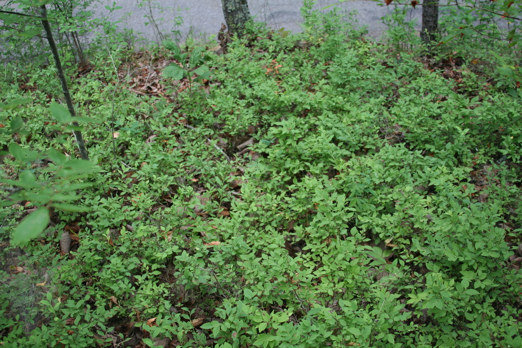 | | 2007 | COLLECTED | 06/08/2007 | East of Keener, Etwah County, Keener Gap. Woods at intersection of Keener Gap Road and Scenic Highway. On ridge above road. | 34.15484000, -85.93371000 | 300 | Soil sandy brown red limestone, with a layer of oak-hickory leaf duff on top. Associated with: Carya, Quercus nigra, Vaccinium stamineum, Liriodendron tulipifera, Liquidambar styraciflua and Acer rubrum. | Wild material | Kim Hummer, Michael Dossett collected from Alabama.
| 1730127 | PI 657235 |
| 32 | PI 657236 | V. corymbosum Mentone Seed | Vaccinium corymbosum L. | Alabama, United States | COR | 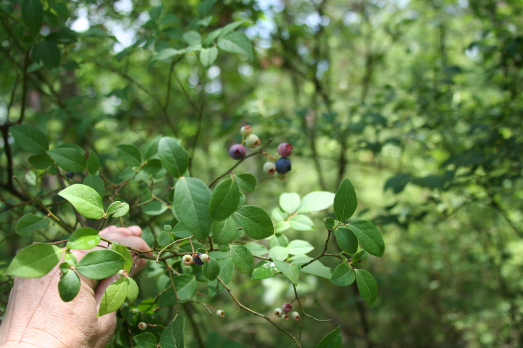 | | 2007 | COLLECTED | 06/08/2007 | Mentone, Dekalb County, off Linchpney Road. | 34.57729000, -85.59305000 | 523 | Open hickory-oak woods, oak leaf duff on top of red-brown clay. Associated with: Carya, Quercus nigra, Liriodendron tulipifera, Acer rubrum and Vaccinium stamineum (glabrous dark green leaf form). | Wild material | Kim Hummer, Michael Dossett collected from Alabama.
| 1730129 | PI 657236 |
| 33 | PI 657237 | V. arboreum HD-2007-068 | Vaccinium arboreum Marshall | Mississippi, United States | COR | 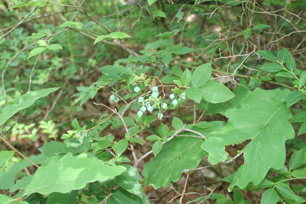 | | 2007 | COLLECTED | 06/09/2007 | Potts Camp, Marshall County, North bound off-ramp of US 78 and Bypass Road. | 34.65562000, -89.30115000 | 143 | In a Hickory-oak forest at the edge of abandoned field. Red clay soil. Associated with: Carya, Quercus nigra and Vaccinium pallidum. | Wild material | Kim Hummer, Michael Dossett collected from Mississippi.
| 1730131 | PI 657237 |
| 34 | PI 657238 | V. stamineum HD-2007-069 | Vaccinium stamineum L. | Mississippi, United States | COR |  | | 2007 | COLLECTED | 06/09/2007 | Potts Camp, Marshall County, North bound off-ramp of US 78 and Bypass Road. | 34.65562000, -89.30115000 | 143 | In a Hickory-oak forest at the edge of abandoned field. Red clay soil. Associated with: Carya, Quercus nigra and Vaccinium arboreum. | Wild material | Kim Hummer, Michael Dossett collected from Mississippi. re-identification - leaves narrow lanceolate
| 1730132 | PI 657238 |
| 35 | PI 657239 | V. fuscatum HD-2007-056 | Vaccinium fuscatum Aiton | Alabama, United States | COR | | | 2007 | COLLECTED | 06/07/2007 | Calhoun County, Anniston Museum of Natural History grounds. Woodland trail 0.5 mile from visitors center. Found in the moister areas, such as dried up stream beds. | 33.69411000, -85.82097000 | 230 | Grey loam - from sandstone. South slope 20 percent. Open woods. Associated with: Quercus nigra, Q. stellata, Q. prinus, Vaccinium arboreum, Pinus taeda and Carya. | Wild material | Kim Hummer, Michael Dossett collected from Alabama.
| 1730134 | PI 657239 |
| 36 | PI 657242 | V. simulatum Mentone HDF 2007-62B | Vaccinium simulatum Small | Alabama, United States | COR | | | 2007 | COLLECTED | | Mentone, Dekalb County, off Linchpney Road. | 34.57729000, -85.59305000 | 523 | Open hickory-oak woods, oak leaf duff on top of red-brown clay. Associated with: Carya, Quercus nigra, Liriodendron tulipifera, Acer rubrum and Vaccinium stamineum (glabrous dark green leaf form). | Wild material | Kim Hummer, Michael Dossett collected from Alabama.
| 1753281 | PI 657242 |
| 37 | PI 666679 | V. simulatum HD 2007-64 | Vaccinium simulatum Small | Alabama, United States | COR | 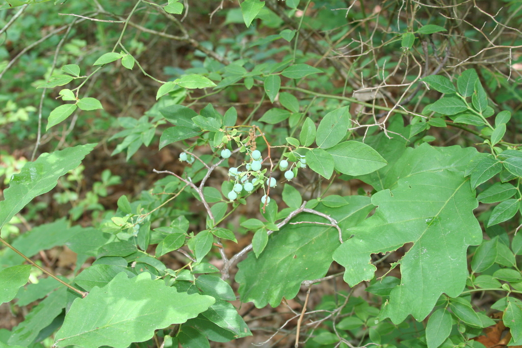 | | 2007 | COLLECTED | 06/08/2007 | Mentone, Dekalb County, off Linchpney Road. | 34.57729000, -85.59305000 | 523 | Open hickory-oak woods, oak leaf duff on top of red-brown clay. Associated with: Carya, Quercus nigra, Liriodendron tulipifera, Acer rubrum and Vaccinium corymbosum. | Wild material | Kim Hummer, Michael Dossett collected from Alabama.
| 1730130 | PI 666679 |
| 38 | PI 657195 | V. fuscatum HL-2006-041 | Vaccinium fuscatum Aiton | Florida, United States | COR |  | | 2006 | COLLECTED | 05/26/2006 | Among residential roads on eastern shore of Lake Marion, southeast of Haines City, Polk county. | 28.09643000, -81.50633000 | 30 | North florida swamp plants. Ecotome between wet bay head and sand scrub plants. Rhododendron viscosisimum cerulatum, Diospyros virginiana, Magnolia virginianum Nyssa biflorida, Persia pulustris and Quercus nigra. | Wild material | Eastern edge of Lake Wales Ridge region. Housing developments encroaching into natural areas. | 1702644 | PI 657195 |
| 39 | PI 664813 | KY1 | Actaea racemosa L. | Kentucky, United States | NC7 | | | 2005 | | | | | | | Wild material | | 1698887 | PI 664813 |
| 40 | PI 664818 | PA2 | Actaea racemosa L. | Pennsylvania, United States | NC7 | | | 2005 | | | | | | | Wild material | | 1698895 | PI 664818 |
| 41 | PI 637902 | C. fargesii 96-574-A Gansu | Corylus fargesii (Franch.) C. K. Schneid. | Gansu Sheng, China | COR |  | | 2002 | COLLECTED | | Gansu Province, Tian Shui City District, Xiao Long Shan Forest Bureau, Danh Chuan Forest Station, Mai Chao Gou. Two meters above a stream in an open woodland setting along a path in the zone where periodic flooding takes place. | 34.30417000, 106.20750000 | 1650 | Growing among rocks in silt loam soils deposited by stream; with Lonicera sp., Juglans sp., Salix sp., Carpinus sp., Quercus sp. and serveral herbaceous species. | Wild material | Single-stemmed, deciduous trees with pyramidal spreading habit; seed collected from more than 5 plants; 12-15 m tall; 15-25 cm DBH; papery copper exfoliating bark - exquisite! Beautiful tree that is threatened or rare according to the Chinese Red Data Book, but grows here in large numbers; the bark on young trees looks a lot like immature Betula nigra bark. 1996 Expedition to Shaanxi and Gansu Provinces (collected as QLG 231 on 4 October 1996.) | 1641999 | PI 637902 |
| 42 | PI 637903 | C. fargesii 96-574-F Gansu | Corylus fargesii (Franch.) C. K. Schneid. | Gansu Sheng, China | COR | | | 2002 | COLLECTED | | Gansu Province, Tian Shui City District, Xiao Long Shan Forest Bureau, Danh Chuan Forest Station, Mai Chao Gou. Two meters above a stream in an open woodland setting along a path in the zone where periodic flooding takes place. | 34.30417000, 106.20750000 | 1650 | Growing among rocks in silt loam soils deposited by stream; with Lonicera sp., Juglans sp., Salix sp., Carpinus sp., Quercus sp. and serveral herbaceous species. | Wild material | Single-stemmed, deciduous trees with pyramidal spreading habit; seed collected from more than 5 plants; 12-15 m tall; 15-25 cm DBH; papery copper exfoliating bark - exquisite! Beautiful tree that is threatened or rare according to the Chinese Red Data Book, but grows here in large numbers; the bark on young trees looks a lot like immature Betula nigra bark. 1996 Expedition to Shaanxi and Gansu Provinces (collected as QLG 231 on 4 October 1996.) | 1642000 | PI 637903 |
| 43 | PI 637904 | C. fargesii 96-574-G Gansu | Corylus fargesii (Franch.) C. K. Schneid. | Gansu Sheng, China | COR | | | 2002 | COLLECTED | | Gansu Province, Tian Shui City District, Xiao Long Shan Forest Bureau, Danh Chuan Forest Station, Mai Chao Gou. Two meters above a stream in an open woodland setting along a path in the zone where periodic flooding takes place. | 34.30417000, 106.20750000 | 1650 | Growing among rocks in silt loam soils deposited by stream; with Lonicera sp., Juglans sp., Salix sp., Carpinus sp., Quercus sp. and serveral herbaceous species. | Wild material | Single-stemmed, deciduous trees with pyramidal spreading habit; seed collected from more than 5 plants; 12-15 m tall; 15-25 cm DBH; papery copper exfoliating bark - exquisite! Beautiful tree that is threatened or rare according to the Chinese Red Data Book, but grows here in large numbers; the bark on young trees looks a lot like immature Betula nigra bark. 1996 Expedition to Shaanxi and Gansu Provinces (collected as QLG 231 on 4 October 1996.) | 1642001 | PI 637904 |
| 44 | PI 637905 | C. fargesii 96-574-H Gansu | Corylus fargesii (Franch.) C. K. Schneid. | Gansu Sheng, China | COR | | | 2002 | COLLECTED | | Gansu Province, Tian Shui City District, Xiao Long Shan Forest Bureau, Danh Chuan Forest Station, Mai Chao Gou. Two meters above a stream in an open woodland setting along a path in the zone where periodic flooding takes place. | 34.30417000, 106.20750000 | 1650 | Growing among rocks in silt loam soils deposited by stream; with Lonicera sp., Juglans sp., Salix sp., Carpinus sp., Quercus sp. and serveral herbaceous species. | Wild material | Single-stemmed, deciduous trees with pyramidal spreading habit; seed collected from more than 5 plants; 12-15 m tall; 15-25 cm DBH; papery copper exfoliating bark - exquisite! Beautiful tree that is threatened or rare according to the Chinese Red Data Book, but grows here in large numbers; the bark on young trees looks a lot like immature Betula nigra bark. 1996 Expedition to Shaanxi and Gansu Provinces (collected as QLG 231 on 4 October 1996.) | 1642002 | PI 637905 |
| 45 | PI 637906 | C. fargesii 96-574-I Gansu | Corylus fargesii (Franch.) C. K. Schneid. | Gansu Sheng, China | COR | | | 2002 | COLLECTED | | Gansu Province, Tian Shui City District, Xiao Long Shan Forest Bureau, Danh Chuan Forest Station, Mai Chao Gou. Two meters above a stream in an open woodland setting along a path in the zone where periodic flooding takes place. | 34.30417000, 106.20750000 | 1650 | Growing among rocks in silt loam soils deposited by stream; with Lonicera sp., Juglans sp., Salix sp., Carpinus sp., Quercus sp. and serveral herbaceous species. | Wild material | Single-stemmed, deciduous trees with pyramidal spreading habit; seed collected from more than 5 plants; 12-15 m tall; 15-25 cm DBH; papery copper exfoliating bark - exquisite! Beautiful tree that is threatened or rare according to the Chinese Red Data Book, but grows here in large numbers; the bark on young trees looks a lot like immature Betula nigra bark. 1996 Expedition to Shaanxi and Gansu Provinces (collected as QLG 231 on 4 October 1996.) | 1642003 | PI 637906 |
| 46 | PI 632470 | 4222 | Puccinellia intermedia (Schur) Janch. | Amasya, Turkey | W6 | | | 1997 | COLLECTED | 08/03/1993 | Highway 795 from Samsun to Ankara, 10 km south of Merzifon. | 40.83333333, 35.48333333 | 488 | Broad shallow interior agricultural valley, surrounded by steppe and Quercus, Juniperus, and Pinus nigra forests. Alkaline swale bordering fields, in heavy wet, clay loam, with Juncus and Phragmites. | Wild material | | 1539527 | PI 632470 |
| 47 | PI 632478 | 4225 | Alopecurus myosuroides Huds. | Çorum, Turkey | W6 |  | | 1997 | COLLECTED | 08/03/1993 | Highway 795 from Samsun to Ankara, 17 km southwest of Corum, just east of Hamdikoy. | 40.41666667, 34.80000000 | 732 | In the bottom of large sunken field used to grow Beta vulgaris, between fields on normal terrain, in heavy somewhat alkaline clay loam with Phragmites, Carduus. | Wild material | Broad shallow interior agricultural valley, surrounded by steppe and Quercus, Juniperus, and Pinus nigra forests. | 1539528 | PI 632478 |
| 48 | PI 656418 | 4226 | Polypogon monspeliensis (L.) Desf. | Çorum, Turkey | S9 |  | | 1997 | COLLECTED | 08/03/1993 | Highway 795 from Samsun to Ankara, 17 km southwest of Corum, just east of Hamdikoy. | 40.41666667, 34.80000000 | 732 | In the bottom of large sunken field used to grow Beta vulgaris, between fields on normal terrain, in heavy somewhat alkaline clay loam with Phragmites, Carduus. | Wild material | Broad shallow interior agricultural valley, surrounded by steppe and Quercus, Juniperus, and Pinus nigra forests. | 1539529 | PI 656418 |
| 49 | PI 495609 | APS/GD/2013/003/088 | Gymnocladus dioicus (L.) K. Koch | Missouri, United States | NC7 |  | | 1984 | COLLECTED | 09/22/1984 | Squaw Creek N.W.R., Section 30, T61N, R38W, Holt County. | 40.06555556, -95.22611111 | 303 | Intermediate elevation and bases of slopes. | Wild material | | 1390545 | PI 495609 |
| 50 | Ames 38800 | Camp Mitigwa | Amelanchier arborea (F. Michx.) Fernald | Iowa, United States | NC7 |  | | 2026 | COLLECTED | 06/01/2026 | Mitigwa Scout Camp located on west side of Des Moines River watershed approximately 7.50 miles south, southwest of Boone, T82N R26W N 1/4 Sec. 5 and T83N R26W S 1/4 Sec. 32. | 41.94894500, -93.90537200 | 310 | High-quality white oak - ironwood, mature woods. | Wild material | The native range of Amelanchier arborea is concentrated in the eastern half of the U.S. (Little, 1977). This accession represents a collection of A. arborea germplasm from the western edge of the species native range, specifically central Iowa. Specimens sampled at the collection site in nature were small to medium understory or woodland edge single and/or multi-trunked trees with a few trees getting close to being deemed as canopy specimens. Bark smooth and light grey in color. Specimens sampled in nature ranging 15-50' in height. Peak flowering occurred on 8 April 2026 with white flowers appearing prior to leaf expansion. Fall colors ranging from orange to orange-red peaking typically at the end of September (central Iowa). Fruits, dark-pink to red, maturing in early June (peak in 2026 occurred on 2 June) averaging 8 mm in diameter, except for mother tree #6 that had rather large fruits at 11 mm in diameter. | 2197049 | Ames 38800 |
| 51 | NA 89171 | 2025RJLSEUS-04 | Rhododendron catawbiense Michx. | Alabama, United States | NA | | | 2026 | COLLECTED | 09/30/2025 | Scarham Creek: southeast of the Pea Ridge Road bridge, approximately 50-80 meters on the south side of the creek. | 34.32559600, -86.16054600 | 266 | Growing near the base of the slopes above the riparian zone, generally on the exposed geology under very well-drained conditions. The woodlands are primarily deciduous with a few evergreens infrequently mixed. Slope: 15 to 30 percent. Aspect: Northeast. Soil: The primary soil type in the area of this collection is classified as Rockland Series sandstone (Rc). The Rockland series consists of well drained soils formed in loamy colluvium from rotational landslides on slopes of stream valleys and dissections of ground moraines. Saturated hydraulic conductivity is moderate in the upper part of the profile and moderately slow in the lower part. Slopes range from 18 to 70 percent. Some pedons have buried leaves, twigs, and moss. Mass soil movement has left random remnants of soil structure from prior upslope soil development and has buried tree branches, leaves and moss. The upper 0-2 cm of soil contains slightly decomposed organic matter while lower soils layers to a depth of 58 cm are comprised of dark reddish-brown to brown silt loam and are moderately acidic. Below 58 cm the soils are generally dark reddish-brown silt loam and strongly to moderately alkaline. (Source:California Soil Resource Lab/NRCS Official Soil Series Descriptions). Geology: The underlying geology of this area is of Pennsylvanian origin and characterized as Pottsville Formation. It is characterized by light-gray thin to thick-bedded quartzose sandstone and conglomerate containing interbedded dark-gray shale, siltstone, and coal. Mapped on Lookout Mountain, Blount and Chandler Mountains, and Sand Mountain northeast of Blount County, and on the mountains of Jackson, Marshall, and Madison Counties north and west of the TN river. (Source: USGS Alabama Geologic Map Data). | Wild material | Received as R. catawbiense vsr. insularis | 2193305 | NA 89171 |
| 52 | NA 89155 | 2025RJLSEUS-02 | Ilex longipes Chapm. ex Trel. | Alabama, United States | NA | | | 2025 | COLLECTED | 09/30/2025 | Scarham Creek: southeast of the Pea Ridge Road bridge, approximately 50-80 meters on the south side of the creek. | 34.32520700, -86.15967000 | 261 | Plants are growing on relatively steep woodland slopes in shade. The woodlands are primarily deciduous with a few evergreens infrequently mixed. Slope: 15 to 30 percent. Aspect: Northeast. Soil: The primary soil type in the area of this collection is classified as Rockland Series sandstone (Rc). The Rockland series consists of well drained soils formed in loamy colluvium from rotational landslides on slopes of stream valleys and dissections of ground moraines. Saturated hydraulic conductivity is moderate in the upper part of the profile and moderately slow in the lower part. Slopes range from 18 to 70 percent. Some pedons have buried leaves, twigs, and moss. Mass soil movement has left random remnants of soil structure from prior upslope soil development and has buried tree branches, leaves and moss. The upper 0-2 cm of soil contains slightly decomposed organic matter while lower soils layers to a depth of 58 cm are comprised of dark reddish-brown to brown silt loam and are moderately acidic. Below 58 cm the soils are generally dark reddish-brown silt loam and strongly to moderately alkaline. (Source: California Soil Resource Lab/NRCS Official Soil Series Descriptions). Geology: The underlying geology of this area is of Pennsylvanian origin and characterized as Pottsville Formation. It is characterized by light-gray thin to thick-bedded quartzose sandstone and conglomerate containing interbedded dark-gray shale, siltstone, and coal. Mapped on Lookout Mountain, Blount and Chandler Mountains, and Sand Mountain northeast of Blount County, and on the mountains of Jackson, Marshall, and Madison Counties north and west of the TN river. (Source: USGS Alabama Geologic Map Data). | Wild material | | 2193001 | NA 89155 |
| 53 | NA 89156 | 2025RJLSEUS-03 | Euonymus americanus L. | Alabama, United States | NA | | | 2025 | COLLECTED | 09/30/2025 | Scarham Creek: southeast of the Pea Ridge Road bridge, approximately 50-80 meters on the south side of the creek. | 34.32577600, -86.16071000 | 260 | Plants are growing on relatively steep woodland slopes in shade. The woodlands are primarily deciduous with a few evergreens infrequently mixed. Slope: 15 to 30 percent. Aspect: Northeast. Soil: The primary soil type in the area of this collection is classified as Rockland Series sandstone (Rc). The Rockland series consists of well drained soils formed in loamy colluvium from rotational landslides on slopes of stream valleys and dissections of ground moraines. Saturated hydraulic conductivity is moderate in the upper part of the profile and moderately slow in the lower part. Slopes range from 18 to 70 percent. Some pedons have buried leaves, twigs, and moss. Mass soil movement has left random remnants of soil structure from prior upslope soil development and has buried tree branches, leaves and moss. The upper 0-2 cm of soil contains slightly decomposed organic matter while lower soils layers to a depth of 58 cm are comprised of dark reddish-brown to brown silt loam and are moderately acidic. Below 58 cm the soils are generally dark reddish-brown silt loam and strongly to moderately alkaline. (Source: California Soil Resource Lab/NRCS Official Soil Series Descriptions). Geology: The underlying geology of this area is of Pennsylvanian origin and characterized as Pottsville Formation. It is characterized by light-gray thin to thick-bedded quartzose sandstone and conglomerate containing interbedded dark-gray shale, siltstone, and coal. Mapped on Lookout Mountain, Blount and Chandler Mountains, and Sand Mountain northeast of Blount County, and on the mountains of Jackson, Marshall, and Madison Counties north and west of the TN river. (Source: USGS Alabama Geologic Map Data). | Wild material | | 2193002 | NA 89156 |
| 54 | NA 89158 | 2025RJLSEUS-06 | Cornus florida L. | Alabama, United States | NA | | | 2025 | COLLECTED | 10/01/2025 | Coosa Wildlife Management Area: along the edge of gated dirt road on the west side of Coosa County Road 29, 0.3 kilometers north of Hatchet Creek. | 32.86402200, -86.33871400 | 108 | Plants are growing in part sun to shade on dry-mesic slopes above the road cut on the gated dirt road; most likely a road for access for fire control/forest management. The forest is a combination of deciduous and evergreen with evergreens primarily comprised of Pinus taeda. The habitat was quite dry during this time of year. Slope: 5 to 20 percent. Aspect: North. Soils: The primary soil in the area of this collection is classified as Madison-Louisa Series complex, 15 to 30 percent slopes, moderately eroded (MdE2). The Madison Series soils are very deep, well drained soils with medium runoff found on Piedmont uplands in interstream divides, ridges and side slopes. They are comprised of residuum weathered from felsic or intermediate, high-grade metamorphic or igneous rocks high in content of mica. Slopes range from 2 to 60 percent and soil is typically strongly acidic. Louisa Series soils The Louisa Series soils consist of shallow, somewhat excessively drained soils which formed over mica gneiss and schist bedrock. They occur on Piedmont uplands. Slopes are 6 to 80 percent. This soil is moderately acid. (Source: California Soil Resource Lab/NRCS Official Soil Series Descriptions). Geology: The underlying geology of this area is of Precambrian to Paleozoic origin and characterized as Hatchet Creek Group; Pinchoulee Gneiss Formation. It is characterized by medium to fine-grained migmatitic, locally garnetiferous biotite-feldspar gneiss, commonly saturated with granitic pods. (Source: USGS Alabama Geologic Map Data). | Wild material | | 2193004 | NA 89158 |
| 55 | NA 89160 | 2025RJLSEUS-08 | Ilex hybr. | Florida, United States | NA | | | 2025 | COLLECTED | 10/02/2025 | Eglin Air Force Base: coastal dune ridge on Eglin AFB behind businesses located along Florida State Highway 98. The site is accessed through a now gated and permanently closed Eglin AFB, East River Unit, A-21 Road (now open to pedestrian traffic only with a valid Eglin user permit). After walking through the gated road, the site is to the west along 4-wheeling trails. | 30.41191000, -86.77315800 | 8 | Part shade in a primarily evergreen extremely dry dune community with a mixed understory of deciduous and evergreen plants. Slope: 0 to 2 percent. Soils: The soils of this are characterized as Kureb Series sand, 0 to 8 percent slopes. The Kureb series consists of very deep, excessively drained, gently sloping to moderately steep soils on Coastal Plain uplands and on side slopes along streams and bays. They have formed in marine, aeolian, or fluvial sands. Slopes range from 0 to 20 percent. The thickness of the sandy horizon is more than 2 meters. Soil reaction is neutral to extremely acid throughout. All horizons are fine sand, sand, or coarse sand. Silt plus clay content is less than 5 percent. (Source: California Soil Resource Lab/NRCS Official Soil Series Descriptions). Geology: The underlying geology of this area is characterized as undifferentiated Quaternary Sediments. Much of Florida's surface is covered by a varying thickness of undifferentiated sediments consisting of siliciclastics, organics and freshwater carbonates. Where these sediments exceed 6.1 meters thick, they were mapped as discrete units. To subdivide the undifferentiated sediments, those sediments occurring in flood plains were mapped as alluvial and flood plain deposits (Qal). Sediments showing surficial expression of beach ridges and dunes were mapped separately (Qbd) as were the sediments composing Trail Ridge (Qtr). Terrace sands were not mapped (refer to Healy [1975] for a discussion of the terraces in Florida). The subdivisions of the Undifferentiated Quaternary Sediments (Qu) are not lithostratigraphic units but are utilized to facilitate a better understanding of the State's geology. The siliciclastics are light gray, tan, brown to black, unconsolidated to poorly consolidated, clean to clayey, silty, unfossiliferous, variably organic-bearing sands to blue green to olive green, poorly to moderately consolidated, sandy, silty clays. Gravel is occasionally present in the panhandle. Organics occur as plant debris, roots, disseminated organic matrix and beds of peat. Freshwater carbonates, often referred to as marls in the literature, are scattered over much of the State. In southern Florida, freshwater carbonates are nearly ubiquitous in the Everglades. These sediments are buff colored to tan, unconsolidated to poorly consolidated, fossiliferous carbonate muds. Sand, silt and clay may be present in limited quantities. These carbonates often contain organics. The dominant fossils in the freshwater carbonates are mollusks. (Source: USGS Florida Geologic Map Data). | Wild material | | 2193006 | NA 89160 |
| 56 | W6 62493 | DCA00-13 | Acmispon americanus (Nutt.) Rydb. var. americanus | California, United States | W6 |  | | 2025 | | | | | | | Wild material | | 2192191 | W6 62493 |
| 57 | W6 62494 | DCA00-14 | Phyla nodiflora (L.) Greene | California, United States | W6 | 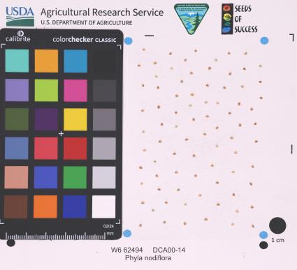 | | 2025 | | | | | | | Wild material | | 2192192 | W6 62494 |
| 58 | W6 62496 | DCA00-16 | Grindelia camporum Greene | California, United States | W6 |  | | 2025 | | | | | | | Wild material | | 2192194 | W6 62496 |
| 59 | W6 62708 | CA360-238 | Keckiella lemmonii (A. Gray) Straw | California, United States | W6 |  | | 2025 | | | | | | | Wild material | | 2192926 | W6 62708 |
| 60 | NA 89115 | TLM25-04a | Hamamelis ovalis S. W. Leonard | Texas, United States | NA | | | 2025 | COLLECTED | 07/10/2025 | State Highway 87 approximately 3.25 kilometers north of the crossroad junction with Texas Recreational Road 255 (RE 255); plants were growing in the narrow buffer woods along the east side of the highway. | 31.12051300, -93.72628100 | 138 | The habitat is an upland mixed coniferous and deciduous woodlands in part to full shade and dry conditions, often under drought stress. Plants seem to always occur on the top of dry ridges or well-drained slopes. Slope: 0 to 1 percent. Aspect: N/A. Soils: The soils of this collection area are classified as Tehran-Letney Association, hilly (TLE) soils. The Tehran Series (55%) consists of deep, somewhat excessively drained, moderately rapidly permeable soils on uplands. They formed in thick loamy and sandy sediments on the Western Coastal Plain. These soils are on gently sloping to moderately steep uplands with slopes ranging from 1 to 20 percent. The Letney Series (30%) consists of deep, well drained, moderately rapidly permeable, upland soils. They formed in thick sandy and loamy sediments of the coastal plains. These soils are on gently sloping to moderately steep uplands with slopes ranging from 1 to 20 percent. Soil pH ranges from 4.5 to 6.0. The minor soil components include Doucette Series (10%) and Boykin Series (5%) soils. (Source: California Soil Resource Lab/NRCS Official Soil Series Descriptions). Geology: The underlying geology of this area is of Oligocene origin and characterized as Catahoula Formation. This formation is extensive and deep in Texas, up to 185 meters thick. In the area of the collection the Catahoula Formation is primarily mudstone and sand. The upper 90-150 meters is mudstone that is tuffaceous, and sandy; also, occasionally, with some bentonitic clay. (Source: USGS Texas Geologic Map Data). | Wild material | | 2191654 | NA 89115 |
| 61 | Ames 36328 | JDC/MA/2025/006/1161 | Morus alba L. | Iowa, United States | NC7 |  | | 2025 | COLLECTED | 06/24/2025 | Story and Boone Counties near Ames and Fraser. | 42.01523400, -93.66476700 | 302 | Typically woodland edges, roadside edges or fencelines or powerline cuts. | Uncertain improvement status | Morus alba is an introduced species into the U.S. and is highly prolific and considered invasive in many parts of the U.S. This accession represents genetics sampled from central Iowa (Story and Boone Counties) that are available for research purposes. Samples acquired had BRIX readings (3 reps of 5 fruits each) ranging from 9.2-17.2 for mature (black/soft) fruits with fruits generally less than 1.0" in length with average lengths of 0.5". Specimens numbers #1 and #9 had the highest average BRIX ratings of 16.5 and 17.2, respectively. All specimens with rather shiny, glabrous leaves on the upper surfaces with lobing variable throughout the canopy but generally higher lobing found on vigorous sprouts/shoots. Majority of specimens sampled were less than 60' in height. The largest specimen sampled was approximately 18" DBH with the average specimen sampled measuring approximately 10" DBH. | 2191609 | Ames 36328 |
| 62 | NA 88940 | 24Flam60 | Rhododendron flammeum (Michx.) Sarg. | South Carolina, United States | NA | | | 2025 | COLLECTED | 09/13/2025 | Savannah River Site, near Tinker Creek. GPS coordinates represent a general location for the population. | 33.36802000, -81.54971000 | 90 | Shady forest following Tinker Creek. Seed collected primarily on slopes and banks over the creek. Growing in half shade. Slope: Varying. | Wild material | Note: Two field collections, 24Flam60 and 24Flam65, were combined together in this USNA accession, with the former identifier being used as the primary one. The collectors note the possibility that this contains hybrids because the plants were not observed in flower. | 2172823 | NA 88940 |
| 63 | NA 88984 | TXWL2025-034 | Ilex opaca Aiton | Texas, United States | NA | | | 2025 | COLLECTED | 01/13/2025 | Fairmount Township: Sabine National Forest C-139: Foxhunters Hill. | 31.18153000, -93.72368000 | | Baygall below a longleaf pine stand. Same system as 035 [NA 88985]. | Wild material | | 2170968 | NA 88984 |
| 64 | NA 88987 | TXWL2025-037 | Ilex opaca Aiton | Texas, United States | NA | | | 2025 | COLLECTED | 01/13/2025 | Fairmount Township: Sabine National Forest C-139: Foxhunters Hill. | 31.18365000, -93.72211000 | | Baygall below a longleaf pine stand. | Wild material | | 2170971 | NA 88987 |
| 65 | NA 88579 | 2024RJLFL-007 | Ilex myrtifolia Walter | Florida, United States | NA | | | 2024 | COLLECTED | 11/13/2024 | Wetlands accessed from Miller Bluff Road. | 30.62251200, -86.86030700 | 8 | Open, wet areas and woodland edge slightly above permanently wet habitat in part shade to full sun. Slope: 0 percent. Aspect: N/A. | Wild material | | 2169916 | NA 88579 |
| 66 | NA 88583 | 2024RJLFL-014 | Ilex amelanchier M. A. Curtis ex Chapm. | Florida, United States | NA | | | 2024 | COLLECTED | 11/13/2024 | Yellow River Water Management Area: found in an area where an unnamed unpaved road dead ends near the Yellow River. This unpaved road is accessed from Old River Road to the east near the junction with Shockley Springs Road. Individual plants for this collection were accessed by foot along the edge of the river and associated wetland depressions to the east of the road. The sampling for this portion of the population extends from the GPS coordinates listed above to the northeast where sampling ended at coordinates 30.871238 deg. N, 86.590170 deg. W. | 30.86989400, -86.59218500 | 23 | Plants growing in seasonally inundated swamp habitats associated with the Yellow River and small tributaries. Plants are emergent during portions of the year, primarily during the growing season. During this time of collection, water had receded from the wetlands and the area was relatively dry. Slope: N/A. Aspect: N./A. The underlying geology of this area is the Alum Bluff Group of Miocene origin. It includes the Chipola Formation, Oak Grove Sand, Shoal River Formation, Choctawhatchee Formation and the Jackson Bluff Formation. The formations included in this group are generally defined based on their molluscan faunas and stratigraphic position. Puri (1953) described sediment facies as they relate to the formations of the Alum Bluff Group. These sediments are lithologically distinct as a group, not as individual units. The Alum Bluff Group crops out or is beneath a thin overburden in the western panhandle from river valleys in Okaloosa County eastward to western Jackson County. The Alum Bluff Group consists of clays, sands and shell beds which may vary from fossiliferous, sandy clays to unfossiliferous sands and clays and occasional carbonate beds. Mica is a common constituent and glauconite and phosphate occur sporadically. Induration varies from essentially nonindurated in sands to well indurated in carbonate lenses. Colors range from cream to olive gray with mottled reddish brown in weathered sections. Sand grain size varies from very fine to very coarse with sporadic occurrences of gravel. These sediments generally have low permeabilities and are part of the intermediate confining unit/aquifer system. (Source: USGS Florida Geologic Map Data). The surface soil profile of this area is primarily Kinston, Johnston, and Bibb soils, frequently flooded. Kinston Series soils are poorly drained, alluvial, fine-loamy, siliceous, and acid soils of flood plains. They are peaty to loamy friable, slightly sticky, and slightly plastic in the upper 0 to 7.5 cm of the strata with less sand and more silt-loam in progressively deeper strata. The Johnston Series consists of very deep, very poorly drained coarse-loamy, siliceous, active, acid, thermic Cumulic Humaquepts. The upper 0-75 cm is black, mucky loam that is friable and very strongly acid. The lower strata to 1.75 m are dark gray, loamy fine sand, single grained, loose and very strongly acid. (Source: NRCS Web Soil Survey). | Wild material | | 2169920 | NA 88583 |
| 67 | NA 88584 | 2024RJLFL-016 | Cornus florida L. | Florida, United States | NA | | | 2024 | COLLECTED | 11/14/2024 | Both sides of Kennedy Bridge Road approximately 0.27 kilometers west of the junction with Hurricane Lake South Entrance Road. | 30.93159700, -86.74928000 | 43 | Mesic to mesic-moist conditions in a mixed and deciduous evergreen forest in part shade. Slope: 5 to 10 percent. Aspect: Various. The underlying geology of this area is characterized as Citronelle Formation of the Pliocene period. The Citronelle Formation is widespread in the Gulf Coastal Plain. The type section for the Citronelle Formation, named by Matson (1916), is near Citronelle, Alabama. The Citronelle Formation grades laterally, through a broad facies transition, into the Miccosukee Formation of the eastern Florida panhandle. Coe (1979) investigated the Citronelle Formation in portions of the western Florida panhandle. The Citronelle Formation is a siliciclastic, deltaic deposit that is lithologically similar to, and time equivalent with, the Cypresshead Formation and, at least in part, the Long Key Formation (Cunningham et al., 1998) of the peninsula. In the western panhandle, some of the sediments mapped as Citronelle Formation may be reworked Citronelle. The lithologies are the same and there are few fossils present to document a possible younger age. The Citronelle Formation consists of gray to orange, often mottled, unconsolidated to poorly consolidated, very fine to very coarse, poorly sorted, clean to clayey sands. It contains significant amounts of clay, silt and gravel which may occur as beds and lenses and may vary considerably over short distances. Limonite nodules and limonite-cemented beds are common. Marine fossils are rare but fossil pollen, plant remains and occasional vertebrates are found. Much of the Citronelle Formation is highly permeable. It forms the Sand and Gravel Aquifer of the surficial aquifer system contain organics. The dominant fossils in the freshwater carbonates are mollusks. (Source: USGS Florida Geologic Map Data). The soils of this are characterized as Dothan Series loamy sand, 5 to 8 percent slopes. The Dothan Series consists of very deep, well drained soils that formed in thick beds of unconsolidated, medium to fine-textured marine sediments. Dothan soils are on interfluves. Slopes range from 0 to 15 percent. The surface 0-33 cm is characterized by sandy-loam, well-drained soils that are strongly acid. From 33-200 cm they are characterized by sandy clay loam soils that are more moisture retentive and strongly acid. (Source: California Soil Resource Lab/NRCS Official Soil Series Descriptions). | Wild material | | 2169921 | NA 88584 |
| 68 | NA 88585 | 2024RJLFL-018 | Rhododendron canescens (Michx.) Sweet | Florida, United States | NA | | | 2024 | COLLECTED | 11/14/2024 | Woodlands in the riparian zone of a headwater spring and wetland leading to Panther Creek. The area is accessed from High Bridge Road by turning south on an unnamed dirt/sand road and driving about 0.27 kilometers to a pond. | 30.90865300, -86.69107200 | 49 | Mostly deciduous woodlands in the riparian zone of a headwater spring and wetland in shade to part shade. Slope: 5 to 8 percent. Aspect: N/A. The underlying geology of this area is characterized as Citronelle Formation of the Pliocene period. The Citronelle Formation is widespread in the Gulf Coastal Plain. The type section for the Citronelle Formation, named by Matson (1916), is near Citronelle, Alabama. The Citronelle Formation grades laterally, through a broad facies transition, into the Miccosukee Formation of the eastern Florida panhandle. Coe (1979) investigated the Citronelle Formation in portions of the western Florida panhandle. The Citronelle Formation is a siliciclastic, deltaic deposit that is lithologically similar to, and time equivalent with, the Cypresshead Formation and, at least in part, the Long Key Formation (Cunningham et al., 1998) of the peninsula. In the western panhandle, some of the sediments mapped as Citronelle Formation may be reworked Citronelle. The lithologies are the same and there are few fossils present to document a possible younger age. The Citronelle Formation consists of gray to orange, often mottled, unconsolidated to poorly consolidated, very fine to very coarse, poorly sorted, clean to clayey sands. It contains significant amounts of clay, silt and gravel which may occur as beds and lenses and may vary considerably over short distances. Limonite nodules and limonite-cemented beds are common. Marine fossils are rare but fossil pollen, plant remains and occasional vertebrates are found. Much of the Citronelle Formation is highly permeable. It forms the Sand and Gravel Aquifer of the surficial aquifer system contain organics. The dominant fossils in the freshwater carbonates are mollusks. (Source: USGS Florida Geologic Map Data). The surface soil profile is classified as Troup-Orangeburg-Cowarts complex, 5 to 12 percent slopes. The Troup series consists of very deep, somewhat excessively drained soils formed in unconsolidated sandy and loamy marine sediments. Troup soils are found on ridges and hillslopes. The Orangeburg series consists of very deep, well drained, moderately permeable soils on uplands of the Southern Coastal Plain. They formed in loamy and clayey marine sediments. The Cowarts series consists of very deep, moderately well and well drained soils on ridge tops and side slopes on uplands of the Coastal Plain Major Land Resource Area. They formed in loamy marine sediments. The reaction of all these soils ranges from very strongly acid to strongly acid. (Source: USDA-NRCS Official Soil Series Descriptions). | Wild material | | 2169922 | NA 88585 |
| 69 | NA 88586 | 2024RJLFL-020 | Vaccinium arboreum Marshall | Florida, United States | NA | | | 2024 | COLLECTED | 11/14/2024 | Woodland edge off of Ralf Laurant Road, above the wetland/headwaters of Danley Branch along the edge of a young longleaf pine plantation. | 30.90104300, -86.78878100 | 61 | Edge of a mixed evergreen and deciduous forest in part shade to full sun on a mesic to mesic-dry slope, adjacent to a young longleaf pine plantation. Slope: 3 to 8 percent. Aspect: West. The underlying geology of this area is characterized as Citronelle Formation of the Pliocene period. The Citronelle Formation is widespread in the Gulf Coastal Plain. The type section for the Citronelle Formation, named by Matson (1916), is near Citronelle, Alabama. The Citronelle Formation grades laterally, through a broad facies transition, into the Miccosukee Formation of the eastern Florida panhandle. Coe (1979) investigated the Citronelle Formation in portions of the western Florida panhandle. The Citronelle Formation is a siliciclastic, deltaic deposit that is lithologically similar to, and time equivalent with, the Cypresshead Formation and, at least in part, the Long Key Formation (Cunningham et al., 1998) of the peninsula. In the western panhandle, some of the sediments mapped as Citronelle Formation may be reworked Citronelle. The lithologies are the same and there are few fossils present to document a possible younger age. The Citronelle Formation consists of gray to orange, often mottled, unconsolidated to poorly consolidated, very fine to very coarse, poorly sorted, clean to clayey sands. It contains significant amounts of clay, silt and gravel which may occur as beds and lenses and may vary considerably over short distances. Limonite nodules and limonite-cemented beds are common. Marine fossils are rare but fossil pollen, plant remains and occasional vertebrates are found. Much of the Citronelle Formation is highly permeable. It forms the Sand and Gravel Aquifer of the surficial aquifer system. The dominant fossils in the freshwater carbonates are mollusks. (Source: USGS Florida Geologic Map Data). The surface soil profile is classified as Troup Series loamy sand, 5 to 8 percent slopes. The Troup series consists of very deep, somewhat excessively drained soils formed in unconsolidated sandy and loamy marine sediments. Troup soils are found on ridges and hillslopes. These soils are very strongly acid to strongly acid. (Source: California Soil Resource Lab/NRCS Official Soil Series Descriptions). | Wild material | | 2169923 | NA 88586 |
| 70 | NA 88731 | RonMiller2022-Old Land Place | Gordonia lasianthus (L.) J. Ellis | Florida, United States | NA | | | 2024 | COLLECTED | 04/2022 | Yellow River Marsh State Aquatic Preserve, "Old Land Place" along Weaver River, 1.47 miles south of the confluence with the Yellow River. | 30.55318000, -87.93656000 | 3 | Moist to wet areas in wetland adjacent to the river in association with a range of evergreen and deciduous forest elements. | Wild material | From open-pollinated, but presumed isolated, seeds of NA 87342-H, -J, and -L (three young plants flowering in containers in production during 2024). Seed was harvested over a period roughly from October through December 2024 as fruits matured. From the record of the parent accession, NA 87342: Exact date of collection unknown. | 2170992 | NA 88731 |
| 71 | NA 88479 | TXWL2024-029 | Ilex longipes Chapm. ex Trel. | Texas, United States | NA | | | 2024 | COLLECTED | 11/20/2024 | Little Cow Creek. | 31.06221000, -93.79603000 | | Upland position above perennial creek. | Wild material | | 2169906 | NA 88479 |
| 72 | NA 88477 | TXWL2024-027 | Ilex ambigua Torr. | Texas, United States | NA | | | 2024 | COLLECTED | 11/12/2024 | Sabine River at I-10 at the Texas/Louisiana state line; south side of bridge. | 30.12654000, -93.70258000 | | Bottomland. | Wild material | | 2169862 | NA 88477 |
| 73 | NA 89078 | 2024RJLPA-004 | Staphylea trifolia L. | Pennsylvania, United States | NA | | | 2024 | COLLECTED | 09/20/2024 | Along gated road about 0.33 kilometers southwest of the Lake Ontelaunee Trail parking lot. | 40.49850800, -75.89121300 | 94 | Plants are growing on well-drained steep slopes in shade to part shade of a deciduous forest. Slope: 35 to 50 percent. Aspect: East-southeast. Geology: The underlying geology of this area is of Ordovician origin and characterized as Shale and graywacke of Hamburg sequence. It is characterized by shale containing zones of conspicuous graywacke. (Source: USGS Pennsylvania Geologic Map Data). Soils: The primary soil type in the area of this collection is classified as Berks-Weikert Complex, 25 to 60% slopes (BkF). Dominantly sloping to very steep, moderately deep and shallow, well drained soils underlain by acid shale bedrock. (Source: UPenn State University Soil Info Website). EPA Ecoregion (Level III): Ridge and Valley (67). EPA Ecoregion (Level IV): Northern Shale Valleys (67b). | Wild material | | 2169042 | NA 89078 |
| 74 | NA 89079 | 2024RJLPA-005 | Viburnum prunifolium L. | Pennsylvania, United States | NA | | | 2024 | COLLECTED | 09/20/2024 | Along gated road about 0.33 kilometers southwest of the Lake Ontelaunee Trail parking lot. | 40.50062600, -75.89004900 | 94 | Plants are growing on moist, well-drained in part shade of a deciduous forest. Slope: 0 percent. Aspect: N/A. Geology: The underlying geology of this area is of Ordovician origin and characterized as Shale and graywacke of Hamburg sequence. It is characterized by shale containing zones of conspicuous graywacke. (Source: USGS Pennsylvania Geologic Map Data). Soils: The primary soil type in the area of this collection is classified as Holly Series Silt Loam (Ho). The Holly Series consists of very deep, very poorly and poorly drained soils formed in loamy alluvium on flood plains. Saturated hydraulic conductivity is moderately high through high in the mineral soil. Slope ranges from 0 through 3 percent. (Source: USDA-NRCS Official Soil Series Descriptions). EPA Ecoregion (Level III): Ridge and Valley (67). EPA Ecoregion (Level IV): Northern Shale Valleys (67b). | Wild material | | 2169043 | NA 89079 |
| 75 | NA 89081 | 2024RJLPA-009 | Rosa carolina L. | Pennsylvania, United States | NA | | | 2024 | COLLECTED | 09/22/2024 | Lancaster and York Counties: outcrops along the Susquehanna River, accessed from the Historic Lock 12 parking lot off of Pennsylvania Road 372. | 39.81483500, -76.32762200 | 34 | Plants are growing from part-sun to full sun in crevices of the outcrops and where organic debris has accumulated in between boulders along the Susquehanna River. The sites range from nearly xeric to dry mesic, at least on the surface. Plants are generally growing 4-10 m above the normal flow of the river; however, the Holtwood Dam is less than 1 kilometer upstream and debris found trapped in the boulders indicates that there is periodic flooding, at least, in the lower zone of 4+ meters or so above normal river flow. This habitat has a diverse assemblage of deciduous trees and shrubs as well as abundant herbaceous taxa. Slope: 0 to 60 percent. Aspect: Northeast (generally). Geology: The underlying geology of this area is probably of lower Paleozoic age and characterized as the Octoraro Formation. It includes albite-chlorite schist, phyllite, some hornblende gneiss, and granitized members. Soils: The area where this species occurs is right on the edge of two soil zones that transition from the river’s edge to mesic conditions upslope. The first is generally referred to as Rock Outcrop. This terrestrial matrix in which plants grow is largely exposed underlying rock geology with accumulated outwash, rock decomposition, and organic debris buildup. The second is Mt. Airy (80%) and Manor (20%) Series soils, 25 to 60 percent slopes, extremely stony (MRF). (Source: California Soil Resource Lab/NRCS Official Soil Series Descriptions). EPA Ecoregion (Level III): Northern Piedmont (64). EPA Ecoregion (Level IV): Piedmont Uplands (64c). | Wild material | | 2169045 | NA 89081 |
| 76 | NA 89082 | 2024RJLPA-010 | Amorpha fruticosa L. | Pennsylvania, United States | NA | | | 2024 | COLLECTED | 09/22/2024 | Outcrops along the Susquehanna River, accessed from the Historic Lock 12 parking lot off of Pennsylvania Road 372. | 39.81481500, -76.32757900 | 34 | Plants are growing from part-sun to full sun in crevices of the outcrops and where organic debris has accumulated in between boulders along the Susquehanna River. The sites range from nearly xeric to dry mesic, at least on the surface. Plants are generally growing 4-10 m above the normal flow of the river; however, the Holtwood Dam is less than 1 kilometer upstream and debris found trapped in the boulders indicates that there is periodic flooding, at least, in the lower zone of 4+ meters or so above normal river flow. This habitat has a diverse assemblage of deciduous trees and shrubs as well as abundant herbaceous taxa. Slope: 0 to 25 percent. Aspect: Northeast (generally). Geology: The underlying geology of this area is probably of lower Paleozoic age and characterized as the Octoraro Formation. It includes albite-chlorite schist, phyllite, some hornblende gneiss, and granitized members. Soils: The area where this species occurs is right on the edge of two soil zones that transition from the river’s edge to mesic conditions upslope. The first is generally referred to as Rock Outcrop. This terrestrial matrix in which plants grow is largely exposed underlying rock geology with accumulated outwash, rock decomposition, and organic debris buildup. The second is Mt. Airy (80%) and Manor (20%) Series soils, 25 to 60 percent slopes, extremely stony (MRF). (Source: California Soil Resource Lab/NRCS Official Soil Series Descriptions). EPA Ecoregion (Level III): Northern Piedmont (64). EPA Ecoregion (Level IV): Piedmont Uplands (64c). | Wild material | | 2169046 | NA 89082 |
| 77 | NA 89083 | 2024RJLPA-012 | Rhododendron periclymenoides (Michx.) Shinners | Pennsylvania, United States | NA | | | 2024 | COLLECTED | 09/22/2024 | Outcrops along the Susquehanna River, accessed from the Historic Lock 12 parking lot off of Pennsylvania Road 372. | 39.81477400, -76.32807300 | 35 | Plants are growing from shade to part-sun and occasionally full sun in crevices of the outcrops and where organic debris has accumulated in between boulders along the Susquehanna River. The sites range from nearly xeric to mesic, at least on the surface. Plants are generally growing 4-10 m above the normal flow of the river; however, the Holtwood Dam is less than 1 kilometer upstream and debris found trapped in the boulders indicates that there is periodic flooding, at least, in the lower zone of 4+ meters or so above normal river flow. This habitat has a diverse assemblage of deciduous trees and shrubs as well as abundant herbaceous taxa. Slope: 0 to 60 percent. Aspect: Northeast (generally). Geology: The underlying geology of this area is probably of lower Paleozoic age and characterized as the Octoraro Formation. It includes albite-chlorite schist, phyllite, some hornblende gneiss, and granitized members. Soils: The area where this species occurs is right on the edge of two soil zones that transition from the river’s edge to mesic conditions upslope. The first is generally referred to as Rock Outcrop. This terrestrial matrix in which plants grow is largely exposed underlying rock geology with accumulated outwash, rock decomposition, and organic debris buildup. The second is Mt. Airy (80%) and Manor (20%) Series soils, 25 to 60 percent slopes, extremely stony (MRF). (Source: California Soil Resource Lab/NRCS Official Soil Series Descriptions). EPA Ecoregion (Level III): Northern Piedmont (64). EPA Ecoregion (Level IV): Piedmont Uplands (64c). | Wild material | | 2169047 | NA 89083 |
| 78 | NA 89084 | 2024RJLPA-013 | Physocarpus opulifolius (L.) Maxim. | Pennsylvania, United States | NA | | | 2024 | COLLECTED | 09/22/2024 | Outcrops along the Susquehanna River, accessed from the Historic Lock 12 parking lot off of Pennsylvania Road 372. | 39.81466300, -76.32833900 | 36 | Plants are growing from shade to part-sun where organic debris has accumulated in between boulders as well as further upslope in deeper mesic soils along the Susquehanna River. This habitat has a diverse assemblage of deciduous trees and shrubs as well as abundant herbaceous taxa. Slope: 10 to 25 percent. Aspect: Northeast (generally). Geology: The underlying geology of this area is probably of lower Paleozoic age and characterized as the Octoraro Formation. It includes albite-chlorite schist, phyllite, some hornblende gneiss, and granitized members. Soils: The area where this species occurs is right on the edge of two soil zones that transition from the river’s edge to mesic conditions upslope. The first is generally referred to as Rock Outcrop. This terrestrial matrix in which plants grow is largely exposed underlying rock geology with accumulated outwash, rock decomposition, and organic debris buildup. The second is Mt. Airy (80%) and Manor (20%) Series soils, 25 to 60 percent slopes, extremely stony (MRF). (Source: California Soil Resource Lab/NRCS Official Soil Series Descriptions). EPA Ecoregion (Level III): Northern Piedmont (64). EPA Ecoregion (Level IV): Piedmont Uplands (64c). | Wild material | | 2169048 | NA 89084 |
| 79 | NA 89085 | 2024RJLPA-014 | Rhododendron arborescens (Pursh) Torr. | Pennsylvania, United States | NA | | | 2024 | COLLECTED | 09/22/2024 | Outcrops along the Susquehanna River, accessed from the Historic Lock 12 parking lot off of Pennsylvania Road 372. | 39.81618100, -76.33069800 | 38 | Plants are growing from shade to part-sun and occasionally full sun in crevices of the outcrops and where organic debris has accumulated in between boulders along the Susquehanna River. The sites range from nearly xeric to mesic, at least on the surface. Plants are generally growing 4-10 m above the normal flow of the river; however, the Holtwood Dam is less than 1 kilometer upstream and debris found trapped in the boulders indicates that there is periodic flooding, at least, in the lower zone of 4+ meters or so above normal river flow. This habitat has a diverse assemblage of deciduous trees and shrubs as well as abundant herbaceous taxa. Slope: 0 to 75 percent. Aspect: Northeast (generally). Geology: The underlying geology of this area is probably of lower Paleozoic age and characterized as the Octoraro Formation. It includes albite-chlorite schist, phyllite, some hornblende gneiss, and granitized members. Soils: The area where this species occurs is right on the edge of two soil zones that transition from the river’s edge to mesic conditions upslope. The first is generally referred to as Rock Outcrop. This terrestrial matrix in which plants grow is largely exposed underlying rock geology with accumulated outwash, rock decomposition, and organic debris buildup. The second is Mt. Airy (80%) and Manor (20%) Series soils, 25 to 60 percent slopes, extremely stony (MRF). (Source: California Soil Resource Lab/NRCS Official Soil Series Descriptions). EPA Ecoregion (Level III): Northern Piedmont (64). EPA Ecoregion (Level IV): Piedmont Uplands (64c). | Wild material | | 2169049 | NA 89085 |
| 80 | NA 89086 | 2024RJLPA-015 | Ilex verticillata (L.) A. Gray | Pennsylvania, United States | NA | | | 2024 | COLLECTED | 09/22/2024 | Outcrops along the Susquehanna River, accessed from the Historic Lock 12 parking lot off of Pennsylvania Road 372. | 39.81656600, -76.33136600 | 38 | Plants are growing from part-sun to full sun in crevices of the outcrops and where organic debris has accumulated in between boulders along the Susquehanna River. The sites range from nearly xeric to dry mesic, at least on the surface. Plants are generally growing 4-10 m above the normal flow of the river; however, the Holtwood Dam is less than 1 kilometer upstream and debris found trapped in the boulders indicates that there is periodic flooding, at least, in the lower zone of 4+ meters or so above normal river flow. This habitat has a diverse assemblage of deciduous trees and shrubs as well as abundant herbaceous taxa. Slope: 0 to 10 percent. Aspect: Northeast (generally). Geology: The underlying geology of this area is probably of lower Paleozoic age and characterized as the Octoraro Formation. It includes albite-chlorite schist, phyllite, some hornblende gneiss, and granitized members. Soils: The area where this species occurs is right on the edge of two soil zones that transition from the river’s edge to mesic conditions upslope. The first is generally referred to as Rock Outcrop. This terrestrial matrix in which plants grow is largely exposed underlying rock geology with accumulated outwash, rock decomposition, and organic debris buildup. The second is Mt. Airy (80%) and Manor (20%) Series soils, 25 to 60 percent slopes, extremely stony (MRF). (Source: California Soil Resource Lab/NRCS Official Soil Series Descriptions). EPA Ecoregion (Level III): Northern Piedmont (64). EPA Ecoregion (Level IV): Piedmont Uplands (64c). | Wild material | | 2169050 | NA 89086 |
| 81 | NA 89087 | 2024RJLPA-016 | Hydrangea arborescens L. | Pennsylvania, United States | NA | | | 2024 | COLLECTED | 09/22/2024 | Outcrops along the Susquehanna River, accessed from the Historic Lock 12 parking lot off of Pennsylvania Road 372. | 39.81489000, -76.32912200 | 43 | Plants are growing in deep shade of the deciduous woodlands on outcrops and the steep slopes where organic debris and detritus has accumulated. This habitat has a diverse assemblage of deciduous trees and shrubs as well as abundant herbaceous taxa. Slope: 30 to 90 percent. Aspect: Northeast (generally). Geology: The underlying geology of this area is probably of lower Paleozoic age and characterized as the Octoraro Formation. It includes albite-chlorite schist, phyllite, some hornblende gneiss, and granitized members. (Source: Source: USGS Pennsylvania Geologic Map Data). Soils: The area where this species occurs is right on the edge of two soil zones that transition from the river’s edge to mesic conditions upslope. The first is generally referred to as Rock Outcrop. This terrestrial matrix in which plants grow is largely exposed underlying rock geology with accumulated outwash, rock decomposition, and organic debris buildup. The second is Mt. Airy (80%) and Manor (20%) Series soils, 25 to 60 percent slopes, extremely stony (MRF). (Source: California Soil Resource Lab/NRCS Official Soil Series Descriptions). EPA Ecoregion (Level III): Northern Piedmont (64). EPA Ecoregion (Level IV): Piedmont Uplands (64c). | Wild material | | 2169051 | NA 89087 |
| 82 | NA 89092 | 2024RM-TK-005 | Ilex amelanchier M. A. Curtis ex Chapm. | Florida, United States | NA | | | 2024 | COLLECTED | 09/29/2024 | Yellow River Water Management Area: found in an area where an unnamed, unpaved road dead ends near the Yellow River. This unpaved road is accessed from Old River Road to the east near the junction with Shockley Springs Road. Plants are accessed by foot along the edge of the river and associated wetland depressions to the west of the road. | 30.86946200, -86.59349000 | 23 | Plants growing in seasonally inundated swamp habitats associated with the Yellow River. Plants are emergent during portions of the year, primarily during the growing season. During this time of collection, water had receded from the wetlands but the area was still quite wet with many tiny stream rivulets still draining. Slope: 0 percent. Aspect: N/A. Geology: The underlying geology of this area is the Alum Bluff Group of Miocene origin. It includes the Chipola Formation, Oak Grove Sand, Shoal River Formation, Choctawhatchee Formation and the Jackson Bluff Formation. The formations included in this group are generally defined based on their molluscan faunas and stratigraphic position. Puri (1953) described sediment facies as they relate to the formations of the Alum Bluff Group. These sediments are lithologically distinct as a group, not as individual units. The Alum Bluff Group crops out or is beneath a thin overburden in the western panhandle from river valleys in Okaloosa County eastward to western Jackson County. The Alum Bluff Group consists of clays, sands and shell beds which may vary from fossiliferous, sandy clays to unfossiliferous sands and clays and occasional carbonate beds. Mica is a common constituent and glauconite and phosphate occur sporadically. Induration varies from essentially nonindurated in sands to well indurated in carbonate lenses. Colors range from cream to olive gray with mottled reddish brown in weathered sections. Sand grain size varies from very fine to very coarse with sporadic occurrences of gravel. These sediments generally have low permeabilities and are part of the intermediate confining unit/aquifer system. (Source: USGS Florida Geologic Map Data). Soils: The surface soil profile of this area is primarily Kinston, Johnston, and Bibb soils, frequently flooded. Kinston Series soils are poorly drained, alluvial, fine-loamy, siliceous, and acid soils of flood plains. They are peaty to loamy friable, slightly sticky and slightly plastic in the upper 0 to 7.5 cm of the strata with less sand and more silt-loam in progressively deeper strata. The Johnston Series consists of very deep, very poorly drained coarse-loamy, siliceous, active, acid, thermic Cumulic Humaquepts. The upper 0-75 cm is black, mucky loam that is friable and very strongly acid. The lower strata to 1.75 m are dark gray, loamy fine sand, single grained, loose and very strongly a).id. The Bibb Series soils consist of very deep, poorly drained, moderately permeable soils on flood plains of streams in the Southern Coastal Plain (133A) Major Land Resource Area. They formed in stratified loamy and sandy alluvium that are commonly and frequently flooded and water runs off the surface very slowly. Slopes range from 0 to 2 percent. (Source: California Soil Resource Lab/NRCS Official Soil Series Descriptions). EPA Ecoregion (Level III): Southeastern Plains (65). EPA Ecoregion (Level IV): Southeastern Floodplains and Low Terraces (65p). | Wild material | | 2169056 | NA 89092 |
| 83 | Ames 36260 | Thomson Causeway Recreation Area | Cornus drummondii C. A. Mey. | Illinois, United States | NC7 |  | | 2024 | COLLECTED | 08/19/2024 | Thomson Causeway Recreation Area, approximately 1 mile southwest of Thomson. Scattered along Potter Road starting just east of the causeway heading west, and along the gravel service road to the south. T23N R3E SE 1/4 Sec. 26. | 41.94919700, -90.11822100 | 179 | Floodplain of wetland complex along east bank of Mississippi River. Soils are moist and seasonally inundated with high organic matter content. | Wild material | Shrubs in nature measuring approximately 10 feet in height (to 15 feet) with varying degrees of red pigmentation on the pedicles. Peak fruit ripening occurred in late August 2024. Minor foliar disease noted at the time of collection. Growing as individual shrubs in shadier locations and forming thickets in sunnier sites. | 2168984 | Ames 36260 |
| 84 | Ames 36248 | Robert's Creek | Salix bebbiana Sarg. | Iowa, United States | NC7 |  | | 2024 | COLLECTED | 05/15/2024 | Robert’s Creek Preserve just north of Forest Road approximately 4.2 miles north, northeast of Elkader, T94N R5W near center of Sec. 36. | 42.91366500, -91.37990600 | 260 | Mixed hardwood forest. Very steep, moist, north-facing slope. | Wild material | Bebb's willow, Salix bebbiana, is a tight, clump forming, multi-stemmed shrub that can reach up to 25' in height that forms a rather distinct, mounded growth habit. Native to North America, the native range covers mostly Canada, but extending south into the northeastern US and also the Rocky Mountains range stretching as far south as New Mexico and Arizona (Little, E. L. Jr. 1977). In Iowa, this species seems to only be known from northeastern Iowa. Salix bebbiana can be found in a variety of habitats from pond margins/swamps to even moderately well-drained open fields. The female capsules are long (5-9 mm) with a very slender beak held on the longest stalk of any N. American Salix. This accession represents genetics from northeastern Iowa at the southern edge of its range in northeastern N. America. Specimens sampled were estimated at 30' in height. Some of the oldest, largest specimens sampled measuring approximately 8" DBH were showing signs of decline. Immature leaves are reddish or yellow green and rather rugose. | 2167645 | Ames 36248 |
| 85 | NA 88852 | TJK2023FL-047 | Ilex glabra (L.) A. Gray | Florida, United States | NA | | | 2024 | COLLECTED | 12/26/2023 | South of Highway 98, west of Twine Road. Track has a very large powerline right-of-way to the east, and George Washington Swamp bottom to the west. | 29.77640000, -85.27410000 | 6 | Longleaf Pine-Saw Palmetto. This area appears to be declining in quality, as witnessed by the declining in Rhododendron stem/plant density. Possible contributing issues: lacking necessary fire regime, has not seen fire in 8-10 years, encroaching woody shrub layer, accumulating organic matter (pine needle), expanding tree canopy, Hurricane Michael. Slope: less than 7%. Aspect: West. Elevation: 20 feet. | Wild material | | 2165707 | NA 88852 |
| 86 | NA 88853 | TJK2023FL-048 | Lyonia ferruginea (Walter) Nutt. | Florida, United States | NA | | | 2024 | COLLECTED | 12/26/2023 | South of Highway 98, west of Twine Road. Track has a very large powerline right-of-way to the east, and George Washington Swamp bottom to the west. | 29.77560000, -85.27400000 | 6 | Longleaf Pine-Saw Palmetto. This area appears to be declining in quality, as witnessed by the declining in Rhododendron stem/plant density. Possible contributing issues: lacking necessary fire regime, has not seen fire in 8-10 years, encroaching woody shrub layer, accumulating organic matter (pine needle), expanding tree canopy, Hurricane Michael. Slope: less than 2%. Aspect: Northeast. Elevation: 20 feet. | Wild material | | 2165708 | NA 88853 |
| 87 | NA 88834 | RJL-RM2023FLAL-008 | Rhododendron canescens (Michx.) Sweet | Florida, United States | NA | | | 2023 | COLLECTED | 12/06/2023 | Blackwater State Forest: plants are growing in wetlands accessed by foot from Buddy Hardy Road. The collection site is approximately 0.14 kilometers west and downhill from the road. | 30.80736700, -86.95784700 | 53 | Growing in shade to part-shade of the well-drained moist mesic habitat about 1 m above the wetland which appears to be formed by a nearby hillside seepage area. In this zone there are numerous facultative wetland species as well as high competition from facultative upland plants. Slope: 5 to 10 percent. Aspect: Variable. The underlying geology of this area is the Citronelle Formation of Pliocene origin and consists of gray to orange, often mottled, unconsolidated to poorly consolidated, very fine to very coarse, poorly sorted, clean to clayey sands. It contains significant amounts of clay, silt and gravel which may occur as beds and lenses and may vary considerably over short distances. Limonite nodules and limonite-cemented beds are common. (Source: USGS Florida Geologic Map Data.) The Troup Series (5 to 8% slopes) consists of very deep, somewhat excessively drained soil formed in unconsolidated sandy and loamy marine sediments. Troup soils are on ridges and hillslopes. The upper 0-13 cm is comprised primarily of decomposing sphagnum peat with a significant amount of fibrous root content. From 15-112 cm the soil is comprised primarily of fine-grained yellowish-brown sand with varying amounts of root content; this zone is strongly acid. From 112-203 cm the soil is comprised of light-red to red sandy clay loam that is discontinuous, generally friable, and strongly acid. (Source: NRCS Web Soil Survey.) | Wild material | | 2165664 | NA 88834 |
| 88 | NA 88835 | RJL-RM2023FLAL-009 | Rhododendron viscosum (L.) Torr. | Florida, United States | NA | | | 2023 | COLLECTED | 12/06/2023 | Blackwater State Forest: plants are growing in wetlands accessed by foot from Buddy Hardy Road. The collection site is approximately 0.14 kilometers west and downhill from the road. | 30.80841000, -86.96283300 | 43 | Growing in part-shade of the well-drained moist-dry mesic habitat about 2-3 m above the wetland. In this zone there are numerous facultative wetland species as well as high competition from facultative upland plants. Slope: 5 to 10 percent. Aspect: Variable. The underlying geology of this area is the Citronelle Formation of Pliocene origin and consists of gray to orange, often mottled, unconsolidated to poorly consolidated, very fine to very coarse, poorly sorted, clean to clayey sands. It contains significant amounts of clay, silt and gravel which may occur as beds and lenses and may vary considerably over short distances. Limonite nodules and limonite-cemented beds are common. (Source: USGS Florida Geologic Map Data.) The Troup Series (5 to 8% slopes) consists of very deep, somewhat excessively drained soil formed in unconsolidated sandy and loamy marine sediments. Troup soils are on ridges and hillslopes. The upper 0-13 cm is comprised primarily of decomposing sphagnum peat with a significant amount of fibrous root content. From 15-112 cm the soil is comprised primarily of fine-grained yellowish-brown sand with varying amounts of root content; this zone is strongly acid. From 112-203 cm the soil is comprised of light-red to red sandy clay loam that is discontinuous, generally friable, and strongly acid. (Source: NRCS Web Soil Survey.) | Wild material | | 2165665 | NA 88835 |
| 89 | NA 88836 | RJL-RM2023FLAL-010 | Leucothoe axillaris (Lam.) D. Don | Florida, United States | NA | | | 2023 | COLLECTED | 12/08/2023 | Along Gin/Camp Road at the bridge over Thomas Creek on the east side of the road. | 30.75018700, -87.23492900 | 21 | Growing in shade of the moist to wet habitat along Thomas Creek. Plants receive regular moisture and are occasionally flooded in this habitat. Slope: N/A. Aspect: N/A. The underlying geology of this area is the Citronelle Formation of Pliocene origin and consists of gray to orange, often mottled, unconsolidated to poorly consolidated, very fine to very coarse, poorly sorted, clean to clayey sands. It contains significant amounts of clay, silt and gravel which may occur as beds and lenses and may vary considerably over short distances. Limonite nodules and limonite-cemented beds are common. (Source: USGS Florida Geologic Map Data.) The surface soil profile of this area is primarily Bibb-Kinston series association. Bibb series soils are coarse-loamy, sandy, acid soils that are poorly drained. They are soils of flood plains and streams subject to frequent flooding. These are found in association with Kinston series soils that are fine-loamy, sandy, acid soils of flood plains and stream subject to frequent flooding. The Bibb-Kinston association ranges from 1-1.5 meters thick and is strongly acid. (Source: NRCS Web Soil Survey.) | Wild material | | 2165666 | NA 88836 |
| 90 | NA 88838 | RJL-RM2023FLAL-012 | Ilex opaca Aiton | Florida, United States | NA | | | 2023 | COLLECTED | 12/08/2023 | North side of Sid Hayes Road approximately 65 m southeast of the junction with Watson Road. | 30.83277400, -87.24324500 | 32 | Growing in shade, part shade and light shade in dry mesic to moist, occasionally wet, habitats along the edge of the road and in the woodland interior. This species is remarkably adaptable. The only drawback to the range of habitats is that in deep shade, very few fruit can be found, presumably because there is far less flower production and/or fewer pollinators. Slope: 0 to 3 percent. Aspect: South. The underlying geology of this area is the Citronelle Formation of Pliocene origin and consists of gray to orange, often mottled, unconsolidated to poorly consolidated, very fine to very coarse, poorly sorted, clean to clayey sands. It contains significant amounts of clay, silt and gravel which may occur as beds and lenses and may vary considerably over short distances. Limonite nodules and limonite-cemented beds are common. (Source: USGS Florida Geologic Map Data.) The surface soil profile of this area is Dothan Series fine sandy loam soils (5 to 8 percent slopes). The Dothan Series consists of very deep, well drained soils that formed in thick beds of unconsolidated, medium to fine-textured marine sediments. Dothan soils are on interfluves. The surface 0-33 cm is characterized by sandy-loam, well-drained soils that are strongly acid. From 33-200 cm they are characterized by sandy clay loam soils that are more moisture retentive and strongly acid. (Source: NRCS Web Soil Survey.) | Wild material | | 2165668 | NA 88838 |
| 91 | NA 88839 | RJL-RM2023FLAL-013 | Rhododendron austrinum (Small) Rehder | Florida, United States | NA | | | 2023 | COLLECTED | 12/10/2023 | Along the Florida Trail, accessed from Miller Bluff Road. Plants were found infrequently but regularly along the trail over 1 kilometer or more. | 30.61991500, -86.86521000 | 4 | Plants are growing primarily in shade to dappled shade, above a small stream in moist mesic conditions along and below the Florida Trail. The mixed evergreen and deciduous forest is quite diverse with an excellent litter layer. Slope: 2 to 8 percent. Aspect: South. The underlying geology of this area is classified as Alluvium, of Pleistocene/Holocene origin and consists of undifferentiated Quaternary sediments of varying thickness including siliciclastics, organics and freshwater carbonates. The siliciclastics are light gray, tan, brown to black, unconsolidated to poorly consolidated, clean to clayey, silty, unfossiliferous, variably organic-bearing sands to blue green to olive green, poorly to moderately consolidated, sandy, silty clays. Organics occur as plant debris, roots, disseminated organic matrix and beds of peat. Freshwater carbonates, often referred to as marls in the literature, are scattered. (Source: USGS Florida Geologic Map Data.) The surface soil profile of this area is primarily Bibb-Kinston Series Association. Bibb Series soils are coarse-loamy, sandy, acid soils that are poorly drained. They are soils of flood plains and streams subject to frequent flooding. These are found in association with Kinston Series soils that are fine-loamy, sandy, acid soils of flood plains and stream subject to frequent flooding. The Bibb-Kinston association ranges from 1-1.5 meters thick and is strongly acid. (Source: NRCS Web Soil Survey.) | Wild material | | 2165669 | NA 88839 |
| 92 | NA 88840 | RJL-RM2023FLAL-014 | Rhododendron viscosum (L.) Torr. | Florida, United States | NA | | | 2023 | COLLECTED | 12/11/2023 | Property of Floyd Griffith off View Drive on the southwest side of McCormick Lake. | 30.63247000, -85.33718200 | 56 | Plants are growing primarily in part shade a few meters above the lake, generally in areas that appear dry, but clearly are associated with hillside seeps. While much of the area has been cultivated, the remnant native flora are largely broadleaved evergreen shrub and deciduous shrub and tree species. Slope: 10 to 15 percent. Aspect: Northeast. The underlying geology of this area is the Citronelle Formation of Pliocene origin and consists of gray to orange, often mottled, unconsolidated to poorly consolidated, very fine to very coarse, poorly sorted, clean to clayey sands. It contains significant amounts of clay, silt and gravel which may occur as beds and lenses and may vary considerably over short distances. Limonite nodules and limonite-cemented beds are common. (Source: USGS Florida Geologic Map Data.) The surface soil profile of this area is primarily Pamlico-Pantego-Rutlege Association. The Pamlico series consists of very poorly drained soils that formed in decomposed organic material underlain by dominantly sandy sediment. The soils are on nearly level flood plains, bays, and depressions of the Coastal Plain. Slopes are less than 1 percent. Pamlico soils have 0.4-1.3 meters of organic material over dominantly sandy sediments. Reaction is extremely in the organic layers and ranges from extremely acid to strongly acid in the underlying mineral layers. The Pantego series consists of very deep, very poorly drained, moderately permeable soils that formed in thick loamy sediments on the Southern Coastal Plain and Atlantic Coast Flatwoods. Slopes are less than 2 percent. This soil is strongly acid. The Rutlege series comprises very deep, very poorly drained persistently wet soils on flats, depressions and floodplains where shallow ponding is common. They are of marine or fluvial sediment origin. Thickness of these loamy sandy soils is greater than 1.5 meters and a reaction from extremely acid to strongly acid. (Source: NRCS Web Soil Survey.) | Wild material | | 2165670 | NA 88840 |
| 93 | NA 88845 | RJL-RM2023FLAL-019 | Ilex opaca Aiton | Florida, United States | NA | | | 2023 | COLLECTED | 12/13/2023 | Yellow River Water Management Area, found along an unnamed unpaved road leading down to the Yellow River. This unpaved road is accessed from Old River Road to the east near the junction with Shockley Springs Road. | 30.87382600, -86.60221300 | 35 | Plants are growing along the road on the woodland edge on a small bluff above a creek in well-drained to dry habitat in part shade. They are also found sporadically in areas along the Yellow River where occasional inundation occurs. Slope: N/A. Aspect: N/A. The underlying geology of this area is the Alum Bluff Group of Miocene origin. It includes the Chipola Formation, Oak Grove Sand, Shoal River Formation, Choctawhatchee Formation and the Jackson Bluff Formation. The formations included in this group are generally defined on the basis of their molluscan faunas and stratigraphic position. Puri (1953) described sediment facies as they relate to the formations of the Alum Bluff Group. These sediments are lithologically distinct as a group, not as individual units. The Alum Bluff Group crops out or is beneath a thin overburden in the western panhandle from river valleys in Okaloosa County eastward to western Jackson County. The Alum Bluff Group consists of clays, sands and shell beds which may vary from fossiliferous, sandy clays to unfossiliferous sands and clays and occasional carbonate beds. Mica is a common constituent and glauconite and phosphate occur sporadically. Induration varies from essentially nonindurated in sands to well indurated in carbonate lenses. Colors range from cream to olive gray with mottled reddish brown in weathered sections. Sand grain size varies from very fine to very coarse with sporadic occurrences of gravel. These sediments generally have low permeabilities and are part of the intermediate confining unit/aquifer system. (Source: USGS Florida Geologic Map Data.) The surface soil profile of this area is primarily Bonifay-Dothan-Angie complex (5 to 12 percent slopes). Bonifay soil consists of very deep, well drained, moderately slowly permeable soils on ridges and side slopes in the Southern Coastal Plain. They formed in thick beds of sandy and loamy marine sediments. Solum thickness ranges from 1.5-2.0 m. Soil reaction ranges from very strongly acid to moderately acid throughout, except where the surface has been limed. Ironstone pebbles, 2 to 15 mm in size, range from 0 to 5 percent, by volume. Depth to the plinthic horizon ranges from 1.1-1.7 m. Some horizons contain up to 25 percent plinthite by volume. The Dothan Series consists of very deep, well drained soils that formed in thick beds of unconsolidated, medium to fine-textured marine sediments. Dothan soils are on interfluves. The surface 0-33 cm is characterized by sandy-loam, well-drained soils that are strongly acid. From 33-200 cm they are characterized by sandy clay loam soils that are more moisture retentive and strongly acid. The Angie series consists of very deep, moderately well drained, slowly permeable soils that formed in loamy and clayey sediment on Tertiary-aged uplands. These soils are on broad, level to strongly sloping coastal plains. Slope is dominantly 1 to 5 percent, but the range is 0 to 12 percent. (Source: NRCS Web Soil Survey.) | Wild material | | 2165675 | NA 88845 |
| 94 | NA 88846 | RJL-RM2023FLAL-020 | Ilex decidua Walter | Florida, United States | NA | | | 2023 | COLLECTED | 12/13/2023 | Yellow River Water Management Area: found in an area where an unnamed unpaved road dead ends near the Yellow River. This unpaved road is accessed from Old River Road to the east near the junction with Shockley Springs Road. | 30.86973100, -86.59168700 | 23 | Plants are growing primarily in part-shade to part-sun in low-lying moist habitats associated with the Yellow River. They are in the flood zone, but not regularly inundated. Slope: N/A. Aspect: N/A. The underlying geology of this area is the Alum Bluff Group of Miocene origin. It includes the Chipola Formation, Oak Grove Sand, Shoal River Formation, Choctawhatchee Formation and the Jackson Bluff Formation. The formations included in this group are generally defined on the basis of their molluscan faunas and stratigraphic position. Puri (1953) described sediment facies as they relate to the formations of the Alum Bluff Group. These sediments are lithologically distinct as a group, not as individual units. The Alum Bluff Group crops out or is beneath a thin overburden in the western panhandle from river valleys in Okaloosa County eastward to western Jackson County. The Alum Bluff Group consists of clays, sands and shell beds which may vary from fossiliferous, sandy clays to unfossiliferous sands and clays and occasional carbonate beds. Mica is a common constituent and glauconite and phosphate occur sporadically. Induration varies from essentially nonindurated in sands to well indurated in carbonate lenses. Colors range from cream to olive gray with mottled reddish brown in weathered sections. Sand grain size varies from very fine to very coarse with sporadic occurrences of gravel. These sediments generally have low permeabilities and are part of the intermediate confining unit/aquifer system. (Source: USGS Florida Geologic Map Data.) The surface soil profile of this area is primarily Kinston, Johnston, and Bibb soils, frequently flooded. Kinston Series soils are poorly drained, alluvial, fine-loamy, siliceous, and acid soils of flood plains. They are peaty to loamy friable, slightly sticky and slightly plastic in the upper 0 to 7.5 cm of the strata with less sand and more silt-loam in progressively deeper strata. The Johnston Series consists of very deep, very poorly drained coarse-loamy, siliceous, active, acid, thermic Cumulic Humaquepts. The upper 0-75 cm is black, mucky loam that is friable and very strongly acid. The lower strata to 1.75 m is dark gray, loamy fine sand, single grained, loose and very strongly acid. The Bibb Series soils consists of very deep, poorly drained, moderately permeable soils on flood plains of streams in the Southern Coastal Plain (133A) Major Land Resource Area. They formed in stratified loamy and sandy alluvium that are commonly and frequently flooded and water runs off the surface very slowly. Slopes range from 0 to 2 percent. (Source: NRCS Web Soil Survey.) | Wild material | | 2165676 | NA 88846 |
| 95 | NA 88847 | RJL-RM2023FLAL-021 | Ilex amelanchier M. A. Curtis ex Chapm. | Florida, United States | NA | | | 2023 | COLLECTED | 12/13/2023 | Yellow River Water Management Area, found in an area where an unnamed unpaved road dead ends near the Yellow River. This unpaved road is accessed from Old River Road to the east near the junction with Shockley Springs Road. Individuals are accessed by foot along the edge of the river and associated wetland depressions to the west of the road. | 30.86980100, -86.59210500 | 23 | Plants growing in seasonally inundated swamp habitats associated with the Yellow River. Plants are emergent during portions of the year, primarily during the growing season. During this time of collection, water had receded from the wetlands but the area was still quite wet with many tiny stream rivulets still draining. Slope: N/A. Aspect: N/A. The underlying geology of this area is the Alum Bluff Group of Miocene origin. It includes the Chipola Formation, Oak Grove Sand, Shoal River Formation, Choctawhatchee Formation and the Jackson Bluff Formation. The formations included in this group are generally defined on the basis of their molluscan faunas and stratigraphic position. Puri (1953) described sediment facies as they relate to the formations of the Alum Bluff Group. These sediments are lithologically distinct as a group, not as individual units. The Alum Bluff Group crops out or is beneath a thin overburden in the western panhandle from river valleys in Okaloosa County eastward to western Jackson County. The Alum Bluff Group consists of clays, sands and shell beds which may vary from fossiliferous, sandy clays to unfossiliferous sands and clays and occasional carbonate beds. Mica is a common constituent and glauconite and phosphate occur sporadically. Induration varies from essentially nonindurated in sands to well indurated in carbonate lenses. Colors range from cream to olive gray with mottled reddish brown in weathered sections. Sand grain size varies from very fine to very coarse with sporadic occurrences of gravel. These sediments generally have low permeabilities and are part of the intermediate confining unit/aquifer system. (Source: USGS Florida Geologic Map Data.) The surface soil profile of this area is primarily Kinston, Johnston, and Bibb soils, frequently flooded. Kinston Series soils are poorly drained, alluvial, fine-loamy, siliceous, and acid soils of flood plains. They are peaty to loamy friable, slightly sticky and slightly plastic in the upper 0 to 7.5 cm of the strata with less sand and more silt-loam in progressively deeper strata. The Johnston Series consists of very deep, very poorly drained coarse-loamy, siliceous, active, acid, thermic Cumulic Humaquepts. The upper 0-75 cm is black, mucky loam that is friable and very strongly acid. The lower strata to 1.75 m is dark gray, loamy fine sand, single grained, loose and very strongly acid. The Bibb Series soils consists of very deep, poorly drained, moderately permeable soils on flood plains of streams in the Southern Coastal Plain (133A) Major Land Resource Area. They formed in stratified loamy and sandy alluvium that are commonly and frequently flooded and water runs off the surface very slowly. Slopes range from 0 to 2 percent. (Source: NRCS Web Soil Survey.) | Wild material | | 2165677 | NA 88847 |
| 96 | NA 88820 | TJK2023AL-005 | Hydrangea arborescens L. | Alabama, United States | NA | | | 2023 | COLLECTED | 12/07/2023 | Between Monroe County Route 1 and Tom Hayles Road. | 31.40575900, -87.54924000 | 22 | In woodlands on limestone outcrop. While the upper area of slopes is covered by a thin soil layer, the exposed limestone rock outcrop on the northwestern edge of this area is a low competition niche for plants like the Hydrangea to gain a foothold. Slope: 60% (plus). Aspect: Northwest. Elevation: 72 feet. | Wild material | | 2165649 | NA 88820 |
| 97 | NA 88821 | TJK2023AL-006 | Hydrangea quercifolia W. Bartram | Alabama, United States | NA | | | 2023 | COLLECTED | 12/07/2023 | Between Monroe County Route 1 and Tom Hayles Road. | 31.40580000, -87.54890000 | 22 | In woodlands on limestone outcrop. While the upper area of slopes is covered by a thin soil layer, the exposed limestone rock outcrop on the northwestern edge of this area is a low competition niche for plants like the Hydrangea to gain a foothold. Slope: 60% (plus). Aspect: Northwest. Elevation: 72 feet. | Wild material | | 2165650 | NA 88821 |
| 98 | NA 88812 | TXWL2023-018 | Ilex ambigua Torr. | Texas, United States | NA | | | 2023 | COLLECTED | 12/05/2023 | Davy Crockett National Forest: Forest Service Road 526 roadside. | 31.49017400, -95.22343300 | | Roadside. Shortleaf mixed upland hardwood forest; dry-mesic. | Wild material | | 2165615 | NA 88812 |
| 99 | NA 88816 | TXWL2023-023 | Ilex decidua Walter | Texas, United States | NA | | | 2023 | COLLECTED | 12/10/2023 | Angelina National Forest: Upland Island Wilderness Area: Neches River bottom. | 31.03478500, -94.38286600 | | Bottomland hardwood forest. | Wild material | | 2165620 | NA 88816 |
| 100 | NA 88801 | TJK2023LA/TX-001 | Cocculus carolinus (L.) DC. | Louisiana, United States | NA | | | 2023 | COLLECTED | 11/21/2023 | Interstate 20, westbound, approximately 13 miles west of Mississippi River, 9 miles east of U.S. Highway 65. | 32.33740000, -91.06320000 | 24 | Damp low, wooded treeline. Slope: less than 2%. Aspect: Southwest. Elevation: 79 feet. | Wild material | | 2159184 | NA 88801 |
| 101 | NA 88802 | TJK2023LA/TX-002 | Ilex decidua Walter | Louisiana, United States | NA | | | 2023 | COLLECTED | 11/21/2023 | Interstate 20, westbound, approximately 6 miles west of U.S. Highway 65 and 7.5 miles east of Louisiana Highway 577. Tensas River watershed. | 32.41950000, -91.29670000 | 21 | Damp wooded treeline. Slope: 12%. Aspect: West-southwest. Elevation: 69 feet. | Wild material | | 2159185 | NA 88802 |
| 102 | NA 88803 | TJK2023LA/TX-003 | Crataegus viridis L. | Louisiana, United States | NA | | | 2023 | COLLECTED | 11/21/2023 | Interstate 20, westbound, approximately 7 miles west of Louisiana Highway 17 and 8.5 miles east of U.S. Highway 425. Tensas River watershed. | 32.41940000, -91.29670000 | 21 | Damp wooded treeline. Slope: 12%. Aspect: West-southwest. Elevation: 69 feet. | Wild material | | 2159186 | NA 88803 |
| 103 | NA 88804 | TJK2023LA/TX-004 | Crataegus viridis L. | Louisiana, United States | NA | | | 2023 | COLLECTED | 11/21/2023 | Walnut Bayou (Mississippi River bottom): Interstate 20, westbound, approximately 10 miles west of the Mississippi River and 8.25 miles east of U.S. Highway 65. | 32.34130000, -91.07170000 | 26 | Damp wooded treeline. Slope: 10%. Aspect: North-northeast. Elevation: 84 feet. | Wild material | | 2159187 | NA 88804 |
| 104 | NA 88697 | RJL2023NCSC-002 | Ilex amelanchier M. A. Curtis ex Chapm. | North Carolina, United States | NA | | | 2023 | COLLECTED | 11/12/2023 | Goose Pond Bay (Nature Conservancy-owned site): wetlands on the south side of McNeil Road approximately 0.64 kilometers west of junction with McIntosh Road. | 34.88254100, -79.09915700 | 60 | Plants are growing in part-shade to sun of a Carolina Bay habitat with seasonally moist to wet, acidic conditions. Slope: N/A. Aspect: N/A. The underlying geology of this area is of Cretaceous origin and characterized as Black Creek Formation. The formation is comprised of clay that is gray to black and lignitic. It contains thin beds and laminae of fine-grained micaceous sand and thick lenses of cross-bedded sand. This formation has glauconitic, fossiliferous clayey sand lenses in the upper part. (Source: USGS North Carolina Geologic Map Data.) The primary soil type in the collection area is classified as McColl loam soil. The McColl Series consists of poorly drained, slowly permeable soils that are shallow or moderately deep to a fragipan and very deep to bedrock. They formed in loamy sediments in oval depressions on the Coastal Plain. The soils are nearly level or concave. Runoff is frequently ponded. Slopes are less than 2 percent. These soils are strongly acid. (Source: NRCS Web Soil Survey.) | Wild material | | 2159125 | NA 88697 |
| 105 | NA 88718 | RJL2023NCSC-023 | Ilex decidua Walter | South Carolina, United States | NA | | | 2023 | COLLECTED | 11/15/2023 | Waccamaw National Wildlife Refuge: U.S. Highway 701, Yauhannah Landing on the east side of the Great Pee Dee River. Plants growing in low woods on the north side of the landing. | 33.66208900, -79.15305000 | 2 | Plants growing in shade to part-shade of a moist to wet woodland habitat that is mostly deciduous and evergreen. Portions of the woodland have depressions with year-round standing water. Slope: N/A. Aspect: N/A. The underlying geology of this area is of Quaternary origin and characterized as Alluvial Valley Swamp. This formation is unconformable on all underlying units. It is composed of fluvial sand and gravel at base, grading upwards into fine sands and silts, and local occasional peat. May be overrun with recent sediments from forest cutting and agriculture. (Source: USGS South Carolina Geologic Map Data.) The primary soil type in this collection area is classified as Johnston Series loam. The Johnson Series consists of very deep, very poorly drained coarse-loamy, siliceous, active, acid, thermic Cumulic Humaquepts. The upper 0-75 cm is black, mucky loam that is friable and very strongly acid. The lower stratum to 1.75 m is dark gray, loamy fine sand, single grained, loose and very strongly acid. (Source: NRCS Web Soil Survey.) | Wild material | | 2159146 | NA 88718 |
| 106 | NA 89011 | TJK2023FL-019 | Kalmia hirsuta Walter | Florida, United States | NA | | | 2023 | COLLECTED | 10/10/2023 | Blackwater State Forest, a few hundred yards from Juniper Creek. | 30.80110600, -86.89107500 | 15 | Elevation: 52 feet. Slope: 0%. Aspect: Southeast. | Wild material | | 2158904 | NA 89011 |
| 107 | NA 89013 | TJK2023FL-021 | Smilax pumila Walter | Florida, United States | NA | | | 2023 | COLLECTED | 10/15/2023 | Collected at 1985 Reagan Rd in Navarre, Florida. | 30.40680000, -86.93090000 | 9 | Disturbed native residential woods. Elevation: 32 feet. Slope: 3%. Aspect: Southeast. | Wild material | | 2158906 | NA 89013 |
| 108 | NA 88660 | TJK2023FL-014 | Rhododendron austrinum (Small) Rehder | Florida, United States | NA | | | 2023 | COLLECTED | 09/15/2023 | Lower Yellow River, Grimes Lake. | 30.61930000, -86.81490000 | 3 | Elevation: 13 feet. Slope: 0 percent. Aspect: West-southwest. | Wild material | | 2158794 | NA 88660 |
| 109 | NA 88662 | TJK2023FL-016 | Sideroxylon sp. | Florida, United States | NA | | | 2023 | COLLECTED | 09/16/2023 | East River Unit, Eglin Air Force Base. Near A-21 Rd. | 30.41250000, -86.77110000 | 7 | Xeric shrub, xeric sandhills community. Elevation: 26 feet. Slope: 2%. Aspect: South. | Wild material | | 2158796 | NA 88662 |
| 110 | NA 88663 | TJK2023FL-017 | Rhododendron austrinum (Small) Rehder | Florida, United States | NA | | | 2023 | COLLECTED | 09/17/2023 | Lower Yellow River, below the Old Land Place. | 30.55513000, -86.94659000 | 0 | An area with very nice Pink R. austrinum. Elevation: 0. Slope: 0 percent. Aspect: South-southwest. | Wild material | | 2158797 | NA 88663 |
| 111 | WLP 3214 | TXWL2023-002 | Stewartia malacodendron L. | Texas, United States | NA | | | 2023 | COLLECTED | 08/27/2023 | Little Cow Creek. | 31.06090300, -93.79570300 | | Mesic mixed hardwood-pine forest adjacent to riparian area. Some blowdown evident. | Wild material | | 2158758 | WLP 3214 |
| 112 | WLP 3215 | TXWL2023-003 | Stewartia malacodendron L. | Texas, United States | NA | | | 2023 | COLLECTED | 08/27/2023 | Little Cow Creek. | 31.06228800, -93.79734300 | | Mesic mixed hardwood-pine forest adjacent to riparian area. Some blowdown evident. | Wild material | | 2158759 | WLP 3215 |
| 113 | WLP 3137 | TJK2023AL-001 | Cornus alternifolia L. f. | Alabama, United States | NA | | | 2023 | COLLECTED | 08/15/2023 | Claiborne Bluffs, above the Alabama River. | 31.54883000, -87.51417000 | 16 | Slope: 35%. Aspect: West-northwest. Elevation recorded as 52 feet. | Wild material | WLPGR contract collection. | 2158469 | WLP 3137 |
| 114 | NA 89265 | TJK2023FL-003 | Ceanothus sp. | Florida, United States | NA | | | 2023 | COLLECTED | 05/19/2023 | Blackwater State Forest: Wolfe Creek. | 30.80650000, -86.95840000 | 49 | Beautiful xeric pine-oak upland community. Transitions to mesic slopes and then to seepage bottom, stringer wetland community adjacent to the Wolfe Creek. Slope: 20%. Aspect: Northwest. Elevation recorded as 162 feet. | Wild material | WLPGR contract collection. Received as Ceanothus microphyllus. | 2158248 | NA 89265 |
| 115 | NA 89266 | TJK2023FL-004 | Gaylussacia dumosa (Andrews) Torr. & A. Gray | Florida, United States | NA | | | 2023 | COLLECTED | 05/31/2023 | Blackwater State Forest: Wolfe Creek. | 30.80560000, -86.95890000 | 49 | Beautiful xeric pine-oak upland community. Transitions to mesic slopes and then to seepage bottom, stringer wetland community adjacent to the Wolfe Creek. Slope: 15%. Aspect: Northwest. Elevation recorded as 160 feet. | Wild material | WLPGR contract collection. | 2158249 | NA 89266 |
| 116 | NA 89267 | TJK2023FL-005 | Ceanothus americanus L. | Florida, United States | NA | | | 2023 | COLLECTED | 06/10/2023 | Blackwater State Forest: Wolfe Creek. | 30.80760000, -86.96250000 | 49 | Beautiful xeric pine-oak upland community. Transitions to mesic slopes and then to seepage bottom, stringer wetland community adjacent to the Wolfe Creek. Area is on a regular 2-4[-year] burn cycle. Slope: 5%. Aspect: Northwest. Elevation recorded as 161 feet. | Wild material | WLPGR contract collection. | 2158250 | NA 89267 |
| 117 | NA 89269 | TJK2023FL-007 | Vaccinium darrowii Camp | Florida, United States | NA | | | 2023 | COLLECTED | 06/10/2023 | Blackwater State Forest: Wolfe Creek. | 30.80560000, -86.95770000 | 60 | Beautiful xeric pine-oak upland community. Transitions to mesic slopes and then to seepage bottom, stringer wetland community adjacent to the Wolfe Creek. Area is on a regular 2-4[-year] burn cycle. Slope: 2%. Aspect: West-northwest. Elevation recorded as 197 feet. | Wild material | WLPGR contract collection. | 2158252 | NA 89269 |
| 118 | Ames 36073 | JDC/UT/2022/028/1009 | Ulmus thomasii Sarg. | Iowa, United States | NC7 |  | | 2023 | COLLECTED | 06/05/2023 | Ledges State Park approximately 4.75 miles south of Boone, T83N R26W (Madrid NW Quad.) near center of SE ¼ Sec. 16 and also NW ¼ SW ¼ Sec. 21. | 41.99780200, -93.87967900 | 288 | Moist deciduous woods typically on mid-slopes to base of slopes and also well-drained floodplains. | Wild material | Ulmus thomasii (Rock elm) is an underutilized tree species both in conservation and in the urban landscape. Charles Sprague Sargent (first director of the Arnold Arboretum of Harvard University, Boston, MA) described the wood of Rock Elm as "heavy, hard, very strong and tough, closely grained, and susceptible of receiving a beautiful polish". Historically noted for a variety of uses in woodworking including furniture, heavy agricultural implements, timber frame buildings, pianos, hockey sticks, and hand tools. U. thomasii is extremely drought tolerant, adaptable to very calcareous soils, and compared to U. americana or U. rubra has a very conservative growth rate requiring minimal attention in regards to pruning. Rock elm naturally tends to develop into a nice structural specimen in the landscape, unlike other fast growing U. americana cultivars in the nursery trade needing frequent attention. Rock elm has very fissured bark and is well known for maintaining a strong central leader resulting in a very attractive, pyramidal form. Despite many literature sources stating that "wings" on the stems are a key identifiying characteristic, this trait is not reliable and many genotypes may completely lack "wings" on the stems. While growth habit and morphology of dormant buds (very pointy) are good traits to help aid in identification, fruits are the best way to confirm identity. Fruits are densly pubescent, often described as "inflated" and generally reach maturity a couple weeks after U. rubra and U. americana. U. thomasii flowering in central Iowa typically occurs the last week in April into the first week in May and are rather distinguishable from other Ulmus in being pendulous. Fruits are extremely prized treats for many birds, where fruits are often "robbed" prior to full maturity. Fruits are also highly prized by many other animals such as mice, squirrels, chipmunks, turkeys, etc. and are generally consumed within hours after fruit abscission. The native range of U. thomasii is concentrated in the northeastern United States and into Canada with disjunct populations documented in northwestern Missouri and northwestern Arkansas (Little, E. L. Jr. 1971). In the 1895 Silva of North America (vol. 7) it was stated that, “The value of the wood of the Rock Elm threatens its extinction and most of the large trees have already been cut.” Today, since rock elm is rather rare, especially in areas near the edges of its range, many states list the species as endangered or threatened warranting preservation efforts. Genetics of this accession would be representative of the species southwestern edge of its native range. At the collection site in nature (Ledges State Park), out of approximately 100 specimens noted only 1-2% of specimens had characteristic "wings" on the stems. Research was executed (Moore, P., 2024) involving the core sampling of U. thomasii and U. americana specimens in Ledges State Park to make growth ring widths and basal area increment comparisons. Results determined that the average age of cored trees U. thomasii (n=4) and U. americana (n=4) of both species was roughly 80 years, excluding the exceptional case of tree #007 (Ames 36073 23ncao02 SD). Tree #007 was aged at 300 years of age and currently (2025) ranks as the 14th largest U. thomasii in Iowa measuring 21" DBH with a height of 75' 5" and a spread of 43' 5" totalling 152.21 points (Rouw, M., personal communication, 4 May 2022). The computed mean density at 𝑀𝑀 = 12% for U. thomasii was 0.80 g/cm3, and for U. americana was 0.672 g/cm3. These values are both higher than the representative values inferred from the Woods Database which are 0.755 g/cm3 for U. thomasii and 0.56 g/cm3 for U. americana. To date, there is little to no information regarding U. thomasii resistance to Dutch Elm Disease. Collections of U. thomasii at the Arnold Arboretum have over-time succumbed to DED (Pruka, B., 2016). However, data recorded by Moore (2024) indicates that U. thomasii growing in central Iowa can surpass 300 years in age verifying it's long-term utilization in the landscape. | 2142915 | Ames 36073 |
| 119 | W6 60933 | CA160-33 | Phacelia distans Benth. | California, United States | W6 |  | | 2023 | | | | | | | Wild material | Along both sides of road. Steep hill on downhill side | 2142571 | W6 60933 |
| 120 | Ames 36017 | AS/GD/2023/002/212 | Gymnocladus dioicus (L.) K. Koch | Wisconsin, United States | NC7 |  | | 2023 | | | | | | | Wild material | Kentucky coffeetree in Wisconsin is rather rare. The Wisconsin Natural Heritage Inventory Program currently (2023) lists this taxon in Wisconsin as a species of concern with a state rank of S2 (Imperiled in Wisconsin due to a restricted range, few populations or occurrences, steep declines, severe threats, or other factors.) This accession represents genetics from a localized population with a near equal porportion of male and female specimens. While there are other known locations along the Wisconsin River, this population is producing seeds. The other known locations represent single clones that are distant enough from other existing clones that prevent the transfer of pollen and thus lack the ability to produce seed or will rarely produce. | 2141550 | Ames 36017 |
| 121 | NA 88598 | RJL2023FL-002a | Agarista populifolia (Lam.) Judd | Florida, United States | NA | | | 2023 | COLLECTED | 02/14/2023 | Plants growing in woodlands of Wekiwa Springs State Park along trails accessed from the Sand Lake parking lot at the end of Palmetto Avenue. From the parking lot, take the main trail south for about 18 meters and immediately take a cut-through trail on the left to the location of this population. | 28.72398600, -81.47205400 | 10 | Plants were growing in shade to part-shade of moist mesic hammocks of lowland transitional woodlands eventually becoming wetland habitats that are comprised primarily of evergreen plants with fewer deciduous plants. The underlying geology of this area is of Pliocene origin and characterized as the Cypresshead Formation. The Cypresshead Formation named by Huddlestun (1988), is composed of siliciclastics and occurs only in the peninsula and eastern Georgia. It is at or near the surface from northern Nassau County southward to Highlands County forming the peninsular highlands. It appears that the Cypresshead Formation occurs in the subsurface southward from the outcrop region and similar sediments, the Long Key Formation, underlie the Florida Keys. The Cypresshead Formation is a shallow marine, near shore deposit equivalent to the Citronelle Formation deltaic sediments and the Miccosukee Formation prodeltaic sediments. The Cypresshead Formation consists of reddish brown to reddish orange, unconsolidated to poorly consolidated, fine to very coarse grained, clean to clayey sands. Cross bedded sands are common within the formation. Discoid quartzite pebbles and mica are often present. Clay beds are scattered and not areally extensive. In general, the Cypresshead Formation in exposure occurs above 100 feet (30 meters) above mean sea level (msl). Original fossil material is not present in the sediments although poorly preserved molds and casts of mollusks and burrow structures are occasionally present. The presence of these fossil "ghosts" and trace fossils documents marine influence on deposition of the Cypresshead sediments. The permeable sands of the Cypresshead Formation form part of the surficial aquifer system. | Wild material | | 2141479 | NA 88598 |
| 122 | NA 88599 | RJL2023NC-001 | Ilex decidua Walter | North Carolina, United States | NA | | | 2023 | COLLECTED | 02/18/2023 | Plants growing along a fenceline on a hillside about 10 meters from Interstate 85 (south bound) and approximately 0.65 kilometers south of the North Carolina-Virginia border. | 36.53904800, -78.18822500 | 86 | The plant was growing on the upper shoulder of a slope about 7 meters above the highway in part-shade to sun of an upland, well-drained, dry mesic somewhat disturbed site on the fenceline boundary of Interstate 85 (south bound). The area was originally cleared of all vegetation and now, many years later, native and non-native plant species have aggressively recolonized the area. This early successional habitat is dominated by Juniperus virginiana and Liquidambar styraciflua, as well as, non-native species such as Ligustrum sinense, Lonicera japonica, and Ailanthus altissima. The underlying geology of this area is of Permian/Pennsylvanian origin and characterized as the Granitic Rock Formation. It is characterized by megacrystic to equigranular components and includs Castalia and Wilton intrusives. | Wild material | | 2141480 | NA 88599 |
| 123 | WLP 3085 | RM2023-003 | Hibiscus laevis All. | Florida, United States | NA | | | 2023 | COLLECTED | 10/01/2022 | This species is growing along the Escambia River and accessed by boat. | 30.62930000, -87.25830000 | 1 | The plants were growing on stumps in full sun on the edge of a semi-alluvial area of the river.
Soils: The underlying geology of this area is classified as Alluvium, of Pleistocene/Holocene origin and consists of undifferentiated Quaternary sediments of varying thickness including siliciclastics, organics and freshwater carbonates. The siliciclastics are light gray, tan, brown to black, unconsolidated to poorly consolidated, clean to clayey, silty, unfossiliferous, variably organic-bearing sands to blue green to olive green, poorly to moderately consolidated, sandy, silty clays. Organics occur as plant debris, roots, disseminated organic matrix and beds of peat. Freshwater carbonates, often referred to as marls in the literature, are scattered.
Source: USGS Florida Geologic Map Data (https://mrdata.usgs.gov/geology/state/state.php?state=fl)
The surface soil profile of this area is primarily Chewacla-Wahee-Riverview Association. The Chewacla Series soils are dark yellowish brown silty clay loam soils, that are strongly acidic and somewhat poorly drained. They are soils of flood plains and streams subject to frequent flooding. The Wahee Series soils are dark gray clayey and loamy marine or fluviomarine sediments that are strongly acidic and somewhat poorly drained. The Riverview series consists of very deep, well drained, moderately permeable soils that formed in loamy alluvium on flood plains. Slopes range from 0 to 5 percent.
Source: NRCS Web Soil Survey (https://websoilsurvey.sc.egov.usda.gov/App/WebSoilSurvey.aspx) | Wild material | | 2141439 | WLP 3085 |
| 124 | WLP 3087 | RM2023-005 | Rhododendron minus Michx. var. minus | Alabama, United States | NA | | | 2023 | COLLECTED | 12/29/2022 | This plant is growing along the edges of Gantt Lake, accessed by boat. Occasional in shaded areas around Gantt Lake. | 31.40780000, -86.46770000 | 68 | The plants were growing in open conditions on a steep north-facing bluff above Gantt Lake.
Soils: The underlying geology of this area is Claiborne Group, Tallahatta Formation, of Eocene origin, with white to very light-greenish-gray thin-bedded to massive siliceous claystone; interbedded with thin layers of fossiliferous clay, sandy clay, and glauconitic sand and sandstone.
Source: USGS Alabama Geological Map Data (https://mrdata.usgs.gov/geology/state/state.php?state=AL)
The surface soil profile of this area is primarily Eunola Series Loamy Fine Sand (0 to 2 percent slopes, rarely flooded). The Eunola series consists of very deep, moderately well drained, moderately permeable loamy soils that formed in fluvial or marine sediments. They are on low stream or marine terraces of the Southern Coastal Plain. They are strongly acid. Slopes are dominantly 0 to 3 percent but range up to 6 percent.
Source: NRCS Web Soil Survey (https://websoilsurvey.sc.egov.usda.gov/App/WebSoilSurvey.aspx) | Wild material | | 2141441 | WLP 3087 |
| 125 | WLP 3088 | RM2023-006 | Kalmia latifolia L. | Alabama, United States | NA | | | 2023 | COLLECTED | 12/29/2022 | This plant is growing along the edges of Gantt Lake, accessed by boat. Occasional in shaded areas around Gantt Lake. | 31.40780000, -86.46770000 | 68 | The plants were growing in open conditions on a steep north-facing bluff above Gantt Lake.
Soils: The underlying geology of this area is Claiborne Group, Tallahatta Formation, of Eocene origin, with white to very light-greenish-gray thin-bedded to massive siliceous claystone; interbedded with thin layers of fossiliferous clay, sandy clay, and glauconitic sand and sandstone.
Source: USGS Alabama Geological Map Data (https://mrdata.usgs.gov/geology/state/state.php?state=AL)
The surface soil profile of this area is primarily Eunola Series Loamy Fine Sand (0 to 2 percent slopes, rarely flooded). The Eunola series consists of very deep, moderately well drained, moderately permeable loamy soils that formed in fluvial or marine sediments. They are on low stream or marine terraces of the Southern Coastal Plain. They are strongly acid. Slopes are dominantly 0 to 3 percent but range up to 6 percent.
Source: NRCS Web Soil Survey (https://websoilsurvey.sc.egov.usda.gov/App/WebSoilSurvey.aspx) | Wild material | | 2141442 | WLP 3088 |
| 126 | WLP 3089 | RM2023-007 | Oxydendrum arboreum (L.) DC. | Alabama, United States | NA | | | 2023 | COLLECTED | 12/29/2022 | This plant is growing along the edges of Gantt Lake, accessed by boat. Occasional around Gantt Lake. | 31.41156000, -86.46920000 | 70 | The plants were growing in open sunny conditions on a steep east-facing bluff above Gantt Lake.
Soils: The underlying geology of this area is Claiborne Group, Tallahatta Formation, of Eocene origin, with white to very light-greenish-gray thin-bedded to massive siliceous claystone; interbedded with thin layers of fossiliferous clay, sandy clay, and glauconitic sand and sandstone.
Source: USGS Alabama Geological Map Data (https://mrdata.usgs.gov/geology/state/state.php?state=AL)
The surface soil profile of this area is primarily Eunola Series Loamy Fine Sand (0 to 2 percent slopes, rarely flooded). The Eunola series consists of very deep, moderately well drained, moderately permeable loamy soils that formed in fluvial or marine sediments. They are on low stream or marine terraces of the Southern Coastal Plain. They are strongly acid. Slopes are dominantly 0 to 3 percent but range up to 6 percent.
Source: NRCS Web Soil Survey (https://websoilsurvey.sc.egov.usda.gov/App/WebSoilSurvey.aspx) | Wild material | | 2141443 | WLP 3089 |
| 127 | WLP 3090 | RM2023-008 | Lyonia lucida (Lam.) K. Koch | Alabama, United States | NA | | | 2023 | COLLECTED | 12/29/2022 | This plant is growing along the steep edges of Gantt Lake, accessed by boat. Occasional in shaded areas around Gantt Lake. | 31.40780000, -86.46770000 | 68 | The plants were growing in open conditions on a steep north-facing bluff above Gantt Lake.
Soils: The underlying geology of this area is Claiborne Group, Tallahatta Formation, of Eocene origin, with white to very light-greenish-gray thin-bedded to massive siliceous claystone; interbedded with thin layers of fossiliferous clay, sandy clay, and glauconitic sand and sandstone.
Source: USGS Alabama Geological Map Data (https://mrdata.usgs.gov/geology/state/state.php?state=AL)
The surface soil profile of this area is primarily Bibb-Kinston Series Association. Bibb Series soils are coarse-loamy, sandy, acid soils that are poorly drained. They are soils of flood plains and streams subject to frequent flooding. These are found in association with Kinston Series soils that are fine-loamy, sandy, acid soils of flood plains and stream subject to frequent flooding. The Bibb-Kinston association ranges from 1-1.5 meters thick and is strongly acid.
Source: Soil Survey of Santa Rosa County and NRCS Web Soil Survey (https://www.nrcs.usda.gov/Internet/FSE_MANUSCRIPTS/florida/FL113/0/SantaRosa.pdf and https://websoilsurvey.sc.egov.usda.gov/App/WebSoilSurvey.aspx) | Wild material | | 2141444 | WLP 3090 |
| 128 | WLP 3092 | RJLSEUS2022-021 | Rhododendron prunifolium (Small) Millais | Alabama, United States | NA | | | 2023 | COLLECTED | 12/10/2023 | Slopes along Poke Springs Branch inlet accessed by boat from Walter F. George Reservoir. Generally uncommon, but frequent at this site. | 31.72318400, -85.12907800 | 69 | Plants are growing in part-shade to shade on the well-drained mostly deciduous woodland slopes approximately 3-6 meters above the inlet.
Soils: The underlying geology of this area is of Cretaceous origin and characterized as Selma Group; Providence Sand. The upper part of the profile consists of cross-bedded fine to coarse sand and white, dark-gray and pale-red-purple mottled clay containing lignite, sand, and kaolin. The lower part consists of dark-gray laminated to thin-bedded silty clay and abundantly micaceous, carbonaceous, fossiliferous very fine to fine sand.
Source: USGS Alabama Geologic Map Data (https://mrdata.usgs.gov/geology/state/sgmc-unit.php?unit=ALKp%3B1)
The primary soil types in the collection area are classified as Nankin-Lucy Complex soil (20 to 60 percent slopes). The Nankin Series consists of very deep, well drained, moderately slowly permeable soils on uplands of the Coastal Plain. They formed in stratified loamy and clayey marine sediments. Slopes range from 0 to 60 percent. Soils are comprised of sandy loam in the upper 25 cm to sandy clay loam and sandy clay in lower strata to about 1.7 meters deep; these soils are strongly acid. The Lucy Series consists of very deep, well drained, moderately permeable soils on uplands. They formed in sandy and loamy marine and fluvial sediments of the Southern Coastal Plain. Slopes vary from 0 to 45 percent. These soils are generally loamy to sandy loam in the upper 25 cm and sandy clay loam in the lower strata to 2 meters; these are strongly acid soils.
Source: NRCS Web Soil Survey (https://websoilsurvey.sc.egov.usda.gov/App/WebSoilSurvey.aspx) | Wild material | | 2141446 | WLP 3092 |
| 129 | NA 87350 | TJK2022FL-005 | Ilex ambigua Torr. | Florida, United States | NA | | | 2023 | COLLECTED | 11/02/2022 | Okaloosa County: Eglin Air Force Base: East River Unit H-3, Range Road 259, north of Highway 98. | 30.41190000, -86.77320000 | 0 | Xeric Scrub/Upland Sandhill community. | Wild material | | 2141641 | NA 87350 |
| 130 | NA 88526 | RM-TK2022-014 | Oxydendrum arboreum (L.) DC. | Florida, United States | NA | | | 2023 | COLLECTED | 11/06/2022 | Growing along an unnamed dirt road leading to “Old Land Place” on the edge of Eglin AFB accessed from the Yellow River. | 30.55320000, -86.93730000 | 2 | The underlying geology of this area is classified as Alluvium of Pleistocene/Holocene origin and consists of undifferentiated Quaternary sediments of varying thickness including siliciclastics, organics and freshwater carbonates. The siliciclastics are light gray, tan, brown to black, unconsolidated to poorly consolidated, clean to clayey, silty, unfossiliferous, variably organic-bearing sands to blue green to olive green, poorly to moderately consolidated, sandy, silty clays. Organics occur as plant debris, roots, disseminated organic matrix and beds of peat. Freshwater carbonates, often referred to as marls in the literature, are scattered.
Source: USGS Florida Geologic Map Data (https://mrdata.usgs.gov/geology/state/state.php?state=fl)
The surface soil profile of this area is primarily Bibb-Kinston Series Association. Bibb Series soils are coarse-loamy, sandy, acid soils that are poorly drained. They are soils of flood plains and streams subject to frequent flooding. These are found in association with Kinston Series soils that are fine-loamy, sandy, acid soils of flood plains and stream subject to frequent flooding. The Bibb-Kinston association ranges from 1-1.5 meters thick and is strongly acid.
Source: Soil Survey of Santa Rosa County and NRCS Web Soil Survey (https://www.nrcs.usda.gov/Internet/FSE_MANUSCRIPTS/florida/FL113/0/SantaRosa.pdf and https://websoilsurvey.sc.egov.usda.gov/App/WebSoilSurvey.aspx) | Wild material | | 2140807 | NA 88526 |
| 131 | NA 88534 | RJLSEUS2022-005 | Leucothoe axillaris (Lam.) D. Don | North Carolina, United States | NA | | | 2023 | COLLECTED | 12/06/2022 | Plants growing in the wetlands and other moist depressions along Scotland Co. Road 1328 in the Sandhills Game Lands. Common at this site This plant is somewhat sporadic in its distribution, but abundant in places where it is found in moist to wet habitats of bottomlands in this area. | 34.88545200, -79.44597500 | 71 | Plants are growing in shade of acid bottomland wet woodlands along streams or adjoining wetlands with constant sub-surface moisture. It prefers areas above the permanently wet conditions and can go through periods of drought.
Soils: The underlying geology of this area is of Cretaceous origin and characterized as Mittendorf Formation. The formation is comprised of sand, sandstone, and mudstone, gray to pale gray with an orange cast, and mottled. Clay balls and iron-cemented concretions are common, beds are laterally discontinuous, and cross-bedding is common.
Source: USGS North Carolina Geologic Map Data (https://mrdata.usgs.gov/geology/state/sgmc-unit.php?unit=NCKm%3B11)
The primary soil type in the collection area is classified as Paxville loam soil (0 to 1 percent slopes, rarely flooded). The Paxville Series consists of very deep, very poorly drained soils. Permeability is moderate. These nearly level soils formed from marine deposits, fluviomarine deposits, and alluvium. They range from 0 to 2 percent slopes. The frequency of flooding is typically very rare to brief periods. The upper strata, 0-1.2 meters, is comprised of fine sandy loam that is friable, non-sticky and non-plastic; it does contain small amounts clean quartz grains and is strongly acid. Lower strata to a depth of 2.5 meters are similar with fine sandy loam in the upper portions and progressively more sandy loam to fine sand in the deepest strata.
Source: NRCS Web Soil Survey (https://websoilsurvey.sc.egov.usda.gov/App/WebSoilSurvey.aspx) | Wild material | | 2140763 | NA 88534 |
| 132 | NA 88536 | RJLSEUS2022-007 | Leucothoe axillaris (Lam.) D. Don | South Carolina, United States | NA | | | 2023 | COLLECTED | 12/07/2022 | Plants growing along the margin of Sandy Run and its associated wetland on the north side of Paradise Rd. (State Rd. S-15-403). Common at this site and throughout the drainage of Sandy Run and its associated wetland. | 32.83900000, -80.81014400 | 27 | Plants are growing in part-shade to shade of a moist mesic woodland habitat along a small wetland associated with Sandy Run. Plants are located in an area that occasionally floods, but is not permanently wet.
Soils: The underlying geology of this area is of Pliocene origin and characterized as Bear Bluff Formation. This formation is considered one of the older coastal terrace sequences in the Carolinas. Bear Bluff Formation consists of gray to cream, fossiliferous, coarse-grained calcareous sand, and sandy limestone. It is typically 3-40 meters thick.
Source: USGS South Carolina Geologic Map Data (https://mrdata.usgs.gov/geology/state/sgmc-unit.php?unit=SCTbb%3B1)
The primary soil type in the collection area is classified as Pickney Loamy Sand soils. The Pickney Series consists of very deep, very poorly drained soils. Permeability is rapid. These nearly level soils have negligible runoff and were formed by marine or fluvial sediments in the lower coastal plain on flats, depressions, stream terraces, and flood plains. Slopes range from 0 to 2 percent. The soils of this series are loamy fine sand that is very friable and extremely acid in the upper 0-25 cm. The lower strata are similar, while the lower strata from 0.8-2 meters are comprised of fine sand.
Source: NRCS Web Soil Survey (https://websoilsurvey.sc.egov.usda.gov/App/WebSoilSurvey.aspx) | Wild material | Leucothoe axillaris/fontanesiana | 2140764 | NA 88536 |
| 133 | NA 88537 | RJLSEUS2022-009 | Rhododendron canescens (Michx.) Sweet | South Carolina, United States | NA | | | 2023 | COLLECTED | 12/07/2022 | Plants growing along the upper margin of a small stream and associated wetland on the northwest side of Paradise Rd. (State Rd. S-15-403). Common at this site and throughout the drainage of the stream and associated wetland. | 32.83868100, -80.81099200 | 28 | Plants are growing in part-shade to shade of a moist mesic woodland habitat along a small wetland associated with a creek. Plants are located in an area that occasionally floods, but is not permanently wet.
Soils: The underlying geology of this area is of Pliocene origin and characterized as Bear Bluff Formation. This formation is considered one of the older coastal terrace sequences in the Carolinas. Bear Bluff Formation consists of gray to cream, fossiliferous, coarse-grained calcareous sand, and sandy limestone. It is typically 3-4 meters thick.
Source: USGS South Carolina Geologic Map Data (https://mrdata.usgs.gov/geology/state/sgmc-unit.php?unit=SCTbb%3B1)
The primary soil type in the collection area is classified as Pickney Loamy Sand soils. The Pickney Series consists of very deep, very poorly drained soils. Permeability is rapid. These nearly level soils have negligible runoff and were formed by marine or fluvial sediments in the lower coastal plain on flats, depressions, stream terraces, and flood plains. Slopes range from 0 to 2 percent. The soils of this series are loamy fine sand that is very friable and extremely acid in the upper 0-25 cm. The lower strata are similar, while the lower strata from 0.8-2 meters are comprised of fine sand.
Source: NRCS Web Soil Survey (https://websoilsurvey.sc.egov.usda.gov/App/WebSoilSurvey.aspx) | Wild material | | 2140765 | NA 88537 |
| 134 | NA 88538 | RJLSEUS2022-010 | Ilex glabra (L.) A. Gray | Georgia, United States | NA | | | 2023 | COLLECTED | 12/08/2022 | Junction of Old Whitley Rd & Irwinville Hwy (GA 125). | 31.64601300, -83.33625800 | 111 | Low woods, a remnant woodland/low moist habitat between agricultural fields. Growing in part shade to shade of a moist mesic (occasionally temporarily wet) mixed evergreen and deciduous woodland along the edge where light conditions are slightly higher. The underlying geology of this area is of Neogene origin and characterized as Neogene Undifferentiated. It includes poorly sorted clayey sand and gravel deposited in a fluvial environment in South Carolina but becoming more fluvio-marine in Georgia. This unit is characterized by in situ weathered feldspar and an abundance of quartzite gravel and cobbles. (Source: USGS Georgia Geologic Map Data). The primary soil types in the collection area are classified as Alapaha Loamy Sand soil (0 to 2 percent slopes, occasionally flooded). The Alapaha Series consists of very deep, poorly drained, moderately slow to slowly permeable soils in small drainageways, flats, seepage areas, and depressions. They formed in sandy and loamy marine deposits of the Southern Coastal Plain. Slopes range from 0 to 5 percent. This series consists of deep, somewhat poorly drained soils. Permeability is very slow. These nearly level to gently sloping soils formed in clayey alluvium on flood plains of streams that drain uplands of the Southern Coastal Plain. The water table ranges from 0-25 cm below the surface and the soils are strongly acid. (Source: NRCS Web Soil Survey). | Wild material | | 2140816 | NA 88538 |
| 135 | NA 88540 | RJLSEUS2022-012 | Rhododendron austrinum (Small) Rehder | Georgia, United States | NA | | | 2023 | COLLECTED | 12/09/2022 | Plants growing along the edge of a moist woodland habitat on the property at the end of the Lavender Lane cul-de-sac adjoining that of Monica Williams, in Albany, Georgia. Infrequent on the woodland edge at this site. | 31.63812300, -84.14066500 | 64 | Plants are growing in part-shade of a moist mesic, mostly deciduous, woodland along the upper fringes of seasonally moist to wet drainage area leading to a large pond and wetland habitat further downstream.
Soils: The underlying geology of this area is of Eocene origin and characterized as Ocala Limestone. The Ocala Limestone consists of almost pure limestones with occasional dolomites. It can be subdivided into both lower and upper facies with the lower facies composed of a whitish to cream-colored, fine to medium grained, poorly to moderately hard, fossil rich grainstone and packstone. The upper Ocala is white and somewhat weak and poorly sorted. It is extremely fossil rich grainstone, packstone and wackestone and some chert is common in the upper facies.
Source: USGS Georgia Geologic Map Data (https://mrdata.usgs.gov/geology/state/sgmc-unit.php?unit=GANu%3B1)
The primary soil types in the collection area are classified as Herod and Muckalee Series soils. The Herod Series consists of poorly drained moderately permeable soils formed in loamy alluvium. These soils are on flood plains of streams in the Coastal Plain. Slopes range from 0 to 2 percent. The Muckalee Series consists of poorly drained moderately permeable soils formed in loamy and sandy alluvium. These soils are on flood plains of streams in the Coastal Plain. Slopes range from 0 to 2 percent.
Source: NRCS Web Soil Survey (https://websoilsurvey.sc.egov.usda.gov/App/WebSoilSurvey.aspx) | Wild material | | 2140767 | NA 88540 |
| 136 | NA 88541 | RJLSEUS2022-013 | Rhododendron viscosum (L.) Torr. | Georgia, United States | NA | | | 2023 | COLLECTED | 12/09/2022 | Plants growing around a pond and associated wetland on the property of Monica Williams north of Albany, Georgia. Common along the edges of the pond and wetland area. | 31.63828300, -84.13827000 | 62 | Plants are growing in part-shade to sun of a wetland habitat on the edge of a large pond. The habitat is comprised of numerous hummocks where this species grows, slightly above the permanently wet, inundated edges of the pond. Some plants are growing in more shade under moist mesic conditions as well.
Soils: The underlying geology of this area is of Eocene origin and characterized as Ocala Limestone. The Ocala Limestone consists of almost pure limestones with occasional dolomites. It can be subdivided into both lower and upper facies with the lower facies composed of a whitish to cream-colored, fine to medium grained, poorly to moderately hard, fossil rich grainstone and packstone. The upper Ocala is white and somewhat weak and poorly sorted. It is extremely fossil rich grainstone, packstone and wackestone and some chert is common in the upper facies.
Source: USGS Georgia Geologic Map Data (https://mrdata.usgs.gov/geology/state/sgmc-unit.php?unit=GANu%3B1)
The primary soil types in the collection area are classified as Herod and Muckalee Series soils. The Herod Series consists of poorly drained moderately permeable soils formed in loamy alluvium. These soils are on flood plains of streams in the Coastal Plain. Slopes range from 0 to 2 percent. The Muckalee Series consists of poorly drained moderately permeable soils formed in loamy and sandy alluvium. These soils are on flood plains of streams in the Coastal Plain. Slopes range from 0 to 2 percent.
Source: NRCS Web Soil Survey (https://websoilsurvey.sc.egov.usda.gov/App/WebSoilSurvey.aspx) | Wild material | | 2140768 | NA 88541 |
| 137 | NA 88542 | RJLSEUS2022-014 | Rosa palustris Marshall | Georgia, United States | NA | | | 2023 | COLLECTED | 12/09/2022 | Plants growing around a pond and associated wetland on the property of Monica Williams north of Albany, Georgia. Common along the transitional edges from wet to dry. | 31.63723900, -84.13776200 | 60 | Plants are growing in full sun mostly in the transitional edges of the pond where conditions are generally moist mesic. Even so, this species appears quite adaptable and can be found in quite moist as well as drier soil conditions.
Soils: The underlying geology of this area is of Eocene origin and characterized as Ocala Limestone. The Ocala Limestone consists of almost pure limestones with occasional dolomites. It can be subdivided into both lower and upper facies with the lower facies composed of a whitish to cream-colored, fine to medium grained, poorly to moderately hard, fossil rich grainstone and packstone. The upper Ocala is white and somewhat weak and poorly sorted. It is extremely fossil rich grainstone, packstone and wackestone and some chert is common in the upper facies.
Source: USGS Georgia Geologic Map Data (https://mrdata.usgs.gov/geology/state/sgmc-unit.php?unit=GANu%3B1)
The primary soil types in the collection area are classified as Herod and Muckalee Series soils. The Herod Series consists of poorly drained moderately permeable soils formed in loamy alluvium. These soils are on flood plains of streams in the Coastal Plain. Slopes range from 0 to 2 percent. The Muckalee Series consists of poorly drained moderately permeable soils formed in loamy and sandy alluvium. These soils are on flood plains of streams in the Coastal Plain. Slopes range from 0 to 2 percent.
Source: NRCS Web Soil Survey (https://websoilsurvey.sc.egov.usda.gov/App/WebSoilSurvey.aspx) | Wild material | | 2140817 | NA 88542 |
| 138 | NA 88543 | RJLSEUS2022-015 | Rhododendron alabamense Rehder | Georgia, United States | NA | | | 2023 | COLLECTED | 12/09/2022 | Plants growing above a pond in drier upland conditions as well as along the banks of the Muckalee Creek on the property of Monica Williams north of Albany, Georgia. Infrequent, but occasionally seen in drier woods; more common along Muckalee Creek. | 31.63566400, -84.13379600 | 61 | Plants are growing in part-shade to shade of well-drained to drier understory conditions of a mixed evergreen and deciduous woodland, approximately 2 meters above Muckalee Creek, on sandy benches where occasional scouring has resulted in lower competition. Plants are occasionally impacted by flooding; however, they are not subjected to extended periods of high moisture on a regular basis.
Soils: The underlying geology of this area is of Eocene origin and characterized as Ocala Limestone. The Ocala Limestone consists of almost pure limestones with occasional dolomites. It can be subdivided into both lower and upper facies with the lower facies composed of a whitish to cream-colored, fine to medium grained, poorly to moderately hard, fossil rich grainstone and packstone. The upper Ocala is white and somewhat weak and poorly sorted. It is extremely fossil rich grainstone, packstone and wackestone and some chert is common in the upper facies.
Source: USGS Georgia Geologic Map Data (https://mrdata.usgs.gov/geology/state/sgmc-unit.php?unit=GANu%3B1)
The primary soil types in the collection area are classified as Herod and Muckalee Series soils. The Herod Series consists of poorly drained moderately permeable soils formed in loamy alluvium. These soils are on flood plains of streams in the Coastal Plain. Slopes range from 0 to 2 percent. The Muckalee Series consists of poorly drained moderately permeable soils formed in loamy and sandy alluvium. These soils are on flood plains of streams in the Coastal Plain. Slopes range from 0 to 2 percent.
Source: NRCS Web Soil Survey (https://websoilsurvey.sc.egov.usda.gov/App/WebSoilSurvey.aspx) | Wild material | | 2140769 | NA 88543 |
| 139 | NA 88544 | RJLSEUS2022-016 | Itea virginica L. | Georgia, United States | NA | | | 2023 | COLLECTED | 12/09/2022 | Plants growing around a pond and associated wetland on the property of Monica Williams north of Albany, Georgia as well as the edges of nearby Muckalee Creek. Common in the wetland habitat edges. | 31.63834700, -84.13835600 | 63 | Plants are growing in part-shade to sun in wet to inundated conditions along the edges of a pond as well as the edges of Muckalee Creek. This species is found in conditions of abundant, year-round moisture.
Soils: The underlying geology of this area is of Eocene origin and characterized as Ocala Limestone. The Ocala Limestone consists of almost pure limestones with occasional dolomites. It can be subdivided into both lower and upper facies with the lower facies composed of a whitish to cream-colored, fine to medium grained, poorly to moderately hard, fossil rich grainstone and packstone. The upper Ocala is white and somewhat weak and poorly sorted. It is extremely fossil rich grainstone, packstone and wackestone and some chert is common in the upper facies.
Source: USGS Georgia Geologic Map Data (https://mrdata.usgs.gov/geology/state/sgmc-unit.php?unit=GANu%3B1)
The primary soil types in the collection area are classified as Herod and Muckalee Series soils. The Herod Series consists of poorly drained moderately permeable soils formed in loamy alluvium. These soils are on flood plains of streams in the Coastal Plain. Slopes range from 0 to 2 percent. The Muckalee Series consists of poorly drained moderately permeable soils formed in loamy and sandy alluvium. These soils are on flood plains of streams in the Coastal Plain. Slopes range from 0 to 2 percent.
Source: NRCS Web Soil Survey (https://websoilsurvey.sc.egov.usda.gov/App/WebSoilSurvey.aspx) | Wild material | | 2140770 | NA 88544 |
| 140 | NA 88545 | RJLSEUS2022-017 | Cephalanthus occidentalis L. | Georgia, United States | NA | | | 2023 | COLLECTED | 12/09/2022 | Plants growing around a pond and associated wetland on the property of Monica Williams north of Albany, Georgia. Infrequent frequency. | 31.63802000, -84.13499000 | 59 | Plants are growing in part-shade to sun in the wetland associated with a large pond. This area is frequently wet during the growing season, but drier during the winter months.
Soils: The underlying geology of this area is of Eocene origin and characterized as Ocala Limestone. The Ocala Limestone consists of almost pure limestones with occasional dolomites. It can be subdivided into both lower and upper facies with the lower facies composed of a whitish to cream-colored, fine to medium grained, poorly to moderately hard, fossil rich grainstone and packstone. The upper Ocala is white and somewhat weak and poorly sorted. It is extremely fossil rich grainstone, packstone and wackestone and some chert is common in the upper facies.
Source: USGS Georgia Geologic Map Data (https://mrdata.usgs.gov/geology/state/sgmc-unit.php?unit=GANu%3B1)
The primary soil types in the collection area are classified as Herod and Muckalee Series soils. The Herod Series consists of poorly drained moderately permeable soils formed in loamy alluvium. These soils are on flood plains of streams in the Coastal Plain. Slopes range from 0 to 2 percent. The Muckalee Series consists of poorly drained moderately permeable soils formed in loamy and sandy alluvium. These soils are on flood plains of streams in the Coastal Plain. Slopes range from 0 to 2 percent.
Source: NRCS Web Soil Survey (https://websoilsurvey.sc.egov.usda.gov/App/WebSoilSurvey.aspx) | Wild material | | 2140771 | NA 88545 |
| 141 | NA 88547 | RJLSEUS2022-019 | Alnus serrulata (Aiton) Willd. | Alabama, United States | NA | | | 2023 | COLLECTED | 12/10/2022 | Poke Springs Branch inlet accessed by boat from Walter F. George Reservoir. Frequent plants. | 31.72236600, -85.12793700 | 63 | Plants are growing in full sun on the eroded bank of the lake. The plants have access to abundant moisture with root systems extended into the lake.
Soils: The underlying geology of this area is of Cretaceous origin and characterized as Selma Group; Providence Sand. The upper part of the profile consists of cross-bedded fine to coarse sand and white, dark-gray and pale-red-purple mottled clay containing lignite, sand, and kaolin. The lower part consists of dark-gray laminated to thin-bedded silty clay and abundantly micaceous, carbonaceous, fossiliferous very fine to fine sand.
Source: USGS Alabama Geologic Map Data (https://mrdata.usgs.gov/geology/state/sgmc-unit.php?unit=ALKp%3B1)
The primary soil types in the collection area are classified as Nankin-Lucy Complex soils (20 to 60 percent slopes). The Nankin Series consists of very deep, well drained, moderately slowly permeable soils on uplands of the Coastal Plain. They formed in stratified loamy and clayey marine sediments. Slopes range from 0 to 60 percent. Soils are comprised of sandy loam in the upper 25 cm to sandy clay loam and sandy clay in lower strata to about 1.7 meters deep; these soils are strongly acid. The Lucy Series consists of very deep, well drained, moderately permeable soils on uplands. They formed in sandy and loamy marine and fluvial sediments of the Southern Coastal Plain. Slopes vary from 0 to 45 percent. These soils are generally loamy to sandy loam in the upper 25 cm and sandy clay loam in the lower strata to 2 meters; these are strongly acid soils.
Source: NRCS Web Soil Survey (https://websoilsurvey.sc.egov.usda.gov/App/WebSoilSurvey.aspx) | Wild material | | 2140773 | NA 88547 |
| 142 | NA 88548 | RJLSEUS2022-020 | Morella cerifera (L.) Small | Alabama, United States | NA | | | 2023 | COLLECTED | 12/10/2022 | Poke Springs Branch inlet accessed by boat from Walter F. George Reservoir. Common frequency. | 31.72236600, -85.12793700 | 63 | Plants are growing in full sun on the eroded bank of the lake. The plants have access to abundant moisture with root systems extended into the lake.
Soils: The underlying geology of this area is of Cretaceous origin and characterized as Selma Group; Providence Sand. The upper part of the profile consists of cross-bedded fine to coarse sand and white, dark-gray and pale-red-purple mottled clay containing lignite, sand, and kaolin. The lower part consists of dark-gray laminated to thin-bedded silty clay and abundantly micaceous, carbonaceous, fossiliferous very fine to fine sand.
Source: USGS Alabama Geologic Map Data (https://mrdata.usgs.gov/geology/state/sgmc-unit.php?unit=ALKp%3B1)
The primary soil types in the collection area are classified as Nankin-Lucy Complex soils (20 to 60 percent slopes). The Nankin Series consists of very deep, well drained, moderately slowly permeable soils on uplands of the Coastal Plain. They formed in stratified loamy and clayey marine sediments. Slopes range from 0 to 60 percent. Soils are comprised of sandy loam in the upper 25 cm to sandy clay loam and sandy clay in lower strata to about 1.7 meters deep; these soils are strongly acid. The Lucy Series consists of very deep, well drained, moderately permeable soils on uplands. They formed in sandy and loamy marine and fluvial sediments of the Southern Coastal Plain. Slopes vary from 0 to 45 percent. These soils are generally loamy to sandy loam in the upper 25 cm and sandy clay loam in the lower strata to 2 meters; these are strongly acid soils.
Source: NRCS Web Soil Survey (https://websoilsurvey.sc.egov.usda.gov/App/WebSoilSurvey.aspx) | Wild material | | 2140774 | NA 88548 |
| 143 | NA 88549 | RJLSEUS2022-022 | Rhododendron minus Michx. var. minus | Georgia, United States | NA | | | 2023 | COLLECTED | 12/10/2022 | East side of Georgia State Hwy. 39, on the south side of Kolomoki Creek approximately 11 kilometers south of Fort Gaines, Georgia. Common on this site, but otherwise infrequent. This species is near the southernmost end of its natural range. | 31.52053400, -85.02351600 | 53 | Plants are growing in part-shade to shade of deciduous upland, dry, deciduous woodlands on steep slopes 10-15 meters above Kolomoki Creek.
Soils: The underlying geology of this area is of Paleocene origin and characterized as Tuscahoma Sand. As mapped this formation includes lower Eocene Bashi Marl Member of the Hatchetigbee Formation. This formation consists of light-gray to light-olive-gray laminated and thin-bedded carbonaceous silt and clay interbedded with fine sand; thin lignite beds occur locally. Lower part of the formation includes beds of fossiliferous, glauconitic fine quartz sand containing spheroidal sandstone concretions, gravel and clay pebbles.
Source: USGS Georgia Geologic Map Data (https://mrdata.usgs.gov/geology/state/sgmc-unit.php?unit=GANu%3B1)
The primary soil types in the collection area are classified as Ailey-Cowarts Complex Series soils (8 to 25 percent slopes). The Ailey Series consists of well drained or somewhat excessively drained soils formed by fluviomarine and marine deposits. These soils are found marine terraces and low hills of the upper coastal plain and sandhills; they are strongly acidic. The Cowarts Series consists of very deep, moderately well and well drained soils on ridge tops and side slopes on uplands of the Coastal Plain Major Land Resource Area. They formed in loamy marine sediments. Slopes range from 1 to 60 percent.
Source: NRCS Web Soil Survey (https://websoilsurvey.sc.egov.usda.gov/App/WebSoilSurvey.aspx) | Wild material | | 2140776 | NA 88549 |
| 144 | NA 88550 | RJLSEUS2022-023 | Kalmia latifolia L. | Georgia, United States | NA | | | 2023 | COLLECTED | 12/10/2022 | East side of Georgia State Hwy. 39, on the south side of Kolomoki Creek approximately 11 kilometers south of Fort Gaines, Georgia. Common on this site, but otherwise infrequent. This species is near the southernmost end of its natural range. | 31.52053400, -85.02351600 | 53 | Plants are growing in part-shade to shade of deciduous upland, dry, deciduous woodlands on steep slopes 10-15 meters above Kolomoki Creek.
Soils: The underlying geology of this area is of Paleocene origin and characterized as Tuscahoma Sand. As mapped this formation includes lower Eocene Bashi Marl Member of the Hatchetigbee Formation. This formation consists of light-gray to light-olive-gray laminated and thin-bedded carbonaceous silt and clay interbedded with fine sand; thin lignite beds occur locally. Lower part of the formation includes beds of fossiliferous, glauconitic fine quartz sand containing spheroidal sandstone concretions, gravel and clay pebbles.
Source: USGS Georgia Geologic Map Data (https://mrdata.usgs.gov/geology/state/sgmc-unit.php?unit=GANu%3B1)
The primary soil types in the collection area are classified as Ailey-Cowarts Complex Series soils (8 to 25 percent slopes). The Ailey Series consists of well drained or somewhat excessively drained soils formed by fluviomarine and marine deposits. These soils are found marine terraces and low hills of the upper coastal plain and sandhills; they are strongly acidic. The Cowarts Series consists of very deep, moderately well and well drained soils on ridge tops and side slopes on uplands of the Coastal Plain Major Land Resource Area. They formed in loamy marine sediments. Slopes range from 1 to 60 percent.
Source: NRCS Web Soil Survey (https://websoilsurvey.sc.egov.usda.gov/App/WebSoilSurvey.aspx) | Wild material | | 2140777 | NA 88550 |
| 145 | NA 88558 | RJLSEUS2022-031 | Ilex decidua Walter | Alabama, United States | NA | | | 2023 | COLLECTED | 12/12/2022 | Silver Creek Lake Campground off of Silver Creek Lake Road: Silver Creek Lake, at the edge of the campground. | 31.66344600, -87.57108400 | 16 | Part shade to sun along the eroding banks of Silver Creek Lake in moist-mesic, mixed deciduous and evergreen woodland, 2-3 meters above the water. The underlying geology of this area is Claiborne Group, Tallahatta Formation, of Eocene origin, with white to very light-greenish-gray thin-bedded to massive siliceous claystone; interbedded with thin layers of fossiliferous clay, sandy clay, and glauconitic sand and sandstone. (Source: USGS Alabama Geological Map Data). The primary soil types in the collection area are classified as Riverview Fine Sandy Loam soils (0 to 2 percent slopes, occasionally flooded). The Riverview Series consists of very deep, well drained, moderately permeable soils that formed in loamy alluvium on flood plains. Slopes range from 0 to 5 percent. Riverview soils fare on high parts of flood plains of rivers and streams draining the Coastal Plain and Southern Piedmont. Runoff is slow. Permeability is moderate. These soils flood for short periods mostly in winter or early spring months. (Source: NRCS Web Soil Survey). | Wild material | | 2140819 | NA 88558 |
| 146 | NA 88566 | RJLSEUS2022-039 | Rhododendron viscosum (L.) Torr. | Florida, United States | NA | | | 2023 | COLLECTED | 12/14/2022 | Plants growing in woodlands at Escribano Point Bayou Campground not far from the parking lot. Occasional. | 30.50990400, -87.00414900 | 1 | Plants are growing in shade to part-shade of dense mesic vegetation only a few meters from the edge of mixed evergreen and deciduous woodland associated with the Yellow River Marsh Aquatic Preserve. While this habitat is typical mesic and well-drained, it is clearly subject to periods of inundation from high tides or storms as it is a meter or less above the marsh habitat. Additionally, it seems likely that there is plentiful moisture further down in the soil profile based on some of the plant associates.
Soils: The underlying geology of this area is classified as Alluvium, of Pleistocene/Holocene origin and consists of undifferentiated Quaternary sediments of varying thickness including siliciclastics, organics and freshwater carbonates. The siliciclastics are light gray, tan, brown to black, unconsolidated to poorly consolidated, clean to clayey, silty, unfossiliferous, variably organic-bearing sands to blue green to olive green, poorly to moderately consolidated, sandy, silty clays. Organics occur as plant debris, roots, disseminated organic matrix and beds of peat. Freshwater carbonates, often referred to as marls in the literature, are scattered.
Source: USGS FL Map Data (https://mrdata.usgs.gov/geology/state/state.php?state=fl)
The primary soil types in the collection area are classified as Ortega Sand soils (0 to 5 percent slopes). The Ortega Series consists of very deep, moderately well drained soils that formed in a sandy deposit on marine terraces. These soils are on nearly level to strongly sloping upland landscapes. Slopes range from 0 to 12 percent. They are extremely acid to slightly acid throughout. They are fine sand or sand to depths of more than 2 meters. Silt plus clay totals less than 5 percent between 25 cm and 1 meter depth.
Source: NRCS Web Soil Survey (https://websoilsurvey.sc.egov.usda.gov/App/WebSoilSurvey.aspx) | Wild material | | 2140788 | NA 88566 |
| 147 | NA 88567 | RJLSEUS2022-040 | Chamaecyparis thyoides (L.) Britton et al. | Florida, United States | NA | | | 2023 | COLLECTED | 12/14/2022 | Plants growing in woodlands at Escribano Point Bayou Campground not far from the parking lot. Occasional. | 30.51018200, -87.00448800 | 1 | Plants are growing in part-shade of dense mesic vegetation only a few meters from the edge of mixed evergreen and deciduous woodland associated with the Yellow River Marsh Aquatic Preserve. While this habitat surface is typical mesic and well-drained, it is clearly subject to periods of inundation from high tides or storms as it is a meter or less above the marsh habitat. Additionally, it seems likely that there is plentiful moisture further down in the soil profile based on some of the plant associates.
Soils: The underlying geology of this area is classified as Alluvium, of Pleistocene/Holocene origin and consists of undifferentiated Quaternary sediments of varying thickness including siliciclastics, organics and freshwater carbonates. The siliciclastics are light gray, tan, brown to black, unconsolidated to poorly consolidated, clean to clayey, silty, unfossiliferous, variably organic-bearing sands to blue green to olive green, poorly to moderately consolidated, sandy, silty clays. Organics occur as plant debris, roots, disseminated organic matrix and beds of peat. Freshwater carbonates, often referred to as marls in the literature, are scattered.
Source: USGS FL Map Data (https://mrdata.usgs.gov/geology/state/state.php?state=fl)
The primary soil types in the collection area are classified as Ortega Sand soils (0 to 5 percent slopes). The Ortega Series consists of very deep, moderately well drained soils that formed in a sandy deposit on marine terraces. These soils are on nearly level to strongly sloping upland landscapes. Slopes range from 0 to 12 percent. They are extremely acid to slightly acid throughout. They are fine sand or sand to depths of more than 2 meters. Silt plus clay totals less than 5 percent between 25 cm and 1 meter depth.
Source: NRCS Web Soil Survey (https://websoilsurvey.sc.egov.usda.gov/App/WebSoilSurvey.aspx) | Wild material | | 2140789 | NA 88567 |
| 148 | NA 88574 | RJLSEUS2022-047 | Rhododendron austrinum (Small) Rehder | Florida, United States | NA | | | 2023 | COLLECTED | 12/15/2022 | Plants are growing along a several mile stretch of the Yellow River and accessed by boat via the Yellow River Boat Ramp on the east side of Florida State Hwy 87. The species is found frequently along several miles of the Yellow River. | 30.58133600, -86.89953900 | 2 | Plants are found growing in part-shade to shade along areas of the river where natural levies, 1-3 meters tall, have formed, depositing sand and organic matter. The plants grow well-above normal flow of the river in well-drained to dry conditions. Even so, they are periodically subjected to inundation from floodwaters.
Soils: The underlying geology of this area is classified as Alluvium, of Pleistocene/Holocene origin and consists of undifferentiated Quaternary sediments of varying thickness including siliciclastics, organics and freshwater carbonates. The siliciclastics are light gray, tan, brown to black, unconsolidated to poorly consolidated, clean to clayey, silty, unfossiliferous, variably organic-bearing sands to blue green to olive green, poorly to moderately consolidated, sandy, silty clays. Organics occur as plant debris, roots, disseminated organic matrix and beds of peat. Freshwater carbonates, often referred to as marls in the literature, are scattered.
Source: USGS Florida Geologic Map Data (https://mrdata.usgs.gov/geology/state/state.php?state=fl)
The surface soil profile of this area is primarily Bibb-Kinston Series Association. Bibb Series soils are coarse-loamy, sandy, acid soils that are poorly drained. They are soils of flood plains and streams subject to frequent flooding. These are found in association with Kinston Series soils that are fine-loamy, sandy, acid soils of flood plains and stream subject to frequent flooding. The Bibb-Kinston Association ranges from 1-1.5 meters thick and is strongly acid.
Source: Soil Survey of Santa Rosa County and NRCS Web Soil Survey (https://www.nrcs.usda.gov/Internet/FSE_MANUSCRIPTS/florida/FL113/0/SantaRosa.pdf and https://websoilsurvey.sc.egov.usda.gov/App/WebSoilSurvey.aspx) | Wild material | Yellow River Pink Austrinum | 2140792 | NA 88574 |
| 149 | NA 88576 | RJLSEUS2022-049 | Rhododendron atlanticum (Ashe) Rehder | South Carolina, United States | NA | | | 2023 | COLLECTED | 12/16/2022 | Plants growing in mixed evergreen and deciduous woods on the east side of Ip Canal Road approximately 0.33 kilometers south of Pleasant Hill Drive (Georgetown County Road 251). Frequent at this location. | 33.63226900, -79.25831700 | 8 | Plants are growing in part-shade to shade of a dry to periodically moist mesic woodland. Given some of the plant associates, there may be an impermeable subsurface soil layer to add moisture availability.
Soils: The underlying geology of this area is of Pleistocene origin and characterized as Socastee Formation. This is a low coastal formation in the Carolinas like Penholoway but younger and lower in altitude. The Socastee Formation lies seaward of the Penholoway and Canepatch Formations and is the next younger surficial unit. It is exposed in a belt approximately 25 km wide at elevations between 9 and 15 m above sea level. It is described as variegated quartzose sands, argillaceous sands, and clays, 5 m thick at the type section near Socastee Swamp. Unconformably overlies Canepatch Formation; unconformably underlies Waiter Island Formation and Ocean Forest Peat.
Source: USGS Texas Geologic Map Data (https://mrdata.usgs.gov/geology/state/sgmc-unit.php?unit=SCQso%3B1)
The primary soil type in the collection area is classified as Centenary Fine Sand. The Centenary Fine Sand Series consists of deep, well drained or somewhat excessively drained single-grained sand that is loose and moderately acid. The upper layer ranges from 7.5cm to 25cm thick. Deeper layers vary in percentage of single-grained sands and clay.
Source: NRCS Web Soil Survey (https://websoilsurvey.sc.egov.usda.gov/App/WebSoilSurvey.aspx) | Wild material | | 2140794 | NA 88576 |
| 150 | NA 88506 | RJL2022TX-001 | Itea virginica L. | Texas, United States | NA | | | 2022 | COLLECTED | 10/31/2022 | Plants growing at Shangri La Botanical Gardens and Nature Center, Orange, TX along Adams Bayou, accessed via internal service roads. Plant is infrequent at this site. | 30.10322000, -93.76271700 | 1 | Plants are growing in shade to part-shade of a Taxodium distichum-Nyssa aquatica dominated forested swampland associated with Adams Bayou in a wet low-lying area that is frequently inundated.
Soils: The underlying geology of this area is of Quaternary to Late Pleistocene origin and comprised of the Beaumont Formation. This formation is yellowish- to brownish-gray, locally reddish orange with very fine to fine quartz sand, silt, and minor fine gravel, intermixed and interbedded. It also includes stream channel, point-bar, cravasse-splay, and natural levee ridge deposits, and clayey fill in abandoned channels. Channel fill is dark brown to brownish-gray with laminated clay and silt that is organic-rich. Includes marine delta-front sand, lagoonal clay, and near-shore marine sand beneath and landward of bays along the coast. Depth of this unconsolidated outwash ranges from 3-100 meters thick.
Source: USGS Texas Geologic Map Data (https://mrdata.usgs.gov/geology/state/sgmc-unit.php?unit=TXQbs%3B0)
The primary soil types in the collection area are classified as Cowmarsh series. The Cowmarsh series consists of very deep, very poorly drained soils that formed in mucky silty clayey alluvial deposits of Holocene age. These depressional soils are oxbows and relict channels of rivers where flooding and ponding is frequent. Slope ranges from 0 to 1 percent but mainly less than 1 percent. very poorly drained. Runoff is negligible. Frequently flooded for very long periods from February through May and surface remains saturated for very long periods once flood waters have receded.
Source: NRCS Web Soil Survey (https://websoilsurvey.sc.egov.usda.gov/App/WebSoilSurvey.aspx) | Wild material | | 2139813 | NA 88506 |
| 151 | NA 88507 | RJL2022TX-002 | Fraxinus caroliniana Mill. | Texas, United States | NA | | | 2022 | COLLECTED | 10/31/2022 | Plants growing at Shangri La Botanical Gardens and Nature Center, Orange, TX along Adams Bayou, accessed via internal service roads. Plant is relatively common along Adams Bayou but scattered. | 30.09989400, -93.75239700 | 1 | Plants are growing in part-shade to sun of a Taxodium distichum-Nyssa aquatica dominated forested swampland associated with Adams Bayou in a wet low-lying area that is frequently inundated. While found as an occasional understory element, it is more common on the edge of the swampland forest where there are high light conditions.
Soils: The underlying geology of this area is of Quaternary to Late Pleistocene origin and comprised of the Beaumont Formation. This formation is yellowish- to brownish-gray, locally reddish orange with very fine to fine quartz sand, silt, and minor fine gravel, intermixed and interbedded. It also includes stream channel, point-bar, cravasse-splay, and natural levee ridge deposits, and clayey fill in abandoned channels. Channel fill is dark brown to brownish-gray with laminated clay and silt that is organic-rich. Includes marine delta-front sand, lagoonal clay, and near-shore marine sand beneath and landward of bays along the coast. Depth of this unconsolidated outwash ranges from 3-100 meters thick.
Source: USGS Texas Geologic Map Data (https://mrdata.usgs.gov/geology/state/sgmc-unit.php?unit=TXQbs%3B0)
The primary soil types in the collection area are classified as Cowmarsh series. The Cowmarsh series consists of very deep, very poorly drained soils that formed in mucky silty clayey alluvial deposits of Holocene age. These depressional soils are oxbows and relict channels of rivers where flooding and ponding is frequent. Slope ranges from 0 to 1 percent but mainly less than 1 percent. very poorly drained. Runoff is negligible. Frequently flooded for very long periods from February through May and surface remains saturated for very long periods once flood waters have receded.
Source: NRCS Web Soil Survey (https://websoilsurvey.sc.egov.usda.gov/App/WebSoilSurvey.aspx) | Wild material | | 2139814 | NA 88507 |
| 152 | NA 88508 | RJL2022TX-003 | Morella cerifera (L.) Small | Texas, United States | NA | | | 2022 | COLLECTED | 10/31/2022 | Plants growing at Shangri La Botanical Gardens and Nature Center Orange, TX along Adams Bayou, accessed via internal service roads. Plant is relatively common along Adams Bayou but scattered in the understory. | 30.10035500, -93.75288700 | 1 | Plants are growing in part-shade to shade of a Taxodium distichum-Nyssa aquatica dominated forested swampland associated with Adams Bayou in a wet low-lying area that is frequently inundated.
Soils: The underlying geology of this area is of Quaternary to Late Pleistocene origin and comprised of the Beaumont Formation. This formation is yellowish- to brownish-gray, locally reddish orange with very fine to fine quartz sand, silt, and minor fine gravel, intermixed and interbedded. It also includes stream channel, point-bar, cravasse-splay, and natural levee ridge deposits, and clayey fill in abandoned channels. Channel fill is dark brown to brownish-gray with laminated clay and silt that is organic-rich. Includes marine delta-front sand, lagoonal clay, and near-shore marine sand beneath and landward of bays along the coast. Depth of this unconsolidated outwash ranges from 3-100 meters thick.
Source: USGS Texas Geologic Map Data (https://mrdata.usgs.gov/geology/state/sgmc-unit.php?unit=TXQbs%3B0)
The primary soil types in the collection area are classified as Cowmarsh series. The Cowmarsh series consists of very deep, very poorly drained soils that formed in mucky silty clayey alluvial deposits of Holocene age. These depressional soils are oxbows and relict channels of rivers where flooding and ponding is frequent. Slope ranges from 0 to 1 percent but mainly less than 1 percent. very poorly drained. Runoff is negligible. Frequently flooded for very long periods from February through May and surface remains saturated for very long periods once flood waters have receded.
Source: NRCS Web Soil Survey (https://websoilsurvey.sc.egov.usda.gov/App/WebSoilSurvey.aspx) | Wild material | | 2139815 | NA 88508 |
| 153 | NA 88509 | RJL2022TX-004 | Ilex decidua Walter | Texas, United States | NA | | | 2022 | COLLECTED | 11/01/2022 | Low woodlands along the north side of Texas State Hwy 190 between the highway and an unnamed paved service road that leads down to the Sabine River; the turn for the service road is approximately 0.62 kilometers west of the Sabine River. Near the bridge over the Sabine River. | 30.74730000, -93.61568900 | 20 | Plants are growing in part-shade to shade of a moist mesic (occasionally temporarily wet) woodland. Ilex decidua can be in the low woods most of the way down to the river. Plant is a common understory shrub in the moist woodland habitat not far from the Sabine River. Soils: The underlying geology of this area is of Holocene origin and characterized as Alluvium. The alluvium and low terrace deposits along streams include sand, silt, clay, and gravel. Thickness is variable. In this case alluvium is from the Sabine River. (Source: USGS Texas Geologic Map Data). The primary soil types in the collection area are classified as Urbo and Mantachie soils. The Urbo series consists of deep, somewhat poorly drained soils. Permeability is very slow. These nearly level to gently sloping soils formed in clayey alluvium on flood plains of streams that drain uplands of the Southern Coastal Plain. Slopes range from 0 to 3 percent. In wet seasons late in winter and early in spring, the water table is at a depth of 1 to 2 feet and most areas of Urbo soils are subject to either occasional or frequent flooding of brief to long duration. The Mantachie series consists of very deep, somewhat poorly drained, moderately permeable soils on flood plains of the Southern Coastal Plain. They formed in loamy alluvium and considered acidic. Mantachie soils are subject to rare to frequent flooding in the winter and early spring for brief to long duration, unless protected. The seasonal high water table ranges from 1.0 to 1.5 feet of the surface during periods of high rainfall. (Source: NRCS Web Soil Survey). | Wild material | | 2139816 | NA 88509 |
| 154 | WLP 2670 | RJL2022PA-016 | Acer negundo L. | Pennsylvania, United States | NA | | | 2022 | COLLECTED | 10/21/2022 | Plants growing in woodlands above a small unnamed creek that dumps into the Middle Branch White Clay Creek in Goddard Park, West Grove Pennsylvania, off of Wickerton Road, Chester County. Plants are found regularly but scattered in the understory of the woodlands. | 39.80426000, -75.82609300 | 105 | Plants growing in a mesic, well-drained habitat of deciduous woodlands along streams and above the riparian zone that drains toward a small unnamed creek that feeds into the Middle Branch White Clay Creek. Plants generally grow in part shade to full sun, but perform best and fruit more heavily in full sun where there is abundant access to moisture. The remnant woodlands exist mostly along the steep slopes, wetlands and seeps of seasonal and year-round creeks flowing into the Middle Branch White Clay Creek. The woodlands are bordered by numerous housing developments and land converted to meadows; hence there is significant first order edge that is heavily impacted by invasive plant intrusion. Despite this fact, Acer negundo is highly competitive and competes well.
Soils: The underlying geology of this area is the Glenarm Wissahickon Formation of lower Paleozoic origin and lithologically similar to oligoclase-mica schist of the Wissahickon Formation (PZw), but also includes lenticular amphibolite bodies having ocean-floor basalt chemistry.
Source: USGS Pennsylvania Geologic Map Data (https://mrdata.usgs.gov/geology/state/sgmc-unit.php?unit=PAPZgw%3B0)
The primary soil type in the area of this collection is classified as Glenelg silt loam, 3 to 8 percent slopes. This series consists of very deep, well drained soils formed in residuum weathered from micaceous schist on uplands of the Blue Ridge and the Northern Piedmont. Saturated hydraulic conductivity is moderately high in the subsoil and moderately high to high in the substratum. This upper horizon of this soil is undifferentiated, mostly poorly drained sandy bottomland soils intermingled with decomposing organic litter and eroded silts and clays due to erosion.
Source: NRCS Web Soil Survey (https://websoilsurvey.sc.egov.usda.gov/App/WebSoilSurvey.aspx) | Wild material | | 2139661 | WLP 2670 |
| 155 | NA 89039 | RJL2022IL-001 | Ptelea trifoliata L. | Illinois, United States | NA | | | 2022 | COLLECTED | 09/28/2022 | Site of plant habitat is located at 823 E Co Rd 1220, Hamilton, IL 62341 which is the property where Jacob's Geode Shop and Mine is located. This species is scattered and relatively common throughout the woodlands on this site. | 40.37848400, -91.35390200 | 175 | Plants growing in shade to part-shade of deciduous woodlands above a small creek.
Soils: The underlying geology of this area is of Mississippian origin and comprised of Warsaw Formation and Salem Limestone. Major lithological components include limestone that can be shaly, oolitic, bioclastic, or cherty. Minor lithological components include siltstone that can contain geodes or drusy quartz and can be calcareous.
Source: USGS Illinois Geologic Map Data (https://mrdata.usgs.gov/geology/state/sgmc-unit.php?unit=ILMws%3B0)
The surface soil profile of this area is Coffeen silt loam, 0 to 2 percent slopes, that are frequently flooded. The Coffeen series consists of very deep, somewhat poorly drained, moderately permeable soils on flood plains, low terraces or benches, toe slopes, and alluvial fans. They formed in silty alluvium. Much of the alluvium is of local origin derived from the nearby loess-covered uplands.
Source: NRCS Web Soil Survey (https://websoilsurvey.sc.egov.usda.gov/App/WebSoilSurvey.aspx) | Wild material | | 2139604 | NA 89039 |
| 156 | NA 89033 | RJL2022MD-010 | Clethra alnifolia L. | Maryland, United States | NA | | | 2022 | COLLECTED | 09/15/2022 | Plants growing in low woodlands at the end of Greenway Avenue near a boat dock that leads to the Pocomoke River, adjacent to Winter Quarters Golf Course, Pocomoke City. Plants common throughout the wetland area as well as mesic edges of the woodlands. | 38.08305100, -75.56527800 | | Plants growing in the flood plain of the Pocomoke River in shade to part sun of a mixed deciduous and evergreen bottomland habitat about 10 meters from the edge of the golf course fairway. The habitat is a mucky swamp edge habitat next to the Pocomoke River, most of which seems wet year-round and grades slightly upslope to more mesic conditions.
The underlying geology of this area is comprised of Quaternary Deposits of Wisconsin to Holocene origin. The composition is primarily undifferentiated gray to buff sand and gravel, gray to brown lignitic silt and clay, occasional boulders, and rare shell beds. Surficial deposits occur as shell-bearing estuarine clays and silts.
Source: USGS Maryland Geologic Map Data https://mrdata.usgs.gov/geology/state/sgmc-unit.php?unit=MDQdu%3B5
The surface soil profile of this habitat is classified as Puckum Muck which is frequently flooded. These highly saturated soils are found in flats, depressions and swales. The soil reaction of Puckum Muck is extremely acid to strongly acid throughout the profile. The depth to bedrock is generally greater than 150 cm. Wood fragments comprise 0-25%, by volume of the Puckum Muck throughout the profile which includes mostly twigs, branches, logs, or stumps and are 1.5-30 cm in diameter. The composition of these highly saturated soils, are classified as muck (sapric soil material) or mucky peat (hemic soil material) throughout most of the upper 150 cm and may contain thin layers of mucky silt loam, silty clay loam, sandy loam and/or sand.
Source: NRCS Web Soil Survey (https://websoilsurvey.sc.egov.usda.gov/App/WebSoilSurvey.aspx) | Wild material | | 2139598 | NA 89033 |
| 157 | NA 89032 | RJL2022MD-009 | Rhododendron viscosum (L.) Torr. | Maryland, United States | NA | | | 2022 | COLLECTED | 09/15/2022 | Plants growing in low woodlands at the end of Greenway Avenue near a boat dock that leads to the Pocomoke River, adjacent to Winter Quarters Golf Course, Pocomoke City. Plants scattered throughout the wetland area. Infrequent, but regularly found. | 38.08235200, -75.56566500 | 1 | Plants growing in the flood plain of the Pocomoke River in part shade to shade of a mixed deciduous and evergreen bottomland habitat about 10 meters from the edge of the golf course fairway. The habitat is a mucky swamp edge habitat next to the Pocomoke River, most of which seems wet year-round.
The underlying geology of this area is comprised of Quaternary Deposits of Wisconsin to Holocene origin. The composition is primarily undifferentiated gray to buff sand and gravel, gray to brown lignitic silt and clay, occasional boulders, and rare shell beds. Surficial deposits occur as shell-bearing estuarine clays and silts.
Source: USGS Maryland Geologic Map Data https://mrdata.usgs.gov/geology/state/sgmc-unit.php?unit=MDQdu%3B5
The surface soil profile of this habitat is classified as Puckum Muck which is frequently flooded. These highly saturated soils are found in flats, depressions and swales. The soil reaction of Puckum Muck is extremely acid to strongly acid throughout the profile. The depth to bedrock is generally greater than 150 cm. Wood fragments comprise 0-25%, by volume of the Puckum Muck throughout the profile which includes mostly twigs, branches, logs, or stumps and are 1.5-30 cm in diameter. The composition of these highly saturated soils, are classified as muck (sapric soil material) or mucky peat (hemic soil material) throughout most of the upper 150 cm and may contain thin layers of mucky silt loam, silty clay loam, sandy loam and/or sand.
Source: NRCS Web Soil Survey (https://websoilsurvey.sc.egov.usda.gov/App/WebSoilSurvey.aspx) | Wild material | | 2139597 | NA 89032 |
| 158 | NA 88483 | RJL2022MD-004 | Clethra alnifolia L. | Maryland, United States | NA | | | 2022 | COLLECTED | 09/04/2022 | Plants growing at Elkton State Forest along roads and woodlands over a distance of approximately 5 kilometers labelled as the address of 717 Irishtown Rd, North East, MD 21901. Plants are found regularly but scattered along the unnamed gravel road as well as in open understory of the upland woodlands. | 39.58531200, -75.89566100 | 47 | Plants are growing in a mesic to moist, well-drained habitat of mixed deciduous and evergreen woodlands comprised primarily of acid-loving plants. Plants are growing in part shade and open understory shade. The soils in the collection area are generally described as a complex series of fluviomarine deposits. The soils range from a thin loam layer at the surface to varying levels of loam to sandy loam and/or extremely gravelly sandy clay loam strata, depending upon geographical location (ie. Hillslope summits, slopes, footslopes, swales, etc.). The primary soil types in the collection area are classified as Russett-Christiana-Hambrook Complex and/or Sassafras and Croom Soils; though, others may intersect and overlay in specific areas. | Wild material | | 2139362 | NA 88483 |
| 159 | WLP 2610 | 2022VA-01 | Stewartia malacodendron L. | Virginia, United States | NA | | | 2022 | COLLECTED | 09/12/2022 | Woodlands adjacent to and bounded by the interchange of Business Route 168 (N. Battlefield Avenue) and Route 168, next to a detention basin and shopping plaza on the west side of Battlefield Avenue. Accessed by parking in the cul-de-sac at the south end of Kingsborough Square Street. This plant is a very common and abundant component of this woodland with significant recruitment continuing | 36.73888200, -76.24327700 | 9 | Plants growing in rich mesic, moist but well-drained conditions in the high understory shade of a mixed deciduous and evergreen woodland, primarily comprised of deciduous trees in the over-story and a mixture of deciduous and evergreen species in the sub-canopy.
Soils: The underlying geology of this area is the Tabb Formation of Quaternary origin which is comprised of undifferentiated sand, silt, and peat and subdivided into three members. Within the Tabb Formation lies the Sedgefield Member, a pebbly to bouldery, clayey sand and fine to medium, shell-rich sand that grades upward into sandy and clayey silt; locally, channel fill at the base of unit includes as much as 15 meters of fine to coarse, cross-bedded sand and clayey silt and peat containing in-situ tree stumps. Sandy bay facies commonly contain numerous mollusks as well as coral. Thickness is 0 to 15.8 meters.
Source: USGS Virginia Geologic Map Data (https://mrdata.usgs.gov/geology/state/sgmc-unit.php?unit=VAQts%3B0)
The surface soil profile of this area is Tetotum fine sandy loam, 0 to 2 percent slopes. Forming primarily terraces, these soils are moderately well-drained and highly acidic. They are generally 100-150 cm thick, the upper 20 inches of the horizon averages more than 30 percent silt or more than 40 percent silt plus very fine sand.
Source: NRCS Web Soil Survey (https://websoilsurvey.sc.egov.usda.gov/App/WebSoilSurvey.aspx) | Wild material | | 2139348 | WLP 2610 |
| 160 | WLP 2612 | 2022VA-03 | Styrax grandifolius Aiton | Virginia, United States | NA | | | 2022 | COLLECTED | 09/12/2022 | Northwest River Park on the south side of Indian Springs Road behind the Equestrian Center along a bridle trail. This plant is a common in the mesic woodlands at this location. | 36.58361100, -76.16277800 | 21 | Plants growing in shade to part-shade of the mixed deciduous and evergreen mesic woodland about 1 to 2 meters above a nearby wetland area.
The underlying geology of this area is the Tabb Formation of Quaternary origin which is comprised of undifferentiated sand, silt, and peat and subdivided into three members. Within the Tabb Formation lies the Lynnhaven Member with pebbly and cobbly, fine to coarse gray sand grades upward into clayey and silty fine sand and sandy silt. Extensive low lands bounded on the landward side by river-, bay-, and ocean-facing scarps having toe altitudes of 5-6 meters. Thickness is 0 to 6.5 meters.
Source: USGS Virginia Geologic Map Data (https://mrdata.usgs.gov/geology/state/sgmc-unit.php?unit=VAQtl%3B0)
The surface soil profile of this area is Chapanoke-Yeopim complex, 0 to 3 percent slopes. These soil as somewhat poorly to moderately drained, acidic, and found on marine terraces and summits of low elevation coastal plain areas. They are comprised of silt loam, silty clay loam, sandy clay loam and loam in varying quantities across the profile; the depth to parent geology is approximately 200 cm.
Source: NRCS Web Soil Survey (https://websoilsurvey.sc.egov.usda.gov/App/WebSoilSurvey.aspx | Wild material | | 2139350 | WLP 2612 |
| 161 | WLP 2614 | 2022VA-05 | Euonymus americanus L. | Virginia, United States | NA | | | 2022 | COLLECTED | 09/12/2022 | In Colonial Williamsburg, park in the Providence Hall Directors Wing parking lot and enter the Bassett Trace Nature Trail; this species is found in the woodlands on either side of the trail and over a bridge until the it turns right. This plant is infrequent, but occasionally found in the mesic woodlands throughout this location. | 37.26681600, -76.69252800 | 21 | Plants growing in shade to part-shade of the mixed deciduous and evergreen mesic woodland. This species is generally growing in areas with an abundant organic, mature woodland that is relatively undisturbed.
The underlying geology of this area is Windsor Formation of Tertiary-Quaternary origin (lower Pleistocene or upper Pliocene). It is comprised of gray and yellowish- to reddish-brown sand, gravel, silt, and clay. It constitutes surficial deposits of extensive plain and fluvial-estuarine terraces above elevations of 10 meters. The thickness of the Windsor Formation is 0 to 12.5 meters.
Source: USGS Virginia Geologic Map Data (https://mrdata.usgs.gov/geology/state/sgmc-unit.php?unit=VAQTw%3B0)
The surface soil profile of this area is Emporia Complex, 15 to 25 percent slopes. This soil as moderately well-drained, acidic, and found on sloping and elevated terraces. They are comprised of fine sandy loam, loam, and sandy clay loam in varying quantities across the profile; the depth to parent geology is approximately 200 cm.
Source: NRCS Web Soil Survey (https://websoilsurvey.sc.egov.usda.gov/App/WebSoilSurvey.aspx) | Wild material | | 2139352 | WLP 2614 |
| 162 | NA 87204 | RJL2022FLAL-019 | Ilex coriacea (Pursh) Chapm. | Florida, United States | NA | | | 2022 | COLLECTED | 08/02/2022 | Corner of San Jose Street and South 28th Avenue just east of Avalon Beach, FL. | 30.53172700, -87.09058900 | 3 | Growing in full sun to part shade in moist to wet areas, often with sphagnum moss along the edges, just above the water in ditches and waterways. Population is so dense that plants are crowding out other species. The underlying geology of this area is classified as Alluvium, of Pleistocene/Holocene origin and consists of undifferentiated Quaternary sediments of varying thickness including siliciclastics, organics and freshwater carbonates. The siliciclastics are light gray, tan, brown to black, unconsolidated to poorly consolidated, clean to clayey, silty, unfossiliferous, variably organic-bearing sands to blue green to olive green, poorly to moderately consolidated, sandy, silty clays. Organics occur as plant debris, roots, disseminated organic matrix and beds of peat. Freshwater carbonates, often referred to as marls in the literature, are scattered. | Wild material | | 2138707 | NA 87204 |
| 163 | WLP 2596 | RJL2022FLAL-018 | Viburnum nitidum Aiton | Florida, United States | NA | | | 2022 | COLLECTED | 08/02/2022 | Along Gin/Camp Road at the bridge over Thomas Creek on the east side of the road. | 30.75027700, -87.23473700 | 21 | Growing in part shade on the sandy bench about a meter above the creek in mixed evergreen and deciduous riparian habitat. Plants have ample access to moisture, but are not obligate wetland plants. Fruiting is occurring where increased sunlight is available; however, most plants appear to be middle understory in this habitat. The underlying geology of this area is the Citronelle Formation, of Pliocene origin, and consists of gray to orange, often mottled, unconsolidated to poorly consolidated, very fine to very coarse, poorly sorted, clean to clayey sands. It contains significant amounts of clay, silt and gravel which may occur as beds and lenses and may vary considerably over short distances. Limonite nodules and limonite-cemented beds are common. | Wild material | | 2138706 | WLP 2596 |
| 164 | Ames 35948 | AS/ML/2022/017/147 | Monarda lindheimeri Engelm. & A. Gray | Texas, United States | NC7 |  | | 2022 | COLLECTED | 08/06/2022 | Located near Grimes County line along highway 6 approximately 6.5 miles north of Hempstead. | 30.22891300, -96.05532600 | 68 | Woodland edge. | Wild material | Plants in nature measuring up to approximately 3.0-3.5' in height with very long internodes. Extreme variation noted on stem color from green, to purple to green with purple edges. | 2140538 | Ames 35948 |
| 165 | Ames 35887 | JDC/MR/2022/034/1014 | Morus rubra L. | Iowa, United States | NC7 |  | | 2022 | COLLECTED | 07/12/2022 | Waubonsie State Park located north, northwest of Hamburg, T68N R42W Sec. 29 and Sec. 32. | 40.67552500, -95.68690400 | 355 | Mid slope (ranging from 10-30 degrees) to base of slopes and along all drainages and valleys of deciduous woods. | Wild material | The native range for Red Mulberry is reported from the eastern margin of the Great Plains, extending north to southern Ontario, Canada, and distributed as far south as southern Florida (Little, 1971). Conservation assessments in North America indicate current (2026) and future concern for the species including Michigan (threatened); Massachusetts (endangered); Ontario Canada (endangered); with NatureServe's 2025 global G5 rank due to genetic swamping and habitat pressure. Red Mulberry seems to be extremely localized to moist, floodplain areas that are high-quality bottomland forests. This accession represents genetics collected from the northwestern edge of the species native range. Specimens sampled in nature displayed the following morphological characters: acuminate leaf tips, impressed veins, pubescent upper and lower leaves, flaky bark (often with tiny pin holes (insect emergence holes)), cordate leaf base, and umbrella-shaped growth habit. M. rubra specimens noted ranged in size from 1"-23" inches DBH with some of the tallest specimens reaching 70' in height. The largest specimen sampled (#172-13) measuring 23.25" DBH. Estimated hundreds, perhaps a thousand specimens of M. rubra noted within the park with very little representation of hybrids or Morus alba. Representation of M. rubra outside of park boundaries is near completely absent and the presence of hybrids and M. alba is extremely evident. Soluble solids content from fruits collected in the wild ranged from 19.0-32.9 degrees Brix. This range of Brix values is likely a result of genetic diversity and also variation in maturity of fruits. Fruits selected for Brix measurements were black in color. The specimen sampled with the highest Brix value was #172-9. All M. rubra specimens noted at time of sampling (12 July 2022) were exhibiting determinate growth compared to local hybrids and M. alba, which were still actively growing with newly emerging leaves. The first study (Adhikari et al. 2026) on the mitogenome of M. rubra utilized sample #172-13 (Ames 35887 Tree #13) reporting 359,221 base pairs (bp) long with 45.8% GC content, comprising 57 genes: 32 protein-coding, 21 transfer, and four ribosomal RNAs. | 2138220 | Ames 35887 |
| 166 | Ames 35884 | AS/MR/2022/003/133 | Morus rubra L. | Iowa, United States | NC7 |  | | 2022 | COLLECTED | 07/06/2022 | Chichaqua Bottoms Greenbelt located northeast of Bondurant, T81N R22W Sec. 33 and also T80N R22W Sec. 10. | 41.78917100, -93.41777300 | 247 | Floodplain. | Wild material | Specimens sampled in nature displayed the following morphological characters: elongated acuminate leaf tips, impressed veins, pubescent upper and lower leaves, flaky bark (often with tiny pin holes (insect emergence holes)), cordate leaf base, and umbrella-shaped growth habit. Majority of specimens were approximately 30-50' in height with the largest diameter specimen (133-6) measuring 19.5" DBH. All M. rubra specimens noted were exhibiting determinate growth compared to local hybrids and M. alba, which were still actively growing with newly emerging leaves. Soluble solids content for fruit samples collected in nature ranged from 12.8-22.8 degrees Brix. This range of Brix values is likely a result of genetic diversity and also variation in maturity of fruits. The highest Brix value was from specimen 133-4. | 2138217 | Ames 35884 |
| 167 | W6 60107 | NEWFS-336 | Scirpus atrovirens Willd. | Rhode Island, United States | W6 | | | 2021 | | | | | | | Wild material | | 2137192 | W6 60107 |
| 168 | NA 86885 | RJL2021PA-004 | Ilex verticillata (L.) A. Gray | Pennsylvania, United States | NA | | | 2021 | COLLECTED | 11/16/2021 | Plants growing in woodlands along a small unnamed creek corridor dumping into the Middle Branch White Clay Creek in Goddard Park, West Grove Pennsylvania, off of Wickerton Road, Chester County. | 39.81063861, -75.82750806 | 124 | Plants are growing in a range of habitats from mesic woodlands to saturated streamside settings of deciduous woodlands that drain toward the Middle Branch White Clay Creek. Plants grow in high understory shade with dappled to indirect sunlight. The only female (fruiting) plants were found in areas along the creek where soils are moist to saturated. Numerous male specimens were found in the areas described above. Soils: Soils found in the areas where this collection was made are comprised primarily of Baile silt loam (Ba), Hatboro silt loam (Ha), and Glenelg silt loam, 8 to 15 percent slopes (GgC). Baile silt loam consists of very deep, poorly drained, moderately low to moderately high saturated hydraulic conductivity, soils on upland depressions and footslopes that were formed in local alluvium over residuum from acid crystalline rocks, chiefly mica schist and granitized schist and gneiss; slope ranges from 0 to 8 percent. Hatboro silt loam consists of very deep and poorly drained soils formed in deposited alluvium derived from metamorphic and crystalline rock. They are on flood plains. Slopes range from 0 to 3 percent. Glenelg silt loam, 8 to 15 percent slopes consists of very deep, well drained soils formed in residuum weathered from micaceous schist on uplands of the Blue Ridge and the Northern Piedmont. This soil is undifferentiated, mostly poorly drained sandy bottomland soils intermingled with decomposing organic litter and eroded silts and clays due to erosion. Slope: 0 to 15% Aspect: Variable. | Wild material | | 2123125 | NA 86885 |
| 169 | WLP 1731 | RJL2021PA-001 | Viburnum acerifolium L. | Pennsylvania, United States | NA | | | 2021 | COLLECTED | 11/05/2021 | Plants growing in woodlands above a small unnamed creek that dumps into the Middle Branch White Clay Creek in Goddard Park, West Grove Pennsylvania, off of Wickerton Road, Chester County. | 39.80462083, -75.82888750 | 103 | Plants growing in a mesic, well-drained habitat of deciduous woodlands, for the most part, above the riparian zone that drains toward a small unnamed creek that feeds into the Middle Branch White Clay Creek. Plants are growing in high understory shade with very little direct sun during most of the day. The remnant woodlands exist mostly along the steep slopes, wetlands and seeps of seasonal and year-round creeks flowing into the Middle Branch White Clay Creek. The woodlands are bordered by numerous housing developments and land converted to meadows; hence there is significant first order edge that is heavily impacted by invasive plant intrusion. Soils: Soils are classified as Glenelg silt loam, 8 to 15% slopes (GgC); this series consists of very deep, well drained soils formed in residuum weathered from micaceous schist on uplands of the Blue Ridge and the Northern Piedmont. Saturated hydraulic conductivity is moderately high in the subsoil and moderately high to high in the substratum. This upper horizon of this soil is undifferentiated, mostly poorly drained sandy bottomland soils intermingled with decomposing organic litter and eroded silts and clays due to erosion. Slope: 8 to 15% Aspect: West. | Wild material | | 2123080 | WLP 1731 |
| 170 | WLP 1732 | RJL2021PA-002 | Viburnum prunifolium L. | Pennsylvania, United States | NA | | | 2021 | COLLECTED | 11/05/2021 | Plants growing in woodlands along a small unnamed creek corridor dumping into the Middle Branch White Clay Creek in Goddard Park, West Grove Pennsylvania, off of Wickerton Road, Chester County. | 39.80462083, -75.82888750 | 102 | Plants are growing in a range of habitats from drier upland woods to moist creekside settings of deciduous woodlands that drain toward the Middle Branch White Clay Creek. Plants grow in part shade to high understory shade with dappled to indirect direct sunlight. Plants achieve their largest size and fruiting potential in part sun of the riparian zone of the creek where woodland canopy is thinner. Soils: Soils found in the areas where this collection was made are comprised primarily of flood plain Hatboro silt loam (Ha) and well-drained, upland Glenelg silt loam, 8 to 15 percent slopes (GgC). Hatboro silt loam consists of very deep and poorly drained soils formed in deposited alluvium derived from metamorphic and crystalline rock. They are on flood plains. Slopes range from 0 to 3 percent. Glenelg silt loam, 8 to 15 percent slopes consists of very deep, well drained soils formed in residuum weathered from micaceous schist on uplands of the Blue Ridge and the Northern Piedmont. This soil is undifferentiated, mostly poorly drained sandy bottomland soils intermingled with decomposing organic litter and eroded silts and clays due to erosion. Slope: 0 to 15% Aspect: Variable. | Wild material | | 2123098 | WLP 1732 |
| 171 | WLP 1733 | RJL2021PA-003 | Viburnum dentatum L. | Pennsylvania, United States | NA | | | 2021 | COLLECTED | 11/05/2021 | Plants growing in woodlands along a small unnamed creek corridor dumping into the Middle Branch White Clay Creek in Goddard Park, West Grove Pennsylvania, off of Wickerton Road, Chester County. | 39.80522167, -75.82928139 | 107 | Plants are growing in a range of habitats from mesic woodland to moist creekside settings of deciduous woodlands that drain toward the Middle Branch White Clay Creek. Plants grow in high understory shade with dappled to indirect sunlight. Soils: Soils found in the areas where this collection was made are comprised primarily of flood plain Hatboro silt loam (Ha) and well-drained, upland Glenelg silt loam, 8 to 15 percent slopes (GgC). Hatboro silt loam consists of very deep and poorly drained soils formed in deposited alluvium derived from metamorphic and crystalline rock. They are on flood plains. Slopes range from 0 to 3 percent. Glenelg silt loam, 8 to 15 percent slopes consists of very deep, well drained soils formed in residuum weathered from micaceous schist on uplands of the Blue Ridge and the Northern Piedmont. This soil is undifferentiated, mostly poorly drained sandy bottomland soils intermingled with decomposing organic litter and eroded silts and clays due to erosion. Slope: 0 to 15% Aspect: Variable. | Wild material | | 2123124 | WLP 1733 |
| 172 | Ames 35752 | #476-477 | Rhus glabra L. | Iowa, United States | NC7 | 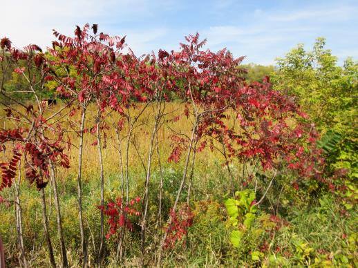 | | 2021 | COLLECTED | 09/29/2021 | Upper Iowa River area near Bluffton, T99N R9W NE1/4 Sec. 9 and S1/2 Sec. 10 | 43.40275000, -91.90494000 | 299 | High bluffs, roadside and stream banks | Wild material | Plants sampled in nature (29 September 2021) during peak fall color displaying bright reds to maroonish colors while measuring approximately 12-15 feet in height. One clonal patch noted was estimated to have 1,000+ ramets. | 2122093 | Ames 35752 |
| 173 | Ames 35750 | Ames 35750 | Blephilia ciliata (L.) Benth. | Iowa, United States | NC7 | 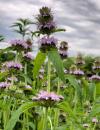 | | 2021 | COLLECTED | 09/27/2021 | Located approximately 3 miles south, southeast of Fairfield, T71N R9W SW1/4 Sec. 7 | 40.96338000, -91.94686900 | 223 | Woodland openings/edges, disturbed areas | Wild material | | 2122068 | Ames 35750 |
| 174 | Ames 35746 | Guye Woods | Acer saccharum Marshall subsp. nigrum (F. Michx.) Desmarais | Iowa, United States | NC7 |  | | 2021 | COLLECTED | 09/08/2021 | Guye Woods County Park located 6.0 miles northeast of Winterset, T76N R27W NE1/4 Sec. 4 | 41.41235000, -93.96373000 | 278 | Moist deciduous maple, oak, hickory forest, northwest facing slope above the North River. | Wild material | Multiple specimens in this population were observed to be 24" diameter at breast height (DBH) or larger with the largest specimen encountered at the time of collection measuring 36.5" DBH.
Morphological traits of leaves suggests sampled specimens are true to type of Acer saccharum subsp. nigrum including leaves with three distinct points, leathery/thick, and drooping in appearance. On September 25, 2020 (Schmitz, A., personal communication, 31 January 2022), peak fall color on Acer saccharum subsp. nigrum at Guye Woods was observed with specimens having a clean yellow fall color, also indicative of Acer saccharum subsp. nigrum.
| 2122010 | Ames 35746 |
| 175 | Ames 36047 | CBG-10076 | Helianthus divaricatus L. | Oklahoma, United States | NC7 | | | 2021 | | | | | | | Wild material | | 2120050 | Ames 36047 |
| 176 | NA 88199 | CBG-10062 | Callicarpa americana L. | Oklahoma, United States | NA | | | 2021 | | | | | | | Wild material | | 2120043 | NA 88199 |
| 177 | OPGC 8289 | CBG-10186 | Verbena hastata L. | Oklahoma, United States | OPGC | | | 2021 | | | | | | | Wild material | | 2120055 | OPGC 8289 |
| 178 | Ames 35612 | Ames 35612 | Agastache nepetoides (L.) Kuntze | Iowa, United States | NC7 |  | | 2020 | COLLECTED | 10/15/2020 | Private property located approximately 5.8 miles southeast of Westfield on both sides of N Ridge Road, T91N R48W SW 1/4 Sec. 16, Sioux Twp., Plymouth County | 42.69938500, -96.51933700 | 419 | Savanna (bur oak, walnut, hackberry). Loess hills and valleys. Distrurbed open forest. | Wild material | Plants sampled in nature measuring approximately 3-4 feet in height. | 2110274 | Ames 35612 |
| 179 | NA 87036 | Site 3A/Live Oak Landing/Holmes Creek Site | Magnolia ashei Weath. | Florida, United States | NA | | | 2020 | COLLECTED | 07/15/2020 | Along Holmes Creek at Live Oak Landing. | 30.59208000, -85.83750000 | 11 | Shade to partial shade of bluffs above the creek in well-drained mesic to dry deciduous woodlands with a few broadleaved and coniferous evergreens. | Wild material | Although these were collected without any field collection number, seeds from individual trees were separated with letter identifiers that will be maintained with the qualifier (seedling) records. The relationships are as follows: 1. Maternal letter G, NA 87036-J, L, P, and T; maternal letter H, NA 87036-V; maternal letter K, NA 87036-X, Z, and H1; maternal letter N, NA 87036-H2. In addition, three seedlings' maternal letters were lost, and these will be NA 87036-H3, H4, and H5. See the following accessions for earlier collections from this same site/population, listed in our records as "Site 3A/Live Oak Landing/Holmes Creek Site": NA 81555 (2013), NA 82745 (2015), and NA 82745.01 (2019). | 2109403 | NA 87036 |
| 180 | NA 86434 | Pulverulentus Group | Styrax americanus Lam. | Texas, United States | NA | | | 2020 | COLLECTED | 09/08/2018 | Near Gum Slough, on the edges of woodlands along the north side of road FM 2246. | 30.33332000, -93.94704000 | 15 | Plants are found along the edges and moist to wet areas of Gum Slough in part shade to full sun of a mixed deciduous and broadleaved evergreen woodlands. Soils are generally acidic with loamy to clayey sediments, but with some areas consisting of deep, nearly level loamy, poorly drained soil. | Wild material | Species occurrence is infrequent at this location. Collector's note on the name under which this material was gathered, Styrax americanus var. pulverulentus: "In general, the var. pulverulentus is considered "taxonomically inconsequential" by many botanists. Even so, this densely pubescent characteristic is highly uniform across every plant I observed in the sampled population. Weakley notes that "true" var. pulverulentus can be found as far west as East Texas and, in my humble opinion, the population sampled herein represents this "taxon". Regardless, for the purposes of drawing distinction between "typical" Styrax americanus and the densely pubescent form, I've chosen to use this varietal name. It will be interesting to observe whether the seedling progeny are uniformly similar to their parents when they germinate." [Actual altitude recorded was 14.8 m, but decimals can't be used in the database, so the number was rounded.] | 2109219 | NA 86434 |
| 181 | OPGC 7975 | NCBG-416 | Lechea maritima Legg. ex Britton | North Carolina, United States | OPGC |  | | 2019 | | | | | | | Wild material | | 2098440 | OPGC 7975 |
| 182 | W6 57457 | NCBG-257 | Parthenocissus quinquefolia (L.) Planch. | North Carolina, United States | W6 |  | | 2019 | | | | | | | Wild material | | 2098381 | W6 57457 |
| 183 | W6 57390 | NEWFS-297 | Phytolacca americana L. | Massachusetts, United States | W6 |  | | 2019 | | | | | | | Wild material | | 2098187 | W6 57390 |
| 184 | OPGC 7946 | NEWFS-246 | Lobelia cardinalis L. | Massachusetts, United States | OPGC |  | | 2019 | | | | | | | Wild material | | 2098174 | OPGC 7946 |
| 185 | NA 88111 | MARSB-428 | Lyonia ligustrina (L.) DC. | New Jersey, United States | NA |  | | 2019 | | | | | | | Wild material | | 2097629 | NA 88111 |
| 186 | NA 88118 | MARSB-573 | Viburnum dentatum L. | New York, United States | NA |  | | 2019 | | | | | | | Wild material | | 2097660 | NA 88118 |
| 187 | W6 57189 | MARSB-427 | Alnus serrulata (Aiton) Willd. | New Jersey, United States | W6 |  | | 2019 | | | | | | | Wild material | | 2097628 | W6 57189 |
| 188 | W6 57290 | MARSB-844 | Elymus hystrix L. | New Jersey, United States | W6 |  | | 2019 | | | | | | | Wild material | | 2097729 | W6 57290 |
| 189 | Ames 35234 | JDC/AS/2019/041/920 | Agastache scrophulariifolia (Willd.) Kuntze | Minnesota, United States | NC7 |  | | 2019 | COLLECTED | 10/24/2019 | Private property approximately 4.94 miles south, southwest of Cannon Falls, T111N R18W NW1/4 Sec. 13, Goodhue County | 44.42498900, -92.93729200 | 346 | Woodland edges, slightly disturbed. | Wild material | Plants measuring approximately 5-6' in height with 4-5" spikes pale pink in color. Stems and petioles tomentose. Peak flowering occurred circa 1 September 2019 and fruiting circa 1 October 2019 in nature. | 2097770 | Ames 35234 |
| 190 | Ames 35228 | JDC/AS/2019/031/910 | Agastache scrophulariifolia (Willd.) Kuntze | Iowa, United States | NC7 |  | | 2019 | COLLECTED | 09/30/2019 | Ledges State Park located approximately 4.75 miles south of Boone, just east and south of the Carl Fritz Henning Shelter, T83N R26W SW1/4 SE1/4 NW1/4 Sec. 21, Boone County | 41.98786200, -93.88824500 | 276 | Moist, semi-shaded, deciduous woods. Recently disturbed. | Wild material | Plants measuring approximately 6-8' in height with 4-5" spikes rather white or extremely pale pink in color. Peak flowering occurred circa 26 August 2019 in nature. | 2097764 | Ames 35228 |
| 191 | Ames 34609 | JDC/MB/2019/014/893 | Monarda brevis (Fosberg & Artz) Floden | West Virginia, United States | NC7 |  | | 2019 | | | | | | | Wild material | Variation in flower color present from near white, faint pink to faint "smoky" purple. Majority of specimens noted at collection site in nature were approximately 3-5 days past peak flower on 10 June 2019 with seeds reaching maturity approximately 55 days later. Majority of specimens observed were approximately 10" in height. Very healthy, dark-green leaves that maintained quality throughout the season (observed mid-August 2019). | 2092645 | Ames 34609 |
| 192 | Ames 34610 | JDC/MB/2019/015/894 | Monarda brevis (Fosberg & Artz) Floden | West Virginia, United States | NC7 |  | | 2019 | | | | | | | Wild material | Many genets noted at collection site in nature consisted of 25-30 stems, but individual stems are widely spaced (e.g. 1-5") apart compared to other populations (four) noted (2019 reconnaisance) where stem spacing was typically observed at 0.25-0.5" apart. Very healthy, dark-green leaves noted in early/mid June, but leaf quality greatly declined when observed in mid-August in contrast to other populations observed in nature that seemed to maintain leaf quality throughout the season. Many plants at this site were defoliated likely due to disease (leaf spot) or tattered likely due to possible insect feeding. Specimens noted were circa 10-12 days from initiation of flowering on 12 June 2019 and during mid-August a few specimens were still observed flowering with about 10-20% of infructescences were still green. The overall phenology of this M. brevis population at this site is quite different in comparison to other populations (four) observed in 2019, with flowering being much later (e.g. 10-25 days); leaf quality lower; and synchronization of flowering extremely variable within genets of this population. | 2092646 | Ames 34610 |
| 193 | WLP 310 | AF2018-007 | Acer saccharum Marshall subsp. floridanum (Chapm.) Desmarais | Virginia, United States | NA | | | 2018 | COLLECTED | 09/11/2018 | Brunswick County; ; Tabacco Heritage Trail, Evans Creek Trailhead. 200 ft east of the parking lot, 50 ft from the creek, on the bank of the trail. | 36.73562000, -77.95825000 | 68 | | | A few medium sized trees near the creek with many seedlings along the trail. Herbarium voucher collected (see barcode NA0103776). | 2108856 | WLP 310 |
| 194 | NA 88021 | NCBG-259 | Morella pensylvanica (Mirb.) Kartesz | Virginia, United States | NA |  | | 2018 | | | | | | | Wild material | | 1965893 | NA 88021 |
| 195 | W6 54666 | NCBG-258 | Schoenoplectus pungens (Vahl) Palla | North Carolina, United States | W6 |  | | 2018 | | | | | | | Wild material | Schoenoplectus pungens | 1965892 | W6 54666 |
| 196 | W6 54702 | NCBG-359 | Distichlis spicata (L.) Greene | Virginia, United States | W6 |  | | 2018 | | | | | | | Wild material | Distichlis spicata | 1965928 | W6 54702 |
| 197 | W6 54009 | MARSB-152 | Carex crinita Lam. | Delaware, United States | W6 |  | | 2018 | | | | | | | Wild material | Carex crinita | 1964725 | W6 54009 |
| 198 | Ames 34208 | NAO/UT/2018/23/48 | Ulmus thomasii Sarg. | Illinois, United States | NC7 |  | | 2018 | COLLECTED | 05/31/2018 | Private property located 2.0 miles northeast of Plano along Big Rock Creek just off Needham Road, T37N R6E SW 1/4 NE 1/4 Sec. 14 | 41.68543300, -88.51368600 | 188 | Flat open (mowed) areas and edge of woods. | Wild material | Ulmus thomasii (Rock elm) is an underutilized tree species both in conservation and in the urban landscape. Charles Sprague Sargent (first director of the Arnold Arboretum of Harvard University, Boston, MA) described the wood of Rock Elm as "heavy, hard, very strong and tough, closely grained, and susceptible of receiving a beautiful polish". Historically noted for a variety of uses in woodworking including furniture, heavy agricultural implements, timber frame buildings, pianos, hockey sticks, and hand tools. U. thomasii is extremely drought tolerant, adaptable to very calcareous soils, and compared to U. americana or U. rubra has a very conservative growth rate requiring minimal attention in regards to pruning. Rock elm naturally tends to develop into a nice structural specimen in the landscape, unlike other fast growing U. americana cultivars in the nursery trade needing frequent attention. Rock elm has very fissured bark and is well known for maintaining a strong central leader resulting in a very attractive, pyramidal form. Despite many literature sources stating that "wings" on the stems are a key identifiying characteristic, this trait is not reliable and many genotypes may completely lack "wings" on the stems. While growth habit and morphology of dormant buds (very pointy) are good traits to help aid in identification, fruits are the best way to confirm identity. Fruits are densly pubescent, often described as "inflated" and generally reach maturity a couple weeks after U. rubra and U. americana. U. thomasii inflorescences are rather distinguishable from other Ulmus in being pendulous. Fruits are extremely prized treats for many birds, where fruits are often "robbed" prior to full maturity. Fruits are also highly prized by many other animals such as mice, squirrels, chipmunks, turkeys, etc. and are generally consumed within hours after fruit abscission. The native range of U. thomasii is concentrated in the northeastern United States and into Canada with disjunct populations documented in northwestern Missouri and northwestern Arkansas (Little, E. L. Jr. 1971). In the 1895 Silva of North America (vol. 7) it was stated that, “The value of the wood of the Rock Elm threatens its extinction and most of the large trees have already been cut.” Today, since rock elm is rather rare, especially in areas near the edges of its range, many states list the species as endangered or threatened warranting preservation efforts. Genetics of this accession were collected on private property in north central Illinois (Kendall County) from a localized population in nature represented by 10-16" DBH specimens with little to no signs of decline. | 1963391 | Ames 34208 |
| 199 | WLP 1190 | NA 85118 | Dirca palustris L. | Iowa, United States | NA |  | | 2018 | COLLECTED | 05/31/2018 | Private property located 3.35 miles southwest of Luther near Des Moines River, T82N R26W SW 1/4 SW 1/4 Sec. 3, Boone County | 41.93795800, -93.87109500 | 317 | Dense shade of mature oak forest. Deep ravines. | Wild material | Specimens measuring approximately 2-5' in height. Noticeable new growth (5-8") at time of seed collection. Population was in peak bloom 24 April 2018 with peak fruit maturity occuring on 30 May 2018. Fruits readily dropping when distrubed. Very slight tinge of white color to fully mature fruits. Seeds measuring approximately 0.5-0.7 cm in length. | 1963390 | WLP 1190 |
| 200 | Ames 34201 | NAO/UR/2018/22/47 | Ulmus rubra Muhl. | Iowa, United States | NC7 |  | | 2018 | COLLECTED | 05/24/2018 | Private property located 5.0 miles west of Grinnell off N 39th Ave E., T80N R17W NW ¼ SW ¼ Sec. 15, Jasper County | 41.73626700, -92.82183600 | 325 | Dry ridge top. Old-growth remnant woods historically and currently utilized as cattle pasture. | Wild material | Mature 20-26" d.b.h. (inches) specimens with little to no signs of decline. | 1963308 | Ames 34201 |
| 201 | OPGC 6391 | CBG-7403 | Lobelia cardinalis L. | Washington, United States | OPGC |  | | 2017 | | | | | | | Wild material | | 1954824 | OPGC 6391 |
| 202 | OPGC 7773 | CBG-7497 | Eutrochium maculatum (L.) E. E. Lamont | Wisconsin, United States | OPGC |  | | 2017 | | | | | | | Wild material | | 1954809 | OPGC 7773 |
| 203 | NA 87954 | MARSB-574 | Morella pensylvanica (Mirb.) Kartesz | New York, United States | NA |  | | 2017 | | | | | | | Wild material | | 1954652 | NA 87954 |
| 204 | Ames 34052 | PB1701 | Betula papyrifera Marshall | Minnesota, United States | NC7 |  | | 2017 | COLLECTED | 09/16/2017 | Detroit Mountain area just east of Detroit Lakes approximately 2.9 miles, T139N R40W SW 1/4 NE 1/4 and NE 1/4 NE 1/4 NW 1/4 Sec. 21, Becker County | 46.81210900, -95.78208300 | 457 | Mixed deciduous woods. | Wild material | | 1954341 | Ames 34052 |
| 205 | Ames 33987 | JDC/FQ/2017/043/797 | Fraxinus quadrangulata Michx. | Ohio, United States | NC7 |  | | 2017 | COLLECTED | 07/12/2017 | Strait Creek Prairie Bluffs Preserve between Peebles and Sinking Spring along highway 41 (Crooked Creek, Strait Creek and Scioto Brush Creek watersheds), Adams and Highland County | 39.00561100, -83.37365400 | 235 | Mixed deciduous woods, generally on top of moist seep, but also on rocky gentle (30-45 degree) slopes. | Wild material | | 1950070 | Ames 33987 |
| 206 | Ames 33990 | JDC/FQ/2017/046/800 | Fraxinus quadrangulata Michx. | Ohio, United States | NC7 |  | | 2017 | COLLECTED | 07/15/2017 | Sharon Woods Metro Park within city limits of Columbus, T2N R18W, Franklin County | 40.12267100, -82.96668000 | 275 | Deciduous woods. | Wild material | | 1950073 | Ames 33990 |
| 207 | Ames 33921 | APS/GD/2016/001/236 | Gymnocladus dioicus (L.) K. Koch | Minnesota, United States | NC7 |  | | 2017 | COLLECTED | 03/17/2017 | Blue Earth River watershed covering approximately 9.0 river miles from Vernon Center south to the county line, Blue Earth and Faribault Counties | 43.87215300, -94.17375800 | 316 | Mixed habitats, both upland dry and wet sites. | Wild material | | 1946988 | Ames 33921 |
| 208 | Ames 33922 | JDC/PO/2017/012/766 | Platanus occidentalis L. | Iowa, United States | NC7 |  | | 2017 | COLLECTED | 03/20/2017 | Skunk River watershed of Chichaqua Bottoms Greenbelt approximately 5.75 miles east, southeast of Elkhart, Polk County | 41.77733500, -93.40833400 | 243 | Floodplain. | Wild material | | 1946989 | Ames 33922 |
| 209 | WLP 1436 | NA 83951 | Oxydendrum arboreum (L.) DC. | Kentucky, United States | NA | | | 2016 | COLLECTED | 09/29/2016 | Kentenia State Forest, Pine Mountain, opening in canopy on Route 1679, south side. | 36.92000000, -83.24200000 | 795 | Roadside, opening in canopy. | | | 1951128 | WLP 1436 |
| 210 | WLP 1704 | NA 83942 | Rhus glabra L. | Kentucky, United States | NA | | | 2016 | COLLECTED | 09/29/2016 | Kentenia State Forest, Pine Mountain, on Route 1679, south side. | 36.90500000, -83.29100000 | 771 | Roadside. | | | 1953164 | WLP 1704 |
| 211 | WLP 1705 | NA 83948 | Rhododendron maximum L. | Kentucky, United States | NA | | | 2016 | COLLECTED | 09/29/2016 | Kentenia State Forest, Pine Mountain, on Route 1679, north side. | 36.91400000, -83.25900000 | 758 | Roadside. | | | 1950864 | WLP 1705 |
| 212 | WLP 872 | NA 83949 | Clethra acuminata Michx. | Kentucky, United States | NA | | | 2016 | COLLECTED | 09/29/2016 | Kentenia State Forest, Pine Mountain, on Route 1679, south side. | 36.91500000, -83.25900000 | 760 | Roadside. | | | 1951703 | WLP 872 |
| 213 | Ames 33736 | JDC/BA/2016/028/743 | Betula alleghaniensis Britton | Iowa, United States | NC7 |  | | 2016 | COLLECTED | 09/02/2016 | Fallen Rock State Preserve approximately 1.9 miles southwest of Steamboat Rock, T88N R19W NW ¼ Sec. 32. | 42.39459000, -93.09423600 | 310 | High-quality, native, mesic deciduous woods on loose, loamy sandstone amongst very large boulders. North-facing with variable 10-50 degree slopes. Majority of specimens located at base of bluff or near water’s edge (Iowa River). | Wild material | The native range of Betula alleghaniensis is concentrated in the northeastern U.S. with disjunct populations in Iowa (Little, 1971). This accession represents a collection of Betula alleghaniensis germplasm from the extreme western edge of the species native range. The next closest occurrence is in Mitchell County, Iowa (60 miles). As of 2025, two trees at Fallen Rock State Preserve currently represent the state of Iowa's 1st and 2nd largest yellow birch specimens measuring 22.76" DBH; 70.83' height; 40' average crow spread (151.83 points) and 17.18" DBH; 65.33' height; 33.75' average crow spread (127.76 points), respectively (Rouw, M., personal communication, 13 May 2018). | 1942689 | Ames 33736 |
| 214 | Ames 33288 | APS/GD/2016/009/244 | Gymnocladus dioicus (L.) K. Koch | Michigan, United States | NC7 |  | | 2016 | COLLECTED | 04/05/2016 | Ottawa County: T7N R13W SW 1/4 SW 1/4 NE 1/4 Sec. 32; T7N R13W NE 1/4 NE 1/4 SW 1/4 Sec. 29; and T7N R14W NW 1/4 NW 1/4 Sec. 10 along Grand River both north (approximately 2.87 miles) and east (approximately 3.84 miles) of Allendale. | 43.00148000, -85.91236400 | 184 | Floodplain. | Wild material | | 1940345 | Ames 33288 |
| 215 | Ames 33289 | APS/GD/2016/010/245 | Gymnocladus dioicus (L.) K. Koch | Michigan, United States | NC7 |  | | 2016 | COLLECTED | 04/05/2016 | Ionia County: T5N R5W SW 1/4 SW 1/4 SE 1/4 Sec. 21; T5N R5W NE 1/4 NW 1/4 NW 1/4 Sec. 20; and T5N R5W SW 1/4 SW 1/4 SE 1/4 Sec. 20 along Grand River approximately 4.80 miles south and slightly west of Portland. | 42.80296200, -84.91275400 | 231 | Floodplain. | Wild material | | 1940346 | Ames 33289 |
| 216 | Ames 33290 | APS/GD/2016/012/247 | Gymnocladus dioicus (L.) K. Koch | Michigan, United States | NC7 |  | | 2016 | COLLECTED | 04/06/2016 | Gratiot and Clinton Counties: T9N R3W SW 1/4 Sec. 35 (Gratiot County) and T8N R4W NW 1/4 NW 1/4 Sec. 14 (Clinton County) along Maple River both northeast (approximately 3.34 miles (Clinton County)) and southwest (approximately 3.00 miles (Gratiot County)) of Maple Rapids. | 43.10603700, -84.70504200 | 205 | Floodplain. | Wild material | | 1940347 | Ames 33290 |
| 217 | Ames 33291 | APS/GD/2016/015/250 | Gymnocladus dioicus (L.) K. Koch | Michigan, United States | NC7 |  | | 2016 | COLLECTED | 04/07/2016 | Shiawassee County: T6N R4E SE 1/4 SE 1/4 SW 1/4 Sec. 30; T5N R4E SE 1/4 NW 1/4 Sec. 7; and T6N R3E SE 1/4 SE 1/4 NE 1/4 Sec. 25 along Shiawassee River both northeast (approximately 1.35 miles) and southeast (approximately 2.63 miles) of Bancroft. | 42.87985700, -84.03461800 | 244 | Floodplain. | Wild material | | 1940348 | Ames 33291 |
| 218 | Ames 32960 | JDC/BP/2015/046/703 | Betula papyrifera Marshall | Iowa, United States | NC7 | | | 2015 | COLLECTED | 09/11/2015 | Ruby Woodland, T88N R19W NW 1/4 Sec. 8 Hardin County. | 42.45099600, -93.09671200 | 328 | Mid portions of north-facing slope (45-60 degrees) in cool, moist deciduous woods. Growing in association with Fraxinus nigra, Staphylea trifolia, Carpinus caroliniana, Quercus rubra, Fraxinus americana, Acer saccharum, Cornus alternifolia, Carya ovata, Urtica dioica, Amelanchier arborea, Ostrya virginiana, Hepatica sp., Smilax rotudifolia, Prunus Virginiana, Betula papyrifera, Betula alleghaniensis, Populus deltoides, Tilia americana, and Allium tricoccum. | Wild material | | 1927430 | Ames 32960 |
| 219 | Ames 32963 | JDC/BA/2015/049/706 | Betula alleghaniensis Britton | Iowa, United States | NC7 | | | 2015 | COLLECTED | 09/14/2015 | Bixby State Preserve, T91N R5W extreme southern edge of Sec. 23 basically restricted to W 1/2 of Sec. 23. | 42.67470300, -91.39917300 | 308 | North-facing algific talus slope (45-60 degrees) adjacent to Bear Creek. Moist deciduous woods. Growing in association with Diervilla lonicera, Hamamelis virginiana, Corylus sp., Viburnum opulus var. americanum, Cornus rugosa (few), Cornus alternifolia, Fraxinus nigra, Quercus rubra, Viburnum lentago, Ribes sp., Rubus idaeus subsp. strigosus, Rhamnus alnifolia (few), Rosa sp., Taxus canadensis, Prunus virginiana, Impatiens sp., Dirca palustris, and Pinus strobus (few). | Wild material | | 1927433 | Ames 32963 |
| 220 | Ames 32965 | JDC/BA/2015/051/708 | Betula alleghaniensis Britton | Iowa, United States | NC7 | | | 2015 | COLLECTED | 09/15/2015 | Yellow River State Forest, T97N R4W northern edge of SW 1/4 NW 1/4 Sec. 36 | 43.17782100, -91.26584600 | 227 | North-facing algific talus slope (45-60 degrees) adjacent to Paint Creek. Moist deciduous woods. Growing in association with Fraxinus nigra, Staphylea trifolia, Carpinus caroliniana, Quercus rubra, Acer saccharum, Cornus alternifolia, Amelanchier arborea, Ostrya virginiana, Viburnum opulus var. americanum, Cornus rugosa, Cornus alternifolia, Zanthoxylum americanum, Viburnum rafinesqueanum, Cypripedium pubescens, Ribes sp.,Corylus sp., Juniperus virginiana, Dirca palustris, Ulmus thomasii, Prunella vulgaris, Diervilla lonicera, Quercus macrocarpa, Carya cordiformis, Taxus canadensis, Tilia americana, Adiantum pedatum, and Aconitum noveboracense. | Wild material | | 1927435 | Ames 32965 |
| 221 | Ames 32966 | JDC/VA/2015/052/709 | Viburnum opulus L. var. americanum Aiton | Iowa, United States | NC7 |  | | 2015 | COLLECTED | 09/15/2015 | Yellow River State Forest, T97N R4W northern edge of SW ¼ NW ¼ Sec. 36. | 43.17778200, -91.26642800 | 239 | North-facing algific talus slope (45-60 degrees) adjacent to Paint Creek. Moist deciduous woods. | Wild material | Formerly known as Viburnum trilobum, American highbush cranberry (V. opulus var. americanum) is a North American native shrub that is utilized as an important ornamental and conservation plant that is also harvested as a minor fruit crop (jams/jellies). In nature, this variety is generally found in moist habitats typically along stream banks and swamps where ample moisture is readily available. The native range of V. opulus var. americana is concentrated in the northeastern United States and into Canada (Little, E. L. Jr. 1977). Attractive ornamental characteristics includes showy lacecap flowers in spring and bright red fruits and foliage in the fall. Fruits are tart with a hint of sweetness. The European highbush cranberry (V. opulus var. opulus) is nearly identical to American highbush cranberry other than small glands (<1 mm) on the petiole making the exact determination very challenging resulting in common misidentifications. A major difference between the American and European highbush cranberries is that the European variety produces unpalatable fruit. Recent research has shown that American and European highbush cranberries are genetically distinct and that plants of hybrid origin are uncommon (Tork et al. 2025). Vigorous early spring growth and good tolerance to late spring frosts. Genetic analysis from Tork et al. 2025 confirmed that genetics of this accession represents American highbush Cranberry (Viburnum opulus var. americanum). This accession represents genetics from northeast Iowa and thus the extreme western edge of the species native range. | 1927436 | Ames 32966 |
| 222 | NA 82643 | NA 82643 | Lonicera sempervirens L. | Texas, United States | NA | | | 2015 | COLLECTED | 07/20/2014 | East side of Texas Route 87 approximately 0.52 miles south of Trout Creek, Texas. | 30.61156000, -93.80506000 | 21 | Southwest-facing edge of mature woodland in part to full sun; well-drained, seasonally moist soils that are sandy loam; surface has an excellent organic litter layer. | | | 1952603 | NA 82643 |
| 223 | Ames 32894 | APS/GD/2015/017/199 | Gymnocladus dioicus (L.) K. Koch | Oklahoma, United States | NC7 |  | | 2015 | COLLECTED | 03/14/2015 | Cleveland County: T10N R5W SW 1/4 SW 1/4 Sec. 7. John Nichols Camp located on north side of Canadian River approxiamtely 4.25 miles south and southeast of Mustang. | 35.35029600, -97.66952200 | 395 | Higher elevations. Dry, relatively thin soils. | Wild material | | 1925360 | Ames 32894 |
| 224 | Ames 32895 | APS/GD/2015/018/200 | Gymnocladus dioicus (L.) K. Koch | Oklahoma, United States | NC7 |  | | 2015 | COLLECTED | 03/15/2015 | Canadian County: Near/adjacent to unnamed creek that empties into the Canadian River, T12N R10W SW 1/4 Sec. 20. Private property approximately 4 miles northeast of Hinton. | 35.49409300, -98.28655400 | 434 | Bottomland. | Wild material | | 1925361 | Ames 32895 |
| 225 | Ames 32902 | APS/GD/2015/030/212 | Gymnocladus dioicus (L.) K. Koch | Oklahoma, United States | NC7 |  | | 2015 | COLLECTED | 03/18/2015 | Logan County: T18N R2W N 1/2 Sec. 36. Private property approximately 1.5 miles east of the confluence of Skeleton Creek and Cimarron River approximately 5.25 miles south southeast of Mulhall. | 35.99593500, -97.36486800 | 288 | Transition zone between higher elevations and bottomlands. | Wild material | | 1925368 | Ames 32902 |
| 226 | Ames 32903 | APS/GD/2015/031/213 | Gymnocladus dioicus (L.) K. Koch | Oklahoma, United States | NC7 |  | | 2015 | COLLECTED | 03/19/2015 | Osage County: Arkansas River watershed area known as Souters Bend, T21N R7E. Keystone Wildlife Management Area (John Lowery Unit) approximatley 3 miles west of Cleveland. | 36.30185300, -96.53051000 | 222 | Floodplain, but one specimen sampled was located on dry, rocky (large boulders) bluff. | Wild material | | 1925369 | Ames 32903 |
| 227 | Ames 32904 | APS/GD/2015/032/214 | Gymnocladus dioicus (L.) K. Koch | Oklahoma, United States | NC7 |  | | 2015 | COLLECTED | 03/19/2015 | Osage County: Sand Creek watershed area, T27N R8E SE 1/4 NW 1/4 Sec. 10. Tallgrass Prairie Preserve approximately 13 miles northwest of Pawhuska. | 36.83425300, -96.43091600 | 307 | Dry, rocky outcroppings and floodplain. | Wild material | | 1925370 | Ames 32904 |
| 228 | Ames 32889 | APS/GD/2015/006/188 | Gymnocladus dioicus (L.) K. Koch | Missouri, United States | NC7 |  | | 2015 | COLLECTED | 03/05/2015 | St Charles County: T46N R2E Sec. 24. August Busch Conservation Area near Weldon Spring. | 38.72724100, -90.74923500 | 166 | Deciduous, mesic woods. | Wild material | | 1924367 | Ames 32889 |
| 229 | NA 83061 | ZARKS-005 | Gymnocladus dioicus (L.) K. Koch | Arkansas, United States | NA | | | 2015 | COLLECTED | 10/02/2014 | Frog Valley (private property). West bank of North Fork of Saline River. | 34.76276000, -92.71386000 | 133 | Alluvial low floodplain, in sandy clay soil. Slope: 0 degrees. Elevation: 435 feet. | Wild material | | 1950627 | NA 83061 |
| 230 | NA 83062 | NA 83062 | Taxodium distichum (L.) Rich. | Arkansas, United States | NA | | | 2015 | COLLECTED | 10/02/2014 | Frog Valley (private property). Banks of North Fork of Saline River. | 34.76443000, -92.71338000 | 135 | Alluvial low floodplain, in gravel bank. | | | 1951432 | NA 83062 |
| 231 | NA 83063 | NA 83063 | Hamamelis vernalis Sarg. | Arkansas, United States | NA | | | 2015 | COLLECTED | 10/02/2014 | Frog Valley (private property). Gravel bar along North Fork of Saline River. | 34.76543000, -92.71353000 | 134 | Alluvial low floodplain; gravel bar. | | | 1950887 | NA 83063 |
| 232 | Ames 33731 | MARSB-070 | Rhus typhina L. | Pennsylvania, United States | NC7 | 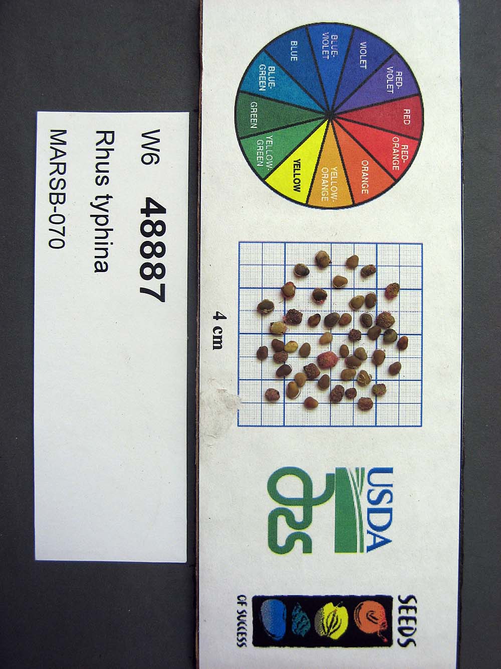 | | 2015 | COLLECTED | 08/22/2013 | Tioga State Forest near Arnot, Tioga County | 41.63745000, -77.21233000 | 1280 | | Wild material | | 1922876 | Ames 33731 |
| 233 | W6 48814 | MARSB-115 | Aristida purpurascens Poir. | New Jersey, United States | W6 |  | | 2015 | | | | | | | Wild material | | 1922907 | W6 48814 |
| 234 | W6 48819 | MARSB-101 | Boehmeria cylindrica (L.) Sw. | Maryland, United States | W6 |  | | 2015 | | | | | | | Wild material | | 1922836 | W6 48819 |
| 235 | W6 48853 | MARSB-102 | Eragrostis spectabilis (Pursh) Steud. | Maryland, United States | W6 |  | | 2015 | | | | | | | Wild material | | 1922857 | W6 48853 |
| 236 | W6 48854 | MARSB-106 | Eragrostis spectabilis (Pursh) Steud. | New Jersey, United States | W6 |  | | 2015 | | | | | | | Wild material | | 1922916 | W6 48854 |
| 237 | W6 48902 | MARSB-114 | Tridens flavus (L.) Hitchc. | New Jersey, United States | W6 |  | | 2015 | | | | | | | Wild material | | 1922931 | W6 48902 |
| 238 | WLP 1967 | HBC1401 | Viburnum opulus L. var. americanum Aiton | North Dakota, United States | NA | | | 2014 | COLLECTED | 09/29/2014 | Jay Wessels Wildlife Management Area located in Pembina County. | 48.80000000, -97.83000000 | 312 | Diverse habitats including edge of swamp and also upland sandy soils. Growing in association Fraxinus pennsylvanica, Fraxinus nigra, Quercus macrocarpa, Acer negundo, Ulmus americana, Populus tremuloides, Populus balsamifera, Toxicodendron radicans, Cornus sericea, Rosa sp., Corylus sp., Prunus virginiana, Ribes sp., Equisetum sp., Rubus sp., IMpatiens capensis, Thalictrum dasycarpum, Fragaria virginiana, Asarum canadense, Calamagrostis canadensis, Sium suave, Solidago gigantea, Poa pratensis, and Bromus inermis. | Wild material | | 1921830 | WLP 1967 |
| 239 | WLP 1304 | JDC/IF/2014/101/603 | Illicium floridanum J. Ellis | Alabama, United States | NA | | | 2014 | COLLECTED | 09/24/2014 | Alabama: Lamar County; Banks of Clear Creek between Millport and Kennedy near Alabama Highway 96. | 33.56897100, -88.02468300 | 111 | Wet, deciduous woods. Growing in association with Magnolia virginiana, Betula nigra, and Quercus nigra. | Wild material | Species locally abundant. Abundant fruit production. | 1922371 | WLP 1304 |
| 240 | WLP 1422 | JDC/NS/2014/068/570 | Nyssa sylvatica Marshall | Mississippi, United States | NA | | | 2014 | COLLECTED | 09/21/2014 | Mississippi: Lafayette County; Holly Springs National Forest along County Road 244. | 34.50982900, -89.35716800 | 95 | Floodplain. Wet woods. Growing in association with Liquidambar styraciflua, Acer negundo, Cetlis sp., Juniperus virginiana, Carya illinoinensis, Quercus nigra, and Quercus phellos. | Wild material | Fruits rather green. | 1922346 | WLP 1422 |
| 241 | Ames 32794 | JDC/FP/2014/106/608 | Fraxinus pennsylvanica Marshall | Mississippi, United States | NC7 |  | | 2014 | COLLECTED | 09/25/2014 | Along Sanders Road, Cypress Creek watershed, NW 1/4 of SW 1/4 of SW1/4 of Section 10, T17N, R13E, Oktibbeha County. | 33.34662400, -88.93148200 | 115 | | Wild material | | 1921805 | Ames 32794 |
| 242 | Ames 32760 | JDC/AB/2014/040/542 | Abies balsamea (L.) Mill. | Iowa, United States | NC7 | | | 2014 | COLLECTED | 09/03/2014 | Bluffton Fir State Preserve, near Bluffton, Winneshiek County. | 43.40106767, -91.90659200 | 326 | High quality, native woods. Steep slope, northwest-facing, and relatively flat portion on top of bluff (powerline) | Wild material | | 1921308 | Ames 32760 |
| 243 | Ames 32758 | Fallen Rock | Pinus strobus L. | Iowa, United States | NC7 |  | | 2014 | COLLECTED | 08/21/2014 | Fallen Rock State Preserve and adjacent private property just north of Eldora, T88N R19W SW ¼ Sec. 28 and N ¼ Sec. 32 and also T87N R19W N ½ Sec. 5. | 42.39548900, -93.09165200 | 311 | Cool moist woods. Slopes averaging 60 degrees. Northern and eastern aspects. Localized to bluffs above Iowa River. | Wild material | The native range of Pinus strobus is concentrated in the northeastern United States extending south into the northern edge of Georgia and west to central Minnesota. In Iowa, scattered native populations exist in a few northeastern counties as well as small disjunct populations in central and southeastern counties (Little, 1971). This accession includes genetics from legacy mother trees located in Fallen Rock State Preserve and nearby private property to the south. This area is near Pine Lake State Park, which in 2009 was devastated by a severe hailstorm of "supersized softballs" resulting in significant cambial damage to many species of trees. Damage to the majority of P. strobus specimens throughout the area was so severe that losses occurred immediately. Additional losses in subsequent years continued to occur likely due to additional stress by drought and destruction by bark beetles. The loss of approximately 75% of the P. strobus specimens at Pine Lake State Park was attributed to the 2009 hailstorm prompted efforts to preserve genetics of the white pines here. In 2014, specimens in parts of Pine Lake State Park and also one specimen at Fallen Rock State Preserve were sampled (Carstens, J.) as seeds from specimens ranging in size from 9.25 inches to 31.75 inches d.b.h. However, in 2021, it was determined (Place, A. pers. comm. 24 February 2021 and Carstens, J. & Sherwood, A., pers. observations 1 March 2021) that likely most if not all of the specimens in Pine Lake State Park are planted specimens of unknown origin because P. strobus specimens located at the far east end of Lower Lake (south side) were noted (Carstens and Sherwood, pers. observations 1 March 2021) growing with uncharacteristic associated taxa including Acer saccharinum and Gymnocladus dioicus. Two documents that support these observations includes: 1. Letter signed by Louis H. Pammel (March 25, 1925) to G.B. McDonald of the Iowa State University Forestry Department asking for 200 white pine to be planted at Pine Lake. 2. "Trees to Be Set Out by CCC Workers" in the Eldora Herald (May 9, 1935) referencing the CCC (Civilian Conservation Corps) to plant “1,000 white pines at Pine Lake State Park". Therefore, if obtained, increment borer measurements of specimens that are 94 years of age at present (2014) or older would suggest those as being true, native remnants. Documents that supports the position of remnant specimens at Fallen Rock State Preserve includes: 1. "Picturesque Drives About Eldora", in the Eldora Herald (December 8, 1910) by Clara Estabrook stating "Miss Stoddard of the Iowa Falls school says these (only 11 trees left) are the only native pines (those restricted to the sandstone cliffs) found in Hardin County" and suggested a movement to have them preserved. 2. Forest Flora of Hardin County (1899) by L. H. Pammel stating that the Iowa valley serves as the western limits for white pine and also refers to David D. Owen's geological report from 1839 indicating the occurrences of white pines on the summits of the hills along the Iowa River. In addition, a photo of white pines growing at Steamboat Rock taken by L. H. Pammel was featured on the front page of the 1919 report of the State Board of Conservation titled "Iowa Parks: Conservation of Iowa Historic, Scenic and Scientific Areas." Due to the significant presence of planted specimens of unknown origin in Pine Lake State Park and surrounding private properties, samples collected in 2014 as seeds may likely contain genetics (pollen donors) from specimens of unknown origin. This resulted in the resampling of specimens in 2021 (USFS - IAHA#'s) and 2023 as dormant scions that are from locations known to be untouched by the CCC and thus represent true, remnant specimens. To date (2021), there are only eight legacy specimens left in this population (four specimens at Fallen Rock State Preserve and four specimens at the nearby private property). The largest specimen of P. strobus (Ames 32758) is #IAHA-08 located at (42.395489, -93.091652) measuring (13 May 2018) 35.65" DBH with a height of 78.33' and a spread of 26' totalling 197 points (Rouw, M., personal communication, 8 February 2023). This germplasm represents the southwestern most population of native P. strobus in Iowa and one of the western most populations in North America. Germplasm likely is adapted to Midwestern climatic extremes and potentially very drought tolerant in comparison to other provenances from the eastern or northeastern U.S. | 1921270 | Ames 32758 |
| 244 | Ames 32093 | JDC/CC/2013/048/492 | Carpinus caroliniana Walter | Iowa, United States | NC7 | | | 2013 | COLLECTED | 10/25/2013 | Ledges State Park mostly from specimens adjacent to Peas Creek, NE ¼ of SE ¼ of Sec. 16, T83N R26W, Des Moines Quad. | 41.99910000, -93.87880000 | 328 | North and northwest-facing slopes. | Wild material | The native range of Carpinus caroliniana is concentrated in the eastern half of the U.S. with a very small disjunct population in central Iowa (Little, 1971). This accession represents a collection of C. caroliniana germplasm from the extreme western edge of the species native range, specifically the central Iowa disjunct population at Ledges State Park. The next closest occurrence is in eastern Iowa (100-150 miles). As of 2025, one specimen at Ledges State Park (McCoy Wildlife Area) currently represents the state of Iowa's largest C. caroliniana specimen measuring 6.68" DBH, 41.67’ in height, and 23.75’ average crown spread for a total of 68.608 points (Rouw, M., personal communication, 4 May 2022). This accession does include genotypes that do tend to sucker/form clonal colonies. Fall color (red/orange) tends to peak in the last week of October (central Iowa) with peak fruiting occurring simultaneously. Bark smooth, grey. | 1914037 | Ames 32093 |
| 245 | Ames 32082 | JDC/FQ/2013/041/485 | Fraxinus quadrangulata Michx. | Ohio, United States | NC7 |  | | 2013 | COLLECTED | 08/17/2013 | South Bass Island, Put-In-Bay Quad, Ottawa County. | 41.63639900, -82.83680200 | 197 | Shallow, rocky soils. | Wild material | | 1913268 | Ames 32082 |
| 246 | Ames 32083 | JDC/FQ/2013/042/486 | Fraxinus quadrangulata Michx. | Michigan, United States | NC7 |  | | 2013 | COLLECTED | 08/17/2013 | Bendor property, Section 21, T2S, R7E, Denton Quad, near Ypsilanti, Washtenaw County. | 42.29735200, -83.61355300 | 262 | Mesic forest. | Wild material | | 1913269 | Ames 32083 |
| 247 | Ames 32084 | JDC/FQ/2013/043/487 | Fraxinus quadrangulata Michx. | Illinois, United States | NC7 |  | | 2013 | COLLECTED | 08/18/2013 | Silver Springs State Park, Section 34, T37N, R6E, Plano Quad, near Plano, Kendall County. | 41.63202700, -88.52791100 | 186 | Mesic forest. | Wild material | | 1913270 | Ames 32084 |
| 248 | DPRU 3195 | DPRU 3195 | Prunus hortulana L. H. Bailey | Missouri, United States | DAV |  | | 2013 | COLLECTED | 08/13/2013 | Property of Prairie Garden Trust (Henry and Lorna Domke), New Bloomfield Quad, northeast of New Bloomfield, Callaway County. | 38.74118667, -92.03118433 | 235 | Numerous specimens scattered throughout property, but localized/common to small drainage ditches; associated with Diospyros virginiana, Juglans nigra, Juniperus virginiana, Prunus serotina, Quercus imbricaria, Toxicodendron radicans, Carya ovata, Cornus florida, and Robinia pseudoacacia. | Wild material | Specimen 1: fruit diameter ranged between 17 mm-20 mm; approximately 20 feet in height and 20 feet in spread; leaves papery thin to the touch and glabrous. Specimen 2: fruit diameter ranged between 15 mm and 17 mm; fruits mostly red. Specimen 3: fruit diameter ranged between 18 mm and 19 mm; fruits mostly red. Specimen 4: fruit diameter ranged between 18 mm and 19 mm; fruits mostly green (a few red). Specimen 5: fruit diameter ranged between 15 mm-17 mm, fruits slightly longer (1 mm) than wide; approximately 15 feet in height; leaves papery thin to the touch and glabrous. Specimen 6: fruit diameter ranged between 20 mm and 22 mm; fruits mostly red. | 1912772 | DPRU 3195 |
| 249 | Ames 32018 | APS/GD/2013/032/117 | Gymnocladus dioicus (L.) K. Koch | Missouri, United States | NC7 |  | | 2013 | COLLECTED | 04/09/2013 | Poosey Conservation Area, Livingston County. | 39.94995200, -93.71471700 | 267 | Floodplain. | Wild material | A total of four areas containing Gymnocladus dioicus were noted throughout Poosey Conservation Area. Each area was represented by approximately 2-6 specimens. Specimens ranged between 14-22.5 inches d.b.h. and approximately 90-110 feet in height. Pod production during the 2012 growing season was minimal/below average. Samples 473-1 and 473-2 were very close together (approximately 10 feet apart) and samples 473-3 and 473-4 were also very close together (approximately 48 feet apart). Samples this close together may potentially represent material from a single clone due to the clonal suckering habit of Gymnocladus dioicus. | 1908307 | Ames 32018 |
| 250 | Ames 31982 | APS/GD/2013/004/089 | Gymnocladus dioicus (L.) K. Koch | Kansas, United States | NC7 |  | | 2013 | COLLECTED | 02/18/2013 | Walnut Creek watershed, southwest of Marysville, Sections 5, 8, and 17, T3S R6E, Marshall County. | 39.79300943, -96.78506600 | 382 | Dry floodplain. | Wild material | | 1907535 | Ames 31982 |
| 251 | Ames 31987 | APS/GD/2013/011/096 | Gymnocladus dioicus (L.) K. Koch | Kansas, United States | NC7 |  | | 2013 | COLLECTED | 02/20/2013 | Camp Wood, near Cottonwood River, south of Elmdale, NW 1/4 of Section 3, T20S R7E, Chase County. | 38.34698100, -96.65080500 | 377 | Samples obtained from both upland, rocky and floodplain habitat. | Wild material | | 1907540 | Ames 31987 |
| 252 | Ames 31990 | APS/GD/2013/013/098 | Gymnocladus dioicus (L.) K. Koch | Missouri, United States | NC7 |  | | 2013 | COLLECTED | 02/22/2013 | Peavine Creek, south of Concordia, SW 1/4 of SE 1/4 of Section 20, SW 1/4 of NW 1/4 of Section 21, and NE 1/4 of NW 1/4 of Section 28, T48N R24W, Lafayette and Johnson Counties. | 38.93429000, -93.57204500 | 205 | Floodplain. | Wild material | | 1907543 | Ames 31990 |
| 253 | NA 85242 | MA-2012-010 | Ilex verticillata (L.) A. Gray | Massachusetts, United States | NA | | | 2012 | COLLECTED | 08/25/2012 | Worcester County; Barre; Collected on the roadside of Sheldon Road, one mile south of the intersection with Old Dana Road. [Note: coordinates are just 600 feet south of that intersection.] | 42.43053000, -72.16093000 | 326 | Upland forest edge. | | Seed and herbarium specimen collected. | 2108859 | NA 85242 |
| 254 | Ames 31521 | JDC/FQ/2012/030/423 | Fraxinus quadrangulata Michx. | Illinois, United States | NC7 |  | | 2012 | COLLECTED | 07/21/2012 | Trelease and Brownfield Woods, SE 1/4 of Section 34, T20N, R9E, and SW 1/4 of Section 1, T19N, R9E, Thomasboro Quad, near Urbana, Champaign County. | 40.14687500, -88.16305800 | 229 | Mature, moist woods. Very flat terrain. | Wild material | Relatively large, averaging 1-2 feet d.b.h. and 80-100 feet in height. | 1903748 | Ames 31521 |
| 255 | Ames 31529 | JDC/FQ/2012/038/431 | Fraxinus quadrangulata Michx. | Indiana, United States | NC7 |  | | 2012 | COLLECTED | 07/24/2012 | Lick Creek Summit Nature Preserve, NW 1/4 of Section 23, T13N, R2W, Richmond Quad, near Richmond, Wayne County. | 39.78453000, -84.95276400 | 267 | Dry woods. Bluffs. Shallow soils. | Wild material | | 1903756 | Ames 31529 |
| 256 | Ames 31532 | JDC/FQ/2012/042/435 | Fraxinus quadrangulata Michx. | Illinois, United States | NC7 |  | | 2012 | COLLECTED | 07/26/2012 | Trout Park Nature Preserve, Section 1, T41N, R83, Elgin Quad, near Elgin, Kane County. | 42.06258500, -88.27131500 | 240 | Variable habitats: dry, rocky slopes and also near small creek in gravelly soils. | Wild material | | 1903759 | Ames 31532 |
| 257 | Ames 31256 | APS/GD/2008/005/005 | Gymnocladus dioicus (L.) K. Koch | Iowa, United States | NC7 |  | | 2012 | COLLECTED | 01/10/2012 | Ledges State Park, SW 1/4 of SW 1/4 of Section 21, T83N, R26W, Madrid NW Quad, Boone County | 41.98110000, -93.89010000 | 328 | Upland woods. 30% slope with a western aspect. | Wild material | Largest specimen noted was 22" d.b.h. | 1897494 | Ames 31256 |
| 258 | W6 42805 | MSB245692 | Fuirena simplex Vahl | Texas, United States | W6 |  | | 2011 | | | | | | | Wild material | | 1895269 | W6 42805 |
| 259 | Ames 30882 | JDC/CI/2010/078/348 | Carya illinoinensis (Wangenh.) K. Koch | Iowa, United States | NC7 |  | | 2011 | COLLECTED | 10/04/2011 | Throughout Port Louisa National Wildlife Refuge, Toolesboro Quad., T74N R2W N 1/2 Sec. 8. | 41.22793000, -91.11041000 | 166 | Floodplain. | Wild material | Pecan is native to portions of the south-central Midwest (Carya illinoinensis Native Distribution from Elbert Little's "Atlas of United States Trees") stretching from Iowa along the Mississippi floodplain south to Texas and is well-known for high-quality fall color (yellow) and edible nuts. The species is relatively tolerant to alkaline and slightly acidic soils and can tolerate both extreme drought and severe flood events. However, well-drained soils are preferred. Genetics of this accession represent the extreme northern edge of the species native range with nuts typically reaching maturity in the last week of September into the first week of October in Iowa. Specimens at the collection site in nature measured ~25 inches DBH, with the largest specimen sampled measuring 40.5 inches DBH. Nut measurements (determined by averaging measurements (mm) from 5 randomly selected nuts off a single mother tree) were variable. Averaged measurements (length/width) recorded from 5 mother trees are as follows: tree #4: 23/15 mm, tree #5: 17/12 mm, tree #6: 26/16 mm, tree #7: 24/15 mm, and tree #8: 24/12 mm. Noted observations of progeny from the 2011 collection noted Tree#4 as having strong resistance to the black pecan aphid, Melanocallis caryaefoliae (Davis)(Hemiptera: Aphidadae). Recollection in 2024 found Tree#4 measuring 42.5" DBH dead as the result of major flooding events in 2013, 2014, and 2019 where floods in 2013 persisted for nearly three months. Flood stage for this population of pecan resides at 538 MSL (Mean Sea Level) which can be compared against data from the Mississippi River Lock and Dam 17 (Flood Events 2009-2024), where water levels were recorded 10-12' above ground level where multiple trees of Ames 30882 have been sampled. | 1865828 | Ames 30882 |
| 260 | Ames 31090 | 709 | Fraxinus pennsylvanica Marshall | Pennsylvania, United States | NC7 |  | | 2011 | COLLECTED | 09/17/2011 | Limerick Lane at Bear (or Bayer) Creek Road; Junction Cross Road at Bradshaw Road near Russel B. Walter Elementary School, Tioga County. | 41.92100000, -77.13400000 | 315 | Floodplain forest. | Wild material | | 1891476 | Ames 31090 |
| 261 | Ames 30679 | JDC/FP/2010/064/334 | Fraxinus pennsylvanica Marshall | Wisconsin, United States | NC7 |  | | 2010 | COLLECTED | 09/27/2010 | Floodplain along railroad, adjacent to Perrot State Park, S 1/2 of Section 20, T18N R9W, Trempealeau Quad, just west of Trempealeau, Trempealeau County. | 44.01496000, -91.47822000 | 208 | | Wild material | | 1853837 | Ames 30679 |
| 262 | Ames 30682 | JDC/FP/2010/070/340 | Fraxinus pennsylvanica Marshall | Wisconsin, United States | NC7 |  | | 2010 | COLLECTED | 09/29/2010 | North of main entrance to Wildwood Park, along west side of South Roddis Avenue, NE 1/4 of SE 1/4 of Section 18, T25N R3E, Marshfield Quad, Marshfield, Wood County. | 44.64822000, -90.18574000 | 387 | | Wild material | | 1853840 | Ames 30682 |
| 263 | Ames 30599 | JDC/FA/2010/031/301 | Fraxinus americana L. | Kansas, United States | NC7 |  | | 2010 | COLLECTED | 09/13/2010 | Near Big Sugar Creek watershed, east of Centerville, Linn County. | 38.21145000, -94.93801000 | 294 | Upland areas. Variable aspects. | Wild material | | 1848894 | Ames 30599 |
| 264 | Ames 30541 | UC 105 | Aronia arbutifolia (L.) Pers. | North Carolina, United States | NC7 |  | | 2010 | COLLECTED | 10/21/2009 | Near West End, Moore County | 35.25260000, -79.49096700 | 149 | Powerline easement. Mixed hardwood woods. Sandy soil overlaying a moist seep. | Wild material | Received as plants grown from seed collected from native/wild population. Accession is extremely vigorous with an upright growth habit. Low fruit/seed production in cultivation in central Iowa. | 1843095 | Ames 30541 |
| 265 | Ames 32070 | UC 105 | Aronia arbutifolia (L.) Pers. | North Carolina, United States | NC7 |  | | 2010 | COLLECTED | 10/21/2009 | Near West End, Moore County | 35.25260000, -79.49096700 | 149 | Powerline easement. Mixed hardwood woods. Sandy soil overlaying a moist seep. | Wild material | Separated from Ames 30541 due to its extremely tight, upright growth habit. This new accession will be maintained as a uniform accession. | 1912823 | Ames 32070 |
| 266 | Ames 30511 | JDC/GD/2010/015/285 | Gymnocladus dioicus (L.) K. Koch | Iowa, United States | NC7 |  | | 2010 | COLLECTED | 03/21/2010 | Along 170th Street, east of Old Lincoln Highway, SE 1/4 of Section 24, NE1/4 of NW 1/4 of Section 11, SE 1/4 of NE 1/4 of Section 25, NW 1/4 of Section 25, NW 1/4 of SE 1/4 of Section 14, NW 1/4 of NE 1/4 of Section 14, T77N, R44W, Honey Creek Quad and SW 1/4 of SW 1/4 of SW 1/4 of Section 2, SE 1/4 of SE 1/4 of Section 3, T77N, R44W, Loveland Quad, south-southeast of Loveland, Pottawattamie County. | 41.46948600, -95.86295900 | 353 | Bluffs of Loess Hills. Slope generally 30-40%, variation in aspect. Elevation ranged between 323 and 379 meters. | Wild material | Average plant height was approximately 55 feet (range 40-70 feet). Average diameter at breast height was approximately 12 inches. (range 7-26 inches). Two specimens measured in the 23-26 inches d.b.h. range. | 1836389 | Ames 30511 |
| 267 | Ames 30481 | APS/GD/2010/001/036 | Gymnocladus dioicus (L.) K. Koch | Missouri, United States | NC7 |  | | 2010 | COLLECTED | 02/17/2010 | Mark Twain Lake Project (Army Corp of Engineers), Mark Twain Lake, T54N R8W SE 1/4 of NW 1/4 of Section 2 and west 1/2 of Sec. 11, Florida Quad, Monroe County. | 39.49270000, -91.76510000 | 199 | Northwest-facing bluff; woods. | Wild material | #106 measured 14.5" d.b.h and 70-80'; #107 measured 9.5" and 70-80'; #108 measured 11" d.b.h. and 60-70'; #109 measured 9.5" d.b.h. and 40-50'; #110 measured 11" d.b.h. at 30-40'; and #111 measured 6" d.b.h. and 30'. | 1831340 | Ames 30481 |
| 268 | Ames 30488 | APS/GD/2010/009/044 | Gymnocladus dioicus (L.) K. Koch | Kentucky, United States | NC7 |  | | 2010 | COLLECTED | 02/21/2010 | Alum Hill and Big Slough Creek, near Hites Falls, Grayson County. | 37.53600000, -86.59630000 | 159 | Floodplain of Big Slough and base of bluffs on northeast-facing slope of Alum Hill. | Wild material | #140 measured 12" d.b.h. at 70', #141 measured 8.5" d.b.h. and 40', #142 measured 12" and 80', #143 measured 9.5" and 60', #144 measured 7.5" d.b.h. and 40', #145 measured 12" d.b.h. and 40', #146 measured 7.3" d.b.h. and 50', and #147 measured 14.25" d.b.h. and 75'. | 1831347 | Ames 30488 |
| 269 | Ames 30491 | APS/GD/2010/013/048 | Gymnocladus dioicus (L.) K. Koch | Illinois, United States | NC7 |  | | 2010 | COLLECTED | 02/23/2010 | Near Deans Hills State Nature Preserve, approximately 7 miles east of Ramsey, T8N R2E Sec. 10 and NE 1/4 of Sec. 16, Fayette County. | 39.13970000, -88.97490000 | 172 | Gentle rolling hills of deciduous woods. | Wild material | #157 measured 9.5" and 50', #158 measured 11.5" d.b.h. and 50', #159 measured 16" and 60', #160 measured 15" and 80', and #161 measured 16.5" and 90'. | 1831350 | Ames 30491 |
| 270 | Ames 30492 | APS/GD/2010/014/049 | Gymnocladus dioicus (L.) K. Koch | Illinois, United States | NC7 |  | | 2010 | COLLECTED | 02/24/2010 | Marshall State Fish and Wildlife Area, along Illinois State Highway 26, Illinois River Watershed, approximately 18.5 miles north of Peoria, NW 1/4 of SW 1/4 of Sec. 35, NE 1/4 of SE 1/4 of Sec. 27, and SE 1/4 of NE 1/4 of Sec. 23, Marshall County. | 40.92820000, -89.42690000 | 158 | Mostly transisition zone at base of slopes or on gentle slopes and floodplain. | Wild material | | 1831351 | Ames 30492 |
| 271 | Ames 30392 | JDC/RT/2009/099/249 | Rhus typhina L. | Ohio, United States | NC7 |  | | 2009 | COLLECTED | 10/16/2009 | Deans State Forest, near Bartles, T3N R17W NE 1/4 of NE 1/4 of Sec. 27, Pedro Quad, Lawerence County | 38.70027778, -82.63333333 | 298 | High elevation. Underground seep present. | Wild material | | 1823944 | Ames 30392 |
| 272 | WLP 1423 | JDC/OA/2009/098/248 | Oxydendrum arboreum (L.) DC. | Ohio, United States | NA | | | 2009 | COLLECTED | 10/16/2009 | Ohio: Lawrence County; Deans State Forest, near Bartles, SE 1/4 of NE 1/4 of Section 27, T3N, R17W, Pedro Quad. | 38.69833333, -82.63222222 | 301 | High elevation. Steep (60%) slope, east-facing. Underground seep present. Associated with Acer rubrum, Cercis canadensis, Corylus americana, Juglans nigra, Quercus rubra, Rhus typhina, and Sassfras albidum. | Wild material | | 1823936 | WLP 1423 |
| 273 | Ames 30137 | JDC/EM/2009/020/170 | Eutrochium maculatum (L.) E. E. Lamont var. maculatum | Wisconsin, United States | NC7 | | | 2009 | COLLECTED | 09/21/2009 | Bridgeport Landing, Lower Wisconsin State Riverway, near Bridgeport, SW 1/4 of NE 1/4 of Section 14, T6N, R6W, Brodtville Quad, Grant County. | 42.99833333, -91.05055556 | 189 | Wisconsin River watershed/floodplain. Associated with Betula nigra, Cephalanthus occidentalis, Quercus bicolor, Ulmus rubra, and Urtica dioica. | Wild material | | 1819718 | Ames 30137 |
| 274 | Ames 30144 | JDC/FP/2009/019/169 | Fraxinus pennsylvanica Marshall | Wisconsin, United States | NC7 |  | | 2009 | COLLECTED | 09/21/2009 | Bridgeport Landing, Lower Wisconsin State Riverway, near Bridgeport, SW 1/4 of NE 1/4 of Section 14, T6N, R6W, Brodtville Quad, Grant County. | 42.99833333, -91.05055556 | 189 | Wisconsin River watershed/floodplain. | Wild material | | 1819725 | Ames 30144 |
| 275 | Ames 30145 | JDC/FP/2009/031/181 | Fraxinus pennsylvanica Marshall | Wisconsin, United States | NC7 |  | | 2009 | COLLECTED | 09/22/2009 | Tower Hill State Park and Lower Wisconsin State Riverway (Helena Unit), SW 1/4 of SE 1/4 of Section 20 and SW 1/4 of NE 1/4 of Section 17, T8N, R4E, Spring Green Quad, Iowa County. | 43.15055556, -90.04166667 | 237 | Wisconsin River watershed/floodplain | Wild material | | 1819726 | Ames 30145 |
| 276 | Ames 30147 | JDC/FP/2009/042/192 | Fraxinus pennsylvanica Marshall | Wisconsin, United States | NC7 |  | | 2009 | COLLECTED | 09/22/2009 | Along Levee Road, Pine Island State Wildlife Area, SW 1/4 of NW 1/4 of Section 11, T12N, R8E, Pine Island Quad, Columbia County. | 43.53250000, -89.51555556 | 242 | Wisconsin River watershed/floodplain. | Wild material | | 1819728 | Ames 30147 |
| 277 | WLP 855 | JDC/CO/2009/021/171 | Cephalanthus occidentalis L. | Wisconsin, United States | NA | | | 2009 | COLLECTED | 09/21/2009 | Wisconsin: Grant County; Wisconsin River watershed/flood plain; Wisconsin River flood plain. Bridgeport Landing, Lower Wisconsin State Riverway, near Bridgeport, SW 1/4 of NE 1/4 of Section 14, T6N, R6W, Brodtville Quad. | 42.99833333, -91.05055556 | 189 | Wisconsin River watershed/floodplain. Associated with Betula nigra, Fraxinus pennsylvanica, Quercus bicolor, Ulmus rubra, and Urtica dioica. | Wild material | | 1819710 | WLP 855 |
| 278 | WLP 856 | JDC/CO/2009/043/193 | Cephalanthus occidentalis L. | Wisconsin, United States | NA | | | 2009 | COLLECTED | 09/22/2009 | Wisconsin: Columbia County; Pine Island State Wildlife Area, Wisconsin River flood plain along Levee Road, SW 1/4 of NW 1/4 of Section 11, T12N, R8E, Pine Island Quad, Columbia County. | 43.53250000, -89.51555556 | 242 | Wisconsin River watershed/floodplain. Associated with Acer saccharinum, Betula nigra, Cornus amomum subsp. obliqua, Fraxinus pennsylvanica, and Quercus bicolor. | Wild material | | 1819711 | WLP 856 |
| 279 | Ames 30090 | 01A | Fraxinus pennsylvanica Marshall | Kansas, United States | NC7 |  | | 2009 | COLLECTED | 09/14/2009 | Along Cedar Creek, 4.5 miles south of Cedar Point, Chase County. | 38.19250000, -96.81194444 | | Along a stream. | Wild material | | 1813253 | Ames 30090 |
| 280 | Ames 30061 | JDC/CA/2009/015/165 | Cornus alternifolia L. f. | Illinois, United States | NC7 |  | | 2009 | COLLECTED | 08/06/2009 | Southwest edge of Pierce Lake, Rock Cut State Park, SW 1/4 of SE 1/4 of Section 27, T45N, R2E, Caledonia Quad, Rockford, Winnebago County. | 42.34333333, -88.98638889 | 259 | Rich woods. | Wild material | Up to 20-30 feet in height. | 1812364 | Ames 30061 |
| 281 | Ames 29981 | APS/GD/2009/019/028 | Gymnocladus dioicus (L.) K. Koch | Iowa, United States | NC7 |  | | 2009 | COLLECTED | 04/04/2009 | Near the confluence of the West Fork Cedar River and Shell Rock River, approximatley 2 miles east of Finchford, T90N R14W SE 1/4 SE 1/4 SE 1/4 and also SE 1/4 SW 1/4 Sec. 4 Shell Rock Quad., Black Hawk County. | 42.62888889, -92.49666667 | 272 | Gentle, east-facing slopes and also floodplain. | Wild material | Trees ranging from 13.5 to 18 inches DBH and 50 to 70 feet in height. | 1799101 | Ames 29981 |
| 282 | Ames 29974 | JDC/GD/2009/003/153 | Gymnocladus dioicus (L.) K. Koch | Iowa, United States | NC7 |  | | 2009 | COLLECTED | 03/19/2009 | Stone State Park, just northwest of Sioux City, T89N R48W west 1/2 of Sec. 1 and east 1/2 of Sec. 2 Sioux City Quad., extreme northwest corner of Woodbury County. | 42.55805556, -96.46861111 | 390 | Variable-wet bottomland and dry slopes; a few small creeks with running water. Variable exposure. 0-45 degrees of slope with southern and eastern aspects. | Wild material | Plants between 40 and 65 feet in height and 6 to 17 inches DBH. | 1798766 | Ames 29974 |
| 283 | Ames 29975 | JDC/GD/2009/004/154 | Gymnocladus dioicus (L.) K. Koch | Nebraska, United States | NC7 |  | | 2009 | COLLECTED | 03/20/2009 | Ponca State Park, approximately 2 miles north of Ponca, T30N R6E Sec. 3 Ponca Quad., Dixon County. | 42.60166667, -96.71444444 | 365 | Variable from mid-level elevation sloped area to bottomland type. Variable exposure. 0-60 degrees of slope with variable aspects. | Wild material | Plants between 40 and 75 feet in height and 8 to 26 inches DBH. | 1798767 | Ames 29975 |
| 284 | Ames 29863 | APS/GD/2009/006/015 | Gymnocladus dioicus (L.) K. Koch | Missouri, United States | NC7 |  | | 2009 | COLLECTED | 02/19/2009 | Along Highway 215 and road to beach, Stockton State Park, approximately 11 miles northwest of Dadeville, Cedar County. | 37.62388889, -93.75527778 | 287 | Tree 1: Upland. Top of west facing slope to lake; Trees 2-5: Open grassy area. 10% southwest slope. | Wild material | 4.5 to 14.5 inches d.b.h. and 70 feet in height. | 1796428 | Ames 29863 |
| 285 | Ames 29639 | JDC/FA/2008/060/130 | Fraxinus americana L. | Illinois, United States | NC7 |  | | 2008 | COLLECTED | 10/12/2008 | Along 2150 North Road, east of Irvington, NE 1/4 of SW 1/4 of Section 15, T1S, R1E, Walnut Hill Quad, Jefferson County. | 38.43833333, -89.07833333 | 161 | | Wild material | | 1788194 | Ames 29639 |
| 286 | Ames 29653 | JDC/FP/2008/062/132 | Fraxinus pennsylvanica Marshall | Illinois, United States | NC7 |  | | 2008 | COLLECTED | 10/13/2008 | Along 100N Road, near north fork of Kaskaskia River, NE 1/4 of NW 1/4 of Section 35, T4N, R1W, Wildcat Lake Quad, Fayette County. | 38.75250000, -89.16750000 | 140 | | Wild material | | 1788208 | Ames 29653 |
| 287 | WLP 1369 | JDC/LB/2008/044/114 | Lindera benzoin (L.) Blume | Missouri, United States | NA |  | | 2008 | COLLECTED | 10/09/2008 | Missouri: Bollinger County; Amidon Memorial Conservation Area, near Stannett Creek, south edge of NE 1/4 of SE 1/4 of Section 10. | 37.56027778, -90.13972222 | 232 | Common in understory/fairly shaded areas. Associated with Acer saccharum, Carpinus caroliniana, Cercis canadensis, Fraxinus americana, Juglans nigra, Quercus muhlenbergii, Staphylea trifolia, Ulmus, and Viburnum prunifolium. | Wild material | Some original plants with yellow fall color. | 1788215 | WLP 1369 |
| 288 | Ames 29616 | JDC/FN/2008/019/089 | Fraxinus americana L. | Iowa, United States | NC7 |  | | 2008 | COLLECTED | 10/01/2008 | Perimeter and adjacent areas of Honey Creek Golf Course, Boone, N 1/2 of Section 8, Boone West Quad, Boone County. | 42.01777778, -93.90694444 | 328 | Majority collected from higher elevations, but also lower valleys. Course constructed by clearing existing trees; all collections from native specimens; no trees have been planted on course. | Wild material | At time of collection, ~1/5 of population had some orangish-red fall color; remaining population exhibited greenish-yellow fall colors; some specimens were completely defoliated. | 1786595 | Ames 29616 |
| 289 | NA 78035 | AL #44 | Philadelphus inodorus L. | Alabama, United States | NA | | | 2008 | COLLECTED | 09/17/2008 | Just above the Cahaba River, near end of road and Caffee Creek. | | | | Wild material | | 1913895 | NA 78035 |
| 290 | Ames 29529 | JDC/FQ/2008/006/076 | Fraxinus quadrangulata Michx. | Illinois, United States | NC7 |  | | 2008 | COLLECTED | 08/01/2008 | Cottonhill Park (West), NE 1/4 of SE 1/4 of Section 3 and NW 1/4 of SW 1/4 of Section 2, T14N, R5W, near Springfield, Chatham Quad. | 39.69055556, -89.63000000 | 175 | Mature kept in park near lake. 25% slope with northern and northwestern exposure. | Wild material | 4-5 feet diameter breast height. | 1782752 | Ames 29529 |
| 291 | Ames 29523 | JDC/CA/2008/015/085 | Cornus alternifolia L. f. | Illinois, United States | NC7 |  | | 2008 | COLLECTED | 08/06/2008 | Along trail heading towards lake, Crosby Road to parking lot, Morrisson-Rockwood State Park, approximately 2 miles north of Morrisson, Whiteside County. | 41.84222222, -89.96888889 | 247 | Woodland area. 100% filtered shade. | Wild material | | 1782640 | Ames 29523 |
| 292 | Ames 29376 | APS/GD/2009/009/018 | Gymnocladus dioicus (L.) K. Koch | Iowa, United States | NC7 |  | | 2008 | COLLECTED | 02/03/2008 | Skunk River Watershed. T85N R23W W 1/2 of Sec. 19 Story City Quad; T84N R24W NW 1/4 of Sec. 7 and T84N R23W SE 1/4 of Sec. 12 Ames East Quad, Story County | 42.10222222, -93.57944444 | 280 | Floodplain/bottomland forest. | Wild material | In 2012, a total of 59 mature specimens (d.b.h. of approximately 12" or greater) of Gymnocladus dioicus were noted growing along a 5 mile linear stretch along the Skunk River with 37 specimens recorded as females and 22 recorded as non-fruiting. Considering that seed production was very poor in 2012, some specimens recorded as non-fruiting (potentially males) may actually be females. The SE 1/4 of Sec. 12 seemed to have a fair amount of G. dioicus regeneration with very small (6-24" tall) seedlings present along with an abundant number of Celtis occidentalis in the area of various sizes. Two very large (20-24" d.b.h. specimens of G. dioicus recently dropped to the ground, most likely the result of strong winds. This area also seems to represent two, distinctly different "clones" of males based on morphological branching structure. The SW 1/4 of Sec. 19 has an abundant population of Tilia americana that were significant in size (20-24" d.b.h. and approximately 70' in height). The largest specimen of G. dioicus found in this area is approximately 90' in height and 40' in width and 35.5" in diameter. | 1749824 | Ames 29376 |
| 293 | Ames 29221 | JDC-0222007 | Fraxinus pennsylvanica Marshall | Maine, United States | NC7 |  | | 2007 | COLLECTED | 09/25/2007 | West side of Prairie Road, 1 mile north of Highway 139, Albion, Waldo County. | 44.62611111, -69.35972222 | 50 | Edge of field. Small stream flows through this area. | Wild material | | 1743325 | Ames 29221 |
| 294 | Ames 12806 | APS/GD/2016/017/252 | Gymnocladus dioicus (L.) K. Koch | Michigan, United States | NC7 |  | | 1990 | COLLECTED | | Near Topliff Drain Creek, approximately 3-4 miles northeast of Eaton Rapids. T2N R2W SE ¼ SW ¼ SW ¼ NE ¼ Sec. 17 Aurelius Quad, Ingham County. | 42.56035300, -84.57002100 | 282 | Fertile mesic woods. | Wild material | | 1061529 | Ames 12806 |