| 0 | Ames 36184 | Ames 36184 | Quercus durandii Buckley var. breviloba (Torr.) E. J. Palmer | Oklahoma, United States | NC7 | 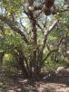 | | 2023 | COLLECTED | 2022 | Private property located 11.0 miles west of Clinton just northeast of intersection of Highway 73 and N2140 Road, T12N R19W NE 1/4 SW 1/4 SW 1/4 Sec. 13 | 35.51213100, -99.16652700 | 518 | Rocky knolls consisting of red Permian sandstone scree and red shale outcroppings with a high pH (estimated 8.0-8.5 pH). | Wild material | Accession represents genetics of a disjunct population that is approximately 150 miles northwest of the nearest population of this taxon. Estimated to reach a mature height at 18-20’ and spread at 12-15’. Leaves are rather persistent (strong marcescence) throughout winter. Specimens are shrubby, multi-stemmed and low-branching. Often referred to as Bigelow oak and typically found throughout most of central Texas and parts of southern Oklahoma. According to Lance (2022), “Bigelow oak is mostly allopatric from typical Durand Oak in its range. East of this range, errors in herbarium annotations of juvenile Durand Oak material, where leaf shapes may mimic Bigelow oak, have caused confusion and inaccurate range extensions.” | 2159016 | Ames 36184 |
| 1 | NA 86648 | SE-2017-001 | Quercus boyntonii Beadle | Alabama, United States | NA | | | 2017 | COLLECTED | 10/12/2017 | Birmingham: Off parking lot of EBSCO Industries, Inc.; along loop trail from back of parking lot. | 33.37797000, -86.67400000 | 352 | Ridge of Appalachian forest. | Wild material | Full name as recorded at U.S. National Arboretum: Quercus boyntonii. | 2154816 | NA 86648 |
| 2 | NA 89013 | TJK2023FL-021 | Smilax pumila Walter | Florida, United States | NA | | | 2023 | COLLECTED | 10/15/2023 | Collected at 1985 Reagan Rd in Navarre, Florida. | 30.40680000, -86.93090000 | 9 | Disturbed native residential woods. Elevation: 32 feet. Slope: 3%. Aspect: Southeast. | Wild material | | 2158906 | NA 89013 |
| 3 | NA 89180 | TJK | Rhododendron minus Michx. var. chapmanii (Alph. Wood) W. H. Duncan & Pullen | Florida, United States | NA | | Contact Site | 2026 | COLLECTED | 04/01/2025 | St. Joseph Bay State Buffer Preserve. Collected from 29.7187833056, -85.2683638611 to 29.7186610833, -85.2689666667 [Note: latitude and longitude of record is selected from the first set of coordinates rather than an average; see the additional field collection note regarding population concentrations.] | 29.71878331, -85.26836386 | 3 | This population is growing in full sun in an area that has been burned in recent years (time frame unknown) and possibly logged. There are scattered large pines, but little shade. This are has been heavily impacted by Category 4/5 hurricanes in recent years and some of the current conditions are undoubtedly a result of this. Soil: The soils of this site are classified as Leon fine sand, 0 to 2 percent slopes (22). The Leon series consists of very deep, very poorly and poorly drained, moderately rapid to moderately slowly permeable soils on upland flats, depressions, stream terraces and tidal areas. They formed in sandy marine sediments of the Eastern Gulf Coast Flatwoods (MLRA 152A), the Atlantic Coast Flatwoods (MLRA 153A) and to a lesser extent in the Southern Coastal Plain (MLRA 133A) and the North-Central Florida Ridge (MLRA 138). Near the type location, the mean annual temperature is about 68 degrees F., and the mean annual precipitation is about 65 inches. Slopes range from 0 to 5 percent. (Source: California Soil Resource Lab/NRCS Official Soil Series Descriptions). Geology: The underlying geology of this area is characterized as Beach Ridge and Dune from the Pleistocene/Holocene which is undifferentiated Quaternary sediments. Much of Florida's surface is covered by a varying thickness of undifferentiated sediments consisting of siliciclastics, organics and freshwater carbonates. Where these sediments exceed 6.1 meters thick, they were mapped as discrete units. In an effort to subdivide the undifferentiated sediments, those sediments occurring in flood plains were mapped as alluvial and flood plain deposits (Qal). Sediments showing surficial expression of beach ridges and dunes were mapped separately (Qbd) as were the sediments composing Trail Ridge (Qtr). Terrace sands were not mapped (refer to Healy [1975] for a discussion of the terraces in Florida). The subdivisions of the Undifferentiated Quaternary Sediments (Qu) are not lithostratigraphic units but are utilized to facilitate a better understanding of the State's geology. The siliciclastics are light gray, tan, brown to black, unconsolidated to poorly consolidated, clean to clayey, silty, unfossiliferous, variably organic-bearing sands to blue green to olive green, poorly to moderately consolidated, sandy, silty clays. Gravel is occasionally present in the panhandle. Organics occur as plant debris, roots, disseminated organic matrix and beds of peat. Freshwater carbonates, often referred to as marls in the literature, are scattered over much of the State. In southern Florida, freshwater carbonates are nearly ubiquitous in the Everglades. These sediments are buff colored to tan, unconsolidated to poorly consolidated, fossiliferous carbonate muds. Sand, silt and clay may be present in limited quantities. These carbonates often contain organics. The dominant fossils in the freshwater carbonates are mollusks. (Source: USGS Florida Geologic Map Data). | Wild material | Received as R. chapmanii | 2193314 | NA 89180 |
| 4 | NA 89173 | 2025RJLSEUS-14 | Chionanthus sp. | Florida, United States | NA | | | 2026 | COLLECTED | 10/03/2025 | Choctawhatchee National Forest: the collection site is reached by foot (~0.5 km) along a loose sand road/firebreak from Martin Luther King, Jr. Boulevard, just east of the boundary for Hurlburt Field in Hurlburt Field/Ft. Walton Beach, FL. Collected from 30 deg. 26.859', -86 deg. 39.577' to 30 deg. 27.137', -86 deg. 39.580'; latitude and longitude of record calculated at the midpoint of these coordinates. | 30.44996000, -86.65965000 | 10 | Dry to xeric conditions of well-drained, deep sandy soils on a relatively level area bordering a powerline in an open mixed mostly mixed evergreen and deciduous, somewhat disturbed habitat in sun to part shade. In areas “broadleaved scrub” vegetation is so dense, that it is almost impenetrable. Elevation: 9 to 11 meters. Slope: 0 to 3 percent. Aspect: Variable. Soil: The soils of this area are characterized as Foxworth Series (95 percent) sand, 0 to 5 percent slopes (8). Other soil series interbedded with the Foxworth Series, vary in percentages from 1-4 percent including Lakeland and Chipley. The Foxworth Series consists of very deep, moderately well to somewhat excessively drained, rapid to very rapid permeable soils on broad uplands and side slopes. They formed in sandy marine or eolian sediments in the Southern Coastal Plain (MLRA 133A), The Eastern Gulf Coast Flatwoods (MLRA 152A), The Atlantic Coast Flatwoods (153A) and the Tidewater Area (153B). Thickness of the grayish brown to light yellowish-brown sand exceeds 2 meters. Reaction ranges from very strongly acid to slightly acid throughout. (Source: California Soil Resource Lab/NRCS Official Soil Series Descriptions). Geology: The underlying geology of this area is characterized as undifferentiated Quaternary Sediments. Much of Florida's surface is covered by a varying thickness of undifferentiated sediments consisting of siliciclastics, organics and freshwater carbonates. Where these sediments exceed 6.1 meters thick, they were mapped as discrete units. To subdivide the undifferentiated sediments, those sediments occurring in flood plains were mapped as alluvial and flood plain deposits (Qal). Sediments showing surficial expression of beach ridges and dunes were mapped separately (Qbd) as were the sediments composing Trail Ridge (Qtr). Terrace sands were not mapped (refer to Healy [1975] for a discussion of the terraces in Florida). The subdivisions of the Undifferentiated Quaternary Sediments (Qu) are not lithostratigraphic units but are utilized to facilitate a better understanding of the State's geology. The siliciclastics are light gray, tan, brown to black, unconsolidated to poorly consolidated, clean to clayey, silty, unfossiliferous, variably organic-bearing sands to blue green to olive green, poorly to moderately consolidated, sandy, silty clays. Gravel is occasionally present in the panhandle. Organics occur as plant debris, roots, disseminated organic matrix and beds of peat. Freshwater carbonates, often referred to as marls in the literature, are scattered over much of the State. In southern Florida, freshwater carbonates are nearly ubiquitous in the Everglades. These sediments are buff colored to tan, unconsolidated to poorly consolidated, fossiliferous carbonate muds. Sand, silt and clay may be present in limited quantities. These carbonates often contain organics. The dominant fossils in the freshwater carbonates are mollusks. (Source: USGS Florida Geologic Map Data). | Wild material | Received as C. cf. henryae | 2193307 | NA 89173 |
| 5 | NA 89160 | 2025RJLSEUS-08 | Ilex hybr. | Florida, United States | NA | | | 2025 | COLLECTED | 10/02/2025 | Eglin Air Force Base: coastal dune ridge on Eglin AFB behind businesses located along Florida State Highway 98. The site is accessed through a now gated and permanently closed Eglin AFB, East River Unit, A-21 Road (now open to pedestrian traffic only with a valid Eglin user permit). After walking through the gated road, the site is to the west along 4-wheeling trails. | 30.41191000, -86.77315800 | 8 | Part shade in a primarily evergreen extremely dry dune community with a mixed understory of deciduous and evergreen plants. Slope: 0 to 2 percent. Soils: The soils of this are characterized as Kureb Series sand, 0 to 8 percent slopes. The Kureb series consists of very deep, excessively drained, gently sloping to moderately steep soils on Coastal Plain uplands and on side slopes along streams and bays. They have formed in marine, aeolian, or fluvial sands. Slopes range from 0 to 20 percent. The thickness of the sandy horizon is more than 2 meters. Soil reaction is neutral to extremely acid throughout. All horizons are fine sand, sand, or coarse sand. Silt plus clay content is less than 5 percent. (Source: California Soil Resource Lab/NRCS Official Soil Series Descriptions). Geology: The underlying geology of this area is characterized as undifferentiated Quaternary Sediments. Much of Florida's surface is covered by a varying thickness of undifferentiated sediments consisting of siliciclastics, organics and freshwater carbonates. Where these sediments exceed 6.1 meters thick, they were mapped as discrete units. To subdivide the undifferentiated sediments, those sediments occurring in flood plains were mapped as alluvial and flood plain deposits (Qal). Sediments showing surficial expression of beach ridges and dunes were mapped separately (Qbd) as were the sediments composing Trail Ridge (Qtr). Terrace sands were not mapped (refer to Healy [1975] for a discussion of the terraces in Florida). The subdivisions of the Undifferentiated Quaternary Sediments (Qu) are not lithostratigraphic units but are utilized to facilitate a better understanding of the State's geology. The siliciclastics are light gray, tan, brown to black, unconsolidated to poorly consolidated, clean to clayey, silty, unfossiliferous, variably organic-bearing sands to blue green to olive green, poorly to moderately consolidated, sandy, silty clays. Gravel is occasionally present in the panhandle. Organics occur as plant debris, roots, disseminated organic matrix and beds of peat. Freshwater carbonates, often referred to as marls in the literature, are scattered over much of the State. In southern Florida, freshwater carbonates are nearly ubiquitous in the Everglades. These sediments are buff colored to tan, unconsolidated to poorly consolidated, fossiliferous carbonate muds. Sand, silt and clay may be present in limited quantities. These carbonates often contain organics. The dominant fossils in the freshwater carbonates are mollusks. (Source: USGS Florida Geologic Map Data). | Wild material | | 2193006 | NA 89160 |
| 6 | W6 62546 | FWS0300-97 | Schizachyrium scoparium (Michx.) Nash | Michigan, United States | W6 |  | | 2025 | | | | | | | Wild material | There is Solidago vossii in the area. | 2192244 | W6 62546 |
| 7 | W6 62547 | FWS0300-98 | Andropogon gerardi Vitman | Michigan, United States | W6 |  | | 2025 | | | | | | | Wild material | There is Solidago vossii in the area. | 2192245 | W6 62547 |
| 8 | NA 89115 | TLM25-04a | Hamamelis ovalis S. W. Leonard | Texas, United States | NA | | | 2025 | COLLECTED | 07/10/2025 | State Highway 87 approximately 3.25 kilometers north of the crossroad junction with Texas Recreational Road 255 (RE 255); plants were growing in the narrow buffer woods along the east side of the highway. | 31.12051300, -93.72628100 | 138 | The habitat is an upland mixed coniferous and deciduous woodlands in part to full shade and dry conditions, often under drought stress. Plants seem to always occur on the top of dry ridges or well-drained slopes. Slope: 0 to 1 percent. Aspect: N/A. Soils: The soils of this collection area are classified as Tehran-Letney Association, hilly (TLE) soils. The Tehran Series (55%) consists of deep, somewhat excessively drained, moderately rapidly permeable soils on uplands. They formed in thick loamy and sandy sediments on the Western Coastal Plain. These soils are on gently sloping to moderately steep uplands with slopes ranging from 1 to 20 percent. The Letney Series (30%) consists of deep, well drained, moderately rapidly permeable, upland soils. They formed in thick sandy and loamy sediments of the coastal plains. These soils are on gently sloping to moderately steep uplands with slopes ranging from 1 to 20 percent. Soil pH ranges from 4.5 to 6.0. The minor soil components include Doucette Series (10%) and Boykin Series (5%) soils. (Source: California Soil Resource Lab/NRCS Official Soil Series Descriptions). Geology: The underlying geology of this area is of Oligocene origin and characterized as Catahoula Formation. This formation is extensive and deep in Texas, up to 185 meters thick. In the area of the collection the Catahoula Formation is primarily mudstone and sand. The upper 90-150 meters is mudstone that is tuffaceous, and sandy; also, occasionally, with some bentonitic clay. (Source: USGS Texas Geologic Map Data). | Wild material | | 2191654 | NA 89115 |
| 9 | NA 88578 | 2024RJLFL-004 | Ilex vomitoria Aiton | Florida, United States | NA | | | 2024 | COLLECTED | 11/12/2024 | Collected along Florida National Scenic Trail/Eglin Air Force Base unnamed road. | 30.44526100, -86.86094700 | 4 | Mixed evergreen and deciduous forests in part shade to full sun. Slope: 5 to 10 percent. Aspect: Various. The underlying geology of this area is characterized as Citronelle Formation of the Pliocene period. The Citronelle Formation is widespread in the Gulf Coastal Plain. The type section for the Citronelle Formation, named by Matson (1916), is near Citronelle, Alabama. The Citronelle Formation grades laterally, through a broad facies transition, into the Miccosukee Formation of the eastern Florida panhandle. Coe (1979) investigated the Citronelle Formation in portions of the western Florida panhandle. The Citronelle Formation is a siliciclastic, deltaic deposit that is lithologically similar to, and time equivalent with, the Cypresshead Formation and, at least in part, the Long Key Formation (Cunningham et al., 1998) of the peninsula. In the western panhandle, some of the sediments mapped as Citronelle Formation may be reworked Citronelle. The lithologies are the same and there are few fossils present to document a possible younger age. The Citronelle Formation consists of gray to orange, often mottled, unconsolidated to poorly consolidated, very fine to very coarse, poorly sorted, clean to clayey sands. It contains significant amounts of clay, silt and gravel which may occur as beds and lenses and may vary considerably over short distances. Limonite nodules and limonite-cemented beds are common. Marine fossils are rare but fossil pollen, plant remains and occasional vertebrates are found. Much of the Citronelle Formation is highly permeable. It forms the Sand and Gravel Aquifer of the surficial aquifer system contain organics. The dominant fossils in the freshwater carbonates are mollusks. (Source: USGS Florida Geologic Map Data). The soils of this are characterized as Lakeland Series Sand, 5 to 12 percent slopes. The Lakeland series consists of very deep, excessively drained, rapid to very rapidly permeable soils on uplands. They formed in thick beds of eolian or marine and/or fluvio-marine sands in the Southern Coastal Plain MLRA (133A), the Carolina and Georgia Sandhills (MLRA 137), the Eastern Gulf Coast Flatwoods (MLRA 152A) and the Atlantic Coast Flatwoods (MLRA 153A). Slopes are dominantly from 0 to 12 percent but can range to 85 percent in dissected areas. Thickness of the sand exceeds 200 cm. Silt plus clay in the 25 to 100 cm control section ranges from 5 to 10 percent. Reaction ranges from very strongly acid to moderately acid throughout. (Source: California Soil Resource Lab/NRCS Official Soil Series Descriptions). | Wild material | | 2169915 | NA 88578 |
| 10 | NA 88584 | 2024RJLFL-016 | Cornus florida L. | Florida, United States | NA | | | 2024 | COLLECTED | 11/14/2024 | Both sides of Kennedy Bridge Road approximately 0.27 kilometers west of the junction with Hurricane Lake South Entrance Road. | 30.93159700, -86.74928000 | 43 | Mesic to mesic-moist conditions in a mixed and deciduous evergreen forest in part shade. Slope: 5 to 10 percent. Aspect: Various. The underlying geology of this area is characterized as Citronelle Formation of the Pliocene period. The Citronelle Formation is widespread in the Gulf Coastal Plain. The type section for the Citronelle Formation, named by Matson (1916), is near Citronelle, Alabama. The Citronelle Formation grades laterally, through a broad facies transition, into the Miccosukee Formation of the eastern Florida panhandle. Coe (1979) investigated the Citronelle Formation in portions of the western Florida panhandle. The Citronelle Formation is a siliciclastic, deltaic deposit that is lithologically similar to, and time equivalent with, the Cypresshead Formation and, at least in part, the Long Key Formation (Cunningham et al., 1998) of the peninsula. In the western panhandle, some of the sediments mapped as Citronelle Formation may be reworked Citronelle. The lithologies are the same and there are few fossils present to document a possible younger age. The Citronelle Formation consists of gray to orange, often mottled, unconsolidated to poorly consolidated, very fine to very coarse, poorly sorted, clean to clayey sands. It contains significant amounts of clay, silt and gravel which may occur as beds and lenses and may vary considerably over short distances. Limonite nodules and limonite-cemented beds are common. Marine fossils are rare but fossil pollen, plant remains and occasional vertebrates are found. Much of the Citronelle Formation is highly permeable. It forms the Sand and Gravel Aquifer of the surficial aquifer system contain organics. The dominant fossils in the freshwater carbonates are mollusks. (Source: USGS Florida Geologic Map Data). The soils of this are characterized as Dothan Series loamy sand, 5 to 8 percent slopes. The Dothan Series consists of very deep, well drained soils that formed in thick beds of unconsolidated, medium to fine-textured marine sediments. Dothan soils are on interfluves. Slopes range from 0 to 15 percent. The surface 0-33 cm is characterized by sandy-loam, well-drained soils that are strongly acid. From 33-200 cm they are characterized by sandy clay loam soils that are more moisture retentive and strongly acid. (Source: California Soil Resource Lab/NRCS Official Soil Series Descriptions). | Wild material | | 2169921 | NA 88584 |
| 11 | NA 88731 | RonMiller2022-Old Land Place | Gordonia lasianthus (L.) J. Ellis | Florida, United States | NA | | | 2024 | COLLECTED | 04/2022 | Yellow River Marsh State Aquatic Preserve, "Old Land Place" along Weaver River, 1.47 miles south of the confluence with the Yellow River. | 30.55318000, -87.93656000 | 3 | Moist to wet areas in wetland adjacent to the river in association with a range of evergreen and deciduous forest elements. | Wild material | From open-pollinated, but presumed isolated, seeds of NA 87342-H, -J, and -L (three young plants flowering in containers in production during 2024). Seed was harvested over a period roughly from October through December 2024 as fruits matured. From the record of the parent accession, NA 87342: Exact date of collection unknown. | 2170992 | NA 88731 |
| 12 | NA 87844 | TRX241118-02GA | Ilex cassine L. | Georgia, United States | NA | | | 2024 | COLLECTED | 11/18/2024 | St. Simons Island: Frederica Park. | 31.23766000, -81.35638000 | 6 | | Wild material | | 2169897 | NA 87844 |
| 13 | NA 89078 | 2024RJLPA-004 | Staphylea trifolia L. | Pennsylvania, United States | NA | | | 2024 | COLLECTED | 09/20/2024 | Along gated road about 0.33 kilometers southwest of the Lake Ontelaunee Trail parking lot. | 40.49850800, -75.89121300 | 94 | Plants are growing on well-drained steep slopes in shade to part shade of a deciduous forest. Slope: 35 to 50 percent. Aspect: East-southeast. Geology: The underlying geology of this area is of Ordovician origin and characterized as Shale and graywacke of Hamburg sequence. It is characterized by shale containing zones of conspicuous graywacke. (Source: USGS Pennsylvania Geologic Map Data). Soils: The primary soil type in the area of this collection is classified as Berks-Weikert Complex, 25 to 60% slopes (BkF). Dominantly sloping to very steep, moderately deep and shallow, well drained soils underlain by acid shale bedrock. (Source: UPenn State University Soil Info Website). EPA Ecoregion (Level III): Ridge and Valley (67). EPA Ecoregion (Level IV): Northern Shale Valleys (67b). | Wild material | | 2169042 | NA 89078 |
| 14 | NA 88834 | RJL-RM2023FLAL-008 | Rhododendron canescens (Michx.) Sweet | Florida, United States | NA | | | 2023 | COLLECTED | 12/06/2023 | Blackwater State Forest: plants are growing in wetlands accessed by foot from Buddy Hardy Road. The collection site is approximately 0.14 kilometers west and downhill from the road. | 30.80736700, -86.95784700 | 53 | Growing in shade to part-shade of the well-drained moist mesic habitat about 1 m above the wetland which appears to be formed by a nearby hillside seepage area. In this zone there are numerous facultative wetland species as well as high competition from facultative upland plants. Slope: 5 to 10 percent. Aspect: Variable. The underlying geology of this area is the Citronelle Formation of Pliocene origin and consists of gray to orange, often mottled, unconsolidated to poorly consolidated, very fine to very coarse, poorly sorted, clean to clayey sands. It contains significant amounts of clay, silt and gravel which may occur as beds and lenses and may vary considerably over short distances. Limonite nodules and limonite-cemented beds are common. (Source: USGS Florida Geologic Map Data.) The Troup Series (5 to 8% slopes) consists of very deep, somewhat excessively drained soil formed in unconsolidated sandy and loamy marine sediments. Troup soils are on ridges and hillslopes. The upper 0-13 cm is comprised primarily of decomposing sphagnum peat with a significant amount of fibrous root content. From 15-112 cm the soil is comprised primarily of fine-grained yellowish-brown sand with varying amounts of root content; this zone is strongly acid. From 112-203 cm the soil is comprised of light-red to red sandy clay loam that is discontinuous, generally friable, and strongly acid. (Source: NRCS Web Soil Survey.) | Wild material | | 2165664 | NA 88834 |
| 15 | NA 88835 | RJL-RM2023FLAL-009 | Rhododendron viscosum (L.) Torr. | Florida, United States | NA | | | 2023 | COLLECTED | 12/06/2023 | Blackwater State Forest: plants are growing in wetlands accessed by foot from Buddy Hardy Road. The collection site is approximately 0.14 kilometers west and downhill from the road. | 30.80841000, -86.96283300 | 43 | Growing in part-shade of the well-drained moist-dry mesic habitat about 2-3 m above the wetland. In this zone there are numerous facultative wetland species as well as high competition from facultative upland plants. Slope: 5 to 10 percent. Aspect: Variable. The underlying geology of this area is the Citronelle Formation of Pliocene origin and consists of gray to orange, often mottled, unconsolidated to poorly consolidated, very fine to very coarse, poorly sorted, clean to clayey sands. It contains significant amounts of clay, silt and gravel which may occur as beds and lenses and may vary considerably over short distances. Limonite nodules and limonite-cemented beds are common. (Source: USGS Florida Geologic Map Data.) The Troup Series (5 to 8% slopes) consists of very deep, somewhat excessively drained soil formed in unconsolidated sandy and loamy marine sediments. Troup soils are on ridges and hillslopes. The upper 0-13 cm is comprised primarily of decomposing sphagnum peat with a significant amount of fibrous root content. From 15-112 cm the soil is comprised primarily of fine-grained yellowish-brown sand with varying amounts of root content; this zone is strongly acid. From 112-203 cm the soil is comprised of light-red to red sandy clay loam that is discontinuous, generally friable, and strongly acid. (Source: NRCS Web Soil Survey.) | Wild material | | 2165665 | NA 88835 |
| 16 | NA 88839 | RJL-RM2023FLAL-013 | Rhododendron austrinum (Small) Rehder | Florida, United States | NA | | | 2023 | COLLECTED | 12/10/2023 | Along the Florida Trail, accessed from Miller Bluff Road. Plants were found infrequently but regularly along the trail over 1 kilometer or more. | 30.61991500, -86.86521000 | 4 | Plants are growing primarily in shade to dappled shade, above a small stream in moist mesic conditions along and below the Florida Trail. The mixed evergreen and deciduous forest is quite diverse with an excellent litter layer. Slope: 2 to 8 percent. Aspect: South. The underlying geology of this area is classified as Alluvium, of Pleistocene/Holocene origin and consists of undifferentiated Quaternary sediments of varying thickness including siliciclastics, organics and freshwater carbonates. The siliciclastics are light gray, tan, brown to black, unconsolidated to poorly consolidated, clean to clayey, silty, unfossiliferous, variably organic-bearing sands to blue green to olive green, poorly to moderately consolidated, sandy, silty clays. Organics occur as plant debris, roots, disseminated organic matrix and beds of peat. Freshwater carbonates, often referred to as marls in the literature, are scattered. (Source: USGS Florida Geologic Map Data.) The surface soil profile of this area is primarily Bibb-Kinston Series Association. Bibb Series soils are coarse-loamy, sandy, acid soils that are poorly drained. They are soils of flood plains and streams subject to frequent flooding. These are found in association with Kinston Series soils that are fine-loamy, sandy, acid soils of flood plains and stream subject to frequent flooding. The Bibb-Kinston association ranges from 1-1.5 meters thick and is strongly acid. (Source: NRCS Web Soil Survey.) | Wild material | | 2165669 | NA 88839 |
| 17 | NA 88840 | RJL-RM2023FLAL-014 | Rhododendron viscosum (L.) Torr. | Florida, United States | NA | | | 2023 | COLLECTED | 12/11/2023 | Property of Floyd Griffith off View Drive on the southwest side of McCormick Lake. | 30.63247000, -85.33718200 | 56 | Plants are growing primarily in part shade a few meters above the lake, generally in areas that appear dry, but clearly are associated with hillside seeps. While much of the area has been cultivated, the remnant native flora are largely broadleaved evergreen shrub and deciduous shrub and tree species. Slope: 10 to 15 percent. Aspect: Northeast. The underlying geology of this area is the Citronelle Formation of Pliocene origin and consists of gray to orange, often mottled, unconsolidated to poorly consolidated, very fine to very coarse, poorly sorted, clean to clayey sands. It contains significant amounts of clay, silt and gravel which may occur as beds and lenses and may vary considerably over short distances. Limonite nodules and limonite-cemented beds are common. (Source: USGS Florida Geologic Map Data.) The surface soil profile of this area is primarily Pamlico-Pantego-Rutlege Association. The Pamlico series consists of very poorly drained soils that formed in decomposed organic material underlain by dominantly sandy sediment. The soils are on nearly level flood plains, bays, and depressions of the Coastal Plain. Slopes are less than 1 percent. Pamlico soils have 0.4-1.3 meters of organic material over dominantly sandy sediments. Reaction is extremely in the organic layers and ranges from extremely acid to strongly acid in the underlying mineral layers. The Pantego series consists of very deep, very poorly drained, moderately permeable soils that formed in thick loamy sediments on the Southern Coastal Plain and Atlantic Coast Flatwoods. Slopes are less than 2 percent. This soil is strongly acid. The Rutlege series comprises very deep, very poorly drained persistently wet soils on flats, depressions and floodplains where shallow ponding is common. They are of marine or fluvial sediment origin. Thickness of these loamy sandy soils is greater than 1.5 meters and a reaction from extremely acid to strongly acid. (Source: NRCS Web Soil Survey.) | Wild material | | 2165670 | NA 88840 |
| 18 | NA 88843 | RJL-RM2023FLAL-017 | Rhododendron austrinum (Small) Rehder | Florida, United States | NA | | | 2023 | COLLECTED | 12/11/2023 | Holmes Creek at Live Oak Landing: plants found on the low bluff along the south side of Holmes Creek accessed by foot from a parking lot on Live Oak Landing Road that dead ends into the creek. | 30.59043500, -85.83899800 | 7 | Plants are growing in part shade to shade on the top and slope of the low bluff overlooking Holmes Creek in a mixed deciduous and evergreen forest. The dry mesic habitat has relatively low competition and is quite acidic. Slope: 0 to 45 percent. Aspect: Northwest. The underlying geology of this area is classified as Alluvium, of Pleistocene/Holocene origin and consists of undifferentiated Quaternary sediments of varying thickness including siliciclastics, organics and freshwater carbonates. The siliciclastics are light gray, tan, brown to black, unconsolidated to poorly consolidated, clean to clayey, silty, unfossiliferous, variably organic-bearing sands to blue green to olive green, poorly to moderately consolidated, sandy, silty clays. Organics occur as plant debris, roots, disseminated organic matrix and beds of peat. Freshwater carbonates, often referred to as marls in the literature, are scattered. (Source: USGS Florida Geologic Map Data.) The surface soil profile of this area is primarily Nankin-Cowarts-Lakeland Complex. The Nankin Series consists of very deep, well drained, moderately slowly permeable soils on uplands of the Coastal Plain. They formed in stratified loamy and clayey marine sediments. Slopes range from 0 to 60 percent. Soils are comprised of sandy loam in the upper 25 cm to sandy clay loam and sandy clay in lower strata to about 1.7 meters deep; these soils are strongly acid. The Cowarts Series consists of very deep, moderately well and well drained soils on ridge tops and side slopes on uplands of the Coastal Plain Major Land Resource Area. They formed in loamy marine sediments. Slopes range from 1 to 60 percent. The Lakeland series consists of very deep, excessively drained, rapid to very rapidly permeable soils on uplands. They formed in thick beds of eolian or marine and/or fluvio-marine sands. Thickness of the sand exceeds 2 meters. Silt plus clay in the upper meter ranges from 5-10 percent. Reaction ranges from very strongly acid to moderately acid throughout. (Source: NRCS Web Soil Survey.) | Wild material | | 2165673 | NA 88843 |
| 19 | NA 88845 | RJL-RM2023FLAL-019 | Ilex opaca Aiton | Florida, United States | NA | | | 2023 | COLLECTED | 12/13/2023 | Yellow River Water Management Area, found along an unnamed unpaved road leading down to the Yellow River. This unpaved road is accessed from Old River Road to the east near the junction with Shockley Springs Road. | 30.87382600, -86.60221300 | 35 | Plants are growing along the road on the woodland edge on a small bluff above a creek in well-drained to dry habitat in part shade. They are also found sporadically in areas along the Yellow River where occasional inundation occurs. Slope: N/A. Aspect: N/A. The underlying geology of this area is the Alum Bluff Group of Miocene origin. It includes the Chipola Formation, Oak Grove Sand, Shoal River Formation, Choctawhatchee Formation and the Jackson Bluff Formation. The formations included in this group are generally defined on the basis of their molluscan faunas and stratigraphic position. Puri (1953) described sediment facies as they relate to the formations of the Alum Bluff Group. These sediments are lithologically distinct as a group, not as individual units. The Alum Bluff Group crops out or is beneath a thin overburden in the western panhandle from river valleys in Okaloosa County eastward to western Jackson County. The Alum Bluff Group consists of clays, sands and shell beds which may vary from fossiliferous, sandy clays to unfossiliferous sands and clays and occasional carbonate beds. Mica is a common constituent and glauconite and phosphate occur sporadically. Induration varies from essentially nonindurated in sands to well indurated in carbonate lenses. Colors range from cream to olive gray with mottled reddish brown in weathered sections. Sand grain size varies from very fine to very coarse with sporadic occurrences of gravel. These sediments generally have low permeabilities and are part of the intermediate confining unit/aquifer system. (Source: USGS Florida Geologic Map Data.) The surface soil profile of this area is primarily Bonifay-Dothan-Angie complex (5 to 12 percent slopes). Bonifay soil consists of very deep, well drained, moderately slowly permeable soils on ridges and side slopes in the Southern Coastal Plain. They formed in thick beds of sandy and loamy marine sediments. Solum thickness ranges from 1.5-2.0 m. Soil reaction ranges from very strongly acid to moderately acid throughout, except where the surface has been limed. Ironstone pebbles, 2 to 15 mm in size, range from 0 to 5 percent, by volume. Depth to the plinthic horizon ranges from 1.1-1.7 m. Some horizons contain up to 25 percent plinthite by volume. The Dothan Series consists of very deep, well drained soils that formed in thick beds of unconsolidated, medium to fine-textured marine sediments. Dothan soils are on interfluves. The surface 0-33 cm is characterized by sandy-loam, well-drained soils that are strongly acid. From 33-200 cm they are characterized by sandy clay loam soils that are more moisture retentive and strongly acid. The Angie series consists of very deep, moderately well drained, slowly permeable soils that formed in loamy and clayey sediment on Tertiary-aged uplands. These soils are on broad, level to strongly sloping coastal plains. Slope is dominantly 1 to 5 percent, but the range is 0 to 12 percent. (Source: NRCS Web Soil Survey.) | Wild material | | 2165675 | NA 88845 |
| 20 | WLP 3377 | TXWL2023-024 | Viburnum dentatum L. | Texas, United States | NA | | | 2023 | COLLECTED | 12/13/2023 | Roadside between Big Cow Creek and Hardy Cemetery. | 31.03548900, -93.85086800 | | Roadside; mesic, mixed hardwood/pine forest. | Wild material | | 2165656 | WLP 3377 |
| 21 | NA 88820 | TJK2023AL-005 | Hydrangea arborescens L. | Alabama, United States | NA | | | 2023 | COLLECTED | 12/07/2023 | Between Monroe County Route 1 and Tom Hayles Road. | 31.40575900, -87.54924000 | 22 | In woodlands on limestone outcrop. While the upper area of slopes is covered by a thin soil layer, the exposed limestone rock outcrop on the northwestern edge of this area is a low competition niche for plants like the Hydrangea to gain a foothold. Slope: 60% (plus). Aspect: Northwest. Elevation: 72 feet. | Wild material | | 2165649 | NA 88820 |
| 22 | NA 88821 | TJK2023AL-006 | Hydrangea quercifolia W. Bartram | Alabama, United States | NA | | | 2023 | COLLECTED | 12/07/2023 | Between Monroe County Route 1 and Tom Hayles Road. | 31.40580000, -87.54890000 | 22 | In woodlands on limestone outcrop. While the upper area of slopes is covered by a thin soil layer, the exposed limestone rock outcrop on the northwestern edge of this area is a low competition niche for plants like the Hydrangea to gain a foothold. Slope: 60% (plus). Aspect: Northwest. Elevation: 72 feet. | Wild material | | 2165650 | NA 88821 |
| 23 | NA 88683 | TJK2023FL-030 | Vaccinium arboreum Marshall | Florida, United States | NA | | | 2023 | COLLECTED | 11/16/2023 | Pensacola State College, Midway Campus, 1/8 mile south of Highway 98. | 30.39710000, -87.01040000 | 10 | Sand Pine Scrub, old remnant sand dune. Slope: flat. Aspect: West. Elevation: 32 feet. | Wild material | | 2159095 | NA 88683 |
| 24 | NA 88684 | TJK2023FL-031 | Smilax smallii Morong | Florida, United States | NA | | | 2023 | COLLECTED | 11/18/2023 | T. Kiphart residence, Navarre, Florida. | 30.40680000, -86.93090000 | 12 | Moist, urban woods. Slope: 3%. Aspect: South. Elevation: 39 feet. | Wild material | | 2159096 | NA 88684 |
| 25 | NA 88685 | TJK2023FL-032 | Lyonia ligustrina (L.) DC. | Florida, United States | NA | | | 2023 | COLLECTED | 11/18/2023 | Blackwater State Forest: Wolfe Creek. | 30.80844000, -86.96243000 | 55 | Drier ridge above seepage slope. Slope: less than 2%. Aspect: South. Elevation: 180 feet. | Wild material | | 2159097 | NA 88685 |
| 26 | NA 88667 | RJL2023PA-004 | Viburnum acerifolium L. | Pennsylvania, United States | NA | | | 2023 | | | | | | | Wild material | | 2158816 | NA 88667 |
| 27 | NA 88662 | TJK2023FL-016 | Sideroxylon sp. | Florida, United States | NA | | | 2023 | COLLECTED | 09/16/2023 | East River Unit, Eglin Air Force Base. Near A-21 Rd. | 30.41250000, -86.77110000 | 7 | Xeric shrub, xeric sandhills community. Elevation: 26 feet. Slope: 2%. Aspect: South. | Wild material | | 2158796 | NA 88662 |
| 28 | WLP 3136 | TJK2023FL-010 | Morella cerifera (L.) Small | Florida, United States | NA | | | 2023 | COLLECTED | 08/18/2023 | Blackwater State Forest: Wolfe Creek. | 30.80751000, -86.95774000 | 52 | Beautiful xeric pine-oak upland community. Transitions to mesic slopes and then to seepage bottom, stringer wetland community adjacent to the Wolfe Creek. Area is on a regular 2-4[-year] burn cycle. Slope: 10%. Aspect: South. Elevation recorded as 172 feet. | Wild material | Received as Morella pumila (Morella cerifera var. pumila). Treated tentatively as Morella cerifera Pumila Group. WLPGR contract collection. | 2158468 | WLP 3136 |
| 29 | NA 89264 | TJK2023FL-002 | Gaylussacia frondosa (L.) Torr. & A. Gray var. nana A. Gray | Florida, United States | NA | | | 2023 | COLLECTED | 05/19/2023 | Blackwater State Forest: Wolfe Creek. | 30.80760000, -86.96250000 | 49 | Beautiful xeric pine-oak upland community. Transitions to mesic slopes and then to seepage bottom, stringer wetland community adjacent to the Wolfe Creek. Area is on a regular 2-4[-year] burn cycle. Slope: 5%. Aspect: Northwest. Elevation recorded as 161 feet. | Wild material | WLPGR contract collection. Received as Gaylussacia tomentosa (nana). | 2158247 | NA 89264 |
| 30 | NA 89266 | TJK2023FL-004 | Gaylussacia dumosa (Andrews) Torr. & A. Gray | Florida, United States | NA | | | 2023 | COLLECTED | 05/31/2023 | Blackwater State Forest: Wolfe Creek. | 30.80560000, -86.95890000 | 49 | Beautiful xeric pine-oak upland community. Transitions to mesic slopes and then to seepage bottom, stringer wetland community adjacent to the Wolfe Creek. Slope: 15%. Aspect: Northwest. Elevation recorded as 160 feet. | Wild material | WLPGR contract collection. | 2158249 | NA 89266 |
| 31 | NA 89267 | TJK2023FL-005 | Ceanothus americanus L. | Florida, United States | NA | | | 2023 | COLLECTED | 06/10/2023 | Blackwater State Forest: Wolfe Creek. | 30.80760000, -86.96250000 | 49 | Beautiful xeric pine-oak upland community. Transitions to mesic slopes and then to seepage bottom, stringer wetland community adjacent to the Wolfe Creek. Area is on a regular 2-4[-year] burn cycle. Slope: 5%. Aspect: Northwest. Elevation recorded as 161 feet. | Wild material | WLPGR contract collection. | 2158250 | NA 89267 |
| 32 | NA 89269 | TJK2023FL-007 | Vaccinium darrowii Camp | Florida, United States | NA | | | 2023 | COLLECTED | 06/10/2023 | Blackwater State Forest: Wolfe Creek. | 30.80560000, -86.95770000 | 60 | Beautiful xeric pine-oak upland community. Transitions to mesic slopes and then to seepage bottom, stringer wetland community adjacent to the Wolfe Creek. Area is on a regular 2-4[-year] burn cycle. Slope: 2%. Aspect: West-northwest. Elevation recorded as 197 feet. | Wild material | WLPGR contract collection. | 2158252 | NA 89269 |
| 33 | NA 89271 | TJK2023FL-009 | Vaccinium stamineum L. | Florida, United States | NA | | | 2023 | COLLECTED | 07/16/2023 | Eglin Air Force Base: Weaver Creek area west of Highway 87, north of Choctaw Nolf Airfield Road (Escrobano Point). | 30.50710000, -86.91220000 | 33 | Xeric oak-pine uplands above Weaver Creek Bayhead. Slope: 5%. Aspect: Northwest. Elevation recorded as 107 feet. | Wild material | WLPGR contract collection. | 2158254 | NA 89271 |
| 34 | NA 88598 | RJL2023FL-002a | Agarista populifolia (Lam.) Judd | Florida, United States | NA | | | 2023 | COLLECTED | 02/14/2023 | Plants growing in woodlands of Wekiwa Springs State Park along trails accessed from the Sand Lake parking lot at the end of Palmetto Avenue. From the parking lot, take the main trail south for about 18 meters and immediately take a cut-through trail on the left to the location of this population. | 28.72398600, -81.47205400 | 10 | Plants were growing in shade to part-shade of moist mesic hammocks of lowland transitional woodlands eventually becoming wetland habitats that are comprised primarily of evergreen plants with fewer deciduous plants. The underlying geology of this area is of Pliocene origin and characterized as the Cypresshead Formation. The Cypresshead Formation named by Huddlestun (1988), is composed of siliciclastics and occurs only in the peninsula and eastern Georgia. It is at or near the surface from northern Nassau County southward to Highlands County forming the peninsular highlands. It appears that the Cypresshead Formation occurs in the subsurface southward from the outcrop region and similar sediments, the Long Key Formation, underlie the Florida Keys. The Cypresshead Formation is a shallow marine, near shore deposit equivalent to the Citronelle Formation deltaic sediments and the Miccosukee Formation prodeltaic sediments. The Cypresshead Formation consists of reddish brown to reddish orange, unconsolidated to poorly consolidated, fine to very coarse grained, clean to clayey sands. Cross bedded sands are common within the formation. Discoid quartzite pebbles and mica are often present. Clay beds are scattered and not areally extensive. In general, the Cypresshead Formation in exposure occurs above 100 feet (30 meters) above mean sea level (msl). Original fossil material is not present in the sediments although poorly preserved molds and casts of mollusks and burrow structures are occasionally present. The presence of these fossil "ghosts" and trace fossils documents marine influence on deposition of the Cypresshead sediments. The permeable sands of the Cypresshead Formation form part of the surficial aquifer system. | Wild material | | 2141479 | NA 88598 |
| 35 | WLP 3084 | RM2023-002 | Rhododendron viscosum (L.) Torr. | Florida, United States | NA | | | 2023 | COLLECTED | 09/15/2022 | This species is growing in the Blackwater River State Forest approximately 0.24 kilometers north of Wof W20 and approximately 0.93 kilometers west of the junction of 3 Notch Trail/Road. | 30.84510000, -86.94940000 | 38 | The plants were growing in part shade of a moist mesic transition slope between a dry upland habitat and a bog.
Soils: The underlying geology of this area is the Citronelle Formation, of Pliocene origin, and consists of gray to orange, often mottled, unconsolidated to poorly consolidated, very fine to very coarse, poorly sorted, clean to clayey sands. It contains significant amounts of clay, silt and gravel which may occur as beds and lenses and may vary considerably over short distances. Limonite nodules and limonite-cemented beds are common. Source: USGS Florida Geologic Map Data (https://mrdata.usgs.gov/geology/state/state.php?state=fl)
The surface soil profile found in this area is primarily Troup Series. These soils are sandy and loamy marine deposits. They are well drained and typically on the tops and sides of broad and narrow ridges on uplands typically with 0-12% slopes. These soils are very strongly acid with a depth of 2-3 meters. Pactolus Series soils comprise a minor, but important percentage of the lower slopes that are nearly level to gently sloping and account for the somewhat poorly drained, yet, sandy conditions. These soils are also strongly acid with very dark gray loamy sands.
Source: Soil Survey of Santa Rosa County and NRCS Web Soil Survey (https://www.nrcs.usda.gov/Internet/FSE_MANUSCRIPTS/florida/FL113/0/SantaRosa.pdf and https://websoilsurvey.sc.egov.usda.gov/App/WebSoilSurvey.aspx) | Wild material | | 2141438 | WLP 3084 |
| 36 | WLP 3092 | RJLSEUS2022-021 | Rhododendron prunifolium (Small) Millais | Alabama, United States | NA | | | 2023 | COLLECTED | 12/10/2023 | Slopes along Poke Springs Branch inlet accessed by boat from Walter F. George Reservoir. Generally uncommon, but frequent at this site. | 31.72318400, -85.12907800 | 69 | Plants are growing in part-shade to shade on the well-drained mostly deciduous woodland slopes approximately 3-6 meters above the inlet.
Soils: The underlying geology of this area is of Cretaceous origin and characterized as Selma Group; Providence Sand. The upper part of the profile consists of cross-bedded fine to coarse sand and white, dark-gray and pale-red-purple mottled clay containing lignite, sand, and kaolin. The lower part consists of dark-gray laminated to thin-bedded silty clay and abundantly micaceous, carbonaceous, fossiliferous very fine to fine sand.
Source: USGS Alabama Geologic Map Data (https://mrdata.usgs.gov/geology/state/sgmc-unit.php?unit=ALKp%3B1)
The primary soil types in the collection area are classified as Nankin-Lucy Complex soil (20 to 60 percent slopes). The Nankin Series consists of very deep, well drained, moderately slowly permeable soils on uplands of the Coastal Plain. They formed in stratified loamy and clayey marine sediments. Slopes range from 0 to 60 percent. Soils are comprised of sandy loam in the upper 25 cm to sandy clay loam and sandy clay in lower strata to about 1.7 meters deep; these soils are strongly acid. The Lucy Series consists of very deep, well drained, moderately permeable soils on uplands. They formed in sandy and loamy marine and fluvial sediments of the Southern Coastal Plain. Slopes vary from 0 to 45 percent. These soils are generally loamy to sandy loam in the upper 25 cm and sandy clay loam in the lower strata to 2 meters; these are strongly acid soils.
Source: NRCS Web Soil Survey (https://websoilsurvey.sc.egov.usda.gov/App/WebSoilSurvey.aspx) | Wild material | | 2141446 | WLP 3092 |
| 37 | NA 87350 | TJK2022FL-005 | Ilex ambigua Torr. | Florida, United States | NA | | | 2023 | COLLECTED | 11/02/2022 | Okaloosa County: Eglin Air Force Base: East River Unit H-3, Range Road 259, north of Highway 98. | 30.41190000, -86.77320000 | 0 | Xeric Scrub/Upland Sandhill community. | Wild material | | 2141641 | NA 87350 |
| 38 | NA 87814 | RM-TK2022-003 | Nyssa ogeche W. Bartram ex Marshall | Florida, United States | NA | | | 2023 | COLLECTED | 09/06/2022 | Hightower Landing on Holmes Creek, off of Hightower Road. This location is off of Florida State Hwy. 79. | 30.60539000, -85.76513400 | 5 | Trees growing on the edge of the water along Holmes Creek.
Soils: The underlying geology of this area is classified as Alluvium of Pleistocene/Holocene origin and consists of undifferentiated Quaternary sediments of varying thickness including siliciclastics, organics and freshwater carbonates. The siliciclastics are light gray, tan, brown to black, unconsolidated to poorly consolidated, clean to clayey, silty, unfossiliferous, variably organic-bearing sands to blue green to olive green, poorly to moderately consolidated, sandy, silty clays. Organics occur as plant debris, roots, disseminated organic matrix and beds of peat. Freshwater carbonates, often referred to as marls in the literature, are scattered.
Source: USGS Florida Geologic Map Data (https://mrdata.usgs.gov/geology/state/state.php?state=fl)
The primary soil types in the collection area are classified as Rutlege, Pickney and Pamlico soils, frequently flooded. The Rutlege series comprises very deep, very poorly drained persistently wet soils on flats, depressions and floodplains where shallow ponding is common. They are of marine or fluvial sediment origin. Thickness of these loamy sandy soils is greater than 1.5 meters and a reaction from extremely acid to strongly acid. The Pickney Series consists of very deep, very poorly drained soils. Permeability is rapid. These nearly level soils have negligible runoff and were formed by marine or fluvial sediments in the lower coastal plain on flats, depressions, stream terraces, and flood plains. Slopes range from 0 to 2 percent. The soils of this series are loamy fine sand that is very friable and extremely acid in the upper 0-25 cm. The lower strata are similar, while the lower strata from 0.8-2 meters are comprised of fine sand. The Pamlico series consists of very poorly drained soils that formed in decomposed organic material underlain by dominantly sandy sediment. The soils are on nearly level flood plains, bays, and depressions of the Coastal Plain. Slopes are less than 1 percent. Pamlico soils have 0.4-1.3 meters of organic material over dominantly sandy sediments. Reaction is extremely in the organic layers and ranges from extremely acid to strongly acid in the underlying mineral layers.
Source: NRCS Web Soil Survey (https://websoilsurvey.sc.egov.usda.gov/App/WebSoilSurvey.aspx) | Wild material | | 2140796 | NA 87814 |
| 39 | NA 88526 | RM-TK2022-014 | Oxydendrum arboreum (L.) DC. | Florida, United States | NA | | | 2023 | COLLECTED | 11/06/2022 | Growing along an unnamed dirt road leading to “Old Land Place” on the edge of Eglin AFB accessed from the Yellow River. | 30.55320000, -86.93730000 | 2 | The underlying geology of this area is classified as Alluvium of Pleistocene/Holocene origin and consists of undifferentiated Quaternary sediments of varying thickness including siliciclastics, organics and freshwater carbonates. The siliciclastics are light gray, tan, brown to black, unconsolidated to poorly consolidated, clean to clayey, silty, unfossiliferous, variably organic-bearing sands to blue green to olive green, poorly to moderately consolidated, sandy, silty clays. Organics occur as plant debris, roots, disseminated organic matrix and beds of peat. Freshwater carbonates, often referred to as marls in the literature, are scattered.
Source: USGS Florida Geologic Map Data (https://mrdata.usgs.gov/geology/state/state.php?state=fl)
The surface soil profile of this area is primarily Bibb-Kinston Series Association. Bibb Series soils are coarse-loamy, sandy, acid soils that are poorly drained. They are soils of flood plains and streams subject to frequent flooding. These are found in association with Kinston Series soils that are fine-loamy, sandy, acid soils of flood plains and stream subject to frequent flooding. The Bibb-Kinston association ranges from 1-1.5 meters thick and is strongly acid.
Source: Soil Survey of Santa Rosa County and NRCS Web Soil Survey (https://www.nrcs.usda.gov/Internet/FSE_MANUSCRIPTS/florida/FL113/0/SantaRosa.pdf and https://websoilsurvey.sc.egov.usda.gov/App/WebSoilSurvey.aspx) | Wild material | | 2140807 | NA 88526 |
| 40 | NA 88549 | RJLSEUS2022-022 | Rhododendron minus Michx. var. minus | Georgia, United States | NA | | | 2023 | COLLECTED | 12/10/2022 | East side of Georgia State Hwy. 39, on the south side of Kolomoki Creek approximately 11 kilometers south of Fort Gaines, Georgia. Common on this site, but otherwise infrequent. This species is near the southernmost end of its natural range. | 31.52053400, -85.02351600 | 53 | Plants are growing in part-shade to shade of deciduous upland, dry, deciduous woodlands on steep slopes 10-15 meters above Kolomoki Creek.
Soils: The underlying geology of this area is of Paleocene origin and characterized as Tuscahoma Sand. As mapped this formation includes lower Eocene Bashi Marl Member of the Hatchetigbee Formation. This formation consists of light-gray to light-olive-gray laminated and thin-bedded carbonaceous silt and clay interbedded with fine sand; thin lignite beds occur locally. Lower part of the formation includes beds of fossiliferous, glauconitic fine quartz sand containing spheroidal sandstone concretions, gravel and clay pebbles.
Source: USGS Georgia Geologic Map Data (https://mrdata.usgs.gov/geology/state/sgmc-unit.php?unit=GANu%3B1)
The primary soil types in the collection area are classified as Ailey-Cowarts Complex Series soils (8 to 25 percent slopes). The Ailey Series consists of well drained or somewhat excessively drained soils formed by fluviomarine and marine deposits. These soils are found marine terraces and low hills of the upper coastal plain and sandhills; they are strongly acidic. The Cowarts Series consists of very deep, moderately well and well drained soils on ridge tops and side slopes on uplands of the Coastal Plain Major Land Resource Area. They formed in loamy marine sediments. Slopes range from 1 to 60 percent.
Source: NRCS Web Soil Survey (https://websoilsurvey.sc.egov.usda.gov/App/WebSoilSurvey.aspx) | Wild material | | 2140776 | NA 88549 |
| 41 | NA 88550 | RJLSEUS2022-023 | Kalmia latifolia L. | Georgia, United States | NA | | | 2023 | COLLECTED | 12/10/2022 | East side of Georgia State Hwy. 39, on the south side of Kolomoki Creek approximately 11 kilometers south of Fort Gaines, Georgia. Common on this site, but otherwise infrequent. This species is near the southernmost end of its natural range. | 31.52053400, -85.02351600 | 53 | Plants are growing in part-shade to shade of deciduous upland, dry, deciduous woodlands on steep slopes 10-15 meters above Kolomoki Creek.
Soils: The underlying geology of this area is of Paleocene origin and characterized as Tuscahoma Sand. As mapped this formation includes lower Eocene Bashi Marl Member of the Hatchetigbee Formation. This formation consists of light-gray to light-olive-gray laminated and thin-bedded carbonaceous silt and clay interbedded with fine sand; thin lignite beds occur locally. Lower part of the formation includes beds of fossiliferous, glauconitic fine quartz sand containing spheroidal sandstone concretions, gravel and clay pebbles.
Source: USGS Georgia Geologic Map Data (https://mrdata.usgs.gov/geology/state/sgmc-unit.php?unit=GANu%3B1)
The primary soil types in the collection area are classified as Ailey-Cowarts Complex Series soils (8 to 25 percent slopes). The Ailey Series consists of well drained or somewhat excessively drained soils formed by fluviomarine and marine deposits. These soils are found marine terraces and low hills of the upper coastal plain and sandhills; they are strongly acidic. The Cowarts Series consists of very deep, moderately well and well drained soils on ridge tops and side slopes on uplands of the Coastal Plain Major Land Resource Area. They formed in loamy marine sediments. Slopes range from 1 to 60 percent.
Source: NRCS Web Soil Survey (https://websoilsurvey.sc.egov.usda.gov/App/WebSoilSurvey.aspx) | Wild material | | 2140777 | NA 88550 |
| 42 | NA 88559 | RJLSEUS2022-032 | Rhododendron colemanii R. F. Mill. | Alabama, United States | NA | | | 2023 | COLLECTED | 12/12/2022 | Plants growing in bottomland mostly deciduous woodlands on the south side of Lena Landegger Hwy (Monroe County Road 39) about 0.5 kilometers south of the entrance to the Alabama River Cellulose plant. Common at this site. | 31.56879700, -87.49589500 | 10 | Plants are growing in shade of a moist mesic (occasionally temporarily wet) deciduous woodland less than 1 meter above wetland habitats associated with the nearby Alabama River.
Soils: The underlying geology of this area is of Holocene origin and characterized as Alluvial, coastal and low terrace deposits. Varicolored fine to coarse quartz sand containing clay lenses and gravel in places.
Source: USGS Alabama Geologic Map Data (https://mrdata.usgs.gov/geology/state/sgmc-unit.php?unit=ALHalt%3B0)
The primary soil types in the collection area are classified as Chrysler Silt Loam soils (0 to 5 percent slopes, occasionally flooded). The Chrysler Series consists of deep, moderately well drained, slowly permeable soils that formed in clayey fluvial or alluvial sediments. These soils are on stream terraces of the Coastal Plain. They are strongly acid. The rate at which water runs off the surface is medium to rapid. Slopes range from 0 to 5 percent.
Source: NRCS Web Soil Survey (https://websoilsurvey.sc.egov.usda.gov/App/WebSoilSurvey.aspx) | Wild material | | 2140784 | NA 88559 |
| 43 | NA 88562 | RJLSEUS2022-035 | Kalmia latifolia L. | Alabama, United States | NA | | | 2023 | COLLECTED | 12/12/2022 | Plants growing on both sides of River Ridge Road accessed from Alabama State Hwy 41 via Tin Cup Alley Road. Common at this site | 31.73823700, -87.35821100 | 132 | Plants are growing in part-shade to full sun on top of a very exposed ridge top under dry conditions.
Soils: The underlying geology of this area is of Eocene origin and characterized as Claiborne Group; Gosport Sand and Lisbon Formation Undifferentiated in part. Greenish-gray calcareous, glauconitic, fossiliferous clayey sand; marl; carbonaceous sand; carbonaceous silty clay; and coarse glauconitic, fossiliferous, quartz sand.
Source: USGS Alabama Geological Map Data (https://mrdata.usgs.gov/geology/state/state.php?state=AL)
The primary soil types in the collection area are classified as Saffell Very Gravelly Sandy Loam soil (5 to 8 percent slopes). The Saffell Series consists of very deep, well drained, moderately permeable soils that formed in loamy and gravelly marine sediments of the Tertiary Age and have acid reaction. These soils are found on the upper portion of the bluffs along the Alabama River.
Source: NRCS Web Soil Survey (https://websoilsurvey.sc.egov.usda.gov/App/WebSoilSurvey.aspx) | Wild material | | 2140787 | NA 88562 |
| 44 | NA 88566 | RJLSEUS2022-039 | Rhododendron viscosum (L.) Torr. | Florida, United States | NA | | | 2023 | COLLECTED | 12/14/2022 | Plants growing in woodlands at Escribano Point Bayou Campground not far from the parking lot. Occasional. | 30.50990400, -87.00414900 | 1 | Plants are growing in shade to part-shade of dense mesic vegetation only a few meters from the edge of mixed evergreen and deciduous woodland associated with the Yellow River Marsh Aquatic Preserve. While this habitat is typical mesic and well-drained, it is clearly subject to periods of inundation from high tides or storms as it is a meter or less above the marsh habitat. Additionally, it seems likely that there is plentiful moisture further down in the soil profile based on some of the plant associates.
Soils: The underlying geology of this area is classified as Alluvium, of Pleistocene/Holocene origin and consists of undifferentiated Quaternary sediments of varying thickness including siliciclastics, organics and freshwater carbonates. The siliciclastics are light gray, tan, brown to black, unconsolidated to poorly consolidated, clean to clayey, silty, unfossiliferous, variably organic-bearing sands to blue green to olive green, poorly to moderately consolidated, sandy, silty clays. Organics occur as plant debris, roots, disseminated organic matrix and beds of peat. Freshwater carbonates, often referred to as marls in the literature, are scattered.
Source: USGS FL Map Data (https://mrdata.usgs.gov/geology/state/state.php?state=fl)
The primary soil types in the collection area are classified as Ortega Sand soils (0 to 5 percent slopes). The Ortega Series consists of very deep, moderately well drained soils that formed in a sandy deposit on marine terraces. These soils are on nearly level to strongly sloping upland landscapes. Slopes range from 0 to 12 percent. They are extremely acid to slightly acid throughout. They are fine sand or sand to depths of more than 2 meters. Silt plus clay totals less than 5 percent between 25 cm and 1 meter depth.
Source: NRCS Web Soil Survey (https://websoilsurvey.sc.egov.usda.gov/App/WebSoilSurvey.aspx) | Wild material | | 2140788 | NA 88566 |
| 45 | NA 88567 | RJLSEUS2022-040 | Chamaecyparis thyoides (L.) Britton et al. | Florida, United States | NA | | | 2023 | COLLECTED | 12/14/2022 | Plants growing in woodlands at Escribano Point Bayou Campground not far from the parking lot. Occasional. | 30.51018200, -87.00448800 | 1 | Plants are growing in part-shade of dense mesic vegetation only a few meters from the edge of mixed evergreen and deciduous woodland associated with the Yellow River Marsh Aquatic Preserve. While this habitat surface is typical mesic and well-drained, it is clearly subject to periods of inundation from high tides or storms as it is a meter or less above the marsh habitat. Additionally, it seems likely that there is plentiful moisture further down in the soil profile based on some of the plant associates.
Soils: The underlying geology of this area is classified as Alluvium, of Pleistocene/Holocene origin and consists of undifferentiated Quaternary sediments of varying thickness including siliciclastics, organics and freshwater carbonates. The siliciclastics are light gray, tan, brown to black, unconsolidated to poorly consolidated, clean to clayey, silty, unfossiliferous, variably organic-bearing sands to blue green to olive green, poorly to moderately consolidated, sandy, silty clays. Organics occur as plant debris, roots, disseminated organic matrix and beds of peat. Freshwater carbonates, often referred to as marls in the literature, are scattered.
Source: USGS FL Map Data (https://mrdata.usgs.gov/geology/state/state.php?state=fl)
The primary soil types in the collection area are classified as Ortega Sand soils (0 to 5 percent slopes). The Ortega Series consists of very deep, moderately well drained soils that formed in a sandy deposit on marine terraces. These soils are on nearly level to strongly sloping upland landscapes. Slopes range from 0 to 12 percent. They are extremely acid to slightly acid throughout. They are fine sand or sand to depths of more than 2 meters. Silt plus clay totals less than 5 percent between 25 cm and 1 meter depth.
Source: NRCS Web Soil Survey (https://websoilsurvey.sc.egov.usda.gov/App/WebSoilSurvey.aspx) | Wild material | | 2140789 | NA 88567 |
| 46 | NA 88568 | RJLSEUS2022-041 | Oxydendrum arboreum (L.) DC. | Florida, United States | NA | | | 2023 | COLLECTED | 12/14/2022 | Plants growing along the south side of Eglin AFB Choctaw Nolf Road northwest of Choctaw Navy Outlying Field. This road goes west and takes circuitous route to the north around the Field enroute to Escribano Point Wildlife Management Area. Common at the location; infrequent, otherwise. | 30.51525300, -87.00563800 | 2 | Trees are growing in full sun to part-shade in mesic habitat associate with a nearby wet depression, less than 0.2 meters above the high moisture zone. The trees also extend into slightly drier mesic to the marginally xeric zone.
Soils: The underlying geology of this area is classified as Alluvium, of Pleistocene/Holocene origin and consists of undifferentiated Quaternary sediments of varying thickness including siliciclastics, organics and freshwater carbonates. The siliciclastics are light gray, tan, brown to black, unconsolidated to poorly consolidated, clean to clayey, silty, unfossiliferous, variably organic-bearing sands to blue green to olive green, poorly to moderately consolidated, sandy, silty clays. Organics occur as plant debris, roots, disseminated organic matrix and beds of peat. Freshwater carbonates, often referred to as marls in the literature, are scattered.
The primary soil types in the collection area are classified as Leon Sand soils (0 to 2 percent slopes). The Leon Series consists of very deep, very poorly and poorly drained, moderately rapid to moderately slowly permeable soils on upland flats, depressions, stream terraces and tidal areas. They formed in sandy marine sediments of the Eastern Gulf Coast Flatwoods, the Atlantic Coast Flatwoods, and to a lesser extent in the Southern Coastal Plain, and the North-Central Florida Ridge. Slopes range from 0 to 5 percent. Leon series is comprised of 95%+ sand in the strata to 3+ meters deep.
Source: NRCS Web Soil Survey (https://websoilsurvey.sc.egov.usda.gov/App/WebSoilSurvey.aspx) | Wild material | | 2140790 | NA 88568 |
| 47 | NA 88509 | RJL2022TX-004 | Ilex decidua Walter | Texas, United States | NA | | | 2022 | COLLECTED | 11/01/2022 | Low woodlands along the north side of Texas State Hwy 190 between the highway and an unnamed paved service road that leads down to the Sabine River; the turn for the service road is approximately 0.62 kilometers west of the Sabine River. Near the bridge over the Sabine River. | 30.74730000, -93.61568900 | 20 | Plants are growing in part-shade to shade of a moist mesic (occasionally temporarily wet) woodland. Ilex decidua can be in the low woods most of the way down to the river. Plant is a common understory shrub in the moist woodland habitat not far from the Sabine River. Soils: The underlying geology of this area is of Holocene origin and characterized as Alluvium. The alluvium and low terrace deposits along streams include sand, silt, clay, and gravel. Thickness is variable. In this case alluvium is from the Sabine River. (Source: USGS Texas Geologic Map Data). The primary soil types in the collection area are classified as Urbo and Mantachie soils. The Urbo series consists of deep, somewhat poorly drained soils. Permeability is very slow. These nearly level to gently sloping soils formed in clayey alluvium on flood plains of streams that drain uplands of the Southern Coastal Plain. Slopes range from 0 to 3 percent. In wet seasons late in winter and early in spring, the water table is at a depth of 1 to 2 feet and most areas of Urbo soils are subject to either occasional or frequent flooding of brief to long duration. The Mantachie series consists of very deep, somewhat poorly drained, moderately permeable soils on flood plains of the Southern Coastal Plain. They formed in loamy alluvium and considered acidic. Mantachie soils are subject to rare to frequent flooding in the winter and early spring for brief to long duration, unless protected. The seasonal high water table ranges from 1.0 to 1.5 feet of the surface during periods of high rainfall. (Source: NRCS Web Soil Survey). | Wild material | | 2139816 | NA 88509 |
| 48 | WLP 2670 | RJL2022PA-016 | Acer negundo L. | Pennsylvania, United States | NA | | | 2022 | COLLECTED | 10/21/2022 | Plants growing in woodlands above a small unnamed creek that dumps into the Middle Branch White Clay Creek in Goddard Park, West Grove Pennsylvania, off of Wickerton Road, Chester County. Plants are found regularly but scattered in the understory of the woodlands. | 39.80426000, -75.82609300 | 105 | Plants growing in a mesic, well-drained habitat of deciduous woodlands along streams and above the riparian zone that drains toward a small unnamed creek that feeds into the Middle Branch White Clay Creek. Plants generally grow in part shade to full sun, but perform best and fruit more heavily in full sun where there is abundant access to moisture. The remnant woodlands exist mostly along the steep slopes, wetlands and seeps of seasonal and year-round creeks flowing into the Middle Branch White Clay Creek. The woodlands are bordered by numerous housing developments and land converted to meadows; hence there is significant first order edge that is heavily impacted by invasive plant intrusion. Despite this fact, Acer negundo is highly competitive and competes well.
Soils: The underlying geology of this area is the Glenarm Wissahickon Formation of lower Paleozoic origin and lithologically similar to oligoclase-mica schist of the Wissahickon Formation (PZw), but also includes lenticular amphibolite bodies having ocean-floor basalt chemistry.
Source: USGS Pennsylvania Geologic Map Data (https://mrdata.usgs.gov/geology/state/sgmc-unit.php?unit=PAPZgw%3B0)
The primary soil type in the area of this collection is classified as Glenelg silt loam, 3 to 8 percent slopes. This series consists of very deep, well drained soils formed in residuum weathered from micaceous schist on uplands of the Blue Ridge and the Northern Piedmont. Saturated hydraulic conductivity is moderately high in the subsoil and moderately high to high in the substratum. This upper horizon of this soil is undifferentiated, mostly poorly drained sandy bottomland soils intermingled with decomposing organic litter and eroded silts and clays due to erosion.
Source: NRCS Web Soil Survey (https://websoilsurvey.sc.egov.usda.gov/App/WebSoilSurvey.aspx) | Wild material | | 2139661 | WLP 2670 |
| 49 | NA 88481 | RJL2022MD-002 | Kalmia latifolia L. | Maryland, United States | NA | | | 2022 | COLLECTED | 09/04/2022 | Plants growing at Elkton State Forest along roads and woodlands over a distance of approximately 5 kilometers labelled as the address of 717 Irishtown Rd, North East, MD 21901. Kalmia is very common along the unnamed gravel road as well as the understory of the upland woodlands. | 39.58852900, -75.90452900 | 60 | Plants are growing in a mesic to dry, well-drained habitat of mixed deciduous and evergreen woodlands comprised primarily of acid-loving plants. Plants are growing in shade to part shade along the unnamed road as well as the woodlands. The soils in the collection area are generally described as a complex series of fluviomarine deposits. The soils range from a thin loam layer at the surface to varying levels of loam to sandy loam and/or extremely gravelly sandy clay loam strata, depending upon geographical location (ie. Hillslope summits, slopes, footslopes, swales, etc.). The primary soil types in the collection area are classified as Russett-Christiana-Hambrook Complex and/or Sassafras and Croom Soils; though, others may intersect and overlay in specific areas. | Wild material | | 2139360 | NA 88481 |
| 50 | Ames 35915 | White Mountains | Fraxinus velutina Torr. | New Mexico, United States | NC7 |  | | 2022 | COLLECTED | 09/08/2022 | White Mountains northwest of Alto. Rare along Eagle Creek and increasing in abundance heading upslope on Ski Run Road. Saplings fairly common in Nogal Canyon and mature specimens frequent on slopes below Nogal Peak in the White Mountain Wilderness of the Lincoln National Forest. T10S R12E S 1/4 Sec. 35. Coordinates listed refer to the last plant sampled (191-5); coordinates for each sample may be provided upon request. | 33.49551600, -105.79515500 | 2743 | Mountainsides and rarely creeks at canyon bottoms. | Wild material | This accession represents a high elevation population of velvet ash which occurs primarily on mountainsides rather than riparian habitats as is typical for the species. Although the velvet ash do occur in the canyon bottoms along creeks in this area, they are quite rare compared to their fairly common distribution on the slopes at higher elevations. Specimens at higher elevations were more shrub-like (multi-trunked and maximum of 20 feet in height) than tree-like while specimens in the canyon bottoms were always trees. All specimens noted at the time of seed collection had glabrous leaves. | 2139677 | Ames 35915 |
| 51 | WLP 2703 | White Mountains | Acer negundo L. | New Mexico, United States | NA |  | | 2022 | COLLECTED | 09/08/2022 | Common along Eagle Creek and Rio Bonito in the Lincoln National Forest, two to five miles west of Alto. Infrequent at the head of Carlton Canyon along Ski Run Road. T10S R11E SE 1/4 Sec. 3. Coordinates listed refer to the first plant sampled; coordinates for each sample may be provided upon request. | 33.46682200, -105.78389500 | 2333 | Riverbanks in canyon bottoms and head of canyon. | Wild material | | 2139679 | WLP 2703 |
| 52 | WLP 2600 | RJL2022FLAL-029 | Stewartia malacodendron L. | Florida, United States | NA | | | 2022 | COLLECTED | 08/07/2022 | Eglin AFB, in woodlands along Weaver Creek accessed from unnamed dirt road, 0.82 kilometers west of junction with Eglin AFB 720; approximately 0.73 kilometers north of junction with Choctaw Nolf Airfield Road and Eglin AFB 720. | 30.51680000, -86.91469400 | 15 | Growing in moist, well-drained sandy soils above Weaver Creek in mixed broadleaved evergreen and deciduous woodland habitat in part shade to shade of west facing slopes several meters above the wetland zone. The Stewartia is growing in a high competition habitat. The underlying geology of this area is the Citronelle Formation, of Pliocene origin, and consists of gray to orange, often mottled, unconsolidated to poorly consolidated, very fine to very coarse, poorly sorted, clean to clayey sands. It contains significant amounts of clay, silt and gravel which may occur as beds and lenses and may vary considerably over short distances. Limonite nodules and limonite-cemented beds are common. | Wild material | | 2138710 | WLP 2600 |
| 53 | NA 87204 | RJL2022FLAL-019 | Ilex coriacea (Pursh) Chapm. | Florida, United States | NA | | | 2022 | COLLECTED | 08/02/2022 | Corner of San Jose Street and South 28th Avenue just east of Avalon Beach, FL. | 30.53172700, -87.09058900 | 3 | Growing in full sun to part shade in moist to wet areas, often with sphagnum moss along the edges, just above the water in ditches and waterways. Population is so dense that plants are crowding out other species. The underlying geology of this area is classified as Alluvium, of Pleistocene/Holocene origin and consists of undifferentiated Quaternary sediments of varying thickness including siliciclastics, organics and freshwater carbonates. The siliciclastics are light gray, tan, brown to black, unconsolidated to poorly consolidated, clean to clayey, silty, unfossiliferous, variably organic-bearing sands to blue green to olive green, poorly to moderately consolidated, sandy, silty clays. Organics occur as plant debris, roots, disseminated organic matrix and beds of peat. Freshwater carbonates, often referred to as marls in the literature, are scattered. | Wild material | | 2138707 | NA 87204 |
| 54 | WLP 2576 | RJL2022-001 | Amelanchier arborea (F. Michx.) Fernald | Maryland, United States | NA | | | 2022 | COLLECTED | 05/25/2022 | Plants growing in open woodlands and part shade along unnamed Elkton State Forest gravel road over a distance of approximately 5 kilometers labelled as the address of 717 Irishtown Rd, North East, MD 21901. | 39.58089500, -75.91505900 | 73 | Plants are found regularly but scattered along the unnamed gravel road as well as in open understory of the upland woodlands. Plants growing in a mesic to dry, well-drained habitat of mixed deciduous and evergreen woodlands comprised primarily of acid-loving plants. Plants are growing in part shade and open understory shade. The soils in the collection area are generally described as a complex series of fluviomarine deposits. The soils range from a thin loam layer at the surface to varying levels of loam to sandy loam and/or extremely gravelly sandy clay loam strata, depending upon geographical location (ie. Hillslope summits, slopes, footslopes, swales, etc.). The primary soil types in the collection area are classified as Russett-Christiana-Hambrook Complex and/or Sassafras and Croom Soils; though, others may intersect and overlay in specific areas. | Wild material | | 2138095 | WLP 2576 |
| 55 | W6 59961 | CBG-10690 | Dasiphora fruticosa (L.) Rydb. | Illinois, United States | W6 | | | 2021 | | | | | | | Wild material | | 2132539 | W6 59961 |
| 56 | NA 88223 | CA190B-151 | Ceanothus cuneatus (Hook.) Nutt. var. rigidus (Nutt.) Hoover | California, United States | NA | | | 2020 | | | | | | | Wild material | Ceanothus rigidus is now recognized as species in new CA Jepson manual is simply Ceanothus rigidus. ûLeaves and branches are opposite; growing in the same vicinity as Ceanothus dentatus. | 2110333 | NA 88223 |
| 57 | Ames 35550 | Scuppernong Prairie | Salix myricoides Muhl. | Wisconsin, United States | NC7 |  | | 2020 | COLLECTED | 09/04/2020 | Two areas of Salix myricoides were identified approximately 2.5 miles apart. The northern area is located along the Scuppernong Springs Nature Trail (intersection of State Highway 67 and County Highway ZZ) and the adjacent marsh prairie to the south. The southern area is located in the Scuppernong Prairie State Natural Area, at the intersection of Wilton Road and County Highway N. Kettle Moraine State Forest - Southern Unit, Waukesha County | 42.93363600, -88.47242400 | 260 | Marsh, riverbank, prairie and woodland. | Wild material | Bayberry willow is native to areas of the northeastern U.S. and north into Canada, localized around the Great Lakes region. Known to occur on shorelines/dunes but also in swamps, fens, and on talus (Haines 2004) with the potential to reach six meters in height (Dorn 1995). Ornamental characteristics include glaucous lower leaf blades that appear chalky white. Staminate flowering occurs before or during leaf expansion with purple-turning-yellow anthers (Haines 2004). This accession was sampled on wet, slightly above neutral pH soils (6.0-7.3) which may result in superior performance in the urban landscape. Under cultivation, the plants grow in a widely spreading growth habit (some are nearly prostrate); however, this trait was not noticed at the time of collection from nature. Shrubs noted in nature measuring 0.5 to 2 m tall. The two areas sampled contained both Salix myricoides and Salix discolor, and likely hybrids between the two species. Attempts were made to collect only Salix myricoides based on the following characteristics: white undersides of the leaves, large stipules and finely serrated leaf margins. During collection on 6 April 2021, S. discolor was in flower while S. myricoides was not yet flowering. | 2107011 | Ames 35550 |
| 58 | NA 87036 | Site 3A/Live Oak Landing/Holmes Creek Site | Magnolia ashei Weath. | Florida, United States | NA | | | 2020 | COLLECTED | 07/15/2020 | Along Holmes Creek at Live Oak Landing. | 30.59208000, -85.83750000 | 11 | Shade to partial shade of bluffs above the creek in well-drained mesic to dry deciduous woodlands with a few broadleaved and coniferous evergreens. | Wild material | Although these were collected without any field collection number, seeds from individual trees were separated with letter identifiers that will be maintained with the qualifier (seedling) records. The relationships are as follows: 1. Maternal letter G, NA 87036-J, L, P, and T; maternal letter H, NA 87036-V; maternal letter K, NA 87036-X, Z, and H1; maternal letter N, NA 87036-H2. In addition, three seedlings' maternal letters were lost, and these will be NA 87036-H3, H4, and H5. See the following accessions for earlier collections from this same site/population, listed in our records as "Site 3A/Live Oak Landing/Holmes Creek Site": NA 81555 (2013), NA 82745 (2015), and NA 82745.01 (2019). | 2109403 | NA 87036 |
| 59 | NA 84578 | RJL-RM002 | Magnolia pyramidata W. Bartram | Texas, United States | NA | | | 2017 | COLLECTED | 07/22/2017 | Newton County Road 425, about 2.8 miles south of Texas Recreational Road 255. | 30.85996000, -93.89596000 | 105 | Along roadsides and among young loblolly pines in forestry plantation. Plants growing in part shade to full sun in heavily regenerating roadside woodlands associated with loblolly pine plantations. Plants are growing in well drained, highly sandy soils. | Wild material | | 1953814 | NA 84578 |
| 60 | WLP 1437 | NA 84027 | Oxydendrum arboreum (L.) DC. | Florida, United States | NA | | | 2016 | COLLECTED | 11/11/2016 | Woodlands associated with Miller Bayou, south of housing subdivision off of Pearl Court. | 30.46413000, -86.92804000 | 2 | Full sun to partial shade in mixed coniferous/broadleaved evergreen woodlands, with a mixture of deciduous plants in highly acidic sandy soils approximately 100-300 ft. from the salt marsh edge associated with Miller Bayou. | | | 1950372 | WLP 1437 |
| 61 | NA 82746 | Site 3B/Hightower Road at Holmes Creek | Magnolia ashei Weath. | Florida, United States | NA | | | 2015 | COLLECTED | 07/31/2015 | Along Holmes Creek 0.2 miles west-southwest of Hard Castle Landing boat ramp at hte end of Hightower Road. | 30.60401000, -85.76883000 | 11 | Shade to partial shade of deciduous woodlands 10 to 15 feet above the creek, surrounded by low lying swampy area. | Wild material | Originally just called Site 3, but the "A/B" has been added to distinguish the Live Oak Landing (3A) and Hightower Road (3B) material. For previous collections of this population, see NA 81556 (2013); for later collection, see NA 82746.01 (2019). | 1950860 | NA 82746 |
| 62 | WLP 699 | NA 82755 | Amelanchier spicata (Lam.) K. Koch | Maine, United States | NA | | | 2015 | COLLECTED | 07/07/2015 | Roadside near the parking area for Bluberry Barrens (also known as Kennebunk Plains), ca. 4.5 miles west of Kennebunk. | 43.40231000, -70.62462000 | | Roadside, along shoulder of road. | | | 1952492 | WLP 699 |
| 63 | NA 82643 | NA 82643 | Lonicera sempervirens L. | Texas, United States | NA | | | 2015 | COLLECTED | 07/20/2014 | East side of Texas Route 87 approximately 0.52 miles south of Trout Creek, Texas. | 30.61156000, -93.80506000 | 21 | Southwest-facing edge of mature woodland in part to full sun; well-drained, seasonally moist soils that are sandy loam; surface has an excellent organic litter layer. | | | 1952603 | NA 82643 |
| 64 | Ames 32894 | APS/GD/2015/017/199 | Gymnocladus dioicus (L.) K. Koch | Oklahoma, United States | NC7 |  | | 2015 | COLLECTED | 03/14/2015 | Cleveland County: T10N R5W SW 1/4 SW 1/4 Sec. 7. John Nichols Camp located on north side of Canadian River approxiamtely 4.25 miles south and southeast of Mustang. | 35.35029600, -97.66952200 | 395 | Higher elevations. Dry, relatively thin soils. | Wild material | | 1925360 | Ames 32894 |
| 65 | Ames 32899 | APS/GD/2015/026/208 | Gymnocladus dioicus (L.) K. Koch | Oklahoma, United States | NC7 |  | | 2015 | COLLECTED | 03/17/2015 | Roger Mills County: Cottonwood Creek and Dugout Creek watersheds, T17N R25W NE 1/4 SE 1/4 Sec. 34. Antelope Hills area approximately 7 miles northeast of Durham. | 35.90486100, -99.84879100 | 664 | Lower elevations. | Wild material | | 1925365 | Ames 32899 |
| 66 | Ames 32902 | APS/GD/2015/030/212 | Gymnocladus dioicus (L.) K. Koch | Oklahoma, United States | NC7 |  | | 2015 | COLLECTED | 03/18/2015 | Logan County: T18N R2W N 1/2 Sec. 36. Private property approximately 1.5 miles east of the confluence of Skeleton Creek and Cimarron River approximately 5.25 miles south southeast of Mulhall. | 35.99593500, -97.36486800 | 288 | Transition zone between higher elevations and bottomlands. | Wild material | | 1925368 | Ames 32902 |
| 67 | WLP 700 | BJP/AS/2014/002 | Amelanchier spicata (Lam.) K. Koch | New Hampshire, United States | NA | | | 2014 | COLLECTED | 07/03/2014 | Rye: West side of Ocean Boulevard in Rye, on shoulder of road. | 43.01886000, -70.73382000 | | Plants on shoulder of road adjacent to marshy field. | Wild material | Full name as recorded at the U.S. National Arboretum: Amelanchier spicata (''maritima''). Received as Amelanchier spicata ''maritima.'' | 1922824 | WLP 700 |
| 68 | NA 81984 | Lactea Group | Callicarpa americana L. | Texas, United States | NA | | | 2014 | COLLECTED | 08/30/2013 | Woodlands above Boykin Spring Lake. | 31.06266000, -94.27565000 | 56 | Growing in partial shade of mixed deciduous and evergreen woodlands in well-drained to dry conditions. | | | 1951711 | NA 81984 |
| 69 | Ames 29975 | JDC/GD/2009/004/154 | Gymnocladus dioicus (L.) K. Koch | Nebraska, United States | NC7 |  | | 2009 | COLLECTED | 03/20/2009 | Ponca State Park, approximately 2 miles north of Ponca, T30N R6E Sec. 3 Ponca Quad., Dixon County. | 42.60166667, -96.71444444 | 365 | Variable from mid-level elevation sloped area to bottomland type. Variable exposure. 0-60 degrees of slope with variable aspects. | Wild material | Plants between 40 and 75 feet in height and 8 to 26 inches DBH. | 1798767 | Ames 29975 |
| 70 | NA 88224 | CA330-12 | Ceanothus dentatus Torr. & A. Gray | California, United States | NA |  | | 2005 | | | | | | | Wild material | Shrub 0.45-1.2 meters tall. | 1674133 | NA 88224 |