| 0 | DVIT 3151 | RJL VA2003-005 | Vitis rotundifolia Michx. | Virginia, United States | DAV | | | 2003 | COLLECTED | 09/05/2003 | Collected from Chesapeake, VA at the interchange of Business Route 168 (Battlefield Ave) and Route 168, next to a detention basin and shopping plaza on the west side of Battlefield Ave. | 36.73861111, -76.24250000 | 5 | Mixed deciduous and evergreen woodland, primarily comprised of deciduous trees in the over-story and a mixture of deciduous and evergreen species in the sub-canopy. Plants growing in part-shade to full sun where they produce abundant fruit. | Breeding material | Seed collected from many individuals and massed. Associated plants: Acer rubrum, Carpinus caroliniana, Clethra alnifolia, fagus grandifolia, gelsemium nudiflorum, Hamamelis virginiana, Ilex opaca, Leucothoe racemosa, liquidambar styraciflua, Liriodendron tulipfera, Nyssa sylvatica, Oxydendrum arboreum, Persea borbonia, Quercus falcata, Quercus michauxii, Smilax sp., Stewartia malacodendron, Symplocos tinctoria and Vaccinium sp. | 1651338 | DVIT 3151 |
| 1 | PI 704859 sos | V. fuscatum NCBG-440 | Vaccinium fuscatum Aiton | North Carolina, United States | COR | | | 2021 | | | | | | | Wild material | PI assigned before phyical inventory of W6 shipment and is missing. Maintain COR as site in case seeds are recovered. Berries glaucous, calyx not oppressed | 2116310 | PI 704859 sos |
| 2 | PI 704860 sos | V. fuscatum NCBG-441 | Vaccinium fuscatum Aiton | North Carolina, United States | COR | | | 2021 | | | | | | | Wild material | PI assigned before phyical inventory of W6 shipment and is missing. Maintain COR as site in case seeds are recovered. Berries black, glabrous | 2116311 | PI 704860 sos |
| 3 | PI 702718 | MARSB-326 | Schizachyrium scoparium (Michx.) Nash | New Jersey, United States | S9 |  | | 2019 | | | | | | | Wild material | | 2097576 | PI 702718 |
| 4 | PI 702722 | MARSB-400 | Schizachyrium scoparium (Michx.) Nash | New York, United States | S9 |  | | 2019 | | | | | | | Wild material | | 2097613 | PI 702722 |
| 5 | PI 710489 | MARSB-254 | Lespedeza capitata Michx. | New York, United States | S9 |  | | 2018 | | | | | | | Wild material | | 1964746 | PI 710489 |
| 6 | PI 653291 | R. argutus Lumberton | Rubus argutus Link | North Carolina, United States | COR |  | | 2007 | COLLECTED | 06/03/2007 | Robeson County, Lumberton, west of I-95 on SR 1536 (Carthage Road), east bank at crossing over Saddletree Swamp (Five Mile Branch of Lumber River). | 34.63527000, -79.02874000 | 18 | Dark organic sandy muck soil. Associated Plants: Quercus velutina, Campsus radicans, Pinus echinata, Acer rubrum, Vitis rotundifolia, Juglans nigra, Liquidamber and Juncus. | Wild material | Kim Hummer, Michael Dossett collection from North Carolina.
| 1730084 | PI 653291 |
| 7 | PI 664623 | Index Seminum 19 | Helianthus giganteus L. | Pennsylvania, United States | NC7 | | | 1993 | COLLECTED | | Serpentine Barrens, Piedmont Province, Chester County. | 39.73333333, -76.03333333 | 130 | Along trails with full to part sun.Growing with Quercus sp., Sassafras albidum, Acer rubrum, Smilas rotundifolia, and many herbaceous plants. | Wild material | | 1086003 | PI 664623 |
| 8 | NA 89173 | 2025RJLSEUS-14 | Chionanthus sp. | Florida, United States | NA | | | 2026 | COLLECTED | 10/03/2025 | Choctawhatchee National Forest: the collection site is reached by foot (~0.5 km) along a loose sand road/firebreak from Martin Luther King, Jr. Boulevard, just east of the boundary for Hurlburt Field in Hurlburt Field/Ft. Walton Beach, FL. Collected from 30 deg. 26.859', -86 deg. 39.577' to 30 deg. 27.137', -86 deg. 39.580'; latitude and longitude of record calculated at the midpoint of these coordinates. | 30.44996000, -86.65965000 | 10 | Dry to xeric conditions of well-drained, deep sandy soils on a relatively level area bordering a powerline in an open mixed mostly mixed evergreen and deciduous, somewhat disturbed habitat in sun to part shade. In areas “broadleaved scrub” vegetation is so dense, that it is almost impenetrable. Elevation: 9 to 11 meters. Slope: 0 to 3 percent. Aspect: Variable. Soil: The soils of this area are characterized as Foxworth Series (95 percent) sand, 0 to 5 percent slopes (8). Other soil series interbedded with the Foxworth Series, vary in percentages from 1-4 percent including Lakeland and Chipley. The Foxworth Series consists of very deep, moderately well to somewhat excessively drained, rapid to very rapid permeable soils on broad uplands and side slopes. They formed in sandy marine or eolian sediments in the Southern Coastal Plain (MLRA 133A), The Eastern Gulf Coast Flatwoods (MLRA 152A), The Atlantic Coast Flatwoods (153A) and the Tidewater Area (153B). Thickness of the grayish brown to light yellowish-brown sand exceeds 2 meters. Reaction ranges from very strongly acid to slightly acid throughout. (Source: California Soil Resource Lab/NRCS Official Soil Series Descriptions). Geology: The underlying geology of this area is characterized as undifferentiated Quaternary Sediments. Much of Florida's surface is covered by a varying thickness of undifferentiated sediments consisting of siliciclastics, organics and freshwater carbonates. Where these sediments exceed 6.1 meters thick, they were mapped as discrete units. To subdivide the undifferentiated sediments, those sediments occurring in flood plains were mapped as alluvial and flood plain deposits (Qal). Sediments showing surficial expression of beach ridges and dunes were mapped separately (Qbd) as were the sediments composing Trail Ridge (Qtr). Terrace sands were not mapped (refer to Healy [1975] for a discussion of the terraces in Florida). The subdivisions of the Undifferentiated Quaternary Sediments (Qu) are not lithostratigraphic units but are utilized to facilitate a better understanding of the State's geology. The siliciclastics are light gray, tan, brown to black, unconsolidated to poorly consolidated, clean to clayey, silty, unfossiliferous, variably organic-bearing sands to blue green to olive green, poorly to moderately consolidated, sandy, silty clays. Gravel is occasionally present in the panhandle. Organics occur as plant debris, roots, disseminated organic matrix and beds of peat. Freshwater carbonates, often referred to as marls in the literature, are scattered over much of the State. In southern Florida, freshwater carbonates are nearly ubiquitous in the Everglades. These sediments are buff colored to tan, unconsolidated to poorly consolidated, fossiliferous carbonate muds. Sand, silt and clay may be present in limited quantities. These carbonates often contain organics. The dominant fossils in the freshwater carbonates are mollusks. (Source: USGS Florida Geologic Map Data). | Wild material | Received as C. cf. henryae | 2193307 | NA 89173 |
| 9 | NA 89171 | 2025RJLSEUS-04 | Rhododendron catawbiense Michx. | Alabama, United States | NA | | | 2026 | COLLECTED | 09/30/2025 | Scarham Creek: southeast of the Pea Ridge Road bridge, approximately 50-80 meters on the south side of the creek. | 34.32559600, -86.16054600 | 266 | Growing near the base of the slopes above the riparian zone, generally on the exposed geology under very well-drained conditions. The woodlands are primarily deciduous with a few evergreens infrequently mixed. Slope: 15 to 30 percent. Aspect: Northeast. Soil: The primary soil type in the area of this collection is classified as Rockland Series sandstone (Rc). The Rockland series consists of well drained soils formed in loamy colluvium from rotational landslides on slopes of stream valleys and dissections of ground moraines. Saturated hydraulic conductivity is moderate in the upper part of the profile and moderately slow in the lower part. Slopes range from 18 to 70 percent. Some pedons have buried leaves, twigs, and moss. Mass soil movement has left random remnants of soil structure from prior upslope soil development and has buried tree branches, leaves and moss. The upper 0-2 cm of soil contains slightly decomposed organic matter while lower soils layers to a depth of 58 cm are comprised of dark reddish-brown to brown silt loam and are moderately acidic. Below 58 cm the soils are generally dark reddish-brown silt loam and strongly to moderately alkaline. (Source:California Soil Resource Lab/NRCS Official Soil Series Descriptions). Geology: The underlying geology of this area is of Pennsylvanian origin and characterized as Pottsville Formation. It is characterized by light-gray thin to thick-bedded quartzose sandstone and conglomerate containing interbedded dark-gray shale, siltstone, and coal. Mapped on Lookout Mountain, Blount and Chandler Mountains, and Sand Mountain northeast of Blount County, and on the mountains of Jackson, Marshall, and Madison Counties north and west of the TN river. (Source: USGS Alabama Geologic Map Data). | Wild material | Received as R. catawbiense vsr. insularis | 2193305 | NA 89171 |
| 10 | NA 89155 | 2025RJLSEUS-02 | Ilex longipes Chapm. ex Trel. | Alabama, United States | NA | | | 2025 | COLLECTED | 09/30/2025 | Scarham Creek: southeast of the Pea Ridge Road bridge, approximately 50-80 meters on the south side of the creek. | 34.32520700, -86.15967000 | 261 | Plants are growing on relatively steep woodland slopes in shade. The woodlands are primarily deciduous with a few evergreens infrequently mixed. Slope: 15 to 30 percent. Aspect: Northeast. Soil: The primary soil type in the area of this collection is classified as Rockland Series sandstone (Rc). The Rockland series consists of well drained soils formed in loamy colluvium from rotational landslides on slopes of stream valleys and dissections of ground moraines. Saturated hydraulic conductivity is moderate in the upper part of the profile and moderately slow in the lower part. Slopes range from 18 to 70 percent. Some pedons have buried leaves, twigs, and moss. Mass soil movement has left random remnants of soil structure from prior upslope soil development and has buried tree branches, leaves and moss. The upper 0-2 cm of soil contains slightly decomposed organic matter while lower soils layers to a depth of 58 cm are comprised of dark reddish-brown to brown silt loam and are moderately acidic. Below 58 cm the soils are generally dark reddish-brown silt loam and strongly to moderately alkaline. (Source: California Soil Resource Lab/NRCS Official Soil Series Descriptions). Geology: The underlying geology of this area is of Pennsylvanian origin and characterized as Pottsville Formation. It is characterized by light-gray thin to thick-bedded quartzose sandstone and conglomerate containing interbedded dark-gray shale, siltstone, and coal. Mapped on Lookout Mountain, Blount and Chandler Mountains, and Sand Mountain northeast of Blount County, and on the mountains of Jackson, Marshall, and Madison Counties north and west of the TN river. (Source: USGS Alabama Geologic Map Data). | Wild material | | 2193001 | NA 89155 |
| 11 | NA 89156 | 2025RJLSEUS-03 | Euonymus americanus L. | Alabama, United States | NA | | | 2025 | COLLECTED | 09/30/2025 | Scarham Creek: southeast of the Pea Ridge Road bridge, approximately 50-80 meters on the south side of the creek. | 34.32577600, -86.16071000 | 260 | Plants are growing on relatively steep woodland slopes in shade. The woodlands are primarily deciduous with a few evergreens infrequently mixed. Slope: 15 to 30 percent. Aspect: Northeast. Soil: The primary soil type in the area of this collection is classified as Rockland Series sandstone (Rc). The Rockland series consists of well drained soils formed in loamy colluvium from rotational landslides on slopes of stream valleys and dissections of ground moraines. Saturated hydraulic conductivity is moderate in the upper part of the profile and moderately slow in the lower part. Slopes range from 18 to 70 percent. Some pedons have buried leaves, twigs, and moss. Mass soil movement has left random remnants of soil structure from prior upslope soil development and has buried tree branches, leaves and moss. The upper 0-2 cm of soil contains slightly decomposed organic matter while lower soils layers to a depth of 58 cm are comprised of dark reddish-brown to brown silt loam and are moderately acidic. Below 58 cm the soils are generally dark reddish-brown silt loam and strongly to moderately alkaline. (Source: California Soil Resource Lab/NRCS Official Soil Series Descriptions). Geology: The underlying geology of this area is of Pennsylvanian origin and characterized as Pottsville Formation. It is characterized by light-gray thin to thick-bedded quartzose sandstone and conglomerate containing interbedded dark-gray shale, siltstone, and coal. Mapped on Lookout Mountain, Blount and Chandler Mountains, and Sand Mountain northeast of Blount County, and on the mountains of Jackson, Marshall, and Madison Counties north and west of the TN river. (Source: USGS Alabama Geologic Map Data). | Wild material | | 2193002 | NA 89156 |
| 12 | NA 89158 | 2025RJLSEUS-06 | Cornus florida L. | Alabama, United States | NA | | | 2025 | COLLECTED | 10/01/2025 | Coosa Wildlife Management Area: along the edge of gated dirt road on the west side of Coosa County Road 29, 0.3 kilometers north of Hatchet Creek. | 32.86402200, -86.33871400 | 108 | Plants are growing in part sun to shade on dry-mesic slopes above the road cut on the gated dirt road; most likely a road for access for fire control/forest management. The forest is a combination of deciduous and evergreen with evergreens primarily comprised of Pinus taeda. The habitat was quite dry during this time of year. Slope: 5 to 20 percent. Aspect: North. Soils: The primary soil in the area of this collection is classified as Madison-Louisa Series complex, 15 to 30 percent slopes, moderately eroded (MdE2). The Madison Series soils are very deep, well drained soils with medium runoff found on Piedmont uplands in interstream divides, ridges and side slopes. They are comprised of residuum weathered from felsic or intermediate, high-grade metamorphic or igneous rocks high in content of mica. Slopes range from 2 to 60 percent and soil is typically strongly acidic. Louisa Series soils The Louisa Series soils consist of shallow, somewhat excessively drained soils which formed over mica gneiss and schist bedrock. They occur on Piedmont uplands. Slopes are 6 to 80 percent. This soil is moderately acid. (Source: California Soil Resource Lab/NRCS Official Soil Series Descriptions). Geology: The underlying geology of this area is of Precambrian to Paleozoic origin and characterized as Hatchet Creek Group; Pinchoulee Gneiss Formation. It is characterized by medium to fine-grained migmatitic, locally garnetiferous biotite-feldspar gneiss, commonly saturated with granitic pods. (Source: USGS Alabama Geologic Map Data). | Wild material | | 2193004 | NA 89158 |
| 13 | NA 89161 | 2025RJLSEUS-10 | Stewartia malacodendron L. | Florida, United States | NA | | | 2025 | COLLECTED | 10/02/2025 | Eglin Air Force Base: woodlands along Weaver Creek accessed from unnamed dirt road, 0.82 kilometers west of junction with Eglin AFB 720; approximately 0.73 kilometers north of junction with Choctaw Nolf Airfield Road and Eglin AFB 720. | 30.51708000, -86.91515000 | 11 | Moist, well-drained, sandy soils above Weaver Creek in a mixed broadleaved evergreen and deciduous woodland habitat in part shade to shade of west facing slopes several meters above the wetland zone. A high-competition, richly diverse environment. Elevation: 7 to 15 meters. Slope: 1 to 15 percent. Aspect: West. Soils: The soils of this area are characterized as Lakeland Series which consist of very deep, excessively drained, rapid to very rapidly permeable soils on uplands. They formed in thick beds of eolian or marine and/or fluvio-marine sands. Thickness of the sand exceeds 2 meters. Silt plus clay in the upper meter ranges from 5-10 percent. Reaction ranges from very strongly acid to moderately acid throughout. (Source: USDA-NRCS Official Soil Series Descriptions). Geology: The underlying geology of this area is the Citronelle Formation, of Pliocene origin, and consists of gray to orange, often mottled, unconsolidated to poorly consolidated, very fine to very coarse, poorly sorted, clean to clayey sands. It contains significant amounts of clay, silt and gravel which may occur as beds and lenses and may vary considerably over short distances. Limonite nodules and limonite-cemented beds are common. (Source: USGS Florida Geologic Map Data). | Wild material | | 2193007 | NA 89161 |
| 14 | NA 89113 | TLM25-01 | Zanthoxylum clava-herculis L. | Texas, United States | NA | | | 2025 | COLLECTED | 07/08/2025 | Packery Channel Oak Motte Sanctuary on Padre Island. Plants were growing on the dune edge of the Sanctuary at the intersection of Villa Maria Isabel Avenue and Sand Dollar Avenue. | 27.62564900, -97.21972000 | 3 | Plants are growing in part shade to full sun, deep sandy, and dry conditions. Plants are sheltered from direct impact of winds and surf by the dunes where they reside. The dunes appear relatively stable with a dense "motte" of Quercus fusiformis and other plants species, all of which appear to quite mature. Soils: The soils of this site are classified as Galveston and Mustang fine sands, occasionally flooded (Gm). The Galveston Series (~50%) consists of very deep, somewhat excessively drained, high saturated hydraulic conductivity (rapidly permeable soils) that formed in sandy eolian deposits derived from igneous, metamorphic and sedimentary rock. These nearly level to strongly sloping soils occur on back-barrier flats on barrier islands. Slope ranges from 0 to 3 percent. The soils are occasionally flooded with salt water during severe storms. The Mustang Series (~30%) consists of very deep, poorly drained, very slowly permeable soils that formed in sandy eolian and storm washover sediments. These nearly level soils are on planar to concave barrier island flats. These soils are subject to occasional flooding by high storm surge from strong tropical storms and are ponded after periods of heavy rainfall. Slope ranges from 0 to 1 percent. Galveston and Mustang fine sands range from slightly alkaline to moderately alkaline. (Source: California Soil Resource Lab/NRCS Official Soil Series Descriptions). Geology: The underlying geology of this area is characterized as Barrier Ridge and Barrier Flat Deposits of Quaternary, Holocene origin. It is comprised of sand, silt, and clay; mostly sand, well sorted, and fine grained with abundant shells and shell fragments. Interfingers have silt and clay in landward direction; includes beach ridge, spit, tidal channel, tidal flats, washover fian, and sand dune deposits. (Source: USGS Texas Geologic Map Data). Slope: 1 to 5 percent. Aspect: west to northwest. | Wild material | | 2191652 | NA 89113 |
| 15 | NA 89114 | TLM25-03 | Zanthoxylum clava-herculis L. | Texas, United States | NA | | | 2025 | COLLECTED | 07/09/2025 | Jackson County Road 113, Bergston Road, approximately 2.1 kilometers north of the junction with Jackson County Road 234; growing on the west side of the road along a fenceline running parallel to the road. | 29.00576600, -96.76298500 | 24 | Plants are growing in full sun to light shade along a fence line near where cattle graze and the dirt road. The area is disturbed, but somewhat overgrown since there is very little traffic on the road that is primarily used by farmers and ranchers to access their fields. Slope: 0 to 1 percent. Aspect: N/A. Soils: The soils of this area sampled are classified as Laewest clay, 0 to 1 percent slopes (LaA). The Laewest Series consists of very deep, moderately well drained soils that formed in clayey flood basin deposits on alluvial plains or deltas of the Beaumont Formation of Pleistocene Age. These nearly level to gently sloping soils are on broad flat coastal plains. Slope ranges from 0 to 8 percent. The solum thickness is more than 200 cm and ranges from slightly acidic on the surface to neutral in deeper pedons. This is a cyclic soil and undisturbed areas have gilgai microrelief with microhighs 15 to 30 cm higher than microlows. Distance from the center of the microhighs to the center of the microlows ranges from about 1.2 to 4.9 m. The microhigh makes up about 20 percent, the intermediate, or area between the knoll and depression about 50 percent, and the microlow about 30 percent. The amplitude of waviness between mollic colored materials in the upper part of the solum and the higher value colors in the lower part ranges from about 30 to 150 cm. When dry, the soil has cracks 1 to 5 cm wide at the surface and commonly 1 cm wide cracks extend to a depth of 1.2 m during the summer. The cracks remain open for less than 90 cumulative days in most years. Some pedons have an overwash of calcareous clay or silty clay 20 to 51 cm thick. (Source: California Soil Resource Lab/NRCS Official Soil Series Descriptions). Geology: The underlying geology of this area is Lizzie Formation of Quaternary, Middle Pleistocene age. It is comprised of sand, silt, clay, and minor amount of gravel. Iron oxide and iron-manganese nodules are common in zones of weathering; locally calcareous. Surface is fairly flat and featureless except for many shallow depressions and pimple mounds. Moore and Wermund (1993a) mapped three units--(1) alluvium undifferentiated as to texture and origin--includes meander belt, levee, crevasse splay, and distributary sand, and flood-basin mud deposits, about 60 m thick, (2) fine-grained channel facies (alluvial sand, silt, and clay) about 10-25 m thick, thicker seaward, and (3) fine-grained overbank facies (alluvial silt and clay) about 55-65 m thick, thicker seaward. Together, these deposits form a deltaic plain that parallels the Gulf Coast. Unit contains Pleistocene vertebrate fauna, dips seaward beneath the Beaumont Fm. and disconformably overlies deposits of the Pliocene and early Pleistocene Willis Formation. The deltaic plain is entrenched as much as 7 m by streams. In Hidalgo County (southernmost part of Texas) the unit underlies a semiarid plain, widely irrigated and cultivated. Unit is locally veneered with thin, discontinuous stabilized eolian sand. (Source: USGS Texas Geologic Map Data). | Wild material | | 2191653 | NA 89114 |
| 16 | NA 89115 | TLM25-04a | Hamamelis ovalis S. W. Leonard | Texas, United States | NA | | | 2025 | COLLECTED | 07/10/2025 | State Highway 87 approximately 3.25 kilometers north of the crossroad junction with Texas Recreational Road 255 (RE 255); plants were growing in the narrow buffer woods along the east side of the highway. | 31.12051300, -93.72628100 | 138 | The habitat is an upland mixed coniferous and deciduous woodlands in part to full shade and dry conditions, often under drought stress. Plants seem to always occur on the top of dry ridges or well-drained slopes. Slope: 0 to 1 percent. Aspect: N/A. Soils: The soils of this collection area are classified as Tehran-Letney Association, hilly (TLE) soils. The Tehran Series (55%) consists of deep, somewhat excessively drained, moderately rapidly permeable soils on uplands. They formed in thick loamy and sandy sediments on the Western Coastal Plain. These soils are on gently sloping to moderately steep uplands with slopes ranging from 1 to 20 percent. The Letney Series (30%) consists of deep, well drained, moderately rapidly permeable, upland soils. They formed in thick sandy and loamy sediments of the coastal plains. These soils are on gently sloping to moderately steep uplands with slopes ranging from 1 to 20 percent. Soil pH ranges from 4.5 to 6.0. The minor soil components include Doucette Series (10%) and Boykin Series (5%) soils. (Source: California Soil Resource Lab/NRCS Official Soil Series Descriptions). Geology: The underlying geology of this area is of Oligocene origin and characterized as Catahoula Formation. This formation is extensive and deep in Texas, up to 185 meters thick. In the area of the collection the Catahoula Formation is primarily mudstone and sand. The upper 90-150 meters is mudstone that is tuffaceous, and sandy; also, occasionally, with some bentonitic clay. (Source: USGS Texas Geologic Map Data). | Wild material | | 2191654 | NA 89115 |
| 17 | NA 88931 | 24Flam27 | Rhododendron flammeum (Michx.) Sarg. | Georgia, United States | NA | | | 2025 | COLLECTED | 09/10/2024 | DeKalb County: Stone Mountain: Stone Mountain Park along Evergreen Trail by resort, growing within 40 feet of Venable Lake. GPS coordinates a general locality for population and each seed lot for 24Flam27-30 was collected progressively further west). | 33.79769000, -84.13420000 | 291 | Dry, somewhat shady forest adjacent to lake, some plants hanging over edge. Primarily close to the water on flat ground, though some on slope. Growing in half shade. Slope: Flat to 30 degrees. Aspect: North. | Wild material | Note: Seeds from three different lots collected at the same spot were bulked together in this accession; the lowest field collection number (24Flam27) has been chosen as the primary for this record. | 2172814 | NA 88931 |
| 18 | NA 88579 | 2024RJLFL-007 | Ilex myrtifolia Walter | Florida, United States | NA | | | 2024 | COLLECTED | 11/13/2024 | Wetlands accessed from Miller Bluff Road. | 30.62251200, -86.86030700 | 8 | Open, wet areas and woodland edge slightly above permanently wet habitat in part shade to full sun. Slope: 0 percent. Aspect: N/A. | Wild material | | 2169916 | NA 88579 |
| 19 | NA 88580 | 2024RJLFL-009 | Ilex myrtifolia Walter | Florida, United States | NA | | | 2024 | COLLECTED | 11/13/2024 | Woodlands on the north side of Fisher Old Mill Road about 0.10 kilometers west of intersection with DOF Y12. | 30.62693800, -86.83962200 | 6 | Mixed evergreen and deciduous moist to wet forest in part shade to full sun. From the associated taxa, this site can be quite wet during the growing season; however, it was dry during this collection time; likely due to extended drought. Slope: 0 percent. Aspect: South. | Wild material | | 2169917 | NA 88580 |
| 20 | NA 88582 | 2024RJLFL-013 | Cornus florida L. | Florida, United States | NA | | | 2024 | COLLECTED | 11/13/2024 | Woodland edge along the south side of Bud Bass Road (DOF B48), 0.30 kilometers east of the junction with Norman Riley Road. | 30.75753300, -86.80457600 | 39 | Mixed evergreen and deciduous forests in part shade in a mesic- to mesic-dry situation. Slope: 0 percent. Aspect: North. The underlying geology of this area is characterized as Citronelle Formation of the Pliocene period. The Citronelle Formation is widespread in the Gulf Coastal Plain. The type section for the Citronelle Formation, named by Matson (1916), is near Citronelle, Alabama. The Citronelle Formation grades laterally, through a broad facies transition, into the Miccosukee Formation of the eastern Florida panhandle. Coe (1979) investigated the Citronelle Formation in portions of the western Florida panhandle. The Citronelle Formation is a siliciclastic, deltaic deposit that is lithologically similar to, and time equivalent with, the Cypresshead Formation and, at least in part, the Long Key Formation (Cunningham et al., 1998) of the peninsula. In the western panhandle, some of the sediments mapped as Citronelle Formation may be reworked Citronelle. The lithologies are the same and there are few fossils present to document a possible younger age. The Citronelle Formation consists of gray to orange, often mottled, unconsolidated to poorly consolidated, very fine to very coarse, poorly sorted, clean to clayey sands. It contains significant amounts of clay, silt and gravel which may occur as beds and lenses and may vary considerably over short distances. Limonite nodules and limonite-cemented beds are common. Marine fossils are rare but fossil pollen, plant remains and occasional vertebrates are found. Much of the Citronelle Formation is highly permeable. It forms the Sand and Gravel Aquifer of the surficial aquifer system contain organics. The dominant fossils in the freshwater carbonates are mollusks. (Source: USGS Florida Geologic Map Data). The soils of this are characterized as Troup Series loamy sand, 0 to 5 percent slopes. The Troup series consists of very deep, somewhat excessively drained soils that formed in unconsolidated sandy and loamy marine sediments. Troup soils are on ridges and hillslopes. Slopes predominantly range from 0 to 15 percent but range to 45 percent. The soil pH is generally strongly acid. (Source: California Soil Resource Lab/NRCS Official Soil Series Descriptions). | Wild material | | 2169919 | NA 88582 |
| 21 | NA 88584 | 2024RJLFL-016 | Cornus florida L. | Florida, United States | NA | | | 2024 | COLLECTED | 11/14/2024 | Both sides of Kennedy Bridge Road approximately 0.27 kilometers west of the junction with Hurricane Lake South Entrance Road. | 30.93159700, -86.74928000 | 43 | Mesic to mesic-moist conditions in a mixed and deciduous evergreen forest in part shade. Slope: 5 to 10 percent. Aspect: Various. The underlying geology of this area is characterized as Citronelle Formation of the Pliocene period. The Citronelle Formation is widespread in the Gulf Coastal Plain. The type section for the Citronelle Formation, named by Matson (1916), is near Citronelle, Alabama. The Citronelle Formation grades laterally, through a broad facies transition, into the Miccosukee Formation of the eastern Florida panhandle. Coe (1979) investigated the Citronelle Formation in portions of the western Florida panhandle. The Citronelle Formation is a siliciclastic, deltaic deposit that is lithologically similar to, and time equivalent with, the Cypresshead Formation and, at least in part, the Long Key Formation (Cunningham et al., 1998) of the peninsula. In the western panhandle, some of the sediments mapped as Citronelle Formation may be reworked Citronelle. The lithologies are the same and there are few fossils present to document a possible younger age. The Citronelle Formation consists of gray to orange, often mottled, unconsolidated to poorly consolidated, very fine to very coarse, poorly sorted, clean to clayey sands. It contains significant amounts of clay, silt and gravel which may occur as beds and lenses and may vary considerably over short distances. Limonite nodules and limonite-cemented beds are common. Marine fossils are rare but fossil pollen, plant remains and occasional vertebrates are found. Much of the Citronelle Formation is highly permeable. It forms the Sand and Gravel Aquifer of the surficial aquifer system contain organics. The dominant fossils in the freshwater carbonates are mollusks. (Source: USGS Florida Geologic Map Data). The soils of this are characterized as Dothan Series loamy sand, 5 to 8 percent slopes. The Dothan Series consists of very deep, well drained soils that formed in thick beds of unconsolidated, medium to fine-textured marine sediments. Dothan soils are on interfluves. Slopes range from 0 to 15 percent. The surface 0-33 cm is characterized by sandy-loam, well-drained soils that are strongly acid. From 33-200 cm they are characterized by sandy clay loam soils that are more moisture retentive and strongly acid. (Source: California Soil Resource Lab/NRCS Official Soil Series Descriptions). | Wild material | | 2169921 | NA 88584 |
| 22 | NA 88590 | 2024RM-003 | Ilex verticillata (L.) A. Gray | Florida, United States | NA | | | 2024 | COLLECTED | 11/21/2024 | Along the west/north side of the Yellow River about 0.33 kilometers (as the crow flies) upstream from the channel that leads the Fisher Old Mill Road Boat Ramp. This site was accessed by boat. | 30.62868600, -86.80748000 | 4 | Plants are found growing primarily in permanently saturated to submersed conditions along the edge of the Yellow River in part shade. The riverine habitat is comprised of a wide array of deciduous and evergreen trees, shrubs, and perennial plant species. Most of the plants along the river are adapted to acidic conditions and, while the aquatic habitat is generally fresh water, there is occasionally tidal or hurricane-caused saltwater intrusions. Slope: 0 percent. Aspect: East-southeast. The underlying geology of this area is characterized as Alluvium from undifferentiated Quaternary Sediments. Much of Florida's surface is covered by a varying thickness of undifferentiated sediments consisting of siliciclastics, organics and freshwater carbonates. Where these sediments exceed 20 feet (6.1 meters) thick, they were mapped as discrete units. To subdivide the undifferentiated sediments, those sediments occurring in flood plains were mapped as alluvial and flood plain deposits (Qal). Sediments showing surficial expression of beach ridges and dunes were mapped separately (Qbd) as were the sediments composing Trail Ridge (Qtr). Terrace sands were not mapped (refer to Healy [1975] for a discussion of the terraces in Florida). The subdivisions of the Undifferentiated Quaternary Sediments (Qu) are not lithostratigraphic units but are utilized to facilitate a better understanding of the State's geology. The siliciclastics are light gray, tan, brown to black, unconsolidated to poorly consolidated, clean to clayey, silty, unfossiliferous, variably organic-bearing sands to blue green to olive green, poorly to moderately consolidated, sandy, silty clays. Gravel is occasionally present in the panhandle. Organics occur as plant debris, roots, disseminated organic matrix and beds of peat. Freshwater carbonates, often referred to as marls in the literature, are scattered over much of the State. In southern Florida, freshwater carbonates are nearly ubiquitous in the Everglades. These sediments are buff colored to tan, unconsolidated to poorly consolidated, fossiliferous carbonate muds. Sand, silt and clay may be present in limited quantities. These carbonates often contain organics. The dominant fossils in the freshwater carbonates are mollusks. (Source: USGS Florida Geologic Map Data). The soils of this are characterized as Bibb-Kinston Series association. The Bibb Series consists of very deep, poorly drained, moderately permeable soils on flood plains of streams in the Southern Coastal Plain (133A) Major Land Resource Area. They formed in stratified loamy and sandy alluvium that are commonly and frequently flooded and water runs off the surface very slowly. Slopes range from 0 to 2 percent. Reaction ranges from extremely acid to strongly acid throughout. Content of mica flakes ranges from none to common. Content of rounded gravel typically ranges from 0 to 10 percent throughout, but may range to 50 percent in thin strata below a depth of 1 meter. Buried soil horizons, present in many pedons have the same range in color and texture as the surface horizon which has iron and organic matter concentrations in shades of brown and yellow ranging from none to common. Texture is sand, loamy sand, loamy fine sand, fine sandy loam, sandy loam, loam or silt loam. The Kinston Series consists of very deep, poorly drained, moderately permeable soils found on flood plains. They were formed in alluvial depositions. Slopes range from 0 to 2 percent. Soil reaction ranges from strongly acid to very strongly acid. Typical texture across the pedons is loamy, gravelly loam, sandy loam, and clay loam with dark concretions often present. (Source: California Soil Resource Lab/NRCS Official Soil Series Descriptions). | Wild material | | 2169927 | NA 88590 |
| 23 | NA 88591 | 2024RM-004 | Ilex opaca Aiton | Florida, United States | NA | | | 2024 | COLLECTED | 11/21/2024 | Along the west/north side of the Yellow River about 5.5 kilometers upstream from the State Highway 87 boat ramp. This site was accessed by boat. | 30.59986000, -86.87936000 | 2 | Plants are found growing primarily in permanently saturated to submersed conditions along the edge of the Yellow River in part shade. The riverine habitat is comprised of a wide array of deciduous and evergreen trees, shrubs, and perennial plant species. Most of the plants along the river are adapted to acidic conditions and, while the aquatic habitat is generally fresh water, there is occasionally tidal or hurricane-caused saltwater intrusions. Slope: 0 percent. Aspect: East-southeast. The underlying geology of this area is characterized as Alluvium from undifferentiated Quaternary Sediments. Much of Florida's surface is covered by a varying thickness of undifferentiated sediments consisting of siliciclastics, organics and freshwater carbonates. Where these sediments exceed 20 feet (6.1 meters) thick, they were mapped as discrete units. To subdivide the undifferentiated sediments, those sediments occurring in flood plains were mapped as alluvial and flood plain deposits (Qal). Sediments showing surficial expression of beach ridges and dunes were mapped separately (Qbd) as were the sediments composing Trail Ridge (Qtr). Terrace sands were not mapped (refer to Healy [1975] for a discussion of the terraces in Florida). The subdivisions of the Undifferentiated Quaternary Sediments (Qu) are not lithostratigraphic units but are utilized to facilitate a better understanding of the State's geology. The siliciclastics are light gray, tan, brown to black, unconsolidated to poorly consolidated, clean to clayey, silty, unfossiliferous, variably organic-bearing sands to blue green to olive green, poorly to moderately consolidated, sandy, silty clays. Gravel is occasionally present in the panhandle. Organics occur as plant debris, roots, disseminated organic matrix and beds of peat. Freshwater carbonates, often referred to as marls in the literature, are scattered over much of the State. In southern Florida, freshwater carbonates are nearly ubiquitous in the Everglades. These sediments are buff colored to tan, unconsolidated to poorly consolidated, fossiliferous carbonate muds. Sand, silt and clay may be present in limited quantities. These carbonates often contain organics. The dominant fossils in the freshwater carbonates are mollusks. (Source: USGS Florida Geologic Map Data). The soils of this are characterized as Bibb-Kinston Series association. The Bibb Series consists of very deep, poorly drained, moderately permeable soils on flood plains of streams in the Southern Coastal Plain (133A) Major Land Resource Area. They formed in stratified loamy and sandy alluvium that are commonly and frequently flooded and water runs off the surface very slowly. Slopes range from 0 to 2 percent. Reaction ranges from extremely acid to strongly acid throughout. Content of mica flakes ranges from none to common. Content of rounded gravel typically ranges from 0 to 10 percent throughout, but may range to 50 percent in thin strata below a depth of 1 meter. Buried soil horizons, present in many pedons have the same range in color and texture as the surface horizon which has iron and organic matter concentrations in shades of brown and yellow ranging from none to common. Texture is sand, loamy sand, loamy fine sand, fine sandy loam, sandy loam, loam or silt loam. The Kinston Series consists of very deep, poorly drained, moderately permeable soils found on flood plains. They were formed in alluvial depositions. Slopes range from 0 to 2 percent. Soil reaction ranges from strongly acid to very strongly acid. Typical texture across the pedons is loamy, gravelly loam, sandy loam, and clay loam with dark concretions often present. (Source: California Soil Resource Lab/NRCS Official Soil Series Descriptions). | Wild material | | 2169928 | NA 88591 |
| 24 | NA 88592 | 2024RM-005 | Ilex sp. | Florida, United States | NA | | | 2024 | COLLECTED | 11/21/2024 | Along the west/north side of the Yellow River about 1.1 kilometers upstream from the State Highway 87 boat ramp. This site was accessed by boat. | 30.57956000, -86.91916400 | 1 | Plants are found growing primarily in permanently saturated to submersed conditions along the edge of the Yellow River in part shade. The riverine habitat is comprised of a wide array of deciduous and evergreen trees, shrubs, and perennial plant species. Most of the plants along the river are adapted to acidic conditions and, while the aquatic habitat is generally fresh water, there is occasionally tidal or hurricane-caused saltwater intrusions. Slope: 0 percent. Aspect: North. The underlying geology of this area is characterized as Alluvium from undifferentiated Quaternary Sediments. Much of Florida's surface is covered by a varying thickness of undifferentiated sediments consisting of siliciclastics, organics and freshwater carbonates. Where these sediments exceed 20 feet (6.1 meters) thick, they were mapped as discrete units. To subdivide the undifferentiated sediments, those sediments occurring in flood plains were mapped as alluvial and flood plain deposits (Qal). Sediments showing surficial expression of beach ridges and dunes were mapped separately (Qbd) as were the sediments composing Trail Ridge (Qtr). Terrace sands were not mapped (refer to Healy [1975] for a discussion of the terraces in Florida). The subdivisions of the Undifferentiated Quaternary Sediments (Qu) are not lithostratigraphic units but are utilized to facilitate a better understanding of the State's geology. The siliciclastics are light gray, tan, brown to black, unconsolidated to poorly consolidated, clean to clayey, silty, unfossiliferous, variably organic-bearing sands to blue green to olive green, poorly to moderately consolidated, sandy, silty clays. Gravel is occasionally present in the panhandle. Organics occur as plant debris, roots, disseminated organic matrix and beds of peat. Freshwater carbonates, often referred to as marls in the literature, are scattered over much of the State. In southern Florida, freshwater carbonates are nearly ubiquitous in the Everglades. These sediments are buff colored to tan, unconsolidated to poorly consolidated, fossiliferous carbonate muds. Sand, silt and clay may be present in limited quantities. These carbonates often contain organics. The dominant fossils in the freshwater carbonates are mollusks. (Source: USGS Florida Geologic Map Data). The soils of this are characterized as Bibb-Kinston Series association. The Bibb Series consists of very deep, poorly drained, moderately permeable soils on flood plains of streams in the Southern Coastal Plain (133A) Major Land Resource Area. They formed in stratified loamy and sandy alluvium that are commonly and frequently flooded and water runs off the surface very slowly. Slopes range from 0 to 2 percent. Reaction ranges from extremely acid to strongly acid throughout. Content of mica flakes ranges from none to common. Content of rounded gravel typically ranges from 0 to 10 percent throughout, but may range to 50 percent in thin strata below a depth of 1 meter. Buried soil horizons, present in many pedons have the same range in color and texture as the surface horizon which has iron and organic matter concentrations in shades of brown and yellow ranging from none to common. Texture is sand, loamy sand, loamy fine sand, fine sandy loam, sandy loam, loam or silt loam. The Kinston Series consists of very deep, poorly drained, moderately permeable soils found on flood plains. They were formed in alluvial depositions. Slopes range from 0 to 2 percent. Soil reaction ranges from strongly acid to very strongly acid. Typical texture across the pedons is loamy, gravelly loam, sandy loam, and clay loam with dark concretions often present. (Source: California Soil Resource Lab/NRCS Official Soil Series Descriptions). | Wild material | | 2169929 | NA 88592 |
| 25 | WLP 3433 | RM2023-002 | Clethra acuminata Michx. | Georgia, United States | NA | | | 2024 | COLLECTED | 10/21/2023 | Plants growing along Patterson Gap Road. | 34.97299200, -83.46003100 | 789 | Plants growing in part shade in a very dry and rocky, mostly deciduous habitat. The site is steeply sloped, underlain by rock, with rocky outcrops. Slope: 15 percent. Aspect: Variable. The underlying geology of this area is Biotite Gneiss, primarily of Precambrian-Paleozoic origin. (Source: USGS North Carolina Geologic Map Data.) The primary soil type in the collection area is classified as Tusquitee loam, 10 to 25 percent slopes. The Tusquitee series consists of very deep, well drained soils on gently sloping to very steep benches, foot slopes, toe slopes, and fans in coves in the Southern Blue Ridge mountains, MLRA 130B. These soils formed in colluvium derived from materials weathered from igneous and high-grade metamorphic crystalline rocks such as granite, mica gneiss, hornblende gneiss, and schist. Slope ranges from 2 to 95 percent. The surface layer to 5cm deep is comprised of moderately decomposed organic matter and leaves, twigs, and roots. Layers to 2m deep range from very dark grayish brown to brown sandy loam with weak medium and coarse granular structure that is friable. A few fine flakes of mica can be found and these soils are very strongly acid. (Source: NRCS Web Soil Survey.) | Wild material | | 2166142 | WLP 3433 |
| 26 | WLP 3434 | RM2023-003 | Hydrangea arborescens L. | Georgia, United States | NA | | | 2024 | COLLECTED | 10/21/2023 | Plants growing along Patterson Gap Road. | 34.97369800, -83.46276600 | 809 | Plants growing in part shade in a very dry and rocky, mostly deciduous habitat. Slope: 25 percent. Aspect: variable. The underlying geology of this area is Biotite Gneiss, primarily of Precambrian-Paleozoic origin. (Source: USGS North Carolina Geologic Map Data.) The primary soil type in the collection area is classified as Porters Series which is stony and steep. The Porters series consists of deep, well drained, moderately permeable soils on cool, north- to east-facing or shaded ridges and side slopes in the Southern Blue Ridge mountains. These soils formed in residuum, affected by soil creep in the upper part, that has weathered from felsic to mafic, high-grade metamorphic and igneous rocks such as granite, gneiss, hornblende gneiss, mica gneiss, and amphibolite. Slope ranges from 2 to 95 percent. The surface layer to 18cm deep is very dark grayish brown loam; moderate fine and medium granular structure; very friable; many fine roots; few fine mica flakes; slightly acid. From 18 to 90 cm soil range from brown loam with weak fine and medium subangular blocky structure, few mica flakes, and few medium gneiss and quartz fragments that is moderately acid to sandy loam with gneiss saprolite with quartz, weathered feldspar, hornblende, mica and other minerals that is slightly acid and grades into hard rock. (Source: NRCS Web Soil Survey.) | Wild material | | 2166143 | WLP 3434 |
| 27 | NA 88834 | RJL-RM2023FLAL-008 | Rhododendron canescens (Michx.) Sweet | Florida, United States | NA | | | 2023 | COLLECTED | 12/06/2023 | Blackwater State Forest: plants are growing in wetlands accessed by foot from Buddy Hardy Road. The collection site is approximately 0.14 kilometers west and downhill from the road. | 30.80736700, -86.95784700 | 53 | Growing in shade to part-shade of the well-drained moist mesic habitat about 1 m above the wetland which appears to be formed by a nearby hillside seepage area. In this zone there are numerous facultative wetland species as well as high competition from facultative upland plants. Slope: 5 to 10 percent. Aspect: Variable. The underlying geology of this area is the Citronelle Formation of Pliocene origin and consists of gray to orange, often mottled, unconsolidated to poorly consolidated, very fine to very coarse, poorly sorted, clean to clayey sands. It contains significant amounts of clay, silt and gravel which may occur as beds and lenses and may vary considerably over short distances. Limonite nodules and limonite-cemented beds are common. (Source: USGS Florida Geologic Map Data.) The Troup Series (5 to 8% slopes) consists of very deep, somewhat excessively drained soil formed in unconsolidated sandy and loamy marine sediments. Troup soils are on ridges and hillslopes. The upper 0-13 cm is comprised primarily of decomposing sphagnum peat with a significant amount of fibrous root content. From 15-112 cm the soil is comprised primarily of fine-grained yellowish-brown sand with varying amounts of root content; this zone is strongly acid. From 112-203 cm the soil is comprised of light-red to red sandy clay loam that is discontinuous, generally friable, and strongly acid. (Source: NRCS Web Soil Survey.) | Wild material | | 2165664 | NA 88834 |
| 28 | NA 88835 | RJL-RM2023FLAL-009 | Rhododendron viscosum (L.) Torr. | Florida, United States | NA | | | 2023 | COLLECTED | 12/06/2023 | Blackwater State Forest: plants are growing in wetlands accessed by foot from Buddy Hardy Road. The collection site is approximately 0.14 kilometers west and downhill from the road. | 30.80841000, -86.96283300 | 43 | Growing in part-shade of the well-drained moist-dry mesic habitat about 2-3 m above the wetland. In this zone there are numerous facultative wetland species as well as high competition from facultative upland plants. Slope: 5 to 10 percent. Aspect: Variable. The underlying geology of this area is the Citronelle Formation of Pliocene origin and consists of gray to orange, often mottled, unconsolidated to poorly consolidated, very fine to very coarse, poorly sorted, clean to clayey sands. It contains significant amounts of clay, silt and gravel which may occur as beds and lenses and may vary considerably over short distances. Limonite nodules and limonite-cemented beds are common. (Source: USGS Florida Geologic Map Data.) The Troup Series (5 to 8% slopes) consists of very deep, somewhat excessively drained soil formed in unconsolidated sandy and loamy marine sediments. Troup soils are on ridges and hillslopes. The upper 0-13 cm is comprised primarily of decomposing sphagnum peat with a significant amount of fibrous root content. From 15-112 cm the soil is comprised primarily of fine-grained yellowish-brown sand with varying amounts of root content; this zone is strongly acid. From 112-203 cm the soil is comprised of light-red to red sandy clay loam that is discontinuous, generally friable, and strongly acid. (Source: NRCS Web Soil Survey.) | Wild material | | 2165665 | NA 88835 |
| 29 | NA 88839 | RJL-RM2023FLAL-013 | Rhododendron austrinum (Small) Rehder | Florida, United States | NA | | | 2023 | COLLECTED | 12/10/2023 | Along the Florida Trail, accessed from Miller Bluff Road. Plants were found infrequently but regularly along the trail over 1 kilometer or more. | 30.61991500, -86.86521000 | 4 | Plants are growing primarily in shade to dappled shade, above a small stream in moist mesic conditions along and below the Florida Trail. The mixed evergreen and deciduous forest is quite diverse with an excellent litter layer. Slope: 2 to 8 percent. Aspect: South. The underlying geology of this area is classified as Alluvium, of Pleistocene/Holocene origin and consists of undifferentiated Quaternary sediments of varying thickness including siliciclastics, organics and freshwater carbonates. The siliciclastics are light gray, tan, brown to black, unconsolidated to poorly consolidated, clean to clayey, silty, unfossiliferous, variably organic-bearing sands to blue green to olive green, poorly to moderately consolidated, sandy, silty clays. Organics occur as plant debris, roots, disseminated organic matrix and beds of peat. Freshwater carbonates, often referred to as marls in the literature, are scattered. (Source: USGS Florida Geologic Map Data.) The surface soil profile of this area is primarily Bibb-Kinston Series Association. Bibb Series soils are coarse-loamy, sandy, acid soils that are poorly drained. They are soils of flood plains and streams subject to frequent flooding. These are found in association with Kinston Series soils that are fine-loamy, sandy, acid soils of flood plains and stream subject to frequent flooding. The Bibb-Kinston association ranges from 1-1.5 meters thick and is strongly acid. (Source: NRCS Web Soil Survey.) | Wild material | | 2165669 | NA 88839 |
| 30 | NA 88843 | RJL-RM2023FLAL-017 | Rhododendron austrinum (Small) Rehder | Florida, United States | NA | | | 2023 | COLLECTED | 12/11/2023 | Holmes Creek at Live Oak Landing: plants found on the low bluff along the south side of Holmes Creek accessed by foot from a parking lot on Live Oak Landing Road that dead ends into the creek. | 30.59043500, -85.83899800 | 7 | Plants are growing in part shade to shade on the top and slope of the low bluff overlooking Holmes Creek in a mixed deciduous and evergreen forest. The dry mesic habitat has relatively low competition and is quite acidic. Slope: 0 to 45 percent. Aspect: Northwest. The underlying geology of this area is classified as Alluvium, of Pleistocene/Holocene origin and consists of undifferentiated Quaternary sediments of varying thickness including siliciclastics, organics and freshwater carbonates. The siliciclastics are light gray, tan, brown to black, unconsolidated to poorly consolidated, clean to clayey, silty, unfossiliferous, variably organic-bearing sands to blue green to olive green, poorly to moderately consolidated, sandy, silty clays. Organics occur as plant debris, roots, disseminated organic matrix and beds of peat. Freshwater carbonates, often referred to as marls in the literature, are scattered. (Source: USGS Florida Geologic Map Data.) The surface soil profile of this area is primarily Nankin-Cowarts-Lakeland Complex. The Nankin Series consists of very deep, well drained, moderately slowly permeable soils on uplands of the Coastal Plain. They formed in stratified loamy and clayey marine sediments. Slopes range from 0 to 60 percent. Soils are comprised of sandy loam in the upper 25 cm to sandy clay loam and sandy clay in lower strata to about 1.7 meters deep; these soils are strongly acid. The Cowarts Series consists of very deep, moderately well and well drained soils on ridge tops and side slopes on uplands of the Coastal Plain Major Land Resource Area. They formed in loamy marine sediments. Slopes range from 1 to 60 percent. The Lakeland series consists of very deep, excessively drained, rapid to very rapidly permeable soils on uplands. They formed in thick beds of eolian or marine and/or fluvio-marine sands. Thickness of the sand exceeds 2 meters. Silt plus clay in the upper meter ranges from 5-10 percent. Reaction ranges from very strongly acid to moderately acid throughout. (Source: NRCS Web Soil Survey.) | Wild material | | 2165673 | NA 88843 |
| 31 | NA 88844 | RJL-RM2023FLAL-018 | Clethra alnifolia L. | Florida, United States | NA | | | 2023 | COLLECTED | 12/13/2023 | Yellow River Water Management Area, accessed off of Old River Road by vehicle on an unmaintained sand road for approximately 1.68 kilometers. Upon reaching the destination, plants are accessed by foot along unmaintained trail to the east. | 30.83495500, -86.62005400 | 27 | Plants are growing primarily in part shade as understory shrubs in mixed evergreen and deciduous, moist to wet, acidic woodlands. Plants form large colonies and appear to have been subjected to prescribed fire in recent years. Slope: 10 to 15 percent. Aspect: Northeast. The underlying geology of this area is the Citronelle Formation of Pliocene origin and consists of gray to orange, often mottled, unconsolidated to poorly consolidated, very fine to very coarse, poorly sorted, clean to clayey sands. It contains significant amounts of clay, silt and gravel which may occur as beds and lenses and may vary considerably over short distances. Limonite nodules and limonite-cemented beds are common. (Source: USGS Florida Geologic Map Data.) The soil profile for this area is classified as the Bonifay Soil Series. Bonifay soil consists of very deep, well drained, moderately slowly permeable soils on ridges and side slopes in the Southern Coastal Plain. They formed in thick beds of sandy and loamy marine sediments. Solum thickness ranges from 1.5-2.0 m. Soil reaction ranges from very strongly acid to moderately acid throughout, except where the surface has been limed. Ironstone pebbles, 2 to 15 mm in size, range from 0 to 5 percent, by volume. Depth to the plinthic horizon ranges from 1.1-1.7 m. Some horizons contain up to 25 percent plinthite by volume. (Source: NRCS Web Soil Survey.) | Wild material | | 2165674 | NA 88844 |
| 32 | NA 88850 | RJL-RM2023FLAL-024 | Rhododendron austrinum (Small) Rehder | Florida, United States | NA | | | 2023 | COLLECTED | 12/13/2023 | Yellow River Water Management Area, found in an area where an unnamed unpaved road winds along the edges of the Yellow River. This unpaved road is accessed from Old River Road to the east near the junction with Shockley Springs Road. Individuals are found along the roadside for at least 6 kilometers from the point where the unnamed road splits and turns south. | 30.82647700, -86.60892000 | 23 | Plants are growing primarily in part shade to shade in mesic conditions in a mixed evergreen and deciduous forest. Fruiting plants are more abundant where plants receive more sunlight. Slope: 0 to 2 percent. Aspect: Various. The underlying geology of this area is the Alum Bluff Group of Miocene origin. It includes the Chipola Formation, Oak Grove Sand, Shoal River Formation, Choctawhatchee Formation and the Jackson Bluff Formation. The formations included in this group are generally defined on the basis of their molluscan faunas and stratigraphic position. Puri (1953) described sediment facies as they relate to the formations of the Alum Bluff Group. These sediments are lithologically distinct as a group, not as individual units. The Alum Bluff Group crops out or is beneath a thin overburden in the western panhandle from river valleys in Okaloosa County eastward to western Jackson County. The Alum Bluff Group consists of clays, sands and shell beds which may vary from fossiliferous, sandy clays to unfossiliferous sands and clays and occasional carbonate beds. Mica is a common constituent and glauconite and phosphate occur sporadically. Induration varies from essentially nonindurated in sands to well indurated in carbonate lenses. Colors range from cream to olive gray with mottled reddish brown in weathered sections. Sand grain size varies from very fine to very coarse with sporadic occurrences of gravel. These sediments generally have low permeabilities and are part of the intermediate confining unit/aquifer system. (Source: USGS Florida Geologic Map Data.) The surface soil profile of this area is primarily Yemassee, Garcon, and Bigbee soils that are occasionally flooded. The Yemassee Series consists of very deep, somewhat poorly drained, moderately permeable, loamy soils that formed in marine sediments. These soils are on terraces and broad flats of the lower Coastal Plain and very strongly acid. Slopes range from 0 to 2 percent. The Garcon Series consists of very deep, somewhat poorly drained, moderately permeable soils on terraces and in the broad flats of the lower Coastal Plain. They formed in sandy and loamy marine sediments. This soil ranges from very strongly acid to extremely acid. The Bigbee series consists of very deep, excessively drained, rapidly permeable soils that are on natural levees and higher positions in flood plains along stream flood plains in the Southern Coastal Plain (MLRA 133A) and the Eastern Gulf Coast Flatwoods (MLRA 152A). They formed in thick sandy alluvial sediments. They range from strongly acid to very strongly acid. (Source: NRCS Web Soil Survey.) | Wild material | | 2165680 | NA 88850 |
| 33 | NA 88710 | RJL2023NCSC-015 | Cephalanthus occidentalis L. | South Carolina, United States | NA | | | 2023 | COLLECTED | 11/14/2023 | Francis Marion National Forest: plants growing in wetlands/swamps on US Forest Service Road 223 approximately 0.57 kilometers southeast from the junction with Halfway Creek Road. | 33.06771000, -79.67769700 | 20 | Plants are growing in part-shade to sun along the edges of the swamp in seasonally inundated acidic wetland habitat. Slope: N/A. Aspect: N/A. The underlying geology of this area is of Pleistocene origin and characterized as an Socastee Formation. This is a low coastal formation in the Carolinas like Penholoway but younger and lower in altitude. It is comprised primarily of unconsolidated, fine-detrital clay. It is described as variegated quartzose sands, argillaceous sands, and clays, 5 m thick at the type section near Socastee Swamp. (Source: USGS South Carolina Geologic Map Data.) The primary soil type in this collection area is classified as Rutlege Series loamy fine sand. Rutlege Series soils are very deep, very poorly drained soils that are sandy, siliceous, thermic Typic Humaquepts. Upper strata soils (0-38 cm) are black loamy sand with weak medium granular structure. They are loose and very strongly acid. Lower strata (38-175 cm) range from dark gray to dark brown sand that is single grained, loose, and very strongly acid. (Source: NRCS Web Soil Survey.) | Wild material | | 2159138 | NA 88710 |
| 34 | NA 88711 | RJL2023NCSC-016 | Ilex myrtifolia Walter | South Carolina, United States | NA | | | 2023 | COLLECTED | 11/14/2023 | Francis Marion National Forest: plants growing in wetlands/swamps on US Forest Service Road 223 approximately 0.57 kilometers southeast from the junction with Halfway Creek Road. | 33.06786200, -79.67761800 | 11 | Plants are growing in shade to part-shade in the swamp in seasonally inundated acidic wetland habitat. Slope: N/A. Aspect: N/A. The underlying geology of this area is of Pleistocene origin and characterized as an Socastee Formation. This is a low coastal formation in the Carolinas like Penholoway but younger and lower in altitude. It is comprised primarily of unconsolidated, fine-detrital clay. It is described as variegated quartzose sands, argillaceous sands, and clays, 5 m thick at the type section near Socastee Swamp. (Source: USGS South Carolina Geologic Map Data.) The primary soil type in this collection area is classified as Rutlege Series loamy fine sand. Rutlege Series soils are very deep, very poorly drained soils that are sandy, siliceous, thermic Typic Humaquepts. Upper strata soils (0-38 cm) are black loamy sand with weak medium granular structure. They are loose and very strongly acid. Lower strata (38-175 cm) range from dark gray to dark brown sand that is single grained, loose, and very strongly acid. (Source: NRCS Web Soil Survey.) | Wild material | | 2159139 | NA 88711 |
| 35 | NA 88712 | RJL2023NCSC-017 | Itea virginica L. | South Carolina, United States | NA | | | 2023 | COLLECTED | 11/14/2023 | Francis Marion National Forest: plants growing in wetlands/swamps on US Forest Service Road 223 approximately 0.57 kilometers southeast from the junction with Halfway Creek Road. | 33.06755600, -79.67789100 | 11 | Plants are growing in the understory of the acidic swamp that is seasonally inundated in shade. Slope: N/A. Aspect: N/A. The underlying geology of this area is of Pleistocene origin and characterized as an Socastee Formation. This is a low coastal formation in the Carolinas like Penholoway but younger and lower in altitude. It is comprised primarily of unconsolidated, fine-detrital clay. It is described as variegated quartzose sands, argillaceous sands, and clays, 5 m thick at the type section near Socastee Swamp. (Source: USGS South Carolina Geologic Map Data.) The primary soil type in this collection area is classified as Rutlege Series loamy fine sand. Rutlege Series soils are very deep, very poorly drained soils that are sandy, siliceous, thermic Typic Humaquepts. Upper strata soils (0-38 cm) are black loamy sand with weak medium granular structure. They are loose and very strongly acid. Lower strata (38-175 cm) range from dark gray to dark brown sand that is single grained, loose, and very strongly acid. (Source: NRCS Web Soil Survey.) | Wild material | | 2159140 | NA 88712 |
| 36 | NA 88713 | RJL2023NCSC-018 | Ilex opaca Aiton | South Carolina, United States | NA | | | 2023 | COLLECTED | 11/14/2023 | Francis Marion National Forest: plants growing in wetlands/swamps on US Forest Service Road 223 approximately 0.57 kilometers southeast from the junction with Halfway Creek Road. | 33.06783000, -79.67749100 | 11 | Plants are growing in part shade to shade of a swamp in seasonally inundated acidic wetland habitat. Slope: N/A. Aspect: N/A. The underlying geology of this area is of Pleistocene origin and characterized as an Socastee Formation. This is a low coastal formation in the Carolinas like Penholoway but younger and lower in altitude. It is comprised primarily of unconsolidated, fine-detrital clay. It is described as variegated quartzose sands, argillaceous sands, and clays, 5 m thick at the type section near Socastee Swamp. (Source: USGS South Carolina Geologic Map Data.) The primary soil type in this collection area is classified as Rutlege Series loamy fine sand. Rutlege Series soils are very deep, very poorly drained soils that are sandy, siliceous, thermic Typic Humaquepts. Upper strata soils (0-38 cm) are black loamy sand with weak medium granular structure. They are loose and very strongly acid. Lower strata (38-175 cm) range from dark gray to dark brown sand that is single grained, loose, and very strongly acid. (Source: NRCS Web Soil Survey.) | Wild material | | 2159141 | NA 88713 |
| 37 | NA 88714 | RJL2023NCSC-019 | Smilax walteri Pursh | South Carolina, United States | NA | | | 2023 | COLLECTED | 11/14/2023 | Francis Marion National Forest: plants growing in wetlands/swamps on US Forest Service Road 223 approximately 0.57 kilometers southeast from the junction with Halfway Creek Road. | 33.06757700, -79.67792800 | 11 | Plants are growing in shade, part-shade and sun in the acid soils of a swamp and along the edges of the swamp where the soils are seasonally inundated. Slope: N/A. Aspect: N/A. The underlying geology of this area is of Pleistocene origin and characterized as a Socastee Formation. This is a low coastal formation in the Carolinas like Penholoway but younger and lower in altitude. It is comprised primarily of unconsolidated, fine-detrital clay. It is described as variegated quartzose sands, argillaceous sands, and clays, 5 m thick at the type section near Socastee Swamp. (Source: USGS South Carolina Geologic Map Data.) The primary soil type in this collection area is classified as Rutlege Series loamy fine sand. Rutlege Series soils are very deep, very poorly drained soils that are sandy, siliceous, thermic Typic Humaquepts. Upper strata soils (0-38 cm) are black loamy sand with weak medium granular structure. They are loose and very strongly acid. Lower strata (38-175 cm) range from dark gray to dark brown sand that is single grained, loose, and very strongly acid. (Source: NRCS Web Soil Survey.) | Wild material | | 2159142 | NA 88714 |
| 38 | NA 88718 | RJL2023NCSC-023 | Ilex decidua Walter | South Carolina, United States | NA | | | 2023 | COLLECTED | 11/15/2023 | Waccamaw National Wildlife Refuge: U.S. Highway 701, Yauhannah Landing on the east side of the Great Pee Dee River. Plants growing in low woods on the north side of the landing. | 33.66208900, -79.15305000 | 2 | Plants growing in shade to part-shade of a moist to wet woodland habitat that is mostly deciduous and evergreen. Portions of the woodland have depressions with year-round standing water. Slope: N/A. Aspect: N/A. The underlying geology of this area is of Quaternary origin and characterized as Alluvial Valley Swamp. This formation is unconformable on all underlying units. It is composed of fluvial sand and gravel at base, grading upwards into fine sands and silts, and local occasional peat. May be overrun with recent sediments from forest cutting and agriculture. (Source: USGS South Carolina Geologic Map Data.) The primary soil type in this collection area is classified as Johnston Series loam. The Johnson Series consists of very deep, very poorly drained coarse-loamy, siliceous, active, acid, thermic Cumulic Humaquepts. The upper 0-75 cm is black, mucky loam that is friable and very strongly acid. The lower stratum to 1.75 m is dark gray, loamy fine sand, single grained, loose and very strongly acid. (Source: NRCS Web Soil Survey.) | Wild material | | 2159146 | NA 88718 |
| 39 | NA 88671 | RJL2023PA-005 | Rhododendron maximum L. | Pennsylvania, United States | NA | | | 2023 | COLLECTED | 10/16/2023 | Appalachian National Scenic Trail: Pulpit Rock and Pinnacle Loop. Rocky woodlands along Furnace Creek as well as steep rocky slopes above Pulpit Rock Reservoir associated with the Pulpit Rock and Pinnacle Loop Trail. | 40.59226100, -75.94588800 | 301 | Well-drained and very rocky dry deciduous woodlands in part shade to full shade. Slope: 0-30%. Aspect: variable. The underlying geology of this area is of Silurian origin and characterized as the Shawangunk Formation. It is characterized by light- to dark-gray, fine- to very coarse-grained sandstone and conglomerate containing thin shale interbeds. Includes four members, in descending order: Tammany--conglomerate and sandstone; Lizard Creek--sandstone and red or green shale; Minsi--sandstone and conglomerate; Weiders--conglomerate. Tammany and Lizard Creek Members together are approximately equivalent to Clinton Group to the west; Minsi and Weiders Members together are equivalent to Tuscarora Formation to the west. (Source: USGS Pennsylvania Geologic Map Data). The primary soil type in the collection area is classified as Hazleton Series. The Hazleton series consists of deep and very deep, well drained soils formed in residuum of acid gray, brown or red sandstone on uplands. Slope ranges from 0 to 80 percent. Permeability is moderately rapid to rapid. Solum thickness ranges from 60 to 120 centimeters. Depth to lithic contact ranges from 1 to 2 meters. Rock fragments of angular sandstone, dominantly less than 25 cm in size, range from 5 to 70 percent in individual horizons. Boulders, stones, flags and channers cover about 5 to 60 percent of the surface of some pedons. Reaction ranges from strongly acid through extremely acid throughout. (Source: NRCS Web Soil Survey). | Wild material | | 2159062 | NA 88671 |
| 40 | NA 88673 | RJL2023PA-007 | Rhododendron pilosum (Michx.) Craven | Pennsylvania, United States | NA | | | 2023 | COLLECTED | 10/25/2023 | Ned Smith Center for Art and Nature. | 40.53367300, -76.92715700 | 147 | Well-drained and very rocky, dry slopes above 10-50 meters above Wiconisco Creek in mixed deciduous and evergreen woodlands in part shade to full shade. Slope: 10-40%. Aspect: North. The underlying geology of this area is of Mississippian origin and characterized as the Pocono Formation. It is comprised of light-gray to buff or light-olive-gray, medium-grained, crossbedded sandstone and minor siltstone; commonly conglomeratic at base and in middle; medial conglomerate, where present, is used to divide into Mount Carbon and Beckville Members; equivalent to Burgoon Sandstone of Allegheny Plateau. (Source: USGS Pennsylvania Geologic Map Data). The primary soil type in the collection area is classified as Laidig Series. The Laidig series consists of very deep, well drained soils formed in colluvium from sandstone, siltstone, and some shale. They are gently sloping to very steep soils on benches and foot slopes. Permeability is moderate or moderately rapid above the fragipan and moderately slow or slow in the fragipan. Slope ranges from 0 to 55 percent. Solum thickness ranges from 1.25 to 2.0 meters or more. Depth to the fragipan ranges from 0.75 to 1.25 meters. The particle-size control section averages less than 35 percent rock fragments. Rock fragments range from 5 to 50 percent in individual subhorizons of the A, E, BE, BA and Bt horizons; 15 to 70 percent in individual subhorizons of the Btx horizon; and 20 to 70 percent in the C horizon. Rock fragments are mostly sandstone but include siltstone and shale. Rock fragments include channers, cobbles, flagstones, and stones. Soils range from extremely acid through strongly acid throughout. (Source: NRCS Web Soil Survey). | Wild material | | 2159064 | NA 88673 |
| 41 | NA 88674 | RJL2023PA-008 | Kalmia latifolia L. | Pennsylvania, United States | NA | | | 2023 | COLLECTED | 10/25/2023 | Ned Smith Center for Art and Nature. | 40.53463500, -76.92616300 | 130 | Well-drained and very rocky, dry slopes above 10-50 meters above Wiconisco Creek in mixed deciduous and evergreen woodlands in part shade to full shade. Slope: 10-40%. Aspect: North. The underlying geology of this area is of Mississippian origin and characterized as the Pocono Formation. It is comprised of light-gray to buff or light-olive-gray, medium-grained, crossbedded sandstone and minor siltstone; commonly conglomeratic at base and in middle; medial conglomerate, where present, is used to divide into Mount Carbon and Beckville Members; equivalent to Burgoon Sandstone of Allegheny Plateau. (Source: USGS Pennsylvania Geologic Map Data). The primary soil type in the collection area is classified as Laidig Series. The Laidig series consists of very deep, well drained soils formed in colluvium from sandstone, siltstone, and some shale. They are gently sloping to very steep soils on benches and foot slopes. Permeability is moderate or moderately rapid above the fragipan and moderately slow or slow in the fragipan. Slope ranges from 0 to 55 percent. Solum thickness ranges from 1.25 to 2.0 meters or more. Depth to the fragipan ranges from 0.75 to 1.25 meters. The particle-size control section averages less than 35 percent rock fragments. Rock fragments range from 5 to 50 percent in individual subhorizons of the A, E, BE, BA and Bt horizons; 15 to 70 percent in individual subhorizons of the Btx horizon; and 20 to 70 percent in the C horizon. Rock fragments are mostly sandstone but include siltstone and shale. Rock fragments include channers, cobbles, flagstones, and stones. Soils range from extremely acid through strongly acid throughout. (Source: NRCS Web Soil Survey). | Wild material | | 2159065 | NA 88674 |
| 42 | NA 88675 | RJL2023PA-009 | Viburnum acerifolium L. | Pennsylvania, United States | NA | | | 2023 | COLLECTED | 10/25/2023 | Ned Smith Center for Art and Nature. | 40.53539200, -76.92313500 | 136 | Well-drained and very rocky dry deciduous woodlands in part shade to full shade. Slope: 10-30%. Aspect: North. The underlying geology of this area is of Mississippian origin and characterized as the Pocono Formation. It is comprised of light-gray to buff or light-olive-gray, medium-grained, crossbedded sandstone and minor siltstone; commonly conglomeratic at base and in middle; medial conglomerate, where present, is used to divide into Mount Carbon and Beckville Members; equivalent to Burgoon Sandstone of Allegheny Plateau. (Source: USGS Pennsylvania Geologic Map Data). The primary soil type in the collection area is classified as Laidig Series. The Laidig series consists of very deep, well drained soils formed in colluvium from sandstone, siltstone, and some shale. They are gently sloping to very steep soils on benches and foot slopes. Permeability is moderate or moderately rapid above the fragipan and moderately slow or slow in the fragipan. Slope ranges from 0 to 55 percent. Solum thickness ranges from 1.25 to 2.0 meters or more. Depth to the fragipan ranges from 0.75 to 1.25 meters. The particle-size control section averages less than 35 percent rock fragments. Rock fragments range from 5 to 50 percent in individual subhorizons of the A, E, BE, BA and Bt horizons; 15 to 70 percent in individual subhorizons of the Btx horizon; and 20 to 70 percent in the C horizon. Rock fragments are mostly sandstone but include siltstone and shale. Rock fragments include channers, cobbles, flagstones, and stones. Soils range from extremely acid through strongly acid throughout. (Source: NRCS Web Soil Survey). | Wild material | | 2159066 | NA 88675 |
| 43 | NA 88669 | TXWL2023-012 | Ilex decidua Walter | Texas, United States | NA | | | 2023 | COLLECTED | 10/21/2023 | County Road 3218 en route to Camp Wohaleta, north of Caddo National Grasslands. | 33.75626700, -95.97888900 | | Roadside. | Wild material | | 2159044 | NA 88669 |
| 44 | NA 88666 | RJL2023PA-003 | Hamamelis virginiana L. | Pennsylvania, United States | NA | | | 2023 | COLLECTED | 10/01/2023 | Collected primarily along the woodland edge along Northside Road on Pennsylvania State Gamelands No. 43 as well as a few on nearby roads. | 40.17974200, -75.76790700 | 176 | Plants were growing in mesic well-drained conditions on moderately sloping sites of a deciduous upland forest. This species grows well in shade to part-sun. Most abundant fruit development is found where plants are exposed to sunlight for a portion of the day. Slope: 15%. Aspect: North-northwest. The underlying geology of this area is of Precambrian origin and characterized as the Graphitic Felsic Gneiss. This includes Pickering Gneiss and small areas of marble; dominantly quartz and feldspar with varying amounts of graphite and various metamorphic minerals; medium grained, light to dark gray and greenish gray; sedimentary origin. (Source: USGS Pennsylvania Geologic Map Data.) The primary soil type in the area of this collection is classified as Gladstone Gravelly Loam Series (8 to 15 percent slopes). The Gladstone Series consists of very deep, well drained soils formed in residuum and colluvium from granitic gneiss. Saturated hydraulic conductivity is moderately high to high. Solum thickness ranges from 75 to 125 cm. Depth to granitic gneiss bedrock is 1.6 meters or more. The bedrock may be strongly weathered in the upper part. Gravel content ranges from 5 to 35 percent throughout the solum, and 10 to 40 percent in the C horizons. Fragments, larger than 3 inches in diameter, range from 0 to 20 percent by volume in the surface layer and 0 to 10 percent in the subsoil and substratum layers. Reaction is strongly or very strongly acid throughout the soil, unless limed. Areas that have been limed range to moderately acid in the upper part of the profile. (Source: NRCS Web Soil Survey.) | Wild material | | 2158815 | NA 88666 |
| 45 | NA 88665 | RJL2023PA-002 | Ilex verticillata (L.) A. Gray | Pennsylvania, United States | NA | | | 2023 | COLLECTED | 10/01/2023 | Woodlands along Pine Creek near the Harmonyville Road bridge. | 40.18764500, -75.76732200 | 141 | Moist to mucky, wet woodland conditions along Pine Creek. Much of the site is very wet due to recent rains; though, earlier in the year, the soils were only moist. Plants grow in both well-drained mesic conditions as well as seasonally wet conditions. They do not grow in standing water anywhere in this location. Plants in this population are found mostly in the shade and partial shade of deciduous trees; there are occasional gaps that offer higher light conditions as well. Slope: 0-2%. Aspect: N/A. The underlying geology of this area is of Precambrian origin and characterized as the Graphitic Felsic Gneiss. This includes Pickering Gneiss and small areas of marble; dominantly quartz and feldspar with varying amounts of graphite and various metamorphic minerals; medium grained, light to dark gray and greenish gray; sedimentary origin. (Source: USGS Pennsylvania Geologic Map Data). The primary soil type in the area of this collection is classified as Hatboro Silt Loam Series. The Hatboro Series consists of very deep and poorly drained soils formed in alluvium derived from metamorphic and crystalline rock. They are on flood plains. Slopes range from 0 to 3 percent. Saturated hydraulic conductivity is moderately high to high. Solum thickness ranges from 50 to 150 cm. Depth to bedrock ranges from 1.5 to 3 meters or more. Organic carbon decreases irregularly with depth or is greater than 0.2 percent directly above any strongly contrasting C horizon. The depth to strongly contrasting sand and gravel is more than 100 cm or the transition is greater than 12.5 cm. Content of gravel ranges from 0 to 10 percent in the solum and from 0 to 80 percent in the C horizon. Mica flakes are common in the solum, and the C horizon contains thin lenses of mica. Reaction ranges from very strongly acid through neutral to a depth of 75 cm and from moderately acid through slightly acid below 75 cm. (Source: NRCS Web Soil Survey.) | Wild material | | 2158814 | NA 88665 |
| 46 | NA 88664 | RJL2023PA-001 | Viburnum acerifolium L. | Pennsylvania, United States | NA | | | 2023 | COLLECTED | 10/01/2023 | Seed collected from plants growing along a two-mile stretch of Harmonyville Road on the woodland edge next to the road. [Note: latitude and longitude were collected at the location of the largest seed collection.] | 40.18482200, -75.78145100 | 158 | Plants were growing in well-drained and rocky mesic-dry woodlands from part shade along the road edge to full shade in the understory of the woodlands. Slope: 2-10%. Aspect: Variable. The underlying geology of this area is of Triassic origin and characterized as the Stockton Formation. It is characterized by light-gray to buff, coarse-grained, arkosic sandstone; includes reddish-brown to grayish-purple sandstone, siltstone, and mudstone. (Source: USGS Pennsylvania Geologic Map Data.) The primary soil type in the area of this collection is classified as Edgemont Channery Sandy Loam Series (8 to 25 percent slopes), extremely stony. The Edgemont Series consists of deep and very deep, well drained soils formed in the weathered residuum of quartzitic rocks. They have moderately high to high saturated hydraulic conductivity. Slopes range from 0 to 70 percent. Solum thickness ranges from 50 to 10 cm. Depth to bedrock ranges from about 1.5 to 2.2 meters. Kaolinite is the dominant mineral in the clay fraction with detectable amounts of illite, vermiculite, montmorillonite, chlorite and interstratified clays. Gravel, channers, and stone size fragments of quartzite and quartz are present throughout the profile. Rock fragments range from 5 to 40 percent in the horizons of the solum and from 10 to 90 percent in the C horizon. Reaction ranges from extremely acid to strongly acid throughout. (Source: NRCS Web Soil Survey.) | Wild material | | 2158813 | NA 88664 |
| 47 | WLP 3140 | TJK2023AL-004 | Viburnum acerifolium L. | Alabama, United States | NA | | | 2023 | COLLECTED | 08/15/2023 | Haines Island Park; overlooks the Alabama River. | 31.72057000, -87.46543000 | 86 | Beautiful Pine-Oak forest sits atop the Buhrstone Questa, an escarpment that rises over 350 feet. Southern Red Hills Region. Slope: 10%. Aspect: North. Elevation recorded as 281 feet. | Wild material | WLPGR contract collection. | 2158472 | WLP 3140 |
| 48 | WLP 3138 | TJK2023AL-002 | Hamamelis virginiana L. | Alabama, United States | NA | | | 2023 | COLLECTED | 08/15/2023 | Haines Island Park; overlooks the Alabama River. | 31.72074000, -87.46362000 | 94 | Beautiful Pine-Oak forest sits atop the Buhrstone Questa, an escarpment that rises over 350 feet. Southern Red Hills Region. Slope: 12%. Aspect: West. Elevation recorded as 308 feet. | Wild material | WLPGR contract collection. | 2158470 | WLP 3138 |
| 49 | WLP 3092 | RJLSEUS2022-021 | Rhododendron prunifolium (Small) Millais | Alabama, United States | NA | | | 2023 | COLLECTED | 12/10/2023 | Slopes along Poke Springs Branch inlet accessed by boat from Walter F. George Reservoir. Generally uncommon, but frequent at this site. | 31.72318400, -85.12907800 | 69 | Plants are growing in part-shade to shade on the well-drained mostly deciduous woodland slopes approximately 3-6 meters above the inlet.
Soils: The underlying geology of this area is of Cretaceous origin and characterized as Selma Group; Providence Sand. The upper part of the profile consists of cross-bedded fine to coarse sand and white, dark-gray and pale-red-purple mottled clay containing lignite, sand, and kaolin. The lower part consists of dark-gray laminated to thin-bedded silty clay and abundantly micaceous, carbonaceous, fossiliferous very fine to fine sand.
Source: USGS Alabama Geologic Map Data (https://mrdata.usgs.gov/geology/state/sgmc-unit.php?unit=ALKp%3B1)
The primary soil types in the collection area are classified as Nankin-Lucy Complex soil (20 to 60 percent slopes). The Nankin Series consists of very deep, well drained, moderately slowly permeable soils on uplands of the Coastal Plain. They formed in stratified loamy and clayey marine sediments. Slopes range from 0 to 60 percent. Soils are comprised of sandy loam in the upper 25 cm to sandy clay loam and sandy clay in lower strata to about 1.7 meters deep; these soils are strongly acid. The Lucy Series consists of very deep, well drained, moderately permeable soils on uplands. They formed in sandy and loamy marine and fluvial sediments of the Southern Coastal Plain. Slopes vary from 0 to 45 percent. These soils are generally loamy to sandy loam in the upper 25 cm and sandy clay loam in the lower strata to 2 meters; these are strongly acid soils.
Source: NRCS Web Soil Survey (https://websoilsurvey.sc.egov.usda.gov/App/WebSoilSurvey.aspx) | Wild material | | 2141446 | WLP 3092 |
| 50 | NA 87814 | RM-TK2022-003 | Nyssa ogeche W. Bartram ex Marshall | Florida, United States | NA | | | 2023 | COLLECTED | 09/06/2022 | Hightower Landing on Holmes Creek, off of Hightower Road. This location is off of Florida State Hwy. 79. | 30.60539000, -85.76513400 | 5 | Trees growing on the edge of the water along Holmes Creek.
Soils: The underlying geology of this area is classified as Alluvium of Pleistocene/Holocene origin and consists of undifferentiated Quaternary sediments of varying thickness including siliciclastics, organics and freshwater carbonates. The siliciclastics are light gray, tan, brown to black, unconsolidated to poorly consolidated, clean to clayey, silty, unfossiliferous, variably organic-bearing sands to blue green to olive green, poorly to moderately consolidated, sandy, silty clays. Organics occur as plant debris, roots, disseminated organic matrix and beds of peat. Freshwater carbonates, often referred to as marls in the literature, are scattered.
Source: USGS Florida Geologic Map Data (https://mrdata.usgs.gov/geology/state/state.php?state=fl)
The primary soil types in the collection area are classified as Rutlege, Pickney and Pamlico soils, frequently flooded. The Rutlege series comprises very deep, very poorly drained persistently wet soils on flats, depressions and floodplains where shallow ponding is common. They are of marine or fluvial sediment origin. Thickness of these loamy sandy soils is greater than 1.5 meters and a reaction from extremely acid to strongly acid. The Pickney Series consists of very deep, very poorly drained soils. Permeability is rapid. These nearly level soils have negligible runoff and were formed by marine or fluvial sediments in the lower coastal plain on flats, depressions, stream terraces, and flood plains. Slopes range from 0 to 2 percent. The soils of this series are loamy fine sand that is very friable and extremely acid in the upper 0-25 cm. The lower strata are similar, while the lower strata from 0.8-2 meters are comprised of fine sand. The Pamlico series consists of very poorly drained soils that formed in decomposed organic material underlain by dominantly sandy sediment. The soils are on nearly level flood plains, bays, and depressions of the Coastal Plain. Slopes are less than 1 percent. Pamlico soils have 0.4-1.3 meters of organic material over dominantly sandy sediments. Reaction is extremely in the organic layers and ranges from extremely acid to strongly acid in the underlying mineral layers.
Source: NRCS Web Soil Survey (https://websoilsurvey.sc.egov.usda.gov/App/WebSoilSurvey.aspx) | Wild material | | 2140796 | NA 87814 |
| 51 | NA 88525 | RM-TK2022-013 | Macranthera flammea (W. Bartram) Pennell | Florida, United States | NA | | | 2023 | COLLECTED | 11/04/2022 | Growing in wetland in Blackwater River State Forest. | 30.80870000, -86.96270000 | 42 | Plants are typically found growing in part shade to sun in saturated streamside wetland/seep areas at the base of the slope in sphagnum moss. This appears to be year-round wetland habitat.
Soils: The underlying geology of this area is the Citronelle Formation of Pliocene origin and consists of gray to orange, often mottled, unconsolidated to poorly consolidated, very fine to very coarse, poorly sorted, clean to clayey sands. It contains significant amounts of clay, silt and gravel which may occur as beds and lenses and may vary considerably over short distances. Limonite nodules and limonite-cemented beds are common. Source: USGS Florida Geologic Map Data (https://mrdata.usgs.gov/geology/state/state.php?state=fl)
The surface soil profile found in this area is primarily Troup Series. These soils are sandy and loamy marine deposits. They are well drained and typically on the tops and sides of broad and narrow ridges on uplands typically with 0-12% slopes. These soils are very strongly acid with a depth of 2-3 meters. Pactolus Series soils comprise a minor, but important percentage of the lower slopes that are nearly level to gently sloping and account for the somewhat poorly drained, yet, sandy conditions. These soils are also strongly acid with very dark gray loamy sands.
Source: Soil Survey of Santa Rosa County and NRCS Web Soil Survey (https://www.nrcs.usda.gov/Internet/FSE_MANUSCRIPTS/florida/FL113/0/SantaRosa.pdf and https://websoilsurvey.sc.egov.usda.gov/App/WebSoilSurvey.aspx) | Wild material | | 2140806 | NA 88525 |
| 52 | NA 88536 | RJLSEUS2022-007 | Leucothoe axillaris (Lam.) D. Don | South Carolina, United States | NA | | | 2023 | COLLECTED | 12/07/2022 | Plants growing along the margin of Sandy Run and its associated wetland on the north side of Paradise Rd. (State Rd. S-15-403). Common at this site and throughout the drainage of Sandy Run and its associated wetland. | 32.83900000, -80.81014400 | 27 | Plants are growing in part-shade to shade of a moist mesic woodland habitat along a small wetland associated with Sandy Run. Plants are located in an area that occasionally floods, but is not permanently wet.
Soils: The underlying geology of this area is of Pliocene origin and characterized as Bear Bluff Formation. This formation is considered one of the older coastal terrace sequences in the Carolinas. Bear Bluff Formation consists of gray to cream, fossiliferous, coarse-grained calcareous sand, and sandy limestone. It is typically 3-40 meters thick.
Source: USGS South Carolina Geologic Map Data (https://mrdata.usgs.gov/geology/state/sgmc-unit.php?unit=SCTbb%3B1)
The primary soil type in the collection area is classified as Pickney Loamy Sand soils. The Pickney Series consists of very deep, very poorly drained soils. Permeability is rapid. These nearly level soils have negligible runoff and were formed by marine or fluvial sediments in the lower coastal plain on flats, depressions, stream terraces, and flood plains. Slopes range from 0 to 2 percent. The soils of this series are loamy fine sand that is very friable and extremely acid in the upper 0-25 cm. The lower strata are similar, while the lower strata from 0.8-2 meters are comprised of fine sand.
Source: NRCS Web Soil Survey (https://websoilsurvey.sc.egov.usda.gov/App/WebSoilSurvey.aspx) | Wild material | Leucothoe axillaris/fontanesiana | 2140764 | NA 88536 |
| 53 | NA 88537 | RJLSEUS2022-009 | Rhododendron canescens (Michx.) Sweet | South Carolina, United States | NA | | | 2023 | COLLECTED | 12/07/2022 | Plants growing along the upper margin of a small stream and associated wetland on the northwest side of Paradise Rd. (State Rd. S-15-403). Common at this site and throughout the drainage of the stream and associated wetland. | 32.83868100, -80.81099200 | 28 | Plants are growing in part-shade to shade of a moist mesic woodland habitat along a small wetland associated with a creek. Plants are located in an area that occasionally floods, but is not permanently wet.
Soils: The underlying geology of this area is of Pliocene origin and characterized as Bear Bluff Formation. This formation is considered one of the older coastal terrace sequences in the Carolinas. Bear Bluff Formation consists of gray to cream, fossiliferous, coarse-grained calcareous sand, and sandy limestone. It is typically 3-4 meters thick.
Source: USGS South Carolina Geologic Map Data (https://mrdata.usgs.gov/geology/state/sgmc-unit.php?unit=SCTbb%3B1)
The primary soil type in the collection area is classified as Pickney Loamy Sand soils. The Pickney Series consists of very deep, very poorly drained soils. Permeability is rapid. These nearly level soils have negligible runoff and were formed by marine or fluvial sediments in the lower coastal plain on flats, depressions, stream terraces, and flood plains. Slopes range from 0 to 2 percent. The soils of this series are loamy fine sand that is very friable and extremely acid in the upper 0-25 cm. The lower strata are similar, while the lower strata from 0.8-2 meters are comprised of fine sand.
Source: NRCS Web Soil Survey (https://websoilsurvey.sc.egov.usda.gov/App/WebSoilSurvey.aspx) | Wild material | | 2140765 | NA 88537 |
| 54 | NA 88543 | RJLSEUS2022-015 | Rhododendron alabamense Rehder | Georgia, United States | NA | | | 2023 | COLLECTED | 12/09/2022 | Plants growing above a pond in drier upland conditions as well as along the banks of the Muckalee Creek on the property of Monica Williams north of Albany, Georgia. Infrequent, but occasionally seen in drier woods; more common along Muckalee Creek. | 31.63566400, -84.13379600 | 61 | Plants are growing in part-shade to shade of well-drained to drier understory conditions of a mixed evergreen and deciduous woodland, approximately 2 meters above Muckalee Creek, on sandy benches where occasional scouring has resulted in lower competition. Plants are occasionally impacted by flooding; however, they are not subjected to extended periods of high moisture on a regular basis.
Soils: The underlying geology of this area is of Eocene origin and characterized as Ocala Limestone. The Ocala Limestone consists of almost pure limestones with occasional dolomites. It can be subdivided into both lower and upper facies with the lower facies composed of a whitish to cream-colored, fine to medium grained, poorly to moderately hard, fossil rich grainstone and packstone. The upper Ocala is white and somewhat weak and poorly sorted. It is extremely fossil rich grainstone, packstone and wackestone and some chert is common in the upper facies.
Source: USGS Georgia Geologic Map Data (https://mrdata.usgs.gov/geology/state/sgmc-unit.php?unit=GANu%3B1)
The primary soil types in the collection area are classified as Herod and Muckalee Series soils. The Herod Series consists of poorly drained moderately permeable soils formed in loamy alluvium. These soils are on flood plains of streams in the Coastal Plain. Slopes range from 0 to 2 percent. The Muckalee Series consists of poorly drained moderately permeable soils formed in loamy and sandy alluvium. These soils are on flood plains of streams in the Coastal Plain. Slopes range from 0 to 2 percent.
Source: NRCS Web Soil Survey (https://websoilsurvey.sc.egov.usda.gov/App/WebSoilSurvey.aspx) | Wild material | | 2140769 | NA 88543 |
| 55 | NA 88552 | RJLSEUS2022-025 | Hydrangea quercifolia W. Bartram | Alabama, United States | NA | | | 2023 | COLLECTED | 12/12/2022 | Claiborne Bluffs area along unnamed road to boat ramp on the east side of the Alabama River at the U.S. Highway 84 bridge over the river. Common at this location and along the nearby Alabama River. | 31.54879700, -87.51416400 | 40 | Plants are growing in part-shade to shade of mesic, well-drained, circum-neutral slopes and benches in mature mixed deciduous and evergreen woodlands with good litter layer. Soils: The underlying geology of this area is the Jackson Group Undifferentiated. The units of the Jackson Group are the Yazoo Clay and Crystal River and Moodys Branch Formations. Descriptions of the members of the Yazoo Clay follow in descending order. Shubuta Member - in western Alabama consists of light-greenish-gray to white plastic fossiliferous, calcareous clay containing irregular calcareous nodules. From the Tombigbee River eastward, the Shubuta becomes more calcareous and grades into massive clayey glauconitic limestone. Eastward from the Alabama River, equivalent beds grade into the Crystal River Formation. Pachuta Marl Member - light-greenish-grey glauconitic, fossiliferous clayey sand and sandy limestone traceable from western Alabama eastward to Covington County where it grades into the Crystal River Formation. Cocoa Sand Member - yellowish-gray firm calcareous, fossiliferous fine to medium sand or sandy limestone or greenish-grey micaceous, calcareous, very clayey sand. Calcareous and clayey sand equivalent to the Cocoa is traceable from western Alabama to the Conecuh River area. (Source: USGS Alabama Geological Map Data). The surface soil profile of this portion of the bluffs along the Alabama River are characterized as Saffell-Lucy (Flomaton) Series Complex soils. The Saffell Series consists of very deep, well drained, moderately permeable soils that formed in loamy and gravelly marine sediments of the Tertiary Age and have acid reaction. These soils are found on the upper portion of the bluffs along the Alabama River. The Lucy Series consists of very deep, well drained, moderately permeable soils on uplands. They formed in sandy and loamy marine and fluvial sediments of the Southern Coastal Plain Major Land Resource Area. Soil reaction runs from strongly to moderately acid. The Flomaton Series consists of very deep, excessively drained, rapidly permeable soils on uplands of the Southern Coastal Plain Major Land Resource Area. They formed in gravelly sandy marine sediments and also have an acid reaction. The remainder of soils are of miscellaneous origin. (Source: USDA-NRCS Official Soil Series Descriptions). | Wild material | | 2140779 | NA 88552 |
| 56 | NA 88553 | RJLSEUS2022-026 | Hydrangea arborescens L. | Alabama, United States | NA | | | 2023 | COLLECTED | 12/12/2022 | Claiborne Bluffs area along unnamed road to boat ramp on the east side of the Alabama River at the U.S. Highway 84 bridge over the river. Occasionally found in the woodlands. | 31.54940700, -87.51366200 | 25 | Plants are growing in part-shade to shade of mesic, well-drained, circum-neutral slopes mature mixed deciduous and evergreen woodlands where slopes are exposed and detritus does not build up.
Soils: The underlying geology of this area is the Jackson Group Undifferentiated. The units of the Jackson Group are the Yazoo Clay and Crystal River and Moodys Branch Formations. Descriptions of the members of the Yazoo Clay follow in descending order. Shubuta Member - in western Alabama consists of light-greenish-gray to white plastic fossiliferous, calcareous clay containing irregular calcareous nodules. From the Tombigbee River eastward, the Shubuta becomes more calcareous and grades into massive clayey glauconitic limestone. Eastward from the Alabama River, equivalent beds grade into the Crystal River Formation. Pachuta Marl Member - light-greenish-grey glauconitic, fossiliferous clayey sand and sandy limestone traceable from western Alabama eastward to Covington County where it grades into the Crystal River Formation. Cocoa Sand Member - yellowish-gray firm calcareous, fossiliferous fine to medium sand or sandy limestone or greenish-grey micaceous, calcareous, very clayey sand. Calcareous and clayey sand equivalent to the Cocoa is traceable from western Alabama to the Conecuh River area.
Source: USGS Alabama Geological Map Data (https://mrdata.usgs.gov/geology/state/state.php?state=AL)
The surface soil profile of this portion of the bluffs along the Alabama River are characterized by Saffell-Lucy (Flomaton) Series Complex soils. The Saffell Series consists of very deep, well drained, moderately permeable soils that formed in loamy and gravelly marine sediments of the Tertiary Age and have acid reaction. These soils are found on the upper portion of the bluffs along the Alabama River. The Lucy Series consists of very deep, well drained, moderately permeable soils on uplands. They formed in sandy and loamy marine and fluvial sediments of the Southern Coastal Plain Major Land Resource Area. Soil reaction runs from strongly to moderately acid. The Flomaton Series consists of very deep, excessively drained, rapidly permeable soils on uplands of the Southern Coastal Plain Major Land Resource Area. They formed in gravelly sandy marine sediments and also have an acid reaction. The remainder of soils are of miscellaneous origin.
Source: USDA-NRCS Official Soil Series Descriptions (https://soilseries.sc.egov.usda.gov/osdname.aspx) | Wild material | | 2140780 | NA 88553 |
| 57 | NA 88561 | RJLSEUS2022-034 | Hydrangea quercifolia W. Bartram | Alabama, United States | NA | | | 2023 | COLLECTED | 12/12/2022 | Plants growing in the woodlands at Haines Island Park at the foot of Tallahatta cuesta, accessed by foot via Ferry Road. Common at this site. | 31.72178200, -87.46589600 | 66 | Plants are growing in part-shade to shade of a moist mesic, well-drained conditions on rocks and in the eroding matrix of the Tallahatta Questa.
Soils: The underlying geology of this area is Claiborne Group, Tallahatta Formation, of Eocene origin, with white to very light-greenish-gray thin-bedded to massive siliceous claystone; interbedded with thin layers of fossiliferous clay, sandy clay, and glauconitic sand and sandstone.
Source: USGS Alabama Geological Map Data (https://mrdata.usgs.gov/geology/state/state.php?state=AL)
The primary soil type in the collection area is classified as Arundel Loam soil (8 to 35 percent slopes). The Arundel Series consists of moderately deep, well drained, very slowly permeable soils on dissected uplands of the Southern Coastal Plain. They formed in marine deposits consisting of acid clays underlain by horizontally bedded sandstone, buhrstone and siltstone. These soils are strongly acid. Slopes range from 2 to 60 percent.
Source: NRCS Web Soil Survey (https://websoilsurvey.sc.egov.usda.gov/App/WebSoilSurvey.aspx) | Wild material | | 2140786 | NA 88561 |
| 58 | NA 88565 | RJLSEUS2022-038 | Ilex ambigua Torr. | Florida, United States | NA | | | 2023 | COLLECTED | 12/14/2022 | Eglin Air Force Base: growing along the east side of Eglin AFB Choctaw Nolf Road northwest of Choctaw Navy Outlying Field. This road goes west and takes circuitous route to the north around the Field en route to Escribano Point Wildlife Management Area. | 30.51507900, -86.96767100 | 14 | Full sun on the top of the roadside slope in well-drained to dry conditions, 1-2 meters above surrounding lower, moist area. The underlying geology of this area is the Citronelle Formation, of Pliocene origin, and consists of gray to orange, often mottled, unconsolidated to poorly consolidated, very fine to very coarse, poorly sorted, clean to clayey sands. It contains significant amounts of clay, silt and gravel which may occur as beds and lenses and may vary considerably over short distances. Limonite nodules and limonite-cemented beds are common. (Source: USGS Florida Geologic Map Data). The primary soil type in the collection area is classified as Lakeland Sand soils (5 to 12 percent slopes). The surface soil profile of this area is primarily the Lakeland series which consists of very deep, excessively drained, rapid to very rapidly permeable soils on uplands. They formed in thick beds of eolian or marine and/or fluvio-marine sands. Thickness of the sand exceeds 2 meters. Silt plus clay in the upper meter ranges from 5-10 percent. Reaction ranges from very strongly acid to moderately acid throughout. (Source: NRCS Web Soil Survey). | Wild material | | 2140822 | NA 88565 |
| 59 | WLP 2670 | RJL2022PA-016 | Acer negundo L. | Pennsylvania, United States | NA | | | 2022 | COLLECTED | 10/21/2022 | Plants growing in woodlands above a small unnamed creek that dumps into the Middle Branch White Clay Creek in Goddard Park, West Grove Pennsylvania, off of Wickerton Road, Chester County. Plants are found regularly but scattered in the understory of the woodlands. | 39.80426000, -75.82609300 | 105 | Plants growing in a mesic, well-drained habitat of deciduous woodlands along streams and above the riparian zone that drains toward a small unnamed creek that feeds into the Middle Branch White Clay Creek. Plants generally grow in part shade to full sun, but perform best and fruit more heavily in full sun where there is abundant access to moisture. The remnant woodlands exist mostly along the steep slopes, wetlands and seeps of seasonal and year-round creeks flowing into the Middle Branch White Clay Creek. The woodlands are bordered by numerous housing developments and land converted to meadows; hence there is significant first order edge that is heavily impacted by invasive plant intrusion. Despite this fact, Acer negundo is highly competitive and competes well.
Soils: The underlying geology of this area is the Glenarm Wissahickon Formation of lower Paleozoic origin and lithologically similar to oligoclase-mica schist of the Wissahickon Formation (PZw), but also includes lenticular amphibolite bodies having ocean-floor basalt chemistry.
Source: USGS Pennsylvania Geologic Map Data (https://mrdata.usgs.gov/geology/state/sgmc-unit.php?unit=PAPZgw%3B0)
The primary soil type in the area of this collection is classified as Glenelg silt loam, 3 to 8 percent slopes. This series consists of very deep, well drained soils formed in residuum weathered from micaceous schist on uplands of the Blue Ridge and the Northern Piedmont. Saturated hydraulic conductivity is moderately high in the subsoil and moderately high to high in the substratum. This upper horizon of this soil is undifferentiated, mostly poorly drained sandy bottomland soils intermingled with decomposing organic litter and eroded silts and clays due to erosion.
Source: NRCS Web Soil Survey (https://websoilsurvey.sc.egov.usda.gov/App/WebSoilSurvey.aspx) | Wild material | | 2139661 | WLP 2670 |
| 60 | WLP 2669 | RJL2022NJ-001 | Rhododendron viscosum (L.) Torr. | New Jersey, United States | NA | | | 2022 | COLLECTED | 10/19/2022 | Plants growing near the confluence of Springers Brook and Mullica River in Wharton State Forest around wetlands and associated woodlands accessed off of an unnamed road from Stokes Road. Plants are common but scattered on the edges and in the understory of low-lying wet woodlands. | 39.72857100, -74.67798200 | 7 | Plants are growing in part-shade to shade of mixed deciduous and evergreen forests on moist slopes to occasionally wet low-lying areas fed by Springers Brook.
Soils: The underlying geology of this area is the Cohansey Formation of middle Miocene origin and comprised of sand, white to yellow with local gravel and clay. It is sometimes locally stained red or orange brown by iron oxides and (or) cemented into large blocks of ironstone. Unweathered clay is typically dark gray, but commonly weathers white, where interbedded with thin beds of ironstone. Sand is typically medium grained and moderately sorted although it ranges from fine to very coarse grained and from poorly to well sorted. Sand consists of quartz and siliceous rock fragments. Some beds are locally micaceous. Maximum thickness in the map area is about 60 meters; however, thickness is difficult to determine because of the irregular basal contact and extensive post-depositional erosion.
Source: USGS New Jersey Geologic Map Data (https://mrdata.usgs.gov/geology/state/sgmc-unit.php?unit=NJTch%3B1)
The primary soil type in the area of this collection is classified as Fluvaquents, sandy, 0 to 3 percent slopes, frequently flooded. This soil is primarily stratified, wet soils on flood plains and deltas of middle and low latitudes. The stratification reflects deposition of sediments under changing currents and in shifting channels. The depth of this soil is approximately 5 meters and are consider very poorly drained; they are considered wet to inundated year-round.
Source: NRCS Web Soil Survey (https://websoilsurvey.sc.egov.usda.gov/App/WebSoilSurvey.aspx) | Wild material | | 2139660 | WLP 2669 |
| 61 | WLP 2610 | 2022VA-01 | Stewartia malacodendron L. | Virginia, United States | NA | | | 2022 | COLLECTED | 09/12/2022 | Woodlands adjacent to and bounded by the interchange of Business Route 168 (N. Battlefield Avenue) and Route 168, next to a detention basin and shopping plaza on the west side of Battlefield Avenue. Accessed by parking in the cul-de-sac at the south end of Kingsborough Square Street. This plant is a very common and abundant component of this woodland with significant recruitment continuing | 36.73888200, -76.24327700 | 9 | Plants growing in rich mesic, moist but well-drained conditions in the high understory shade of a mixed deciduous and evergreen woodland, primarily comprised of deciduous trees in the over-story and a mixture of deciduous and evergreen species in the sub-canopy.
Soils: The underlying geology of this area is the Tabb Formation of Quaternary origin which is comprised of undifferentiated sand, silt, and peat and subdivided into three members. Within the Tabb Formation lies the Sedgefield Member, a pebbly to bouldery, clayey sand and fine to medium, shell-rich sand that grades upward into sandy and clayey silt; locally, channel fill at the base of unit includes as much as 15 meters of fine to coarse, cross-bedded sand and clayey silt and peat containing in-situ tree stumps. Sandy bay facies commonly contain numerous mollusks as well as coral. Thickness is 0 to 15.8 meters.
Source: USGS Virginia Geologic Map Data (https://mrdata.usgs.gov/geology/state/sgmc-unit.php?unit=VAQts%3B0)
The surface soil profile of this area is Tetotum fine sandy loam, 0 to 2 percent slopes. Forming primarily terraces, these soils are moderately well-drained and highly acidic. They are generally 100-150 cm thick, the upper 20 inches of the horizon averages more than 30 percent silt or more than 40 percent silt plus very fine sand.
Source: NRCS Web Soil Survey (https://websoilsurvey.sc.egov.usda.gov/App/WebSoilSurvey.aspx) | Wild material | | 2139348 | WLP 2610 |
| 62 | WLP 2612 | 2022VA-03 | Styrax grandifolius Aiton | Virginia, United States | NA | | | 2022 | COLLECTED | 09/12/2022 | Northwest River Park on the south side of Indian Springs Road behind the Equestrian Center along a bridle trail. This plant is a common in the mesic woodlands at this location. | 36.58361100, -76.16277800 | 21 | Plants growing in shade to part-shade of the mixed deciduous and evergreen mesic woodland about 1 to 2 meters above a nearby wetland area.
The underlying geology of this area is the Tabb Formation of Quaternary origin which is comprised of undifferentiated sand, silt, and peat and subdivided into three members. Within the Tabb Formation lies the Lynnhaven Member with pebbly and cobbly, fine to coarse gray sand grades upward into clayey and silty fine sand and sandy silt. Extensive low lands bounded on the landward side by river-, bay-, and ocean-facing scarps having toe altitudes of 5-6 meters. Thickness is 0 to 6.5 meters.
Source: USGS Virginia Geologic Map Data (https://mrdata.usgs.gov/geology/state/sgmc-unit.php?unit=VAQtl%3B0)
The surface soil profile of this area is Chapanoke-Yeopim complex, 0 to 3 percent slopes. These soil as somewhat poorly to moderately drained, acidic, and found on marine terraces and summits of low elevation coastal plain areas. They are comprised of silt loam, silty clay loam, sandy clay loam and loam in varying quantities across the profile; the depth to parent geology is approximately 200 cm.
Source: NRCS Web Soil Survey (https://websoilsurvey.sc.egov.usda.gov/App/WebSoilSurvey.aspx | Wild material | | 2139350 | WLP 2612 |
| 63 | WLP 2599 | RJL2022FLAL-028 | Viburnum nitidum Aiton | Florida, United States | NA | | | 2022 | COLLECTED | 08/07/2022 | Eglin AFB, in woodlands along Weaver Creek accessed from unnamed dirt road, 0.82 kilometers west of junction with Eglin AFB 720; approximately 0.73 kilometers north of junction with Choctaw Nolf Airfield Road and Eglin AFB 720. | 30.51753300, -86.91490000 | 13 | Plants are found growing in part shade to nearly full sun of a mixed deciduous and broadleaved evergreen woodland along Weaver Creek where there is a wider stream edge with low to flat slopes above the normal creek flow. The underlying geology of this area is the Citronelle Formation, of Pliocene origin, and consists of gray to orange, often mottled, unconsolidated to poorly consolidated, very fine to very coarse, poorly sorted, clean to clayey sands. It contains significant amounts of clay, silt and gravel which may occur as beds and lenses and may vary considerably over short distances. Limonite nodules and limonite-cemented beds are common. | Wild material | | 2138709 | WLP 2599 |
| 64 | WLP 2600 | RJL2022FLAL-029 | Stewartia malacodendron L. | Florida, United States | NA | | | 2022 | COLLECTED | 08/07/2022 | Eglin AFB, in woodlands along Weaver Creek accessed from unnamed dirt road, 0.82 kilometers west of junction with Eglin AFB 720; approximately 0.73 kilometers north of junction with Choctaw Nolf Airfield Road and Eglin AFB 720. | 30.51680000, -86.91469400 | 15 | Growing in moist, well-drained sandy soils above Weaver Creek in mixed broadleaved evergreen and deciduous woodland habitat in part shade to shade of west facing slopes several meters above the wetland zone. The Stewartia is growing in a high competition habitat. The underlying geology of this area is the Citronelle Formation, of Pliocene origin, and consists of gray to orange, often mottled, unconsolidated to poorly consolidated, very fine to very coarse, poorly sorted, clean to clayey sands. It contains significant amounts of clay, silt and gravel which may occur as beds and lenses and may vary considerably over short distances. Limonite nodules and limonite-cemented beds are common. | Wild material | | 2138710 | WLP 2600 |
| 65 | NA 87204 | RJL2022FLAL-019 | Ilex coriacea (Pursh) Chapm. | Florida, United States | NA | | | 2022 | COLLECTED | 08/02/2022 | Corner of San Jose Street and South 28th Avenue just east of Avalon Beach, FL. | 30.53172700, -87.09058900 | 3 | Growing in full sun to part shade in moist to wet areas, often with sphagnum moss along the edges, just above the water in ditches and waterways. Population is so dense that plants are crowding out other species. The underlying geology of this area is classified as Alluvium, of Pleistocene/Holocene origin and consists of undifferentiated Quaternary sediments of varying thickness including siliciclastics, organics and freshwater carbonates. The siliciclastics are light gray, tan, brown to black, unconsolidated to poorly consolidated, clean to clayey, silty, unfossiliferous, variably organic-bearing sands to blue green to olive green, poorly to moderately consolidated, sandy, silty clays. Organics occur as plant debris, roots, disseminated organic matrix and beds of peat. Freshwater carbonates, often referred to as marls in the literature, are scattered. | Wild material | | 2138707 | NA 87204 |
| 66 | WLP 2568 | APS/HA/2022/028/490 | Hydrangea arborescens L. | Arkansas, United States | NA |  | | 2022 | COLLECTED | 03/15/2022 | Located approximately 3.75 miles east of Allison just off Round Bottom Road. | 35.93357000, -92.05110000 | 144 | Moist, low deciduous forest with scattered rock outcrops, growing along base of hill and bank of seasonal stream. | Wild material | | 2137430 | WLP 2568 |
| 67 | W6 59997 | NCBG-392 | Alnus serrulata (Aiton) Willd. | Virginia, United States | W6 |  | | 2021 | | | | | | | Wild material | Underside of leaves pubescent leaves dull not shiny. | 2132879 | W6 59997 |
| 68 | W6 59998 | NCBG-395 | Eupatorium hyssopifolium L. | Maryland, United States | W6 | | | 2021 | | | | | | | Wild material | | 2132880 | W6 59998 |
| 69 | NA 86885 | RJL2021PA-004 | Ilex verticillata (L.) A. Gray | Pennsylvania, United States | NA | | | 2021 | COLLECTED | 11/16/2021 | Plants growing in woodlands along a small unnamed creek corridor dumping into the Middle Branch White Clay Creek in Goddard Park, West Grove Pennsylvania, off of Wickerton Road, Chester County. | 39.81063861, -75.82750806 | 124 | Plants are growing in a range of habitats from mesic woodlands to saturated streamside settings of deciduous woodlands that drain toward the Middle Branch White Clay Creek. Plants grow in high understory shade with dappled to indirect sunlight. The only female (fruiting) plants were found in areas along the creek where soils are moist to saturated. Numerous male specimens were found in the areas described above. Soils: Soils found in the areas where this collection was made are comprised primarily of Baile silt loam (Ba), Hatboro silt loam (Ha), and Glenelg silt loam, 8 to 15 percent slopes (GgC). Baile silt loam consists of very deep, poorly drained, moderately low to moderately high saturated hydraulic conductivity, soils on upland depressions and footslopes that were formed in local alluvium over residuum from acid crystalline rocks, chiefly mica schist and granitized schist and gneiss; slope ranges from 0 to 8 percent. Hatboro silt loam consists of very deep and poorly drained soils formed in deposited alluvium derived from metamorphic and crystalline rock. They are on flood plains. Slopes range from 0 to 3 percent. Glenelg silt loam, 8 to 15 percent slopes consists of very deep, well drained soils formed in residuum weathered from micaceous schist on uplands of the Blue Ridge and the Northern Piedmont. This soil is undifferentiated, mostly poorly drained sandy bottomland soils intermingled with decomposing organic litter and eroded silts and clays due to erosion. Slope: 0 to 15% Aspect: Variable. | Wild material | | 2123125 | NA 86885 |
| 70 | WLP 1731 | RJL2021PA-001 | Viburnum acerifolium L. | Pennsylvania, United States | NA | | | 2021 | COLLECTED | 11/05/2021 | Plants growing in woodlands above a small unnamed creek that dumps into the Middle Branch White Clay Creek in Goddard Park, West Grove Pennsylvania, off of Wickerton Road, Chester County. | 39.80462083, -75.82888750 | 103 | Plants growing in a mesic, well-drained habitat of deciduous woodlands, for the most part, above the riparian zone that drains toward a small unnamed creek that feeds into the Middle Branch White Clay Creek. Plants are growing in high understory shade with very little direct sun during most of the day. The remnant woodlands exist mostly along the steep slopes, wetlands and seeps of seasonal and year-round creeks flowing into the Middle Branch White Clay Creek. The woodlands are bordered by numerous housing developments and land converted to meadows; hence there is significant first order edge that is heavily impacted by invasive plant intrusion. Soils: Soils are classified as Glenelg silt loam, 8 to 15% slopes (GgC); this series consists of very deep, well drained soils formed in residuum weathered from micaceous schist on uplands of the Blue Ridge and the Northern Piedmont. Saturated hydraulic conductivity is moderately high in the subsoil and moderately high to high in the substratum. This upper horizon of this soil is undifferentiated, mostly poorly drained sandy bottomland soils intermingled with decomposing organic litter and eroded silts and clays due to erosion. Slope: 8 to 15% Aspect: West. | Wild material | | 2123080 | WLP 1731 |
| 71 | WLP 1732 | RJL2021PA-002 | Viburnum prunifolium L. | Pennsylvania, United States | NA | | | 2021 | COLLECTED | 11/05/2021 | Plants growing in woodlands along a small unnamed creek corridor dumping into the Middle Branch White Clay Creek in Goddard Park, West Grove Pennsylvania, off of Wickerton Road, Chester County. | 39.80462083, -75.82888750 | 102 | Plants are growing in a range of habitats from drier upland woods to moist creekside settings of deciduous woodlands that drain toward the Middle Branch White Clay Creek. Plants grow in part shade to high understory shade with dappled to indirect direct sunlight. Plants achieve their largest size and fruiting potential in part sun of the riparian zone of the creek where woodland canopy is thinner. Soils: Soils found in the areas where this collection was made are comprised primarily of flood plain Hatboro silt loam (Ha) and well-drained, upland Glenelg silt loam, 8 to 15 percent slopes (GgC). Hatboro silt loam consists of very deep and poorly drained soils formed in deposited alluvium derived from metamorphic and crystalline rock. They are on flood plains. Slopes range from 0 to 3 percent. Glenelg silt loam, 8 to 15 percent slopes consists of very deep, well drained soils formed in residuum weathered from micaceous schist on uplands of the Blue Ridge and the Northern Piedmont. This soil is undifferentiated, mostly poorly drained sandy bottomland soils intermingled with decomposing organic litter and eroded silts and clays due to erosion. Slope: 0 to 15% Aspect: Variable. | Wild material | | 2123098 | WLP 1732 |
| 72 | WLP 1733 | RJL2021PA-003 | Viburnum dentatum L. | Pennsylvania, United States | NA | | | 2021 | COLLECTED | 11/05/2021 | Plants growing in woodlands along a small unnamed creek corridor dumping into the Middle Branch White Clay Creek in Goddard Park, West Grove Pennsylvania, off of Wickerton Road, Chester County. | 39.80522167, -75.82928139 | 107 | Plants are growing in a range of habitats from mesic woodland to moist creekside settings of deciduous woodlands that drain toward the Middle Branch White Clay Creek. Plants grow in high understory shade with dappled to indirect sunlight. Soils: Soils found in the areas where this collection was made are comprised primarily of flood plain Hatboro silt loam (Ha) and well-drained, upland Glenelg silt loam, 8 to 15 percent slopes (GgC). Hatboro silt loam consists of very deep and poorly drained soils formed in deposited alluvium derived from metamorphic and crystalline rock. They are on flood plains. Slopes range from 0 to 3 percent. Glenelg silt loam, 8 to 15 percent slopes consists of very deep, well drained soils formed in residuum weathered from micaceous schist on uplands of the Blue Ridge and the Northern Piedmont. This soil is undifferentiated, mostly poorly drained sandy bottomland soils intermingled with decomposing organic litter and eroded silts and clays due to erosion. Slope: 0 to 15% Aspect: Variable. | Wild material | | 2123124 | WLP 1733 |
| 73 | NA 86881 | ASA-009A | Ilex vomitoria Aiton | Virginia, United States | NA | | | 2021 | COLLECTED | 01/13/2020 | Virginia Beach: First Landing State Park. Collected in the park campground, near the location of VIRG-015. One plant at campsite #166, the other near site #73 | 36.91886900, -76.05188900 | 2 | 15 deg slope; SE-facing; sand. Dunes with live oaks | Wild material | | 2116470 | NA 86881 |
| 74 | W6 58990 | NCBG-437 | Glyceria striata (Lam.) Hitchc. | North Carolina, United States | W6 | | | 2021 | | | | | | | Wild material | Drooping inflorescence; dark brown seeds | 2116308 | W6 58990 |
| 75 | W6 59005 | NCBG-455 | Avenella flexuosa (L.) Parl. | Virginia, United States | W6 | | | 2021 | | | | | | | Wild material | inflorescence drooping/nodding | 2116323 | W6 59005 |
| 76 | W6 58592 | MARSB-450 | Danthonia spicata (L.) P. Beauv. ex Roem. & Schult. | New Jersey, United States | W6 | | | 2021 | | | | | | | Wild material | Dense tufts. Leaves born mostly near base, blades curly. lower sheaths often contain cleistogamous spikelets. inflorescence contracted, racemiform. | 2113522 | W6 58592 |
| 77 | W6 58628 | MARSB-553 | Avenella flexuosa (L.) Parl. | New York, United States | W6 | | | 2021 | | | | | | | Wild material | Round stem, inflorescence with thin wiry branches and tan seed. Large tufts of straight, wiry basal leaves. | 2113558 | W6 58628 |
| 78 | NA 87611 | ZARKS-030 | Rhododendron prinophyllum (Small) Millais | Arkansas, United States | NA | | | 2020 | COLLECTED | 10/05/2014 | King's River Falls Natural Area; King's River, downstream of junction of county roads 3415 and 3500 along trail leading from parking area and trail sign. | 35.90106000, -93.57456000 | 514 | Mesic, mixed deciduous forest; growing on ledge along river, in rocky soil. | Wild material | See NA 84645 for material received from the Arnold Arboretum in 2017. | 2115796 | NA 87611 |
| 79 | NA 87036 | Site 3A/Live Oak Landing/Holmes Creek Site | Magnolia ashei Weath. | Florida, United States | NA | | | 2020 | COLLECTED | 07/15/2020 | Along Holmes Creek at Live Oak Landing. | 30.59208000, -85.83750000 | 11 | Shade to partial shade of bluffs above the creek in well-drained mesic to dry deciduous woodlands with a few broadleaved and coniferous evergreens. | Wild material | Although these were collected without any field collection number, seeds from individual trees were separated with letter identifiers that will be maintained with the qualifier (seedling) records. The relationships are as follows: 1. Maternal letter G, NA 87036-J, L, P, and T; maternal letter H, NA 87036-V; maternal letter K, NA 87036-X, Z, and H1; maternal letter N, NA 87036-H2. In addition, three seedlings' maternal letters were lost, and these will be NA 87036-H3, H4, and H5. See the following accessions for earlier collections from this same site/population, listed in our records as "Site 3A/Live Oak Landing/Holmes Creek Site": NA 81555 (2013), NA 82745 (2015), and NA 82745.01 (2019). | 2109403 | NA 87036 |
| 80 | NA 88149 | NCBG-313 | Liquidambar styraciflua L. | North Carolina, United States | NA | 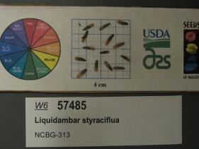 | | 2019 | | | | | | | Wild material | | 2098409 | NA 88149 |
| 81 | NA 88152 | NCBG-320 | Liquidambar styraciflua L. | North Carolina, United States | NA |  | | 2019 | | | | | | | Wild material | | 2098412 | NA 88152 |
| 82 | NA 88153 | NCBG-321 | Morella cerifera (L.) Small | North Carolina, United States | NA |  | | 2019 | | | | | | | Wild material | | 2098413 | NA 88153 |
| 83 | NA 88158 | NCBG-331 | Callicarpa americana L. | North Carolina, United States | NA | 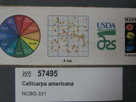 | | 2019 | | | | | | | Wild material | | 2098419 | NA 88158 |
| 84 | NA 88161 | NCBG-354 | Ilex opaca Aiton | Virginia, United States | NA |  | | 2019 | COLLECTED | 10/14/2015 | Belle Isle State Park (Rappahanock River): from park entrance, continue on State Rte. 683/Belle Isle Rd. Turn right onto Creek Landing Road. Park at end of road, follow Mulberry Trail. Population along boardwalk as you walk toward the canoe launch. | 37.78222000, -76.60419000 | 2 | Riverside forest. | Wild material | | 2098425 | NA 88161 |
| 85 | GPRU 168 | MARSB-577 | Prunus serotina Ehrh. | New York, United States | GEN |  | | 2019 | | | | | | | Wild material | | 2097661 | GPRU 168 |
| 86 | NA 88109 | MARSB-425 | Ilex opaca Aiton | New Jersey, United States | NA |  | | 2019 | COLLECTED | 11/03/2015 | Tuckahoe Wildlife Management Area: take exit 20 off Garden State Parkway, route 50 north. Turn right onto Tuckahoe Road, left on Woods Road, right onto Washington Ave, and follow to Tuckahoe Lake. | 39.27769000, -74.73111000 | 0 | Pitch pine lowland swamp forest. | Wild material | | 2097626 | NA 88109 |
| 87 | WLP 1686 | APS/RS/2019/067/396 | Rosa setigera Michx. | Arkansas, United States | NA |  | | 2019 | COLLECTED | 11/07/2019 | Located near intersection of Smith Mountain Road and Newton County 8828 Road approximately 6.00 miles north of Deer, Newton County | 35.91212000, -93.21112000 | 636 | Roadside, upland with rocky soils | Wild material | | 2097789 | WLP 1686 |
| 88 | WLP 156 | NACPEC19-022 | Oxydendrum arboreum (L.) DC. | Kentucky, United States | NA | | | 2019 | COLLECTED | 09/09/2019 | Madison County; Berea College Forest: Around the corner from Upper Indian Fort Trail Junction, on top of the Davis Hollow "holler" | 37.56414400, -84.23341800 | 477 | Sandstone outcrop, incredibly thin, low pH <4. Very heavy foot traffic | Wild material | | 2110468 | WLP 156 |
| 89 | WLP 163 | NACPEC19-046B | Hydrangea cinerea Small | Georgia, United States | NA | | | 2019 | COLLECTED | 09/14/2019 | Walker County; Lula Lake Land Trust: Bridge from parking lot to South Creek Trail | 34.92114500, -85.38035700 | 373 | Limestone bluffs surrounding dry creek bed in mixed mesophytic forest | Wild material | | 2110475 | WLP 163 |
| 90 | WLP 164 | NACPEC19-047 | Kalmia latifolia L. | Georgia, United States | NA | | | 2019 | COLLECTED | 09/14/2019 | Walker County; Lula Lake Land Trust: Off of South Creek trail on North side of bridge from parking lot | 34.92134100, -85.38051100 | 373 | Riparian zone, wet slope of creek, moist, sandy banks | Wild material | | 2110476 | WLP 164 |
| 91 | Ames 34787 | NCBG-330 | Rhus copallinum L. | North Carolina, United States | NC7 |  | | 2018 | COLLECTED | 10/07/2015 | Dismal Swamp State Park areas of Laurel Hill Trail and Corapeake Road. | 36.54783000, -76.42763000 | 5 | Hardwood swamp roadside | Wild material | | 1965913 | Ames 34787 |
| 92 | GPRU 165 | NCBG-218 | Prunus serotina Ehrh. | North Carolina, United States | GEN | | | 2018 | | | | | | | Wild material | | 1965868 | GPRU 165 |
| 93 | NA 87961 | NEWFS-242 | Clethra alnifolia L. | Connecticut, United States | NA |  | | 2017 | | | | | | | Wild material | | 1954706 | NA 87961 |
| 94 | NA 84645 | ZARKS-030 | Rhododendron prinophyllum (Small) Millais | Arkansas, United States | NA | | | 2017 | COLLECTED | 10/05/2014 | King's River Falls Natural Area; King's River, downstream of junction of county roads 3415 and 3500 along trail leading from parking area and trail sign. | 35.90106000, -93.57456000 | 514 | Mesic, mixed deciduous forest; growing on ledge along river, in rocky soil. | Wild material | See NA 87611 for plants of the same collection received from Morris Arboretum in 2020. | 2108758 | NA 84645 |
| 95 | NA 84577 | RJL-RM001 | Halesia diptera J. Ellis | Texas, United States | NA | | | 2017 | COLLECTED | 07/22/2017 | Along either side of a clear creek on private property approximately 1.42 kilometers north of Texas Recreational Road 255 in northeastern Jasper County. | 31.07135000, -93.94985000 | 107 | Plants growing along the embankments of the clear creek just above normal flood stage in primarily deciduous woodlands with some broadleaved evergreens and conifers. Plants are growing in part shade; some direct sunlight occurs during mid-day hours for 1-2 hours. Soils sandy and topped with a generous undisturbed decomposed litter layer. Slope: 10 percent. Aspect: variable. | Wild material | | 1953812 | NA 84577 |
| 96 | NA 84578 | RJL-RM002 | Magnolia pyramidata W. Bartram | Texas, United States | NA | | | 2017 | COLLECTED | 07/22/2017 | Newton County Road 425, about 2.8 miles south of Texas Recreational Road 255. | 30.85996000, -93.89596000 | 105 | Along roadsides and among young loblolly pines in forestry plantation. Plants growing in part shade to full sun in heavily regenerating roadside woodlands associated with loblolly pine plantations. Plants are growing in well drained, highly sandy soils. | Wild material | | 1953814 | NA 84578 |
| 97 | WLP 1437 | NA 84027 | Oxydendrum arboreum (L.) DC. | Florida, United States | NA | | | 2016 | COLLECTED | 11/11/2016 | Woodlands associated with Miller Bayou, south of housing subdivision off of Pearl Court. | 30.46413000, -86.92804000 | 2 | Full sun to partial shade in mixed coniferous/broadleaved evergreen woodlands, with a mixture of deciduous plants in highly acidic sandy soils approximately 100-300 ft. from the salt marsh edge associated with Miller Bayou. | | | 1950372 | WLP 1437 |
| 98 | Ames 33839 | E-23 | Daucus durieua Lange | Castilla-La Mancha, Spain | NC7 | | | 2016 | COLLECTED | 06/13/2016 | On dirt road 100 m N and also 1 km N of CM-413, about 3.5 km W of Aldea del Rey, at base of and in Solana de la Higuera Mountains. Elevation: 750 to 800 m. | 38.72734000, -3.89621000 | 750 | 10s of plants. Growing among Quercus rotundifolia, Cistus ladanifer, Retama sphaerocarpa, Genista hirsuta and Lavandula stoechas | Wild material | | 1943130 | Ames 33839 |
| 99 | Ames 33840 | E-24 | Daucus durieua Lange | Castilla-La Mancha, Spain | NC7 | | | 2016 | COLLECTED | 06/14/2016 | 3.5 km NE of Villamayor de Calatrava, then 1 km NW of road on the way to Volcán del Morrón de Villamayor, on both sides of road | 38.80933000, -4.10711000 | 692 | 100s of plants. Growing among Quercus rotundifolia, Lavandula stoechas, Cistus ladanifer, Retama sphaerocarpa | Wild material | | 1943131 | Ames 33840 |
| 100 | Ames 33841 | E-25 | Daucus durieua Lange | Castilla-La Mancha, Spain | NC7 | | | 2016 | COLLECTED | 06/14/2016 | Approximately 2.3 km NW of outskirts of Piedrabuena, on Camino de la Reguerilla | 39.04980000, -4.20320000 | 657 | 100s of plants. Growing among Quercus rotundifolia, Lavandula stoechas, Cistus ladanifer | Wild material | | 1943132 | Ames 33841 |
| 101 | Ames 33842 | E-28 | Daucus durieua Lange | Castilla-La Mancha, Spain | NC7 | | | 2016 | COLLECTED | 06/15/2016 | Approximately 25 km NW of Piedrabuena, La Charca de las Colmenas, in fenced private area of Finca de Nuestra Señora del Rosario, S of CR-721 | 39.08182000, -4.41406000 | 731 | 100s of plants, Growing among Quercus rotundifolia, Lavandula stoechas, Cistus ladanifer | Wild material | | 1943133 | Ames 33842 |
| 102 | Ames 33845 | E-32 | Daucus durieua Lange | Castilla-La Mancha, Spain | NC7 | | | 2016 | COLLECTED | 06/17/2016 | Along E side of Rt. CM-5001, N of Talavera de la Reina, about 1 km N of N end of San Román de los Montes | 40.07958000, -4.78285000 | 538 | 100s of plants. Growing in grassy fiend among and in semishade of Quercus rotundifolia and Retama sphaerocarpa | Wild material | | 1943136 | Ames 33845 |
| 103 | NA 83681 | Ron Miller 08302014 | Viburnum obovatum Walter | Florida, United States | NA | | | 2016 | COLLECTED | 08/30/2014 | Along Holmes Creek not far from the boat ramp on Hightowers Road. | 30.60560000, -85.76490000 | 5 | Boggy edge of creek in mixed deciduous and evergreen bottomland woodlands that are periodically inundated for extended periods. | Wild material | | 1951230 | NA 83681 |
| 104 | NA 82746 | Site 3B/Hightower Road at Holmes Creek | Magnolia ashei Weath. | Florida, United States | NA | | | 2015 | COLLECTED | 07/31/2015 | Along Holmes Creek 0.2 miles west-southwest of Hard Castle Landing boat ramp at hte end of Hightower Road. | 30.60401000, -85.76883000 | 11 | Shade to partial shade of deciduous woodlands 10 to 15 feet above the creek, surrounded by low lying swampy area. | Wild material | Originally just called Site 3, but the "A/B" has been added to distinguish the Live Oak Landing (3A) and Hightower Road (3B) material. For previous collections of this population, see NA 81556 (2013); for later collection, see NA 82746.01 (2019). | 1950860 | NA 82746 |
| 105 | NA 82643 | NA 82643 | Lonicera sempervirens L. | Texas, United States | NA | | | 2015 | COLLECTED | 07/20/2014 | East side of Texas Route 87 approximately 0.52 miles south of Trout Creek, Texas. | 30.61156000, -93.80506000 | 21 | Southwest-facing edge of mature woodland in part to full sun; well-drained, seasonally moist soils that are sandy loam; surface has an excellent organic litter layer. | | | 1952603 | NA 82643 |
| 106 | NA 82648 | NA 82648 | Viburnum acerifolium L. | Texas, United States | NA | | | 2015 | COLLECTED | 08/31/2013 | West side of the road along Texas Route 87 north of Burkeville, Texas. | 31.11950000, -93.72656000 | 141 | Dry, acidic woodlands in full shade beneath trees; soils sandy loam and are very loose and drought prone. | Wild material | | 1953129 | NA 82648 |
| 107 | NA 83069 | NA 83069 | Rhododendron prunifolium (Small) Millais | Georgia, United States | NA | | | 2015 | COLLECTED | 10/09/2014 | Callaway Gardens. Callaway natural lands; restricted entrance on Rt. 116 (Blue Springs Rd.) approx. 3.6 west of Hamilton, GA. | 32.75538000, -84.94025000 | 251 | | | | 1952271 | NA 83069 |
| 108 | Ames 32820 | APS/EA/2013/041/126 | Euonymus atropurpureus Jacq. | Iowa, United States | NC7 |  | | 2014 | COLLECTED | 10/10/2014 | Midland Trail Road near North Racoon River watershed. Dallas County T80N R27W SW 1/4 NW 1/4 Sec. 30 | 41.71142000, -94.04538000 | 299 | Wooded roadside. | Wild material | | 1921780 | Ames 32820 |
| 109 | NA 81570 | (orange suffused with rose) | Rhododendron austrinum (Small) Rehder | Florida, United States | NA | | | 2013 | COLLECTED | 03/31/2013 | Little Simpson River approximately 0.53 miles southeast of the confluence with Buzzards Lake River [and White River] in the Escambia River State Wildlife Management Area. | 30.59421000, -87.21575000 | 2 | Light shade along the river on a small sandy berm above the stream in mixed deciduous and broadleaved evergreen maritime forest occasionally inundated by tidal salt water. | Wild material | | 1951291 | NA 81570 |
| 110 | NA 81571 | (clear light pink) | Rhododendron austrinum (Small) Rehder | Florida, United States | NA | | | 2013 | COLLECTED | 03/31/2013 | White River approximately 1.1 miles north of the confluence with Buzzard�s Lake River in the Escambia River State Wildlife Management Area. | 30.60490000, -87.22261000 | 2 | Part shade along the river on a small sandy berm above the stream in mixed deciduous and broadleaved evergreen maritime forest occasionally inundated by tidal salt water. | Wild material | | 1952627 | NA 81571 |
| 111 | NA 81603 | (seedling of pink form) | Rhododendron austrinum (Small) Rehder | Florida, United States | NA | | | 2013 | COLLECTED | 2013 | On the Escambia river near the mouth of the Yellow River. [GPS coordinates are actually at the confluence of the White River, the Little Simpson River, and the Buzzard Lake River (and gas line canal). -SBL] | 30.59699000, -87.22295000 | | Plants were collected along along the sandy berms along river delta. | | | 1950972 | NA 81603 |
| 112 | Ames 30482 | APS/GD/2010/002/037 | Gymnocladus dioicus (L.) K. Koch | Missouri, United States | NC7 |  | | 2010 | COLLECTED | 02/17/2010 | Lake of the Ozarks, Grandglaize Creek Watershed, T39N R15W NW 1/4 Sec. 36 and NE 1/4 of SE 1/4 Sec. 35, Toronto Quad, Miller County. | 38.07386700, -92.52686700 | 207 | Mixed deciduous woods. | Wild material | | 1831341 | Ames 30482 |
| 113 | Ames 30484 | APS/GD/2010/004/039 | Gymnocladus dioicus (L.) K. Koch | Tennessee, United States | NC7 |  | | 2010 | COLLECTED | 02/18/2010 | Walnut Log, near Reelfoot National Wildlife Refuge. | 36.47498300, -89.30245000 | 93 | Northwest-facing and west-facing base of bluffs. Very weedy. | Wild material | #123 measured 17.5" d.b.h. and 100' and #124 measured 15" d.b.h. and 60'. | 1831343 | Ames 30484 |