| 0 | NA 80732 | RL 08211 | Quercus rubra L. | North Carolina, United States | NA | | | 2008 | COLLECTED | 10/10/2008 | | | | | Wild material | | 1914138 | NA 80732 |
| 1 | NA 80741 | RL 08220 | Quercus rubra L. | North Carolina, United States | NA | | | 2008 | COLLECTED | 10/13/2008 | | | | | Wild material | | 1914143 | NA 80741 |
| 2 | NA 77686 | RL 08162 | Quercus rubra L. | North Carolina, United States | NA | | | 2008 | COLLECTED | 09/26/2008 | Balsam Mountain Preserve, Sugarloaf Mountain. | 35.37398000, -83.11034000 | | | Wild material | | 1896122 | NA 77686 |
| 3 | NA 77689 | RL 08165 | Quercus rubra L. | North Carolina, United States | NA | | | 2008 | COLLECTED | 09/26/2008 | Balsam Mountain Preserve, Fern Mountain, Lot 157. | | | | Wild material | | 1896125 | NA 77689 |
| 4 | NA 77499 | NA 77499 | Quercus rubra L. | North Carolina, United States | NA | | | 2008 | COLLECTED | 10/2004 | Chimney Rock Park, along Woodland Adventure Trail, near well site. | | | | Wild material | | 1895988 | NA 77499 |
| 5 | NA 82794 | JDC/QE/2014/132/635 | Quercus ellipsoidalis E. J. Hill | Iowa, United States | NA | | | 2015 | COLLECTED | 10/21/2014 | Pilot Knob State Park just east of Forest City. T97N R23W Ellington Township SW 1/4 SW 1/4 NE 1/4 Sec. 4 Hancock County. | 43.24931400, -93.56681800 | 399 | Near floating bog, transition area from edge of floating bog and incline to upland habitat. Growing in association with Cephalanthus occidentalis, Salix sp., Asclepias incarnata, Typha latifolia, Spiraea alba, Populus tremuloides, Quercus rubra, Rhamnus cathartica, Carex lacustris, Carex lupulina, and Carex spp. | Wild material | Acorns harvested from forest floor. Attractive, red fall color noted (peak - October 21, 2014). | 1928362 | NA 82794 |
| 6 | NA 82071 | JDC/QM/2014/103/605 | Quercus michauxii Nutt. | Mississippi, United States | NA | | | 2014 | COLLECTED | 09/25/2014 | Chinchahoma Creek watershed near Ennis Road. | 33.38574900, -88.92255600 | 98 | Wet, deciduous woods. | Wild material | Specimen sampled measured 26.75" d.b.h. and approximately 110' in height. Fruits still green. | 1922372 | NA 82071 |
| 7 | Ames 23752 | NSA 960194 | Quercus hybr. | Nebraska, United States | NC7 |  | | 1997 | COLLECTED | PRE 1997 | Southwest of Salem approximately 2.6 miles, T1N R15E NW 1/4 NW 1/4 Sec. 21, Richardson County. | 40.04268000, -95.74558000 | 330 | Prairie knoll/ridge, very dry and rocky substrate. Growing in association with Rhus sp., Liatris aspera (white and purple), Juniperus virginiana, Quercus rubra, Quercus macrocarpa, and Schizachyrium scoparium. | Wild material | Specimens at the collection site in nature are represented as very large/old plants, approximately 5.0 meters in height with trunk diameters to 25.0 cm. After 15 years of growth in cultivation in central Iowa, specimens average approximately 3.5 x 3.5 meters. This species is reported to sucker, but all specimens of this accession have shown no signs of suckering while grown in cultivation. Peak fall color tends to occur during the second week in October in central Iowa ranging from reddish-orange; brownish-red, brownish-orange, etc. Acorn production tends to be consistently heavy every year and can initiate production after three years in age. Peak fruiting tends to occur between 5-15 of September in central Iowa, which is approximately 1 week prior to Q. muehlenbergii. Acorns are extremely favored by deer, rabbits, raccoons, turkeys and bluejays. Quercus prinoides in Nebraska is extremely rare. To date (2022), only two counties totalling four localities have recorded this taxa including Richardson County: two areas near Salem; one in Indian Caves State Park and one in Nemaha County described as near Nemaha. Species tends to be restricted to dry rocky upland hills and bluffs. Recent research (Hipp et al., 2019), noted that using the unweighted pair group method with arithmetic mean and non-metric multidimensional scaling ordination did not separate individuals of Q. muehlenbergii and Q. prinoides as distinct species. However, W. M. Keith Jr. (1957) states that "Q. muehlenbergii never spreads vegetatively and acorns are rarely borne until it has attained small tree size whereas Q. prinoides bears at extremely small sizes, usually a foot or so high and spreads vegetatively via rhizomes". Therefore, genetics of this accession most likely represents the hybrid of Q. prinoides x Q. muehlenbergii under the assumption that the true Q. prinoides is represented only by those that clonally spread via rhizomes. Further research is needed to clarify the identity of Q. prinoides. This accession is therefore being listed as Q. hybr. Specimens are clearly "dwarf" or shrubby in growth habit and produce acorns at extremely early ages, but do not spread via rhizomes. | 1543547 | Ames 23752 |
| 8 | Ames 4618 | Accession No. 1985-0642
Collection No. 1224 | Quercus muehlenbergii Engelm. | Ontario, Canada | NC7 | | | 1985 | COLLECTED | 09/21/1985 | Canada, Ontario, Lambton County, Bosanquet Township (Now Municipality of Lambton Shores), Port Franks. | 43.23195300, -81.89238900 | 190 | Growing in dry sand. 0.8km east of trailer park bridge, off Biddulph Street, property line beside road | Wild material | Large Tree, 2-trunked, 80cm DBH, 20m high, 30m crown spread, infrequent. Medium-sized, deciduous tree | 1028813 | Ames 4618 |
| 9 | Ames 36139 | Berea College Forest | Morus rubra L. | Kentucky, United States | NA |  | | 2023 | COLLECTED | 05/31/2023 | Between West and East Pinnacles of Berea College Forest just 3.25 miles east, southeast of Berea | 37.55656100, -84.23777600 | 338 | Mid-lower slopes of moist, deciduous woods. | Wild material | Species rather abundant throughout site with little to no presence of Morus alba. Majority of specimens noted measuring 8" DBH or smaller. Largest specimen noted reaching approximately 60' in height. | 2158344 | Ames 36139 |
| 10 | Ames 35887 | JDC/MR/2022/034/1014 | Morus rubra L. | Iowa, United States | NC7 |  | | 2022 | COLLECTED | 07/12/2022 | Waubonsie State Park located north, northwest of Hamburg, T68N R42W Sec. 29 and Sec. 32. | 40.67552500, -95.68690400 | 355 | Mid slope (ranging from 10-30 degrees) to base of slopes and along all drainages and valleys of deciduous woods. | Wild material | The native range for Red Mulberry is reported from the eastern margin of the Great Plains, extending north to southern Ontario, Canada, and distributed as far south as southern Florida (Little, 1971). Conservation assessments in North America indicate current (2026) and future concern for the species including Michigan (threatened); Massachusetts (endangered); Ontario Canada (endangered); with NatureServe's 2025 global G5 rank due to genetic swamping and habitat pressure. Red Mulberry seems to be extremely localized to moist, floodplain areas that are high-quality bottomland forests. This accession represents genetics collected from the northwestern edge of the species native range. Specimens sampled in nature displayed the following morphological characters: acuminate leaf tips, impressed veins, pubescent upper and lower leaves, flaky bark (often with tiny pin holes (insect emergence holes)), cordate leaf base, and umbrella-shaped growth habit. M. rubra specimens noted ranged in size from 1"-23" inches DBH with some of the tallest specimens reaching 70' in height. The largest specimen sampled (#172-13) measuring 23.25" DBH. Estimated hundreds, perhaps a thousand specimens of M. rubra noted within the park with very little representation of hybrids or Morus alba. Representation of M. rubra outside of park boundaries is near completely absent and the presence of hybrids and M. alba is extremely evident. Soluble solids content from fruits collected in the wild ranged from 19.0-32.9 degrees Brix. This range of Brix values is likely a result of genetic diversity and also variation in maturity of fruits. Fruits selected for Brix measurements were black in color. The specimen sampled with the highest Brix value was #172-9. All M. rubra specimens noted at time of sampling (12 July 2022) were exhibiting determinate growth compared to local hybrids and M. alba, which were still actively growing with newly emerging leaves. The first study (Adhikari et al. 2026) on the mitogenome of M. rubra utilized sample #172-13 (Ames 35887 Tree #13) reporting 359,221 base pairs (bp) long with 45.8% GC content, comprising 57 genes: 32 protein-coding, 21 transfer, and four ribosomal RNAs. | 2138220 | Ames 35887 |
| 11 | Ames 35884 | AS/MR/2022/003/133 | Morus rubra L. | Iowa, United States | NC7 |  | | 2022 | COLLECTED | 07/06/2022 | Chichaqua Bottoms Greenbelt located northeast of Bondurant, T81N R22W Sec. 33 and also T80N R22W Sec. 10. | 41.78917100, -93.41777300 | 247 | Floodplain. | Wild material | Specimens sampled in nature displayed the following morphological characters: elongated acuminate leaf tips, impressed veins, pubescent upper and lower leaves, flaky bark (often with tiny pin holes (insect emergence holes)), cordate leaf base, and umbrella-shaped growth habit. Majority of specimens were approximately 30-50' in height with the largest diameter specimen (133-6) measuring 19.5" DBH. All M. rubra specimens noted were exhibiting determinate growth compared to local hybrids and M. alba, which were still actively growing with newly emerging leaves. Soluble solids content for fruit samples collected in nature ranged from 12.8-22.8 degrees Brix. This range of Brix values is likely a result of genetic diversity and also variation in maturity of fruits. The highest Brix value was from specimen 133-4. | 2138217 | Ames 35884 |
| 12 | Ames 34201 | NAO/UR/2018/22/47 | Ulmus rubra Muhl. | Iowa, United States | NC7 |  | | 2018 | COLLECTED | 05/24/2018 | Private property located 5.0 miles west of Grinnell off N 39th Ave E., T80N R17W NW ¼ SW ¼ Sec. 15, Jasper County | 41.73626700, -92.82183600 | 325 | Dry ridge top. Old-growth remnant woods historically and currently utilized as cattle pasture. | Wild material | Mature 20-26" d.b.h. (inches) specimens with little to no signs of decline. | 1963308 | Ames 34201 |
| 13 | PI 704869 sos | V. angustifolium NEWFS-267 | Vaccinium angustifolium Aiton | New Hampshire, United States | COR | | | 2021 | | | | | | | Wild material | PI assigned before phyical inventory of W6 shipment and is missing. Maintain COR as site in case seeds are recovered. Glabrous underside of leaf finely toothed leaf margins low creeping habit in dense clusters glabrous stem. Some had pubescent undressed of leaf believed to be a hybrid with Vaccinium myrtilloides. | 2137188 | PI 704869 sos |
| 14 | PI 704871 sos | V. angustifolium NEWFS-355 | Vaccinium angustifolium Aiton | New Hampshire, United States | COR | | | 2021 | | | | | | | Wild material | PI assigned before phyical inventory of W6 shipment and is missing. Maintain COR as site in case seeds are recovered. | 2137198 | PI 704871 sos |
| 15 | PI 702701 | MARSB-249 | Dichanthelium clandestinum (L.) Gould | New York, United States | S9 |  | | 2019 | | | | | | | Wild material | | 2097541 | PI 702701 |
| 16 | PI 710524 | MARSB-091 | Phytolacca americana L. | New York, United States | S9 | 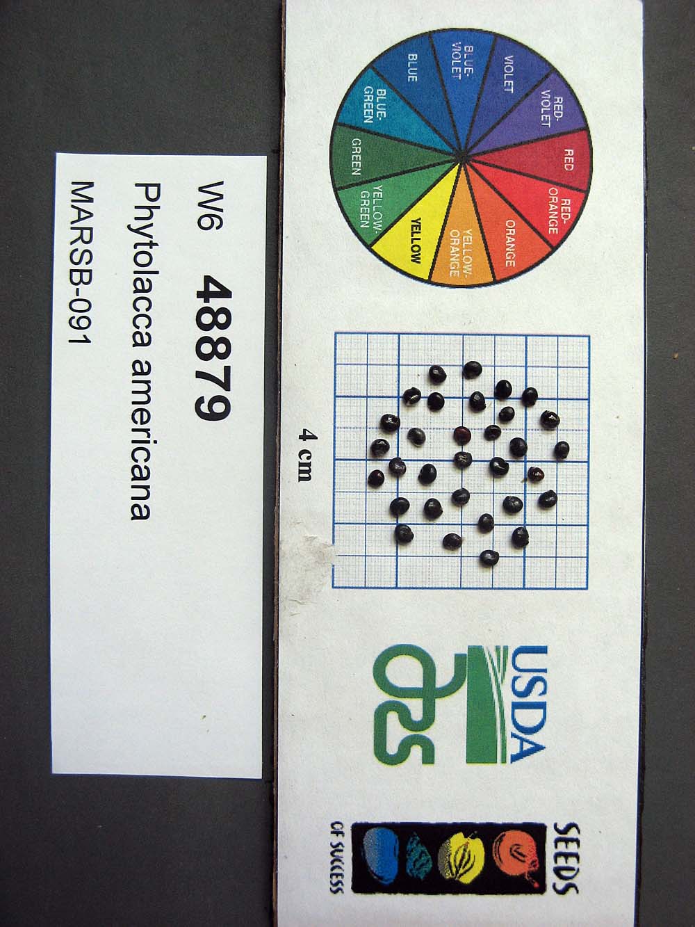 | | 2015 | | | | | | | Wild material | | 1922926 | PI 710524 |
| 17 | PI 664869 | JDC/HP/2008/030/100 | Hypericum prolificum L. | Missouri, United States | NC7 |  | | 2008 | COLLECTED | 10/06/2008 | Rudolf Bennitt Conservation Area, NE 1/4 of NE 1/4 of Section 25, T52N, R14W, Renick Quad, Randolph County. | 39.27527778, -92.43388889 | 256 | | Wild material | | 1788211 | PI 664869 |
| 18 | PI 664885 | JM20061020 | Prunella vulgaris L. | South Carolina, United States | NC7 | | | 2006 | COLLECTED | 09/28/2006 | East side of State Road 1149, north of Highway 11, Pickens, Pickens County. | 34.93500000, -82.88750000 | 262 | Cove hardwood forest, roadside. | Wild material | | 1715758 | PI 664885 |
| 19 | PI 649023 | NY2 | Actaea racemosa L. | New York, United States | NC7 |  | | 2005 | | | | | | | Wild material | | 1698893 | PI 649023 |
| 20 | PI 649025 | VA1 | Actaea racemosa L. | Virginia, United States | NC7 | | | 2005 | | | | | | | Wild material | | 1698897 | PI 649025 |
| 21 | PI 664811 | DE2 | Actaea racemosa L. | Delaware, United States | NC7 | | | 2005 | | | | | | | Wild material | | 1698885 | PI 664811 |
| 22 | PI 664813 | KY1 | Actaea racemosa L. | Kentucky, United States | NC7 | | | 2005 | | | | | | | Wild material | | 1698887 | PI 664813 |
| 23 | PI 664818 | PA2 | Actaea racemosa L. | Pennsylvania, United States | NC7 | | | 2005 | | | | | | | Wild material | | 1698895 | PI 664818 |
| 24 | PI 664820 | VA2 | Actaea racemosa L. | Virginia, United States | NC7 | | | 2005 | | | | | | | Wild material | | 1698898 | PI 664820 |
| 25 | PI 649021 | 46 | Actaea racemosa L. | Missouri, United States | NC7 | | | 2004 | | | | | | | Wild material | 1 meter tall. | 1668177 | PI 649021 |
| 26 | PI 649704 | 39 | Physocarpus opulifolius (L.) Maxim. | Iowa, United States | NC7 |  | | 2003 | COLLECTED | 09/24/2003 | Starr's Cave State Preserve located just northwest of Burlington, T70N, R2W NW 1/4 of NW 1/4 of Sec. 19, West Burlington Quad, Des Moines County | 40.85194444, -91.13722222 | 183 | Edge of limestone bluff. 1/2 to 3/4 sunny. Steep slope with a southern aspect. Thin, very rocky soil, well drained | Wild material | | 1649673 | PI 649704 |
| 27 | PI 649661 | 23 | Diervilla lonicera Mill. | Iowa, United States | NC7 |  | | 2003 | COLLECTED | 09/15/2003 | Steamboat Rock County Park just southwest of Steamboat Rock, Steamboat Rock Quad. T88N R19W N edge of SE 1/4 SW 1/4 Sec. 28 | 42.40138889, -93.07305556 | 299 | Eroding sandstone cliff. Mostly shaded area with 50% slope with a northern aspect. Sand and organic matter just above sandstone rock cliff, well drained. | Wild material | | 1649456 | PI 649661 |
| 28 | PI 649703 | 14 | Physocarpus opulifolius (L.) Maxim. | Iowa, United States | NC7 |  | | 2003 | COLLECTED | 09/14/2003 | Fish Farm Mounds, New Albin, SW 1/4 of SW 1/4 of NW 1/4 of Section 26, T100N, R4W, New Albin Quad, Allamakee County. | 43.45111111, -91.28222222 | 280 | Sandstone ridge just above goat prairie. 1/2 sun. 30-50% slope w/ NW aspect. Sandy loam soil w/ some stoniness, well drained | Wild material | Medium sized shrubs. | 1649463 | PI 649703 |
| 29 | PI 656820 | Ames 27186 | Physocarpus opulifolius (L.) Maxim. | Iowa, United States | NC7 |  | | 2003 | COLLECTED | 08/24/2003 | Along Old Indian Trail, overlooking Pease Creek, Ledges State Park, S 1/2 of SE 1/4 of SW 1/4 of Section 16, T83N, R26W, Madrid NW Quad, Boone County. | 41.99500000, -93.88583333 | 289 | Sandstone ridge. | Wild material | Shrubs to 2 meters tall. | 1648564 | PI 656820 |
| 30 | PI 616939 | F. virginiana subsp. virginiana NC 98-2-2 | Fragaria virginiana Mill. subsp. virginiana | Tennessee, United States | COR | | Out of Season | 2000 | COLLECTED | 09/25/1998 | From I-40 take Strawberry Plains PIke north for 1.9 miles to McCubbins Cemetary Lane. Turn right and go 0.1 mile to Mcubbins Cemetary. Site is McCubbins Cemetary grounds. Knox county. | 36.01917000, -83.74694000 | 425 | Dry uplands, silty topsoil, shale underneath. Quercus alba, Pinus virginiana, Pespalum subsp., Potentilla canadensis, Andropogon sp., Plantogo sp., Ulmus sp., Acer rubra and Acer barbatum. Mosses, lichens and grasses. | Wild material | | 1603151 | PI 616939 |
| 31 | PI 616940 | F. virginiana subsp. virginiana NC 98-2-3 | Fragaria virginiana Mill. subsp. virginiana | Tennessee, United States | COR | | Out of Season | 2000 | COLLECTED | 09/25/1998 | From I-40 take Strawberry Plains PIke north for 1.9 miles to McCubbins Cemetary Lane. Turn right and go 0.1 mile to Mcubbins Cemetary. Site is McCubbins Cemetary grounds. Knox county. | 36.01917000, -83.74694000 | 425 | Dry uplands, silty topsoil, shale underneath. Quercus alba, Pinus virginiana, Pespalum subsp., Potentilla canadensis, Andropogon sp., Plantogo sp., Ulmus sp., Acer rubra and Acer barbatum. Mosses, lichens and grasses. | Wild material | | 1603152 | PI 616940 |
| 32 | PI 616941 | F. virginiana subsp. virginiana NC 98-2-3 | Fragaria virginiana Mill. subsp. virginiana | Tennessee, United States | COR | | Out of Season | 2000 | COLLECTED | 09/25/1998 | From I-40 take Strawberry Plains PIke north for 1.9 miles to McCubbins Cemetary Lane. Turn right and go 0.1 mile to Mcubbins Cemetary. Site is McCubbins Cemetary grounds. Knox county. | 36.01917000, -83.74694000 | 425 | Dry uplands, silty topsoil, shale underneath. Quercus alba, Pinus virginiana, Pespalum subsp., Potentilla canadensis, Andropogon sp., Plantogo sp., Ulmus sp., Acer rubra and Acer barbatum. Mosses, lichens and grasses. | Wild material | | 1603153 | PI 616941 |
| 33 | PI 649650 | Index Seminum 4 | Betula populifolia Marshall | Pennsylvania, United States | NC7 | | | 1993 | COLLECTED | | Kittatinny Ridge, Valley and Ridge Province, Northampton County. | 40.91666667, -75.20000000 | 500 | On top of ridgetop quartzite outcrop. | Wild material | | 1086000 | PI 649650 |
| 34 | PI 495604 | 8 | Cornus drummondii C. A. Mey. | Iowa, United States | NC7 |  | | 1984 | COLLECTED | 09/21/1984 | Along south end of parking area, Lake of Three Fires State Park, extreme NW corner of Section 7, T68N, R33W, Bedford Quad, Taylor County. | 40.71194444, -94.68583333 | 360 | | Wild material | Perennial woody. Plants in wide thicket to 2 meters tall, heavy fruiting. Very clean foliage with nice white fruits. | 1390540 | PI 495604 |
| 35 | PI 495607 | 2 | Euonymus atropurpureus Jacq. | Iowa, United States | NC7 |  | | 1984 | COLLECTED | 09/21/1984 | Southwest end of lake, Lake Icaria County Recreation Area, 4 miles north of Corning, Section 10, T72N, R34W, Adams County. | 41.04972222, -94.74638889 | 362 | Among rock boulders near shore line. Rare population abundance with irregular distribution. | Wild material | Comments on plants harvested in nature: Perennial woody. Plants approximately 4-6 feet in height. Orangish-red fall color. Pinkish seed pods. In 2014 and 2015, plants growing in cultivation at NCRPIS exhibited a fair amount of powdery mildew with poor quality fall color (peaking typically last week in October), but plants showed above average amounts of vigor. For central and eastern Iowa, PI 662022 would be a more appropriate selection. For potential planting locations west of the Missouri River, PI 495607 may exhibit good ornamental characteristics. | 1390543 | PI 495607 |
| 36 | Ames 38800 | Camp Mitigwa | Amelanchier arborea (F. Michx.) Fernald | Iowa, United States | NC7 |  | | 2026 | COLLECTED | 06/01/2026 | Mitigwa Scout Camp located on west side of Des Moines River watershed approximately 7.50 miles south, southwest of Boone, T82N R26W N 1/4 Sec. 5 and T83N R26W S 1/4 Sec. 32. | 41.94894500, -93.90537200 | 310 | High-quality white oak - ironwood, mature woods. | Wild material | The native range of Amelanchier arborea is concentrated in the eastern half of the U.S. (Little, 1977). This accession represents a collection of A. arborea germplasm from the western edge of the species native range, specifically central Iowa. Specimens sampled at the collection site in nature were small to medium understory or woodland edge single and/or multi-trunked trees with a few trees getting close to being deemed as canopy specimens. Bark smooth and light grey in color. Specimens sampled in nature ranging 15-50' in height. Peak flowering occurred on 8 April 2026 with white flowers appearing prior to leaf expansion. Fall colors ranging from orange to orange-red peaking typically at the end of September (central Iowa). Fruits, dark-pink to red, maturing in early June (peak in 2026 occurred on 2 June) averaging 8 mm in diameter, except for mother tree #6 that had rather large fruits at 11 mm in diameter. | 2197049 | Ames 38800 |
| 37 | NA 89158 | 2025RJLSEUS-06 | Cornus florida L. | Alabama, United States | NA | | | 2025 | COLLECTED | 10/01/2025 | Coosa Wildlife Management Area: along the edge of gated dirt road on the west side of Coosa County Road 29, 0.3 kilometers north of Hatchet Creek. | 32.86402200, -86.33871400 | 108 | Plants are growing in part sun to shade on dry-mesic slopes above the road cut on the gated dirt road; most likely a road for access for fire control/forest management. The forest is a combination of deciduous and evergreen with evergreens primarily comprised of Pinus taeda. The habitat was quite dry during this time of year. Slope: 5 to 20 percent. Aspect: North. Soils: The primary soil in the area of this collection is classified as Madison-Louisa Series complex, 15 to 30 percent slopes, moderately eroded (MdE2). The Madison Series soils are very deep, well drained soils with medium runoff found on Piedmont uplands in interstream divides, ridges and side slopes. They are comprised of residuum weathered from felsic or intermediate, high-grade metamorphic or igneous rocks high in content of mica. Slopes range from 2 to 60 percent and soil is typically strongly acidic. Louisa Series soils The Louisa Series soils consist of shallow, somewhat excessively drained soils which formed over mica gneiss and schist bedrock. They occur on Piedmont uplands. Slopes are 6 to 80 percent. This soil is moderately acid. (Source: California Soil Resource Lab/NRCS Official Soil Series Descriptions). Geology: The underlying geology of this area is of Precambrian to Paleozoic origin and characterized as Hatchet Creek Group; Pinchoulee Gneiss Formation. It is characterized by medium to fine-grained migmatitic, locally garnetiferous biotite-feldspar gneiss, commonly saturated with granitic pods. (Source: USGS Alabama Geologic Map Data). | Wild material | | 2193004 | NA 89158 |
| 38 | Ames 36697 | APS/JC/2025/XXX/XXX | Juniperus communis L. | Iowa, United States | NC7 |  | | 2025 | COLLECTED | 09/15/2025 | Located off Iowa River Drive approximately 2.5 miles southwest of New Albin, T100N R4W NE 1/4 NW 1/4 Sec. 21. | 43.46830000, -91.32128000 | 207 | Sandy ridge of a power line cut. | Wild material | | 2192820 | Ames 36697 |
| 39 | NA 89115 | TLM25-04a | Hamamelis ovalis S. W. Leonard | Texas, United States | NA | | | 2025 | COLLECTED | 07/10/2025 | State Highway 87 approximately 3.25 kilometers north of the crossroad junction with Texas Recreational Road 255 (RE 255); plants were growing in the narrow buffer woods along the east side of the highway. | 31.12051300, -93.72628100 | 138 | The habitat is an upland mixed coniferous and deciduous woodlands in part to full shade and dry conditions, often under drought stress. Plants seem to always occur on the top of dry ridges or well-drained slopes. Slope: 0 to 1 percent. Aspect: N/A. Soils: The soils of this collection area are classified as Tehran-Letney Association, hilly (TLE) soils. The Tehran Series (55%) consists of deep, somewhat excessively drained, moderately rapidly permeable soils on uplands. They formed in thick loamy and sandy sediments on the Western Coastal Plain. These soils are on gently sloping to moderately steep uplands with slopes ranging from 1 to 20 percent. The Letney Series (30%) consists of deep, well drained, moderately rapidly permeable, upland soils. They formed in thick sandy and loamy sediments of the coastal plains. These soils are on gently sloping to moderately steep uplands with slopes ranging from 1 to 20 percent. Soil pH ranges from 4.5 to 6.0. The minor soil components include Doucette Series (10%) and Boykin Series (5%) soils. (Source: California Soil Resource Lab/NRCS Official Soil Series Descriptions). Geology: The underlying geology of this area is of Oligocene origin and characterized as Catahoula Formation. This formation is extensive and deep in Texas, up to 185 meters thick. In the area of the collection the Catahoula Formation is primarily mudstone and sand. The upper 90-150 meters is mudstone that is tuffaceous, and sandy; also, occasionally, with some bentonitic clay. (Source: USGS Texas Geologic Map Data). | Wild material | | 2191654 | NA 89115 |
| 40 | NA 88930 | 24Flam16 | Rhododendron canescens (Michx.) Sweet | Georgia, United States | NA | | | 2025 | COLLECTED | 09/10/2024 | DeKalb County: Stone Mountain: Stone Mountain Park: slope near Robert E. Lee Boulevard. | 33.80238000, -84.15508000 | 286 | Dry, shady slope. Growing in 3/4 shade. Slope: 30 to 45 degrees. Aspect: West-southwest. | Wild material | Note: Seeds from three different plants collected at the same spot were bulked together in this accession; the lowest field collection number (24Flam16) has been chosen as the primary for this record. It appears from the notes that the identity is slightly uncertain; possibly not pure R. canescens. | 2172813 | NA 88930 |
| 41 | NA 89193 | DLSP-SB | Hamamelis virginiana L. | Wisconsin, United States | NA | | | 2025 | COLLECTED | 08/21/2024 | Devil's Lake State Park: South Bluff. | 43.41164210, -89.74057740 | 327 | Shade to partial shade in clayey, organic, mesic material on boulders. Slope: 45 degrees. Aspect: Northwest. White oak-sugar maple vegetative community. | Wild material | | 2171014 | NA 89193 |
| 42 | NA 89075 | 2024RJLPA-001 | Rhododendron maximum L. | Pennsylvania, United States | NA | | | 2024 | COLLECTED | 09/18/2024 | Fieldstone Farm Tank Creek Nature Preserve (a property of the Pocono Heritage Land Trust): Collected along Tank Creek. The property is accessed from a parking area located on Devil's Hole Road. | 41.13862300, -75.34562700 | 493 | Mostly found in mixed deciduous forest with occasional conifers and evergreen shrubs generally on steep slopes above Tank Creek in rocky well-drained soils in shade to part-shade. The slopes are abundant in decomposed organic matter and runoff soils. Slope: 5 to 30 percent. Aspect: various. Geology: The underlying geology of this area is of Devonian origin and characterized as the Long Run Member of Catskill Formation. It is comprised of gray and grayish-red sandstone and grayish-red siltstone and mudstone in fining-upward cycles. (Source: USGS Pennsylvania Geologic Map Data). Soils: The primary soil type found here is classified as Alluvial Land. In geology, alluvial land refers to areas of land that are formed by the deposition of sediments carried by rivers, or other surface water. EPA Ecoregion (Level III): North Central Appalachians (62). EPA Ecoregion (Level IV): Low Poconos (62b). | Wild material | | 2169039 | NA 89075 |
| 43 | NA 89076 | 2024RJLPA-002 | Kalmia latifolia L. | Pennsylvania, United States | NA | | | 2024 | COLLECTED | 09/18/2024 | Fieldstone Farm Tank Creek Nature Preserve (a property of the Pocono Heritage Land Trust): Collected along Tank Creek. The property is accessed from a parking area located on Devil's Hole Road. | 41.13862300, -75.34562700 | 493 | Mostly found in mixed deciduous forest with occasional conifers and evergreen shrubs generally on sloping sites as an understory shrub in rocky well-drained soils in shade to part-shade. Slope: 5 to 15 percent. Aspect: various. Geology: The underlying geology of this area is of Devonian origin and characterized as the Long Run Member of Catskill Formation. It is comprised of gray and grayish-red sandstone and grayish-red siltstone and mudstone in fining-upward cycles. (Source: USGS Pennsylvania Geologic Map Data). Soils: The primary soil type found here is classified as Alluvial Land. In geology, alluvial land refers to areas of land that are formed by the deposition of sediments carried by rivers, or other surface water. EPA Ecoregion (Level III): North Central Appalachians (62). EPA Ecoregion (Level IV): Low Poconos (62b). | Wild material | | 2169040 | NA 89076 |
| 44 | NA 89077 | 2024RJLPA-003 | Viburnum acerifolium L. | Pennsylvania, United States | NA | | | 2024 | COLLECTED | 09/19/2024 | Birdell Road, near parking lot to trail where the road ends at Chambers Lake, which is part of Hibernia County Park. | 40.03559500, -75.85708600 | 187 | Plants are growing in deep shade of a dry deciduous forest dominated by Fagus grandifolia. Slope: 0 percent. Aspect: N/A. Geology: The underlying geology of this area is of Precambrian origin and characterized as Banded Mafic Gneiss. It is characterized as dark and fine to medium grained. This formation includes rocks of probable sedimentary origin; may be equivalent to "PZmgh." (Source: USGS Pennsylvania Geologic Map Data). Soils: The primary soil type in the area of this collection is classified as Neshaminy Series Silt Loam, very deep over mafic gneiss, 3 to 8 percent slopes (NvB). (Source: USDA-NRCS Official Soil Series Descriptions). EPA Ecoregion (Level III): Northern Piedmont (64). EPA Ecoregion (Level IV): Piedmont Uplands (64c). | Wild material | | 2169041 | NA 89077 |
| 45 | NA 89078 | 2024RJLPA-004 | Staphylea trifolia L. | Pennsylvania, United States | NA | | | 2024 | COLLECTED | 09/20/2024 | Along gated road about 0.33 kilometers southwest of the Lake Ontelaunee Trail parking lot. | 40.49850800, -75.89121300 | 94 | Plants are growing on well-drained steep slopes in shade to part shade of a deciduous forest. Slope: 35 to 50 percent. Aspect: East-southeast. Geology: The underlying geology of this area is of Ordovician origin and characterized as Shale and graywacke of Hamburg sequence. It is characterized by shale containing zones of conspicuous graywacke. (Source: USGS Pennsylvania Geologic Map Data). Soils: The primary soil type in the area of this collection is classified as Berks-Weikert Complex, 25 to 60% slopes (BkF). Dominantly sloping to very steep, moderately deep and shallow, well drained soils underlain by acid shale bedrock. (Source: UPenn State University Soil Info Website). EPA Ecoregion (Level III): Ridge and Valley (67). EPA Ecoregion (Level IV): Northern Shale Valleys (67b). | Wild material | | 2169042 | NA 89078 |
| 46 | NA 89079 | 2024RJLPA-005 | Viburnum prunifolium L. | Pennsylvania, United States | NA | | | 2024 | COLLECTED | 09/20/2024 | Along gated road about 0.33 kilometers southwest of the Lake Ontelaunee Trail parking lot. | 40.50062600, -75.89004900 | 94 | Plants are growing on moist, well-drained in part shade of a deciduous forest. Slope: 0 percent. Aspect: N/A. Geology: The underlying geology of this area is of Ordovician origin and characterized as Shale and graywacke of Hamburg sequence. It is characterized by shale containing zones of conspicuous graywacke. (Source: USGS Pennsylvania Geologic Map Data). Soils: The primary soil type in the area of this collection is classified as Holly Series Silt Loam (Ho). The Holly Series consists of very deep, very poorly and poorly drained soils formed in loamy alluvium on flood plains. Saturated hydraulic conductivity is moderately high through high in the mineral soil. Slope ranges from 0 through 3 percent. (Source: USDA-NRCS Official Soil Series Descriptions). EPA Ecoregion (Level III): Ridge and Valley (67). EPA Ecoregion (Level IV): Northern Shale Valleys (67b). | Wild material | | 2169043 | NA 89079 |
| 47 | NA 89080 | 2024RJLPA-006 | Ilex montana Torr. & A. Gray | Pennsylvania, United States | NA | | | 2024 | COLLECTED | 09/20/2024 | Berks and Schuylkill Counties: Hawk Mountain Sanctuary. | 40.64162200, -75.99122600 | 418 | Plants are growing from shade to full sun on a dry-mesic to very dry, well-drained upland/montane habitat characterized by an upland mixed deciduous and evergreen forest that is very rocky. All the plants found in this habitat go through periods of drought during the growing season due to the limited litter/soil layer in which moisture can be held. Elevation: 405 to 430 meters. Slope: 5 to 25 percent. Aspect: various. Geology: The underlying geology of this area is of Silurian origin and comprised of Shawangunk Formation. This formation is primarily light- to dark-gray, fine- to very coarse-grained sandstone and conglomerate containing thin shale interbeds. (Source: USGS Pennsylvania Geologic Map Data). Soils: The surface soil profile of this area is characterized as the Hazleton Series which consists of deep and very deep, well drained soils formed in residuum of acid gray, brown or red sandstone on uplands. The matrix includes a considerable accumulation of thin, flat, coarse fragments of sandstone, limestone, or schist with diameters up to 15 cm. Slope ranges from 0-80%. Permeability is moderately rapid to rapid. (Source: USDA-NRCS Official Soil Series Descriptions). EPA Ecoregion (Level III): Ridge and Valley (67). EPA Ecoregion (Level IV): Northern Sandstone Ridges (67c). | Wild material | | 2169044 | NA 89080 |
| 48 | NA 89081 | 2024RJLPA-009 | Rosa carolina L. | Pennsylvania, United States | NA | | | 2024 | COLLECTED | 09/22/2024 | Lancaster and York Counties: outcrops along the Susquehanna River, accessed from the Historic Lock 12 parking lot off of Pennsylvania Road 372. | 39.81483500, -76.32762200 | 34 | Plants are growing from part-sun to full sun in crevices of the outcrops and where organic debris has accumulated in between boulders along the Susquehanna River. The sites range from nearly xeric to dry mesic, at least on the surface. Plants are generally growing 4-10 m above the normal flow of the river; however, the Holtwood Dam is less than 1 kilometer upstream and debris found trapped in the boulders indicates that there is periodic flooding, at least, in the lower zone of 4+ meters or so above normal river flow. This habitat has a diverse assemblage of deciduous trees and shrubs as well as abundant herbaceous taxa. Slope: 0 to 60 percent. Aspect: Northeast (generally). Geology: The underlying geology of this area is probably of lower Paleozoic age and characterized as the Octoraro Formation. It includes albite-chlorite schist, phyllite, some hornblende gneiss, and granitized members. Soils: The area where this species occurs is right on the edge of two soil zones that transition from the river’s edge to mesic conditions upslope. The first is generally referred to as Rock Outcrop. This terrestrial matrix in which plants grow is largely exposed underlying rock geology with accumulated outwash, rock decomposition, and organic debris buildup. The second is Mt. Airy (80%) and Manor (20%) Series soils, 25 to 60 percent slopes, extremely stony (MRF). (Source: California Soil Resource Lab/NRCS Official Soil Series Descriptions). EPA Ecoregion (Level III): Northern Piedmont (64). EPA Ecoregion (Level IV): Piedmont Uplands (64c). | Wild material | | 2169045 | NA 89081 |
| 49 | NA 89082 | 2024RJLPA-010 | Amorpha fruticosa L. | Pennsylvania, United States | NA | | | 2024 | COLLECTED | 09/22/2024 | Outcrops along the Susquehanna River, accessed from the Historic Lock 12 parking lot off of Pennsylvania Road 372. | 39.81481500, -76.32757900 | 34 | Plants are growing from part-sun to full sun in crevices of the outcrops and where organic debris has accumulated in between boulders along the Susquehanna River. The sites range from nearly xeric to dry mesic, at least on the surface. Plants are generally growing 4-10 m above the normal flow of the river; however, the Holtwood Dam is less than 1 kilometer upstream and debris found trapped in the boulders indicates that there is periodic flooding, at least, in the lower zone of 4+ meters or so above normal river flow. This habitat has a diverse assemblage of deciduous trees and shrubs as well as abundant herbaceous taxa. Slope: 0 to 25 percent. Aspect: Northeast (generally). Geology: The underlying geology of this area is probably of lower Paleozoic age and characterized as the Octoraro Formation. It includes albite-chlorite schist, phyllite, some hornblende gneiss, and granitized members. Soils: The area where this species occurs is right on the edge of two soil zones that transition from the river’s edge to mesic conditions upslope. The first is generally referred to as Rock Outcrop. This terrestrial matrix in which plants grow is largely exposed underlying rock geology with accumulated outwash, rock decomposition, and organic debris buildup. The second is Mt. Airy (80%) and Manor (20%) Series soils, 25 to 60 percent slopes, extremely stony (MRF). (Source: California Soil Resource Lab/NRCS Official Soil Series Descriptions). EPA Ecoregion (Level III): Northern Piedmont (64). EPA Ecoregion (Level IV): Piedmont Uplands (64c). | Wild material | | 2169046 | NA 89082 |
| 50 | NA 89083 | 2024RJLPA-012 | Rhododendron periclymenoides (Michx.) Shinners | Pennsylvania, United States | NA | | | 2024 | COLLECTED | 09/22/2024 | Outcrops along the Susquehanna River, accessed from the Historic Lock 12 parking lot off of Pennsylvania Road 372. | 39.81477400, -76.32807300 | 35 | Plants are growing from shade to part-sun and occasionally full sun in crevices of the outcrops and where organic debris has accumulated in between boulders along the Susquehanna River. The sites range from nearly xeric to mesic, at least on the surface. Plants are generally growing 4-10 m above the normal flow of the river; however, the Holtwood Dam is less than 1 kilometer upstream and debris found trapped in the boulders indicates that there is periodic flooding, at least, in the lower zone of 4+ meters or so above normal river flow. This habitat has a diverse assemblage of deciduous trees and shrubs as well as abundant herbaceous taxa. Slope: 0 to 60 percent. Aspect: Northeast (generally). Geology: The underlying geology of this area is probably of lower Paleozoic age and characterized as the Octoraro Formation. It includes albite-chlorite schist, phyllite, some hornblende gneiss, and granitized members. Soils: The area where this species occurs is right on the edge of two soil zones that transition from the river’s edge to mesic conditions upslope. The first is generally referred to as Rock Outcrop. This terrestrial matrix in which plants grow is largely exposed underlying rock geology with accumulated outwash, rock decomposition, and organic debris buildup. The second is Mt. Airy (80%) and Manor (20%) Series soils, 25 to 60 percent slopes, extremely stony (MRF). (Source: California Soil Resource Lab/NRCS Official Soil Series Descriptions). EPA Ecoregion (Level III): Northern Piedmont (64). EPA Ecoregion (Level IV): Piedmont Uplands (64c). | Wild material | | 2169047 | NA 89083 |
| 51 | NA 89084 | 2024RJLPA-013 | Physocarpus opulifolius (L.) Maxim. | Pennsylvania, United States | NA | | | 2024 | COLLECTED | 09/22/2024 | Outcrops along the Susquehanna River, accessed from the Historic Lock 12 parking lot off of Pennsylvania Road 372. | 39.81466300, -76.32833900 | 36 | Plants are growing from shade to part-sun where organic debris has accumulated in between boulders as well as further upslope in deeper mesic soils along the Susquehanna River. This habitat has a diverse assemblage of deciduous trees and shrubs as well as abundant herbaceous taxa. Slope: 10 to 25 percent. Aspect: Northeast (generally). Geology: The underlying geology of this area is probably of lower Paleozoic age and characterized as the Octoraro Formation. It includes albite-chlorite schist, phyllite, some hornblende gneiss, and granitized members. Soils: The area where this species occurs is right on the edge of two soil zones that transition from the river’s edge to mesic conditions upslope. The first is generally referred to as Rock Outcrop. This terrestrial matrix in which plants grow is largely exposed underlying rock geology with accumulated outwash, rock decomposition, and organic debris buildup. The second is Mt. Airy (80%) and Manor (20%) Series soils, 25 to 60 percent slopes, extremely stony (MRF). (Source: California Soil Resource Lab/NRCS Official Soil Series Descriptions). EPA Ecoregion (Level III): Northern Piedmont (64). EPA Ecoregion (Level IV): Piedmont Uplands (64c). | Wild material | | 2169048 | NA 89084 |
| 52 | NA 89085 | 2024RJLPA-014 | Rhododendron arborescens (Pursh) Torr. | Pennsylvania, United States | NA | | | 2024 | COLLECTED | 09/22/2024 | Outcrops along the Susquehanna River, accessed from the Historic Lock 12 parking lot off of Pennsylvania Road 372. | 39.81618100, -76.33069800 | 38 | Plants are growing from shade to part-sun and occasionally full sun in crevices of the outcrops and where organic debris has accumulated in between boulders along the Susquehanna River. The sites range from nearly xeric to mesic, at least on the surface. Plants are generally growing 4-10 m above the normal flow of the river; however, the Holtwood Dam is less than 1 kilometer upstream and debris found trapped in the boulders indicates that there is periodic flooding, at least, in the lower zone of 4+ meters or so above normal river flow. This habitat has a diverse assemblage of deciduous trees and shrubs as well as abundant herbaceous taxa. Slope: 0 to 75 percent. Aspect: Northeast (generally). Geology: The underlying geology of this area is probably of lower Paleozoic age and characterized as the Octoraro Formation. It includes albite-chlorite schist, phyllite, some hornblende gneiss, and granitized members. Soils: The area where this species occurs is right on the edge of two soil zones that transition from the river’s edge to mesic conditions upslope. The first is generally referred to as Rock Outcrop. This terrestrial matrix in which plants grow is largely exposed underlying rock geology with accumulated outwash, rock decomposition, and organic debris buildup. The second is Mt. Airy (80%) and Manor (20%) Series soils, 25 to 60 percent slopes, extremely stony (MRF). (Source: California Soil Resource Lab/NRCS Official Soil Series Descriptions). EPA Ecoregion (Level III): Northern Piedmont (64). EPA Ecoregion (Level IV): Piedmont Uplands (64c). | Wild material | | 2169049 | NA 89085 |
| 53 | NA 89086 | 2024RJLPA-015 | Ilex verticillata (L.) A. Gray | Pennsylvania, United States | NA | | | 2024 | COLLECTED | 09/22/2024 | Outcrops along the Susquehanna River, accessed from the Historic Lock 12 parking lot off of Pennsylvania Road 372. | 39.81656600, -76.33136600 | 38 | Plants are growing from part-sun to full sun in crevices of the outcrops and where organic debris has accumulated in between boulders along the Susquehanna River. The sites range from nearly xeric to dry mesic, at least on the surface. Plants are generally growing 4-10 m above the normal flow of the river; however, the Holtwood Dam is less than 1 kilometer upstream and debris found trapped in the boulders indicates that there is periodic flooding, at least, in the lower zone of 4+ meters or so above normal river flow. This habitat has a diverse assemblage of deciduous trees and shrubs as well as abundant herbaceous taxa. Slope: 0 to 10 percent. Aspect: Northeast (generally). Geology: The underlying geology of this area is probably of lower Paleozoic age and characterized as the Octoraro Formation. It includes albite-chlorite schist, phyllite, some hornblende gneiss, and granitized members. Soils: The area where this species occurs is right on the edge of two soil zones that transition from the river’s edge to mesic conditions upslope. The first is generally referred to as Rock Outcrop. This terrestrial matrix in which plants grow is largely exposed underlying rock geology with accumulated outwash, rock decomposition, and organic debris buildup. The second is Mt. Airy (80%) and Manor (20%) Series soils, 25 to 60 percent slopes, extremely stony (MRF). (Source: California Soil Resource Lab/NRCS Official Soil Series Descriptions). EPA Ecoregion (Level III): Northern Piedmont (64). EPA Ecoregion (Level IV): Piedmont Uplands (64c). | Wild material | | 2169050 | NA 89086 |
| 54 | NA 89087 | 2024RJLPA-016 | Hydrangea arborescens L. | Pennsylvania, United States | NA | | | 2024 | COLLECTED | 09/22/2024 | Outcrops along the Susquehanna River, accessed from the Historic Lock 12 parking lot off of Pennsylvania Road 372. | 39.81489000, -76.32912200 | 43 | Plants are growing in deep shade of the deciduous woodlands on outcrops and the steep slopes where organic debris and detritus has accumulated. This habitat has a diverse assemblage of deciduous trees and shrubs as well as abundant herbaceous taxa. Slope: 30 to 90 percent. Aspect: Northeast (generally). Geology: The underlying geology of this area is probably of lower Paleozoic age and characterized as the Octoraro Formation. It includes albite-chlorite schist, phyllite, some hornblende gneiss, and granitized members. (Source: Source: USGS Pennsylvania Geologic Map Data). Soils: The area where this species occurs is right on the edge of two soil zones that transition from the river’s edge to mesic conditions upslope. The first is generally referred to as Rock Outcrop. This terrestrial matrix in which plants grow is largely exposed underlying rock geology with accumulated outwash, rock decomposition, and organic debris buildup. The second is Mt. Airy (80%) and Manor (20%) Series soils, 25 to 60 percent slopes, extremely stony (MRF). (Source: California Soil Resource Lab/NRCS Official Soil Series Descriptions). EPA Ecoregion (Level III): Northern Piedmont (64). EPA Ecoregion (Level IV): Piedmont Uplands (64c). | Wild material | | 2169051 | NA 89087 |
| 55 | OPGC 8855 | JDC/RM/2024/019/1141 | Rudbeckia missouriensis Engelm. ex C. L. Boynton & Beadle | Missouri, United States | OPGC |  | | 2024 | COLLECTED | 09/28/2024 | Danville Glade Conservation Area located 3.60 miles south, southeast of Danville, T47N R5W SW 1/4 SW 1/4 Sec. 5. | 38.86583400, -91.50779400 | 222 | Remnant glade. | Wild material | | 2169019 | OPGC 8855 |
| 56 | Ames 36260 | Thomson Causeway Recreation Area | Cornus drummondii C. A. Mey. | Illinois, United States | NC7 |  | | 2024 | COLLECTED | 08/19/2024 | Thomson Causeway Recreation Area, approximately 1 mile southwest of Thomson. Scattered along Potter Road starting just east of the causeway heading west, and along the gravel service road to the south. T23N R3E SE 1/4 Sec. 26. | 41.94919700, -90.11822100 | 179 | Floodplain of wetland complex along east bank of Mississippi River. Soils are moist and seasonally inundated with high organic matter content. | Wild material | Shrubs in nature measuring approximately 10 feet in height (to 15 feet) with varying degrees of red pigmentation on the pedicles. Peak fruit ripening occurred in late August 2024. Minor foliar disease noted at the time of collection. Growing as individual shrubs in shadier locations and forming thickets in sunnier sites. | 2168984 | Ames 36260 |
| 57 | Ames 36251 | JDC/UT/2024/008/1130 | Ulmus thomasii Sarg. | Minnesota, United States | NC7 | 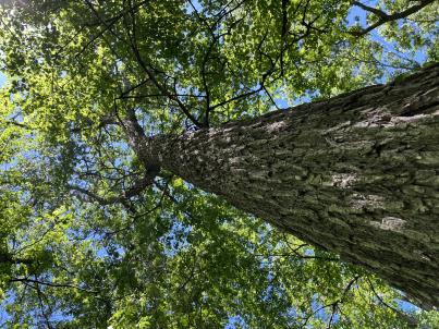 | | 2024 | COLLECTED | 06/05/2024 | Near southeast edge of Kasota Lake approximately 9.0 miles east, southeast of Willmar, T119N R34W SE 1/4 NE 1/4 Sec. 36 and also Robbins Island Park in Wilmar, T119N R35W Sec. 11. | 45.07399600, -94.88484100 | 352 | Deciduous woods | Wild material | Ulmus thomasii (Rock elm) is an underutilized tree species both in conservation and in the urban landscape. Described by Charles Sprague Sargent (first director for the Arnold Arborteum) as "heavy, hard, very strong and tough, closely grained, and susceptible of receiving a beautiful polish". Historically noted for a variety of uses in woodworking including furniture, heavy agricultural implements, timber frame buildings, pianos, hockey sticks, and hand tools. Ulmus thomasii is extremely drought tolerant, adaptable to very calcareous soils, and compared to U. americana or U. rubra has a very conservative growth rate requiring minimal attention in regards to pruning. Rock elm naturally tends to develop into a nice structural specimen in the landscape, unlike other fast growing cultivars in the nursery trade needing frequent attention. Rock elm has very fissured bark and is well known for maintaining a strong central leader resulting in a very attractive, pyramidal form. Despite many literature sources stating that "wings" on the stems are a key identifiying characteristic, this trait is not reliable and many genotypes may completely lack "wings" on the stems. While growth habit and morphology of dormant buds (very pointy) are good traits to help aid in identification, fruits are the best way to confirm identity. Fruits are densly pubescent, often described as "inflated" and generally reach maturity a couple weeks after Ulmus rubra and Ulmus americana. U. thomasii inflorescences are rather distinguishable from other Ulmus in being pendulous. Fruits are extremely prized treats for many birds, where fruits are often "robbed" prior to full maturity. Fruits are also highly prized by many other animals such as mice, squirrels, chipmunks, turkeys, etc. and are generally consumed within hours after fruit abscission. The native range of U. thomasii is concentrated in the northeastern United States and into Canada with disjunct populations documented in northwestern Missouri and northwestern Arkansas (Little, E. L. Jr. 1971). In the 1895 Silva of North America (vol. 7) it was stated that, “The value of the wood of the Rock Elm threatens its extinction and most of the large trees have already been cut.” Today, while rock elm is rather rare, especially in areas near the edges of its range, many states list the species as endangered or threatened warranting preservation efforts. Genetics of this accession would be representative of the species northwestern edge of its native range. Majority of specimens noted did not have characteristic "wings" on the stems and measured approximately 20" DBH or more with a few specimens nearing 30". Heights estimated between 70-90'. Rock elm in this area could be classified as locally abundant. | 2167953 | Ames 36251 |
| 58 | Ames 36248 | Robert's Creek | Salix bebbiana Sarg. | Iowa, United States | NC7 |  | | 2024 | COLLECTED | 05/15/2024 | Robert’s Creek Preserve just north of Forest Road approximately 4.2 miles north, northeast of Elkader, T94N R5W near center of Sec. 36. | 42.91366500, -91.37990600 | 260 | Mixed hardwood forest. Very steep, moist, north-facing slope. | Wild material | Bebb's willow, Salix bebbiana, is a tight, clump forming, multi-stemmed shrub that can reach up to 25' in height that forms a rather distinct, mounded growth habit. Native to North America, the native range covers mostly Canada, but extending south into the northeastern US and also the Rocky Mountains range stretching as far south as New Mexico and Arizona (Little, E. L. Jr. 1977). In Iowa, this species seems to only be known from northeastern Iowa. Salix bebbiana can be found in a variety of habitats from pond margins/swamps to even moderately well-drained open fields. The female capsules are long (5-9 mm) with a very slender beak held on the longest stalk of any N. American Salix. This accession represents genetics from northeastern Iowa at the southern edge of its range in northeastern N. America. Specimens sampled were estimated at 30' in height. Some of the oldest, largest specimens sampled measuring approximately 8" DBH were showing signs of decline. Immature leaves are reddish or yellow green and rather rugose. | 2167645 | Ames 36248 |
| 59 | WLP 3433 | RM2023-002 | Clethra acuminata Michx. | Georgia, United States | NA | | | 2024 | COLLECTED | 10/21/2023 | Plants growing along Patterson Gap Road. | 34.97299200, -83.46003100 | 789 | Plants growing in part shade in a very dry and rocky, mostly deciduous habitat. The site is steeply sloped, underlain by rock, with rocky outcrops. Slope: 15 percent. Aspect: Variable. The underlying geology of this area is Biotite Gneiss, primarily of Precambrian-Paleozoic origin. (Source: USGS North Carolina Geologic Map Data.) The primary soil type in the collection area is classified as Tusquitee loam, 10 to 25 percent slopes. The Tusquitee series consists of very deep, well drained soils on gently sloping to very steep benches, foot slopes, toe slopes, and fans in coves in the Southern Blue Ridge mountains, MLRA 130B. These soils formed in colluvium derived from materials weathered from igneous and high-grade metamorphic crystalline rocks such as granite, mica gneiss, hornblende gneiss, and schist. Slope ranges from 2 to 95 percent. The surface layer to 5cm deep is comprised of moderately decomposed organic matter and leaves, twigs, and roots. Layers to 2m deep range from very dark grayish brown to brown sandy loam with weak medium and coarse granular structure that is friable. A few fine flakes of mica can be found and these soils are very strongly acid. (Source: NRCS Web Soil Survey.) | Wild material | | 2166142 | WLP 3433 |
| 60 | WLP 3434 | RM2023-003 | Hydrangea arborescens L. | Georgia, United States | NA | | | 2024 | COLLECTED | 10/21/2023 | Plants growing along Patterson Gap Road. | 34.97369800, -83.46276600 | 809 | Plants growing in part shade in a very dry and rocky, mostly deciduous habitat. Slope: 25 percent. Aspect: variable. The underlying geology of this area is Biotite Gneiss, primarily of Precambrian-Paleozoic origin. (Source: USGS North Carolina Geologic Map Data.) The primary soil type in the collection area is classified as Porters Series which is stony and steep. The Porters series consists of deep, well drained, moderately permeable soils on cool, north- to east-facing or shaded ridges and side slopes in the Southern Blue Ridge mountains. These soils formed in residuum, affected by soil creep in the upper part, that has weathered from felsic to mafic, high-grade metamorphic and igneous rocks such as granite, gneiss, hornblende gneiss, mica gneiss, and amphibolite. Slope ranges from 2 to 95 percent. The surface layer to 18cm deep is very dark grayish brown loam; moderate fine and medium granular structure; very friable; many fine roots; few fine mica flakes; slightly acid. From 18 to 90 cm soil range from brown loam with weak fine and medium subangular blocky structure, few mica flakes, and few medium gneiss and quartz fragments that is moderately acid to sandy loam with gneiss saprolite with quartz, weathered feldspar, hornblende, mica and other minerals that is slightly acid and grades into hard rock. (Source: NRCS Web Soil Survey.) | Wild material | | 2166143 | WLP 3434 |
| 61 | NA 88671 | RJL2023PA-005 | Rhododendron maximum L. | Pennsylvania, United States | NA | | | 2023 | COLLECTED | 10/16/2023 | Appalachian National Scenic Trail: Pulpit Rock and Pinnacle Loop. Rocky woodlands along Furnace Creek as well as steep rocky slopes above Pulpit Rock Reservoir associated with the Pulpit Rock and Pinnacle Loop Trail. | 40.59226100, -75.94588800 | 301 | Well-drained and very rocky dry deciduous woodlands in part shade to full shade. Slope: 0-30%. Aspect: variable. The underlying geology of this area is of Silurian origin and characterized as the Shawangunk Formation. It is characterized by light- to dark-gray, fine- to very coarse-grained sandstone and conglomerate containing thin shale interbeds. Includes four members, in descending order: Tammany--conglomerate and sandstone; Lizard Creek--sandstone and red or green shale; Minsi--sandstone and conglomerate; Weiders--conglomerate. Tammany and Lizard Creek Members together are approximately equivalent to Clinton Group to the west; Minsi and Weiders Members together are equivalent to Tuscarora Formation to the west. (Source: USGS Pennsylvania Geologic Map Data). The primary soil type in the collection area is classified as Hazleton Series. The Hazleton series consists of deep and very deep, well drained soils formed in residuum of acid gray, brown or red sandstone on uplands. Slope ranges from 0 to 80 percent. Permeability is moderately rapid to rapid. Solum thickness ranges from 60 to 120 centimeters. Depth to lithic contact ranges from 1 to 2 meters. Rock fragments of angular sandstone, dominantly less than 25 cm in size, range from 5 to 70 percent in individual horizons. Boulders, stones, flags and channers cover about 5 to 60 percent of the surface of some pedons. Reaction ranges from strongly acid through extremely acid throughout. (Source: NRCS Web Soil Survey). | Wild material | | 2159062 | NA 88671 |
| 62 | NA 88672 | RJL2023PA-006 | Rhododendron periclymenoides (Michx.) Shinners | Pennsylvania, United States | NA | | | 2023 | COLLECTED | 10/16/2023 | Appalachian National Scenic Trail: Pulpit Rock and Pinnacle Loop. Rocky woodland edges above Furnace Creek around Pulpit Rock and Pinnacle Loop Trail. | 40.58668200, -75.94269600 | 247 | Well-drained and very rocky dry deciduous woodlands in part shade to full shade. Slope: 10%. Aspect: East. The underlying geology of this area is of Silurian origin and characterized as the Shawangunk Formation. It is characterized by light- to dark-gray, fine- to very coarse-grained sandstone and conglomerate containing thin shale interbeds. Includes four members, in descending order: Tammany--conglomerate and sandstone; Lizard Creek--sandstone and red or green shale; Minsi--sandstone and conglomerate; Weiders--conglomerate. Tammany and Lizard Creek Members together are approximately equivalent to Clinton Group to the west; Minsi and Weiders Members together are equivalent to Tuscarora Formation to the west. (Source: USGS Pennsylvania Geologic Map Data). The primary soil type in the collection area is classified as Hazleton Series. The Hazleton series consists of deep and very deep, well drained soils formed in residuum of acid gray, brown or red sandstone on uplands. Slope ranges from 0 to 80 percent. Permeability is moderately rapid to rapid. Solum thickness ranges from 60 to 120 centimeters. Depth to lithic contact ranges from 1 to 2 meters. Rock fragments of angular sandstone, dominantly less than 25 cm in size, range from 5 to 70 percent in individual horizons. Boulders, stones, flags and channers cover about 5 to 60 percent of the surface of some pedons. Reaction ranges from strongly acid through extremely acid throughout. (Source: NRCS Web Soil Survey). | Wild material | | 2159063 | NA 88672 |
| 63 | NA 88678 | RJL2023PA-012 | Viburnum acerifolium L. | Pennsylvania, United States | NA | | | 2023 | COLLECTED | 10/27/2023 | Slopes on the east side of Creek Road above the North Branch of White Clay Creek. | 39.78552600, -75.80251900 | 90 | Well-drained mesic-dry to rocky dry deciduous woodlands in part shade to full shade. Slope: 15-35%. Aspect: West to northwest. The underlying geology of this area includes two formations. The first and primary formation is Lower Paleozoic Glenarm Wissahickon Formation, lithologically similar to oligoclase-mica schist of the Wissahickon Formation, but also includes lenticular amphibolite bodies having ocean-floor basalt chemistry. The second formation is Lower Paleozoic Mafic Gneiss Formation that is dark and medium grained. It includes rocks of probable sedimentary origin. (Sources: USGS Pennsylvania Geologic Map Data). The primary soil type in the collection area is classified as Manor Series. The Manor Series consists of well-drained residuum weathered from micaceous schist. Soils in the upper pedon (0-33 cm) are very dark grayish brown loam with strong fine granular structure; also, very friable with fine mica flakes and strongly acid. Lower pedon soils (34-56 cm) are strong brown, sandy loams. They have weak medium sub-angular blocky structure, are friable with many fine and a few medium mica flakes; this pedon is very strongly acid. (Source: NRCS Web Soil Survey). | Wild material | | 2159069 | NA 88678 |
| 64 | NA 88680 | RJL2023PA-014 | Kalmia latifolia L. | Pennsylvania, United States | NA | | | 2023 | COLLECTED | 10/30/2023 | West side of Pennsylvania Route 487 within the boundary of Ricketts Glen State Park. | 41.31733100, -76.30259500 | 699 | Growing in dense thickets in well-drained habitat in a mixed evergreen and deciduous woodland on shallow to moderate slopes. Slope: 3-8%. Aspect: various. The underlying geology of this area is of Mississippian and Devonian origin and characterized as the Huntley Mountain Formation. It is comprised of greenish-gray and light-olive-gray, flaggy, fine-grained sandstone, siltstone, and a few red shale interbeds; includes lower "Pocono" plus "Oswayo" of earlier workers. This formation forms a transition between Catskill Formation and Burgoon Sandstone. (Source: USGS Pennsylvania Geologic Map Data). The primary soil type in the collection area is classified as Oquaga and Lordstown Series. The Oquaga Series consists of moderately deep, somewhat excessively drained and well drained soils formed in a thin mantle of till over sandstone, siltstone, and shale bedrock on nearly level to very steep uplands. Slope ranges from 0 to 70 percent. Depth to bedrock ranges from 50 to 100 cm. Content of rock fragments ranges from 15 to 60 percent in surface horizons and from 25 to 70 percent in the subsoil, and 25 to 85 percent in the substratum. Soil reaction ranges from extremely acid to moderately acid. The Lordstown series consists of moderately deep, well drained soils formed in till and cryoturbated material derived from siltstone and sandstone on bedrock-controlled landforms of glaciated dissected plateaus. They are nearly level to very steep soils on hillsides and hilltops in glaciated bedrock-controlled uplands. Slope ranges from 0 to 90 percent. Thickness of solum and depth to bedrock ranges from 51 to 102 cm. Rock fragments are dominantly flat angular fragments and flagstones and occupy 10 to 35 percent of the volume in the Ap horizon and 20 to 60 percent in the B and C horizons. Reaction is very strongly acid through neutral in the surface layer, very strongly acid to moderately acid in the subsoil and strongly acid or moderately acid in the substratum. (Source: NRCS Web Soil Survey). | Wild material | | 2159071 | NA 88680 |
| 65 | NA 88681 | RJL2023PA-015 | Ilex verticillata (L.) A. Gray | Pennsylvania, United States | NA | | | 2023 | COLLECTED | 10/30/2023 | Wetlands near Phillips Creek: seed collected from plants on the north and south (further east) side of Pennsylvania Route 188 approximately 6.9 kilometers east of the junction with Pennsylvania Route 487. | 41.30353100, -76.22452800 | 381 | Boggy to moist habitats associated with wetlands of Phillips Creek in shade to full sun next to the road. Slope: 0%. Aspect: various. The underlying geology of this area is of Devonian origin and characterized as the Catskill Formation. It is comprised of grayish-red sandstone, siltstone, shale, and mudstone; units of gray sandstone occur in upper part; lithologies in upper part arranged in fining-upward cycles. In the Altoona area, the Catskill Formation is mapped as the Duncannon, Sherman Creek, and Irish Valley Members, which are described under "Central and Eastern Pennsylvania" provinces. (Source: USGS Pennsylvania Geologic Map Data). The primary soil type in the collection area is classified as Wellsboro Series. The Wellsboro Series consists of very deep, moderately well- and somewhat poorly-drained soils formed in till derived from red sandstone, siltstone, and shale. Slope ranges from 0 to 50 percent. Saturated hydraulic conductivity is moderately high or high in the mineral surface layer, subsurface layer, and upper part of the subsoil; and low or moderately low in the lower part of the subsoil (fragipan) and the substratum. Solum thickness is greater than 102 cm. Depth to the fragipan ranges from 36 to 76 cm. Depth to bedrock is 152 cm or more. Rock fragments of subangular and rounded sandstone, siltstone or shale range from 5 to 40 percent in the A and B horizons, and from 15 to 50 percent in the Bx and C horizons. Typically, rock fragments average about 5 to 25 percent by volume above the fragipan and 15 to 40 percent by volume in and below the fragipan. Reaction commonly ranges from very strongly acid through moderately acid. (Source: NRCS Web Soil Survey). | Wild material | | 2159072 | NA 88681 |
| 66 | Ames 36185 | APS/BP/2023/076/286 | Betula populifolia Marshall | Indiana, United States | NC7 |  | | 2023 | COLLECTED | 11/02/2023 | Indiana Dunes State Park just 3.40 miles northeast of Chesterton, T37N R5W NE 1/4 SE 1/4 SW 1/4 Sec. 18 | 41.65352700, -87.03831500 | 186 | Low depressions with some standing water. Woodland edge. | Wild material | Represents a disjunct population in northwest Indiana and the extreme western edge of the species native range. Trees sampled in nature averaging 30-45' in height with trunks ranging from 3" up to 8" DBH. Bark dull-white to grey. Typically multi-stemmed trunks. Leaves with acuminate tips and branches with typically one male catkin at terminal end of branches, but occassionally two male catkins. | 2159042 | Ames 36185 |
| 67 | NA 88666 | RJL2023PA-003 | Hamamelis virginiana L. | Pennsylvania, United States | NA | | | 2023 | COLLECTED | 10/01/2023 | Collected primarily along the woodland edge along Northside Road on Pennsylvania State Gamelands No. 43 as well as a few on nearby roads. | 40.17974200, -75.76790700 | 176 | Plants were growing in mesic well-drained conditions on moderately sloping sites of a deciduous upland forest. This species grows well in shade to part-sun. Most abundant fruit development is found where plants are exposed to sunlight for a portion of the day. Slope: 15%. Aspect: North-northwest. The underlying geology of this area is of Precambrian origin and characterized as the Graphitic Felsic Gneiss. This includes Pickering Gneiss and small areas of marble; dominantly quartz and feldspar with varying amounts of graphite and various metamorphic minerals; medium grained, light to dark gray and greenish gray; sedimentary origin. (Source: USGS Pennsylvania Geologic Map Data.) The primary soil type in the area of this collection is classified as Gladstone Gravelly Loam Series (8 to 15 percent slopes). The Gladstone Series consists of very deep, well drained soils formed in residuum and colluvium from granitic gneiss. Saturated hydraulic conductivity is moderately high to high. Solum thickness ranges from 75 to 125 cm. Depth to granitic gneiss bedrock is 1.6 meters or more. The bedrock may be strongly weathered in the upper part. Gravel content ranges from 5 to 35 percent throughout the solum, and 10 to 40 percent in the C horizons. Fragments, larger than 3 inches in diameter, range from 0 to 20 percent by volume in the surface layer and 0 to 10 percent in the subsoil and substratum layers. Reaction is strongly or very strongly acid throughout the soil, unless limed. Areas that have been limed range to moderately acid in the upper part of the profile. (Source: NRCS Web Soil Survey.) | Wild material | | 2158815 | NA 88666 |
| 68 | NA 88665 | RJL2023PA-002 | Ilex verticillata (L.) A. Gray | Pennsylvania, United States | NA | | | 2023 | COLLECTED | 10/01/2023 | Woodlands along Pine Creek near the Harmonyville Road bridge. | 40.18764500, -75.76732200 | 141 | Moist to mucky, wet woodland conditions along Pine Creek. Much of the site is very wet due to recent rains; though, earlier in the year, the soils were only moist. Plants grow in both well-drained mesic conditions as well as seasonally wet conditions. They do not grow in standing water anywhere in this location. Plants in this population are found mostly in the shade and partial shade of deciduous trees; there are occasional gaps that offer higher light conditions as well. Slope: 0-2%. Aspect: N/A. The underlying geology of this area is of Precambrian origin and characterized as the Graphitic Felsic Gneiss. This includes Pickering Gneiss and small areas of marble; dominantly quartz and feldspar with varying amounts of graphite and various metamorphic minerals; medium grained, light to dark gray and greenish gray; sedimentary origin. (Source: USGS Pennsylvania Geologic Map Data). The primary soil type in the area of this collection is classified as Hatboro Silt Loam Series. The Hatboro Series consists of very deep and poorly drained soils formed in alluvium derived from metamorphic and crystalline rock. They are on flood plains. Slopes range from 0 to 3 percent. Saturated hydraulic conductivity is moderately high to high. Solum thickness ranges from 50 to 150 cm. Depth to bedrock ranges from 1.5 to 3 meters or more. Organic carbon decreases irregularly with depth or is greater than 0.2 percent directly above any strongly contrasting C horizon. The depth to strongly contrasting sand and gravel is more than 100 cm or the transition is greater than 12.5 cm. Content of gravel ranges from 0 to 10 percent in the solum and from 0 to 80 percent in the C horizon. Mica flakes are common in the solum, and the C horizon contains thin lenses of mica. Reaction ranges from very strongly acid through neutral to a depth of 75 cm and from moderately acid through slightly acid below 75 cm. (Source: NRCS Web Soil Survey.) | Wild material | | 2158814 | NA 88665 |
| 69 | NA 88664 | RJL2023PA-001 | Viburnum acerifolium L. | Pennsylvania, United States | NA | | | 2023 | COLLECTED | 10/01/2023 | Seed collected from plants growing along a two-mile stretch of Harmonyville Road on the woodland edge next to the road. [Note: latitude and longitude were collected at the location of the largest seed collection.] | 40.18482200, -75.78145100 | 158 | Plants were growing in well-drained and rocky mesic-dry woodlands from part shade along the road edge to full shade in the understory of the woodlands. Slope: 2-10%. Aspect: Variable. The underlying geology of this area is of Triassic origin and characterized as the Stockton Formation. It is characterized by light-gray to buff, coarse-grained, arkosic sandstone; includes reddish-brown to grayish-purple sandstone, siltstone, and mudstone. (Source: USGS Pennsylvania Geologic Map Data.) The primary soil type in the area of this collection is classified as Edgemont Channery Sandy Loam Series (8 to 25 percent slopes), extremely stony. The Edgemont Series consists of deep and very deep, well drained soils formed in the weathered residuum of quartzitic rocks. They have moderately high to high saturated hydraulic conductivity. Slopes range from 0 to 70 percent. Solum thickness ranges from 50 to 10 cm. Depth to bedrock ranges from about 1.5 to 2.2 meters. Kaolinite is the dominant mineral in the clay fraction with detectable amounts of illite, vermiculite, montmorillonite, chlorite and interstratified clays. Gravel, channers, and stone size fragments of quartzite and quartz are present throughout the profile. Rock fragments range from 5 to 40 percent in the horizons of the solum and from 10 to 90 percent in the C horizon. Reaction ranges from extremely acid to strongly acid throughout. (Source: NRCS Web Soil Survey.) | Wild material | | 2158813 | NA 88664 |
| 70 | Ames 36170 | Lake Catherine State Park | Ptelea trifoliata L. | Arkansas, United States | NC7 |  | | 2023 | COLLECTED | 08/27/2023 | Lake Catherine State Park approximately 10 miles southeast of Hot Springs. Localized to the ridge top of Dam Mountain on the south shore of the southeast arm of the reservior, starting approximately 0.25 miles southwest of the dam. T3S R18W Sec. 35. | 34.42452200, -92.90218400 | 199 | Dry ridge top. Predominantly on the north facing edge of ridge. | Wild material | A localized but very dense population. Ptelea is the dominant understory species in this location. | 2158789 | Ames 36170 |
| 71 | NA 89015 | WLP 3141 | Cladrastis kentukea (Dum. Cours.) Rudd | Kentucky, United States | NA | | | 2023 | COLLECTED | 08/16/2023 | Daniel Boone National Forest: on Ryans Creek Mountain near end of long gravel road. | 36.65177000, -84.26708000 | | Edge of mature forest, below road at steep gully. | Wild material | WLPGR contract collection. | 2158473 | NA 89015 |
| 72 | Ames 36152 | JDC/MM/2023/048/1080 | Monarda maxmedleyi J. J. N. Campb. & Floden | Kentucky, United States | NC7 |  | | 2023 | COLLECTED | 08/10/2023 | Owsley Fork Road (roadsides) just 2.3 miles east, southeast of Big Hill, along the north edge of the reservior. | 37.54038300, -84.17209500 | 252 | Moist and dry slopes. Woodland edges; open woods; densely shaded woods; and wooded roadsides. | Wild material | Plants measuring 12-18" in height. Spreading vegetatively via rhizomes. Flower color on the majority of specimens is mostly white with some specimens having a hint of pink. Peak flowering at collection site occurred near 28th of May (2023). Some specimens flowering in heavy shade. | 2158357 | Ames 36152 |
| 73 | Ames 36158 | JDC/MM/2023/058/1090 | Monarda maxmedleyi J. J. N. Campb. & Floden | Kentucky, United States | NC7 |  | | 2023 | COLLECTED | 08/09/2023 | South of Morehead approximately 5.8 miles on Pretty Ridge Road (highway 1274) just north of intersection with Road 801 | 38.10409000, -83.42610600 | 353 | Roadside. High-quality remnant prairie/open woods in immediate area. | Wild material | Plants measuring 12-18" in height. Spreading vegetatively via rhizomes. Majority of specimens with light pink flowers but a few have white flowers. Peak flowering at collection site occurred near 25th of May (2023). | 2158363 | Ames 36158 |
| 74 | Ames 36159 | JDC/MM/2023/062/1094 | Monarda maxmedleyi J. J. N. Campb. & Floden | Kentucky, United States | NC7 |  | | 2023 | COLLECTED | 08/09/2023 | Daniel Boone National Forest on north and south sides along Zilpo Road with the highest abundance being across from intersection with Dogwood Lane. | 38.05551500, -83.53288600 | 354 | Edges of woods/roadsides. Localized to west and southeast facing slopes. | Wild material | Plants measuring 12-18" in height. Spreading vegetatively via rhizomes. Flower color varies within the population from white to pink. Peak flowering at collection site occurred near 27th of May (2023). | 2158364 | Ames 36159 |
| 75 | Ames 36073 | JDC/UT/2022/028/1009 | Ulmus thomasii Sarg. | Iowa, United States | NC7 |  | | 2023 | COLLECTED | 06/05/2023 | Ledges State Park approximately 4.75 miles south of Boone, T83N R26W (Madrid NW Quad.) near center of SE ¼ Sec. 16 and also NW ¼ SW ¼ Sec. 21. | 41.99780200, -93.87967900 | 288 | Moist deciduous woods typically on mid-slopes to base of slopes and also well-drained floodplains. | Wild material | Ulmus thomasii (Rock elm) is an underutilized tree species both in conservation and in the urban landscape. Charles Sprague Sargent (first director of the Arnold Arboretum of Harvard University, Boston, MA) described the wood of Rock Elm as "heavy, hard, very strong and tough, closely grained, and susceptible of receiving a beautiful polish". Historically noted for a variety of uses in woodworking including furniture, heavy agricultural implements, timber frame buildings, pianos, hockey sticks, and hand tools. U. thomasii is extremely drought tolerant, adaptable to very calcareous soils, and compared to U. americana or U. rubra has a very conservative growth rate requiring minimal attention in regards to pruning. Rock elm naturally tends to develop into a nice structural specimen in the landscape, unlike other fast growing U. americana cultivars in the nursery trade needing frequent attention. Rock elm has very fissured bark and is well known for maintaining a strong central leader resulting in a very attractive, pyramidal form. Despite many literature sources stating that "wings" on the stems are a key identifiying characteristic, this trait is not reliable and many genotypes may completely lack "wings" on the stems. While growth habit and morphology of dormant buds (very pointy) are good traits to help aid in identification, fruits are the best way to confirm identity. Fruits are densly pubescent, often described as "inflated" and generally reach maturity a couple weeks after U. rubra and U. americana. U. thomasii flowering in central Iowa typically occurs the last week in April into the first week in May and are rather distinguishable from other Ulmus in being pendulous. Fruits are extremely prized treats for many birds, where fruits are often "robbed" prior to full maturity. Fruits are also highly prized by many other animals such as mice, squirrels, chipmunks, turkeys, etc. and are generally consumed within hours after fruit abscission. The native range of U. thomasii is concentrated in the northeastern United States and into Canada with disjunct populations documented in northwestern Missouri and northwestern Arkansas (Little, E. L. Jr. 1971). In the 1895 Silva of North America (vol. 7) it was stated that, “The value of the wood of the Rock Elm threatens its extinction and most of the large trees have already been cut.” Today, since rock elm is rather rare, especially in areas near the edges of its range, many states list the species as endangered or threatened warranting preservation efforts. Genetics of this accession would be representative of the species southwestern edge of its native range. At the collection site in nature (Ledges State Park), out of approximately 100 specimens noted only 1-2% of specimens had characteristic "wings" on the stems. Research was executed (Moore, P., 2024) involving the core sampling of U. thomasii and U. americana specimens in Ledges State Park to make growth ring widths and basal area increment comparisons. Results determined that the average age of cored trees U. thomasii (n=4) and U. americana (n=4) of both species was roughly 80 years, excluding the exceptional case of tree #007 (Ames 36073 23ncao02 SD). Tree #007 was aged at 300 years of age and currently (2025) ranks as the 14th largest U. thomasii in Iowa measuring 21" DBH with a height of 75' 5" and a spread of 43' 5" totalling 152.21 points (Rouw, M., personal communication, 4 May 2022). The computed mean density at 𝑀𝑀 = 12% for U. thomasii was 0.80 g/cm3, and for U. americana was 0.672 g/cm3. These values are both higher than the representative values inferred from the Woods Database which are 0.755 g/cm3 for U. thomasii and 0.56 g/cm3 for U. americana. To date, there is little to no information regarding U. thomasii resistance to Dutch Elm Disease. Collections of U. thomasii at the Arnold Arboretum have over-time succumbed to DED (Pruka, B., 2016). However, data recorded by Moore (2024) indicates that U. thomasii growing in central Iowa can surpass 300 years in age verifying it's long-term utilization in the landscape. | 2142915 | Ames 36073 |
| 76 | OPGC 8840 | CBG- 10848 | Symphyotrichum shortii (Lindl.) G. L. Nesom | Illinois, United States | OPGC | | | 2023 | | | | | | | Wild material | | 2142296 | OPGC 8840 |
| 77 | Ames 36017 | AS/GD/2023/002/212 | Gymnocladus dioicus (L.) K. Koch | Wisconsin, United States | NC7 |  | | 2023 | | | | | | | Wild material | Kentucky coffeetree in Wisconsin is rather rare. The Wisconsin Natural Heritage Inventory Program currently (2023) lists this taxon in Wisconsin as a species of concern with a state rank of S2 (Imperiled in Wisconsin due to a restricted range, few populations or occurrences, steep declines, severe threats, or other factors.) This accession represents genetics from a localized population with a near equal porportion of male and female specimens. While there are other known locations along the Wisconsin River, this population is producing seeds. The other known locations represent single clones that are distant enough from other existing clones that prevent the transfer of pollen and thus lack the ability to produce seed or will rarely produce. | 2141550 | Ames 36017 |
| 78 | Ames 36024 | AS/FN/2023/011/221 | Fraxinus nigra Marshall | Wisconsin, United States | NC7 |  | | 2023 | COLLECTED | 02/26/2023 | Located just north of Leland approximately 0.70 miles along Hemlock Road, T10N R5E SW 1/4 NW 1/4 Sec. 18 | 43.34472800, -89.95099700 | 242 | Floodplain | Wild material | Single mother tree sample with signs of wood pecker damage on trunk. | 2141557 | Ames 36024 |
| 79 | NA 88599 | RJL2023NC-001 | Ilex decidua Walter | North Carolina, United States | NA | | | 2023 | COLLECTED | 02/18/2023 | Plants growing along a fenceline on a hillside about 10 meters from Interstate 85 (south bound) and approximately 0.65 kilometers south of the North Carolina-Virginia border. | 36.53904800, -78.18822500 | 86 | The plant was growing on the upper shoulder of a slope about 7 meters above the highway in part-shade to sun of an upland, well-drained, dry mesic somewhat disturbed site on the fenceline boundary of Interstate 85 (south bound). The area was originally cleared of all vegetation and now, many years later, native and non-native plant species have aggressively recolonized the area. This early successional habitat is dominated by Juniperus virginiana and Liquidambar styraciflua, as well as, non-native species such as Ligustrum sinense, Lonicera japonica, and Ailanthus altissima. The underlying geology of this area is of Permian/Pennsylvanian origin and characterized as the Granitic Rock Formation. It is characterized by megacrystic to equigranular components and includs Castalia and Wilton intrusives. | Wild material | | 2141480 | NA 88599 |
| 80 | NA 88509 | RJL2022TX-004 | Ilex decidua Walter | Texas, United States | NA | | | 2022 | COLLECTED | 11/01/2022 | Low woodlands along the north side of Texas State Hwy 190 between the highway and an unnamed paved service road that leads down to the Sabine River; the turn for the service road is approximately 0.62 kilometers west of the Sabine River. Near the bridge over the Sabine River. | 30.74730000, -93.61568900 | 20 | Plants are growing in part-shade to shade of a moist mesic (occasionally temporarily wet) woodland. Ilex decidua can be in the low woods most of the way down to the river. Plant is a common understory shrub in the moist woodland habitat not far from the Sabine River. Soils: The underlying geology of this area is of Holocene origin and characterized as Alluvium. The alluvium and low terrace deposits along streams include sand, silt, clay, and gravel. Thickness is variable. In this case alluvium is from the Sabine River. (Source: USGS Texas Geologic Map Data). The primary soil types in the collection area are classified as Urbo and Mantachie soils. The Urbo series consists of deep, somewhat poorly drained soils. Permeability is very slow. These nearly level to gently sloping soils formed in clayey alluvium on flood plains of streams that drain uplands of the Southern Coastal Plain. Slopes range from 0 to 3 percent. In wet seasons late in winter and early in spring, the water table is at a depth of 1 to 2 feet and most areas of Urbo soils are subject to either occasional or frequent flooding of brief to long duration. The Mantachie series consists of very deep, somewhat poorly drained, moderately permeable soils on flood plains of the Southern Coastal Plain. They formed in loamy alluvium and considered acidic. Mantachie soils are subject to rare to frequent flooding in the winter and early spring for brief to long duration, unless protected. The seasonal high water table ranges from 1.0 to 1.5 feet of the surface during periods of high rainfall. (Source: NRCS Web Soil Survey). | Wild material | | 2139816 | NA 88509 |
| 81 | NA 88514 | RJL2022MD-019 | Kalmia latifolia L. | Maryland, United States | NA | | | 2022 | COLLECTED | 11/04/2022 | Plants are growing on both sides of a fire road on Maryland Heights along the edge with Harpers Ferry National Historic Park. This location was accessed from the east where Miller Avenue meets the fire road, approximately 2 kilometers away. There is no vehicular access to the collecting area. Becoming locally uncommon. This local population is likely to be extirpated in the next 20-30 years. This collector has hiked through this area for more than 35 years and seen dramatic changes in the population. When first observed, Kalmia latifolia was a dominant understory shrub on south- to west-facing slopes beneath a mature forest canopy. Over the years, at least one forest fire has significantly reduced the population, along with a continuing increase in deer populations, resulting in catastrophic browse damage. The absence of a mature forest canopy and periods of drought have almost certainly also resulted in decline of this population. While collecting seed from scattered mature plants well above deer browse levels, this collector also noted that there was virtually no recruitment taking place. | 39.32811200, -77.72242400 | 287 | Plants are growing in part-shade to shade of a deciduous upland, very rocky, and dry forest community. Plants are frequently found growing among boulders, rock outcrops, and steep-slope erosional areas, although, not exclusively.
Soils: The underlying geology of this area is of Late Cambrian to Cambrian origin and comprised of Chilhowee Group; Weverton Formation. This includes interbedded white to dark gray, thin-bedded, micaceous, ferruginous, and sericitic quartzites, phyllites, and white, thick-bedded, ledge-making quartzites; some gray to brown ferruginous quartz conglomerate and purple-banded phyllite.
Source: USGS Maryland Geologic Map Data https://mrdata.usgs.gov/geology/state/sgmc-unit.php?unit=MDKp%3B5
The primary soil types in the collection area are classified as Dekalb-Bagtown-Rock outcrop complex, 25 to 65 percent slopes. The Dekalb series consists of moderately deep, excessively drained soils formed in material weathered from gray and brown acid sandstone in places interbedded with shale and graywacke. Slope ranges from 0 to 80 percent. Permeability is rapid. Solum thickness and depth to bedrock range from 50 to 100 cm. Flat, subangular or angular, sandstone fragments, 2.5-25 cm across increase with depth and range from 10-60 percent in individual horizons of the solum and from 50-90 percent or more in the C horizon. The amount of rock fragments typically increases with depth. Cobbly, channery, and very stony phases are common. Reaction ranges from extremely through strongly acid.
Source: NRCS Web Soil Survey (https://websoilsurvey.sc.egov.usda.gov/App/WebSoilSurvey.aspx) | Wild material | | 2139821 | NA 88514 |
| 82 | WLP 2670 | RJL2022PA-016 | Acer negundo L. | Pennsylvania, United States | NA | | | 2022 | COLLECTED | 10/21/2022 | Plants growing in woodlands above a small unnamed creek that dumps into the Middle Branch White Clay Creek in Goddard Park, West Grove Pennsylvania, off of Wickerton Road, Chester County. Plants are found regularly but scattered in the understory of the woodlands. | 39.80426000, -75.82609300 | 105 | Plants growing in a mesic, well-drained habitat of deciduous woodlands along streams and above the riparian zone that drains toward a small unnamed creek that feeds into the Middle Branch White Clay Creek. Plants generally grow in part shade to full sun, but perform best and fruit more heavily in full sun where there is abundant access to moisture. The remnant woodlands exist mostly along the steep slopes, wetlands and seeps of seasonal and year-round creeks flowing into the Middle Branch White Clay Creek. The woodlands are bordered by numerous housing developments and land converted to meadows; hence there is significant first order edge that is heavily impacted by invasive plant intrusion. Despite this fact, Acer negundo is highly competitive and competes well.
Soils: The underlying geology of this area is the Glenarm Wissahickon Formation of lower Paleozoic origin and lithologically similar to oligoclase-mica schist of the Wissahickon Formation (PZw), but also includes lenticular amphibolite bodies having ocean-floor basalt chemistry.
Source: USGS Pennsylvania Geologic Map Data (https://mrdata.usgs.gov/geology/state/sgmc-unit.php?unit=PAPZgw%3B0)
The primary soil type in the area of this collection is classified as Glenelg silt loam, 3 to 8 percent slopes. This series consists of very deep, well drained soils formed in residuum weathered from micaceous schist on uplands of the Blue Ridge and the Northern Piedmont. Saturated hydraulic conductivity is moderately high in the subsoil and moderately high to high in the substratum. This upper horizon of this soil is undifferentiated, mostly poorly drained sandy bottomland soils intermingled with decomposing organic litter and eroded silts and clays due to erosion.
Source: NRCS Web Soil Survey (https://websoilsurvey.sc.egov.usda.gov/App/WebSoilSurvey.aspx) | Wild material | | 2139661 | WLP 2670 |
| 83 | NA 89044 | RJL2022PA-012 | Rhododendron maximum L. | Pennsylvania, United States | NA | | | 2022 | COLLECTED | 10/07/2022 | Plants growing on the steep banks along Octoraro Creek accessed by canoe. Plants are locally common but generally uncommon along the Octoraro Creek. | 39.75272200, -76.08271500 | 63 | Plants are growing in part-shade to part-sun of mixed deciduous and evergreen forests on steep rocky habitats along the Octoraro Creek.
Soils: The underlying geology of this area is estimated to be of lower Paleozoic origin and comprised of Peters Creek Schist. This is comprised of chlorite-sericite schist containing interbedded quartzite.
Source: USGS Pennsylvania Geologic Map Data (https://mrdata.usgs.gov/geology/state/sgmc-unit.php?unit=PAPZpc%3B0)
The primary soil types in the collection area are classified as Manor loam, 25 to 60 percent slopes, very stony. The soils in the collecting area originated as residuum, weathered from the micaceous schist exposed geology and are generally considered coarse-loamy, micaceous, mesic typic dystrudepts that are very acidic and well-drained. There is a variable depth of soil depending upon the steepness of slopes. Some areas contain significant exposed Peters Creek Schist overlain by a highly decomposed organic mat intermingled with a dense root mat of woody and herbaceous plants.
Source: NRCS Web Soil Survey (https://websoilsurvey.sc.egov.usda.gov/App/WebSoilSurvey.aspx) | Wild material | | 2139609 | NA 89044 |
| 84 | Ames 35920 | AS/FN/2022/069/200 | Fraxinus nigra Marshall | Wisconsin, United States | NC7 |  | | 2022 | COLLECTED | 09/28/2022 | Chippewa County Forest Area approximately 4.0 miles south-southeast of intersection of County Highway M and State Highway 40, T32N R8W SE 1/4 Sec. 32. | 45.21053100, -91.38084600 | 348 | Northern hardwood forest in moraine lakes ecosystem. | Wild material | | 2139683 | Ames 35920 |
| 85 | NA 88488 | RJL2022PA-004 | Viburnum acerifolium L. | Pennsylvania, United States | NA | | | 2022 | COLLECTED | 09/03/2022 | Plants growing in woodlands on the east side of Shed Road in French Creek State Park. Plants are common and found scattered along the edges of the road and into the woodlands. | 40.21969200, -75.77373600 | 238 | Plants are growing in a mesic to dry, well-drained habitat of upland deciduous forest which is very rocky. The understory layer is generally not as rich due to the rock-laden ground layer. Plants are growing in part shade to shade. The underlying geology of this area is comprised of Hammer Creek Conglomerate, characterized by cobble and pebble quartz conglomerate interbedded with red sandstone.
Source: USGS Pennsylvania Geologic Map Data (https://mrdata.usgs.gov/geology/state/sgmc-unit.php?unit=PATRhc%3B2) The surface soil profile of this area is Joanna Loam (JpD), 8 to 25 percent slopes which is extremely stony. It is represented by residuum weathered from sandstone and/or residuum weathered from conglomerate. Joanna Loam is moderately to well-drained and 1.8 meters to 2.5 meters to the lithic bedrock described above.
Source: NRCS Web Soil Survey (https://websoilsurvey.sc.egov.usda.gov/App/WebSoilSurvey.aspx) | Wild material | | 2139367 | NA 88488 |
| 86 | NA 88489 | RJL2022PA-005 | Kalmia latifolia L. | Pennsylvania, United States | NA | | | 2022 | COLLECTED | 09/10/2022 | Plants are growing on the lands of Hawk Mountain Sanctuary. This species is very common and abundant. It is one of the most dominant understory plants in woodlands. This species is a common understory shrub throughout the entire region in upland dry woodland habitats. | 40.63862000, -75.99071200 | 430 | Plants are growing primarily in shade to part-shade on a dry-mesic to very dry, well-drained upland/montane habitat characterized by upland mixed deciduous and evergreen forest that is very rocky. All of the plants found in this habitat go through periods of drought during the growing season due to the limited litter/soil layer in which moisture can be held. The underlying geology of this area is of Silurian origin and comprised of Shawangunk Formation. This formation is primarily light- to dark-gray, fine- to very coarse-grained sandstone and conglomerate containing thin shale interbeds.
Source: USGS Pennsylvania Geologic Map Data (https://mrdata.usgs.gov/geology/state/sgmc-unit.php?unit=PASs%3B14)
The surface soil profile of this area is the Hazleton series consists of deep and very deep, well drained soils formed in residuum of acid gray, brown or red sandstone on uplands. The matrix includes a considerable accumulation of thin, flat, coarse fragments of sandstone, limestone, or schist with diameters up to 15 cm. Slope ranges from 0-80%. Permeability is moderately rapid to rapid.
Source: NRCS Web Soil Survey (https://websoilsurvey.sc.egov.usda.gov/App/WebSoilSurvey.aspx) | Wild material | | 2139368 | NA 88489 |
| 87 | NA 88490 | RJL2022PA-006 | Ilex montana Torr. & A. Gray | Pennsylvania, United States | NA | | | 2022 | COLLECTED | 09/10/2022 | Hawk Mountain Sanctuary. | 40.64162200, -75.99122600 | 420 | Plants are growing from shade to full sun on a dry-mesic to very dry, well-drained upland/montane habitat characterized by an upland mixed deciduous and evergreen forest that is very rocky. All of the plants found in this habitat go through periods of drought during the growing season due to the limited litter/soil layer in which moisture can be held. The underlying geology of this area is of Silurian origin and comprised of Shawangunk Formation. This formation is primarily light- to dark-gray, fine- to very coarse-grained sandstone and conglomerate containing thin shale interbeds. (Source: USGS Pennsylvania Geologic Map Data). The surface soil profile of this area is the Hazleton series consists of deep and very deep, well drained soils formed in residuum of acid gray, brown or red sandstone on uplands. The matrix includes a considerable accumulation of thin, flat, coarse fragments of sandstone, limestone, or schist with diameters up to 15 cm. Slope ranges from 0-80%. Permeability is moderately rapid to rapid. (Source: NRCS Web Soil Survey). | Wild material | | 2139369 | NA 88490 |
| 88 | NA 88491 | RJL2022PA-007 | Rhododendron maximum L. | Pennsylvania, United States | NA | | | 2022 | COLLECTED | 09/10/2022 | Plants are growing on the lands of Hawk Mountain Sanctuary. This species was common, but generally restricted to steep rocky outcrops. | 40.63813900, -75.98835200 | 420 | Plants are growing from shade to full sun on a dry-mesic to very dry, well-drained upland/montane habitat characterized by an upland mixed deciduous and evergreen forest that is very rocky. Even so, most heavily fruited plants were growing in part shade to almost full sun. All of the plants found in this habitat go through periods of drought during the growing season due to the limited litter/soil layer in which moisture can be held. The underlying geology of this area is of Silurian origin and comprised of Shawangunk Formation. This formation is primarily light- to dark-gray, fine- to very coarse-grained sandstone and conglomerate containing thin shale interbeds.
Source: USGS Pennsylvania Geologic Map Data (https://mrdata.usgs.gov/geology/state/sgmc-unit.php?unit=PASs%3B14)
The surface soil profile of this area is the Hazleton series consists of deep and very deep, well drained soils formed in residuum of acid gray, brown or red sandstone on uplands. The matrix includes a considerable accumulation of thin, flat, coarse fragments of sandstone, limestone, or schist with diameters up to 15 cm. Slope ranges from 0-80%. Permeability is moderately rapid to rapid.
Source: NRCS Web Soil Survey (https://websoilsurvey.sc.egov.usda.gov/App/WebSoilSurvey.aspx) | Wild material | | 2139370 | NA 88491 |
| 89 | NA 88495 | RJL2022PA-011 | Sorbus americana Marshall | Pennsylvania, United States | NA | | | 2022 | COLLECTED | 09/10/2022 | Plants are growing on the lands of Hawk Mountain Sanctuary. This plant is frequent but scattered on the exposed north, northeast, and east-facing steep slopes and ridge areas. | 40.63793500, -75.98778000 | 430 | part sun to full sun on a dry-mesic to very dry, well-drained upland/montane habitat characterized by an upland mixed deciduous and evergreen forest that is very rocky. All of the plants found in this habitat go through periods of drought during the growing season due to the limited litter/soil layer in which moisture can be held.
The underlying geology of this area is of Silurian origin and comprised of Shawangunk Formation. This formation is primarily light- to dark-gray, fine- to very coarse-grained sandstone and conglomerate containing thin shale interbeds.
Source: USGS Pennsylvania Geologic Map Data (https://mrdata.usgs.gov/geology/state/sgmc-unit.php?unit=PASs%3B14)
The surface soil profile of this area is the Hazleton series consists of deep and very deep, well drained soils formed in residuum of acid gray, brown or red sandstone on uplands. The matrix includes a considerable accumulation of thin, flat, coarse fragments of sandstone, limestone, or schist with diameters up to 15 cm. Slope ranges from 0-80%. Permeability is moderately rapid to rapid.
Source: NRCS Web Soil Survey (https://websoilsurvey.sc.egov.usda.gov/App/WebSoilSurvey.aspx) | Wild material | | 2139374 | NA 88495 |
| 90 | Ames 35906 | Turkey Mounds State Preserve | Heuchera richardsonii R. Br. | Iowa, United States | NC7 | | | 2022 | COLLECTED | 07/30/2022 | Turkey River Mounds State Preserve located 5.50 miles south, southeast of Guttenberg, T91N R2W SE ¼ NE ¼ Sec. 11. | 42.71399000, -91.03844000 | 228 | Narrow ridge with precipitous bluffs rising 250 feet above the Mississippi River floodplain | Wild material | | 2139635 | Ames 35906 |
| 91 | WLP 2704 | AS/CV/2022/028/159 | Chionanthus virginicus L. | Arkansas, United States | NA |  | | 2022 | COLLECTED | 08/08/2022 | Just south and southwest of Potter Junction by approximately 1.1 miles; along Highway 59 and Highway 78 | 34.53717900, -94.31379200 | 336 | Roadside, moist woods. | Wild material | Specimens in nature peaked flower on 29 April (2022). | 2140549 | WLP 2704 |
| 92 | WLP 2568 | APS/HA/2022/028/490 | Hydrangea arborescens L. | Arkansas, United States | NA | 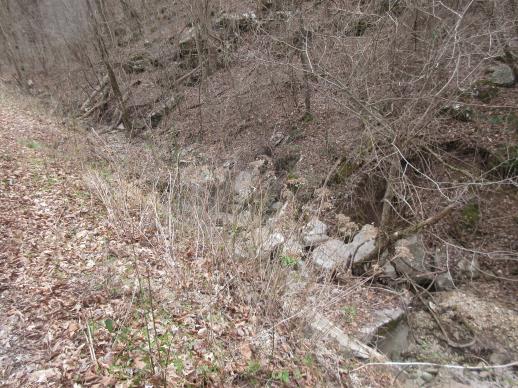 | | 2022 | COLLECTED | 03/15/2022 | Located approximately 3.75 miles east of Allison just off Round Bottom Road. | 35.93357000, -92.05110000 | 144 | Moist, low deciduous forest with scattered rock outcrops, growing along base of hill and bank of seasonal stream. | Wild material | | 2137430 | WLP 2568 |
| 93 | NA 88383 | NEWFS-712 | Iva frutescens L. | New Hampshire, United States | NA | | | 2021 | | | | | | | Wild material | Twiggy shrub. Fleshy, fragrant leaves, five black seeds per ovary. | 2138810 | NA 88383 |
| 94 | OPGC 8522 | NEWFS-366 | Hieracium paniculatum L. | Connecticut, United States | OPGC | | | 2021 | | | | | | | Wild material | Capitula with yellow ligules arranged in a panicle with delicate pedicles. Base of stem densely hairy. | 2137205 | OPGC 8522 |
| 95 | NA 86885 | RJL2021PA-004 | Ilex verticillata (L.) A. Gray | Pennsylvania, United States | NA | | | 2021 | COLLECTED | 11/16/2021 | Plants growing in woodlands along a small unnamed creek corridor dumping into the Middle Branch White Clay Creek in Goddard Park, West Grove Pennsylvania, off of Wickerton Road, Chester County. | 39.81063861, -75.82750806 | 124 | Plants are growing in a range of habitats from mesic woodlands to saturated streamside settings of deciduous woodlands that drain toward the Middle Branch White Clay Creek. Plants grow in high understory shade with dappled to indirect sunlight. The only female (fruiting) plants were found in areas along the creek where soils are moist to saturated. Numerous male specimens were found in the areas described above. Soils: Soils found in the areas where this collection was made are comprised primarily of Baile silt loam (Ba), Hatboro silt loam (Ha), and Glenelg silt loam, 8 to 15 percent slopes (GgC). Baile silt loam consists of very deep, poorly drained, moderately low to moderately high saturated hydraulic conductivity, soils on upland depressions and footslopes that were formed in local alluvium over residuum from acid crystalline rocks, chiefly mica schist and granitized schist and gneiss; slope ranges from 0 to 8 percent. Hatboro silt loam consists of very deep and poorly drained soils formed in deposited alluvium derived from metamorphic and crystalline rock. They are on flood plains. Slopes range from 0 to 3 percent. Glenelg silt loam, 8 to 15 percent slopes consists of very deep, well drained soils formed in residuum weathered from micaceous schist on uplands of the Blue Ridge and the Northern Piedmont. This soil is undifferentiated, mostly poorly drained sandy bottomland soils intermingled with decomposing organic litter and eroded silts and clays due to erosion. Slope: 0 to 15% Aspect: Variable. | Wild material | | 2123125 | NA 86885 |
| 96 | WLP 1731 | RJL2021PA-001 | Viburnum acerifolium L. | Pennsylvania, United States | NA | | | 2021 | COLLECTED | 11/05/2021 | Plants growing in woodlands above a small unnamed creek that dumps into the Middle Branch White Clay Creek in Goddard Park, West Grove Pennsylvania, off of Wickerton Road, Chester County. | 39.80462083, -75.82888750 | 103 | Plants growing in a mesic, well-drained habitat of deciduous woodlands, for the most part, above the riparian zone that drains toward a small unnamed creek that feeds into the Middle Branch White Clay Creek. Plants are growing in high understory shade with very little direct sun during most of the day. The remnant woodlands exist mostly along the steep slopes, wetlands and seeps of seasonal and year-round creeks flowing into the Middle Branch White Clay Creek. The woodlands are bordered by numerous housing developments and land converted to meadows; hence there is significant first order edge that is heavily impacted by invasive plant intrusion. Soils: Soils are classified as Glenelg silt loam, 8 to 15% slopes (GgC); this series consists of very deep, well drained soils formed in residuum weathered from micaceous schist on uplands of the Blue Ridge and the Northern Piedmont. Saturated hydraulic conductivity is moderately high in the subsoil and moderately high to high in the substratum. This upper horizon of this soil is undifferentiated, mostly poorly drained sandy bottomland soils intermingled with decomposing organic litter and eroded silts and clays due to erosion. Slope: 8 to 15% Aspect: West. | Wild material | | 2123080 | WLP 1731 |
| 97 | WLP 1732 | RJL2021PA-002 | Viburnum prunifolium L. | Pennsylvania, United States | NA | | | 2021 | COLLECTED | 11/05/2021 | Plants growing in woodlands along a small unnamed creek corridor dumping into the Middle Branch White Clay Creek in Goddard Park, West Grove Pennsylvania, off of Wickerton Road, Chester County. | 39.80462083, -75.82888750 | 102 | Plants are growing in a range of habitats from drier upland woods to moist creekside settings of deciduous woodlands that drain toward the Middle Branch White Clay Creek. Plants grow in part shade to high understory shade with dappled to indirect direct sunlight. Plants achieve their largest size and fruiting potential in part sun of the riparian zone of the creek where woodland canopy is thinner. Soils: Soils found in the areas where this collection was made are comprised primarily of flood plain Hatboro silt loam (Ha) and well-drained, upland Glenelg silt loam, 8 to 15 percent slopes (GgC). Hatboro silt loam consists of very deep and poorly drained soils formed in deposited alluvium derived from metamorphic and crystalline rock. They are on flood plains. Slopes range from 0 to 3 percent. Glenelg silt loam, 8 to 15 percent slopes consists of very deep, well drained soils formed in residuum weathered from micaceous schist on uplands of the Blue Ridge and the Northern Piedmont. This soil is undifferentiated, mostly poorly drained sandy bottomland soils intermingled with decomposing organic litter and eroded silts and clays due to erosion. Slope: 0 to 15% Aspect: Variable. | Wild material | | 2123098 | WLP 1732 |
| 98 | WLP 1733 | RJL2021PA-003 | Viburnum dentatum L. | Pennsylvania, United States | NA | | | 2021 | COLLECTED | 11/05/2021 | Plants growing in woodlands along a small unnamed creek corridor dumping into the Middle Branch White Clay Creek in Goddard Park, West Grove Pennsylvania, off of Wickerton Road, Chester County. | 39.80522167, -75.82928139 | 107 | Plants are growing in a range of habitats from mesic woodland to moist creekside settings of deciduous woodlands that drain toward the Middle Branch White Clay Creek. Plants grow in high understory shade with dappled to indirect sunlight. Soils: Soils found in the areas where this collection was made are comprised primarily of flood plain Hatboro silt loam (Ha) and well-drained, upland Glenelg silt loam, 8 to 15 percent slopes (GgC). Hatboro silt loam consists of very deep and poorly drained soils formed in deposited alluvium derived from metamorphic and crystalline rock. They are on flood plains. Slopes range from 0 to 3 percent. Glenelg silt loam, 8 to 15 percent slopes consists of very deep, well drained soils formed in residuum weathered from micaceous schist on uplands of the Blue Ridge and the Northern Piedmont. This soil is undifferentiated, mostly poorly drained sandy bottomland soils intermingled with decomposing organic litter and eroded silts and clays due to erosion. Slope: 0 to 15% Aspect: Variable. | Wild material | | 2123124 | WLP 1733 |
| 99 | Ames 35752 | #476-477 | Rhus glabra L. | Iowa, United States | NC7 | 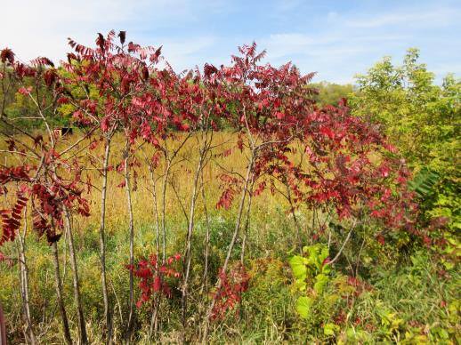 | | 2021 | COLLECTED | 09/29/2021 | Upper Iowa River area near Bluffton, T99N R9W NE1/4 Sec. 9 and S1/2 Sec. 10 | 43.40275000, -91.90494000 | 299 | High bluffs, roadside and stream banks | Wild material | Plants sampled in nature (29 September 2021) during peak fall color displaying bright reds to maroonish colors while measuring approximately 12-15 feet in height. One clonal patch noted was estimated to have 1,000+ ramets. | 2122093 | Ames 35752 |
| 100 | OPGC 7576 | McFarland Park | Solidago flexicaulis L. | Iowa, United States | OPGC |  | | 2021 | COLLECTED | 09/26/2021 | McFarland Park just north, northeast of Ames, T84N R23W Sec. 7 | 42.09667500, -93.57083500 | 288 | Moist areas near streambanks and bottomlands in hardwood forest understory. | Wild material | Plants in nature ranged in height from approximately one to three feet, growing as spreading clumps. Peak flowering in 2021 occurred near 18 September. | 2132830 | OPGC 7576 |
| 101 | Ames 35746 | Guye Woods | Acer saccharum Marshall subsp. nigrum (F. Michx.) Desmarais | Iowa, United States | NC7 |  | | 2021 | COLLECTED | 09/08/2021 | Guye Woods County Park located 6.0 miles northeast of Winterset, T76N R27W NE1/4 Sec. 4 | 41.41235000, -93.96373000 | 278 | Moist deciduous maple, oak, hickory forest, northwest facing slope above the North River. | Wild material | Multiple specimens in this population were observed to be 24" diameter at breast height (DBH) or larger with the largest specimen encountered at the time of collection measuring 36.5" DBH.
Morphological traits of leaves suggests sampled specimens are true to type of Acer saccharum subsp. nigrum including leaves with three distinct points, leathery/thick, and drooping in appearance. On September 25, 2020 (Schmitz, A., personal communication, 31 January 2022), peak fall color on Acer saccharum subsp. nigrum at Guye Woods was observed with specimens having a clean yellow fall color, also indicative of Acer saccharum subsp. nigrum.
| 2122010 | Ames 35746 |
| 102 | WLP 2484 | AS/TO/2021/017/117 | Thuja occidentalis L. | Illinois, United States | NA |  | | 2021 | COLLECTED | 08/26/2021 | State Route 71 along Illinois River located approximately 1.30 miles southwest of Ottawa, T33N R3E SW1/4 NE1/4 Sec. 15 | 41.33211800, -88.86347300 | 146 | Roadside at top of limestone cliff above Illinois River. | Wild material | Thuja occidentalis is a medium sized, evergreen tree that is native throughout northeastern North America stretching from Minnesota to Maine with scattered distributions in the Appalachian Mountains. In Illinois, Northern White Cedar was formerly listed as a state-threatened species, but delisted in 2004 (Mankowski 2012) and is localized to bluffs and cliffs of St. Peter sandstone and rocky outcroppings. Elsewhere, the species is abundant in sphagnum peat swamps, lake shorelines, and moist woods. This accession was collected on the southwest edge of the species native range and is one of the southern-most, known native localities in Illinois and thus may contain genetics for heat and drought tolerance. Genetics for this accessions were collected from two areas separated by approximately 6.50 miles. | 2120343 | WLP 2484 |
| 103 | Ames 35734 | Ledges State Park | Teucrium canadense L. | Iowa, United States | NC7 |  | | 2021 | COLLECTED | 08/23/2021 | Ledges State Park located approximately 4.75 miles south of Boone T83N R26W Sec. 16 & 21 | 41.99262400, -93.87724800 | 330 | Edges of woods | Wild material | | 2120338 | Ames 35734 |
| 104 | Ames 36047 | CBG-10076 | Helianthus divaricatus L. | Oklahoma, United States | NC7 | | | 2021 | | | | | | | Wild material | | 2120050 | Ames 36047 |
| 105 | NA 88199 | CBG-10062 | Callicarpa americana L. | Oklahoma, United States | NA | | | 2021 | | | | | | | Wild material | | 2120043 | NA 88199 |
| 106 | OPGC 8289 | CBG-10186 | Verbena hastata L. | Oklahoma, United States | OPGC | | | 2021 | | | | | | | Wild material | | 2120055 | OPGC 8289 |
| 107 | OPGC 8359 | CBG-10615 | Symphyotrichum drummondii (Lindl.) G. L. Nesom | Illinois, United States | OPGC | | | 2021 | | | | | | | Wild material | Plant numbers sampled estimated. | 2120231 | OPGC 8359 |
| 108 | W6 59177 | CBG-10464 | Carex normalis Mack. | Illinois, United States | W6 | | | 2021 | | | | | | | Wild material | | 2120098 | W6 59177 |
| 109 | W6 59183 | CBG-10474 | Leersia virginica Willd. | Illinois, United States | W6 | | | 2021 | | | | | | | Wild material | | 2120104 | W6 59183 |
| 110 | W6 59200 | CBG-10494 | Cinna arundinacea L. | Illinois, United States | W6 | | | 2021 | | | | | | | Wild material | | 2120119 | W6 59200 |
| 111 | W6 59274 | CBG-10598 | Scrophularia marilandica L. | Illinois, United States | W6 | | | 2021 | | | | | | | Wild material | Plant numbers sampled estimated. | 2120183 | W6 59274 |
| 112 | NA 88399 | NCBG-670 | Kalmia latifolia L. | Maryland, United States | NA | | | 2021 | | | | | | | Wild material | | 2116373 | NA 88399 |
| 113 | W6 59062 | NCBG-676 | Andropogon gerardi Vitman | Virginia, United States | W6 | | | 2021 | | | | | | | Wild material | | 2116376 | W6 59062 |
| 114 | NA 88283 | NEWFS-554 | Cephalanthus occidentalis L. | Massachusetts, United States | NA | | | 2021 | | | | | | | Wild material | Opposite branches, balls of white flowers, seeds in balls. | 2115694 | NA 88283 |
| 115 | NA 88284 | NEWFS-557 | Cephalanthus occidentalis L. | Massachusetts, United States | NA | | | 2021 | | | | | | | Wild material | | 2115697 | NA 88284 |
| 116 | NA 88298 | NEWFS-570 | Clethra alnifolia L. | Connecticut, United States | NA | | | 2021 | | | | | | | Wild material | | 2115704 | NA 88298 |
| 117 | NA 88398 | NEWFS-571 | Kalmia latifolia L. | Connecticut, United States | NA | | | 2021 | | | | | | | Wild material | | 2115705 | NA 88398 |
| 118 | OPGC 8206 | NEWFS-569 | Eurybia divaricata (L.) G. L. Nesom | Connecticut, United States | OPGC | | | 2021 | | | | | | | Wild material | | 2115703 | OPGC 8206 |
| 119 | W6 58757 | NEWFS-556 | Scirpus cyperinus (L.) Kunth | Massachusetts, United States | W6 | | | 2021 | | | | | | | Wild material | | 2115696 | W6 58757 |
| 120 | NA 88281 | MARSB-497 | Cephalanthus occidentalis L. | New Jersey, United States | NA | | | 2021 | | | | | | | Wild material | Growth formûthe plant is a shrub (i.e., a woody plant with several stems growing from the base)ûLeaf typeûthe leaf blade is simple (i.e., lobed or unlobed but not separated into leaflets)ûLeaves per nodeûthere are three leaves per node along the stemûthere are two leaves per node along the stemûLeaf blade edgesûthe edge of the leaf blade has teethûLeaf durationûthe leaves drop off in winter (or they wither but persist on the plant)ûarmature on plantûthe plant does not have spines, prickles, or thornsûLeaf blade lengthû80–150 mmûLeaf blade widthû23–150 mmûLeaf stalkûthe leaves have leaf stalksûFruit type (general)ûthe fruit is dry but does not split open when ripeûBark textureûthe bark of an adult plant is ridged or platedûthe bark of an adult plant is thin and smoothûTwig winter colorûbrownûgrayûredûBud scale numberûthere are no scales on the winter buds | 2113542 | NA 88281 |
| 121 | OPGC 8148 | MARSB-496 | Typha latifolia L. | New Jersey, United States | OPGC | | | 2021 | | | | | | | Wild material | Stem shape in cross-sectionûthe stem is round or oval in cross-sectionûLeaf blade widthû5–29 mmûLeaf blade cross-sectionûthe leaf blade is flat or rolled in at the edgesûInflorescence positionûthe inflorescence is at the tip of the plantûInflorescence branchingûthe inflorescence is on one or more stems with no branchesûFruit type (general)ûthe fruit is like a seed, and surrounded by hairsûFruit lengthû10–15 mmûLeaf position on plantûsome leaf attachment points are above the midpoint of the stemûPerianth compositionûthere are long, thin hairs attached at the base of the acheneûthere are three bristles and three scales on narrow stalks, attached at the base of the acheneûFruit cross-sectionûthe fruit is triangular to terete (circular) in cross-section | 2113541 | OPGC 8148 |
| 122 | W6 58575 | MARSB-215 | Juncus secundus P. Beauv. ex Poir. | New York, United States | W6 | | | 2021 | | | | | | | Wild material | Plants are in seed. The inflorescences are straw colored. The inflorescences are at the top of the stem, not spreading. It is taller than Juncus tenuis. | 2113505 | W6 58575 |
| 123 | W6 58592 | MARSB-450 | Danthonia spicata (L.) P. Beauv. ex Roem. & Schult. | New Jersey, United States | W6 | | | 2021 | | | | | | | Wild material | Dense tufts. Leaves born mostly near base, blades curly. lower sheaths often contain cleistogamous spikelets. inflorescence contracted, racemiform. | 2113522 | W6 58592 |
| 124 | W6 58597 | MARSB-457 | Carex crinita Lam. | New Jersey, United States | W6 | | | 2021 | | | | | | | Wild material | Densely tufted, 4-16 dm. stems surpassing the leaves. spikes loosely spreading to drooping on slender peduncles. perigynia silky green, 2-ribbed. achene lenticular. | 2113527 | W6 58597 |
| 125 | W6 58601 | MARSB-470 | Carex lurida Wahlenb. | New Jersey, United States | W6 | | | 2021 | | | | | | | Wild material | stem leaf blade widthû4–13 mmûLowest bract sheathûthe lowest bract has a sheath longer than four millimetersûthe lowest bract has no sheath (or a very short sheath up to four millimeters in length)ûSpike on stalkûthe lowest spike on the plant has a peduncleûTop spikeûthe uppermost spike contains only staminate flowersûPerigynium hairsûthe perigynium has no hairsûPerigynium lengthû6–10.8 mmûLeaf sheath colorûthe leaf sheath is tinted pink, red or purpleûLeaf blade textureûthe leaf blade is smooth and hairless, or rough and sandpaperyûPerigynium beak teethûthe perigynium beak is divided at the top into two teeth | 2113531 | W6 58601 |
| 126 | W6 58613 | MARSB-498 | Scirpus cyperinus (L.) Kunth | New Jersey, United States | W6 | | | 2021 | | | | | | | Wild material | Stem shape in cross-sectionûthe stem is roughly triangular in cross-sectionûthe stem is round or oval in cross-sectionûLeaf blade widthû3–10 mmûLeaf blade cross-sectionûthe leaf blade is flat or rolled in at the edgesûInflorescence positionûthe inflorescence is at the tip of the plantûInflorescence branchingûthe inflorescence is branchedûFruit type (general)ûthe fruit is like a seed, and surrounded by hairsûthe fruit is like a seed, and surrounded by scalesûFruit lengthû0.6–0.9 mmûLeaf position on plantûsome leaf attachment points are above the midpoint of the stemûthe attachment points of all the leaves are at or near the base of the plantûPerianth compositionûthere are bristles attached at the base of the acheneûFruit cross-sectionûthe fruit is lenticular (lens-shaped) in cross-sectionûthe fruit is triangular to terete (circular) in cross-section | 2113543 | W6 58613 |
| 127 | Ames 35649 | Backbone | Pinus strobus L. | Iowa, United States | NC7 |  | | 2021 | COLLECTED | 03/04/2021 | Backbone State Park located approximately 5.15 miles south, southwest of Strawberry Point, T90N R6W NW1/4 Sec. 16 | 42.61131500, -91.56098900 | 316 | Cliff edges and steep slopes above the Maquoketa River, including the ridge known as the "Backbone". | Wild material | The native range of Pinus strobus is concentrated in the northeastern United States extending south into the northern edge of Georgia and west to central Minnesota. In Iowa, there are scattered populations in a few northeastern counties and also a very small disjunct population in central Iowa (Hardin County, Ames 32758) and also one in southeastern Iowa (Muscatine County, Ames 35635). This accession represents genetics from "legacy" specimens from northeastern Iowa in Backbone State Park (Delaware County). Although a significant number of P. strobus were planted at this park in the 1920's a significant number of native specimens still exist throughout the park typically found on extreme topographical features such as steep slopes and rock outcroppings. Genetics from this site likely represents the extreme southwestern edge of the species native range. Genetics may likely be adapted/tolerant to drought and also late winter/early spring extreme temperature fluctuations. Accession was collected as scions in winter to capture genetics that are of known origin. | 2113351 | Ames 35649 |
| 128 | Ames 35650 | Bixby | Pinus strobus L. | Iowa, United States | NC7 |  | | 2021 | COLLECTED | 03/04/2021 | Bixby State Preserve on slopes above Bear Creek, located approximately 6.25 miles east of Strawberry Point, T91N R5W SE1/4 Sec. 22 | 42.67534800, -91.41301000 | 324 | Cliff edges and steep slopes. | Wild material | The native range of Pinus strobus is concentrated in the northeastern United States extending south into the northern edge of Georgia and west to central Minnesota. In Iowa, there are scattered populations in a few northeastern counties and also a very small disjunct population in central Iowa (Hardin County, Ames 32758) and also one in southeastern Iowa (Muscatine County, Ames 35635). This accession represents genetics from "legacy" specimens from northeastern Iowa in Bixby State Preserve (Clayton County). Genetics from this site likely represents the extreme southwestern edge of the species native range. Genetics may likely be adapted/tolerant to drought and also late winter/early spring extreme temperature fluctuations. Accession was collected as scions in winter to capture genetics that are of known origin. | 2113352 | Ames 35650 |
| 129 | Ames 35635 | Wildcat Den | Pinus strobus L. | Iowa, United States | NC7 |  | | 2021 | COLLECTED | 03/02/2021 | Wildcat Den State Preserve near Muscatine, T77N R1E SW1/4 SW1/4 Sec. 17 | 41.46735000, -90.88171000 | 185 | Canyon edges and valleys. | Wild material | The native range of Pinus strobus is concentrated in the northeastern United States extending south into the northern edge of Georgia and west to central Minnesota. In Iowa, there are scattered populations in a few northeastern counties and also a very small disjunct population in central Iowa (Hardin County, Ames 32758) and one in southeastern Iowa (Muscatine County). This accession represents genetics from five mother "legacy" trees located in Wildcat Den State Park (Muscatine County). Although a significant number of P. strobus were planted at this park in the early 1900's a significant number of native specimens still exist as a localized grouping within the central portion of the park in the deep valleys and also one specimen on an extreme rock outcropping. P. strobus from this site represents the extreme southwestern edge of the species native range. Genetics may likely be adapted/tolerant to drought and also late winter/early spring extreme temperature fluctuations. Specimen #1 sampled at this site is currently ranked as the 6th largest Pinus strobus in the state (M. Rouw, pers. comm. 28 February 2021) measuring 11'6" circumference; 127.5' height; and 45' crown spread (Total Points: 276.75). Accession was collected as scions in winter to capture genetics that are of known origin. | 2113335 | Ames 35635 |
| 130 | Ames 35614 | F017 | Physocarpus opulifolius (L.) Maxim. | Pennsylvania, United States | NC7 |  | | 2020 | COLLECTED | 09/29/2020 | Camp Shand located approximately 1.97 miles south, southeast of Cornwall, Lebanon County | 40.24719440, -76.39194440 | 231 | Powerline cut. Edge of woods | Wild material | | 2109481 | Ames 35614 |
| 131 | NA 88466 | F013 | Viburnum dentatum L. | Pennsylvania, United States | NA | | | 2020 | COLLECTED | 09/09/2020 | Schaefferstown, PA: Middle Creek Wildlife Management Area, along the Middle Creek power lines on the southern side, starting near Laurel Drive and hiking east to Middle Creek. | 40.26400000, -76.25333000 | | | Wild material | | 2109477 | NA 88466 |
| 132 | Ames 35574 | Southeastern Westmoreland County | Monarda didyma L. | Pennsylvania, United States | NC7 |  | | 2020 | COLLECTED | 09/16/2020 | Rolling Rock and Linn Run Creek watersheds (roughly 1.75 miles apart) located approximately 3.0-4.0 miles southeast of Rector, Westmoreland County | 40.17100000, -79.19200000 | 493 | Wooded area | Wild material | | 2107737 | Ames 35574 |
| 133 | Ames 35547 | White Pine Hollow | Pinus strobus L. | Iowa, United States | NC7 |  | | 2020 | COLLECTED | 08/20/2020 | White Pine Hollow State Preserve located approximately 2.65 miles northwest of Luxemburg, T90N R2W SE 1/4 Sec. 7, Dubuque County | 42.61954600, -91.11933000 | 308 | High-quality remant mixed woods | Wild material | The native range of Pinus strobus is concentrated in the northeastern United States extending south into the northern edge of Georgia and west to central Minnesota. In Iowa, there are scattered populations in a few northeastern counties and also a very small disjunct population in central Iowa (Hardin County, Ames 32758) and also in southeastern Iowa (Muscatine County, Ames 35635). This accession represents genetics from northesastern Iowa in White Pine Hollow (WPH) in Dubuque County and is known to harbor the largest stand of white pine in Iowa dating back to the 1870's. WPH was the first woodland in Iowa to be dedicated (1967) as a state preserve and was previously known to contain Iowa's oldest white oak with a core date estimated back to the year 1580 (Duvick and Blasing 1983). WPH is home to the largest native specimen of Pinus strobus measuring 11’1.5” circumference, 142’ tall, and 44’ spread for a total of 286.3 points (Rouw, M., personal communication, 21 September 2020). “In an assessment of 92 of the largest white pines (native and cultivated) across Iowa, 68 occur in WPH. Out of 40 that exceed a height of 130', 38 are found in WPH with seven of those exceeding 140' and two surpassing 147' (Rouw, M., personal communication, 18 September 2020). The site is also the location of height records (Iowa) for several tree species including Ulmus americana 108', Tilia americana 105.5', Acer saccharum 109', Quercus alba 107', and Carya ovata 109’ (Rouw, M., personal communication, 18 September 2020). P. strobus in WPH is the dominant overstory species specifically in areas next to ravines/valleys and some immediately adjacent uplands. P. strobus from this site represents the extreme western edge of the species native range. Genetics may likely be adapted/tolerant to drought and also late winter/early spring extreme temperature fluctuations. Accession was collected both as seeds (2020) and as scions (2021). | 2106728 | Ames 35547 |
| 134 | NA 87370 | NCTN59 | Hydrangea barbara (L.) Bernd Schulz | Tennessee, United States | NA | | | 2020 | COLLECTED | 22/09/2019 | | 35.10423000, -84.61030000 | 256 | Mesic oak-pine forest edge, growing up trunks of trees on a steep, rocky slope. | Wild material | Three seedlings received along with NA 87106-87112, but not requested for accessioning at the same time. | 2141752 | NA 87370 |
| 135 | WLP 2026 | MARSB-993 | Viburnum acerifolium L. | New York, United States | NA | | | 2019 | COLLECTED | 09/06/2019 | Tompkins County; ; Cornell Botanical Gardens: Cayuga Monkey Run Trail. | 42.45601000, -76.45154000 | | Hillside forest in full shade; growing in moist, well-drained silt/clay soil. | | Seed harvested from 10+ individuals in a population of 40+. Common. Seed 85 percent healthy; seed maturation middle, late. | 2109175 | WLP 2026 |
| 136 | WLP 2031 | MARSB-998 | Viburnum acerifolium L. | New York, United States | NA | | | 2019 | COLLECTED | 09/20/2019 | Monroe County; Perinton; Horizon Hill Conservation Area [side of Interstate 490 west, alongside Bushnell's Basin exit (Exit 27).] | 43.04778000, -77.46235000 | 189 | Oak/hickory forest in partial shade; growing in moist, well-drained loam soil. | | Seeds collected from 40 individuals in a population of 100 plants spread across a 60 m by 60 m area; scattered distribution. 95 percent healthy seed. Seed maturation: middle. | 2109180 | WLP 2031 |
| 137 | WLP 2032 | MARSB-999 | Viburnum acerifolium L. | New York, United States | NA | | | 2019 | COLLECTED | 09/08/2019 | Dutchess County; Rhinebeck; Enterprise Drive, private residential property. | | 305 | Oak forest in partial shade; growing in dry loamy sand. | | Seeds collected from 100+ individuals in a population of 100+ plants spread across a 300 meter by 300 meter linear strip [?]; common. Seed maturation: late. | 2109181 | WLP 2032 |
| 138 | WLP 2034 | MARSB-1001 | Viburnum acerifolium L. | New York, United States | NA | | | 2019 | COLLECTED | 07/08/2019 | Dutchess County; Tivoli; Bard College campus. | | 122 | Oak woodland in partial shade; growing in dry loamy sand. | | Seeds collected from 75 individuals in a population of 100+ plants spread across a ca 1 square mile area; common. Seed maturation: late. | 2109183 | WLP 2034 |
| 139 | WLP 2035 | MARSB-1002 | Viburnum acerifolium L. | New York, United States | NA | | | 2019 | COLLECTED | 09/05/2019 | Dutchess County; Barrytown; Rokeby Rd. [Locality not recorded, but inferred from similarity of other data, including recorded landowner, to MARSB-1006/MARSB_MM_015/NA 86371. -SBL] | | 91 | Oak-hickory woodland in partial shade; g rowing in dry loam soil. | | Seeds collected from 50+ individuals in a population of 100+ plants; common. Seed maturation: middle. Birds & herbivory, low fruit set noted. | 2109184 | WLP 2035 |
| 140 | W6 57403 | NEWFS-334 | Carex crinita Lam. | New Hampshire, United States | W6 |  | | 2019 | | | | | | | Wild material | | 2098200 | W6 57403 |
| 141 | W6 57390 | NEWFS-297 | Phytolacca americana L. | Massachusetts, United States | W6 |  | | 2019 | | | | | | | Wild material | | 2098187 | W6 57390 |
| 142 | W6 57372 | NEWFS-234 | Spiraea alba Du Roi | Massachusetts, United States | W6 |  | | 2019 | | | | | | | Wild material | | 2098169 | W6 57372 |
| 143 | WLP 2503 | Jeff Busby Park | Hydrangea quercifolia W. Bartram | Mississippi, United States | NA |  | | 2019 | COLLECTED | 12/16/2017 | Jeff Busby Park, Choctaw County, along Natchez Trace National Parkway. 8.4 miles south of Eupora. | 33.41567000, -89.26402200 | | Steep slopes on mountainside, steep roadsides, ravines. | Wild material | Specimens in nature represented as dense, clonaly spreading colonies with abundant flowering. A few plants had persistent leaves on 16 December 2017. | 2106213 | WLP 2503 |
| 144 | WLP 2526 | Franklin D. Roosevelt State Park | Hydrangea quercifolia W. Bartram | Georgia, United States | NA |  | | 2019 | COLLECTED | 11/28/2018 | Franklin D. Roosevelt State Park, Harris County. Approximately 1.9 miles southeast of Pine Mountain along Mountain Creek. | 32.84099500, -84.83899300 | | Shady streambank. | Wild material | Measurements of sampled specimen taken in nature: Height 47 to 101 in.; width 27 to 99 in. | 2106236 | WLP 2526 |
| 145 | NA 88104 | MARSB-398 | Lyonia mariana (L.) D. Don | New York, United States | NA |  | | 2019 | | | | | | | Wild material | | 2097612 | NA 88104 |
| 146 | NA 88111 | MARSB-428 | Lyonia ligustrina (L.) DC. | New Jersey, United States | NA |  | | 2019 | | | | | | | Wild material | | 2097629 | NA 88111 |
| 147 | NA 88112 | MARSB-467 | Viburnum dentatum L. | New Jersey, United States | NA | | | 2019 | | | | | | | Wild material | | 2097634 | NA 88112 |
| 148 | W6 57084 | MARSB-216 | Carex annectens (E. P. Bicknell) E. P. Bicknell | New York, United States | W6 |  | | 2019 | | | | | | | Wild material | | 2097523 | W6 57084 |
| 149 | W6 57085 | MARSB-218 | Scirpus atrovirens Willd. | New York, United States | W6 |  | | 2019 | | | | | | | Wild material | | 2097524 | W6 57085 |
| 150 | W6 57168 | MARSB-389 | Ageratina altissima (L.) R. M. King & H. Rob. | Delaware, United States | W6 |  | | 2019 | | | | | | | Wild material | | 2097607 | W6 57168 |
| 151 | W6 57189 | MARSB-427 | Alnus serrulata (Aiton) Willd. | New Jersey, United States | W6 |  | | 2019 | | | | | | | Wild material | | 2097628 | W6 57189 |
| 152 | W6 57290 | MARSB-844 | Elymus hystrix L. | New Jersey, United States | W6 |  | | 2019 | | | | | | | Wild material | | 2097729 | W6 57290 |
| 153 | WLP 1686 | APS/RS/2019/067/396 | Rosa setigera Michx. | Arkansas, United States | NA |  | | 2019 | COLLECTED | 11/07/2019 | Located near intersection of Smith Mountain Road and Newton County 8828 Road approximately 6.00 miles north of Deer, Newton County | 35.91212000, -93.21112000 | 636 | Roadside, upland with rocky soils | Wild material | | 2097789 | WLP 1686 |
| 154 | WLP 1685 | JDC/RS/2019/036/915 | Rosa setigera Michx. | Iowa, United States | NA |  | | 2019 | COLLECTED | 10/17/2019 | Ledges State Park located approximately 4.75 miles south of Boone, just south of the Oakwoods Shelter/Picnic area, T83N R26W NE1/4 NE1/4 and also NW1/4 NE1/4 Sec. 21, Boone County | 41.99262400, -93.87724800 | 330 | Edges of woods (adjacent to prairie) and also within 20-25 yards from woods in prairie. Noted in east, west, and south-facing edges of woods (no specimens noted on north-facing woodland edges) | Wild material | Woody shrub/vine stretching up to 12' in length. Alternate compound leaves usually consisting of five lealets. Leaf rachis and stipule margins glandular. Mature hypanthium and pedicel with stipitate glandular hairs. Mature hypanthium mostly bright to dark red in color with a few dark orange noted at time of harvest (17 October 2019). Leaves rather to somewhat glossy. This collection represents genetics from the northwestern edge of the species range, likely suggesting good cold-hardiness (USDA Zone 5a). | 2097769 | WLP 1685 |
| 155 | WLP 156 | NACPEC19-022 | Oxydendrum arboreum (L.) DC. | Kentucky, United States | NA | | | 2019 | COLLECTED | 09/09/2019 | Madison County; Berea College Forest: Around the corner from Upper Indian Fort Trail Junction, on top of the Davis Hollow "holler" | 37.56414400, -84.23341800 | 477 | Sandstone outcrop, incredibly thin, low pH <4. Very heavy foot traffic | Wild material | | 2110468 | WLP 156 |
| 156 | WLP 157 | NACPEC19-026 | Carpinus caroliniana Walter | Kentucky, United States | NA | | | 2019 | COLLECTED | 09/09/2019 | Madison County; Berea College Forest: Gabertown Road, near junction of Gabertown Road (KY 1617) + Scaffold Cane (KY595) | 37.54309800, -84.27086000 | 292 | Former Pinus taeda plantation | Wild material | | 2110469 | WLP 157 |
| 157 | WLP 167 | NACPEC19-053 | Mitchella repens L. | Georgia, United States | NA | | | 2019 | COLLECTED | 09/14/2019 | Walker County; Lula Lake Land Trust: Middle Trail near top, also collected along Connector Trail to Middle Trail from parking lot. | 34.93141800, -85.36991400 | 469 | Mesic, sandy, rocky Oak-Hickory woodland slope - likely acidic | Wild material | | 2110479 | WLP 167 |
| 158 | WLP 168 | NACPEC19-054 | Viburnum acerifolium L. | Georgia, United States | NA | | | 2019 | COLLECTED | 09/14/2019 | Walker County; Lula Lake Land Trust: Middle Trail near top. | 34.93146200, -85.37018800 | 449 | Mesic, sandy, rocky Oak-Hickory woodland slope - likely acidic | Wild material | | 2110480 | WLP 168 |
| 159 | WLP 172 | NACPEC19-069 | Smilax lasioneura Hook. | North Carolina, United States | NA | | | 2019 | COLLECTED | 09/16/2019 | Transylvania County; Southern Highland Reserve: Toxaway Mountain, Service Road (name unknown), adjacent to Southern Highlands Reserve: Power line cut. | 35.13228000, -82.98331400 | 1455 | Roadside edge, disturbed opening: mountaintop mixed Oak-Chestnut woodland (forest margin at high elevation) | Wild material | | 2110486 | WLP 172 |
| 160 | WLP 177 | NACPEC19-090 | Aralia spinosa L. | North Carolina, United States | NA | | | 2019 | COLLECTED | 09/18/2019 | Clay County; Nantahala National Forest: Winding Stair Gap Parking Lot, Murphy Road, U.S. Hwy 64, Appalachian Trail Trailhead Parking | 35.11992300, -83.54804600 | 1134 | Parking lot edge of mixed mesophytic forest, drainage ditch adjacent | Wild material | | 2110491 | WLP 177 |
| 161 | Ames 35229 | JDC/AS/2019/020/899 | Agastache scrophulariifolia (Willd.) Kuntze | Iowa, United States | NC7 |  | | 2019 | COLLECTED | 10/01/2019 | Hertz Family Woods & Nature Preserve just 2.25 miles south of Nevada (T83N R22W NW1/4 NW1/4 Sec. 20) and Robison Wildlife Acres just 6.75 miles south of Nevada (T82N R22W NE1/4 SW1/4 Sec. 8), Story County | 41.99070000, -93.44186700 | 285 | Moist, semi-shaded, deciduous woods. | Wild material | Plants measuring approximately 6' in height with somewhat short (perhaps due to dense shade) 2-3" spikes rather white or extremely pale pink in color. Peak flowering occurred circa 26 August 2019 in nature. | 2097765 | Ames 35229 |
| 162 | Ames 35228 | JDC/AS/2019/031/910 | Agastache scrophulariifolia (Willd.) Kuntze | Iowa, United States | NC7 |  | | 2019 | COLLECTED | 09/30/2019 | Ledges State Park located approximately 4.75 miles south of Boone, just east and south of the Carl Fritz Henning Shelter, T83N R26W SW1/4 SE1/4 NW1/4 Sec. 21, Boone County | 41.98786200, -93.88824500 | 276 | Moist, semi-shaded, deciduous woods. Recently disturbed. | Wild material | Plants measuring approximately 6-8' in height with 4-5" spikes rather white or extremely pale pink in color. Peak flowering occurred circa 26 August 2019 in nature. | 2097764 | Ames 35228 |
| 163 | WLP 2008 | MARSB-974 | Viburnum dentatum L. | New York, United States | NA | | | 2019 | COLLECTED | 07/29/2019 | Columbia County; Clermont; Church Avenue, Clermont, New York; privately owned agricultural land. | 0.00000000, 0.00000000 | 183 | Edge of oak-hickory woodland in partial shade; growing in dry clay-loam soil. | | Seeds collected directly from plants. Species common in area; 50+ individuals in population, 50+ individuals sampled, with population area 1/4 mile (linear). | 2109104 | WLP 2008 |
| 164 | WLP 2010 | MARSB-977 | Viburnum dentatum L. | New York, United States | NA | | | 2019 | COLLECTED | 08/02/2019 | Greene County; Catskill; Scenic Hudson plot (land in conservation use) on Kukuk Rd in Catskill, New York [Note: location could not be found on maps, and no latitude and longitude were supplied; possibly Kukuk Lane in Kingston, New York, which is a bit south of Catskill. -SBL] | 0.00000000, 0.00000000 | 91 | Edge of oak-hickory woodland; growing in full sun in loamy sand soil. | | Seeds collected directly from plants. Sparse seed set noted. Species scattered in area; 30+ individuals in population, 32 individuals sampled, with population area 1 mile x 1 mile. | 2109106 | WLP 2010 |
| 165 | Ames 35220 | Ames 35220 | Aronia ×prunifolia (Marshall) Rehder | Wisconsin, United States | NC7 |  | | 2019 | COLLECTED | 09/04/2019 | Watershed area of Brule River. Collection site located approximately 3.75 miles southwest of Winneboujou, 0.30 miles west of intersection of Francis Willard Road and Forestry Road, T46N R10W SW1/4 SW1/4 Sec. 8, Douglas County | 46.47574000, -91.65172000 | 359 | Ecotone of Tamarack Swamp, Northern Sedge Meadow and Upland Northern Hardwood Forest | Wild material | Plants in nature ranging from 1.0-2.5 meters in height. Fruits measuring approximately 7-9mm in diameter and dark reddish-purple at time of collection (4 September 2019). | 2097756 | Ames 35220 |
| 166 | Ames 34943 | JDC/BC/2019/025/904 | Blephilia ciliata (L.) Benth. | West Virginia, United States | NC7 |  | | 2019 | COLLECTED | 08/10/2019 | Smoke Hole Region: Powers Hollow. Located approximately 5.2 miles west of Petersburg on the east side of Powers Hollow Road, Grant County | 39.00611600, -79.22179200 | 482 | Open woodland. Dry, rock with sparse vegetation. | Wild material | Plants approximately 12" in height. Specimens at time of sampling (10 August 2019) were completely dried to soil line with no leaves remaining. | 2096625 | Ames 34943 |
| 167 | Ames 34944 | JDC/HD/2019/023/902 | Helianthus divaricatus L. | West Virginia, United States | NC7 |  | | 2019 | COLLECTED | 08/10/2019 | Smoke Hole Region: Eagle Rock. Located on east side of South Branch Potomac River approximately 2.85 miles north of Upper Tract and 0.5 miles northeast of Eagle Rock formation, Pendleton County | 38.82840700, -79.28397500 | 702 | Open woodland. Dry, rock with sparse vegetation. | Wild material | Majority of specimens noted were close to peak fruit maturity with a few specimens just past peak flowering. Specimens approximately 3' in height. | 2096626 | Ames 34944 |
| 168 | Ames 34946 | JDC/LL/2019/024/903 | Linum lewisii Pursh | West Virginia, United States | NC7 | 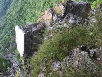 | | 2019 | COLLECTED | 08/10/2019 | Smoke Hole Region: Eagle Rock. Located on east side of South Branch Potomac River approximately 2.85 miles north of Upper Tract and 0.5 miles northeast of Eagle Rock formation, Pendleton County | 38.82840700, -79.28397500 | 702 | Exposed rock cliff edges. | Wild material | Plants approximately 20-24" in height. Fruits persisting and fully mature at time of sampling (10 August 2019). Noted a few plants actively blooming. | 2096628 | Ames 34946 |
| 169 | Ames 34948 | JDC/PO/2019/026/905 | Physocarpus opulifolius (L.) Maxim. | West Virginia, United States | NC7 |  | | 2019 | COLLECTED | 08/10/2019 | Smoke Hole Region: Powers Hollow. Located approximately 5.2 miles west of Petersburg on the east side of Powers Hollow Road, Grant County | 39.00339500, -79.22036500 | 455 | Exposed rock cliff edges. | Wild material | Fruits close to peak maturity. Small plants approximately 3-4' in height and spread likely due to extremely harsh habitat. In cultivation (NCRPIS), plants grow greater than 5' in height. | 2096630 | Ames 34948 |
| 170 | OPGC 7572 | JDC/HX/2019/028/907 | Heuchera alba Rydb. | West Virginia, United States | OPGC |  | | 2019 | COLLECTED | 08/10/2019 | Smoke Hole Region: Powers Hollow. Located approximately 5.2 miles west of Petersburg on the east side of Powers Hollow Road, Grant County | 39.00339500, -79.22036500 | 455 | Exposed rock cliff edges. | Wild material | Heuchera alba is a narrow Appalachian endemic and globally imperiled (G2) taxon recorded only from West Virginia and Virginia that occurs in sympatry with H. pubescens and H. americana. According to Scheutte et al. 2018, the range for H. alba is restricted to high elevation acidic sandstone ridges and outcrops in the Ridge-and-Valley province of West Virginia and Virginia. In cultivation (central Iowa) the leaves emerge with subtle variegation that is lost by early summer. Flowers are creamy white to pale green. | 2096627 | OPGC 7572 |
| 171 | OPGC 7496 | CBG-9546 | Solidago ulmifolia Muhl. ex Willd. | Illinois, United States | OPGC |  | | 2019 | | | | | | | Wild material | | 2092814 | OPGC 7496 |
| 172 | OPGC 7855 | CBG-9538 | Eutrochium purpureum (L.) E. E. Lamont | Illinois, United States | OPGC |  | | 2019 | | | | | | | Wild material | | 2092807 | OPGC 7855 |
| 173 | W6 56710 | CBG-9540 | Scrophularia marilandica L. | Illinois, United States | W6 |  | | 2019 | | | | | | | Wild material | | 2092809 | W6 56710 |
| 174 | Ames 34607 | JDC/MB/2019/012/891 | Monarda brevis (Fosberg & Artz) Floden | West Virginia, United States | NC7 |  | | 2019 | | | | | | | Wild material | This accession likely represents the holotype for Monarda brevis that was vouchered by Lena Artz in 1953 (Catalog No. 2097485). Variation in flower color present from near white, faint pink to faint "smoky" purple. Majority of specimens noted at collection site in nature were approximately 3-5 days past peak flower on 10 June 2019 with seeds reaching maturity approximately 55 days later. Majority of specimens observed were apprxoimately 10" in height. Very healthy, dark-green leaves that maintained quality throughout the season (observed mid-August 2019). | 2092643 | Ames 34607 |
| 175 | Ames 34608 | JDC/MB/2019/013/892 | Monarda brevis (Fosberg & Artz) Floden | West Virginia, United States | NC7 |  | | 2019 | | | | | | | Wild material | Majority of specimens noted at collection site in nature were approximately 5-7 days past peak flower on 11 June 2019 with seeds reaching maturity approximately 55 days later. Very healthy, dark-green leaves near peak flowering with some minor decline in leaf quality later in the season (observed mid-August 2019). Majority of specimens less than 10" in height. A few specimens with noteable hairs on stems, specifically near soil line. | 2092644 | Ames 34608 |
| 176 | WLP 686 | NA 85862 | Amelanchier arborea (F. Michx.) Fernald | Kentucky, United States | NA | | | 2019 | COLLECTED | 06/15/2019 | Madison County; ; South of Berea. | 37.55708000, -84.29542000 | | Growing on the side of a steep Devonian black shale embankment, partly shaded by the canopy above. | | There were other Amelanchier arborea trees in the immediate vicinity, however, these trees did not have any significant amount of viable berries. These berries were harvested from approximately 8 m high in the tree. | 2109078 | WLP 686 |
| 177 | NA 88058 | NEWFS-80 | Mitchella repens L. | Massachusetts, United States | NA | | | 2019 | | | | | | | Wild material | | 1976147 | NA 88058 |
| 178 | NA 88063 | NEWFS-247 | Clethra alnifolia L. | Massachusetts, United States | NA |  | | 2019 | | | | | | | Wild material | | 1976188 | NA 88063 |
| 179 | NA 88071 | NEWFS-610 | Clethra alnifolia L. | Connecticut, United States | NA |  | | 2019 | | | | | | | Wild material | | 1976301 | NA 88071 |
| 180 | OPGC 7388 | NEWFS-221 | Asclepias syriaca L. | Massachusetts, United States | OPGC |  | | 2019 | | | | | | | Wild material | | 1976181 | OPGC 7388 |
| 181 | WLP 1549 | OWE-031 | Philadelphus lewisii Pursh | Oregon, United States | NA | | | 2019 | COLLECTED | 09/04/2018 | Clackamas County; ; Mount Hood National Forest: Clackamas Highway (Rote 224) past Moore Creek, east side of Clackamas River. | 45.19593000, -122.18031000 | 294 | Dry river bank slope; open [full sun]. | | Approximately 250 seeds collected from one individual. Species frequent, with patchy distribution. | 2109062 | WLP 1549 |
| 182 | W6 54021 | MARSB-217 | Scirpus cyperinus (L.) Kunth | New York, United States | W6 |  | | 2018 | | | | | | | Wild material | Scirpus cyperinus | 1964737 | W6 54021 |
| 183 | Ames 34208 | NAO/UT/2018/23/48 | Ulmus thomasii Sarg. | Illinois, United States | NC7 |  | | 2018 | COLLECTED | 05/31/2018 | Private property located 2.0 miles northeast of Plano along Big Rock Creek just off Needham Road, T37N R6E SW 1/4 NE 1/4 Sec. 14 | 41.68543300, -88.51368600 | 188 | Flat open (mowed) areas and edge of woods. | Wild material | Ulmus thomasii (Rock elm) is an underutilized tree species both in conservation and in the urban landscape. Charles Sprague Sargent (first director of the Arnold Arboretum of Harvard University, Boston, MA) described the wood of Rock Elm as "heavy, hard, very strong and tough, closely grained, and susceptible of receiving a beautiful polish". Historically noted for a variety of uses in woodworking including furniture, heavy agricultural implements, timber frame buildings, pianos, hockey sticks, and hand tools. U. thomasii is extremely drought tolerant, adaptable to very calcareous soils, and compared to U. americana or U. rubra has a very conservative growth rate requiring minimal attention in regards to pruning. Rock elm naturally tends to develop into a nice structural specimen in the landscape, unlike other fast growing U. americana cultivars in the nursery trade needing frequent attention. Rock elm has very fissured bark and is well known for maintaining a strong central leader resulting in a very attractive, pyramidal form. Despite many literature sources stating that "wings" on the stems are a key identifiying characteristic, this trait is not reliable and many genotypes may completely lack "wings" on the stems. While growth habit and morphology of dormant buds (very pointy) are good traits to help aid in identification, fruits are the best way to confirm identity. Fruits are densly pubescent, often described as "inflated" and generally reach maturity a couple weeks after U. rubra and U. americana. U. thomasii inflorescences are rather distinguishable from other Ulmus in being pendulous. Fruits are extremely prized treats for many birds, where fruits are often "robbed" prior to full maturity. Fruits are also highly prized by many other animals such as mice, squirrels, chipmunks, turkeys, etc. and are generally consumed within hours after fruit abscission. The native range of U. thomasii is concentrated in the northeastern United States and into Canada with disjunct populations documented in northwestern Missouri and northwestern Arkansas (Little, E. L. Jr. 1971). In the 1895 Silva of North America (vol. 7) it was stated that, “The value of the wood of the Rock Elm threatens its extinction and most of the large trees have already been cut.” Today, since rock elm is rather rare, especially in areas near the edges of its range, many states list the species as endangered or threatened warranting preservation efforts. Genetics of this accession were collected on private property in north central Illinois (Kendall County) from a localized population in nature represented by 10-16" DBH specimens with little to no signs of decline. | 1963391 | Ames 34208 |
| 184 | WLP 1190 | NA 85118 | Dirca palustris L. | Iowa, United States | NA |  | | 2018 | COLLECTED | 05/31/2018 | Private property located 3.35 miles southwest of Luther near Des Moines River, T82N R26W SW 1/4 SW 1/4 Sec. 3, Boone County | 41.93795800, -93.87109500 | 317 | Dense shade of mature oak forest. Deep ravines. | Wild material | Specimens measuring approximately 2-5' in height. Noticeable new growth (5-8") at time of seed collection. Population was in peak bloom 24 April 2018 with peak fruit maturity occuring on 30 May 2018. Fruits readily dropping when distrubed. Very slight tinge of white color to fully mature fruits. Seeds measuring approximately 0.5-0.7 cm in length. | 1963390 | WLP 1190 |
| 185 | Ames 34160 | Ames 34160 | Fraxinus americana L. | Pennsylvania, United States | NC7 |  | | 2017 | COLLECTED | 11/01/2017 | Urban loaction near the intersection of Pennsylvania ave. and Fort Washington Ave. Fort Washington, Montgomery County. | 40.13730600, -75.21111800 | 66 | Specimens located along a possible eixisting naural hedge row along the rightway of two existing parking lots. | Uncertain improvement status | | 1957726 | Ames 34160 |
| 186 | NA 87956 | NEWFS-285 | Viburnum dentatum L. | Massachusetts, United States | NA |  | | 2017 | | | | | | | Wild material | | 1954734 | NA 87956 |
| 187 | WLP 1980 | MARSB-795 | Viburnum acerifolium L. | New Jersey, United States | NA | | | 2017 | COLLECTED | 08/29/2017 | Morris County; ; Hacklebarney State Park; all trails in park. | 40.74913000, -74.72916000 | 153 | Upland hardwood forest; hills. Loam soil (Parker series). Land used for conservation and recreation. | | Seeds collected from 75 plants; 400+ plants found in an area of 40 acres. Population is present and spread out throughout park along all trails. One herbarium voucher collected on 29 Aug. 2017; held at Smithsonian. Material identified by Clara Holmes from pressed specimen on 16 Nov. 2017. Ecoregion: 58E -- Northeastern Highlands (Omernik). | 2108824 | WLP 1980 |
| 188 | WLP 1981 | MARSB-797 | Viburnum acerifolium L. | New Jersey, United States | NA | | | 2017 | COLLECTED | 09/07/2017 | Morris County; ; Berkshire Wildlife Management Area: Gordon Road. [From Roxbury fire Co. 3, drive west for 1,500 feet to the end of Gordon Road. Take trail that leads North on foot. Population is spread evenly throughout the WMA.] | 40.91772000, -74.62291000 | 247 | Upland hardwood forest; ground moraines. Coarse loam soil (Rockaway series). Land used for conservation and recreation. | | Seeds collected from 100 plants; 500 plants found in an area of 50 acres. Population is spread evenly throughout the wildlife management area. One herbarium voucher collected on 9 Sep. 2017; held at Smithsonian. Material identified by Clara Holmes from pressed specimen on 16 Nov. 2017. Ecoregion: 58E -- Northeastern Highlands (Omernik). | 2108825 | WLP 1981 |
| 189 | Ames 34086 | APS/HD/2017/038/297 | Helianthus divaricatus L. | Illinois, United States | NC7 |  | | 2017 | COLLECTED | 11/11/2017 | Trail of Tears State Forest approximately 6.11 miles northwest of Anna along North Forest Road (both sides), T12S R2W NW 1/4 NW 1/4 Sec. 4, Union County | 37.50864000, -89.33891000 | 218 | Ridgetop of dry-mesic oak forest | Wild material | Plants 2-5 feet tall, elongated leaves quite rough on both the upper and lower sides. Herbarium specimen is clearly Helianthus divaricatus, however, there is a large amount of variation in seed size, shape, and color. Seed sample may contain genetics of Helianthus hirsutus. | 1954437 | Ames 34086 |
| 190 | Ames 34028 | NA 84709 | Monarda didyma L. | Maryland, United States | NC7 |  | | 2017 | COLLECTED | 10/09/2017 | Savage River State Forest along Elk Lick Run Creek located approximately 5.9 miles southeast of Grantsville just off Westernport Road 2.5 miles south of intersection with Lower New Germany Road, Garrett County. | 39.61595000, -79.11066900 | 694 | Partial shade along disturbed roadside with steep slope on both sides of road near edge of creek. Mowed annually. Moist, rocky clay-loam soils. | Wild material | Specimens measuring approximately 18-24" in height with some mildew present at time of collection (10/09/2017). Peak bloom occurred near 07/25/2017. | 1954317 | Ames 34028 |
| 191 | Ames 34032 | Ames 34032 | Monarda didyma L. | West Virginia, United States | NC7 |  | | 2017 | COLLECTED | 08/17/2017 | Fernow Forest approximately 3.6 miles east, southeast of Parsons along Road 701 adjacent to Elklick Run Creek, Tucker County. | 39.04350000, -79.67683300 | 703 | Allegheny Plateau. Mixed mesophytic forest, riparian area. | Wild material | | 1954321 | Ames 34032 |
| 192 | Ames 34033 | Ames 34033 | Monarda didyma L. | West Virginia, United States | NC7 |  | | 2017 | COLLECTED | 09/02/2017 | Monongahela National Forest along Road 1678 following Sutton Run Creek aproximately 4.3 miles east of Green Bank, Pocahontas County. | 38.40400000, -79.75550000 | 1001 | Wet/mesic forested, riparian area. | Wild material | | 1954322 | Ames 34033 |
| 193 | Ames 34052 | PB1701 | Betula papyrifera Marshall | Minnesota, United States | NC7 |  | | 2017 | COLLECTED | 09/16/2017 | Detroit Mountain area just east of Detroit Lakes approximately 2.9 miles, T139N R40W SW 1/4 NE 1/4 and NE 1/4 NE 1/4 NW 1/4 Sec. 21, Becker County | 46.81210900, -95.78208300 | 457 | Mixed deciduous woods. | Wild material | | 1954341 | Ames 34052 |
| 194 | WLP 1230 | NA 84808 | Hydrangea arborescens L. | Maryland, United States | NA | | | 2017 | COLLECTED | 10/09/2017 | Garrett County; ; Along Westernport Road 2.5 miles south of intersection with Lower New Germany Road. | 39.61595000, -79.11066000 | | Partial shade along disturbed roadside; collected along edge of roadside creek. Steep slope on both sides of the road. Mowing occurs at least once a year. Moist, rocky, clay loam soils. | | Two plants sampled. | 2108823 | WLP 1230 |
| 195 | Ames 34023 | Ames 34023 | Viburnum prunifolium L. | Iowa, United States | NC7 |  | | 2017 | COLLECTED | 09/27/2017 | Shimek State Forest, Donnellson Unit, approximately 6.0 miles west of Donnellson. | 40.64796000, -91.67764000 | 219 | Oak-hickory upland forest. | Wild material | Plants at collection site ranging between 10-15' tall. Fruits dark purple, leaves on some stems were turning red fall color at time of collection (09/27/2017). | 1953995 | Ames 34023 |
| 196 | Ames 33979 | JDC/FQ/2017/031/785 | Fraxinus quadrangulata Michx. | Tennessee, United States | NC7 |  | | 2017 | COLLECTED | 07/08/2017 | Along highway 52 approximately 2.30 miles northwest of Celina, Clay County | 36.57174000, -85.53638800 | 190 | Dry, rocky soils. | Wild material | | 1950062 | Ames 33979 |
| 197 | Ames 33980 | JDC/FQ/2017/035/789 | Fraxinus quadrangulata Michx. | Kentucky, United States | NC7 |  | | 2017 | COLLECTED | 07/09/2017 | North Rolling Rock watershed and nearby tributaries approximately 3.3 miles south of Mitchellsburg, Boyle County | 37.55385900, -84.96328900 | 267 | Mixed wooded deciduous forests, including dry, rocky areas with shallow substrate, steep (65 degree +) slopes, and base of slopes, generally with underground seeps. | Wild material | | 1950063 | Ames 33980 |
| 198 | Ames 33981 | JDC/FQ/2017/036/790 | Fraxinus quadrangulata Michx. | Kentucky, United States | NC7 |  | | 2017 | COLLECTED | 07/10/2017 | Two areas sampled just south and southwest of Wilmore, including Sally Brown Preserve/Bowmans Bend on south side of Kentucky River, Garrard County and along Corman Lane approximately 0.86 miles from junction with Route 1268 on north side of Kentucky River, Jessamine County | 37.80093600, -84.70302000 | 231 | Deciduous forest, rocky substrate. | Wild material | | 1950064 | Ames 33981 |
| 199 | Ames 33984 | JDC/FQ/2017/040/794 | Fraxinus quadrangulata Michx. | Kentucky, United States | NC7 |  | | 2017 | COLLECTED | 07/11/2017 | Near county line approximately 6.3 miles northwest of Carlisle, Nicholas County | 38.35854300, -83.94605900 | 188 | Scattered hillside, deciduous woods. | Wild material | | 1950067 | Ames 33984 |
| 200 | Ames 33990 | JDC/FQ/2017/046/800 | Fraxinus quadrangulata Michx. | Ohio, United States | NC7 |  | | 2017 | COLLECTED | 07/15/2017 | Sharon Woods Metro Park within city limits of Columbus, T2N R18W, Franklin County | 40.12267100, -82.96668000 | 275 | Deciduous woods. | Wild material | | 1950073 | Ames 33990 |
| 201 | Ames 33965 | JDC/PG/2017/013/767 | Populus grandidentata Michx. | Iowa, United States | NC7 |  | | 2017 | COLLECTED | 05/07/2017 | Private property approximately 2.98 miles west of Luther, T83N R26W NE 1/4 SE 1/4 NE 1/4 Sec. 28., Boone County | 41.97486900, -93.87548500 | 328 | Woodland. Deciduous forest. | Wild material | The native range of Populus grandidentata is concentrated througout the northeastern United States with disjunct populations in far south as Kentucky and as far west as central Iowa (Little, E. L. Jr. 1971). Bigtooth aspens are known to be fast-growing trees, making for a quick source of shade in the landscape. As a pioneer species in nature, P. grandidentata is adaptable to a wide range of environments but is considered to be slightly less adaptable than quaking aspen. However, bigtooth aspen is more resistant to canker diseases than quaking aspen (Laidly 1990), potentially making it slightly longer-lived. Bark on big-tooth aspens is generally greyish to greyish-yellow or olive-green compared to quaking aspens where bark is typically white to greyish-white. Leaves and leaf serrations are larger, and the degree of suckering is lower in big-tooth aspens. Both species are well known for their leaves to quake or tremble as the lengthy petioles allow leaves to swivel in the slightest amount of wind. Populus use is well-documented throughout the world and encompasses a wide range of products including energy feedstock, wood chips for pulping fibers, veneer logs, agro-forestry, and phyto-remediation as well as several other environmental applications. Interspecific hybrids of P. grandidentata and P. canescens have superior performance in yield; Hypoxylon canker resistance; and rooting ability compared to pure, N. American aspen genetics. This accession represents genetics acquired from the Des Moines River Valley of central Iowa and considered a disjunct population. P. grandidentata is infrequent to somewhat common throughout parts of the Des Moines River Valley, but very localized. The next closest, native population would be found in Hardin County (Iowa) approximately 50 miles to the northeast near Eldora. In central Iowa, this accession has been noted to have excellent, yellow fall color that typically peaks in mid-October (e.g. 21 October 2015). Fruits usually mature in early May (e.g. 3 May 2017) coinciding with flower initiation on local genotypes of Prunus virginiana. Specimens sampled in nature measuring approximately 60' in height and 16-22" dbh. Due to this accession originating from the western and southern edge of the species native range, it is suspected that this accession would have excellent heat and drought tolerance compared to genetics from areas in the northeastern U.S. | 1949856 | Ames 33965 |
| 202 | Ames 33918 | APS/GD/2017/008/267 | Gymnocladus dioicus (L.) K. Koch | Minnesota, United States | NC7 |  | | 2017 | COLLECTED | 03/16/2017 | Minnesota River watershed covering approximately 9.0 river miles between Redwood Falls and Vicksburg Park, Renville County | 44.61447700, -95.14878600 | 254 | Mixed habitats, both upland dry sites, wet sites, and rocky sites. | Wild material | | 1946985 | Ames 33918 |
| 203 | Ames 33909 | APS/DL/2017/002/261 | Diervilla lonicera Mill. | Iowa, United States | NC7 |  | | 2017 | COLLECTED | 02/07/2017 | Cedar Bluffs State Preserve approximately 3 miles east southeast of Tracy, T75N R17W SE 1/4 NW 1/4 Sec. 33 | 41.25648000, -92.82437000 | 235 | Deciduous woods, north facing (70-80 degrees) slope above a deep moist ravine, sandstone ledges along ravine. | Wild material | | 1946805 | Ames 33909 |
| 204 | NA 83904 | NA 83904 | Clethra acuminata Michx. | Kentucky, United States | NA | | | 2016 | COLLECTED | 09/27/2016 | Daniel Boone National Forest, Forest Service Road 828/Route 927, Panoramic View Trail #528. | 36.84200000, -84.52900000 | 390 | Ridgetop trail. | Wild material | | 1952034 | NA 83904 |
| 205 | WLP 1433 | NA 83908 | Oxydendrum arboreum (L.) DC. | Kentucky, United States | NA | | | 2016 | COLLECTED | 09/27/2016 | Daniel Boone National Forest, Forest Service Road 828/Route 927, Panoramic View Trail #528. | 36.84400000, -84.52700000 | 400 | Ridgetop trail. | | | 1951131 | WLP 1433 |
| 206 | WLP 147 | NA 83890 | Mitchella repens L. | Kentucky, United States | NA | | | 2016 | COLLECTED | 09/27/2016 | Whitley County; Cumberland Falls State Park, Trail #6 | 36.83700000, -84.34000000 | 301 | | Wild material | | 2110320 | WLP 147 |
| 207 | WLP 1700 | NA 83905 | Rhododendron cumberlandense E. L. Braun | Kentucky, United States | NA | | | 2016 | COLLECTED | 09/27/2016 | Daniel Boone National Forest, Forest Service Road 828/Route 927, Panoramic View Trail #528. | 36.84200000, -84.53000000 | 402 | Ridgetop trail, uphill side of hill. | | | 1950763 | WLP 1700 |
| 208 | WLP 1972 | NA 83906 | Vaccinium sp. | Kentucky, United States | NA | | | 2016 | COLLECTED | 09/27/2016 | Daniel Boone National Forest, Forest Service Road 828/Route 927, Panoramic View Trail #528. | 36.84300000, -84.52800000 | 406 | Ridgetop trail. | Wild material | | 1950956 | WLP 1972 |
| 209 | Ames 33757 | Ames 33757 | Monarda bradburiana L. C. Beck | Illinois, United States | NC7 | _thumbnail.jpg "Click for 3 image(s) for this accession.") | | 2016 | COLLECTED | 10/03/2016 | Shoal Creek Conservation Area approximately 3.5 miles northeast of Litchfield, T9N R5W NW 1/4 SW 1/4 Sec. 25 Montgomery County. | 39.19444400, -89.59388900 | 194 | Barrens complex. Southern Illinois Tillplain. Clay and silt sandstone | Wild material | | 1943155 | Ames 33757 |
| 210 | W6 51565 | CBG-4001 | Dicentra cucullaria (L.) Bernh. | Illinois, United States | W6 | | | 2016 | | | | | | | Wild material | | 1942695 | W6 51565 |
| 211 | Ames 33736 | JDC/BA/2016/028/743 | Betula alleghaniensis Britton | Iowa, United States | NC7 |  | | 2016 | COLLECTED | 09/02/2016 | Fallen Rock State Preserve approximately 1.9 miles southwest of Steamboat Rock, T88N R19W NW ¼ Sec. 32. | 42.39459000, -93.09423600 | 310 | High-quality, native, mesic deciduous woods on loose, loamy sandstone amongst very large boulders. North-facing with variable 10-50 degree slopes. Majority of specimens located at base of bluff or near water’s edge (Iowa River). | Wild material | The native range of Betula alleghaniensis is concentrated in the northeastern U.S. with disjunct populations in Iowa (Little, 1971). This accession represents a collection of Betula alleghaniensis germplasm from the extreme western edge of the species native range. The next closest occurrence is in Mitchell County, Iowa (60 miles). As of 2025, two trees at Fallen Rock State Preserve currently represent the state of Iowa's 1st and 2nd largest yellow birch specimens measuring 22.76" DBH; 70.83' height; 40' average crow spread (151.83 points) and 17.18" DBH; 65.33' height; 33.75' average crow spread (127.76 points), respectively (Rouw, M., personal communication, 13 May 2018). | 1942689 | Ames 33736 |
| 212 | Ames 33290 | APS/GD/2016/012/247 | Gymnocladus dioicus (L.) K. Koch | Michigan, United States | NC7 |  | | 2016 | COLLECTED | 04/06/2016 | Gratiot and Clinton Counties: T9N R3W SW 1/4 Sec. 35 (Gratiot County) and T8N R4W NW 1/4 NW 1/4 Sec. 14 (Clinton County) along Maple River both northeast (approximately 3.34 miles (Clinton County)) and southwest (approximately 3.00 miles (Gratiot County)) of Maple Rapids. | 43.10603700, -84.70504200 | 205 | Floodplain. | Wild material | | 1940347 | Ames 33290 |
| 213 | Ames 33291 | APS/GD/2016/015/250 | Gymnocladus dioicus (L.) K. Koch | Michigan, United States | NC7 |  | | 2016 | COLLECTED | 04/07/2016 | Shiawassee County: T6N R4E SE 1/4 SE 1/4 SW 1/4 Sec. 30; T5N R4E SE 1/4 NW 1/4 Sec. 7; and T6N R3E SE 1/4 SE 1/4 NE 1/4 Sec. 25 along Shiawassee River both northeast (approximately 1.35 miles) and southeast (approximately 2.63 miles) of Bancroft. | 42.87985700, -84.03461800 | 244 | Floodplain. | Wild material | | 1940348 | Ames 33291 |
| 214 | WLP 1105 | NA 82792 | Cornus florida L. | Indiana, United States | NA | | | 2015 | COLLECTED | 10/07/2015 | Grindstone Creek watershed, T22N R6W NW 1/4 SE 1/4 Sec. 20, just northeast of Attica, Fountain County. | 40.33643000, -87.11758400 | 192 | Upland, gentle bluffs. Deciduous woods. Growing on west and southwest-facing slopes at approximately 0 to 45 degrees. Growing in association with Quercus alba, Quercus velutina, Quercus rubra, Acer saccharum, and Sassafras albidum. | Wild material | Bright red fruits approximately 10mm in length. One specimen close to 30' in height and 25' spread. Sampled three specimens all within a quarter mile. | 1927828 | WLP 1105 |
| 215 | Ames 32959 | JDC/FN/2015/045/702 | Fraxinus nigra Marshall | Iowa, United States | NC7 | | | 2015 | COLLECTED | 09/11/2015 | Ruby Woodland, T88N R19W NW 1/4 Sec. 8 Hardin County. | 42.45105400, -93.09686700 | 318 | Mid portions of north-facing slope (45 degrees) in cool, moist deciduous woods. Growing in association with Betula papyrifera, Staphylea trifolia, Carpinus caroliniana, Quercus rubra, Fraxinus americana, Acer saccharum, Cornus alternifolia, Carya ovata, Urtica dioica, Amelanchier arborea, Ostrya virginiana, Hepatica sp., and Allium tricoccum. | Wild material | | 1927429 | Ames 32959 |
| 216 | Ames 32960 | JDC/BP/2015/046/703 | Betula papyrifera Marshall | Iowa, United States | NC7 | | | 2015 | COLLECTED | 09/11/2015 | Ruby Woodland, T88N R19W NW 1/4 Sec. 8 Hardin County. | 42.45099600, -93.09671200 | 328 | Mid portions of north-facing slope (45-60 degrees) in cool, moist deciduous woods. Growing in association with Fraxinus nigra, Staphylea trifolia, Carpinus caroliniana, Quercus rubra, Fraxinus americana, Acer saccharum, Cornus alternifolia, Carya ovata, Urtica dioica, Amelanchier arborea, Ostrya virginiana, Hepatica sp., Smilax rotudifolia, Prunus Virginiana, Betula papyrifera, Betula alleghaniensis, Populus deltoides, Tilia americana, and Allium tricoccum. | Wild material | | 1927430 | Ames 32960 |
| 217 | Ames 32963 | JDC/BA/2015/049/706 | Betula alleghaniensis Britton | Iowa, United States | NC7 | | | 2015 | COLLECTED | 09/14/2015 | Bixby State Preserve, T91N R5W extreme southern edge of Sec. 23 basically restricted to W 1/2 of Sec. 23. | 42.67470300, -91.39917300 | 308 | North-facing algific talus slope (45-60 degrees) adjacent to Bear Creek. Moist deciduous woods. Growing in association with Diervilla lonicera, Hamamelis virginiana, Corylus sp., Viburnum opulus var. americanum, Cornus rugosa (few), Cornus alternifolia, Fraxinus nigra, Quercus rubra, Viburnum lentago, Ribes sp., Rubus idaeus subsp. strigosus, Rhamnus alnifolia (few), Rosa sp., Taxus canadensis, Prunus virginiana, Impatiens sp., Dirca palustris, and Pinus strobus (few). | Wild material | | 1927433 | Ames 32963 |
| 218 | Ames 32965 | JDC/BA/2015/051/708 | Betula alleghaniensis Britton | Iowa, United States | NC7 | | | 2015 | COLLECTED | 09/15/2015 | Yellow River State Forest, T97N R4W northern edge of SW 1/4 NW 1/4 Sec. 36 | 43.17782100, -91.26584600 | 227 | North-facing algific talus slope (45-60 degrees) adjacent to Paint Creek. Moist deciduous woods. Growing in association with Fraxinus nigra, Staphylea trifolia, Carpinus caroliniana, Quercus rubra, Acer saccharum, Cornus alternifolia, Amelanchier arborea, Ostrya virginiana, Viburnum opulus var. americanum, Cornus rugosa, Cornus alternifolia, Zanthoxylum americanum, Viburnum rafinesqueanum, Cypripedium pubescens, Ribes sp.,Corylus sp., Juniperus virginiana, Dirca palustris, Ulmus thomasii, Prunella vulgaris, Diervilla lonicera, Quercus macrocarpa, Carya cordiformis, Taxus canadensis, Tilia americana, Adiantum pedatum, and Aconitum noveboracense. | Wild material | | 1927435 | Ames 32965 |
| 219 | Ames 32966 | JDC/VA/2015/052/709 | Viburnum opulus L. var. americanum Aiton | Iowa, United States | NC7 |  | | 2015 | COLLECTED | 09/15/2015 | Yellow River State Forest, T97N R4W northern edge of SW ¼ NW ¼ Sec. 36. | 43.17778200, -91.26642800 | 239 | North-facing algific talus slope (45-60 degrees) adjacent to Paint Creek. Moist deciduous woods. | Wild material | Formerly known as Viburnum trilobum, American highbush cranberry (V. opulus var. americanum) is a North American native shrub that is utilized as an important ornamental and conservation plant that is also harvested as a minor fruit crop (jams/jellies). In nature, this variety is generally found in moist habitats typically along stream banks and swamps where ample moisture is readily available. The native range of V. opulus var. americana is concentrated in the northeastern United States and into Canada (Little, E. L. Jr. 1977). Attractive ornamental characteristics includes showy lacecap flowers in spring and bright red fruits and foliage in the fall. Fruits are tart with a hint of sweetness. The European highbush cranberry (V. opulus var. opulus) is nearly identical to American highbush cranberry other than small glands (<1 mm) on the petiole making the exact determination very challenging resulting in common misidentifications. A major difference between the American and European highbush cranberries is that the European variety produces unpalatable fruit. Recent research has shown that American and European highbush cranberries are genetically distinct and that plants of hybrid origin are uncommon (Tork et al. 2025). Vigorous early spring growth and good tolerance to late spring frosts. Genetic analysis from Tork et al. 2025 confirmed that genetics of this accession represents American highbush Cranberry (Viburnum opulus var. americanum). This accession represents genetics from northeast Iowa and thus the extreme western edge of the species native range. | 1927436 | Ames 32966 |
| 220 | WLP 683 | JDC/AA/2015/040/697 | Amelanchier arborea (F. Michx.) Fernald | Iowa, United States | NA |  | | 2015 | COLLECTED | 06/16/2015 | Elk Rock State Park approximately 6.25 miles north of Knoxville. Extreme northern point of park. T76N R19W SW 1/4 SW 1/4 Sec. 5 Marion County | 41.40879000, -93.07958000 | 219 | Relatively steep, north-facing slopes (55 degrees). Growing in association with Diervilla lonicera (rare), Tilia americana (large and abundant), Rosa multiflora, Lonicera maackia, Eleagnus umbellata, Quercus rubra, Viburnum rafinesqueanum, Sanguinaria canadensis, Staphylea trifolia, and Ostrya virginiana. | Wild material | Fruits harvested at peak maturity. Numerous fruits were soft and/or dropped when distrurbed. Fruit color ranged from dark red with tinge of blue/purple to light red. Fruit diameter averaged 10.28 mm (0.83 stdev), range min 9.00 mm to max 12.00 mm (random sample of 20 fruits). Stalk length (fruits) averaged 22.08 mm (5.28 stdev), range min 13.89 mm to max 35.00 mm (random sample of 20 fruits with intact stalks). | 1926845 | WLP 683 |
| 221 | W6 49579 | CBG-2564 | Elymus villosus Muhl. ex Willd. | Illinois, United States | W6 |  | | 2015 | | | | | | | Wild material | | 1926050 | W6 49579 |
| 222 | W6 49580 | CBG-2565 | Elymus hystrix L. | Illinois, United States | W6 |  | | 2015 | | | | | | | Wild material | | 1926051 | W6 49580 |
| 223 | Ames 32894 | APS/GD/2015/017/199 | Gymnocladus dioicus (L.) K. Koch | Oklahoma, United States | NC7 |  | | 2015 | COLLECTED | 03/14/2015 | Cleveland County: T10N R5W SW 1/4 SW 1/4 Sec. 7. John Nichols Camp located on north side of Canadian River approxiamtely 4.25 miles south and southeast of Mustang. | 35.35029600, -97.66952200 | 395 | Higher elevations. Dry, relatively thin soils. | Wild material | | 1925360 | Ames 32894 |
| 224 | Ames 32895 | APS/GD/2015/018/200 | Gymnocladus dioicus (L.) K. Koch | Oklahoma, United States | NC7 |  | | 2015 | COLLECTED | 03/15/2015 | Canadian County: Near/adjacent to unnamed creek that empties into the Canadian River, T12N R10W SW 1/4 Sec. 20. Private property approximately 4 miles northeast of Hinton. | 35.49409300, -98.28655400 | 434 | Bottomland. | Wild material | | 1925361 | Ames 32895 |
| 225 | Ames 32903 | APS/GD/2015/031/213 | Gymnocladus dioicus (L.) K. Koch | Oklahoma, United States | NC7 |  | | 2015 | COLLECTED | 03/19/2015 | Osage County: Arkansas River watershed area known as Souters Bend, T21N R7E. Keystone Wildlife Management Area (John Lowery Unit) approximatley 3 miles west of Cleveland. | 36.30185300, -96.53051000 | 222 | Floodplain, but one specimen sampled was located on dry, rocky (large boulders) bluff. | Wild material | | 1925369 | Ames 32903 |
| 226 | Ames 32889 | APS/GD/2015/006/188 | Gymnocladus dioicus (L.) K. Koch | Missouri, United States | NC7 |  | | 2015 | COLLECTED | 03/05/2015 | St Charles County: T46N R2E Sec. 24. August Busch Conservation Area near Weldon Spring. | 38.72724100, -90.74923500 | 166 | Deciduous, mesic woods. | Wild material | | 1924367 | Ames 32889 |
| 227 | NA 83066 | NA 83066 | Hamamelis vernalis Sarg. | Arkansas, United States | NA | | | 2015 | COLLECTED | 10/04/2014 | King's River Falls Natural Area; upstream of the junction of County Rds 3415 and 3500 and the bridge over Mink Creek branch of King's River; at the Dripping Springs Schoolhouse (1921). | 35.88946000, -93.58091000 | 528 | Mesic, mixed deciduous forest; north-northeast running stream valley; gravel bank along seasonal stream in sandy/gravelly soil. | Wild material | | 1953405 | NA 83066 |
| 228 | Ames 33732 | MARSB-078 | Rhus typhina L. | Pennsylvania, United States | NC7 |  | | 2015 | COLLECTED | 09/08/2013 | Allegheny National Forest between Warren and Bradford - Route 59, McKean County | 41.85943000, -78.91113000 | 2101 | | Wild material | | 1922877 | Ames 33732 |
| 229 | W6 48814 | MARSB-115 | Aristida purpurascens Poir. | New Jersey, United States | W6 |  | | 2015 | | | | | | | Wild material | | 1922907 | W6 48814 |
| 230 | W6 48846 | MARSB-112 | Decodon verticillatus (L.) Elliott | New York, United States | W6 |  | | 2015 | | | | | | | Wild material | | 1922900 | W6 48846 |
| 231 | W6 48903 | MARSB-116 | Tridens flavus (L.) Hitchc. | Delaware, United States | W6 |  | | 2015 | | | | | | | Wild material | | 1922889 | W6 48903 |
| 232 | OPGC 6122 | MARSB-097 | Mimulus ringens L. | Virginia, United States | OPGC |  | | 2015 | | | | | | | Wild material | | 1922923 | OPGC 6122 |
| 233 | W6 48820 | MARSB-96 | Boehmeria cylindrica (L.) Sw. | Virginia, United States | W6 |  | | 2015 | | | | | | | Wild material | | 1922908 | W6 48820 |
| 234 | W6 48833 | MARSB-55 | Carex swanii (Fernald) Mack. | New Jersey, United States | W6 | 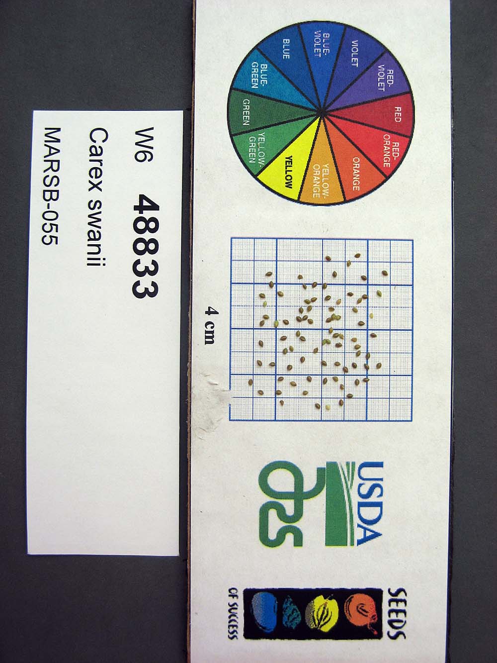 | | 2015 | | | | | | | Wild material | | 1922909 | W6 48833 |
| 235 | W6 48845 | MARSB-58 | Danthonia spicata (L.) P. Beauv. ex Roem. & Schult. | New York, United States | W6 |  | | 2015 | | | | | | | Wild material | | 1922913 | W6 48845 |
| 236 | W6 48848 | MARSB-057 | Avenella flexuosa (L.) Parl. | New York, United States | W6 | 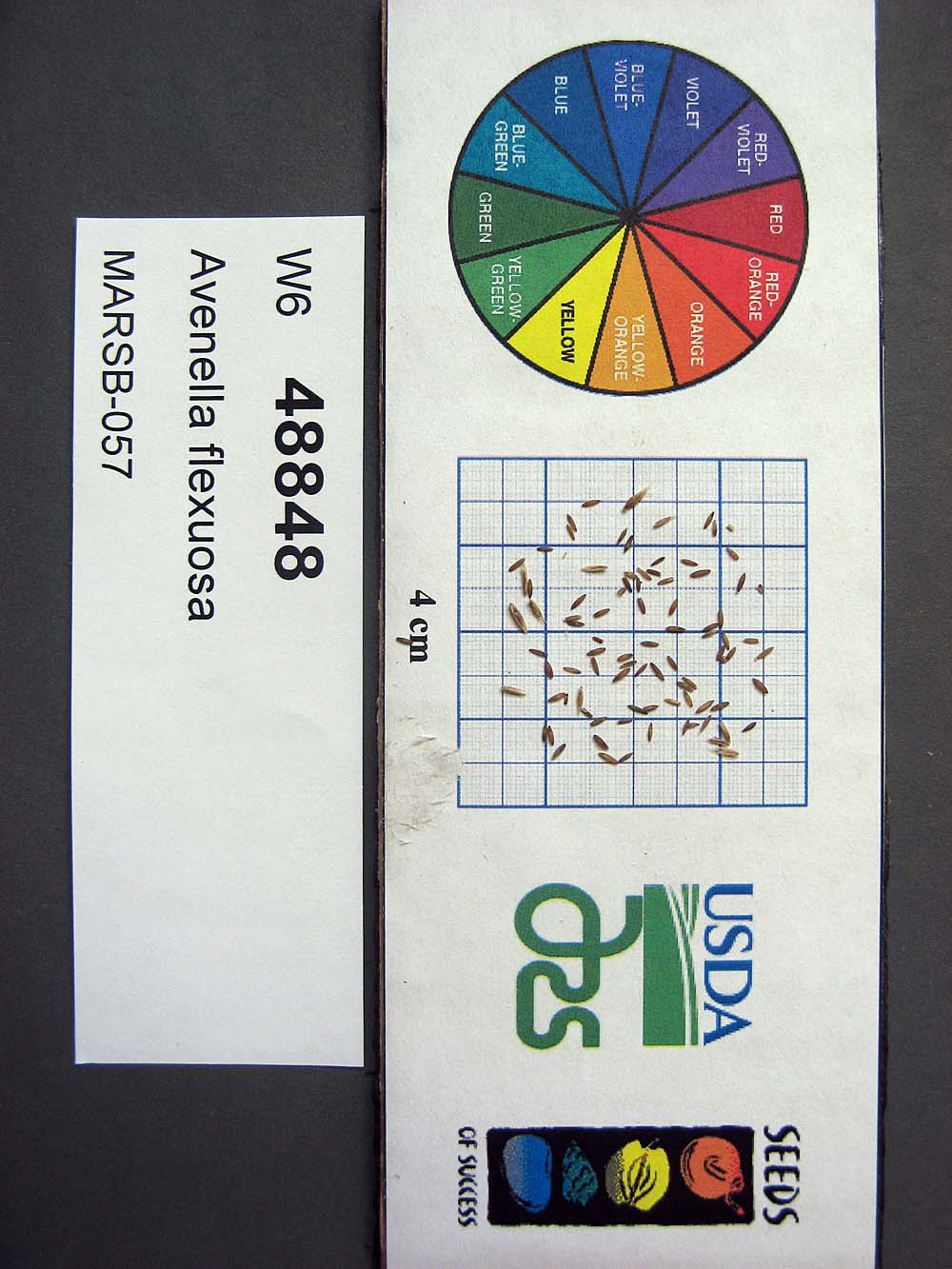 | | 2015 | | | | | | | Wild material | | 1922914 | W6 48848 |
| 237 | W6 48850 | MARSB-085 | Hexasepalum teres (Walter) J. H. Kirkbr. | New Jersey, United States | W6 |  | | 2015 | | | | | | | Wild material | | 1922915 | W6 48850 |
| 238 | W6 48854 | MARSB-106 | Eragrostis spectabilis (Pursh) Steud. | New Jersey, United States | W6 |  | | 2015 | | | | | | | Wild material | | 1922916 | W6 48854 |
| 239 | W6 48867 | MARSB-59 | Juncus tenuis Willd. | New York, United States | W6 |  | | 2015 | | | | | | | Wild material | | 1922918 | W6 48867 |
| 240 | W6 48902 | MARSB-114 | Tridens flavus (L.) Hitchc. | New Jersey, United States | W6 |  | | 2015 | | | | | | | Wild material | | 1922931 | W6 48902 |
| 241 | Ames 32847 | JDC/DL/2014/150/653 | Diervilla lonicera Mill. | Iowa, United States | NC7 |  | | 2014 | COLLECTED | 11/23/2014 | Wild Cat Den State Park located approximately 9.00 miles northeast of Muscatine, T77N R1E SW 1/4 SW 1/4 and also SE 1/4 SW 1/4Sec. 17 | 41.46820900, -90.87994300 | 215 | Mixed decidous woods. Northeast and east-facing, extremely steep slopes on loose soils. | Wild material | | 1921868 | Ames 32847 |
| 242 | Ames 32849 | JDC/DL/2014/151/654 | Diervilla lonicera Mill. | Iowa, United States | NC7 | | | 2014 | COLLECTED | 11/23/2014 | Fern Cliff County Park located approximatley 3.75 miles west, southwest of Crawfordsville, T74N R7W southern edge of N 1/2 Sec. 24 | 41.19958700, -91.60874700 | 208 | Steep north-facing slopes on loose soils. | Wild material | | 1921870 | Ames 32849 |
| 243 | Ames 32829 | NA 82181 | Cornus amomum Mill. | Maine, United States | NC7 | | | 2014 | COLLECTED | 09/13/2014 | Along small gravel road heading north along Birch Stream from the Stillwater River boat landing on Southgate Road, Old Town, Penobscot County, Maine | 44.98842400, -68.67561400 | 33 | Open, seasonally wet woods. Growing in association with Quercus rubra, Fraxinus pennsylvanica, Ilex verticillata, Viburnum nudum, Crataegus sp., Myrica gale, Rhodora canadense, Betula sp, and Acer saccharinum. | Wild material | | 1921789 | Ames 32829 |
| 244 | Ames 32826 | JDC/DL/2014/148/651 | Diervilla lonicera Mill. | Iowa, United States | NC7 |  | | 2014 | COLLECTED | 11/04/2014 | Elk Rock State Park (extreme northern point of park) approximately 6.25 miles north of Knoxville, T76N R19W SW 1/4 SW 1/4 Sec. 5 | 41.40879000, -93.07958000 | 219 | Extremely steep, north-facing slopes. | Wild material | | 1921786 | Ames 32826 |
| 245 | Ames 32824 | JDC/DL/2014/142/645 | Diervilla lonicera Mill. | Iowa, United States | NC7 |  | | 2014 | COLLECTED | 10/29/2014 | Backbone State Park located approximately 4.60 miles south southwest of Strawberry Point, T90N R6W NE 1/4 Sec. 16. | 42.61091600, -91.55377200 | 322 | Steep north-facing slope. | Wild material | | 1921784 | Ames 32824 |
| 246 | Ames 32820 | APS/EA/2013/041/126 | Euonymus atropurpureus Jacq. | Iowa, United States | NC7 |  | | 2014 | COLLECTED | 10/10/2014 | Midland Trail Road near North Racoon River watershed. Dallas County T80N R27W SW 1/4 NW 1/4 Sec. 30 | 41.71142000, -94.04538000 | 299 | Wooded roadside. | Wild material | | 1921780 | Ames 32820 |
| 247 | WLP 689 | BJP/AI/2014/001 | Amelanchier intermedia Spach | Maine, United States | NA | | | 2014 | COLLECTED | 07/17/2014 | Woods at the edge of a small cemetery on Pigeon Hill Road, just east of its intersection with Main Street (Hwy. 1), approximately .2.5 miles southwest of Milbridge. | 44.51051000, -67.91188000 | | Woods at the edge of a small cemetery. | Wild material | | 1922791 | WLP 689 |
| 248 | WLP 698 | BJP/AS/2014/003 | Amelanchier spicata (Lam.) K. Koch | Maine, United States | NA | | | 2014 | COLLECTED | 07/16/2014 | Roadside near the parking area for Bluberry Barrens (also known as Kennebunk Plains), ca. 4.5 miles west of Kennebunk. | 43.40231000, -70.62462000 | | Roadside, along shoulder of road. | Wild material | | 1922790 | WLP 698 |
| 249 | Ames 32760 | JDC/AB/2014/040/542 | Abies balsamea (L.) Mill. | Iowa, United States | NC7 | | | 2014 | COLLECTED | 09/03/2014 | Bluffton Fir State Preserve, near Bluffton, Winneshiek County. | 43.40106767, -91.90659200 | 326 | High quality, native woods. Steep slope, northwest-facing, and relatively flat portion on top of bluff (powerline) | Wild material | | 1921308 | Ames 32760 |
| 250 | Ames 32758 | Fallen Rock | Pinus strobus L. | Iowa, United States | NC7 |  | | 2014 | COLLECTED | 08/21/2014 | Fallen Rock State Preserve and adjacent private property just north of Eldora, T88N R19W SW ¼ Sec. 28 and N ¼ Sec. 32 and also T87N R19W N ½ Sec. 5. | 42.39548900, -93.09165200 | 311 | Cool moist woods. Slopes averaging 60 degrees. Northern and eastern aspects. Localized to bluffs above Iowa River. | Wild material | The native range of Pinus strobus is concentrated in the northeastern United States extending south into the northern edge of Georgia and west to central Minnesota. In Iowa, scattered native populations exist in a few northeastern counties as well as small disjunct populations in central and southeastern counties (Little, 1971). This accession includes genetics from legacy mother trees located in Fallen Rock State Preserve and nearby private property to the south. This area is near Pine Lake State Park, which in 2009 was devastated by a severe hailstorm of "supersized softballs" resulting in significant cambial damage to many species of trees. Damage to the majority of P. strobus specimens throughout the area was so severe that losses occurred immediately. Additional losses in subsequent years continued to occur likely due to additional stress by drought and destruction by bark beetles. The loss of approximately 75% of the P. strobus specimens at Pine Lake State Park was attributed to the 2009 hailstorm prompted efforts to preserve genetics of the white pines here. In 2014, specimens in parts of Pine Lake State Park and also one specimen at Fallen Rock State Preserve were sampled (Carstens, J.) as seeds from specimens ranging in size from 9.25 inches to 31.75 inches d.b.h. However, in 2021, it was determined (Place, A. pers. comm. 24 February 2021 and Carstens, J. & Sherwood, A., pers. observations 1 March 2021) that likely most if not all of the specimens in Pine Lake State Park are planted specimens of unknown origin because P. strobus specimens located at the far east end of Lower Lake (south side) were noted (Carstens and Sherwood, pers. observations 1 March 2021) growing with uncharacteristic associated taxa including Acer saccharinum and Gymnocladus dioicus. Two documents that support these observations includes: 1. Letter signed by Louis H. Pammel (March 25, 1925) to G.B. McDonald of the Iowa State University Forestry Department asking for 200 white pine to be planted at Pine Lake. 2. "Trees to Be Set Out by CCC Workers" in the Eldora Herald (May 9, 1935) referencing the CCC (Civilian Conservation Corps) to plant “1,000 white pines at Pine Lake State Park". Therefore, if obtained, increment borer measurements of specimens that are 94 years of age at present (2014) or older would suggest those as being true, native remnants. Documents that supports the position of remnant specimens at Fallen Rock State Preserve includes: 1. "Picturesque Drives About Eldora", in the Eldora Herald (December 8, 1910) by Clara Estabrook stating "Miss Stoddard of the Iowa Falls school says these (only 11 trees left) are the only native pines (those restricted to the sandstone cliffs) found in Hardin County" and suggested a movement to have them preserved. 2. Forest Flora of Hardin County (1899) by L. H. Pammel stating that the Iowa valley serves as the western limits for white pine and also refers to David D. Owen's geological report from 1839 indicating the occurrences of white pines on the summits of the hills along the Iowa River. In addition, a photo of white pines growing at Steamboat Rock taken by L. H. Pammel was featured on the front page of the 1919 report of the State Board of Conservation titled "Iowa Parks: Conservation of Iowa Historic, Scenic and Scientific Areas." Due to the significant presence of planted specimens of unknown origin in Pine Lake State Park and surrounding private properties, samples collected in 2014 as seeds may likely contain genetics (pollen donors) from specimens of unknown origin. This resulted in the resampling of specimens in 2021 (USFS - IAHA#'s) and 2023 as dormant scions that are from locations known to be untouched by the CCC and thus represent true, remnant specimens. To date (2021), there are only eight legacy specimens left in this population (four specimens at Fallen Rock State Preserve and four specimens at the nearby private property). The largest specimen of P. strobus (Ames 32758) is #IAHA-08 located at (42.395489, -93.091652) measuring (13 May 2018) 35.65" DBH with a height of 78.33' and a spread of 26' totalling 197 points (Rouw, M., personal communication, 8 February 2023). This germplasm represents the southwestern most population of native P. strobus in Iowa and one of the western most populations in North America. Germplasm likely is adapted to Midwestern climatic extremes and potentially very drought tolerant in comparison to other provenances from the eastern or northeastern U.S. | 1921270 | Ames 32758 |
| 251 | Ames 32228 | APS/GD/2014/013/144 | Gymnocladus dioicus (L.) K. Koch | Indiana, United States | NC7 | | | 2014 | COLLECTED | 03/23/2014 | Olin Lake Nature Preserve, along southwest side of Olin Lake, SE 1/4 of Section 20, T36N, R10E, just northwest of Wolcottville, LaGrange County. | 41.55917300, -85.39413400 | 285 | Hardwood mesic forest. | Wild material | | 1917832 | Ames 32228 |
| 252 | Ames 32197 | GA13009001 | Fraxinus pennsylvanica Marshall | Minnesota, United States | NC7 |  | | 2014 | COLLECTED | 09/23/2013 | Clearwater County. | 47.18397220, -95.47407220 | | Mixed upland deciduous forest. | Wild material | | 1917223 | Ames 32197 |
| 253 | NA 81709 | CSF-13-22 | Cephalanthus occidentalis L. | Maryland, United States | NA | | | 2013 | COLLECTED | 11/04/2013 | Cedarville State Forest near Brandywine/Waldorf, MD, at power transmission line corridor along small stream. | 38.64824000, -76.83493000 | 61 | Growing along small stream that crossed the transmission line right-of-way. | Wild material | | 1951113 | NA 81709 |
| 254 | Ames 32096 | BA13009001 | Fraxinus nigra Marshall | Minnesota, United States | NC7 |  | | 2013 | COLLECTED | 09/23/2013 | T144N R38W, Clearwater County. | 47.25711000, -95.49000667 | 543 | Edges of lakes and forest edges. Growing in association with Fraxinus pennsylvanica, Quercus macrocarpa, Ulmus americana, Populus tremuloides, Populus balsamifera, Acer saccharum, Betula papyrifera, Salix sp., Larix laricina, Quercus rubra, Abies balsamea, Picea glauca, Sambucus canadensis, Cornus rugosa, Acer spicatum, Rosa sp., Viburnum opulus var. americanum, Viburnum dentatum, Alnus sp., Cornus canadensis, Corylus sp., Prunus virginiana, Ribes sp., Prunus pensylvanica, Rhamnus alnifolia, Equisetum sp., Carex sp., Rubus sp., Impatiens capensis, Bromus sp., and Thalictrum dasycarpum. | Wild material | D.B.H. ranged between 3 and 6 inches. | 1914713 | Ames 32096 |
| 255 | WLP 1079 | NA 81742 | Cornus florida L. | Missouri, United States | NA | | | 2013 | COLLECTED | 09/26/2013 | Springfield Township: NW 1/4 of Section 20. | 38.41792000, -93.60433000 | | Growing in and around sandstone ravines. | Wild material | Voucher specimen being processed at time of accessioning; will be forwarded to USNA once prepared. | 1922751 | WLP 1079 |
| 256 | Ames 32093 | JDC/CC/2013/048/492 | Carpinus caroliniana Walter | Iowa, United States | NC7 | | | 2013 | COLLECTED | 10/25/2013 | Ledges State Park mostly from specimens adjacent to Peas Creek, NE ¼ of SE ¼ of Sec. 16, T83N R26W, Des Moines Quad. | 41.99910000, -93.87880000 | 328 | North and northwest-facing slopes. | Wild material | The native range of Carpinus caroliniana is concentrated in the eastern half of the U.S. with a very small disjunct population in central Iowa (Little, 1971). This accession represents a collection of C. caroliniana germplasm from the extreme western edge of the species native range, specifically the central Iowa disjunct population at Ledges State Park. The next closest occurrence is in eastern Iowa (100-150 miles). As of 2025, one specimen at Ledges State Park (McCoy Wildlife Area) currently represents the state of Iowa's largest C. caroliniana specimen measuring 6.68" DBH, 41.67’ in height, and 23.75’ average crown spread for a total of 68.608 points (Rouw, M., personal communication, 4 May 2022). This accession does include genotypes that do tend to sucker/form clonal colonies. Fall color (red/orange) tends to peak in the last week of October (central Iowa) with peak fruiting occurring simultaneously. Bark smooth, grey. | 1914037 | Ames 32093 |
| 257 | Ames 32094 | Ames 32094 | Symphoricarpos orbiculatus Moench | Iowa, United States | NC7 |  | | 2013 | COLLECTED | PRE 10/25/2013 | Bluffs along Des Moines River, SE 1/4 of Section 9, T82N R26W, Madrid NW Quad, Boone County. | 41.92480000, -93.87550000 | 328 | Edge of dry woods. Western exposure. | Wild material | Plants donated were grown from original seed. | 1914038 | Ames 32094 |
| 258 | Ames 32092 | Ames 32092 | Viburnum rufidulum Raf. | Missouri, United States | NC7 | | | 2013 | COLLECTED | 10/13/2013 | Private property, north of 27640 EE Highway, NE 1/4 of SE 1/4 of Section 4, T47N R15W, Prairie Home, Prairie Home Quad, Cooper County. | 38.85910000, -92.56030000 | 236 | Wooded hillside. North-facing slope. | Wild material | | 1914036 | Ames 32092 |
| 259 | Ames 32083 | JDC/FQ/2013/042/486 | Fraxinus quadrangulata Michx. | Michigan, United States | NC7 |  | | 2013 | COLLECTED | 08/17/2013 | Bendor property, Section 21, T2S, R7E, Denton Quad, near Ypsilanti, Washtenaw County. | 42.29735200, -83.61355300 | 262 | Mesic forest. | Wild material | | 1913269 | Ames 32083 |
| 260 | Ames 32018 | APS/GD/2013/032/117 | Gymnocladus dioicus (L.) K. Koch | Missouri, United States | NC7 |  | | 2013 | COLLECTED | 04/09/2013 | Poosey Conservation Area, Livingston County. | 39.94995200, -93.71471700 | 267 | Floodplain. | Wild material | A total of four areas containing Gymnocladus dioicus were noted throughout Poosey Conservation Area. Each area was represented by approximately 2-6 specimens. Specimens ranged between 14-22.5 inches d.b.h. and approximately 90-110 feet in height. Pod production during the 2012 growing season was minimal/below average. Samples 473-1 and 473-2 were very close together (approximately 10 feet apart) and samples 473-3 and 473-4 were also very close together (approximately 48 feet apart). Samples this close together may potentially represent material from a single clone due to the clonal suckering habit of Gymnocladus dioicus. | 1908307 | Ames 32018 |
| 261 | Ames 31989 | APS/GD/2009/001/010 | Gymnocladus dioicus (L.) K. Koch | Kansas, United States | NC7 |  | | 2013 | COLLECTED | 02/21/2013 | Clinton State Park, west of Lawrence, Section 12, T13S R18E, Douglas County. | 38.93730038, -95.36213950 | 282 | Fairly dry, upland site. Majority of specimens found on upland areas. | Wild material | | 1907542 | Ames 31989 |
| 262 | NA 85242 | MA-2012-010 | Ilex verticillata (L.) A. Gray | Massachusetts, United States | NA | | | 2012 | COLLECTED | 08/25/2012 | Worcester County; Barre; Collected on the roadside of Sheldon Road, one mile south of the intersection with Old Dana Road. [Note: coordinates are just 600 feet south of that intersection.] | 42.43053000, -72.16093000 | 326 | Upland forest edge. | | Seed and herbarium specimen collected. | 2108859 | NA 85242 |
| 263 | W6 43740 | NYCPDR-BBG-096 | Avenella flexuosa (L.) Parl. | New York, United States | W6 |  | | 2012 | | | | | | | Wild material | | 1900131 | W6 43740 |
| 264 | Ames 31256 | APS/GD/2008/005/005 | Gymnocladus dioicus (L.) K. Koch | Iowa, United States | NC7 |  | | 2012 | COLLECTED | 01/10/2012 | Ledges State Park, SW 1/4 of SW 1/4 of Section 21, T83N, R26W, Madrid NW Quad, Boone County | 41.98110000, -93.89010000 | 328 | Upland woods. 30% slope with a western aspect. | Wild material | Largest specimen noted was 22" d.b.h. | 1897494 | Ames 31256 |
| 265 | Ames 31214 | Ames 31214 | Cornus rugosa Lam. | Wisconsin, United States | NC7 |  | | 2011 | COLLECTED | 2011 | Along east side of County Road C, base of McCaslin Mountain, NW 1/4 of Section 26, T34N, R17E, Roaring Rapids Quad, Marinette County. | 45.39916660, -88.34111110 | 371 | Hilly terrain. Sandy loam soil with a shallow humus layer, near surface of granite and scattered granite boulders. Soils must be near neutral due to abscence of Ericaceae plants. | Wild material | | 1894296 | Ames 31214 |
| 266 | Ames 31215 | Ames 31215 | Diervilla lonicera Mill. | Wisconsin, United States | NC7 |  | | 2011 | COLLECTED | 2011 | Site 1: Dells above Prairie River, Bloomville Quad. T32N R7E NE 1/4 SW 1/4 Sec. 13 and Site 2: Along east side of Highway 17, Pine Dells Quad. T32N R7E NW 1/4 NW 1/4 Sec. 26 | 45.24472220, -89.57486100 | 434 | Site 1: High spots between granite boulders strewn about a young woodland. Sandy soil with a few inches of humus layer. Site 2: Roadside. Disturbed ground on sandy soil with a slight humus layer. | Wild material | | 1894298 | Ames 31215 |
| 267 | Ames 31066 | 369 | Diervilla lonicera Mill. | New York, United States | NC7 |  | | 2011 | COLLECTED | 09/14/2011 | Just south of intersection of Sherman-Westfield Road and Mount Baldy Road | 42.28100000, -79.58200000 | 435 | Roadside. Mixed hardwood forest. Northwest-facing slope. | Wild material | | 1891452 | Ames 31066 |
| 268 | Ames 31072 | 693 | Fraxinus americana L. | New York, United States | NC7 |  | | 2011 | COLLECTED | 09/12/2011 | 840 to 1150 Turnpike Road, Allegany County. | 42.30200000, -77.79000000 | 570 | Roadside and field edges. Southwest-facing slope (10-15 degrees). | Wild material | | 1891458 | Ames 31072 |
| 269 | Ames 31079 | 707 | Fraxinus americana L. | Pennsylvania, United States | NC7 |  | | 2011 | COLLECTED | 09/16/2011 | PA 120, Cameron County. | 41.47000000, -78.39200000 | 430 | Rich woods. | Wild material | | 1891465 | Ames 31079 |
| 270 | Ames 31082 | 712 | Fraxinus americana L. | New York, United States | NC7 |  | | 2011 | COLLECTED | 09/11/2011 | Federal Road, south of Marsh Road (Co. 4), Chemung County. | 42.15600000, -76.65500000 | 466 | Roadside and woodland edges. | Wild material | | 1891468 | Ames 31082 |
| 271 | WLP 1055 | 386 | Cornus florida L. | Pennsylvania, United States | NA |  | | 2011 | COLLECTED | 09/16/2011 | Along Highway 120, Cameron County. | 41.32400000, -78.12500000 | 251 | Mixed hardwood forest. Steep (60 degree) west-facing slope. Associated with Carya, Cornus alternifolia, Fraxinus americana, Quercus alba, Quercus prinus, Quercus rubra, Rhododendron maximum, and Sassafras albidum. | Wild material | | 1891449 | WLP 1055 |
| 272 | Ames 31029 | MPW/MSD 710 | Cornus rugosa Lam. | New York, United States | NC7 |  | | 2011 | COLLECTED | 07/29/2011 | Along Tannery Creek Road, Steuben County. | 42.04210000, -77.11640000 | 378 | Rich woods, just above shale. Steep, north-facing slope. | Wild material | | 1886744 | Ames 31029 |
| 273 | Ames 30679 | JDC/FP/2010/064/334 | Fraxinus pennsylvanica Marshall | Wisconsin, United States | NC7 |  | | 2010 | COLLECTED | 09/27/2010 | Floodplain along railroad, adjacent to Perrot State Park, S 1/2 of Section 20, T18N R9W, Trempealeau Quad, just west of Trempealeau, Trempealeau County. | 44.01496000, -91.47822000 | 208 | | Wild material | | 1853837 | Ames 30679 |
| 274 | Ames 30682 | JDC/FP/2010/070/340 | Fraxinus pennsylvanica Marshall | Wisconsin, United States | NC7 |  | | 2010 | COLLECTED | 09/29/2010 | North of main entrance to Wildwood Park, along west side of South Roddis Avenue, NE 1/4 of SE 1/4 of Section 18, T25N R3E, Marshfield Quad, Marshfield, Wood County. | 44.64822000, -90.18574000 | 387 | | Wild material | | 1853840 | Ames 30682 |
| 275 | Ames 30600 | JDC/FA/2010/050/320 | Fraxinus americana L. | Arkansas, United States | NC7 |  | | 2010 | COLLECTED | 09/16/2010 | Along Push Mountain Road, Sylamore Wildlife Management Area, Baxter County. | 36.20005000, -92.32758000 | 264 | Rolling hillsides with varying aspects; generally restricted to higher elevations. | Wild material | | 1848895 | Ames 30600 |
| 276 | WLP 1043 | JDC/CF/2010/044/314 | Cornus florida L. | Missouri, United States | NA |  | | 2010 | COLLECTED | 09/15/2010 | Odin Access Conservation Area, Wright County. | 37.26709000, -92.61271000 | 388 | South-southeast facing slope (50%). Associated with Hydrangea arborescens, Morus rubra, Quercus, Staphylea trifolia, and Viburnum prunifolium. | Wild material | Very large flowering dogwoods, approximately 5-6 inches d.b.h. and 25-30 feet tall. | 1848889 | WLP 1043 |
| 277 | Ames 30589 | JDC/FQ/2010/025/295 | Fraxinus quadrangulata Michx. | Illinois, United States | NC7 |  | | 2010 | COLLECTED | 09/06/2010 | Along Burton Creek, middle of Section 27, Marblehead Quad, Adams County. | 39.86690000, -91.31220000 | 174 | Along very steep (90%) south facing slope. | Wild material | Approximately 8 inches d.b.h. | 1847246 | Ames 30589 |
| 278 | WLP 1949 | JDC/VM/2010/022/292 | Viburnum molle Michx. | Illinois, United States | NA |  | | 2010 | COLLECTED | 09/06/2010 | Along Senachwine Creek, SE 1/4 of Section 12, Rome Quad, Peoria County. | 40.94680000, -89.52970000 | 183 | Along steep (75%) west-northwest facing slope. Associated with Cornus, Fraxinus, Ostrya virginiana, Platanus occidentalis, Quercus rubra, Staphylea trifolia, Tilia americana, and Vitis riparia. | Wild material | Plants up to 15 feet in height. Reddish fall color on apical stems. Peeling bark on older stems. | 1847248 | WLP 1949 |
| 279 | Ames 30552 | Ames 30552 | Cornus alternifolia L. f. | Missouri, United States | NC7 |  | | 2010 | COLLECTED | 06/29/2010 | Along North River, Callaghan Mound Access Conservation Area, near Heather, SW 1/4 of Section 15, T58N, R8W, Emden Quad. | 39.82140000, -91.78680000 | 190 | Northeast facing slope. | Wild material | | 1843106 | Ames 30552 |
| 280 | Ames 31457 | 424873 | Staphylea bolanderi A. Gray | California, United States | NC7 | | | 2009 | COLLECTED | 10/16/2007 | Southern Cascades Ecoregion. Shasta County. Off Salt Creek Road next to I5, junction 698. | 40.86222000, -122.36028000 | 480 | Dry gully. Mixed transition Quercus kelloggii forest. | Wild material | | 1826985 | Ames 31457 |
| 281 | Ames 30392 | JDC/RT/2009/099/249 | Rhus typhina L. | Ohio, United States | NC7 |  | | 2009 | COLLECTED | 10/16/2009 | Deans State Forest, near Bartles, T3N R17W NE 1/4 of NE 1/4 of Sec. 27, Pedro Quad, Lawerence County | 38.70027778, -82.63333333 | 298 | High elevation. Underground seep present. | Wild material | | 1823944 | Ames 30392 |
| 282 | WLP 1423 | JDC/OA/2009/098/248 | Oxydendrum arboreum (L.) DC. | Ohio, United States | NA | | | 2009 | COLLECTED | 10/16/2009 | Ohio: Lawrence County; Deans State Forest, near Bartles, SE 1/4 of NE 1/4 of Section 27, T3N, R17W, Pedro Quad. | 38.69833333, -82.63222222 | 301 | High elevation. Steep (60%) slope, east-facing. Underground seep present. Associated with Acer rubrum, Cercis canadensis, Corylus americana, Juglans nigra, Quercus rubra, Rhus typhina, and Sassfras albidum. | Wild material | | 1823936 | WLP 1423 |
| 283 | WLP 814 | JDC/CC/2009/086/236 | Carpinus caroliniana Walter | Ohio, United States | NA | | | 2009 | COLLECTED | 10/15/2009 | Along Clear Creek, near Revenge, SE 1/4 of SE 1/4 of Section 13, T13N, R19W, Rockbridge Quad, Hocking County. | 39.59361111, -82.61944444 | 246 | Creekbed. Associated with Acer rubra, Asimina triloba, Carya, Cephalanthus occidentalis, Cornus florida, Hamamelis virginiana, Nyssa sylvatica, Oxydendrum arboreum, and Quercus. | Wild material | | 1823913 | WLP 814 |
| 284 | Ames 30137 | JDC/EM/2009/020/170 | Eutrochium maculatum (L.) E. E. Lamont var. maculatum | Wisconsin, United States | NC7 | | | 2009 | COLLECTED | 09/21/2009 | Bridgeport Landing, Lower Wisconsin State Riverway, near Bridgeport, SW 1/4 of NE 1/4 of Section 14, T6N, R6W, Brodtville Quad, Grant County. | 42.99833333, -91.05055556 | 189 | Wisconsin River watershed/floodplain. Associated with Betula nigra, Cephalanthus occidentalis, Quercus bicolor, Ulmus rubra, and Urtica dioica. | Wild material | | 1819718 | Ames 30137 |
| 285 | Ames 30144 | JDC/FP/2009/019/169 | Fraxinus pennsylvanica Marshall | Wisconsin, United States | NC7 |  | | 2009 | COLLECTED | 09/21/2009 | Bridgeport Landing, Lower Wisconsin State Riverway, near Bridgeport, SW 1/4 of NE 1/4 of Section 14, T6N, R6W, Brodtville Quad, Grant County. | 42.99833333, -91.05055556 | 189 | Wisconsin River watershed/floodplain. | Wild material | | 1819725 | Ames 30144 |
| 286 | WLP 2486 | JDC/VL/2009/023/173 | Viburnum lentago L. | Wisconsin, United States | NA |  | | 2009 | COLLECTED | 09/21/2009 | Along Bowers Road west of Snow Bottoms State Natural Area, Highland West Quad. T7N R1W SW1/4 SW /4 SE1/4 Sec. 34 | 43.03200000, -90.47680000 | 267 | Roadside | Wild material | Variation in leaf thickness, fall color (mostly reddish tones) and degree of powdery mildew was noted across population sampled in nature. At time of collection (12 September) fruits were at various stages of maturity including green, red, blue/black. | 1819759 | WLP 2486 |
| 287 | WLP 855 | JDC/CO/2009/021/171 | Cephalanthus occidentalis L. | Wisconsin, United States | NA | | | 2009 | COLLECTED | 09/21/2009 | Wisconsin: Grant County; Wisconsin River watershed/flood plain; Wisconsin River flood plain. Bridgeport Landing, Lower Wisconsin State Riverway, near Bridgeport, SW 1/4 of NE 1/4 of Section 14, T6N, R6W, Brodtville Quad. | 42.99833333, -91.05055556 | 189 | Wisconsin River watershed/floodplain. Associated with Betula nigra, Fraxinus pennsylvanica, Quercus bicolor, Ulmus rubra, and Urtica dioica. | Wild material | | 1819710 | WLP 855 |
| 288 | Ames 29981 | APS/GD/2009/019/028 | Gymnocladus dioicus (L.) K. Koch | Iowa, United States | NC7 |  | | 2009 | COLLECTED | 04/04/2009 | Near the confluence of the West Fork Cedar River and Shell Rock River, approximatley 2 miles east of Finchford, T90N R14W SE 1/4 SE 1/4 SE 1/4 and also SE 1/4 SW 1/4 Sec. 4 Shell Rock Quad., Black Hawk County. | 42.62888889, -92.49666667 | 272 | Gentle, east-facing slopes and also floodplain. | Wild material | Trees ranging from 13.5 to 18 inches DBH and 50 to 70 feet in height. | 1799101 | Ames 29981 |
| 289 | Ames 29975 | JDC/GD/2009/004/154 | Gymnocladus dioicus (L.) K. Koch | Nebraska, United States | NC7 |  | | 2009 | COLLECTED | 03/20/2009 | Ponca State Park, approximately 2 miles north of Ponca, T30N R6E Sec. 3 Ponca Quad., Dixon County. | 42.60166667, -96.71444444 | 365 | Variable from mid-level elevation sloped area to bottomland type. Variable exposure. 0-60 degrees of slope with variable aspects. | Wild material | Plants between 40 and 75 feet in height and 8 to 26 inches DBH. | 1798767 | Ames 29975 |
| 290 | Ames 29628 | JDC/FA/2008/029/099 | Fraxinus americana L. | Missouri, United States | NC7 |  | | 2008 | COLLECTED | 10/06/2008 | Rudolf Bennitt Conservation Area, NE 1/4 of NE 1/4 of Section 25, T52N, R14W, Renick Quad, Randolph County. | 39.27527778, -92.43388889 | 256 | | Wild material | Original specimens ranged from 6-10 inches d.b.h. and 30-50 feet in height. Reddish-orange fall color more apparent in males. | 1788183 | Ames 29628 |
| 291 | Ames 29653 | JDC/FP/2008/062/132 | Fraxinus pennsylvanica Marshall | Illinois, United States | NC7 |  | | 2008 | COLLECTED | 10/13/2008 | Along 100N Road, near north fork of Kaskaskia River, NE 1/4 of NW 1/4 of Section 35, T4N, R1W, Wildcat Lake Quad, Fayette County. | 38.75250000, -89.16750000 | 140 | | Wild material | | 1788208 | Ames 29653 |
| 292 | Ames 29616 | JDC/FN/2008/019/089 | Fraxinus americana L. | Iowa, United States | NC7 |  | | 2008 | COLLECTED | 10/01/2008 | Perimeter and adjacent areas of Honey Creek Golf Course, Boone, N 1/2 of Section 8, Boone West Quad, Boone County. | 42.01777778, -93.90694444 | 328 | Majority collected from higher elevations, but also lower valleys. Course constructed by clearing existing trees; all collections from native specimens; no trees have been planted on course. | Wild material | At time of collection, ~1/5 of population had some orangish-red fall color; remaining population exhibited greenish-yellow fall colors; some specimens were completely defoliated. | 1786595 | Ames 29616 |
| 293 | Ames 29532 | JDC/CA/2008/008/078 | Cornus alternifolia L. f. | Illinois, United States | NC7 |  | | 2008 | COLLECTED | 08/25/2008 | Black Hawk Forest Nature Preserve, Rock Island, Rock Island County. | 41.46583333, -90.57277778 | 186 | Wooded understory. Essentially full shade. Generally located along north facing 40% slope. | Wild material | Majority of specimens exhibited strong central leaders at time of collection. Tallest specimen was approximately 25 feet in height. | 1783446 | Ames 29532 |
| 294 | Ames 29525 | JDC-0712008 | Amelanchier arborea (F. Michx.) Fernald | Iowa, United States | NC7 |  | | 2008 | COLLECTED | 07/13/2008 | Pine Lake State Park along east shoreline of Upper Lake, T87N R19W NE1/4 of SE 1/4 Sec. 4 | 42.37472222, -93.06277778 | 316 | Mature woods. | Wild material | Ovary summits glabrous; newly expanding leaves densely pubescent; pubescent sepals; and also pubescent peduncles. Petals white with a slight tinge of pink. | 1782748 | Ames 29525 |
| 295 | Ames 29523 | JDC/CA/2008/015/085 | Cornus alternifolia L. f. | Illinois, United States | NC7 |  | | 2008 | COLLECTED | 08/06/2008 | Along trail heading towards lake, Crosby Road to parking lot, Morrisson-Rockwood State Park, approximately 2 miles north of Morrisson, Whiteside County. | 41.84222222, -89.96888889 | 247 | Woodland area. 100% filtered shade. | Wild material | | 1782640 | Ames 29523 |
| 296 | Ames 29506 | JDC-CA-2008-003 | Cornus alternifolia L. f. | Iowa, United States | NC7 |  | | 2008 | COLLECTED | 07/20/2008 | Tower Rock Park, N edge of SE 1/4 of SW 1/4 of Section 28, T88N, R19W, Steamboat Roak Quad, Steamboat Rock, Hardin County. | 42.40111111, -93.07166667 | 292 | Eroding (burnt orange) sandstone cliff, south side of Iowa River; mostly shaded; near base of slope with northern aspect; sand and organic matter above cliff; well drained. | Wild material | | 1782028 | Ames 29506 |
| 297 | WLP 2120 | 302025 | Juniperus virginiana L. | Virginia, United States | NA |  | | 2008 | COLLECTED | 12/28/2005 | | | 89 | Slope: 0 Aspect: NE Soil: Clay-loam, Land form: Upland meadow. Mowed. | Wild material | | 1780179 | WLP 2120 |
| 298 | Ames 29376 | APS/GD/2009/009/018 | Gymnocladus dioicus (L.) K. Koch | Iowa, United States | NC7 |  | | 2008 | COLLECTED | 02/03/2008 | Skunk River Watershed. T85N R23W W 1/2 of Sec. 19 Story City Quad; T84N R24W NW 1/4 of Sec. 7 and T84N R23W SE 1/4 of Sec. 12 Ames East Quad, Story County | 42.10222222, -93.57944444 | 280 | Floodplain/bottomland forest. | Wild material | In 2012, a total of 59 mature specimens (d.b.h. of approximately 12" or greater) of Gymnocladus dioicus were noted growing along a 5 mile linear stretch along the Skunk River with 37 specimens recorded as females and 22 recorded as non-fruiting. Considering that seed production was very poor in 2012, some specimens recorded as non-fruiting (potentially males) may actually be females. The SE 1/4 of Sec. 12 seemed to have a fair amount of G. dioicus regeneration with very small (6-24" tall) seedlings present along with an abundant number of Celtis occidentalis in the area of various sizes. Two very large (20-24" d.b.h. specimens of G. dioicus recently dropped to the ground, most likely the result of strong winds. This area also seems to represent two, distinctly different "clones" of males based on morphological branching structure. The SW 1/4 of Sec. 19 has an abundant population of Tilia americana that were significant in size (20-24" d.b.h. and approximately 70' in height). The largest specimen of G. dioicus found in this area is approximately 90' in height and 40' in width and 35.5" in diameter. | 1749824 | Ames 29376 |
| 299 | Ames 29210 | JDC-0242007 | Fraxinus americana L. | Maine, United States | NC7 |  | | 2007 | COLLECTED | 09/26/2007 | Approximately 1.5 miles southwest from Rumford Center on Highway 2, adjacent to the Androscoggin River, Oxford County. | 44.50111111, -70.63472222 | 189 | | Wild material | Approximately 60 feet in height. | 1743314 | Ames 29210 |
| 300 | Ames 29218 | JDC-0382007 | Fraxinus americana L. | Maine, United States | NC7 |  | | 2007 | COLLECTED | 09/28/2007 | Along Highway 109 (starting at intersection with Goose Pond Road and heading downhill along 109 for approximately 200 yards), between Acton and Emery Mills, York County. | 43.52833333, -70.89555556 | 173 | | Wild material | Plants range from 20-80 feet in height. | 1743322 | Ames 29218 |
| 301 | Ames 28427 | JM20061017 | Hypericum gentianoides (L.) Britton et al. | South Carolina, United States | NC7 |  | | 2006 | COLLECTED | 09/28/2006 | Intersection of Highway 11 and Highway 133, Poe Creek State Forest, Pickens, Pickens County. | 34.93166667, -82.87722222 | 248 | Pine-oak heath, roadside of dirt road. | Wild material | | 1715748 | Ames 28427 |
| 302 | Ames 28428 | JM20061016 | Hypericum hypericoides (L.) Crantz | South Carolina, United States | NC7 |  | | 2006 | COLLECTED | 09/28/2006 | Intersection of Highway 11 and Highway 133, Poe Creek State Forest, Pickens, Pickens County. | 34.93166667, -82.87722222 | 248 | Pine-oak heath. | Wild material | | 1715749 | Ames 28428 |
| 303 | Ames 28429 | JM20061018 | Hypericum hypericoides (L.) Crantz subsp. multicaule (Michx. ex Willd.) N. Robson | South Carolina, United States | NC7 |  | | 2006 | COLLECTED | 09/28/2006 | Intersection of Highway 11 and Highway 133, Poe Creek State Forest, Pickens, Pickens County. | 34.93166667, -82.87722222 | 248 | Pine-oak heath, roadside of dirt road. | Wild material | | 1715750 | Ames 28429 |
| 304 | Ames 28434 | JM20061019 | Hypericum crux-andreae (L.) Crantz | South Carolina, United States | NC7 |  | | 2006 | COLLECTED | 09/28/2006 | Intersection of Highway 11 and Highway 133, Poe Creek State Forest, Pickens, Pickens County. | 34.93166667, -82.87722222 | 248 | Pine-oak heath, roadside of dirt road. | Wild material | | 1715755 | Ames 28434 |
| 305 | NA 76035 | DE.001-2006 | Clethra alnifolia L. | Delaware, United States | NA | | | 2006 | COLLECTED | 10/18/2006 | Thompson's Island State Park. | 38.70111000, -75.08902000 | 5 | Woodland coastal. Elevation: 17 feet. | Wild material | | 1716201 | NA 76035 |
| 306 | WLP 2487 | JDC-0112006 | Viburnum prunifolium L. | Iowa, United States | NA |  | | 2006 | COLLECTED | 09/12/2006 | Lake of Three Fires State Park, Bedford Quad.T68N R33W extreme NW corner of Sec. 7 | 40.71194444, -94.68583333 | 360 | Moderately shaded deciduous woods. | Wild material | Noted in nature as small understory trees, approximately 15-20 feet in height with clean foliage under moderate to heavy shade. In cultivation, fall color seems to vary from year to year ranging from dark purplish to bright red with peak fall color occurring around the later part of October (central Iowa). Flowers are white with peak flowering occurring in early-mid May. The range of this North American native is noted throughout the eastern and southeastern U.S. This accession represents genetics from the extreme northwestern corner of the species native range. Viburnum prunifolium in Iowa is rather rare and generally restricted and more commonly found in the extreme southeast corner of the state. This disjunct population in Taylor County (southwest Iowa) has been questioned as to whether it is a true native population or a naturalized escape. Additional V. prunifolium elsewhere in southwest Iowa has not been reported/documented. Immediately to the south of Taylor County, V. prunifolium is documented throughout most of Missouri and thus it is suspected that these genetics do represent a true native population. | 1708694 | WLP 2487 |
| 307 | Ames 29923 | 191179 | Physocarpus capitatus (Pursh) Kuntze | Oregon, United States | NC7 | 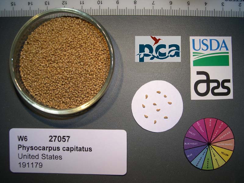 | | 2005 | COLLECTED | 09/19/2002 | Ecoregion 5. Douglas County. Along banks of South Umpqua river, off county route 1, East of Canyonville. | 42.97417000, -123.19972000 | 223 | Moderate canopy cover of Acer macrophyllum, Fraxinus latifolia and Quercus kelloggii. Understory of Corylus cornuta, Alnus rubra & Cornus stolonifera. Within floodplain of river. | Wild material | Shrub 1.8-5.5 meters tall. | 1674094 | Ames 29923 |
| 308 | Ames 27341 | JDC/UT/2017/021/775 | Ulmus thomasii Sarg. | Nebraska, United States | NC7 | 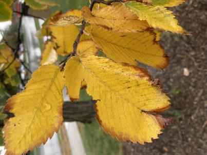 | | 2003 | COLLECTED | | Ponca State Park just north of Ponca approximately 2.75 miles T30N R6E N1/3 SE 1/4 Sec. 3 | 42.60173800, -96.71222100 | 383 | Eastern slopes and ridges of loess bluffs | Wild material | Ulmus thomasii (Rock elm) is an underutilized tree species both in conservation and in the urban landscape. Charles Sprague Sargent (first director of the Arnold Arboretum of Harvard University, Boston, MA) described the wood of Rock Elm as "heavy, hard, very strong and tough, closely grained, and susceptible of receiving a beautiful polish". Historically noted for a variety of uses in woodworking including furniture, heavy agricultural implements, timber frame buildings, pianos, hockey sticks, and hand tools. U. thomasii is extremely drought tolerant, adaptable to very calcareous soils, and compared to U. americana or U. rubra has a very conservative growth rate requiring minimal attention in regards to pruning. Rock elm naturally tends to develop into a nice structural specimen in the landscape, unlike other fast growing U. americana cultivars in the nursery trade needing frequent attention. Rock elm has very fissured bark and is well known for maintaining a strong central leader resulting in a very attractive, pyramidal form. Despite many literature sources stating that "wings" on the stems are a key identifiying characteristic, this trait is not reliable and many genotypes may completely lack "wings" on the stems. While growth habit and morphology of dormant buds (very pointy) are good traits to help aid in identification, fruits are the best way to confirm identity. Fruits are densly pubescent, often described as "inflated" and generally reach maturity a couple weeks after U. rubra and U. americana. U. thomasii inflorescences are rather distinguishable from other Ulmus in being pendulous. Fruits are extremely prized treats for many birds, where fruits are often "robbed" prior to full maturity. Fruits are also highly prized by many other animals such as mice, squirrels, chipmunks, turkeys, etc. and are generally consumed within hours after fruit abscission. The native range of U. thomasii is concentrated in the northeastern United States and into Canada with disjunct populations documented in northwestern Missouri and northwestern Arkansas (Little, E. L. Jr. 1971). In the 1895 Silva of North America (vol. 7) it was stated that, “The value of the wood of the Rock Elm threatens its extinction and most of the large trees have already been cut.” Today, since rock elm is rather rare, especially in areas near the edges of its range, many states list the species as endangered or threatened warranting preservation efforts. This accession was collected in northeast Nebraska (Dixon County) at Ponca State Park representing genetics from the extreme northwestern edge of the species native range and includes genetics (#775-6) from the current (2022) state champion. In an assessment of seedlings from all mother trees sampled (Carstens, J., personal communication, 12 April 2022), #775-4 produces the most vigorous seedlings which also consistently exhibited extremely corky/winged stems on new seedlings. Seedlings from other maternal lines show both winged and non-winged seedlings within the same maternal line and seedlings from some maternal lines have no wings. | 1649925 | Ames 27341 |
| 309 | Ames 27330 | JDC/RA/2023/069/1101 | Rhus aromatica Aiton | Iowa, United States | NC7 |  | | 2003 | COLLECTED | 09/24/2003 | Chatfield Park near Mooar, T65N R5W SW 1/4 of SW 1/4 of Sec. 9, Keokuk Quad. | 40.43750000, -91.45055556 | 195 | Half shaded. ~10% slope with a southwestern aspect | Wild material | Suckering shrubs averaging 4 feet tall. Leaves pubescent. | 1649676 | Ames 27330 |
| 310 | Ames 27312 | 6 | Staphylea trifolia L. | Iowa, United States | NC7 |  | | 2003 | COLLECTED | 09/13/2003 | Malanaphy Springs State Preserve near Decorah, T99N R8W NW 1/4 of SE 1/4 and SW 1/4 of NE 1/4 of Sec. 31, Winneshiek County | 43.34888889, -91.83638889 | 293 | Along trail near spring, half shaded. Gradual slope with a northwestern aspect. Organic soil over limestone with high stoniness, well to good drainage | Wild material | Shrubs to small trees to 3 meters tall. Some plants had very large pods. | 1649469 | Ames 27312 |
| 311 | Ames 27313 | 22 | Staphylea trifolia L. | Iowa, United States | NC7 |  | | 2003 | COLLECTED | 09/15/2003 | Backbone State Park Cave near Strawberry Point, T90N, R6W NE corner of NW 1/4 of SW 1/4 of Sec. 4, Delaware County | 42.63694444, -91.56194444 | 317 | Alluvium below limestone cave. Nearly full shade. Slight slope w/ SE aspect. Loam soil w/ some stoniness, good drainage | Wild material | Medium to large shrubs. Heavy fruit production. | 1649470 | Ames 27313 |
| 312 | WLP 767 | 19 | Carpinus caroliniana Walter | Iowa, United States | NA | | | 2003 | COLLECTED | 09/15/2003 | Bixby State Park, Edgewood, T91N R5W, SW corner of SE 1/4 of NW 1/4, Section 26, Edgewood Quad, Clayton County. | 42.66694444, -91.40333333 | 329 | Forest edge. Half shaded. 20% slope with a western aspect. Associated with Acer nigrum, Cornus alternifolia, Quercus rubra, and Rubus occidentalis. | Wild material | Small tree. | 1649453 | WLP 767 |
| 313 | Ames 27962 | Quercus Wilderness Area | Amelanchier arborea (F. Michx.) Fernald | Iowa, United States | NC7 |  | | 2003 | COLLECTED | 05/26/2003 | Quercus Wilderness Area located 6.75 miles south, southwest of Oskaloosa, T74N R16W SE ¼ NE ¼ of Sec. 23. | 41.19888889, -92.66111111 | 244 | Mature woods on very sandy soils. Typically restricted to east, west or south facing slopes at either summits or mid-slopes. | Wild material | The native range of Amelanchier arborea is concentrated in the eastern half of the U.S. (Little, 1977). This accession represents a collection of A. arborea germplasm from the western edge of the species native range, specifically the southern portion of Iowa. As of 2025, the top ten largest specimens in the state of Iowa are located at Quercus Wilderness where this accession was collected. Iowa’s largest specimen of A. arborea specimen at Quercus Wilderness was measured at 14.17" DBH, 51.83’ in height, and 27.00’ average crown spread for a total of 102.955 points (Rouw, M., personal communication, 12 December 2023). Fall color (orange-red) tends to peak in the middle of September (Iowa) with peak fruiting occurring in early May. Bark smooth, grey. | 1700483 | Ames 27962 |
| 314 | NA 70422 | MWPCC00-078 | Magnolia acuminata (L.) L. | North Carolina, United States | NA | | | 2000 | COLLECTED | 09/14/2000 | Blue Ridge Parkway pullover, N of marker 417. | 35.32333333, -82.82694444 | 1353 | Just in from mowed roadside. Slope: 15 degrees, Aspect: East, 3/4 day sun, Soil Type: gritty loam, well-drained, moist bottom of slope. | Wild material | | 1608250 | NA 70422 |
| 315 | Ames 12806 | APS/GD/2016/017/252 | Gymnocladus dioicus (L.) K. Koch | Michigan, United States | NC7 |  | | 1990 | COLLECTED | | Near Topliff Drain Creek, approximately 3-4 miles northeast of Eaton Rapids. T2N R2W SE ¼ SW ¼ SW ¼ NE ¼ Sec. 17 Aurelius Quad, Ingham County. | 42.56035300, -84.57002100 | 282 | Fertile mesic woods. | Wild material | | 1061529 | Ames 12806 |