| 0 | NA 86662 | SE-2017-016 | Quercus shumardii Buckley | Georgia, United States | NA | | | 2017 | COLLECTED | 10/14/2017 | Oconee National Forest: Monticello Glades. | 33.25416000, -83.68386000 | 185 | Moist woods. | Wild material | On the original collection notes, this was assigned the field collection number SE-2017-017, but it was corrected to SE-2017-016 later. | 2141807 | NA 86662 |
| 1 | NA 88929 | 24Flam8 | Rhododendron hybr. | Georgia, United States | NA | | | 2025 | COLLECTED | 09/09/2024 | Smyrna, GA: private residence. | 33.84871000, -84.51773000 | 303 | Dry slope in backyard of residence, primarily open with some large oaks. Open conditions. Slope: 30 degrees. Aspect: Northwest. | Wild material | | 2172812 | NA 88929 |
| 2 | WLP 3140 | TJK2023AL-004 | Viburnum acerifolium L. | Alabama, United States | NA | | | 2023 | COLLECTED | 08/15/2023 | Haines Island Park; overlooks the Alabama River. | 31.72057000, -87.46543000 | 86 | Beautiful Pine-Oak forest sits atop the Buhrstone Questa, an escarpment that rises over 350 feet. Southern Red Hills Region. Slope: 10%. Aspect: North. Elevation recorded as 281 feet. | Wild material | WLPGR contract collection. | 2158472 | WLP 3140 |
| 3 | WLP 3138 | TJK2023AL-002 | Hamamelis virginiana L. | Alabama, United States | NA | | | 2023 | COLLECTED | 08/15/2023 | Haines Island Park; overlooks the Alabama River. | 31.72074000, -87.46362000 | 94 | Beautiful Pine-Oak forest sits atop the Buhrstone Questa, an escarpment that rises over 350 feet. Southern Red Hills Region. Slope: 12%. Aspect: West. Elevation recorded as 308 feet. | Wild material | WLPGR contract collection. | 2158470 | WLP 3138 |
| 4 | Ames 35792 | APS/ID/2022/027/489 | Ilex decidua Walter | Arkansas, United States | NC7 |  | | 2022 | COLLECTED | 03/15/2022 | Located approximately 3.75 miles east of Allison just off Round Bottom Road. | 35.93670000, -92.04891000 | 133 | Dry west facing slope in a pine, oak, and hickory forest. | Wild material | Plants sampled in nature with bright red fruits measuring 7-9 mm in diameter. | 2137431 | Ames 35792 |
| 5 | WLP 2568 | APS/HA/2022/028/490 | Hydrangea arborescens L. | Arkansas, United States | NA | 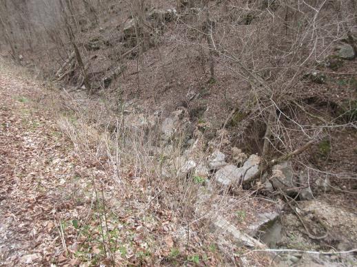 | | 2022 | COLLECTED | 03/15/2022 | Located approximately 3.75 miles east of Allison just off Round Bottom Road. | 35.93357000, -92.05110000 | 144 | Moist, low deciduous forest with scattered rock outcrops, growing along base of hill and bank of seasonal stream. | Wild material | | 2137430 | WLP 2568 |
| 6 | W6 58659 | MARSB-693 | Tridens flavus (L.) Hitchc. | Delaware, United States | W6 | | | 2021 | | | | | | | Wild material | Large grass with dark purple seeds. The seeds are also oily and droop. Branching is opposite. | 2113589 | W6 58659 |
| 7 | NA 83068 | NA 83068 | Philadelphus pubescens Loisel. | Arkansas, United States | NA | | | 2015 | COLLECTED | 10/06/2014 | Mount Magazine State Park; Brown's Spring Picnic Area trail. | 36.16768000, -93.66583000 | 796 | Moist bluff line community, growing in moist organic soil layer over rocks. | | | 1952927 | NA 83068 |
| 8 | NA 80067 | NA 80067 | Cladrastis kentukea (Dum. Cours.) Rudd | Kentucky, United States | NA | | | 2011 | COLLECTED | 10/02/2001 | Palisades (a locally used term to describe the sheer cliffs along the Kentucky River); along the west side of Kentucky Route 27 just north of Hall, Kentucky. | 37.79288000, -84.60705000 | 300 | Growing on the thin soils of the sheer limestone cliffs just below the top of the cliffs. | | | 1953441 | NA 80067 |