| 0 | NA 86519 | P, Thompson 18 | Quercus oglethorpensis W. H. Duncan | Alabama, United States | NA | | | 2020 | COLLECTED | 10/15/2015 | Between timber and hunting properties on a side of County Road 14, ca 3.5 air miles west of Catherine, Alabama. [The GPS coordinates provided, 32.177130 deg. N, 87.522820 deg. W, appear to be slightly east of the collecting site in neighboring Wilcox County. -SBL] | 32.17712000, -87.52281000 | | Mesic roadside. | Wild material | For more information about the project for which this material was collected, see M. Lobdell and P. Thompson, Ex-situ Conservation of _Quercus oglethorpensis_ in Living Collections of Arboreta and Botanical Gardens in _Proceedings of Workshop on Gene Conservation of Tree Species--Banking on the Future_. | 2109228 | NA 86519 |
| 1 | NA 81861 | VIRG-005 | Quercus virginiana Mill. | Virginia, United States | NA | | | 2012 | COLLECTED | 10/21/2012 | Joseph Bryan Park. Along Joseph Bryan Lane (entrance drive) on the left before the lower intersection with Gabriel Posser Circle and before the bridge over Princeton Creek. | 37.59526000, -77.46816000 | 51 | Cultivated in city park | Wild material | Collected during an expedition seeking material of Quercus virginiana near the species' northern natural limit | 2115755 | NA 81861 |
| 2 | Ames 26202 | 'Lippert' | Quercus macrocarpa Michx. | Oklahoma, United States | NC7 |  | | 2001 | COLLECTED | 1970 | Stillwater City Park, Payne County. | 36.11555556, -97.05805556 | 274 | | Wild material | Released in 1994 by the USDA-ARS Natural Resource Conservation Service Manhattan Plant Materials Center in cooperation with Kansas State and Extension Forestry. Selected from a collection of 4 bur oak accessions assembled and evaluated at the Manhattan Plant Materials Center from 1972 to 1994. Selected as a superior strain on the basis of growth rate, plant vigor, form, and seedling vigor. Broad leaf, deciduous, medium-to-tall tree reaching a mature height of 100 feet. Characterized by a broad, round, open crown, corky twigs; and thick, ridged, deeply furrowed bark. Leaves are bright green above, pale beneath with a close, fine, stellate pubescence, five to nine rounded loves, deeply incised in the middle, almost in two; oblong, the terminal half broader than the basal portion. Staminate flowers are small, in clustered, pendant catkins, while pistillate flowers are solitary to few in leaf axils. Fruit is an acorn up to 2 inches long, 1/2 to entirely encloesd in a distinctive fringed cup. Multiple use species, including multi-row-windbreaks, watershed protection, and plantings for farmsteads and parks. Its acorns are consumed by white-tail deer, squirrels, wood ducks, and other animals. Tolerant of a broad spectrum of physical and chemical soil porperties, but prefers moist, deep bottomland soils, but occurs on shallow uplands in coarse soils derived of limestone and sedimentaries to bluffs and at the edge of dry prairies. While the full area of adaptation is unknown, survival and adaptation ranges from the Panhandle of Texas, to central Oklahoma, and north to Manhattan, Kansas. The potential area of adaptation includes most of Oklahoma, eastern Kansas, and eastern Nebraska. For additional information, view the 'Lippert' USDA-NRCS Brochure | 1613053 | Ames 26202 |
| 3 | Ames 23752 | NSA 960194 | Quercus hybr. | Nebraska, United States | NC7 |  | | 1997 | COLLECTED | PRE 1997 | Southwest of Salem approximately 2.6 miles, T1N R15E NW 1/4 NW 1/4 Sec. 21, Richardson County. | 40.04268000, -95.74558000 | 330 | Prairie knoll/ridge, very dry and rocky substrate. Growing in association with Rhus sp., Liatris aspera (white and purple), Juniperus virginiana, Quercus rubra, Quercus macrocarpa, and Schizachyrium scoparium. | Wild material | Specimens at the collection site in nature are represented as very large/old plants, approximately 5.0 meters in height with trunk diameters to 25.0 cm. After 15 years of growth in cultivation in central Iowa, specimens average approximately 3.5 x 3.5 meters. This species is reported to sucker, but all specimens of this accession have shown no signs of suckering while grown in cultivation. Peak fall color tends to occur during the second week in October in central Iowa ranging from reddish-orange; brownish-red, brownish-orange, etc. Acorn production tends to be consistently heavy every year and can initiate production after three years in age. Peak fruiting tends to occur between 5-15 of September in central Iowa, which is approximately 1 week prior to Q. muehlenbergii. Acorns are extremely favored by deer, rabbits, raccoons, turkeys and bluejays. Quercus prinoides in Nebraska is extremely rare. To date (2022), only two counties totalling four localities have recorded this taxa including Richardson County: two areas near Salem; one in Indian Caves State Park and one in Nemaha County described as near Nemaha. Species tends to be restricted to dry rocky upland hills and bluffs. Recent research (Hipp et al., 2019), noted that using the unweighted pair group method with arithmetic mean and non-metric multidimensional scaling ordination did not separate individuals of Q. muehlenbergii and Q. prinoides as distinct species. However, W. M. Keith Jr. (1957) states that "Q. muehlenbergii never spreads vegetatively and acorns are rarely borne until it has attained small tree size whereas Q. prinoides bears at extremely small sizes, usually a foot or so high and spreads vegetatively via rhizomes". Therefore, genetics of this accession most likely represents the hybrid of Q. prinoides x Q. muehlenbergii under the assumption that the true Q. prinoides is represented only by those that clonally spread via rhizomes. Further research is needed to clarify the identity of Q. prinoides. This accession is therefore being listed as Q. hybr. Specimens are clearly "dwarf" or shrubby in growth habit and produce acorns at extremely early ages, but do not spread via rhizomes. | 1543547 | Ames 23752 |
| 4 | Ames 19367 | Ames 19367 | Quercus ×schochiana Dieck | Missouri, United States | NC7 |  | | 1992 | COLLECTED | | Missouri: southeastern corner of state. | 37.14982600, -90.76904300 | | | Wild material | Accession was separated during a grow out at NCRPIS from a seed lot of Ames 4723, which was originally received by the Missouri Dept. of Conservation as Quercus phellos. This hybrid is assumed to be a hybrid between Quercus phellos and Quercus palustris based on morphological characters being intermediate of both species. | 1082829 | Ames 19367 |
| 5 | PI 618172 | V. stamineum NC96-31-1 | Vaccinium stamineum L. | Alabama, United States | COR | | | 1997 | COLLECTED | | Roadsides and woods edges along county road 7 at Tick Hill Cemetary, 8 miles north of U.S. 29. | 31.92861000, -85.91361000 | 0 | Very dry sandy uplands (were topsoil remains). Much of the vegetation typical for the southern U.S. inner coastal plain. Quercus stellata var. margareta (running post oak) found on top of the hill. Ironstone layer in siol profile. | Wild material | Jim Ballington collection
| 1548792 | PI 618172 |
| 6 | PI 618157 | V. stamineum NC 95-14-1 | Vaccinium stamineum L. | Mississippi, United States | COR | | | 1995 | COLLECTED | 07/07/1995 | Mississippi, Green county. Old River Road, 6 mi off Hwy 63 south, south of Leaksville. | 31.21139000, -89.15361000 | 0 | Sandy mixed woodland, mainly Quercus, along and unpaved field road. Scattered V. elliottii and crown-forming V. stamineum on the site. | Wild material | Jim Ballington and Jerry Payne collection
| 1508041 | PI 618157 |
| 7 | PI 692940 | V. shastense subsp. shastense JO Shasta County | Vaccinium shastense J. K. Nelson & Lindstrand subsp. shastense | California, United States | COR | | | 2020 | COLLECTED | 10/18/2019 | Mount Shasta | 40.73944000, -122.46944000 | 335 | Montane hardwood-conifer, ponderosa pine, and chaparral habitats on steep slopes above creek with Pinus ponderosa, Pseudotsuga menziesii, Quercus chrysolepis, Arctostaphylos viscida, Aesculus californica and Toxicodendron diversilobum. | Wild material | Jim Oliphant collection.
Cuttings were collected on 18 October 2019, from a single plant occurring on the south side and upstream from the bridge crossing Squaw Creek (County Road 5G012).
This subspecies species has bright pink flowers. Vaccinium shastense subsp. nevadense has greenish to pale pink flowers. | 2098776 | PI 692940 |
| 8 | PI 702622 | Pratt 1 | Phaseolus acutifolius A. Gray var. acutifolius | New Mexico, United States | W6 | 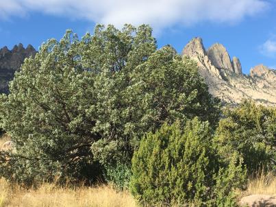 | | 2018 | COLLECTED | 10/28/2017 | About 25 to 30 plants were sampled at two sites along the Indian Hollow Trail in the Organ Mountains, Dona Ana County, New Mexico by the collector, Richard Pratt on October 28, 2017. At the exposed sites (two) along the trail, prior to reaching the intermittent stream, one site had only two plants, the other site had about three plants. These were tucked in near small boulders adjacent to the trail. A few samples were obtained from plants adjacent to the trail on an open slope, around rocks, a little before the 0.7 mile marker on Indian Hollow Trail (dot, indicated below) elev. 5490’ The majority of samples were obtained from plants growing in association with shrubs near an intermittent stream area just past the 0.7 mile trail mark--indicated by blue arrow elev. 5483’ | | 1672 | | Wild material | Received as acutifolius var. latifolius from collector Richard C. Pratt of New Mexico State University.
About 25 to 30 plants were sampled at two sites along the Indian Hollow Trail in the Organ Mountains, Dona Ana County, New Mexico by the collector, Richard Pratt on October 28, 2017. At the exposed sites (two) along the trail, prior to reaching the intermittent stream, one site had only two plants, the other site had about three plants. These were tucked in near small boulders adjacent to the trail.
The primary site was adjacent to an intermittent streambed. There were large boulders, small to medium trees, and shrubs in the riparian area. There were probably about 10-12 tepary plants associated with a shrub or two and perhaps another dozen or so in an adjacent area associated with small trees.
Associated species in the collection area were Mexican Buckeye, (Ungnadia speciosa), streambed brittle grass (Setaria leucopila ), gray oak (Quercus grisea), alligator juniper (Juniperus deppeana), mountain mahogany (Cercocarpus sp.), canyon ash (Fraxinus velutina). Elevation approximately 5490’.
Collected seed were mixed and an increase was performed in a UC Davis greenhouse by Jorge Berny.
| 2142022 | PI 702622 |
| 9 | PI 710500 | CBG-5006 | Strophostyles helvola (L.) Elliott | Illinois, United States | S9 | | | 2016 | | | | | | | Wild material | | 1942760 | PI 710500 |
| 10 | PI 710503 | CBG-4508 | Tephrosia virginiana (L.) Pers. | Illinois, United States | S9 | | | 2016 | | | | | | | Wild material | | 1942747 | PI 710503 |
| 11 | PI 710504 | CBG-5562 | Tephrosia virginiana (L.) Pers. | Illinois, United States | S9 | | | 2016 | | | | | | | Wild material | | 1942792 | PI 710504 |
| 12 | PI 675330 | MSB245599 | Eragrostis secundiflora J. Presl | Texas, United States | W6 |  | | 2011 | | | | | | | Wild material | | 1895259 | PI 675330 |
| 13 | PI 668017 | UJO 53313 | Trifolium pratense L. | Krym, Ukraine | W6 |  | | 2008 | COLLECTED | 06/29/2008 | 1.66 km W of Verkhorichcia (center of town extent), .12 km N of main road | 44.69960000, 33.97138900 | 243 | Associated Species: Quercus pubescens, Juniperus oxycedrous, Limodorum abortivum; Land Element: ridge; Aspect: S; Exposure: open; Slope: unknown; Soil pH: unknown; Soil Moisture: unknown; Soil Texture: unknown | Wild material | | 1790386 | PI 668017 |
| 14 | PI 691664 | BC 1 | Silphium terebinthinaceum Jacq. | Ohio, United States | W6 | | | 2004 | COLLECTED | 09/30/2004 | Bigalow Cemetery State Nature Preserve, Madison County. State route 161 West from Columbus, South on Rosedale Road | 40.10972222, -83.41916667 | | Drainage(1-well, 4-poor): 3 Full sun. Slope: None. Small prairie remnant in pioneer cemetery, total land area approx 100 m . Surrounded by farm fields, road. | Wild material | 5-7', very large cordate leaves at plant base. Yellow rays 2-3 cm. (2n=14) Sample size: 50. Population size: 200. Site size: 10 square meters. | 1690533 | PI 691664 |
| 15 | PI 656416 | ODNR 47 | Dichanthelium acuminatum (Sw.) Gould & C. A. Clark subsp. spretum (Schult.) Freckmann & Lelong | Ohio, United States | S9 | | | 2004 | COLLECTED | 07/08/2004 | 1/4 mile South of Monclova Road and Girdham Road, about 100 yards East of road near forest edge. Oak Openings - managed by Toledo Area Metroparks, Lucas County | 41.55527778, -83.85083333 | | Well drained. Full sun. Slight slope. Sandy dry field near forest edge. Population size: 3. Site size: 1 square meter. Associated species: Quercus, Arabis, Carex, Helianthemum, Krigia | Wild material | | 1690509 | PI 656416 |
| 16 | PI 637902 | C. fargesii 96-574-A Gansu | Corylus fargesii (Franch.) C. K. Schneid. | Gansu Sheng, China | COR |  | | 2002 | COLLECTED | | Gansu Province, Tian Shui City District, Xiao Long Shan Forest Bureau, Danh Chuan Forest Station, Mai Chao Gou. Two meters above a stream in an open woodland setting along a path in the zone where periodic flooding takes place. | 34.30417000, 106.20750000 | 1650 | Growing among rocks in silt loam soils deposited by stream; with Lonicera sp., Juglans sp., Salix sp., Carpinus sp., Quercus sp. and serveral herbaceous species. | Wild material | Single-stemmed, deciduous trees with pyramidal spreading habit; seed collected from more than 5 plants; 12-15 m tall; 15-25 cm DBH; papery copper exfoliating bark - exquisite! Beautiful tree that is threatened or rare according to the Chinese Red Data Book, but grows here in large numbers; the bark on young trees looks a lot like immature Betula nigra bark. 1996 Expedition to Shaanxi and Gansu Provinces (collected as QLG 231 on 4 October 1996.) | 1641999 | PI 637902 |
| 17 | PI 637903 | C. fargesii 96-574-F Gansu | Corylus fargesii (Franch.) C. K. Schneid. | Gansu Sheng, China | COR | | | 2002 | COLLECTED | | Gansu Province, Tian Shui City District, Xiao Long Shan Forest Bureau, Danh Chuan Forest Station, Mai Chao Gou. Two meters above a stream in an open woodland setting along a path in the zone where periodic flooding takes place. | 34.30417000, 106.20750000 | 1650 | Growing among rocks in silt loam soils deposited by stream; with Lonicera sp., Juglans sp., Salix sp., Carpinus sp., Quercus sp. and serveral herbaceous species. | Wild material | Single-stemmed, deciduous trees with pyramidal spreading habit; seed collected from more than 5 plants; 12-15 m tall; 15-25 cm DBH; papery copper exfoliating bark - exquisite! Beautiful tree that is threatened or rare according to the Chinese Red Data Book, but grows here in large numbers; the bark on young trees looks a lot like immature Betula nigra bark. 1996 Expedition to Shaanxi and Gansu Provinces (collected as QLG 231 on 4 October 1996.) | 1642000 | PI 637903 |
| 18 | PI 637904 | C. fargesii 96-574-G Gansu | Corylus fargesii (Franch.) C. K. Schneid. | Gansu Sheng, China | COR | | | 2002 | COLLECTED | | Gansu Province, Tian Shui City District, Xiao Long Shan Forest Bureau, Danh Chuan Forest Station, Mai Chao Gou. Two meters above a stream in an open woodland setting along a path in the zone where periodic flooding takes place. | 34.30417000, 106.20750000 | 1650 | Growing among rocks in silt loam soils deposited by stream; with Lonicera sp., Juglans sp., Salix sp., Carpinus sp., Quercus sp. and serveral herbaceous species. | Wild material | Single-stemmed, deciduous trees with pyramidal spreading habit; seed collected from more than 5 plants; 12-15 m tall; 15-25 cm DBH; papery copper exfoliating bark - exquisite! Beautiful tree that is threatened or rare according to the Chinese Red Data Book, but grows here in large numbers; the bark on young trees looks a lot like immature Betula nigra bark. 1996 Expedition to Shaanxi and Gansu Provinces (collected as QLG 231 on 4 October 1996.) | 1642001 | PI 637904 |
| 19 | PI 637905 | C. fargesii 96-574-H Gansu | Corylus fargesii (Franch.) C. K. Schneid. | Gansu Sheng, China | COR | | | 2002 | COLLECTED | | Gansu Province, Tian Shui City District, Xiao Long Shan Forest Bureau, Danh Chuan Forest Station, Mai Chao Gou. Two meters above a stream in an open woodland setting along a path in the zone where periodic flooding takes place. | 34.30417000, 106.20750000 | 1650 | Growing among rocks in silt loam soils deposited by stream; with Lonicera sp., Juglans sp., Salix sp., Carpinus sp., Quercus sp. and serveral herbaceous species. | Wild material | Single-stemmed, deciduous trees with pyramidal spreading habit; seed collected from more than 5 plants; 12-15 m tall; 15-25 cm DBH; papery copper exfoliating bark - exquisite! Beautiful tree that is threatened or rare according to the Chinese Red Data Book, but grows here in large numbers; the bark on young trees looks a lot like immature Betula nigra bark. 1996 Expedition to Shaanxi and Gansu Provinces (collected as QLG 231 on 4 October 1996.) | 1642002 | PI 637905 |
| 20 | PI 637906 | C. fargesii 96-574-I Gansu | Corylus fargesii (Franch.) C. K. Schneid. | Gansu Sheng, China | COR | | | 2002 | COLLECTED | | Gansu Province, Tian Shui City District, Xiao Long Shan Forest Bureau, Danh Chuan Forest Station, Mai Chao Gou. Two meters above a stream in an open woodland setting along a path in the zone where periodic flooding takes place. | 34.30417000, 106.20750000 | 1650 | Growing among rocks in silt loam soils deposited by stream; with Lonicera sp., Juglans sp., Salix sp., Carpinus sp., Quercus sp. and serveral herbaceous species. | Wild material | Single-stemmed, deciduous trees with pyramidal spreading habit; seed collected from more than 5 plants; 12-15 m tall; 15-25 cm DBH; papery copper exfoliating bark - exquisite! Beautiful tree that is threatened or rare according to the Chinese Red Data Book, but grows here in large numbers; the bark on young trees looks a lot like immature Betula nigra bark. 1996 Expedition to Shaanxi and Gansu Provinces (collected as QLG 231 on 4 October 1996.) | 1642003 | PI 637906 |
| 21 | PI 641285 | ARM-02-167 | Pyrus communis L. subsp. caucasica (Fed.) Browicz | Armenia | COR |  | | 2002 | COLLECTED | 09/12/2002 | Vanadzor Valley in Lori Marz (province) | 40.77972000, 44.47889000 | 1526 | and Quercus macranthera. and Quercus macranthera. | Wild material | Seeds were germinated and seedlings grown at The Morris Arboretum of the University of Pennsylavaia in Philadelphia with their inventory reference numbers 2002x263 and 2002-250. Two seedlings were provided to the NPGS Woody Landscape Plant genebank in Beltsville, Maryland, and forwarded to NCGR Corvallis in December, 2009 by curator Kevin Conrad. Additional seedling trees were sent to NCGR Corvallis from the Morris Arboretum in March, 2010 by curator Tony Aiello. | 1642265 | PI 641285 |
| 22 | PI 604693 | 052 | Trifolium pratense L. | Russian Federation | W6 | | | 1996 | COLLECTED | 07/29/1995 | Province Nal'Chir (Kabardin-Balkarskaya Republic), 1 km west of Balsan. | 43.71555556, 43.51138889 | 427 | Past logged, now roadway. Slope 0-5%, aspect SW. Light open. Soil loam with gravel, pH 7.5. Seasonally dry, roadside ditch. Vegetation closed, evergreen tall grass. Surrounding vegetation open deciduous forest with closed lower layers. | Wild material | Dominant tree species Fagus sp., and Quercus sp. Dominant shrub species Origanum sp. Population distribution patchy, abundance occasional. Growth habit erect. Flower red. Extensive regional climate data available in spreadsheet format or image maps in raster format suitable for GIS analysis. Contact Dr. Stephanie L. Greene (sgreene@ars-grin.gov). | 1530838 | PI 604693 |
| 23 | PI 604694 | 157 | Trifolium repens L. | Russian Federation | W6 | | | 1996 | COLLECTED | 08/23/1995 | Province Sochi, 10 km north of Khosta at Krasnar Vove village. | 43.55138889, 39.90833333 | 220 | pH 7.5. Samples taken in orchard that was heavily grazed. Sampling terminated after soil pH determined to be basic. Parent rock was schist with some limestone. Vegetation closed, evergreen broad-leafed herb vegetation. | Wild material | Surrounding vegetation open deciduous forest with closed lower layers. Dominant tree species Carpinus sp., Quercus sp. Dominant shrub species Lauracerasus sp. Dominant herb/grass species Trifolium sp., Bermuda grass. Population abundance frequent. Growth habit prostrate. Flower white. Extensive regional climate data available in spreadsheet format or image maps in raster format suitable for GIS analysis. Contact Dr. Stephanie L. Greene (sgreene@ars-grin.gov). | 1530917 | PI 604694 |
| 24 | PI 604697 | 235 | Trifolium pratense L. | Russian Federation | W6 | | | 1996 | COLLECTED | 09/05/1995 | Province Maykop/Labrinsk, 10 km southeast of Psebay. | 44.08444444, 40.84388889 | 640 | Past and current grazing. Slope 6-10%, aspect SW. Light open. Soil clay rock derived, pH 5.2. Moist to seasonally dry, lower slope, stream terrace. Vegetation closed, evergreen broad-leafed herb vegetation.Acid soil type rhizobium collected | Wild material | Surrounding vegetation open deciduous forest with closed lower layers. Dominant tree species Quercus robur, Quercus sp., Fagus o., Carpinus c. Dominant shrub species Laurocerasus officinalis, Crataegus sp., Rosa sp., Ribes sp. Dominant herb/grass species Lotus c., Achillea sp., Trifolium sp., wild strawberry, Geranium sp., Phleum p., other grasses. Population distribution patchy, abundance occasional. Growth habit erect. Flower red. Extensive regional climate data available in spreadsheet format or image maps in raster format suitable for GIS analysis. Contact Dr. Stephanie L. Greene (sgreene@ars-grin.gov). | 1530970 | PI 604697 |
| 25 | PI 604698 | 210 | Trifolium pratense L. | Russian Federation | W6 | | | 1996 | COLLECTED | 09/03/1995 | Province Maykop, 5 km southeast of Dakhovskaya. | 44.20805556, 40.25277778 | 550 | Past logged,now roadway.Slope 0-5%,aspect SE.Light open.Soil loam upper to 25 cm,clay >25 cm,pH 5.9-5.3 with depth,parent rock colluvial clays.Seasonally dry,mid slope.Vegetation closed,evergreen tall grass and broad-leafed herb vegetation. | Wild material | Surrounding vegetation evergreen open forest with closed lower layers. Dominant tree species Quercus sp., Carpinus c. Dominant shrub species Rosa sp. Dominant herb/grass species Daucus c., Trifolium sp., Achillea sp., Geranium sp., Brachypodium p., Festuca sp., Calamagrostis sp., Agrostis sp., Phleum p. Population distribution uniform, abundance frequent. Growth habit erect. Flower red. Extensive regional climate data available in spreadsheet format or image maps in raster format suitable for GIS analysis. Contact Dr. Stephanie L. Greene (sgreene@ars-grin.gov). | 1530958 | PI 604698 |
| 26 | PI 604706 | 132 | Trifolium pratense L. | Russian Federation | W6 | | | 1996 | COLLECTED | | Province Novorossiysk, 6 km north of Michaelouski-Perival. | 44.53805556, 38.34611111 | 420 | Past logged, now roadway. Slope 6-10%, aspect S. Light 1/4 shade. Soil clay, parent rock limestone, pH basic. Seasonally dry, mid slope. Vegetation closed evergreen broad-leafed herb vegetation. | Wild material | Surrounding vegetation open deciduous forest with closed lower layers. Dominant tree species Quercus sp. Dominant shrub species Caprinus sp., Quercus sp., Ribes, Dorycnium intermedium. Dominant herb/grass species Trifolium sp., Dactylis glomerata, Daucus carota. Population abundance frequent. Growth habit erect. Flower red. Extensive regional climate data available in spreadsheet format or image maps in raster format suitable for GIS analysis. Contact Dr. Stephanie L. Greene (sgreene@ars-grin.gov). | 1530896 | PI 604706 |
| 27 | PI 604709 | 062 | Trifolium pratense L. | Russian Federation | W6 | | | 1996 | COLLECTED | 07/30/1995 | Province Armavir/Maykop, 1 km north of Chamlykskaya, valley of Chemlink. | 44.73611111, 40.84444444 | 244 | Past logged, now roadway. Slope 0-5%, aspect SW. Light open. Soil sand with gravel, pH 7.5. Seasonally dry, roadside. Vegetation closed, evergreen tall grass. Surrounding vegetation open deciduous forest with closed lower layers. | Wild material | Dominant tree species Quercus sp., Q. robur. Dominant shrub species Carpinus sp., Prunus sp. Population distribution patchy, abundance occasional. Growth habit erect. Flower red. Extensive regional climate data available in spreadsheet format or image maps in raster format suitable for GIS analysis. Contact Dr. Stephanie L. Greene (sgreene@ars-grin.gov). | 1530848 | PI 604709 |
| 28 | PI 604710 | 116 | Trifolium pratense L. | Russian Federation | W6 | | | 1996 | COLLECTED | | Province Novorossiysk, 3 km north of Kabardinka. | 44.68250000, 37.95222222 | 380 | Past logged, now grazed. Slope 11-40%, aspect SW. Light open. Soil clay, parent rock platey limestones, pH 7.5-8.0. Seasonally dry, lower to upper slope. Vegetation closed, open deciduous forest with closed lower layers. | Wild material | Surrounding vegetation closed, seasonal tall grass. Dominant tree species Quercus sp. Dominant shrub species Carpinus sp., Quercus sp. Dominant herb/grass species Achillea sp., Festuca sp., Agropyron cristatum, Phleom sp., Salvia sp., Sanguisorba minor, Plantago sp. Population abundance frequent. Growth habit erect. Flower red. Extensive regional climate data available in spreadsheet format or image maps in raster format suitable for GIS analysis. Contact Dr. Stephanie L. Greene (sgreene@ars-grin.gov). | 1530887 | PI 604710 |
| 29 | PI 604711 | 113 | Trifolium medium L. | Russian Federation | W6 | | | 1996 | COLLECTED | | Province Novorossiysk, 3 km north of Kabardinka. | 44.68250000, 37.95222222 | 380 | Past logged, now grazed. Slope 11-40%, aspect SW. Light open. Soil clay, parent rock platey limestones, pH 7.5-8.0. Seasonally dry, lower to upper slope. Vegetation closed, open deciduous forest with closed lower layers. | Wild material | Surrounding vegetation seasonal tall grass. Dominant tree species Quercus sp. Dominant shrub species Carpinus sp., Quercus sp. Dominant herb/grass species Achillea sp., Festuca sp., Agropyron cristatum, Phleom sp., Salvia sp., Sanguisorba minor, Plantago sp. Population distribution patchy. Growth habit erect, spreading. Flower white-cream-lavender. Extensive regional climate data available in spreadsheet format or image maps in raster format suitable for GIS analysis. Contact Dr. Stephanie L. Greene (sgreene@ars-grin.gov). | 1530885 | PI 604711 |
| 30 | PI 604715 | 038 | Trifolium pratense L. | Russian Federation | W6 | | | 1996 | COLLECTED | 07/23/1995 | Province Maykop, 3 km north of Podgorna. | 44.29722222, 41.24722222 | 914 | Slope 0-5%, aspect S. Light open. Soil clay, pH 5.6-5.8, gravel layer between clay layers. Vegetation closed, evergreen short grass. Surrounding veg. open deciduous forest with closed lower layers. | Wild material | Dominant tree species Quercus sp., Q. robur. Dominant shrub species Carpinus c., Q. petraea. Population distribution patchy, abundance occasional. Growth habit erect. Flower red. Extensive regional climate data available in spreadsheet format or image maps in raster format suitable for GIS analysis. Contact Dr. Stephanie L. Greene (sgreene@ars-grin.gov). | 1530829 | PI 604715 |
| 31 | PI 604716 | 019 | Trifolium pratense L. | Russian Federation | W6 | | | 1996 | COLLECTED | 12/07/1995 | Province Anapa/Novorossiysk. 2 km east of Podbidam. | 44.87500000, 37.55000000 | 120 | Past and current grazing. Slope 11-40%, aspect N. Open light. Soil clay with gravel, parent material colluvial of limestones, pH 7.3. Seasonally dry, mid slope. Vegetation closed, seasonal short grass. | Wild material | Surrounding vegetation open deciduous forest with closed lower layers. Dominant tree species Quercus sp. Dominant shrub species Carpinus sp., Quercus sp. Dominant herb/grass species broadleaves, Daucus carotta, Festuca sp. Population distribution patchy, abundance occasional. Growth habit erect. Flower red. Extensive regional climate data available in spreadsheet format or image maps in raster format suitable for GIS analysis. Contact Dr. Stephanie L. Greene (sgreene@ars-grin.gov). | 1530818 | PI 604716 |
| 32 | PI 604719 | D43 | Trifolium pratense L. | Russian Federation | W6 | | | 1996 | COLLECTED | | Province Maykop, 5 km west of Otradnaya. | 44.41861111, 41.43138889 | 608 | Past logged, now settlement, rock quarry. Slope 0-5%, aspect S. Light open. Soil conglomerate with clay between, pH 7.8. Seasonally dry, ridgetop. Vegetation closed, evergreen broad-leafed herb vegetation. | Wild material | Surrounding vegetation open deciduous forest with closed lower layers. Dominant tree species Quercus robur, Quercus sp. Dominant shrub species Carpinus c., Q. petraea. Dominant herb/grass species Trifolium sp. Extensive regional climate data available in spreadsheet format or image maps in raster format suitable for GIS analysis. Contact Dr. Stephanie L. Greene (sgreene@ars-grin.gov). | 1531088 | PI 604719 |
| 33 | PI 604721 | 164 | Trifolium repens L. | Russian Federation | W6 | | | 1996 | COLLECTED | 08/23/1995 | Province Souchi, 3-4 km north of Ismyolfka. | 43.62666667, 39.80361111 | 250 | Past logged, now grazed and cultivated. Slope 11-40%, aspect S. Light open. Soil yellow clay, pH basic. Seasonally dry, mid slope. Vegetation closed, evergreen broad-leafed herb vegetation. | Wild material | Surrounding vegetation open deciduous forest with closed lower layers. Dominant tree species Castanea sp., Carpinus sp., Quercus sp. Dominant shrub species Laurocerasus sp., Ribes sp. Dominant herb/grass species Trifolium sp., annual grasses. Open degraded slope, 15% cover. Population distribution patchy. Growth habit prostrate. Flower white. Extensive regional climate data available in spreadsheet format or image maps in raster format suitable for GIS analysis. Contact Dr. Stephanie L. Greene (sgreene@ars-grin.gov). | 1530924 | PI 604721 |
| 34 | PI 604722 | 155 | Trifolium repens L. | Russian Federation | W6 | | | 1996 | COLLECTED | 08/23/1995 | Province Souchi, 10 km north of Dagomys. | 43.75555556, 39.69472222 | 230 | Past logged, now grazed, roadway. Slope 11-40%, aspect S. Light open. Soil clay, limestones, calcareous soils, pH 7.8. Moist, mid slope. Vegetation closed, open deciduous forest with closed lower layers. | Wild material | Surrounding vegetation evergreen broad-leafed herb vegetation. Dominant tree species Quercus sp., Carpinus sp. Dominant shrub species Laurocerasus sp., Ribes sp. Dominant herb/grass species Trifolium sp., Bermuda, Aster sp. types. Population abundance frequent. Growth habit prostrate. Flower white. Extensive regional climate data available in spreadsheet format or image maps in raster format suitable for GIS analysis. Contact Dr. Stephanie L. Greene (sgreene@ars-grin.gov). | 1530915 | PI 604722 |
| 35 | PI 604723 | 145 | Trifolium pratense L. | Russian Federation | W6 | | | 1996 | COLLECTED | 08/22/1995 | Province Lazarevskoye-Souchi, 10 km east of Soloniki. | 43.84833333, 39.40888889 | 15 | Past logged, now grazed. Slope 11-40%, aspect S. Light open. Soil clay, parent rock limestones, pH 7.4-7.5. Seasonally dry, lower to mid slope. Vegetation closed, evergreen broad-leafed herb vegetation. | Wild material | Surrounding vegetation open deciduous forest with closed lower layers. Dominant tree species Quercus sp., Carpinus sp. Dominant shrub species Laurocerasus sp., Ribes sp. Dominant herb/grass species Trifolium sp., Festuca pratensis, Agrimonia eupatoria, Vicia sp., Dorycnium intermedium, Senecio sp., Origonium regata, Coronilla varia, Geranium sp., Inula britannia, Daucus carota, Plantago sp. Population abundance frequent. Growth habit erect. Flower red. Extensive regional climate data available in spreadsheet format or image maps in raster format suitable for GIS analysis. Contact Dr. Stephanie L. Greene (sgreene@ars-grin.gov). | 1530907 | PI 604723 |
| 36 | PI 604724 | 149 | Trifolium repens L. | Dagestan, Russian Federation | W6 | | | 1996 | COLLECTED | | Province Dagomys-Babuk (Sochi), 2 km north of Volafka, along river. | 43.72222222, 39.67194444 | 90 | Past logged, now settlement. Slope 6-10%, aspect E, SE. Light 1/4 shade. Soil clay, parent rock clays, schists, pH 4.5-4.6. Seasonally dry, upper slope. Vegetation closed, evergreen broad-leafed herb vegetation. | Wild material | Surrounding vegetation open deciduous forest with closed lower layers. Dominant tree species Quercus sp., Carpinus sp. Dominant shrub species Laurocerasus sp. Dominant herb/grass species ferns, Trifolium sp., Lotus corniculatus, Alien sorghum, Johnson Grass. Population abundance frequent. Growth habit prostrate. Flower white. Extensive regional climate data available in spreadsheet format or image maps in raster format suitable for GIS analysis. Contact Dr. Stephanie L. Greene (sgreene@ars-grin.gov). | 1530910 | PI 604724 |
| 37 | PI 604733 | 083 | Trifolium medium L. | Krasnodar, Russian Federation | W6 | | | 1996 | COLLECTED | 08/10/1995 | Province Krasnodar, southwest of Krasnodar, village Azovskaya. | 44.79361111, 38.55777778 | 210 | Past cultivated, now grazed. Slope 0-5%, aspect W. Light open. Soil loam, clay, pH 5.0-5.6. Seasonally dry, mid slope. Vegetation closed, seasonal broad-leafed herb vegetation. Surrounding veg. open deciduous forest with closed lower layers | Wild material | Dominant tree species Fagus sp. and Quercus sp. Dominant shrub species Ribes sp., Prunus sp., Caprinus sp., Crataegus sp. Population distribution patchy, abundance occasional. Growth habit prostrate. Extensive regional climate data available in spreadsheet format or image maps in raster format suitable for GIS analysis. Contact Dr. Stephanie L. Greene (sgreene@ars-grin.gov). | 1530863 | PI 604733 |
| 38 | PI 604734 | 080 | Trifolium pratense L. | Krasnodar, Russian Federation | W6 | | | 1996 | COLLECTED | 08/16/1995 | Province Krasnodar, southwest of Krasnodar, village Azovskaya. | 44.79361111, 38.55777778 | 210 | Past cultivated, now grazed. Slope 0-5%, aspect W. Light open. Soil loam, clay, pH 4.8. Seasonally dry, mid slope. Vegetation closed, seasonal broad-leafed herb vegetation. Surrounding veg. open deciduous forest with closed lower layers. | Wild material | Dominant tree species Fagus sp. and Quercus sp. Dominant shrub species Ribes sp., Prunus sp., Caprinus sp., Crataegus sp. Population distribution patchy, abundance occasional. Growth habit erect. Flower purple/red. Extensive regional climate data available in spreadsheet format or image maps in raster format suitable for GIS analysis. Contact Dr. Stephanie L. Greene (sgreene@ars-grin.gov). | 1530861 | PI 604734 |
| 39 | PI 604739 | D2 | Trifolium pratense L. | Krasnodar, Russian Federation | W6 | | | 1996 | COLLECTED | | Province Krasnodar, 5 km south of Il'skaya, southwest of Krasnodar. | 44.78333333, 38.56666667 | 190 | Grazed, Slope 0-10%, aspect NE. Light open. Soil sand, loam, pH 4.6-5.3. Seasonally dry, upper slope. Vegetation closed, seasonal broad-leafed herb vegetation. Surrounding vegetation open deciduous forest with closed lower layers. | Wild material | Dominant tree species Quercus sp. Dominant shrub species Ribes sp., Prunus sp., Caprinus sp., Crataegus sp. Dominant herb/grass species Daucus carota, Potentilla sp., Festuca pratensis, Medicago falcata, Lotus c., Dorycnium intermedium, Dorycnium graceum. Extensive regional climate data available in spreadsheet format or image maps in raster format suitable for GIS analysis. Contact Dr. Stephanie L. Greene (sgreene@ars-grin.gov). | 1531080 | PI 604739 |
| 40 | PI 604740 | 085 | Trifolium pratense L. | Krasnoyarsk, Russian Federation | W6 | | | 1996 | COLLECTED | 08/17/1995 | Province Krymsk, between Krasnodar and Novorossiysk, west of Krymsk. | 44.91083333, 37.96250000 | 70 | Past and current grazing. Slope 6-40%, aspect NE. Light open. Soil calcareous loams/sands, clay, pH 7.6-7.9. Seasonally dry, lower to mid slope, active slope movement. Vegetation closed, seasonal broad-leafed herb vegetation. | Wild material | Surrounding vegetation open deciduous forest with closed lower layers. Dominant tree species Quercus robur, Quercus sp. Dominant shrub species Ribes sp. Dominant herb/grass species broadleaves, Trifoliums, Lotus corniculatus, Bermuda grass, Bothriochloa ischaemum, Senecio grandidentatus, Tusslilago farfara, Coronilla varia, Xanthium strumarium, Daucus carota, Convolvulus arvensis, Achillea millefolium. Population distribution uniform, abundance frequent. Growth habit erect. Flower red. Extensive regional climate data available in spreadsheet format or image maps in raster format suitable for GIS analysis. Contact Dr. Stephanie L. Greene (sgreene@ars-grin.gov). | 1530865 | PI 604740 |
| 41 | PI 604745 | D144 | Trifolium repens L. | Russian Federation | W6 | | | 1996 | COLLECTED | 09/04/1995 | 1 km. east of Yeroslavskaya, 30+ km. east of Maykop. | 44.61861111, 40.49000000 | 340 | Area grazed. Slope 11-40%, aspect S. Light open. Soil clay, pH basic. Seasonally dry, lower slope. Vegetation closed, seasonal tall grass. Surrounding vegetation open deciduous forest with closed lower layers. | Wild material | Dominant tree species Crataegus sp., Quercus sp., Monogyna, Pentagyna. Dominant shrub species Rosa sp., Prunus sp. Dominant herb/grass species Achellea sp., Daucus c., thistle, bindweed, chichory, Bothriochloa i., Cynodon d. Population distribution patchy, abundance rare. Growth habit prostrate. Flower white. Extensive regional climate data available in spreadsheet format or image maps in raster format suitable for GIS analysis. Contact Dr. Stephanie L. Greene (sgreene@ars-grin.gov). | 1531071 | PI 604745 |
| 42 | PI 604746 | 042 | Trifolium repens L. | Russian Federation | W6 | | | 1996 | COLLECTED | 07/24/1995 | Province Maykop, 5 km west of Otradnaya. | 44.41861111, 41.43138889 | 610 | Past logged,now settlement.Slope 0-5%,aspect S.Light open.Soil conglomerate w/ clay between,pH 7.8.Seasonally dry,ridgetop.Vegetation closed,evergreen broad-leafed herb vegetation.Surrounding veg. open decid. forest with closed lower layers | Wild material | Dominant tree species Quercus sp., Q. robur. Dominant shrub species Carpinus c., Q. petraea. Dominant herb/grass species Trifolium sp. Population distribution uniform, abundant. Growth habit prostrate. Flower white. Extensive regional climate data available in spreadsheet format or image maps in raster format suitable for GIS analysis. Contact Dr. Stephanie L. Greene (sgreene@ars-grin.gov). | 1530832 | PI 604746 |
| 43 | PI 604749 | D145 | Trifolium ambiguum M. Bieb. | Russian Federation | W6 | | | 1996 | COLLECTED | 09/04/1995 | Province Maykop/Labinsk, 5 km south of Vladimirskaya. | 44.48027778, 40.81472222 | 360 | Grazed, cut hay. Slope 11-40%, aspect SW. Light open. Soil clay, pH 7.7. Moist, lower slope, landslide, unstable site,springs,boggy zones.Vegetation closed, seasonal tall grass.Surrounding veg. open deciduous forest with closed lower layers | Wild material | Dominant tree species Crataegus sp., Quercus sp., Hornbeam-Oak. Dominant shrub species Sambucus sp., Rosa sp., Prunus sp. Dominant herb/grass species Achillea sp., Daucus c., Medicago f., Bothriochloa i., Erytregia sp. Population distribution patchy, abundance rare. Growth habit prostrate. Flower white. Extensive regional climate data available in spreadsheet format or image maps in raster format suitable for GIS analysis. Contact Dr. Stephanie L. Greene (sgreene@ars-grin.gov). | 1531072 | PI 604749 |
| 44 | PI 604754 | 125 | Trifolium medium L. | Russian Federation | W6 | | | 1996 | COLLECTED | 08/21/1995 | Province Novorossiysk, 10 km north of Michaelovski-Perival. | 44.55833333, 38.36333333 | 690 | Past logged, now grazed. Slope 0-5%, aspect NW. Light open. Soil clay, limestone/slate, shales, sandstones, pH 5.6-7.5. Seasonally dry, ridgetop, upper slope. Vegetation closed, evergreen broad-leafed herb vegetation. | Wild material | Surrounding vegetation open deciduous forest with closed lower layers. Dominant tree species Quercus sp. Dominant shrub species Caprinus sp., Quercus sp., Ribes sp. Dominant herb/grass species Trifolium sp., Festuca pratensis, Poa sp., Potentilla sp., Medicago falcata, Onobrychis sp., Aster sp., Dactylis glomerata, Geranium sp. Population distribution patchy. Growth habit erect. Flower red-purple. Extensive regional climate data available in spreadsheet format or image maps in raster format suitable for GIS analysis. Contact Dr. Stephanie L. Greene (sgreene@ars-grin.gov). | 1530892 | PI 604754 |
| 45 | PI 604760 | 144A | Trifolium repens L. | Russian Federation | W6 | | | 1996 | COLLECTED | 08/22/1995 | Province Lazarevskoye-Sochi, south on river floodplain near Soloniki. | 43.86666667, 39.36666667 | 5 | Past logged, now roadway. Slope 0-5%, aspect S. Light open. Soil clay, parent rock limestone, pH basic. Moist, floodplain. Vegetation closed, open deciduous forest with closed lower layers. Surrounding vegetation evergreen tall grass. | Wild material | Dominant tree species Quercus sp., Caprinus sp. Dominant shrub species Laurocerasus sp. Dominant herb/grass species white clover, Bermuda grass, Galega officinalis. Population distribution patchy, abundance rare. Growth habit prostrate. Flower white. Extensive regional climate data available in spreadsheet format or image maps in raster format suitable for GIS analysis. Contact Dr. Stephanie L. Greene (sgreene@ars-grin.gov). | 1530906 | PI 604760 |
| 46 | PI 604761 | 146 | Trifolium repens L. | Russian Federation | W6 | | | 1996 | COLLECTED | 08/22/1995 | Province Lazarevskoye-Souchi, 10 km east of Soloniki. | 43.84833333, 39.40888889 | 15 | Past logged, now grazed. Slope 11-40%, aspect S. Light open. Soil clay, parent rock limestone, pH 7.4-7.5. Seasonally dry, lower to mid slope. Vegetation closed, evergreen broad-leafed herb vegetation. | Wild material | Surrounding vegetation open deciduous forest with closed lower layers. Dominant tree species Quercus sp., Carpinus sp. Dominant shrub species Laurocerasus sp., Ribes sp. Dominant herb/grass species Trifolium sp., Festuca pratensis, Agrimonia eupatoria, Vicia sp., Dorycnium intermedium, Senecio sp., Origonium regata, Coronilla varia, Geranium sp., Inula britannia, Daucus carota, Plantago sp. Population abundance frequent. Growth habit prostrate. Flower white. Extensive regional climate data available in spreadsheet format or image maps in raster format suitable for GIS analysis. Contact Dr. Stephanie L. Greene (sgreene@ars-grin.gov). | 1530908 | PI 604761 |
| 47 | PI 604764 | 144 | Trifolium repens L. | Russian Federation | W6 | | | 1996 | COLLECTED | 08/22/1995 | Province Lazarevskoye-Sochi, south on river floodplain near Soloniki. | 43.86666667, 39.36666667 | 5 | Past logged, now roadway. Slope 0-5%, aspect S. Light open. Soil clay, parent rock limestone, pH basic. Moist, floodplain. Vegetation closed, open deciduous forest with closed lower layers. Surrounding vegetation evergreen tall grass. | Wild material | Dominant tree species Quercus sp., Caprinus sp. Dominant shrub species Laurocerasus sp. Dominant herb/grass species white clover, Bermuda grass, Galega officinalis. Population abundance frequent. Growth habit prostrate. Flower white. Extensive regional climate data available in spreadsheet format or image maps in raster format suitable for GIS analysis. Contact Dr. Stephanie L. Greene (sgreene@ars-grin.gov). | 1530905 | PI 604764 |
| 48 | PI 604765 | 254 | Trifolium ambiguum M. Bieb. | Karelia, Russian Federation | W6 | | | 1996 | COLLECTED | 09/06/1995 | Province Karachayevo-Cherkesskaya Republic, 1 km northwest of Ordzhanikedevskiy. | 43.85833333, 41.90194444 | 790 | Past and current grazing. Lower slope 6-10%, upper slope 41-60%, aspect SE. Light open. Soil sandy loam, sanstone rock outcrop, pH upper 5.8, lower 6.3-6.4. Seasonally dry, lower slope, rock outcrop. Vegetation closed, seasonal tall grass. | Wild material | Surrounding vegetation open deciduous forest with closed lower layers. Dominant tree species Beech, Oak, Fagus o., Quercus sp. Dominant shrub species Artemisia sp., Rosa sp. Dominant herb/grass species Achillea sp., Medicago sp., Bothriochloa i., Festuca v. Population distribution patchy, abundance occasinal. Growth habit prostrate. Flower white. Extensive regional climate data available in spreadsheet format or image maps in raster format suitable for GIS analysis. Contact Dr. Stephanie L. Greene (sgreene@ars-grin.gov). | 1530981 | PI 604765 |
| 49 | PI 604766 | D165 | Trifolium pratense L. | Krasnodar, Russian Federation | W6 | | | 1996 | COLLECTED | 09/20/1995 | Krasnodarskiy kray, nearest village is Temnolesskaya. | | | Now logged. Slope 6-10%. 1/4 shade. Moist, mid slope. Vegetation closed, primary deciduous forest, scrub with scattered trees. | Wild material | Dominant tree species Carpinus betulus, Quercus robur, Castanea vulgaris. Dominant shrub species Rosa sp., Corylus avellana, Salix caprea. Dominant herb/grass species Calamogrostis sp., Doricnium graecum, Trifolium medium. Population distribution uniform, abundance rare. Growth habit spreading. Extensive regional climate data available in spreadsheet format or image maps in raster format suitable for GIS analysis. Contact Dr. Stephanie L. Greene (sgreene@ars-grin.gov). | 1531075 | PI 604766 |
| 50 | PI 604768 | D142 | Trifolium repens L. | Russian Federation | W6 | | | 1996 | COLLECTED | 09/03/1995 | Province Maykop, 5 km southeast of Dakhovskaya. | 44.20833333, 40.25277778 | 550 | Past logged, now roadway. Slope 0-5%, aspect SE. Light open. Soil clay-loam upper to 25 cm, clay >25 cm, parent rock colluvial clays, pH 5.9-5.3 with depth. Seasonally dry, mid slope. Vegetation closed evergreen broad-leafed herb vegetation | Wild material | Surrounding vegetation evergreen open forest with closed lower layers. Dominant tree species Quercus robur, Quercus sp., Carpinus c. Dominant shrub species Rosa sp. Dominant herb/grass species Daucus c., Trifolium sp., Achillea sp., Geranium sp., Brachypodium p., Festuca sp., Calamagrostis sp., Agrostis sp., Phleum p. Population distribution patchy, abundance occasional. Growth habit prostrate. Flower white. Extensive regional climate data available in spreadsheet format or image maps in raster format suitable for GIS analysis. Contact Dr. Stephanie L. Greene (sgreene@ars-grin.gov). | 1531070 | PI 604768 |
| 51 | PI 604769 | 151 | Trifolium medium L. | Russian Federation | W6 | | | 1996 | COLLECTED | 08/22/1995 | Province Souchi, 12 km north of Dagomys, to west of site 78. | 43.74972222, 39.68361111 | 300 | Past logged, now grazed. Slope 11-40%, aspect SE. Light open. Soil clay, parent rock limestone, schists/shale, pH 5.9-6.0. Filbert orchard. Moist, ridgetop, upper slope. Vegetation closed, open deciduous forest with closed lower layers. | Wild material | Surrounding vegetation evergreen tall grass. Dominant tree species Quercus sp., Quercus robur, Carpinus sp. Dominant shrub species Laurocerasus sp., Ribes sp. Dominant herb/grass species Calamagrostis sp., grass dominant, ferns, blackberry. Population abundance occasional. Growth habit erect, spreading. Flower purple. Extensive regional climate data available in spreadsheet format or image maps in raster format suitable for GIS analysis. Contact Dr. Stephanie L. Greene (sgreene@ars-grin.gov). | 1530912 | PI 604769 |
| 52 | PI 604770 | 162 | Trifolium repens L. | Russian Federation | W6 | | | 1996 | COLLECTED | | Province Souchi, 2 km north of Ismyolfka/Metseska. | 43.61888889, 39.82055556 | 100 | Past logged, now grazed. Slope 0-5%, aspect S. Light open. Soil clay, limestone, schists on slopes, pH 6.9-7.0. Moist, floodplain. Vegetation closed, evergreen broad-leafed herb vegetation.` | Wild material | Surrounding vegetation open deciduous forest with closed lower layers. Dominant tree species Carpinus sp., Quercus sp. Dominant shrub species Sambucus sp., Ribes sp., Lauracerasus sp. Dominant herb/grass species Trifolium sp., Bermuda grass, Mentha arvensis. Population abundance frequent. Growth habit prostrate. Flower white. Extensive regional climate data available in spreadsheet format or image maps in raster format suitable for GIS analysis. Contact Dr. Stephanie L. Greene (sgreene@ars-grin.gov). | 1530922 | PI 604770 |
| 53 | PI 604771 | 218 | Trifolium pratense L. | Russian Federation | W6 | | | 1996 | COLLECTED | 09/04/1995 | 1 km. east of Yeroslavskaya, 30+ km. east of Maykop. | 44.61861111, 40.49000000 | 340 | Area grazed. Slope 11-40%, aspect S. Light open. Soil clay, pH basic. Seasonally dry, lower slope. Vegetation closed, seasonal tall grass. Surrounding vegetation open deciduous forest with closed lower layers. | Wild material | Dominant tree species Crataegus sp., Quercus sp., Monogyna, Pentagyna. Dominant shrub species Rosa sp., Prunus sp. Dominant herb/grass species Achellea sp., Daucus c., thistle, bindweed, chicory, Bothriochloa i., Cynodon d. Population distribution patchy, abundance occasional. Growth habit erect. Flower red. Extensive regional climate data available in spreadsheet format or image maps in raster format suitable for GIS analysis. Contact Dr. Stephanie L. Greene (sgreene@ars-grin.gov). | 1530960 | PI 604771 |
| 54 | PI 604773 | D132 | Trifolium pratense L. | Dagestan, Russian Federation | W6 | | | 1996 | COLLECTED | | Province Dagomys-Babuk (Souchi), 2 km north of Volafka, along river. | 43.72222222, 39.67194444 | 90 | Past logged, now settlement. Slope 6-10%, aspect E, SE. Light 1/4 shade. Soil clay, parent rock clays, schists, pH 4.5-4.6. Seasonally dry, upper slope. Vegetation closed, evergreen broad-leafed herb vegetation. | Wild material | Surrounding vegetation open deciduous forest with closed lower layers. Dominant tree species Carpinus sp., Quercus sp. Dominant shrub species Laurocerasus sp. Dominant herb/grass species ferns, Trifolium sp., Lotus corniculatus, Alien sorghum, Johnson grass. Population abundance occasional. Growth habit erect. Flower red. Extensive regional climate data available in spreadsheet format or image maps in raster format suitable for GIS analysis. Contact Dr. Stephanie L. Greene (sgreene@ars-grin.gov). | 1531069 | PI 604773 |
| 55 | PI 611037 | VIR 129 | Dactylis glomerata L. | Russian Federation | W6 | | | 1996 | COLLECTED | 08/21/1995 | Province Novorossiysk, 10 km. north of Michaelovskiperival. | 44.55833333, 38.36333333 | 700 | Past logged, now grazed. Slope 0-5%, aspect NW. Light open. Soil sandy-clay, pH 4.5-5.5. Seasonally dry, ridgetop, upper slope. Vegetation closed, evergreen broad-leafed. Surrounding veg. open deciduous forest with closed lower layers. | Wild material | Dominant tree species Quercus sp. Dominant shrub species Carpinus sp., Quercus sp., Ribes sp. Dominant herb/grass species Trifolium sp., Festuca pratensis, Poa sp., Potentilla sp., Medicago falcata, Onobrychis sp., Aster sp., Dactylis glomerata, Geranium sp. Population abundance frequent. Growth habit erect. Extensive regional climate data available in spreadsheet format or image maps in raster format suitable for GIS analysis. Contact Dr. Stephanie L. Greene (sgreene@ars-grin.gov). | 1517970 | PI 611037 |
| 56 | PI 611039 | VIR 123 | Agropyron sp. | Russian Federation | W6 |  | | 1996 | COLLECTED | 08/20/1995 | Province Novorossiysk, 3 km. north of Kabardinka. | 44.68250000, 37.95222222 | 380 | Past logged, now grazed. Slope 11-40%, aspect SW. Light open. Soil clay, pH 6.8-7.0. Seasonally dry, lower-upper slope. vegetation closed, open deciduous forest with closed lower layers. Surrounding vegetation seasonal tall grass. | Wild material | Dominant tree species Quercus sp. Dominant shrub species Carpinus sp., Quercus sp. Dominant herb/grass species Achillea sp., Festuca sp., Agropyron cristatum, Salvia sp., S. ringens, Sanguisorba minor, Plantago sp. Population abundant. Growth habit erect. Extensive regional climate data available in spreadsheet format or image maps in raster format suitable for GIS analysis. Contact Dr. Stephanie L. Greene (sgreene@ars-grin.gov). | 1517969 | PI 611039 |
| 57 | PI 611049 | VIR 281 | Dactylis glomerata L. | Russian Federation | W6 | | | 1996 | COLLECTED | 09/14/1995 | Krasnodarskiy kray. Nearest village Dachovskaya. | 44.15055556, 40.19666667 | 1100 | Area logged. Slope 6-10%, aspect NE. Light 1/4 shade. Soil loam, pH 5.4-5.6. Moist, upper slope. Vegetation closed, deciduous forest primary, closed scrub with scattered trees. | Wild material | Dominant tree species Carpinus betulus, Quercus robur, Acer campestre. Dominant shrub species Rosa sp., Rubus caesius, Salix caprea, Rhododendron luteum. Dominant herb/grass species Deschampsia caespitosa, Molinia caerulea, Calamagrostis sp., Doricnium graecum, Trifolium medium. Population distribution uniform, abundance occasional. Growth habit erect. Extensive regional climate data available in spreadsheet format or image maps in raster format suitable for GIS analysis. Contact Dr. Stephanie L. Greene (sgreene@ars-grin.gov). | 1517975 | PI 611049 |
| 58 | PI 611051 | VIR 137 | Dactylis glomerata L. | Russian Federation | W6 | | | 1996 | COLLECTED | 08/21/1995 | Province Novorossiysk, south of Aguaye on beach. | 44.14833333, 39.02222222 | 15 | Past logged, now settlement. slope 0-5%, aspect S. Light 1/4 shade. Soil clay, pH 7.5. Seasonally dry, cliff, beach. Vegetation closed, open deciduous forest with closed lower layers. Surrounding vegetation evergreen short grass. | Wild material | Dominant tree species Quercus sp, Castanea sp. Dominant shrub species Laurocerasus sp. Dominant herb/grass species Bermuda grass, Trifolium f. Lotus tenuis. Population abundance occasional. Growth habit erect. Extensive regional climate data available in spreadsheet format or image maps in raster format suitable for GIS analysis. Contact Dr. Stephanie L. Greene (sgreene@ars-grin.gov). | 1517972 | PI 611051 |
| 59 | PI 611053 | VIR 278B | Dactylis glomerata L. | Russian Federation | W6 | | | 1996 | COLLECTED | 09/14/1995 | Krasnodarskiy kray. Nearest village Dachovskaya. | 44.15055556, 40.19666667 | 1100 | Area logged. Slope 6-10%, aspect NE. Light 1/4 shade. Soil loam, pH 5.4-5.6. Moist, upper slope. Vegetation closed, deciduous forest primary, closed scrub with scattered trees. | Wild material | Dominant tree species Carpinus betulus, Quercus robur, Acer campestre. Dominant shrub species Rosa sp., Rubus caesius, Salix caprea, Rhododendron luteum. Dominant herb/grass species Deschampsia caespitosa, Molina caerulea, Calamagrostis sp., Doricnium graecum, Trifolium medium. Population distribution uniform, abundance occasional. Growth habit erect. Flower gray. Extensive regional climate data available in spreadsheet format or image maps in raster format suitable for GIS analysis. Contact Dr. Stephanie L. Greene (sgreene@ars-grin.gov). | 1517973 | PI 611053 |
| 60 | PI 611055 | VIR 305 | Dactylis glomerata L. | Russian Federation | W6 | | | 1996 | COLLECTED | 09/20/1995 | Krasnodarskiy kray. Nearest village Temnolesskaya. | 44.26472222, 40.08750000 | 900 | Area logged. Slope 6-10%. 1/4 shade. Moist, mid-slope. pH 5.3. Vegetation closed, deciduous forest primary, closed scrub with scattered trees. | Wild material | Dominant tree species Carpinus betulus, Quercus robur, Castanea vulgaris. Dominant shrub species Rosa sp., Corylus avellana, Salix caprea. Dominant herb/grass species Calamagrostis sp., Dorycnium graecum, Trifolium medium. Population distribution uniform, abundance rare. Growth habit erect. Extensive regional climate data available in spreadsheet format or image maps in raster format suitable for GIS analysis. Contact Dr. Stephanie L. Greene (sgreene@ars-grin.gov). | 1517984 | PI 611055 |
| 61 | PI 611652 | 033 | Trifolium alpestre L. | Russian Federation | W6 | | | 1996 | COLLECTED | 07/22/1995 | Province Maykop, 1 km south of Psebay. | 44.15888889, 40.82333333 | 701 | Past and current grazing.Slope 11-40%,aspect S.Light open.Soil loam,gravel,pH 5.8-6.3,parent rock glacial.Seasonally dry,upper slope. Vegetation closed, evergreen short grass. Surrounding veg. open deciduous forest with closed lower layers. | Wild material | Dominant tree species Quercus sp., Q. robur. Dominant shrub species Carpinus c., Q. petraea. Dominant herb/grass species Asperula sp, Festuca sp. Population distribution patchy, abundance frequent. Growth habit prostrate. Flower purple. Extensive regional climate data available in spreadsheet format or image maps in raster format suitable for GIS analysis. Contact Dr. Stephanie L. Greene (sgreene@ars-grin.gov). | 1530826 | PI 611652 |
| 62 | PI 611653 | 082 | Trifolium caucasicum Tausch | Krasnodar, Russian Federation | W6 |  | | 1996 | COLLECTED | 08/10/1995 | Province Krasnodar, southwest of Krasnodar, village Azovskaya. | 44.79361111, 38.55777778 | 210 | Past cultivated, now grazed. Slope 0-5%, aspect W. Light open. Soil loam, clay, pH 5.0-5.5. Seasonally dry, mid slope. Vegetation closed, seasonal broad-leafed herb vegetation. Surrounding veg. open deciduous forest with closed lower layers | Wild material | Dominant tree species Faus sp. and Quercus sp. Dominant shrub species Ribes sp., Prunus sp., Caprinus sp., Crataegus sp. Population distribution patchy, abundance occasional. Growth habit erect. Extensive regional climate data available in spreadsheet format or image maps in raster format suitable for GIS analysis. Contact Dr. Stephanie L. Greene (sgreene@ars-grin.gov). | 1530862 | PI 611653 |
| 63 | PI 611654 | 118 | Trifolium caucasicum Tausch | Russian Federation | W6 |  | | 1996 | COLLECTED | | Province Novorossiysk, 3 km north of Kabardinka. | 44.68250000, 37.95222222 | 380 | Past logged, now grazed. Slope 11-40%, aspect SW. Light open. Soil clay, parent rock platey limestones, pH 7.5-8.0. Seasonally dry, lower to upper slope. Vegetation closed, open deciduous forest with closed lower layers. | Wild material | Surrounding vegetation seasonal tall grass. Dominant tree species Quercus sp. Dominant shrub species Carpinus sp., Quercus sp. Dominant herb/grass species Achillea sp., Festuca sp., Agropyron cristatum, Phleom sp., Salvia sp., Sanguisorba minor, Plantago sp. Population abundance frequent. Growth habit erect. Flower cream. Extensive regional climate data available in spreadsheet format or image maps in raster format suitable for GIS analysis. Contact Dr. Stephanie L. Greene (sgreene@ars-grin.gov). | 1530888 | PI 611654 |
| 64 | PI 618783 | 0049 | Phleum pratense L. | Russian Federation | W6 | | | 1996 | COLLECTED | 09/03/1995 | Province Maykop, 5 km. southeast of Dakhovskaya. | 44.20833333, 40.25277778 | 550 | Past logged, now roadway. Slope 0-5%, aspect SE. Light open. Soil clay-loam upper-25 cm., clay >25 cm., pH 5.5-6.5. Seasonally dry, mid slope. Vegetation closed, evergreen tall grass and broad-leafed herb vegetation. | Wild material | Surrounding vegetation evergreen open forest with closed lower layers. Dominant tree species Quercus sp. Dominant shrub species Rosa sp. Dominant herb/grass species Daucus c., Trifolium sp., Achellia sp., Geranium sp., Brachypodium p., Festuca sp., Calamagrostis sp., Agrostis sp., Phleum sp. Population distribution patchy, abundance occasional. Growth habit erect. Extensive regional climate data available in spreadsheet format or image maps in raster format suitable for GIS analysis. Contact Dr. Stephanie L. Greene (sgreene@ars-grin.gov). | 1518088 | PI 618783 |
| 65 | PI 618784 | 0060 | Phleum pratense L. | Russian Federation | W6 | | | 1996 | COLLECTED | 09/04/1995 | 1 km. east of Yeroslavskaya, and 30+ km. east of Maykop. | 44.61861111, 40.49000000 | 350 | Area grazed. Slope 11-40%, aspect S. Light open. Soil clay, cracking, pH 6.3-6.8, large rocks in profile. Seasonally dry, lower slope. Vegetation closed, seasonal tall grass. Surrounding veg. open deciduous forest with closed lower layers. | Wild material | Dominant tree species Crataegus sp., Quercus sp., Monogyna, Pentagyna. Dominant shrub species Rosa sp., Prunus sp. Dominant herb/grass species Achellea sp., Daucus c., thistle, bindweed, chicory, Bothriochloa i., Cynodon d. Population distribution patchy, abundance frequent. Growth habit erect. Extensive regional climate data available in spreadsheet format or image maps in raster format suitable for GIS analysis. Contact Dr. Stephanie L. Greene (sgreene@ars-grin.gov). | 1518092 | PI 618784 |
| 66 | PI 618785 | 0077 | Phleum pratense L. | Russian Federation | W6 | | | 1996 | COLLECTED | 09/05/1995 | Province Maykop/Labrinsk, 10 km southeast of Psebay. | 44.08444444, 40.84388889 | 620 | Area grazed. Slope 6-10%, aspect SW. Light open. Soil clay, pH 5.1-5.6. Moist to seasonally dry, lower slope, stream terrace. Vegetation closed, evergreen broad-leafed herb vegetation. | Wild material | Surrounding vegetation open deciduous forest with closed lower layers. Dominant tree species Quercus robur, Quercus sp., Fagus o., Carpinus c. Dominant shrub species Laurocerosus sp., Crataegus sp., Rosa sp., Ribes sp. Dominant herb/grass species Lotus c., Achillia sp., Trifolium sp., wild strawberry, Geranium sp., Phleum p., other grasses. Population distribution patchy, abundance frequent. Growth habit erect. Extensive regional climate data available in spreadsheet format or image maps in raster format suitable for GIS analysis. Contact Dr. Stephanie L. Greene (sgreene@ars-grin.gov). | 1518095 | PI 618785 |
| 67 | PI 618786 | 0083 | Phleum pratense L. | Russian Federation | W6 | | | 1996 | COLLECTED | 09/05/1995 | Cherkessk-Karachayeysk Republic, 2 km. east of Pregradnayc. | 43.91666667, 41.23305556 | 850 | Past logged, now grazed/hayed. Slope 0-5%, aspect S. Light open. Soil loam, pH 5.6-5.7. Moist to seasonally dry, stream terrace. Vegetation closed, evergreen broad-leafed herb vegetation. | Wild material | Surrounding vegetation open deciduous forest with closed lower layers. Dominant tree species Quercus sp., Fagus o., Betula p. Dominant shrub species Laurocerasus o., Ribes sp., Rosa sp. Dominant herb/grass species Achellea sp., Trifolium sp., Medicago sp., Geranium sp., Ambrosia sp., Daucus, Dactylis g., Phleum p., Lolium p. Population distribution patchy, abundance frequent. Growth habit erect. Extensive regional climate data available in spreadsheet format or image maps in raster format suitable for GIS analysis. Contact Dr. Stephanie L. Greene (sgreene@ars-grin.gov). | 1518097 | PI 618786 |
| 68 | PI 618791 | 0081 | Dactylis glomerata L. | Russian Federation | W6 | | | 1996 | COLLECTED | 09/05/1995 | Cherkessk-Karachayeysk Republic, 2 km. east of Pregradnayc. | 43.91666667, 41.23305556 | 850 | Past logged, now grazed/hayed. Slope 0-5%, aspect S. Light open. Soil loam, pH 5.6-5.7. Moist to seasonally dry, stream terrace. Vegetation closed, evergreen broad-leafed herb vegetation. | Wild material | Surrounding vegetation open deciduous forest with closed lower layers. Dominant tree species Quercus sp., Fagus o., Betula p. Dominant shrub species Laurocerasus o., Ribes sp., Rosa sp. Dominant herb/grass species Achellea sp., Trifolium sp., Medicago sp., Geranium sp., Ambrosia sp., Daucus, chicory, Dactylis g., Phleum p., Lolium p. Population distribution patchy, abundance frequent. Growth habit erect. Extensive regional climate data available in spreadsheet format or image maps in raster format suitable for GIS analysis. Contact Dr. Stephanie L. Greene (sgreene@ars-grin.gov). | 1518096 | PI 618791 |
| 69 | PI 619036 | VIR D133 | Astragalus glycyphyllos L. | Russian Federation | W6 | | | 1996 | COLLECTED | 08/23/1995 | Province Souchi, 12 km. north of Dagomys, to west of site 78. | 43.74972222, 39.68361111 | | Past logged, now grazed. Slope 11-40%, aspect SE. Light open. Soil clay, pH 5.9-6.0, moist, ridgetop-upper slope. Vegetation closed, open deciduous forest with closed lower layers. Surrounding vegetation evergreen tall grass. | Wild material | Dominant tree species Carpinus sp, Quercus robur, Quercus sp. Dominant shrub species Laurocerasus sp., Ribes sp. Dominant herb/grass species Calamagrostis sp., grass dominant, ferns, blackberry. Population abundance frequent. Growth habit semi-erect. Extensive regional climate data available in spreadsheet format or image maps in raster format suitable for GIS analysis. Contact Dr. Stephanie L. Greene (sgreene@ars-grin.gov). | 1518018 | PI 619036 |
| 70 | PI 631653 | 040 | Trifolium fragiferum L. | Russian Federation | W6 | | | 1996 | COLLECTED | 07/24/1995 | Province Maykop, 5 km west of Otradnaya. | 44.41861111, 41.43138889 | 610 | Past logged,now settlement.Slope 0-5%,aspect S.Light open.Soil conglomerate w/ clay between,pH 7.8.Seasonally dry,ridgetop.Vegetation closed,evergreen broad-leafed herb vegetation.Surrounding veg. open decid. forest with closed lower layers | Wild material | Dominant tree species Quercus sp., Q. robur. Dominant shrub specis Carpinus c., Q. Petraea. Dominant herb/grass species Trifolium sp. Population distribution uniform, abundance frequent. Growth habit prostrate. Flower rose. Extensive regional climate data available in spreadsheet format or image maps in raster format suitable for GIS analysis. Contact Dr. Stephanie L. Greene (sgreene@ars-grin.gov). | 1530830 | PI 631653 |
| 71 | PI 631654 | 044 | Medicago sativa L. subsp. falcata (L.) Arcang. | Russian Federation | W6 |  | | 1996 | COLLECTED | 07/25/1995 | Province Maykop, 1 km northwest of Psauch'ye-Dakha. | 44.21666667, 41.85000000 | 700 | Past logged, now grazed. Slope 11-40%, aspect SE. Light open. Soil clay with gravel, pH 7.4-8.0, some sand layer, mainly tertiary clays. Seasonally dry, upper slope, landslide slope. Vegetation closed evergreen broad-leafed herb vegetation. | Wild material | Surrounding vegetation open deciduous forest with closed lower layers. Dominant tree species Quercus sp., Q. robur. Dominant shrub species Carpinus c., Q. petraea. Population distribution patchy, abundance frequent. Growth habit erect. Flower yellow. Extensive regional climate data available in spreadsheet format or image maps in raster format suitable for GIS analysis. Contact Dr. Stephanie L. Greene (sgreene@ars-grin.gov). | 1530834 | PI 631654 |
| 72 | PI 631659 | 079 | Trifolium fragiferum L. | Krasnodar, Russian Federation | W6 | | | 1996 | COLLECTED | 08/15/1995 | Province Krasnodar, Groreghgloviskoy (hot springs), village Chibiy/Kaluzhskaya, southwest of Krasnodar. | 44.69583333, 38.97555556 | 140 | Past cultivated, now roadway. Slope 0-5%, aspect SE. Light 1/4 shade. Soil loam to clay, pH 7.4. Seasonally dry, lower slope, lower mountain foothills. Vegetation closed, seasonal broad-leafed herb vegetation. | Wild material | Surrounding vegetation open deciduous forest with closed lower layers. Dominant tree species Quercus robur. Dominant shrub species Caprinus sp., Quercus sp. Dominant herb/grass species mixed grass/legume, some forbes, Dorycnium intermedium, T. apertum, T. caucasium, M. falcatum. Population distribution uniform, abundance frequent. Growth habit prostrate. Flower rose. Extensive regional climate data available in spreadsheet format or image maps in raster format suitable for GIS analysis. Contact Dr. Stephanie L. Greene (sgreene@ars-grin.gov). | 1530860 | PI 631659 |
| 73 | PI 631660 | 090 | Medicago sativa L. subsp. falcata (L.) Arcang. | Krasnoyarsk, Russian Federation | W6 | | | 1996 | COLLECTED | 08/17/1995 | Province Krymsk, between Krasnodar and Novorossiysk, west of Krymsk. | 44.91083333, 37.96250000 | 70 | Past and current grazing. Slope 6-40%, aspect NE. Light open. Soil calcareous loams/sands, clay, pH 7.6-7.9. Seasonally dry, lower to mid slope, active slope movement. Vegetation closed, seasonal broad-leafed herb vegetation. | Wild material | Surrounding vegetation open deciduous forest with closed lower layers. Dominant tree species Quercus robur, Quercus sp. Dominant shrub species Ribes sp. Dominant herb/grass species broadleaves, Trifoliums, Lotus corniculatus, Bermuda grass, Bothriochloa ischaemum, Senecio grandidentatus, Tussilago farfara, Coronilla varia, Xanthium strumarium, Daucus carota, Convolvulus arvensis, Achillea millefolium. Population distribution patchy, abundance occasional. Growth habit semi-erect. Flower yellow. Extensive regional climate data available in spreadsheet format or image maps in raster format suitable for GIS analysis. Contact Dr. Stephanie L. Greene (sgreene@ars-grin.gov). | 1530870 | PI 631660 |
| 74 | PI 631663 | 128 | Medicago sativa L. subsp. falcata (L.) Arcang. | Russian Federation | W6 | | | 1996 | COLLECTED | 08/21/1995 | Province Novorossiysk, 10 km north of Michaelovski-Pervial. | 44.55833333, 38.36333333 | 690 | Past logged, now grazed. Slope 0-5%, aspect NW. Light open. Soil clay, limestone/slate, shales, sandstones, pH 5.6-7.5. Seasonally dry, ridgetop, upper slope. Vegetation closed, evergreen broad-leafed herb vegetation. | Wild material | Surrounding vegetation open deciduous forest with closed lower layers. Dominant tree species Quercus sp. Dominant shrub species Caprinus sp., Quercus sp., Ribes sp. Dominant herb/grass species Trifolium sp., Festuca pratensis, Poa sp., Potentilla sp., Medicago falcata, Onobrychis sp., Aster sp., Dactylis glomerata, Geranium sp. Population abundant. Growth habit erect. Flower yellow. Extensive regional climate data available in spreadsheet format or image maps in raster format suitable for GIS analysis. Contact Dr. Stephanie L. Greene (sgreene@ars-grin.gov). | 1530895 | PI 631663 |
| 75 | PI 631664 | 135 | Trifolium fragiferum L. | Russian Federation | W6 | | | 1996 | COLLECTED | | Province Novorossiysk, 6 km north of Michaelovski-Perival | 44.53805556, 38.34611111 | 420 | Past logged, now raodway. Slope 6-10%, aspect S. Light 1/4 shade. Soil clay, parent rock limestone, pH basic. Seasonally dry, mid slope. Vegetation closed, evergreen broad-leafed herb vegetation. | Wild material | Surrounding vegetation open deciduous forest with closed lower layers. Dominant tree species Quercus sp. Dominant shrub species Caprinus sp., Quercus sp., Ribes, Dorycnium intermedium. Dominant herb/grass species Trifolium sp., Dactylis glomerata, Daucus carota. Population distribution patchy. Growth habit prostrate. Flower rose. Extensive regional climate data available in spreadsheet format or image maps in raster format suitable for GIS analysis. Contact Dr. Stephanie L. Greene (sgreene@ars-grin.gov). | 1530898 | PI 631664 |
| 76 | PI 631665 | 141 | Trifolium fragiferum L. | Russian Federation | W6 |  | | 1996 | COLLECTED | 08/21/1995 | Province Novorossiysk-Tuapsf, south of Aguaye (Agoy) on beach. | 44.14833333, 39.02222222 | 50 | Past logged, now settlement. Slope 0-5%, aspect S. Light 1/4 shade. Soil clay, limestone, beach platy stones, pH basic. Seasonally dry, cliff, beach. Vegetation closed, open deciduous forest with closed lower layers. | Wild material | Surrounding vegetation evergreen short grass. Dominant tree species Quercus sp., Castanea sp. Dominant shrub species Laurocerasus sp. Dominant herb/grass species Bermuda grass, Trifolium fragiferum, Lotus tenuis. Population abundance occasional. Growth habit prostrate. Flower rose. Extensive regional climate data available in spreadsheet format or image maps in raster format suitable for GIS analysis. Contact Dr. Stephanie L. Greene (sgreene@ars-grin.gov). | 1530902 | PI 631665 |
| 77 | PI 631667 | 241 | Medicago sativa L. subsp. falcata (L.) Arcang. | Chelyabinsk, Russian Federation | W6 | | | 1996 | COLLECTED | 09/05/1995 | Province Cherkessk-Karachayeysk Republic, 2 km east of Pregradnayc. | 43.91666667, 41.23305556 | 850 | Past logged, now grazed, hayed. Slope 0-5%, aspect S. Light open. Soil loam, pH neutral. Moist to seasonally dry, stream terrace. Vegetation closed, evergreen broad-leafed herb vegetation. | Wild material | Surrounding vegetation open deciduous forest with closed lower layers. Dominant tree species Fagus o., Quercus sp., Betula p. Dominant shrub species Laurocerasus officinalis, Ribes sp., Rosa sp. Dominant herb/grass species Achillea sp., Trifolium sp., Medicago sp., Geranium sp., Ambrosia sp., Daucus, Chicory, Dactylis g., Phleum p., Lolium p. Population distribution patchy, abundance frequent. Growth habit erect. Flower yellow. Extensive regional climate data available in spreadsheet format or image maps in raster format suitable for GIS analysis. Contact Dr. Stephanie L. Greene (sgreene@ars-grin.gov). | 1530971 | PI 631667 |
| 78 | PI 631668 | 253 | Medicago sativa L. subsp. falcata (L.) Arcang. | Karelia, Russian Federation | W6 | | | 1996 | COLLECTED | 09/06/1995 | Province Karachayevo-Cherkesskaya Republic, 1 km northwest of Ordzhanikedevskiy. | 43.85833333, 41.90194444 | 790 | Past and current grazing. Lower slope 6-10%, upper slope 41-60%, aspect SE. Light open. Soil sandy loam, sandstone rock outcrop, pH upper 5.8, lower 6.3-6.4. Seasonally dry, lower slope, rock outcrop. Vegetation closed, seasonal tall grass. | Wild material | Surrounding vegetation open deciduous forest with closed lower layers. Dominant tree species Beech, Oak, Fagus o., Quercus sp. Dominant shrub species Artemisia sp., Rosa sp. Dominant herb/grass species Achillea sp., Medicago sp., Bothriochloa i., Festuca v. Population distribution uniform, abundant. Growth habit erect. Flower yellow. Extensive regional climate data available in spreadsheet format or image maps in raster format suitable for GIS analysis. Contact Dr. Stephanie L. Greene (sgreene@ars-grin.gov). | 1530980 | PI 631668 |
| 79 | PI 631721 | 022 | Medicago cretacea M. Bieb. | Russian Federation | W6 | | | 1996 | COLLECTED | 07/13/1995 | Province Novorossiysk. 5 km west of Kaberdinka. | 44.66666667, 37.91666667 | 50 | Roadway. Slope 41-60%, aspect SW. Open light. Soil clay,parent rock limestone/clay layers(schist), pH 7.8-7.9. Vegetation closed, seasonal tall grass. Surrounding vegetation open deciduous forest with closed lower layers, human disturbance. | Wild material | Dominant tree species Juniperus sp., Quercus sp. Dominant shrub species Pistacia sp., Chus sp. Dominant herb/grass species Bothriochloa ischaemum, Festuca ovina type, Agropyron cristatum. Population distribution patchy, abundance occasional. Growth habit semi-prostrate. Flower yellow. Extensive regional climate data available in spreadsheet format or image maps in raster format suitable for GIS analysis. Contact Dr. Stephanie L. Greene (sgreene@ars-grin.gov). | 1530819 | PI 631721 |
| 80 | PI 631789 | 089 | Medicago minima (L.) Bartal. | Krasnoyarsk, Russian Federation | W6 | | | 1996 | COLLECTED | 08/17/1995 | Province Krymsk, between Krasnodar and Novorossiysk, west of Krymsk. | 44.91083333, 37.96250000 | 70 | Past and current grazing. Slope 6-40%, aspect NE. Light open. Soil calcareous loams/sands, clay, pH 7.6-7.9. Seasonally dry, lower to mid slope, active slope movement. Vegetation closed, seasonal broad-leafed herb vegetation. | Wild material | Surrounding vegetation open deciduous forest with closed lower layers. Dominant tree species Quercus robur, Quercus sp. Dominant shrub species Ribes sp. Dominant herb/grass species broadleaves, Trifoliums, Lotus corniculatus, Bermuda grass, Bothriochloa ischaemum, Senecio grandidentatus, Tussilago farfara, Coronilla varia, Xanthium strumarium, Daucus carota, Convolvulus arvensis, Achillea millefolium. Population distribution patchy, abundance occasional. Growth habit prostrate. Extensive regional climate data available in spreadsheet format or image maps in raster format suitable for GIS analysis. Contact Dr. Stephanie L. Greene (sgreene@ars-grin.gov). | 1530869 | PI 631789 |
| 81 | PI 631869 | 109 | Medicago sativa L. subsp. falcata (L.) Arcang. var. viscosa (Rchb.) Posp. | Russian Federation | W6 |  | | 1996 | COLLECTED | 07/13/1995 | Province Novorossiysk, 5 km west of Kaberdinka. | 44.66666667, 37.90777778 | 50 | Past and current grazing. Slope 11-40%, aspect SW. Light open. Soil clay, pH 7.8-7.9. Seasonally dry, ridgetop, cliff, rock outcrop. Vegetation closed, seasonal tall grass. Surrounding veg. open deciduous forest with closed lower layers. | Wild material | Dominant tree species Juniperus sp., Quercus sp. Dominant shrub species Pistacia sp., Chus sp. Dominant herb/grass species Bothriochloa ischaemum, Festuca ovina type, Agropyron cristatum. Population distribution patchy. Growth habit semi-erect. Flower yellow. Extensive regional climate data available in spreadsheet format or image maps in raster format suitable for GIS analysis. Contact Dr. Stephanie L. Greene (sgreene@ars-grin.gov). | 1530881 | PI 631869 |
| 82 | PI 631870 | 120 | Medicago sativa L. subsp. falcata (L.) Arcang. var. viscosa (Rchb.) Posp. | Russian Federation | W6 |  | | 1996 | COLLECTED | | Province Novorossiysk, 3 km north of Kabardinka. | 44.68250000, 37.95222222 | 380 | Past logged, now grazed. Slope 11-40%, aspect SW. Light open. Soil clay, parent rock platey limestones, pH 7.5-8.0. Seasonally dry, lower to upper slope. Vegetation closed, open deciduous forest with closed lower layers. | Wild material | Surrounding vegetation seasonal tall grass. Dominant tree species Quercus sp. Dominant shrub species Carpinus sp., Quercus sp. Dominant herb/grass species Achillea sp., Festuca sp., Agropyron cristatum, Phleom sp., Salvia sp., Sanguisorba minor, Plantago sp. Population abundance frequent. Growth habit erect. Flower yellow. Extensive regional climate data available in spreadsheet format or image maps in raster format suitable for GIS analysis. Contact Dr. Stephanie L. Greene (sgreene@ars-grin.gov). | 1530889 | PI 631870 |
| 83 | PI 631963 | 026 | Medicago lupulina L. | Belgorod, Russian Federation | W6 | | | 1996 | COLLECTED | 07/14/1995 | Province Maykop/Belorechensk. 1 km west of Belorechensk. | 44.75000000, 39.85833333 | 100 | Past and current grazing. Slope 0-5%. Open light. Sandy with round gravel, pH 7.4-7.9. Moist, floodplain. Vegetation closed, evergreen broad-leafed herb vegetation. Surrounding veg. open deciduous forest with closed lower layers. | Wild material | Dominant tree species Quercus sp., Q. robur. Dominant shrub species Carpinus sp., Quercus sp. Dominant herb/grass species broadleaved, Trifolium sp. Population distribution patchy, abundance frequent. Growth habit prostrate. Flower yellow. Extensive regional climate data available in spreadsheet format or image maps in raster format suitable for GIS analysis. Contact Dr. Stephanie L. Greene (sgreene@ars-grin.gov). | 1530822 | PI 631963 |
| 84 | PI 631966 | 122 | Medicago lupulina L. | Russian Federation | W6 | | | 1996 | COLLECTED | | Province Novorossiysk, 3 km north of Kabardinka. | 44.68250000, 37.95222222 | 380 | Past logged, now grazed. Slope 11-40%, aspect SW. Light open. Soil clay, parent rock platey limestones, pH 7.5-8.0. Seasonally dry, lower to upper slope. Vegetation closed, open deciduous forest with closed lower layers. | Wild material | Surrounding vegetation seasonal tall grass. Dominant tree species Quercus sp. Dominant shrub species Carpinus sp., Quercus sp. Dominant herb/grass species Achillea sp., Festuca sp., Agropyron cristatum, Phleom sp., Salvia sp., Sanguisorba minor, Plantago sp. Population abundance frequent. Growth habit prostrate. Flower yellow. Extensive regional climate data available in spreadsheet format or image maps in raster format suitable for GIS analysis. Contact Dr. Stephanie L. Greene (sgreene@ars-grin.gov). | 1530890 | PI 631966 |
| 85 | PI 631968 | 243 | Medicago lupulina L. | Chelyabinsk, Russian Federation | W6 | | | 1996 | COLLECTED | 09/05/1995 | Province Cherkessk-Karachayeysk Republic, 2 km east of Pregradnayc. | 43.91666667, 41.23333333 | 850 | Past logged, now grazed, hayed. Slope 0-5%, aspect S. Light open. Soil loam, pH neutral. Moist to seasonally dry, stream terrace. Vegetation closed, evergreen broad-leafed herb vegetation. | Wild material | Surrounding vegetation open deciduous forest with closed lower layers. Dominant tree species Quercus sp., Fagus o., Betula p. Dominant shrub species Laurocerasus officinalis, Ribes sp., Rosa sp. Dominant herb/grass species Achillea sp., Trifolium sp., Medicago sp., Geranium sp., Ambrosia sp., Daucus, Chicory, Dactylis g., Phleum p., Lolium p. Population distribution patchy, abundance occasional. Growth habit semi-erect. Flower yellow. Extensive regional climate data available in spreadsheet format or image maps in raster format suitable for GIS analysis. Contact Dr. Stephanie L. Greene (sgreene@ars-grin.gov). | 1530973 | PI 631968 |
| 86 | PI 631969 | 255 | Medicago lupulina L. | Karelia, Russian Federation | W6 | | | 1996 | COLLECTED | 09/06/1995 | Province Karachayevo-Cherkesskaya Republic, 1 km northwest of Ordzhanikedevskiy. | 43.85833333, 41.90194444 | 790 | Past and current grazing. Lower slope 6-10%, upper slope 41-60%, aspect SE. Light open. Soil sandy loam, sandstone rock outcrop, pH upper 5.8, lower 6.3-6.4. Seasonally dry, lower slope, rock outcrop. Vegetation closed, seasonal tall grass. | Wild material | Surrounding vegetation open deciduous forest with closed lower layers. Dominant tree species Beech, Oak, Fagus o., Quercus sp. Dominant shrub species Artemisia sp., Rosa sp. Dominant herb/grass species Achillea sp., Medicago sp., Bothriochloa i., Festuca v. Population distribution patchy, abundance frequent. Growth habit semi-erect. Flower yellow. Extensive regional climate data available in spreadsheet format or image maps in raster format suitable for GIS analysis. Contact Dr. Stephanie L. Greene (sgreene@ars-grin.gov). | 1530982 | PI 631969 |
| 87 | PI 634035 | 115 | Trifolium hybridum L. | Russian Federation | W6 | | | 1996 | COLLECTED | | Province Novorossiysk, 3 km north of Kabardinka. | 44.68250000, 37.95222222 | 380 | Past logged, now grazed. Slope 11-40%, aspect SW. Light open. Soil clay, parent rock platey limestones, pH 7.5-8.0. Seasonally dry, lower to upper slope. Vegetation closed, open deciduous forest with closed lower layers. | Wild material | Surrounding vegetation seasonal tall grass. Dominant tree species Quercus sp. Dominant shrub species Carpinus sp., Quercus sp. Dominant herb/grass species Achillea sp., Festuca sp., Agropyron cristatum, Phleom sp., Salvia sp., Sanguisorba minor, Plantago sp. Population distribution patchy. Growth habit erect. Flower pink. Extensive regional climate data available in spreadsheet format or image maps in raster format suitable for GIS analysis. Contact Dr. Stephanie L. Greene (sgreene@ars-grin.gov). | 1530886 | PI 634035 |
| 88 | PI 634036 | 124 | Trifolium hybridum L. | Russian Federation | W6 | | | 1996 | COLLECTED | 08/21/1995 | Province Novorossiysk, 10 km north of Michaelovski-Perival. | 44.55833333, 38.36333333 | 690 | Past logged, now grazed. Slope 0-5%, aspect NW. Light open. Soil clay, limestone/slate, some shales, sandstones, pH 5.6-7.5. Seasonally dry, ridgetop, upper slope. Vegetation closed, evergreen broad-leafed herb vegetation. | Wild material | Surrounding vegetation open deciduous forest with closed lower layers. Dominant tree species Quercus sp. Dominant shrub species Caprinus sp., Quercus sp., Ribes sp. Dominant herb/grass species Trifolium sp., Festuca pratensis, Poa sp., Potentilla sp., Medicago falcata, Onobrychis sp., Aster sp., Dactylis glomerata, geranium sp. Population abundance frequent. Growth habit erect. Flower rose. Extensive regional climate data available in spreadsheet format or image maps in raster format suitable for GIS analysis. Contact Dr. Stephanie L. Greene (sgreene@ars-grin.gov). | 1530891 | PI 634036 |
| 89 | PI 634037 | 133 | Trifolium caucasicum Tausch | Russian Federation | W6 |  | | 1996 | COLLECTED | | Province Novorossiysk, 6 km north of Michaelovski-Perival. | 44.53805556, 38.34611111 | 420 | Past logged, now roadway. Slope 6-10%, aspect S. Light 1/4 shade. Soil clay, parent rock limestone, pH basic. Seasonally dry, mid slope. Vegetation closed, evergreen broad-leafed herb vegetation. | Wild material | Surrounding vegetation open deciduous forest with closed lower layers. Dominant tree species Quercus sp. Dominant shrub species Caprinus sp., Quercus sp., Ribes, Dorycnium intermedium. Dominant herb/grass species Trifolium sp., Dactylis glomerata, Daucus carota. Population abundance frequent. Growth habit erect. Flower yellow. Extensive regional climate data available in spreadsheet format or image maps in raster format suitable for GIS analysis. Contact Dr. Stephanie L. Greene (sgreene@ars-grin.gov). | 1530897 | PI 634037 |
| 90 | PI 634038 | 143 | Trifolium fragiferum L. | Russian Federation | W6 | | | 1996 | COLLECTED | 08/22/1995 | Province Lazarevskoye-Sochi, south on river floodplain near Soloniki. | 43.86666667, 39.36666667 | 5 | Past logged, now roadway. Slope 0-5%, aspect S. Light open. Soil clay, parent rock limestone, pH basic. Moist, floodplain. Vegetation closed, open deciduous forest with closed lower layers. Surrounding vegetation evergreen tall grass. | Wild material | Dominant tree species Quercus sp., Caprinus sp. Dominant shrub species Laurocerasus sp. Dominant herb/grass species white clover, Bermuda grass, Galega officinalis. Population distribution patchy. Growth habit prostrate. Flower rose. Extensive regional climate data available in spreadsheet format or image maps in raster format suitable for GIS analysis. Contact Dr. Stephanie L. Greene (sgreene@ars-grin.gov). | 1530904 | PI 634038 |
| 91 | PI 634039 | 147 | Trifolium fragiferum L. | Russian Federation | W6 |  | | 1996 | COLLECTED | 08/22/1995 | Province Lazarevskoye-Souchi, 10 km east of Soloniki. | 43.84833333, 39.40888889 | 15 | Past logged, now grazed. Slope 11-40%, aspect S. Light 1/2 shade. Soil clay, parent rock limestone, pH 7.4-7.5. Seasonally dry, lower to mid slope. Vegetation closed, evergreen broad-leafed herb vegetation. | Wild material | Surrounding vegetation open deciduous forest with closed lower layers. Dominant tree species Quercus sp., Carpinus sp. Dominant shrub species Laurocerasus sp., Ribes sp. Dominant herb/grass species Trifolium sp., Festuca pratensis, Agrimonia eupatoria, Vicia sp., Dorycnium intermedium, Senecio sp., Origonium regata, Coronilla varia, Geranium sp., Inula britannia, Daucus carota, Plantago sp. Population abundance frequent. Growth habit prostrate. Flower rose. Extensive regional climate data available in spreadsheet format or image maps in raster format suitable for GIS analysis. Contact Dr. Stephanie L. Greene (sgreene@ars-grin.gov). | 1530909 | PI 634039 |
| 92 | PI 634040 | 152 | Trifolium hybridum L. | Russian Federation | W6 | | | 1996 | COLLECTED | 08/22/1995 | Province Souchi, 12 km north of Dagomys, to west of site 78. | 43.74972222, 39.68361111 | 300 | Past logged, now grazed. Slope 11-40%, aspect SE. Light open. Soil clay, parent rock limestone, schists/shale, pH 5.9-6.0. Filbert orchard. Moist, ridgetop, upper slope. Vegetation closed, open deciduous forest with closed lower layers. | Wild material | Surrounding vegetation evergreen tall grass. Dominant tree species Carpinus sp., Quercus sp., Quercus robur. Dominant shrub species Laurocerasus sp., Ribes sp. Dominant herb/grass species Calamagrostis sp., grass dominant, ferns, blackberry. Population abundance rare. Growth habit erect. Flower rose. Extensive regional climate data available in spreadsheet format or image maps in raster format suitable for GIS analysis. Contact Dr. Stephanie L. Greene (sgreene@ars-grin.gov). | 1530913 | PI 634040 |
| 93 | PI 634041 | 154 | Trifolium fragiferum L. | Russian Federation | W6 | | | 1996 | COLLECTED | 08/23/1995 | Province Souchi, 10 km north of Dagomys. | 43.75555556, 39.69472222 | 230 | Past logged, now grazed, roadway. Slope 11-40%, aspect S. Light open. Soil clay, limestones, calcareous soils, pH 7.8. Moist, mid slope. Vegetation closed, open deciduous forest with closed lower layers. | Wild material | Surrounding vegetation evergreen broad-leafed herb vegetation. Dominant tree species Quercus sp., Carpinus sp. Dominant shrub species Laurocerasus sp., Ribes sp. Dominant herb/grass species Trifolium sp., Bermuda, Aster sp. types. Population abundance frequent. Growth habit prostrate. Flower rose. Extensive regional climate data available in spreadsheet format or image maps in raster format suitable for GIS analysis. Contact Dr. Stephanie L. Greene (sgreene@ars-grin.gov). | 1530914 | PI 634041 |
| 94 | PI 634042 | 159 | Trifolium fragiferum L. | Russian Federation | W6 | | | 1996 | COLLECTED | 08/23/1995 | Province Souchi, 10 km north of Dagomys. | 43.75555556, 39.69472222 | 230 | Past logged, now grazed. Slope 11-40%, aspect S. Light open. Soil clay, limestone, calcareous soils, pH 7.8. Moist, mid slope. Vegetation closed, open deciduous forest with closed lower layers. | Wild material | Surrounding vegetation evergreen broad-leafed herb vegetation. Dominant tree species Quercus sp., Carpinus sp. Dominant shrub species Laurocerasus sp., Ribes. Dominant herb/grass species Trifolium sp., Bermuda, Aster sp. types. Population abundance frequent. Growth habit prostrate. Flower rose. Extensive regional climate data available in spreadsheet format or image maps in raster format suitable for GIS analysis. Contact Dr. Stephanie L. Greene (sgreene@ars-grin.gov). | 1530919 | PI 634042 |
| 95 | PI 634043 | 160 | Trifolium hybridum L. | Russian Federation | W6 | | | 1996 | COLLECTED | | Province Souchi, 2 km north of Ismyolfka/Metseska. | 43.61888889, 39.82055556 | 100 | Past logged, now grazed. Slope 0-5%, aspect S. Light open. Soil clay, limestone, schists on slopes, pH 6.9-7.0. Moist, floodplain. Vegetation closed, evergreen broad-leafed herb vegetation. | Wild material | Surrounding vegetation open deciduous forest with closed lower layers. Dominant tree species Carpinus sp., Quercus sp. Dominant shrub species Sambucus sp., Ribes sp., Lauracerasus sp. Dominant herb/grass species Trifolium sp., Bermuda grass, Mentha arvensis. Population abundance occasional. Growth habit erect. Flower rose-red. Extensive regional climate data available in spreadsheet format or image maps in raster format suitable for GIS analysis. Contact Dr. Stephanie L. Greene (sgreene@ars-grin.gov). | 1530920 | PI 634043 |
| 96 | PI 634044 | 161 | Trifolium fragiferum L. | Russian Federation | W6 | | | 1996 | COLLECTED | | Province Souchi, 2 km north of Ismyolfka. | 43.61888889, 39.82055556 | 100 | Past logged, now grazed. Slope 0-5%, aspect S. Light open. Soil clay, limestone, schitsts on slopes, pH 6.9-7.0. Moist, floodplain. Vegetation closed, evergreen broad-leafed herb vegetation. | Wild material | Surrounding vegetation open deciduous forest with closed lower layers. Dominant tree species Carpinus sp., Quercus sp. Dominant shrub species Sambucus sp., Ribes sp., Lauracerasus sp. Dominant herb/grass species Trifolium sp., Bermuda grass, Mentha arvensis. Population abundance frequent. Growth habit prostrate. Flower rose. Extensive regional climate data available in spreadsheet format or image maps in raster format suitable for GIS analysis. Contact Dr. Stephanie L. Greene (sgreene@ars-grin.gov). | 1530921 | PI 634044 |
| 97 | PI 634050 | 208 | Trifolium hybridum L. | Russian Federation | W6 | | | 1996 | COLLECTED | 09/03/1995 | Province Maykop, 5 km southeast of Dakhovskaya. | 44.20805556, 40.25277778 | 550 | Past logged,now roadway.Slope 0-5%,aspect SE. Light open.Soil loam upper to 25 cm,clay >25 cm,pH 5.9-5.3 with depth,parent rock colluvial clays.Seasonally dry,mid slope.Vegetation closed,evergreen tall grass and broad-leafed herb vegetation | Wild material | Surrounding vegetation evergreen open forest with closed lower layers. Dominant tree species Quercus sp., Carpinus c. Dominant shrub species Rosa sp. Dominant herb/grass species Daucus c., Trifolium sp., Achillea sp., Geranium sp., Brachypodium p., Festuca sp., Calamagrostis sp., Agrostis sp., Phleum p. Population distribution patchy, abundance frequent. Growth habit erect. Flower rose. Extensive regional climate data available in spreadsheet format or image maps in raster format suitable for GIS analysis. Contact Dr. Stephanie L. Greene (sgreene@ars-grin.gov). | 1530956 | PI 634050 |
| 98 | PI 634051 | 216 | Trifolium fragiferum L. | Russian Federation | W6 | | | 1996 | COLLECTED | 09/03/1995 | Province Maykop, 15 km northeast of Dokhovskaya. | 44.16444444, 40.23888889 | 620 | Past logged, now grazed, roadway, and settlement. Slope 0-5%, aspect S. Light open. Soil clay. Moist, lower slope. Vegetation closed, evergreen broad-leafed herb vegetation. Surrounding veg. open deciduous forest with closed lower layers. | Wild material | Dominant tree species Quercus sp., Quercus robur, Carpinus sp. Dominant shrub species Quercus sp., Rosa sp. Dominant herb/grass species Trifolium sp., Ambrosia, Descampsia sp., Elytregia sp., Dactylis g. Population distribution patchy, abundance rare. Growth habit prostrate. Flower rose-pink. Extensive regional climate data available in spreadsheet format or image maps in raster format suitable for GIS analysis. Contact Dr. Stephanie L. Greene (sgreene@ars-grin.gov). | 1530959 | PI 634051 |
| 99 | PI 634052 | 219 | Trifolium fragiferum L. | Russian Federation | W6 |  | | 1996 | COLLECTED | 09/04/1995 | 1 km. east of Yeroslavskaya, 30+ km. east of Maykop. | 44.61861111, 40.49000000 | 340 | Area grazed. Slope 11-40%, aspect S. Light open. Soil clay, pH 6.3-7.0. Seasonally dry, lower slope. Vegetation closed, seasonal tall grass. Surrounding vegetation open deciduous forest with closed lower layers. | Wild material | Dominant tree species Crataegus sp., Quercus sp., Monogyna, Pentagyna. Dominant shrub species Rosa sp., Prunus sp. Dominant herb/grass species Achellea sp., Daucus c., thistle, bindweed, chicory, Bothriochloa i., Cynodon d. Population distribution uniform, abundance frequent. Growth habit prostrate. Flower pink-rose. Extensive regional climate data available in spreadsheet format or image maps in raster format suitable for GIS analysis. Contact Dr. Stephanie L. Greene (sgreene@ars-grin.gov). | 1530961 | PI 634052 |
| 100 | PI 634054 | 231 | Trifolium repens L. | Russian Federation | W6 |  | | 1996 | COLLECTED | 09/05/1995 | Province Maykop/Labrinsk, 10 km southeast of Psebay. | 44.08444444, 40.84388889 | 640 | Past and current grazing. Slope 6-10%, aspect SW. Light open. Soil clay rock derived, pH 5.2-5.6. Moist to seasonally dry, lower slope, stream terrace. Vegetation closed, evergreen broad-leafed herb vegetation. | Wild material | Surrounding vegetation open deciduous forest with closed lower layers. Dominant tree species Quercus robur, Quercus sp., Fagus o., Carpinus c. Dominant shrub species Laurocerasus officinalis, Crataegus sp., Rosa sp., Ribes sp. Dominant herb/grass species Lotus c., Achillea sp., Trifolium sp., wild strawberry, Geranium sp., Phleum p., other grasses. Population distribution patchy, abundance frequent. Growth habit prostrate. Flower white. Extensive regional climate data available in spreadsheet format or image maps in raster format suitable for GIS analysis. Contact Dr. Stephanie L. Greene (sgreene@ars-grin.gov). | 1530967 | PI 634054 |
| 101 | PI 634055 | 233 | Trifolium hybridum L. | Russian Federation | W6 | | | 1996 | COLLECTED | 09/05/1995 | Province Maykop/Labrinsk, 10 km southeast of Psebay. | 44.08444444, 40.84388889 | 640 | Past and current grazing. Slope 6-10%, aspect SW. Light open. Soil clay rock derived, pH 5.2-5.6. Moist to seasonally dry, lower slope, stream terrace. Vegetation closed, evergreen broad-leafed herb vegetation. | Wild material | Surrounding vegetation open deciduous forest with closed lower layers. Dominant tree species Quercus robur, Quercus sp., Fagus o., Carpinus c. Dominant shrub species Laurocerasus officinalis, Crataegus sp., Rosa sp., Ribes sp. Dominant herb/grass species Lotus c., Achillea sp., Trifolium sp., wild strawberry, Geranium sp., Phleum p., other grasses. Population distribution patchy, abundance frequent. Growth habit erect. Flower pink-white. Extensive regional climate data available in spreadsheet format or image maps in raster format suitable for GIS analysis. Contact Dr. Stephanie L. Greene (sgreene@ars-grin.gov). | 1530969 | PI 634055 |
| 102 | PI 634061 | 304 | Trifolium medium L. | Krasnodar, Russian Federation | W6 | | | 1996 | COLLECTED | 09/20/1995 | Krasnodarskiy kray, nearest village is Temnolesskaya. | | | Now logged. Slope 6-10%. 1/4 shade. Moist, mid slope. Vegetation closed, primary deciduous forest, scrub with scattered trees. | Wild material | Dominant tree species Carpinus betulus, Quercus robur, Castanea vulgaris. Dominant shrub species Rosa sp., Corylus avellana, Salix caprea. Dominant herb/grass species Calamogrostis sp., Doricnium graecum, Trifolium medium. Population distribution patchy, abundance occasional. Growth habit prostrate. Extensive regional climate data available in spreadsheet format or image maps in raster format suitable for GIS analysis. Contact Dr. Stephanie L. Greene (sgreene@ars-grin.gov). | 1531028 | PI 634061 |
| 103 | PI 634068 | D116 | Trifolium fragiferum L. | Krasnodar, Russian Federation | W6 | | | 1996 | COLLECTED | | Province Krasnodar, southwest of Krasnodar, village Azovskaya. | 44.79361111, 38.55777778 | 210 | Past cultivated, now grazed. Slope 0-5%, aspect W. Light open. Soil loam, clay, pH 4.8-6.2, 0-15 cm. Seasonally dry, mid slope. Vegetation closed, seasonal broad-leafed herb vegetation. | Wild material | Surrounding vegetation open deciduous forest with closed lower layers. Dominant tree species Fagus sp., Quercus sp. Dominant shrub species Ribes sp., Prunus sp., Carpinus sp., Crataegus sp. Extensive regional climate data available in spreadsheet format or image maps in raster format suitable for GIS analysis. Contact Dr. Stephanie L. Greene (sgreene@ars-grin.gov). | 1531063 | PI 634068 |
| 104 | PI 634256 | 0069 | Dactylis glomerata L. | Russian Federation | W6 | | | 1996 | COLLECTED | 09/04/1995 | Province Maykop/Labinsk, 5 km. south of Vladimirskaya. | 44.48027778, 40.81472222 | 380 | Area grazed, cut hay. Slope 11-40%, aspect SW. Light open. Soil clay, pH 7.7. Moist, lower slope. Vegetation closed, seasonal tall grass. Surrounding vegetation open deciduous forest with closed lower layers. | Wild material | Dominant tree species Crataegus sp., Quercus sp., Hornbeam-Oak. Dominant shrub species Sambucus sp., Rosa sp., Prunus sp. Dominant herb/grass species Achellia sp., Daucus c., Medicago f., Bothriochloa i., Erytregia sp. Population distribution patchy, abundance occasional. Growth habit erect. Extensive regional climate data available in spreadsheet format or image maps in raster format suitable for GIS analysis. Contact Dr. Stephanie L. Greene (sgreene@ars-grin.gov). | 1518094 | PI 634256 |
| 105 | PI 636552 | 0182 | Onobrychis inermis Steven | Russian Federation | W6 | | | 1996 | COLLECTED | 07/23/1995 | Southeast of Maykop, 5 km. northwest of Spokoynaya. | 44.28444444, 41.30694444 | 800 | Previously grazed, now roadway. Slope 0-5%, aspect N. Light open. Soil clay with 60% gravel, pH 7. Seasonally dry, ridgetop. Vegetation closed, evergreen short grass. Surrounding vegetation open deciduous forest with closed lower layers. | Wild material | Dominant tree species Quercus robur. Dominant shrub species Carpinus c., Q. petraea. Population distribution patchy, abundance frequent. Growth habit semi-erect. Extensive regional climate data available in spreadsheet format or image maps in raster format suitable for GIS analysis. Contact Dr. Stephanie L. Greene (sgreene@ars-grin.gov). | 1518121 | PI 636552 |
| 106 | PI 639768 | 0046 | Dactylis glomerata L. | Russian Federation | W6 | | | 1996 | COLLECTED | 09/03/1995 | Province Maykop, 5 km. southeast of Dakhovskaya. | 44.20833333, 40.25277778 | 550 | Past logged, now roadway. Slope 0-5%, aspect SE. Light open. Soil clay-loam upper to 25 cm., clay >25 cm., pH 6.8. Seasonally dry, mid slope. Vegetation closed, evergreen tall grass and broad-leafed herb vegetation. | Wild material | Surrounding vegetation evergreen open forest with closed lower layers. Dominant tree species Quercus sp. Dominant shrub species Rosa sp. Dominant herb/grass species Daucus c., Trifolium sp., Achellia sp., Geranium sp., Brachypodium p., Festuca sp., Calamagrostis sp., Agrostis sp., Phleum p. Population distribution patchy, abundance frequent. Growth habit erect. Extensive regional climate data available in spreadsheet format or image maps in raster format suitable for GIS analysis. Contact Dr. Stephanie L. Greene (sgreene@ars-grin.gov). | 1518086 | PI 639768 |
| 107 | PI 641433 | 016 | Lotus corniculatus L. | Russian Federation | W6 |  | | 1996 | COLLECTED | 11/07/1995 | Province Temrjuk/Novorossiysk. 2 km south of Gostagayevskaya. | 45.05000000, 37.46666667 | 80 | Past and current grazing. Slope 11-40%, aspect S. Open light. Soil clay, pH 7.5. Moist, seasonally dry, upper-mid slope. Vegetation open, evergreen dwarf scrub with scattered trees. Surrounding veg. evergreen tall grass, human disturbances. | Wild material | Dominant tree species Quercus sp. Dominant shrub species Carpinus sp., Quercus sp. Dominant herb/grass species Festuca v., Stipa sp., Agropyron. Population distribution patchy, abundance occasional. Growth habit semi-prostrate. Flower yellow. Extensive regional climate data available in spreadsheet format or image maps in raster format suitable for GIS analysis. Contact Dr. Stephanie L. Greene (sgreene@ars-grin.gov). | 1530817 | PI 641433 |
| 108 | PI 641435 | 041 | Lotus corniculatus L. | Russian Federation | W6 |  | | 1996 | COLLECTED | 07/24/1995 | Province Maykop, 5 km west of Otradnaya. | 44.41861111, 41.43138889 | 610 | Past logged,now settlement.Slope 0-5%,aspect S.Light open.Soil conglomerate w/ clay between,pH 7.8.Seasonally dry,ridgetop.Vegetation closed,evergreen broad-leafed herb vegetation.Surrounding veg. open decid. forest with closed lower layers | Wild material | Dominant tree specis Quercus sp., Q. robur. Dominant shrub species Carpinus c., Q. petraea. Dominant herb/grass species Trifolium sp. Population distribution uniform, abundant. Growth habit semi-erect. Flower yellow. Extensive regional climate data available in spreadsheet format or image maps in raster format suitable for GIS analysis. Contact Dr. Stephanie L. Greene (sgreene@ars-grin.gov). | 1530831 | PI 641435 |
| 109 | PI 641436 | 043 | Lotus corniculatus L. | Russian Federation | W6 |  | | 1996 | COLLECTED | 07/25/1995 | Province Maykop, 1 km northwest of Psauch'ye-Dakha. | 44.21666667, 41.85000000 | 700 | Past logged, now grazed. Slope 11-40%, aspect SE. Soil clay w/gravel, pH 7.4-8.0, some sand layer, mainly tertiary clays. Seasonally dry, upper slope, landslide slope. Vegetation closed, evergreen broad-leafed herb vegetation. | Wild material | Dominant tree species Quercus sp., Q. robur. Dominant shrub species Carpinus c., Q. petraea. Population distribution patchy, abundance frequent. Growth habit semi-erect. Flower yellow. Extensive regional climate data available in spreadsheet format or image maps in raster format suitable for GIS analysis. Contact Dr. Stephanie L. Greene (sgreene@ars-grin.gov). | 1530833 | PI 641436 |
| 110 | PI 641439 | 061 | Lotus corniculatus L. | Russian Federation | W6 |  | | 1996 | COLLECTED | 07/30/1995 | Province/subdivision Maykop/Armavir, 5 km south of Armavir, valley of Ouropriva. | 44.91944444, 41.14055556 | 152 | Past logged, now grazed. Slope 0-5%, aspect E. Light 1/4 shade. Soil clay with gravel, pH 7.4. Seasonally dry, stream terrace, bottom of quarry. Vegetation open, evergreen dwarf shrub steppe savanna. Surrounding vegetation evergreen steppe. | Wild material | Dominant tree species Quercus sp., Q. robur. Dominant shrub species Prunus sp. Dominant herb/grass species Amygadus sp., Festuca sp. Population distribution patchy, abundance frequent. Growth habit semi-erect. Flower yellow. Extensive regional climate data available in spreadsheet format or image maps in raster format suitable for GIS analysis. Contact Dr. Stephanie L. Greene (sgreene@ars-grin.gov). | 1530847 | PI 641439 |
| 111 | PI 641444 | 088 | Trifolium fragiferum L. | Krasnoyarsk, Russian Federation | W6 |  | | 1996 | COLLECTED | 08/17/1995 | Province Krymsk, between Krasnodar and Novorossiysk, west of Krymsk. | 44.91083333, 37.96250000 | 70 | Past and current grazing. Slope 6-40%, aspect NE. Light open. Soil calcareous loams/sands, clay, pH 7.6-7.9. Seasonally dry, lower to mid slope, active slope movement. Vegetation closed, seasonal broad-leafed herb vegetation. | Wild material | Surrounding vegetation open deciduous forest with closed lower layers. Dominant tree species Quercus robur, Quercus sp. Dominant shrub species Ribes sp. Dominant herb/grass species broadleaves, Trifoliums, Lotus corniculatus, Bermuda grass, Bothriochloa ischaemum, Senecio grandidentatus, Tussilago farfara, Coronilla varia, Xanthium strumarium, Daucus carota, Convolvulus arvensis, Achillea millefolium. Population distribution uniform, abundant. Growth habit prostrate. Flower rose. Extensive regional climate data available in spreadsheet format or image maps in raster format suitable for GIS analysis. Contact Dr. Stephanie L. Greene (sgreene@ars-grin.gov). | 1530868 | PI 641444 |
| 112 | PI 641446 | 112 | Lotus corniculatus L. | Russian Federation | W6 |  | | 1996 | COLLECTED | | Province Novorossiysk, 3 km north of Kabardinka,. | 44.68250000, 37.95222222 | 380 | Past logged, now grazed. Slope 11-40%, aspect SW. Light open. Soil clay, pH 7.5-8.0, parent rock platey limestones. Seasonally dry, lower to upper slope. Vegetation closed, open deciduous forest with closed lower layers. | Wild material | Surrounding vegetation seasonal tall grass. Dominant tree species Quercus sp. Dominant shrub species Carpinus sp., Quercus sp. Dominant herb/grass species Achillea sp., Festuca sp., Agropyron cristatum, Phleom sp., Salvia sp., Sanguisorba minor, Plantago sp. Population abundant. Growth habit semi-erect. Flower yellow. Extensive regional climate data available in spreadsheet format or image maps in raster format suitable for GIS analysis. Contact Dr. Stephanie L. Greene (sgreene@ars-grin.gov). | 1530884 | PI 641446 |
| 113 | PI 641447 | 126 | Lotus corniculatus L. | Russian Federation | W6 |  | | 1996 | COLLECTED | 08/21/1995 | Province Novorossiysk, 10 km north of Michaelovski-Perival. | 44.55833333, 38.36333333 | 690 | Past logged, now grazed. Slope 0-5%, aspect NW. Light open. Soil clay, limestone/slate, shales, sandstones, pH 5.6-7.5. Seasonally dry, ridgetop, upper slope. Vegetation closed, evergeen broad-leafed herb vegetation. | Wild material | Surrounding vegetation open deciduous forest with closed lower layers. Dominant tree species Quercus sp. Dominant shrub species Caprinus sp., Quercus sp., Ribes sp. Dominant herb/grass species Trifolium sp., Festuca pratensis, Poa sp., Potentilla sp., Mdicago falcata, Onobrychis sp., Aster sp., Dactylis glomerata, Geranium sp. Population abundant. Growth habit semi-erect. Flower yellow. Extensive regional climate data available in spreadsheet format or image maps in raster format suitable for GIS analysis. Contact Dr. Stephanie L. Greene (sgreene@ars-grin.gov). | 1530893 | PI 641447 |
| 114 | PI 641448 | 150 | Lotus corniculatus L. | Dagestan, Russian Federation | W6 |  | | 1996 | COLLECTED | | Province Dagomys-Babuk (Sochi), 2 km north of Volafka, along river. | 43.72222222, 39.67194444 | 90 | Past logged, now settlement. Slope 6-10%, aspect E, SE. Light 1/4 shade. Soil clay, parent rock clays, schists, pH 4.5-4.6. Seasonally dry, upper slope. Vegetation closed, evergreen broad-leafed herb vegetation. | Wild material | Surrounding vegetation open deciduous forest with closed lower layers. Dominant tree species Quercus sp., Carpinus sp. Dominant shrub species Laurocerasus sp. Dominant herb/grass species ferns, Trifolium sp., Lotus corniculatus, Alien sorghum, Johnson Grass. Population abundance frequent. Growth habit semi-erect. Flower yellow. Extensive reginal climate data available in spreadsheet format or image maps in raster format suitable for GIS analysis. Contact Dr. Stephanie L. Greene (sgreene@ars-grin.gov). | 1530911 | PI 641448 |
| 115 | PI 641449 | 156 | Lotus corniculatus L. | Russian Federation | W6 |  | | 1996 | COLLECTED | 08/23/1995 | Province Souchi, 10 km north of Dagomys. | 43.75555556, 39.69472222 | 230 | Past logged, now grazed, roadway. Slope 11-40%, aspect S. Light open. Soil clay, limestone, calcareous soils, pH 7.8. Moist, mid slope. Vegetation closed, open deciduous forest with closed lower layers. | Wild material | Surrounding vegetation evergreen broad-leafed herb vegatation. Dominant tree species Quercus sp., Carpinus sp. Dominant shrub species Laurocerasus sp., Ribes sp. Dominant herb/grass species Trifolium sp., Bermuda, Aster sp. types. Population abundance frequent. Growth habit semi-erect. Flower yellow-cream. Extensive regional climate data available in spreadsheet format or image maps in raster format suitable for GIS analysis. Contact Dr. Stephanie L. Greene (sgreene@ars-grin.gov). | 1530916 | PI 641449 |
| 116 | PI 641450 | 158 | Lotus corniculatus L. | Russian Federation | W6 |  | | 1996 | COLLECTED | 08/23/1995 | Province Sochi, 10 km north of Khosta at Krasnar Vove village. | 43.55138889, 39.90833333 | 220 | pH 7.5. Samples taken in orchard that was heavily grazed. Sampling terminated after soil pH determined to be basic. Parent rock schist with some limestone. Vegetation closed, evergreen broad-leafed herb vegetation. | Wild material | Surrounding vegetation open deciduous forest with closed lower layers. Dominant tree species Carpinus sp., Quercus sp. Dominant shrub species Lauracerasus sp. Dominant herb/grass species Trifolium sp., Bermuda grass. Population abundance occasional. Growth habit semi-erect. Flower yellow. Extensive regional climate data available in spreadsheet format or image maps in raster format suitable for GIS analysis. Contact Dr. Stephanie L. Greene (sgreene@ars-grin.gov). | 1530918 | PI 641450 |
| 117 | PI 641451 | 163 | Lotus corniculatus L. | Russian Federation | W6 | | | 1996 | COLLECTED | | Province Souchi, 2 km north of Ismyolfka/Metseska. | 43.61888889, 39.82055556 | 100 | Past logged, now grazed, Slope 0-5%, aspect S. Light open. Soil clay, limestone, schists on slopes, pH 6.9-7.0. Moist, floodplain. Vegetaton closed, evergreen broad-leafed herb vegetation. | Wild material | Surrounding vegetation open deciduous forest with closed lower layers. Dominant tree species Carpinus sp., Quercus sp. Dominant shrub species Sambucus sp., Ribes sp., Lauracerasus sp. Dominant herb/grass species Trifolium sp., Bermuda grass, Mentha arvensis. Population distribution patchy. Growth habit semi-erect. Flower yellow. Extensive regional climate data available in spreadsheet format or image maps in raster format suitable for GIS analysis. Contact Dr. Stephanie L. Greene (sgreene@ars-grin.gov). | 1530923 | PI 641451 |
| 118 | PI 641461 | 209 | Lotus corniculatus L. | Russian Federation | W6 |  | | 1996 | COLLECTED | 09/03/1995 | Province Maykop, 5 km southeast of Dakhovskaya. | 44.20805556, 40.25277778 | 550 | Past logged,now roadway.Slope 0-5%,aspect SE.Light open.Soil loam upper to 25 cm,clay >25 cm,pH 5.9-5.3 with depth,parent rock colluvial clays.Seasonally dry,mid slope.Vegetation closed,evergreen tall grass and broad-leafed herb vegetation. | Wild material | Surrounding vegetation evergreen open forest with closed lower layers. Dominant tree species Quercus sp., Carpinus c. Dominant shrub species Rosa sp. Dominant herb/grass species Daucus c., Trifolium sp., Achillea sp., Geranium sp., Brachypodium p., Festuca sp., Calamagrostis sp., Agrostis sp., Phleum p. Population distribution patchy, abundance frequent. Growth habit semi-prostrate. Flower yellow. Extensive regional climate data available in spreadsheet format or image maps in raster format suitable for GIS analysis. Contact Dr. Stephanie L. Greene (sgreen@ars-grin.gov). | 1530957 | PI 641461 |
| 119 | PI 641462 | 220 | Lotus corniculatus L. | Russian Federation | W6 |  | | 1996 | COLLECTED | 09/04/1995 | 1 km. east of Yeroslavskaya, 30+ km. east of Maykop. | 44.61861111, 40.49000000 | 340 | Area grazed. Slope 11-40%, aspect S. Light open. Soil clay, pH basic. Seasonally dry, lower slope. Vegetation closed, seasonal tall grass. Surrounding vegetation open deciduous forest with closed lower layers. | Wild material | Dominant tree species Crataegus sp., Quercus sp., Monogyna, Pentagyna. Dominant shrub species Rosa sp., Prunus sp. Dominant herb/grass species Achellea sp., Daucus c., thistle, bindweed, chicory, Bothriochloa i., Cynodon d. Population distribution patchy, abundance frequent. Growth habit semi-erect. Flower yellow. Extensive regional climate data available in spreadsheet format or image maps in raster format suitable for GIS analysis. Contact Dr. Stephanie L. Greene (sgreene@ars-grin.gov). | 1530962 | PI 641462 |
| 120 | PI 641463 | 223 | Medicago sativa L. subsp. falcata (L.) Arcang. | Russian Federation | W6 | | | 1996 | COLLECTED | 09/04/1995 | Province Maykop/Labinsk, 5 km south of Vladimirskaya. | 44.48027778, 40.81472222 | 360 | Past and current grazing, cut hay. Slope 11-40%, aspect SW. Light open. Soil clay, pH basic-7.7. Moist, lower slope. Unstable site. Vegetation closed, seasonal tall grass. Surrounding veg. open deciduous forest with closed lower layers. | Wild material | Dominant tree species Crataegus sp., Quercus sp., Hornbeam-Oak. Dominant shrub species Sambucus sp., Rosa sp., Prunus sp. Dominant herb/grass species Achillea sp., Daucus c., Medicago f., Bothriochloa i., Erytregia sp. Population distribution uniform, abundant. Growth habit erect. Flower yellow. Extensive regional climate data available in spreadsheet format or image maps in raster format suitable for GIS analysis. Contact Dr. Stephanie L. Greene (sgreene@ars-grin.gov). | 1530963 | PI 641463 |
| 121 | PI 641464 | 225 | Lotus corniculatus L. | Russian Federation | W6 |  | | 1996 | COLLECTED | 09/04/1995 | Province Maykop/Labinsk, 5 km south of Vladimirskaya. | 44.48027778, 40.81472222 | 360 | Past and current grazing, cut hay. Slope 11-40%, aspect SW. Light open. Soil clay, pH basic-7.7. Moist, lower slope. Unstable site. Vegetation closed, seasonal tall grass. Surruounding veg. open deciduous forest with closed lower layers. | Wild material | Dominant tree species Crataegus sp., Quercus sp., Hornbeam-Oak. Dominant shrub species Sambucus sp., Rosa sp., Prunus sp. Dominant herb/grass species Achillea sp., Daucus c., Medicago f., Bothriochloa i., Erytregia sp. Population distribution patchy, abundance frequent to occasional. Growth habit semi-erect. Flower yellow. Extensive regional climate data available in spreadsheet format or image maps in raster format suitable for GIS analysis. Contact Dr. Stephanie L. Greene (sgreene@ars-grin.gov). | 1530964 | PI 641464 |
| 122 | PI 641465 | 232 | Lotus corniculatus L. | Russian Federation | W6 |  | | 1996 | COLLECTED | 09/05/1995 | Province Maykop/Labrinsk, 10 km southeast of Psebay. | 44.08444444, 40.84388889 | 640 | Past and current grazing. Slope 6-10%, aspect SW. Light open. Soil clay rock derived, pH 5.2-5.6. Moist to seasonally dry, lower slope, stream terrace. Vegetation closed, evergreen broad-leafed herb vegetation. | Wild material | Surrounding vegetation open deciduous forest with closed lower layers. Dominant tree species Quercus robur, Quercus sp., Fagus o., Carpinus c. Dominant shrub species Laurocerasus officinalis, Crataegus sp., Rosa sp., Ribes sp. Dominant herb/grass species Lotus c., Achillea sp., Trifolium sp., wild strawberry, Geranium sp., Phleum p., other grasses. Population distribution uniform, abundant. Growth habit semi-erect. Flower yellow. Extensive regional climate data available in spreadsheet format or image maps in raster format suitable for GIS analysis. Contact Dr. Stephanie L. Greene (sgreene@ars-grin.gov). | 1530968 | PI 641465 |
| 123 | PI 641466 | 242 | Lotus corniculatus L. | Chelyabinsk, Russian Federation | W6 |  | | 1996 | COLLECTED | 09/05/1995 | Province Cherkessk-Karachayeysk Republic, 2 km east of Pregradnayc. | 43.91666667, 41.23333333 | 850 | Past logged, now grazed, hayed. Slope 0-5%, aspect S. Light open. Soil loam, pH neutral. Moist to seasonally dry, stream terrace. Vegetation closed, evergreen broad-leafed herb vegetation. | Wild material | Surrounding vegetation open deciduous forest with closed lower layers. Dominant tree species Quercus sp., Fagus o., Betula p. Dominant shrub species Laurocerasus officinalis, Ribes sp., Rosa sp. Dominant herb/grass species Achillea sp., Trifolium sp., Medicago sp., Geranium sp., Ambrosia sp., Daucus, Chicory, Dactylis g., Phleum p., Lolium p. Population distribution patchy, abundance frequent. Growth habit semi-erect. Flower yellow. Extensive regional climate data available in spreadsheet format or image maps in raster format suitable for GIS analysis. Contact Dr. Stephanie L. Greene (sgreene@ars-grin.gov). | 1530972 | PI 641466 |
| 124 | PI 641474 | 279 | Lotus corniculatus L. | Krasnodar, Russian Federation | W6 |  | | 1996 | COLLECTED | 09/14/1995 | Krasnodarskiy kray, nearest village is Dachovskaya. | | | Now logged. Slope 6-10%, aspect NE. 1/4 shade. Soil loam. Moist, upper slope. Vegetation closed, deciduous forest, closed scrub with scattered trees. | Wild material | Dominant tree species Carpinus betulus, Quercus robur, Acer campestre. Dominant shrub species Rosa sp., Rubus caesius, Salix caprea, Rhododendron luteum. Dominant herb/grass species Deschampsia caespitosa, Molinia caerulea, Calamogrostis graecum, Trifolium medium. Population distribution uniform, abundance occasional. Growth habit spreading. Extensive regional climate data available in spreadsheet format or image maps in raster format suitable for GIS analysis. Contact Dr. Stephanie L. Greene (sgreene@ars-grin.gov). | 1531013 | PI 641474 |
| 125 | PI 641475 | 282 | Trifolium medium L. | Krasnodar, Russian Federation | W6 | | | 1996 | COLLECTED | 09/14/1995 | Krasnodarskiy kray, nearest village is Dachovskaya. | | | Now logged. Slope 6-10%, aspect NE. 1/4 shade. Soil loam. Moist, upper slope. Vegetation closed, deciduous forest, scrub with scattered trees. | Wild material | Dominant tree species Carpinus betulus, Quercus robur, Acer campestre. Dominant shrub species Rosa sp., Rubus caesius, Salix caprea, Rhododendron luteum. Dominant herb/grass species Deschampsia caespitosa, Molinia caerulea, Calamogrostis sp., Doricnium graecum, Trifolium medium. Population distribution patchy, abundance frequent. Growth habit spreading. Extensive regional climate data available in spreadsheet format or image maps in raster format suitable for GIS analysis. Contact Dr. Stephanie L. Greene (sgreene@ars-grin.gov). | 1531014 | PI 641475 |
| 126 | PI 641476 | 285 | Lotus corniculatus L. | Krasnodar, Russian Federation | W6 |  | | 1996 | COLLECTED | 09/14/1995 | Krasnodarskiy kray, nearest village is Dachovskaya. | | | Now logged. Slope 6-10%, aspect NE. 1/4 shade. Soil loam. Moist, upper slope. Vegetation closed, deciduous forest, scrub with scattered trees. | Wild material | Dominant tree species Carpinus betulus, Quercus robur, Acer campestre. Dominant shrub species Rosa sp., Rubus caesius, Salix caprea, Rhododendron luteum. Dominant herb/grass species Deschampsia caespitosa, Molinia caerulea, Calamogrostis sp., Doricnium graecum, Trifolium medium. Population distribution uniform, abundance occasional. Growth habit spreading. Extensive regional climate data available in spreadsheet format or image maps in raster format suitable for GIS analysis. Contact Dr. Stephanie L. Greene (sgreene@ars-grin.gov). | 1531016 | PI 641476 |
| 127 | PI 641499 | D111 | Lotus corniculatus L. | Krasnodar, Russian Federation | W6 |  | | 1996 | COLLECTED | 08/15/1995 | Province Krasnodar, Groreghgloviskoy, southwest of Krasnodar, village Chibiy/Kaluzhskaya. | 44.69583333, 38.97555556 | 140 | Past cultivated, now roadway. Slope 0-5%, aspect SE. Light 1/4 shade. Soil loam to clay, deluvial clays, pH 7.4. Seasonally dry, lower slope, lower mountains. Vegetation closed, seasonal broad-leafed herb vegetation. | Wild material | Surrounding vegetation open deciduous forest with closed lower layers. Dominant tree species Quercus robur. Dominant shrub species Caprinus sp., Quercus sp. Dominant herb/grass species Dorycnium intermedium, mix grass, legume, some forbs, Poterium p., Sanguisorba, T. apertum, T. caucasium, M. Falcatum. Population distribution patchy, abundance occasional. Growth habit semi-prostrate. Flower yellow. Extensive regional climate data available in spreadsheet format or image maps in raster format suitable for GIS analysis. Contact Dr. Stephanie L. Greene (sgreene@ars-grin.gov). | 1531061 | PI 641499 |
| 128 | PI 641500 | D117 | Lotus corniculatus L. | Krasnodar, Russian Federation | W6 |  | | 1996 | COLLECTED | 08/17/1995 | Province Krasnodar, southwest of Krasnodar, village Azovskaya. | 44.79361111, 38.55777778 | 210 | Past cultivated, now grazed. Slope 0-5%, aspect W. Light open. Soil loam, clay, glacial deposits, variable soils, pH 4.8-6.2, 0-15cm. Seasonally dry, mid slope. Vegetation closed, seasonal broad-leafed herb vegetation. | Wild material | Surrounding vegetation open deciduous forest with closed lower layers. Dominant tree species Fagus sp., Quercus sp. Dominant shrub species Ribes sp., Prunus sp., Caprinus sp., Crataegus sp. Population distribution patchy, abundance occasional. Growth habit semi-prostrate. Flower yellow. Extensive regional climate data available in spreadsheet format or image maps in raster format suitable for GIS analysis. Contact Dr. Stephanie L. Greene (sgreene@ars-grin.gov). | 1531064 | PI 641500 |
| 129 | PI 641501 | D123 | Lotus corniculatus L. | Krasnoyarsk, Russian Federation | W6 |  | | 1996 | COLLECTED | 08/17/1995 | Province Krymsk, between Krasnodar and Novorossiysk, west of Krymsk. | 44.91083333, 37.96250000 | 70 | Past and current grazing. Slope 6-40%, aspect NE. Light open. Soil clay, lithosols, calcareous loams/sands, pH 7.6-7.9. Seasonally dry, lower to mid slope, acitve slope movement. Vegetation closed, seasonal broad-leafed herb vegetation. | Wild material | Surrounding vegetation open deciduous forest with closed lower layers. Dominant tree species Quercus robur, Quercus sp. Dominant shrub species Ribes sp. Dominant herb/grass species broadleaves, Trifoliums, Lotus corniculatus, Bermuda grass, Bothriochloa ischaemum, Senecio grandidentatus, Tussilago farfara, Coronilla varia, Xanthium strumarium, Daucus carota, Convolvulus arvensis, Achillea n., Achillea millefolium. Population distribution uniform, abundant. Growth habit semi-prostrate. Flower yellow. Extensive regional climate data available in spreadsheet format or image maps in raster format suitable for GIS analysis. Contact Dr. Stephanie L. Greene (sgreene@ars-grin.gov). | 1531065 | PI 641501 |
| 130 | PI 641502 | D125 | Lotus corniculatus L. | Krasnoyarsk, Russian Federation | W6 |  | | 1996 | COLLECTED | 08/17/1995 | Province Krymsk, between Krasnodar and Novorossiysk, west of Krymsk. | 44.91083333, 37.96250000 | 70 | Past and current grazing. Slope 6-40%, aspect NE. Light open. Soil clay, lithosols, calcareous loams/sands, pH 7.6-7.9. Seasonally dry, lower to mid slope, active slope movement. Vegetation closed, seasonal broad-leafed herb vegetation. | Wild material | Surrounding vegetation open deciduous forest with closed lower layers. Dominant tree species Quercus robur, Quercus sp. Dominant shrub species Ribes sp. Dominant herb/grass species broadleaves, Trifoliums, Lotus corniculatus, Bermuda grass, Bothriochloa ischaemum, Senecio grandidentatus, Tussilago farfara, Coronilla varia, Xanthium strumarium, Daucus carota, Convolvulus arvensis, Achillea n., Achillea millefolium. Population distribution uniform, abundant. Growth habit semi-prostrate. Flower yellow. Extensive regional climate data available in spreadsheet format or image maps in raster format suitable for GIS analysis. Contact Dr. Stephanie L. Greene (sgreene@ars-grin.gov). | 1531066 | PI 641502 |
| 131 | PI 641503 | D131 | Lotus corniculatus L. | Russian Federation | W6 |  | | 1996 | COLLECTED | 08/22/1995 | Province Lazarevskoye-Souchi, 10 km east of Soloniki. | 43.84833333, 39.40888889 | 15 | Past logged, now grazed. Slope 11-40%, aspect S. Light open. Soil clay, parent rock limestone, yellow soils, pH 7.4-7.5. Seasonally dry, lower to mid slope. Vegetation closed, evergreen broad-leafed herb vegetation. | Wild material | Surrounding vegetation open deciduous forest with closed lower layers. Dominant tree species Quercus sp., Carpinus sp. Dominant shrub species Laurocerasus sp., Ribes sp. Dominant herb/grass species Trifolium sp., Festuca pratensis, Agrimonia eupatoria, Vicia sp., Dorycnium i., Senecio sp., Origonium regata, Coronilla varia, Ceranium sp., Inula britannia, Daucus carota, Plantago sp. Population abundance frequent. Growth habit semi-erect. Flower yellow. Extensive regional climate data available in spreadsheet format or image maps in raster format suitable for GIS analysis. Contact Dr. Stephanie L. Greene (sgreene@ars-grin.gov). | 1531068 | PI 641503 |
| 132 | PI 641504 | D151 | Lotus corniculatus L. | Karelia, Russian Federation | W6 |  | | 1996 | COLLECTED | 09/06/1995 | Province Karachayevo-Cherkesskaya Republic, 1 km northwest of Ordzhanikedevskiy. | 43.85833333, 41.90194444 | 790 | Grazed. Lower slope 6-10%, upper 41-60%, aspect SE. Light open. Soil sandy loam, pH upper 5.8, lower 6.3-6.4. Seasonally dry, lower slope, sandstone rock outcrop. Vegetation closed, seasonal tall grass. | Wild material | Surrounding vegetation open deciduous forest with closed lower layers. Dominant tree species Beech, Oak, Faus o., Quercus sp. Dominant shrub species Artemisia sp., Rosa sp. Dominant herb/grass species Achillea sp., Medicago sp., Bothriochloa i., Festuca v., Melica t. Population distribution patchy, abundance occasional. Growth habit semi-prostrate. Flower yellow. Extensive regional climate data available in spreadsheet format or image maps in raster format suitable for GIS analysis. Contact Dr. Stephanie L. Greene (sgreene@ars-grin.gov). | 1531073 | PI 641504 |
| 133 | PI 641510 | D21 | Medicago cretacea M. Bieb. | Russian Federation | W6 | | | 1996 | COLLECTED | 07/13/1995 | 5 km. north of Gelendzhik, village Marinarocha. | 44.64666667, 38.05000000 | 720 | Area grazed. Slope 11-40%, aspect S. Light open. Soil clay, pH 6.8-7.2. Seasonally dry, upper slope. Vegetation closed, evergreen and seasonal tall grass. Surrounding vegetation open deciduous forest with closed lower layers. | Wild material | Dominant tree species Crimea NC Oak. Dominant shrub species Carpinus sp., Quercus sp. Dominant herb/grass species A. cristatum, Bothriochloa ischaemum. Extensive regional climate data available in spreadsheet format or image maps in raster format suitable for GIS analysis. Contact Dr. Stephanie L. Greene (sgreene@ars-grin.gov). | 1531081 | PI 641510 |
| 134 | PI 641512 | D73 | Lotus corniculatus L. | Russian Federation | W6 |  | | 1996 | COLLECTED | 07/31/1995 | Province Maykop, 1 km northwest of Labinsk. | 44.65166667, 40.62972222 | 182 | Past logged, now grazed. Slope 0-5%, aspect S. Light 1/4 shade. Soil loam with gravel, pH basic. Seasonally dry, alluvial stream terrace. Vegetation closed, evergreen tall grass and broad-leafed herb vegetation | Wild material | Surrounding vegetation open deciduous forest with closed lower layers. Dominant shrub species Carpinus sp., Quercus petraea. Extensive regional climate data available in spreadsheet format or image maps in raster format suitable for GIS analysis. Contact Dr. Stephanie L. Greene (sgreene@ars-grin.gov). | 1531095 | PI 641512 |
| 135 | PI 641727 | D3 | Trifolium striatum L. | Krasnodar, Russian Federation | S9 | | | 1996 | COLLECTED | | Province Krasnodar, 5 km south of Il'skaya, southwest of Krasnodar. | 44.78333333, 38.56666667 | 190 | Grazed. Slope 0-10%, aspect NE. Light open. Soil sand, loam, pH 4.6-5.3. Seasonally dry, upper slope. Vegetation closed, seasonal broad-leafed herb vegetation. Surrounding vegetation open deciduous forest with closed lower layers. | Wild material | Dominant tree species Quercus sp. Dominant shrub species Ribes sp., Prunus sp., Caprinus sp., Crataegus sp. Dominant herb/grass species Daucus carota, Potentilla sp., Festuca pratensis, Medicago falcata, Lotus c., Dorycnium intermedium, Dorycnium graceum. Extensive regional climate data available in spreadsheet format or image maps in raster format suitable for GIS analysis. Contact Dr. Stephanie L. Greene (sgreene@ars-grin.gov). | 1531085 | PI 641727 |
| 136 | PI 642146 | VIR D152 | Onobrychis petraea (M. Bieb. ex Willd.) Fisch. | Russian Federation | W6 | | | 1996 | COLLECTED | 09/06/1995 | Province Karachayevo-Cherkesskaya Republic, 1 km. northwest of Ordzhanikedevskiy. | 43.85833333, 41.90166667 | 800 | Past and current grazing. Lower slope 6-10%, upper slope 41-60%, aspect SE. Light open. Soil sandy-loam, pH 5.8-6.5. Seasonally dry, lower slope, rock outcrop. Vegetation seasonal tall grass. | Wild material | Surrounding vegetation open deciduous forest with closed lower layers. Dominant tree species Beech/Oak, Fagus sp., Quercus sp. Dominant shrub species Artemisia sp., Rosa sp. Dominant herb/grass species Achillea sp., Medicago sp., Bothriochloa i., Festuca v. Population distribution patchy, abundance rare. Growth habit semi-erect. Flower pink. Extensive regional climate data available in spreadsheet format or image maps in raster format suitable for GIS analysis. Contact Dr. Stephanie L. Greene (sgreene@ars-grin.gov). | 1518032 | PI 642146 |
| 137 | PI 655805 | 001 | Trifolium repens L. | Krasnodar, Russian Federation | W6 |  | | 1996 | COLLECTED | 08/07/1995 | South of Il'skaya (Azovskaya), 5 km southwest of Krasnodar. | 44.78333333, 38.56666667 | 190 | Past and current grazing.Slope 1-10%, aspect NE.Open light.Sandy loam, pH 4.6-5.3. Seasonally dry, upper slope.Vegetation closed, seasonal broad-leafed herb.Surrounding veg.open deciduous forest with closed lower layers, agri. disturbance. | Wild material | Dominant tree species Quercus sp. Dominant shrub species Ribes sp., Prunus sp., Caprinus sp., Crataegus sp. Dominant herb/grass species Daucus carota, Potentilla sp., Festuca pratensis, Medicago falcata, Lotus cauc., Dorycnium intermedium, Dorycnium graceum. Population distibution patchy, abundance frequent. Growth habit prostrate. Flower white. Extensive regional climate data available in spreadsheet format or image maps in raster format suitable for GIS analysis. Contact Dr. Stephanie L. Greene (sgreene@ars-grin.gov). | 1530806 | PI 655805 |
| 138 | PI 655806 | 027 | Trifolium repens L. | Belgorod, Russian Federation | W6 |  | | 1996 | COLLECTED | 07/14/1995 | Province Maykop. West of Belorechensk, 1 km. | 44.75000000, 39.85833333 | 100 | Past and current grazing. Slope 0-5%, aspect level. Open light. Sandy with round gravel, parent material alluvium, pH 7.4-7.9. Moist, floodplain. Vegetation closed, evergreen broad-leafed herb vegetation. | Wild material | Dominant tree species Quercus robur, and Q. sp. Dominant shrub species Carpinus sp. and Quercus sp. Dominant herb/grass species broad-leaved Trifolium sp. Surrounding vegetation open deciduous forest with closed lower layers. Population distribution patchy, abundance frequent. Growth habit prostrate. Flower white. Extensive regional climate data available in spreadsheet format or image maps in raster format suitable for GIS analysis. Contact Dr. Stephanie L. Greene (sgreene@ars-grin.gov). | 1530823 | PI 655806 |
| 139 | PI 655809 | 076 | Trifolium hybridum L. | Russian Federation | W6 |  | | 1996 | COLLECTED | 08/12/1995 | Province Maykop, southwest of Maykop, 5 km west of Niftegorsk. | 44.36166667, 39.77500000 | 320 | Past logged, now grazed. Slope 0-5%, aspect S. Light open. Soil alluvial/colluvial clays, pH 5.1-5.3. Moist to seasonally dry, plateau. Vegetation closed, evergreen tall grass. Surrounding veg. evergreen open forest with closed lower layers | Wild material | Dominant tree species Hornbeam-Oak, Quercus sp. Dominant shrub species Carpinus sp., Q. petraea. Population distribution patchy, abundance frequent. Growth habit erect. Extensive regional climate data available in spreadsheet format or image maps in raster format suitable for GIS analysis. Contact Dr. Stephanie L. Greene (sgreene@ars-grin.gov). | 1530859 | PI 655809 |
| 140 | PI 655810 | 084 | Trifolium hybridum L. | Krasnodar, Russian Federation | W6 |  | | 1996 | COLLECTED | 08/10/1995 | Province Krasnodar, southwest of Krasnodar, village Azovskaya. | 44.79361111, 38.55777778 | 210 | Past cultivated, now grazed. Slope 0-5%, aspect W. Light open. Soil loam, clay, pH 5.0-5.5. Seasonally dry, mid slope. Vegetation closed, seasonal broad-leafed herb vegetation. Surrounding veg. open deciduous forest with closed lower layers | Wild material | Dominant tree species Fagus sp. and Quercus sp. Dominant shrub species Ribes sp., Prunus sp., Caprinus sp., Crataegus sp. Population distribution uniform, abundance frequent. Growth habit erect. Flower rose/pink. Extensive regional climate data available in spreadsheet format or image maps in raster format suitable for GIS analysis. Contact Dr. Stephanie L. Greene (sgreene@ars-grin.gov). | 1530864 | PI 655810 |
| 141 | PI 655811 | 091 | Lotus tenuis Waldst. & Kit. ex Willd. | Krasnodar, Russian Federation | W6 |  | | 1996 | COLLECTED | | Province Krasnodar-Tamrjuk, north of Tamrjuk toward sea, village Temliokh (Temrjuk). | 45.27388889, 37.38861111 | 50 | Past grazed, now settlement. Slope 6-10%, aspect N. Light open. Soil clay, pH 5.3-6.0. Seasonally dry, upper to mid slope. Vegetation open, evergreen dwarf shrub steppe savanna. Surrounding veg. evergreen short grass, agri. disturbances. | Wild material | Dominant tree species Quercus robur, Quercus sp. Dominant shrub specie Artimesia austriaca. Dominant herb/grass species Elytrigia elongatiforis, Phleum sp., Festuca f., T. fragiferum, Agropyron cristatum. Population distribution patchy, abundance occasional. Growth habit semi-prostrate. Flower yellow. Extensive regional climate data available in spreadsheet format or image maps in raster format suitable for GIS analysis. Contact Dr. Stephanie L. Greene (sgreene@ars-grin.gov). | 1530872 | PI 655811 |
| 142 | PI 655813 | 136 | Lotus tenuis Waldst. & Kit. ex Willd. | Russian Federation | W6 |  | | 1996 | COLLECTED | 08/21/1995 | Province Novorossiysk-Tuapsf, south of Aguaye (Agoy) on beach. | 44.14833333, 39.02222222 | 50 | Past logged, now settlement. Slope 0-5%, aspect S. Light 1/4 shade. Soil clay, limestone rock, beach platy stones, pH basic. Seasonally dry, cliff, beach. Vegetation closed, open deciduous forest with closed lower layers. | Wild material | Surrounding vegetation evergreen short grass. Dominant tree species Quercus sp., Castanea sp. Dominant shrub species Laurocerasus sp. Dominant herb/grass species Bermuda grass, Trifolium fragiferum, Lotus tenuis. Population abundance frequent. Growth habit semi-erect. Flower yellow. Extensive regional climate data available in spreadsheet format or image maps in raster format suitable for GIS analysis. Contact Dr. Stephanie L. Greene (greene@ars-grin.gov). | 1530899 | PI 655813 |
| 143 | PI 655814 | 142 | Lotus tenuis Waldst. & Kit. ex Willd. | Russian Federation | W6 |  | | 1996 | COLLECTED | 08/22/1995 | Province Lazarevskoye-Sochi, south on river floodplain near Soloniki. | 43.86666667, 39.36666667 | 5 | Past logged, now roadway. Slope 0-5%, aspect S. Light open. Soil clay, parent rock limestone, pH basic. Moist, floodplain. Vegetation closed, open deciduous forest with closed lower layers. Surrounding vegetation evergreen tall grass. | Wild material | Dominant tree species Quercus sp., Caprinus sp. Dominant shrub species Laurocerasus sp. Dominant herb/grass species white clover, Bermuda grass, Galega officinalis. Population abundance frequent. Growth habit semi-erect. Flower yellow. Extensive regional climate data available in spreadsheet format or image maps in raster format suitable for GIS analysis. Contact Dr. Stephanie L. Greene (sgreene@ars-grin.gov). | 1530903 | PI 655814 |
| 144 | PI 655818 | 284 | Trifolium hybridum L. | Krasnodar, Russian Federation | W6 |  | | 1996 | COLLECTED | 09/14/1995 | Krasnodarskiy kray, nearest village is Dachovskaya. | | | Now logged. Slope 6-10%, aspect NE. 1/4 shade. Soil loam. Moist, upper slope. Vegetation closed, deciduous forest, scrub with scattered trees. | Wild material | Dominant tree species Carpinus betulus, Quercus robur, Acer campestre. Dominant shrub species Rosa sp., Rubus caesius, Salix caprea, Rhododendron luteum. Dominant herb/grass species Deschampsia caespitosa, Molinia caerulea, Calamogrostis sp., Doricnium graecum, Trifolium medium. Population distribution uniform-patchy, abundance occasional. Growth habit spreading. Extensive regional climate data available in spreadsheet format or image maps in raster format suitable for GIS analysis. Contact Dr. Stephanie L. Greene (sgreene@ars-grin.gov). | 1531015 | PI 655818 |
| 145 | PI 655824 | 078 | Lotus corniculatus L. | Krasnodar, Russian Federation | W6 |  | | 1996 | COLLECTED | 08/16/1995 | Province Krasnodar, Croreghgloviskoy (hot springs), southwest of Krasnodar, village Chibiy/Kaluzhskaya. | 44.69583333, 38.97555556 | 140 | Past logged, now grazed. Slope 0-5%, aspect SW. Light open. Soil loam, clay, pH 5.0-5.4. Seasonally dry, lower slope. Vegetation closed, seasonal broad-leafed herb vegetation. Surrounding veg. open deciduous forest with closed lower layers. | Wild material | Dominant tree species Quercus robur. Dominant shrub species Carpinus sp., Quercus sp. Dominant herb/grass species mix grass/legumes, some forbs, Dorycnium intermedium, Poterium p., Sanguissorba, T. apertum, T. caucasium, M. falcatum. Population distribution patchy, abundance frequent. Growth habit semi-prostrate, erect. Flower yellow. Extensive regional climate data available in spreadsheet format or image maps in raster format suitable for GIS analysis. Contact Dr. Stephanie L. Greene (sgreene@ars-grin.gov). | 1531684 | PI 655824 |
| 146 | PI 678913 | VIR D68 | Onobrychis vassilczenkoi Grossh. | Russian Federation | W6 |  | | 1996 | COLLECTED | 07/30/1995 | Province Maykop/Armavir, 5 km. south of Armavir. | 44.91916667, 41.14055556 | 150 | Past logged, now grazed. Slope 0-5%, aspect E. Light 1/4 shade. Soil clay with gravel, pH 7.4. Seasonally dry, stream terrace, quarry. Vegetation open, evergreen dwarf shrub steppe savanna. Surrounding vegetation evergreen steppe. | Wild material | Dominant tree species Quercus robur, Quercus sp. Dominant shrub species Prunus sp. Dominant herb/grass species Amygadus sp., Festuca sp. Population distribution patchy, abundance frequent. Growth habit semi-erect. Extensive regional climate data available in spreadsheet format or image maps in raster format suitable for GIS analysis. Contact Dr. Stephanie L. Greene (sgreene@ars-grin.gov). | 1518068 | PI 678913 |
| 147 | PI 618245 | V. ovatum GP3 | Vaccinium ovatum Pursh | Oregon, United States | COR | | | 1994 | COLLECTED | 08/23/1993 | Siskiyou National Forest, near Agness, Take F.S. 33 east and south over Rouge River from county road 375. West on F.S. 2308 which runs, at first, along Snout Creek. Collection site along F.S. 2308 from just past F.S. 260 to F.S. 3577. | 42.56467000, -124.00567000 | 535 | Coast forest but many drier species. Arbutus, Quercus, Pseudotsuga, Abies and Rubus ursinus. | Wild material | Chad Finn collection
| 1583760 | PI 618245 |
| 148 | PI 598826 | MOO4.CPG94 | Festuca arundinacea Schreb. | Morocco | W6 | | | 1994 | COLLECTED | 07/12/1994 | Near Chefchaouen, 8 km southeast of Chefchaouen at intersection of roads P28 and P39. | 35.11805556, -5.28944444 | 426 | Grazed. River bed/edge. Slope 0-5%, aspect W. 1/4 shade. Soil loam, pH 6.0-6.5. Seasonally inundated, stream terrace, wet river bottom/shale-alluvium bed rock. Area sampled 40,000 sq. m. | Wild material | Surrounding vegetation evergreen open forest with closed lower layers. Dominant tree species Quercus suber. Dom. shrub sp. Oleander. Dom herb/grass sp. Couch, Bermuda. Population distribution patchy, abundance occasional. Growth habit erect. | 1480196 | PI 598826 |
| 149 | PI 598827 | MOO7.CPG94 | Dactylis glomerata L. | Morocco | W6 | | | 1994 | COLLECTED | 07/12/1994 | Near Bab-taza, 3 km east of Bab-taza on road P39. | 35.06083333, -50.17722222 | 910 | Grazed. Slope 11-40%, aspect W. 1/4 shade. Soil loam, pH 6.5. Rainfall 1150 mm. Seasonally dry, upper slope. Vegetation closed, evergreen open forest with closed lower layers. Surrounding veg. seasonal tall grass. | Wild material | Dominant tree species Quercus suber, Q. ilex. Dom. shrub sp. Cistus mont., Pistacia lent. Dom. herb/grass sp. tall annual grasses, Avena sp. Population distribution patchy, abundance frequent. Growth habit erect. | 1480199 | PI 598827 |
| 150 | PI 598832 | MO20.CPG94 | Festuca arundinacea Schreb. | Morocco | W6 | | | 1994 | COLLECTED | 07/13/1994 | Near Aknoul, 10 km west of Aknoul on road S304, 9 km. west of intersection with S312. | 34.71055556, -3.92222222 | 1400 | Grazed. Slope 11-40%, aspect NE. 1/4 shade. Soil loam, heavy, on calcareous shale, pH 9.0-9.5. Rainfall 500 mm. Moist, ravine by irr. orchard/alfalfa crops. Vegetation closed, seasonal tall grass. Surrounding veg. cereal-vineyard-orchard. | Wild material | Dominant tree species Quercus ilex on slopes, Poplar and Salix spp. in ravine. Dom. shrub sp. Calycotome villosus. Dom. herb/grass sp. annual/perennial grass, Avena, Festuca arundinacea. Population distribution patchy, abundance frequent. Growth habit erect. | 1480211 | PI 598832 |
| 151 | PI 598833 | MO21.CPG94 | Dactylis glomerata L. | Morocco | W6 | | | 1994 | COLLECTED | 07/13/1994 | Near Aknoul, 10 km west of Aknoul on road S304, 9 km. west of intersection with S312. | 34.71055556, -3.92222222 | 1400 | Grazed. Slope 11-40%, aspect NE. 1/4 shade. Soil loam, pH 9.0-9.5. Rainfall 500 mm. Seasonally dry, upper slope. Vegetation closed, seasonal tall grass. Surrounding veg. cereal-vineyard-orchard agriculture. | Wild material | Dominant tree species Quercus ilex on slpe, Poplar and Salix spp. in ravine. Dom. shrub sp. Calycotome villosus. Dom. herb/grass sp. annual/perennial grass, Avena, Festuca arundinacea. Population distribution patchy, abundance frequent. Growth habit erect. | 1480212 | PI 598833 |
| 152 | PI 598834 | MO24.CPG94 | Festuca arundinacea Schreb. | Morocco | W6 | | | 1994 | COLLECTED | 07/13/1994 | Near Aknoul, 12 km north of Aknoul on road S312. | 34.73472222, -3.82027778 | 1110 | Grazed. Slope 0-5%, aspect S. Light open. Riverbed on alluvial shale. Soil loam, pH 8.5-9.0. Seasonally inundated, floodplain. Vegetation closed, seasonal tall grass. Surrounding veg. evergreen open forest with closed lower layers. | Wild material | Dominant tree species Populus, Salix sp. Dom. shrub sp. Oleander. Dom. herb/grass sp. annual grasses, Avena sp. Population distribution patchy, abundance frequent. Growth habit erect. | 1480214 | PI 598834 |
| 153 | PI 598835 | MO25.CPG94 | Dactylis glomerata L. | Morocco | W6 | | | 1994 | COLLECTED | 07/13/1994 | Near Aknoul, 12 km north of Aknoul on road S312. | 34.73472222, -3.82027778 | 1110 | Grazed. Slope 0-5%, aspect S. Light open. Riverbed on alluvial shale. Soil loam, pH 8.5-9.0. Seasonally dry, mid slope. Vegetation closed, seasonal tall grass. Surrounding veg. evergreen open forest with closed lower layers. | Wild material | Dominant tree species Populus, Salix spp. Dom. shrub sp. Oleander. Dom. herb/grass sp. annual grasses, Avena sp. Population distribution patchy, abundance frequent. Growth habit erect. | 1480215 | PI 598835 |
| 154 | PI 598836 | MO26.CPG94 | Festuca arundinacea Schreb. | Morocco | W6 | | | 1994 | COLLECTED | 07/13/1994 | Near Tizi-Ouzli, 7 km north of Tizi-Ouzli on road S312. | 34.78805556, -3.75972222 | 826 | Grazed. Slope 0-5%, aspect N. Light open. Soil loam, pH 9.5-10.0. Rainfall 440 mm. Seasonally inundated, floodplain. Vegetation closed, seasonal tall grass. Surrounding veg. degraded evergreen open forest with closed lower layers. | Wild material | Dominant tree species Populus, Salix spp. Dom. shrub sp. Oleander. Dom. herb/grass sp. tall annual grass, Avena and couch grass. Population distribution patchy, abundance frequent. Growth habit erect. | 1480216 | PI 598836 |
| 155 | PI 598837 | MO27.CPG94 | Dactylis glomerata L. | Morocco | W6 | | | 1994 | COLLECTED | 07/13/1994 | Near Tizi-Ouzli, 7 km north of Tizi-Ouzli on road S312. | 34.78805556, -3.75972222 | 826 | Grazed. Slope 0-5%, aspect N. Light open. Soil loam, pH 9.5-10.0. Rainfall 440 mm. Seasonally inundated, floodplain. Vegetation closed, seasonal tall grass. Surrounding veg. degraded evergreen forest with closed lower layers. | Wild material | Dominant tree species Populus, Salix spp. Dom. shrub sp. Oleander. Dom. herb/grass sp. tall annual grass, Avena and couch grass. Population distribution patchy, abundance frequent. Growth habit erect. | 1480217 | PI 598837 |
| 156 | PI 598838 | MO29.CPG94 | Festuca sp. | Morocco | W6 | | | 1994 | COLLECTED | 07/13/1994 | Near Tizi-Ouzli, 7 km north of Tizi-Ouzli on road S312. | 34.78805556, -3.75972222 | 826 | Grazed.Slope 0-5%,aspect N.Open.Riverbed on alluvial shale.Soil loam, pH 9.5-10.0. Rainfall 440 mm.Seasonally inundated, floodplain. Vegetation closed, seasoanl tall grass. Surrounding veg. degraded evergreen forest with closed lower layers | Wild material | Dominant tree species Populus, Salix spp. Dom. shrub sp. Oleander. Dom. herb/grass sp. tall annual grass, Avena and couch grass. Population distribution patchy, abundance frequent. Growth habit erect. | 1480219 | PI 598838 |
| 157 | PI 598839 | MO30.CPG94 | Lolium perenne L. | Morocco | W6 |  | | 1994 | COLLECTED | 07/13/1994 | Near Taza, 16 km south of Taza near Ras-El-Oued on road S311. | 34.14500000, -4.01416667 | 1120 | Grazed. Slope 11-40%, aspect NE. Light open. Soil hillside loam on calcareous dolomite bedrock, pH 7.5-8.0. Moist, ravine, mid slope. Vegetation closed, seasonal tall grass. Surrounding veg. evergreen open forest with closed lower layers. | Wild material | Dominant tree species Quercus ilex. Dom. shrub sp. Calycotome villosa, Juniperus sp. Dom. herb/grass sp. perennial clovers, grasses, couch. Population distribution patchy, abundance frequent. Growth habit semi-erect. | 1480220 | PI 598839 |
| 158 | PI 598840 | MO32.CPG94 | Dactylis glomerata L. | Morocco | W6 | | | 1994 | COLLECTED | 07/13/1994 | Near Taza, 16 km south of Taza near Ras-El-Oued on road S311. | 34.14500000, -4.01416667 | 1120 | Grazed. Slope 11-40%, aspect NE. Light open. Soil loam on calcareous dolomite bedrock, pH 7.5-8.0. Moist, ravine, mid slope. Vegetation closed, seasonal tall grass. Surrounding vegetation evergreen open forest with closed lower layers. | Wild material | Dominant tree species Quercus ilex. Dom. shrub sp., Calycotome villosa, Juniperus sp. Dom. herb/grass sp. perennial clovers, grasses, couch. Population distribution patchy, abundance frequent. Growth habit erect. | 1480222 | PI 598840 |
| 159 | PI 598841 | MO35.CPG94 | Festuca arundinacea Schreb. | Morocco | W6 | | | 1994 | COLLECTED | 07/13/1994 | Near Taza, 16 km south of Taza near Ras-El-Oued on road S311. | 34.14500000, -4.01416667 | 1120 | Grazed. Slope 11-40%, aspect NE. Open. Loam on calcareous dolomite bedrock, pH 7.5-8.0. Rainfall 900 mm. Moist, ravine, mid slope, spring weep. Veg. closed, seasonal tall grass.Surrounding veg. evergreen open forest with closed lower layers | Wild material | Dominant tree species Quercus ilex. Dom. shrub sp. Calycotome villosa, Juniperus sp. Dom. herb/grass sp. perennial clovers, grasses, couch. Population distribution patchy, abundance frequent. Growth habit erect. | 1480225 | PI 598841 |
| 160 | PI 598849 | MO46.CPG94 | Festuca arundinacea Schreb. | Morocco | W6 | | | 1994 | COLLECTED | 07/14/1994 | Near Annoceur, 8 km SW of Annoceur on road 3325 west of road P20. | 33.62333333, -4.90166667 | 1460 | Grazed. Slope 11-40%, aspect E. Open. Soil loam, hydromorphic, on calcareous bedrock, surface stony, free limestone, pH 10.0. Rainfall 800 mm. Seasonally inundated, basin. Veg. closed, seasonal tall grass. Surrounding veg. evergreen forest. | Wild material | Population distribution patchy, abundance frequent. Growth habit erect. | 1480236 | PI 598849 |
| 161 | PI 598854 | MO58.CPG94 | Lolium perenne L. | Morocco | W6 |  | | 1994 | COLLECTED | 07/16/1994 | Near Oulmes, 18 km west of Oulmes on road S209, Tiflet-Oulmes. | 33.48583333, -6.14583333 | 980 | Grazed. Slope 0-5%, aspect S. Light open. Soil loam on schist bedrock, pH 6.0. Rainfall 700 mm. Moist meadow in watercourse. Vegetation closed, seasonal tall grass. Surrounding veg. evergreen open forest with closed lower layers. | Wild material | Dominant tree species Quercus suber. Dom. shrub sp. Lavandula stoechas. Dom. herb/grass sp. perennial grass/clovers, couch, strawberry. Area sampled 20,000 sq. m. Population distribution patchy, abundance frequent. Growth habit semi-erect. | 1480247 | PI 598854 |
| 162 | PI 598855 | MO59.CPG94 | Festuca arundinacea Schreb. | Morocco | W6 | | | 1994 | COLLECTED | 07/16/1994 | Near Oulmes, 18 km west of Oulmes on road S209, Tiflet-Oulmes. | 33.48583333, -6.14583333 | 980 | Grazed. Slope 0-5%, aspect S. Open. Soil loam on schist bedrock, pH 6.0. Rainfall 700 mm. Moist meadow in watercourse. Vegetation closed, seasonal tall grass. Surrounding veg. evergreen open forest with closed lower layers. | Wild material | Dominant tree species Quercus suber. Dom. shrub sp. Lavandula stoechas. Dom. herb/grass sp. perennial grass/clovers, couch, strawberry. Area sampled 40,000 sq. m. Population distribution patchy, abundance occasional. Growth habit erect. | 1480248 | PI 598855 |
| 163 | PI 598856 | MO60.CPG94 | Dactylis glomerata L. | Morocco | W6 | | | 1994 | COLLECTED | 07/16/1994 | Near Oulmes, 18 km west of Oulmes on road S209, Tiflet-Oulmes. | 33.48583333, -6.14583333 | 980 | Grazed. Slope 6-10%, aspect N,E,S,W. 1/4 shade. Soil loam on schist bedrock, pH 6.0. Rainfall 700 mm. Seasonally dry, ridgetop, lower-upper slope, adjacent to watercourse. Vegetation closed, seasonal tall grass. | Wild material | Dominant tree species Quercus suber. Dom. shrub sp. Lavandula stoechas. Dom. herb/grass sp perennial grass/clovers, couch, strawberry. Area sampled 10,000 sq. m. Population distribution patchy, abundance frequent. Growth habit erect. | 1480249 | PI 598856 |
| 164 | PI 598857 | MO61.CPG94 | Phalaris aquatica L. | Morocco | W6 | | | 1994 | COLLECTED | 07/16/1994 | Near Oulmes, 18 km west of Oulmes on road S209, Tiflet-Oulmes. | 33.48583333, -6.14583333 | 980 | Grazed. Slope 6-10%, aspect N, S. Open. Soil loam on schist bedrock, pH 6.0. Rainfall 700 mm. Seasonally dry, lower slope, up from ravine.Vegetation closed,seasonal tall grass.Surrounding veg. evergreen open forest with closed lower layers. | Wild material | Dominant tree species Quercus suber. Dom. shrub sp. Lavandula stoechas. Dom. herb/grass sp. perennial grass/clovers, couch, strawberry. Area sampled 40,000 sq. m. Population distribution patchy, abundance occasional. Growth habit erect. | 1480250 | PI 598857 |
| 165 | PI 598858 | MO64.CPG94 | Festuca arundinacea Schreb. | Morocco | W6 | | | 1994 | COLLECTED | 07/16/1994 | Near Oulmes, 5 km east of Oulmes on Dirt road S109, Oulmes-Mrirt. | 33.40194444, -5.96027778 | 1240 | Grazed. Slope 6-10%, aspect NE. Open. Soil loam, eroded, watercourse on rocky schist bedrock, pH 7.0. Rainfall 800 mm. Moist, ravine. Vegetation closed, seasonal tall grass. Surrounding veg. evergreen open forest with closed lower layers. | Wild material | Dominant tree species Quercus ilex, Q. suber. Dom. shrub sp. Lavandula stoechas, Ulex sp. Dom. herb/grass sp. perennial grass, annual grass, couch, Avena. Population distribution patchy, abundance frequent. Growth habit erect. | 1480253 | PI 598858 |
| 166 | PI 598859 | MO65.CPG94 | Dactylis glomerata L. | Morocco | W6 | | | 1994 | COLLECTED | 07/16/1994 | Near Oulmes, 5 km east of Oulmes on Dirt road S109, Oulmes-Mrirt. | 33.40194444, -5.96027778 | 1240 | Grazed. Slope 11-40%, aspect E,W.Open.Soil loam,eroded,pH 7.0. Rainfall 800 mm.Seasonally dry,lower-upper slope next to ravine-watercourse.Vegetation closed,seasonal tall grass.Surronding veg. evergreen open forest with closed lower layers. | Wild material | Dominant tree species Quercus ilex, Q. suber. Dom. shrub sp. Lavandula stoechas, Ulex sp., Dom. herb/grass sp. perennial grass/annual grass, couch, Avena. Population distribution patchy, abundance frequent. Growth habit erect. | 1480254 | PI 598859 |
| 167 | PI 598860 | MO67.CPG94 | Festuca arundinacea Schreb. | Morocco | W6 | | | 1994 | COLLECTED | 07/16/1994 | Near Oulmes, 32 km southeast of Oulmes on Dirt road S209, Oulmes-Mrirt. | 33.33722222, -5.83166667 | 1310 | Grazed slope 11-40%,aspect W. Open.Soil rocky eroded loam on cereal slopes, pH 5.5-6.0. Rainfall 900+ mm. Moist, ravine,waterway on shale.Vegetation closed,seasonal tall grass.Surrounding veg. evergreen open forest with closed lower layers. | Wild material | Population distribution patchy, abundance frequent. Growth habit erect. Area sampled 40,000 sq. m. | 1480256 | PI 598860 |
| 168 | PI 598869 | MO86.CPG94 | Lolium perenne L. | Morocco | W6 |  | | 1994 | COLLECTED | 07/18/1994 | Near Ain-Leuh, 3 km north of Ain-Leuh on road S303, south of Azrou. | 33.30972222, -5.33861111 | 1280 | Grazed. Slope 0-5%, aspect W. Open. Soil loam on calcareous rock, pH 9.5-10.0. Rainfall 840 mm. Seasonally dry, plateau, next to orchard/roadside. Vegetation closed, seasonal short grass. Surrounding veg. orchard-cereal-pasture agriculture. | Wild material | Population distribution patchy, abundance occasional. Growth habit semi-erect. | 1480275 | PI 598869 |
| 169 | PI 598887 | M140.CPG94 | Dactylis glomerata L. | Morocco | W6 | | | 1994 | COLLECTED | 07/21/1994 | 10 km west of turn off to Boumia on road P33, Zeida-Arhbalou-north of Serdane. | 32.73472222, -5.17777778 | 1640 | Grazed. Slope 0-5%, aspect S. Area open. Soil clay, pH 10.0. Rainfall 300 mm. Seasonally dry, plateau. Vegetation closed, seasonal tall grass. Surrounding veg. degraded evergreen open forest with closed lower layers. | Wild material | Population abundance frequent, distribution patchy. Growth habit erect. | 1480329 | PI 598887 |
| 170 | PI 598888 | M141.CPG94 | Lolium perenne L. | Morocco | W6 | | | 1994 | COLLECTED | 07/21/1994 | 10 km west of turn off to Boumia on road P33, Zeida-Arhbalou-N-Serdane. | 32.73472222, -5.17777778 | 1640 | Grazed. Slope 0-5%, aspect S. Area open. Soil clay on limestone, pH 10.0. Rainfall 300 mm. Moist, basin. Vegetation closed, seasonal tall grass. Surrounding veg. degraded evergreen open forest with closed lower layers. | Wild material | Population abundance occasional, distribution patchy. Growth habit semi-erect. | 1480338 | PI 598888 |
| 171 | PI 598889 | M142.CPG94 | Festuca arundinacea Schreb. | Morocco | W6 | | | 1994 | COLLECTED | 07/21/1994 | Near Arhbalou-N-Serdane, next to village Arhbalou on P33, 45 k west of Zeida to K. Tadla. | 32.67638889, -5.29222222 | 1675 | Grazed/hay. Slope 0-5%, aspect N. Open. Soil clay on limestone bedrock, pH 10. Rainfall 350 mm. Moist, seasonally flooded, basin-swale. Vegetation closed, seasonal tall grass. Surrounding veg. evergreen open forest with closed lower layers. | Wild material | Population abundant, distribution uniform. Growth habit erect. | 1480339 | PI 598889 |
| 172 | PI 598890 | M143.CPG94 | Lolium perenne L. | Morocco | W6 |  | | 1994 | COLLECTED | 07/21/1994 | Near Arhbalou-N-Serdane, next to village Arhbalou on P33, 45 k west of Zeida to K. Tadla. | 32.67638889, -5.29222222 | 1675 | Grazed/hay. Slope 0-5%, aspect N. Area open. Soil clay on limestone, pH 10.0. Rainfall 350 mm. Moist, seasonally flooded, basin-swale. Vegetation closed, seasonal tall grass. Surrounding veg. evergreen open forest with closed lower layers. | Wild material | Population abundance frequent, distribution patchy. Growth habit erect. | 1480340 | PI 598890 |
| 173 | PI 598894 | M155.CPG94 | Dactylis glomerata L. | Morocco | W6 | | | 1994 | COLLECTED | 07/21/1994 | 6 km south of El-Kbab on P33, Zeida-K. Tabla, 48 km south of Khenifra. | 32.68444444, -5.53583333 | 1680 | Grazed. Slope 0-5%, aspect W. Area open. Soil loam clay bog on limestone, pH 10+. Rainfall 550 mm. Seasonally dry, lower slope. Vegetation closed, seasonal tall grass. Surrounding veg. degraded evergreen open forest with closed lower layers | Wild material | Population abundance frequent, distribution patchy. Growth habit erect. | 1480352 | PI 598894 |
| 174 | PI 598895 | M163.CPG94 | Phalaris aquatica L. | Morocco | W6 | | | 1994 | COLLECTED | 07/21/1994 | 4 km northeast of Tarmilate on road S209B, 8 km northwest of Oulmes. | 33.41527778, -6.05166667 | 1290 | Grazed. Slope 0-5%, aspect E. Area open. Soil loam on granite, pH 6.5. Rainfall 775 mm. Seasonally dry, plateau-roadside. Vegetation closed, seasonal tall grass. Surrounding veg. degraded evergreen open forest with closed lower layers. | Wild material | Population abundance occasional, distribution patchy. growth habit erect. | 1480360 | PI 598895 |
| 175 | PI 598896 | M164.CPG94 | Dactylis glomerata L. | Morocco | W6 | | | 1994 | COLLECTED | 07/21/1994 | 4 km northeast of Tarmilate on road S209B, 8 km northwest of Oulmes. | 33.41527778, -6.05166667 | 1290 | Grazed. Slope 0-5%, aspect E. Area open. Soil loam on granite, pH 6.5. Rainfall 775 mm. Seasonally dry, plateau-roadside. Vegetation closed, seasonal tall grass. Surrounding veg. degraded evergreen open forest with closed lower layers. | Wild material | Population abundance frequent, distribution patchy. Growth habit erect. | 1480361 | PI 598896 |
| 176 | PI 598897 | M170.CPG94 | Phalaris aquatica L. | Morocco | W6 | | | 1994 | COLLECTED | 07/25/1994 | 9 k west of Arhbalow on road 6034A, Marrakech-Oukaimeden. | 31.27722222, -7.80916667 | 1340 | Grazed. Slope 0-5%, aspect NE. Open. Soil sandy loam on sandstone/shale/limestone, pH 9.0. Rainfall 800 mm. Moist, stream terrace. Vegetation closed, season. tall grass. Surrounding veg. degrad. evergreen open forest with closed lower layer | Wild material | Population abundance occasional, distribution patchy. Growth habit erect. | 1480367 | PI 598897 |
| 177 | PI 598901 | M196.CPG94 | Phalaris aquatica L. | Morocco | W6 | | | 1994 | COLLECTED | 07/27/1994 | South edge of village Ijoukak, on road S501, Taroudannt-Marrekech. | 30.99833333, -8.17000000 | 1240 | Grazed. Slope 0-5%, aspect NE. Area open. Soil sandy loam on alluvium terrace from calcareous schist, pH 9.0. Rainfall 250-400 mm. Seasonally dry, lower slope. Vegetation closed, seasonal broad-leafed herb veg. | Wild material | Population abundance occasional, distribution patchy. Growth habit erect. | 1480393 | PI 598901 |
| 178 | PI 598917 | T121.CPG94 | Festuca arundinacea Schreb. | Tunisia | W6 | | | 1994 | COLLECTED | 06/30/1994 | 1 km north of Rass Rajel off P7 on Inrat field station. | 36.96166667, 8.86944444 | 29 | Grazed. Slope 0-5%, aspect E. Area open. Soil loam, hydromorphic, pH 5.0-5.5. Rainfall 1000 mm. Moist, alluvial fan. Vegetation closed, seasonal tall grass. Surrounding veg. closed evergreen scrub with scattered trees. | Wild material | Population abundance frequent, distribution patchy. Growth habit erect. | 1480067 | PI 598917 |
| 179 | PI 598927 | S021.CPG94 | Festuca arundinacea Schreb. | Sardegna, Italy | W6 | | | 1994 | COLLECTED | 07/04/1994 | 5 km west of Budduso on road 389 dir/a; Budduso-Pattada. | 40.57694444, 9.20500000 | 680 | Grazed. Slope 6-10%, aspect W. Area open. Soil loam, granitic, pH 6.0. Rainfall 980 mm. Moist, basin. Vegetation closed, evergreen broad-leafed herb veg. Surrounding veg. dryland cereal/forage agri. | Wild material | Population abundance occasional, distribution patchy. Growth habit erect. | 1480110 | PI 598927 |
| 180 | PI 598930 | S034.CPG94 | Festuca arundinacea Schreb. | Sardegna, Italy | W6 | | | 1994 | COLLECTED | 07/05/1994 | Near Bassacutena, 26 km northeast of Tempio on road S133 to Bassacutena. | 41.07666667, 9.21527778 | 35 | Grazed. Slope 0-5%, aspect NE. Open. Soil heavy loam, pH 7.0. Rainfall 900 mm. Seasonally inundated, alluvial fan/spring bog. Vegetation closed, evergreen broad-leafed herb. Surrounding veg. evergreen open forest with closed lower layers. | Wild material | Population abundance frequent, distribution patchy. Growth habit erect. | 1480123 | PI 598930 |
| 181 | PI 598931 | S038.CPG94 | Lolium perenne L. | Sardegna, Italy | W6 |  | | 1994 | COLLECTED | 07/05/1994 | 2 km west of Arzachena on road Bassacutena-Arzachena. | 41.08583333, 9.35861111 | 20 | Grazed. Slope 0-5%, aspect NE. Area open. Soil clay, pH 6.0-6.5. Rainfall 770 mm. Seasonally inundated, stream terrace. Vegetation closed, evergreen broad-leafed herb veg. Surrounding veg. evergreen open forest with closed lower layers. | Wild material | Population abundance frequent, distribution patchy. Growth habit semi-erect. | 1480127 | PI 598931 |
| 182 | PI 598934 | S048.CPG94 | Festuca arundinacea Schreb. | Sardegna, Italy | W6 | | | 1994 | COLLECTED | 07/06/1994 | Near Padru Mannu, 45 km south of Sassari and 2 km east of Hwy. 131, 1/2 km south of road to Bolotana. | 40.35500000, 8.79583333 | 650 | Grazed. Slope 0-5%, aspect E. Area open. Soil loam, pH 6.0. Rainfall 960 mm. Seasonally dry, stream terrace. Vegetation closed, seasonal tall grass. Surrounding veg. evergreen open forest with closed lower layers. | Wild material | Population abundance occasional, distribution patchy. Growth habit erect. | 1480137 | PI 598934 |
| 183 | PI 598937 | S057.CPG94 | Lolium perenne L. | Sardegna, Italy | W6 |  | | 1994 | COLLECTED | 07/06/1994 | 7 km west of Macomer to Bosa on road S121 bis. | 40.28805556, 8.70750000 | 610 | Grazed. Slope 0-5%, aspect E. Area open. Soil loam, pH 4.0-4.5. Rainfall 1014 mm. Seasonally inundated, floodplain. Vegetation closed, seasonal tall grass. Surrounding veg. evergreen open forest with closed lower layers. | Wild material | Population abundance frequent, distribution patchy. Growth habit semi-erect. | 1480146 | PI 598937 |
| 184 | PI 598938 | S058.CPG94 | Phalaris aquatica L. | Sardegna, Italy | W6 | | | 1994 | COLLECTED | 07/06/1994 | 7 km west of Macomer to Bosa on road S121 bis. | 40.28805556, 8.70750000 | 610 | Grazed. Slope 0-5%, aspect E. Area open. Soil loam, pH 4.0-4.5. Rainfall 1014 mm. Seasonally inundated, floodplain. Vegetation closed, seasonal tall grass. Surrounding veg. evergreen open forest wtih closed lower layers. | Wild material | Population abundance occasional, distribution patchy. Growth habit erect. | 1480147 | PI 598938 |
| 185 | PI 598939 | S059.CPG94 | Lolium multiflorum Lam. | Sardegna, Italy | W6 |  | | 1994 | COLLECTED | 07/06/1994 | 7 km west of Macomer to Bosa on road S121 bis. | 40.28805556, 8.70750000 | 610 | Grazed. Slope 0-5%, aspect E. Area open. Soil loam, pH 4.0-4.5. Rainfall 1014 mm. Seasonally inundated, floodplain. Vegetation closed, seasonal tall grass. Surrounding veg. evergreen open forest with closed lower layers. | Wild material | Population abundance occasional, distribution patchy. Growth habit erect. | 1480148 | PI 598939 |
| 186 | PI 598940 | S061.CPG94 | Phalaris aquatica L. | Sardegna, Italy | W6 | | | 1994 | COLLECTED | 07/06/1994 | Near Siette Fuentes, 17 km southwest of Macomer on road to Santu Lussurgiu. | 40.17416667, 8.66277778 | 700 | Past grazed, now roadway. Slope 0-5%, aspect E. Area open. Soil loam, pH 5.0-5.5. Rainfall 1174 mm. Seasonally dry, stream terrace. Vegetation closed, seasonal tall grass. Surrounding veg. evergreen forest. | Wild material | Population abundance occasional, distribution patchy. Growth habit erect. | 1480150 | PI 598940 |
| 187 | PI 598942 | S075.CPG94 | Festuca arundinacea Schreb. | Sardegna, Italy | W6 | | | 1994 | COLLECTED | 07/07/1994 | 5 km south of Fonni off SP7 up toward Mt. Spada 1.5 km east. | 40.07027778, 9.27333333 | 1360 | Grazed. Slope 6-10%, aspect N. Area open. Soil loam, pH 5.0. Rainfall 900-1000 mm. Moist, basin. Vegetation closed, seasonal tall grass. Surrounding veg. evergreen open forest with closed lower layers. | Wild material | Population abundance rare, distribution patchy. Growth habit erect. | 1480164 | PI 598942 |
| 188 | PI 598943 | S076.CPG94 | Festuca arundinacea Schreb. | Sardegna, Italy | W6 | | | 1994 | COLLECTED | 07/07/1994 | 11 km southeast of Fonni on road S38, Fonni-Lanusei. | 40.10361111, 9.31638889 | 1040 | Grazed. Slope 0-5%, aspect W. Area open. Soil loam, pH 6.0. Rainfall 1000 mm. Moist, stream terrace. Vegetation closed, seasonal tall grass. Surrounding veg. evergreen open forest with closed lower layers. | Wild material | Population abundance occasional, distribution patchy. Growth habit erect. | 1480165 | PI 598943 |
| 189 | PI 598944 | S082.CPG94 | Festuca arundinacea Schreb. | Sardegna, Italy | W6 | | | 1994 | COLLECTED | 07/07/1994 | 5 km south of Villanova, 1 km west of road S389 on Lake Alto del Flumendosa road. | 39.92388889, 9.46472222 | 830 | Grazed. Slope 0-5%, aspect S. 1/4 shade. Soil clay, schist/shale rock, pH 6.0. Rainfall 1000 mm. Seasonally inundated, stream terrace. Vegetation closed, open evergreen scrub with closed ground cover. Surrounding veg. seasonal short grass. | Wild material | Population abundance occasional, distribution patchy. Growth habit erect. | 1480171 | PI 598944 |
| 190 | PI 598945 | S083.CPG94 | Festuca arundinacea Schreb. | Sardegna, Italy | W6 | | | 1994 | COLLECTED | 07/07/1994 | 11 km south of Olassa on SSN 198, Olassa-Perdasdefogu. | 39.76222222, 9.49666667 | 690 | Grazed. Slope 11-40%, aspect SE. Area open. Soil loam, limestone rock, pH 8.5. Rainfall 840 mm. Moist, lower slope. Vegetation closed, open evergreen scrub with closed ground cover. Surrounding veg. seasonal short grass. | Wild material | Population abundance occasional, distribution patchy. Growth habit erect. | 1480172 | PI 598945 |
| 191 | PI 598946 | S087.CPG94 | Phalaris aquatica L. | Sardegna, Italy | W6 | | | 1994 | COLLECTED | 07/07/1994 | 2 km north of Perdasdefogu, road SSN 198, Ulassai-Perdasdefogu. | 39.69194444, 9.45833333 | 511 | Past grazed, now roadway. Slope 6-10%, aspect E. Area open. Soil loam, limestone, pH 9.0. Rainfall 800 mm. Seasonally dry, lower slope. Vegetation closed, open evergreen scrub with closed ground cover. Surrounding veg. seasonal tall grass. | Wild material | Population abundance frequent, distribution patchy. Growth habit erect. | 1480176 | PI 598946 |
| 192 | PI 598950 | S096.CPG94 | Phalaris aquatica L. | Sardegna, Italy | W6 | | | 1994 | COLLECTED | 07/08/1994 | 10.5 km north of Fluminimaggiore, road SSN 126, Iglesias-Fluminimaggiore. | 39.49305556, 8.51805556 | 450 | Past grazed, now cultivated. Slope 0-5%, aspect E. Open. Soil loam, schist/granitic tran. zone, pH 6.0. Rainfall 710 mm. Seasonally dry, plateau. Veg. closed, seasonal tall grass. Surrounding veg. closed evergreen scrub with scattered trees | Cultivated material | Population abundance frequent, distribution patchy. Growth habit erect. | 1480185 | PI 598950 |
| 193 | PI 598951 | S099.CPG94 | Phalaris aquatica L. | Sardegna, Italy | W6 | | | 1994 | COLLECTED | 07/08/1994 | 3 km east of Guspini on road SSN 197, Guspini-Sanluri. | 39.53805556, 8.66555556 | 115 | Grazed. Slope 0-5%, aspect S. 1/4 shade. Soil loam, pH 6.0-6.5. Rainfall 560 mm. Seasonally inundated, moist, basin. Vegetation closed, seasonal tall grass. Surrounding veg. closed evergreen scrub with scattered trees. | Wild material | Population abundance frequent, distribution patchy. Growth habit erect. | 1480188 | PI 598951 |
| 194 | PI 598952 | S103.CPG94 | Phalaris aquatica L. | Italy | W6 | | | 1994 | COLLECTED | | 3 km west of Gesturi toward 'Giara di Gesturi'. | 39.73944444, 9.00638889 | 538 | Grazed. Slope 11-40%, aspect SE. Oen. Soil loam, dolomite-marne-calcareous zone, pH 10.0. Rainfall 700 mm. Seasonally dry, upper slope. Vegetation closed, seasonal tall grass. Surrounding veg. evergreen open forest with closed lower layers. | Wild material | Population abundance frequent, distribution patchy. Growth habit erect. | 1480192 | PI 598952 |
| 195 | PI 610908 | M167.CPG94 | Festuca arundinacea Schreb. | Morocco | W6 | | | 1994 | COLLECTED | 07/25/1994 | Near Arhbalow, 4.5 k northwest of Arhbalow on road S513; Marrakech-Setti-Fatma. | 31.34361111, -7.75611111 | 905 | Grazed.Slope 0-5%,aspect W.1/4 shade.Sand in alluvium on sandstone,some schist,pH 9.0. Rainfall 500 mm. Moist-seasonally flooded,stream terrace.Veg. closed,seasonal tall grass.Surrounding veg. evergreen open forest with closed lower layers. | Wild material | Population abundance occasional, distribution patchy. Growth habit erect. | 1480364 | PI 610908 |
| 196 | PI 610911 | M189.CPG94 | Dactylis glomerata L. | Morocco | W6 | | | 1994 | COLLECTED | 07/27/1994 | Near Taroudannt, 71 k northeast of Taroudant on road S501, to Marrakech, 19 k northeast of intersection with P32. | 30.81888889, -8.39472222 | 1240 | Grazed, protected. Slope 11-40%, aspect W. 1/4 shade. Soil sandy loam on calcareous rock, pH 9.0. Rainfall 350 mm. Seasonally dry, upper-mid slope. Vegetation closed, evergreen open forest with closed lower layers. | Wild material | Population abundance frequent, distribution patchy. Growth habit erect. | 1480386 | PI 610911 |
| 197 | PI 610928 | S078.CPG94 | Lolium perenne L. | Sardegna, Italy | W6 |  | | 1994 | COLLECTED | 07/07/1994 | 11 k southeast of Fonni on road S389, Fonni-Lanusei. | 40.10361111, 9.31638889 | 1040 | Grazed. Slope 11-40%, aspect W. 1/2 shade. Soil loam, granitic rock, pH 6.0. Rainfall 1000 mm. Seasonally dry, mid slope. Vegetation closed, seasonal tall grass. Surrounding veg. evergreen open forest with closed lower layers. | Wild material | Population abundance frequent, distribution patchy. Growth habit semi-erect. | 1480167 | PI 610928 |
| 198 | PI 610929 | S098.CPG94 | Lolium perenne L. | Sardegna, Italy | W6 |  | | 1994 | COLLECTED | 07/08/1994 | 6 k south of Arbus, road SSN 126, Iglesias-Guspini. | 39.51000000, 8.54611111 | 396 | Grazed. Slope 0-5%, aspect E. 1/4 shade. Soil loam, schist-granitic transition zone, pH 6.5. Rainfall 700 mm. Seasonally dry. Vegetation closed, seasonal tall grass. Surrounding veg. evergreen open forest with closed lower layers. | Wild material | Population abundance occasional, distribution patchy. Growth habit semi-erect. | 1480187 | PI 610929 |
| 199 | PI 610933 | S097.CPG94 | Festuca arundinacea Schreb. | Sardegna, Italy | W6 | | | 1994 | COLLECTED | 07/08/1994 | 6 k south of Arbus, road SSN126, Iglesias-Guspini. | 39.51000000, 8.54611111 | 396 | Grazed. Slope 0-5%, aspect E. 1/4 shade. Soil loam, schist-granitic tran. zone, pH 6.5. Rainfall 700 mm. Moist, seasonally flooded, basin. Vege. closed, seasonal tall grass. Surrounding veg. evergreen open forest with closed lower layers. | Wild material | Population abundance occasional, distribution patchy. Growth habit erect. | 1480186 | PI 610933 |
| 200 | PI 610934 | S037.CPG94 | Phalaris aquatica L. | Sardegna, Italy | W6 | | | 1994 | COLLECTED | 07/05/1994 | 26 k northeast of Tempio on road S133 to Bassacutena. | 41.07666667, 9.21527778 | 35 | Grazed. Slope 0-5%, aspect NE. Open. Soil heavy loam, pH 7.0. Rainfall 900 mm. Seasonally inundated, alluvial fan, spring bog. Vegetation closed, evergreen broad-leafed herb. Surrounding veg. evergreen open forest with closed lower layers. | Wild material | Population abundance rare, distribution patchy. Growth habit erect. | 1480126 | PI 610934 |
| 201 | PI 610935 | S054.CPG94 | Phalaris aquatica L. | Sardegna, Italy | W6 | | | 1994 | COLLECTED | 07/06/1994 | Viua Pierce, 12 k east of Padru Mannu on road to Bolotana, east of S131 Hw. | 40.35833333, 8.92361111 | 960 | Grazed. Slope 6-10%, aspect NE. Area open. Soil loam, pH 5.5. Rainfall 1000 mm. Seasonally dry, lower slope, pasture. Vegetation closed, seasonal tall grass. Surrounding veg. evergreen forest. Cattle ranch operation. | Wild material | Population abundance rare, distribution patchy. Growth habit erect. | 1480143 | PI 610935 |
| 202 | PI 610939 | S043.CPG94 | Lolium perenne L. | Sardegna, Italy | W6 |  | | 1994 | COLLECTED | 07/05/1994 | Near Aggius, 3 k north of Aggius on road SS127 to Trinita. | 40.93666667, 9.05555556 | 550 | Grazed. Slope 0-5%, aspect N. Area open. Soil loam, alluvial, pH 5.0. Rainfall 1000 mm. Seasonally dry, alluvial fan. Vegetation closed, seasonal tall grass. Surrounding veg. closed evergreen scrub with scattered trees. | Wild material | Population abundance frequent, distribution patchy. Growth habit semi-erect. | 1480132 | PI 610939 |
| 203 | PI 610942 | S081.CPG94 | Lolium perenne L. | Sardegna, Italy | W6 |  | | 1994 | COLLECTED | 07/07/1994 | 5 k south of Villanova, 1 k west of road S389 on Lake Alto del Flumendosa road. | 39.92388889, 9.46472222 | 830 | Grazed. Slope 0-5%, aspect S. 1/4 shade. Soil clay, rock schist/shale, pH 6.0. Moist, stream terrace. Vegetation closed, open evergreen scrub with closed ground cover. Surrounding veg. seasonal short grass. | Wild material | Population abundance occasional, distribution patchy. Growth habit semi-erect. | 1480170 | PI 610942 |
| 204 | PI 610945 | S070.CPG94 | Phalaris aquatica L. | Sardegna, Italy | W6 | | | 1994 | COLLECTED | 07/07/1994 | 1 k west of Neoneli, 4 k east of Ardauli on SP15. | 40.06861111, 8.93694444 | 440 | Grazed. Slope 0-5%, aspect NW. Area open. Soil loam, granitic/trachiti transition, pH 6.0-6.5. Seasonally dry, mid slope, swale meadow. Vegetation closed, seasonal tall grass. Surrounding veg. closed evergreen scrub with scattered trees. | Wild material | Population abundance occasional, distribution patchy. Growth habit erect. | 1480159 | PI 610945 |
| 205 | PI 610951 | M168.CPG94 | Festuca arundinacea Schreb. | Morocco | W6 | | | 1994 | COLLECTED | 07/25/1994 | Near Arhbalow, 9 k west of Arhbalow on road 6034A, Marrakech-Oukaimeden. | 31.27722222, -7.80916667 | 1340 | Grazed.Slope 0-5%, aspect NE.Open.Soil sandy loam onsandstone,shales,some limestone,pH 9.0. Rainfall 800 mm.Moist,stream terrace.Vegetation closed,seasonal tall grass.Surrounding veg. degraded evergreen open forest with closed lower layers. | Wild material | Population abundance frequent, distribution patchy. Growth habit erect. | 1480365 | PI 610951 |
| 206 | PI 610957 | S032.CPG94 | Festuca arundinacea Schreb. | Sardegna, Italy | W6 | | | 1994 | COLLECTED | 07/05/1994 | Near Tempio, 11 north on road S133 to Luogosanto. | 40.95277778, 9.09638889 | 315 | Grazed. Slope 0-5%, aspect E. Area open. Soil loam, pH 5.5. Rainfall 1000 mm. Moist, stream terrace, meadow. Vegetation closed, seasonal tall grass. Surrounding veg. evergreen open forest with closed lower layers, dryland pasture/forage. | Wild material | Population abundance occasional, distribution patchy. Growth habit erect. | 1480121 | PI 610957 |
| 207 | PI 610959 | S092.CPG94 | Phalaris aquatica L. | Italy | W6 | | | 1994 | COLLECTED | | 5 k north of Burcei on road to Pta. Serpeddi mountain, road north of San Priamo, Cagliari road SSN 125, 33 k NE of Cagliari. | 39.35166667, 9.33555556 | 592 | Grazed. Slope 11-40%, aspect E. Open. Soil loam, stony, granitic mixed rock, pH 6.5-7.0. Rainfall 850 mm. Seasonally dry, upper slope. Vegetation closed, seasonal tall grass. Surrounding veg. evergreen open forest with closed lower layers. | Wild material | Population abundance frequent, distribution patchy. Growth habit erect. | 1480181 | PI 610959 |
| 208 | PI 610960 | M160.CPG94 | Festuca arundinacea Schreb. | Morocco | W6 | | | 1994 | COLLECTED | 07/21/1994 | Near Oulmes, 2 k southeast of Oulmes on road 2516B, Oulmes-Khenifra. | 33.40944444, -5.98111111 | 1340 | Grazed. Slope 11-40%, aspect SW. Area open. Soil loam on shale-schist, pH 6.5. Rainfall 775 mm. Moist, ravine, spring steep. Vegetation closed, seasonal tall grass. Surrounding veg. degraded evergreen open forest with closed lower layers. | Wild material | Population abundance frequent, distribution patchy. Growth habit erect. | 1480357 | PI 610960 |
| 209 | PI 631634 | M182.CPG94 | Medicago laciniata (L.) Mill. | Morocco | W6 | | | 1994 | COLLECTED | 07/26/1994 | Near Bou-Laouane, 21 k south of Bou-Laouane along road 6404. | 31.10277778, -8.71083333 | 980 | Grazed. Slope 11-40%, aspect E. Area open. Soil sandy loam on degraded schist/calcareous rock, pH 10.0. Rainfall 350 mm. Seasonally dry, lower-upper slope. Vegetation open. evergreen steppe scrub. Surrounding veg. stream terrace agriculture | Wild material | Population abundance frequent, distribution patchy. Growth habit prostrate. | 1480379 | PI 631634 |
| 210 | PI 631737 | S056.CPG94 | Trifolium pratense L. | Sardegna, Italy | W6 | | | 1994 | COLLECTED | 07/06/1994 | Viua Pierce, 12 k east of Padru Mannu on road to Bolotana, east of S131 Hw. | 40.35833333, 8.92361111 | 960 | Grazed. Slope 6-10%, apsect NE. Area open. Soil loam, pH 5.5. Rainfall 1000 mm. Seasonally dry, lower slope, pasture. Vegetation closed, seasonal tall grass. Surrounding veg. evergreen forest. Cattle ranch operation. | Wild material | Population abundance occasional, distribution patchy. Growth habit semi-erect. Flower red. | 1480145 | PI 631737 |
| 211 | PI 631738 | MO80.CPG94 | Trifolium pratense L. | Morocco | W6 | | | 1994 | COLLECTED | 07/18/1994 | Near Azrou, 7 km. northwest of Azrou on road P21, El-Hajeb-Azrou. | 33.49361111, -5.26361111 | 1270 | Grazed. Slope 11-40%, aspect SE. Open. Soil loam on calcareous rock, pH 9.5-10.0. Rainfall 825 mm. Moist, ravine, spring bog.Vegetation closed,seasonal tall grass.Surrounding veg.cereal-pasture-orchard agriculture.Area sampled 20,000 sq. m. | Wild material | Population distribution patchy, abundance frequent. Growth habit semi-erect. Flower red. | 1480269 | PI 631738 |
| 212 | PI 631754 | S036.CPG94 | Trifolium pratense L. | Sardegna, Italy | W6 | | | 1994 | COLLECTED | 07/04/1994 | 26 k northeast of Tempio on road S133 to Bassacutena. | 41.07666667, 9.21527778 | 35 | Grazed. Slope 0-5%, aspect NE. Open. Soil heavy loam, pH 7.0. Rainfall 900 mm. Seasonally flooded, alluvial fan, spring bog. Vegetation closed, seasonal broad-leafed herb. Surrounding veg. evergreen open forest with closed lower layers. | Wild material | Population abundance frequent, distribution patchy. Growth habit semi-erect. Flower red/purple. | 1480125 | PI 631754 |
| 213 | PI 632461 | M191.CPG94 | Dactylis glomerata L. | Morocco | W6 | | | 1994 | COLLECTED | 07/27/1994 | Near Idni, 5 k south of Idni on S501, Taroudannt-Marrekech road. | 30.90305556, -8.31055556 | 1750 | Grazed. Slope 11-40%, aspect NE. Open. Soil sandy loam on calcareous schist type rock, pH 9.5. Rainfall 300 mm. Seasonally dry, cliff. Veg. closed, seasonal tall grass.Surrounding veg. degraded evergreen open forest with closed lower layers | Wild material | Population abundance occasional, distribution patchy. Growth habit erect. | 1480388 | PI 632461 |
| 214 | PI 632462 | M169.CPG94 | Dactylis glomerata L. | Morocco | W6 | | | 1994 | COLLECTED | 07/25/1994 | Near Arhbalow, 9 k west of Arhbalow on road 6034A, Marrakech-Oukaimeden. | 31.27722222, -7.80916667 | 1340 | Grazed.Slope 0-5%,aspect NE.Open.Soil sandy loam on sandstone,shales,limestone,pH 9.0. Rainfall 800 mm. Moist, stream terrace. Vegetation closed, seasonal tall grass. Surrounding veg. degraded evergreen open forest with closed lower layers. | Wild material | Population abundance frequent, distribution patchy. Growth habit erect. | 1480366 | PI 632462 |
| 215 | PI 632472 | S073.CPG94 | Lolium perenne L. | Sardegna, Italy | W6 |  | | 1994 | COLLECTED | 07/07/1994 | 10 k south of Fonni road SP7, Desulo-Fonni. | 40.03805556, 9.25750000 | 1030 | Grazed. Slope 0-5%, aspect E. Area open. Soil loam, rock schist/shale, pH 6.0. Rainfall 1180 mm. Seasonally dry, lower slope. Vegetation closed, seasonal short grass. Surrounding veg. evergreen open forest with closed lower layers. | Wild material | Population abundance occasional, distribution patchy. Growth habit semi-erect. | 1480162 | PI 632472 |
| 216 | PI 632473 | S051.CPG94 | Lolium perenne L. | Sardegna, Italy | W6 |  | | 1994 | COLLECTED | 07/06/1994 | Padru Mannu, 45 k south of Sassari, 2 k east of Hw.131, 1/2 k south of road to Bolotana. | 40.35500000, 8.79583333 | 650 | Grazed. Slope 0-5%, aspect E. Area open. Soil loam, pH 6.0. Rainfall 960 mm. Seasonally dry, stream terrace, oak-grassland. Vegetation closed, seasonal tall grass. Surrounding veg. evergreen open forest with closed lower layers. | Wild material | Population abundance frequent, distribution patchy. Growth habit semi-erect. | 1480140 | PI 632473 |
| 217 | PI 632538 | S079.CPG94 | Lolium perenne L. | Sardegna, Italy | W6 |  | | 1994 | COLLECTED | 07/07/1994 | 3 k north of Villanova off road S389, Fonni-Lanusei. | 39.97944444, 9.44111111 | 895 | Grazed. Slope 0-5%, aspect E. 1/4 shade. Soil sand, granitic rock, pH 5.0. Rainfall 1000 mm. Moist, stream terrace. Vegetation closed, seasonal short grass. Surrounding veg. evergreen open forest with closed lower layers. | Wild material | Population abundance occasional, distribution patchy. Growth habit semi-erect. | 1480168 | PI 632538 |
| 218 | PI 632553 | S071.CPG94 | Lolium perenne L. | Sardegna, Italy | W6 |  | | 1994 | COLLECTED | 07/07/1994 | 1 k west of Neoneli, 4 k east of Ardauli on SP15. | 40.06861111, 8.93694444 | 440 | Grazed. Slope 0-5%, aspect NW. 1/2 shade. Soil loam, granitic/trachiti transition, pH 6.0-6.5. Seasonally dry, mid slope, swale meadow. Vegetation closed, seasonal tall grass. Surrounding veg. closed evergreen scrub with scattered trees. | Wild material | Population abundance occasional, distribution patchy. Growth habit semi-erect. | 1480160 | PI 632553 |
| 219 | PI 632566 | M184.CPG94 | Dactylis glomerata L. | Morocco | W6 | | | 1994 | COLLECTED | 07/26/1994 | Near Tiznit/Bou-Laouane, 40 k south of Bou-Laouane on road 6404 near village Tiznit. | 31.04416667, -8.72611111 | 1890 | Grazed. Slope 11-40%, aspect E. Area open area. Soil sandy loam on rocky schist, pH 8.5. Rainfall 400 mm. Moist, ravine. Vegetation closed, seasonal tall grass. Surrounding veg. degraded evergreen open forest with closed lower layers. | Wild material | Population abundance occasional, distribution patchy. Growth habit erect. | 1480381 | PI 632566 |
| 220 | PI 632568 | S039.CPG94 | Festuca arundinacea Schreb. | Sardegna, Italy | W6 | | | 1994 | COLLECTED | 07/05/1994 | Near Arzachena, 2 k west of Arzachena on road Bassacutena-Arzachena. | 41.08583333, 9.35861111 | 20 | Grazed. Slope 0-5%, aspect NE. Open. Soil clay, pH 6.0-6.5. Rainfall 770 mm. Seasonally inundated, stream terrace. Vegetation closed, evergreen broad-leafed herb vegetation. Surrounding veg. evergreen open forest with closed lower layers. | Wild material | Population abundance occasional, distribution patchy. Growth habit erect. | 1480128 | PI 632568 |
| 221 | PI 632582 | S080.CPG94 | Festuca arundinacea Schreb. | Sardegna, Italy | W6 | | | 1994 | COLLECTED | 07/07/1994 | 3 k north of Villanova off road S389, Fonni-Lanusei. | 39.97944444, 9.44111111 | 895 | Grazed. Slope 0-5%, aspect E. 1/4 shade. Soil sand, granitic rock, pH 5.0. Rainfall 1000 mm. Seasonally inundate, stream terrace. Vegetation closed, seasonal short grass. Surrounding veg. evergreen open forest with closed lower layers. | Wild material | Population abundance occasional, distribution patchy. growth habit erect. | 1480169 | PI 632582 |
| 222 | PI 636538 | S074.CPG94 | Lolium perenne L. | Sardegna, Italy | W6 |  | | 1994 | COLLECTED | 07/08/1994 | 5 k south of Fonni off SP7 up toward Mt. Spada 1.5 k to east. | 39.35166667, 9.33555556 | 592 | Grazed. Slope 6-10%, aspect N. 1/2 shade. Soil loam, granitic rock, pH 5.0. Rainfall 900-1000 mm. Seasonally dry, lower slope. Vegetation closed, seasonal tall grass. Surrounding veg. evergreen open forest wtih closed lower layers. | Wild material | Population abundance occasional, distribution patchy. Growth habit semi-erect. | 1480163 | PI 636538 |
| 223 | PI 636539 | S084.CPG94 | Lolium perenne L. | Sardegna, Italy | W6 |  | | 1994 | COLLECTED | 07/07/1994 | 11 k south of Olassa on SSN 198, Olassa-Lerdasdefogu. | 39.76222222, 9.49666667 | 690 | Roadway. Slope 0-5%, aspect SE. Oen. Soil loam, limestone rock, pH 8.5. Rainfall 840 mm. Seasonally dry, lower slope. Vegetation closed, open evergreen scrub with closed ground cover. Surrounding veg. seasonal short grass, pasture agri. | Wild material | Population abundance occasional, distribution patchy. Growth habit semi-erect. | 1480173 | PI 636539 |
| 224 | PI 641420 | MO63.CPG94 | Trifolium pratense L. | Morocco | W6 | | | 1994 | COLLECTED | 07/16/1994 | Near Oulmes, 18 km. west of Oulmes on road S209, Tiflet-Oulmes. | 33.48583333, -6.14583333 | 980 | Grazed. Slope 0-5%, aspect S. Light open. Soil loam on schist bedrock, pH 6.0. Rainfall 700 mm. Moist meadow in watercourse. Vegetation closed, seasonal tall grass. Surrounding veg. evergreen open forest with closed lower layers. | Wild material | Dominant tree species Quercus suber. Dom. shrub sp. Lavandula stoechas. Dom. herb/grass sp. perennial grass/clovers, couch, strawberry. Area sampled 20,000 sq. m. Population distribution patchy, abundance occasional. Growth habit semi-erect. Flower rare white in mix with red type. | 1480252 | PI 641420 |
| 225 | PI 655708 | MOO2.CPG94 | Trifolium repens L. | Morocco | W6 | | | 1994 | COLLECTED | 07/12/1994 | Near Chefchaouen, 6 km. southeast of Chefchaouen on P39 (412). | 35.12472222, -5.28833333 | 460 | Grazed. Slope 6-10%, aspect. Light open. Soil loam, hydromorphis, from shale & sandstones, pH 6.5-7.0. Rainfall 900 mm. Seasonally inundated, basin, spring weep/bog next to road. Area sampled 20,000 sq. m. | Wild material | Dominant tree species Quercus suber. Dom. shrub sp. Pistacia lentiscus. Dom. herb/grass sp. Juncus sp. Population distribution patchy, abundance occasional. Growth habit prostrate. Flower white. | 1480194 | PI 655708 |
| 226 | PI 655709 | MOO5.CPG94 | Trifolium repens L. | Morocco | W6 | | | 1994 | COLLECTED | 07/12/1994 | Near Chefchaouen, 8 km. southeast of Chefchaouen at intersection of roads P28 and P39. | 35.11805556, -5.28944444 | 426 | Grazed. Slope 0-5%, aspect W. 1/4 shade. Soil loam, pH 6.0-6.5. Seasonally inundated, stream terrace, wet river botton/shale-alluvium bed rock. Area sampled 40,000 sq. m. | Wild material | Surrounding vegetation evergreen open forest with closed lower layers. Dominant tree species Quercus suber. Dom. shrub sp. Oleander. Dom. herb/grass sp. Couch, Bermuda. Population distribution patchy, abundance occasional. Growth habit prostrate. Flower white. | 1480197 | PI 655709 |
| 227 | PI 655717 | MO34.CPG94 | Trifolium repens L. | Morocco | W6 | | | 1994 | COLLECTED | 07/13/1994 | 16 km. south of Taza near Ras-El-Oved on road S311. | 34.14027778, -4.00861111 | 1120 | Grazed. Slope 11-40%, aspect NE. Open. Loam on calcareous dolomite bedrock, pH 7.5-8.0. Rainfall 900 mm. Moist, ravine, mid slope, spring weep. Veg. closed, seasonal tall grass.Surrounding veg. evergreen open forest with closed lower layers | Wild material | Dominant tree species Quercus ilex. Dom. shrub sp. Calycotome villosa, Juniperus sp. Dom. herb/grass sp. perennial clovers, grasses, couch. Population distribution patchy, abundance occasional. Growth habit prostrate. Flower white. | 1480224 | PI 655717 |
| 228 | PI 655719 | MO47.CPG94 | Trifolium fragiferum L. | Morocco | W6 | | | 1994 | COLLECTED | 07/14/1994 | Near Annoceur, 8 km. southwest of Annoceur on road 3325 west of road P20. | 33.62333333, -4.90166667 | 1460 | Grazed. Slope 11-40%, aspect E. Light open. Soil loam on calcareous bedrock, surface stony, free limestone, pH 10.0. Rainfall 800 mm. Seasonally inundated, basin. Vegetation closed, seasonal tall grass. Surrounding veg. evergreen forest. | Wild material | Population distribution patchy, abundance frequent. Growth habit prostrate. Flower color rose. | 1480237 | PI 655719 |
| 229 | PI 655722 | MO62.CPG94 | Trifolium fragiferum L. | Morocco | W6 | | | 1994 | COLLECTED | 07/16/1994 | Near Oulmes, 18 km. west of Oulmes on road S209, Tiflet-Oulmes. | 33.48583333, -6.14583333 | 980 | Grazed. Slope 0-5%, aspect S. Light open. Soil loam on schist bedrock, pH 6.0. Rainfall 700 mm. Moist meadow, stream terrace. Vegetation closed, seasonal tall grass. Surrounding veg. evergreen open forest with closed lower layers. | Wild material | Dominant tree species Quercus suber. Dom. shrub sp. Lavandula stoechas. Dominant herb/grass sp. perennial grass/clovers, couch, strawberry. Area sampled 20,000 sq. m. Population distribution patchy, abundance frequent. Growth habit prostrate. Flower color rose. | 1480251 | PI 655722 |
| 230 | PI 655742 | M161.CPG94 | Trifolium fragiferum L. | Morocco | W6 |  | | 1994 | COLLECTED | 07/21/1994 | Near Oulmes, 2 k southeast of Oulmes on road 2516B, Oulmes-Khenifra. | 33.40944444, -5.98111111 | 1340 | Grazed. Slope 11-40%, aspect SW. Area open. Soil loam on shale-schist, pH 6.5. Rainfall 775 mm. Moist, ravine, spring steep. Vegetation closed, seasonal tall grass. Surrounding veg. degraded evergreen open forest with closed lower layers. | Wild material | Population abundance frequent, distribution patchy. Growth habit prostrate. Flower color rose. | 1480358 | PI 655742 |
| 231 | PI 655743 | M165.CPG94 | Trifolium repens L. | Morocco | W6 | | | 1994 | COLLECTED | 07/25/1994 | Near Arhbalow, 4.5 k northwest of Arhbalow on road S513; Marrakech-Setti-Fatma. | 31.34361111, -7.75611111 | 905 | Grazed. Slope 0-5%, aspect W. 1/4 shade. Soil sandy in alluvium on sandstone and some schist, pH 9.0. Rainfall 500 mm. Moist, seasonally flooded, stream terrace. Vegetation closed, seasonal tall grass. | Wild material | Population abundance occasional, distribution patchy. Growth habit prostrate. Flower white. | 1480362 | PI 655743 |
| 232 | PI 655783 | S035.CPG94 | Trifolium repens L. | Sardegna, Italy | W6 |  | | 1994 | COLLECTED | 07/05/1994 | 26 k northeast of Tempio on road S133 to Bassacutena. | 41.07666667, 9.21527778 | 35 | Grazed. Slope 0-5%, aspect NE. Open. Soil heavy loam, pH 7.0. Rainfall 900 mm. Seasonally flooded, alluvial fan, spring bog. Vegetation closed, evergreen broad-leafed herb veg. Surrounding veg. evergreen open forest with closed lower layers | Wild material | Population abundance frequent, distribution patchy. Growth habit prostrate. Flower white. | 1480124 | PI 655783 |
| 233 | PI 655784 | S040.CPG94 | Lotus palustris Willd. | Sardegna, Italy | W6 |  | | 1994 | COLLECTED | 07/05/1994 | Near Arzachena, 2 k west of Arzachena on road Bassacutena-Arzachena. | 41.08583333, 9.35861111 | 20 | Grazed. Slope 0-5%, aspect NE. Open. Soil clay, pH 6.0-6.5. Rainfall 770 mm. Seasonally inundated, stream terrace. Vegetation closed, evergreen broad-leafed herb veg. Surrounding veg. evergreen open forest with closed lower layers. | Wild material | Population abundance frequent, distribution patchy. Growth habit prostrate. Flower yellow. | 1480129 | PI 655784 |
| 234 | PI 655785 | S055.CPG94 | Trifolium repens L. | Sardegna, Italy | W6 |  | | 1994 | COLLECTED | 07/06/1994 | Viua Pierce, 12 k east of Padru Mannu on road to Bolotana, east of S131 Hw. | 40.35833333, 8.92361111 | 960 | Grazed. Slope 6-10%, aspect NE. Area open. Soil loam, pH 5.5. Rainfall 1000 mm. Seasonally dry, lower slope, pasture. Vegetation closed, seasonal tall grass. Surrounding veg. evergreen forest. Cattle ranch operation. | Wild material | Population abundance occasional, distribution patchy. Growth habit prostrate. Flower white. | 1480144 | PI 655785 |
| 235 | PI 665501 | S028.CPG94 | Dactylis glomerata L. | Sardegna, Italy | W6 | | | 1994 | COLLECTED | 07/05/1994 | Near Trinity, 18 k east from Trinity on SP74 to Aggius, 1/2 k to northeast on dirt road. | 40.95861111, 9.02722222 | 358 | Grazed. Slope 0-5%, aspect N. Area open. Soil loam, alluvial, pH 5.5. Rainfall 850 mm. Seasonally dry, lower slope. Vegetation closed, seasonal tall grass. Surrounding veg. pasture/forage agri. | Wild material | Population abundance frequent, distribution patchy. Growth habit erect. | 1480117 | PI 665501 |
| 236 | PI 685540 | S024.CPG94 | Dactylis glomerata L. | Sardegna, Italy | W6 | | | 1994 | COLLECTED | 07/05/1994 | Near Trinita, 5 k east of Trinita on road SP74-Trinita-Aggius. | 40.97527778, 8.94638889 | 330 | Past grazed, now roadway. Slope 11-40%, aspect E. 1/4 shade. Soil clay, granitic rock, pH 6.0. Rainfall 550 mm. Seasonally dry, rock outcrop. Vegetation closed, evergreen scrub with scattered trees. Surrounding veg. dryland cereal/forage. | Wild material | Population abundance frequent, distribution patchy. Growth habit erect. | 1480113 | PI 685540 |
| 237 | PI 685615 | S101.CPG94 | Festuca arundinacea Schreb. | Sardegna, Italy | W6 | | | 1994 | COLLECTED | 07/08/1994 | 3 k east of Guspini on road SSN 197, Guspini-Sanluri. | 39.53805556, 8.66555556 | 115 | Grazed. Slope 0-5%, aspect S. Area open. Soil clay, pH 6.0-6.5. Rainfall 560 mm. Moist, seasonally inundated, basin, floodplain. Vegetation closed, seasonal tall grass. Surrounding veg. cereal/forage agriculture. | Wild material | Population abundance occasional, distribution patchy. Growth habit erect. | 1480190 | PI 685615 |
| 238 | PI 692257 | S029.CPG94 | Lolium multiflorum Lam. | Sardegna, Italy | W6 | | | 1994 | COLLECTED | 07/05/1994 | Near Trinity, 18 k east from Trinity on SP74 to Aggius, 1/2 k to northeast on dirt road. | 40.95861111, 9.02722222 | 358 | Grazed. Slope 0-5%, aspect N. Area open. Soil loam, alluvial, pH 5.5. Rainfall 850 mm. Moist, stream terrace. Vegetation closed, seasonal tall grass. Surrounding veg. pasture/forage agri. | Wild material | Population abundance occasional, distribution patchy. Growth habit erect. | 1480118 | PI 692257 |
| 239 | PI 699206 | T057.CPG94 | Festuca arundinacea Schreb. | Tunisia | W6 | | | 1994 | COLLECTED | 06/24/1994 | Near Sedjnane, 4 k west of Sedjnane on Hw. P7. | 37.06638889, 9.20777778 | 116 | Grazed. Slope 0-5%, aspect N. Area open. Soil clay, vertisol, pH 6.5-7.0. Rainfall 650 mm. Seasonally dry, alluvial fan. Vegetation closed, seasonal tall grass. Surrounding veg. evergreen open forest with closed lower layers. | Wild material | Population abundant, distribution uniform. Growth habit erect. | 1480004 | PI 699206 |
| 240 | PI 613194 | V. arboreum Missouri | Vaccinium arboreum Marshall | Missouri, United States | COR |  | | 1993 | COLLECTED | 10/1992 | T34N R3E, See. 15, NE 1/4 and Sec. 16, NW 1/4. Elephant Rocks State Park, Iron County, Missouri. | 37.65000000, -90.68333000 | 0 | Plants growing in exposed granite rocky area and extending into the understory of the surrounding forest at the base of the rocks. | Wild material | Elephant Rocks are an exposed 1.6-2.0 ha of granite rising 30 m above surrounding landscape. Large population of plants, predominant species in the rocky area and population extended into the understory of the surrounding forest at the base of the rocks. Fruit ripen at this site from late August until a hard freeze. Green fruit have been seen in late October at this site. The fruit was collected in early October 1992. Fruiting plants ranging from 1.2-4.6 m tall. Both shrub and small tree habit; trunks up to 10 cm in diameter. Leaves were glossy and dark green. Fruit ranging from dark blue to black. Fruit size from 0.4-1.0 cm in diameter. Location in crevices suggest drought tolerance; during an extreme drought in 1991, oaks (Quercus alba and Q. macrocarpa) in the area appeared to be dying from drought while the V. arboreum appeared unaffected. No visible winter injury or insect damage. Minimal disease problems; Ophiodothella spp. which doesn't appear to affect the plant and som fruit that appeared to have mummyberry (Monilinia spp.). Seed from this population were germinated and several seedlings submitted to the NCGR. | 1011294 | PI 613194 |
| 241 | PI 545824 | TRHRG 228 | Solanum ehrenbergii (Bitter) Rydb. | Zacatecas, Mexico | NR6 | | | 1986 | COLLECTED | 09/28/1984 | Hwy 54, 10 km SW of Jalpa, 20.2 km along the track towards Tlaltenango. | 21.63333333, -103.10000000 | 2160 | In mixed woodland of Quercus and other species. In dark soil with leaf mould. | Wild material | Leaves simple, dark green, a lower leaf trifid with decurrent laterals; daughter tuber about 1.2cm diameter. | 1440760 | PI 545824 |
| 242 | PI 560525 | TU85-073-02 | Aegilops neglecta Req. ex Bertol. | Bitlis, Turkey | NSGC |  | | 1986 | COLLECTED | 08/09/1985 | near cemetery, about 6km S of Kuslu | 38.30000000, 42.26666667 | 1585 | Steep rocky S slope, heavily grazed, area of open Quercus scrub | Wild material | Plants common but less so than TU85-073-01 (PI 560553). Associated species: Juglans, Quercus and Crataegus. 2n=28. | 1455497 | PI 560525 |
| 243 | PI 550940 | JM-3649 | Aegilops biuncialis Vis. | Thessalía, Greece | NSGC |  | | 1984 | COLLECTED | 07/06/1984 | 1.5km before junction to Achladea on Kalambaka-Grevena road, Trikala | 39.83333333, 21.55000000 | 360 | Plants growing on slopes. Clay soil with medium stones and good drainage. Plants growing with 3 other Aegilops species in intermixed populations, annual and perennial grasses, Quercus, Paliurus. | Wild material | | 1445876 | PI 550940 |
| 244 | PI 550941 | JM-3656 | Aegilops biuncialis Vis. | Thessalía, Greece | NSGC |  | | 1984 | COLLECTED | 07/06/1984 | 3km after Aghio Theodori on Kalambaka-Grevena road, Grevena | 39.66666667, 21.66666667 | 750 | Plants growing on roadside and margins of forest. Dark brown, shallow soil on basalt with few stones and good drainage. Plants growing with 2 other Aegilops species in intermixed populations, Quercus, and Triticum boeoticum (abundant). | Wild material | | 1445877 | PI 550941 |
| 245 | PI 550942 | JM-3661 | Aegilops biuncialis Vis. | Dytikí Makedonía, Greece | NSGC |  | | 1984 | COLLECTED | 07/07/1984 | 5km from Kipourio on road to Grevena. | 39.98333333, 21.36666667 | 560 | Plants growing on slopes. Loam soil with few stones and good drainage. Plants growing with annual and perennial grasses, Juniperis, Quercus, Pyrus, and 3 other Aegilops species. | Wild material | | 1445878 | PI 550942 |
| 246 | PI 550943 | JM-3668 | Aegilops biuncialis Vis. | Dytikí Makedonía, Greece | NSGC |  | | 1984 | COLLECTED | 07/07/1984 | 8km from Kipourio on old Grevena-Kipourio road, Grevena. | 40.03333333, 21.38333333 | 520 | Plants growing at riverbank and margin of forest. Loam soil with good drainage. Plants growing with 3 other Aegilops species, Platanus, Scirpus, Rubus, Quercus. | Wild material | | 1445879 | PI 550943 |
| 247 | PI 550944 | JM-3671 | Aegilops biuncialis Vis. | Dytikí Makedonía, Greece | NSGC |  | | 1984 | COLLECTED | 07/07/1984 | 7km from Kipourio on old Grevena-Kipourio road, Grevena. | 40.01666667, 21.38333333 | 520 | Plants growing at riverbank or margin of forest. Loam soil with good drainage. Plants growing with 3 other Aegilops species, Platanus, Scirpus, Rubus, Quercus. | Wild material | | 1445880 | PI 550944 |
| 248 | PI 550945 | JM-3677 | Aegilops biuncialis Vis. | Dytikí Makedonía, Greece | NSGC |  | | 1984 | COLLECTED | 07/07/1984 | 1.5km before Sitaras on road from Kipurio, Grevena | 39.93333333, 21.38333333 | 750 | Plants growing on moderate slopes among cultivated cereals. Clay loam soil with medium stones and good drainage. Plants growing with Quercus, Triticum boeoticum, Haynaldia villosa, and 3 other species of Aegilops. | Wild material | | 1445881 | PI 550945 |
| 249 | PI 550954 | JM-3728 | Aegilops biuncialis Vis. | Kentrikí Makedonía, Greece | NSGC |  | | 1984 | COLLECTED | 07/12/1984 | 1km before junction to Geoponika on Thessaloniki- Nea-Moudani-Chalkidiki road, Chalkidiki | 40.70000000, 22.70000000 | 70 | Plants growing in margins of maquis on hills and margins of cultivated fields. Plants growing with 8 other Aegilops species, Quercus, Pistacia. | Wild material | | 1445890 | PI 550954 |
| 250 | PI 550955 | JM-3732 | Aegilops biuncialis Vis. | Kentrikí Makedonía, Greece | NSGC |  | | 1984 | COLLECTED | 07/12/1984 | 2km before Krini on St. Antonios-Petralona road, Chalkidiki | 40.38333333, 23.15000000 | 220 | Plants growing on margins of maquis and garique. Calcareous, light brown loam soil with few stones and good drainage. Plants growing with Quercus, Juniperus, other maquis and garique plants, Haynaldia villosa, and 4 other species of Aegilops. | Wild material | | 1445891 | PI 550955 |
| 251 | PI 550956 | JM-3742 | Aegilops biuncialis Vis. | Kentrikí Makedonía, Greece | NSGC |  | | 1984 | COLLECTED | 07/12/1984 | 2km beyond Kallithea on Moudania-Palouri road, Chalkidiki. | 40.05000000, 23.48333333 | 10 | Plants growing in margins of pine forest and roadside. Light brown loam soil with few stones and good drainage. Plants growing with Pinus, Pyrus, Quercus, Spartium, and several other Aegilops species. | Wild material | | 1445892 | PI 550956 |
| 252 | PI 550957 | JM-3747 | Aegilops biuncialis Vis. | Kentrikí Makedonía, Greece | NSGC |  | | 1984 | COLLECTED | 07/12/1984 | 4km beyond Palaiokastron on Polygiros-Thessaloniki road, Chalkidiki. | 40.46666667, 23.43333333 | 500 | Plants growing on slopes on margins of cereal and vegetable fields. Reddish brown, Terra-rosa-like soil with few stones and good drainage. Plants growing with 3 other species of Aegilops in intermixed populations, Pistacia, Quercus, Pyrus, Cichorium, Onoporodon, Marrubium. | Wild material | | 1445893 | PI 550957 |
| 253 | PI 550961 | JM-3762 | Aegilops biuncialis Vis. | Attikí, Greece | NSGC |  | | 1984 | COLLECTED | 07/16/1984 | near Dionissos, northern foothills of Mt. Penteli, Attica | 38.10000000, 23.88333333 | 478 | Plants growing in ruined maquis, heavily grazed, and roadside. Rocky, loam soil with good drainage. Plants growing with Pinus, Quercus, annual and perennial grasses and herbs, and 4 other species of Aegilops in intermixed populations. | Wild material | | 1445897 | PI 550961 |
| 254 | PI 550973 | JM-3807 | Aegilops biuncialis Vis. | Stereá Elláda, Greece | NSGC |  | | 1984 | COLLECTED | 07/17/1984 | 8km from Loukissia on road to Mauriki, Boeotea. | 38.45000000, 23.38333333 | 339 | Plants growing in open spaces in maquis and garique on slopes, heavily grazed. Clay loam soil with few stones and good drainage. Plants growing with 2 other Aegilops species in intermixed populations, Quercus, Pistacia. | Wild material | | 1445909 | PI 550973 |
| 255 | PI 550974 | JM-3811 | Aegilops biuncialis Vis. | Stereá Elláda, Greece | NSGC |  | | 1984 | COLLECTED | 07/17/1984 | 2km from Mauriki on road to Loukissia, Boeotea. | 38.43333333, 23.38333333 | 193 | Plants growing in open spaces in batha and garique on slopes. Loam soil with medium stones and good drainage. Plants growing with Quercus, Pistacia, Sarcopoterium, Haynaldia villosa, Hordeum bulbosum, and 3 other Aegilops species. | Wild material | | 1445910 | PI 550974 |
| 256 | PI 550983 | JM-3850 | Aegilops biuncialis Vis. | Pelopónnisos, Greece | NSGC |  | | 1984 | COLLECTED | 07/23/1984 | 8km from junction to Tolo on road from Nauplio to Epidavros, Argolis. | 37.58333333, 22.93333333 | 178 | Plants growing in open spaces in garique and batha on hillsides and roadside. Loam soil with medium stones and good drainage. Plants growing with 2 other Aegilops species, Quercus, Pistacia, Coridothymus, Echium, Scolymus, Hypericum. | Wild material | | 1445919 | PI 550983 |
| 257 | PI 551012 | JM-3950 | Aegilops biuncialis Vis. | Pelopónnisos, Greece | NSGC |  | | 1984 | COLLECTED | 08/01/1984 | 0.5km from Sotirianka on road to Kalanata, Messina. | 36.96666667, 22.20000000 | 368 | Plants growing slopes in fig and olive plantations. Clay loam soil with medium stones and good drainage. Plants growing with Quercus, Pinus, Pistacia, Sarcopoterium, Coridothymus, Dactylis, Avena sterilis, Cistus. This population differs from the common forms of the species. Seems to be a local variant in the geographic region. | Wild material | | 1445948 | PI 551012 |
| 258 | PI 551020 | JM-3647 | Aegilops comosa Sm. | Thessalía, Greece | NSGC |  | | 1984 | COLLECTED | 07/06/1984 | 1.5km before junction to Achladea on Kalambaka-Grevena road, Trikala | 39.83333333, 21.55000000 | 360 | Plants growing on slopes in open spaces of forest. Clay soil with medium stones and good drainage. Plants growing with annual and perennial grasses, Quercus, Paliurus, and 3 other Aegilops species in intermixed populations. | Wild material | | 1445956 | PI 551020 |
| 259 | PI 551021 | JM-3658 | Aegilops comosa Sm. | Dytikí Makedonía, Greece | NSGC |  | | 1984 | COLLECTED | 07/07/1984 | 5km from Kipourio on road to Grevena. | 39.98333333, 21.36666667 | 560 | Plants growing on slopes. Loam soil with few stones and good drainage. Plants growing with annual and perennial grasses, Juniperis, Quercus, Pyrus, and 3 other Aegilops species. | Wild material | | 1445957 | PI 551021 |
| 260 | PI 551023 | JM-3736 | Aegilops comosa Sm. | Kentrikí Makedonía, Greece | NSGC |  | | 1984 | COLLECTED | 07/12/1984 | 2km before Krini on St. Antonios-Petralona road, Chalkidiki | 40.38333333, 23.15000000 | 220 | Plants growing on slopes on margins of maquis and garique. Calcareous, light brown loam soil with few stones and good drainage. Plants growing with 4 other species of Aegilops, Haynaldia villosa, Quercus, Juniperus, and other maquis and garique plants. | Wild material | | 1445959 | PI 551023 |
| 261 | PI 551025 | JM-3765 | Aegilops comosa Sm. | Attikí, Greece | NSGC |  | | 1984 | COLLECTED | 07/16/1984 | near Dionissos, northern foothills of Mt. Penteli, Attica | 38.10000000, 23.88333333 | 478 | Plants growing on slopes in ruined maquis, heavily grazed. Rocky, loam soil with good drainage. Plants growing with Pinus, Quercus, annual and perennial grasses and herbs, and 4 other species of Aegilops in intermixed populations. | Wild material | | 1445961 | PI 551025 |
| 262 | PI 551033 | JM-3809 | Aegilops comosa Sm. | Stereá Elláda, Greece | NSGC |  | | 1984 | COLLECTED | 07/17/1984 | 8km from Loukissia on road to Mauriki, Boeotia. | 38.45000000, 23.38333333 | 339 | Plants growing in open spaces in maquis and garique on hills, slopes, heavily grazed. Clay loam soil with few stones and good drainage. Plants growing with 2 other Aegilops species in intermixed populations, Quercus, and Pistacia. | Wild material | | 1445969 | PI 551033 |
| 263 | PI 551034 | JM-3812 | Aegilops comosa Sm. | Stereá Elláda, Greece | NSGC |  | | 1984 | COLLECTED | 07/17/1984 | 2km from Mauriki on road to Loukissia, Boeotia. | 38.43333333, 23.38333333 | 193 | Plants growing in open spaces in batha and garique on hilly slopes. Loam soil with medium stones and good drainage. Plants growing among Quercus, Pistacia, Sarcopoterium, Haynaldia villosa, Hordeum bulbosum, and 3 other Aegilops species. | Wild material | | 1445970 | PI 551034 |
| 264 | PI 551047 | JM-3856 | Aegilops comosa Sm. var. subventricosa Boiss. | Pelopónnisos, Greece | NSGC |  | | 1984 | COLLECTED | 07/24/1984 | 2km from Ligurio on road to Epidhavros, Argolis. | 37.63333333, 23.06666667 | 370 | Plants growing in fallow fields, level to moderate slopes. Terra rosa-like, clay loam soil with medium stones and good drainage. Plants growing with several Aegilops species, Pyrus, Pistacia, Carthamus, Ballota, Asparagus, Quercus, Sarcopoterium, Eryngium, Hordeum bulbosum | Wild material | | 1445983 | PI 551047 |
| 265 | PI 551073 | JM-3948 | Aegilops comosa Sm. var. subventricosa Boiss. | Pelopónnisos, Greece | NSGC |  | | 1984 | COLLECTED | 08/01/1984 | 0.5km from Sotirianka on road to Kalamata, Messini. | 36.96666667, 22.20000000 | 368 | Plants growing with cultivated figs and olives on slopes. Clay loam soil with medium stones and good drainage. Plants growing with Quercus, Pinus, Pistacia, Sarcopoterium, Ceridothymus, Dactylis, Avena sterilis, Cistus, and 2 other species of Aegilops in intermixed populations. | Wild material | | 1446009 | PI 551073 |
| 266 | PI 551086 | JM-3665 | Aegilops geniculata Roth | Dytikí Makedonía, Greece | NSGC |  | | 1984 | COLLECTED | 07/07/1984 | 8km from Kipourio on old road from Grevena, Grevena. | 40.03333333, 21.38333333 | 520 | Plants growing at riverbank and margin of forest. Loam soil with good drainage. Plants growing with 3 other Aegilops species, partially intermixed populations, Platanus, Scirpus, Rubus, Quercus. | Wild material | | 1446022 | PI 551086 |
| 267 | PI 551093 | JM-3729 | Aegilops geniculata Roth | Kentrikí Makedonía, Greece | NSGC |  | | 1984 | COLLECTED | 07/12/1984 | 1km before junction to Geoponika on Thessaloniki- Nea-Moudani-Chalkidiki road, Chalkidiki | 40.70000000, 22.70000000 | 70 | Plants growing on hills and margins of cultivated fields in plains. Plants growing with 3 other Aegilops species, Quercus, Pistacia. | Wild material | | 1446029 | PI 551093 |
| 268 | PI 551094 | JM-3734 | Aegilops geniculata Roth | Kentrikí Makedonía, Greece | NSGC |  | | 1984 | COLLECTED | 07/12/1984 | 2km before Krini on St. Antonios-Petralona road, Chalkidiki | 40.38333333, 23.15000000 | 220 | Plants growing at margins of maquis and garique. Calcareous, light brown loam soil with few stones and good drainage. Plants growing with 4 other species of Aegilops, Haynaldia villosa, Quercus, Juniperus, and other maquis and garique species. | Wild material | | 1446030 | PI 551094 |
| 269 | PI 551097 | JM-3749 | Aegilops geniculata Roth | Kentrikí Makedonía, Greece | NSGC |  | | 1984 | COLLECTED | 07/12/1984 | 4km beyond Palaiokastron on Polygiros-Thessaloniki road, Chalkidiki. | 40.46666667, 23.43333333 | 400 | Plants growing on hillsides and margins of cereal and vegetable fields. Clay loam soil with few stones and good drainage. Plants growing with 3 other Aegilops species in intermixed populations, Pistacia, Quercus, Pyrus, CIchorium, Onopordon, Marrubium. | Wild material | | 1446033 | PI 551097 |
| 270 | PI 551100 | JM-3766 | Aegilops geniculata Roth | Attikí, Greece | NSGC |  | | 1984 | COLLECTED | 07/16/1984 | near Dionissos, northern foothills of Mt. Penteli, Attica | 38.10000000, 23.88333333 | 478 | Plants growing in ruined maquis, heavily grazed, and roadside. Rocky, loam soil with good drainage. Plants growing with 4 other Aegilops species in intermixed populations, Pinus, Quercus, annual and perennial grasses and herbs. | Wild material | | 1446036 | PI 551100 |
| 271 | PI 551108 | JM-3808 | Aegilops geniculata Roth | Stereá Elláda, Greece | NSGC |  | | 1984 | COLLECTED | 07/17/1984 | 8km from Loukissia on road to Mauriki, Boeotea. | 38.45000000, 23.38333333 | 339 | Plants growing in open spaces in maquis and garique on hillsides, heavily grazed. Clay loam soil with few stones and good drainage. Plants growing with Quercus, Pistacia, and 2 other Aegilops species in intermixed populations. | Wild material | | 1446044 | PI 551108 |
| 272 | PI 551111 | JM-3857 | Aegilops geniculata Roth | Pelopónnisos, Greece | NSGC |  | | 1984 | COLLECTED | 07/24/1984 | 2km from Ligurio on road to Epidavros, Argolis. | 37.63333333, 23.06666667 | 370 | Plants growing in fallow fields. Terra rosa-like clay loam soil with medium stones and good drainage. Plants growing with other Aegilops species in intermixed populations, Pyrus, Pistacia, Carthamus, Ballota, Asparagus, Quercus, Sarcopoterium, Eryngium, Hordeum bulbosum. | Wild material | | 1446047 | PI 551111 |
| 273 | PI 551116 | JM-3889 | Aegilops geniculata Roth | Pelopónnisos, Greece | NSGC |  | | 1984 | COLLECTED | 07/25/1984 | 4km from Pissia on road to Schinos on slopes of Mt. Gerania, Korinthos. | 38.03333333, 23.00000000 | 587 | Plants growing in meadow and batha on mountain slope, heavily grazed. Loam soil with numerous stones and good drainage. Plants growing with 2 other Aegilops species in intermixed populations, Pinus, Quercus, Pistacia, Sarcopoterium, annual and perennial herbs and grasses. | Wild material | | 1446052 | PI 551116 |
| 274 | PI 551121 | JM-3645 | Aegilops markgrafii (Greuter) K. Hammer | Thessalía, Greece | NSGC |  | | 1984 | COLLECTED | 07/06/1984 | 2km before Aghios Stephanos Monastery on road from Trikala Aghiatriada | 39.68333333, 21.61666667 | 450 | Plants growing in open spaces and terraces between maquis. Plants growing with 2 other Aegilops species, Platenus, Quercus. | Wild material | | 1446057 | PI 551121 |
| 275 | PI 551123 | JM-3727 | Aegilops markgrafii (Greuter) K. Hammer | Kentrikí Makedonía, Greece | NSGC |  | | 1984 | COLLECTED | 07/12/1984 | 1km before junction to Geoponika on Thessaloniki- Nea-Moudani-Chalkidiki road, Chalkidiki | 40.70000000, 22.70000000 | 70 | Plants growing on margins of maquis on hills and margins of cultivated fields. Plants growing with 3 other Aegilops species, Quercus, Pistacia. | Wild material | | 1446059 | PI 551123 |
| 276 | PI 551124 | JM-3735 | Aegilops markgrafii (Greuter) K. Hammer | Kentrikí Makedonía, Greece | NSGC |  | | 1984 | COLLECTED | 07/12/1984 | 2km before Krini on St. Antonios-Petralona road, Chalkidiki | 40.38333333, 23.15000000 | 220 | Plants growing on margins of maquis and garique. Calcareous, light brown loam soil with few stones and good drainage. Plants growing with 4 other Aegilops species, Haynaldia villosa, Quercus, Juniperus. | Wild material | | 1446060 | PI 551124 |
| 277 | PI 551129 | JM-3813 | Aegilops markgrafii (Greuter) K. Hammer | Stereá Elláda, Greece | NSGC |  | | 1984 | COLLECTED | 07/17/1984 | 2km from Mauriki on road to Loukissia, Boeotea. | 38.43333333, 23.38333333 | 193 | Plants growing in open spaces in batha and garique on hilly slopes. Loam soil with medium stones and good drainage. Plants growing with 3 other species of Aegilops, Quercus, Pistacia, Sarcopoterium, Haynaldia villosa, Hordeum bulbosum. | Wild material | | 1446065 | PI 551129 |
| 278 | PI 551132 | JM-3848 | Aegilops markgrafii (Greuter) K. Hammer | Pelopónnisos, Greece | NSGC |  | | 1984 | COLLECTED | 07/23/1984 | 8km from junction to Tolo on Nauplio-Epidavros road, Argolis. | 37.58333333, 22.93333333 | 178 | Plants growing in open spaces in garique and batha on hillside and roadside. Loam soil with medium stones and good drainage. Plants growing with 2 other Aegilops species, Quercus, Pistacia, Coridothymus, Echium, Scolymus, Hypericum. | Wild material | | 1446068 | PI 551132 |
| 279 | PI 551143 | JM-3949 | Aegilops markgrafii (Greuter) K. Hammer | Pelopónnisos, Greece | NSGC |  | | 1984 | COLLECTED | 08/01/1984 | 0.5km from Sotirianka on road to Kalamata, Messini. | 36.96666667, 22.20000000 | 368 | Plants growing on east facing slopes. Clay loam soil with medium stones and good drainage. Plants growing with 2 other Aegilops species in intermixed populations, Quercus, Pinus, Pistacia, Olea, Ficus, Pistacia, Sarcopoterium, Coridothymus, Dactylis, Avena sterilis, Cistus. | Wild material | | 1446079 | PI 551143 |
| 280 | PI 551157 | JM-3644 | Aegilops neglecta Req. ex Bertol. | Thessalía, Greece | NSGC |  | | 1984 | COLLECTED | 07/06/1984 | 2km before Aghios Stephanos Monastery on road from Trikala Aghiatriada | 39.68333333, 21.61666667 | 450 | Plants growing in terraces and in open spaces in hills. Plants growing with 2 other Aegilops species, Platanus orientalis, Quercus cocifera. | Wild material | 2n=42. | 1446093 | PI 551157 |
| 281 | PI 551158 | JM-3646 | Aegilops neglecta Req. ex Bertol. | Thessalía, Greece | NSGC |  | | 1984 | COLLECTED | 07/06/1984 | near Achladea, 1.5km before junction of road from Kalambaka to Grevena, Trikala | 39.83333333, 21.61666667 | 360 | Plants growing on slopes. Clay soil with medium stones, good drainage. Plants growing with 3 other Aegilops species and other annual and perennial grasses in a forest of Quercus and Paliurus. | Wild material | 2n=42. | 1446094 | PI 551158 |
| 282 | PI 551160 | JM-3659 | Aegilops neglecta Req. ex Bertol. | Dytikí Makedonía, Greece | NSGC |  | | 1984 | COLLECTED | 07/07/1984 | 5km from Kipourio on road to Grevena. | 39.98333333, 21.36666667 | 560 | Plants growing on hills. Loam soil with few stones and good drainage. Plants growing with 3 other Aegilops species, Triticum boeoticum, other annual and perennial grasses, and some trees, e.g. Quercus. | Wild material | 2n=42. | 1446096 | PI 551160 |
| 283 | PI 551163 | JM-3672 | Aegilops neglecta Req. ex Bertol. | Dytikí Makedonía, Greece | NSGC |  | | 1984 | COLLECTED | 07/07/1984 | 2km from Kipourio on road to Sitaras, Grevena. | 39.93333333, 21.38333333 | 770 | Plants growing on slopes and along roadside. Reddish brown basaltic clay loam soil with few stones, good drainage. Plants growing in mixed populations with 3 other Aegilops species, Triticum boeoticum, Haynaldia villosa, Quercus, Juniperus, and Pyrus amygdaliformis. | Wild material | 2n=42. | 1446099 | PI 551163 |
| 284 | PI 551173 | JM-3748 | Aegilops neglecta Req. ex Bertol. | Kentrikí Makedonía, Greece | NSGC |  | | 1984 | COLLECTED | 07/12/1984 | 4km beyond Palaiokastron on road from Polygiros to Thessaloniki. | 40.46666667, 23.43333333 | 500 | Plants growing on slopes and margins of cereal and vegetable fields. Clay loam soil with few stones and good drainage. Plants growing with 3 other Aegilops species, Pistacia, Quercus, Pyrus, Marrubium. | Wild material | 2n=42. | 1446109 | PI 551173 |
| 285 | PI 551175 | JM-3764 | Aegilops neglecta Req. ex Bertol. | Attikí, Greece | NSGC |  | | 1984 | COLLECTED | 07/16/1984 | near Dionissos, northern foothills of Mt. Penteli, Attica | 38.10000000, 23.88333333 | 478 | Plants growing along roadside and in ruined maquis, scattered pines and shrubby relics of oaks, heavily grazed. Plants growing among annual and perennial grasses and herbs, Pinus, Quercus, and 4 other Aegilops species. | Wild material | Mixed ploidy: 2n=28 and 42. | 1446111 | PI 551175 |
| 286 | PI 551185 | JM-3643 | Aegilops triuncialis L. | Thessalía, Greece | NSGC |  | | 1984 | COLLECTED | 07/06/1984 | 2km before Aghios Stephanos Monastery on road from Trikala Aghiatriada | 39.68333333, 21.61666667 | 450 | Plants growing in open spaces and terraces between maquis. Plants growing with 2 other Aegilops species, Platanus, Quercus. | Wild material | | 1446121 | PI 551185 |
| 287 | PI 551186 | JM-3648 | Aegilops triuncialis L. | Thessalía, Greece | NSGC |  | | 1984 | COLLECTED | 07/06/1984 | 1.5km before junction to Achladea on Kalambaka-Grevena road, Trikala | 39.83333333, 21.55000000 | 360 | Plants growing on slopes. Clay soil with medium stones and good drainage. Plants growing with 3 other Aegilops species in intermixed populations, annual and perennial grasses, Quercus, Paliurus. | Wild material | | 1446122 | PI 551186 |
| 288 | PI 551188 | JM-3655 | Aegilops triuncialis L. | Thessalía, Greece | NSGC |  | | 1984 | COLLECTED | 07/06/1984 | 3km beyond Aghio Theodori on Kalambaka-Grevena road, Grevena. | 39.66666667, 21.66666667 | 750 | Plants growing at margins of forest and roadside. Dark brown clay soil with few stones and good drainage. Plants growing with 2 other Aegilops species in intermixed populations, Quercus, Triticum boeoticum. | Wild material | | 1446124 | PI 551188 |
| 289 | PI 551189 | JM-3660 | Aegilops triuncialis L. | Dytikí Makedonía, Greece | NSGC |  | | 1984 | COLLECTED | 07/07/1984 | 5km from Kipourio on road to Grevena. | 39.98333333, 21.36666667 | 560 | Plants growing on slopes in hilly region. Loam soil with few stones and good drainage. Plants growing with annual and perennial grasses, Juniperus, Quercus, Pyrus, Triticum boeoticum, and 3 other Aegilops species. | Wild material | | 1446125 | PI 551189 |
| 290 | PI 551191 | JM-3667 | Aegilops triuncialis L. | Dytikí Makedonía, Greece | NSGC |  | | 1984 | COLLECTED | 07/07/1984 | 8km from Kipourio on old road to Grevena. | 40.03333333, 21.38333333 | 520 | Plants growing at river bank and margin of forest. Loam soil with good drainage. Plants growing with 3 other Aegilops species, Platanus, Scirpus, Rubus, Quercus. | Wild material | | 1446127 | PI 551191 |
| 291 | PI 551192 | JM-3670 | Aegilops triuncialis L. | Dytikí Makedonía, Greece | NSGC |  | | 1984 | COLLECTED | 07/07/1984 | 7km from Kipourio on old road to Grevena. | 40.01666667, 21.38333333 | 520 | Plants growing at riverbank and margins of forest. Loam soil with good drainage. Plants growing with 3 other Aegilops species, Platanus, Scirpus, Rubus, Quercus. | Wild material | | 1446128 | PI 551192 |
| 292 | PI 551193 | JM-3674 | Aegilops triuncialis L. | Dytikí Makedonía, Greece | NSGC |  | | 1984 | COLLECTED | 07/07/1984 | 2km from Kipourio on road to Sitaras, Grevena. | 39.93333333, 21.38333333 | 770 | Plants growing in fallow fields and roadside. Reddish brown clay loam soil with few stones and good drainage. Plants growing with 3 other Aegilops species in intermixed populations, Triticum boeoticum, Haynaldia villosa, Quercus, Juniperus, Pyrus. | Wild material | | 1446129 | PI 551193 |
| 293 | PI 551205 | JM-3730 | Aegilops triuncialis L. | Kentrikí Makedonía, Greece | NSGC |  | | 1984 | COLLECTED | 07/12/1984 | 1km before junction to Geoponika on Thessaloniki- Nea-Moudani-Chalkidiki road, Chalkidiki | 40.70000000, 22.70000000 | 70 | Plants growing on margins of maquis on hills and margins of cultivated fields. Plants growing Quercus, Pistacia, 3 other Aegilops species. | Wild material | | 1446141 | PI 551205 |
| 294 | PI 551206 | JM-3733 | Aegilops triuncialis L. | Kentrikí Makedonía, Greece | NSGC |  | | 1984 | COLLECTED | 07/12/1984 | 2km before Krini on St. Antonios-Petralona road, Chalkidiki | 40.38333333, 23.15000000 | 220 | Plants growing on margins of Maquis and garique. Calcareous, light brown, loam soil with few stones and good drainage. Plants growing with 4 other Aegilops species, Haynaldia villosa, Quercus, Juniperus. | Wild material | | 1446142 | PI 551206 |
| 295 | PI 551209 | JM-3750 | Aegilops triuncialis L. | Kentrikí Makedonía, Greece | NSGC |  | | 1984 | COLLECTED | 07/12/1984 | 4km beyond Palaiokastron on Polygiros-Thessaloniki road, Chalkidiki. | 40.46666667, 23.43333333 | 500 | Plants growing on slopes and margins of cereal and vegetable fields. Clay loam soil with few stones and good drainage. Plants growing with 3 other Aegilops species in intermixed populations, Pistacia, Quercus, Pyrus, cichorium, Onopordon, Marrubium. | Wild material | | 1446145 | PI 551209 |
| 296 | PI 551212 | JM-3763 | Aegilops triuncialis L. | Attikí, Greece | NSGC |  | | 1984 | COLLECTED | 07/16/1984 | near Dionissos, northern foothills of Mt. Penteli, Attica | 38.10000000, 23.88333333 | 478 | Plants growing in ruined maquis, heavily grazed, and roadside. Loam soil with numerous stones. Plants growing with 4 other Aegilops species in intermixed populations, Pinus, Quercus, annual and perennial grasses and herbs. | Wild material | | 1446148 | PI 551212 |
| 297 | PI 551220 | JM-3810 | Aegilops triuncialis L. | Stereá Elláda, Greece | NSGC |  | | 1984 | COLLECTED | 07/17/1984 | 2km from Mauriki on road to Loukissia, Boeotea. | 38.43333333, 23.38333333 | 193 | Plants growing in open spaces in batha and garique on hilly slopes. Loam soil with medium stones and good drainage. Plants growing with 3 other Aegilops species, Hordeum bulbosum, Haynaldia villosa, Sarcopoterium, Pistacia, Quercus. | Wild material | | 1446156 | PI 551220 |
| 298 | PI 598392 | JM 3650 | Dasypyrum villosum (L.) P. Candargy | Greece | W6 | | | 1984 | COLLECTED | 07/06/1984 | Plants growing on hills in clay with medium stones and good drainage, 1500m before junctions with Achladea, on road from Kalambaka to Grevena, Trikala, Thessaly | | 360 | | Wild material | Plants growing with 3 other Aegilops species in intermixed populations, annual and perennial grasses in forest of Quercus and Paliurus spina-christi | 1039219 | PI 598392 |
| 299 | PI 598393 | JM 3662 | Dasypyrum villosum (L.) P. Candargy | Greece | W6 | | | 1984 | COLLECTED | 07/07/1984 | Plants growing on hills in loam with low stones and good drainage, 5km from Kipourio, on road from Kipourio to Grevena, Grevena, West Macedonia | | 560 | | Wild material | Plants growing with 4 other Aegilops species, Quercus, Pyrus amygdaliformis, annual and perennial grasses | 1039228 | PI 598393 |
| 300 | PI 598394 | JM 3676 | Dasypyrum villosum (L.) P. Candargy | Greece | W6 | | | 1984 | COLLECTED | 07/07/1984 | Plants growing on hills along roadsides in reddish brown basaltic loam and clay with low stones and good drainage, 2km from Kipourio, on road from Kipourio to Sitaras, Grevena, West Macedonia | | 770 | | Wild material | Plants growing with 3 other Aegilops species, Quercus, Pyrus amygdaliformis, and Juniperus | 1039234 | PI 598394 |
| 301 | PI 598395 | JM 3680 | Dasypyrum villosum (L.) P. Candargy | Greece | W6 | | | 1984 | COLLECTED | 07/07/1984 | Plants growing on hills in clay and loam with medium stones and good drainage, 1500m from Sitaras, on road from Kipourio to Sitaras, Grevena, West Macedonia | | 750 | | Wild material | Plants growing with 3 other Aegilops species, Triticum boeoticum, Quercus, Juniperus, and Pyrus amygdaliformis | 1039235 | PI 598395 |
| 302 | Ames 38800 | Camp Mitigwa | Amelanchier arborea (F. Michx.) Fernald | Iowa, United States | NC7 |  | | 2026 | COLLECTED | 06/01/2026 | Mitigwa Scout Camp located on west side of Des Moines River watershed approximately 7.50 miles south, southwest of Boone, T82N R26W N 1/4 Sec. 5 and T83N R26W S 1/4 Sec. 32. | 41.94894500, -93.90537200 | 310 | High-quality white oak - ironwood, mature woods. | Wild material | The native range of Amelanchier arborea is concentrated in the eastern half of the U.S. (Little, 1977). This accession represents a collection of A. arborea germplasm from the western edge of the species native range, specifically central Iowa. Specimens sampled at the collection site in nature were small to medium understory or woodland edge single and/or multi-trunked trees with a few trees getting close to being deemed as canopy specimens. Bark smooth and light grey in color. Specimens sampled in nature ranging 15-50' in height. Peak flowering occurred on 8 April 2026 with white flowers appearing prior to leaf expansion. Fall colors ranging from orange to orange-red peaking typically at the end of September (central Iowa). Fruits, dark-pink to red, maturing in early June (peak in 2026 occurred on 2 June) averaging 8 mm in diameter, except for mother tree #6 that had rather large fruits at 11 mm in diameter. | 2197049 | Ames 38800 |
| 303 | W6 62687 | CA340-62 | Deschampsia cespitosa (L.) P. Beauv. | California, United States | W6 |  | | 2025 | | | | | | | Wild material | 2 larger pockets in the previously wet areas of the meadows, with a few individuals scattered outside of those pockets. 1 pocket in the northern meadow and one in the eastern meadow. Looks similar to other species when vegetative, but easily distinguishable when in flower.Yielded a triple collection. | 2192905 | W6 62687 |
| 304 | W6 62688 RE | CA340-66 | Arctostaphylos viscida Parry | California, United States | W6 |  | | 2025 | | | | | | | Wild material | RECOLLECTION. Large forest of this species. Lighter leaves and sticky berries. | 2192906 | W6 62688 RE |
| 305 | W6 62719 | CA360A-18 | Madia elegans D. Don | California, United States | W6 |  | | 2025 | | | | | | | Wild material | In a field immediately to left of entering Reading Island Trail; matted in its grasses and lots of dry Vitchia. Larger plants in anthesis, seeds collected from smaller plants. Some variation in seed progress of development; also some variation in seed type produced. Mostly large black ligulate seeds, however a very few seem to only have central achenes, and one had tiny almost guitar shaped seeds. Confirmed it was the same plant and species as others. We will be using the black ligulate seeds as our target for this collection. Collection is (of now 07/24/2024/) only from smaller plants that have already gone to seed. | 2192937 | W6 62719 |
| 306 | W6 62901 | DUT020-15 | Balsamorhiza sagittata (Pursh) Nutt. | Utah, United States | W6 |  | | 2025 | | | | | | | Wild material | We'd recommend getting a voucher before mid July. Lots of invasive species here, so watch for that when collecting. The dry grass on the slopes also gets slippery, so watch your step. | 2196077 | W6 62901 |
| 307 | NA 89113 | TLM25-01 | Zanthoxylum clava-herculis L. | Texas, United States | NA | | | 2025 | COLLECTED | 07/08/2025 | Packery Channel Oak Motte Sanctuary on Padre Island. Plants were growing on the dune edge of the Sanctuary at the intersection of Villa Maria Isabel Avenue and Sand Dollar Avenue. | 27.62564900, -97.21972000 | 3 | Plants are growing in part shade to full sun, deep sandy, and dry conditions. Plants are sheltered from direct impact of winds and surf by the dunes where they reside. The dunes appear relatively stable with a dense "motte" of Quercus fusiformis and other plants species, all of which appear to quite mature. Soils: The soils of this site are classified as Galveston and Mustang fine sands, occasionally flooded (Gm). The Galveston Series (~50%) consists of very deep, somewhat excessively drained, high saturated hydraulic conductivity (rapidly permeable soils) that formed in sandy eolian deposits derived from igneous, metamorphic and sedimentary rock. These nearly level to strongly sloping soils occur on back-barrier flats on barrier islands. Slope ranges from 0 to 3 percent. The soils are occasionally flooded with salt water during severe storms. The Mustang Series (~30%) consists of very deep, poorly drained, very slowly permeable soils that formed in sandy eolian and storm washover sediments. These nearly level soils are on planar to concave barrier island flats. These soils are subject to occasional flooding by high storm surge from strong tropical storms and are ponded after periods of heavy rainfall. Slope ranges from 0 to 1 percent. Galveston and Mustang fine sands range from slightly alkaline to moderately alkaline. (Source: California Soil Resource Lab/NRCS Official Soil Series Descriptions). Geology: The underlying geology of this area is characterized as Barrier Ridge and Barrier Flat Deposits of Quaternary, Holocene origin. It is comprised of sand, silt, and clay; mostly sand, well sorted, and fine grained with abundant shells and shell fragments. Interfingers have silt and clay in landward direction; includes beach ridge, spit, tidal channel, tidal flats, washover fian, and sand dune deposits. (Source: USGS Texas Geologic Map Data). Slope: 1 to 5 percent. Aspect: west to northwest. | Wild material | | 2191652 | NA 89113 |
| 308 | NA 89114 | TLM25-03 | Zanthoxylum clava-herculis L. | Texas, United States | NA | | | 2025 | COLLECTED | 07/09/2025 | Jackson County Road 113, Bergston Road, approximately 2.1 kilometers north of the junction with Jackson County Road 234; growing on the west side of the road along a fenceline running parallel to the road. | 29.00576600, -96.76298500 | 24 | Plants are growing in full sun to light shade along a fence line near where cattle graze and the dirt road. The area is disturbed, but somewhat overgrown since there is very little traffic on the road that is primarily used by farmers and ranchers to access their fields. Slope: 0 to 1 percent. Aspect: N/A. Soils: The soils of this area sampled are classified as Laewest clay, 0 to 1 percent slopes (LaA). The Laewest Series consists of very deep, moderately well drained soils that formed in clayey flood basin deposits on alluvial plains or deltas of the Beaumont Formation of Pleistocene Age. These nearly level to gently sloping soils are on broad flat coastal plains. Slope ranges from 0 to 8 percent. The solum thickness is more than 200 cm and ranges from slightly acidic on the surface to neutral in deeper pedons. This is a cyclic soil and undisturbed areas have gilgai microrelief with microhighs 15 to 30 cm higher than microlows. Distance from the center of the microhighs to the center of the microlows ranges from about 1.2 to 4.9 m. The microhigh makes up about 20 percent, the intermediate, or area between the knoll and depression about 50 percent, and the microlow about 30 percent. The amplitude of waviness between mollic colored materials in the upper part of the solum and the higher value colors in the lower part ranges from about 30 to 150 cm. When dry, the soil has cracks 1 to 5 cm wide at the surface and commonly 1 cm wide cracks extend to a depth of 1.2 m during the summer. The cracks remain open for less than 90 cumulative days in most years. Some pedons have an overwash of calcareous clay or silty clay 20 to 51 cm thick. (Source: California Soil Resource Lab/NRCS Official Soil Series Descriptions). Geology: The underlying geology of this area is Lizzie Formation of Quaternary, Middle Pleistocene age. It is comprised of sand, silt, clay, and minor amount of gravel. Iron oxide and iron-manganese nodules are common in zones of weathering; locally calcareous. Surface is fairly flat and featureless except for many shallow depressions and pimple mounds. Moore and Wermund (1993a) mapped three units--(1) alluvium undifferentiated as to texture and origin--includes meander belt, levee, crevasse splay, and distributary sand, and flood-basin mud deposits, about 60 m thick, (2) fine-grained channel facies (alluvial sand, silt, and clay) about 10-25 m thick, thicker seaward, and (3) fine-grained overbank facies (alluvial silt and clay) about 55-65 m thick, thicker seaward. Together, these deposits form a deltaic plain that parallels the Gulf Coast. Unit contains Pleistocene vertebrate fauna, dips seaward beneath the Beaumont Fm. and disconformably overlies deposits of the Pliocene and early Pleistocene Willis Formation. The deltaic plain is entrenched as much as 7 m by streams. In Hidalgo County (southernmost part of Texas) the unit underlies a semiarid plain, widely irrigated and cultivated. Unit is locally veneered with thin, discontinuous stabilized eolian sand. (Source: USGS Texas Geologic Map Data). | Wild material | | 2191653 | NA 89114 |
| 309 | Ames 36328 | JDC/MA/2025/006/1161 | Morus alba L. | Iowa, United States | NC7 |  | | 2025 | COLLECTED | 06/24/2025 | Story and Boone Counties near Ames and Fraser. | 42.01523400, -93.66476700 | 302 | Typically woodland edges, roadside edges or fencelines or powerline cuts. | Uncertain improvement status | Morus alba is an introduced species into the U.S. and is highly prolific and considered invasive in many parts of the U.S. This accession represents genetics sampled from central Iowa (Story and Boone Counties) that are available for research purposes. Samples acquired had BRIX readings (3 reps of 5 fruits each) ranging from 9.2-17.2 for mature (black/soft) fruits with fruits generally less than 1.0" in length with average lengths of 0.5". Specimens numbers #1 and #9 had the highest average BRIX ratings of 16.5 and 17.2, respectively. All specimens with rather shiny, glabrous leaves on the upper surfaces with lobing variable throughout the canopy but generally higher lobing found on vigorous sprouts/shoots. Majority of specimens sampled were less than 60' in height. The largest specimen sampled was approximately 18" DBH with the average specimen sampled measuring approximately 10" DBH. | 2191609 | Ames 36328 |
| 310 | Ames 36327 | Lick Creek Unit | Amelanchier arborea (F. Michx.) Fernald | Iowa, United States | NC7 |  | | 2025 | COLLECTED | 06/10/2025 | Shimek State Forest Lick Creek Unit just east of Farmington, T67N R7W NE ¼ Sec. 8 and Sec. 7 and also T68N R8W Sec. 25. | 40.62024500, -91.70427700 | 214 | Woodland edges. | Wild material | The native range of Amelanchier arborea is concentrated in the eastern half of the U.S. (Little, 1977). This accession represents a collection of A. arborea germplasm from the western region of the species native range, specifically the extreme southeastern corner of Iowa. Specimens sampled in nature ranging 15-35' in height. Typically smoothish bark, light grey in color. Peak flowering (white flowers) occuring usually in early April with orange, orange-red fall colors peaking typically end of September (southeastern Iowa). | 2191464 | Ames 36327 |
| 311 | NA 88579 | 2024RJLFL-007 | Ilex myrtifolia Walter | Florida, United States | NA | | | 2024 | COLLECTED | 11/13/2024 | Wetlands accessed from Miller Bluff Road. | 30.62251200, -86.86030700 | 8 | Open, wet areas and woodland edge slightly above permanently wet habitat in part shade to full sun. Slope: 0 percent. Aspect: N/A. | Wild material | | 2169916 | NA 88579 |
| 312 | NA 88580 | 2024RJLFL-009 | Ilex myrtifolia Walter | Florida, United States | NA | | | 2024 | COLLECTED | 11/13/2024 | Woodlands on the north side of Fisher Old Mill Road about 0.10 kilometers west of intersection with DOF Y12. | 30.62693800, -86.83962200 | 6 | Mixed evergreen and deciduous moist to wet forest in part shade to full sun. From the associated taxa, this site can be quite wet during the growing season; however, it was dry during this collection time; likely due to extended drought. Slope: 0 percent. Aspect: South. | Wild material | | 2169917 | NA 88580 |
| 313 | NA 88590 | 2024RM-003 | Ilex verticillata (L.) A. Gray | Florida, United States | NA | | | 2024 | COLLECTED | 11/21/2024 | Along the west/north side of the Yellow River about 0.33 kilometers (as the crow flies) upstream from the channel that leads the Fisher Old Mill Road Boat Ramp. This site was accessed by boat. | 30.62868600, -86.80748000 | 4 | Plants are found growing primarily in permanently saturated to submersed conditions along the edge of the Yellow River in part shade. The riverine habitat is comprised of a wide array of deciduous and evergreen trees, shrubs, and perennial plant species. Most of the plants along the river are adapted to acidic conditions and, while the aquatic habitat is generally fresh water, there is occasionally tidal or hurricane-caused saltwater intrusions. Slope: 0 percent. Aspect: East-southeast. The underlying geology of this area is characterized as Alluvium from undifferentiated Quaternary Sediments. Much of Florida's surface is covered by a varying thickness of undifferentiated sediments consisting of siliciclastics, organics and freshwater carbonates. Where these sediments exceed 20 feet (6.1 meters) thick, they were mapped as discrete units. To subdivide the undifferentiated sediments, those sediments occurring in flood plains were mapped as alluvial and flood plain deposits (Qal). Sediments showing surficial expression of beach ridges and dunes were mapped separately (Qbd) as were the sediments composing Trail Ridge (Qtr). Terrace sands were not mapped (refer to Healy [1975] for a discussion of the terraces in Florida). The subdivisions of the Undifferentiated Quaternary Sediments (Qu) are not lithostratigraphic units but are utilized to facilitate a better understanding of the State's geology. The siliciclastics are light gray, tan, brown to black, unconsolidated to poorly consolidated, clean to clayey, silty, unfossiliferous, variably organic-bearing sands to blue green to olive green, poorly to moderately consolidated, sandy, silty clays. Gravel is occasionally present in the panhandle. Organics occur as plant debris, roots, disseminated organic matrix and beds of peat. Freshwater carbonates, often referred to as marls in the literature, are scattered over much of the State. In southern Florida, freshwater carbonates are nearly ubiquitous in the Everglades. These sediments are buff colored to tan, unconsolidated to poorly consolidated, fossiliferous carbonate muds. Sand, silt and clay may be present in limited quantities. These carbonates often contain organics. The dominant fossils in the freshwater carbonates are mollusks. (Source: USGS Florida Geologic Map Data). The soils of this are characterized as Bibb-Kinston Series association. The Bibb Series consists of very deep, poorly drained, moderately permeable soils on flood plains of streams in the Southern Coastal Plain (133A) Major Land Resource Area. They formed in stratified loamy and sandy alluvium that are commonly and frequently flooded and water runs off the surface very slowly. Slopes range from 0 to 2 percent. Reaction ranges from extremely acid to strongly acid throughout. Content of mica flakes ranges from none to common. Content of rounded gravel typically ranges from 0 to 10 percent throughout, but may range to 50 percent in thin strata below a depth of 1 meter. Buried soil horizons, present in many pedons have the same range in color and texture as the surface horizon which has iron and organic matter concentrations in shades of brown and yellow ranging from none to common. Texture is sand, loamy sand, loamy fine sand, fine sandy loam, sandy loam, loam or silt loam. The Kinston Series consists of very deep, poorly drained, moderately permeable soils found on flood plains. They were formed in alluvial depositions. Slopes range from 0 to 2 percent. Soil reaction ranges from strongly acid to very strongly acid. Typical texture across the pedons is loamy, gravelly loam, sandy loam, and clay loam with dark concretions often present. (Source: California Soil Resource Lab/NRCS Official Soil Series Descriptions). | Wild material | | 2169927 | NA 88590 |
| 314 | NA 88591 | 2024RM-004 | Ilex opaca Aiton | Florida, United States | NA | | | 2024 | COLLECTED | 11/21/2024 | Along the west/north side of the Yellow River about 5.5 kilometers upstream from the State Highway 87 boat ramp. This site was accessed by boat. | 30.59986000, -86.87936000 | 2 | Plants are found growing primarily in permanently saturated to submersed conditions along the edge of the Yellow River in part shade. The riverine habitat is comprised of a wide array of deciduous and evergreen trees, shrubs, and perennial plant species. Most of the plants along the river are adapted to acidic conditions and, while the aquatic habitat is generally fresh water, there is occasionally tidal or hurricane-caused saltwater intrusions. Slope: 0 percent. Aspect: East-southeast. The underlying geology of this area is characterized as Alluvium from undifferentiated Quaternary Sediments. Much of Florida's surface is covered by a varying thickness of undifferentiated sediments consisting of siliciclastics, organics and freshwater carbonates. Where these sediments exceed 20 feet (6.1 meters) thick, they were mapped as discrete units. To subdivide the undifferentiated sediments, those sediments occurring in flood plains were mapped as alluvial and flood plain deposits (Qal). Sediments showing surficial expression of beach ridges and dunes were mapped separately (Qbd) as were the sediments composing Trail Ridge (Qtr). Terrace sands were not mapped (refer to Healy [1975] for a discussion of the terraces in Florida). The subdivisions of the Undifferentiated Quaternary Sediments (Qu) are not lithostratigraphic units but are utilized to facilitate a better understanding of the State's geology. The siliciclastics are light gray, tan, brown to black, unconsolidated to poorly consolidated, clean to clayey, silty, unfossiliferous, variably organic-bearing sands to blue green to olive green, poorly to moderately consolidated, sandy, silty clays. Gravel is occasionally present in the panhandle. Organics occur as plant debris, roots, disseminated organic matrix and beds of peat. Freshwater carbonates, often referred to as marls in the literature, are scattered over much of the State. In southern Florida, freshwater carbonates are nearly ubiquitous in the Everglades. These sediments are buff colored to tan, unconsolidated to poorly consolidated, fossiliferous carbonate muds. Sand, silt and clay may be present in limited quantities. These carbonates often contain organics. The dominant fossils in the freshwater carbonates are mollusks. (Source: USGS Florida Geologic Map Data). The soils of this are characterized as Bibb-Kinston Series association. The Bibb Series consists of very deep, poorly drained, moderately permeable soils on flood plains of streams in the Southern Coastal Plain (133A) Major Land Resource Area. They formed in stratified loamy and sandy alluvium that are commonly and frequently flooded and water runs off the surface very slowly. Slopes range from 0 to 2 percent. Reaction ranges from extremely acid to strongly acid throughout. Content of mica flakes ranges from none to common. Content of rounded gravel typically ranges from 0 to 10 percent throughout, but may range to 50 percent in thin strata below a depth of 1 meter. Buried soil horizons, present in many pedons have the same range in color and texture as the surface horizon which has iron and organic matter concentrations in shades of brown and yellow ranging from none to common. Texture is sand, loamy sand, loamy fine sand, fine sandy loam, sandy loam, loam or silt loam. The Kinston Series consists of very deep, poorly drained, moderately permeable soils found on flood plains. They were formed in alluvial depositions. Slopes range from 0 to 2 percent. Soil reaction ranges from strongly acid to very strongly acid. Typical texture across the pedons is loamy, gravelly loam, sandy loam, and clay loam with dark concretions often present. (Source: California Soil Resource Lab/NRCS Official Soil Series Descriptions). | Wild material | | 2169928 | NA 88591 |
| 315 | NA 88592 | 2024RM-005 | Ilex sp. | Florida, United States | NA | | | 2024 | COLLECTED | 11/21/2024 | Along the west/north side of the Yellow River about 1.1 kilometers upstream from the State Highway 87 boat ramp. This site was accessed by boat. | 30.57956000, -86.91916400 | 1 | Plants are found growing primarily in permanently saturated to submersed conditions along the edge of the Yellow River in part shade. The riverine habitat is comprised of a wide array of deciduous and evergreen trees, shrubs, and perennial plant species. Most of the plants along the river are adapted to acidic conditions and, while the aquatic habitat is generally fresh water, there is occasionally tidal or hurricane-caused saltwater intrusions. Slope: 0 percent. Aspect: North. The underlying geology of this area is characterized as Alluvium from undifferentiated Quaternary Sediments. Much of Florida's surface is covered by a varying thickness of undifferentiated sediments consisting of siliciclastics, organics and freshwater carbonates. Where these sediments exceed 20 feet (6.1 meters) thick, they were mapped as discrete units. To subdivide the undifferentiated sediments, those sediments occurring in flood plains were mapped as alluvial and flood plain deposits (Qal). Sediments showing surficial expression of beach ridges and dunes were mapped separately (Qbd) as were the sediments composing Trail Ridge (Qtr). Terrace sands were not mapped (refer to Healy [1975] for a discussion of the terraces in Florida). The subdivisions of the Undifferentiated Quaternary Sediments (Qu) are not lithostratigraphic units but are utilized to facilitate a better understanding of the State's geology. The siliciclastics are light gray, tan, brown to black, unconsolidated to poorly consolidated, clean to clayey, silty, unfossiliferous, variably organic-bearing sands to blue green to olive green, poorly to moderately consolidated, sandy, silty clays. Gravel is occasionally present in the panhandle. Organics occur as plant debris, roots, disseminated organic matrix and beds of peat. Freshwater carbonates, often referred to as marls in the literature, are scattered over much of the State. In southern Florida, freshwater carbonates are nearly ubiquitous in the Everglades. These sediments are buff colored to tan, unconsolidated to poorly consolidated, fossiliferous carbonate muds. Sand, silt and clay may be present in limited quantities. These carbonates often contain organics. The dominant fossils in the freshwater carbonates are mollusks. (Source: USGS Florida Geologic Map Data). The soils of this are characterized as Bibb-Kinston Series association. The Bibb Series consists of very deep, poorly drained, moderately permeable soils on flood plains of streams in the Southern Coastal Plain (133A) Major Land Resource Area. They formed in stratified loamy and sandy alluvium that are commonly and frequently flooded and water runs off the surface very slowly. Slopes range from 0 to 2 percent. Reaction ranges from extremely acid to strongly acid throughout. Content of mica flakes ranges from none to common. Content of rounded gravel typically ranges from 0 to 10 percent throughout, but may range to 50 percent in thin strata below a depth of 1 meter. Buried soil horizons, present in many pedons have the same range in color and texture as the surface horizon which has iron and organic matter concentrations in shades of brown and yellow ranging from none to common. Texture is sand, loamy sand, loamy fine sand, fine sandy loam, sandy loam, loam or silt loam. The Kinston Series consists of very deep, poorly drained, moderately permeable soils found on flood plains. They were formed in alluvial depositions. Slopes range from 0 to 2 percent. Soil reaction ranges from strongly acid to very strongly acid. Typical texture across the pedons is loamy, gravelly loam, sandy loam, and clay loam with dark concretions often present. (Source: California Soil Resource Lab/NRCS Official Soil Series Descriptions). | Wild material | | 2169929 | NA 88592 |
| 316 | NA 89081 | 2024RJLPA-009 | Rosa carolina L. | Pennsylvania, United States | NA | | | 2024 | COLLECTED | 09/22/2024 | Lancaster and York Counties: outcrops along the Susquehanna River, accessed from the Historic Lock 12 parking lot off of Pennsylvania Road 372. | 39.81483500, -76.32762200 | 34 | Plants are growing from part-sun to full sun in crevices of the outcrops and where organic debris has accumulated in between boulders along the Susquehanna River. The sites range from nearly xeric to dry mesic, at least on the surface. Plants are generally growing 4-10 m above the normal flow of the river; however, the Holtwood Dam is less than 1 kilometer upstream and debris found trapped in the boulders indicates that there is periodic flooding, at least, in the lower zone of 4+ meters or so above normal river flow. This habitat has a diverse assemblage of deciduous trees and shrubs as well as abundant herbaceous taxa. Slope: 0 to 60 percent. Aspect: Northeast (generally). Geology: The underlying geology of this area is probably of lower Paleozoic age and characterized as the Octoraro Formation. It includes albite-chlorite schist, phyllite, some hornblende gneiss, and granitized members. Soils: The area where this species occurs is right on the edge of two soil zones that transition from the river’s edge to mesic conditions upslope. The first is generally referred to as Rock Outcrop. This terrestrial matrix in which plants grow is largely exposed underlying rock geology with accumulated outwash, rock decomposition, and organic debris buildup. The second is Mt. Airy (80%) and Manor (20%) Series soils, 25 to 60 percent slopes, extremely stony (MRF). (Source: California Soil Resource Lab/NRCS Official Soil Series Descriptions). EPA Ecoregion (Level III): Northern Piedmont (64). EPA Ecoregion (Level IV): Piedmont Uplands (64c). | Wild material | | 2169045 | NA 89081 |
| 317 | NA 89082 | 2024RJLPA-010 | Amorpha fruticosa L. | Pennsylvania, United States | NA | | | 2024 | COLLECTED | 09/22/2024 | Outcrops along the Susquehanna River, accessed from the Historic Lock 12 parking lot off of Pennsylvania Road 372. | 39.81481500, -76.32757900 | 34 | Plants are growing from part-sun to full sun in crevices of the outcrops and where organic debris has accumulated in between boulders along the Susquehanna River. The sites range from nearly xeric to dry mesic, at least on the surface. Plants are generally growing 4-10 m above the normal flow of the river; however, the Holtwood Dam is less than 1 kilometer upstream and debris found trapped in the boulders indicates that there is periodic flooding, at least, in the lower zone of 4+ meters or so above normal river flow. This habitat has a diverse assemblage of deciduous trees and shrubs as well as abundant herbaceous taxa. Slope: 0 to 25 percent. Aspect: Northeast (generally). Geology: The underlying geology of this area is probably of lower Paleozoic age and characterized as the Octoraro Formation. It includes albite-chlorite schist, phyllite, some hornblende gneiss, and granitized members. Soils: The area where this species occurs is right on the edge of two soil zones that transition from the river’s edge to mesic conditions upslope. The first is generally referred to as Rock Outcrop. This terrestrial matrix in which plants grow is largely exposed underlying rock geology with accumulated outwash, rock decomposition, and organic debris buildup. The second is Mt. Airy (80%) and Manor (20%) Series soils, 25 to 60 percent slopes, extremely stony (MRF). (Source: California Soil Resource Lab/NRCS Official Soil Series Descriptions). EPA Ecoregion (Level III): Northern Piedmont (64). EPA Ecoregion (Level IV): Piedmont Uplands (64c). | Wild material | | 2169046 | NA 89082 |
| 318 | NA 89083 | 2024RJLPA-012 | Rhododendron periclymenoides (Michx.) Shinners | Pennsylvania, United States | NA | | | 2024 | COLLECTED | 09/22/2024 | Outcrops along the Susquehanna River, accessed from the Historic Lock 12 parking lot off of Pennsylvania Road 372. | 39.81477400, -76.32807300 | 35 | Plants are growing from shade to part-sun and occasionally full sun in crevices of the outcrops and where organic debris has accumulated in between boulders along the Susquehanna River. The sites range from nearly xeric to mesic, at least on the surface. Plants are generally growing 4-10 m above the normal flow of the river; however, the Holtwood Dam is less than 1 kilometer upstream and debris found trapped in the boulders indicates that there is periodic flooding, at least, in the lower zone of 4+ meters or so above normal river flow. This habitat has a diverse assemblage of deciduous trees and shrubs as well as abundant herbaceous taxa. Slope: 0 to 60 percent. Aspect: Northeast (generally). Geology: The underlying geology of this area is probably of lower Paleozoic age and characterized as the Octoraro Formation. It includes albite-chlorite schist, phyllite, some hornblende gneiss, and granitized members. Soils: The area where this species occurs is right on the edge of two soil zones that transition from the river’s edge to mesic conditions upslope. The first is generally referred to as Rock Outcrop. This terrestrial matrix in which plants grow is largely exposed underlying rock geology with accumulated outwash, rock decomposition, and organic debris buildup. The second is Mt. Airy (80%) and Manor (20%) Series soils, 25 to 60 percent slopes, extremely stony (MRF). (Source: California Soil Resource Lab/NRCS Official Soil Series Descriptions). EPA Ecoregion (Level III): Northern Piedmont (64). EPA Ecoregion (Level IV): Piedmont Uplands (64c). | Wild material | | 2169047 | NA 89083 |
| 319 | NA 89084 | 2024RJLPA-013 | Physocarpus opulifolius (L.) Maxim. | Pennsylvania, United States | NA | | | 2024 | COLLECTED | 09/22/2024 | Outcrops along the Susquehanna River, accessed from the Historic Lock 12 parking lot off of Pennsylvania Road 372. | 39.81466300, -76.32833900 | 36 | Plants are growing from shade to part-sun where organic debris has accumulated in between boulders as well as further upslope in deeper mesic soils along the Susquehanna River. This habitat has a diverse assemblage of deciduous trees and shrubs as well as abundant herbaceous taxa. Slope: 10 to 25 percent. Aspect: Northeast (generally). Geology: The underlying geology of this area is probably of lower Paleozoic age and characterized as the Octoraro Formation. It includes albite-chlorite schist, phyllite, some hornblende gneiss, and granitized members. Soils: The area where this species occurs is right on the edge of two soil zones that transition from the river’s edge to mesic conditions upslope. The first is generally referred to as Rock Outcrop. This terrestrial matrix in which plants grow is largely exposed underlying rock geology with accumulated outwash, rock decomposition, and organic debris buildup. The second is Mt. Airy (80%) and Manor (20%) Series soils, 25 to 60 percent slopes, extremely stony (MRF). (Source: California Soil Resource Lab/NRCS Official Soil Series Descriptions). EPA Ecoregion (Level III): Northern Piedmont (64). EPA Ecoregion (Level IV): Piedmont Uplands (64c). | Wild material | | 2169048 | NA 89084 |
| 320 | NA 89085 | 2024RJLPA-014 | Rhododendron arborescens (Pursh) Torr. | Pennsylvania, United States | NA | | | 2024 | COLLECTED | 09/22/2024 | Outcrops along the Susquehanna River, accessed from the Historic Lock 12 parking lot off of Pennsylvania Road 372. | 39.81618100, -76.33069800 | 38 | Plants are growing from shade to part-sun and occasionally full sun in crevices of the outcrops and where organic debris has accumulated in between boulders along the Susquehanna River. The sites range from nearly xeric to mesic, at least on the surface. Plants are generally growing 4-10 m above the normal flow of the river; however, the Holtwood Dam is less than 1 kilometer upstream and debris found trapped in the boulders indicates that there is periodic flooding, at least, in the lower zone of 4+ meters or so above normal river flow. This habitat has a diverse assemblage of deciduous trees and shrubs as well as abundant herbaceous taxa. Slope: 0 to 75 percent. Aspect: Northeast (generally). Geology: The underlying geology of this area is probably of lower Paleozoic age and characterized as the Octoraro Formation. It includes albite-chlorite schist, phyllite, some hornblende gneiss, and granitized members. Soils: The area where this species occurs is right on the edge of two soil zones that transition from the river’s edge to mesic conditions upslope. The first is generally referred to as Rock Outcrop. This terrestrial matrix in which plants grow is largely exposed underlying rock geology with accumulated outwash, rock decomposition, and organic debris buildup. The second is Mt. Airy (80%) and Manor (20%) Series soils, 25 to 60 percent slopes, extremely stony (MRF). (Source: California Soil Resource Lab/NRCS Official Soil Series Descriptions). EPA Ecoregion (Level III): Northern Piedmont (64). EPA Ecoregion (Level IV): Piedmont Uplands (64c). | Wild material | | 2169049 | NA 89085 |
| 321 | NA 89086 | 2024RJLPA-015 | Ilex verticillata (L.) A. Gray | Pennsylvania, United States | NA | | | 2024 | COLLECTED | 09/22/2024 | Outcrops along the Susquehanna River, accessed from the Historic Lock 12 parking lot off of Pennsylvania Road 372. | 39.81656600, -76.33136600 | 38 | Plants are growing from part-sun to full sun in crevices of the outcrops and where organic debris has accumulated in between boulders along the Susquehanna River. The sites range from nearly xeric to dry mesic, at least on the surface. Plants are generally growing 4-10 m above the normal flow of the river; however, the Holtwood Dam is less than 1 kilometer upstream and debris found trapped in the boulders indicates that there is periodic flooding, at least, in the lower zone of 4+ meters or so above normal river flow. This habitat has a diverse assemblage of deciduous trees and shrubs as well as abundant herbaceous taxa. Slope: 0 to 10 percent. Aspect: Northeast (generally). Geology: The underlying geology of this area is probably of lower Paleozoic age and characterized as the Octoraro Formation. It includes albite-chlorite schist, phyllite, some hornblende gneiss, and granitized members. Soils: The area where this species occurs is right on the edge of two soil zones that transition from the river’s edge to mesic conditions upslope. The first is generally referred to as Rock Outcrop. This terrestrial matrix in which plants grow is largely exposed underlying rock geology with accumulated outwash, rock decomposition, and organic debris buildup. The second is Mt. Airy (80%) and Manor (20%) Series soils, 25 to 60 percent slopes, extremely stony (MRF). (Source: California Soil Resource Lab/NRCS Official Soil Series Descriptions). EPA Ecoregion (Level III): Northern Piedmont (64). EPA Ecoregion (Level IV): Piedmont Uplands (64c). | Wild material | | 2169050 | NA 89086 |
| 322 | NA 89087 | 2024RJLPA-016 | Hydrangea arborescens L. | Pennsylvania, United States | NA | | | 2024 | COLLECTED | 09/22/2024 | Outcrops along the Susquehanna River, accessed from the Historic Lock 12 parking lot off of Pennsylvania Road 372. | 39.81489000, -76.32912200 | 43 | Plants are growing in deep shade of the deciduous woodlands on outcrops and the steep slopes where organic debris and detritus has accumulated. This habitat has a diverse assemblage of deciduous trees and shrubs as well as abundant herbaceous taxa. Slope: 30 to 90 percent. Aspect: Northeast (generally). Geology: The underlying geology of this area is probably of lower Paleozoic age and characterized as the Octoraro Formation. It includes albite-chlorite schist, phyllite, some hornblende gneiss, and granitized members. (Source: Source: USGS Pennsylvania Geologic Map Data). Soils: The area where this species occurs is right on the edge of two soil zones that transition from the river’s edge to mesic conditions upslope. The first is generally referred to as Rock Outcrop. This terrestrial matrix in which plants grow is largely exposed underlying rock geology with accumulated outwash, rock decomposition, and organic debris buildup. The second is Mt. Airy (80%) and Manor (20%) Series soils, 25 to 60 percent slopes, extremely stony (MRF). (Source: California Soil Resource Lab/NRCS Official Soil Series Descriptions). EPA Ecoregion (Level III): Northern Piedmont (64). EPA Ecoregion (Level IV): Piedmont Uplands (64c). | Wild material | | 2169051 | NA 89087 |
| 323 | NA 89089 | 2024RM-TK-002 | Viburnum acerifolium L. | Alabama, United States | NA | | | 2024 | COLLECTED | 09/19/2024 | Woodland slopes around and below the hilltop parking area leading down to the Silver Creek Lake Campground off of Silver Creek Lake Road. | 31.66612294, -87.57569860 | 49 | Plants are growing in shade of upland dry mesic, mature mixed deciduous and evergreen woodland. Generally, the overstory is thinner and there is less leaf litter cover, making the surface soil conditions drier. Slope: 5 to 10 percent. Aspect: Southeast. Geology: The underlying geology of this area is Claiborne Group, Tallahatta Formation, of Eocene origin, with white to very light-greenish-gray thin-bedded to massive siliceous claystone; interbedded with thin layers of fossiliferous clay, sandy clay, and glauconitic sand and sandstone. (Source: USGS Alabama Geologic Map Data). Soils: The primary soil types in the collection area are classified as Arundel-Cantuche Complex soils (15 to 35 percent slopes). The Arundel Series consists of moderately deep, well drained, very slowly permeable soils on dissected uplands of the Southern Coastal Plain. They formed in marine deposits consisting of acid clays underlain by horizontally bedded sandstone, buhrstone and siltstone. These soils are strongly acid. Slopes range from 2 to 60 percent. The Cantuche Series consists of shallow, well drained, moderately permeable soils that formed over horizontally bedded claystone. These soils are on narrow ridgetops and narrow benches on steep side-slopes of dissected landscapes in the Coastal Plain. They are strongly acid. Slopes range from 2 to 35 percent. (Source: California Soil Resource Lab/NRCS Official Soil Series Descriptions). EPA Ecoregion (Level III): Southeastern Plains (65). EPA Ecoregion (Level IV): Buhrstone/Lime Hills (65q). | Wild material | | 2169053 | NA 89089 |
| 324 | NA 89091 | 2024RM-TK-004 | Prunus sp. | Florida, United States | NA | | | 2024 | COLLECTED | 09/05/2024 | Blackwater River Wildlife Management Area: on the south side of Boundary Line Road about 0.32 kilometers west of Deaton Bridge Road along an area edged by a barbed wire fence. | 30.68579800, -86.87964300 | 45 | Plants are growing from part-sun to full sun. Plants are growing in an area that is frequently burned with a lot of [Prunus sp. (orig. listed as Prunus alabamensis)] scattered throughout. This habitat is a longleaf pine-wiregrass community with scattered turkey (Quercus laevis) and blackjack oaks (Quercus incana). There is a slight slope downward. The line of [Prunus sp.] goes along a semi-ditch on the side of a dirt road. The plants probably get a bit more water than the plants out in the open forest. The [Prunus sp.] are most often without any other close woody companions. Slope: 0 percent. Aspect: North. Geology: The underlying geology of this area is probably of lower Pliocene age and characterized as the Citronelle Formation. The Citronelle Formation is widespread in the Gulf Coastal Plain. The type section for the Citronelle Formation, named by Matson (1916), is near Citronelle, Alabama. The Citronelle Formation grades laterally, through a broad facies transition, into the Miccosukee Formation of the eastern Florida panhandle. Coe (1979) investigated the Citronelle Formation in portions of the western Florida panhandle. The Citronelle Formation is a siliciclastic, deltaic deposit that is lithologically similar to, and time equivalent with, the Cypresshead Formation and, at least in part, the Long Key Formation (Cunningham et al., 1998) of the peninsula. In the western panhandle, some of the sediments mapped as Citronelle Formation may be reworked Citronelle. The lithologies are the same and there are few fossils present to document a possible younger age. The Citronelle Formation consists of gray to orange, often mottled, unconsolidated to poorly consolidated, very fine to very coarse, poorly sorted, clean to clayey sands. It contains significant amounts of clay, silt and gravel which may occur as beds and lenses and may vary considerably over short distances. Limonite nodules and limonite-cemented beds are common. Marine fossils are rare but fossil pollen, plant remains and occasional vertebrates are found. Much of the Citronelle Formation is highly permeable. It forms the Sand and Gravel Aquifer of the surficial aquifer system. (Source: USGS Florida Geologic Map Data). Soils: The soil of this area is characterized as Lakeland Series Sand, 0 to 5 percent slopes (21). The Lakeland Series consists of very deep, excessively drained, rapid to very rapidly permeable soils on uplands. They formed in thick beds of eolian or marine and/or fluvio-marine sands in the Southern Coastal Plain MLRA (133A), the Carolina and Georgia Sandhills (MLRA 137), the Eastern Gulf Coast Flatwoods (MLRA 152A) and the Atlantic Coast Flatwoods (MLRA 153A). (Source: California Soil Resource Lab/NRCS Official Soil Series Descriptions). EPA Ecoregion (Level III): Southeastern Plains (65). EPA Ecoregion (Level IV): Southern Pine Plains and Hills (65f). | Wild material | Received as Prunus alabamensis; other collections of this material have proven not to be Prunus serotina var. alabamensis, but actually a species of plum; this will likewise be treated as unidentified material until its species can be ascertained. Collectors' notes refer to the plant by the name under which it was collected. | 2169055 | NA 89091 |
| 325 | Ames 36251 | JDC/UT/2024/008/1130 | Ulmus thomasii Sarg. | Minnesota, United States | NC7 | 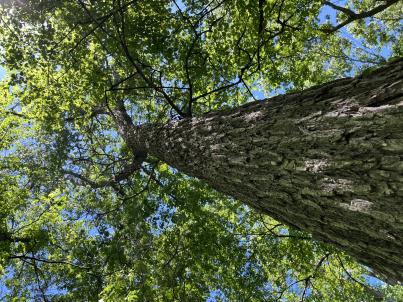 | | 2024 | COLLECTED | 06/05/2024 | Near southeast edge of Kasota Lake approximately 9.0 miles east, southeast of Willmar, T119N R34W SE 1/4 NE 1/4 Sec. 36 and also Robbins Island Park in Wilmar, T119N R35W Sec. 11. | 45.07399600, -94.88484100 | 352 | Deciduous woods | Wild material | Ulmus thomasii (Rock elm) is an underutilized tree species both in conservation and in the urban landscape. Described by Charles Sprague Sargent (first director for the Arnold Arborteum) as "heavy, hard, very strong and tough, closely grained, and susceptible of receiving a beautiful polish". Historically noted for a variety of uses in woodworking including furniture, heavy agricultural implements, timber frame buildings, pianos, hockey sticks, and hand tools. Ulmus thomasii is extremely drought tolerant, adaptable to very calcareous soils, and compared to U. americana or U. rubra has a very conservative growth rate requiring minimal attention in regards to pruning. Rock elm naturally tends to develop into a nice structural specimen in the landscape, unlike other fast growing cultivars in the nursery trade needing frequent attention. Rock elm has very fissured bark and is well known for maintaining a strong central leader resulting in a very attractive, pyramidal form. Despite many literature sources stating that "wings" on the stems are a key identifiying characteristic, this trait is not reliable and many genotypes may completely lack "wings" on the stems. While growth habit and morphology of dormant buds (very pointy) are good traits to help aid in identification, fruits are the best way to confirm identity. Fruits are densly pubescent, often described as "inflated" and generally reach maturity a couple weeks after Ulmus rubra and Ulmus americana. U. thomasii inflorescences are rather distinguishable from other Ulmus in being pendulous. Fruits are extremely prized treats for many birds, where fruits are often "robbed" prior to full maturity. Fruits are also highly prized by many other animals such as mice, squirrels, chipmunks, turkeys, etc. and are generally consumed within hours after fruit abscission. The native range of U. thomasii is concentrated in the northeastern United States and into Canada with disjunct populations documented in northwestern Missouri and northwestern Arkansas (Little, E. L. Jr. 1971). In the 1895 Silva of North America (vol. 7) it was stated that, “The value of the wood of the Rock Elm threatens its extinction and most of the large trees have already been cut.” Today, while rock elm is rather rare, especially in areas near the edges of its range, many states list the species as endangered or threatened warranting preservation efforts. Genetics of this accession would be representative of the species northwestern edge of its native range. Majority of specimens noted did not have characteristic "wings" on the stems and measured approximately 20" DBH or more with a few specimens nearing 30". Heights estimated between 70-90'. Rock elm in this area could be classified as locally abundant. | 2167953 | Ames 36251 |
| 326 | Ames 36248 | Robert's Creek | Salix bebbiana Sarg. | Iowa, United States | NC7 |  | | 2024 | COLLECTED | 05/15/2024 | Robert’s Creek Preserve just north of Forest Road approximately 4.2 miles north, northeast of Elkader, T94N R5W near center of Sec. 36. | 42.91366500, -91.37990600 | 260 | Mixed hardwood forest. Very steep, moist, north-facing slope. | Wild material | Bebb's willow, Salix bebbiana, is a tight, clump forming, multi-stemmed shrub that can reach up to 25' in height that forms a rather distinct, mounded growth habit. Native to North America, the native range covers mostly Canada, but extending south into the northeastern US and also the Rocky Mountains range stretching as far south as New Mexico and Arizona (Little, E. L. Jr. 1977). In Iowa, this species seems to only be known from northeastern Iowa. Salix bebbiana can be found in a variety of habitats from pond margins/swamps to even moderately well-drained open fields. The female capsules are long (5-9 mm) with a very slender beak held on the longest stalk of any N. American Salix. This accession represents genetics from northeastern Iowa at the southern edge of its range in northeastern N. America. Specimens sampled were estimated at 30' in height. Some of the oldest, largest specimens sampled measuring approximately 8" DBH were showing signs of decline. Immature leaves are reddish or yellow green and rather rugose. | 2167645 | Ames 36248 |
| 327 | W6 61511 | CA180-281 | Collinsia heterophylla Graham | California, United States | W6 |  | | 2024 | | | | | | | | | 2167610 | W6 61511 |
| 328 | W6 61553 | CA340-42 | Lupinus luteolus Kellogg | California, United States | W6 |  | | 2024 | | | | | | | Wild material | This population may be mixed with another subspecies mutation or the contestetd very rare species L milo bakeri Future voucher samples should be taken and hopefully collected seed will be genetically tested Note There appears to possibly be a similar population in equally dark soil in Bear Valley itself on one of the private ranches The plants in this second population are noticeably taller and delayed compared to the other luteolus in the valley The second species or subspecies gets much larger before flowering is phenologically delayed in comparison to the other and is pithy until flowering compared to hollow and has a leaf keel to 45 degrees rather than the 90 degrees of the other Many of the larger ones also have purple pink to blue flowering coloring while flowers are very young but quickly fade and turn yellow with age We first observed the first species definitely Lupinus luteolus which flowers earlier while taking this scouting point and our vouchers This confusing second species was noticed during collection while realizing many plants were mid flowering cycle still and taller than those surrounding them in seemingly random placement Because they were still in the vegetative or earlier bud stage when we took vouchers and ID Ûªd the population we had not noticed them or the color height difference that first caught our eye Lupinus milo bakeri may have previously grown in Bear Valley in similar soil but there are no confirmed vouchers or population records We were unable to get a voucher from one of the second species as we were not sure specific protocol permissions before the population became too dried out to ID from A good voucher is heavily desired from this second population ask BLM or State Contact for protocol guidelines Another set of documentation photos and descriptions would also be helpful | 2168002 | W6 61553 |
| 329 | NA 88827 | RJL-RM2023FLAL-001 | Ilex ambigua Torr. | Florida, United States | NA | | | 2023 | COLLECTED | 12/05/2023 | Yellow River Wildlife Management Area, along DOF [Department of Forestry] Y9 dirt road 0.08 kilometers east of Miller Bluff Road. | 30.65289100, -86.87602800 | 44 | Growing in part shade to sun in very dry, highly competitive site still recovering from the logging of pines in the past decade. This young woodland is comprised of a combination of evergreen and deciduous species competing for available resources and light before the young sand pines begin to dominate the upper canopy. Slope: 0 percent. Aspect: N/A. The underlying geology of this area is the Citronelle Formation, of Pliocene origin, and consists of gray to orange, often mottled, unconsolidated to poorly consolidated, very fine to very coarse, poorly sorted, clean to clayey sands. It contains significant amounts of clay, silt and gravel which may occur as beds and lenses and may vary considerably over short distances. Limonite nodules and limonite-cemented beds are common. (Source: USGS Florida Geologic Map Data.) The primary soil type in the collection area is classified as Lakeland Sand soils (0 to 5 percent slopes). The surface soil profile of this area is primarily the Lakeland series which consists of very deep, excessively drained, rapid to very rapidly permeable soils on uplands. They formed in thick beds of eolian or marine and/or fluvio-marine sands. Thickness of the sand exceeds 2 meters. Silt plus clay in the upper meter ranges from 5-10 percent. Reaction ranges from very strongly acid to moderately acid throughout. (Source: NRCS Web Soil Survey.) | Wild material | | 2165657 | NA 88827 |
| 330 | NA 88828 | RJL-RM2023FLAL-002 | Vaccinium arboreum Marshall | Florida, United States | NA | | | 2023 | COLLECTED | 12/05/2023 | Yellow River Wildlife Management Area, along DOF [Department of Forestry] Y9 dirt road 0.08 kilometers east of Miller Bluff Road. | 30.65289100, -86.87608500 | 44 | Growing in part shade to sun in very dry, highly competitive site still recovering from the logging of pines in the past decade. This young woodland is comprised of a combination of evergreen and deciduous species competing for available resources and light before the young sand pines begin to dominate the upper canopy. Slope: 0 percent. Aspect: N/A. The underlying geology of this area is the Citronelle Formation, of Pliocene origin, and consists of gray to orange, often mottled, unconsolidated to poorly consolidated, very fine to very coarse, poorly sorted, clean to clayey sands. It contains significant amounts of clay, silt and gravel which may occur as beds and lenses and may vary considerably over short distances. Limonite nodules and limonite-cemented beds are common. (Source: USGS Florida Geologic Map Data.) The primary soil type in the collection area is classified as Lakeland Sand soils (0 to 5 percent slopes). The surface soil profile of this area is primarily the Lakeland series which consists of very deep, excessively drained, rapid to very rapidly permeable soils on uplands. They formed in thick beds of eolian or marine and/or fluvio-marine sands. Thickness of the sand exceeds 2 meters. Silt plus clay in the upper meter ranges from 5-10 percent. Reaction ranges from very strongly acid to moderately acid throughout. (Source: NRCS Web Soil Survey.) | Wild material | | 2165658 | NA 88828 |
| 331 | NA 88829 | RJL-RM2023FLAL-003 | Oxydendrum arboreum (L.) DC. | Florida, United States | NA | | | 2023 | COLLECTED | 12/05/2023 | Yellow River Wildlife Management Area, along DOF [Department of Forestry] Y15 dirt road 0.06 kilometers north of Fisher Old Mill Road. | 30.62728600, -86.83824600 | 7 | Growing in part shade to sun in moist to wet flat woods of the longleaf pine forest. The woodland is comprised mostly of open habitat of longleaf pine and an understory tree and shrub layer of evergreen and deciduous species. There is also a wealth of herbaceous species in moist to wet conditions of the habitat where there is rich organic matter in the surface layer. Slope: 0 percent. Aspect: N/A. The underlying geology of this area is classified as Alluvium, of Pleistocene/Holocene origin and consists of undifferentiated Quaternary sediments of varying thickness including siliciclastics, organics and freshwater carbonates. The siliciclastics are light gray, tan, brown to black, unconsolidated to poorly consolidated, clean to clayey, silty, unfossiliferous, variably organic-bearing sands to blue green to olive green, poorly to moderately consolidated, sandy, silty clays. Organics occur as plant debris, roots, disseminated organic matrix and beds of peat. Freshwater carbonates, often referred to as marls in the literature, are scattered. (Source: USGS Florida Geologic Map Data.) The primary soil types in the collection area are classified as Pactolus Loamy Sand soils (0 to 5 percent slopes). The Pactolus Series consists of very deep, moderately well to somewhat poorly drained soils. Permeability is rapid. These Coastal Plain soils, typically found with streams and marine terraces and were formed by loamy and sandy fluvial sediments and marine sediments. The strata is, generally, uniformly loamy sand that is very friable and strongly acid from the surface to a depth of 1.8 meters. (Source: NRCS Web Soil Survey.) | Wild material | | 2165659 | NA 88829 |
| 332 | NA 88834 | RJL-RM2023FLAL-008 | Rhododendron canescens (Michx.) Sweet | Florida, United States | NA | | | 2023 | COLLECTED | 12/06/2023 | Blackwater State Forest: plants are growing in wetlands accessed by foot from Buddy Hardy Road. The collection site is approximately 0.14 kilometers west and downhill from the road. | 30.80736700, -86.95784700 | 53 | Growing in shade to part-shade of the well-drained moist mesic habitat about 1 m above the wetland which appears to be formed by a nearby hillside seepage area. In this zone there are numerous facultative wetland species as well as high competition from facultative upland plants. Slope: 5 to 10 percent. Aspect: Variable. The underlying geology of this area is the Citronelle Formation of Pliocene origin and consists of gray to orange, often mottled, unconsolidated to poorly consolidated, very fine to very coarse, poorly sorted, clean to clayey sands. It contains significant amounts of clay, silt and gravel which may occur as beds and lenses and may vary considerably over short distances. Limonite nodules and limonite-cemented beds are common. (Source: USGS Florida Geologic Map Data.) The Troup Series (5 to 8% slopes) consists of very deep, somewhat excessively drained soil formed in unconsolidated sandy and loamy marine sediments. Troup soils are on ridges and hillslopes. The upper 0-13 cm is comprised primarily of decomposing sphagnum peat with a significant amount of fibrous root content. From 15-112 cm the soil is comprised primarily of fine-grained yellowish-brown sand with varying amounts of root content; this zone is strongly acid. From 112-203 cm the soil is comprised of light-red to red sandy clay loam that is discontinuous, generally friable, and strongly acid. (Source: NRCS Web Soil Survey.) | Wild material | | 2165664 | NA 88834 |
| 333 | NA 88835 | RJL-RM2023FLAL-009 | Rhododendron viscosum (L.) Torr. | Florida, United States | NA | | | 2023 | COLLECTED | 12/06/2023 | Blackwater State Forest: plants are growing in wetlands accessed by foot from Buddy Hardy Road. The collection site is approximately 0.14 kilometers west and downhill from the road. | 30.80841000, -86.96283300 | 43 | Growing in part-shade of the well-drained moist-dry mesic habitat about 2-3 m above the wetland. In this zone there are numerous facultative wetland species as well as high competition from facultative upland plants. Slope: 5 to 10 percent. Aspect: Variable. The underlying geology of this area is the Citronelle Formation of Pliocene origin and consists of gray to orange, often mottled, unconsolidated to poorly consolidated, very fine to very coarse, poorly sorted, clean to clayey sands. It contains significant amounts of clay, silt and gravel which may occur as beds and lenses and may vary considerably over short distances. Limonite nodules and limonite-cemented beds are common. (Source: USGS Florida Geologic Map Data.) The Troup Series (5 to 8% slopes) consists of very deep, somewhat excessively drained soil formed in unconsolidated sandy and loamy marine sediments. Troup soils are on ridges and hillslopes. The upper 0-13 cm is comprised primarily of decomposing sphagnum peat with a significant amount of fibrous root content. From 15-112 cm the soil is comprised primarily of fine-grained yellowish-brown sand with varying amounts of root content; this zone is strongly acid. From 112-203 cm the soil is comprised of light-red to red sandy clay loam that is discontinuous, generally friable, and strongly acid. (Source: NRCS Web Soil Survey.) | Wild material | | 2165665 | NA 88835 |
| 334 | NA 88836 | RJL-RM2023FLAL-010 | Leucothoe axillaris (Lam.) D. Don | Florida, United States | NA | | | 2023 | COLLECTED | 12/08/2023 | Along Gin/Camp Road at the bridge over Thomas Creek on the east side of the road. | 30.75018700, -87.23492900 | 21 | Growing in shade of the moist to wet habitat along Thomas Creek. Plants receive regular moisture and are occasionally flooded in this habitat. Slope: N/A. Aspect: N/A. The underlying geology of this area is the Citronelle Formation of Pliocene origin and consists of gray to orange, often mottled, unconsolidated to poorly consolidated, very fine to very coarse, poorly sorted, clean to clayey sands. It contains significant amounts of clay, silt and gravel which may occur as beds and lenses and may vary considerably over short distances. Limonite nodules and limonite-cemented beds are common. (Source: USGS Florida Geologic Map Data.) The surface soil profile of this area is primarily Bibb-Kinston series association. Bibb series soils are coarse-loamy, sandy, acid soils that are poorly drained. They are soils of flood plains and streams subject to frequent flooding. These are found in association with Kinston series soils that are fine-loamy, sandy, acid soils of flood plains and stream subject to frequent flooding. The Bibb-Kinston association ranges from 1-1.5 meters thick and is strongly acid. (Source: NRCS Web Soil Survey.) | Wild material | | 2165666 | NA 88836 |
| 335 | NA 88838 | RJL-RM2023FLAL-012 | Ilex opaca Aiton | Florida, United States | NA | | | 2023 | COLLECTED | 12/08/2023 | North side of Sid Hayes Road approximately 65 m southeast of the junction with Watson Road. | 30.83277400, -87.24324500 | 32 | Growing in shade, part shade and light shade in dry mesic to moist, occasionally wet, habitats along the edge of the road and in the woodland interior. This species is remarkably adaptable. The only drawback to the range of habitats is that in deep shade, very few fruit can be found, presumably because there is far less flower production and/or fewer pollinators. Slope: 0 to 3 percent. Aspect: South. The underlying geology of this area is the Citronelle Formation of Pliocene origin and consists of gray to orange, often mottled, unconsolidated to poorly consolidated, very fine to very coarse, poorly sorted, clean to clayey sands. It contains significant amounts of clay, silt and gravel which may occur as beds and lenses and may vary considerably over short distances. Limonite nodules and limonite-cemented beds are common. (Source: USGS Florida Geologic Map Data.) The surface soil profile of this area is Dothan Series fine sandy loam soils (5 to 8 percent slopes). The Dothan Series consists of very deep, well drained soils that formed in thick beds of unconsolidated, medium to fine-textured marine sediments. Dothan soils are on interfluves. The surface 0-33 cm is characterized by sandy-loam, well-drained soils that are strongly acid. From 33-200 cm they are characterized by sandy clay loam soils that are more moisture retentive and strongly acid. (Source: NRCS Web Soil Survey.) | Wild material | | 2165668 | NA 88838 |
| 336 | NA 88840 | RJL-RM2023FLAL-014 | Rhododendron viscosum (L.) Torr. | Florida, United States | NA | | | 2023 | COLLECTED | 12/11/2023 | Property of Floyd Griffith off View Drive on the southwest side of McCormick Lake. | 30.63247000, -85.33718200 | 56 | Plants are growing primarily in part shade a few meters above the lake, generally in areas that appear dry, but clearly are associated with hillside seeps. While much of the area has been cultivated, the remnant native flora are largely broadleaved evergreen shrub and deciduous shrub and tree species. Slope: 10 to 15 percent. Aspect: Northeast. The underlying geology of this area is the Citronelle Formation of Pliocene origin and consists of gray to orange, often mottled, unconsolidated to poorly consolidated, very fine to very coarse, poorly sorted, clean to clayey sands. It contains significant amounts of clay, silt and gravel which may occur as beds and lenses and may vary considerably over short distances. Limonite nodules and limonite-cemented beds are common. (Source: USGS Florida Geologic Map Data.) The surface soil profile of this area is primarily Pamlico-Pantego-Rutlege Association. The Pamlico series consists of very poorly drained soils that formed in decomposed organic material underlain by dominantly sandy sediment. The soils are on nearly level flood plains, bays, and depressions of the Coastal Plain. Slopes are less than 1 percent. Pamlico soils have 0.4-1.3 meters of organic material over dominantly sandy sediments. Reaction is extremely in the organic layers and ranges from extremely acid to strongly acid in the underlying mineral layers. The Pantego series consists of very deep, very poorly drained, moderately permeable soils that formed in thick loamy sediments on the Southern Coastal Plain and Atlantic Coast Flatwoods. Slopes are less than 2 percent. This soil is strongly acid. The Rutlege series comprises very deep, very poorly drained persistently wet soils on flats, depressions and floodplains where shallow ponding is common. They are of marine or fluvial sediment origin. Thickness of these loamy sandy soils is greater than 1.5 meters and a reaction from extremely acid to strongly acid. (Source: NRCS Web Soil Survey.) | Wild material | | 2165670 | NA 88840 |
| 337 | NA 88692 | RJL2023NJ-005 | Ilex opaca Aiton | New Jersey, United States | NA | | | 2023 | COLLECTED | 11/10/2023 | Franklin Township: Piney Hollow Preservation Area (the site is owned by Franklin Township). This species was found on as well as below the dam at the far end of McCarthys Lakes. Plants accessed by foot along trails throughout property. | 39.57423200, -74.92525600 | 29 | Plants growing in part-shade to sun of the moist to saturated areas below the McCarthys Lakes dam in the wetlands associated with the New Squankum Branch. Plants were also found growing on the slopes of the dam in well-drained mesic to dry-mesic conditions. This species is clearly adaptable to a variety of conditions. Slope: 0 to 15 percent. Aspect: East. Elevation: 28 to 30 meters. NOTE: In addition to the soil type described below, this species was also growing on the slopes of a constructed earthen dam of unknown soil origin. The underlying geology of this area is of Middle Miocene, Serravallian origin and characterized as an Cohansey Formation. It is comprised of sand, white to yellow with local gravel and clay. Locally stained red or orange brown by iron oxides and (or) cemented into large blocks of ironstone. Unweathered clay is typically dark gray, but commonly weathers white where interbedded with thin beds of ironstone. Unit is a complex of interfingering marine and nonmarine facies. Sand is typically medium grained and moderately sorted although it ranges from fine to very coarse grained and from poorly to well sorted. Sand consists of quartz and siliceous rock fragments. Some beds are locally micaceous. In general, the sand is crossbedded, although the style of crossbedding varies significantly with the paleoenvironment. Trough crossbedding predominates, especially in the nonmarine channel fill deposits, and the scale of the crossbeds varies from small to large. Maximum thickness in the map area is about 60 m; however, thickness is difficult to determine because of the irregular basal contact and extensive post-depositional erosion. There is as much as 18 m of relief along the basal contact. The basal contact is sharp, undulatory, and directly overlain by a thin gravel bed. The Cohansey Formation unconformably overlies the Kirkwood Formation and is found in channels cut down into the Kirkwood. Where the Kirkwood consists of sandy, light-colored sediments, the basal contact of the Cohansey is drawn below crossbedded sediments. Where the Kirkwood consists of dark-colored silty beds, the basal contact is drawn between light-colored Cohansey sediments and the underlying dark-colored sediments. The Cohansey was markedly thinned because of erosion prior to deposition of overlying units in the western and southern parts of the southern sheet. The unit has been extensively eroded and stripped from large areas of the New Jersey Coastal Plain, particularly in the central sheet where outliers are common. In spite of its widespread nature, the Cohansey is poorly exposed because of its loose sandy composition, which causes it to erode easily. (Source: USGS New Jersey Geologic Map Data.) The primary soil type in the collection area is classified as Manahawkin Series muck, 0 to 2 percent slopes, frequently flooded, Northern Coastal Plain. Manahawkin Series soils are very deep, very poorly drained soils that are sandy or sandy-skeletal, siliceous, dysic, mesic Terric Haplosaprists high in organic deposits that are found in lake basins, back swamps, floodplains, and freshwater channels. The soils are classified in the dysic reaction class because pH in water dominantly ranges from 4.5 to 5.0. The zone from the soil surface to a depth of 200 cm is continuously saturated (endosaturation). The upper strata of Manahawkin Series from 0 to 76 cm is black broken face and rubbed muck; 10 percent fibers, less than 2 percent rubbed; moderate medium granular structure; mat of many fine roots; identifiable material is primarily herbaceous with a trace of woody fragments; 85-95 percent organic matter; extremely acid. Lower strata to 200 cm are gray sand, single grained and loose; strongly acid. (Source: NRCS Web Soil Survey.) | Wild material | | 2159120 | NA 88692 |
| 338 | NA 88678 | RJL2023PA-012 | Viburnum acerifolium L. | Pennsylvania, United States | NA | | | 2023 | COLLECTED | 10/27/2023 | Slopes on the east side of Creek Road above the North Branch of White Clay Creek. | 39.78552600, -75.80251900 | 90 | Well-drained mesic-dry to rocky dry deciduous woodlands in part shade to full shade. Slope: 15-35%. Aspect: West to northwest. The underlying geology of this area includes two formations. The first and primary formation is Lower Paleozoic Glenarm Wissahickon Formation, lithologically similar to oligoclase-mica schist of the Wissahickon Formation, but also includes lenticular amphibolite bodies having ocean-floor basalt chemistry. The second formation is Lower Paleozoic Mafic Gneiss Formation that is dark and medium grained. It includes rocks of probable sedimentary origin. (Sources: USGS Pennsylvania Geologic Map Data). The primary soil type in the collection area is classified as Manor Series. The Manor Series consists of well-drained residuum weathered from micaceous schist. Soils in the upper pedon (0-33 cm) are very dark grayish brown loam with strong fine granular structure; also, very friable with fine mica flakes and strongly acid. Lower pedon soils (34-56 cm) are strong brown, sandy loams. They have weak medium sub-angular blocky structure, are friable with many fine and a few medium mica flakes; this pedon is very strongly acid. (Source: NRCS Web Soil Survey). | Wild material | | 2159069 | NA 88678 |
| 339 | Ames 36185 | APS/BP/2023/076/286 | Betula populifolia Marshall | Indiana, United States | NC7 |  | | 2023 | COLLECTED | 11/02/2023 | Indiana Dunes State Park just 3.40 miles northeast of Chesterton, T37N R5W NE 1/4 SE 1/4 SW 1/4 Sec. 18 | 41.65352700, -87.03831500 | 186 | Low depressions with some standing water. Woodland edge. | Wild material | Represents a disjunct population in northwest Indiana and the extreme western edge of the species native range. Trees sampled in nature averaging 30-45' in height with trunks ranging from 3" up to 8" DBH. Bark dull-white to grey. Typically multi-stemmed trunks. Leaves with acuminate tips and branches with typically one male catkin at terminal end of branches, but occassionally two male catkins. | 2159042 | Ames 36185 |
| 340 | NA 88666 | RJL2023PA-003 | Hamamelis virginiana L. | Pennsylvania, United States | NA | | | 2023 | COLLECTED | 10/01/2023 | Collected primarily along the woodland edge along Northside Road on Pennsylvania State Gamelands No. 43 as well as a few on nearby roads. | 40.17974200, -75.76790700 | 176 | Plants were growing in mesic well-drained conditions on moderately sloping sites of a deciduous upland forest. This species grows well in shade to part-sun. Most abundant fruit development is found where plants are exposed to sunlight for a portion of the day. Slope: 15%. Aspect: North-northwest. The underlying geology of this area is of Precambrian origin and characterized as the Graphitic Felsic Gneiss. This includes Pickering Gneiss and small areas of marble; dominantly quartz and feldspar with varying amounts of graphite and various metamorphic minerals; medium grained, light to dark gray and greenish gray; sedimentary origin. (Source: USGS Pennsylvania Geologic Map Data.) The primary soil type in the area of this collection is classified as Gladstone Gravelly Loam Series (8 to 15 percent slopes). The Gladstone Series consists of very deep, well drained soils formed in residuum and colluvium from granitic gneiss. Saturated hydraulic conductivity is moderately high to high. Solum thickness ranges from 75 to 125 cm. Depth to granitic gneiss bedrock is 1.6 meters or more. The bedrock may be strongly weathered in the upper part. Gravel content ranges from 5 to 35 percent throughout the solum, and 10 to 40 percent in the C horizons. Fragments, larger than 3 inches in diameter, range from 0 to 20 percent by volume in the surface layer and 0 to 10 percent in the subsoil and substratum layers. Reaction is strongly or very strongly acid throughout the soil, unless limed. Areas that have been limed range to moderately acid in the upper part of the profile. (Source: NRCS Web Soil Survey.) | Wild material | | 2158815 | NA 88666 |
| 341 | NA 88625 | KY23-028 | Vaccinium stamineum L. | Kentucky, United States | NA | | | 2023 | COLLECTED | 09/10/2023 | The Gulf - Natural Arch Scenic Area Panoramic Trail. | 36.84384000, -84.52836000 | 395 | Ridgeline, trailside, near trailhead / parking lot, Panoramic Trail at Natural Arch Scenic Area ('The Gulf'). Elevation: 1295 feet. Aspect: South. | Wild material | Initial identification: Vaccinium corymbosum aff.; in situ this collection was far hairier than typical V. stamineum, but still within the description for the species. | 2158717 | NA 88625 |
| 342 | WLP 3213 | TXWL2023-001 | Lyonia mariana (L.) D. Don | Texas, United States | NA | | | 2023 | COLLECTED | 08/22/2023 | Angelina National Forest. | 31.05522100, -94.26205200 | | Baygall below longleaf [pine] stand. | Wild material | | 2158757 | WLP 3213 |
| 343 | Ames 36170 | Lake Catherine State Park | Ptelea trifoliata L. | Arkansas, United States | NC7 |  | | 2023 | COLLECTED | 08/27/2023 | Lake Catherine State Park approximately 10 miles southeast of Hot Springs. Localized to the ridge top of Dam Mountain on the south shore of the southeast arm of the reservior, starting approximately 0.25 miles southwest of the dam. T3S R18W Sec. 35. | 34.42452200, -92.90218400 | 199 | Dry ridge top. Predominantly on the north facing edge of ridge. | Wild material | A localized but very dense population. Ptelea is the dominant understory species in this location. | 2158789 | Ames 36170 |
| 344 | Ames 36073 | JDC/UT/2022/028/1009 | Ulmus thomasii Sarg. | Iowa, United States | NC7 |  | | 2023 | COLLECTED | 06/05/2023 | Ledges State Park approximately 4.75 miles south of Boone, T83N R26W (Madrid NW Quad.) near center of SE ¼ Sec. 16 and also NW ¼ SW ¼ Sec. 21. | 41.99780200, -93.87967900 | 288 | Moist deciduous woods typically on mid-slopes to base of slopes and also well-drained floodplains. | Wild material | Ulmus thomasii (Rock elm) is an underutilized tree species both in conservation and in the urban landscape. Charles Sprague Sargent (first director of the Arnold Arboretum of Harvard University, Boston, MA) described the wood of Rock Elm as "heavy, hard, very strong and tough, closely grained, and susceptible of receiving a beautiful polish". Historically noted for a variety of uses in woodworking including furniture, heavy agricultural implements, timber frame buildings, pianos, hockey sticks, and hand tools. U. thomasii is extremely drought tolerant, adaptable to very calcareous soils, and compared to U. americana or U. rubra has a very conservative growth rate requiring minimal attention in regards to pruning. Rock elm naturally tends to develop into a nice structural specimen in the landscape, unlike other fast growing U. americana cultivars in the nursery trade needing frequent attention. Rock elm has very fissured bark and is well known for maintaining a strong central leader resulting in a very attractive, pyramidal form. Despite many literature sources stating that "wings" on the stems are a key identifiying characteristic, this trait is not reliable and many genotypes may completely lack "wings" on the stems. While growth habit and morphology of dormant buds (very pointy) are good traits to help aid in identification, fruits are the best way to confirm identity. Fruits are densly pubescent, often described as "inflated" and generally reach maturity a couple weeks after U. rubra and U. americana. U. thomasii flowering in central Iowa typically occurs the last week in April into the first week in May and are rather distinguishable from other Ulmus in being pendulous. Fruits are extremely prized treats for many birds, where fruits are often "robbed" prior to full maturity. Fruits are also highly prized by many other animals such as mice, squirrels, chipmunks, turkeys, etc. and are generally consumed within hours after fruit abscission. The native range of U. thomasii is concentrated in the northeastern United States and into Canada with disjunct populations documented in northwestern Missouri and northwestern Arkansas (Little, E. L. Jr. 1971). In the 1895 Silva of North America (vol. 7) it was stated that, “The value of the wood of the Rock Elm threatens its extinction and most of the large trees have already been cut.” Today, since rock elm is rather rare, especially in areas near the edges of its range, many states list the species as endangered or threatened warranting preservation efforts. Genetics of this accession would be representative of the species southwestern edge of its native range. At the collection site in nature (Ledges State Park), out of approximately 100 specimens noted only 1-2% of specimens had characteristic "wings" on the stems. Research was executed (Moore, P., 2024) involving the core sampling of U. thomasii and U. americana specimens in Ledges State Park to make growth ring widths and basal area increment comparisons. Results determined that the average age of cored trees U. thomasii (n=4) and U. americana (n=4) of both species was roughly 80 years, excluding the exceptional case of tree #007 (Ames 36073 23ncao02 SD). Tree #007 was aged at 300 years of age and currently (2025) ranks as the 14th largest U. thomasii in Iowa measuring 21" DBH with a height of 75' 5" and a spread of 43' 5" totalling 152.21 points (Rouw, M., personal communication, 4 May 2022). The computed mean density at 𝑀𝑀 = 12% for U. thomasii was 0.80 g/cm3, and for U. americana was 0.672 g/cm3. These values are both higher than the representative values inferred from the Woods Database which are 0.755 g/cm3 for U. thomasii and 0.56 g/cm3 for U. americana. To date, there is little to no information regarding U. thomasii resistance to Dutch Elm Disease. Collections of U. thomasii at the Arnold Arboretum have over-time succumbed to DED (Pruka, B., 2016). However, data recorded by Moore (2024) indicates that U. thomasii growing in central Iowa can surpass 300 years in age verifying it's long-term utilization in the landscape. | 2142915 | Ames 36073 |
| 345 | Ames 36139 | Berea College Forest | Morus rubra L. | Kentucky, United States | NA |  | | 2023 | COLLECTED | 05/31/2023 | Between West and East Pinnacles of Berea College Forest just 3.25 miles east, southeast of Berea | 37.55656100, -84.23777600 | 338 | Mid-lower slopes of moist, deciduous woods. | Wild material | Species rather abundant throughout site with little to no presence of Morus alba. Majority of specimens noted measuring 8" DBH or smaller. Largest specimen noted reaching approximately 60' in height. | 2158344 | Ames 36139 |
| 346 | Ames 36017 | AS/GD/2023/002/212 | Gymnocladus dioicus (L.) K. Koch | Wisconsin, United States | NC7 |  | | 2023 | | | | | | | Wild material | Kentucky coffeetree in Wisconsin is rather rare. The Wisconsin Natural Heritage Inventory Program currently (2023) lists this taxon in Wisconsin as a species of concern with a state rank of S2 (Imperiled in Wisconsin due to a restricted range, few populations or occurrences, steep declines, severe threats, or other factors.) This accession represents genetics from a localized population with a near equal porportion of male and female specimens. While there are other known locations along the Wisconsin River, this population is producing seeds. The other known locations represent single clones that are distant enough from other existing clones that prevent the transfer of pollen and thus lack the ability to produce seed or will rarely produce. | 2141550 | Ames 36017 |
| 347 | NA 88599 | RJL2023NC-001 | Ilex decidua Walter | North Carolina, United States | NA | | | 2023 | COLLECTED | 02/18/2023 | Plants growing along a fenceline on a hillside about 10 meters from Interstate 85 (south bound) and approximately 0.65 kilometers south of the North Carolina-Virginia border. | 36.53904800, -78.18822500 | 86 | The plant was growing on the upper shoulder of a slope about 7 meters above the highway in part-shade to sun of an upland, well-drained, dry mesic somewhat disturbed site on the fenceline boundary of Interstate 85 (south bound). The area was originally cleared of all vegetation and now, many years later, native and non-native plant species have aggressively recolonized the area. This early successional habitat is dominated by Juniperus virginiana and Liquidambar styraciflua, as well as, non-native species such as Ligustrum sinense, Lonicera japonica, and Ailanthus altissima. The underlying geology of this area is of Permian/Pennsylvanian origin and characterized as the Granitic Rock Formation. It is characterized by megacrystic to equigranular components and includs Castalia and Wilton intrusives. | Wild material | | 2141480 | NA 88599 |
| 348 | WLP 3084 | RM2023-002 | Rhododendron viscosum (L.) Torr. | Florida, United States | NA | | | 2023 | COLLECTED | 09/15/2022 | This species is growing in the Blackwater River State Forest approximately 0.24 kilometers north of Wof W20 and approximately 0.93 kilometers west of the junction of 3 Notch Trail/Road. | 30.84510000, -86.94940000 | 38 | The plants were growing in part shade of a moist mesic transition slope between a dry upland habitat and a bog.
Soils: The underlying geology of this area is the Citronelle Formation, of Pliocene origin, and consists of gray to orange, often mottled, unconsolidated to poorly consolidated, very fine to very coarse, poorly sorted, clean to clayey sands. It contains significant amounts of clay, silt and gravel which may occur as beds and lenses and may vary considerably over short distances. Limonite nodules and limonite-cemented beds are common. Source: USGS Florida Geologic Map Data (https://mrdata.usgs.gov/geology/state/state.php?state=fl)
The surface soil profile found in this area is primarily Troup Series. These soils are sandy and loamy marine deposits. They are well drained and typically on the tops and sides of broad and narrow ridges on uplands typically with 0-12% slopes. These soils are very strongly acid with a depth of 2-3 meters. Pactolus Series soils comprise a minor, but important percentage of the lower slopes that are nearly level to gently sloping and account for the somewhat poorly drained, yet, sandy conditions. These soils are also strongly acid with very dark gray loamy sands.
Source: Soil Survey of Santa Rosa County and NRCS Web Soil Survey (https://www.nrcs.usda.gov/Internet/FSE_MANUSCRIPTS/florida/FL113/0/SantaRosa.pdf and https://websoilsurvey.sc.egov.usda.gov/App/WebSoilSurvey.aspx) | Wild material | | 2141438 | WLP 3084 |
| 349 | WLP 3085 | RM2023-003 | Hibiscus laevis All. | Florida, United States | NA | | | 2023 | COLLECTED | 10/01/2022 | This species is growing along the Escambia River and accessed by boat. | 30.62930000, -87.25830000 | 1 | The plants were growing on stumps in full sun on the edge of a semi-alluvial area of the river.
Soils: The underlying geology of this area is classified as Alluvium, of Pleistocene/Holocene origin and consists of undifferentiated Quaternary sediments of varying thickness including siliciclastics, organics and freshwater carbonates. The siliciclastics are light gray, tan, brown to black, unconsolidated to poorly consolidated, clean to clayey, silty, unfossiliferous, variably organic-bearing sands to blue green to olive green, poorly to moderately consolidated, sandy, silty clays. Organics occur as plant debris, roots, disseminated organic matrix and beds of peat. Freshwater carbonates, often referred to as marls in the literature, are scattered.
Source: USGS Florida Geologic Map Data (https://mrdata.usgs.gov/geology/state/state.php?state=fl)
The surface soil profile of this area is primarily Chewacla-Wahee-Riverview Association. The Chewacla Series soils are dark yellowish brown silty clay loam soils, that are strongly acidic and somewhat poorly drained. They are soils of flood plains and streams subject to frequent flooding. The Wahee Series soils are dark gray clayey and loamy marine or fluviomarine sediments that are strongly acidic and somewhat poorly drained. The Riverview series consists of very deep, well drained, moderately permeable soils that formed in loamy alluvium on flood plains. Slopes range from 0 to 5 percent.
Source: NRCS Web Soil Survey (https://websoilsurvey.sc.egov.usda.gov/App/WebSoilSurvey.aspx) | Wild material | | 2141439 | WLP 3085 |
| 350 | WLP 2795 | RJL2023NJ-001 | Rhododendron atlanticum (Ashe) Rehder | New Jersey, United States | NA | | | 2023 | COLLECTED | 01/16/2023 | Plants growing in woodlands on the south side of a powerline right-of-way approximately 0.72 kilometers southwest of Indian Trail Road. The site was accessed by foot. Plants are infrequent at this site and considered rare in New Jersey. | 39.05653200, -74.87482500 | 5 | Plants growing in shade to part-shade of a dry woodland habitat that is mostly deciduous. Nearby, as the elevation changes slightly, there is more abundant soil moisture, becoming a bit more mesic. Soils: The underlying geology of this area is of Upper Pliocene origin and characterized as an Unnamed Formation at Cape May. It is comprised of interbedded gravel, sand, and clay, massive to thickly-bedded. This is an informal unit described from a core hole at the Cape May Airport. The lower 18.3 meters consists of interbedded gravel; medium- to very coarse grained, poorly sorted sand; and thin to thick beds of medium- to dark-gray, very woody clay. Gravel clasts are typically less than 0.64 mm in diameter. The upper 12.2 meters consists of a thick-bedded, medium-gray, extensively bioturbated clay-silt, which is overlain by an extensively burrowed, fine- to medium-grained glauconitic (about 5 percent) quartz sand. Quartz and siliceous rock fragments compose most sand grains. Feldspar is present in most samples but usually constitutes less than 10 percent of the sand fraction. No calcareous macrofossils were found in the burrowed intervals. This unit is known only to occur on the Cape May peninsula where it lies within a large channel. The unit is about 60 m in maximum thickness. The contact with the underlying Belleplain Member of the Kirkwood Formation is sharp and unconformable; a basal gravel bed as much as 1 m thick is present along the contact. The pollen assemblage in the lower part of the unit is dominated by pine and oak with somewhat lesser amounts of hickory and basswood. Spruce, hemlock, beech, alder, and black gum are minor constituents. Traces of fir, willow, birch, and sweet gum are present, as is exotic Engelhardia. The non-arboreal pollen are a Multisia-type composite of the present-day Andean provenance which indicate an exotic cool climate. The lower assemblage suggests a cool-temperate climatic regimen. The pollen assemblage in the upper beds is dominated by oak and hickory with minor amounts of basswood, sweet gum, pine, and Multisia-type composite. Traces of cedar, willow, birch, alder, grass, and Sphagnum spores also are present. This assemblage probably represents a temperate climatic regimen (Les Sirkin, Adelphi University, written commun., 1991). The low percentage of exotic species is characteristic of the late Pliocene, and therefore, the unnamed unit at Cape May could be equivalent to the Beaverdam Formation of the Delmarva Peninsula of Delaware, Maryland, and Virginia. Source: USGS New Jersey Geologic Map Data (https://mrdata.usgs.gov/geology/state/sgmc-unit.php?unit=NJTc%3B1) The primary soil type in the area of this collection is classified as Berryland and Mullica soils (0 to 2 percent slopes, occasionally flooded). Berryland Series soils are very deep, very poorly drained soils of the Coastal Plains formed by sandy eolian deposits and/or fluviomarine sediments. Th upper 30 cm of the strata is sandy, dry, very friable and extremely acid. The lower strata to 1.8 meters contains loamy sand coated with organic matter, weakly cemented organ nodules and additional layers of sand occasionally containing rounded quartzose pebbles. The Mullica Series soils are typically coarse-loamy, siliceous, semiactive, and mesic typic humaquepts that are strongly to extremely acidic throughout the profile. The typical solum thickness ranges from 50-150+ cm. These soils are generally considered to be poorly drained. Source: NRCS Web Soil Survey (https://websoilsurvey.sc.egov.usda.gov/App/WebSoilSurvey.aspx) | Wild material | | 2141140 | WLP 2795 |
| 351 | NA 88525 | RM-TK2022-013 | Macranthera flammea (W. Bartram) Pennell | Florida, United States | NA | | | 2023 | COLLECTED | 11/04/2022 | Growing in wetland in Blackwater River State Forest. | 30.80870000, -86.96270000 | 42 | Plants are typically found growing in part shade to sun in saturated streamside wetland/seep areas at the base of the slope in sphagnum moss. This appears to be year-round wetland habitat.
Soils: The underlying geology of this area is the Citronelle Formation of Pliocene origin and consists of gray to orange, often mottled, unconsolidated to poorly consolidated, very fine to very coarse, poorly sorted, clean to clayey sands. It contains significant amounts of clay, silt and gravel which may occur as beds and lenses and may vary considerably over short distances. Limonite nodules and limonite-cemented beds are common. Source: USGS Florida Geologic Map Data (https://mrdata.usgs.gov/geology/state/state.php?state=fl)
The surface soil profile found in this area is primarily Troup Series. These soils are sandy and loamy marine deposits. They are well drained and typically on the tops and sides of broad and narrow ridges on uplands typically with 0-12% slopes. These soils are very strongly acid with a depth of 2-3 meters. Pactolus Series soils comprise a minor, but important percentage of the lower slopes that are nearly level to gently sloping and account for the somewhat poorly drained, yet, sandy conditions. These soils are also strongly acid with very dark gray loamy sands.
Source: Soil Survey of Santa Rosa County and NRCS Web Soil Survey (https://www.nrcs.usda.gov/Internet/FSE_MANUSCRIPTS/florida/FL113/0/SantaRosa.pdf and https://websoilsurvey.sc.egov.usda.gov/App/WebSoilSurvey.aspx) | Wild material | | 2140806 | NA 88525 |
| 352 | NA 88541 | RJLSEUS2022-013 | Rhododendron viscosum (L.) Torr. | Georgia, United States | NA | | | 2023 | COLLECTED | 12/09/2022 | Plants growing around a pond and associated wetland on the property of Monica Williams north of Albany, Georgia. Common along the edges of the pond and wetland area. | 31.63828300, -84.13827000 | 62 | Plants are growing in part-shade to sun of a wetland habitat on the edge of a large pond. The habitat is comprised of numerous hummocks where this species grows, slightly above the permanently wet, inundated edges of the pond. Some plants are growing in more shade under moist mesic conditions as well.
Soils: The underlying geology of this area is of Eocene origin and characterized as Ocala Limestone. The Ocala Limestone consists of almost pure limestones with occasional dolomites. It can be subdivided into both lower and upper facies with the lower facies composed of a whitish to cream-colored, fine to medium grained, poorly to moderately hard, fossil rich grainstone and packstone. The upper Ocala is white and somewhat weak and poorly sorted. It is extremely fossil rich grainstone, packstone and wackestone and some chert is common in the upper facies.
Source: USGS Georgia Geologic Map Data (https://mrdata.usgs.gov/geology/state/sgmc-unit.php?unit=GANu%3B1)
The primary soil types in the collection area are classified as Herod and Muckalee Series soils. The Herod Series consists of poorly drained moderately permeable soils formed in loamy alluvium. These soils are on flood plains of streams in the Coastal Plain. Slopes range from 0 to 2 percent. The Muckalee Series consists of poorly drained moderately permeable soils formed in loamy and sandy alluvium. These soils are on flood plains of streams in the Coastal Plain. Slopes range from 0 to 2 percent.
Source: NRCS Web Soil Survey (https://websoilsurvey.sc.egov.usda.gov/App/WebSoilSurvey.aspx) | Wild material | | 2140768 | NA 88541 |
| 353 | NA 88542 | RJLSEUS2022-014 | Rosa palustris Marshall | Georgia, United States | NA | | | 2023 | COLLECTED | 12/09/2022 | Plants growing around a pond and associated wetland on the property of Monica Williams north of Albany, Georgia. Common along the transitional edges from wet to dry. | 31.63723900, -84.13776200 | 60 | Plants are growing in full sun mostly in the transitional edges of the pond where conditions are generally moist mesic. Even so, this species appears quite adaptable and can be found in quite moist as well as drier soil conditions.
Soils: The underlying geology of this area is of Eocene origin and characterized as Ocala Limestone. The Ocala Limestone consists of almost pure limestones with occasional dolomites. It can be subdivided into both lower and upper facies with the lower facies composed of a whitish to cream-colored, fine to medium grained, poorly to moderately hard, fossil rich grainstone and packstone. The upper Ocala is white and somewhat weak and poorly sorted. It is extremely fossil rich grainstone, packstone and wackestone and some chert is common in the upper facies.
Source: USGS Georgia Geologic Map Data (https://mrdata.usgs.gov/geology/state/sgmc-unit.php?unit=GANu%3B1)
The primary soil types in the collection area are classified as Herod and Muckalee Series soils. The Herod Series consists of poorly drained moderately permeable soils formed in loamy alluvium. These soils are on flood plains of streams in the Coastal Plain. Slopes range from 0 to 2 percent. The Muckalee Series consists of poorly drained moderately permeable soils formed in loamy and sandy alluvium. These soils are on flood plains of streams in the Coastal Plain. Slopes range from 0 to 2 percent.
Source: NRCS Web Soil Survey (https://websoilsurvey.sc.egov.usda.gov/App/WebSoilSurvey.aspx) | Wild material | | 2140817 | NA 88542 |
| 354 | NA 88544 | RJLSEUS2022-016 | Itea virginica L. | Georgia, United States | NA | | | 2023 | COLLECTED | 12/09/2022 | Plants growing around a pond and associated wetland on the property of Monica Williams north of Albany, Georgia as well as the edges of nearby Muckalee Creek. Common in the wetland habitat edges. | 31.63834700, -84.13835600 | 63 | Plants are growing in part-shade to sun in wet to inundated conditions along the edges of a pond as well as the edges of Muckalee Creek. This species is found in conditions of abundant, year-round moisture.
Soils: The underlying geology of this area is of Eocene origin and characterized as Ocala Limestone. The Ocala Limestone consists of almost pure limestones with occasional dolomites. It can be subdivided into both lower and upper facies with the lower facies composed of a whitish to cream-colored, fine to medium grained, poorly to moderately hard, fossil rich grainstone and packstone. The upper Ocala is white and somewhat weak and poorly sorted. It is extremely fossil rich grainstone, packstone and wackestone and some chert is common in the upper facies.
Source: USGS Georgia Geologic Map Data (https://mrdata.usgs.gov/geology/state/sgmc-unit.php?unit=GANu%3B1)
The primary soil types in the collection area are classified as Herod and Muckalee Series soils. The Herod Series consists of poorly drained moderately permeable soils formed in loamy alluvium. These soils are on flood plains of streams in the Coastal Plain. Slopes range from 0 to 2 percent. The Muckalee Series consists of poorly drained moderately permeable soils formed in loamy and sandy alluvium. These soils are on flood plains of streams in the Coastal Plain. Slopes range from 0 to 2 percent.
Source: NRCS Web Soil Survey (https://websoilsurvey.sc.egov.usda.gov/App/WebSoilSurvey.aspx) | Wild material | | 2140770 | NA 88544 |
| 355 | NA 88549 | RJLSEUS2022-022 | Rhododendron minus Michx. var. minus | Georgia, United States | NA | | | 2023 | COLLECTED | 12/10/2022 | East side of Georgia State Hwy. 39, on the south side of Kolomoki Creek approximately 11 kilometers south of Fort Gaines, Georgia. Common on this site, but otherwise infrequent. This species is near the southernmost end of its natural range. | 31.52053400, -85.02351600 | 53 | Plants are growing in part-shade to shade of deciduous upland, dry, deciduous woodlands on steep slopes 10-15 meters above Kolomoki Creek.
Soils: The underlying geology of this area is of Paleocene origin and characterized as Tuscahoma Sand. As mapped this formation includes lower Eocene Bashi Marl Member of the Hatchetigbee Formation. This formation consists of light-gray to light-olive-gray laminated and thin-bedded carbonaceous silt and clay interbedded with fine sand; thin lignite beds occur locally. Lower part of the formation includes beds of fossiliferous, glauconitic fine quartz sand containing spheroidal sandstone concretions, gravel and clay pebbles.
Source: USGS Georgia Geologic Map Data (https://mrdata.usgs.gov/geology/state/sgmc-unit.php?unit=GANu%3B1)
The primary soil types in the collection area are classified as Ailey-Cowarts Complex Series soils (8 to 25 percent slopes). The Ailey Series consists of well drained or somewhat excessively drained soils formed by fluviomarine and marine deposits. These soils are found marine terraces and low hills of the upper coastal plain and sandhills; they are strongly acidic. The Cowarts Series consists of very deep, moderately well and well drained soils on ridge tops and side slopes on uplands of the Coastal Plain Major Land Resource Area. They formed in loamy marine sediments. Slopes range from 1 to 60 percent.
Source: NRCS Web Soil Survey (https://websoilsurvey.sc.egov.usda.gov/App/WebSoilSurvey.aspx) | Wild material | | 2140776 | NA 88549 |
| 356 | NA 88550 | RJLSEUS2022-023 | Kalmia latifolia L. | Georgia, United States | NA | | | 2023 | COLLECTED | 12/10/2022 | East side of Georgia State Hwy. 39, on the south side of Kolomoki Creek approximately 11 kilometers south of Fort Gaines, Georgia. Common on this site, but otherwise infrequent. This species is near the southernmost end of its natural range. | 31.52053400, -85.02351600 | 53 | Plants are growing in part-shade to shade of deciduous upland, dry, deciduous woodlands on steep slopes 10-15 meters above Kolomoki Creek.
Soils: The underlying geology of this area is of Paleocene origin and characterized as Tuscahoma Sand. As mapped this formation includes lower Eocene Bashi Marl Member of the Hatchetigbee Formation. This formation consists of light-gray to light-olive-gray laminated and thin-bedded carbonaceous silt and clay interbedded with fine sand; thin lignite beds occur locally. Lower part of the formation includes beds of fossiliferous, glauconitic fine quartz sand containing spheroidal sandstone concretions, gravel and clay pebbles.
Source: USGS Georgia Geologic Map Data (https://mrdata.usgs.gov/geology/state/sgmc-unit.php?unit=GANu%3B1)
The primary soil types in the collection area are classified as Ailey-Cowarts Complex Series soils (8 to 25 percent slopes). The Ailey Series consists of well drained or somewhat excessively drained soils formed by fluviomarine and marine deposits. These soils are found marine terraces and low hills of the upper coastal plain and sandhills; they are strongly acidic. The Cowarts Series consists of very deep, moderately well and well drained soils on ridge tops and side slopes on uplands of the Coastal Plain Major Land Resource Area. They formed in loamy marine sediments. Slopes range from 1 to 60 percent.
Source: NRCS Web Soil Survey (https://websoilsurvey.sc.egov.usda.gov/App/WebSoilSurvey.aspx) | Wild material | | 2140777 | NA 88550 |
| 357 | NA 88551 | RJLSEUS2022-024 | Rhododendron minus Michx. var. minus | Alabama, United States | NA | | | 2023 | COLLECTED | 12/10/2022 | Plants growing on the west side of George H. Grimsley Highway (Alabama State Hwy. 95) on the bluffs above the south side of Abbie Creek. Common on this site, but otherwise infrequent. This species is near the southernmost end of its natural range. | 31.47254800, -85.16304800 | 67 | Plants are growing in part-shade to shade of a mixed evergreen and deciduous woodland on the dry well-drained bluffs 4-5 meters above Abbie Creek.
Soils: The underlying geology of this area is of Holocene origin and characterized as Alluvial, coastal and low terrace deposits. Varicolored fine to coarse quartz sand containing clay lenses and gravel in places.
Source: USGS Alabama Geologic Map Data (https://mrdata.usgs.gov/geology/state/sgmc-unit.php?unit=ALHalt%3B0)
The primary soil types in the collection area are classified as Bonneau Loamy Fine Sand soil (0 to 2 percent slopes). The Bonneau Series consists of very deep, well drained, moderately permeable soils on the middle and upper coastal plain. They were formed by marine and fluviomarine deposits. Slopes range from 0 to 12 percent. Soils are comprised of very friable loamy sand that is strongly acid in the upper 0.7 meters. The lower strata to 2 meters are comprised of sandy clay loam that is friable, sometimes with oxidized iron, and strongly acid.
Source: NRCS Web Soil Survey (https://websoilsurvey.sc.egov.usda.gov/App/WebSoilSurvey.aspx) | Wild material | | 2140778 | NA 88551 |
| 358 | NA 88570 | RJLSEUS2022-043 | Ilex myrtifolia Walter | Florida, United States | NA | | | 2023 | COLLECTED | 12/15/2022 | Yellow River: plants are growing along a several mile stretch of the Yellow River and accessed by boat via the Yellow River Boat Ramp on the east side of Florida State Hwy 87. | 30.58148800, -86.91121900 | 1 | Plants are typically found growing in full sun to part shade in permanently saturated to submersed conditions along the edge of the Yellow River, growing in association with a wide array of deciduous and evergreen trees, shrubs and perennial plant species. Most of the plants along the river are adapted to acidic conditions and, while the aquatic habitats are generally fresh water, there is occasionally tidal or hurricane-caused saltwater intrusions. The underlying geology of this area is classified as Alluvium, of Pleistocene/Holocene origin and consists of undifferentiated Quaternary sediments of varying thickness including siliciclastics, organics and freshwater carbonates. The siliciclastics are light gray, tan, brown to black, unconsolidated to poorly consolidated, clean to clayey, silty, unfossiliferous, variably organic-bearing sands to blue green to olive green, poorly to moderately consolidated, sandy, silty clays. Organics occur as plant debris, roots, disseminated organic matrix and beds of peat. Freshwater carbonates, often referred to as marls in the literature, are scattered. (Source: USGS Florida Geologic Map Data). The surface soil profile of this area is primarily Bibb-Kinston Series association. Bibb Series soils are coarse-loamy, sandy, acid soils that are poorly drained. They are soils of flood plains and streams subject to frequent flooding. These are found in association with Kinston Series soils that are fine-loamy, sandy, acid soils of flood plains and stream subject to frequent flooding. The Bibb-Kinston association ranges from 1-1.5 meters thick and is strongly acid. (Source: Soil Survey of Santa Rosa County and NRCS Web Soil Survey). | Wild material | | 2140824 | NA 88570 |
| 359 | NA 88571 | RJLSEUS2022-044 | Itea virginica L. | Florida, United States | NA | | | 2023 | COLLECTED | 12/15/2022 | Plants are growing along a several mile stretch of the Yellow River and accessed by boat via the Yellow River Boat Ramp on the east side of Florida State Hwy 87. The species is common along several miles of the Yellow River. | 30.55805600, -86.93544500 | 1 | Plants are typically found growing in part-shade to sun in permanently saturated to submersed conditions along the edge of the Yellow River, growing in association with a wide array of deciduous and evergreen trees, shrubs and perennial plant species. Most of the plants along the river are adapted to acidic conditions and, while the aquatic habitats are generally fresh water, there is occasionally tidal or hurricane-caused saltwater intrusions.
Soils: The underlying geology of this area is classified as Alluvium, of Pleistocene/Holocene origin and consists of undifferentiated Quaternary sediments of varying thickness including siliciclastics, organics and freshwater carbonates. The siliciclastics are light gray, tan, brown to black, unconsolidated to poorly consolidated, clean to clayey, silty, unfossiliferous, variably organic-bearing sands to blue green to olive green, poorly to moderately consolidated, sandy, silty clays. Organics occur as plant debris, roots, disseminated organic matrix and beds of peat. Freshwater carbonates, often referred to as marls in the literature, are scattered.
Source: USGS Florida Geologic Map Data (https://mrdata.usgs.gov/geology/state/state.php?state=fl)
The surface soil profile of this area is primarily Bibb-Kinston Series association. Bibb Series soils are coarse-loamy, sandy, acid soils that are poorly drained. They are soils of flood plains and streams subject to frequent flooding. These are found in association with Kinston Series soils that are fine-loamy, sandy, acid soils of flood plains and stream subject to frequent flooding. The Bibb-Kinston Association ranges from 1-1.5 meters thick and is strongly acid.
Source: Soil Survey of Santa Rosa County and NRCS Web Soil Survey (https://www.nrcs.usda.gov/Internet/FSE_MANUSCRIPTS/florida/FL113/0/SantaRosa.pdf and https://websoilsurvey.sc.egov.usda.gov/App/WebSoilSurvey.aspx) | Wild material | | 2140791 | NA 88571 |
| 360 | NA 88572 | RJLSEUS2022-045 | Ilex verticillata (L.) A. Gray | Florida, United States | NA | | | 2023 | COLLECTED | 12/15/2022 | Yellow River: plants are growing along a several mile stretch of the Yellow River and accessed by boat via the Yellow River Boat Ramp on the east side of Florida State Hwy 87. | 30.57947400, -86.91906100 | 1 | Plants are typically found growing in full sun to part shade in permanently saturated to submersed conditions along the edge of the Yellow River, growing in association with a wide array of deciduous and evergreen trees, shrubs and perennial plant species. Most of the plants along the river are adapted to acidic conditions and, while the aquatic habitats are generally fresh water, there is occasionally tidal or hurricane-caused saltwater intrusions. The underlying geology of this area is classified as Alluvium, of Pleistocene/Holocene origin and consists of undifferentiated Quaternary sediments of varying thickness including siliciclastics, organics and freshwater carbonates. The siliciclastics are light gray, tan, brown to black, unconsolidated to poorly consolidated, clean to clayey, silty, unfossiliferous, variably organic-bearing sands to blue green to olive green, poorly to moderately consolidated, sandy, silty clays. Organics occur as plant debris, roots, disseminated organic matrix and beds of peat. Freshwater carbonates, often referred to as marls in the literature, are scattered. (Source: USGS Florida Geologic Map Data). The surface soil profile of this area is primarily Bibb-Kinston Series association. Bibb Series soils are coarse-loamy, sandy, acid soils that are poorly drained. They are soils of flood plains and streams subject to frequent flooding. These are found in association with Kinston Series soils that are fine-loamy, sandy, acid soils of flood plains and stream subject to frequent flooding. The Bibb-Kinston association ranges from 1-1.5 meters thick and is strongly acid. (Source: Soil Survey of Santa Rosa County and NRCS Web Soil Survey). | Wild material | | 2140825 | NA 88572 |
| 361 | NA 88573 | RJLSEUS2022-046 | Ilex myrtifolia Walter | Florida, United States | NA | | | 2023 | COLLECTED | 12/15/2022 | Yellow River: this plant is growing on the edge of the Yellow River and accessed by boat. This collection is located approximately 3.2 kilometers by boat north and east of the Yellow River Boat Ramp on the east side of Florida State Hwy 87. | 30.58188200, -86.91220500 | 1 | This plant is growing in full sun in permanently saturated conditions along the edge of the Yellow River, growing in association with a wide array of deciduous and evergreen trees, shrubs and perennial plant species. Most of the plants along the river are adapted to acidic conditions and, while the aquatic habitats are generally fresh water, there is occasionally tidal or hurricane-caused saltwater intrusions. The underlying geology of this area is classified as Alluvium, of Pleistocene/Holocene origin and consists of undifferentiated Quaternary sediments of varying thickness including siliciclastics, organics and freshwater carbonates. The siliciclastics are light gray, tan, brown to black, unconsolidated to poorly consolidated, clean to clayey, silty, unfossiliferous, variably organic-bearing sands to blue green to olive green, poorly to moderately consolidated, sandy, silty clays. Organics occur as plant debris, roots, disseminated organic matrix and beds of peat. Freshwater carbonates, often referred to as marls in the literature, are scattered. (Source: USGS Florida Geologic Map Data). The surface soil profile of this area is primarily Bibb-Kinston Series Association. Bibb Series soils are coarse-loamy, sandy, acid soils that are poorly drained. They are soils of flood plains and streams subject to frequent flooding. These are found in association with Kinston Series soils that are fine-loamy, sandy, acid soils of flood plains and stream subject to frequent flooding. The Bibb-Kinston Association ranges from 1-1.5 meters thick and is strongly acid. (Source: Soil Survey of Santa Rosa County and NRCS Web Soil Survey). | Wild material | orange-fruited form | 2140826 | NA 88573 |
| 362 | NA 88574 | RJLSEUS2022-047 | Rhododendron austrinum (Small) Rehder | Florida, United States | NA | | | 2023 | COLLECTED | 12/15/2022 | Plants are growing along a several mile stretch of the Yellow River and accessed by boat via the Yellow River Boat Ramp on the east side of Florida State Hwy 87. The species is found frequently along several miles of the Yellow River. | 30.58133600, -86.89953900 | 2 | Plants are found growing in part-shade to shade along areas of the river where natural levies, 1-3 meters tall, have formed, depositing sand and organic matter. The plants grow well-above normal flow of the river in well-drained to dry conditions. Even so, they are periodically subjected to inundation from floodwaters.
Soils: The underlying geology of this area is classified as Alluvium, of Pleistocene/Holocene origin and consists of undifferentiated Quaternary sediments of varying thickness including siliciclastics, organics and freshwater carbonates. The siliciclastics are light gray, tan, brown to black, unconsolidated to poorly consolidated, clean to clayey, silty, unfossiliferous, variably organic-bearing sands to blue green to olive green, poorly to moderately consolidated, sandy, silty clays. Organics occur as plant debris, roots, disseminated organic matrix and beds of peat. Freshwater carbonates, often referred to as marls in the literature, are scattered.
Source: USGS Florida Geologic Map Data (https://mrdata.usgs.gov/geology/state/state.php?state=fl)
The surface soil profile of this area is primarily Bibb-Kinston Series Association. Bibb Series soils are coarse-loamy, sandy, acid soils that are poorly drained. They are soils of flood plains and streams subject to frequent flooding. These are found in association with Kinston Series soils that are fine-loamy, sandy, acid soils of flood plains and stream subject to frequent flooding. The Bibb-Kinston Association ranges from 1-1.5 meters thick and is strongly acid.
Source: Soil Survey of Santa Rosa County and NRCS Web Soil Survey (https://www.nrcs.usda.gov/Internet/FSE_MANUSCRIPTS/florida/FL113/0/SantaRosa.pdf and https://websoilsurvey.sc.egov.usda.gov/App/WebSoilSurvey.aspx) | Wild material | Yellow River Pink Austrinum | 2140792 | NA 88574 |
| 363 | WLP 2676 | RJL2022NJ-007 | Kalmia latifolia L. | New Jersey, United States | NA | | | 2022 | COLLECTED | 10/24/2022 | Plants growing along Hawkins Bridge Road in Wharton State Forest. Plants are common and frequent throughout the woodlands at this location. | 39.70292400, -74.56106800 | 16 | Plants growing in a mixed Conifer-Broadleaved Evergreen-Deciduous dry to xeric forest habitat in part shade to shade.
Soils: The underlying geology of this area is the Cohansey Formation of middle Miocene origin and comprised of sand, white to yellow with local gravel and clay. It is sometimes locally stained red or orange brown by iron oxides and (or) cemented into large blocks of ironstone. Unweathered clay is typically dark gray, but commonly weathers white where it is interbedded with thin beds of ironstone. Sand is typically medium grained and moderately sorted although it ranges from fine to very coarse grained and from poorly to well sorted. Sand consists of quartz and siliceous rock fragments. Some beds are locally micaceous. Maximum thickness in the map area is about 60 meters; however, thickness is difficult to determine because of the irregular basal contact and extensive post-depositional erosion.
Source: USGS New Jersey Geologic Map Data (https://mrdata.usgs.gov/geology/state/sgmc-unit.php?unit=NJTch%3B1)
The primary soil type in the area of this collection is classified as Lakehurst sand, 0 to 5 percent slopes. Other related soils are found along the collection area; even so, this is the dominant soil in the collecting area of this species. This soil is primarily sandy coastal plain deposition that is moderately well-drained with limited organic matter in the upper horizon. This soil ranges in depth from 0.1-1.5 meters. It is very strongly acidic throughout. It is subject to periods of extreme drought.
Source: NRCS Web Soil Survey (https://websoilsurvey.sc.egov.usda.gov/App/WebSoilSurvey.aspx) | Wild material | | 2139667 | WLP 2676 |
| 364 | WLP 2675 | RJL2022NJ-006 | Kalmia angustifolia L. | New Jersey, United States | NA | | | 2022 | COLLECTED | 10/24/2022 | Plants growing along Hawkins Bridge Road in Wharton State Forest. Plants are common and frequent throughout the woodlands at this location. | 39.70231900, -74.56084200 | 16 | Plants growing in a mixed Conifer-Broadleaved Evergreen-Deciduous dry to xeric forest habitat in part shade to part sun.
Soils: The underlying geology of this area is the Cohansey Formation of middle Miocene origin and comprised of sand, white to yellow with local gravel and clay. It is sometimes locally stained red or orange brown by iron oxides and (or) cemented into large blocks of ironstone. Unweathered clay is typically dark gray, but commonly weathers white where it is interbedded with thin beds of ironstone. Sand is typically medium grained and moderately sorted although it ranges from fine to very coarse grained and from poorly to well sorted. Sand consists of quartz and siliceous rock fragments. Some beds are locally micaceous. Maximum thickness in the map area is about 60 meters; however, thickness is difficult to determine because of the irregular basal contact and extensive post-depositional erosion.
Source: USGS New Jersey Geologic Map Data (https://mrdata.usgs.gov/geology/state/sgmc-unit.php?unit=NJTch%3B1)
The primary soil type in the area of this collection is classified as Lakehurst sand, 0 to 5 percent slopes. Other related soils are found along the collection area; even so, this is the dominant soil in the collecting area of this species. This soil is primarily sandy coastal plain deposition that is moderately well-drained with limited organic matter in the upper horizon. This soil ranges in depth from 0.1-1.5 meters. It is very strongly acidic throughout. It is subject to periods of extreme drought.
Source: NRCS Web Soil Survey (https://websoilsurvey.sc.egov.usda.gov/App/WebSoilSurvey.aspx) | Wild material | | 2139666 | WLP 2675 |
| 365 | WLP 2673 | RJL2022NJ-004 | Lyonia mariana (L.) D. Don | New Jersey, United States | NA | | | 2022 | COLLECTED | 10/24/2022 | Plants growing on both sides of Duerer Street approximately 0.37 kilometers southeast of 4th Avenue, Mullica Township, New Jersey. Plants are common but scattered on both sides of the road at this site. | 39.55730700, -74.66376100 | 22 | Plants grow from part shade to full sun throughout the habit from the upper edges of the ditches through the herbaceous grass dominant buffer and all the way to the part shade of the woodland edge. Plants transition through moist/wet conditions in full sun to quite dry conditions in part shade and seem equally adapted.
Soils: The underlying geology of this area is the Cohansey Formation of middle Miocene origin and comprised of sand, white to yellow with local gravel and clay. It is sometimes locally stained red or orange brown by iron oxides and (or) cemented into large blocks of ironstone. Unweathered clay is typically dark gray, but commonly weathers white where it is interbedded with thin beds of ironstone. Sand is typically medium grained and moderately sorted although it ranges from fine to very coarse grained and from poorly to well sorted. Sand consists of quartz and siliceous rock fragments. Some beds are locally micaceous. Maximum thickness in the map area is about 60 meters; however, thickness is difficult to determine because of the irregular basal contact and extensive post-depositional erosion.
Source: USGS New Jersey Geologic Map Data (https://mrdata.usgs.gov/geology/state/sgmc-unit.php?unit=NJTch%3B1)
The primary soil type in the area of this collection is classified as Mullica sandy loam, 0 to 2 percent slopes. These soils are typically coarse-loamy, siliceous, semiactive, and mesic typic humaquepts that are strongly to extremely acidic throughout the profile. The typical solum thickness ranges from 50-150+ cm. These soils are generally considered to be poorly drained.
Source: NRCS Web Soil Survey (https://websoilsurvey.sc.egov.usda.gov/App/WebSoilSurvey.aspx) | Wild material | | 2139664 | WLP 2673 |
| 366 | NA 89039 | RJL2022IL-001 | Ptelea trifoliata L. | Illinois, United States | NA | | | 2022 | COLLECTED | 09/28/2022 | Site of plant habitat is located at 823 E Co Rd 1220, Hamilton, IL 62341 which is the property where Jacob's Geode Shop and Mine is located. This species is scattered and relatively common throughout the woodlands on this site. | 40.37848400, -91.35390200 | 175 | Plants growing in shade to part-shade of deciduous woodlands above a small creek.
Soils: The underlying geology of this area is of Mississippian origin and comprised of Warsaw Formation and Salem Limestone. Major lithological components include limestone that can be shaly, oolitic, bioclastic, or cherty. Minor lithological components include siltstone that can contain geodes or drusy quartz and can be calcareous.
Source: USGS Illinois Geologic Map Data (https://mrdata.usgs.gov/geology/state/sgmc-unit.php?unit=ILMws%3B0)
The surface soil profile of this area is Coffeen silt loam, 0 to 2 percent slopes, that are frequently flooded. The Coffeen series consists of very deep, somewhat poorly drained, moderately permeable soils on flood plains, low terraces or benches, toe slopes, and alluvial fans. They formed in silty alluvium. Much of the alluvium is of local origin derived from the nearby loess-covered uplands.
Source: NRCS Web Soil Survey (https://websoilsurvey.sc.egov.usda.gov/App/WebSoilSurvey.aspx) | Wild material | | 2139604 | NA 89039 |
| 367 | NA 88485 | RJL2022MD-006 | Hamamelis virginiana L. | Maryland, United States | NA | | | 2022 | COLLECTED | 09/04/2022 | Plants growing at Elkton State Forest on Elk Neck Trail #3 (Starkey Lane) labelled as the address of 717 Irishtown Rd, North East, MD 21901. This species was infrequent throughout most of Elk Neck State Park, but relatively common. | 39.58790000, -75.88853100 | 54 | Plants are growing in a mesic to dry, well-drained habitat of mixed deciduous and evergreen woodlands comprised primarily of acid-loving plants. Plants are growing in part shade to shade. The soils in the collection area are generally described as a complex series of fluviomarine deposits. The soils range from a thin loam layer at the surface to varying levels of loam to sandy loam and/or extremely gravelly sandy clay loam strata, depending upon geographical location (ie. Hillslope summits, slopes, footslopes, swales, etc.). The primary soil types in the collection area are classified as Russett-Christiana-Hambrook Complex and/or Sassafras and Croom Soils; though, others may intersect and overlay in specific areas.
Source: NRCS Web Soil Survey (https://websoilsurvey.sc.egov.usda.gov/App/WebSoilSurvey.aspx) | Wild material | | 2139364 | NA 88485 |
| 368 | NA 88489 | RJL2022PA-005 | Kalmia latifolia L. | Pennsylvania, United States | NA | | | 2022 | COLLECTED | 09/10/2022 | Plants are growing on the lands of Hawk Mountain Sanctuary. This species is very common and abundant. It is one of the most dominant understory plants in woodlands. This species is a common understory shrub throughout the entire region in upland dry woodland habitats. | 40.63862000, -75.99071200 | 430 | Plants are growing primarily in shade to part-shade on a dry-mesic to very dry, well-drained upland/montane habitat characterized by upland mixed deciduous and evergreen forest that is very rocky. All of the plants found in this habitat go through periods of drought during the growing season due to the limited litter/soil layer in which moisture can be held. The underlying geology of this area is of Silurian origin and comprised of Shawangunk Formation. This formation is primarily light- to dark-gray, fine- to very coarse-grained sandstone and conglomerate containing thin shale interbeds.
Source: USGS Pennsylvania Geologic Map Data (https://mrdata.usgs.gov/geology/state/sgmc-unit.php?unit=PASs%3B14)
The surface soil profile of this area is the Hazleton series consists of deep and very deep, well drained soils formed in residuum of acid gray, brown or red sandstone on uplands. The matrix includes a considerable accumulation of thin, flat, coarse fragments of sandstone, limestone, or schist with diameters up to 15 cm. Slope ranges from 0-80%. Permeability is moderately rapid to rapid.
Source: NRCS Web Soil Survey (https://websoilsurvey.sc.egov.usda.gov/App/WebSoilSurvey.aspx) | Wild material | | 2139368 | NA 88489 |
| 369 | NA 88491 | RJL2022PA-007 | Rhododendron maximum L. | Pennsylvania, United States | NA | | | 2022 | COLLECTED | 09/10/2022 | Plants are growing on the lands of Hawk Mountain Sanctuary. This species was common, but generally restricted to steep rocky outcrops. | 40.63813900, -75.98835200 | 420 | Plants are growing from shade to full sun on a dry-mesic to very dry, well-drained upland/montane habitat characterized by an upland mixed deciduous and evergreen forest that is very rocky. Even so, most heavily fruited plants were growing in part shade to almost full sun. All of the plants found in this habitat go through periods of drought during the growing season due to the limited litter/soil layer in which moisture can be held. The underlying geology of this area is of Silurian origin and comprised of Shawangunk Formation. This formation is primarily light- to dark-gray, fine- to very coarse-grained sandstone and conglomerate containing thin shale interbeds.
Source: USGS Pennsylvania Geologic Map Data (https://mrdata.usgs.gov/geology/state/sgmc-unit.php?unit=PASs%3B14)
The surface soil profile of this area is the Hazleton series consists of deep and very deep, well drained soils formed in residuum of acid gray, brown or red sandstone on uplands. The matrix includes a considerable accumulation of thin, flat, coarse fragments of sandstone, limestone, or schist with diameters up to 15 cm. Slope ranges from 0-80%. Permeability is moderately rapid to rapid.
Source: NRCS Web Soil Survey (https://websoilsurvey.sc.egov.usda.gov/App/WebSoilSurvey.aspx) | Wild material | | 2139370 | NA 88491 |
| 370 | WLP 2610 | 2022VA-01 | Stewartia malacodendron L. | Virginia, United States | NA | | | 2022 | COLLECTED | 09/12/2022 | Woodlands adjacent to and bounded by the interchange of Business Route 168 (N. Battlefield Avenue) and Route 168, next to a detention basin and shopping plaza on the west side of Battlefield Avenue. Accessed by parking in the cul-de-sac at the south end of Kingsborough Square Street. This plant is a very common and abundant component of this woodland with significant recruitment continuing | 36.73888200, -76.24327700 | 9 | Plants growing in rich mesic, moist but well-drained conditions in the high understory shade of a mixed deciduous and evergreen woodland, primarily comprised of deciduous trees in the over-story and a mixture of deciduous and evergreen species in the sub-canopy.
Soils: The underlying geology of this area is the Tabb Formation of Quaternary origin which is comprised of undifferentiated sand, silt, and peat and subdivided into three members. Within the Tabb Formation lies the Sedgefield Member, a pebbly to bouldery, clayey sand and fine to medium, shell-rich sand that grades upward into sandy and clayey silt; locally, channel fill at the base of unit includes as much as 15 meters of fine to coarse, cross-bedded sand and clayey silt and peat containing in-situ tree stumps. Sandy bay facies commonly contain numerous mollusks as well as coral. Thickness is 0 to 15.8 meters.
Source: USGS Virginia Geologic Map Data (https://mrdata.usgs.gov/geology/state/sgmc-unit.php?unit=VAQts%3B0)
The surface soil profile of this area is Tetotum fine sandy loam, 0 to 2 percent slopes. Forming primarily terraces, these soils are moderately well-drained and highly acidic. They are generally 100-150 cm thick, the upper 20 inches of the horizon averages more than 30 percent silt or more than 40 percent silt plus very fine sand.
Source: NRCS Web Soil Survey (https://websoilsurvey.sc.egov.usda.gov/App/WebSoilSurvey.aspx) | Wild material | | 2139348 | WLP 2610 |
| 371 | WLP 2614 | 2022VA-05 | Euonymus americanus L. | Virginia, United States | NA | | | 2022 | COLLECTED | 09/12/2022 | In Colonial Williamsburg, park in the Providence Hall Directors Wing parking lot and enter the Bassett Trace Nature Trail; this species is found in the woodlands on either side of the trail and over a bridge until the it turns right. This plant is infrequent, but occasionally found in the mesic woodlands throughout this location. | 37.26681600, -76.69252800 | 21 | Plants growing in shade to part-shade of the mixed deciduous and evergreen mesic woodland. This species is generally growing in areas with an abundant organic, mature woodland that is relatively undisturbed.
The underlying geology of this area is Windsor Formation of Tertiary-Quaternary origin (lower Pleistocene or upper Pliocene). It is comprised of gray and yellowish- to reddish-brown sand, gravel, silt, and clay. It constitutes surficial deposits of extensive plain and fluvial-estuarine terraces above elevations of 10 meters. The thickness of the Windsor Formation is 0 to 12.5 meters.
Source: USGS Virginia Geologic Map Data (https://mrdata.usgs.gov/geology/state/sgmc-unit.php?unit=VAQTw%3B0)
The surface soil profile of this area is Emporia Complex, 15 to 25 percent slopes. This soil as moderately well-drained, acidic, and found on sloping and elevated terraces. They are comprised of fine sandy loam, loam, and sandy clay loam in varying quantities across the profile; the depth to parent geology is approximately 200 cm.
Source: NRCS Web Soil Survey (https://websoilsurvey.sc.egov.usda.gov/App/WebSoilSurvey.aspx) | Wild material | | 2139352 | WLP 2614 |
| 372 | Ames 35915 | White Mountains | Fraxinus velutina Torr. | New Mexico, United States | NC7 |  | | 2022 | COLLECTED | 09/08/2022 | White Mountains northwest of Alto. Rare along Eagle Creek and increasing in abundance heading upslope on Ski Run Road. Saplings fairly common in Nogal Canyon and mature specimens frequent on slopes below Nogal Peak in the White Mountain Wilderness of the Lincoln National Forest. T10S R12E S 1/4 Sec. 35. Coordinates listed refer to the last plant sampled (191-5); coordinates for each sample may be provided upon request. | 33.49551600, -105.79515500 | 2743 | Mountainsides and rarely creeks at canyon bottoms. | Wild material | This accession represents a high elevation population of velvet ash which occurs primarily on mountainsides rather than riparian habitats as is typical for the species. Although the velvet ash do occur in the canyon bottoms along creeks in this area, they are quite rare compared to their fairly common distribution on the slopes at higher elevations. Specimens at higher elevations were more shrub-like (multi-trunked and maximum of 20 feet in height) than tree-like while specimens in the canyon bottoms were always trees. All specimens noted at the time of seed collection had glabrous leaves. | 2139677 | Ames 35915 |
| 373 | Ames 35906 | Turkey Mounds State Preserve | Heuchera richardsonii R. Br. | Iowa, United States | NC7 | | | 2022 | COLLECTED | 07/30/2022 | Turkey River Mounds State Preserve located 5.50 miles south, southeast of Guttenberg, T91N R2W SE ¼ NE ¼ Sec. 11. | 42.71399000, -91.03844000 | 228 | Narrow ridge with precipitous bluffs rising 250 feet above the Mississippi River floodplain | Wild material | | 2139635 | Ames 35906 |
| 374 | Ames 36026 | RJL2022FLAL-007 | Fraxinus caroliniana Mill. | Florida, United States | NC7 |  | | 2022 | COLLECTED | 07/28/2022 | Growing along the Yellow River and reached by boat. | 30.58025000, -86.91052800 | 1 | Trees are typically found growing in full sun in permanently saturated to submersed conditions along the edge of the Yellow River, growing in association with a wide array of deciduous and evergreen trees, shrubs and perennial plant species. This species requires acidic conditions. While the aquatic habitats are generally fresh water, there is occasionally tidal or hurricane-caused saltwater intrusions. The underlying geology of this area is classified as Alluvium, of Pleistocene/Holocene origin and consists of undifferentiated Quaternary sediments of varying thickness including siliciclastics, organics and freshwater carbonates. The siliciclastics are light gray, tan, brown to black, unconsolidated to poorly consolidated, clean to clayey, silty, unfossiliferous, variably organic-bearing sands to blue green to olive green, poorly to moderately consolidated, sandy, silty clays. Organics occur as plant debris, roots, disseminated organic matrix and beds of peat. Freshwater carbonates, often referred to as marls in the literature, are scattered. | Wild material | | 2138696 | Ames 36026 |
| 375 | NA 87204 | RJL2022FLAL-019 | Ilex coriacea (Pursh) Chapm. | Florida, United States | NA | | | 2022 | COLLECTED | 08/02/2022 | Corner of San Jose Street and South 28th Avenue just east of Avalon Beach, FL. | 30.53172700, -87.09058900 | 3 | Growing in full sun to part shade in moist to wet areas, often with sphagnum moss along the edges, just above the water in ditches and waterways. Population is so dense that plants are crowding out other species. The underlying geology of this area is classified as Alluvium, of Pleistocene/Holocene origin and consists of undifferentiated Quaternary sediments of varying thickness including siliciclastics, organics and freshwater carbonates. The siliciclastics are light gray, tan, brown to black, unconsolidated to poorly consolidated, clean to clayey, silty, unfossiliferous, variably organic-bearing sands to blue green to olive green, poorly to moderately consolidated, sandy, silty clays. Organics occur as plant debris, roots, disseminated organic matrix and beds of peat. Freshwater carbonates, often referred to as marls in the literature, are scattered. | Wild material | | 2138707 | NA 87204 |
| 376 | WLP 2584 | RJL2022FLAL-005 | Styrax americanus Lam. | Florida, United States | NA | | | 2022 | COLLECTED | 07/28/2022 | Growing along the Yellow River and reached by boat. | 30.57944000, -86.91689800 | 1 | Plants are typically found growing in shade to full sun in permanently saturated to submersed conditions along the edge of the Yellow River, growing in association with a wide array of deciduous and evergreen trees, shrubs and perennial plant species. Most of the plants along the river are adapted to acidic conditions and while the aquatic habitats are generally fresh water, there is occasionally tidal or hurricane-caused saltwater intrusions. The underlying geology of this area is classified as Alluvium, of Pleistocene/Holocene origin and consists of undifferentiated Quaternary sediments of varying thickness including siliciclastics, organics and freshwater carbonates. The siliciclastics are light gray, tan, brown to black, unconsolidated to poorly consolidated, clean to clayey, silty, unfossiliferous, variably organic-bearing sands to blue green to olive green, poorly to moderately consolidated, sandy, silty clays. Organics occur as plant debris, roots, disseminated organic matrix and beds of peat. Freshwater carbonates, often referred to as marls in the literature, are scattered. | Wild material | | 2138694 | WLP 2584 |
| 377 | WLP 2585 | RJL2022FLAL-006 | Nyssa biflora Walter | Florida, United States | NA | | | 2022 | COLLECTED | 07/28/2022 | Growing along the Yellow River and reached by boat. | 30.58013800, -86.91556800 | 1 | Trees are typically found growing in full sun in permanently saturated to submersed conditions along the edge of the Yellow River, growing in association with a wide array of deciduous and evergreen trees, shrubs and perennial plant species. This species requires acidic conditions. While the aquatic habitats are generally fresh water, there is occasionally tidal or hurricane-caused saltwater intrusions. The underlying geology of this area is classified as Alluvium, of Pleistocene/Holocene origin and consists of undifferentiated Quaternary sediments of varying thickness including siliciclastics, organics and freshwater carbonates. The siliciclastics are light gray, tan, brown to black, unconsolidated to poorly consolidated, clean to clayey, silty, unfossiliferous, variably organic-bearing sands to blue green to olive green, poorly to moderately consolidated, sandy, silty clays. Organics occur as plant debris, roots, disseminated organic matrix and beds of peat. Freshwater carbonates, often referred to as marls in the literature, are scattered. | Wild material | | 2138695 | WLP 2585 |
| 378 | WLP 2596 | RJL2022FLAL-018 | Viburnum nitidum Aiton | Florida, United States | NA | | | 2022 | COLLECTED | 08/02/2022 | Along Gin/Camp Road at the bridge over Thomas Creek on the east side of the road. | 30.75027700, -87.23473700 | 21 | Growing in part shade on the sandy bench about a meter above the creek in mixed evergreen and deciduous riparian habitat. Plants have ample access to moisture, but are not obligate wetland plants. Fruiting is occurring where increased sunlight is available; however, most plants appear to be middle understory in this habitat. The underlying geology of this area is the Citronelle Formation, of Pliocene origin, and consists of gray to orange, often mottled, unconsolidated to poorly consolidated, very fine to very coarse, poorly sorted, clean to clayey sands. It contains significant amounts of clay, silt and gravel which may occur as beds and lenses and may vary considerably over short distances. Limonite nodules and limonite-cemented beds are common. | Wild material | | 2138706 | WLP 2596 |
| 379 | Ames 35887 | JDC/MR/2022/034/1014 | Morus rubra L. | Iowa, United States | NC7 |  | | 2022 | COLLECTED | 07/12/2022 | Waubonsie State Park located north, northwest of Hamburg, T68N R42W Sec. 29 and Sec. 32. | 40.67552500, -95.68690400 | 355 | Mid slope (ranging from 10-30 degrees) to base of slopes and along all drainages and valleys of deciduous woods. | Wild material | The native range for Red Mulberry is reported from the eastern margin of the Great Plains, extending north to southern Ontario, Canada, and distributed as far south as southern Florida (Little, 1971). Conservation assessments in North America indicate current (2026) and future concern for the species including Michigan (threatened); Massachusetts (endangered); Ontario Canada (endangered); with NatureServe's 2025 global G5 rank due to genetic swamping and habitat pressure. Red Mulberry seems to be extremely localized to moist, floodplain areas that are high-quality bottomland forests. This accession represents genetics collected from the northwestern edge of the species native range. Specimens sampled in nature displayed the following morphological characters: acuminate leaf tips, impressed veins, pubescent upper and lower leaves, flaky bark (often with tiny pin holes (insect emergence holes)), cordate leaf base, and umbrella-shaped growth habit. M. rubra specimens noted ranged in size from 1"-23" inches DBH with some of the tallest specimens reaching 70' in height. The largest specimen sampled (#172-13) measuring 23.25" DBH. Estimated hundreds, perhaps a thousand specimens of M. rubra noted within the park with very little representation of hybrids or Morus alba. Representation of M. rubra outside of park boundaries is near completely absent and the presence of hybrids and M. alba is extremely evident. Soluble solids content from fruits collected in the wild ranged from 19.0-32.9 degrees Brix. This range of Brix values is likely a result of genetic diversity and also variation in maturity of fruits. Fruits selected for Brix measurements were black in color. The specimen sampled with the highest Brix value was #172-9. All M. rubra specimens noted at time of sampling (12 July 2022) were exhibiting determinate growth compared to local hybrids and M. alba, which were still actively growing with newly emerging leaves. The first study (Adhikari et al. 2026) on the mitogenome of M. rubra utilized sample #172-13 (Ames 35887 Tree #13) reporting 359,221 base pairs (bp) long with 45.8% GC content, comprising 57 genes: 32 protein-coding, 21 transfer, and four ribosomal RNAs. | 2138220 | Ames 35887 |
| 380 | W6 60453 | CA180-245 | Salvia sonomensis Greene | California, United States | W6 | | | 2022 | | | | | | | Wild material | Rhizomatous matt-forming ground cover. Pale green/gray basal leaves; lance-elliptic, fuzzy, minutely toothed. Light blue to purple flowers in whorls 3-7mm, style exserted. Plant has a pungent sage fragrance. | 2138391 | W6 60453 |
| 381 | W6 60456 | CA180-249 | Thysanocarpus curvipes Hook. | California, United States | W6 |  | | 2022 | | | | | | | Wild material | Small white to purple flowers born on a raceme; styles <.7mm. Leaves lanceolate, bases lobed, clasping. Stems fuzzy. Winged fruit pedicels in a continuous 1.5-12mm arc. Fruit, <6mm, entire, crenate or perforated. | 2138394 | W6 60456 |
| 382 | OPGC 5799 | 284806 | Brickellia dentata (DC.) Sch. Bip. | Texas, United States | OPGC |  | | 2021 | | | | | | | Wild material | | 1895216 | OPGC 5799 |
| 383 | OPGC 5807 | 283315 | Echinocereus enneacanthus Engelm. | West Virginia, United States | OPGC |  | Contact Site | 2021 | | | | | | | Wild material | | 1895253 | OPGC 5807 |
| 384 | OPGC 5808 | 284839 | Echinocereus reichenbachii (Terscheck ex Walp.) hort. ex Haage | Texas, United States | OPGC |  | Contact Site | 2021 | | | | | | | Wild material | | 1895254 | OPGC 5808 |
| 385 | OPGC 5810 | 283876 | Heterotheca canescens (DC.) Shinners | Texas, United States | OPGC |  | | 2021 | | | | | | | Wild material | | 1895291 | OPGC 5810 |
| 386 | OPGC 5811 | 209951 | Heterotheca subaxillaris (Lam.) Britton & Rusby | Texas, United States | OPGC |  | | 2021 | | | | | | | Wild material | | 1895292 | OPGC 5811 |
| 387 | OPGC 5812 | 210638 | Lobelia cardinalis L. | Texas, United States | OPGC |  | | 2021 | | | | | | | Wild material | | 1895309 | OPGC 5812 |
| 388 | OPGC 5820 | 231202 | Sedum nuttallii Torr. & E. James ex Eaton | Texas, United States | OPGC |  | | 2021 | | | | | | | Wild material | | 1895406 | OPGC 5820 |
| 389 | OPGC 7574 | Ledges State Park | Solidago ulmifolia Muhl. ex Willd. | Iowa, United States | OPGC |  | | 2021 | COLLECTED | 09/15/2021 | Ledges State Park, approximately 4.5 miles south of Boone, T83N R26W Sec. 20 | 41.98266200, -93.89314800 | 287 | Understory of hardwood forest. | Wild material | Plants in nature were generally two to three feet in height, growing in sparsely spreading colonies. This population has a large amount of diversity for flowering time with the first plants in the population beginning to flower on 22 July 2021 and the last plants to flower were still blooming at the end of September. Some plants in the population had a muted red fall foliage color at the end of October 2021. This accession represents genetics from near the northwest edge of the species range of occurence. | 2132828 | OPGC 7574 |
| 390 | W6 59594 | CO932-402 | Pascopyrum smithii (Rydb.) Barkworth & D. R. Dewey | Colorado, United States | W6 | | | 2021 | | | | | | | Wild material | Culms erect, sheaths open, blades flat to in-rolled, rigid upper surface striate, inflorescence erect terminal spike, spikelet tightly overlapped | 2120760 | W6 59594 |
| 391 | W6 59616 | CO932-428 | Artemisia tridentata Nutt. subsp. vaseyana (Rydb.) Beetle | Colorado, United States | W6 | | | 2021 | | | | | | | Wild material | Silky tomentose throughout vegetative parts, leaves 3-lobed at tip, wedge shaped at base, floral erect, dense narrow panicles, rays lacking, disks yellow | 2120782 | W6 59616 |
| 392 | OPGC 8370 | CA180-220 | Clarkia purpurea (Curtis) A. Nelson & J. F. Macbr. subsp. quadrivulnera (Douglas ex Lindl.) F. H. Lewis & M. E. Lewis | California, United States | OPGC | | | 2021 | | | | | | | Wild material | Petals purple to wine red often with a contrasting purple spot in center or edge but highly variable. | 2120361 | OPGC 8370 |
| 393 | OPGC 8380 | CA360-182 | Keckiella lemmonii (A. Gray) Straw | California, United States | OPGC | | | 2021 | | | | | | | Wild material | Bushy shrub. Hairy flowers, orange- pink in color. Glandular. Only K. lemmonii in the area, no other Keckiella species. | 2120388 | OPGC 8380 |
| 394 | WLP 2484 | AS/TO/2021/017/117 | Thuja occidentalis L. | Illinois, United States | NA |  | | 2021 | COLLECTED | 08/26/2021 | State Route 71 along Illinois River located approximately 1.30 miles southwest of Ottawa, T33N R3E SW1/4 NE1/4 Sec. 15 | 41.33211800, -88.86347300 | 146 | Roadside at top of limestone cliff above Illinois River. | Wild material | Thuja occidentalis is a medium sized, evergreen tree that is native throughout northeastern North America stretching from Minnesota to Maine with scattered distributions in the Appalachian Mountains. In Illinois, Northern White Cedar was formerly listed as a state-threatened species, but delisted in 2004 (Mankowski 2012) and is localized to bluffs and cliffs of St. Peter sandstone and rocky outcroppings. Elsewhere, the species is abundant in sphagnum peat swamps, lake shorelines, and moist woods. This accession was collected on the southwest edge of the species native range and is one of the southern-most, known native localities in Illinois and thus may contain genetics for heat and drought tolerance. Genetics for this accessions were collected from two areas separated by approximately 6.50 miles. | 2120343 | WLP 2484 |
| 395 | Ames 35649 | Backbone | Pinus strobus L. | Iowa, United States | NC7 |  | | 2021 | COLLECTED | 03/04/2021 | Backbone State Park located approximately 5.15 miles south, southwest of Strawberry Point, T90N R6W NW1/4 Sec. 16 | 42.61131500, -91.56098900 | 316 | Cliff edges and steep slopes above the Maquoketa River, including the ridge known as the "Backbone". | Wild material | The native range of Pinus strobus is concentrated in the northeastern United States extending south into the northern edge of Georgia and west to central Minnesota. In Iowa, there are scattered populations in a few northeastern counties and also a very small disjunct population in central Iowa (Hardin County, Ames 32758) and also one in southeastern Iowa (Muscatine County, Ames 35635). This accession represents genetics from "legacy" specimens from northeastern Iowa in Backbone State Park (Delaware County). Although a significant number of P. strobus were planted at this park in the 1920's a significant number of native specimens still exist throughout the park typically found on extreme topographical features such as steep slopes and rock outcroppings. Genetics from this site likely represents the extreme southwestern edge of the species native range. Genetics may likely be adapted/tolerant to drought and also late winter/early spring extreme temperature fluctuations. Accession was collected as scions in winter to capture genetics that are of known origin. | 2113351 | Ames 35649 |
| 396 | Ames 35650 | Bixby | Pinus strobus L. | Iowa, United States | NC7 |  | | 2021 | COLLECTED | 03/04/2021 | Bixby State Preserve on slopes above Bear Creek, located approximately 6.25 miles east of Strawberry Point, T91N R5W SE1/4 Sec. 22 | 42.67534800, -91.41301000 | 324 | Cliff edges and steep slopes. | Wild material | The native range of Pinus strobus is concentrated in the northeastern United States extending south into the northern edge of Georgia and west to central Minnesota. In Iowa, there are scattered populations in a few northeastern counties and also a very small disjunct population in central Iowa (Hardin County, Ames 32758) and also one in southeastern Iowa (Muscatine County, Ames 35635). This accession represents genetics from "legacy" specimens from northeastern Iowa in Bixby State Preserve (Clayton County). Genetics from this site likely represents the extreme southwestern edge of the species native range. Genetics may likely be adapted/tolerant to drought and also late winter/early spring extreme temperature fluctuations. Accession was collected as scions in winter to capture genetics that are of known origin. | 2113352 | Ames 35650 |
| 397 | Ames 35635 | Wildcat Den | Pinus strobus L. | Iowa, United States | NC7 |  | | 2021 | COLLECTED | 03/02/2021 | Wildcat Den State Preserve near Muscatine, T77N R1E SW1/4 SW1/4 Sec. 17 | 41.46735000, -90.88171000 | 185 | Canyon edges and valleys. | Wild material | The native range of Pinus strobus is concentrated in the northeastern United States extending south into the northern edge of Georgia and west to central Minnesota. In Iowa, there are scattered populations in a few northeastern counties and also a very small disjunct population in central Iowa (Hardin County, Ames 32758) and one in southeastern Iowa (Muscatine County). This accession represents genetics from five mother "legacy" trees located in Wildcat Den State Park (Muscatine County). Although a significant number of P. strobus were planted at this park in the early 1900's a significant number of native specimens still exist as a localized grouping within the central portion of the park in the deep valleys and also one specimen on an extreme rock outcropping. P. strobus from this site represents the extreme southwestern edge of the species native range. Genetics may likely be adapted/tolerant to drought and also late winter/early spring extreme temperature fluctuations. Specimen #1 sampled at this site is currently ranked as the 6th largest Pinus strobus in the state (M. Rouw, pers. comm. 28 February 2021) measuring 11'6" circumference; 127.5' height; and 45' crown spread (Total Points: 276.75). Accession was collected as scions in winter to capture genetics that are of known origin. | 2113335 | Ames 35635 |
| 398 | NA 88223 | CA190B-151 | Ceanothus cuneatus (Hook.) Nutt. var. rigidus (Nutt.) Hoover | California, United States | NA | | | 2020 | | | | | | | Wild material | Ceanothus rigidus is now recognized as species in new CA Jepson manual is simply Ceanothus rigidus. ûLeaves and branches are opposite; growing in the same vicinity as Ceanothus dentatus. | 2110333 | NA 88223 |
| 399 | NA 88240 | CA190B-159 | Ceanothus incanus Torr. & A. Gray | California, United States | NA | | | 2020 | | | | | | | Wild material | Leaves are larger than other Ft. Ord species and more supple. | 2110340 | NA 88240 |
| 400 | Ames 35550 | Scuppernong Prairie | Salix myricoides Muhl. | Wisconsin, United States | NC7 |  | | 2020 | COLLECTED | 09/04/2020 | Two areas of Salix myricoides were identified approximately 2.5 miles apart. The northern area is located along the Scuppernong Springs Nature Trail (intersection of State Highway 67 and County Highway ZZ) and the adjacent marsh prairie to the south. The southern area is located in the Scuppernong Prairie State Natural Area, at the intersection of Wilton Road and County Highway N. Kettle Moraine State Forest - Southern Unit, Waukesha County | 42.93363600, -88.47242400 | 260 | Marsh, riverbank, prairie and woodland. | Wild material | Bayberry willow is native to areas of the northeastern U.S. and north into Canada, localized around the Great Lakes region. Known to occur on shorelines/dunes but also in swamps, fens, and on talus (Haines 2004) with the potential to reach six meters in height (Dorn 1995). Ornamental characteristics include glaucous lower leaf blades that appear chalky white. Staminate flowering occurs before or during leaf expansion with purple-turning-yellow anthers (Haines 2004). This accession was sampled on wet, slightly above neutral pH soils (6.0-7.3) which may result in superior performance in the urban landscape. Under cultivation, the plants grow in a widely spreading growth habit (some are nearly prostrate); however, this trait was not noticed at the time of collection from nature. Shrubs noted in nature measuring 0.5 to 2 m tall. The two areas sampled contained both Salix myricoides and Salix discolor, and likely hybrids between the two species. Attempts were made to collect only Salix myricoides based on the following characteristics: white undersides of the leaves, large stipules and finely serrated leaf margins. During collection on 6 April 2021, S. discolor was in flower while S. myricoides was not yet flowering. | 2107011 | Ames 35550 |
| 401 | Ames 35547 | White Pine Hollow | Pinus strobus L. | Iowa, United States | NC7 |  | | 2020 | COLLECTED | 08/20/2020 | White Pine Hollow State Preserve located approximately 2.65 miles northwest of Luxemburg, T90N R2W SE 1/4 Sec. 7, Dubuque County | 42.61954600, -91.11933000 | 308 | High-quality remant mixed woods | Wild material | The native range of Pinus strobus is concentrated in the northeastern United States extending south into the northern edge of Georgia and west to central Minnesota. In Iowa, there are scattered populations in a few northeastern counties and also a very small disjunct population in central Iowa (Hardin County, Ames 32758) and also in southeastern Iowa (Muscatine County, Ames 35635). This accession represents genetics from northesastern Iowa in White Pine Hollow (WPH) in Dubuque County and is known to harbor the largest stand of white pine in Iowa dating back to the 1870's. WPH was the first woodland in Iowa to be dedicated (1967) as a state preserve and was previously known to contain Iowa's oldest white oak with a core date estimated back to the year 1580 (Duvick and Blasing 1983). WPH is home to the largest native specimen of Pinus strobus measuring 11’1.5” circumference, 142’ tall, and 44’ spread for a total of 286.3 points (Rouw, M., personal communication, 21 September 2020). “In an assessment of 92 of the largest white pines (native and cultivated) across Iowa, 68 occur in WPH. Out of 40 that exceed a height of 130', 38 are found in WPH with seven of those exceeding 140' and two surpassing 147' (Rouw, M., personal communication, 18 September 2020). The site is also the location of height records (Iowa) for several tree species including Ulmus americana 108', Tilia americana 105.5', Acer saccharum 109', Quercus alba 107', and Carya ovata 109’ (Rouw, M., personal communication, 18 September 2020). P. strobus in WPH is the dominant overstory species specifically in areas next to ravines/valleys and some immediately adjacent uplands. P. strobus from this site represents the extreme western edge of the species native range. Genetics may likely be adapted/tolerant to drought and also late winter/early spring extreme temperature fluctuations. Accession was collected both as seeds (2020) and as scions (2021). | 2106728 | Ames 35547 |
| 402 | NA 86434 | Pulverulentus Group | Styrax americanus Lam. | Texas, United States | NA | | | 2020 | COLLECTED | 09/08/2018 | Near Gum Slough, on the edges of woodlands along the north side of road FM 2246. | 30.33332000, -93.94704000 | 15 | Plants are found along the edges and moist to wet areas of Gum Slough in part shade to full sun of a mixed deciduous and broadleaved evergreen woodlands. Soils are generally acidic with loamy to clayey sediments, but with some areas consisting of deep, nearly level loamy, poorly drained soil. | Wild material | Species occurrence is infrequent at this location. Collector's note on the name under which this material was gathered, Styrax americanus var. pulverulentus: "In general, the var. pulverulentus is considered "taxonomically inconsequential" by many botanists. Even so, this densely pubescent characteristic is highly uniform across every plant I observed in the sampled population. Weakley notes that "true" var. pulverulentus can be found as far west as East Texas and, in my humble opinion, the population sampled herein represents this "taxon". Regardless, for the purposes of drawing distinction between "typical" Styrax americanus and the densely pubescent form, I've chosen to use this varietal name. It will be interesting to observe whether the seedling progeny are uniformly similar to their parents when they germinate." [Actual altitude recorded was 14.8 m, but decimals can't be used in the database, so the number was rounded.] | 2109219 | NA 86434 |
| 403 | Ames 35235 | JDC/AF/2019/017/896 | Agastache foeniculum (Pursh) Kuntze | Wisconsin, United States | NC7 |  | | 2019 | COLLECTED | 09/25/2019 | Brule River watershed located along E. Jersett Road appproximately 4.92 miles northeast of Solon Springs,T45N R11W: NE ¼ NW ¼ Sec. 13; NW ¼ NW ¼ Sec. 14; and NW ¼ Sec. 15. | 46.38906900, -91.68919500 | 357 | Roadside, sandy soils | Wild material | Plants measuring approximately 3-4' in height with attractive pale lavender to lilac colored flowers. Spikes measuring circa 5" in length. Leaves with undersides whitish in color. Peak flowering occurred 5 August 2019 in nature. Species rather rare in immediate area and county. | 2097771 | Ames 35235 |
| 404 | WLP 1685 | JDC/RS/2019/036/915 | Rosa setigera Michx. | Iowa, United States | NA |  | | 2019 | COLLECTED | 10/17/2019 | Ledges State Park located approximately 4.75 miles south of Boone, just south of the Oakwoods Shelter/Picnic area, T83N R26W NE1/4 NE1/4 and also NW1/4 NE1/4 Sec. 21, Boone County | 41.99262400, -93.87724800 | 330 | Edges of woods (adjacent to prairie) and also within 20-25 yards from woods in prairie. Noted in east, west, and south-facing edges of woods (no specimens noted on north-facing woodland edges) | Wild material | Woody shrub/vine stretching up to 12' in length. Alternate compound leaves usually consisting of five lealets. Leaf rachis and stipule margins glandular. Mature hypanthium and pedicel with stipitate glandular hairs. Mature hypanthium mostly bright to dark red in color with a few dark orange noted at time of harvest (17 October 2019). Leaves rather to somewhat glossy. This collection represents genetics from the northwestern edge of the species range, likely suggesting good cold-hardiness (USDA Zone 5a). | 2097769 | WLP 1685 |
| 405 | Ames 35221 | JDC/AF/2019/019/898 | Agastache foeniculum (Pursh) Kuntze | Wisconsin, United States | NC7 |  | | 2019 | COLLECTED | 09/17/2019 | Crex Meadows Wildlife Management Area located along N. Refuge Road approximately 7.0 miles north of Grantsburg (sampled within T39N R19W SW 1/4 Sec. 12; T39N R18W NE1/4 Sec. 8; T39N R18W NW1/4 Sec. 9; and T39N R18W SE1/4 Sec. 5), Burnett County | 45.88440500, -92.61196900 | 290 | Prairie remnant with sandy soils | Wild material | Plants measuring approximately 3-4' in height with attractive blue flowers circa 5-6" spikes and leaves with undersides whitish in color. Peak flowering occurred 5 August 2019 in nature. Species locally abundant in area. | 2097757 | Ames 35221 |
| 406 | Ames 35222 | JDC/MF/2019/032/911 | Monarda fistulosa L. | Wisconsin, United States | NC7 |  | | 2019 | COLLECTED | 09/17/2019 | Crex Meadows Wildlife Management Area located along N. Refuge Road approximately 7.0 miles north of Grantsburg (sampled within T39N R19W SW 1/4 Sec. 12; T39N R18W NE1/4 Sec. 8; T39N R18W NW1/4 Sec. 9; and T39N R18W SE1/4 Sec. 5), Burnett County | 45.88440500, -92.61196900 | 290 | Prairie remnant with sandy soils. | Wild material | Plants measuring approximately 2-3' in height with attractive pink flowers. Peak flowering occurred circa 28 July 2019 in nature. Species locally abundant to infrequent in area. | 2097758 | Ames 35222 |
| 407 | WLP 2003 | MARSB-968 | Viburnum dentatum L. | New York, United States | NA | | | 2019 | COLLECTED | 08/04/2019 | Ulster County; Gardiner; Private residence at 844 Route 208, Gardiner, New York 12525. | 41.65848000, -74.14236000 | 122 | Forest, marsh/pond shore in partial to full shade; poorly drained, clay loam soil, seasonally wet/moist. | | Seeds collected from plant. Many seeds had already dropped or been eaten; seeds collected from an approximately 1 acre (or 4000 square meters) area with Viburnum dentatum growing in several dense patches and sparsely between. Species common, scattered in area; 100-plus individuals estimated in approximately 4000 square meters. | 2109099 | WLP 2003 |
| 408 | WLP 2008 | MARSB-974 | Viburnum dentatum L. | New York, United States | NA | | | 2019 | COLLECTED | 07/29/2019 | Columbia County; Clermont; Church Avenue, Clermont, New York; privately owned agricultural land. | 0.00000000, 0.00000000 | 183 | Edge of oak-hickory woodland in partial shade; growing in dry clay-loam soil. | | Seeds collected directly from plants. Species common in area; 50+ individuals in population, 50+ individuals sampled, with population area 1/4 mile (linear). | 2109104 | WLP 2008 |
| 409 | WLP 2010 | MARSB-977 | Viburnum dentatum L. | New York, United States | NA | | | 2019 | COLLECTED | 08/02/2019 | Greene County; Catskill; Scenic Hudson plot (land in conservation use) on Kukuk Rd in Catskill, New York [Note: location could not be found on maps, and no latitude and longitude were supplied; possibly Kukuk Lane in Kingston, New York, which is a bit south of Catskill. -SBL] | 0.00000000, 0.00000000 | 91 | Edge of oak-hickory woodland; growing in full sun in loamy sand soil. | | Seeds collected directly from plants. Sparse seed set noted. Species scattered in area; 30+ individuals in population, 32 individuals sampled, with population area 1 mile x 1 mile. | 2109106 | WLP 2010 |
| 410 | WLP 1549 | OWE-031 | Philadelphus lewisii Pursh | Oregon, United States | NA | | | 2019 | COLLECTED | 09/04/2018 | Clackamas County; ; Mount Hood National Forest: Clackamas Highway (Rote 224) past Moore Creek, east side of Clackamas River. | 45.19593000, -122.18031000 | 294 | Dry river bank slope; open [full sun]. | | Approximately 250 seeds collected from one individual. Species frequent, with patchy distribution. | 2109062 | WLP 1549 |
| 411 | WLP 888 | AOK014 | Callicarpa americana L. | Arkansas, United States | NA | | | 2019 | COLLECTED | 10/05/2018 | Johnson County; Hagarville; Ozark National Forest: Little Sulphur Creek, along an unmarked trail off of Forest Service Road 1826. | 35.57135000, -93.28193000 | 207 | Mixed hardwood forest; 50 percent shade. | | This specimen appears to be the uncommon white-fruited form [=C. americana Lactea Group]. 300 seeds collected from one individual. Species frequent, with patchy distribution. | 2109069 | WLP 888 |
| 412 | Ames 34307 | JDC/EP/2018/051/864 | Echinacea paradoxa (Norton) Britton | Missouri, United States | NC7 |  | | 2018 | COLLECTED | 07/16/2018 | Auxvasse Natural Area located 8.44 miles southeast of Fulton, T46N R8W S 1/4 Sec. 9, Callaway County | 38.76733000, -91.82958500 | 205 | Dolomite glade. Large (110 acres) and exceptionally diverse (220 plant species identified). According to local MDC biologists, this is one of the best glades north of the Missouri River in Missouri. Northern most, native population of Echinacea paradoxa in Missouri. | Wild material | Plants reached peak flower on 30 May 2018. Specimens ranged from 2.0-4.0' in height. | 1964614 | Ames 34307 |
| 413 | Ames 34310 | JDC/MB/2018/050/863 | Monarda bradburiana L. C. Beck | Missouri, United States | NC7 |  | | 2018 | COLLECTED | 07/16/2018 | Auxvasse Natural Area located 8.44 miles southeast of Fulton, T46N R8W S 1/4 Sec. 9, Callaway County | 38.76733000, -91.82958500 | 205 | Dolomite glade. Large (110 acres) and exceptionally diverse (220 plant species identified). According to local MDC biologists, this is one of the best glades north of the Missouri River in Missouri. | Wild material | Plants measuring circa 1.0' in height. Peak flowering occurred around 18 May 2018. Seeds likely reached full maturity around first week in July (2018). | 1964617 | Ames 34310 |
| 414 | Ames 34208 | NAO/UT/2018/23/48 | Ulmus thomasii Sarg. | Illinois, United States | NC7 |  | | 2018 | COLLECTED | 05/31/2018 | Private property located 2.0 miles northeast of Plano along Big Rock Creek just off Needham Road, T37N R6E SW 1/4 NE 1/4 Sec. 14 | 41.68543300, -88.51368600 | 188 | Flat open (mowed) areas and edge of woods. | Wild material | Ulmus thomasii (Rock elm) is an underutilized tree species both in conservation and in the urban landscape. Charles Sprague Sargent (first director of the Arnold Arboretum of Harvard University, Boston, MA) described the wood of Rock Elm as "heavy, hard, very strong and tough, closely grained, and susceptible of receiving a beautiful polish". Historically noted for a variety of uses in woodworking including furniture, heavy agricultural implements, timber frame buildings, pianos, hockey sticks, and hand tools. U. thomasii is extremely drought tolerant, adaptable to very calcareous soils, and compared to U. americana or U. rubra has a very conservative growth rate requiring minimal attention in regards to pruning. Rock elm naturally tends to develop into a nice structural specimen in the landscape, unlike other fast growing U. americana cultivars in the nursery trade needing frequent attention. Rock elm has very fissured bark and is well known for maintaining a strong central leader resulting in a very attractive, pyramidal form. Despite many literature sources stating that "wings" on the stems are a key identifiying characteristic, this trait is not reliable and many genotypes may completely lack "wings" on the stems. While growth habit and morphology of dormant buds (very pointy) are good traits to help aid in identification, fruits are the best way to confirm identity. Fruits are densly pubescent, often described as "inflated" and generally reach maturity a couple weeks after U. rubra and U. americana. U. thomasii inflorescences are rather distinguishable from other Ulmus in being pendulous. Fruits are extremely prized treats for many birds, where fruits are often "robbed" prior to full maturity. Fruits are also highly prized by many other animals such as mice, squirrels, chipmunks, turkeys, etc. and are generally consumed within hours after fruit abscission. The native range of U. thomasii is concentrated in the northeastern United States and into Canada with disjunct populations documented in northwestern Missouri and northwestern Arkansas (Little, E. L. Jr. 1971). In the 1895 Silva of North America (vol. 7) it was stated that, “The value of the wood of the Rock Elm threatens its extinction and most of the large trees have already been cut.” Today, since rock elm is rather rare, especially in areas near the edges of its range, many states list the species as endangered or threatened warranting preservation efforts. Genetics of this accession were collected on private property in north central Illinois (Kendall County) from a localized population in nature represented by 10-16" DBH specimens with little to no signs of decline. | 1963391 | Ames 34208 |
| 415 | Ames 34014 | Ames 34014 | Aronia melanocarpa (Michx.) Elliott | Illinois, United States | NC7 |  | | 2017 | COLLECTED | 09/03/2017 | Nachusa Grasslands - locally known as Coyote Point approximately 3.80 miles northwest of Franklin Grove just 0.60 miles west of Lowden Road, T22N R10E NE 1/4 NE 1/4 SW 1/4 Sec. 21, Lee County | 41.87972200, -89.35305600 | 220 | St. Peter's sandstone cliff, specimens noted on ridgetop and on slopes. | Wild material | This accession based on morphological/phenological observations at NCRPIS field plots seems to represent the "southern form" of A. melanocarpa, potentially a new Aronia species. This southern form was originally discovered by Brand et al. 2022 (Ploidy, genetic diversity and speciation of the genus Aronia) and is known for having glabrous stems and leaves and a distinct phyllotaxy than other Aronia species. In addition, plants tend to bloom approximately two weeks later than all other Aronia taxonomic groups and the inflorescences/infructescences are more spreading and extended due to longer peduncles and pedicels within the cyme. Fruit maturity tends to occur 2 to 4 weeks later than tetraploid A. melanocarpa and 4 to 6 weeks later than diploid A. melanocarpa. Phenolic levels are much higher in comparison to other A. melanocarpa accessions (Brand et al., 2017 - Anthocyanins, total phenolics, ORAC and moisture content of wild and cultivated dark-fruited Aronia species.) | 1953928 | Ames 34014 |
| 416 | Ames 34007 | JDC/PP/2017/052/806 | Pinus ponderosa P. Lawson & C. Lawson | Nebraska, United States | NC7 |  | | 2017 | COLLECTED | 08/29/2017 | Areas on both north and south sides of the Niobrara River between Long Pine and Springview, T32N R21W; T32N R20W; and T31N R21W in Brown and Keya Paha Counties. | 42.75716800, -99.74657300 | 685 | Dry, rocky ridgetops. | Wild material | Genetics represent the extreme eastern edgeo of the species native range. | 1953921 | Ames 34007 |
| 417 | WLP 2602 | JDC/TA/2017/053/807 | Tilia americana L. | Nebraska, United States | NA |  | | 2017 | COLLECTED | 08/29/2017 | Niobrara River Valley just 25.9 miles east, southeast of Valentine, T33N R23W Sec. 32 and Sec. 33. | 42.78284200, -100.05716700 | 658 | Floodplain and also base of adjacent bluffs/slopes (north-facing). | Wild material | Genetics represent the extreme western edge of the species native range. | 1953922 | WLP 2602 |
| 418 | Ames 33965 | JDC/PG/2017/013/767 | Populus grandidentata Michx. | Iowa, United States | NC7 |  | | 2017 | COLLECTED | 05/07/2017 | Private property approximately 2.98 miles west of Luther, T83N R26W NE 1/4 SE 1/4 NE 1/4 Sec. 28., Boone County | 41.97486900, -93.87548500 | 328 | Woodland. Deciduous forest. | Wild material | The native range of Populus grandidentata is concentrated througout the northeastern United States with disjunct populations in far south as Kentucky and as far west as central Iowa (Little, E. L. Jr. 1971). Bigtooth aspens are known to be fast-growing trees, making for a quick source of shade in the landscape. As a pioneer species in nature, P. grandidentata is adaptable to a wide range of environments but is considered to be slightly less adaptable than quaking aspen. However, bigtooth aspen is more resistant to canker diseases than quaking aspen (Laidly 1990), potentially making it slightly longer-lived. Bark on big-tooth aspens is generally greyish to greyish-yellow or olive-green compared to quaking aspens where bark is typically white to greyish-white. Leaves and leaf serrations are larger, and the degree of suckering is lower in big-tooth aspens. Both species are well known for their leaves to quake or tremble as the lengthy petioles allow leaves to swivel in the slightest amount of wind. Populus use is well-documented throughout the world and encompasses a wide range of products including energy feedstock, wood chips for pulping fibers, veneer logs, agro-forestry, and phyto-remediation as well as several other environmental applications. Interspecific hybrids of P. grandidentata and P. canescens have superior performance in yield; Hypoxylon canker resistance; and rooting ability compared to pure, N. American aspen genetics. This accession represents genetics acquired from the Des Moines River Valley of central Iowa and considered a disjunct population. P. grandidentata is infrequent to somewhat common throughout parts of the Des Moines River Valley, but very localized. The next closest, native population would be found in Hardin County (Iowa) approximately 50 miles to the northeast near Eldora. In central Iowa, this accession has been noted to have excellent, yellow fall color that typically peaks in mid-October (e.g. 21 October 2015). Fruits usually mature in early May (e.g. 3 May 2017) coinciding with flower initiation on local genotypes of Prunus virginiana. Specimens sampled in nature measuring approximately 60' in height and 16-22" dbh. Due to this accession originating from the western and southern edge of the species native range, it is suspected that this accession would have excellent heat and drought tolerance compared to genetics from areas in the northeastern U.S. | 1949856 | Ames 33965 |
| 419 | W6 51793 | OR110-838 | Alnus rhombifolia Nutt. | Oregon, United States | W6 | | | 2017 | | | | | | | Wild material | | 1943640 | W6 51793 |
| 420 | Ames 33745 | UC 108 | Aronia melanocarpa (Michx.) Elliott | Tennessee, United States | NC7 |  | | 2016 | COLLECTED | 10/01/2009 | Near Caryville, Campbell County | 36.35786670, -84.21851670 | 532 | Powerline cut and surrounding area of dry and wet woods. | Wild material | This accession is rather unique as it seems to morphologically/phenologically (NCRPIS field plots) represent the "southern form" of A. melanocarpa, a potentially a new Aronia species. This southern form was originally discovered by Brand et al. 2022 (Ploidy, genetic diversity and speciation of the genus Aronia) and is known for having glabrous stems and leaves and a distinct phyllotaxy than other Aronia species. However, this accession based on Brand et al. 2022 AFLP dendogram fits with diploid A. melanocarpa, but flow cytometry indicates it is tetraploid. Fruits tend to ripen the same time as diploid A. melanocarpa and three weeks ahead of tetraploid A. melanocarpa. | 1942831 | Ames 33745 |
| 421 | Ames 33746 | UC 110a | Aronia melanocarpa (Michx.) Elliott | Tennessee, United States | NC7 |  | | 2016 | COLLECTED | 10/01/2009 | Near Newcomb, Campbell County | 36.53751670, -84.15580000 | 541 | Very dry, exposed rock spine with primarily organic soil and plants growing in cracks and pockets. Growing in association with Pinus virginiana, Quercus, Vaccinium, Gaylussacia, Castanea, Amelanchier, Magnolia ashei, Magnolia tripetala, Oxydendrum, Nyssa, Liquidambar styraciflua. | Wild material | This accession has been confirmed to represent the "southern form" of A. melanocarpa, potentially a new Aronia species. This southern form was originally discovered by Brand et al. 2022 (Ploidy, genetic diversity and speciation of the genus Aronia) and is known for having glabrous stems and leaves and a distinct phyllotaxy than other Aronia species. In addition, plants tend to bloom approximately two weeks later than all other Aronia taxonomic groups and the inflorescences/infructescences are more spreading and extended due to longer peduncles and pedicels within the cyme. Fruit maturity tends to occur 2 to 4 weeks later than tetraploid A. melanocarpa and 4 to 6 weeks later than diploid A. melanocarpa. Phenolic levels are much higher in comparison to other A. melanocarpa accessions (Brand et al., 2017 - Anthocyanins, total phenolics, ORAC and moisture content of wild and cultivated dark-fruited Aronia species.) | 1942832 | Ames 33746 |
| 422 | OPGC 6240 | CBG-4156 | Tradescantia ohiensis Raf. | Illinois, United States | OPGC | | | 2016 | | | | | | | Wild material | | 1942710 | OPGC 6240 |
| 423 | OPGC 6246 | CBG-5646 | Ionactis linariifolia (L.) Greene | Illinois, United States | OPGC | | | 2016 | | | | | | | Wild material | | 1942794 | OPGC 6246 |
| 424 | W6 51565 | CBG-4001 | Dicentra cucullaria (L.) Bernh. | Illinois, United States | W6 | | | 2016 | | | | | | | Wild material | | 1942695 | W6 51565 |
| 425 | W6 51566 | CBG-4086 | Krigia virginica (L.) Willd. | Illinois, United States | W6 | | | 2016 | | | | | | | Wild material | | 1942696 | W6 51566 |
| 426 | W6 51579 | CBG2015-4155 | Koeleria macrantha (Ledeb.) Schult. | Illinois, United States | W6 | | | 2016 | | | | | | | Wild material | | 1942709 | W6 51579 |
| 427 | W6 51581 | CBG-4157 | Heracleum sphondylium L. subsp. montanum (Schleich. ex Gaudin) Briq. | Illinois, United States | W6 | | | 2016 | | | | | | | Wild material | | 1942711 | W6 51581 |
| 428 | W6 51598 | CBG-4308 | Physalis virginiana Mill. | Illinois, United States | W6 | | | 2016 | | | | | | | Wild material | | 1942728 | W6 51598 |
| 429 | W6 51599 | CBG-4310 | Carex blanda Dewey | Iowa, United States | W6 | | | 2016 | | | | | | | Wild material | | 1942729 | W6 51599 |
| 430 | Ames 33736 | JDC/BA/2016/028/743 | Betula alleghaniensis Britton | Iowa, United States | NC7 |  | | 2016 | COLLECTED | 09/02/2016 | Fallen Rock State Preserve approximately 1.9 miles southwest of Steamboat Rock, T88N R19W NW ¼ Sec. 32. | 42.39459000, -93.09423600 | 310 | High-quality, native, mesic deciduous woods on loose, loamy sandstone amongst very large boulders. North-facing with variable 10-50 degree slopes. Majority of specimens located at base of bluff or near water’s edge (Iowa River). | Wild material | The native range of Betula alleghaniensis is concentrated in the northeastern U.S. with disjunct populations in Iowa (Little, 1971). This accession represents a collection of Betula alleghaniensis germplasm from the extreme western edge of the species native range. The next closest occurrence is in Mitchell County, Iowa (60 miles). As of 2025, two trees at Fallen Rock State Preserve currently represent the state of Iowa's 1st and 2nd largest yellow birch specimens measuring 22.76" DBH; 70.83' height; 40' average crow spread (151.83 points) and 17.18" DBH; 65.33' height; 33.75' average crow spread (127.76 points), respectively (Rouw, M., personal communication, 13 May 2018). | 1942689 | Ames 33736 |
| 431 | Ames 32966 | JDC/VA/2015/052/709 | Viburnum opulus L. var. americanum Aiton | Iowa, United States | NC7 |  | | 2015 | COLLECTED | 09/15/2015 | Yellow River State Forest, T97N R4W northern edge of SW ¼ NW ¼ Sec. 36. | 43.17778200, -91.26642800 | 239 | North-facing algific talus slope (45-60 degrees) adjacent to Paint Creek. Moist deciduous woods. | Wild material | Formerly known as Viburnum trilobum, American highbush cranberry (V. opulus var. americanum) is a North American native shrub that is utilized as an important ornamental and conservation plant that is also harvested as a minor fruit crop (jams/jellies). In nature, this variety is generally found in moist habitats typically along stream banks and swamps where ample moisture is readily available. The native range of V. opulus var. americana is concentrated in the northeastern United States and into Canada (Little, E. L. Jr. 1977). Attractive ornamental characteristics includes showy lacecap flowers in spring and bright red fruits and foliage in the fall. Fruits are tart with a hint of sweetness. The European highbush cranberry (V. opulus var. opulus) is nearly identical to American highbush cranberry other than small glands (<1 mm) on the petiole making the exact determination very challenging resulting in common misidentifications. A major difference between the American and European highbush cranberries is that the European variety produces unpalatable fruit. Recent research has shown that American and European highbush cranberries are genetically distinct and that plants of hybrid origin are uncommon (Tork et al. 2025). Vigorous early spring growth and good tolerance to late spring frosts. Genetic analysis from Tork et al. 2025 confirmed that genetics of this accession represents American highbush Cranberry (Viburnum opulus var. americanum). This accession represents genetics from northeast Iowa and thus the extreme western edge of the species native range. | 1927436 | Ames 32966 |
| 432 | WLP 1304 | JDC/IF/2014/101/603 | Illicium floridanum J. Ellis | Alabama, United States | NA | | | 2014 | COLLECTED | 09/24/2014 | Alabama: Lamar County; Banks of Clear Creek between Millport and Kennedy near Alabama Highway 96. | 33.56897100, -88.02468300 | 111 | Wet, deciduous woods. Growing in association with Magnolia virginiana, Betula nigra, and Quercus nigra. | Wild material | Species locally abundant. Abundant fruit production. | 1922371 | WLP 1304 |
| 433 | WLP 218 | JDC/TC/2014/089/591A | Tsuga canadensis (L.) Carrière | Alabama, United States | NA | | | 2014 | COLLECTED | 09/23/2014 | Alabama: Franklin County; William B. Bankhead National Forest, north-facing banks of Bear Creek watershed. | 34.33924600, -87.54771500 | 285 | Growing in association with Quercus alba, Cornus florida, Pueraria montana var. lobata, Magnolia macrophylla, Platanus occidentalis, Liquidambar styraciflua, and Fagus grandifolia. | Wild material | Excellent cone production. Optimum timing for harvest. Species infrequent to locally abundant across a 12 mile linear stretch of the southeast corner of Franklin County to north-central Winston County. | 1922361 | WLP 218 |
| 434 | DPRU 3200 | JDC/PA/2014/082/584 | Prunus americana Marshall | Mississippi, United States | DAV | | | 2014 | COLLECTED | 09/22/2014 | Tishomingo County, Mississippi - Extreme northeast corner of Tishomingo County near J.P. Coleman S.P. | 34.98170000, -88.20449700 | 202 | Dry, pine-oak-hickory woods. Growing in association with Pinus sp., Liquidambar styraciflua, Fraxinus americana, Rhus typhina, Acer rubrum, Quercus stellata, and Carya sp. | Wild material | Fruits perfectly round, very ripe, and pinkish-red in color. Actively dropping at time of collection. The only specimens of this species noted during entire trip throughout northern Mississippi, parts of Arkansas, and northwest Alabama. There were two specimens a few feet from each other, but I suspect they were not genetically unique from each other due to the suckering nature of the species. Considering there was decent fruit production there must have been another Prunus sp. nearby. | 1921307 | DPRU 3200 |
| 435 | Ames 32758 | Fallen Rock | Pinus strobus L. | Iowa, United States | NC7 |  | | 2014 | COLLECTED | 08/21/2014 | Fallen Rock State Preserve and adjacent private property just north of Eldora, T88N R19W SW ¼ Sec. 28 and N ¼ Sec. 32 and also T87N R19W N ½ Sec. 5. | 42.39548900, -93.09165200 | 311 | Cool moist woods. Slopes averaging 60 degrees. Northern and eastern aspects. Localized to bluffs above Iowa River. | Wild material | The native range of Pinus strobus is concentrated in the northeastern United States extending south into the northern edge of Georgia and west to central Minnesota. In Iowa, scattered native populations exist in a few northeastern counties as well as small disjunct populations in central and southeastern counties (Little, 1971). This accession includes genetics from legacy mother trees located in Fallen Rock State Preserve and nearby private property to the south. This area is near Pine Lake State Park, which in 2009 was devastated by a severe hailstorm of "supersized softballs" resulting in significant cambial damage to many species of trees. Damage to the majority of P. strobus specimens throughout the area was so severe that losses occurred immediately. Additional losses in subsequent years continued to occur likely due to additional stress by drought and destruction by bark beetles. The loss of approximately 75% of the P. strobus specimens at Pine Lake State Park was attributed to the 2009 hailstorm prompted efforts to preserve genetics of the white pines here. In 2014, specimens in parts of Pine Lake State Park and also one specimen at Fallen Rock State Preserve were sampled (Carstens, J.) as seeds from specimens ranging in size from 9.25 inches to 31.75 inches d.b.h. However, in 2021, it was determined (Place, A. pers. comm. 24 February 2021 and Carstens, J. & Sherwood, A., pers. observations 1 March 2021) that likely most if not all of the specimens in Pine Lake State Park are planted specimens of unknown origin because P. strobus specimens located at the far east end of Lower Lake (south side) were noted (Carstens and Sherwood, pers. observations 1 March 2021) growing with uncharacteristic associated taxa including Acer saccharinum and Gymnocladus dioicus. Two documents that support these observations includes: 1. Letter signed by Louis H. Pammel (March 25, 1925) to G.B. McDonald of the Iowa State University Forestry Department asking for 200 white pine to be planted at Pine Lake. 2. "Trees to Be Set Out by CCC Workers" in the Eldora Herald (May 9, 1935) referencing the CCC (Civilian Conservation Corps) to plant “1,000 white pines at Pine Lake State Park". Therefore, if obtained, increment borer measurements of specimens that are 94 years of age at present (2014) or older would suggest those as being true, native remnants. Documents that supports the position of remnant specimens at Fallen Rock State Preserve includes: 1. "Picturesque Drives About Eldora", in the Eldora Herald (December 8, 1910) by Clara Estabrook stating "Miss Stoddard of the Iowa Falls school says these (only 11 trees left) are the only native pines (those restricted to the sandstone cliffs) found in Hardin County" and suggested a movement to have them preserved. 2. Forest Flora of Hardin County (1899) by L. H. Pammel stating that the Iowa valley serves as the western limits for white pine and also refers to David D. Owen's geological report from 1839 indicating the occurrences of white pines on the summits of the hills along the Iowa River. In addition, a photo of white pines growing at Steamboat Rock taken by L. H. Pammel was featured on the front page of the 1919 report of the State Board of Conservation titled "Iowa Parks: Conservation of Iowa Historic, Scenic and Scientific Areas." Due to the significant presence of planted specimens of unknown origin in Pine Lake State Park and surrounding private properties, samples collected in 2014 as seeds may likely contain genetics (pollen donors) from specimens of unknown origin. This resulted in the resampling of specimens in 2021 (USFS - IAHA#'s) and 2023 as dormant scions that are from locations known to be untouched by the CCC and thus represent true, remnant specimens. To date (2021), there are only eight legacy specimens left in this population (four specimens at Fallen Rock State Preserve and four specimens at the nearby private property). The largest specimen of P. strobus (Ames 32758) is #IAHA-08 located at (42.395489, -93.091652) measuring (13 May 2018) 35.65" DBH with a height of 78.33' and a spread of 26' totalling 197 points (Rouw, M., personal communication, 8 February 2023). This germplasm represents the southwestern most population of native P. strobus in Iowa and one of the western most populations in North America. Germplasm likely is adapted to Midwestern climatic extremes and potentially very drought tolerant in comparison to other provenances from the eastern or northeastern U.S. | 1921270 | Ames 32758 |
| 436 | Ames 32093 | JDC/CC/2013/048/492 | Carpinus caroliniana Walter | Iowa, United States | NC7 | | | 2013 | COLLECTED | 10/25/2013 | Ledges State Park mostly from specimens adjacent to Peas Creek, NE ¼ of SE ¼ of Sec. 16, T83N R26W, Des Moines Quad. | 41.99910000, -93.87880000 | 328 | North and northwest-facing slopes. | Wild material | The native range of Carpinus caroliniana is concentrated in the eastern half of the U.S. with a very small disjunct population in central Iowa (Little, 1971). This accession represents a collection of C. caroliniana germplasm from the extreme western edge of the species native range, specifically the central Iowa disjunct population at Ledges State Park. The next closest occurrence is in eastern Iowa (100-150 miles). As of 2025, one specimen at Ledges State Park (McCoy Wildlife Area) currently represents the state of Iowa's largest C. caroliniana specimen measuring 6.68" DBH, 41.67’ in height, and 23.75’ average crown spread for a total of 68.608 points (Rouw, M., personal communication, 4 May 2022). This accession does include genotypes that do tend to sucker/form clonal colonies. Fall color (red/orange) tends to peak in the last week of October (central Iowa) with peak fruiting occurring simultaneously. Bark smooth, grey. | 1914037 | Ames 32093 |
| 437 | OPGC 7681 | CBG-1868 | Arnoglossum atriplicifolium (L.) H. Rob. | Illinois, United States | OPGC |  | | 2013 | | | | | | | Wild material | | 1908768 | OPGC 7681 |
| 438 | NA 83485 | 210432 | Ilex vomitoria Aiton | Texas, United States | NA |  | | 2011 | COLLECTED | 11/20/2003 | Lady Bird Johnson Wildflower Center, woody area between dry creek bed and windmill. | 30.18667000, -97.87437000 | 247 | Gently rolling terrain Woody area between dry creek bed and windmill. Oak-juniper savanna. Limestone geology. | Wild material | | 1895295 | NA 83485 |
| 439 | OPGC 7046 | MSB180090 | Polanisia dodecandra (L.) DC. | Texas, United States | OPGC | 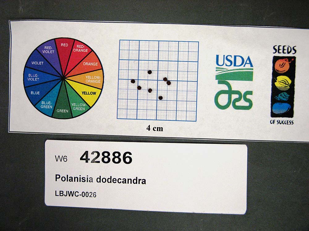 | | 2011 | | | | | | | Wild material | | 1895344 | OPGC 7046 |
| 440 | OPGC 7628 | MSB210074 | Agalinis heterophylla (Nutt.) Small | Texas, United States | OPGC | 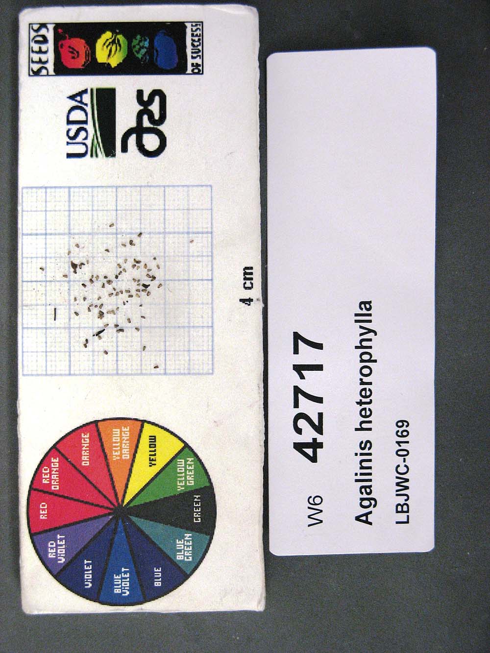 | | 2011 | | | | | | | Wild material | | 1895193 | OPGC 7628 |
| 441 | OPGC 7630 | MSB286693 | Xyris ambigua Beyr. ex Kunth | Texas, United States | OPGC |  | | 2011 | | | | | | | Wild material | | 1895400 | OPGC 7630 |
| 442 | W6 42715 | MSB210339 | Acalypha phleoides Cav. | Texas, United States | W6 |  | | 2011 | | | | | | | Wild material | | 1895191 | W6 42715 |
| 443 | W6 42735 | MSB286084 | Atrema americana DC. | Texas, United States | W6 |  | | 2011 | | | | | | | Wild material | | 1895210 | W6 42735 |
| 444 | W6 42753 | MSB194608 | Chaerophyllum tainturieri Hook. | Texas, United States | W6 |  | | 2011 | | | | | | | Wild material | | 1895421 | W6 42753 |
| 445 | W6 42761 | MSB231187 | Chrysactinia mexicana A. Gray | Texas, United States | W6 |  | | 2011 | | | | | | | Wild material | | 1895234 | W6 42761 |
| 446 | W6 42763 | MSB245588 | Cladium mariscus (L.) Pohl | Texas, United States | W6 |  | | 2011 | | | | | | | Wild material | | 1895236 | W6 42763 |
| 447 | W6 42776 | MSB181455 | Croton monanthogynus Michx. | Texas, United States | W6 |  | | 2011 | | | | | | | Wild material | | 1895420 | W6 42776 |
| 448 | W6 42778 | MSB245717 | Daucosma laciniata Engelm. & A. Gray | Texas, United States | W6 |  | | 2011 | | | | | | | Wild material | | 1895419 | W6 42778 |
| 449 | W6 42779 | MSB180067 | Daucus pusillus Michx. | Texas, United States | W6 |  | | 2011 | | | | | | | Wild material | | 1895250 | W6 42779 |
| 450 | W6 42789 | MSB210269 | Eragrostis curtipedicellata Buckley | Texas, United States | W6 |  | | 2011 | | | | | | | Wild material | | 1895257 | W6 42789 |
| 451 | W6 42790 | MSB210063 | Eragrostis intermedia Hitchc. | Texas, United States | W6 |  | | 2011 | | | | | | | Wild material | | 1895258 | W6 42790 |
| 452 | W6 42795 | MSB180115 | Erioneuron pilosum (Buckley) Nash | Texas, United States | W6 |  | | 2011 | | | | | | | Wild material | | 1895261 | W6 42795 |
| 453 | W6 42801 | MSB202893 | Diaperia prolifera (Nutt. ex DC.) Nutt. | Texas, United States | W6 |  | | 2011 | | | | | | | Wild material | | 1895265 | W6 42801 |
| 454 | W6 42802 | MSB181477 | Eysenhardtia texana Scheele | Texas, United States | W6 |  | | 2011 | | | | | | | Wild material | | 1895266 | W6 42802 |
| 455 | W6 42803 | MSB231361 | Forestiera pubescens Nutt. | Texas, United States | W6 |  | | 2011 | | | | | | | Wild material | | 1895267 | W6 42803 |
| 456 | W6 42805 | MSB245692 | Fuirena simplex Vahl | Texas, United States | W6 |  | | 2011 | | | | | | | Wild material | | 1895269 | W6 42805 |
| 457 | W6 42816 | MSB210395 | Gutierrezia texana (DC.) Torr. & A. Gray | Texas, United States | W6 |  | | 2011 | | | | | | | Wild material | | 1895280 | W6 42816 |
| 458 | W6 42819 | MSB286017 | Hedeoma drummondii Benth. | Texas, United States | W6 |  | | 2011 | | | | | | | Wild material | | 1895282 | W6 42819 |
| 459 | W6 42820 | MSB203052 | Stenaria nigricans (Lam.) Terrell | Texas, United States | W6 |  | | 2011 | | | | | | | Wild material | | 1895283 | W6 42820 |
| 460 | W6 42823 | MSB286095 | Crocanthemum georgianum (Chapm.) Barnhart | Texas, United States | W6 | | | 2011 | | | | | | | Wild material | | 1895286 | W6 42823 |
| 461 | W6 42831 | MSB180056 | Hymenopappus scabiosaeus LʼHér. | Texas, United States | W6 |  | | 2011 | | | | | | | Wild material | | 1895294 | W6 42831 |
| 462 | W6 42836 | MSB286523 | Juncus coriaceus Mack. | Texas, United States | W6 |  | | 2011 | | | | | | | Wild material | | 1895299 | W6 42836 |
| 463 | W6 42856 | MSB231154 | Maurandella antirrhiniflora (Humb. & Bonpl. ex Willd.) Rothm. | West Virginia, United States | W6 |  | | 2011 | | | | | | | Wild material | | 1895316 | W6 42856 |
| 464 | W6 42866 | MSB231257 | Nuttallanthus texanus (Scheele) D. A. Sutton | Texas, United States | W6 |  | | 2011 | | | | | | | Wild material | | 1895408 | W6 42866 |
| 465 | W6 42875 | MSB194631 | Parietaria pensylvanica Muhl. ex Willd. | Texas, United States | W6 |  | | 2011 | | | | | | | Wild material | | 1895333 | W6 42875 |
| 466 | W6 42876 | MSB210351 | Parthenium hysterophorus L. | Texas, United States | W6 |  | | 2011 | | | | | | | Wild material | | 1895334 | W6 42876 |
| 467 | W6 42880 | MSB286109 | Phyllanthus polygonoides Nutt. ex Spreng. | Texas, United States | W6 |  | | 2011 | | | | | | | Wild material | | 1895338 | W6 42880 |
| 468 | W6 42884 | MSB286224 | Pluchea foetida (L.) DC. | Texas, United States | W6 |  | | 2011 | | | | | | | Wild material | | 1895342 | W6 42884 |
| 469 | W6 42893 | MSB194642 | Rhus aromatica Aiton | Texas, United States | W6 |  | | 2011 | | | | | | | Wild material | | 1895351 | W6 42893 |
| 470 | W6 42895 | MSB231143 | Rhus virens Lindh. ex A. Gray | West Virginia, United States | W6 |  | | 2011 | | | | | | | Wild material | | 1895353 | W6 42895 |
| 471 | W6 42896 | MSB284909 | Rhynchospora colorata (L.) H. Pfeiff. | Texas, United States | W6 |  | | 2011 | | | | | | | Wild material | | 1895354 | W6 42896 |
| 472 | W6 42897 | MSB286615 | Rhynchospora inexpansa (Michx.) Vahl | Texas, United States | W6 |  | | 2011 | | | | | | | Wild material | | 1895355 | W6 42897 |
| 473 | W6 42898 | MSB283278 | Rhynchospora nivea Boeck. | West Virginia, United States | W6 |  | | 2011 | | | | | | | Wild material | | 1895356 | W6 42898 |
| 474 | W6 42910 | MSB180089 | Sida abutifolia Mill. | Texas, United States | W6 |  | | 2011 | | | | | | | Wild material | | 1895364 | W6 42910 |
| 475 | W6 42917 | MSB245603 | Dermatophyllum secundiflorum (Ortega) Gandhi & Reveal | Florida, United States | W6 |  | | 2011 | | | | | | | Wild material | | 1895370 | W6 42917 |
| 476 | W6 42922 | MSB283359 | Stillingia texana I. M. Johnst. | Texas, United States | W6 |  | | 2011 | | | | | | | Wild material | | 1895405 | W6 42922 |
| 477 | W6 42929 | MSB181499 | Tetragonotheca texana (A. Gray) Engelm. & A. Gray | Texas, United States | W6 |  | | 2011 | | | | | | | Wild material | | 1895424 | W6 42929 |
| 478 | W6 42930 | MSB245577 | Tetragonotheca texana (A. Gray) Engelm. & A. Gray | Texas, United States | W6 |  | | 2011 | | | | | | | Wild material | | 1895381 | W6 42930 |
| 479 | W6 42936 | MSB181433 | Tridentopsis mutica (Torr.) P. M. Peterson | Texas, United States | W6 |  | | 2011 | | | | | | | Wild material | | 1895386 | W6 42936 |
| 480 | W6 42939 | MSB181031 | Ulmus crassifolia Nutt. | Texas, United States | W6 |  | | 2011 | | | | | | | Wild material | | 1895388 | W6 42939 |
| 481 | W6 42941 | MSB194664 | Valerianella amarella (Lindh. ex Engelm.) Krok | Texas, United States | W6 |  | | 2011 | | | | | | | Wild material | | 1895390 | W6 42941 |
| 482 | W6 42949 | MSB286143 | Xanthisma texanum DC. | Texas, United States | W6 |  | | 2011 | | | | | | | Wild material | | 1895398 | W6 42949 |
| 483 | W6 42952 | MSB284655 | Yucca constricta Buckley | Texas, United States | W6 |  | | 2011 | | | | | | | Wild material | | 1895401 | W6 42952 |
| 484 | WLP 1115 | MSB286637 | Croton alabamensis E. A. Sm. ex Chapm. | Texas, United States | NA |  | | 2011 | COLLECTED | 06/04/2005 | | 30.58501000, -97.99075000 | 311 | Found along banks of creek (high and low side). | Wild material | | 1895248 | WLP 1115 |
| 485 | WLP 2183 | 210524 | Callicarpa americana L. | Texas, United States | NA |  | | 2011 | COLLECTED | 09/15/2003 | Edwards Plateau: Travis County, River Fern Court. | 30.58501000, -97.99076000 | 308 | Shaded woodland, creekside, growing in brown silt soil over limestone. | Wild material | | 1895217 | WLP 2183 |
| 486 | WLP 2186 | 245566 | Clematis texensis Buckley | Texas, United States | NA |  | | 2011 | COLLECTED | 07/20/2004 | Edwards Plateau: Travis County, River Fern Court. | 30.58380000, -97.99076000 | 303 | Growing in tan silt-sand-gravel mix over limestone. | Wild material | | 1895238 | WLP 2186 |
| 487 | WLP 2187 | 210591 | Frangula caroliniana (Walter) A. Gray | Texas, United States | NA |  | | 2011 | COLLECTED | 10/16/2003 | Edwards Plateau: Travis County, River Fern Court. | 30.58501000, -97.99075000 | 311 | Limestone geology with brown silt soil. | Wild material | | 1895268 | WLP 2187 |
| 488 | WLP 2189 | 210362 | Juniperus ashei J. Buchholz | Texas, United States | NA |  | | 2011 | COLLECTED | 11/11/2003 | Lady Bird Johnson Wildflower Center, behind administration building. | 30.18630000, -97.87280000 | 244 | Gently rolling terrain Oak-juniper savanna. Limestone geology. | Wild material | | 1895300 | WLP 2189 |
| 489 | WLP 2406 | 201546 | Ptelea trifoliata L. | Texas, United States | NA |  | | 2011 | COLLECTED | 09/17/2003 | Scott Rd | 30.19917000, -97.58735000 | 130 | Blackland prairie. Soil brown. | Wild material | | 1895348 | WLP 2406 |
| 490 | WLP 2407 | 189440 | Smilax bona-nox L. | Texas, United States | NA |  | | 2011 | COLLECTED | 06/20/2002 | Edwards Plateau Lady Bird Johnson Wildflower Center | | | Oak-juniper savanna. Speck clay-loam soil, with limestone geology. Speck clay-loam. | Wild material | | 1895366 | WLP 2407 |
| 491 | WLP 2479 | 245533 | Malvaviscus arboreus Cav. | Texas, United States | NA |  | | 2011 | COLLECTED | 10/05/2004 | | | | Gently rolling terrain | Wild material | | 1895313 | WLP 2479 |
| 492 | WLP 2480 | 210568 | Malvaviscus arboreus Cav. | Texas, United States | NA |  | | 2011 | COLLECTED | 09/30/2003 | | | | | Wild material | | 1895410 | WLP 2480 |
| 493 | Ames 30882 | JDC/CI/2010/078/348 | Carya illinoinensis (Wangenh.) K. Koch | Iowa, United States | NC7 |  | | 2011 | COLLECTED | 10/04/2011 | Throughout Port Louisa National Wildlife Refuge, Toolesboro Quad., T74N R2W N 1/2 Sec. 8. | 41.22793000, -91.11041000 | 166 | Floodplain. | Wild material | Pecan is native to portions of the south-central Midwest (Carya illinoinensis Native Distribution from Elbert Little's "Atlas of United States Trees") stretching from Iowa along the Mississippi floodplain south to Texas and is well-known for high-quality fall color (yellow) and edible nuts. The species is relatively tolerant to alkaline and slightly acidic soils and can tolerate both extreme drought and severe flood events. However, well-drained soils are preferred. Genetics of this accession represent the extreme northern edge of the species native range with nuts typically reaching maturity in the last week of September into the first week of October in Iowa. Specimens at the collection site in nature measured ~25 inches DBH, with the largest specimen sampled measuring 40.5 inches DBH. Nut measurements (determined by averaging measurements (mm) from 5 randomly selected nuts off a single mother tree) were variable. Averaged measurements (length/width) recorded from 5 mother trees are as follows: tree #4: 23/15 mm, tree #5: 17/12 mm, tree #6: 26/16 mm, tree #7: 24/15 mm, and tree #8: 24/12 mm. Noted observations of progeny from the 2011 collection noted Tree#4 as having strong resistance to the black pecan aphid, Melanocallis caryaefoliae (Davis)(Hemiptera: Aphidadae). Recollection in 2024 found Tree#4 measuring 42.5" DBH dead as the result of major flooding events in 2013, 2014, and 2019 where floods in 2013 persisted for nearly three months. Flood stage for this population of pecan resides at 538 MSL (Mean Sea Level) which can be compared against data from the Mississippi River Lock and Dam 17 (Flood Events 2009-2024), where water levels were recorded 10-12' above ground level where multiple trees of Ames 30882 have been sampled. | 1865828 | Ames 30882 |
| 494 | Ames 30493 | APS/GD/2010/015/050 | Gymnocladus dioicus (L.) K. Koch | Iowa, United States | NC7 |  | | 2010 | COLLECTED | 02/24/2010 | Iowa River Watershed, near Toolesboro T73N R2W NW 1/4 Sec. 1 and also SE 1/4 NW 1/4 Sec. 14. | 41.15416700, -91.04153300 | 170 | Floodplain/mouth of Iowa River and base of northeast-facing slope. | Wild material | Kentucky Coffeetree is native to North America centered throughout majority of the Midwest from central Ohio west to central Kansas and from southern Minnesota south to northern Arkansas (Gymnocladus dioicus Native Distribution from Elbert Little's "Atlas of United States Trees"). Kentucky coffeetree is a picturesque shade tree that is extremely tolerant to highly alkaline and also slightly acidic soils, tolerant to both extreme drought and flood events, and has no serious insect or disease problems. These traits make G. dioicus a promising candidate among diverse tree genera to replace ash (Fraxinus) trees affected by the emerald ash borer (Agrilus planipennis) or oaks (Quercus) being affected by oak wilt (caused by the fungus Ceratocystis fagacearum) (Schmitz & Carstens 2017). Specimens at the collection site in nature averaged (n=7) 14.50” DBH and 53’ in height (Individual Tree measurements (DBH/Height): #1 = 13"/40', #2 = 15"/50', #3 = 14"/40', #4 = 15"/50', #5 = 13"/30', #6 = 16"/90', and #7 = 15"/70'). Sampling in 2010 estimated more than one hundred genetically distinct trees – the most coffeetrees noted in any single area observed throughout the species native range (Schmitz & Carstens 2018). A return site visit in 2016, estimated that three-quarters of the coffeetrees were dead or in decline after becoming overgrown by hops (Humulus sp.), a result of major flooding events in 2013 and 2014 where floods in 2013 persisted for nearly three months. Flood stage for this population of coffeetrees in the NW ¼ of Sec. 1 resides at 538 MSL (Mean Sea Level) which can be compared against data from the Mississippi River Lock and Dam 17 (Flood Events 2009-2024), where water levels were recorded 14' above ground level where multiple trees of Ames 30493 were sampled. | 1831352 | Ames 30493 |
| 495 | W6 35185 | AZ930-196 | Lasthenia californica DC. ex Lindl. | Arizona, United States | W6 |  | | 2009 | | | | | | | Wild material | | 1802171 | W6 35185 |
| 496 | W6 35187 | AZ930-200 | Aristida adscensionis L. | Arizona, United States | W6 |  | | 2009 | | | | | | | Wild material | | 1802173 | W6 35187 |
| 497 | W6 35190 | AZ930-205 | Dalea pulchra Gentry | Arizona, United States | W6 |  | | 2009 | | | | | | | Wild material | | 1802176 | W6 35190 |
| 498 | W6 35191 | AZ930-206 | Carex senta Boott | Arizona, United States | W6 |  | | 2009 | | | | | | | Wild material | | 1802284 | W6 35191 |
| 499 | W6 35192 | AZ930-207 | Erigeron divergens Torr. & A. Gray | United States | W6 |  | | 2009 | | | | | | | Wild material | | 1802177 | W6 35192 |