| 0 | PI 658651 | Ames 26838 | Rhus glabra L. | Missouri, United States | NC7 | | | 2002 | COLLECTED | 2001 | Shaw Nature Reserve, Gray Summit | 38.48972222, -90.81666667 | 204 | | Wild material | | 1635682 | PI 658651 |
| 1 | PI 518502 | 9031712 | Rhus glabra L. | Michigan, United States | NC7 | | | 1988 | COLLECTED | 12/12/1980 | T45N R30W, Marquette County, MLRA 93 | 46.29005230, -88.05458820 | 469 | | Wild material | Tillers/suckers abundant. Used for critical area stabilization on acid mine spoil in midwestern and northeastern U.S. | 1413438 | PI 518502 |
| 2 | PI 518503 | 9031717 | Rhus glabra L. | Illinois, United States | NC7 | | | 1988 | COLLECTED | 09/17/1981 | T12S R2W Sec. 3, Calhoun County, MLRA 115 | 39.04785350, -90.62647550 | 243 | | Wild material | Tillers/suckers abundant. Vigor excellent. Used for critical area stabilization primarily on acid mine spoil in midwestern and northeastern U.S. | 1413439 | PI 518503 |
| 3 | PI 518504 | 9031719 | Rhus glabra L. | Indiana, United States | NC7 | | | 1988 | COLLECTED | 09/22/1981 | R1E T10N Sec. 1, Brown County, MLRA 120 | 39.33242680, -86.36666667 | 274 | | Wild material | Seed production heavy. Plants vigorous. Used for critical area stabilization primarily on acid mine spoil in midwestern and northeastern U.S. | 1413440 | PI 518504 |
| 4 | PI 518506 | 9031748 | Rhus glabra L. | Indiana, United States | NC7 | | | 1988 | COLLECTED | 1981 | T4S R5E Sec. 34, Harrison County, MLRA 122 | 38.12010350, -85.94921670 | 243 | | Wild material | Growth uniform. Seed production heavy. Used for critical area stabilization primarily on acid mine spoil in midwestern and northeastern U.S. | 1413442 | PI 518506 |
| 5 | PI 518507 | 9031759 | Rhus glabra L. | Missouri, United States | NC7 | | | 1988 | COLLECTED | 1981 | East side of I-29, .8km N of mile post 54, N of St. Joseph, Andrew County, MLRA 107 | 39.86056100, -94.81421100 | 304 | | Wild material | Tillers/suckers abundant. Plants vigorous. Used for critical area stabilization primarily on acid mine spoil in midwestern and northeastern U.S. | 1413443 | PI 518507 |
| 6 | PI 518510 | 9031828 | Rhus glabra L. | Missouri, United States | NC7 | | | 1988 | COLLECTED | 1981 | T50N R16W Sec. 10, Howard County, MLRA 115 | 39.15000000, -92.70000000 | 216 | | Wild material | Plants produce tillers/suckers. Seed production good. Used for critical area stabilization primarily on acid mine spoil in midwestern and northeastern U.S. | 1413446 | PI 518510 |
| 7 | Ames 35752 | #476-477 | Rhus glabra L. | Iowa, United States | NC7 | 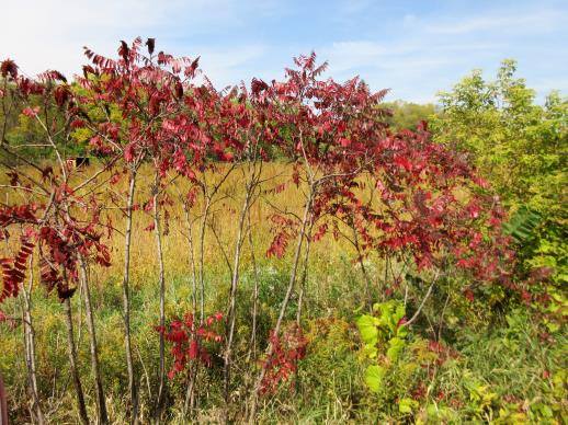 | | 2021 | COLLECTED | 09/29/2021 | Upper Iowa River area near Bluffton, T99N R9W NE1/4 Sec. 9 and S1/2 Sec. 10 | 43.40275000, -91.90494000 | 299 | High bluffs, roadside and stream banks | Wild material | Plants sampled in nature (29 September 2021) during peak fall color displaying bright reds to maroonish colors while measuring approximately 12-15 feet in height. One clonal patch noted was estimated to have 1,000+ ramets. | 2122093 | Ames 35752 |
| 8 | W6 57249 | MARSB-714 | Rhus glabra L. | New York, United States | W6 |  | | 2019 | | | | | | | Wild material | | 2097688 | W6 57249 |
| 9 | WLP 158 | NACPEC19-029 | Rhus glabra L. | Kentucky, United States | NA | | | 2019 | COLLECTED | 09/09/2019 | Madison County; Berea College Forest: Radio Tower Service Trail | 37.55289700, -84.28793400 | 379 | Xeric shade knob, limestone shale conglomerate material | Wild material | | 2110470 | WLP 158 |
| 10 | W6 56179 | NEWFS-305 | Rhus glabra L. | Massachusetts, United States | W6 |  | | 2019 | | | | | | | Wild material | | 1976214 | W6 56179 |
| 11 | Ames 34794 | NCBG-739 | Rhus glabra L. | North Carolina, United States | NC7 |  | | 2018 | COLLECTED | 10/07/2017 | Just north of Oswego. | 36.19391000, -78.19391000 | 91 | Ruderal loblolly pine/sweetgum red maple forest | Wild material | | 1966040 | Ames 34794 |
| 12 | Ames 34791 | CO150A-34 | Rhus glabra L. | Colorado, United States | NC7 |  | | 2018 | COLLECTED | 09/10/2016 | Uncompahgre National Forest near East Fork Escalante Creek between MM 29 and MM 30. | 38.50333000, -108.46027000 | 2490 | Burned pinyon/juniper | Wild material | | 1958166 | Ames 34791 |
| 13 | WLP 1704 | NA 83942 | Rhus glabra L. | Kentucky, United States | NA | | | 2016 | COLLECTED | 09/29/2016 | Kentenia State Forest, Pine Mountain, on Route 1679, south side. | 36.90500000, -83.29100000 | 771 | Roadside. | | | 1953164 | WLP 1704 |
| 14 | Ames 32900 | JDC/RG/2015/017/673 | Rhus glabra L. | Oklahoma, United States | NC7 |  | | 2015 | COLLECTED | 03/17/2015 | Located approximately 10 miles west of Vici, T19N R21W N edge of Sec. 7, Ellis County | 36.14448500, -99.47983500 | 701 | Roadside. | Wild material | | 1925366 | Ames 32900 |
| 15 | W6 42297 | NYCDPR-BBG-83 | Rhus glabra L. | New York, United States | W6 | | | 2011 | | | | | | | Wild material | | 1889648 | W6 42297 |
| 16 | WLP 1618 | RL 08085 | Rhus glabra L. | North Carolina, United States | NA | | | 2008 | COLLECTED | | North Carolina: Buncombe County, Along road leading to Elk Mountian summit ridge, east end, ca. 400 ft. from junction with Elk Mountain Scenic Hwy. | | | | | | 1922675 | WLP 1618 |
| 17 | Ames 22092 | Index Seminum #88 | Rhus glabra L. | Oklahoma, United States | NC7 | | | 1994 | COLLECTED | 1993 | Greer County | 34.92309300, -99.55455000 | 479 | | Wild material | | 1087573 | Ames 22092 |
| 18 | W6 52944 | NEWFS-127 | Rhus copallinum L. | Connecticut, United States | W6 |  | | 2017 | | | | | | | Wild material | | 1954687 | W6 52944 |
| 19 | Ames 33232 | Index Seminum 9 | Rhus typhina L. | Michigan, United States | NC7 | | | 2016 | COLLECTED | 10/23/2014 | Along Woodbury Road, Rose Lake State Wildlife Research Area, T5N R1E Sec. 20, Shiawassee County | 42.81640000, -84.35390000 | 257 | Old flooded field. | Wild material | | 1936482 | Ames 33232 |
| 20 | Ames 32800 | JDC/RC/2014/085/587 | Rhus copallinum L. | Mississippi, United States | NC7 | | | 2014 | COLLECTED | 09/22/2014 | Near J.P. Coleman State Park, T1S, R10E NW 1/4 of NW 1/4 of NW 1/4 of Sec. 24, extreme northeast corner of Tishomingo County | 34.98550900, -88.20415100 | 196 | Dry, pine-post oak woods | Wild material | | 1921811 | Ames 32800 |
| 21 | WLP 1619 | RL 08086 | Rhus ×pulvinata Greene | North Carolina, United States | NA | | | 2008 | COLLECTED | 09/11/2008 | North Carolina, Buncombe County, Along road leading to Elk Mountain summit ridge, east end, ca. 450 ft. from junction with Elk Mountain Scenic Hwy. | | | | Wild material | Rhus glabra x typhina | 1898077 | WLP 1619 |
| 22 | Ames 29227 | JDC-0452007 | Rhus copallinum L. | Missouri, United States | NC7 |  | | 2007 | COLLECTED | 10/04/2007 | Along trail to Mina Sauk Falls, Taum Sauk Mountain State Park, Iron County | 37.57250000, -90.72805556 | 541 | Very dry, rocky soil. Very close to the highest elevation in Missouri | Wild material | Reddish fall color. | 1743330 | Ames 29227 |
| 23 | WLP 1613 | RL 099 | Rhus ×pulvinata Greene | North Carolina, United States | NA | | | 2006 | COLLECTED | 07/01/2004 | North Carolina, Buncombe County, Elk Mountain; west of Bull Gap, and north of Vance Birthplace Road; along old road to ridgetop. | | | | Wild material | Rhus glabra x typhina | 1898074 | WLP 1613 |
| 24 | PI 704861 sos | R. pensilvanicus NCBG-442 | Rubus pensilvanicus Poir. | North Carolina, United States | COR | | | 2021 | | | | | | | Wild material | high arching | 2116312 | PI 704861 sos |
| 25 | PI 702722 | MARSB-400 | Schizachyrium scoparium (Michx.) Nash | New York, United States | S9 |  | | 2019 | | | | | | | Wild material | | 2097613 | PI 702722 |
| 26 | PI 710489 | MARSB-254 | Lespedeza capitata Michx. | New York, United States | S9 |  | | 2018 | | | | | | | Wild material | | 1964746 | PI 710489 |
| 27 | PI 710485 | CBG-7324 | Desmodium canadense (L.) DC. | Wisconsin, United States | S9 |  | | 2017 | | | | | | | Wild material | | 1954800 | PI 710485 |
| 28 | PI 664805 | JDC/HX/2010/035/305 | Helianthus mollis Lam. | Kansas, United States | NC7 | | | 2010 | COLLECTED | 09/14/2010 | Roadside along Kansas Rd, west of Hwy 3 south of Uniontown, Bourbon County. | 37.81978000, -94.98685000 | 325 | Uplands. Associated with Andropogon gerardii, Bidens polylepis, Chamaechrista fasciculata, Cornus, Diospyros virginiana, Gleditsia triacanthos, Juglans nigra, Maclura pomifera, Monarda, Pycnanthemum virginianum, Quercus, Rhus glabra, and Sorghastrum nutans. | Wild material | | 1848907 | PI 664805 |
| 29 | PI 664869 | JDC/HP/2008/030/100 | Hypericum prolificum L. | Missouri, United States | NC7 |  | | 2008 | COLLECTED | 10/06/2008 | Rudolf Bennitt Conservation Area, NE 1/4 of NE 1/4 of Section 25, T52N, R14W, Renick Quad, Randolph County. | 39.27527778, -92.43388889 | 256 | | Wild material | | 1788211 | PI 664869 |
| 30 | PI 653309 | R. occidentalis HDF-2007-094 | Rubus occidentalis L. | Nebraska, United States | COR |  | | 2007 | COLLECTED | 07/09/2007 | Cherry County, Valentine City Park and area along creek Roadside with Rhus glabra Opuntia nearby | 41.88500000, -100.54870000 | 823 | roadside along Lake Shore Drive. Riparian Edge @ State Park Mennachadinga Creek | Wild material | Michael Dossett, Chad Finn collected from Nebraska.
| 1733169 | PI 653309 |
| 31 | PI 664901 | JM20061003 | Teucrium canadense L. | Missouri, United States | NC7 | | | 2006 | COLLECTED | 09/25/2006 | Mile marker 222.1, Route 66 off of Interstate 44, southwest of Meramec State Park, West Sullivan, Crawford County. | 38.18194444, -91.20194444 | 301 | Roadside prairie remnant (between railroad and state road). Ambrosia artemisiifolia, Andropogon gerardii, Celtis laevigata, Elaeagnus angustifolia, Eryngium, Helianthus mollus, Rhus glabra, Schrankia nuttallianum, and Sorghastrum nutans. | Wild material | | 1715759 | PI 664901 |
| 32 | PI 662017 | 24 | Cornus drummondii C. A. Mey. | Iowa, United States | NC7 | | | 2003 | COLLECTED | 09/22/2003 | Eldon Wildlife Management Area, Floris, SW 1/4 of NW 1/4 of Section 9, T70N, R12W, Agency Quad, Davis County. | 40.88083333, -92.25222222 | 235 | Near a pond. Sunny. Slight slope. Clay loam soil. | Wild material | Medium sized, suckering shrubs. Good leaf quality and fruit production. | 1649669 | PI 662017 |
| 33 | PI 649702 | 12 | Physocarpus opulifolius (L.) Maxim. | Iowa, United States | NC7 | | | 2003 | COLLECTED | 09/14/2003 | 100 meters south of campground at North Bear Creek, west side of Quandahl Road, Bear Creek Wildlife Area, Highlandville, NW 1/4 of SE 1/4 of Section 25, T100N, R7W, Dorchester Quad, Winneshiek County. | 43.44833333, -91.61861111 | 265 | Limestone road cut. Mostly sunny. Steep slope with an eastern aspect. Thin soil with high stoniness, well drained. | Wild material | Medium sized shrubs with arching stems. | 1649462 | PI 649702 |
| 34 | PI 631302 | 048 | Echinacea pallida (Nutt.) Nutt. | Missouri, United States | NC7 |  | | 1997 | COLLECTED | 08/25/1997 | Near Sleeper, Laclede County. Please contact curator for specific site location. | 37.75000000, -92.56666667 | 390 | Roadside prairie remnant/disturbed area. Full exposure, ~15 degrees of slope with a southern aspect. Calcareous, dry soil with good drainage and high stoniness. | Wild material | Plants were tall, occasional, and sometimes branched with pale pink flowers. Population had the "mixed pollen color" character (ie. most plants had white pollen, some had light yellow pollen). Part of site mowed, part of site previously harvested of seed: more of a "clear cut" than a random/scientific collection (probable collection for profit). | 1548372 | PI 631302 |
| 35 | PI 631264 | 017 | Echinacea paradoxa (Norton) Britton var. neglecta McGregor | Oklahoma, United States | NC7 |  | | 1997 | COLLECTED | 08/10/1997 | Near Sulphur, Murray County. Please contact curator for specific site location. | 34.50000000, -96.96666667 | 370 | Top of road bank adjacent to buffalo pasture. Full exposure on nearly level ground. Calcareous, well drained soil with high stoniness. | Wild material | Plants were up to ~2.5 feet high, in relative abundance, and seldom branched with white and medium pink flowers. Endemic to Arbuckle Mountains. | 1547266 | PI 631264 |
| 36 | PI 649686 | 15 | Monarda fistulosa L. | Kansas, United States | NC7 |  | | 1985 | COLLECTED | 09/23/1985 | Chase County State Fishing Lake,T19S R8E W1/4 of SW 1/4 of Sec. 30, Cottonwood Falls Quad, Chase County | 38.36277600, -96.59551200 | 402 | Southeast facing slope on limestone. | Wild material | Lemon-scented plants noted in this population. | 1028672 | PI 649686 |
| 37 | NA 89115 | TLM25-04a | Hamamelis ovalis S. W. Leonard | Texas, United States | NA | | | 2025 | COLLECTED | 07/10/2025 | State Highway 87 approximately 3.25 kilometers north of the crossroad junction with Texas Recreational Road 255 (RE 255); plants were growing in the narrow buffer woods along the east side of the highway. | 31.12051300, -93.72628100 | 138 | The habitat is an upland mixed coniferous and deciduous woodlands in part to full shade and dry conditions, often under drought stress. Plants seem to always occur on the top of dry ridges or well-drained slopes. Slope: 0 to 1 percent. Aspect: N/A. Soils: The soils of this collection area are classified as Tehran-Letney Association, hilly (TLE) soils. The Tehran Series (55%) consists of deep, somewhat excessively drained, moderately rapidly permeable soils on uplands. They formed in thick loamy and sandy sediments on the Western Coastal Plain. These soils are on gently sloping to moderately steep uplands with slopes ranging from 1 to 20 percent. The Letney Series (30%) consists of deep, well drained, moderately rapidly permeable, upland soils. They formed in thick sandy and loamy sediments of the coastal plains. These soils are on gently sloping to moderately steep uplands with slopes ranging from 1 to 20 percent. Soil pH ranges from 4.5 to 6.0. The minor soil components include Doucette Series (10%) and Boykin Series (5%) soils. (Source: California Soil Resource Lab/NRCS Official Soil Series Descriptions). Geology: The underlying geology of this area is of Oligocene origin and characterized as Catahoula Formation. This formation is extensive and deep in Texas, up to 185 meters thick. In the area of the collection the Catahoula Formation is primarily mudstone and sand. The upper 90-150 meters is mudstone that is tuffaceous, and sandy; also, occasionally, with some bentonitic clay. (Source: USGS Texas Geologic Map Data). | Wild material | | 2191654 | NA 89115 |
| 38 | NA 88581 | 2024RJLFL-012 | Ilex ambigua Torr. | Florida, United States | NA | | | 2024 | COLLECTED | 11/13/2024 | Woodland edge along the south side of Bud Bass Road (DOF B48), 0.30 kilometers east of the junction with Norman Riley Road. | 30.75763200, -86.80184300 | 32 | Woodland edge. Slope: 3 percent. Aspect: North. The underlying geology of this area is characterized as Citronelle Formation of the Pliocene period. The Citronelle Formation is widespread in the Gulf Coastal Plain. The type section for the Citronelle Formation, named by Matson (1916), is near Citronelle, Alabama. The Citronelle Formation grades laterally, through a broad facies transition, into the Miccosukee Formation of the eastern Florida panhandle. Coe (1979) investigated the Citronelle Formation in portions of the western Florida panhandle. The Citronelle Formation is a siliciclastic, deltaic deposit that is lithologically similar to, and time equivalent with, the Cypresshead Formation and, at least in part, the Long Key Formation (Cunningham et al., 1998) of the peninsula. In the western panhandle, some of the sediments mapped as Citronelle Formation may be reworked Citronelle. The lithologies are the same and there are few fossils present to document a possible younger age. The Citronelle Formation consists of gray to orange, often mottled, unconsolidated to poorly consolidated, very fine to very coarse, poorly sorted, clean to clayey sands. It contains significant amounts of clay, silt and gravel which may occur as beds and lenses and may vary considerably over short distances. Limonite nodules and limonite-cemented beds are common. Marine fossils are rare but fossil pollen, plant remains and occasional vertebrates are found. Much of the Citronelle Formation is highly permeable. It forms the Sand and Gravel Aquifer of the surficial aquifer system contain organics. The dominant fossils in the freshwater carbonates are mollusks. (Source: USGS Florida Geologic Map Data). The soils of this are characterized as Lakeland Series Sand, 0 to 5 percent slopes. The Lakeland series consists of very deep, excessively drained, rapid to very rapidly permeable soils on uplands. They formed in thick beds of eolian or marine and/or fluvio-marine sands in the Southern Coastal Plain MLRA (133A), the Carolina and Georgia Sandhills (MLRA 137), the Eastern Gulf Coast Flatwoods (MLRA 152A) and the Atlantic Coast Flatwoods (MLRA 153A). Slopes are dominantly from 0 to 12 percent but can range to 85 percent in dissected areas. Thickness of the sand exceeds 200 cm. Silt plus clay in the 25 to 100 cm control section ranges from 5 to 10 percent. Reaction ranges from very strongly acid to moderately acid throughout. (Source: California Soil Resource Lab/NRCS Official Soil Series Descriptions). | Wild material | | 2169918 | NA 88581 |
| 39 | Ames 36284 | Oak Creek Canyon | Alnus oblongifolia Torr. | Arizona, United States | NC7 |  | | 2024 | COLLECTED | 10/18/2024 | Oak Creek Canyon, approximately five miles north-northeast of Sedona in the Coconino National Forest, T18N R6E Sec. 8 and Sec. 21 and also T19N R6E Sec. 22 and Sec. 27. | 35.01694800, -111.73755900 | 1538 | Creek beds in canyon bottom. | Wild material | Plants sampled in nature had dark green, glossy leaves. Young bark is smooth and light grey, becoming dark and scaly with age. Approximately 50 feet in height. | 2169812 | Ames 36284 |
| 40 | NA 89081 | 2024RJLPA-009 | Rosa carolina L. | Pennsylvania, United States | NA | | | 2024 | COLLECTED | 09/22/2024 | Lancaster and York Counties: outcrops along the Susquehanna River, accessed from the Historic Lock 12 parking lot off of Pennsylvania Road 372. | 39.81483500, -76.32762200 | 34 | Plants are growing from part-sun to full sun in crevices of the outcrops and where organic debris has accumulated in between boulders along the Susquehanna River. The sites range from nearly xeric to dry mesic, at least on the surface. Plants are generally growing 4-10 m above the normal flow of the river; however, the Holtwood Dam is less than 1 kilometer upstream and debris found trapped in the boulders indicates that there is periodic flooding, at least, in the lower zone of 4+ meters or so above normal river flow. This habitat has a diverse assemblage of deciduous trees and shrubs as well as abundant herbaceous taxa. Slope: 0 to 60 percent. Aspect: Northeast (generally). Geology: The underlying geology of this area is probably of lower Paleozoic age and characterized as the Octoraro Formation. It includes albite-chlorite schist, phyllite, some hornblende gneiss, and granitized members. Soils: The area where this species occurs is right on the edge of two soil zones that transition from the river’s edge to mesic conditions upslope. The first is generally referred to as Rock Outcrop. This terrestrial matrix in which plants grow is largely exposed underlying rock geology with accumulated outwash, rock decomposition, and organic debris buildup. The second is Mt. Airy (80%) and Manor (20%) Series soils, 25 to 60 percent slopes, extremely stony (MRF). (Source: California Soil Resource Lab/NRCS Official Soil Series Descriptions). EPA Ecoregion (Level III): Northern Piedmont (64). EPA Ecoregion (Level IV): Piedmont Uplands (64c). | Wild material | | 2169045 | NA 89081 |
| 41 | NA 89082 | 2024RJLPA-010 | Amorpha fruticosa L. | Pennsylvania, United States | NA | | | 2024 | COLLECTED | 09/22/2024 | Outcrops along the Susquehanna River, accessed from the Historic Lock 12 parking lot off of Pennsylvania Road 372. | 39.81481500, -76.32757900 | 34 | Plants are growing from part-sun to full sun in crevices of the outcrops and where organic debris has accumulated in between boulders along the Susquehanna River. The sites range from nearly xeric to dry mesic, at least on the surface. Plants are generally growing 4-10 m above the normal flow of the river; however, the Holtwood Dam is less than 1 kilometer upstream and debris found trapped in the boulders indicates that there is periodic flooding, at least, in the lower zone of 4+ meters or so above normal river flow. This habitat has a diverse assemblage of deciduous trees and shrubs as well as abundant herbaceous taxa. Slope: 0 to 25 percent. Aspect: Northeast (generally). Geology: The underlying geology of this area is probably of lower Paleozoic age and characterized as the Octoraro Formation. It includes albite-chlorite schist, phyllite, some hornblende gneiss, and granitized members. Soils: The area where this species occurs is right on the edge of two soil zones that transition from the river’s edge to mesic conditions upslope. The first is generally referred to as Rock Outcrop. This terrestrial matrix in which plants grow is largely exposed underlying rock geology with accumulated outwash, rock decomposition, and organic debris buildup. The second is Mt. Airy (80%) and Manor (20%) Series soils, 25 to 60 percent slopes, extremely stony (MRF). (Source: California Soil Resource Lab/NRCS Official Soil Series Descriptions). EPA Ecoregion (Level III): Northern Piedmont (64). EPA Ecoregion (Level IV): Piedmont Uplands (64c). | Wild material | | 2169046 | NA 89082 |
| 42 | NA 89083 | 2024RJLPA-012 | Rhododendron periclymenoides (Michx.) Shinners | Pennsylvania, United States | NA | | | 2024 | COLLECTED | 09/22/2024 | Outcrops along the Susquehanna River, accessed from the Historic Lock 12 parking lot off of Pennsylvania Road 372. | 39.81477400, -76.32807300 | 35 | Plants are growing from shade to part-sun and occasionally full sun in crevices of the outcrops and where organic debris has accumulated in between boulders along the Susquehanna River. The sites range from nearly xeric to mesic, at least on the surface. Plants are generally growing 4-10 m above the normal flow of the river; however, the Holtwood Dam is less than 1 kilometer upstream and debris found trapped in the boulders indicates that there is periodic flooding, at least, in the lower zone of 4+ meters or so above normal river flow. This habitat has a diverse assemblage of deciduous trees and shrubs as well as abundant herbaceous taxa. Slope: 0 to 60 percent. Aspect: Northeast (generally). Geology: The underlying geology of this area is probably of lower Paleozoic age and characterized as the Octoraro Formation. It includes albite-chlorite schist, phyllite, some hornblende gneiss, and granitized members. Soils: The area where this species occurs is right on the edge of two soil zones that transition from the river’s edge to mesic conditions upslope. The first is generally referred to as Rock Outcrop. This terrestrial matrix in which plants grow is largely exposed underlying rock geology with accumulated outwash, rock decomposition, and organic debris buildup. The second is Mt. Airy (80%) and Manor (20%) Series soils, 25 to 60 percent slopes, extremely stony (MRF). (Source: California Soil Resource Lab/NRCS Official Soil Series Descriptions). EPA Ecoregion (Level III): Northern Piedmont (64). EPA Ecoregion (Level IV): Piedmont Uplands (64c). | Wild material | | 2169047 | NA 89083 |
| 43 | NA 89084 | 2024RJLPA-013 | Physocarpus opulifolius (L.) Maxim. | Pennsylvania, United States | NA | | | 2024 | COLLECTED | 09/22/2024 | Outcrops along the Susquehanna River, accessed from the Historic Lock 12 parking lot off of Pennsylvania Road 372. | 39.81466300, -76.32833900 | 36 | Plants are growing from shade to part-sun where organic debris has accumulated in between boulders as well as further upslope in deeper mesic soils along the Susquehanna River. This habitat has a diverse assemblage of deciduous trees and shrubs as well as abundant herbaceous taxa. Slope: 10 to 25 percent. Aspect: Northeast (generally). Geology: The underlying geology of this area is probably of lower Paleozoic age and characterized as the Octoraro Formation. It includes albite-chlorite schist, phyllite, some hornblende gneiss, and granitized members. Soils: The area where this species occurs is right on the edge of two soil zones that transition from the river’s edge to mesic conditions upslope. The first is generally referred to as Rock Outcrop. This terrestrial matrix in which plants grow is largely exposed underlying rock geology with accumulated outwash, rock decomposition, and organic debris buildup. The second is Mt. Airy (80%) and Manor (20%) Series soils, 25 to 60 percent slopes, extremely stony (MRF). (Source: California Soil Resource Lab/NRCS Official Soil Series Descriptions). EPA Ecoregion (Level III): Northern Piedmont (64). EPA Ecoregion (Level IV): Piedmont Uplands (64c). | Wild material | | 2169048 | NA 89084 |
| 44 | NA 89085 | 2024RJLPA-014 | Rhododendron arborescens (Pursh) Torr. | Pennsylvania, United States | NA | | | 2024 | COLLECTED | 09/22/2024 | Outcrops along the Susquehanna River, accessed from the Historic Lock 12 parking lot off of Pennsylvania Road 372. | 39.81618100, -76.33069800 | 38 | Plants are growing from shade to part-sun and occasionally full sun in crevices of the outcrops and where organic debris has accumulated in between boulders along the Susquehanna River. The sites range from nearly xeric to mesic, at least on the surface. Plants are generally growing 4-10 m above the normal flow of the river; however, the Holtwood Dam is less than 1 kilometer upstream and debris found trapped in the boulders indicates that there is periodic flooding, at least, in the lower zone of 4+ meters or so above normal river flow. This habitat has a diverse assemblage of deciduous trees and shrubs as well as abundant herbaceous taxa. Slope: 0 to 75 percent. Aspect: Northeast (generally). Geology: The underlying geology of this area is probably of lower Paleozoic age and characterized as the Octoraro Formation. It includes albite-chlorite schist, phyllite, some hornblende gneiss, and granitized members. Soils: The area where this species occurs is right on the edge of two soil zones that transition from the river’s edge to mesic conditions upslope. The first is generally referred to as Rock Outcrop. This terrestrial matrix in which plants grow is largely exposed underlying rock geology with accumulated outwash, rock decomposition, and organic debris buildup. The second is Mt. Airy (80%) and Manor (20%) Series soils, 25 to 60 percent slopes, extremely stony (MRF). (Source: California Soil Resource Lab/NRCS Official Soil Series Descriptions). EPA Ecoregion (Level III): Northern Piedmont (64). EPA Ecoregion (Level IV): Piedmont Uplands (64c). | Wild material | | 2169049 | NA 89085 |
| 45 | NA 89086 | 2024RJLPA-015 | Ilex verticillata (L.) A. Gray | Pennsylvania, United States | NA | | | 2024 | COLLECTED | 09/22/2024 | Outcrops along the Susquehanna River, accessed from the Historic Lock 12 parking lot off of Pennsylvania Road 372. | 39.81656600, -76.33136600 | 38 | Plants are growing from part-sun to full sun in crevices of the outcrops and where organic debris has accumulated in between boulders along the Susquehanna River. The sites range from nearly xeric to dry mesic, at least on the surface. Plants are generally growing 4-10 m above the normal flow of the river; however, the Holtwood Dam is less than 1 kilometer upstream and debris found trapped in the boulders indicates that there is periodic flooding, at least, in the lower zone of 4+ meters or so above normal river flow. This habitat has a diverse assemblage of deciduous trees and shrubs as well as abundant herbaceous taxa. Slope: 0 to 10 percent. Aspect: Northeast (generally). Geology: The underlying geology of this area is probably of lower Paleozoic age and characterized as the Octoraro Formation. It includes albite-chlorite schist, phyllite, some hornblende gneiss, and granitized members. Soils: The area where this species occurs is right on the edge of two soil zones that transition from the river’s edge to mesic conditions upslope. The first is generally referred to as Rock Outcrop. This terrestrial matrix in which plants grow is largely exposed underlying rock geology with accumulated outwash, rock decomposition, and organic debris buildup. The second is Mt. Airy (80%) and Manor (20%) Series soils, 25 to 60 percent slopes, extremely stony (MRF). (Source: California Soil Resource Lab/NRCS Official Soil Series Descriptions). EPA Ecoregion (Level III): Northern Piedmont (64). EPA Ecoregion (Level IV): Piedmont Uplands (64c). | Wild material | | 2169050 | NA 89086 |
| 46 | NA 89091 | 2024RM-TK-004 | Prunus sp. | Florida, United States | NA | | | 2024 | COLLECTED | 09/05/2024 | Blackwater River Wildlife Management Area: on the south side of Boundary Line Road about 0.32 kilometers west of Deaton Bridge Road along an area edged by a barbed wire fence. | 30.68579800, -86.87964300 | 45 | Plants are growing from part-sun to full sun. Plants are growing in an area that is frequently burned with a lot of [Prunus sp. (orig. listed as Prunus alabamensis)] scattered throughout. This habitat is a longleaf pine-wiregrass community with scattered turkey (Quercus laevis) and blackjack oaks (Quercus incana). There is a slight slope downward. The line of [Prunus sp.] goes along a semi-ditch on the side of a dirt road. The plants probably get a bit more water than the plants out in the open forest. The [Prunus sp.] are most often without any other close woody companions. Slope: 0 percent. Aspect: North. Geology: The underlying geology of this area is probably of lower Pliocene age and characterized as the Citronelle Formation. The Citronelle Formation is widespread in the Gulf Coastal Plain. The type section for the Citronelle Formation, named by Matson (1916), is near Citronelle, Alabama. The Citronelle Formation grades laterally, through a broad facies transition, into the Miccosukee Formation of the eastern Florida panhandle. Coe (1979) investigated the Citronelle Formation in portions of the western Florida panhandle. The Citronelle Formation is a siliciclastic, deltaic deposit that is lithologically similar to, and time equivalent with, the Cypresshead Formation and, at least in part, the Long Key Formation (Cunningham et al., 1998) of the peninsula. In the western panhandle, some of the sediments mapped as Citronelle Formation may be reworked Citronelle. The lithologies are the same and there are few fossils present to document a possible younger age. The Citronelle Formation consists of gray to orange, often mottled, unconsolidated to poorly consolidated, very fine to very coarse, poorly sorted, clean to clayey sands. It contains significant amounts of clay, silt and gravel which may occur as beds and lenses and may vary considerably over short distances. Limonite nodules and limonite-cemented beds are common. Marine fossils are rare but fossil pollen, plant remains and occasional vertebrates are found. Much of the Citronelle Formation is highly permeable. It forms the Sand and Gravel Aquifer of the surficial aquifer system. (Source: USGS Florida Geologic Map Data). Soils: The soil of this area is characterized as Lakeland Series Sand, 0 to 5 percent slopes (21). The Lakeland Series consists of very deep, excessively drained, rapid to very rapidly permeable soils on uplands. They formed in thick beds of eolian or marine and/or fluvio-marine sands in the Southern Coastal Plain MLRA (133A), the Carolina and Georgia Sandhills (MLRA 137), the Eastern Gulf Coast Flatwoods (MLRA 152A) and the Atlantic Coast Flatwoods (MLRA 153A). (Source: California Soil Resource Lab/NRCS Official Soil Series Descriptions). EPA Ecoregion (Level III): Southeastern Plains (65). EPA Ecoregion (Level IV): Southern Pine Plains and Hills (65f). | Wild material | Received as Prunus alabamensis; other collections of this material have proven not to be Prunus serotina var. alabamensis, but actually a species of plum; this will likewise be treated as unidentified material until its species can be ascertained. Collectors' notes refer to the plant by the name under which it was collected. | 2169055 | NA 89091 |
| 47 | NA 89093 | 2024RM-TK-006 | Ilex ambigua Torr. | Florida, United States | NA | | | 2024 | COLLECTED | 09/29/2024 | Blackwater River Wildlife Management Area: growing on the south side of Bud Bass Road, approximately 0.3 kilometers east of Training Center R./Norma Riley Rd. | 30.75759720, -86.80187220 | 29 | This plant is growing in part-shade under mesic conditions along the edge of a longleaf pine plantation. Slope: 0 percent. Aspect: North. Geology: The underlying geology of this area is probably of lower Pliocene age and characterized as the Citronelle Formation. The Citronelle Formation is widespread in the Gulf Coastal Plain. The type section for the Citronelle Formation, named by Matson (1916), is near Citronelle, Alabama. The Citronelle Formation grades laterally, through a broad facies transition, into the Miccosukee Formation of the eastern Florida panhandle. Coe (1979) investigated the Citronelle Formation in portions of the western Florida panhandle. The Citronelle Formation is a siliciclastic, deltaic deposit that is lithologically similar to, and time equivalent with, the Cypresshead Formation and, at least in part, the Long Key Formation (Cunningham et al., 1998) of the peninsula. In the western panhandle, some of the sediments mapped as Citronelle Formation may be reworked Citronelle. The lithologies are the same and there are few fossils present to document a possible younger age. The Citronelle Formation consists of gray to orange, often mottled, unconsolidated to poorly consolidated, very fine to very coarse, poorly sorted, clean to clayey sands. It contains significant amounts of clay, silt and gravel which may occur as beds and lenses and may vary considerably over short distances. Limonite nodules and limonite-cemented beds are common. Marine fossils are rare but fossil pollen, plant remains and occasional vertebrates are found. Much of the Citronelle Formation is highly permeable. It forms the Sand and Gravel Aquifer of the surficial aquifer system. (Source: USGS Florida Geologic Map Data). Soils: The soil of this area is characterized as Lakeland Series Sand, 0 to 5 percent slopes (21). The Lakeland Series consists of very deep, excessively drained, rapid to very rapidly permeable soils on uplands. They formed in thick beds of eolian or marine and/or fluvio-marine sands in the Southern Coastal Plain MLRA (133A), the Carolina and Georgia Sandhills (MLRA 137), the Eastern Gulf Coast Flatwoods (MLRA 152A) and the Atlantic Coast Flatwoods (MLRA 153A). (Source: California Soil Resource Lab/NRCS Official Soil Series Descriptions). EPA Ecoregion (Level III): Southeastern Plains (65). EPA Ecoregion (Level IV): Southern Pine Plains and Hills (65f). | Wild material | | 2169057 | NA 89093 |
| 48 | NA 87823 | FL24-01 | Ilex cassine L. | Florida, United States | NA | | | 2024 | COLLECTED | 09/05/2024 | Matanzas State Forest. | 29.72143991, -81.28386478 | | Boggy blackwater ditches along edge of dirt road. EPA Ecoregion III: Southern Coastal Plain (75). EPA Ecoregion IV: Eastern Florida Flatwoods (75d). Geology: Beach Ridge and Dune. Soil: Immokalee Series Fine Sand. | Wild material | | 2168973 | NA 87823 |
| 49 | NA 88844 | RJL-RM2023FLAL-018 | Clethra alnifolia L. | Florida, United States | NA | | | 2023 | COLLECTED | 12/13/2023 | Yellow River Water Management Area, accessed off of Old River Road by vehicle on an unmaintained sand road for approximately 1.68 kilometers. Upon reaching the destination, plants are accessed by foot along unmaintained trail to the east. | 30.83495500, -86.62005400 | 27 | Plants are growing primarily in part shade as understory shrubs in mixed evergreen and deciduous, moist to wet, acidic woodlands. Plants form large colonies and appear to have been subjected to prescribed fire in recent years. Slope: 10 to 15 percent. Aspect: Northeast. The underlying geology of this area is the Citronelle Formation of Pliocene origin and consists of gray to orange, often mottled, unconsolidated to poorly consolidated, very fine to very coarse, poorly sorted, clean to clayey sands. It contains significant amounts of clay, silt and gravel which may occur as beds and lenses and may vary considerably over short distances. Limonite nodules and limonite-cemented beds are common. (Source: USGS Florida Geologic Map Data.) The soil profile for this area is classified as the Bonifay Soil Series. Bonifay soil consists of very deep, well drained, moderately slowly permeable soils on ridges and side slopes in the Southern Coastal Plain. They formed in thick beds of sandy and loamy marine sediments. Solum thickness ranges from 1.5-2.0 m. Soil reaction ranges from very strongly acid to moderately acid throughout, except where the surface has been limed. Ironstone pebbles, 2 to 15 mm in size, range from 0 to 5 percent, by volume. Depth to the plinthic horizon ranges from 1.1-1.7 m. Some horizons contain up to 25 percent plinthite by volume. (Source: NRCS Web Soil Survey.) | Wild material | | 2165674 | NA 88844 |
| 50 | NA 88820 | TJK2023AL-005 | Hydrangea arborescens L. | Alabama, United States | NA | | | 2023 | COLLECTED | 12/07/2023 | Between Monroe County Route 1 and Tom Hayles Road. | 31.40575900, -87.54924000 | 22 | In woodlands on limestone outcrop. While the upper area of slopes is covered by a thin soil layer, the exposed limestone rock outcrop on the northwestern edge of this area is a low competition niche for plants like the Hydrangea to gain a foothold. Slope: 60% (plus). Aspect: Northwest. Elevation: 72 feet. | Wild material | | 2165649 | NA 88820 |
| 51 | NA 88821 | TJK2023AL-006 | Hydrangea quercifolia W. Bartram | Alabama, United States | NA | | | 2023 | COLLECTED | 12/07/2023 | Between Monroe County Route 1 and Tom Hayles Road. | 31.40580000, -87.54890000 | 22 | In woodlands on limestone outcrop. While the upper area of slopes is covered by a thin soil layer, the exposed limestone rock outcrop on the northwestern edge of this area is a low competition niche for plants like the Hydrangea to gain a foothold. Slope: 60% (plus). Aspect: Northwest. Elevation: 72 feet. | Wild material | | 2165650 | NA 88821 |
| 52 | NA 88704 | RJL2023NCSC-009 | Rhododendron viscosum (L.) Torr. | North Carolina, United States | NA | | | 2023 | COLLECTED | 11/13/2023 | Sandhills Game Land: wetlands and moist depressions along Hoffman Road, Scotland County Road 1328, | 34.95510000, -79.51769700 | 112 | Plants are growing in sun in an acidic wetland habitat rich in sphagnum and other wetland species. The habitat is moist to wet year-round and periodically has surface runoff occurring; even so, this habitat can become quite dry during seasonal periods without rainfall. Slope: 2 to 3 percent. Aspect: Northeast. The underlying geology of this area is of Tertiary origin and characterized as Pinehurst Formation. It is comprised of medium- to coarse-grained sand as well as cross-bedding and rhythmic bands of clayey sand that are unconsolidated. (Source: USGS North Carolina Geologic Map Data.) The primary soil type in the collection area is classified as Pelion Loamy Sand (2 to 6 percent slopes). The Pelion Loamy Sand series consists of very deep, moderately well-drained marine deposits, fluviomarine deposits, and sand sheets. Permeability is moderately slow or slow. Surface layers 0-25 cm deep are comprised of loamy sand with a weak fine granular structure and are very friable. Deeper horizons are comprised of sandy loam, sandy clay loam, or clay loam in the upper part and includes sandy clay or clay in the deepest part. Soils are extremely acid to strongly acid. (Source: NRCS Web Soil Survey.) | Wild material | | 2159132 | NA 88704 |
| 53 | NA 88705 | RJL2023NCSC-010 | Zenobia pulverulenta (W. Bartram ex Willd.) Pollard | North Carolina, United States | NA | | | 2023 | COLLECTED | 11/13/2023 | Sandhills Game Land: wetlands and moist depressions along Hoffman Road, Scotland County Road 1328, | 34.95510000, -79.51769700 | 112 | Plants are growing in part-shade to sun in an acidic wetland habitat rich in sphagnum and other obligate wetland species. The habitat is moist to wet year-round and periodically has surface runoff occurring; even so, this habitat can become quite dry during seasonal periods without rainfall. Slope: 2 to 3 percent. Aspect: Northeast. The underlying geology of this area is of Tertiary origin and characterized as Pinehurst Formation. It is comprised of medium- to coarse-grained sand as well as cross-bedding and rhythmic bands of clayey sand that are unconsolidated. (Source: USGS North Carolina Geologic Map Data.) The primary soil type in the collection area is classified as Pelion Loamy Sand (2 to 6 percent slopes). The Pelion Loamy Sand series consists of very deep, moderately well-drained marine deposits, fluviomarine deposits, and sand sheets. Permeability is moderately slow or slow. Surface layers 0-25 cm deep are comprised of loamy sand with a weak fine granular structure and are very friable. Deeper horizons are comprised of sandy loam, sandy clay loam, or clay loam in the upper part and includes sandy clay or clay in the deepest part. Soils are extremely acid to strongly acid. (Source: NRCS Web Soil Survey.) | Wild material | | 2159133 | NA 88705 |
| 54 | NA 88706 | RJL2023NCSC-011 | Smilax laurifolia L. | North Carolina, United States | NA | | | 2023 | COLLECTED | 11/13/2023 | Sandhills Game Land: wetland associated with the West Prong of Juniper Creek on the north side of Whisky Still Road approximately 0.63 kilometers northeast of Hoffman Road, Scotland County Road 1328. | 34.95683200, -79.51146200 | 103 | Plants are growing in part-shade to sun in an acidic wetland habitat rich in sphagnum and other wetland species. The habitat is moist to wet year-round and periodically has surface runoff occurring; even so, this habitat can become quite dry during seasonal periods without rainfall. Slope: N/A. Aspect: N/A. The underlying geology of this area is of Tertiary origin and characterized as Pinehurst Formation. It is comprised of medium- to coarse-grained sand as well as cross-bedding and rhythmic bands of clayey sand that are unconsolidated. (Source: USGS North Carolina Geologic Map Data.) The primary soil type in the collection area is classified as Johnston Series soils, 0 to 2 percent slopes, frequently flooded. The Johnson Series consists of very deep, very poorly drained coarse-loamy, siliceous, active, acid, thermic Cumulic Humaquepts. The upper 0-75 cm is black, mucky loam that is friable and very strongly acid. The lower strata to 1.75 m is dark gray, loamy fine sand, single grained, loose and very strongly acid. (Source: NRCS Web Soil Survey.) | Wild material | | 2159134 | NA 88706 |
| 55 | NA 88707 | RJL2023NCSC-012 | Rhododendron viscosum (L.) Torr. | North Carolina, United States | NA | | | 2023 | COLLECTED | 11/13/2023 | Sandhills Game Land: wetland associated with the West Prong of Juniper Creek on the north side of Whisky Still Road approximately 0.63 kilometers northeast of Hoffman Road, Scotland County Road 1328. | 34.95683200, -79.51146200 | 103 | Plants are growing in part-shade to sun in an acidic wetland habitat rich in sphagnum and other wetland species. The habitat is moist to wet year-round and periodically has surface runoff occurring; even so, this habitat can become quite dry during seasonal periods without rainfall. Slope: N/A. Aspect: N/A. The underlying geology of this area is of Tertiary origin and characterized as Pinehurst Formation. It is comprised of medium- to coarse-grained sand as well as cross-bedding and rhythmic bands of clayey sand that are unconsolidated. (Source: USGS North Carolina Geologic Map Data.) The primary soil type in the collection area is classified as Johnston Series soils, 0 to 2 percent slopes, frequently flooded. The Johnson Series consists of very deep, very poorly drained coarse-loamy, siliceous, active, acid, thermic Cumulic Humaquepts. The upper 0-75 cm is black, mucky loam that is friable and very strongly acid. The lower strata to 1.75 m is dark gray, loamy fine sand, single grained, loose and very strongly acid. (Source: NRCS Web Soil Survey.) | Wild material | | 2159135 | NA 88707 |
| 56 | Ames 36168 | Mount Magazine | Ptelea trifoliata L. | Arkansas, United States | NC7 |  | | 2023 | COLLECTED | 08/26/2023 | Mount Magazine State Park primarily localized to the northwest rim of the mountain along the trails heading west from Brown's Spring, T6N R25W Sec. 21. | 35.17130900, -93.65582200 | 786 | Top of sky-island mountain. Localized along the rims just above steep cliffs on north facing slopes. | Wild material | Plants in nature ranging from three to fifteen feet in height with peak bloom observed during the first week of May (2023). | 2158787 | Ames 36168 |
| 57 | Ames 36153 | JDC/MM/2023/049/1081 | Monarda maxmedleyi J. J. N. Campb. & Floden | Kentucky, United States | NC7 |  | | 2023 | COLLECTED | 08/10/2023 | Lily Mountain Preserve located 6.92 miles west, southwest of South Irvine | 37.63661300, -84.09026400 | 432 | Open dry, woods. Localized at highest elevations of preserve. | Wild material | Plants measuring 12-18" in height. Spreading vegetatively via rhizomes. Majority of specimens with mostly white flowers. Peak flowering at collection site occurred near 26th of May (2023). | 2158358 | Ames 36153 |
| 58 | Ames 36159 | JDC/MM/2023/062/1094 | Monarda maxmedleyi J. J. N. Campb. & Floden | Kentucky, United States | NC7 |  | | 2023 | COLLECTED | 08/09/2023 | Daniel Boone National Forest on north and south sides along Zilpo Road with the highest abundance being across from intersection with Dogwood Lane. | 38.05551500, -83.53288600 | 354 | Edges of woods/roadsides. Localized to west and southeast facing slopes. | Wild material | Plants measuring 12-18" in height. Spreading vegetatively via rhizomes. Flower color varies within the population from white to pink. Peak flowering at collection site occurred near 27th of May (2023). | 2158364 | Ames 36159 |
| 59 | OPGC 8811 | CBG- 10775 | Penstemon pallidus Small | Illinois, United States | OPGC | | | 2023 | | | | | | | Wild material | | 2142242 | OPGC 8811 |
| 60 | W6 61393 | CBG- 10818 | Linum sulcatum Riddell | Illinois, United States | W6 |  | | 2023 | | | | | | | Wild material | | 2142275 | W6 61393 |
| 61 | Ames 36016 | Sugar Creek | Platanus occidentalis L. | Iowa, United States | NC7 |  | | 2023 | COLLECTED | 02/20/2023 | Scattered along Sugar Creek between 3.1 miles north and also 1.3 miles northeast of Franklin, T68N R6W Sections 2, 11, 12, 13 and 24. | 40.70277500, -91.51065900 | 185 | River banks and floodplains. | Wild material | This accession of American sycamore includes the sampling from several very large specimens found in the state of Iowa including specimen #211-12 currently (2023) ranking 13th largest measuring 14' 9" circumference; 106' 8" in height; and a calculated spread of 114' 8" totalling 312.346 points (measured 23 April 2023 by Mark Rouw); specimen #211-10 currently (2023) ranking as the 9th largest measuring 16' 2" circumference; 97' 5" in height; and a calculated spread of 134' 3" totalling 322.983 points (measured 21 April 2020 by Mark Rouw); and specimen #211-6 currently (2023) ranking 2nd largest measuring 20' 2.5" circumference; 109' 6" in height; and a calculated spread of 148' 9" totalling 389.188 points (measured 23 April 2023 by Mark Rouw). Numerous specimens noted in nature with extremely white, superior, ornamental bark characteristics, specifically specimen #211-13. | 2141476 | Ames 36016 |
| 62 | WLP 3092 | RJLSEUS2022-021 | Rhododendron prunifolium (Small) Millais | Alabama, United States | NA | | | 2023 | COLLECTED | 12/10/2023 | Slopes along Poke Springs Branch inlet accessed by boat from Walter F. George Reservoir. Generally uncommon, but frequent at this site. | 31.72318400, -85.12907800 | 69 | Plants are growing in part-shade to shade on the well-drained mostly deciduous woodland slopes approximately 3-6 meters above the inlet.
Soils: The underlying geology of this area is of Cretaceous origin and characterized as Selma Group; Providence Sand. The upper part of the profile consists of cross-bedded fine to coarse sand and white, dark-gray and pale-red-purple mottled clay containing lignite, sand, and kaolin. The lower part consists of dark-gray laminated to thin-bedded silty clay and abundantly micaceous, carbonaceous, fossiliferous very fine to fine sand.
Source: USGS Alabama Geologic Map Data (https://mrdata.usgs.gov/geology/state/sgmc-unit.php?unit=ALKp%3B1)
The primary soil types in the collection area are classified as Nankin-Lucy Complex soil (20 to 60 percent slopes). The Nankin Series consists of very deep, well drained, moderately slowly permeable soils on uplands of the Coastal Plain. They formed in stratified loamy and clayey marine sediments. Slopes range from 0 to 60 percent. Soils are comprised of sandy loam in the upper 25 cm to sandy clay loam and sandy clay in lower strata to about 1.7 meters deep; these soils are strongly acid. The Lucy Series consists of very deep, well drained, moderately permeable soils on uplands. They formed in sandy and loamy marine and fluvial sediments of the Southern Coastal Plain. Slopes vary from 0 to 45 percent. These soils are generally loamy to sandy loam in the upper 25 cm and sandy clay loam in the lower strata to 2 meters; these are strongly acid soils.
Source: NRCS Web Soil Survey (https://websoilsurvey.sc.egov.usda.gov/App/WebSoilSurvey.aspx) | Wild material | | 2141446 | WLP 3092 |
| 63 | NA 88549 | RJLSEUS2022-022 | Rhododendron minus Michx. var. minus | Georgia, United States | NA | | | 2023 | COLLECTED | 12/10/2022 | East side of Georgia State Hwy. 39, on the south side of Kolomoki Creek approximately 11 kilometers south of Fort Gaines, Georgia. Common on this site, but otherwise infrequent. This species is near the southernmost end of its natural range. | 31.52053400, -85.02351600 | 53 | Plants are growing in part-shade to shade of deciduous upland, dry, deciduous woodlands on steep slopes 10-15 meters above Kolomoki Creek.
Soils: The underlying geology of this area is of Paleocene origin and characterized as Tuscahoma Sand. As mapped this formation includes lower Eocene Bashi Marl Member of the Hatchetigbee Formation. This formation consists of light-gray to light-olive-gray laminated and thin-bedded carbonaceous silt and clay interbedded with fine sand; thin lignite beds occur locally. Lower part of the formation includes beds of fossiliferous, glauconitic fine quartz sand containing spheroidal sandstone concretions, gravel and clay pebbles.
Source: USGS Georgia Geologic Map Data (https://mrdata.usgs.gov/geology/state/sgmc-unit.php?unit=GANu%3B1)
The primary soil types in the collection area are classified as Ailey-Cowarts Complex Series soils (8 to 25 percent slopes). The Ailey Series consists of well drained or somewhat excessively drained soils formed by fluviomarine and marine deposits. These soils are found marine terraces and low hills of the upper coastal plain and sandhills; they are strongly acidic. The Cowarts Series consists of very deep, moderately well and well drained soils on ridge tops and side slopes on uplands of the Coastal Plain Major Land Resource Area. They formed in loamy marine sediments. Slopes range from 1 to 60 percent.
Source: NRCS Web Soil Survey (https://websoilsurvey.sc.egov.usda.gov/App/WebSoilSurvey.aspx) | Wild material | | 2140776 | NA 88549 |
| 64 | NA 88550 | RJLSEUS2022-023 | Kalmia latifolia L. | Georgia, United States | NA | | | 2023 | COLLECTED | 12/10/2022 | East side of Georgia State Hwy. 39, on the south side of Kolomoki Creek approximately 11 kilometers south of Fort Gaines, Georgia. Common on this site, but otherwise infrequent. This species is near the southernmost end of its natural range. | 31.52053400, -85.02351600 | 53 | Plants are growing in part-shade to shade of deciduous upland, dry, deciduous woodlands on steep slopes 10-15 meters above Kolomoki Creek.
Soils: The underlying geology of this area is of Paleocene origin and characterized as Tuscahoma Sand. As mapped this formation includes lower Eocene Bashi Marl Member of the Hatchetigbee Formation. This formation consists of light-gray to light-olive-gray laminated and thin-bedded carbonaceous silt and clay interbedded with fine sand; thin lignite beds occur locally. Lower part of the formation includes beds of fossiliferous, glauconitic fine quartz sand containing spheroidal sandstone concretions, gravel and clay pebbles.
Source: USGS Georgia Geologic Map Data (https://mrdata.usgs.gov/geology/state/sgmc-unit.php?unit=GANu%3B1)
The primary soil types in the collection area are classified as Ailey-Cowarts Complex Series soils (8 to 25 percent slopes). The Ailey Series consists of well drained or somewhat excessively drained soils formed by fluviomarine and marine deposits. These soils are found marine terraces and low hills of the upper coastal plain and sandhills; they are strongly acidic. The Cowarts Series consists of very deep, moderately well and well drained soils on ridge tops and side slopes on uplands of the Coastal Plain Major Land Resource Area. They formed in loamy marine sediments. Slopes range from 1 to 60 percent.
Source: NRCS Web Soil Survey (https://websoilsurvey.sc.egov.usda.gov/App/WebSoilSurvey.aspx) | Wild material | | 2140777 | NA 88550 |
| 65 | NA 88562 | RJLSEUS2022-035 | Kalmia latifolia L. | Alabama, United States | NA | | | 2023 | COLLECTED | 12/12/2022 | Plants growing on both sides of River Ridge Road accessed from Alabama State Hwy 41 via Tin Cup Alley Road. Common at this site | 31.73823700, -87.35821100 | 132 | Plants are growing in part-shade to full sun on top of a very exposed ridge top under dry conditions.
Soils: The underlying geology of this area is of Eocene origin and characterized as Claiborne Group; Gosport Sand and Lisbon Formation Undifferentiated in part. Greenish-gray calcareous, glauconitic, fossiliferous clayey sand; marl; carbonaceous sand; carbonaceous silty clay; and coarse glauconitic, fossiliferous, quartz sand.
Source: USGS Alabama Geological Map Data (https://mrdata.usgs.gov/geology/state/state.php?state=AL)
The primary soil types in the collection area are classified as Saffell Very Gravelly Sandy Loam soil (5 to 8 percent slopes). The Saffell Series consists of very deep, well drained, moderately permeable soils that formed in loamy and gravelly marine sediments of the Tertiary Age and have acid reaction. These soils are found on the upper portion of the bluffs along the Alabama River.
Source: NRCS Web Soil Survey (https://websoilsurvey.sc.egov.usda.gov/App/WebSoilSurvey.aspx) | Wild material | | 2140787 | NA 88562 |
| 66 | NA 88568 | RJLSEUS2022-041 | Oxydendrum arboreum (L.) DC. | Florida, United States | NA | | | 2023 | COLLECTED | 12/14/2022 | Plants growing along the south side of Eglin AFB Choctaw Nolf Road northwest of Choctaw Navy Outlying Field. This road goes west and takes circuitous route to the north around the Field enroute to Escribano Point Wildlife Management Area. Common at the location; infrequent, otherwise. | 30.51525300, -87.00563800 | 2 | Trees are growing in full sun to part-shade in mesic habitat associate with a nearby wet depression, less than 0.2 meters above the high moisture zone. The trees also extend into slightly drier mesic to the marginally xeric zone.
Soils: The underlying geology of this area is classified as Alluvium, of Pleistocene/Holocene origin and consists of undifferentiated Quaternary sediments of varying thickness including siliciclastics, organics and freshwater carbonates. The siliciclastics are light gray, tan, brown to black, unconsolidated to poorly consolidated, clean to clayey, silty, unfossiliferous, variably organic-bearing sands to blue green to olive green, poorly to moderately consolidated, sandy, silty clays. Organics occur as plant debris, roots, disseminated organic matrix and beds of peat. Freshwater carbonates, often referred to as marls in the literature, are scattered.
The primary soil types in the collection area are classified as Leon Sand soils (0 to 2 percent slopes). The Leon Series consists of very deep, very poorly and poorly drained, moderately rapid to moderately slowly permeable soils on upland flats, depressions, stream terraces and tidal areas. They formed in sandy marine sediments of the Eastern Gulf Coast Flatwoods, the Atlantic Coast Flatwoods, and to a lesser extent in the Southern Coastal Plain, and the North-Central Florida Ridge. Slopes range from 0 to 5 percent. Leon series is comprised of 95%+ sand in the strata to 3+ meters deep.
Source: NRCS Web Soil Survey (https://websoilsurvey.sc.egov.usda.gov/App/WebSoilSurvey.aspx) | Wild material | | 2140790 | NA 88568 |
| 67 | NA 88574 | RJLSEUS2022-047 | Rhododendron austrinum (Small) Rehder | Florida, United States | NA | | | 2023 | COLLECTED | 12/15/2022 | Plants are growing along a several mile stretch of the Yellow River and accessed by boat via the Yellow River Boat Ramp on the east side of Florida State Hwy 87. The species is found frequently along several miles of the Yellow River. | 30.58133600, -86.89953900 | 2 | Plants are found growing in part-shade to shade along areas of the river where natural levies, 1-3 meters tall, have formed, depositing sand and organic matter. The plants grow well-above normal flow of the river in well-drained to dry conditions. Even so, they are periodically subjected to inundation from floodwaters.
Soils: The underlying geology of this area is classified as Alluvium, of Pleistocene/Holocene origin and consists of undifferentiated Quaternary sediments of varying thickness including siliciclastics, organics and freshwater carbonates. The siliciclastics are light gray, tan, brown to black, unconsolidated to poorly consolidated, clean to clayey, silty, unfossiliferous, variably organic-bearing sands to blue green to olive green, poorly to moderately consolidated, sandy, silty clays. Organics occur as plant debris, roots, disseminated organic matrix and beds of peat. Freshwater carbonates, often referred to as marls in the literature, are scattered.
Source: USGS Florida Geologic Map Data (https://mrdata.usgs.gov/geology/state/state.php?state=fl)
The surface soil profile of this area is primarily Bibb-Kinston Series Association. Bibb Series soils are coarse-loamy, sandy, acid soils that are poorly drained. They are soils of flood plains and streams subject to frequent flooding. These are found in association with Kinston Series soils that are fine-loamy, sandy, acid soils of flood plains and stream subject to frequent flooding. The Bibb-Kinston Association ranges from 1-1.5 meters thick and is strongly acid.
Source: Soil Survey of Santa Rosa County and NRCS Web Soil Survey (https://www.nrcs.usda.gov/Internet/FSE_MANUSCRIPTS/florida/FL113/0/SantaRosa.pdf and https://websoilsurvey.sc.egov.usda.gov/App/WebSoilSurvey.aspx) | Wild material | Yellow River Pink Austrinum | 2140792 | NA 88574 |
| 68 | NA 89039 | RJL2022IL-001 | Ptelea trifoliata L. | Illinois, United States | NA | | | 2022 | COLLECTED | 09/28/2022 | Site of plant habitat is located at 823 E Co Rd 1220, Hamilton, IL 62341 which is the property where Jacob's Geode Shop and Mine is located. This species is scattered and relatively common throughout the woodlands on this site. | 40.37848400, -91.35390200 | 175 | Plants growing in shade to part-shade of deciduous woodlands above a small creek.
Soils: The underlying geology of this area is of Mississippian origin and comprised of Warsaw Formation and Salem Limestone. Major lithological components include limestone that can be shaly, oolitic, bioclastic, or cherty. Minor lithological components include siltstone that can contain geodes or drusy quartz and can be calcareous.
Source: USGS Illinois Geologic Map Data (https://mrdata.usgs.gov/geology/state/sgmc-unit.php?unit=ILMws%3B0)
The surface soil profile of this area is Coffeen silt loam, 0 to 2 percent slopes, that are frequently flooded. The Coffeen series consists of very deep, somewhat poorly drained, moderately permeable soils on flood plains, low terraces or benches, toe slopes, and alluvial fans. They formed in silty alluvium. Much of the alluvium is of local origin derived from the nearby loess-covered uplands.
Source: NRCS Web Soil Survey (https://websoilsurvey.sc.egov.usda.gov/App/WebSoilSurvey.aspx) | Wild material | | 2139604 | NA 89039 |
| 69 | NA 89037 | RJL2022KS-004 | Fraxinus pennsylvanica Marshall | Kansas, United States | NA |  for this accession.") | | 2022 | COLLECTED | 09/21/2022 | Coronado Heights Park, Smoky View, Kansas hillsides surrounding the historic WPA circa 1932 Coronado Heights Castle located about 91 meters above the surrounding land. This plant is scattered and infrequent on the slopes of this site. | 38.61065700, -97.70408300 | 448 | Plants growing in full sun, under extreme exposure, rocky, dry and thin soils of this short grass prairie habitat on the slopes surrounding the summit of Coronado Heights Park. Plants tend
Soils: The underlying geology of this area is of Upper Cretaceous origin and comprised of Kiowa Shale or FM- light -gray to black illitic shale with thin coquinoidal limestone beds at the base; sandstone lenses are common. Cheyenne Sandstone-massive to cross-bedded, light-gray to buff fine-grained sandstone with lenses to be found in runoff zones where moisture is temporarily more abundant.of gray sandy shale and conglomerate.
Source: USGS Kansas Geologic Map Data (https://mrdata.usgs.gov/geology/state/sgmc-unit.php?unit=KSKkc%3B0)
The surface soil profile of this area is Lancaster-Hedville complex, 3 to 20 percent slopes. The Lancaster series consists of moderately deep, well drained soils that formed in residuum from sandstone and sandy shales; it can be up to 200 cm deep. Slopes range from 1-20%. Hedville soils have bedrock within 50 centimeters of the surface and occur on similar hillslope positions.
Source: NRCS Web Soil Survey (https://websoilsurvey.sc.egov.usda.gov/App/WebSoilSurvey.aspx) | Wild material | | 2139602 | NA 89037 |
| 70 | NA 89036 | RJL2022KS-003 | Cornus drummondii C. A. Mey. | Kansas, United States | NA | | | 2022 | COLLECTED | 09/21/2022 | Coronado Heights Park, Smoky View, Kansas hillsides surrounding the historic WPA circa 1932 Coronado Heights Castle located about 91 meters above the surrounding land. This plant is common and abundant on the slopes of this site. | 38.61348400, -97.70343100 | 475 | Plants growing in part shade to full sun, under extreme exposure, rocky, dry and thin soils of this short grass prairie habitat on the slopes surrounding the summit of Coronado Heights Park. The underlying geology of this area is of Upper Cretaceous origin and comprised of Kiowa Shale or FM- light -gray to black illitic shale with thin coquinoidal limestone beds at the base; sandstone lenses are common. Cheyenne Sandstone-massive to cross-bedded, light-gray to buff fine-grained sandstone with lenses of gray sandy shale and conglomerate.
Source: USGS Kansas Geologic Map Data (https://mrdata.usgs.gov/geology/state/sgmc-unit.php?unit=KSKkc%3B0)
The surface soil profile of this area is Lancaster-Hedville complex, 3 to 20 percent slopes. The Lancaster series consists of moderately deep, well drained soils that formed in residuum from sandstone and sandy shales; it can be up to 200 cm deep. Slopes range from 1-20%. Hedville soils have bedrock within 50 centimeters of the surface and occur on similar hillslope positions.
Source: NRCS Web Soil Survey (https://websoilsurvey.sc.egov.usda.gov/App/WebSoilSurvey.aspx)
Slope: 5-20% Aspect: all | Wild material | | 2139601 | NA 89036 |
| 71 | NA 89035 | RJL2022KS-002 | Rosa arkansana Porter | Kansas, United States | NA | | | 2022 | COLLECTED | 09/20/2022 | Coronado Heights Park, Smoky View, Kansas hillsides surrounding the historic WPA circa 1932 Coronado Heights Castle located about 91 meters above the surrounding land. This plant is quite abundant on the slopes of this site and highly competitive. | 38.61158800, -97.70427000 | 475 | Plants growing in part-sun to full sun, under extreme exposure, rocky, dry and thin soils of this short grass prairie habitat on the slopes surrounding the summit of Coronado Heights Park.
The underlying geology of this area is of Upper Cretaceous origin and comprised of Kiowa Shale or FM- light -gray to black illitic shale with thin coquinoidal limestone beds at the base; sandstone lenses are common. Cheyenne Sandstone-massive to cross-bedded, light-gray to buff fine-grained sandstone with lenses of gray sandy shale and conglomerate.
Source: USGS Kansas Geologic Map Data (https://mrdata.usgs.gov/geology/state/sgmc-unit.php?unit=KSKkc%3B0)
The surface soil profile of this area is Lancaster-Hedville complex, 3 to 20 percent slopes. The Lancaster series consists of moderately deep, well drained soils that formed in residuum from sandstone and sandy shales; it can be up to 200 cm deep. Slopes range from 1-20%. Hedville soils have bedrock within 50 centimeters of the surface and occur on similar hillslope positions.
Source: NRCS Web Soil Survey (https://websoilsurvey.sc.egov.usda.gov/App/WebSoilSurvey.aspx) | Wild material | | 2139600 | NA 89035 |
| 72 | NA 89034 | RJL2022KS-001 | Baptisia australis (L.) R. Br. var. minor (Lehm.) Fernald | Kansas, United States | NA | | | 2022 | COLLECTED | 09/20/2022 | Coronado Heights Park, Smoky View, Kansas hillsides surrounding the historic WPA circa 1932 Coronado Heights Castle located about 91 meters above the surrounding land. This plant is sporadic to common on the slopes of this site. | 38.61349700, -97.70303900 | 487 | This plant is sporadic to common on the slopes of this site.
Habitat Notes: Plants growing in full sun, under extreme exposure, rocky, dry and thin soils of this short grass prairie habitat on the slopes surrounding the summit of Coronado Heights Park.
The underlying geology of this area is of Upper Cretaceous origin and comprised of Kiowa Shale or FM- light -gray to black illitic shale with thin coquinoidal limestone beds at the base; sandstone lenses are common. Cheyenne Sandstone-massive to cross-bedded, light-gray to buff fine-grained sandstone with lenses of gray sandy shale and conglomerate.
Source: USGS Kansas Geologic Map Data (https://mrdata.usgs.gov/geology/state/sgmc-unit.php?unit=KSKkc%3B0)
The surface soil profile of this area is Lancaster-Hedville complex, 3 to 20 percent slopes. The Lancaster series consists of moderately deep, well drained soils that formed in residuum from sandstone and sandy shales; it can be up to 200 cm deep. Slopes range from 1-20%. Hedville soils have bedrock within 50 centimeters of the surface and occur on similar hillslope positions.
Source: NRCS Web Soil Survey (https://websoilsurvey.sc.egov.usda.gov/App/WebSoilSurvey.aspx) | Wild material | received as Baptisia minor | 2139599 | NA 89034 |
| 73 | Ames 35907 | Oak Creek Canyon | Fraxinus velutina Torr. | Arizona, United States | NC7 | 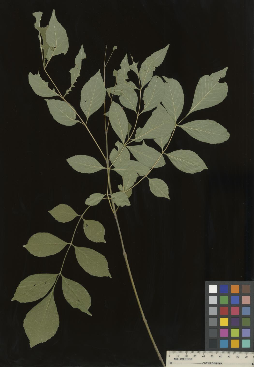 | | 2022 | COLLECTED | 09/02/2022 | Oak Creek Canyon, approximately five miles north-northeast of Sedona in the Coconino National Forest. T18N R6E NE 1/4 NW 1/4 Sec. 21 . | 34.93600300, -111.74436900 | 1464 | Floodplain and riverbanks, growing in gravely soil. | Wild material | Most of the velvet ash in this population are small trees (10-25 feet in height and approximately 5 inches DBH). Variation was noted for leaflet pubescence but with the petioles of all trees in the population being pubescent. | 2139669 | Ames 35907 |
| 74 | W6 60214 | NEWFS-754 | Lespedeza capitata Michx. | Rhode Island, United States | W6 | | | 2021 | | | | | | | Wild material | Drooping because top heavy. | 2138840 | W6 60214 |
| 75 | NA 88421 | CBG-10737 | Prunus americana Marshall | | NA |  | | 2021 | | | | | | | Wild material | Spatially discreet collection for a clonal species. Counts made approximately every 6 feet. Fruits collected from the plant and the ground. | 2137989 | NA 88421 |
| 76 | NA 88320 | CBG-10190 | Hydrangea arborescens L. | Illinois, United States | NA | | | 2021 | | | | | | | Wild material | | 2120058 | NA 88320 |
| 77 | NA 88332 | CBG-10580 | Hypericum prolificum L. | Illinois, United States | NA | | | 2021 | | | | | | | Wild material | Plant numbers sampled estimated. | 2120171 | NA 88332 |
| 78 | OPGC 8343 | CBG-10575 | Euthamia graminifolia (L.) Nutt. | Illinois, United States | OPGC | | | 2021 | | | | | | | Wild material | Plant numbers sampled estimated. | 2120166 | OPGC 8343 |
| 79 | W6 59243 | CBG-10560 | Cinna arundinacea L. | Illinois, United States | W6 | | | 2021 | | | | | | | Wild material | Plant numbers estimated. | 2120155 | W6 59243 |
| 80 | W6 59266 | CBG-10588 | Muhlenbergia sobolifera (Muhl. ex Willd.) Trin. | Illinois, United States | W6 | | | 2021 | | | | | | | Wild material | | 2120209 | W6 59266 |
| 81 | W6 59267 | CBG-10590 | Muhlenbergia glabrifloris Scribn. | Illinois, United States | W6 | | | 2021 | | | | | | | Wild material | Received as: Muhlenbergia glabriflora. Plant numbers sampled estimated. | 2120210 | W6 59267 |
| 82 | Ames 35667 | Kankakee Sands Preserve | Aronia ×prunifolia (Marshall) Rehder | Illinois, United States | NC7 |  | | 2021 | COLLECTED | 05/04/2021 | Kankakee Sands Preserve located approximately 2.3 miles southwest of Wilmington in Custer Township, T32N R9E NE 1/4 Sec. 11 | 41.27166000, -88.15701800 | 170 | Sand shrub prairie | Wild material | Genotypes noted in nature were averaging 5.0-6.0' in height, relatively upright in growth habit and extremely dense suckering. Numerous clones noted covering expansive areas (e.g. 30 yards by 20 yards, etc.). Variation in branching and glossiness of leaves noted across genotypes present in nature. | 2115976 | Ames 35667 |
| 83 | Ames 35541 | NAO/MB/2020/01/53 | Monarda bradburiana L. C. Beck | Illinois, United States | NC7 |  | | 2020 | COLLECTED | 07/16/2020 | Eagle Point Bay area located at southwest portion of Lake of Egypt, T11S R2E NE1/4 Sec. 1 and T11S R2E NW1/4 Sec. 6, Johnson County | 37.59183900, -88.93008100 | 168 | Roadside, wooded rocky hillside. | Wild material | | 2106720 | Ames 35541 |
| 84 | WLP 1686 | APS/RS/2019/067/396 | Rosa setigera Michx. | Arkansas, United States | NA |  | | 2019 | COLLECTED | 11/07/2019 | Located near intersection of Smith Mountain Road and Newton County 8828 Road approximately 6.00 miles north of Deer, Newton County | 35.91212000, -93.21112000 | 636 | Roadside, upland with rocky soils | Wild material | | 2097789 | WLP 1686 |
| 85 | Ames 34433 | Bryantsburg Prairie | Salix humilis Marshall | Iowa, United States | NC7 |  | | 2019 | COLLECTED | 05/17/2019 | Bryantsburg Prairie located 2.75 miles south of Hazelton, T90N R9W SE ¼ SE ¼ NE ¼ Sec. 28. | 42.57794200, -91.90508100 | 298 | Native prairie remnant. | Wild material | Plants averaging 4.0-4.5 feet in height with extremely vigorous and densly flowered stems (no branching), perhaps a response due to management (e.g. burning and/or mowing). Estimated 25 ramets per genet. Some with pinkish/red fruiting capsules. | 2091749 | Ames 34433 |
| 86 | Ames 34348 | 3247 | Monarda punctata L. | Missouri, United States | NC7 |  | | 2018 | COLLECTED | 09/13/2018 | Illiniwek Village State Historic Site located approximately 2.90 miles northeast of Wayland, T65N R6W SE ¼ Sec. 16, Clark County. | 40.42887800, -91.55410100 | 161 | On flat open sand terrace. | Wild material | | 1967550 | Ames 34348 |
| 87 | NA 88425 | NCBG-738 | Rosa carolina L. | North Carolina, United States | NA |  | | 2018 | | | | | | | Wild material | Rosa carolina | 1966039 | NA 88425 |
| 88 | W6 54767 | NCBG-624 | Tridens flavus (L.) Hitchc. | North Carolina, United States | W6 |  | | 2018 | | | | | | | Wild material | Tridens flavus | 1965993 | W6 54767 |
| 89 | W6 54820 | NCBG-759 | Verbesina occidentalis (L.) Walter | Maryland, United States | W6 |  | | 2018 | | | | | | | Wild material | Verbesina occidentalis | 1966046 | W6 54820 |
| 90 | NA 88001 | MARSB-595 | Morella pensylvanica (Mirb.) Kartesz | New York, United States | NA |  | | 2018 | | | | | | | Wild material | | 1964805 | NA 88001 |
| 91 | NA 85021 | JDC/SS/2018/004/817 | Sapindus saponaria L. var. drummondii (Hook. & Arn.) L. D. Benson | Oklahoma, United States | NA |  | | 2018 | COLLECTED | 03/12/2018 | Private property approximately 4.8 miles southeast of Mulhall, north side of Cimarron River, T18N R2W, Logan County | 35.99972000, -97.39735900 | 210 | Transition zone between higher elevations and bottomlands. | Wild material | | 1957958 | NA 85021 |
| 92 | NA 85022 | JDC/SS/2018/008/821 | Sapindus saponaria L. var. drummondii (Hook. & Arn.) L. D. Benson | Oklahoma, United States | NA |  | | 2018 | COLLECTED | 03/13/2018 | Thurmond Ranch approximately 3.80 miles southwest of Cheyenne, T13N R24W, Roger Mills County | 35.59226100, -99.69600600 | 554 | Bottomlands and immediate higher elevations of Sergeant Major Creek and surrounding tributaries. | Wild material | | 1957959 | NA 85022 |
| 93 | NA 85024 | JDC/SS/2018/020/833 | Sapindus saponaria L. var. drummondii (Hook. & Arn.) L. D. Benson | Kansas, United States | NA |  | | 2018 | COLLECTED | 03/15/2018 | Private property approximately 3.65 miles north of Lake City on Cottonwood Creek and Sand Creek watersheds, T30S R14W, Barber County | 37.39995200, -98.84153900 | 593 | Cedar and elm woods. | Wild material | | 1957961 | NA 85024 |
| 94 | Ames 34038 | Ames 34038 | Monarda punctata L. | Illinois, United States | NC7 |  | | 2017 | COLLECTED | 10/29/2017 | Nachusa Grasslands located approximately 4.17 miles northwest of Franklin Grove just west of Lowden Road, T22N R10E NW 1/4 NW 1/4 SE 1/4 Sec. 16, Ogle County. | 41.89120000, -89.34490000 | 225 | Newly disturbed ground (fenceline installation 2015) consisting of almost level sandy soil with a very slight slope. | Wild material | Plants ranging between 16-22" in height, branched with numerous seed heads. | 1954327 | Ames 34038 |
| 95 | Ames 34024 | Ames 34024 | Monarda fistulosa L. | New Mexico, United States | NC7 |  | | 2017 | COLLECTED | 09/19/2017 | North of Cherry Creek Campground in the Gila National Forest along highway NM-15 (west side of road), T16S R13W Sec. 17, Grant County. | 32.91992700, -108.21901900 | 2105 | Roadside. Mixed habitat including woody and herbaceous vegetation. | Wild material | | 1953996 | Ames 34024 |
| 96 | Ames 34007 | JDC/PP/2017/052/806 | Pinus ponderosa P. Lawson & C. Lawson | Nebraska, United States | NC7 |  | | 2017 | COLLECTED | 08/29/2017 | Areas on both north and south sides of the Niobrara River between Long Pine and Springview, T32N R21W; T32N R20W; and T31N R21W in Brown and Keya Paha Counties. | 42.75716800, -99.74657300 | 685 | Dry, rocky ridgetops. | Wild material | Genetics represent the extreme eastern edgeo of the species native range. | 1953921 | Ames 34007 |
| 97 | WLP 2602 | JDC/TA/2017/053/807 | Tilia americana L. | Nebraska, United States | NA |  | | 2017 | COLLECTED | 08/29/2017 | Niobrara River Valley just 25.9 miles east, southeast of Valentine, T33N R23W Sec. 32 and Sec. 33. | 42.78284200, -100.05716700 | 658 | Floodplain and also base of adjacent bluffs/slopes (north-facing). | Wild material | Genetics represent the extreme western edge of the species native range. | 1953922 | WLP 2602 |
| 98 | Ames 34015 | Ames 34015 | Cornus rugosa Lam. | Minnesota, United States | NC7 | | | 2017 | COLLECTED | 08/23/2017 | Smoky Hills State Forest between Snellman and Osage, T139N R37W Sec. 2, 9, 11, and 14 and also T140N R37W Sec. 26 and 34. | 46.89278300, -95.35163300 | 501 | Mixed pine and deciduous moist woods. | Wild material | | 1953929 | Ames 34015 |
| 99 | Ames 33918 | APS/GD/2017/008/267 | Gymnocladus dioicus (L.) K. Koch | Minnesota, United States | NC7 |  | | 2017 | COLLECTED | 03/16/2017 | Minnesota River watershed covering approximately 9.0 river miles between Redwood Falls and Vicksburg Park, Renville County | 44.61447700, -95.14878600 | 254 | Mixed habitats, both upland dry sites, wet sites, and rocky sites. | Wild material | | 1946985 | Ames 33918 |
| 100 | WLP 1437 | NA 84027 | Oxydendrum arboreum (L.) DC. | Florida, United States | NA | | | 2016 | COLLECTED | 11/11/2016 | Woodlands associated with Miller Bayou, south of housing subdivision off of Pearl Court. | 30.46413000, -86.92804000 | 2 | Full sun to partial shade in mixed coniferous/broadleaved evergreen woodlands, with a mixture of deciduous plants in highly acidic sandy soils approximately 100-300 ft. from the salt marsh edge associated with Miller Bayou. | | | 1950372 | WLP 1437 |
| 101 | WLP 1181 | NA 83958 | Diospyros virginiana L. | Kentucky, United States | NA | | | 2016 | COLLECTED | 09/30/2016 | Daniel Boone National Forest, Natural Arch Scenic Area. | 36.84100000, -84.51200000 | 408 | Natural area park. | | | 1951334 | WLP 1181 |
| 102 | Ames 33229 | JDC/SO/2016/001/716 | Symphoricarpos orbiculatus Moench | Missouri, United States | NC7 | | | 2016 | COLLECTED | 01/13/2016 | Access road near Scobee Lake, NE 1/4 of NE 1/4 of Section 32, T64N R16W, approximately 10.5 miles northwest of Kirksville, Adair County. | 40.30655000, -92.71615200 | | | Wild material | Plants approximately 4 feet in height. Fruits red in color. Variation noted in fruits ranging from bright red to dark red in color. | 1936479 | Ames 33229 |
| 103 | WLP 1098 | JDC/CO/2015/030/686 | Cotinus obovatus Raf. | Arkansas, United States | NA |  | | 2015 | COLLECTED | 05/20/2015 | T18N R15W NW 1/4 Sec. 15 and SE 1/4 Sec. 10 Marion County. Hall Mountain area along County Road 6074. | 36.20574400, -92.56150900 | 239 | Rocky, very shallow soils. Growing in association with Quercus muehlenbergii, Juniperus virginiana, Acer saccharum, Cercis canadensis, Lindera benzoin, Diospyros virginiana, Silphium terebinthinaceum, Baptisia sp., Rudbeckia sp., and Rhus glabra. | Wild material | | 1926260 | WLP 1098 |
| 104 | NA 82643 | NA 82643 | Lonicera sempervirens L. | Texas, United States | NA | | | 2015 | COLLECTED | 07/20/2014 | East side of Texas Route 87 approximately 0.52 miles south of Trout Creek, Texas. | 30.61156000, -93.80506000 | 21 | Southwest-facing edge of mature woodland in part to full sun; well-drained, seasonally moist soils that are sandy loam; surface has an excellent organic litter layer. | | | 1952603 | NA 82643 |
| 105 | W6 48905 | MARSB-99 | Tridens flavus (L.) Hitchc. | Virginia, United States | W6 |  | | 2015 | | | | | | | Wild material | | 1922891 | W6 48905 |
| 106 | WLP 1253 | JDC/HQ/2014/090/592 | Hydrangea quercifolia W. Bartram | Alabama, United States | NA |  | | 2014 | COLLECTED | 09/23/2014 | Alabama: Lawrence County; Near Franklin and Lawrence County line off County Road 303. | 34.33701600, -87.52906200 | 332 | Growing in association with Quercus alba, Quercus montana, Cornus florida, Rhus glabra, Liriodendron tulipifera, Pinus virginiana, Pinus sp., Acer rubrum, and Frangula alnus. | Wild material | Some specimens with infructescences averaging 12" in length. | 1922364 | WLP 1253 |
| 107 | Ames 31987 | APS/GD/2013/011/096 | Gymnocladus dioicus (L.) K. Koch | Kansas, United States | NC7 |  | | 2013 | COLLECTED | 02/20/2013 | Camp Wood, near Cottonwood River, south of Elmdale, NW 1/4 of Section 3, T20S R7E, Chase County. | 38.34698100, -96.65080500 | 377 | Samples obtained from both upland, rocky and floodplain habitat. | Wild material | | 1907540 | Ames 31987 |
| 108 | Ames 30599 | JDC/FA/2010/031/301 | Fraxinus americana L. | Kansas, United States | NC7 |  | | 2010 | COLLECTED | 09/13/2010 | Near Big Sugar Creek watershed, east of Centerville, Linn County. | 38.21145000, -94.93801000 | 294 | Upland areas. Variable aspects. | Wild material | | 1848894 | Ames 30599 |
| 109 | WLP 809 | JDC/CS/2010/033/303 | Celastrus scandens L. | Kansas, United States | NA |  | | 2010 | COLLECTED | 09/14/2010 | Along Marshall Road, just north of Shaw, Neosho County. | 37.66917000, -95.31584000 | 295 | Associated with Cornus drummondii, Juniperus virginiana, Liatris aspera, Maclura pomifera, Prunus serotina, Rhus glabra, and Ulmus. | Wild material | | 1848888 | WLP 809 |
| 110 | Ames 30481 | APS/GD/2010/001/036 | Gymnocladus dioicus (L.) K. Koch | Missouri, United States | NC7 |  | | 2010 | COLLECTED | 02/17/2010 | Mark Twain Lake Project (Army Corp of Engineers), Mark Twain Lake, T54N R8W SE 1/4 of NW 1/4 of Section 2 and west 1/2 of Sec. 11, Florida Quad, Monroe County. | 39.49270000, -91.76510000 | 199 | Northwest-facing bluff; woods. | Wild material | #106 measured 14.5" d.b.h and 70-80'; #107 measured 9.5" and 70-80'; #108 measured 11" d.b.h. and 60-70'; #109 measured 9.5" d.b.h. and 40-50'; #110 measured 11" d.b.h. at 30-40'; and #111 measured 6" d.b.h. and 30'. | 1831340 | Ames 30481 |
| 111 | Ames 30489 | APS/GD/2010/010/045 | Gymnocladus dioicus (L.) K. Koch | Kentucky, United States | NC7 |  | | 2010 | COLLECTED | 02/22/2010 | Yellowbank Wildlife Management Area, near Lick Run Creek, on Ammons Church Road and slope on Jays Lane, north of Ammons, Breckinridge County. | 37.96060000, -86.49880000 | 130 | Northeast-facing slope. | Wild material | #148 measured 16.5" d.b.h. and 100', #149 measured 14.5" d.b.h. and 90', #150 measured 16" d.b.h. and 90', and #151 measured 18" d.b.h. and 80'. | 1831348 | Ames 30489 |
| 112 | Ames 30133 | JDC/CD/2009/063/213 | Cornus drummondii C. A. Mey. | Illinois, United States | NC7 |  | | 2009 | COLLECTED | 09/25/2009 | Four Corners Road, north from Illinois Highway 84, NW 1/4 of SW 1/4 of Section 36, T26N, R2E, Blackhawk (IL-IA) Quad, Jo Daviess County. | 42.20027778, -90.22944444 | 194 | Roadside in fence row. | Wild material | | 1819714 | Ames 30133 |
| 113 | Ames 30153 | JDC/FP/2009/062/212 | Fraxinus pennsylvanica Marshall | Illinois, United States | NC7 |  | | 2009 | COLLECTED | 09/25/2009 | Four Corners Road, north from Illinois Highway 84, NW 1/4 of SW 1/4 of Section 36, T26N, R2E, Blackhawk (IL-IA) Quad, Jo Daviess County. | 42.20027778, -90.22944444 | 194 | Roadside in fence row. | Wild material | | 1819734 | Ames 30153 |
| 114 | Ames 30167 | JDC/PT/2009/061/211 | Ptelea trifoliata L. | Illinois, United States | NC7 |  | | 2009 | COLLECTED | 09/24/2009 | Rock Cut State Park along Hart Road; SE 1/4 of SE 1/4 of Section 21, T45N, R2E, Rockford North Quad. | 42.35500000, -89.00083333 | 254 | Roadside. | Wild material | | 1819748 | Ames 30167 |
| 115 | Ames 29974 | JDC/GD/2009/003/153 | Gymnocladus dioicus (L.) K. Koch | Iowa, United States | NC7 |  | | 2009 | COLLECTED | 03/19/2009 | Stone State Park, just northwest of Sioux City, T89N R48W west 1/2 of Sec. 1 and east 1/2 of Sec. 2 Sioux City Quad., extreme northwest corner of Woodbury County. | 42.55805556, -96.46861111 | 390 | Variable-wet bottomland and dry slopes; a few small creeks with running water. Variable exposure. 0-45 degrees of slope with southern and eastern aspects. | Wild material | Plants between 40 and 65 feet in height and 6 to 17 inches DBH. | 1798766 | Ames 29974 |
| 116 | Ames 29628 | JDC/FA/2008/029/099 | Fraxinus americana L. | Missouri, United States | NC7 |  | | 2008 | COLLECTED | 10/06/2008 | Rudolf Bennitt Conservation Area, NE 1/4 of NE 1/4 of Section 25, T52N, R14W, Renick Quad, Randolph County. | 39.27527778, -92.43388889 | 256 | | Wild material | Original specimens ranged from 6-10 inches d.b.h. and 30-50 feet in height. Reddish-orange fall color more apparent in males. | 1788183 | Ames 29628 |
| 117 | Ames 29885 | 174525 | Cercocarpus montanus Raf. | Colorado, United States | NC7 |  | | 2005 | COLLECTED | 08/19/2002 | Central shortgrass prairie. Jefferson County. Apex Gulch, US Highway 40 at County Road 93. Jefferson County Open Space. | 39.71361000, -105.21722000 | 1982 | Foothills. | Wild material | Shrub 1.5-1.8 meters tall. | 1673952 | Ames 29885 |
| 118 | WLP 770 | 25 | Celastrus scandens L. | Iowa, United States | NA | | | 2003 | COLLECTED | 09/22/2003 | Along Gate House Trail, Lacey-Keosauqua State Park, Keosauqua, T68N R10W, S edge of NE 1/4 of NW 1/4, Section 3, Keosauqua Quad, Van Buren County. | 40.72194444, -91.99861111 | 203 | Woody invaders to old field setting. 2/3 sunny. Slight slope. Associated with Cornus drummondii, Viburnum lentago, Prunus serotina, Aster pilosus, Rhus glabra, and Rosa multiflora. | Wild material | Climbing vine. | 1649666 | WLP 770 |
| 119 | WLP 1332 | 9 | Lonicera reticulata Raf. | Iowa, United States | NA |  | | 2003 | COLLECTED | 09/14/2003 | Parking area for ford, South Bear Creek Wildlife Area, Highlandville, T100N R7W, NE 1/4 of NE 1/4, Section 35, Highlandville Quad, Winneshiek County. | 43.44083333, -91.64722222 | 274 | Edge of parking area, floodplain. Half sunny. No slope with an eastern aspect. Alluvial soil. Associated with Juglans nigra, Ulmus, Acer negundo, Xanthoxylum, and Rhus glabra. | Wild material | One large, very attractive vine ~14 feet tall, climbing up a Juglans nigra tree. | 1649461 | WLP 1332 |
| 120 | WLP 769 | NA 73812 | Celastrus scandens L. | Iowa, United States | NA |  | | 2003 | COLLECTED | 09/14/2003 | Quandahl Road, Bear Creek Wildlife Area, Highlandville, T100N R7W, NE 1/4 of NW 1/4, Section 36, Dorchester Quad, Winneshiek County. | 43.44055556, -91.62388889 | 268 | Mostly sunny. Steep slope with a southeastern aspect. Thin soil over limestone with high stoniness, well drained. Associated with Juniperus communis, J. virginiana, Ulmus rubra, Lespedeza capitata, Monarda fistulosa, and Rhus glabra. | Wild material | Vine to 4 meters tall. | 1649454 | WLP 769 |