| 0 | PI 662030 | Index Seminum 3 | Rhus typhina L. | Connecticut, United States | NC7 | | | 2003 | COLLECTED | 10/13/2002 | Hartford County | 42.00944444, -72.71638889 | 64 | Acid mixed deciduous and broadleaf evergreen woods. | Wild material | | 1645382 | PI 662030 |
| 1 | PI 649737 | 02-005 | Rhus typhina L. | Minnesota, United States | NC7 | | | 2003 | COLLECTED | 2002 | Just southeast of Lyndale, Hennepin County | 44.98250000, -93.73166667 | 290 | Along trail converted from abandoned railroad. | Wild material | | 1644321 | PI 649737 |
| 2 | PI 662029 | Index Seminum 2 | Rhus typhina L. | Ontario, Canada | NC7 | | | 2002 | COLLECTED | 08/2001 | Niagara Glen, Niagara Falls | 43.13149700, -79.06038300 | 160 | Clay loam soil on limestone bedrock. USDA Zone 6b. | Wild material | | 1639233 | PI 662029 |
| 3 | PI 662028 | Index Seminum 4 | Rhus typhina L. | Ontario, Canada | NC7 | | | 2000 | COLLECTED | PRE 12/1999 | East of Stoney Point, Tilbury North Township, Essex County | 42.30000000, -82.53333333 | 180 | Railroad ditch. | Wild material | | 1599822 | PI 662028 |
| 4 | PI 658653 | Index Seminum 43 | Rhus typhina L. | Pennsylvania, United States | NC7 | | | 1993 | COLLECTED | | Chester County | 39.73333333, -75.93333333 | 120 | Edge of clearing, Chrome Serpentine Barrens, Piedmont Province. | Wild material | | 1086006 | PI 658653 |
| 5 | PI 658652 | Index Seminum 8 | Rhus typhina L. | Ontario, Canada | NC7 | | | 1993 | COLLECTED | | Metro Toronto | 43.81666667, -79.18333333 | 125 | Edge of forest. Clay-loam soil. | Wild material | | 1085953 | PI 658652 |
| 6 | W6 60223 | NEWFS-779 | Rhus typhina L. | Massachusetts, United States | W6 | | | 2021 | | | | | | | Wild material | Received as: Rhus hirta. Leaves in a single horizontal plane inflorescence reddish and touching may cause numbness stems and branches densely pubescent and velvety . | 2138849 | W6 60223 |
| 7 | W6 60329 | NEWFS-935 | Rhus typhina L. | Massachusetts, United States | W6 | | | 2021 | | | | | | | Wild material | Upper branches and stems velvety fruit, a drupe enclosed in red pubescence. Sap thick, milky and irritating to the skin. | 2138955 | W6 60329 |
| 8 | W6 60101 | NEWFS-165 | Rhus typhina L. | Massachusetts, United States | W6 | | | 2021 | | | | | | | Wild material | Hairy fruit and stems. Received as: Rhus hirta. | 2137186 | W6 60101 |
| 9 | W6 60131 | NEWFS-464 | Rhus typhina L. | Massachusetts, United States | W6 | | | 2021 | | | | | | | Wild material | | 2137216 | W6 60131 |
| 10 | W6 57432 | NEWFS-509 | Rhus typhina L. | Massachusetts, United States | W6 |  | | 2019 | | | | | | | Wild material | | 2098229 | W6 57432 |
| 11 | W6 57327 | NEWFS-117 | Rhus typhina L. | Massachusetts, United States | W6 |  | | 2019 | | | | | | | Wild material | | 2098124 | W6 57327 |
| 12 | W6 56129 | NEWFS-146 | Rhus typhina L. | Massachusetts, United States | W6 |  | | 2019 | | | | | | | Wild material | | 1976164 | W6 56129 |
| 13 | W6 56135 | NEWFS-165 | Rhus typhina L. | Massachusetts, United States | W6 |  | | 2019 | | | | | | | Wild material | | 1976170 | W6 56135 |
| 14 | W6 56201 | NEWFS-376 | Rhus typhina L. | New Hampshire, United States | W6 |  | | 2019 | | | | | | | Wild material | | 1976236 | W6 56201 |
| 15 | W6 56235 | NEWFS-464 | Rhus typhina L. | Massachusetts, United States | W6 |  | | 2019 | | | | | | | Wild material | | 1976270 | W6 56235 |
| 16 | W6 56247 | NEWFS-511 | Rhus typhina L. | New Hampshire, United States | W6 |  | | 2019 | | | | | | | Wild material | | 1976282 | W6 56247 |
| 17 | W6 56297 | NEWFS-707 | Rhus typhina L. | Massachusetts, United States | W6 |  | | 2019 | | | | | | | Wild material | | 1976332 | W6 56297 |
| 18 | W6 56319 | NEWFS-779 | Rhus typhina L. | Massachusetts, United States | W6 |  | | 2019 | | | | | | | Wild material | | 1976354 | W6 56319 |
| 19 | W6 56324 | NEWFS-841 | Rhus typhina L. | Massachusetts, United States | W6 |  | | 2019 | | | | | | | Wild material | | 1976359 | W6 56324 |
| 20 | Ames 33232 | Index Seminum 9 | Rhus typhina L. | Michigan, United States | NC7 | | | 2016 | COLLECTED | 10/23/2014 | Along Woodbury Road, Rose Lake State Wildlife Research Area, T5N R1E Sec. 20, Shiawassee County | 42.81640000, -84.35390000 | 257 | Old flooded field. | Wild material | | 1936482 | Ames 33232 |
| 21 | Ames 33731 | MARSB-070 | Rhus typhina L. | Pennsylvania, United States | NC7 | 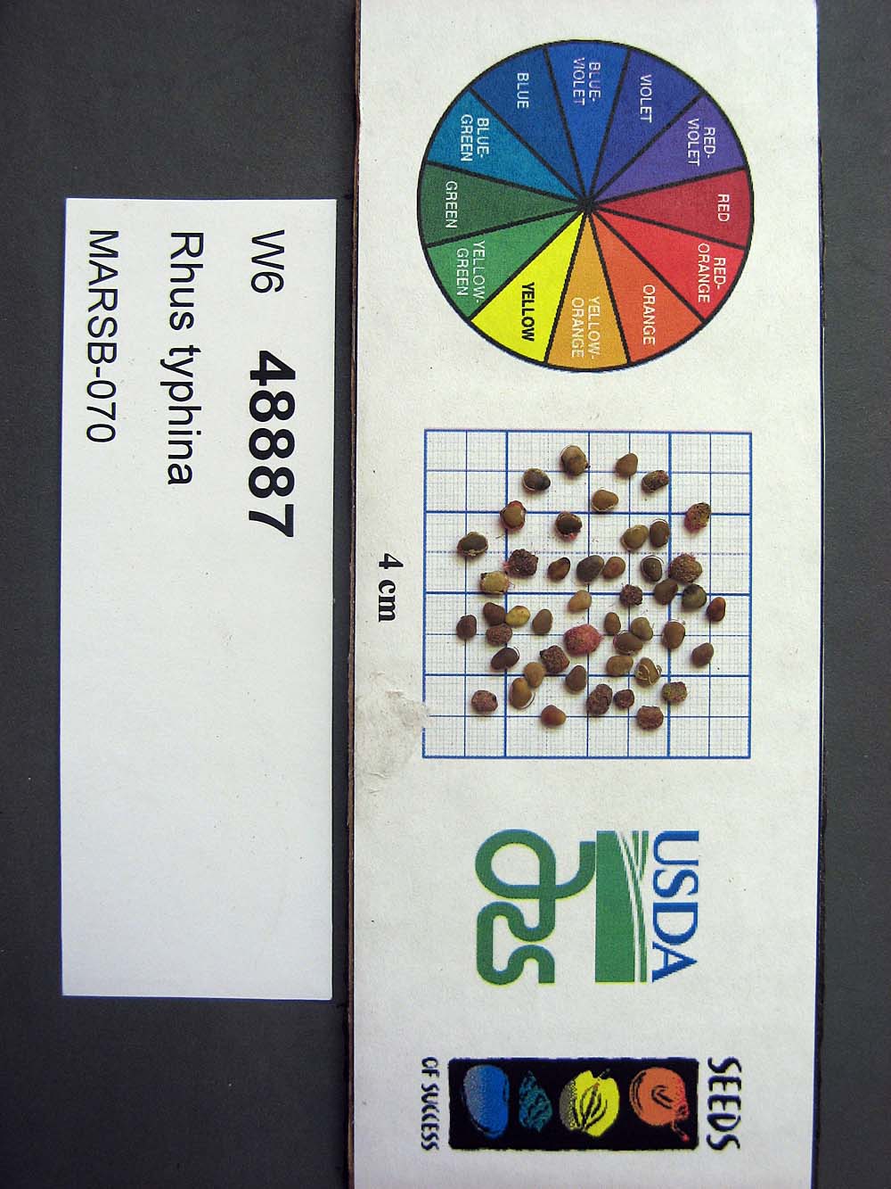 | | 2015 | COLLECTED | 08/22/2013 | Tioga State Forest near Arnot, Tioga County | 41.63745000, -77.21233000 | 1280 | | Wild material | | 1922876 | Ames 33731 |
| 22 | Ames 33732 | MARSB-078 | Rhus typhina L. | Pennsylvania, United States | NC7 |  | | 2015 | COLLECTED | 09/08/2013 | Allegheny National Forest between Warren and Bradford - Route 59, McKean County | 41.85943000, -78.91113000 | 2101 | | Wild material | | 1922877 | Ames 33732 |
| 23 | Ames 30392 | JDC/RT/2009/099/249 | Rhus typhina L. | Ohio, United States | NC7 |  | | 2009 | COLLECTED | 10/16/2009 | Deans State Forest, near Bartles, T3N R17W NE 1/4 of NE 1/4 of Sec. 27, Pedro Quad, Lawerence County | 38.70027778, -82.63333333 | 298 | High elevation. Underground seep present. | Wild material | | 1823944 | Ames 30392 |
| 24 | Ames 30393 | JDC/RT/2009/115/265 | Rhus typhina L. | Ohio, United States | NC7 |  | | 2009 | COLLECTED | 10/19/2009 | Along West Oak Hickory Trail, 0.5 mile southeast of Driver and Smoky Road intersection, Edison Woods, Berlin Heights Quad, Erie County | 41.35138889, -82.47722222 | 205 | | Wild material | | 1823945 | Ames 30393 |
| 25 | Ames 30168 | JDC/RT/2009/029/179 | Rhus typhina L. | Wisconsin, United States | NC7 |  | | 2009 | COLLECTED | 09/21/2009 | Near Big Rock Branch Creek, Irish Hollow Road, T7N R1E SW 1/4 of NE 1/4 of Sec. 31, Highland West Quad, Iowa County | 43.04163300, -90.41766700 | 289 | Roadside. Steep (45%) south facing slope. | Wild material | | 1819749 | Ames 30168 |
| 26 | Ames 29853 | 606-2008 | Rhus typhina L. | New York, United States | NC7 | | | 2009 | COLLECTED | 10/09/2008 | Along New York State Route 73, just above north fork of Bouquet River, Keene Valley, Essex County | 44.10805556, -73.69722222 | 373 | Edge of road. Full sun. | Wild material | Many stemmed mass. 3.7 meters in height. Leaves orange-red in color. | 1795813 | Ames 29853 |
| 27 | Ames 29841 | RL 105 | Rhus typhina L. | North Carolina, United States | NC7 | | | 2008 | COLLECTED | 10/15/2006 | Elk Mountain, west of Bull Gap and north of Vance Birthplace Road, along old road to ridgetop. | 35.67010600, -82.47746900 | 938 | | Wild material | | 1794085 | Ames 29841 |
| 28 | Ames 29431 | RES021 | Rhus typhina L. | Michigan, United States | NC7 |  | | 2008 | COLLECTED | 10/21/2002 | Interstate 75 South rest area, north of exit 326, Cheboygan County | 45.65694444, -84.63861111 | 238 | Along the top ridge in grassy meadow, full sun, sandy soils | Wild material | | 1775545 | Ames 29431 |
| 29 | Ames 29432 | RES026 | Rhus typhina L. | Michigan, United States | NC7 |  | | 2008 | COLLECTED | 12/05/2002 | Along east side of Route 131 North, mile marker 109, Kent County | 43.27222222, -85.54166667 | 267 | East highway slope in open meadow, full sun, sandy soils | Wild material | This accession represents a small percentage (e.g. 5%) of specimens with somewhat glabrous branches with minor pubescence. Typically Rhus typhina is known for having densely hairy branches and fruits with dense red hairs. In comparison to other Rhus typhina, specimens of this accession seem to be minimally pubescent overall. During regeneration at NCRPIS in 2022, out of 60 specimens, 23 were female. Upright infructescences reached peak maturity at NCRPIS on 1 September (2022) and ranged in lenghth from 8-12" averaging 10.5". | 1775546 | Ames 29432 |
| 30 | Ames 29433 | RES029 | Rhus typhina L. | Michigan, United States | NC7 |  | | 2008 | COLLECTED | 12/05/2002 | Route 131 North at Little Muskegon River, Mecosta County | 43.47361111, -85.47777778 | 267 | Along the east highway slope, open meadow, full sun, sandy soils | Wild material | | 1775547 | Ames 29433 |
| 31 | Ames 29434 | RES031 | Rhus typhina L. | Michigan, United States | NC7 |  | | 2008 | COLLECTED | 12/06/2002 | Southwest corner of the junction of Route 31 South and Indian Hill Road, Benzie County | 44.66833333, -86.03916667 | 183 | Open site | Wild material | | 1775548 | Ames 29434 |
| 32 | Ames 29435 | RES051 | Rhus typhina L. | Michigan, United States | NC7 |  | | 2008 | COLLECTED | 10/19/2004 | West side of Route 37, adjacent to a pine plantation, north of Mesick, Wexford County | 44.48111111, -85.69722222 | 317 | Along the road, sandy soils | Wild material | | 1775549 | Ames 29435 |
| 33 | WLP 1614 | NA 75414 | Rhus typhina L. | North Carolina, United States | NA | | | 2006 | COLLECTED | 2004 | Elk Mountain; west of Bull Gap, and north of Vance Birthplace Road; along old road to ridgetop. | | 960 | | | | 1952584 | WLP 1614 |
| 34 | Ames 27311 | 18 | Rhus typhina L. | Iowa, United States | NC7 | | | 2003 | COLLECTED | 09/15/2003 | Edge of road, north side of creek, Bixby State Park, Edgewood, T91N R5W SE 1/4 of SW 1/4 of Sec. 23, Edgewood Quad, Clayton County | 42.67527778, -91.40111111 | 303 | Road edge. Mostly sunny. Slight slope with a southern aspect. | Wild material | Tall shrubs to 5 meters tall. | 1649468 | Ames 27311 |
| 35 | Ames 35752 | #476-477 | Rhus glabra L. | Iowa, United States | NC7 | 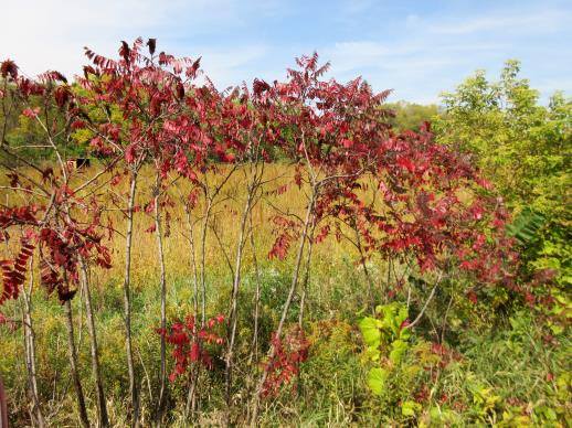 | | 2021 | COLLECTED | 09/29/2021 | Upper Iowa River area near Bluffton, T99N R9W NE1/4 Sec. 9 and S1/2 Sec. 10 | 43.40275000, -91.90494000 | 299 | High bluffs, roadside and stream banks | Wild material | Plants sampled in nature (29 September 2021) during peak fall color displaying bright reds to maroonish colors while measuring approximately 12-15 feet in height. One clonal patch noted was estimated to have 1,000+ ramets. | 2122093 | Ames 35752 |
| 36 | WLP 1619 | RL 08086 | Rhus ×pulvinata Greene | North Carolina, United States | NA | | | 2008 | COLLECTED | 09/11/2008 | North Carolina, Buncombe County, Along road leading to Elk Mountain summit ridge, east end, ca. 450 ft. from junction with Elk Mountain Scenic Hwy. | | | | Wild material | Rhus glabra x typhina | 1898077 | WLP 1619 |
| 37 | WLP 1613 | RL 099 | Rhus ×pulvinata Greene | North Carolina, United States | NA | | | 2006 | COLLECTED | 07/01/2004 | North Carolina, Buncombe County, Elk Mountain; west of Bull Gap, and north of Vance Birthplace Road; along old road to ridgetop. | | | | Wild material | Rhus glabra x typhina | 1898074 | WLP 1613 |
| 38 | PI 652983 | R. occidentalis Mentone late HDF-066 | Rubus occidentalis L. | Alabama, United States | COR |  | | 2007 | COLLECTED | 06/08/2007 | Dekalb County, Mentone (just east of Valley Head), between Linchpney Road and Route 117. Along edge of 117 for about 1.5 miles. | 34.57729000, -85.59305000 | 523 | Plants near or growing directly out of limestone cliff by roadside. Associated Plants: Ligustrum vulgare, Lonicera, Rhus typhina, Allium, Hermerocalis and Gleditsia. | Wild material | Kim Hummer, Michael Dossett collection from Alabama.
| 1730103 | PI 652983 |
| 39 | PI 653293 | R. occidentalis HDF-2007-032 | Rubus occidentalis L. | Georgia, United States | COR | | | 2007 | COLLECTED | 06/05/2007 | Near were William Bartram Trail crosses Warwoman Road, Warwoman Dell, about 4 miles east of Clayton, Rabun County. On slope down to the creek (Becky Branch) below. | 34.88280000, -83.35170000 | 595 | East facing slope, Associated Plants: Smilax bona-nox, Rhus typhina, Potentilla, Liriodendron tulipifera, Hydrangea arborescens, Lonicera japonica, Rhododendron, Sambucus canadensis and Vitis rotundifolia. | Wild material | Kim Hummer, Michael Dossett collection from Georgia.
| 1730092 | PI 653293 |
| 40 | PI 653296 | R. occidentalis HDF-2007-063 | Rubus occidentalis L. | Alabama, United States | COR |  | | 2007 | COLLECTED | 06/08/2007 | Dekalb County, Mentone (just east of Valley Head), between Linchpney Road and Route 117. Along edge of 117 for about 1.5 miles. | 34.57729000, -85.59305000 | 523 | Plants near or growing directly out of limestone cliff by roadside. Associated Plants: Ligustrum vulgare, Lonicera, Rhus typhina, Allium, Hermerocalis and Gleditsia. | Wild material | Kim Hummer, Michael Dossett collection from Alabama.
| 1730102 | PI 653296 |
| 41 | PI 653297 | R. argutus HD-2007-070 | Rubus argutus Link | Mississippi, United States | COR | | | 2007 | COLLECTED | 06/09/2007 | Marshall County, northwest of Potts Camp off route 178 onto George Mann Road onto Lake Shore Drive at a drainage ditch in the community of Lake Center. | 34.69310000, -89.36150000 | 120 | Open area in drainage ditch growing on the perimeter road of a lake. Associated Plants: Rhus typhina, Vitis rotundifolia, Pinus taeda, Salix sp., Lonicera japonica, Liquidambar styraciflua and Acer negundo. | Wild material | Kim Hummer, Michael Dossett collection from Mississippi.
| 1730104 | PI 653297 |
| 42 | PI 653298 | R. occidentalis HD-2007-046 | Rubus occidentalis L. | Georgia, United States | COR | | | 2007 | COLLECTED | 06/06/2007 | Dawson County, about 10 miles west of Dahlonega on route 52, near house number 4121 | 34.54920000, -84.09903000 | 485 | Along roadside and powerline right-of-way on steep slope. Associated Plants: Rubus argutus, Plantago major, Quinopodium alba, Rhus radicans, Rhus typhina and Daccus carrota. | Wild material | Kim Hummer, Michael Dossett collection from Georgia.
| 1730105 | PI 653298 |
| 43 | PI 657221 | V. corymbosum Zebulon | Vaccinium corymbosum L. | North Carolina, United States | COR | 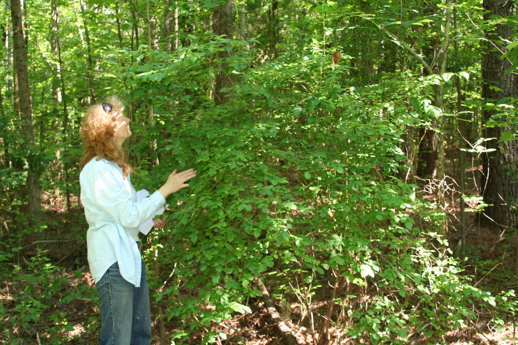 | | 2007 | COLLECTED | 06/01/2007 | Zebulon, Wake County. Near sewer right of way on North Worth Hinton Road (SR 2369). | 35.82683000, -78.33110000 | 90 | Organic duff over dark brown sandy soil. Associated with: Liquidambar styraciflua, Acer rubrum, Rhus typhina, Rubus argutus, Pinus palustris and Liriodentdron tulipfera. Near sewer right of way, at edge of dark hardwood forest. | Wild material | Kim Hummer, Michael Dossett collected from North Carolina.
| 1730106 | PI 657221 |
| 44 | W6 62550 | FWS0502-102 | Eutrochium fistulosum (Barratt) E. E. Lamont | Pennsylvania, United States | W6 |  | | 2025 | | | | | | | Wild material | Stem hollow at base | 2192248 | W6 62550 |
| 45 | NA 88549 | RJLSEUS2022-022 | Rhododendron minus Michx. var. minus | Georgia, United States | NA | | | 2023 | COLLECTED | 12/10/2022 | East side of Georgia State Hwy. 39, on the south side of Kolomoki Creek approximately 11 kilometers south of Fort Gaines, Georgia. Common on this site, but otherwise infrequent. This species is near the southernmost end of its natural range. | 31.52053400, -85.02351600 | 53 | Plants are growing in part-shade to shade of deciduous upland, dry, deciduous woodlands on steep slopes 10-15 meters above Kolomoki Creek.
Soils: The underlying geology of this area is of Paleocene origin and characterized as Tuscahoma Sand. As mapped this formation includes lower Eocene Bashi Marl Member of the Hatchetigbee Formation. This formation consists of light-gray to light-olive-gray laminated and thin-bedded carbonaceous silt and clay interbedded with fine sand; thin lignite beds occur locally. Lower part of the formation includes beds of fossiliferous, glauconitic fine quartz sand containing spheroidal sandstone concretions, gravel and clay pebbles.
Source: USGS Georgia Geologic Map Data (https://mrdata.usgs.gov/geology/state/sgmc-unit.php?unit=GANu%3B1)
The primary soil types in the collection area are classified as Ailey-Cowarts Complex Series soils (8 to 25 percent slopes). The Ailey Series consists of well drained or somewhat excessively drained soils formed by fluviomarine and marine deposits. These soils are found marine terraces and low hills of the upper coastal plain and sandhills; they are strongly acidic. The Cowarts Series consists of very deep, moderately well and well drained soils on ridge tops and side slopes on uplands of the Coastal Plain Major Land Resource Area. They formed in loamy marine sediments. Slopes range from 1 to 60 percent.
Source: NRCS Web Soil Survey (https://websoilsurvey.sc.egov.usda.gov/App/WebSoilSurvey.aspx) | Wild material | | 2140776 | NA 88549 |
| 46 | NA 88550 | RJLSEUS2022-023 | Kalmia latifolia L. | Georgia, United States | NA | | | 2023 | COLLECTED | 12/10/2022 | East side of Georgia State Hwy. 39, on the south side of Kolomoki Creek approximately 11 kilometers south of Fort Gaines, Georgia. Common on this site, but otherwise infrequent. This species is near the southernmost end of its natural range. | 31.52053400, -85.02351600 | 53 | Plants are growing in part-shade to shade of deciduous upland, dry, deciduous woodlands on steep slopes 10-15 meters above Kolomoki Creek.
Soils: The underlying geology of this area is of Paleocene origin and characterized as Tuscahoma Sand. As mapped this formation includes lower Eocene Bashi Marl Member of the Hatchetigbee Formation. This formation consists of light-gray to light-olive-gray laminated and thin-bedded carbonaceous silt and clay interbedded with fine sand; thin lignite beds occur locally. Lower part of the formation includes beds of fossiliferous, glauconitic fine quartz sand containing spheroidal sandstone concretions, gravel and clay pebbles.
Source: USGS Georgia Geologic Map Data (https://mrdata.usgs.gov/geology/state/sgmc-unit.php?unit=GANu%3B1)
The primary soil types in the collection area are classified as Ailey-Cowarts Complex Series soils (8 to 25 percent slopes). The Ailey Series consists of well drained or somewhat excessively drained soils formed by fluviomarine and marine deposits. These soils are found marine terraces and low hills of the upper coastal plain and sandhills; they are strongly acidic. The Cowarts Series consists of very deep, moderately well and well drained soils on ridge tops and side slopes on uplands of the Coastal Plain Major Land Resource Area. They formed in loamy marine sediments. Slopes range from 1 to 60 percent.
Source: NRCS Web Soil Survey (https://websoilsurvey.sc.egov.usda.gov/App/WebSoilSurvey.aspx) | Wild material | | 2140777 | NA 88550 |
| 47 | NA 88409 | NEWFS-844 | Morella caroliniensis (Mill.) Small | Massachusetts, United States | NA | | | 2021 | | | | | | | Wild material | Drupes have a bluish waxy coating that rubs off; glossy entire leaves, aromatic. | 2115750 | NA 88409 |
| 48 | OPGC 8227 | NEWFS-840 | Euthamia graminifolia (L.) Nutt. | Massachusetts, United States | OPGC | | | 2021 | | | | | | | Wild material | Leaves alternate, linear, with three conspicuous veins. Composite flowers are flat-headed. | 2115747 | OPGC 8227 |
| 49 | W6 58739 | NEWFS-521 | Scirpus cyperinus (L.) Kunth | New Hampshire, United States | W6 | | | 2021 | | | | | | | Wild material | | 2115678 | W6 58739 |
| 50 | W6 58810 | NEWFS-843 | Schizachyrium scoparium (Michx.) Nash | Massachusetts, United States | W6 | | | 2021 | | | | | | | Wild material | Fruits spaced along grass stalk, with white hairs. | 2115749 | W6 58810 |
| 51 | WLP 2044 | MARSB-1013 | Viburnum dentatum L. | New York, United States | NA | | | 2019 | COLLECTED | 08/29/2019 | Sullivan County; Livingston Manor; Debruce Rd, Livingston Manor. | | 488 | Growing in full sun in moist clay-loam soil. | | Seeds collected from 20+ individuals in a population of 20+ individuals, growing over an area 100 meters by 100 meters in size. Scattered distribution. Seed maturation: late. | 2109193 | WLP 2044 |
| 52 | OPGC 7961 | NEWFS-778 | Solidago rugosa Mill. | Massachusetts, United States | OPGC |  | | 2019 | | | | | | | Wild material | | 2098242 | OPGC 7961 |
| 53 | Ames 34606 | JDC/MB/2019/011/890 | Monarda brevis (Fosberg & Artz) Floden | West Virginia, United States | NC7 |  | | 2019 | | | | | | | Wild material | Variation in flower color present from near white, faint pink to faint "smoky" purple. Majority of specimens noted at collection site in nature were approximately 3-5 days past peak flower on 10 June 2019 with seeds reaching maturity approximately 55 days later. Majority of specimens observed were approximately 10" in height. Very healthy, dark-green leaves that maintained quality throughout the season (observed mid-August 2019). Some specimens consisting of 25-30 flowering stems encompassing a 1.5 sq. ft. area. | 2092642 | Ames 34606 |
| 54 | Ames 34607 | JDC/MB/2019/012/891 | Monarda brevis (Fosberg & Artz) Floden | West Virginia, United States | NC7 |  | | 2019 | | | | | | | Wild material | This accession likely represents the holotype for Monarda brevis that was vouchered by Lena Artz in 1953 (Catalog No. 2097485). Variation in flower color present from near white, faint pink to faint "smoky" purple. Majority of specimens noted at collection site in nature were approximately 3-5 days past peak flower on 10 June 2019 with seeds reaching maturity approximately 55 days later. Majority of specimens observed were apprxoimately 10" in height. Very healthy, dark-green leaves that maintained quality throughout the season (observed mid-August 2019). | 2092643 | Ames 34607 |
| 55 | W6 56183 | NEWFS-315 | Carex comosa Boott | New Hampshire, United States | W6 |  | | 2019 | | | | | | | Wild material | | 1976218 | W6 56183 |
| 56 | NA 88001 | MARSB-595 | Morella pensylvanica (Mirb.) Kartesz | New York, United States | NA |  | | 2018 | | | | | | | Wild material | | 1964805 | NA 88001 |
| 57 | NA 88204 | CBG-7297 | Ceanothus americanus L. | Wisconsin, United States | NA |  | | 2017 | | | | | | | Wild material | | 1954781 | NA 88204 |
| 58 | NA 87963 | NEWFS-365 | Morella caroliniensis (Mill.) Small | Connecticut, United States | NA |  | | 2017 | | | | | | | Wild material | | 1954710 | NA 87963 |
| 59 | W6 48814 | MARSB-115 | Aristida purpurascens Poir. | New Jersey, United States | W6 |  | | 2015 | | | | | | | Wild material | | 1922907 | W6 48814 |
| 60 | W6 48905 | MARSB-99 | Tridens flavus (L.) Hitchc. | Virginia, United States | W6 |  | | 2015 | | | | | | | Wild material | | 1922891 | W6 48905 |
| 61 | W6 48854 | MARSB-106 | Eragrostis spectabilis (Pursh) Steud. | New Jersey, United States | W6 |  | | 2015 | | | | | | | Wild material | | 1922916 | W6 48854 |
| 62 | W6 48902 | MARSB-114 | Tridens flavus (L.) Hitchc. | New Jersey, United States | W6 |  | | 2015 | | | | | | | Wild material | | 1922931 | W6 48902 |
| 63 | Ames 32822 | JDC/DL/2014/139/642 | Diervilla lonicera Mill. | Iowa, United States | NC7 |  | | 2014 | COLLECTED | 10/28/2014 | Clayton Road (C17) approximately 0.25 mile west of Kestrel Road, 1.50 miles east of Garnavillo on a steep north-facing slope T93N R3W near center of NW 1/4 Sec. 16 and also at the end of 250th Street approximatley 2.25 miles east of Garnavillo on a steep north, northwest-facing slope of Buck Creek watershed T93N R3W SE 1/4 SE 1/4 SE 1/4 Sec. 16 | 42.87344100, -91.20649600 | 264 | | Wild material | | 1921782 | Ames 32822 |
| 64 | WLP 1251 | JDC/HQ/2014/067/569 | Hydrangea quercifolia W. Bartram | Mississippi, United States | NA |  | | 2014 | COLLECTED | 09/21/2014 | Mississippi: Lafayette County; Holly Springs National Forest along County Road 244. | 34.51468900, -89.45669300 | 132 | Deciduous woods. Higher elevation than surrounding area. East, northeast-facing 45 degree slope. Growing in association with Cornus florida, Nyssa sylvatica, Quercus alba, Pinus sp., Liquidambar styraciflua, Juniperus virginiana, Carya tomentosa, and Rhus typhina. | Wild material | Numerous specimens. Attractive peeling bark and large (10" long) infructescences. | 1922345 | WLP 1251 |
| 65 | DPRU 3200 | JDC/PA/2014/082/584 | Prunus americana Marshall | Mississippi, United States | DAV | | | 2014 | COLLECTED | 09/22/2014 | Tishomingo County, Mississippi - Extreme northeast corner of Tishomingo County near J.P. Coleman S.P. | 34.98170000, -88.20449700 | 202 | Dry, pine-oak-hickory woods. Growing in association with Pinus sp., Liquidambar styraciflua, Fraxinus americana, Rhus typhina, Acer rubrum, Quercus stellata, and Carya sp. | Wild material | Fruits perfectly round, very ripe, and pinkish-red in color. Actively dropping at time of collection. The only specimens of this species noted during entire trip throughout northern Mississippi, parts of Arkansas, and northwest Alabama. There were two specimens a few feet from each other, but I suspect they were not genetically unique from each other due to the suckering nature of the species. Considering there was decent fruit production there must have been another Prunus sp. nearby. | 1921307 | DPRU 3200 |
| 66 | WLP 698 | BJP/AS/2014/003 | Amelanchier spicata (Lam.) K. Koch | Maine, United States | NA | | | 2014 | COLLECTED | 07/16/2014 | Roadside near the parking area for Bluberry Barrens (also known as Kennebunk Plains), ca. 4.5 miles west of Kennebunk. | 43.40231000, -70.62462000 | | Roadside, along shoulder of road. | Wild material | | 1922790 | WLP 698 |
| 67 | Ames 32760 | JDC/AB/2014/040/542 | Abies balsamea (L.) Mill. | Iowa, United States | NC7 | | | 2014 | COLLECTED | 09/03/2014 | Bluffton Fir State Preserve, near Bluffton, Winneshiek County. | 43.40106767, -91.90659200 | 326 | High quality, native woods. Steep slope, northwest-facing, and relatively flat portion on top of bluff (powerline) | Wild material | | 1921308 | Ames 32760 |
| 68 | Ames 31054 | 359 | Betula lenta L. | New York, United States | NC7 |  | | 2011 | COLLECTED | 09/11/2011 | Hurd Cross Road, Steuben County. | 42.04000000, -77.07900000 | 443 | Roadside. | Wild material | | 1891440 | Ames 31054 |
| 69 | Ames 31067 | 383 | Diervilla lonicera Mill. | Pennsylvania, United States | NC7 |  | | 2011 | COLLECTED | 09/16/2011 | Along Highway 219 just north of Ridgway | 41.43800000, -78.72300000 | 446 | Mixed hardwood forest. Steep (60 degrees) north-facing slope. | Wild material | | 1891453 | Ames 31067 |
| 70 | Ames 31073 | 695 | Fraxinus americana L. | New York, United States | NC7 |  | | 2011 | COLLECTED | 09/12/2011 | New Hudson Road, Allegany County. | 42.28600000, -78.24700000 | 574 | Roadside and field edges. | Wild material | | 1891459 | Ames 31073 |
| 71 | Ames 31080 | 708 | Fraxinus americana L. | Pennsylvania, United States | NC7 |  | | 2011 | COLLECTED | 09/17/2011 | PA 660, Tioga County. | 41.73500000, -77.33700000 | 500 | Roadside. South-facing slope. | Wild material | | 1891466 | Ames 31080 |
| 72 | Ames 31090 | 709 | Fraxinus pennsylvanica Marshall | Pennsylvania, United States | NC7 |  | | 2011 | COLLECTED | 09/17/2011 | Limerick Lane at Bear (or Bayer) Creek Road; Junction Cross Road at Bradshaw Road near Russel B. Walter Elementary School, Tioga County. | 41.92100000, -77.13400000 | 315 | Floodplain forest. | Wild material | | 1891476 | Ames 31090 |
| 73 | Ames 31101 | 373 | Spiraea alba Du Roi | New York, United States | NC7 |  | | 2011 | COLLECTED | 09/14/2011 | Beaver Meadow Brook Watershed, along Route 426, Chautauqua County | 42.03600000, -79.69900000 | 418 | Marsh | Wild material | | 1891487 | Ames 31101 |
| 74 | WLP 1054 | 362 | Cornus florida L. | New York, United States | NA |  | | 2011 | COLLECTED | 09/11/2011 | Cameron-North Jasper Road, Steuben County. | 42.20100000, -77.43300000 | 384 | Mixed, upland, hardwood forest. Associated with Carpinus caroliniana, Pinus strobus, Populus tremuloides, Prunus serotina, Rhus typhina, Quercus alba, Quercus velutina, Tilia americana, and Ulmus. | Wild material | | 1891448 | WLP 1054 |
| 75 | WLP 1222 | 384 | Hydrangea arborescens L. | Pennsylvania, United States | NA |  | | 2011 | COLLECTED | 09/16/2011 | Along Highway 219, Elk County. | 41.43800000, -78.72300000 | 422 | Mixed hardwood forest. Steep (60 degree) north-facing slope. Associated with Betula alleghaniensis, Diervilla lonicera, Fraxinus americana, Hypericum, Populus tremuloides, Rhododendron maximum, and Rhus typhina. | Wild material | | 1891479 | WLP 1222 |
| 76 | WLP 1653 | 382 | Rhododendron maximum L. | Pennsylvania, United States | NA |  | | 2011 | COLLECTED | 09/16/2011 | Along Highway 219, Elk County. | 41.43800000, -78.72300000 | 422 | Mixed hardwood forest. Steep (60 degree) north-facing slope. Associated with Betula alleghaniensis, Diervilla lonicera, Fraxinus americana, Hydrangea arborescens, Hypericum, Populus tremuloides, and Rhus typhina. | Wild material | | 1891485 | WLP 1653 |
| 77 | WLP 829 | 358 | Carpinus caroliniana Walter | New York, United States | NA | | | 2011 | COLLECTED | 09/11/2011 | Bixby Road, Chemung County. | 42.15900000, -76.65900000 | 440 | Roadside. Mixed, hardwood forest. Associated with Acer saccharum, Amelanchier, Fraxinus americana, Hamamelis virginiana, feral Malus, Parthenocissus quinquefolia, Populus tremuloides, and Rhus typhina. | Wild material | | 1891441 | WLP 829 |
| 78 | Ames 30681 | JDC/FP/2010/068/338 | Fraxinus pennsylvanica Marshall | Wisconsin, United States | NC7 |  | | 2010 | COLLECTED | 09/28/2010 | East side of Lower Turtle Lake, north of boat ramp on 4th Street, SE 1/4 of NE 1/4 of Section 34, T34N R14W, Almena Quad, east of Turtle Lake, Barron County. | 45.38861000, -92.07153000 | 358 | | Uncertain improvement status | | 1853839 | Ames 30681 |
| 79 | WLP 1423 | JDC/OA/2009/098/248 | Oxydendrum arboreum (L.) DC. | Ohio, United States | NA | | | 2009 | COLLECTED | 10/16/2009 | Ohio: Lawrence County; Deans State Forest, near Bartles, SE 1/4 of NE 1/4 of Section 27, T3N, R17W, Pedro Quad. | 38.69833333, -82.63222222 | 301 | High elevation. Steep (60%) slope, east-facing. Underground seep present. Associated with Acer rubrum, Cercis canadensis, Corylus americana, Juglans nigra, Quercus rubra, Rhus typhina, and Sassfras albidum. | Wild material | | 1823936 | WLP 1423 |
| 80 | Ames 29974 | JDC/GD/2009/003/153 | Gymnocladus dioicus (L.) K. Koch | Iowa, United States | NC7 |  | | 2009 | COLLECTED | 03/19/2009 | Stone State Park, just northwest of Sioux City, T89N R48W west 1/2 of Sec. 1 and east 1/2 of Sec. 2 Sioux City Quad., extreme northwest corner of Woodbury County. | 42.55805556, -96.46861111 | 390 | Variable-wet bottomland and dry slopes; a few small creeks with running water. Variable exposure. 0-45 degrees of slope with southern and eastern aspects. | Wild material | Plants between 40 and 65 feet in height and 6 to 17 inches DBH. | 1798766 | Ames 29974 |
| 81 | Ames 29861 | APS/GD/2009/002/011 | Gymnocladus dioicus (L.) K. Koch | Kansas, United States | NC7 |  | | 2009 | COLLECTED | 02/17/2009 | Trees 1-3: Woodson Cove Road, Holiday Hill area; Trees 4-5: Sandstone Campground; Tree 6: Campground 16, Toronto Point area; Tree 7: Lake Hills Road 400; Cross Timbers State Park, Toronto, extreme southwest corner of Woodson County. | 37.74277778, -95.91194444 | 290 | Trees 1-3: Wooded area. Flat; Trees 4-5: 20-30 yards from lake shore, east side of lake; Tree 6: Edge of wooded area, north side of Toronto Lake, Flat; Tree 7: Roadside ditch in a fence row. | Wild material | Trees 1-3: 5.5 to 7 inches d.b.h and 50 feet in height; Trees 4-5: 9 to 10.5 inches d.b.h. and 40 feet in height; Tree 6: 14 inches d.b.h. and 40 feet in height; Tree 7: 2 to 6 inches d.b.h. and 10 to 25 feet in height. | 1796426 | Ames 29861 |
| 82 | Ames 29848 | JDC/GD/2009/001/151 | Gymnocladus dioicus (L.) K. Koch | Minnesota, United States | NC7 |  | | 2009 | COLLECTED | 02/02/2009 | Minnesota River Watershed approximately 2-3 miles north-northeast of Le Sueur, NW 1/4 of NW 1/4 of Section 19, T112N, R25W, Tyrone Township, Le Sueur Quad, Le Sueur County. | 44.49833333, -93.88666667 | 238 | Floodplain/mesic woods adjacent to river. Majority found on lower slopes (20%, west facing) & where ravines met bottomland. Few found at higher elevation; dry ridge on slope (30%, south facing). | Wild material | Plant size ranged from approximately 40 to 90 feet in height and 36 to 60 d.b.h. | 1794565 | Ames 29848 |
| 83 | Ames 29210 | JDC-0242007 | Fraxinus americana L. | Maine, United States | NC7 |  | | 2007 | COLLECTED | 09/26/2007 | Approximately 1.5 miles southwest from Rumford Center on Highway 2, adjacent to the Androscoggin River, Oxford County. | 44.50111111, -70.63472222 | 189 | | Wild material | Approximately 60 feet in height. | 1743314 | Ames 29210 |