| 0 | NA 89081 | 2024RJLPA-009 | Rosa carolina L. | Pennsylvania, United States | NA | | | 2024 | COLLECTED | 09/22/2024 | Lancaster and York Counties: outcrops along the Susquehanna River, accessed from the Historic Lock 12 parking lot off of Pennsylvania Road 372. | 39.81483500, -76.32762200 | 34 | Plants are growing from part-sun to full sun in crevices of the outcrops and where organic debris has accumulated in between boulders along the Susquehanna River. The sites range from nearly xeric to dry mesic, at least on the surface. Plants are generally growing 4-10 m above the normal flow of the river; however, the Holtwood Dam is less than 1 kilometer upstream and debris found trapped in the boulders indicates that there is periodic flooding, at least, in the lower zone of 4+ meters or so above normal river flow. This habitat has a diverse assemblage of deciduous trees and shrubs as well as abundant herbaceous taxa. Slope: 0 to 60 percent. Aspect: Northeast (generally). Geology: The underlying geology of this area is probably of lower Paleozoic age and characterized as the Octoraro Formation. It includes albite-chlorite schist, phyllite, some hornblende gneiss, and granitized members. Soils: The area where this species occurs is right on the edge of two soil zones that transition from the river’s edge to mesic conditions upslope. The first is generally referred to as Rock Outcrop. This terrestrial matrix in which plants grow is largely exposed underlying rock geology with accumulated outwash, rock decomposition, and organic debris buildup. The second is Mt. Airy (80%) and Manor (20%) Series soils, 25 to 60 percent slopes, extremely stony (MRF). (Source: California Soil Resource Lab/NRCS Official Soil Series Descriptions). EPA Ecoregion (Level III): Northern Piedmont (64). EPA Ecoregion (Level IV): Piedmont Uplands (64c). | Wild material | | 2169045 | NA 89081 |
| 1 | W6 62108 | CBG-10943 | Rosa carolina L. | | W6 |  | | 2024 | | | | | | | | | 2168906 | W6 62108 |
| 2 | NA 88425 | NCBG-738 | Rosa carolina L. | North Carolina, United States | NA |  | | 2018 | | | | | | | Wild material | Rosa carolina | 1966039 | NA 88425 |
| 3 | WLP 1573 | GU 133 | Rosa carolina L. | Virginia, United States | NA | | | 1989 | COLLECTED | 09/29/1989 | George Washington National Forest, State Route 758, trail to Woodstock Tower, Powell Mountain. [Note: coordinates were not provided by the original collectors, and have been estimated based on the locality. The road referenced was originally listed as Forest Route 758.] | | 609 | Deciduous woodland, rocky soil. Elevation: 2000 feet. | Wild material | | 1496017 | WLP 1573 |
| 4 | WLP 1620 | RL 08199 | Rosa palustris Marshall | | NA | | | 2008 | COLLECTED | PRE 10/06/2008 | North Carolina, Henderson County, Along abandoned section of old Fanning Fields Road, Mills River, near stream crossing which joins McDowell Creek. | 35.42003000, -82.55346000 | | | Wild material | | 1896147 | WLP 1620 |
| 5 | PI 710500 | CBG-5006 | Strophostyles helvola (L.) Elliott | Illinois, United States | S9 | | | 2016 | | | | | | | Wild material | | 1942760 | PI 710500 |
| 6 | PI 659994 | mani | Arachis hypogaea L. subsp. fastigiata Waldron | Imbabura, Ecuador | S9 |  | | 1996 | COLLECTED | 08/23/1996 | Canton Ibarra, Parroquia La Carolina, Localidad Santa Rosa. Farm. | 0.80388889, -78.38583333 | 1050 | | Landrace | Pods strongly reticulated, humps, slight beak, 1-4 seeds per pod. Seeds brown, size medium. | 1531652 | PI 659994 |
| 7 | PI 616833 | F. virginiana subsp. virginiana NC 96-45-1 | Fragaria virginiana Mill. subsp. virginiana | South Carolina, United States | COR | | Out of Season | 1996 | COLLECTED | 07/20/1996 | Left roadside both north and south of Little River, 6.3 miles south of Clinton on SC 72, Laurens county, South Carolina. | 34.38694000, -81.94444000 | | Fragaria virginiana occasional on dry roadbanks over about 300 yards along road. Rosa carolina also associated with strawberry. | Wild material | USDA Sponsored plant collecting expedition, 1996 | 1535626 | PI 616833 |
| 8 | PI 616835 | F. virginiana subsp. virginiana NC 96-45-3 | Fragaria virginiana Mill. subsp. virginiana | South Carolina, United States | COR | | Out of Season | 1996 | COLLECTED | 07/20/1996 | Left roadside both north and south of Little River, 6.3 miles south of Clinton on SC 72, Laurens county, South Carolina. | 34.38694000, -81.94444000 | | Fragaria virginiana occasional on dry roadbanks over about 300 yards along road. Rosa carolina also associated with strawberry. | Wild material | USDA Sponsored plant collecting expedition, 1996 | 1535628 | PI 616835 |
| 9 | PI 616836 | F. virginiana subsp. virginiana NC 96-45-4 | Fragaria virginiana Mill. subsp. virginiana | South Carolina, United States | COR | | Out of Season | 1996 | COLLECTED | 07/20/1996 | Left roadside both north and south of Little River, 6.3 miles south of Clinton on SC 72, Laurens county, South Carolina. | 34.38694000, -81.94444000 | | Fragaria virginiana occasional on dry roadbanks over about 300 yards along road. Rosa carolina also associated with strawberry. | Wild material | USDA Sponsored plant collecting expedition, 1996 | 1535629 | PI 616836 |
| 10 | PI 616837 | F. virginiana subsp. virginiana NC 96-46-1 | Fragaria virginiana Mill. subsp. virginiana | South Carolina, United States | COR | | Out of Season | 1996 | COLLECTED | 07/20/1996 | Roadside on the right just above the Tyger River, 0.3 mile north of the town limits of Cross Anchor, on county road 56 , Spartonbury county, South Carolina. | 34.69167000, -81.83250000 | | One scattered colony of Fragaria virginiana growing on the dry shoulder of the road. Rosa carolina also on the site. Climbing milkweed between the site and the river. | Wild material | USDA Sponsored plant collecting expedition, 1996 | 1535630 | PI 616837 |
| 11 | Ames 36698 | Smith Cemetery NP | Echinacea simulata McGregor | Indiana, United States | NC7 |  | | 2025 | COLLECTED | 08/25/2025 | Smith Cemetery Nature Preserve located approximately 2.0 miles southwest of Perrysville on the southwest corner of SR 63 and a private lane, T18N R9W NE 1/4 NE 1/4 NE 1/4 Sec. 8. | 40.02625000, -87.45092000 | 167 | Prairie remnant (cemetery). | Wild material | Specimens at collection site in nature with drooping, pink to rose colored rays measuring 3.0-5.2 mm in width and 30.00-41.00 mm in length with bright yellow pollen. Plants measuring approximately 30" (762 mm) in height. Note: seed heads during threshing were extremely difficult to work with in order to extract seeds. | 2192821 | Ames 36698 |
| 12 | W6 62514 | FWS0300-104 | Spiraea alba Du Roi | Michigan, United States | W6 |  | | 2025 | | | | | | | Wild material | | 2192212 | W6 62514 |
| 13 | W6 62539 | FWS0300-154 | Liatris cylindracea Michx. | Michigan, United States | W6 |  | | 2025 | | | | | | | Wild material | The vegetative part of the population is likely dormant, though it is not possible to discern dormant individuals. Consequently, the above population size may be an underestimate. | 2192237 | W6 62539 |
| 14 | NA 89082 | 2024RJLPA-010 | Amorpha fruticosa L. | Pennsylvania, United States | NA | | | 2024 | COLLECTED | 09/22/2024 | Outcrops along the Susquehanna River, accessed from the Historic Lock 12 parking lot off of Pennsylvania Road 372. | 39.81481500, -76.32757900 | 34 | Plants are growing from part-sun to full sun in crevices of the outcrops and where organic debris has accumulated in between boulders along the Susquehanna River. The sites range from nearly xeric to dry mesic, at least on the surface. Plants are generally growing 4-10 m above the normal flow of the river; however, the Holtwood Dam is less than 1 kilometer upstream and debris found trapped in the boulders indicates that there is periodic flooding, at least, in the lower zone of 4+ meters or so above normal river flow. This habitat has a diverse assemblage of deciduous trees and shrubs as well as abundant herbaceous taxa. Slope: 0 to 25 percent. Aspect: Northeast (generally). Geology: The underlying geology of this area is probably of lower Paleozoic age and characterized as the Octoraro Formation. It includes albite-chlorite schist, phyllite, some hornblende gneiss, and granitized members. Soils: The area where this species occurs is right on the edge of two soil zones that transition from the river’s edge to mesic conditions upslope. The first is generally referred to as Rock Outcrop. This terrestrial matrix in which plants grow is largely exposed underlying rock geology with accumulated outwash, rock decomposition, and organic debris buildup. The second is Mt. Airy (80%) and Manor (20%) Series soils, 25 to 60 percent slopes, extremely stony (MRF). (Source: California Soil Resource Lab/NRCS Official Soil Series Descriptions). EPA Ecoregion (Level III): Northern Piedmont (64). EPA Ecoregion (Level IV): Piedmont Uplands (64c). | Wild material | | 2169046 | NA 89082 |
| 15 | NA 89083 | 2024RJLPA-012 | Rhododendron periclymenoides (Michx.) Shinners | Pennsylvania, United States | NA | | | 2024 | COLLECTED | 09/22/2024 | Outcrops along the Susquehanna River, accessed from the Historic Lock 12 parking lot off of Pennsylvania Road 372. | 39.81477400, -76.32807300 | 35 | Plants are growing from shade to part-sun and occasionally full sun in crevices of the outcrops and where organic debris has accumulated in between boulders along the Susquehanna River. The sites range from nearly xeric to mesic, at least on the surface. Plants are generally growing 4-10 m above the normal flow of the river; however, the Holtwood Dam is less than 1 kilometer upstream and debris found trapped in the boulders indicates that there is periodic flooding, at least, in the lower zone of 4+ meters or so above normal river flow. This habitat has a diverse assemblage of deciduous trees and shrubs as well as abundant herbaceous taxa. Slope: 0 to 60 percent. Aspect: Northeast (generally). Geology: The underlying geology of this area is probably of lower Paleozoic age and characterized as the Octoraro Formation. It includes albite-chlorite schist, phyllite, some hornblende gneiss, and granitized members. Soils: The area where this species occurs is right on the edge of two soil zones that transition from the river’s edge to mesic conditions upslope. The first is generally referred to as Rock Outcrop. This terrestrial matrix in which plants grow is largely exposed underlying rock geology with accumulated outwash, rock decomposition, and organic debris buildup. The second is Mt. Airy (80%) and Manor (20%) Series soils, 25 to 60 percent slopes, extremely stony (MRF). (Source: California Soil Resource Lab/NRCS Official Soil Series Descriptions). EPA Ecoregion (Level III): Northern Piedmont (64). EPA Ecoregion (Level IV): Piedmont Uplands (64c). | Wild material | | 2169047 | NA 89083 |
| 16 | NA 89084 | 2024RJLPA-013 | Physocarpus opulifolius (L.) Maxim. | Pennsylvania, United States | NA | | | 2024 | COLLECTED | 09/22/2024 | Outcrops along the Susquehanna River, accessed from the Historic Lock 12 parking lot off of Pennsylvania Road 372. | 39.81466300, -76.32833900 | 36 | Plants are growing from shade to part-sun where organic debris has accumulated in between boulders as well as further upslope in deeper mesic soils along the Susquehanna River. This habitat has a diverse assemblage of deciduous trees and shrubs as well as abundant herbaceous taxa. Slope: 10 to 25 percent. Aspect: Northeast (generally). Geology: The underlying geology of this area is probably of lower Paleozoic age and characterized as the Octoraro Formation. It includes albite-chlorite schist, phyllite, some hornblende gneiss, and granitized members. Soils: The area where this species occurs is right on the edge of two soil zones that transition from the river’s edge to mesic conditions upslope. The first is generally referred to as Rock Outcrop. This terrestrial matrix in which plants grow is largely exposed underlying rock geology with accumulated outwash, rock decomposition, and organic debris buildup. The second is Mt. Airy (80%) and Manor (20%) Series soils, 25 to 60 percent slopes, extremely stony (MRF). (Source: California Soil Resource Lab/NRCS Official Soil Series Descriptions). EPA Ecoregion (Level III): Northern Piedmont (64). EPA Ecoregion (Level IV): Piedmont Uplands (64c). | Wild material | | 2169048 | NA 89084 |
| 17 | NA 89085 | 2024RJLPA-014 | Rhododendron arborescens (Pursh) Torr. | Pennsylvania, United States | NA | | | 2024 | COLLECTED | 09/22/2024 | Outcrops along the Susquehanna River, accessed from the Historic Lock 12 parking lot off of Pennsylvania Road 372. | 39.81618100, -76.33069800 | 38 | Plants are growing from shade to part-sun and occasionally full sun in crevices of the outcrops and where organic debris has accumulated in between boulders along the Susquehanna River. The sites range from nearly xeric to mesic, at least on the surface. Plants are generally growing 4-10 m above the normal flow of the river; however, the Holtwood Dam is less than 1 kilometer upstream and debris found trapped in the boulders indicates that there is periodic flooding, at least, in the lower zone of 4+ meters or so above normal river flow. This habitat has a diverse assemblage of deciduous trees and shrubs as well as abundant herbaceous taxa. Slope: 0 to 75 percent. Aspect: Northeast (generally). Geology: The underlying geology of this area is probably of lower Paleozoic age and characterized as the Octoraro Formation. It includes albite-chlorite schist, phyllite, some hornblende gneiss, and granitized members. Soils: The area where this species occurs is right on the edge of two soil zones that transition from the river’s edge to mesic conditions upslope. The first is generally referred to as Rock Outcrop. This terrestrial matrix in which plants grow is largely exposed underlying rock geology with accumulated outwash, rock decomposition, and organic debris buildup. The second is Mt. Airy (80%) and Manor (20%) Series soils, 25 to 60 percent slopes, extremely stony (MRF). (Source: California Soil Resource Lab/NRCS Official Soil Series Descriptions). EPA Ecoregion (Level III): Northern Piedmont (64). EPA Ecoregion (Level IV): Piedmont Uplands (64c). | Wild material | | 2169049 | NA 89085 |
| 18 | NA 89086 | 2024RJLPA-015 | Ilex verticillata (L.) A. Gray | Pennsylvania, United States | NA | | | 2024 | COLLECTED | 09/22/2024 | Outcrops along the Susquehanna River, accessed from the Historic Lock 12 parking lot off of Pennsylvania Road 372. | 39.81656600, -76.33136600 | 38 | Plants are growing from part-sun to full sun in crevices of the outcrops and where organic debris has accumulated in between boulders along the Susquehanna River. The sites range from nearly xeric to dry mesic, at least on the surface. Plants are generally growing 4-10 m above the normal flow of the river; however, the Holtwood Dam is less than 1 kilometer upstream and debris found trapped in the boulders indicates that there is periodic flooding, at least, in the lower zone of 4+ meters or so above normal river flow. This habitat has a diverse assemblage of deciduous trees and shrubs as well as abundant herbaceous taxa. Slope: 0 to 10 percent. Aspect: Northeast (generally). Geology: The underlying geology of this area is probably of lower Paleozoic age and characterized as the Octoraro Formation. It includes albite-chlorite schist, phyllite, some hornblende gneiss, and granitized members. Soils: The area where this species occurs is right on the edge of two soil zones that transition from the river’s edge to mesic conditions upslope. The first is generally referred to as Rock Outcrop. This terrestrial matrix in which plants grow is largely exposed underlying rock geology with accumulated outwash, rock decomposition, and organic debris buildup. The second is Mt. Airy (80%) and Manor (20%) Series soils, 25 to 60 percent slopes, extremely stony (MRF). (Source: California Soil Resource Lab/NRCS Official Soil Series Descriptions). EPA Ecoregion (Level III): Northern Piedmont (64). EPA Ecoregion (Level IV): Piedmont Uplands (64c). | Wild material | | 2169050 | NA 89086 |
| 19 | Ames 36219 | Egyptian Tract | Salix sericea Marshall | Missouri, United States | NC7 |  | | 2024 | COLLECTED | 01/19/2024 | LAD Foundation Egyptian Tract Wet Hollow Seep/Fen Complex located 7.52 miles west, southwest of Annapolis just northwest of intersection of CR 338 and CR 334, T31N R2E SW 1/4 SE 1/4 SE 1/4 Sec. 21 (Lesterville SE Quad.). | 37.34429700, -90.83361600 | 217 | Perched wet fen/seep complex with standing water supporting both obligate calciphilic and obligate acidophilic plant species. | Wild material | The native range of Salix sericea is concentrated througout the northeastern and eastern central United States ranging from Maine south to South Carolina, west to Illinois with a relatively large disjunct area in southeastern Missouri (Little, E. L. Jr. 1977). This accession represents genetics from southeastern Missouri in Reynolds County. Shrubs noted at the collection site in nature ranging in height from 2-7 feet and typically twice as wide as tall. Multi-stemmed shrubs expanding vegetatively via layering. Dormant stem colors noted at collection site ranging from mostly greenish to occassionally brownish red and/or copper tones. Dormant buds rather red and often bright red in color. Salix sericea is native to areas of the northeastern U.S. and north into Canada, reaching its western extent in Missouri. Classified as an obligate wetland plant that typically occurs on wet seeps, sedge meadows, streambanks, fens, etc. that are usually slightly acidic. Known to have the potential to reach up to four meters in height, but always much wider than tall. Ornamental characteristics include dark green leaves that are hairless above with undersides that are densely minutely-hairy making them rather white in appearance. Flowering occurs before or during leaf expansion. This species is known to serve as a larval host plant for the Arcadian Hairstreak, Satyrium acadica. | 2165775 | Ames 36219 |
| 20 | Ames 36153 | JDC/MM/2023/049/1081 | Monarda maxmedleyi J. J. N. Campb. & Floden | Kentucky, United States | NC7 |  | | 2023 | COLLECTED | 08/10/2023 | Lily Mountain Preserve located 6.92 miles west, southwest of South Irvine | 37.63661300, -84.09026400 | 432 | Open dry, woods. Localized at highest elevations of preserve. | Wild material | Plants measuring 12-18" in height. Spreading vegetatively via rhizomes. Majority of specimens with mostly white flowers. Peak flowering at collection site occurred near 26th of May (2023). | 2158358 | Ames 36153 |
| 21 | Ames 36154 | JDC/MM/2023/051/1083 | Monarda maxmedleyi J. J. N. Campb. & Floden | Kentucky, United States | NC7 |  | | 2023 | COLLECTED | 08/08/2023 | Located just east of highway 213 (Morris Creek Road) near Powell and Montgomery County line. Population in both counties. | 37.90554800, -83.86808700 | 359 | Dry, steep hillside (roadside). Localized to south-facing slopes. | Wild material | Plants measuring 12-18" in height. Peak flowering at collection site occurred near 24th of May (2023). Some specimens extremely vigorous forming dense clonal patches covering a 5' x 5' area. Majority of specimens with mostly white flowers. | 2158359 | Ames 36154 |
| 22 | Ames 36155 | JDC/MM/2023/052/1084 | Monarda maxmedleyi J. J. N. Campb. & Floden | Kentucky, United States | NC7 |  | | 2023 | COLLECTED | 08/09/2023 | Star Gap Road between Red River and Campton Road located 3.0 miles north, northwest of Slade | 37.83158300, -83.72674500 | 265 | Edges of woods/roadsides. Localized to west and southeast facing slopes. | Wild material | Plants measuring 12-18" in height. Spreading vegetatively via rhizomes. Most specimens had pale pink flowers with some having white flowers. Peak flowering at collection site occurred near 29th of May (2023). | 2158360 | Ames 36155 |
| 23 | Ames 36159 | JDC/MM/2023/062/1094 | Monarda maxmedleyi J. J. N. Campb. & Floden | Kentucky, United States | NC7 |  | | 2023 | COLLECTED | 08/09/2023 | Daniel Boone National Forest on north and south sides along Zilpo Road with the highest abundance being across from intersection with Dogwood Lane. | 38.05551500, -83.53288600 | 354 | Edges of woods/roadsides. Localized to west and southeast facing slopes. | Wild material | Plants measuring 12-18" in height. Spreading vegetatively via rhizomes. Flower color varies within the population from white to pink. Peak flowering at collection site occurred near 27th of May (2023). | 2158364 | Ames 36159 |
| 24 | OPGC 8851 | AS/OF/2023/068/278 | Oenothera fruticosa L. subsp. glauca (Michx.) Straley | Kentucky, United States | OPGC |  | | 2023 | COLLECTED | 08/09/2023 | Star Gap Road between Red River and Campton Road located 3.0 miles north, northwest of Slade | 37.83158300, -83.72674500 | 260 | Edges of woods/roadsides. Localized to west and southeast facing slopes. | Wild material | Plants in nature measuring approximately 3.0' in height. Bright yellow flowers peaking in early June (central Kentucky) measuring approximately 1-2" across. | 2158361 | OPGC 8851 |
| 25 | OPGC 8828 | CBG- 10831 | Senega sanguinea (L.) J. F. B. Pastore & J. R. Abbott | Illinois, United States | OPGC | | | 2023 | | | | | | | Wild material | | 2142281 | OPGC 8828 |
| 26 | OPGC 8837 | CBG- 10845 | Gentiana flavida A. Gray | Illinois, United States | OPGC | | | 2023 | | | | | | | Wild material | | 2142293 | OPGC 8837 |
| 27 | W6 61373 | CBG- 10793 | Monarda punctata L. | Illinois, United States | W6 |  | | 2023 | | | | | | | Wild material | | 2142255 | W6 61373 |
| 28 | W6 61377 | CBG- 10800 | Digitaria cognata (Schult.) Pilg. | Illinois, United States | W6 |  | | 2023 | | | | | | | Wild material | | 2142259 | W6 61377 |
| 29 | W6 61384 | CBG- 10809 | Paspalum setaceum Michx. | Illinois, United States | W6 |  | | 2023 | | | | | | | Wild material | | 2142266 | W6 61384 |
| 30 | W6 61386 | CBG- 10811 | Parthenium integrifolium L. | Illinois, United States | W6 |  | | 2023 | | | | | | | Wild material | | 2142268 | W6 61386 |
| 31 | W6 61387 | CBG- 10812 | Chamaecrista fasciculata (Michx.) Greene | Illinois, United States | W6 |  | | 2023 | | | | | | | Wild material | | 2142269 | W6 61387 |
| 32 | W6 61409 | CBG- 10843 | Lespedeza capitata Michx. | Illinois, United States | W6 |  | | 2023 | | | | | | | Wild material | | 2142291 | W6 61409 |
| 33 | WLP 3090 | RM2023-008 | Lyonia lucida (Lam.) K. Koch | Alabama, United States | NA | | | 2023 | COLLECTED | 12/29/2022 | This plant is growing along the steep edges of Gantt Lake, accessed by boat. Occasional in shaded areas around Gantt Lake. | 31.40780000, -86.46770000 | 68 | The plants were growing in open conditions on a steep north-facing bluff above Gantt Lake.
Soils: The underlying geology of this area is Claiborne Group, Tallahatta Formation, of Eocene origin, with white to very light-greenish-gray thin-bedded to massive siliceous claystone; interbedded with thin layers of fossiliferous clay, sandy clay, and glauconitic sand and sandstone.
Source: USGS Alabama Geological Map Data (https://mrdata.usgs.gov/geology/state/state.php?state=AL)
The surface soil profile of this area is primarily Bibb-Kinston Series Association. Bibb Series soils are coarse-loamy, sandy, acid soils that are poorly drained. They are soils of flood plains and streams subject to frequent flooding. These are found in association with Kinston Series soils that are fine-loamy, sandy, acid soils of flood plains and stream subject to frequent flooding. The Bibb-Kinston association ranges from 1-1.5 meters thick and is strongly acid.
Source: Soil Survey of Santa Rosa County and NRCS Web Soil Survey (https://www.nrcs.usda.gov/Internet/FSE_MANUSCRIPTS/florida/FL113/0/SantaRosa.pdf and https://websoilsurvey.sc.egov.usda.gov/App/WebSoilSurvey.aspx) | Wild material | | 2141444 | WLP 3090 |
| 34 | Ames 36051 | CBG-10689 | Helianthus occidentalis Riddell | Illinois, United States | NC7 | | | 2021 | | | | | | | Wild material | | 2132538 | Ames 36051 |
| 35 | OPGC 8490 | CBG-10706 | Symphyotrichum sericeum (Vent.) G. L. Nesom | Illinois, United States | OPGC | | | 2021 | | | | | | | Wild material | | 2132552 | OPGC 8490 |
| 36 | W6 59943 | CBG-10667 | Sporobolus rigidus (Buckley) P. M. Peterson var. rigidus | Illinois, United States | W6 |  | | 2021 | | | | | | | Wild material | | 2132521 | W6 59943 |
| 37 | W6 59948 | CBG-10673 | Liatris cylindracea Michx. | Illinois, United States | W6 | | | 2021 | | | | | | | Wild material | | 2132526 | W6 59948 |
| 38 | W6 59954 | CBG-10682 | Panicum virgatum L. | Illinois, United States | W6 | | | 2021 | | | | | | | Wild material | | 2132532 | W6 59954 |
| 39 | W6 59966 | CBG-10696 | Dalea purpurea Vent. | Illinois, United States | W6 | | | 2021 | | | | | | | Wild material | | 2132544 | W6 59966 |
| 40 | Ames 35750 | Ames 35750 | Blephilia ciliata (L.) Benth. | Iowa, United States | NC7 | 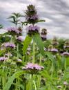 | | 2021 | COLLECTED | 09/27/2021 | Located approximately 3 miles south, southeast of Fairfield, T71N R9W SW1/4 Sec. 7 | 40.96338000, -91.94686900 | 223 | Woodland openings/edges, disturbed areas | Wild material | | 2122068 | Ames 35750 |
| 41 | W6 60350 | CBG-10730 | Dichanthelium leibergii (Vasey) Freckmann | | W6 |  | | 2021 | | | | | | | Wild material | | 2137982 | W6 60350 |
| 42 | NA 88190 | MARSB-749 | Baccharis halimifolia L. | New York, United States | NA | | | 2021 | | | | | | | Wild material | Simple, alternate, toothed leaves. White flowers that become conscpicuously fluffy when ripe. | 2113604 | NA 88190 |
| 43 | OPGC 7925 | NEWFS-84 | Limonium carolinianum (Walter) Britton | Maine, United States | OPGC | | | 2019 | | | | | | | Wild material | | 2098115 | OPGC 7925 |
| 44 | OPGC 7475 | CBG-9130 | Verbena stricta Vent. | Wisconsin, United States | OPGC |  | | 2019 | | | | | | | Wild material | | 2092769 | OPGC 7475 |
| 45 | OPGC 7491 | CBG-9486 | Symphyotrichum ericoides (L.) G. L. Nesom | Wisconsin, United States | OPGC |  | | 2019 | | | | | | | Wild material | | 2092805 | OPGC 7491 |
| 46 | OPGC 7850 | CBG-8800 | Hieracium longipilum Torr. ex Hook. | Wisconsin, United States | OPGC |  | | 2019 | | | | | | | Wild material | | 2092710 | OPGC 7850 |
| 47 | W6 56591 | CBG-8639 | Erigeron strigosus Muhl. ex Willd. | Wisconsin, United States | W6 |  | | 2019 | | | | | | | Wild material | | 2092690 | W6 56591 |
| 48 | W6 56648 | CBG-9070 | Amorpha canescens Pursh | Wisconsin, United States | W6 |  | | 2019 | | | | | | | Wild material | | 2092747 | W6 56648 |
| 49 | W6 56656 | CBG-9081 | Zizia aptera (A. Gray) Fernald | Wisconsin, United States | W6 |  | | 2019 | | | | | | | Wild material | | 2092755 | W6 56656 |
| 50 | Ames 34606 | JDC/MB/2019/011/890 | Monarda brevis (Fosberg & Artz) Floden | West Virginia, United States | NC7 |  | | 2019 | | | | | | | Wild material | Variation in flower color present from near white, faint pink to faint "smoky" purple. Majority of specimens noted at collection site in nature were approximately 3-5 days past peak flower on 10 June 2019 with seeds reaching maturity approximately 55 days later. Majority of specimens observed were approximately 10" in height. Very healthy, dark-green leaves that maintained quality throughout the season (observed mid-August 2019). Some specimens consisting of 25-30 flowering stems encompassing a 1.5 sq. ft. area. | 2092642 | Ames 34606 |
| 51 | Ames 34607 | JDC/MB/2019/012/891 | Monarda brevis (Fosberg & Artz) Floden | West Virginia, United States | NC7 |  | | 2019 | | | | | | | Wild material | This accession likely represents the holotype for Monarda brevis that was vouchered by Lena Artz in 1953 (Catalog No. 2097485). Variation in flower color present from near white, faint pink to faint "smoky" purple. Majority of specimens noted at collection site in nature were approximately 3-5 days past peak flower on 10 June 2019 with seeds reaching maturity approximately 55 days later. Majority of specimens observed were apprxoimately 10" in height. Very healthy, dark-green leaves that maintained quality throughout the season (observed mid-August 2019). | 2092643 | Ames 34607 |
| 52 | Ames 34609 | JDC/MB/2019/014/893 | Monarda brevis (Fosberg & Artz) Floden | West Virginia, United States | NC7 |  | | 2019 | | | | | | | Wild material | Variation in flower color present from near white, faint pink to faint "smoky" purple. Majority of specimens noted at collection site in nature were approximately 3-5 days past peak flower on 10 June 2019 with seeds reaching maturity approximately 55 days later. Majority of specimens observed were approximately 10" in height. Very healthy, dark-green leaves that maintained quality throughout the season (observed mid-August 2019). | 2092645 | Ames 34609 |
| 53 | Ames 34794 | NCBG-739 | Rhus glabra L. | North Carolina, United States | NC7 |  | | 2018 | COLLECTED | 10/07/2017 | Just north of Oswego. | 36.19391000, -78.19391000 | 91 | Ruderal loblolly pine/sweetgum red maple forest | Wild material | | 1966040 | Ames 34794 |
| 54 | OPGC 6401 | CBG-8086 | Solidago rigida L. | Illinois, United States | OPGC |  | | 2017 | | | | | | | Wild material | | 1954839 | OPGC 6401 |
| 55 | W6 53022 | CBG-6586 | Carex cephalophora Muhl. ex Willd. | Illinois, United States | W6 |  | | 2017 | | | | | | | Wild material | | 1954773 | W6 53022 |
| 56 | W6 53063 | CBG-7313 | Houstonia purpurea L. | Illinois, United States | W6 |  | | 2017 | | | | | | | Wild material | | 1954814 | W6 53063 |
| 57 | W6 51579 | CBG2015-4155 | Koeleria macrantha (Ledeb.) Schult. | Illinois, United States | W6 | | | 2016 | | | | | | | Wild material | | 1942709 | W6 51579 |
| 58 | W6 49622 | CBG-2635 | Amorpha canescens Pursh | Wisconsin, United States | W6 |  | | 2015 | | | | | | | Wild material | | 1926088 | W6 49622 |
| 59 | W6 48814 | MARSB-115 | Aristida purpurascens Poir. | New Jersey, United States | W6 |  | | 2015 | | | | | | | Wild material | | 1922907 | W6 48814 |
| 60 | W6 48850 | MARSB-085 | Hexasepalum teres (Walter) J. H. Kirkbr. | New Jersey, United States | W6 |  | | 2015 | | | | | | | Wild material | | 1922915 | W6 48850 |
| 61 | W6 48854 | MARSB-106 | Eragrostis spectabilis (Pursh) Steud. | New Jersey, United States | W6 |  | | 2015 | | | | | | | Wild material | | 1922916 | W6 48854 |
| 62 | W6 48902 | MARSB-114 | Tridens flavus (L.) Hitchc. | New Jersey, United States | W6 |  | | 2015 | | | | | | | Wild material | | 1922931 | W6 48902 |