| 0 | NA 88542 | RJLSEUS2022-014 | Rosa palustris Marshall | Georgia, United States | NA | | | 2023 | COLLECTED | 12/09/2022 | Plants growing around a pond and associated wetland on the property of Monica Williams north of Albany, Georgia. Common along the transitional edges from wet to dry. | 31.63723900, -84.13776200 | 60 | Plants are growing in full sun mostly in the transitional edges of the pond where conditions are generally moist mesic. Even so, this species appears quite adaptable and can be found in quite moist as well as drier soil conditions.
Soils: The underlying geology of this area is of Eocene origin and characterized as Ocala Limestone. The Ocala Limestone consists of almost pure limestones with occasional dolomites. It can be subdivided into both lower and upper facies with the lower facies composed of a whitish to cream-colored, fine to medium grained, poorly to moderately hard, fossil rich grainstone and packstone. The upper Ocala is white and somewhat weak and poorly sorted. It is extremely fossil rich grainstone, packstone and wackestone and some chert is common in the upper facies.
Source: USGS Georgia Geologic Map Data (https://mrdata.usgs.gov/geology/state/sgmc-unit.php?unit=GANu%3B1)
The primary soil types in the collection area are classified as Herod and Muckalee Series soils. The Herod Series consists of poorly drained moderately permeable soils formed in loamy alluvium. These soils are on flood plains of streams in the Coastal Plain. Slopes range from 0 to 2 percent. The Muckalee Series consists of poorly drained moderately permeable soils formed in loamy and sandy alluvium. These soils are on flood plains of streams in the Coastal Plain. Slopes range from 0 to 2 percent.
Source: NRCS Web Soil Survey (https://websoilsurvey.sc.egov.usda.gov/App/WebSoilSurvey.aspx) | Wild material | | 2140817 | NA 88542 |
| 1 | WLP 1747 | RJL2021PA-005 | Rosa palustris Marshall | Pennsylvania, United States | NA | | | 2021 | COLLECTED | 11/20/2021 | Plants growing in wetland seeps surrounded by mown hayfields just west of the Middle Branch White Clay Creek in Goddard Park, West Grove Pennsylvania, off of Wickerton Road, Chester County. | 39.80090528, -75.82383250 | 100 | Habitat Notes: Plants are growing in permanently saturated to moist soils in wetland habitats. Plants appear to be obligate wetland plants and are found only in permanent to nearly permanent wet habitats observed. Generally, the shrubs are found in part shade to full sun. Soils: Soils found in the areas where this collection was made are comprised primarily of Hatboro silt loam (Ha). Hatboro silt loam consists of very deep and poorly drained soils formed in deposited alluvium derived from metamorphic and crystalline rock. They are on flood plains. Slopes range from 0 to 3 percent. Slope: 0 to 3% Aspect: Variable. | Wild material | | 2123715 | WLP 1747 |
| 2 | NA 88438 | MARSB-202 | Rosa palustris Marshall | Delaware, United States | NA | | | 2020 | | | | | | | Wild material | Woody plant with stems covered in recurved thorns. Mature fruit a scarlet hip. | 2106461 | NA 88438 |
| 3 | NA 88436 | NCBG-303 | Rosa palustris Marshall | North Carolina, United States | NA |  | | 2019 | | | | | | | Wild material | | 2098403 | NA 88436 |
| 4 | NA 88437 | NCBG-305 | Rosa palustris Marshall | Virginia, United States | NA |  | | 2019 | | | | | | | Wild material | | 2098404 | NA 88437 |
| 5 | NA 88435 | MARSB-255 | Rosa palustris Marshall | New York, United States | NA |  | | 2019 | | | | | | | Wild material | | 2097542 | NA 88435 |
| 6 | NA 88427 | NEWFS-83 | Rosa palustris Marshall | Maine, United States | NA | | | 2019 | | | | | | | Wild material | | 1976148 | NA 88427 |
| 7 | NA 88428 | NEWFS-140 | Rosa palustris Marshall | Massachusetts, United States | NA | 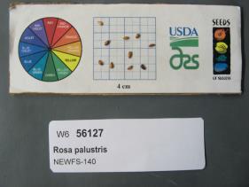 | | 2019 | | | | | | | Wild material | | 1976162 | NA 88428 |
| 8 | NA 88429 | NEWFS-190 | Rosa palustris Marshall | Rhode Island, United States | NA | 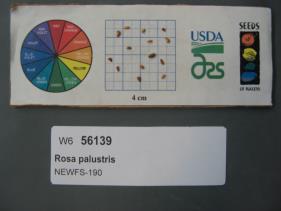 | | 2019 | | | | | | | Wild material | | 1976174 | NA 88429 |
| 9 | NA 88430 | NEWFS-631 | Rosa palustris Marshall | Massachusetts, United States | NA |  | | 2019 | | | | | | | Wild material | | 1976306 | NA 88430 |
| 10 | NA 88432 | NEWFS-228 | Rosa palustris Marshall | Rhode Island, United States | NA |  | | 2019 | | | | | | | Wild material | | 1976184 | NA 88432 |
| 11 | NA 88433 | NEWFS-237 | Rosa palustris Marshall | Connecticut, United States | NA |  | | 2019 | | | | | | | Wild material | | 1976186 | NA 88433 |
| 12 | NA 88434 | NEWFS-740 | Rosa palustris Marshall | Massachusetts, United States | NA |  | | 2019 | | | | | | | Wild material | | 1976342 | NA 88434 |
| 13 | NA 88431 | NCBG-581 | Rosa palustris Marshall | Maryland, United States | NA |  | | 2018 | | | | | | | Wild material | Rosa palustris | 1965980 | NA 88431 |
| 14 | WLP 2469 | MARSB-0111 | Rosa palustris Marshall | New York, United States | NA |  | | 2015 | COLLECTED | 10/28/2013 | | | 47 | | Wild material | | 1922878 | WLP 2469 |
| 15 | WLP 1649 | KC09-015 | Rosa palustris Marshall | | NA | | | 2009 | COLLECTED | PRE 07/01/2009 | Virginia, Appomattox County, Route 601 6 miles north of intersection of 601 and Route 460 | | | roadside; wooded; oak-hickory-maple forest | Wild material | | 1896369 | WLP 1649 |
| 16 | WLP 1620 | RL 08199 | Rosa palustris Marshall | | NA | | | 2008 | COLLECTED | PRE 10/06/2008 | North Carolina, Henderson County, Along abandoned section of old Fanning Fields Road, Mills River, near stream crossing which joins McDowell Creek. | 35.42003000, -82.55346000 | | | Wild material | | 1896147 | WLP 1620 |
| 17 | PI 702717 | NCBG-648 | Sacciolepis striata (L.) Nash | Virginia, United States | S9 |  | | 2019 | | | | | | | Wild material | | 2098499 | PI 702717 |
| 18 | PI 702724 | NEWFS-500 | Schizachyrium scoparium (Michx.) Nash | Massachusetts, United States | S9 |  | | 2019 | | | | | | | Wild material | | 2098225 | PI 702724 |
| 19 | PI 710491 | MARSB-488 | Lespedeza capitata Michx. | New Jersey, United States | S9 |  | | 2018 | | | | | | | Wild material | | 1964782 | PI 710491 |
| 20 | W6 62521 | FWS0300-111 | Chamaenerion angustifolium (L.) Scop. subsp. angustifolium | Michigan, United States | W6 | 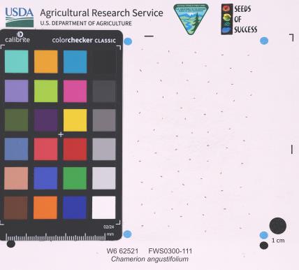 | | 2025 | | | | | | | Wild material | | 2192219 | W6 62521 |
| 21 | W6 62535 | FWS0300-145 | Verbena hastata L. | Michigan, United States | W6 |  | | 2025 | | | | | | | Wild material | | 2192233 | W6 62535 |
| 22 | WLP 3084 | RM2023-002 | Rhododendron viscosum (L.) Torr. | Florida, United States | NA | | | 2023 | COLLECTED | 09/15/2022 | This species is growing in the Blackwater River State Forest approximately 0.24 kilometers north of Wof W20 and approximately 0.93 kilometers west of the junction of 3 Notch Trail/Road. | 30.84510000, -86.94940000 | 38 | The plants were growing in part shade of a moist mesic transition slope between a dry upland habitat and a bog.
Soils: The underlying geology of this area is the Citronelle Formation, of Pliocene origin, and consists of gray to orange, often mottled, unconsolidated to poorly consolidated, very fine to very coarse, poorly sorted, clean to clayey sands. It contains significant amounts of clay, silt and gravel which may occur as beds and lenses and may vary considerably over short distances. Limonite nodules and limonite-cemented beds are common. Source: USGS Florida Geologic Map Data (https://mrdata.usgs.gov/geology/state/state.php?state=fl)
The surface soil profile found in this area is primarily Troup Series. These soils are sandy and loamy marine deposits. They are well drained and typically on the tops and sides of broad and narrow ridges on uplands typically with 0-12% slopes. These soils are very strongly acid with a depth of 2-3 meters. Pactolus Series soils comprise a minor, but important percentage of the lower slopes that are nearly level to gently sloping and account for the somewhat poorly drained, yet, sandy conditions. These soils are also strongly acid with very dark gray loamy sands.
Source: Soil Survey of Santa Rosa County and NRCS Web Soil Survey (https://www.nrcs.usda.gov/Internet/FSE_MANUSCRIPTS/florida/FL113/0/SantaRosa.pdf and https://websoilsurvey.sc.egov.usda.gov/App/WebSoilSurvey.aspx) | Wild material | | 2141438 | WLP 3084 |
| 23 | NA 87351 | TJK2022FL-006 | Aronia arbutifolia (L.) Pers. | Florida, United States | NA | | | 2023 | COLLECTED | 12/31/2022 | Santa Rosa County: Midway: Pensacola State College, South Santa Rosa Center (Santa Rosa County School District), 1/4 mile south of Highway 98. | 30.39570000, -87.01300000 | 0 | Very interesting site. Interior flooded wetland dominated by Ilex cassine and Ilex myrtifolia. Xeric ridges in wetland have both Cladonia cristella and Cladonia perforata, xeric edges dominated by Pinus clausa. Cyrilla, in seed, consistently dwarfed 16 inches to 6 feet tall, probably due to hydrological and edaphic factors. | Wild material | | 2141642 | NA 87351 |
| 24 | NA 87352 | (open-pollinated seed of Lowei Group) | Ilex myrtifolia Walter | Florida, United States | NA | | | 2023 | COLLECTED | 12/31/2022 | Santa Rosa County: Midway: Pensacola State College, South Santa Rosa Center (Santa Rosa County School District), 1/4 mile south of Highway 98. Coordinates for two plants given; second plant's coordinates are 30.3959 deg. N, 87.0097 deg. W. | 30.39570000, -87.01290000 | 0 | Very interesting site. Interior flooded wetland dominated by Ilex cassine and Ilex myrtifolia. Xeric ridges in wetland have both Cladonia cristella and Cladonia perforata, xeric edges dominated by Pinus clausa. Cyrilla, in seed, consistently dwarfed 16 inches to 6 feet tall, probably due to hydrological and edaphic factors. | Wild material | Received as Ilex myrtifolia (yellow fruit); accessioned at USNA as Ilex myrtifolia (open-pollinated seed of Lowei Group). Note: while these seeds were collected from yellow-fruited individuals, the parent plants were open-pollinated. The yellow fruit trait is likely to be recessive, so some seedlings may be only heterogeneous for yellow fruit. -SBL [As of late November 2025, all three female seedlings at USNA that have borne fruit are red-fruited; one might be a lighter, more orange-red tone than the other two.] | 2141643 | NA 87352 |
| 25 | NA 88525 | RM-TK2022-013 | Macranthera flammea (W. Bartram) Pennell | Florida, United States | NA | | | 2023 | COLLECTED | 11/04/2022 | Growing in wetland in Blackwater River State Forest. | 30.80870000, -86.96270000 | 42 | Plants are typically found growing in part shade to sun in saturated streamside wetland/seep areas at the base of the slope in sphagnum moss. This appears to be year-round wetland habitat.
Soils: The underlying geology of this area is the Citronelle Formation of Pliocene origin and consists of gray to orange, often mottled, unconsolidated to poorly consolidated, very fine to very coarse, poorly sorted, clean to clayey sands. It contains significant amounts of clay, silt and gravel which may occur as beds and lenses and may vary considerably over short distances. Limonite nodules and limonite-cemented beds are common. Source: USGS Florida Geologic Map Data (https://mrdata.usgs.gov/geology/state/state.php?state=fl)
The surface soil profile found in this area is primarily Troup Series. These soils are sandy and loamy marine deposits. They are well drained and typically on the tops and sides of broad and narrow ridges on uplands typically with 0-12% slopes. These soils are very strongly acid with a depth of 2-3 meters. Pactolus Series soils comprise a minor, but important percentage of the lower slopes that are nearly level to gently sloping and account for the somewhat poorly drained, yet, sandy conditions. These soils are also strongly acid with very dark gray loamy sands.
Source: Soil Survey of Santa Rosa County and NRCS Web Soil Survey (https://www.nrcs.usda.gov/Internet/FSE_MANUSCRIPTS/florida/FL113/0/SantaRosa.pdf and https://websoilsurvey.sc.egov.usda.gov/App/WebSoilSurvey.aspx) | Wild material | | 2140806 | NA 88525 |
| 26 | NA 88541 | RJLSEUS2022-013 | Rhododendron viscosum (L.) Torr. | Georgia, United States | NA | | | 2023 | COLLECTED | 12/09/2022 | Plants growing around a pond and associated wetland on the property of Monica Williams north of Albany, Georgia. Common along the edges of the pond and wetland area. | 31.63828300, -84.13827000 | 62 | Plants are growing in part-shade to sun of a wetland habitat on the edge of a large pond. The habitat is comprised of numerous hummocks where this species grows, slightly above the permanently wet, inundated edges of the pond. Some plants are growing in more shade under moist mesic conditions as well.
Soils: The underlying geology of this area is of Eocene origin and characterized as Ocala Limestone. The Ocala Limestone consists of almost pure limestones with occasional dolomites. It can be subdivided into both lower and upper facies with the lower facies composed of a whitish to cream-colored, fine to medium grained, poorly to moderately hard, fossil rich grainstone and packstone. The upper Ocala is white and somewhat weak and poorly sorted. It is extremely fossil rich grainstone, packstone and wackestone and some chert is common in the upper facies.
Source: USGS Georgia Geologic Map Data (https://mrdata.usgs.gov/geology/state/sgmc-unit.php?unit=GANu%3B1)
The primary soil types in the collection area are classified as Herod and Muckalee Series soils. The Herod Series consists of poorly drained moderately permeable soils formed in loamy alluvium. These soils are on flood plains of streams in the Coastal Plain. Slopes range from 0 to 2 percent. The Muckalee Series consists of poorly drained moderately permeable soils formed in loamy and sandy alluvium. These soils are on flood plains of streams in the Coastal Plain. Slopes range from 0 to 2 percent.
Source: NRCS Web Soil Survey (https://websoilsurvey.sc.egov.usda.gov/App/WebSoilSurvey.aspx) | Wild material | | 2140768 | NA 88541 |
| 27 | NA 88544 | RJLSEUS2022-016 | Itea virginica L. | Georgia, United States | NA | | | 2023 | COLLECTED | 12/09/2022 | Plants growing around a pond and associated wetland on the property of Monica Williams north of Albany, Georgia as well as the edges of nearby Muckalee Creek. Common in the wetland habitat edges. | 31.63834700, -84.13835600 | 63 | Plants are growing in part-shade to sun in wet to inundated conditions along the edges of a pond as well as the edges of Muckalee Creek. This species is found in conditions of abundant, year-round moisture.
Soils: The underlying geology of this area is of Eocene origin and characterized as Ocala Limestone. The Ocala Limestone consists of almost pure limestones with occasional dolomites. It can be subdivided into both lower and upper facies with the lower facies composed of a whitish to cream-colored, fine to medium grained, poorly to moderately hard, fossil rich grainstone and packstone. The upper Ocala is white and somewhat weak and poorly sorted. It is extremely fossil rich grainstone, packstone and wackestone and some chert is common in the upper facies.
Source: USGS Georgia Geologic Map Data (https://mrdata.usgs.gov/geology/state/sgmc-unit.php?unit=GANu%3B1)
The primary soil types in the collection area are classified as Herod and Muckalee Series soils. The Herod Series consists of poorly drained moderately permeable soils formed in loamy alluvium. These soils are on flood plains of streams in the Coastal Plain. Slopes range from 0 to 2 percent. The Muckalee Series consists of poorly drained moderately permeable soils formed in loamy and sandy alluvium. These soils are on flood plains of streams in the Coastal Plain. Slopes range from 0 to 2 percent.
Source: NRCS Web Soil Survey (https://websoilsurvey.sc.egov.usda.gov/App/WebSoilSurvey.aspx) | Wild material | | 2140770 | NA 88544 |
| 28 | NA 88545 | RJLSEUS2022-017 | Cephalanthus occidentalis L. | Georgia, United States | NA | | | 2023 | COLLECTED | 12/09/2022 | Plants growing around a pond and associated wetland on the property of Monica Williams north of Albany, Georgia. Infrequent frequency. | 31.63802000, -84.13499000 | 59 | Plants are growing in part-shade to sun in the wetland associated with a large pond. This area is frequently wet during the growing season, but drier during the winter months.
Soils: The underlying geology of this area is of Eocene origin and characterized as Ocala Limestone. The Ocala Limestone consists of almost pure limestones with occasional dolomites. It can be subdivided into both lower and upper facies with the lower facies composed of a whitish to cream-colored, fine to medium grained, poorly to moderately hard, fossil rich grainstone and packstone. The upper Ocala is white and somewhat weak and poorly sorted. It is extremely fossil rich grainstone, packstone and wackestone and some chert is common in the upper facies.
Source: USGS Georgia Geologic Map Data (https://mrdata.usgs.gov/geology/state/sgmc-unit.php?unit=GANu%3B1)
The primary soil types in the collection area are classified as Herod and Muckalee Series soils. The Herod Series consists of poorly drained moderately permeable soils formed in loamy alluvium. These soils are on flood plains of streams in the Coastal Plain. Slopes range from 0 to 2 percent. The Muckalee Series consists of poorly drained moderately permeable soils formed in loamy and sandy alluvium. These soils are on flood plains of streams in the Coastal Plain. Slopes range from 0 to 2 percent.
Source: NRCS Web Soil Survey (https://websoilsurvey.sc.egov.usda.gov/App/WebSoilSurvey.aspx) | Wild material | | 2140771 | NA 88545 |
| 29 | WLP 2674 | RJL2022NJ-005 | Alnus serrulata (Aiton) Willd. | New Jersey, United States | NA | | | 2022 | COLLECTED | 10/24/2022 | Plants growing on the east side of Atlantic County Road 543, Green Bank Road, in wetlands of the Mullica River, approximately 1.01 kilometers southwest of the intersection with River Road in Green Bank, New Jersey. Plants are common but scattered on the east side of the road at this location. | 39.60472300, -74.59378100 | 2 | Plants grow in full sun to light shade throughout this permanently wet to inundated habitat that is comprised mostly of emergent and obligate wetland herbaceous plants, deciduous shrubs, and Chamaecyparis thyoides, none reaching more than 5-10 meters tall. There are small elevation changes throughout this wetland, but the location is surrounded by water year-round.
Soils: The underlying geology of this area is the Cohansey Formation of middle Miocene origin and comprised of sand, white to yellow with local gravel and clay. It is sometimes locally stained red or orange brown by iron oxides and (or) cemented into large blocks of ironstone. Unweathered clay is typically dark gray, but commonly weathers white where it is interbedded with thin beds of ironstone. Sand is typically medium grained and moderately sorted although it ranges from fine to very coarse grained and from poorly to well sorted. Sand consists of quartz and siliceous rock fragments. Some beds are locally micaceous. Maximum thickness in the map area is about 60 meters; however, thickness is difficult to determine because of the irregular basal contact and extensive post-depositional erosion.
Source: USGS New Jersey Geologic Map Data (https://mrdata.usgs.gov/geology/state/sgmc-unit.php?unit=NJTch%3B1)
The primary soil type in the area of this collection is classified as Manahawkin muck, 0 to 2 percent slopes, frequently flooded. This soil is moderately high to high in the organic layers and high in the mineral layers comprised of sandy or sandy-skeletal, siliceous, dysic, mesic terric haplosaprists. This soil is considered extremely acid or very strongly acid in the surface tier and very strongly acid or strongly acid in the lower tiers and in the mineral substratum. The mineral content of organic layers ranges from 5 to 80 percent. Organic layers consist of mostly sapric material. Some pedons have subhorizons or a surface horizon of hemic material up to 25 cm. Woody fragments range from 0 to 50 percent, by volume, in the organic layers. These fragments are mostly twigs, branches, or logs ranging in size from 3 mm to 51 cm in diameter and completely break down when rubbed or crushed. The depth of this soil ranges from 0.2-2 meters. This soil is considered wet to inundated year-round.
Source: NRCS Web Soil Survey (https://websoilsurvey.sc.egov.usda.gov/App/WebSoilSurvey.aspx) | Wild material | | 2139665 | WLP 2674 |
| 30 | NA 89033 | RJL2022MD-010 | Clethra alnifolia L. | Maryland, United States | NA | | | 2022 | COLLECTED | 09/15/2022 | Plants growing in low woodlands at the end of Greenway Avenue near a boat dock that leads to the Pocomoke River, adjacent to Winter Quarters Golf Course, Pocomoke City. Plants common throughout the wetland area as well as mesic edges of the woodlands. | 38.08305100, -75.56527800 | | Plants growing in the flood plain of the Pocomoke River in shade to part sun of a mixed deciduous and evergreen bottomland habitat about 10 meters from the edge of the golf course fairway. The habitat is a mucky swamp edge habitat next to the Pocomoke River, most of which seems wet year-round and grades slightly upslope to more mesic conditions.
The underlying geology of this area is comprised of Quaternary Deposits of Wisconsin to Holocene origin. The composition is primarily undifferentiated gray to buff sand and gravel, gray to brown lignitic silt and clay, occasional boulders, and rare shell beds. Surficial deposits occur as shell-bearing estuarine clays and silts.
Source: USGS Maryland Geologic Map Data https://mrdata.usgs.gov/geology/state/sgmc-unit.php?unit=MDQdu%3B5
The surface soil profile of this habitat is classified as Puckum Muck which is frequently flooded. These highly saturated soils are found in flats, depressions and swales. The soil reaction of Puckum Muck is extremely acid to strongly acid throughout the profile. The depth to bedrock is generally greater than 150 cm. Wood fragments comprise 0-25%, by volume of the Puckum Muck throughout the profile which includes mostly twigs, branches, logs, or stumps and are 1.5-30 cm in diameter. The composition of these highly saturated soils, are classified as muck (sapric soil material) or mucky peat (hemic soil material) throughout most of the upper 150 cm and may contain thin layers of mucky silt loam, silty clay loam, sandy loam and/or sand.
Source: NRCS Web Soil Survey (https://websoilsurvey.sc.egov.usda.gov/App/WebSoilSurvey.aspx) | Wild material | | 2139598 | NA 89033 |
| 31 | NA 89032 | RJL2022MD-009 | Rhododendron viscosum (L.) Torr. | Maryland, United States | NA | | | 2022 | COLLECTED | 09/15/2022 | Plants growing in low woodlands at the end of Greenway Avenue near a boat dock that leads to the Pocomoke River, adjacent to Winter Quarters Golf Course, Pocomoke City. Plants scattered throughout the wetland area. Infrequent, but regularly found. | 38.08235200, -75.56566500 | 1 | Plants growing in the flood plain of the Pocomoke River in part shade to shade of a mixed deciduous and evergreen bottomland habitat about 10 meters from the edge of the golf course fairway. The habitat is a mucky swamp edge habitat next to the Pocomoke River, most of which seems wet year-round.
The underlying geology of this area is comprised of Quaternary Deposits of Wisconsin to Holocene origin. The composition is primarily undifferentiated gray to buff sand and gravel, gray to brown lignitic silt and clay, occasional boulders, and rare shell beds. Surficial deposits occur as shell-bearing estuarine clays and silts.
Source: USGS Maryland Geologic Map Data https://mrdata.usgs.gov/geology/state/sgmc-unit.php?unit=MDQdu%3B5
The surface soil profile of this habitat is classified as Puckum Muck which is frequently flooded. These highly saturated soils are found in flats, depressions and swales. The soil reaction of Puckum Muck is extremely acid to strongly acid throughout the profile. The depth to bedrock is generally greater than 150 cm. Wood fragments comprise 0-25%, by volume of the Puckum Muck throughout the profile which includes mostly twigs, branches, logs, or stumps and are 1.5-30 cm in diameter. The composition of these highly saturated soils, are classified as muck (sapric soil material) or mucky peat (hemic soil material) throughout most of the upper 150 cm and may contain thin layers of mucky silt loam, silty clay loam, sandy loam and/or sand.
Source: NRCS Web Soil Survey (https://websoilsurvey.sc.egov.usda.gov/App/WebSoilSurvey.aspx) | Wild material | | 2139597 | NA 89032 |
| 32 | NA 88389 | NEWFS-739 | Juniperus virginiana L. var. virginiana | Massachusetts, United States | NA | | | 2021 | | | | | | | Wild material | Small conical shrub with waxy blue green fruits and tight scale like leaves. | 2138832 | NA 88389 |
| 33 | NA 88462 | NCBG-304 | Taxodium distichum (L.) Rich. | North Carolina, United States | NA | | | 2021 | | | | | | | Wild material | | 2132865 | NA 88462 |
| 34 | OPGC 8507 | NCBG-534 | Typha angustifolia L. | Virginia, United States | OPGC | | | 2021 | | | | | | | Wild material | | 2132908 | OPGC 8507 |
| 35 | OPGC 8511 | NCBG-549 | Typha angustifolia L. | North Carolina, United States | OPGC | | | 2021 | | | | | | | Wild material | | 2132916 | OPGC 8511 |
| 36 | OPGC 8513 | NCBG-575 | Typha angustifolia L. | Maryland, United States | OPGC | | | 2021 | | | | | | | Wild material | | 2132926 | OPGC 8513 |
| 37 | OPGC 8515 | NCBG-595 | Iris versicolor L. | Virginia, United States | OPGC | | | 2021 | | | | | | | Wild material | | 2132931 | OPGC 8515 |
| 38 | W6 60025 | NCBG-532 | Decodon verticillatus (L.) Elliott | Maryland, United States | W6 | | | 2021 | | | | | | | Wild material | | 2132907 | W6 60025 |
| 39 | Ames 35750 | Ames 35750 | Blephilia ciliata (L.) Benth. | Iowa, United States | NC7 | 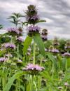 | | 2021 | COLLECTED | 09/27/2021 | Located approximately 3 miles south, southeast of Fairfield, T71N R9W SW1/4 Sec. 7 | 40.96338000, -91.94686900 | 223 | Woodland openings/edges, disturbed areas | Wild material | | 2122068 | Ames 35750 |
| 40 | OPGC 8343 | CBG-10575 | Euthamia graminifolia (L.) Nutt. | Illinois, United States | OPGC | | | 2021 | | | | | | | Wild material | Plant numbers sampled estimated. | 2120166 | OPGC 8343 |
| 41 | W6 59032 | NCBG-574 | Sagittaria latifolia Willd. | Maryland, United States | W6 | | | 2021 | | | | | | | Wild material | | 2116349 | W6 59032 |
| 42 | Ames 35668 | Iroquois County Conservation Area | Aronia ×prunifolia (Marshall) Rehder | Illinois, United States | NC7 |  | | 2021 | COLLECTED | 05/05/2021 | Iroquois County Conservation Area located approximately 4.5 miles northeast of Beaverville in Beaverville Township, T29N R11W NE1/4 Sec. 22 | 40.99154700, -87.58073200 | 198 | Woodland edge of wet sand prairie | Wild material | Wide variety of genotypes noted in nature averaging 3.5-7' in height. Some growing in shade of oak forest were sparse suckering and open branching compared to open grown specimens that were extremely dense with suckers. | 2115977 | Ames 35668 |
| 43 | NA 88281 | MARSB-497 | Cephalanthus occidentalis L. | New Jersey, United States | NA | | | 2021 | | | | | | | Wild material | Growth formûthe plant is a shrub (i.e., a woody plant with several stems growing from the base)ûLeaf typeûthe leaf blade is simple (i.e., lobed or unlobed but not separated into leaflets)ûLeaves per nodeûthere are three leaves per node along the stemûthere are two leaves per node along the stemûLeaf blade edgesûthe edge of the leaf blade has teethûLeaf durationûthe leaves drop off in winter (or they wither but persist on the plant)ûarmature on plantûthe plant does not have spines, prickles, or thornsûLeaf blade lengthû80–150 mmûLeaf blade widthû23–150 mmûLeaf stalkûthe leaves have leaf stalksûFruit type (general)ûthe fruit is dry but does not split open when ripeûBark textureûthe bark of an adult plant is ridged or platedûthe bark of an adult plant is thin and smoothûTwig winter colorûbrownûgrayûredûBud scale numberûthere are no scales on the winter buds | 2113542 | NA 88281 |
| 44 | NA 88285 | MARSB-766 | Cephalanthus occidentalis L. | New Jersey, United States | NA | | | 2021 | | | | | | | Wild material | Growth formûthe plant is a shrub (i.e., a woody plant with several stems growing from the base)ûLeaf typeûthe leaf blade is simple (i.e., lobed or unlobed but not separated into leaflets)ûLeaves per nodeûthere are three leaves per node along the stemûthere are two leaves per node along the stemûLeaf blade edgesûthe edge of the leaf blade has teethûLeaf durationûthe leaves drop off in winter (or they wither but persist on the plant)ûarmature on plantûthe plant does not have spines, prickles, or thornsûLeaf blade lengthû80–150 mmûLeaf blade widthû23–150 mmûLeaf stalkûthe leaves have leaf stalksûFruit type (general)ûthe fruit is dry but does not split open when ripeûBark textureûthe bark of an adult plant is ridged or platedûthe bark of an adult plant is thin and smoothûTwig winter colorûbrownûgrayûredûBud scale numberûthere are no scales on the winter buds | 2113612 | NA 88285 |
| 45 | W6 58609 | MARSB-489 | Rhus copallinum L. | New Jersey, United States | W6 | | | 2021 | | | | | | | Wild material | Growth formûthe plant is a shrub ûLeaf typeûthe leaf blade is compound ûLeaves per nodeûthere is one leaf per node along the stemûLeaf blade edgesûthe edge of the leaf blade has no teeth or lobesûthe edge of the leaf blade has teethûLeaf durationûthe leaves drop off in winter (or they wither but persist on the plant)ûarmature on plantûthe plant does not have spines, prickles, or thornsûLeaf blade lengthû150–350 mmûLeaf stalkûthe leaves have leaf stalksûFruit type (general)ûthe fruit is dry but does not split open when ripeûBark textureûthe bark of an adult plant is thin and smoothûTwig winter colorûbrownûpurpleûredûBud scale numberûthere are no scales on the winter buds | 2113539 | W6 58609 |
| 46 | W6 58678 | MARSB-762 | Mikania scandens (L.) Willd. | New Jersey, United States | W6 | | | 2021 | | | | | | | Wild material | Leaf typeûleaves are simple (i.e., lobed or unlobed but not separated into leaflets)ûLeaf arrangementûopposite: there are two leaves per node along the stemûLeaf blade edgesûthe edge of the leaf blade has no teeth or lobesûthe edge of the leaf blade has teethûFlower type in flower headsûthe flower head has disk flowers only, and lacks the strap-shaped flowersûRay flower colorûNAûTuft or plume on fruitûat least a part of the plume is made up of fine bristlesûSpines on plantûthe plant has no spinesûLeaf blade lengthû30–150 mmûDisk flower numberû1-5 | 2113608 | W6 58678 |
| 47 | NA 88147 | NCBG-310 | Cephalanthus occidentalis L. | North Carolina, United States | NA |  | | 2019 | | | | | | | Wild material | | 2098407 | NA 88147 |
| 48 | W6 57365 | NEWFS-210 | Spiraea alba Du Roi | Maine, United States | W6 |  | | 2019 | | | | | | | Wild material | | 2098162 | W6 57365 |
| 49 | OPGC 7925 | NEWFS-84 | Limonium carolinianum (Walter) Britton | Maine, United States | OPGC | | | 2019 | | | | | | | Wild material | | 2098115 | OPGC 7925 |
| 50 | NA 88095 | MARSB-256 | Ilex verticillata (L.) A. Gray | New York, United States | NA |  | | 2019 | COLLECTED | 10/07/2015 | In Sag Harbor, NY, park in Mashashimuet Park. Walk along the Long Pond Greenbelt Trail. The population is along the edges of Long Pond and Crooked Pond, the first and third ponds on the left, respectively. | 40.96283000, -72.29366000 | 5 | Central shrub & herb depression pond. | Wild material | | 2097543 | NA 88095 |
| 51 | NA 88096 | MARSB-258 | Ilex glabra (L.) A. Gray | New York, United States | NA |  | | 2019 | COLLECTED | 10/08/2015 | In Sag Harbor, park in Mashashimuet Park. Enter the Long Pond Greenbelt and walk along it until you reach Crooked Pond, the third pond on the left. The population is along pond edges. | 40.96283000, -72.29366000 | 5 | Central shrub & herb depression pond. | Wild material | | 2097545 | NA 88096 |
| 52 | NA 88380 | MARSB-835 | Iva frutescens L. | New Jersey, United States | NA |  | | 2019 | | | | | | | Wild material | | 2097723 | NA 88380 |
| 53 | OPGC 7884 | MARSB-259 | Rhexia virginica L. | New York, United States | OPGC |  | | 2019 | | | | | | | Wild material | | 2097546 | OPGC 7884 |
| 54 | OPGC 7845 | CBG-8187 | Polemonium reptans L. | Wisconsin, United States | OPGC |  | | 2019 | | | | | | | Wild material | SOS 7th transfer. | 2092671 | OPGC 7845 |
| 55 | NA 88059 | NEWFS-85 | Morella caroliniensis (Mill.) Small | Maine, United States | NA | | | 2019 | | | | | | | Wild material | | 1976149 | NA 88059 |
| 56 | NA 88081 | NEWFS-739 | Juniperus virginiana L. var. virginiana | Massachusetts, United States | NA |  | | 2019 | | | | | | | Wild material | | 1976341 | NA 88081 |
| 57 | NA 88083 | NEWFS-810 | Baccharis halimifolia L. | Connecticut, United States | NA |  | | 2019 | | | | | | | Wild material | | 1976357 | NA 88083 |
| 58 | OPGC 7403 | NEWFS-498 | Rhexia virginica L. | Massachusetts, United States | OPGC |  | | 2019 | | | | | | | Wild material | | 1976280 | OPGC 7403 |
| 59 | NA 88006 | MARSB-740 | Clethra alnifolia L. | New York, United States | NA |  | | 2018 | | | | | | | Wild material | | 1964840 | NA 88006 |
| 60 | W6 54027 | MARSB-232 | Schoenoplectus pungens (Vahl) Palla | New York, United States | W6 |  | | 2018 | | | | | | | Wild material | Schoenoplectus pungens | 1964743 | W6 54027 |
| 61 | NA 87959 | NEWFS-229 | Viburnum dentatum L. | Rhode Island, United States | NA |  | | 2017 | | | | | | | Wild material | | 1954701 | NA 87959 |
| 62 | NA 87960 | NEWFS-239 | Clethra alnifolia L. | Connecticut, United States | NA |  | | 2017 | | | | | | | Wild material | | 1954705 | NA 87960 |
| 63 | W6 52944 | NEWFS-127 | Rhus copallinum L. | Connecticut, United States | W6 |  | | 2017 | | | | | | | Wild material | | 1954687 | W6 52944 |
| 64 | W6 52960 | NEWFS-236 | Triadenum virginicum (L.) Raf. | Connecticut, United States | W6 |  | | 2017 | | | | | | | Wild material | | 1954703 | W6 52960 |
| 65 | WLP 2057 | NEWFS-270 | Viburnum dentatum L. | Maine, United States | NA |  | | 2017 | COLLECTED | 08/11/2015 | Scarborough Marsh WMA just off Pine Point Road along trail across from Audubon Center, Cumberland County | 43.56536400, -70.37482700 | 1 | Saltmarsh | Wild material | | 1954666 | WLP 2057 |
| 66 | OPGC 5074 | JDC/PP/2017/017/771 | Phlox pilosa L. subsp. fulgida (Wherry) Wherry | Iowa, United States | OPGC | | | 2017 | COLLECTED | 06/23/2017 | Private property approximately 2.6 miles east, northeast of Polk City, T81N R24W NW ¼ SE ¼ Sec. 32. | 41.78088600, -93.66458200 | 300 | Native remnant, extremely high-quality hay prairie (circa 40 acres) with diverse soil types (classic swell and swale topography) with both pothole marsh and mesic prairie areas that has been in family name since mid 1800’s. Never been plowed. Extremely biologically diverse, seasonally wet prairie. Growing in association with Eryngium yuccafolium, Monarda fistulosa, Asclepias tuberosa (common), Asclepias sullivantii (rare), Asclepias syriaca, Asclepias incarnata, Zizia aurea, Coreopsis palmata, Baptisia bracteata (common), Thalictrum dasycarpum (common), Rosa sp., Carex haydenii, Carex sartwellii, Echinacea pallida, Lithospermum canescens, Cirsium pumilum var. hillii (circa 12 plants noted), Lilium philadelphicum (circa 12 plants noted), Polytaenia nuttallii (rare), Helianthus spp., Comandra umbelata, Silphium laciniatum (common), Iris virginica, Heliopsis helianthoides, Achillea millefolium, Cicuta maculata, Stachys palustris, Hesperostipa spartea, Liatris aspera, Liatris pycnostachya, Pedicularis lanceolata, Hyposix hirsuta, Arnoglossum atriplicifolium, and Ceanothus herbaceous. Species actively blooming on 25 May 2017 included: P. pilosa, C. herbaceous, Z. aurea, C. umbellata, and L. canescens. Species actively bloomin on 23 June 2017 included: A. tuberosa, A. syriaca, A. incarnata, C. palmata, C. maculata, L. philadelphicum, C. pumilum var. hillii, S. palustris, E. pallida, H. helianthoides, and A. millefolium. | Wild material | Flower color for population is all purple. | 1950049 | OPGC 5074 |
| 67 | Ames 34803 | CBG-5442 | Spiraea tomentosa L. | Illinois, United States | NC7 |  | | 2016 | COLLECTED | 09/30/2015 | Iroquois County Conservation Area | 40.99082000, -87.56577000 | 199 | Wet prairie, sedge meadow. | Wild material | | 1942778 | Ames 34803 |
| 68 | Ames 32963 | JDC/BA/2015/049/706 | Betula alleghaniensis Britton | Iowa, United States | NC7 | | | 2015 | COLLECTED | 09/14/2015 | Bixby State Preserve, T91N R5W extreme southern edge of Sec. 23 basically restricted to W 1/2 of Sec. 23. | 42.67470300, -91.39917300 | 308 | North-facing algific talus slope (45-60 degrees) adjacent to Bear Creek. Moist deciduous woods. Growing in association with Diervilla lonicera, Hamamelis virginiana, Corylus sp., Viburnum opulus var. americanum, Cornus rugosa (few), Cornus alternifolia, Fraxinus nigra, Quercus rubra, Viburnum lentago, Ribes sp., Rubus idaeus subsp. strigosus, Rhamnus alnifolia (few), Rosa sp., Taxus canadensis, Prunus virginiana, Impatiens sp., Dirca palustris, and Pinus strobus (few). | Wild material | | 1927433 | Ames 32963 |
| 69 | W6 48958 | AK930-486 | Calamagrostis canadensis (Michx.) P. Beauv. | Alaska, United States | W6 |  | | 2015 | | | | | | | Wild material | | 1923873 | W6 48958 |
| 70 | W6 48959 | AK930-487 | Koenigia alpina (All.) T. M. Schust. & Reveal | Alaska, United States | W6 |  | | 2015 | | | | | | | Wild material | | 1923874 | W6 48959 |
| 71 | W6 48814 | MARSB-115 | Aristida purpurascens Poir. | New Jersey, United States | W6 |  | | 2015 | | | | | | | Wild material | | 1922907 | W6 48814 |
| 72 | W6 48846 | MARSB-112 | Decodon verticillatus (L.) Elliott | New York, United States | W6 |  | | 2015 | | | | | | | Wild material | | 1922900 | W6 48846 |
| 73 | W6 48864 | MARSB-62 | Juncus effusus L. | West Virginia, United States | W6 | 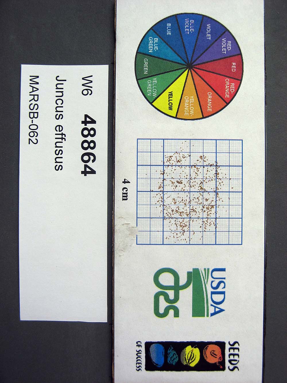 | | 2015 | | | | | | | Wild material | | 1922865 | W6 48864 |
| 74 | W6 48854 | MARSB-106 | Eragrostis spectabilis (Pursh) Steud. | New Jersey, United States | W6 |  | | 2015 | | | | | | | Wild material | | 1922916 | W6 48854 |
| 75 | W6 48902 | MARSB-114 | Tridens flavus (L.) Hitchc. | New Jersey, United States | W6 |  | | 2015 | | | | | | | Wild material | | 1922931 | W6 48902 |
| 76 | Ames 32627 | AK930-269 | Potentilla norvegica L. | Alaska, United States | NC7 |  | | 2012 | COLLECTED | 09/09/2010 | West end of Circle Hot Springs Air Strip. | 65.48548000, -144.62135000 | 271 | Parking area margins. Silty loam soil (2.5Y 3/6). | Wild material | | 1900616 | Ames 32627 |
| 77 | WLP 2206 | AK930-128 | Amelanchier alnifolia (Nutt.) Nutt. ex M. Roem. | Alaska, United States | NA |  | | 2012 | COLLECTED | 08/10/2010 | Off the Seward Highway, Windy Trailhead, mile marker 106. Chugach State Park. | 61.24780000, -149.32671000 | 9 | vegetated rocky mountainside Soil type: sand, loam, rocks - 2.5/1 2.5Y. South facing slope, 10 degrees. | Wild material | | 1900462 | WLP 2206 |
| 78 | Ames 31101 | 373 | Spiraea alba Du Roi | New York, United States | NC7 |  | | 2011 | COLLECTED | 09/14/2011 | Beaver Meadow Brook Watershed, along Route 426, Chautauqua County | 42.03600000, -79.69900000 | 418 | Marsh | Wild material | | 1891487 | Ames 31101 |
| 79 | Ames 28322 | JDC-0142006 | Betula pumila L. | Michigan, United States | NC7 |  | | 2006 | COLLECTED | 10/04/2006 | Sarett Nature Preserve, 2300 Benton Center Road, Benton Harbor. | 42.15916667, -86.37944444 | 180 | Full sun; no slope. Growing in standing water ~0-4 inches deep. Abundant population (>75) with uniform distribution. | Wild material | Small plants; approximately 3-7 feet in height. Yellow fall color. | 1711421 | Ames 28322 |
| 80 | Ames 28324 | JDC-0162006 | Physocarpus opulifolius (L.) Maxim. | Michigan, United States | NC7 |  | | 2006 | COLLECTED | 10/04/2006 | Sarett Nature Preserve, just north of Benton Harbor, T3S R18W SE 1/4 SE 1/4 Sec. 34, Benton Heights Quad., Berrien County. | 42.15916667, -86.37944444 | 180 | Floodplain of Paw Paw River. Full sun with no slope. Very wet soil; standing water approximately 0-4 inches deep. Occasional population abundance. | Wild material | Plants 5-7 feet in height. | 1711424 | Ames 28324 |