| 0 | PI 495617 | WLP 1567 | Rosa rubiginosa L. | Nebraska, United States | NA | | | 1984 | COLLECTED | 09/23/1984 | Indian Cave State Park, (T3N R17E Section 9) | 40.26184500, -95.56697800 | 264 | Base of bluff. In association with Apocynum, Solidago, and cottonwood. | Wild material | Collected and received as Rosa setigera. [Note: Dr. David Zlesak received seeds from WLPGR storage for research and raised seedlings that he determined to be Rosa rubiginosa (pers. comm., 2026). It appears all but certain that the parent plant was misidentified and was a naturalized European sweetbriar.] | 1390553 | PI 495617 |
| 1 | NA 89081 | 2024RJLPA-009 | Rosa carolina L. | Pennsylvania, United States | NA | | | 2024 | COLLECTED | 09/22/2024 | Lancaster and York Counties: outcrops along the Susquehanna River, accessed from the Historic Lock 12 parking lot off of Pennsylvania Road 372. | 39.81483500, -76.32762200 | 34 | Plants are growing from part-sun to full sun in crevices of the outcrops and where organic debris has accumulated in between boulders along the Susquehanna River. The sites range from nearly xeric to dry mesic, at least on the surface. Plants are generally growing 4-10 m above the normal flow of the river; however, the Holtwood Dam is less than 1 kilometer upstream and debris found trapped in the boulders indicates that there is periodic flooding, at least, in the lower zone of 4+ meters or so above normal river flow. This habitat has a diverse assemblage of deciduous trees and shrubs as well as abundant herbaceous taxa. Slope: 0 to 60 percent. Aspect: Northeast (generally). Geology: The underlying geology of this area is probably of lower Paleozoic age and characterized as the Octoraro Formation. It includes albite-chlorite schist, phyllite, some hornblende gneiss, and granitized members. Soils: The area where this species occurs is right on the edge of two soil zones that transition from the river’s edge to mesic conditions upslope. The first is generally referred to as Rock Outcrop. This terrestrial matrix in which plants grow is largely exposed underlying rock geology with accumulated outwash, rock decomposition, and organic debris buildup. The second is Mt. Airy (80%) and Manor (20%) Series soils, 25 to 60 percent slopes, extremely stony (MRF). (Source: California Soil Resource Lab/NRCS Official Soil Series Descriptions). EPA Ecoregion (Level III): Northern Piedmont (64). EPA Ecoregion (Level IV): Piedmont Uplands (64c). | Wild material | | 2169045 | NA 89081 |
| 2 | NA 88542 | RJLSEUS2022-014 | Rosa palustris Marshall | Georgia, United States | NA | | | 2023 | COLLECTED | 12/09/2022 | Plants growing around a pond and associated wetland on the property of Monica Williams north of Albany, Georgia. Common along the transitional edges from wet to dry. | 31.63723900, -84.13776200 | 60 | Plants are growing in full sun mostly in the transitional edges of the pond where conditions are generally moist mesic. Even so, this species appears quite adaptable and can be found in quite moist as well as drier soil conditions.
Soils: The underlying geology of this area is of Eocene origin and characterized as Ocala Limestone. The Ocala Limestone consists of almost pure limestones with occasional dolomites. It can be subdivided into both lower and upper facies with the lower facies composed of a whitish to cream-colored, fine to medium grained, poorly to moderately hard, fossil rich grainstone and packstone. The upper Ocala is white and somewhat weak and poorly sorted. It is extremely fossil rich grainstone, packstone and wackestone and some chert is common in the upper facies.
Source: USGS Georgia Geologic Map Data (https://mrdata.usgs.gov/geology/state/sgmc-unit.php?unit=GANu%3B1)
The primary soil types in the collection area are classified as Herod and Muckalee Series soils. The Herod Series consists of poorly drained moderately permeable soils formed in loamy alluvium. These soils are on flood plains of streams in the Coastal Plain. Slopes range from 0 to 2 percent. The Muckalee Series consists of poorly drained moderately permeable soils formed in loamy and sandy alluvium. These soils are on flood plains of streams in the Coastal Plain. Slopes range from 0 to 2 percent.
Source: NRCS Web Soil Survey (https://websoilsurvey.sc.egov.usda.gov/App/WebSoilSurvey.aspx) | Wild material | | 2140817 | NA 88542 |
| 3 | NA 89035 | RJL2022KS-002 | Rosa arkansana Porter | Kansas, United States | NA | | | 2022 | COLLECTED | 09/20/2022 | Coronado Heights Park, Smoky View, Kansas hillsides surrounding the historic WPA circa 1932 Coronado Heights Castle located about 91 meters above the surrounding land. This plant is quite abundant on the slopes of this site and highly competitive. | 38.61158800, -97.70427000 | 475 | Plants growing in part-sun to full sun, under extreme exposure, rocky, dry and thin soils of this short grass prairie habitat on the slopes surrounding the summit of Coronado Heights Park.
The underlying geology of this area is of Upper Cretaceous origin and comprised of Kiowa Shale or FM- light -gray to black illitic shale with thin coquinoidal limestone beds at the base; sandstone lenses are common. Cheyenne Sandstone-massive to cross-bedded, light-gray to buff fine-grained sandstone with lenses of gray sandy shale and conglomerate.
Source: USGS Kansas Geologic Map Data (https://mrdata.usgs.gov/geology/state/sgmc-unit.php?unit=KSKkc%3B0)
The surface soil profile of this area is Lancaster-Hedville complex, 3 to 20 percent slopes. The Lancaster series consists of moderately deep, well drained soils that formed in residuum from sandstone and sandy shales; it can be up to 200 cm deep. Slopes range from 1-20%. Hedville soils have bedrock within 50 centimeters of the surface and occur on similar hillslope positions.
Source: NRCS Web Soil Survey (https://websoilsurvey.sc.egov.usda.gov/App/WebSoilSurvey.aspx) | Wild material | | 2139600 | NA 89035 |
| 4 | NA 88452 | NV030-1559 | Rosa woodsii Lindl. | Nevada, United States | NA | | | 2022 | | | | | | | Wild material | Prefers riparian areas along Edwards Creek. Opposite leaves, Prickles are many along stem. | 2138781 | NA 88452 |
| 5 | WLP 1747 | RJL2021PA-005 | Rosa palustris Marshall | Pennsylvania, United States | NA | | | 2021 | COLLECTED | 11/20/2021 | Plants growing in wetland seeps surrounded by mown hayfields just west of the Middle Branch White Clay Creek in Goddard Park, West Grove Pennsylvania, off of Wickerton Road, Chester County. | 39.80090528, -75.82383250 | 100 | Habitat Notes: Plants are growing in permanently saturated to moist soils in wetland habitats. Plants appear to be obligate wetland plants and are found only in permanent to nearly permanent wet habitats observed. Generally, the shrubs are found in part shade to full sun. Soils: Soils found in the areas where this collection was made are comprised primarily of Hatboro silt loam (Ha). Hatboro silt loam consists of very deep and poorly drained soils formed in deposited alluvium derived from metamorphic and crystalline rock. They are on flood plains. Slopes range from 0 to 3 percent. Slope: 0 to 3% Aspect: Variable. | Wild material | | 2123715 | WLP 1747 |
| 6 | NA 88439 | CBG-10597 | Rosa setigera Michx. | Illinois, United States | NA | | | 2021 | | | | | | | Wild material | Plant numbers sampled estimated. | 2120182 | NA 88439 |
| 7 | NA 88448 | NV030-1456 | Rosa woodsii Lindl. | Nevada, United States | NA | | | 2020 | | | | | | | Wild material | Bright red rose hips, near riparian area, bushy shrub. | 2110402 | NA 88448 |
| 8 | NA 88449 | NV030-1465 | Rosa woodsii Lindl. | Nevada, United States | NA | | | 2020 | | | | | | | Wild material | Bright red rose hips, margins of lvs serrated, opposite lvs. | 2110411 | NA 88449 |
| 9 | NA 88435 | MARSB-255 | Rosa palustris Marshall | New York, United States | NA |  | | 2019 | | | | | | | Wild material | | 2097542 | NA 88435 |
| 10 | NA 88440 | MARSB-419 | Rosa virginiana Mill. | New York, United States | NA |  | | 2019 | | | | | | | Wild material | | 2097623 | NA 88440 |
| 11 | WLP 1686 | APS/RS/2019/067/396 | Rosa setigera Michx. | Arkansas, United States | NA |  | | 2019 | COLLECTED | 11/07/2019 | Located near intersection of Smith Mountain Road and Newton County 8828 Road approximately 6.00 miles north of Deer, Newton County | 35.91212000, -93.21112000 | 636 | Roadside, upland with rocky soils | Wild material | | 2097789 | WLP 1686 |
| 12 | WLP 1685 | JDC/RS/2019/036/915 | Rosa setigera Michx. | Iowa, United States | NA |  | | 2019 | COLLECTED | 10/17/2019 | Ledges State Park located approximately 4.75 miles south of Boone, just south of the Oakwoods Shelter/Picnic area, T83N R26W NE1/4 NE1/4 and also NW1/4 NE1/4 Sec. 21, Boone County | 41.99262400, -93.87724800 | 330 | Edges of woods (adjacent to prairie) and also within 20-25 yards from woods in prairie. Noted in east, west, and south-facing edges of woods (no specimens noted on north-facing woodland edges) | Wild material | Woody shrub/vine stretching up to 12' in length. Alternate compound leaves usually consisting of five lealets. Leaf rachis and stipule margins glandular. Mature hypanthium and pedicel with stipitate glandular hairs. Mature hypanthium mostly bright to dark red in color with a few dark orange noted at time of harvest (17 October 2019). Leaves rather to somewhat glossy. This collection represents genetics from the northwestern edge of the species range, likely suggesting good cold-hardiness (USDA Zone 5a). | 2097769 | WLP 1685 |
| 13 | NA 88443 | NV040-344 | Rosa woodsii Lindl. | Nevada, United States | NA |  | | 2019 | | | | | | | Wild material | | 2094595 | NA 88443 |
| 14 | NA 88428 | NEWFS-140 | Rosa palustris Marshall | Massachusetts, United States | NA |  | | 2019 | | | | | | | Wild material | | 1976162 | NA 88428 |
| 15 | NA 88430 | NEWFS-631 | Rosa palustris Marshall | Massachusetts, United States | NA |  | | 2019 | | | | | | | Wild material | | 1976306 | NA 88430 |
| 16 | NA 88432 | NEWFS-228 | Rosa palustris Marshall | Rhode Island, United States | NA |  | | 2019 | | | | | | | Wild material | | 1976184 | NA 88432 |
| 17 | NA 88433 | NEWFS-237 | Rosa palustris Marshall | Connecticut, United States | NA |  | | 2019 | | | | | | | Wild material | | 1976186 | NA 88433 |
| 18 | NA 88441 | NV030-1307 | Rosa woodsii Lindl. | Nevada, United States | NA |  | | 2018 | | | | | | | Wild material | Rosa woodsii | 1970632 | NA 88441 |
| 19 | NA 88442 | NV030-1308 | Rosa woodsii Lindl. | Nevada, United States | NA |  | | 2018 | | | | | | | Wild material | Rosa woodsii | 1970633 | NA 88442 |
| 20 | NA 88445 | NV030-1309 | Rosa woodsii Lindl. | Nevada, United States | NA |  | | 2018 | | | | | | | Wild material | Rosa woodsii | 1970634 | NA 88445 |
| 21 | NA 88446 | NV030-1320 | Rosa woodsii Lindl. | Nevada, United States | NA |  | | 2018 | | | | | | | Wild material | Rosa woodsii | 1970645 | NA 88446 |
| 22 | WLP 1720 | NACPEC18-001 | Rosa helenae Rehder & E. H. Wilson | Hubei Sheng, China | NA | | | 2018 | COLLECTED | 09/13/2018 | Xuanen County; Chunmuyin; Changpo. | 30.18445000, 109.78723000 | 1623 | Disturbed roadside scrub. Brown forest soil. | | Seeds and three herbarium specimens collected from one plant. Photographed. | 2108941 | WLP 1720 |
| 23 | NA 88454 | OR050-274 | Rosa woodsii Lindl. var. ultramontana (S. Watson) Jeps. | Oregon, United States | NA |  | | 2018 | | | | | | | Wild material | Rosa woodsii var. ultramontana | 1967943 | NA 88454 |
| 24 | NA 88424 | CA180-151 | Rosa californica Cham. & Schltdl. | California, United States | NA |  | | 2018 | | | | | | | Wild material | Rosa californica | 1966291 | NA 88424 |
| 25 | NA 88431 | NCBG-581 | Rosa palustris Marshall | Maryland, United States | NA |  | | 2018 | | | | | | | Wild material | Rosa palustris | 1965980 | NA 88431 |
| 26 | NA 88455 | CA350-87 | Rosa woodsii Lindl. var. ultramontana (S. Watson) Jeps. | California, United States | NA |  | | 2018 | | | | | | | Wild material | Rosa woodsii var. ultramontana | 1966334 | NA 88455 |
| 27 | NA 88444 | NM018-73 | Rosa woodsii Lindl. | New Mexico, United States | NA | | | 2017 | | | | | | | Wild material | | 1947262 | NA 88444 |
| 28 | WLP 1710 | PCC16-GE150 | Rosa spinosissima L. | Samtskhe-Javakheti, Georgia | NA | | | 2016 | COLLECTED | 08/30/2016 | Along Borjomi-Bakuriani-Akhalkalaki Rd, 4.6 km south of boundary of Ktsia-Tabatskuri Managed Reserve, ca 1.2 air km west of Modega. | 41.61356000, 43.49441000 | 2023 | Subalpine meadow. On flat ground. | | One isolated plant. [Originally collected as Rosa sp.] | 2108743 | WLP 1710 |
| 29 | WLP 1711 | PCC16-GE151 | Rosa kazarjanii Sosn. | Samtskhe-Javakheti, Georgia | NA | | | 2016 | COLLECTED | 08/30/2016 | Along Borjomi-Bakuriani-Akhalkalaki Rd, 4.6 km south of boundary of Ktsia-Tabatskuri Managed Reserve, ca 1.2 air km west of Modega. | 41.61356000, 43.49441000 | 2023 | Subalpine meadow. On flat ground. | | One isolated plant. [Originally collected as Rosa sp.] | 2108744 | WLP 1711 |
| 30 | WLP 2345 | NV030-219 | Rosa woodsii Lindl. | Nevada, United States | NA | 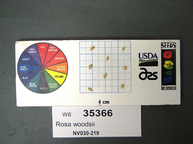 | | 2009 | COLLECTED | 10/07/2008 | Valley East of Pine Nut Mountains. Back Country Byway off 95A via Churchill Canyon Road, in large open field. | 39.04154000, -119.43305000 | | Desert in valley, large open field; soil dark grey, with gravel. Burned within past few years; site is used for livestock grazing. | Wild material | Red rose hips, thorny. Ht: 2-3 ft. | 1808194 | WLP 2345 |
| 31 | WLP 2310 | 176806 | Rosa woodsii Lindl. | Colorado, United States | NA | 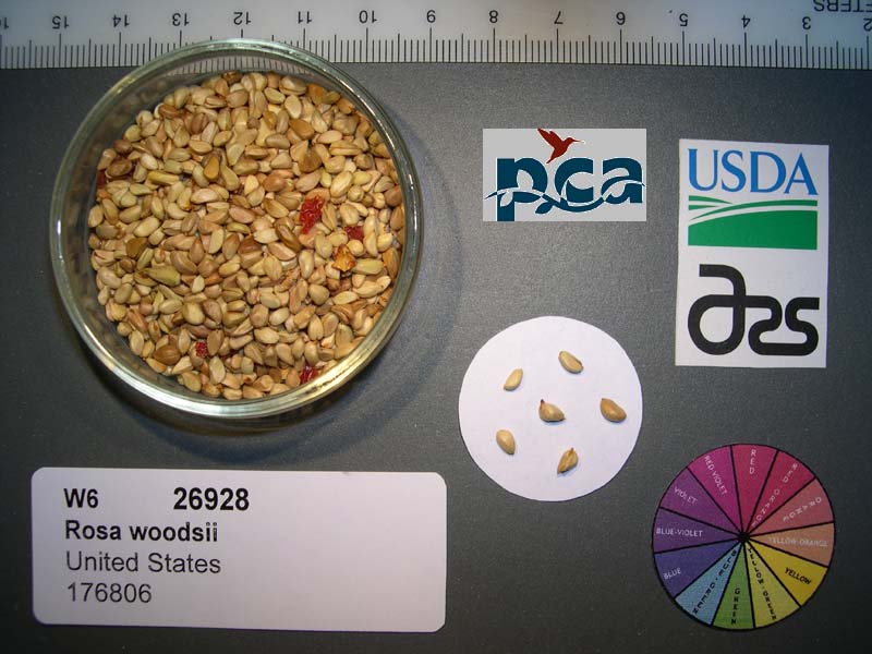 | | 2005 | COLLECTED | 08/05/2002 | | | 2255 | Stream bank; montane riparian community; soil very dark greyish-brown sand-silt.Montane riparian community. | Wild material | Shrub 0.9-2 meters tall. | 1673967 | WLP 2310 |
| 32 | NA 67718 | QLG091 | Rosa roxburghii Tratt. | Shaanxi Sheng, China | NA | | | 1996 | COLLECTED | 10/18/1996 | Liang He Xiang, enroute to Liping Forest Station | 32.93361111, 107.78361111 | 630 | Full sun along the roadside on a well-drained embankment just above a rice field; 40% S slope; growing w/ several grass species, herbaceous perennial species, Pyracantha fortuneana and Equisetum sp. | Wild material | | 1579543 | NA 67718 |
| 33 | WLP 1593 | SHX024 | Rosa henryi Boulenger | Shaanxi Sheng, China | NA | | | 1995 | COLLECTED | 04/09/1995 | Enroute to remote station, Beiba Province Grade Forest Bureau Preserve, Beiba County, Hanzhong District. | 32.69416667, 107.13611111 | 1480 | In full sun on well-drained soils between large boulders in association with Pinus sp., bamboo, Hydrangea sp., Populus sp., and other species. | Wild material | Deciduous, multi-stemmed, spreading shrub with upright arching branches about 8 meters wide and 3.5 meters tall. | 1496754 | WLP 1593 |
| 34 | PI 702728 | MARSB-630 | Sorghastrum nutans (L.) Nash | New York, United States | S9 | | | 2020 | | | | | | | Wild material | Round stem, flower branches arranged vertically in a straight, narrow infloresence where branches hug stem. Flowers have small twisted awn. | 2106463 | PI 702728 |
| 35 | PI 702717 | NCBG-648 | Sacciolepis striata (L.) Nash | Virginia, United States | S9 |  | | 2019 | | | | | | | Wild material | | 2098499 | PI 702717 |
| 36 | PI 702701 | MARSB-249 | Dichanthelium clandestinum (L.) Gould | New York, United States | S9 |  | | 2019 | | | | | | | Wild material | | 2097541 | PI 702701 |
| 37 | PI 704849 sos | R. flagellaris MARSB-128 | Rubus flagellaris Willd. | New Jersey, United States | COR |  | | 2019 | | | | | | | Wild material | | 2097493 | PI 704849 sos |
| 38 | PI 710515 | OR010-265 | Eleocharis macrostachya Britton | Oregon, United States | S9 |  | | 2015 | | | | | | | Wild material | | 1927502 | PI 710515 |
| 39 | PI 678497 | RU2012-5015 | Festuca rubra L. | Sakhalin, Russian Federation | W6 | | | 2013 | COLLECTED | 09/04/2012 | Dolinsky Region, 3 km N of Starodubskoye Village | 47.47870000, 142.70830000 | 0 | Seashore, dunes | Wild material | | 1909813 | PI 678497 |
| 40 | PI 678500 | RU2012-5023 | Festuca ovina L. | Sakhalin, Russian Federation | W6 | | | 2013 | COLLECTED | 09/05/2012 | Korsakov Region, near Ozersky Village | 46.59670000, 143.17930000 | -14 | Wet meadow close to sea | Wild material | | 1909819 | PI 678500 |
| 41 | PI 675304 | R10-01-005 | Bromus riparius Rehmann | Stavropol, Russian Federation | W6 | | | 2011 | COLLECTED | 07/17/2010 | 12 NW of Stavropol | 45.12900000, 41.85200000 | 436 | Stony steppe surrounded by forest (Quercus robur, Q. calcarea, Fraxinus exelsior): margin of gravel pit area: scraped shallow soils. Shallow sandy black A horizon, very stony, weathered limestone parent material and outcroppings: seed collected from >100 plants | Wild material | | 1883107 | PI 675304 |
| 42 | PI 675322 | R10-59-245 | Dactylis glomerata L. subsp. lobata (Drejer) H. Lindb. | Adygeja, Russian Federation | W6 | | | 2011 | COLLECTED | 08/04/2010 | Valley overlook, 6 km from Belaya River Bridge towards Lago-Naki Nature Reserve | 44.23700000, 40.15700000 | 780 | Roadside meadow, some disturbed areas. Steep limestone slope, SE exposure, collected along roadside: seed collected from >100 plants | Wild material | | 1883329 | PI 675322 |
| 43 | PI 675326 | R10-67-282 | Dactylis glomerata L. | Krasnodar, Russian Federation | W6 |  | | 2011 | COLLECTED | 08/05/2010 | | | | Sub-alpine forest. Collected by Larisa Bagmet and Olga Radchenko of VIR | Wild material | | 1883360 | PI 675326 |
| 44 | PI 676196 | R10-16-063 | Poa badensis Haenke ex Willd. | Stavropol, Russian Federation | W6 | | | 2011 | COLLECTED | 07/21/2010 | Grass meadow at top of Mashuk Mountain-South exposure near Pyatigorsk | 44.04900000, 43.09000000 | 976 | Steppe meadow. Near terminus of gondola, 30% slope south exposure, limestone parent material, black rocky soil: seed collected from >100 plants | Wild material | | 1883158 | PI 676196 |
| 45 | PI 678468 | R10-01-004 | Lolium perenne L. | Stavropol, Russian Federation | W6 |  | | 2011 | COLLECTED | 07/17/2010 | 12 NW of Stavropol | 45.12900000, 41.85200000 | 436 | Stony steppe surrounded by forest (Quercus robur, Q. calcarea, Fraxinus exelsior): margin of gravel pit area: scraped shallow soils. Shallow sandy black A horizon, very stony, weathered limestone parent material and outcroppings: seed collected from >100 plants | Wild material | | 1883106 | PI 678468 |
| 46 | PI 678478 | R10-16-064 | Festuca valesiaca Schleich. ex Gaudin | Stavropol, Russian Federation | W6 | | | 2011 | COLLECTED | 07/21/2010 | Grass meadow at top of Mashuk Mountain-South exposure near Pyatigorsk | 44.04900000, 43.09000000 | 976 | Steppe meadow. Near terminus of gondola, 30% slope south exposure, limestone parent material, black rocky soil: seed collected from >100 plants | Wild material | | 1883159 | PI 678478 |
| 47 | PI 678479 | R10-16-065 | Lolium perenne L. | Stavropol, Russian Federation | W6 |  | | 2011 | COLLECTED | 07/21/2010 | Grass meadow at top of Mashuk Mountain-South exposure near Pyatigorsk | 44.04900000, 43.09000000 | 976 | Steppe meadow. Near terminus of gondola, 30% slope south exposure, limestone parent material, black rocky soil: seed collected from >100 plants | Wild material | | 1883160 | PI 678479 |
| 48 | PI 678480 | R10-16-066 | Bromus riparius Rehmann | Stavropol, Russian Federation | W6 | | | 2011 | COLLECTED | 07/21/2010 | Grass meadow at top of Mashuk Mountain-South exposure near Pyatigorsk | 44.04900000, 43.09000000 | 976 | Steppe meadow. Near terminus of gondola, 30% slope south exposure, limestone parent material, black rocky soil: seed collected from >100 plants | Wild material | | 1883161 | PI 678480 |
| 49 | PI 678481 | R10-16-067 | Thinopyrum intermedium (Host) Barkworth & D. R. Dewey | Stavropol, Russian Federation | W6 | | | 2011 | COLLECTED | 07/21/2010 | Grass meadow at top of Mashuk Mountain-South exposure near Pyatigorsk | 44.04900000, 43.09000000 | 976 | Steppe meadow. Near terminus of gondola, 30% slope south exposure, limestone parent material, black rocky soil: seed collected from >100 plants | Wild material | | 1883162 | PI 678481 |
| 50 | PI 678482 | R10-19-071 | Melica transsilvanica Schur | Stavropol, Russian Federation | W6 | | | 2011 | COLLECTED | 07/21/2010 | Grass meadow at mid to low elevation of Mashuk Mountain-South exposure near Pyatigorsk | 44.04400000, 43.08800000 | 735 | Steppe meadow. 30% slope south exposure, limestone parent material, black rocky soil: seed collected from >100 plants | Wild material | | 1883166 | PI 678482 |
| 51 | PI 678483 | R10-19-072 | Poa pratensis L. subsp. angustifolia (L.) Arcang. | Stavropol, Russian Federation | W6 | | | 2011 | COLLECTED | 07/21/2010 | Grass meadow at mid to low elevation of Mashuk Mountain-South exposure near Pyatigorsk | 44.04400000, 43.08800000 | 735 | Steppe meadow. 30% slope south exposure, limestone parent material, black rocky soil: seed collected from >100 plants | Wild material | | 1883167 | PI 678483 |
| 52 | PI 678490 | R10-59-243 | Brachypodium rupestre (Host) Roem. & Schult. | Adygeja, Russian Federation | W6 | | | 2011 | COLLECTED | 08/04/2010 | Valley overlook, 6 km from Belaya River Bridge towards Lago-Naki Nature Reserve | 44.23700000, 40.15700000 | 780 | Roadside meadow, some disturbed areas. Steep limestone slope, SE exposure, collected along roadside: seed collected from >100 plants | Wild material | | 1883327 | PI 678490 |
| 53 | PI 678491 | R10-59-246 | Festuca arundinacea Schreb. | Adygeja, Russian Federation | W6 | | | 2011 | COLLECTED | 08/04/2010 | Valley overlook, 6 km from Belaya River Bridge towards Lago-Naki Nature Reserve | 44.23700000, 40.15700000 | 780 | Roadside meadow, some disturbed areas. Steep limestone slope, SE exposure, collected along roadside: seed collected from >100 plants | Wild material | | 1883404 | PI 678491 |
| 54 | PI 678772 | R10-16-061 | Poa compressa L. | Stavropol, Russian Federation | W6 | | | 2011 | COLLECTED | 07/21/2010 | Grass meadow at top of Mashuk Mountain-South exposure near Pyatigorsk | 44.04900000, 43.09000000 | 976 | Steppe meadow. Near terminus of gondola, 30% slope south exposure, limestone parent material, black rocky soil: seed collected from >100 plants | Wild material | | 1883156 | PI 678772 |
| 55 | PI 678773 | R10-17-068 | Poa badensis Haenke ex Willd. | Stavropol, Russian Federation | W6 | | | 2011 | COLLECTED | 07/21/2010 | Mid-elevation on Mashuk Mountain-South exposure near Pyatigorsk | 44.04700000, 43.08900000 | 859 | Steppe meadow. 40% slope, south exposure, rocky and exposed, limestone parent material: seed collected from >100 plants | Wild material | | 1883163 | PI 678773 |
| 56 | PI 685586 | R10-01-001 | Festuca rupicola Heuff. | Stavropol, Russian Federation | W6 | | | 2011 | COLLECTED | 07/17/2010 | 12 NW of Stavropol | 45.12900000, 41.85200000 | 436 | Stony steppe surrounded by forest (Quercus robur, Q. calcarea, Fraxinus exelsior): margin of gravel pit area: scraped shallow soils. Shallow sandy black A horizon, very stony, weathered limestone parent material and outcroppings: seed collected from >100 plants | Wild material | | 1883103 | PI 685586 |
| 57 | PI 685597 | R10-59-244 | Phleum phleoides (L.) H. Karst. | Adygeja, Russian Federation | W6 | | | 2011 | COLLECTED | 08/04/2010 | Valley overlook, 6 km from Belaya River Bridge towards Lago-Naki Nature Reserve | 44.23700000, 40.15700000 | 780 | Roadside meadow, some disturbed areas. Steep limestone slope, SE exposure, collected along roadside: seed collected from >100 plants | Wild material | | 1883328 | PI 685597 |
| 58 | PI 685598 | R10-59-247 | Poa compressa L. | Adygeja, Russian Federation | W6 | | | 2011 | COLLECTED | 08/04/2010 | Valley overlook, 6 km from Belaya River Bridge towards Lago-Naki Nature Reserve | 44.23700000, 40.15700000 | 780 | Roadside meadow, some disturbed areas. Steep limestone slope, SE exposure, collected along roadside: seed collected from >100 plants | Wild material | | 1883330 | PI 685598 |
| 59 | PI 685600 | R10-63-269 | Agrostis capillaris L. | Krasnodar, Russian Federation | W6 | | | 2011 | COLLECTED | 08/08/2010 | Golovinski Nature Reserve near Psetuapse River near Thagapsh | 43.97100000, 39.44300000 | 100 | Sub-tropical forest pasture. Limestone parent material, SW exposure, heavily grazed and disturbed meadow in sub-tropical forest opening, collection may be mixed with A. stolonifera: seed collected from >100 plants | Wild material | | 1883348 | PI 685600 |
| 60 | PI 693818 | R10-01-002 | Poa compressa L. | Stavropol, Russian Federation | W6 | | | 2011 | COLLECTED | 07/17/2010 | 12 NW of Stavropol | 45.12900000, 41.85200000 | 436 | Stony steppe surrounded by forest (Quercus robur, Q. calcarea, Fraxinus exelsior): margin of gravel pit area: scraped shallow soils. Shallow sandy black A horizon, very stony, weathered limestone parent material and outcroppings: seed collected from >100 plants | Wild material | | 1883104 | PI 693818 |
| 61 | PI 693819 | R10-01-003 | Poa pratensis L. subsp. angustifolia (L.) Arcang. | Stavropol, Russian Federation | W6 | | | 2011 | COLLECTED | 07/17/2010 | 12 NW of Stavropol | 45.12900000, 41.85200000 | 436 | Stony steppe surrounded by forest (Quercus robur, Q. calcarea, Fraxinus exelsior): margin of gravel pit area: scraped shallow soils. Shallow sandy black A horizon, very stony, weathered limestone parent material and outcroppings: seed collected from >100 plants | Wild material | | 1883105 | PI 693819 |
| 62 | PI 693828 | R10-16-062 | Dactylis glomerata L. subsp. glomerata | Stavropol, Russian Federation | W6 | | | 2011 | COLLECTED | 07/21/2010 | Grass meadow at top of Mashuk Mountain-South exposure near Pyatigorsk | 44.04900000, 43.09000000 | 976 | Steppe meadow. Near terminus of gondola, 30% slope south exposure, limestone parent material, black rocky soil: seed collected from >100 plants | Wild material | | 1883157 | PI 693828 |
| 63 | PI 675255 | UT933-50 | Eriocoma nelsonii (Scribn.) Romasch. subsp. nelsonii | Utah, United States | W6 |  | | 2009 | | | | | | | Wild material | Height: 3.5 feet. | 1808247 | PI 675255 |
| 64 | PI 667069 | S. racemosa GE-2007-39 | Sambucus racemosa L. subsp. racemosa | Georgia | COR | | | 2008 | COLLECTED | 08/12/2007 | Meskheti Province, AspinZa District, near village of Tmogvi, between Tmogvi and Vardzia. | 41.39222000, 43.31389000 | 1301 | Rocks near roadside with: Rhamnus pallasii, Rosa sp., Leonurus quinquelobatus, Prunela vulgaris, Urtica dioica, Campanula sp., Pulsatila violacea, Scabiosa meskhetica. | Wild material | | 1783161 | PI 667069 |
| 65 | PI 670383 | PRC-06-IN/116-386 | Agropyron michnoi Roshev. | Nei Mongol Zizhiqu, China | W6 |  | | 2007 | COLLECTED | 08/28/2006 | 43 km southwest of Jingpeng Town, Keshiketeng County | 43.06222222, 117.05888889 | 1304 | On sand dunes in hilly shrubby-steppe | Wild material | Hunshandake Sand Land, spike long and narrow | 1722555 | PI 670383 |
| 66 | PI 693773 | PRC-06-IN/116-382 | Agropyron cristatum (L.) Gaertn. | Nei Mongol Zizhiqu, China | W6 | | | 2007 | COLLECTED | 08/28/2006 | 43 km southwest of Jingpeng Town, Keshiketeng County | 43.06222222, 117.05888889 | 1304 | On sand dunes in hilly shrubby-steppe | Wild material | Hunshandake Sand Land, spike short and narrow | 1722553 | PI 693773 |
| 67 | PI 650946 | MN 85-21-20 | Malus hybr. | Kazakhstan | GEN | | | 2007 | COLLECTED | 09/21/1995 | Semipalitinsk Region (Tarbagatai Mountain Range). 20 km. North of Urdzhar. 7 km. Northeast of Alekseyevka. Landform mostly hillside. Collected in North end of West Valley, upstream 3 km. from site 05 (GMAL's 3604-3607, GMAL's 3760-3789). | 47.27000000, 81.57361111 | 990 | Silt to clay loam soil. Aspect: Mostly East. Dominant tree sp.: M. sieversii; Associated-Populus, Pyrus, Acer. Dominant shrub sp.: Rosa; Assoc.-Lonicera, Amygdalus, Rubus. Dominant herbaceous: Grasses; Assoc.-Potentilla, Fragaria. | Uncertain improvement status | Sampled 30 fruits from 1 tree. Selected for texture and flavor. Fruit is firm. Fruit size is larger than 50mm, scab detected. -- Domestic introgression intentified using 20K Illumina Infinium apple SNP array. Charlamoff is a grandparent | 1723377 | PI 650946 |
| 68 | PI 650948 | MN 85-21-47 | Malus sieversii (Ledeb.) M. Roem. | Kazakhstan | GEN | | | 2007 | COLLECTED | 09/21/1995 | Semipalitinsk Region (Tarbagatai Mountain Range). 20 km. North of Urdzhar, 6 km. East-Northeast of Alekseyevka, on separate jeep trail. East Valley collection site. Collected on north end on flat by East River. | 47.27805556, 81.59972222 | 1120 | Flat slope. Dominant tree sp.: M. sieversii. Dominant shrub sp.: Rosa; Associated-Lonicera, Rubus. Dominant herbaceous: Malva; Assoc.-Fragaria. | Wild material | Sampled 60 fruits from 1 tree. Fruit is hard with aromatic flesh flavor. Over color is 90% red. Fruit size is larger than 50mm, free of scab. Very heavy cropload. | 1723379 | PI 650948 |
| 69 | PI 650951 | MN 85-22-81 | Malus hybr. | Kazakhstan | GEN | | | 2007 | COLLECTED | 09/21/1995 | Semipalitinsk Region (Tarbagatai Mountain Range). 20 km. North of Urdzhar, 6 km. NE of Alekseyevka. Slopes of East-West Valley. Collected on north slope of North Valley. Between & East of sites 05 & 06 (GMAL's 3604-3615, GMAL's 3760-3789). | 47.27055556, 81.57916667 | 960 | Slope incline: 5-20 degrees. Aspect: South and North. Rainfall: 400 mm. Dominant tree sp.: M. sieversii; Assoc.-Crataegus. Dominant shrub sp.: Rosa; Associated-Amydalus. Dominant herbaceous: Aster. | Uncertain improvement status | Sampled 5 fruits from 1 tree. Fruit is firm. Fruit size is larger than 50mm.Over color is 80% red. -- Domestic introgression intentified using 20K Illumina Infinium apple SNP array. Kaiser_Alexander is likely a great-grandparent | 1723382 | PI 650951 |
| 70 | PI 650952 | MN 85-23-53 | Malus hybr. | Kazakhstan | GEN | | | 2007 | COLLECTED | 09/21/1995 | Semipalitinsk Region (Tarbagatai Mountain Range). 20 km. North of Urdzhar. 5 km. Northeast of Alekseyevka. Collected mainly on west slopes in center of West Valley. Equidistant between sites 05 & 06 (GMAL's 3604-3615, GMAL's 3760-3789). | 47.25555556, 81.57222222 | 920 | Silt to clay loam soil. Aspect: West. Landform mostly hillside. Dominant tree sp.: M. sieversii. Dominant shrub sp.: Rosa; Associated-Lonicera, Rubus. Dominant herbaceous: Malva; Assoc.-Fragaria. | Uncertain improvement status | Sampled 15 fruits from 1 tree. Fruit is firm with aromatic flesh flavor. Over color is 80% red. Fruit size is larger than 50mm. Small amount of scab detected. Very column-shaped tree. Scion also collected. -- Domestic introgression intentified using 20K Illumina Infinium apple SNP array. One parent has Kaiser_Alexander as an offspring, the other has domestic haplotypes, including significant haplotypes from Gragylling, which could be a grandparent or great-grandparent of the 2nd parent | 1723383 | PI 650952 |
| 71 | PI 650956 | MN 85-25-48 | Malus hybr. | Kazakhstan | GEN | | | 2007 | COLLECTED | 09/21/1995 | Semipalitinsk Region (Tarbagatai Mountain Range). 20 km. North of Urdzhar. 5 km. Northeast of Alekseyevka. Collected mainly on west slopes in center of West Valley. Equidistant between sites 05 & 06 (GMAL's 3604-3615, GMAL's 3760-3789). | 47.25555556, 81.57222222 | 920 | Silt to clay loam soil. Aspect: West. Landform mostly hillside. Dominant tree sp.: M. sieversii. Dominant shrub sp.: Rosa; Associated-Lonicera, Rubus. Dominant herbaceous: Malva; Assoc.-Fragaria. | Uncertain improvement status | Sampled 15 fruits from 1 tree. Flesh flavor is aromatic. Fruit size is larger than 50mm obtained from a small tree. -- Domestic introgression intentified using 20K Illumina Infinium apple SNP array. Charlamoff is a grandparent | 1723387 | PI 650956 |
| 72 | PI 650959 | MN 85-25-84 | Malus hybr. | Kazakhstan | GEN | | | 2007 | COLLECTED | 09/21/1995 | Semipalitinsk Region (Tarbagatai Mountain Range). 20 km. North of Urdzhar, 3-4 km. Northeast of Alekseyevka. Collected from west end between Middle and South Valley, on a ridge. | 47.26444444, 81.58472222 | 1000 | Slope incline: 3 degrees. Aspect: Northwest. Dominant tree sp.: M. sieversii. Dominant shrub sp.: Amygdalus; Associated-Rosa. Dominant herbaceous: Aster; Assoc.-Xanthium. | Uncertain improvement status | Sampled 50 fruits from 1 tree. Flesh flavor is aromatic. Over color is 85% red. Fruit size is larger than 50mm, moderate scab. Largest apple found in Tarbagatui (over 73mm). Scion also collected. -- Domestic introgression intentified using 20K Illumina Infinium apple SNP array. | 1723390 | PI 650959 |
| 73 | PI 650960 | MN 85-25-97 | Malus hybr. | Kazakhstan | GEN | | | 2007 | COLLECTED | 09/21/1995 | Semipalitinsk Region (Tarbagatai Mountain Range). 20 km. North of Urdzhar. 7 km. Northeast of Alekseyevka. Landform mostly hillside. Collected in North end of West Valley, upstream 3 km. from site 05 (GMAL's 3604-3607, GMAL's 3760-3789). | 47.27000000, 81.57361111 | 990 | Silt to clay loam soil. Aspect: Mostly East. Dominant tree sp.: M. sieversii; Associated-Populus, Pyrus, Acer. Dominant shrub sp.: Rosa; Assoc.-Lonicera, Amygdalus, Rubus. Dominant herbaceous: Grasses; Assoc.-Potentilla, Fragaria. | Uncertain improvement status | Sampled 30 fruits from 1 tree. Selected for texture and flavor. Fruit is firm. Fruit size is larger than 50mm, scab detected. -- Domestic introgression intentified using 20K Illumina Infinium apple SNP array. Charlamoff or Gold_Reinette is a grandparent | 1723391 | PI 650960 |
| 74 | PI 650964 | MN 85-26-18 | Malus hybr. | Kazakhstan | GEN |  | | 2007 | COLLECTED | 09/21/1995 | Semipalitinsk Region (Tarbagatai Mountain Range). 20 km. North of Urdzhar, 6 km. East-Northeast of Alekseyevka, on separate jeep trail. East Valley collection site. Collected on south end by East River. | 47.27777778, 81.59805556 | 1120 | Dominant tree sp.: M. sieversii. Dominant shrub sp.: Rosa; Associated-Lonicera, Rubus. Dominant herbaceous: Malva; Assoc.-Fragaria. | Uncertain improvement status | Sampled 30 fruits from 1 tree. Flesh flavor is aromatic. Fruit size is larger than 50mm, free of scab. Tree has wide angle branching, side branches long, central leader dominant. Heavy cropload. -- Domestic introgression intentified using 20K Illumina Infinium apple SNP array. Kaiser_Alexander is a grandparent | 1723395 | PI 650964 |
| 75 | PI 650966 | MN 85-26-66 | Malus hybr. | Kazakhstan | GEN | | | 2007 | COLLECTED | 09/21/1995 | Semipalitinsk Region (Tarbagatai Mountain Range). Village of Alekseyevka. 4 km. Northeast of Alekseyevka, 20 km. North of Urdzhar. Flat area near stream. Collected in South end of West Valley. Coordinates in Urdzhar: 47-05-01, 81-37-49. | 47.24416667, 81.57055556 | 870 | Temp: max. +41, min. -40. Stoney gravely loam soil. Good drainage. 400 mm rainfall. Dominant tree sp.: Populus. Dominant shrub sp.: Crataegus, Rosa; Associated-Viburnum. Random pop. as close as 20 m. to stream. Many new small trees growing. | Uncertain improvement status | Sampled 30 fruits from 1 tree. Fruit is firm with aromatic flavor. Fruit size is larger than 50mm. -- Domestic introgression intentified using 20K Illumina Infinium apple SNP array. Kaiser_Alexander is a grandparent or great-grandparent | 1723397 | PI 650966 |
| 76 | PI 650967 | MN 85-26-95 | Malus hybr. | Kazakhstan | GEN | | | 2007 | COLLECTED | 09/21/1995 | Semipalitinsk Region (Tarbagatai Mountain Range). 20 km. North of Urdzhar, 3-4 km. Northeast of Alekseyevka. Collected in West and South Valley. | 47.26444444, 81.58472222 | 1000 | Slope incline: 3 degrees. Aspect: South. Dominant tree sp.: M. sieversii. Dominant shrub sp.: Amygdalus; Associated-Rosa. Dominant herbaceous: Aster; Assoc.-Xanthium. | Uncertain improvement status | Sampled 30 fruits from 1 tree. Summer apple. Fruit over mature, but still hanging tightly. Fruit is firm with aromatic flesh flavor. Over color is 70% red. Fruit size is larger than 50mm. Spur type tree. -- Domestic introgression intentified using 20K Illumina Infinium apple SNP array. Charlamoff and Zigeunerinapfel are possibly grandparents through opposite parents | 1723398 | PI 650967 |
| 77 | PI 650968 | MN 85-26-96 | Malus hybr. | Kazakhstan | GEN | | | 2007 | COLLECTED | 09/21/1995 | Semipalitinsk Region (Tarbagatai Mountain Range). 20 km. North of Urdzhar, 3-4 km. Northeast of Alekseyevka. Collected in West and South Valley. | 47.26444444, 81.58472222 | 1000 | Slope incline: 3 degrees. Aspect: South. Dominant tree sp.: M. sieversii. Dominant shrub sp.: Amygdalus; Associated-Rosa. Dominant herbaceous: Aster; Assoc.-Xanthium. | Uncertain improvement status | Sampled 30 fruits from 1 tree. Summer apple. Fruit over mature, but still hanging tightly. Fruit is firm with aromatic flesh flavor. Over color is 70% red. Fruit size is larger than 50mm. Spur type tree. -- Domestic introgression intentified using 20K Illumina Infinium apple SNP array. Charlamoff is a grandparent | 1723399 | PI 650968 |
| 78 | PI 650969 | Mn 88-27-62 | Malus hybr. | Kazakhstan | GEN | | | 2007 | COLLECTED | 09/21/1995 | Semipalitinsk Region (Tarbagatai Mountain Range). 20 km. North of Urdzhar, 6 km. East-Northeast of Alekseyevka, on separate jeep trail. East Valley collection site. Collected on north end on flat by East River. | 47.27805556, 81.59972222 | 1120 | Slope incline 2 degrees. Aspect: East. Dominant tree sp.: M. sieversii. Dominant shrub sp.: Rosa; Associated-Lonicera, Rubus. Dominant herbaceous: Malva; Assoc.-Fragaria. | Uncertain improvement status | Sampled 30 fruits from 1 tree. Fruit is firm with aromatic flesh flavor. Over color is 70% red. Fruit size is larger than 50mm. Looks scab free. Winter type. Commercial size. -- Domestic introgression intentified using 20K Illumina Infinium apple SNP array. | 1723400 | PI 650969 |
| 79 | PI 650972 | MN 88-28-25 | Malus hybr. | Kazakhstan | GEN | | | 2007 | COLLECTED | 09/21/1995 | Semipalitinsk Region (Tarbagatai Mountain Range). 20 km. North of Urdzhar, 3-4 km. Northeast of Alekseyevka. Collected from west end between Middle and South Valley, on a ridge. | 47.26444444, 81.58472222 | 1000 | Slope incline: 3 degrees. Aspect: Northwest. Dominant tree sp.: M. sieversii. Dominant shrub sp.: Amygdalus; Associated-Rosa. Dominant herbaceous: Aster; Assoc.-Xanthium. | Uncertain improvement status | Sampled 50 fruits from 1 tree. Flesh flavor is aromatic. Over color is 85% red. Fruit size is larger than 50mm, moderate scab. Largest apple found in Tarbagatui (over 73mm). Scion also collected. -- Domestic introgression intentified using 20K Illumina Infinium apple SNP array. | 1723403 | PI 650972 |
| 80 | PI 650973 | MN 88-28-59 | Malus hybr. | Kazakhstan | GEN | | | 2007 | COLLECTED | 09/21/1995 | Semipalitinsk Region (Tarbagatai Mountain Range). 20 km. North of Urdzhar, 3-4 km. Northeast of Alekseyevka. Collected in Middle and South Valley. | 47.26444444, 81.58472222 | 1000 | Aspect: North. Dominant tree sp.: M. sieversii. Dominant shrub sp.: Amygdalus; Associated-Rosa. Dominant herbaceous: Aster; Assoc.-Xanthium. | Uncertain improvement status | Sampled 40 fruits from 1 tree. Flesh flavor is acid/aromatic mix. Fruit size is larger than 50mm. Nice clean finish. -- Domestic introgression intentified using 20K Illumina Infinium apple SNP array. Yellow_Transparent and Gold_Reinette are possibly grandparents through opposite parents | 1723404 | PI 650973 |
| 81 | PI 650975 | MN 88-28-121 | Malus hybr. | Kazakhstan | GEN | | | 2007 | COLLECTED | 09/21/1995 | Semipalitinsk Region (Tarbagatai Mountain Range). 20 km. North of Urdzhar, 3-4 km. Northeast of Alekseyevka. Collected in West and South Valley. | 47.26444444, 81.58472222 | 1000 | Slope incline: 3 degrees. Aspect: South. Dominant tree sp.: M. sieversii. Dominant shrub sp.: Amygdalus; Associated-Rosa. Dominant herbaceous: Aster; Assoc.-Xanthium. | Uncertain improvement status | Sampled 30 fruits from 1 tree. Summer apple. Fruit over mature, but still hanging tightly. Fruit is firm with aromatic flesh flavor. Over color is 70% red. Fruit size is larger than 50mm. Spur type tree. -- Domestic introgression intentified using 20K Illumina Infinium apple SNP array. Charlamoff is a grandparent | 1723406 | PI 650975 |
| 82 | PI 650977 | MN 88-29-27 | Malus hybr. | Kazakhstan | GEN | | | 2007 | COLLECTED | 09/21/1995 | Semipalitinsk Region (Tarbagatai Mountain Range). 20 km. North of Urdzhar, 3-4 km. Northeast of Alekseyevka. Collected in West and South Valley. | 47.26444444, 81.58472222 | 1000 | Slope incline: 5-10 degrees. Aspect: South. Dominant tree sp.: M. sieversii. Dominant shrub sp.: Amygdalus; Associated-Rosa. Dominant herbaceous: Aster; Assoc.-Xanthium. | Uncertain improvement status | Sampled 150 fruits from 1 tree. Fruit is firm with aromatic flesh flavor. Over color is 90% red. Fruit size is larger than 50mm, no scab. Closest to McIntosh group of those sampled. Spur type tree. Scion also collected. -- Domestic introgression intentified using 20K Illumina Infinium apple SNP array. | 1723408 | PI 650977 |
| 83 | PI 650979 | MN 88-29-50 | Malus hybr. | Kazakhstan | GEN | | | 2007 | COLLECTED | 09/21/1995 | Semipalitinsk Region (Tarbagatai Mountain Range). 20 km. North of Urdzhar, 3-4 km. Northeast of Alekseyevka. Collected in West and South Valley. | 47.26444444, 81.58472222 | 1000 | Slope incline: 5-10 degrees. Aspect: South. Dominant tree sp.: M. sieversii. Dominant shrub sp.: Amygdalus; Associated-Rosa. Dominant herbaceous: Aster; Assoc.-Xanthium. | Uncertain improvement status | Sampled 30 fruits from 1 tree. Tree has wide branch angles. Late fruit and leaves damaged by hail. Fruit is firm with aromatic flesh flavor. Fruit size is larger than 50mm, no scab. Spur type tree. -- Domestic introgression intentified using 20K Illumina Infinium apple SNP array. Gold_Reinette is a grandparent | 1723410 | PI 650979 |
| 84 | PI 650980 | MN 88-29-56 | Malus sieversii (Ledeb.) M. Roem. | Kazakhstan | GEN | | | 2007 | COLLECTED | 09/21/1995 | Semipalitinsk Region (Tarbagatai Mountain Range). 20 km. North of Urdzhar, 3-4 km. Northeast of Alekseyevka. Collected in West and South Valley. | 47.26444444, 81.58472222 | 1000 | Slope incline: 5-10 degrees. Aspect: South. Dominant tree sp.: M. sieversii. Dominant shrub sp.: Amygdalus; Associated-Rosa. Dominant herbaceous: Aster; Assoc.-Xanthium. | Wild material | Sampled 30 fruits from 1 tree. Tree has wide branch angles. Late fruit and leaves damaged by hail. Fruit is firm with aromatic flesh flavor. Fruit size is larger than 50mm, no scab. Spur type tree. | 1723411 | PI 650980 |
| 85 | PI 651001 | MN 80-16-29 | Malus sieversii (Ledeb.) M. Roem. | Kazakhstan | GEN |  | | 2007 | COLLECTED | 09/19/1996 | Kok Bulak (Black Spring) Forestry Camp. 35 km southeast of Boraldy Camp visited in 1995. Collections made in and around camp-noth, east, south of camp. | 42.70750000, 70.28944444 | 1040 | Variable and open, stream bed and hillsides. Rainfall 275mm. Dominant tree sp: Crataegus; Assoc.-Malus, Vitis, Morus Rhamnus. Dominant shrub sp: Amygdalus, Pyrus, Rosa. Dominant herbaceous: Grasses. | Wild material | Sampled 80 fruits from 1 tree. Fruit size is larger than 50mm. Free of disease and insects. Overripe. | 1723432 | PI 651001 |
| 86 | PI 651002 | MN 80-16-34 | Malus sieversii (Ledeb.) M. Roem. | Kazakhstan | GEN |  | | 2007 | COLLECTED | 09/19/1996 | Kok Bulak (Black Spring) Forestry Camp. 35 km southeast of Boraldy Camp visited in 1995. Collected along river east of camp. | 42.67111111, 70.25777778 | 800 | Variable and open, stream bed and hillsides. Rainfall 275mm. Dominant tree sp: Crataegus; Assoc.-Malus, Vitis, Morus Rhamnus. Dominant shrub sp: Amygdalus, Pyrus, Rosa. Dominant herbaceous: Grasses. | Wild material | Sampled 100 fruits from 1 tree. Flesh flavor is subacid. Over color is 70% red. Free of disease and insects. Scion collected also. | 1723433 | PI 651002 |
| 87 | PI 651004 | MN 88-29-42 | Malus hybr. | Kazakhstan | GEN | | | 2007 | COLLECTED | 09/21/1995 | Semipalitinsk Region (Tarbagatai Mountain Range). 20 km. North of Urdzhar, 3-4 km. Northeast of Alekseyevka. Collected in West and South Valley. | 47.26444444, 81.58472222 | 1000 | Slope incline: 5-10 degrees. Aspect: South. Dominant tree sp.: M. sieversii. Dominant shrub sp.: Amygdalus; Associated-Rosa. Dominant herbaceous: Aster; Assoc.-Xanthium. | Uncertain improvement status | Sampled 30 fruits from 1 tree. Tree has wide branch angles. Late fruit and leaves damaged by hail. Fruit is firm with aromatic flesh flavor. Fruit size is larger than 50mm, no scab. Spur type tree. -- Domestic introgression intentified using 20K Illumina Infinium apple SNP array. Gold_Reinette is a grandparent | 1723435 | PI 651004 |
| 88 | PI 644197 | MN 85-24-53 | Malus hybr. | Kazakhstan | GEN | | | 2006 | COLLECTED | 08/29/1995 | Semipalitinsk Region (Tarbagatai Mountain Range). 20 km. North of Urdzhar. 5 km. Northeast of Alekseyevka. Collected mainly on west slopes in center of West Valley. Equidistant between sites 05 & 06 (GMAL's 3604-3615, GMAL's 3760-3789). | 47.25555556, 81.57222222 | 920 | Silt to clay loam soil. Aspect: West. Landform mostly hillside. Dominant tree sp.: M. sieversii. Dominant shrub sp.: Rosa; Associated-Lonicera, Rubus. Dominant herbaceous: Malva; Assoc.-Fragaria. | Uncertain improvement status | Sampled 40 fruits from 1 tree. Flesh flavor is aromatic. Over color is 90% red. Fruit size is larger than 50mm. Spur type tree. GMAL 4712 is an individual seedling selection from seedlot GMAL 3622. It was grown at the University of Minnesota. Comments from Minnesota: attractive. -- Domestic introgression intentified using 20K Illumina Infinium apple SNP array. Charlamoff is a grandparent | 1708180 | PI 644197 |
| 89 | PI 644198 | MN 85-22-99 | Malus sieversii (Ledeb.) M. Roem. | Kazakhstan | GEN |  | | 2006 | COLLECTED | 08/30/1995 | Semipalitinsk Region (Tarbagatai Mountain Range). 20 km. North of Urdzhar. 5 km. Northeast of Alekseyevka. Collected mainly on west slopes in center of West Valley. Equidistant between sites 05 & 06 (GMAL's 3604-3615, GMAL's 3760-3789). | 47.25555556, 81.57222222 | 920 | Silt to clay loam soil. Aspect: North. Landform mostly hillside. Dominant tree sp.: M. sieversii. Dominant shrub sp.: Rosa; Associated-Lonicera, Rubus. Dominant herbaceous: Malva; Assoc.-Fragaria. | Wild material | Sampled 30 fruits from 1 tree. Looks like a domesticated apple. Fruit is firm with aromatic flesh flavor, juicy. Fruit size is larger than 50mm. Winter keeper. Very heavy cropload. Scion also collected. GMAL 4713 is an individual seedling selection from seedlot GMAL 3623. It was grown at the University of Minnesota. Comments from Minnesota: scab resistant. | 1708286 | PI 644198 |
| 90 | PI 644199 | MN 85-26-21 | Malus hybr. | Kazakhstan | GEN |  | | 2006 | COLLECTED | 08/30/1995 | Semipalitinsk Region (Tarbagatai Mountain Range). 20 km. North of Urdzhar. 5 km. Northeast of Alekseyevka. Collected mainly on west slopes in center of West Valley. Equidistant between sites 05 & 06 (GMAL's 3604-3615, GMAL's 3760-3789). | 47.25555556, 81.57222222 | 920 | Silt to clay loam soil. Aspect: North. Landform mostly hillside. Dominant tree sp.: M. sieversii. Dominant shrub sp.: Rosa; Associated-Lonicera, Rubus. Dominant herbaceous: Malva; Assoc.-Fragaria. | Uncertain improvement status | Sampled 30 fruits from 1 tree. Looks like a domesticated apple. Fruit is firm with aromatic flesh flavor, juicy. Fruit size is larger than 50mm. Winter keeper. Very heavy cropload. Scion also collected. GMAL 4714 is an individual seedling selction from seedlot GMAL 3623. It was grown at the University of Minnesota. Comments from Minnesota: nice texture. -- One fully domesticated parent intentified using 20K Illumina Infinium apple SNP array. Grandparentage is Kulon_Kitaika and Gold_Reinette | 1708287 | PI 644199 |
| 91 | PI 644200 | MN 85-28-17 | Malus hybr. | Kazakhstan | GEN |  | | 2006 | COLLECTED | 08/30/1995 | Semipalitinsk Region (Tarbagatai Mountain Range). 20 km. North of Urdzhar. 5 km. Northeast of Alekseyevka. Collected mainly on west slopes in center of West Valley. Equidistant between sites 05 & 06 (GMAL's 3604-3615, GMAL's 3760-3789). | 47.25555556, 81.57222222 | 920 | Silt to clay loam soil. Aspect: North. Landform mostly hillside. Dominant tree sp.: M. sieversii. Dominant shrub sp.: Rosa; Associated-Lonicera, Rubus. Dominant herbaceous: Malva; Assoc.-Fragaria. | Uncertain improvement status | Sampled 30 fruits from 1 tree. Looks like a domesticated apple. Fruit is firm with aromatic flesh flavor, juicy. Fruit size is larger than 50mm. Winter keeper. Very heavy cropload. Scion also collected. GMAL 4715 is an individual seedling selection from seedlot GMAL 3623. It was grown at the University of Minnesota. Comments from Minnesota: late ripening. -- One fully domesticated parent intentified using 20K Illumina Infinium apple SNP array. Grandparentage is Kulon_Kitaika and Gold_Reinette | 1708288 | PI 644200 |
| 92 | PI 644201 | MN 85-28-25 | Malus hybr. | Kazakhstan | GEN | | | 2006 | COLLECTED | 08/30/1995 | Semipalitinsk Region (Tarbagatai Mountain Range). 20 km. North of Urdzhar. 5 km. Northeast of Alekseyevka. Collected mainly on west slopes in center of West Valley. Equidistant between sites 05 & 06 (GMAL's 3604-3615, GMAL's 3760-3789). | 47.25555556, 81.57222222 | 920 | Silt to clay loam soil. Aspect: North. Landform mostly hillside. Dominant tree sp.: M. sieversii. Dominant shrub sp.: Rosa; Associated-Lonicera, Rubus. Dominant herbaceous: Malva; Assoc.-Fragaria. | Uncertain improvement status | Sampled 30 fruits from 1 tree. Looks like a domesticated apple. Fruit is firm with aromatic flesh flavor, juicy. Fruit size is larger than 50mm. Winter keeper. Very heavy cropload. Scion also collected. GMAL 4716 is an individual seedling selection from seed lot GMAL 3623. It was grown at the University of Minnesota. Comments from Minnesota: late ripening. -- One fully domesticated parent intentified using 20K Illumina Infinium apple SNP array. Grandparentage is Kulon_Kitaika and Gold_Reinette | 1708310 | PI 644201 |
| 93 | PI 644202 | MN 88-27-40 | Malus hybr. | Kazakhstan | GEN | | | 2006 | COLLECTED | 08/31/1995 | Semipalitinsk Region (Tarbagatai Mountain Range). 20 km. North of Urdzhar, 6 km. East-Northeast of Alekseyevka, on separate jeep trail. East Valley collection site. Collected on north end on flat by East River. | 47.27805556, 81.59972222 | 1120 | Slope incline 2 degrees. Aspect: East. Dominant tree sp.: M. sieversii. Dominant shrub sp.: Rosa; Associated-Lonicera, Rubus. Dominant herbaceous: Malva; Assoc.-Fragaria. | Uncertain improvement status | Sampled 30 fruits from 1 tree. Fruit is firm with aromatic flesh flavor. Over color is 70% red. Fruit size is larger than 50mm. Looks scab free. Winter type. Commercial size. GMAL 4717 is an individual seedling selection from seed lot GMAL 3626. It was grown at the University of Minnesota. Comments from Minnesota: scab resistant. -- Domestic introgression intentified using 20K Illumina Infinium apple SNP array. Gold_Reinette is a grandparent | 1708316 | PI 644202 |
| 94 | PI 644203 | MN-88-27-43 | Malus hybr. | Kazakhstan | GEN | | | 2006 | COLLECTED | 08/31/1995 | Semipalitinsk Region (Tarbagatai Mountain Range). 20 km. North of Urdzhar, 6 km. East-Northeast of Alekseyevka, on separate jeep trail. East Valley collection site. Collected on north end on flat by East River. | 47.27805556, 81.59972222 | 1120 | Slope incline 2 degrees. Aspect: East. Dominant tree sp.: M. sieversii. Dominant shrub sp.: Rosa; Associated-Lonicera, Rubus. Dominant herbaceous: Malva; Assoc.-Fragaria. | Uncertain improvement status | Sampled 30 fruits from 1 tree. Fruit is firm with aromatic flesh flavor. Over color is 70% red. Fruit size is larger than 50mm. Looks scab free. Winter type. Commercial size. GMAL 4718 is an individual seedling selction from seed lot GMAL 3626. It was grown at the University of Minnesota. Comments from Minnesota: scab resistant. -- Domestic introgression intentified using 20K Illumina Infinium apple SNP array. Gold_Reinette is a grandparent | 1708318 | PI 644203 |
| 95 | PI 644205 | MN 88-28-52 | Malus hybr. | Kazakhstan | GEN |  | | 2006 | COLLECTED | 08/31/1995 | Semipalitinsk Region (Tarbagatai Mountain Range). 20 km. North of Urdzhar, 3-4 km. Northeast of Alekseyevka. Collected in Middle and South Valley. | 47.26444444, 81.58472222 | 1000 | Aspect: North. Dominant tree sp.: M. sieversii. Dominant shrub sp.: Amygdalus; Associated-Rosa. Dominant herbaceous: Aster; Assoc.-Xanthium. | Uncertain improvement status | Sampled 40 fruits from 1 tree. Flesh flavor is acid/aromatic mix. Fruit size is larger than 50mm. Nice clean finish. GMAL 4720 is an individual seedling selection form seed lot GMAL 3640. It was grown at the University of Minnesota. Comments from Minnesota: large, yellow fruit. -- Domestic introgression intentified using 20K Illumina Infinium apple SNP array. Yellow_Transparent and Gold_Reinette are possibly grandparents through opposite parents | 1708324 | PI 644205 |
| 96 | PI 644206 | MN 85-21-112 | Malus hybr. | Kazakhstan | GEN | | | 2006 | COLLECTED | 08/31/1995 | Semipalitinsk Region (Tarbagatai Mountain Range). 20 km. North of Urdzhar, 3-4 km. Northeast of Alekseyevka. Collected from east end of Middle Valley. | 47.26444444, 81.58472222 | 1000 | Aspect: North. Dominant tree sp.: M. sieversii. Dominant shrub sp.: Amygdalus; Associated-Rosa. Dominant herbaceous: Aster; Assoc.-Xanthium. | Uncertain improvement status | Sampled 30 fruits from 1 tree. Fruit is hard with aromatic flesh flavor. Over color is 90% red. Fruit size is larger than 50mm. Very free of disease. GMAL 4721 is a individual seedling selection from seed lot GMAL 3641. It was grown at the University of Minnesota. Comments from Minnesota: large, yellow fruit. -- Domestic introgression intentified using 20K Illumina Infinium apple SNP array. Kaiser_Alexander is a grandparent | 1708672 | PI 644206 |
| 97 | PI 644207 | MN 85-23-21 | Malus hybr. | Kazakhstan | GEN | | | 2006 | COLLECTED | 08/31/1995 | Semipalitinsk Region (Tarbagatai Mountain Range). 20 km. North of Urdzhar, 3-4 km. Northeast of Alekseyevka. Collected from east end of Middle Valley. | 47.26444444, 81.58472222 | 1000 | Aspect: North. Dominant tree sp.: M. sieversii. Dominant shrub sp.: Amygdalus; Associated-Rosa. Dominant herbaceous: Aster; Assoc.-Xanthium. | Uncertain improvement status | Sampled 30 fruits from 1 tree. Fruit is hard with aromatic flesh flavor. Over color is 90% red. Fruit size is larger than 50mm. Very free of disease. GMAL 4722 is an individual seedling selection from seed lot GMAL 3641. It was grown at the University of Minnesota. Comments from Minnesota: scab resistant. -- Domestic introgression intentified using 20K Illumina Infinium apple SNP array. Kaiser_Alexander is a grandparent | 1708673 | PI 644207 |
| 98 | PI 644208 | MN 88-29-71 | Malus hybr. | Kazakhstan | GEN |  | | 2006 | COLLECTED | 08/31/1995 | Semipalitinsk Region (Tarbagatai Mountain Range). 20 km. North of Urdzhar, 3-4 km. Northeast of Alekseyevka. Collected in West and South Valley. | 47.26444444, 81.58472222 | 1000 | Slope incline: 10 degrees. Aspect: South. Dominant tree sp.: M. sieversii. Dominant shrub sp.: Amygdalus; Associated-Rosa. Dominant herbaceous: Aster; Assoc.-Xanthium. | Uncertain improvement status | Sampled 30 fruits from 1 tree. Fruit is firm with aromatic flesh flavor, juicy. No scab present. Hail damage. Fruit larger than 50mm. Very free of disease. Spur type tree. GMAL 4723 is an individual seedling selection seed lot GMAL 3649. It was grown at the University of Minnesota. Comments from Minnesota: large, yellow fruit. -- Domestic introgression intentified using 20K Illumina Infinium apple SNP array. Kaiser_Alexander and Gold_Reinette are possibly grandparents through opposite parents | 1708674 | PI 644208 |
| 99 | PI 644209 | MN 85-23-14 | Malus hybr. | Kazakhstan | GEN | | | 2006 | COLLECTED | 08/29/2006 | Semipalitinsk Region (Tarbagatai Mountain Range). Village of Alekseyevka. 4 km. Northeast of Alekseyevka, 20 km. North of Urdzhar. Flat area near stream. Collected in South end of West Valley. Coordinated in Urdzhar: 47-05-01, 81-37-49. | 47.24416667, 81.57055556 | 870 | Temp: max. +41, min. -40. Stoney gravely loam soil. Good drainage. 400mm rainfall. Dominant tree sp.: Populus. Dominant shrub sp.: Crataugus, Rosa; Associated-Viburnum. Random pop. as close as 20 m. to stream. Many new small trees growing. | Uncertain improvement status | Sampled 5 fruits from 1 tree. Fruit is firm. GMAL 4724 is an individual seedling selection from seed lot GMAL 3760. It was grown at the University of Minnesota. Comments from Minnesota: scab resistant. -- Domestic introgression intentified using 20K Illumina Infinium apple SNP array. Gold_Reinette is a grandparent | 1708675 | PI 644209 |
| 100 | PI 644210 | MN 85-23-37 | Malus hybr. | Kazakhstan | GEN | | | 2006 | COLLECTED | 08/30/1995 | Semipalitinsk Region (Tarbagatai Mountain Range). 20 km. North of Urdzhar, 6 km. NE of Alekseyevka. Slopes of East-West Valley. Collected on north slope of North Valley. Between & East of sites 05 & 06 (GMAL's 3604-3615, GMAL's 3760-3789). | 47.27055556, 81.57916667 | 960 | Slope incline: 5-20 degrees. Aspect: South and North. Rainfall: 400 mm. Dominant tree sp.: M. sieversii; Assoc.-Crataegus. Dominant shrub sp.: Rosa; Associated-Amydalus. Dominant herbaceous: Aster. | Uncertain improvement status | Sampled 5 fruits from 1 tree. Fruit is firm. GMAL 4725 is an individual seedling selection from seed lot GMAL 3793. It was grown at the University of Minnesota. Comments from Minnesota: scab resistant. -- Domestic introgression intentified using 20K Illumina Infinium apple SNP array. Charlamoff is a grandparent | 1708678 | PI 644210 |
| 101 | PI 644215 | MN 80-16-24 | Malus hybr. | Kazakhstan | GEN |  | | 2006 | COLLECTED | 09/14/1996 | Kok Bulak (Black Spring) Forestry Camp. 35 km southeast of Boraldy Camp visited in 1995. Collections made in and around camp-north, east, south of camp. | 42.66916667, 70.25111111 | 830 | Variable and open, stream bed and hillsides. Rainfall 275mm. Dominant tree sp: Crataegus; Assoc.-Malus, Vitis, Morus Rhamnus. Dominant shrub sp: Amygdalus, Pyrus, Rosa. Dominant herbaceous: Grasses. | Uncertain improvement status | Sampled 80 fruits from 1 tree. Flesh flavor is aromatic. Fruit size is larger than 50mm. Free of disease. Heavy codling moth. GMAL 4730 is an individual seedling selection from seed lot GMAL 4050. It was grown at the University of Minnesota. Comments from Minnesota: ripe 10/1. -- One fully domesticated parent intentified using 20K Illumina Infinium apple SNP array. Grandparentage is Goldparmaene and Rosmarina_Bianca_MI | 1708683 | PI 644215 |
| 102 | PI 644193 | MN 85-23-28 | Malus hybr. | Kazakhstan | GEN | | | 2006 | COLLECTED | 08/29/1995 | Semipalitinsk Region (Tarbagatai Mountain Range). Village of Alekseyevka. 4 km. Northeast of Alekseyevka, 20 km. North of Urdzhar. Flat area near stream. Collected in South end of West Valley. Coordinates in Urdzhar: 47-05-01, 81-37-49. | 47.24416667, 81.57055556 | 870 | Temp: max. +41, min. -40. Stoney gravely loam soil. Good drainage. 400 mm rainfall. Dominant tree sp.: Populus. Dominant shrub sp.: Crataegus, Rosa; Associated-Viburnum. Random pop. as close as 20 m. to stream. Many new small trees growing. | Uncertain improvement status | Sampled 30 fruits from 1 tree. Fruit is firm with aromatic flavor. Fruit size is larger than 50mm. GMAL 4708 is an individual seedling selction form seed lot GMAL 3606. It was grown at the University of Minnesota. Comments from Minnesota: nice, yellow. -- Domestic introgression intentified using 20K Illumina Infinium apple SNP array. Gold_Reinette is a grandparent | 1708077 | PI 644193 |
| 103 | PI 644195 | MN 85-25-110 | Malus hybr. | Kazakhstan | GEN | | | 2006 | COLLECTED | 08/29/1995 | Semipalitinsk Region (Tarbagatai Mountain Range). Village of Alekseyevka. 4 km. Northeast of Alekseyevka, 20 km. North of Urdzhar. Flat area near stream. Collected in South end of West Valley. Coordinates in Urdzhar: 47-05-01, 81-37-49. | 47.24416667, 81.57055556 | 870 | Temp: max. +41, min. -40. Stoney gravely loam soil. Good drainage. 400 mm rainfall. Dominant tree sp.: Populus. Dominant shrub sp.: Crataegus, Rosa; Associated-Viburnum. Random pop. as close as 20 m. to stream. Many new small trees growing. | Uncertain improvement status | Sampled 30 fruits from 1 tree. Fruit is firm with aromatic flavor. Fruit size is larger than 50mm. GMAL 4710 is an individual seedling selection from seed lot GMAL 3612. It was grown at the University of Minnesota. Comments from Minnesota: attractive. -- Domestic introgression intentified using 20K Illumina Infinium apple SNP array. Charlamoff is a grandparent | 1708178 | PI 644195 |
| 104 | PI 685562 | KAZ04-19-039 | Agropyron cristatum (L.) Gaertn. subsp. pectinatum (M. Bieb.) Tzvelev | Kazakhstan | W6 | | | 2005 | COLLECTED | 2004 | Ulytau mountainains | 48.57027778, 67.16000000 | 648 | Soil is light-brown, stony, well-drained. | Wild material | Population is abundant and irregular. | 1668924 | PI 685562 |
| 105 | PI 693179 | KAZ04-38-106 | Psathyrostachys lanuginosa (Trin.) Nevski | Kazakhstan | W6 | | | 2005 | COLLECTED | 2004 | East Kazakhstan province, Tarbagatai county, mountain Kyzyltas, gorge Akkoin, in 5 km from farm Mailysch | 47.77777778, 81.68333333 | 640 | Dark-brown soil, well-drained and not stony. | Wild material | Population is frequent and uniform. | 1669175 | PI 693179 |
| 106 | PI 659642 | Kostrets | Bromus inermis Leyss. subsp. inermis | Kazakhstan | W6 | | | 2004 | COLLECTED | 08/15/2003 | East Kazakhstan, county urdjar, ridge Western Tarbagatai, gorge Alet. | 47.25222222, 81.67777778 | 1026 | Mountains Tarbagatai, north slope, bushy belt. Chernozem soil; good drainage. Couchgrass mixture; Hypericum scabrum, Artemisia vulgaris, Dactylis glomerata, Lonicera tatarica, Berberis heteropoda, Amagdalus ledeubouriana, Rosa sp. | Wild material | Perennial, as high as up 120 cm, single stem, erect, naked, leaves; plain (flat), tassel 10-15 cm long; spikelets prolonged, linear, 1.5-3 cm long; greenish color. | 1650940 | PI 659642 |
| 107 | PI 670314 | Pyrei polzychi | Elymus repens (L.) Gould subsp. repens | Kazakhstan | W6 | | | 2004 | COLLECTED | 08/13/2003 | East Kazakhstan, county Ulan, road Samarskaya - UstKamenogorsk. | 49.24194444, 83.18416667 | 1245 | Steppe slope. Bushy graminae-grass mixture. Clay soil, stony; poor drainage. Spiraea crenata, Rosa sp., Dactylis glomerata, Stipa capillata, Agropyron tarbagataicum, Psathyrostachys juncea, Festuca sulcato, Achillea millefolium, and others. | Wild material | Perennial, up to 100 cm high; stem naked, leaf sheath naked; leaves plain or rolled, 5-10 mm wide, linear; smooth underneath, upper side is rough; spike erect, up 19 cm long; spikelets are a bit prominent. | 1650903 | PI 670314 |
| 108 | PI 693652 | Kostrets | Bromus inermis Leyss. subsp. inermis | Kazakhstan | W6 | | | 2004 | COLLECTED | 08/13/2003 | East Kazakhstan, county Ulan, road Samarskaya - UstKamenogorsk. | 49.24194444, 83.18416667 | 1245 | Steppe slope. Bushy graminae-grass mixture. Clay soil, stony; poor drainage. Spiraea crenata, Rosa sp., Dactylis glomerata, Stipa capillata, Agropyron tarbagataicum, Psathyrostachys juncea, Festuca sulcato, Achillea millefolium, and others. | Wild material | Perennial, as high as up 120 cm, single stem, erect, naked, leaves plain (flat); tassel 10-15 cm long; spikelets prolonged linear, 1.5-3 cm long; greenish color. | 1650902 | PI 693652 |
| 109 | PI 693653 | K2003-131 | Agropyron cristatum (L.) Gaertn. subsp. tarbagataicum (N. Plotn.) Tzvelev | Kazakhstan | W6 | | | 2004 | COLLECTED | 08/13/2003 | East Kazakhstan, county Ulan, road Samarskaya - UstKamenogorsk. | 49.24194444, 83.18416667 | 1245 | Steppe slope. Bushy graminae-grass mixture. Clay soil, stony; poor drainage. Spiraea crenata, Rosa sp., Dactylis glomerata, Stipa capillata, Agropyron tarbagataicum, Psathyrostachys juncea, Festuca sulcato, Achillea millefolium, and others. | Wild material | Perennial; height 150 cm; rhizome shortly crouching; stem upright, naked, striated, under spikes short pubescent; leaf sheath naked, plain, pointed, 12-27 long; spike 2 row, not thick, ?-8 cm long, 1.5-2 cm wide; spikelet sessile, 5-7 mm wide; spikelet glume with 3 veins, lanceolate, up to 5 mm long. | 1650904 | PI 693653 |
| 110 | PI 635237 | Lookout Canyon Female | Humulus lupulus L. var. neomexicanus A. Nelson & Cockerell | Arizona, United States | COR | | Out of Season | 2003 | COLLECTED | 10/12/2003 | Coconino County, Kaibab National Forest, FR 206 south of FR 429, east of FR 22. | 36.58186000, -112.34364000 | 2195 | Dry, base of rocks with Rosa sp., Clematis sp., east facing. | Wild material | | 1649759 | PI 635237 |
| 111 | PI 635238 | H. lupulus var. neomexicanus DC2003-15 | Humulus lupulus L. var. neomexicanus A. Nelson & Cockerell | British Columbia, Canada | COR | | | 2003 | COLLECTED | 10/13/2003 | Cowichan River delta, along Tzouhalem Road. Southeast of Duncan. | 48.76215000, -123.64417000 | 2 | Rosa sp., Rubus laciniatus, Creteagus sp., Sambucus sp. and Symphoracarpos sp. Exposure mostly open. | Wild material | This could either be an introduced Humulus lupulus var. lupulus or H. l. var. neomexicanus. Needs to be checked. KEH 2 March 2019 | 1650180 | PI 635238 |
| 112 | PI 638254 | R. laciniatus DC2003-16 | Rubus laciniatus Willd. | British Columbia, Canada | COR | | | 2003 | COLLECTED | 10/13/2003 | Cowichan River delta, along Tzouhalem Road, southeast of Duncan. | 48.76222000, -123.64417000 | 2 | Rosa sp., Creteagus sp., Sambucus sp. and Symphoracarpos sp. | Wild material | Douglas Cook collection from BC, Canada.
| 1650184 | PI 638254 |
| 113 | PI 638255 | R. laciniatus DC2003-17 | Rubus laciniatus Willd. | British Columbia, Canada | COR |  | | 2003 | COLLECTED | 10/13/2003 | Cowichan River delta, along Cowichan Bay Road, southeast of Duncan. Half way from Highway 1 to junction with Tzouhalem Road. | 48.75528000, -123.66361000 | 2 | Rosa sp., and Symphoracarpos sp. | Wild material | Douglas Cook collection from BC, Canada.
| 1650185 | PI 638255 |
| 114 | PI 635226 | H. lupulus var. neomexicanus OJ-2003-03 | Humulus lupulus L. var. neomexicanus A. Nelson & Cockerell | Arizona, United States | COR | | | 2003 | COLLECTED | | Coconino county, Mack's Crossing, East Clear Creek, 1 mile South of Hwy 87, Forest Service road 137 | 34.61861000, -111.09278000 | 1953 | Along creek , with Acer negundo, Rosa sp. | Wild material | | 1648999 | PI 635226 |
| 115 | PI 649701 | 02-017 | Physocarpus opulifolius (L.) Maxim. | Minnesota, United States | NC7 |  | | 2003 | COLLECTED | 2002 | Shovel Point of Tettegouche State Park located just southeast of Illgen City | 47.33972222, -91.18527778 | 200 | Rocky outcrop. | Wild material | | 1644319 | PI 649701 |
| 116 | PI 635989 | WLP 1775 | Sorbus aucuparia L. subsp. pohuashanensis (Hance) McAll. | Shanxi Sheng, China | NA | | | 2002 | COLLECTED | | Jiao Cheng: Heng Jian Zhen: Panquangou National Preserve. | 37.84528000, 111.53222000 | 2112 | Streambank along trail; rocky, but moist area, mostly sunny. Ggrowing in association with Populus, Picea, Salix, Rosa, Betula, Ribes. Slope 15 degrees West. Rocky rich organic. | Wild material | Seeds were collected. Six herbarium specimens. | 1648425 | PI 635989 |
| 117 | PI 635452 | H. lupulus var. neomexicanus OCJ-27 | Humulus lupulus L. var. neomexicanus A. Nelson & Cockerell | Colorado, United States | COR | | | 2002 | COLLECTED | 09/14/2002 | State Highway 13 (S-13) north of Rifle onto S-325 up East Rifle Creek. Half-way between junction with County Road 226 and Coulter Mesa State Trail Road. | 39.64833000, -107.70833000 | 1887 | Irrigation ditch with Rosa sp. and grasses | Wild material | | 1642211 | PI 635452 |
| 118 | PI 635460 | Willow Creek A Female | Humulus lupulus L. var. neomexicanus A. Nelson & Cockerell | Colorado, United States | COR | | Out of Season | 2002 | COLLECTED | 09/16/2002 | West of Gunnison on U.S.-50, south on State Highway 149 to County Road 31 following Willow Creek. Along a stretch for a half mile in the vacinity of Pole Creek scattered plants were found. Ending Lat/long, 34.4525/-107.5861 | 38.45277000, -107.05833000 | 2374 | Raparian; Rhus trilobata, Artemisia tridentata, Salix sp. and Rosa sp. | Wild material | | 1642219 | PI 635460 |
| 119 | PI 635461 | Willow Creek B Female | Humulus lupulus L. var. neomexicanus A. Nelson & Cockerell | Colorado, United States | COR | | Out of Season | 2002 | COLLECTED | 09/16/2002 | West of Gunnison on U.S.-50, south on State Highway 149 to County Road 31 following Willow Creek. Along a stretch for a half mile in the vacinity of Pole Creek scattered plants were found. Ending Lat/long, 34.4525/-107.5861 | 38.45250000, -107.05861000 | 2374 | Raparian; Rhus trilobata, Artemisia tridentata, Salix sp. and Rosa sp. | Wild material | | 1642220 | PI 635461 |
| 120 | PI 635462 | Willow Creek Male | Humulus lupulus L. var. neomexicanus A. Nelson & Cockerell | Colorado, United States | COR |  | Out of Season | 2002 | COLLECTED | 09/16/2002 | West of Gunnison on U.S.-50, south on State Highway 149 to County Road 31 following Willow Creek. Along a stretch for a half mile in the vacinity of Pole Creek scattered plants were found. Ending Lat/long, 34.4525/-107.5861 | 38.45250000, -107.05861000 | 2374 | Raparian; Rhus trilobata, Artemisia tridentata, Salix sp. and Rosa sp. | Wild material | | 1642221 | PI 635462 |
| 121 | PI 635463 | H. lupulus var. neomexicanus OCJ-40 | Humulus lupulus L. var. neomexicanus A. Nelson & Cockerell | Colorado, United States | COR | | | 2002 | COLLECTED | 09/16/2002 | From U.S.-50 go south on County Road 114. At about 5 miles up Cochetopa Creek where road crosses creek. Both sides of road. | 38.45806000, -106.75833000 | 2439 | Raparian; Salix sp. Alnus sp. and Rosa sp. | Wild material | | 1642222 | PI 635463 |
| 122 | PI 635465 | H. lupulus var. neomexicanus OCJ-42 | Humulus lupulus L. var. neomexicanus A. Nelson & Cockerell | Colorado, United States | COR | | | 2002 | COLLECTED | 09/16/2002 | North of Poncha Springs along the Arkansas River on U.S.-285 Two miles north of Nathrop turn north on County Road 301 (C-301). Upstream from C-301 bridge, between C-301A and river. | 38.76778000, -106.09722000 | 2348 | Raparian; Salix sp., Prunus virginiana, Ribes aureum and Rosa sp. | Wild material | | 1642224 | PI 635465 |
| 123 | PI 635467 | H. lupulus var. neomexicanus OCJ-44 | Humulus lupulus L. var. neomexicanus A. Nelson & Cockerell | Colorado, United States | COR | | | 2002 | COLLECTED | 09/17/2002 | Northeast of Fort Garland on U.S.-160, along Sangre de Cristo Creek, between Cottonwood Gulch and Sawmill Gulch. | 37.49528000, -105.33444000 | 2409 | Raparian; in Salix sp. thickets along creek with Rosa sp., Ribes aureum and Cirsium arvense. | Wild material | | 1642226 | PI 635467 |
| 124 | PI 635470 | H. lupulus var. neomexicanus OCJ-47 | Humulus lupulus L. var. neomexicanus A. Nelson & Cockerell | Colorado, United States | COR | | | 2002 | COLLECTED | 09/17/2002 | Rock Creek at junction of County Road 28 and North Rock Creek Road. Along creek bank from Norht Rock Creek Rd. going down stream to water gaging station at Burnt Gulch. | 37.49028000, -106.26000000 | 2530 | Raparian; Rosa sp., Alnus sp. and Salix sp. | Wild material | | 1642229 | PI 635470 |
| 125 | PI 635473 | H. lupulus var. neomexianus OCJ-50 | Humulus lupulus L. var. neomexicanus A. Nelson & Cockerell | Colorado, United States | COR | | | 2002 | COLLECTED | 09/18/2002 | Travel 2.6 miles on State Highway 62 (S-62) north of S-145, between mileposts 2 and 3. West side of Leopard Creek, between road and creek. | 38.04861000, -108.03472000 | 2299 | Raparian; Populus sp., Rosa sp., Cornus sericea subsp. sericea and Salix sp. | Wild material | | 1642232 | PI 635473 |
| 126 | PI 635474 | H. lupulus var. neomexicanus OCJ-51 | Humulus lupulus L. var. neomexicanus A. Nelson & Cockerell | Colorado, United States | COR | | | 2002 | COLLECTED | 09/18/2002 | Travel one-fourth mile on State Highway 62 (S-62) north of S-145. West side of Leopard Creek, between road and creek. | 38.02250000, -108.05500000 | 2228 | Raparian; Populus sp., Rosa sp., Cornus sericea subsp. sericea and Salix sp. | Wild material | | 1642233 | PI 635474 |
| 127 | PI 635484 | H. lupulus var. neomexicanus OCJ-63 | Humulus lupulus L. var. neomexicanus A. Nelson & Cockerell | New Mexico, United States | COR | | | 2002 | COLLECTED | 09/19/2002 | East of Eagle Nest on State Highway 64, between mileposts 289 and 290. | 36.53722000, -105.20583000 | 2455 | Raparian; Rosa sp., Salix sp. and Populus sp. | Wild material | | 1642244 | PI 635484 |
| 128 | PI 635485 | H. lupulus var. neomexicanus OCJ-64 | Humulus lupulus L. var. neomexicanus A. Nelson & Cockerell | Colorado, United States | COR | | | 2002 | COLLECTED | 09/19/2002 | North of the Colorado and New Mexico boarder. Take Exit 2 off Interstate 25 and back south a short distance on an old road to Raton Creek where a railroad bridge crosses over the creek. | 37.01917000, -104.49139000 | 2201 | Raparian; Populus sp., Rosa sp., Cornus sericea subsp. sericea and Salix sp. | Wild material | | 1642245 | PI 635485 |
| 129 | PI 635488 | Phantom Canyon #2C Female | Humulus lupulus L. var. neomexicanus A. Nelson & Cockerell | Colorado, United States | COR |  | Out of Season | 2002 | COLLECTED | 09/20/2002 | East of Canon City on U.S.-50, north on County Road 67 (Phantom Canyon Road), pass though second tunnel and go one half mile to about milepost 11. Between road cut though narrow rock ridgeline and pullout with concrete fireplace. | 38.55028000, -105.09972000 | 2088 | Rosa sp. and Cercocarpus ledifolius | Wild material | | 1642251 | PI 635488 |
| 130 | PI 635489 | Phantom Canyon #2A Male | Humulus lupulus L. var. neomexicanus A. Nelson & Cockerell | Colorado, United States | COR |  | Out of Season | 2002 | COLLECTED | 09/20/2002 | East of Canon City on U.S.-50, north on County Road 67 (Phantom Canyon Road), pass though second tunnel and go one half mile to about milepost 11. Between road cut though narrow rock ridgeline and pullout with concrete fireplace. | 38.55028000, -105.09972000 | 2088 | Rosa sp. and Cercocarpus ledifolius | Wild material | | 1642254 | PI 635489 |
| 131 | PI 635490 | Phantom Canyon, CO #2B Male | Humulus lupulus L. var. neomexicanus A. Nelson & Cockerell | Colorado, United States | COR |  | Out of Season | 2002 | COLLECTED | 09/20/2002 | East of Canon City on U.S.-50, north on County Road 67 (Phantom Canyon Road), pass though second tunnel and go one half mile to about milepost 11. Between road cut though narrow rock ridgeline and pullout with concrete fireplace. | 38.55028000, -105.09972000 | 2088 | Rosa sp. and Cercocarpus ledifolius | Wild material | | 1642255 | PI 635490 |
| 132 | PI 639853 | TP00-06-016 | Elymus dahuricus Turcz. ex Griseb. | Xizang Zizhiqu, China | W6 | | | 2001 | COLLECTED | 08/22/2000 | 10 km S of he Zue City, Gansu Province | 34.91361111, 102.86305556 | 2900 | Mixed grass, shrub, forb, sub-alpine meadow shrub SOIL:Silt loam SLOPE:40% ASPECT:E | Wild material | | 1616112 | PI 639853 |
| 133 | PI 639860 | TP00-26-089 | Elymus dahuricus Turcz. ex Griseb. subsp. excelsus (Turcz. ex Griseb.) Tzvelev | Xizang Zizhiqu, China | W6 | | | 2001 | COLLECTED | 08/30/2000 | 45 km SE of Longriba, Sichuan Province | 32.07861111, 102.57277778 | 3280 | Sub-alpine shrub, old logged forest SOIL:Gravelly loam SLOPE:30-40% ASPECT:SW | Wild material | | 1616072 | PI 639860 |
| 134 | PI 655189 | TP00-06-015 | Elymus dahuricus Turcz. ex Griseb. subsp. excelsus (Turcz. ex Griseb.) Tzvelev | Xizang Zizhiqu, China | W6 | | | 2001 | COLLECTED | 08/22/2000 | 10 km S of he Zue City, Gansu Province | 34.91361111, 102.86305556 | 2900 | Mixed grass, shrub, forb, sub-alpine meadow shrub SOIL:Silt loam SLOPE:40% ASPECT:E | Wild material | | 1616111 | PI 655189 |
| 135 | PI 655199 | TP00-26-090 | Elymus sibiricus L. | Xizang Zizhiqu, China | W6 | | | 2001 | COLLECTED | 08/30/2000 | 45 km SE of Longriba, Sichuan Province | 32.07861111, 102.57277778 | 3280 | Sub-alpine shrub, old logged forest SOIL:Gravelly loam SLOPE:30-40% ASPECT:SW | Wild material | | 1616073 | PI 655199 |
| 136 | PI 655204 | TP00-34-118 | Elymus dahuricus Turcz. ex Griseb. subsp. excelsus (Turcz. ex Griseb.) Tzvelev | Xizang Zizhiqu, China | W6 | | | 2001 | COLLECTED | 09/02/2000 | 30 km SE of Luhuo, Sichuan Province | 31.18972222, 100.86388889 | 2990 | Slope next to creek, ungrazed SOIL:Gravelly clay loam SLOPE:0-25% ASPECT:SE | Wild material | | 1616586 | PI 655204 |
| 137 | PI 670306 | TP00-06-018 | Poa pratensis L. | Xizang Zizhiqu, China | W6 | | | 2001 | COLLECTED | 08/22/2000 | 10 km S of he Zue City, Gansu Province | 34.91361111, 102.86305556 | 2900 | Mixed grass, shrub, forb, sub-alpine meadow shrub SOIL:Silt loam SLOPE:40% ASPECT:E | Wild material | | 1616114 | PI 670306 |
| 138 | PI 675236 | TP00-06-022 | Elymus sp. | Xizang Zizhiqu, China | W6 | | | 2001 | COLLECTED | 08/22/2000 | 10 km S of he Zue City, Gansu Province | 34.91361111, 102.86305556 | 2900 | Mixed grass, shrub, forb, sub-alpine meadow shrub SOIL:Silt loam SLOPE:40% ASPECT:E | Wild material | | 1616116 | PI 675236 |
| 139 | PI 693577 | TP00-06-017 | Elymus strictus (Keng) S. L. Chen | Xizang Zizhiqu, China | W6 | | | 2001 | COLLECTED | 08/22/2000 | 10 km S of he Zue City, Gansu Province | 34.91361111, 102.86305556 | 2900 | Mixed grass, shrub, forb, sub-alpine meadow shrub SOIL:Silt loam SLOPE:40% ASPECT:E | Wild material | | 1616113 | PI 693577 |
| 140 | PI 693578 | TP00-06-019 | Brachypodium sylvaticum (Huds.) P. Beauv. | Xizang Zizhiqu, China | W6 | | | 2001 | COLLECTED | 08/22/2000 | 10 km S of he Zue City, Gansu Province | 34.91361111, 102.86305556 | 2900 | Mixed grass, shrub, forb, sub-alpine meadow shrub SOIL:Silt loam SLOPE:40% ASPECT:E | Wild material | | 1616115 | PI 693578 |
| 141 | PI 616950 | F. virginiana subsp. virginiana NC 98-14-2 | Fragaria virginiana Mill. subsp. virginiana | Tennessee, United States | COR | | Out of Season | 2000 | COLLECTED | 09/27/1998 | Ceders of Lebanon State Forest. 0.7 mile down State Forest road from the 'Pork'. Road edge on the right and 3 to 4 miles into a very large cedar glade. Wilson county. | 36.07361000, -86.31056000 | 340 | Cedar glade with typical vegetation. Pimarily growing through a mat of mosses. Some plants suffering from severe drought. Rhus aromatica, Rosa sp. and Rhamus caroliniana occasional to scattered. | Wild material | | 1603162 | PI 616950 |
| 142 | PI 633807 | CH97 03-01 | Malus hupehensis (Pamp.) Rehder | Sichuan Sheng, China | GEN |  | | 1997 | COLLECTED | 09/21/1997 | Maerkang County, Dananzugou village. 5 km. northeast of Maerkang. | 31.95583333, 102.27555556 | 2930 | Aspect-South, partial canopy. Incline <5%, slight south, variable. Landform: Mountain valley. Assoc. sp: Sorbus, Fir, Pine Acer, Cornus, Willow, Betula. Shrub sp: Rosa, Pyracantha, Holly, Berberis, Cotoneaster, Rubus. Herb sp: Aster, Fern. | Wild material | Additional Weather Notes: Rainfall in concentrated from May to Sept. There are spring and summer droughts. Hail and frost damage occur. Additional Habitat Notes: Collection tree nearly defoilated, 5m. in height, located on minimal south facing slope. Name of gorge: Da Nan Zu Gou. Name of village: Cha Bei. Sampled 132 fruits from 23 trees. | 1652458 | PI 633807 |
| 143 | PI 633808 | CH97 03-02 | Malus toringoides (Rehder) Hughes | Sichuan Sheng, China | GEN |  | | 1997 | COLLECTED | 09/21/1997 | Maerkang County, Dananzugou village. 5 km. northeast of Maerkang. | 31.95583333, 102.27555556 | 2930 | Aspect-South, partial canopy. Incline <5%, slight south, variable. Landform: Mountain valley. Assoc. sp: Sorbus, Fir, Pine Acer, Cornus, Willow, Betula. Shrub sp: Rosa, Pyracantha, Holly, Berberis, Cotoneaster, Rubus. Herb sp: Aster, Fern. | Wild material | Additional Weather Notes: Rainfall in concentrated from May to Sept. There are spring and summer droughts. Hail and frost damage occur. Sampled 132 fruits from each of the 23 trees. | 1652459 | PI 633808 |
| 144 | PI 633810 | CH97 03-20 | Malus kansuensis (Batalin) C. K. Schneid. | Sichuan Sheng, China | GEN | | | 1997 | COLLECTED | 09/21/1997 | Maerkang County, Dananzugou village. 5 km. northeast of Maerkang. | 31.94472222, 102.27000000 | 2930 | Aspect-South, partial canopy. Incline <5%, slight south, variable. Landform: Mountain valley. Assoc. sp: Sorbus, Fir, Pine Acer, Cornus, Willow, Betula. Shrub sp: Rosa, Pyracantha, Holly, Berberis, Cotoneaster, Rubus. Herb sp: Aster, Fern. | Wild material | Additional Weather Notes: Rainfall in concentrated from May to Sept. There are spring and summer droughts. Hail and frost damage occur. Additional Habitat Notes: Collection tree 4m. in height with 6 trunks copiced; located on a very rocky hillside. Sampled 132 fruits from 23 trees. Rust present; no scab. | 1652461 | PI 633810 |
| 145 | PI 633814 | CH97 05-06 | Malus toringo (Siebold) de Vriese | Sichuan Sheng, China | GEN |  | | 1997 | COLLECTED | 09/23/1997 | Town of Mao xian ping, 6km. northeast of Maoxian. | 31.72055556, 103.91611111 | 1800 | Loam, dark brown soil. Slope 15-20% incline. Aspect-South, partial canopy. Landform: mountain, higher in this area. Dominent tree sp: Oak; Assoc: Juglans, Prunus. Assoc shrub: Rosa, Corylus, Vitis, Actinidin, Viburnum. | Wild material | Additional Habitat Notes: Collection tree located on south side of slope, 20% incline. Sampled 30-50 fruits each from 7 trees. Partial leaf lobing. In B9 orchard 2007, note from P. Forsline looks like hupehensis. | 1652465 | PI 633814 |
| 146 | PI 633815 | CH97 05-08 | Malus toringo (Siebold) de Vriese | Sichuan Sheng, China | GEN |  | | 1997 | COLLECTED | 09/23/1997 | Town of Mao xian ping, 6km. northeast of Maoxian. | 31.72055556, 103.91611111 | 1800 | Loam, dark brown soil. Slope 15-20% incline. Aspect-South, partial canopy. Landform: mountain, higher in this area. Dominent tree sp: Oak; Assoc: Juglans, Prunus. Assoc shrub: Rosa, Corylus, Vitis, Actinidin, Viburnum. | Wild material | Additional Habitat Notes: Collection tree located on south side of slope, 20% incline. Sampled 30-50 fruits each from 7 trees. Partial leaf lobing. In B9 orchard 2007, noted by P. Forsline looks like hupehensis. | 1652466 | PI 633815 |
| 147 | PI 703093 | CH97 03-02 | Malus toringoides (Rehder) Hughes | Sichuan Sheng, China | | | Historic | 1997 | COLLECTED | 09/21/1997 | Maerkang County, Dananzugou village. 5 km. northeast of Maerkang. | 31.95583333, 102.27555556 | 2930 | Aspect-South, partial canopy. Incline <5%, slight south, variable. Landform: Mountain valley. Assoc. sp: Sorbus, Fir, Pine Acer, Cornus, Willow, Betula. Shrub sp: Rosa, Pyracantha, Holly, Berberis, Cotoneaster, Rubus. Herb sp: Aster, Fern. | Wild material | Additional Weather Notes: Rainfall in concentrated from May to Sept. There are spring and summer droughts. Hail and frost damage occur. Sampled 132 fruits from each of the 23 trees. | 1695202 | PI 703093 |
| 148 | PI 703094 | CH97 03-02 | Malus toringoides (Rehder) Hughes | Sichuan Sheng, China | | | Historic | 1997 | COLLECTED | 09/21/1997 | Maerkang County, Dananzugou village. 5 km. northeast of Maerkang. | 31.95583333, 102.27555556 | 2930 | Aspect-South, partial canopy. Incline <5%, slight south, variable. Landform: Mountain valley. Assoc. sp: Sorbus, Fir, Pine Acer, Cornus, Willow, Betula. Shrub sp: Rosa, Pyracantha, Holly, Berberis, Cotoneaster, Rubus. Herb sp: Aster, Fern. | Wild material | Additional Weather Notes: Rainfall in concentrated from May to Sept. There are spring and summer droughts. Hail and frost damage occur. Sampled 132 fruits from each of the 23 trees. | 1695203 | PI 703094 |
| 149 | PI 703095 | CH97 03-02 | Malus toringoides (Rehder) Hughes | Sichuan Sheng, China | | | Historic | 1997 | COLLECTED | 09/21/1997 | Maerkang County, Dananzugou village. 5 km. northeast of Maerkang. | 31.95583333, 102.27555556 | 2930 | Aspect-South, partial canopy. Incline <5%, slight south, variable. Landform: Mountain valley. Assoc. sp: Sorbus, Fir, Pine Acer, Cornus, Willow, Betula. Shrub sp: Rosa, Pyracantha, Holly, Berberis, Cotoneaster, Rubus. Herb sp: Aster, Fern. | Wild material | Additional Weather Notes: Rainfall in concentrated from May to Sept. There are spring and summer droughts. Hail and frost damage occur. Sampled 132 fruits from each of the 23 trees. | 1695205 | PI 703095 |
| 150 | PI 703096 | CH97 03-03 | Malus toringoides (Rehder) Hughes | Sichuan Sheng, China | | | Historic | 1997 | COLLECTED | 09/21/1997 | Maerkang County, Dananzugou village. 5 km. northeast of Maerkang. | 31.95583333, 102.27555556 | 2930 | Aspect-South, partial canopy. Incline <5%, slight south, variable. Landform: Mountain valley. Assoc. sp: Sorbus, Fir, Pine Acer, Cornus, Willow, Betula. Shrub sp: Rosa, Pyracantha, Holly, Berberis, Cotoneaster, Rubus. Herb sp: Aster, Fern. | Wild material | Additional Weather Notes: Rainfall in concentrated from May to Sept. There are spring and summer droughts. Hail and frost damage occur. Additional Habitat Notes: Collection tree an older tree, 6m. in height, 40cm. diameter, good vigor; located on west facing slope; incline 30%. Sampled 132 fruits from 23 trees. No scab present; quite a lot of of leaf spotting. | 1695209 | PI 703096 |
| 151 | PI 703097 | CH97 03-03 | Malus toringoides (Rehder) Hughes | Sichuan Sheng, China | | | Historic | 1997 | COLLECTED | 09/21/1997 | Maerkang County, Dananzugou village. 5 km. northeast of Maerkang. | 31.95583333, 102.27555556 | 2930 | Aspect-South, partial canopy. Incline <5%, slight south, variable. Landform: Mountain valley. Assoc. sp: Sorbus, Fir, Pine Acer, Cornus, Willow, Betula. Shrub sp: Rosa, Pyracantha, Holly, Berberis, Cotoneaster, Rubus. Herb sp: Aster, Fern. | Wild material | Additional Weather Notes: Rainfall in concentrated from May to Sept. There are spring and summer droughts. Hail and frost damage occur. Additional Habitat Notes: Collection tree an older tree, 6m. in height, 40cm. diameter, good vigor; located on west facing slope; incline 30%. Sampled 132 fruits from 23 trees. No scab present; quite a lot of of leaf spotting. | 1695206 | PI 703097 |
| 152 | PI 703098 | CH97 03-04 | Malus toringoides (Rehder) Hughes | Sichuan Sheng, China | | | Historic | 1997 | COLLECTED | 09/21/1997 | Maerkang County, Dananzugou village. 5 km. northeast of Maerkang. | 31.95583333, 102.27555556 | 2930 | Aspect-South, partial canopy. Incline <5%, slight south, variable. Landform: Mountain valley. Assoc. sp: Sorbus, Fir, Pine Acer, Cornus, Willow, Betula. Shrub sp: Rosa, Pyracantha, Holly, Berberis, Cotoneaster, Rubus. Herb sp: Aster, Fern. | Wild material | Additional Weather Notes: Rainfall in concentrated from May to Sept. There are spring and summer droughts. Hail and frost damage occur. Additional Habitat Notes: Collection tree located on south facing slope, 20% incline. Sampled 132 fruits from 23 trees. | 1695210 | PI 703098 |
| 153 | PI 703099 | CH97 03-05 | Malus hupehensis (Pamp.) Rehder | Sichuan Sheng, China | |  | Historic | 1997 | COLLECTED | 09/21/1997 | Maerkang County, Dananzugou village. 5 km. northeast of Maerkang. | 31.95583333, 102.27555556 | 2920 | Aspect-South, partial canopy. Incline <5%, slight south, variable. Landform: Mountain valley. Assoc. sp: Sorbus, Fir, Pine Acer, Cornus, Willow, Betula. Shrub sp: Rosa, Pyracantha, Holly, Berberis, Cotoneaster, Rubus. Herb sp: Aster, Fern. | Wild material | Additional Weather Notes: Rainfall in concentrated from May to Sept. There are spring and summer droughts. Hail and frost damage occur. Sampled 132 fruits from each of the 23 trees. Collection tree 15cm. in diameter. Fruit shows heavy disease. leaves are lanceolate. | 1695218 | PI 703099 |
| 154 | PI 703100 | CH97 03-16 | Malus kansuensis (Batalin) C. K. Schneid. | Sichuan Sheng, China | | | Historic | 1997 | COLLECTED | 09/21/1997 | Maerkang County, Dananzugou village. 5 km. northeast of Maerkang. | 31.94472222, 102.27000000 | 2880 | Aspect-South, partial canopy. Incline <5%, slight south, variable. Landform: Mountain valley. Assoc. sp: Sorbus, Fir, Pine Acer, Cornus, Willow, Betula. Shrub sp: Rosa, Pyracantha, Holly, Berberis, Cotoneaster, Rubus. Herb sp: Aster, Fern. | Wild material | Additional Weather Notes: Rainfall in concentrated from May to Sept. There are spring and summer droughts. Hail and frost damage occur. Additional Habitat Notes: Collection tree 3m. in height, moderate vigor; located on a rocky river bank. Sampled 132 fruits from 23 trees. Leaf rust present. No scab. | 1695245 | PI 703100 |
| 155 | PI 703101 | CH97 03-19 | Malus toringoides (Rehder) Hughes | Sichuan Sheng, China | | | Historic | 1997 | COLLECTED | 09/21/1997 | Maerkang County, Dananzugou village. 5 km. northeast of Maerkang. | 31.94472222, 102.27000000 | 2930 | Aspect-South, partial canopy. Incline <5%, slight south, variable. Landform: Mountain valley. Assoc. sp: Sorbus, Fir, Pine Acer, Cornus, Willow, Betula. Shrub sp: Rosa, Pyracantha, Holly, Berberis, Cotoneaster, Rubus. Herb sp: Aster, Fern. | Wild material | Additional Weather Notes: Rainfall in concentrated from May to Sept. There are spring and summer droughts. Hail and frost damage occur. Additional Habitat Notes: Collection tree older, 12m. in height, 40cm. diameter, 3 trunks, moderate vigor; located on a very rocky slope, near Acer and Holly. Sampled 132 fruits from 23 trees. Rust and leaf spotting present; no scab. | 1695248 | PI 703101 |
| 156 | PI 703119 | CH97 05-02 | Malus toringo (Siebold) de Vriese | Sichuan Sheng, China | GEN | | | 1997 | COLLECTED | 09/23/1997 | Town of Mao xian ping, 6km. northeast of Maoxian. | 31.72055556, 103.91611111 | 1800 | Loam, dark brown soil. Slope 15-20% incline. Aspect-South, partial canopy. Landform: mountain, higher in this area. Dominent tree sp: Oak; Assoc: Juglans, Prunus. Assoc shrub: Rosa, Corylus, Vitis, Actinidin, Viburnum. | Wild material | Additional Habitat Notes: Collection tree 6m. in height, 10cm. diameter; above undergrowth; located on south side of slope, 15% incline. Sampled 30-50 fruits each from 7 trees. | 1695656 | PI 703119 |
| 157 | PI 703120 | CH97 05-03 | Malus prattii (Hemsl.) C. K. Schneid. | Sichuan Sheng, China | | | Historic | 1997 | COLLECTED | 09/23/1997 | Town of Mao xian ping, 6km. northeast of Maoxian. | 31.72055556, 103.91611111 | 1800 | Loam, dark brown soil. Slope 15-20% incline. Aspect-South, partial canopy. Landform: mountain, higher in this area. Dominent tree sp: Oak; Assoc: Juglans, Prunus. Assoc shrub: Rosa, Corylus, Vitis, Actinidin, Viburnum. | Wild material | Additional Habitat Notes: Collection tree located on south side of slope, 10% incline. Sampled 30-50 fruits each from 7 trees. Some spotting on leaves, no leaf lobing. | 1695662 | PI 703120 |
| 158 | PI 703121 | CH97 05-03 | Malus prattii (Hemsl.) C. K. Schneid. | Sichuan Sheng, China | | | Historic | 1997 | COLLECTED | 09/23/1997 | Town of Mao xian ping, 6km. northeast of Maoxian. | 31.72055556, 103.91611111 | 1800 | Loam, dark brown soil. Slope 15-20% incline. Aspect-South, partial canopy. Landform: mountain, higher in this area. Dominent tree sp: Oak; Assoc: Juglans, Prunus. Assoc shrub: Rosa, Corylus, Vitis, Actinidin, Viburnum. | Wild material | Additional Habitat Notes: Collection tree located on south side of slope, 10% incline. Sampled 30-50 fruits each from 7 trees. Some spotting on leaves, no leaf lobing. | 1695664 | PI 703121 |
| 159 | PI 703122 | CH97 05-03 | Malus prattii (Hemsl.) C. K. Schneid. | Sichuan Sheng, China | | | Historic | 1997 | COLLECTED | 09/23/1997 | Town of Mao xian ping, 6km. northeast of Maoxian. | 31.72055556, 103.91611111 | 1800 | Loam, dark brown soil. Slope 15-20% incline. Aspect-South, partial canopy. Landform: mountain, higher in this area. Dominent tree sp: Oak; Assoc: Juglans, Prunus. Assoc shrub: Rosa, Corylus, Vitis, Actinidin, Viburnum. | Wild material | Additional Habitat Notes: Collection tree located on south side of slope, 10% incline. Sampled 30-50 fruits each from 7 trees. Some spotting on leaves, no leaf lobing. | 1695665 | PI 703122 |
| 160 | PI 703123 | CH97 05-06 | Malus toringo (Siebold) de Vriese | Sichuan Sheng, China | | | Historic | 1997 | COLLECTED | 09/23/1997 | Town of Mao xian ping, 6km. northeast of Maoxian. | 31.72055556, 103.91611111 | 1800 | Loam, dark brown soil. Slope 15-20% incline. Aspect-South, partial canopy. Landform: mountain, higher in this area. Dominent tree sp: Oak; Assoc: Juglans, Prunus. Assoc shrub: Rosa, Corylus, Vitis, Actinidin, Viburnum. | Wild material | Additional Habitat Notes: Collection tree located on south side of slope, 20% incline. Sampled 30-50 fruits each from 7 trees. Partial leaf lobing. | 1695703 | PI 703123 |
| 161 | PI 703124 | CH97 05-06 | Malus toringo (Siebold) de Vriese | Sichuan Sheng, China | | | Historic | 1997 | COLLECTED | 09/23/1997 | Town of Mao xian ping, 6km. northeast of Maoxian. | 31.72055556, 103.91611111 | 1800 | Loam, dark brown soil. Slope 15-20% incline. Aspect-South, partial canopy. Landform: mountain, higher in this area. Dominent tree sp: Oak; Assoc: Juglans, Prunus. Assoc shrub: Rosa, Corylus, Vitis, Actinidin, Viburnum. | Wild material | Additional Habitat Notes: Collection tree located on south side of slope, 20% incline. Sampled 30-50 fruits each from 7 trees. Partial leaf lobing. | 1695698 | PI 703124 |
| 162 | PI 703125 | CH97 05-06 | Malus toringo (Siebold) de Vriese | Sichuan Sheng, China | | | Historic | 1997 | COLLECTED | 09/23/1997 | Town of Mao xian ping, 6km. northeast of Maoxian. | 31.72055556, 103.91611111 | 1800 | Loam, dark brown soil. Slope 15-20% incline. Aspect-South, partial canopy. Landform: mountain, higher in this area. Dominent tree sp: Oak; Assoc: Juglans, Prunus. Assoc shrub: Rosa, Corylus, Vitis, Actinidin, Viburnum. | Wild material | Additional Habitat Notes: Collection tree located on south side of slope, 20% incline. Sampled 30-50 fruits each from 7 trees. Partial leaf lobing. | 1695701 | PI 703125 |
| 163 | PI 703126 | CH97 05-08 | Malus toringo (Siebold) de Vriese | Sichuan Sheng, China | | | Historic | 1997 | COLLECTED | 09/23/1997 | Town of Mao xian ping, 6km. northeast of Maoxian. | 31.72055556, 103.91611111 | 1800 | Loam, dark brown soil. Slope 15-20% incline. Aspect-South, partial canopy. Landform: mountain, higher in this area. Dominent tree sp: Oak; Assoc: Juglans, Prunus. Assoc shrub: Rosa, Corylus, Vitis, Actinidin, Viburnum. | Wild material | Additional Habitat Notes: Collection tree located on south side of slope, 20% incline. Sampled 30-50 fruits each from 7 trees. Partial leaf lobing. | 1695709 | PI 703126 |
| 164 | PI 703127 | CH97 05-08 | Malus toringo (Siebold) de Vriese | Sichuan Sheng, China | | | Historic | 1997 | COLLECTED | 09/23/1997 | Town of Mao xian ping, 6km. northeast of Maoxian. | 31.72055556, 103.91611111 | 1800 | Loam, dark brown soil. Slope 15-20% incline. Aspect-South, partial canopy. Landform: mountain, higher in this area. Dominent tree sp: Oak; Assoc: Juglans, Prunus. Assoc shrub: Rosa, Corylus, Vitis, Actinidin, Viburnum. | Wild material | Additional Habitat Notes: Collection tree located on south side of slope, 20% incline. Sampled 30-50 fruits each from 7 trees. Partial leaf lobing. | 1695714 | PI 703127 |
| 165 | PI 703128 | CH97 05-08 | Malus toringo (Siebold) de Vriese | Sichuan Sheng, China | | | Historic | 1997 | COLLECTED | 09/23/1997 | Town of Mao xian ping, 6km. northeast of Maoxian. | 31.72055556, 103.91611111 | 1800 | Loam, dark brown soil. Slope 15-20% incline. Aspect-South, partial canopy. Landform: mountain, higher in this area. Dominent tree sp: Oak; Assoc: Juglans, Prunus. Assoc shrub: Rosa, Corylus, Vitis, Actinidin, Viburnum. | Wild material | Additional Habitat Notes: Collection tree located on south side of slope, 20% incline. Sampled 30-50 fruits each from 7 trees. Partial leaf lobing. | 1695715 | PI 703128 |
| 166 | PI 703129 | CH97 05-09 | Malus toringo (Siebold) de Vriese | Sichuan Sheng, China | | | Historic | 1997 | COLLECTED | 09/23/1997 | Town of Mao xian ping, 6km. northeast of Maoxian. | 31.72055556, 103.91611111 | 1800 | Loam, dark brown soil. Slope 15-20% incline. Aspect-South, partial canopy. Landform: mountain, higher in this area. Dominent tree sp: Oak; Assoc: Juglans, Prunus. Assoc shrub: Rosa, Corylus, Vitis, Actinidin, Viburnum. | Wild material | Additional Habitat Notes: Collection tree 7m. in height, 10cm. diameter; located on southwest side of slope, 20% incline, in an open area. Sampled 30-50 fruits each from 7 trees. | 1695719 | PI 703129 |
| 167 | PI 703130 | CH97 05-10 | Malus toringo (Siebold) de Vriese | Sichuan Sheng, China | | | Historic | 1997 | COLLECTED | 09/23/1997 | Town of Mao xian ping, 6km. northeast of Maoxian. | 31.72055556, 103.91611111 | 1800 | Loam, dark brown soil. Slope 15-20% incline. Aspect-South, partial canopy. Landform: mountain, higher in this area. Dominent tree sp: Oak; Assoc: Juglans, Prunus. Assoc shrub: Rosa, Corylus, Vitis, Actinidin, Viburnum. | Wild material | Additional Habitat Notes: Collection tree located on southwest side of slope, 20% incline, in an open area. Sampled 30-50 fruits each from 7 trees. Partially lobed leaves. | 1695732 | PI 703130 |
| 168 | PI 703131 | CH97 05-10 | Malus toringo (Siebold) de Vriese | Sichuan Sheng, China | | | Historic | 1997 | COLLECTED | 09/23/1997 | Town of Mao xian ping, 6km. northeast of Maoxian. | 31.72055556, 103.91611111 | 1800 | Loam, dark brown soil. Slope 15-20% incline. Aspect-South, partial canopy. Landform: mountain, higher in this area. Dominent tree sp: Oak; Assoc: Juglans, Prunus. Assoc shrub: Rosa, Corylus, Vitis, Actinidin, Viburnum. | Wild material | Additional Habitat Notes: Collection tree located on southwest side of slope, 20% incline, in an open area. Sampled 30-50 fruits each from 7 trees. Partially lobed leaves. | 1695733 | PI 703131 |
| 169 | PI 703132 | CH97 05-10 | Malus toringo (Siebold) de Vriese | Sichuan Sheng, China | | | Historic | 1997 | COLLECTED | 09/23/1997 | Town of Mao xian ping, 6km. northeast of Maoxian. | 31.72055556, 103.91611111 | 1800 | Loam, dark brown soil. Slope 15-20% incline. Aspect-South, partial canopy. Landform: mountain, higher in this area. Dominent tree sp: Oak; Assoc: Juglans, Prunus. Assoc shrub: Rosa, Corylus, Vitis, Actinidin, Viburnum. | Wild material | Additional Habitat Notes: Collection tree located on southwest side of slope, 20% incline, in an open area. Sampled 30-50 fruits each from 7 trees. Partially lobed leaves. | 1695728 | PI 703132 |
| 170 | PI 703133 | CH97 05-11 | Malus prattii (Hemsl.) C. K. Schneid. | Sichuan Sheng, China | | | Historic | 1997 | COLLECTED | 09/23/1997 | Town of Mao xian ping, 6km. northeast of Maoxian. | 31.72055556, 103.91611111 | 1800 | Loam, dark brown soil. Slope 15-20% incline. Aspect-South, partial canopy. Landform: mountain, higher in this area. Dominent tree sp: Oak; Assoc: Juglans, Prunus. Assoc shrub: Rosa, Corylus, Vitis, Actinidin, Viburnum. | Wild material | Additional Habitat Notes: Collection tree located on southwest side of slope, 20% incline, in an open area. Sampled 30-50 fruits each from 7 trees. No leaf lobing. Some leaf spotting, some bronzing. | 1695740 | PI 703133 |
| 171 | PI 703134 | CH97 05-11 | Malus prattii (Hemsl.) C. K. Schneid. | Sichuan Sheng, China | | | Historic | 1997 | COLLECTED | 09/23/1997 | Town of Mao xian ping, 6km. northeast of Maoxian. | 31.72055556, 103.91611111 | 1800 | Loam, dark brown soil. Slope 15-20% incline. Aspect-South, partial canopy. Landform: mountain, higher in this area. Dominent tree sp: Oak; Assoc: Juglans, Prunus. Assoc shrub: Rosa, Corylus, Vitis, Actinidin, Viburnum. | Wild material | Additional Habitat Notes: Collection tree located on southwest side of slope, 20% incline, in an open area. Sampled 30-50 fruits each from 7 trees. No leaf lobing. Some leaf spotting, some bronzing. | 1695742 | PI 703134 |
| 172 | PI 703135 | CH97 05-11 | Malus prattii (Hemsl.) C. K. Schneid. | Sichuan Sheng, China | | | Historic | 1997 | COLLECTED | 09/23/1997 | Town of Mao xian ping, 6km. northeast of Maoxian. | 31.72055556, 103.91611111 | 1800 | Loam, dark brown soil. Slope 15-20% incline. Aspect-South, partial canopy. Landform: mountain, higher in this area. Dominent tree sp: Oak; Assoc: Juglans, Prunus. Assoc shrub: Rosa, Corylus, Vitis, Actinidin, Viburnum. | Wild material | Additional Habitat Notes: Collection tree located on southwest side of slope, 20% incline, in an open area. Sampled 30-50 fruits each from 7 trees. No leaf lobing. Some leaf spotting, some bronzing. | 1695760 | PI 703135 |
| 173 | PI 613953 | KAZ 96 03-07 | Malus hybr. | Kazakhstan | GEN | | | 1996 | COLLECTED | 09/02/1996 | Semipalitinsk Region - Tarbagatai Mountain region. 4 km. NE of Alekseyevka, 20 km. north of Urdzhar. Collected middle of south valley (site 10, 1995) on south side, 50 ft. from field edge, may be same as one elite collected in 1995. | 47.26416667, 81.57916667 | 840 | Soil: silt, little rock, good drainage. Variable incline, open, ridges on valleys. Dominant tree sp: M. sieversii; Associated: Crataegus. Dominant shrub sp: Rosa; Assoc: Lonicera. Dominant herhaceous: Humulus; Assoc: Circium. Rainfall 400mm | Uncertain improvement status | Sampled 25 fruits from 1 tree. Flesh flavor is aromatic and sweet. Over color is 60% red. Fruit size is larger than 50mm. Free of disease and insects. May be same as elite collected in 1995. Scion collected also. ---Malus sieversii hybrid. Domestic introgression intentified using 20K Illumina Infinium apple SNP array--Noted by Philip Forsline that this was possibly the same tree sampled in 1995 - presumably he was correct as this was a duplicate of PI_613978. Grosse_de_Saint_Clement is a possible grandparent but likely further removed. | 1531521 | PI 613953 |
| 174 | PI 613954 | KAZ 96 03-11 | Malus hybr. | Kazakhstan | GEN | | | 1996 | COLLECTED | 09/02/1996 | Semipalitinsk Region - Tarbagatai Mountain region. 4 km. NE of Alekseyevka, 20 km north of Urdzhar. Collected near site 03-10. | 47.26777778, 81.58055556 | 880 | Soil: silt, little rock, good drainage. Variableincline, open, ridges on valleys. Dominant tree sp: M. sieversii; Associated: Crataegus. Dominant shrub sp: Rosa; Assoc: Lonicera. Dominant herbaceous: Humulus; Assoc: Circium. Rainfall 400 mm | Uncertain improvement status | Sampled 4 fruits from 1 tree. Flesh flavor is aromatic. Fruit size is over 50mm. Free of disease and insects. Very nice flavor. Only four fruits available. Scion collected also. -- One fully domesticated parent intentified using 20K Illumina Infinium apple SNP array. Parent is Charlamoff. | 1531524 | PI 613954 |
| 175 | PI 613955 | KAZ 96 03-12 | Malus hybr. | Kazakhstan | GEN | 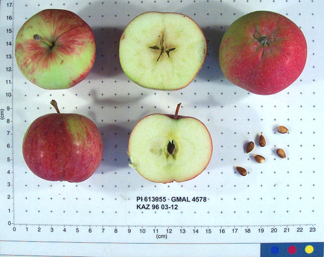 | | 1996 | COLLECTED | 09/02/1996 | Semipalitinsk Region - Tarbagatai Mountain region. 4 km NE of Alekseyevka, 20 km. north of Urdzhar. Collected near streams near site 05 (1995) on west end of site 10 (1995). | 47.26777778, 81.58250000 | | Soil: silt, little rock, good drainage. Variable incline, open, ridges on valleys. Dominant tree sp: M. sieversii; Assoc: Crataegus. Dominant shrub sp: Rosa; Assoc: Lonicera. Dominant herbaceous: Humulus; Assoc: Circium. Rainfall 400 mm. | Uncertain improvement status | Sampled 60 fruits from 1 tree. Flesh flavor is subacid. Over color is 60% red. Fruit size is larger than 50mm. Free of disease and insects. General health is great. Scion collected also. ---Malus sieversii hybrid. Domestic introgression intentified using 20K Illumina Infinium apple SNP array--Gragylling and Weisser_Tafelapfel are close ancestors, likely great-grandparents. | 1531525 | PI 613955 |
| 176 | PI 613956 | KAZ 96 03-13 | Malus hybr. | Kazakhstan | GEN |  | | 1996 | COLLECTED | 09/02/1996 | Semipalitinsk Region - Tarbagatai Mountain region. 4 km. NE of Alekseyevka, 20 km. north of Urdzhan. Collected on west facing slope in site 05 (1995) just up the incline from the road. | 47.25250000, 81.57055556 | 800 | Soil: silt, little rock, good drainage. Variable incline, open, ridges on valleys. Dominant tree sp: M sieversii; Assoc: Crataegus. Dominant shrub sp: Rosa; Assoc: Lonicera. Dominant herbaceous: Humulus; Assoc: Circium. Rainfall 400 mm. | Uncertain improvement status | Sampled 80 fruits from 1 tree. Flesh flavor is aromatic. Free of disease and insects. Scion collected also. -- One fully domesticated parent intentified using 20K Illumina Infinium apple SNP array. Parent is Gold_Reinette. | 1531526 | PI 613956 |
| 177 | PI 613957 | KAZ 96 03-14 | Malus sieversii (Ledeb.) M. Roem. | Kazakhstan | GEN | 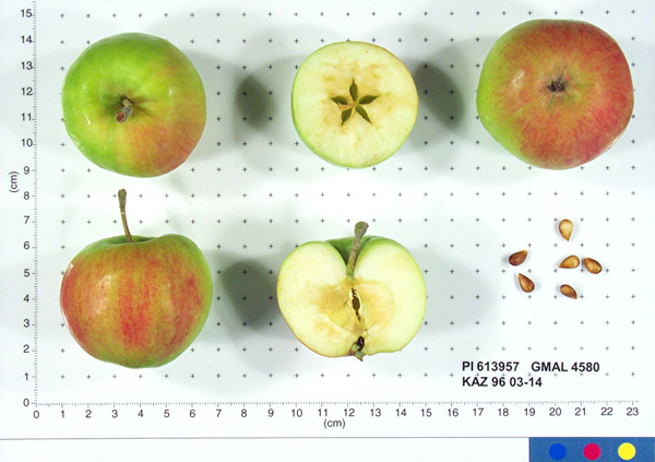 | | 1996 | COLLECTED | 09/03/1996 | Semipalitinsk Region - Tarbagatai Mountain region. 4 km. NE of Alekseyevka, 20 km. north of Urdzhar. Collected along road in center of site 09 (1995) may have been collected as an elite in 1995. | 47.26805556, 81.59277778 | 800 | Soil: silt, little rock, good drainage. Variable incline, open, ridges on valleys. Dominant tree sp: M. sieversii; Assoc: Crataegus. Dominant shrub sp: Rosa; Assoc: Lonicera. Dominant herbaceous: Humulus; Assoc: Circium. Rainfall 400mm. | Wild material | Sampled 100 fruits from 1 tree. Flesh flavor is aromatic. Over color is 70% red. Fruit size is larger than 50mm. Free of disease, some codling moth. May have been collected as an elite in 1995. Scion collected also. | 1531527 | PI 613957 |
| 178 | PI 613986 | KAZ 96 03-09 | Malus hybr. | Kazakhstan | GEN | 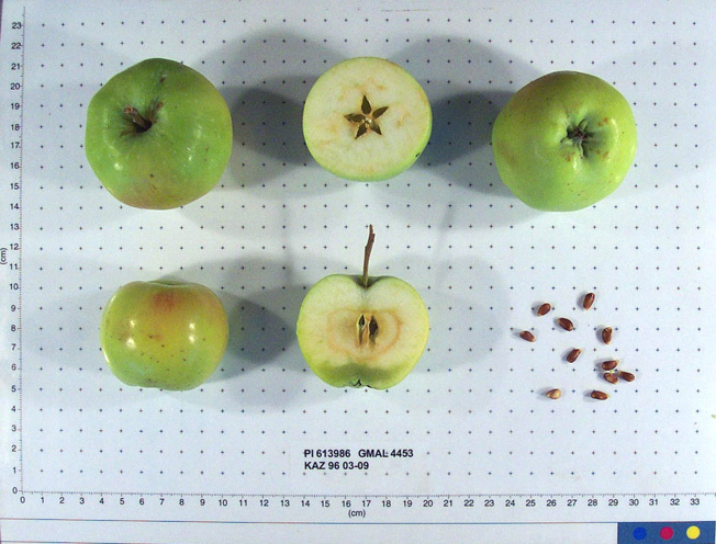 | | 1996 | COLLECTED | 09/02/1996 | Semipalitinsk Region-Tarbagatai Mt. region. 4 km NE of Alekseyevka, 20 km north of Urdzhar. Collected at east end of South valley (site 10 1995) just 10 ft. from field on west-facing slope. | 47.26777778, 81.58250000 | 900 | Soil: Silt, Little rock, good drainage. Variable incline, west, open, ridges on valleys. Dominant tree sp: M. sieversii; Assoc-Crataegus. Dominant shrub sp: Rosa; Assoc-Lonicera. Dominant herbaceous: Humulus; Assoc-Circium. Rainfall 400mm. | Uncertain improvement status | Elite scion material. Sampled 20 fruits from 1 tree. Flesh flavor is sweet. Free of disease and insects. Scion also collected. -- One fully domesticated parent intentified using 20K Illumina Infinium apple SNP array. Parent is Kaiser_Alexander. | 1531523 | PI 613986 |
| 179 | PI 613997 | KAZ 96 08-15 | Malus domestica (Suckow) Borkh. | Kazakhstan | GEN |  | | 1996 | COLLECTED | 09/14/1996 | Kok Bulak (Black Spring) Forestry Camp. 35 km southeast of Boraldy Camp visited in 1995. Collections made in and around camp-north, east, south of camp. | 42.66888889, 70.25111111 | 840 | Variable and open, stream bed and hillsides. Rainfall 275mm. Dominant tree sp: Crataegus; Assoc.-Malus, Vitis, Morus Rhamnus. Dominant shrub sp: Amygdalus, Pyrus, Rosa. Dominant herbaceous: Grasses. | Uncertain improvement status | Sampled 70 fruits from 1 tree. Flesh flavor is aromatic. Fruit size is larger than 50mm. Free of disease and insects. Excellent flavor, very large leaf. Scion also collected. -- Identified as fully domestic using 20K Illumina Infinium apple SNP array. Parentage is Rosmarina_Bianca_MI and Kostlicher | 1531543 | PI 613997 |
| 180 | PI 613998 | KAZ 96 08-16 | Malus hybr. | Kazakhstan | GEN |  | | 1996 | COLLECTED | 09/14/1996 | Kok Bulak (Black Spring) Forestry Camp. 35 km southeast of Boraldy Camp visited in 1995. Collections made in and around camp-north, east, south of camp. | 42.66888889, 70.25111111 | | Variable and open, stream bed and hillsides. Rainfall 275mm. Dominant tree sp: Crataegus; Assoc.-Malus, Vitis, Morus Rhamnus. Dominant shrub sp: Amygdalus, Pyrus, Rosa. Dominant herbaceous: Grasses. | Uncertain improvement status | Elite scion material. ---Malus sieversii hybrid. Domestic introgression intentified using 20K Illumina Infinium apple SNP array--Kaiser_Alexander is a grandparent | 1531544 | PI 613998 |
| 181 | PI 599801 | KAZ 96 02-01P | Malus sieversii (Ledeb.) M. Roem. | Kazakhstan | GEN | | | 1996 | COLLECTED | 08/30/1996 | Zielisky Alatau. 17 km SSw of Almaty center-Aksay river. West side of Zieliesky Apple Belt. Landform: Valley near river. | 43.11916667, 76.79833333 | 1260 | Soil: Gravely loam, good drainage, some stone. Incline flat + 15%, NW. Rainfall 700mm. Dominant tree sp: Malus sieversii; Assoc-Apricot, Crataegus. Dominant shrub sp: Berberis, Hippophae; Assoc-Rubus, Rosa. Dom. herb-Hops; Assoc-Geranium. | Wild material | | 1551098 | PI 599801 |
| 182 | PI 599802 | KAZ 96 03-01P | Malus sieversii (Ledeb.) M. Roem. | Kazakhstan | GEN | | | 1996 | COLLECTED | 09/01/1996 | Semipalitinsk Region. 4 km northeast of Alekseyevka, 20 km north of Urdzhar. Elevation between 820-860. | 47.26777778, 81.58250000 | 820 | Soil: Silt loam, little rock, good drainage. Incline variable, open light. Ridges on valleys, rainfall 400mm. Dominant tree sp: Malus sieversii. Dominant shrub sp: Crataegus, rosa; Assoc-Viburnum. | Wild material | | 1551099 | PI 599802 |
| 183 | PI 599804 | KAZ 96 05-01P | Malus sieversii (Ledeb.) M. Roem. | Kazakhstan | GEN | | | 1996 | COLLECTED | 09/05/1996 | Andreyevka District,Djungarsky Mt. range. 5 miles NW of Konstantinova. Collected in a line on a ridge northwest facing from 1260-1230m, about a mile long. | 45.68361111, 80.86250000 | 1260 | Drainage good. Incline 10-40%, northwest, very open. Cultivation to SE-forested ridge on NW. Rainfall 700mm. Dominant tree sp: Malus, Betula, Populus. Dominant shrub sp: Rosa. | Wild material | | 1551103 | PI 599804 |
| 184 | PI 599807 | KAZ 96 08-01P | Malus sieversii (Ledeb.) M. Roem. | Kazakhstan | GEN | | | 1996 | COLLECTED | 09/12/1996 | Karatau, Kok Bulak (Black Spring) Forestry Camp. 35km southeast of Boraldy camp visited in 1995. Collected along river east of camp. | 42.66777778, 70.25583333 | 780 | Aspect-variable, open light. Stream bed and hillsides. Rainfall 275mm. Dominant tree sp: Crataegus; Assoc-Malus, Vitis, Morus Rhamnus. Dominant shrub sp: Amygdalus, Pyrus, Rosa. Dominant herbaceous: Grasses. | Wild material | | 1551101 | PI 599807 |
| 185 | PI 600588 | KAZ 96 03-02 | Malus sieversii (Ledeb.) M. Roem. | Kazakhstan | GEN | | | 1996 | COLLECTED | 09/01/1996 | Semipalitinsk Region-Tarbagatai Mt. region. 4 km northeast of Alekseyevka, 20 km north of Urdzhar. Collected on south side of site 10, 1995 (middle valley) near 03-02. | 47.27222222, 81.57527778 | 830 | Soil: Silt, Little rock, good drainage. Variable incline, open, ridges on valleys. Dominant tree sp: M. sieversii; Assoc-Crataegus. Dominant shrub sp: Rosa; Assoc-Lonicera. Dominant herbaceous: Humulus; Assoc-Circium. Rainfall 400mm. | Wild material | | 1550514 | PI 600588 |
| 186 | PI 600589 | KAZ 96 03-04 | Malus sieversii (Ledeb.) M. Roem. | Kazakhstan | GEN | | | 1996 | COLLECTED | 09/01/1996 | Semipalitinsk Region-Tarbagatai Mt. region. 4 km northeast of Alekseyevka, 20 km north of Urdzhar. Collected in site 07(1995). East end of valley on north side. | 47.27055556, 81.57916667 | 860 | Soil: Silt, Little rock, good drainage. Variable incline,south, open, ridges on valleys. Dominant tree sp: M. sieversii; Assoc-Crataegus. Dominant shrub sp: Rosa; Assoc-Lonicera. Dominant herbaceous: Humulus; Assoc-Circium. Rainfall 400mm. | Wild material | | 1550515 | PI 600589 |
| 187 | PI 600595 | KAZ 96 03-12 | Malus sieversii (Ledeb.) M. Roem. | Kazakhstan | GEN | | | 1996 | COLLECTED | 09/02/1996 | Semipalitinsk Region-Tarbagatai Mt. region. 4 km NE of Alekseyevka, 20 km north of Urdzhar. Collected near streams near site 05(1995) on west end of site 10(1995). | 47.26777778, 81.58250000 | 840 | Soil: Silt, Little rock, good drainage. Variable incline, open, ridges on valleys. Dominant tree sp: M. sieversii; Assoc-Crataegus. Dominant shrub sp: Rosa; Assoc-Lonicera. Dominant herbaceous: Humulus; Assoc-Circium. Rainfall 400mm. | Wild material | | 1550519 | PI 600595 |
| 188 | PI 600596 | KAZ 96 03-13 | Malus sieversii (Ledeb.) M. Roem. | Kazakhstan | GEN | | | 1996 | COLLECTED | 09/02/1996 | Semipalitinsk Region-Tarbagatai Mt. region. 4 km NE of Alekseyevka, 20 km north of Urdzhar. Collected on west facing slope in site 05(1995) just up the incline from the road. | 47.25250000, 81.57055556 | 800 | Soil: Silt, Little rock, good drainage. Variable incline, open, ridges on valleys. Dominant tree sp: M. sieversii; Assoc-Crataegus. Dominant shrub sp: Rosa; Assoc-Lonicera. Dominant herbaceous: Humulus; Assoc-Circium. Rainfall 400mm. | Wild material | | 1550548 | PI 600596 |
| 189 | PI 600597 | KAZ 96 03-14 | Malus sieversii (Ledeb.) M. Roem. | Kazakhstan | GEN | | | 1996 | COLLECTED | 09/03/1996 | Semipalitinsk Region-Tarbagatai Mt. region. 4 km NE of Alekseyevka, 20 km north of Urdzhar. Collected along road in center of site 09(1995) may have been collected as an elite in 1995. | 47.26805556, 81.59277778 | 800 | Soil: Silt, Little rock, good drainage. Variable incline, open, ridges on valleys. Dominant tree sp: M. sieversii; Assoc-Crataegus. Dominant shrub sp: Rosa; Assoc-Lonicera. Dominant herbaceous: Humulus; Assoc-Circium. Rainfall 400mm. | Wild material | | 1550520 | PI 600597 |
| 190 | PI 600598 | KAZ 96 03-15 | Malus sieversii (Ledeb.) M. Roem. | Kazakhstan | GEN | | | 1996 | COLLECTED | 09/03/1996 | Semipalitinsk Region-Tarbagatai Mt. region. 4 km northeast of Alekseyevka, 20 km north of Urdzhar. Near 03-14, 1/2km north of 03-14. | 47.26805556, 81.59166667 | 1030 | Soil: Silt, Little rock, good drainage. Variable incline, open, ridges on valleys. Dominant tree sp: M. sieversii; Assoc-Crataegus. Dominant shrub sp: Rosa; Assoc-Lonicera. Dominant herbaceous: Humulus; Assoc-Circium. Rainfall 400mm. | Wild material | | 1550521 | PI 600598 |
| 191 | PI 600600 | KAZ 96 05-03 | Malus sieversii (Ledeb.) M. Roem. | Kazakhstan | GEN | | | 1996 | COLLECTED | 09/05/1996 | Andreyevka District-Djungarsky Mt. range. 5 miles northwest of Konstantinova. | 45.68361111, 81.86250000 | 1240 | Drainage good, Incline 10-40 degrees, northwest, very open. Cultivation to southeast-forested ridge on Northwest, rainfall 700mm. Dominant tree sp: Malus, Betula, Populus. Dominant Shrub sp: Rosa. | Wild material | | 1550544 | PI 600600 |
| 192 | PI 600601 | KAZ 96 05-04 | Malus sieversii (Ledeb.) M. Roem. | Kazakhstan | GEN | | | 1996 | COLLECTED | 09/05/1996 | Andreyevka District-Djungarsky Mt. range. 5 miles northwest of Konstantinova. | 45.68361111, 81.86250000 | 1190 | Drainage good, Incline 10-40 degrees, northwest, very open. Cultivation to southeast-forested ridge on northwest, rainfall 700mm. Dominant tree sp: Malus, Betula, Populus. Dominant Shrub sp: Rosa. | Wild material | | 1550523 | PI 600601 |
| 193 | PI 600602 | KAZ 96 05-05 | Malus sieversii (Ledeb.) M. Roem. | Kazakhstan | GEN | | | 1996 | COLLECTED | 09/05/1996 | Andreyevka District-Djungarsky Mt. range. 5 miles northwest of Konstantinova. | 45.68361111, 81.86250000 | 1190 | Drainage good, Incline 10-40 degrees, Northwest, very open. Cultivation to southeast-forested ridge on Northwest, rainfall 700mm. Dominant tree sp: Malus, Betula, Populus. Dominant Shrub sp: Rosa. | Wild material | | 1550540 | PI 600602 |
| 194 | PI 600612 | KAZ 96 08-02 | Malus sieversii (Ledeb.) M. Roem. | Kazakhstan | GEN | | | 1996 | COLLECTED | 09/12/1996 | Kok Bulak (Black Spring) Forestry Camp. 35 km southeast of Boraldy Camp visited in 1995. Collections made in and around camp- north, east, south of camp. | 42.66777778, 70.25583333 | 780 | Variable and open, stream bed and hillsides. Rainfall 275mm. Dominant tree sp: Crataegus; Assoc.-Malus, Vitis, Morus Rhamnus. Dominant shrub sp: Amygdalus, Pyrus, Rosa. Dominant herbaceous: Grasses. | Wild material | | 1550530 | PI 600612 |
| 195 | PI 600613 | KAZ 96 08-03 | Malus sieversii (Ledeb.) M. Roem. | Kazakhstan | GEN | | | 1996 | COLLECTED | 09/12/1996 | Kok Bulak (Black Spring) Forestry Camp. 35 km southeast of Boraldy Camp visited in 1995. Collected along river east of camp. | 42.67111111, 70.25777778 | 800 | Variable and open, stream bed and hillsides. Rainfall 275mm. Dominant tree sp: Crataegus; Assoc.-Malus, Vitis, Morus Rhamnus. Dominant shrub sp: Amygdalus, Pyrus, Rosa. Dominant herbaceous: Grasses. | Wild material | | 1550531 | PI 600613 |
| 196 | PI 600614 | KAZ 96 08-06 | Malus sieversii (Ledeb.) M. Roem. | Kazakhstan | GEN | | | 1996 | COLLECTED | 09/13/1996 | Kok Bulak (Black Spring) Forestry Camp. 35 km southeast of Boraldy Camp visited in 1995. Collected along river north of camp. | 42.66944444, 70.26194444 | 815 | Variable and open, stream bed and hillsides. Rainfall 275mm. Dominant tree sp: Crataegus; Assoc.-Malus, Vitis, Morus Rhamnus. Dominant shrub sp: Amygdalus, Pyrus, Rosa. Dominant herbaceous: Grasses. | Wild material | | 1550550 | PI 600614 |
| 197 | PI 600615 | KAZ 96 08-07 | Malus sieversii (Ledeb.) M. Roem. | Kazakhstan | GEN | | | 1996 | COLLECTED | 09/13/1996 | Kok Bulak (Black Spring) Forestry Camp. 35 km southeast of Boraldy Camp visited in 1995. Collections made in and around camp-north, east, south of camp. | 42.68611111, 70.26194444 | 820 | Variable and open, stream bed and hillsides. Rainfall 275mm. Dominant tree sp: Crataegus; Assoc.-Malus, Vitis, Morus Rhamnus. Dominant shrub sp: Amygdalus, Pyrus, Rosa. Dominant herbaceous: Grasses. | Wild material | | 1550532 | PI 600615 |
| 198 | PI 600616 | KAZ 96 08-10 | Malus sieversii (Ledeb.) M. Roem. | Kazakhstan | GEN | | | 1996 | COLLECTED | 09/13/1996 | Kok Bulak (Black Spring) Forestry Camp. 35 km southeast of Boraldy Camp visited in 1995. Collections made in and around camp-north, east, south of camp. | 42.70138889, 70.27666667 | 940 | Variable and open, stream bed and hillsides. Rainfall 275mm. Dominant tree sp: Crataegus; Assoc.-Malus, Vitis, Morus Rhamnus. Dominant shrub sp: Amygdalus, Pyrus, Rosa. Dominant herbaceous: Grasses. | Wild material | | 1550546 | PI 600616 |
| 199 | PI 600617 | KAZ 96 08-11 | Malus sieversii (Ledeb.) M. Roem. | Kazakhstan | GEN | | | 1996 | COLLECTED | 09/13/1996 | Kok Bulak (Black Spring) Forestry Camp. 35 km southeast of Boraldy Camp visited in 1995. Collections made in and around camp-noth, east, south of camp. | 42.70750000, 70.28944444 | 1040 | Variable and open, stream bed and hillsides. Rainfall 275mm. Dominant tree sp: Crataegus; Assoc.-Malus, Vitis, Morus Rhamnus. Dominant shrub sp: Amygdalus, Pyrus, Rosa. Dominant herbaceous: Grasses. | Wild material | | 1550533 | PI 600617 |
| 200 | PI 600618 | KAZ 96 08-12 | Malus sieversii (Ledeb.) M. Roem. | Kazakhstan | GEN | | | 1996 | COLLECTED | 09/13/1996 | Kok Bulak (Black Spring) Forestry Camp. 35 km southeast of Boraldy Camp visited in 1995. Collections made in and around camp- north, east, south of camp. | 42.71194444, 70.29638889 | 1170 | Variable and open, stream bed and hillsides. Rainfall 275mm. Dominant tree sp: Crataegus; Assoc.-Malus, Vitis, Morus Rhamnus. Dominant shrub sp: Amygdalus, Pyrus, Rosa. Dominant herbaceous: Grasses. | Wild material | | 1550534 | PI 600618 |
| 201 | PI 600620 | KAZ 96 08-14 | Malus sieversii (Ledeb.) M. Roem. | Kazakhstan | GEN | | | 1996 | COLLECTED | 09/14/1996 | Kok Bulak (Black Spring) Forestry Camp. 35 km southeast of Boraldy Camp visited in 1995. Collections made in and around camp-north, east, south of camp. | 42.66916667, 70.25111111 | 830 | Variable and open, stream bed and hillsides. Rainfall 275mm. Dominant tree sp: Crataegus; Assoc.-Malus, Vitis, Morus Rhamnus. Dominant shrub sp: Amygdalus, Pyrus, Rosa. Dominant herbaceous: Grasses. | Wild material | | 1550536 | PI 600620 |
| 202 | PI 600621 | KAZ 96 08-15 | Malus sieversii (Ledeb.) M. Roem. | Kazakhstan | GEN | | | 1996 | COLLECTED | 09/14/1996 | Kok Bulak (Black Spring) Forestry Camp. 35 km southeast of Boraldy Camp visited in 1995. Collections made in and around camp-north, east, south of camp. | 42.66916667, 70.25111111 | 840 | Variable and open, stream bed and hillsides. Rainfall 275mm. Dominant tree sp: Crataegus; Assoc.-Malus, Vitis, Morus Rhamnus. Dominant shrub sp: Amygdalus, Pyrus, Rosa. Dominant herbaceous: Grasses. | Wild material | | 1550542 | PI 600621 |
| 203 | PI 633802 | KAZ 96 08-17 | Malus hybr. | Kazakhstan | GEN | 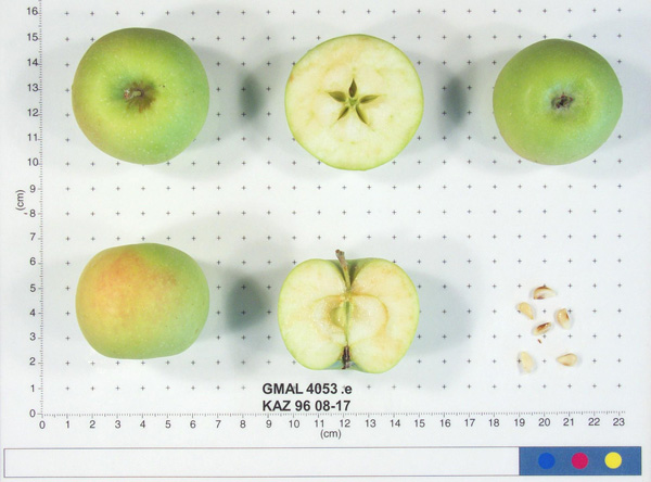 | | 1996 | COLLECTED | 09/14/1996 | Kok Bulak (Black Spring) Forestry Camp. 35 km southeast of Boraldy Camp visited in 1995. Collections made in and around camp-north, east, south of camp. | 42.66250000, 70.25361111 | 930 | Variable and open, stream bed and hillsides. Rainfall 275mm. Dominant tree sp: Crataegus; Assoc.-Malus, Vitis, Morus Rhamnus. Dominant shrub sp: Amygdalus, Pyrus, Rosa. Dominant herbaceous: Grasses. | Uncertain improvement status | Sampled 40 fruits from 1 tree. Flesh flavor is aromatic and sweet. Fruit size is larger than 50mm. Free of disease. Heavy codling moth, nice apple. Scion also collected. -- One fully domesticated parent intentified using 20K Illumina Infinium apple SNP array. Grandparentage is Kaiser_Alexander and Goldparmaene | 1652453 | PI 633802 |
| 204 | PI 633803 | KAZ 96 02-01P-11 | Malus sieversii (Ledeb.) M. Roem. | Kazakhstan | GEN | 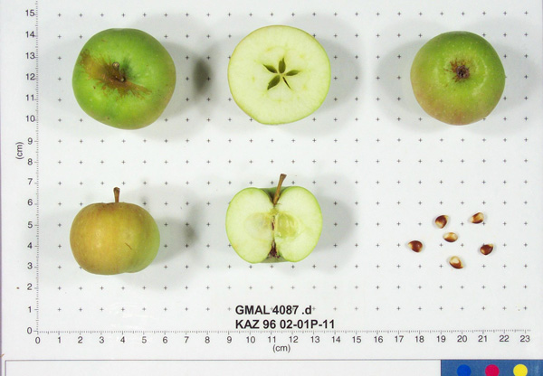 | | 1996 | COLLECTED | 08/30/1996 | Zielisky Alatau. 17 km SSw of Almaty center-Aksay river. West side of Zieliesky Apple Belt. Landform: Valley near river. | 43.11916667, 76.79833333 | 1260 | Soil: Gravely loam, good drainage, some stone. Incline flat + 15%, NW. Rainfall 700mm. Dominant tree sp: Malus sieversii; Assoc-Apricot, Crataegus. Dominant shrub sp: Berberis, Hippophae; Assoc-Rubus, Rosa. Dom. herb-Hops; Assoc-Geranium. | Wild material | Sampled 8 fruits from 20 trees. Flesh flavor is acid. Light scab. | 1652454 | PI 633803 |
| 205 | PI 633919 | KAZ 96 05-05 | Malus hybr. | Kazakhstan | GEN |  | | 1996 | COLLECTED | 09/05/1996 | Andreyevka District-Djungarsky Mt. range. 5 miles northwest of Konstantinova. | 45.68361111, 81.86250000 | 1190 | Drainage good, Incline 10-40 degrees, Northwest, very open. Cultivation to southeast-forested ridge on Northwest, rainfall 700mm. Dominant tree sp: Malus, Betula, Populus. Dominant Shrub sp: Rosa. | Uncertain improvement status | Sampled 50 fruits from 1 tree. Flesh flavor is subacid. Fruit size is larger than 50mm. Free of disease and insects. May be hybrid with cultivated nearby. Scion collected also. ---Malus sieversii hybrid. Domestic introgression intentified using 20K Illumina Infinium apple SNP array--Zigeunerinapfel and Kaiser_Alexander are possibly grandparents through opposite parents | 1653305 | PI 633919 |
| 206 | PI 633923 | KAZ 96 06-01P-28 | Malus sieversii (Ledeb.) M. Roem. | Kazakhstan | GEN |  | | 1996 | COLLECTED | 09/06/1996 | 9km southeast of Lepsinsk, 3km southwest of Lepsinsk Forestry Camp. Sampled area down the bank, along the river and up the bank on the other side. Collected in site 15 area of 1995. | 45.51305556, 80.71944444 | 1250 | Soil: Gravely loam, excellent drainage. N-S ridge, open. Dominant tree sp: Malus sieversii: Assoc-Populus, Crateagus. Dominant shrub sp: Rosa: Assoc-Rubus. Dominant herbaceous: Grasses; Assoc-Aster, Cirscium. | Wild material | Sampled 8 fruits from 30 trees. Flesh flavor is acid. Scab is light to moderate, spur-type. Same as site 15 in 1995. Excellent fruiting in 1996. | 1653309 | PI 633923 |
| 207 | PI 650944 | KAZ 96 08-17 | Malus domestica (Suckow) Borkh. | Kazakhstan | GEN |  | | 1996 | COLLECTED | 09/14/1996 | Kok Bulak (Black Spring) Forestry Camp. 35 km southeast of Boraldy Camp visited in 1995. Collections made in and around camp-north, east, south of camp. | 42.66250000, 70.25361111 | 930 | Variable and open, stream bed and hillsides. Rainfall 275mm. Dominant tree sp: Crataegus; Assoc.-Malus, Vitis, Morus Rhamnus. Dominant shrub sp: Amygdalus, Pyrus, Rosa. Dominant herbaceous: Grasses. | Uncertain improvement status | Sampled 40 fruits from 1 tree. Flesh flavor is aromatic and sweet. Fruit size is larger than 50mm. Free of disease. Heavy codling moth, nice apple. Scion also collected. -- Identified as fully domestic using 20K Illumina Infinium apple SNP array. Grandparentage is Yellow_Bellflower and Rosmarina_Bianca_MI | 1693565 | PI 650944 |
| 208 | PI 657086 | KAZ 96 03-11 | Malus hybr. | Kazakhstan | GEN | 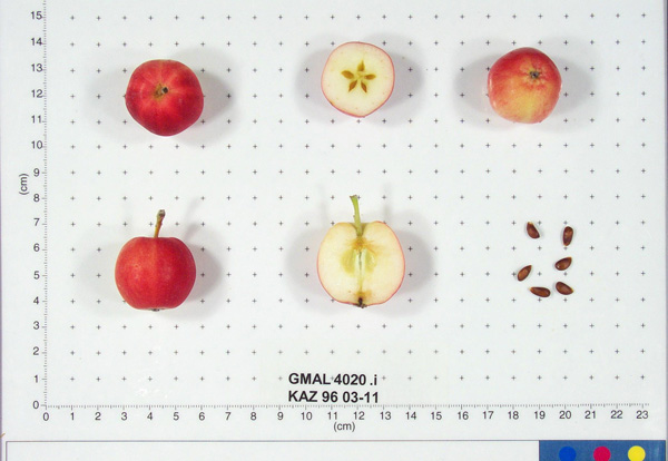 | | 1996 | COLLECTED | 09/02/1996 | Semipalitinsk Region-Tarbagatai Mt. region. 4 km northeast of Alekseyevka, 20 km north of Urdzhar. Collected near 03-10. | 47.26777778, 81.58250000 | 880 | Soil: Silt, Little rock, good drainage. Variable incline, open, ridges on valleys. Dominant tree sp: M. sieversii; Assoc-Crataegus. Dominant shrub sp: Rosa; Assoc-Lonicera. Dominant herbaceous: Humulus; Assoc-Circium. Rainfall 400mm. | Uncertain improvement status | Sampled 4 fruits from 1 tree. Flesh flavor is aromatic. Fruit size is over 50mm. Free of disease and insects. Very nice flavor. Only four fruits available. Scion collected also. ---Malus sieversii hybrid. Domestic introgression intentified using 20K Illumina Infinium apple SNP array-- | 1693310 | PI 657086 |
| 209 | PI 657087 | KAZ 96 03-15 | Malus hybr. | Kazakhstan | GEN | | | 1996 | COLLECTED | 09/03/1996 | Semipalitinsk Region-Tarbagatai Mt. region. 4 km northeast of Alekseyevka, 20 km north of Urdzhar. Near 03-14, 1/2km north of 03-14. | 47.26805556, 81.59166667 | 1030 | Soil: Silt, Little rock, good drainage. Variable incline, open, ridges on valleys. Dominant tree sp: M. sieversii; Assoc-Crataegus. Dominant shrub sp: Rosa; Assoc-Lonicera. Dominant herbaceous: Humulus; Assoc-Circium. Rainfall 400mm. | Uncertain improvement status | Sampled 100 fruits from 1 tree. Flesh flavor is aromatic. Fruit size is larger than 50mm. Free of disease and insects. Scion collected also. Same as 0301P59, GMAL 4155. ---Malus sieversii hybrid. Domestic introgression intentified using 20K Illumina Infinium apple SNP array-- | 1693332 | PI 657087 |
| 210 | PI 657088 | KAZ 96 05-05 | Malus sieversii (Ledeb.) M. Roem. | Kazakhstan | GEN | 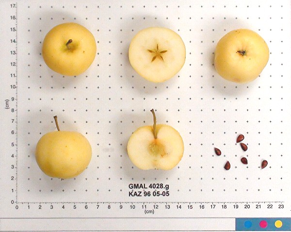 | | 1996 | COLLECTED | 09/05/1996 | Andreyevka District-Djungarsky Mt. range. 5 miles northwest of Konstantinova. | 45.68361111, 81.86250000 | 1190 | Drainage good, Incline 10-40 degrees, Northwest, very open. Cultivation to southeast-forested ridge on Northwest, rainfall 700mm. Dominant tree sp: Malus, Betula, Populus. Dominant Shrub sp: Rosa. | Wild material | Sampled 50 fruits from 1 tree. Flesh flavor is subacid. Fruit size is larger than 50mm. Free of disease and insects. May be hybrid with cultivated nearby. Scion collected also. | 1693359 | PI 657088 |
| 211 | PI 657094 | KAZ 96 08-13 | Malus hybr. | Kazakhstan | GEN |  | | 1996 | COLLECTED | 09/14/1996 | Kok Bulak (Black Spring) Forestry Camp. 35 km southeast of Boraldy Camp visited in 1995. Collections made in and around camp-north, east, south of camp. | 42.66583333, 70.24722222 | 780 | Variable and open, stream bed and hillsides. Rainfall 275mm. Dominant tree sp: Crataegus; Assoc.-Malus, Vitis, Morus Rhamnus. Dominant shrub sp: Amygdalus, Pyrus, Rosa. Dominant herbaceous: Grasses. | Uncertain improvement status | Sampled 30 fruits from 1 tree. Flesh flavor is aromatic. Fruit size is larger than 50mm. Free of disease. Heavy codling moth, largest fruit so far. Scion also collected. -- One fully domesticated parent intentified using 20K Illumina Infinium apple SNP array. Grandparentage is Kaiser_Alexander and Goldparmaene | 1693540 | PI 657094 |
| 212 | PI 657095 | KAZ 96 08-15 | Malus hybr. | Kazakhstan | GEN |  | | 1996 | COLLECTED | 09/14/1996 | Kok Bulak (Black Spring) Forestry Camp. 35 km southeast of Boraldy Camp visited in 1995. Collections made in and around camp-north, east, south of camp. | 42.66916667, 70.25111111 | 840 | Variable and open, stream bed and hillsides. Rainfall 275mm. Dominant tree sp: Crataegus; Assoc.-Malus, Vitis, Morus Rhamnus. Dominant shrub sp: Amygdalus, Pyrus, Rosa. Dominant herbaceous: Grasses. | Uncertain improvement status | Sampled 70 fruits from 1 tree. Flesh flavor is aromatic. Fruit size is larger than 50mm. Free of disease and insects. Excellent flavor, very large leaf. Scion also collected. -- One fully domesticated parent intentified using 20K Illumina Infinium apple SNP array. Grandparentage is Rosmarina_Bianca_MI and Kostlicher | 1693543 | PI 657095 |
| 213 | PI 657096 | KAZ 96 08-15 | Malus hybr. | Kazakhstan | GEN |  | | 1996 | COLLECTED | 09/14/1996 | Kok Bulak (Black Spring) Forestry Camp. 35 km southeast of Boraldy Camp visited in 1995. Collections made in and around camp-north, east, south of camp. | 42.66916667, 70.25111111 | 840 | Variable and open, stream bed and hillsides. Rainfall 275mm. Dominant tree sp: Crataegus; Assoc.-Malus, Vitis, Morus Rhamnus. Dominant shrub sp: Amygdalus, Pyrus, Rosa. Dominant herbaceous: Grasses. | Uncertain improvement status | Sampled 70 fruits from 1 tree. Flesh flavor is aromatic. Fruit size is larger than 50mm. Free of disease and insects. Excellent flavor, very large leaf. Scion also collected. -- One fully domesticated parent intentified using 20K Illumina Infinium apple SNP array. Grandparentage is Rosmarina_Bianca_MI and Kostlicher | 1693563 | PI 657096 |
| 214 | PI 657099 | KAZ 96 08-17 | Malus hybr. | Kazakhstan | GEN | 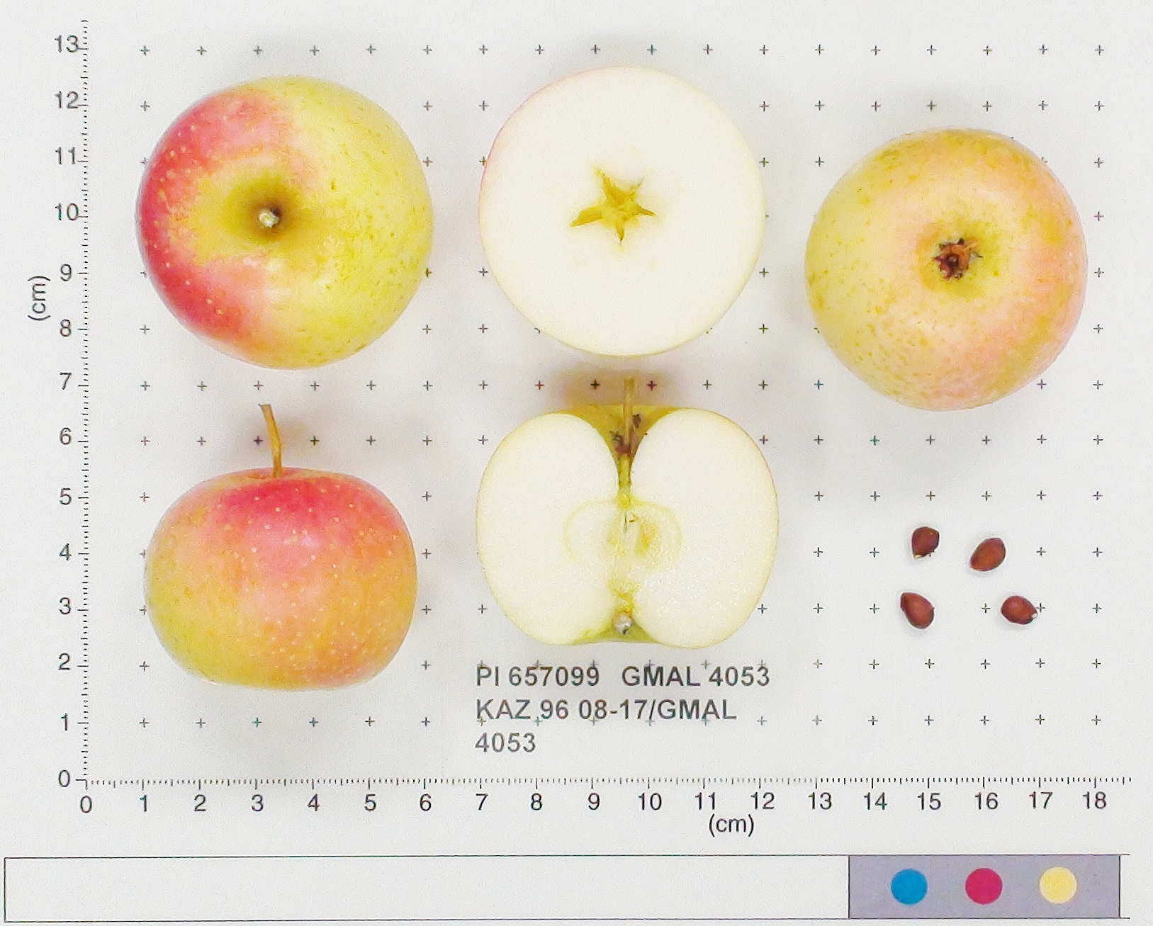 | | 1996 | COLLECTED | 09/14/1996 | Kok Bulak (Black Spring) Forestry Camp. 35 km southeast of Boraldy Camp visited in 1995. Collections made in and around camp-north, east, south of camp. | 42.66250000, 70.25361111 | 930 | Variable and open, stream bed and hillsides. Rainfall 275mm. Dominant tree sp: Crataegus; Assoc.-Malus, Vitis, Morus Rhamnus. Dominant shrub sp: Amygdalus, Pyrus, Rosa. Dominant herbaceous: Grasses. | Uncertain improvement status | Sampled 40 fruits from 1 tree. Flesh flavor is aromatic and sweet. Fruit size is larger than 50mm. Free of disease. Heavy codling moth, nice apple. Scion also collected. -- One fully domesticated parent intentified using 20K Illumina Infinium apple SNP array. Grandparentage is Kaiser_Alexander and Goldparmaene | 1693574 | PI 657099 |
| 215 | PI 657106 | KAZ 96 02-01P-6 | Malus sieversii (Ledeb.) M. Roem. | Kazakhstan | GEN | | | 1996 | COLLECTED | 08/30/1996 | Zielisky Alatau. 17 km SSw of Almaty center-Aksay river. West side of Zieliesky Apple Belt. Landform: Valley near river. | 43.11916667, 76.79833333 | 1260 | Soil: Gravely loam, good drainage, some stone. Incline flat + 15%, NW. Rainfall 700mm. Dominant tree sp: Malus sieversii; Assoc-Apricot, Crataegus. Dominant shrub sp: Berberis, Hippophae; Assoc-Rubus, Rosa. Dom. herb-Hops; Assoc-Geranium. | Wild material | Sampled 8 fruits from 20 trees. Flesh flavor is astringent. No scab, slightly ribbed. | 1693683 | PI 657106 |
| 216 | PI 657109 | KAZ 96 06-01P-23 | Malus hybr. | Kazakhstan | GEN |  | | 1996 | COLLECTED | 09/06/1996 | 9km southeast of Lepsinsk, 3km southwest of Lepsinsk Forestry Camp. Sampled area down the bank, along the river and up the bank on the other side. Collected in site 15 area of 1995. | 45.51916667, 80.71555556 | 1110 | Soil: Gravely loam, excellent drainage. N-S ridge, open. Dominant tree sp: Malus sieversii: Assoc-Populus, Crateagus. Dominant shrub sp: Rosa: Assoc-Rubus. Dominant herbaceous: Grasses; Assoc-Aster, Cirscium. | Uncertain improvement status | Sampled 8 fruits from 30 trees. Flesh flavor is acid. Over color is 80% red. Scab is heavy. Stem end overgrowth. Same as site 15 in 1995. Excellent fruiting in 1996. ---Malus sieversii hybrid. Domestic introgression intentified using 20K Illumina Infinium apple SNP array--Lowland_Raspberry is a grandparent | 1694003 | PI 657109 |
| 217 | PI 657113 | KAZ 96 08-01P-11 | Malus hybr. | Kazakhstan | GEN | | | 1996 | COLLECTED | 09/13/1996 | Karatau, Kok Bulak (Black Spring) Forestry Camp. 35km southeast of Boraldy camp visited in 1995. Collected along river North of camp. | 42.68000000, 70.25861111 | 800 | Aspect-variable, open light. Stream bed and hillsides. Rainfall 275mm. Dominant tree sp: Crataegus; Assoc-Malus, Vitis, Morus Rhamnus. Dominant shrub sp: Amygdalus, Pyrus, Rosa. Dominant herbaceous: Grasses. | Uncertain improvement status | Sampled 8 fruits from 40 trees. Flesh flavor is aromatic. Scab is absent. Same as 0305. Scion. ---Malus sieversii hybrid. Domestic introgression intentified using 20K Illumina Infinium apple SNP array--Rosmarina_Bianca_MI is a grandparent | 1694054 | PI 657113 |
| 218 | PI 657114 | KAZ 96 08-01P-29 | Malus sieversii (Ledeb.) M. Roem. | Kazakhstan | GEN |  | | 1996 | COLLECTED | 09/13/1996 | Karatau, Kok Bulak (Black Spring) Forestry Camp. 35km southeast of Boraldy camp visited in 1995. Collected along river North of camp. | 42.71277778, 70.29611111 | 1230 | Aspect-variable, open light. Stream bed and hillsides. Rainfall 275mm. Dominant tree sp: Crataegus; Assoc-Malus, Vitis, Morus Rhamnus. Dominant shrub sp: Amygdalus, Pyrus, Rosa. Dominant herbaceous: Grasses. | Wild material | Sampled 8 fruits from 40 trees. Flesh flavor is sweet. Over color is 90% red. Scab is absent. Over ripe. | 1694084 | PI 657114 |
| 219 | PI 657115 | KAZ 96 08-01P-37 | Malus hybr. | Kazakhstan | GEN | 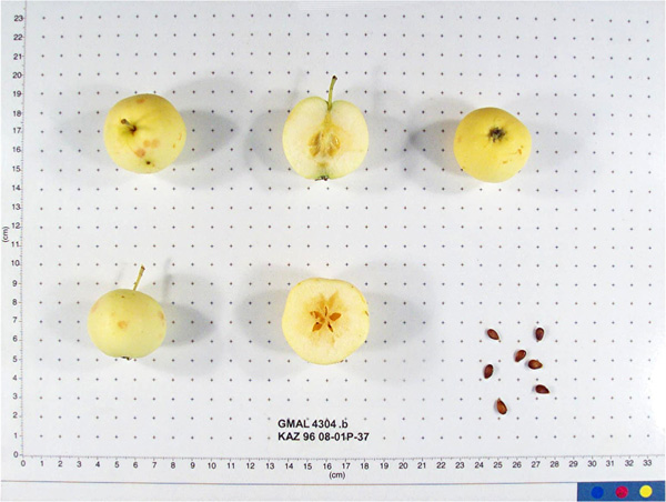 | | 1996 | COLLECTED | 09/14/1996 | Karatau, Kok Bulak (Black Spring) Forestry Camp. 35km southeast of Boraldy camp visited in 1995. Collected on North facing slope south of camp. | 42.66027778, 70.25250000 | 940 | Aspect-variable, open light. Stream bed and hillsides. Rainfall 275mm. Dominant tree sp: Crataegus; Assoc-Malus, Vitis, Morus Rhamnus. Dominant shrub sp: Amygdalus, Pyrus, Rosa. Dominant herbaceous: Grasses. | Uncertain improvement status | Sampled 8 fruits from 40 trees. Flesh flavor is aromatic. Over color is 90% red. Scab is absent. Heavy crop. ---Malus sieversii hybrid. Domestic introgression intentified using 20K Illumina Infinium apple SNP array--Yellow_Bellflower is either a grandparent or great-grandparent | 1694089 | PI 657115 |
| 220 | PI 657116 | KAZ 96 08-01P-37 | Malus hybr. | Kazakhstan | GEN | 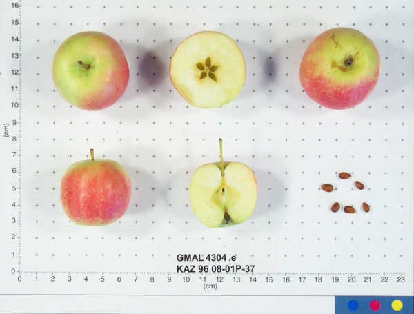 | | 1996 | COLLECTED | 09/14/1996 | Karatau, Kok Bulak (Black Spring) Forestry Camp. 35km southeast of Boraldy camp visited in 1995. Collected on North facing slope south of camp. | 42.66027778, 70.25250000 | 940 | Aspect-variable, open light. Stream bed and hillsides. Rainfall 275mm. Dominant tree sp: Crataegus; Assoc-Malus, Vitis, Morus Rhamnus. Dominant shrub sp: Amygdalus, Pyrus, Rosa. Dominant herbaceous: Grasses. | Uncertain improvement status | Sampled 8 fruits from 40 trees. Flesh flavor is aromatic. Over color is 90% red. Scab is absent. Heavy crop. ---Malus sieversii hybrid. Domestic introgression intentified using 20K Illumina Infinium apple SNP array--Yellow_Transparent is a grandparent | 1694092 | PI 657116 |
| 221 | PI 682766 | KAZ 96 03-11 | Malus sieversii (Ledeb.) M. Roem. | Kazakhstan | GEN | | | 1996 | COLLECTED | 09/02/1996 | Semipalitinsk Region-Tarbagatai Mt. region. 4 km northeast of Alekseyevka, 20 km north of Urdzhar. Collected near 03-10. | 47.26777778, 81.58250000 | 880 | Soil: Silt, Little rock, good drainage. Variable incline, open, ridges on valleys. Dominant tree sp: M. sieversii; Assoc-Crataegus. Dominant shrub sp: Rosa; Assoc-Lonicera. Dominant herbaceous: Humulus; Assoc-Circium. Rainfall 400mm. | Wild material | Sampled 4 fruits from 1 tree. Flesh flavor is aromatic. Fruit size is over 50mm. Free of disease and insects. Very nice flavor. Only four fruits available. Scion collected also. | 1693307 | PI 682766 |
| 222 | PI 682783 | KAZ 96 08-15 | Malus hybr. | Kazakhstan | GEN |  | | 1996 | COLLECTED | 09/14/1996 | Kok Bulak (Black Spring) Forestry Camp. 35 km southeast of Boraldy Camp visited in 1995. Collections made in and around camp-north, east, south of camp. | 42.66916667, 70.25111111 | 840 | Variable and open, stream bed and hillsides. Rainfall 275mm. Dominant tree sp: Crataegus; Assoc.-Malus, Vitis, Morus Rhamnus. Dominant shrub sp: Amygdalus, Pyrus, Rosa. Dominant herbaceous: Grasses. | Uncertain improvement status | Sampled 70 fruits from 1 tree. Flesh flavor is aromatic. Fruit size is larger than 50mm. Free of disease and insects. Excellent flavor, very large leaf. Scion also collected. -- One fully domesticated parent intentified using 20K Illumina Infinium apple SNP array. Grandparentage is Rosmarina_Bianca_MI and Kostlicher | 1693556 | PI 682783 |
| 223 | PI 682791 | KAZ 96 02-01P-6 | Malus sieversii (Ledeb.) M. Roem. | Kazakhstan | GEN |  | | 1996 | COLLECTED | 08/30/1996 | Zielisky Alatau. 17 km SSw of Almaty center-Aksay river. West side of Zieliesky Apple Belt. Landform: Valley near river. | 43.11916667, 76.79833333 | 1260 | Soil: Gravely loam, good drainage, some stone. Incline flat + 15%, NW. Rainfall 700mm. Dominant tree sp: Malus sieversii; Assoc-Apricot, Crataegus. Dominant shrub sp: Berberis, Hippophae; Assoc-Rubus, Rosa. Dom. herb-Hops; Assoc-Geranium. | Wild material | Sampled 8 fruits from 20 trees. Flesh flavor is astringent. No scab, slightly ribbed. | 1693685 | PI 682791 |
| 224 | PI 682792 | KAZ 96 05-01P-11 | Malus hybr. | Kazakhstan | GEN |  | | 1996 | COLLECTED | 09/05/1996 | Andreyevka District,Djungarsky Mt. range. 5 miles NW of Konstantinova. Collected in a line on a ridge northwest facing from 1260-1230m, about a mile long. | 45.68361111, 80.86250000 | 1260 | Drainage good. Incline 10-40%, northwest, very open. Cultivation to SE-forested ridge on NW. Rainfall 700mm. Dominant tree sp: Malus, Betula, Populus. Dominant shrub sp: Rosa. | Uncertain improvement status | Sampled 8 fruits from 17 trees. Flesh flavor is acid. Heavy scab. ---Malus sieversii hybrid. Domestic introgression intentified using 20K Illumina Infinium apple SNP array--Zigeunerinapfel is a close ancestor, likely either great-grandparent or one further generation removed | 1693971 | PI 682792 |
| 225 | PI 682793 | KAZ 96 05-01P-13 | Malus sieversii (Ledeb.) M. Roem. | Kazakhstan | GEN |  | | 1996 | COLLECTED | 09/05/1996 | Andreyevka District,Djungarsky Mt. range. 5 miles NW of Konstantinova. Collected in a line on a ridge northwest facing from 1260-1230m, about a mile long. | 45.67416667, 80.87694444 | 1185 | Drainage good. Incline 10-40%, northwest, very open. Cultivation to SE-forested ridge on NW. Rainfall 700mm. Dominant tree sp: Malus, Betula, Populus. Dominant shrub sp: Rosa. | Wild material | Sampled 8 fruits from 17 trees. Flesh flavor is acid. Heavy scab. | 1693978 | PI 682793 |
| 226 | PI 682794 | KAZ 96 05-01P-13 | Malus sieversii (Ledeb.) M. Roem. | Kazakhstan | GEN |  | | 1996 | COLLECTED | 09/05/1996 | Andreyevka District,Djungarsky Mt. range. 5 miles NW of Konstantinova. Collected in a line on a ridge northwest facing from 1260-1230m, about a mile long. | 45.67416667, 80.87694444 | 1185 | Drainage good. Incline 10-40%, northwest, very open. Cultivation to SE-forested ridge on NW. Rainfall 700mm. Dominant tree sp: Malus, Betula, Populus. Dominant shrub sp: Rosa. | Wild material | Sampled 8 fruits from 17 trees. Flesh flavor is acid. Heavy scab. | 1693982 | PI 682794 |
| 227 | PI 682795 | KAZ 96 05-01P-13 | Malus sieversii (Ledeb.) M. Roem. | Kazakhstan | GEN | | | 1996 | COLLECTED | 09/05/1996 | Andreyevka District,Djungarsky Mt. range. 5 miles NW of Konstantinova. Collected in a line on a ridge northwest facing from 1260-1230m, about a mile long. | 45.67416667, 80.87694444 | 1185 | Drainage good. Incline 10-40%, northwest, very open. Cultivation to SE-forested ridge on NW. Rainfall 700mm. Dominant tree sp: Malus, Betula, Populus. Dominant shrub sp: Rosa. | Wild material | Sampled 8 fruits from 17 trees. Flesh flavor is acid. Heavy scab. | 1693983 | PI 682795 |
| 228 | PI 682800 | KAZ 96 08-01P-23 | Malus sieversii (Ledeb.) M. Roem. | Kazakhstan | GEN |  | | 1996 | COLLECTED | 09/13/1996 | Karatau, Kok Bulak (Black Spring) Forestry Camp. 35km southeast of Boraldy camp visited in 1995. Collected along river North of camp. | 42.70500000, 70.28083333 | 1010 | Aspect-variable, open light. Stream bed and hillsides. Rainfall 275mm. Dominant tree sp: Crataegus; Assoc-Malus, Vitis, Morus Rhamnus. Dominant shrub sp: Amygdalus, Pyrus, Rosa. Dominant herbaceous: Grasses. | Wild material | Sampled 8 fruits from 40 trees. Flesh flavor is aromatic. Scab is absent. | 1694073 | PI 682800 |
| 229 | PI 682801 | KAZ 96 08-01P-29 | Malus sieversii (Ledeb.) M. Roem. | Kazakhstan | GEN |  | | 1996 | COLLECTED | 09/13/1996 | Karatau, Kok Bulak (Black Spring) Forestry Camp. 35km southeast of Boraldy camp visited in 1995. Collected along river North of camp. | 42.71277778, 70.29611111 | 1230 | Aspect-variable, open light. Stream bed and hillsides. Rainfall 275mm. Dominant tree sp: Crataegus; Assoc-Malus, Vitis, Morus Rhamnus. Dominant shrub sp: Amygdalus, Pyrus, Rosa. Dominant herbaceous: Grasses. | Wild material | Sampled 8 fruits from 40 trees. Flesh flavor is sweet. Over color is 90% red. Scab is absent. Over ripe. | 1694085 | PI 682801 |
| 230 | PI 682802 | KAZ 96 08-01P-37 | Malus hybr. | Kazakhstan | GEN |  | | 1996 | COLLECTED | 09/14/1996 | Karatau, Kok Bulak (Black Spring) Forestry Camp. 35km southeast of Boraldy camp visited in 1995. Collected on North facing slope south of camp. | 42.66027778, 70.25250000 | 940 | Aspect-variable, open light. Stream bed and hillsides. Rainfall 275mm. Dominant tree sp: Crataegus; Assoc-Malus, Vitis, Morus Rhamnus. Dominant shrub sp: Amygdalus, Pyrus, Rosa. Dominant herbaceous: Grasses. | Uncertain improvement status | Sampled 8 fruits from 40 trees. Flesh flavor is aromatic. Over color is 90% red. Scab is absent. Heavy crop. ---Malus sieversii hybrid. Domestic introgression intentified using 20K Illumina Infinium apple SNP array--Roter_Astrachan is a grandparent | 1694091 | PI 682802 |
| 231 | PI 703085 | KAZ 96 06-01P-28 | Malus sieversii (Ledeb.) M. Roem. | Kazakhstan | | | Historic | 1996 | COLLECTED | 09/06/1996 | 9km southeast of Lepsinsk, 3km southwest of Lepsinsk Forestry Camp. Sampled area down the bank, along the river and up the bank on the other side. Collected in site 15 area of 1995. | 45.51305556, 80.71944444 | 1250 | Soil: Gravely loam, excellent drainage. N-S ridge, open. Dominant tree sp: Malus sieversii: Assoc-Populus, Crateagus. Dominant shrub sp: Rosa: Assoc-Rubus. Dominant herbaceous: Grasses; Assoc-Aster, Cirscium. | Wild material | Sampled 8 fruits from 30 trees. Flesh flavor is acid. Scab is light to moderate, spur-type. Same as site 15 in 1995. Excellent fruiting in 1996. | 1694020 | PI 703085 |
| 232 | PI 604697 | 235 | Trifolium pratense L. | Russian Federation | W6 | | | 1996 | COLLECTED | 09/05/1995 | Province Maykop/Labrinsk, 10 km southeast of Psebay. | 44.08444444, 40.84388889 | 640 | Past and current grazing. Slope 6-10%, aspect SW. Light open. Soil clay rock derived, pH 5.2. Moist to seasonally dry, lower slope, stream terrace. Vegetation closed, evergreen broad-leafed herb vegetation.Acid soil type rhizobium collected | Wild material | Surrounding vegetation open deciduous forest with closed lower layers. Dominant tree species Quercus robur, Quercus sp., Fagus o., Carpinus c. Dominant shrub species Laurocerasus officinalis, Crataegus sp., Rosa sp., Ribes sp. Dominant herb/grass species Lotus c., Achillea sp., Trifolium sp., wild strawberry, Geranium sp., Phleum p., other grasses. Population distribution patchy, abundance occasional. Growth habit erect. Flower red. Extensive regional climate data available in spreadsheet format or image maps in raster format suitable for GIS analysis. Contact Dr. Stephanie L. Greene (sgreene@ars-grin.gov). | 1530970 | PI 604697 |
| 233 | PI 604698 | 210 | Trifolium pratense L. | Russian Federation | W6 | | | 1996 | COLLECTED | 09/03/1995 | Province Maykop, 5 km southeast of Dakhovskaya. | 44.20805556, 40.25277778 | 550 | Past logged,now roadway.Slope 0-5%,aspect SE.Light open.Soil loam upper to 25 cm,clay >25 cm,pH 5.9-5.3 with depth,parent rock colluvial clays.Seasonally dry,mid slope.Vegetation closed,evergreen tall grass and broad-leafed herb vegetation. | Wild material | Surrounding vegetation evergreen open forest with closed lower layers. Dominant tree species Quercus sp., Carpinus c. Dominant shrub species Rosa sp. Dominant herb/grass species Daucus c., Trifolium sp., Achillea sp., Geranium sp., Brachypodium p., Festuca sp., Calamagrostis sp., Agrostis sp., Phleum p. Population distribution uniform, abundance frequent. Growth habit erect. Flower red. Extensive regional climate data available in spreadsheet format or image maps in raster format suitable for GIS analysis. Contact Dr. Stephanie L. Greene (sgreene@ars-grin.gov). | 1530958 | PI 604698 |
| 234 | PI 604699 | 207 | Trifolium pratense L. | Russian Federation | W6 | | | 1996 | COLLECTED | 09/01/1995 | Province Maykop, 15 km southwest of Dakhovskaya. | 44.15777778, 40.03055556 | 1250 | Past logged,now grazed.Slope 0-5%,aspect N. Light 1/4 shade.Soil loam,pH neutral.Moist to seasonally dry,lower slope. Vegetation closed, evergreen broad-leafed herb vegetation. Surrounding veg. open deciduous forest with closed lower layers | Wild material | Dominant tree species Acer sp. Dominant shrub species Laurocerasus officinalis, Rosa sp. Dominant herb/grass species Geranium sanguineum, Clinopodium vulgare, Betonica macrantha, Brachypodium pinnatum, Calamagrostis, Phleum montanum. Population distribution uniform, abundance frequent. Growth habit erect. Flower red. Extensive regional climate data available in spreadsheet format or image maps in raster format suitable for GIS analysis. Contact Dr. Stephanie L. Greene (sgreene@ars-grin.gov). | 1530955 | PI 604699 |
| 235 | PI 604700 | 197 | Trifolium ambiguum M. Bieb. | Russian Federation | W6 | | | 1996 | COLLECTED | 09/01/1995 | Province Maykop, 15 km southwest of Dakhovskaya. | 44.15777778, 40.03055556 | 1250 | Past logged,now grazed.Slope 0-5%,aspect N. Light 1/4 shade.Soil loam, pH neutral.Moist to seasonally dry, lower slope.Vegetation closed, evergreen broad-leafed herb vegetation.Surrounding veg. open deciduous forest with closed lower layers | Wild material | Dominant tree species Acer sp. Dominant shrub species Laurocerasus officinalis, Rosa sp. Dominant herb/grass species Geranium sanguineum, Clinopodium vulgare, Betonica macrantha, Brachypodium pinnatum, Calamagrostis, Phleum montanum. Population distribution patchy, abundance occasional. Growth habit prostrate. Flower rose-pink. Extensive regional climate data available in spreadsheet format or image maps in raster format suitable for GIS analysis. Contact Dr. Stephanie L. Greene (sgreene@ars-grin.gov). | 1530950 | PI 604700 |
| 236 | PI 604701 | 196 | Trifolium medium L. | Russian Federation | W6 | | | 1996 | COLLECTED | 09/01/1995 | Province Maykop, 15 km southwest of Dakhovskaya. | 44.15777778, 40.03055556 | 1250 | Past logged,now grazed.Slope 0-5%,aspect N. Light 1/4 shade.Soil loam, pH neutral.Moist to Seasonally dry, lower slope.Vegetation closed, evergreen broad-leafed herb vegetation.Surrounding veg. open deciduous forest with closed lower layers | Wild material | Dominant tree species Acer sp. Dominant shrub species Laurocerasus offincinalis, Rosa sp. Dominant herb/grass species Geranium sanguineum, Clinopodium vulgare, Betonica macrantha, Brachypodium pinnatum, Calamagrostis, Phleum montanum. Population distribution patchy, abundance occasional. Growth habit prostrate, flowers erect. Flower red-purple. Extensive regional climate data available in spreadsheet format or image maps in raster format suitable for GIS analysis. Contact Dr. Stephanie L. Greene (sgreene@ars-grin.gov). | 1530949 | PI 604701 |
| 237 | PI 604726 | 272 | Trifolium ambiguum M. Bieb. | Karelia, Russian Federation | W6 | | | 1996 | COLLECTED | 09/07/1995 | Province Teberda, Karachayevo-Cherkesskaya Republic, 10 km northwest of Teberda. | 43.49222222, 41.69416667 | 2700 | Past logged, now grazed. Slope 41-60%, aspect SW. Light open. Soil loam, shallow, granitic rock. Seasonally dry, ridgetop, upper slope, alpine/sub-alpine. Vegetation closed, evergreen short grass. | Wild material | Surrounding vegetation evergreen open forest with closed lower layers. Dominant tree species Pinus sp. on south slope, Picea o. and Abies n. on north slope. Dominant shrub species Juniperus oblonga, some Rosa sp. Dominant herb/grass species Achillea sp., Festuca varia ssp. chaculata, Helitrochicum agarium, Deschampsia sp. Population distribution patchy, abundance frequent. Growth habit prostrate. Flower white-pink. Extensive regional climate data available in spreadsheet format or image maps in raster format suitable for GIS analysis. Contact Dr. Stephanie L. Greene (sgreene@ars-grin.gov). | 1531006 | PI 604726 |
| 238 | PI 604728 | 265 | Trifolium pratense L. | Karelia, Russian Federation | W6 | | | 1996 | COLLECTED | 09/07/1995 | Province Teberda, Karachayevo-Cherkesskaya Republic, 8 km west of Teberda. | 43.47444444, 41.68166667 | 1800 | Past logged, now grazed. Slope 41-60%, aspect S. Light 3/4 shade to shaded. Soil loam, granitic derived. Seasonally dry, lower to mid slope. Vegetation closed, evergreen open forest with closed lower layers. Surrounding vegetation same. | Wild material | Dominant tree species Pinus syl., hamata on south slope, Abies n., Picea o. on north slope. Dominant shrub species Juniperus oblonga, Rosa sp., Ribes sp. Dominant herb/grass species Achillea sp., Trifolium sp., Coronilla sp., Lotus c., Deschampsia c., Festuca sp., Agrostis sp., Calamagrostis sp. Population distribution patchy, abundance occasional. Growth habit erect. Flower red. Extensive regional climate data available in spreadsheet format or image maps in raster format suitable for GIS analysis. Contact Dr. Stephanie L. Greene (sgreene@ars-grin.gov). | 1530998 | PI 604728 |
| 239 | PI 604729 | 264 | Trifolium medium L. | Karelia, Russian Federation | W6 | | | 1996 | COLLECTED | 09/07/1995 | Province Teberda, Karachayevo-Cherkesskaya Republic, 8 km west of Teberda. | 43.47444444, 41.68166667 | 1800 | Past logged, now grazed. Slope 41-60%, aspect S. Light 3/4 shade to shaded. Soil loam, granitic derived. Seasonally dry, lower to mid slope. Vegetation closed, evergreen open forest with closed lower layers. Surrounding vegetation same. | Wild material | Dominant tree species Pinus syl., hamata on south slope, Abies n., Picea o. on north slope. Dominant shrub species Juniperus oblonga, Rosa sp., Ribes sp. Dominant herb/grass species Achillea sp., Trifolium sp., Coronilla sp., Lotus c., Deschampsia c., Festuca sp., Agrostis sp., Calamagrostis sp. Population distribution patchy, abundance frequent. Growth habit semi-prostrate. Flower purple. Extensive regional climate data available in spreadsheet format or image maps in raster format suitable for GIS analysis. Contact Dr. Stephanie L. Greene (sgreene@ars-grin.gov). | 1530996 | PI 604729 |
| 240 | PI 604731 | 260 | Trifolium ambiguum M. Bieb. | Karelia, Russian Federation | W6 | | | 1996 | COLLECTED | 09/07/1995 | Province Teberda, Karachayevo-Cherkesskaya Republic, 8 km west of Teberda. | 43.47444444, 41.68166667 | 1800 | Past logged, now grazed. Slope 41-60%, aspect S. Light 3/4 shade to shaded. Soil loam, granitic derived. Seasonally dry, lower to mid slope. Vegetation closed, evergreen open forest with closed lower layers. Surrounding vegetation same. | Wild material | Dominant tree species Pinus syl., hamata on south slope, Abies n., Picea o. on north slope. Dominant shrub species Juniperus oblonga, Rosa sp., Ribes sp. Dominant herb/grass species Achillea sp., Trifolium sp., Coronilla sp., Lotus c., Deschampsia c., Festuca sp., Agrostis sp., Calamagrostis sp. Population distribution patchy, abundance frequent. Growth habit prostrate. Flower white-pink. Extensive regional climate data available in spreadsheet format or image maps in raster format suitable for GIS analysis. Contact Dr. Stephanie L. Greene (sgreene@ars-grin.gov). | 1530990 | PI 604731 |
| 241 | PI 604741 | 244 | Trifolium pratense L. | Chelyabinsk, Russian Federation | W6 | | | 1996 | COLLECTED | 09/06/1995 | Province Cherkessk-Karachayeysk Republic (Karachayevo-Cherkesskaya Republic), 8 km south of Marvkha. | 43.71888889, 41.59611111 | 1190 | Fields used for hay, no grazing. Slope 6-10%, aspect SW. Light open. Soil colluvial clays, rock clay schists, pH 5.0-5.3. Moist to seasonally dry, ridgetop, upper slope. Vegetation closed, evergreen broad-leafed herb vegetation. | Wild material | Surrounding vegetation open deciduous forest with closed lower layers. Dominant shrub species Rhododendron sp., Rosa sp., Ribes sp. Dominant herb/grass species Trifolium sp., Lotus c., Achillea sp., Dandelion, Deschampsia c., Phleum p., Dactylis g., Agrostis sp., Calamagrostis sp. Population distribution uniform, abundant. Growth habit erect. Flower red. Extensive regional climate data available in spreadsheet format or image maps in raster format suitable for GIS analysis. Contact Dr. Stephanie L. Greene (sgreene@ars-grin.gov). | 1530974 | PI 604741 |
| 242 | PI 604742 | 252 | Trifolium medium L. | Chelyabinsk, Russian Federation | W6 | | | 1996 | COLLECTED | 09/06/1995 | Province Cherkessk-Karachayeysk Republic (Karachayevo-Cherkesskaya Republic), 8 km south of Marvkha. | 43.71888889, 41.59611111 | 1190 | Fields used for hay, no grazing. Slope 6-10%, aspect SW. Light open. Soil colluvial clays, rock clay schists, pH 5.0-5.3. Moist to seasonally dry, ridgetop, upper slope. Vegetation closed, evergreen broad-leafed herb vegetation. | Wild material | Surrounding vegetation open deciduous forest with closed lower layers. Dominant shrub species Rhododendron sp., Rosa sp., Ribes sp. Dominant herb/grass species Trifolium sp., Lotus c., Achillea sp., Dandelion, Deschampsia c., Phleum p., Dactylis g., Agrostis sp., Calamagrostis sp. Population distribution patchy, abundance frequent. Growth habit semi-prostrate. Flower purple. Extensive regional climate data available in spreadsheet format or image maps in raster format suitable for GIS analysis. Contact Dr. Stephanie L. Greene (sgreene@ars-grin.gov). | 1530979 | PI 604742 |
| 243 | PI 604743 | 251 | Trifolium ambiguum M. Bieb. | Chelyabinsk, Russian Federation | W6 | | | 1996 | COLLECTED | 09/06/1995 | Province Cherkessk-Karachayeysk Republic (Karachayevo-Cherkesskaya Republic), 8 km south of Marvkha. | 43.71888889, 41.59611111 | 1190 | Fields used for hay, no grazing. Slope 6-10%, aspect SW. Light open. Soil colluvial clays, rock clay schists, pH 5.0-5.3. Moist to seasonally dry, ridgetop, upper slope. Vegetation closed, evergreen broad-leafed herb vegetation. | Wild material | Surrounding vegetation open deciduous forest with closed lower layers. Dominant shrub species Rhododendron sp., Rosa sp., Ribes sp. Dominant herb/grass species Trifolium sp., Lotus c., Achillea sp., Dandelion, Deschampsia c., Phleum p., Dactylis g., Agrostis sp., Calamagrostis sp. Population distribution patchy, abundance occasional. Growth habit prostrate. Flower white. Extensive regional climate data avialable in spreadsheet format or image maps in raster format suitable for GIS analysis. Contact Dr. Stephanie L. Greene (sgreene@ars-grin.gov). | 1530978 | PI 604743 |
| 244 | PI 604745 | D144 | Trifolium repens L. | Russian Federation | W6 | | | 1996 | COLLECTED | 09/04/1995 | 1 km. east of Yeroslavskaya, 30+ km. east of Maykop. | 44.61861111, 40.49000000 | 340 | Area grazed. Slope 11-40%, aspect S. Light open. Soil clay, pH basic. Seasonally dry, lower slope. Vegetation closed, seasonal tall grass. Surrounding vegetation open deciduous forest with closed lower layers. | Wild material | Dominant tree species Crataegus sp., Quercus sp., Monogyna, Pentagyna. Dominant shrub species Rosa sp., Prunus sp. Dominant herb/grass species Achellea sp., Daucus c., thistle, bindweed, chichory, Bothriochloa i., Cynodon d. Population distribution patchy, abundance rare. Growth habit prostrate. Flower white. Extensive regional climate data available in spreadsheet format or image maps in raster format suitable for GIS analysis. Contact Dr. Stephanie L. Greene (sgreene@ars-grin.gov). | 1531071 | PI 604745 |
| 245 | PI 604749 | D145 | Trifolium ambiguum M. Bieb. | Russian Federation | W6 | | | 1996 | COLLECTED | 09/04/1995 | Province Maykop/Labinsk, 5 km south of Vladimirskaya. | 44.48027778, 40.81472222 | 360 | Grazed, cut hay. Slope 11-40%, aspect SW. Light open. Soil clay, pH 7.7. Moist, lower slope, landslide, unstable site,springs,boggy zones.Vegetation closed, seasonal tall grass.Surrounding veg. open deciduous forest with closed lower layers | Wild material | Dominant tree species Crataegus sp., Quercus sp., Hornbeam-Oak. Dominant shrub species Sambucus sp., Rosa sp., Prunus sp. Dominant herb/grass species Achillea sp., Daucus c., Medicago f., Bothriochloa i., Erytregia sp. Population distribution patchy, abundance rare. Growth habit prostrate. Flower white. Extensive regional climate data available in spreadsheet format or image maps in raster format suitable for GIS analysis. Contact Dr. Stephanie L. Greene (sgreene@ars-grin.gov). | 1531072 | PI 604749 |
| 246 | PI 604765 | 254 | Trifolium ambiguum M. Bieb. | Karelia, Russian Federation | W6 | | | 1996 | COLLECTED | 09/06/1995 | Province Karachayevo-Cherkesskaya Republic, 1 km northwest of Ordzhanikedevskiy. | 43.85833333, 41.90194444 | 790 | Past and current grazing. Lower slope 6-10%, upper slope 41-60%, aspect SE. Light open. Soil sandy loam, sanstone rock outcrop, pH upper 5.8, lower 6.3-6.4. Seasonally dry, lower slope, rock outcrop. Vegetation closed, seasonal tall grass. | Wild material | Surrounding vegetation open deciduous forest with closed lower layers. Dominant tree species Beech, Oak, Fagus o., Quercus sp. Dominant shrub species Artemisia sp., Rosa sp. Dominant herb/grass species Achillea sp., Medicago sp., Bothriochloa i., Festuca v. Population distribution patchy, abundance occasinal. Growth habit prostrate. Flower white. Extensive regional climate data available in spreadsheet format or image maps in raster format suitable for GIS analysis. Contact Dr. Stephanie L. Greene (sgreene@ars-grin.gov). | 1530981 | PI 604765 |
| 247 | PI 604766 | D165 | Trifolium pratense L. | Krasnodar, Russian Federation | W6 | | | 1996 | COLLECTED | 09/20/1995 | Krasnodarskiy kray, nearest village is Temnolesskaya. | | | Now logged. Slope 6-10%. 1/4 shade. Moist, mid slope. Vegetation closed, primary deciduous forest, scrub with scattered trees. | Wild material | Dominant tree species Carpinus betulus, Quercus robur, Castanea vulgaris. Dominant shrub species Rosa sp., Corylus avellana, Salix caprea. Dominant herb/grass species Calamogrostis sp., Doricnium graecum, Trifolium medium. Population distribution uniform, abundance rare. Growth habit spreading. Extensive regional climate data available in spreadsheet format or image maps in raster format suitable for GIS analysis. Contact Dr. Stephanie L. Greene (sgreene@ars-grin.gov). | 1531075 | PI 604766 |
| 248 | PI 604768 | D142 | Trifolium repens L. | Russian Federation | W6 | | | 1996 | COLLECTED | 09/03/1995 | Province Maykop, 5 km southeast of Dakhovskaya. | 44.20833333, 40.25277778 | 550 | Past logged, now roadway. Slope 0-5%, aspect SE. Light open. Soil clay-loam upper to 25 cm, clay >25 cm, parent rock colluvial clays, pH 5.9-5.3 with depth. Seasonally dry, mid slope. Vegetation closed evergreen broad-leafed herb vegetation | Wild material | Surrounding vegetation evergreen open forest with closed lower layers. Dominant tree species Quercus robur, Quercus sp., Carpinus c. Dominant shrub species Rosa sp. Dominant herb/grass species Daucus c., Trifolium sp., Achillea sp., Geranium sp., Brachypodium p., Festuca sp., Calamagrostis sp., Agrostis sp., Phleum p. Population distribution patchy, abundance occasional. Growth habit prostrate. Flower white. Extensive regional climate data available in spreadsheet format or image maps in raster format suitable for GIS analysis. Contact Dr. Stephanie L. Greene (sgreene@ars-grin.gov). | 1531070 | PI 604768 |
| 249 | PI 604771 | 218 | Trifolium pratense L. | Russian Federation | W6 | | | 1996 | COLLECTED | 09/04/1995 | 1 km. east of Yeroslavskaya, 30+ km. east of Maykop. | 44.61861111, 40.49000000 | 340 | Area grazed. Slope 11-40%, aspect S. Light open. Soil clay, pH basic. Seasonally dry, lower slope. Vegetation closed, seasonal tall grass. Surrounding vegetation open deciduous forest with closed lower layers. | Wild material | Dominant tree species Crataegus sp., Quercus sp., Monogyna, Pentagyna. Dominant shrub species Rosa sp., Prunus sp. Dominant herb/grass species Achellea sp., Daucus c., thistle, bindweed, chicory, Bothriochloa i., Cynodon d. Population distribution patchy, abundance occasional. Growth habit erect. Flower red. Extensive regional climate data available in spreadsheet format or image maps in raster format suitable for GIS analysis. Contact Dr. Stephanie L. Greene (sgreene@ars-grin.gov). | 1530960 | PI 604771 |
| 250 | PI 611049 | VIR 281 | Dactylis glomerata L. | Russian Federation | W6 | | | 1996 | COLLECTED | 09/14/1995 | Krasnodarskiy kray. Nearest village Dachovskaya. | 44.15055556, 40.19666667 | 1100 | Area logged. Slope 6-10%, aspect NE. Light 1/4 shade. Soil loam, pH 5.4-5.6. Moist, upper slope. Vegetation closed, deciduous forest primary, closed scrub with scattered trees. | Wild material | Dominant tree species Carpinus betulus, Quercus robur, Acer campestre. Dominant shrub species Rosa sp., Rubus caesius, Salix caprea, Rhododendron luteum. Dominant herb/grass species Deschampsia caespitosa, Molinia caerulea, Calamagrostis sp., Doricnium graecum, Trifolium medium. Population distribution uniform, abundance occasional. Growth habit erect. Extensive regional climate data available in spreadsheet format or image maps in raster format suitable for GIS analysis. Contact Dr. Stephanie L. Greene (sgreene@ars-grin.gov). | 1517975 | PI 611049 |
| 251 | PI 611053 | VIR 278B | Dactylis glomerata L. | Russian Federation | W6 | | | 1996 | COLLECTED | 09/14/1995 | Krasnodarskiy kray. Nearest village Dachovskaya. | 44.15055556, 40.19666667 | 1100 | Area logged. Slope 6-10%, aspect NE. Light 1/4 shade. Soil loam, pH 5.4-5.6. Moist, upper slope. Vegetation closed, deciduous forest primary, closed scrub with scattered trees. | Wild material | Dominant tree species Carpinus betulus, Quercus robur, Acer campestre. Dominant shrub species Rosa sp., Rubus caesius, Salix caprea, Rhododendron luteum. Dominant herb/grass species Deschampsia caespitosa, Molina caerulea, Calamagrostis sp., Doricnium graecum, Trifolium medium. Population distribution uniform, abundance occasional. Growth habit erect. Flower gray. Extensive regional climate data available in spreadsheet format or image maps in raster format suitable for GIS analysis. Contact Dr. Stephanie L. Greene (sgreene@ars-grin.gov). | 1517973 | PI 611053 |
| 252 | PI 611055 | VIR 305 | Dactylis glomerata L. | Russian Federation | W6 | | | 1996 | COLLECTED | 09/20/1995 | Krasnodarskiy kray. Nearest village Temnolesskaya. | 44.26472222, 40.08750000 | 900 | Area logged. Slope 6-10%. 1/4 shade. Moist, mid-slope. pH 5.3. Vegetation closed, deciduous forest primary, closed scrub with scattered trees. | Wild material | Dominant tree species Carpinus betulus, Quercus robur, Castanea vulgaris. Dominant shrub species Rosa sp., Corylus avellana, Salix caprea. Dominant herb/grass species Calamagrostis sp., Dorycnium graecum, Trifolium medium. Population distribution uniform, abundance rare. Growth habit erect. Extensive regional climate data available in spreadsheet format or image maps in raster format suitable for GIS analysis. Contact Dr. Stephanie L. Greene (sgreene@ars-grin.gov). | 1517984 | PI 611055 |
| 253 | PI 611655 | 257 | Trifolium alpestre L. | Karelia, Russian Federation | W6 | | | 1996 | COLLECTED | 09/07/1995 | Province Teberda, Karachayevo-Cherkesskaya Republic, 8 km west of Teberda. | 43.47444444, 41.68166667 | 1800 | Past logged, now grazed. Slope 41-60%, aspect S. Light 3/4 shade to shaded. Soil loam, granitic derived. Seasonally dry, lower to mid slope. Vegetation closed, evergreen open forest with closed lower layers. Surrounding vegetation same. | Wild material | Dominant tree species Pinus syl., hamata on south slope, Abies n., Picea o. on north slope. Dominant shrub species Juniperus oblonga, Rosa sp., Ribes sp. Dominant herb/grass species Achillea sp., Trifolium sp., Coronilla sp., Lotus c., Deschampsia c., Festuca sp., Agrostis sp., Calamagrostis sp. Population distribution patchy, abundance frequent. Growth habit erect. Flower purple. Extensive regional climate data available in spreadsheet format or image maps in raster format suitable for GIS analysis. Contact Dr. Stephanie L. Greene (sgreene@ars-grin.gov). | 1530985 | PI 611655 |
| 254 | PI 618783 | 0049 | Phleum pratense L. | Russian Federation | W6 | | | 1996 | COLLECTED | 09/03/1995 | Province Maykop, 5 km. southeast of Dakhovskaya. | 44.20833333, 40.25277778 | 550 | Past logged, now roadway. Slope 0-5%, aspect SE. Light open. Soil clay-loam upper-25 cm., clay >25 cm., pH 5.5-6.5. Seasonally dry, mid slope. Vegetation closed, evergreen tall grass and broad-leafed herb vegetation. | Wild material | Surrounding vegetation evergreen open forest with closed lower layers. Dominant tree species Quercus sp. Dominant shrub species Rosa sp. Dominant herb/grass species Daucus c., Trifolium sp., Achellia sp., Geranium sp., Brachypodium p., Festuca sp., Calamagrostis sp., Agrostis sp., Phleum sp. Population distribution patchy, abundance occasional. Growth habit erect. Extensive regional climate data available in spreadsheet format or image maps in raster format suitable for GIS analysis. Contact Dr. Stephanie L. Greene (sgreene@ars-grin.gov). | 1518088 | PI 618783 |
| 255 | PI 618784 | 0060 | Phleum pratense L. | Russian Federation | W6 | | | 1996 | COLLECTED | 09/04/1995 | 1 km. east of Yeroslavskaya, and 30+ km. east of Maykop. | 44.61861111, 40.49000000 | 350 | Area grazed. Slope 11-40%, aspect S. Light open. Soil clay, cracking, pH 6.3-6.8, large rocks in profile. Seasonally dry, lower slope. Vegetation closed, seasonal tall grass. Surrounding veg. open deciduous forest with closed lower layers. | Wild material | Dominant tree species Crataegus sp., Quercus sp., Monogyna, Pentagyna. Dominant shrub species Rosa sp., Prunus sp. Dominant herb/grass species Achellea sp., Daucus c., thistle, bindweed, chicory, Bothriochloa i., Cynodon d. Population distribution patchy, abundance frequent. Growth habit erect. Extensive regional climate data available in spreadsheet format or image maps in raster format suitable for GIS analysis. Contact Dr. Stephanie L. Greene (sgreene@ars-grin.gov). | 1518092 | PI 618784 |
| 256 | PI 618785 | 0077 | Phleum pratense L. | Russian Federation | W6 | | | 1996 | COLLECTED | 09/05/1995 | Province Maykop/Labrinsk, 10 km southeast of Psebay. | 44.08444444, 40.84388889 | 620 | Area grazed. Slope 6-10%, aspect SW. Light open. Soil clay, pH 5.1-5.6. Moist to seasonally dry, lower slope, stream terrace. Vegetation closed, evergreen broad-leafed herb vegetation. | Wild material | Surrounding vegetation open deciduous forest with closed lower layers. Dominant tree species Quercus robur, Quercus sp., Fagus o., Carpinus c. Dominant shrub species Laurocerosus sp., Crataegus sp., Rosa sp., Ribes sp. Dominant herb/grass species Lotus c., Achillia sp., Trifolium sp., wild strawberry, Geranium sp., Phleum p., other grasses. Population distribution patchy, abundance frequent. Growth habit erect. Extensive regional climate data available in spreadsheet format or image maps in raster format suitable for GIS analysis. Contact Dr. Stephanie L. Greene (sgreene@ars-grin.gov). | 1518095 | PI 618785 |
| 257 | PI 618786 | 0083 | Phleum pratense L. | Russian Federation | W6 | | | 1996 | COLLECTED | 09/05/1995 | Cherkessk-Karachayeysk Republic, 2 km. east of Pregradnayc. | 43.91666667, 41.23305556 | 850 | Past logged, now grazed/hayed. Slope 0-5%, aspect S. Light open. Soil loam, pH 5.6-5.7. Moist to seasonally dry, stream terrace. Vegetation closed, evergreen broad-leafed herb vegetation. | Wild material | Surrounding vegetation open deciduous forest with closed lower layers. Dominant tree species Quercus sp., Fagus o., Betula p. Dominant shrub species Laurocerasus o., Ribes sp., Rosa sp. Dominant herb/grass species Achellea sp., Trifolium sp., Medicago sp., Geranium sp., Ambrosia sp., Daucus, Dactylis g., Phleum p., Lolium p. Population distribution patchy, abundance frequent. Growth habit erect. Extensive regional climate data available in spreadsheet format or image maps in raster format suitable for GIS analysis. Contact Dr. Stephanie L. Greene (sgreene@ars-grin.gov). | 1518097 | PI 618786 |
| 258 | PI 618787 | 0089 | Phleum pratense L. | Russian Federation | W6 | | | 1996 | COLLECTED | 09/06/1995 | Cherkessk-Karachayeysk Republic, 8 km. south of Marvkha. | 43.71916667, 41.59583333 | 1200 | Area grazed/hayed. Slope 6-10%, aspect SW. Light open. Soil clay, pH 5.0-5.3. Moist to seasonally dry, ridgetop, upper slope. Vegetation closed, evergreen broad-leafed herb vegetation. | Wild material | Surrounding vegetation open deciduous forest with closed lower layers. Dominant tree species Alnus i., Corealus a. Dominant shrub species Rhododendron sp., Rosa sp., Ribes sp. Dominant herb/grass species Trifolium sp., Lotus c., Achellea sp., Dandelion, Deschampsia c., Phleum p., Dactylis g., Agrostis sp., Calamagrostis sp. Population distribution patchy, abundance frequent. Growth habit erect. Extensive regional climate data available in spreadsheet format or image maps in raster format suitable for GIS analysis. Contact Dr. Stephanie L. Greene (sgreene@ars-grin.gov). | 1518098 | PI 618787 |
| 259 | PI 618789 | 0129 | Phleum pratense L. | Russian Federation | W6 | | | 1996 | COLLECTED | 09/07/1995 | Karachayevo-Cherkesskaya Republic, 8 km. west of Teberda. | 43.47416667, 41.68166667 | 1800 | Past logged, now grazed. Slope 41-60%, aspect S. Light 3/4 to shaded. Soil loam, pH 6.1. Seasonally dry, lower-mid slope. Vegetation closed, evergreen open forest with closed lower layers. Surrounding vegetation same. | Wild material | Dominant tree species Pinus s., Hamata on S. slope, Abies n., Picea o. on N. slope. Dominant shrub species Juniperus oblonga, Rosa sp., Ribes sp. Dominant herb/grass species Achellea sp., Trifolium sp., Coronilla sp., Lotus c., Deschampsia c., Festuca sp., Agrostis sp., Calamagrostis. Population distribution patchy, abundance occasional. Growth habit erect. Extensive regional climate data available in spreadsheet format or image maps in raster format suitable for GIS analysis. Contact Dr. Stephanie L. Greene (sgreene@ars-grin.gov). | 1518113 | PI 618789 |
| 260 | PI 618791 | 0081 | Dactylis glomerata L. | Russian Federation | W6 | | | 1996 | COLLECTED | 09/05/1995 | Cherkessk-Karachayeysk Republic, 2 km. east of Pregradnayc. | 43.91666667, 41.23305556 | 850 | Past logged, now grazed/hayed. Slope 0-5%, aspect S. Light open. Soil loam, pH 5.6-5.7. Moist to seasonally dry, stream terrace. Vegetation closed, evergreen broad-leafed herb vegetation. | Wild material | Surrounding vegetation open deciduous forest with closed lower layers. Dominant tree species Quercus sp., Fagus o., Betula p. Dominant shrub species Laurocerasus o., Ribes sp., Rosa sp. Dominant herb/grass species Achellea sp., Trifolium sp., Medicago sp., Geranium sp., Ambrosia sp., Daucus, chicory, Dactylis g., Phleum p., Lolium p. Population distribution patchy, abundance frequent. Growth habit erect. Extensive regional climate data available in spreadsheet format or image maps in raster format suitable for GIS analysis. Contact Dr. Stephanie L. Greene (sgreene@ars-grin.gov). | 1518096 | PI 618791 |
| 261 | PI 618792 | 0001 | Phleum pratense L. | Russian Federation | W6 | | | 1996 | COLLECTED | 09/01/1995 | Province Maykop, 15 km. southwest of Dakhovskaya. | 44.15777778, 40.03055556 | 1250 | Past logged, now grazed/hayed. Slope 0-5%, aspect N. Light 1/4 shade. Soil loam, pH neutral. Moist to seasonally dry, lower slope. Vegetation closed, evergreen broad-leafed herb vegetation. | Wild material | Surrounding vegetation open deciduous forest with closed lower layers. Dominant tree species Acer sp. Dominant shrub species Laurocerasus o., Rosa sp. Dominant herb/grass species Geranium sanguineum, Clinopodium vulgare, Betonica macrantia, Brachypodium pinnatum, Calamagrostis a., Phleum montanum. Population distribution patchy, abundance occasional. Growth habit erect. Extensive regional climate data available in spreadsheet format or image maps in raster format suitable for GIS analysis. Contact Dr. Stephanie L. Greene (sgreene@ars-grin.gov). | 1518071 | PI 618792 |
| 262 | PI 631667 | 241 | Medicago sativa L. subsp. falcata (L.) Arcang. | Chelyabinsk, Russian Federation | W6 | | | 1996 | COLLECTED | 09/05/1995 | Province Cherkessk-Karachayeysk Republic, 2 km east of Pregradnayc. | 43.91666667, 41.23305556 | 850 | Past logged, now grazed, hayed. Slope 0-5%, aspect S. Light open. Soil loam, pH neutral. Moist to seasonally dry, stream terrace. Vegetation closed, evergreen broad-leafed herb vegetation. | Wild material | Surrounding vegetation open deciduous forest with closed lower layers. Dominant tree species Fagus o., Quercus sp., Betula p. Dominant shrub species Laurocerasus officinalis, Ribes sp., Rosa sp. Dominant herb/grass species Achillea sp., Trifolium sp., Medicago sp., Geranium sp., Ambrosia sp., Daucus, Chicory, Dactylis g., Phleum p., Lolium p. Population distribution patchy, abundance frequent. Growth habit erect. Flower yellow. Extensive regional climate data available in spreadsheet format or image maps in raster format suitable for GIS analysis. Contact Dr. Stephanie L. Greene (sgreene@ars-grin.gov). | 1530971 | PI 631667 |
| 263 | PI 631668 | 253 | Medicago sativa L. subsp. falcata (L.) Arcang. | Karelia, Russian Federation | W6 | | | 1996 | COLLECTED | 09/06/1995 | Province Karachayevo-Cherkesskaya Republic, 1 km northwest of Ordzhanikedevskiy. | 43.85833333, 41.90194444 | 790 | Past and current grazing. Lower slope 6-10%, upper slope 41-60%, aspect SE. Light open. Soil sandy loam, sandstone rock outcrop, pH upper 5.8, lower 6.3-6.4. Seasonally dry, lower slope, rock outcrop. Vegetation closed, seasonal tall grass. | Wild material | Surrounding vegetation open deciduous forest with closed lower layers. Dominant tree species Beech, Oak, Fagus o., Quercus sp. Dominant shrub species Artemisia sp., Rosa sp. Dominant herb/grass species Achillea sp., Medicago sp., Bothriochloa i., Festuca v. Population distribution uniform, abundant. Growth habit erect. Flower yellow. Extensive regional climate data available in spreadsheet format or image maps in raster format suitable for GIS analysis. Contact Dr. Stephanie L. Greene (sgreene@ars-grin.gov). | 1530980 | PI 631668 |
| 264 | PI 631871 | 271 | Medicago sativa L. subsp. sativa | Karelia, Russian Federation | W6 | | | 1996 | COLLECTED | 09/07/1995 | Province Teberda, Karachayevo-Cherkesskaya Republic, 9 km west of Teberda. | 43.48222222, 41.67416667 | 2189 | Past logged, now grazed. Slope 11-40%, aspect S. Light open. Soil loam to clay, derived from small pockets of schists, pH acidic. Moist to seasonally dry, ravine. Vegetation closed, evergreen broad-leafed herb vegetation. | Wild material | Surrounding vegetation evergreen open forest with closed lower layers. Dominant shrub species Juniperus oblonga, Rosa sp., Ribes sp. Dominant herb/grass species Achillea sp., Geranium sp., Medicago f., T. ambiguum, Deschampsia c., Festuca sp., Agrostis sp., Calamagrostis sp. Population distribution patchy, abundance occasional. Growth habit semi-prostrate. Flower yellow. Extensive regional climate data available in spreadsheet format or image maps in raster format suitable for GIS analysis. Contact Dr. Stephanie L. Greene (sgreene@ars-grin.gov). | 1531005 | PI 631871 |
| 265 | PI 631968 | 243 | Medicago lupulina L. | Chelyabinsk, Russian Federation | W6 | | | 1996 | COLLECTED | 09/05/1995 | Province Cherkessk-Karachayeysk Republic, 2 km east of Pregradnayc. | 43.91666667, 41.23333333 | 850 | Past logged, now grazed, hayed. Slope 0-5%, aspect S. Light open. Soil loam, pH neutral. Moist to seasonally dry, stream terrace. Vegetation closed, evergreen broad-leafed herb vegetation. | Wild material | Surrounding vegetation open deciduous forest with closed lower layers. Dominant tree species Quercus sp., Fagus o., Betula p. Dominant shrub species Laurocerasus officinalis, Ribes sp., Rosa sp. Dominant herb/grass species Achillea sp., Trifolium sp., Medicago sp., Geranium sp., Ambrosia sp., Daucus, Chicory, Dactylis g., Phleum p., Lolium p. Population distribution patchy, abundance occasional. Growth habit semi-erect. Flower yellow. Extensive regional climate data available in spreadsheet format or image maps in raster format suitable for GIS analysis. Contact Dr. Stephanie L. Greene (sgreene@ars-grin.gov). | 1530973 | PI 631968 |
| 266 | PI 631969 | 255 | Medicago lupulina L. | Karelia, Russian Federation | W6 | | | 1996 | COLLECTED | 09/06/1995 | Province Karachayevo-Cherkesskaya Republic, 1 km northwest of Ordzhanikedevskiy. | 43.85833333, 41.90194444 | 790 | Past and current grazing. Lower slope 6-10%, upper slope 41-60%, aspect SE. Light open. Soil sandy loam, sandstone rock outcrop, pH upper 5.8, lower 6.3-6.4. Seasonally dry, lower slope, rock outcrop. Vegetation closed, seasonal tall grass. | Wild material | Surrounding vegetation open deciduous forest with closed lower layers. Dominant tree species Beech, Oak, Fagus o., Quercus sp. Dominant shrub species Artemisia sp., Rosa sp. Dominant herb/grass species Achillea sp., Medicago sp., Bothriochloa i., Festuca v. Population distribution patchy, abundance frequent. Growth habit semi-erect. Flower yellow. Extensive regional climate data available in spreadsheet format or image maps in raster format suitable for GIS analysis. Contact Dr. Stephanie L. Greene (sgreene@ars-grin.gov). | 1530982 | PI 631969 |
| 267 | PI 631970 | 263 | Medicago lupulina L. | Karelia, Russian Federation | W6 | | | 1996 | COLLECTED | 09/07/1995 | Province Teberda, Karachayevo-Cherkesskaya Republic, 8 km west of Teberda. | 43.47444444, 41.68166667 | 1800 | Past logged, now grazed. Slope 41-60%, aspect S. Light 3/4 shade to shaded. Soil loam, granitic derived. Seasonally dry, lower to mid slope. Vegetation closed, evergreen open forest with closed lower layers. Surrounding vegetation same. | Wild material | Dominant tree species Pinus syl., hamata on south slope, Abies n., Picea o. on north slope. Dominant shrub species Juniperus oblonga, Rosa sp., Ribes sp. Dominant herb/grass species Achillea sp., Trifolium sp., Coronilla sp., Lotus c., Deschampsia c., Festuca sp., Agrostis sp., Calamagrostis sp. Population distribution patchy, abundance occasional. Growth habit semi-prostrate. Flower yellow. Extensive regional climate data available in spreadsheet format or image maps in raster format suitable for GIS analysis. Contact Dr. Stephanie L. Greene (sgreene@ars-grin.gov). | 1530994 | PI 631970 |
| 268 | PI 632531 | 0130 | Phleum montanum K. Koch | Russian Federation | W6 | | | 1996 | COLLECTED | 09/07/1995 | Karachayevo-Cherkesskaya Republic, 8 km. west of Teberda. | 43.47416667, 41.68166667 | 1800 | Past logged, now grazed. Slope 41-60%, aspect S. Light 3/4 to shaded. Soil loam, pH 5.7-6.0. Seasonally dry, lower-mid slope. Vegetation closed, evergreen open forest with closed lower layers. Surrounding vegetation same. | Wild material | Dominant tree species Pinus s., Hamata on S. slope, Abies n., Picea o. on N. slope. Dominant shrub species Juniperus oblonga, Rosa sp., Ribes sp. Dominant herb/grass species Achellea sp., Trifolium sp., Coronilla sp., Lotus c., Deschampsia c., Festuca sp., Agrostis sp., Calamagrostis. Population distribution patchy, abundance occasional. Growth habit erect. Extensive regional climate data available in spreadsheet format or image maps in raster format suitable for GIS analysis. Contact Dr. Stephanie L. Greene (sgreene@ars-grin.gov). | 1518114 | PI 632531 |
| 269 | PI 634050 | 208 | Trifolium hybridum L. | Russian Federation | W6 | | | 1996 | COLLECTED | 09/03/1995 | Province Maykop, 5 km southeast of Dakhovskaya. | 44.20805556, 40.25277778 | 550 | Past logged,now roadway.Slope 0-5%,aspect SE. Light open.Soil loam upper to 25 cm,clay >25 cm,pH 5.9-5.3 with depth,parent rock colluvial clays.Seasonally dry,mid slope.Vegetation closed,evergreen tall grass and broad-leafed herb vegetation | Wild material | Surrounding vegetation evergreen open forest with closed lower layers. Dominant tree species Quercus sp., Carpinus c. Dominant shrub species Rosa sp. Dominant herb/grass species Daucus c., Trifolium sp., Achillea sp., Geranium sp., Brachypodium p., Festuca sp., Calamagrostis sp., Agrostis sp., Phleum p. Population distribution patchy, abundance frequent. Growth habit erect. Flower rose. Extensive regional climate data available in spreadsheet format or image maps in raster format suitable for GIS analysis. Contact Dr. Stephanie L. Greene (sgreene@ars-grin.gov). | 1530956 | PI 634050 |
| 270 | PI 634051 | 216 | Trifolium fragiferum L. | Russian Federation | W6 | | | 1996 | COLLECTED | 09/03/1995 | Province Maykop, 15 km northeast of Dokhovskaya. | 44.16444444, 40.23888889 | 620 | Past logged, now grazed, roadway, and settlement. Slope 0-5%, aspect S. Light open. Soil clay. Moist, lower slope. Vegetation closed, evergreen broad-leafed herb vegetation. Surrounding veg. open deciduous forest with closed lower layers. | Wild material | Dominant tree species Quercus sp., Quercus robur, Carpinus sp. Dominant shrub species Quercus sp., Rosa sp. Dominant herb/grass species Trifolium sp., Ambrosia, Descampsia sp., Elytregia sp., Dactylis g. Population distribution patchy, abundance rare. Growth habit prostrate. Flower rose-pink. Extensive regional climate data available in spreadsheet format or image maps in raster format suitable for GIS analysis. Contact Dr. Stephanie L. Greene (sgreene@ars-grin.gov). | 1530959 | PI 634051 |
| 271 | PI 634052 | 219 | Trifolium fragiferum L. | Russian Federation | W6 |  | | 1996 | COLLECTED | 09/04/1995 | 1 km. east of Yeroslavskaya, 30+ km. east of Maykop. | 44.61861111, 40.49000000 | 340 | Area grazed. Slope 11-40%, aspect S. Light open. Soil clay, pH 6.3-7.0. Seasonally dry, lower slope. Vegetation closed, seasonal tall grass. Surrounding vegetation open deciduous forest with closed lower layers. | Wild material | Dominant tree species Crataegus sp., Quercus sp., Monogyna, Pentagyna. Dominant shrub species Rosa sp., Prunus sp. Dominant herb/grass species Achellea sp., Daucus c., thistle, bindweed, chicory, Bothriochloa i., Cynodon d. Population distribution uniform, abundance frequent. Growth habit prostrate. Flower pink-rose. Extensive regional climate data available in spreadsheet format or image maps in raster format suitable for GIS analysis. Contact Dr. Stephanie L. Greene (sgreene@ars-grin.gov). | 1530961 | PI 634052 |
| 272 | PI 634054 | 231 | Trifolium repens L. | Russian Federation | W6 |  | | 1996 | COLLECTED | 09/05/1995 | Province Maykop/Labrinsk, 10 km southeast of Psebay. | 44.08444444, 40.84388889 | 640 | Past and current grazing. Slope 6-10%, aspect SW. Light open. Soil clay rock derived, pH 5.2-5.6. Moist to seasonally dry, lower slope, stream terrace. Vegetation closed, evergreen broad-leafed herb vegetation. | Wild material | Surrounding vegetation open deciduous forest with closed lower layers. Dominant tree species Quercus robur, Quercus sp., Fagus o., Carpinus c. Dominant shrub species Laurocerasus officinalis, Crataegus sp., Rosa sp., Ribes sp. Dominant herb/grass species Lotus c., Achillea sp., Trifolium sp., wild strawberry, Geranium sp., Phleum p., other grasses. Population distribution patchy, abundance frequent. Growth habit prostrate. Flower white. Extensive regional climate data available in spreadsheet format or image maps in raster format suitable for GIS analysis. Contact Dr. Stephanie L. Greene (sgreene@ars-grin.gov). | 1530967 | PI 634054 |
| 273 | PI 634055 | 233 | Trifolium hybridum L. | Russian Federation | W6 | | | 1996 | COLLECTED | 09/05/1995 | Province Maykop/Labrinsk, 10 km southeast of Psebay. | 44.08444444, 40.84388889 | 640 | Past and current grazing. Slope 6-10%, aspect SW. Light open. Soil clay rock derived, pH 5.2-5.6. Moist to seasonally dry, lower slope, stream terrace. Vegetation closed, evergreen broad-leafed herb vegetation. | Wild material | Surrounding vegetation open deciduous forest with closed lower layers. Dominant tree species Quercus robur, Quercus sp., Fagus o., Carpinus c. Dominant shrub species Laurocerasus officinalis, Crataegus sp., Rosa sp., Ribes sp. Dominant herb/grass species Lotus c., Achillea sp., Trifolium sp., wild strawberry, Geranium sp., Phleum p., other grasses. Population distribution patchy, abundance frequent. Growth habit erect. Flower pink-white. Extensive regional climate data available in spreadsheet format or image maps in raster format suitable for GIS analysis. Contact Dr. Stephanie L. Greene (sgreene@ars-grin.gov). | 1530969 | PI 634055 |
| 274 | PI 634056 | 247 | Trifolium repens L. | Chelyabinsk, Russian Federation | W6 |  | | 1996 | COLLECTED | 09/06/1995 | Province Cherkessk-Karachayeysk Republic (Karachayevo-Cherkesskaya Republic), 8 km south of Marvkha. | 43.71888889, 41.59611111 | 1190 | Fields used for hay, no grazing. Slope 6-10%, aspect SW. Light open. Soil colluvial clays, rock clay schists, pH 5.0-5.3. Moist to seasonally dry, ridgetop, upper slope. Vegetation closed, evergreen broad-leafed herb vegetation. | Wild material | Surrounding vegetation open deciduous forest with closed lower layers. Dominant shrub species Rhododendron sp., Rosa sp., Ribes sp. Dominant herb/grass species Trifolium sp., Lotus c., Achillea sp., Dandelion, Deschampsia c., Phleum p., Dactylis g., Agrostis sp., Calamgrostis sp. Population distribution patchy, abundance frequent. Growth habit prostrate. Flower white. Extensive regional climate data available in spreadsheet format or image maps in raster format suitable for GIS analysis. Contact Dr. Stephanie L. Greene (sgreene@ars-grin.gov). | 1530976 | PI 634056 |
| 275 | PI 634057 | 249 | Trifolium hybridum L. | Chelyabinsk, Russian Federation | W6 |  | | 1996 | COLLECTED | 09/06/1995 | Province Cherkessk-Karachayeysk Republic (Karachayevo-Cherkesskaya Republic), 8 km south of Marvka. | 43.71888889, 41.59611111 | 1190 | Fields used for hay, no grazing. Slope 6-10%, aspect SW. Light open. Soil colluvial clays, rock clay schists, pH 5.0-5.3. Moist to seasonally dry, ridgetop, upper slope. Vegetation closed, evergreen broad-leafed herb vegetation. | Wild material | Surrounding vegetation open deciduous forest with closed lower layers. Dominant shrub species Rhododendron sp., Rosa sp., Ribes sp. Dominant herb/grass species Trifolium sp., Lotus c., Achillea sp., Dandelion, Deschampsia c., Phleum p., Dactylis g., Agrostis sp., Calamagrostis sp. Population distribution patchy, abundance frequent. Growth habit erect. Flower white-pink. Extensive regional climate data available in spreadsheet format or image maps in raster format suitable for GIS analysis. Contact Dr. Stephanie L. Greene (sgreene@ars-grin.gov). | 1530977 | PI 634057 |
| 276 | PI 634058 | 256 | Trifolium hybridum L. | Karelia, Russian Federation | W6 | | | 1996 | COLLECTED | 09/07/1995 | Province Teberda, Karachayevo-Cherkesskaya Republic, 8 km west of Teberda. | 43.47444444, 41.68166667 | 1800 | Past logged, now grazed. Slope 41-60%, aspect S. Light 3/4 shade to shaded. Soil loam, granite derived. Seasonally dry, lower to mid slope. Vegetation closed, evergreen open forest with closed lower layers. Surrounding vegetation same. | Wild material | Dominant tree species Pinus syl., hamata on south slope, Abies n., Picea o. on north slope. Dominant shrub species Juniperus oblonga, Rosa sp., Ribes sp. Dominant herb/grass species Achillea sp., Trifolium sp., Coronilla sp., Lotus c., Deschampsia c., Festuca sp., Agrostis sp., Calamagrostis sp. Population distribution patchy, abundance occasional. Growth habit erect. Flower white-pink. Extensive regional climate data available in spreadsheet format or image maps in raster format suitable for GIS analysis. Contact Dr. Stephanie L. Greene (sgreene@ars-grin.gov). | 1530983 | PI 634058 |
| 277 | PI 634059 | 266 | Trifolium repens L. | Karelia, Russian Federation | W6 |  | | 1996 | COLLECTED | 09/07/1995 | Province Teberda, Karachayevo-Cherkesskaya Republic, 8 km west of Teberda. | 43.47444444, 41.68166667 | 1800 | Past logged, now grazed. Slope 41-60%, aspect S. Light 3/4 shade to shaded. Soil loam, granitic derived. Seasonally dry, lower to mid slope. Vegetation closed, evergreen open forest with closed lower layers. Surrounding vegetation same. | Wild material | Dominant tree species Pinus syl., hamata on south slope, Abies n., Picea o. on north slope. Dominant shrub species Juniperus oblonga, Rosa sp., Ribes sp. Dominant herb/grass species Achillea sp., Trifolium sp., Coronilla sp., Lotus c., Deschampsia c., Festuca sp., Agrostis sp., Calamagrostis sp. Population distribution patchy, abundance occasional. Growth habit prostrate. Flower white. Extensive regional climate data available in spreadsheet format or image maps in raster format suitable for GIS analysis. Contact Dr. Stephanie L. Greene (sgreene@ars-grin.gov). | 1530999 | PI 634059 |
| 278 | PI 634061 | 304 | Trifolium medium L. | Krasnodar, Russian Federation | W6 | | | 1996 | COLLECTED | 09/20/1995 | Krasnodarskiy kray, nearest village is Temnolesskaya. | | | Now logged. Slope 6-10%. 1/4 shade. Moist, mid slope. Vegetation closed, primary deciduous forest, scrub with scattered trees. | Wild material | Dominant tree species Carpinus betulus, Quercus robur, Castanea vulgaris. Dominant shrub species Rosa sp., Corylus avellana, Salix caprea. Dominant herb/grass species Calamogrostis sp., Doricnium graecum, Trifolium medium. Population distribution patchy, abundance occasional. Growth habit prostrate. Extensive regional climate data available in spreadsheet format or image maps in raster format suitable for GIS analysis. Contact Dr. Stephanie L. Greene (sgreene@ars-grin.gov). | 1531028 | PI 634061 |
| 279 | PI 634256 | 0069 | Dactylis glomerata L. | Russian Federation | W6 | | | 1996 | COLLECTED | 09/04/1995 | Province Maykop/Labinsk, 5 km. south of Vladimirskaya. | 44.48027778, 40.81472222 | 380 | Area grazed, cut hay. Slope 11-40%, aspect SW. Light open. Soil clay, pH 7.7. Moist, lower slope. Vegetation closed, seasonal tall grass. Surrounding vegetation open deciduous forest with closed lower layers. | Wild material | Dominant tree species Crataegus sp., Quercus sp., Hornbeam-Oak. Dominant shrub species Sambucus sp., Rosa sp., Prunus sp. Dominant herb/grass species Achellia sp., Daucus c., Medicago f., Bothriochloa i., Erytregia sp. Population distribution patchy, abundance occasional. Growth habit erect. Extensive regional climate data available in spreadsheet format or image maps in raster format suitable for GIS analysis. Contact Dr. Stephanie L. Greene (sgreene@ars-grin.gov). | 1518094 | PI 634256 |
| 280 | PI 636447 | 0127 | Trifolium aureum Pollich | Karelia, Russian Federation | S9 | | | 1996 | COLLECTED | 09/07/1995 | Province Teberda, Karachayevo-Cherkesskaya Republic, 8 km west of Teberda. | 43.47444444, 41.68166667 | 1800 | Past logged, now grazed. Slope 41-60%, aspect S. Light 3/4 shade to shaded. Soil loam, granitic derived. Seasonally dry, lower to mid slope. Vegetation closed, evergreen open forest with closed lower layers. Surrounding vegetation same. | Wild material | Dominant tree species Pinus syl., hamata on south slope, Abies n., Picea o. on north slope. Dominant shrub species Juniperus oblonga, Rosa sp., Ribes sp. Dominant herb/grass species Achillea sp., Trifolium sp., Coronilla sp., Lotus c., Deschampsia c., Festuca sp., Agrostis sp., Calamagrostis sp. Population distribution patchy, abundance occasional. Growth habit erect. Flower yellow. Extensive regional climate data available in spreadsheet format or image maps in raster format suitable for GIS analysis. Contact Dr. Stephanie L. Greene (sgreene@ars-grin.gov). | 1530989 | PI 636447 |
| 281 | PI 636547 | 0091 | Dactylis glomerata L. | Russian Federation | W6 | | | 1996 | COLLECTED | 09/06/1995 | Cherkessk-Karachayeysk Republic, 8 km. south of Marvkha. | 43.71916667, 41.59583333 | 1200 | Area grazed/hayed. Slope 6-10%, aspect SW. Light open. Soil clay, pH 5.0-5.3. Moist to seasonally dry, ridgetop, upper slope. Vegetation closed, evergreen broad-leafed herb vegetation. | Wild material | Surrounding vegetation open deciduous forest with closed lower layers. Dominant tree species Alnus i., Corealus a. Dominant shrub species Rhododendron sp., Rosa sp., Ribes sp. Dominant herb/grass species Trifolium sp., Lotus c., Achellea sp., Dandelion, Deschampsia c., Phleum p., Dactylis g., Agrostis sp., Calamagrostis sp. Population distribution patchy, abundance frequent. Growth habit erect. Extensive regional climate data available in spreadsheet format or image maps in raster format suitable for GIS analysis. Contact Dr. Stephanie L. Greene (sgreene@ars-grin.gov). | 1518099 | PI 636547 |
| 282 | PI 636550 | 0135 | Dactylis glomerata L. | Russian Federation | W6 | | | 1996 | COLLECTED | 09/07/1995 | Karachayevo-Cherkesskaya Republic, 8 km. west of Teberda. | 43.47416667, 41.68166667 | 1800 | Past logged, now grazed. Slope 41-60%, aspect S. Light 3/4 to shaded. Soil loam, pH 5.7-6.0. Seasonally dry, lower-mid slope. Vegetation closed, evergreen open forest with closed lower layers. Surrounding vegetation same. | Wild material | Dominant tree species Pinus s., Hamata on S. slope, Abies n., Picea o., on N. slope. Dominant shrub species Juniperus oblonga, Rosa sp., Ribes sp. Dominant herb/grass species Achellea sp., Trifolium sp., Coronilla sp., Lotus c., Deschampsia c., Festuca sp., Agrostis sp., Calamagrostis. Population distribution patchy, abundance frequent. Growth habit erect. Extensive regional climate data available in spreadsheet format or image maps in raster format suitable for GIS analysis. Contact Dr. Stephanie L. Greene (sgreene@ars-grin.gov). | 1518115 | PI 636550 |
| 283 | PI 636551 | 0136 | Dactylis glomerata L. | Russian Federation | W6 | | | 1996 | COLLECTED | 09/07/1995 | Karachayevo-Cherkesskaya Republic, 8 km. west of Teberda. | 43.47416667, 41.68166667 | 1800 | Past logged, now grazed. Slope 41-60%, aspect S. Light 3/4 to shaded. Soil loam, pH 5.7-6.0. Seasonally dry, lower-mid slope. Vegetation closed, evergreen open forest with closed lower layers. Surrounding vegetation same. | Wild material | Dominant tree species Pinus s., Hamata on S. slope, Abies n., Picea o. on N. slope. Dominant shrub species Juniperus oblonga, Rosa sp., Ribes sp. Dominant herb/grass species Achellea sp., Trifolium sp., Coronilla sp., Lotus c., Deschampsia c., Festuca sp., Agrostis sp., Calamagrostis. Population distribution patchy, abundance frequent. Growth habit erect. Extensive regional climate data available in spreadsheet format or image maps in raster format suitable for GIS analysis. Contact Dr. Stephanie L. Greene (sgreene@ars-grin.gov). | 1518116 | PI 636551 |
| 284 | PI 639767 | 0036 | Dactylis glomerata L. | Russian Federation | W6 | | | 1996 | COLLECTED | 09/01/1995 | Province Maykop, 15 km. southwest of Dakhovskaya. | 44.15777778, 40.03055556 | 1250 | Past logged, now grazed/hayed. Slope 0-5%, aspect N. Light 1/4 shade. Soil loam, pH neutral. Moist to seasonally dry, lower slope. Vegetation closed, evergreen broad-leafed herb vegetation. | Wild material | Surrounding vegetation open deciduous forest with closed lower layers. Dominant tree species Acer sp. Dominant shrub species Laurocerasus o., Rosa sp. Dominant herb/grass species Geranium sanguineum, Clinopodium vulgare, Betonica macrantia, Brachypodium pinnatum, Calamagrostis a., Phleum montanum. Populaton distribution patchy, abundance frequent. Growth habit erect. Extensive regional climate data available in spreadsheet format or image maps in raster format suitable for GIS analysis. Contact Dr. Stephanie L. Greene (sgreene@ars-grin.gov). | 1518083 | PI 639767 |
| 285 | PI 639768 | 0046 | Dactylis glomerata L. | Russian Federation | W6 | | | 1996 | COLLECTED | 09/03/1995 | Province Maykop, 5 km. southeast of Dakhovskaya. | 44.20833333, 40.25277778 | 550 | Past logged, now roadway. Slope 0-5%, aspect SE. Light open. Soil clay-loam upper to 25 cm., clay >25 cm., pH 6.8. Seasonally dry, mid slope. Vegetation closed, evergreen tall grass and broad-leafed herb vegetation. | Wild material | Surrounding vegetation evergreen open forest with closed lower layers. Dominant tree species Quercus sp. Dominant shrub species Rosa sp. Dominant herb/grass species Daucus c., Trifolium sp., Achellia sp., Geranium sp., Brachypodium p., Festuca sp., Calamagrostis sp., Agrostis sp., Phleum p. Population distribution patchy, abundance frequent. Growth habit erect. Extensive regional climate data available in spreadsheet format or image maps in raster format suitable for GIS analysis. Contact Dr. Stephanie L. Greene (sgreene@ars-grin.gov). | 1518086 | PI 639768 |
| 286 | PI 641458 | 199 | Lotus corniculatus L. | Russian Federation | W6 |  | | 1996 | COLLECTED | 09/01/1995 | Province Maykop, 15 km southwest of Dakhovskaya. | 44.15777778, 40.03055556 | 1250 | Past logged,now grazed.Slope 0-5%,aspect N. Light 1/4 shade.Soil loam, pH neutral.Moist to seasonally dry, lower slope.Vegetation closed, evergreen broad-leafed herb vegetation.Surrounding veg. open deciduous forest with closed lower layers | Wild material | Dominant tree species Acer sp. Dominant shrub species Laurocerasus officinalis, Rosa sp. Dominant herb/grass species Geranium sanguineum, Clinopodium vulgare, Betonica macrantha, Brachypodium pinnatum, Calamagrostis, Phleum montanum. Population distribution uniform, abundant. Growth habit semi-prostrate. Flower yellow. Extensive regional climate data available in spreadsheet format or image maps in raster format suitable for GIS analysis. Contact Dr. Stephanie L. Greene (sgreene@ars-grin.gov). | 1530951 | PI 641458 |
| 287 | PI 641459 | 200 | Lotus corniculatus L. | Russian Federation | W6 |  | | 1996 | COLLECTED | 09/01/1995 | Province Maykop, 15 km southwest of Dakhovskaya. | 44.15777778, 40.03055556 | 1250 | Past logged,now grazed.Slope 0-5%,aspect N. Light 1/4 shade.Soil loam, pH neutral.Moist to seasonally dry, lower slope.Vegetation closed, evergreen broad-leafed herb vegetation.Surrounding veg. open deciduous forest with closed lower layers | Wild material | Dominant tree species Acer sp. Dominant shrub species Laurocerasus officinalis, Rosa sp. Dominant herb/grass species Geranium sanguineum, Clinopodium vulgare, Betonica macrantha, Brachypodium pinnatum, Calamagrostis, Phleum montanum. Population distribution uniform, abundant. Growth habit semi-prostrate. Flower yellow. Extensive regional climate data available in spreadsheet format or image maps in raster format suitable for GIS analysis. Contact Dr. Stephanie L. Greene (sgreene@ars-grin.gov). | 1530952 | PI 641459 |
| 288 | PI 641460 | 204 | Trifolium alpestre L. | Russian Federation | W6 |  | | 1996 | COLLECTED | 09/01/1995 | Province Maykop, 15 km southwest of Dakhovskaya. | 44.15777778, 40.03055556 | 1250 | Past logged,now grazed.Slope 0-5%,aspect N. Light 1/4 shade.Soil loam,pH neutral.Moist to seasonally dry, lower slope.Vegetation closed, evergreen broad-leafed herb vegetation. Surrounding veg. open deciduous forest with closed lower layers | Wild material | Dominant tree species Acer sp. Dominant shrub species Laurocerasus officinalis, Rosa sp. Dominant herb/grass species Geranium sanguineum, Clinopodium vulgare, Betonica macrantha, Brachypodium pinnatum, Calamagrostis, Phleum montanum. Population distribution patchy, abundance occasional. Growth habit prostrate, flower erect. Flower purple. Extensive regional climate data available in spreadsheet format or image maps in raster format suitable for GIS analysis. Contact Dr. Stephanie L. Greene (sgreene@ars-grin.gov). | 1530954 | PI 641460 |
| 289 | PI 641461 | 209 | Lotus corniculatus L. | Russian Federation | W6 |  | | 1996 | COLLECTED | 09/03/1995 | Province Maykop, 5 km southeast of Dakhovskaya. | 44.20805556, 40.25277778 | 550 | Past logged,now roadway.Slope 0-5%,aspect SE.Light open.Soil loam upper to 25 cm,clay >25 cm,pH 5.9-5.3 with depth,parent rock colluvial clays.Seasonally dry,mid slope.Vegetation closed,evergreen tall grass and broad-leafed herb vegetation. | Wild material | Surrounding vegetation evergreen open forest with closed lower layers. Dominant tree species Quercus sp., Carpinus c. Dominant shrub species Rosa sp. Dominant herb/grass species Daucus c., Trifolium sp., Achillea sp., Geranium sp., Brachypodium p., Festuca sp., Calamagrostis sp., Agrostis sp., Phleum p. Population distribution patchy, abundance frequent. Growth habit semi-prostrate. Flower yellow. Extensive regional climate data available in spreadsheet format or image maps in raster format suitable for GIS analysis. Contact Dr. Stephanie L. Greene (sgreen@ars-grin.gov). | 1530957 | PI 641461 |
| 290 | PI 641462 | 220 | Lotus corniculatus L. | Russian Federation | W6 |  | | 1996 | COLLECTED | 09/04/1995 | 1 km. east of Yeroslavskaya, 30+ km. east of Maykop. | 44.61861111, 40.49000000 | 340 | Area grazed. Slope 11-40%, aspect S. Light open. Soil clay, pH basic. Seasonally dry, lower slope. Vegetation closed, seasonal tall grass. Surrounding vegetation open deciduous forest with closed lower layers. | Wild material | Dominant tree species Crataegus sp., Quercus sp., Monogyna, Pentagyna. Dominant shrub species Rosa sp., Prunus sp. Dominant herb/grass species Achellea sp., Daucus c., thistle, bindweed, chicory, Bothriochloa i., Cynodon d. Population distribution patchy, abundance frequent. Growth habit semi-erect. Flower yellow. Extensive regional climate data available in spreadsheet format or image maps in raster format suitable for GIS analysis. Contact Dr. Stephanie L. Greene (sgreene@ars-grin.gov). | 1530962 | PI 641462 |
| 291 | PI 641463 | 223 | Medicago sativa L. subsp. falcata (L.) Arcang. | Russian Federation | W6 | | | 1996 | COLLECTED | 09/04/1995 | Province Maykop/Labinsk, 5 km south of Vladimirskaya. | 44.48027778, 40.81472222 | 360 | Past and current grazing, cut hay. Slope 11-40%, aspect SW. Light open. Soil clay, pH basic-7.7. Moist, lower slope. Unstable site. Vegetation closed, seasonal tall grass. Surrounding veg. open deciduous forest with closed lower layers. | Wild material | Dominant tree species Crataegus sp., Quercus sp., Hornbeam-Oak. Dominant shrub species Sambucus sp., Rosa sp., Prunus sp. Dominant herb/grass species Achillea sp., Daucus c., Medicago f., Bothriochloa i., Erytregia sp. Population distribution uniform, abundant. Growth habit erect. Flower yellow. Extensive regional climate data available in spreadsheet format or image maps in raster format suitable for GIS analysis. Contact Dr. Stephanie L. Greene (sgreene@ars-grin.gov). | 1530963 | PI 641463 |
| 292 | PI 641464 | 225 | Lotus corniculatus L. | Russian Federation | W6 |  | | 1996 | COLLECTED | 09/04/1995 | Province Maykop/Labinsk, 5 km south of Vladimirskaya. | 44.48027778, 40.81472222 | 360 | Past and current grazing, cut hay. Slope 11-40%, aspect SW. Light open. Soil clay, pH basic-7.7. Moist, lower slope. Unstable site. Vegetation closed, seasonal tall grass. Surruounding veg. open deciduous forest with closed lower layers. | Wild material | Dominant tree species Crataegus sp., Quercus sp., Hornbeam-Oak. Dominant shrub species Sambucus sp., Rosa sp., Prunus sp. Dominant herb/grass species Achillea sp., Daucus c., Medicago f., Bothriochloa i., Erytregia sp. Population distribution patchy, abundance frequent to occasional. Growth habit semi-erect. Flower yellow. Extensive regional climate data available in spreadsheet format or image maps in raster format suitable for GIS analysis. Contact Dr. Stephanie L. Greene (sgreene@ars-grin.gov). | 1530964 | PI 641464 |
| 293 | PI 641465 | 232 | Lotus corniculatus L. | Russian Federation | W6 |  | | 1996 | COLLECTED | 09/05/1995 | Province Maykop/Labrinsk, 10 km southeast of Psebay. | 44.08444444, 40.84388889 | 640 | Past and current grazing. Slope 6-10%, aspect SW. Light open. Soil clay rock derived, pH 5.2-5.6. Moist to seasonally dry, lower slope, stream terrace. Vegetation closed, evergreen broad-leafed herb vegetation. | Wild material | Surrounding vegetation open deciduous forest with closed lower layers. Dominant tree species Quercus robur, Quercus sp., Fagus o., Carpinus c. Dominant shrub species Laurocerasus officinalis, Crataegus sp., Rosa sp., Ribes sp. Dominant herb/grass species Lotus c., Achillea sp., Trifolium sp., wild strawberry, Geranium sp., Phleum p., other grasses. Population distribution uniform, abundant. Growth habit semi-erect. Flower yellow. Extensive regional climate data available in spreadsheet format or image maps in raster format suitable for GIS analysis. Contact Dr. Stephanie L. Greene (sgreene@ars-grin.gov). | 1530968 | PI 641465 |
| 294 | PI 641466 | 242 | Lotus corniculatus L. | Chelyabinsk, Russian Federation | W6 |  | | 1996 | COLLECTED | 09/05/1995 | Province Cherkessk-Karachayeysk Republic, 2 km east of Pregradnayc. | 43.91666667, 41.23333333 | 850 | Past logged, now grazed, hayed. Slope 0-5%, aspect S. Light open. Soil loam, pH neutral. Moist to seasonally dry, stream terrace. Vegetation closed, evergreen broad-leafed herb vegetation. | Wild material | Surrounding vegetation open deciduous forest with closed lower layers. Dominant tree species Quercus sp., Fagus o., Betula p. Dominant shrub species Laurocerasus officinalis, Ribes sp., Rosa sp. Dominant herb/grass species Achillea sp., Trifolium sp., Medicago sp., Geranium sp., Ambrosia sp., Daucus, Chicory, Dactylis g., Phleum p., Lolium p. Population distribution patchy, abundance frequent. Growth habit semi-erect. Flower yellow. Extensive regional climate data available in spreadsheet format or image maps in raster format suitable for GIS analysis. Contact Dr. Stephanie L. Greene (sgreene@ars-grin.gov). | 1530972 | PI 641466 |
| 295 | PI 641467 | 245 | Lotus corniculatus L. | Chelyabinsk, Russian Federation | W6 |  | | 1996 | COLLECTED | 09/06/1995 | Province Cherkessk-Karachayeysk Republic (Karachayevo-Cherkesskaya Republic), 8 km south of Marvkha. | 43.71888889, 41.59611111 | 1190 | Fields used for hay, no grazing. Slope 6-10%, aspect SW. Light open. Soil colluvial clays, rock clay schists, pH 5.0-5.3. Moist to seasonally dry, ridgetop, upper slope. Vegetation closed, evergreen broad-leafed herb vegetation. | Wild material | Surrounding vegetation open deciduous forest with closed lower layers. Dominant shrub species Rhododendron sp., Rosa sp., Ribes sp. Dominant herb/grass species Trifolium sp., Lotus c., Achillea sp., Dandelion, Deschampsia c., Phleum p., Dactylis g., Agrostis sp., Calamagrostis sp. Population distribution patchy, abundance frequent. Growth habit semi-erect. Flower yellow. Extensive regional climate data available in spreadsheet format or image maps in raster format suitable for GIS analysis. Contact Dr. Stephanie L. Greene (sgreene@ars-grin.gov). | 1530975 | PI 641467 |
| 296 | PI 641471 | 269 | Lotus corniculatus L. | Karelia, Russian Federation | W6 |  | | 1996 | COLLECTED | 09/07/1995 | Province Teberda, Karachayevo-Cherkesskaya Republic, 8 km west of Teberda. | 43.47444444, 41.68166667 | 1800 | Past logged, now grazed. Slope 41-60%, aspect S. Light 3/4 shade to shaded. Soil loam, granitic derived. Seasonally dry, lower to mid slope. Vegetation closed, evergreen open forest with closed lower layers. Surrounding vegetation same. | Wild material | Dominant tree species Pinus syl., hamata on south slope, Abies n., Picea o. on north slope. Dominant shrub species Juniperus oblonga, Rosa sp., Ribes sp. Dominant herb/grass species Achillea sp., Trifolium sp., Coronilla sp., Lotus c., Deschampsia c., Festuca sp., Agrostis sp., Calamagrostis sp. Population distribution patchy, abundance frequent. Growth habit semi-prostrate. Flower yellow. Extensive regional climate data available in spreadsheet format or image maps in raster format suitable for GIS analysis. Contact Dr. Stephanie L. Greene (sgreene@ars-grin.gov). | 1531003 | PI 641471 |
| 297 | PI 641472 | 270 | Lotus corniculatus L. | Karelia, Russian Federation | W6 |  | | 1996 | COLLECTED | 09/07/1995 | Province Teberda, Karachayevo-Cherkesskaya Republic, 8 km west of Teberda. | 43.47444444, 41.68166667 | 1800 | Past logged, now grazed. Slope 41-60%, aspect S. Light 3/4 shade to shaded. Soil loam, granitic derived. Seasonally dry, lower to mid slope. Vegetation closed, evergreen open forest with closed lower layers. Surrounding vegetation same. | Wild material | Dominant tree species Pinus syl., hamata on south slope, Abies n., Picea o. on north slope. Dominant shrub species Juniperus oblonga, Rosa sp., Ribes sp. Dominant herb/grass species Achillea sp., Trifolium sp., Coronilla sp., Lotus c., Deschampsia c., Festuca sp., Agrosits sp., Calamagrostis sp. Population distribution patchy, abundance frequent. Growth habit prostrate. Flower yellow. Extensive regional climate data available in spreadsheet format or image maps in raster format suitable for GIS analysis. Contact Dr. Stephanie L. Greene (sgreene@ars-grin.gov). | 1531004 | PI 641472 |
| 298 | PI 641473 | 274 | Trifolium trichocephalum M. Bieb. | Karelia, Russian Federation | W6 |  | | 1996 | COLLECTED | 09/07/1995 | Province Teberda, Karachayevo-Cherkesskaya Republic, 10 km northwest of Teberda. | 43.49222222, 41.69416667 | 2700 | Past logged, now grazed. Slope 41-60%, aspect SW. Light open. Soil loam, shallow, rocks granitic. Seasonally dry, ridgetop, upper slope, alpine/sub-alpine. Vegetation closed, evergreen short grass. | Wild material | Surrounding vegetation evergreen open forest with closed lower layers. Dominant tree species Pinus sp. on south slope, Picea o. and Abies n. on north slope. Dominant shrub species Juniperus oblonga, some Rosa sp. Dominant herb/grass species Achillea sp., Festuca varia ssp. chaculata, Helitrochicum agarium, Deschampsia sp. Population distribution patchy, abundance rare. Growth habit semi-erect. Flower cream-yellow. Extensive regional climate data available in spreadsheet format or image maps in raster format suitable for GIS analysis. Contact Dr. Stephanie L. Greene (sgreene@ars-grin.gov). | 1531008 | PI 641473 |
| 299 | PI 641474 | 279 | Lotus corniculatus L. | Krasnodar, Russian Federation | W6 |  | | 1996 | COLLECTED | 09/14/1995 | Krasnodarskiy kray, nearest village is Dachovskaya. | | | Now logged. Slope 6-10%, aspect NE. 1/4 shade. Soil loam. Moist, upper slope. Vegetation closed, deciduous forest, closed scrub with scattered trees. | Wild material | Dominant tree species Carpinus betulus, Quercus robur, Acer campestre. Dominant shrub species Rosa sp., Rubus caesius, Salix caprea, Rhododendron luteum. Dominant herb/grass species Deschampsia caespitosa, Molinia caerulea, Calamogrostis graecum, Trifolium medium. Population distribution uniform, abundance occasional. Growth habit spreading. Extensive regional climate data available in spreadsheet format or image maps in raster format suitable for GIS analysis. Contact Dr. Stephanie L. Greene (sgreene@ars-grin.gov). | 1531013 | PI 641474 |
| 300 | PI 641475 | 282 | Trifolium medium L. | Krasnodar, Russian Federation | W6 | | | 1996 | COLLECTED | 09/14/1995 | Krasnodarskiy kray, nearest village is Dachovskaya. | | | Now logged. Slope 6-10%, aspect NE. 1/4 shade. Soil loam. Moist, upper slope. Vegetation closed, deciduous forest, scrub with scattered trees. | Wild material | Dominant tree species Carpinus betulus, Quercus robur, Acer campestre. Dominant shrub species Rosa sp., Rubus caesius, Salix caprea, Rhododendron luteum. Dominant herb/grass species Deschampsia caespitosa, Molinia caerulea, Calamogrostis sp., Doricnium graecum, Trifolium medium. Population distribution patchy, abundance frequent. Growth habit spreading. Extensive regional climate data available in spreadsheet format or image maps in raster format suitable for GIS analysis. Contact Dr. Stephanie L. Greene (sgreene@ars-grin.gov). | 1531014 | PI 641475 |
| 301 | PI 641476 | 285 | Lotus corniculatus L. | Krasnodar, Russian Federation | W6 |  | | 1996 | COLLECTED | 09/14/1995 | Krasnodarskiy kray, nearest village is Dachovskaya. | | | Now logged. Slope 6-10%, aspect NE. 1/4 shade. Soil loam. Moist, upper slope. Vegetation closed, deciduous forest, scrub with scattered trees. | Wild material | Dominant tree species Carpinus betulus, Quercus robur, Acer campestre. Dominant shrub species Rosa sp., Rubus caesius, Salix caprea, Rhododendron luteum. Dominant herb/grass species Deschampsia caespitosa, Molinia caerulea, Calamogrostis sp., Doricnium graecum, Trifolium medium. Population distribution uniform, abundance occasional. Growth habit spreading. Extensive regional climate data available in spreadsheet format or image maps in raster format suitable for GIS analysis. Contact Dr. Stephanie L. Greene (sgreene@ars-grin.gov). | 1531016 | PI 641476 |
| 302 | PI 641504 | D151 | Lotus corniculatus L. | Karelia, Russian Federation | W6 |  | | 1996 | COLLECTED | 09/06/1995 | Province Karachayevo-Cherkesskaya Republic, 1 km northwest of Ordzhanikedevskiy. | 43.85833333, 41.90194444 | 790 | Grazed. Lower slope 6-10%, upper 41-60%, aspect SE. Light open. Soil sandy loam, pH upper 5.8, lower 6.3-6.4. Seasonally dry, lower slope, sandstone rock outcrop. Vegetation closed, seasonal tall grass. | Wild material | Surrounding vegetation open deciduous forest with closed lower layers. Dominant tree species Beech, Oak, Faus o., Quercus sp. Dominant shrub species Artemisia sp., Rosa sp. Dominant herb/grass species Achillea sp., Medicago sp., Bothriochloa i., Festuca v., Melica t. Population distribution patchy, abundance occasional. Growth habit semi-prostrate. Flower yellow. Extensive regional climate data available in spreadsheet format or image maps in raster format suitable for GIS analysis. Contact Dr. Stephanie L. Greene (sgreene@ars-grin.gov). | 1531073 | PI 641504 |
| 303 | PI 642146 | VIR D152 | Onobrychis petraea (M. Bieb. ex Willd.) Fisch. | Russian Federation | W6 | | | 1996 | COLLECTED | 09/06/1995 | Province Karachayevo-Cherkesskaya Republic, 1 km. northwest of Ordzhanikedevskiy. | 43.85833333, 41.90166667 | 800 | Past and current grazing. Lower slope 6-10%, upper slope 41-60%, aspect SE. Light open. Soil sandy-loam, pH 5.8-6.5. Seasonally dry, lower slope, rock outcrop. Vegetation seasonal tall grass. | Wild material | Surrounding vegetation open deciduous forest with closed lower layers. Dominant tree species Beech/Oak, Fagus sp., Quercus sp. Dominant shrub species Artemisia sp., Rosa sp. Dominant herb/grass species Achillea sp., Medicago sp., Bothriochloa i., Festuca v. Population distribution patchy, abundance rare. Growth habit semi-erect. Flower pink. Extensive regional climate data available in spreadsheet format or image maps in raster format suitable for GIS analysis. Contact Dr. Stephanie L. Greene (sgreene@ars-grin.gov). | 1518032 | PI 642146 |
| 304 | PI 655816 | 201 | Lotus corniculatus L. | Russian Federation | W6 |  | | 1996 | COLLECTED | 09/01/1995 | Province Maykop, 15 km southwest of Dakhovskaya. | 44.15777778, 40.03055556 | 1250 | Past logged,now grazed.Slope 0-5%,aspect N. Light 1/4 shade.Soil loam,pH neutral.Moist to seasonally dry,lower slope. Vegetation closed, evergreen broad-leafed herb vegetation. Surrounding veg. open deciduous forest with closed lower layers | Wild material | Dominant tree species Acer sp. Dominant shrub species Laurocerasus officinalis, Rosa sp. Dominant herb/grass species Geranium sanguineum, Clinopodium vulgare, Betonica macrantha, Brachypodium pinnatum, Calamagrostis, Phleum montanum. Population distribution patchy, abundance occasional. Growth habit prostrate. Flower yellow-cream. Extensive regional climate data available in spreadsheet format or image maps in raster format suitable for GIS analysis. Contact Dr. Stephanie L. Greene (sgreene@ars-grin.gov). | 1530953 | PI 655816 |
| 305 | PI 655818 | 284 | Trifolium hybridum L. | Krasnodar, Russian Federation | W6 |  | | 1996 | COLLECTED | 09/14/1995 | Krasnodarskiy kray, nearest village is Dachovskaya. | | | Now logged. Slope 6-10%, aspect NE. 1/4 shade. Soil loam. Moist, upper slope. Vegetation closed, deciduous forest, scrub with scattered trees. | Wild material | Dominant tree species Carpinus betulus, Quercus robur, Acer campestre. Dominant shrub species Rosa sp., Rubus caesius, Salix caprea, Rhododendron luteum. Dominant herb/grass species Deschampsia caespitosa, Molinia caerulea, Calamogrostis sp., Doricnium graecum, Trifolium medium. Population distribution uniform-patchy, abundance occasional. Growth habit spreading. Extensive regional climate data available in spreadsheet format or image maps in raster format suitable for GIS analysis. Contact Dr. Stephanie L. Greene (sgreene@ars-grin.gov). | 1531015 | PI 655818 |
| 306 | PI 599790 | Kaz 95 01-01P-1 | Malus sieversii (Ledeb.) M. Roem. | Kazakhstan | GEN | | | 1995 | COLLECTED | 08/26/1995 | Zielisky Alatau Province. Almaty village. 17 km South to Southwest of Almaty Center. Aksay river West side of Zielisky Apple Belt. Land form - valley near river. | 43.11611111, 76.79611111 | 1400 | Gravely loam soil, some stoniness. Good drainage. Slope incline flat. Dominant tree sp: M. sieversii; Assoc.-Apricot, Crataegus. Dom. shrub sp: Berberis, Hippophae; Assoc.-Rubus, Rosa. Dominant herbaceous: Hops; Assoc.-Geranium, Fragaria. | Wild material | Sampled 5 fruits from 1 tree. | 1551087 | PI 599790 |
| 307 | PI 599793 | Kaz 95 07-01P-1 | Malus sieversii (Ledeb.) M. Roem. | Kazakhstan | GEN | | | 1995 | COLLECTED | 08/30/1995 | Semipalitinsk Region (Tarbagatai Mountain Range). 20 km. North of Urdzhar, 6 km. NE of Alekseyevka. Slopes of East-West Valley. Collected on north slope of North Valley. Between & East of sites 05 & 06 (GMAL's 3604-3615, GMAL's 3760-3789). | 47.27055556, 81.57916667 | 960 | Slope incline: 5-20 degrees. Aspect: South and North. Rainfall: 400 mm. Dominant tree sp.: M. sieversii; Assoc.-Crataegus. Dominant shrub sp.: Rosa; Associated-Amydalus. Dominant herbaceous: Aster. | Wild material | Sampled 5 fruits from 1 tree. Fruit is firm. | 1551095 | PI 599793 |
| 308 | PI 599794 | Kaz 95 09-01P-1 | Malus sieversii (Ledeb.) M. Roem. | Kazakhstan | GEN | | | 1995 | COLLECTED | 08/31/1995 | Semipalitinsk Region (Tarbagatai Mountain Range). 20 km. North of Urdzhar, 6 km. East-Northeast of Alekseyevka, on separate jeep trail. East Valley collection site. Collected on north end on flat by East River. | 47.27805556, 81.59972222 | 1120 | Aspect: Mainly East. Landform: flat valley and East slope. Dominant tree sp.: M. sieversii. Dominant shrub sp.: Rosa; Associated-Lonicera, Rubus. Dominant herbaceous: Malva; Assoc.-Fragaria. | Wild material | Sampled 5 fruits from 1 tree. Fruit is firm with aromatic flesh flavor. | 1551089 | PI 599794 |
| 309 | PI 600485 | Kaz 95 01-02 | Malus sieversii (Ledeb.) M. Roem. | Kazakhstan | GEN | | | 1995 | COLLECTED | 08/26/1995 | Zielisky Alatau Province. Almaty village. 17 km South to Southwest of Almaty Center. Aksay river West side of Zielisky Apple Belt. Landform - valley near river. | 43.11611111, 76.79611111 | 1400 | Gravely loam soil, some stoniness. Good drainage. Slope incline flat. Dominant tree sp: M. sieversii; Assoc.-Apricot, Crataegus. Dom. shrub sp: Berberis, Hippophae; Assoc.-Rubus, Rosa. Dominant herbaceous: Hops; Assoc.-Geranium, Fragaria. | Wild material | Sampled 150 fruits from 1 tree. Flesh flavor is aromatic. Bruises easily. Over color is 80% red, moderate scab. Low seed count (infertile). | 1550628 | PI 600485 |
| 310 | PI 600486 | Kaz 95 01-03 | Malus sieversii (Ledeb.) M. Roem. | Kazakhstan | GEN | | | 1995 | COLLECTED | 08/26/1995 | Zielisky Alatau Province. Almaty village. 17 km South to Southwest of Almaty Center. Aksay river West side of Zielisky Apple Belt. Landform - valley near river. | 43.11611111, 76.79611111 | 1400 | Gravely loam soil, some stoniness. Good drainage. Slope incline flat. Dominant tree sp: M. sieversii; Assoc.-Apricot, Crataegus. Dom. shrub sp: Berberis, Hippophae; Assoc.-Rubus, Rosa. Dominant herbaceous: Hops; Assoc.-Geranium, Fragaria. | Wild material | Sampled 150 fruits from 1 tree. Fruit size is larger than 50mm, low scab. A bit immature - low seed set. Some codling moth damage. | 1550629 | PI 600486 |
| 311 | PI 600487 | Kaz 95 01-04 | Malus sieversii (Ledeb.) M. Roem. | Kazakhstan | GEN | | | 1995 | COLLECTED | 08/26/1995 | Zielisky Alatau Province. Almaty village. 17 km South to Southwest of Almaty Center. Aksay river West side of Zielisky Apple Belt. Landform - valley near river. | 43.11611111, 76.79611111 | 1400 | Gravely loam soil, some stoniness. Good drainage. Slope incline flat. Dominant tree sp: M. sieversii; Assoc.-Apricot, Crataegus. Dom. shrub sp: Berberis, Hippophae; Assoc.-Rubus, Rosa. Dominant herbaceous: Hops; Assoc.-Geranium, Fragaria. | Wild material | Sampled 150 fruits from 1 tree. Flesh flavor is aromatic. Over color is 95% red, light scab. Unique shape at calyx and pedicel. | 1550630 | PI 600487 |
| 312 | PI 600488 | Kaz 95 02-01 | Malus sieversii (Ledeb.) M. Roem. | Kazakhstan | GEN | | | 1995 | COLLECTED | 08/26/1995 | Zielisky Alatau Province. Almaty village. 17 km South Almaty, along the Almatinka River - a holiday spot for week-enders. | 43.10916667, 76.91083333 | 1440 | Loam soil, moderate stoniness. Slope incline of 50 degrees North. Dominant tree sp.: Populus; Associated-Malus, Picea, Juniperus. Dominant shrub sp.: Rosa platyacanthi; Assoc.-Hippophae. Dominant herbaceous: Grasses; Assoc.-Clematis. | Wild material | Sampled 100 fruits from 1 tree. Flesh flavor is aromatic. Immature fruit, may bruise easily. Good crotch angles. | 1550631 | PI 600488 |
| 313 | PI 600489 | Kaz 95 03-01 | Malus sieversii (Ledeb.) M. Roem. | Kazakhstan | GEN | | | 1995 | COLLECTED | 08/27/1995 | Zielisky Alatau Province. 40 km East of the Almatinka River, near stream bed. Forest region of Talgar - 188 hectares. Mikushina area, 1100-1800 m. | 43.29333333, 77.39555556 | 1490 | Clay loam soil, limited stoniness. Good drainage. Flat slope, next to W. slope. Dom. tree sp.: Malus; Assoc-Crataegus, Rhamnus, Populus, Salix. Dom. shrub sp: Rosa. Assoc-Rubus, Berberis. Dom. herb.: Humulus; Assoc-Origanum, Malva, Geranium | Wild material | Sampled 150 fruits from 1 tree. White seeds, immature fruit. Upright tree. Not real healthy-somewhat defoliated. Fruit over color is 90% red, scab detected. | 1550632 | PI 600489 |
| 314 | PI 600490 | Kaz 95 03-02 | Malus sieversii (Ledeb.) M. Roem. | Kazakhstan | GEN | | | 1995 | COLLECTED | 08/27/1995 | Zielisky Alatau Province. 40 km East of the Almatinka River, near stream bed. Forest region of Talgar - 188 hectares. Mikushina area, 1100-1800 m. | 43.29333333, 77.39555556 | 1490 | Clay loam soil, limited stoniness. Good drainage. Flat slope, next to W. slope. Dom. tree sp.: Malus; Assoc-Crataegus, Rhamnus, Populus, Salix. Dom. shrub sp: Rosa. Assoc-Rubus, Berberis. Dom. herb.: Humulus; Assoc-Origanum, Malva, Geranium | Wild material | Sampled 150 fruits from 1 tree. Spreading habit. | 1550633 | PI 600490 |
| 315 | PI 600493 | Kaz 95 05-02 | Malus sieversii (Ledeb.) M. Roem. | Kazakhstan | GEN | | | 1995 | COLLECTED | 08/29/1995 | Semipalitinsk Region (Tarbagatai Mountain Range). Village of Alekseyevka. 4 km. Northeast of Alekseyevka, 20 km. North of Urdzhar. Flat area near stream. Collected in South end of West Valley. Coordinates in Urdzhar: 47-05-01, 81-37-49. | 47.24416667, 81.57055556 | 870 | Temp: max. +41, min. -40. Stoney gravely loam soil. Good drainage. 400 mm rainfall. Dominant tree sp.: Populus. Dominant shrub sp.: Crataegus, Rosa; Associated-Viburnum. Random pop. as close as 20 m. to stream. Many new small trees growing. | Wild material | Sampled 150 fruits from 1 tree. Fruit free of scab, very clean and free of disease, bruises easily. Flesh flavor is aromatic. High quality. Very heavy cropload; spur type tree. Same as accession GMAL 3779. | 1550636 | PI 600493 |
| 316 | PI 600495 | Kaz 95 05-05 | Malus sieversii (Ledeb.) M. Roem. | Kazakhstan | GEN | | | 1995 | COLLECTED | 08/29/1995 | Semipalitinsk Region (Tarbagatai Mountain Range). Village of Alekseyevka. 4 km. Northeast of Alekseyevka, 20 km. North of Urdzhar. Flat area near stream. Collected in South end of West Valley. Coordinates in Urdzhar: 47-05-01, 81-37-49. | 47.24416667, 81.57055556 | 870 | Temp: max. +41, min. -40. Stoney gravely loam soil. Good drainage. 400 mm rainfall. Dominant tree sp.: Populus. Dominant shrub sp.: Crataegus, Rosa; Associated-Viburnum. Random pop. as close as 20 m. to stream. Many new small trees growing. | Wild material | Sampled 30 fruits from 1 tree. Fruit is firm with aromatic flavor. Fruit size is larger than 50mm. | 1550637 | PI 600495 |
| 317 | PI 600496 | Kaz 95 05-06 | Malus sieversii (Ledeb.) M. Roem. | Kazakhstan | GEN | | | 1995 | COLLECTED | 08/29/1995 | Semipalitinsk Region (Tarbagatai Mountain Range). Village of Alekseyevka. 4 km. Northeast of Alekseyevka, 20 km. North of Urdzhar. Flat area near stream. Collected in South end of West Valley. Coordinates in Urdzhar: 47-05-01, 81-37-49. | 47.24416667, 81.57055556 | 870 | Temp: max. +41, min. -40. Stoney gravely loam soil. Good drainage. 400 mm rainfall. Dominant tree sp.: Populus. Dominant shrub sp.: Crataegus, Rosa; Associated-Viburnum. Random pop. as close as 20 m. to stream. Many new small trees growing. | Wild material | Sampled 30 fruits from 1 tree. Fruit is firm with aromatic flesh flavor. Fruit size is larger than 50mm, free of scab. Scion also collected. | 1550638 | PI 600496 |
| 318 | PI 600497 | Kaz 95 06-01 | Malus sieversii (Ledeb.) M. Roem. | Kazakhstan | GEN | | | 1995 | COLLECTED | 08/29/1995 | Semipalitinsk Region (Tarbagatai Mountain Range). 20 km. North of Urdzhar. 7 km. Northeast of Alekseyevka. Landform mostly hillside. Collected in North end of West Valley, upstream 3 km. from site 05 (GMAL's 3604-3607, GMAL's 3760-3789). | 47.27000000, 81.57361111 | 990 | Silt to clay loam soil. Aspect: Mostly East. Dominant tree sp.: M. sieversii; Associated-Populus, Pyrus, Acer. Dominant shrub sp.: Rosa; Assoc.-Lonicera, Amygdalus, Rubus. Dominant herbaceous: Grasses; Assoc.-Potentilla, Fragaria. | Wild material | Sampled 150 fruits from 1 tree. Flesh flavor is aromatic. Over color is 90% red. Fruit size is larger than 50mm, no scab. Spur type tree. Scion also collected. | 1550639 | PI 600497 |
| 319 | PI 600498 | Kaz 95 06-03 | Malus sieversii (Ledeb.) M. Roem. | Kazakhstan | GEN | | | 1995 | COLLECTED | 08/29/1995 | Semipalitinsk Region (Tarbagatai Mountain Range). 20 km. North of Urdzhar. 7 km. Northeast of Alekseyevka. Landform mostly hillside. Collected in North end of West Valley, upstream 3 km. from site 05 (GMAL's 3604-3607, GMAL's 3760-3789). | 47.27000000, 81.57361111 | 990 | Silt to clay loam soil. Slope incline: 5%. Aspect: West. Dominant tree sp: M. sieversii; Associated-Populus, Pyrus, Acer. Dominant shrub sp: Rosa; Assoc.-Lonicera, Amygdalus, Rubus. Dominant herbaceous: Grasses; Assoc.-Potentilla, Fragaria. | Wild material | Sampled 150 fruits from 1 tree. Scab detected. Very heavy cropload. Spur tpye tree. | 1550640 | PI 600498 |
| 320 | PI 600518 | Kaz 95 09-05F | Malus sieversii (Ledeb.) M. Roem. | Kazakhstan | GEN | | | 1995 | COLLECTED | 08/31/1995 | Semipalitinsk Region (Tarbagatai Mountain Range). 20 km. North of Urdzhar, 6 km. East-Northeast of Alekseyevka, on separate jeep trail. East Valley collection site. Collected on north end on flat by East River. | 47.27805556, 81.59972222 | 1120 | Flat slope. Dominant tree sp.: M. sieversii. Dominant shrub sp.: Rosa; Associated-Lonicera, Rubus. Dominant herbaceous: Malva; Assoc.-Fragaria. | Wild material | Sampled 30 fruits from 1 tree. Fruit is firm with aromatic flesh flavor. Fruit size is larger than 50mm. Very heavy cropload. Same as accession GMAL 3829. | 1550660 | PI 600518 |
| 321 | PI 600522 | Kaz 95 10-01F | Malus sieversii (Ledeb.) M. Roem. | Kazakhstan | GEN | | | 1995 | COLLECTED | 08/31/1995 | Semipalitinsk Region (Tarbagatai Mountain Range). 20 km. North of Urdzhar, 3-4 km. Northeast of Alekseyevka. Collected on east ridge of South Valley. | 47.26444444, 81.58472222 | 1000 | Aspect: West. Dominant tree sp.: M. sieversii. Dominant shrub sp.: Amygdalus; Associated-Rosa. Dominant herbaceous: Aster; Assoc.-Xanthium. | Wild material | Sampled 40 fruits from 1 tree. Flesh flavor is aromatic. Over color is 85% red. Fruit size is larger than 50mm, clean with slight scab. Hangs well. Heavy cropload. | 1550664 | PI 600522 |
| 322 | PI 600523 | Kaz 95 10-02F | Malus sieversii (Ledeb.) M. Roem. | Kazakhstan | GEN | | | 1995 | COLLECTED | 08/31/1995 | Semipalitinsk Region (Tarbagatai Mountain Range). 20 km. North of Urdzhar, 3-4 km. Northeast of Alekseyevka. Collected in Middle and South Valley, on slopes or edges. | 47.26444444, 81.58472222 | 1000 | Slope incline: 5 degrees. Aspect: West. Dominant tree sp.: M. sieversii. Dominant shrub sp.: Amygdalus; Associated-Rosa. Dominant herbaceous: Aster; Assoc.-Xanthium. | Wild material | Sampled 50 fruits from 1 tree. Fruit is hard. Over color is 80% red. Some hail damage noted. Tree sets fruit in large clusters. Heavy cropload. Spur type tree. | 1550552 | PI 600523 |
| 323 | PI 600524 | Kaz 95 10-03F | Malus sieversii (Ledeb.) M. Roem. | Kazakhstan | GEN | | | 1995 | COLLECTED | 08/31/1995 | Semipalitinsk Region (Tarbagatai Mountain Range). 20 km. North of Urdzhar, 3-4 km. Northeast of Alekseyevka. Collected in Middle and South Valley, on slopes or edges. | 47.26444444, 81.58472222 | 1000 | Slope incline: 5 degrees. Aspect: West. Dominant tree sp.: M. sieversii. Dominant shrub sp.: Amygdalus; Associated-Rosa. Dominant herbaceous: Aster; Assoc.-Xanthium. | Wild material | Sampled 30 fruits from 1 tree. Fruit is firm, bruises easily. Nice finish - 'Golden Delicious' type. Very free of disease. Spur type tree. | 1550553 | PI 600524 |
| 324 | PI 600526 | Kaz 95 10-05F | Malus sieversii (Ledeb.) M. Roem. | Kazakhstan | GEN | | | 1995 | COLLECTED | 08/31/1995 | Semipalitinsk Region (Tarbagatai Mountain Range). 20 km. North of Urdzhar, 3-4 km. Northeast of Alekseyevka. Collected from west end between Middle and South Valley, on a ridge. | 47.26444444, 81.58472222 | 1000 | Slope incline: 3 degrees. Aspect: Northwest. Dominant tree sp.: M. sieversii. Dominant shrub sp.: Amygdalus; Associated-Rosa. Dominant herbaceous: Aster; Assoc.-Xanthium. | Wild material | Sampled 50 fruits from 1 tree. Flesh flavor is aromatic. Over color is 85% red. Fruit size is larger than 50mm, moderate scab. Largest apple found in Tarbagatui (over 73mm). Scion also collected. | 1550555 | PI 600526 |
| 325 | PI 600532 | Kaz 95 10-01L | Malus sieversii (Ledeb.) M. Roem. | Kazakhstan | GEN | | | 1995 | COLLECTED | 08/31/1995 | Semipalitinsk Region (Tarbagatai Mountain Range). 20 km. North of Urdzhar, 3-4 km. Northeast of Alekseyevka. Collected in West and South Valley. | 47.26444444, 81.58472222 | 1000 | Slope incline: 5-10 degrees. Aspect: South. Dominant tree sp.: M. sieversii. Dominant shrub sp.: Amygdalus; Associated-Rosa. Dominant herbaceous: Aster; Assoc.-Xanthium. | Wild material | Sampled 150 fruits from 1 tree. Fruit is firm with aromatic flesh flavor. Over color is 90% red. Fruit size is larger than 50mm, no scab. Closest to McIntosh group of those sampled. Spur type tree. Scion also collected. | 1550561 | PI 600532 |
| 326 | PI 600533 | Kaz 95 10-02L | Malus sieversii (Ledeb.) M. Roem. | Kazakhstan | GEN | | | 1995 | COLLECTED | 08/31/1995 | Semipalitinsk Region (Tarbagatai Mountain Range). 20 km. North of Urdzhar, 3-4 km. Northeast of Alekseyevka. Collected in West and South Valley. | 47.26444444, 81.58472222 | 1000 | Slope incline: 5-10 degrees. Aspect: South. Dominant tree sp.: M. sieversii. Dominant shrub sp.: Amygdalus; Associated-Rosa. Dominant herbaceous: Aster; Assoc.-Xanthium. | Wild material | Sampled 30 fruits from 1 tree. Tree has multiple trunks, reddish bark on new growth. Fruit is hard, small seeds. Over color is 80% red. Looks unusual, maybe has M. baccata in it's genetic background. Heavy cropload. | 1550562 | PI 600533 |
| 327 | PI 600557 | Kaz 95 15-01 | Malus sieversii (Ledeb.) M. Roem. | Kazakhstan | GEN | | | 1995 | COLLECTED | 09/05/1995 | Lepsinsk village. 9 km. Southeast of Lepsinsk. 3 km. Southwest of Lepsinsk Forestry Camp. Landform: Ridge. | 45.51083333, 80.71583333 | 1270 | Gravely loam soil. Excellent drainage. Aspect N-S. Dominant tree sp: M. sieversii; Assoc-Populus, Crataegus. Dominant shrub sp: Rosa; Assoc-Rubus. Dominant herbaceous:Grasses; Assoc-Aster, Cirscium. | Wild material | Sampled 150 fruits from 1 tree. Fruit is firm. Area where trees were nearly defoliated in 1993, looks much better in 1995. | 1550586 | PI 600557 |
| 328 | PI 600558 | Kaz 95 15-02 | Malus sieversii (Ledeb.) M. Roem. | Kazakhstan | GEN | | | 1995 | COLLECTED | 09/05/1995 | Lepsinsk village. 9 km. Southeast of Lepsinsk. 3 km. Southwest of Lepsinsk Forestry Camp. Landform: Ridge. | 45.51083333, 80.71583333 | 1270 | Excellant drainage. Slope incline 5 degrees. Aspect West. Dominant tree sp: M. sieversii; Assoc-Populus, Crataegus. Dominant shrub sp: Rosa; Assoc-Rubus. Dominant herbaceous:Grasses; Assoc-Aster, Cirscium. | Wild material | Sampled 150 fruits from 1 tree. Fruit is firm. Scab present. | 1550587 | PI 600558 |
| 329 | PI 600559 | Kaz 95 15-03 | Malus sieversii (Ledeb.) M. Roem. | Kazakhstan | GEN | | | 1995 | COLLECTED | 09/05/1995 | Lepsinsk village. 9 km. Southeast of Lepsinsk. 3 km. Southwest of Lepsinsk Forestry Camp. Landform: Ridge. | 45.51083333, 80.71583333 | 1270 | Excellant drainage. Slope incline 10 degrees. Aspect Northwest. Dominant tree sp: M. sieversii; Assoc-Populus, Crataegus. Dominant shrub sp: Rosa; Assoc-Rubus. Dominant herbaceous:Grasses; Assoc-Aster, Cirscium. | Wild material | Sampled 150 fruits from 1 tree. Fruit is firm with aromatic flesh flavor. Scab present. | 1550588 | PI 600559 |
| 330 | PI 600560 | Kaz 95 15-04 | Malus sieversii (Ledeb.) M. Roem. | Kazakhstan | GEN | | | 1995 | COLLECTED | 09/05/1995 | Lepsinsk village. 9 km. Southeast of Lepsinsk. 3 km. Southwest of Lepsinsk Forestry Camp. Landform: On cliff of ridge. | 45.51083333, 80.71583333 | 1270 | Excellant drainage. Slope incline 70 degrees. Aspect East. Collected on edge of cliff. Dominant tree sp: M. sieversii; Assoc-Populus, Crataegus. Dominant shrub sp: Rosa; Assoc-Rubus. Dominant herbaceous:Grasses; Assoc-Aster, Cirscium. | Wild material | Sampled 60 fruits from 1 tree. Selected for leaf form that stood out (thick, dark green, disease free). Clean of scab. | 1550589 | PI 600560 |
| 331 | PI 600583 | Kaz 95 20-02 | Malus sieversii (Ledeb.) M. Roem. | Kazakhstan | GEN | | | 1995 | COLLECTED | 09/12/1995 | Zielisky Alatau Province. Almaty village. 30 km. East of Almaty in the Kuznetzov area. Landform: Slope. | 43.36194444, 77.67444444 | 1550 | Slope incline: 15 degrees, East. Dominant tree sp: M. sieversii; Associated-Crataegus, Sorbus. Dominant shrub sp: Rosa; Assoc-Lonicera. Associated herbaceous: Fragaria, Geranium, Thalictrum. | Wild material | Sampled 100 fruits from 1 tree. Fruit is hard. Very early leaf fall - yellow foilage. Very free of disease. | 1550509 | PI 600583 |
| 332 | PI 600584 | Kaz 95 20-03 | Malus sieversii (Ledeb.) M. Roem. | Kazakhstan | GEN | | | 1995 | COLLECTED | 09/12/1995 | Zielisky Alatau Province. Almaty village. 30 km. East of Almaty in the Kuznetzov area. Landform: Slope. | 43.36194444, 77.67444444 | 1550 | Slope incline: 15 degrees, East. Dominant tree sp: M. sieversii; Associated-Crataegus, Sorbus. Dominant shrub sp: Rosa; Assoc-Lonicera. Associated herbaceous: Fragaria, Geranium, Thalictrum. | Wild material | Sampled 100 fruits from 1 tree. Fruit is firm. Very free of disease. | 1550510 | PI 600584 |
| 333 | PI 613971 | KAZ 95 06-01 | Malus hybr. | Kazakhstan | GEN | | | 1995 | COLLECTED | 08/29/1995 | Semipalitinsk Region (Tarbagatai Mountain Range). 20 km. North of Urdzhar. 7 km. Northeast of Alekseyevka. Landform mostly hillside. Collected in North end of West Valley, upstream 3 km. from site 05 (GMAL's 3604-3607, GMAL's 3760-3789). | 47.27000000, 81.57361111 | 990 | Silt to clay loam soil. Aspect: Mostly East. Dominant tree sp.: M. sieversii; Associated-Populus, Pyrus, Acer. Dominant shrub sp.: Rosa; Assoc.-Lonicera, Amygdalus, Rubus. Dominant herbaceous: Grasses; Assoc.-Potentilla, Fragaria. | Uncertain improvement status | Wild. Additional habitat data: Nearest M. domestica 5 km. Collection tree height 3 meters. DBH 7 cm. multiple trunk. Habit type: I spar. sampled 150 fruits from 1 tree. Flesh flavor is aromatic. Over color is 90%. Fruit size is larger than 50mm, no scab. Spur type tree. Clone of tree from which GMAL 3608 seed were collected. -- One fully domesticated parent intentified using 20K Illumina Infinium apple SNP array. Parent is Charlamoff. | 1498666 | PI 613971 |
| 334 | PI 613972 | KAZ 95 06-08 | Malus hybr. | Kazakhstan | GEN |  | | 1995 | COLLECTED | 08/29/1995 | Semipalitinsk Region (Tarbagatai Mountain Range). 20 km. North of Urdzhar. 7 km. Northeast of Alekseyevka. Landform mostly hillside. Collected in North end of West Valley, upstream 3 km. from site 05 (GMAL's 3604-3607, GMAL's 3760-3789). | 47.27000000, 81.57361111 | 990 | Silt to clay loam soil. Aspect: West. Dominant tree sp.: M. sieversii; Associated-Populus, Pyrus, Acer. Dominant shrub sp.: Rosa; Assoc.-Lonicera, Amygdalus, Rubus. Dominant herbaceous: Grasses; Assoc.-Potentilla, Fragaria. | Uncertain improvement status | Wild. Additional habitat data: Habit type: II semispur. Leaves very clean from disease; nice shape tree. Sampled 30 fruits from 1 tree. Fruit collected from tree with nice shape. Fruit is firm with aromatic flesh flavor. Fruit size is larger than 50mm. Very clean and free of disease. Clone of tree from which GMAL 3614 seed were collected. -- One fully domesticated parent intentified using 20K Illumina Infinium apple SNP array. Parent is Charlamoff. | 1498667 | PI 613972 |
| 335 | PI 613973 | KAZ 95 07-02 | Malus hybr. | Kazakhstan | GEN |  | | 1995 | COLLECTED | 08/30/1995 | Semipalitinsk Region (Tarbagatai Mountain Range). 20 km. North of Urdzhar, 6 km. NE of Alekseyevka. Slopes of East-West Valley. Collected on north slope of North Valley. Between & East of sites 05 & 06 (GMAL's 3604-3615, GMAL's 3760-3789). | 47.27055556, 81.57916667 | 960 | Slope incline: 15 degrees. Aspect: North. Rainfall: 400 mm. Dominant tree sp.: M. sieversii; Assoc.-Crataegus. Dominant shrub sp.: Rosa; Associated-Amydalus. Dominant herbaceous: Aster. | Uncertain improvement status | Wild. Sampled 30 fruits from 1 tree. Fruit is firm with aromatic flesh flavor, fruit bruises easily. Fruit size is larger than 50mm, very attractive. # 3 on the 07-01P population sample. Clone of tree from which GMAL 3616 seed were collected. same accession as GMAL 3792. -- One fully domesticated parent intentified using 20K Illumina Infinium apple SNP array. Parent is Gold_Reinette. | 1498668 | PI 613973 |
| 336 | PI 613977 | KAZ 95 10-01L | Malus hybr. | Kazakhstan | GEN | | | 1995 | COLLECTED | 08/31/1995 | Semipalitinsk Region (Tarbagatai Mountain Range). 20 km. North of Urdzhar, 3-4 km. Northeast of Alekseyevka. Collected on east ridge of South Valley. | 47.26444444, 81.58472222 | 1000 | Aspect: West. Dominant tree sp.: M. sieversii. Dominant shrub sp.: Amygdalus; Associated-Rosa. Dominant herbaceous: Aster; Assoc.-Xanthium. | Uncertain improvement status | Wild. Additional habitat data: DBH 10 cm. Habit type: I spar. Medium vigor. Heavy crop load. General health good. Sampled 150 fruits from 1 tree. Fruit is firm with aromatic flesh flavor. Over color is 90% red. Fruit size is over 50mm, no scab. No insects. Closest to 'McIntosh' group of those sampled. Spur type tree. Clone of tree from which GMAL 3643 seed were collected. -- One fully domesticated parent intentified using 20K Illumina Infinium apple SNP array. Parent is Charlamoff. | 1498673 | PI 613977 |
| 337 | PI 613978 | KAZ 95 10-04F | Malus hybr. | Kazakhstan | GEN |  | | 1995 | COLLECTED | 08/31/1995 | Semipalitinsk Region (Tarbagatai Mountain Range). 20 km. North of Urdzhar, 3-4 km. Northeast of Alekseyevka. Collected in South Valley, on slopes or edges. | 47.26444444, 81.58472222 | 1000 | Slope incline: 10 degrees. Aspect: North. Dominant tree sp.: M. sieversii. Dominant shrub sp.: Amygdalus; Associated-Rosa. Dominant herbaceous: Aster; Assoc.-Xanthium. | Uncertain improvement status | Wild. Additional habitat data: Collection tree height 2.5 meters. DBH 6 cm. Leaves clean, no insects. Commercial size, winter type . Sampled 35 fruits from 1 tree. Fruit is firm with aromatic and sweet flesh flavor. Over color is 60% red. Fruit size is larger than 50mm. Clone of tree from which GMAL 3636 were collected. ---Malus sieversii hybrid. Domestic introgression intentified using 20K Illumina Infinium apple SNP array-- | 1498674 | PI 613978 |
| 338 | PI 633799 | Kaz 95 10-03F | Malus hybr. | Kazakhstan | GEN |  | | 1995 | COLLECTED | 08/31/1995 | Semipalitinsk Region (Tarbagatai Mountain Range). 20 km. North of Urdzhar, 3-4 km. Northeast of Alekseyevka. Collected in Middle and South Valley, on slopes or edges. | 47.26444444, 81.58472222 | 1000 | Slope incline: 5 degrees. Aspect: West. Dominant tree sp.: M. sieversii. Dominant shrub sp.: Amygdalus; Associated-Rosa. Dominant herbaceous: Aster; Assoc.-Xanthium. | Uncertain improvement status | Sampled 30 fruits from 1 tree. Fruit is firm, bruises easily. Nice finish 'Golden Delicious' type. Very free of disease. Spur type tree. ---Malus sieversii hybrid. Domestic introgression intentified using 20K Illumina Infinium apple SNP array-- | 1652450 | PI 633799 |
| 339 | PI 633918 | Kaz 95 05-01P-22 | Malus sieversii (Ledeb.) M. Roem. | Kazakhstan | GEN |  | | 1995 | COLLECTED | 08/29/1995 | Semipalitinsk Region (Tarbagatai Mountain Range). Village of Alekseyevka. 4 km. Northeast of Alekseyevka, 20 km. North of Urdzhar. Flat area near stream. Collected in South end of West Valley. Coordinated in Urdzhar: 47-05-01, 81-37-49. | 47.24416667, 81.57055556 | 870 | Temp: max. +41, min. -40. Stoney gravely loam soil. Good drainage. 400mm rainfall. Dominant tree sp.: Populus. Dominant shrub sp.: Crataugus, Rosa; Associated-Viburnum. Random pop. as close as 20 m. to stream. Many new small trees growing. | Wild material | Sampled 5 fruits from 1 tree. | 1653304 | PI 633918 |
| 340 | PI 657002 | Kaz 95 06-01 | Malus hybr. | Kazakhstan | GEN |  | | 1995 | COLLECTED | 08/29/1995 | Semipalitinsk Region (Tarbagatai Mountain Range). 20 km. North of Urdzhar. 7 km. Northeast of Alekseyevka. Landform mostly hillside. Collected in North end of West Valley, upstream 3 km. from site 05 (GMAL's 3604-3607, GMAL's 3760-3789). | 47.27000000, 81.57361111 | 990 | Silt to clay loam soil. Aspect: Mostly East. Dominant tree sp.: M. sieversii; Associated-Populus, Pyrus, Acer. Dominant shrub sp.: Rosa; Assoc.-Lonicera, Amygdalus, Rubus. Dominant herbaceous: Grasses; Assoc.-Potentilla, Fragaria. | Uncertain improvement status | Sampled 150 fruits from 1 tree. Flesh flavor is aromatic. Over color is 90% red. Fruit size is larger than 50mm, no scab. Spur type tree. Scion also collected. ---Malus sieversii hybrid. Domestic introgression intentified using 20K Illumina Infinium apple SNP array-- | 1692586 | PI 657002 |
| 341 | PI 657004 | Kaz 95 06-04 | Malus hybr. | Kazakhstan | GEN |  | | 1995 | COLLECTED | 08/29/1995 | Semipalitinsk Region (Tarbagatai Mountain Range). 20 km. North of Urdzhar. 7 km. Northeast of Alekseyevka. Landform mostly hillside. Collected in North end of West Valley, upstream 3 km. from site 05 (GMAL's 3604-3607, GMAL's 3760-3789). | 47.27000000, 81.57361111 | 990 | Silt to clay loam soil. Slope incline: 5%. Aspect: West. Dominant tree sp: M. sieversii; Associated-Populus, Pyrus, Acer. Dominant shrub sp: Rosa; Assoc.-Lonicera, Amygdalus, Rubus. Dominant herbaceous: Grasses; Assoc.-Potentilla, Fragaria. | Uncertain improvement status | Sampled 30 fruits from 1 tree. Fruit is firm, bruises easily. Fruit size is larger than 50mm, free of scab. Spur type tree. ---Malus sieversii hybrid. Domestic introgression intentified using 20K Illumina Infinium apple SNP array--Charlamoff is a grandparent | 1692611 | PI 657004 |
| 342 | PI 657005 | Kaz 95 06-08 | Malus hybr. | Kazakhstan | GEN | | | 1995 | COLLECTED | 08/29/1995 | Semipalitinsk Region (Tarbagatai Mountain Range). 20 km. North of Urdzhar. 7 km. Northeast of Alekseyevka. Landform mostly hillside. Collected in North end of West Valley, upstream 3 km. from site 05 (GMAL's 3604-3607, GMAL's 3760-3789). | 47.27000000, 81.57361111 | 990 | Silt to clay loam soil. Aspect: West. Dominant tree sp.: M. sieversii; Associated-Populus, Pyrus, Acer. Dominant shrub sp.: Rosa; Assoc.-Lonicera, Amygdalus, Rubus. Dominant herbaceous: Grasses; Assoc.-Potentilla, Fragaria. | Uncertain improvement status | Sampled 30 fruits from 1 tree. Fruit collected from tree with nice shape. Fruit is firm with aromatic flesh flavor. Fruit size is larger than 50mm. Very clean and free of disease. Scion also collected. ---Malus sieversii hybrid. Domestic introgression intentified using 20K Illumina Infinium apple SNP array-- | 1692612 | PI 657005 |
| 343 | PI 657006 | Kaz 95 06-08 | Malus hybr. | Kazakhstan | GEN | | | 1995 | COLLECTED | 08/29/1995 | Semipalitinsk Region (Tarbagatai Mountain Range). 20 km. North of Urdzhar. 7 km. Northeast of Alekseyevka. Landform mostly hillside. Collected in North end of West Valley, upstream 3 km. from site 05 (GMAL's 3604-3607, GMAL's 3760-3789). | 47.27000000, 81.57361111 | 990 | Silt to clay loam soil. Aspect: West. Dominant tree sp.: M. sieversii; Associated-Populus, Pyrus, Acer. Dominant shrub sp.: Rosa; Assoc.-Lonicera, Amygdalus, Rubus. Dominant herbaceous: Grasses; Assoc.-Potentilla, Fragaria. | Uncertain improvement status | Sampled 30 fruits from 1 tree. Fruit collected from tree with nice shape. Fruit is firm with aromatic flesh flavor. Fruit size is larger than 50mm. Very clean and free of disease. Scion also collected. ---Malus sieversii hybrid. Domestic introgression intentified using 20K Illumina Infinium apple SNP array-- | 1692615 | PI 657006 |
| 344 | PI 657008 | Kaz 95 07-02 | Malus hybr. | Kazakhstan | GEN | | | 1995 | COLLECTED | 08/30/1995 | Semipalitinsk Region (Tarbagatai Mountain Range). 20 km. North of Urdzhar, 6 km. NE of Alekseyevka. Slopes of East-West Valley. Collected on north slope of North Valley. Between & East of sites 05 & 06 (GMAL's 3604-3615, GMAL's 3760-3789). | 47.27055556, 81.57916667 | 960 | Slope incline: 15 degrees. Aspect: North. Rainfall: 400 mm. Dominant tree sp.: M. sieversii; Assoc.-Crataegus. Dominant shrub sp.: Rosa; Associated-Amydalus. Dominant herbaceous: Aster. | Uncertain improvement status | Sampled 30 fruits from 1 tree. Fruit is firm with aromatic flesh flavor, bruises easily. Fruit size is larger than 50mm, very attractive. Scion also collected. Same accession as GMAL 3792. ---Malus sieversii hybrid. Domestic introgression intentified using 20K Illumina Infinium apple SNP array-- | 1692625 | PI 657008 |
| 345 | PI 657009 | Kaz 95 07-02 | Malus hybr. | Kazakhstan | GEN |  | | 1995 | COLLECTED | 08/30/1995 | Semipalitinsk Region (Tarbagatai Mountain Range). 20 km. North of Urdzhar, 6 km. NE of Alekseyevka. Slopes of East-West Valley. Collected on north slope of North Valley. Between & East of sites 05 & 06 (GMAL's 3604-3615, GMAL's 3760-3789). | 47.27055556, 81.57916667 | 960 | Slope incline: 15 degrees. Aspect: North. Rainfall: 400 mm. Dominant tree sp.: M. sieversii; Assoc.-Crataegus. Dominant shrub sp.: Rosa; Associated-Amydalus. Dominant herbaceous: Aster. | Uncertain improvement status | Sampled 30 fruits from 1 tree. Fruit is firm with aromatic flesh flavor, bruises easily. Fruit size is larger than 50mm, very attractive. Scion also collected. Same accession as GMAL 3792. ---Malus sieversii hybrid. Domestic introgression intentified using 20K Illumina Infinium apple SNP array-- | 1692627 | PI 657009 |
| 346 | PI 657010 | Kaz 95 07-02 | Malus hybr. | Kazakhstan | GEN | | | 1995 | COLLECTED | 08/30/1995 | Semipalitinsk Region (Tarbagatai Mountain Range). 20 km. North of Urdzhar, 6 km. NE of Alekseyevka. Slopes of East-West Valley. Collected on north slope of North Valley. Between & East of sites 05 & 06 (GMAL's 3604-3615, GMAL's 3760-3789). | 47.27055556, 81.57916667 | 960 | Slope incline: 15 degrees. Aspect: North. Rainfall: 400 mm. Dominant tree sp.: M. sieversii; Assoc.-Crataegus. Dominant shrub sp.: Rosa; Associated-Amydalus. Dominant herbaceous: Aster. | Uncertain improvement status | Sampled 30 fruits from 1 tree. Fruit is firm with aromatic flesh flavor, bruises easily. Fruit size is larger than 50mm, very attractive. Scion also collected. Same accession as GMAL 3792. ---Malus sieversii hybrid. Domestic introgression intentified using 20K Illumina Infinium apple SNP array-- | 1692633 | PI 657010 |
| 347 | PI 657011 | Kaz 95 07-05 | Malus hybr. | Kazakhstan | GEN |  | | 1995 | COLLECTED | 08/30/1995 | Semipalitinsk Region (Tarbagatai Mountain Range). 20 km. North of Urdzhar, 6 km. NE of Alekseyevka. Slopes of East-West Valley. Collected on north slope of North Valley. Between & East of sites 05 & 06 (GMAL's 3604-3615, GMAL's 3760-3789). | 47.27055556, 81.57916667 | 960 | Slope incline: 5-20. Aspect: South and North. Rainfall: 400 mm. Dominant tree sp.: M. sieversii; Assoc.-Crataegus. Dominant shrub sp.: Rosa; Associated-Amydalus. Dominant herbaceous: Aster. | Uncertain improvement status | Sampled 30 fruits from 1 tree. Flesh flavor is aromatic, very flavorful. Fruit size is larger than 50mm, generally free of scab. Scion also collected. ---Malus sieversii hybrid. Domestic introgression intentified using 20K Illumina Infinium apple SNP array--Charlamoff is a grandparent | 1692648 | PI 657011 |
| 348 | PI 657012 | Kaz 95 07-05 | Malus hybr. | Kazakhstan | GEN |  | | 1995 | COLLECTED | 08/30/1995 | Semipalitinsk Region (Tarbagatai Mountain Range). 20 km. North of Urdzhar, 6 km. NE of Alekseyevka. Slopes of East-West Valley. Collected on north slope of North Valley. Between & East of sites 05 & 06 (GMAL's 3604-3615, GMAL's 3760-3789). | 47.27055556, 81.57916667 | 960 | Slope incline: 5-20. Aspect: South and North. Rainfall: 400 mm. Dominant tree sp.: M. sieversii; Assoc.-Crataegus. Dominant shrub sp.: Rosa; Associated-Amydalus. Dominant herbaceous: Aster. | Uncertain improvement status | Sampled 30 fruits from 1 tree. Flesh flavor is aromatic, very flavorful. Fruit size is larger than 50mm, generally free of scab. Scion also collected. ---Malus sieversii hybrid. Domestic introgression intentified using 20K Illumina Infinium apple SNP array--Charlamoff is a grandparent or great-grandparent | 1692651 | PI 657012 |
| 349 | PI 657013 | Kaz 95 08-01 | Malus hybr. | Kazakhstan | GEN | | | 1995 | COLLECTED | 08/30/1995 | Semipalitinsk Region (Tarbagatai Mountain Range). 20 km. North of Urdzhar. 5 km. Northeast of Alekseyevka. Collected mainly on west slopes in center of West Valley. Equidistant between sites 05 & 06 (GMAL's 3604-3615, GMAL's 3760-3789). | 47.25555556, 81.57222222 | 920 | Silt to clay loam soil. Aspect: West. Landform mostly hillside. Dominant tree sp.: M. sieversii. Dominant shrub sp.: Rosa; Associated-Lonicera, Rubus. Dominant herbaceous: Malva; Assoc.-Fragaria. | Uncertain improvement status | Sampled 15 fruits from 1 tree. Flesh flavor is aromatic. Fruit size is larger than 50mm obtained from a small tree. ---Malus sieversii hybrid. Domestic introgression intentified using 20K Illumina Infinium apple SNP array--Charlamoff is a grandparent | 1692657 | PI 657013 |
| 350 | PI 657015 | Kaz 95 08-01 | Malus sieversii (Ledeb.) M. Roem. | Kazakhstan | GEN | | | 1995 | COLLECTED | 08/30/1995 | Semipalitinsk Region (Tarbagatai Mountain Range). 20 km. North of Urdzhar. 5 km. Northeast of Alekseyevka. Collected mainly on west slopes in center of West Valley. Equidistant between sites 05 & 06 (GMAL's 3604-3615, GMAL's 3760-3789). | 47.25555556, 81.57222222 | 920 | Silt to clay loam soil. Aspect: West. Landform mostly hillside. Dominant tree sp.: M. sieversii. Dominant shrub sp.: Rosa; Associated-Lonicera, Rubus. Dominant herbaceous: Malva; Assoc.-Fragaria. | Wild material | Sampled 15 fruits from 1 tree. Flesh flavor is aromatic. Fruit size is larger than 50mm obtained from a small tree. | 1692665 | PI 657015 |
| 351 | PI 657016 | Kaz 95 08-03 | Malus hybr. | Kazakhstan | GEN | | | 1995 | COLLECTED | 08/30/1995 | Semipalitinsk Region (Tarbagatai Mountain Range). 20 km. North of Urdzhar. 5 km. Northeast of Alekseyevka. Collected mainly on west slopes in center of West Valley. Equidistant between sites 05 & 06 (GMAL's 3604-3615, GMAL's 3760-3789). | 47.25555556, 81.57222222 | 920 | Silt to clay loam soil. Aspect: West. Landform mostly hillside. Dominant tree sp.: M. sieversii. Dominant shrub sp.: Rosa; Associated-Lonicera, Rubus. Dominant herbaceous: Malva; Assoc.-Fragaria. | Uncertain improvement status | Sampled 40 fruits from 1 tree. Flesh flavor is aromatic. Over color is 90% red. Fruit size is larger than 50mm. Spur type tree. ---Malus sieversii hybrid. Domestic introgression intentified using 20K Illumina Infinium apple SNP array--Charlamoff is a grandparent | 1692677 | PI 657016 |
| 352 | PI 657019 | Kaz 95 08-06 | Malus sieversii (Ledeb.) M. Roem. | Kazakhstan | GEN |  | | 1995 | COLLECTED | 08/30/1995 | Semipalitinsk Region (Tarbagatai Mountain Range). 20 km. North of Urdzhar. 5 km. Northeast of Alekseyevka. Collected mainly on west slopes in center of West Valley. Equidistant between sites 05 & 06 (GMAL's 3604-3615, GMAL's 3760-3789). | 47.25555556, 81.57222222 | 920 | Silt to clay loam soil. Aspect: West. Landform mostly hillside. Dominant tree sp.: M. sieversii. Dominant shrub sp.: Rosa; Associated-Lonicera, Rubus. Dominant herbaceous: Malva; Assoc.-Fragaria. | Wild material | Sampled 15 fruits from 1 tree. Fruit is firm with aromatic flesh flavor. Over color is 80% red. Fruit size is larger than 50mm. Small amount of scab detected. Very column-shaped tree. Scion also collected. | 1692694 | PI 657019 |
| 353 | PI 657020 | Kaz 95 09-03F | Malus sieversii (Ledeb.) M. Roem. | Kazakhstan | GEN | | | 1995 | COLLECTED | 08/31/1995 | Semipalitinsk Region (Tarbagatai Mountain Range). 20 km. North of Urdzhar, 6 km. East-Northeast of Alekseyevka, on separate jeep trail. East Valley collection site. Collected on north end on flat by East River. | 47.27805556, 81.59972222 | 1120 | Flat slope. Dominant tree sp.: M. sieversii. Dominant shrub sp.: Rosa; Associated-Lonicera, Rubus. Dominant herbaceous: Malva; Assoc.-Fragaria. | Wild material | Sampled 60 fruits from 1 tree. Fruit is hard with aromatic flesh flavor. Over color is 90% red. Fruit size is larger than 50mm, free of scab. Very heavy cropload. | 1692719 | PI 657020 |
| 354 | PI 657022 | Kaz 95 09-03F | Malus hybr. | Kazakhstan | GEN |  | | 1995 | COLLECTED | 08/31/1995 | Semipalitinsk Region (Tarbagatai Mountain Range). 20 km. North of Urdzhar, 6 km. East-Northeast of Alekseyevka, on separate jeep trail. East Valley collection site. Collected on north end on flat by East River. | 47.27805556, 81.59972222 | 1120 | Flat slope. Dominant tree sp.: M. sieversii. Dominant shrub sp.: Rosa; Associated-Lonicera, Rubus. Dominant herbaceous: Malva; Assoc.-Fragaria. | Uncertain improvement status | Sampled 60 fruits from 1 tree. Fruit is hard with aromatic flesh flavor. Over color is 90% red. Fruit size is larger than 50mm, free of scab. Very heavy cropload. ---Malus sieversii hybrid. Domestic introgression intentified using 20K Illumina Infinium apple SNP array--Shares extended haplotypes with 'Yellow Transparent' (possibly 3-4 generations removed) | 1692730 | PI 657022 |
| 355 | PI 657023 | Kaz 95 09-05F | Malus hybr. | Kazakhstan | GEN |  | | 1995 | COLLECTED | 08/31/1995 | Semipalitinsk Region (Tarbagatai Mountain Range). 20 km. North of Urdzhar, 6 km. East-Northeast of Alekseyevka, on separate jeep trail. East Valley collection site. Collected on north end on flat by East River. | 47.27805556, 81.59972222 | 1120 | Flat slope. Dominant tree sp.: M. sieversii. Dominant shrub sp.: Rosa; Associated-Lonicera, Rubus. Dominant herbaceous: Malva; Assoc.-Fragaria. | Uncertain improvement status | Sampled 30 fruits from 1 tree. Fruit is firm with aromatic flesh flavor. Fruit size is larger than 50mm. Very heavy cropload. Same as accession GMAL 3829. ---Malus sieversii hybrid. Domestic introgression intentified using 20K Illumina Infinium apple SNP array--Gold_Reinette is a grandparent | 1692735 | PI 657023 |
| 356 | PI 657024 | Kaz 95 09-05F | Malus hybr. | Kazakhstan | GEN | | | 1995 | COLLECTED | 08/31/1995 | Semipalitinsk Region (Tarbagatai Mountain Range). 20 km. North of Urdzhar, 6 km. East-Northeast of Alekseyevka, on separate jeep trail. East Valley collection site. Collected on north end on flat by East River. | 47.27805556, 81.59972222 | 1120 | Flat slope. Dominant tree sp.: M. sieversii. Dominant shrub sp.: Rosa; Associated-Lonicera, Rubus. Dominant herbaceous: Malva; Assoc.-Fragaria. | Uncertain improvement status | Sampled 30 fruits from 1 tree. Fruit is firm with aromatic flesh flavor. Fruit size is larger than 50mm. Very heavy cropload. Same as accession GMAL 3829. ---Malus sieversii hybrid. Domestic introgression intentified using 20K Illumina Infinium apple SNP array--Gold_Reinette is a grandparent | 1692745 | PI 657024 |
| 357 | PI 657027 | Kaz 95 10-06F | Malus hybr. | Kazakhstan | GEN |  | | 1995 | COLLECTED | 08/31/1995 | Semipalitinsk Region (Tarbagatai Mountain Range). 20 km. North of Urdzhar, 3-4 km. Northeast of Alekseyevka. Collected from Middle Valley. | 47.26444444, 81.58472222 | 1000 | Slope incline: 15 degrees. Aspect: North. Dominant tree sp.: M. sieversii. Dominant shrub sp.: Amygdalus; Associated-Rosa. Dominant herbaceous: Aster; Assoc.-Xanthium. | Uncertain improvement status | Sampled 30 fruits from 1 tree. Flesh flavor is aromatic. Bruises easily. Fruit size is larger than 50mm. Very blemish free, almost 'Yellow Transparent' color. Heavy cropload. ---Malus sieversii hybrid. Domestic introgression intentified using 20K Illumina Infinium apple SNP array--Gold_Reinette is a grandparent | 1692802 | PI 657027 |
| 358 | PI 657057 | Kaz 95 05-01P-3 | Malus hybr. | Kazakhstan | GEN | | | 1995 | COLLECTED | 08/29/1995 | Semipalitinsk Region (Tarbagatai Mountain Range). Village of Alekseyevka. 4 km. Northeast of Alekseyevka, 20 km. North of Urdzhar. Flat area near stream. Collected in South end of West Valley. Coordinated in Urdzhar: 47-05-01, 81-37-49. | 47.24416667, 81.57055556 | 870 | Temp: max. +41, min. -40. Stoney gravely loam soil. Good drainage. 400mm rainfall. Dominant tree sp.: Populus. Dominant shrub sp.: Crataugus, Rosa; Associated-Viburnum. Random pop. as close as 20 m. to stream. Many new small trees growing. | Uncertain improvement status | Sampled 5 fruits from 1 tree. Flesh flavor is aromatic. Fruit size is larger than 50mm. ---Malus sieversii hybrid. Domestic introgression intentified using 20K Illumina Infinium apple SNP array--One grandparent is Gold_Reinette | 1693136 | PI 657057 |
| 359 | PI 657058 | Kaz 95 05-01P-3 | Malus hybr. | Kazakhstan | GEN |  | | 1995 | COLLECTED | 08/29/1995 | Semipalitinsk Region (Tarbagatai Mountain Range). Village of Alekseyevka. 4 km. Northeast of Alekseyevka, 20 km. North of Urdzhar. Flat area near stream. Collected in South end of West Valley. Coordinated in Urdzhar: 47-05-01, 81-37-49. | 47.24416667, 81.57055556 | 870 | Temp: max. +41, min. -40. Stoney gravely loam soil. Good drainage. 400mm rainfall. Dominant tree sp.: Populus. Dominant shrub sp.: Crataugus, Rosa; Associated-Viburnum. Random pop. as close as 20 m. to stream. Many new small trees growing. | Uncertain improvement status | Sampled 5 fruits from 1 tree. Flesh flavor is aromatic. Fruit size is larger than 50mm. ---Malus sieversii hybrid. Domestic introgression intentified using 20K Illumina Infinium apple SNP array--One grandparent is Gold_Reinette | 1693135 | PI 657058 |
| 360 | PI 657059 | Kaz 95 05-01P-3 | Malus hybr. | Kazakhstan | GEN |  | | 1995 | COLLECTED | 08/29/1995 | Semipalitinsk Region (Tarbagatai Mountain Range). Village of Alekseyevka. 4 km. Northeast of Alekseyevka, 20 km. North of Urdzhar. Flat area near stream. Collected in South end of West Valley. Coordinated in Urdzhar: 47-05-01, 81-37-49. | 47.24416667, 81.57055556 | 870 | Temp: max. +41, min. -40. Stoney gravely loam soil. Good drainage. 400mm rainfall. Dominant tree sp.: Populus. Dominant shrub sp.: Crataugus, Rosa; Associated-Viburnum. Random pop. as close as 20 m. to stream. Many new small trees growing. | Uncertain improvement status | Sampled 5 fruits from 1 tree. Flesh flavor is aromatic. Fruit size is larger than 50mm. ---Malus sieversii hybrid. Domestic introgression intentified using 20K Illumina Infinium apple SNP array--One grandparent is Gold_Reinette | 1693128 | PI 657059 |
| 361 | PI 657060 | Kaz 95 05-01P-5 | Malus hybr. | Kazakhstan | GEN |  | | 1995 | COLLECTED | 08/29/1995 | Semipalitinsk Region (Tarbagatai Mountain Range). Village of Alekseyevka. 4 km. Northeast of Alekseyevka, 20 km. North of Urdzhar. Flat area near stream. Collected in South end of West Valley. Coordinated in Urdzhar: 47-05-01, 81-37-49. | 47.24416667, 81.57055556 | 870 | Temp: max. +41, min. -40. Stoney gravely loam soil. Good drainage. 400mm rainfall. Dominant tree sp.: Populus. Dominant shrub sp.: Crataugus, Rosa; Associated-Viburnum. Random pop. as close as 20 m. to stream. Many new small trees growing. | Uncertain improvement status | Sampled 5 fruits from 1 tree. Flesh flavor is aromatic. Over color is 65% red. Fruit size is larger than 50mm. ---Malus sieversii hybrid. Domestic introgression intentified using 20K Illumina Infinium apple SNP array--Shares extended haplotypes with Kaiser Alexander (possibly 3-4 generations removed). | 1693149 | PI 657060 |
| 362 | PI 657061 | Kaz 95 05-01P-5 | Malus hybr. | Kazakhstan | GEN |  | | 1995 | COLLECTED | 08/29/1995 | Semipalitinsk Region (Tarbagatai Mountain Range). Village of Alekseyevka. 4 km. Northeast of Alekseyevka, 20 km. North of Urdzhar. Flat area near stream. Collected in South end of West Valley. Coordinated in Urdzhar: 47-05-01, 81-37-49. | 47.24416667, 81.57055556 | 870 | Temp: max. +41, min. -40. Stoney gravely loam soil. Good drainage. 400mm rainfall. Dominant tree sp.: Populus. Dominant shrub sp.: Crataugus, Rosa; Associated-Viburnum. Random pop. as close as 20 m. to stream. Many new small trees growing. | Uncertain improvement status | Sampled 5 fruits from 1 tree. Flesh flavor is aromatic. Over color is 65% red. Fruit size is larger than 50mm. ---Malus sieversii hybrid. Domestic introgression intentified using 20K Illumina Infinium apple SNP array--Kaiser_Alexander is a grandparent | 1693143 | PI 657061 |
| 363 | PI 657062 | Kaz 95 05-01P-16 | Malus sieversii (Ledeb.) M. Roem. | Kazakhstan | GEN | | | 1995 | COLLECTED | 08/29/1995 | Semipalitinsk Region (Tarbagatai Mountain Range). Village of Alekseyevka. 4 km. Northeast of Alekseyevka, 20 km. North of Urdzhar. Flat area near stream. Collected in South end of West Valley. Coordinated in Urdzhar: 47-05-01, 81-37-49. | 47.24416667, 81.57055556 | 870 | Temp: max. +41, min. -40. Stoney gravely loam soil. Good drainage. 400mm rainfall. Dominant tree sp.: Populus. Dominant shrub sp.: Crataugus, Rosa; Associated-Viburnum. Random pop. as close as 20 m. to stream. Many new small trees growing. | Wild material | Sampled 5 fruits from 1 tree. | 1693159 | PI 657062 |
| 364 | PI 657063 | Kaz 95 05-01P-22 | Malus sieversii (Ledeb.) M. Roem. | Kazakhstan | GEN |  | | 1995 | COLLECTED | 08/29/1995 | Semipalitinsk Region (Tarbagatai Mountain Range). Village of Alekseyevka. 4 km. Northeast of Alekseyevka, 20 km. North of Urdzhar. Flat area near stream. Collected in South end of West Valley. Coordinated in Urdzhar: 47-05-01, 81-37-49. | 47.24416667, 81.57055556 | 870 | Temp: max. +41, min. -40. Stoney gravely loam soil. Good drainage. 400mm rainfall. Dominant tree sp.: Populus. Dominant shrub sp.: Crataugus, Rosa; Associated-Viburnum. Random pop. as close as 20 m. to stream. Many new small trees growing. | Wild material | Sampled 5 fruits from 1 tree. | 1693175 | PI 657063 |
| 365 | PI 657064 | Kaz 95 05-01P-22 | Malus sieversii (Ledeb.) M. Roem. | Kazakhstan | GEN |  | | 1995 | COLLECTED | 08/29/1995 | Semipalitinsk Region (Tarbagatai Mountain Range). Village of Alekseyevka. 4 km. Northeast of Alekseyevka, 20 km. North of Urdzhar. Flat area near stream. Collected in South end of West Valley. Coordinated in Urdzhar: 47-05-01, 81-37-49. | 47.24416667, 81.57055556 | 870 | Temp: max. +41, min. -40. Stoney gravely loam soil. Good drainage. 400mm rainfall. Dominant tree sp.: Populus. Dominant shrub sp.: Crataugus, Rosa; Associated-Viburnum. Random pop. as close as 20 m. to stream. Many new small trees growing. | Wild material | Sampled 5 fruits from 1 tree. | 1693174 | PI 657064 |
| 366 | PI 657065 | Kaz 95 05-01P-22 | Malus hybr. | Kazakhstan | GEN | | | 1995 | COLLECTED | 08/29/1995 | Semipalitinsk Region (Tarbagatai Mountain Range). Village of Alekseyevka. 4 km. Northeast of Alekseyevka, 20 km. North of Urdzhar. Flat area near stream. Collected in South end of West Valley. Coordinated in Urdzhar: 47-05-01, 81-37-49. | 47.24416667, 81.57055556 | 870 | Temp: max. +41, min. -40. Stoney gravely loam soil. Good drainage. 400mm rainfall. Dominant tree sp.: Populus. Dominant shrub sp.: Crataugus, Rosa; Associated-Viburnum. Random pop. as close as 20 m. to stream. Many new small trees growing. | Uncertain improvement status | Sampled 5 fruits from 1 tree. ---Malus sieversii hybrid. Domestic introgression intentified using 20K Illumina Infinium apple SNP array--Yellow_Transparent is a grandparent | 1693166 | PI 657065 |
| 367 | PI 657066 | Kaz 95 05-01P-26 | Malus sieversii (Ledeb.) M. Roem. | Kazakhstan | GEN |  | | 1995 | COLLECTED | 08/29/1995 | Semipalitinsk Region (Tarbagatai Mountain Range). Village of Alekseyevka. 4 km. Northeast of Alekseyevka, 20 km. North of Urdzhar. Flat area near stream. Collected in South end of West Valley. Coordinated in Urdzhar: 47-05-01, 81-37-49. | 47.24416667, 81.57055556 | 870 | Temp: max. +41, min. -40. Stoney gravely loam soil. Good drainage. 400mm rainfall. Dominant tree sp.: Populus. Dominant shrub sp.: Crataugus, Rosa; Associated-Viburnum. Random pop. as close as 20 m. to stream. Many new small trees growing. | Wild material | Sampled 5 fruits from 1 tree. Fruit is firm. | 1693201 | PI 657066 |
| 368 | PI 666150 | Kaz 95 09-05F | Malus hybr. | Kazakhstan | GEN | | | 1995 | COLLECTED | 08/31/1995 | Semipalitinsk Region (Tarbagatai Mountain Range). 20 km. North of Urdzhar, 6 km. East-Northeast of Alekseyevka, on separate jeep trail. East Valley collection site. Collected on north end on flat by East River. | 47.27805556, 81.59972222 | 1120 | Flat slope. Dominant tree sp.: M. sieversii. Dominant shrub sp.: Rosa; Associated-Lonicera, Rubus. Dominant herbaceous: Malva; Assoc.-Fragaria. | Uncertain improvement status | Sampled 30 fruits from 1 tree. Fruit is firm with aromatic flesh flavor. Fruit size is larger than 50mm. Very heavy cropload. Susceptible to P. expansum and C. acutatum. ---Malus sieversii hybrid. Domestic introgression intentified using 20K Illumina Infinium apple SNP array--Gold_Reinette is a grandparent | 1905424 | PI 666150 |
| 369 | PI 666153 | Kaz 95 01-01P-4 | Malus hybr. | Kazakhstan | GEN |  | | 1995 | COLLECTED | 08/26/1995 | Zielisky Alatau Province. Almaty village. 17 km South to Southwest of Almaty Center. Aksay river West side of Zielisky Apple Belt. Land form - valley near river. | 43.11611111, 76.79611111 | 1400 | Gravely loam soil, some stoniness. Good drainage. Slope incline flat. Dominant tree sp: M. sieversii; Assoc.-Apricot, Crataegus. Dom. shrub sp: Berberis, Hippophae; Assoc.-Rubus, Rosa. Dominant herbaceous: Hops; Assoc.-Geranium, Fragaria. | Uncertain improvement status | Sampled 5 fruits from 1 tree. Susceptible to P. expansum. ---Malus sieversii hybrid. Domestic introgression intentified using 20K Illumina Infinium apple SNP array--Kaiser_Alexander is a grandparent or great-grandparent | 1905466 | PI 666153 |
| 370 | PI 682747 | Kaz 95 05-06 | Malus hybr. | Kazakhstan | GEN | | | 1995 | COLLECTED | 08/29/1995 | Semipalitinsk Region (Tarbagatai Mountain Range). Village of Alekseyevka. 4 km. Northeast of Alekseyevka, 20 km. North of Urdzhar. Flat area near stream. Collected in South end of West Valley. Coordinates in Urdzhar: 47-05-01, 81-37-49. | 47.24416667, 81.57055556 | 870 | Temp: max. +41, min. -40. Stoney gravely loam soil. Good drainage. 400 mm rainfall. Dominant tree sp.: Populus. Dominant shrub sp.: Crataegus, Rosa; Associated-Viburnum. Random pop. as close as 20 m. to stream. Many new small trees growing. | Uncertain improvement status | Sampled 30 fruits from 1 tree. Fruit is firm with aromatic flesh flavor. Fruit size is larger than 50mm, free of scab. Scion also collected. ---Malus sieversii hybrid. Domestic introgression intentified using 20K Illumina Infinium apple SNP array-- | 1692578 | PI 682747 |
| 371 | PI 682748 | Kaz 95 05-06 | Malus sieversii (Ledeb.) M. Roem. | Kazakhstan | GEN | | | 1995 | COLLECTED | 08/29/1995 | Semipalitinsk Region (Tarbagatai Mountain Range). Village of Alekseyevka. 4 km. Northeast of Alekseyevka, 20 km. North of Urdzhar. Flat area near stream. Collected in South end of West Valley. Coordinates in Urdzhar: 47-05-01, 81-37-49. | 47.24416667, 81.57055556 | 870 | Temp: max. +41, min. -40. Stoney gravely loam soil. Good drainage. 400 mm rainfall. Dominant tree sp.: Populus. Dominant shrub sp.: Crataegus, Rosa; Associated-Viburnum. Random pop. as close as 20 m. to stream. Many new small trees growing. | Wild material | Sampled 30 fruits from 1 tree. Fruit is firm with aromatic flesh flavor. Fruit size is larger than 50mm, free of scab. Scion also collected. | 1692581 | PI 682748 |
| 372 | PI 682749 | Kaz 95 06-01 | Malus sieversii (Ledeb.) M. Roem. | Kazakhstan | GEN |  | | 1995 | COLLECTED | 08/29/1995 | Semipalitinsk Region (Tarbagatai Mountain Range). 20 km. North of Urdzhar. 7 km. Northeast of Alekseyevka. Landform mostly hillside. Collected in North end of West Valley, upstream 3 km. from site 05 (GMAL's 3604-3607, GMAL's 3760-3789). | 47.27000000, 81.57361111 | 990 | Silt to clay loam soil. Aspect: Mostly East. Dominant tree sp.: M. sieversii; Associated-Populus, Pyrus, Acer. Dominant shrub sp.: Rosa; Assoc.-Lonicera, Amygdalus, Rubus. Dominant herbaceous: Grasses; Assoc.-Potentilla, Fragaria. | Wild material | Sampled 150 fruits from 1 tree. Flesh flavor is aromatic. Over color is 90% red. Fruit size is larger than 50mm, no scab. Spur type tree. Scion also collected. | 1692587 | PI 682749 |
| 373 | PI 682752 | Kaz 95 09-05F | Malus hybr. | Kazakhstan | GEN |  | | 1995 | COLLECTED | 08/31/1995 | Semipalitinsk Region (Tarbagatai Mountain Range). 20 km. North of Urdzhar, 6 km. East-Northeast of Alekseyevka, on separate jeep trail. East Valley collection site. Collected on north end on flat by East River. | 47.27805556, 81.59972222 | 1120 | Flat slope. Dominant tree sp.: M. sieversii. Dominant shrub sp.: Rosa; Associated-Lonicera, Rubus. Dominant herbaceous: Malva; Assoc.-Fragaria. | Uncertain improvement status | Sampled 30 fruits from 1 tree. Fruit is firm with aromatic flesh flavor. Fruit size is larger than 50mm. Very heavy cropload. Same as accession GMAL 3829. ---Malus sieversii hybrid. Domestic introgression intentified using 20K Illumina Infinium apple SNP array--Gold_Reinette is a grandparent | 1692740 | PI 682752 |
| 374 | PI 682753 | Kaz 95 09-03L | Malus sieversii (Ledeb.) M. Roem. | Kazakhstan | GEN |  | | 1995 | COLLECTED | 08/31/1995 | Semipalitinsk Region (Tarbagatai Mountain Range). 20 km. North of Urdzhar, 6 km. East-Northeast of Alekseyevka, on separate jeep trail. East Valley collection site. Collected on north end on flat by East River. | 47.27805556, 81.59972222 | 1120 | Slope incline 10 degrees. Aspect: East. Dominant tree sp.: M. sieversii. Dominant shrub sp.: Rosa; Associated-Lonicera, Rubus. Dominant herbaceous: Malva; Assoc.-Fragaria. | Wild material | Sampled 30 fruits from 1 tree. Fruit is firm with aromatic flesh flavor. Fruit size is larger than 50mm. Looks clean of scab. Hail damage detected. | 1692758 | PI 682753 |
| 375 | PI 682756 | Kaz 95 10-06F | Malus sieversii (Ledeb.) M. Roem. | Kazakhstan | GEN |  | | 1995 | COLLECTED | 08/31/1995 | Semipalitinsk Region (Tarbagatai Mountain Range). 20 km. North of Urdzhar, 3-4 km. Northeast of Alekseyevka. Collected from Middle Valley. | 47.26444444, 81.58472222 | 1000 | Slope incline: 15 degrees. Aspect: North. Dominant tree sp.: M. sieversii. Dominant shrub sp.: Amygdalus; Associated-Rosa. Dominant herbaceous: Aster; Assoc.-Xanthium. | Wild material | Sampled 30 fruits from 1 tree. Flesh flavor is aromatic. Bruises easily. Fruit size is larger than 50mm. Very blemish free, almost 'Yellow Transparent' color. Heavy cropload. | 1692803 | PI 682756 |
| 376 | PI 682765 | Kaz 95 05-01P-25 | Malus hybr. | Kazakhstan | GEN |  | | 1995 | COLLECTED | 08/29/1995 | Semipalitinsk Region (Tarbagatai Mountain Range). Village of Alekseyevka. 4 km. Northeast of Alekseyevka, 20 km. North of Urdzhar. Flat area near stream. Collected in South end of West Valley. Coordinated in Urdzhar: 47-05-01, 81-37-49. | 47.24416667, 81.57055556 | 870 | Temp: max. +41, min. -40. Stoney gravely loam soil. Good drainage. 400mm rainfall. Dominant tree sp.: Populus. Dominant shrub sp.: Crataugus, Rosa; Associated-Viburnum. Random pop. as close as 20 m. to stream. Many new small trees growing. | Uncertain improvement status | Sampled 5 fruits from 1 tree. Fruit is firm with aromatic flesh flavor. ---Malus sieversii hybrid. Domestic introgression intentified using 20K Illumina Infinium apple SNP array--Kaiser_Alexander is likely a great-grandparent | 1693186 | PI 682765 |
| 377 | PI 703078 | Kaz 95 07-02 | Malus sieversii (Ledeb.) M. Roem. | Kazakhstan | |  | Historic | 1995 | COLLECTED | 08/30/1995 | Semipalitinsk Region (Tarbagatai Mountain Range). 20 km. North of Urdzhar, 6 km. NE of Alekseyevka. Slopes of East-West Valley. Collected on north slope of North Valley. Between & East of sites 05 & 06 (GMAL's 3604-3615, GMAL's 3760-3789). | 47.27055556, 81.57916667 | 960 | Slope incline: 15 degrees. Aspect: North. Rainfall: 400 mm. Dominant tree sp.: M. sieversii; Assoc.-Crataegus. Dominant shrub sp.: Rosa; Associated-Amydalus. Dominant herbaceous: Aster. | Wild material | Sampled 30 fruits from 1 tree. Fruit is firm with aromatic flesh flavor, bruises easily. Fruit size is larger than 50mm, very attractive. Scion also collected. Same accession as GMAL 3792. | 1692638 | PI 703078 |
| 378 | PI 631648 | W94019 | Trifolium lupinaster L. | Mongolia | W6 | | | 1995 | COLLECTED | 09/1994 | On highway just east of Shaamar. | 50.05222222, 106.22166667 | 890 | Mountain steppe. Slope 1%. Wooded with Pinus species. | Wild material | | 1521806 | PI 631648 |
| 379 | PI 659427 | W94020 | Vicia unijuga A. Braun | Mongolia | W6 |  | | 1995 | COLLECTED | 09/1994 | On highway just east of Shaamar. | 50.05222222, 106.22166667 | 890 | Mountain steppe. Slope 1%. Wooded with Pinus species. | Wild material | | 1521808 | PI 659427 |
| 380 | PI 598872 | MO94.CPG94 | Dactylis glomerata L. | Morocco | W6 | | | 1994 | COLLECTED | 07/19/1994 | Near Ifrane, entrance to Ifrane from Azrou on P24. | 33.51916667, -5.11611111 | 1510 | Grazed, settlement. Slope 11-40%, aspect W. Area open. Soil rocky loam on limestone type bedrock, pH 9.5-10.0. Rainfall 1100 mm. Seasonally dry, lower-upper slope. Vegetation closed, seasonal tall grass. Surrounding veg. evergreen forest. | Wild material | Population abundance frequent, distribution patchy. Growth habit erect. | 1480283 | PI 598872 |
| 381 | PI 598879 | M118.CPG94 | Lolium perenne L. | Morocco | W6 |  | | 1994 | COLLECTED | 07/20/1994 | 2 km north of Ait-Oufella on P21, Azrou-Midelt; 52 km northwest of Midelt. | 33.95444444, -5.05388889 | 1880 | Grazed. Slope 6-10%, aspect SE. Area open. Soil loam-clay, hydromorphic on calcareous limestone type bedrock, pH 9.5-10.0. Rainfall 375 mm. Moist, ravine. Vegetation closed, evergreen tall grass. Surrounding veg. degraded evergreen forest. | Wild material | Population abundance frequent, distribution patchy. Growth habit semi-erect. | 1480307 | PI 598879 |
| 382 | PI 613182 | V. macrocarpon Site D Ogle 1 | Vaccinium macrocarpon Aiton | Tennessee, United States | COR | | | 1991 | COLLECTED | 10/19/1991 | Side of Holston mountains above Shady Valley, Johnson county , Tennessee. | 36.51667000, -81.96667000 | 1120 | Habitat saturated stream bank at lower edge of secondary seep. Edged by dry deciduous woods. Carex sp., Scirpus cyperinus, Pinus strobus, Lyonia ligustrina, Rosa sp., Dulichium arundinaceum, et al. | Wild material | D. W. Ogle collection
| 1009852 | PI 613182 |
| 383 | PI 638753 | V. macrocarpon Site D. Ogle 2 | Vaccinium macrocarpon Aiton | Tennessee, United States | COR | | | 1991 | COLLECTED | 10/19/1991 | Side of Holston mountains above Shady Valley, Johnson county , Tennessee. | 36.51667000, -81.96667000 | 1120 | Habitat saturated stream bank at lower edge of secondary seep. Edged by dry deciduous woods. Carex sp., Scirpus cyperinus, Pinus strobus, Lyonia ligustrina, Rosa sp., Dulichium arundinaceum, et al. | Wild material | D. W. Ogle collection
| 1009838 | PI 638753 |
| 384 | PI 495609 | APS/GD/2013/003/088 | Gymnocladus dioicus (L.) K. Koch | Missouri, United States | NC7 |  | | 1984 | COLLECTED | 09/22/1984 | Squaw Creek N.W.R., Section 30, T61N, R38W, Holt County. | 40.06555556, -95.22611111 | 303 | Intermediate elevation and bases of slopes. | Wild material | | 1390545 | PI 495609 |
| 385 | Ames 36698 | Smith Cemetery NP | Echinacea simulata McGregor | Indiana, United States | NC7 |  | | 2025 | COLLECTED | 08/25/2025 | Smith Cemetery Nature Preserve located approximately 2.0 miles southwest of Perrysville on the southwest corner of SR 63 and a private lane, T18N R9W NE 1/4 NE 1/4 NE 1/4 Sec. 8. | 40.02625000, -87.45092000 | 167 | Prairie remnant (cemetery). | Wild material | Specimens at collection site in nature with drooping, pink to rose colored rays measuring 3.0-5.2 mm in width and 30.00-41.00 mm in length with bright yellow pollen. Plants measuring approximately 30" (762 mm) in height. Note: seed heads during threshing were extremely difficult to work with in order to extract seeds. | 2192821 | Ames 36698 |
| 386 | W6 62535 | FWS0300-145 | Verbena hastata L. | Michigan, United States | W6 |  | | 2025 | | | | | | | Wild material | | 2192233 | W6 62535 |
| 387 | W6 62539 | FWS0300-154 | Liatris cylindracea Michx. | Michigan, United States | W6 |  | | 2025 | | | | | | | Wild material | The vegetative part of the population is likely dormant, though it is not possible to discern dormant individuals. Consequently, the above population size may be an underestimate. | 2192237 | W6 62539 |
| 388 | W6 62658 | CA180A-23 | Epilobium ciliatum Raf. | California, United States | W6 |  | | 2025 | | | | | | | Wild material | Linear population between rice field and dirt road, in patches along the entire east-west length of road. Plants mostly in various stages of fruiting. In with Ludwigia grandiflora,Typha, Persicaria lapathifolia, invasive mustard. Seed hair tuft present and seed ridged, root/stem assumed to be caudex; lower stem appeared peeled but not actively peeling like other species. Stigma club like. Flrs mostly white. Stems and leaves were turning red. Viability assumed 50% due to cut test and microscope seed viability tests not working well for this seed. Avg of 135 seed per fruit. | 2192876 | W6 62658 |
| 389 | W6 62804 | DCO00-M15 | Elymus elymoides (Raf.) Swezey | Colorado, United States | W6 |  | | 2025 | | | | | | | Wild material | Combined DCO00-C7, DCO00-C9, DCO00-C14, DCO00-15, DCO00-C17, DCO00-C35 together under DCO00-M15. Data on this data sheet is only for the population at the original collection number DCO00-15, information for additional combined collections captured in SOS database. | 2193101 | W6 62804 |
| 390 | NA 89114 | TLM25-03 | Zanthoxylum clava-herculis L. | Texas, United States | NA | | | 2025 | COLLECTED | 07/09/2025 | Jackson County Road 113, Bergston Road, approximately 2.1 kilometers north of the junction with Jackson County Road 234; growing on the west side of the road along a fenceline running parallel to the road. | 29.00576600, -96.76298500 | 24 | Plants are growing in full sun to light shade along a fence line near where cattle graze and the dirt road. The area is disturbed, but somewhat overgrown since there is very little traffic on the road that is primarily used by farmers and ranchers to access their fields. Slope: 0 to 1 percent. Aspect: N/A. Soils: The soils of this area sampled are classified as Laewest clay, 0 to 1 percent slopes (LaA). The Laewest Series consists of very deep, moderately well drained soils that formed in clayey flood basin deposits on alluvial plains or deltas of the Beaumont Formation of Pleistocene Age. These nearly level to gently sloping soils are on broad flat coastal plains. Slope ranges from 0 to 8 percent. The solum thickness is more than 200 cm and ranges from slightly acidic on the surface to neutral in deeper pedons. This is a cyclic soil and undisturbed areas have gilgai microrelief with microhighs 15 to 30 cm higher than microlows. Distance from the center of the microhighs to the center of the microlows ranges from about 1.2 to 4.9 m. The microhigh makes up about 20 percent, the intermediate, or area between the knoll and depression about 50 percent, and the microlow about 30 percent. The amplitude of waviness between mollic colored materials in the upper part of the solum and the higher value colors in the lower part ranges from about 30 to 150 cm. When dry, the soil has cracks 1 to 5 cm wide at the surface and commonly 1 cm wide cracks extend to a depth of 1.2 m during the summer. The cracks remain open for less than 90 cumulative days in most years. Some pedons have an overwash of calcareous clay or silty clay 20 to 51 cm thick. (Source: California Soil Resource Lab/NRCS Official Soil Series Descriptions). Geology: The underlying geology of this area is Lizzie Formation of Quaternary, Middle Pleistocene age. It is comprised of sand, silt, clay, and minor amount of gravel. Iron oxide and iron-manganese nodules are common in zones of weathering; locally calcareous. Surface is fairly flat and featureless except for many shallow depressions and pimple mounds. Moore and Wermund (1993a) mapped three units--(1) alluvium undifferentiated as to texture and origin--includes meander belt, levee, crevasse splay, and distributary sand, and flood-basin mud deposits, about 60 m thick, (2) fine-grained channel facies (alluvial sand, silt, and clay) about 10-25 m thick, thicker seaward, and (3) fine-grained overbank facies (alluvial silt and clay) about 55-65 m thick, thicker seaward. Together, these deposits form a deltaic plain that parallels the Gulf Coast. Unit contains Pleistocene vertebrate fauna, dips seaward beneath the Beaumont Fm. and disconformably overlies deposits of the Pliocene and early Pleistocene Willis Formation. The deltaic plain is entrenched as much as 7 m by streams. In Hidalgo County (southernmost part of Texas) the unit underlies a semiarid plain, widely irrigated and cultivated. Unit is locally veneered with thin, discontinuous stabilized eolian sand. (Source: USGS Texas Geologic Map Data). | Wild material | | 2191653 | NA 89114 |
| 391 | Ames 36327 | Lick Creek Unit | Amelanchier arborea (F. Michx.) Fernald | Iowa, United States | NC7 |  | | 2025 | COLLECTED | 06/10/2025 | Shimek State Forest Lick Creek Unit just east of Farmington, T67N R7W NE ¼ Sec. 8 and Sec. 7 and also T68N R8W Sec. 25. | 40.62024500, -91.70427700 | 214 | Woodland edges. | Wild material | The native range of Amelanchier arborea is concentrated in the eastern half of the U.S. (Little, 1977). This accession represents a collection of A. arborea germplasm from the western region of the species native range, specifically the extreme southeastern corner of Iowa. Specimens sampled in nature ranging 15-35' in height. Typically smoothish bark, light grey in color. Peak flowering (white flowers) occuring usually in early April with orange, orange-red fall colors peaking typically end of September (southeastern Iowa). | 2191464 | Ames 36327 |
| 392 | W6 62401 | AK930A-15 | Sanguisorba officinalis L. | Alaska, United States | W6 | | | 2025 | | | | | | | Wild material | Plant growing densely throughout meadow | 2172755 | W6 62401 |
| 393 | Ames 36282 | Coconino National Forest | Monarda fistulosa L. | Arizona, United States | NC7 |  | | 2024 | COLLECTED | 10/18/2024 | Coconino National Forest approximately five miles north of Flagstaff along Schultz Pass Road. T22N R7E SE 1/4 Sec. 15, NW 1/4 Sec. 22 and NW 1/4 Sec. 28. | 35.28050100, -111.64193200 | 2401 | Creek beds and drainages; understory of mixed conifer forest. | Wild material | Plants sampled in nature were approximately two to three feet in height. | 2169810 | Ames 36282 |
| 394 | NA 89077 | 2024RJLPA-003 | Viburnum acerifolium L. | Pennsylvania, United States | NA | | | 2024 | COLLECTED | 09/19/2024 | Birdell Road, near parking lot to trail where the road ends at Chambers Lake, which is part of Hibernia County Park. | 40.03559500, -75.85708600 | 187 | Plants are growing in deep shade of a dry deciduous forest dominated by Fagus grandifolia. Slope: 0 percent. Aspect: N/A. Geology: The underlying geology of this area is of Precambrian origin and characterized as Banded Mafic Gneiss. It is characterized as dark and fine to medium grained. This formation includes rocks of probable sedimentary origin; may be equivalent to "PZmgh." (Source: USGS Pennsylvania Geologic Map Data). Soils: The primary soil type in the area of this collection is classified as Neshaminy Series Silt Loam, very deep over mafic gneiss, 3 to 8 percent slopes (NvB). (Source: USDA-NRCS Official Soil Series Descriptions). EPA Ecoregion (Level III): Northern Piedmont (64). EPA Ecoregion (Level IV): Piedmont Uplands (64c). | Wild material | | 2169041 | NA 89077 |
| 395 | NA 89079 | 2024RJLPA-005 | Viburnum prunifolium L. | Pennsylvania, United States | NA | | | 2024 | COLLECTED | 09/20/2024 | Along gated road about 0.33 kilometers southwest of the Lake Ontelaunee Trail parking lot. | 40.50062600, -75.89004900 | 94 | Plants are growing on moist, well-drained in part shade of a deciduous forest. Slope: 0 percent. Aspect: N/A. Geology: The underlying geology of this area is of Ordovician origin and characterized as Shale and graywacke of Hamburg sequence. It is characterized by shale containing zones of conspicuous graywacke. (Source: USGS Pennsylvania Geologic Map Data). Soils: The primary soil type in the area of this collection is classified as Holly Series Silt Loam (Ho). The Holly Series consists of very deep, very poorly and poorly drained soils formed in loamy alluvium on flood plains. Saturated hydraulic conductivity is moderately high through high in the mineral soil. Slope ranges from 0 through 3 percent. (Source: USDA-NRCS Official Soil Series Descriptions). EPA Ecoregion (Level III): Ridge and Valley (67). EPA Ecoregion (Level IV): Northern Shale Valleys (67b). | Wild material | | 2169043 | NA 89079 |
| 396 | NA 89082 | 2024RJLPA-010 | Amorpha fruticosa L. | Pennsylvania, United States | NA | | | 2024 | COLLECTED | 09/22/2024 | Outcrops along the Susquehanna River, accessed from the Historic Lock 12 parking lot off of Pennsylvania Road 372. | 39.81481500, -76.32757900 | 34 | Plants are growing from part-sun to full sun in crevices of the outcrops and where organic debris has accumulated in between boulders along the Susquehanna River. The sites range from nearly xeric to dry mesic, at least on the surface. Plants are generally growing 4-10 m above the normal flow of the river; however, the Holtwood Dam is less than 1 kilometer upstream and debris found trapped in the boulders indicates that there is periodic flooding, at least, in the lower zone of 4+ meters or so above normal river flow. This habitat has a diverse assemblage of deciduous trees and shrubs as well as abundant herbaceous taxa. Slope: 0 to 25 percent. Aspect: Northeast (generally). Geology: The underlying geology of this area is probably of lower Paleozoic age and characterized as the Octoraro Formation. It includes albite-chlorite schist, phyllite, some hornblende gneiss, and granitized members. Soils: The area where this species occurs is right on the edge of two soil zones that transition from the river’s edge to mesic conditions upslope. The first is generally referred to as Rock Outcrop. This terrestrial matrix in which plants grow is largely exposed underlying rock geology with accumulated outwash, rock decomposition, and organic debris buildup. The second is Mt. Airy (80%) and Manor (20%) Series soils, 25 to 60 percent slopes, extremely stony (MRF). (Source: California Soil Resource Lab/NRCS Official Soil Series Descriptions). EPA Ecoregion (Level III): Northern Piedmont (64). EPA Ecoregion (Level IV): Piedmont Uplands (64c). | Wild material | | 2169046 | NA 89082 |
| 397 | NA 89083 | 2024RJLPA-012 | Rhododendron periclymenoides (Michx.) Shinners | Pennsylvania, United States | NA | | | 2024 | COLLECTED | 09/22/2024 | Outcrops along the Susquehanna River, accessed from the Historic Lock 12 parking lot off of Pennsylvania Road 372. | 39.81477400, -76.32807300 | 35 | Plants are growing from shade to part-sun and occasionally full sun in crevices of the outcrops and where organic debris has accumulated in between boulders along the Susquehanna River. The sites range from nearly xeric to mesic, at least on the surface. Plants are generally growing 4-10 m above the normal flow of the river; however, the Holtwood Dam is less than 1 kilometer upstream and debris found trapped in the boulders indicates that there is periodic flooding, at least, in the lower zone of 4+ meters or so above normal river flow. This habitat has a diverse assemblage of deciduous trees and shrubs as well as abundant herbaceous taxa. Slope: 0 to 60 percent. Aspect: Northeast (generally). Geology: The underlying geology of this area is probably of lower Paleozoic age and characterized as the Octoraro Formation. It includes albite-chlorite schist, phyllite, some hornblende gneiss, and granitized members. Soils: The area where this species occurs is right on the edge of two soil zones that transition from the river’s edge to mesic conditions upslope. The first is generally referred to as Rock Outcrop. This terrestrial matrix in which plants grow is largely exposed underlying rock geology with accumulated outwash, rock decomposition, and organic debris buildup. The second is Mt. Airy (80%) and Manor (20%) Series soils, 25 to 60 percent slopes, extremely stony (MRF). (Source: California Soil Resource Lab/NRCS Official Soil Series Descriptions). EPA Ecoregion (Level III): Northern Piedmont (64). EPA Ecoregion (Level IV): Piedmont Uplands (64c). | Wild material | | 2169047 | NA 89083 |
| 398 | NA 89084 | 2024RJLPA-013 | Physocarpus opulifolius (L.) Maxim. | Pennsylvania, United States | NA | | | 2024 | COLLECTED | 09/22/2024 | Outcrops along the Susquehanna River, accessed from the Historic Lock 12 parking lot off of Pennsylvania Road 372. | 39.81466300, -76.32833900 | 36 | Plants are growing from shade to part-sun where organic debris has accumulated in between boulders as well as further upslope in deeper mesic soils along the Susquehanna River. This habitat has a diverse assemblage of deciduous trees and shrubs as well as abundant herbaceous taxa. Slope: 10 to 25 percent. Aspect: Northeast (generally). Geology: The underlying geology of this area is probably of lower Paleozoic age and characterized as the Octoraro Formation. It includes albite-chlorite schist, phyllite, some hornblende gneiss, and granitized members. Soils: The area where this species occurs is right on the edge of two soil zones that transition from the river’s edge to mesic conditions upslope. The first is generally referred to as Rock Outcrop. This terrestrial matrix in which plants grow is largely exposed underlying rock geology with accumulated outwash, rock decomposition, and organic debris buildup. The second is Mt. Airy (80%) and Manor (20%) Series soils, 25 to 60 percent slopes, extremely stony (MRF). (Source: California Soil Resource Lab/NRCS Official Soil Series Descriptions). EPA Ecoregion (Level III): Northern Piedmont (64). EPA Ecoregion (Level IV): Piedmont Uplands (64c). | Wild material | | 2169048 | NA 89084 |
| 399 | NA 89085 | 2024RJLPA-014 | Rhododendron arborescens (Pursh) Torr. | Pennsylvania, United States | NA | | | 2024 | COLLECTED | 09/22/2024 | Outcrops along the Susquehanna River, accessed from the Historic Lock 12 parking lot off of Pennsylvania Road 372. | 39.81618100, -76.33069800 | 38 | Plants are growing from shade to part-sun and occasionally full sun in crevices of the outcrops and where organic debris has accumulated in between boulders along the Susquehanna River. The sites range from nearly xeric to mesic, at least on the surface. Plants are generally growing 4-10 m above the normal flow of the river; however, the Holtwood Dam is less than 1 kilometer upstream and debris found trapped in the boulders indicates that there is periodic flooding, at least, in the lower zone of 4+ meters or so above normal river flow. This habitat has a diverse assemblage of deciduous trees and shrubs as well as abundant herbaceous taxa. Slope: 0 to 75 percent. Aspect: Northeast (generally). Geology: The underlying geology of this area is probably of lower Paleozoic age and characterized as the Octoraro Formation. It includes albite-chlorite schist, phyllite, some hornblende gneiss, and granitized members. Soils: The area where this species occurs is right on the edge of two soil zones that transition from the river’s edge to mesic conditions upslope. The first is generally referred to as Rock Outcrop. This terrestrial matrix in which plants grow is largely exposed underlying rock geology with accumulated outwash, rock decomposition, and organic debris buildup. The second is Mt. Airy (80%) and Manor (20%) Series soils, 25 to 60 percent slopes, extremely stony (MRF). (Source: California Soil Resource Lab/NRCS Official Soil Series Descriptions). EPA Ecoregion (Level III): Northern Piedmont (64). EPA Ecoregion (Level IV): Piedmont Uplands (64c). | Wild material | | 2169049 | NA 89085 |
| 400 | NA 89086 | 2024RJLPA-015 | Ilex verticillata (L.) A. Gray | Pennsylvania, United States | NA | | | 2024 | COLLECTED | 09/22/2024 | Outcrops along the Susquehanna River, accessed from the Historic Lock 12 parking lot off of Pennsylvania Road 372. | 39.81656600, -76.33136600 | 38 | Plants are growing from part-sun to full sun in crevices of the outcrops and where organic debris has accumulated in between boulders along the Susquehanna River. The sites range from nearly xeric to dry mesic, at least on the surface. Plants are generally growing 4-10 m above the normal flow of the river; however, the Holtwood Dam is less than 1 kilometer upstream and debris found trapped in the boulders indicates that there is periodic flooding, at least, in the lower zone of 4+ meters or so above normal river flow. This habitat has a diverse assemblage of deciduous trees and shrubs as well as abundant herbaceous taxa. Slope: 0 to 10 percent. Aspect: Northeast (generally). Geology: The underlying geology of this area is probably of lower Paleozoic age and characterized as the Octoraro Formation. It includes albite-chlorite schist, phyllite, some hornblende gneiss, and granitized members. Soils: The area where this species occurs is right on the edge of two soil zones that transition from the river’s edge to mesic conditions upslope. The first is generally referred to as Rock Outcrop. This terrestrial matrix in which plants grow is largely exposed underlying rock geology with accumulated outwash, rock decomposition, and organic debris buildup. The second is Mt. Airy (80%) and Manor (20%) Series soils, 25 to 60 percent slopes, extremely stony (MRF). (Source: California Soil Resource Lab/NRCS Official Soil Series Descriptions). EPA Ecoregion (Level III): Northern Piedmont (64). EPA Ecoregion (Level IV): Piedmont Uplands (64c). | Wild material | | 2169050 | NA 89086 |
| 401 | OPGC 8855 | JDC/RM/2024/019/1141 | Rudbeckia missouriensis Engelm. ex C. L. Boynton & Beadle | Missouri, United States | OPGC |  | | 2024 | COLLECTED | 09/28/2024 | Danville Glade Conservation Area located 3.60 miles south, southeast of Danville, T47N R5W SW 1/4 SW 1/4 Sec. 5. | 38.86583400, -91.50779400 | 222 | Remnant glade. | Wild material | | 2169019 | OPGC 8855 |
| 402 | Ames 36219 | Egyptian Tract | Salix sericea Marshall | Missouri, United States | NC7 |  | | 2024 | COLLECTED | 01/19/2024 | LAD Foundation Egyptian Tract Wet Hollow Seep/Fen Complex located 7.52 miles west, southwest of Annapolis just northwest of intersection of CR 338 and CR 334, T31N R2E SW 1/4 SE 1/4 SE 1/4 Sec. 21 (Lesterville SE Quad.). | 37.34429700, -90.83361600 | 217 | Perched wet fen/seep complex with standing water supporting both obligate calciphilic and obligate acidophilic plant species. | Wild material | The native range of Salix sericea is concentrated througout the northeastern and eastern central United States ranging from Maine south to South Carolina, west to Illinois with a relatively large disjunct area in southeastern Missouri (Little, E. L. Jr. 1977). This accession represents genetics from southeastern Missouri in Reynolds County. Shrubs noted at the collection site in nature ranging in height from 2-7 feet and typically twice as wide as tall. Multi-stemmed shrubs expanding vegetatively via layering. Dormant stem colors noted at collection site ranging from mostly greenish to occassionally brownish red and/or copper tones. Dormant buds rather red and often bright red in color. Salix sericea is native to areas of the northeastern U.S. and north into Canada, reaching its western extent in Missouri. Classified as an obligate wetland plant that typically occurs on wet seeps, sedge meadows, streambanks, fens, etc. that are usually slightly acidic. Known to have the potential to reach up to four meters in height, but always much wider than tall. Ornamental characteristics include dark green leaves that are hairless above with undersides that are densely minutely-hairy making them rather white in appearance. Flowering occurs before or during leaf expansion. This species is known to serve as a larval host plant for the Arcadian Hairstreak, Satyrium acadica. | 2165775 | Ames 36219 |
| 403 | NA 88679 | RJL2023PA-013 | Rhododendron prinophyllum (Small) Millais | Pennsylvania, United States | NA | | | 2023 | COLLECTED | 10/30/2023 | Southwest side of Dutch Mountain Road north of Pine Marsh Creek in Pennsylvania State Game Lands Number 66. | 41.48201500, -76.27286000 | 602 | Moist, well-drained habitat with good organic matter in part shade on a wooded slope next to the road. Slope: 5-10%. Aspect: East. The underlying geology of this area is of Mississippian origin and characterized as the Burgoon Formation. It is comprised of buff, medium-grained, cross bedded sandstone that includes shale and coal. In some places, it contains conglomerate at base as well as occasionally contains plant fossils; equivalent to Pocono Formation of Ridge and Valley province. (Source: USGS Pennsylvania Geologic Map Data). The primary soil type in the collection area is classified as Wellsboro Series. The Wellsboro Series consists of very deep, moderately well- and somewhat poorly-drained soils formed in till derived from red sandstone, siltstone, and shale. Slope ranges from 0 to 50 percent. Saturated hydraulic conductivity is moderately high or high in the mineral surface layer, subsurface layer, and upper part of the subsoil; and low or moderately low in the lower part of the subsoil (fragipan) and the substratum. Solum thickness is greater than 102 cm. Depth to the fragipan ranges from 36 to 76 cm. Depth to bedrock is 152 cm or more. Rock fragments of subangular and rounded sandstone, siltstone or shale range from 5 to 40 percent in the A and B horizons, and from 15 to 50 percent in the Bx and C horizons. Typically, rock fragments average about 5 to 25 percent by volume above the fragipan and 15 to 40 percent by volume in and below the fragipan. Reaction commonly ranges from very strongly acid through moderately acid. (Source: NRCS Web Soil Survey). | Wild material | | 2159070 | NA 88679 |
| 404 | WLP 3274 | TJK2023FL-022 | Smilax auriculata Walter | Florida, United States | NA | | | 2023 | COLLECTED | 10/20/2023 | Santa Rosa Island: White Sands Blvd, Navarre Beach at Santa Rosa Sound, soundside. | 30.37828000, -86.89761000 | 6 | First dunes off the sound. Slope: 30%. Aspect: West. Elevation: 21 feet. | Wild material | | 2159054 | WLP 3274 |
| 405 | WLP 3275 | TJK2023FL-023 | Morella cerifera (L.) Small | Florida, United States | NA | | | 2023 | COLLECTED | 10/20/2023 | Santa Rosa Island: White Sands Blvd, Navarre Beach at Santa Rosa Sound, soundside. | 30.37880000, -86.89770000 | 2 | Woody transition belt between sound-side marsh vegetation and fore dune vegetation. Plants experience saltwater intrusion. Slope: 7%. Aspect: Northwest. Elevation: 5 feet. | Wild material | | 2159055 | WLP 3275 |
| 406 | WLP 3276 | TJK2023FL-024 | Crataegus lacrimata Small | Florida, United States | NA | | | 2023 | COLLECTED | 10/20/2023 | Santa Rosa Island: White Sands Blvd, Navarre Beach at Santa Rosa Sound, soundside. | 30.37843000, -86.89778000 | 5 | Base of the first dunes off the sound. Slope: 15%. Aspect: North. Elevation: 15 feet. | Wild material | | 2159056 | WLP 3276 |
| 407 | Ames 36185 | APS/BP/2023/076/286 | Betula populifolia Marshall | Indiana, United States | NC7 |  | | 2023 | COLLECTED | 11/02/2023 | Indiana Dunes State Park just 3.40 miles northeast of Chesterton, T37N R5W NE 1/4 SE 1/4 SW 1/4 Sec. 18 | 41.65352700, -87.03831500 | 186 | Low depressions with some standing water. Woodland edge. | Wild material | Represents a disjunct population in northwest Indiana and the extreme western edge of the species native range. Trees sampled in nature averaging 30-45' in height with trunks ranging from 3" up to 8" DBH. Bark dull-white to grey. Typically multi-stemmed trunks. Leaves with acuminate tips and branches with typically one male catkin at terminal end of branches, but occassionally two male catkins. | 2159042 | Ames 36185 |
| 408 | Ames 36193 | Mounds SP | Monarda sp. | Indiana, United States | NC7 |  | | 2023 | COLLECTED | 09/17/2023 | Mounds State Park located approximately 3.15 miles east of Anderson, T19N R8E NE 1/4 Sec. 16. | 40.10142600, -85.62065300 | 258 | Floodplain. | Wild material | This taxa is currently undescribed and according to Campbell and Medley in The atlas of vascular plants in Kentucky (Accessed 06 September 2019) was provisionally named Monarda serotina by R.T. Simmers. Described as a broad-leaved form of M. fistulosa, generally intermediate between M. fistulosa and M. clinopodia, with probable hybrid origin. Typcial habitat is mesic woods and edges on lowlands. In contrast to M. fistulosa, this taxon has longer petioles (usually 2-3 cm versus 0.5-2.0 cm), lower leaf surfaces with scattered spreading hairs, and corollas are paler pink at tips to almost white with peak flowering occurring prior to M. fistulosa by approximately 1-2 weeks. Leaves are rather rugose, where upper leaf tissue between veins is visibly raised. This accession represents genetics from central Indiana (Mounds State Park). Plants at the collection site in nature peaked flower 8 July (2023). Plants in nature generally reaching 1.0-1.3 meters in height with about 10 percent having stacked heads. Majority of plants unbranched. | 2159165 | Ames 36193 |
| 409 | Ames 36179 | AS/JS/2023/073/283 | Juniperus scopulorum Sarg. | North Dakota, United States | NC7 |  | | 2023 | COLLECTED | 09/18/2023 | Little Missouri National Grassland approximately two miles south of Medora along the Maah Daah Hey National Recreation Trail, starting 0.2 miles south of Sully Creek State Recreation Area, T139N R102W Sec. 3. | 46.88356500, -103.53189100 | 761 | Badlands hillsides, north and east facing. | Wild material | Variation was noted for growth habit (upright to rounded) and foliage color (green to bluish). | 2159011 | Ames 36179 |
| 410 | Ames 36181 | Turtlehead Fen | Eutrochium maculatum (L.) E. E. Lamont | Iowa, United States | NC7 | | | 2023 | COLLECTED | 09/29/2023 | Turtlehead Fen (Chichaqua Bottoms Greenbelt) located 1.75 miles southeast of Farrar just north of highway 65, T81N R21W SW ¼ NW ¼ Sec. 31. | 41.78610000, -93.34730000 | 290 | Remnant fen with extremely wet, spongy soils and surface water visible at time of collection. | Wild material | Plants in nature ranged in height from three to eight feet. Variation was also noted for phenology with some plants mostly dispersed and some just ripening at the time of collection. | 2159013 | Ames 36181 |
| 411 | WLP 3348 | AS/VO/2023/074/284 | Viburnum opulus L. var. americanum Aiton | Minnesota, United States | NA |  | | 2023 | COLLECTED | 09/23/2023 | Between Itasca State Park and White Earth State Forest, from 0.75 to 2.5 miles north of State Highway 113. Along McKenzie Road and Anchor Hill Road, T143N R37W Sections 22, 28, 30 and 31. | 47.16689300, -95.42134000 | 515 | Understory of mixed forest in wetland complex. Near southern edge of transition zone from temperate to boreal forest. | Wild material | Variation was noted for timing of fall color with some plants still green and others nearing peak display. | 2159012 | WLP 3348 |
| 412 | Ames 36168 | Mount Magazine | Ptelea trifoliata L. | Arkansas, United States | NC7 |  | | 2023 | COLLECTED | 08/26/2023 | Mount Magazine State Park primarily localized to the northwest rim of the mountain along the trails heading west from Brown's Spring, T6N R25W Sec. 21. | 35.17130900, -93.65582200 | 786 | Top of sky-island mountain. Localized along the rims just above steep cliffs on north facing slopes. | Wild material | Plants in nature ranging from three to fifteen feet in height with peak bloom observed during the first week of May (2023). | 2158787 | Ames 36168 |
| 413 | Ames 36160 | JDC/MM/2023/063/1095 | Monarda maxmedleyi J. J. N. Campb. & Floden | Kentucky, United States | NC7 |  | | 2023 | COLLECTED | 08/09/2023 | Pottersville Road approximately 0.85 miles northeast of intersection with Hope Means Road | 37.99758300, -83.75498000 | 294 | Roadside prairie remnant. | Wild material | Plants measuring 12-18" in height. Spreading vegetatively via rhizomes. Population mostly represented as specimens with white flowers, but a few light pink specimens. Peak flowering at collection site occurred near 29th of May (2023). | 2158365 | Ames 36160 |
| 414 | OPGC 8750 | ID120-25 | Symphyotrichum spathulatum (Lindl.) G. L. Nesom | Idaho, United States | OPGC | | | 2023 | | | | | | | Wild material | | 2142071 | OPGC 8750 |
| 415 | W6 61373 | CBG- 10793 | Monarda punctata L. | Illinois, United States | W6 |  | | 2023 | | | | | | | Wild material | | 2142255 | W6 61373 |
| 416 | W6 61375 | CBG- 10798 | Desmodium perplexum B. G. Schub. | Illinois, United States | W6 |  | | 2023 | | | | | | | Wild material | | 2142257 | W6 61375 |
| 417 | W6 61377 | CBG- 10800 | Digitaria cognata (Schult.) Pilg. | Illinois, United States | W6 |  | | 2023 | | | | | | | Wild material | | 2142259 | W6 61377 |
| 418 | W6 61387 | CBG- 10812 | Chamaecrista fasciculata (Michx.) Greene | Illinois, United States | W6 |  | | 2023 | | | | | | | Wild material | | 2142269 | W6 61387 |
| 419 | W6 61409 | CBG- 10843 | Lespedeza capitata Michx. | Illinois, United States | W6 |  | | 2023 | | | | | | | Wild material | | 2142291 | W6 61409 |
| 420 | W6 61417 | CBG- 10852 | Verbesina alternifolia (L.) Britton ex Kearney | Illinois, United States | W6 |  | | 2023 | | | | | | | Wild material | | 2142299 | W6 61417 |
| 421 | W6 61418 | CBG- 10853 | Agastache scrophulariifolia (Willd.) Kuntze | Illinois, United States | W6 |  | | 2023 | | | | | | | Wild material | | 2142300 | W6 61418 |
| 422 | Ames 36017 | AS/GD/2023/002/212 | Gymnocladus dioicus (L.) K. Koch | Wisconsin, United States | NC7 |  | | 2023 | | | | | | | Wild material | Kentucky coffeetree in Wisconsin is rather rare. The Wisconsin Natural Heritage Inventory Program currently (2023) lists this taxon in Wisconsin as a species of concern with a state rank of S2 (Imperiled in Wisconsin due to a restricted range, few populations or occurrences, steep declines, severe threats, or other factors.) This accession represents genetics from a localized population with a near equal porportion of male and female specimens. While there are other known locations along the Wisconsin River, this population is producing seeds. The other known locations represent single clones that are distant enough from other existing clones that prevent the transfer of pollen and thus lack the ability to produce seed or will rarely produce. | 2141550 | Ames 36017 |
| 423 | WLP 3090 | RM2023-008 | Lyonia lucida (Lam.) K. Koch | Alabama, United States | NA | | | 2023 | COLLECTED | 12/29/2022 | This plant is growing along the steep edges of Gantt Lake, accessed by boat. Occasional in shaded areas around Gantt Lake. | 31.40780000, -86.46770000 | 68 | The plants were growing in open conditions on a steep north-facing bluff above Gantt Lake.
Soils: The underlying geology of this area is Claiborne Group, Tallahatta Formation, of Eocene origin, with white to very light-greenish-gray thin-bedded to massive siliceous claystone; interbedded with thin layers of fossiliferous clay, sandy clay, and glauconitic sand and sandstone.
Source: USGS Alabama Geological Map Data (https://mrdata.usgs.gov/geology/state/state.php?state=AL)
The surface soil profile of this area is primarily Bibb-Kinston Series Association. Bibb Series soils are coarse-loamy, sandy, acid soils that are poorly drained. They are soils of flood plains and streams subject to frequent flooding. These are found in association with Kinston Series soils that are fine-loamy, sandy, acid soils of flood plains and stream subject to frequent flooding. The Bibb-Kinston association ranges from 1-1.5 meters thick and is strongly acid.
Source: Soil Survey of Santa Rosa County and NRCS Web Soil Survey (https://www.nrcs.usda.gov/Internet/FSE_MANUSCRIPTS/florida/FL113/0/SantaRosa.pdf and https://websoilsurvey.sc.egov.usda.gov/App/WebSoilSurvey.aspx) | Wild material | | 2141444 | WLP 3090 |
| 424 | NA 87351 | TJK2022FL-006 | Aronia arbutifolia (L.) Pers. | Florida, United States | NA | | | 2023 | COLLECTED | 12/31/2022 | Santa Rosa County: Midway: Pensacola State College, South Santa Rosa Center (Santa Rosa County School District), 1/4 mile south of Highway 98. | 30.39570000, -87.01300000 | 0 | Very interesting site. Interior flooded wetland dominated by Ilex cassine and Ilex myrtifolia. Xeric ridges in wetland have both Cladonia cristella and Cladonia perforata, xeric edges dominated by Pinus clausa. Cyrilla, in seed, consistently dwarfed 16 inches to 6 feet tall, probably due to hydrological and edaphic factors. | Wild material | | 2141642 | NA 87351 |
| 425 | NA 87352 | (open-pollinated seed of Lowei Group) | Ilex myrtifolia Walter | Florida, United States | NA | | | 2023 | COLLECTED | 12/31/2022 | Santa Rosa County: Midway: Pensacola State College, South Santa Rosa Center (Santa Rosa County School District), 1/4 mile south of Highway 98. Coordinates for two plants given; second plant's coordinates are 30.3959 deg. N, 87.0097 deg. W. | 30.39570000, -87.01290000 | 0 | Very interesting site. Interior flooded wetland dominated by Ilex cassine and Ilex myrtifolia. Xeric ridges in wetland have both Cladonia cristella and Cladonia perforata, xeric edges dominated by Pinus clausa. Cyrilla, in seed, consistently dwarfed 16 inches to 6 feet tall, probably due to hydrological and edaphic factors. | Wild material | Received as Ilex myrtifolia (yellow fruit); accessioned at USNA as Ilex myrtifolia (open-pollinated seed of Lowei Group). Note: while these seeds were collected from yellow-fruited individuals, the parent plants were open-pollinated. The yellow fruit trait is likely to be recessive, so some seedlings may be only heterogeneous for yellow fruit. -SBL [As of late November 2025, all three female seedlings at USNA that have borne fruit are red-fruited; one might be a lighter, more orange-red tone than the other two.] | 2141643 | NA 87352 |
| 426 | NA 88525 | RM-TK2022-013 | Macranthera flammea (W. Bartram) Pennell | Florida, United States | NA | | | 2023 | COLLECTED | 11/04/2022 | Growing in wetland in Blackwater River State Forest. | 30.80870000, -86.96270000 | 42 | Plants are typically found growing in part shade to sun in saturated streamside wetland/seep areas at the base of the slope in sphagnum moss. This appears to be year-round wetland habitat.
Soils: The underlying geology of this area is the Citronelle Formation of Pliocene origin and consists of gray to orange, often mottled, unconsolidated to poorly consolidated, very fine to very coarse, poorly sorted, clean to clayey sands. It contains significant amounts of clay, silt and gravel which may occur as beds and lenses and may vary considerably over short distances. Limonite nodules and limonite-cemented beds are common. Source: USGS Florida Geologic Map Data (https://mrdata.usgs.gov/geology/state/state.php?state=fl)
The surface soil profile found in this area is primarily Troup Series. These soils are sandy and loamy marine deposits. They are well drained and typically on the tops and sides of broad and narrow ridges on uplands typically with 0-12% slopes. These soils are very strongly acid with a depth of 2-3 meters. Pactolus Series soils comprise a minor, but important percentage of the lower slopes that are nearly level to gently sloping and account for the somewhat poorly drained, yet, sandy conditions. These soils are also strongly acid with very dark gray loamy sands.
Source: Soil Survey of Santa Rosa County and NRCS Web Soil Survey (https://www.nrcs.usda.gov/Internet/FSE_MANUSCRIPTS/florida/FL113/0/SantaRosa.pdf and https://websoilsurvey.sc.egov.usda.gov/App/WebSoilSurvey.aspx) | Wild material | | 2140806 | NA 88525 |
| 427 | NA 88526 | RM-TK2022-014 | Oxydendrum arboreum (L.) DC. | Florida, United States | NA | | | 2023 | COLLECTED | 11/06/2022 | Growing along an unnamed dirt road leading to “Old Land Place” on the edge of Eglin AFB accessed from the Yellow River. | 30.55320000, -86.93730000 | 2 | The underlying geology of this area is classified as Alluvium of Pleistocene/Holocene origin and consists of undifferentiated Quaternary sediments of varying thickness including siliciclastics, organics and freshwater carbonates. The siliciclastics are light gray, tan, brown to black, unconsolidated to poorly consolidated, clean to clayey, silty, unfossiliferous, variably organic-bearing sands to blue green to olive green, poorly to moderately consolidated, sandy, silty clays. Organics occur as plant debris, roots, disseminated organic matrix and beds of peat. Freshwater carbonates, often referred to as marls in the literature, are scattered.
Source: USGS Florida Geologic Map Data (https://mrdata.usgs.gov/geology/state/state.php?state=fl)
The surface soil profile of this area is primarily Bibb-Kinston Series Association. Bibb Series soils are coarse-loamy, sandy, acid soils that are poorly drained. They are soils of flood plains and streams subject to frequent flooding. These are found in association with Kinston Series soils that are fine-loamy, sandy, acid soils of flood plains and stream subject to frequent flooding. The Bibb-Kinston association ranges from 1-1.5 meters thick and is strongly acid.
Source: Soil Survey of Santa Rosa County and NRCS Web Soil Survey (https://www.nrcs.usda.gov/Internet/FSE_MANUSCRIPTS/florida/FL113/0/SantaRosa.pdf and https://websoilsurvey.sc.egov.usda.gov/App/WebSoilSurvey.aspx) | Wild material | | 2140807 | NA 88526 |
| 428 | NA 88541 | RJLSEUS2022-013 | Rhododendron viscosum (L.) Torr. | Georgia, United States | NA | | | 2023 | COLLECTED | 12/09/2022 | Plants growing around a pond and associated wetland on the property of Monica Williams north of Albany, Georgia. Common along the edges of the pond and wetland area. | 31.63828300, -84.13827000 | 62 | Plants are growing in part-shade to sun of a wetland habitat on the edge of a large pond. The habitat is comprised of numerous hummocks where this species grows, slightly above the permanently wet, inundated edges of the pond. Some plants are growing in more shade under moist mesic conditions as well.
Soils: The underlying geology of this area is of Eocene origin and characterized as Ocala Limestone. The Ocala Limestone consists of almost pure limestones with occasional dolomites. It can be subdivided into both lower and upper facies with the lower facies composed of a whitish to cream-colored, fine to medium grained, poorly to moderately hard, fossil rich grainstone and packstone. The upper Ocala is white and somewhat weak and poorly sorted. It is extremely fossil rich grainstone, packstone and wackestone and some chert is common in the upper facies.
Source: USGS Georgia Geologic Map Data (https://mrdata.usgs.gov/geology/state/sgmc-unit.php?unit=GANu%3B1)
The primary soil types in the collection area are classified as Herod and Muckalee Series soils. The Herod Series consists of poorly drained moderately permeable soils formed in loamy alluvium. These soils are on flood plains of streams in the Coastal Plain. Slopes range from 0 to 2 percent. The Muckalee Series consists of poorly drained moderately permeable soils formed in loamy and sandy alluvium. These soils are on flood plains of streams in the Coastal Plain. Slopes range from 0 to 2 percent.
Source: NRCS Web Soil Survey (https://websoilsurvey.sc.egov.usda.gov/App/WebSoilSurvey.aspx) | Wild material | | 2140768 | NA 88541 |
| 429 | NA 88544 | RJLSEUS2022-016 | Itea virginica L. | Georgia, United States | NA | | | 2023 | COLLECTED | 12/09/2022 | Plants growing around a pond and associated wetland on the property of Monica Williams north of Albany, Georgia as well as the edges of nearby Muckalee Creek. Common in the wetland habitat edges. | 31.63834700, -84.13835600 | 63 | Plants are growing in part-shade to sun in wet to inundated conditions along the edges of a pond as well as the edges of Muckalee Creek. This species is found in conditions of abundant, year-round moisture.
Soils: The underlying geology of this area is of Eocene origin and characterized as Ocala Limestone. The Ocala Limestone consists of almost pure limestones with occasional dolomites. It can be subdivided into both lower and upper facies with the lower facies composed of a whitish to cream-colored, fine to medium grained, poorly to moderately hard, fossil rich grainstone and packstone. The upper Ocala is white and somewhat weak and poorly sorted. It is extremely fossil rich grainstone, packstone and wackestone and some chert is common in the upper facies.
Source: USGS Georgia Geologic Map Data (https://mrdata.usgs.gov/geology/state/sgmc-unit.php?unit=GANu%3B1)
The primary soil types in the collection area are classified as Herod and Muckalee Series soils. The Herod Series consists of poorly drained moderately permeable soils formed in loamy alluvium. These soils are on flood plains of streams in the Coastal Plain. Slopes range from 0 to 2 percent. The Muckalee Series consists of poorly drained moderately permeable soils formed in loamy and sandy alluvium. These soils are on flood plains of streams in the Coastal Plain. Slopes range from 0 to 2 percent.
Source: NRCS Web Soil Survey (https://websoilsurvey.sc.egov.usda.gov/App/WebSoilSurvey.aspx) | Wild material | | 2140770 | NA 88544 |
| 430 | NA 88545 | RJLSEUS2022-017 | Cephalanthus occidentalis L. | Georgia, United States | NA | | | 2023 | COLLECTED | 12/09/2022 | Plants growing around a pond and associated wetland on the property of Monica Williams north of Albany, Georgia. Infrequent frequency. | 31.63802000, -84.13499000 | 59 | Plants are growing in part-shade to sun in the wetland associated with a large pond. This area is frequently wet during the growing season, but drier during the winter months.
Soils: The underlying geology of this area is of Eocene origin and characterized as Ocala Limestone. The Ocala Limestone consists of almost pure limestones with occasional dolomites. It can be subdivided into both lower and upper facies with the lower facies composed of a whitish to cream-colored, fine to medium grained, poorly to moderately hard, fossil rich grainstone and packstone. The upper Ocala is white and somewhat weak and poorly sorted. It is extremely fossil rich grainstone, packstone and wackestone and some chert is common in the upper facies.
Source: USGS Georgia Geologic Map Data (https://mrdata.usgs.gov/geology/state/sgmc-unit.php?unit=GANu%3B1)
The primary soil types in the collection area are classified as Herod and Muckalee Series soils. The Herod Series consists of poorly drained moderately permeable soils formed in loamy alluvium. These soils are on flood plains of streams in the Coastal Plain. Slopes range from 0 to 2 percent. The Muckalee Series consists of poorly drained moderately permeable soils formed in loamy and sandy alluvium. These soils are on flood plains of streams in the Coastal Plain. Slopes range from 0 to 2 percent.
Source: NRCS Web Soil Survey (https://websoilsurvey.sc.egov.usda.gov/App/WebSoilSurvey.aspx) | Wild material | | 2140771 | NA 88545 |
| 431 | NA 88569 | RJLSEUS2022-042 | Ilex hybr. | Florida, United States | NA | | | 2023 | COLLECTED | 12/15/2022 | Yellow River: this plant is growing on the edge of the Yellow River and accessed by boat. This collection located approximately 0.4 kilometers north of the Yellow River Boat Ramp on the east side of Florida State Hwy 87. | 30.57317600, -86.92367500 | 1 | This plant was found growing in full sun in permanently saturated to submersed conditions along the edge of the Yellow River, growing in an open river edge with no overstory. Like most of the plants along the river, this collection is adapted to acidic conditions and while the aquatic habitats are generally fresh water, there can occasionally be tidal or hurricane-caused saltwater intrusions. The underlying geology of this area is classified as Alluvium, of Pleistocene/Holocene origin and consists of undifferentiated Quaternary sediments of varying thickness including siliciclastics, organics and freshwater carbonates. The siliciclastics are light gray, tan, brown to black, unconsolidated to poorly consolidated, clean to clayey, silty, unfossiliferous, variably organic-bearing sands to blue green to olive green, poorly to moderately consolidated, sandy, silty clays. Organics occur as plant debris, roots, disseminated organic matrix and beds of peat. Freshwater carbonates, often referred to as marls in the literature, are scattered. (Source: USGS Florida Geologic Map Data). The surface soil profile of this area is primarily Bibb-Kinston Series Association. Bibb Series soils are coarse-loamy, sandy, acid soils that are poorly drained. They are soils of flood plains and streams subject to frequent flooding. These are found in association with Kinston Series soils that are fine-loamy, sandy, acid soils of flood plains and stream subject to frequent flooding. The Bibb-Kinston association ranges from 1-1.5 meters thick and is strongly acid. (Source: Soil Survey of Santa Rosa County and NRCS Web Soil Survey). | Wild material | Ilex putative natural hybrid (I. myrtifolia x I. opaca) | 2140823 | NA 88569 |
| 432 | NA 88570 | RJLSEUS2022-043 | Ilex myrtifolia Walter | Florida, United States | NA | | | 2023 | COLLECTED | 12/15/2022 | Yellow River: plants are growing along a several mile stretch of the Yellow River and accessed by boat via the Yellow River Boat Ramp on the east side of Florida State Hwy 87. | 30.58148800, -86.91121900 | 1 | Plants are typically found growing in full sun to part shade in permanently saturated to submersed conditions along the edge of the Yellow River, growing in association with a wide array of deciduous and evergreen trees, shrubs and perennial plant species. Most of the plants along the river are adapted to acidic conditions and, while the aquatic habitats are generally fresh water, there is occasionally tidal or hurricane-caused saltwater intrusions. The underlying geology of this area is classified as Alluvium, of Pleistocene/Holocene origin and consists of undifferentiated Quaternary sediments of varying thickness including siliciclastics, organics and freshwater carbonates. The siliciclastics are light gray, tan, brown to black, unconsolidated to poorly consolidated, clean to clayey, silty, unfossiliferous, variably organic-bearing sands to blue green to olive green, poorly to moderately consolidated, sandy, silty clays. Organics occur as plant debris, roots, disseminated organic matrix and beds of peat. Freshwater carbonates, often referred to as marls in the literature, are scattered. (Source: USGS Florida Geologic Map Data). The surface soil profile of this area is primarily Bibb-Kinston Series association. Bibb Series soils are coarse-loamy, sandy, acid soils that are poorly drained. They are soils of flood plains and streams subject to frequent flooding. These are found in association with Kinston Series soils that are fine-loamy, sandy, acid soils of flood plains and stream subject to frequent flooding. The Bibb-Kinston association ranges from 1-1.5 meters thick and is strongly acid. (Source: Soil Survey of Santa Rosa County and NRCS Web Soil Survey). | Wild material | | 2140824 | NA 88570 |
| 433 | NA 88571 | RJLSEUS2022-044 | Itea virginica L. | Florida, United States | NA | | | 2023 | COLLECTED | 12/15/2022 | Plants are growing along a several mile stretch of the Yellow River and accessed by boat via the Yellow River Boat Ramp on the east side of Florida State Hwy 87. The species is common along several miles of the Yellow River. | 30.55805600, -86.93544500 | 1 | Plants are typically found growing in part-shade to sun in permanently saturated to submersed conditions along the edge of the Yellow River, growing in association with a wide array of deciduous and evergreen trees, shrubs and perennial plant species. Most of the plants along the river are adapted to acidic conditions and, while the aquatic habitats are generally fresh water, there is occasionally tidal or hurricane-caused saltwater intrusions.
Soils: The underlying geology of this area is classified as Alluvium, of Pleistocene/Holocene origin and consists of undifferentiated Quaternary sediments of varying thickness including siliciclastics, organics and freshwater carbonates. The siliciclastics are light gray, tan, brown to black, unconsolidated to poorly consolidated, clean to clayey, silty, unfossiliferous, variably organic-bearing sands to blue green to olive green, poorly to moderately consolidated, sandy, silty clays. Organics occur as plant debris, roots, disseminated organic matrix and beds of peat. Freshwater carbonates, often referred to as marls in the literature, are scattered.
Source: USGS Florida Geologic Map Data (https://mrdata.usgs.gov/geology/state/state.php?state=fl)
The surface soil profile of this area is primarily Bibb-Kinston Series association. Bibb Series soils are coarse-loamy, sandy, acid soils that are poorly drained. They are soils of flood plains and streams subject to frequent flooding. These are found in association with Kinston Series soils that are fine-loamy, sandy, acid soils of flood plains and stream subject to frequent flooding. The Bibb-Kinston Association ranges from 1-1.5 meters thick and is strongly acid.
Source: Soil Survey of Santa Rosa County and NRCS Web Soil Survey (https://www.nrcs.usda.gov/Internet/FSE_MANUSCRIPTS/florida/FL113/0/SantaRosa.pdf and https://websoilsurvey.sc.egov.usda.gov/App/WebSoilSurvey.aspx) | Wild material | | 2140791 | NA 88571 |
| 434 | NA 88572 | RJLSEUS2022-045 | Ilex verticillata (L.) A. Gray | Florida, United States | NA | | | 2023 | COLLECTED | 12/15/2022 | Yellow River: plants are growing along a several mile stretch of the Yellow River and accessed by boat via the Yellow River Boat Ramp on the east side of Florida State Hwy 87. | 30.57947400, -86.91906100 | 1 | Plants are typically found growing in full sun to part shade in permanently saturated to submersed conditions along the edge of the Yellow River, growing in association with a wide array of deciduous and evergreen trees, shrubs and perennial plant species. Most of the plants along the river are adapted to acidic conditions and, while the aquatic habitats are generally fresh water, there is occasionally tidal or hurricane-caused saltwater intrusions. The underlying geology of this area is classified as Alluvium, of Pleistocene/Holocene origin and consists of undifferentiated Quaternary sediments of varying thickness including siliciclastics, organics and freshwater carbonates. The siliciclastics are light gray, tan, brown to black, unconsolidated to poorly consolidated, clean to clayey, silty, unfossiliferous, variably organic-bearing sands to blue green to olive green, poorly to moderately consolidated, sandy, silty clays. Organics occur as plant debris, roots, disseminated organic matrix and beds of peat. Freshwater carbonates, often referred to as marls in the literature, are scattered. (Source: USGS Florida Geologic Map Data). The surface soil profile of this area is primarily Bibb-Kinston Series association. Bibb Series soils are coarse-loamy, sandy, acid soils that are poorly drained. They are soils of flood plains and streams subject to frequent flooding. These are found in association with Kinston Series soils that are fine-loamy, sandy, acid soils of flood plains and stream subject to frequent flooding. The Bibb-Kinston association ranges from 1-1.5 meters thick and is strongly acid. (Source: Soil Survey of Santa Rosa County and NRCS Web Soil Survey). | Wild material | | 2140825 | NA 88572 |
| 435 | NA 88573 | RJLSEUS2022-046 | Ilex myrtifolia Walter | Florida, United States | NA | | | 2023 | COLLECTED | 12/15/2022 | Yellow River: this plant is growing on the edge of the Yellow River and accessed by boat. This collection is located approximately 3.2 kilometers by boat north and east of the Yellow River Boat Ramp on the east side of Florida State Hwy 87. | 30.58188200, -86.91220500 | 1 | This plant is growing in full sun in permanently saturated conditions along the edge of the Yellow River, growing in association with a wide array of deciduous and evergreen trees, shrubs and perennial plant species. Most of the plants along the river are adapted to acidic conditions and, while the aquatic habitats are generally fresh water, there is occasionally tidal or hurricane-caused saltwater intrusions. The underlying geology of this area is classified as Alluvium, of Pleistocene/Holocene origin and consists of undifferentiated Quaternary sediments of varying thickness including siliciclastics, organics and freshwater carbonates. The siliciclastics are light gray, tan, brown to black, unconsolidated to poorly consolidated, clean to clayey, silty, unfossiliferous, variably organic-bearing sands to blue green to olive green, poorly to moderately consolidated, sandy, silty clays. Organics occur as plant debris, roots, disseminated organic matrix and beds of peat. Freshwater carbonates, often referred to as marls in the literature, are scattered. (Source: USGS Florida Geologic Map Data). The surface soil profile of this area is primarily Bibb-Kinston Series Association. Bibb Series soils are coarse-loamy, sandy, acid soils that are poorly drained. They are soils of flood plains and streams subject to frequent flooding. These are found in association with Kinston Series soils that are fine-loamy, sandy, acid soils of flood plains and stream subject to frequent flooding. The Bibb-Kinston Association ranges from 1-1.5 meters thick and is strongly acid. (Source: Soil Survey of Santa Rosa County and NRCS Web Soil Survey). | Wild material | orange-fruited form | 2140826 | NA 88573 |
| 436 | NA 88574 | RJLSEUS2022-047 | Rhododendron austrinum (Small) Rehder | Florida, United States | NA | | | 2023 | COLLECTED | 12/15/2022 | Plants are growing along a several mile stretch of the Yellow River and accessed by boat via the Yellow River Boat Ramp on the east side of Florida State Hwy 87. The species is found frequently along several miles of the Yellow River. | 30.58133600, -86.89953900 | 2 | Plants are found growing in part-shade to shade along areas of the river where natural levies, 1-3 meters tall, have formed, depositing sand and organic matter. The plants grow well-above normal flow of the river in well-drained to dry conditions. Even so, they are periodically subjected to inundation from floodwaters.
Soils: The underlying geology of this area is classified as Alluvium, of Pleistocene/Holocene origin and consists of undifferentiated Quaternary sediments of varying thickness including siliciclastics, organics and freshwater carbonates. The siliciclastics are light gray, tan, brown to black, unconsolidated to poorly consolidated, clean to clayey, silty, unfossiliferous, variably organic-bearing sands to blue green to olive green, poorly to moderately consolidated, sandy, silty clays. Organics occur as plant debris, roots, disseminated organic matrix and beds of peat. Freshwater carbonates, often referred to as marls in the literature, are scattered.
Source: USGS Florida Geologic Map Data (https://mrdata.usgs.gov/geology/state/state.php?state=fl)
The surface soil profile of this area is primarily Bibb-Kinston Series Association. Bibb Series soils are coarse-loamy, sandy, acid soils that are poorly drained. They are soils of flood plains and streams subject to frequent flooding. These are found in association with Kinston Series soils that are fine-loamy, sandy, acid soils of flood plains and stream subject to frequent flooding. The Bibb-Kinston Association ranges from 1-1.5 meters thick and is strongly acid.
Source: Soil Survey of Santa Rosa County and NRCS Web Soil Survey (https://www.nrcs.usda.gov/Internet/FSE_MANUSCRIPTS/florida/FL113/0/SantaRosa.pdf and https://websoilsurvey.sc.egov.usda.gov/App/WebSoilSurvey.aspx) | Wild material | Yellow River Pink Austrinum | 2140792 | NA 88574 |
| 437 | WLP 2674 | RJL2022NJ-005 | Alnus serrulata (Aiton) Willd. | New Jersey, United States | NA | | | 2022 | COLLECTED | 10/24/2022 | Plants growing on the east side of Atlantic County Road 543, Green Bank Road, in wetlands of the Mullica River, approximately 1.01 kilometers southwest of the intersection with River Road in Green Bank, New Jersey. Plants are common but scattered on the east side of the road at this location. | 39.60472300, -74.59378100 | 2 | Plants grow in full sun to light shade throughout this permanently wet to inundated habitat that is comprised mostly of emergent and obligate wetland herbaceous plants, deciduous shrubs, and Chamaecyparis thyoides, none reaching more than 5-10 meters tall. There are small elevation changes throughout this wetland, but the location is surrounded by water year-round.
Soils: The underlying geology of this area is the Cohansey Formation of middle Miocene origin and comprised of sand, white to yellow with local gravel and clay. It is sometimes locally stained red or orange brown by iron oxides and (or) cemented into large blocks of ironstone. Unweathered clay is typically dark gray, but commonly weathers white where it is interbedded with thin beds of ironstone. Sand is typically medium grained and moderately sorted although it ranges from fine to very coarse grained and from poorly to well sorted. Sand consists of quartz and siliceous rock fragments. Some beds are locally micaceous. Maximum thickness in the map area is about 60 meters; however, thickness is difficult to determine because of the irregular basal contact and extensive post-depositional erosion.
Source: USGS New Jersey Geologic Map Data (https://mrdata.usgs.gov/geology/state/sgmc-unit.php?unit=NJTch%3B1)
The primary soil type in the area of this collection is classified as Manahawkin muck, 0 to 2 percent slopes, frequently flooded. This soil is moderately high to high in the organic layers and high in the mineral layers comprised of sandy or sandy-skeletal, siliceous, dysic, mesic terric haplosaprists. This soil is considered extremely acid or very strongly acid in the surface tier and very strongly acid or strongly acid in the lower tiers and in the mineral substratum. The mineral content of organic layers ranges from 5 to 80 percent. Organic layers consist of mostly sapric material. Some pedons have subhorizons or a surface horizon of hemic material up to 25 cm. Woody fragments range from 0 to 50 percent, by volume, in the organic layers. These fragments are mostly twigs, branches, or logs ranging in size from 3 mm to 51 cm in diameter and completely break down when rubbed or crushed. The depth of this soil ranges from 0.2-2 meters. This soil is considered wet to inundated year-round.
Source: NRCS Web Soil Survey (https://websoilsurvey.sc.egov.usda.gov/App/WebSoilSurvey.aspx) | Wild material | | 2139665 | WLP 2674 |
| 438 | NA 89039 | RJL2022IL-001 | Ptelea trifoliata L. | Illinois, United States | NA | | | 2022 | COLLECTED | 09/28/2022 | Site of plant habitat is located at 823 E Co Rd 1220, Hamilton, IL 62341 which is the property where Jacob's Geode Shop and Mine is located. This species is scattered and relatively common throughout the woodlands on this site. | 40.37848400, -91.35390200 | 175 | Plants growing in shade to part-shade of deciduous woodlands above a small creek.
Soils: The underlying geology of this area is of Mississippian origin and comprised of Warsaw Formation and Salem Limestone. Major lithological components include limestone that can be shaly, oolitic, bioclastic, or cherty. Minor lithological components include siltstone that can contain geodes or drusy quartz and can be calcareous.
Source: USGS Illinois Geologic Map Data (https://mrdata.usgs.gov/geology/state/sgmc-unit.php?unit=ILMws%3B0)
The surface soil profile of this area is Coffeen silt loam, 0 to 2 percent slopes, that are frequently flooded. The Coffeen series consists of very deep, somewhat poorly drained, moderately permeable soils on flood plains, low terraces or benches, toe slopes, and alluvial fans. They formed in silty alluvium. Much of the alluvium is of local origin derived from the nearby loess-covered uplands.
Source: NRCS Web Soil Survey (https://websoilsurvey.sc.egov.usda.gov/App/WebSoilSurvey.aspx) | Wild material | | 2139604 | NA 89039 |
| 439 | NA 89037 | RJL2022KS-004 | Fraxinus pennsylvanica Marshall | Kansas, United States | NA |  for this accession.") | | 2022 | COLLECTED | 09/21/2022 | Coronado Heights Park, Smoky View, Kansas hillsides surrounding the historic WPA circa 1932 Coronado Heights Castle located about 91 meters above the surrounding land. This plant is scattered and infrequent on the slopes of this site. | 38.61065700, -97.70408300 | 448 | Plants growing in full sun, under extreme exposure, rocky, dry and thin soils of this short grass prairie habitat on the slopes surrounding the summit of Coronado Heights Park. Plants tend
Soils: The underlying geology of this area is of Upper Cretaceous origin and comprised of Kiowa Shale or FM- light -gray to black illitic shale with thin coquinoidal limestone beds at the base; sandstone lenses are common. Cheyenne Sandstone-massive to cross-bedded, light-gray to buff fine-grained sandstone with lenses to be found in runoff zones where moisture is temporarily more abundant.of gray sandy shale and conglomerate.
Source: USGS Kansas Geologic Map Data (https://mrdata.usgs.gov/geology/state/sgmc-unit.php?unit=KSKkc%3B0)
The surface soil profile of this area is Lancaster-Hedville complex, 3 to 20 percent slopes. The Lancaster series consists of moderately deep, well drained soils that formed in residuum from sandstone and sandy shales; it can be up to 200 cm deep. Slopes range from 1-20%. Hedville soils have bedrock within 50 centimeters of the surface and occur on similar hillslope positions.
Source: NRCS Web Soil Survey (https://websoilsurvey.sc.egov.usda.gov/App/WebSoilSurvey.aspx) | Wild material | | 2139602 | NA 89037 |
| 440 | NA 89033 | RJL2022MD-010 | Clethra alnifolia L. | Maryland, United States | NA | | | 2022 | COLLECTED | 09/15/2022 | Plants growing in low woodlands at the end of Greenway Avenue near a boat dock that leads to the Pocomoke River, adjacent to Winter Quarters Golf Course, Pocomoke City. Plants common throughout the wetland area as well as mesic edges of the woodlands. | 38.08305100, -75.56527800 | | Plants growing in the flood plain of the Pocomoke River in shade to part sun of a mixed deciduous and evergreen bottomland habitat about 10 meters from the edge of the golf course fairway. The habitat is a mucky swamp edge habitat next to the Pocomoke River, most of which seems wet year-round and grades slightly upslope to more mesic conditions.
The underlying geology of this area is comprised of Quaternary Deposits of Wisconsin to Holocene origin. The composition is primarily undifferentiated gray to buff sand and gravel, gray to brown lignitic silt and clay, occasional boulders, and rare shell beds. Surficial deposits occur as shell-bearing estuarine clays and silts.
Source: USGS Maryland Geologic Map Data https://mrdata.usgs.gov/geology/state/sgmc-unit.php?unit=MDQdu%3B5
The surface soil profile of this habitat is classified as Puckum Muck which is frequently flooded. These highly saturated soils are found in flats, depressions and swales. The soil reaction of Puckum Muck is extremely acid to strongly acid throughout the profile. The depth to bedrock is generally greater than 150 cm. Wood fragments comprise 0-25%, by volume of the Puckum Muck throughout the profile which includes mostly twigs, branches, logs, or stumps and are 1.5-30 cm in diameter. The composition of these highly saturated soils, are classified as muck (sapric soil material) or mucky peat (hemic soil material) throughout most of the upper 150 cm and may contain thin layers of mucky silt loam, silty clay loam, sandy loam and/or sand.
Source: NRCS Web Soil Survey (https://websoilsurvey.sc.egov.usda.gov/App/WebSoilSurvey.aspx) | Wild material | | 2139598 | NA 89033 |
| 441 | NA 89032 | RJL2022MD-009 | Rhododendron viscosum (L.) Torr. | Maryland, United States | NA | | | 2022 | COLLECTED | 09/15/2022 | Plants growing in low woodlands at the end of Greenway Avenue near a boat dock that leads to the Pocomoke River, adjacent to Winter Quarters Golf Course, Pocomoke City. Plants scattered throughout the wetland area. Infrequent, but regularly found. | 38.08235200, -75.56566500 | 1 | Plants growing in the flood plain of the Pocomoke River in part shade to shade of a mixed deciduous and evergreen bottomland habitat about 10 meters from the edge of the golf course fairway. The habitat is a mucky swamp edge habitat next to the Pocomoke River, most of which seems wet year-round.
The underlying geology of this area is comprised of Quaternary Deposits of Wisconsin to Holocene origin. The composition is primarily undifferentiated gray to buff sand and gravel, gray to brown lignitic silt and clay, occasional boulders, and rare shell beds. Surficial deposits occur as shell-bearing estuarine clays and silts.
Source: USGS Maryland Geologic Map Data https://mrdata.usgs.gov/geology/state/sgmc-unit.php?unit=MDQdu%3B5
The surface soil profile of this habitat is classified as Puckum Muck which is frequently flooded. These highly saturated soils are found in flats, depressions and swales. The soil reaction of Puckum Muck is extremely acid to strongly acid throughout the profile. The depth to bedrock is generally greater than 150 cm. Wood fragments comprise 0-25%, by volume of the Puckum Muck throughout the profile which includes mostly twigs, branches, logs, or stumps and are 1.5-30 cm in diameter. The composition of these highly saturated soils, are classified as muck (sapric soil material) or mucky peat (hemic soil material) throughout most of the upper 150 cm and may contain thin layers of mucky silt loam, silty clay loam, sandy loam and/or sand.
Source: NRCS Web Soil Survey (https://websoilsurvey.sc.egov.usda.gov/App/WebSoilSurvey.aspx) | Wild material | | 2139597 | NA 89032 |
| 442 | Ames 35919 | AS/VO/2022/066/197 | Viburnum opulus L. var. americanum Aiton | Iowa, United States | NC7 |  | | 2022 | COLLECTED | 09/22/2022 | Collected from two locations (13.5 miles apart): North Bear Creek Wildlife Management Area located 1.80 miles east of Highlandville along South Bear Creek (one plant sampled) and Bluffton Fir Stand State Preserve located 9.00 miles northwest of Decorah along Upper Iowa River (two plants sampled), T100N R7W NW ¼ Sec. 35 and T99N R9W SW ¼ Sec. 10, respectively. | 43.43762000, -91.63512800 | 266 | Steep, rocky slopes and cliffs above river. | Wild material | Formerly known as Viburnum trilobum, American highbush cranberry (V. opulus var. americanum) is a North American native shrub that is utilized as an important ornamental and conservation plant that is also harvested as a minor fruit crop (jams/jellies). In nature, this variety is generally found in moist habitats typically along stream banks and swamps where ample moisture is readily available. The native range of V. opulus var. americanum is concentrated in the northeastern United States and into Canada (Little, E. L. Jr. 1977). Attractive ornamental characteristics includes showy lacecap flowers in spring and bright red fruits and foliage in the fall. Fruits are tart with a hint of sweetness. The European highbush cranberry (V. opulus var. opulus) is nearly identical to American highbush cranberry other than small glands (<1 mm) on the petiole making the exact determination very challenging resulting in common misidentifications. A major difference between the American and European highbush cranberries is that the European variety produces unpalatable fruit. Recent research has shown that American and European highbush cranberries are genetically distinct and that plants of hybrid origin are uncommon (Tork et al. 2025). Vigorous early spring growth and good tolerance to late spring frosts. Genetic analysis from Tork et al. 2025 confirmed that genetics of this accession represents American highbush Cranberry (Viburnum opulus var. americanum). This accession represents genetics from northeast Iowa and thus the extreme western edge of the species native range. | 2139681 | Ames 35919 |
| 443 | Ames 35915 | White Mountains | Fraxinus velutina Torr. | New Mexico, United States | NC7 |  | | 2022 | COLLECTED | 09/08/2022 | White Mountains northwest of Alto. Rare along Eagle Creek and increasing in abundance heading upslope on Ski Run Road. Saplings fairly common in Nogal Canyon and mature specimens frequent on slopes below Nogal Peak in the White Mountain Wilderness of the Lincoln National Forest. T10S R12E S 1/4 Sec. 35. Coordinates listed refer to the last plant sampled (191-5); coordinates for each sample may be provided upon request. | 33.49551600, -105.79515500 | 2743 | Mountainsides and rarely creeks at canyon bottoms. | Wild material | This accession represents a high elevation population of velvet ash which occurs primarily on mountainsides rather than riparian habitats as is typical for the species. Although the velvet ash do occur in the canyon bottoms along creeks in this area, they are quite rare compared to their fairly common distribution on the slopes at higher elevations. Specimens at higher elevations were more shrub-like (multi-trunked and maximum of 20 feet in height) than tree-like while specimens in the canyon bottoms were always trees. All specimens noted at the time of seed collection had glabrous leaves. | 2139677 | Ames 35915 |
| 444 | WLP 2705 | Eagle Creek | Crataegus wootoniana Eggl. | New Mexico, United States | NA |  | | 2022 | COLLECTED | 09/08/2022 | Eagle Creek, along Upper Eagle Creek Road (past gate to cabins) approximately 1.5 miles northwest of intersection with Ski Run Road. T10S R12E N 1/2 S 1/4 Sec. 35. | 33.40777700, -105.73980900 | 2422 | Canyon bottom above creek. | Wild material | Shrubs to approximately 15 feet in height with a tight clump forming growth habit and arching stems. | 2139678 | WLP 2705 |
| 445 | Ames 35881 | Reichelt Unit | Heuchera richardsonii R. Br. | Iowa, United States | NC7 |  | | 2022 | COLLECTED | 06/30/2022 | Reichelt Unit of Rock Creek State Park on south side of US highway 6 located 7.70 miles west, southwest of Grinnell, T80N R17W SE ¼ SE ¼ Sec. 30. | 41.70311300, -92.86569100 | 274 | Prairie remnant. Hilltop/knoll. | Wild material | Plants in nature measuring approximately six to eight inches in height with flowering stalks reaching up to three feet in height. | 2138180 | Ames 35881 |
| 446 | W6 60672 | NV030-1569 | Leymus cinereus (Scribn. & Merr.) Á. Löve | California, United States | W6 | 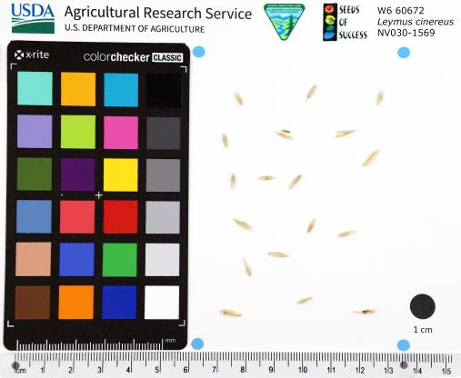 | | 2022 | | | | | | | Wild material | Bunchgrass forming large clumps up to 2 metres tall. It has a large, fibrous root system and sometimes small rhizomes. The inflorescence is an unbranched, cylindrical spike divided into up to 35 nodes with several flower spikelets per node. | 2138791 | W6 60672 |
| 447 | Ames 35806 | Reichelt Prairie | Salix humilis Marshall var. tristis (Aiton) Griggs | Iowa, United States | NC7 |  | | 2022 | COLLECTED | 05/16/2022 | Reichelt Unit of Rock Creek State Park on south side of US highway 6 approximately 7.70 miles west, southwest of Grinnell, T80N R17W SE ¼ SE ¼ Sec. 30. | 41.70311300, -92.86569100 | 274 | Xeric prairie remnant. Hilltop/knoll. | Wild material | Plants sampled in nature measuring 2.0-4.0 feet in height. Specimens noted during peak flowering and seed dispersal on 21 April and 17 May (2022), respectively. Some plants upright and some rather prostrate. Site was mowed in winter 2020/2021 winter resulting in significant flowering in 2022. In cultivation (central Iowa), plants are extremely short and compact where after two field seasons plants are rather uniform and topping out at a height of 2.5'. Dense suckering immediately surrounding clump/base of plant. Peak fall color (central Iowa) occurring in mid-November. | 2137912 | Ames 35806 |
| 448 | Ames 35805 | Rippey RR ROW | Salix humilis Marshall var. tristis (Aiton) Griggs | Iowa, United States | NC7 |  | | 2022 | COLLECTED | 05/12/2022 | Located 3.27 miles southeast of Rippey along east side of highway 144, T82N R28W NW ¼ SW ¼ Sec. 19. | 41.89609800, -94.16247600 | 284 | Xeric prairie remnant. Railroad right of way. | Wild material | Plants in nature measuring approximately 3.0-3.5' in height. Specimens noted during peak flowering and seed dispersal on 12 April and 3 May (2021), respectively. Normally for central Iowa peak flowering and fruiting occurs in late April and mid-May, respectively. | 2137911 | Ames 35805 |
| 449 | OPGC 8536 | NEWFS-786 | Verbena hastata L. | Massachusetts, United States | OPGC | | | 2021 | | | | | | | Wild material | Leaves are simple, sometimes lobed and sometimes unlobed. Flowers purple with petals that are fused into a floral tube. Iinflorescence ranges from open, showy flowers at the base of the cone shaped inflorescence to smaller florets at the tip of the inflorescence. | 2138853 | OPGC 8536 |
| 450 | W6 60223 | NEWFS-779 | Rhus typhina L. | Massachusetts, United States | W6 | | | 2021 | | | | | | | Wild material | Received as: Rhus hirta. Leaves in a single horizontal plane inflorescence reddish and touching may cause numbness stems and branches densely pubescent and velvety . | 2138849 | W6 60223 |
| 451 | W6 60229 | NEWFS-789 | Bolboschoenus maritimus (L.) Palla | Massachusetts, United States | W6 | | | 2021 | | | | | | | Wild material | Long bract subtends axillary inflorescence. | 2138855 | W6 60229 |
| 452 | OPGC 8507 | NCBG-534 | Typha angustifolia L. | Virginia, United States | OPGC | | | 2021 | | | | | | | Wild material | | 2132908 | OPGC 8507 |
| 453 | OPGC 8513 | NCBG-575 | Typha angustifolia L. | Maryland, United States | OPGC | | | 2021 | | | | | | | Wild material | | 2132926 | OPGC 8513 |
| 454 | OPGC 8518 | MARSB-405 | Euthamia caroliniana (L.) Greene ex Porter & Britton | New York, United States | OPGC | | | 2021 | | | | | | | Wild material | | 2137174 | OPGC 8518 |
| 455 | W6 59994 | NCBG-388 | Sorghastrum nutans (L.) Nash | Maryland, United States | W6 | | | 2021 | | | | | | | Wild material | | 2132876 | W6 59994 |
| 456 | W6 60048 | NCBG-580 | Schizachyrium scoparium (Michx.) Nash | Maryland, United States | W6 | | | 2021 | | | | | | | Wild material | | 2132929 | W6 60048 |
| 457 | W6 60090 | MARSB-410 | Tridens flavus (L.) Hitchc. | New York, United States | W6 | | | 2021 | | | | | | | Wild material | | 2137175 | W6 60090 |
| 458 | W6 60131 | NEWFS-464 | Rhus typhina L. | Massachusetts, United States | W6 | | | 2021 | | | | | | | Wild material | | 2137216 | W6 60131 |
| 459 | W6 59943 | CBG-10667 | Sporobolus rigidus (Buckley) P. M. Peterson var. rigidus | Illinois, United States | W6 |  | | 2021 | | | | | | | Wild material | | 2132521 | W6 59943 |
| 460 | OPGC 7574 | Ledges State Park | Solidago ulmifolia Muhl. ex Willd. | Iowa, United States | OPGC |  | | 2021 | COLLECTED | 09/15/2021 | Ledges State Park, approximately 4.5 miles south of Boone, T83N R26W Sec. 20 | 41.98266200, -93.89314800 | 287 | Understory of hardwood forest. | Wild material | Plants in nature were generally two to three feet in height, growing in sparsely spreading colonies. This population has a large amount of diversity for flowering time with the first plants in the population beginning to flower on 22 July 2021 and the last plants to flower were still blooming at the end of September. Some plants in the population had a muted red fall foliage color at the end of October 2021. This accession represents genetics from near the northwest edge of the species range of occurence. | 2132828 | OPGC 7574 |
| 461 | OPGC 7575 | Ledges State Park | Solidago flexicaulis L. | Iowa, United States | OPGC |  | | 2021 | COLLECTED | 10/03/2021 | Ledges State Park, approximately 4.5 miles south of Boone, T83N R26W Sec. 21 | 41.98338100, -93.89052800 | 288 | Understory of hardwood forest. | Wild material | Plants in nature ranged in height from approximately one to three feet, growing in sparsely spreading colonies. Peak bloom in 2021 occurred near 15 September. Several specimens had branched inflorescences. | 2132829 | OPGC 7575 |
| 462 | Ames 35750 | Ames 35750 | Blephilia ciliata (L.) Benth. | Iowa, United States | NC7 |  | | 2021 | COLLECTED | 09/27/2021 | Located approximately 3 miles south, southeast of Fairfield, T71N R9W SW1/4 Sec. 7 | 40.96338000, -91.94686900 | 223 | Woodland openings/edges, disturbed areas | Wild material | | 2122068 | Ames 35750 |
| 463 | W6 59652 | UT020-94 | Leymus cinereus (Scribn. & Merr.) Á. Löve | Utah, United States | W6 | | | 2021 | | | | | | | Wild material | Perennial bunchgrass forming tall, sprawling clumps with numerous inflorescences. Plant height averaged 4.5 ft and plants appeared healthy, but many plants in this area produced few or no reproductive shoots this year. Plants were present in flat, open areas directly alongside Wildcat Creek, but also along dry drainage paths relatively far from the creek. Most of the plants we collected seed from were located on rather dry, sloped sites, with their lower leaf blades dried up at the time of collection. | 2120817 | W6 59652 |
| 464 | W6 59654 | UT020-96 | Leymus cinereus (Scribn. & Merr.) Á. Löve | Utah, United States | W6 | | | 2021 | | | | | | | Wild material | Perennial bunchgrass forming tall, sprawling clumps with numerous inflorescences. Plant height averaged 4.58 ft, with plants scattered alongside Clear Creek Rd in relatively flat, open sites. The effects of grazing here were minimal this season, so most plants were neither chewed down nor trampled upon. Rather than forming dense clusters, most of the plants here were scattered far from one another amidst other tall grasses, shrubs, and forbs. Since the riparian zone here is heavily forested, most Leymus cinereus individuals were relatively far from the creek, compared with other sites where we've collected. | 2120819 | W6 59654 |
| 465 | Ames 35746 | Guye Woods | Acer saccharum Marshall subsp. nigrum (F. Michx.) Desmarais | Iowa, United States | NC7 |  | | 2021 | COLLECTED | 09/08/2021 | Guye Woods County Park located 6.0 miles northeast of Winterset, T76N R27W NE1/4 Sec. 4 | 41.41235000, -93.96373000 | 278 | Moist deciduous maple, oak, hickory forest, northwest facing slope above the North River. | Wild material | Multiple specimens in this population were observed to be 24" diameter at breast height (DBH) or larger with the largest specimen encountered at the time of collection measuring 36.5" DBH.
Morphological traits of leaves suggests sampled specimens are true to type of Acer saccharum subsp. nigrum including leaves with three distinct points, leathery/thick, and drooping in appearance. On September 25, 2020 (Schmitz, A., personal communication, 31 January 2022), peak fall color on Acer saccharum subsp. nigrum at Guye Woods was observed with specimens having a clean yellow fall color, also indicative of Acer saccharum subsp. nigrum.
| 2122010 | Ames 35746 |
| 466 | Ames 35736 | Horn Prairie Early Blooming | Monarda fistulosa L. | Illinois, United States | NC7 |  | | 2021 | COLLECTED | 08/27/2021 | Horn Prairie Grove located 3.91 miles east, southeast of Ramsey, T8N R1E SE ¼ SW ¼ Sec. 13 | 39.12960100, -89.03759800 | 166 | Very diverse remnant prairie. | Wild material | Accession represents an “early” flowering variant of Monarda fistulosa. Majority of specimens noted have pubescent stems and leaves; peaking flower on 6 June (2021); and measuring 34-36" in height. Generally found in more open, drier habitats in comparison to the “late” flowering more typical form of Monarda fistulosa. Majority of the “late” variants noted at the same locality (Ames 35737) have glabrous stems and leaves; measuring 4-4.5’ in height; peaking flower approximately five weeks later; and typically found in slightly wetter habitats. | 2120340 | Ames 35736 |
| 467 | Ames 35737 | Horn Prairie Late Blooming | Monarda fistulosa L. | Illinois, United States | NC7 |  | | 2021 | COLLECTED | 08/27/2021 | Horn Prairie Grove located 3.91 miles east, southeast of Ramsey, T8N R1E SE ¼ SW ¼ Sec. 13 | 39.12913900, -89.03924000 | 166 | Very diverse remnant prairie. | Wild material | Accession represents genetics from the typical form of M. fistulosa at the collection site. Majority of the specimens sampled display the typical morphological characters of the species including glabrous stems and leaves; measuring 4-4.5’ in height; peaking flower approximately 10 July (2021); and at the collection site typically, in slightly wetter habitats. Majority of the “early” variants noted at the same locality (Ames 35736) have pubescent stems and leaves; peaking flower on 6 June (2021); measuring 3’ in height or less; and are typically found in more open, drier habitats. | 2120341 | Ames 35737 |
| 468 | Ames 35735 | Steele Prairie State Preserve | Ceanothus americanus L. | Iowa, United States | NC7 |  | | 2021 | COLLECTED | 08/24/2021 | Steele Prairie State Preserve located approximately 8.75 miles north, northwest of Cherokee, T93N R40W NW1/4 Sec. 16 and also NW1/4 SW1/4 Sec. 15. | 42.87981600, -95.57948900 | 434 | Remnant sand prairie. | Wild material | Ceanothus americanus is abundant throughout the upland areas of Steele Prairie State Preserve. Plants sampled in nature were approximately 0.5 meters in height. At the time of sampling, variation was observed for plant growth habit, inflorescence size, and fruit maturity. Peak seed ripening in 2021 occurred on approximately 24 August. | 2120339 | Ames 35735 |
| 469 | Ames 35734 | Ledges State Park | Teucrium canadense L. | Iowa, United States | NC7 |  | | 2021 | COLLECTED | 08/23/2021 | Ledges State Park located approximately 4.75 miles south of Boone T83N R26W Sec. 16 & 21 | 41.99262400, -93.87724800 | 330 | Edges of woods | Wild material | | 2120338 | Ames 35734 |
| 470 | NA 88332 | CBG-10580 | Hypericum prolificum L. | Illinois, United States | NA | | | 2021 | | | | | | | Wild material | Plant numbers sampled estimated. | 2120171 | NA 88332 |
| 471 | OPGC 8343 | CBG-10575 | Euthamia graminifolia (L.) Nutt. | Illinois, United States | OPGC | | | 2021 | | | | | | | Wild material | Plant numbers sampled estimated. | 2120166 | OPGC 8343 |
| 472 | W6 59032 | NCBG-574 | Sagittaria latifolia Willd. | Maryland, United States | W6 | | | 2021 | | | | | | | Wild material | | 2116349 | W6 59032 |
| 473 | Ames 35729 | Woodside Prairie | Ceanothus americanus L. | Iowa, United States | NC7 | | | 2021 | COLLECTED | 08/31/2020 | Woodside Praire located 8.0 miles south and 2.0 miles west of Fontanelle | 41.17130000, -94.60140000 | 380 | Remnant prairie. | Wild material | | 2120333 | Ames 35729 |
| 474 | Ames 35668 | Iroquois County Conservation Area | Aronia ×prunifolia (Marshall) Rehder | Illinois, United States | NC7 |  | | 2021 | COLLECTED | 05/05/2021 | Iroquois County Conservation Area located approximately 4.5 miles northeast of Beaverville in Beaverville Township, T29N R11W NE1/4 Sec. 22 | 40.99154700, -87.58073200 | 198 | Woodland edge of wet sand prairie | Wild material | Wide variety of genotypes noted in nature averaging 3.5-7' in height. Some growing in shade of oak forest were sparse suckering and open branching compared to open grown specimens that were extremely dense with suckers. | 2115977 | Ames 35668 |
| 475 | OPGC 8186 | NEWFS-487 | Euthamia graminifolia (L.) Nutt. | Massachusetts, United States | OPGC | | | 2021 | | | | | | | Wild material | | 2115670 | OPGC 8186 |
| 476 | OPGC 8192 | NEWFS-519 | Euthamia graminifolia (L.) Nutt. | New Hampshire, United States | OPGC | | | 2021 | | | | | | | Wild material | | 2115677 | OPGC 8192 |
| 477 | W6 58792 | NEWFS-790 | Schoenoplectus americanus (Pers.) Volkart ex Schinz & R. Keller | Massachusetts, United States | W6 | | | 2021 | | | | | | | Wild material | There is an awn present that subtends the scales/ bracts of the cone; also differs from S. pungens by a nook or divot at the tip of the bract where the awn resides. | 2115731 | W6 58792 |
| 478 | NA 88190 | MARSB-749 | Baccharis halimifolia L. | New York, United States | NA | | | 2021 | | | | | | | Wild material | Simple, alternate, toothed leaves. White flowers that become conscpicuously fluffy when ripe. | 2113604 | NA 88190 |
| 479 | OPGC 8105 | CO932-388 | Chrysothamnus viscidiflorus (Hook.) Nutt. | Colorado, United States | OPGC | | | 2020 | | | | | | | Wild material | Leaves: twisted, 3-veined; inflorescence: lacking ray flowers, disc flowers yellow; fruit: achenes, hairy | 2109952 | OPGC 8105 |
| 480 | W6 58339 | CA930A-899 | Sphaeralcea ambigua A. Gray var. ambigua | California, United States | W6 | | | 2020 | | | | | | | Wild material | Currently accepted name: Sphaeralcea ambigua var. ambigua (SPAMA3)ûAssociated species: Cryptantha dumetorum is probably C. nevadensis. | 2109902 | W6 58339 |
| 481 | W6 58340 | CA930A-900 | Grayia spinosa (Hook.) Moq. | California, United States | W6 | | | 2020 | | | | | | | Wild material | | 2109903 | W6 58340 |
| 482 | W6 58349 | CA930A-909 | Krascheninnikovia lanata (Pursh) A. Meeuse & A. Smit | California, United States | W6 | | | 2020 | | | | | | | Wild material | | 2109912 | W6 58349 |
| 483 | W6 58350 | CA930A-910 | Xylorhiza tortifolia (Torr. & A. Gray) Greene var. tortifolia | California, United States | W6 | | | 2020 | | | | | | | Wild material | | 2109913 | W6 58350 |
| 484 | W6 58351 | CA930A-911 | Achnatherum speciosum (Trin. & Rupr.) Barkworth | California, United States | W6 | | | 2020 | | | | | | | Wild material | | 2109914 | W6 58351 |
| 485 | W6 58353 | CA930A-913 | Chylismia brevipes (A. Gray) Small subsp. brevipes | California, United States | W6 | | | 2020 | | | | | | | Wild material | | 2109916 | W6 58353 |
| 486 | W6 58354 | CA930A-914 | Streptanthus pilosus (S. Watson) Jeps. | California, United States | W6 | | | 2020 | | | | | | | Wild material | | 2109917 | W6 58354 |
| 487 | W6 58384 | CO932-383 | Ericameria parryi (A. Gray) G. L. Nesom & G. I. Baird | Colorado, United States | W6 | | | 2020 | | | | | | | Wild material | apressed tomentum on stems, yellow disk flowers in heads of ~15, and alternate and linear leaves. | 2109947 | W6 58384 |
| 488 | Ames 35545 | Kish-Ke-Kosh Prairie | Drymocallis arguta (Pursh) Rydb. | Iowa, United States | NC7 |  | | 2020 | COLLECTED | 08/14/2020 | Kish-Ke-Kosh Prairie State Preserve located 1.1 miles southeast of Reasnor, T78N R19W NE 1/4 NW 1/4 NE 1/4 Sec. 14, Jasper County | 41.56461900, -93.01285900 | 259 | Sandy prairie remnant. | Wild material | | 2106724 | Ames 35545 |
| 489 | NA 87337 | QLG223 (seed parent) | Cephalotaxus sinensis (Rehder & E. H. Wilson) H. L. Li | Gansu Sheng, China | NA | | | 2020 | COLLECTED | 10/04/1996 | Tianshui City (Qinling Mountains): Xiaolongshan Forestry Experimental Bureau, Dang Chuan Forest Station, Mai Chao Gou. | 34.29819000, 106.19911000 | 1605 | Rocky slope in part shade along woodland edge, just above floodplain of stream; growing in large, almost impenetrable masses, untouched by grazing animals; in well-drained, rocky, generally silty-sandy soils deposited among rocks in floodplain. | Wild material | Full name as recorded at U.S. National Arboretum: Cephalotaxus sinensis. Open-pollinated seedlings found directly underneath NA 67854 qualifiers L and T (latter deceased), growing in close proximity and some distance from other Cephalotaxus accessions. Parent qualifier L is in poor condition and qualifier T likely died within the last one to three years; these were the last remaining individuals of this wild collection, so it is worth preserving the germplasm through their seedlings. The year of origin is only an estimate based on the apparent seedling age; seedlings appear to have germinated over a few years. There is likely to be no fundamental difference between the seedlings from the two NA 67854 qualifiers, but seedlings from 67854-L will initially be treated as 87337-H, and the (more numerous) seedlings from deceased 67854-T will be treated initially as 87337-J. -SBL | 2155330 | NA 87337 |
| 490 | W6 57661 | CA180-208 | Prunella vulgaris L. | California, United States | W6 | | | 2020 | | | | | | | Wild material | SOS 92nd Shipment | 2104959 | W6 57661 |
| 491 | NA 88139 | NCBG-271 | Morella cerifera (L.) Small | North Carolina, United States | NA |  | | 2019 | | | | | | | Wild material | | 2098383 | NA 88139 |
| 492 | W6 57584 | NCBG-671 | Ageratina altissima (L.) R. M. King & H. Rob. var. altissima | Maryland, United States | W6 |  | | 2019 | | | | | | | Wild material | | 2098508 | W6 57584 |
| 493 | OPGC 7961 | NEWFS-778 | Solidago rugosa Mill. | Massachusetts, United States | OPGC |  | | 2019 | | | | | | | Wild material | | 2098242 | OPGC 7961 |
| 494 | GPRU 168 | MARSB-577 | Prunus serotina Ehrh. | New York, United States | GEN |  | | 2019 | | | | | | | Wild material | | 2097661 | GPRU 168 |
| 495 | NA 88095 | MARSB-256 | Ilex verticillata (L.) A. Gray | New York, United States | NA |  | | 2019 | COLLECTED | 10/07/2015 | In Sag Harbor, NY, park in Mashashimuet Park. Walk along the Long Pond Greenbelt Trail. The population is along the edges of Long Pond and Crooked Pond, the first and third ponds on the left, respectively. | 40.96283000, -72.29366000 | 5 | Central shrub & herb depression pond. | Wild material | | 2097543 | NA 88095 |
| 496 | NA 88096 | MARSB-258 | Ilex glabra (L.) A. Gray | New York, United States | NA |  | | 2019 | COLLECTED | 10/08/2015 | In Sag Harbor, park in Mashashimuet Park. Enter the Long Pond Greenbelt and walk along it until you reach Crooked Pond, the third pond on the left. The population is along pond edges. | 40.96283000, -72.29366000 | 5 | Central shrub & herb depression pond. | Wild material | | 2097545 | NA 88096 |
| 497 | NA 88122 | MARSB-736 | Kalmia latifolia L. | New York, United States | NA |  | | 2019 | | | | | | | Wild material | | 2097694 | NA 88122 |
| 498 | OPGC 7884 | MARSB-259 | Rhexia virginica L. | New York, United States | OPGC |  | | 2019 | | | | | | | Wild material | | 2097546 | OPGC 7884 |
| 499 | OPGC 7902 | MARSB-405 | Euthamia caroliniana (L.) Greene ex Porter & Britton | New York, United States | OPGC |  | | 2019 | | | | | | | Wild material | | 2097616 | OPGC 7902 |