| 0 | NA 88440 | MARSB-419 | Rosa virginiana Mill. | New York, United States | NA |  | | 2019 | | | | | | | Wild material | | 2097623 | NA 88440 |
| 1 | NA 89081 | 2024RJLPA-009 | Rosa carolina L. | Pennsylvania, United States | NA | | | 2024 | COLLECTED | 09/22/2024 | Lancaster and York Counties: outcrops along the Susquehanna River, accessed from the Historic Lock 12 parking lot off of Pennsylvania Road 372. | 39.81483500, -76.32762200 | 34 | Plants are growing from part-sun to full sun in crevices of the outcrops and where organic debris has accumulated in between boulders along the Susquehanna River. The sites range from nearly xeric to dry mesic, at least on the surface. Plants are generally growing 4-10 m above the normal flow of the river; however, the Holtwood Dam is less than 1 kilometer upstream and debris found trapped in the boulders indicates that there is periodic flooding, at least, in the lower zone of 4+ meters or so above normal river flow. This habitat has a diverse assemblage of deciduous trees and shrubs as well as abundant herbaceous taxa. Slope: 0 to 60 percent. Aspect: Northeast (generally). Geology: The underlying geology of this area is probably of lower Paleozoic age and characterized as the Octoraro Formation. It includes albite-chlorite schist, phyllite, some hornblende gneiss, and granitized members. Soils: The area where this species occurs is right on the edge of two soil zones that transition from the river’s edge to mesic conditions upslope. The first is generally referred to as Rock Outcrop. This terrestrial matrix in which plants grow is largely exposed underlying rock geology with accumulated outwash, rock decomposition, and organic debris buildup. The second is Mt. Airy (80%) and Manor (20%) Series soils, 25 to 60 percent slopes, extremely stony (MRF). (Source: California Soil Resource Lab/NRCS Official Soil Series Descriptions). EPA Ecoregion (Level III): Northern Piedmont (64). EPA Ecoregion (Level IV): Piedmont Uplands (64c). | Wild material | | 2169045 | NA 89081 |
| 2 | NA 88542 | RJLSEUS2022-014 | Rosa palustris Marshall | Georgia, United States | NA | | | 2023 | COLLECTED | 12/09/2022 | Plants growing around a pond and associated wetland on the property of Monica Williams north of Albany, Georgia. Common along the transitional edges from wet to dry. | 31.63723900, -84.13776200 | 60 | Plants are growing in full sun mostly in the transitional edges of the pond where conditions are generally moist mesic. Even so, this species appears quite adaptable and can be found in quite moist as well as drier soil conditions.
Soils: The underlying geology of this area is of Eocene origin and characterized as Ocala Limestone. The Ocala Limestone consists of almost pure limestones with occasional dolomites. It can be subdivided into both lower and upper facies with the lower facies composed of a whitish to cream-colored, fine to medium grained, poorly to moderately hard, fossil rich grainstone and packstone. The upper Ocala is white and somewhat weak and poorly sorted. It is extremely fossil rich grainstone, packstone and wackestone and some chert is common in the upper facies.
Source: USGS Georgia Geologic Map Data (https://mrdata.usgs.gov/geology/state/sgmc-unit.php?unit=GANu%3B1)
The primary soil types in the collection area are classified as Herod and Muckalee Series soils. The Herod Series consists of poorly drained moderately permeable soils formed in loamy alluvium. These soils are on flood plains of streams in the Coastal Plain. Slopes range from 0 to 2 percent. The Muckalee Series consists of poorly drained moderately permeable soils formed in loamy and sandy alluvium. These soils are on flood plains of streams in the Coastal Plain. Slopes range from 0 to 2 percent.
Source: NRCS Web Soil Survey (https://websoilsurvey.sc.egov.usda.gov/App/WebSoilSurvey.aspx) | Wild material | | 2140817 | NA 88542 |
| 3 | NA 89035 | RJL2022KS-002 | Rosa arkansana Porter | Kansas, United States | NA | | | 2022 | COLLECTED | 09/20/2022 | Coronado Heights Park, Smoky View, Kansas hillsides surrounding the historic WPA circa 1932 Coronado Heights Castle located about 91 meters above the surrounding land. This plant is quite abundant on the slopes of this site and highly competitive. | 38.61158800, -97.70427000 | 475 | Plants growing in part-sun to full sun, under extreme exposure, rocky, dry and thin soils of this short grass prairie habitat on the slopes surrounding the summit of Coronado Heights Park.
The underlying geology of this area is of Upper Cretaceous origin and comprised of Kiowa Shale or FM- light -gray to black illitic shale with thin coquinoidal limestone beds at the base; sandstone lenses are common. Cheyenne Sandstone-massive to cross-bedded, light-gray to buff fine-grained sandstone with lenses of gray sandy shale and conglomerate.
Source: USGS Kansas Geologic Map Data (https://mrdata.usgs.gov/geology/state/sgmc-unit.php?unit=KSKkc%3B0)
The surface soil profile of this area is Lancaster-Hedville complex, 3 to 20 percent slopes. The Lancaster series consists of moderately deep, well drained soils that formed in residuum from sandstone and sandy shales; it can be up to 200 cm deep. Slopes range from 1-20%. Hedville soils have bedrock within 50 centimeters of the surface and occur on similar hillslope positions.
Source: NRCS Web Soil Survey (https://websoilsurvey.sc.egov.usda.gov/App/WebSoilSurvey.aspx) | Wild material | | 2139600 | NA 89035 |
| 4 | NA 88439 | CBG-10597 | Rosa setigera Michx. | Illinois, United States | NA | | | 2021 | | | | | | | Wild material | Plant numbers sampled estimated. | 2120182 | NA 88439 |
| 5 | WLP 1686 | APS/RS/2019/067/396 | Rosa setigera Michx. | Arkansas, United States | NA |  | | 2019 | COLLECTED | 11/07/2019 | Located near intersection of Smith Mountain Road and Newton County 8828 Road approximately 6.00 miles north of Deer, Newton County | 35.91212000, -93.21112000 | 636 | Roadside, upland with rocky soils | Wild material | | 2097789 | WLP 1686 |
| 6 | WLP 1685 | JDC/RS/2019/036/915 | Rosa setigera Michx. | Iowa, United States | NA |  | | 2019 | COLLECTED | 10/17/2019 | Ledges State Park located approximately 4.75 miles south of Boone, just south of the Oakwoods Shelter/Picnic area, T83N R26W NE1/4 NE1/4 and also NW1/4 NE1/4 Sec. 21, Boone County | 41.99262400, -93.87724800 | 330 | Edges of woods (adjacent to prairie) and also within 20-25 yards from woods in prairie. Noted in east, west, and south-facing edges of woods (no specimens noted on north-facing woodland edges) | Wild material | Woody shrub/vine stretching up to 12' in length. Alternate compound leaves usually consisting of five lealets. Leaf rachis and stipule margins glandular. Mature hypanthium and pedicel with stipitate glandular hairs. Mature hypanthium mostly bright to dark red in color with a few dark orange noted at time of harvest (17 October 2019). Leaves rather to somewhat glossy. This collection represents genetics from the northwestern edge of the species range, likely suggesting good cold-hardiness (USDA Zone 5a). | 2097769 | WLP 1685 |
| 7 | NA 88443 | NV040-344 | Rosa woodsii Lindl. | Nevada, United States | NA |  | | 2019 | | | | | | | Wild material | | 2094595 | NA 88443 |
| 8 | NA 88434 | NEWFS-740 | Rosa palustris Marshall | Massachusetts, United States | NA |  | | 2019 | | | | | | | Wild material | | 1976342 | NA 88434 |
| 9 | PI 616950 | F. virginiana subsp. virginiana NC 98-14-2 | Fragaria virginiana Mill. subsp. virginiana | Tennessee, United States | COR | | Out of Season | 2000 | COLLECTED | 09/27/1998 | Ceders of Lebanon State Forest. 0.7 mile down State Forest road from the 'Pork'. Road edge on the right and 3 to 4 miles into a very large cedar glade. Wilson county. | 36.07361000, -86.31056000 | 340 | Cedar glade with typical vegetation. Pimarily growing through a mat of mosses. Some plants suffering from severe drought. Rhus aromatica, Rosa sp. and Rhamus caroliniana occasional to scattered. | Wild material | | 1603162 | PI 616950 |
| 10 | PI 616833 | F. virginiana subsp. virginiana NC 96-45-1 | Fragaria virginiana Mill. subsp. virginiana | South Carolina, United States | COR | | Out of Season | 1996 | COLLECTED | 07/20/1996 | Left roadside both north and south of Little River, 6.3 miles south of Clinton on SC 72, Laurens county, South Carolina. | 34.38694000, -81.94444000 | | Fragaria virginiana occasional on dry roadbanks over about 300 yards along road. Rosa carolina also associated with strawberry. | Wild material | USDA Sponsored plant collecting expedition, 1996 | 1535626 | PI 616833 |
| 11 | PI 616835 | F. virginiana subsp. virginiana NC 96-45-3 | Fragaria virginiana Mill. subsp. virginiana | South Carolina, United States | COR | | Out of Season | 1996 | COLLECTED | 07/20/1996 | Left roadside both north and south of Little River, 6.3 miles south of Clinton on SC 72, Laurens county, South Carolina. | 34.38694000, -81.94444000 | | Fragaria virginiana occasional on dry roadbanks over about 300 yards along road. Rosa carolina also associated with strawberry. | Wild material | USDA Sponsored plant collecting expedition, 1996 | 1535628 | PI 616835 |
| 12 | PI 616836 | F. virginiana subsp. virginiana NC 96-45-4 | Fragaria virginiana Mill. subsp. virginiana | South Carolina, United States | COR | | Out of Season | 1996 | COLLECTED | 07/20/1996 | Left roadside both north and south of Little River, 6.3 miles south of Clinton on SC 72, Laurens county, South Carolina. | 34.38694000, -81.94444000 | | Fragaria virginiana occasional on dry roadbanks over about 300 yards along road. Rosa carolina also associated with strawberry. | Wild material | USDA Sponsored plant collecting expedition, 1996 | 1535629 | PI 616836 |
| 13 | PI 616837 | F. virginiana subsp. virginiana NC 96-46-1 | Fragaria virginiana Mill. subsp. virginiana | South Carolina, United States | COR | | Out of Season | 1996 | COLLECTED | 07/20/1996 | Roadside on the right just above the Tyger River, 0.3 mile north of the town limits of Cross Anchor, on county road 56 , Spartonbury county, South Carolina. | 34.69167000, -81.83250000 | | One scattered colony of Fragaria virginiana growing on the dry shoulder of the road. Rosa carolina also on the site. Climbing milkweed between the site and the river. | Wild material | USDA Sponsored plant collecting expedition, 1996 | 1535630 | PI 616837 |
| 14 | NA 88389 | NEWFS-739 | Juniperus virginiana L. var. virginiana | Massachusetts, United States | NA | | | 2021 | | | | | | | Wild material | Small conical shrub with waxy blue green fruits and tight scale like leaves. | 2138832 | NA 88389 |
| 15 | NA 88081 | NEWFS-739 | Juniperus virginiana L. var. virginiana | Massachusetts, United States | NA |  | | 2019 | | | | | | | Wild material | | 1976341 | NA 88081 |
| 16 | GPRU 170 | NV030-1334 | Prunus virginiana L. | California, United States | GEN |  | | 2018 | COLLECTED | 09/25/2017 | From US-395N from Reno, turn L onto CA-70W to Chilcoot. Turn R onto CA-284N towards Frenchman Lake, and continue 7 miles until Cornus patch. | 39.87549000, -120.18370000 | 1623 | | Wild material | | 1970658 | GPRU 170 |
| 17 | WLP 2435 | CBG-1797 | Prunus virginiana L. | Wyoming, United States | NA |  | | 2013 | COLLECTED | 09/06/2011 | | | 1727 | Stream gulch with wetter soils within Western Rocky Mountain foothills. | Wild material | | 1908924 | WLP 2435 |
| 18 | WLP 2346 | NV030-220 | Prunus virginiana L. | California, United States | NA | 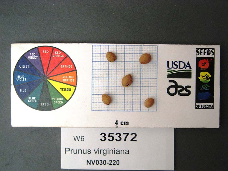 | | 2009 | COLLECTED | 10/15/2008 | Bank of the Truckee River, from Floriston exit off 80W coming from Reno, Nevada. | | | Riparian community along river; site is used for recreation; soil consists of rocks, gravel, and sand | Wild material | No thorns present. Ht: 1-3 meters. | 1808200 | WLP 2346 |
| 19 | WLP 2120 | 302025 | Juniperus virginiana L. | Virginia, United States | NA |  | | 2008 | COLLECTED | 12/28/2005 | | | 89 | Slope: 0 Aspect: NE Soil: Clay-loam, Land form: Upland meadow. Mowed. | Wild material | | 1780179 | WLP 2120 |
| 20 | PI 704849 sos | R. flagellaris MARSB-128 | Rubus flagellaris Willd. | New Jersey, United States | COR |  | | 2019 | | | | | | | Wild material | | 2097493 | PI 704849 sos |
| 21 | PI 656821 | Ames 27283 | Physocarpus opulifolius (L.) Maxim. | Iowa, United States | NC7 | | | 2003 | COLLECTED | 09/06/2003 | Above Cedar River, along River Road, southeast of Mitchell, extreme SE corner of Section 8 and NE corner of Section 17, T98N, R17W, Osage Quad, Mitchell County. | 43.31277778, -92.87166667 | 332 | Base of west-facing limestone bluff. | Wild material | Large, floriferous shrubs. | 1648679 | PI 656821 |
| 22 | PI 635465 | H. lupulus var. neomexicanus OCJ-42 | Humulus lupulus L. var. neomexicanus A. Nelson & Cockerell | Colorado, United States | COR | | | 2002 | COLLECTED | 09/16/2002 | North of Poncha Springs along the Arkansas River on U.S.-285 Two miles north of Nathrop turn north on County Road 301 (C-301). Upstream from C-301 bridge, between C-301A and river. | 38.76778000, -106.09722000 | 2348 | Raparian; Salix sp., Prunus virginiana, Ribes aureum and Rosa sp. | Wild material | | 1642224 | PI 635465 |
| 23 | NA 89077 | 2024RJLPA-003 | Viburnum acerifolium L. | Pennsylvania, United States | NA | | | 2024 | COLLECTED | 09/19/2024 | Birdell Road, near parking lot to trail where the road ends at Chambers Lake, which is part of Hibernia County Park. | 40.03559500, -75.85708600 | 187 | Plants are growing in deep shade of a dry deciduous forest dominated by Fagus grandifolia. Slope: 0 percent. Aspect: N/A. Geology: The underlying geology of this area is of Precambrian origin and characterized as Banded Mafic Gneiss. It is characterized as dark and fine to medium grained. This formation includes rocks of probable sedimentary origin; may be equivalent to "PZmgh." (Source: USGS Pennsylvania Geologic Map Data). Soils: The primary soil type in the area of this collection is classified as Neshaminy Series Silt Loam, very deep over mafic gneiss, 3 to 8 percent slopes (NvB). (Source: USDA-NRCS Official Soil Series Descriptions). EPA Ecoregion (Level III): Northern Piedmont (64). EPA Ecoregion (Level IV): Piedmont Uplands (64c). | Wild material | | 2169041 | NA 89077 |
| 24 | NA 89082 | 2024RJLPA-010 | Amorpha fruticosa L. | Pennsylvania, United States | NA | | | 2024 | COLLECTED | 09/22/2024 | Outcrops along the Susquehanna River, accessed from the Historic Lock 12 parking lot off of Pennsylvania Road 372. | 39.81481500, -76.32757900 | 34 | Plants are growing from part-sun to full sun in crevices of the outcrops and where organic debris has accumulated in between boulders along the Susquehanna River. The sites range from nearly xeric to dry mesic, at least on the surface. Plants are generally growing 4-10 m above the normal flow of the river; however, the Holtwood Dam is less than 1 kilometer upstream and debris found trapped in the boulders indicates that there is periodic flooding, at least, in the lower zone of 4+ meters or so above normal river flow. This habitat has a diverse assemblage of deciduous trees and shrubs as well as abundant herbaceous taxa. Slope: 0 to 25 percent. Aspect: Northeast (generally). Geology: The underlying geology of this area is probably of lower Paleozoic age and characterized as the Octoraro Formation. It includes albite-chlorite schist, phyllite, some hornblende gneiss, and granitized members. Soils: The area where this species occurs is right on the edge of two soil zones that transition from the river’s edge to mesic conditions upslope. The first is generally referred to as Rock Outcrop. This terrestrial matrix in which plants grow is largely exposed underlying rock geology with accumulated outwash, rock decomposition, and organic debris buildup. The second is Mt. Airy (80%) and Manor (20%) Series soils, 25 to 60 percent slopes, extremely stony (MRF). (Source: California Soil Resource Lab/NRCS Official Soil Series Descriptions). EPA Ecoregion (Level III): Northern Piedmont (64). EPA Ecoregion (Level IV): Piedmont Uplands (64c). | Wild material | | 2169046 | NA 89082 |
| 25 | NA 89083 | 2024RJLPA-012 | Rhododendron periclymenoides (Michx.) Shinners | Pennsylvania, United States | NA | | | 2024 | COLLECTED | 09/22/2024 | Outcrops along the Susquehanna River, accessed from the Historic Lock 12 parking lot off of Pennsylvania Road 372. | 39.81477400, -76.32807300 | 35 | Plants are growing from shade to part-sun and occasionally full sun in crevices of the outcrops and where organic debris has accumulated in between boulders along the Susquehanna River. The sites range from nearly xeric to mesic, at least on the surface. Plants are generally growing 4-10 m above the normal flow of the river; however, the Holtwood Dam is less than 1 kilometer upstream and debris found trapped in the boulders indicates that there is periodic flooding, at least, in the lower zone of 4+ meters or so above normal river flow. This habitat has a diverse assemblage of deciduous trees and shrubs as well as abundant herbaceous taxa. Slope: 0 to 60 percent. Aspect: Northeast (generally). Geology: The underlying geology of this area is probably of lower Paleozoic age and characterized as the Octoraro Formation. It includes albite-chlorite schist, phyllite, some hornblende gneiss, and granitized members. Soils: The area where this species occurs is right on the edge of two soil zones that transition from the river’s edge to mesic conditions upslope. The first is generally referred to as Rock Outcrop. This terrestrial matrix in which plants grow is largely exposed underlying rock geology with accumulated outwash, rock decomposition, and organic debris buildup. The second is Mt. Airy (80%) and Manor (20%) Series soils, 25 to 60 percent slopes, extremely stony (MRF). (Source: California Soil Resource Lab/NRCS Official Soil Series Descriptions). EPA Ecoregion (Level III): Northern Piedmont (64). EPA Ecoregion (Level IV): Piedmont Uplands (64c). | Wild material | | 2169047 | NA 89083 |
| 26 | NA 89084 | 2024RJLPA-013 | Physocarpus opulifolius (L.) Maxim. | Pennsylvania, United States | NA | | | 2024 | COLLECTED | 09/22/2024 | Outcrops along the Susquehanna River, accessed from the Historic Lock 12 parking lot off of Pennsylvania Road 372. | 39.81466300, -76.32833900 | 36 | Plants are growing from shade to part-sun where organic debris has accumulated in between boulders as well as further upslope in deeper mesic soils along the Susquehanna River. This habitat has a diverse assemblage of deciduous trees and shrubs as well as abundant herbaceous taxa. Slope: 10 to 25 percent. Aspect: Northeast (generally). Geology: The underlying geology of this area is probably of lower Paleozoic age and characterized as the Octoraro Formation. It includes albite-chlorite schist, phyllite, some hornblende gneiss, and granitized members. Soils: The area where this species occurs is right on the edge of two soil zones that transition from the river’s edge to mesic conditions upslope. The first is generally referred to as Rock Outcrop. This terrestrial matrix in which plants grow is largely exposed underlying rock geology with accumulated outwash, rock decomposition, and organic debris buildup. The second is Mt. Airy (80%) and Manor (20%) Series soils, 25 to 60 percent slopes, extremely stony (MRF). (Source: California Soil Resource Lab/NRCS Official Soil Series Descriptions). EPA Ecoregion (Level III): Northern Piedmont (64). EPA Ecoregion (Level IV): Piedmont Uplands (64c). | Wild material | | 2169048 | NA 89084 |
| 27 | NA 89085 | 2024RJLPA-014 | Rhododendron arborescens (Pursh) Torr. | Pennsylvania, United States | NA | | | 2024 | COLLECTED | 09/22/2024 | Outcrops along the Susquehanna River, accessed from the Historic Lock 12 parking lot off of Pennsylvania Road 372. | 39.81618100, -76.33069800 | 38 | Plants are growing from shade to part-sun and occasionally full sun in crevices of the outcrops and where organic debris has accumulated in between boulders along the Susquehanna River. The sites range from nearly xeric to mesic, at least on the surface. Plants are generally growing 4-10 m above the normal flow of the river; however, the Holtwood Dam is less than 1 kilometer upstream and debris found trapped in the boulders indicates that there is periodic flooding, at least, in the lower zone of 4+ meters or so above normal river flow. This habitat has a diverse assemblage of deciduous trees and shrubs as well as abundant herbaceous taxa. Slope: 0 to 75 percent. Aspect: Northeast (generally). Geology: The underlying geology of this area is probably of lower Paleozoic age and characterized as the Octoraro Formation. It includes albite-chlorite schist, phyllite, some hornblende gneiss, and granitized members. Soils: The area where this species occurs is right on the edge of two soil zones that transition from the river’s edge to mesic conditions upslope. The first is generally referred to as Rock Outcrop. This terrestrial matrix in which plants grow is largely exposed underlying rock geology with accumulated outwash, rock decomposition, and organic debris buildup. The second is Mt. Airy (80%) and Manor (20%) Series soils, 25 to 60 percent slopes, extremely stony (MRF). (Source: California Soil Resource Lab/NRCS Official Soil Series Descriptions). EPA Ecoregion (Level III): Northern Piedmont (64). EPA Ecoregion (Level IV): Piedmont Uplands (64c). | Wild material | | 2169049 | NA 89085 |
| 28 | NA 89086 | 2024RJLPA-015 | Ilex verticillata (L.) A. Gray | Pennsylvania, United States | NA | | | 2024 | COLLECTED | 09/22/2024 | Outcrops along the Susquehanna River, accessed from the Historic Lock 12 parking lot off of Pennsylvania Road 372. | 39.81656600, -76.33136600 | 38 | Plants are growing from part-sun to full sun in crevices of the outcrops and where organic debris has accumulated in between boulders along the Susquehanna River. The sites range from nearly xeric to dry mesic, at least on the surface. Plants are generally growing 4-10 m above the normal flow of the river; however, the Holtwood Dam is less than 1 kilometer upstream and debris found trapped in the boulders indicates that there is periodic flooding, at least, in the lower zone of 4+ meters or so above normal river flow. This habitat has a diverse assemblage of deciduous trees and shrubs as well as abundant herbaceous taxa. Slope: 0 to 10 percent. Aspect: Northeast (generally). Geology: The underlying geology of this area is probably of lower Paleozoic age and characterized as the Octoraro Formation. It includes albite-chlorite schist, phyllite, some hornblende gneiss, and granitized members. Soils: The area where this species occurs is right on the edge of two soil zones that transition from the river’s edge to mesic conditions upslope. The first is generally referred to as Rock Outcrop. This terrestrial matrix in which plants grow is largely exposed underlying rock geology with accumulated outwash, rock decomposition, and organic debris buildup. The second is Mt. Airy (80%) and Manor (20%) Series soils, 25 to 60 percent slopes, extremely stony (MRF). (Source: California Soil Resource Lab/NRCS Official Soil Series Descriptions). EPA Ecoregion (Level III): Northern Piedmont (64). EPA Ecoregion (Level IV): Piedmont Uplands (64c). | Wild material | | 2169050 | NA 89086 |
| 29 | Ames 36168 | Mount Magazine | Ptelea trifoliata L. | Arkansas, United States | NC7 |  | | 2023 | COLLECTED | 08/26/2023 | Mount Magazine State Park primarily localized to the northwest rim of the mountain along the trails heading west from Brown's Spring, T6N R25W Sec. 21. | 35.17130900, -93.65582200 | 786 | Top of sky-island mountain. Localized along the rims just above steep cliffs on north facing slopes. | Wild material | Plants in nature ranging from three to fifteen feet in height with peak bloom observed during the first week of May (2023). | 2158787 | Ames 36168 |
| 30 | Ames 36153 | JDC/MM/2023/049/1081 | Monarda maxmedleyi J. J. N. Campb. & Floden | Kentucky, United States | NC7 |  | | 2023 | COLLECTED | 08/10/2023 | Lily Mountain Preserve located 6.92 miles west, southwest of South Irvine | 37.63661300, -84.09026400 | 432 | Open dry, woods. Localized at highest elevations of preserve. | Wild material | Plants measuring 12-18" in height. Spreading vegetatively via rhizomes. Majority of specimens with mostly white flowers. Peak flowering at collection site occurred near 26th of May (2023). | 2158358 | Ames 36153 |
| 31 | Ames 36154 | JDC/MM/2023/051/1083 | Monarda maxmedleyi J. J. N. Campb. & Floden | Kentucky, United States | NC7 |  | | 2023 | COLLECTED | 08/08/2023 | Located just east of highway 213 (Morris Creek Road) near Powell and Montgomery County line. Population in both counties. | 37.90554800, -83.86808700 | 359 | Dry, steep hillside (roadside). Localized to south-facing slopes. | Wild material | Plants measuring 12-18" in height. Peak flowering at collection site occurred near 24th of May (2023). Some specimens extremely vigorous forming dense clonal patches covering a 5' x 5' area. Majority of specimens with mostly white flowers. | 2158359 | Ames 36154 |
| 32 | Ames 36155 | JDC/MM/2023/052/1084 | Monarda maxmedleyi J. J. N. Campb. & Floden | Kentucky, United States | NC7 |  | | 2023 | COLLECTED | 08/09/2023 | Star Gap Road between Red River and Campton Road located 3.0 miles north, northwest of Slade | 37.83158300, -83.72674500 | 265 | Edges of woods/roadsides. Localized to west and southeast facing slopes. | Wild material | Plants measuring 12-18" in height. Spreading vegetatively via rhizomes. Most specimens had pale pink flowers with some having white flowers. Peak flowering at collection site occurred near 29th of May (2023). | 2158360 | Ames 36155 |
| 33 | Ames 36158 | JDC/MM/2023/058/1090 | Monarda maxmedleyi J. J. N. Campb. & Floden | Kentucky, United States | NC7 |  | | 2023 | COLLECTED | 08/09/2023 | South of Morehead approximately 5.8 miles on Pretty Ridge Road (highway 1274) just north of intersection with Road 801 | 38.10409000, -83.42610600 | 353 | Roadside. High-quality remnant prairie/open woods in immediate area. | Wild material | Plants measuring 12-18" in height. Spreading vegetatively via rhizomes. Majority of specimens with light pink flowers but a few have white flowers. Peak flowering at collection site occurred near 25th of May (2023). | 2158363 | Ames 36158 |
| 34 | Ames 36159 | JDC/MM/2023/062/1094 | Monarda maxmedleyi J. J. N. Campb. & Floden | Kentucky, United States | NC7 |  | | 2023 | COLLECTED | 08/09/2023 | Daniel Boone National Forest on north and south sides along Zilpo Road with the highest abundance being across from intersection with Dogwood Lane. | 38.05551500, -83.53288600 | 354 | Edges of woods/roadsides. Localized to west and southeast facing slopes. | Wild material | Plants measuring 12-18" in height. Spreading vegetatively via rhizomes. Flower color varies within the population from white to pink. Peak flowering at collection site occurred near 27th of May (2023). | 2158364 | Ames 36159 |
| 35 | OPGC 8851 | AS/OF/2023/068/278 | Oenothera fruticosa L. subsp. glauca (Michx.) Straley | Kentucky, United States | OPGC |  | | 2023 | COLLECTED | 08/09/2023 | Star Gap Road between Red River and Campton Road located 3.0 miles north, northwest of Slade | 37.83158300, -83.72674500 | 260 | Edges of woods/roadsides. Localized to west and southeast facing slopes. | Wild material | Plants in nature measuring approximately 3.0' in height. Bright yellow flowers peaking in early June (central Kentucky) measuring approximately 1-2" across. | 2158361 | OPGC 8851 |
| 36 | W6 61386 | CBG- 10811 | Parthenium integrifolium L. | Illinois, United States | W6 |  | | 2023 | | | | | | | Wild material | | 2142268 | W6 61386 |
| 37 | W6 61387 | CBG- 10812 | Chamaecrista fasciculata (Michx.) Greene | Illinois, United States | W6 |  | | 2023 | | | | | | | Wild material | | 2142269 | W6 61387 |
| 38 | WLP 3084 | RM2023-002 | Rhododendron viscosum (L.) Torr. | Florida, United States | NA | | | 2023 | COLLECTED | 09/15/2022 | This species is growing in the Blackwater River State Forest approximately 0.24 kilometers north of Wof W20 and approximately 0.93 kilometers west of the junction of 3 Notch Trail/Road. | 30.84510000, -86.94940000 | 38 | The plants were growing in part shade of a moist mesic transition slope between a dry upland habitat and a bog.
Soils: The underlying geology of this area is the Citronelle Formation, of Pliocene origin, and consists of gray to orange, often mottled, unconsolidated to poorly consolidated, very fine to very coarse, poorly sorted, clean to clayey sands. It contains significant amounts of clay, silt and gravel which may occur as beds and lenses and may vary considerably over short distances. Limonite nodules and limonite-cemented beds are common. Source: USGS Florida Geologic Map Data (https://mrdata.usgs.gov/geology/state/state.php?state=fl)
The surface soil profile found in this area is primarily Troup Series. These soils are sandy and loamy marine deposits. They are well drained and typically on the tops and sides of broad and narrow ridges on uplands typically with 0-12% slopes. These soils are very strongly acid with a depth of 2-3 meters. Pactolus Series soils comprise a minor, but important percentage of the lower slopes that are nearly level to gently sloping and account for the somewhat poorly drained, yet, sandy conditions. These soils are also strongly acid with very dark gray loamy sands.
Source: Soil Survey of Santa Rosa County and NRCS Web Soil Survey (https://www.nrcs.usda.gov/Internet/FSE_MANUSCRIPTS/florida/FL113/0/SantaRosa.pdf and https://websoilsurvey.sc.egov.usda.gov/App/WebSoilSurvey.aspx) | Wild material | | 2141438 | WLP 3084 |
| 39 | NA 88525 | RM-TK2022-013 | Macranthera flammea (W. Bartram) Pennell | Florida, United States | NA | | | 2023 | COLLECTED | 11/04/2022 | Growing in wetland in Blackwater River State Forest. | 30.80870000, -86.96270000 | 42 | Plants are typically found growing in part shade to sun in saturated streamside wetland/seep areas at the base of the slope in sphagnum moss. This appears to be year-round wetland habitat.
Soils: The underlying geology of this area is the Citronelle Formation of Pliocene origin and consists of gray to orange, often mottled, unconsolidated to poorly consolidated, very fine to very coarse, poorly sorted, clean to clayey sands. It contains significant amounts of clay, silt and gravel which may occur as beds and lenses and may vary considerably over short distances. Limonite nodules and limonite-cemented beds are common. Source: USGS Florida Geologic Map Data (https://mrdata.usgs.gov/geology/state/state.php?state=fl)
The surface soil profile found in this area is primarily Troup Series. These soils are sandy and loamy marine deposits. They are well drained and typically on the tops and sides of broad and narrow ridges on uplands typically with 0-12% slopes. These soils are very strongly acid with a depth of 2-3 meters. Pactolus Series soils comprise a minor, but important percentage of the lower slopes that are nearly level to gently sloping and account for the somewhat poorly drained, yet, sandy conditions. These soils are also strongly acid with very dark gray loamy sands.
Source: Soil Survey of Santa Rosa County and NRCS Web Soil Survey (https://www.nrcs.usda.gov/Internet/FSE_MANUSCRIPTS/florida/FL113/0/SantaRosa.pdf and https://websoilsurvey.sc.egov.usda.gov/App/WebSoilSurvey.aspx) | Wild material | | 2140806 | NA 88525 |
| 40 | NA 88526 | RM-TK2022-014 | Oxydendrum arboreum (L.) DC. | Florida, United States | NA | | | 2023 | COLLECTED | 11/06/2022 | Growing along an unnamed dirt road leading to “Old Land Place” on the edge of Eglin AFB accessed from the Yellow River. | 30.55320000, -86.93730000 | 2 | The underlying geology of this area is classified as Alluvium of Pleistocene/Holocene origin and consists of undifferentiated Quaternary sediments of varying thickness including siliciclastics, organics and freshwater carbonates. The siliciclastics are light gray, tan, brown to black, unconsolidated to poorly consolidated, clean to clayey, silty, unfossiliferous, variably organic-bearing sands to blue green to olive green, poorly to moderately consolidated, sandy, silty clays. Organics occur as plant debris, roots, disseminated organic matrix and beds of peat. Freshwater carbonates, often referred to as marls in the literature, are scattered.
Source: USGS Florida Geologic Map Data (https://mrdata.usgs.gov/geology/state/state.php?state=fl)
The surface soil profile of this area is primarily Bibb-Kinston Series Association. Bibb Series soils are coarse-loamy, sandy, acid soils that are poorly drained. They are soils of flood plains and streams subject to frequent flooding. These are found in association with Kinston Series soils that are fine-loamy, sandy, acid soils of flood plains and stream subject to frequent flooding. The Bibb-Kinston association ranges from 1-1.5 meters thick and is strongly acid.
Source: Soil Survey of Santa Rosa County and NRCS Web Soil Survey (https://www.nrcs.usda.gov/Internet/FSE_MANUSCRIPTS/florida/FL113/0/SantaRosa.pdf and https://websoilsurvey.sc.egov.usda.gov/App/WebSoilSurvey.aspx) | Wild material | | 2140807 | NA 88526 |
| 41 | NA 88541 | RJLSEUS2022-013 | Rhododendron viscosum (L.) Torr. | Georgia, United States | NA | | | 2023 | COLLECTED | 12/09/2022 | Plants growing around a pond and associated wetland on the property of Monica Williams north of Albany, Georgia. Common along the edges of the pond and wetland area. | 31.63828300, -84.13827000 | 62 | Plants are growing in part-shade to sun of a wetland habitat on the edge of a large pond. The habitat is comprised of numerous hummocks where this species grows, slightly above the permanently wet, inundated edges of the pond. Some plants are growing in more shade under moist mesic conditions as well.
Soils: The underlying geology of this area is of Eocene origin and characterized as Ocala Limestone. The Ocala Limestone consists of almost pure limestones with occasional dolomites. It can be subdivided into both lower and upper facies with the lower facies composed of a whitish to cream-colored, fine to medium grained, poorly to moderately hard, fossil rich grainstone and packstone. The upper Ocala is white and somewhat weak and poorly sorted. It is extremely fossil rich grainstone, packstone and wackestone and some chert is common in the upper facies.
Source: USGS Georgia Geologic Map Data (https://mrdata.usgs.gov/geology/state/sgmc-unit.php?unit=GANu%3B1)
The primary soil types in the collection area are classified as Herod and Muckalee Series soils. The Herod Series consists of poorly drained moderately permeable soils formed in loamy alluvium. These soils are on flood plains of streams in the Coastal Plain. Slopes range from 0 to 2 percent. The Muckalee Series consists of poorly drained moderately permeable soils formed in loamy and sandy alluvium. These soils are on flood plains of streams in the Coastal Plain. Slopes range from 0 to 2 percent.
Source: NRCS Web Soil Survey (https://websoilsurvey.sc.egov.usda.gov/App/WebSoilSurvey.aspx) | Wild material | | 2140768 | NA 88541 |
| 42 | NA 88544 | RJLSEUS2022-016 | Itea virginica L. | Georgia, United States | NA | | | 2023 | COLLECTED | 12/09/2022 | Plants growing around a pond and associated wetland on the property of Monica Williams north of Albany, Georgia as well as the edges of nearby Muckalee Creek. Common in the wetland habitat edges. | 31.63834700, -84.13835600 | 63 | Plants are growing in part-shade to sun in wet to inundated conditions along the edges of a pond as well as the edges of Muckalee Creek. This species is found in conditions of abundant, year-round moisture.
Soils: The underlying geology of this area is of Eocene origin and characterized as Ocala Limestone. The Ocala Limestone consists of almost pure limestones with occasional dolomites. It can be subdivided into both lower and upper facies with the lower facies composed of a whitish to cream-colored, fine to medium grained, poorly to moderately hard, fossil rich grainstone and packstone. The upper Ocala is white and somewhat weak and poorly sorted. It is extremely fossil rich grainstone, packstone and wackestone and some chert is common in the upper facies.
Source: USGS Georgia Geologic Map Data (https://mrdata.usgs.gov/geology/state/sgmc-unit.php?unit=GANu%3B1)
The primary soil types in the collection area are classified as Herod and Muckalee Series soils. The Herod Series consists of poorly drained moderately permeable soils formed in loamy alluvium. These soils are on flood plains of streams in the Coastal Plain. Slopes range from 0 to 2 percent. The Muckalee Series consists of poorly drained moderately permeable soils formed in loamy and sandy alluvium. These soils are on flood plains of streams in the Coastal Plain. Slopes range from 0 to 2 percent.
Source: NRCS Web Soil Survey (https://websoilsurvey.sc.egov.usda.gov/App/WebSoilSurvey.aspx) | Wild material | | 2140770 | NA 88544 |
| 43 | NA 88569 | RJLSEUS2022-042 | Ilex hybr. | Florida, United States | NA | | | 2023 | COLLECTED | 12/15/2022 | Yellow River: this plant is growing on the edge of the Yellow River and accessed by boat. This collection located approximately 0.4 kilometers north of the Yellow River Boat Ramp on the east side of Florida State Hwy 87. | 30.57317600, -86.92367500 | 1 | This plant was found growing in full sun in permanently saturated to submersed conditions along the edge of the Yellow River, growing in an open river edge with no overstory. Like most of the plants along the river, this collection is adapted to acidic conditions and while the aquatic habitats are generally fresh water, there can occasionally be tidal or hurricane-caused saltwater intrusions. The underlying geology of this area is classified as Alluvium, of Pleistocene/Holocene origin and consists of undifferentiated Quaternary sediments of varying thickness including siliciclastics, organics and freshwater carbonates. The siliciclastics are light gray, tan, brown to black, unconsolidated to poorly consolidated, clean to clayey, silty, unfossiliferous, variably organic-bearing sands to blue green to olive green, poorly to moderately consolidated, sandy, silty clays. Organics occur as plant debris, roots, disseminated organic matrix and beds of peat. Freshwater carbonates, often referred to as marls in the literature, are scattered. (Source: USGS Florida Geologic Map Data). The surface soil profile of this area is primarily Bibb-Kinston Series Association. Bibb Series soils are coarse-loamy, sandy, acid soils that are poorly drained. They are soils of flood plains and streams subject to frequent flooding. These are found in association with Kinston Series soils that are fine-loamy, sandy, acid soils of flood plains and stream subject to frequent flooding. The Bibb-Kinston association ranges from 1-1.5 meters thick and is strongly acid. (Source: Soil Survey of Santa Rosa County and NRCS Web Soil Survey). | Wild material | Ilex putative natural hybrid (I. myrtifolia x I. opaca) | 2140823 | NA 88569 |
| 44 | NA 88570 | RJLSEUS2022-043 | Ilex myrtifolia Walter | Florida, United States | NA | | | 2023 | COLLECTED | 12/15/2022 | Yellow River: plants are growing along a several mile stretch of the Yellow River and accessed by boat via the Yellow River Boat Ramp on the east side of Florida State Hwy 87. | 30.58148800, -86.91121900 | 1 | Plants are typically found growing in full sun to part shade in permanently saturated to submersed conditions along the edge of the Yellow River, growing in association with a wide array of deciduous and evergreen trees, shrubs and perennial plant species. Most of the plants along the river are adapted to acidic conditions and, while the aquatic habitats are generally fresh water, there is occasionally tidal or hurricane-caused saltwater intrusions. The underlying geology of this area is classified as Alluvium, of Pleistocene/Holocene origin and consists of undifferentiated Quaternary sediments of varying thickness including siliciclastics, organics and freshwater carbonates. The siliciclastics are light gray, tan, brown to black, unconsolidated to poorly consolidated, clean to clayey, silty, unfossiliferous, variably organic-bearing sands to blue green to olive green, poorly to moderately consolidated, sandy, silty clays. Organics occur as plant debris, roots, disseminated organic matrix and beds of peat. Freshwater carbonates, often referred to as marls in the literature, are scattered. (Source: USGS Florida Geologic Map Data). The surface soil profile of this area is primarily Bibb-Kinston Series association. Bibb Series soils are coarse-loamy, sandy, acid soils that are poorly drained. They are soils of flood plains and streams subject to frequent flooding. These are found in association with Kinston Series soils that are fine-loamy, sandy, acid soils of flood plains and stream subject to frequent flooding. The Bibb-Kinston association ranges from 1-1.5 meters thick and is strongly acid. (Source: Soil Survey of Santa Rosa County and NRCS Web Soil Survey). | Wild material | | 2140824 | NA 88570 |
| 45 | NA 88571 | RJLSEUS2022-044 | Itea virginica L. | Florida, United States | NA | | | 2023 | COLLECTED | 12/15/2022 | Plants are growing along a several mile stretch of the Yellow River and accessed by boat via the Yellow River Boat Ramp on the east side of Florida State Hwy 87. The species is common along several miles of the Yellow River. | 30.55805600, -86.93544500 | 1 | Plants are typically found growing in part-shade to sun in permanently saturated to submersed conditions along the edge of the Yellow River, growing in association with a wide array of deciduous and evergreen trees, shrubs and perennial plant species. Most of the plants along the river are adapted to acidic conditions and, while the aquatic habitats are generally fresh water, there is occasionally tidal or hurricane-caused saltwater intrusions.
Soils: The underlying geology of this area is classified as Alluvium, of Pleistocene/Holocene origin and consists of undifferentiated Quaternary sediments of varying thickness including siliciclastics, organics and freshwater carbonates. The siliciclastics are light gray, tan, brown to black, unconsolidated to poorly consolidated, clean to clayey, silty, unfossiliferous, variably organic-bearing sands to blue green to olive green, poorly to moderately consolidated, sandy, silty clays. Organics occur as plant debris, roots, disseminated organic matrix and beds of peat. Freshwater carbonates, often referred to as marls in the literature, are scattered.
Source: USGS Florida Geologic Map Data (https://mrdata.usgs.gov/geology/state/state.php?state=fl)
The surface soil profile of this area is primarily Bibb-Kinston Series association. Bibb Series soils are coarse-loamy, sandy, acid soils that are poorly drained. They are soils of flood plains and streams subject to frequent flooding. These are found in association with Kinston Series soils that are fine-loamy, sandy, acid soils of flood plains and stream subject to frequent flooding. The Bibb-Kinston Association ranges from 1-1.5 meters thick and is strongly acid.
Source: Soil Survey of Santa Rosa County and NRCS Web Soil Survey (https://www.nrcs.usda.gov/Internet/FSE_MANUSCRIPTS/florida/FL113/0/SantaRosa.pdf and https://websoilsurvey.sc.egov.usda.gov/App/WebSoilSurvey.aspx) | Wild material | | 2140791 | NA 88571 |
| 46 | NA 88572 | RJLSEUS2022-045 | Ilex verticillata (L.) A. Gray | Florida, United States | NA | | | 2023 | COLLECTED | 12/15/2022 | Yellow River: plants are growing along a several mile stretch of the Yellow River and accessed by boat via the Yellow River Boat Ramp on the east side of Florida State Hwy 87. | 30.57947400, -86.91906100 | 1 | Plants are typically found growing in full sun to part shade in permanently saturated to submersed conditions along the edge of the Yellow River, growing in association with a wide array of deciduous and evergreen trees, shrubs and perennial plant species. Most of the plants along the river are adapted to acidic conditions and, while the aquatic habitats are generally fresh water, there is occasionally tidal or hurricane-caused saltwater intrusions. The underlying geology of this area is classified as Alluvium, of Pleistocene/Holocene origin and consists of undifferentiated Quaternary sediments of varying thickness including siliciclastics, organics and freshwater carbonates. The siliciclastics are light gray, tan, brown to black, unconsolidated to poorly consolidated, clean to clayey, silty, unfossiliferous, variably organic-bearing sands to blue green to olive green, poorly to moderately consolidated, sandy, silty clays. Organics occur as plant debris, roots, disseminated organic matrix and beds of peat. Freshwater carbonates, often referred to as marls in the literature, are scattered. (Source: USGS Florida Geologic Map Data). The surface soil profile of this area is primarily Bibb-Kinston Series association. Bibb Series soils are coarse-loamy, sandy, acid soils that are poorly drained. They are soils of flood plains and streams subject to frequent flooding. These are found in association with Kinston Series soils that are fine-loamy, sandy, acid soils of flood plains and stream subject to frequent flooding. The Bibb-Kinston association ranges from 1-1.5 meters thick and is strongly acid. (Source: Soil Survey of Santa Rosa County and NRCS Web Soil Survey). | Wild material | | 2140825 | NA 88572 |
| 47 | NA 88573 | RJLSEUS2022-046 | Ilex myrtifolia Walter | Florida, United States | NA | | | 2023 | COLLECTED | 12/15/2022 | Yellow River: this plant is growing on the edge of the Yellow River and accessed by boat. This collection is located approximately 3.2 kilometers by boat north and east of the Yellow River Boat Ramp on the east side of Florida State Hwy 87. | 30.58188200, -86.91220500 | 1 | This plant is growing in full sun in permanently saturated conditions along the edge of the Yellow River, growing in association with a wide array of deciduous and evergreen trees, shrubs and perennial plant species. Most of the plants along the river are adapted to acidic conditions and, while the aquatic habitats are generally fresh water, there is occasionally tidal or hurricane-caused saltwater intrusions. The underlying geology of this area is classified as Alluvium, of Pleistocene/Holocene origin and consists of undifferentiated Quaternary sediments of varying thickness including siliciclastics, organics and freshwater carbonates. The siliciclastics are light gray, tan, brown to black, unconsolidated to poorly consolidated, clean to clayey, silty, unfossiliferous, variably organic-bearing sands to blue green to olive green, poorly to moderately consolidated, sandy, silty clays. Organics occur as plant debris, roots, disseminated organic matrix and beds of peat. Freshwater carbonates, often referred to as marls in the literature, are scattered. (Source: USGS Florida Geologic Map Data). The surface soil profile of this area is primarily Bibb-Kinston Series Association. Bibb Series soils are coarse-loamy, sandy, acid soils that are poorly drained. They are soils of flood plains and streams subject to frequent flooding. These are found in association with Kinston Series soils that are fine-loamy, sandy, acid soils of flood plains and stream subject to frequent flooding. The Bibb-Kinston Association ranges from 1-1.5 meters thick and is strongly acid. (Source: Soil Survey of Santa Rosa County and NRCS Web Soil Survey). | Wild material | orange-fruited form | 2140826 | NA 88573 |
| 48 | NA 88574 | RJLSEUS2022-047 | Rhododendron austrinum (Small) Rehder | Florida, United States | NA | | | 2023 | COLLECTED | 12/15/2022 | Plants are growing along a several mile stretch of the Yellow River and accessed by boat via the Yellow River Boat Ramp on the east side of Florida State Hwy 87. The species is found frequently along several miles of the Yellow River. | 30.58133600, -86.89953900 | 2 | Plants are found growing in part-shade to shade along areas of the river where natural levies, 1-3 meters tall, have formed, depositing sand and organic matter. The plants grow well-above normal flow of the river in well-drained to dry conditions. Even so, they are periodically subjected to inundation from floodwaters.
Soils: The underlying geology of this area is classified as Alluvium, of Pleistocene/Holocene origin and consists of undifferentiated Quaternary sediments of varying thickness including siliciclastics, organics and freshwater carbonates. The siliciclastics are light gray, tan, brown to black, unconsolidated to poorly consolidated, clean to clayey, silty, unfossiliferous, variably organic-bearing sands to blue green to olive green, poorly to moderately consolidated, sandy, silty clays. Organics occur as plant debris, roots, disseminated organic matrix and beds of peat. Freshwater carbonates, often referred to as marls in the literature, are scattered.
Source: USGS Florida Geologic Map Data (https://mrdata.usgs.gov/geology/state/state.php?state=fl)
The surface soil profile of this area is primarily Bibb-Kinston Series Association. Bibb Series soils are coarse-loamy, sandy, acid soils that are poorly drained. They are soils of flood plains and streams subject to frequent flooding. These are found in association with Kinston Series soils that are fine-loamy, sandy, acid soils of flood plains and stream subject to frequent flooding. The Bibb-Kinston Association ranges from 1-1.5 meters thick and is strongly acid.
Source: Soil Survey of Santa Rosa County and NRCS Web Soil Survey (https://www.nrcs.usda.gov/Internet/FSE_MANUSCRIPTS/florida/FL113/0/SantaRosa.pdf and https://websoilsurvey.sc.egov.usda.gov/App/WebSoilSurvey.aspx) | Wild material | Yellow River Pink Austrinum | 2140792 | NA 88574 |
| 49 | WLP 2674 | RJL2022NJ-005 | Alnus serrulata (Aiton) Willd. | New Jersey, United States | NA | | | 2022 | COLLECTED | 10/24/2022 | Plants growing on the east side of Atlantic County Road 543, Green Bank Road, in wetlands of the Mullica River, approximately 1.01 kilometers southwest of the intersection with River Road in Green Bank, New Jersey. Plants are common but scattered on the east side of the road at this location. | 39.60472300, -74.59378100 | 2 | Plants grow in full sun to light shade throughout this permanently wet to inundated habitat that is comprised mostly of emergent and obligate wetland herbaceous plants, deciduous shrubs, and Chamaecyparis thyoides, none reaching more than 5-10 meters tall. There are small elevation changes throughout this wetland, but the location is surrounded by water year-round.
Soils: The underlying geology of this area is the Cohansey Formation of middle Miocene origin and comprised of sand, white to yellow with local gravel and clay. It is sometimes locally stained red or orange brown by iron oxides and (or) cemented into large blocks of ironstone. Unweathered clay is typically dark gray, but commonly weathers white where it is interbedded with thin beds of ironstone. Sand is typically medium grained and moderately sorted although it ranges from fine to very coarse grained and from poorly to well sorted. Sand consists of quartz and siliceous rock fragments. Some beds are locally micaceous. Maximum thickness in the map area is about 60 meters; however, thickness is difficult to determine because of the irregular basal contact and extensive post-depositional erosion.
Source: USGS New Jersey Geologic Map Data (https://mrdata.usgs.gov/geology/state/sgmc-unit.php?unit=NJTch%3B1)
The primary soil type in the area of this collection is classified as Manahawkin muck, 0 to 2 percent slopes, frequently flooded. This soil is moderately high to high in the organic layers and high in the mineral layers comprised of sandy or sandy-skeletal, siliceous, dysic, mesic terric haplosaprists. This soil is considered extremely acid or very strongly acid in the surface tier and very strongly acid or strongly acid in the lower tiers and in the mineral substratum. The mineral content of organic layers ranges from 5 to 80 percent. Organic layers consist of mostly sapric material. Some pedons have subhorizons or a surface horizon of hemic material up to 25 cm. Woody fragments range from 0 to 50 percent, by volume, in the organic layers. These fragments are mostly twigs, branches, or logs ranging in size from 3 mm to 51 cm in diameter and completely break down when rubbed or crushed. The depth of this soil ranges from 0.2-2 meters. This soil is considered wet to inundated year-round.
Source: NRCS Web Soil Survey (https://websoilsurvey.sc.egov.usda.gov/App/WebSoilSurvey.aspx) | Wild material | | 2139665 | WLP 2674 |
| 50 | NA 89039 | RJL2022IL-001 | Ptelea trifoliata L. | Illinois, United States | NA | | | 2022 | COLLECTED | 09/28/2022 | Site of plant habitat is located at 823 E Co Rd 1220, Hamilton, IL 62341 which is the property where Jacob's Geode Shop and Mine is located. This species is scattered and relatively common throughout the woodlands on this site. | 40.37848400, -91.35390200 | 175 | Plants growing in shade to part-shade of deciduous woodlands above a small creek.
Soils: The underlying geology of this area is of Mississippian origin and comprised of Warsaw Formation and Salem Limestone. Major lithological components include limestone that can be shaly, oolitic, bioclastic, or cherty. Minor lithological components include siltstone that can contain geodes or drusy quartz and can be calcareous.
Source: USGS Illinois Geologic Map Data (https://mrdata.usgs.gov/geology/state/sgmc-unit.php?unit=ILMws%3B0)
The surface soil profile of this area is Coffeen silt loam, 0 to 2 percent slopes, that are frequently flooded. The Coffeen series consists of very deep, somewhat poorly drained, moderately permeable soils on flood plains, low terraces or benches, toe slopes, and alluvial fans. They formed in silty alluvium. Much of the alluvium is of local origin derived from the nearby loess-covered uplands.
Source: NRCS Web Soil Survey (https://websoilsurvey.sc.egov.usda.gov/App/WebSoilSurvey.aspx) | Wild material | | 2139604 | NA 89039 |
| 51 | NA 89037 | RJL2022KS-004 | Fraxinus pennsylvanica Marshall | Kansas, United States | NA |  for this accession.") | | 2022 | COLLECTED | 09/21/2022 | Coronado Heights Park, Smoky View, Kansas hillsides surrounding the historic WPA circa 1932 Coronado Heights Castle located about 91 meters above the surrounding land. This plant is scattered and infrequent on the slopes of this site. | 38.61065700, -97.70408300 | 448 | Plants growing in full sun, under extreme exposure, rocky, dry and thin soils of this short grass prairie habitat on the slopes surrounding the summit of Coronado Heights Park. Plants tend
Soils: The underlying geology of this area is of Upper Cretaceous origin and comprised of Kiowa Shale or FM- light -gray to black illitic shale with thin coquinoidal limestone beds at the base; sandstone lenses are common. Cheyenne Sandstone-massive to cross-bedded, light-gray to buff fine-grained sandstone with lenses to be found in runoff zones where moisture is temporarily more abundant.of gray sandy shale and conglomerate.
Source: USGS Kansas Geologic Map Data (https://mrdata.usgs.gov/geology/state/sgmc-unit.php?unit=KSKkc%3B0)
The surface soil profile of this area is Lancaster-Hedville complex, 3 to 20 percent slopes. The Lancaster series consists of moderately deep, well drained soils that formed in residuum from sandstone and sandy shales; it can be up to 200 cm deep. Slopes range from 1-20%. Hedville soils have bedrock within 50 centimeters of the surface and occur on similar hillslope positions.
Source: NRCS Web Soil Survey (https://websoilsurvey.sc.egov.usda.gov/App/WebSoilSurvey.aspx) | Wild material | | 2139602 | NA 89037 |
| 52 | NA 89033 | RJL2022MD-010 | Clethra alnifolia L. | Maryland, United States | NA | | | 2022 | COLLECTED | 09/15/2022 | Plants growing in low woodlands at the end of Greenway Avenue near a boat dock that leads to the Pocomoke River, adjacent to Winter Quarters Golf Course, Pocomoke City. Plants common throughout the wetland area as well as mesic edges of the woodlands. | 38.08305100, -75.56527800 | | Plants growing in the flood plain of the Pocomoke River in shade to part sun of a mixed deciduous and evergreen bottomland habitat about 10 meters from the edge of the golf course fairway. The habitat is a mucky swamp edge habitat next to the Pocomoke River, most of which seems wet year-round and grades slightly upslope to more mesic conditions.
The underlying geology of this area is comprised of Quaternary Deposits of Wisconsin to Holocene origin. The composition is primarily undifferentiated gray to buff sand and gravel, gray to brown lignitic silt and clay, occasional boulders, and rare shell beds. Surficial deposits occur as shell-bearing estuarine clays and silts.
Source: USGS Maryland Geologic Map Data https://mrdata.usgs.gov/geology/state/sgmc-unit.php?unit=MDQdu%3B5
The surface soil profile of this habitat is classified as Puckum Muck which is frequently flooded. These highly saturated soils are found in flats, depressions and swales. The soil reaction of Puckum Muck is extremely acid to strongly acid throughout the profile. The depth to bedrock is generally greater than 150 cm. Wood fragments comprise 0-25%, by volume of the Puckum Muck throughout the profile which includes mostly twigs, branches, logs, or stumps and are 1.5-30 cm in diameter. The composition of these highly saturated soils, are classified as muck (sapric soil material) or mucky peat (hemic soil material) throughout most of the upper 150 cm and may contain thin layers of mucky silt loam, silty clay loam, sandy loam and/or sand.
Source: NRCS Web Soil Survey (https://websoilsurvey.sc.egov.usda.gov/App/WebSoilSurvey.aspx) | Wild material | | 2139598 | NA 89033 |
| 53 | NA 89032 | RJL2022MD-009 | Rhododendron viscosum (L.) Torr. | Maryland, United States | NA | | | 2022 | COLLECTED | 09/15/2022 | Plants growing in low woodlands at the end of Greenway Avenue near a boat dock that leads to the Pocomoke River, adjacent to Winter Quarters Golf Course, Pocomoke City. Plants scattered throughout the wetland area. Infrequent, but regularly found. | 38.08235200, -75.56566500 | 1 | Plants growing in the flood plain of the Pocomoke River in part shade to shade of a mixed deciduous and evergreen bottomland habitat about 10 meters from the edge of the golf course fairway. The habitat is a mucky swamp edge habitat next to the Pocomoke River, most of which seems wet year-round.
The underlying geology of this area is comprised of Quaternary Deposits of Wisconsin to Holocene origin. The composition is primarily undifferentiated gray to buff sand and gravel, gray to brown lignitic silt and clay, occasional boulders, and rare shell beds. Surficial deposits occur as shell-bearing estuarine clays and silts.
Source: USGS Maryland Geologic Map Data https://mrdata.usgs.gov/geology/state/sgmc-unit.php?unit=MDQdu%3B5
The surface soil profile of this habitat is classified as Puckum Muck which is frequently flooded. These highly saturated soils are found in flats, depressions and swales. The soil reaction of Puckum Muck is extremely acid to strongly acid throughout the profile. The depth to bedrock is generally greater than 150 cm. Wood fragments comprise 0-25%, by volume of the Puckum Muck throughout the profile which includes mostly twigs, branches, logs, or stumps and are 1.5-30 cm in diameter. The composition of these highly saturated soils, are classified as muck (sapric soil material) or mucky peat (hemic soil material) throughout most of the upper 150 cm and may contain thin layers of mucky silt loam, silty clay loam, sandy loam and/or sand.
Source: NRCS Web Soil Survey (https://websoilsurvey.sc.egov.usda.gov/App/WebSoilSurvey.aspx) | Wild material | | 2139597 | NA 89032 |
| 54 | Ames 35951 | AS/ML/2022/020/151 | Monarda lindheimeri Engelm. & A. Gray | Texas, United States | NC7 |  | | 2022 | COLLECTED | 08/07/2022 | Located northwest of Navasota approximately 5.60 miles along Old Highway 6. | 30.44628200, -96.15333200 | 67 | Powerline cut. | Wild material | Accession consisting of both white flowering specimens and multi-colored (pinkish) flowering specimens. Inventory 01 represented as rather robust plants up to 40" tall that display a rather to somewhat clump type growth habit (possibly due to growing in more of a prairie habitat/full sun), but also includes adjacent specimens that are rhizomatous. Inventory 02 represents a more rhizomatous growth habit and shorter in height (e.g. less than 20" tall). Plants sampled ranging from 1.0-4.5' in height. | 2140541 | Ames 35951 |
| 55 | Ames 35804 | Kuehn Prairie | Salix humilis Marshall var. tristis (Aiton) Griggs | Iowa, United States | NC7 |  | | 2022 | COLLECTED | 05/12/2022 | Kuehn Conservation Area located 4.90 miles north of Earlham on east side of Houston Trail Road, T78N R29W SE ¼ SE ¼ Sec. 12. | 41.56328500, -94.12929100 | 313 | Xeric prairie remnant. Hilltop/knoll. | Wild material | Plants in nature measuring approximately 2.0-2.5' in height. Specimens noted during peak flowering and seed dispersal on 9 April and 1 May (2021), respectively. Normally for central Iowa peak flowering and fruiting occurs in late April and mid-May, respectively. | 2137910 | Ames 35804 |
| 56 | Ames 35805 | Rippey RR ROW | Salix humilis Marshall var. tristis (Aiton) Griggs | Iowa, United States | NC7 |  | | 2022 | COLLECTED | 05/12/2022 | Located 3.27 miles southeast of Rippey along east side of highway 144, T82N R28W NW ¼ SW ¼ Sec. 19. | 41.89609800, -94.16247600 | 284 | Xeric prairie remnant. Railroad right of way. | Wild material | Plants in nature measuring approximately 3.0-3.5' in height. Specimens noted during peak flowering and seed dispersal on 12 April and 3 May (2021), respectively. Normally for central Iowa peak flowering and fruiting occurs in late April and mid-May, respectively. | 2137911 | Ames 35805 |
| 57 | W6 60090 | MARSB-410 | Tridens flavus (L.) Hitchc. | New York, United States | W6 | | | 2021 | | | | | | | Wild material | | 2137175 | W6 60090 |
| 58 | WLP 1731 | RJL2021PA-001 | Viburnum acerifolium L. | Pennsylvania, United States | NA | | | 2021 | COLLECTED | 11/05/2021 | Plants growing in woodlands above a small unnamed creek that dumps into the Middle Branch White Clay Creek in Goddard Park, West Grove Pennsylvania, off of Wickerton Road, Chester County. | 39.80462083, -75.82888750 | 103 | Plants growing in a mesic, well-drained habitat of deciduous woodlands, for the most part, above the riparian zone that drains toward a small unnamed creek that feeds into the Middle Branch White Clay Creek. Plants are growing in high understory shade with very little direct sun during most of the day. The remnant woodlands exist mostly along the steep slopes, wetlands and seeps of seasonal and year-round creeks flowing into the Middle Branch White Clay Creek. The woodlands are bordered by numerous housing developments and land converted to meadows; hence there is significant first order edge that is heavily impacted by invasive plant intrusion. Soils: Soils are classified as Glenelg silt loam, 8 to 15% slopes (GgC); this series consists of very deep, well drained soils formed in residuum weathered from micaceous schist on uplands of the Blue Ridge and the Northern Piedmont. Saturated hydraulic conductivity is moderately high in the subsoil and moderately high to high in the substratum. This upper horizon of this soil is undifferentiated, mostly poorly drained sandy bottomland soils intermingled with decomposing organic litter and eroded silts and clays due to erosion. Slope: 8 to 15% Aspect: West. | Wild material | | 2123080 | WLP 1731 |
| 59 | OPGC 7574 | Ledges State Park | Solidago ulmifolia Muhl. ex Willd. | Iowa, United States | OPGC |  | | 2021 | COLLECTED | 09/15/2021 | Ledges State Park, approximately 4.5 miles south of Boone, T83N R26W Sec. 20 | 41.98266200, -93.89314800 | 287 | Understory of hardwood forest. | Wild material | Plants in nature were generally two to three feet in height, growing in sparsely spreading colonies. This population has a large amount of diversity for flowering time with the first plants in the population beginning to flower on 22 July 2021 and the last plants to flower were still blooming at the end of September. Some plants in the population had a muted red fall foliage color at the end of October 2021. This accession represents genetics from near the northwest edge of the species range of occurence. | 2132828 | OPGC 7574 |
| 60 | OPGC 7575 | Ledges State Park | Solidago flexicaulis L. | Iowa, United States | OPGC |  | | 2021 | COLLECTED | 10/03/2021 | Ledges State Park, approximately 4.5 miles south of Boone, T83N R26W Sec. 21 | 41.98338100, -93.89052800 | 288 | Understory of hardwood forest. | Wild material | Plants in nature ranged in height from approximately one to three feet, growing in sparsely spreading colonies. Peak bloom in 2021 occurred near 15 September. Several specimens had branched inflorescences. | 2132829 | OPGC 7575 |
| 61 | Ames 35750 | Ames 35750 | Blephilia ciliata (L.) Benth. | Iowa, United States | NC7 |  | | 2021 | COLLECTED | 09/27/2021 | Located approximately 3 miles south, southeast of Fairfield, T71N R9W SW1/4 Sec. 7 | 40.96338000, -91.94686900 | 223 | Woodland openings/edges, disturbed areas | Wild material | | 2122068 | Ames 35750 |
| 62 | W6 59340 | CA360-188 | Grindelia camporum Greene | California, United States | W6 | | | 2021 | | | | | | | Wild material | Yellow flowers. Glandular bracts, stem, leaves. Pungent scent. | 2120393 | W6 59340 |
| 63 | Ames 35746 | Guye Woods | Acer saccharum Marshall subsp. nigrum (F. Michx.) Desmarais | Iowa, United States | NC7 |  | | 2021 | COLLECTED | 09/08/2021 | Guye Woods County Park located 6.0 miles northeast of Winterset, T76N R27W NE1/4 Sec. 4 | 41.41235000, -93.96373000 | 278 | Moist deciduous maple, oak, hickory forest, northwest facing slope above the North River. | Wild material | Multiple specimens in this population were observed to be 24" diameter at breast height (DBH) or larger with the largest specimen encountered at the time of collection measuring 36.5" DBH.
Morphological traits of leaves suggests sampled specimens are true to type of Acer saccharum subsp. nigrum including leaves with three distinct points, leathery/thick, and drooping in appearance. On September 25, 2020 (Schmitz, A., personal communication, 31 January 2022), peak fall color on Acer saccharum subsp. nigrum at Guye Woods was observed with specimens having a clean yellow fall color, also indicative of Acer saccharum subsp. nigrum.
| 2122010 | Ames 35746 |
| 64 | Ames 35734 | Ledges State Park | Teucrium canadense L. | Iowa, United States | NC7 |  | | 2021 | COLLECTED | 08/23/2021 | Ledges State Park located approximately 4.75 miles south of Boone T83N R26W Sec. 16 & 21 | 41.99262400, -93.87724800 | 330 | Edges of woods | Wild material | | 2120338 | Ames 35734 |
| 65 | W6 59175 | CBG-10462 | Scirpus pendulus Muhl. | Illinois, United States | W6 | | | 2021 | | | | | | | Wild material | | 2120097 | W6 59175 |
| 66 | W6 59183 | CBG-10474 | Leersia virginica Willd. | Illinois, United States | W6 | | | 2021 | | | | | | | Wild material | | 2120104 | W6 59183 |
| 67 | Ames 35667 | Kankakee Sands Preserve | Aronia ×prunifolia (Marshall) Rehder | Illinois, United States | NC7 |  | | 2021 | COLLECTED | 05/04/2021 | Kankakee Sands Preserve located approximately 2.3 miles southwest of Wilmington in Custer Township, T32N R9E NE 1/4 Sec. 11 | 41.27166000, -88.15701800 | 170 | Sand shrub prairie | Wild material | Genotypes noted in nature were averaging 5.0-6.0' in height, relatively upright in growth habit and extremely dense suckering. Numerous clones noted covering expansive areas (e.g. 30 yards by 20 yards, etc.). Variation in branching and glossiness of leaves noted across genotypes present in nature. | 2115976 | Ames 35667 |
| 68 | Ames 35668 | Iroquois County Conservation Area | Aronia ×prunifolia (Marshall) Rehder | Illinois, United States | NC7 |  | | 2021 | COLLECTED | 05/05/2021 | Iroquois County Conservation Area located approximately 4.5 miles northeast of Beaverville in Beaverville Township, T29N R11W NE1/4 Sec. 22 | 40.99154700, -87.58073200 | 198 | Woodland edge of wet sand prairie | Wild material | Wide variety of genotypes noted in nature averaging 3.5-7' in height. Some growing in shade of oak forest were sparse suckering and open branching compared to open grown specimens that were extremely dense with suckers. | 2115977 | Ames 35668 |
| 69 | NA 88190 | MARSB-749 | Baccharis halimifolia L. | New York, United States | NA | | | 2021 | | | | | | | Wild material | Simple, alternate, toothed leaves. White flowers that become conscpicuously fluffy when ripe. | 2113604 | NA 88190 |
| 70 | W6 58577 | MARSB-275 | Schizachyrium scoparium (Michx.) Nash subsp. littorale (Nash) Gandhi & Smeins | New York, United States | W6 | | | 2021 | | | | | | | Wild material | | 2113507 | W6 58577 |
| 71 | WLP 2024 | MARSB-988 | Viburnum acerifolium L. | New York, United States | NA | | | 2019 | COLLECTED | 08/30/2019 | Onondaga County; Geddes; Long Branch County Park. | 43.11757000, -76.25210000 | | Growing in full shade in forest, in moist to dry, well-drained silt/sand soil. | | Seed harvested from 35+ individuals in a population of 100+. Common. Seed 100 percent healthy; seed maturation middle. | 2109173 | WLP 2024 |
| 72 | OPGC 7903 | MARSB-411 | Asclepias tuberosa L. | New York, United States | OPGC |  | | 2019 | | | | | | | Wild material | | 2097619 | OPGC 7903 |
| 73 | W6 57141 | MARSB-331 | Parthenocissus quinquefolia (L.) Planch. | New Jersey, United States | W6 |  | | 2019 | | | | | | | Wild material | | 2097580 | W6 57141 |
| 74 | W6 57179 | MARSB-409 | Eupatorium hyssopifolium L. | New York, United States | W6 |  | | 2019 | | | | | | | Wild material | | 2097618 | W6 57179 |
| 75 | W6 57287 | MARSB-840 | Schizachyrium scoparium (Michx.) Nash subsp. littorale (Nash) Gandhi & Smeins | New York, United States | W6 |  | | 2019 | | | | | | | Wild material | | 2097726 | W6 57287 |
| 76 | Ames 35237 | Ames 35237 | Monarda fistulosa L. | New Mexico, United States | NC7 |  | | 2019 | COLLECTED | 10/03/2019 | Railroad Canyon located approximately 6.38 miles west of Kingston just north of highway 152, T16S R10W Grant County | 32.91279900, -107.81640300 | 2173 | Sparsely wooded canyon with small creek. | Wild material | | 2097773 | Ames 35237 |
| 77 | Ames 35216 | Potato Creek SP | Monarda sp. | Indiana, United States | NC7 |  | | 2019 | COLLECTED | 09/02/2019 | Potato Creek State Park located approximately 2.6 miles northeast of North Liberty, T36N R1E extreme eastern edge of NW 1/4 SW 1/4 Sec. 23. | 41.55439400, -86.38375900 | 222 | Degraded floodplain, along sides of elevated road bed. | Wild material | This taxa is currently undescribed and according to Campbell and Medley in The atlas of vascular plants in Kentucky (Accessed 06 September 2019) was provisionally named Monarda serotina by R.T. Simmers. Described as a broad-leaved form of M. fistulosa, generally intermediate between M. fistulosa and M. clinopodia, with probable hybrid origin. Typcial habitat is mesic woods and edges on lowlands. In contrast to M. fistulosa, this taxon has longer petioles (usually 2-3 cm versus 0.5-2.0 cm), lower leaf surfaces with scattered spreading hairs, and corollas are paler pink at tips to almost white with peak flowering occurring prior to M. fistulosa by approximately 1-2 weeks. Leaves are rather rugose, where upper leaf tissue between veins is visibly raised. This accession represents genetics from northern Indiana (Potato Creek State Park). Plants at the collection site in nature peaked flowering near 8 July 2019 where flower colors were more lavender in sun but pale in shade (Namestnik, S., personal communication, 15 July 2020). Peak fruiting occurs mid-August. Average height of plants sampled in nature estimated at 4.5' in height. | 2097752 | Ames 35216 |
| 78 | OPGC 7865 | NV040-348 | Dieteria canescens (Pursh) Nutt. var. canescens | Nevada, United States | OPGC |  | | 2019 | | | | | | | Wild material | | 2094599 | OPGC 7865 |
| 79 | W6 56656 | CBG-9081 | Zizia aptera (A. Gray) Fernald | Wisconsin, United States | W6 |  | | 2019 | | | | | | | Wild material | | 2092755 | W6 56656 |
| 80 | Ames 34606 | JDC/MB/2019/011/890 | Monarda brevis (Fosberg & Artz) Floden | West Virginia, United States | NC7 |  | | 2019 | | | | | | | Wild material | Variation in flower color present from near white, faint pink to faint "smoky" purple. Majority of specimens noted at collection site in nature were approximately 3-5 days past peak flower on 10 June 2019 with seeds reaching maturity approximately 55 days later. Majority of specimens observed were approximately 10" in height. Very healthy, dark-green leaves that maintained quality throughout the season (observed mid-August 2019). Some specimens consisting of 25-30 flowering stems encompassing a 1.5 sq. ft. area. | 2092642 | Ames 34606 |
| 81 | Ames 34607 | JDC/MB/2019/012/891 | Monarda brevis (Fosberg & Artz) Floden | West Virginia, United States | NC7 |  | | 2019 | | | | | | | Wild material | This accession likely represents the holotype for Monarda brevis that was vouchered by Lena Artz in 1953 (Catalog No. 2097485). Variation in flower color present from near white, faint pink to faint "smoky" purple. Majority of specimens noted at collection site in nature were approximately 3-5 days past peak flower on 10 June 2019 with seeds reaching maturity approximately 55 days later. Majority of specimens observed were apprxoimately 10" in height. Very healthy, dark-green leaves that maintained quality throughout the season (observed mid-August 2019). | 2092643 | Ames 34607 |
| 82 | Ames 34609 | JDC/MB/2019/014/893 | Monarda brevis (Fosberg & Artz) Floden | West Virginia, United States | NC7 |  | | 2019 | | | | | | | Wild material | Variation in flower color present from near white, faint pink to faint "smoky" purple. Majority of specimens noted at collection site in nature were approximately 3-5 days past peak flower on 10 June 2019 with seeds reaching maturity approximately 55 days later. Majority of specimens observed were approximately 10" in height. Very healthy, dark-green leaves that maintained quality throughout the season (observed mid-August 2019). | 2092645 | Ames 34609 |
| 83 | W6 55946 | NV030-1333 | Cornus sericea L. subsp. occidentalis (Torr. & A. Gray) Fosberg | California, United States | W6 |  | | 2018 | | | | | | | Wild material | Cornus sericea subsp. occidentalis | 1970657 | W6 55946 |
| 84 | OPGC 6539 | MARSB-445 | Solidago sempervirens L. | New Jersey, United States | OPGC |  | | 2018 | | | | | | | Wild material | Solidago sempervirens | 1964772 | OPGC 6539 |
| 85 | W6 54032 | MARSB-287 | Carex crinita Lam. | New Jersey, United States | W6 |  | | 2018 | | | | | | | Wild material | Carex crinita | 1964748 | W6 54032 |
| 86 | W6 54033 | MARSB-288 | Carex lurida Wahlenb. | New Jersey, United States | W6 |  | | 2018 | | | | | | | Wild material | Carex lurida | 1964749 | W6 54033 |
| 87 | W6 53039 | CBG-8026 | Dysphania atriplicifolia (Spreng.) G. Kadereit et al. | Nebraska, United States | W6 |  | | 2017 | | | | | | | Wild material | | 1954790 | W6 53039 |
| 88 | NA 87963 | NEWFS-365 | Morella caroliniensis (Mill.) Small | Connecticut, United States | NA |  | | 2017 | | | | | | | Wild material | | 1954710 | NA 87963 |
| 89 | Ames 34037 | JDC/MF/2017/059/813 | Monarda fistulosa L. | Iowa, United States | NC7 |  | | 2017 | COLLECTED | 10/26/2017 | Private property located approximately 6.2 miles west, southwest of Grinnell, T80N R17W SE 1/4 NE 1/4 NW 1/4 Sec. 21, Jasper County | 41.72810000, -92.83508100 | 285 | Prairie remnant, never plowed. Small (e.g. less than 1 acre), localized area of mixed woody (tree/shrub), grass, and forbs. | Wild material | Population sampled at collection site consisted of approximately half of the specimens being void of foliage likely due to susceptibility to mildew, while the remaining half still had some green foliage at time of sampling (10/26/2017). Plants sampled varied in height, typically 3' in height, but a few specimens measuring 5' in height. | 1954326 | Ames 34037 |
| 90 | Ames 34052 | PB1701 | Betula papyrifera Marshall | Minnesota, United States | NC7 |  | | 2017 | COLLECTED | 09/16/2017 | Detroit Mountain area just east of Detroit Lakes approximately 2.9 miles, T139N R40W SW 1/4 NE 1/4 and NE 1/4 NE 1/4 NW 1/4 Sec. 21, Becker County | 46.81210900, -95.78208300 | 457 | Mixed deciduous woods. | Wild material | | 1954341 | Ames 34052 |
| 91 | Ames 34015 | Ames 34015 | Cornus rugosa Lam. | Minnesota, United States | NC7 | | | 2017 | COLLECTED | 08/23/2017 | Smoky Hills State Forest between Snellman and Osage, T139N R37W Sec. 2, 9, 11, and 14 and also T140N R37W Sec. 26 and 34. | 46.89278300, -95.35163300 | 501 | Mixed pine and deciduous moist woods. | Wild material | | 1953929 | Ames 34015 |
| 92 | Ames 33921 | APS/GD/2016/001/236 | Gymnocladus dioicus (L.) K. Koch | Minnesota, United States | NC7 |  | | 2017 | COLLECTED | 03/17/2017 | Blue Earth River watershed covering approximately 9.0 river miles from Vernon Center south to the county line, Blue Earth and Faribault Counties | 43.87215300, -94.17375800 | 316 | Mixed habitats, both upland dry and wet sites. | Wild material | | 1946988 | Ames 33921 |
| 93 | Ames 33866 | JDC/MP/2016/033/748 | Monarda punctata L. | Iowa, United States | NC7 |  | | 2016 | COLLECTED | 11/01/2016 | Shields Prairie located appproximately 5.85 miles northwest of Muscatine, T77N R2W SW1/4 SE 1/4 Sec. 7 Muscatine County. | 41.48253000, -91.12427000 | 217 | Native prairie remnant. | Wild material | | 1943208 | Ames 33866 |
| 94 | Ames 33867 | JDC/PT/2016/034/749 | Ptelea trifoliata L. | Iowa, United States | NC7 |  | | 2016 | COLLECTED | 11/01/2016 | Shields Prairie located approximately 5.85 miles northwest of Muscatine, T77N R2W SW1/4 SE1/4 Sec. 7 | 41.48239000, -91.12428000 | 222 | Native prairie remnant | Wild material | | 1943209 | Ames 33867 |
| 95 | Ames 33289 | APS/GD/2016/010/245 | Gymnocladus dioicus (L.) K. Koch | Michigan, United States | NC7 |  | | 2016 | COLLECTED | 04/05/2016 | Ionia County: T5N R5W SW 1/4 SW 1/4 SE 1/4 Sec. 21; T5N R5W NE 1/4 NW 1/4 NW 1/4 Sec. 20; and T5N R5W SW 1/4 SW 1/4 SE 1/4 Sec. 20 along Grand River approximately 4.80 miles south and slightly west of Portland. | 42.80296200, -84.91275400 | 231 | Floodplain. | Wild material | | 1940346 | Ames 33289 |
| 96 | W6 50196 | NV040-223 | Elymus elymoides (Raf.) Swezey | Nevada, United States | W6 | 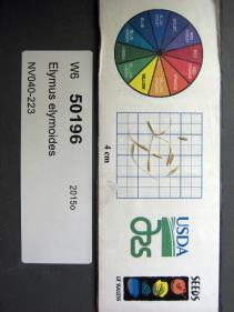 | | 2015 | | | | | | | Wild material | | 1927505 | W6 50196 |
| 97 | Ames 32963 | JDC/BA/2015/049/706 | Betula alleghaniensis Britton | Iowa, United States | NC7 | | | 2015 | COLLECTED | 09/14/2015 | Bixby State Preserve, T91N R5W extreme southern edge of Sec. 23 basically restricted to W 1/2 of Sec. 23. | 42.67470300, -91.39917300 | 308 | North-facing algific talus slope (45-60 degrees) adjacent to Bear Creek. Moist deciduous woods. Growing in association with Diervilla lonicera, Hamamelis virginiana, Corylus sp., Viburnum opulus var. americanum, Cornus rugosa (few), Cornus alternifolia, Fraxinus nigra, Quercus rubra, Viburnum lentago, Ribes sp., Rubus idaeus subsp. strigosus, Rhamnus alnifolia (few), Rosa sp., Taxus canadensis, Prunus virginiana, Impatiens sp., Dirca palustris, and Pinus strobus (few). | Wild material | | 1927433 | Ames 32963 |
| 98 | WLP 683 | JDC/AA/2015/040/697 | Amelanchier arborea (F. Michx.) Fernald | Iowa, United States | NA |  | | 2015 | COLLECTED | 06/16/2015 | Elk Rock State Park approximately 6.25 miles north of Knoxville. Extreme northern point of park. T76N R19W SW 1/4 SW 1/4 Sec. 5 Marion County | 41.40879000, -93.07958000 | 219 | Relatively steep, north-facing slopes (55 degrees). Growing in association with Diervilla lonicera (rare), Tilia americana (large and abundant), Rosa multiflora, Lonicera maackia, Eleagnus umbellata, Quercus rubra, Viburnum rafinesqueanum, Sanguinaria canadensis, Staphylea trifolia, and Ostrya virginiana. | Wild material | Fruits harvested at peak maturity. Numerous fruits were soft and/or dropped when distrurbed. Fruit color ranged from dark red with tinge of blue/purple to light red. Fruit diameter averaged 10.28 mm (0.83 stdev), range min 9.00 mm to max 12.00 mm (random sample of 20 fruits). Stalk length (fruits) averaged 22.08 mm (5.28 stdev), range min 13.89 mm to max 35.00 mm (random sample of 20 fruits with intact stalks). | 1926845 | WLP 683 |
| 99 | Ames 32903 | APS/GD/2015/031/213 | Gymnocladus dioicus (L.) K. Koch | Oklahoma, United States | NC7 |  | | 2015 | COLLECTED | 03/19/2015 | Osage County: Arkansas River watershed area known as Souters Bend, T21N R7E. Keystone Wildlife Management Area (John Lowery Unit) approximatley 3 miles west of Cleveland. | 36.30185300, -96.53051000 | 222 | Floodplain, but one specimen sampled was located on dry, rocky (large boulders) bluff. | Wild material | | 1925369 | Ames 32903 |
| 100 | NA 82391 | JDC/SD/2015/022/678 | Sapindus saponaria L. var. drummondii (Hook. & Arn.) L. D. Benson | Kansas, United States | NA |  | | 2015 | COLLECTED | 03/20/2015 | Elk City State Park between Elk City and Independence, T32S R15E, northwest 1/4 of southwest 1/4 of Section 7. | 37.27647400, -95.81521600 | 288 | Short grass prairie area. | Wild material | | 1925374 | NA 82391 |
| 101 | Ames 32886 | APS/GD/2015/002/184 | Gymnocladus dioicus (L.) K. Koch | Missouri, United States | NC7 |  | | 2015 | COLLECTED | 03/03/2015 | Douglas County: North Fork River watershed, T26N R12W Sec. 13. Private property approximately 5.3 miles east, southeast of Vanzant. | 36.93971400, -92.21469500 | 264 | Floodplain. Riverbank in pure sand. | Wild material | | 1924364 | Ames 32886 |
| 102 | Ames 34289 | MARSB-090 | Rhus copallinum L. | New York, United States | NC7 |  | | 2015 | COLLECTED | 09/26/2013 | Great Kills Park near Oakwood Beach. | 40.55428000, -74.10738000 | 3 | | Wild material | | 1922928 | Ames 34289 |
| 103 | Ames 32833 | GA14005001 | Fraxinus pennsylvanica Marshall | North Dakota, United States | NC7 |  | | 2014 | COLLECTED | 09/25/2014 | Billings County, Southern Badlands area. | 46.42000000, -103.40000000 | 753 | Growing in association with Arctium majus, Shepherdia argentea, Prunus virginiana, Rosa sp., and Symphoricarpos spp. | Wild material | | 1921826 | Ames 32833 |
| 104 | Ames 32835 | GA14014001 | Fraxinus pennsylvanica Marshall | North Dakota, United States | NC7 |  | | 2014 | COLLECTED | 10/30/2014 | Bottineau County, Turtle Mountains. | 48.97000000, -100.45000000 | 737 | Mixed oak-aspen forest | Wild material | | 1921828 | Ames 32835 |
| 105 | WLP 1746 | Ames 32838 | Viburnum opulus L. var. americanum Aiton | North Dakota, United States | NA | | | 2014 | COLLECTED | 10/31/2014 | Turtle Mountains - Bottineau County. | 48.95000000, -100.43000000 | 692 | Wet, aspen forest. Growing in association with Sanicula marilandica, Fragaria virginiana, Trifolium repens, Rubus sp., Typha latifolia, Prunus pensylvanica, Prunus virginiana, Corylus sp., Crataegus sp., Viburnum lentago, Rosa sp., Cornus sericea, Amelanchier sp., Symphoricarpos sp., Salix sp., Betula papyrifera, Populus tremuloides, Ulmus americana, Acer negundo, Quercus macrocarpa, and Fraxinus pennsylvanica. | Wild material | | 1921831 | WLP 1746 |
| 106 | WLP 1967 | HBC1401 | Viburnum opulus L. var. americanum Aiton | North Dakota, United States | NA | | | 2014 | COLLECTED | 09/29/2014 | Jay Wessels Wildlife Management Area located in Pembina County. | 48.80000000, -97.83000000 | 312 | Diverse habitats including edge of swamp and also upland sandy soils. Growing in association Fraxinus pennsylvanica, Fraxinus nigra, Quercus macrocarpa, Acer negundo, Ulmus americana, Populus tremuloides, Populus balsamifera, Toxicodendron radicans, Cornus sericea, Rosa sp., Corylus sp., Prunus virginiana, Ribes sp., Equisetum sp., Rubus sp., IMpatiens capensis, Thalictrum dasycarpum, Fragaria virginiana, Asarum canadense, Calamagrostis canadensis, Sium suave, Solidago gigantea, Poa pratensis, and Bromus inermis. | Wild material | | 1921830 | WLP 1967 |
| 107 | Ames 32826 | JDC/DL/2014/148/651 | Diervilla lonicera Mill. | Iowa, United States | NC7 |  | | 2014 | COLLECTED | 11/04/2014 | Elk Rock State Park (extreme northern point of park) approximately 6.25 miles north of Knoxville, T76N R19W SW 1/4 SW 1/4 Sec. 5 | 41.40879000, -93.07958000 | 219 | Extremely steep, north-facing slopes. | Wild material | | 1921786 | Ames 32826 |
| 108 | WLP 689 | BJP/AI/2014/001 | Amelanchier intermedia Spach | Maine, United States | NA | | | 2014 | COLLECTED | 07/17/2014 | Woods at the edge of a small cemetery on Pigeon Hill Road, just east of its intersection with Main Street (Hwy. 1), approximately .2.5 miles southwest of Milbridge. | 44.51051000, -67.91188000 | | Woods at the edge of a small cemetery. | Wild material | | 1922791 | WLP 689 |
| 109 | Ames 32386 | JDC/BN/2014/013/515 | Betula nigra L. | Iowa, United States | NC7 |  | | 2014 | COLLECTED | 06/05/2014 | Bearbower Sand Prairie, T87N R9W SW 1/4 of SW 1/4 Sec. 32. | 42.29814100, -91.92822800 | 289 | Sand prairie with likely high water table. | Wild material | | 1919307 | Ames 32386 |
| 110 | Ames 32096 | BA13009001 | Fraxinus nigra Marshall | Minnesota, United States | NC7 |  | | 2013 | COLLECTED | 09/23/2013 | T144N R38W, Clearwater County. | 47.25711000, -95.49000667 | 543 | Edges of lakes and forest edges. Growing in association with Fraxinus pennsylvanica, Quercus macrocarpa, Ulmus americana, Populus tremuloides, Populus balsamifera, Acer saccharum, Betula papyrifera, Salix sp., Larix laricina, Quercus rubra, Abies balsamea, Picea glauca, Sambucus canadensis, Cornus rugosa, Acer spicatum, Rosa sp., Viburnum opulus var. americanum, Viburnum dentatum, Alnus sp., Cornus canadensis, Corylus sp., Prunus virginiana, Ribes sp., Prunus pensylvanica, Rhamnus alnifolia, Equisetum sp., Carex sp., Rubus sp., Impatiens capensis, Bromus sp., and Thalictrum dasycarpum. | Wild material | D.B.H. ranged between 3 and 6 inches. | 1914713 | Ames 32096 |
| 111 | Ames 32585 | CBG-1842 | Monarda fistulosa L. var. fistulosa | Wyoming, United States | NC7 |  | | 2013 | COLLECTED | 09/07/2011 | Moiser Gulch Recreational picnic area, located approximately 5.5 miles west of Buffalo on highway 16 (Cloud Peak Scenic Byway) in northern Wyoming | 44.33220000, -106.81660000 | 1727 | Stream gulch with wetter soils within Western Rocky Mountain foothills. | Wild material | | 1909018 | Ames 32585 |
| 112 | Ames 31679 | GA12011001 | Fraxinus pennsylvanica Marshall | North Dakota, United States | NC7 |  | | 2012 | COLLECTED | NEAR 09/27/2012 | Sheyenne National Grassland along the Sheyenne River just east of Lisbon near Richland and Ransom County line. | 46.53246660, -97.26656660 | 302 | Riverbank and transition area of tallgrass prairie and riparian forest. Sandy-silt soil with good drainage and ph of ~7 | Wild material | Population located close to windbreak planted with Fraxinus. | 1906590 | Ames 31679 |
| 113 | Ames 31529 | JDC/FQ/2012/038/431 | Fraxinus quadrangulata Michx. | Indiana, United States | NC7 |  | | 2012 | COLLECTED | 07/24/2012 | Lick Creek Summit Nature Preserve, NW 1/4 of Section 23, T13N, R2W, Richmond Quad, near Richmond, Wayne County. | 39.78453000, -84.95276400 | 267 | Dry woods. Bluffs. Shallow soils. | Wild material | | 1903756 | Ames 31529 |
| 114 | Ames 31217 | GA15004001 | Fraxinus pennsylvanica Marshall | North Dakota, United States | NC7 |  | | 2011 | COLLECTED | 09/24/2011 | Along Forest Service Road 842, SW 1/4 of Section 2, T147N, R99W, Long X Divide Quad, Badlands, Little Missouri National Grasslands, McKenzie County. | 47.57730000, -103.26760000 | 674 | Clay substrate. | Wild material | Requests will be filled using inventory sample 11ncao02 (JDZ/2011/004/002) unless otherwise noted. | 1896696 | Ames 31217 |
| 115 | Ames 31218 | GA15005001 | Fraxinus pennsylvanica Marshall | North Dakota, United States | NC7 |  | | 2011 | COLLECTED | 09/24/2011 | Along East River and Tracy Mountain Roads, Burning Coal Vein Campground, T139N, R102W, Chimney Butte Quad, Badlands, Little Missouri National Grasslands, Billings and Slope County. Area following along Little Missouri River and including small tributaries from approximately 4.5 miles south of Medora, ND to approximately 2.5 miles south of Billings/Slope County line. Material sampled along an 18 mile stretch. | 46.81270000, -103.50900000 | 780 | Clay substrate. | Wild material | Requests will be filled using inventory sample 11ncao02 (JDZ/2011/005/002) unless otherwise noted. | 1896697 | Ames 31218 |
| 116 | Ames 31087 | 692 | Fraxinus pennsylvanica Marshall | New York, United States | NC7 |  | | 2011 | COLLECTED | 09/11/2011 | McMaster at Jasper-North Cameron Road, Steuben County. | 42.20400000, -77.41500000 | 349 | Edge of Canisteo River, adjacent farmland. | Wild material | | 1891473 | Ames 31087 |
| 117 | WLP 830 | 381 | Carpinus caroliniana Walter | Pennsylvania, United States | NA | | | 2011 | COLLECTED | 09/15/2011 | Along Valentine Run Road, near small tributary to Rhine Run Creek, Warren County. | 41.92500000, -79.18800000 | 475 | Roadside. Mixed hardwood forest and open rangeland (Solidago). Associated with Acer, Carya ovata, Cornus racemosa, Fagus grandifolia, Hamamelis virginiana, Quercus, Rosa, Rubus, and Tsuga canadensis. | Wild material | | 1891442 | WLP 830 |
| 118 | OPGC 4292 | 198341 | Heuchera cylindrica Douglas | Washington, United States | OPGC |  | | 2005 | COLLECTED | 07/28/2003 | | | 640 | Associated with Artemisia tripartita, Festuca idahoensis, Pseudoroegneria spicata, Artemisia tridentata, Amelanchier alniflolia, Rosa woodsii, Prunus virginiana, Lomatium dissectum, Lupinus sericeus, Gaillardia aristata and S | Wild material | Forb 0.6 meters tall. | 1674223 | OPGC 4292 |
| 119 | Ames 27962 | Quercus Wilderness Area | Amelanchier arborea (F. Michx.) Fernald | Iowa, United States | NC7 |  | | 2003 | COLLECTED | 05/26/2003 | Quercus Wilderness Area located 6.75 miles south, southwest of Oskaloosa, T74N R16W SE ¼ NE ¼ of Sec. 23. | 41.19888889, -92.66111111 | 244 | Mature woods on very sandy soils. Typically restricted to east, west or south facing slopes at either summits or mid-slopes. | Wild material | The native range of Amelanchier arborea is concentrated in the eastern half of the U.S. (Little, 1977). This accession represents a collection of A. arborea germplasm from the western edge of the species native range, specifically the southern portion of Iowa. As of 2025, the top ten largest specimens in the state of Iowa are located at Quercus Wilderness where this accession was collected. Iowa’s largest specimen of A. arborea specimen at Quercus Wilderness was measured at 14.17" DBH, 51.83’ in height, and 27.00’ average crown spread for a total of 102.955 points (Rouw, M., personal communication, 12 December 2023). Fall color (orange-red) tends to peak in the middle of September (Iowa) with peak fruiting occurring in early May. Bark smooth, grey. | 1700483 | Ames 27962 |