| 0 | PI 704826 sos | R. pensilvanicus MARSB-285 | Rubus pensilvanicus Poir. | New Jersey, United States | COR |  | | 2019 | | | | | | | Wild material | | 2097556 | PI 704826 sos |
| 1 | PI 652978 | R. occidentalis HDF-2007-039 | Rubus occidentalis L. | Georgia, United States | COR | | | 2007 | COLLECTED | 06/05/2007 | Lumpkin County, Chattahoochee National Forest, Blue Ridge Mountain Road intesection with FS 42, Hightower Gap and Rock Creek Roads. | 34.66382000, -84.12987000 | 900 | Rich hardwood forest with some light decending. Grey loam soil. Associated Plants: Liriodendron tulipifera, Oxydendron arboreum, Kalmia latifolia and Acer rubrum. | Wild material | Kim Hummer, Michael Dossett collection from Georgia.
| 1730096 | PI 652978 |
| 2 | PI 653291 | R. argutus Lumberton | Rubus argutus Link | North Carolina, United States | COR |  | | 2007 | COLLECTED | 06/03/2007 | Robeson County, Lumberton, west of I-95 on SR 1536 (Carthage Road), east bank at crossing over Saddletree Swamp (Five Mile Branch of Lumber River). | 34.63527000, -79.02874000 | 18 | Dark organic sandy muck soil. Associated Plants: Quercus velutina, Campsus radicans, Pinus echinata, Acer rubrum, Vitis rotundifolia, Juglans nigra, Liquidamber and Juncus. | Wild material | Kim Hummer, Michael Dossett collection from North Carolina.
| 1730084 | PI 653291 |
| 3 | PI 653292 | R. occidentalis HDF-2007-030 | Rubus occidentalis L. | South Carolina, United States | COR | | | 2007 | COLLECTED | 06/04/2007 | Rich Mountain, Sumter National Forest, Oconee County, west of Walhalla. | 34.75472000, -83.15991000 | 538 | Red sandy loam with duff sloping eastward, behind guardrail on edge of road. Associated Plants: Clematus, Liriodendron tulipifera, Oxydendron arboreum, Kalmia latifolia, Acer rubrum, Campsis radicans and Rhus radicans. | Wild material | Kim Hummer, Michael Dossett collection from South Carolina.
| 1730090 | PI 653292 |
| 4 | PI 653295 | R. argutus Keener HDF-2007-058 | Rubus argutus Link | Alabama, United States | COR |  | | 2007 | COLLECTED | 06/08/2007 | Etowah County, about 1 mile east of US 11 on Keener Gap Road. Power line right-of-way down to the road. Just west of junction with Scenic Highway at Keener Gap. | 34.15687000, -85.93532000 | 250 | Growing on a southwest facing slope (25 degrees), duff on grey soil from limestone outcrops. Associated Plants: Acer rubrum, Liriodendron tulipifera, Liquidambar styraceflua and Quercus nigra. | Wild material | Kim Hummer, Michael Dossett collection from Alabama.
| 1730100 | PI 653295 |
| 5 | PI 653297 | R. argutus HD-2007-070 | Rubus argutus Link | Mississippi, United States | COR | | | 2007 | COLLECTED | 06/09/2007 | Marshall County, northwest of Potts Camp off route 178 onto George Mann Road onto Lake Shore Drive at a drainage ditch in the community of Lake Center. | 34.69310000, -89.36150000 | 120 | Open area in drainage ditch growing on the perimeter road of a lake. Associated Plants: Rhus typhina, Vitis rotundifolia, Pinus taeda, Salix sp., Lonicera japonica, Liquidambar styraciflua and Acer negundo. | Wild material | Kim Hummer, Michael Dossett collection from Mississippi.
| 1730104 | PI 653297 |
| 6 | PI 638304 | R. sachalinensis J93 | Rubus sachalinensis H. Lév. | Hokkaidô, Japan | COR | | | 2004 | COLLECTED | 07/23/2004 | Near Mt. Apoi, section 91, Toyukinazawa valley, along road edge. | 42.15338000, 143.00992000 | 298 | Associated species: under Acer, white clover, Artemesia, and Big leaf. | Wild material | This accession was collected under the auspices of a bilateral agreement between the National Institute of Agrobiological Sciences, Ministry of Agriculture Fisheries and Foods, Japan, and the U. S. Department of Agriculture, Agricultural Reseach Service, USA, prepared in May 2004. | 1662006 | PI 638304 |
| 7 | PI 638305 | R. crataegifolius J94 | Rubus crataegifolius Bunge | Hokkaidô, Japan | COR |  | | 2004 | COLLECTED | 07/23/2004 | Near Mt. Apoi, section 91, Toyukinazawa valley, along road edge. | 42.15338000, 143.00992000 | 298 | Filtered light. Associated species: under Acer, white clover, Artemesia and Big leaf. | Wild material | This accession was collected under the auspices of a bilateral agreement between the National Institute of Agrobiological Sciences, Ministry of Agriculture Fisheries and Foods, Japan, and the U. S. Department of Agriculture, Agricultural Reseach Service, USA, prepared in May 2004. | 1662007 | PI 638305 |
| 8 | PI 643953 | R. caesius ARM-02-194 | Rubus caesius L. | Armenia | COR |  | | 2002 | COLLECTED | 09/14/2002 | Near Alaverdi in Lori Marz province. | 40.99806000, 44.65222000 | 834 | Disturbed, rocky slope between road and Debed River with Acer campestre and Carpinus orientalis. | Wild material | | 1642352 | PI 643953 |
| 9 | PI 643936 | R. lambertianus TS98-010 | Rubus lambertianus Ser. | Anhui Sheng, China | COR |  | | 1998 | COLLECTED | 10/07/1998 | Shexian County, Qingliang Peak Reserve: Houershi. Valley called the Da Xi which supposedly means Elephant-Lion Valley. | 30.10222000, 118.84667000 | 970 | Sloping site in woodlands along stream; 20-30 degree slope. Growing with Lindera glauca, Acer, Hydrangea, Quercus, Actinidia, Camellia, Liquidamber. | Wild material | Shrub, 3 m, tall arching canes, 3-4 canes/plant. Leaves simple, cordate shaped, serrate margins, very pubescent. Fruit transluscent, orange-red, shiny, 1 cm. diameter. | 1571426 | PI 643936 |
| 10 | PI 606455 | R. corchorifolius MT 92116 | Rubus corchorifolius L. f. | Guizhou Sheng, China | COR |  | | 1992 | COLLECTED | 05/31/1992 | Leigong Mt. Nature Preserve, Leishan County Road to Maoping | 26.40000000, 108.25000000 | 2000 | cool, subtropical, mountainous vegetation, mostly shrubby with scattered large trees , with Pinus massoniana, Prunus, Cornus, Acer, Salix, | Wild material | Additional information is forthcoming | 1015152 | PI 606455 |
| 11 | WLP 2670 | RJL2022PA-016 | Acer negundo L. | Pennsylvania, United States | NA | | | 2022 | COLLECTED | 10/21/2022 | Plants growing in woodlands above a small unnamed creek that dumps into the Middle Branch White Clay Creek in Goddard Park, West Grove Pennsylvania, off of Wickerton Road, Chester County. Plants are found regularly but scattered in the understory of the woodlands. | 39.80426000, -75.82609300 | 105 | Plants growing in a mesic, well-drained habitat of deciduous woodlands along streams and above the riparian zone that drains toward a small unnamed creek that feeds into the Middle Branch White Clay Creek. Plants generally grow in part shade to full sun, but perform best and fruit more heavily in full sun where there is abundant access to moisture. The remnant woodlands exist mostly along the steep slopes, wetlands and seeps of seasonal and year-round creeks flowing into the Middle Branch White Clay Creek. The woodlands are bordered by numerous housing developments and land converted to meadows; hence there is significant first order edge that is heavily impacted by invasive plant intrusion. Despite this fact, Acer negundo is highly competitive and competes well.
Soils: The underlying geology of this area is the Glenarm Wissahickon Formation of lower Paleozoic origin and lithologically similar to oligoclase-mica schist of the Wissahickon Formation (PZw), but also includes lenticular amphibolite bodies having ocean-floor basalt chemistry.
Source: USGS Pennsylvania Geologic Map Data (https://mrdata.usgs.gov/geology/state/sgmc-unit.php?unit=PAPZgw%3B0)
The primary soil type in the area of this collection is classified as Glenelg silt loam, 3 to 8 percent slopes. This series consists of very deep, well drained soils formed in residuum weathered from micaceous schist on uplands of the Blue Ridge and the Northern Piedmont. Saturated hydraulic conductivity is moderately high in the subsoil and moderately high to high in the substratum. This upper horizon of this soil is undifferentiated, mostly poorly drained sandy bottomland soils intermingled with decomposing organic litter and eroded silts and clays due to erosion.
Source: NRCS Web Soil Survey (https://websoilsurvey.sc.egov.usda.gov/App/WebSoilSurvey.aspx) | Wild material | | 2139661 | WLP 2670 |
| 12 | WLP 3096 | NCBG-435 | Acer rubrum L. | North Carolina, United States | NA | 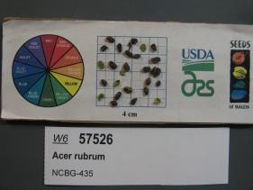 | | 2019 | | | | | | | Wild material | | 2098450 | WLP 3096 |
| 13 | WLP 2081 | 205654 | Acer macrophyllum Pursh | Oregon, United States | NA | 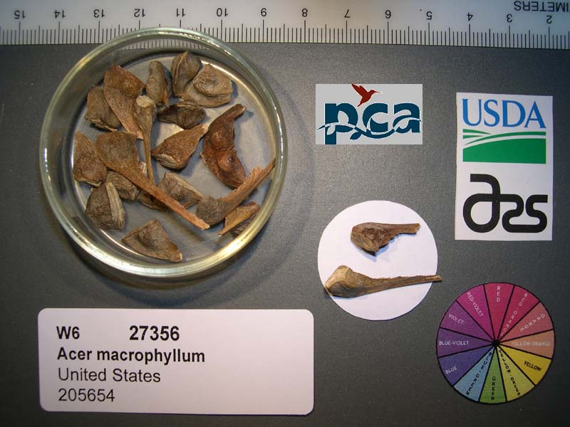 | | 2005 | COLLECTED | 09/27/2003 | | | 100 | Associated with Pseudotsuga menziesii, Umbellularia californica, Alnus rubra, Polystichum munitum and Rubus spectabilis. | Wild material | Tree 4.5-24 meters tall. | 1674387 | WLP 2081 |
| 14 | NA 67769 | QLG139 | Acer cappadocicum Gled. subsp. sinicum (Rehder) Hand.-Mazz. | Shaanxi Sheng, China | NA | | | 1996 | COLLECTED | 10/18/1996 | Liuba Forest Bureau, Miaotaizi Forest Station, Jiang Liang Temple Tourist Area | 33.66666667, 106.81666667 | 1611 | Moist 45% N slope in mixed deciduous/evergreen woodland; well-drained rocky clay loam w/ thick surface layer of organic matter; w/ bamboo,Rubus,Neillia sinensis,Schisandra,Staphylea,Celastrus,Quercus,Aralia,Meliosma,Clematoclethra,Alangium. | Wild material | 18-20 meters; single-stemmed, deciduous, broadspreading tree with first branches at least 6 meters above the ground; D.B.H. 80 cm; dark brown with vertical twisting, furrowed bark | 1579635 | NA 67769 |
| 15 | NA 67846 | QLG215 | Acer davidii Franch. | Shaanxi Sheng, China | NA | | | 1996 | COLLECTED | 10/18/1996 | Ningxi Preserve, enroute to Caiziping Forest Station town | 33.76694444, 108.33361111 | 2105 | Full sun along roadside in dry, well-drained site; 35% E slope; growing w/ Salix, Sinacalcia tangutica, Rubus, Aralia, Ulmus, Populus, and numerous herbaceous species. | Wild material | 5-6 meters; single-stemmed, deciduous, upright vase-shaped tree with spreading arching branches; D.B.H. 12 cm; bark green even on mature stems | 1579634 | NA 67846 |
| 16 | PI 702691 | MARSB-322 | Chasmanthium laxum (L.) H. O. Yates | New Jersey, United States | S9 |  | | 2019 | | | | | | | Wild material | | 2097574 | PI 702691 |
| 17 | PI 704845 sos | V. parvifolium OR080-49 | Vaccinium parvifolium Sm. | Oregon, United States | COR |  | | 2018 | | | | | | | Wild material | | 1957632 | PI 704845 sos |
| 18 | PI 675325 | R10-64-273 | Brachypodium sylvaticum (Huds.) P. Beauv. | Krasnodar, Russian Federation | W6 | | | 2011 | COLLECTED | 08/08/2010 | Approx. 4 km E of Lazarevskoye near Alekseevskoye | 43.94600000, 39.39300000 | 50 | Sub-tropical forest opening, road cut and rock wall. Steep, rocky limestone slope with NW exposure: seed collected from >100 plants | Wild material | | 1883352 | PI 675325 |
| 19 | PI 685600 | R10-63-269 | Agrostis capillaris L. | Krasnodar, Russian Federation | W6 | | | 2011 | COLLECTED | 08/08/2010 | Golovinski Nature Reserve near Psetuapse River near Thagapsh | 43.97100000, 39.44300000 | 100 | Sub-tropical forest pasture. Limestone parent material, SW exposure, heavily grazed and disturbed meadow in sub-tropical forest opening, collection may be mixed with A. stolonifera: seed collected from >100 plants | Wild material | | 1883348 | PI 685600 |
| 20 | PI 666703 | JPN-2009-105 | Vaccinium praestans Lamb. | Hokkaidô, Japan | COR | | | 2009 | COLLECTED | 09/15/2009 | Okishima Bog | 43.92965000, 142.97719000 | 829 | Trail-side associate with Juncus, Sasa bamboo, Acer palmatum, Dryopteris, Lycopodium and Rubus idaeus under Picea overstory. | Wild material | From September 7 to 25, 2009, U.S. scientists K. Hummer and J. Postman from the USDA Agricultural Research Service and Japanese scientists H. Iketani and H. Imanishi from the Japanese Ministry of Forestry and Fisheries/National Institute of Agrobiological Sciences, and Akita Agricultural University collaborated on an expedition to collect temperate fruit genera in Hokkaido and northern Honshu, Japan. An agreement between Japan and the USDA specified the terms of exchange, and materials collected were shared between scientists of both countries. | 1824114 | PI 666703 |
| 21 | PI 657221 | V. corymbosum Zebulon | Vaccinium corymbosum L. | North Carolina, United States | COR | 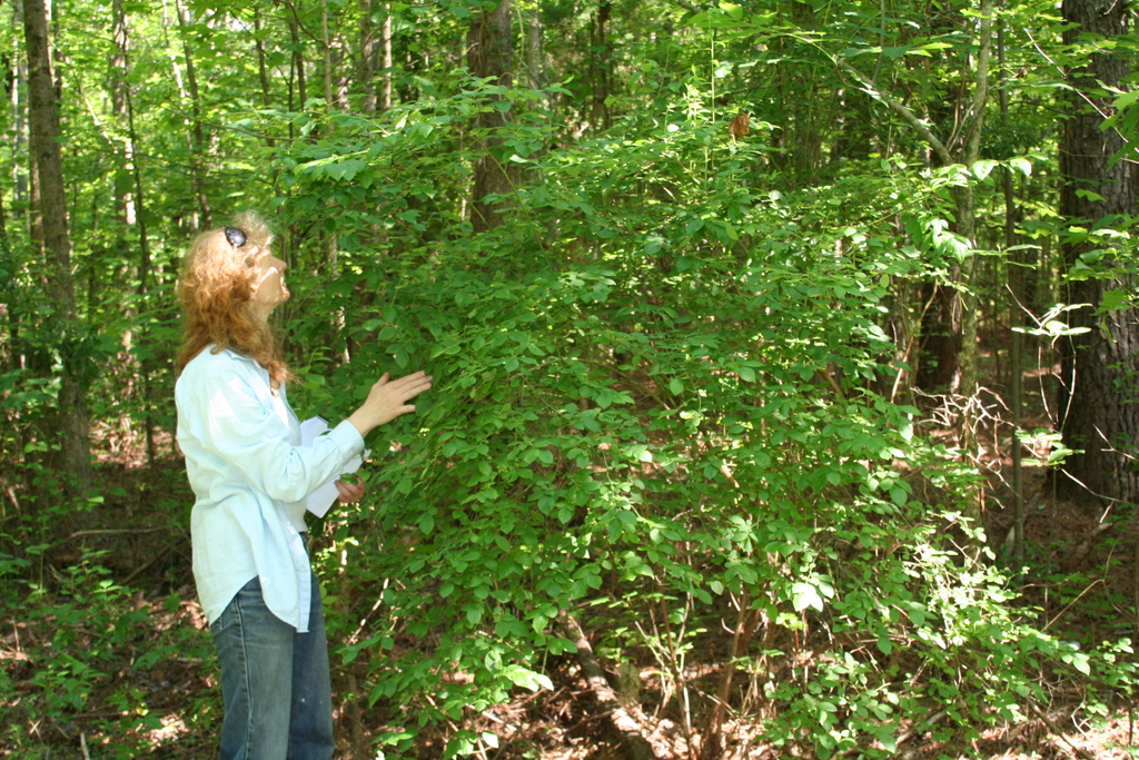 | | 2007 | COLLECTED | 06/01/2007 | Zebulon, Wake County. Near sewer right of way on North Worth Hinton Road (SR 2369). | 35.82683000, -78.33110000 | 90 | Organic duff over dark brown sandy soil. Associated with: Liquidambar styraciflua, Acer rubrum, Rhus typhina, Rubus argutus, Pinus palustris and Liriodentdron tulipfera. Near sewer right of way, at edge of dark hardwood forest. | Wild material | Kim Hummer, Michael Dossett collected from North Carolina.
| 1730106 | PI 657221 |
| 22 | PI 657224 | V. fuscatum Glassy Mt. HD-2007-021 | Vaccinium fuscatum Aiton | South Carolina, United States | COR |  | | 2007 | COLLECTED | 06/04/2007 | Glassy Mountain at home number 3786 Glassy Mountain Road, Greenville County. Edge of road. | 35.13435000, -82.36098000 | 675 | Sandy loam duff associated with: Acer rubrum, Vitis palmata, Erigeron annuus, Commelina virginiaca, Oxydendron arboreum, Platanus occidentalis, Phytolacca americana, Quercus nigra, Rubus argutus and R. trivialis. 45 degree southeast slope. | Wild material | Kim Hummer, Michael Dossett collected from South Carolina.
Jim Ballington reidentified this accession as V. fuscatum. Personal communication from 2 August 2021:
From the leaf shape, general yellow-green color of the leaves, and the distinctive size (relative to the size of the berries) and shape of the calyx, my conclusion is that this accession is probably not V. simulatum, but rather the blue-fruited Carolina foothills form of V. fuscatum. | 1730115 | PI 657224 |
| 23 | PI 650946 | MN 85-21-20 | Malus hybr. | Kazakhstan | GEN | | | 2007 | COLLECTED | 09/21/1995 | Semipalitinsk Region (Tarbagatai Mountain Range). 20 km. North of Urdzhar. 7 km. Northeast of Alekseyevka. Landform mostly hillside. Collected in North end of West Valley, upstream 3 km. from site 05 (GMAL's 3604-3607, GMAL's 3760-3789). | 47.27000000, 81.57361111 | 990 | Silt to clay loam soil. Aspect: Mostly East. Dominant tree sp.: M. sieversii; Associated-Populus, Pyrus, Acer. Dominant shrub sp.: Rosa; Assoc.-Lonicera, Amygdalus, Rubus. Dominant herbaceous: Grasses; Assoc.-Potentilla, Fragaria. | Uncertain improvement status | Sampled 30 fruits from 1 tree. Selected for texture and flavor. Fruit is firm. Fruit size is larger than 50mm, scab detected. -- Domestic introgression intentified using 20K Illumina Infinium apple SNP array. Charlamoff is a grandparent | 1723377 | PI 650946 |
| 24 | PI 650960 | MN 85-25-97 | Malus hybr. | Kazakhstan | GEN | | | 2007 | COLLECTED | 09/21/1995 | Semipalitinsk Region (Tarbagatai Mountain Range). 20 km. North of Urdzhar. 7 km. Northeast of Alekseyevka. Landform mostly hillside. Collected in North end of West Valley, upstream 3 km. from site 05 (GMAL's 3604-3607, GMAL's 3760-3789). | 47.27000000, 81.57361111 | 990 | Silt to clay loam soil. Aspect: Mostly East. Dominant tree sp.: M. sieversii; Associated-Populus, Pyrus, Acer. Dominant shrub sp.: Rosa; Assoc.-Lonicera, Amygdalus, Rubus. Dominant herbaceous: Grasses; Assoc.-Potentilla, Fragaria. | Uncertain improvement status | Sampled 30 fruits from 1 tree. Selected for texture and flavor. Fruit is firm. Fruit size is larger than 50mm, scab detected. -- Domestic introgression intentified using 20K Illumina Infinium apple SNP array. Charlamoff or Gold_Reinette is a grandparent | 1723391 | PI 650960 |
| 25 | PI 651006 | MN 80-15-30 | Malus hybr. | Kazakhstan | GEN | | | 2007 | COLLECTED | 09/19/1996 | 15km east of Topelevka-Djungarsky Range. 3 km southeast of Topelevka Forestry Camp. Collections made in radius around camp. Aspect flat. | 45.41527780, 80.40277778 | 1250 | Fertile. Dominant tree sp: Malus sierversii; Assoc.-Betula, Crataegus, Acer, Quercus, Tilia, Populus, Betula. Dom. Shrub Sp: Berberis, Lonicera: Assoc.-Cotoneaster, Rubus, Berberis, Ribes. Dom. herb.:Fragaria,Grasses,Humulus:Assoc.-Dianthus | Uncertain improvement status | Sampled 60 fruits from 1 tree. Flesh flavor is aromatic. Over color is 70% red. Fruit size is larger than 50mm. Free of disease and insects. Best apple so far, great. -- Domestic introgression intentified using 20K Illumina Infinium apple SNP array. Gold_Reinette is a grandparent | 1723437 | PI 651006 |
| 26 | PI 644214 | MN 80-15-27 | Malus hybr. | Kazakhstan | GEN | | | 2006 | COLLECTED | 09/08/1996 | 15km east of Topelevka-Djungarsky Range. 3 km southeast of Topelevka Forestry Camp. Collections made in radius around camp. Aspect west. | 45.40333333, 80.40611111 | 1500 | Fertile. Dominant tree sp: Malus sierversii; Assoc.-Betula, Crataegus, Acer, Quercus, Tilia, Populus, Betula. Dom. Shrub Sp: Berberis, Lonicera: Assoc.-Cotoneaster, Rubus, Berberis, Ribes. Dom. herb.:Fragaria,Grasses,Humulus:Assoc.-Dianthus | Uncertain improvement status | Sampled 100 fruits from 1 tree. Flesh flavor is aromatic. Fruit size is larger than 50mm. Free of of disease and insects. Scion collected also. GMAL 4729 is an individual seedling selction from seed lot GMAL 4035. It was grown at the University of Minnesota. Comments from Minnesota: nice. -- Domestic introgression intentified using 20K Illumina Infinium apple SNP array. Spasovka_Kvasna is a grandparent | 1708682 | PI 644214 |
| 27 | PI 633807 | CH97 03-01 | Malus hupehensis (Pamp.) Rehder | Sichuan Sheng, China | GEN |  | | 1997 | COLLECTED | 09/21/1997 | Maerkang County, Dananzugou village. 5 km. northeast of Maerkang. | 31.95583333, 102.27555556 | 2930 | Aspect-South, partial canopy. Incline <5%, slight south, variable. Landform: Mountain valley. Assoc. sp: Sorbus, Fir, Pine Acer, Cornus, Willow, Betula. Shrub sp: Rosa, Pyracantha, Holly, Berberis, Cotoneaster, Rubus. Herb sp: Aster, Fern. | Wild material | Additional Weather Notes: Rainfall in concentrated from May to Sept. There are spring and summer droughts. Hail and frost damage occur. Additional Habitat Notes: Collection tree nearly defoilated, 5m. in height, located on minimal south facing slope. Name of gorge: Da Nan Zu Gou. Name of village: Cha Bei. Sampled 132 fruits from 23 trees. | 1652458 | PI 633807 |
| 28 | PI 633808 | CH97 03-02 | Malus toringoides (Rehder) Hughes | Sichuan Sheng, China | GEN |  | | 1997 | COLLECTED | 09/21/1997 | Maerkang County, Dananzugou village. 5 km. northeast of Maerkang. | 31.95583333, 102.27555556 | 2930 | Aspect-South, partial canopy. Incline <5%, slight south, variable. Landform: Mountain valley. Assoc. sp: Sorbus, Fir, Pine Acer, Cornus, Willow, Betula. Shrub sp: Rosa, Pyracantha, Holly, Berberis, Cotoneaster, Rubus. Herb sp: Aster, Fern. | Wild material | Additional Weather Notes: Rainfall in concentrated from May to Sept. There are spring and summer droughts. Hail and frost damage occur. Sampled 132 fruits from each of the 23 trees. | 1652459 | PI 633808 |
| 29 | PI 633810 | CH97 03-20 | Malus kansuensis (Batalin) C. K. Schneid. | Sichuan Sheng, China | GEN | | | 1997 | COLLECTED | 09/21/1997 | Maerkang County, Dananzugou village. 5 km. northeast of Maerkang. | 31.94472222, 102.27000000 | 2930 | Aspect-South, partial canopy. Incline <5%, slight south, variable. Landform: Mountain valley. Assoc. sp: Sorbus, Fir, Pine Acer, Cornus, Willow, Betula. Shrub sp: Rosa, Pyracantha, Holly, Berberis, Cotoneaster, Rubus. Herb sp: Aster, Fern. | Wild material | Additional Weather Notes: Rainfall in concentrated from May to Sept. There are spring and summer droughts. Hail and frost damage occur. Additional Habitat Notes: Collection tree 4m. in height with 6 trunks copiced; located on a very rocky hillside. Sampled 132 fruits from 23 trees. Rust present; no scab. | 1652461 | PI 633810 |
| 30 | PI 703093 | CH97 03-02 | Malus toringoides (Rehder) Hughes | Sichuan Sheng, China | | | Historic | 1997 | COLLECTED | 09/21/1997 | Maerkang County, Dananzugou village. 5 km. northeast of Maerkang. | 31.95583333, 102.27555556 | 2930 | Aspect-South, partial canopy. Incline <5%, slight south, variable. Landform: Mountain valley. Assoc. sp: Sorbus, Fir, Pine Acer, Cornus, Willow, Betula. Shrub sp: Rosa, Pyracantha, Holly, Berberis, Cotoneaster, Rubus. Herb sp: Aster, Fern. | Wild material | Additional Weather Notes: Rainfall in concentrated from May to Sept. There are spring and summer droughts. Hail and frost damage occur. Sampled 132 fruits from each of the 23 trees. | 1695202 | PI 703093 |
| 31 | PI 703094 | CH97 03-02 | Malus toringoides (Rehder) Hughes | Sichuan Sheng, China | | | Historic | 1997 | COLLECTED | 09/21/1997 | Maerkang County, Dananzugou village. 5 km. northeast of Maerkang. | 31.95583333, 102.27555556 | 2930 | Aspect-South, partial canopy. Incline <5%, slight south, variable. Landform: Mountain valley. Assoc. sp: Sorbus, Fir, Pine Acer, Cornus, Willow, Betula. Shrub sp: Rosa, Pyracantha, Holly, Berberis, Cotoneaster, Rubus. Herb sp: Aster, Fern. | Wild material | Additional Weather Notes: Rainfall in concentrated from May to Sept. There are spring and summer droughts. Hail and frost damage occur. Sampled 132 fruits from each of the 23 trees. | 1695203 | PI 703094 |
| 32 | PI 703095 | CH97 03-02 | Malus toringoides (Rehder) Hughes | Sichuan Sheng, China | | | Historic | 1997 | COLLECTED | 09/21/1997 | Maerkang County, Dananzugou village. 5 km. northeast of Maerkang. | 31.95583333, 102.27555556 | 2930 | Aspect-South, partial canopy. Incline <5%, slight south, variable. Landform: Mountain valley. Assoc. sp: Sorbus, Fir, Pine Acer, Cornus, Willow, Betula. Shrub sp: Rosa, Pyracantha, Holly, Berberis, Cotoneaster, Rubus. Herb sp: Aster, Fern. | Wild material | Additional Weather Notes: Rainfall in concentrated from May to Sept. There are spring and summer droughts. Hail and frost damage occur. Sampled 132 fruits from each of the 23 trees. | 1695205 | PI 703095 |
| 33 | PI 703096 | CH97 03-03 | Malus toringoides (Rehder) Hughes | Sichuan Sheng, China | | | Historic | 1997 | COLLECTED | 09/21/1997 | Maerkang County, Dananzugou village. 5 km. northeast of Maerkang. | 31.95583333, 102.27555556 | 2930 | Aspect-South, partial canopy. Incline <5%, slight south, variable. Landform: Mountain valley. Assoc. sp: Sorbus, Fir, Pine Acer, Cornus, Willow, Betula. Shrub sp: Rosa, Pyracantha, Holly, Berberis, Cotoneaster, Rubus. Herb sp: Aster, Fern. | Wild material | Additional Weather Notes: Rainfall in concentrated from May to Sept. There are spring and summer droughts. Hail and frost damage occur. Additional Habitat Notes: Collection tree an older tree, 6m. in height, 40cm. diameter, good vigor; located on west facing slope; incline 30%. Sampled 132 fruits from 23 trees. No scab present; quite a lot of of leaf spotting. | 1695209 | PI 703096 |
| 34 | PI 703097 | CH97 03-03 | Malus toringoides (Rehder) Hughes | Sichuan Sheng, China | | | Historic | 1997 | COLLECTED | 09/21/1997 | Maerkang County, Dananzugou village. 5 km. northeast of Maerkang. | 31.95583333, 102.27555556 | 2930 | Aspect-South, partial canopy. Incline <5%, slight south, variable. Landform: Mountain valley. Assoc. sp: Sorbus, Fir, Pine Acer, Cornus, Willow, Betula. Shrub sp: Rosa, Pyracantha, Holly, Berberis, Cotoneaster, Rubus. Herb sp: Aster, Fern. | Wild material | Additional Weather Notes: Rainfall in concentrated from May to Sept. There are spring and summer droughts. Hail and frost damage occur. Additional Habitat Notes: Collection tree an older tree, 6m. in height, 40cm. diameter, good vigor; located on west facing slope; incline 30%. Sampled 132 fruits from 23 trees. No scab present; quite a lot of of leaf spotting. | 1695206 | PI 703097 |
| 35 | PI 703098 | CH97 03-04 | Malus toringoides (Rehder) Hughes | Sichuan Sheng, China | | | Historic | 1997 | COLLECTED | 09/21/1997 | Maerkang County, Dananzugou village. 5 km. northeast of Maerkang. | 31.95583333, 102.27555556 | 2930 | Aspect-South, partial canopy. Incline <5%, slight south, variable. Landform: Mountain valley. Assoc. sp: Sorbus, Fir, Pine Acer, Cornus, Willow, Betula. Shrub sp: Rosa, Pyracantha, Holly, Berberis, Cotoneaster, Rubus. Herb sp: Aster, Fern. | Wild material | Additional Weather Notes: Rainfall in concentrated from May to Sept. There are spring and summer droughts. Hail and frost damage occur. Additional Habitat Notes: Collection tree located on south facing slope, 20% incline. Sampled 132 fruits from 23 trees. | 1695210 | PI 703098 |
| 36 | PI 703099 | CH97 03-05 | Malus hupehensis (Pamp.) Rehder | Sichuan Sheng, China | |  | Historic | 1997 | COLLECTED | 09/21/1997 | Maerkang County, Dananzugou village. 5 km. northeast of Maerkang. | 31.95583333, 102.27555556 | 2920 | Aspect-South, partial canopy. Incline <5%, slight south, variable. Landform: Mountain valley. Assoc. sp: Sorbus, Fir, Pine Acer, Cornus, Willow, Betula. Shrub sp: Rosa, Pyracantha, Holly, Berberis, Cotoneaster, Rubus. Herb sp: Aster, Fern. | Wild material | Additional Weather Notes: Rainfall in concentrated from May to Sept. There are spring and summer droughts. Hail and frost damage occur. Sampled 132 fruits from each of the 23 trees. Collection tree 15cm. in diameter. Fruit shows heavy disease. leaves are lanceolate. | 1695218 | PI 703099 |
| 37 | PI 703100 | CH97 03-16 | Malus kansuensis (Batalin) C. K. Schneid. | Sichuan Sheng, China | | | Historic | 1997 | COLLECTED | 09/21/1997 | Maerkang County, Dananzugou village. 5 km. northeast of Maerkang. | 31.94472222, 102.27000000 | 2880 | Aspect-South, partial canopy. Incline <5%, slight south, variable. Landform: Mountain valley. Assoc. sp: Sorbus, Fir, Pine Acer, Cornus, Willow, Betula. Shrub sp: Rosa, Pyracantha, Holly, Berberis, Cotoneaster, Rubus. Herb sp: Aster, Fern. | Wild material | Additional Weather Notes: Rainfall in concentrated from May to Sept. There are spring and summer droughts. Hail and frost damage occur. Additional Habitat Notes: Collection tree 3m. in height, moderate vigor; located on a rocky river bank. Sampled 132 fruits from 23 trees. Leaf rust present. No scab. | 1695245 | PI 703100 |
| 38 | PI 703101 | CH97 03-19 | Malus toringoides (Rehder) Hughes | Sichuan Sheng, China | | | Historic | 1997 | COLLECTED | 09/21/1997 | Maerkang County, Dananzugou village. 5 km. northeast of Maerkang. | 31.94472222, 102.27000000 | 2930 | Aspect-South, partial canopy. Incline <5%, slight south, variable. Landform: Mountain valley. Assoc. sp: Sorbus, Fir, Pine Acer, Cornus, Willow, Betula. Shrub sp: Rosa, Pyracantha, Holly, Berberis, Cotoneaster, Rubus. Herb sp: Aster, Fern. | Wild material | Additional Weather Notes: Rainfall in concentrated from May to Sept. There are spring and summer droughts. Hail and frost damage occur. Additional Habitat Notes: Collection tree older, 12m. in height, 40cm. diameter, 3 trunks, moderate vigor; located on a very rocky slope, near Acer and Holly. Sampled 132 fruits from 23 trees. Rust and leaf spotting present; no scab. | 1695248 | PI 703101 |
| 39 | PI 662031 | NA 67802 | Spiraea miyabei Koidz. | Shaanxi Sheng, China | NC7 | | | 1997 | COLLECTED | 09/25/1996 | Ningxi Forest Bureau, Caiziping Forest Station, Xi Gou, Ning Shan District. | 33.71916667, 108.21138890 | 2090 | Shade at the base of a moist cliff with water seepage. 15% slope with a north facing aspect. | Wild material | Deciduous, multi-stemmed shrub; 1.5 m tall; fruit borne in large clusters on current season's growth. | 1537440 | PI 662031 |
| 40 | PI 613991 | KAZ 96 07-03 | Malus sieversii (Ledeb.) M. Roem. | Kazakhstan | GEN | 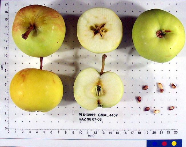 | | 1996 | COLLECTED | 09/08/1996 | 15km east of Topelevka-Djungarsky Range. 3 km southeast of Topelevka Forestry Camp. Collections made in radius around camp. Incline 10%, northwest. | 45.40722222, 80.43944444 | 1460 | Fertile. Dominant tree sp: Malus sierversii; Assoc.-Betula, Crataegus, Acer, Quercus, Tilia, Populus, Betula. Dom. Shrub Sp: Berberis, Lonicera: Assoc.-Cotoneaster, Rubus, Berberis, Ribes. Dom. herb.:Fragaria,Grasses,Humulus:Assoc.-Dianthus | Wild material | Elite scion material. sampled 80 fruits from 1 tree. Flesh is subacid. Fruit size is larger than 50mm. Free of disease and insects. Nice apple, 50 year old tree. Scion also collected. | 1531534 | PI 613991 |
| 41 | PI 613992 | KAZ 96 07-04 | Malus sieversii (Ledeb.) M. Roem. | Kazakhstan | GEN |  | | 1996 | COLLECTED | 09/08/1996 | 15 km southeast of Topelevka-Djungarski Range. 3km of Topelevka Forestry Camp. Collected further east of camp at higher elevations. | 45.40027778, 80.44083333 | 1540 | Dominant tree sp: M. sieversii; Assoc-Betula, Crataegus, Acer, Quercus, Tilia, Populus, Rhamnus. Dom. shrub sp: Berberis, Lonicera; Assoc-Cotoneaster, Rubus, Ribes. Dom. herb:Fragaria, Grasses, Humulus; Assoc-Dianthus, Fragaria, Chelidonium | Wild material | Sampled 8 fruits from 54 trees. Flesh flavor is subacid. scab is absent. Genetic Dwarf. Same as 07-04. | 1531535 | PI 613992 |
| 42 | PI 613993 | KAZ 96 07-05 | Malus sieversii (Ledeb.) M. Roem. | Kazakhstan | GEN |  | | 1996 | COLLECTED | 09/08/1996 | 15 km southeast of Topelevka-Djungarski Range. 3km of Topelevka Forestry Camp. Collected further east of camp at higher elevations. | 45.40027778, 80.44083333 | 1580 | Dominant tree sp: M. sieversii; Assoc-Betula, Crataegus, Acer, Quercus, Tilia, Populus, Rhamnus. Dom. shrub sp: Berberis, Lonicera; Assoc-Cotoneaster, Rubus, Ribes. Dom. herb:Fragaria, Grasses, Humulus; Assoc-Dianthus, Fragaria, Chelidonium | Wild material | Sampled 8 fruits from 54 trees. Flesh flavor is subacid. Scab is absent. Genetic Dwarfs. Same as 07-05. | 1531536 | PI 613993 |
| 43 | PI 599806 | KAZ 96 07-01P | Malus sieversii (Ledeb.) M. Roem. | Kazakhstan | GEN | | | 1996 | COLLECTED | 09/07/1996 | 15 km southeast of Topelevka-Djungarski Range. 3km of Topelevka Forestry Camp. Collected east of camp. | 45.40833333, 80.43000000 | 1250 | Dominant tree sp: M. sieversii; Assoc-Betula, Crataegus, Acer, Quercus, Tilia, Populus, Rhamnus. Dom. shrub sp: Berberis, Lonicera; Assoc-Cotoneaster, Rubus, Ribes. Dom. herb:Fragaria, Grasses, Humulus; Assoc-Dianthus, Fragaria, Chelidonium | Wild material | | 1551100 | PI 599806 |
| 44 | PI 600605 | KAZ 96 07-02 | Malus sieversii (Ledeb.) M. Roem. | Kazakhstan | GEN | | | 1996 | COLLECTED | 09/07/1996 | 15km east of Topelevka-Djungarsky Range. 3 km southeast of Topelevka Forestry Camp. Collections made in radius around camp. Incline 10%, east. | 45.41222222, 80.41222222 | 1250 | Fertile. Dominant tree sp: Malus sierversii; Assoc.-Betula, Crataegus, Acer, Quercus, Tilia, Populus, Betula. Dom. Shrub Sp: Berberis, Lonicera: Assoc.-Cotoneaster, Rubus, Berberis, Ribes. Dom. herb.:Fragaria,Grasses,Humulus:Assoc.-Dianthus | Wild material | | 1550549 | PI 600605 |
| 45 | PI 600606 | KAZ 96 07-03 | Malus sieversii (Ledeb.) M. Roem. | Kazakhstan | GEN | | | 1996 | COLLECTED | 09/08/1996 | 15km east of Topelevka-Djungarsky Range. 3 km southeast of Topelevka Forestry Camp. Collections made in radius around camp. Incline 10%, northwest. | 45.40722222, 80.43944444 | 1460 | Fertile. Dominant tree sp: Malus sierversii; Assoc.-Betula, Crataegus, Acer, Quercus, Tilia, Populus, Betula. Dom. Shrub Sp: Berberis, Lonicera: Assoc.-Cotoneaster, Rubus, Berberis, Ribes. Dom. herb.:Fragaria,Grasses,Humulus:Assoc.-Dianthus | Wild material | | 1550526 | PI 600606 |
| 46 | PI 600607 | KAZ 96 07-06 | Malus sieversii (Ledeb.) M. Roem. | Kazakhstan | GEN | | | 1996 | COLLECTED | 09/08/1996 | 15km east of Topelevka-Djungarsky Range. 3 km southeast of Topelevka Forestry Camp. Collections made in radius around camp. Aspect west. | 45.40333333, 80.40611111 | 1500 | Fertile. Dominant tree sp: Malus sierversii; Assoc.-Betula, Crataegus, Acer, Quercus, Tilia, Populus, Betula. Dom. Shrub Sp: Berberis, Lonicera: Assoc.-Cotoneaster, Rubus, Berberis, Ribes. Dom. herb.:Fragaria,Grasses,Humulus:Assoc.-Dianthus | Wild material | | 1550527 | PI 600607 |
| 47 | PI 600608 | KAZ 96 07-08 | Malus sieversii (Ledeb.) M. Roem. | Kazakhstan | GEN | | | 1996 | COLLECTED | 09/09/1996 | 15km east of Topelevka-Djungarsky Range. 3 km southeast of Topelevka Forestry Camp. Collections made in radius around camp. | 45.40472222, 80.40694444 | 1220 | Fertile. Dominant tree sp: Malus sierversii; Assoc.-Betula, Crataegus, Acer, Quercus, Tilia, Populus, Betula. Dom. Shrub Sp: Berberis, Lonicera: Assoc.-Cotoneaster, Rubus, Berberis, Ribes. Dom. herb.:Fragaria,Grasses,Humulus:Assoc.-Dianthus | Wild material | | 1550545 | PI 600608 |
| 48 | PI 600609 | KAZ 96 07-09 | Malus sieversii (Ledeb.) M. Roem. | Kazakhstan | GEN | | | 1996 | COLLECTED | 09/09/1996 | 15km east of Topelevka-Djungarsky Range. 3 km southeast of Topelevka Forestry Camp. Collections made in radius around camp. Aspect southeast. | 45.41027778, 80.40527778 | 1240 | Fertile. Dominant tree sp: Malus sierversii; Assoc.-Betula, Crataegus, Acer, Quercus, Tilia, Populus, Betula. Dom. Shrub Sp: Berberis, Lonicera: Assoc.-Cotoneaster, Rubus, Berberis, Ribes. Dom. herb.:Fragaria,Grasses,Humulus:Assoc.-Dianthus | Wild material | | 1550528 | PI 600609 |
| 49 | PI 600610 | KAZ 96 07-10 | Malus sieversii (Ledeb.) M. Roem. | Kazakhstan | GEN | | | 1996 | COLLECTED | 09/09/1996 | 15km east of Topelevka-Djungarsky Range. 3 km southeast of Topelevka Forestry Camp. Collections made in radius around camp. Aspect flat. | 85.41527778, 80.40277778 | 1250 | Fertile. Dominant tree sp: Malus sierversii; Assoc.-Betula, Crataegus, Acer, Quercus, Tilia, Populus, Betula. Dom. Shrub Sp: Berberis, Lonicera: Assoc.-Cotoneaster, Rubus, Berberis, Ribes. Dom. herb.:Fragaria,Grasses,Humulus:Assoc.-Dianthus | Wild material | | 1550529 | PI 600610 |
| 50 | PI 600611 | KAZ 96 07-11 | Malus sieversii (Ledeb.) M. Roem. | Kazakhstan | GEN | | | 1996 | COLLECTED | 09/09/1996 | 15 miles east of the village of Topelevka. Djungarsky Mt. Range. Collections made in radius around camp. | 45.42000000, 80.39722222 | 1210 | NW, open. Dominant Tree sp: malus sieversii; Assoc.-Betula, Crataegus, Acer, Quercus, Tilia. Dom. shrub sp: Berberis, Lonicera; Assoc.-Cotoneaster, Rubus, Ribes. Dom. Herb.: Fragaria, Grasses, Humulus; Assoc.-Dianthus, Chelidonium, Urtica. | Wild material | | 1550541 | PI 600611 |
| 51 | PI 657089 | KAZ 96 07-03 | Malus hybr. | Kazakhstan | GEN | 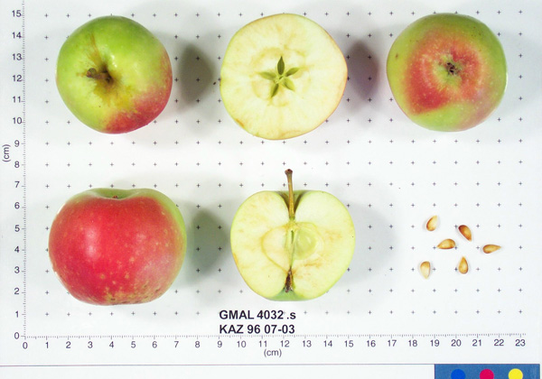 | | 1996 | COLLECTED | 09/08/1996 | 15km east of Topelevka-Djungarsky Range. 3 km southeast of Topelevka Forestry Camp. Collections made in radius around camp. Incline 10%, northwest. | 45.40722222, 80.43944444 | 1460 | Fertile. Dominant tree sp: Malus sierversii; Assoc.-Betula, Crataegus, Acer, Quercus, Tilia, Populus, Betula. Dom. Shrub Sp: Berberis, Lonicera: Assoc.-Cotoneaster, Rubus, Berberis, Ribes. Dom. herb.:Fragaria,Grasses,Humulus:Assoc.-Dianthus | Uncertain improvement status | Sampled 80 fruits from 1 tree. Flesh flavor is subacid. Fruit size is larger than 50mm. Free of disease and insects. Nice apple, 50 year old tree. Scion collected also. ---Malus sieversii hybrid. Domestic introgression intentified using 20K Illumina Infinium apple SNP array--Gold_Reinette is a likely grandparent | 1693368 | PI 657089 |
| 52 | PI 657091 | KAZ 96 07-08 | Malus sieversii (Ledeb.) M. Roem. | Kazakhstan | GEN | | | 1996 | COLLECTED | 09/09/1996 | 15km east of Topelevka-Djungarsky Range. 3 km southeast of Topelevka Forestry Camp. Collections made in radius around camp. | 45.40472222, 80.40694444 | 1220 | Fertile. Dominant tree sp: Malus sierversii; Assoc.-Betula, Crataegus, Acer, Quercus, Tilia, Populus, Betula. Dom. Shrub Sp: Berberis, Lonicera: Assoc.-Cotoneaster, Rubus, Berberis, Ribes. Dom. herb.:Fragaria,Grasses,Humulus:Assoc.-Dianthus | Wild material | Sampled 70 fruits from 1 tree. Flesh flavor is aromatic. Fruit size is larger than 50mm. Free of disease and insects. White transparent type. Heavy crop load. | 1693446 | PI 657091 |
| 53 | PI 657093 | KAZ 96 07-10 | Malus hybr. | Kazakhstan | GEN | 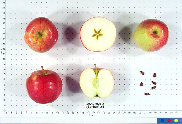 | | 1996 | COLLECTED | 09/09/1996 | 15km east of Topelevka-Djungarsky Range. 3 km southeast of Topelevka Forestry Camp. Collections made in radius around camp. Aspect flat. | 85.41527778, 80.40277778 | 1250 | Fertile. Dominant tree sp: Malus sierversii; Assoc.-Betula, Crataegus, Acer, Quercus, Tilia, Populus, Betula. Dom. Shrub Sp: Berberis, Lonicera: Assoc.-Cotoneaster, Rubus, Berberis, Ribes. Dom. herb.:Fragaria,Grasses,Humulus:Assoc.-Dianthus | Uncertain improvement status | Sampled 60 fruits from 1 tree. Flesh flavor is aromatic. Over color is 70% red. Fruit size is larger than 50mm. Free of disease and insects. Best apple so far, great. ---Malus sieversii hybrid. Domestic introgression intentified using 20K Illumina Infinium apple SNP array--Gold_Reinette is a grandparent | 1693493 | PI 657093 |
| 54 | PI 657111 | KAZ 96 07-01P-24 | Malus sieversii (Ledeb.) M. Roem. | Kazakhstan | GEN | | | 1996 | COLLECTED | 09/08/1996 | 15 km southeast of Topelevka-Djungarski Range. 3km of Topelevka Forestry Camp. Collected further east of camp at higher elevations. | 45.40027778, 80.44083333 | 1540 | Dominant tree sp: M. sieversii; Assoc-Betula, Crataegus, Acer, Quercus, Tilia, Populus, Rhamnus. Dom. shrub sp: Berberis, Lonicera; Assoc-Cotoneaster, Rubus, Ribes. Dom. herb:Fragaria, Grasses, Humulus; Assoc-Dianthus, Fragaria, Chelidonium | Wild material | Sampled 8 fruits from 54 trees. Flesh flavor is subacid. scab is absent. Genetic Dwarf. Same as 07-04. | 1694029 | PI 657111 |
| 55 | PI 682768 | KAZ 96 07-03 | Malus hybr. | Kazakhstan | GEN | | | 1996 | COLLECTED | 09/08/1996 | 15km east of Topelevka-Djungarsky Range. 3 km southeast of Topelevka Forestry Camp. Collections made in radius around camp. Incline 10%, northwest. | 45.40722222, 80.43944444 | 1460 | Fertile. Dominant tree sp: Malus sierversii; Assoc.-Betula, Crataegus, Acer, Quercus, Tilia, Populus, Betula. Dom. Shrub Sp: Berberis, Lonicera: Assoc.-Cotoneaster, Rubus, Berberis, Ribes. Dom. herb.:Fragaria,Grasses,Humulus:Assoc.-Dianthus | Uncertain improvement status | Sampled 80 fruits from 1 tree. Flesh flavor is subacid. Fruit size is larger than 50mm. Free of disease and insects. Nice apple, 50 year old tree. Scion collected also. ---Malus sieversii hybrid. Domestic introgression intentified using 20K Illumina Infinium apple SNP array--Gold_Reinette likely a grandparent | 1693381 | PI 682768 |
| 56 | PI 682769 | KAZ 96 07-03 | Malus sieversii (Ledeb.) M. Roem. | Kazakhstan | GEN |  | | 1996 | COLLECTED | 09/08/1996 | 15km east of Topelevka-Djungarsky Range. 3 km southeast of Topelevka Forestry Camp. Collections made in radius around camp. Incline 10%, northwest. | 45.40722222, 80.43944444 | 1460 | Fertile. Dominant tree sp: Malus sierversii; Assoc.-Betula, Crataegus, Acer, Quercus, Tilia, Populus, Betula. Dom. Shrub Sp: Berberis, Lonicera: Assoc.-Cotoneaster, Rubus, Berberis, Ribes. Dom. herb.:Fragaria,Grasses,Humulus:Assoc.-Dianthus | Wild material | Sampled 80 fruits from 1 tree. Flesh flavor is subacid. Fruit size is larger than 50mm. Free of disease and insects. Nice apple, 50 year old tree. Scion collected also. | 1693369 | PI 682769 |
| 57 | PI 682770 | KAZ 96 07-03 | Malus hybr. | Kazakhstan | GEN | 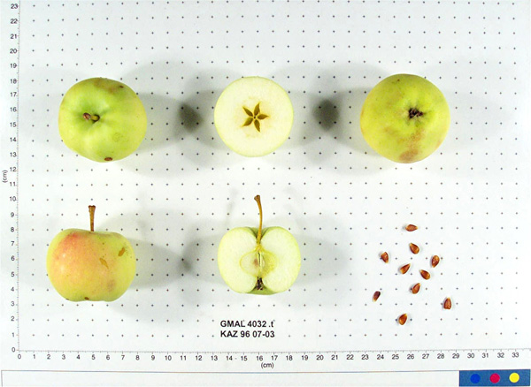 | | 1996 | COLLECTED | 09/08/1996 | 15km east of Topelevka-Djungarsky Range. 3 km southeast of Topelevka Forestry Camp. Collections made in radius around camp. Incline 10%, northwest. | 45.40722222, 80.43944444 | 1460 | Fertile. Dominant tree sp: Malus sierversii; Assoc.-Betula, Crataegus, Acer, Quercus, Tilia, Populus, Betula. Dom. Shrub Sp: Berberis, Lonicera: Assoc.-Cotoneaster, Rubus, Berberis, Ribes. Dom. herb.:Fragaria,Grasses,Humulus:Assoc.-Dianthus | Uncertain improvement status | Sampled 80 fruits from 1 tree. Flesh flavor is subacid. Fruit size is larger than 50mm. Free of disease and insects. Nice apple, 50 year old tree. Scion collected also. ---Malus sieversii hybrid. Domestic introgression intentified using 20K Illumina Infinium apple SNP array--Gold_Reinette likely a grandparent | 1693367 | PI 682770 |
| 58 | PI 682772 | KAZ 96 07-07 | Malus hybr. | Kazakhstan | | 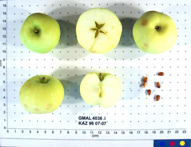 | Historic | 1996 | COLLECTED | 09/09/1996 | 15km east of Topelevka-Djungarsky Range. 3 km southeast of Topelevka Forestry Camp. Collections made in radius around camp. Collected near GMAL 4256. | 45.40472222, 80.40694444 | 1220 | Fertile. Dominant tree sp: Malus sierversii; Assoc.-Betula, Crataegus, Acer, Quercus, Tilia, Populus, Betula. Dom. Shrub Sp: Berberis, Lonicera: Assoc.-Cotoneaster, Rubus, Berberis, Ribes. Dom. herb.:Fragaria,Grasses,Humulus:Assoc.-Dianthus | Uncertain improvement status | Sampled 7 fruits form 1 tree. Flesh flavor is sweet. Fruit size is larger than 50mm. Free of disease and insects. Has water core. Strange hazelnutbananna flavor. Scion collected also. ---Malus sieversii hybrid. Domestic introgression intentified using 20K Illumina Infinium apple SNP array-- | 1693415 | PI 682772 |
| 59 | PI 682773 | KAZ 96 07-07 | Malus sieversii (Ledeb.) M. Roem. | Kazakhstan | GEN |  | | 1996 | COLLECTED | 09/09/1996 | 15km east of Topelevka-Djungarsky Range. 3 km southeast of Topelevka Forestry Camp. Collections made in radius around camp. Collected near GMAL 4256. | 45.40472222, 80.40694444 | 1220 | Fertile. Dominant tree sp: Malus sierversii; Assoc.-Betula, Crataegus, Acer, Quercus, Tilia, Populus, Betula. Dom. Shrub Sp: Berberis, Lonicera: Assoc.-Cotoneaster, Rubus, Berberis, Ribes. Dom. herb.:Fragaria,Grasses,Humulus:Assoc.-Dianthus | Wild material | Sampled 7 fruits form 1 tree. Flesh flavor is sweet. Fruit size is larger than 50mm. Free of disease and insects. Has water core. Strange hazelnut-bananna flavor. Scion collected also. | 1693414 | PI 682773 |
| 60 | PI 682774 | KAZ 96 07-09 | Malus sieversii (Ledeb.) M. Roem. | Kazakhstan | GEN | | | 1996 | COLLECTED | 09/09/1996 | 15km east of Topelevka-Djungarsky Range. 3 km southeast of Topelevka Forestry Camp. Collections made in radius around camp. Aspect southeast. | 45.41027778, 80.40527778 | 1240 | Fertile. Dominant tree sp: Malus sierversii; Assoc.-Betula, Crataegus, Acer, Quercus, Tilia, Populus, Betula. Dom. Shrub Sp: Berberis, Lonicera: Assoc.-Cotoneaster, Rubus, Berberis, Ribes. Dom. herb.:Fragaria,Grasses,Humulus:Assoc.-Dianthus | Wild material | Sampled 80 fruits from 1 tree. Flesh flavor is subacid. Over color is 50% red. Fruit size is larger than 50mm. Free of disease and insects. Crop load is heavy. Large apples with hugh green leaves that are clean, look like triploid. Apples could even be larger of smaller crop. Scion collected also. | 1693464 | PI 682774 |
| 61 | PI 682778 | KAZ 96 07-10 | Malus sieversii (Ledeb.) M. Roem. | Kazakhstan | GEN | 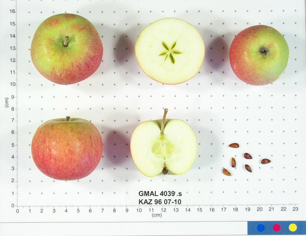 | | 1996 | COLLECTED | 09/09/1996 | 15km east of Topelevka-Djungarsky Range. 3 km southeast of Topelevka Forestry Camp. Collections made in radius around camp. Aspect flat. | 85.41527778, 80.40277778 | 1250 | Fertile. Dominant tree sp: Malus sierversii; Assoc.-Betula, Crataegus, Acer, Quercus, Tilia, Populus, Betula. Dom. Shrub Sp: Berberis, Lonicera: Assoc.-Cotoneaster, Rubus, Berberis, Ribes. Dom. herb.:Fragaria,Grasses,Humulus:Assoc.-Dianthus | Wild material | Sampled 60 fruits from 1 tree. Flesh flavor is aromatic. Over color is 70% red. Fruit size is larger than 50mm. Free of disease and insects. Best apple so far, great. | 1693476 | PI 682778 |
| 62 | PI 682779 | KAZ 96 07-10 | Malus hybr. | Kazakhstan | GEN | 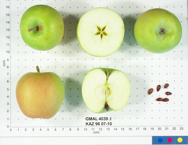 | | 1996 | COLLECTED | 09/09/1996 | 15km east of Topelevka-Djungarsky Range. 3 km southeast of Topelevka Forestry Camp. Collections made in radius around camp. Aspect flat. | 85.41527778, 80.40277778 | 1250 | Fertile. Dominant tree sp: Malus sierversii; Assoc.-Betula, Crataegus, Acer, Quercus, Tilia, Populus, Betula. Dom. Shrub Sp: Berberis, Lonicera: Assoc.-Cotoneaster, Rubus, Berberis, Ribes. Dom. herb.:Fragaria,Grasses,Humulus:Assoc.-Dianthus | Uncertain improvement status | Sampled 60 fruits from 1 tree. Flesh flavor is aromatic. Over color is 70% red. Fruit size is larger than 50mm. Free of disease and insects. Best apple so far, great. ---Malus sieversii hybrid. Domestic introgression intentified using 20K Illumina Infinium apple SNP array--Gold_Reinette is a grandparent | 1693477 | PI 682779 |
| 63 | PI 682780 | KAZ 96 07-10 | Malus sieversii (Ledeb.) M. Roem. | Kazakhstan | GEN | 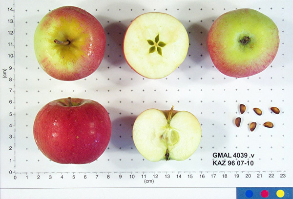 | | 1996 | COLLECTED | 09/09/1996 | 15km east of Topelevka-Djungarsky Range. 3 km southeast of Topelevka Forestry Camp. Collections made in radius around camp. Aspect flat. | 85.41527778, 80.40277778 | 1250 | Fertile. Dominant tree sp: Malus sierversii; Assoc.-Betula, Crataegus, Acer, Quercus, Tilia, Populus, Betula. Dom. Shrub Sp: Berberis, Lonicera: Assoc.-Cotoneaster, Rubus, Berberis, Ribes. Dom. herb.:Fragaria,Grasses,Humulus:Assoc.-Dianthus | Wild material | Sampled 60 fruits from 1 tree. Flesh flavor is aromatic. Over color is 70% red. Fruit size is larger than 50mm. Free of disease and insects. Best apple so far, great. | 1693479 | PI 682780 |
| 64 | PI 682781 | KAZ 96 07-10 | Malus hybr. | Kazakhstan | GEN | 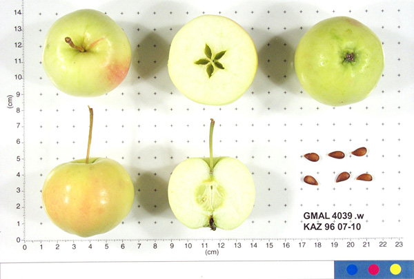 | | 1996 | COLLECTED | 09/09/1996 | 15km east of Topelevka-Djungarsky Range. 3 km southeast of Topelevka Forestry Camp. Collections made in radius around camp. Aspect flat. | 85.41527778, 80.40277778 | 1250 | Fertile. Dominant tree sp: Malus sierversii; Assoc.-Betula, Crataegus, Acer, Quercus, Tilia, Populus, Betula. Dom. Shrub Sp: Berberis, Lonicera: Assoc.-Cotoneaster, Rubus, Berberis, Ribes. Dom. herb.:Fragaria,Grasses,Humulus:Assoc.-Dianthus | Uncertain improvement status | Sampled 60 fruits from 1 tree. Flesh flavor is aromatic. Over color is 70% red. Fruit size is larger than 50mm. Free of disease and insects. Best apple so far, great. ---Malus sieversii hybrid. Domestic introgression intentified using 20K Illumina Infinium apple SNP array--Gold_Reinette is a grandparent | 1693492 | PI 682781 |
| 65 | PI 611049 | VIR 281 | Dactylis glomerata L. | Russian Federation | W6 | | | 1996 | COLLECTED | 09/14/1995 | Krasnodarskiy kray. Nearest village Dachovskaya. | 44.15055556, 40.19666667 | 1100 | Area logged. Slope 6-10%, aspect NE. Light 1/4 shade. Soil loam, pH 5.4-5.6. Moist, upper slope. Vegetation closed, deciduous forest primary, closed scrub with scattered trees. | Wild material | Dominant tree species Carpinus betulus, Quercus robur, Acer campestre. Dominant shrub species Rosa sp., Rubus caesius, Salix caprea, Rhododendron luteum. Dominant herb/grass species Deschampsia caespitosa, Molinia caerulea, Calamagrostis sp., Doricnium graecum, Trifolium medium. Population distribution uniform, abundance occasional. Growth habit erect. Extensive regional climate data available in spreadsheet format or image maps in raster format suitable for GIS analysis. Contact Dr. Stephanie L. Greene (sgreene@ars-grin.gov). | 1517975 | PI 611049 |
| 66 | PI 611053 | VIR 278B | Dactylis glomerata L. | Russian Federation | W6 | | | 1996 | COLLECTED | 09/14/1995 | Krasnodarskiy kray. Nearest village Dachovskaya. | 44.15055556, 40.19666667 | 1100 | Area logged. Slope 6-10%, aspect NE. Light 1/4 shade. Soil loam, pH 5.4-5.6. Moist, upper slope. Vegetation closed, deciduous forest primary, closed scrub with scattered trees. | Wild material | Dominant tree species Carpinus betulus, Quercus robur, Acer campestre. Dominant shrub species Rosa sp., Rubus caesius, Salix caprea, Rhododendron luteum. Dominant herb/grass species Deschampsia caespitosa, Molina caerulea, Calamagrostis sp., Doricnium graecum, Trifolium medium. Population distribution uniform, abundance occasional. Growth habit erect. Flower gray. Extensive regional climate data available in spreadsheet format or image maps in raster format suitable for GIS analysis. Contact Dr. Stephanie L. Greene (sgreene@ars-grin.gov). | 1517973 | PI 611053 |
| 67 | PI 641474 | 279 | Lotus corniculatus L. | Krasnodar, Russian Federation | W6 |  | | 1996 | COLLECTED | 09/14/1995 | Krasnodarskiy kray, nearest village is Dachovskaya. | | | Now logged. Slope 6-10%, aspect NE. 1/4 shade. Soil loam. Moist, upper slope. Vegetation closed, deciduous forest, closed scrub with scattered trees. | Wild material | Dominant tree species Carpinus betulus, Quercus robur, Acer campestre. Dominant shrub species Rosa sp., Rubus caesius, Salix caprea, Rhododendron luteum. Dominant herb/grass species Deschampsia caespitosa, Molinia caerulea, Calamogrostis graecum, Trifolium medium. Population distribution uniform, abundance occasional. Growth habit spreading. Extensive regional climate data available in spreadsheet format or image maps in raster format suitable for GIS analysis. Contact Dr. Stephanie L. Greene (sgreene@ars-grin.gov). | 1531013 | PI 641474 |
| 68 | PI 641475 | 282 | Trifolium medium L. | Krasnodar, Russian Federation | W6 | | | 1996 | COLLECTED | 09/14/1995 | Krasnodarskiy kray, nearest village is Dachovskaya. | | | Now logged. Slope 6-10%, aspect NE. 1/4 shade. Soil loam. Moist, upper slope. Vegetation closed, deciduous forest, scrub with scattered trees. | Wild material | Dominant tree species Carpinus betulus, Quercus robur, Acer campestre. Dominant shrub species Rosa sp., Rubus caesius, Salix caprea, Rhododendron luteum. Dominant herb/grass species Deschampsia caespitosa, Molinia caerulea, Calamogrostis sp., Doricnium graecum, Trifolium medium. Population distribution patchy, abundance frequent. Growth habit spreading. Extensive regional climate data available in spreadsheet format or image maps in raster format suitable for GIS analysis. Contact Dr. Stephanie L. Greene (sgreene@ars-grin.gov). | 1531014 | PI 641475 |
| 69 | PI 641476 | 285 | Lotus corniculatus L. | Krasnodar, Russian Federation | W6 |  | | 1996 | COLLECTED | 09/14/1995 | Krasnodarskiy kray, nearest village is Dachovskaya. | | | Now logged. Slope 6-10%, aspect NE. 1/4 shade. Soil loam. Moist, upper slope. Vegetation closed, deciduous forest, scrub with scattered trees. | Wild material | Dominant tree species Carpinus betulus, Quercus robur, Acer campestre. Dominant shrub species Rosa sp., Rubus caesius, Salix caprea, Rhododendron luteum. Dominant herb/grass species Deschampsia caespitosa, Molinia caerulea, Calamogrostis sp., Doricnium graecum, Trifolium medium. Population distribution uniform, abundance occasional. Growth habit spreading. Extensive regional climate data available in spreadsheet format or image maps in raster format suitable for GIS analysis. Contact Dr. Stephanie L. Greene (sgreene@ars-grin.gov). | 1531016 | PI 641476 |
| 70 | PI 655818 | 284 | Trifolium hybridum L. | Krasnodar, Russian Federation | W6 |  | | 1996 | COLLECTED | 09/14/1995 | Krasnodarskiy kray, nearest village is Dachovskaya. | | | Now logged. Slope 6-10%, aspect NE. 1/4 shade. Soil loam. Moist, upper slope. Vegetation closed, deciduous forest, scrub with scattered trees. | Wild material | Dominant tree species Carpinus betulus, Quercus robur, Acer campestre. Dominant shrub species Rosa sp., Rubus caesius, Salix caprea, Rhododendron luteum. Dominant herb/grass species Deschampsia caespitosa, Molinia caerulea, Calamogrostis sp., Doricnium graecum, Trifolium medium. Population distribution uniform-patchy, abundance occasional. Growth habit spreading. Extensive regional climate data available in spreadsheet format or image maps in raster format suitable for GIS analysis. Contact Dr. Stephanie L. Greene (sgreene@ars-grin.gov). | 1531015 | PI 655818 |
| 71 | PI 599796 | Kaz 95 12-01P-1 | Malus sieversii (Ledeb.) M. Roem. | Kazakhstan | GEN | | | 1995 | COLLECTED | 09/03/1995 | Topolevka village. 15 km. East of Topolevka - Djungarsky Mountain Range. 1.5 km. Southeast of Topolevka Forestry Camp. Elevation: 1220-1450 m. | 45.39611111, 80.40777778 | 1220 | Aspect: Northwest. Dominant tree sp.: M. sieversii; Associated-Acer, Quercus, Tilia, Populus, Rhamnus. Dominant shrub sp.: Lonicera; Assoc.-Berberis, Cotoneaster, Rubus. Dominant herbaceous: Grasses; Assoc.-Fragaria, Chelidonium, Urtica. | Wild material | Sampled 8 fruits from 1 tree. Collected at 1450 m. | 1551093 | PI 599796 |
| 72 | PI 600497 | Kaz 95 06-01 | Malus sieversii (Ledeb.) M. Roem. | Kazakhstan | GEN | | | 1995 | COLLECTED | 08/29/1995 | Semipalitinsk Region (Tarbagatai Mountain Range). 20 km. North of Urdzhar. 7 km. Northeast of Alekseyevka. Landform mostly hillside. Collected in North end of West Valley, upstream 3 km. from site 05 (GMAL's 3604-3607, GMAL's 3760-3789). | 47.27000000, 81.57361111 | 990 | Silt to clay loam soil. Aspect: Mostly East. Dominant tree sp.: M. sieversii; Associated-Populus, Pyrus, Acer. Dominant shrub sp.: Rosa; Assoc.-Lonicera, Amygdalus, Rubus. Dominant herbaceous: Grasses; Assoc.-Potentilla, Fragaria. | Wild material | Sampled 150 fruits from 1 tree. Flesh flavor is aromatic. Over color is 90% red. Fruit size is larger than 50mm, no scab. Spur type tree. Scion also collected. | 1550639 | PI 600497 |
| 73 | PI 600498 | Kaz 95 06-03 | Malus sieversii (Ledeb.) M. Roem. | Kazakhstan | GEN | | | 1995 | COLLECTED | 08/29/1995 | Semipalitinsk Region (Tarbagatai Mountain Range). 20 km. North of Urdzhar. 7 km. Northeast of Alekseyevka. Landform mostly hillside. Collected in North end of West Valley, upstream 3 km. from site 05 (GMAL's 3604-3607, GMAL's 3760-3789). | 47.27000000, 81.57361111 | 990 | Silt to clay loam soil. Slope incline: 5%. Aspect: West. Dominant tree sp: M. sieversii; Associated-Populus, Pyrus, Acer. Dominant shrub sp: Rosa; Assoc.-Lonicera, Amygdalus, Rubus. Dominant herbaceous: Grasses; Assoc.-Potentilla, Fragaria. | Wild material | Sampled 150 fruits from 1 tree. Scab detected. Very heavy cropload. Spur tpye tree. | 1550640 | PI 600498 |
| 74 | PI 600543 | Kaz 95 12-02 | Malus sieversii (Ledeb.) M. Roem. | Kazakhstan | GEN | | | 1995 | COLLECTED | 09/03/1995 | Topolevka village. 15 km. East of Topolevka - Djungarsky Range. 1.5 km. Southeast of Topolevka Forestry Camp. Elevation: 1220-1450 m. | 45.39611111, 80.40777778 | 1450 | Aspect: Northwest. Dominant tree sp.: M. sieversii; Assoc.-Acer, Quercus, Tilia, Populus, Rhamnus. Dominant shrub sp.: Lonicera; Assoc-Berberis, Cotoneaster, Rubus. Dominant herbaceous: Grasses; Assoc.-Fragaria, Chelidonium, Urtica. | Wild material | Sampled 150 frts from 1 tree. Fruit is firm, largest in Djangarsky. Some codling moth eggs visible in seed. Quite clean of scab. Tree sets fruit in clusters; has clonal offshoots. Scion also coll. Spur type tree. Same accession as GMAL 3890 | 1550572 | PI 600543 |
| 75 | PI 600544 | Kaz 95 12-03 | Malus sieversii (Ledeb.) M. Roem. | Kazakhstan | GEN | | | 1995 | COLLECTED | 09/03/1995 | Topolevka village. 15 km. East of Topolevka - Djungarsky Range. 1.5 km. Southeast of Topolevka Forestry Camp. Landform: Plateau. Elevation: 1220-1450 m. | 45.39611111, 80.40777778 | 1500 | Aspect: Northwest. Dominant tree sp.: M. sieversii; Assoc.-Acer, Quercus, Tilia, Populus, Rhamnus. Dominant shrub sp.: Lonicera; Assoc-Berberis, Cotoneaster, Rubus. Dominant herbaceous: Grasses; Assoc.-Fragaria, Chelidonium, Urtica. | Wild material | Sampled 150 fruits from 1 tree. Fruit is hard. Slight scab. 100 year old tree. | 1550573 | PI 600544 |
| 76 | PI 600545 | Kaz 95 12-04 | Malus sieversii (Ledeb.) M. Roem. | Kazakhstan | GEN | | | 1995 | COLLECTED | 09/03/1995 | Topolevka village. 15 km. East of Topolevka - Djungarsky Range. 1.5 km. Southeast of Topolevka Forestry Camp. Elevation: 1220-1450 m. | 45.39611111, 80.40777778 | 1500 | Aspect: East. Dominant tree sp.: M. sieversii; Assoc.-Acer, Quercus, Tilia, Populus, Rhamnus. Dominant shrub sp.: Lonicera; Assoc-Berberis, Cotoneaster, Rubus. Dominant herbaceous: Grasses; Assoc.-Fragaria, Chelidonium, Urtica. | Wild material | Sampled 100 fruits from 1 tree. Flesh flavor is aromatic. Scab present. Fruit contains insect eggs in seed area. Tree tall and thin. | 1550574 | PI 600545 |
| 77 | PI 600546 | Kaz 95 12-05 | Malus sieversii (Ledeb.) M. Roem. | Kazakhstan | GEN | | | 1995 | COLLECTED | 09/03/1995 | Topolevka village. 15 km. East of Topolevka - Djungarsky Range. 1.5 km. Southeast of Topolevka Forestry Camp. Elevation: 1220-1450 m. | 45.39611111, 80.40777778 | 1220 | Dominant tree sp.: M. sieversii; Assoc.-Acer, Quercus, Tilia, Populus, Rhamnus. Dominant shrub sp.: Lonicera; Assoc-Berberis, Cotoneaster, Rubus. Dominant herbaceous: Grasses; Assoc.-Fragaria, Chelidonium, Urtica. | Wild material | Sampled 150 fruits from 1 tree. Fruit is firm with aromatic flesh flavor. Fruit size is larger than 50mm, very little scab. Collected very close to GMAL 3554 in 1993. Maybe near M. x domestica source. | 1550575 | PI 600546 |
| 78 | PI 613971 | KAZ 95 06-01 | Malus hybr. | Kazakhstan | GEN | | | 1995 | COLLECTED | 08/29/1995 | Semipalitinsk Region (Tarbagatai Mountain Range). 20 km. North of Urdzhar. 7 km. Northeast of Alekseyevka. Landform mostly hillside. Collected in North end of West Valley, upstream 3 km. from site 05 (GMAL's 3604-3607, GMAL's 3760-3789). | 47.27000000, 81.57361111 | 990 | Silt to clay loam soil. Aspect: Mostly East. Dominant tree sp.: M. sieversii; Associated-Populus, Pyrus, Acer. Dominant shrub sp.: Rosa; Assoc.-Lonicera, Amygdalus, Rubus. Dominant herbaceous: Grasses; Assoc.-Potentilla, Fragaria. | Uncertain improvement status | Wild. Additional habitat data: Nearest M. domestica 5 km. Collection tree height 3 meters. DBH 7 cm. multiple trunk. Habit type: I spar. sampled 150 fruits from 1 tree. Flesh flavor is aromatic. Over color is 90%. Fruit size is larger than 50mm, no scab. Spur type tree. Clone of tree from which GMAL 3608 seed were collected. -- One fully domesticated parent intentified using 20K Illumina Infinium apple SNP array. Parent is Charlamoff. | 1498666 | PI 613971 |
| 79 | PI 613972 | KAZ 95 06-08 | Malus hybr. | Kazakhstan | GEN |  | | 1995 | COLLECTED | 08/29/1995 | Semipalitinsk Region (Tarbagatai Mountain Range). 20 km. North of Urdzhar. 7 km. Northeast of Alekseyevka. Landform mostly hillside. Collected in North end of West Valley, upstream 3 km. from site 05 (GMAL's 3604-3607, GMAL's 3760-3789). | 47.27000000, 81.57361111 | 990 | Silt to clay loam soil. Aspect: West. Dominant tree sp.: M. sieversii; Associated-Populus, Pyrus, Acer. Dominant shrub sp.: Rosa; Assoc.-Lonicera, Amygdalus, Rubus. Dominant herbaceous: Grasses; Assoc.-Potentilla, Fragaria. | Uncertain improvement status | Wild. Additional habitat data: Habit type: II semispur. Leaves very clean from disease; nice shape tree. Sampled 30 fruits from 1 tree. Fruit collected from tree with nice shape. Fruit is firm with aromatic flesh flavor. Fruit size is larger than 50mm. Very clean and free of disease. Clone of tree from which GMAL 3614 seed were collected. -- One fully domesticated parent intentified using 20K Illumina Infinium apple SNP array. Parent is Charlamoff. | 1498667 | PI 613972 |
| 80 | PI 613980 | KAZ 95 12-02 | Malus sieversii (Ledeb.) M. Roem. | Kazakhstan | GEN |  | | 1995 | COLLECTED | 09/12/1995 | Topolevka village. 15 km. East of Topolevka - Djungarsky Range. 1.5 km. Southeast of Topolevka Forestry Camp. Elevation: 1220-1450 m. | 45.39611111, 80.40777778 | 1450 | Aspect: Northwest. Dominant tree sp.: M. sieversii; Assoc.-Acer, Quercus, Tilia, Populus, Rhamnus. Dominant shrub sp.: Lonicera; Assoc-Berberis, Cotoneaster, Rubus. Dominant herbaceous: Grasses; Assoc.-Fragaria, Chelidonium, Urtica. | Wild material | Elite scion material. Wild. Additional habitat data: Tree ht. 3.5 m, DBH 8 cm., habit type I spur-nice. Crop load very heavy. Leaves: very clean (from disease). Scab: quite clean. Insects: some codling moth, eggs visible in seed. General notes: Largest fruit in Djungarsky so far, sets fruit in clusters, has clonal offshoots. Same accession as GMAL 3890. | 1498677 | PI 613980 |
| 81 | PI 657002 | Kaz 95 06-01 | Malus hybr. | Kazakhstan | GEN |  | | 1995 | COLLECTED | 08/29/1995 | Semipalitinsk Region (Tarbagatai Mountain Range). 20 km. North of Urdzhar. 7 km. Northeast of Alekseyevka. Landform mostly hillside. Collected in North end of West Valley, upstream 3 km. from site 05 (GMAL's 3604-3607, GMAL's 3760-3789). | 47.27000000, 81.57361111 | 990 | Silt to clay loam soil. Aspect: Mostly East. Dominant tree sp.: M. sieversii; Associated-Populus, Pyrus, Acer. Dominant shrub sp.: Rosa; Assoc.-Lonicera, Amygdalus, Rubus. Dominant herbaceous: Grasses; Assoc.-Potentilla, Fragaria. | Uncertain improvement status | Sampled 150 fruits from 1 tree. Flesh flavor is aromatic. Over color is 90% red. Fruit size is larger than 50mm, no scab. Spur type tree. Scion also collected. ---Malus sieversii hybrid. Domestic introgression intentified using 20K Illumina Infinium apple SNP array-- | 1692586 | PI 657002 |
| 82 | PI 657004 | Kaz 95 06-04 | Malus hybr. | Kazakhstan | GEN |  | | 1995 | COLLECTED | 08/29/1995 | Semipalitinsk Region (Tarbagatai Mountain Range). 20 km. North of Urdzhar. 7 km. Northeast of Alekseyevka. Landform mostly hillside. Collected in North end of West Valley, upstream 3 km. from site 05 (GMAL's 3604-3607, GMAL's 3760-3789). | 47.27000000, 81.57361111 | 990 | Silt to clay loam soil. Slope incline: 5%. Aspect: West. Dominant tree sp: M. sieversii; Associated-Populus, Pyrus, Acer. Dominant shrub sp: Rosa; Assoc.-Lonicera, Amygdalus, Rubus. Dominant herbaceous: Grasses; Assoc.-Potentilla, Fragaria. | Uncertain improvement status | Sampled 30 fruits from 1 tree. Fruit is firm, bruises easily. Fruit size is larger than 50mm, free of scab. Spur type tree. ---Malus sieversii hybrid. Domestic introgression intentified using 20K Illumina Infinium apple SNP array--Charlamoff is a grandparent | 1692611 | PI 657004 |
| 83 | PI 657005 | Kaz 95 06-08 | Malus hybr. | Kazakhstan | GEN | | | 1995 | COLLECTED | 08/29/1995 | Semipalitinsk Region (Tarbagatai Mountain Range). 20 km. North of Urdzhar. 7 km. Northeast of Alekseyevka. Landform mostly hillside. Collected in North end of West Valley, upstream 3 km. from site 05 (GMAL's 3604-3607, GMAL's 3760-3789). | 47.27000000, 81.57361111 | 990 | Silt to clay loam soil. Aspect: West. Dominant tree sp.: M. sieversii; Associated-Populus, Pyrus, Acer. Dominant shrub sp.: Rosa; Assoc.-Lonicera, Amygdalus, Rubus. Dominant herbaceous: Grasses; Assoc.-Potentilla, Fragaria. | Uncertain improvement status | Sampled 30 fruits from 1 tree. Fruit collected from tree with nice shape. Fruit is firm with aromatic flesh flavor. Fruit size is larger than 50mm. Very clean and free of disease. Scion also collected. ---Malus sieversii hybrid. Domestic introgression intentified using 20K Illumina Infinium apple SNP array-- | 1692612 | PI 657005 |
| 84 | PI 657006 | Kaz 95 06-08 | Malus hybr. | Kazakhstan | GEN | | | 1995 | COLLECTED | 08/29/1995 | Semipalitinsk Region (Tarbagatai Mountain Range). 20 km. North of Urdzhar. 7 km. Northeast of Alekseyevka. Landform mostly hillside. Collected in North end of West Valley, upstream 3 km. from site 05 (GMAL's 3604-3607, GMAL's 3760-3789). | 47.27000000, 81.57361111 | 990 | Silt to clay loam soil. Aspect: West. Dominant tree sp.: M. sieversii; Associated-Populus, Pyrus, Acer. Dominant shrub sp.: Rosa; Assoc.-Lonicera, Amygdalus, Rubus. Dominant herbaceous: Grasses; Assoc.-Potentilla, Fragaria. | Uncertain improvement status | Sampled 30 fruits from 1 tree. Fruit collected from tree with nice shape. Fruit is firm with aromatic flesh flavor. Fruit size is larger than 50mm. Very clean and free of disease. Scion also collected. ---Malus sieversii hybrid. Domestic introgression intentified using 20K Illumina Infinium apple SNP array-- | 1692615 | PI 657006 |
| 85 | PI 682749 | Kaz 95 06-01 | Malus sieversii (Ledeb.) M. Roem. | Kazakhstan | GEN |  | | 1995 | COLLECTED | 08/29/1995 | Semipalitinsk Region (Tarbagatai Mountain Range). 20 km. North of Urdzhar. 7 km. Northeast of Alekseyevka. Landform mostly hillside. Collected in North end of West Valley, upstream 3 km. from site 05 (GMAL's 3604-3607, GMAL's 3760-3789). | 47.27000000, 81.57361111 | 990 | Silt to clay loam soil. Aspect: Mostly East. Dominant tree sp.: M. sieversii; Associated-Populus, Pyrus, Acer. Dominant shrub sp.: Rosa; Assoc.-Lonicera, Amygdalus, Rubus. Dominant herbaceous: Grasses; Assoc.-Potentilla, Fragaria. | Wild material | Sampled 150 fruits from 1 tree. Flesh flavor is aromatic. Over color is 90% red. Fruit size is larger than 50mm, no scab. Spur type tree. Scion also collected. | 1692587 | PI 682749 |
| 86 | PI 618015 | V. macrocarpon WV Allen 7 | Vaccinium macrocarpon Aiton | West Virginia, United States | COR | 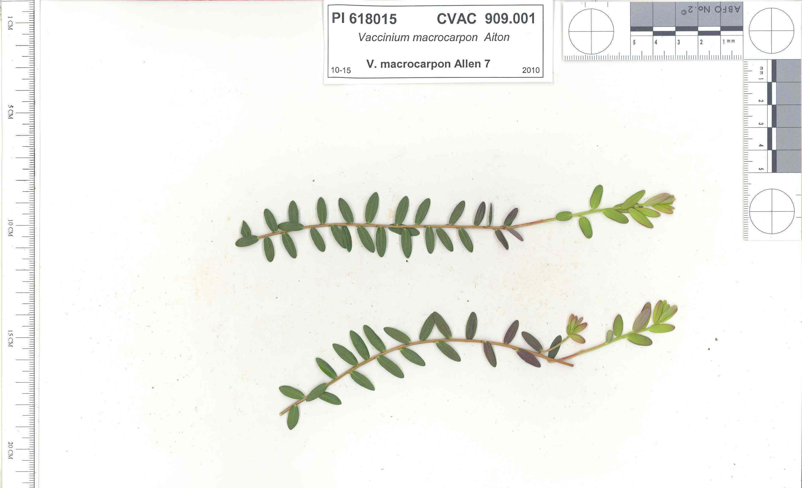 | | 1991 | COLLECTED | 10/29/1991 | Oligotrophic fen near WV/MD border in Preston county, WV, owned by the nature conservancy, WV, known as Cranesville Swamp | 39.51950000, -79.48233000 | 786 | 2 acres fen, bordered by Typha sp., Acer rubrum, Prunus serotina, Hemlock, Sotuhern most population of American Larch (Tamarack), also has Sphagnum spp., Rubus hispidus, Solidago uliginosa, Eripphorum virginicum, Pyrus melanocarpa | Wild material | Site holding moisture well in a regional drought, designated as a National Natural Landmark Additional plants are Hypericum densiflorum, Carex folliculata, Juncus effusus, J. canadensis, Bartonia virginica, Gaultheria procumbens | 1009919 | PI 618015 |
| 87 | W6 62528 | FWS0300-131 | Symphyotrichum urophyllum (Lindl.) G. L. Nesom | Michigan, United States | W6 | 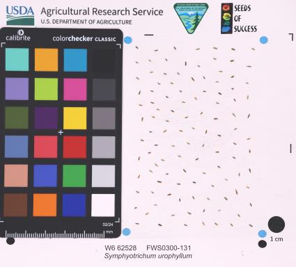 | | 2025 | | | | | | | Wild material | | 2192226 | W6 62528 |
| 88 | W6 62710 | CA360-240 | Verbena lasiostachys Link | California, United States | W6 |  | | 2025 | | | | | | | Wild material | | 2192928 | W6 62710 |
| 89 | NA 89115 | TLM25-04a | Hamamelis ovalis S. W. Leonard | Texas, United States | NA | | | 2025 | COLLECTED | 07/10/2025 | State Highway 87 approximately 3.25 kilometers north of the crossroad junction with Texas Recreational Road 255 (RE 255); plants were growing in the narrow buffer woods along the east side of the highway. | 31.12051300, -93.72628100 | 138 | The habitat is an upland mixed coniferous and deciduous woodlands in part to full shade and dry conditions, often under drought stress. Plants seem to always occur on the top of dry ridges or well-drained slopes. Slope: 0 to 1 percent. Aspect: N/A. Soils: The soils of this collection area are classified as Tehran-Letney Association, hilly (TLE) soils. The Tehran Series (55%) consists of deep, somewhat excessively drained, moderately rapidly permeable soils on uplands. They formed in thick loamy and sandy sediments on the Western Coastal Plain. These soils are on gently sloping to moderately steep uplands with slopes ranging from 1 to 20 percent. The Letney Series (30%) consists of deep, well drained, moderately rapidly permeable, upland soils. They formed in thick sandy and loamy sediments of the coastal plains. These soils are on gently sloping to moderately steep uplands with slopes ranging from 1 to 20 percent. Soil pH ranges from 4.5 to 6.0. The minor soil components include Doucette Series (10%) and Boykin Series (5%) soils. (Source: California Soil Resource Lab/NRCS Official Soil Series Descriptions). Geology: The underlying geology of this area is of Oligocene origin and characterized as Catahoula Formation. This formation is extensive and deep in Texas, up to 185 meters thick. In the area of the collection the Catahoula Formation is primarily mudstone and sand. The upper 90-150 meters is mudstone that is tuffaceous, and sandy; also, occasionally, with some bentonitic clay. (Source: USGS Texas Geologic Map Data). | Wild material | | 2191654 | NA 89115 |
| 90 | NA 89194 | DLSP-WB | Hamamelis virginiana L. | Wisconsin, United States | NA | | | 2025 | COLLECTED | 08/21/2024 | Devil's Lake State Park: West Bluff. | 43.41418510, -89.73993600 | 332 | Shade to part shade/sun to full sun in thin layer of clayey organic matter on boulder field. Slope: 60 degrees. Aspect: East. Red oak-sugar maple-linden vegetative community. | Wild material | | 2171015 | NA 89194 |
| 91 | NA 89196 | KVR | Hamamelis virginiana L. | Wisconsin, United States | NA | | | 2025 | COLLECTED | 08/22/2024 | Kickapoo Valley Reserve. | 43.62650770, -90.64627490 | 299 | Shade in thick, clayey, organic soil with sand. Slope: 45 degrees. Aspect: Northeast. Silver maple-boxelder-elm vegetative community. | Wild material | | 2171017 | NA 89196 |
| 92 | NA 88593 | 2024RJLNJ-001 | Ilex glabra (L.) A. Gray | New Jersey, United States | NA | | | 2024 | COLLECTED | 11/24/2024 | Mullica Township: Both sides of Duerer Street, approximately 0.37 kilometers southeast of 4th Avenue. | 39.55885000, -74.66442500 | 21 | Shade to almost full sun on compacted seasonally moist to temporarily wet areas of a mixed evergreen and deciduous woodland dominated by Pinus rigida. Vegetation of this area is very much defined by small changes in elevation that go from wet to very dry. Ilex glabra remains abundant throughout, though. Slope: N/A. Aspect: N/A. The underlying geology of this area is the Cohansey Formation of middle Miocene origin and comprised of sand, white to yellow with local gravel and clay. It is sometimes locally stained red or orange brown by iron oxides and (or) cemented into large blocks of ironstone. Unweathered clay is typically dark gray, but commonly weathers white where it is interbedded with thin beds of ironstone. Sand is typically medium grained and moderately sorted although it ranges from fine to very coarse grained and from poorly to well sorted. Sand consists of quartz and siliceous rock fragments. Some beds are locally micaceous. Maximum thickness in the map area is about 60 meters; however, thickness is difficult to determine because of the irregular basal contact and extensive post-depositional erosion. (Source: USGS New Jersey Geologic Map Data). The primary soil type in the area of this collection is classified as Mullica Series sandy loam, 0 to 2 percent slopes. These soils are typically coarse-loamy, siliceous, semiactive, and mesic typic humaquepts that are strongly to extremely acidic throughout the profile. The typical solum thickness ranges from 50-150+ cm. These soils are generally considered to be poorly drained. (Source: NRCS Web Soil Survey). | Wild material | | 2169930 | NA 88593 |
| 93 | Ames 36284 | Oak Creek Canyon | Alnus oblongifolia Torr. | Arizona, United States | NC7 |  | | 2024 | COLLECTED | 10/18/2024 | Oak Creek Canyon, approximately five miles north-northeast of Sedona in the Coconino National Forest, T18N R6E Sec. 8 and Sec. 21 and also T19N R6E Sec. 22 and Sec. 27. | 35.01694800, -111.73755900 | 1538 | Creek beds in canyon bottom. | Wild material | Plants sampled in nature had dark green, glossy leaves. Young bark is smooth and light grey, becoming dark and scaly with age. Approximately 50 feet in height. | 2169812 | Ames 36284 |
| 94 | NA 89075 | 2024RJLPA-001 | Rhododendron maximum L. | Pennsylvania, United States | NA | | | 2024 | COLLECTED | 09/18/2024 | Fieldstone Farm Tank Creek Nature Preserve (a property of the Pocono Heritage Land Trust): Collected along Tank Creek. The property is accessed from a parking area located on Devil's Hole Road. | 41.13862300, -75.34562700 | 493 | Mostly found in mixed deciduous forest with occasional conifers and evergreen shrubs generally on steep slopes above Tank Creek in rocky well-drained soils in shade to part-shade. The slopes are abundant in decomposed organic matter and runoff soils. Slope: 5 to 30 percent. Aspect: various. Geology: The underlying geology of this area is of Devonian origin and characterized as the Long Run Member of Catskill Formation. It is comprised of gray and grayish-red sandstone and grayish-red siltstone and mudstone in fining-upward cycles. (Source: USGS Pennsylvania Geologic Map Data). Soils: The primary soil type found here is classified as Alluvial Land. In geology, alluvial land refers to areas of land that are formed by the deposition of sediments carried by rivers, or other surface water. EPA Ecoregion (Level III): North Central Appalachians (62). EPA Ecoregion (Level IV): Low Poconos (62b). | Wild material | | 2169039 | NA 89075 |
| 95 | NA 89076 | 2024RJLPA-002 | Kalmia latifolia L. | Pennsylvania, United States | NA | | | 2024 | COLLECTED | 09/18/2024 | Fieldstone Farm Tank Creek Nature Preserve (a property of the Pocono Heritage Land Trust): Collected along Tank Creek. The property is accessed from a parking area located on Devil's Hole Road. | 41.13862300, -75.34562700 | 493 | Mostly found in mixed deciduous forest with occasional conifers and evergreen shrubs generally on sloping sites as an understory shrub in rocky well-drained soils in shade to part-shade. Slope: 5 to 15 percent. Aspect: various. Geology: The underlying geology of this area is of Devonian origin and characterized as the Long Run Member of Catskill Formation. It is comprised of gray and grayish-red sandstone and grayish-red siltstone and mudstone in fining-upward cycles. (Source: USGS Pennsylvania Geologic Map Data). Soils: The primary soil type found here is classified as Alluvial Land. In geology, alluvial land refers to areas of land that are formed by the deposition of sediments carried by rivers, or other surface water. EPA Ecoregion (Level III): North Central Appalachians (62). EPA Ecoregion (Level IV): Low Poconos (62b). | Wild material | | 2169040 | NA 89076 |
| 96 | NA 89078 | 2024RJLPA-004 | Staphylea trifolia L. | Pennsylvania, United States | NA | | | 2024 | COLLECTED | 09/20/2024 | Along gated road about 0.33 kilometers southwest of the Lake Ontelaunee Trail parking lot. | 40.49850800, -75.89121300 | 94 | Plants are growing on well-drained steep slopes in shade to part shade of a deciduous forest. Slope: 35 to 50 percent. Aspect: East-southeast. Geology: The underlying geology of this area is of Ordovician origin and characterized as Shale and graywacke of Hamburg sequence. It is characterized by shale containing zones of conspicuous graywacke. (Source: USGS Pennsylvania Geologic Map Data). Soils: The primary soil type in the area of this collection is classified as Berks-Weikert Complex, 25 to 60% slopes (BkF). Dominantly sloping to very steep, moderately deep and shallow, well drained soils underlain by acid shale bedrock. (Source: UPenn State University Soil Info Website). EPA Ecoregion (Level III): Ridge and Valley (67). EPA Ecoregion (Level IV): Northern Shale Valleys (67b). | Wild material | | 2169042 | NA 89078 |
| 97 | NA 89080 | 2024RJLPA-006 | Ilex montana Torr. & A. Gray | Pennsylvania, United States | NA | | | 2024 | COLLECTED | 09/20/2024 | Berks and Schuylkill Counties: Hawk Mountain Sanctuary. | 40.64162200, -75.99122600 | 418 | Plants are growing from shade to full sun on a dry-mesic to very dry, well-drained upland/montane habitat characterized by an upland mixed deciduous and evergreen forest that is very rocky. All the plants found in this habitat go through periods of drought during the growing season due to the limited litter/soil layer in which moisture can be held. Elevation: 405 to 430 meters. Slope: 5 to 25 percent. Aspect: various. Geology: The underlying geology of this area is of Silurian origin and comprised of Shawangunk Formation. This formation is primarily light- to dark-gray, fine- to very coarse-grained sandstone and conglomerate containing thin shale interbeds. (Source: USGS Pennsylvania Geologic Map Data). Soils: The surface soil profile of this area is characterized as the Hazleton Series which consists of deep and very deep, well drained soils formed in residuum of acid gray, brown or red sandstone on uplands. The matrix includes a considerable accumulation of thin, flat, coarse fragments of sandstone, limestone, or schist with diameters up to 15 cm. Slope ranges from 0-80%. Permeability is moderately rapid to rapid. (Source: USDA-NRCS Official Soil Series Descriptions). EPA Ecoregion (Level III): Ridge and Valley (67). EPA Ecoregion (Level IV): Northern Sandstone Ridges (67c). | Wild material | | 2169044 | NA 89080 |
| 98 | NA 89081 | 2024RJLPA-009 | Rosa carolina L. | Pennsylvania, United States | NA | | | 2024 | COLLECTED | 09/22/2024 | Lancaster and York Counties: outcrops along the Susquehanna River, accessed from the Historic Lock 12 parking lot off of Pennsylvania Road 372. | 39.81483500, -76.32762200 | 34 | Plants are growing from part-sun to full sun in crevices of the outcrops and where organic debris has accumulated in between boulders along the Susquehanna River. The sites range from nearly xeric to dry mesic, at least on the surface. Plants are generally growing 4-10 m above the normal flow of the river; however, the Holtwood Dam is less than 1 kilometer upstream and debris found trapped in the boulders indicates that there is periodic flooding, at least, in the lower zone of 4+ meters or so above normal river flow. This habitat has a diverse assemblage of deciduous trees and shrubs as well as abundant herbaceous taxa. Slope: 0 to 60 percent. Aspect: Northeast (generally). Geology: The underlying geology of this area is probably of lower Paleozoic age and characterized as the Octoraro Formation. It includes albite-chlorite schist, phyllite, some hornblende gneiss, and granitized members. Soils: The area where this species occurs is right on the edge of two soil zones that transition from the river’s edge to mesic conditions upslope. The first is generally referred to as Rock Outcrop. This terrestrial matrix in which plants grow is largely exposed underlying rock geology with accumulated outwash, rock decomposition, and organic debris buildup. The second is Mt. Airy (80%) and Manor (20%) Series soils, 25 to 60 percent slopes, extremely stony (MRF). (Source: California Soil Resource Lab/NRCS Official Soil Series Descriptions). EPA Ecoregion (Level III): Northern Piedmont (64). EPA Ecoregion (Level IV): Piedmont Uplands (64c). | Wild material | | 2169045 | NA 89081 |
| 99 | NA 89082 | 2024RJLPA-010 | Amorpha fruticosa L. | Pennsylvania, United States | NA | | | 2024 | COLLECTED | 09/22/2024 | Outcrops along the Susquehanna River, accessed from the Historic Lock 12 parking lot off of Pennsylvania Road 372. | 39.81481500, -76.32757900 | 34 | Plants are growing from part-sun to full sun in crevices of the outcrops and where organic debris has accumulated in between boulders along the Susquehanna River. The sites range from nearly xeric to dry mesic, at least on the surface. Plants are generally growing 4-10 m above the normal flow of the river; however, the Holtwood Dam is less than 1 kilometer upstream and debris found trapped in the boulders indicates that there is periodic flooding, at least, in the lower zone of 4+ meters or so above normal river flow. This habitat has a diverse assemblage of deciduous trees and shrubs as well as abundant herbaceous taxa. Slope: 0 to 25 percent. Aspect: Northeast (generally). Geology: The underlying geology of this area is probably of lower Paleozoic age and characterized as the Octoraro Formation. It includes albite-chlorite schist, phyllite, some hornblende gneiss, and granitized members. Soils: The area where this species occurs is right on the edge of two soil zones that transition from the river’s edge to mesic conditions upslope. The first is generally referred to as Rock Outcrop. This terrestrial matrix in which plants grow is largely exposed underlying rock geology with accumulated outwash, rock decomposition, and organic debris buildup. The second is Mt. Airy (80%) and Manor (20%) Series soils, 25 to 60 percent slopes, extremely stony (MRF). (Source: California Soil Resource Lab/NRCS Official Soil Series Descriptions). EPA Ecoregion (Level III): Northern Piedmont (64). EPA Ecoregion (Level IV): Piedmont Uplands (64c). | Wild material | | 2169046 | NA 89082 |
| 100 | NA 89083 | 2024RJLPA-012 | Rhododendron periclymenoides (Michx.) Shinners | Pennsylvania, United States | NA | | | 2024 | COLLECTED | 09/22/2024 | Outcrops along the Susquehanna River, accessed from the Historic Lock 12 parking lot off of Pennsylvania Road 372. | 39.81477400, -76.32807300 | 35 | Plants are growing from shade to part-sun and occasionally full sun in crevices of the outcrops and where organic debris has accumulated in between boulders along the Susquehanna River. The sites range from nearly xeric to mesic, at least on the surface. Plants are generally growing 4-10 m above the normal flow of the river; however, the Holtwood Dam is less than 1 kilometer upstream and debris found trapped in the boulders indicates that there is periodic flooding, at least, in the lower zone of 4+ meters or so above normal river flow. This habitat has a diverse assemblage of deciduous trees and shrubs as well as abundant herbaceous taxa. Slope: 0 to 60 percent. Aspect: Northeast (generally). Geology: The underlying geology of this area is probably of lower Paleozoic age and characterized as the Octoraro Formation. It includes albite-chlorite schist, phyllite, some hornblende gneiss, and granitized members. Soils: The area where this species occurs is right on the edge of two soil zones that transition from the river’s edge to mesic conditions upslope. The first is generally referred to as Rock Outcrop. This terrestrial matrix in which plants grow is largely exposed underlying rock geology with accumulated outwash, rock decomposition, and organic debris buildup. The second is Mt. Airy (80%) and Manor (20%) Series soils, 25 to 60 percent slopes, extremely stony (MRF). (Source: California Soil Resource Lab/NRCS Official Soil Series Descriptions). EPA Ecoregion (Level III): Northern Piedmont (64). EPA Ecoregion (Level IV): Piedmont Uplands (64c). | Wild material | | 2169047 | NA 89083 |
| 101 | NA 89084 | 2024RJLPA-013 | Physocarpus opulifolius (L.) Maxim. | Pennsylvania, United States | NA | | | 2024 | COLLECTED | 09/22/2024 | Outcrops along the Susquehanna River, accessed from the Historic Lock 12 parking lot off of Pennsylvania Road 372. | 39.81466300, -76.32833900 | 36 | Plants are growing from shade to part-sun where organic debris has accumulated in between boulders as well as further upslope in deeper mesic soils along the Susquehanna River. This habitat has a diverse assemblage of deciduous trees and shrubs as well as abundant herbaceous taxa. Slope: 10 to 25 percent. Aspect: Northeast (generally). Geology: The underlying geology of this area is probably of lower Paleozoic age and characterized as the Octoraro Formation. It includes albite-chlorite schist, phyllite, some hornblende gneiss, and granitized members. Soils: The area where this species occurs is right on the edge of two soil zones that transition from the river’s edge to mesic conditions upslope. The first is generally referred to as Rock Outcrop. This terrestrial matrix in which plants grow is largely exposed underlying rock geology with accumulated outwash, rock decomposition, and organic debris buildup. The second is Mt. Airy (80%) and Manor (20%) Series soils, 25 to 60 percent slopes, extremely stony (MRF). (Source: California Soil Resource Lab/NRCS Official Soil Series Descriptions). EPA Ecoregion (Level III): Northern Piedmont (64). EPA Ecoregion (Level IV): Piedmont Uplands (64c). | Wild material | | 2169048 | NA 89084 |
| 102 | NA 89085 | 2024RJLPA-014 | Rhododendron arborescens (Pursh) Torr. | Pennsylvania, United States | NA | | | 2024 | COLLECTED | 09/22/2024 | Outcrops along the Susquehanna River, accessed from the Historic Lock 12 parking lot off of Pennsylvania Road 372. | 39.81618100, -76.33069800 | 38 | Plants are growing from shade to part-sun and occasionally full sun in crevices of the outcrops and where organic debris has accumulated in between boulders along the Susquehanna River. The sites range from nearly xeric to mesic, at least on the surface. Plants are generally growing 4-10 m above the normal flow of the river; however, the Holtwood Dam is less than 1 kilometer upstream and debris found trapped in the boulders indicates that there is periodic flooding, at least, in the lower zone of 4+ meters or so above normal river flow. This habitat has a diverse assemblage of deciduous trees and shrubs as well as abundant herbaceous taxa. Slope: 0 to 75 percent. Aspect: Northeast (generally). Geology: The underlying geology of this area is probably of lower Paleozoic age and characterized as the Octoraro Formation. It includes albite-chlorite schist, phyllite, some hornblende gneiss, and granitized members. Soils: The area where this species occurs is right on the edge of two soil zones that transition from the river’s edge to mesic conditions upslope. The first is generally referred to as Rock Outcrop. This terrestrial matrix in which plants grow is largely exposed underlying rock geology with accumulated outwash, rock decomposition, and organic debris buildup. The second is Mt. Airy (80%) and Manor (20%) Series soils, 25 to 60 percent slopes, extremely stony (MRF). (Source: California Soil Resource Lab/NRCS Official Soil Series Descriptions). EPA Ecoregion (Level III): Northern Piedmont (64). EPA Ecoregion (Level IV): Piedmont Uplands (64c). | Wild material | | 2169049 | NA 89085 |
| 103 | NA 89086 | 2024RJLPA-015 | Ilex verticillata (L.) A. Gray | Pennsylvania, United States | NA | | | 2024 | COLLECTED | 09/22/2024 | Outcrops along the Susquehanna River, accessed from the Historic Lock 12 parking lot off of Pennsylvania Road 372. | 39.81656600, -76.33136600 | 38 | Plants are growing from part-sun to full sun in crevices of the outcrops and where organic debris has accumulated in between boulders along the Susquehanna River. The sites range from nearly xeric to dry mesic, at least on the surface. Plants are generally growing 4-10 m above the normal flow of the river; however, the Holtwood Dam is less than 1 kilometer upstream and debris found trapped in the boulders indicates that there is periodic flooding, at least, in the lower zone of 4+ meters or so above normal river flow. This habitat has a diverse assemblage of deciduous trees and shrubs as well as abundant herbaceous taxa. Slope: 0 to 10 percent. Aspect: Northeast (generally). Geology: The underlying geology of this area is probably of lower Paleozoic age and characterized as the Octoraro Formation. It includes albite-chlorite schist, phyllite, some hornblende gneiss, and granitized members. Soils: The area where this species occurs is right on the edge of two soil zones that transition from the river’s edge to mesic conditions upslope. The first is generally referred to as Rock Outcrop. This terrestrial matrix in which plants grow is largely exposed underlying rock geology with accumulated outwash, rock decomposition, and organic debris buildup. The second is Mt. Airy (80%) and Manor (20%) Series soils, 25 to 60 percent slopes, extremely stony (MRF). (Source: California Soil Resource Lab/NRCS Official Soil Series Descriptions). EPA Ecoregion (Level III): Northern Piedmont (64). EPA Ecoregion (Level IV): Piedmont Uplands (64c). | Wild material | | 2169050 | NA 89086 |
| 104 | Ames 36251 | JDC/UT/2024/008/1130 | Ulmus thomasii Sarg. | Minnesota, United States | NC7 | 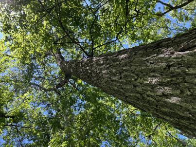 | | 2024 | COLLECTED | 06/05/2024 | Near southeast edge of Kasota Lake approximately 9.0 miles east, southeast of Willmar, T119N R34W SE 1/4 NE 1/4 Sec. 36 and also Robbins Island Park in Wilmar, T119N R35W Sec. 11. | 45.07399600, -94.88484100 | 352 | Deciduous woods | Wild material | Ulmus thomasii (Rock elm) is an underutilized tree species both in conservation and in the urban landscape. Described by Charles Sprague Sargent (first director for the Arnold Arborteum) as "heavy, hard, very strong and tough, closely grained, and susceptible of receiving a beautiful polish". Historically noted for a variety of uses in woodworking including furniture, heavy agricultural implements, timber frame buildings, pianos, hockey sticks, and hand tools. Ulmus thomasii is extremely drought tolerant, adaptable to very calcareous soils, and compared to U. americana or U. rubra has a very conservative growth rate requiring minimal attention in regards to pruning. Rock elm naturally tends to develop into a nice structural specimen in the landscape, unlike other fast growing cultivars in the nursery trade needing frequent attention. Rock elm has very fissured bark and is well known for maintaining a strong central leader resulting in a very attractive, pyramidal form. Despite many literature sources stating that "wings" on the stems are a key identifiying characteristic, this trait is not reliable and many genotypes may completely lack "wings" on the stems. While growth habit and morphology of dormant buds (very pointy) are good traits to help aid in identification, fruits are the best way to confirm identity. Fruits are densly pubescent, often described as "inflated" and generally reach maturity a couple weeks after Ulmus rubra and Ulmus americana. U. thomasii inflorescences are rather distinguishable from other Ulmus in being pendulous. Fruits are extremely prized treats for many birds, where fruits are often "robbed" prior to full maturity. Fruits are also highly prized by many other animals such as mice, squirrels, chipmunks, turkeys, etc. and are generally consumed within hours after fruit abscission. The native range of U. thomasii is concentrated in the northeastern United States and into Canada with disjunct populations documented in northwestern Missouri and northwestern Arkansas (Little, E. L. Jr. 1971). In the 1895 Silva of North America (vol. 7) it was stated that, “The value of the wood of the Rock Elm threatens its extinction and most of the large trees have already been cut.” Today, while rock elm is rather rare, especially in areas near the edges of its range, many states list the species as endangered or threatened warranting preservation efforts. Genetics of this accession would be representative of the species northwestern edge of its native range. Majority of specimens noted did not have characteristic "wings" on the stems and measured approximately 20" DBH or more with a few specimens nearing 30". Heights estimated between 70-90'. Rock elm in this area could be classified as locally abundant. | 2167953 | Ames 36251 |
| 105 | W6 61942 | OR080-109 | Elymus glaucus Buckley | Oregon, United States | W6 |  | | 2024 | | | | | | | Wild material | Forested roadside | 2168347 | W6 61942 |
| 106 | W6 61976 | OR930A-17 | Chamaenerion angustifolium (L.) Scop. subsp. angustifolium | Oregon, United States | W6 |  | | 2024 | | | | | | | Wild material | Flowers pink purple 4 lobed stigma 8 stamens | 2168428 | W6 61976 |
| 107 | W6 61977 | OR930A-19 | Chamaenerion angustifolium (L.) Scop. subsp. angustifolium | Oregon, United States | W6 |  | | 2024 | | | | | | | Wild material | Flowers pink purple 4 lobed stigma 8 stamens | 2168376 | W6 61977 |
| 108 | W6 61978 | OR930A-20 | Prunella vulgaris L. | Oregon, United States | W6 |  | | 2024 | | | | | | | Wild material | Flowers in bracteate terminal spikes corolla purple | 2168377 | W6 61978 |
| 109 | WLP 3432 | RM2023-001 | Rhododendron minus Michx. | Georgia, United States | NA | | | 2024 | COLLECTED | 10/21/2023 | Plants growing along Patterson Gap Road. | 34.96995500, -83.47722800 | 1005 | Plants growing in part shade to sun in an upland, very dry and rocky, mostly deciduous habitat. The site is steeply sloped, underlain by rock, with rocky outcrops. Slope: 15 to 65 percent. Aspect: Variable. The underlying geology of this area is Quartzite/Mica Schist, primarily of Precambrian-Paleozoic origin. (Source: USGS North Carolina Geologic Map Data.) The primary soil type in the collection area is classified as Ashe Series that is stony and very steep. The Ashe series consists of moderately deep, somewhat excessively drained soils on gently sloping to very steep ridges and side slopes of the Blue Ridge. They formed in residuum that is affected by soil creep in the upper part, and weathered from felsic or mafic igneous and high-grade metamorphic rocks such as granite, hornblende gneiss, granodiorite, biotite gneiss, and high-grade metagraywacke. Slope ranges from 2 to 95 percent. The surface layer to 5cm deep is comprised of moderately decomposed organic matter and leaves, twigs, and roots. Layers to 70cm deep range from very dark grayish brown to brown sandy loam with weak medium and coarse granular structure that is friable. A few fine flakes of mica can be found and these soils are very strongly acid. (Source: NRCS Web Soil Survey.) | Wild material | | 2166141 | WLP 3432 |
| 110 | WLP 3434 | RM2023-003 | Hydrangea arborescens L. | Georgia, United States | NA | | | 2024 | COLLECTED | 10/21/2023 | Plants growing along Patterson Gap Road. | 34.97369800, -83.46276600 | 809 | Plants growing in part shade in a very dry and rocky, mostly deciduous habitat. Slope: 25 percent. Aspect: variable. The underlying geology of this area is Biotite Gneiss, primarily of Precambrian-Paleozoic origin. (Source: USGS North Carolina Geologic Map Data.) The primary soil type in the collection area is classified as Porters Series which is stony and steep. The Porters series consists of deep, well drained, moderately permeable soils on cool, north- to east-facing or shaded ridges and side slopes in the Southern Blue Ridge mountains. These soils formed in residuum, affected by soil creep in the upper part, that has weathered from felsic to mafic, high-grade metamorphic and igneous rocks such as granite, gneiss, hornblende gneiss, mica gneiss, and amphibolite. Slope ranges from 2 to 95 percent. The surface layer to 18cm deep is very dark grayish brown loam; moderate fine and medium granular structure; very friable; many fine roots; few fine mica flakes; slightly acid. From 18 to 90 cm soil range from brown loam with weak fine and medium subangular blocky structure, few mica flakes, and few medium gneiss and quartz fragments that is moderately acid to sandy loam with gneiss saprolite with quartz, weathered feldspar, hornblende, mica and other minerals that is slightly acid and grades into hard rock. (Source: NRCS Web Soil Survey.) | Wild material | | 2166143 | WLP 3434 |
| 111 | NA 88836 | RJL-RM2023FLAL-010 | Leucothoe axillaris (Lam.) D. Don | Florida, United States | NA | | | 2023 | COLLECTED | 12/08/2023 | Along Gin/Camp Road at the bridge over Thomas Creek on the east side of the road. | 30.75018700, -87.23492900 | 21 | Growing in shade of the moist to wet habitat along Thomas Creek. Plants receive regular moisture and are occasionally flooded in this habitat. Slope: N/A. Aspect: N/A. The underlying geology of this area is the Citronelle Formation of Pliocene origin and consists of gray to orange, often mottled, unconsolidated to poorly consolidated, very fine to very coarse, poorly sorted, clean to clayey sands. It contains significant amounts of clay, silt and gravel which may occur as beds and lenses and may vary considerably over short distances. Limonite nodules and limonite-cemented beds are common. (Source: USGS Florida Geologic Map Data.) The surface soil profile of this area is primarily Bibb-Kinston series association. Bibb series soils are coarse-loamy, sandy, acid soils that are poorly drained. They are soils of flood plains and streams subject to frequent flooding. These are found in association with Kinston series soils that are fine-loamy, sandy, acid soils of flood plains and stream subject to frequent flooding. The Bibb-Kinston association ranges from 1-1.5 meters thick and is strongly acid. (Source: NRCS Web Soil Survey.) | Wild material | | 2165666 | NA 88836 |
| 112 | NA 88838 | RJL-RM2023FLAL-012 | Ilex opaca Aiton | Florida, United States | NA | | | 2023 | COLLECTED | 12/08/2023 | North side of Sid Hayes Road approximately 65 m southeast of the junction with Watson Road. | 30.83277400, -87.24324500 | 32 | Growing in shade, part shade and light shade in dry mesic to moist, occasionally wet, habitats along the edge of the road and in the woodland interior. This species is remarkably adaptable. The only drawback to the range of habitats is that in deep shade, very few fruit can be found, presumably because there is far less flower production and/or fewer pollinators. Slope: 0 to 3 percent. Aspect: South. The underlying geology of this area is the Citronelle Formation of Pliocene origin and consists of gray to orange, often mottled, unconsolidated to poorly consolidated, very fine to very coarse, poorly sorted, clean to clayey sands. It contains significant amounts of clay, silt and gravel which may occur as beds and lenses and may vary considerably over short distances. Limonite nodules and limonite-cemented beds are common. (Source: USGS Florida Geologic Map Data.) The surface soil profile of this area is Dothan Series fine sandy loam soils (5 to 8 percent slopes). The Dothan Series consists of very deep, well drained soils that formed in thick beds of unconsolidated, medium to fine-textured marine sediments. Dothan soils are on interfluves. The surface 0-33 cm is characterized by sandy-loam, well-drained soils that are strongly acid. From 33-200 cm they are characterized by sandy clay loam soils that are more moisture retentive and strongly acid. (Source: NRCS Web Soil Survey.) | Wild material | | 2165668 | NA 88838 |
| 113 | NA 88820 | TJK2023AL-005 | Hydrangea arborescens L. | Alabama, United States | NA | | | 2023 | COLLECTED | 12/07/2023 | Between Monroe County Route 1 and Tom Hayles Road. | 31.40575900, -87.54924000 | 22 | In woodlands on limestone outcrop. While the upper area of slopes is covered by a thin soil layer, the exposed limestone rock outcrop on the northwestern edge of this area is a low competition niche for plants like the Hydrangea to gain a foothold. Slope: 60% (plus). Aspect: Northwest. Elevation: 72 feet. | Wild material | | 2165649 | NA 88820 |
| 114 | NA 88821 | TJK2023AL-006 | Hydrangea quercifolia W. Bartram | Alabama, United States | NA | | | 2023 | COLLECTED | 12/07/2023 | Between Monroe County Route 1 and Tom Hayles Road. | 31.40580000, -87.54890000 | 22 | In woodlands on limestone outcrop. While the upper area of slopes is covered by a thin soil layer, the exposed limestone rock outcrop on the northwestern edge of this area is a low competition niche for plants like the Hydrangea to gain a foothold. Slope: 60% (plus). Aspect: Northwest. Elevation: 72 feet. | Wild material | | 2165650 | NA 88821 |
| 115 | NA 88689 | RJL2023NJ-002 | Kalmia latifolia L. | New Jersey, United States | NA | | | 2023 | COLLECTED | 11/10/2023 | Franklin Township: Piney Hollow Preservation Area (the site is owned by Franklin Township). Plants accessed by foot along trails throughout property. | 39.57400900, -74.93602400 | 32 | Plants growing in shade to part-shade of a mesic to mesic-dry woodland habitat that is mostly deciduous, but also includes pine overstory. Slope: N/A. Aspect: N/A. Soils: The underlying geology of this area is of Middle Miocene, Serravallian origin and characterized as an Cohansey Formation. It is comprised of sand, white to yellow with local gravel and clay. Locally stained red or orange brown by iron oxides and (or) cemented into large blocks of ironstone. Unweathered clay is typically dark gray, but commonly weathers white where interbedded with thin beds of ironstone. Unit is a complex of interfingering marine and nonmarine facies. Sand is typically medium grained and moderately sorted although it ranges from fine to very coarse grained and from poorly to well sorted. Sand consists of quartz and siliceous rock fragments. Some beds are locally micaceous. In general, the sand is crossbedded, although the style of crossbedding varies significantly with the paleoenvironment. Trough crossbedding predominates, especially in the nonmarine channel fill deposits, and the scale of the crossbeds varies from small to large. Maximum thickness in the map area is about 60 m; however, thickness is difficult to determine because of the irregular basal contact and extensive post-depositional erosion. There is as much as 18 m of relief along the basal contact. The basal contact is sharp, undulatory, and directly overlain by a thin gravel bed. The Cohansey Formation unconformably overlies the Kirkwood Formation and is found in channels cut down into the Kirkwood. Where the Kirkwood consists of sandy, light-colored sediments, the basal contact of the Cohansey is drawn below crossbedded sediments. Where the Kirkwood consists of dark-colored silty beds, the basal contact is drawn between light-colored Cohansey sediments and the underlying dark-colored sediments. The Cohansey was markedly thinned because of erosion prior to deposition of overlying units in the western and southern parts of the southern sheet. The unit has been extensively eroded and stripped from large areas of the New Jersey Coastal Plain, particularly in the central sheet where outliers are common. In spite of its widespread nature, the Cohansey is poorly exposed because of its loose sandy composition, which causes it to erode easily. (Source: USGS New Jersey Geologic Map Data.) The primary soil type in the location of this collection is classified as Downer loamy sand, 0 to 5 percent slopes, Northern Coastal Plain. Downer Series soils are very deep, well-drained soils that are coarse-loamy, siliceous, semiactive, mesic Typic Hapludults. The upper strata of Downer Series from 0 to 25 cm is dark grayish brown, brown loamy sand that is dry with weak fine granular structure. It is very friable and strongly acid. Lower strata from 25 to 76 cm are yellowish brown single grain, loose loamy sand with few extremely weakly cemented masses of oxidized iron in the lower part. This layer is very strongly acid. (Source: NRCS Web Soil Survey.) | Wild material | | 2159117 | NA 88689 |
| 116 | NA 88693 | RJL2023NJ-006 | Clethra alnifolia L. | New Jersey, United States | NA | | | 2023 | COLLECTED | 11/10/2023 | Franklin Township: Piney Hollow Preservation Area (the site is owned by Franklin Township). Plants accessed by foot along trails throughout property. | 39.57319800, -74.92908900 | 29 | Plants growing in shade to part-shade over a wide range of habitats from mesic to mesic-dry as well as moist to wetland habitats. The woodlands are mostly deciduous, but also include occasional pine overstory. Slope: N/A. Aspect: N/A. The underlying geology of this area is of Middle Miocene, Serravallian origin and characterized as an Cohansey Formation. It is comprised of sand, white to yellow with local gravel and clay. Locally stained red or orange brown by iron oxides and (or) cemented into large blocks of ironstone. Unweathered clay is typically dark gray, but commonly weathers white where interbedded with thin beds of ironstone. Unit is a complex of interfingering marine and nonmarine facies. Sand is typically medium grained and moderately sorted although it ranges from fine to very coarse grained and from poorly to well sorted. Sand consists of quartz and siliceous rock fragments. Some beds are locally micaceous. In general, the sand is crossbedded, although the style of crossbedding varies significantly with the paleoenvironment. Trough crossbedding predominates, especially in the nonmarine channel fill deposits, and the scale of the crossbeds varies from small to large. Maximum thickness in the map area is about 60 m; however, thickness is difficult to determine because of the irregular basal contact and extensive post-depositional erosion. There is as much as 18 m of relief along the basal contact. The basal contact is sharp, undulatory, and directly overlain by a thin gravel bed. The Cohansey Formation unconformably overlies the Kirkwood Formation and is found in channels cut down into the Kirkwood. Where the Kirkwood consists of sandy, light-colored sediments, the basal contact of the Cohansey is drawn below crossbedded sediments. Where the Kirkwood consists of dark-colored silty beds, the basal contact is drawn between light-colored Cohansey sediments and the underlying dark-colored sediments. The Cohansey was markedly thinned because of erosion prior to deposition of overlying units in the western and southern parts of the southern sheet. The unit has been extensively eroded and stripped from large areas of the New Jersey Coastal Plain, particularly in the central sheet where outliers are common. In spite of its widespread nature, the Cohansey is poorly exposed because of its loose sandy composition, which causes it to erode easily. (Source: USGS New Jersey Geologic Map Data.) The primary soil types in the area of this collection is classified as Atsion sand, 0 to 2 percent slopes, Northern Tidewater Area and Downer loamy sand, 0 to 5 percent slopes, Northern Coastal Plain. Atsion Series soils are very deep, poorly drained with moderate to rapid permeability above 70 cm and slower beneath. They are classified as sandy, siliceous, mesic Aeric Alaquods. The upper stratum from 0 to 25 cm is dark gray sand, dry, single grained and lose with many fine roots. It is extremely acid. Lower strata are light gray to dark brown with small percentages of rounded quartzose pebbles and are extremely acid. Downer Series soils are very deep, well-drained soils that are coarse-loamy, siliceous, semiactive, mesic Typic Hapludults. The upper stratum of Downer Series from 0 to 25 cm is dark grayish brown, brown loamy sand that is dry with weak fine granular structure. It is very friable and strongly acid. Lower strata from 25 to 76 cm are yellowish brown single grain, loose loamy sand with few extremely weakly cemented masses of oxidized iron in the lower part. This layer is very strongly acid. (Source: NRCS Web Soil Survey.) | Wild material | | 2159121 | NA 88693 |
| 117 | NA 88694 | RJL2023NJ-007 | Spiraea tomentosa L. | New Jersey, United States | NA | | | 2023 | COLLECTED | 11/10/2023 | Franklin Township: Piney Hollow Preservation Area (the site is owned by Franklin Township). Plants accessed by foot along trails throughout property. | 39.57318200, -74.92673700 | 28 | Plants growing in part-shade to sun along the edges of McCarthys Lakes in moist-mesic to wet areas dominated by herbaceous plants. Slope: N/A. Aspect: N/A. | Wild material | | 2159122 | NA 88694 |
| 118 | NA 88695 | RJL2023NJ-008 | Aronia arbutifolia (L.) Pers. | New Jersey, United States | NA | | | 2023 | COLLECTED | 11/10/2023 | Franklin Township: Piney Hollow Preservation Area (the site is owned by Franklin Township). Plants accessed by foot along trails throughout property. | 39.57262400, -74.92606900 | 28 | Plants growing in part-shade to sun along the edges of McCarthys Lakes and in the understory of a mixed deciduous and evergreen forest in moist-mesic to wet conditions. Slope: N/A. Aspect: N/A. | Wild material | | 2159123 | NA 88695 |
| 119 | NA 88697 | RJL2023NCSC-002 | Ilex amelanchier M. A. Curtis ex Chapm. | North Carolina, United States | NA | | | 2023 | COLLECTED | 11/12/2023 | Goose Pond Bay (Nature Conservancy-owned site): wetlands on the south side of McNeil Road approximately 0.64 kilometers west of junction with McIntosh Road. | 34.88254100, -79.09915700 | 60 | Plants are growing in part-shade to sun of a Carolina Bay habitat with seasonally moist to wet, acidic conditions. Slope: N/A. Aspect: N/A. The underlying geology of this area is of Cretaceous origin and characterized as Black Creek Formation. The formation is comprised of clay that is gray to black and lignitic. It contains thin beds and laminae of fine-grained micaceous sand and thick lenses of cross-bedded sand. This formation has glauconitic, fossiliferous clayey sand lenses in the upper part. (Source: USGS North Carolina Geologic Map Data.) The primary soil type in the collection area is classified as McColl loam soil. The McColl Series consists of poorly drained, slowly permeable soils that are shallow or moderately deep to a fragipan and very deep to bedrock. They formed in loamy sediments in oval depressions on the Coastal Plain. The soils are nearly level or concave. Runoff is frequently ponded. Slopes are less than 2 percent. These soils are strongly acid. (Source: NRCS Web Soil Survey.) | Wild material | | 2159125 | NA 88697 |
| 120 | NA 88704 | RJL2023NCSC-009 | Rhododendron viscosum (L.) Torr. | North Carolina, United States | NA | | | 2023 | COLLECTED | 11/13/2023 | Sandhills Game Land: wetlands and moist depressions along Hoffman Road, Scotland County Road 1328, | 34.95510000, -79.51769700 | 112 | Plants are growing in sun in an acidic wetland habitat rich in sphagnum and other wetland species. The habitat is moist to wet year-round and periodically has surface runoff occurring; even so, this habitat can become quite dry during seasonal periods without rainfall. Slope: 2 to 3 percent. Aspect: Northeast. The underlying geology of this area is of Tertiary origin and characterized as Pinehurst Formation. It is comprised of medium- to coarse-grained sand as well as cross-bedding and rhythmic bands of clayey sand that are unconsolidated. (Source: USGS North Carolina Geologic Map Data.) The primary soil type in the collection area is classified as Pelion Loamy Sand (2 to 6 percent slopes). The Pelion Loamy Sand series consists of very deep, moderately well-drained marine deposits, fluviomarine deposits, and sand sheets. Permeability is moderately slow or slow. Surface layers 0-25 cm deep are comprised of loamy sand with a weak fine granular structure and are very friable. Deeper horizons are comprised of sandy loam, sandy clay loam, or clay loam in the upper part and includes sandy clay or clay in the deepest part. Soils are extremely acid to strongly acid. (Source: NRCS Web Soil Survey.) | Wild material | | 2159132 | NA 88704 |
| 121 | NA 88705 | RJL2023NCSC-010 | Zenobia pulverulenta (W. Bartram ex Willd.) Pollard | North Carolina, United States | NA | | | 2023 | COLLECTED | 11/13/2023 | Sandhills Game Land: wetlands and moist depressions along Hoffman Road, Scotland County Road 1328, | 34.95510000, -79.51769700 | 112 | Plants are growing in part-shade to sun in an acidic wetland habitat rich in sphagnum and other obligate wetland species. The habitat is moist to wet year-round and periodically has surface runoff occurring; even so, this habitat can become quite dry during seasonal periods without rainfall. Slope: 2 to 3 percent. Aspect: Northeast. The underlying geology of this area is of Tertiary origin and characterized as Pinehurst Formation. It is comprised of medium- to coarse-grained sand as well as cross-bedding and rhythmic bands of clayey sand that are unconsolidated. (Source: USGS North Carolina Geologic Map Data.) The primary soil type in the collection area is classified as Pelion Loamy Sand (2 to 6 percent slopes). The Pelion Loamy Sand series consists of very deep, moderately well-drained marine deposits, fluviomarine deposits, and sand sheets. Permeability is moderately slow or slow. Surface layers 0-25 cm deep are comprised of loamy sand with a weak fine granular structure and are very friable. Deeper horizons are comprised of sandy loam, sandy clay loam, or clay loam in the upper part and includes sandy clay or clay in the deepest part. Soils are extremely acid to strongly acid. (Source: NRCS Web Soil Survey.) | Wild material | | 2159133 | NA 88705 |
| 122 | NA 88718 | RJL2023NCSC-023 | Ilex decidua Walter | South Carolina, United States | NA | | | 2023 | COLLECTED | 11/15/2023 | Waccamaw National Wildlife Refuge: U.S. Highway 701, Yauhannah Landing on the east side of the Great Pee Dee River. Plants growing in low woods on the north side of the landing. | 33.66208900, -79.15305000 | 2 | Plants growing in shade to part-shade of a moist to wet woodland habitat that is mostly deciduous and evergreen. Portions of the woodland have depressions with year-round standing water. Slope: N/A. Aspect: N/A. The underlying geology of this area is of Quaternary origin and characterized as Alluvial Valley Swamp. This formation is unconformable on all underlying units. It is composed of fluvial sand and gravel at base, grading upwards into fine sands and silts, and local occasional peat. May be overrun with recent sediments from forest cutting and agriculture. (Source: USGS South Carolina Geologic Map Data.) The primary soil type in this collection area is classified as Johnston Series loam. The Johnson Series consists of very deep, very poorly drained coarse-loamy, siliceous, active, acid, thermic Cumulic Humaquepts. The upper 0-75 cm is black, mucky loam that is friable and very strongly acid. The lower stratum to 1.75 m is dark gray, loamy fine sand, single grained, loose and very strongly acid. (Source: NRCS Web Soil Survey.) | Wild material | | 2159146 | NA 88718 |
| 123 | NA 88671 | RJL2023PA-005 | Rhododendron maximum L. | Pennsylvania, United States | NA | | | 2023 | COLLECTED | 10/16/2023 | Appalachian National Scenic Trail: Pulpit Rock and Pinnacle Loop. Rocky woodlands along Furnace Creek as well as steep rocky slopes above Pulpit Rock Reservoir associated with the Pulpit Rock and Pinnacle Loop Trail. | 40.59226100, -75.94588800 | 301 | Well-drained and very rocky dry deciduous woodlands in part shade to full shade. Slope: 0-30%. Aspect: variable. The underlying geology of this area is of Silurian origin and characterized as the Shawangunk Formation. It is characterized by light- to dark-gray, fine- to very coarse-grained sandstone and conglomerate containing thin shale interbeds. Includes four members, in descending order: Tammany--conglomerate and sandstone; Lizard Creek--sandstone and red or green shale; Minsi--sandstone and conglomerate; Weiders--conglomerate. Tammany and Lizard Creek Members together are approximately equivalent to Clinton Group to the west; Minsi and Weiders Members together are equivalent to Tuscarora Formation to the west. (Source: USGS Pennsylvania Geologic Map Data). The primary soil type in the collection area is classified as Hazleton Series. The Hazleton series consists of deep and very deep, well drained soils formed in residuum of acid gray, brown or red sandstone on uplands. Slope ranges from 0 to 80 percent. Permeability is moderately rapid to rapid. Solum thickness ranges from 60 to 120 centimeters. Depth to lithic contact ranges from 1 to 2 meters. Rock fragments of angular sandstone, dominantly less than 25 cm in size, range from 5 to 70 percent in individual horizons. Boulders, stones, flags and channers cover about 5 to 60 percent of the surface of some pedons. Reaction ranges from strongly acid through extremely acid throughout. (Source: NRCS Web Soil Survey). | Wild material | | 2159062 | NA 88671 |
| 124 | NA 88672 | RJL2023PA-006 | Rhododendron periclymenoides (Michx.) Shinners | Pennsylvania, United States | NA | | | 2023 | COLLECTED | 10/16/2023 | Appalachian National Scenic Trail: Pulpit Rock and Pinnacle Loop. Rocky woodland edges above Furnace Creek around Pulpit Rock and Pinnacle Loop Trail. | 40.58668200, -75.94269600 | 247 | Well-drained and very rocky dry deciduous woodlands in part shade to full shade. Slope: 10%. Aspect: East. The underlying geology of this area is of Silurian origin and characterized as the Shawangunk Formation. It is characterized by light- to dark-gray, fine- to very coarse-grained sandstone and conglomerate containing thin shale interbeds. Includes four members, in descending order: Tammany--conglomerate and sandstone; Lizard Creek--sandstone and red or green shale; Minsi--sandstone and conglomerate; Weiders--conglomerate. Tammany and Lizard Creek Members together are approximately equivalent to Clinton Group to the west; Minsi and Weiders Members together are equivalent to Tuscarora Formation to the west. (Source: USGS Pennsylvania Geologic Map Data). The primary soil type in the collection area is classified as Hazleton Series. The Hazleton series consists of deep and very deep, well drained soils formed in residuum of acid gray, brown or red sandstone on uplands. Slope ranges from 0 to 80 percent. Permeability is moderately rapid to rapid. Solum thickness ranges from 60 to 120 centimeters. Depth to lithic contact ranges from 1 to 2 meters. Rock fragments of angular sandstone, dominantly less than 25 cm in size, range from 5 to 70 percent in individual horizons. Boulders, stones, flags and channers cover about 5 to 60 percent of the surface of some pedons. Reaction ranges from strongly acid through extremely acid throughout. (Source: NRCS Web Soil Survey). | Wild material | | 2159063 | NA 88672 |
| 125 | NA 88673 | RJL2023PA-007 | Rhododendron pilosum (Michx.) Craven | Pennsylvania, United States | NA | | | 2023 | COLLECTED | 10/25/2023 | Ned Smith Center for Art and Nature. | 40.53367300, -76.92715700 | 147 | Well-drained and very rocky, dry slopes above 10-50 meters above Wiconisco Creek in mixed deciduous and evergreen woodlands in part shade to full shade. Slope: 10-40%. Aspect: North. The underlying geology of this area is of Mississippian origin and characterized as the Pocono Formation. It is comprised of light-gray to buff or light-olive-gray, medium-grained, crossbedded sandstone and minor siltstone; commonly conglomeratic at base and in middle; medial conglomerate, where present, is used to divide into Mount Carbon and Beckville Members; equivalent to Burgoon Sandstone of Allegheny Plateau. (Source: USGS Pennsylvania Geologic Map Data). The primary soil type in the collection area is classified as Laidig Series. The Laidig series consists of very deep, well drained soils formed in colluvium from sandstone, siltstone, and some shale. They are gently sloping to very steep soils on benches and foot slopes. Permeability is moderate or moderately rapid above the fragipan and moderately slow or slow in the fragipan. Slope ranges from 0 to 55 percent. Solum thickness ranges from 1.25 to 2.0 meters or more. Depth to the fragipan ranges from 0.75 to 1.25 meters. The particle-size control section averages less than 35 percent rock fragments. Rock fragments range from 5 to 50 percent in individual subhorizons of the A, E, BE, BA and Bt horizons; 15 to 70 percent in individual subhorizons of the Btx horizon; and 20 to 70 percent in the C horizon. Rock fragments are mostly sandstone but include siltstone and shale. Rock fragments include channers, cobbles, flagstones, and stones. Soils range from extremely acid through strongly acid throughout. (Source: NRCS Web Soil Survey). | Wild material | | 2159064 | NA 88673 |
| 126 | NA 88674 | RJL2023PA-008 | Kalmia latifolia L. | Pennsylvania, United States | NA | | | 2023 | COLLECTED | 10/25/2023 | Ned Smith Center for Art and Nature. | 40.53463500, -76.92616300 | 130 | Well-drained and very rocky, dry slopes above 10-50 meters above Wiconisco Creek in mixed deciduous and evergreen woodlands in part shade to full shade. Slope: 10-40%. Aspect: North. The underlying geology of this area is of Mississippian origin and characterized as the Pocono Formation. It is comprised of light-gray to buff or light-olive-gray, medium-grained, crossbedded sandstone and minor siltstone; commonly conglomeratic at base and in middle; medial conglomerate, where present, is used to divide into Mount Carbon and Beckville Members; equivalent to Burgoon Sandstone of Allegheny Plateau. (Source: USGS Pennsylvania Geologic Map Data). The primary soil type in the collection area is classified as Laidig Series. The Laidig series consists of very deep, well drained soils formed in colluvium from sandstone, siltstone, and some shale. They are gently sloping to very steep soils on benches and foot slopes. Permeability is moderate or moderately rapid above the fragipan and moderately slow or slow in the fragipan. Slope ranges from 0 to 55 percent. Solum thickness ranges from 1.25 to 2.0 meters or more. Depth to the fragipan ranges from 0.75 to 1.25 meters. The particle-size control section averages less than 35 percent rock fragments. Rock fragments range from 5 to 50 percent in individual subhorizons of the A, E, BE, BA and Bt horizons; 15 to 70 percent in individual subhorizons of the Btx horizon; and 20 to 70 percent in the C horizon. Rock fragments are mostly sandstone but include siltstone and shale. Rock fragments include channers, cobbles, flagstones, and stones. Soils range from extremely acid through strongly acid throughout. (Source: NRCS Web Soil Survey). | Wild material | | 2159065 | NA 88674 |
| 127 | NA 88675 | RJL2023PA-009 | Viburnum acerifolium L. | Pennsylvania, United States | NA | | | 2023 | COLLECTED | 10/25/2023 | Ned Smith Center for Art and Nature. | 40.53539200, -76.92313500 | 136 | Well-drained and very rocky dry deciduous woodlands in part shade to full shade. Slope: 10-30%. Aspect: North. The underlying geology of this area is of Mississippian origin and characterized as the Pocono Formation. It is comprised of light-gray to buff or light-olive-gray, medium-grained, crossbedded sandstone and minor siltstone; commonly conglomeratic at base and in middle; medial conglomerate, where present, is used to divide into Mount Carbon and Beckville Members; equivalent to Burgoon Sandstone of Allegheny Plateau. (Source: USGS Pennsylvania Geologic Map Data). The primary soil type in the collection area is classified as Laidig Series. The Laidig series consists of very deep, well drained soils formed in colluvium from sandstone, siltstone, and some shale. They are gently sloping to very steep soils on benches and foot slopes. Permeability is moderate or moderately rapid above the fragipan and moderately slow or slow in the fragipan. Slope ranges from 0 to 55 percent. Solum thickness ranges from 1.25 to 2.0 meters or more. Depth to the fragipan ranges from 0.75 to 1.25 meters. The particle-size control section averages less than 35 percent rock fragments. Rock fragments range from 5 to 50 percent in individual subhorizons of the A, E, BE, BA and Bt horizons; 15 to 70 percent in individual subhorizons of the Btx horizon; and 20 to 70 percent in the C horizon. Rock fragments are mostly sandstone but include siltstone and shale. Rock fragments include channers, cobbles, flagstones, and stones. Soils range from extremely acid through strongly acid throughout. (Source: NRCS Web Soil Survey). | Wild material | | 2159066 | NA 88675 |
| 128 | NA 88676 | RJL2023PA-010 | Staphylea trifolia L. | Pennsylvania, United States | NA | | | 2023 | COLLECTED | 10/25/2023 | Seed collected along the Appalachian National Scenic Trail, accessed from the Duncannon Entrance. | 40.38132600, -77.02965700 | 103 | Well-drained and very rocky deciduous woodlands where soil has accumulated in part shade to full shade. Slope: 0-30%. Aspect: variable. The underlying geology of this area is of Devonian origin and characterized as the Duncannon Member of Catskill Formation. It is characterized by grayish-red sandstone, siltstone, and mudstone in fining-upward cycles; conglomerate occurs at base of some cycles. The sandstones which comprise the Duncannon Member are fine to very coarse grained and grayish red to grayish red-purple in color. The Duncannon Member is known to be crossbedded to planar bedded in beds anywhere from 3 to 9 meters thick. Conglomerates have been spotted at the base of the Duncannon Member. The Duncannon Member is poorly exposed in most areas except along the Lehigh River. The conglomerate portion of this member has been known to form ridges and ledges with thicknesses approaching 228 meters. (Source: USGS Pennsylvania Geologic Map Data). The primary soil type in the collection area is classified as Hazleton Series. The Hazleton series consists of deep and very deep, well drained soils formed in residuum of acid gray, brown or red sandstone on uplands. Slope ranges from 0 to 80 percent. Permeability is moderately rapid to rapid. Solum thickness ranges from 60 to 120 centimeters. Depth to lithic contact ranges from 1 to 2 meters. Rock fragments of angular sandstone, dominantly less than 25 cm in size, range from 5 to 70 percent in individual horizons. Boulders, stones, flags and channers cover about 5 to 60 percent of the surface of some pedons. Reaction ranges from strongly acid through extremely acid throughout. (Source: NRCS Web Soil Survey). | Wild material | | 2159067 | NA 88676 |
| 129 | NA 88677 | RJL2023PA-011 | Hydrangea arborescens L. | Pennsylvania, United States | NA | | | 2023 | COLLECTED | 10/25/2023 | Seed collected along the Appalachian National Scenic Trail, accessed from the Duncannon Entrance. | 40.37735300, -77.03997300 | 239 | Well-drained and very rocky dry deciduous woodlands in part shade to full shade. Slope: 20-50%. Aspect: Northwest. The underlying geology of this area is of Devonian origin and characterized as the Duncannon Member of Catskill Formation. It is characterized by grayish-red sandstone, siltstone, and mudstone in fining-upward cycles; conglomerate occurs at base of some cycles. The sandstones which comprise the Duncannon Member are fine to very coarse grained and grayish red to grayish red-purple in color. The Duncannon Member is known to be crossbedded to planar bedded in beds anywhere from 3 to 9 meters thick. Conglomerates have been spotted at the base of the Duncannon Member. The Duncannon Member is poorly exposed in most areas except along the Lehigh River. The conglomerate portion of this member has been known to form ridges and ledges with thicknesses approaching 228 meters. (Source: USGS Pennsylvania Geologic Map Data). The primary soil type in the collection area is classified as Dystrochrepts, boulder soils. These soils are characterized by coarse-silty loess over residuum weathered from sedimentary rock and located on steep ridges along the upper third of the mountainflank. These soils are comprised of cobbles, stones or boulders (9%), well-drained, and approximately 1 meter or less to lithic bedrock. (Source: NRCS Web Soil Survey). | Wild material | | 2159068 | NA 88677 |
| 130 | NA 88678 | RJL2023PA-012 | Viburnum acerifolium L. | Pennsylvania, United States | NA | | | 2023 | COLLECTED | 10/27/2023 | Slopes on the east side of Creek Road above the North Branch of White Clay Creek. | 39.78552600, -75.80251900 | 90 | Well-drained mesic-dry to rocky dry deciduous woodlands in part shade to full shade. Slope: 15-35%. Aspect: West to northwest. The underlying geology of this area includes two formations. The first and primary formation is Lower Paleozoic Glenarm Wissahickon Formation, lithologically similar to oligoclase-mica schist of the Wissahickon Formation, but also includes lenticular amphibolite bodies having ocean-floor basalt chemistry. The second formation is Lower Paleozoic Mafic Gneiss Formation that is dark and medium grained. It includes rocks of probable sedimentary origin. (Sources: USGS Pennsylvania Geologic Map Data). The primary soil type in the collection area is classified as Manor Series. The Manor Series consists of well-drained residuum weathered from micaceous schist. Soils in the upper pedon (0-33 cm) are very dark grayish brown loam with strong fine granular structure; also, very friable with fine mica flakes and strongly acid. Lower pedon soils (34-56 cm) are strong brown, sandy loams. They have weak medium sub-angular blocky structure, are friable with many fine and a few medium mica flakes; this pedon is very strongly acid. (Source: NRCS Web Soil Survey). | Wild material | | 2159069 | NA 88678 |
| 131 | NA 88679 | RJL2023PA-013 | Rhododendron prinophyllum (Small) Millais | Pennsylvania, United States | NA | | | 2023 | COLLECTED | 10/30/2023 | Southwest side of Dutch Mountain Road north of Pine Marsh Creek in Pennsylvania State Game Lands Number 66. | 41.48201500, -76.27286000 | 602 | Moist, well-drained habitat with good organic matter in part shade on a wooded slope next to the road. Slope: 5-10%. Aspect: East. The underlying geology of this area is of Mississippian origin and characterized as the Burgoon Formation. It is comprised of buff, medium-grained, cross bedded sandstone that includes shale and coal. In some places, it contains conglomerate at base as well as occasionally contains plant fossils; equivalent to Pocono Formation of Ridge and Valley province. (Source: USGS Pennsylvania Geologic Map Data). The primary soil type in the collection area is classified as Wellsboro Series. The Wellsboro Series consists of very deep, moderately well- and somewhat poorly-drained soils formed in till derived from red sandstone, siltstone, and shale. Slope ranges from 0 to 50 percent. Saturated hydraulic conductivity is moderately high or high in the mineral surface layer, subsurface layer, and upper part of the subsoil; and low or moderately low in the lower part of the subsoil (fragipan) and the substratum. Solum thickness is greater than 102 cm. Depth to the fragipan ranges from 36 to 76 cm. Depth to bedrock is 152 cm or more. Rock fragments of subangular and rounded sandstone, siltstone or shale range from 5 to 40 percent in the A and B horizons, and from 15 to 50 percent in the Bx and C horizons. Typically, rock fragments average about 5 to 25 percent by volume above the fragipan and 15 to 40 percent by volume in and below the fragipan. Reaction commonly ranges from very strongly acid through moderately acid. (Source: NRCS Web Soil Survey). | Wild material | | 2159070 | NA 88679 |
| 132 | NA 88681 | RJL2023PA-015 | Ilex verticillata (L.) A. Gray | Pennsylvania, United States | NA | | | 2023 | COLLECTED | 10/30/2023 | Wetlands near Phillips Creek: seed collected from plants on the north and south (further east) side of Pennsylvania Route 188 approximately 6.9 kilometers east of the junction with Pennsylvania Route 487. | 41.30353100, -76.22452800 | 381 | Boggy to moist habitats associated with wetlands of Phillips Creek in shade to full sun next to the road. Slope: 0%. Aspect: various. The underlying geology of this area is of Devonian origin and characterized as the Catskill Formation. It is comprised of grayish-red sandstone, siltstone, shale, and mudstone; units of gray sandstone occur in upper part; lithologies in upper part arranged in fining-upward cycles. In the Altoona area, the Catskill Formation is mapped as the Duncannon, Sherman Creek, and Irish Valley Members, which are described under "Central and Eastern Pennsylvania" provinces. (Source: USGS Pennsylvania Geologic Map Data). The primary soil type in the collection area is classified as Wellsboro Series. The Wellsboro Series consists of very deep, moderately well- and somewhat poorly-drained soils formed in till derived from red sandstone, siltstone, and shale. Slope ranges from 0 to 50 percent. Saturated hydraulic conductivity is moderately high or high in the mineral surface layer, subsurface layer, and upper part of the subsoil; and low or moderately low in the lower part of the subsoil (fragipan) and the substratum. Solum thickness is greater than 102 cm. Depth to the fragipan ranges from 36 to 76 cm. Depth to bedrock is 152 cm or more. Rock fragments of subangular and rounded sandstone, siltstone or shale range from 5 to 40 percent in the A and B horizons, and from 15 to 50 percent in the Bx and C horizons. Typically, rock fragments average about 5 to 25 percent by volume above the fragipan and 15 to 40 percent by volume in and below the fragipan. Reaction commonly ranges from very strongly acid through moderately acid. (Source: NRCS Web Soil Survey). | Wild material | | 2159072 | NA 88681 |
| 133 | Ames 36185 | APS/BP/2023/076/286 | Betula populifolia Marshall | Indiana, United States | NC7 |  | | 2023 | COLLECTED | 11/02/2023 | Indiana Dunes State Park just 3.40 miles northeast of Chesterton, T37N R5W NE 1/4 SE 1/4 SW 1/4 Sec. 18 | 41.65352700, -87.03831500 | 186 | Low depressions with some standing water. Woodland edge. | Wild material | Represents a disjunct population in northwest Indiana and the extreme western edge of the species native range. Trees sampled in nature averaging 30-45' in height with trunks ranging from 3" up to 8" DBH. Bark dull-white to grey. Typically multi-stemmed trunks. Leaves with acuminate tips and branches with typically one male catkin at terminal end of branches, but occassionally two male catkins. | 2159042 | Ames 36185 |
| 134 | NA 88667 | RJL2023PA-004 | Viburnum acerifolium L. | Pennsylvania, United States | NA | | | 2023 | | | | | | | Wild material | | 2158816 | NA 88667 |
| 135 | NA 88666 | RJL2023PA-003 | Hamamelis virginiana L. | Pennsylvania, United States | NA | | | 2023 | COLLECTED | 10/01/2023 | Collected primarily along the woodland edge along Northside Road on Pennsylvania State Gamelands No. 43 as well as a few on nearby roads. | 40.17974200, -75.76790700 | 176 | Plants were growing in mesic well-drained conditions on moderately sloping sites of a deciduous upland forest. This species grows well in shade to part-sun. Most abundant fruit development is found where plants are exposed to sunlight for a portion of the day. Slope: 15%. Aspect: North-northwest. The underlying geology of this area is of Precambrian origin and characterized as the Graphitic Felsic Gneiss. This includes Pickering Gneiss and small areas of marble; dominantly quartz and feldspar with varying amounts of graphite and various metamorphic minerals; medium grained, light to dark gray and greenish gray; sedimentary origin. (Source: USGS Pennsylvania Geologic Map Data.) The primary soil type in the area of this collection is classified as Gladstone Gravelly Loam Series (8 to 15 percent slopes). The Gladstone Series consists of very deep, well drained soils formed in residuum and colluvium from granitic gneiss. Saturated hydraulic conductivity is moderately high to high. Solum thickness ranges from 75 to 125 cm. Depth to granitic gneiss bedrock is 1.6 meters or more. The bedrock may be strongly weathered in the upper part. Gravel content ranges from 5 to 35 percent throughout the solum, and 10 to 40 percent in the C horizons. Fragments, larger than 3 inches in diameter, range from 0 to 20 percent by volume in the surface layer and 0 to 10 percent in the subsoil and substratum layers. Reaction is strongly or very strongly acid throughout the soil, unless limed. Areas that have been limed range to moderately acid in the upper part of the profile. (Source: NRCS Web Soil Survey.) | Wild material | | 2158815 | NA 88666 |
| 136 | NA 88665 | RJL2023PA-002 | Ilex verticillata (L.) A. Gray | Pennsylvania, United States | NA | | | 2023 | COLLECTED | 10/01/2023 | Woodlands along Pine Creek near the Harmonyville Road bridge. | 40.18764500, -75.76732200 | 141 | Moist to mucky, wet woodland conditions along Pine Creek. Much of the site is very wet due to recent rains; though, earlier in the year, the soils were only moist. Plants grow in both well-drained mesic conditions as well as seasonally wet conditions. They do not grow in standing water anywhere in this location. Plants in this population are found mostly in the shade and partial shade of deciduous trees; there are occasional gaps that offer higher light conditions as well. Slope: 0-2%. Aspect: N/A. The underlying geology of this area is of Precambrian origin and characterized as the Graphitic Felsic Gneiss. This includes Pickering Gneiss and small areas of marble; dominantly quartz and feldspar with varying amounts of graphite and various metamorphic minerals; medium grained, light to dark gray and greenish gray; sedimentary origin. (Source: USGS Pennsylvania Geologic Map Data). The primary soil type in the area of this collection is classified as Hatboro Silt Loam Series. The Hatboro Series consists of very deep and poorly drained soils formed in alluvium derived from metamorphic and crystalline rock. They are on flood plains. Slopes range from 0 to 3 percent. Saturated hydraulic conductivity is moderately high to high. Solum thickness ranges from 50 to 150 cm. Depth to bedrock ranges from 1.5 to 3 meters or more. Organic carbon decreases irregularly with depth or is greater than 0.2 percent directly above any strongly contrasting C horizon. The depth to strongly contrasting sand and gravel is more than 100 cm or the transition is greater than 12.5 cm. Content of gravel ranges from 0 to 10 percent in the solum and from 0 to 80 percent in the C horizon. Mica flakes are common in the solum, and the C horizon contains thin lenses of mica. Reaction ranges from very strongly acid through neutral to a depth of 75 cm and from moderately acid through slightly acid below 75 cm. (Source: NRCS Web Soil Survey.) | Wild material | | 2158814 | NA 88665 |
| 137 | NA 88664 | RJL2023PA-001 | Viburnum acerifolium L. | Pennsylvania, United States | NA | | | 2023 | COLLECTED | 10/01/2023 | Seed collected from plants growing along a two-mile stretch of Harmonyville Road on the woodland edge next to the road. [Note: latitude and longitude were collected at the location of the largest seed collection.] | 40.18482200, -75.78145100 | 158 | Plants were growing in well-drained and rocky mesic-dry woodlands from part shade along the road edge to full shade in the understory of the woodlands. Slope: 2-10%. Aspect: Variable. The underlying geology of this area is of Triassic origin and characterized as the Stockton Formation. It is characterized by light-gray to buff, coarse-grained, arkosic sandstone; includes reddish-brown to grayish-purple sandstone, siltstone, and mudstone. (Source: USGS Pennsylvania Geologic Map Data.) The primary soil type in the area of this collection is classified as Edgemont Channery Sandy Loam Series (8 to 25 percent slopes), extremely stony. The Edgemont Series consists of deep and very deep, well drained soils formed in the weathered residuum of quartzitic rocks. They have moderately high to high saturated hydraulic conductivity. Slopes range from 0 to 70 percent. Solum thickness ranges from 50 to 10 cm. Depth to bedrock ranges from about 1.5 to 2.2 meters. Kaolinite is the dominant mineral in the clay fraction with detectable amounts of illite, vermiculite, montmorillonite, chlorite and interstratified clays. Gravel, channers, and stone size fragments of quartzite and quartz are present throughout the profile. Rock fragments range from 5 to 40 percent in the horizons of the solum and from 10 to 90 percent in the C horizon. Reaction ranges from extremely acid to strongly acid throughout. (Source: NRCS Web Soil Survey.) | Wild material | | 2158813 | NA 88664 |
| 138 | NA 88663 | TJK2023FL-017 | Rhododendron austrinum (Small) Rehder | Florida, United States | NA | | | 2023 | COLLECTED | 09/17/2023 | Lower Yellow River, below the Old Land Place. | 30.55513000, -86.94659000 | 0 | An area with very nice Pink R. austrinum. Elevation: 0. Slope: 0 percent. Aspect: South-southwest. | Wild material | | 2158797 | NA 88663 |
| 139 | OPGC 8793 | OR110-1114 | Anaphalis margaritacea (L.) Benth. & Hook. f. | Oregon, United States | OPGC | | | 2023 | | | | | | | Wild material | | 2142745 | OPGC 8793 |
| 140 | W6 60984 | CA330-217 | Elymus glaucus Buckley | California, United States | W6 |  | | 2023 | | | | | | | Wild material | Dense spike inflorescence, lemma with long awns, glume with short awn, perennial grass, dark green culm with large strap like leaves. | 2142623 | W6 60984 |
| 141 | W6 60985 | CA330-218 | Bromus carinatus Hook. & Arn. | California, United States | W6 | 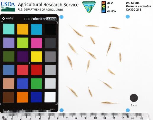 | | 2023 | | | | | | | Wild material | Tall grass, panicle inflorescence, lemma in herringbone arrangement, lemmas opposite arrangement, green broad leaves | 2142624 | W6 60985 |
| 142 | W6 61298 | OR110-1111 | Holodiscus discolor (Pursh) Maxim. | Oregon, United States | W6 |  | | 2023 | | | | | | | Wild material | | 2142742 | W6 61298 |
| 143 | Ames 36017 | AS/GD/2023/002/212 | Gymnocladus dioicus (L.) K. Koch | Wisconsin, United States | NC7 |  | | 2023 | | | | | | | Wild material | Kentucky coffeetree in Wisconsin is rather rare. The Wisconsin Natural Heritage Inventory Program currently (2023) lists this taxon in Wisconsin as a species of concern with a state rank of S2 (Imperiled in Wisconsin due to a restricted range, few populations or occurrences, steep declines, severe threats, or other factors.) This accession represents genetics from a localized population with a near equal porportion of male and female specimens. While there are other known locations along the Wisconsin River, this population is producing seeds. The other known locations represent single clones that are distant enough from other existing clones that prevent the transfer of pollen and thus lack the ability to produce seed or will rarely produce. | 2141550 | Ames 36017 |
| 144 | NA 88599 | RJL2023NC-001 | Ilex decidua Walter | North Carolina, United States | NA | | | 2023 | COLLECTED | 02/18/2023 | Plants growing along a fenceline on a hillside about 10 meters from Interstate 85 (south bound) and approximately 0.65 kilometers south of the North Carolina-Virginia border. | 36.53904800, -78.18822500 | 86 | The plant was growing on the upper shoulder of a slope about 7 meters above the highway in part-shade to sun of an upland, well-drained, dry mesic somewhat disturbed site on the fenceline boundary of Interstate 85 (south bound). The area was originally cleared of all vegetation and now, many years later, native and non-native plant species have aggressively recolonized the area. This early successional habitat is dominated by Juniperus virginiana and Liquidambar styraciflua, as well as, non-native species such as Ligustrum sinense, Lonicera japonica, and Ailanthus altissima. The underlying geology of this area is of Permian/Pennsylvanian origin and characterized as the Granitic Rock Formation. It is characterized by megacrystic to equigranular components and includs Castalia and Wilton intrusives. | Wild material | | 2141480 | NA 88599 |
| 145 | NA 88534 | RJLSEUS2022-005 | Leucothoe axillaris (Lam.) D. Don | North Carolina, United States | NA | | | 2023 | COLLECTED | 12/06/2022 | Plants growing in the wetlands and other moist depressions along Scotland Co. Road 1328 in the Sandhills Game Lands. Common at this site This plant is somewhat sporadic in its distribution, but abundant in places where it is found in moist to wet habitats of bottomlands in this area. | 34.88545200, -79.44597500 | 71 | Plants are growing in shade of acid bottomland wet woodlands along streams or adjoining wetlands with constant sub-surface moisture. It prefers areas above the permanently wet conditions and can go through periods of drought.
Soils: The underlying geology of this area is of Cretaceous origin and characterized as Mittendorf Formation. The formation is comprised of sand, sandstone, and mudstone, gray to pale gray with an orange cast, and mottled. Clay balls and iron-cemented concretions are common, beds are laterally discontinuous, and cross-bedding is common.
Source: USGS North Carolina Geologic Map Data (https://mrdata.usgs.gov/geology/state/sgmc-unit.php?unit=NCKm%3B11)
The primary soil type in the collection area is classified as Paxville loam soil (0 to 1 percent slopes, rarely flooded). The Paxville Series consists of very deep, very poorly drained soils. Permeability is moderate. These nearly level soils formed from marine deposits, fluviomarine deposits, and alluvium. They range from 0 to 2 percent slopes. The frequency of flooding is typically very rare to brief periods. The upper strata, 0-1.2 meters, is comprised of fine sandy loam that is friable, non-sticky and non-plastic; it does contain small amounts clean quartz grains and is strongly acid. Lower strata to a depth of 2.5 meters are similar with fine sandy loam in the upper portions and progressively more sandy loam to fine sand in the deepest strata.
Source: NRCS Web Soil Survey (https://websoilsurvey.sc.egov.usda.gov/App/WebSoilSurvey.aspx) | Wild material | | 2140763 | NA 88534 |
| 146 | NA 88536 | RJLSEUS2022-007 | Leucothoe axillaris (Lam.) D. Don | South Carolina, United States | NA | | | 2023 | COLLECTED | 12/07/2022 | Plants growing along the margin of Sandy Run and its associated wetland on the north side of Paradise Rd. (State Rd. S-15-403). Common at this site and throughout the drainage of Sandy Run and its associated wetland. | 32.83900000, -80.81014400 | 27 | Plants are growing in part-shade to shade of a moist mesic woodland habitat along a small wetland associated with Sandy Run. Plants are located in an area that occasionally floods, but is not permanently wet.
Soils: The underlying geology of this area is of Pliocene origin and characterized as Bear Bluff Formation. This formation is considered one of the older coastal terrace sequences in the Carolinas. Bear Bluff Formation consists of gray to cream, fossiliferous, coarse-grained calcareous sand, and sandy limestone. It is typically 3-40 meters thick.
Source: USGS South Carolina Geologic Map Data (https://mrdata.usgs.gov/geology/state/sgmc-unit.php?unit=SCTbb%3B1)
The primary soil type in the collection area is classified as Pickney Loamy Sand soils. The Pickney Series consists of very deep, very poorly drained soils. Permeability is rapid. These nearly level soils have negligible runoff and were formed by marine or fluvial sediments in the lower coastal plain on flats, depressions, stream terraces, and flood plains. Slopes range from 0 to 2 percent. The soils of this series are loamy fine sand that is very friable and extremely acid in the upper 0-25 cm. The lower strata are similar, while the lower strata from 0.8-2 meters are comprised of fine sand.
Source: NRCS Web Soil Survey (https://websoilsurvey.sc.egov.usda.gov/App/WebSoilSurvey.aspx) | Wild material | Leucothoe axillaris/fontanesiana | 2140764 | NA 88536 |
| 147 | NA 88537 | RJLSEUS2022-009 | Rhododendron canescens (Michx.) Sweet | South Carolina, United States | NA | | | 2023 | COLLECTED | 12/07/2022 | Plants growing along the upper margin of a small stream and associated wetland on the northwest side of Paradise Rd. (State Rd. S-15-403). Common at this site and throughout the drainage of the stream and associated wetland. | 32.83868100, -80.81099200 | 28 | Plants are growing in part-shade to shade of a moist mesic woodland habitat along a small wetland associated with a creek. Plants are located in an area that occasionally floods, but is not permanently wet.
Soils: The underlying geology of this area is of Pliocene origin and characterized as Bear Bluff Formation. This formation is considered one of the older coastal terrace sequences in the Carolinas. Bear Bluff Formation consists of gray to cream, fossiliferous, coarse-grained calcareous sand, and sandy limestone. It is typically 3-4 meters thick.
Source: USGS South Carolina Geologic Map Data (https://mrdata.usgs.gov/geology/state/sgmc-unit.php?unit=SCTbb%3B1)
The primary soil type in the collection area is classified as Pickney Loamy Sand soils. The Pickney Series consists of very deep, very poorly drained soils. Permeability is rapid. These nearly level soils have negligible runoff and were formed by marine or fluvial sediments in the lower coastal plain on flats, depressions, stream terraces, and flood plains. Slopes range from 0 to 2 percent. The soils of this series are loamy fine sand that is very friable and extremely acid in the upper 0-25 cm. The lower strata are similar, while the lower strata from 0.8-2 meters are comprised of fine sand.
Source: NRCS Web Soil Survey (https://websoilsurvey.sc.egov.usda.gov/App/WebSoilSurvey.aspx) | Wild material | | 2140765 | NA 88537 |
| 148 | NA 88538 | RJLSEUS2022-010 | Ilex glabra (L.) A. Gray | Georgia, United States | NA | | | 2023 | COLLECTED | 12/08/2022 | Junction of Old Whitley Rd & Irwinville Hwy (GA 125). | 31.64601300, -83.33625800 | 111 | Low woods, a remnant woodland/low moist habitat between agricultural fields. Growing in part shade to shade of a moist mesic (occasionally temporarily wet) mixed evergreen and deciduous woodland along the edge where light conditions are slightly higher. The underlying geology of this area is of Neogene origin and characterized as Neogene Undifferentiated. It includes poorly sorted clayey sand and gravel deposited in a fluvial environment in South Carolina but becoming more fluvio-marine in Georgia. This unit is characterized by in situ weathered feldspar and an abundance of quartzite gravel and cobbles. (Source: USGS Georgia Geologic Map Data). The primary soil types in the collection area are classified as Alapaha Loamy Sand soil (0 to 2 percent slopes, occasionally flooded). The Alapaha Series consists of very deep, poorly drained, moderately slow to slowly permeable soils in small drainageways, flats, seepage areas, and depressions. They formed in sandy and loamy marine deposits of the Southern Coastal Plain. Slopes range from 0 to 5 percent. This series consists of deep, somewhat poorly drained soils. Permeability is very slow. These nearly level to gently sloping soils formed in clayey alluvium on flood plains of streams that drain uplands of the Southern Coastal Plain. The water table ranges from 0-25 cm below the surface and the soils are strongly acid. (Source: NRCS Web Soil Survey). | Wild material | | 2140816 | NA 88538 |
| 149 | NA 88574 | RJLSEUS2022-047 | Rhododendron austrinum (Small) Rehder | Florida, United States | NA | | | 2023 | COLLECTED | 12/15/2022 | Plants are growing along a several mile stretch of the Yellow River and accessed by boat via the Yellow River Boat Ramp on the east side of Florida State Hwy 87. The species is found frequently along several miles of the Yellow River. | 30.58133600, -86.89953900 | 2 | Plants are found growing in part-shade to shade along areas of the river where natural levies, 1-3 meters tall, have formed, depositing sand and organic matter. The plants grow well-above normal flow of the river in well-drained to dry conditions. Even so, they are periodically subjected to inundation from floodwaters.
Soils: The underlying geology of this area is classified as Alluvium, of Pleistocene/Holocene origin and consists of undifferentiated Quaternary sediments of varying thickness including siliciclastics, organics and freshwater carbonates. The siliciclastics are light gray, tan, brown to black, unconsolidated to poorly consolidated, clean to clayey, silty, unfossiliferous, variably organic-bearing sands to blue green to olive green, poorly to moderately consolidated, sandy, silty clays. Organics occur as plant debris, roots, disseminated organic matrix and beds of peat. Freshwater carbonates, often referred to as marls in the literature, are scattered.
Source: USGS Florida Geologic Map Data (https://mrdata.usgs.gov/geology/state/state.php?state=fl)
The surface soil profile of this area is primarily Bibb-Kinston Series Association. Bibb Series soils are coarse-loamy, sandy, acid soils that are poorly drained. They are soils of flood plains and streams subject to frequent flooding. These are found in association with Kinston Series soils that are fine-loamy, sandy, acid soils of flood plains and stream subject to frequent flooding. The Bibb-Kinston Association ranges from 1-1.5 meters thick and is strongly acid.
Source: Soil Survey of Santa Rosa County and NRCS Web Soil Survey (https://www.nrcs.usda.gov/Internet/FSE_MANUSCRIPTS/florida/FL113/0/SantaRosa.pdf and https://websoilsurvey.sc.egov.usda.gov/App/WebSoilSurvey.aspx) | Wild material | Yellow River Pink Austrinum | 2140792 | NA 88574 |
| 150 | NA 88506 | RJL2022TX-001 | Itea virginica L. | Texas, United States | NA | | | 2022 | COLLECTED | 10/31/2022 | Plants growing at Shangri La Botanical Gardens and Nature Center, Orange, TX along Adams Bayou, accessed via internal service roads. Plant is infrequent at this site. | 30.10322000, -93.76271700 | 1 | Plants are growing in shade to part-shade of a Taxodium distichum-Nyssa aquatica dominated forested swampland associated with Adams Bayou in a wet low-lying area that is frequently inundated.
Soils: The underlying geology of this area is of Quaternary to Late Pleistocene origin and comprised of the Beaumont Formation. This formation is yellowish- to brownish-gray, locally reddish orange with very fine to fine quartz sand, silt, and minor fine gravel, intermixed and interbedded. It also includes stream channel, point-bar, cravasse-splay, and natural levee ridge deposits, and clayey fill in abandoned channels. Channel fill is dark brown to brownish-gray with laminated clay and silt that is organic-rich. Includes marine delta-front sand, lagoonal clay, and near-shore marine sand beneath and landward of bays along the coast. Depth of this unconsolidated outwash ranges from 3-100 meters thick.
Source: USGS Texas Geologic Map Data (https://mrdata.usgs.gov/geology/state/sgmc-unit.php?unit=TXQbs%3B0)
The primary soil types in the collection area are classified as Cowmarsh series. The Cowmarsh series consists of very deep, very poorly drained soils that formed in mucky silty clayey alluvial deposits of Holocene age. These depressional soils are oxbows and relict channels of rivers where flooding and ponding is frequent. Slope ranges from 0 to 1 percent but mainly less than 1 percent. very poorly drained. Runoff is negligible. Frequently flooded for very long periods from February through May and surface remains saturated for very long periods once flood waters have receded.
Source: NRCS Web Soil Survey (https://websoilsurvey.sc.egov.usda.gov/App/WebSoilSurvey.aspx) | Wild material | | 2139813 | NA 88506 |
| 151 | NA 88507 | RJL2022TX-002 | Fraxinus caroliniana Mill. | Texas, United States | NA | | | 2022 | COLLECTED | 10/31/2022 | Plants growing at Shangri La Botanical Gardens and Nature Center, Orange, TX along Adams Bayou, accessed via internal service roads. Plant is relatively common along Adams Bayou but scattered. | 30.09989400, -93.75239700 | 1 | Plants are growing in part-shade to sun of a Taxodium distichum-Nyssa aquatica dominated forested swampland associated with Adams Bayou in a wet low-lying area that is frequently inundated. While found as an occasional understory element, it is more common on the edge of the swampland forest where there are high light conditions.
Soils: The underlying geology of this area is of Quaternary to Late Pleistocene origin and comprised of the Beaumont Formation. This formation is yellowish- to brownish-gray, locally reddish orange with very fine to fine quartz sand, silt, and minor fine gravel, intermixed and interbedded. It also includes stream channel, point-bar, cravasse-splay, and natural levee ridge deposits, and clayey fill in abandoned channels. Channel fill is dark brown to brownish-gray with laminated clay and silt that is organic-rich. Includes marine delta-front sand, lagoonal clay, and near-shore marine sand beneath and landward of bays along the coast. Depth of this unconsolidated outwash ranges from 3-100 meters thick.
Source: USGS Texas Geologic Map Data (https://mrdata.usgs.gov/geology/state/sgmc-unit.php?unit=TXQbs%3B0)
The primary soil types in the collection area are classified as Cowmarsh series. The Cowmarsh series consists of very deep, very poorly drained soils that formed in mucky silty clayey alluvial deposits of Holocene age. These depressional soils are oxbows and relict channels of rivers where flooding and ponding is frequent. Slope ranges from 0 to 1 percent but mainly less than 1 percent. very poorly drained. Runoff is negligible. Frequently flooded for very long periods from February through May and surface remains saturated for very long periods once flood waters have receded.
Source: NRCS Web Soil Survey (https://websoilsurvey.sc.egov.usda.gov/App/WebSoilSurvey.aspx) | Wild material | | 2139814 | NA 88507 |
| 152 | NA 88508 | RJL2022TX-003 | Morella cerifera (L.) Small | Texas, United States | NA | | | 2022 | COLLECTED | 10/31/2022 | Plants growing at Shangri La Botanical Gardens and Nature Center Orange, TX along Adams Bayou, accessed via internal service roads. Plant is relatively common along Adams Bayou but scattered in the understory. | 30.10035500, -93.75288700 | 1 | Plants are growing in part-shade to shade of a Taxodium distichum-Nyssa aquatica dominated forested swampland associated with Adams Bayou in a wet low-lying area that is frequently inundated.
Soils: The underlying geology of this area is of Quaternary to Late Pleistocene origin and comprised of the Beaumont Formation. This formation is yellowish- to brownish-gray, locally reddish orange with very fine to fine quartz sand, silt, and minor fine gravel, intermixed and interbedded. It also includes stream channel, point-bar, cravasse-splay, and natural levee ridge deposits, and clayey fill in abandoned channels. Channel fill is dark brown to brownish-gray with laminated clay and silt that is organic-rich. Includes marine delta-front sand, lagoonal clay, and near-shore marine sand beneath and landward of bays along the coast. Depth of this unconsolidated outwash ranges from 3-100 meters thick.
Source: USGS Texas Geologic Map Data (https://mrdata.usgs.gov/geology/state/sgmc-unit.php?unit=TXQbs%3B0)
The primary soil types in the collection area are classified as Cowmarsh series. The Cowmarsh series consists of very deep, very poorly drained soils that formed in mucky silty clayey alluvial deposits of Holocene age. These depressional soils are oxbows and relict channels of rivers where flooding and ponding is frequent. Slope ranges from 0 to 1 percent but mainly less than 1 percent. very poorly drained. Runoff is negligible. Frequently flooded for very long periods from February through May and surface remains saturated for very long periods once flood waters have receded.
Source: NRCS Web Soil Survey (https://websoilsurvey.sc.egov.usda.gov/App/WebSoilSurvey.aspx) | Wild material | | 2139815 | NA 88508 |
| 153 | NA 88513 | RJL2022TX-008 | Cephalanthus occidentalis L. | Texas, United States | NA | | | 2022 | COLLECTED | 11/01/2022 | Plants growing in moist sites on the north and south side of Clarktown Road approximately 0.5 kilometers west of Texas State Hwy 87 in Sabine National Forest. Plant is relatively common in the moist-wet and seasonally wet locations; absent elsewhere. | 31.17294500, -93.74133900 | 92 | Plants are growing in part-shade to part-sun in moist-wet areas with low competition. The area generally retains moisture throughout the growing season.
Soils: The underlying geology of this area is of Oligocene origin and characterized as Catahoula Formation. This formation is extensive and deep in Texas, up to 185 meters thick. In the area of the collection the Catahoula Formation is primarily mudstone and sand. The upper 90-150 meters is mudstone that is tuffaceous, and sandy; also, occasionally, with some bentonitic clay.
Source: USGS Texas Geologic Map Data (https://mrdata.usgs.gov/geology/state/sgmc-unit.php?unit=TXQbs%3B0
The primary soil types in the collection area are classified as Mattex-Iulus complex soils. The Mattex series consists of very deep, somewhat poorly drained, slowly permeable, acidic loamy soils. They formed in loamy and clayey alluvium. These are nearly level soils on flood plains. Slopes range from 0 to 1 percent. The Iulus series consists of very deep, moderately well drained, moderately permeable, soils on flood plains. These soils formed in recent alluvium derived from coastal plain sediments, often containing fine sandy elements and are extremely acidic. The slope ranges from 0 to 1 percent.
Source: NRCS Web Soil Survey (https://websoilsurvey.sc.egov.usda.gov/App/WebSoilSurvey.aspx) | Wild material | | 2139820 | NA 88513 |
| 154 | NA 88514 | RJL2022MD-019 | Kalmia latifolia L. | Maryland, United States | NA | | | 2022 | COLLECTED | 11/04/2022 | Plants are growing on both sides of a fire road on Maryland Heights along the edge with Harpers Ferry National Historic Park. This location was accessed from the east where Miller Avenue meets the fire road, approximately 2 kilometers away. There is no vehicular access to the collecting area. Becoming locally uncommon. This local population is likely to be extirpated in the next 20-30 years. This collector has hiked through this area for more than 35 years and seen dramatic changes in the population. When first observed, Kalmia latifolia was a dominant understory shrub on south- to west-facing slopes beneath a mature forest canopy. Over the years, at least one forest fire has significantly reduced the population, along with a continuing increase in deer populations, resulting in catastrophic browse damage. The absence of a mature forest canopy and periods of drought have almost certainly also resulted in decline of this population. While collecting seed from scattered mature plants well above deer browse levels, this collector also noted that there was virtually no recruitment taking place. | 39.32811200, -77.72242400 | 287 | Plants are growing in part-shade to shade of a deciduous upland, very rocky, and dry forest community. Plants are frequently found growing among boulders, rock outcrops, and steep-slope erosional areas, although, not exclusively.
Soils: The underlying geology of this area is of Late Cambrian to Cambrian origin and comprised of Chilhowee Group; Weverton Formation. This includes interbedded white to dark gray, thin-bedded, micaceous, ferruginous, and sericitic quartzites, phyllites, and white, thick-bedded, ledge-making quartzites; some gray to brown ferruginous quartz conglomerate and purple-banded phyllite.
Source: USGS Maryland Geologic Map Data https://mrdata.usgs.gov/geology/state/sgmc-unit.php?unit=MDKp%3B5
The primary soil types in the collection area are classified as Dekalb-Bagtown-Rock outcrop complex, 25 to 65 percent slopes. The Dekalb series consists of moderately deep, excessively drained soils formed in material weathered from gray and brown acid sandstone in places interbedded with shale and graywacke. Slope ranges from 0 to 80 percent. Permeability is rapid. Solum thickness and depth to bedrock range from 50 to 100 cm. Flat, subangular or angular, sandstone fragments, 2.5-25 cm across increase with depth and range from 10-60 percent in individual horizons of the solum and from 50-90 percent or more in the C horizon. The amount of rock fragments typically increases with depth. Cobbly, channery, and very stony phases are common. Reaction ranges from extremely through strongly acid.
Source: NRCS Web Soil Survey (https://websoilsurvey.sc.egov.usda.gov/App/WebSoilSurvey.aspx) | Wild material | | 2139821 | NA 88514 |
| 155 | WLP 2677 | RJL2022NJ-008 | Lyonia ligustrina (L.) DC. | New Jersey, United States | NA | | | 2022 | COLLECTED | 10/24/2022 | Plants growing along Burlington County Road 563, Green Bank Chatsworth Road, on the west side of the road, 16.22 kilometers south of the intersection with New Jersey Hwy 72. Plants are common at this location. | 39.73274000, -74.53449000 | 15 | Plants growing in a depression wetland habitat in full sun. This location seems somewhat historically disturbed by development of cranberry bogs surrounding the wet site.
Soils: The underlying geology of this area is the Cohansey Formation of middle Miocene origin and comprised of sand, white to yellow with local gravel and clay. It is sometimes locally stained red or orange brown by iron oxides and (or) cemented into large blocks of ironstone. Unweathered clay is typically dark gray, but commonly weathers white where it is interbedded with thin beds of ironstone. Sand is typically medium grained and moderately sorted although it ranges from fine to very coarse grained and from poorly to well sorted. Sand consists of quartz and siliceous rock fragments. Some beds are locally micaceous. Maximum thickness in the map area is about 60 meters; however, thickness is difficult to determine because of the irregular basal contact and extensive post-depositional erosion.
Source: USGS New Jersey Geologic Map Data (https://mrdata.usgs.gov/geology/state/sgmc-unit.php?unit=NJTch%3B1)
The primary soil type in the area of this collection is classified as Atsion sand, 0 to 2 percent slopes, Northern Tidewater Area. The area is close and probably overlapping with Lakehurst sand series soil. Atsion series soil is poor to slowly draining and comprised primarily of sandy marine sediments. Surface runoff is slow to very slow. This soil is strongly to extremely acid throughout the profile. This soil is generally 50-100 cm deep.
Source: NRCS Web Soil Survey (https://websoilsurvey.sc.egov.usda.gov/App/WebSoilSurvey.aspx) | Wild material | | 2139668 | WLP 2677 |
| 156 | WLP 2673 | RJL2022NJ-004 | Lyonia mariana (L.) D. Don | New Jersey, United States | NA | | | 2022 | COLLECTED | 10/24/2022 | Plants growing on both sides of Duerer Street approximately 0.37 kilometers southeast of 4th Avenue, Mullica Township, New Jersey. Plants are common but scattered on both sides of the road at this site. | 39.55730700, -74.66376100 | 22 | Plants grow from part shade to full sun throughout the habit from the upper edges of the ditches through the herbaceous grass dominant buffer and all the way to the part shade of the woodland edge. Plants transition through moist/wet conditions in full sun to quite dry conditions in part shade and seem equally adapted.
Soils: The underlying geology of this area is the Cohansey Formation of middle Miocene origin and comprised of sand, white to yellow with local gravel and clay. It is sometimes locally stained red or orange brown by iron oxides and (or) cemented into large blocks of ironstone. Unweathered clay is typically dark gray, but commonly weathers white where it is interbedded with thin beds of ironstone. Sand is typically medium grained and moderately sorted although it ranges from fine to very coarse grained and from poorly to well sorted. Sand consists of quartz and siliceous rock fragments. Some beds are locally micaceous. Maximum thickness in the map area is about 60 meters; however, thickness is difficult to determine because of the irregular basal contact and extensive post-depositional erosion.
Source: USGS New Jersey Geologic Map Data (https://mrdata.usgs.gov/geology/state/sgmc-unit.php?unit=NJTch%3B1)
The primary soil type in the area of this collection is classified as Mullica sandy loam, 0 to 2 percent slopes. These soils are typically coarse-loamy, siliceous, semiactive, and mesic typic humaquepts that are strongly to extremely acidic throughout the profile. The typical solum thickness ranges from 50-150+ cm. These soils are generally considered to be poorly drained.
Source: NRCS Web Soil Survey (https://websoilsurvey.sc.egov.usda.gov/App/WebSoilSurvey.aspx) | Wild material | | 2139664 | WLP 2673 |
| 157 | NA 88500 | RJL2022NJ-002 | Ilex glabra (L.) A. Gray | New Jersey, United States | NA | | | 2022 | COLLECTED | 10/24/2022 | Mullica Township: both sides of Duerer Street, approximately 0.37 kilometers southeast of 4th Avenue. | 39.55885000, -74.66442500 | 21 | Plants growing in shade to almost full sun on compacted seasonally moist to temporarily wet areas of a mixed evergreen and deciduous woodland dominated by Pinus rigida. Vegetation of this area is very much defined by small changes in elevation that go from wet to very dry. Ilex glabra remains abundant throughout, though. Plants are abundant on the edge of the woodlands as well as the understory of the woodlands. Soils: The underlying geology of this area is the Cohansey Formation of middle Miocene origin and comprised of sand, white to yellow with local gravel and clay. It is sometimes locally stained red or orange brown by iron oxides and (or) cemented into large blocks of ironstone. Unweathered clay is typically dark gray, but commonly weathers white where it is interbedded with thin beds of ironstone. Sand is typically medium grained and moderately sorted although it ranges from fine to very coarse grained and from poorly to well sorted. Sand consists of quartz and siliceous rock fragments. Some beds are locally micaceous. Maximum thickness in the map area is about 60 meters; however, thickness is difficult to determine because of the irregular basal contact and extensive post-depositional erosion. (Source: USGS New Jersey Geologic Map Data). The primary soil type in the area of this collection is classified as Mullica sandy loam, 0 to 2 percent slopes. These soils are typically coarse-loamy, siliceous, semiactive, and mesic typic humaquepts that are strongly to extremely acidic throughout the profile. The typical solum thickness ranges from 50-150+ cm. These soils are generally considered to be poorly drained. (Source: NRCS Web Soil Survey). | Wild material | | 2139663 | NA 88500 |
| 158 | NA 89047 | RJL2022PA-015 | Cephalanthus occidentalis L. | Pennsylvania, United States | NA | | | 2022 | COLLECTED | 10/09/2022 | Plants growing in the floodplain of Octoraro Creek near 698 Lees Bridge Road, West Nottingham Township, Pennsylvania on the south side of the road. Plants are locally common and spread out in the floodplain area along the Octoraro Creek. | 39.73540700, -76.09226500 | 60 | Plants of this species are growing in full sun to part shade of a moist to seasonally mucky and wide flood plain area adjacent to Octoraro Creek. The area is dominated by deciduous herbaceous plants, scrambling vines, shrubs and occasional small trees. Much of this wet “meadow” is dominated by aggressive stands of grasses and members of the sedge family.
Soils: The underlying geology of this area is estimated to be of lower Paleozoic origin and comprised of Peters Creek Schist. This is comprised of chlorite-sericite schist containing interbedded quartzite. Interestingly, this area is very close to and may interface with the adjacent formation of Ultramafic Rocks that includes serpentine, steatite, and other products of alteration of peridotites and pyroxenites.
Source: USGS Pennsylvania Geologic Map Data (https://mrdata.usgs.gov/geology/state/sgmc-unit.php?unit=PAPZpc%3B0)
The primary soil types in the collection area are classified as Hatboro Silt Loam which consists of soils formed in alluvium derived from metamorphic and crystalline rock. They are on flood plains. Slopes range from 0 to 3 percent. Hatboro Silt Loam soils are poorly drained and have a high to very high surface runoff index. These soils are subject to periodic stream overflow, which usually occurs during the winter and spring months. The A and B horizons are moderately acidic to neutral, generally to a depth of 1-2 meters; the C horizon below ranges from a depth of 2-3 meters with uniformly acidic soils.
Source: NRCS Web Soil Survey (https://websoilsurvey.sc.egov.usda.gov/App/WebSoilSurvey.aspx) | Wild material | | 2139612 | NA 89047 |
| 159 | NA 89046 | RJL2022PA-014 | Alnus serrulata (Aiton) Willd. | Pennsylvania, United States | NA | | | 2022 | COLLECTED | 10/09/2022 | Plants growing in the floodplain of Octoraro Creek near 698 Lees Bridge Road, West Nottingham Township, Pennsylvania on the south side of the road. Plants are locally common and spread out in the floodplain area along the Octoraro Creek. | 39.73579900, -76.09238300 | 60 | Plants of this species are growing in full sun of a moist to seasonally mucky and wide flood plain area adjacent to Octoraro Creek. The area is dominated by deciduous herbaceous plants, scrambling vines, shrubs and occasional small trees. Much of this wet “meadow” is dominated by aggressive stands of grasses and members of the sedge family.
Soils: The underlying geology of this area is estimated to be of lower Paleozoic origin and comprised of Peters Creek Schist. This is comprised of chlorite-sericite schist containing interbedded quartzite. Interestingly, this area is very close to and may interface with the adjacent formation of Ultramafic Rocks that includes serpentine, steatite, and other products of alteration of peridotites and pyroxenites.
Source: USGS Pennsylvania Geologic Map Data (https://mrdata.usgs.gov/geology/state/sgmc-unit.php?unit=PAPZpc%3B0)
The primary soil types in the collection area are classified as Hatboro Silt Loam which consists of soils formed in alluvium derived from metamorphic and crystalline rock. They are on flood plains. Slopes range from 0 to 3 percent. Hatboro Silt Loam soils are poorly drained and have a high to very high surface runoff index. These soils are subject to periodic stream overflow, which usually occurs during the winter and spring months. The A and B horizons are moderately acidic to neutral, generally to a depth of 1-2 meters; the C horizon below ranges from a depth of 2-3 meters with uniformly acidic soils.
Source: NRCS Web Soil Survey (https://websoilsurvey.sc.egov.usda.gov/App/WebSoilSurvey.aspx) | Wild material | | 2139611 | NA 89046 |
| 160 | NA 89033 | RJL2022MD-010 | Clethra alnifolia L. | Maryland, United States | NA | | | 2022 | COLLECTED | 09/15/2022 | Plants growing in low woodlands at the end of Greenway Avenue near a boat dock that leads to the Pocomoke River, adjacent to Winter Quarters Golf Course, Pocomoke City. Plants common throughout the wetland area as well as mesic edges of the woodlands. | 38.08305100, -75.56527800 | | Plants growing in the flood plain of the Pocomoke River in shade to part sun of a mixed deciduous and evergreen bottomland habitat about 10 meters from the edge of the golf course fairway. The habitat is a mucky swamp edge habitat next to the Pocomoke River, most of which seems wet year-round and grades slightly upslope to more mesic conditions.
The underlying geology of this area is comprised of Quaternary Deposits of Wisconsin to Holocene origin. The composition is primarily undifferentiated gray to buff sand and gravel, gray to brown lignitic silt and clay, occasional boulders, and rare shell beds. Surficial deposits occur as shell-bearing estuarine clays and silts.
Source: USGS Maryland Geologic Map Data https://mrdata.usgs.gov/geology/state/sgmc-unit.php?unit=MDQdu%3B5
The surface soil profile of this habitat is classified as Puckum Muck which is frequently flooded. These highly saturated soils are found in flats, depressions and swales. The soil reaction of Puckum Muck is extremely acid to strongly acid throughout the profile. The depth to bedrock is generally greater than 150 cm. Wood fragments comprise 0-25%, by volume of the Puckum Muck throughout the profile which includes mostly twigs, branches, logs, or stumps and are 1.5-30 cm in diameter. The composition of these highly saturated soils, are classified as muck (sapric soil material) or mucky peat (hemic soil material) throughout most of the upper 150 cm and may contain thin layers of mucky silt loam, silty clay loam, sandy loam and/or sand.
Source: NRCS Web Soil Survey (https://websoilsurvey.sc.egov.usda.gov/App/WebSoilSurvey.aspx) | Wild material | | 2139598 | NA 89033 |
| 161 | NA 89032 | RJL2022MD-009 | Rhododendron viscosum (L.) Torr. | Maryland, United States | NA | | | 2022 | COLLECTED | 09/15/2022 | Plants growing in low woodlands at the end of Greenway Avenue near a boat dock that leads to the Pocomoke River, adjacent to Winter Quarters Golf Course, Pocomoke City. Plants scattered throughout the wetland area. Infrequent, but regularly found. | 38.08235200, -75.56566500 | 1 | Plants growing in the flood plain of the Pocomoke River in part shade to shade of a mixed deciduous and evergreen bottomland habitat about 10 meters from the edge of the golf course fairway. The habitat is a mucky swamp edge habitat next to the Pocomoke River, most of which seems wet year-round.
The underlying geology of this area is comprised of Quaternary Deposits of Wisconsin to Holocene origin. The composition is primarily undifferentiated gray to buff sand and gravel, gray to brown lignitic silt and clay, occasional boulders, and rare shell beds. Surficial deposits occur as shell-bearing estuarine clays and silts.
Source: USGS Maryland Geologic Map Data https://mrdata.usgs.gov/geology/state/sgmc-unit.php?unit=MDQdu%3B5
The surface soil profile of this habitat is classified as Puckum Muck which is frequently flooded. These highly saturated soils are found in flats, depressions and swales. The soil reaction of Puckum Muck is extremely acid to strongly acid throughout the profile. The depth to bedrock is generally greater than 150 cm. Wood fragments comprise 0-25%, by volume of the Puckum Muck throughout the profile which includes mostly twigs, branches, logs, or stumps and are 1.5-30 cm in diameter. The composition of these highly saturated soils, are classified as muck (sapric soil material) or mucky peat (hemic soil material) throughout most of the upper 150 cm and may contain thin layers of mucky silt loam, silty clay loam, sandy loam and/or sand.
Source: NRCS Web Soil Survey (https://websoilsurvey.sc.egov.usda.gov/App/WebSoilSurvey.aspx) | Wild material | | 2139597 | NA 89032 |
| 162 | Ames 35924 | AS/FN/2022/073/204 | Fraxinus nigra Marshall | Wisconsin, United States | NC7 |  | | 2022 | COLLECTED | 09/29/2022 | Chequamegon National Forest, approximately 4.5 miles south-southeast of Clam Lake along County Highway GG and adjacent Forest Service roads, T42N R4W Sec. 21. | 46.10020200, -90.87459600 | 431 | Wet to saturated soils in northern hardwood forest. | Wild material | | 2139687 | Ames 35924 |
| 163 | Ames 35925 | AS/FN/2022/075/206 | Fraxinus nigra Marshall | Wisconsin, United States | NC7 |  | | 2022 | COLLECTED | 09/30/2022 | Approximately 9.3 miles north-northwest of Hayward along State Road 27, Wozny Road, John Waggoner Road and State Road 77. Collected in both Washburn and Sawyer Counties. Coordinates listed refer to the first plant sampled; coordinates for each specimen may be provided upon request. T42N R9W SW 1/4 SW 1/4 Sec. 5. | 46.14354200, -91.52893600 | 384 | Bogs and saturated soils in northern hardwood forest. | Wild material | | 2139688 | Ames 35925 |
| 164 | NA 88481 | RJL2022MD-002 | Kalmia latifolia L. | Maryland, United States | NA | | | 2022 | COLLECTED | 09/04/2022 | Plants growing at Elkton State Forest along roads and woodlands over a distance of approximately 5 kilometers labelled as the address of 717 Irishtown Rd, North East, MD 21901. Kalmia is very common along the unnamed gravel road as well as the understory of the upland woodlands. | 39.58852900, -75.90452900 | 60 | Plants are growing in a mesic to dry, well-drained habitat of mixed deciduous and evergreen woodlands comprised primarily of acid-loving plants. Plants are growing in shade to part shade along the unnamed road as well as the woodlands. The soils in the collection area are generally described as a complex series of fluviomarine deposits. The soils range from a thin loam layer at the surface to varying levels of loam to sandy loam and/or extremely gravelly sandy clay loam strata, depending upon geographical location (ie. Hillslope summits, slopes, footslopes, swales, etc.). The primary soil types in the collection area are classified as Russett-Christiana-Hambrook Complex and/or Sassafras and Croom Soils; though, others may intersect and overlay in specific areas. | Wild material | | 2139360 | NA 88481 |
| 165 | NA 88482 | RJL2022MD-003 | Rhododendron periclymenoides (Michx.) Shinners | Maryland, United States | NA | | | 2022 | COLLECTED | 09/04/2022 | Plants growing at Elkton State Forest along roads and woodlands over a distance of approximately 5 kilometers labelled as the address of 717 Irishtown Rd, North East, MD 21901. Plants are found infrequently and scattered along the unnamed gravel road | 39.58852900, -75.90452900 | 51 | Plants are growing in a mesic to dry, well-drained habitat of mixed deciduous and evergreen woodlands comprised primarily of acid-loving plants. Plants are growing in part shade. The soils in the collection area are generally described as a complex series of fluviomarine deposits. The soils range from a thin loam layer at the surface to varying levels of loam to sandy loam and/or extremely gravelly sandy clay loam strata, depending upon geographical location (ie. Hillslope summits, slopes, footslopes, swales, etc.). The primary soil types in the collection area are classified as Russett-Christiana-Hambrook Complex and/or Sassafras and Croom Soils; though, others may intersect and overlay in specific areas. | Wild material | | 2139361 | NA 88482 |
| 166 | NA 88483 | RJL2022MD-004 | Clethra alnifolia L. | Maryland, United States | NA | | | 2022 | COLLECTED | 09/04/2022 | Plants growing at Elkton State Forest along roads and woodlands over a distance of approximately 5 kilometers labelled as the address of 717 Irishtown Rd, North East, MD 21901. Plants are found regularly but scattered along the unnamed gravel road as well as in open understory of the upland woodlands. | 39.58531200, -75.89566100 | 47 | Plants are growing in a mesic to moist, well-drained habitat of mixed deciduous and evergreen woodlands comprised primarily of acid-loving plants. Plants are growing in part shade and open understory shade. The soils in the collection area are generally described as a complex series of fluviomarine deposits. The soils range from a thin loam layer at the surface to varying levels of loam to sandy loam and/or extremely gravelly sandy clay loam strata, depending upon geographical location (ie. Hillslope summits, slopes, footslopes, swales, etc.). The primary soil types in the collection area are classified as Russett-Christiana-Hambrook Complex and/or Sassafras and Croom Soils; though, others may intersect and overlay in specific areas. | Wild material | | 2139362 | NA 88483 |
| 167 | NA 88484 | RJL2022MD-005 | Aronia melanocarpa (Michx.) Elliott | Maryland, United States | NA | | | 2022 | COLLECTED | 09/04/2022 | Plants growing at Elkton State Forest on Elk Neck Trail #3 (Starkey Lane) labelled as the address of 717 Irishtown Rd, North East, MD 21901. This was the only plant observed during several visits to Elk Neck State Forest during early and mid-summer | 39.58531200, -75.89566100 | 55 | Plants are growing in a mesic to dry, well-drained habitat of mixed deciduous and evergreen woodlands comprised primarily of acid-loving plants. Plants are growing in part shade to part-sun. The soils in the collection area are generally described as a complex series of fluviomarine deposits. The soils range from a thin loam layer at the surface to varying levels of loam to sandy loam and/or extremely gravelly sandy clay loam strata, depending upon geographical location (ie. Hillslope summits, slopes, footslopes, swales, etc.). The primary soil types in the collection area are classified as Russett-Christiana-Hambrook Complex and/or Sassafras and Croom Soils; though, others may intersect and overlay in specific areas.
Source: NRCS Web Soil Survey (https://websoilsurvey.sc.egov.usda.gov/App/WebSoilSurvey.aspx) | Wild material | received as A. prunifolia, on further examination by collector it was determined to be A. melanocarpa | 2139363 | NA 88484 |
| 168 | NA 88485 | RJL2022MD-006 | Hamamelis virginiana L. | Maryland, United States | NA | | | 2022 | COLLECTED | 09/04/2022 | Plants growing at Elkton State Forest on Elk Neck Trail #3 (Starkey Lane) labelled as the address of 717 Irishtown Rd, North East, MD 21901. This species was infrequent throughout most of Elk Neck State Park, but relatively common. | 39.58790000, -75.88853100 | 54 | Plants are growing in a mesic to dry, well-drained habitat of mixed deciduous and evergreen woodlands comprised primarily of acid-loving plants. Plants are growing in part shade to shade. The soils in the collection area are generally described as a complex series of fluviomarine deposits. The soils range from a thin loam layer at the surface to varying levels of loam to sandy loam and/or extremely gravelly sandy clay loam strata, depending upon geographical location (ie. Hillslope summits, slopes, footslopes, swales, etc.). The primary soil types in the collection area are classified as Russett-Christiana-Hambrook Complex and/or Sassafras and Croom Soils; though, others may intersect and overlay in specific areas.
Source: NRCS Web Soil Survey (https://websoilsurvey.sc.egov.usda.gov/App/WebSoilSurvey.aspx) | Wild material | | 2139364 | NA 88485 |
| 169 | NA 88488 | RJL2022PA-004 | Viburnum acerifolium L. | Pennsylvania, United States | NA | | | 2022 | COLLECTED | 09/03/2022 | Plants growing in woodlands on the east side of Shed Road in French Creek State Park. Plants are common and found scattered along the edges of the road and into the woodlands. | 40.21969200, -75.77373600 | 238 | Plants are growing in a mesic to dry, well-drained habitat of upland deciduous forest which is very rocky. The understory layer is generally not as rich due to the rock-laden ground layer. Plants are growing in part shade to shade. The underlying geology of this area is comprised of Hammer Creek Conglomerate, characterized by cobble and pebble quartz conglomerate interbedded with red sandstone.
Source: USGS Pennsylvania Geologic Map Data (https://mrdata.usgs.gov/geology/state/sgmc-unit.php?unit=PATRhc%3B2) The surface soil profile of this area is Joanna Loam (JpD), 8 to 25 percent slopes which is extremely stony. It is represented by residuum weathered from sandstone and/or residuum weathered from conglomerate. Joanna Loam is moderately to well-drained and 1.8 meters to 2.5 meters to the lithic bedrock described above.
Source: NRCS Web Soil Survey (https://websoilsurvey.sc.egov.usda.gov/App/WebSoilSurvey.aspx) | Wild material | | 2139367 | NA 88488 |
| 170 | NA 88489 | RJL2022PA-005 | Kalmia latifolia L. | Pennsylvania, United States | NA | | | 2022 | COLLECTED | 09/10/2022 | Plants are growing on the lands of Hawk Mountain Sanctuary. This species is very common and abundant. It is one of the most dominant understory plants in woodlands. This species is a common understory shrub throughout the entire region in upland dry woodland habitats. | 40.63862000, -75.99071200 | 430 | Plants are growing primarily in shade to part-shade on a dry-mesic to very dry, well-drained upland/montane habitat characterized by upland mixed deciduous and evergreen forest that is very rocky. All of the plants found in this habitat go through periods of drought during the growing season due to the limited litter/soil layer in which moisture can be held. The underlying geology of this area is of Silurian origin and comprised of Shawangunk Formation. This formation is primarily light- to dark-gray, fine- to very coarse-grained sandstone and conglomerate containing thin shale interbeds.
Source: USGS Pennsylvania Geologic Map Data (https://mrdata.usgs.gov/geology/state/sgmc-unit.php?unit=PASs%3B14)
The surface soil profile of this area is the Hazleton series consists of deep and very deep, well drained soils formed in residuum of acid gray, brown or red sandstone on uplands. The matrix includes a considerable accumulation of thin, flat, coarse fragments of sandstone, limestone, or schist with diameters up to 15 cm. Slope ranges from 0-80%. Permeability is moderately rapid to rapid.
Source: NRCS Web Soil Survey (https://websoilsurvey.sc.egov.usda.gov/App/WebSoilSurvey.aspx) | Wild material | | 2139368 | NA 88489 |
| 171 | NA 88490 | RJL2022PA-006 | Ilex montana Torr. & A. Gray | Pennsylvania, United States | NA | | | 2022 | COLLECTED | 09/10/2022 | Hawk Mountain Sanctuary. | 40.64162200, -75.99122600 | 420 | Plants are growing from shade to full sun on a dry-mesic to very dry, well-drained upland/montane habitat characterized by an upland mixed deciduous and evergreen forest that is very rocky. All of the plants found in this habitat go through periods of drought during the growing season due to the limited litter/soil layer in which moisture can be held. The underlying geology of this area is of Silurian origin and comprised of Shawangunk Formation. This formation is primarily light- to dark-gray, fine- to very coarse-grained sandstone and conglomerate containing thin shale interbeds. (Source: USGS Pennsylvania Geologic Map Data). The surface soil profile of this area is the Hazleton series consists of deep and very deep, well drained soils formed in residuum of acid gray, brown or red sandstone on uplands. The matrix includes a considerable accumulation of thin, flat, coarse fragments of sandstone, limestone, or schist with diameters up to 15 cm. Slope ranges from 0-80%. Permeability is moderately rapid to rapid. (Source: NRCS Web Soil Survey). | Wild material | | 2139369 | NA 88490 |
| 172 | NA 88491 | RJL2022PA-007 | Rhododendron maximum L. | Pennsylvania, United States | NA | | | 2022 | COLLECTED | 09/10/2022 | Plants are growing on the lands of Hawk Mountain Sanctuary. This species was common, but generally restricted to steep rocky outcrops. | 40.63813900, -75.98835200 | 420 | Plants are growing from shade to full sun on a dry-mesic to very dry, well-drained upland/montane habitat characterized by an upland mixed deciduous and evergreen forest that is very rocky. Even so, most heavily fruited plants were growing in part shade to almost full sun. All of the plants found in this habitat go through periods of drought during the growing season due to the limited litter/soil layer in which moisture can be held. The underlying geology of this area is of Silurian origin and comprised of Shawangunk Formation. This formation is primarily light- to dark-gray, fine- to very coarse-grained sandstone and conglomerate containing thin shale interbeds.
Source: USGS Pennsylvania Geologic Map Data (https://mrdata.usgs.gov/geology/state/sgmc-unit.php?unit=PASs%3B14)
The surface soil profile of this area is the Hazleton series consists of deep and very deep, well drained soils formed in residuum of acid gray, brown or red sandstone on uplands. The matrix includes a considerable accumulation of thin, flat, coarse fragments of sandstone, limestone, or schist with diameters up to 15 cm. Slope ranges from 0-80%. Permeability is moderately rapid to rapid.
Source: NRCS Web Soil Survey (https://websoilsurvey.sc.egov.usda.gov/App/WebSoilSurvey.aspx) | Wild material | | 2139370 | NA 88491 |
| 173 | NA 88495 | RJL2022PA-011 | Sorbus americana Marshall | Pennsylvania, United States | NA | | | 2022 | COLLECTED | 09/10/2022 | Plants are growing on the lands of Hawk Mountain Sanctuary. This plant is frequent but scattered on the exposed north, northeast, and east-facing steep slopes and ridge areas. | 40.63793500, -75.98778000 | 430 | part sun to full sun on a dry-mesic to very dry, well-drained upland/montane habitat characterized by an upland mixed deciduous and evergreen forest that is very rocky. All of the plants found in this habitat go through periods of drought during the growing season due to the limited litter/soil layer in which moisture can be held.
The underlying geology of this area is of Silurian origin and comprised of Shawangunk Formation. This formation is primarily light- to dark-gray, fine- to very coarse-grained sandstone and conglomerate containing thin shale interbeds.
Source: USGS Pennsylvania Geologic Map Data (https://mrdata.usgs.gov/geology/state/sgmc-unit.php?unit=PASs%3B14)
The surface soil profile of this area is the Hazleton series consists of deep and very deep, well drained soils formed in residuum of acid gray, brown or red sandstone on uplands. The matrix includes a considerable accumulation of thin, flat, coarse fragments of sandstone, limestone, or schist with diameters up to 15 cm. Slope ranges from 0-80%. Permeability is moderately rapid to rapid.
Source: NRCS Web Soil Survey (https://websoilsurvey.sc.egov.usda.gov/App/WebSoilSurvey.aspx) | Wild material | | 2139374 | NA 88495 |
| 174 | Ames 35907 | Oak Creek Canyon | Fraxinus velutina Torr. | Arizona, United States | NC7 | 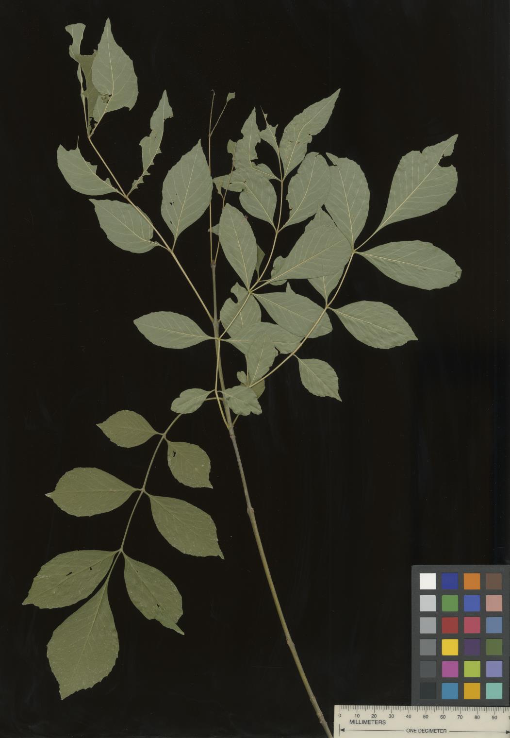 | | 2022 | COLLECTED | 09/02/2022 | Oak Creek Canyon, approximately five miles north-northeast of Sedona in the Coconino National Forest. T18N R6E NE 1/4 NW 1/4 Sec. 21 . | 34.93600300, -111.74436900 | 1464 | Floodplain and riverbanks, growing in gravely soil. | Wild material | Most of the velvet ash in this population are small trees (10-25 feet in height and approximately 5 inches DBH). Variation was noted for leaflet pubescence but with the petioles of all trees in the population being pubescent. | 2139669 | Ames 35907 |
| 175 | WLP 2705 | Eagle Creek | Crataegus wootoniana Eggl. | New Mexico, United States | NA |  | | 2022 | COLLECTED | 09/08/2022 | Eagle Creek, along Upper Eagle Creek Road (past gate to cabins) approximately 1.5 miles northwest of intersection with Ski Run Road. T10S R12E N 1/2 S 1/4 Sec. 35. | 33.40777700, -105.73980900 | 2422 | Canyon bottom above creek. | Wild material | Shrubs to approximately 15 feet in height with a tight clump forming growth habit and arching stems. | 2139678 | WLP 2705 |
| 176 | WLP 2596 | RJL2022FLAL-018 | Viburnum nitidum Aiton | Florida, United States | NA | | | 2022 | COLLECTED | 08/02/2022 | Along Gin/Camp Road at the bridge over Thomas Creek on the east side of the road. | 30.75027700, -87.23473700 | 21 | Growing in part shade on the sandy bench about a meter above the creek in mixed evergreen and deciduous riparian habitat. Plants have ample access to moisture, but are not obligate wetland plants. Fruiting is occurring where increased sunlight is available; however, most plants appear to be middle understory in this habitat. The underlying geology of this area is the Citronelle Formation, of Pliocene origin, and consists of gray to orange, often mottled, unconsolidated to poorly consolidated, very fine to very coarse, poorly sorted, clean to clayey sands. It contains significant amounts of clay, silt and gravel which may occur as beds and lenses and may vary considerably over short distances. Limonite nodules and limonite-cemented beds are common. | Wild material | | 2138706 | WLP 2596 |
| 177 | Ames 35949 | AS/ML/2022/018/149 | Monarda lindheimeri Engelm. & A. Gray | Texas, United States | NC7 |  | | 2022 | COLLECTED | 08/06/2022 | Located approximately 5.47 miles southeast of Navasota on County Road 314 just south of highway 105 (0.4-0.8 miles). | 30.35463000, -96.00678200 | 83 | Fenceline, grazed pasture and woodland edges. | Wild material | Plants in nature measuring up to approximately 32" in height with average height at 24". | 2140539 | Ames 35949 |
| 178 | WLP 2576 | RJL2022-001 | Amelanchier arborea (F. Michx.) Fernald | Maryland, United States | NA | | | 2022 | COLLECTED | 05/25/2022 | Plants growing in open woodlands and part shade along unnamed Elkton State Forest gravel road over a distance of approximately 5 kilometers labelled as the address of 717 Irishtown Rd, North East, MD 21901. | 39.58089500, -75.91505900 | 73 | Plants are found regularly but scattered along the unnamed gravel road as well as in open understory of the upland woodlands. Plants growing in a mesic to dry, well-drained habitat of mixed deciduous and evergreen woodlands comprised primarily of acid-loving plants. Plants are growing in part shade and open understory shade. The soils in the collection area are generally described as a complex series of fluviomarine deposits. The soils range from a thin loam layer at the surface to varying levels of loam to sandy loam and/or extremely gravelly sandy clay loam strata, depending upon geographical location (ie. Hillslope summits, slopes, footslopes, swales, etc.). The primary soil types in the collection area are classified as Russett-Christiana-Hambrook Complex and/or Sassafras and Croom Soils; though, others may intersect and overlay in specific areas. | Wild material | | 2138095 | WLP 2576 |
| 179 | NA 88301 | NCBG-753 | Clethra alnifolia L. | North Carolina, United States | NA | | | 2021 | | | | | | | Wild material | | 2132950 | NA 88301 |
| 180 | OPGC 8518 | MARSB-405 | Euthamia caroliniana (L.) Greene ex Porter & Britton | New York, United States | OPGC | | | 2021 | | | | | | | Wild material | | 2137174 | OPGC 8518 |
| 181 | NA 86885 | RJL2021PA-004 | Ilex verticillata (L.) A. Gray | Pennsylvania, United States | NA | | | 2021 | COLLECTED | 11/16/2021 | Plants growing in woodlands along a small unnamed creek corridor dumping into the Middle Branch White Clay Creek in Goddard Park, West Grove Pennsylvania, off of Wickerton Road, Chester County. | 39.81063861, -75.82750806 | 124 | Plants are growing in a range of habitats from mesic woodlands to saturated streamside settings of deciduous woodlands that drain toward the Middle Branch White Clay Creek. Plants grow in high understory shade with dappled to indirect sunlight. The only female (fruiting) plants were found in areas along the creek where soils are moist to saturated. Numerous male specimens were found in the areas described above. Soils: Soils found in the areas where this collection was made are comprised primarily of Baile silt loam (Ba), Hatboro silt loam (Ha), and Glenelg silt loam, 8 to 15 percent slopes (GgC). Baile silt loam consists of very deep, poorly drained, moderately low to moderately high saturated hydraulic conductivity, soils on upland depressions and footslopes that were formed in local alluvium over residuum from acid crystalline rocks, chiefly mica schist and granitized schist and gneiss; slope ranges from 0 to 8 percent. Hatboro silt loam consists of very deep and poorly drained soils formed in deposited alluvium derived from metamorphic and crystalline rock. They are on flood plains. Slopes range from 0 to 3 percent. Glenelg silt loam, 8 to 15 percent slopes consists of very deep, well drained soils formed in residuum weathered from micaceous schist on uplands of the Blue Ridge and the Northern Piedmont. This soil is undifferentiated, mostly poorly drained sandy bottomland soils intermingled with decomposing organic litter and eroded silts and clays due to erosion. Slope: 0 to 15% Aspect: Variable. | Wild material | | 2123125 | NA 86885 |
| 182 | WLP 1731 | RJL2021PA-001 | Viburnum acerifolium L. | Pennsylvania, United States | NA | | | 2021 | COLLECTED | 11/05/2021 | Plants growing in woodlands above a small unnamed creek that dumps into the Middle Branch White Clay Creek in Goddard Park, West Grove Pennsylvania, off of Wickerton Road, Chester County. | 39.80462083, -75.82888750 | 103 | Plants growing in a mesic, well-drained habitat of deciduous woodlands, for the most part, above the riparian zone that drains toward a small unnamed creek that feeds into the Middle Branch White Clay Creek. Plants are growing in high understory shade with very little direct sun during most of the day. The remnant woodlands exist mostly along the steep slopes, wetlands and seeps of seasonal and year-round creeks flowing into the Middle Branch White Clay Creek. The woodlands are bordered by numerous housing developments and land converted to meadows; hence there is significant first order edge that is heavily impacted by invasive plant intrusion. Soils: Soils are classified as Glenelg silt loam, 8 to 15% slopes (GgC); this series consists of very deep, well drained soils formed in residuum weathered from micaceous schist on uplands of the Blue Ridge and the Northern Piedmont. Saturated hydraulic conductivity is moderately high in the subsoil and moderately high to high in the substratum. This upper horizon of this soil is undifferentiated, mostly poorly drained sandy bottomland soils intermingled with decomposing organic litter and eroded silts and clays due to erosion. Slope: 8 to 15% Aspect: West. | Wild material | | 2123080 | WLP 1731 |
| 183 | WLP 1732 | RJL2021PA-002 | Viburnum prunifolium L. | Pennsylvania, United States | NA | | | 2021 | COLLECTED | 11/05/2021 | Plants growing in woodlands along a small unnamed creek corridor dumping into the Middle Branch White Clay Creek in Goddard Park, West Grove Pennsylvania, off of Wickerton Road, Chester County. | 39.80462083, -75.82888750 | 102 | Plants are growing in a range of habitats from drier upland woods to moist creekside settings of deciduous woodlands that drain toward the Middle Branch White Clay Creek. Plants grow in part shade to high understory shade with dappled to indirect direct sunlight. Plants achieve their largest size and fruiting potential in part sun of the riparian zone of the creek where woodland canopy is thinner. Soils: Soils found in the areas where this collection was made are comprised primarily of flood plain Hatboro silt loam (Ha) and well-drained, upland Glenelg silt loam, 8 to 15 percent slopes (GgC). Hatboro silt loam consists of very deep and poorly drained soils formed in deposited alluvium derived from metamorphic and crystalline rock. They are on flood plains. Slopes range from 0 to 3 percent. Glenelg silt loam, 8 to 15 percent slopes consists of very deep, well drained soils formed in residuum weathered from micaceous schist on uplands of the Blue Ridge and the Northern Piedmont. This soil is undifferentiated, mostly poorly drained sandy bottomland soils intermingled with decomposing organic litter and eroded silts and clays due to erosion. Slope: 0 to 15% Aspect: Variable. | Wild material | | 2123098 | WLP 1732 |
| 184 | WLP 1733 | RJL2021PA-003 | Viburnum dentatum L. | Pennsylvania, United States | NA | | | 2021 | COLLECTED | 11/05/2021 | Plants growing in woodlands along a small unnamed creek corridor dumping into the Middle Branch White Clay Creek in Goddard Park, West Grove Pennsylvania, off of Wickerton Road, Chester County. | 39.80522167, -75.82928139 | 107 | Plants are growing in a range of habitats from mesic woodland to moist creekside settings of deciduous woodlands that drain toward the Middle Branch White Clay Creek. Plants grow in high understory shade with dappled to indirect sunlight. Soils: Soils found in the areas where this collection was made are comprised primarily of flood plain Hatboro silt loam (Ha) and well-drained, upland Glenelg silt loam, 8 to 15 percent slopes (GgC). Hatboro silt loam consists of very deep and poorly drained soils formed in deposited alluvium derived from metamorphic and crystalline rock. They are on flood plains. Slopes range from 0 to 3 percent. Glenelg silt loam, 8 to 15 percent slopes consists of very deep, well drained soils formed in residuum weathered from micaceous schist on uplands of the Blue Ridge and the Northern Piedmont. This soil is undifferentiated, mostly poorly drained sandy bottomland soils intermingled with decomposing organic litter and eroded silts and clays due to erosion. Slope: 0 to 15% Aspect: Variable. | Wild material | | 2123124 | WLP 1733 |
| 185 | WLP 1747 | RJL2021PA-005 | Rosa palustris Marshall | Pennsylvania, United States | NA | | | 2021 | COLLECTED | 11/20/2021 | Plants growing in wetland seeps surrounded by mown hayfields just west of the Middle Branch White Clay Creek in Goddard Park, West Grove Pennsylvania, off of Wickerton Road, Chester County. | 39.80090528, -75.82383250 | 100 | Habitat Notes: Plants are growing in permanently saturated to moist soils in wetland habitats. Plants appear to be obligate wetland plants and are found only in permanent to nearly permanent wet habitats observed. Generally, the shrubs are found in part shade to full sun. Soils: Soils found in the areas where this collection was made are comprised primarily of Hatboro silt loam (Ha). Hatboro silt loam consists of very deep and poorly drained soils formed in deposited alluvium derived from metamorphic and crystalline rock. They are on flood plains. Slopes range from 0 to 3 percent. Slope: 0 to 3% Aspect: Variable. | Wild material | | 2123715 | WLP 1747 |
| 186 | OPGC 7574 | Ledges State Park | Solidago ulmifolia Muhl. ex Willd. | Iowa, United States | OPGC |  | | 2021 | COLLECTED | 09/15/2021 | Ledges State Park, approximately 4.5 miles south of Boone, T83N R26W Sec. 20 | 41.98266200, -93.89314800 | 287 | Understory of hardwood forest. | Wild material | Plants in nature were generally two to three feet in height, growing in sparsely spreading colonies. This population has a large amount of diversity for flowering time with the first plants in the population beginning to flower on 22 July 2021 and the last plants to flower were still blooming at the end of September. Some plants in the population had a muted red fall foliage color at the end of October 2021. This accession represents genetics from near the northwest edge of the species range of occurence. | 2132828 | OPGC 7574 |
| 187 | OPGC 7575 | Ledges State Park | Solidago flexicaulis L. | Iowa, United States | OPGC |  | | 2021 | COLLECTED | 10/03/2021 | Ledges State Park, approximately 4.5 miles south of Boone, T83N R26W Sec. 21 | 41.98338100, -93.89052800 | 288 | Understory of hardwood forest. | Wild material | Plants in nature ranged in height from approximately one to three feet, growing in sparsely spreading colonies. Peak bloom in 2021 occurred near 15 September. Several specimens had branched inflorescences. | 2132829 | OPGC 7575 |
| 188 | OPGC 7576 | McFarland Park | Solidago flexicaulis L. | Iowa, United States | OPGC |  | | 2021 | COLLECTED | 09/26/2021 | McFarland Park just north, northeast of Ames, T84N R23W Sec. 7 | 42.09667500, -93.57083500 | 288 | Moist areas near streambanks and bottomlands in hardwood forest understory. | Wild material | Plants in nature ranged in height from approximately one to three feet, growing as spreading clumps. Peak flowering in 2021 occurred near 18 September. | 2132830 | OPGC 7576 |
| 189 | W6 59563 | OR080-69 | Lupinus rivularis Douglas ex Lindl. | Oregon, United States | W6 | | | 2021 | | | | | | | Wild material | Large, 1-5ft, erect forb w/ a deep tap root. In Oregon, its habit can be like an evergreen subshrub. The flowers are purple-blue to white in coloration. | 2120729 | W6 59563 |
| 190 | NA 88320 | CBG-10190 | Hydrangea arborescens L. | Illinois, United States | NA | | | 2021 | | | | | | | Wild material | | 2120058 | NA 88320 |
| 191 | OPGC 8342 | CBG-10574 | Euthamia gymnospermoides Greene | Illinois, United States | OPGC | | | 2021 | | | | | | | Wild material | Plant numbers sampled estimated. | 2120165 | OPGC 8342 |
| 192 | NA 88282 | MARSB-698 | Cephalanthus occidentalis L. | Delaware, United States | NA | | | 2021 | | | | | | | Wild material | Multi-stemmed shrub. Leaves in pairs or in threes, petiolate. Long, ovate narrow leaves with pointed tip and rounded to tapered at base. Small white flowers born in distinctive round clusters. | 2113592 | NA 88282 |
| 193 | W6 58592 | MARSB-450 | Danthonia spicata (L.) P. Beauv. ex Roem. & Schult. | New Jersey, United States | W6 | | | 2021 | | | | | | | Wild material | Dense tufts. Leaves born mostly near base, blades curly. lower sheaths often contain cleistogamous spikelets. inflorescence contracted, racemiform. | 2113522 | W6 58592 |
| 194 | W6 58637 | MARSB-601 | Pluchea odorata (L.) Cass. | New York, United States | W6 | | | 2021 | | | | | | | Wild material | Simple alternate leaves. Fragrant, pink, discoid heads. | 2113567 | W6 58637 |
| 195 | W6 58055 | CA360-180 | Elymus glaucus Buckley subsp. glaucus | California, United States | W6 | | | 2020 | | | | | | | Wild material | Florets pale green; awns present; single stalk with inflorescence; nodes paler, almost white. | 2107459 | W6 58055 |
| 196 | NA 86434 | Pulverulentus Group | Styrax americanus Lam. | Texas, United States | NA | | | 2020 | COLLECTED | 09/08/2018 | Near Gum Slough, on the edges of woodlands along the north side of road FM 2246. | 30.33332000, -93.94704000 | 15 | Plants are found along the edges and moist to wet areas of Gum Slough in part shade to full sun of a mixed deciduous and broadleaved evergreen woodlands. Soils are generally acidic with loamy to clayey sediments, but with some areas consisting of deep, nearly level loamy, poorly drained soil. | Wild material | Species occurrence is infrequent at this location. Collector's note on the name under which this material was gathered, Styrax americanus var. pulverulentus: "In general, the var. pulverulentus is considered "taxonomically inconsequential" by many botanists. Even so, this densely pubescent characteristic is highly uniform across every plant I observed in the sampled population. Weakley notes that "true" var. pulverulentus can be found as far west as East Texas and, in my humble opinion, the population sampled herein represents this "taxon". Regardless, for the purposes of drawing distinction between "typical" Styrax americanus and the densely pubescent form, I've chosen to use this varietal name. It will be interesting to observe whether the seedling progeny are uniformly similar to their parents when they germinate." [Actual altitude recorded was 14.8 m, but decimals can't be used in the database, so the number was rounded.] | 2109219 | NA 86434 |
| 197 | W6 57540 | NCBG-499 | Teucrium canadense L. | North Carolina, United States | W6 |  | | 2019 | | | | | | | Wild material | | 2098464 | W6 57540 |
| 198 | GPRU 167 | MARSB-281 | Prunus serotina Ehrh. | New Jersey, United States | GEN |  | | 2019 | | | | | | | Wild material | | 2097554 | GPRU 167 |
| 199 | NA 88118 | MARSB-573 | Viburnum dentatum L. | New York, United States | NA |  | | 2019 | | | | | | | Wild material | | 2097660 | NA 88118 |
| 200 | OPGC 7902 | MARSB-405 | Euthamia caroliniana (L.) Greene ex Porter & Britton | New York, United States | OPGC |  | | 2019 | | | | | | | Wild material | | 2097616 | OPGC 7902 |
| 201 | W6 57168 | MARSB-389 | Ageratina altissima (L.) R. M. King & H. Rob. | Delaware, United States | W6 |  | | 2019 | | | | | | | Wild material | | 2097607 | W6 57168 |
| 202 | Ames 35242 | APS/EA/2019/046/375 | Euonymus atropurpureus Jacq. | Missouri, United States | NC7 |  | | 2019 | COLLECTED | 11/02/2019 | Mule Shoe Conservation Area along CR 66 approximately 7.5 miles east of Cross Timbers. | 38.01203000, -93.09312000 | 265 | Roadside, deciduous forest. | Wild material | | 2097787 | Ames 35242 |
| 203 | WLP 167 | NACPEC19-053 | Mitchella repens L. | Georgia, United States | NA | | | 2019 | COLLECTED | 09/14/2019 | Walker County; Lula Lake Land Trust: Middle Trail near top, also collected along Connector Trail to Middle Trail from parking lot. | 34.93141800, -85.36991400 | 469 | Mesic, sandy, rocky Oak-Hickory woodland slope - likely acidic | Wild material | | 2110479 | WLP 167 |
| 204 | WLP 168 | NACPEC19-054 | Viburnum acerifolium L. | Georgia, United States | NA | | | 2019 | COLLECTED | 09/14/2019 | Walker County; Lula Lake Land Trust: Middle Trail near top. | 34.93146200, -85.37018800 | 449 | Mesic, sandy, rocky Oak-Hickory woodland slope - likely acidic | Wild material | | 2110480 | WLP 168 |
| 205 | WLP 2012 | MARSB-982 | Viburnum dentatum L. | New York, United States | NA | | | 2019 | COLLECTED | 08/08/2019 | Onondaga County; Phoenix; Three Rivers Wildlife Management Area. | 43.20187000, -76.33883000 | | Shrubland and meadow/grassland in moist to dry, well-drained, clay loam soil. | | Seeds collected directly from plants. Species common in area; 100+ individuals in population, 30+ individuals sampled. Seed quality good, 100 percent healthy seed. The second of two collections made in two areas of Three Rivers WMA [see NA 86004, MARSB-981/MARSB_IL_006 for the previous one] due to the large size of the area. | 2109108 | WLP 2012 |
| 206 | Ames 35216 | Potato Creek SP | Monarda sp. | Indiana, United States | NC7 |  | | 2019 | COLLECTED | 09/02/2019 | Potato Creek State Park located approximately 2.6 miles northeast of North Liberty, T36N R1E extreme eastern edge of NW 1/4 SW 1/4 Sec. 23. | 41.55439400, -86.38375900 | 222 | Degraded floodplain, along sides of elevated road bed. | Wild material | This taxa is currently undescribed and according to Campbell and Medley in The atlas of vascular plants in Kentucky (Accessed 06 September 2019) was provisionally named Monarda serotina by R.T. Simmers. Described as a broad-leaved form of M. fistulosa, generally intermediate between M. fistulosa and M. clinopodia, with probable hybrid origin. Typcial habitat is mesic woods and edges on lowlands. In contrast to M. fistulosa, this taxon has longer petioles (usually 2-3 cm versus 0.5-2.0 cm), lower leaf surfaces with scattered spreading hairs, and corollas are paler pink at tips to almost white with peak flowering occurring prior to M. fistulosa by approximately 1-2 weeks. Leaves are rather rugose, where upper leaf tissue between veins is visibly raised. This accession represents genetics from northern Indiana (Potato Creek State Park). Plants at the collection site in nature peaked flowering near 8 July 2019 where flower colors were more lavender in sun but pale in shade (Namestnik, S., personal communication, 15 July 2020). Peak fruiting occurs mid-August. Average height of plants sampled in nature estimated at 4.5' in height. | 2097752 | Ames 35216 |
| 207 | OPGC 7444 | CA360-159 | Clarkia concinna (Fisch. & C. A. Mey.) Greene subsp. concinna | California, United States | OPGC |  | | 2019 | | | | | | | Wild material | | 2091964 | OPGC 7444 |
| 208 | W6 56467 | CA360-165 | Agrostis idahoensis Nash | California, United States | W6 |  | | 2019 | | | | | | | Wild material | | 2091970 | W6 56467 |
| 209 | NA 88071 | NEWFS-610 | Clethra alnifolia L. | Connecticut, United States | NA |  | | 2019 | | | | | | | Wild material | | 1976301 | NA 88071 |
| 210 | WLP 1549 | OWE-031 | Philadelphus lewisii Pursh | Oregon, United States | NA | | | 2019 | COLLECTED | 09/04/2018 | Clackamas County; ; Mount Hood National Forest: Clackamas Highway (Rote 224) past Moore Creek, east side of Clackamas River. | 45.19593000, -122.18031000 | 294 | Dry river bank slope; open [full sun]. | | Approximately 250 seeds collected from one individual. Species frequent, with patchy distribution. | 2109062 | WLP 1549 |
| 211 | WLP 224 | OWE-029 | Tsuga heterophylla (Raf.) Sarg. | Oregon, United States | NA | | | 2019 | COLLECTED | 09/04/2018 | Clackamas County; ; Mount Hood National Forest: Clackamas River Trail #715, east of Fish Creek Campground on Fish Creek Road. | 45.16386000, -122.14081000 | 325 | Mesic forest, mix of conifer and deciduous; open [full sun]. | | 200 seeds collected from one individual. Species common, with uniform distribution. | 2109060 | WLP 224 |
| 212 | NA 88054 | OR110-1051 | Aralia californica S. Watson | Oregon, United States | NA |  | | 2018 | | | | | | | Wild material | | 1970522 | NA 88054 |
| 213 | W6 55800 | OR110-1037 | Drymocallis glandulosa (Lindl.) Rydb. var. glandulosa | Oregon, United States | W6 | | | 2018 | | | | | | | Wild material | Potentilla glandulosa | 1970511 | W6 55800 |
| 214 | W6 55324 | CA360-154 | Barkworthia stillmanii (Bol.) Romasch. et al. | California, United States | W6 |  | | 2018 | | | | | | | Wild material | Achnatherum stillmanii | 1967876 | W6 55324 |
| 215 | NA 88208 | NCBG-721 | Ceanothus americanus L. | North Carolina, United States | NA |  | | 2018 | | | | | | | Wild material | Ceanothus americanus | 1966030 | NA 88208 |
| 216 | NA 88004 | MARSB-737 | Clethra alnifolia L. | New York, United States | NA |  | | 2018 | | | | | | | Wild material | | 1964838 | NA 88004 |
| 217 | W6 54293 | OR110-937 | Phacelia hastata Douglas ex Lehm. | Oregon, United States | W6 | | | 2018 | | | | | | | Wild material | Phacelia hastata | 1965010 | W6 54293 |
| 218 | W6 53272 | OR080-39 | Bromus pacificus Shear | Oregon, United States | W6 |  | | 2018 | | | | | | | Wild material | | 1957622 | W6 53272 |
| 219 | W6 53278 | OR080-45 | Cornus sericea L. subsp. sericea | Oregon, United States | W6 |  | | 2018 | | | | | | | Wild material | | 1957628 | W6 53278 |
| 220 | Ames 34162 | MARSB-711 | Spiraea tomentosa L. | New York, United States | NC7 |  | | 2018 | COLLECTED | 12/23/2017 | Private property located approximately 0.25 miles southwest of Hunter Road and Parksville Road intersection, Sullivan County | 41.91374700, -74.66922300 | 701 | Wet meadow, mountianous (dessicated plateau), slope 5-10 degrees. | Wild material | Plants 3' in hieght with bright pink flowers in late July-August | 1957728 | Ames 34162 |
| 221 | NA 87954 | MARSB-574 | Morella pensylvanica (Mirb.) Kartesz | New York, United States | NA |  | | 2017 | | | | | | | Wild material | | 1954652 | NA 87954 |
| 222 | WLP 1231 | APS/HA/2017/032/291 | Hydrangea arborescens L. | Tennessee, United States | NA | | | 2017 | COLLECTED | 11/05/2017 | South side of Cumberland River and the east end of Bluff Rd, South Carthage, Smith County | 36.24106000, -85.94595000 | 174 | Deciduous forest. Talus slope below limestone bluffs. | Wild material | | 1954438 | WLP 1231 |
| 223 | Ames 34052 | PB1701 | Betula papyrifera Marshall | Minnesota, United States | NC7 |  | | 2017 | COLLECTED | 09/16/2017 | Detroit Mountain area just east of Detroit Lakes approximately 2.9 miles, T139N R40W SW 1/4 NE 1/4 and NE 1/4 NE 1/4 NW 1/4 Sec. 21, Becker County | 46.81210900, -95.78208300 | 457 | Mixed deciduous woods. | Wild material | | 1954341 | Ames 34052 |
| 224 | Ames 34015 | Ames 34015 | Cornus rugosa Lam. | Minnesota, United States | NC7 | | | 2017 | COLLECTED | 08/23/2017 | Smoky Hills State Forest between Snellman and Osage, T139N R37W Sec. 2, 9, 11, and 14 and also T140N R37W Sec. 26 and 34. | 46.89278300, -95.35163300 | 501 | Mixed pine and deciduous moist woods. | Wild material | | 1953929 | Ames 34015 |
| 225 | NA 84578 | RJL-RM002 | Magnolia pyramidata W. Bartram | Texas, United States | NA | | | 2017 | COLLECTED | 07/22/2017 | Newton County Road 425, about 2.8 miles south of Texas Recreational Road 255. | 30.85996000, -93.89596000 | 105 | Along roadsides and among young loblolly pines in forestry plantation. Plants growing in part shade to full sun in heavily regenerating roadside woodlands associated with loblolly pine plantations. Plants are growing in well drained, highly sandy soils. | Wild material | | 1953814 | NA 84578 |
| 226 | WLP 1436 | NA 83951 | Oxydendrum arboreum (L.) DC. | Kentucky, United States | NA | | | 2016 | COLLECTED | 09/29/2016 | Kentenia State Forest, Pine Mountain, opening in canopy on Route 1679, south side. | 36.92000000, -83.24200000 | 795 | Roadside, opening in canopy. | | | 1951128 | WLP 1436 |
| 227 | WLP 1704 | NA 83942 | Rhus glabra L. | Kentucky, United States | NA | | | 2016 | COLLECTED | 09/29/2016 | Kentenia State Forest, Pine Mountain, on Route 1679, south side. | 36.90500000, -83.29100000 | 771 | Roadside. | | | 1953164 | WLP 1704 |
| 228 | WLP 1705 | NA 83948 | Rhododendron maximum L. | Kentucky, United States | NA | | | 2016 | COLLECTED | 09/29/2016 | Kentenia State Forest, Pine Mountain, on Route 1679, north side. | 36.91400000, -83.25900000 | 758 | Roadside. | | | 1950864 | WLP 1705 |
| 229 | WLP 872 | NA 83949 | Clethra acuminata Michx. | Kentucky, United States | NA | | | 2016 | COLLECTED | 09/29/2016 | Kentenia State Forest, Pine Mountain, on Route 1679, south side. | 36.91500000, -83.25900000 | 760 | Roadside. | | | 1951703 | WLP 872 |
| 230 | Ames 33753 | Ames 33753 | Monarda didyma L. | New York, United States | NC7 | _thumbnail.jpg "Click for 3 image(s) for this accession.") | | 2016 | COLLECTED | 09/28/2016 | Shindagin Hollow State Forest along Shindagin Hollow Road, located approximately 4.2 miles southwest of Caroline, Tompkins County. | 42.32542000, -76.33778700 | 375 | Base of slope and adjacent floodplain along roadside. | Wild material | Plants averaging 15 to 28" in height. Flowers red in color peaking mid-July. Little to no mildew or insect herbivory observed during collection at collection site in nature. | 1942951 | Ames 33753 |
| 231 | OPGC 7157 | CBG-5314 | Geum aleppicum Jacq. | Wisconsin, United States | OPGC | | | 2016 | | | | | | | Wild material | | 1942769 | OPGC 7157 |
| 232 | W6 51634 | CBG-5267 | Chamaenerion angustifolium (L.) Scop. subsp. circumvagum (Mosquin) Moldenke | Wisconsin, United States | W6 | | | 2016 | | | | | | | Wild material | | 1942764 | W6 51634 |
| 233 | Ames 33736 | JDC/BA/2016/028/743 | Betula alleghaniensis Britton | Iowa, United States | NC7 |  | | 2016 | COLLECTED | 09/02/2016 | Fallen Rock State Preserve approximately 1.9 miles southwest of Steamboat Rock, T88N R19W NW ¼ Sec. 32. | 42.39459000, -93.09423600 | 310 | High-quality, native, mesic deciduous woods on loose, loamy sandstone amongst very large boulders. North-facing with variable 10-50 degree slopes. Majority of specimens located at base of bluff or near water’s edge (Iowa River). | Wild material | The native range of Betula alleghaniensis is concentrated in the northeastern U.S. with disjunct populations in Iowa (Little, 1971). This accession represents a collection of Betula alleghaniensis germplasm from the extreme western edge of the species native range. The next closest occurrence is in Mitchell County, Iowa (60 miles). As of 2025, two trees at Fallen Rock State Preserve currently represent the state of Iowa's 1st and 2nd largest yellow birch specimens measuring 22.76" DBH; 70.83' height; 40' average crow spread (151.83 points) and 17.18" DBH; 65.33' height; 33.75' average crow spread (127.76 points), respectively (Rouw, M., personal communication, 13 May 2018). | 1942689 | Ames 33736 |
| 234 | WLP 1976 | ME2016-023 | Zelkova carpinifolia (Pall.) K. Koch | Imereti, Georgia | NA | | | 2016 | COLLECTED | 10/11/2016 | Imereti mkhare (region): Zestafoni (municipality/district): Near Tklapivake village. | 42.16415000, 43.07031000 | 257 | Roadside deciduous woodland patch. Slope: 5-10 percent. Aspect: Southwest. | Wild material | | 1952620 | WLP 1976 |
| 235 | WLP 873 | NA 84101 | Celtis caucasica Willd. | Georgia | NA | | | 2016 | COLLECTED | 09/27/2016 | Vicinity of the ruins of the medieval fortress Samshvilde. | 41.50656000, 44.50271000 | 793 | Thinned woodland combined with scrub and dry grassland. | | | 1953465 | WLP 873 |
| 236 | NA 82643 | NA 82643 | Lonicera sempervirens L. | Texas, United States | NA | | | 2015 | COLLECTED | 07/20/2014 | East side of Texas Route 87 approximately 0.52 miles south of Trout Creek, Texas. | 30.61156000, -93.80506000 | 21 | Southwest-facing edge of mature woodland in part to full sun; well-drained, seasonally moist soils that are sandy loam; surface has an excellent organic litter layer. | | | 1952603 | NA 82643 |
| 237 | Ames 32893 | APS/GD/2015/016/198 | Gymnocladus dioicus (L.) K. Koch | Oklahoma, United States | NC7 |  | | 2015 | COLLECTED | 03/14/2015 | Creek County: West Fork Sandy Creek watershed and small tributaries. T14N R9E SW 1/4 SE 1/4 Sec. 21. Private property approximately 11 miles south of Bristow. | 35.66820200, -96.35882500 | 216 | Floodplain. | Wild material | | 1925359 | Ames 32893 |
| 238 | Ames 33731 | MARSB-070 | Rhus typhina L. | Pennsylvania, United States | NC7 | 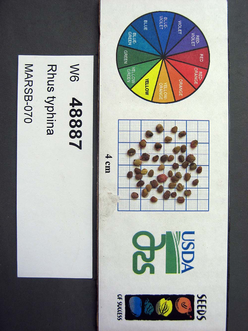 | | 2015 | COLLECTED | 08/22/2013 | Tioga State Forest near Arnot, Tioga County | 41.63745000, -77.21233000 | 1280 | | Wild material | | 1922876 | Ames 33731 |
| 239 | Ames 34697 | MARSB-080 | Cornus amomum Mill. | Pennsylvania, United States | NC7 |  | | 2015 | COLLECTED | 09/11/2013 | Allegheny National Forest -Minister Creek watershed just south of Minister. | 41.61593000, -79.15109000 | 369 | | Wild material | | 1922851 | Ames 34697 |
| 240 | W6 48814 | MARSB-115 | Aristida purpurascens Poir. | New Jersey, United States | W6 |  | | 2015 | | | | | | | Wild material | | 1922907 | W6 48814 |
| 241 | W6 48901 | MARSB-93 | Triadenum virginicum (L.) Raf. | West Virginia, United States | W6 |  | | 2015 | | | | | | | Wild material | | 1922888 | W6 48901 |
| 242 | W6 48833 | MARSB-55 | Carex swanii (Fernald) Mack. | New Jersey, United States | W6 | 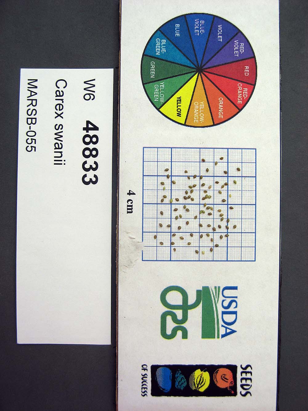 | | 2015 | | | | | | | Wild material | | 1922909 | W6 48833 |
| 243 | W6 48843 | MARSB-60 | Danthonia compressa Austin | Pennsylvania, United States | W6 |  | | 2015 | | | | | | | Wild material | | 1922912 | W6 48843 |
| 244 | W6 48845 | MARSB-58 | Danthonia spicata (L.) P. Beauv. ex Roem. & Schult. | New York, United States | W6 |  | | 2015 | | | | | | | Wild material | | 1922913 | W6 48845 |
| 245 | W6 48848 | MARSB-057 | Avenella flexuosa (L.) Parl. | New York, United States | W6 | 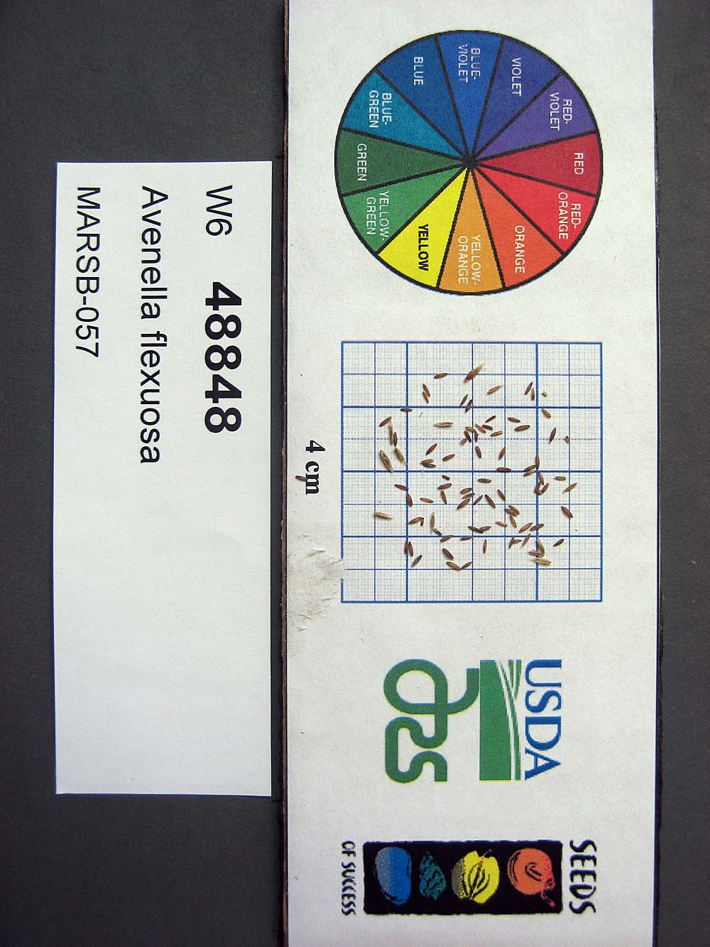 | | 2015 | | | | | | | Wild material | | 1922914 | W6 48848 |
| 246 | W6 48850 | MARSB-085 | Hexasepalum teres (Walter) J. H. Kirkbr. | New Jersey, United States | W6 |  | | 2015 | | | | | | | Wild material | | 1922915 | W6 48850 |
| 247 | W6 48854 | MARSB-106 | Eragrostis spectabilis (Pursh) Steud. | New Jersey, United States | W6 |  | | 2015 | | | | | | | Wild material | | 1922916 | W6 48854 |
| 248 | W6 48902 | MARSB-114 | Tridens flavus (L.) Hitchc. | New Jersey, United States | W6 |  | | 2015 | | | | | | | Wild material | | 1922931 | W6 48902 |
| 249 | Ames 32847 | JDC/DL/2014/150/653 | Diervilla lonicera Mill. | Iowa, United States | NC7 |  | | 2014 | COLLECTED | 11/23/2014 | Wild Cat Den State Park located approximately 9.00 miles northeast of Muscatine, T77N R1E SW 1/4 SW 1/4 and also SE 1/4 SW 1/4Sec. 17 | 41.46820900, -90.87994300 | 215 | Mixed decidous woods. Northeast and east-facing, extremely steep slopes on loose soils. | Wild material | | 1921868 | Ames 32847 |
| 250 | Ames 32849 | JDC/DL/2014/151/654 | Diervilla lonicera Mill. | Iowa, United States | NC7 | | | 2014 | COLLECTED | 11/23/2014 | Fern Cliff County Park located approximatley 3.75 miles west, southwest of Crawfordsville, T74N R7W southern edge of N 1/2 Sec. 24 | 41.19958700, -91.60874700 | 208 | Steep north-facing slopes on loose soils. | Wild material | | 1921870 | Ames 32849 |
| 251 | Ames 32831 | RLD1401 | Cornus rugosa Lam. | Minnesota, United States | NC7 | | | 2014 | COLLECTED | 09/03/2014 | Becker County near Pine Island Lake. | 47.14710000, -95.43608330 | 503 | Upland roadside near steep dropoff with lake below. Mixed deciduous and conifer forest. Growing in association with Fraxinus pennsylvanica, Quercus macrocarpa, Populus tremuloides, Betula papyrifera, Picea glauca, Pinus strobus, Sambucus sp., Acer spicatum, Rosa sp., Rubus sp., and Sanicula marilandica. | Wild material | | 1921824 | Ames 32831 |
| 252 | Ames 32835 | GA14014001 | Fraxinus pennsylvanica Marshall | North Dakota, United States | NC7 |  | | 2014 | COLLECTED | 10/30/2014 | Bottineau County, Turtle Mountains. | 48.97000000, -100.45000000 | 737 | Mixed oak-aspen forest | Wild material | | 1921828 | Ames 32835 |
| 253 | WLP 1746 | Ames 32838 | Viburnum opulus L. var. americanum Aiton | North Dakota, United States | NA | | | 2014 | COLLECTED | 10/31/2014 | Turtle Mountains - Bottineau County. | 48.95000000, -100.43000000 | 692 | Wet, aspen forest. Growing in association with Sanicula marilandica, Fragaria virginiana, Trifolium repens, Rubus sp., Typha latifolia, Prunus pensylvanica, Prunus virginiana, Corylus sp., Crataegus sp., Viburnum lentago, Rosa sp., Cornus sericea, Amelanchier sp., Symphoricarpos sp., Salix sp., Betula papyrifera, Populus tremuloides, Ulmus americana, Acer negundo, Quercus macrocarpa, and Fraxinus pennsylvanica. | Wild material | | 1921831 | WLP 1746 |
| 254 | WLP 1967 | HBC1401 | Viburnum opulus L. var. americanum Aiton | North Dakota, United States | NA | | | 2014 | COLLECTED | 09/29/2014 | Jay Wessels Wildlife Management Area located in Pembina County. | 48.80000000, -97.83000000 | 312 | Diverse habitats including edge of swamp and also upland sandy soils. Growing in association Fraxinus pennsylvanica, Fraxinus nigra, Quercus macrocarpa, Acer negundo, Ulmus americana, Populus tremuloides, Populus balsamifera, Toxicodendron radicans, Cornus sericea, Rosa sp., Corylus sp., Prunus virginiana, Ribes sp., Equisetum sp., Rubus sp., IMpatiens capensis, Thalictrum dasycarpum, Fragaria virginiana, Asarum canadense, Calamagrostis canadensis, Sium suave, Solidago gigantea, Poa pratensis, and Bromus inermis. | Wild material | | 1921830 | WLP 1967 |
| 255 | NA 82043 | JDC/AP/2014/063/565 | Aesculus pavia L. | Arkansas, United States | NA |  | | 2014 | COLLECTED | 09/20/2014 | St. Francis National Forest. | 34.68710800, -90.67734100 | 108 | Deciduous woods. Valleys, slopes, and ridges. | Wild material | Collected as Aesculus parviflora and initially accessioned under that name. Renamed to A. pavia based on ID by Pablo Jourdan (Director, Ornamental Plant Germplasm Center at Ohio State University). | 1922344 | NA 82043 |
| 256 | Ames 32760 | JDC/AB/2014/040/542 | Abies balsamea (L.) Mill. | Iowa, United States | NC7 | | | 2014 | COLLECTED | 09/03/2014 | Bluffton Fir State Preserve, near Bluffton, Winneshiek County. | 43.40106767, -91.90659200 | 326 | High quality, native woods. Steep slope, northwest-facing, and relatively flat portion on top of bluff (powerline) | Wild material | | 1921308 | Ames 32760 |
| 257 | Ames 32386 | JDC/BN/2014/013/515 | Betula nigra L. | Iowa, United States | NC7 |  | | 2014 | COLLECTED | 06/05/2014 | Bearbower Sand Prairie, T87N R9W SW 1/4 of SW 1/4 Sec. 32. | 42.29814100, -91.92822800 | 289 | Sand prairie with likely high water table. | Wild material | | 1919307 | Ames 32386 |
| 258 | Ames 32197 | GA13009001 | Fraxinus pennsylvanica Marshall | Minnesota, United States | NC7 |  | | 2014 | COLLECTED | 09/23/2013 | Clearwater County. | 47.18397220, -95.47407220 | | Mixed upland deciduous forest. | Wild material | | 1917223 | Ames 32197 |
| 259 | Ames 32096 | BA13009001 | Fraxinus nigra Marshall | Minnesota, United States | NC7 |  | | 2013 | COLLECTED | 09/23/2013 | T144N R38W, Clearwater County. | 47.25711000, -95.49000667 | 543 | Edges of lakes and forest edges. Growing in association with Fraxinus pennsylvanica, Quercus macrocarpa, Ulmus americana, Populus tremuloides, Populus balsamifera, Acer saccharum, Betula papyrifera, Salix sp., Larix laricina, Quercus rubra, Abies balsamea, Picea glauca, Sambucus canadensis, Cornus rugosa, Acer spicatum, Rosa sp., Viburnum opulus var. americanum, Viburnum dentatum, Alnus sp., Cornus canadensis, Corylus sp., Prunus virginiana, Ribes sp., Prunus pensylvanica, Rhamnus alnifolia, Equisetum sp., Carex sp., Rubus sp., Impatiens capensis, Bromus sp., and Thalictrum dasycarpum. | Wild material | D.B.H. ranged between 3 and 6 inches. | 1914713 | Ames 32096 |
| 260 | NA 81939 | NA 81939 | Magnolia virginiana L. | Tennessee, United States | NA | | | 2013 | COLLECTED | 08/18/2008 | On west side of Main Street directly across from the Bethel Springs City Hall. | 35.23170000, -88.60690000 | | Growing in a saturated slough originating from a nearby spring. | | | 1952583 | NA 81939 |
| 261 | NA 81571 | (clear light pink) | Rhododendron austrinum (Small) Rehder | Florida, United States | NA | | | 2013 | COLLECTED | 03/31/2013 | White River approximately 1.1 miles north of the confluence with Buzzard�s Lake River in the Escambia River State Wildlife Management Area. | 30.60490000, -87.22261000 | 2 | Part shade along the river on a small sandy berm above the stream in mixed deciduous and broadleaved evergreen maritime forest occasionally inundated by tidal salt water. | Wild material | | 1952627 | NA 81571 |
| 262 | Ames 31678 | GA12003001 | Fraxinus pennsylvanica Marshall | Minnesota, United States | NC7 |  | | 2012 | COLLECTED | NEAR 09/26/2012 | Buffalo River State Park along the Buffalo River, east of Glyndon, Clay County. | 46.86481660, -96.46406660 | 302 | Floodplain. Transistion zone between prairie and forest | Wild material | | 1906589 | Ames 31678 |
| 263 | NA 87911 | LBJWC-0636 | Taxodium distichum (L.) Rich. | Texas, United States | NA |  | | 2011 | | | | | | | Wild material | | 1895379 | NA 87911 |
| 264 | WLP 2480 | 210568 | Malvaviscus arboreus Cav. | Texas, United States | NA |  | | 2011 | COLLECTED | 09/30/2003 | | | | | Wild material | | 1895410 | WLP 2480 |
| 265 | Ames 31214 | Ames 31214 | Cornus rugosa Lam. | Wisconsin, United States | NC7 |  | | 2011 | COLLECTED | 2011 | Along east side of County Road C, base of McCaslin Mountain, NW 1/4 of Section 26, T34N, R17E, Roaring Rapids Quad, Marinette County. | 45.39916660, -88.34111110 | 371 | Hilly terrain. Sandy loam soil with a shallow humus layer, near surface of granite and scattered granite boulders. Soils must be near neutral due to abscence of Ericaceae plants. | Wild material | | 1894296 | Ames 31214 |
| 266 | Ames 31215 | Ames 31215 | Diervilla lonicera Mill. | Wisconsin, United States | NC7 |  | | 2011 | COLLECTED | 2011 | Site 1: Dells above Prairie River, Bloomville Quad. T32N R7E NE 1/4 SW 1/4 Sec. 13 and Site 2: Along east side of Highway 17, Pine Dells Quad. T32N R7E NW 1/4 NW 1/4 Sec. 26 | 45.24472220, -89.57486100 | 434 | Site 1: High spots between granite boulders strewn about a young woodland. Sandy soil with a few inches of humus layer. Site 2: Roadside. Disturbed ground on sandy soil with a slight humus layer. | Wild material | | 1894298 | Ames 31215 |
| 267 | Ames 31065 | 354 | Diervilla lonicera Mill. | New York, United States | NC7 |  | | 2011 | COLLECTED | 09/10/2011 | Along Emery Hill Road | 42.07700000, -79.08400000 | 446 | Roadside. East-facing slope. Rocky substrate with very tiny spring creek at base of slope. | Wild material | | 1891451 | Ames 31065 |
| 268 | Ames 31077 | 702 | Fraxinus americana L. | New York, United States | NC7 |  | | 2011 | COLLECTED | 09/14/2011 | Wilcox Road, Chautauqua County. | 42.04000000, -79.45900000 | 526 | Upland mixed forest. | Wild material | | 1891463 | Ames 31077 |
| 269 | Ames 31086 | 691 | Fraxinus pennsylvanica Marshall | New York, United States | NC7 |  | | 2011 | COLLECTED | 09/10/2011 | Winters Road, south of Main Street, Chemung County. | 42.13200000, -76.92800000 | 275 | Floodplain of Cuthrie Run | Wild material | | 1891472 | Ames 31086 |
| 270 | WLP 229 | NA 80349 | Tsuga canadensis (L.) Carrière | New York, United States | NA | | | 2011 | COLLECTED | 09/10/2011 | Along Emery Hill Road. | 42.07700000, -79.08400000 | 433 | Roadside. East-facing slope. Rocky substrate with very tiny spring creek at base of slope. Associated with Acer saccharum, Asarum canadense, Diervilla lonicera, Fraxinus americana, Hamamelis virginiana, Impatiens capensis, Rubus, Solidago, and Tilia americana. | Wild material | | 1891488 | WLP 229 |
| 271 | WLP 830 | 381 | Carpinus caroliniana Walter | Pennsylvania, United States | NA | | | 2011 | COLLECTED | 09/15/2011 | Along Valentine Run Road, near small tributary to Rhine Run Creek, Warren County. | 41.92500000, -79.18800000 | 475 | Roadside. Mixed hardwood forest and open rangeland (Solidago). Associated with Acer, Carya ovata, Cornus racemosa, Fagus grandifolia, Hamamelis virginiana, Quercus, Rosa, Rubus, and Tsuga canadensis. | Wild material | | 1891442 | WLP 830 |
| 272 | Ames 31029 | MPW/MSD 710 | Cornus rugosa Lam. | New York, United States | NC7 |  | | 2011 | COLLECTED | 07/29/2011 | Along Tannery Creek Road, Steuben County. | 42.04210000, -77.11640000 | 378 | Rich woods, just above shale. Steep, north-facing slope. | Wild material | | 1886744 | Ames 31029 |
| 273 | W6 41834 | R10-63-270 | Agrostis stolonifera L. | Krasnodar, Russian Federation | W6 | | | 2011 | COLLECTED | 08/08/2010 | Golovinski Nature Reserve near Psetuapse River near Thagapsh | 43.97100000, 39.44300000 | 100 | Sub-tropical forest pasture. Limestone parent material, SW exposure, heavily grazed and disturbed meadow in sub-tropical forest opening: seed collected from >100 plants | Wild material | | 1883349 | W6 41834 |
| 274 | W6 41836 | R10-63-272 | Trifolium fragiferum L. | Krasnodar, Russian Federation | W6 | | | 2011 | COLLECTED | 08/08/2010 | Golovinski Nature Reserve near Psetuapse River near Thagapsh | 43.97100000, 39.44300000 | 100 | Sub-tropical forest pasture. Limestone parent material, SW exposure, heavily grazed and disturbed meadow in sub-tropical forest opening: seed collected from >100 plants | Wild material | | 1883351 | W6 41836 |
| 275 | Ames 30492 | APS/GD/2010/014/049 | Gymnocladus dioicus (L.) K. Koch | Illinois, United States | NC7 |  | | 2010 | COLLECTED | 02/24/2010 | Marshall State Fish and Wildlife Area, along Illinois State Highway 26, Illinois River Watershed, approximately 18.5 miles north of Peoria, NW 1/4 of SW 1/4 of Sec. 35, NE 1/4 of SE 1/4 of Sec. 27, and SE 1/4 of NE 1/4 of Sec. 23, Marshall County. | 40.92820000, -89.42690000 | 158 | Mostly transisition zone at base of slopes or on gentle slopes and floodplain. | Wild material | | 1831351 | Ames 30492 |
| 276 | Ames 30393 | JDC/RT/2009/115/265 | Rhus typhina L. | Ohio, United States | NC7 |  | | 2009 | COLLECTED | 10/19/2009 | Along West Oak Hickory Trail, 0.5 mile southeast of Driver and Smoky Road intersection, Edison Woods, Berlin Heights Quad, Erie County | 41.35138889, -82.47722222 | 205 | | Wild material | | 1823945 | Ames 30393 |
| 277 | Ames 30062 | JDC/CR/2009/011/161 | Cornus rugosa Lam. | Wisconsin, United States | NC7 |  | | 2009 | COLLECTED | 08/03/2009 | Along Highway 133, Lower Wisconsin Riverway State Wildlife Area, SE 1/4 of NW 1/4 of Section 14, T7N, R4W, Wauzeka East Quad, Woodman, Grant County. | 43.08527778, -90.81638889 | 201 | Wisconsin River watershed. | Wild material | | 1812365 | Ames 30062 |
| 278 | W6 33318 | CA330-85 | Poa kelloggii Vasey | California, United States | W6 | 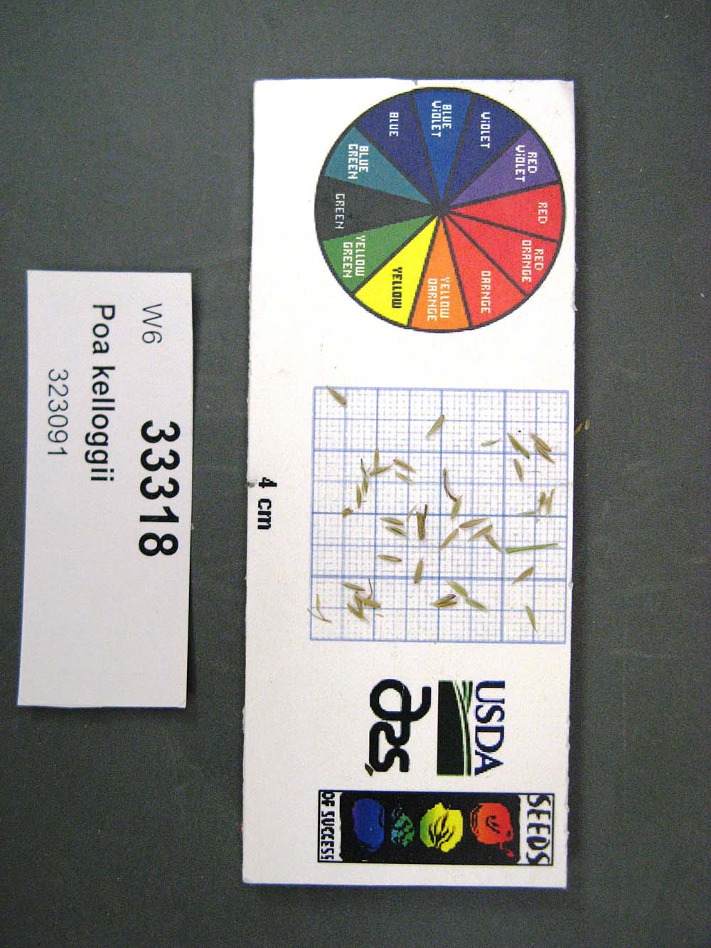 | | 2008 | | | | | | | Wild material | | 1780316 | W6 33318 |
| 279 | WLP 2336 | 348674 | Rosa gymnocarpa Nutt. | Washington, United States | NA | 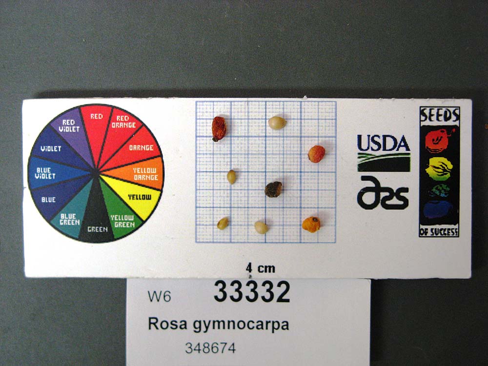 | | 2008 | COLLECTED | 09/17/2006 | | | 244 | Aspect: All, Pseudotsuga menziesii forest on a hill in botanical preserve; site used as outdoor classroom. Soil brownish black. | Wild material | | 1780213 | WLP 2336 |
| 280 | Ames 29211 | JDC-0252007 | Fraxinus americana L. | New Hampshire, United States | NC7 |  | | 2007 | COLLECTED | 09/26/2007 | Along Highway 115, approximately 3-4 miles west of Meadows, Coos County. | 44.35444444, -71.50833333 | 426 | Along road ditch. | Wild material | | 1743315 | Ames 29211 |
| 281 | NA 87882 | COOS-06a | Umbellularia californica (Hook. & Arn.) Nutt. | Oregon, United States | NA | 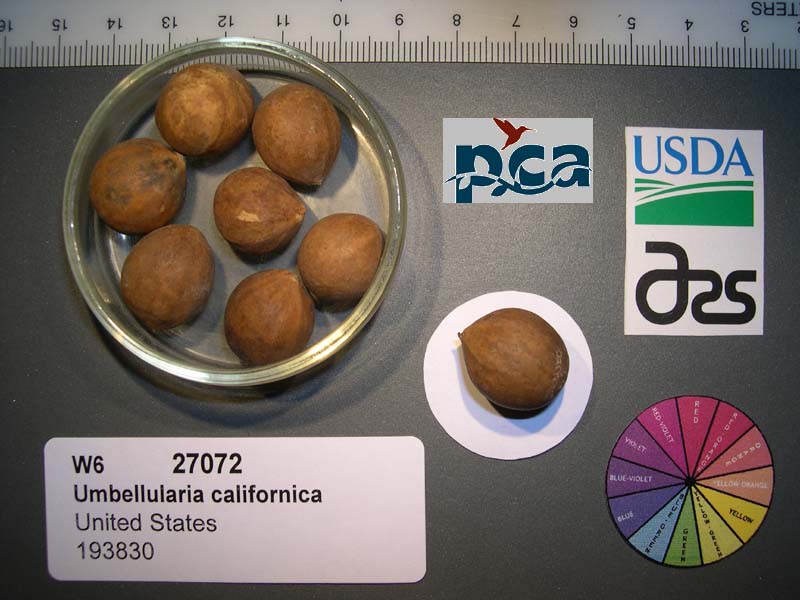 | | 2005 | | | | | | | Wild material | Tree 26 meters tall. | 1674109 | NA 87882 |
| 282 | OPGC 2931 | 178316 | Lilium columbianum hort. ex Leichtlin | Oregon, United States | OPGC | 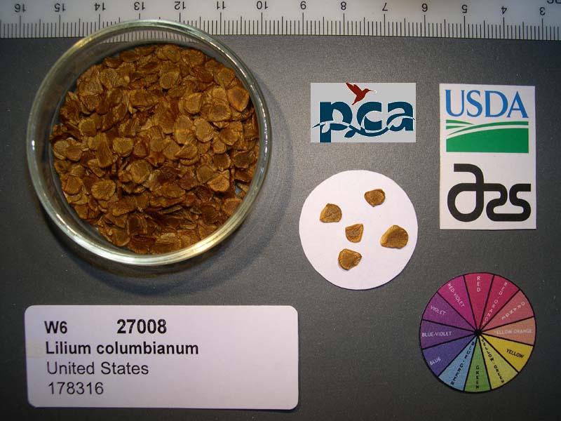 | | 2005 | COLLECTED | 09/26/2002 | | | 1179 | Light canopy cover of douglas fir/sitka alder, in roadside opening. Associated with Acer circinatum, Peridium aquilinum, Equisetum, Epilobium angustifolium, Rubus parviflora, Hypericum perforatum, Dactylis glomeratum, Elymus | Wild material | Forb 0.3-1.2 meters tall. | 1674045 | OPGC 2931 |
| 283 | OPGC 4272 | 173034 | Boykinia occidentalis Torr. & A. Gray | Oregon, United States | OPGC |  | | 2005 | COLLECTED | 08/13/2002 | | | 950 | Seasonal road. Young douglas fir overstory with Acer circinatum, Salix sitchensis. Shrub lay of Gaultheria, Polystichum, Rubus spectabilis. Herbaceous species Hypericum, Leucanthemum, Elymus glaucus, Equisetum. | Wild material | Forb 0.3-1 meters tall. | 1673937 | OPGC 4272 |
| 284 | W6 27227 | CA330-30 | Urtica dioica L. | California, United States | W6 |  | | 2005 | | | | | | | Wild material | Forb 0.15-1.8 meters tall. | 1674262 | W6 27227 |
| 285 | WLP 2075 | 178626 | Cornus nuttallii Audubon | Oregon, United States | NA |  | | 2005 | COLLECTED | 10/07/2002 | | | 386 | Moderately closed canopy Pseudotsuga menziesii/Acer macrophyllum dominated forest with Acer circinatum/Sambucus nigra understory. Shrub cover of Gaultheria shallon, Vaccinium parvifolium, Berberis nervosa, Rubus discolor, Pte | Wild material | Tree 4.5-15 meters tall. | 1674069 | WLP 2075 |
| 286 | WLP 767 | 19 | Carpinus caroliniana Walter | Iowa, United States | NA | | | 2003 | COLLECTED | 09/15/2003 | Bixby State Park, Edgewood, T91N R5W, SW corner of SE 1/4 of NW 1/4, Section 26, Edgewood Quad, Clayton County. | 42.66694444, -91.40333333 | 329 | Forest edge. Half shaded. 20% slope with a western aspect. Associated with Acer nigrum, Cornus alternifolia, Quercus rubra, and Rubus occidentalis. | Wild material | Small tree. | 1649453 | WLP 767 |
| 287 | NA 70434 | MWPCC00-097 | Halesia carolina L. | North Carolina, United States | NA | | | 2000 | COLLECTED | 09/15/2000 | Henderson Co. NC. Located in the scrub located between a cornfield and the French Broad River, near intersection of Fanning Melds adn Fnning Bridge Roads. | 35.42388889, -82.54583333 | 665 | Associates: Prunsu serotina, Acer negundo, Privet, Smilax, Lonicera, Celastrus, Betula nigra, Rubus, Ambrosia. | Wild material | | 1608154 | NA 70434 |
| 288 | GMAL 4369 .d | CH97 03-01 | Malus hupehensis (Pamp.) Rehder | Sichuan Sheng, China | GEN | | | 1997 | COLLECTED | 09/21/1997 | Maerkang County, Dananzugou village. 5 km. northeast of Maerkang. | 31.95583333, 102.27555556 | 2930 | Aspect-South, partial canopy. Incline <5%, slight south, variable. Landform: Mountain valley. Assoc. sp: Sorbus, Fir, Pine Acer, Cornus, Willow, Betula. Shrub sp: Rosa, Pyracantha, Holly, Berberis, Cotoneaster, Rubus. Herb sp: Aster, Fern. | Wild material | Additional Weather Notes: Rainfall in concentrated from May to Sept. There are spring and summer droughts. Hail and frost damage occur. Additional Habitat Notes: Collection tree nearly defoilated, 5m. in height, located on minimal south facing slope. Name of gorge: Da Nan Zu Gou. Name of village: Cha Bei. Sampled 132 fruits from 23 trees. | 1695191 | GMAL 4369 .d |
| 289 | GMAL 4371 .d | CH97 03-03 | Malus toringoides (Rehder) Hughes | Sichuan Sheng, China | GEN | | | 1997 | COLLECTED | 09/21/1997 | Maerkang County, Dananzugou village. 5 km. northeast of Maerkang. | 31.95583333, 102.27555556 | 2930 | Aspect-South, partial canopy. Incline <5%, slight south, variable. Landform: Mountain valley. Assoc. sp: Sorbus, Fir, Pine Acer, Cornus, Willow, Betula. Shrub sp: Rosa, Pyracantha, Holly, Berberis, Cotoneaster, Rubus. Herb sp: Aster, Fern. | Wild material | Additional Weather Notes: Rainfall in concentrated from May to Sept. There are spring and summer droughts. Hail and frost damage occur. Additional Habitat Notes: Collection tree an older tree, 6m. in height, 40cm. diameter, good vigor; located on west facing slope; incline 30%. Sampled 132 fruits from 23 trees. No scab present; quite a lot of of leaf spotting. | 1695208 | GMAL 4371 .d |
| 290 | GMAL 4377 .c | CH97 03-10 | Malus kansuensis (Batalin) C. K. Schneid. | Sichuan Sheng, China | GEN | | | 1997 | COLLECTED | 09/21/1997 | Maerkang County, Dananzugou village. 5 km. northeast of Maerkang. | 31.94694444, 102.27138889 | 2930 | Aspect-South, partial canopy. Incline <5%, slight south, variable. Landform: Mountain valley. Assoc. sp: Sorbus, Fir, Pine Acer, Cornus, Willow, Betula. Shrub sp: Rosa, Pyracantha, Holly, Berberis, Cotoneaster, Rubus. Herb sp: Aster, Fern. | Wild material | Additional Weather Notes: Rainfall in concentrated from May to Sept. There are spring and summer droughts. Hail and frost damage occur. Additional Habitat Notes: Collection tree 6m. height, 15cm. diameter, located on the Northeast slope with slight incline. Rhododendran and Holly next to collection tree. Soil may be acid. Sampled 132 fruits from 23 trees. | 1695223 | GMAL 4377 .c |
| 291 | GMAL 4379 .b | CH97 03-12 | Malus kansuensis (Batalin) C. K. Schneid. | Sichuan Sheng, China | GEN | | | 1997 | COLLECTED | 09/21/1997 | Maerkang County, Dananzugou village. 5 km. northeast of Maerkang. | 31.94472222, 102.27000000 | 2880 | Aspect-South, partial canopy. Incline <5%, slight south, variable. Landform: Mountain valley. Assoc. sp: Sorbus, Fir, Pine Acer, Cornus, Willow, Betula. Shrub sp: Rosa, Pyracantha, Holly, Berberis, Cotoneaster, Rubus. Herb sp: Aster, Fern. | Wild material | Additional Weather Notes: Rainfall in concentrated from May to Sept. There are spring and summer droughts. Hail and frost damage occur. Sampled 132 fruits from each of the 23 trees. Good tree vigor. | 1695232 | GMAL 4379 .b |
| 292 | GMAL 4382 .c | CH97 03-15 | Malus kansuensis (Batalin) C. K. Schneid. | Sichuan Sheng, China | GEN | | | 1997 | COLLECTED | 09/21/1997 | Maerkang County, Dananzugou village. 5 km. northeast of Maerkang. | 31.94472222, 102.27000000 | 2880 | Aspect-South, partial canopy. Incline <5%, slight south, variable. Landform: Mountain valley. Assoc. sp: Sorbus, Fir, Pine Acer, Cornus, Willow, Betula. Shrub sp: Rosa, Pyracantha, Holly, Berberis, Cotoneaster, Rubus. Herb sp: Aster, Fern. | Wild material | Additional Weather Notes: Rainfall in concentrated from May to Sept. There are spring and summer droughts. Hail and frost damage occur. Sampled 132 fruits from each of the 23 trees. Collection tree 3m. in height, moderate vigor. Leaf rust present. | 1695243 | GMAL 4382 .c |
| 293 | GMAL 4384 | CH97 03-17 | Malus kansuensis (Batalin) C. K. Schneid. | Sichuan Sheng, China | GEN | | | 1997 | COLLECTED | 09/21/1997 | Maerkang County, Dananzugou village. 5 km. northeast of Maerkang. | 31.94472222, 102.27000000 | 2880 | Aspect-South, partial canopy. Incline <5%, slight south, variable. Landform: Mountain valley. Assoc. sp: Sorbus, Fir, Pine Acer, Cornus, Willow, Betula. Shrub sp: Rosa, Pyracantha, Holly, Berberis, Cotoneaster, Rubus. Herb sp: Aster, Fern. | Wild material | Additional Weather Notes: Rainfall in concentrated from May to Sept. There are spring and summer droughts. Hail and frost damage occur. Additional Habitat Notes: Collection tree 4 m. in height, good vigor; located on a rocky river bank. Sampled 132 fruits from 23 trees. Leaf rust present. No scab. | 1552399 | GMAL 4384 |
| 294 | GMAL 4387 | CH97 03-20 | Malus kansuensis (Batalin) C. K. Schneid. | Sichuan Sheng, China | GEN | | | 1997 | COLLECTED | 09/21/1997 | Maerkang County, Dananzugou village. 5 km. northeast of Maerkang. | 31.94472222, 102.27000000 | 2930 | Aspect-South, partial canopy. Incline <5%, slight south, variable. Landform: Mountain valley. Assoc. sp: Sorbus, Fir, Pine Acer, Cornus, Willow, Betula. Shrub sp: Rosa, Pyracantha, Holly, Berberis, Cotoneaster, Rubus. Herb sp: Aster, Fern. | Wild material | Additional Weather Notes: Rainfall in concentrated from May to Sept. There are spring and summer droughts. Hail and frost damage occur. Additional Habitat Notes: Collection tree 4m. in height with 6 trunks copiced; located on a very rocky hillside. Sampled 132 fruits from 23 trees. Rust present; no scab. | 1552402 | GMAL 4387 |
| 295 | GMAL 4387 .c | CH97 03-20 | Malus kansuensis (Batalin) C. K. Schneid. | Sichuan Sheng, China | GEN | | | 1997 | COLLECTED | 09/21/1997 | Maerkang County, Dananzugou village. 5 km. northeast of Maerkang. | 31.94472222, 102.27000000 | 2930 | Aspect-South, partial canopy. Incline <5%, slight south, variable. Landform: Mountain valley. Assoc. sp: Sorbus, Fir, Pine Acer, Cornus, Willow, Betula. Shrub sp: Rosa, Pyracantha, Holly, Berberis, Cotoneaster, Rubus. Herb sp: Aster, Fern. | Wild material | Additional Weather Notes: Rainfall in concentrated from May to Sept. There are spring and summer droughts. Hail and frost damage occur. Additional Habitat Notes: Collection tree 4m. in height with 6 trunks copiced; located on a very rocky hillside. Sampled 132 fruits from 23 trees. Rust present; no scab. | 1695254 | GMAL 4387 .c |
| 296 | GMAL 4387 .e | CH97 03-20 | Malus kansuensis (Batalin) C. K. Schneid. | Sichuan Sheng, China | GEN | | | 1997 | COLLECTED | 09/21/1997 | Maerkang County, Dananzugou village. 5 km. northeast of Maerkang. | 31.94472222, 102.27000000 | 2930 | Aspect-South, partial canopy. Incline <5%, slight south, variable. Landform: Mountain valley. Assoc. sp: Sorbus, Fir, Pine Acer, Cornus, Willow, Betula. Shrub sp: Rosa, Pyracantha, Holly, Berberis, Cotoneaster, Rubus. Herb sp: Aster, Fern. | Wild material | Additional Weather Notes: Rainfall in concentrated from May to Sept. There are spring and summer droughts. Hail and frost damage occur. Additional Habitat Notes: Collection tree 4m. in height with 6 trunks copiced; located on a very rocky hillside. Sampled 132 fruits from 23 trees. Rust present; no scab. | 1695252 | GMAL 4387 .e |
| 297 | NA 67660 | QLG034 | Deutzia vilmoriniae Lemoine | Shaanxi Sheng, China | NA | | | 1996 | COLLECTED | 10/18/1996 | Hanzhong District, Foping County (Qinling Mountains): Foping Nature Preserve, San Guan Miao Forest Station, along trail en route to summit. | 33.66666667, 107.81694444 | 1923 | Growing in open woodland in part to full sun in a dense forest. Growing amid boulders with moist, organic soils between and sphagnum moss on top. Slope: 5 percent. Aspect: Southeast. | Wild material | | 1579550 | NA 67660 |
| 298 | NA 67796 | QLG166 | Syringa pubescens Turcz. subsp. microphylla (Diels) M. C. Chang & X. L. Chen | Shaanxi Sheng, China | NA | | | 1996 | COLLECTED | 10/18/1996 | Ningxi Preserve, Caiziping Forest Station, Xi Gou | 33.71694444, 108.20027778 | 1985 | Shade at the base of a moist cliff with seepage; 35% N slope; sandy loam soil; growing w/ Rubus, Philadelphus, ferns, Acer, Betula, Sinacalcia tangutica, Populus, Euonymus and several herbaceous species. | Wild material | 3 meters; multi-stemmed, deciduous shrub with spreading habit | 1579579 | NA 67796 |
| 299 | NA 67798 | QLG168 | Deutzia hypoglauca Rehder | Shaanxi Sheng, China | NA | | | 1996 | COLLECTED | 10/18/1996 | Ankang District, Ningshan County (Qinling Mountains): Ningxi Preserve, Caiziping Forest Station, Xigou. | 33.71694444, 108.20027778 | 2090 | Growing in shade at the base of a moist cliff with seepage. Slope: 25 percent. Aspect: North. | Wild material | | 1579473 | NA 67798 |
| 300 | NA 67884 | QLG252 | Buddleja davidii Franch. | Gansu Sheng, China | NA | | | 1996 | COLLECTED | 10/18/1996 | Xiao Long Shan Forest Bureau, Guang Ying Forest Station, Da Feng Shan | 34.38333333, 106.03361111 | 1470 | Sunny site on a steep slope along road edge; 60% SE slope; growing w/ Acer sp., Neillia sinensis, Quercus sp., Rubus sp., Smilax sp., Salix sp. and numerous herbaceous species. | Wild material | 2-3 meters; multi-stemmed, deciduous shrub with upright arching, spreading habit | 1579778 | NA 67884 |
| 301 | GMAL 3654 .g | Kaz 95 12-02 | Malus sieversii (Ledeb.) M. Roem. | Kazakhstan | GEN | | | 1995 | COLLECTED | 09/03/1995 | Topolevka village. 15 km. East of Topolevka - Djungarsky Range. 1.5 km. Southeast of Topolevka Forestry Camp. Elevation: 1220-1450 m. | 45.39611111, 80.40777778 | 1450 | Aspect: Northwest. Dominant tree sp.: M. sieversii; Assoc.-Acer, Quercus, Tilia, Populus, Rhamnus. Dominant shrub sp.: Lonicera; Assoc-Berberis, Cotoneaster, Rubus. Dominant herbaceous: Grasses; Assoc.-Fragaria, Chelidonium, Urtica. | Wild material | Sampled 150 frts from 1 tree. Fruit is firm, largest in Djangarsky. Some codling moth eggs visible in seed. Quite clean of scab. Tree sets fruit in clusters; has clonal offshoots. Scion also coll. Spur type tree. Same accession as GMAL 3890 | 1694348 | GMAL 3654 .g |
| 302 | GMAL 3654 .h | Kaz 95 12-02 | Malus sieversii (Ledeb.) M. Roem. | Kazakhstan | GEN |  | | 1995 | COLLECTED | 09/03/1995 | Topolevka village. 15 km. East of Topolevka - Djungarsky Range. 1.5 km. Southeast of Topolevka Forestry Camp. Elevation: 1220-1450 m. | 45.39611111, 80.40777778 | 1450 | Aspect: Northwest. Dominant tree sp.: M. sieversii; Assoc.-Acer, Quercus, Tilia, Populus, Rhamnus. Dominant shrub sp.: Lonicera; Assoc-Berberis, Cotoneaster, Rubus. Dominant herbaceous: Grasses; Assoc.-Fragaria, Chelidonium, Urtica. | Wild material | Sampled 150 frts from 1 tree. Fruit is firm, largest in Djangarsky. Some codling moth eggs visible in seed. Quite clean of scab. Tree sets fruit in clusters; has clonal offshoots. Scion also coll. Spur type tree. Same accession as GMAL 3890 | 1694340 | GMAL 3654 .h |