| 0 | PI 706985 | MD_2024_03 | Rubus allegheniensis Porter | Nova Scotia, Canada | COR | | | 2025 | COLLECTED | 08/25/2024 | | 44.49333000, -63.88996000 | | | Wild material | Polly Cove Trail, Peggy's Cove Preservation Area, Nova Scotia, Canada. Shrubby area, just south of parking, along trail. Plants widespread and scattered. August 25, 2024, MD_2024_03 | 2172627 | PI 706985 |
| 1 | PI 618279 | R. allegheniensis rual050 | Rubus allegheniensis Porter | United States | COR | | | 2000 | DONATED | 03/08/2000 | | | | | Cultivated material | | 1603249 | PI 618279 |
| 2 | PI 618439 | 'White Blackberry' | Rubus allegheniensis Porter | California, United States | COR | | Out of Season | 1996 | DONATED | 03/15/1996 | | | | | Cultivar | | 1522038 | PI 618439 |
| 3 | PI 618499 | 'Arkansas Tree Everbearing' | Rubus allegheniensis Porter | Arkansas, United States | COR | 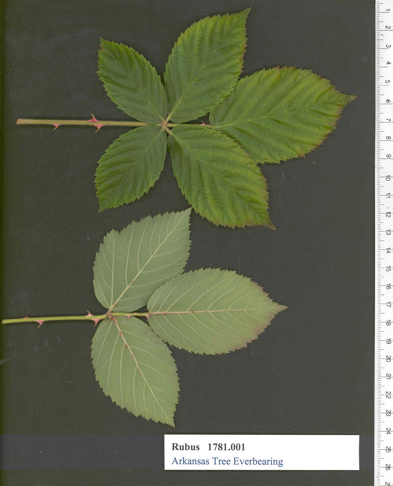 | | 1994 | DEVELOPED | | | | | | Cultivar | (The following description of this unusual plant has been furnishedus by the originator.)This new berry came into our possession as a seedling several years ago. After years of painstaking efforts, the undesirable plants have been taken out, now having a variety that comes true and exactly alike.Due to the nature of their growth and over the long period of ripening, we have named it the Tree Everbearing Blackberry. It grows in any soil or climate, has stood twenty degrees below zero without any injury. Berries are round, very large, extra sweet, yet enough acid for jams and jellies. An excellent keeper, has to be picked only once a week. Plants are very thorny, but berries grow on a long fruit stem in clusters of seven to thirty berries. Ninety percent of the fruit extends above the thorns. There being no berries on the market when they ripen, therefore its possibilities are unlimited as a commercial berry.Another feature why people prefer it: they grow up off the ground, ninety percent are free from dirt regardless of the weather. Rain must be in abundance or it must be planted where it can be watered. The undreamed of feature of this berry is that people in our towns and cities who have been deprived of fresh fruits may now grow all the berries they can use for pies, jams and jellies from six plants in their yard or small garden, taking no more care of , them than a common shrub. From a two-year-old plant we have gathered three gallons or 24 pounds. Three-year-old plants have broken all records with a yield of 6 gallons of fruit from one plant,Waller Brothers do not hesitate to recommend these plants as an excellent berry, as we have fruited some of them for the past several seasons with very satisfactory results.
named because originated in Arkansas
| 1482860 | PI 618499 |
| 4 | PI 553970 | R. allegheniensis Pennsylvania | Rubus allegheniensis Porter | Pennsylvania, United States | COR | | | 1989 | COLLECTED | 05/1989 | Lehighton, Penn. | 40.83333000, -75.73333000 | | Lehighton, Penn. | Wild material | Common type, no additional information provided on receipt | 1448942 | PI 553970 |
| 5 | PI 553098 | R. allegheniensis | Rubus allegheniensis Porter | Michigan, United States | COR | | | 1987 | COLLECTED | | | 42.58333000, -86.00000000 | 262 | | Wild material | Mark P. Widrlechner collection
| 1448070 | PI 553098 |
| 6 | PI 553095 | R. allegheniensis | Rubus allegheniensis Porter | United States | COR | | | 1987 | COLLECTED | | | | | | Uncertain improvement status | V. L. Vitkovskij, N. I. Vavilov Institute
| 1448067 | PI 553095 |
| 7 | PI 553094 | R. allegheniensis NC 86-20-1 | Rubus allegheniensis Porter | Georgia, United States | COR | | | 1986 | COLLECTED | 08/05/1986 | Appalachian Trail to Tray Mountain | 34.75000000, -83.66667000 | 1200 | Appalachian Trail to Tray Mountain | Wild material | 3 m tall, new growth on floricanes pubescent,leaf lanceolate | 1448066 | PI 553094 |
| 8 | PI 265721 | R. allegheniensis Minnesota | Rubus allegheniensis Porter | Minnesota, United States | COR | | | 1984 | COLLECTED | 05/31/1960 | Rosemount, Minnesota | 44.66667000, -93.08333000 | | Rosemount, Minnesota | Wild material | | 1200620 | PI 265721 |
| 9 | PI 265722 | R. allegheniensis Wisconsin | Rubus allegheniensis Porter | Wisconsin, United States | COR | | | 1984 | COLLECTED | 05/31/1960 | Ellsworth, Wisconsin | 44.66667000, -92.50000000 | | Ellsworth, Wisconsin | Wild material | | 1200621 | PI 265722 |
| 10 | PI 265724 | R. allegheniensis Minnesota | Rubus allegheniensis Porter | Minnesota, United States | COR | | | 1984 | COLLECTED | 05/31/1960 | Marine-on-St. Croix, Minn. | 45.16667000, -92.75000000 | | Marine-on-St. Croix, Minn. | Wild material | | 1200623 | PI 265724 |
| 11 | PI 265725 | R. allegheniensis Minnesota | Rubus allegheniensis Porter | Minnesota, United States | COR | | | 1984 | COLLECTED | 05/31/1960 | Marine-on-St. Croix, Minn. | 45.16667000, -92.75000000 | | Marine-on-St. Croix, Minn. | Wild material | | 1200624 | PI 265725 |
| 12 | PI 265728 | R. allegheniensis Minnesota | Rubus allegheniensis Porter | Minnesota, United States | COR | | | 1984 | COLLECTED | 05/31/1960 | Chisago City | 46.33333000, -92.83333000 | | Chisago City | Wild material | | 1200627 | PI 265728 |
| 13 | PI 265729 | R. allegheniensis Minnesota | Rubus allegheniensis Porter | Minnesota, United States | COR | | | 1984 | COLLECTED | 05/31/1960 | Beroun, Minnesota | 46.00000000, -94.00000000 | | Beroun, Minnesota | Wild material | | 1200628 | PI 265729 |
| 14 | PI 265730 | R. allegheniensis Minnesota | Rubus allegheniensis Porter | Minnesota, United States | COR | | | 1984 | COLLECTED | 05/31/1960 | St. Criox Park | 44.75000000, -92.83333000 | | St. Criox Park | Wild material | | 1200629 | PI 265730 |
| 15 | PI 265731 | R. allegheniensis Minnesota | Rubus allegheniensis Porter | Minnesota, United States | COR | | | 1984 | COLLECTED | | St. Croix Park | 44.75000000, -92.83333000 | | St. Croix Park | Wild material | | 1200630 | PI 265731 |
| 16 | PI 265732 | R. allegheniensis | Rubus allegheniensis Porter | Wisconsin, United States | COR |  | | 1984 | COLLECTED | 05/31/1960 | Luck, Wisconsin | 45.58333000, -92.50000000 | | Luck, Wisconsin | Wild material | | 1200631 | PI 265732 |
| 17 | PI 265733 | R. allegheniensis Wisconsin | Rubus allegheniensis Porter | Wisconsin, United States | COR | | | 1984 | COLLECTED | 05/31/1960 | Amery | 45.33333000, -92.33333000 | | Amery | Wild material | | 1200632 | PI 265733 |
| 18 | PI 265734 | R. allegheniensis Wisconsin | Rubus allegheniensis Porter | Wisconsin, United States | COR | | | 1984 | COLLECTED | 05/31/1960 | Hudson, Wisconsin | 44.95000000, -95.75000000 | | Hudson, Wisconsin | Wild material | | 1200633 | PI 265734 |
| 19 | PI 265735 | R. allegheniensis Wisconsin | Rubus allegheniensis Porter | Wisconsin, United States | COR | | | 1984 | COLLECTED | 05/31/1960 | Osceola, Wisconsin | 45.33333000, -92.75000000 | | Osceola, Wisconsin | Wild material | | 1200634 | PI 265735 |
| 20 | PI 265736 | R. allegheniensis Wisconsin | Rubus allegheniensis Porter | Wisconsin, United States | COR | | | 1984 | COLLECTED | 05/31/1960 | Henderson, WI | 44.00000000, -90.00000000 | | Henderson, WI | Wild material | | 1200635 | PI 265736 |
| 21 | PI 265738 | R. allegheniensis Minnesota | Rubus allegheniensis Porter | Minnesota, United States | COR | | | 1984 | COLLECTED | 05/31/1960 | Winona, Minn. | 44.03333000, -91.65000000 | | Winona, Minn. | Wild material | | 1200637 | PI 265738 |
| 22 | PI 265739 | R. allegheniensis | Rubus allegheniensis Porter | Wisconsin, United States | COR | | | 1984 | COLLECTED | 05/31/1960 | Medford, Wis. | 45.15000000, -90.35000000 | | Medford, Wis. | Wild material | | 1200638 | PI 265739 |
| 23 | PI 265740 | R. allegheniensis | Rubus allegheniensis Porter | Wisconsin, United States | COR | | | 1984 | COLLECTED | 05/31/1960 | Rhinelander, Wis. | 45.63333000, -89.48333000 | | Rhinelander, Wis. | Wild material | | 1200639 | PI 265740 |
| 24 | PI 265742 | R. allegheniensis | Rubus allegheniensis Porter | Wisconsin, United States | COR | | | 1984 | COLLECTED | 05/31/1960 | Florence, Wis. | 45.91667000, -88.25000000 | | Florence, Wis. | Wild material | | 1200641 | PI 265742 |
| 25 | PI 265743 | R. allegheniensis | Rubus allegheniensis Porter | Wisconsin, United States | COR | | | 1984 | COLLECTED | 05/31/1960 | Eagle River, Wis. | 45.91667000, -89.28333000 | | Eagle River, Wis. | Wild material | | 1200642 | PI 265743 |
| 26 | PI 265744 | R. allegheniensis | Rubus allegheniensis Porter | Minnesota, United States | COR | | | 1984 | COLLECTED | 05/13/1960 | Washburn, Wisc. | 46.63333000, -90.91667000 | | Washburn, Wisc. | Wild material | | 1200643 | PI 265744 |
| 27 | PI 265745 | R. allegheniensis | Rubus allegheniensis Porter | Minnesota, United States | COR | | | 1984 | COLLECTED | 05/31/1960 | Onamia, Minn. | 46.06667000, -93.63333000 | | Onamia, Minn. | Wild material | | 1200644 | PI 265745 |
| 28 | PI 653368 | R. occidentalis Ohio ORUS 3849 | Rubus occidentalis L. | Ohio, United States | COR | | | 2007 | COLLECTED | 06/19/2006 | Clermont County, edge of woods by utility substation in a suburban neighorhood. Appoximate location: 39.05 N, 84.15 W. | 39.08465000, -84.25960000 | 275 | Zone 6a. Soil pH probably neutral. Clay loam soil likely. Surrounded by Blackberries, probably Rubus allegheniensis. | Wild material | Michele Stanton collected from Ohio.
| 1739839 | PI 653368 |
| 29 | PI 553243 | 'Bailey' | Rubus hybr. | New York, United States | COR |  | | 1981 | DEVELOPED | 1950 | | | | | Cultivar | Plants erect,fruit borne out in the open and uniformly large
named for Liberty Hyde Bailey, Horticulturist from New York
| 1448215 | PI 553243 |
| 30 | W6 62527 | FWS0300-130 | Solidago hispida Muhl. ex Willd. | Michigan, United States | W6 |  | | 2025 | | | | | | | Wild material | Received as: Solidago hispida | 2192225 | W6 62527 |
| 31 | W6 62528 | FWS0300-131 | Symphyotrichum urophyllum (Lindl.) G. L. Nesom | Michigan, United States | W6 | 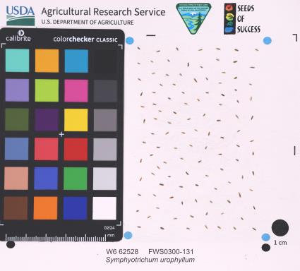 | | 2025 | | | | | | | Wild material | | 2192226 | W6 62528 |
| 32 | W6 62537 | FWS0300-151 | Lespedeza capitata Michx. | Michigan, United States | W6 | 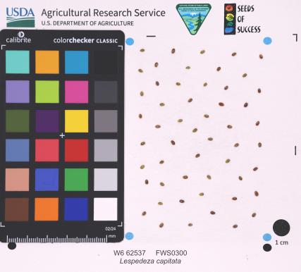 | | 2025 | | | | | | | Wild material | | 2192235 | W6 62537 |
| 33 | NA 89075 | 2024RJLPA-001 | Rhododendron maximum L. | Pennsylvania, United States | NA | | | 2024 | COLLECTED | 09/18/2024 | Fieldstone Farm Tank Creek Nature Preserve (a property of the Pocono Heritage Land Trust): Collected along Tank Creek. The property is accessed from a parking area located on Devil's Hole Road. | 41.13862300, -75.34562700 | 493 | Mostly found in mixed deciduous forest with occasional conifers and evergreen shrubs generally on steep slopes above Tank Creek in rocky well-drained soils in shade to part-shade. The slopes are abundant in decomposed organic matter and runoff soils. Slope: 5 to 30 percent. Aspect: various. Geology: The underlying geology of this area is of Devonian origin and characterized as the Long Run Member of Catskill Formation. It is comprised of gray and grayish-red sandstone and grayish-red siltstone and mudstone in fining-upward cycles. (Source: USGS Pennsylvania Geologic Map Data). Soils: The primary soil type found here is classified as Alluvial Land. In geology, alluvial land refers to areas of land that are formed by the deposition of sediments carried by rivers, or other surface water. EPA Ecoregion (Level III): North Central Appalachians (62). EPA Ecoregion (Level IV): Low Poconos (62b). | Wild material | | 2169039 | NA 89075 |
| 34 | NA 89076 | 2024RJLPA-002 | Kalmia latifolia L. | Pennsylvania, United States | NA | | | 2024 | COLLECTED | 09/18/2024 | Fieldstone Farm Tank Creek Nature Preserve (a property of the Pocono Heritage Land Trust): Collected along Tank Creek. The property is accessed from a parking area located on Devil's Hole Road. | 41.13862300, -75.34562700 | 493 | Mostly found in mixed deciduous forest with occasional conifers and evergreen shrubs generally on sloping sites as an understory shrub in rocky well-drained soils in shade to part-shade. Slope: 5 to 15 percent. Aspect: various. Geology: The underlying geology of this area is of Devonian origin and characterized as the Long Run Member of Catskill Formation. It is comprised of gray and grayish-red sandstone and grayish-red siltstone and mudstone in fining-upward cycles. (Source: USGS Pennsylvania Geologic Map Data). Soils: The primary soil type found here is classified as Alluvial Land. In geology, alluvial land refers to areas of land that are formed by the deposition of sediments carried by rivers, or other surface water. EPA Ecoregion (Level III): North Central Appalachians (62). EPA Ecoregion (Level IV): Low Poconos (62b). | Wild material | | 2169040 | NA 89076 |
| 35 | NA 88679 | RJL2023PA-013 | Rhododendron prinophyllum (Small) Millais | Pennsylvania, United States | NA | | | 2023 | COLLECTED | 10/30/2023 | Southwest side of Dutch Mountain Road north of Pine Marsh Creek in Pennsylvania State Game Lands Number 66. | 41.48201500, -76.27286000 | 602 | Moist, well-drained habitat with good organic matter in part shade on a wooded slope next to the road. Slope: 5-10%. Aspect: East. The underlying geology of this area is of Mississippian origin and characterized as the Burgoon Formation. It is comprised of buff, medium-grained, cross bedded sandstone that includes shale and coal. In some places, it contains conglomerate at base as well as occasionally contains plant fossils; equivalent to Pocono Formation of Ridge and Valley province. (Source: USGS Pennsylvania Geologic Map Data). The primary soil type in the collection area is classified as Wellsboro Series. The Wellsboro Series consists of very deep, moderately well- and somewhat poorly-drained soils formed in till derived from red sandstone, siltstone, and shale. Slope ranges from 0 to 50 percent. Saturated hydraulic conductivity is moderately high or high in the mineral surface layer, subsurface layer, and upper part of the subsoil; and low or moderately low in the lower part of the subsoil (fragipan) and the substratum. Solum thickness is greater than 102 cm. Depth to the fragipan ranges from 36 to 76 cm. Depth to bedrock is 152 cm or more. Rock fragments of subangular and rounded sandstone, siltstone or shale range from 5 to 40 percent in the A and B horizons, and from 15 to 50 percent in the Bx and C horizons. Typically, rock fragments average about 5 to 25 percent by volume above the fragipan and 15 to 40 percent by volume in and below the fragipan. Reaction commonly ranges from very strongly acid through moderately acid. (Source: NRCS Web Soil Survey). | Wild material | | 2159070 | NA 88679 |
| 36 | NA 88681 | RJL2023PA-015 | Ilex verticillata (L.) A. Gray | Pennsylvania, United States | NA | | | 2023 | COLLECTED | 10/30/2023 | Wetlands near Phillips Creek: seed collected from plants on the north and south (further east) side of Pennsylvania Route 188 approximately 6.9 kilometers east of the junction with Pennsylvania Route 487. | 41.30353100, -76.22452800 | 381 | Boggy to moist habitats associated with wetlands of Phillips Creek in shade to full sun next to the road. Slope: 0%. Aspect: various. The underlying geology of this area is of Devonian origin and characterized as the Catskill Formation. It is comprised of grayish-red sandstone, siltstone, shale, and mudstone; units of gray sandstone occur in upper part; lithologies in upper part arranged in fining-upward cycles. In the Altoona area, the Catskill Formation is mapped as the Duncannon, Sherman Creek, and Irish Valley Members, which are described under "Central and Eastern Pennsylvania" provinces. (Source: USGS Pennsylvania Geologic Map Data). The primary soil type in the collection area is classified as Wellsboro Series. The Wellsboro Series consists of very deep, moderately well- and somewhat poorly-drained soils formed in till derived from red sandstone, siltstone, and shale. Slope ranges from 0 to 50 percent. Saturated hydraulic conductivity is moderately high or high in the mineral surface layer, subsurface layer, and upper part of the subsoil; and low or moderately low in the lower part of the subsoil (fragipan) and the substratum. Solum thickness is greater than 102 cm. Depth to the fragipan ranges from 36 to 76 cm. Depth to bedrock is 152 cm or more. Rock fragments of subangular and rounded sandstone, siltstone or shale range from 5 to 40 percent in the A and B horizons, and from 15 to 50 percent in the Bx and C horizons. Typically, rock fragments average about 5 to 25 percent by volume above the fragipan and 15 to 40 percent by volume in and below the fragipan. Reaction commonly ranges from very strongly acid through moderately acid. (Source: NRCS Web Soil Survey). | Wild material | | 2159072 | NA 88681 |
| 37 | OPGC 8809 | CBG- 10771 | Silene stellata W. T. Aiton | Illinois, United States | OPGC | | | 2023 | | | | | | | Wild material | | 2142239 | OPGC 8809 |
| 38 | OPGC 8825 | CBG- 10822 | Ratibida pinnata (Vent.) Barnhart | Illinois, United States | OPGC | | | 2023 | | | | | | | Wild material | | 2142276 | OPGC 8825 |
| 39 | OPGC 8846 | CBG- 10857 | Gentiana puberulenta J. S. Pringle | Illinois, United States | OPGC | | | 2023 | | | | | | | Wild material | | 2142304 | OPGC 8846 |
| 40 | W6 61344 | CBG- 10756 | Perideridia americana (Nutt. ex DC.) Rchb. ex Steud. | Illinois, United States | W6 |  | | 2023 | | | | | | | Wild material | | 2142226 | W6 61344 |
| 41 | W6 61364 | CBG- 10780 | Ceanothus americanus L. | Illinois, United States | W6 |  | | 2023 | | | | | | | Wild material | | 2142246 | W6 61364 |
| 42 | W6 61366 | CBG- 10782 | Paronychia canadensis (L.) Alph. Wood | Illinois, United States | W6 |  | | 2023 | | | | | | | Wild material | | 2142248 | W6 61366 |
| 43 | W6 61391 | CBG- 10816 | Crocanthemum canadense (L.) Britton | Illinois, United States | W6 |  | | 2023 | | | | | | | Wild material | | 2142273 | W6 61391 |
| 44 | W6 61395 | CBG- 10823 | Helianthus mollis Lam. | Illinois, United States | W6 |  | | 2023 | | | | | | | Wild material | | 2142277 | W6 61395 |
| 45 | W6 61417 | CBG- 10852 | Verbesina alternifolia (L.) Britton ex Kearney | Illinois, United States | W6 |  | | 2023 | | | | | | | Wild material | | 2142299 | W6 61417 |
| 46 | W6 61418 | CBG- 10853 | Agastache scrophulariifolia (Willd.) Kuntze | Illinois, United States | W6 |  | | 2023 | | | | | | | Wild material | | 2142300 | W6 61418 |
| 47 | W6 60086 | MARSB-387 | Sorghastrum nutans (L.) Nash | Delaware, United States | W6 | | | 2021 | | | | | | | Wild material | | 2137171 | W6 60086 |
| 48 | NA 88298 | NEWFS-570 | Clethra alnifolia L. | Connecticut, United States | NA | | | 2021 | | | | | | | Wild material | | 2115704 | NA 88298 |
| 49 | OPGC 8206 | NEWFS-569 | Eurybia divaricata (L.) G. L. Nesom | Connecticut, United States | OPGC | | | 2021 | | | | | | | Wild material | | 2115703 | OPGC 8206 |
| 50 | W6 51581 | CBG-4157 | Heracleum sphondylium L. subsp. montanum (Schleich. ex Gaudin) Briq. | Illinois, United States | W6 | | | 2016 | | | | | | | Wild material | | 1942711 | W6 51581 |
| 51 | W6 48833 | MARSB-55 | Carex swanii (Fernald) Mack. | New Jersey, United States | W6 | 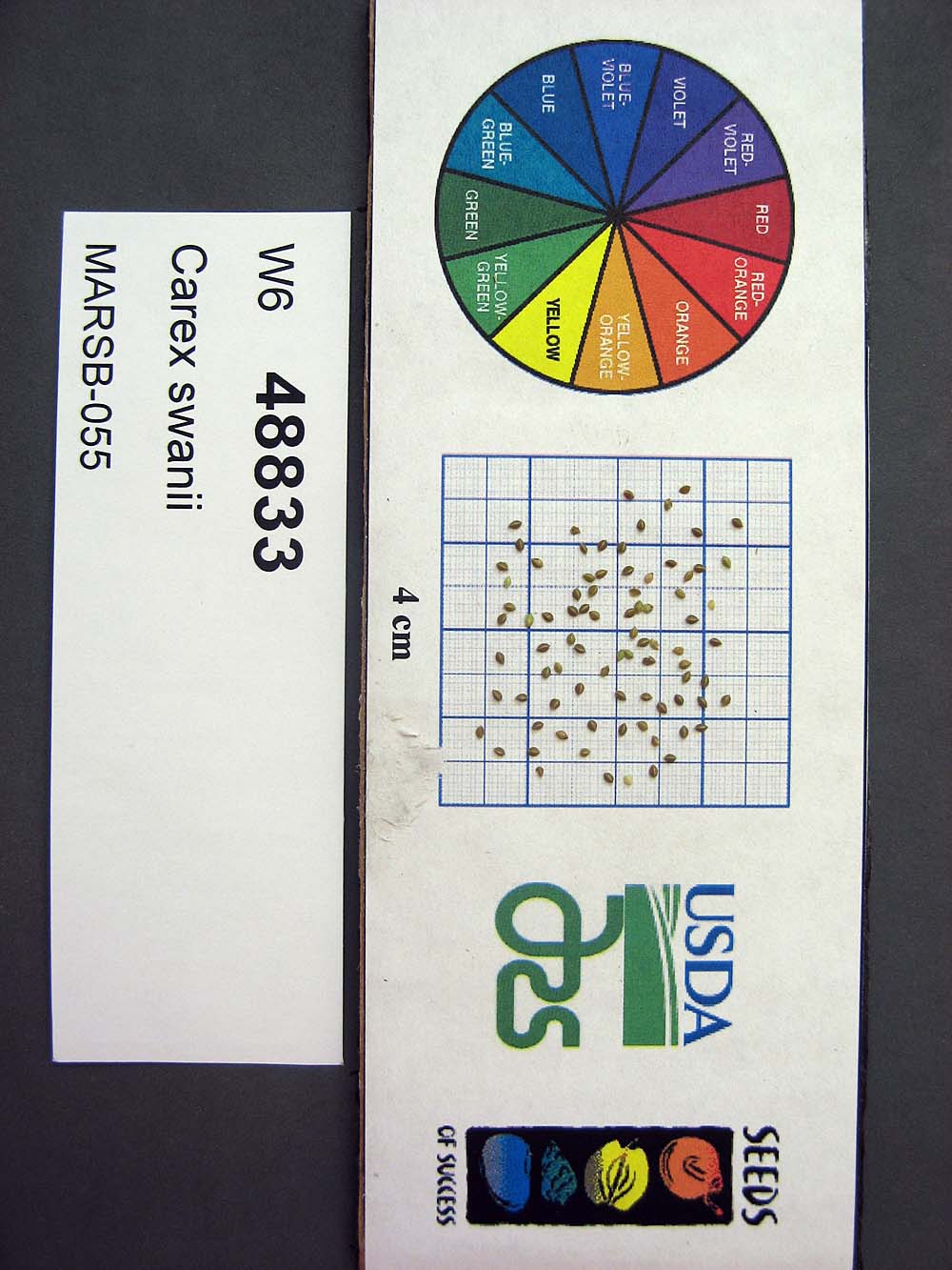 | | 2015 | | | | | | | Wild material | | 1922909 | W6 48833 |