| 0 | PI 688332 | R. cascadensis VA-2018-023 Spruce Knob | Rubus canadensis L. | West Virginia, United States | COR |  | | 2018 | COLLECTED | 08/24/2018 | Spruce Knob, Public Road 112, Monongahela National Forest, Pendleton, Co. WV | 38.70266700, -79.52476700 | 1309 | Steep east-facing road cut with dense vegetation of Solidago, Rubus strigosus, alder, Fragaria, bamboo grass, maple | Wild material | West Virginia 2018 | 1965279 | PI 688332 |
| 1 | PI 688333 | R. canadensis VA-2018-024 Forest Route 70 | Rubus canadensis L. | West Virginia, United States | COR | | | 2018 | COLLECTED | 08/24/2018 | Dolly Sods, FR 70, Monongahela National Forest, Randolph Co. WV | 38.95775000, -79.36330000 | 1159 | | Wild material | West Virginia 2018 | 1965280 | PI 688333 |
| 2 | PI 688375 | R. canadensis VA-2018-033 Dolly Sods | Rubus canadensis L. | West Virginia, United States | COR | | | 2018 | COLLECTED | 08/25/2018 | Dolly Sods Rohrbaugh Trail, Monongahela National Forest, Tucker Co. WV | 38.96508300, -79.35841700 | 1265 | shady weedy roadside | Wild material | West Virginia 2018 | 1965650 | PI 688375 |
| 3 | PI 688396 | R. canadensis VA-2018-053 Mt. Rogers | Rubus canadensis L. | Virginia, United States | COR | | | 2018 | COLLECTED | 08/28/2018 | | | | | Wild material | Virginia 2018 | 1965671 | PI 688396 |
| 4 | PI 553127 | R. canadensis NC 86-21-2 | Rubus canadensis L. | Georgia, United States | COR |  | | 1986 | COLLECTED | 08/05/1986 | Brasstown Bald up the road from parking area | 34.83333000, -83.83333000 | 1500 | Brasstown Bald up the road from parking area | Wild material | Excellent population, some introgression with R. argutus | 1448099 | PI 553127 |
| 5 | PI 553128 | R. canadensis NC 86-22-2 | Rubus canadensis L. | North Carolina, United States | COR | | | 1986 | COLLECTED | 08/05/1986 | Franklin, Wine Spring Bald summit | 35.16667000, -83.58333000 | 1815 | Franklin, Wine Spring Bald summit | Wild material | Varying thorniness, possible introgression with R. argutus | 1448100 | PI 553128 |
| 6 | PI 553129 | R. canadensis NC 86-23-2 | Rubus canadensis L. | North Carolina, United States | COR | | | 1986 | COLLECTED | 08/05/1986 | Watterock Knob off Blue Ridge Parkway along trail to peak | 35.41667000, -83.33333000 | 2000 | Watterock Knob off Blue Ridge Parkway along trail to peak | Wild material | Pimocane thornfree, variable for fruit size and set | 1448101 | PI 553129 |
| 7 | PI 553130 | R. canadensis NC 86-24-4 | Rubus canadensis L. | North Carolina, United States | COR | | | 1986 | COLLECTED | 08/05/1986 | Roy Taylor Forest Overlook on the Blue Ridge Parkway | 35.50000000, -83.00000000 | 1860 | Roy Taylor Forest Overlook on the Blue Ridge Parkway | Wild material | Extensive colony on slope, population sample | 1448102 | PI 553130 |
| 8 | PI 553131 | R. canadensis NC 86-29-2 | Rubus canadensis L. | North Carolina, United States | COR | | | 1986 | COLLECTED | 08/05/1986 | Jonas Ridge, Burke County | 35.83333000, -81.83333000 | 1380 | Jonas Ridge, Burke County | Wild material | Varying thorniness, appears introgressed with R. allegh. | 1448103 | PI 553131 |
| 9 | PI 553133 | R. canadensis NC 86-34-2 | Rubus canadensis L. | North Carolina, United States | COR | | | 1986 | COLLECTED | 08/05/1986 | Fork Ridge Overlook on the Blue Ridge Parkway | 35.41667000, -83.00000000 | | Fork Ridge Overlook on the Blue Ridge Parkway | Wild material | Canes generally thornless, typical variation of frt size | 1448105 | PI 553133 |
| 10 | PI 553134 | R. canadensis NC 86-35-2 | Rubus canadensis L. | North Carolina, United States | COR | | | 1986 | COLLECTED | 08/05/1986 | Balsam Mountain Road off Blue Ridge Parkway | 35.41667000, -83.16667000 | 1730 | Balsam Mountain Road off Blue Ridge Parkway | Wild material | Quite variable fruit size, some very nice | 1448106 | PI 553134 |
| 11 | PI 553135 | R. canadensis NC 86-38-2 | Rubus canadensis L. | North Carolina, United States | COR | | | 1986 | COLLECTED | 08/05/1986 | Clingman's Dome Road, Swain County. Roadsides | 35.50000000, -83.41667000 | 1825 | Clingman's Dome Road, Swain County. Roadsides | Wild material | Thornless primocanes and typical variation for fruit size | 1448107 | PI 553135 |
| 12 | PI 553136 | R. canadensis NC 86-39-2 | Rubus canadensis L. | North Carolina, United States | COR | | | 1986 | COLLECTED | 08/05/1986 | Along trail to Andrew's Bald, Swain County | 35.50000000, -83.41667000 | 2000 | Along trail to Andrew's Bald, Swain County | Wild material | Quite variable fruit size | 1448108 | PI 553136 |
| 13 | PI 553137 | R. canadensis NC 86-41-2 | Rubus canadensis L. | North Carolina, United States | COR | | | 1986 | COLLECTED | 08/05/1986 | Haywood-Jackson Overlook off Blue Ridge Parkway | 35.41667000, -83.08333000 | 2000 | Haywood-Jackson Overlook off Blue Ridge Parkway | Wild material | Quite variable fruit size, some variation in thorniness | 1448109 | PI 553137 |
| 14 | PI 553138 | R. canadensis NC 86-43-3 | Rubus canadensis L. | North Carolina, United States | COR | | | 1986 | COLLECTED | 08/05/1986 | Boone, in bald area in a saddle which has been grazed | 36.33333000, -81.66667000 | 1500 | Boone, in bald area in a saddle which has been grazed | Wild material | Scattered colonies, almost thronfree primocanes | 1448110 | PI 553138 |
| 15 | PI 553139 | R. canadensis NC 86-44-5 | Rubus canadensis L. | North Carolina, United States | COR | | | 1986 | COLLECTED | 08/05/1986 | Boone, along Roan Mountain Gardens Road | 36.00000000, -82.08333000 | 2050 | Boone, along Roan Mountain Gardens Road | Wild material | Quite variable fruitfulness and fruit size | 1448111 | PI 553139 |
| 16 | PI 553140 | R. canadensis NC 86-44-6 | Rubus canadensis L. | North Carolina, United States | COR | | | 1986 | COLLECTED | 08/05/1986 | Boone, along Roan Mountain Gardens Road | 36.00000000, -82.08333000 | 2050 | Boone, along Roan Mountain Gardens Road | Wild material | Select clone, primocanes to 2.5m, almost thornless | 1448112 | PI 553140 |
| 17 | PI 653293 | R. occidentalis HDF-2007-032 | Rubus occidentalis L. | Georgia, United States | COR | | | 2007 | COLLECTED | 06/05/2007 | Near were William Bartram Trail crosses Warwoman Road, Warwoman Dell, about 4 miles east of Clayton, Rabun County. On slope down to the creek (Becky Branch) below. | 34.88280000, -83.35170000 | 595 | East facing slope, Associated Plants: Smilax bona-nox, Rhus typhina, Potentilla, Liriodendron tulipifera, Hydrangea arborescens, Lonicera japonica, Rhododendron, Sambucus canadensis and Vitis rotundifolia. | Wild material | Kim Hummer, Michael Dossett collection from Georgia.
| 1730092 | PI 653293 |
| 18 | PI 553355 | 'Perron's Black' | Rubus hybr. | Québec, Canada | COR |  | | 1990 | DEVELOPED | 1987 | | | | | Cultivar | Orig. in Quebec, Canada, by W.H. Perron and Co. Introd. in 1987. Selected from wild Rubus canadensis on the Appalachian plateau of southern Quebec. Fruit: black; slightly conical, 30 x 20 mm; high sugar content, aromatic. Plant: thornless, trailing canes; vigorous; no suckering; cold hardy.Brooks and Olmo
W. H. Perron and Co. Ltd. cultivar release
NAMED FOR= W. H. Perron and Co. Ltd., nurserymen | 1448327 | PI 553355 |
| 19 | OPGC 8803 | CBG- 10754 | Aquilegia canadensis L. | Illinois, United States | OPGC | | | 2023 | | | | | | | Wild material | | 2142225 | OPGC 8803 |
| 20 | W6 61366 | CBG- 10782 | Paronychia canadensis (L.) Alph. Wood | Illinois, United States | W6 |  | | 2023 | | | | | | | Wild material | | 2142248 | W6 61366 |
| 21 | OPGC 8277 | CBG-9703 | Pedicularis canadensis L. | Illinois, United States | OPGC | | | 2021 | | | | | | | Wild material | plant habit: forb | 2120016 | OPGC 8277 |
| 22 | OPGC 8182 | NEWFS-475 | Solidago canadensis L. | Massachusetts, United States | OPGC | | | 2021 | | | | | | | Wild material | Three-veined leaves with frequent, flared teeth. | 2115665 | OPGC 8182 |
| 23 | OPGC 8203 | NEWFS-558 | Solidago canadensis L. | Massachusetts, United States | OPGC | | | 2021 | | | | | | | Wild material | Teeth at leaf margins are extremely flared, stems pubescent from top to bottom. | 2115698 | OPGC 8203 |
| 24 | OPGC 7466 | CBG-8640 | Anemone canadensis L. | Wisconsin, United States | OPGC |  | | 2019 | | | | | | | Wild material | | 2092691 | OPGC 7466 |
| 25 | OPGC 6153 | CBG-2469 | Aquilegia canadensis L. | Illinois, United States | OPGC |  | | 2015 | | | | | | | Wild material | | 1926006 | OPGC 6153 |
| 26 | W6 48948 | AK930-473 | Calamagrostis canadensis (Michx.) P. Beauv. | Alaska, United States | W6 |  | | 2015 | | | | | | | Wild material | | 1923863 | W6 48948 |
| 27 | W6 48958 | AK930-486 | Calamagrostis canadensis (Michx.) P. Beauv. | Alaska, United States | W6 |  | | 2015 | | | | | | | Wild material | | 1923873 | W6 48958 |
| 28 | WLP 229 | NA 80349 | Tsuga canadensis (L.) Carrière | New York, United States | NA | | | 2011 | COLLECTED | 09/10/2011 | Along Emery Hill Road. | 42.07700000, -79.08400000 | 433 | Roadside. East-facing slope. Rocky substrate with very tiny spring creek at base of slope. Associated with Acer saccharum, Asarum canadense, Diervilla lonicera, Fraxinus americana, Hamamelis virginiana, Impatiens capensis, Rubus, Solidago, and Tilia americana. | Wild material | | 1891488 | WLP 229 |
| 29 | PI 688393 | V. corymbosum (constablaei) VA-2018-051 Mt. Rogers | Vaccinium corymbosum L. | Virginia, United States | COR | | | 2018 | COLLECTED | 08/28/2018 | Mt. Rogers Grayson Highlands State Park, Twin Pinnacles trail, Grayson Co. VA | 36.62674000, -81.50373000 | 1556 | Rocky outcrop along Twin Pinnacles trail, a single plant at edge of outcrop with V. erythrocarpum, V. simulatum, on edge of dense forest of yellow birch, red maple, striped maple, witchhazel, fir, red spruce, cherry, beech, Solidago, Menziezia, Rubus canadensis, lycopodium, Ribes, Smilax, aster, grasses, various herbs and weeds | Wild material | Virginia 2018 | 1965668 | PI 688393 |
| 30 | PI 688394 | V. erythrocarpum VA-2018-052 Mt. Rogers | Vaccinium erythrocarpum Michx. subsp. erythrocarpum | Virginia, United States | COR |  | | 2018 | COLLECTED | 08/26/2018 | Mt. Rogers Grayson Highlands State Park, Twin Pinnacles trail, Grayson Co. VA | 36.62674000, -81.50373000 | 1556 | Rocky outcrop along Twin Pinnacles trail, a single plant at edge of outcrop with V. simulatum, on edge of dense forest of yellow birch, red maple, striped maple, witchhazel, fir, red spruce, cherry, beech, Solidago, Menziezia, Rubus canadensis, lycopodium, Ribes, Smilax, aster, grasses, various herbs and weeds | Wild material | Virginia 2018 | 1965669 | PI 688394 |
| 31 | PI 688404 | V. simulatum VA-2018-061 White Top | Vaccinium simulatum Small | Virginia, United States | COR | | | 2018 | COLLECTED | 08/29/2018 | Whitetop Mountain, Mud Creek Lane, Grayson Co. VA | 36.63828000, -81.60551000 | 1673 | Top of Whitetop Mountain along Mud Creek Lane. Found on rocky, moist, dark soiled, weedy road cuts and in open meadow with Crataegus, fir, Sorbus, yellow birch, wild cherry, azalea, Rubus canadensis, rush, grass, Eupatorium, Prunella, Solidago, sneezeweed, Gentian, Erigeron, various herbs; one or two large clones of V. erythrocarpum found across Mud Creek Lane. | Wild material | Virginia 2018 | 1965679 | PI 688404 |
| 32 | PI 688405 | V. erythrocarpum VA-2018-062 White Top | Vaccinium erythrocarpum Michx. subsp. erythrocarpum | Virginia, United States | COR | | | 2018 | COLLECTED | 08/29/2018 | Whitetop Mountain, Mud Creek Lane, Grayson Co. VA | 36.63781000, -81.60879000 | 1657 | Top of Whitetop Mountain along Mud Creek Lane; one or two large clones on rocky, moist road cut; Crataegus, fir, Rubus canadensis, rush, grass, Eupatorium, Prunella, Solidago; Ribes rotundifolium, strawberry, weeds | Wild material | Virginia 2018 | 1965680 | PI 688405 |
| 33 | PI 688406 | V. erythrocarpum VA-2018-063 White Top | Vaccinium erythrocarpum Michx. subsp. erythrocarpum | Virginia, United States | COR | | | 2018 | COLLECTED | 08/29/2018 | Whitetop Mountain, Mud Creek Lane, Grayson Co. VA | 36.63269000, -81.60374000 | 1563 | Top of Whitetop Mountain along Mud Creek Lane; one or two large clones on rocky, moist road cut; Crataegus, fir, Rubus canadensis, rush, grass, Eupatorium, Prunella, Solidago; Ribes rotundifolium, strawberry, weeds | Wild material | Virginia 2018 | 1965681 | PI 688406 |
| 34 | PI 688407 | V. simulatum VA-2018-064 late ripening | Vaccinium simulatum Small | Virginia, United States | COR |  | | 2018 | COLLECTED | 08/29/2018 | Whitetop Mountain, Mud Creek Lane, Grayson Co. VA | 36.63390000, -81.60403000 | 1590 | Top of Whitetop Mountain along Mud Creek Lane. Found on rocky, moist, dark soiled, weedy road cuts and in open meadow with Crataegus, fir, Sorbus, yellow birch, wild cherry, azalea, Rubus canadensis, rush, grass, Eupatorium, Prunella, Solidago, sneezeweed, Gentian, Erigeron, various herbs; one or two large clones of V. erythrocarpum found across Mud Creek Lane. | Wild material | Virginia 2018 | 1965682 | PI 688407 |
| 35 | PI 688408 | V. simulatum VA-2018-065 Mud Creek Lane | Vaccinium simulatum Small | Virginia, United States | COR |  | | 2018 | COLLECTED | 08/29/2018 | Whitetop Mountain, Mud Creek Lane, Grayson Co. VA | 36.63273000, -81.60430000 | 1572 | Top of Whitetop Mountain along Mud Creek Lane. Found on rocky, moist, dark soiled, weedy road cuts and in open meadow with Crataegus, fir, Sorbus, yellow birch, wild cherry, azalea, Rubus canadensis, rush, grass, Eupatorium, Prunella, Solidago, sneezeweed, Gentian, Erigeron, various herbs; one or two large clones of V. erythrocarpum found across Mud Creek Lane. | Wild material | Virginia 2018 | 1965683 | PI 688408 |
| 36 | PI 679664 | V. macrocarpon USFA-ANF-2014-1 | Vaccinium macrocarpon Aiton | Pennsylvania, United States | COR | | | 2014 | COLLECTED | 11/06/2014 | McKean County, Allegheny National Forest, Bradford Ranger District. Along both sides of FR320, approximately 0.2 miles south of junction with FR455. | 41.81790828, -78.73479570 | 629 | Fen. Mixed mosaic of grass/sedge meadow, sphagnum lawn and dry upland mounds. Eriophorum virginicum, Scirpus cyperinus, Glyceria canadensis, Lycopodiella inundata, Vaccinium macrocarpon and numerous Carex and Juncus spp. dominate the saturated portions, while Rubus hispidus and Lycopodium spp. dominate the drier mounds. Population size 1215 m2. | Wild material | Improvement status: wild
Frequency: Occasional to rare
Population distribution: irregular
Altitude: 629
Altimeter make\model: Trimble Geoexplorer 6000
Latitude: 41.817908283 ? N
Longitude: 78.734795701 ? W
GPS make\model: Trimble Geoexplorer 6000
GPS geodetic datum: WGS 1984
GPS uncertainty: 0.6
Slope: 0 ? 5%
Habitat: Fen. Mixed mosaic of grass/sedge meadow, sphagnum lawn and dry upland mounds ? Eriophorum virginicum, Scirpus cyperinus, Glyceria canadensis, Lycopodiella inundata, Vaccinium macrocarpon and numerous Carex and Juncus spp. dominate the saturated portions, while Rubus hispidus and Lycopodium spp. dominate the drier mounds. Population size 1215 m2.
Plant description: Typical for species. Plants present many upright shoots. No flowers. Abundant fruit. Fruit ranges from about 9 to 17 mm in diameter. Fruit shape ranges from pear-shaped to spherical. Fruit color ranges from salmon-pink to nearly black. Fruit consistency ranges from firm and waxy to soft and non-waxy. Vigor and productiveness of plants varies throughout population, though, in general, those in the southern half of the site are denser and bearing substantially more fruit. The densest fruit set tends to be right along road margins.
Type of propagule collected: Seed
Notes: This site is part of a brownwater upland wetland complex heavily impacted by historic Oil, Gas, and Mineral Activity and bisected by a maintained forest road. It drains into an unnamed tributary to Turnup Run. One small disjunct population (4.5 sq meters) is located approximately 1.15 miles NE of this site along the edge of FR305. The nearest sizeable population is located approximately 8.8 miles E of this site.
Collectors: Susan Dube
Comment: CRANBERRY IGRR PROJECT | 1922212 | PI 679664 |
| 37 | PI 679627 | V. macrocarpon Big Run Bog FR 18 | Vaccinium macrocarpon Aiton | West Virginia, United States | COR | | | 2014 | COLLECTED | 04/22/2014 | Big Run Bog, Backbone Mountain, Monogahela National Forest, Tucker County. Next to Forest Road 18 | 39.11812000, -79.58452000 | 983 | Minerotrophic fen in a shallow basin. Many hummocks with standing water between. Fen dissected by many sloughs. A large area of open water within the fen has active beaver dams. Hummocks support small trees and shrubs | Wild material | Plants in fen include Spaghnum sp., Rubus hispidus, Solidago uliginosa, Eriphorum virginicum, Juncus sp., Carex spp., Scirpus sp. Gaultheria hispidula, Aronia melanocarpa, Sarracenia purpurea (introduced). Hummocks supported Picea rubens, Rhododendron maximum, Kalmia latifolia, and ferns including Osmundastrum cinnamomea. Vegetation on surrounding slopes includes Picea rubens, Tsuga canadensis, Amelanchier sp. and Pinus rigida.
Plant description: Reddish leaves. Prolific fruit production. Fruit shape, size and color typical for species. Voucher colleted. Type of propagule collected: seed
Collectors: Williams, KA; Garvey, E; Polgar, R. CRANBERRY IGRR PROJECT | 1919345 | PI 679627 |
| 38 | PI 679628 | V. oxycoccos Big Run Bog FR 18 | Vaccinium oxycoccos L. | West Virginia, United States | COR | | | 2014 | COLLECTED | 04/22/2014 | Big Run Bog, Backbone Mountain, Monogahela National Forest, Tucker County. Next to Forest Road 18 | 39.11812000, -79.58452000 | 983 | Minerotrophic fen in a shallow basin. Many hummocks with standing water between. Fen dissected by many sloughs. A large area of open water within the fen has active beaver dams. Hummocks support small trees and shrubs | Wild material | Plants in fen include Spaghnum sp., Rubus hispidus, Solidago uliginosa, Eriphorum virginicum, Juncus sp., Carex spp., Scirpus sp. Gaultheria hispidula, Aronia melanocarpa, Sarracenia purpurea (introduced). Hummocks supported Picea rubens, Rhododendron maximum, Kalmia latifolia, and ferns including Osmundastrum cinnamomea. Vegetation on surrounding slopes includes Picea rubens, Tsuga canadensis, Amelanchier sp. and Pinus rigida.
Plant description: Plant prostrate. Fruit shape, size and color typical for species. Voucher collected Type of propagule collected: seed
Collectors: Williams, KA; Garvey, E; Polgar, R. CRANBERRY IGRR PROJECT | 1919346 | PI 679628 |
| 39 | PI 679629 | V. oxycoccos Red Run Bog FR 13 | Vaccinium oxycoccos L. | West Virginia, United States | COR | | | 2014 | COLLECTED | 04/23/2014 | Red Run Bog, Monongahela National Forest. Tucker County. The bog is bisected by Canaan Loop Road (Forest Road 13) | 39.07228000, -79.47363000 | 1110 | Bog with two main areas (east and west) separated by forest which is interspersed with smaller boggy areas. Road runs through forested area. Gentle slope from 1115 m in the east to 1105 m in the west. The total area is approximately 100 acres. | Wild material | Plants in bog include Spaghnum sp., Lycopodium sp., Rubus hispidus, Solidago uliginosa, Eriphorum virginicum, Pteridium aquilinum, Juncus sp., Carex spp., Aronia melanocarpa, and Vaccinium macrocarpon . Vegetation on surrounding slopes includes Picea rubens, Tsuga canadensis, Rhododendron maximum, Kalmia latifolia, Ilex montana, Gaultheria sp., and Viburnum prunifolium. Abies balsamea occurs on the edge of the bog.
Plant description: Abundant fruit. Fruit shape, size and color typical for species. Voucher collected Type of propagule collected: seed
Collectors: Williams, KA; Garvey, E; Polgar, R. CRANBERRY IGRR PROJECT | 1919347 | PI 679629 |
| 40 | PI 679630 | V. macrocarpon Red Run Bog FR 13 | Vaccinium macrocarpon Aiton | West Virginia, United States | COR | | | 2014 | COLLECTED | 04/23/2014 | Red Run Bog, Monongahela National Forest. Tucker County. The bog is bisected by Canaan Loop Road (Forest Road 13) | 39.07228000, -79.47363000 | 1110 | Bog with two main areas (east and west) separated by forest which is interspersed with smaller boggy areas. Road runs through forested area. Gentle slope from 1115 m in the east to 1105 m in the west. The total area is approximately 100 acres. | Wild material | Plants in bog include Spaghnum sp., Lycopodium sp., Rubus hispidus, Solidago uliginosa, Eriphorum virginicum, Pteridium aquilinum, Juncus sp., Carex spp., Aronia melanocarpa, and Vaccinium oxycoccos . Vegetation on surrounding slopes includes Picea rubens, Tsuga canadensis, Rhododendron maximum, Kalmia latifolia, Ilex montana, Gaultheria sp., and Viburnum prunifolium. Abies balsamea occurs on the edge of the bog.
Plant description: Abundant fruit. Fruit shape, size and color typical for species. Voucher collected Type of propagule collected: seed
Collectors: Williams, KA; Garvey, E; Polgar, R. CRANBERRY IGRR PROJECT | 1919348 | PI 679630 |
| 41 | PI 613679 | V. uliginosum KHCW 96-04-01 | Vaccinium uliginosum L. | Alaska, United States | COR | | | 1996 | COLLECTED | 07/30/1996 | Whitshed Road Extended, about 8 miles southwest of Cordova | 60.49139000, -145.87056000 | 10 | Exposured Peat bog, a few scattered scrub spruce. Associated plants: Vaccinium uliginosum, Spiranthes romanzoa, Carex, Vaccinium oxycoccus, V. vitis-idaea, Rubus spectabilis, Drosera rotundifolia, Cornus canadensis, Salix and Alnus. | Wild material | USDA Sponsored plant collecting expedition, 1996. Typical Fragaria chiloensis subsp. pacifica with spreading hairs on pedioles. Fruit past ripe on 29 August 1996. One flower in bloom. | 1536523 | PI 613679 |
| 42 | PI 613680 | V. vitis-idaea KHCW 96-04-02 | Vaccinium vitis-idaea L. | Alaska, United States | COR |  | | 1996 | COLLECTED | 07/30/1996 | Whitshed Road Extended, about 8 miles southwest of Cordova | 60.49139000, -145.87056000 | 10 | Exposured Peat bog, a few scattered scrub spruce. Associated plants: Vaccinium uliginosum, Spiranthes romanzoa, Carex, Vaccinium oxycoccus, V. vitis-idaea, Rubus spectabilis, Drosera rotundifolia, Cornus canadensis, Salix and Alnus. | Wild material | USDA Sponsored plant collecting expedition, 1996. | 1536524 | PI 613680 |
| 43 | PI 613687 | V. vitis-idaea Muskeeg KHCW 96-12-01A | Vaccinium vitis-idaea L. | Alaska, United States | COR |  | | 1996 | COLLECTED | 07/31/1996 | About 0.5 mile from Copper River Road on Muskeeg Meander Trail. | 60.49816000, -145.46733000 | 45 | Associated plants:Salix alaxensis, Picea sitchensis, Festuca Rubus spectabilis, Cornus canadensis, Gentian, Epilobium angustifolium. | Wild material | USDA Sponsored plant collecting expedition, 1996. | 1536531 | PI 613687 |
| 44 | PI 616874 | F. virginiana subsp. virginiana NC 96-4-2 | Fragaria virginiana Mill. subsp. virginiana | North Carolina, United States | COR |  | Out of Season | 1996 | COLLECTED | 05/14/1996 | Highway US 117, 1.4 miles north of Magnolia city limits , Duplin county, North Carolina. Roadside on right heading north. | 34.92000000, -78.06472000 | | Roadside between ditch and woods of mixed pines and hardwoods. Plants scattered with P. canadensis, Rubus ssp. among grasses and herbs. | Wild material | USDA Sponsored plant collecting expedition, 1996 | 1536037 | PI 616874 |
| 45 | PI 616886 | F. virginiana subsp. virginiana NC 96-6-3 | Fragaria virginiana Mill. subsp. virginiana | North Carolina, United States | COR |  | Out of Season | 1996 | COLLECTED | 05/14/1996 | Scattered along left side of county road 1004, at woods edge, 0.4 miles beyond Island Creek. Jones county, North Carolina. | 35.02889000, -77.12944000 | | Scattered near woods edge. Rich woods of Beech, hop hornbeam and associated vegetation. Duchesnea indica, P. canadensis, along with Rubus spp., also present. | Wild material | USDA Sponsored plant collecting expedition, 1996 | 1536050 | PI 616886 |
| 46 | PI 612569 | F. virginiana subsp. grayana NC 95-21-1 | Fragaria virginiana Mill. subsp. grayana (Vilm. ex J. Gay) Staudt | Mississippi, United States | COR |  | Out of Season | 1995 | COLLECTED | 07/12/1995 | Mississippi, Pontotoc county. Trace State Park (just outside Tupelo) | 33.85528000, -88.53917000 | 0 | Along roadside in grassy areas. Found in shade under trees. Scattered and morphologically diverse popl. | Wild material | Update on 1995 F. virginiana Collections in the Southeastern USA James R. Ballington and Jerry A. Payne South Carolina was extremely frustrating, by the middle of the week we had only verified the existence of one location for Fragaria virginiana inthe Coastal Plain. Three accessions were located in the Edgefield District of Sumter National Forest and four in Greenwood State Park. Fragaria virginiana from the one verified Coastal Plain location is currently growing in a garden near Lexington, SC. Twelve accessions of Vaccinium spp., four of Gaylussacia frondosa, and one of Rubus argutus were also collected.In southeastern Louisiana and in Mississippi, Fragaria virginiana was not abundant either, and no accessions were found south of Starkville, MS. Specific previous sites were visited near Hattisburg and Laurel, MS, but F. virginiana was no longer present. A total 33 accessions of F. viriniana were collected from east central and northeastern Mississippi. Occurring in small outcroppings of prairie in these regions. Characterized by a very thin layer of 'usually' sticky black soil over decaying limestone, and a scattered to dense overstory of Juniperus virginiana. Within such prairies, F. virginiana was often found growing directly under J. virginiana where little other vegetation occurred. In addition to F. virginiana, 14 accessions of Vaccinium spp. and two accessions Rubus flagellaris were also collected. The collecting trips raised serious questions concerning the statusof Fragaria virginiana in the southeastern US. Is it really as rare as it appears to be in areas such as the coastal plain of South Carolina, southern Mississippi and southeastern Louisiana? People in almost every area told us how abundant wild strawberries were on their property or generally in their region, but these almost always turned out to be either Duchesnea indica, or Potentilla canadensis. The abundance of these two species was about what we had hoped for F. virginiana. | 1507734 | PI 612569 |
| 47 | PI 616689 | F. virginiana subsp. virginiana NC 95-4-1 | Fragaria virginiana Mill. subsp. virginiana | South Carolina, United States | COR | | Out of Season | 1995 | COLLECTED | 06/12/1995 | South Carolina, Williamsburg county, Creel Farm, Henry community. South from Hemingway on SC 41 to county road 121 , left on 121 for 4.5 miles to SC 512 in Henry. Just across SC 512 on 121, to Creel farm. | 34.32111000, -79.28556000 | 0 | Woodland, currently w/ a heavy canopy of mostly deciduous trees. V. tenellum, R. trivialis and R. flagellans occasionally in the woods and along the field edge. | Wild material | South Carolina was extremely frustrating, by the middle of the week we had only verified the existence of one location for Fragaria virginiana in the Coastal Plain, so we moved over into the southern piedmont. Three accessions were located in the Edgefield District of Sumter National Forest and four in Greenwood State Park. The one verified Coastal Plain location is in a garden near Lexington, SC. Twelve accessions of Vaccinium spp., four of Gaylussacia frondosa, and one of Rubus argutus were also collected. Southeastern Louisiana and Mississippi were more successful, but not abundant in these areas either. No accessions were found south of Starkville, MS. Specific previous sites were visited near Hattisburg and Laurel, MS, but F. virginiana was no longer present. A total 33 accessions of F. virginiana were collected from east central and northeastern MS, occurring in small outcroppings of prairie; characterized by a very thin layer of 'usually' sticky black soil over decaying limestone with scattered to dense overstory of Juniperus virginiana. Fragaria virginiana was often found growing directly under J. virginiana where little other vegetation occurred. Dr. Sidney McDaniel of Mississippi State University refers to these areas as 'cedar prairie woodlands'. In addition to F. virginiana, 14 accessions of Vaccinium spp. and two accessions Rubus flagellaris were also collected. These trips raise serious questions concerning the status of Fragaria virginiana in the southeastern US. Is it really as rare as it appears to be? In Greenwood State Park in South Carolina, the species was pioneering on bare ground two years after clearcutting. In Mississippi it was not found in such areas, although one herbarium specimen came from the edged of wildlife food plot. People in almost every area told us how abundant wild strawberries were on their property or in their region, but these almost always turned out to be either Duchesnea indica, or Potentilla canadensis. | 1507705 | PI 616689 |
| 48 | PI 616691 | F. virginiana subsp. virginiana NC 95-11-1 | Fragaria virginiana Mill. subsp. virginiana | South Carolina, United States | COR |  | Out of Season | 1995 | COLLECTED | 06/16/1995 | South Carolina, Abbeville county, Sumter National Forest. FS Road 520 at White Creek Bridge. | 34.08972000, -82.41028000 | 0 | Modest colony of F. virginiana in shade in shallow ditch by road side (above creek). Good moisture and moisture holding capacity. Sig. comp. from grasses & lugumes + Lonicera hallii & tree sdlg. | Wild material | South Carolina was extremely frustrating, by the middle of the week we had only verified the existence of one location for Fragaria virginiana in the Coastal Plain, so we moved over into the southern piedmont. Three accessions were located in the Edgefield District of Sumter National Forest and four in Greenwood State Park. The one verified Coastal Plain location is in a garden near Lexington, SC. Twelve accessions of Vaccinium spp., four of Gaylussacia frondosa, and one of Rubus argutus were also collected. Southeastern Louisiana and Mississippi were more successful, but not abundant in these areas either. No accessions were found south of Starkville, MS. Specific previous sites were visited near Hattisburg and Laurel, MS, but F. virginiana was no longer present. A total 33 accessions of F. virginiana were collected from east central and northeastern MS, occurring in small outcroppings of prairie; characterized by a very thin layer of 'usually' sticky black soil over decaying limestone with scattered to dense overstory of Juniperus virginiana. Fragaria virginiana was often found growing directly under J. virginiana where little other vegetation occurred. Dr. Sidney McDaniel of Mississippi State University refers to these areas as 'cedar prairie woodlands'. In addition to F. virginiana, 14 accessions of Vaccinium spp. and two accessions Rubus flagellaris were also collected. These trips raise serious questions concerning the status of Fragaria virginiana in the southeastern US. Is it really as rare as it appears to be? In Greenwood State Park in South Carolina, the species was pioneering on bare ground two years after clearcutting. In Mississippi it was not found in such areas, although one herbarium specimen came from the edged of wildlife food plot. People in almost every area told us how abundant wild strawberries were on their property or in their region, but these almost always turned out to be either Duchesnea indica, or Potentilla canadensis. | 1507708 | PI 616691 |
| 49 | PI 616695 | F. virginiana subsp. virginiana NC 95-12-4 | Fragaria virginiana Mill. subsp. virginiana | South Carolina, United States | COR |  | Out of Season | 1995 | COLLECTED | 06/17/1995 | South Carolina, Greenwood county, Greenwood State Park. Along road 207 that fronts the Park boundary. | 34.18944000, -82.96528000 | 0 | Upland - very disturbed area, apparently clearcut 2 yrs ago. Some areas of bare soil. Clearcut cornered with established 30 year old pines. | Wild material | South Carolina was extremely frustrating, by the middle of the week we had only verified the existence of one location for Fragaria virginiana in the Coastal Plain, so we moved over into the southern piedmont. Three accessions were located in the Edgefield District of Sumter National Forest and four in Greenwood State Park. The one verified Coastal Plain location is in a garden near Lexington, SC. Twelve accessions of Vaccinium spp., four of Gaylussacia frondosa, and one of Rubus argutus were also collected. Southeastern Louisiana and Mississippi were more successful, but not abundant in these areas either. No accessions were found south of Starkville, MS. Specific previous sites were visited near Hattisburg and Laurel, MS, but F. virginiana was no longer present. A total 33 accessions of F. virginiana were collected from east central and northeastern MS, occurring in small outcroppings of prairie; characterized by a very thin layer of 'usually' sticky black soil over decaying limestone with scattered to dense overstory of Juniperus virginiana. Fragaria virginiana was often found growing directly under J. virginiana where little other vegetation occurred. Dr. Sidney McDaniel of Mississippi State University refers to these areas as 'cedar prairie woodlands'. In addition to F. virginiana, 14 accessions of Vaccinium spp. and two accessions Rubus flagellaris were also collected. These trips raise serious questions concerning the status of Fragaria virginiana in the southeastern US. Is it really as rare as it appears to be? In Greenwood State Park in South Carolina, the species was pioneering on bare ground two years after clearcutting. In Mississippi it was not found in such areas, although one herbarium specimen came from the edged of wildlife food plot. People in almost every area told us how abundant wild strawberries were on their property or in their region, but these almost always turned out to be either Duchesnea indica, or Potentilla canadensis. | 1507712 | PI 616695 |
| 50 | PI 616700 | F. virginiana NC 95-16-6 | Fragaria virginiana Mill. subsp. grayana (Vilm. ex J. Gay) Staudt | Mississippi, United States | COR |  | Out of Season | 1995 | COLLECTED | 07/10/1995 | Mississippi, Oktibbeha county. From Starkville, E on Hwy 82/182 2.2 mi to sec rd 16. L on sec rd 16 4.6 mi to Rock Hill Rd. Righton Rock Hill Rd for 1.6 mi. | 33.54611000, -88.71472000 | 0 | On right: almost excl in shade of Juniperus virgiana, shallow soil over exposed chalk - shade appeared critical for survival. On left: more or less open, competing w/ grasses & R. trivialis. | Wild material | South Carolina was extremely frustrating, by the middle of the week we had only verified the existence of one location for Fragaria virginiana in the Coastal Plain, so we moved over into the southern piedmont. Three accessions were located in the Edgefield District of Sumter National Forest and four in Greenwood State Park. The one verified Coastal Plain location is in a garden near Lexington, SC. Twelve accessions of Vaccinium spp., four of Gaylussacia frondosa, and one of Rubus argutus were also collected. Southeastern Louisiana and Mississippi were more successful, but not abundant in these areas either. No accessions were found south of Starkville, MS. Specific previous sites were visited near Hattisburg and Laurel, MS, but F. virginiana was no longer present. A total 33 accessions of F. virginiana were collected from east central and northeastern MS, occurring in small outcroppings of prairie; characterized by a very thin layer of 'usually' sticky black soil over decaying limestone with scattered to dense overstory of Juniperus virginiana. Fragaria virginiana was often found growing directly under J. virginiana where little other vegetation occurred. Dr. Sidney McDaniel of Mississippi State University refers to these areas as 'cedar prairie woodlands'. In addition to F. virginiana, 14 accessions of Vaccinium spp. and two accessions Rubus flagellaris were also collected. These trips raise serious questions concerning the status of Fragaria virginiana in the southeastern US. Is it really as rare as it appears to be? In Greenwood State Park in South Carolina, the species was pioneering on bare ground two years after clearcutting. In Mississippi it was not found in such areas, although one herbarium specimen came from the edged of wildlife food plot. People in almost every area told us how abundant wild strawberries were on their property or in their region, but these almost always turned out to be either Duchesnea indica, or Potentilla canadensis. | 1507717 | PI 616700 |
| 51 | PI 616701 | F. virginiana NC 95-17-1 | Fragaria virginiana Mill. subsp. grayana (Vilm. ex J. Gay) Staudt | Mississippi, United States | COR | | Out of Season | 1995 | COLLECTED | 07/10/1995 | Mississippi, Oktibbeha county. E on Hwy 82 to Old Mayhew Road. Right on Old Mayhew 0.8 mi to unpaved road heading uphill to left. Left on unpaved rd 0.5 mi to nat'l gas pipeling right of way. | 33.45778000, -88.77056000 | 0 | A significant popl of F. virginiana occurred under J. virginiana trees in an extended cedar glade on slopes above a meadow. | Wild material | South Carolina was extremely frustrating, by the middle of the week we had only verified the existence of one location for Fragaria virginiana in the Coastal Plain, so we moved over into the southern piedmont. Three accessions were located in the Edgefield District of Sumter National Forest and four in Greenwood State Park. The one verified Coastal Plain location is in a garden near Lexington, SC. Twelve accessions of Vaccinium spp., four of Gaylussacia frondosa, and one of Rubus argutus were also collected. Southeastern Louisiana and Mississippi were more successful, but not abundant in these areas either. No accessions were found south of Starkville, MS. Specific previous sites were visited near Hattisburg and Laurel, MS, but F. virginiana was no longer present. A total 33 accessions of F. virginiana were collected from east central and northeastern MS, occurring in small outcroppings of prairie; characterized by a very thin layer of 'usually' sticky black soil over decaying limestone with scattered to dense overstory of Juniperus virginiana. Fragaria virginiana was often found growing directly under J. virginiana where little other vegetation occurred. Dr. Sidney McDaniel of Mississippi State University refers to these areas as 'cedar prairie woodlands'. In addition to F. virginiana, 14 accessions of Vaccinium spp. and two accessions Rubus flagellaris were also collected. These trips raise serious questions concerning the status of Fragaria virginiana in the southeastern US. Is it really as rare as it appears to be? In Greenwood State Park in South Carolina, the species was pioneering on bare ground two years after clearcutting. In Mississippi it was not found in such areas, although one herbarium specimen came from the edged of wildlife food plot. People in almost every area told us how abundant wild strawberries were on their property or in their region, but these almost always turned out to be either Duchesnea indica, or Potentilla canadensis. | 1507718 | PI 616701 |
| 52 | PI 616702 | F. virginiana NC 95-17-2 | Fragaria virginiana Mill. subsp. grayana (Vilm. ex J. Gay) Staudt | Mississippi, United States | COR | | Out of Season | 1995 | COLLECTED | 07/10/1995 | Mississippi, Oktibbeha county. E on Hwy 82 to Old Mayhew Road. Right on Old Mayhew 0.8 mi to unpaved road heading uphill to left. Left on unpaved rd 0.5 mi to nat'l gas pipeling right of way. | 33.45778000, -88.77056000 | 0 | A significant popl of F. virginiana occurred under J. virginiana trees in an extended cedar glade on slopes above a meadow. | Wild material | South Carolina was extremely frustrating, by the middle of the week we had only verified the existence of one location for Fragaria virginiana in the Coastal Plain, so we moved over into the southern piedmont. Three accessions were located in the Edgefield District of Sumter National Forest and four in Greenwood State Park. The one verified Coastal Plain location is in a garden near Lexington, SC. Twelve accessions of Vaccinium spp., four of Gaylussacia frondosa, and one of Rubus argutus were also collected. Southeastern Louisiana and Mississippi were more successful, but not abundant in these areas either. No accessions were found south of Starkville, MS. Specific previous sites were visited near Hattisburg and Laurel, MS, but F. virginiana was no longer present. A total 33 accessions of F. virginiana were collected from east central and northeastern MS, occurring in small outcroppings of prairie; characterized by a very thin layer of 'usually' sticky black soil over decaying limestone with scattered to dense overstory of Juniperus virginiana. Fragaria virginiana was often found growing directly under J. virginiana where little other vegetation occurred. Dr. Sidney McDaniel of Mississippi State University refers to these areas as 'cedar prairie woodlands'. In addition to F. virginiana, 14 accessions of Vaccinium spp. and two accessions Rubus flagellaris were also collected. These trips raise serious questions concerning the status of Fragaria virginiana in the southeastern US. Is it really as rare as it appears to be? In Greenwood State Park in South Carolina, the species was pioneering on bare ground two years after clearcutting. In Mississippi it was not found in such areas, although one herbarium specimen came from the edged of wildlife food plot. People in almost every area told us how abundant wild strawberries were on their property or in their region, but these almost always turned out to be either Duchesnea indica, or Potentilla canadensis. | 1507719 | PI 616702 |
| 53 | PI 616703 | F. virginiana NC 95-17-3 | Fragaria virginiana Mill. subsp. grayana (Vilm. ex J. Gay) Staudt | Mississippi, United States | COR | | Out of Season | 1995 | COLLECTED | 07/10/1995 | Mississippi, Oktibbeha county. E on Hwy 82 to Old Mayhew Road. Right on Old Mayhew 0.8 mi to unpaved road heading uphill to left. Left on unpaved rd 0.5 mi to nat'l gas pipeling right of way. | 33.45778000, -88.77056000 | 0 | A significant popl of F. virginiana occurred under J. virginiana trees in an extended cedar glade on slopes above a meadow. | Wild material | South Carolina was extremely frustrating, by the middle of the week we had only verified the existence of one location for Fragaria virginiana in the Coastal Plain, so we moved over into the southern piedmont. Three accessions were located in the Edgefield District of Sumter National Forest and four in Greenwood State Park. The one verified Coastal Plain location is in a garden near Lexington, SC. Twelve accessions of Vaccinium spp., four of Gaylussacia frondosa, and one of Rubus argutus were also collected. Southeastern Louisiana and Mississippi were more successful, but not abundant in these areas either. No accessions were found south of Starkville, MS. Specific previous sites were visited near Hattisburg and Laurel, MS, but F. virginiana was no longer present. A total 33 accessions of F. virginiana were collected from east central and northeastern MS, occurring in small outcroppings of prairie; characterized by a very thin layer of 'usually' sticky black soil over decaying limestone with scattered to dense overstory of Juniperus virginiana. Fragaria virginiana was often found growing directly under J. virginiana where little other vegetation occurred. Dr. Sidney McDaniel of Mississippi State University refers to these areas as 'cedar prairie woodlands'. In addition to F. virginiana, 14 accessions of Vaccinium spp. and two accessions Rubus flagellaris were also collected. These trips raise serious questions concerning the status of Fragaria virginiana in the southeastern US. Is it really as rare as it appears to be? In Greenwood State Park in South Carolina, the species was pioneering on bare ground two years after clearcutting. In Mississippi it was not found in such areas, although one herbarium specimen came from the edged of wildlife food plot. People in almost every area told us how abundant wild strawberries were on their property or in their region, but these almost always turned out to be either Duchesnea indica, or Potentilla canadensis. | 1507720 | PI 616703 |
| 54 | PI 616706 | F. virginiana subsp. grayana NC 95-17-6 | Fragaria virginiana Mill. subsp. grayana (Vilm. ex J. Gay) Staudt | Mississippi, United States | COR | | Out of Season | 1995 | COLLECTED | 07/10/1995 | Mississippi, Oktibbeha county. E on Hwy 82 to Old Mayhew Road. Right on Old Mayhew 0.8 mi to unpaved road heading uphill to left. Left on unpaved rd 0.5 mi to nat'l gas pipeling right of way. | 33.45778000, -88.77056000 | 0 | A significant popl of F. virginiana occurred under J. virginiana trees in an extended cedar glade on slopes above a meadow. | Wild material | South Carolina was extremely frustrating, by the middle of the week we had only verified the existence of one location for Fragaria virginiana in the Coastal Plain, so we moved over into the southern piedmont. Three accessions were located in the Edgefield District of Sumter National Forest and four in Greenwood State Park. The one verified Coastal Plain location is in a garden near Lexington, SC. Twelve accessions of Vaccinium spp., four of Gaylussacia frondosa, and one of Rubus argutus were also collected. Southeastern Louisiana and Mississippi were more successful, but not abundant in these areas either. No accessions were found south of Starkville, MS. Specific previous sites were visited near Hattisburg and Laurel, MS, but F. virginiana was no longer present. A total 33 accessions of F. virginiana were collected from east central and northeastern MS, occurring in small outcroppings of prairie; characterized by a very thin layer of 'usually' sticky black soil over decaying limestone with scattered to dense overstory of Juniperus virginiana. Fragaria virginiana was often found growing directly under J. virginiana where little other vegetation occurred. Dr. Sidney McDaniel of Mississippi State University refers to these areas as 'cedar prairie woodlands'. In addition to F. virginiana, 14 accessions of Vaccinium spp. and two accessions Rubus flagellaris were also collected. These trips raise serious questions concerning the status of Fragaria virginiana in the southeastern US. Is it really as rare as it appears to be? In Greenwood State Park in South Carolina, the species was pioneering on bare ground two years after clearcutting. In Mississippi it was not found in such areas, although one herbarium specimen came from the edged of wildlife food plot. People in almost every area told us how abundant wild strawberries were on their property or in their region, but these almost always turned out to be either Duchesnea indica, or Potentilla canadensis. | 1507723 | PI 616706 |
| 55 | PI 616707 | F. virginiana NC 95-18-1 | Fragaria virginiana Mill. subsp. grayana (Vilm. ex J. Gay) Staudt | Mississippi, United States | COR | | Out of Season | 1995 | COLLECTED | 07/11/1995 | Mississippi, Monroe county. Hwy 45 north to Hwy 278. E on Hwy 278to Central Grove Rd. Right on Peacely Ferry Rd. 1.1 mi. | 33.45750000, -88.77056000 | 0 | Cedar glade on both roadsides, with F. virginiana scattered on the site under J. virginiana, always under heavy shade. | Wild material | South Carolina was extremely frustrating, by the middle of the week we had only verified the existence of one location for Fragaria virginiana in the Coastal Plain, so we moved over into the southern piedmont. Three accessions were located in the Edgefield District of Sumter National Forest and four in Greenwood State Park. The one verified Coastal Plain location is in a garden near Lexington, SC. Twelve accessions of Vaccinium spp., four of Gaylussacia frondosa, and one of Rubus argutus were also collected. Southeastern Louisiana and Mississippi were more successful, but not abundant in these areas either. No accessions were found south of Starkville, MS. Specific previous sites were visited near Hattisburg and Laurel, MS, but F. virginiana was no longer present. A total 33 accessions of F. virginiana were collected from east central and northeastern MS, occurring in small outcroppings of prairie; characterized by a very thin layer of 'usually' sticky black soil over decaying limestone with scattered to dense overstory of Juniperus virginiana. Fragaria virginiana was often found growing directly under J. virginiana where little other vegetation occurred. Dr. Sidney McDaniel of Mississippi State University refers to these areas as 'cedar prairie woodlands'. In addition to F. virginiana, 14 accessions of Vaccinium spp. and two accessions Rubus flagellaris were also collected. These trips raise serious questions concerning the status of Fragaria virginiana in the southeastern US. Is it really as rare as it appears to be? In Greenwood State Park in South Carolina, the species was pioneering on bare ground two years after clearcutting. In Mississippi it was not found in such areas, although one herbarium specimen came from the edged of wildlife food plot. People in almost every area told us how abundant wild strawberries were on their property or in their region, but these almost always turned out to be either Duchesnea indica, or Potentilla canadensis. | 1507724 | PI 616707 |
| 56 | PI 616708 | F. virginiana NC 95-18-2 | Fragaria virginiana Mill. subsp. grayana (Vilm. ex J. Gay) Staudt | Mississippi, United States | COR | | Out of Season | 1995 | COLLECTED | 07/11/1995 | Mississippi, Monroe county. Hwy 45 north to Hwy 278. E on Hwy 278to Central Grove Rd. Right on Peacely Ferry Rd. 1.1 mi. | 33.45750000, -88.77056000 | 0 | Cedar glade on both roadsides, with F. virginiana scattered on the site under J. virginiana, always under heavy shade. | Wild material | South Carolina was extremely frustrating, by the middle of the week we had only verified the existence of one location for Fragaria virginiana in the Coastal Plain, so we moved over into the southern piedmont. Three accessions were located in the Edgefield District of Sumter National Forest and four in Greenwood State Park. The one verified Coastal Plain location is in a garden near Lexington, SC. Twelve accessions of Vaccinium spp., four of Gaylussacia frondosa, and one of Rubus argutus were also collected. Southeastern Louisiana and Mississippi were more successful, but not abundant in these areas either. No accessions were found south of Starkville, MS. Specific previous sites were visited near Hattisburg and Laurel, MS, but F. virginiana was no longer present. A total 33 accessions of F. virginiana were collected from east central and northeastern MS, occurring in small outcroppings of prairie; characterized by a very thin layer of 'usually' sticky black soil over decaying limestone with scattered to dense overstory of Juniperus virginiana. Fragaria virginiana was often found growing directly under J. virginiana where little other vegetation occurred. Dr. Sidney McDaniel of Mississippi State University refers to these areas as 'cedar prairie woodlands'. In addition to F. virginiana, 14 accessions of Vaccinium spp. and two accessions Rubus flagellaris were also collected. These trips raise serious questions concerning the status of Fragaria virginiana in the southeastern US. Is it really as rare as it appears to be? In Greenwood State Park in South Carolina, the species was pioneering on bare ground two years after clearcutting. In Mississippi it was not found in such areas, although one herbarium specimen came from the edged of wildlife food plot. People in almost every area told us how abundant wild strawberries were on their property or in their region, but these almost always turned out to be either Duchesnea indica, or Potentilla canadensis. | 1507725 | PI 616708 |
| 57 | PI 616710 | F. virginiana subsp. grayana NC 95-18-6 | Fragaria virginiana Mill. subsp. grayana (Vilm. ex J. Gay) Staudt | Mississippi, United States | COR |  | Out of Season | 1995 | COLLECTED | 07/11/1995 | Mississippi, Monroe county. Hwy 45 north to Hwy 278. E on Hwy 278to Central Grove Rd. Right on Peacely Ferry Rd. 1.1 mi. | 33.45750000, -88.77056000 | 0 | Cedar glade on both roadsides, with F. virginiana scattered on the site under J. virginiana, always under heavy shade. | Wild material | South Carolina was extremely frustrating, by the middle of the week we had only verified the existence of one location for Fragaria virginiana in the Coastal Plain, so we moved over into the southern piedmont. Three accessions were located in the Edgefield District of Sumter National Forest and four in Greenwood State Park. The one verified Coastal Plain location is in a garden near Lexington, SC. Twelve accessions of Vaccinium spp., four of Gaylussacia frondosa, and one of Rubus argutus were also collected. Southeastern Louisiana and Mississippi were more successful, but not abundant in these areas either. No accessions were found south of Starkville, MS. Specific previous sites were visited near Hattisburg and Laurel, MS, but F. virginiana was no longer present. A total 33 accessions of F. virginiana were collected from east central and northeastern MS, occurring in small outcroppings of prairie; characterized by a very thin layer of 'usually' sticky black soil over decaying limestone with scattered to dense overstory of Juniperus virginiana. Fragaria virginiana was often found growing directly under J. virginiana where little other vegetation occurred. Dr. Sidney McDaniel of Mississippi State University refers to these areas as 'cedar prairie woodlands'. In addition to F. virginiana, 14 accessions of Vaccinium spp. and two accessions Rubus flagellaris were also collected. These trips raise serious questions concerning the status of Fragaria virginiana in the southeastern US. Is it really as rare as it appears to be? In Greenwood State Park in South Carolina, the species was pioneering on bare ground two years after clearcutting. In Mississippi it was not found in such areas, although one herbarium specimen came from the edged of wildlife food plot. People in almost every area told us how abundant wild strawberries were on their property or in their region, but these almost always turned out to be either Duchesnea indica, or Potentilla canadensis. | 1507727 | PI 616710 |
| 58 | PI 616712 | F. virginiana NC 95-19-3 | Fragaria virginiana Mill. subsp. grayana (Vilm. ex J. Gay) Staudt | Mississippi, United States | COR | | Out of Season | 1995 | COLLECTED | 07/11/1995 | Mississippi, Monroe county. Hwy 278 1.8 mi from Lake Monroe Rd to Wrenwood Rd. L on Wrenwood (an unpaved rd to Presbyterian Church Camp). Site 0.75 mi off road to the right, behind caretakers home. | 34.00750000, -88.57139000 | 0 | Cedar glade with occasional F. virginiana, mostly in heavy shade, but with several colonies extending out into open areas. | Wild material | South Carolina was extremely frustrating, by the middle of the week we had only verified the existence of one location for Fragaria virginiana in the Coastal Plain, so we moved over into the southern piedmont. Three accessions were located in the Edgefield District of Sumter National Forest and four in Greenwood State Park. The one verified Coastal Plain location is in a garden near Lexington, SC. Twelve accessions of Vaccinium spp., four of Gaylussacia frondosa, and one of Rubus argutus were also collected. Southeastern Louisiana and Mississippi were more successful, but not abundant in these areas either. No accessions were found south of Starkville, MS. Specific previous sites were visited near Hattisburg and Laurel, MS, but F. virginiana was no longer present. A total 33 accessions of F. virginiana were collected from east central and northeastern MS, occurring in small outcroppings of prairie; characterized by a very thin layer of 'usually' sticky black soil over decaying limestone with scattered to dense overstory of Juniperus virginiana. Fragaria virginiana was often found growing directly under J. virginiana where little other vegetation occurred. Dr. Sidney McDaniel of Mississippi State University refers to these areas as 'cedar prairie woodlands'. In addition to F. virginiana, 14 accessions of Vaccinium spp. and two accessions Rubus flagellaris were also collected. These trips raise serious questions concerning the status of Fragaria virginiana in the southeastern US. Is it really as rare as it appears to be? In Greenwood State Park in South Carolina, the species was pioneering on bare ground two years after clearcutting. In Mississippi it was not found in such areas, although one herbarium specimen came from the edged of wildlife food plot. People in almost every area told us how abundant wild strawberries were on their property or in their region, but these almost always turned out to be either Duchesnea indica, or Potentilla canadensis. | 1507730 | PI 616712 |
| 59 | PI 616713 | F. virginiana NC 95-19-4 | Fragaria virginiana Mill. subsp. grayana (Vilm. ex J. Gay) Staudt | Mississippi, United States | COR | | Out of Season | 1995 | COLLECTED | 07/11/1995 | Mississippi, Monroe county. Hwy 278 1.8 mi from Lake Monroe Rd to Wrenwood Rd. L on Wrenwood (an unpaved rd to Presbyterian Church Camp). Site 0.75 mi off road to the right, behind caretakers home. | 34.00750000, -88.57139000 | 0 | Cedar glade with occasional F. virginiana, mostly in heavy shade, but with several colonies extending out into open areas. | Wild material | South Carolina was extremely frustrating, by the middle of the week we had only verified the existence of one location for Fragaria virginiana in the Coastal Plain, so we moved over into the southern piedmont. Three accessions were located in the Edgefield District of Sumter National Forest and four in Greenwood State Park. The one verified Coastal Plain location is in a garden near Lexington, SC. Twelve accessions of Vaccinium spp., four of Gaylussacia frondosa, and one of Rubus argutus were also collected. Southeastern Louisiana and Mississippi were more successful, but not abundant in these areas either. No accessions were found south of Starkville, MS. Specific previous sites were visited near Hattisburg and Laurel, MS, but F. virginiana was no longer present. A total 33 accessions of F. virginiana were collected from east central and northeastern MS, occurring in small outcroppings of prairie; characterized by a very thin layer of 'usually' sticky black soil over decaying limestone with scattered to dense overstory of Juniperus virginiana. Fragaria virginiana was often found growing directly under J. virginiana where little other vegetation occurred. Dr. Sidney McDaniel of Mississippi State University refers to these areas as 'cedar prairie woodlands'. In addition to F. virginiana, 14 accessions of Vaccinium spp. and two accessions Rubus flagellaris were also collected. These trips raise serious questions concerning the status of Fragaria virginiana in the southeastern US. Is it really as rare as it appears to be? In Greenwood State Park in South Carolina, the species was pioneering on bare ground two years after clearcutting. In Mississippi it was not found in such areas, although one herbarium specimen came from the edged of wildlife food plot. People in almost every area told us how abundant wild strawberries were on their property or in their region, but these almost always turned out to be either Duchesnea indica, or Potentilla canadensis. | 1507731 | PI 616713 |
| 60 | PI 616716 | F. virginiana NC 95-21-2 | Fragaria virginiana Mill. subsp. grayana (Vilm. ex J. Gay) Staudt | Mississippi, United States | COR | | Out of Season | 1995 | COLLECTED | 07/12/1995 | Mississippi, Pontotoc county. Trace State Park (just outside Tupelo) | 33.85528000, -88.53917000 | 0 | Along roadside in grassy areas. Found in shade under trees. Scattered and morphologically diverse popl. | Wild material | South Carolina was extremely frustrating, by the middle of the week we had only verified the existence of one location for Fragaria virginiana in the Coastal Plain, so we moved over into the southern piedmont. Three accessions were located in the Edgefield District of Sumter National Forest and four in Greenwood State Park. The one verified Coastal Plain location is in a garden near Lexington, SC. Twelve accessions of Vaccinium spp., four of Gaylussacia frondosa, and one of Rubus argutus were also collected. Southeastern Louisiana and Mississippi were more successful, but not abundant in these areas either. No accessions were found south of Starkville, MS. Specific previous sites were visited near Hattisburg and Laurel, MS, but F. virginiana was no longer present. A total 33 accessions of F. virginiana were collected from east central and northeastern MS, occurring in small outcroppings of prairie; characterized by a very thin layer of 'usually' sticky black soil over decaying limestone with scattered to dense overstory of Juniperus virginiana. Fragaria virginiana was often found growing directly under J. virginiana where little other vegetation occurred. Dr. Sidney McDaniel of Mississippi State University refers to these areas as 'cedar prairie woodlands'. In addition to F. virginiana, 14 accessions of Vaccinium spp. and two accessions Rubus flagellaris were also collected. These trips raise serious questions concerning the status of Fragaria virginiana in the southeastern US. Is it really as rare as it appears to be? In Greenwood State Park in South Carolina, the species was pioneering on bare ground two years after clearcutting. In Mississippi it was not found in such areas, although one herbarium specimen came from the edged of wildlife food plot. People in almost every area told us how abundant wild strawberries were on their property or in their region, but these almost always turned out to be either Duchesnea indica, or Potentilla canadensis. | 1507735 | PI 616716 |
| 61 | PI 616717 | F. virginiana NC 95-21-3 | Fragaria virginiana Mill. subsp. grayana (Vilm. ex J. Gay) Staudt | Mississippi, United States | COR |  | Out of Season | 1995 | COLLECTED | 07/12/1995 | Mississippi, Pontotoc county. Trace State Park (just outside Tupelo) | 33.85528000, -88.53917000 | 0 | Along roadside in grassy areas. Found in shade under trees. Scattered and morphologically diverse popl. | Wild material | South Carolina was extremely frustrating, by the middle of the week we had only verified the existence of one location for Fragaria virginiana in the Coastal Plain, so we moved over into the southern piedmont. Three accessions were located in the Edgefield District of Sumter National Forest and four in Greenwood State Park. The one verified Coastal Plain location is in a garden near Lexington, SC. Twelve accessions of Vaccinium spp., four of Gaylussacia frondosa, and one of Rubus argutus were also collected. Southeastern Louisiana and Mississippi were more successful, but not abundant in these areas either. No accessions were found south of Starkville, MS. Specific previous sites were visited near Hattisburg and Laurel, MS, but F. virginiana was no longer present. A total 33 accessions of F. virginiana were collected from east central and northeastern MS, occurring in small outcroppings of prairie; characterized by a very thin layer of 'usually' sticky black soil over decaying limestone with scattered to dense overstory of Juniperus virginiana. Fragaria virginiana was often found growing directly under J. virginiana where little other vegetation occurred. Dr. Sidney McDaniel of Mississippi State University refers to these areas as 'cedar prairie woodlands'. In addition to F. virginiana, 14 accessions of Vaccinium spp. and two accessions Rubus flagellaris were also collected. These trips raise serious questions concerning the status of Fragaria virginiana in the southeastern US. Is it really as rare as it appears to be? In Greenwood State Park in South Carolina, the species was pioneering on bare ground two years after clearcutting. In Mississippi it was not found in such areas, although one herbarium specimen came from the edged of wildlife food plot. People in almost every area told us how abundant wild strawberries were on their property or in their region, but these almost always turned out to be either Duchesnea indica, or Potentilla canadensis. | 1507736 | PI 616717 |
| 62 | PI 616718 | F. virginiana NC 95-21-4A | Fragaria virginiana Mill. subsp. grayana (Vilm. ex J. Gay) Staudt | Mississippi, United States | COR |  | Out of Season | 1995 | COLLECTED | 07/12/1995 | Mississippi, Pontotoc county. Trace State Park (just outside Tupelo) | 33.85528000, -88.53917000 | 0 | Along roadside in grassy areas. Found in shade under trees. Scattered and morphologically diverse popl. | Wild material | South Carolina was extremely frustrating, by the middle of the week we had only verified the existence of one location for Fragaria virginiana in the Coastal Plain, so we moved over into the southern piedmont. Three accessions were located in the Edgefield District of Sumter National Forest and four in Greenwood State Park. The one verified Coastal Plain location is in a garden near Lexington, SC. Twelve accessions of Vaccinium spp., four of Gaylussacia frondosa, and one of Rubus argutus were also collected. Southeastern Louisiana and Mississippi were more successful, but not abundant in these areas either. No accessions were found south of Starkville, MS. Specific previous sites were visited near Hattisburg and Laurel, MS, but F. virginiana was no longer present. A total 33 accessions of F. virginiana were collected from east central and northeastern MS, occurring in small outcroppings of prairie; characterized by a very thin layer of 'usually' sticky black soil over decaying limestone with scattered to dense overstory of Juniperus virginiana. Fragaria virginiana was often found growing directly under J. virginiana where little other vegetation occurred. Dr. Sidney McDaniel of Mississippi State University refers to these areas as 'cedar prairie woodlands'. In addition to F. virginiana, 14 accessions of Vaccinium spp. and two accessions Rubus flagellaris were also collected. These trips raise serious questions concerning the status of Fragaria virginiana in the southeastern US. Is it really as rare as it appears to be? In Greenwood State Park in South Carolina, the species was pioneering on bare ground two years after clearcutting. In Mississippi it was not found in such areas, although one herbarium specimen came from the edged of wildlife food plot. People in almost every area told us how abundant wild strawberries were on their property or in their region, but these almost always turned out to be either Duchesnea indica, or Potentilla canadensis. | 1507737 | PI 616718 |
| 63 | PI 616720 | F. virginiana subsp. grayana NC 95-21-5 | Fragaria virginiana Mill. subsp. grayana (Vilm. ex J. Gay) Staudt | Mississippi, United States | COR |  | Out of Season | 1995 | COLLECTED | 07/12/1995 | Mississippi, Pontotoc county. Trace State Park (just outside Tupelo) | 33.85528000, -88.53917000 | 0 | Along roadside in grassy areas. Found in shade under trees. Scattered and morphologically diverse popl. | Wild material | South Carolina was extremely frustrating, by the middle of the week we had only verified the existence of one location for Fragaria virginiana in the Coastal Plain, so we moved over into the southern piedmont. Three accessions were located in the Edgefield District of Sumter National Forest and four in Greenwood State Park. The one verified Coastal Plain location is in a garden near Lexington, SC. Twelve accessions of Vaccinium spp., four of Gaylussacia frondosa, and one of Rubus argutus were also collected. Southeastern Louisiana and Mississippi were more successful, but not abundant in these areas either. No accessions were found south of Starkville, MS. Specific previous sites were visited near Hattisburg and Laurel, MS, but F. virginiana was no longer present. A total 33 accessions of F. virginiana were collected from east central and northeastern MS, occurring in small outcroppings of prairie; characterized by a very thin layer of 'usually' sticky black soil over decaying limestone with scattered to dense overstory of Juniperus virginiana. Fragaria virginiana was often found growing directly under J. virginiana where little other vegetation occurred. Dr. Sidney McDaniel of Mississippi State University refers to these areas as 'cedar prairie woodlands'. In addition to F. virginiana, 14 accessions of Vaccinium spp. and two accessions Rubus flagellaris were also collected. These trips raise serious questions concerning the status of Fragaria virginiana in the southeastern US. Is it really as rare as it appears to be? In Greenwood State Park in South Carolina, the species was pioneering on bare ground two years after clearcutting. In Mississippi it was not found in such areas, although one herbarium specimen came from the edged of wildlife food plot. People in almost every area told us how abundant wild strawberries were on their property or in their region, but these almost always turned out to be either Duchesnea indica, or Potentilla canadensis. | 1507739 | PI 616720 |
| 64 | PI 616721 | F. virginiana subsp. grayana NC 95-21-6 | Fragaria virginiana Mill. subsp. grayana (Vilm. ex J. Gay) Staudt | Mississippi, United States | COR | | Out of Season | 1995 | COLLECTED | 07/12/1995 | Mississippi, Pontotoc county. Trace State Park (just outside Tupelo) | 33.85528000, -88.53917000 | 0 | Along roadside in grassy areas. Found in shade under trees. Scattered and morphologically diverse popl. | Wild material | South Carolina was extremely frustrating, by the middle of the week we had only verified the existence of one location for Fragaria virginiana in the Coastal Plain, so we moved over into the southern piedmont. Three accessions were located in the Edgefield District of Sumter National Forest and four in Greenwood State Park. The one verified Coastal Plain location is in a garden near Lexington, SC. Twelve accessions of Vaccinium spp., four of Gaylussacia frondosa, and one of Rubus argutus were also collected. Southeastern Louisiana and Mississippi were more successful, but not abundant in these areas either. No accessions were found south of Starkville, MS. Specific previous sites were visited near Hattisburg and Laurel, MS, but F. virginiana was no longer present. A total 33 accessions of F. virginiana were collected from east central and northeastern MS, occurring in small outcroppings of prairie; characterized by a very thin layer of 'usually' sticky black soil over decaying limestone with scattered to dense overstory of Juniperus virginiana. Fragaria virginiana was often found growing directly under J. virginiana where little other vegetation occurred. Dr. Sidney McDaniel of Mississippi State University refers to these areas as 'cedar prairie woodlands'. In addition to F. virginiana, 14 accessions of Vaccinium spp. and two accessions Rubus flagellaris were also collected. These trips raise serious questions concerning the status of Fragaria virginiana in the southeastern US. Is it really as rare as it appears to be? In Greenwood State Park in South Carolina, the species was pioneering on bare ground two years after clearcutting. In Mississippi it was not found in such areas, although one herbarium specimen came from the edged of wildlife food plot. People in almost every area told us how abundant wild strawberries were on their property or in their region, but these almost always turned out to be either Duchesnea indica, or Potentilla canadensis. | 1507740 | PI 616721 |
| 65 | PI 616723 | NC 95-22-4 | Fragaria virginiana Mill. subsp. grayana (Vilm. ex J. Gay) Staudt | Mississippi, United States | COR |  | Out of Season | 1995 | COLLECTED | 07/13/1995 | Mississippi, Tishomingo county, Tishomingo State Park. | 34.26028000, -88.88583000 | 0 | Upper piedmont vegetation on ridges and in deep shady ravines; closely resembling the Applachians where rock outcrops occur. V. arboreum, V. elliotii fairly abundant. Scattering of Rubus spp | Wild material | South Carolina was extremely frustrating, by the middle of the week we had only verified the existence of one location for Fragaria virginiana in the Coastal Plain, so we moved over into the southern piedmont. Three accessions were located in the Edgefield District of Sumter National Forest and four in Greenwood State Park. The one verified Coastal Plain location is in a garden near Lexington, SC. Twelve accessions of Vaccinium spp., four of Gaylussacia frondosa, and one of Rubus argutus were also collected. Southeastern Louisiana and Mississippi were more successful, but not abundant in these areas either. No accessions were found south of Starkville, MS. Specific previous sites were visited near Hattisburg and Laurel, MS, but F. virginiana was no longer present. A total 33 accessions of F. virginiana were collected from east central and northeastern MS, occurring in small outcroppings of prairie; characterized by a very thin layer of 'usually' sticky black soil over decaying limestone with scattered to dense overstory of Juniperus virginiana. Fragaria virginiana was often found growing directly under J. virginiana where little other vegetation occurred. Dr. Sidney McDaniel of Mississippi State University refers to these areas as 'cedar prairie woodlands'. In addition to F. virginiana, 14 accessions of Vaccinium spp. and two accessions Rubus flagellaris were also collected. These trips raise serious questions concerning the status of Fragaria virginiana in the southeastern US. Is it really as rare as it appears to be? In Greenwood State Park in South Carolina, the species was pioneering on bare ground two years after clearcutting. In Mississippi it was not found in such areas, although one herbarium specimen came from the edged of wildlife food plot. People in almost every area told us how abundant wild strawberries were on their property or in their region, but these almost always turned out to be either Duchesnea indica, or Potentilla canadensis. | 1507742 | PI 616723 |
| 66 | PI 616724 | F. virginiana NC 95-22-5 | Fragaria virginiana Mill. subsp. grayana (Vilm. ex J. Gay) Staudt | Mississippi, United States | COR |  | Out of Season | 1995 | COLLECTED | 07/13/1995 | Mississippi, Tishomingo county, Tishomingo State Park. | 34.26028000, -88.88583000 | 0 | Upper piedmont vegetation on ridges and in deep shady ravines; closely resembling the Applachians where rock outcrops occur. V. arboreum, V. elliotii fairly abundant. Scattering of Rubus spp | Wild material | South Carolina was extremely frustrating, by the middle of the week we had only verified the existence of one location for Fragaria virginiana in the Coastal Plain, so we moved over into the southern piedmont. Three accessions were located in the Edgefield District of Sumter National Forest and four in Greenwood State Park. The one verified Coastal Plain location is in a garden near Lexington, SC. Twelve accessions of Vaccinium spp., four of Gaylussacia frondosa, and one of Rubus argutus were also collected. Southeastern Louisiana and Mississippi were more successful, but not abundant in these areas either. No accessions were found south of Starkville, MS. Specific previous sites were visited near Hattisburg and Laurel, MS, but F. virginiana was no longer present. A total 33 accessions of F. virginiana were collected from east central and northeastern MS, occurring in small outcroppings of prairie; characterized by a very thin layer of 'usually' sticky black soil over decaying limestone with scattered to dense overstory of Juniperus virginiana. Fragaria virginiana was often found growing directly under J. virginiana where little other vegetation occurred. Dr. Sidney McDaniel of Mississippi State University refers to these areas as 'cedar prairie woodlands'. In addition to F. virginiana, 14 accessions of Vaccinium spp. and two accessions Rubus flagellaris were also collected. These trips raise serious questions concerning the status of Fragaria virginiana in the southeastern US. Is it really as rare as it appears to be? In Greenwood State Park in South Carolina, the species was pioneering on bare ground two years after clearcutting. In Mississippi it was not found in such areas, although one herbarium specimen came from the edged of wildlife food plot. People in almost every area told us how abundant wild strawberries were on their property or in their region, but these almost always turned out to be either Duchesnea indica, or Potentilla canadensis. | 1507743 | PI 616724 |
| 67 | PI 616725 | F. virginiana NC 95-16-1 | Fragaria virginiana Mill. subsp. grayana (Vilm. ex J. Gay) Staudt | Mississippi, United States | COR |  | Out of Season | 1995 | COLLECTED | 07/10/1995 | Mississippi, Oktibbeha county. From Starkville, E on Hwy 82/182 2.2 mi to sec rd 16. L on sec rd 16 4.6 mi to Rock Hill Rd. Righton Rock Hill Rd for 1.6 mi. | 33.54611000, -88.71472000 | 0 | On right: almost excl in shade of Juniperus virgiana, shallow soil over exposed chalk - shade appeared critical for survival. On left: more or less open, competing w/ grasses & R. trivialis. | Wild material | South Carolina was extremely frustrating, by the middle of the week we had only verified the existence of one location for Fragaria virginiana in the Coastal Plain, so we moved over into the southern piedmont. Three accessions were located in the Edgefield District of Sumter National Forest and four in Greenwood State Park. The one verified Coastal Plain location is in a garden near Lexington, SC. Twelve accessions of Vaccinium spp., four of Gaylussacia frondosa, and one of Rubus argutus were also collected. Southeastern Louisiana and Mississippi were more successful, but not abundant in these areas either. No accessions were found south of Starkville, MS. Specific previous sites were visited near Hattisburg and Laurel, MS, but F. virginiana was no longer present. A total 33 accessions of F. virginiana were collected from east central and northeastern MS, occurring in small outcroppings of prairie; characterized by a very thin layer of 'usually' sticky black soil over decaying limestone with scattered to dense overstory of Juniperus virginiana. Fragaria virginiana was often found growing directly under J. virginiana where little other vegetation occurred. Dr. Sidney McDaniel of Mississippi State University refers to these areas as 'cedar prairie woodlands'. In addition to F. virginiana, 14 accessions of Vaccinium spp. and two accessions Rubus flagellaris were also collected. These trips raise serious questions concerning the status of Fragaria virginiana in the southeastern US. Is it really as rare as it appears to be? In Greenwood State Park in South Carolina, the species was pioneering on bare ground two years after clearcutting. In Mississippi it was not found in such areas, although one herbarium specimen came from the edged of wildlife food plot. People in almost every area told us how abundant wild strawberries were on their property or in their region, but these almost always turned out to be either Duchesnea indica, or Potentilla canadensis. | 1507744 | PI 616725 |
| 68 | PI 616726 | F. virginiana NC 95-18-4 | Fragaria virginiana Mill. subsp. grayana (Vilm. ex J. Gay) Staudt | Mississippi, United States | COR |  | Out of Season | 1995 | COLLECTED | 07/11/1995 | Mississippi, Monroe county. Hwy 45 north to Hwy 278. E on Hwy 278to Central Grove Rd. Right on Peacely Ferry Rd. 1.1 mi. | 33.45750000, -88.77056000 | 0 | Cedar glade on both roadsides, with F. virginiana scattered on the site under J. virginiana, always under heavy shade. | Wild material | South Carolina was extremely frustrating, by the middle of the week we had only verified the existence of one location for Fragaria virginiana in the Coastal Plain, so we moved over into the southern piedmont. Three accessions were located in the Edgefield District of Sumter National Forest and four in Greenwood State Park. The one verified Coastal Plain location is in a garden near Lexington, SC. Twelve accessions of Vaccinium spp., four of Gaylussacia frondosa, and one of Rubus argutus were also collected. Southeastern Louisiana and Mississippi were more successful, but not abundant in these areas either. No accessions were found south of Starkville, MS. Specific previous sites were visited near Hattisburg and Laurel, MS, but F. virginiana was no longer present. A total 33 accessions of F. virginiana were collected from east central and northeastern MS, occurring in small outcroppings of prairie; characterized by a very thin layer of 'usually' sticky black soil over decaying limestone with scattered to dense overstory of Juniperus virginiana. Fragaria virginiana was often found growing directly under J. virginiana where little other vegetation occurred. Dr. Sidney McDaniel of Mississippi State University refers to these areas as 'cedar prairie woodlands'. In addition to F. virginiana, 14 accessions of Vaccinium spp. and two accessions Rubus flagellaris were also collected. These trips raise serious questions concerning the status of Fragaria virginiana in the southeastern US. Is it really as rare as it appears to be? In Greenwood State Park in South Carolina, the species was pioneering on bare ground two years after clearcutting. In Mississippi it was not found in such areas, although one herbarium specimen came from the edged of wildlife food plot. People in almost every area told us how abundant wild strawberries were on their property or in their region, but these almost always turned out to be either Duchesnea indica, or Potentilla canadensis. | 1507745 | PI 616726 |
| 69 | PI 613185 | V. macrocarpon MD Allen 12 | Vaccinium macrocarpon Aiton | Maryland, United States | COR |  | | 1991 | COLLECTED | 10/29/1991 | "The Glades" minerotrophic fen, near Grantsville, Garrett county, MD | 39.55767000, -79.27967000 | 817 | greater than 100 acres, sedge/grass dominated minerotrophic fen, bordered by scattered white pine and spruce, also with Sphagnum spp., Solidago uliginosa, Glyceria canadensis, Calamogrostis canadensis, Carex Rostrata, C. Folliculata, | Wild material | Associated with Rubus Hispidus, Polytrichum sp., Alnus Rugosa. (This accession was part of the PL,SD 'breakout' - 1992) | 1009975 | PI 613185 |
| 70 | PI 618015 | V. macrocarpon WV Allen 7 | Vaccinium macrocarpon Aiton | West Virginia, United States | COR | 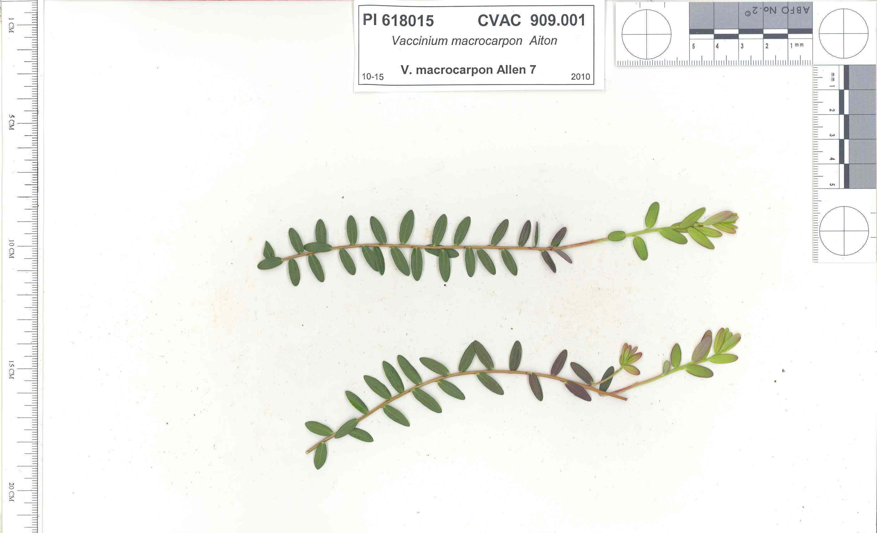 | | 1991 | COLLECTED | 10/29/1991 | Oligotrophic fen near WV/MD border in Preston county, WV, owned by the nature conservancy, WV, known as Cranesville Swamp | 39.51950000, -79.48233000 | 786 | 2 acres fen, bordered by Typha sp., Acer rubrum, Prunus serotina, Hemlock, Sotuhern most population of American Larch (Tamarack), also has Sphagnum spp., Rubus hispidus, Solidago uliginosa, Eripphorum virginicum, Pyrus melanocarpa | Wild material | Site holding moisture well in a regional drought, designated as a National Natural Landmark Additional plants are Hypericum densiflorum, Carex folliculata, Juncus effusus, J. canadensis, Bartonia virginica, Gaultheria procumbens | 1009919 | PI 618015 |
| 71 | PI 618017 | V. oxycoccos MD Allen 13 | Vaccinium oxycoccos L. | Maryland, United States | COR |  | | 1991 | COLLECTED | 10/30/1991 | "The Glades" minerotrophic fen, near Grantsville, Garrett county, MD | 39.55767000, -79.27967000 | 817 | greater than 100 acres, sedge/grass dominated minerotrophic fen, bordered by scattered white pine and spruce, also with Sphagnum spp., Solidago uliginosa, Glyceria canadensis, Calamogrostis canadensis, Carex Rostrata, C. Folliculata, | Wild material | Associated with Rubus Hispidus, Polytrichum sp., Alnus Rugosa. (This accession was part of the PL,SD 'breakout' - 1992) | 1009989 | PI 618017 |
| 72 | W6 62528 | FWS0300-131 | Symphyotrichum urophyllum (Lindl.) G. L. Nesom | Michigan, United States | W6 |  | | 2025 | | | | | | | Wild material | | 2192226 | W6 62528 |
| 73 | W6 62538 | FWS0300-153 | Monarda punctata L. | Michigan, United States | W6 |  | | 2025 | | | | | | | Wild material | | 2192236 | W6 62538 |
| 74 | NA 89115 | TLM25-04a | Hamamelis ovalis S. W. Leonard | Texas, United States | NA | | | 2025 | COLLECTED | 07/10/2025 | State Highway 87 approximately 3.25 kilometers north of the crossroad junction with Texas Recreational Road 255 (RE 255); plants were growing in the narrow buffer woods along the east side of the highway. | 31.12051300, -93.72628100 | 138 | The habitat is an upland mixed coniferous and deciduous woodlands in part to full shade and dry conditions, often under drought stress. Plants seem to always occur on the top of dry ridges or well-drained slopes. Slope: 0 to 1 percent. Aspect: N/A. Soils: The soils of this collection area are classified as Tehran-Letney Association, hilly (TLE) soils. The Tehran Series (55%) consists of deep, somewhat excessively drained, moderately rapidly permeable soils on uplands. They formed in thick loamy and sandy sediments on the Western Coastal Plain. These soils are on gently sloping to moderately steep uplands with slopes ranging from 1 to 20 percent. The Letney Series (30%) consists of deep, well drained, moderately rapidly permeable, upland soils. They formed in thick sandy and loamy sediments of the coastal plains. These soils are on gently sloping to moderately steep uplands with slopes ranging from 1 to 20 percent. Soil pH ranges from 4.5 to 6.0. The minor soil components include Doucette Series (10%) and Boykin Series (5%) soils. (Source: California Soil Resource Lab/NRCS Official Soil Series Descriptions). Geology: The underlying geology of this area is of Oligocene origin and characterized as Catahoula Formation. This formation is extensive and deep in Texas, up to 185 meters thick. In the area of the collection the Catahoula Formation is primarily mudstone and sand. The upper 90-150 meters is mudstone that is tuffaceous, and sandy; also, occasionally, with some bentonitic clay. (Source: USGS Texas Geologic Map Data). | Wild material | | 2191654 | NA 89115 |
| 75 | W6 62368 | AK930-1192 | Elymus trachycaulus (Link) Gould subsp. trachycaulus | Alaska, United States | W6 | | | 2025 | | | | | | | Wild material | NA | 2172722 | W6 62368 |
| 76 | NA 88588 | 2024RM-001 | Hydrangea radiata Walter | Georgia, United States | NA | | | 2024 | COLLECTED | 10/24/2024 | Chattahoochee National Forest: Warwoman Wildlife Management Area: north side of Overflow Creek Road just west of the bridge over the Chattooga River. | 34.94956600, -83.20652000 | 498 | Mixed evergreen and deciduous moist mesic forest in part shade. The underlying geology of this area is characterized as Metagraywacke/Mica Schist Formation of the Precambrian-Paleozoic period. (Source: USGS Georgia Geologic Map Data). The soils of this are characterized as Tusquitee Series Loam, 10 to 25 percent slopes. The Tusquitee Series consists of very deep, well drained soils on gently sloping to very steep benches, foot slopes, toe slopes, and fans in coves in the Southern Blue Ridge mountains, MLRA 130B. These soils formed in colluvium derived from materials weathered from igneous and high-grade metamorphic crystalline rocks such as granite, mica gneiss, hornblende gneiss, and schist. Slope ranges from 2 to 95 percent. Solum thickness ranges from 1 to 3+ meters. Reaction is very strongly acid to slightly acid, in the A horizon. The Bw and lower horizons are very strongly acid to moderately acid. In the upper 1 meter, content of rock fragments, dominantly of gravel to stone size, ranges up to 35 percent. Below 1 meter, rock fragment content may range up to 60 percent. Content of mica flakes ranges from few to common. (Source: California Soil Resource Lab/NRCS Official Soil Series Descriptions). | Wild material | | 2169925 | NA 88588 |
| 77 | NA 88593 | 2024RJLNJ-001 | Ilex glabra (L.) A. Gray | New Jersey, United States | NA | | | 2024 | COLLECTED | 11/24/2024 | Mullica Township: Both sides of Duerer Street, approximately 0.37 kilometers southeast of 4th Avenue. | 39.55885000, -74.66442500 | 21 | Shade to almost full sun on compacted seasonally moist to temporarily wet areas of a mixed evergreen and deciduous woodland dominated by Pinus rigida. Vegetation of this area is very much defined by small changes in elevation that go from wet to very dry. Ilex glabra remains abundant throughout, though. Slope: N/A. Aspect: N/A. The underlying geology of this area is the Cohansey Formation of middle Miocene origin and comprised of sand, white to yellow with local gravel and clay. It is sometimes locally stained red or orange brown by iron oxides and (or) cemented into large blocks of ironstone. Unweathered clay is typically dark gray, but commonly weathers white where it is interbedded with thin beds of ironstone. Sand is typically medium grained and moderately sorted although it ranges from fine to very coarse grained and from poorly to well sorted. Sand consists of quartz and siliceous rock fragments. Some beds are locally micaceous. Maximum thickness in the map area is about 60 meters; however, thickness is difficult to determine because of the irregular basal contact and extensive post-depositional erosion. (Source: USGS New Jersey Geologic Map Data). The primary soil type in the area of this collection is classified as Mullica Series sandy loam, 0 to 2 percent slopes. These soils are typically coarse-loamy, siliceous, semiactive, and mesic typic humaquepts that are strongly to extremely acidic throughout the profile. The typical solum thickness ranges from 50-150+ cm. These soils are generally considered to be poorly drained. (Source: NRCS Web Soil Survey). | Wild material | | 2169930 | NA 88593 |
| 78 | NA 89075 | 2024RJLPA-001 | Rhododendron maximum L. | Pennsylvania, United States | NA | | | 2024 | COLLECTED | 09/18/2024 | Fieldstone Farm Tank Creek Nature Preserve (a property of the Pocono Heritage Land Trust): Collected along Tank Creek. The property is accessed from a parking area located on Devil's Hole Road. | 41.13862300, -75.34562700 | 493 | Mostly found in mixed deciduous forest with occasional conifers and evergreen shrubs generally on steep slopes above Tank Creek in rocky well-drained soils in shade to part-shade. The slopes are abundant in decomposed organic matter and runoff soils. Slope: 5 to 30 percent. Aspect: various. Geology: The underlying geology of this area is of Devonian origin and characterized as the Long Run Member of Catskill Formation. It is comprised of gray and grayish-red sandstone and grayish-red siltstone and mudstone in fining-upward cycles. (Source: USGS Pennsylvania Geologic Map Data). Soils: The primary soil type found here is classified as Alluvial Land. In geology, alluvial land refers to areas of land that are formed by the deposition of sediments carried by rivers, or other surface water. EPA Ecoregion (Level III): North Central Appalachians (62). EPA Ecoregion (Level IV): Low Poconos (62b). | Wild material | | 2169039 | NA 89075 |
| 79 | NA 89076 | 2024RJLPA-002 | Kalmia latifolia L. | Pennsylvania, United States | NA | | | 2024 | COLLECTED | 09/18/2024 | Fieldstone Farm Tank Creek Nature Preserve (a property of the Pocono Heritage Land Trust): Collected along Tank Creek. The property is accessed from a parking area located on Devil's Hole Road. | 41.13862300, -75.34562700 | 493 | Mostly found in mixed deciduous forest with occasional conifers and evergreen shrubs generally on sloping sites as an understory shrub in rocky well-drained soils in shade to part-shade. Slope: 5 to 15 percent. Aspect: various. Geology: The underlying geology of this area is of Devonian origin and characterized as the Long Run Member of Catskill Formation. It is comprised of gray and grayish-red sandstone and grayish-red siltstone and mudstone in fining-upward cycles. (Source: USGS Pennsylvania Geologic Map Data). Soils: The primary soil type found here is classified as Alluvial Land. In geology, alluvial land refers to areas of land that are formed by the deposition of sediments carried by rivers, or other surface water. EPA Ecoregion (Level III): North Central Appalachians (62). EPA Ecoregion (Level IV): Low Poconos (62b). | Wild material | | 2169040 | NA 89076 |
| 80 | NA 89080 | 2024RJLPA-006 | Ilex montana Torr. & A. Gray | Pennsylvania, United States | NA | | | 2024 | COLLECTED | 09/20/2024 | Berks and Schuylkill Counties: Hawk Mountain Sanctuary. | 40.64162200, -75.99122600 | 418 | Plants are growing from shade to full sun on a dry-mesic to very dry, well-drained upland/montane habitat characterized by an upland mixed deciduous and evergreen forest that is very rocky. All the plants found in this habitat go through periods of drought during the growing season due to the limited litter/soil layer in which moisture can be held. Elevation: 405 to 430 meters. Slope: 5 to 25 percent. Aspect: various. Geology: The underlying geology of this area is of Silurian origin and comprised of Shawangunk Formation. This formation is primarily light- to dark-gray, fine- to very coarse-grained sandstone and conglomerate containing thin shale interbeds. (Source: USGS Pennsylvania Geologic Map Data). Soils: The surface soil profile of this area is characterized as the Hazleton Series which consists of deep and very deep, well drained soils formed in residuum of acid gray, brown or red sandstone on uplands. The matrix includes a considerable accumulation of thin, flat, coarse fragments of sandstone, limestone, or schist with diameters up to 15 cm. Slope ranges from 0-80%. Permeability is moderately rapid to rapid. (Source: USDA-NRCS Official Soil Series Descriptions). EPA Ecoregion (Level III): Ridge and Valley (67). EPA Ecoregion (Level IV): Northern Sandstone Ridges (67c). | Wild material | | 2169044 | NA 89080 |
| 81 | NA 89081 | 2024RJLPA-009 | Rosa carolina L. | Pennsylvania, United States | NA | | | 2024 | COLLECTED | 09/22/2024 | Lancaster and York Counties: outcrops along the Susquehanna River, accessed from the Historic Lock 12 parking lot off of Pennsylvania Road 372. | 39.81483500, -76.32762200 | 34 | Plants are growing from part-sun to full sun in crevices of the outcrops and where organic debris has accumulated in between boulders along the Susquehanna River. The sites range from nearly xeric to dry mesic, at least on the surface. Plants are generally growing 4-10 m above the normal flow of the river; however, the Holtwood Dam is less than 1 kilometer upstream and debris found trapped in the boulders indicates that there is periodic flooding, at least, in the lower zone of 4+ meters or so above normal river flow. This habitat has a diverse assemblage of deciduous trees and shrubs as well as abundant herbaceous taxa. Slope: 0 to 60 percent. Aspect: Northeast (generally). Geology: The underlying geology of this area is probably of lower Paleozoic age and characterized as the Octoraro Formation. It includes albite-chlorite schist, phyllite, some hornblende gneiss, and granitized members. Soils: The area where this species occurs is right on the edge of two soil zones that transition from the river’s edge to mesic conditions upslope. The first is generally referred to as Rock Outcrop. This terrestrial matrix in which plants grow is largely exposed underlying rock geology with accumulated outwash, rock decomposition, and organic debris buildup. The second is Mt. Airy (80%) and Manor (20%) Series soils, 25 to 60 percent slopes, extremely stony (MRF). (Source: California Soil Resource Lab/NRCS Official Soil Series Descriptions). EPA Ecoregion (Level III): Northern Piedmont (64). EPA Ecoregion (Level IV): Piedmont Uplands (64c). | Wild material | | 2169045 | NA 89081 |
| 82 | NA 89082 | 2024RJLPA-010 | Amorpha fruticosa L. | Pennsylvania, United States | NA | | | 2024 | COLLECTED | 09/22/2024 | Outcrops along the Susquehanna River, accessed from the Historic Lock 12 parking lot off of Pennsylvania Road 372. | 39.81481500, -76.32757900 | 34 | Plants are growing from part-sun to full sun in crevices of the outcrops and where organic debris has accumulated in between boulders along the Susquehanna River. The sites range from nearly xeric to dry mesic, at least on the surface. Plants are generally growing 4-10 m above the normal flow of the river; however, the Holtwood Dam is less than 1 kilometer upstream and debris found trapped in the boulders indicates that there is periodic flooding, at least, in the lower zone of 4+ meters or so above normal river flow. This habitat has a diverse assemblage of deciduous trees and shrubs as well as abundant herbaceous taxa. Slope: 0 to 25 percent. Aspect: Northeast (generally). Geology: The underlying geology of this area is probably of lower Paleozoic age and characterized as the Octoraro Formation. It includes albite-chlorite schist, phyllite, some hornblende gneiss, and granitized members. Soils: The area where this species occurs is right on the edge of two soil zones that transition from the river’s edge to mesic conditions upslope. The first is generally referred to as Rock Outcrop. This terrestrial matrix in which plants grow is largely exposed underlying rock geology with accumulated outwash, rock decomposition, and organic debris buildup. The second is Mt. Airy (80%) and Manor (20%) Series soils, 25 to 60 percent slopes, extremely stony (MRF). (Source: California Soil Resource Lab/NRCS Official Soil Series Descriptions). EPA Ecoregion (Level III): Northern Piedmont (64). EPA Ecoregion (Level IV): Piedmont Uplands (64c). | Wild material | | 2169046 | NA 89082 |
| 83 | NA 89083 | 2024RJLPA-012 | Rhododendron periclymenoides (Michx.) Shinners | Pennsylvania, United States | NA | | | 2024 | COLLECTED | 09/22/2024 | Outcrops along the Susquehanna River, accessed from the Historic Lock 12 parking lot off of Pennsylvania Road 372. | 39.81477400, -76.32807300 | 35 | Plants are growing from shade to part-sun and occasionally full sun in crevices of the outcrops and where organic debris has accumulated in between boulders along the Susquehanna River. The sites range from nearly xeric to mesic, at least on the surface. Plants are generally growing 4-10 m above the normal flow of the river; however, the Holtwood Dam is less than 1 kilometer upstream and debris found trapped in the boulders indicates that there is periodic flooding, at least, in the lower zone of 4+ meters or so above normal river flow. This habitat has a diverse assemblage of deciduous trees and shrubs as well as abundant herbaceous taxa. Slope: 0 to 60 percent. Aspect: Northeast (generally). Geology: The underlying geology of this area is probably of lower Paleozoic age and characterized as the Octoraro Formation. It includes albite-chlorite schist, phyllite, some hornblende gneiss, and granitized members. Soils: The area where this species occurs is right on the edge of two soil zones that transition from the river’s edge to mesic conditions upslope. The first is generally referred to as Rock Outcrop. This terrestrial matrix in which plants grow is largely exposed underlying rock geology with accumulated outwash, rock decomposition, and organic debris buildup. The second is Mt. Airy (80%) and Manor (20%) Series soils, 25 to 60 percent slopes, extremely stony (MRF). (Source: California Soil Resource Lab/NRCS Official Soil Series Descriptions). EPA Ecoregion (Level III): Northern Piedmont (64). EPA Ecoregion (Level IV): Piedmont Uplands (64c). | Wild material | | 2169047 | NA 89083 |
| 84 | NA 89084 | 2024RJLPA-013 | Physocarpus opulifolius (L.) Maxim. | Pennsylvania, United States | NA | | | 2024 | COLLECTED | 09/22/2024 | Outcrops along the Susquehanna River, accessed from the Historic Lock 12 parking lot off of Pennsylvania Road 372. | 39.81466300, -76.32833900 | 36 | Plants are growing from shade to part-sun where organic debris has accumulated in between boulders as well as further upslope in deeper mesic soils along the Susquehanna River. This habitat has a diverse assemblage of deciduous trees and shrubs as well as abundant herbaceous taxa. Slope: 10 to 25 percent. Aspect: Northeast (generally). Geology: The underlying geology of this area is probably of lower Paleozoic age and characterized as the Octoraro Formation. It includes albite-chlorite schist, phyllite, some hornblende gneiss, and granitized members. Soils: The area where this species occurs is right on the edge of two soil zones that transition from the river’s edge to mesic conditions upslope. The first is generally referred to as Rock Outcrop. This terrestrial matrix in which plants grow is largely exposed underlying rock geology with accumulated outwash, rock decomposition, and organic debris buildup. The second is Mt. Airy (80%) and Manor (20%) Series soils, 25 to 60 percent slopes, extremely stony (MRF). (Source: California Soil Resource Lab/NRCS Official Soil Series Descriptions). EPA Ecoregion (Level III): Northern Piedmont (64). EPA Ecoregion (Level IV): Piedmont Uplands (64c). | Wild material | | 2169048 | NA 89084 |
| 85 | NA 89085 | 2024RJLPA-014 | Rhododendron arborescens (Pursh) Torr. | Pennsylvania, United States | NA | | | 2024 | COLLECTED | 09/22/2024 | Outcrops along the Susquehanna River, accessed from the Historic Lock 12 parking lot off of Pennsylvania Road 372. | 39.81618100, -76.33069800 | 38 | Plants are growing from shade to part-sun and occasionally full sun in crevices of the outcrops and where organic debris has accumulated in between boulders along the Susquehanna River. The sites range from nearly xeric to mesic, at least on the surface. Plants are generally growing 4-10 m above the normal flow of the river; however, the Holtwood Dam is less than 1 kilometer upstream and debris found trapped in the boulders indicates that there is periodic flooding, at least, in the lower zone of 4+ meters or so above normal river flow. This habitat has a diverse assemblage of deciduous trees and shrubs as well as abundant herbaceous taxa. Slope: 0 to 75 percent. Aspect: Northeast (generally). Geology: The underlying geology of this area is probably of lower Paleozoic age and characterized as the Octoraro Formation. It includes albite-chlorite schist, phyllite, some hornblende gneiss, and granitized members. Soils: The area where this species occurs is right on the edge of two soil zones that transition from the river’s edge to mesic conditions upslope. The first is generally referred to as Rock Outcrop. This terrestrial matrix in which plants grow is largely exposed underlying rock geology with accumulated outwash, rock decomposition, and organic debris buildup. The second is Mt. Airy (80%) and Manor (20%) Series soils, 25 to 60 percent slopes, extremely stony (MRF). (Source: California Soil Resource Lab/NRCS Official Soil Series Descriptions). EPA Ecoregion (Level III): Northern Piedmont (64). EPA Ecoregion (Level IV): Piedmont Uplands (64c). | Wild material | | 2169049 | NA 89085 |
| 86 | NA 89086 | 2024RJLPA-015 | Ilex verticillata (L.) A. Gray | Pennsylvania, United States | NA | | | 2024 | COLLECTED | 09/22/2024 | Outcrops along the Susquehanna River, accessed from the Historic Lock 12 parking lot off of Pennsylvania Road 372. | 39.81656600, -76.33136600 | 38 | Plants are growing from part-sun to full sun in crevices of the outcrops and where organic debris has accumulated in between boulders along the Susquehanna River. The sites range from nearly xeric to dry mesic, at least on the surface. Plants are generally growing 4-10 m above the normal flow of the river; however, the Holtwood Dam is less than 1 kilometer upstream and debris found trapped in the boulders indicates that there is periodic flooding, at least, in the lower zone of 4+ meters or so above normal river flow. This habitat has a diverse assemblage of deciduous trees and shrubs as well as abundant herbaceous taxa. Slope: 0 to 10 percent. Aspect: Northeast (generally). Geology: The underlying geology of this area is probably of lower Paleozoic age and characterized as the Octoraro Formation. It includes albite-chlorite schist, phyllite, some hornblende gneiss, and granitized members. Soils: The area where this species occurs is right on the edge of two soil zones that transition from the river’s edge to mesic conditions upslope. The first is generally referred to as Rock Outcrop. This terrestrial matrix in which plants grow is largely exposed underlying rock geology with accumulated outwash, rock decomposition, and organic debris buildup. The second is Mt. Airy (80%) and Manor (20%) Series soils, 25 to 60 percent slopes, extremely stony (MRF). (Source: California Soil Resource Lab/NRCS Official Soil Series Descriptions). EPA Ecoregion (Level III): Northern Piedmont (64). EPA Ecoregion (Level IV): Piedmont Uplands (64c). | Wild material | | 2169050 | NA 89086 |
| 87 | NA 88671 | RJL2023PA-005 | Rhododendron maximum L. | Pennsylvania, United States | NA | | | 2023 | COLLECTED | 10/16/2023 | Appalachian National Scenic Trail: Pulpit Rock and Pinnacle Loop. Rocky woodlands along Furnace Creek as well as steep rocky slopes above Pulpit Rock Reservoir associated with the Pulpit Rock and Pinnacle Loop Trail. | 40.59226100, -75.94588800 | 301 | Well-drained and very rocky dry deciduous woodlands in part shade to full shade. Slope: 0-30%. Aspect: variable. The underlying geology of this area is of Silurian origin and characterized as the Shawangunk Formation. It is characterized by light- to dark-gray, fine- to very coarse-grained sandstone and conglomerate containing thin shale interbeds. Includes four members, in descending order: Tammany--conglomerate and sandstone; Lizard Creek--sandstone and red or green shale; Minsi--sandstone and conglomerate; Weiders--conglomerate. Tammany and Lizard Creek Members together are approximately equivalent to Clinton Group to the west; Minsi and Weiders Members together are equivalent to Tuscarora Formation to the west. (Source: USGS Pennsylvania Geologic Map Data). The primary soil type in the collection area is classified as Hazleton Series. The Hazleton series consists of deep and very deep, well drained soils formed in residuum of acid gray, brown or red sandstone on uplands. Slope ranges from 0 to 80 percent. Permeability is moderately rapid to rapid. Solum thickness ranges from 60 to 120 centimeters. Depth to lithic contact ranges from 1 to 2 meters. Rock fragments of angular sandstone, dominantly less than 25 cm in size, range from 5 to 70 percent in individual horizons. Boulders, stones, flags and channers cover about 5 to 60 percent of the surface of some pedons. Reaction ranges from strongly acid through extremely acid throughout. (Source: NRCS Web Soil Survey). | Wild material | | 2159062 | NA 88671 |
| 88 | NA 88672 | RJL2023PA-006 | Rhododendron periclymenoides (Michx.) Shinners | Pennsylvania, United States | NA | | | 2023 | COLLECTED | 10/16/2023 | Appalachian National Scenic Trail: Pulpit Rock and Pinnacle Loop. Rocky woodland edges above Furnace Creek around Pulpit Rock and Pinnacle Loop Trail. | 40.58668200, -75.94269600 | 247 | Well-drained and very rocky dry deciduous woodlands in part shade to full shade. Slope: 10%. Aspect: East. The underlying geology of this area is of Silurian origin and characterized as the Shawangunk Formation. It is characterized by light- to dark-gray, fine- to very coarse-grained sandstone and conglomerate containing thin shale interbeds. Includes four members, in descending order: Tammany--conglomerate and sandstone; Lizard Creek--sandstone and red or green shale; Minsi--sandstone and conglomerate; Weiders--conglomerate. Tammany and Lizard Creek Members together are approximately equivalent to Clinton Group to the west; Minsi and Weiders Members together are equivalent to Tuscarora Formation to the west. (Source: USGS Pennsylvania Geologic Map Data). The primary soil type in the collection area is classified as Hazleton Series. The Hazleton series consists of deep and very deep, well drained soils formed in residuum of acid gray, brown or red sandstone on uplands. Slope ranges from 0 to 80 percent. Permeability is moderately rapid to rapid. Solum thickness ranges from 60 to 120 centimeters. Depth to lithic contact ranges from 1 to 2 meters. Rock fragments of angular sandstone, dominantly less than 25 cm in size, range from 5 to 70 percent in individual horizons. Boulders, stones, flags and channers cover about 5 to 60 percent of the surface of some pedons. Reaction ranges from strongly acid through extremely acid throughout. (Source: NRCS Web Soil Survey). | Wild material | | 2159063 | NA 88672 |
| 89 | NA 88673 | RJL2023PA-007 | Rhododendron pilosum (Michx.) Craven | Pennsylvania, United States | NA | | | 2023 | COLLECTED | 10/25/2023 | Ned Smith Center for Art and Nature. | 40.53367300, -76.92715700 | 147 | Well-drained and very rocky, dry slopes above 10-50 meters above Wiconisco Creek in mixed deciduous and evergreen woodlands in part shade to full shade. Slope: 10-40%. Aspect: North. The underlying geology of this area is of Mississippian origin and characterized as the Pocono Formation. It is comprised of light-gray to buff or light-olive-gray, medium-grained, crossbedded sandstone and minor siltstone; commonly conglomeratic at base and in middle; medial conglomerate, where present, is used to divide into Mount Carbon and Beckville Members; equivalent to Burgoon Sandstone of Allegheny Plateau. (Source: USGS Pennsylvania Geologic Map Data). The primary soil type in the collection area is classified as Laidig Series. The Laidig series consists of very deep, well drained soils formed in colluvium from sandstone, siltstone, and some shale. They are gently sloping to very steep soils on benches and foot slopes. Permeability is moderate or moderately rapid above the fragipan and moderately slow or slow in the fragipan. Slope ranges from 0 to 55 percent. Solum thickness ranges from 1.25 to 2.0 meters or more. Depth to the fragipan ranges from 0.75 to 1.25 meters. The particle-size control section averages less than 35 percent rock fragments. Rock fragments range from 5 to 50 percent in individual subhorizons of the A, E, BE, BA and Bt horizons; 15 to 70 percent in individual subhorizons of the Btx horizon; and 20 to 70 percent in the C horizon. Rock fragments are mostly sandstone but include siltstone and shale. Rock fragments include channers, cobbles, flagstones, and stones. Soils range from extremely acid through strongly acid throughout. (Source: NRCS Web Soil Survey). | Wild material | | 2159064 | NA 88673 |
| 90 | NA 88674 | RJL2023PA-008 | Kalmia latifolia L. | Pennsylvania, United States | NA | | | 2023 | COLLECTED | 10/25/2023 | Ned Smith Center for Art and Nature. | 40.53463500, -76.92616300 | 130 | Well-drained and very rocky, dry slopes above 10-50 meters above Wiconisco Creek in mixed deciduous and evergreen woodlands in part shade to full shade. Slope: 10-40%. Aspect: North. The underlying geology of this area is of Mississippian origin and characterized as the Pocono Formation. It is comprised of light-gray to buff or light-olive-gray, medium-grained, crossbedded sandstone and minor siltstone; commonly conglomeratic at base and in middle; medial conglomerate, where present, is used to divide into Mount Carbon and Beckville Members; equivalent to Burgoon Sandstone of Allegheny Plateau. (Source: USGS Pennsylvania Geologic Map Data). The primary soil type in the collection area is classified as Laidig Series. The Laidig series consists of very deep, well drained soils formed in colluvium from sandstone, siltstone, and some shale. They are gently sloping to very steep soils on benches and foot slopes. Permeability is moderate or moderately rapid above the fragipan and moderately slow or slow in the fragipan. Slope ranges from 0 to 55 percent. Solum thickness ranges from 1.25 to 2.0 meters or more. Depth to the fragipan ranges from 0.75 to 1.25 meters. The particle-size control section averages less than 35 percent rock fragments. Rock fragments range from 5 to 50 percent in individual subhorizons of the A, E, BE, BA and Bt horizons; 15 to 70 percent in individual subhorizons of the Btx horizon; and 20 to 70 percent in the C horizon. Rock fragments are mostly sandstone but include siltstone and shale. Rock fragments include channers, cobbles, flagstones, and stones. Soils range from extremely acid through strongly acid throughout. (Source: NRCS Web Soil Survey). | Wild material | | 2159065 | NA 88674 |
| 91 | NA 88675 | RJL2023PA-009 | Viburnum acerifolium L. | Pennsylvania, United States | NA | | | 2023 | COLLECTED | 10/25/2023 | Ned Smith Center for Art and Nature. | 40.53539200, -76.92313500 | 136 | Well-drained and very rocky dry deciduous woodlands in part shade to full shade. Slope: 10-30%. Aspect: North. The underlying geology of this area is of Mississippian origin and characterized as the Pocono Formation. It is comprised of light-gray to buff or light-olive-gray, medium-grained, crossbedded sandstone and minor siltstone; commonly conglomeratic at base and in middle; medial conglomerate, where present, is used to divide into Mount Carbon and Beckville Members; equivalent to Burgoon Sandstone of Allegheny Plateau. (Source: USGS Pennsylvania Geologic Map Data). The primary soil type in the collection area is classified as Laidig Series. The Laidig series consists of very deep, well drained soils formed in colluvium from sandstone, siltstone, and some shale. They are gently sloping to very steep soils on benches and foot slopes. Permeability is moderate or moderately rapid above the fragipan and moderately slow or slow in the fragipan. Slope ranges from 0 to 55 percent. Solum thickness ranges from 1.25 to 2.0 meters or more. Depth to the fragipan ranges from 0.75 to 1.25 meters. The particle-size control section averages less than 35 percent rock fragments. Rock fragments range from 5 to 50 percent in individual subhorizons of the A, E, BE, BA and Bt horizons; 15 to 70 percent in individual subhorizons of the Btx horizon; and 20 to 70 percent in the C horizon. Rock fragments are mostly sandstone but include siltstone and shale. Rock fragments include channers, cobbles, flagstones, and stones. Soils range from extremely acid through strongly acid throughout. (Source: NRCS Web Soil Survey). | Wild material | | 2159066 | NA 88675 |
| 92 | NA 88677 | RJL2023PA-011 | Hydrangea arborescens L. | Pennsylvania, United States | NA | | | 2023 | COLLECTED | 10/25/2023 | Seed collected along the Appalachian National Scenic Trail, accessed from the Duncannon Entrance. | 40.37735300, -77.03997300 | 239 | Well-drained and very rocky dry deciduous woodlands in part shade to full shade. Slope: 20-50%. Aspect: Northwest. The underlying geology of this area is of Devonian origin and characterized as the Duncannon Member of Catskill Formation. It is characterized by grayish-red sandstone, siltstone, and mudstone in fining-upward cycles; conglomerate occurs at base of some cycles. The sandstones which comprise the Duncannon Member are fine to very coarse grained and grayish red to grayish red-purple in color. The Duncannon Member is known to be crossbedded to planar bedded in beds anywhere from 3 to 9 meters thick. Conglomerates have been spotted at the base of the Duncannon Member. The Duncannon Member is poorly exposed in most areas except along the Lehigh River. The conglomerate portion of this member has been known to form ridges and ledges with thicknesses approaching 228 meters. (Source: USGS Pennsylvania Geologic Map Data). The primary soil type in the collection area is classified as Dystrochrepts, boulder soils. These soils are characterized by coarse-silty loess over residuum weathered from sedimentary rock and located on steep ridges along the upper third of the mountainflank. These soils are comprised of cobbles, stones or boulders (9%), well-drained, and approximately 1 meter or less to lithic bedrock. (Source: NRCS Web Soil Survey). | Wild material | | 2159068 | NA 88677 |
| 93 | NA 88679 | RJL2023PA-013 | Rhododendron prinophyllum (Small) Millais | Pennsylvania, United States | NA | | | 2023 | COLLECTED | 10/30/2023 | Southwest side of Dutch Mountain Road north of Pine Marsh Creek in Pennsylvania State Game Lands Number 66. | 41.48201500, -76.27286000 | 602 | Moist, well-drained habitat with good organic matter in part shade on a wooded slope next to the road. Slope: 5-10%. Aspect: East. The underlying geology of this area is of Mississippian origin and characterized as the Burgoon Formation. It is comprised of buff, medium-grained, cross bedded sandstone that includes shale and coal. In some places, it contains conglomerate at base as well as occasionally contains plant fossils; equivalent to Pocono Formation of Ridge and Valley province. (Source: USGS Pennsylvania Geologic Map Data). The primary soil type in the collection area is classified as Wellsboro Series. The Wellsboro Series consists of very deep, moderately well- and somewhat poorly-drained soils formed in till derived from red sandstone, siltstone, and shale. Slope ranges from 0 to 50 percent. Saturated hydraulic conductivity is moderately high or high in the mineral surface layer, subsurface layer, and upper part of the subsoil; and low or moderately low in the lower part of the subsoil (fragipan) and the substratum. Solum thickness is greater than 102 cm. Depth to the fragipan ranges from 36 to 76 cm. Depth to bedrock is 152 cm or more. Rock fragments of subangular and rounded sandstone, siltstone or shale range from 5 to 40 percent in the A and B horizons, and from 15 to 50 percent in the Bx and C horizons. Typically, rock fragments average about 5 to 25 percent by volume above the fragipan and 15 to 40 percent by volume in and below the fragipan. Reaction commonly ranges from very strongly acid through moderately acid. (Source: NRCS Web Soil Survey). | Wild material | | 2159070 | NA 88679 |
| 94 | NA 88681 | RJL2023PA-015 | Ilex verticillata (L.) A. Gray | Pennsylvania, United States | NA | | | 2023 | COLLECTED | 10/30/2023 | Wetlands near Phillips Creek: seed collected from plants on the north and south (further east) side of Pennsylvania Route 188 approximately 6.9 kilometers east of the junction with Pennsylvania Route 487. | 41.30353100, -76.22452800 | 381 | Boggy to moist habitats associated with wetlands of Phillips Creek in shade to full sun next to the road. Slope: 0%. Aspect: various. The underlying geology of this area is of Devonian origin and characterized as the Catskill Formation. It is comprised of grayish-red sandstone, siltstone, shale, and mudstone; units of gray sandstone occur in upper part; lithologies in upper part arranged in fining-upward cycles. In the Altoona area, the Catskill Formation is mapped as the Duncannon, Sherman Creek, and Irish Valley Members, which are described under "Central and Eastern Pennsylvania" provinces. (Source: USGS Pennsylvania Geologic Map Data). The primary soil type in the collection area is classified as Wellsboro Series. The Wellsboro Series consists of very deep, moderately well- and somewhat poorly-drained soils formed in till derived from red sandstone, siltstone, and shale. Slope ranges from 0 to 50 percent. Saturated hydraulic conductivity is moderately high or high in the mineral surface layer, subsurface layer, and upper part of the subsoil; and low or moderately low in the lower part of the subsoil (fragipan) and the substratum. Solum thickness is greater than 102 cm. Depth to the fragipan ranges from 36 to 76 cm. Depth to bedrock is 152 cm or more. Rock fragments of subangular and rounded sandstone, siltstone or shale range from 5 to 40 percent in the A and B horizons, and from 15 to 50 percent in the Bx and C horizons. Typically, rock fragments average about 5 to 25 percent by volume above the fragipan and 15 to 40 percent by volume in and below the fragipan. Reaction commonly ranges from very strongly acid through moderately acid. (Source: NRCS Web Soil Survey). | Wild material | | 2159072 | NA 88681 |
| 95 | NA 88666 | RJL2023PA-003 | Hamamelis virginiana L. | Pennsylvania, United States | NA | | | 2023 | COLLECTED | 10/01/2023 | Collected primarily along the woodland edge along Northside Road on Pennsylvania State Gamelands No. 43 as well as a few on nearby roads. | 40.17974200, -75.76790700 | 176 | Plants were growing in mesic well-drained conditions on moderately sloping sites of a deciduous upland forest. This species grows well in shade to part-sun. Most abundant fruit development is found where plants are exposed to sunlight for a portion of the day. Slope: 15%. Aspect: North-northwest. The underlying geology of this area is of Precambrian origin and characterized as the Graphitic Felsic Gneiss. This includes Pickering Gneiss and small areas of marble; dominantly quartz and feldspar with varying amounts of graphite and various metamorphic minerals; medium grained, light to dark gray and greenish gray; sedimentary origin. (Source: USGS Pennsylvania Geologic Map Data.) The primary soil type in the area of this collection is classified as Gladstone Gravelly Loam Series (8 to 15 percent slopes). The Gladstone Series consists of very deep, well drained soils formed in residuum and colluvium from granitic gneiss. Saturated hydraulic conductivity is moderately high to high. Solum thickness ranges from 75 to 125 cm. Depth to granitic gneiss bedrock is 1.6 meters or more. The bedrock may be strongly weathered in the upper part. Gravel content ranges from 5 to 35 percent throughout the solum, and 10 to 40 percent in the C horizons. Fragments, larger than 3 inches in diameter, range from 0 to 20 percent by volume in the surface layer and 0 to 10 percent in the subsoil and substratum layers. Reaction is strongly or very strongly acid throughout the soil, unless limed. Areas that have been limed range to moderately acid in the upper part of the profile. (Source: NRCS Web Soil Survey.) | Wild material | | 2158815 | NA 88666 |
| 96 | NA 88665 | RJL2023PA-002 | Ilex verticillata (L.) A. Gray | Pennsylvania, United States | NA | | | 2023 | COLLECTED | 10/01/2023 | Woodlands along Pine Creek near the Harmonyville Road bridge. | 40.18764500, -75.76732200 | 141 | Moist to mucky, wet woodland conditions along Pine Creek. Much of the site is very wet due to recent rains; though, earlier in the year, the soils were only moist. Plants grow in both well-drained mesic conditions as well as seasonally wet conditions. They do not grow in standing water anywhere in this location. Plants in this population are found mostly in the shade and partial shade of deciduous trees; there are occasional gaps that offer higher light conditions as well. Slope: 0-2%. Aspect: N/A. The underlying geology of this area is of Precambrian origin and characterized as the Graphitic Felsic Gneiss. This includes Pickering Gneiss and small areas of marble; dominantly quartz and feldspar with varying amounts of graphite and various metamorphic minerals; medium grained, light to dark gray and greenish gray; sedimentary origin. (Source: USGS Pennsylvania Geologic Map Data). The primary soil type in the area of this collection is classified as Hatboro Silt Loam Series. The Hatboro Series consists of very deep and poorly drained soils formed in alluvium derived from metamorphic and crystalline rock. They are on flood plains. Slopes range from 0 to 3 percent. Saturated hydraulic conductivity is moderately high to high. Solum thickness ranges from 50 to 150 cm. Depth to bedrock ranges from 1.5 to 3 meters or more. Organic carbon decreases irregularly with depth or is greater than 0.2 percent directly above any strongly contrasting C horizon. The depth to strongly contrasting sand and gravel is more than 100 cm or the transition is greater than 12.5 cm. Content of gravel ranges from 0 to 10 percent in the solum and from 0 to 80 percent in the C horizon. Mica flakes are common in the solum, and the C horizon contains thin lenses of mica. Reaction ranges from very strongly acid through neutral to a depth of 75 cm and from moderately acid through slightly acid below 75 cm. (Source: NRCS Web Soil Survey.) | Wild material | | 2158814 | NA 88665 |
| 97 | NA 88664 | RJL2023PA-001 | Viburnum acerifolium L. | Pennsylvania, United States | NA | | | 2023 | COLLECTED | 10/01/2023 | Seed collected from plants growing along a two-mile stretch of Harmonyville Road on the woodland edge next to the road. [Note: latitude and longitude were collected at the location of the largest seed collection.] | 40.18482200, -75.78145100 | 158 | Plants were growing in well-drained and rocky mesic-dry woodlands from part shade along the road edge to full shade in the understory of the woodlands. Slope: 2-10%. Aspect: Variable. The underlying geology of this area is of Triassic origin and characterized as the Stockton Formation. It is characterized by light-gray to buff, coarse-grained, arkosic sandstone; includes reddish-brown to grayish-purple sandstone, siltstone, and mudstone. (Source: USGS Pennsylvania Geologic Map Data.) The primary soil type in the area of this collection is classified as Edgemont Channery Sandy Loam Series (8 to 25 percent slopes), extremely stony. The Edgemont Series consists of deep and very deep, well drained soils formed in the weathered residuum of quartzitic rocks. They have moderately high to high saturated hydraulic conductivity. Slopes range from 0 to 70 percent. Solum thickness ranges from 50 to 10 cm. Depth to bedrock ranges from about 1.5 to 2.2 meters. Kaolinite is the dominant mineral in the clay fraction with detectable amounts of illite, vermiculite, montmorillonite, chlorite and interstratified clays. Gravel, channers, and stone size fragments of quartzite and quartz are present throughout the profile. Rock fragments range from 5 to 40 percent in the horizons of the solum and from 10 to 90 percent in the C horizon. Reaction ranges from extremely acid to strongly acid throughout. (Source: NRCS Web Soil Survey.) | Wild material | | 2158813 | NA 88664 |
| 98 | OPGC 8784 | OR080-105 | Anaphalis margaritacea (L.) Benth. & Hook. f. | Oregon, United States | OPGC | | | 2023 | | | | | | | Wild material | Plants have erect stems with alternate, lance-shaped leaves. Compound flowers form dense umbels at meristems with a lasting white color. | 2142716 | OPGC 8784 |
| 99 | OPGC 8809 | CBG- 10771 | Silene stellata W. T. Aiton | Illinois, United States | OPGC | | | 2023 | | | | | | | Wild material | | 2142239 | OPGC 8809 |
| 100 | OPGC 8810 | CBG- 10773 | Penstemon pallidus Small | Illinois, United States | OPGC | | | 2023 | | | | | | | Wild material | | 2142241 | OPGC 8810 |
| 101 | W6 61417 | CBG- 10852 | Verbesina alternifolia (L.) Britton ex Kearney | Illinois, United States | W6 |  | | 2023 | | | | | | | Wild material | | 2142299 | W6 61417 |
| 102 | W6 61418 | CBG- 10853 | Agastache scrophulariifolia (Willd.) Kuntze | Illinois, United States | W6 |  | | 2023 | | | | | | | Wild material | | 2142300 | W6 61418 |
| 103 | Ames 36018 | AS/SL/2023/003/213 | Salix lucida Muhl. | Wisconsin, United States | NC7 |  | | 2023 | COLLECTED | 02/25/2023 | Located just west of Kempster approximately 4.65 miles along County Road J (floodplains of Sucker Creek and West Branch Eau Claire River), T33N R10E Sec. 32, 33, and 34 (extreme southern edges) | 45.29205000, -89.27304100 | 479 | Wetland | Wild material | Salix lucida (shining willow) is referenced as a tall shrub or small tree with multiple trunks with the potential to reach 6 meters in height. Shining willow frequents wetland habitats such as swampy lakes, wet meadows and along rivers. Noted for it's extremely shiny, long (e.g. 7-14 cm) leaves with very elongated, acumiate leaf tips and conspicuous, enlarged glands clustered at the end of the petiole. First year branches are very glabrous and bright yellow to bright orange in color. Flowering tends to occur later in spring in comparison to other shrubby willows e.g. Salix discolor, Salix humilis, Salix petiolaris, and Salix eriocephala. Shining willow can often be confused with Salix serissima, but the presence of glands at the base of the petiole, the colorful first year stems (most noticeable in winter) of Salix lucida can be used to separate them. The native distribution of Salix lucida is concentrated in the northeastern U.S. with scattered disjuncts as far west as North Dakota and as far south as the northern tier of counties in Illinois, Indiana, and Ohio (Little, E. L. Jr. 1977). This accession represents genetics from northeastern Wisconsin. Specimens sampled in nature measuring approximately 6' in height with bright orange-yellowish stem colors on most recent year's growth. | 2141551 | Ames 36018 |
| 104 | Ames 36019 | AS/SD/2023/004/214 | Salix discolor Muhl. | Wisconsin, United States | NC7 |  | | 2023 | COLLECTED | 02/25/2023 | Located along County Road J west of Kempster and County Road T/County Road H west of Summit Lake. | 45.29210300, -89.27334900 | 478 | Wetland | Wild material | The native range of Salix discolor is concentrated in the northeastern United States and also throughout southern Canada (Little, E. L. Jr. 1977). Generally adapted/tolerant to wet soils this species is often found in meadows, fens, swamps, and streambanks. Attractive ornamental characteristics includes early spring, showy flowers and yellow foliage in the fall. Salix discolor provides a critical source of pollen at the beginning of the growing season for a plethora of pollinators and also serves as a larval host to many insect species. Salix discolor are commonly used in the cut flower industry for both their showy catkins and colorful, dormant winter stems. This accession represents genetics from central Wisconsin. Plants in nature measuring approximately 8-10' in height occassionally up to 25' with brown to red-brown stem colors on most recent year's growth. Some genotypes with dense pubescence on stems while others are glabrous. | 2141552 | Ames 36019 |
| 105 | Ames 36021 | AS/SP/2023/006/216 | Salix petiolaris Sm. | Wisconsin, United States | NC7 |  | | 2023 | COLLECTED | 02/25/2023 | Located just west of Kempster approximately 5.25 miles along County Road J (floodplain between Sucker Creek and West Branch Eau Claire River), T33N R10E Sec. 32 and 33 (extreme southern edges). | 45.29239600, -89.27583700 | 478 | Wetland | Wild material | Slender-leaved willow, Salix petiolaris, is a somewhat dense suckering shrub that can reach up to 10' in height with slender stems that branch minimally, but typically maintains a height of 5-8'. Native to North America, the native range covers mostly the northeastern US stretching from Maine to western North Dakota and Canada south to central Iowa (Little, E. L. Jr. 1977). Salix petiolaris typically dominates wetland areas including sedge meadows, marshes, riverbanks, and lake shores. Despite favoring wet habitats, it can also be found in dry, upland areas, especially those with high-water tables. However, longevity is generally limited in upland habitats. S. petiolaris, similar to other willow species, responds well to fire, coppicing, or heavy browsing (highly favored by deer) by sprouting new stems close to the crown. In cultivation, plants after five years will encompass a 5' x 5' area due to stems that arch from the main base of the plant. Coppicing of plants to ground level is highly recommended either annually or once every 3-5 years to maintain vigorous growth and plant health. This species requires substantial to full sun exposure and is an excellent choice for streambank stabilizations and windbreaks to reduce soil erosion and drifting snow, respectively. This accession represents genetics from central Wisconsin. Plants noted in nature measuring up to 6' in height. Very densely suckering clumps occassionally reaching up to 10' in diameter. Stem colors on most recent year's growth varied from orange-yellow, red (predominate), to yellow. Petioles are minutely hairy. | 2141554 | Ames 36021 |
| 106 | NA 88536 | RJLSEUS2022-007 | Leucothoe axillaris (Lam.) D. Don | South Carolina, United States | NA | | | 2023 | COLLECTED | 12/07/2022 | Plants growing along the margin of Sandy Run and its associated wetland on the north side of Paradise Rd. (State Rd. S-15-403). Common at this site and throughout the drainage of Sandy Run and its associated wetland. | 32.83900000, -80.81014400 | 27 | Plants are growing in part-shade to shade of a moist mesic woodland habitat along a small wetland associated with Sandy Run. Plants are located in an area that occasionally floods, but is not permanently wet.
Soils: The underlying geology of this area is of Pliocene origin and characterized as Bear Bluff Formation. This formation is considered one of the older coastal terrace sequences in the Carolinas. Bear Bluff Formation consists of gray to cream, fossiliferous, coarse-grained calcareous sand, and sandy limestone. It is typically 3-40 meters thick.
Source: USGS South Carolina Geologic Map Data (https://mrdata.usgs.gov/geology/state/sgmc-unit.php?unit=SCTbb%3B1)
The primary soil type in the collection area is classified as Pickney Loamy Sand soils. The Pickney Series consists of very deep, very poorly drained soils. Permeability is rapid. These nearly level soils have negligible runoff and were formed by marine or fluvial sediments in the lower coastal plain on flats, depressions, stream terraces, and flood plains. Slopes range from 0 to 2 percent. The soils of this series are loamy fine sand that is very friable and extremely acid in the upper 0-25 cm. The lower strata are similar, while the lower strata from 0.8-2 meters are comprised of fine sand.
Source: NRCS Web Soil Survey (https://websoilsurvey.sc.egov.usda.gov/App/WebSoilSurvey.aspx) | Wild material | Leucothoe axillaris/fontanesiana | 2140764 | NA 88536 |
| 107 | NA 88537 | RJLSEUS2022-009 | Rhododendron canescens (Michx.) Sweet | South Carolina, United States | NA | | | 2023 | COLLECTED | 12/07/2022 | Plants growing along the upper margin of a small stream and associated wetland on the northwest side of Paradise Rd. (State Rd. S-15-403). Common at this site and throughout the drainage of the stream and associated wetland. | 32.83868100, -80.81099200 | 28 | Plants are growing in part-shade to shade of a moist mesic woodland habitat along a small wetland associated with a creek. Plants are located in an area that occasionally floods, but is not permanently wet.
Soils: The underlying geology of this area is of Pliocene origin and characterized as Bear Bluff Formation. This formation is considered one of the older coastal terrace sequences in the Carolinas. Bear Bluff Formation consists of gray to cream, fossiliferous, coarse-grained calcareous sand, and sandy limestone. It is typically 3-4 meters thick.
Source: USGS South Carolina Geologic Map Data (https://mrdata.usgs.gov/geology/state/sgmc-unit.php?unit=SCTbb%3B1)
The primary soil type in the collection area is classified as Pickney Loamy Sand soils. The Pickney Series consists of very deep, very poorly drained soils. Permeability is rapid. These nearly level soils have negligible runoff and were formed by marine or fluvial sediments in the lower coastal plain on flats, depressions, stream terraces, and flood plains. Slopes range from 0 to 2 percent. The soils of this series are loamy fine sand that is very friable and extremely acid in the upper 0-25 cm. The lower strata are similar, while the lower strata from 0.8-2 meters are comprised of fine sand.
Source: NRCS Web Soil Survey (https://websoilsurvey.sc.egov.usda.gov/App/WebSoilSurvey.aspx) | Wild material | | 2140765 | NA 88537 |
| 108 | NA 88506 | RJL2022TX-001 | Itea virginica L. | Texas, United States | NA | | | 2022 | COLLECTED | 10/31/2022 | Plants growing at Shangri La Botanical Gardens and Nature Center, Orange, TX along Adams Bayou, accessed via internal service roads. Plant is infrequent at this site. | 30.10322000, -93.76271700 | 1 | Plants are growing in shade to part-shade of a Taxodium distichum-Nyssa aquatica dominated forested swampland associated with Adams Bayou in a wet low-lying area that is frequently inundated.
Soils: The underlying geology of this area is of Quaternary to Late Pleistocene origin and comprised of the Beaumont Formation. This formation is yellowish- to brownish-gray, locally reddish orange with very fine to fine quartz sand, silt, and minor fine gravel, intermixed and interbedded. It also includes stream channel, point-bar, cravasse-splay, and natural levee ridge deposits, and clayey fill in abandoned channels. Channel fill is dark brown to brownish-gray with laminated clay and silt that is organic-rich. Includes marine delta-front sand, lagoonal clay, and near-shore marine sand beneath and landward of bays along the coast. Depth of this unconsolidated outwash ranges from 3-100 meters thick.
Source: USGS Texas Geologic Map Data (https://mrdata.usgs.gov/geology/state/sgmc-unit.php?unit=TXQbs%3B0)
The primary soil types in the collection area are classified as Cowmarsh series. The Cowmarsh series consists of very deep, very poorly drained soils that formed in mucky silty clayey alluvial deposits of Holocene age. These depressional soils are oxbows and relict channels of rivers where flooding and ponding is frequent. Slope ranges from 0 to 1 percent but mainly less than 1 percent. very poorly drained. Runoff is negligible. Frequently flooded for very long periods from February through May and surface remains saturated for very long periods once flood waters have receded.
Source: NRCS Web Soil Survey (https://websoilsurvey.sc.egov.usda.gov/App/WebSoilSurvey.aspx) | Wild material | | 2139813 | NA 88506 |
| 109 | NA 88507 | RJL2022TX-002 | Fraxinus caroliniana Mill. | Texas, United States | NA | | | 2022 | COLLECTED | 10/31/2022 | Plants growing at Shangri La Botanical Gardens and Nature Center, Orange, TX along Adams Bayou, accessed via internal service roads. Plant is relatively common along Adams Bayou but scattered. | 30.09989400, -93.75239700 | 1 | Plants are growing in part-shade to sun of a Taxodium distichum-Nyssa aquatica dominated forested swampland associated with Adams Bayou in a wet low-lying area that is frequently inundated. While found as an occasional understory element, it is more common on the edge of the swampland forest where there are high light conditions.
Soils: The underlying geology of this area is of Quaternary to Late Pleistocene origin and comprised of the Beaumont Formation. This formation is yellowish- to brownish-gray, locally reddish orange with very fine to fine quartz sand, silt, and minor fine gravel, intermixed and interbedded. It also includes stream channel, point-bar, cravasse-splay, and natural levee ridge deposits, and clayey fill in abandoned channels. Channel fill is dark brown to brownish-gray with laminated clay and silt that is organic-rich. Includes marine delta-front sand, lagoonal clay, and near-shore marine sand beneath and landward of bays along the coast. Depth of this unconsolidated outwash ranges from 3-100 meters thick.
Source: USGS Texas Geologic Map Data (https://mrdata.usgs.gov/geology/state/sgmc-unit.php?unit=TXQbs%3B0)
The primary soil types in the collection area are classified as Cowmarsh series. The Cowmarsh series consists of very deep, very poorly drained soils that formed in mucky silty clayey alluvial deposits of Holocene age. These depressional soils are oxbows and relict channels of rivers where flooding and ponding is frequent. Slope ranges from 0 to 1 percent but mainly less than 1 percent. very poorly drained. Runoff is negligible. Frequently flooded for very long periods from February through May and surface remains saturated for very long periods once flood waters have receded.
Source: NRCS Web Soil Survey (https://websoilsurvey.sc.egov.usda.gov/App/WebSoilSurvey.aspx) | Wild material | | 2139814 | NA 88507 |
| 110 | NA 88508 | RJL2022TX-003 | Morella cerifera (L.) Small | Texas, United States | NA | | | 2022 | COLLECTED | 10/31/2022 | Plants growing at Shangri La Botanical Gardens and Nature Center Orange, TX along Adams Bayou, accessed via internal service roads. Plant is relatively common along Adams Bayou but scattered in the understory. | 30.10035500, -93.75288700 | 1 | Plants are growing in part-shade to shade of a Taxodium distichum-Nyssa aquatica dominated forested swampland associated with Adams Bayou in a wet low-lying area that is frequently inundated.
Soils: The underlying geology of this area is of Quaternary to Late Pleistocene origin and comprised of the Beaumont Formation. This formation is yellowish- to brownish-gray, locally reddish orange with very fine to fine quartz sand, silt, and minor fine gravel, intermixed and interbedded. It also includes stream channel, point-bar, cravasse-splay, and natural levee ridge deposits, and clayey fill in abandoned channels. Channel fill is dark brown to brownish-gray with laminated clay and silt that is organic-rich. Includes marine delta-front sand, lagoonal clay, and near-shore marine sand beneath and landward of bays along the coast. Depth of this unconsolidated outwash ranges from 3-100 meters thick.
Source: USGS Texas Geologic Map Data (https://mrdata.usgs.gov/geology/state/sgmc-unit.php?unit=TXQbs%3B0)
The primary soil types in the collection area are classified as Cowmarsh series. The Cowmarsh series consists of very deep, very poorly drained soils that formed in mucky silty clayey alluvial deposits of Holocene age. These depressional soils are oxbows and relict channels of rivers where flooding and ponding is frequent. Slope ranges from 0 to 1 percent but mainly less than 1 percent. very poorly drained. Runoff is negligible. Frequently flooded for very long periods from February through May and surface remains saturated for very long periods once flood waters have receded.
Source: NRCS Web Soil Survey (https://websoilsurvey.sc.egov.usda.gov/App/WebSoilSurvey.aspx) | Wild material | | 2139815 | NA 88508 |
| 111 | NA 88509 | RJL2022TX-004 | Ilex decidua Walter | Texas, United States | NA | | | 2022 | COLLECTED | 11/01/2022 | Low woodlands along the north side of Texas State Hwy 190 between the highway and an unnamed paved service road that leads down to the Sabine River; the turn for the service road is approximately 0.62 kilometers west of the Sabine River. Near the bridge over the Sabine River. | 30.74730000, -93.61568900 | 20 | Plants are growing in part-shade to shade of a moist mesic (occasionally temporarily wet) woodland. Ilex decidua can be in the low woods most of the way down to the river. Plant is a common understory shrub in the moist woodland habitat not far from the Sabine River. Soils: The underlying geology of this area is of Holocene origin and characterized as Alluvium. The alluvium and low terrace deposits along streams include sand, silt, clay, and gravel. Thickness is variable. In this case alluvium is from the Sabine River. (Source: USGS Texas Geologic Map Data). The primary soil types in the collection area are classified as Urbo and Mantachie soils. The Urbo series consists of deep, somewhat poorly drained soils. Permeability is very slow. These nearly level to gently sloping soils formed in clayey alluvium on flood plains of streams that drain uplands of the Southern Coastal Plain. Slopes range from 0 to 3 percent. In wet seasons late in winter and early in spring, the water table is at a depth of 1 to 2 feet and most areas of Urbo soils are subject to either occasional or frequent flooding of brief to long duration. The Mantachie series consists of very deep, somewhat poorly drained, moderately permeable soils on flood plains of the Southern Coastal Plain. They formed in loamy alluvium and considered acidic. Mantachie soils are subject to rare to frequent flooding in the winter and early spring for brief to long duration, unless protected. The seasonal high water table ranges from 1.0 to 1.5 feet of the surface during periods of high rainfall. (Source: NRCS Web Soil Survey). | Wild material | | 2139816 | NA 88509 |
| 112 | WLP 2673 | RJL2022NJ-004 | Lyonia mariana (L.) D. Don | New Jersey, United States | NA | | | 2022 | COLLECTED | 10/24/2022 | Plants growing on both sides of Duerer Street approximately 0.37 kilometers southeast of 4th Avenue, Mullica Township, New Jersey. Plants are common but scattered on both sides of the road at this site. | 39.55730700, -74.66376100 | 22 | Plants grow from part shade to full sun throughout the habit from the upper edges of the ditches through the herbaceous grass dominant buffer and all the way to the part shade of the woodland edge. Plants transition through moist/wet conditions in full sun to quite dry conditions in part shade and seem equally adapted.
Soils: The underlying geology of this area is the Cohansey Formation of middle Miocene origin and comprised of sand, white to yellow with local gravel and clay. It is sometimes locally stained red or orange brown by iron oxides and (or) cemented into large blocks of ironstone. Unweathered clay is typically dark gray, but commonly weathers white where it is interbedded with thin beds of ironstone. Sand is typically medium grained and moderately sorted although it ranges from fine to very coarse grained and from poorly to well sorted. Sand consists of quartz and siliceous rock fragments. Some beds are locally micaceous. Maximum thickness in the map area is about 60 meters; however, thickness is difficult to determine because of the irregular basal contact and extensive post-depositional erosion.
Source: USGS New Jersey Geologic Map Data (https://mrdata.usgs.gov/geology/state/sgmc-unit.php?unit=NJTch%3B1)
The primary soil type in the area of this collection is classified as Mullica sandy loam, 0 to 2 percent slopes. These soils are typically coarse-loamy, siliceous, semiactive, and mesic typic humaquepts that are strongly to extremely acidic throughout the profile. The typical solum thickness ranges from 50-150+ cm. These soils are generally considered to be poorly drained.
Source: NRCS Web Soil Survey (https://websoilsurvey.sc.egov.usda.gov/App/WebSoilSurvey.aspx) | Wild material | | 2139664 | WLP 2673 |
| 113 | NA 88500 | RJL2022NJ-002 | Ilex glabra (L.) A. Gray | New Jersey, United States | NA | | | 2022 | COLLECTED | 10/24/2022 | Mullica Township: both sides of Duerer Street, approximately 0.37 kilometers southeast of 4th Avenue. | 39.55885000, -74.66442500 | 21 | Plants growing in shade to almost full sun on compacted seasonally moist to temporarily wet areas of a mixed evergreen and deciduous woodland dominated by Pinus rigida. Vegetation of this area is very much defined by small changes in elevation that go from wet to very dry. Ilex glabra remains abundant throughout, though. Plants are abundant on the edge of the woodlands as well as the understory of the woodlands. Soils: The underlying geology of this area is the Cohansey Formation of middle Miocene origin and comprised of sand, white to yellow with local gravel and clay. It is sometimes locally stained red or orange brown by iron oxides and (or) cemented into large blocks of ironstone. Unweathered clay is typically dark gray, but commonly weathers white where it is interbedded with thin beds of ironstone. Sand is typically medium grained and moderately sorted although it ranges from fine to very coarse grained and from poorly to well sorted. Sand consists of quartz and siliceous rock fragments. Some beds are locally micaceous. Maximum thickness in the map area is about 60 meters; however, thickness is difficult to determine because of the irregular basal contact and extensive post-depositional erosion. (Source: USGS New Jersey Geologic Map Data). The primary soil type in the area of this collection is classified as Mullica sandy loam, 0 to 2 percent slopes. These soils are typically coarse-loamy, siliceous, semiactive, and mesic typic humaquepts that are strongly to extremely acidic throughout the profile. The typical solum thickness ranges from 50-150+ cm. These soils are generally considered to be poorly drained. (Source: NRCS Web Soil Survey). | Wild material | | 2139663 | NA 88500 |
| 114 | WLP 2670 | RJL2022PA-016 | Acer negundo L. | Pennsylvania, United States | NA | | | 2022 | COLLECTED | 10/21/2022 | Plants growing in woodlands above a small unnamed creek that dumps into the Middle Branch White Clay Creek in Goddard Park, West Grove Pennsylvania, off of Wickerton Road, Chester County. Plants are found regularly but scattered in the understory of the woodlands. | 39.80426000, -75.82609300 | 105 | Plants growing in a mesic, well-drained habitat of deciduous woodlands along streams and above the riparian zone that drains toward a small unnamed creek that feeds into the Middle Branch White Clay Creek. Plants generally grow in part shade to full sun, but perform best and fruit more heavily in full sun where there is abundant access to moisture. The remnant woodlands exist mostly along the steep slopes, wetlands and seeps of seasonal and year-round creeks flowing into the Middle Branch White Clay Creek. The woodlands are bordered by numerous housing developments and land converted to meadows; hence there is significant first order edge that is heavily impacted by invasive plant intrusion. Despite this fact, Acer negundo is highly competitive and competes well.
Soils: The underlying geology of this area is the Glenarm Wissahickon Formation of lower Paleozoic origin and lithologically similar to oligoclase-mica schist of the Wissahickon Formation (PZw), but also includes lenticular amphibolite bodies having ocean-floor basalt chemistry.
Source: USGS Pennsylvania Geologic Map Data (https://mrdata.usgs.gov/geology/state/sgmc-unit.php?unit=PAPZgw%3B0)
The primary soil type in the area of this collection is classified as Glenelg silt loam, 3 to 8 percent slopes. This series consists of very deep, well drained soils formed in residuum weathered from micaceous schist on uplands of the Blue Ridge and the Northern Piedmont. Saturated hydraulic conductivity is moderately high in the subsoil and moderately high to high in the substratum. This upper horizon of this soil is undifferentiated, mostly poorly drained sandy bottomland soils intermingled with decomposing organic litter and eroded silts and clays due to erosion.
Source: NRCS Web Soil Survey (https://websoilsurvey.sc.egov.usda.gov/App/WebSoilSurvey.aspx) | Wild material | | 2139661 | WLP 2670 |
| 115 | NA 89033 | RJL2022MD-010 | Clethra alnifolia L. | Maryland, United States | NA | | | 2022 | COLLECTED | 09/15/2022 | Plants growing in low woodlands at the end of Greenway Avenue near a boat dock that leads to the Pocomoke River, adjacent to Winter Quarters Golf Course, Pocomoke City. Plants common throughout the wetland area as well as mesic edges of the woodlands. | 38.08305100, -75.56527800 | | Plants growing in the flood plain of the Pocomoke River in shade to part sun of a mixed deciduous and evergreen bottomland habitat about 10 meters from the edge of the golf course fairway. The habitat is a mucky swamp edge habitat next to the Pocomoke River, most of which seems wet year-round and grades slightly upslope to more mesic conditions.
The underlying geology of this area is comprised of Quaternary Deposits of Wisconsin to Holocene origin. The composition is primarily undifferentiated gray to buff sand and gravel, gray to brown lignitic silt and clay, occasional boulders, and rare shell beds. Surficial deposits occur as shell-bearing estuarine clays and silts.
Source: USGS Maryland Geologic Map Data https://mrdata.usgs.gov/geology/state/sgmc-unit.php?unit=MDQdu%3B5
The surface soil profile of this habitat is classified as Puckum Muck which is frequently flooded. These highly saturated soils are found in flats, depressions and swales. The soil reaction of Puckum Muck is extremely acid to strongly acid throughout the profile. The depth to bedrock is generally greater than 150 cm. Wood fragments comprise 0-25%, by volume of the Puckum Muck throughout the profile which includes mostly twigs, branches, logs, or stumps and are 1.5-30 cm in diameter. The composition of these highly saturated soils, are classified as muck (sapric soil material) or mucky peat (hemic soil material) throughout most of the upper 150 cm and may contain thin layers of mucky silt loam, silty clay loam, sandy loam and/or sand.
Source: NRCS Web Soil Survey (https://websoilsurvey.sc.egov.usda.gov/App/WebSoilSurvey.aspx) | Wild material | | 2139598 | NA 89033 |
| 116 | NA 89032 | RJL2022MD-009 | Rhododendron viscosum (L.) Torr. | Maryland, United States | NA | | | 2022 | COLLECTED | 09/15/2022 | Plants growing in low woodlands at the end of Greenway Avenue near a boat dock that leads to the Pocomoke River, adjacent to Winter Quarters Golf Course, Pocomoke City. Plants scattered throughout the wetland area. Infrequent, but regularly found. | 38.08235200, -75.56566500 | 1 | Plants growing in the flood plain of the Pocomoke River in part shade to shade of a mixed deciduous and evergreen bottomland habitat about 10 meters from the edge of the golf course fairway. The habitat is a mucky swamp edge habitat next to the Pocomoke River, most of which seems wet year-round.
The underlying geology of this area is comprised of Quaternary Deposits of Wisconsin to Holocene origin. The composition is primarily undifferentiated gray to buff sand and gravel, gray to brown lignitic silt and clay, occasional boulders, and rare shell beds. Surficial deposits occur as shell-bearing estuarine clays and silts.
Source: USGS Maryland Geologic Map Data https://mrdata.usgs.gov/geology/state/sgmc-unit.php?unit=MDQdu%3B5
The surface soil profile of this habitat is classified as Puckum Muck which is frequently flooded. These highly saturated soils are found in flats, depressions and swales. The soil reaction of Puckum Muck is extremely acid to strongly acid throughout the profile. The depth to bedrock is generally greater than 150 cm. Wood fragments comprise 0-25%, by volume of the Puckum Muck throughout the profile which includes mostly twigs, branches, logs, or stumps and are 1.5-30 cm in diameter. The composition of these highly saturated soils, are classified as muck (sapric soil material) or mucky peat (hemic soil material) throughout most of the upper 150 cm and may contain thin layers of mucky silt loam, silty clay loam, sandy loam and/or sand.
Source: NRCS Web Soil Survey (https://websoilsurvey.sc.egov.usda.gov/App/WebSoilSurvey.aspx) | Wild material | | 2139597 | NA 89032 |
| 117 | Ames 35924 | AS/FN/2022/073/204 | Fraxinus nigra Marshall | Wisconsin, United States | NC7 |  | | 2022 | COLLECTED | 09/29/2022 | Chequamegon National Forest, approximately 4.5 miles south-southeast of Clam Lake along County Highway GG and adjacent Forest Service roads, T42N R4W Sec. 21. | 46.10020200, -90.87459600 | 431 | Wet to saturated soils in northern hardwood forest. | Wild material | | 2139687 | Ames 35924 |
| 118 | NA 88488 | RJL2022PA-004 | Viburnum acerifolium L. | Pennsylvania, United States | NA | | | 2022 | COLLECTED | 09/03/2022 | Plants growing in woodlands on the east side of Shed Road in French Creek State Park. Plants are common and found scattered along the edges of the road and into the woodlands. | 40.21969200, -75.77373600 | 238 | Plants are growing in a mesic to dry, well-drained habitat of upland deciduous forest which is very rocky. The understory layer is generally not as rich due to the rock-laden ground layer. Plants are growing in part shade to shade. The underlying geology of this area is comprised of Hammer Creek Conglomerate, characterized by cobble and pebble quartz conglomerate interbedded with red sandstone.
Source: USGS Pennsylvania Geologic Map Data (https://mrdata.usgs.gov/geology/state/sgmc-unit.php?unit=PATRhc%3B2) The surface soil profile of this area is Joanna Loam (JpD), 8 to 25 percent slopes which is extremely stony. It is represented by residuum weathered from sandstone and/or residuum weathered from conglomerate. Joanna Loam is moderately to well-drained and 1.8 meters to 2.5 meters to the lithic bedrock described above.
Source: NRCS Web Soil Survey (https://websoilsurvey.sc.egov.usda.gov/App/WebSoilSurvey.aspx) | Wild material | | 2139367 | NA 88488 |
| 119 | NA 88489 | RJL2022PA-005 | Kalmia latifolia L. | Pennsylvania, United States | NA | | | 2022 | COLLECTED | 09/10/2022 | Plants are growing on the lands of Hawk Mountain Sanctuary. This species is very common and abundant. It is one of the most dominant understory plants in woodlands. This species is a common understory shrub throughout the entire region in upland dry woodland habitats. | 40.63862000, -75.99071200 | 430 | Plants are growing primarily in shade to part-shade on a dry-mesic to very dry, well-drained upland/montane habitat characterized by upland mixed deciduous and evergreen forest that is very rocky. All of the plants found in this habitat go through periods of drought during the growing season due to the limited litter/soil layer in which moisture can be held. The underlying geology of this area is of Silurian origin and comprised of Shawangunk Formation. This formation is primarily light- to dark-gray, fine- to very coarse-grained sandstone and conglomerate containing thin shale interbeds.
Source: USGS Pennsylvania Geologic Map Data (https://mrdata.usgs.gov/geology/state/sgmc-unit.php?unit=PASs%3B14)
The surface soil profile of this area is the Hazleton series consists of deep and very deep, well drained soils formed in residuum of acid gray, brown or red sandstone on uplands. The matrix includes a considerable accumulation of thin, flat, coarse fragments of sandstone, limestone, or schist with diameters up to 15 cm. Slope ranges from 0-80%. Permeability is moderately rapid to rapid.
Source: NRCS Web Soil Survey (https://websoilsurvey.sc.egov.usda.gov/App/WebSoilSurvey.aspx) | Wild material | | 2139368 | NA 88489 |
| 120 | NA 88490 | RJL2022PA-006 | Ilex montana Torr. & A. Gray | Pennsylvania, United States | NA | | | 2022 | COLLECTED | 09/10/2022 | Hawk Mountain Sanctuary. | 40.64162200, -75.99122600 | 420 | Plants are growing from shade to full sun on a dry-mesic to very dry, well-drained upland/montane habitat characterized by an upland mixed deciduous and evergreen forest that is very rocky. All of the plants found in this habitat go through periods of drought during the growing season due to the limited litter/soil layer in which moisture can be held. The underlying geology of this area is of Silurian origin and comprised of Shawangunk Formation. This formation is primarily light- to dark-gray, fine- to very coarse-grained sandstone and conglomerate containing thin shale interbeds. (Source: USGS Pennsylvania Geologic Map Data). The surface soil profile of this area is the Hazleton series consists of deep and very deep, well drained soils formed in residuum of acid gray, brown or red sandstone on uplands. The matrix includes a considerable accumulation of thin, flat, coarse fragments of sandstone, limestone, or schist with diameters up to 15 cm. Slope ranges from 0-80%. Permeability is moderately rapid to rapid. (Source: NRCS Web Soil Survey). | Wild material | | 2139369 | NA 88490 |
| 121 | NA 88491 | RJL2022PA-007 | Rhododendron maximum L. | Pennsylvania, United States | NA | | | 2022 | COLLECTED | 09/10/2022 | Plants are growing on the lands of Hawk Mountain Sanctuary. This species was common, but generally restricted to steep rocky outcrops. | 40.63813900, -75.98835200 | 420 | Plants are growing from shade to full sun on a dry-mesic to very dry, well-drained upland/montane habitat characterized by an upland mixed deciduous and evergreen forest that is very rocky. Even so, most heavily fruited plants were growing in part shade to almost full sun. All of the plants found in this habitat go through periods of drought during the growing season due to the limited litter/soil layer in which moisture can be held. The underlying geology of this area is of Silurian origin and comprised of Shawangunk Formation. This formation is primarily light- to dark-gray, fine- to very coarse-grained sandstone and conglomerate containing thin shale interbeds.
Source: USGS Pennsylvania Geologic Map Data (https://mrdata.usgs.gov/geology/state/sgmc-unit.php?unit=PASs%3B14)
The surface soil profile of this area is the Hazleton series consists of deep and very deep, well drained soils formed in residuum of acid gray, brown or red sandstone on uplands. The matrix includes a considerable accumulation of thin, flat, coarse fragments of sandstone, limestone, or schist with diameters up to 15 cm. Slope ranges from 0-80%. Permeability is moderately rapid to rapid.
Source: NRCS Web Soil Survey (https://websoilsurvey.sc.egov.usda.gov/App/WebSoilSurvey.aspx) | Wild material | | 2139370 | NA 88491 |
| 122 | NA 88495 | RJL2022PA-011 | Sorbus americana Marshall | Pennsylvania, United States | NA | | | 2022 | COLLECTED | 09/10/2022 | Plants are growing on the lands of Hawk Mountain Sanctuary. This plant is frequent but scattered on the exposed north, northeast, and east-facing steep slopes and ridge areas. | 40.63793500, -75.98778000 | 430 | part sun to full sun on a dry-mesic to very dry, well-drained upland/montane habitat characterized by an upland mixed deciduous and evergreen forest that is very rocky. All of the plants found in this habitat go through periods of drought during the growing season due to the limited litter/soil layer in which moisture can be held.
The underlying geology of this area is of Silurian origin and comprised of Shawangunk Formation. This formation is primarily light- to dark-gray, fine- to very coarse-grained sandstone and conglomerate containing thin shale interbeds.
Source: USGS Pennsylvania Geologic Map Data (https://mrdata.usgs.gov/geology/state/sgmc-unit.php?unit=PASs%3B14)
The surface soil profile of this area is the Hazleton series consists of deep and very deep, well drained soils formed in residuum of acid gray, brown or red sandstone on uplands. The matrix includes a considerable accumulation of thin, flat, coarse fragments of sandstone, limestone, or schist with diameters up to 15 cm. Slope ranges from 0-80%. Permeability is moderately rapid to rapid.
Source: NRCS Web Soil Survey (https://websoilsurvey.sc.egov.usda.gov/App/WebSoilSurvey.aspx) | Wild material | | 2139374 | NA 88495 |
| 123 | W6 60086 | MARSB-387 | Sorghastrum nutans (L.) Nash | Delaware, United States | W6 | | | 2021 | | | | | | | Wild material | | 2137171 | W6 60086 |
| 124 | W6 60131 | NEWFS-464 | Rhus typhina L. | Massachusetts, United States | W6 | | | 2021 | | | | | | | Wild material | | 2137216 | W6 60131 |
| 125 | NA 86885 | RJL2021PA-004 | Ilex verticillata (L.) A. Gray | Pennsylvania, United States | NA | | | 2021 | COLLECTED | 11/16/2021 | Plants growing in woodlands along a small unnamed creek corridor dumping into the Middle Branch White Clay Creek in Goddard Park, West Grove Pennsylvania, off of Wickerton Road, Chester County. | 39.81063861, -75.82750806 | 124 | Plants are growing in a range of habitats from mesic woodlands to saturated streamside settings of deciduous woodlands that drain toward the Middle Branch White Clay Creek. Plants grow in high understory shade with dappled to indirect sunlight. The only female (fruiting) plants were found in areas along the creek where soils are moist to saturated. Numerous male specimens were found in the areas described above. Soils: Soils found in the areas where this collection was made are comprised primarily of Baile silt loam (Ba), Hatboro silt loam (Ha), and Glenelg silt loam, 8 to 15 percent slopes (GgC). Baile silt loam consists of very deep, poorly drained, moderately low to moderately high saturated hydraulic conductivity, soils on upland depressions and footslopes that were formed in local alluvium over residuum from acid crystalline rocks, chiefly mica schist and granitized schist and gneiss; slope ranges from 0 to 8 percent. Hatboro silt loam consists of very deep and poorly drained soils formed in deposited alluvium derived from metamorphic and crystalline rock. They are on flood plains. Slopes range from 0 to 3 percent. Glenelg silt loam, 8 to 15 percent slopes consists of very deep, well drained soils formed in residuum weathered from micaceous schist on uplands of the Blue Ridge and the Northern Piedmont. This soil is undifferentiated, mostly poorly drained sandy bottomland soils intermingled with decomposing organic litter and eroded silts and clays due to erosion. Slope: 0 to 15% Aspect: Variable. | Wild material | | 2123125 | NA 86885 |
| 126 | WLP 1731 | RJL2021PA-001 | Viburnum acerifolium L. | Pennsylvania, United States | NA | | | 2021 | COLLECTED | 11/05/2021 | Plants growing in woodlands above a small unnamed creek that dumps into the Middle Branch White Clay Creek in Goddard Park, West Grove Pennsylvania, off of Wickerton Road, Chester County. | 39.80462083, -75.82888750 | 103 | Plants growing in a mesic, well-drained habitat of deciduous woodlands, for the most part, above the riparian zone that drains toward a small unnamed creek that feeds into the Middle Branch White Clay Creek. Plants are growing in high understory shade with very little direct sun during most of the day. The remnant woodlands exist mostly along the steep slopes, wetlands and seeps of seasonal and year-round creeks flowing into the Middle Branch White Clay Creek. The woodlands are bordered by numerous housing developments and land converted to meadows; hence there is significant first order edge that is heavily impacted by invasive plant intrusion. Soils: Soils are classified as Glenelg silt loam, 8 to 15% slopes (GgC); this series consists of very deep, well drained soils formed in residuum weathered from micaceous schist on uplands of the Blue Ridge and the Northern Piedmont. Saturated hydraulic conductivity is moderately high in the subsoil and moderately high to high in the substratum. This upper horizon of this soil is undifferentiated, mostly poorly drained sandy bottomland soils intermingled with decomposing organic litter and eroded silts and clays due to erosion. Slope: 8 to 15% Aspect: West. | Wild material | | 2123080 | WLP 1731 |
| 127 | WLP 1732 | RJL2021PA-002 | Viburnum prunifolium L. | Pennsylvania, United States | NA | | | 2021 | COLLECTED | 11/05/2021 | Plants growing in woodlands along a small unnamed creek corridor dumping into the Middle Branch White Clay Creek in Goddard Park, West Grove Pennsylvania, off of Wickerton Road, Chester County. | 39.80462083, -75.82888750 | 102 | Plants are growing in a range of habitats from drier upland woods to moist creekside settings of deciduous woodlands that drain toward the Middle Branch White Clay Creek. Plants grow in part shade to high understory shade with dappled to indirect direct sunlight. Plants achieve their largest size and fruiting potential in part sun of the riparian zone of the creek where woodland canopy is thinner. Soils: Soils found in the areas where this collection was made are comprised primarily of flood plain Hatboro silt loam (Ha) and well-drained, upland Glenelg silt loam, 8 to 15 percent slopes (GgC). Hatboro silt loam consists of very deep and poorly drained soils formed in deposited alluvium derived from metamorphic and crystalline rock. They are on flood plains. Slopes range from 0 to 3 percent. Glenelg silt loam, 8 to 15 percent slopes consists of very deep, well drained soils formed in residuum weathered from micaceous schist on uplands of the Blue Ridge and the Northern Piedmont. This soil is undifferentiated, mostly poorly drained sandy bottomland soils intermingled with decomposing organic litter and eroded silts and clays due to erosion. Slope: 0 to 15% Aspect: Variable. | Wild material | | 2123098 | WLP 1732 |
| 128 | WLP 1733 | RJL2021PA-003 | Viburnum dentatum L. | Pennsylvania, United States | NA | | | 2021 | COLLECTED | 11/05/2021 | Plants growing in woodlands along a small unnamed creek corridor dumping into the Middle Branch White Clay Creek in Goddard Park, West Grove Pennsylvania, off of Wickerton Road, Chester County. | 39.80522167, -75.82928139 | 107 | Plants are growing in a range of habitats from mesic woodland to moist creekside settings of deciduous woodlands that drain toward the Middle Branch White Clay Creek. Plants grow in high understory shade with dappled to indirect sunlight. Soils: Soils found in the areas where this collection was made are comprised primarily of flood plain Hatboro silt loam (Ha) and well-drained, upland Glenelg silt loam, 8 to 15 percent slopes (GgC). Hatboro silt loam consists of very deep and poorly drained soils formed in deposited alluvium derived from metamorphic and crystalline rock. They are on flood plains. Slopes range from 0 to 3 percent. Glenelg silt loam, 8 to 15 percent slopes consists of very deep, well drained soils formed in residuum weathered from micaceous schist on uplands of the Blue Ridge and the Northern Piedmont. This soil is undifferentiated, mostly poorly drained sandy bottomland soils intermingled with decomposing organic litter and eroded silts and clays due to erosion. Slope: 0 to 15% Aspect: Variable. | Wild material | | 2123124 | WLP 1733 |
| 129 | WLP 1747 | RJL2021PA-005 | Rosa palustris Marshall | Pennsylvania, United States | NA | | | 2021 | COLLECTED | 11/20/2021 | Plants growing in wetland seeps surrounded by mown hayfields just west of the Middle Branch White Clay Creek in Goddard Park, West Grove Pennsylvania, off of Wickerton Road, Chester County. | 39.80090528, -75.82383250 | 100 | Habitat Notes: Plants are growing in permanently saturated to moist soils in wetland habitats. Plants appear to be obligate wetland plants and are found only in permanent to nearly permanent wet habitats observed. Generally, the shrubs are found in part shade to full sun. Soils: Soils found in the areas where this collection was made are comprised primarily of Hatboro silt loam (Ha). Hatboro silt loam consists of very deep and poorly drained soils formed in deposited alluvium derived from metamorphic and crystalline rock. They are on flood plains. Slopes range from 0 to 3 percent. Slope: 0 to 3% Aspect: Variable. | Wild material | | 2123715 | WLP 1747 |
| 130 | OPGC 7574 | Ledges State Park | Solidago ulmifolia Muhl. ex Willd. | Iowa, United States | OPGC |  | | 2021 | COLLECTED | 09/15/2021 | Ledges State Park, approximately 4.5 miles south of Boone, T83N R26W Sec. 20 | 41.98266200, -93.89314800 | 287 | Understory of hardwood forest. | Wild material | Plants in nature were generally two to three feet in height, growing in sparsely spreading colonies. This population has a large amount of diversity for flowering time with the first plants in the population beginning to flower on 22 July 2021 and the last plants to flower were still blooming at the end of September. Some plants in the population had a muted red fall foliage color at the end of October 2021. This accession represents genetics from near the northwest edge of the species range of occurence. | 2132828 | OPGC 7574 |
| 131 | OPGC 7575 | Ledges State Park | Solidago flexicaulis L. | Iowa, United States | OPGC |  | | 2021 | COLLECTED | 10/03/2021 | Ledges State Park, approximately 4.5 miles south of Boone, T83N R26W Sec. 21 | 41.98338100, -93.89052800 | 288 | Understory of hardwood forest. | Wild material | Plants in nature ranged in height from approximately one to three feet, growing in sparsely spreading colonies. Peak bloom in 2021 occurred near 15 September. Several specimens had branched inflorescences. | 2132829 | OPGC 7575 |
| 132 | Ames 35734 | Ledges State Park | Teucrium canadense L. | Iowa, United States | NC7 |  | | 2021 | COLLECTED | 08/23/2021 | Ledges State Park located approximately 4.75 miles south of Boone T83N R26W Sec. 16 & 21 | 41.99262400, -93.87724800 | 330 | Edges of woods | Wild material | | 2120338 | Ames 35734 |
| 133 | OPGC 8293 | CBG-10194 | Doellingeria umbellata (Mill.) Nees | Illinois, United States | OPGC | | | 2021 | | | | | | | Wild material | | 2120060 | OPGC 8293 |
| 134 | OPGC 8342 | CBG-10574 | Euthamia gymnospermoides Greene | Illinois, United States | OPGC | | | 2021 | | | | | | | Wild material | Plant numbers sampled estimated. | 2120165 | OPGC 8342 |
| 135 | OPGC 8343 | CBG-10575 | Euthamia graminifolia (L.) Nutt. | Illinois, United States | OPGC | | | 2021 | | | | | | | Wild material | Plant numbers sampled estimated. | 2120166 | OPGC 8343 |
| 136 | W6 59135 | CBG-10230 | Eupatorium perfoliatum L. | Illinois, United States | W6 | | | 2021 | | | | | | | Wild material | | 2120061 | W6 59135 |
| 137 | W6 59234 | CBG-10548 | Dasistoma macrophyllum (Nutt.) Raf. | Illinois, United States | W6 | | | 2021 | | | | | | | Wild material | Received as Dasistoma macrophylla. Plant numbers estimated. Few this year; abundant other years in numerous locations. | 2120206 | W6 59234 |
| 138 | OPGC 8180 | NEWFS-473 | Solidago rugosa Mill. | Massachusetts, United States | OPGC | | | 2021 | | | | | | | Wild material | | 2115663 | OPGC 8180 |
| 139 | W6 58629 | MARSB-554 | Danthonia spicata (L.) P. Beauv. ex Roem. & Schult. | New York, United States | W6 | | | 2021 | | | | | | | Wild material | Round stem, narrow inflorescence with tan seed, inflorescence branches point upwards and hug the stem. Tufts of curly basal leaves. | 2113559 | W6 58629 |
| 140 | Ames 35288 | APS/MF/2020/003/406 | Monarda fistulosa L. | Kansas, United States | NC7 |  | | 2020 | COLLECTED | 02/05/2020 | Eisenhower State Park on north side of Melvern Lake approximately 5.25 miles west, northwest of Melvern, T18S R15E NE1/4 Sec. 3, Osage County | 38.51966000, -95.73352000 | 323 | Edge of woods with limestone substrate. | Wild material | | 2101394 | Ames 35288 |
| 141 | NA 88165 | NCBG-450 | Viburnum dentatum L. | Virginia, United States | NA |  | | 2019 | | | | | | | Wild material | | 2098452 | NA 88165 |
| 142 | W6 57402 | NEWFS-330 | Carex annectens (E. P. Bicknell) E. P. Bicknell | Rhode Island, United States | W6 |  | | 2019 | | | | | | | Wild material | | 2098199 | W6 57402 |
| 143 | W6 57387 | NEWFS-284 | Carex lupulina Muhl. ex Willd. | Massachusetts, United States | W6 |  | | 2019 | | | | | | | Wild material | | 2098184 | W6 57387 |
| 144 | NA 88118 | MARSB-573 | Viburnum dentatum L. | New York, United States | NA |  | | 2019 | | | | | | | Wild material | | 2097660 | NA 88118 |
| 145 | Ames 35242 | APS/EA/2019/046/375 | Euonymus atropurpureus Jacq. | Missouri, United States | NC7 |  | | 2019 | COLLECTED | 11/02/2019 | Mule Shoe Conservation Area along CR 66 approximately 7.5 miles east of Cross Timbers. | 38.01203000, -93.09312000 | 265 | Roadside, deciduous forest. | Wild material | | 2097787 | Ames 35242 |
| 146 | WLP 1686 | APS/RS/2019/067/396 | Rosa setigera Michx. | Arkansas, United States | NA |  | | 2019 | COLLECTED | 11/07/2019 | Located near intersection of Smith Mountain Road and Newton County 8828 Road approximately 6.00 miles north of Deer, Newton County | 35.91212000, -93.21112000 | 636 | Roadside, upland with rocky soils | Wild material | | 2097789 | WLP 1686 |
| 147 | WLP 1685 | JDC/RS/2019/036/915 | Rosa setigera Michx. | Iowa, United States | NA |  | | 2019 | COLLECTED | 10/17/2019 | Ledges State Park located approximately 4.75 miles south of Boone, just south of the Oakwoods Shelter/Picnic area, T83N R26W NE1/4 NE1/4 and also NW1/4 NE1/4 Sec. 21, Boone County | 41.99262400, -93.87724800 | 330 | Edges of woods (adjacent to prairie) and also within 20-25 yards from woods in prairie. Noted in east, west, and south-facing edges of woods (no specimens noted on north-facing woodland edges) | Wild material | Woody shrub/vine stretching up to 12' in length. Alternate compound leaves usually consisting of five lealets. Leaf rachis and stipule margins glandular. Mature hypanthium and pedicel with stipitate glandular hairs. Mature hypanthium mostly bright to dark red in color with a few dark orange noted at time of harvest (17 October 2019). Leaves rather to somewhat glossy. This collection represents genetics from the northwestern edge of the species range, likely suggesting good cold-hardiness (USDA Zone 5a). | 2097769 | WLP 1685 |
| 148 | WLP 167 | NACPEC19-053 | Mitchella repens L. | Georgia, United States | NA | | | 2019 | COLLECTED | 09/14/2019 | Walker County; Lula Lake Land Trust: Middle Trail near top, also collected along Connector Trail to Middle Trail from parking lot. | 34.93141800, -85.36991400 | 469 | Mesic, sandy, rocky Oak-Hickory woodland slope - likely acidic | Wild material | | 2110479 | WLP 167 |
| 149 | WLP 168 | NACPEC19-054 | Viburnum acerifolium L. | Georgia, United States | NA | | | 2019 | COLLECTED | 09/14/2019 | Walker County; Lula Lake Land Trust: Middle Trail near top. | 34.93146200, -85.37018800 | 449 | Mesic, sandy, rocky Oak-Hickory woodland slope - likely acidic | Wild material | | 2110480 | WLP 168 |
| 150 | Ames 35216 | Potato Creek SP | Monarda sp. | Indiana, United States | NC7 |  | | 2019 | COLLECTED | 09/02/2019 | Potato Creek State Park located approximately 2.6 miles northeast of North Liberty, T36N R1E extreme eastern edge of NW 1/4 SW 1/4 Sec. 23. | 41.55439400, -86.38375900 | 222 | Degraded floodplain, along sides of elevated road bed. | Wild material | This taxa is currently undescribed and according to Campbell and Medley in The atlas of vascular plants in Kentucky (Accessed 06 September 2019) was provisionally named Monarda serotina by R.T. Simmers. Described as a broad-leaved form of M. fistulosa, generally intermediate between M. fistulosa and M. clinopodia, with probable hybrid origin. Typcial habitat is mesic woods and edges on lowlands. In contrast to M. fistulosa, this taxon has longer petioles (usually 2-3 cm versus 0.5-2.0 cm), lower leaf surfaces with scattered spreading hairs, and corollas are paler pink at tips to almost white with peak flowering occurring prior to M. fistulosa by approximately 1-2 weeks. Leaves are rather rugose, where upper leaf tissue between veins is visibly raised. This accession represents genetics from northern Indiana (Potato Creek State Park). Plants at the collection site in nature peaked flowering near 8 July 2019 where flower colors were more lavender in sun but pale in shade (Namestnik, S., personal communication, 15 July 2020). Peak fruiting occurs mid-August. Average height of plants sampled in nature estimated at 4.5' in height. | 2097752 | Ames 35216 |
| 151 | OPGC 7495 | CBG-9545 | Symphyotrichum shortii (Lindl.) G. L. Nesom | Illinois, United States | OPGC |  | | 2019 | | | | | | | Wild material | | 2092813 | OPGC 7495 |
| 152 | NA 88071 | NEWFS-610 | Clethra alnifolia L. | Connecticut, United States | NA |  | | 2019 | | | | | | | Wild material | | 1976301 | NA 88071 |
| 153 | OPGC 7400 | NEWFS-447 | Asclepias syriaca L. | Maine, United States | OPGC |  | | 2019 | | | | | | | Wild material | | 1976265 | OPGC 7400 |
| 154 | W6 56235 | NEWFS-464 | Rhus typhina L. | Massachusetts, United States | W6 |  | | 2019 | | | | | | | Wild material | | 1976270 | W6 56235 |
| 155 | NA 87954 | MARSB-574 | Morella pensylvanica (Mirb.) Kartesz | New York, United States | NA |  | | 2017 | | | | | | | Wild material | | 1954652 | NA 87954 |
| 156 | Ames 34151 | MARSB-813 | Monarda fistulosa L. | New York, United States | NC7 |  | | 2017 | COLLECTED | 09/20/2017 | Beaver Dam Sanctuary located just southeast of Katonah. Area sampled known as Sheep Dip Meadow just north of parking area, Westchester County | 41.24605600, -73.67036100 | 85 | Early successional, undulating meadow. Paxton fine sandy loam. | Wild material | 3-4' tall forbe, light purple flowers. | 1954952 | Ames 34151 |
| 157 | Ames 34038 | Ames 34038 | Monarda punctata L. | Illinois, United States | NC7 |  | | 2017 | COLLECTED | 10/29/2017 | Nachusa Grasslands located approximately 4.17 miles northwest of Franklin Grove just west of Lowden Road, T22N R10E NW 1/4 NW 1/4 SE 1/4 Sec. 16, Ogle County. | 41.89120000, -89.34490000 | 225 | Newly disturbed ground (fenceline installation 2015) consisting of almost level sandy soil with a very slight slope. | Wild material | Plants ranging between 16-22" in height, branched with numerous seed heads. | 1954327 | Ames 34038 |
| 158 | WLP 1436 | NA 83951 | Oxydendrum arboreum (L.) DC. | Kentucky, United States | NA | | | 2016 | COLLECTED | 09/29/2016 | Kentenia State Forest, Pine Mountain, opening in canopy on Route 1679, south side. | 36.92000000, -83.24200000 | 795 | Roadside, opening in canopy. | | | 1951128 | WLP 1436 |
| 159 | WLP 1704 | NA 83942 | Rhus glabra L. | Kentucky, United States | NA | | | 2016 | COLLECTED | 09/29/2016 | Kentenia State Forest, Pine Mountain, on Route 1679, south side. | 36.90500000, -83.29100000 | 771 | Roadside. | | | 1953164 | WLP 1704 |
| 160 | WLP 1705 | NA 83948 | Rhododendron maximum L. | Kentucky, United States | NA | | | 2016 | COLLECTED | 09/29/2016 | Kentenia State Forest, Pine Mountain, on Route 1679, north side. | 36.91400000, -83.25900000 | 758 | Roadside. | | | 1950864 | WLP 1705 |
| 161 | WLP 872 | NA 83949 | Clethra acuminata Michx. | Kentucky, United States | NA | | | 2016 | COLLECTED | 09/29/2016 | Kentenia State Forest, Pine Mountain, on Route 1679, south side. | 36.91500000, -83.25900000 | 760 | Roadside. | | | 1951703 | WLP 872 |
| 162 | Ames 33753 | Ames 33753 | Monarda didyma L. | New York, United States | NC7 | _thumbnail.jpg "Click for 3 image(s) for this accession.") | | 2016 | COLLECTED | 09/28/2016 | Shindagin Hollow State Forest along Shindagin Hollow Road, located approximately 4.2 miles southwest of Caroline, Tompkins County. | 42.32542000, -76.33778700 | 375 | Base of slope and adjacent floodplain along roadside. | Wild material | Plants averaging 15 to 28" in height. Flowers red in color peaking mid-July. Little to no mildew or insect herbivory observed during collection at collection site in nature. | 1942951 | Ames 33753 |
| 163 | W6 51581 | CBG-4157 | Heracleum sphondylium L. subsp. montanum (Schleich. ex Gaudin) Briq. | Illinois, United States | W6 | | | 2016 | | | | | | | Wild material | | 1942711 | W6 51581 |
| 164 | Ames 32963 | JDC/BA/2015/049/706 | Betula alleghaniensis Britton | Iowa, United States | NC7 | | | 2015 | COLLECTED | 09/14/2015 | Bixby State Preserve, T91N R5W extreme southern edge of Sec. 23 basically restricted to W 1/2 of Sec. 23. | 42.67470300, -91.39917300 | 308 | North-facing algific talus slope (45-60 degrees) adjacent to Bear Creek. Moist deciduous woods. Growing in association with Diervilla lonicera, Hamamelis virginiana, Corylus sp., Viburnum opulus var. americanum, Cornus rugosa (few), Cornus alternifolia, Fraxinus nigra, Quercus rubra, Viburnum lentago, Ribes sp., Rubus idaeus subsp. strigosus, Rhamnus alnifolia (few), Rosa sp., Taxus canadensis, Prunus virginiana, Impatiens sp., Dirca palustris, and Pinus strobus (few). | Wild material | | 1927433 | Ames 32963 |
| 165 | Ames 34281 | CBG-2812 | Monarda fistulosa L. | Illinois, United States | NC7 |  | | 2015 | COLLECTED | 09/07/2013 | IDNR RR prairie between Litchfield and Gillespie along IL Route 16, Macoupin County | 39.16025000, -89.76463900 | 202 | Mesic prairie. | Wild material | | 1926147 | Ames 34281 |
| 166 | Ames 32893 | APS/GD/2015/016/198 | Gymnocladus dioicus (L.) K. Koch | Oklahoma, United States | NC7 |  | | 2015 | COLLECTED | 03/14/2015 | Creek County: West Fork Sandy Creek watershed and small tributaries. T14N R9E SW 1/4 SE 1/4 Sec. 21. Private property approximately 11 miles south of Bristow. | 35.66820200, -96.35882500 | 216 | Floodplain. | Wild material | | 1925359 | Ames 32893 |
| 167 | Ames 34773 | AK930-483 | Potentilla norvegica L. | Alaska, United States | NC7 |  | | 2015 | COLLECTED | 09/11/2012 | Elliot Highway just south of Highway 2 and 11 intersection (Mile marker 78.5, pulloff). | 65.44436000, -148.78236000 | 268 | Disturbed margin of road at edge of mixed broadleaf/white spruce forest | Wild material | | 1923870 | Ames 34773 |
| 168 | W6 48941 | AK930-466 | Heracleum sphondylium L. subsp. montanum (Schleich. ex Gaudin) Briq. | Alaska, United States | W6 |  | | 2015 | | | | | | | Wild material | | 1923856 | W6 48941 |
| 169 | W6 48942 | AK930-467 | Juncus castaneus Sm. | Alaska, United States | W6 |  | | 2015 | | | | | | | Wild material | | 1923857 | W6 48942 |
| 170 | W6 48946 | AK930-471 | Rumex arcticus Trautv. | Alaska, United States | W6 |  | | 2015 | | | | | | | Wild material | | 1923861 | W6 48946 |
| 171 | W6 48947 | AK930-472 | Polemonium caeruleum L. subsp. villosum (Rudolph ex Georgi) Brand | Alaska, United States | W6 |  | | 2015 | | | | | | | Wild material | | 1923862 | W6 48947 |
| 172 | W6 48949 | AK930-474 | Eriophorum angustifolium Honck. | Alaska, United States | W6 |  | | 2015 | | | | | | | Wild material | | 1923864 | W6 48949 |
| 173 | W6 48950 | AK930-475 | Comarum palustre L. | Alaska, United States | W6 |  | | 2015 | | | | | | | Wild material | | 1923865 | W6 48950 |
| 174 | W6 48951 | AK930-476 | Spiraea stevenii (C. K. Schneid.) Rydb. | Alaska, United States | W6 |  | | 2015 | | | | | | | Wild material | | 1923866 | W6 48951 |
| 175 | W6 48959 | AK930-487 | Koenigia alpina (All.) T. M. Schust. & Reveal | Alaska, United States | W6 |  | | 2015 | | | | | | | Wild material | | 1923874 | W6 48959 |
| 176 | W6 48968 | AK930-498 | Arctagrostis latifolia (R. Br.) Griseb. | Alaska, United States | W6 |  | | 2015 | | | | | | | Wild material | | 1923882 | W6 48968 |
| 177 | W6 48969 | AK930-499 | Chamaenerion angustifolium (L.) Scop. subsp. angustifolium | Alaska, United States | W6 |  | | 2015 | | | | | | | Wild material | | 1923883 | W6 48969 |
| 178 | W6 48972 | AK930-502 | Barbarea orthoceras Ledeb. | Alaska, United States | W6 |  | | 2015 | | | | | | | Wild material | | 1923886 | W6 48972 |
| 179 | Ames 33731 | MARSB-070 | Rhus typhina L. | Pennsylvania, United States | NC7 | 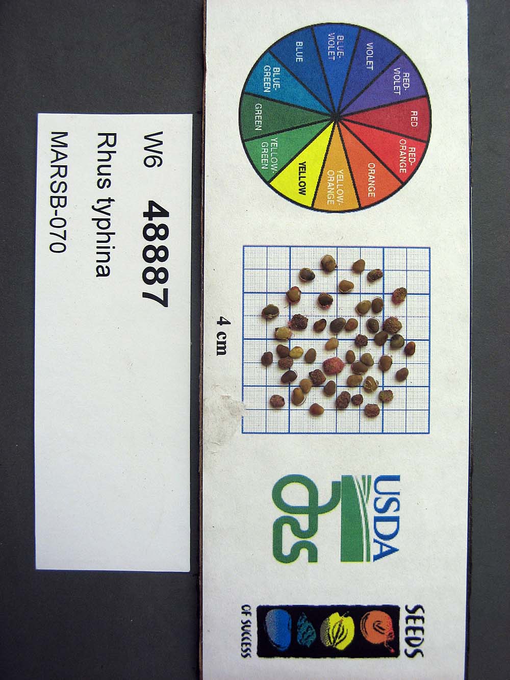 | | 2015 | COLLECTED | 08/22/2013 | Tioga State Forest near Arnot, Tioga County | 41.63745000, -77.21233000 | 1280 | | Wild material | | 1922876 | Ames 33731 |
| 180 | Ames 34697 | MARSB-080 | Cornus amomum Mill. | Pennsylvania, United States | NC7 |  | | 2015 | COLLECTED | 09/11/2013 | Allegheny National Forest -Minister Creek watershed just south of Minister. | 41.61593000, -79.15109000 | 369 | | Wild material | | 1922851 | Ames 34697 |
| 181 | W6 48836 | MARSB-63 | Carex vulpinoidea Michx. | West Virginia, United States | W6 |  | | 2015 | | | | | | | Wild material | | 1922848 | W6 48836 |
| 182 | W6 48866 | MARSB-76 | Juncus effusus L. | Pennsylvania, United States | W6 | 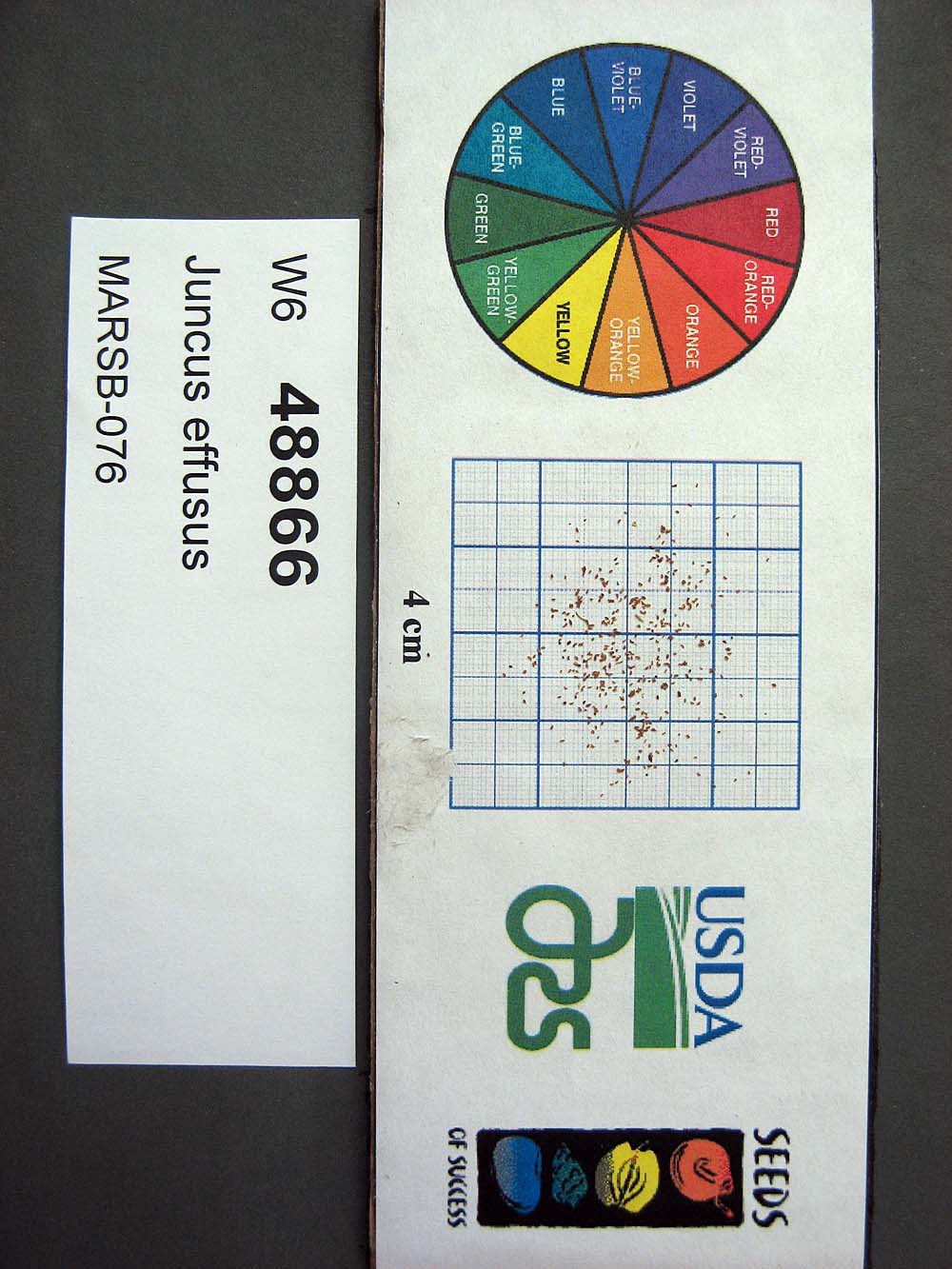 | | 2015 | | | | | | | Wild material | | 1922867 | W6 48866 |
| 183 | W6 48901 | MARSB-93 | Triadenum virginicum (L.) Raf. | West Virginia, United States | W6 |  | | 2015 | | | | | | | Wild material | | 1922888 | W6 48901 |
| 184 | Ames 34280 | MARSB-073 | Monarda fistulosa L. | New Jersey, United States | NC7 |  | | 2015 | COLLECTED | 08/27/2013 | Sparta Mountain WMA near Ogdensburg, Sussex County | 41.06376000, -74.58098000 | 1261 | Utility powerline cut. | Wild material | | 1922924 | Ames 34280 |
| 185 | W6 48843 | MARSB-60 | Danthonia compressa Austin | Pennsylvania, United States | W6 |  | | 2015 | | | | | | | Wild material | | 1922912 | W6 48843 |
| 186 | WLP 1967 | HBC1401 | Viburnum opulus L. var. americanum Aiton | North Dakota, United States | NA | | | 2014 | COLLECTED | 09/29/2014 | Jay Wessels Wildlife Management Area located in Pembina County. | 48.80000000, -97.83000000 | 312 | Diverse habitats including edge of swamp and also upland sandy soils. Growing in association Fraxinus pennsylvanica, Fraxinus nigra, Quercus macrocarpa, Acer negundo, Ulmus americana, Populus tremuloides, Populus balsamifera, Toxicodendron radicans, Cornus sericea, Rosa sp., Corylus sp., Prunus virginiana, Ribes sp., Equisetum sp., Rubus sp., IMpatiens capensis, Thalictrum dasycarpum, Fragaria virginiana, Asarum canadense, Calamagrostis canadensis, Sium suave, Solidago gigantea, Poa pratensis, and Bromus inermis. | Wild material | | 1921830 | WLP 1967 |
| 187 | Ames 32760 | JDC/AB/2014/040/542 | Abies balsamea (L.) Mill. | Iowa, United States | NC7 | | | 2014 | COLLECTED | 09/03/2014 | Bluffton Fir State Preserve, near Bluffton, Winneshiek County. | 43.40106767, -91.90659200 | 326 | High quality, native woods. Steep slope, northwest-facing, and relatively flat portion on top of bluff (powerline) | Wild material | | 1921308 | Ames 32760 |
| 188 | Ames 32386 | JDC/BN/2014/013/515 | Betula nigra L. | Iowa, United States | NC7 |  | | 2014 | COLLECTED | 06/05/2014 | Bearbower Sand Prairie, T87N R9W SW 1/4 of SW 1/4 Sec. 32. | 42.29814100, -91.92822800 | 289 | Sand prairie with likely high water table. | Wild material | | 1919307 | Ames 32386 |
| 189 | Ames 32096 | BA13009001 | Fraxinus nigra Marshall | Minnesota, United States | NC7 |  | | 2013 | COLLECTED | 09/23/2013 | T144N R38W, Clearwater County. | 47.25711000, -95.49000667 | 543 | Edges of lakes and forest edges. Growing in association with Fraxinus pennsylvanica, Quercus macrocarpa, Ulmus americana, Populus tremuloides, Populus balsamifera, Acer saccharum, Betula papyrifera, Salix sp., Larix laricina, Quercus rubra, Abies balsamea, Picea glauca, Sambucus canadensis, Cornus rugosa, Acer spicatum, Rosa sp., Viburnum opulus var. americanum, Viburnum dentatum, Alnus sp., Cornus canadensis, Corylus sp., Prunus virginiana, Ribes sp., Prunus pensylvanica, Rhamnus alnifolia, Equisetum sp., Carex sp., Rubus sp., Impatiens capensis, Bromus sp., and Thalictrum dasycarpum. | Wild material | D.B.H. ranged between 3 and 6 inches. | 1914713 | Ames 32096 |
| 190 | Ames 31516 | JDC/CR/2012/014/407 | Cornus rugosa Lam. | Iowa, United States | NC7 |  | | 2012 | COLLECTED | 07/13/2012 | Bluffton Fir State Preserve, SW 1/4 of Section 10, T99N, R9W, Bluffton Quad, near Bluffton, Winneshiek County. | 43.41080200, -91.93845200 | 343 | Mixed hardwood forest. Very steep, northwest-facing slope. | Wild material | | 1903743 | Ames 31516 |
| 191 | Ames 32627 | AK930-269 | Potentilla norvegica L. | Alaska, United States | NC7 |  | | 2012 | COLLECTED | 09/09/2010 | West end of Circle Hot Springs Air Strip. | 65.48548000, -144.62135000 | 271 | Parking area margins. Silty loam soil (2.5Y 3/6). | Wild material | | 1900616 | Ames 32627 |
| 192 | WLP 2206 | AK930-128 | Amelanchier alnifolia (Nutt.) Nutt. ex M. Roem. | Alaska, United States | NA |  | | 2012 | COLLECTED | 08/10/2010 | Off the Seward Highway, Windy Trailhead, mile marker 106. Chugach State Park. | 61.24780000, -149.32671000 | 9 | vegetated rocky mountainside Soil type: sand, loam, rocks - 2.5/1 2.5Y. South facing slope, 10 degrees. | Wild material | | 1900462 | WLP 2206 |
| 193 | Ames 31215 | Ames 31215 | Diervilla lonicera Mill. | Wisconsin, United States | NC7 |  | | 2011 | COLLECTED | 2011 | Site 1: Dells above Prairie River, Bloomville Quad. T32N R7E NE 1/4 SW 1/4 Sec. 13 and Site 2: Along east side of Highway 17, Pine Dells Quad. T32N R7E NW 1/4 NW 1/4 Sec. 26 | 45.24472220, -89.57486100 | 434 | Site 1: High spots between granite boulders strewn about a young woodland. Sandy soil with a few inches of humus layer. Site 2: Roadside. Disturbed ground on sandy soil with a slight humus layer. | Wild material | | 1894298 | Ames 31215 |
| 194 | Ames 31065 | 354 | Diervilla lonicera Mill. | New York, United States | NC7 |  | | 2011 | COLLECTED | 09/10/2011 | Along Emery Hill Road | 42.07700000, -79.08400000 | 446 | Roadside. East-facing slope. Rocky substrate with very tiny spring creek at base of slope. | Wild material | | 1891451 | Ames 31065 |
| 195 | WLP 830 | 381 | Carpinus caroliniana Walter | Pennsylvania, United States | NA | | | 2011 | COLLECTED | 09/15/2011 | Along Valentine Run Road, near small tributary to Rhine Run Creek, Warren County. | 41.92500000, -79.18800000 | 475 | Roadside. Mixed hardwood forest and open rangeland (Solidago). Associated with Acer, Carya ovata, Cornus racemosa, Fagus grandifolia, Hamamelis virginiana, Quercus, Rosa, Rubus, and Tsuga canadensis. | Wild material | | 1891442 | WLP 830 |
| 196 | Ames 31029 | MPW/MSD 710 | Cornus rugosa Lam. | New York, United States | NC7 |  | | 2011 | COLLECTED | 07/29/2011 | Along Tannery Creek Road, Steuben County. | 42.04210000, -77.11640000 | 378 | Rich woods, just above shale. Steep, north-facing slope. | Wild material | | 1886744 | Ames 31029 |
| 197 | Ames 29848 | JDC/GD/2009/001/151 | Gymnocladus dioicus (L.) K. Koch | Minnesota, United States | NC7 |  | | 2009 | COLLECTED | 02/02/2009 | Minnesota River Watershed approximately 2-3 miles north-northeast of Le Sueur, NW 1/4 of NW 1/4 of Section 19, T112N, R25W, Tyrone Township, Le Sueur Quad, Le Sueur County. | 44.49833333, -93.88666667 | 238 | Floodplain/mesic woods adjacent to river. Majority found on lower slopes (20%, west facing) & where ravines met bottomland. Few found at higher elevation; dry ridge on slope (30%, south facing). | Wild material | Plant size ranged from approximately 40 to 90 feet in height and 36 to 60 d.b.h. | 1794565 | Ames 29848 |
| 198 | Ames 27962 | Quercus Wilderness Area | Amelanchier arborea (F. Michx.) Fernald | Iowa, United States | NC7 |  | | 2003 | COLLECTED | 05/26/2003 | Quercus Wilderness Area located 6.75 miles south, southwest of Oskaloosa, T74N R16W SE ¼ NE ¼ of Sec. 23. | 41.19888889, -92.66111111 | 244 | Mature woods on very sandy soils. Typically restricted to east, west or south facing slopes at either summits or mid-slopes. | Wild material | The native range of Amelanchier arborea is concentrated in the eastern half of the U.S. (Little, 1977). This accession represents a collection of A. arborea germplasm from the western edge of the species native range, specifically the southern portion of Iowa. As of 2025, the top ten largest specimens in the state of Iowa are located at Quercus Wilderness where this accession was collected. Iowa’s largest specimen of A. arborea specimen at Quercus Wilderness was measured at 14.17" DBH, 51.83’ in height, and 27.00’ average crown spread for a total of 102.955 points (Rouw, M., personal communication, 12 December 2023). Fall color (orange-red) tends to peak in the middle of September (Iowa) with peak fruiting occurring in early May. Bark smooth, grey. | 1700483 | Ames 27962 |