| 0 | PI 688310 | R. occidentalis VA-2018-002 WVA | Rubus occidentalis L. | West Virginia, United States | COR |  | | 2018 | COLLECTED | 08/22/2018 | Mountain Lake Biological Research Station, Jefferson National Forest, Giles Co., VA | 37.42283300, -80.50588300 | 1017 | open area in wood south-facing slope on steep road bank; dying ash (from emerald ash borer), maple, black locust, hydrangea, Christmas fern, jewelweed, polygonum, meadow rue, native and non-native herbs, vitus, clematis, sugar maple, tulip poplar | Wild material | West Virginia 2018 | 1965254 | PI 688310 |
| 1 | PI 687155 sos | R. occidentalis MARSB-056 | Rubus occidentalis L. | New Jersey, United States | COR |  | | 2015 | COLLECTED | 07/09/2013 | | | 1115 | | Wild material | | 1922929 | PI 687155 sos |
| 2 | PI 672660 | ORUS 3805-2 | Rubus occidentalis L. | Oregon, United States | COR | | | 2011 | DONATED | 07/21/2011 | | | | | Cultivar | Very erect, nearly thornless - notes from Michael Dossett 07/21/2011 | 1881998 | PI 672660 |
| 3 | PI 672662 | R. occidentalis ORUS 3817-2 | Rubus occidentalis L. | Oregon, United States | COR | | | 2011 | DONATED | 07/21/2011 | | | | | Cultivar | Aphid resistant - Homozygous Ag5 gene - notes from Michael Dossett 07/21/2011 | 1882000 | PI 672662 |
| 4 | PI 672665 | ORUS 3849-1 | Rubus occidentalis L. | Oregon, United States | COR | | | 2011 | DONATED | 07/21/2011 | | | | | Cultivar | yellow-fruited - notes from Michael Dossett, 07/21/2011 | 1882006 | PI 672665 |
| 5 | PI 672668 | ORUS 4143-1 | Rubus occidentalis L. | Oregon, United States | COR | | | 2011 | DEVELOPED | 10/23/2011 | | | | | Cultivar | | 1889451 | PI 672668 |
| 6 | PI 672642 | R. occidentalis #71 | Rubus occidentalis L. | Maryland, United States | COR | | | 2011 | COLLECTED | 2006 | from wild plants growing in Dorchester County, MD | 38.53700000, -75.94380000 | | 1 mile north of Linkwood MD post office, along US hwy 50 | Wild material | ORUS 3809 - Collected in 2006 by Harry Swartz from wild plants growing in Dorchester County, Maryland - N 38.5370, W 75.9438 - 1 mile north of Linkwood MD post office, along US hwy 50. Plants break bud, flower, and fruit very early. Fruit small and crumbly, not well set. Primocanes lack vigor, but are strongly primocane-fruiting. Seedlot segregates for plants with yellow/orange canes and fruit. | 1874003 | PI 672642 |
| 7 | PI 672643 | R. occidentalis #68 | Rubus occidentalis L. | Maryland, United States | COR | | | 2011 | COLLECTED | 2006 | Howard County, Maryland | 39.18220000, -76.88770000 | | along US hwy 32 near exit 17, west side of exit | Wild material | ORUS 3806 - Collected in 2006 by Harry Swartz from wild plants growing in Howard County, Maryland - N 391822, W76.8877 ? along US hwy 32 near exit 17, west side of exit. Germination poor. Plants upright and vigorous. midseason | 1874004 | PI 672643 |
| 8 | PI 672644 | R. occidentalis ORUS 4115-3 | Rubus occidentalis L. | South Carolina, United States | COR | | | 2011 | COLLECTED | 2007 | Rich Mountain, South Carolina | | | Seedlot collected at Rich Mountain, South Carolina, this clone is a seedling from the seedlot. | Wild material | Highly homozygous clone, seedling from a seedlot that was originally collected (in 2007) from Rich Mountain, South Carolina. This clone is being sequenced for a black raspberry research project (2011). | 1878639 | PI 672644 |
| 9 | PI 672634 | R. occidentalis RI 4185 | Rubus occidentalis L. | Rhode Island, United States | COR | | | 2011 | COLLECTED | 2007 | Charlestown, Rhode Island | 41.38305560, -71.64222220 | | | Wild material | Open-pollinated seed from four wild plants collected at Charlestown, Rhode Island. These plants were grown in Corvallis, Oregon, in the vicinity of wild plants from across the range and much of the seed likely represents crossing from unrelated wild germplasm. Mother plants were vigorous with widely branching arching canes. Mother plants tested positive for Raspberry Bushy Dwarf Virus. | 1871989 | PI 672634 |
| 10 | PI 672635 | R. occidentalis Benton Harbor | Rubus occidentalis L. | Michigan, United States | COR | | | 2011 | COLLECTED | 2007 | Benton Harbor, Michigan | 42.11666670, -86.45416670 | 182 | | Wild material | ORUS 4110 - Collected in from wild plants in Benton Harbor, Michigan, by James Hancock in 2007. Plants grown from this seedlot have larger than average fruit size, and strong, stiff, vigorous canes. Early-midseason | 1871997 | PI 672635 |
| 11 | PI 672636 | R. occidentalis Okemos | Rubus occidentalis L. | Michigan, United States | COR | | | 2011 | COLLECTED | | Okemos, Michigan | 42.70248400, -84.39729600 | | | Wild material | Collected in from wild plants in Okemos, Michigan, by James Hancock in 2007. Moderate vigor, late-midseason | 1871998 | PI 672636 |
| 12 | PI 672637 | R. occidentalis Bath | Rubus occidentalis L. | Michigan, United States | COR | | | 2011 | COLLECTED | 2007 | Bath, Michigan | 42.80753360, -84.44914320 | | | Wild material | Collected in from wild plants growing in Bath, Michigan by James Hancock in 2007. Plants from this seedlot tend toward large thorns and have moderate sensitivity to Verticillium wilt. A very low percentage of seedlings from this lot carry a major gene for resistance to the large raspberry aphid, Amphorophora agathonica. Seedlot carries Raspberry Bushy Dwarf Virus. Midseason **Note, a selection (ORUS 4109-1) from this seedlot is heterozygous for a major gene conferring aphid resistance and is in the repository collection. | 1871999 | PI 672637 |
| 13 | PI 672638 | R. occidentalis Hilliard 156 | Rubus occidentalis L. | Ohio, United States | COR | | | 2011 | COLLECTED | 2007 | near Hillard, Ohio | 40.03269000, -83.14011000 | | Plants were growing along the west side of Leap Rd., just north of its intersection with Cemetary Rd. | Wild material | Collected by Christopher Brown of Trenton, NJ in 2007 from wild plants growing near Hilliard, OH. Plants were growing along the west side of Leap Rd., just north of its intersection with Cemetary Rd. coordinates: N 40.03269 W 83.14011. Plants from this population have slightly larger than average sized fruit for wild plants. Plants are upright with moderately stiff canes and moderate vigor. Midseason. | 1872000 | PI 672638 |
| 14 | PI 672639 | R. occidentalis Newton Falls # 157 | Rubus occidentalis L. | Ohio, United States | COR | | | 2011 | COLLECTED | 2007 | SW of Newton Falls, Ohio | 41.16614000, -81.01567000 | | Plants found growing along McClain Rd., approximately 200m east of its intersection with McClintocksburg Rd. | Wild material | ORUS 4108 - Seed collected by Christopher Brown of Trenton, NJ in 2007 from wild plants growing SW of Newton Falls, Ohio. Plants found growing along McClain Rd., approximately 200m east of its intersection with McClintocksburg Rd. Fruit small, moderate gloss. Plants with moderate vigor. Small percentage of plants from this seedlot show introgression with red raspberry, R. strigosus. | 1872001 | PI 672639 |
| 15 | PI 672640 | R. occidentalis #81 | Rubus occidentalis L. | Illinois, United States | COR | | | 2011 | COLLECTED | 2007 | Arenzville, illinois | 39.87694400, -90.37333300 | | near the corner of Lovekamp School Road and Herbert Road | Wild material | ORUS 3789 - Arenzville, Illinois ? near the corner of Lovekamp School Road and Herbert Road. Poor germination, plants erect. | 1874001 | PI 672640 |
| 16 | PI 672641 | R. occidentalis #89 | Rubus occidentalis L. | Indiana, United States | COR | | | 2011 | COLLECTED | 2007 | near Youngstown, Indiana | 39.22420000, -87.22120000 | | Off Hwy 41 | Wild material | ORUS 3795 - Vigo County, IN - Off Hwy 41 near Youngstown, Indiana. 39?22?42?N, 87?22?12?W ? Poor germination. | 1874002 | PI 672641 |
| 17 | PI 657883 | Explorer OP F1 | Rubus occidentalis L. | Colorado, United States | COR | | | 2009 | DONATED | 01/08/2009 | | | | | Cultivar | | 1796888 | PI 657883 |
| 18 | PI 651848 | R. occidentalis Kentucky ORUS 3802 | Rubus occidentalis L. | Kentucky, United States | COR | | | 2007 | COLLECTED | | | | | | Wild material | Robert Geneve collected from Kentucky.
| 1739803 | PI 651848 |
| 19 | PI 651849 | R. occidentalis Maine ORUS 3815 | Rubus occidentalis L. | Maine, United States | COR | | | 2007 | COLLECTED | | Kennebec County, Monmouth. | 44.23733000, -70.03533000 | | | Wild material | David Handley collected from Maine.
| 1739813 | PI 651849 |
| 20 | PI 651850 | R. occidentalis Maine ORUS 3824 | Rubus occidentalis L. | Minnesota, United States | COR | | | 2007 | COLLECTED | 07/05/2006 | Ramsey County, Saint Paul (White Bear Lake), 3695 Auger Ave. | 45.05312000, -93.02370000 | 290 | Partial shade. | Wild material | David Massey collected from Minnesota.
| 1739820 | PI 651850 |
| 21 | PI 651851 | R. occidentalis Minnesota ORUS 3827 | Rubus occidentalis L. | Minnesota, United States | COR | | | 2007 | COLLECTED | 07/01/2006 | Dakota County, Mendota Heights, Big Rivers Trail, bluffs opposite of the confluence of the Minnesota and Mississippi Rivers. | 44.88534000, -93.16713000 | 245 | Plants growing in hardwood forest on NW facing bluffs. | Wild material | Jim Luby collected from Minnesota.
| 1739823 | PI 651851 |
| 22 | PI 651852 | R. occidentalis Missouri ORUS 3830 | Rubus occidentalis L. | Missouri, United States | COR | | | 2007 | COLLECTED | 06/06/2006 | Webster County, roadbank along Green Hill Road (County Road 354) just off MO highway Z, 4 miles south of US highway 60, near Fordland. | 37.11503000, -92.91968000 | 455 | | Wild material | Patrick Byers collected from Missouri.
| 1739826 | PI 651852 |
| 23 | PI 653325 | R. occidentalis New Brunswick ORUS 3777 | Rubus occidentalis L. | New Brunswick, Canada | COR | | | 2007 | COLLECTED | 08/07/2006 | South of Mactaquac, by the shores of the reservoir on the Saint John River. | 45.92639000, -66.89055000 | | Growing in a mature red oak- sugar maple forest with quite a high canopy. Hardiness zone 4b. | Wild material | Andrew Jamieson collected from New Brunswick, Canada.
| 1739791 | PI 653325 |
| 24 | PI 653326 | R. occidentalis Ontario ORUS 3778 | Rubus occidentalis L. | Ontario, Canada | COR | | | 2007 | COLLECTED | 07/07/2006 | | | | | Wild material | Adam Dale collected from Ontario, Canada.
| 1739792 | PI 653326 |
| 25 | PI 653327 | R. occidentalis Connecticut ORUS 3779 | Rubus occidentalis L. | Connecticut, United States | COR | | | 2007 | COLLECTED | 07/10/2006 | Litchfield County, Sharon, 162 Gay Street, 60 feet northwest of Route 41 (Gay Street) between Rhynus and Cole roads. | 41.89040000, -73.45685000 | 265 | | Wild material | Karen Kellogg collected from Connecticut.
| 1739793 | PI 653327 |
| 26 | PI 653328 | R. occidentalis Iowa ORUS 3780 | Rubus occidentalis L. | Iowa, United States | COR | | | 2007 | COLLECTED | 07/14/2006 | Story County, Roland, 417 West Maple Street. | 42.16670000, -93.50800000 | 305 | Plants growing in day-lily flower bed under black walnut trees. | Wild material | Gail Nonnecke collected from Iowa.
Story County, IA - 417 W. Maple Street, Roland, Iowa 50236 Plants growing in flower bed from seed spread by birds | 1739794 | PI 653328 |
| 27 | PI 653329 | R. occidentalis Illinois ORUS 3781 | Rubus occidentalis L. | Illinois, United States | COR | | | 2007 | COLLECTED | 06/15/2006 | Iroquois County, 867 E 400 N Road. About 0.5 miles south of road along Fountain Creek. South edge of F. Weber Farm. | 40.53802000, -87.80760000 | 205 | | Wild material | Courtney Weber collected from Illinios.
| 1739795 | PI 653329 |
| 28 | PI 653330 | R. occidentalis Indiana ORUS 3794 | Rubus occidentalis L. | Indiana, United States | COR | | | 2007 | COLLECTED | 06/21/2006 | Hendrick County, West of Inidianapolis on Highway 40 and then north on 75. Just north of the Putnam and Hendrick County line. | 39.63140000, -86.67012000 | 240 | | Wild material | Jerry Lehman collected from Indiana.
| 1739796 | PI 653330 |
| 29 | PI 653331 | R. occidentalis Indiana ORUS 3796 | Rubus occidentalis L. | Indiana, United States | COR | | | 2007 | COLLECTED | 06/16/2006 | Greene County, south side of highway 54, east of Bloomfield. | 39.03650000, -86.82777000 | 235 | | Wild material | Jerry Lehman collected from Indiana.
| 1739797 | PI 653331 |
| 30 | PI 653332 | R. occidentalis Indiana ORUS 3797 | Rubus occidentalis L. | Indiana, United States | COR | | | 2007 | COLLECTED | 06/16/2006 | Hendricks County, North Belleville | 39.63787000, -86.67012000 | 240 | | Wild material | Jerry Lehman collected from Indiana.
| 1739798 | PI 653332 |
| 31 | PI 653333 | R. occidentalis Indiana ORUS 3798 | Rubus occidentalis L. | Indiana, United States | COR | | | 2007 | COLLECTED | 06/16/2006 | Sullivan County, between Cass and Antioch Junction. (However, coordinates given would place the collection sight southeast of Sullivan. 39�04.388N, 87�22.357W) | 39.07313000, -87.37262000 | 140 | | Wild material | Jerry Lehman collected from Indiana.
| 1739799 | PI 653333 |
| 32 | PI 653334 | R. occidentalis Indiana ORUS 3799 | Rubus occidentalis L. | Indiana, United States | COR | | | 2007 | COLLECTED | 06/16/2006 | Vigo County, north of Farmersburg. Highway 246, south side by railroad tracks. | 39.30330000, -87.36942000 | 185 | | Wild material | Photo shows possible Powdery Mildew on leaves. | 1739800 | PI 653334 |
| 33 | PI 653335 | R. occidentalis Indiana ORUS 3800 | Rubus occidentalis L. | Indiana, United States | COR | | | 2007 | COLLECTED | 06/16/2006 | Greene County, Along White River, north of Elliston. | 39.06485000, -86.97560000 | 165 | | Wild material | Jerry Lehman collected from Indiana.
| 1739801 | PI 653335 |
| 34 | PI 653336 | R. occidentalis Indiana ORUS 3801 | Rubus occidentalis L. | Indiana, United States | COR | | | 2007 | COLLECTED | | | | | | Wild material | Robert Geneve collected from Indiana.
| 1739802 | PI 653336 |
| 35 | PI 653337 | R. occidentalis Massachusetts ORUS 3803 | Rubus occidentalis L. | Massachusetts, United States | COR | | | 2007 | COLLECTED | 07/10/2006 | Berkshire County, New Marlburough Township, Clayton Mill River Rd. about halfway between Canaan Southfield Road and Alum Hill Road. | 42.05813000, -73.29033000 | 215 | Along a sandy dirt lane into a hayfield. Understory of large deciduous trees at lane's edge. | Wild material | Karen Kellogg collected from Massachusetts.
| 1739804 | PI 653337 |
| 36 | PI 653338 | R. occidentalis Massachusetts ORUS 3804 | Rubus occidentalis L. | Massachusetts, United States | COR | | | 2007 | COLLECTED | 07/10/2006 | Berkshire County, Great Barrington, corner of East Sheffield Road and Brush Hill Road. | 42.17574000, -73.35661000 | 210 | Unmown strip along roadside, among milkweed and other tall herbs. Western exposure. | Wild material | Karen Kellogg collected from Massachusetts.
| 1739805 | PI 653338 |
| 37 | PI 653339 | R. occidentalis Maryland ORUS 3805 | Rubus occidentalis L. | Maryland, United States | COR | | | 2007 | COLLECTED | 06/2006 | Washington County, along I-70, 0.1 mile west of Appalachian Trail. | 39.53933000, -77.60528000 | 375 | | Wild material | Harry Swartz collected from Maryland.
| 1739806 | PI 653339 |
| 38 | PI 653340 | R. occidentalis Maryland ORUS 3807 | Rubus occidentalis L. | Maryland, United States | COR | | | 2007 | COLLECTED | 06/2006 | Washington County, about 0.5 mile east of Allegeny and Washington County line, north side of I-68. | 39.70696000, -78.31021000 | 230 | | Wild material | Harry Swartz collected from Maryland.
| 1739807 | PI 653340 |
| 39 | PI 653341 | R. occidentalis Maryland ORUS 3808 | Rubus occidentalis L. | Maryland, United States | COR | | | 2007 | COLLECTED | 06/2006 | Allegany County, 0.1 miles west of Volke (Vocke) Road. I-68 south side of Vale (La Vale). | 39.63512000, -78.83233000 | 300 | | Wild material | Harry Swartz collected from Maryland.
| 1739808 | PI 653341 |
| 40 | PI 653342 | R. occidentalis Maryland ORUS 3810 | Rubus occidentalis L. | Maryland, United States | COR | | | 2007 | COLLECTED | 06/2006 | Howard County, MD 32 (Sykesville Road) 0.2 miles South of MD 144 (Frederick Pike/National Pike), east side of road. | 39.29854000, -76.95285000 | 150 | | Wild material | Harry Swartz collected from Maryland.
| 1739809 | PI 653342 |
| 41 | PI 653343 | R. occidentalis Maryland ORUS 3811 | Rubus occidentalis L. | Maryland, United States | COR | | | 2007 | COLLECTED | 06/2006 | Allegany County, north side of I-68 east of Cumberland, about 0.5 miles east of US 220 N exit. | 39.67115000, -78.69780000 | 275 | | Wild material | Harry Swartz collected from Maryland.
| 1739810 | PI 653343 |
| 42 | PI 653344 | R. occidentalis Maryland ORUS 3812 | Rubus occidentalis L. | Maryland, United States | COR | | | 2007 | COLLECTED | 06/2006 | Prince George County, USDA Beltsville Area Research Center, 201 Sheep Road. | 39.03160000, -76.88600000 | 30 | | Wild material | Harry Swartz collected from Maryland.
| 1739811 | PI 653344 |
| 43 | PI 653345 | R. occidentalis Maine ORUS 3814 | Rubus occidentalis L. | Maine, United States | COR | | | 2007 | COLLECTED | | Penobscot County, Orono | 44.88333000, -68.67167000 | | | Wild material | David Handley collected from Maine.
| 1739812 | PI 653345 |
| 44 | PI 653346 | R. occidentalis Maine ORUS 3816 | Rubus occidentalis L. | Maine, United States | COR | | | 2007 | COLLECTED | | York County, West Kennebunk. | 43.40900000, -70.57983000 | | | Wild material | David Handley collected from Maine.
| 1739814 | PI 653346 |
| 45 | PI 653347 | R. occidentalis Maine ORUS 3817 | Rubus occidentalis L. | Maine, United States | COR | | | 2007 | COLLECTED | | Kennebec County, Gardiner. | 44.22717000, -69.77600000 | | | Wild material | David Handley collected from Maine.
| 1739815 | PI 653347 |
| 46 | PI 653348 | R. occidentalis Maine ORUS 3819 | Rubus occidentalis L. | Maine, United States | COR | | | 2007 | COLLECTED | | Kennebec County, Hallowell. | 44.28633000, -69.79100000 | | | Wild material | David Handley collected from Maine.
| 1739816 | PI 653348 |
| 47 | PI 653349 | R. occidentalis Maine ORUS 3820 | Rubus occidentalis L. | Maine, United States | COR | | | 2007 | COLLECTED | | Kennebec County, East Vassalboro. | 44.44770000, -69.60640000 | | | Wild material | David Handley collected from Maine.
| 1739817 | PI 653349 |
| 48 | PI 653350 | R. occidentalis Maine ORUS 3821 | Rubus occidentalis L. | Maine, United States | COR | | | 2007 | COLLECTED | | Knox County, Camden. | 44.20980000, -69.06480000 | | | Wild material | David Handley collected from Maine.
| 1739818 | PI 653350 |
| 49 | PI 653351 | R. occidentalis Maine ORUS 3823 | Rubus occidentalis L. | Minnesota, United States | COR | | | 2007 | COLLECTED | 07/11/2006 | Cass County, West of Pequot Lakes, 6598 49th Ave SW. | 46.56367000, -94.53983000 | 430 | | Wild material | Sample labeled 'Farm', wild origin is unknown. | 1739819 | PI 653351 |
| 50 | PI 653352 | R. occidentalis Minnesota ORUS 3825 | Rubus occidentalis L. | Minnesota, United States | COR | | | 2007 | COLLECTED | | Crow Wing County, Pequot Lakes, Brambleberry Farm, 4002 Davis Street. | 46.59350000, -94.32017000 | 375 | | Wild material | Jim Fruth collected from Minnesota.
| 1739821 | PI 653352 |
| 51 | PI 653353 | R. occidentalis Minnesota ORUS 3826 | Rubus occidentalis L. | Minnesota, United States | COR | | | 2007 | COLLECTED | 07/02/2006 | Ramsey County, Roseville, near corner of Roselawn and Larpenteur (Lexington ?) Aves. | 45.00418000, -93.14640000 | 290 | Suburban woodlot. | Wild material | Jim Luby collected from Minnesota.
| 1739822 | PI 653353 |
| 52 | PI 653354 | R. occidentalis Minnesota ORUS 3828 | Rubus occidentalis L. | Minnesota, United States | COR | | | 2007 | COLLECTED | 07/03/2007 | Dakota County, Rosemount, Lebanon Hills Regional Park, north and east of Jensen Lake on trail. Fruit collected along 5 km of trails. | 44.77944000, -93.15256000 | 290 | Hardwood forest (maple, basswood,ash). This was an interesting site because it had extensive Rubus strigosus and R. occidentalis populations. | Wild material | Some of the black raspsberries, though distinctly black based on cane morphology and fruit color, make me think they have a little strigosus based on their hairier fruit. - Jim Luby | 1739824 | PI 653354 |
| 53 | PI 653355 | R. occidentalis Minnesota ORUS 3829 | Rubus occidentalis L. | Minnesota, United States | COR | | | 2007 | COLLECTED | 07/03/2007 | Dakota County, Rosemount, Lebanon Hills Regional Park, north and east of Jensen Lake on trail. Fruit collected along 5 km of trails. | 44.77944000, -93.15256000 | 290 | Hardwood forest (maple, basswood,ash). This was an interesting site because it had extensive Rubus strigosus and R. occidentalis populations. | Wild material | Jim Luby collected from Minnesota.
| 1739825 | PI 653355 |
| 54 | PI 653356 | R. occidentalis Missouri ORUS 3832 | Rubus occidentalis L. | Missouri, United States | COR | | | 2007 | COLLECTED | 06/11/2006 | Webster County, New Hope Road (County Road 432), west of Fordland. Plants along roadside. | 37.16335000, -92.96401000 | 455 | | Wild material | Patrick Byers collected from Missouri.
| 1739827 | PI 653356 |
| 55 | PI 653357 | R. occidentalis North Carolina ORUS 3835 | Rubus occidentalis L. | North Carolina, United States | COR | | | 2007 | COLLECTED | 06/20/2006 | Madison County, Interstate 26 milepost 6, steep bank above North Carolina Welcome Center. | 35.87406000, -82.54523000 | 730 | | Wild material | Richard Moyer collected from North Carolina.
| 1739828 | PI 653357 |
| 56 | PI 653358 | R. occidentalis North Carolina ORUS 3837 | Rubus occidentalis L. | North Carolina, United States | COR | | | 2007 | COLLECTED | 07/23/2006 | Rutherford County, US 74 about 100m to the east of Broad River, just after highway crosses the river. | 35.42462000, -82.16490000 | 300 | | Wild material | Richard Moyer collected from North Carolina.
| 1739829 | PI 653358 |
| 57 | PI 653359 | R. occidentalis North Carolina ORUS 3838 | Rubus occidentalis L. | North Carolina, United States | COR | | | 2007 | COLLECTED | 07/23/2006 | Rutherford County, US 74 about 150m to the east of Broad River, just after highway crosses the river. | 35.42450000, -82.16403000 | 300 | | Wild material | Richard Moyer collected from North Carolina.
| 1739830 | PI 653359 |
| 58 | PI 653360 | R. occidentalis New York ORUS 3839 | Rubus occidentalis L. | New York, United States | COR | | | 2007 | COLLECTED | 07/15/2006 | Ontario County, Sutton Road, 1.5 miles south of County Road 4 on east side of road at New York State Agricultural Experiment Station. | 42.86902000, -77.03994000 | 225 | | Wild material | Courtney Weber collected from New York.
| 1739831 | PI 653360 |
| 59 | PI 653361 | R. occidentalis New York ORUS 3840 | Rubus occidentalis L. | New York, United States | COR | | | 2007 | COLLECTED | 07/15/2006 | Ontario County, Sutton Road south of County Road 4 west side. Western part of Sutton to Gates Road right of way. | 42.88485000, -77.04329000 | 225 | | Wild material | Courtney Weber collected from New York.
| 1739832 | PI 653361 |
| 60 | PI 653362 | R. occidentalis New YorkORUS 3842 | Rubus occidentalis L. | New York, United States | COR | | | 2007 | COLLECTED | 07/09/2006 | Dutchess County, south of Millerton, east off US 44 on Downey Road, between corn field and Webatuck Creek. | 41.92600000, -73.51080000 | 180 | Herbaceous plants and grasses. | Wild material | Karen Kellogg collected from New York.
| 1739833 | PI 653362 |
| 61 | PI 653363 | R. occidentalis New YorkORUS 3843 | Rubus occidentalis L. | New York, United States | COR | | | 2007 | COLLECTED | 07/10/2006 | Columbia County, Farm Road, 1.5 miles southwest of route 22, near Copake Falls. | 42.13050000, -73.53350000 | 180 | Mowed roadside, but, vines being crowed out by Multiflora Rose and Oriental Bittersweet. West exposure. | Wild material | Karen Kellogg collected from New York.
| 1739834 | PI 653363 |
| 62 | PI 653364 | R. occidentalis New York ORUS 3844 | Rubus occidentalis L. | New York, United States | COR | | | 2007 | COLLECTED | 07/10/2006 | Yates County, northeast of Dundee, Smith Road, Road's End Farm. | 42.55950000, -76.93220000 | 225 | | Wild material | Rivka Davis collected from New York.
| 1739835 | PI 653364 |
| 63 | PI 653365 | R. occidentalis New York ORUS 3845 | Rubus occidentalis L. | New York, United States | COR | | | 2007 | COLLECTED | 07/10/2006 | Yates County, northeast of Dundee, Smith Road, Road's End Farm. | 42.55950000, -76.93220000 | 225 | | Wild material | Rivka Davis collected from New York.
| 1739836 | PI 653365 |
| 64 | PI 653366 | R. occidentalis New York ORUS 3846 | Rubus occidentalis L. | New York, United States | COR | | | 2007 | COLLECTED | 07/10/2006 | Yates County, northeast of Dundee, Smith Road, Road's End Farm. | 42.55831000, -76.93731000 | 250 | | Wild material | Rivka Davis collected from New York.
| 1739837 | PI 653366 |
| 65 | PI 653367 | R. occidentalis New York ORUS 3848 | Rubus occidentalis L. | New York, United States | COR | | | 2007 | COLLECTED | 07/10/2006 | Yates County, northeast of Dundee, Smith Road, Road's End Farm. | 42.55950000, -76.93220000 | 225 | | Wild material | Rivka Davis collected from New York.
| 1739838 | PI 653367 |
| 66 | PI 653368 | R. occidentalis Ohio ORUS 3849 | Rubus occidentalis L. | Ohio, United States | COR | | | 2007 | COLLECTED | 06/19/2006 | Clermont County, edge of woods by utility substation in a suburban neighorhood. Appoximate location: 39.05 N, 84.15 W. | 39.08465000, -84.25960000 | 275 | Zone 6a. Soil pH probably neutral. Clay loam soil likely. Surrounded by Blackberries, probably Rubus allegheniensis. | Wild material | Michele Stanton collected from Ohio.
| 1739839 | PI 653368 |
| 67 | PI 653369 | R. occidentalis Pennsylvania ORUS 3851 | Rubus occidentalis L. | Pennsylvania, United States | COR | | | 2007 | COLLECTED | 07/11/2006 | Chester County, Honeybrook, 271 Hunter Run Road. | 40.08351000, -75.84386000 | 185 | Growing on north side of grove of pines mainly in shade. Wineberry and garlic mustard growing nearby. | Wild material | Chris Mauchline collected from Pennsylvania.
| 1739840 | PI 653369 |
| 68 | PI 653370 | R. occidentalis Pennsylvania ORUS 3852 | Rubus occidentalis L. | Pennsylvania, United States | COR | | | 2007 | COLLECTED | | Interstate 79, one to two miles north of Pennsylvania line. 200 meters north of rest stop, west side of road. (Rest Area's road.) | 39.73530000, -80.05660000 | 300 | | Wild material | Harry Swartz collected from Pennsylvania.
| 1739841 | PI 653370 |
| 69 | PI 653371 | R. occidentalis Pennsylvania ORUS 3853 | Rubus occidentalis L. | Pennsylvania, United States | COR | | | 2007 | COLLECTED | | Somerset County, Springs, Ash Hollow and Shade Grove Road, north of intersection. | 39.72570000, -79.16800000 | 750 | | Wild material | Harry Swartz collected from Pennsylvania.
| 1739842 | PI 653371 |
| 70 | PI 653372 | R. occidentalis Pennsylvania ORUS 3855 | Rubus occidentalis L. | Pennsylvania, United States | COR | | | 2007 | COLLECTED | 06/29/2006 | Centre County, State College, growing in empty lot next door to 275 Osmond Street. | 40.78223000, -77.87083000 | 360 | | Wild material | Michael Bathrick collected from Pennsylvania.
| 1739843 | PI 653372 |
| 71 | PI 653373 | R. occidentalis Pennsylvania ORUS 3856 | Rubus occidentalis L. | Pennsylvania, United States | COR | | | 2007 | COLLECTED | 06/24/2006 | Centre County, west of Howard, growing across the street from 1096 Nittany Ridge Road. | 41.01383000, -77.58056000 | 325 | | Wild material | Michael Bathrick collected from Pennsylvania.
| 1739844 | PI 653373 |
| 72 | PI 653374 | R. occidentalisTennessee ORUS 3857, 3858 | Rubus occidentalis L. | Tennessee, United States | COR | | | 2007 | COLLECTED | 06/06/2006 | Davidson Couty. Southwest of Whites Creek, north of Lloyd Road and northeast of U.S. 41 Alternate (Clarksville Pike). | 36.25278000, -86.84750000 | 170 | Patch of plants is isolated, in a wooded ravine in moderate shade. | Wild material | Hal Love collected from Tennessee.
| 1739845 | PI 653374 |
| 73 | PI 653375 | R. occidentalis Tennessee ORUS 3859-3862 | Rubus occidentalis L. | Tennessee, United States | COR | | | 2007 | COLLECTED | 06/09/2006 | Davidson County, field between Dry Fork Creek and Dry Fork Road. | 36.24917000, -86.84028000 | 140 | Morning sun. | Wild material | Hal Love collected from Tennessee.
| 1739846 | PI 653375 |
| 74 | PI 653376 | R. occidentalis Tennessee ORUS 3864 3865 | Rubus occidentalis L. | Tennessee, United States | COR | | | 2007 | COLLECTED | 06/11/2006 | Davidson County, Nashville, North side of Briley Parkway near intersection with Clarksville Pike. | 36.22972000, -86.83833000 | 167 | Part to full morning sun. | Wild material | Hal Love collected from Tennessee.
| 1739847 | PI 653376 |
| 75 | PI 653378 | R. occidentalis Tennessee ORUS 3868 | Rubus occidentalis L. | Tennessee, United States | COR | | | 2007 | COLLECTED | 06/09/2006 | Dekalb County, Side of Dry Creek Road near intersection with Pea Ridge Road. | 35.94111000, -85.90861000 | 197 | Full sun. | Wild material | Hal Love collected from Tennessee.
| 1739849 | PI 653378 |
| 76 | PI 653379 | R. occidentalis Tennessee ORUS 3871 | Rubus occidentalis L. | Tennessee, United States | COR | | | 2007 | COLLECTED | 06/09/2006 | Dekalb County, side of road along Dry Creek. | 35.93222000, -85.91667000 | 203 | Full sun. | Wild material | Hal Love collected from Tennessee.
| 1739850 | PI 653379 |
| 77 | PI 653380 | R. occidentalis Tennessee | Rubus occidentalis L. | Tennessee, United States | COR | | | 2007 | COLLECTED | 06/09/2006 | Dekalb County, side of Old Mill Hill Road on top of Highland Rim just west of Smithville. | 35.94611000, -85.89889000 | 327 | Full sun. | Wild material | Hal Love collected from Tennessee.
| 1739851 | PI 653380 |
| 78 | PI 653381 | R. occidentalis Tennessee | Rubus occidentalis L. | Tennessee, United States | COR | | | 2007 | COLLECTED | 06/09/2006 | Dekalb County, Side of Old Mill Hill Road across from Braswell Cemetery just west of Smithville. | 35.94889000, -85.88444000 | 340 | Full sun. | Wild material | Many clusters evenly ripe. Berries medium size with very sweet, very good flavor. By far the best wild black raspberries I have found. - Hal Love, June 2006 | 1739852 | PI 653381 |
| 79 | PI 653383 | R. occidentalis Tennessee | Rubus occidentalis L. | Tennessee, United States | COR | | | 2007 | COLLECTED | 06/09/2006 | Warren County, Side of road (Northcutts Cove Road) in powerline cut. | 35.53917000, -85.75056000 | 303 | Full sun to part shade. | Wild material | Hal Love collected from Tennessee.
| 1739854 | PI 653383 |
| 80 | PI 653384 | R. occidentalis Tennessee | Rubus occidentalis L. | Tennessee, United States | COR | | | 2007 | COLLECTED | 06/09/2006 | Grundy County, Side of road behind guardrail near Northcutt's Spring. | 35.51639000, -85.75250000 | 312 | Growing in full sun. | Wild material | Hal Love collected from Tennessee.
| 1739855 | PI 653384 |
| 81 | PI 653385 | R. occidentalis Tennessee | Rubus occidentalis L. | Tennessee, United States | COR | | | 2007 | COLLECTED | 06/09/2006 | Side of road (Northcutts Cove Road). | 35.50333000, -85.75333000 | 333 | On steep hillside with limestone outcrops, growing with wineberry. Morning sun. | Wild material | Hal Love collected from Tennessee.
| 1739856 | PI 653385 |
| 82 | PI 653386 | R. occidentalis Tennessee | Rubus occidentalis L. | Tennessee, United States | COR | | | 2007 | COLLECTED | 06/09/2006 | Warren County, long side of road (Northcutts Cove Road). | 35.53611000, -85.74944000 | 327 | Full to part sun. | Wild material | Hal Love collected from Tennessee.
| 1739857 | PI 653386 |
| 83 | PI 653387 | R. occidentalis Tennessee ORUS 3900 | Rubus occidentalis L. | Tennessee, United States | COR | | | 2007 | COLLECTED | 06/09/2006 | Warren County, Side of Jeep road in Rogers Hollow. | 35.55306000, -85.77917000 | 294 | Afternoon sun, three isolated plants with hydrangea. | Wild material | Hal Love collected from Tennessee.
| 1739858 | PI 653387 |
| 84 | PI 653388 | R. occidentalis Tennessee ORUS 3902 | Rubus occidentalis L. | Tennessee, United States | COR | | | 2007 | COLLECTED | 06/09/2006 | Dekalb County, side of highway 56 south of Smithville. | 35.91250000, -85.82028000 | 297 | | Wild material | Hal Love collected from Tennessee.
| 1739859 | PI 653388 |
| 85 | PI 653389 | R. occidentalis Tennessee ORUS 3904 | Rubus occidentalis L. | Tennessee, United States | COR | | | 2007 | COLLECTED | 06/10/2006 | Cannon County, side of highway 70 near Woodbury. | 35.81972000, -86.04611000 | 248 | Morning shade, afternoon sun. | Wild material | Hal Love collected from Tennessee.
| 1739860 | PI 653389 |
| 86 | PI 653390 | R. occidentalis Tennessee ORUS 3906 | Rubus occidentalis L. | Tennessee, United States | COR | | | 2007 | COLLECTED | 06/10/2006 | Van Buren County, side of Rocky River in deep gorge. | 35.63972000, -85.54000000 | 321 | Growing in shade with hydrangea. | Wild material | Hal Love collected from Tennessee.
| 1739861 | PI 653390 |
| 87 | PI 653391 | R. occidentalis Tennessee ORUS 3908 | Rubus occidentalis L. | Tennessee, United States | COR | | | 2007 | COLLECTED | 06/10/2006 | Van Buren County, side of Jeep Road (by Rocky River.) | 35.63611000, -85.53667000 | 355 | | Wild material | Hal Love collected from Tennessee.
| 1739862 | PI 653391 |
| 88 | PI 653392 | R. occidentalis Tennessee ORUS 3909 | Rubus occidentalis L. | Tennessee, United States | COR | | | 2007 | COLLECTED | 06/10/2006 | Van Buren County, side of old logging camp. (Rocky River) | 35.62583000, -85.52833000 | 370 | Part to full sun. | Wild material | Hal Love collected from Tennessee.
| 1739863 | PI 653392 |
| 89 | PI 653393 | R. occidentalis Tennessee ORUS 3911 | Rubus occidentalis L. | Tennessee, United States | COR | | | 2007 | COLLECTED | 06/10/2006 | Van Buren County, below large limestone bluff. (Rocky River) | 35.62778000, -85.52694000 | 364 | Full shade to full sun. | Wild material | Hal Love collected from Tennessee.
| 1739864 | PI 653393 |
| 90 | PI 653394 | R. occidentalis Tennessee ORUS 3912 | Rubus occidentalis L. | Tennessee, United States | COR | | | 2007 | COLLECTED | 06/10/2006 | Van Buren County, side of Jeep Road. (Rocky River) | 35.63111000, -85.53083000 | 382 | Sunny, Rocky, very exposed, dry site. | Wild material | Hal Love collected from Tennessee.
| 1739865 | PI 653394 |
| 91 | PI 653395 | R. occidentalis Tennessee ORUS 3914 | Rubus occidentalis L. | Tennessee, United States | COR | | | 2007 | COLLECTED | 06/14/2006 | Cheatham County, side of Highway 249, near intersection with highway 70 in Pegram. | 36.10806000, -87.06722000 | 158 | | Wild material | Hal Love collected from Tennessee.
| 1739866 | PI 653395 |
| 92 | PI 653396 | R. occidentalis Tennessee ORUS 3916 | Rubus occidentalis L. | Tennessee, United States | COR | | | 2007 | COLLECTED | 06/20/2006 | Unicoi County, I-26 mile marker #26. Collected from east end of limestone outcrop. | 35.98540000, -82.54260000 | 990 | Limestone outcrop | Wild material | Richard Moyer collected from Tennessee.
| 1739867 | PI 653396 |
| 93 | PI 653397 | R. occidentalis Tennessee ORUS 3918 | Rubus occidentalis L. | Tennessee, United States | COR | | | 2007 | COLLECTED | 06/20/2006 | Unicoi County, I-26 mile marker #4.25 | 36.21070000, -82.35010000 | 610 | Plants along highway on steep bank, growing in vetch, and under edge of black locust trees. | Wild material | Richard Moyer collected from Tennessee.
| 1739868 | PI 653397 |
| 94 | PI 653398 | R. occidentalis Tennessee ORUS 3919 | Rubus occidentalis L. | Tennessee, United States | COR | | | 2007 | COLLECTED | 06/20/2006 | Henderson County, I-26 Rest Area near Asheville Airport (Edge of Buncombe County.) Behind rest area. | 35.42727000, -82.52764000 | 650 | Drought conditions, as evidenced by herbaceous plants in area are suffering. | Wild material | Richard Moyer collected from Tennessee.
| 1739869 | PI 653398 |
| 95 | PI 653399 | R. occidentalis Wisconsin ORUS 3926 | Rubus occidentalis L. | Wisconsin, United States | COR | | | 2007 | COLLECTED | 07/05/2006 | Columbia County, Lowville Township, field of wild parsnip on southeast 'armpit' of Rocky Run Oak Savana State Natural Area. | 43.45440000, -89.33110000 | 265 | Fine sandy loam soil in dappled shade with a few hours of direct sun on edge of field. | Wild material | Tanis Cuff collected from Wisconsin.
| 1739870 | PI 653399 |
| 96 | PI 653400 | R. occidentalis West Virginia ORUS 3929 | Rubus occidentalis L. | West Virginia, United States | COR | | | 2007 | COLLECTED | 06/17/2006 | Jefferson County, Shepherdson, Cress Creek Golf and Country Club, hole 12. | 39.44983000, -77.80567000 | 120 | | Wild material | Fumiomi Takeda collected from West Virginia.
| 1739871 | PI 653400 |
| 97 | PI 653401 | R. occidentalis West Virginia ORUS 3930 | Rubus occidentalis L. | West Virginia, United States | COR | | | 2007 | COLLECTED | 06/21/2006 | Berkeley County, intersection of Mission Road and Mish Lane about 1.5 miles southwest of Inwood. | 39.34608000, -78.06962000 | 185 | | Wild material | Fumiomi Takeda collected from West Virginia.
| 1739872 | PI 653401 |
| 98 | PI 653402 | R. occidentalis West Virginia ORUS 3931 | Rubus occidentalis L. | West Virginia, United States | COR | | | 2007 | COLLECTED | | Preston County, off route 24 about 3 miles into West Virginia, near corner with 116. | 39.29090000, -79.52210000 | 820 | | Wild material | The coordinates of the collection site estamated to be 39.2896 degrees North by 79.5221 degrees West. | 1739873 | PI 653402 |
| 99 | PI 651846 | R. occidentalis HDF-2007-083 | Rubus occidentalis L. | Kansas, United States | COR |  | | 2007 | COLLECTED | 07/08/2007 | Ottawa County Minneapolis-Ottawa County State Lake | 39.11586000, -97.56972000 | 0 | Sandstone with organic duff | Wild material | Michael Dossett, Chad Finn collected from Kansas.
| 1733161 | PI 651846 |
| 100 | PI 651847 | R. occidentalis HDF-2007-122 | Rubus occidentalis L. | Minnesota, United States | COR |  | | 2007 | COLLECTED | 07/13/2007 | Big Stone Lake State Park, Bonanza Area Hillside at entrance to park | 45.38870000, -96.51290000 | 336 | Prairie edge/ interface with riparian zone, slope 20 deg. south aspect, soil: black sandy loam | Wild material | Michael Dossett, Chad Finn collected from Minnesota.
| 1733185 | PI 651847 |
| 101 | PI 652985 | R. occidentalis HDF-2007-084 | Rubus occidentalis L. | Kansas, United States | COR |  | | 2007 | COLLECTED | 07/08/2007 | Ottawa County Minneapolis-Ottawa County State Lake | 39.10760000, -97.57270000 | 201 | open field with grass and sumac flat open aspect | Wild material | Michael Dossett, Chad Finn collected from Kansas.
| 1733162 | PI 652985 |
| 102 | PI 652988 | R. occidentalis HDF-2007-107 | Rubus occidentalis L. | South Dakota, United States | COR |  | | 2007 | COLLECTED | 07/11/2007 | Charles Mix County Peas Creek State Recreation Area | 43.14550000, -98.73460000 | 455 | Moist edge of creek bed stream bank overgrown with lots of vegetation | Wild material | Michael Dossett, Chad Finn collected from South Dakota.
| 1733175 | PI 652988 |
| 103 | PI 653299 | R. occidentalis HDF-2007-071 | Rubus occidentalis L. | Kansas, United States | COR | | | 2007 | COLLECTED | 07/07/2007 | Wyandotte County, west of Kansas City, south of I-70, east off SR-7 on short side road, northend of Bonner Springs. | 39.08389000, -94.88000000 | 302 | | Wild material | Michael Dossett, Chad Finn collected from Kansas.
| 1733154 | PI 653299 |
| 104 | PI 653300 | R. occidentalis HDF-2007-073 | Rubus occidentalis L. | Kansas, United States | COR |  | | 2007 | COLLECTED | 07/07/2007 | Jefferson County, Perry Lake (large reservoir on the Delaware River) located off US-59 west of Oskaloosa on S-92. | 39.12920000, -95.40560000 | 300 | flat slope , mostly west facing aspect Assoc. plants: Vitis, Rhus, Juglans nigra, Parthenocissus | Wild material | Michael Dossett, Chad Finn collected from Kansas.
| 1733156 | PI 653300 |
| 105 | PI 653301 | R. occidentalis HDF-2007-078 | Rubus occidentalis L. | Kansas, United States | COR |  | | 2007 | COLLECTED | 07/08/2007 | Manhattan Patowatomi #2 | 39.22791000, -96.52860000 | 0 | Rocky limestone | Wild material | Michael Dossett, Chad Finn collected from Kansas.
| 1733158 | PI 653301 |
| 106 | PI 653302 | R. occidentalis HDF-2007-081 | Rubus occidentalis L. | Kansas, United States | COR |  | | 2007 | COLLECTED | 07/08/2007 | Fort Riley - Ogden | 39.11210000, -96.76080000 | 330 | Forest edge with remnant fallgrass prairie, riparian corridor of creek on limestone origin soil | Wild material | Michael Dossett, Chad Finn collected from Kansas.
| 1733159 | PI 653302 |
| 107 | PI 653303 | R. occidentalis HDF-2007-082 | Rubus occidentalis L. | Kansas, United States | COR | | | 2007 | COLLECTED | 07/08/2007 | Geang County Moon Lake - west side | 39.07390000, -96.80600000 | 0 | | Wild material | Michael Dossett, Chad Finn collected from Kansas.
| 1733160 | PI 653303 |
| 108 | PI 653304 | R. occidentalis HDF-2007-085 | Rubus occidentalis L. | Nebraska, United States | COR |  | | 2007 | COLLECTED | 07/09/2007 | Ambay-Elm Creek Webster County | 40.11770000, -98.44540000 | 570 | Organic loamy soil | Wild material | Michael Dossett, Chad Finn collected from Nebraska.
| 1733163 | PI 653304 |
| 109 | PI 653305 | R. occidentalis HDF-2007-088 | Rubus occidentalis L. | Nebraska, United States | COR |  | | 2007 | COLLECTED | 07/09/2007 | St. Paul-North Loup State Recreation Area | 41.26480000, 98.45030000 | 591 | wet, dark organic soil along bank of dike | Wild material | Michael Dossett, Chad Finn collected from Nebraska.
| 1733165 | PI 653305 |
| 110 | PI 653306 | R. occidentalis HDF-2007-090 | Rubus occidentalis L. | Nebraska, United States | COR |  | | 2007 | COLLECTED | 07/09/2007 | Wheeler County, Pibel Lake State Recreation Area | 41.75500000, -98.53170000 | 672 | Roadside riparian woods and edges of mowed area at recreation area | Wild material | Michael Dossett, Chad Finn collected from Nebraska.
| 1733166 | PI 653306 |
| 111 | PI 653307 | R. occidentalis HDF-2007-091 | Rubus occidentalis L. | Nebraska, United States | COR | | | 2007 | COLLECTED | 07/09/2007 | Custer County, Victoria Springs State Recreation Area | 41.60806000, -99.74926000 | 838 | East side of Victoria Creek. Riparian edge with maintained mowed lawn | Wild material | Michael Dossett, Chad Finn collected from Nebraska.
| 1733167 | PI 653307 |
| 112 | PI 653308 | R. occidentalis HDF-2007-092 | Rubus occidentalis L. | Nebraska, United States | COR |  | | 2007 | COLLECTED | 07/09/2007 | Halsey-Nebraska National Forest Campground suspect not wild? | 41.90040000, -100.30150000 | 912 | riparian with scattered ponderosa pine. area mostly behind campsite #21 and #17, hardwood loop behind | Wild material | Michael Dossett, Chad Finn collected from Nebraska.
| 1733168 | PI 653308 |
| 113 | PI 653309 | R. occidentalis HDF-2007-094 | Rubus occidentalis L. | Nebraska, United States | COR |  | | 2007 | COLLECTED | 07/09/2007 | Cherry County, Valentine City Park and area along creek Roadside with Rhus glabra Opuntia nearby | 41.88500000, -100.54870000 | 823 | roadside along Lake Shore Drive. Riparian Edge @ State Park Mennachadinga Creek | Wild material | Michael Dossett, Chad Finn collected from Nebraska.
| 1733169 | PI 653309 |
| 114 | PI 653310 | R. occidentalis HDF-2007-096 | Rubus occidentalis L. | Nebraska, United States | COR |  | | 2007 | COLLECTED | 07/10/2007 | Dawes County, Chadron State Park, Camp Norwesca Road Chadron Creek | 42.70100000, -103.00660000 | 1296 | Riparian woods and roadside bordering Chadron Creek | Wild material | Michael Dossett, Chad Finn collected from Nebraska.
| 1733170 | PI 653310 |
| 115 | PI 653311 | R. occidentalis HDF-2007-100 | Rubus occidentalis L. | Nebraska, United States | COR |  | | 2007 | COLLECTED | 07/10/2007 | Dawes County, East Ash Canyon-Pine Ridge Trail creek bed /canyon walls where difficult for cattle to graze | 42.61686000, -103.19389000 | 163 | | Wild material | Michael Dossett, Chad Finn collected from Nebraska.
| 1733171 | PI 653311 |
| 116 | PI 653314 | R. occidentalis Yankton County HDF-2007-108 | Rubus occidentalis L. | South Dakota, United States | COR |  | | 2007 | COLLECTED | 07/12/2007 | Yankton County Lewis and Clark State Recreation Area | 42.87400000, -97.48540000 | 408 | Edges throughout campground @ recreation area. Oak Woods variety of soil types | Wild material | Michael Dossett, Chad Finn collected from South Dakota.
| 1733176 | PI 653314 |
| 117 | PI 653315 | R. occidentalis HDF-2007-110 | Rubus occidentalis L. | South Dakota, United States | COR |  | | 2007 | COLLECTED | 07/12/2007 | Clay County, Vermillion Area, Clay County Park Lakeside use area, deer pressure evident | 42.77360000, 97.00620000 | 383 | Cottonwood and willow forest with Rhus and Lonicera plants a edge of forest and mowed area, soil dary sandy forest duff | Wild material | Michael Dossett, Chad Finn collected from South Dakota.
| 1733177 | PI 653315 |
| 118 | PI 653316 | R. occidentalis Union Grove HDF-2007-111 | Rubus occidentalis L. | South Dakota, United States | COR |  | | 2007 | COLLECTED | 07/12/2007 | Union County Union Grove State Park near Bridle trail area | 42.92236000, -96.77229000 | 438 | along road in dry oak woods, soil: dry sandy duff flat. | Wild material | Michael Dossett, Chad Finn collected from South Dakota.
| 1733178 | PI 653316 |
| 119 | PI 653317 | R. occidentalis HDF-2007-113 | Rubus occidentalis L. | South Dakota, United States | COR |  | | 2007 | COLLECTED | 07/12/2007 | | | | | Wild material | Michael Dossett, Chad Finn collected from South Dakota.
| 1733180 | PI 653317 |
| 120 | PI 653318 | R. occidentalis HDF-2007-115 S. Dakota | Rubus occidentalis L. | South Dakota, United States | COR |  | | 2007 | COLLECTED | 07/12/2007 | Minnehaha County East Sioux Falls, Perry Nature Area and Arrowhead Park | 43.52830000, -96.60690000 | 436 | Creek bank in nature area. Quartzite outtercrops in the park Soil type: quartzite | Wild material | Michael Dossett, Chad Finn collected from South Dakota.
| 1733181 | PI 653318 |
| 121 | PI 653319 | R. occidentalis HDF-2007-117 | Rubus occidentalis L. | South Dakota, United States | COR |  | | 2007 | COLLECTED | 07/13/2007 | Brookings County, Oakwood Lakes State Park near turnoff for boat ramp. | 44.45501000, -96.99033000 | 546 | dry open woods with mowed grassy areas. Plants found along road to boat ramp. Not widely scattered. | Wild material | Michael Dossett, Chad Finn collected from South Dakota.
| 1733183 | PI 653319 |
| 122 | PI 653321 | R. occidentalis HDF-2007-123 | Rubus occidentalis L. | Minnesota, United States | COR |  | | 2007 | COLLECTED | 07/13/2007 | Big Stone National Wildlife Refuge along auto tour route | 45.24920000, -96.37560000 | 318 | Prairie- growing in open prairie as well as out of rocky out croppings. soil: black rich sandy loam, | Wild material | Michael Dossett, Chad Finn collected from Minnesota.
| 1733186 | PI 653321 |
| 123 | PI 653323 | R. occidentalis HDF-2007-125 | Rubus occidentalis L. | Minnesota, United States | COR |  | | 2007 | COLLECTED | 07/14/2007 | | | | | Wild material | Michael Dossett, Chad Finn collected from Minnesota.
| 1733188 | PI 653323 |
| 124 | PI 653324 | R. occidentalis HDF-2007-126 | Rubus occidentalis L. | Minnesota, United States | COR | | | 2007 | COLLECTED | 07/14/2007 | Wright County, roadside rest area - westbound near Hasty I-94 exit 187 | 45.34980000, -93.90690000 | 338 | | Wild material | Michael Dossett, Chad Finn collected from Minnesota.
| 1733189 | PI 653324 |
| 125 | PI 652976 | R. occidentalis HDF-2007-034 | Rubus occidentalis L. | Georgia, United States | COR |  | | 2007 | COLLECTED | 06/05/2007 | About 100 m west from junction of Warwoman Road with Henry Page Road, Rabun County. | 34.90115000, -83.27334000 | 508 | In drainage ditch by creek, brown sandy loam, in shade under deciduous trees. Associated with: Carya, Vitis rotundifolia, Eupatorium fistulosum. Hemerocalis, Parthenocissus quinquefolia, Rhus radicans and Polygonum. | Wild material | Kim Hummer, Michael Dossett collection from Georgia.
| 1730093 | PI 652976 |
| 126 | PI 652978 | R. occidentalis HDF-2007-039 | Rubus occidentalis L. | Georgia, United States | COR | | | 2007 | COLLECTED | 06/05/2007 | Lumpkin County, Chattahoochee National Forest, Blue Ridge Mountain Road intesection with FS 42, Hightower Gap and Rock Creek Roads. | 34.66382000, -84.12987000 | 900 | Rich hardwood forest with some light decending. Grey loam soil. Associated Plants: Liriodendron tulipifera, Oxydendron arboreum, Kalmia latifolia and Acer rubrum. | Wild material | Kim Hummer, Michael Dossett collection from Georgia.
| 1730096 | PI 652978 |
| 127 | PI 652983 | R. occidentalis Mentone late HDF-066 | Rubus occidentalis L. | Alabama, United States | COR |  | | 2007 | COLLECTED | 06/08/2007 | Dekalb County, Mentone (just east of Valley Head), between Linchpney Road and Route 117. Along edge of 117 for about 1.5 miles. | 34.57729000, -85.59305000 | 523 | Plants near or growing directly out of limestone cliff by roadside. Associated Plants: Ligustrum vulgare, Lonicera, Rhus typhina, Allium, Hermerocalis and Gleditsia. | Wild material | Kim Hummer, Michael Dossett collection from Alabama.
| 1730103 | PI 652983 |
| 128 | PI 653292 | R. occidentalis HDF-2007-030 | Rubus occidentalis L. | South Carolina, United States | COR | | | 2007 | COLLECTED | 06/04/2007 | Rich Mountain, Sumter National Forest, Oconee County, west of Walhalla. | 34.75472000, -83.15991000 | 538 | Red sandy loam with duff sloping eastward, behind guardrail on edge of road. Associated Plants: Clematus, Liriodendron tulipifera, Oxydendron arboreum, Kalmia latifolia, Acer rubrum, Campsis radicans and Rhus radicans. | Wild material | Kim Hummer, Michael Dossett collection from South Carolina.
| 1730090 | PI 653292 |
| 129 | PI 653293 | R. occidentalis HDF-2007-032 | Rubus occidentalis L. | Georgia, United States | COR | | | 2007 | COLLECTED | 06/05/2007 | Near were William Bartram Trail crosses Warwoman Road, Warwoman Dell, about 4 miles east of Clayton, Rabun County. On slope down to the creek (Becky Branch) below. | 34.88280000, -83.35170000 | 595 | East facing slope, Associated Plants: Smilax bona-nox, Rhus typhina, Potentilla, Liriodendron tulipifera, Hydrangea arborescens, Lonicera japonica, Rhododendron, Sambucus canadensis and Vitis rotundifolia. | Wild material | Kim Hummer, Michael Dossett collection from Georgia.
| 1730092 | PI 653293 |
| 130 | PI 653294 | R. occidentalis HDF-2007-035 | Rubus occidentalis L. | Georgia, United States | COR |  | | 2007 | COLLECTED | 06/05/2007 | Two miles west of Clayton, Rabun County, along both sides of the road (US-76). Sandstone outcrop on other side of road. | 34.86683000, -83.48485000 | 595 | Steep slope, sandstone outcrop near by, growing in sandy red clay with a layer of organic duff. Associated Plants: Platinus lanceolata, Malus, Eupatorium, Rhus toxidendron, Robinia pseudoacasia, Rubus phoenicolasius and Lonicera. | Wild material | Kim Hummer, Michael Dossett collection from Georgia.
| 1730094 | PI 653294 |
| 131 | PI 653296 | R. occidentalis HDF-2007-063 | Rubus occidentalis L. | Alabama, United States | COR |  | | 2007 | COLLECTED | 06/08/2007 | Dekalb County, Mentone (just east of Valley Head), between Linchpney Road and Route 117. Along edge of 117 for about 1.5 miles. | 34.57729000, -85.59305000 | 523 | Plants near or growing directly out of limestone cliff by roadside. Associated Plants: Ligustrum vulgare, Lonicera, Rhus typhina, Allium, Hermerocalis and Gleditsia. | Wild material | Kim Hummer, Michael Dossett collection from Alabama.
| 1730102 | PI 653296 |
| 132 | PI 653298 | R. occidentalis HD-2007-046 | Rubus occidentalis L. | Georgia, United States | COR | | | 2007 | COLLECTED | 06/06/2007 | Dawson County, about 10 miles west of Dahlonega on route 52, near house number 4121 | 34.54920000, -84.09903000 | 485 | Along roadside and powerline right-of-way on steep slope. Associated Plants: Rubus argutus, Plantago major, Quinopodium alba, Rhus radicans, Rhus typhina and Daccus carrota. | Wild material | Kim Hummer, Michael Dossett collection from Georgia.
| 1730105 | PI 653298 |
| 133 | PI 638243 | R. occidentalis Manasquan Reservoir | Rubus occidentalis L. | New Jersey, United States | COR | | | 2003 | COLLECTED | 07/2003 | Along trail around the Manasquan Reservoir in Howell, Monmouth County, New Jersey. | 40.18361000, -74.20917000 | 33 | | Wild material | Location collected.
| 1648826 | PI 638243 |
| 134 | PI 638244 | R. occidentalis Toms River | Rubus occidentalis L. | New Jersey, United States | COR | | | 2003 | COLLECTED | 08/2003 | The Berry Farm, Colts Neck, Monmouth County, New Jersey. | 40.28750000, -74.17250000 | 23 | | Cultivated material | The seeds were collected from a parent used by 5 Aces Breeding residing at The Berry Farm, Colts Neck, Monmouth County, New Jersey. The farm is run by Mark Ciotoli. This plant was surrounded by red raspberries with the black raspberry variety Jewell much further away. I have observed a primocane fruiting branch this year on this plant. It was originally collected in Toms River, Ocean County, New Jersey. | 1648827 | PI 638244 |
| 135 | PI 618287 | R. occidentalis NC 98-7-1 | Rubus occidentalis L. | Tennessee, United States | COR |  | | 2000 | COLLECTED | | Roane County, Hwy 58, 1.8 miles North of junction with 72 | 35.82306000, -84.54750000 | 330 | Roadbank on both sides (morning sun on left, evening sun on right), Pinus-Quercus forest above roadbanks on both sides, heavy clay soil, very dry site at this time | Wild material | | 1603262 | PI 618287 |
| 136 | PI 618333 | R. occidentalis Lake Altoona WI | Rubus occidentalis L. | Wisconsin, United States | COR | | | 1999 | COLLECTED | 08/1999 | Along North Beach Road, Park Road and Lake Road adjacent to Lake Altoona in Altoona, Wisconsin. | 44.81028000, -91.42361000 | 0 | | Wild material | | 1585887 | PI 618333 |
| 137 | PI 618351 | R. occidentalis WS07.1.x | Rubus occidentalis L. | Colorado, United States | COR | | | 1999 | DONATED | 08/10/1999 | | | | | Breeding material | Berry color is an attractive light garnet to garnet (orange red). Seed from plant regrown from seed originally collected by me from the wild in Poughkeepsie, NY. | 1584068 | PI 618351 |
| 138 | PI 618352 | R. occidentalis WS03.0.x | Rubus occidentalis L. | Colorado, United States | COR | | | 1999 | DONATED | 08/10/1999 | | | | | Breeding material | Berry color is garnet to dark garnet (deep orange-red). Seed from plant regrown from seed originally collected by me from the wild in Poughkeepsie, NY. | 1584069 | PI 618352 |
| 139 | PI 691948 | Black raspberry necrosis virus in R. occidentalis | Rubus occidentalis L. f. occidentalis | Oregon, United States | COR | | Out of Season | 1997 | DONATED | 10/16/1997 | | | | | Cultivar | Black raspberry necrosis virus in R. occidentalis | 2097845 | PI 691948 |
| 140 | PI 691929 | Hop latent mosaic virus in Munger | Rubus occidentalis L. f. occidentalis | Oregon, United States | COR | | Out of Season | 1997 | DONATED | 10/16/1997 | | | | | Cultivar | Hop latent mosaic virus in Munger | 2097826 | PI 691929 |
| 141 | PI 691932 | Raspberry bushy dwarf virus in Munger | Rubus occidentalis L. f. occidentalis | Oregon, United States | COR | | Out of Season | 1997 | DONATED | 10/16/1997 | | | | | Cultivar | Raspberry bushy dwarf virus in Munger | 2097829 | PI 691932 |
| 142 | PI 618382 | R. occidentalis Ontario | Rubus occidentalis L. | Ontario, Canada | COR | | | 1996 | COLLECTED | 09/1996 | On the farm of Phil Hosick near Addison, northwest of Brockville in eastern Ontario. | 44.66667000, -75.80000000 | 0 | | Wild material | I live in Eastern Ontario near Brockville and have a seventy acre farm. The seeds I have enclosed are not red, but a rather small black raspberry. Which my wife and I think is wonderful. We have some red raspberries on the property, but they never bear enough to be worth picking. However these black ones on certain bushes are extremely prolific (the majority though are not). The few bushes that do produce well are located either along cedar fences (or rail piles) or along an old building (south exposure). We picked roughly seven quarts from these four bushes this summer. They are small and seedy, but the juice is wonderful. They also make great cheesecake topping. The brambles are quite long, up to eight or ten feet. The branch is whitish in color and the thorns are second to none. The leaves are darker green than red raspberries. The fruit is very tight, the seed pockets do not come apart like a red raspberry will. I have enclosed a package of seed, it is primarily off these four bushes. Although I did try to get some of the less productive bushes for diversity. | 1568832 | PI 618382 |
| 143 | PI 606476 | R. occidentalis Nebraska | Rubus occidentalis L. | Nebraska, United States | COR | | | 1993 | COLLECTED | 07/1993 | Two miles west of Nebraska City on Higheay 2, Otoe County Gun Club. | 40.68333000, -95.86667000 | | 2 miles west of Nebraska City on Hwy 2, Otoe Co. Gun Club | Wild material | Fruit collected from several plants. | 1015784 | PI 606476 |
| 144 | PI 618559 | R. occidentalis WS001 OP | Rubus occidentalis L. | New York, United States | COR | | | 1991 | DEVELOPED | | | | | | Breeding material | Fallbearing black raspberry which also fruits normally on floricanes the following summer. Quality similar to wild | 1013473 | PI 618559 |
| 145 | PI 618560 | R. occidentalis New York | Rubus occidentalis L. | New York, United States | COR |  | | 1991 | DEVELOPED | | | | | | Breeding material | 'White-fruited' type of black raspberry, berry ripens to a dirty orange color. Floricanes are green. Poor quality | 1013480 | PI 618560 |
| 146 | PI 553774 | R. occidentalis | Rubus occidentalis L. | Russian Federation | COR | | | 1991 | COLLECTED | 08/10/1990 | | | | | Breeding material | | 1448746 | PI 553774 |
| 147 | PI 553770 | 'Dundee' | Rubus occidentalis L. | New York, United States | COR |  | | 1989 | DEVELOPED | 1927 | | | | | Cultivar | Orig. in Geneva, N.Y., by Richard Wellington, New York State Agricultural Experiment Station. Smith 1 x Palmer; cross made in 1910; introduced in 1927. Fruit: large; glossy; black; small drupelets; attractive; moderately firm, mildly subacid, quality very good. Plant: tall; vigorous; productive.
named for Dundee, Scotland
| 1448742 | PI 553770 |
| 148 | PI 553768 | 'Hanover' | Rubus occidentalis L. | Indiana, United States | COR |  | | 1988 | DEVELOPED | | | | | | Cultivar | Vigorous, highly disease resistant
| 1448740 | PI 553768 |
| 149 | PI 553764 | R. occidentalis MPW 120 | Rubus occidentalis L. | Michigan, United States | COR | | | 1987 | COLLECTED | 06/21/1987 | Oak Grove Cemetary. T 8 S, R 13 W, east edge of SE 1/4 of NE 1/4 of Sec. 3. | 42.58333000, -86.00000000 | 264 | Oak Grove, Michigan | Wild material | Mark P. Widrlechner collection
| 1448736 | PI 553764 |
| 150 | PI 553765 | R. occidentalis MPW 113 | Rubus occidentalis L. | Michigan, United States | COR | | | 1987 | COLLECTED | 06/21/1987 | Fred Russ State Forest. T 5 S, R 14 W, NE 1/4 of NE 1/4 of sec 29. | 42.58333000, -86.00000000 | 264 | Fred Russ State Forest | Wild material | Mark P. Widrlechner collection
| 1448737 | PI 553765 |
| 151 | PI 553766 | R. occidentalis MPW 116 | Rubus occidentalis L. | Michigan, United States | COR | | | 1987 | COLLECTED | 06/21/1987 | Fred Russ State Forest. T 5 S, R 14 W, NW 1/4 of SW 1/4 of Sec. 20. | 42.58333000, -86.00000000 | 262 | Fred Russ State Forest | Wild material | Mark P. Widrlechner collection
| 1448738 | PI 553766 |
| 152 | PI 553767 | R. occidentalis | Rubus occidentalis L. | United States | COR | | | 1986 | COLLECTED | | | | | | Wild material | No additional information provided upon receipt | 1448739 | PI 553767 |
| 153 | PI 553755 | NC 84-10-3 | Rubus occidentalis L. | North Carolina, United States | COR |  | | 1986 | DEVELOPED | | | | | | Breeding material | Collected for heat and fungus disease resistance | 1448727 | PI 553755 |
| 154 | PI 553756 | R. occidentalis NC 84-10-4 | Rubus occidentalis L. | North Carolina, United States | COR |  | | 1986 | DEVELOPED | | | | | | Breeding material | Coll. for heat and fungus disease res. tends to fall bloom | 1448728 | PI 553756 |
| 155 | PI 553757 | R. occidentalis NC 84-10-5 | Rubus occidentalis L. | North Carolina, United States | COR |  | | 1986 | DEVELOPED | | | | | | Breeding material | Collected for heat and fungus disease resistance | 1448729 | PI 553757 |
| 156 | PI 553758 | R. occidentalis NC 84-10-6 | Rubus occidentalis L. | North Carolina, United States | COR |  | | 1986 | DEVELOPED | | | | | | Breeding material | Collected for heat and fungus disease resistance | 1448730 | PI 553758 |
| 157 | PI 553759 | R. occidentalis NC 84-10-7 | Rubus occidentalis L. | North Carolina, United States | COR |  | | 1986 | DEVELOPED | | | | | | Breeding material | Collected for heat and fungus disease resistance | 1448731 | PI 553759 |
| 158 | PI 553739 | 'Cumberland' | Rubus occidentalis L. | Pennsylvania, United States | COR |  | | 1985 | DEVELOPED | 1896 | | | | | Cultivar | For many years Cumberland was the most widely and most commonly grown black raspberry. The assets which gave it high standing were productiveness and hardiness of plant, and large size and high quality of fruit. The fruits are especially firm, and therefore in favor with shippers. The berries hold their size well until the close of the season. It is now losing in popularity because of susceptibility to anthracnose, the streak disease, and rosette. Cumberland originated with David Miller, Camp Hill, Pennsylvania, and after having been grown locally for some years was introduced in 1896. In 1899 the American Pomological Society added Cumberland to its fruit catalog list. The variety was supposed to be a seedling of Gregg but this origin is doubtful.Plants tall, vigorous, upright-spreading, unusually hardy, very productive, susceptible to anthracnose and rosette, contract streak disease rapidly; canes smooth, greenish changing to light reddish brown, heavily glaucous; prickles large, long, thick, strong, very numerous, greenish; leaflets 3 to 5, of medium size, broadly ovate, rugose, with dentate margins; petiole medium in length and thickness, prickly, glabrous, glaucous. Flowers early; pedicels prickly, pubescent; calyx smooth. Fruit early midseason, ships well, usually holds up in size to the close of the season; large, conical, attractive black, clings well to the short, small, roundish torus, although the berry is released readily, heavily glaucous; drupelets large, round, with strong coherence so that the berries do not crumble; flesh juicy, firm, sweet, rich; quality very good.
heritage black raspberry cultivar from Appalachian Mountains
NAMED FOR= named for the Cumberland Gap Region of the Appalachian Mts. | 1448711 | PI 553739 |
| 159 | PI 553740 | 'Munger' | Rubus occidentalis L. | Ohio, United States | COR |  | | 1985 | DEVELOPED | 1890 | | | | | Cultivar | July harvest. Most vigorous of black raspberry varieties in Oregon. Berries small-medium, blue-black, firm
Grown from seed of Shaffer about 1890, by Timothy Munger from Western Ohio. Introduced by W. N Scarff, New Carlisle, Ohio in 1897. On trial at NY Experiment Station. Did not compare well to standard sorts. Neither the plants nor the fruits of this variety show any of the characters of it's reputed parent. Plants above medium height, vigorous, upright, hardy, only moderately productive; canes stocky, treenish, heavily glaucous with numerous, slender prickles, flowers medium in season, torus blunt-pointed, slightly rough releasing the recepticle readily; fruit variable in size, averaging mediu, regular, roundish to roundish conic, drupelets numerous, below medium in size, strongly coherent, black with a light bloom, juicy, firm, mild, sweet, good, late midseason. - Small Fruits of New York 1925 Citations: Am. Gard 18:255 fig 74. 1897 and Mich Sta. Bul 171:287. 1898. | 1448712 | PI 553740 |
| 160 | PI 553741 | 'New Logan' | Rubus occidentalis L. | Pennsylvania, United States | COR |  | | 1985 | DEVELOPED | 1920 | | | | | Cultivar | Ripens 10 days before Cumberland, large berries and heavy yielding
| 1448713 | PI 553741 |
| 161 | PI 265772 | R. occidentalis Minnesota | Rubus occidentalis L. | Minnesota, United States | COR | | | 1984 | COLLECTED | 1960 | St. Paul, Minn. | 45.00000000, -93.00000000 | | St. Paul, Minn. | Wild material | | 1200665 | PI 265772 |
| 162 | PI 265773 | R. occidentalis Minnesota | Rubus occidentalis L. | Minnesota, United States | COR | | | 1984 | COLLECTED | 1960 | Minneapolis, Minn. | 44.96667000, -93.33333000 | | Minneapolis, Minn. | Wild material | | 1200666 | PI 265773 |
| 163 | PI 265774 | R. occidentalis Minnesota | Rubus occidentalis L. | Minnesota, United States | COR | | | 1984 | COLLECTED | 05/31/1960 | Hopkins, Minn. | 44.91667000, -93.33333000 | | Hopkins, Minn. | Wild material | | 1200667 | PI 265774 |
| 164 | PI 265775 | R. occidentalis Minnesota | Rubus occidentalis L. | Minnesota, United States | COR | | | 1984 | COLLECTED | 05/31/1960 | St. Peter, Minn. | 44.35000000, -93.95000000 | | St. Peter, Minn. | Wild material | | 1200668 | PI 265775 |
| 165 | PI 265776 | R. occidentalis Minnesota | Rubus occidentalis L. | Minnesota, United States | COR | | | 1984 | COLLECTED | 05/31/1960 | Madelia, Minn. | 46.00000000, -94.00000000 | | Madelia, Minn. | Wild material | | 1200669 | PI 265776 |
| 166 | PI 265780 | R. occidentalis Minnesota | Rubus occidentalis L. | Minnesota, United States | COR | | | 1984 | COLLECTED | 05/31/1960 | Bird Island, Minn. | 44.83333000, -94.91667000 | | Bird Island, Minn. | Wild material | | 1200673 | PI 265780 |
| 167 | PI 265781 | R. occidentallis Minnesota | Rubus occidentalis L. | Minnesota, United States | COR | | | 1984 | COLLECTED | 05/31/1960 | Franklin, Minn. | 44.50000000, -95.00000000 | | Franklin, Minn. | Wild material | | 1200674 | PI 265781 |
| 168 | PI 265782 | R. occidentalis Minnesota | Rubus occidentalis L. | Minnesota, United States | COR | | | 1984 | COLLECTED | 05/31/1960 | Luck, Minn. | 45.58333000, -92.50000000 | | Luck, Minn. | Wild material | | 1200675 | PI 265782 |
| 169 | PI 265784 | R. occidentalis Minnesota | Rubus occidentalis L. | Minnesota, United States | COR | | | 1984 | COLLECTED | 05/31/1960 | | 45.41667000, -93.00000000 | | | Wild material | | 1200677 | PI 265784 |
| 170 | PI 553751 | R. occidentalis 7 | Rubus occidentalis L. | Missouri, United States | COR | | | 1984 | COLLECTED | 06/19/1959 | Fordland, Missouri | 37.08333000, -93.00000000 | | Fordland, Missouri | Wild material | | 1448723 | PI 553751 |
| 171 | PI 553934 | R. occidentalis 9 W-seed | Rubus occidentalis L. | Arkansas, United States | COR | | | 1984 | COLLECTED | 05/31/1960 | Black Rock, Ark. | 36.08333000, -91.08333000 | | Black Rock, Ark. | Wild material | | 1448906 | PI 553934 |
| 172 | PI 553743 | R. occidentalis | Rubus occidentalis L. | Iowa, United States | COR |  | | 1982 | COLLECTED | 08/13/1982 | Ames, Iowa at 6th St & Squaw Creek | 42.00000000, -92.66667000 | 200 | Ames, Iowa at 6th St & Squaw Creek | Wild material | | 1448715 | PI 553743 |
| 173 | PI 553733 | 'Allen' | Rubus occidentalis L. | New York, United States | COR |  | | 1981 | DEVELOPED | 1963 | | | | | Cultivar | Received as virus indexed. Sent to the Pomologist of the United States Department of Agriculture in 1894 by W. B. K. Johnson, Allentown, Pennsylvania. As grown at this Station it is inferior to standard sorts in productivity, hardiness, and size of fruit. Allen was placed in the catalog of the American Pomological Society in 1899, and remained in the last catalog in 1909. Plants moderately vigorous, dwarfish, not hardy, moderately productive; fruit small, elongated; attractive black in color, firm, juicy, mild; good; early.
named By George L. Slate named for Herbert Allen, who tested it extensively selected in 1947, first sold in 1957; tested as NY 30001 Introduced in 1957 but named in 1963
Cultivar Synonym= Tested as NY 30001
NAMED FOR= Herbert Allen, who tested it extensively | 1448705 | PI 553733 |
| 174 | PI 553734 | 'Black Hawk' | Rubus occidentalis L. | Iowa, United States | COR |  | | 1981 | DEVELOPED | 1955 | | | | | Cultivar | Fruit black, large, to 3/4 in. diameter
named for black fruit from Iowa synonym = Blackhawk
Cultivar Synonym= Black Hawk, tested as Iowa 20
| 1448706 | PI 553734 |
| 175 | PI 553735 | 'Bristol' | Rubus occidentalis L. | New York, United States | COR |  | | 1981 | DEVELOPED | 1934 | | | | | Cultivar | Fruit medium-large, firm, with good flavor and glossy skin, good yielder, susceptible to anthracnose, mildew-tolerant
named for Bristol, Pennsylvania
NAMED FOR= Bristol, Pennsylvania This genotype was found to be the same as 'Munger' using SSR (Dossett and Bassil, 2012). | 1448707 | PI 553735 |
| 176 | PI 553736 | 'Huron' | Rubus occidentalis L. | New York, United States | COR |  | | 1981 | DEVELOPED | 1965 | | | | | Cultivar | Orig. in Geneva, N.Y., by George L. Slate, New York State Agr. Expt. Sta. Rachel x Dundee; cross made in 1943; se-lected in 1947; tested as N.Y. 27189; introd. in 1965. Fruit: black; quality good; all around merit rather than any distinguishing characteristics; ripens midseason. Plant: vigorous; productive.
named for Lake Huron
Cultivar Synonym= Tested as NY 27189
NAMED FOR= Lake Huron | 1448708 | PI 553736 |
| 177 | PI 553737 | 'Plum Farmer' | Rubus occidentalis L. | New York, United States | COR |  | | 1981 | DEVELOPED | 1895 | | | | | Cultivar | This variety is comparatively new, but has been under cultivation long enough to have its merits and faults judged. It is the consensus of opinion among the black raspberry growers of New York that Plum Farmer is one of the best commercial sorts. The plants are prominently vigorous, hardy, healthy, and productive. Moreover, they withstand well the dry, hot weather that so often plays havoc with this fruit. Unfortunately they are quite susceptible to the several diseases which make the growing of black raspberries so hazardous in eastern America. The fruits, which ripen in early midseason, are large, beautiful, of high quality and ship well. The variety may often be told in the fruit plantation by its spreading habit of growth. The first plant of this variety was found by L. J. Farmer, Pulaski, New York, in a shipment of raspberries from Ohio, about 1892, from which introduction was begun in 1895.Plants tall, vigorous, upright to quite spreading, hardy, very productive, contracting the streak disease rapidly, susceptible to anthracnose and rosette; canes numerous, stocky, green becoming brownish red, very heavily glaucous; prickles of medium length and thickness, numerous, greenish; leaflets usually 3, intermediate in size and color, sometimes dark green, and narrowly and deeply lobed, rugose, with coarsely dentate margins; petiole slender, prickly, glabrous, slightly glaucous. Flowers midseason; pedicels prickly, pubescent; calyx not prickly. Fruit early midseason, ships and dries fairly well; large, broadly hemispherical, very black but not glossy, with considerable bloom, adheres fairly well to the slightly roughened and rounded torus yet releasing the berries readily; drupelets rather small, rounded, cohering strongly so that berries do not crumble; flesh juicy, medium in firmness, sprightly at first becoming mild at full maturity; quality good.
named for L. J. Farmer, discoverer
NAMED FOR= L J Farmer, discoverer | 1448709 | PI 553737 |
| 178 | PI 553738 | 'Shuttleworth' | Rubus occidentalis L. | New York, United States | COR |  | | 1981 | DEVELOPED | 1933 | | | | | Cultivar | Orig. in Silver Creek, N.Y., by A.L. Shuttleworth. Parentage unknown; introd. in 1933. Fruit: large, glossy black; firm, superior quality; ripens very early. Plant: canes strong; productive.
A.L. Shuttleworth cultivar release in 1933
NAMED FOR= named for A. L. Shuttleworth, discoverer | 1448710 | PI 553738 |
| 179 | PI 657886 | 'Wyoming' | Rubus ×neglectus Peck | Alberta, Canada | COR | | | 2009 | DONATED | 05/18/2009 | | | | | Cultivar | Non-suckering; Cold Hardy; Long arching branches; Ripens mid-late August; Good fruit flavor.
| 1801681 | PI 657886 |
| 180 | PI 638227 | 'Chinook' | Rubus idaeus L. subsp. idaeus | Oregon, United States | COR |  | | 2003 | DEVELOPED | | | | | | Cultivar | CHINOOK ripens its primocane crop 7-12 days before 'Heritage' the most widely grown primocane-fruiting cultivar in the world. CHINOOK has had very high yields (20356 kg/ha); similar to 'Heritage' (20352 kg/ha). The fruit are more round than conic, extremely firm, and dry, with an attractive red color similar to 'Heritage'; The fruit are much larger than 'Heritage' (3.1-3.7 g vs 2.3-2.5 g). The fruit pick easily from the plant when ripe, however, commercial growers must train pickers carefully on the appropriate stage for picking as red, but underripe, fruit can be difficult to pick. Fruit flavor has been rated as similar to or slightly better than 'Heritage' and is similar to 'Summit'. CHINOOK can be shipped long distances, much better than 'Autumn Bliss', in part because of its fruit firmness and skin toughness. CHINOOK has been successfully air-freighted from the Pacific Northwest to the East Coast of the U.S. by commercial producers. While CHINOOK will mostly be grown for its fresh crop, it processes well as an individually quick frozen (IQF) product. CHINOOK plants are vigorous but shorter (1.55 m, ~38 nodes) than Heritage (1.64 m, ~43 nodes). The canes are slightly smaller in diameter than 'Heritage' and they are not as sturdy. The combination of heavy fruit load and less sturdy canes produces a plant that must be supported. CHINOOK produces more canes than does 'Heritage'. While CHINOOK has on average 5 node shorter canes than 'Heritage', the average number of fruiting nodes is only 1.4 less than 'Heritage' (16.4 vs 17.8). The spines on CHINOOK canes are infrequent with 2-3 purple spines per internode compared to 8-10 for 'Heritage'. CHINOOK is expected to be susceptible to the common strain of raspberry bushy dwarf virus (RBDV), however, CHINOOK has shown no particular susceptibility to fungal diseases. Very little botrytis fruit rot (Botrytis cinerea) has been seen on CHINOOK, although it ripens in the Pacific Northwest at a time when there is very little rain suggesting avoidance rather than resistance. When it has been planted in commercial fields infected with root rot, presumably Phytophthora fragariae var. rubi, it has not shown symptoms of the disease. CHINOOK is introduced as an early-ripening, primocane-fruiting berry for the fresh market where its production of early season, high quality, very firm fruit and high yields will make it a preferred berry for fresh market sales. CHINOOK nuclear stock has tested negative for tomato ringspot, raspberry bushy dwarf, and tobacco streak viruses by ELISA and has indexed negative on grafting to R. occidentalis. CHINOOK is not patented. However, when this germplasm contributes to the development of a new cultivar, hybrid, or germplasm, it is requested that appropriate recognition be given to the source. Further information or a list of nurseries propagating CHINOOK is available on written request to Chad Finn; USDA-ARS, Northwest Center for Small Fruit Research; Horticultural Crops Research Laboratory; 3420 NW Orchard Ave.; Corvallis, Oregon 97330. The USDA-ARS does not sell plants. In addition, genetic material of this release has been deposited in the National Plant Germplasm System, where it will be available for research purposes, including development and commercialization of new cultivars.
| 1646445 | PI 638227 |
| 181 | PI 638206 | 'Malahat' | Rubus idaeus L. subsp. idaeus | British Columbia, Canada | COR |  | | 2002 | DEVELOPED | 1996 | | | | | Cultivar | Malahat-A high-yielding, early-ripening, fresh-market raspberry. Orig. in Vancouver B.C., Catiada, by H.A. Daubeny and C. Kempler, Agriculture and Agri-Food Canada, Pacific Agr. Res. Cen-tre. Meeker x BCISCRI 7853/116 (selection has complex parentage including Nootka, Rubus occidentalis, R. phoenicolasius); cross made by HAD in 1985; selected in 1987; tested as BC 85-5-24; introd . in 1996. Propagated underaroyalty agreement by Sieglin Ent., Abbotsford, B.C. Fruit: large; firm; conic; glossy medium red; easy to harvest, flavor not as sweet as Chilliwack but considered good; good shelf life; intermediate reaction to Botrytis post harvest rot; ripens earlier than any other high-quality Pacific Northwest variety. Plant: high yield; vigorous, fairly upright habit; adequate primocane numbers; winter hardiness appears similar to Meeker and less than Chilliwack. Relatively susceptible to spur blight; susceptible to cane spot; resistant to cane Botrytis; relatively susceptible to Phytophthora root rot in green-house screening test; susceptible to natural infection by raspberry bushy dwarf virus; resistant to the common strain of the North American aphid vector of the raspberry mosaic virus complex.MALAHAT (1996) - raspberry - There is some debate on the origin of this Saanich First Nation's name. Some say it means "infested with caterpillars" (let us hope not!) and others say it means "place where one gets bait.The 'Malahat' cultivar ripens fruit particularly early and thus lengthens the harvest season for fresh market raspberries. It is also suitable for processing and is gaining in popularity. Fruit is large and the plants productive.
Hugh Daubeny cultivar release cross made by HAD in 1985; selected in 1987; tested as BC 85 introduced in 1996
English Translation= Saanich First Nation's name "Place where one gets bait"
| 1636908 | PI 638206 |
| 182 | PI 653100 | 'Autumn Britten' | Rubus idaeus L. subsp. idaeus | Washington, United States | COR |  | | 2000 | DONATED | 04/04/2000 | | | | | Cultivar | Autumn Britten.-An early ripening, primocane-fruiting raspberry released for eastern Canada. Orig. in East Malling, Kent, U.K., by V.H. Knight, E. Keep, and J.H. Parker, Hort. Res. Intl. Sibling of Au-tumn Bliss, with complex derivation in-volving several red raspberry varieties and Rubus arcticus, R. strigosus, and R. occidentalis; tested as EM 3676 / 6; introd. in 1995. Plant variety rights held by Ontario Berry Growers Assn. and Hort. Res. Intl. Fruit: large; medium to dark red; firm; at times more uniform than Autumn Bliss; usually ripens a few days after Autumn Bliss; can be difficult to harvest in British Columbia but not in Ontario. Plant: yields similar to or slightly higher than Autumn Bliss; canes not as erect as Autumn Bliss; some spines. Susceptible to infection by pollen transmission of raspberry bushy dwarf virus; gene A10 gives resistance to the four known strains of the European aphid vector of the raspberry mosaic virus complex.Autumn Britten originates in Great Britain. It ripens before Caroline and Heritage, bearing fruit from late summer through the fall. It has a very large, very firm and coherent berry that is flavorful. Autumn Britten has shown to be winter hardy in trials at Nourse Farms. Plants are moderately vigorous
cultivar introduced by V.H. Knight, E. Keep, and J.H. Parker in 1995 from East Mallin Experiment Station, Kent
WHY NAMED= fall fruiting raspberry from Great Britain
| 1603276 | PI 653100 |
| 183 | PI 618410 | R. sp. B96-257 | Rubus sp. | Bulgaria | COR | | | 1996 | COLLECTED | 07/12/1996 | Balkan mountains northeast of Plovdiv. | 42.65944000, 24.71444000 | 442 | Open meadow. Mostly Lolium, Trifolium, some Lactuca, Daucus, but not mature. | Wild material | complex derivation in-volving several red raspberry varieties and Rubus arcticus, R. strigosus, and R. occidentalis; | 1536602 | PI 618410 |
| 184 | PI 553534 | 'Lewis' | Rubus idaeus L. subsp. idaeus | Oregon, United States | COR | | | 1989 | DEVELOPED | | | | | | Cultivar | USDA/OSU small fruit certified stock. LEWIS has had superior performance in New Zealand in research trials and grower's production fields. In NZ, LEWIS had very good yields of medium-large, medium-red, very firm and shiny berries that seperate from the plant easily. The plants produce a moderate number of canes with medium vigor and thickness and few spines. The main defeciencies of LEWIS in NZ are its susceptibility to rust (Phragmidium rubi-idaei Karsten), root rot (Phytophthora cactorum Shroeter) and budmoth (Heterocrossa rubophago Dugdale). Lewis is considered outstanding for the fresh market and is recommended for some Northern and most Central and Southern districts of NZ.LEWIS has performed well in Oregon and Washington; fruit yields are similar to 'Meeker,' but with larger and firmer fruit. pH is similar to 'Meeker' and 'Willamete'; greater soluble solids and intermediate titratable acidity and anthocyanin levels. Fruits ripen 2-5 days later than 'Meeker.' Fruits can be mechanically harvested.LEWIS has tested positive to raspberry bushy dwarf virus after several years in the field, however, it appears no more susceptible than 'Meeker.' In OR and WA, LEWIS has shown no other particular disease problems. While not extremely sensitive to Phytophthora root rot, on heavy or wet soils, LEWIS will show symptoms of the disease.LEWIS has been an excellent parent in New Zealand and Pacific Northwest breeding programs and readily transmits large fruit size.LEWIS is introduced as a berry for the fresh market, pick-your-own operations and for processing. Its large, attractive glossy fruit have made it a preferred berry for fresh market sales.LEWIS nuclear stock has tested negative for tomato ringspot, raspberry bushy dwarf, and tobacco streak viruses by ELISA and has indexed negative on grafting to R. occidentalis.
'Lewis' is named for Meriwether Lewis who explored the United States in 1800s; and for Henry Lewis who was an explorer/surveyor in New Zealand,. Breeders were: C. Finn, F. Lawrence, P. Moore, G. Lanford, B. Yorgey, Strik
| 1448506 | PI 553534 |
| 185 | PI 553325 | 'Autumn Bliss' | Rubus idaeus L. subsp. idaeus | England, United Kingdom | COR |  | | 1987 | DEVELOPED | 1983 | | | | | Cultivar | Autumn Bliss.-Orig. in East Malling, En-gland, by E Keep, J.H. Parker, and V.H. Knight, Hort. Res. Intl. (East Malling Res. Sta.). Complex parentage involving Rubus strigosus, R. arcticus, R. occidentalis, and the red raspberry varieties Malling Landmark, Malling Promise, Lloyd George, Pyne's Royal, Burnetholm, and Norfolk Giant; cross made in 1974; selected in 1976; tested as EM 3676 / 78; introd. in 1984. Plant vari-ety rights held by Plant Breeding Intl. Cam-bridge and Hort. Res. Intl. Fruit: large; oval -conic; slightly dark red; pleasant, rather mild flavor; produced on primocanes; earlier ripening than either Heritage or Zeva Herbsternte, overlapping with late floricane fruiting types; fairly easy separa-tion from receptacle. Plant: productive; primocanes moderately numerous, gla-brous, fairly erect, green with pink tinge; numerous light purple spines. Susceptible to infection by pollen transmission of rasp-berry bushy dwarf virus; has the gene A10 for resistance to all races of the European aphid vector of raspberry mosaic virus. Cane diseases and winter hardiness are not considered since primocanes are usually removed after fruiting.
E. Keep, J. H. Parker, and V. H. Knight named for primocane fruiting
Cultivar Synonym= Tested as EM 3676/78, 'Malling' Autumn Bliss
WHY NAMED= Fall-bearing fruiting habit
| 1448297 | PI 553325 |
| 186 | PI 553958 | R. sp. | Rubus sp. | Uncertain | COR | | | 1986 | COLLECTED | 1959 | | | | | Wild material | This accession is either R. occidentalis or R. leucodermis | 1448930 | PI 553958 |
| 187 | PI 553487 | 'Amity' | Rubus idaeus L. subsp. idaeus | Oregon, United States | COR | _thumbnail.jpg "Click for 2 image(s) for this accession.") | | 1985 | DEVELOPED | 1984 | | | | | Cultivar | Amity.-Orig. in Corvallis, Ore., by F.J. Lawrence, released jointly by the U.S. Dept. of Agriculture-Agr. Res. Serv., Oregon Agr. Expt. Sta., and Washington Agr. Res. Center. Selected in 1976. ORUS 1839 (Fallred ORUS 1347) x ORUS 1835 (PI 338908 x Heritage) (PI 338908 is East Malling selection 791/45 derived from Malling Landmark and Rubus occidentalis); tested as ORUS 2036; introd. in 1984. Fruit: medium size, uniform shape; very firm; fairly dark red; ease of separation from receptacle varies and can be rather difficult under cooler weather conditions; good fresh-market and processing qualities; fruit produced on primocanes in August; ripens up to 7 days earlier than Heritage in the Pacific Northwest. Plant: moderate yield, slightly less than Heritage over the entire season; primocanes vigorous, glabrous, nonwax green with purple overlay; scattered pale purple spines that are objectionable; fruiting laterals medium to short length. Some resistance to root rot; susceptible to infection by pollen transmission of raspberry bushy dwarf virus and to the common strain of the North American aphid vector of the raspberry mosaic virus complex.
Francis J. Lawrence cultivar release named for the town of Amity, Oregon Amity means "friendship"
Cultivar Synonym= Tested as ORUS 2036
NAMED FOR= Town of Amity, Oregon | 1448459 | PI 553487 |
| 188 | PI 553905 | R. hybrid 3650/6 | Rubus idaeus L. subsp. idaeus | England, United Kingdom | COR | | | 1982 | DEVELOPED | | | | | | Breeding material | Complex hybrid - see login notes for detailed pedigree. | 1448877 | PI 553905 |
| 189 | PI 553906 | R. hybrid 3909/1 | Rubus idaeus L. subsp. idaeus | England, United Kingdom | COR | | | 1982 | DEVELOPED | | | | | | Breeding material | Complex hybrid - see login notes for detailed pedigree. | 1448878 | PI 553906 |
| 190 | PI 553907 | R. hybrid 5005/54 | Rubus idaeus L. subsp. idaeus | England, United Kingdom | COR | | | 1982 | DEVELOPED | | | | | | Breeding material | Complex hybrid - see login notes for detailed pedigree. | 1448879 | PI 553907 |
| 191 | PI 553908 | R. hybrid 4997/55 | Rubus idaeus L. subsp. idaeus | England, United Kingdom | COR | | | 1982 | DEVELOPED | | | | | | Breeding material | Complex hybrid - see login notes for detailed pedigree. | 1448880 | PI 553908 |
| 192 | PI 553909 | R. hybrid 4997/17 | Rubus idaeus L. subsp. idaeus | England, United Kingdom | COR |  | | 1982 | DEVELOPED | | | | | | Breeding material | Complex hybrid - see login notes for detailed pedigree. | 1448881 | PI 553909 |
| 193 | W6 62515 | FWS0300-105 | Helianthus occidentalis Riddell | Michigan, United States | W6 |  | | 2025 | | | | | | | Wild material | Northeast subpopulation not producing viable seeds, but the rest of the subpopulations are | 2192213 | W6 62515 |
| 194 | NA 88513 | RJL2022TX-008 | Cephalanthus occidentalis L. | Texas, United States | NA | | | 2022 | COLLECTED | 11/01/2022 | Plants growing in moist sites on the north and south side of Clarktown Road approximately 0.5 kilometers west of Texas State Hwy 87 in Sabine National Forest. Plant is relatively common in the moist-wet and seasonally wet locations; absent elsewhere. | 31.17294500, -93.74133900 | 92 | Plants are growing in part-shade to part-sun in moist-wet areas with low competition. The area generally retains moisture throughout the growing season.
Soils: The underlying geology of this area is of Oligocene origin and characterized as Catahoula Formation. This formation is extensive and deep in Texas, up to 185 meters thick. In the area of the collection the Catahoula Formation is primarily mudstone and sand. The upper 90-150 meters is mudstone that is tuffaceous, and sandy; also, occasionally, with some bentonitic clay.
Source: USGS Texas Geologic Map Data (https://mrdata.usgs.gov/geology/state/sgmc-unit.php?unit=TXQbs%3B0
The primary soil types in the collection area are classified as Mattex-Iulus complex soils. The Mattex series consists of very deep, somewhat poorly drained, slowly permeable, acidic loamy soils. They formed in loamy and clayey alluvium. These are nearly level soils on flood plains. Slopes range from 0 to 1 percent. The Iulus series consists of very deep, moderately well drained, moderately permeable, soils on flood plains. These soils formed in recent alluvium derived from coastal plain sediments, often containing fine sandy elements and are extremely acidic. The slope ranges from 0 to 1 percent.
Source: NRCS Web Soil Survey (https://websoilsurvey.sc.egov.usda.gov/App/WebSoilSurvey.aspx) | Wild material | | 2139820 | NA 88513 |
| 195 | NA 89047 | RJL2022PA-015 | Cephalanthus occidentalis L. | Pennsylvania, United States | NA | | | 2022 | COLLECTED | 10/09/2022 | Plants growing in the floodplain of Octoraro Creek near 698 Lees Bridge Road, West Nottingham Township, Pennsylvania on the south side of the road. Plants are locally common and spread out in the floodplain area along the Octoraro Creek. | 39.73540700, -76.09226500 | 60 | Plants of this species are growing in full sun to part shade of a moist to seasonally mucky and wide flood plain area adjacent to Octoraro Creek. The area is dominated by deciduous herbaceous plants, scrambling vines, shrubs and occasional small trees. Much of this wet “meadow” is dominated by aggressive stands of grasses and members of the sedge family.
Soils: The underlying geology of this area is estimated to be of lower Paleozoic origin and comprised of Peters Creek Schist. This is comprised of chlorite-sericite schist containing interbedded quartzite. Interestingly, this area is very close to and may interface with the adjacent formation of Ultramafic Rocks that includes serpentine, steatite, and other products of alteration of peridotites and pyroxenites.
Source: USGS Pennsylvania Geologic Map Data (https://mrdata.usgs.gov/geology/state/sgmc-unit.php?unit=PAPZpc%3B0)
The primary soil types in the collection area are classified as Hatboro Silt Loam which consists of soils formed in alluvium derived from metamorphic and crystalline rock. They are on flood plains. Slopes range from 0 to 3 percent. Hatboro Silt Loam soils are poorly drained and have a high to very high surface runoff index. These soils are subject to periodic stream overflow, which usually occurs during the winter and spring months. The A and B horizons are moderately acidic to neutral, generally to a depth of 1-2 meters; the C horizon below ranges from a depth of 2-3 meters with uniformly acidic soils.
Source: NRCS Web Soil Survey (https://websoilsurvey.sc.egov.usda.gov/App/WebSoilSurvey.aspx) | Wild material | | 2139612 | NA 89047 |
| 196 | NA 88282 | MARSB-698 | Cephalanthus occidentalis L. | Delaware, United States | NA | | | 2021 | | | | | | | Wild material | Multi-stemmed shrub. Leaves in pairs or in threes, petiolate. Long, ovate narrow leaves with pointed tip and rounded to tapered at base. Small white flowers born in distinctive round clusters. | 2113592 | NA 88282 |
| 197 | W6 55802 | OR110-1039 | Boykinia occidentalis Torr. & A. Gray | Oregon, United States | W6 |  | | 2018 | | | | | | | Wild material | Boykinia occidentalis | 1970513 | W6 55802 |
| 198 | NA 81709 | CSF-13-22 | Cephalanthus occidentalis L. | Maryland, United States | NA | | | 2013 | COLLECTED | 11/04/2013 | Cedarville State Forest near Brandywine/Waldorf, MD, at power transmission line corridor along small stream. | 38.64824000, -76.83493000 | 61 | Growing along small stream that crossed the transmission line right-of-way. | Wild material | | 1951113 | NA 81709 |
| 199 | OPGC 4272 | 173034 | Boykinia occidentalis Torr. & A. Gray | Oregon, United States | OPGC |  | | 2005 | COLLECTED | 08/13/2002 | | | 950 | Seasonal road. Young douglas fir overstory with Acer circinatum, Salix sitchensis. Shrub lay of Gaultheria, Polystichum, Rubus spectabilis. Herbaceous species Hypericum, Leucanthemum, Elymus glaucus, Equisetum. | Wild material | Forb 0.3-1 meters tall. | 1673937 | OPGC 4272 |
| 200 | PI 702691 | MARSB-322 | Chasmanthium laxum (L.) H. O. Yates | New Jersey, United States | S9 |  | | 2019 | | | | | | | Wild material | | 2097574 | PI 702691 |
| 201 | PI 710486 | CBG-9082 | Desmodium canadense (L.) DC. | Wisconsin, United States | S9 |  | | 2019 | | | | | | | Wild material | | 2092756 | PI 710486 |
| 202 | PI 710521 | CA360-166 | Eleocharis palustris (L.) Roem. & Schult. | California, United States | S9 |  | | 2019 | | | | | | | Wild material | | 2091971 | PI 710521 |
| 203 | PI 704837 sos | V. parvifolium OR110-955 | Vaccinium parvifolium Sm. | Oregon, United States | COR | | | 2017 | | | | | | | Wild material | PI assigned before phyical inventory of W6 shipment and is missing. Maintain COR as site in case seeds are recovered. | 1947046 | PI 704837 sos |
| 204 | PI 657224 | V. fuscatum Glassy Mt. HD-2007-021 | Vaccinium fuscatum Aiton | South Carolina, United States | COR |  | | 2007 | COLLECTED | 06/04/2007 | Glassy Mountain at home number 3786 Glassy Mountain Road, Greenville County. Edge of road. | 35.13435000, -82.36098000 | 675 | Sandy loam duff associated with: Acer rubrum, Vitis palmata, Erigeron annuus, Commelina virginiaca, Oxydendron arboreum, Platanus occidentalis, Phytolacca americana, Quercus nigra, Rubus argutus and R. trivialis. 45 degree southeast slope. | Wild material | Kim Hummer, Michael Dossett collected from South Carolina.
Jim Ballington reidentified this accession as V. fuscatum. Personal communication from 2 August 2021:
From the leaf shape, general yellow-green color of the leaves, and the distinctive size (relative to the size of the berries) and shape of the calyx, my conclusion is that this accession is probably not V. simulatum, but rather the blue-fruited Carolina foothills form of V. fuscatum. | 1730115 | PI 657224 |
| 205 | PI 656841 | 7 | Prunella vulgaris L. | Iowa, United States | NC7 | | | 2006 | COLLECTED | 09/26/2006 | Parking lot on deadend farm driveway through woods to Boone River, Department of Natural Resources public area, 0.5 mile west of 305th Street, T87N R26W NW 1/4 of SE 1/4 of NE 1/4 of Sec. 15, Webster Township, Hamilton County | 42.34916667, -93.85916667 | 289 | Bottom ground field. Partial to full sun. Moist soil. Site extends 0.25 mile along driveway | Wild material | Plants up to 24-26 inches tall. | 1712927 | PI 656841 |
| 206 | PI 649745 | 44 | Symphoricarpos orbiculatus Moench | Iowa, United States | NC7 | | | 2003 | COLLECTED | 10/21/2003 | Chichaqua Wildlife Habitat Park bottoms, Elkhart, NW corner of SE 1/4 of SE 1/4 of Section 29, T81N, R22W, Loring Quad, Polk County. | 41.79472222, -93.42972222 | 250 | Alluvial soil. Understory of green ash, Cornus drummondii, Rubus occidentalis, and Smilax. | Wild material | Low, suckering shrubs to 1 meter tall. Good fruit and foliage quality. | 1649921 | PI 649745 |
| 207 | PI 662010 | JDC/CA/2008/013/083 | Cornus alternifolia L. f. | Iowa, United States | NC7 |  | | 2003 | COLLECTED | 09/15/2003 | West side of Fortune Road, just north of 38558 Fortune, near entrance to Bixby State Park, north of Edgewood, SW corner of SE 1/4 of NW 1/4 of Section 26, T91N, R5W, Edgewood Quad, Clayton County. | 42.66694444, -91.40333333 | 329 | Woodland. Steep bank along creek. 100% filtered shade. Soil consisted of organic matter and rock fill with many stones, well drained. | Wild material | Small tree. Very late fruiting. | 1649455 | PI 662010 |
| 208 | PI 560110 | MPW-WWR 247 | Cuphea viscosissima Jacq. | Indiana, United States | NC7 | | | 1989 | COLLECTED | 09/22/1989 | In clay loam with Eupatorium rugosum and coelestinum, Setaria, Melilotus, Ambrosia trifida and Rubus occidentalis 8 mi S Salem IN 135 & .8 mi E on Co. to New Pekin, T1N R4E NW 1/4 of NW 1/4 Sec 28, Palmyra quad. In Washington Cty. | 38.50000000, -86.08333333 | 239 | | Wild material | Population of over 200 plants. | 1455082 | PI 560110 |
| 209 | W6 62539 | FWS0300-154 | Liatris cylindracea Michx. | Michigan, United States | W6 |  | | 2025 | | | | | | | Wild material | The vegetative part of the population is likely dormant, though it is not possible to discern dormant individuals. Consequently, the above population size may be an underestimate. | 2192237 | W6 62539 |
| 210 | W6 62648 | CA180A-13 | Helenium puberulum DC. | California, United States | W6 |  | | 2025 | | | | | | | Wild material | Ray flowers tiny to nonexistent; head yellow to brownish red. Borders recreational trail. Noticed that head count increased significantly between week of first ID and time of collection ~3 weeks.). Fruit falls off head and can be easily lost; collect heads by clipping stem. Quick turnaround between flower and fruit production. 1seed/fruit, average 692 seeds/head, estimated 86% viability. | 2192866 | W6 62648 |
| 211 | NA 89078 | 2024RJLPA-004 | Staphylea trifolia L. | Pennsylvania, United States | NA | | | 2024 | COLLECTED | 09/20/2024 | Along gated road about 0.33 kilometers southwest of the Lake Ontelaunee Trail parking lot. | 40.49850800, -75.89121300 | 94 | Plants are growing on well-drained steep slopes in shade to part shade of a deciduous forest. Slope: 35 to 50 percent. Aspect: East-southeast. Geology: The underlying geology of this area is of Ordovician origin and characterized as Shale and graywacke of Hamburg sequence. It is characterized by shale containing zones of conspicuous graywacke. (Source: USGS Pennsylvania Geologic Map Data). Soils: The primary soil type in the area of this collection is classified as Berks-Weikert Complex, 25 to 60% slopes (BkF). Dominantly sloping to very steep, moderately deep and shallow, well drained soils underlain by acid shale bedrock. (Source: UPenn State University Soil Info Website). EPA Ecoregion (Level III): Ridge and Valley (67). EPA Ecoregion (Level IV): Northern Shale Valleys (67b). | Wild material | | 2169042 | NA 89078 |
| 212 | NA 89081 | 2024RJLPA-009 | Rosa carolina L. | Pennsylvania, United States | NA | | | 2024 | COLLECTED | 09/22/2024 | Lancaster and York Counties: outcrops along the Susquehanna River, accessed from the Historic Lock 12 parking lot off of Pennsylvania Road 372. | 39.81483500, -76.32762200 | 34 | Plants are growing from part-sun to full sun in crevices of the outcrops and where organic debris has accumulated in between boulders along the Susquehanna River. The sites range from nearly xeric to dry mesic, at least on the surface. Plants are generally growing 4-10 m above the normal flow of the river; however, the Holtwood Dam is less than 1 kilometer upstream and debris found trapped in the boulders indicates that there is periodic flooding, at least, in the lower zone of 4+ meters or so above normal river flow. This habitat has a diverse assemblage of deciduous trees and shrubs as well as abundant herbaceous taxa. Slope: 0 to 60 percent. Aspect: Northeast (generally). Geology: The underlying geology of this area is probably of lower Paleozoic age and characterized as the Octoraro Formation. It includes albite-chlorite schist, phyllite, some hornblende gneiss, and granitized members. Soils: The area where this species occurs is right on the edge of two soil zones that transition from the river’s edge to mesic conditions upslope. The first is generally referred to as Rock Outcrop. This terrestrial matrix in which plants grow is largely exposed underlying rock geology with accumulated outwash, rock decomposition, and organic debris buildup. The second is Mt. Airy (80%) and Manor (20%) Series soils, 25 to 60 percent slopes, extremely stony (MRF). (Source: California Soil Resource Lab/NRCS Official Soil Series Descriptions). EPA Ecoregion (Level III): Northern Piedmont (64). EPA Ecoregion (Level IV): Piedmont Uplands (64c). | Wild material | | 2169045 | NA 89081 |
| 213 | NA 89082 | 2024RJLPA-010 | Amorpha fruticosa L. | Pennsylvania, United States | NA | | | 2024 | COLLECTED | 09/22/2024 | Outcrops along the Susquehanna River, accessed from the Historic Lock 12 parking lot off of Pennsylvania Road 372. | 39.81481500, -76.32757900 | 34 | Plants are growing from part-sun to full sun in crevices of the outcrops and where organic debris has accumulated in between boulders along the Susquehanna River. The sites range from nearly xeric to dry mesic, at least on the surface. Plants are generally growing 4-10 m above the normal flow of the river; however, the Holtwood Dam is less than 1 kilometer upstream and debris found trapped in the boulders indicates that there is periodic flooding, at least, in the lower zone of 4+ meters or so above normal river flow. This habitat has a diverse assemblage of deciduous trees and shrubs as well as abundant herbaceous taxa. Slope: 0 to 25 percent. Aspect: Northeast (generally). Geology: The underlying geology of this area is probably of lower Paleozoic age and characterized as the Octoraro Formation. It includes albite-chlorite schist, phyllite, some hornblende gneiss, and granitized members. Soils: The area where this species occurs is right on the edge of two soil zones that transition from the river’s edge to mesic conditions upslope. The first is generally referred to as Rock Outcrop. This terrestrial matrix in which plants grow is largely exposed underlying rock geology with accumulated outwash, rock decomposition, and organic debris buildup. The second is Mt. Airy (80%) and Manor (20%) Series soils, 25 to 60 percent slopes, extremely stony (MRF). (Source: California Soil Resource Lab/NRCS Official Soil Series Descriptions). EPA Ecoregion (Level III): Northern Piedmont (64). EPA Ecoregion (Level IV): Piedmont Uplands (64c). | Wild material | | 2169046 | NA 89082 |
| 214 | NA 89083 | 2024RJLPA-012 | Rhododendron periclymenoides (Michx.) Shinners | Pennsylvania, United States | NA | | | 2024 | COLLECTED | 09/22/2024 | Outcrops along the Susquehanna River, accessed from the Historic Lock 12 parking lot off of Pennsylvania Road 372. | 39.81477400, -76.32807300 | 35 | Plants are growing from shade to part-sun and occasionally full sun in crevices of the outcrops and where organic debris has accumulated in between boulders along the Susquehanna River. The sites range from nearly xeric to mesic, at least on the surface. Plants are generally growing 4-10 m above the normal flow of the river; however, the Holtwood Dam is less than 1 kilometer upstream and debris found trapped in the boulders indicates that there is periodic flooding, at least, in the lower zone of 4+ meters or so above normal river flow. This habitat has a diverse assemblage of deciduous trees and shrubs as well as abundant herbaceous taxa. Slope: 0 to 60 percent. Aspect: Northeast (generally). Geology: The underlying geology of this area is probably of lower Paleozoic age and characterized as the Octoraro Formation. It includes albite-chlorite schist, phyllite, some hornblende gneiss, and granitized members. Soils: The area where this species occurs is right on the edge of two soil zones that transition from the river’s edge to mesic conditions upslope. The first is generally referred to as Rock Outcrop. This terrestrial matrix in which plants grow is largely exposed underlying rock geology with accumulated outwash, rock decomposition, and organic debris buildup. The second is Mt. Airy (80%) and Manor (20%) Series soils, 25 to 60 percent slopes, extremely stony (MRF). (Source: California Soil Resource Lab/NRCS Official Soil Series Descriptions). EPA Ecoregion (Level III): Northern Piedmont (64). EPA Ecoregion (Level IV): Piedmont Uplands (64c). | Wild material | | 2169047 | NA 89083 |
| 215 | NA 89084 | 2024RJLPA-013 | Physocarpus opulifolius (L.) Maxim. | Pennsylvania, United States | NA | | | 2024 | COLLECTED | 09/22/2024 | Outcrops along the Susquehanna River, accessed from the Historic Lock 12 parking lot off of Pennsylvania Road 372. | 39.81466300, -76.32833900 | 36 | Plants are growing from shade to part-sun where organic debris has accumulated in between boulders as well as further upslope in deeper mesic soils along the Susquehanna River. This habitat has a diverse assemblage of deciduous trees and shrubs as well as abundant herbaceous taxa. Slope: 10 to 25 percent. Aspect: Northeast (generally). Geology: The underlying geology of this area is probably of lower Paleozoic age and characterized as the Octoraro Formation. It includes albite-chlorite schist, phyllite, some hornblende gneiss, and granitized members. Soils: The area where this species occurs is right on the edge of two soil zones that transition from the river’s edge to mesic conditions upslope. The first is generally referred to as Rock Outcrop. This terrestrial matrix in which plants grow is largely exposed underlying rock geology with accumulated outwash, rock decomposition, and organic debris buildup. The second is Mt. Airy (80%) and Manor (20%) Series soils, 25 to 60 percent slopes, extremely stony (MRF). (Source: California Soil Resource Lab/NRCS Official Soil Series Descriptions). EPA Ecoregion (Level III): Northern Piedmont (64). EPA Ecoregion (Level IV): Piedmont Uplands (64c). | Wild material | | 2169048 | NA 89084 |
| 216 | NA 89085 | 2024RJLPA-014 | Rhododendron arborescens (Pursh) Torr. | Pennsylvania, United States | NA | | | 2024 | COLLECTED | 09/22/2024 | Outcrops along the Susquehanna River, accessed from the Historic Lock 12 parking lot off of Pennsylvania Road 372. | 39.81618100, -76.33069800 | 38 | Plants are growing from shade to part-sun and occasionally full sun in crevices of the outcrops and where organic debris has accumulated in between boulders along the Susquehanna River. The sites range from nearly xeric to mesic, at least on the surface. Plants are generally growing 4-10 m above the normal flow of the river; however, the Holtwood Dam is less than 1 kilometer upstream and debris found trapped in the boulders indicates that there is periodic flooding, at least, in the lower zone of 4+ meters or so above normal river flow. This habitat has a diverse assemblage of deciduous trees and shrubs as well as abundant herbaceous taxa. Slope: 0 to 75 percent. Aspect: Northeast (generally). Geology: The underlying geology of this area is probably of lower Paleozoic age and characterized as the Octoraro Formation. It includes albite-chlorite schist, phyllite, some hornblende gneiss, and granitized members. Soils: The area where this species occurs is right on the edge of two soil zones that transition from the river’s edge to mesic conditions upslope. The first is generally referred to as Rock Outcrop. This terrestrial matrix in which plants grow is largely exposed underlying rock geology with accumulated outwash, rock decomposition, and organic debris buildup. The second is Mt. Airy (80%) and Manor (20%) Series soils, 25 to 60 percent slopes, extremely stony (MRF). (Source: California Soil Resource Lab/NRCS Official Soil Series Descriptions). EPA Ecoregion (Level III): Northern Piedmont (64). EPA Ecoregion (Level IV): Piedmont Uplands (64c). | Wild material | | 2169049 | NA 89085 |
| 217 | NA 89086 | 2024RJLPA-015 | Ilex verticillata (L.) A. Gray | Pennsylvania, United States | NA | | | 2024 | COLLECTED | 09/22/2024 | Outcrops along the Susquehanna River, accessed from the Historic Lock 12 parking lot off of Pennsylvania Road 372. | 39.81656600, -76.33136600 | 38 | Plants are growing from part-sun to full sun in crevices of the outcrops and where organic debris has accumulated in between boulders along the Susquehanna River. The sites range from nearly xeric to dry mesic, at least on the surface. Plants are generally growing 4-10 m above the normal flow of the river; however, the Holtwood Dam is less than 1 kilometer upstream and debris found trapped in the boulders indicates that there is periodic flooding, at least, in the lower zone of 4+ meters or so above normal river flow. This habitat has a diverse assemblage of deciduous trees and shrubs as well as abundant herbaceous taxa. Slope: 0 to 10 percent. Aspect: Northeast (generally). Geology: The underlying geology of this area is probably of lower Paleozoic age and characterized as the Octoraro Formation. It includes albite-chlorite schist, phyllite, some hornblende gneiss, and granitized members. Soils: The area where this species occurs is right on the edge of two soil zones that transition from the river’s edge to mesic conditions upslope. The first is generally referred to as Rock Outcrop. This terrestrial matrix in which plants grow is largely exposed underlying rock geology with accumulated outwash, rock decomposition, and organic debris buildup. The second is Mt. Airy (80%) and Manor (20%) Series soils, 25 to 60 percent slopes, extremely stony (MRF). (Source: California Soil Resource Lab/NRCS Official Soil Series Descriptions). EPA Ecoregion (Level III): Northern Piedmont (64). EPA Ecoregion (Level IV): Piedmont Uplands (64c). | Wild material | | 2169050 | NA 89086 |
| 218 | Ames 36251 | JDC/UT/2024/008/1130 | Ulmus thomasii Sarg. | Minnesota, United States | NC7 | 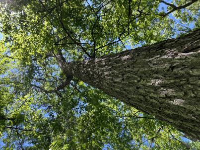 | | 2024 | COLLECTED | 06/05/2024 | Near southeast edge of Kasota Lake approximately 9.0 miles east, southeast of Willmar, T119N R34W SE 1/4 NE 1/4 Sec. 36 and also Robbins Island Park in Wilmar, T119N R35W Sec. 11. | 45.07399600, -94.88484100 | 352 | Deciduous woods | Wild material | Ulmus thomasii (Rock elm) is an underutilized tree species both in conservation and in the urban landscape. Described by Charles Sprague Sargent (first director for the Arnold Arborteum) as "heavy, hard, very strong and tough, closely grained, and susceptible of receiving a beautiful polish". Historically noted for a variety of uses in woodworking including furniture, heavy agricultural implements, timber frame buildings, pianos, hockey sticks, and hand tools. Ulmus thomasii is extremely drought tolerant, adaptable to very calcareous soils, and compared to U. americana or U. rubra has a very conservative growth rate requiring minimal attention in regards to pruning. Rock elm naturally tends to develop into a nice structural specimen in the landscape, unlike other fast growing cultivars in the nursery trade needing frequent attention. Rock elm has very fissured bark and is well known for maintaining a strong central leader resulting in a very attractive, pyramidal form. Despite many literature sources stating that "wings" on the stems are a key identifiying characteristic, this trait is not reliable and many genotypes may completely lack "wings" on the stems. While growth habit and morphology of dormant buds (very pointy) are good traits to help aid in identification, fruits are the best way to confirm identity. Fruits are densly pubescent, often described as "inflated" and generally reach maturity a couple weeks after Ulmus rubra and Ulmus americana. U. thomasii inflorescences are rather distinguishable from other Ulmus in being pendulous. Fruits are extremely prized treats for many birds, where fruits are often "robbed" prior to full maturity. Fruits are also highly prized by many other animals such as mice, squirrels, chipmunks, turkeys, etc. and are generally consumed within hours after fruit abscission. The native range of U. thomasii is concentrated in the northeastern United States and into Canada with disjunct populations documented in northwestern Missouri and northwestern Arkansas (Little, E. L. Jr. 1971). In the 1895 Silva of North America (vol. 7) it was stated that, “The value of the wood of the Rock Elm threatens its extinction and most of the large trees have already been cut.” Today, while rock elm is rather rare, especially in areas near the edges of its range, many states list the species as endangered or threatened warranting preservation efforts. Genetics of this accession would be representative of the species northwestern edge of its native range. Majority of specimens noted did not have characteristic "wings" on the stems and measured approximately 20" DBH or more with a few specimens nearing 30". Heights estimated between 70-90'. Rock elm in this area could be classified as locally abundant. | 2167953 | Ames 36251 |
| 219 | W6 61519 | CA180-289 | Erigeron foliosus Nutt. | California, United States | W6 |  | | 2024 | | | | | | | | | 2167618 | W6 61519 |
| 220 | W6 61583 | CA360-218 | Rosa californica Cham. & Schltdl. | California, United States | W6 |  | | 2024 | | | | | | | Wild material | | 2168031 | W6 61583 |
| 221 | NA 88820 | TJK2023AL-005 | Hydrangea arborescens L. | Alabama, United States | NA | | | 2023 | COLLECTED | 12/07/2023 | Between Monroe County Route 1 and Tom Hayles Road. | 31.40575900, -87.54924000 | 22 | In woodlands on limestone outcrop. While the upper area of slopes is covered by a thin soil layer, the exposed limestone rock outcrop on the northwestern edge of this area is a low competition niche for plants like the Hydrangea to gain a foothold. Slope: 60% (plus). Aspect: Northwest. Elevation: 72 feet. | Wild material | | 2165649 | NA 88820 |
| 222 | NA 88821 | TJK2023AL-006 | Hydrangea quercifolia W. Bartram | Alabama, United States | NA | | | 2023 | COLLECTED | 12/07/2023 | Between Monroe County Route 1 and Tom Hayles Road. | 31.40580000, -87.54890000 | 22 | In woodlands on limestone outcrop. While the upper area of slopes is covered by a thin soil layer, the exposed limestone rock outcrop on the northwestern edge of this area is a low competition niche for plants like the Hydrangea to gain a foothold. Slope: 60% (plus). Aspect: Northwest. Elevation: 72 feet. | Wild material | | 2165650 | NA 88821 |
| 223 | NA 88718 | RJL2023NCSC-023 | Ilex decidua Walter | South Carolina, United States | NA | | | 2023 | COLLECTED | 11/15/2023 | Waccamaw National Wildlife Refuge: U.S. Highway 701, Yauhannah Landing on the east side of the Great Pee Dee River. Plants growing in low woods on the north side of the landing. | 33.66208900, -79.15305000 | 2 | Plants growing in shade to part-shade of a moist to wet woodland habitat that is mostly deciduous and evergreen. Portions of the woodland have depressions with year-round standing water. Slope: N/A. Aspect: N/A. The underlying geology of this area is of Quaternary origin and characterized as Alluvial Valley Swamp. This formation is unconformable on all underlying units. It is composed of fluvial sand and gravel at base, grading upwards into fine sands and silts, and local occasional peat. May be overrun with recent sediments from forest cutting and agriculture. (Source: USGS South Carolina Geologic Map Data.) The primary soil type in this collection area is classified as Johnston Series loam. The Johnson Series consists of very deep, very poorly drained coarse-loamy, siliceous, active, acid, thermic Cumulic Humaquepts. The upper 0-75 cm is black, mucky loam that is friable and very strongly acid. The lower stratum to 1.75 m is dark gray, loamy fine sand, single grained, loose and very strongly acid. (Source: NRCS Web Soil Survey.) | Wild material | | 2159146 | NA 88718 |
| 224 | NA 88671 | RJL2023PA-005 | Rhododendron maximum L. | Pennsylvania, United States | NA | | | 2023 | COLLECTED | 10/16/2023 | Appalachian National Scenic Trail: Pulpit Rock and Pinnacle Loop. Rocky woodlands along Furnace Creek as well as steep rocky slopes above Pulpit Rock Reservoir associated with the Pulpit Rock and Pinnacle Loop Trail. | 40.59226100, -75.94588800 | 301 | Well-drained and very rocky dry deciduous woodlands in part shade to full shade. Slope: 0-30%. Aspect: variable. The underlying geology of this area is of Silurian origin and characterized as the Shawangunk Formation. It is characterized by light- to dark-gray, fine- to very coarse-grained sandstone and conglomerate containing thin shale interbeds. Includes four members, in descending order: Tammany--conglomerate and sandstone; Lizard Creek--sandstone and red or green shale; Minsi--sandstone and conglomerate; Weiders--conglomerate. Tammany and Lizard Creek Members together are approximately equivalent to Clinton Group to the west; Minsi and Weiders Members together are equivalent to Tuscarora Formation to the west. (Source: USGS Pennsylvania Geologic Map Data). The primary soil type in the collection area is classified as Hazleton Series. The Hazleton series consists of deep and very deep, well drained soils formed in residuum of acid gray, brown or red sandstone on uplands. Slope ranges from 0 to 80 percent. Permeability is moderately rapid to rapid. Solum thickness ranges from 60 to 120 centimeters. Depth to lithic contact ranges from 1 to 2 meters. Rock fragments of angular sandstone, dominantly less than 25 cm in size, range from 5 to 70 percent in individual horizons. Boulders, stones, flags and channers cover about 5 to 60 percent of the surface of some pedons. Reaction ranges from strongly acid through extremely acid throughout. (Source: NRCS Web Soil Survey). | Wild material | | 2159062 | NA 88671 |
| 225 | NA 88672 | RJL2023PA-006 | Rhododendron periclymenoides (Michx.) Shinners | Pennsylvania, United States | NA | | | 2023 | COLLECTED | 10/16/2023 | Appalachian National Scenic Trail: Pulpit Rock and Pinnacle Loop. Rocky woodland edges above Furnace Creek around Pulpit Rock and Pinnacle Loop Trail. | 40.58668200, -75.94269600 | 247 | Well-drained and very rocky dry deciduous woodlands in part shade to full shade. Slope: 10%. Aspect: East. The underlying geology of this area is of Silurian origin and characterized as the Shawangunk Formation. It is characterized by light- to dark-gray, fine- to very coarse-grained sandstone and conglomerate containing thin shale interbeds. Includes four members, in descending order: Tammany--conglomerate and sandstone; Lizard Creek--sandstone and red or green shale; Minsi--sandstone and conglomerate; Weiders--conglomerate. Tammany and Lizard Creek Members together are approximately equivalent to Clinton Group to the west; Minsi and Weiders Members together are equivalent to Tuscarora Formation to the west. (Source: USGS Pennsylvania Geologic Map Data). The primary soil type in the collection area is classified as Hazleton Series. The Hazleton series consists of deep and very deep, well drained soils formed in residuum of acid gray, brown or red sandstone on uplands. Slope ranges from 0 to 80 percent. Permeability is moderately rapid to rapid. Solum thickness ranges from 60 to 120 centimeters. Depth to lithic contact ranges from 1 to 2 meters. Rock fragments of angular sandstone, dominantly less than 25 cm in size, range from 5 to 70 percent in individual horizons. Boulders, stones, flags and channers cover about 5 to 60 percent of the surface of some pedons. Reaction ranges from strongly acid through extremely acid throughout. (Source: NRCS Web Soil Survey). | Wild material | | 2159063 | NA 88672 |
| 226 | NA 88676 | RJL2023PA-010 | Staphylea trifolia L. | Pennsylvania, United States | NA | | | 2023 | COLLECTED | 10/25/2023 | Seed collected along the Appalachian National Scenic Trail, accessed from the Duncannon Entrance. | 40.38132600, -77.02965700 | 103 | Well-drained and very rocky deciduous woodlands where soil has accumulated in part shade to full shade. Slope: 0-30%. Aspect: variable. The underlying geology of this area is of Devonian origin and characterized as the Duncannon Member of Catskill Formation. It is characterized by grayish-red sandstone, siltstone, and mudstone in fining-upward cycles; conglomerate occurs at base of some cycles. The sandstones which comprise the Duncannon Member are fine to very coarse grained and grayish red to grayish red-purple in color. The Duncannon Member is known to be crossbedded to planar bedded in beds anywhere from 3 to 9 meters thick. Conglomerates have been spotted at the base of the Duncannon Member. The Duncannon Member is poorly exposed in most areas except along the Lehigh River. The conglomerate portion of this member has been known to form ridges and ledges with thicknesses approaching 228 meters. (Source: USGS Pennsylvania Geologic Map Data). The primary soil type in the collection area is classified as Hazleton Series. The Hazleton series consists of deep and very deep, well drained soils formed in residuum of acid gray, brown or red sandstone on uplands. Slope ranges from 0 to 80 percent. Permeability is moderately rapid to rapid. Solum thickness ranges from 60 to 120 centimeters. Depth to lithic contact ranges from 1 to 2 meters. Rock fragments of angular sandstone, dominantly less than 25 cm in size, range from 5 to 70 percent in individual horizons. Boulders, stones, flags and channers cover about 5 to 60 percent of the surface of some pedons. Reaction ranges from strongly acid through extremely acid throughout. (Source: NRCS Web Soil Survey). | Wild material | | 2159067 | NA 88676 |
| 227 | NA 88664 | RJL2023PA-001 | Viburnum acerifolium L. | Pennsylvania, United States | NA | | | 2023 | COLLECTED | 10/01/2023 | Seed collected from plants growing along a two-mile stretch of Harmonyville Road on the woodland edge next to the road. [Note: latitude and longitude were collected at the location of the largest seed collection.] | 40.18482200, -75.78145100 | 158 | Plants were growing in well-drained and rocky mesic-dry woodlands from part shade along the road edge to full shade in the understory of the woodlands. Slope: 2-10%. Aspect: Variable. The underlying geology of this area is of Triassic origin and characterized as the Stockton Formation. It is characterized by light-gray to buff, coarse-grained, arkosic sandstone; includes reddish-brown to grayish-purple sandstone, siltstone, and mudstone. (Source: USGS Pennsylvania Geologic Map Data.) The primary soil type in the area of this collection is classified as Edgemont Channery Sandy Loam Series (8 to 25 percent slopes), extremely stony. The Edgemont Series consists of deep and very deep, well drained soils formed in the weathered residuum of quartzitic rocks. They have moderately high to high saturated hydraulic conductivity. Slopes range from 0 to 70 percent. Solum thickness ranges from 50 to 10 cm. Depth to bedrock ranges from about 1.5 to 2.2 meters. Kaolinite is the dominant mineral in the clay fraction with detectable amounts of illite, vermiculite, montmorillonite, chlorite and interstratified clays. Gravel, channers, and stone size fragments of quartzite and quartz are present throughout the profile. Rock fragments range from 5 to 40 percent in the horizons of the solum and from 10 to 90 percent in the C horizon. Reaction ranges from extremely acid to strongly acid throughout. (Source: NRCS Web Soil Survey.) | Wild material | | 2158813 | NA 88664 |
| 228 | NA 88663 | TJK2023FL-017 | Rhododendron austrinum (Small) Rehder | Florida, United States | NA | | | 2023 | COLLECTED | 09/17/2023 | Lower Yellow River, below the Old Land Place. | 30.55513000, -86.94659000 | 0 | An area with very nice Pink R. austrinum. Elevation: 0. Slope: 0 percent. Aspect: South-southwest. | Wild material | | 2158797 | NA 88663 |
| 229 | W6 60985 | CA330-218 | Bromus carinatus Hook. & Arn. | California, United States | W6 |  | | 2023 | | | | | | | Wild material | Tall grass, panicle inflorescence, lemma in herringbone arrangement, lemmas opposite arrangement, green broad leaves | 2142624 | W6 60985 |
| 230 | OPGC 8826 | CBG- 10824 | Rudbeckia subtomentosa Pursh | Illinois, United States | OPGC | | | 2023 | | | | | | | Wild material | | 2142278 | OPGC 8826 |
| 231 | W6 61344 | CBG- 10756 | Perideridia americana (Nutt. ex DC.) Rchb. ex Steud. | Illinois, United States | W6 |  | | 2023 | | | | | | | Wild material | | 2142226 | W6 61344 |
| 232 | W6 61403 | CBG- 10836 | Triosteum aurantiacum E. P. Bicknell | Wisconsin, United States | W6 |  | | 2023 | | | | | | | Wild material | | 2142285 | W6 61403 |
| 233 | W6 61417 | CBG- 10852 | Verbesina alternifolia (L.) Britton ex Kearney | Illinois, United States | W6 |  | | 2023 | | | | | | | Wild material | | 2142299 | W6 61417 |
| 234 | W6 61418 | CBG- 10853 | Agastache scrophulariifolia (Willd.) Kuntze | Illinois, United States | W6 |  | | 2023 | | | | | | | Wild material | | 2142300 | W6 61418 |
| 235 | Ames 36017 | AS/GD/2023/002/212 | Gymnocladus dioicus (L.) K. Koch | Wisconsin, United States | NC7 |  | | 2023 | | | | | | | Wild material | Kentucky coffeetree in Wisconsin is rather rare. The Wisconsin Natural Heritage Inventory Program currently (2023) lists this taxon in Wisconsin as a species of concern with a state rank of S2 (Imperiled in Wisconsin due to a restricted range, few populations or occurrences, steep declines, severe threats, or other factors.) This accession represents genetics from a localized population with a near equal porportion of male and female specimens. While there are other known locations along the Wisconsin River, this population is producing seeds. The other known locations represent single clones that are distant enough from other existing clones that prevent the transfer of pollen and thus lack the ability to produce seed or will rarely produce. | 2141550 | Ames 36017 |
| 236 | Ames 36018 | AS/SL/2023/003/213 | Salix lucida Muhl. | Wisconsin, United States | NC7 |  | | 2023 | COLLECTED | 02/25/2023 | Located just west of Kempster approximately 4.65 miles along County Road J (floodplains of Sucker Creek and West Branch Eau Claire River), T33N R10E Sec. 32, 33, and 34 (extreme southern edges) | 45.29205000, -89.27304100 | 479 | Wetland | Wild material | Salix lucida (shining willow) is referenced as a tall shrub or small tree with multiple trunks with the potential to reach 6 meters in height. Shining willow frequents wetland habitats such as swampy lakes, wet meadows and along rivers. Noted for it's extremely shiny, long (e.g. 7-14 cm) leaves with very elongated, acumiate leaf tips and conspicuous, enlarged glands clustered at the end of the petiole. First year branches are very glabrous and bright yellow to bright orange in color. Flowering tends to occur later in spring in comparison to other shrubby willows e.g. Salix discolor, Salix humilis, Salix petiolaris, and Salix eriocephala. Shining willow can often be confused with Salix serissima, but the presence of glands at the base of the petiole, the colorful first year stems (most noticeable in winter) of Salix lucida can be used to separate them. The native distribution of Salix lucida is concentrated in the northeastern U.S. with scattered disjuncts as far west as North Dakota and as far south as the northern tier of counties in Illinois, Indiana, and Ohio (Little, E. L. Jr. 1977). This accession represents genetics from northeastern Wisconsin. Specimens sampled in nature measuring approximately 6' in height with bright orange-yellowish stem colors on most recent year's growth. | 2141551 | Ames 36018 |
| 237 | Ames 36019 | AS/SD/2023/004/214 | Salix discolor Muhl. | Wisconsin, United States | NC7 |  | | 2023 | COLLECTED | 02/25/2023 | Located along County Road J west of Kempster and County Road T/County Road H west of Summit Lake. | 45.29210300, -89.27334900 | 478 | Wetland | Wild material | The native range of Salix discolor is concentrated in the northeastern United States and also throughout southern Canada (Little, E. L. Jr. 1977). Generally adapted/tolerant to wet soils this species is often found in meadows, fens, swamps, and streambanks. Attractive ornamental characteristics includes early spring, showy flowers and yellow foliage in the fall. Salix discolor provides a critical source of pollen at the beginning of the growing season for a plethora of pollinators and also serves as a larval host to many insect species. Salix discolor are commonly used in the cut flower industry for both their showy catkins and colorful, dormant winter stems. This accession represents genetics from central Wisconsin. Plants in nature measuring approximately 8-10' in height occassionally up to 25' with brown to red-brown stem colors on most recent year's growth. Some genotypes with dense pubescence on stems while others are glabrous. | 2141552 | Ames 36019 |
| 238 | Ames 36021 | AS/SP/2023/006/216 | Salix petiolaris Sm. | Wisconsin, United States | NC7 |  | | 2023 | COLLECTED | 02/25/2023 | Located just west of Kempster approximately 5.25 miles along County Road J (floodplain between Sucker Creek and West Branch Eau Claire River), T33N R10E Sec. 32 and 33 (extreme southern edges). | 45.29239600, -89.27583700 | 478 | Wetland | Wild material | Slender-leaved willow, Salix petiolaris, is a somewhat dense suckering shrub that can reach up to 10' in height with slender stems that branch minimally, but typically maintains a height of 5-8'. Native to North America, the native range covers mostly the northeastern US stretching from Maine to western North Dakota and Canada south to central Iowa (Little, E. L. Jr. 1977). Salix petiolaris typically dominates wetland areas including sedge meadows, marshes, riverbanks, and lake shores. Despite favoring wet habitats, it can also be found in dry, upland areas, especially those with high-water tables. However, longevity is generally limited in upland habitats. S. petiolaris, similar to other willow species, responds well to fire, coppicing, or heavy browsing (highly favored by deer) by sprouting new stems close to the crown. In cultivation, plants after five years will encompass a 5' x 5' area due to stems that arch from the main base of the plant. Coppicing of plants to ground level is highly recommended either annually or once every 3-5 years to maintain vigorous growth and plant health. This species requires substantial to full sun exposure and is an excellent choice for streambank stabilizations and windbreaks to reduce soil erosion and drifting snow, respectively. This accession represents genetics from central Wisconsin. Plants noted in nature measuring up to 6' in height. Very densely suckering clumps occassionally reaching up to 10' in diameter. Stem colors on most recent year's growth varied from orange-yellow, red (predominate), to yellow. Petioles are minutely hairy. | 2141554 | Ames 36021 |
| 239 | Ames 36024 | AS/FN/2023/011/221 | Fraxinus nigra Marshall | Wisconsin, United States | NC7 |  | | 2023 | COLLECTED | 02/26/2023 | Located just north of Leland approximately 0.70 miles along Hemlock Road, T10N R5E SW 1/4 NW 1/4 Sec. 18 | 43.34472800, -89.95099700 | 242 | Floodplain | Wild material | Single mother tree sample with signs of wood pecker damage on trunk. | 2141557 | Ames 36024 |
| 240 | NA 88599 | RJL2023NC-001 | Ilex decidua Walter | North Carolina, United States | NA | | | 2023 | COLLECTED | 02/18/2023 | Plants growing along a fenceline on a hillside about 10 meters from Interstate 85 (south bound) and approximately 0.65 kilometers south of the North Carolina-Virginia border. | 36.53904800, -78.18822500 | 86 | The plant was growing on the upper shoulder of a slope about 7 meters above the highway in part-shade to sun of an upland, well-drained, dry mesic somewhat disturbed site on the fenceline boundary of Interstate 85 (south bound). The area was originally cleared of all vegetation and now, many years later, native and non-native plant species have aggressively recolonized the area. This early successional habitat is dominated by Juniperus virginiana and Liquidambar styraciflua, as well as, non-native species such as Ligustrum sinense, Lonicera japonica, and Ailanthus altissima. The underlying geology of this area is of Permian/Pennsylvanian origin and characterized as the Granitic Rock Formation. It is characterized by megacrystic to equigranular components and includs Castalia and Wilton intrusives. | Wild material | | 2141480 | NA 88599 |
| 241 | NA 88534 | RJLSEUS2022-005 | Leucothoe axillaris (Lam.) D. Don | North Carolina, United States | NA | | | 2023 | COLLECTED | 12/06/2022 | Plants growing in the wetlands and other moist depressions along Scotland Co. Road 1328 in the Sandhills Game Lands. Common at this site This plant is somewhat sporadic in its distribution, but abundant in places where it is found in moist to wet habitats of bottomlands in this area. | 34.88545200, -79.44597500 | 71 | Plants are growing in shade of acid bottomland wet woodlands along streams or adjoining wetlands with constant sub-surface moisture. It prefers areas above the permanently wet conditions and can go through periods of drought.
Soils: The underlying geology of this area is of Cretaceous origin and characterized as Mittendorf Formation. The formation is comprised of sand, sandstone, and mudstone, gray to pale gray with an orange cast, and mottled. Clay balls and iron-cemented concretions are common, beds are laterally discontinuous, and cross-bedding is common.
Source: USGS North Carolina Geologic Map Data (https://mrdata.usgs.gov/geology/state/sgmc-unit.php?unit=NCKm%3B11)
The primary soil type in the collection area is classified as Paxville loam soil (0 to 1 percent slopes, rarely flooded). The Paxville Series consists of very deep, very poorly drained soils. Permeability is moderate. These nearly level soils formed from marine deposits, fluviomarine deposits, and alluvium. They range from 0 to 2 percent slopes. The frequency of flooding is typically very rare to brief periods. The upper strata, 0-1.2 meters, is comprised of fine sandy loam that is friable, non-sticky and non-plastic; it does contain small amounts clean quartz grains and is strongly acid. Lower strata to a depth of 2.5 meters are similar with fine sandy loam in the upper portions and progressively more sandy loam to fine sand in the deepest strata.
Source: NRCS Web Soil Survey (https://websoilsurvey.sc.egov.usda.gov/App/WebSoilSurvey.aspx) | Wild material | | 2140763 | NA 88534 |
| 242 | NA 88561 | RJLSEUS2022-034 | Hydrangea quercifolia W. Bartram | Alabama, United States | NA | | | 2023 | COLLECTED | 12/12/2022 | Plants growing in the woodlands at Haines Island Park at the foot of Tallahatta cuesta, accessed by foot via Ferry Road. Common at this site. | 31.72178200, -87.46589600 | 66 | Plants are growing in part-shade to shade of a moist mesic, well-drained conditions on rocks and in the eroding matrix of the Tallahatta Questa.
Soils: The underlying geology of this area is Claiborne Group, Tallahatta Formation, of Eocene origin, with white to very light-greenish-gray thin-bedded to massive siliceous claystone; interbedded with thin layers of fossiliferous clay, sandy clay, and glauconitic sand and sandstone.
Source: USGS Alabama Geological Map Data (https://mrdata.usgs.gov/geology/state/state.php?state=AL)
The primary soil type in the collection area is classified as Arundel Loam soil (8 to 35 percent slopes). The Arundel Series consists of moderately deep, well drained, very slowly permeable soils on dissected uplands of the Southern Coastal Plain. They formed in marine deposits consisting of acid clays underlain by horizontally bedded sandstone, buhrstone and siltstone. These soils are strongly acid. Slopes range from 2 to 60 percent.
Source: NRCS Web Soil Survey (https://websoilsurvey.sc.egov.usda.gov/App/WebSoilSurvey.aspx) | Wild material | | 2140786 | NA 88561 |
| 243 | NA 88574 | RJLSEUS2022-047 | Rhododendron austrinum (Small) Rehder | Florida, United States | NA | | | 2023 | COLLECTED | 12/15/2022 | Plants are growing along a several mile stretch of the Yellow River and accessed by boat via the Yellow River Boat Ramp on the east side of Florida State Hwy 87. The species is found frequently along several miles of the Yellow River. | 30.58133600, -86.89953900 | 2 | Plants are found growing in part-shade to shade along areas of the river where natural levies, 1-3 meters tall, have formed, depositing sand and organic matter. The plants grow well-above normal flow of the river in well-drained to dry conditions. Even so, they are periodically subjected to inundation from floodwaters.
Soils: The underlying geology of this area is classified as Alluvium, of Pleistocene/Holocene origin and consists of undifferentiated Quaternary sediments of varying thickness including siliciclastics, organics and freshwater carbonates. The siliciclastics are light gray, tan, brown to black, unconsolidated to poorly consolidated, clean to clayey, silty, unfossiliferous, variably organic-bearing sands to blue green to olive green, poorly to moderately consolidated, sandy, silty clays. Organics occur as plant debris, roots, disseminated organic matrix and beds of peat. Freshwater carbonates, often referred to as marls in the literature, are scattered.
Source: USGS Florida Geologic Map Data (https://mrdata.usgs.gov/geology/state/state.php?state=fl)
The surface soil profile of this area is primarily Bibb-Kinston Series Association. Bibb Series soils are coarse-loamy, sandy, acid soils that are poorly drained. They are soils of flood plains and streams subject to frequent flooding. These are found in association with Kinston Series soils that are fine-loamy, sandy, acid soils of flood plains and stream subject to frequent flooding. The Bibb-Kinston Association ranges from 1-1.5 meters thick and is strongly acid.
Source: Soil Survey of Santa Rosa County and NRCS Web Soil Survey (https://www.nrcs.usda.gov/Internet/FSE_MANUSCRIPTS/florida/FL113/0/SantaRosa.pdf and https://websoilsurvey.sc.egov.usda.gov/App/WebSoilSurvey.aspx) | Wild material | Yellow River Pink Austrinum | 2140792 | NA 88574 |
| 244 | NA 88506 | RJL2022TX-001 | Itea virginica L. | Texas, United States | NA | | | 2022 | COLLECTED | 10/31/2022 | Plants growing at Shangri La Botanical Gardens and Nature Center, Orange, TX along Adams Bayou, accessed via internal service roads. Plant is infrequent at this site. | 30.10322000, -93.76271700 | 1 | Plants are growing in shade to part-shade of a Taxodium distichum-Nyssa aquatica dominated forested swampland associated with Adams Bayou in a wet low-lying area that is frequently inundated.
Soils: The underlying geology of this area is of Quaternary to Late Pleistocene origin and comprised of the Beaumont Formation. This formation is yellowish- to brownish-gray, locally reddish orange with very fine to fine quartz sand, silt, and minor fine gravel, intermixed and interbedded. It also includes stream channel, point-bar, cravasse-splay, and natural levee ridge deposits, and clayey fill in abandoned channels. Channel fill is dark brown to brownish-gray with laminated clay and silt that is organic-rich. Includes marine delta-front sand, lagoonal clay, and near-shore marine sand beneath and landward of bays along the coast. Depth of this unconsolidated outwash ranges from 3-100 meters thick.
Source: USGS Texas Geologic Map Data (https://mrdata.usgs.gov/geology/state/sgmc-unit.php?unit=TXQbs%3B0)
The primary soil types in the collection area are classified as Cowmarsh series. The Cowmarsh series consists of very deep, very poorly drained soils that formed in mucky silty clayey alluvial deposits of Holocene age. These depressional soils are oxbows and relict channels of rivers where flooding and ponding is frequent. Slope ranges from 0 to 1 percent but mainly less than 1 percent. very poorly drained. Runoff is negligible. Frequently flooded for very long periods from February through May and surface remains saturated for very long periods once flood waters have receded.
Source: NRCS Web Soil Survey (https://websoilsurvey.sc.egov.usda.gov/App/WebSoilSurvey.aspx) | Wild material | | 2139813 | NA 88506 |
| 245 | NA 88507 | RJL2022TX-002 | Fraxinus caroliniana Mill. | Texas, United States | NA | | | 2022 | COLLECTED | 10/31/2022 | Plants growing at Shangri La Botanical Gardens and Nature Center, Orange, TX along Adams Bayou, accessed via internal service roads. Plant is relatively common along Adams Bayou but scattered. | 30.09989400, -93.75239700 | 1 | Plants are growing in part-shade to sun of a Taxodium distichum-Nyssa aquatica dominated forested swampland associated with Adams Bayou in a wet low-lying area that is frequently inundated. While found as an occasional understory element, it is more common on the edge of the swampland forest where there are high light conditions.
Soils: The underlying geology of this area is of Quaternary to Late Pleistocene origin and comprised of the Beaumont Formation. This formation is yellowish- to brownish-gray, locally reddish orange with very fine to fine quartz sand, silt, and minor fine gravel, intermixed and interbedded. It also includes stream channel, point-bar, cravasse-splay, and natural levee ridge deposits, and clayey fill in abandoned channels. Channel fill is dark brown to brownish-gray with laminated clay and silt that is organic-rich. Includes marine delta-front sand, lagoonal clay, and near-shore marine sand beneath and landward of bays along the coast. Depth of this unconsolidated outwash ranges from 3-100 meters thick.
Source: USGS Texas Geologic Map Data (https://mrdata.usgs.gov/geology/state/sgmc-unit.php?unit=TXQbs%3B0)
The primary soil types in the collection area are classified as Cowmarsh series. The Cowmarsh series consists of very deep, very poorly drained soils that formed in mucky silty clayey alluvial deposits of Holocene age. These depressional soils are oxbows and relict channels of rivers where flooding and ponding is frequent. Slope ranges from 0 to 1 percent but mainly less than 1 percent. very poorly drained. Runoff is negligible. Frequently flooded for very long periods from February through May and surface remains saturated for very long periods once flood waters have receded.
Source: NRCS Web Soil Survey (https://websoilsurvey.sc.egov.usda.gov/App/WebSoilSurvey.aspx) | Wild material | | 2139814 | NA 88507 |
| 246 | NA 88508 | RJL2022TX-003 | Morella cerifera (L.) Small | Texas, United States | NA | | | 2022 | COLLECTED | 10/31/2022 | Plants growing at Shangri La Botanical Gardens and Nature Center Orange, TX along Adams Bayou, accessed via internal service roads. Plant is relatively common along Adams Bayou but scattered in the understory. | 30.10035500, -93.75288700 | 1 | Plants are growing in part-shade to shade of a Taxodium distichum-Nyssa aquatica dominated forested swampland associated with Adams Bayou in a wet low-lying area that is frequently inundated.
Soils: The underlying geology of this area is of Quaternary to Late Pleistocene origin and comprised of the Beaumont Formation. This formation is yellowish- to brownish-gray, locally reddish orange with very fine to fine quartz sand, silt, and minor fine gravel, intermixed and interbedded. It also includes stream channel, point-bar, cravasse-splay, and natural levee ridge deposits, and clayey fill in abandoned channels. Channel fill is dark brown to brownish-gray with laminated clay and silt that is organic-rich. Includes marine delta-front sand, lagoonal clay, and near-shore marine sand beneath and landward of bays along the coast. Depth of this unconsolidated outwash ranges from 3-100 meters thick.
Source: USGS Texas Geologic Map Data (https://mrdata.usgs.gov/geology/state/sgmc-unit.php?unit=TXQbs%3B0)
The primary soil types in the collection area are classified as Cowmarsh series. The Cowmarsh series consists of very deep, very poorly drained soils that formed in mucky silty clayey alluvial deposits of Holocene age. These depressional soils are oxbows and relict channels of rivers where flooding and ponding is frequent. Slope ranges from 0 to 1 percent but mainly less than 1 percent. very poorly drained. Runoff is negligible. Frequently flooded for very long periods from February through May and surface remains saturated for very long periods once flood waters have receded.
Source: NRCS Web Soil Survey (https://websoilsurvey.sc.egov.usda.gov/App/WebSoilSurvey.aspx) | Wild material | | 2139815 | NA 88508 |
| 247 | NA 88509 | RJL2022TX-004 | Ilex decidua Walter | Texas, United States | NA | | | 2022 | COLLECTED | 11/01/2022 | Low woodlands along the north side of Texas State Hwy 190 between the highway and an unnamed paved service road that leads down to the Sabine River; the turn for the service road is approximately 0.62 kilometers west of the Sabine River. Near the bridge over the Sabine River. | 30.74730000, -93.61568900 | 20 | Plants are growing in part-shade to shade of a moist mesic (occasionally temporarily wet) woodland. Ilex decidua can be in the low woods most of the way down to the river. Plant is a common understory shrub in the moist woodland habitat not far from the Sabine River. Soils: The underlying geology of this area is of Holocene origin and characterized as Alluvium. The alluvium and low terrace deposits along streams include sand, silt, clay, and gravel. Thickness is variable. In this case alluvium is from the Sabine River. (Source: USGS Texas Geologic Map Data). The primary soil types in the collection area are classified as Urbo and Mantachie soils. The Urbo series consists of deep, somewhat poorly drained soils. Permeability is very slow. These nearly level to gently sloping soils formed in clayey alluvium on flood plains of streams that drain uplands of the Southern Coastal Plain. Slopes range from 0 to 3 percent. In wet seasons late in winter and early in spring, the water table is at a depth of 1 to 2 feet and most areas of Urbo soils are subject to either occasional or frequent flooding of brief to long duration. The Mantachie series consists of very deep, somewhat poorly drained, moderately permeable soils on flood plains of the Southern Coastal Plain. They formed in loamy alluvium and considered acidic. Mantachie soils are subject to rare to frequent flooding in the winter and early spring for brief to long duration, unless protected. The seasonal high water table ranges from 1.0 to 1.5 feet of the surface during periods of high rainfall. (Source: NRCS Web Soil Survey). | Wild material | | 2139816 | NA 88509 |
| 248 | NA 88514 | RJL2022MD-019 | Kalmia latifolia L. | Maryland, United States | NA | | | 2022 | COLLECTED | 11/04/2022 | Plants are growing on both sides of a fire road on Maryland Heights along the edge with Harpers Ferry National Historic Park. This location was accessed from the east where Miller Avenue meets the fire road, approximately 2 kilometers away. There is no vehicular access to the collecting area. Becoming locally uncommon. This local population is likely to be extirpated in the next 20-30 years. This collector has hiked through this area for more than 35 years and seen dramatic changes in the population. When first observed, Kalmia latifolia was a dominant understory shrub on south- to west-facing slopes beneath a mature forest canopy. Over the years, at least one forest fire has significantly reduced the population, along with a continuing increase in deer populations, resulting in catastrophic browse damage. The absence of a mature forest canopy and periods of drought have almost certainly also resulted in decline of this population. While collecting seed from scattered mature plants well above deer browse levels, this collector also noted that there was virtually no recruitment taking place. | 39.32811200, -77.72242400 | 287 | Plants are growing in part-shade to shade of a deciduous upland, very rocky, and dry forest community. Plants are frequently found growing among boulders, rock outcrops, and steep-slope erosional areas, although, not exclusively.
Soils: The underlying geology of this area is of Late Cambrian to Cambrian origin and comprised of Chilhowee Group; Weverton Formation. This includes interbedded white to dark gray, thin-bedded, micaceous, ferruginous, and sericitic quartzites, phyllites, and white, thick-bedded, ledge-making quartzites; some gray to brown ferruginous quartz conglomerate and purple-banded phyllite.
Source: USGS Maryland Geologic Map Data https://mrdata.usgs.gov/geology/state/sgmc-unit.php?unit=MDKp%3B5
The primary soil types in the collection area are classified as Dekalb-Bagtown-Rock outcrop complex, 25 to 65 percent slopes. The Dekalb series consists of moderately deep, excessively drained soils formed in material weathered from gray and brown acid sandstone in places interbedded with shale and graywacke. Slope ranges from 0 to 80 percent. Permeability is rapid. Solum thickness and depth to bedrock range from 50 to 100 cm. Flat, subangular or angular, sandstone fragments, 2.5-25 cm across increase with depth and range from 10-60 percent in individual horizons of the solum and from 50-90 percent or more in the C horizon. The amount of rock fragments typically increases with depth. Cobbly, channery, and very stony phases are common. Reaction ranges from extremely through strongly acid.
Source: NRCS Web Soil Survey (https://websoilsurvey.sc.egov.usda.gov/App/WebSoilSurvey.aspx) | Wild material | | 2139821 | NA 88514 |
| 249 | NA 89046 | RJL2022PA-014 | Alnus serrulata (Aiton) Willd. | Pennsylvania, United States | NA | | | 2022 | COLLECTED | 10/09/2022 | Plants growing in the floodplain of Octoraro Creek near 698 Lees Bridge Road, West Nottingham Township, Pennsylvania on the south side of the road. Plants are locally common and spread out in the floodplain area along the Octoraro Creek. | 39.73579900, -76.09238300 | 60 | Plants of this species are growing in full sun of a moist to seasonally mucky and wide flood plain area adjacent to Octoraro Creek. The area is dominated by deciduous herbaceous plants, scrambling vines, shrubs and occasional small trees. Much of this wet “meadow” is dominated by aggressive stands of grasses and members of the sedge family.
Soils: The underlying geology of this area is estimated to be of lower Paleozoic origin and comprised of Peters Creek Schist. This is comprised of chlorite-sericite schist containing interbedded quartzite. Interestingly, this area is very close to and may interface with the adjacent formation of Ultramafic Rocks that includes serpentine, steatite, and other products of alteration of peridotites and pyroxenites.
Source: USGS Pennsylvania Geologic Map Data (https://mrdata.usgs.gov/geology/state/sgmc-unit.php?unit=PAPZpc%3B0)
The primary soil types in the collection area are classified as Hatboro Silt Loam which consists of soils formed in alluvium derived from metamorphic and crystalline rock. They are on flood plains. Slopes range from 0 to 3 percent. Hatboro Silt Loam soils are poorly drained and have a high to very high surface runoff index. These soils are subject to periodic stream overflow, which usually occurs during the winter and spring months. The A and B horizons are moderately acidic to neutral, generally to a depth of 1-2 meters; the C horizon below ranges from a depth of 2-3 meters with uniformly acidic soils.
Source: NRCS Web Soil Survey (https://websoilsurvey.sc.egov.usda.gov/App/WebSoilSurvey.aspx) | Wild material | | 2139611 | NA 89046 |
| 250 | NA 89039 | RJL2022IL-001 | Ptelea trifoliata L. | Illinois, United States | NA | | | 2022 | COLLECTED | 09/28/2022 | Site of plant habitat is located at 823 E Co Rd 1220, Hamilton, IL 62341 which is the property where Jacob's Geode Shop and Mine is located. This species is scattered and relatively common throughout the woodlands on this site. | 40.37848400, -91.35390200 | 175 | Plants growing in shade to part-shade of deciduous woodlands above a small creek.
Soils: The underlying geology of this area is of Mississippian origin and comprised of Warsaw Formation and Salem Limestone. Major lithological components include limestone that can be shaly, oolitic, bioclastic, or cherty. Minor lithological components include siltstone that can contain geodes or drusy quartz and can be calcareous.
Source: USGS Illinois Geologic Map Data (https://mrdata.usgs.gov/geology/state/sgmc-unit.php?unit=ILMws%3B0)
The surface soil profile of this area is Coffeen silt loam, 0 to 2 percent slopes, that are frequently flooded. The Coffeen series consists of very deep, somewhat poorly drained, moderately permeable soils on flood plains, low terraces or benches, toe slopes, and alluvial fans. They formed in silty alluvium. Much of the alluvium is of local origin derived from the nearby loess-covered uplands.
Source: NRCS Web Soil Survey (https://websoilsurvey.sc.egov.usda.gov/App/WebSoilSurvey.aspx) | Wild material | | 2139604 | NA 89039 |
| 251 | NA 89033 | RJL2022MD-010 | Clethra alnifolia L. | Maryland, United States | NA | | | 2022 | COLLECTED | 09/15/2022 | Plants growing in low woodlands at the end of Greenway Avenue near a boat dock that leads to the Pocomoke River, adjacent to Winter Quarters Golf Course, Pocomoke City. Plants common throughout the wetland area as well as mesic edges of the woodlands. | 38.08305100, -75.56527800 | | Plants growing in the flood plain of the Pocomoke River in shade to part sun of a mixed deciduous and evergreen bottomland habitat about 10 meters from the edge of the golf course fairway. The habitat is a mucky swamp edge habitat next to the Pocomoke River, most of which seems wet year-round and grades slightly upslope to more mesic conditions.
The underlying geology of this area is comprised of Quaternary Deposits of Wisconsin to Holocene origin. The composition is primarily undifferentiated gray to buff sand and gravel, gray to brown lignitic silt and clay, occasional boulders, and rare shell beds. Surficial deposits occur as shell-bearing estuarine clays and silts.
Source: USGS Maryland Geologic Map Data https://mrdata.usgs.gov/geology/state/sgmc-unit.php?unit=MDQdu%3B5
The surface soil profile of this habitat is classified as Puckum Muck which is frequently flooded. These highly saturated soils are found in flats, depressions and swales. The soil reaction of Puckum Muck is extremely acid to strongly acid throughout the profile. The depth to bedrock is generally greater than 150 cm. Wood fragments comprise 0-25%, by volume of the Puckum Muck throughout the profile which includes mostly twigs, branches, logs, or stumps and are 1.5-30 cm in diameter. The composition of these highly saturated soils, are classified as muck (sapric soil material) or mucky peat (hemic soil material) throughout most of the upper 150 cm and may contain thin layers of mucky silt loam, silty clay loam, sandy loam and/or sand.
Source: NRCS Web Soil Survey (https://websoilsurvey.sc.egov.usda.gov/App/WebSoilSurvey.aspx) | Wild material | | 2139598 | NA 89033 |
| 252 | NA 89032 | RJL2022MD-009 | Rhododendron viscosum (L.) Torr. | Maryland, United States | NA | | | 2022 | COLLECTED | 09/15/2022 | Plants growing in low woodlands at the end of Greenway Avenue near a boat dock that leads to the Pocomoke River, adjacent to Winter Quarters Golf Course, Pocomoke City. Plants scattered throughout the wetland area. Infrequent, but regularly found. | 38.08235200, -75.56566500 | 1 | Plants growing in the flood plain of the Pocomoke River in part shade to shade of a mixed deciduous and evergreen bottomland habitat about 10 meters from the edge of the golf course fairway. The habitat is a mucky swamp edge habitat next to the Pocomoke River, most of which seems wet year-round.
The underlying geology of this area is comprised of Quaternary Deposits of Wisconsin to Holocene origin. The composition is primarily undifferentiated gray to buff sand and gravel, gray to brown lignitic silt and clay, occasional boulders, and rare shell beds. Surficial deposits occur as shell-bearing estuarine clays and silts.
Source: USGS Maryland Geologic Map Data https://mrdata.usgs.gov/geology/state/sgmc-unit.php?unit=MDQdu%3B5
The surface soil profile of this habitat is classified as Puckum Muck which is frequently flooded. These highly saturated soils are found in flats, depressions and swales. The soil reaction of Puckum Muck is extremely acid to strongly acid throughout the profile. The depth to bedrock is generally greater than 150 cm. Wood fragments comprise 0-25%, by volume of the Puckum Muck throughout the profile which includes mostly twigs, branches, logs, or stumps and are 1.5-30 cm in diameter. The composition of these highly saturated soils, are classified as muck (sapric soil material) or mucky peat (hemic soil material) throughout most of the upper 150 cm and may contain thin layers of mucky silt loam, silty clay loam, sandy loam and/or sand.
Source: NRCS Web Soil Survey (https://websoilsurvey.sc.egov.usda.gov/App/WebSoilSurvey.aspx) | Wild material | | 2139597 | NA 89032 |
| 253 | Ames 35924 | AS/FN/2022/073/204 | Fraxinus nigra Marshall | Wisconsin, United States | NC7 |  | | 2022 | COLLECTED | 09/29/2022 | Chequamegon National Forest, approximately 4.5 miles south-southeast of Clam Lake along County Highway GG and adjacent Forest Service roads, T42N R4W Sec. 21. | 46.10020200, -90.87459600 | 431 | Wet to saturated soils in northern hardwood forest. | Wild material | | 2139687 | Ames 35924 |
| 254 | WLP 2568 | APS/HA/2022/028/490 | Hydrangea arborescens L. | Arkansas, United States | NA | 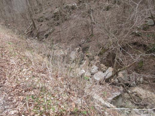 | | 2022 | COLLECTED | 03/15/2022 | Located approximately 3.75 miles east of Allison just off Round Bottom Road. | 35.93357000, -92.05110000 | 144 | Moist, low deciduous forest with scattered rock outcrops, growing along base of hill and bank of seasonal stream. | Wild material | | 2137430 | WLP 2568 |
| 255 | OPGC 5812 | 210638 | Lobelia cardinalis L. | Texas, United States | OPGC |  | | 2021 | | | | | | | Wild material | | 1895309 | OPGC 5812 |
| 256 | NA 86885 | RJL2021PA-004 | Ilex verticillata (L.) A. Gray | Pennsylvania, United States | NA | | | 2021 | COLLECTED | 11/16/2021 | Plants growing in woodlands along a small unnamed creek corridor dumping into the Middle Branch White Clay Creek in Goddard Park, West Grove Pennsylvania, off of Wickerton Road, Chester County. | 39.81063861, -75.82750806 | 124 | Plants are growing in a range of habitats from mesic woodlands to saturated streamside settings of deciduous woodlands that drain toward the Middle Branch White Clay Creek. Plants grow in high understory shade with dappled to indirect sunlight. The only female (fruiting) plants were found in areas along the creek where soils are moist to saturated. Numerous male specimens were found in the areas described above. Soils: Soils found in the areas where this collection was made are comprised primarily of Baile silt loam (Ba), Hatboro silt loam (Ha), and Glenelg silt loam, 8 to 15 percent slopes (GgC). Baile silt loam consists of very deep, poorly drained, moderately low to moderately high saturated hydraulic conductivity, soils on upland depressions and footslopes that were formed in local alluvium over residuum from acid crystalline rocks, chiefly mica schist and granitized schist and gneiss; slope ranges from 0 to 8 percent. Hatboro silt loam consists of very deep and poorly drained soils formed in deposited alluvium derived from metamorphic and crystalline rock. They are on flood plains. Slopes range from 0 to 3 percent. Glenelg silt loam, 8 to 15 percent slopes consists of very deep, well drained soils formed in residuum weathered from micaceous schist on uplands of the Blue Ridge and the Northern Piedmont. This soil is undifferentiated, mostly poorly drained sandy bottomland soils intermingled with decomposing organic litter and eroded silts and clays due to erosion. Slope: 0 to 15% Aspect: Variable. | Wild material | | 2123125 | NA 86885 |
| 257 | WLP 1732 | RJL2021PA-002 | Viburnum prunifolium L. | Pennsylvania, United States | NA | | | 2021 | COLLECTED | 11/05/2021 | Plants growing in woodlands along a small unnamed creek corridor dumping into the Middle Branch White Clay Creek in Goddard Park, West Grove Pennsylvania, off of Wickerton Road, Chester County. | 39.80462083, -75.82888750 | 102 | Plants are growing in a range of habitats from drier upland woods to moist creekside settings of deciduous woodlands that drain toward the Middle Branch White Clay Creek. Plants grow in part shade to high understory shade with dappled to indirect direct sunlight. Plants achieve their largest size and fruiting potential in part sun of the riparian zone of the creek where woodland canopy is thinner. Soils: Soils found in the areas where this collection was made are comprised primarily of flood plain Hatboro silt loam (Ha) and well-drained, upland Glenelg silt loam, 8 to 15 percent slopes (GgC). Hatboro silt loam consists of very deep and poorly drained soils formed in deposited alluvium derived from metamorphic and crystalline rock. They are on flood plains. Slopes range from 0 to 3 percent. Glenelg silt loam, 8 to 15 percent slopes consists of very deep, well drained soils formed in residuum weathered from micaceous schist on uplands of the Blue Ridge and the Northern Piedmont. This soil is undifferentiated, mostly poorly drained sandy bottomland soils intermingled with decomposing organic litter and eroded silts and clays due to erosion. Slope: 0 to 15% Aspect: Variable. | Wild material | | 2123098 | WLP 1732 |
| 258 | WLP 1733 | RJL2021PA-003 | Viburnum dentatum L. | Pennsylvania, United States | NA | | | 2021 | COLLECTED | 11/05/2021 | Plants growing in woodlands along a small unnamed creek corridor dumping into the Middle Branch White Clay Creek in Goddard Park, West Grove Pennsylvania, off of Wickerton Road, Chester County. | 39.80522167, -75.82928139 | 107 | Plants are growing in a range of habitats from mesic woodland to moist creekside settings of deciduous woodlands that drain toward the Middle Branch White Clay Creek. Plants grow in high understory shade with dappled to indirect sunlight. Soils: Soils found in the areas where this collection was made are comprised primarily of flood plain Hatboro silt loam (Ha) and well-drained, upland Glenelg silt loam, 8 to 15 percent slopes (GgC). Hatboro silt loam consists of very deep and poorly drained soils formed in deposited alluvium derived from metamorphic and crystalline rock. They are on flood plains. Slopes range from 0 to 3 percent. Glenelg silt loam, 8 to 15 percent slopes consists of very deep, well drained soils formed in residuum weathered from micaceous schist on uplands of the Blue Ridge and the Northern Piedmont. This soil is undifferentiated, mostly poorly drained sandy bottomland soils intermingled with decomposing organic litter and eroded silts and clays due to erosion. Slope: 0 to 15% Aspect: Variable. | Wild material | | 2123124 | WLP 1733 |
| 259 | WLP 1747 | RJL2021PA-005 | Rosa palustris Marshall | Pennsylvania, United States | NA | | | 2021 | COLLECTED | 11/20/2021 | Plants growing in wetland seeps surrounded by mown hayfields just west of the Middle Branch White Clay Creek in Goddard Park, West Grove Pennsylvania, off of Wickerton Road, Chester County. | 39.80090528, -75.82383250 | 100 | Habitat Notes: Plants are growing in permanently saturated to moist soils in wetland habitats. Plants appear to be obligate wetland plants and are found only in permanent to nearly permanent wet habitats observed. Generally, the shrubs are found in part shade to full sun. Soils: Soils found in the areas where this collection was made are comprised primarily of Hatboro silt loam (Ha). Hatboro silt loam consists of very deep and poorly drained soils formed in deposited alluvium derived from metamorphic and crystalline rock. They are on flood plains. Slopes range from 0 to 3 percent. Slope: 0 to 3% Aspect: Variable. | Wild material | | 2123715 | WLP 1747 |
| 260 | OPGC 7574 | Ledges State Park | Solidago ulmifolia Muhl. ex Willd. | Iowa, United States | OPGC |  | | 2021 | COLLECTED | 09/15/2021 | Ledges State Park, approximately 4.5 miles south of Boone, T83N R26W Sec. 20 | 41.98266200, -93.89314800 | 287 | Understory of hardwood forest. | Wild material | Plants in nature were generally two to three feet in height, growing in sparsely spreading colonies. This population has a large amount of diversity for flowering time with the first plants in the population beginning to flower on 22 July 2021 and the last plants to flower were still blooming at the end of September. Some plants in the population had a muted red fall foliage color at the end of October 2021. This accession represents genetics from near the northwest edge of the species range of occurence. | 2132828 | OPGC 7574 |
| 261 | OPGC 7575 | Ledges State Park | Solidago flexicaulis L. | Iowa, United States | OPGC |  | | 2021 | COLLECTED | 10/03/2021 | Ledges State Park, approximately 4.5 miles south of Boone, T83N R26W Sec. 21 | 41.98338100, -93.89052800 | 288 | Understory of hardwood forest. | Wild material | Plants in nature ranged in height from approximately one to three feet, growing in sparsely spreading colonies. Peak bloom in 2021 occurred near 15 September. Several specimens had branched inflorescences. | 2132829 | OPGC 7575 |
| 262 | OPGC 7576 | McFarland Park | Solidago flexicaulis L. | Iowa, United States | OPGC |  | | 2021 | COLLECTED | 09/26/2021 | McFarland Park just north, northeast of Ames, T84N R23W Sec. 7 | 42.09667500, -93.57083500 | 288 | Moist areas near streambanks and bottomlands in hardwood forest understory. | Wild material | Plants in nature ranged in height from approximately one to three feet, growing as spreading clumps. Peak flowering in 2021 occurred near 18 September. | 2132830 | OPGC 7576 |
| 263 | Ames 35750 | Ames 35750 | Blephilia ciliata (L.) Benth. | Iowa, United States | NC7 |  | | 2021 | COLLECTED | 09/27/2021 | Located approximately 3 miles south, southeast of Fairfield, T71N R9W SW1/4 Sec. 7 | 40.96338000, -91.94686900 | 223 | Woodland openings/edges, disturbed areas | Wild material | | 2122068 | Ames 35750 |
| 264 | Ames 35734 | Ledges State Park | Teucrium canadense L. | Iowa, United States | NC7 |  | | 2021 | COLLECTED | 08/23/2021 | Ledges State Park located approximately 4.75 miles south of Boone T83N R26W Sec. 16 & 21 | 41.99262400, -93.87724800 | 330 | Edges of woods | Wild material | | 2120338 | Ames 35734 |
| 265 | NA 88320 | CBG-10190 | Hydrangea arborescens L. | Illinois, United States | NA | | | 2021 | | | | | | | Wild material | | 2120058 | NA 88320 |
| 266 | W6 59183 | CBG-10474 | Leersia virginica Willd. | Illinois, United States | W6 | | | 2021 | | | | | | | Wild material | | 2120104 | W6 59183 |
| 267 | Ames 35667 | Kankakee Sands Preserve | Aronia ×prunifolia (Marshall) Rehder | Illinois, United States | NC7 |  | | 2021 | COLLECTED | 05/04/2021 | Kankakee Sands Preserve located approximately 2.3 miles southwest of Wilmington in Custer Township, T32N R9E NE 1/4 Sec. 11 | 41.27166000, -88.15701800 | 170 | Sand shrub prairie | Wild material | Genotypes noted in nature were averaging 5.0-6.0' in height, relatively upright in growth habit and extremely dense suckering. Numerous clones noted covering expansive areas (e.g. 30 yards by 20 yards, etc.). Variation in branching and glossiness of leaves noted across genotypes present in nature. | 2115976 | Ames 35667 |
| 268 | Ames 35668 | Iroquois County Conservation Area | Aronia ×prunifolia (Marshall) Rehder | Illinois, United States | NC7 |  | | 2021 | COLLECTED | 05/05/2021 | Iroquois County Conservation Area located approximately 4.5 miles northeast of Beaverville in Beaverville Township, T29N R11W NE1/4 Sec. 22 | 40.99154700, -87.58073200 | 198 | Woodland edge of wet sand prairie | Wild material | Wide variety of genotypes noted in nature averaging 3.5-7' in height. Some growing in shade of oak forest were sparse suckering and open branching compared to open grown specimens that were extremely dense with suckers. | 2115977 | Ames 35668 |
| 269 | NA 86434 | Pulverulentus Group | Styrax americanus Lam. | Texas, United States | NA | | | 2020 | COLLECTED | 09/08/2018 | Near Gum Slough, on the edges of woodlands along the north side of road FM 2246. | 30.33332000, -93.94704000 | 15 | Plants are found along the edges and moist to wet areas of Gum Slough in part shade to full sun of a mixed deciduous and broadleaved evergreen woodlands. Soils are generally acidic with loamy to clayey sediments, but with some areas consisting of deep, nearly level loamy, poorly drained soil. | Wild material | Species occurrence is infrequent at this location. Collector's note on the name under which this material was gathered, Styrax americanus var. pulverulentus: "In general, the var. pulverulentus is considered "taxonomically inconsequential" by many botanists. Even so, this densely pubescent characteristic is highly uniform across every plant I observed in the sampled population. Weakley notes that "true" var. pulverulentus can be found as far west as East Texas and, in my humble opinion, the population sampled herein represents this "taxon". Regardless, for the purposes of drawing distinction between "typical" Styrax americanus and the densely pubescent form, I've chosen to use this varietal name. It will be interesting to observe whether the seedling progeny are uniformly similar to their parents when they germinate." [Actual altitude recorded was 14.8 m, but decimals can't be used in the database, so the number was rounded.] | 2109219 | NA 86434 |
| 270 | Ames 35288 | APS/MF/2020/003/406 | Monarda fistulosa L. | Kansas, United States | NC7 |  | | 2020 | COLLECTED | 02/05/2020 | Eisenhower State Park on north side of Melvern Lake approximately 5.25 miles west, northwest of Melvern, T18S R15E NE1/4 Sec. 3, Osage County | 38.51966000, -95.73352000 | 323 | Edge of woods with limestone substrate. | Wild material | | 2101394 | Ames 35288 |
| 271 | NA 88172 | NCBG-668 | Kalmia latifolia L. | Maryland, United States | NA |  | | 2019 | | | | | | | Wild material | | 2098507 | NA 88172 |
| 272 | W6 57168 | MARSB-389 | Ageratina altissima (L.) R. M. King & H. Rob. | Delaware, United States | W6 |  | | 2019 | | | | | | | Wild material | | 2097607 | W6 57168 |
| 273 | Ames 35242 | APS/EA/2019/046/375 | Euonymus atropurpureus Jacq. | Missouri, United States | NC7 |  | | 2019 | COLLECTED | 11/02/2019 | Mule Shoe Conservation Area along CR 66 approximately 7.5 miles east of Cross Timbers. | 38.01203000, -93.09312000 | 265 | Roadside, deciduous forest. | Wild material | | 2097787 | Ames 35242 |
| 274 | WLP 1686 | APS/RS/2019/067/396 | Rosa setigera Michx. | Arkansas, United States | NA |  | | 2019 | COLLECTED | 11/07/2019 | Located near intersection of Smith Mountain Road and Newton County 8828 Road approximately 6.00 miles north of Deer, Newton County | 35.91212000, -93.21112000 | 636 | Roadside, upland with rocky soils | Wild material | | 2097789 | WLP 1686 |
| 275 | WLP 1685 | JDC/RS/2019/036/915 | Rosa setigera Michx. | Iowa, United States | NA |  | | 2019 | COLLECTED | 10/17/2019 | Ledges State Park located approximately 4.75 miles south of Boone, just south of the Oakwoods Shelter/Picnic area, T83N R26W NE1/4 NE1/4 and also NW1/4 NE1/4 Sec. 21, Boone County | 41.99262400, -93.87724800 | 330 | Edges of woods (adjacent to prairie) and also within 20-25 yards from woods in prairie. Noted in east, west, and south-facing edges of woods (no specimens noted on north-facing woodland edges) | Wild material | Woody shrub/vine stretching up to 12' in length. Alternate compound leaves usually consisting of five lealets. Leaf rachis and stipule margins glandular. Mature hypanthium and pedicel with stipitate glandular hairs. Mature hypanthium mostly bright to dark red in color with a few dark orange noted at time of harvest (17 October 2019). Leaves rather to somewhat glossy. This collection represents genetics from the northwestern edge of the species range, likely suggesting good cold-hardiness (USDA Zone 5a). | 2097769 | WLP 1685 |
| 276 | Ames 35216 | Potato Creek SP | Monarda sp. | Indiana, United States | NC7 |  | | 2019 | COLLECTED | 09/02/2019 | Potato Creek State Park located approximately 2.6 miles northeast of North Liberty, T36N R1E extreme eastern edge of NW 1/4 SW 1/4 Sec. 23. | 41.55439400, -86.38375900 | 222 | Degraded floodplain, along sides of elevated road bed. | Wild material | This taxa is currently undescribed and according to Campbell and Medley in The atlas of vascular plants in Kentucky (Accessed 06 September 2019) was provisionally named Monarda serotina by R.T. Simmers. Described as a broad-leaved form of M. fistulosa, generally intermediate between M. fistulosa and M. clinopodia, with probable hybrid origin. Typcial habitat is mesic woods and edges on lowlands. In contrast to M. fistulosa, this taxon has longer petioles (usually 2-3 cm versus 0.5-2.0 cm), lower leaf surfaces with scattered spreading hairs, and corollas are paler pink at tips to almost white with peak flowering occurring prior to M. fistulosa by approximately 1-2 weeks. Leaves are rather rugose, where upper leaf tissue between veins is visibly raised. This accession represents genetics from northern Indiana (Potato Creek State Park). Plants at the collection site in nature peaked flowering near 8 July 2019 where flower colors were more lavender in sun but pale in shade (Namestnik, S., personal communication, 15 July 2020). Peak fruiting occurs mid-August. Average height of plants sampled in nature estimated at 4.5' in height. | 2097752 | Ames 35216 |
| 277 | OPGC 7466 | CBG-8640 | Anemone canadensis L. | Wisconsin, United States | OPGC |  | | 2019 | | | | | | | Wild material | | 2092691 | OPGC 7466 |
| 278 | OPGC 7495 | CBG-9545 | Symphyotrichum shortii (Lindl.) G. L. Nesom | Illinois, United States | OPGC |  | | 2019 | | | | | | | Wild material | | 2092813 | OPGC 7495 |
| 279 | OPGC 7846 | CBG-8189 | Packera paupercula (Michx.) Á. Löve & D. Löve | Wisconsin, United States | OPGC |  | | 2019 | | | | | | | Wild material | | 2092672 | OPGC 7846 |
| 280 | OPGC 7334 | OR110-1053 | Veratrum californicum Durand | Oregon, United States | OPGC |  | | 2018 | | | | | | | Wild material | | 1970524 | OPGC 7334 |
| 281 | NA 88424 | CA180-151 | Rosa californica Cham. & Schltdl. | California, United States | NA |  | | 2018 | | | | | | | Wild material | Rosa californica | 1966291 | NA 88424 |
| 282 | NA 88204 | CBG-7297 | Ceanothus americanus L. | Wisconsin, United States | NA |  | | 2017 | | | | | | | Wild material | | 1954781 | NA 88204 |
| 283 | OPGC 6376 | CBG-8085 | Anemone virginiana L. | Illinois, United States | OPGC |  | | 2017 | | | | | | | Wild material | | 1954753 | OPGC 6376 |
| 284 | WLP 1231 | APS/HA/2017/032/291 | Hydrangea arborescens L. | Tennessee, United States | NA | | | 2017 | COLLECTED | 11/05/2017 | South side of Cumberland River and the east end of Bluff Rd, South Carthage, Smith County | 36.24106000, -85.94595000 | 174 | Deciduous forest. Talus slope below limestone bluffs. | Wild material | | 1954438 | WLP 1231 |
| 285 | Ames 34038 | Ames 34038 | Monarda punctata L. | Illinois, United States | NC7 |  | | 2017 | COLLECTED | 10/29/2017 | Nachusa Grasslands located approximately 4.17 miles northwest of Franklin Grove just west of Lowden Road, T22N R10E NW 1/4 NW 1/4 SE 1/4 Sec. 16, Ogle County. | 41.89120000, -89.34490000 | 225 | Newly disturbed ground (fenceline installation 2015) consisting of almost level sandy soil with a very slight slope. | Wild material | Plants ranging between 16-22" in height, branched with numerous seed heads. | 1954327 | Ames 34038 |
| 286 | Ames 34023 | Ames 34023 | Viburnum prunifolium L. | Iowa, United States | NC7 |  | | 2017 | COLLECTED | 09/27/2017 | Shimek State Forest, Donnellson Unit, approximately 6.0 miles west of Donnellson. | 40.64796000, -91.67764000 | 219 | Oak-hickory upland forest. | Wild material | Plants at collection site ranging between 10-15' tall. Fruits dark purple, leaves on some stems were turning red fall color at time of collection (09/27/2017). | 1953995 | Ames 34023 |
| 287 | Ames 33983 | JDC/FQ/2017/039/793 | Fraxinus quadrangulata Michx. | Kentucky, United States | NC7 |  | | 2017 | COLLECTED | 07/11/2017 | Griffith Woods and surrounding area approximately 6.2 miles just southwest of Cynthiana, Harrison County | 38.32601000, -84.35295800 | 281 | Recognized as the best remnant of ancient Bluegrass woodland containing numerous mature, open-grown specimens. | Wild material | | 1950066 | Ames 33983 |
| 288 | W6 51920 | OR130-109 | Camassia leichtlinii (Baker) S. Watson | Washington, United States | W6 | | | 2017 | | | | | | | Wild material | | 1947053 | W6 51920 |
| 289 | W6 51925 | OR130-96 | Sisyrinchium idahoense E. P. Bicknell | Washington, United States | W6 | | | 2017 | | | | | | | Wild material | | 1947058 | W6 51925 |
| 290 | OPGC 7157 | CBG-5314 | Geum aleppicum Jacq. | Wisconsin, United States | OPGC | | | 2016 | | | | | | | Wild material | | 1942769 | OPGC 7157 |
| 291 | W6 51581 | CBG-4157 | Heracleum sphondylium L. subsp. montanum (Schleich. ex Gaudin) Briq. | Illinois, United States | W6 | | | 2016 | | | | | | | Wild material | | 1942711 | W6 51581 |
| 292 | W6 51634 | CBG-5267 | Chamaenerion angustifolium (L.) Scop. subsp. circumvagum (Mosquin) Moldenke | Wisconsin, United States | W6 | | | 2016 | | | | | | | Wild material | | 1942764 | W6 51634 |
| 293 | Ames 34210 | OR110-804 | Actaea rubra (Aiton) Willd. | Oregon, United States | NC7 |  | | 2015 | COLLECTED | 08/11/2014 | Scattered throughout the understory at the trailhead to Grizzly Peak loop trail. | | 1609 | | Wild material | | 1926638 | Ames 34210 |
| 294 | Ames 32893 | APS/GD/2015/016/198 | Gymnocladus dioicus (L.) K. Koch | Oklahoma, United States | NC7 |  | | 2015 | COLLECTED | 03/14/2015 | Creek County: West Fork Sandy Creek watershed and small tributaries. T14N R9E SW 1/4 SE 1/4 Sec. 21. Private property approximately 11 miles south of Bristow. | 35.66820200, -96.35882500 | 216 | Floodplain. | Wild material | | 1925359 | Ames 32893 |
| 295 | Ames 34280 | MARSB-073 | Monarda fistulosa L. | New Jersey, United States | NC7 |  | | 2015 | COLLECTED | 08/27/2013 | Sparta Mountain WMA near Ogdensburg, Sussex County | 41.06376000, -74.58098000 | 1261 | Utility powerline cut. | Wild material | | 1922924 | Ames 34280 |
| 296 | Ames 34289 | MARSB-090 | Rhus copallinum L. | New York, United States | NC7 |  | | 2015 | COLLECTED | 09/26/2013 | Great Kills Park near Oakwood Beach. | 40.55428000, -74.10738000 | 3 | | Wild material | | 1922928 | Ames 34289 |
| 297 | NA 82043 | JDC/AP/2014/063/565 | Aesculus pavia L. | Arkansas, United States | NA |  | | 2014 | COLLECTED | 09/20/2014 | St. Francis National Forest. | 34.68710800, -90.67734100 | 108 | Deciduous woods. Valleys, slopes, and ridges. | Wild material | Collected as Aesculus parviflora and initially accessioned under that name. Renamed to A. pavia based on ID by Pablo Jourdan (Director, Ornamental Plant Germplasm Center at Ohio State University). | 1922344 | NA 82043 |
| 298 | Ames 32585 | CBG-1842 | Monarda fistulosa L. var. fistulosa | Wyoming, United States | NC7 |  | | 2013 | COLLECTED | 09/07/2011 | Moiser Gulch Recreational picnic area, located approximately 5.5 miles west of Buffalo on highway 16 (Cloud Peak Scenic Byway) in northern Wyoming | 44.33220000, -106.81660000 | 1727 | Stream gulch with wetter soils within Western Rocky Mountain foothills. | Wild material | | 1909018 | Ames 32585 |
| 299 | WLP 2435 | CBG-1797 | Prunus virginiana L. | Wyoming, United States | NA |  | | 2013 | COLLECTED | 09/06/2011 | | | 1727 | Stream gulch with wetter soils within Western Rocky Mountain foothills. | Wild material | | 1908924 | WLP 2435 |
| 300 | Ames 31678 | GA12003001 | Fraxinus pennsylvanica Marshall | Minnesota, United States | NC7 |  | | 2012 | COLLECTED | NEAR 09/26/2012 | Buffalo River State Park along the Buffalo River, east of Glyndon, Clay County. | 46.86481660, -96.46406660 | 302 | Floodplain. Transistion zone between prairie and forest | Wild material | | 1906589 | Ames 31678 |
| 301 | Ames 31086 | 691 | Fraxinus pennsylvanica Marshall | New York, United States | NC7 |  | | 2011 | COLLECTED | 09/10/2011 | Winters Road, south of Main Street, Chemung County. | 42.13200000, -76.92800000 | 275 | Floodplain of Cuthrie Run | Wild material | | 1891472 | Ames 31086 |
| 302 | Ames 30511 | JDC/GD/2010/015/285 | Gymnocladus dioicus (L.) K. Koch | Iowa, United States | NC7 |  | | 2010 | COLLECTED | 03/21/2010 | Along 170th Street, east of Old Lincoln Highway, SE 1/4 of Section 24, NE1/4 of NW 1/4 of Section 11, SE 1/4 of NE 1/4 of Section 25, NW 1/4 of Section 25, NW 1/4 of SE 1/4 of Section 14, NW 1/4 of NE 1/4 of Section 14, T77N, R44W, Honey Creek Quad and SW 1/4 of SW 1/4 of SW 1/4 of Section 2, SE 1/4 of SE 1/4 of Section 3, T77N, R44W, Loveland Quad, south-southeast of Loveland, Pottawattamie County. | 41.46948600, -95.86295900 | 353 | Bluffs of Loess Hills. Slope generally 30-40%, variation in aspect. Elevation ranged between 323 and 379 meters. | Wild material | Average plant height was approximately 55 feet (range 40-70 feet). Average diameter at breast height was approximately 12 inches. (range 7-26 inches). Two specimens measured in the 23-26 inches d.b.h. range. | 1836389 | Ames 30511 |
| 303 | WLP 767 | 19 | Carpinus caroliniana Walter | Iowa, United States | NA | | | 2003 | COLLECTED | 09/15/2003 | Bixby State Park, Edgewood, T91N R5W, SW corner of SE 1/4 of NW 1/4, Section 26, Edgewood Quad, Clayton County. | 42.66694444, -91.40333333 | 329 | Forest edge. Half shaded. 20% slope with a western aspect. Associated with Acer nigrum, Cornus alternifolia, Quercus rubra, and Rubus occidentalis. | Wild material | Small tree. | 1649453 | WLP 767 |