| 0 | PI 704849 sos | R. flagellaris MARSB-128 | Rubus flagellaris Willd. | New Jersey, United States | COR |  | | 2019 | | | | | | | Wild material | | 2097493 | PI 704849 sos |
| 1 | PI 638254 | R. laciniatus DC2003-16 | Rubus laciniatus Willd. | British Columbia, Canada | COR | | | 2003 | COLLECTED | 10/13/2003 | Cowichan River delta, along Tzouhalem Road, southeast of Duncan. | 48.76222000, -123.64417000 | 2 | Rosa sp., Creteagus sp., Sambucus sp. and Symphoracarpos sp. | Wild material | Douglas Cook collection from BC, Canada.
| 1650184 | PI 638254 |
| 2 | PI 638255 | R. laciniatus DC2003-17 | Rubus laciniatus Willd. | British Columbia, Canada | COR |  | | 2003 | COLLECTED | 10/13/2003 | Cowichan River delta, along Cowichan Bay Road, southeast of Duncan. Half way from Highway 1 to junction with Tzouhalem Road. | 48.75528000, -123.66361000 | 2 | Rosa sp., and Symphoracarpos sp. | Wild material | Douglas Cook collection from BC, Canada.
| 1650185 | PI 638255 |
| 3 | PI 638222 | R. strigosus Colorado OCJ-39 | Rubus idaeus L. subsp. strigosus (Michx.) Focke | Colorado, United States | COR |  | | 2002 | COLLECTED | 09/16/2002 | South off US-50 on S-149, then south 1.5 miles on County Road 31. Willow creek, Gunnison River Watershed. | 38.45250000, -107.05861000 | 2478 | Aspect: NE Associated vegetation: Populus deltoides and Rosa | Wild material | | 1642364 | PI 638222 |
| 4 | PI 618314 | 'Glen Rosa' | Rubus idaeus L. subsp. idaeus | Scotland, United Kingdom | COR |  | | 2000 | DEVELOPED | 1994 | | | | | Cultivar | Glen Rosa. A raspberry with easily harvested fruit, well adapted to the cool growing conditions of Scotland. Originated in Invergowrie, Scotland, by R.J. McNicol and D.L. Jennings, Scottish Crop Research Institute. Sibling of Glen Ample; complex parentage includes Glen Prosen and Meeker; cross made in 1978; tested as SCRI 7815Al2; introduced in 1994. Worldwide marketing rights held by NSA Plants, East Mailing, Kent, U.K. Fruit: medium size; bright medium-red color; firm with good collar adhesion; easily removed from receptacle; adapted to machine harvest; midseason ripening; fairly good flavor; for processing, less well adapted to fresh market. Plant: production moderate; spine-free, relatively upright canes with medium vigor. Gene H gives resistance to spur blight and cane Botrytis; gene Al0 gives resistance to the four known strains of the European aphid vector of the raspberry mosaic virus complex; gene Bu gives resistance to raspberry bushy dwarf virus.
| 1599290 | PI 618314 |
| 5 | PI 606520 | R. spectabilis KHCW 96-20-01 | Rubus spectabilis Pursh | Alaska, United States | COR | | | 1996 | COLLECTED | 08/03/1996 | About 0.5 mile on trail past end of the road going around Anton Larsen Bay, Kodiak Island. | 57.86472000, -152.67056000 | 48 | Open sun near edge of road. | Wild material | USDA Plant Exploration Expedition, 1996. Associated plants:Rosa woodsii, Spirea belbardiana, Veratrum viride, Epilobium angustifolium, Trentellis europaea, Salix alazensis, Viola, Sambucus racemosum. | 1536583 | PI 606520 |
| 6 | NA 89081 | 2024RJLPA-009 | Rosa carolina L. | Pennsylvania, United States | NA | | | 2024 | COLLECTED | 09/22/2024 | Lancaster and York Counties: outcrops along the Susquehanna River, accessed from the Historic Lock 12 parking lot off of Pennsylvania Road 372. | 39.81483500, -76.32762200 | 34 | Plants are growing from part-sun to full sun in crevices of the outcrops and where organic debris has accumulated in between boulders along the Susquehanna River. The sites range from nearly xeric to dry mesic, at least on the surface. Plants are generally growing 4-10 m above the normal flow of the river; however, the Holtwood Dam is less than 1 kilometer upstream and debris found trapped in the boulders indicates that there is periodic flooding, at least, in the lower zone of 4+ meters or so above normal river flow. This habitat has a diverse assemblage of deciduous trees and shrubs as well as abundant herbaceous taxa. Slope: 0 to 60 percent. Aspect: Northeast (generally). Geology: The underlying geology of this area is probably of lower Paleozoic age and characterized as the Octoraro Formation. It includes albite-chlorite schist, phyllite, some hornblende gneiss, and granitized members. Soils: The area where this species occurs is right on the edge of two soil zones that transition from the river’s edge to mesic conditions upslope. The first is generally referred to as Rock Outcrop. This terrestrial matrix in which plants grow is largely exposed underlying rock geology with accumulated outwash, rock decomposition, and organic debris buildup. The second is Mt. Airy (80%) and Manor (20%) Series soils, 25 to 60 percent slopes, extremely stony (MRF). (Source: California Soil Resource Lab/NRCS Official Soil Series Descriptions). EPA Ecoregion (Level III): Northern Piedmont (64). EPA Ecoregion (Level IV): Piedmont Uplands (64c). | Wild material | | 2169045 | NA 89081 |
| 7 | W6 61583 | CA360-218 | Rosa californica Cham. & Schltdl. | California, United States | W6 |  | | 2024 | | | | | | | Wild material | | 2168031 | W6 61583 |
| 8 | WLP 1747 | RJL2021PA-005 | Rosa palustris Marshall | Pennsylvania, United States | NA | | | 2021 | COLLECTED | 11/20/2021 | Plants growing in wetland seeps surrounded by mown hayfields just west of the Middle Branch White Clay Creek in Goddard Park, West Grove Pennsylvania, off of Wickerton Road, Chester County. | 39.80090528, -75.82383250 | 100 | Habitat Notes: Plants are growing in permanently saturated to moist soils in wetland habitats. Plants appear to be obligate wetland plants and are found only in permanent to nearly permanent wet habitats observed. Generally, the shrubs are found in part shade to full sun. Soils: Soils found in the areas where this collection was made are comprised primarily of Hatboro silt loam (Ha). Hatboro silt loam consists of very deep and poorly drained soils formed in deposited alluvium derived from metamorphic and crystalline rock. They are on flood plains. Slopes range from 0 to 3 percent. Slope: 0 to 3% Aspect: Variable. | Wild material | | 2123715 | WLP 1747 |
| 9 | NA 88439 | CBG-10597 | Rosa setigera Michx. | Illinois, United States | NA | | | 2021 | | | | | | | Wild material | Plant numbers sampled estimated. | 2120182 | NA 88439 |
| 10 | NA 88440 | MARSB-419 | Rosa virginiana Mill. | New York, United States | NA |  | | 2019 | | | | | | | Wild material | | 2097623 | NA 88440 |
| 11 | WLP 1686 | APS/RS/2019/067/396 | Rosa setigera Michx. | Arkansas, United States | NA |  | | 2019 | COLLECTED | 11/07/2019 | Located near intersection of Smith Mountain Road and Newton County 8828 Road approximately 6.00 miles north of Deer, Newton County | 35.91212000, -93.21112000 | 636 | Roadside, upland with rocky soils | Wild material | | 2097789 | WLP 1686 |
| 12 | WLP 1685 | JDC/RS/2019/036/915 | Rosa setigera Michx. | Iowa, United States | NA |  | | 2019 | COLLECTED | 10/17/2019 | Ledges State Park located approximately 4.75 miles south of Boone, just south of the Oakwoods Shelter/Picnic area, T83N R26W NE1/4 NE1/4 and also NW1/4 NE1/4 Sec. 21, Boone County | 41.99262400, -93.87724800 | 330 | Edges of woods (adjacent to prairie) and also within 20-25 yards from woods in prairie. Noted in east, west, and south-facing edges of woods (no specimens noted on north-facing woodland edges) | Wild material | Woody shrub/vine stretching up to 12' in length. Alternate compound leaves usually consisting of five lealets. Leaf rachis and stipule margins glandular. Mature hypanthium and pedicel with stipitate glandular hairs. Mature hypanthium mostly bright to dark red in color with a few dark orange noted at time of harvest (17 October 2019). Leaves rather to somewhat glossy. This collection represents genetics from the northwestern edge of the species range, likely suggesting good cold-hardiness (USDA Zone 5a). | 2097769 | WLP 1685 |
| 13 | NA 88424 | CA180-151 | Rosa californica Cham. & Schltdl. | California, United States | NA |  | | 2018 | | | | | | | Wild material | Rosa californica | 1966291 | NA 88424 |
| 14 | WLP 2336 | 348674 | Rosa gymnocarpa Nutt. | Washington, United States | NA | 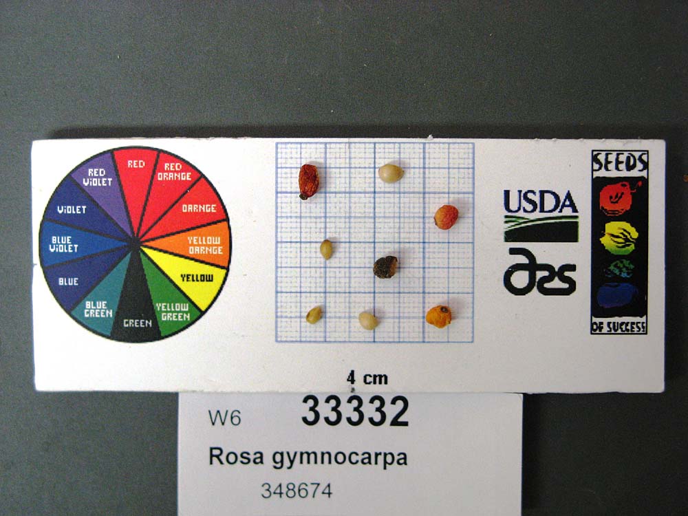 | | 2008 | COLLECTED | 09/17/2006 | | | 244 | Aspect: All, Pseudotsuga menziesii forest on a hill in botanical preserve; site used as outdoor classroom. Soil brownish black. | Wild material | | 1780213 | WLP 2336 |
| 15 | WLP 2310 | 176806 | Rosa woodsii Lindl. | Colorado, United States | NA | 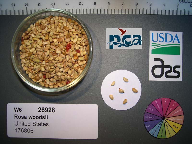 | | 2005 | COLLECTED | 08/05/2002 | | | 2255 | Stream bank; montane riparian community; soil very dark greyish-brown sand-silt.Montane riparian community. | Wild material | Shrub 0.9-2 meters tall. | 1673967 | WLP 2310 |
| 16 | PI 702717 | NCBG-648 | Sacciolepis striata (L.) Nash | Virginia, United States | S9 |  | | 2019 | | | | | | | Wild material | | 2098499 | PI 702717 |
| 17 | PI 702701 | MARSB-249 | Dichanthelium clandestinum (L.) Gould | New York, United States | S9 |  | | 2019 | | | | | | | Wild material | | 2097541 | PI 702701 |
| 18 | PI 675326 | R10-67-282 | Dactylis glomerata L. | Krasnodar, Russian Federation | W6 |  | | 2011 | COLLECTED | 08/05/2010 | | | | Sub-alpine forest. Collected by Larisa Bagmet and Olga Radchenko of VIR | Wild material | | 1883360 | PI 675326 |
| 19 | PI 685600 | R10-63-269 | Agrostis capillaris L. | Krasnodar, Russian Federation | W6 | | | 2011 | COLLECTED | 08/08/2010 | Golovinski Nature Reserve near Psetuapse River near Thagapsh | 43.97100000, 39.44300000 | 100 | Sub-tropical forest pasture. Limestone parent material, SW exposure, heavily grazed and disturbed meadow in sub-tropical forest opening, collection may be mixed with A. stolonifera: seed collected from >100 plants | Wild material | | 1883348 | PI 685600 |
| 20 | PI 650946 | MN 85-21-20 | Malus hybr. | Kazakhstan | GEN | | | 2007 | COLLECTED | 09/21/1995 | Semipalitinsk Region (Tarbagatai Mountain Range). 20 km. North of Urdzhar. 7 km. Northeast of Alekseyevka. Landform mostly hillside. Collected in North end of West Valley, upstream 3 km. from site 05 (GMAL's 3604-3607, GMAL's 3760-3789). | 47.27000000, 81.57361111 | 990 | Silt to clay loam soil. Aspect: Mostly East. Dominant tree sp.: M. sieversii; Associated-Populus, Pyrus, Acer. Dominant shrub sp.: Rosa; Assoc.-Lonicera, Amygdalus, Rubus. Dominant herbaceous: Grasses; Assoc.-Potentilla, Fragaria. | Uncertain improvement status | Sampled 30 fruits from 1 tree. Selected for texture and flavor. Fruit is firm. Fruit size is larger than 50mm, scab detected. -- Domestic introgression intentified using 20K Illumina Infinium apple SNP array. Charlamoff is a grandparent | 1723377 | PI 650946 |
| 21 | PI 650948 | MN 85-21-47 | Malus sieversii (Ledeb.) M. Roem. | Kazakhstan | GEN | | | 2007 | COLLECTED | 09/21/1995 | Semipalitinsk Region (Tarbagatai Mountain Range). 20 km. North of Urdzhar, 6 km. East-Northeast of Alekseyevka, on separate jeep trail. East Valley collection site. Collected on north end on flat by East River. | 47.27805556, 81.59972222 | 1120 | Flat slope. Dominant tree sp.: M. sieversii. Dominant shrub sp.: Rosa; Associated-Lonicera, Rubus. Dominant herbaceous: Malva; Assoc.-Fragaria. | Wild material | Sampled 60 fruits from 1 tree. Fruit is hard with aromatic flesh flavor. Over color is 90% red. Fruit size is larger than 50mm, free of scab. Very heavy cropload. | 1723379 | PI 650948 |
| 22 | PI 650952 | MN 85-23-53 | Malus hybr. | Kazakhstan | GEN | | | 2007 | COLLECTED | 09/21/1995 | Semipalitinsk Region (Tarbagatai Mountain Range). 20 km. North of Urdzhar. 5 km. Northeast of Alekseyevka. Collected mainly on west slopes in center of West Valley. Equidistant between sites 05 & 06 (GMAL's 3604-3615, GMAL's 3760-3789). | 47.25555556, 81.57222222 | 920 | Silt to clay loam soil. Aspect: West. Landform mostly hillside. Dominant tree sp.: M. sieversii. Dominant shrub sp.: Rosa; Associated-Lonicera, Rubus. Dominant herbaceous: Malva; Assoc.-Fragaria. | Uncertain improvement status | Sampled 15 fruits from 1 tree. Fruit is firm with aromatic flesh flavor. Over color is 80% red. Fruit size is larger than 50mm. Small amount of scab detected. Very column-shaped tree. Scion also collected. -- Domestic introgression intentified using 20K Illumina Infinium apple SNP array. One parent has Kaiser_Alexander as an offspring, the other has domestic haplotypes, including significant haplotypes from Gragylling, which could be a grandparent or great-grandparent of the 2nd parent | 1723383 | PI 650952 |
| 23 | PI 650956 | MN 85-25-48 | Malus hybr. | Kazakhstan | GEN | | | 2007 | COLLECTED | 09/21/1995 | Semipalitinsk Region (Tarbagatai Mountain Range). 20 km. North of Urdzhar. 5 km. Northeast of Alekseyevka. Collected mainly on west slopes in center of West Valley. Equidistant between sites 05 & 06 (GMAL's 3604-3615, GMAL's 3760-3789). | 47.25555556, 81.57222222 | 920 | Silt to clay loam soil. Aspect: West. Landform mostly hillside. Dominant tree sp.: M. sieversii. Dominant shrub sp.: Rosa; Associated-Lonicera, Rubus. Dominant herbaceous: Malva; Assoc.-Fragaria. | Uncertain improvement status | Sampled 15 fruits from 1 tree. Flesh flavor is aromatic. Fruit size is larger than 50mm obtained from a small tree. -- Domestic introgression intentified using 20K Illumina Infinium apple SNP array. Charlamoff is a grandparent | 1723387 | PI 650956 |
| 24 | PI 650960 | MN 85-25-97 | Malus hybr. | Kazakhstan | GEN | | | 2007 | COLLECTED | 09/21/1995 | Semipalitinsk Region (Tarbagatai Mountain Range). 20 km. North of Urdzhar. 7 km. Northeast of Alekseyevka. Landform mostly hillside. Collected in North end of West Valley, upstream 3 km. from site 05 (GMAL's 3604-3607, GMAL's 3760-3789). | 47.27000000, 81.57361111 | 990 | Silt to clay loam soil. Aspect: Mostly East. Dominant tree sp.: M. sieversii; Associated-Populus, Pyrus, Acer. Dominant shrub sp.: Rosa; Assoc.-Lonicera, Amygdalus, Rubus. Dominant herbaceous: Grasses; Assoc.-Potentilla, Fragaria. | Uncertain improvement status | Sampled 30 fruits from 1 tree. Selected for texture and flavor. Fruit is firm. Fruit size is larger than 50mm, scab detected. -- Domestic introgression intentified using 20K Illumina Infinium apple SNP array. Charlamoff or Gold_Reinette is a grandparent | 1723391 | PI 650960 |
| 25 | PI 650964 | MN 85-26-18 | Malus hybr. | Kazakhstan | GEN |  | | 2007 | COLLECTED | 09/21/1995 | Semipalitinsk Region (Tarbagatai Mountain Range). 20 km. North of Urdzhar, 6 km. East-Northeast of Alekseyevka, on separate jeep trail. East Valley collection site. Collected on south end by East River. | 47.27777778, 81.59805556 | 1120 | Dominant tree sp.: M. sieversii. Dominant shrub sp.: Rosa; Associated-Lonicera, Rubus. Dominant herbaceous: Malva; Assoc.-Fragaria. | Uncertain improvement status | Sampled 30 fruits from 1 tree. Flesh flavor is aromatic. Fruit size is larger than 50mm, free of scab. Tree has wide angle branching, side branches long, central leader dominant. Heavy cropload. -- Domestic introgression intentified using 20K Illumina Infinium apple SNP array. Kaiser_Alexander is a grandparent | 1723395 | PI 650964 |
| 26 | PI 650969 | Mn 88-27-62 | Malus hybr. | Kazakhstan | GEN | | | 2007 | COLLECTED | 09/21/1995 | Semipalitinsk Region (Tarbagatai Mountain Range). 20 km. North of Urdzhar, 6 km. East-Northeast of Alekseyevka, on separate jeep trail. East Valley collection site. Collected on north end on flat by East River. | 47.27805556, 81.59972222 | 1120 | Slope incline 2 degrees. Aspect: East. Dominant tree sp.: M. sieversii. Dominant shrub sp.: Rosa; Associated-Lonicera, Rubus. Dominant herbaceous: Malva; Assoc.-Fragaria. | Uncertain improvement status | Sampled 30 fruits from 1 tree. Fruit is firm with aromatic flesh flavor. Over color is 70% red. Fruit size is larger than 50mm. Looks scab free. Winter type. Commercial size. -- Domestic introgression intentified using 20K Illumina Infinium apple SNP array. | 1723400 | PI 650969 |
| 27 | PI 644197 | MN 85-24-53 | Malus hybr. | Kazakhstan | GEN | | | 2006 | COLLECTED | 08/29/1995 | Semipalitinsk Region (Tarbagatai Mountain Range). 20 km. North of Urdzhar. 5 km. Northeast of Alekseyevka. Collected mainly on west slopes in center of West Valley. Equidistant between sites 05 & 06 (GMAL's 3604-3615, GMAL's 3760-3789). | 47.25555556, 81.57222222 | 920 | Silt to clay loam soil. Aspect: West. Landform mostly hillside. Dominant tree sp.: M. sieversii. Dominant shrub sp.: Rosa; Associated-Lonicera, Rubus. Dominant herbaceous: Malva; Assoc.-Fragaria. | Uncertain improvement status | Sampled 40 fruits from 1 tree. Flesh flavor is aromatic. Over color is 90% red. Fruit size is larger than 50mm. Spur type tree. GMAL 4712 is an individual seedling selection from seedlot GMAL 3622. It was grown at the University of Minnesota. Comments from Minnesota: attractive. -- Domestic introgression intentified using 20K Illumina Infinium apple SNP array. Charlamoff is a grandparent | 1708180 | PI 644197 |
| 28 | PI 644198 | MN 85-22-99 | Malus sieversii (Ledeb.) M. Roem. | Kazakhstan | GEN |  | | 2006 | COLLECTED | 08/30/1995 | Semipalitinsk Region (Tarbagatai Mountain Range). 20 km. North of Urdzhar. 5 km. Northeast of Alekseyevka. Collected mainly on west slopes in center of West Valley. Equidistant between sites 05 & 06 (GMAL's 3604-3615, GMAL's 3760-3789). | 47.25555556, 81.57222222 | 920 | Silt to clay loam soil. Aspect: North. Landform mostly hillside. Dominant tree sp.: M. sieversii. Dominant shrub sp.: Rosa; Associated-Lonicera, Rubus. Dominant herbaceous: Malva; Assoc.-Fragaria. | Wild material | Sampled 30 fruits from 1 tree. Looks like a domesticated apple. Fruit is firm with aromatic flesh flavor, juicy. Fruit size is larger than 50mm. Winter keeper. Very heavy cropload. Scion also collected. GMAL 4713 is an individual seedling selection from seedlot GMAL 3623. It was grown at the University of Minnesota. Comments from Minnesota: scab resistant. | 1708286 | PI 644198 |
| 29 | PI 644199 | MN 85-26-21 | Malus hybr. | Kazakhstan | GEN |  | | 2006 | COLLECTED | 08/30/1995 | Semipalitinsk Region (Tarbagatai Mountain Range). 20 km. North of Urdzhar. 5 km. Northeast of Alekseyevka. Collected mainly on west slopes in center of West Valley. Equidistant between sites 05 & 06 (GMAL's 3604-3615, GMAL's 3760-3789). | 47.25555556, 81.57222222 | 920 | Silt to clay loam soil. Aspect: North. Landform mostly hillside. Dominant tree sp.: M. sieversii. Dominant shrub sp.: Rosa; Associated-Lonicera, Rubus. Dominant herbaceous: Malva; Assoc.-Fragaria. | Uncertain improvement status | Sampled 30 fruits from 1 tree. Looks like a domesticated apple. Fruit is firm with aromatic flesh flavor, juicy. Fruit size is larger than 50mm. Winter keeper. Very heavy cropload. Scion also collected. GMAL 4714 is an individual seedling selction from seedlot GMAL 3623. It was grown at the University of Minnesota. Comments from Minnesota: nice texture. -- One fully domesticated parent intentified using 20K Illumina Infinium apple SNP array. Grandparentage is Kulon_Kitaika and Gold_Reinette | 1708287 | PI 644199 |
| 30 | PI 644200 | MN 85-28-17 | Malus hybr. | Kazakhstan | GEN |  | | 2006 | COLLECTED | 08/30/1995 | Semipalitinsk Region (Tarbagatai Mountain Range). 20 km. North of Urdzhar. 5 km. Northeast of Alekseyevka. Collected mainly on west slopes in center of West Valley. Equidistant between sites 05 & 06 (GMAL's 3604-3615, GMAL's 3760-3789). | 47.25555556, 81.57222222 | 920 | Silt to clay loam soil. Aspect: North. Landform mostly hillside. Dominant tree sp.: M. sieversii. Dominant shrub sp.: Rosa; Associated-Lonicera, Rubus. Dominant herbaceous: Malva; Assoc.-Fragaria. | Uncertain improvement status | Sampled 30 fruits from 1 tree. Looks like a domesticated apple. Fruit is firm with aromatic flesh flavor, juicy. Fruit size is larger than 50mm. Winter keeper. Very heavy cropload. Scion also collected. GMAL 4715 is an individual seedling selection from seedlot GMAL 3623. It was grown at the University of Minnesota. Comments from Minnesota: late ripening. -- One fully domesticated parent intentified using 20K Illumina Infinium apple SNP array. Grandparentage is Kulon_Kitaika and Gold_Reinette | 1708288 | PI 644200 |
| 31 | PI 644201 | MN 85-28-25 | Malus hybr. | Kazakhstan | GEN | | | 2006 | COLLECTED | 08/30/1995 | Semipalitinsk Region (Tarbagatai Mountain Range). 20 km. North of Urdzhar. 5 km. Northeast of Alekseyevka. Collected mainly on west slopes in center of West Valley. Equidistant between sites 05 & 06 (GMAL's 3604-3615, GMAL's 3760-3789). | 47.25555556, 81.57222222 | 920 | Silt to clay loam soil. Aspect: North. Landform mostly hillside. Dominant tree sp.: M. sieversii. Dominant shrub sp.: Rosa; Associated-Lonicera, Rubus. Dominant herbaceous: Malva; Assoc.-Fragaria. | Uncertain improvement status | Sampled 30 fruits from 1 tree. Looks like a domesticated apple. Fruit is firm with aromatic flesh flavor, juicy. Fruit size is larger than 50mm. Winter keeper. Very heavy cropload. Scion also collected. GMAL 4716 is an individual seedling selection from seed lot GMAL 3623. It was grown at the University of Minnesota. Comments from Minnesota: late ripening. -- One fully domesticated parent intentified using 20K Illumina Infinium apple SNP array. Grandparentage is Kulon_Kitaika and Gold_Reinette | 1708310 | PI 644201 |
| 32 | PI 644202 | MN 88-27-40 | Malus hybr. | Kazakhstan | GEN | | | 2006 | COLLECTED | 08/31/1995 | Semipalitinsk Region (Tarbagatai Mountain Range). 20 km. North of Urdzhar, 6 km. East-Northeast of Alekseyevka, on separate jeep trail. East Valley collection site. Collected on north end on flat by East River. | 47.27805556, 81.59972222 | 1120 | Slope incline 2 degrees. Aspect: East. Dominant tree sp.: M. sieversii. Dominant shrub sp.: Rosa; Associated-Lonicera, Rubus. Dominant herbaceous: Malva; Assoc.-Fragaria. | Uncertain improvement status | Sampled 30 fruits from 1 tree. Fruit is firm with aromatic flesh flavor. Over color is 70% red. Fruit size is larger than 50mm. Looks scab free. Winter type. Commercial size. GMAL 4717 is an individual seedling selection from seed lot GMAL 3626. It was grown at the University of Minnesota. Comments from Minnesota: scab resistant. -- Domestic introgression intentified using 20K Illumina Infinium apple SNP array. Gold_Reinette is a grandparent | 1708316 | PI 644202 |
| 33 | PI 644203 | MN-88-27-43 | Malus hybr. | Kazakhstan | GEN | | | 2006 | COLLECTED | 08/31/1995 | Semipalitinsk Region (Tarbagatai Mountain Range). 20 km. North of Urdzhar, 6 km. East-Northeast of Alekseyevka, on separate jeep trail. East Valley collection site. Collected on north end on flat by East River. | 47.27805556, 81.59972222 | 1120 | Slope incline 2 degrees. Aspect: East. Dominant tree sp.: M. sieversii. Dominant shrub sp.: Rosa; Associated-Lonicera, Rubus. Dominant herbaceous: Malva; Assoc.-Fragaria. | Uncertain improvement status | Sampled 30 fruits from 1 tree. Fruit is firm with aromatic flesh flavor. Over color is 70% red. Fruit size is larger than 50mm. Looks scab free. Winter type. Commercial size. GMAL 4718 is an individual seedling selction from seed lot GMAL 3626. It was grown at the University of Minnesota. Comments from Minnesota: scab resistant. -- Domestic introgression intentified using 20K Illumina Infinium apple SNP array. Gold_Reinette is a grandparent | 1708318 | PI 644203 |
| 34 | PI 635238 | H. lupulus var. neomexicanus DC2003-15 | Humulus lupulus L. var. neomexicanus A. Nelson & Cockerell | British Columbia, Canada | COR | | | 2003 | COLLECTED | 10/13/2003 | Cowichan River delta, along Tzouhalem Road. Southeast of Duncan. | 48.76215000, -123.64417000 | 2 | Rosa sp., Rubus laciniatus, Creteagus sp., Sambucus sp. and Symphoracarpos sp. Exposure mostly open. | Wild material | This could either be an introduced Humulus lupulus var. lupulus or H. l. var. neomexicanus. Needs to be checked. KEH 2 March 2019 | 1650180 | PI 635238 |
| 35 | PI 662017 | 24 | Cornus drummondii C. A. Mey. | Iowa, United States | NC7 | | | 2003 | COLLECTED | 09/22/2003 | Eldon Wildlife Management Area, Floris, SW 1/4 of NW 1/4 of Section 9, T70N, R12W, Agency Quad, Davis County. | 40.88083333, -92.25222222 | 235 | Near a pond. Sunny. Slight slope. Clay loam soil. | Wild material | Medium sized, suckering shrubs. Good leaf quality and fruit production. | 1649669 | PI 662017 |
| 36 | PI 633807 | CH97 03-01 | Malus hupehensis (Pamp.) Rehder | Sichuan Sheng, China | GEN |  | | 1997 | COLLECTED | 09/21/1997 | Maerkang County, Dananzugou village. 5 km. northeast of Maerkang. | 31.95583333, 102.27555556 | 2930 | Aspect-South, partial canopy. Incline <5%, slight south, variable. Landform: Mountain valley. Assoc. sp: Sorbus, Fir, Pine Acer, Cornus, Willow, Betula. Shrub sp: Rosa, Pyracantha, Holly, Berberis, Cotoneaster, Rubus. Herb sp: Aster, Fern. | Wild material | Additional Weather Notes: Rainfall in concentrated from May to Sept. There are spring and summer droughts. Hail and frost damage occur. Additional Habitat Notes: Collection tree nearly defoilated, 5m. in height, located on minimal south facing slope. Name of gorge: Da Nan Zu Gou. Name of village: Cha Bei. Sampled 132 fruits from 23 trees. | 1652458 | PI 633807 |
| 37 | PI 633808 | CH97 03-02 | Malus toringoides (Rehder) Hughes | Sichuan Sheng, China | GEN |  | | 1997 | COLLECTED | 09/21/1997 | Maerkang County, Dananzugou village. 5 km. northeast of Maerkang. | 31.95583333, 102.27555556 | 2930 | Aspect-South, partial canopy. Incline <5%, slight south, variable. Landform: Mountain valley. Assoc. sp: Sorbus, Fir, Pine Acer, Cornus, Willow, Betula. Shrub sp: Rosa, Pyracantha, Holly, Berberis, Cotoneaster, Rubus. Herb sp: Aster, Fern. | Wild material | Additional Weather Notes: Rainfall in concentrated from May to Sept. There are spring and summer droughts. Hail and frost damage occur. Sampled 132 fruits from each of the 23 trees. | 1652459 | PI 633808 |
| 38 | PI 633810 | CH97 03-20 | Malus kansuensis (Batalin) C. K. Schneid. | Sichuan Sheng, China | GEN | | | 1997 | COLLECTED | 09/21/1997 | Maerkang County, Dananzugou village. 5 km. northeast of Maerkang. | 31.94472222, 102.27000000 | 2930 | Aspect-South, partial canopy. Incline <5%, slight south, variable. Landform: Mountain valley. Assoc. sp: Sorbus, Fir, Pine Acer, Cornus, Willow, Betula. Shrub sp: Rosa, Pyracantha, Holly, Berberis, Cotoneaster, Rubus. Herb sp: Aster, Fern. | Wild material | Additional Weather Notes: Rainfall in concentrated from May to Sept. There are spring and summer droughts. Hail and frost damage occur. Additional Habitat Notes: Collection tree 4m. in height with 6 trunks copiced; located on a very rocky hillside. Sampled 132 fruits from 23 trees. Rust present; no scab. | 1652461 | PI 633810 |
| 39 | PI 703093 | CH97 03-02 | Malus toringoides (Rehder) Hughes | Sichuan Sheng, China | | | Historic | 1997 | COLLECTED | 09/21/1997 | Maerkang County, Dananzugou village. 5 km. northeast of Maerkang. | 31.95583333, 102.27555556 | 2930 | Aspect-South, partial canopy. Incline <5%, slight south, variable. Landform: Mountain valley. Assoc. sp: Sorbus, Fir, Pine Acer, Cornus, Willow, Betula. Shrub sp: Rosa, Pyracantha, Holly, Berberis, Cotoneaster, Rubus. Herb sp: Aster, Fern. | Wild material | Additional Weather Notes: Rainfall in concentrated from May to Sept. There are spring and summer droughts. Hail and frost damage occur. Sampled 132 fruits from each of the 23 trees. | 1695202 | PI 703093 |
| 40 | PI 703094 | CH97 03-02 | Malus toringoides (Rehder) Hughes | Sichuan Sheng, China | | | Historic | 1997 | COLLECTED | 09/21/1997 | Maerkang County, Dananzugou village. 5 km. northeast of Maerkang. | 31.95583333, 102.27555556 | 2930 | Aspect-South, partial canopy. Incline <5%, slight south, variable. Landform: Mountain valley. Assoc. sp: Sorbus, Fir, Pine Acer, Cornus, Willow, Betula. Shrub sp: Rosa, Pyracantha, Holly, Berberis, Cotoneaster, Rubus. Herb sp: Aster, Fern. | Wild material | Additional Weather Notes: Rainfall in concentrated from May to Sept. There are spring and summer droughts. Hail and frost damage occur. Sampled 132 fruits from each of the 23 trees. | 1695203 | PI 703094 |
| 41 | PI 703095 | CH97 03-02 | Malus toringoides (Rehder) Hughes | Sichuan Sheng, China | | | Historic | 1997 | COLLECTED | 09/21/1997 | Maerkang County, Dananzugou village. 5 km. northeast of Maerkang. | 31.95583333, 102.27555556 | 2930 | Aspect-South, partial canopy. Incline <5%, slight south, variable. Landform: Mountain valley. Assoc. sp: Sorbus, Fir, Pine Acer, Cornus, Willow, Betula. Shrub sp: Rosa, Pyracantha, Holly, Berberis, Cotoneaster, Rubus. Herb sp: Aster, Fern. | Wild material | Additional Weather Notes: Rainfall in concentrated from May to Sept. There are spring and summer droughts. Hail and frost damage occur. Sampled 132 fruits from each of the 23 trees. | 1695205 | PI 703095 |
| 42 | PI 703096 | CH97 03-03 | Malus toringoides (Rehder) Hughes | Sichuan Sheng, China | | | Historic | 1997 | COLLECTED | 09/21/1997 | Maerkang County, Dananzugou village. 5 km. northeast of Maerkang. | 31.95583333, 102.27555556 | 2930 | Aspect-South, partial canopy. Incline <5%, slight south, variable. Landform: Mountain valley. Assoc. sp: Sorbus, Fir, Pine Acer, Cornus, Willow, Betula. Shrub sp: Rosa, Pyracantha, Holly, Berberis, Cotoneaster, Rubus. Herb sp: Aster, Fern. | Wild material | Additional Weather Notes: Rainfall in concentrated from May to Sept. There are spring and summer droughts. Hail and frost damage occur. Additional Habitat Notes: Collection tree an older tree, 6m. in height, 40cm. diameter, good vigor; located on west facing slope; incline 30%. Sampled 132 fruits from 23 trees. No scab present; quite a lot of of leaf spotting. | 1695209 | PI 703096 |
| 43 | PI 703097 | CH97 03-03 | Malus toringoides (Rehder) Hughes | Sichuan Sheng, China | | | Historic | 1997 | COLLECTED | 09/21/1997 | Maerkang County, Dananzugou village. 5 km. northeast of Maerkang. | 31.95583333, 102.27555556 | 2930 | Aspect-South, partial canopy. Incline <5%, slight south, variable. Landform: Mountain valley. Assoc. sp: Sorbus, Fir, Pine Acer, Cornus, Willow, Betula. Shrub sp: Rosa, Pyracantha, Holly, Berberis, Cotoneaster, Rubus. Herb sp: Aster, Fern. | Wild material | Additional Weather Notes: Rainfall in concentrated from May to Sept. There are spring and summer droughts. Hail and frost damage occur. Additional Habitat Notes: Collection tree an older tree, 6m. in height, 40cm. diameter, good vigor; located on west facing slope; incline 30%. Sampled 132 fruits from 23 trees. No scab present; quite a lot of of leaf spotting. | 1695206 | PI 703097 |
| 44 | PI 703098 | CH97 03-04 | Malus toringoides (Rehder) Hughes | Sichuan Sheng, China | | | Historic | 1997 | COLLECTED | 09/21/1997 | Maerkang County, Dananzugou village. 5 km. northeast of Maerkang. | 31.95583333, 102.27555556 | 2930 | Aspect-South, partial canopy. Incline <5%, slight south, variable. Landform: Mountain valley. Assoc. sp: Sorbus, Fir, Pine Acer, Cornus, Willow, Betula. Shrub sp: Rosa, Pyracantha, Holly, Berberis, Cotoneaster, Rubus. Herb sp: Aster, Fern. | Wild material | Additional Weather Notes: Rainfall in concentrated from May to Sept. There are spring and summer droughts. Hail and frost damage occur. Additional Habitat Notes: Collection tree located on south facing slope, 20% incline. Sampled 132 fruits from 23 trees. | 1695210 | PI 703098 |
| 45 | PI 703099 | CH97 03-05 | Malus hupehensis (Pamp.) Rehder | Sichuan Sheng, China | |  | Historic | 1997 | COLLECTED | 09/21/1997 | Maerkang County, Dananzugou village. 5 km. northeast of Maerkang. | 31.95583333, 102.27555556 | 2920 | Aspect-South, partial canopy. Incline <5%, slight south, variable. Landform: Mountain valley. Assoc. sp: Sorbus, Fir, Pine Acer, Cornus, Willow, Betula. Shrub sp: Rosa, Pyracantha, Holly, Berberis, Cotoneaster, Rubus. Herb sp: Aster, Fern. | Wild material | Additional Weather Notes: Rainfall in concentrated from May to Sept. There are spring and summer droughts. Hail and frost damage occur. Sampled 132 fruits from each of the 23 trees. Collection tree 15cm. in diameter. Fruit shows heavy disease. leaves are lanceolate. | 1695218 | PI 703099 |
| 46 | PI 703100 | CH97 03-16 | Malus kansuensis (Batalin) C. K. Schneid. | Sichuan Sheng, China | | | Historic | 1997 | COLLECTED | 09/21/1997 | Maerkang County, Dananzugou village. 5 km. northeast of Maerkang. | 31.94472222, 102.27000000 | 2880 | Aspect-South, partial canopy. Incline <5%, slight south, variable. Landform: Mountain valley. Assoc. sp: Sorbus, Fir, Pine Acer, Cornus, Willow, Betula. Shrub sp: Rosa, Pyracantha, Holly, Berberis, Cotoneaster, Rubus. Herb sp: Aster, Fern. | Wild material | Additional Weather Notes: Rainfall in concentrated from May to Sept. There are spring and summer droughts. Hail and frost damage occur. Additional Habitat Notes: Collection tree 3m. in height, moderate vigor; located on a rocky river bank. Sampled 132 fruits from 23 trees. Leaf rust present. No scab. | 1695245 | PI 703100 |
| 47 | PI 703101 | CH97 03-19 | Malus toringoides (Rehder) Hughes | Sichuan Sheng, China | | | Historic | 1997 | COLLECTED | 09/21/1997 | Maerkang County, Dananzugou village. 5 km. northeast of Maerkang. | 31.94472222, 102.27000000 | 2930 | Aspect-South, partial canopy. Incline <5%, slight south, variable. Landform: Mountain valley. Assoc. sp: Sorbus, Fir, Pine Acer, Cornus, Willow, Betula. Shrub sp: Rosa, Pyracantha, Holly, Berberis, Cotoneaster, Rubus. Herb sp: Aster, Fern. | Wild material | Additional Weather Notes: Rainfall in concentrated from May to Sept. There are spring and summer droughts. Hail and frost damage occur. Additional Habitat Notes: Collection tree older, 12m. in height, 40cm. diameter, 3 trunks, moderate vigor; located on a very rocky slope, near Acer and Holly. Sampled 132 fruits from 23 trees. Rust and leaf spotting present; no scab. | 1695248 | PI 703101 |
| 48 | PI 599801 | KAZ 96 02-01P | Malus sieversii (Ledeb.) M. Roem. | Kazakhstan | GEN | | | 1996 | COLLECTED | 08/30/1996 | Zielisky Alatau. 17 km SSw of Almaty center-Aksay river. West side of Zieliesky Apple Belt. Landform: Valley near river. | 43.11916667, 76.79833333 | 1260 | Soil: Gravely loam, good drainage, some stone. Incline flat + 15%, NW. Rainfall 700mm. Dominant tree sp: Malus sieversii; Assoc-Apricot, Crataegus. Dominant shrub sp: Berberis, Hippophae; Assoc-Rubus, Rosa. Dom. herb-Hops; Assoc-Geranium. | Wild material | | 1551098 | PI 599801 |
| 49 | PI 633803 | KAZ 96 02-01P-11 | Malus sieversii (Ledeb.) M. Roem. | Kazakhstan | GEN | 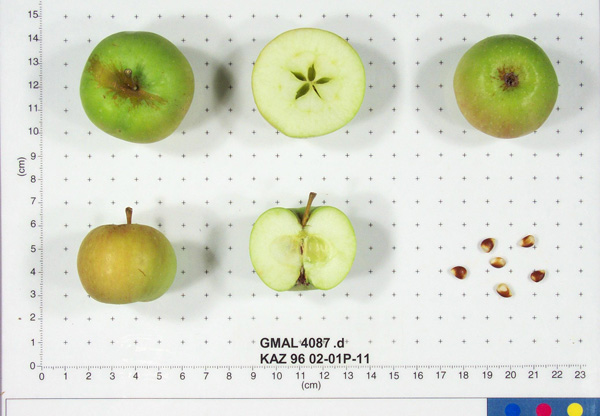 | | 1996 | COLLECTED | 08/30/1996 | Zielisky Alatau. 17 km SSw of Almaty center-Aksay river. West side of Zieliesky Apple Belt. Landform: Valley near river. | 43.11916667, 76.79833333 | 1260 | Soil: Gravely loam, good drainage, some stone. Incline flat + 15%, NW. Rainfall 700mm. Dominant tree sp: Malus sieversii; Assoc-Apricot, Crataegus. Dominant shrub sp: Berberis, Hippophae; Assoc-Rubus, Rosa. Dom. herb-Hops; Assoc-Geranium. | Wild material | Sampled 8 fruits from 20 trees. Flesh flavor is acid. Light scab. | 1652454 | PI 633803 |
| 50 | PI 633923 | KAZ 96 06-01P-28 | Malus sieversii (Ledeb.) M. Roem. | Kazakhstan | GEN |  | | 1996 | COLLECTED | 09/06/1996 | 9km southeast of Lepsinsk, 3km southwest of Lepsinsk Forestry Camp. Sampled area down the bank, along the river and up the bank on the other side. Collected in site 15 area of 1995. | 45.51305556, 80.71944444 | 1250 | Soil: Gravely loam, excellent drainage. N-S ridge, open. Dominant tree sp: Malus sieversii: Assoc-Populus, Crateagus. Dominant shrub sp: Rosa: Assoc-Rubus. Dominant herbaceous: Grasses; Assoc-Aster, Cirscium. | Wild material | Sampled 8 fruits from 30 trees. Flesh flavor is acid. Scab is light to moderate, spur-type. Same as site 15 in 1995. Excellent fruiting in 1996. | 1653309 | PI 633923 |
| 51 | PI 657106 | KAZ 96 02-01P-6 | Malus sieversii (Ledeb.) M. Roem. | Kazakhstan | GEN | | | 1996 | COLLECTED | 08/30/1996 | Zielisky Alatau. 17 km SSw of Almaty center-Aksay river. West side of Zieliesky Apple Belt. Landform: Valley near river. | 43.11916667, 76.79833333 | 1260 | Soil: Gravely loam, good drainage, some stone. Incline flat + 15%, NW. Rainfall 700mm. Dominant tree sp: Malus sieversii; Assoc-Apricot, Crataegus. Dominant shrub sp: Berberis, Hippophae; Assoc-Rubus, Rosa. Dom. herb-Hops; Assoc-Geranium. | Wild material | Sampled 8 fruits from 20 trees. Flesh flavor is astringent. No scab, slightly ribbed. | 1693683 | PI 657106 |
| 52 | PI 657109 | KAZ 96 06-01P-23 | Malus hybr. | Kazakhstan | GEN |  | | 1996 | COLLECTED | 09/06/1996 | 9km southeast of Lepsinsk, 3km southwest of Lepsinsk Forestry Camp. Sampled area down the bank, along the river and up the bank on the other side. Collected in site 15 area of 1995. | 45.51916667, 80.71555556 | 1110 | Soil: Gravely loam, excellent drainage. N-S ridge, open. Dominant tree sp: Malus sieversii: Assoc-Populus, Crateagus. Dominant shrub sp: Rosa: Assoc-Rubus. Dominant herbaceous: Grasses; Assoc-Aster, Cirscium. | Uncertain improvement status | Sampled 8 fruits from 30 trees. Flesh flavor is acid. Over color is 80% red. Scab is heavy. Stem end overgrowth. Same as site 15 in 1995. Excellent fruiting in 1996. ---Malus sieversii hybrid. Domestic introgression intentified using 20K Illumina Infinium apple SNP array--Lowland_Raspberry is a grandparent | 1694003 | PI 657109 |
| 53 | PI 682791 | KAZ 96 02-01P-6 | Malus sieversii (Ledeb.) M. Roem. | Kazakhstan | GEN |  | | 1996 | COLLECTED | 08/30/1996 | Zielisky Alatau. 17 km SSw of Almaty center-Aksay river. West side of Zieliesky Apple Belt. Landform: Valley near river. | 43.11916667, 76.79833333 | 1260 | Soil: Gravely loam, good drainage, some stone. Incline flat + 15%, NW. Rainfall 700mm. Dominant tree sp: Malus sieversii; Assoc-Apricot, Crataegus. Dominant shrub sp: Berberis, Hippophae; Assoc-Rubus, Rosa. Dom. herb-Hops; Assoc-Geranium. | Wild material | Sampled 8 fruits from 20 trees. Flesh flavor is astringent. No scab, slightly ribbed. | 1693685 | PI 682791 |
| 54 | PI 703085 | KAZ 96 06-01P-28 | Malus sieversii (Ledeb.) M. Roem. | Kazakhstan | | | Historic | 1996 | COLLECTED | 09/06/1996 | 9km southeast of Lepsinsk, 3km southwest of Lepsinsk Forestry Camp. Sampled area down the bank, along the river and up the bank on the other side. Collected in site 15 area of 1995. | 45.51305556, 80.71944444 | 1250 | Soil: Gravely loam, excellent drainage. N-S ridge, open. Dominant tree sp: Malus sieversii: Assoc-Populus, Crateagus. Dominant shrub sp: Rosa: Assoc-Rubus. Dominant herbaceous: Grasses; Assoc-Aster, Cirscium. | Wild material | Sampled 8 fruits from 30 trees. Flesh flavor is acid. Scab is light to moderate, spur-type. Same as site 15 in 1995. Excellent fruiting in 1996. | 1694020 | PI 703085 |
| 55 | PI 611049 | VIR 281 | Dactylis glomerata L. | Russian Federation | W6 | | | 1996 | COLLECTED | 09/14/1995 | Krasnodarskiy kray. Nearest village Dachovskaya. | 44.15055556, 40.19666667 | 1100 | Area logged. Slope 6-10%, aspect NE. Light 1/4 shade. Soil loam, pH 5.4-5.6. Moist, upper slope. Vegetation closed, deciduous forest primary, closed scrub with scattered trees. | Wild material | Dominant tree species Carpinus betulus, Quercus robur, Acer campestre. Dominant shrub species Rosa sp., Rubus caesius, Salix caprea, Rhododendron luteum. Dominant herb/grass species Deschampsia caespitosa, Molinia caerulea, Calamagrostis sp., Doricnium graecum, Trifolium medium. Population distribution uniform, abundance occasional. Growth habit erect. Extensive regional climate data available in spreadsheet format or image maps in raster format suitable for GIS analysis. Contact Dr. Stephanie L. Greene (sgreene@ars-grin.gov). | 1517975 | PI 611049 |
| 56 | PI 611053 | VIR 278B | Dactylis glomerata L. | Russian Federation | W6 | | | 1996 | COLLECTED | 09/14/1995 | Krasnodarskiy kray. Nearest village Dachovskaya. | 44.15055556, 40.19666667 | 1100 | Area logged. Slope 6-10%, aspect NE. Light 1/4 shade. Soil loam, pH 5.4-5.6. Moist, upper slope. Vegetation closed, deciduous forest primary, closed scrub with scattered trees. | Wild material | Dominant tree species Carpinus betulus, Quercus robur, Acer campestre. Dominant shrub species Rosa sp., Rubus caesius, Salix caprea, Rhododendron luteum. Dominant herb/grass species Deschampsia caespitosa, Molina caerulea, Calamagrostis sp., Doricnium graecum, Trifolium medium. Population distribution uniform, abundance occasional. Growth habit erect. Flower gray. Extensive regional climate data available in spreadsheet format or image maps in raster format suitable for GIS analysis. Contact Dr. Stephanie L. Greene (sgreene@ars-grin.gov). | 1517973 | PI 611053 |
| 57 | PI 641474 | 279 | Lotus corniculatus L. | Krasnodar, Russian Federation | W6 |  | | 1996 | COLLECTED | 09/14/1995 | Krasnodarskiy kray, nearest village is Dachovskaya. | | | Now logged. Slope 6-10%, aspect NE. 1/4 shade. Soil loam. Moist, upper slope. Vegetation closed, deciduous forest, closed scrub with scattered trees. | Wild material | Dominant tree species Carpinus betulus, Quercus robur, Acer campestre. Dominant shrub species Rosa sp., Rubus caesius, Salix caprea, Rhododendron luteum. Dominant herb/grass species Deschampsia caespitosa, Molinia caerulea, Calamogrostis graecum, Trifolium medium. Population distribution uniform, abundance occasional. Growth habit spreading. Extensive regional climate data available in spreadsheet format or image maps in raster format suitable for GIS analysis. Contact Dr. Stephanie L. Greene (sgreene@ars-grin.gov). | 1531013 | PI 641474 |
| 58 | PI 641475 | 282 | Trifolium medium L. | Krasnodar, Russian Federation | W6 | | | 1996 | COLLECTED | 09/14/1995 | Krasnodarskiy kray, nearest village is Dachovskaya. | | | Now logged. Slope 6-10%, aspect NE. 1/4 shade. Soil loam. Moist, upper slope. Vegetation closed, deciduous forest, scrub with scattered trees. | Wild material | Dominant tree species Carpinus betulus, Quercus robur, Acer campestre. Dominant shrub species Rosa sp., Rubus caesius, Salix caprea, Rhododendron luteum. Dominant herb/grass species Deschampsia caespitosa, Molinia caerulea, Calamogrostis sp., Doricnium graecum, Trifolium medium. Population distribution patchy, abundance frequent. Growth habit spreading. Extensive regional climate data available in spreadsheet format or image maps in raster format suitable for GIS analysis. Contact Dr. Stephanie L. Greene (sgreene@ars-grin.gov). | 1531014 | PI 641475 |
| 59 | PI 641476 | 285 | Lotus corniculatus L. | Krasnodar, Russian Federation | W6 |  | | 1996 | COLLECTED | 09/14/1995 | Krasnodarskiy kray, nearest village is Dachovskaya. | | | Now logged. Slope 6-10%, aspect NE. 1/4 shade. Soil loam. Moist, upper slope. Vegetation closed, deciduous forest, scrub with scattered trees. | Wild material | Dominant tree species Carpinus betulus, Quercus robur, Acer campestre. Dominant shrub species Rosa sp., Rubus caesius, Salix caprea, Rhododendron luteum. Dominant herb/grass species Deschampsia caespitosa, Molinia caerulea, Calamogrostis sp., Doricnium graecum, Trifolium medium. Population distribution uniform, abundance occasional. Growth habit spreading. Extensive regional climate data available in spreadsheet format or image maps in raster format suitable for GIS analysis. Contact Dr. Stephanie L. Greene (sgreene@ars-grin.gov). | 1531016 | PI 641476 |
| 60 | PI 655818 | 284 | Trifolium hybridum L. | Krasnodar, Russian Federation | W6 |  | | 1996 | COLLECTED | 09/14/1995 | Krasnodarskiy kray, nearest village is Dachovskaya. | | | Now logged. Slope 6-10%, aspect NE. 1/4 shade. Soil loam. Moist, upper slope. Vegetation closed, deciduous forest, scrub with scattered trees. | Wild material | Dominant tree species Carpinus betulus, Quercus robur, Acer campestre. Dominant shrub species Rosa sp., Rubus caesius, Salix caprea, Rhododendron luteum. Dominant herb/grass species Deschampsia caespitosa, Molinia caerulea, Calamogrostis sp., Doricnium graecum, Trifolium medium. Population distribution uniform-patchy, abundance occasional. Growth habit spreading. Extensive regional climate data available in spreadsheet format or image maps in raster format suitable for GIS analysis. Contact Dr. Stephanie L. Greene (sgreene@ars-grin.gov). | 1531015 | PI 655818 |
| 61 | PI 599790 | Kaz 95 01-01P-1 | Malus sieversii (Ledeb.) M. Roem. | Kazakhstan | GEN | | | 1995 | COLLECTED | 08/26/1995 | Zielisky Alatau Province. Almaty village. 17 km South to Southwest of Almaty Center. Aksay river West side of Zielisky Apple Belt. Land form - valley near river. | 43.11611111, 76.79611111 | 1400 | Gravely loam soil, some stoniness. Good drainage. Slope incline flat. Dominant tree sp: M. sieversii; Assoc.-Apricot, Crataegus. Dom. shrub sp: Berberis, Hippophae; Assoc.-Rubus, Rosa. Dominant herbaceous: Hops; Assoc.-Geranium, Fragaria. | Wild material | Sampled 5 fruits from 1 tree. | 1551087 | PI 599790 |
| 62 | PI 599794 | Kaz 95 09-01P-1 | Malus sieversii (Ledeb.) M. Roem. | Kazakhstan | GEN | | | 1995 | COLLECTED | 08/31/1995 | Semipalitinsk Region (Tarbagatai Mountain Range). 20 km. North of Urdzhar, 6 km. East-Northeast of Alekseyevka, on separate jeep trail. East Valley collection site. Collected on north end on flat by East River. | 47.27805556, 81.59972222 | 1120 | Aspect: Mainly East. Landform: flat valley and East slope. Dominant tree sp.: M. sieversii. Dominant shrub sp.: Rosa; Associated-Lonicera, Rubus. Dominant herbaceous: Malva; Assoc.-Fragaria. | Wild material | Sampled 5 fruits from 1 tree. Fruit is firm with aromatic flesh flavor. | 1551089 | PI 599794 |
| 63 | PI 600485 | Kaz 95 01-02 | Malus sieversii (Ledeb.) M. Roem. | Kazakhstan | GEN | | | 1995 | COLLECTED | 08/26/1995 | Zielisky Alatau Province. Almaty village. 17 km South to Southwest of Almaty Center. Aksay river West side of Zielisky Apple Belt. Landform - valley near river. | 43.11611111, 76.79611111 | 1400 | Gravely loam soil, some stoniness. Good drainage. Slope incline flat. Dominant tree sp: M. sieversii; Assoc.-Apricot, Crataegus. Dom. shrub sp: Berberis, Hippophae; Assoc.-Rubus, Rosa. Dominant herbaceous: Hops; Assoc.-Geranium, Fragaria. | Wild material | Sampled 150 fruits from 1 tree. Flesh flavor is aromatic. Bruises easily. Over color is 80% red, moderate scab. Low seed count (infertile). | 1550628 | PI 600485 |
| 64 | PI 600486 | Kaz 95 01-03 | Malus sieversii (Ledeb.) M. Roem. | Kazakhstan | GEN | | | 1995 | COLLECTED | 08/26/1995 | Zielisky Alatau Province. Almaty village. 17 km South to Southwest of Almaty Center. Aksay river West side of Zielisky Apple Belt. Landform - valley near river. | 43.11611111, 76.79611111 | 1400 | Gravely loam soil, some stoniness. Good drainage. Slope incline flat. Dominant tree sp: M. sieversii; Assoc.-Apricot, Crataegus. Dom. shrub sp: Berberis, Hippophae; Assoc.-Rubus, Rosa. Dominant herbaceous: Hops; Assoc.-Geranium, Fragaria. | Wild material | Sampled 150 fruits from 1 tree. Fruit size is larger than 50mm, low scab. A bit immature - low seed set. Some codling moth damage. | 1550629 | PI 600486 |
| 65 | PI 600487 | Kaz 95 01-04 | Malus sieversii (Ledeb.) M. Roem. | Kazakhstan | GEN | | | 1995 | COLLECTED | 08/26/1995 | Zielisky Alatau Province. Almaty village. 17 km South to Southwest of Almaty Center. Aksay river West side of Zielisky Apple Belt. Landform - valley near river. | 43.11611111, 76.79611111 | 1400 | Gravely loam soil, some stoniness. Good drainage. Slope incline flat. Dominant tree sp: M. sieversii; Assoc.-Apricot, Crataegus. Dom. shrub sp: Berberis, Hippophae; Assoc.-Rubus, Rosa. Dominant herbaceous: Hops; Assoc.-Geranium, Fragaria. | Wild material | Sampled 150 fruits from 1 tree. Flesh flavor is aromatic. Over color is 95% red, light scab. Unique shape at calyx and pedicel. | 1550630 | PI 600487 |
| 66 | PI 600489 | Kaz 95 03-01 | Malus sieversii (Ledeb.) M. Roem. | Kazakhstan | GEN | | | 1995 | COLLECTED | 08/27/1995 | Zielisky Alatau Province. 40 km East of the Almatinka River, near stream bed. Forest region of Talgar - 188 hectares. Mikushina area, 1100-1800 m. | 43.29333333, 77.39555556 | 1490 | Clay loam soil, limited stoniness. Good drainage. Flat slope, next to W. slope. Dom. tree sp.: Malus; Assoc-Crataegus, Rhamnus, Populus, Salix. Dom. shrub sp: Rosa. Assoc-Rubus, Berberis. Dom. herb.: Humulus; Assoc-Origanum, Malva, Geranium | Wild material | Sampled 150 fruits from 1 tree. White seeds, immature fruit. Upright tree. Not real healthy-somewhat defoliated. Fruit over color is 90% red, scab detected. | 1550632 | PI 600489 |
| 67 | PI 600490 | Kaz 95 03-02 | Malus sieversii (Ledeb.) M. Roem. | Kazakhstan | GEN | | | 1995 | COLLECTED | 08/27/1995 | Zielisky Alatau Province. 40 km East of the Almatinka River, near stream bed. Forest region of Talgar - 188 hectares. Mikushina area, 1100-1800 m. | 43.29333333, 77.39555556 | 1490 | Clay loam soil, limited stoniness. Good drainage. Flat slope, next to W. slope. Dom. tree sp.: Malus; Assoc-Crataegus, Rhamnus, Populus, Salix. Dom. shrub sp: Rosa. Assoc-Rubus, Berberis. Dom. herb.: Humulus; Assoc-Origanum, Malva, Geranium | Wild material | Sampled 150 fruits from 1 tree. Spreading habit. | 1550633 | PI 600490 |
| 68 | PI 600497 | Kaz 95 06-01 | Malus sieversii (Ledeb.) M. Roem. | Kazakhstan | GEN | | | 1995 | COLLECTED | 08/29/1995 | Semipalitinsk Region (Tarbagatai Mountain Range). 20 km. North of Urdzhar. 7 km. Northeast of Alekseyevka. Landform mostly hillside. Collected in North end of West Valley, upstream 3 km. from site 05 (GMAL's 3604-3607, GMAL's 3760-3789). | 47.27000000, 81.57361111 | 990 | Silt to clay loam soil. Aspect: Mostly East. Dominant tree sp.: M. sieversii; Associated-Populus, Pyrus, Acer. Dominant shrub sp.: Rosa; Assoc.-Lonicera, Amygdalus, Rubus. Dominant herbaceous: Grasses; Assoc.-Potentilla, Fragaria. | Wild material | Sampled 150 fruits from 1 tree. Flesh flavor is aromatic. Over color is 90% red. Fruit size is larger than 50mm, no scab. Spur type tree. Scion also collected. | 1550639 | PI 600497 |
| 69 | PI 600498 | Kaz 95 06-03 | Malus sieversii (Ledeb.) M. Roem. | Kazakhstan | GEN | | | 1995 | COLLECTED | 08/29/1995 | Semipalitinsk Region (Tarbagatai Mountain Range). 20 km. North of Urdzhar. 7 km. Northeast of Alekseyevka. Landform mostly hillside. Collected in North end of West Valley, upstream 3 km. from site 05 (GMAL's 3604-3607, GMAL's 3760-3789). | 47.27000000, 81.57361111 | 990 | Silt to clay loam soil. Slope incline: 5%. Aspect: West. Dominant tree sp: M. sieversii; Associated-Populus, Pyrus, Acer. Dominant shrub sp: Rosa; Assoc.-Lonicera, Amygdalus, Rubus. Dominant herbaceous: Grasses; Assoc.-Potentilla, Fragaria. | Wild material | Sampled 150 fruits from 1 tree. Scab detected. Very heavy cropload. Spur tpye tree. | 1550640 | PI 600498 |
| 70 | PI 600518 | Kaz 95 09-05F | Malus sieversii (Ledeb.) M. Roem. | Kazakhstan | GEN | | | 1995 | COLLECTED | 08/31/1995 | Semipalitinsk Region (Tarbagatai Mountain Range). 20 km. North of Urdzhar, 6 km. East-Northeast of Alekseyevka, on separate jeep trail. East Valley collection site. Collected on north end on flat by East River. | 47.27805556, 81.59972222 | 1120 | Flat slope. Dominant tree sp.: M. sieversii. Dominant shrub sp.: Rosa; Associated-Lonicera, Rubus. Dominant herbaceous: Malva; Assoc.-Fragaria. | Wild material | Sampled 30 fruits from 1 tree. Fruit is firm with aromatic flesh flavor. Fruit size is larger than 50mm. Very heavy cropload. Same as accession GMAL 3829. | 1550660 | PI 600518 |
| 71 | PI 600557 | Kaz 95 15-01 | Malus sieversii (Ledeb.) M. Roem. | Kazakhstan | GEN | | | 1995 | COLLECTED | 09/05/1995 | Lepsinsk village. 9 km. Southeast of Lepsinsk. 3 km. Southwest of Lepsinsk Forestry Camp. Landform: Ridge. | 45.51083333, 80.71583333 | 1270 | Gravely loam soil. Excellent drainage. Aspect N-S. Dominant tree sp: M. sieversii; Assoc-Populus, Crataegus. Dominant shrub sp: Rosa; Assoc-Rubus. Dominant herbaceous:Grasses; Assoc-Aster, Cirscium. | Wild material | Sampled 150 fruits from 1 tree. Fruit is firm. Area where trees were nearly defoliated in 1993, looks much better in 1995. | 1550586 | PI 600557 |
| 72 | PI 600558 | Kaz 95 15-02 | Malus sieversii (Ledeb.) M. Roem. | Kazakhstan | GEN | | | 1995 | COLLECTED | 09/05/1995 | Lepsinsk village. 9 km. Southeast of Lepsinsk. 3 km. Southwest of Lepsinsk Forestry Camp. Landform: Ridge. | 45.51083333, 80.71583333 | 1270 | Excellant drainage. Slope incline 5 degrees. Aspect West. Dominant tree sp: M. sieversii; Assoc-Populus, Crataegus. Dominant shrub sp: Rosa; Assoc-Rubus. Dominant herbaceous:Grasses; Assoc-Aster, Cirscium. | Wild material | Sampled 150 fruits from 1 tree. Fruit is firm. Scab present. | 1550587 | PI 600558 |
| 73 | PI 600559 | Kaz 95 15-03 | Malus sieversii (Ledeb.) M. Roem. | Kazakhstan | GEN | | | 1995 | COLLECTED | 09/05/1995 | Lepsinsk village. 9 km. Southeast of Lepsinsk. 3 km. Southwest of Lepsinsk Forestry Camp. Landform: Ridge. | 45.51083333, 80.71583333 | 1270 | Excellant drainage. Slope incline 10 degrees. Aspect Northwest. Dominant tree sp: M. sieversii; Assoc-Populus, Crataegus. Dominant shrub sp: Rosa; Assoc-Rubus. Dominant herbaceous:Grasses; Assoc-Aster, Cirscium. | Wild material | Sampled 150 fruits from 1 tree. Fruit is firm with aromatic flesh flavor. Scab present. | 1550588 | PI 600559 |
| 74 | PI 600560 | Kaz 95 15-04 | Malus sieversii (Ledeb.) M. Roem. | Kazakhstan | GEN | | | 1995 | COLLECTED | 09/05/1995 | Lepsinsk village. 9 km. Southeast of Lepsinsk. 3 km. Southwest of Lepsinsk Forestry Camp. Landform: On cliff of ridge. | 45.51083333, 80.71583333 | 1270 | Excellant drainage. Slope incline 70 degrees. Aspect East. Collected on edge of cliff. Dominant tree sp: M. sieversii; Assoc-Populus, Crataegus. Dominant shrub sp: Rosa; Assoc-Rubus. Dominant herbaceous:Grasses; Assoc-Aster, Cirscium. | Wild material | Sampled 60 fruits from 1 tree. Selected for leaf form that stood out (thick, dark green, disease free). Clean of scab. | 1550589 | PI 600560 |
| 75 | PI 613971 | KAZ 95 06-01 | Malus hybr. | Kazakhstan | GEN | | | 1995 | COLLECTED | 08/29/1995 | Semipalitinsk Region (Tarbagatai Mountain Range). 20 km. North of Urdzhar. 7 km. Northeast of Alekseyevka. Landform mostly hillside. Collected in North end of West Valley, upstream 3 km. from site 05 (GMAL's 3604-3607, GMAL's 3760-3789). | 47.27000000, 81.57361111 | 990 | Silt to clay loam soil. Aspect: Mostly East. Dominant tree sp.: M. sieversii; Associated-Populus, Pyrus, Acer. Dominant shrub sp.: Rosa; Assoc.-Lonicera, Amygdalus, Rubus. Dominant herbaceous: Grasses; Assoc.-Potentilla, Fragaria. | Uncertain improvement status | Wild. Additional habitat data: Nearest M. domestica 5 km. Collection tree height 3 meters. DBH 7 cm. multiple trunk. Habit type: I spar. sampled 150 fruits from 1 tree. Flesh flavor is aromatic. Over color is 90%. Fruit size is larger than 50mm, no scab. Spur type tree. Clone of tree from which GMAL 3608 seed were collected. -- One fully domesticated parent intentified using 20K Illumina Infinium apple SNP array. Parent is Charlamoff. | 1498666 | PI 613971 |
| 76 | PI 613972 | KAZ 95 06-08 | Malus hybr. | Kazakhstan | GEN |  | | 1995 | COLLECTED | 08/29/1995 | Semipalitinsk Region (Tarbagatai Mountain Range). 20 km. North of Urdzhar. 7 km. Northeast of Alekseyevka. Landform mostly hillside. Collected in North end of West Valley, upstream 3 km. from site 05 (GMAL's 3604-3607, GMAL's 3760-3789). | 47.27000000, 81.57361111 | 990 | Silt to clay loam soil. Aspect: West. Dominant tree sp.: M. sieversii; Associated-Populus, Pyrus, Acer. Dominant shrub sp.: Rosa; Assoc.-Lonicera, Amygdalus, Rubus. Dominant herbaceous: Grasses; Assoc.-Potentilla, Fragaria. | Uncertain improvement status | Wild. Additional habitat data: Habit type: II semispur. Leaves very clean from disease; nice shape tree. Sampled 30 fruits from 1 tree. Fruit collected from tree with nice shape. Fruit is firm with aromatic flesh flavor. Fruit size is larger than 50mm. Very clean and free of disease. Clone of tree from which GMAL 3614 seed were collected. -- One fully domesticated parent intentified using 20K Illumina Infinium apple SNP array. Parent is Charlamoff. | 1498667 | PI 613972 |
| 77 | PI 657002 | Kaz 95 06-01 | Malus hybr. | Kazakhstan | GEN |  | | 1995 | COLLECTED | 08/29/1995 | Semipalitinsk Region (Tarbagatai Mountain Range). 20 km. North of Urdzhar. 7 km. Northeast of Alekseyevka. Landform mostly hillside. Collected in North end of West Valley, upstream 3 km. from site 05 (GMAL's 3604-3607, GMAL's 3760-3789). | 47.27000000, 81.57361111 | 990 | Silt to clay loam soil. Aspect: Mostly East. Dominant tree sp.: M. sieversii; Associated-Populus, Pyrus, Acer. Dominant shrub sp.: Rosa; Assoc.-Lonicera, Amygdalus, Rubus. Dominant herbaceous: Grasses; Assoc.-Potentilla, Fragaria. | Uncertain improvement status | Sampled 150 fruits from 1 tree. Flesh flavor is aromatic. Over color is 90% red. Fruit size is larger than 50mm, no scab. Spur type tree. Scion also collected. ---Malus sieversii hybrid. Domestic introgression intentified using 20K Illumina Infinium apple SNP array-- | 1692586 | PI 657002 |
| 78 | PI 657004 | Kaz 95 06-04 | Malus hybr. | Kazakhstan | GEN |  | | 1995 | COLLECTED | 08/29/1995 | Semipalitinsk Region (Tarbagatai Mountain Range). 20 km. North of Urdzhar. 7 km. Northeast of Alekseyevka. Landform mostly hillside. Collected in North end of West Valley, upstream 3 km. from site 05 (GMAL's 3604-3607, GMAL's 3760-3789). | 47.27000000, 81.57361111 | 990 | Silt to clay loam soil. Slope incline: 5%. Aspect: West. Dominant tree sp: M. sieversii; Associated-Populus, Pyrus, Acer. Dominant shrub sp: Rosa; Assoc.-Lonicera, Amygdalus, Rubus. Dominant herbaceous: Grasses; Assoc.-Potentilla, Fragaria. | Uncertain improvement status | Sampled 30 fruits from 1 tree. Fruit is firm, bruises easily. Fruit size is larger than 50mm, free of scab. Spur type tree. ---Malus sieversii hybrid. Domestic introgression intentified using 20K Illumina Infinium apple SNP array--Charlamoff is a grandparent | 1692611 | PI 657004 |
| 79 | PI 657005 | Kaz 95 06-08 | Malus hybr. | Kazakhstan | GEN | | | 1995 | COLLECTED | 08/29/1995 | Semipalitinsk Region (Tarbagatai Mountain Range). 20 km. North of Urdzhar. 7 km. Northeast of Alekseyevka. Landform mostly hillside. Collected in North end of West Valley, upstream 3 km. from site 05 (GMAL's 3604-3607, GMAL's 3760-3789). | 47.27000000, 81.57361111 | 990 | Silt to clay loam soil. Aspect: West. Dominant tree sp.: M. sieversii; Associated-Populus, Pyrus, Acer. Dominant shrub sp.: Rosa; Assoc.-Lonicera, Amygdalus, Rubus. Dominant herbaceous: Grasses; Assoc.-Potentilla, Fragaria. | Uncertain improvement status | Sampled 30 fruits from 1 tree. Fruit collected from tree with nice shape. Fruit is firm with aromatic flesh flavor. Fruit size is larger than 50mm. Very clean and free of disease. Scion also collected. ---Malus sieversii hybrid. Domestic introgression intentified using 20K Illumina Infinium apple SNP array-- | 1692612 | PI 657005 |
| 80 | PI 657006 | Kaz 95 06-08 | Malus hybr. | Kazakhstan | GEN | | | 1995 | COLLECTED | 08/29/1995 | Semipalitinsk Region (Tarbagatai Mountain Range). 20 km. North of Urdzhar. 7 km. Northeast of Alekseyevka. Landform mostly hillside. Collected in North end of West Valley, upstream 3 km. from site 05 (GMAL's 3604-3607, GMAL's 3760-3789). | 47.27000000, 81.57361111 | 990 | Silt to clay loam soil. Aspect: West. Dominant tree sp.: M. sieversii; Associated-Populus, Pyrus, Acer. Dominant shrub sp.: Rosa; Assoc.-Lonicera, Amygdalus, Rubus. Dominant herbaceous: Grasses; Assoc.-Potentilla, Fragaria. | Uncertain improvement status | Sampled 30 fruits from 1 tree. Fruit collected from tree with nice shape. Fruit is firm with aromatic flesh flavor. Fruit size is larger than 50mm. Very clean and free of disease. Scion also collected. ---Malus sieversii hybrid. Domestic introgression intentified using 20K Illumina Infinium apple SNP array-- | 1692615 | PI 657006 |
| 81 | PI 657013 | Kaz 95 08-01 | Malus hybr. | Kazakhstan | GEN | | | 1995 | COLLECTED | 08/30/1995 | Semipalitinsk Region (Tarbagatai Mountain Range). 20 km. North of Urdzhar. 5 km. Northeast of Alekseyevka. Collected mainly on west slopes in center of West Valley. Equidistant between sites 05 & 06 (GMAL's 3604-3615, GMAL's 3760-3789). | 47.25555556, 81.57222222 | 920 | Silt to clay loam soil. Aspect: West. Landform mostly hillside. Dominant tree sp.: M. sieversii. Dominant shrub sp.: Rosa; Associated-Lonicera, Rubus. Dominant herbaceous: Malva; Assoc.-Fragaria. | Uncertain improvement status | Sampled 15 fruits from 1 tree. Flesh flavor is aromatic. Fruit size is larger than 50mm obtained from a small tree. ---Malus sieversii hybrid. Domestic introgression intentified using 20K Illumina Infinium apple SNP array--Charlamoff is a grandparent | 1692657 | PI 657013 |
| 82 | PI 657015 | Kaz 95 08-01 | Malus sieversii (Ledeb.) M. Roem. | Kazakhstan | GEN | | | 1995 | COLLECTED | 08/30/1995 | Semipalitinsk Region (Tarbagatai Mountain Range). 20 km. North of Urdzhar. 5 km. Northeast of Alekseyevka. Collected mainly on west slopes in center of West Valley. Equidistant between sites 05 & 06 (GMAL's 3604-3615, GMAL's 3760-3789). | 47.25555556, 81.57222222 | 920 | Silt to clay loam soil. Aspect: West. Landform mostly hillside. Dominant tree sp.: M. sieversii. Dominant shrub sp.: Rosa; Associated-Lonicera, Rubus. Dominant herbaceous: Malva; Assoc.-Fragaria. | Wild material | Sampled 15 fruits from 1 tree. Flesh flavor is aromatic. Fruit size is larger than 50mm obtained from a small tree. | 1692665 | PI 657015 |
| 83 | PI 657016 | Kaz 95 08-03 | Malus hybr. | Kazakhstan | GEN | | | 1995 | COLLECTED | 08/30/1995 | Semipalitinsk Region (Tarbagatai Mountain Range). 20 km. North of Urdzhar. 5 km. Northeast of Alekseyevka. Collected mainly on west slopes in center of West Valley. Equidistant between sites 05 & 06 (GMAL's 3604-3615, GMAL's 3760-3789). | 47.25555556, 81.57222222 | 920 | Silt to clay loam soil. Aspect: West. Landform mostly hillside. Dominant tree sp.: M. sieversii. Dominant shrub sp.: Rosa; Associated-Lonicera, Rubus. Dominant herbaceous: Malva; Assoc.-Fragaria. | Uncertain improvement status | Sampled 40 fruits from 1 tree. Flesh flavor is aromatic. Over color is 90% red. Fruit size is larger than 50mm. Spur type tree. ---Malus sieversii hybrid. Domestic introgression intentified using 20K Illumina Infinium apple SNP array--Charlamoff is a grandparent | 1692677 | PI 657016 |
| 84 | PI 657019 | Kaz 95 08-06 | Malus sieversii (Ledeb.) M. Roem. | Kazakhstan | GEN |  | | 1995 | COLLECTED | 08/30/1995 | Semipalitinsk Region (Tarbagatai Mountain Range). 20 km. North of Urdzhar. 5 km. Northeast of Alekseyevka. Collected mainly on west slopes in center of West Valley. Equidistant between sites 05 & 06 (GMAL's 3604-3615, GMAL's 3760-3789). | 47.25555556, 81.57222222 | 920 | Silt to clay loam soil. Aspect: West. Landform mostly hillside. Dominant tree sp.: M. sieversii. Dominant shrub sp.: Rosa; Associated-Lonicera, Rubus. Dominant herbaceous: Malva; Assoc.-Fragaria. | Wild material | Sampled 15 fruits from 1 tree. Fruit is firm with aromatic flesh flavor. Over color is 80% red. Fruit size is larger than 50mm. Small amount of scab detected. Very column-shaped tree. Scion also collected. | 1692694 | PI 657019 |
| 85 | PI 657020 | Kaz 95 09-03F | Malus sieversii (Ledeb.) M. Roem. | Kazakhstan | GEN | | | 1995 | COLLECTED | 08/31/1995 | Semipalitinsk Region (Tarbagatai Mountain Range). 20 km. North of Urdzhar, 6 km. East-Northeast of Alekseyevka, on separate jeep trail. East Valley collection site. Collected on north end on flat by East River. | 47.27805556, 81.59972222 | 1120 | Flat slope. Dominant tree sp.: M. sieversii. Dominant shrub sp.: Rosa; Associated-Lonicera, Rubus. Dominant herbaceous: Malva; Assoc.-Fragaria. | Wild material | Sampled 60 fruits from 1 tree. Fruit is hard with aromatic flesh flavor. Over color is 90% red. Fruit size is larger than 50mm, free of scab. Very heavy cropload. | 1692719 | PI 657020 |
| 86 | PI 657022 | Kaz 95 09-03F | Malus hybr. | Kazakhstan | GEN |  | | 1995 | COLLECTED | 08/31/1995 | Semipalitinsk Region (Tarbagatai Mountain Range). 20 km. North of Urdzhar, 6 km. East-Northeast of Alekseyevka, on separate jeep trail. East Valley collection site. Collected on north end on flat by East River. | 47.27805556, 81.59972222 | 1120 | Flat slope. Dominant tree sp.: M. sieversii. Dominant shrub sp.: Rosa; Associated-Lonicera, Rubus. Dominant herbaceous: Malva; Assoc.-Fragaria. | Uncertain improvement status | Sampled 60 fruits from 1 tree. Fruit is hard with aromatic flesh flavor. Over color is 90% red. Fruit size is larger than 50mm, free of scab. Very heavy cropload. ---Malus sieversii hybrid. Domestic introgression intentified using 20K Illumina Infinium apple SNP array--Shares extended haplotypes with 'Yellow Transparent' (possibly 3-4 generations removed) | 1692730 | PI 657022 |
| 87 | PI 657023 | Kaz 95 09-05F | Malus hybr. | Kazakhstan | GEN |  | | 1995 | COLLECTED | 08/31/1995 | Semipalitinsk Region (Tarbagatai Mountain Range). 20 km. North of Urdzhar, 6 km. East-Northeast of Alekseyevka, on separate jeep trail. East Valley collection site. Collected on north end on flat by East River. | 47.27805556, 81.59972222 | 1120 | Flat slope. Dominant tree sp.: M. sieversii. Dominant shrub sp.: Rosa; Associated-Lonicera, Rubus. Dominant herbaceous: Malva; Assoc.-Fragaria. | Uncertain improvement status | Sampled 30 fruits from 1 tree. Fruit is firm with aromatic flesh flavor. Fruit size is larger than 50mm. Very heavy cropload. Same as accession GMAL 3829. ---Malus sieversii hybrid. Domestic introgression intentified using 20K Illumina Infinium apple SNP array--Gold_Reinette is a grandparent | 1692735 | PI 657023 |
| 88 | PI 657024 | Kaz 95 09-05F | Malus hybr. | Kazakhstan | GEN | | | 1995 | COLLECTED | 08/31/1995 | Semipalitinsk Region (Tarbagatai Mountain Range). 20 km. North of Urdzhar, 6 km. East-Northeast of Alekseyevka, on separate jeep trail. East Valley collection site. Collected on north end on flat by East River. | 47.27805556, 81.59972222 | 1120 | Flat slope. Dominant tree sp.: M. sieversii. Dominant shrub sp.: Rosa; Associated-Lonicera, Rubus. Dominant herbaceous: Malva; Assoc.-Fragaria. | Uncertain improvement status | Sampled 30 fruits from 1 tree. Fruit is firm with aromatic flesh flavor. Fruit size is larger than 50mm. Very heavy cropload. Same as accession GMAL 3829. ---Malus sieversii hybrid. Domestic introgression intentified using 20K Illumina Infinium apple SNP array--Gold_Reinette is a grandparent | 1692745 | PI 657024 |
| 89 | PI 666150 | Kaz 95 09-05F | Malus hybr. | Kazakhstan | GEN | | | 1995 | COLLECTED | 08/31/1995 | Semipalitinsk Region (Tarbagatai Mountain Range). 20 km. North of Urdzhar, 6 km. East-Northeast of Alekseyevka, on separate jeep trail. East Valley collection site. Collected on north end on flat by East River. | 47.27805556, 81.59972222 | 1120 | Flat slope. Dominant tree sp.: M. sieversii. Dominant shrub sp.: Rosa; Associated-Lonicera, Rubus. Dominant herbaceous: Malva; Assoc.-Fragaria. | Uncertain improvement status | Sampled 30 fruits from 1 tree. Fruit is firm with aromatic flesh flavor. Fruit size is larger than 50mm. Very heavy cropload. Susceptible to P. expansum and C. acutatum. ---Malus sieversii hybrid. Domestic introgression intentified using 20K Illumina Infinium apple SNP array--Gold_Reinette is a grandparent | 1905424 | PI 666150 |
| 90 | PI 666153 | Kaz 95 01-01P-4 | Malus hybr. | Kazakhstan | GEN |  | | 1995 | COLLECTED | 08/26/1995 | Zielisky Alatau Province. Almaty village. 17 km South to Southwest of Almaty Center. Aksay river West side of Zielisky Apple Belt. Land form - valley near river. | 43.11611111, 76.79611111 | 1400 | Gravely loam soil, some stoniness. Good drainage. Slope incline flat. Dominant tree sp: M. sieversii; Assoc.-Apricot, Crataegus. Dom. shrub sp: Berberis, Hippophae; Assoc.-Rubus, Rosa. Dominant herbaceous: Hops; Assoc.-Geranium, Fragaria. | Uncertain improvement status | Sampled 5 fruits from 1 tree. Susceptible to P. expansum. ---Malus sieversii hybrid. Domestic introgression intentified using 20K Illumina Infinium apple SNP array--Kaiser_Alexander is a grandparent or great-grandparent | 1905466 | PI 666153 |
| 91 | PI 682749 | Kaz 95 06-01 | Malus sieversii (Ledeb.) M. Roem. | Kazakhstan | GEN |  | | 1995 | COLLECTED | 08/29/1995 | Semipalitinsk Region (Tarbagatai Mountain Range). 20 km. North of Urdzhar. 7 km. Northeast of Alekseyevka. Landform mostly hillside. Collected in North end of West Valley, upstream 3 km. from site 05 (GMAL's 3604-3607, GMAL's 3760-3789). | 47.27000000, 81.57361111 | 990 | Silt to clay loam soil. Aspect: Mostly East. Dominant tree sp.: M. sieversii; Associated-Populus, Pyrus, Acer. Dominant shrub sp.: Rosa; Assoc.-Lonicera, Amygdalus, Rubus. Dominant herbaceous: Grasses; Assoc.-Potentilla, Fragaria. | Wild material | Sampled 150 fruits from 1 tree. Flesh flavor is aromatic. Over color is 90% red. Fruit size is larger than 50mm, no scab. Spur type tree. Scion also collected. | 1692587 | PI 682749 |
| 92 | PI 682752 | Kaz 95 09-05F | Malus hybr. | Kazakhstan | GEN |  | | 1995 | COLLECTED | 08/31/1995 | Semipalitinsk Region (Tarbagatai Mountain Range). 20 km. North of Urdzhar, 6 km. East-Northeast of Alekseyevka, on separate jeep trail. East Valley collection site. Collected on north end on flat by East River. | 47.27805556, 81.59972222 | 1120 | Flat slope. Dominant tree sp.: M. sieversii. Dominant shrub sp.: Rosa; Associated-Lonicera, Rubus. Dominant herbaceous: Malva; Assoc.-Fragaria. | Uncertain improvement status | Sampled 30 fruits from 1 tree. Fruit is firm with aromatic flesh flavor. Fruit size is larger than 50mm. Very heavy cropload. Same as accession GMAL 3829. ---Malus sieversii hybrid. Domestic introgression intentified using 20K Illumina Infinium apple SNP array--Gold_Reinette is a grandparent | 1692740 | PI 682752 |
| 93 | PI 682753 | Kaz 95 09-03L | Malus sieversii (Ledeb.) M. Roem. | Kazakhstan | GEN |  | | 1995 | COLLECTED | 08/31/1995 | Semipalitinsk Region (Tarbagatai Mountain Range). 20 km. North of Urdzhar, 6 km. East-Northeast of Alekseyevka, on separate jeep trail. East Valley collection site. Collected on north end on flat by East River. | 47.27805556, 81.59972222 | 1120 | Slope incline 10 degrees. Aspect: East. Dominant tree sp.: M. sieversii. Dominant shrub sp.: Rosa; Associated-Lonicera, Rubus. Dominant herbaceous: Malva; Assoc.-Fragaria. | Wild material | Sampled 30 fruits from 1 tree. Fruit is firm with aromatic flesh flavor. Fruit size is larger than 50mm. Looks clean of scab. Hail damage detected. | 1692758 | PI 682753 |
| 94 | PI 600228 | GMAL 3055 | Malus ioensis (Alph. Wood) Britton | Illinois, United States | GEN | | | 1988 | COLLECTED | 09/10/1988 | Logan Co., Sheridan Twp, 1.8 mi. E. of New Holland. Powerline between soybean and corn fields, 0.1 mi. S. of Hwy 10 on Co 275, then E. on first dirt road. | | | Crataegus, Rubus, Rosa, Euphorbia. | Wild material | Tree 6 ft. high; 2 inch diam. | 1550319 | PI 600228 |
| 95 | PI 590004 | GMAL 2923 | Malus ioensis (Alph. Wood) Britton | Illinois, United States | GEN |  | | 1988 | COLLECTED | 09/10/1988 | Illinois, Logan Cp., Sheridan Twp., 1.8 mi., E. of New Holland. Powerline betwen soybean and corn fields, 0.1 mi. S. of Hwy 10 on Co. 275, then E. on first dirt road. | | | | | Comments: 15 ft. high, 5 inch diam., scion and fruit; Crataegus, Rubus, Rosa, Euphorbiaceae. | 1022563 | PI 590004 |
| 96 | Ames 36698 | Smith Cemetery NP | Echinacea simulata McGregor | Indiana, United States | NC7 |  | | 2025 | COLLECTED | 08/25/2025 | Smith Cemetery Nature Preserve located approximately 2.0 miles southwest of Perrysville on the southwest corner of SR 63 and a private lane, T18N R9W NE 1/4 NE 1/4 NE 1/4 Sec. 8. | 40.02625000, -87.45092000 | 167 | Prairie remnant (cemetery). | Wild material | Specimens at collection site in nature with drooping, pink to rose colored rays measuring 3.0-5.2 mm in width and 30.00-41.00 mm in length with bright yellow pollen. Plants measuring approximately 30" (762 mm) in height. Note: seed heads during threshing were extremely difficult to work with in order to extract seeds. | 2192821 | Ames 36698 |
| 97 | W6 62521 | FWS0300-111 | Chamaenerion angustifolium (L.) Scop. subsp. angustifolium | Michigan, United States | W6 | 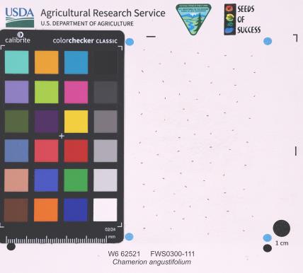 | | 2025 | | | | | | | Wild material | | 2192219 | W6 62521 |
| 98 | W6 62539 | FWS0300-154 | Liatris cylindracea Michx. | Michigan, United States | W6 |  | | 2025 | | | | | | | Wild material | The vegetative part of the population is likely dormant, though it is not possible to discern dormant individuals. Consequently, the above population size may be an underestimate. | 2192237 | W6 62539 |
| 99 | NA 89114 | TLM25-03 | Zanthoxylum clava-herculis L. | Texas, United States | NA | | | 2025 | COLLECTED | 07/09/2025 | Jackson County Road 113, Bergston Road, approximately 2.1 kilometers north of the junction with Jackson County Road 234; growing on the west side of the road along a fenceline running parallel to the road. | 29.00576600, -96.76298500 | 24 | Plants are growing in full sun to light shade along a fence line near where cattle graze and the dirt road. The area is disturbed, but somewhat overgrown since there is very little traffic on the road that is primarily used by farmers and ranchers to access their fields. Slope: 0 to 1 percent. Aspect: N/A. Soils: The soils of this area sampled are classified as Laewest clay, 0 to 1 percent slopes (LaA). The Laewest Series consists of very deep, moderately well drained soils that formed in clayey flood basin deposits on alluvial plains or deltas of the Beaumont Formation of Pleistocene Age. These nearly level to gently sloping soils are on broad flat coastal plains. Slope ranges from 0 to 8 percent. The solum thickness is more than 200 cm and ranges from slightly acidic on the surface to neutral in deeper pedons. This is a cyclic soil and undisturbed areas have gilgai microrelief with microhighs 15 to 30 cm higher than microlows. Distance from the center of the microhighs to the center of the microlows ranges from about 1.2 to 4.9 m. The microhigh makes up about 20 percent, the intermediate, or area between the knoll and depression about 50 percent, and the microlow about 30 percent. The amplitude of waviness between mollic colored materials in the upper part of the solum and the higher value colors in the lower part ranges from about 30 to 150 cm. When dry, the soil has cracks 1 to 5 cm wide at the surface and commonly 1 cm wide cracks extend to a depth of 1.2 m during the summer. The cracks remain open for less than 90 cumulative days in most years. Some pedons have an overwash of calcareous clay or silty clay 20 to 51 cm thick. (Source: California Soil Resource Lab/NRCS Official Soil Series Descriptions). Geology: The underlying geology of this area is Lizzie Formation of Quaternary, Middle Pleistocene age. It is comprised of sand, silt, clay, and minor amount of gravel. Iron oxide and iron-manganese nodules are common in zones of weathering; locally calcareous. Surface is fairly flat and featureless except for many shallow depressions and pimple mounds. Moore and Wermund (1993a) mapped three units--(1) alluvium undifferentiated as to texture and origin--includes meander belt, levee, crevasse splay, and distributary sand, and flood-basin mud deposits, about 60 m thick, (2) fine-grained channel facies (alluvial sand, silt, and clay) about 10-25 m thick, thicker seaward, and (3) fine-grained overbank facies (alluvial silt and clay) about 55-65 m thick, thicker seaward. Together, these deposits form a deltaic plain that parallels the Gulf Coast. Unit contains Pleistocene vertebrate fauna, dips seaward beneath the Beaumont Fm. and disconformably overlies deposits of the Pliocene and early Pleistocene Willis Formation. The deltaic plain is entrenched as much as 7 m by streams. In Hidalgo County (southernmost part of Texas) the unit underlies a semiarid plain, widely irrigated and cultivated. Unit is locally veneered with thin, discontinuous stabilized eolian sand. (Source: USGS Texas Geologic Map Data). | Wild material | | 2191653 | NA 89114 |
| 100 | Ames 36327 | Lick Creek Unit | Amelanchier arborea (F. Michx.) Fernald | Iowa, United States | NC7 |  | | 2025 | COLLECTED | 06/10/2025 | Shimek State Forest Lick Creek Unit just east of Farmington, T67N R7W NE ¼ Sec. 8 and Sec. 7 and also T68N R8W Sec. 25. | 40.62024500, -91.70427700 | 214 | Woodland edges. | Wild material | The native range of Amelanchier arborea is concentrated in the eastern half of the U.S. (Little, 1977). This accession represents a collection of A. arborea germplasm from the western region of the species native range, specifically the extreme southeastern corner of Iowa. Specimens sampled in nature ranging 15-35' in height. Typically smoothish bark, light grey in color. Peak flowering (white flowers) occuring usually in early April with orange, orange-red fall colors peaking typically end of September (southeastern Iowa). | 2191464 | Ames 36327 |
| 101 | NA 89077 | 2024RJLPA-003 | Viburnum acerifolium L. | Pennsylvania, United States | NA | | | 2024 | COLLECTED | 09/19/2024 | Birdell Road, near parking lot to trail where the road ends at Chambers Lake, which is part of Hibernia County Park. | 40.03559500, -75.85708600 | 187 | Plants are growing in deep shade of a dry deciduous forest dominated by Fagus grandifolia. Slope: 0 percent. Aspect: N/A. Geology: The underlying geology of this area is of Precambrian origin and characterized as Banded Mafic Gneiss. It is characterized as dark and fine to medium grained. This formation includes rocks of probable sedimentary origin; may be equivalent to "PZmgh." (Source: USGS Pennsylvania Geologic Map Data). Soils: The primary soil type in the area of this collection is classified as Neshaminy Series Silt Loam, very deep over mafic gneiss, 3 to 8 percent slopes (NvB). (Source: USDA-NRCS Official Soil Series Descriptions). EPA Ecoregion (Level III): Northern Piedmont (64). EPA Ecoregion (Level IV): Piedmont Uplands (64c). | Wild material | | 2169041 | NA 89077 |
| 102 | NA 89082 | 2024RJLPA-010 | Amorpha fruticosa L. | Pennsylvania, United States | NA | | | 2024 | COLLECTED | 09/22/2024 | Outcrops along the Susquehanna River, accessed from the Historic Lock 12 parking lot off of Pennsylvania Road 372. | 39.81481500, -76.32757900 | 34 | Plants are growing from part-sun to full sun in crevices of the outcrops and where organic debris has accumulated in between boulders along the Susquehanna River. The sites range from nearly xeric to dry mesic, at least on the surface. Plants are generally growing 4-10 m above the normal flow of the river; however, the Holtwood Dam is less than 1 kilometer upstream and debris found trapped in the boulders indicates that there is periodic flooding, at least, in the lower zone of 4+ meters or so above normal river flow. This habitat has a diverse assemblage of deciduous trees and shrubs as well as abundant herbaceous taxa. Slope: 0 to 25 percent. Aspect: Northeast (generally). Geology: The underlying geology of this area is probably of lower Paleozoic age and characterized as the Octoraro Formation. It includes albite-chlorite schist, phyllite, some hornblende gneiss, and granitized members. Soils: The area where this species occurs is right on the edge of two soil zones that transition from the river’s edge to mesic conditions upslope. The first is generally referred to as Rock Outcrop. This terrestrial matrix in which plants grow is largely exposed underlying rock geology with accumulated outwash, rock decomposition, and organic debris buildup. The second is Mt. Airy (80%) and Manor (20%) Series soils, 25 to 60 percent slopes, extremely stony (MRF). (Source: California Soil Resource Lab/NRCS Official Soil Series Descriptions). EPA Ecoregion (Level III): Northern Piedmont (64). EPA Ecoregion (Level IV): Piedmont Uplands (64c). | Wild material | | 2169046 | NA 89082 |
| 103 | NA 89083 | 2024RJLPA-012 | Rhododendron periclymenoides (Michx.) Shinners | Pennsylvania, United States | NA | | | 2024 | COLLECTED | 09/22/2024 | Outcrops along the Susquehanna River, accessed from the Historic Lock 12 parking lot off of Pennsylvania Road 372. | 39.81477400, -76.32807300 | 35 | Plants are growing from shade to part-sun and occasionally full sun in crevices of the outcrops and where organic debris has accumulated in between boulders along the Susquehanna River. The sites range from nearly xeric to mesic, at least on the surface. Plants are generally growing 4-10 m above the normal flow of the river; however, the Holtwood Dam is less than 1 kilometer upstream and debris found trapped in the boulders indicates that there is periodic flooding, at least, in the lower zone of 4+ meters or so above normal river flow. This habitat has a diverse assemblage of deciduous trees and shrubs as well as abundant herbaceous taxa. Slope: 0 to 60 percent. Aspect: Northeast (generally). Geology: The underlying geology of this area is probably of lower Paleozoic age and characterized as the Octoraro Formation. It includes albite-chlorite schist, phyllite, some hornblende gneiss, and granitized members. Soils: The area where this species occurs is right on the edge of two soil zones that transition from the river’s edge to mesic conditions upslope. The first is generally referred to as Rock Outcrop. This terrestrial matrix in which plants grow is largely exposed underlying rock geology with accumulated outwash, rock decomposition, and organic debris buildup. The second is Mt. Airy (80%) and Manor (20%) Series soils, 25 to 60 percent slopes, extremely stony (MRF). (Source: California Soil Resource Lab/NRCS Official Soil Series Descriptions). EPA Ecoregion (Level III): Northern Piedmont (64). EPA Ecoregion (Level IV): Piedmont Uplands (64c). | Wild material | | 2169047 | NA 89083 |
| 104 | NA 89084 | 2024RJLPA-013 | Physocarpus opulifolius (L.) Maxim. | Pennsylvania, United States | NA | | | 2024 | COLLECTED | 09/22/2024 | Outcrops along the Susquehanna River, accessed from the Historic Lock 12 parking lot off of Pennsylvania Road 372. | 39.81466300, -76.32833900 | 36 | Plants are growing from shade to part-sun where organic debris has accumulated in between boulders as well as further upslope in deeper mesic soils along the Susquehanna River. This habitat has a diverse assemblage of deciduous trees and shrubs as well as abundant herbaceous taxa. Slope: 10 to 25 percent. Aspect: Northeast (generally). Geology: The underlying geology of this area is probably of lower Paleozoic age and characterized as the Octoraro Formation. It includes albite-chlorite schist, phyllite, some hornblende gneiss, and granitized members. Soils: The area where this species occurs is right on the edge of two soil zones that transition from the river’s edge to mesic conditions upslope. The first is generally referred to as Rock Outcrop. This terrestrial matrix in which plants grow is largely exposed underlying rock geology with accumulated outwash, rock decomposition, and organic debris buildup. The second is Mt. Airy (80%) and Manor (20%) Series soils, 25 to 60 percent slopes, extremely stony (MRF). (Source: California Soil Resource Lab/NRCS Official Soil Series Descriptions). EPA Ecoregion (Level III): Northern Piedmont (64). EPA Ecoregion (Level IV): Piedmont Uplands (64c). | Wild material | | 2169048 | NA 89084 |
| 105 | NA 89085 | 2024RJLPA-014 | Rhododendron arborescens (Pursh) Torr. | Pennsylvania, United States | NA | | | 2024 | COLLECTED | 09/22/2024 | Outcrops along the Susquehanna River, accessed from the Historic Lock 12 parking lot off of Pennsylvania Road 372. | 39.81618100, -76.33069800 | 38 | Plants are growing from shade to part-sun and occasionally full sun in crevices of the outcrops and where organic debris has accumulated in between boulders along the Susquehanna River. The sites range from nearly xeric to mesic, at least on the surface. Plants are generally growing 4-10 m above the normal flow of the river; however, the Holtwood Dam is less than 1 kilometer upstream and debris found trapped in the boulders indicates that there is periodic flooding, at least, in the lower zone of 4+ meters or so above normal river flow. This habitat has a diverse assemblage of deciduous trees and shrubs as well as abundant herbaceous taxa. Slope: 0 to 75 percent. Aspect: Northeast (generally). Geology: The underlying geology of this area is probably of lower Paleozoic age and characterized as the Octoraro Formation. It includes albite-chlorite schist, phyllite, some hornblende gneiss, and granitized members. Soils: The area where this species occurs is right on the edge of two soil zones that transition from the river’s edge to mesic conditions upslope. The first is generally referred to as Rock Outcrop. This terrestrial matrix in which plants grow is largely exposed underlying rock geology with accumulated outwash, rock decomposition, and organic debris buildup. The second is Mt. Airy (80%) and Manor (20%) Series soils, 25 to 60 percent slopes, extremely stony (MRF). (Source: California Soil Resource Lab/NRCS Official Soil Series Descriptions). EPA Ecoregion (Level III): Northern Piedmont (64). EPA Ecoregion (Level IV): Piedmont Uplands (64c). | Wild material | | 2169049 | NA 89085 |
| 106 | NA 89086 | 2024RJLPA-015 | Ilex verticillata (L.) A. Gray | Pennsylvania, United States | NA | | | 2024 | COLLECTED | 09/22/2024 | Outcrops along the Susquehanna River, accessed from the Historic Lock 12 parking lot off of Pennsylvania Road 372. | 39.81656600, -76.33136600 | 38 | Plants are growing from part-sun to full sun in crevices of the outcrops and where organic debris has accumulated in between boulders along the Susquehanna River. The sites range from nearly xeric to dry mesic, at least on the surface. Plants are generally growing 4-10 m above the normal flow of the river; however, the Holtwood Dam is less than 1 kilometer upstream and debris found trapped in the boulders indicates that there is periodic flooding, at least, in the lower zone of 4+ meters or so above normal river flow. This habitat has a diverse assemblage of deciduous trees and shrubs as well as abundant herbaceous taxa. Slope: 0 to 10 percent. Aspect: Northeast (generally). Geology: The underlying geology of this area is probably of lower Paleozoic age and characterized as the Octoraro Formation. It includes albite-chlorite schist, phyllite, some hornblende gneiss, and granitized members. Soils: The area where this species occurs is right on the edge of two soil zones that transition from the river’s edge to mesic conditions upslope. The first is generally referred to as Rock Outcrop. This terrestrial matrix in which plants grow is largely exposed underlying rock geology with accumulated outwash, rock decomposition, and organic debris buildup. The second is Mt. Airy (80%) and Manor (20%) Series soils, 25 to 60 percent slopes, extremely stony (MRF). (Source: California Soil Resource Lab/NRCS Official Soil Series Descriptions). EPA Ecoregion (Level III): Northern Piedmont (64). EPA Ecoregion (Level IV): Piedmont Uplands (64c). | Wild material | | 2169050 | NA 89086 |
| 107 | NA 88679 | RJL2023PA-013 | Rhododendron prinophyllum (Small) Millais | Pennsylvania, United States | NA | | | 2023 | COLLECTED | 10/30/2023 | Southwest side of Dutch Mountain Road north of Pine Marsh Creek in Pennsylvania State Game Lands Number 66. | 41.48201500, -76.27286000 | 602 | Moist, well-drained habitat with good organic matter in part shade on a wooded slope next to the road. Slope: 5-10%. Aspect: East. The underlying geology of this area is of Mississippian origin and characterized as the Burgoon Formation. It is comprised of buff, medium-grained, cross bedded sandstone that includes shale and coal. In some places, it contains conglomerate at base as well as occasionally contains plant fossils; equivalent to Pocono Formation of Ridge and Valley province. (Source: USGS Pennsylvania Geologic Map Data). The primary soil type in the collection area is classified as Wellsboro Series. The Wellsboro Series consists of very deep, moderately well- and somewhat poorly-drained soils formed in till derived from red sandstone, siltstone, and shale. Slope ranges from 0 to 50 percent. Saturated hydraulic conductivity is moderately high or high in the mineral surface layer, subsurface layer, and upper part of the subsoil; and low or moderately low in the lower part of the subsoil (fragipan) and the substratum. Solum thickness is greater than 102 cm. Depth to the fragipan ranges from 36 to 76 cm. Depth to bedrock is 152 cm or more. Rock fragments of subangular and rounded sandstone, siltstone or shale range from 5 to 40 percent in the A and B horizons, and from 15 to 50 percent in the Bx and C horizons. Typically, rock fragments average about 5 to 25 percent by volume above the fragipan and 15 to 40 percent by volume in and below the fragipan. Reaction commonly ranges from very strongly acid through moderately acid. (Source: NRCS Web Soil Survey). | Wild material | | 2159070 | NA 88679 |
| 108 | Ames 36185 | APS/BP/2023/076/286 | Betula populifolia Marshall | Indiana, United States | NC7 |  | | 2023 | COLLECTED | 11/02/2023 | Indiana Dunes State Park just 3.40 miles northeast of Chesterton, T37N R5W NE 1/4 SE 1/4 SW 1/4 Sec. 18 | 41.65352700, -87.03831500 | 186 | Low depressions with some standing water. Woodland edge. | Wild material | Represents a disjunct population in northwest Indiana and the extreme western edge of the species native range. Trees sampled in nature averaging 30-45' in height with trunks ranging from 3" up to 8" DBH. Bark dull-white to grey. Typically multi-stemmed trunks. Leaves with acuminate tips and branches with typically one male catkin at terminal end of branches, but occassionally two male catkins. | 2159042 | Ames 36185 |
| 109 | Ames 36168 | Mount Magazine | Ptelea trifoliata L. | Arkansas, United States | NC7 |  | | 2023 | COLLECTED | 08/26/2023 | Mount Magazine State Park primarily localized to the northwest rim of the mountain along the trails heading west from Brown's Spring, T6N R25W Sec. 21. | 35.17130900, -93.65582200 | 786 | Top of sky-island mountain. Localized along the rims just above steep cliffs on north facing slopes. | Wild material | Plants in nature ranging from three to fifteen feet in height with peak bloom observed during the first week of May (2023). | 2158787 | Ames 36168 |
| 110 | W6 60969 | CA190B-198 | Symphoricarpos albus (L.) S. F. Blake var. laevigatus (Fernald) S. F. Blake | California, United States | W6 |  | | 2023 | | | | | | | Wild material | Pink and white flower color, white fruit | 2142607 | W6 60969 |
| 111 | W6 61375 | CBG- 10798 | Desmodium perplexum B. G. Schub. | Illinois, United States | W6 |  | | 2023 | | | | | | | Wild material | | 2142257 | W6 61375 |
| 112 | W6 61417 | CBG- 10852 | Verbesina alternifolia (L.) Britton ex Kearney | Illinois, United States | W6 |  | | 2023 | | | | | | | Wild material | | 2142299 | W6 61417 |
| 113 | W6 61418 | CBG- 10853 | Agastache scrophulariifolia (Willd.) Kuntze | Illinois, United States | W6 |  | | 2023 | | | | | | | Wild material | | 2142300 | W6 61418 |
| 114 | Ames 36017 | AS/GD/2023/002/212 | Gymnocladus dioicus (L.) K. Koch | Wisconsin, United States | NC7 |  | | 2023 | | | | | | | Wild material | Kentucky coffeetree in Wisconsin is rather rare. The Wisconsin Natural Heritage Inventory Program currently (2023) lists this taxon in Wisconsin as a species of concern with a state rank of S2 (Imperiled in Wisconsin due to a restricted range, few populations or occurrences, steep declines, severe threats, or other factors.) This accession represents genetics from a localized population with a near equal porportion of male and female specimens. While there are other known locations along the Wisconsin River, this population is producing seeds. The other known locations represent single clones that are distant enough from other existing clones that prevent the transfer of pollen and thus lack the ability to produce seed or will rarely produce. | 2141550 | Ames 36017 |
| 115 | NA 87352 | (open-pollinated seed of Lowei Group) | Ilex myrtifolia Walter | Florida, United States | NA | | | 2023 | COLLECTED | 12/31/2022 | Santa Rosa County: Midway: Pensacola State College, South Santa Rosa Center (Santa Rosa County School District), 1/4 mile south of Highway 98. Coordinates for two plants given; second plant's coordinates are 30.3959 deg. N, 87.0097 deg. W. | 30.39570000, -87.01290000 | 0 | Very interesting site. Interior flooded wetland dominated by Ilex cassine and Ilex myrtifolia. Xeric ridges in wetland have both Cladonia cristella and Cladonia perforata, xeric edges dominated by Pinus clausa. Cyrilla, in seed, consistently dwarfed 16 inches to 6 feet tall, probably due to hydrological and edaphic factors. | Wild material | Received as Ilex myrtifolia (yellow fruit); accessioned at USNA as Ilex myrtifolia (open-pollinated seed of Lowei Group). Note: while these seeds were collected from yellow-fruited individuals, the parent plants were open-pollinated. The yellow fruit trait is likely to be recessive, so some seedlings may be only heterogeneous for yellow fruit. -SBL [As of late November 2025, all three female seedlings at USNA that have borne fruit are red-fruited; one might be a lighter, more orange-red tone than the other two.] | 2141643 | NA 87352 |
| 116 | NA 88574 | RJLSEUS2022-047 | Rhododendron austrinum (Small) Rehder | Florida, United States | NA | | | 2023 | COLLECTED | 12/15/2022 | Plants are growing along a several mile stretch of the Yellow River and accessed by boat via the Yellow River Boat Ramp on the east side of Florida State Hwy 87. The species is found frequently along several miles of the Yellow River. | 30.58133600, -86.89953900 | 2 | Plants are found growing in part-shade to shade along areas of the river where natural levies, 1-3 meters tall, have formed, depositing sand and organic matter. The plants grow well-above normal flow of the river in well-drained to dry conditions. Even so, they are periodically subjected to inundation from floodwaters.
Soils: The underlying geology of this area is classified as Alluvium, of Pleistocene/Holocene origin and consists of undifferentiated Quaternary sediments of varying thickness including siliciclastics, organics and freshwater carbonates. The siliciclastics are light gray, tan, brown to black, unconsolidated to poorly consolidated, clean to clayey, silty, unfossiliferous, variably organic-bearing sands to blue green to olive green, poorly to moderately consolidated, sandy, silty clays. Organics occur as plant debris, roots, disseminated organic matrix and beds of peat. Freshwater carbonates, often referred to as marls in the literature, are scattered.
Source: USGS Florida Geologic Map Data (https://mrdata.usgs.gov/geology/state/state.php?state=fl)
The surface soil profile of this area is primarily Bibb-Kinston Series Association. Bibb Series soils are coarse-loamy, sandy, acid soils that are poorly drained. They are soils of flood plains and streams subject to frequent flooding. These are found in association with Kinston Series soils that are fine-loamy, sandy, acid soils of flood plains and stream subject to frequent flooding. The Bibb-Kinston Association ranges from 1-1.5 meters thick and is strongly acid.
Source: Soil Survey of Santa Rosa County and NRCS Web Soil Survey (https://www.nrcs.usda.gov/Internet/FSE_MANUSCRIPTS/florida/FL113/0/SantaRosa.pdf and https://websoilsurvey.sc.egov.usda.gov/App/WebSoilSurvey.aspx) | Wild material | Yellow River Pink Austrinum | 2140792 | NA 88574 |
| 117 | NA 89039 | RJL2022IL-001 | Ptelea trifoliata L. | Illinois, United States | NA | | | 2022 | COLLECTED | 09/28/2022 | Site of plant habitat is located at 823 E Co Rd 1220, Hamilton, IL 62341 which is the property where Jacob's Geode Shop and Mine is located. This species is scattered and relatively common throughout the woodlands on this site. | 40.37848400, -91.35390200 | 175 | Plants growing in shade to part-shade of deciduous woodlands above a small creek.
Soils: The underlying geology of this area is of Mississippian origin and comprised of Warsaw Formation and Salem Limestone. Major lithological components include limestone that can be shaly, oolitic, bioclastic, or cherty. Minor lithological components include siltstone that can contain geodes or drusy quartz and can be calcareous.
Source: USGS Illinois Geologic Map Data (https://mrdata.usgs.gov/geology/state/sgmc-unit.php?unit=ILMws%3B0)
The surface soil profile of this area is Coffeen silt loam, 0 to 2 percent slopes, that are frequently flooded. The Coffeen series consists of very deep, somewhat poorly drained, moderately permeable soils on flood plains, low terraces or benches, toe slopes, and alluvial fans. They formed in silty alluvium. Much of the alluvium is of local origin derived from the nearby loess-covered uplands.
Source: NRCS Web Soil Survey (https://websoilsurvey.sc.egov.usda.gov/App/WebSoilSurvey.aspx) | Wild material | | 2139604 | NA 89039 |
| 118 | NA 89033 | RJL2022MD-010 | Clethra alnifolia L. | Maryland, United States | NA | | | 2022 | COLLECTED | 09/15/2022 | Plants growing in low woodlands at the end of Greenway Avenue near a boat dock that leads to the Pocomoke River, adjacent to Winter Quarters Golf Course, Pocomoke City. Plants common throughout the wetland area as well as mesic edges of the woodlands. | 38.08305100, -75.56527800 | | Plants growing in the flood plain of the Pocomoke River in shade to part sun of a mixed deciduous and evergreen bottomland habitat about 10 meters from the edge of the golf course fairway. The habitat is a mucky swamp edge habitat next to the Pocomoke River, most of which seems wet year-round and grades slightly upslope to more mesic conditions.
The underlying geology of this area is comprised of Quaternary Deposits of Wisconsin to Holocene origin. The composition is primarily undifferentiated gray to buff sand and gravel, gray to brown lignitic silt and clay, occasional boulders, and rare shell beds. Surficial deposits occur as shell-bearing estuarine clays and silts.
Source: USGS Maryland Geologic Map Data https://mrdata.usgs.gov/geology/state/sgmc-unit.php?unit=MDQdu%3B5
The surface soil profile of this habitat is classified as Puckum Muck which is frequently flooded. These highly saturated soils are found in flats, depressions and swales. The soil reaction of Puckum Muck is extremely acid to strongly acid throughout the profile. The depth to bedrock is generally greater than 150 cm. Wood fragments comprise 0-25%, by volume of the Puckum Muck throughout the profile which includes mostly twigs, branches, logs, or stumps and are 1.5-30 cm in diameter. The composition of these highly saturated soils, are classified as muck (sapric soil material) or mucky peat (hemic soil material) throughout most of the upper 150 cm and may contain thin layers of mucky silt loam, silty clay loam, sandy loam and/or sand.
Source: NRCS Web Soil Survey (https://websoilsurvey.sc.egov.usda.gov/App/WebSoilSurvey.aspx) | Wild material | | 2139598 | NA 89033 |
| 119 | NA 89032 | RJL2022MD-009 | Rhododendron viscosum (L.) Torr. | Maryland, United States | NA | | | 2022 | COLLECTED | 09/15/2022 | Plants growing in low woodlands at the end of Greenway Avenue near a boat dock that leads to the Pocomoke River, adjacent to Winter Quarters Golf Course, Pocomoke City. Plants scattered throughout the wetland area. Infrequent, but regularly found. | 38.08235200, -75.56566500 | 1 | Plants growing in the flood plain of the Pocomoke River in part shade to shade of a mixed deciduous and evergreen bottomland habitat about 10 meters from the edge of the golf course fairway. The habitat is a mucky swamp edge habitat next to the Pocomoke River, most of which seems wet year-round.
The underlying geology of this area is comprised of Quaternary Deposits of Wisconsin to Holocene origin. The composition is primarily undifferentiated gray to buff sand and gravel, gray to brown lignitic silt and clay, occasional boulders, and rare shell beds. Surficial deposits occur as shell-bearing estuarine clays and silts.
Source: USGS Maryland Geologic Map Data https://mrdata.usgs.gov/geology/state/sgmc-unit.php?unit=MDQdu%3B5
The surface soil profile of this habitat is classified as Puckum Muck which is frequently flooded. These highly saturated soils are found in flats, depressions and swales. The soil reaction of Puckum Muck is extremely acid to strongly acid throughout the profile. The depth to bedrock is generally greater than 150 cm. Wood fragments comprise 0-25%, by volume of the Puckum Muck throughout the profile which includes mostly twigs, branches, logs, or stumps and are 1.5-30 cm in diameter. The composition of these highly saturated soils, are classified as muck (sapric soil material) or mucky peat (hemic soil material) throughout most of the upper 150 cm and may contain thin layers of mucky silt loam, silty clay loam, sandy loam and/or sand.
Source: NRCS Web Soil Survey (https://websoilsurvey.sc.egov.usda.gov/App/WebSoilSurvey.aspx) | Wild material | | 2139597 | NA 89032 |
| 120 | WLP 2705 | Eagle Creek | Crataegus wootoniana Eggl. | New Mexico, United States | NA |  | | 2022 | COLLECTED | 09/08/2022 | Eagle Creek, along Upper Eagle Creek Road (past gate to cabins) approximately 1.5 miles northwest of intersection with Ski Run Road. T10S R12E N 1/2 S 1/4 Sec. 35. | 33.40777700, -105.73980900 | 2422 | Canyon bottom above creek. | Wild material | Shrubs to approximately 15 feet in height with a tight clump forming growth habit and arching stems. | 2139678 | WLP 2705 |
| 121 | Ames 35951 | AS/ML/2022/020/151 | Monarda lindheimeri Engelm. & A. Gray | Texas, United States | NC7 |  | | 2022 | COLLECTED | 08/07/2022 | Located northwest of Navasota approximately 5.60 miles along Old Highway 6. | 30.44628200, -96.15333200 | 67 | Powerline cut. | Wild material | Accession consisting of both white flowering specimens and multi-colored (pinkish) flowering specimens. Inventory 01 represented as rather robust plants up to 40" tall that display a rather to somewhat clump type growth habit (possibly due to growing in more of a prairie habitat/full sun), but also includes adjacent specimens that are rhizomatous. Inventory 02 represents a more rhizomatous growth habit and shorter in height (e.g. less than 20" tall). Plants sampled ranging from 1.0-4.5' in height. | 2140541 | Ames 35951 |
| 122 | Ames 35881 | Reichelt Unit | Heuchera richardsonii R. Br. | Iowa, United States | NC7 |  | | 2022 | COLLECTED | 06/30/2022 | Reichelt Unit of Rock Creek State Park on south side of US highway 6 located 7.70 miles west, southwest of Grinnell, T80N R17W SE ¼ SE ¼ Sec. 30. | 41.70311300, -92.86569100 | 274 | Prairie remnant. Hilltop/knoll. | Wild material | Plants in nature measuring approximately six to eight inches in height with flowering stalks reaching up to three feet in height. | 2138180 | Ames 35881 |
| 123 | Ames 35806 | Reichelt Prairie | Salix humilis Marshall var. tristis (Aiton) Griggs | Iowa, United States | NC7 |  | | 2022 | COLLECTED | 05/16/2022 | Reichelt Unit of Rock Creek State Park on south side of US highway 6 approximately 7.70 miles west, southwest of Grinnell, T80N R17W SE ¼ SE ¼ Sec. 30. | 41.70311300, -92.86569100 | 274 | Xeric prairie remnant. Hilltop/knoll. | Wild material | Plants sampled in nature measuring 2.0-4.0 feet in height. Specimens noted during peak flowering and seed dispersal on 21 April and 17 May (2022), respectively. Some plants upright and some rather prostrate. Site was mowed in winter 2020/2021 winter resulting in significant flowering in 2022. In cultivation (central Iowa), plants are extremely short and compact where after two field seasons plants are rather uniform and topping out at a height of 2.5'. Dense suckering immediately surrounding clump/base of plant. Peak fall color (central Iowa) occurring in mid-November. | 2137912 | Ames 35806 |
| 124 | OPGC 8518 | MARSB-405 | Euthamia caroliniana (L.) Greene ex Porter & Britton | New York, United States | OPGC | | | 2021 | | | | | | | Wild material | | 2137174 | OPGC 8518 |
| 125 | W6 59994 | NCBG-388 | Sorghastrum nutans (L.) Nash | Maryland, United States | W6 | | | 2021 | | | | | | | Wild material | | 2132876 | W6 59994 |
| 126 | W6 60048 | NCBG-580 | Schizachyrium scoparium (Michx.) Nash | Maryland, United States | W6 | | | 2021 | | | | | | | Wild material | | 2132929 | W6 60048 |
| 127 | W6 60090 | MARSB-410 | Tridens flavus (L.) Hitchc. | New York, United States | W6 | | | 2021 | | | | | | | Wild material | | 2137175 | W6 60090 |
| 128 | W6 60131 | NEWFS-464 | Rhus typhina L. | Massachusetts, United States | W6 | | | 2021 | | | | | | | Wild material | | 2137216 | W6 60131 |
| 129 | NA 86885 | RJL2021PA-004 | Ilex verticillata (L.) A. Gray | Pennsylvania, United States | NA | | | 2021 | COLLECTED | 11/16/2021 | Plants growing in woodlands along a small unnamed creek corridor dumping into the Middle Branch White Clay Creek in Goddard Park, West Grove Pennsylvania, off of Wickerton Road, Chester County. | 39.81063861, -75.82750806 | 124 | Plants are growing in a range of habitats from mesic woodlands to saturated streamside settings of deciduous woodlands that drain toward the Middle Branch White Clay Creek. Plants grow in high understory shade with dappled to indirect sunlight. The only female (fruiting) plants were found in areas along the creek where soils are moist to saturated. Numerous male specimens were found in the areas described above. Soils: Soils found in the areas where this collection was made are comprised primarily of Baile silt loam (Ba), Hatboro silt loam (Ha), and Glenelg silt loam, 8 to 15 percent slopes (GgC). Baile silt loam consists of very deep, poorly drained, moderately low to moderately high saturated hydraulic conductivity, soils on upland depressions and footslopes that were formed in local alluvium over residuum from acid crystalline rocks, chiefly mica schist and granitized schist and gneiss; slope ranges from 0 to 8 percent. Hatboro silt loam consists of very deep and poorly drained soils formed in deposited alluvium derived from metamorphic and crystalline rock. They are on flood plains. Slopes range from 0 to 3 percent. Glenelg silt loam, 8 to 15 percent slopes consists of very deep, well drained soils formed in residuum weathered from micaceous schist on uplands of the Blue Ridge and the Northern Piedmont. This soil is undifferentiated, mostly poorly drained sandy bottomland soils intermingled with decomposing organic litter and eroded silts and clays due to erosion. Slope: 0 to 15% Aspect: Variable. | Wild material | | 2123125 | NA 86885 |
| 130 | WLP 1731 | RJL2021PA-001 | Viburnum acerifolium L. | Pennsylvania, United States | NA | | | 2021 | COLLECTED | 11/05/2021 | Plants growing in woodlands above a small unnamed creek that dumps into the Middle Branch White Clay Creek in Goddard Park, West Grove Pennsylvania, off of Wickerton Road, Chester County. | 39.80462083, -75.82888750 | 103 | Plants growing in a mesic, well-drained habitat of deciduous woodlands, for the most part, above the riparian zone that drains toward a small unnamed creek that feeds into the Middle Branch White Clay Creek. Plants are growing in high understory shade with very little direct sun during most of the day. The remnant woodlands exist mostly along the steep slopes, wetlands and seeps of seasonal and year-round creeks flowing into the Middle Branch White Clay Creek. The woodlands are bordered by numerous housing developments and land converted to meadows; hence there is significant first order edge that is heavily impacted by invasive plant intrusion. Soils: Soils are classified as Glenelg silt loam, 8 to 15% slopes (GgC); this series consists of very deep, well drained soils formed in residuum weathered from micaceous schist on uplands of the Blue Ridge and the Northern Piedmont. Saturated hydraulic conductivity is moderately high in the subsoil and moderately high to high in the substratum. This upper horizon of this soil is undifferentiated, mostly poorly drained sandy bottomland soils intermingled with decomposing organic litter and eroded silts and clays due to erosion. Slope: 8 to 15% Aspect: West. | Wild material | | 2123080 | WLP 1731 |
| 131 | WLP 1732 | RJL2021PA-002 | Viburnum prunifolium L. | Pennsylvania, United States | NA | | | 2021 | COLLECTED | 11/05/2021 | Plants growing in woodlands along a small unnamed creek corridor dumping into the Middle Branch White Clay Creek in Goddard Park, West Grove Pennsylvania, off of Wickerton Road, Chester County. | 39.80462083, -75.82888750 | 102 | Plants are growing in a range of habitats from drier upland woods to moist creekside settings of deciduous woodlands that drain toward the Middle Branch White Clay Creek. Plants grow in part shade to high understory shade with dappled to indirect direct sunlight. Plants achieve their largest size and fruiting potential in part sun of the riparian zone of the creek where woodland canopy is thinner. Soils: Soils found in the areas where this collection was made are comprised primarily of flood plain Hatboro silt loam (Ha) and well-drained, upland Glenelg silt loam, 8 to 15 percent slopes (GgC). Hatboro silt loam consists of very deep and poorly drained soils formed in deposited alluvium derived from metamorphic and crystalline rock. They are on flood plains. Slopes range from 0 to 3 percent. Glenelg silt loam, 8 to 15 percent slopes consists of very deep, well drained soils formed in residuum weathered from micaceous schist on uplands of the Blue Ridge and the Northern Piedmont. This soil is undifferentiated, mostly poorly drained sandy bottomland soils intermingled with decomposing organic litter and eroded silts and clays due to erosion. Slope: 0 to 15% Aspect: Variable. | Wild material | | 2123098 | WLP 1732 |
| 132 | WLP 1733 | RJL2021PA-003 | Viburnum dentatum L. | Pennsylvania, United States | NA | | | 2021 | COLLECTED | 11/05/2021 | Plants growing in woodlands along a small unnamed creek corridor dumping into the Middle Branch White Clay Creek in Goddard Park, West Grove Pennsylvania, off of Wickerton Road, Chester County. | 39.80522167, -75.82928139 | 107 | Plants are growing in a range of habitats from mesic woodland to moist creekside settings of deciduous woodlands that drain toward the Middle Branch White Clay Creek. Plants grow in high understory shade with dappled to indirect sunlight. Soils: Soils found in the areas where this collection was made are comprised primarily of flood plain Hatboro silt loam (Ha) and well-drained, upland Glenelg silt loam, 8 to 15 percent slopes (GgC). Hatboro silt loam consists of very deep and poorly drained soils formed in deposited alluvium derived from metamorphic and crystalline rock. They are on flood plains. Slopes range from 0 to 3 percent. Glenelg silt loam, 8 to 15 percent slopes consists of very deep, well drained soils formed in residuum weathered from micaceous schist on uplands of the Blue Ridge and the Northern Piedmont. This soil is undifferentiated, mostly poorly drained sandy bottomland soils intermingled with decomposing organic litter and eroded silts and clays due to erosion. Slope: 0 to 15% Aspect: Variable. | Wild material | | 2123124 | WLP 1733 |
| 133 | OPGC 7574 | Ledges State Park | Solidago ulmifolia Muhl. ex Willd. | Iowa, United States | OPGC |  | | 2021 | COLLECTED | 09/15/2021 | Ledges State Park, approximately 4.5 miles south of Boone, T83N R26W Sec. 20 | 41.98266200, -93.89314800 | 287 | Understory of hardwood forest. | Wild material | Plants in nature were generally two to three feet in height, growing in sparsely spreading colonies. This population has a large amount of diversity for flowering time with the first plants in the population beginning to flower on 22 July 2021 and the last plants to flower were still blooming at the end of September. Some plants in the population had a muted red fall foliage color at the end of October 2021. This accession represents genetics from near the northwest edge of the species range of occurence. | 2132828 | OPGC 7574 |
| 134 | OPGC 7575 | Ledges State Park | Solidago flexicaulis L. | Iowa, United States | OPGC |  | | 2021 | COLLECTED | 10/03/2021 | Ledges State Park, approximately 4.5 miles south of Boone, T83N R26W Sec. 21 | 41.98338100, -93.89052800 | 288 | Understory of hardwood forest. | Wild material | Plants in nature ranged in height from approximately one to three feet, growing in sparsely spreading colonies. Peak bloom in 2021 occurred near 15 September. Several specimens had branched inflorescences. | 2132829 | OPGC 7575 |
| 135 | Ames 35750 | Ames 35750 | Blephilia ciliata (L.) Benth. | Iowa, United States | NC7 |  | | 2021 | COLLECTED | 09/27/2021 | Located approximately 3 miles south, southeast of Fairfield, T71N R9W SW1/4 Sec. 7 | 40.96338000, -91.94686900 | 223 | Woodland openings/edges, disturbed areas | Wild material | | 2122068 | Ames 35750 |
| 136 | Ames 35734 | Ledges State Park | Teucrium canadense L. | Iowa, United States | NC7 |  | | 2021 | COLLECTED | 08/23/2021 | Ledges State Park located approximately 4.75 miles south of Boone T83N R26W Sec. 16 & 21 | 41.99262400, -93.87724800 | 330 | Edges of woods | Wild material | | 2120338 | Ames 35734 |
| 137 | OPGC 8343 | CBG-10575 | Euthamia graminifolia (L.) Nutt. | Illinois, United States | OPGC | | | 2021 | | | | | | | Wild material | Plant numbers sampled estimated. | 2120166 | OPGC 8343 |
| 138 | W6 59183 | CBG-10474 | Leersia virginica Willd. | Illinois, United States | W6 | | | 2021 | | | | | | | Wild material | | 2120104 | W6 59183 |
| 139 | Ames 35667 | Kankakee Sands Preserve | Aronia ×prunifolia (Marshall) Rehder | Illinois, United States | NC7 |  | | 2021 | COLLECTED | 05/04/2021 | Kankakee Sands Preserve located approximately 2.3 miles southwest of Wilmington in Custer Township, T32N R9E NE 1/4 Sec. 11 | 41.27166000, -88.15701800 | 170 | Sand shrub prairie | Wild material | Genotypes noted in nature were averaging 5.0-6.0' in height, relatively upright in growth habit and extremely dense suckering. Numerous clones noted covering expansive areas (e.g. 30 yards by 20 yards, etc.). Variation in branching and glossiness of leaves noted across genotypes present in nature. | 2115976 | Ames 35667 |
| 140 | Ames 35668 | Iroquois County Conservation Area | Aronia ×prunifolia (Marshall) Rehder | Illinois, United States | NC7 |  | | 2021 | COLLECTED | 05/05/2021 | Iroquois County Conservation Area located approximately 4.5 miles northeast of Beaverville in Beaverville Township, T29N R11W NE1/4 Sec. 22 | 40.99154700, -87.58073200 | 198 | Woodland edge of wet sand prairie | Wild material | Wide variety of genotypes noted in nature averaging 3.5-7' in height. Some growing in shade of oak forest were sparse suckering and open branching compared to open grown specimens that were extremely dense with suckers. | 2115977 | Ames 35668 |
| 141 | OPGC 8168 | NEWFS-410 | Euthamia graminifolia (L.) Nutt. | Maine, United States | OPGC | | | 2021 | | | | | | | Wild material | Leaf blades with few or inconspicuous resin glands, usually 3-12mm wide, plants varying from glabrous to conspicuously pubescent on stem/abaxial leaf surfaces, axillary fasicles if present, usually poorly developed and sparse. | 2115650 | OPGC 8168 |
| 142 | W6 57661 | CA180-208 | Prunella vulgaris L. | California, United States | W6 | | | 2020 | | | | | | | Wild material | SOS 92nd Shipment | 2104959 | W6 57661 |
| 143 | W6 57584 | NCBG-671 | Ageratina altissima (L.) R. M. King & H. Rob. var. altissima | Maryland, United States | W6 |  | | 2019 | | | | | | | Wild material | | 2098508 | W6 57584 |
| 144 | GPRU 168 | MARSB-577 | Prunus serotina Ehrh. | New York, United States | GEN |  | | 2019 | | | | | | | Wild material | | 2097661 | GPRU 168 |
| 145 | OPGC 7902 | MARSB-405 | Euthamia caroliniana (L.) Greene ex Porter & Britton | New York, United States | OPGC |  | | 2019 | | | | | | | Wild material | | 2097616 | OPGC 7902 |
| 146 | OPGC 7903 | MARSB-411 | Asclepias tuberosa L. | New York, United States | OPGC |  | | 2019 | | | | | | | Wild material | | 2097619 | OPGC 7903 |
| 147 | W6 57099 | MARSB-246 | Tridens flavus (L.) Hitchc. | New York, United States | W6 |  | | 2019 | | | | | | | Wild material | | 2097538 | W6 57099 |
| 148 | W6 57179 | MARSB-409 | Eupatorium hyssopifolium L. | New York, United States | W6 |  | | 2019 | | | | | | | Wild material | | 2097618 | W6 57179 |
| 149 | Ames 35216 | Potato Creek SP | Monarda sp. | Indiana, United States | NC7 |  | | 2019 | COLLECTED | 09/02/2019 | Potato Creek State Park located approximately 2.6 miles northeast of North Liberty, T36N R1E extreme eastern edge of NW 1/4 SW 1/4 Sec. 23. | 41.55439400, -86.38375900 | 222 | Degraded floodplain, along sides of elevated road bed. | Wild material | This taxa is currently undescribed and according to Campbell and Medley in The atlas of vascular plants in Kentucky (Accessed 06 September 2019) was provisionally named Monarda serotina by R.T. Simmers. Described as a broad-leaved form of M. fistulosa, generally intermediate between M. fistulosa and M. clinopodia, with probable hybrid origin. Typcial habitat is mesic woods and edges on lowlands. In contrast to M. fistulosa, this taxon has longer petioles (usually 2-3 cm versus 0.5-2.0 cm), lower leaf surfaces with scattered spreading hairs, and corollas are paler pink at tips to almost white with peak flowering occurring prior to M. fistulosa by approximately 1-2 weeks. Leaves are rather rugose, where upper leaf tissue between veins is visibly raised. This accession represents genetics from northern Indiana (Potato Creek State Park). Plants at the collection site in nature peaked flowering near 8 July 2019 where flower colors were more lavender in sun but pale in shade (Namestnik, S., personal communication, 15 July 2020). Peak fruiting occurs mid-August. Average height of plants sampled in nature estimated at 4.5' in height. | 2097752 | Ames 35216 |
| 150 | NA 88071 | NEWFS-610 | Clethra alnifolia L. | Connecticut, United States | NA |  | | 2019 | | | | | | | Wild material | | 1976301 | NA 88071 |
| 151 | OPGC 7400 | NEWFS-447 | Asclepias syriaca L. | Maine, United States | OPGC |  | | 2019 | | | | | | | Wild material | | 1976265 | OPGC 7400 |
| 152 | OPGC 7402 | NEWFS-486 | Euthamia graminifolia (L.) Nutt. | Massachusetts, United States | OPGC |  | | 2019 | | | | | | | Wild material | | 1976275 | OPGC 7402 |
| 153 | W6 56235 | NEWFS-464 | Rhus typhina L. | Massachusetts, United States | W6 |  | | 2019 | | | | | | | Wild material | | 1976270 | W6 56235 |
| 154 | WLP 243 | OWE-005 | Abies grandis (Douglas ex D. Don) Lindl. | Oregon, United States | NA | | | 2019 | COLLECTED | 08/31/2018 | Josephine County; ; Rogue River-Siskiyou National Forest: Page Mountain, north of National Forest Service Road 015. | 42.01076000, -123.56506000 | 1420 | Coniferous forest; 1/4 shade. | | Old A. grandis scattered, including occasional snags, in old Pseudotsuga menziesii forest. Many of the oldest trees scarred by fires. 200 seeds collected from one individual (collected from ground). Species common, with uniform distribution. | 2109042 | WLP 243 |
| 155 | OPGC 6539 | MARSB-445 | Solidago sempervirens L. | New Jersey, United States | OPGC |  | | 2018 | | | | | | | Wild material | Solidago sempervirens | 1964772 | OPGC 6539 |
| 156 | W6 53022 | CBG-6586 | Carex cephalophora Muhl. ex Willd. | Illinois, United States | W6 |  | | 2017 | | | | | | | Wild material | | 1954773 | W6 53022 |
| 157 | Ames 34052 | PB1701 | Betula papyrifera Marshall | Minnesota, United States | NC7 |  | | 2017 | COLLECTED | 09/16/2017 | Detroit Mountain area just east of Detroit Lakes approximately 2.9 miles, T139N R40W SW 1/4 NE 1/4 and NE 1/4 NE 1/4 NW 1/4 Sec. 21, Becker County | 46.81210900, -95.78208300 | 457 | Mixed deciduous woods. | Wild material | | 1954341 | Ames 34052 |
| 158 | Ames 34015 | Ames 34015 | Cornus rugosa Lam. | Minnesota, United States | NC7 | | | 2017 | COLLECTED | 08/23/2017 | Smoky Hills State Forest between Snellman and Osage, T139N R37W Sec. 2, 9, 11, and 14 and also T140N R37W Sec. 26 and 34. | 46.89278300, -95.35163300 | 501 | Mixed pine and deciduous moist woods. | Wild material | | 1953929 | Ames 34015 |
| 159 | Ames 33983 | JDC/FQ/2017/039/793 | Fraxinus quadrangulata Michx. | Kentucky, United States | NC7 |  | | 2017 | COLLECTED | 07/11/2017 | Griffith Woods and surrounding area approximately 6.2 miles just southwest of Cynthiana, Harrison County | 38.32601000, -84.35295800 | 281 | Recognized as the best remnant of ancient Bluegrass woodland containing numerous mature, open-grown specimens. | Wild material | | 1950066 | Ames 33983 |
| 160 | W6 51793 | OR110-838 | Alnus rhombifolia Nutt. | Oregon, United States | W6 | | | 2017 | | | | | | | Wild material | | 1943640 | W6 51793 |
| 161 | W6 51644 | CBG-5428 | Chamaenerion angustifolium (L.) Scop. subsp. angustifolium | Colorado, United States | W6 | | | 2016 | | | | | | | Wild material | | 1942774 | W6 51644 |
| 162 | WLP 1976 | ME2016-023 | Zelkova carpinifolia (Pall.) K. Koch | Imereti, Georgia | NA | | | 2016 | COLLECTED | 10/11/2016 | Imereti mkhare (region): Zestafoni (municipality/district): Near Tklapivake village. | 42.16415000, 43.07031000 | 257 | Roadside deciduous woodland patch. Slope: 5-10 percent. Aspect: Southwest. | Wild material | | 1952620 | WLP 1976 |
| 163 | WLP 873 | NA 84101 | Celtis caucasica Willd. | Georgia | NA | | | 2016 | COLLECTED | 09/27/2016 | Vicinity of the ruins of the medieval fortress Samshvilde. | 41.50656000, 44.50271000 | 793 | Thinned woodland combined with scrub and dry grassland. | | | 1953465 | WLP 873 |
| 164 | WLP 1424 | ME2015-002 | Ostrya carpinifolia Scop. | Samtskhe-Javakheti, Georgia | NA | | | 2015 | COLLECTED | 08/17/2015 | Borjomi (municipality/district): west of the village of Rveli. | 41.87363000, 43.40531000 | 840 | Deciduous woodland. Slope: 0 to 8 percent. Aspect: Southeast. | Wild material | | 1940412 | WLP 1424 |
| 165 | Ames 32963 | JDC/BA/2015/049/706 | Betula alleghaniensis Britton | Iowa, United States | NC7 | | | 2015 | COLLECTED | 09/14/2015 | Bixby State Preserve, T91N R5W extreme southern edge of Sec. 23 basically restricted to W 1/2 of Sec. 23. | 42.67470300, -91.39917300 | 308 | North-facing algific talus slope (45-60 degrees) adjacent to Bear Creek. Moist deciduous woods. Growing in association with Diervilla lonicera, Hamamelis virginiana, Corylus sp., Viburnum opulus var. americanum, Cornus rugosa (few), Cornus alternifolia, Fraxinus nigra, Quercus rubra, Viburnum lentago, Ribes sp., Rubus idaeus subsp. strigosus, Rhamnus alnifolia (few), Rosa sp., Taxus canadensis, Prunus virginiana, Impatiens sp., Dirca palustris, and Pinus strobus (few). | Wild material | | 1927433 | Ames 32963 |
| 166 | W6 49523 | CBG-2460 | Nothocalais cuspidata (Pursh) Greene | Colorado, United States | W6 |  | | 2015 | | | | | | | Wild material | | 1926158 | W6 49523 |
| 167 | W6 49550 | CBG-2497 | Allium textile A. Nelson & J. F. Macbr. | Colorado, United States | W6 |  | | 2015 | | | | | | | Wild material | | 1926023 | W6 49550 |
| 168 | Ames 34773 | AK930-483 | Potentilla norvegica L. | Alaska, United States | NC7 |  | | 2015 | COLLECTED | 09/11/2012 | Elliot Highway just south of Highway 2 and 11 intersection (Mile marker 78.5, pulloff). | 65.44436000, -148.78236000 | 268 | Disturbed margin of road at edge of mixed broadleaf/white spruce forest | Wild material | | 1923870 | Ames 34773 |
| 169 | W6 48958 | AK930-486 | Calamagrostis canadensis (Michx.) P. Beauv. | Alaska, United States | W6 |  | | 2015 | | | | | | | Wild material | | 1923873 | W6 48958 |
| 170 | W6 48959 | AK930-487 | Koenigia alpina (All.) T. M. Schust. & Reveal | Alaska, United States | W6 |  | | 2015 | | | | | | | Wild material | | 1923874 | W6 48959 |
| 171 | W6 48814 | MARSB-115 | Aristida purpurascens Poir. | New Jersey, United States | W6 |  | | 2015 | | | | | | | Wild material | | 1922907 | W6 48814 |
| 172 | W6 48864 | MARSB-62 | Juncus effusus L. | West Virginia, United States | W6 |  | | 2015 | | | | | | | Wild material | | 1922865 | W6 48864 |
| 173 | Ames 34289 | MARSB-090 | Rhus copallinum L. | New York, United States | NC7 |  | | 2015 | COLLECTED | 09/26/2013 | Great Kills Park near Oakwood Beach. | 40.55428000, -74.10738000 | 3 | | Wild material | | 1922928 | Ames 34289 |
| 174 | W6 48850 | MARSB-085 | Hexasepalum teres (Walter) J. H. Kirkbr. | New Jersey, United States | W6 |  | | 2015 | | | | | | | Wild material | | 1922915 | W6 48850 |
| 175 | W6 48854 | MARSB-106 | Eragrostis spectabilis (Pursh) Steud. | New Jersey, United States | W6 |  | | 2015 | | | | | | | Wild material | | 1922916 | W6 48854 |
| 176 | W6 48902 | MARSB-114 | Tridens flavus (L.) Hitchc. | New Jersey, United States | W6 |  | | 2015 | | | | | | | Wild material | | 1922931 | W6 48902 |
| 177 | Ames 32831 | RLD1401 | Cornus rugosa Lam. | Minnesota, United States | NC7 | | | 2014 | COLLECTED | 09/03/2014 | Becker County near Pine Island Lake. | 47.14710000, -95.43608330 | 503 | Upland roadside near steep dropoff with lake below. Mixed deciduous and conifer forest. Growing in association with Fraxinus pennsylvanica, Quercus macrocarpa, Populus tremuloides, Betula papyrifera, Picea glauca, Pinus strobus, Sambucus sp., Acer spicatum, Rosa sp., Rubus sp., and Sanicula marilandica. | Wild material | | 1921824 | Ames 32831 |
| 178 | Ames 32835 | GA14014001 | Fraxinus pennsylvanica Marshall | North Dakota, United States | NC7 |  | | 2014 | COLLECTED | 10/30/2014 | Bottineau County, Turtle Mountains. | 48.97000000, -100.45000000 | 737 | Mixed oak-aspen forest | Wild material | | 1921828 | Ames 32835 |
| 179 | WLP 1746 | Ames 32838 | Viburnum opulus L. var. americanum Aiton | North Dakota, United States | NA | | | 2014 | COLLECTED | 10/31/2014 | Turtle Mountains - Bottineau County. | 48.95000000, -100.43000000 | 692 | Wet, aspen forest. Growing in association with Sanicula marilandica, Fragaria virginiana, Trifolium repens, Rubus sp., Typha latifolia, Prunus pensylvanica, Prunus virginiana, Corylus sp., Crataegus sp., Viburnum lentago, Rosa sp., Cornus sericea, Amelanchier sp., Symphoricarpos sp., Salix sp., Betula papyrifera, Populus tremuloides, Ulmus americana, Acer negundo, Quercus macrocarpa, and Fraxinus pennsylvanica. | Wild material | | 1921831 | WLP 1746 |
| 180 | WLP 1967 | HBC1401 | Viburnum opulus L. var. americanum Aiton | North Dakota, United States | NA | | | 2014 | COLLECTED | 09/29/2014 | Jay Wessels Wildlife Management Area located in Pembina County. | 48.80000000, -97.83000000 | 312 | Diverse habitats including edge of swamp and also upland sandy soils. Growing in association Fraxinus pennsylvanica, Fraxinus nigra, Quercus macrocarpa, Acer negundo, Ulmus americana, Populus tremuloides, Populus balsamifera, Toxicodendron radicans, Cornus sericea, Rosa sp., Corylus sp., Prunus virginiana, Ribes sp., Equisetum sp., Rubus sp., IMpatiens capensis, Thalictrum dasycarpum, Fragaria virginiana, Asarum canadense, Calamagrostis canadensis, Sium suave, Solidago gigantea, Poa pratensis, and Bromus inermis. | Wild material | | 1921830 | WLP 1967 |
| 181 | Ames 32386 | JDC/BN/2014/013/515 | Betula nigra L. | Iowa, United States | NC7 |  | | 2014 | COLLECTED | 06/05/2014 | Bearbower Sand Prairie, T87N R9W SW 1/4 of SW 1/4 Sec. 32. | 42.29814100, -91.92822800 | 289 | Sand prairie with likely high water table. | Wild material | | 1919307 | Ames 32386 |
| 182 | Ames 32096 | BA13009001 | Fraxinus nigra Marshall | Minnesota, United States | NC7 |  | | 2013 | COLLECTED | 09/23/2013 | T144N R38W, Clearwater County. | 47.25711000, -95.49000667 | 543 | Edges of lakes and forest edges. Growing in association with Fraxinus pennsylvanica, Quercus macrocarpa, Ulmus americana, Populus tremuloides, Populus balsamifera, Acer saccharum, Betula papyrifera, Salix sp., Larix laricina, Quercus rubra, Abies balsamea, Picea glauca, Sambucus canadensis, Cornus rugosa, Acer spicatum, Rosa sp., Viburnum opulus var. americanum, Viburnum dentatum, Alnus sp., Cornus canadensis, Corylus sp., Prunus virginiana, Ribes sp., Prunus pensylvanica, Rhamnus alnifolia, Equisetum sp., Carex sp., Rubus sp., Impatiens capensis, Bromus sp., and Thalictrum dasycarpum. | Wild material | D.B.H. ranged between 3 and 6 inches. | 1914713 | Ames 32096 |
| 183 | Ames 32585 | CBG-1842 | Monarda fistulosa L. var. fistulosa | Wyoming, United States | NC7 |  | | 2013 | COLLECTED | 09/07/2011 | Moiser Gulch Recreational picnic area, located approximately 5.5 miles west of Buffalo on highway 16 (Cloud Peak Scenic Byway) in northern Wyoming | 44.33220000, -106.81660000 | 1727 | Stream gulch with wetter soils within Western Rocky Mountain foothills. | Wild material | | 1909018 | Ames 32585 |
| 184 | WLP 2435 | CBG-1797 | Prunus virginiana L. | Wyoming, United States | NA |  | | 2013 | COLLECTED | 09/06/2011 | | | 1727 | Stream gulch with wetter soils within Western Rocky Mountain foothills. | Wild material | | 1908924 | WLP 2435 |
| 185 | Ames 32627 | AK930-269 | Potentilla norvegica L. | Alaska, United States | NC7 |  | | 2012 | COLLECTED | 09/09/2010 | West end of Circle Hot Springs Air Strip. | 65.48548000, -144.62135000 | 271 | Parking area margins. Silty loam soil (2.5Y 3/6). | Wild material | | 1900616 | Ames 32627 |
| 186 | WLP 2206 | AK930-128 | Amelanchier alnifolia (Nutt.) Nutt. ex M. Roem. | Alaska, United States | NA |  | | 2012 | COLLECTED | 08/10/2010 | Off the Seward Highway, Windy Trailhead, mile marker 106. Chugach State Park. | 61.24780000, -149.32671000 | 9 | vegetated rocky mountainside Soil type: sand, loam, rocks - 2.5/1 2.5Y. South facing slope, 10 degrees. | Wild material | | 1900462 | WLP 2206 |
| 187 | Ames 32631 | AK930-288 | Potentilla pensylvanica L. | Alaska, United States | NC7 |  | | 2012 | COLLECTED | 09/11/2010 | Bluffs east of Birch Creek crossing, Steese Highway. | 65.71155000, -144.31697000 | 239 | Silt, sand, and pebbles soil (2.5Y 4/4). | Wild material | | 1901064 | Ames 32631 |
| 188 | Ames 31208 | ALB-2011-020 | Cornus mas L. | Korçë, Albania | NC7 |  | | 2011 | COLLECTED | 09/14/2011 | Northern side of Gjançi Reservoir between Gjanç and Ujëbardhë, Korçë approximately 1 km from ALB-2011-019 (Ames 31207). | 40.52942000, 20.64710000 | 1079 | | Wild material | | 1891852 | Ames 31208 |
| 189 | Ames 31077 | 702 | Fraxinus americana L. | New York, United States | NC7 |  | | 2011 | COLLECTED | 09/14/2011 | Wilcox Road, Chautauqua County. | 42.04000000, -79.45900000 | 526 | Upland mixed forest. | Wild material | | 1891463 | Ames 31077 |
| 190 | Ames 31086 | 691 | Fraxinus pennsylvanica Marshall | New York, United States | NC7 |  | | 2011 | COLLECTED | 09/10/2011 | Winters Road, south of Main Street, Chemung County. | 42.13200000, -76.92800000 | 275 | Floodplain of Cuthrie Run | Wild material | | 1891472 | Ames 31086 |
| 191 | WLP 830 | 381 | Carpinus caroliniana Walter | Pennsylvania, United States | NA | | | 2011 | COLLECTED | 09/15/2011 | Along Valentine Run Road, near small tributary to Rhine Run Creek, Warren County. | 41.92500000, -79.18800000 | 475 | Roadside. Mixed hardwood forest and open rangeland (Solidago). Associated with Acer, Carya ovata, Cornus racemosa, Fagus grandifolia, Hamamelis virginiana, Quercus, Rosa, Rubus, and Tsuga canadensis. | Wild material | | 1891442 | WLP 830 |
| 192 | W6 41834 | R10-63-270 | Agrostis stolonifera L. | Krasnodar, Russian Federation | W6 | | | 2011 | COLLECTED | 08/08/2010 | Golovinski Nature Reserve near Psetuapse River near Thagapsh | 43.97100000, 39.44300000 | 100 | Sub-tropical forest pasture. Limestone parent material, SW exposure, heavily grazed and disturbed meadow in sub-tropical forest opening: seed collected from >100 plants | Wild material | | 1883349 | W6 41834 |
| 193 | W6 41836 | R10-63-272 | Trifolium fragiferum L. | Krasnodar, Russian Federation | W6 | | | 2011 | COLLECTED | 08/08/2010 | Golovinski Nature Reserve near Psetuapse River near Thagapsh | 43.97100000, 39.44300000 | 100 | Sub-tropical forest pasture. Limestone parent material, SW exposure, heavily grazed and disturbed meadow in sub-tropical forest opening: seed collected from >100 plants | Wild material | | 1883351 | W6 41836 |
| 194 | W6 41845 | R10-67-281 | Lotus sp. | Krasnodar, Russian Federation | W6 |  | | 2011 | COLLECTED | 08/05/2010 | | | | Dry steppe meadow. Collected by Larisa Bagmet and Olga Radchenko of VIR | Wild material | | 1883359 | W6 41845 |
| 195 | Ames 29890 | 172417 | Cornus sericea L. | Colorado, United States | NC7 |  | | 2005 | COLLECTED | 08/08/2002 | Colorado Rocky Mountains. Grand County. Corral Creek. | 40.07750000, -106.18583000 | 2325 | Montane riparian community. | Wild material | Shrub 1.2-1.5 meters tall. | 1673920 | Ames 29890 |
| 196 | Ames 29945 | 178279 | Spiraea douglasii Hook. | Oregon, United States | NC7 |  | | 2005 | COLLECTED | 09/25/2002 | Ecoregion 5. Douglas County. Along Cow Creek parallel to county road 164. | 42.92028000, -123.47056000 | 185 | Moderate to light canopy cover of sparse. | Wild material | Shrub 0.9-2.1 meters tall. | 1674042 | Ames 29945 |
| 197 | Ames 27962 | Quercus Wilderness Area | Amelanchier arborea (F. Michx.) Fernald | Iowa, United States | NC7 |  | | 2003 | COLLECTED | 05/26/2003 | Quercus Wilderness Area located 6.75 miles south, southwest of Oskaloosa, T74N R16W SE ¼ NE ¼ of Sec. 23. | 41.19888889, -92.66111111 | 244 | Mature woods on very sandy soils. Typically restricted to east, west or south facing slopes at either summits or mid-slopes. | Wild material | The native range of Amelanchier arborea is concentrated in the eastern half of the U.S. (Little, 1977). This accession represents a collection of A. arborea germplasm from the western edge of the species native range, specifically the southern portion of Iowa. As of 2025, the top ten largest specimens in the state of Iowa are located at Quercus Wilderness where this accession was collected. Iowa’s largest specimen of A. arborea specimen at Quercus Wilderness was measured at 14.17" DBH, 51.83’ in height, and 27.00’ average crown spread for a total of 102.955 points (Rouw, M., personal communication, 12 December 2023). Fall color (orange-red) tends to peak in the middle of September (Iowa) with peak fruiting occurring in early May. Bark smooth, grey. | 1700483 | Ames 27962 |
| 198 | W6 23598 | TP00-40-137 | Elymus burchan-buddae (Nevski) Tzvelev | Xizang Zizhiqu, China | W6 | | | 2001 | COLLECTED | 09/04/2000 | 33 km E-NE of Donge Luo | 30.06805556, 101.31805556 | 4000 | Near top of pass towards Yajana, alpine shrub and tree SOIL:Rocky clay loam SLOPE:60% ASPECT:SE | Wild material | | 1616551 | W6 23598 |
| 199 | GMAL 4369 .d | CH97 03-01 | Malus hupehensis (Pamp.) Rehder | Sichuan Sheng, China | GEN | | | 1997 | COLLECTED | 09/21/1997 | Maerkang County, Dananzugou village. 5 km. northeast of Maerkang. | 31.95583333, 102.27555556 | 2930 | Aspect-South, partial canopy. Incline <5%, slight south, variable. Landform: Mountain valley. Assoc. sp: Sorbus, Fir, Pine Acer, Cornus, Willow, Betula. Shrub sp: Rosa, Pyracantha, Holly, Berberis, Cotoneaster, Rubus. Herb sp: Aster, Fern. | Wild material | Additional Weather Notes: Rainfall in concentrated from May to Sept. There are spring and summer droughts. Hail and frost damage occur. Additional Habitat Notes: Collection tree nearly defoilated, 5m. in height, located on minimal south facing slope. Name of gorge: Da Nan Zu Gou. Name of village: Cha Bei. Sampled 132 fruits from 23 trees. | 1695191 | GMAL 4369 .d |
| 200 | GMAL 4371 .d | CH97 03-03 | Malus toringoides (Rehder) Hughes | Sichuan Sheng, China | GEN | | | 1997 | COLLECTED | 09/21/1997 | Maerkang County, Dananzugou village. 5 km. northeast of Maerkang. | 31.95583333, 102.27555556 | 2930 | Aspect-South, partial canopy. Incline <5%, slight south, variable. Landform: Mountain valley. Assoc. sp: Sorbus, Fir, Pine Acer, Cornus, Willow, Betula. Shrub sp: Rosa, Pyracantha, Holly, Berberis, Cotoneaster, Rubus. Herb sp: Aster, Fern. | Wild material | Additional Weather Notes: Rainfall in concentrated from May to Sept. There are spring and summer droughts. Hail and frost damage occur. Additional Habitat Notes: Collection tree an older tree, 6m. in height, 40cm. diameter, good vigor; located on west facing slope; incline 30%. Sampled 132 fruits from 23 trees. No scab present; quite a lot of of leaf spotting. | 1695208 | GMAL 4371 .d |
| 201 | GMAL 4377 .c | CH97 03-10 | Malus kansuensis (Batalin) C. K. Schneid. | Sichuan Sheng, China | GEN | | | 1997 | COLLECTED | 09/21/1997 | Maerkang County, Dananzugou village. 5 km. northeast of Maerkang. | 31.94694444, 102.27138889 | 2930 | Aspect-South, partial canopy. Incline <5%, slight south, variable. Landform: Mountain valley. Assoc. sp: Sorbus, Fir, Pine Acer, Cornus, Willow, Betula. Shrub sp: Rosa, Pyracantha, Holly, Berberis, Cotoneaster, Rubus. Herb sp: Aster, Fern. | Wild material | Additional Weather Notes: Rainfall in concentrated from May to Sept. There are spring and summer droughts. Hail and frost damage occur. Additional Habitat Notes: Collection tree 6m. height, 15cm. diameter, located on the Northeast slope with slight incline. Rhododendran and Holly next to collection tree. Soil may be acid. Sampled 132 fruits from 23 trees. | 1695223 | GMAL 4377 .c |
| 202 | GMAL 4379 .b | CH97 03-12 | Malus kansuensis (Batalin) C. K. Schneid. | Sichuan Sheng, China | GEN | | | 1997 | COLLECTED | 09/21/1997 | Maerkang County, Dananzugou village. 5 km. northeast of Maerkang. | 31.94472222, 102.27000000 | 2880 | Aspect-South, partial canopy. Incline <5%, slight south, variable. Landform: Mountain valley. Assoc. sp: Sorbus, Fir, Pine Acer, Cornus, Willow, Betula. Shrub sp: Rosa, Pyracantha, Holly, Berberis, Cotoneaster, Rubus. Herb sp: Aster, Fern. | Wild material | Additional Weather Notes: Rainfall in concentrated from May to Sept. There are spring and summer droughts. Hail and frost damage occur. Sampled 132 fruits from each of the 23 trees. Good tree vigor. | 1695232 | GMAL 4379 .b |
| 203 | GMAL 4382 .c | CH97 03-15 | Malus kansuensis (Batalin) C. K. Schneid. | Sichuan Sheng, China | GEN | | | 1997 | COLLECTED | 09/21/1997 | Maerkang County, Dananzugou village. 5 km. northeast of Maerkang. | 31.94472222, 102.27000000 | 2880 | Aspect-South, partial canopy. Incline <5%, slight south, variable. Landform: Mountain valley. Assoc. sp: Sorbus, Fir, Pine Acer, Cornus, Willow, Betula. Shrub sp: Rosa, Pyracantha, Holly, Berberis, Cotoneaster, Rubus. Herb sp: Aster, Fern. | Wild material | Additional Weather Notes: Rainfall in concentrated from May to Sept. There are spring and summer droughts. Hail and frost damage occur. Sampled 132 fruits from each of the 23 trees. Collection tree 3m. in height, moderate vigor. Leaf rust present. | 1695243 | GMAL 4382 .c |
| 204 | GMAL 4384 | CH97 03-17 | Malus kansuensis (Batalin) C. K. Schneid. | Sichuan Sheng, China | GEN | | | 1997 | COLLECTED | 09/21/1997 | Maerkang County, Dananzugou village. 5 km. northeast of Maerkang. | 31.94472222, 102.27000000 | 2880 | Aspect-South, partial canopy. Incline <5%, slight south, variable. Landform: Mountain valley. Assoc. sp: Sorbus, Fir, Pine Acer, Cornus, Willow, Betula. Shrub sp: Rosa, Pyracantha, Holly, Berberis, Cotoneaster, Rubus. Herb sp: Aster, Fern. | Wild material | Additional Weather Notes: Rainfall in concentrated from May to Sept. There are spring and summer droughts. Hail and frost damage occur. Additional Habitat Notes: Collection tree 4 m. in height, good vigor; located on a rocky river bank. Sampled 132 fruits from 23 trees. Leaf rust present. No scab. | 1552399 | GMAL 4384 |
| 205 | GMAL 4387 | CH97 03-20 | Malus kansuensis (Batalin) C. K. Schneid. | Sichuan Sheng, China | GEN | | | 1997 | COLLECTED | 09/21/1997 | Maerkang County, Dananzugou village. 5 km. northeast of Maerkang. | 31.94472222, 102.27000000 | 2930 | Aspect-South, partial canopy. Incline <5%, slight south, variable. Landform: Mountain valley. Assoc. sp: Sorbus, Fir, Pine Acer, Cornus, Willow, Betula. Shrub sp: Rosa, Pyracantha, Holly, Berberis, Cotoneaster, Rubus. Herb sp: Aster, Fern. | Wild material | Additional Weather Notes: Rainfall in concentrated from May to Sept. There are spring and summer droughts. Hail and frost damage occur. Additional Habitat Notes: Collection tree 4m. in height with 6 trunks copiced; located on a very rocky hillside. Sampled 132 fruits from 23 trees. Rust present; no scab. | 1552402 | GMAL 4387 |
| 206 | GMAL 4387 .c | CH97 03-20 | Malus kansuensis (Batalin) C. K. Schneid. | Sichuan Sheng, China | GEN | | | 1997 | COLLECTED | 09/21/1997 | Maerkang County, Dananzugou village. 5 km. northeast of Maerkang. | 31.94472222, 102.27000000 | 2930 | Aspect-South, partial canopy. Incline <5%, slight south, variable. Landform: Mountain valley. Assoc. sp: Sorbus, Fir, Pine Acer, Cornus, Willow, Betula. Shrub sp: Rosa, Pyracantha, Holly, Berberis, Cotoneaster, Rubus. Herb sp: Aster, Fern. | Wild material | Additional Weather Notes: Rainfall in concentrated from May to Sept. There are spring and summer droughts. Hail and frost damage occur. Additional Habitat Notes: Collection tree 4m. in height with 6 trunks copiced; located on a very rocky hillside. Sampled 132 fruits from 23 trees. Rust present; no scab. | 1695254 | GMAL 4387 .c |
| 207 | GMAL 4387 .e | CH97 03-20 | Malus kansuensis (Batalin) C. K. Schneid. | Sichuan Sheng, China | GEN | | | 1997 | COLLECTED | 09/21/1997 | Maerkang County, Dananzugou village. 5 km. northeast of Maerkang. | 31.94472222, 102.27000000 | 2930 | Aspect-South, partial canopy. Incline <5%, slight south, variable. Landform: Mountain valley. Assoc. sp: Sorbus, Fir, Pine Acer, Cornus, Willow, Betula. Shrub sp: Rosa, Pyracantha, Holly, Berberis, Cotoneaster, Rubus. Herb sp: Aster, Fern. | Wild material | Additional Weather Notes: Rainfall in concentrated from May to Sept. There are spring and summer droughts. Hail and frost damage occur. Additional Habitat Notes: Collection tree 4m. in height with 6 trunks copiced; located on a very rocky hillside. Sampled 132 fruits from 23 trees. Rust present; no scab. | 1695252 | GMAL 4387 .e |
| 208 | Ames 23203 | Al 072 | Cornus mas L. | Korçë, Albania | NC7 |  | | 1996 | COLLECTED | NEAR 08/27/1996 | Along road between Leskovik and Ersekel, Korçë | 40.18638889, 20.64916667 | 840 | Many Cornus mas growing at edge of field. All but one had red fruits. | Wild material | Tree 6m tall. Fruits red. | 1531345 | Ames 23203 |
| 209 | GMAL 3703 .m | Kaz 95 01-01P-4 | Malus sieversii (Ledeb.) M. Roem. | Kazakhstan | GEN | | | 1995 | COLLECTED | 08/26/1995 | Zielisky Alatau Province. Almaty village. 17 km South to Southwest of Almaty Center. Aksay river West side of Zielisky Apple Belt. Land form - valley near river. | 43.11611111, 76.79611111 | 1400 | Gravely loam soil, some stoniness. Good drainage. Slope incline flat. Dominant tree sp: M. sieversii; Assoc.-Apricot, Crataegus. Dom. shrub sp: Berberis, Hippophae; Assoc.-Rubus, Rosa. Dominant herbaceous: Hops; Assoc.-Geranium, Fragaria. | Wild material | Sampled 5 fruits from 1 tree. | 1694365 | GMAL 3703 .m |
| 210 | GMAL 3709 .c | Kaz 95 01-01P-10 | Malus sieversii (Ledeb.) M. Roem. | Kazakhstan | GEN |  | | 1995 | COLLECTED | 08/26/1995 | Zielisky Alatau Province. Almaty village. 17 km South to Southwest of Almaty Center. Aksay river West side of Zielisky Apple Belt. Land form - valley near river. | 43.11611111, 76.79611111 | 1400 | Gravely loam soil, some stoniness. Good drainage. Slope incline flat. Dominant tree sp: M. sieversii; Assoc.-Apricot, Crataegus. Dom. shrub sp: Berberis, Hippophae; Assoc.-Rubus, Rosa. Dominant herbaceous: Hops; Assoc.-Geranium, Fragaria. | Wild material | Sampled 5 fruits from 1 tree. Flesh flavor is aromatic. Resistant to C. acutatum. | 1694389 | GMAL 3709 .c |
| 211 | GMAL 3709 .d | Kaz 95 01-01P-10 | Malus sieversii (Ledeb.) M. Roem. | Kazakhstan | GEN |  | | 1995 | COLLECTED | 08/26/1995 | Zielisky Alatau Province. Almaty village. 17 km South to Southwest of Almaty Center. Aksay river West side of Zielisky Apple Belt. Land form - valley near river. | 43.11611111, 76.79611111 | 1400 | Gravely loam soil, some stoniness. Good drainage. Slope incline flat. Dominant tree sp: M. sieversii; Assoc.-Apricot, Crataegus. Dom. shrub sp: Berberis, Hippophae; Assoc.-Rubus, Rosa. Dominant herbaceous: Hops; Assoc.-Geranium, Fragaria. | Wild material | Sampled 5 fruits from 1 tree. Flesh flavor is aromatic. | 1694376 | GMAL 3709 .d |
| 212 | GMAL 3709 .n | Kaz 95 01-01P-10 | Malus sieversii (Ledeb.) M. Roem. | Kazakhstan | GEN | | | 1995 | COLLECTED | 08/26/1995 | Zielisky Alatau Province. Almaty village. 17 km South to Southwest of Almaty Center. Aksay river West side of Zielisky Apple Belt. Land form - valley near river. | 43.11611111, 76.79611111 | 1400 | Gravely loam soil, some stoniness. Good drainage. Slope incline flat. Dominant tree sp: M. sieversii; Assoc.-Apricot, Crataegus. Dom. shrub sp: Berberis, Hippophae; Assoc.-Rubus, Rosa. Dominant herbaceous: Hops; Assoc.-Geranium, Fragaria. | Wild material | Sampled 5 fruits from 1 tree. Flesh flavor is aromatic. | 1694381 | GMAL 3709 .n |
| 213 | GMAL 3709 .o | Kaz 95 01-01P-10 | Malus sieversii (Ledeb.) M. Roem. | Kazakhstan | GEN | | | 1995 | COLLECTED | 08/26/1995 | Zielisky Alatau Province. Almaty village. 17 km South to Southwest of Almaty Center. Aksay river West side of Zielisky Apple Belt. Land form - valley near river. | 43.11611111, 76.79611111 | 1400 | Gravely loam soil, some stoniness. Good drainage. Slope incline flat. Dominant tree sp: M. sieversii; Assoc.-Apricot, Crataegus. Dom. shrub sp: Berberis, Hippophae; Assoc.-Rubus, Rosa. Dominant herbaceous: Hops; Assoc.-Geranium, Fragaria. | Wild material | Sampled 5 fruits from 1 tree. Flesh flavor is aromatic. | 1694382 | GMAL 3709 .o |
| 214 | NA 66755 | SHX015 | Cephalotaxus sinensis (Rehder & E. H. Wilson) H. L. Li | Shaanxi Sheng, China | NA | | | 1995 | COLLECTED | 04/14/1995 | Ankang District, Pingli County: Near Hua Long Shan, Baxian Province Grade Forest Bureau. | 32.02691000, 109.28044000 | 2080 | Growing at the base of a steep south-facing hillside as well as about 5 m above the path in partial shade. | Wild material | | 1501925 | NA 66755 |