| 0 | PI 708614 | MD_2025_1 | Rubus idaeus L. subsp. strigosus (Michx.) Focke | British Columbia, Canada | COR |  | | 2025 | COLLECTED | 08/26/2025 | | 50.96900600, -118.12712800 | 1685 | | Wild material | Collected August 26, 2025. West flank of Mt. MacKenzie, Revelstoke, British Columbia. Growing along trail access and path for gondola. Steep, west-facing slope with thin, rocky soil. Plants ~1m in height, dense glandular prickles along stems, petioles, peduncles and abaxial surface of sepals. Canes with strong anthocyanin pigmentation and waxy coating giving a purplish appearance. Plants are scattered and uncommon in the area. Foliage dark green and mostly healthy, with thick tomentum on the abaxial surface, some with scattered rust pustules. Dominant shrubby vegetation in the area Vaccinium sp., primarily V. membranaceum as well as Rhododendron albiflorum. Surrounding mixed conifer woods dominated by Tsuga mertensiana, Abies sp., and Picea sp.
| 2192747 | PI 708614 |
| 1 | PI 704862 sos | R. hispidus NCBG-461 | Rubus hispidus L. | Maryland, United States | COR | | | 2021 | | | | | | | Wild material | PI assigned before phyical inventory of W6 shipment and is missing. Maintain COR as site in case seeds are recovered. | 2116326 | PI 704862 sos |
| 2 | PI 704826 sos | R. pensilvanicus MARSB-285 | Rubus pensilvanicus Poir. | New Jersey, United States | COR |  | | 2019 | | | | | | | Wild material | | 2097556 | PI 704826 sos |
| 3 | PI 704829 sos | R. pensilvanicus MARSB-633 | Rubus pensilvanicus Poir. | Delaware, United States | COR |  | | 2019 | | | | | | | Wild material | | 2097670 | PI 704829 sos |
| 4 | PI 704849 sos | R. flagellaris MARSB-128 | Rubus flagellaris Willd. | New Jersey, United States | COR |  | | 2019 | | | | | | | Wild material | | 2097493 | PI 704849 sos |
| 5 | PI 704815 sos | R. leucodermis OR110-1006 | Rubus leucodermis Douglas ex Torr. & A. Gray | Oregon, United States | COR |  | | 2018 | | | | | | | Wild material | | 1964265 | PI 704815 sos |
| 6 | PI 704846 sos | R. parviflorus Nutt. OR110-1000 | Rubus parviflorus Nutt. | Oregon, United States | COR |  | | 2018 | | | | | | | Wild material | | 1964260 | PI 704846 sos |
| 7 | PI 704843 sos | R. leucodermis OR080-34 | Rubus leucodermis Douglas ex Torr. & A. Gray | Oregon, United States | COR |  | | 2018 | | | | | | | Wild material | | 1957617 | PI 704843 sos |
| 8 | PI 672694 | R. sanctus AZB-2008-031 | Rubus sanctus Schreb. | Azerbaijan | COR | | | 2013 | COLLECTED | 09/18/2008 | Azerbaijan, Davachi District | 41.31666667, 48.86666667 | 47 | Roadside across from Baki Ristoran (restaurant). Coordinates are only approximate. | Wild material | Plant with especially tasty fruit; everblooming species with pink flowers, common in area; collected as Rubus sp. Distributed to Corvallis and assigned PI number 672694, with Corvallis number CRUB 2655. | 1906484 | PI 672694 |
| 9 | PI 653297 | R. argutus HD-2007-070 | Rubus argutus Link | Mississippi, United States | COR | | | 2007 | COLLECTED | 06/09/2007 | Marshall County, northwest of Potts Camp off route 178 onto George Mann Road onto Lake Shore Drive at a drainage ditch in the community of Lake Center. | 34.69310000, -89.36150000 | 120 | Open area in drainage ditch growing on the perimeter road of a lake. Associated Plants: Rhus typhina, Vitis rotundifolia, Pinus taeda, Salix sp., Lonicera japonica, Liquidambar styraciflua and Acer negundo. | Wild material | Kim Hummer, Michael Dossett collection from Mississippi.
| 1730104 | PI 653297 |
| 10 | PI 641310 | ORUS 1350-2 | Rubus hybr. | Oregon, United States | COR |  | | 2005 | DONATED | 09/20/2005 | | | | | Breeding material | Selection of blackberry Rubus sp. from USDA-ARS program in Oregon. Trailing blackberry. Very productive. Thorny. Fresh Market. Processed just ok. Attractive uniform fruit. Turns Marion color (purple). Very large 10-12 g cylindrical fruit with block end. Higher yield than marion.. Would have been released as cultivar except for thorniness and not completely out of running.
| 1684609 | PI 641310 |
| 11 | PI 638254 | R. laciniatus DC2003-16 | Rubus laciniatus Willd. | British Columbia, Canada | COR | | | 2003 | COLLECTED | 10/13/2003 | Cowichan River delta, along Tzouhalem Road, southeast of Duncan. | 48.76222000, -123.64417000 | 2 | Rosa sp., Creteagus sp., Sambucus sp. and Symphoracarpos sp. | Wild material | Douglas Cook collection from BC, Canada.
| 1650184 | PI 638254 |
| 12 | PI 638255 | R. laciniatus DC2003-17 | Rubus laciniatus Willd. | British Columbia, Canada | COR |  | | 2003 | COLLECTED | 10/13/2003 | Cowichan River delta, along Cowichan Bay Road, southeast of Duncan. Half way from Highway 1 to junction with Tzouhalem Road. | 48.75528000, -123.66361000 | 2 | Rosa sp., and Symphoracarpos sp. | Wild material | Douglas Cook collection from BC, Canada.
| 1650185 | PI 638255 |
| 13 | PI 638242 | R. strigosus North Dakota DC2001-6 | Rubus idaeus L. subsp. strigosus (Michx.) Focke | North Dakota, United States | COR |  | | 2003 | COLLECTED | 10/09/2001 | One-tenth mile north of county road 2 along west side of River Road opposite some farm buildings. | 48.96778000, -101.94972000 | 495 | Upper flood plain of Souris River with Crataegus sp. and Humulus lupulus. | Wild material | Douglas Cook collection from North Dakota.
| 1648405 | PI 638242 |
| 14 | PI 638185 | R. sp. K-107 | Rubus sp. | Kazakhstan | COR | | | 2000 | COLLECTED | | | | | | Wild material | | 1638213 | PI 638185 |
| 15 | PI 618288 | R. sp. | Rubus sp. | Poznan, Poland | COR | | | 2000 | COLLECTED | | Dendrological Garden, Ponznan | 52.41666667, 16.88333333 | 70 | | Cultivated material | Item number 39 in Index Seminum. Listed as Rubus apricus Wimm. (currently not a valid taxon)
| 1603263 | PI 618288 |
| 16 | PI 618292 | R. sp. | Rubus sp. | Poznan, Poland | COR | | | 2000 | COLLECTED | | Dendrological Garden, Ponznan | 52.41666667, 16.88333333 | 70 | | Cultivated material | Item number 48 in Index Seminum. Listed as Rubus lesznensis Ziel. (currently not a valid taxon)
| 1603269 | PI 618292 |
| 17 | PI 618334 | R. sp. Lake Altoona WI | Rubus sp. | Wisconsin, United States | COR | | | 1999 | COLLECTED | 08/1999 | Along North Beach Road, Park Road and Lake Road adjacent to Lake Altoona in Altoona, Wisconsin. | 44.81028000, -91.42361000 | 0 | | Wild material | | 1585888 | PI 618334 |
| 18 | PI 618335 | R. sp. Lake Altoona WI 1 | Rubus sp. | Wisconsin, United States | COR | | | 1999 | COLLECTED | 08/1999 | From Altoona take 'Country Road Ss' 6 or 7 miles east. Go north on 'Country Road K'. Just before it crosses the Eau Claire River take road west to falls. Fruit collected along trail to falls. | 44.80972000, -91.28361000 | 0 | | Wild material | | 1585889 | PI 618335 |
| 19 | PI 618410 | R. sp. B96-257 | Rubus sp. | Bulgaria | COR | | | 1996 | COLLECTED | 07/12/1996 | Balkan mountains northeast of Plovdiv. | 42.65944000, 24.71444000 | 442 | Open meadow. Mostly Lolium, Trifolium, some Lactuca, Daucus, but not mature. | Wild material | complex derivation in-volving several red raspberry varieties and Rubus arcticus, R. strigosus, and R. occidentalis; | 1536602 | PI 618410 |
| 20 | PI 618320 | R. sp. from Beijing (Meng) | Rubus sp. | Oregon, United States | COR | | | 1996 | DONATED | 11/16/1996 | | | | | Uncertain improvement status | Seeds obtained from the Beijing Botanical Garden collection. | 1588180 | PI 618320 |
| 21 | PI 618321 | R. sp. from Meng | Rubus sp. | Oregon, United States | COR | | | 1996 | DONATED | 11/16/1996 | | | | | Uncertain improvement status | Seeds obtained from the Beijing Botanical Garden collection. | 1588181 | PI 618321 |
| 22 | PI 618300 | R. sp. NAH 112 | Rubus sp. | Imbabura, Ecuador | COR | | | 1996 | COLLECTED | 03/1996 | | | | | Cultivated material | | 1597252 | PI 618300 |
| 23 | PI 618307 | R. sp. NAH 113 | Rubus sp. | Imbabura, Ecuador | COR | | | 1996 | COLLECTED | 03/1996 | Fruit purchased from a vendor in the Ibarra market. | 0.35000000, -78.11667000 | | | Cultivated material | | 1597253 | PI 618307 |
| 24 | PI 604644 | R. sp. AL 5 | Rubus sp. | Albania | COR | | | 1996 | COLLECTED | 08/24/1996 | Ditch along road going to field plots of Wheat Institute, Lavdi Deshmoreye, Lushnje. | 40.95111000, 19.68444000 | 60 | | Wild material | Shrub 1 m, deciduous. Leaves compound, dull green on top, lighter green bottom, undersides highly pubescent, margin serrate. Flowers in terminal spikes, 25-30cm long, pink petals. Fruits many, glossy red, and highly flavorful. | 1533560 | PI 604644 |
| 25 | PI 618408 | R. sp. Al 006 | Rubus sp. | Albania | COR | | | 1996 | COLLECTED | 08/24/1996 | Ditch along road going to field plots of Wheat Institute, Lavdi Deshmoreye, Lushnje. | 40.95111000, 19.68444000 | 60 | | Wild material | Shrub low growing. Leaves compound, 3 leaflets, lobed, margins serrate, upper side dark green, underside light green and pubescent. Flower petals white, many anthers. Inflorescence short, 3-4cm long, terminal. Fruit dull black, sour. | 1533561 | PI 618408 |
| 26 | PI 604639 | R. ursinus LIG-29 | Rubus ursinus Cham. & Schltdl. | Washington, United States | COR | | | 1995 | COLLECTED | 08/14/1993 | Wenatchee National Forest. From FR 6500, southwest on FR 6700. Also along FR 6702 which joins 6700 in section 15. Collection along roadside and adjacent clearcut sites. T27N R15E Sec 21, 16, 15. Chelan County. | 47.84528000, -120.95694000 | 800 | Moist forest type; however, soil at this site seemed to be dry. Associated with Pseudotsuga menziesii, Abies sp., Tsuga heterophylla, Thuja plicata, Vaccinium membranaceum and Rubus leucodermis. | Wild material | | 1517527 | PI 604639 |
| 27 | PI 604640 | R. ursinus LIG-31 | Rubus ursinus Cham. & Schltdl. | Washington, United States | COR | | | 1995 | COLLECTED | 08/14/1993 | Wenatchee National Forest. Just before Phelps Creek NFS Campground take FR 6211 to trailhead on ridge. Collected along switchbacks to ridge. T30N R16E Sec 27. Chelan County. | 48.07056000, -120.84389000 | 1000 | Poorly lit forest. Associated with Pinus contorta, Pseudotsuga menziesii, Abies sp. and Vaccinium membranaceum. | Wild material | | 1517529 | PI 604640 |
| 28 | PI 604641 | R. ursinus LIG-33 | Rubus ursinus Cham. & Schltdl. | Washington, United States | COR | | | 1995 | COLLECTED | 08/15/1993 | Gifford Pinchot National Forest. FR 5260. T14N R8E Sec 13. Old clear cut on east side of road. Washington County. | 46.70278000, -121.74722000 | 930 | Old clear cut. In more open areas, especially around old tree stumps, R. ursinus growing well. Associated with Alnus sp., Vaccinium ovalifolium, V. parvifolium and Ribes lacustre. | Wild material | | 1517531 | PI 604641 |
| 29 | PI 604642 | R. ursinus LIG-38 | Rubus ursinus Cham. & Schltdl. | Washington, United States | COR | | | 1995 | COLLECTED | 08/16/1993 | Gifford Pinchot National Forest. Collection began at bridge over Clear Creek and ran south along FR 93. T7N R7E Sec 6. | 46.12500000, -121.98889000 | 460 | Coastal type forest. Fairly thick forest away from road, Thuja plicata, Pseudotsuga menziesii and Alnus sp. | Wild material | | 1517532 | PI 604642 |
| 30 | PI 606496 | R. ursinus LIG-6 | Rubus ursinus Cham. & Schltdl. | Washington, United States | COR | | | 1995 | COLLECTED | 08/09/1993 | Salt Creek County Park. Along Crescent Bay and around Tongue Point on the Strait of Juan de Fuca. T31N R8W Sec 21. Washington County. | 48.16694000, -123.70472000 | 3 | Site generally very exposed to elements, R. ursinus tended to be found in protected nooks in cliff or in areas protected by shrubs at the base of the cliff. Associated with Pseudotsuga menziesii and Alnus sp. | Wild material | | 1517518 | PI 606496 |
| 31 | PI 606503 | R. ursinus LIG-30 | Rubus ursinus Cham. & Schltdl. | Washington, United States | COR | | | 1995 | COLLECTED | 08/14/1993 | Wenatchee National Forest. From FR 6500 head northwest until road turns to gravel. Collection made for 3.2 km back to Lake Creek NFS Campground. T28N R15E Sec 36 and Sec 31. | 47.88333000, -121.03333000 | | Moist forest type. Associated with Tsuga heterophylla, Alnus sp. | Wild material | | 1517528 | PI 606503 |
| 32 | PI 606505 | R. ursinus LIG-30-SFI | Rubus ursinus Cham. & Schltdl. | Washington, United States | COR | | | 1995 | COLLECTED | 08/14/1993 | Wenatchee National Forest. From FR 6500 head northwest until road turns to gravel. Collection made for 3.2 km back to Lake Creek NFS Campground. T28N R15E Sec 36 and Sec 31. | 47.88333000, -121.03333000 | | Moist forest type. Associated with Tsuga heterophylla, Alnus sp. | Wild material | | 1517533 | PI 606505 |
| 33 | PI 606506 | R. ursinus LIG-30-SFII | Rubus ursinus Cham. & Schltdl. | Washington, United States | COR | | | 1995 | COLLECTED | 08/14/1993 | Wenatchee National Forest. From FR 6500 head northwest until road turns to gravel. Collection made for 3.2 km back to Lake Creek NFS Campground. T28N R15E Sec 36 and Sec 31. | 47.88333000, -121.03333000 | | Moist forest type. Associated with Tsuga heterophylla, Alnus sp. | Wild material | | 1517534 | PI 606506 |
| 34 | PI 604630 | R. leucodermis LIG-19 | Rubus leucodermis Douglas ex Torr. & A. Gray | Washington, United States | COR | | | 1995 | COLLECTED | 08/12/1993 | Okanogan National Forest. In area of bridge over Early Winters Creek along access road (FR 5310300) Klipchuck NFS Campground off WA 20. T36N R19E Sec 29. Okanogan County. | 48.59028000, -120.49861000 | 850 | Typical stream environment. Moist. Fragaria virginiana, Ribes lacustre, Sambucus cerulea?(black fruited nigra?), Amelanchier sp., Red raspberry (no fruit) and Alnus sp. | Wild material | | 1517492 | PI 604630 |
| 35 | PI 604633 | R. leucodermis LIG031 | Rubus leucodermis Douglas ex Torr. & A. Gray | Washington, United States | COR | | | 1995 | COLLECTED | 08/14/1993 | Wenatchee National Forest. Just before Phelps Creek NFS Campground take FR 6211 to trailhead on ridge. Collected along switchbacks to ridge. T30N R16E Sec 27. Chelan County. | 48.07056000, -120.84389000 | 1000 | Poorly lit forest. Associated with Pinus contorta, Pseudotsuga menziesii, Abies sp. and Vaccinium membranaceum. | Wild material | | 1517495 | PI 604633 |
| 36 | PI 604634 | R. leucodermis LIG-37 | Rubus leucodermis Douglas ex Torr. & A. Gray | Washington, United States | COR | | | 1995 | COLLECTED | 08/16/1993 | Gifford Pinchot National Forest. From U.S. 12 at Randle, WA go south on FR 25 for many kilometers, paralleling Mt. Saint Helens National Park. East on FR 93 to FR 9303 then north on FR 9303 along Clear Creek. T3N R7E Sec 32. Skamania County | 46.13889000, -121.98194000 | 535 | Dark, moist creek valley. Collected along road which was very overgrown and shady. Associated with Alnus sp. and Ribes sp. | Wild material | | 1517496 | PI 604634 |
| 37 | PI 604618 | R. sp. Nanjing 249 | Rubus sp. | Sichuan Sheng, China | COR | | | 1992 | COLLECTED | 09/1992 | Xuyong County | 28.16666667, 105.40000000 | 1100 | | Wild material | Fruit black | 1015577 | PI 604618 |
| 38 | PI 618507 | R. sp. Nanjing 250 | Rubus sp. | Sichuan Sheng, China | COR | | | 1992 | COLLECTED | 09/1992 | Xuyong County | 28.28333333, 105.35000000 | 1150 | | Wild material | Fruit black | 1015582 | PI 618507 |
| 39 | PI 606450 | R. corchorifolius 92003 | Rubus corchorifolius L. f. | Guizhou Sheng, China | COR |  | | 1992 | COLLECTED | 05/21/1992 | In the vicinity (a few hundred meters) of the Ecological Station in Fanjing Shan Nature Preserve, about 27 km NW of Jiangkuo, Jiangkuo County | 27.78333000, 108.71667000 | 661 | Very steep mountains, heavily vegetated Near Hei Wan River, with other Rubus sp. | Wild material | Orange fruit, medium - small, good taste. Drupelets adhere to receptacle. | 1015126 | PI 606450 |
| 40 | PI 606451 | R. corchorifolius 92021 | Rubus corchorifolius L. f. | Guizhou Sheng, China | COR |  | | 1992 | COLLECTED | 05/21/1992 | In the vicinity (within 1 km) of the Ecological Station in Fanjing Shan Nature Preserve, about 27 km NE. of Jiangkuo, Kiangkuo County | 27.78333000, 108.71667000 | 646 | Very steep mountains, heavily vegetated Near Hei Wan River, with other Rubus sp. | Wild material | Seeds and herbarium specimen collected. | 1015128 | PI 606451 |
| 41 | PI 606452 | R. corchorifolius 92077 | Rubus corchorifolius L. f. | Guizhou Sheng, China | COR |  | | 1992 | COLLECTED | 05/25/1992 | south from Mu Huan towards the Furongba substation of Ecology Station in Fanjingshan Nautre preserve, near Jiang Jai Ao village, on the north side of the mountain | 28.05000000, 108.68333000 | 1123 | Growing beside road with other Rubus sp. | Wild material | Additional information is forthcoming | 1015140 | PI 606452 |
| 42 | PI 606453 | R. corchorifolius MT 92108 | Rubus corchorifolius L. f. | Guizhou Sheng, China | COR |  | | 1992 | COLLECTED | 05/30/1992 | Along road to Leigong Mountain in Leigong Nature Preserve walk a few km down the road for collection Leishan County. 10-15km E. of Leishan. | 26.43333000, 108.20000000 | 1450 | with many Rubus sp., and Fragaria nilgerrensis | Wild material | Additional information is forthcoming | 1015141 | PI 606453 |
| 43 | PI 606457 | R. eustephanos MT 92001 | Rubus eustephanos Focke ex Diels | Guizhou Sheng, China | COR |  | | 1992 | COLLECTED | 05/21/1992 | In the vicinity (within 1 km) before the Ecological Station in Fanjing Shan Nature Preserve 27 km NW of Jiangkuo, Jiangkuo County | 27.78333000, 108.71667000 | 669 | very steep mountains, heavily vegetated Near Hei Wan River, with other Rubus sp. | Wild material | Additional information is forthcoming | 1015198 | PI 606457 |
| 44 | PI 606458 | R. eustephanos MT 92013 | Rubus eustephanos Focke ex Diels | Guizhou Sheng, China | COR |  | | 1992 | COLLECTED | 05/21/1992 | 1 km beyond the Ecological Station in Fanjing Shan Nature Reserve, about 28 km NW of Jiangkuo, Jiangkuo County | 27.78333000, 108.71667000 | 650 | Very steep mountains, heavily vegetated Near Hei Wan River, with other Rubus sp. | Wild material | Additional information is forthcoming | 1015207 | PI 606458 |
| 45 | PI 618521 | R. eustephanos MT0592 | Rubus eustephanos Focke ex Diels | Guizhou Sheng, China | COR | | | 1992 | COLLECTED | 05/21/1992 | In the vicinity (within 1 km) of the Ecological Station in Fanjing Shan Nature Preserve, about 27 km NW of Jiangkuo, Kiangkuo County | 27.78333000, 108.71667000 | 646 | Very steep mountains, heavily vegetated Near Hei Wan River, with other Rubus sp. | Wild material | Additional information is forthcoming | 1015211 | PI 618521 |
| 46 | PI 618535 | R. sp. 92169 | Rubus sp. | Guizhou Sheng, China | COR | | | 1992 | COLLECTED | 06/19/1992 | near Wen Jia Po village, about 6-8 km west of Anlong | 25.03333000, 105.38333000 | 1268 | open rocky slope beside road with scattered shrubs with Rubus niveus, Rubus parvifolius | Wild material | The Chinese collaborators could not identify the species. We suspected that these may be interspecific hybrids, but this needs verification. Mature fruits medium to small (12 mm x 9.5 mm), purple-red with bloom, drupelets adhere to each other and detach from the receptacle. Acceptable taste. Looks similar to 92186. Seeds collected from few plants, and herbarium specimens with flowers. | 1015427 | PI 618535 |
| 47 | PI 618564 | R. sp. 5093 | Rubus sp. | Ecuador | COR | | | 1991 | COLLECTED | 1991 | | | | | Wild material | Passport data not received | 1013584 | PI 618564 |
| 48 | PI 618565 | R. sp. 5106 | Rubus sp. | Ecuador | COR | | | 1991 | COLLECTED | 1991 | | | | | Wild material | Passport data not received | 1013594 | PI 618565 |
| 49 | PI 553979 | R. sp. Ecuador | Rubus sp. | Ecuador | COR | | | 1991 | COLLECTED | | | | | | Cultivated material | OP seed collected from native plants in the village of Tumianuma | 1448951 | PI 553979 |
| 50 | PI 548926 | R. sp. 14194 | Rubus sp. | Azuay, Ecuador | COR | | | 1990 | COLLECTED | 11/17/1990 | Cuenca-Las Cajas Recreational Area road, 14-16km W of Cuenca | -2.83333000, -79.08333000 | 3169 | Disturbed subparamo vegetation along road. | Wild material | Arching canes to 2m long. Leaves shiny-green. Flowers small. Petals greenish. Fruit small, black | 1443862 | PI 548926 |
| 51 | PI 553978 | R. sp. Costa Rica | Rubus sp. | Costa Rica | COR | | | 1990 | COLLECTED | 02/16/1990 | Mt. Poas | 10.00000000, -84.00000000 | 1500 | Mt. Poas | Wild material | Seedlot possibly combined with some additional purchased from a street vendor | 1448950 | PI 553978 |
| 52 | PI 553977 | R. sp. L&D 13596 | Rubus sp. | Bolivia | COR | | | 1990 | COLLECTED | 05/09/1990 | La Paz: Murillo, Valle de Zongo, 21-23km N. of La Cumbre | -16.16667000, -68.16667000 | 3100 | La Paz: Murillo, Valle de Zongo, 21-23km N. of La Cumbre | Wild material | Scandent herb, stems dark blackish-green. Fruit black | 1448949 | PI 553977 |
| 53 | PI 553963 | R. sp. Luteyn 12701 | Rubus sp. | Colombia | COR | | | 1989 | COLLECTED | | Vereda Ventanas, Antioquia, disturbed forest | 5.66667000, -75.78333000 | 2320 | Vereda Ventanas, Antioquia, disturbed forest | Wild material | Pendent, suffrutescent herb, canes to 1.5m long. Fruit blk. | 1448935 | PI 553963 |
| 54 | PI 553964 | R. sp. Luteyn 12725 | Rubus sp. | Colombia | COR | | | 1989 | COLLECTED | | Vereda Ventanas, Antioquia, disturbed montane forest | 5.66667000, -75.78333000 | 2320 | Vereda Ventanas, Antioquia, disturbed montane forest | Wild material | Scandent herb. Petals magenta. Fruit dark red, very tasty. | 1448936 | PI 553964 |
| 55 | PI 553969 | R. sp. Blackberry | Rubus sp. | Pennsylvania, United States | COR | | | 1989 | COLLECTED | 05/1989 | Lehighton, Penn. | 40.83333000, -75.73333000 | | Lehighton, Penn. | Wild material | Common type, no additional information provided on receipt | 1448941 | PI 553969 |
| 56 | PI 553954 | R. sp. #8385 Tasmania | Rubus sp. | Tasmania, Australia | COR | | | 1987 | COLLECTED | 04/01/1986 | Cemetary Bluff, Adventure Bay, S. Bruny Island | -43.33333000, 147.31667000 | | Cemetary Bluff, Adventure Bay, S. Bruny Island | Wild material | Received as R. fruiticosus | 1448926 | PI 553954 |
| 57 | PI 553958 | R. sp. | Rubus sp. | Uncertain | COR | | | 1986 | COLLECTED | 1959 | | | | | Wild material | This accession is either R. occidentalis or R. leucodermis | 1448930 | PI 553958 |
| 58 | PI 553947 | R. sp. Hawaii | Rubus sp. | Hawaii, United States | COR | | | 1985 | COLLECTED | 02/22/1985 | Wailua, Island of Kauai. Sandy-volcanic soil | 22.00000000, -122.50000000 | 850 | Wailua, Island of Kauai. Sandy-volcanic soil | Wild material | Very seedy, fruit 1 cm, very little pulp, upright habit | 1448919 | PI 553947 |
| 59 | PI 553932 | R. sp. 6 W-seed | Rubus sp. | Missouri, United States | COR | | | 1984 | COLLECTED | 05/31/1960 | Norwood, Missouri | 37.08333000, -92.50000000 | | Norwood, Missouri | Wild material | | 1448904 | PI 553932 |
| 60 | PI 553933 | R. sp. 8 W-seed | Rubus sp. | Missouri, United States | COR | | | 1984 | COLLECTED | 05/31/1960 | Mt. Grove, Missouri | 37.00000000, -91.75000000 | | Mt. Grove, Missouri | Wild material | | 1448905 | PI 553933 |
| 61 | PI 553935 | R. sp. | Rubus sp. | Missouri, United States | COR | | | 1984 | COLLECTED | 05/31/1960 | Chadwick, Missouri | 36.91667000, -93.08333000 | | Chadwick, Missouri | Wild material | | 1448907 | PI 553935 |
| 62 | PI 553937 | R. sp. 16 Missouri | Rubus sp. | Missouri, United States | COR | | | 1984 | COLLECTED | 06/19/1959 | Joplin, Missouri | 37.00000000, -94.51667000 | | Joplin, Missouri | Wild material | | 1448909 | PI 553937 |
| 63 | PI 553938 | R. sp. 21 Missouri | Rubus sp. | Missouri, United States | COR | | | 1984 | COLLECTED | 07/07/1959 | Ava, Missouri | 37.88333000, -89.50000000 | | Ava, Missouri | Wild material | | 1448910 | PI 553938 |
| 64 | PI 553939 | R. sp. 23 Missouri | Rubus sp. | Missouri, United States | COR | | | 1984 | COLLECTED | 07/11/1954 | Mt. Grove, Missouri | 37.00000000, -91.75000000 | | Mt. Grove, Missouri | Wild material | | 1448911 | PI 553939 |
| 65 | PI 553940 | R. sp 24 | Rubus sp. | Missouri, United States | COR | | | 1984 | COLLECTED | 07/15/1959 | Mt. Grove, Missouri | 37.00000000, -91.75000000 | | Mt. Grove, Missouri | Wild material | | 1448912 | PI 553940 |
| 66 | PI 553941 | R. sp. 26 | Rubus sp. | Missouri, United States | COR | | | 1984 | COLLECTED | 07/28/1959 | Sparta, Missouri | 36.83333000, -93.08333000 | | Sparta, Missouri | Wild material | | 1448913 | PI 553941 |
| 67 | PI 553942 | R. sp. 29 | Rubus sp. | Missouri, United States | COR | | | 1984 | COLLECTED | 07/28/1959 | Buckner, Missouri | 39.16667000, -94.25000000 | | Buckner, Missouri | Wild material | | 1448914 | PI 553942 |
| 68 | PI 553943 | R. sp. 30 | Rubus sp. | Missouri, United States | COR | | | 1984 | COLLECTED | 07/28/1959 | Norwood, Missouri | 37.08333000, -92.50000000 | | Norwood, Missouri | Wild material | | 1448915 | PI 553943 |
| 69 | PI 553944 | R. sp. 31 | Rubus sp. | Missouri, United States | COR | | | 1984 | COLLECTED | 07/15/1959 | Mt. Grove, Missouri | 37.00000000, -91.75000000 | | Mt. Grove, Missouri | Wild material | | 1448916 | PI 553944 |
| 70 | PI 553927 | R. sp. T 1 | Rubus sp. | Texas, United States | COR |  | | 1983 | COLLECTED | 10/14/1983 | Along old roadbed at Goff Bayou, Port Lavaca-Tivoli | 28.63333000, -96.63333000 | 152 | Along old roadbed at Goff Bayou, Port Lavaca-Tivoli | Wild material | Low growing vine about 1 ft, leaflet 5 lobed palmate | 1448899 | PI 553927 |
| 71 | PI 553299 | 'Hull Thornless' | Rubus hybr. | Maryland, United States | COR |  | | 1983 | DEVELOPED | 1981 | | | | | Cultivar | 'Hull Thornless' (Rubus sp., is a vigorous and productive thornless blackberry cultivar with firm, sweet, fruit. It is named for the late John W. (Jack) Hull, formerly of the University of Maryland. the University of Arkansas, and the U.S. Department of Agriculture, who spent most of his life breeding blackberries and raspberries. 'Hull Thornless' is the fifth in a series of tetraploid, genetically thornless blackberry hybrids developed by the USDA and cooperating agencies (4). It is adapted principally to USDA Plant Hardiness Zones 6-8.Origin'Hull Thornless'. tested as SIUS 68-6-6. originated from a cross made in 1968 by Jack Hull of SIUS 47 x by 'Thornfree' (Fig. 1) and selected by him in 1972 at Carbondale, Illinois. This cross was a repeat of an earlier cross which yielded the promising selections SIUS 64-21-8 ('Dirksen Thornless') and SIUS 64-21-11 ('Black Satin'). Since being selected, 'Hull Thornless' has been tested principally in Maryland and Ohio.Description and performance'Hull Thornless' plants are multistemmed with biennial thornless, vigorous canes. They are essentially crown-forming, and semi-erect after the first year in the field. 'Hull Thornless' is winter-hardy south of a line from Urbana, Ill., to central Ohio, to western Maryland, southern Pennsylvania and northern New Jersey (Zone 6 on the USDA Plant Hardiness Zone Map.) In a greenhouse forcing trial at Beltsville, 'Hull Thornless' needed 750 consecutive hours under 7.2'C to satisfy its chilling requirement. Under conditions of high fertility. and good moisture, plants should be set at 1.8 to 3 m apart and trained onto a 2- or 3-wire trellis. Mature cane bases can be 5 cm in diameter, are self-supporting, and can grow to 4-5 m in a year. Canes are usually topped at 2 meters and lateral shoots are forced for fruiting the following year.'Hull Thornless' is similar to 'Black Satin' in yield and fruit size (Table 1).The thornless blackberries yield very well at an early age (third year) and the yield rankings of the several cultivars at the same age do not vary appreciably with soil difference (compare trial 1 and trial 2 at age 3 years). 'Hull Thornless* and 'Black Satin' are usually the heaviest yielding and the largest fruited of the 5 thornless cultivars, ranging from 8 to 3 g/berry over the harvest season.'Hull Thornless'. on a heavy soil at Beltsville, bloomed 8-9 days later than 'Dirksen Thornless' and 'Black Satin', but it ripened between 'Dirksen Thornless' and 'Black Satin'. On a light soil, 'Hull Thornless' ripened ahead of 'Dirksen Thornless' and 'Black Satin'. Fully ripe fruit of 'Hull Thornless' is firmer, sweeter, colors better and is tougher than 'Black Satin'. 'Hull Thornless' fruit, like that of the other named cultivars, makes a superior jelly or baked product.The superior yielding ability of *Hull Thornless' appears to result from a combination of high number of berries/fruiting lateral and large fruit size, whereas that of 'Black Satin' is attributed to many fruiting laterals/ cane and large fruit size. 'Hull Thornless' and 'Black Satin' do not differ in number or length of bearing canes per plant. The high vigor of 'Hull Thornless' and 'Black Satin' contributes to continued productivity with increasing plant age. 'Dirksen Thornless . , which has lower plant vigor, shows declining yield with advancing plant age. 'Hull Thornless' plants can be well propagated by tip layering, by rooting of I -node softwood stem cuttings (6), or by micropropagation techniques (2).
introduced by USDA tested as SIUS 68-6-6.
Cultivar Synonym= Tested as SIUS 68-6-6
WHY NAMED= Thornless habit
NAMED FOR= Jack Hull, who made the original cross in 1968 | 1448271 | PI 553299 |
| 72 | PI 553914 | R. sp. ELD4 Ireland | Rubus sp. | Ireland | COR | | | 1983 | COLLECTED | 09/22/1982 | Found in an orchard in central Ireland | 53.08333000, -7.00000000 | 100 | Found in an orchard in central Ireland | Wild material | Ervin L. Denisen collection
| 1448886 | PI 553914 |
| 73 | PI 553901 | R. sp. Oregon OJ | Rubus sp. | Oregon, United States | COR |  | | 1982 | COLLECTED | 06/01/1982 | Near Breitenbush Lake at Detroit, OR | 44.75000000, -122.46667000 | 650 | Near Breitenbush Lake at Detroit, OR | Wild material | Otto Jahn collection
| 1448873 | PI 553901 |
| 74 | PI 704863 sos | V. angustifolium CBG-9706 | Vaccinium angustifolium Aiton | Illinois, United States | COR | | | 2021 | | | | | | | Wild material | | 2120019 | PI 704863 sos |
| 75 | PI 702717 | NCBG-648 | Sacciolepis striata (L.) Nash | Virginia, United States | S9 |  | | 2019 | | | | | | | Wild material | | 2098499 | PI 702717 |
| 76 | PI 702727 | NCBG-638 | Sorghastrum nutans (L.) Nash | Virginia, United States | S9 |  | | 2019 | | | | | | | Wild material | | 2098497 | PI 702727 |
| 77 | PI 702693 | MARSB-338 | Chasmanthium laxum (L.) H. O. Yates | New Jersey, United States | S9 |  | | 2019 | | | | | | | Wild material | | 2097586 | PI 702693 |
| 78 | PI 702700 | MARSB-195 | Dichanthelium clandestinum (L.) Gould | Delaware, United States | S9 |  | | 2019 | | | | | | | Wild material | | 2097514 | PI 702700 |
| 79 | PI 702701 | MARSB-249 | Dichanthelium clandestinum (L.) Gould | New York, United States | S9 |  | | 2019 | | | | | | | Wild material | | 2097541 | PI 702701 |
| 80 | PI 702719 | MARSB-336 | Schizachyrium scoparium (Michx.) Nash | New Jersey, United States | S9 |  | | 2019 | | | | | | | Wild material | | 2097584 | PI 702719 |
| 81 | PI 710486 | CBG-9082 | Desmodium canadense (L.) DC. | Wisconsin, United States | S9 |  | | 2019 | | | | | | | Wild material | | 2092756 | PI 710486 |
| 82 | PI 710490 | MARSB-345 | Lespedeza capitata Michx. | New Jersey, United States | S9 |  | | 2018 | | | | | | | Wild material | | 1964765 | PI 710490 |
| 83 | PI 691728 | ME2015-016 | Picea orientalis (L.) Link | Georgia | NA | | | 2015 | COLLECTED | 10/15/2015 | Samtskhe-Javakheti mkhare (region): Borjomi (municipality/district): Near the town of Bakuriani, Mt. Kokhta slopes. | 41.74555000, 43.54936000 | 1784 | Mixed woodland. | Wild material | | 1951816 | PI 691728 |
| 84 | PI 679627 | V. macrocarpon Big Run Bog FR 18 | Vaccinium macrocarpon Aiton | West Virginia, United States | COR | | | 2014 | COLLECTED | 04/22/2014 | Big Run Bog, Backbone Mountain, Monogahela National Forest, Tucker County. Next to Forest Road 18 | 39.11812000, -79.58452000 | 983 | Minerotrophic fen in a shallow basin. Many hummocks with standing water between. Fen dissected by many sloughs. A large area of open water within the fen has active beaver dams. Hummocks support small trees and shrubs | Wild material | Plants in fen include Spaghnum sp., Rubus hispidus, Solidago uliginosa, Eriphorum virginicum, Juncus sp., Carex spp., Scirpus sp. Gaultheria hispidula, Aronia melanocarpa, Sarracenia purpurea (introduced). Hummocks supported Picea rubens, Rhododendron maximum, Kalmia latifolia, and ferns including Osmundastrum cinnamomea. Vegetation on surrounding slopes includes Picea rubens, Tsuga canadensis, Amelanchier sp. and Pinus rigida.
Plant description: Reddish leaves. Prolific fruit production. Fruit shape, size and color typical for species. Voucher colleted. Type of propagule collected: seed
Collectors: Williams, KA; Garvey, E; Polgar, R. CRANBERRY IGRR PROJECT | 1919345 | PI 679627 |
| 85 | PI 679628 | V. oxycoccos Big Run Bog FR 18 | Vaccinium oxycoccos L. | West Virginia, United States | COR | | | 2014 | COLLECTED | 04/22/2014 | Big Run Bog, Backbone Mountain, Monogahela National Forest, Tucker County. Next to Forest Road 18 | 39.11812000, -79.58452000 | 983 | Minerotrophic fen in a shallow basin. Many hummocks with standing water between. Fen dissected by many sloughs. A large area of open water within the fen has active beaver dams. Hummocks support small trees and shrubs | Wild material | Plants in fen include Spaghnum sp., Rubus hispidus, Solidago uliginosa, Eriphorum virginicum, Juncus sp., Carex spp., Scirpus sp. Gaultheria hispidula, Aronia melanocarpa, Sarracenia purpurea (introduced). Hummocks supported Picea rubens, Rhododendron maximum, Kalmia latifolia, and ferns including Osmundastrum cinnamomea. Vegetation on surrounding slopes includes Picea rubens, Tsuga canadensis, Amelanchier sp. and Pinus rigida.
Plant description: Plant prostrate. Fruit shape, size and color typical for species. Voucher collected Type of propagule collected: seed
Collectors: Williams, KA; Garvey, E; Polgar, R. CRANBERRY IGRR PROJECT | 1919346 | PI 679628 |
| 86 | PI 679629 | V. oxycoccos Red Run Bog FR 13 | Vaccinium oxycoccos L. | West Virginia, United States | COR | | | 2014 | COLLECTED | 04/23/2014 | Red Run Bog, Monongahela National Forest. Tucker County. The bog is bisected by Canaan Loop Road (Forest Road 13) | 39.07228000, -79.47363000 | 1110 | Bog with two main areas (east and west) separated by forest which is interspersed with smaller boggy areas. Road runs through forested area. Gentle slope from 1115 m in the east to 1105 m in the west. The total area is approximately 100 acres. | Wild material | Plants in bog include Spaghnum sp., Lycopodium sp., Rubus hispidus, Solidago uliginosa, Eriphorum virginicum, Pteridium aquilinum, Juncus sp., Carex spp., Aronia melanocarpa, and Vaccinium macrocarpon . Vegetation on surrounding slopes includes Picea rubens, Tsuga canadensis, Rhododendron maximum, Kalmia latifolia, Ilex montana, Gaultheria sp., and Viburnum prunifolium. Abies balsamea occurs on the edge of the bog.
Plant description: Abundant fruit. Fruit shape, size and color typical for species. Voucher collected Type of propagule collected: seed
Collectors: Williams, KA; Garvey, E; Polgar, R. CRANBERRY IGRR PROJECT | 1919347 | PI 679629 |
| 87 | PI 679630 | V. macrocarpon Red Run Bog FR 13 | Vaccinium macrocarpon Aiton | West Virginia, United States | COR | | | 2014 | COLLECTED | 04/23/2014 | Red Run Bog, Monongahela National Forest. Tucker County. The bog is bisected by Canaan Loop Road (Forest Road 13) | 39.07228000, -79.47363000 | 1110 | Bog with two main areas (east and west) separated by forest which is interspersed with smaller boggy areas. Road runs through forested area. Gentle slope from 1115 m in the east to 1105 m in the west. The total area is approximately 100 acres. | Wild material | Plants in bog include Spaghnum sp., Lycopodium sp., Rubus hispidus, Solidago uliginosa, Eriphorum virginicum, Pteridium aquilinum, Juncus sp., Carex spp., Aronia melanocarpa, and Vaccinium oxycoccos . Vegetation on surrounding slopes includes Picea rubens, Tsuga canadensis, Rhododendron maximum, Kalmia latifolia, Ilex montana, Gaultheria sp., and Viburnum prunifolium. Abies balsamea occurs on the edge of the bog.
Plant description: Abundant fruit. Fruit shape, size and color typical for species. Voucher collected Type of propagule collected: seed
Collectors: Williams, KA; Garvey, E; Polgar, R. CRANBERRY IGRR PROJECT | 1919348 | PI 679630 |
| 88 | PI 679631 | V. oxycoccos Bear Rocks Bog FR 75 | Vaccinium oxycoccos L. | West Virginia, United States | COR | | | 2014 | COLLECTED | 04/23/2014 | Bear Rocks Bog, Dolly Sods Wilderness Area, Monongahela National Forest. Tucker County. Accessed from Forest Road 75. | 39.06700800, -79.30496600 | 1196 | Fen with spongy, saturated uneven survace and many hummocks. Water level | Wild material | Plants in bog include Spaghnum sp., and other mosses. Lycopodium sp., Rubus hispidus, Eriphorum virginicum, Juncus sp., Carex spp., Gaultheria sp., and Vaccinium macrocarpon . Vegetation on surrounding slopes includes Picea rubens, Rhododendron maximum, Kalmia latifolia, and Vaccinium spp.
Plant description: Plants occasionally upright but mostly prostrate. Fruit shape, size, and color typical for species. Heavy fruit production. Voucher collected Type of propagule collected: seed
Collectors: Williams, KA; Garvey, E; Polgar, R. CRANBERRY IGRR PROJECT | 1919349 | PI 679631 |
| 89 | PI 679632 | V. macrocarpon Bear Rocks Bog FR 75 | Vaccinium macrocarpon Aiton | West Virginia, United States | COR | | | 2014 | COLLECTED | 04/23/2014 | Bear Rocks Bog, Dolly Sods Wilderness Area, Monongahela National Forest. Tucker County. Accessed from Forest Road 75. | 39.06700800, -79.30496600 | 1196 | Fen with spongy, saturated uneven survace and many hummocks. Water level | Wild material | Plants in bog include Spaghnum sp., and other mosses. Lycopodium sp., Rubus hispidus, Eriphorum virginicum, Juncus sp., Carex spp., Gaultheria sp., and Vaccinium oxycoccos . Vegetation on surrounding slopes includes Picea rubens, Rhododendron maximum, Kalmia latifolia, and Vaccinium spp.
Plant description: Plants occasionally upright but mostly prostrate. Fruit shape, size, and color typical for species. Heavy fruit production. Voucher collected Type of propagule collected: seed
Collectors: Williams, KA; Garvey, E; Polgar, R. CRANBERRY IGRR PROJECT | 1919350 | PI 679632 |
| 90 | PI 675321 | R10-55-229 | Dactylis glomerata L. | Adygeja, Russian Federation | W6 | | | 2011 | COLLECTED | 08/03/2010 | Belaya River Bridge, 2 km SW of Dakhovskya | 44.36200000, 40.19400000 | 360 | Mesic steppe bench above river. Mollisol, disturbed site: seed collected from >100 plants | Wild material | | 1883314 | PI 675321 |
| 91 | PI 675325 | R10-64-273 | Brachypodium sylvaticum (Huds.) P. Beauv. | Krasnodar, Russian Federation | W6 | | | 2011 | COLLECTED | 08/08/2010 | Approx. 4 km E of Lazarevskoye near Alekseevskoye | 43.94600000, 39.39300000 | 50 | Sub-tropical forest opening, road cut and rock wall. Steep, rocky limestone slope with NW exposure: seed collected from >100 plants | Wild material | | 1883352 | PI 675325 |
| 92 | PI 675326 | R10-67-282 | Dactylis glomerata L. | Krasnodar, Russian Federation | W6 |  | | 2011 | COLLECTED | 08/05/2010 | | | | Sub-alpine forest. Collected by Larisa Bagmet and Olga Radchenko of VIR | Wild material | | 1883360 | PI 675326 |
| 93 | PI 676187 | R10-55-228 | Festuca pratensis Huds. subsp. pratensis | Adygeja, Russian Federation | W6 | | | 2011 | COLLECTED | 08/03/2010 | Belaya River Bridge, 2 km SW of Dakhovskya | 44.36200000, 40.19400000 | 360 | Mesic steppe bench above river. Mollisol, disturbed site: seed collected from >100 plants | Wild material | | 1883313 | PI 676187 |
| 94 | PI 676198 | R10-55-230 | Poa compressa L. | Adygeja, Russian Federation | W6 | | | 2011 | COLLECTED | 08/03/2010 | Belaya River Bridge, 2 km SW of Dakhovskya | 44.36200000, 40.19400000 | 360 | Mesic steppe bench above river. Mollisol, disturbed site: seed collected from >100 plants | Wild material | | 1883315 | PI 676198 |
| 95 | PI 685600 | R10-63-269 | Agrostis capillaris L. | Krasnodar, Russian Federation | W6 | | | 2011 | COLLECTED | 08/08/2010 | Golovinski Nature Reserve near Psetuapse River near Thagapsh | 43.97100000, 39.44300000 | 100 | Sub-tropical forest pasture. Limestone parent material, SW exposure, heavily grazed and disturbed meadow in sub-tropical forest opening, collection may be mixed with A. stolonifera: seed collected from >100 plants | Wild material | | 1883348 | PI 685600 |
| 96 | PI 693187 | R10-55-226 | Poa pratensis L. subsp. angustifolia (L.) Arcang. | Adygeja, Russian Federation | W6 | | | 2011 | COLLECTED | 08/03/2010 | Belaya River Bridge, 2 km SW of Dakhovskya | 44.36200000, 40.19400000 | 360 | Mesic steppe bench above river. Mollisol, disturbed site: seed collected from >100 plants | Wild material | | 1883311 | PI 693187 |
| 97 | PI 678917 | BH2007 09056 | Epilobium sp. | Georgia | W6 | | | 2007 | COLLECTED | 09/02/2007 | Behind Elia Mountain Ecological Field Station of the Institute of Botany, Kazbegi. East up the Mountain. Mtkheta Province. | 42.65583333, 44.65416667 | 1894 | Along field road in shrub thicket. | Wild material | collected from population of 20+ plants. | 1740632 | PI 678917 |
| 98 | PI 664836 | Ames 28959 | Echinacea purpurea (L.) Moench | Iowa, United States | NC7 |  | | 2007 | COLLECTED | 2006 | Codfish Hollow Hill Prairie just east of Maquoketa (Southern Iowa Drift Plain) T84N R3E NE1/4 Sec. 23 and NE1/4 Sec. 24 | 42.07419100, -90.56693400 | 214 | Woodland-prairie edge. General land use light intermittent grazing. Cool and damp with northern exposure and tree/brush enclosure. Nordess silt loam at rocky dolomite outcrop junction with Fayette-Lamont-Chelsea complex silt loam soil. | Wild material | This population of Echinacea purpurea may represents one of the very few native sites and the most northern in Iowa. Plants show phenotypic variation within the population, consistent with native populations. Specimens are generally restricted to the cooler and damper (north-facing and tree/brush enclosed) areas of the prairie/savanna complex. | 1717968 | PI 664836 |
| 99 | PI 650946 | MN 85-21-20 | Malus hybr. | Kazakhstan | GEN | | | 2007 | COLLECTED | 09/21/1995 | Semipalitinsk Region (Tarbagatai Mountain Range). 20 km. North of Urdzhar. 7 km. Northeast of Alekseyevka. Landform mostly hillside. Collected in North end of West Valley, upstream 3 km. from site 05 (GMAL's 3604-3607, GMAL's 3760-3789). | 47.27000000, 81.57361111 | 990 | Silt to clay loam soil. Aspect: Mostly East. Dominant tree sp.: M. sieversii; Associated-Populus, Pyrus, Acer. Dominant shrub sp.: Rosa; Assoc.-Lonicera, Amygdalus, Rubus. Dominant herbaceous: Grasses; Assoc.-Potentilla, Fragaria. | Uncertain improvement status | Sampled 30 fruits from 1 tree. Selected for texture and flavor. Fruit is firm. Fruit size is larger than 50mm, scab detected. -- Domestic introgression intentified using 20K Illumina Infinium apple SNP array. Charlamoff is a grandparent | 1723377 | PI 650946 |
| 100 | PI 650948 | MN 85-21-47 | Malus sieversii (Ledeb.) M. Roem. | Kazakhstan | GEN | | | 2007 | COLLECTED | 09/21/1995 | Semipalitinsk Region (Tarbagatai Mountain Range). 20 km. North of Urdzhar, 6 km. East-Northeast of Alekseyevka, on separate jeep trail. East Valley collection site. Collected on north end on flat by East River. | 47.27805556, 81.59972222 | 1120 | Flat slope. Dominant tree sp.: M. sieversii. Dominant shrub sp.: Rosa; Associated-Lonicera, Rubus. Dominant herbaceous: Malva; Assoc.-Fragaria. | Wild material | Sampled 60 fruits from 1 tree. Fruit is hard with aromatic flesh flavor. Over color is 90% red. Fruit size is larger than 50mm, free of scab. Very heavy cropload. | 1723379 | PI 650948 |
| 101 | PI 650952 | MN 85-23-53 | Malus hybr. | Kazakhstan | GEN | | | 2007 | COLLECTED | 09/21/1995 | Semipalitinsk Region (Tarbagatai Mountain Range). 20 km. North of Urdzhar. 5 km. Northeast of Alekseyevka. Collected mainly on west slopes in center of West Valley. Equidistant between sites 05 & 06 (GMAL's 3604-3615, GMAL's 3760-3789). | 47.25555556, 81.57222222 | 920 | Silt to clay loam soil. Aspect: West. Landform mostly hillside. Dominant tree sp.: M. sieversii. Dominant shrub sp.: Rosa; Associated-Lonicera, Rubus. Dominant herbaceous: Malva; Assoc.-Fragaria. | Uncertain improvement status | Sampled 15 fruits from 1 tree. Fruit is firm with aromatic flesh flavor. Over color is 80% red. Fruit size is larger than 50mm. Small amount of scab detected. Very column-shaped tree. Scion also collected. -- Domestic introgression intentified using 20K Illumina Infinium apple SNP array. One parent has Kaiser_Alexander as an offspring, the other has domestic haplotypes, including significant haplotypes from Gragylling, which could be a grandparent or great-grandparent of the 2nd parent | 1723383 | PI 650952 |
| 102 | PI 650956 | MN 85-25-48 | Malus hybr. | Kazakhstan | GEN | | | 2007 | COLLECTED | 09/21/1995 | Semipalitinsk Region (Tarbagatai Mountain Range). 20 km. North of Urdzhar. 5 km. Northeast of Alekseyevka. Collected mainly on west slopes in center of West Valley. Equidistant between sites 05 & 06 (GMAL's 3604-3615, GMAL's 3760-3789). | 47.25555556, 81.57222222 | 920 | Silt to clay loam soil. Aspect: West. Landform mostly hillside. Dominant tree sp.: M. sieversii. Dominant shrub sp.: Rosa; Associated-Lonicera, Rubus. Dominant herbaceous: Malva; Assoc.-Fragaria. | Uncertain improvement status | Sampled 15 fruits from 1 tree. Flesh flavor is aromatic. Fruit size is larger than 50mm obtained from a small tree. -- Domestic introgression intentified using 20K Illumina Infinium apple SNP array. Charlamoff is a grandparent | 1723387 | PI 650956 |
| 103 | PI 650960 | MN 85-25-97 | Malus hybr. | Kazakhstan | GEN | | | 2007 | COLLECTED | 09/21/1995 | Semipalitinsk Region (Tarbagatai Mountain Range). 20 km. North of Urdzhar. 7 km. Northeast of Alekseyevka. Landform mostly hillside. Collected in North end of West Valley, upstream 3 km. from site 05 (GMAL's 3604-3607, GMAL's 3760-3789). | 47.27000000, 81.57361111 | 990 | Silt to clay loam soil. Aspect: Mostly East. Dominant tree sp.: M. sieversii; Associated-Populus, Pyrus, Acer. Dominant shrub sp.: Rosa; Assoc.-Lonicera, Amygdalus, Rubus. Dominant herbaceous: Grasses; Assoc.-Potentilla, Fragaria. | Uncertain improvement status | Sampled 30 fruits from 1 tree. Selected for texture and flavor. Fruit is firm. Fruit size is larger than 50mm, scab detected. -- Domestic introgression intentified using 20K Illumina Infinium apple SNP array. Charlamoff or Gold_Reinette is a grandparent | 1723391 | PI 650960 |
| 104 | PI 650964 | MN 85-26-18 | Malus hybr. | Kazakhstan | GEN |  | | 2007 | COLLECTED | 09/21/1995 | Semipalitinsk Region (Tarbagatai Mountain Range). 20 km. North of Urdzhar, 6 km. East-Northeast of Alekseyevka, on separate jeep trail. East Valley collection site. Collected on south end by East River. | 47.27777778, 81.59805556 | 1120 | Dominant tree sp.: M. sieversii. Dominant shrub sp.: Rosa; Associated-Lonicera, Rubus. Dominant herbaceous: Malva; Assoc.-Fragaria. | Uncertain improvement status | Sampled 30 fruits from 1 tree. Flesh flavor is aromatic. Fruit size is larger than 50mm, free of scab. Tree has wide angle branching, side branches long, central leader dominant. Heavy cropload. -- Domestic introgression intentified using 20K Illumina Infinium apple SNP array. Kaiser_Alexander is a grandparent | 1723395 | PI 650964 |
| 105 | PI 650969 | Mn 88-27-62 | Malus hybr. | Kazakhstan | GEN | | | 2007 | COLLECTED | 09/21/1995 | Semipalitinsk Region (Tarbagatai Mountain Range). 20 km. North of Urdzhar, 6 km. East-Northeast of Alekseyevka, on separate jeep trail. East Valley collection site. Collected on north end on flat by East River. | 47.27805556, 81.59972222 | 1120 | Slope incline 2 degrees. Aspect: East. Dominant tree sp.: M. sieversii. Dominant shrub sp.: Rosa; Associated-Lonicera, Rubus. Dominant herbaceous: Malva; Assoc.-Fragaria. | Uncertain improvement status | Sampled 30 fruits from 1 tree. Fruit is firm with aromatic flesh flavor. Over color is 70% red. Fruit size is larger than 50mm. Looks scab free. Winter type. Commercial size. -- Domestic introgression intentified using 20K Illumina Infinium apple SNP array. | 1723400 | PI 650969 |
| 106 | PI 650994 | MN 80-15-11 | Malus hybr. | Kazakhstan | GEN | | | 2007 | COLLECTED | 09/19/1996 | 9 km southeast of Lepinsk, 2 km southeast of Lepsinsk Forestry Camp. Incline 20%. | 45.51722222, 80.72777778 | 1230 | Excellent drainage, mostly N-Ne, rainfall 700mm. Dominant Tree sp: Malus sieversii: Assoc-Populus tremula. Dominant shrub sp: Rubus caesius: Assoc-Lonicera. Dominant Herbaceous: Urtica; Assoc-Cirscium. | Uncertain improvement status | Sampled 50 fruits from 1 tree. Flesh flavor is aromatic. Over color is 50% red. Free of disease and insects. Scion collected also. -- Domestic introgression intentified using 20K Illumina Infinium apple SNP array. Second parent has Kaiser_Alexander as one grandparent | 1723425 | PI 650994 |
| 107 | PI 651006 | MN 80-15-30 | Malus hybr. | Kazakhstan | GEN | | | 2007 | COLLECTED | 09/19/1996 | 15km east of Topelevka-Djungarsky Range. 3 km southeast of Topelevka Forestry Camp. Collections made in radius around camp. Aspect flat. | 45.41527780, 80.40277778 | 1250 | Fertile. Dominant tree sp: Malus sierversii; Assoc.-Betula, Crataegus, Acer, Quercus, Tilia, Populus, Betula. Dom. Shrub Sp: Berberis, Lonicera: Assoc.-Cotoneaster, Rubus, Berberis, Ribes. Dom. herb.:Fragaria,Grasses,Humulus:Assoc.-Dianthus | Uncertain improvement status | Sampled 60 fruits from 1 tree. Flesh flavor is aromatic. Over color is 70% red. Fruit size is larger than 50mm. Free of disease and insects. Best apple so far, great. -- Domestic introgression intentified using 20K Illumina Infinium apple SNP array. Gold_Reinette is a grandparent | 1723437 | PI 651006 |
| 108 | PI 644197 | MN 85-24-53 | Malus hybr. | Kazakhstan | GEN | | | 2006 | COLLECTED | 08/29/1995 | Semipalitinsk Region (Tarbagatai Mountain Range). 20 km. North of Urdzhar. 5 km. Northeast of Alekseyevka. Collected mainly on west slopes in center of West Valley. Equidistant between sites 05 & 06 (GMAL's 3604-3615, GMAL's 3760-3789). | 47.25555556, 81.57222222 | 920 | Silt to clay loam soil. Aspect: West. Landform mostly hillside. Dominant tree sp.: M. sieversii. Dominant shrub sp.: Rosa; Associated-Lonicera, Rubus. Dominant herbaceous: Malva; Assoc.-Fragaria. | Uncertain improvement status | Sampled 40 fruits from 1 tree. Flesh flavor is aromatic. Over color is 90% red. Fruit size is larger than 50mm. Spur type tree. GMAL 4712 is an individual seedling selection from seedlot GMAL 3622. It was grown at the University of Minnesota. Comments from Minnesota: attractive. -- Domestic introgression intentified using 20K Illumina Infinium apple SNP array. Charlamoff is a grandparent | 1708180 | PI 644197 |
| 109 | PI 644198 | MN 85-22-99 | Malus sieversii (Ledeb.) M. Roem. | Kazakhstan | GEN |  | | 2006 | COLLECTED | 08/30/1995 | Semipalitinsk Region (Tarbagatai Mountain Range). 20 km. North of Urdzhar. 5 km. Northeast of Alekseyevka. Collected mainly on west slopes in center of West Valley. Equidistant between sites 05 & 06 (GMAL's 3604-3615, GMAL's 3760-3789). | 47.25555556, 81.57222222 | 920 | Silt to clay loam soil. Aspect: North. Landform mostly hillside. Dominant tree sp.: M. sieversii. Dominant shrub sp.: Rosa; Associated-Lonicera, Rubus. Dominant herbaceous: Malva; Assoc.-Fragaria. | Wild material | Sampled 30 fruits from 1 tree. Looks like a domesticated apple. Fruit is firm with aromatic flesh flavor, juicy. Fruit size is larger than 50mm. Winter keeper. Very heavy cropload. Scion also collected. GMAL 4713 is an individual seedling selection from seedlot GMAL 3623. It was grown at the University of Minnesota. Comments from Minnesota: scab resistant. | 1708286 | PI 644198 |
| 110 | PI 644199 | MN 85-26-21 | Malus hybr. | Kazakhstan | GEN |  | | 2006 | COLLECTED | 08/30/1995 | Semipalitinsk Region (Tarbagatai Mountain Range). 20 km. North of Urdzhar. 5 km. Northeast of Alekseyevka. Collected mainly on west slopes in center of West Valley. Equidistant between sites 05 & 06 (GMAL's 3604-3615, GMAL's 3760-3789). | 47.25555556, 81.57222222 | 920 | Silt to clay loam soil. Aspect: North. Landform mostly hillside. Dominant tree sp.: M. sieversii. Dominant shrub sp.: Rosa; Associated-Lonicera, Rubus. Dominant herbaceous: Malva; Assoc.-Fragaria. | Uncertain improvement status | Sampled 30 fruits from 1 tree. Looks like a domesticated apple. Fruit is firm with aromatic flesh flavor, juicy. Fruit size is larger than 50mm. Winter keeper. Very heavy cropload. Scion also collected. GMAL 4714 is an individual seedling selction from seedlot GMAL 3623. It was grown at the University of Minnesota. Comments from Minnesota: nice texture. -- One fully domesticated parent intentified using 20K Illumina Infinium apple SNP array. Grandparentage is Kulon_Kitaika and Gold_Reinette | 1708287 | PI 644199 |
| 111 | PI 644200 | MN 85-28-17 | Malus hybr. | Kazakhstan | GEN |  | | 2006 | COLLECTED | 08/30/1995 | Semipalitinsk Region (Tarbagatai Mountain Range). 20 km. North of Urdzhar. 5 km. Northeast of Alekseyevka. Collected mainly on west slopes in center of West Valley. Equidistant between sites 05 & 06 (GMAL's 3604-3615, GMAL's 3760-3789). | 47.25555556, 81.57222222 | 920 | Silt to clay loam soil. Aspect: North. Landform mostly hillside. Dominant tree sp.: M. sieversii. Dominant shrub sp.: Rosa; Associated-Lonicera, Rubus. Dominant herbaceous: Malva; Assoc.-Fragaria. | Uncertain improvement status | Sampled 30 fruits from 1 tree. Looks like a domesticated apple. Fruit is firm with aromatic flesh flavor, juicy. Fruit size is larger than 50mm. Winter keeper. Very heavy cropload. Scion also collected. GMAL 4715 is an individual seedling selection from seedlot GMAL 3623. It was grown at the University of Minnesota. Comments from Minnesota: late ripening. -- One fully domesticated parent intentified using 20K Illumina Infinium apple SNP array. Grandparentage is Kulon_Kitaika and Gold_Reinette | 1708288 | PI 644200 |
| 112 | PI 644201 | MN 85-28-25 | Malus hybr. | Kazakhstan | GEN | | | 2006 | COLLECTED | 08/30/1995 | Semipalitinsk Region (Tarbagatai Mountain Range). 20 km. North of Urdzhar. 5 km. Northeast of Alekseyevka. Collected mainly on west slopes in center of West Valley. Equidistant between sites 05 & 06 (GMAL's 3604-3615, GMAL's 3760-3789). | 47.25555556, 81.57222222 | 920 | Silt to clay loam soil. Aspect: North. Landform mostly hillside. Dominant tree sp.: M. sieversii. Dominant shrub sp.: Rosa; Associated-Lonicera, Rubus. Dominant herbaceous: Malva; Assoc.-Fragaria. | Uncertain improvement status | Sampled 30 fruits from 1 tree. Looks like a domesticated apple. Fruit is firm with aromatic flesh flavor, juicy. Fruit size is larger than 50mm. Winter keeper. Very heavy cropload. Scion also collected. GMAL 4716 is an individual seedling selection from seed lot GMAL 3623. It was grown at the University of Minnesota. Comments from Minnesota: late ripening. -- One fully domesticated parent intentified using 20K Illumina Infinium apple SNP array. Grandparentage is Kulon_Kitaika and Gold_Reinette | 1708310 | PI 644201 |
| 113 | PI 644202 | MN 88-27-40 | Malus hybr. | Kazakhstan | GEN | | | 2006 | COLLECTED | 08/31/1995 | Semipalitinsk Region (Tarbagatai Mountain Range). 20 km. North of Urdzhar, 6 km. East-Northeast of Alekseyevka, on separate jeep trail. East Valley collection site. Collected on north end on flat by East River. | 47.27805556, 81.59972222 | 1120 | Slope incline 2 degrees. Aspect: East. Dominant tree sp.: M. sieversii. Dominant shrub sp.: Rosa; Associated-Lonicera, Rubus. Dominant herbaceous: Malva; Assoc.-Fragaria. | Uncertain improvement status | Sampled 30 fruits from 1 tree. Fruit is firm with aromatic flesh flavor. Over color is 70% red. Fruit size is larger than 50mm. Looks scab free. Winter type. Commercial size. GMAL 4717 is an individual seedling selection from seed lot GMAL 3626. It was grown at the University of Minnesota. Comments from Minnesota: scab resistant. -- Domestic introgression intentified using 20K Illumina Infinium apple SNP array. Gold_Reinette is a grandparent | 1708316 | PI 644202 |
| 114 | PI 644203 | MN-88-27-43 | Malus hybr. | Kazakhstan | GEN | | | 2006 | COLLECTED | 08/31/1995 | Semipalitinsk Region (Tarbagatai Mountain Range). 20 km. North of Urdzhar, 6 km. East-Northeast of Alekseyevka, on separate jeep trail. East Valley collection site. Collected on north end on flat by East River. | 47.27805556, 81.59972222 | 1120 | Slope incline 2 degrees. Aspect: East. Dominant tree sp.: M. sieversii. Dominant shrub sp.: Rosa; Associated-Lonicera, Rubus. Dominant herbaceous: Malva; Assoc.-Fragaria. | Uncertain improvement status | Sampled 30 fruits from 1 tree. Fruit is firm with aromatic flesh flavor. Over color is 70% red. Fruit size is larger than 50mm. Looks scab free. Winter type. Commercial size. GMAL 4718 is an individual seedling selction from seed lot GMAL 3626. It was grown at the University of Minnesota. Comments from Minnesota: scab resistant. -- Domestic introgression intentified using 20K Illumina Infinium apple SNP array. Gold_Reinette is a grandparent | 1708318 | PI 644203 |
| 115 | PI 644214 | MN 80-15-27 | Malus hybr. | Kazakhstan | GEN | | | 2006 | COLLECTED | 09/08/1996 | 15km east of Topelevka-Djungarsky Range. 3 km southeast of Topelevka Forestry Camp. Collections made in radius around camp. Aspect west. | 45.40333333, 80.40611111 | 1500 | Fertile. Dominant tree sp: Malus sierversii; Assoc.-Betula, Crataegus, Acer, Quercus, Tilia, Populus, Betula. Dom. Shrub Sp: Berberis, Lonicera: Assoc.-Cotoneaster, Rubus, Berberis, Ribes. Dom. herb.:Fragaria,Grasses,Humulus:Assoc.-Dianthus | Uncertain improvement status | Sampled 100 fruits from 1 tree. Flesh flavor is aromatic. Fruit size is larger than 50mm. Free of of disease and insects. Scion collected also. GMAL 4729 is an individual seedling selction from seed lot GMAL 4035. It was grown at the University of Minnesota. Comments from Minnesota: nice. -- Domestic introgression intentified using 20K Illumina Infinium apple SNP array. Spasovka_Kvasna is a grandparent | 1708682 | PI 644214 |
| 116 | PI 656850 | R. sanguineum var. santuineum 177571 | Ribes sanguineum Pursh var. sanguineum | Oregon, United States | COR |  | | 2005 | COLLECTED | 09/16/2002 | | | 1008 | Moderate canopy cover of douglas fir/canyon live oak. Growing with Rubus spectabilis, Arctostaphylos patens & columbiana, sparse Sambucus, sparse Salix sp., Holodiscus discolor. | Wild material | Shrub 1.2-3 meters tall. Seeds of Success (SOS) program germplasm. | 1674014 | PI 656850 |
| 117 | PI 699126 | F. vesca f. bracteata CA330-04 | Fragaria vesca L. | California, United States | COR | 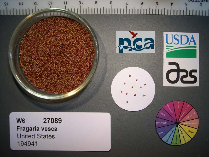 | | 2005 | COLLECTED | 06/10/2003 | | | 667 | Redwood-Douglas Fir. Associated with Rubus ursinus, Galium sp., Juncus sp., Carex sp., Rubus spectabilis and Rubus parviflorus. Slope: 0-5% SE. Soil: Clay. | Wild material | Seeds of Success (SOS) program germplasm. | 1674126 | PI 699126 |
| 118 | PI 699127 | F. chiloensis CA330-15 | Fragaria chiloensis (L.) Mill. | California, United States | COR |  | | 2005 | COLLECTED | 07/07/2003 | | | 250 | Coastal scrub. Associated with Rubus ursinus, Mara sp., Stachys sp, Avena sp and Holcus lanatum. Slope: 0-5% SE. | Wild material | Seeds of Success (SOS) program germplasm. | 1674163 | PI 699127 |
| 119 | PI 637961 | F. virginiana subsp. platypetala Benton | Fragaria ×ananassa Duchesne ex Rozier nothosubsp. cuneifolia (Nutt. ex Howell) Staudt | Oregon, United States | COR | | | 2004 | COLLECTED | 05/20/2004 | From a meadow behind city lot 2775 N.W. 29th Street Corvallis, Oregon, Benton County | 44.58625000, -123.28447000 | 95 | Open field, northwest facing slope with canary grass, Rubus armeniacus and Crataegus sp. | Wild material | | 1656324 | PI 637961 |
| 120 | PI 635238 | H. lupulus var. neomexicanus DC2003-15 | Humulus lupulus L. var. neomexicanus A. Nelson & Cockerell | British Columbia, Canada | COR | | | 2003 | COLLECTED | 10/13/2003 | Cowichan River delta, along Tzouhalem Road. Southeast of Duncan. | 48.76215000, -123.64417000 | 2 | Rosa sp., Rubus laciniatus, Creteagus sp., Sambucus sp. and Symphoracarpos sp. Exposure mostly open. | Wild material | This could either be an introduced Humulus lupulus var. lupulus or H. l. var. neomexicanus. Needs to be checked. KEH 2 March 2019 | 1650180 | PI 635238 |
| 121 | PI 635965 | WLP 1766 | Sorbus aucuparia L. subsp. pohuashanensis (Hance) McAll. | Primorye, Russian Federation | NA |  | | 2001 | COLLECTED | 08/09/2001 | Yakovleskya district, 15 km east of Dostoyevka, Elovy pass | 44.28855000, 133.65223000 | 396 | 50% exposure, 45 degree slope, Northeastern aspect, pull off at NE edge of road, soil texture is a gravel loam, associate vegetation, Populus sp., Urtica diocia, Betula, rubus crataegifolius, woodland | Wild material | | 1631316 | PI 635965 |
| 122 | PI 616954 | F. virginiana subsp. irginiana NC 98-15-1 | Fragaria virginiana Mill. subsp. virginiana | Arkansas, United States | COR | | Out of Season | 2000 | COLLECTED | 09/28/1998 | | | | | Wild material | | 1603166 | PI 616954 |
| 123 | PI 616955 | F. virginiana subsp. virginiana NC 98-15-2 | Fragaria virginiana Mill. subsp. virginiana | Arkansas, United States | COR | | Out of Season | 2000 | COLLECTED | 09/28/1998 | | | | | Wild material | | 1603167 | PI 616955 |
| 124 | PI 616956 | F. virginiana subsp. virginiana NC 98-15-3 | Fragaria virginiana Mill. subsp. virginiana | Arkansas, United States | COR | | Out of Season | 2000 | COLLECTED | 09/28/1998 | | | | | Wild material | | 1603168 | PI 616956 |
| 125 | PI 633807 | CH97 03-01 | Malus hupehensis (Pamp.) Rehder | Sichuan Sheng, China | GEN |  | | 1997 | COLLECTED | 09/21/1997 | Maerkang County, Dananzugou village. 5 km. northeast of Maerkang. | 31.95583333, 102.27555556 | 2930 | Aspect-South, partial canopy. Incline <5%, slight south, variable. Landform: Mountain valley. Assoc. sp: Sorbus, Fir, Pine Acer, Cornus, Willow, Betula. Shrub sp: Rosa, Pyracantha, Holly, Berberis, Cotoneaster, Rubus. Herb sp: Aster, Fern. | Wild material | Additional Weather Notes: Rainfall in concentrated from May to Sept. There are spring and summer droughts. Hail and frost damage occur. Additional Habitat Notes: Collection tree nearly defoilated, 5m. in height, located on minimal south facing slope. Name of gorge: Da Nan Zu Gou. Name of village: Cha Bei. Sampled 132 fruits from 23 trees. | 1652458 | PI 633807 |
| 126 | PI 633808 | CH97 03-02 | Malus toringoides (Rehder) Hughes | Sichuan Sheng, China | GEN |  | | 1997 | COLLECTED | 09/21/1997 | Maerkang County, Dananzugou village. 5 km. northeast of Maerkang. | 31.95583333, 102.27555556 | 2930 | Aspect-South, partial canopy. Incline <5%, slight south, variable. Landform: Mountain valley. Assoc. sp: Sorbus, Fir, Pine Acer, Cornus, Willow, Betula. Shrub sp: Rosa, Pyracantha, Holly, Berberis, Cotoneaster, Rubus. Herb sp: Aster, Fern. | Wild material | Additional Weather Notes: Rainfall in concentrated from May to Sept. There are spring and summer droughts. Hail and frost damage occur. Sampled 132 fruits from each of the 23 trees. | 1652459 | PI 633808 |
| 127 | PI 633810 | CH97 03-20 | Malus kansuensis (Batalin) C. K. Schneid. | Sichuan Sheng, China | GEN | | | 1997 | COLLECTED | 09/21/1997 | Maerkang County, Dananzugou village. 5 km. northeast of Maerkang. | 31.94472222, 102.27000000 | 2930 | Aspect-South, partial canopy. Incline <5%, slight south, variable. Landform: Mountain valley. Assoc. sp: Sorbus, Fir, Pine Acer, Cornus, Willow, Betula. Shrub sp: Rosa, Pyracantha, Holly, Berberis, Cotoneaster, Rubus. Herb sp: Aster, Fern. | Wild material | Additional Weather Notes: Rainfall in concentrated from May to Sept. There are spring and summer droughts. Hail and frost damage occur. Additional Habitat Notes: Collection tree 4m. in height with 6 trunks copiced; located on a very rocky hillside. Sampled 132 fruits from 23 trees. Rust present; no scab. | 1652461 | PI 633810 |
| 128 | PI 703093 | CH97 03-02 | Malus toringoides (Rehder) Hughes | Sichuan Sheng, China | | | Historic | 1997 | COLLECTED | 09/21/1997 | Maerkang County, Dananzugou village. 5 km. northeast of Maerkang. | 31.95583333, 102.27555556 | 2930 | Aspect-South, partial canopy. Incline <5%, slight south, variable. Landform: Mountain valley. Assoc. sp: Sorbus, Fir, Pine Acer, Cornus, Willow, Betula. Shrub sp: Rosa, Pyracantha, Holly, Berberis, Cotoneaster, Rubus. Herb sp: Aster, Fern. | Wild material | Additional Weather Notes: Rainfall in concentrated from May to Sept. There are spring and summer droughts. Hail and frost damage occur. Sampled 132 fruits from each of the 23 trees. | 1695202 | PI 703093 |
| 129 | PI 703094 | CH97 03-02 | Malus toringoides (Rehder) Hughes | Sichuan Sheng, China | | | Historic | 1997 | COLLECTED | 09/21/1997 | Maerkang County, Dananzugou village. 5 km. northeast of Maerkang. | 31.95583333, 102.27555556 | 2930 | Aspect-South, partial canopy. Incline <5%, slight south, variable. Landform: Mountain valley. Assoc. sp: Sorbus, Fir, Pine Acer, Cornus, Willow, Betula. Shrub sp: Rosa, Pyracantha, Holly, Berberis, Cotoneaster, Rubus. Herb sp: Aster, Fern. | Wild material | Additional Weather Notes: Rainfall in concentrated from May to Sept. There are spring and summer droughts. Hail and frost damage occur. Sampled 132 fruits from each of the 23 trees. | 1695203 | PI 703094 |
| 130 | PI 703095 | CH97 03-02 | Malus toringoides (Rehder) Hughes | Sichuan Sheng, China | | | Historic | 1997 | COLLECTED | 09/21/1997 | Maerkang County, Dananzugou village. 5 km. northeast of Maerkang. | 31.95583333, 102.27555556 | 2930 | Aspect-South, partial canopy. Incline <5%, slight south, variable. Landform: Mountain valley. Assoc. sp: Sorbus, Fir, Pine Acer, Cornus, Willow, Betula. Shrub sp: Rosa, Pyracantha, Holly, Berberis, Cotoneaster, Rubus. Herb sp: Aster, Fern. | Wild material | Additional Weather Notes: Rainfall in concentrated from May to Sept. There are spring and summer droughts. Hail and frost damage occur. Sampled 132 fruits from each of the 23 trees. | 1695205 | PI 703095 |
| 131 | PI 703096 | CH97 03-03 | Malus toringoides (Rehder) Hughes | Sichuan Sheng, China | | | Historic | 1997 | COLLECTED | 09/21/1997 | Maerkang County, Dananzugou village. 5 km. northeast of Maerkang. | 31.95583333, 102.27555556 | 2930 | Aspect-South, partial canopy. Incline <5%, slight south, variable. Landform: Mountain valley. Assoc. sp: Sorbus, Fir, Pine Acer, Cornus, Willow, Betula. Shrub sp: Rosa, Pyracantha, Holly, Berberis, Cotoneaster, Rubus. Herb sp: Aster, Fern. | Wild material | Additional Weather Notes: Rainfall in concentrated from May to Sept. There are spring and summer droughts. Hail and frost damage occur. Additional Habitat Notes: Collection tree an older tree, 6m. in height, 40cm. diameter, good vigor; located on west facing slope; incline 30%. Sampled 132 fruits from 23 trees. No scab present; quite a lot of of leaf spotting. | 1695209 | PI 703096 |
| 132 | PI 703097 | CH97 03-03 | Malus toringoides (Rehder) Hughes | Sichuan Sheng, China | | | Historic | 1997 | COLLECTED | 09/21/1997 | Maerkang County, Dananzugou village. 5 km. northeast of Maerkang. | 31.95583333, 102.27555556 | 2930 | Aspect-South, partial canopy. Incline <5%, slight south, variable. Landform: Mountain valley. Assoc. sp: Sorbus, Fir, Pine Acer, Cornus, Willow, Betula. Shrub sp: Rosa, Pyracantha, Holly, Berberis, Cotoneaster, Rubus. Herb sp: Aster, Fern. | Wild material | Additional Weather Notes: Rainfall in concentrated from May to Sept. There are spring and summer droughts. Hail and frost damage occur. Additional Habitat Notes: Collection tree an older tree, 6m. in height, 40cm. diameter, good vigor; located on west facing slope; incline 30%. Sampled 132 fruits from 23 trees. No scab present; quite a lot of of leaf spotting. | 1695206 | PI 703097 |
| 133 | PI 703098 | CH97 03-04 | Malus toringoides (Rehder) Hughes | Sichuan Sheng, China | | | Historic | 1997 | COLLECTED | 09/21/1997 | Maerkang County, Dananzugou village. 5 km. northeast of Maerkang. | 31.95583333, 102.27555556 | 2930 | Aspect-South, partial canopy. Incline <5%, slight south, variable. Landform: Mountain valley. Assoc. sp: Sorbus, Fir, Pine Acer, Cornus, Willow, Betula. Shrub sp: Rosa, Pyracantha, Holly, Berberis, Cotoneaster, Rubus. Herb sp: Aster, Fern. | Wild material | Additional Weather Notes: Rainfall in concentrated from May to Sept. There are spring and summer droughts. Hail and frost damage occur. Additional Habitat Notes: Collection tree located on south facing slope, 20% incline. Sampled 132 fruits from 23 trees. | 1695210 | PI 703098 |
| 134 | PI 703099 | CH97 03-05 | Malus hupehensis (Pamp.) Rehder | Sichuan Sheng, China | |  | Historic | 1997 | COLLECTED | 09/21/1997 | Maerkang County, Dananzugou village. 5 km. northeast of Maerkang. | 31.95583333, 102.27555556 | 2920 | Aspect-South, partial canopy. Incline <5%, slight south, variable. Landform: Mountain valley. Assoc. sp: Sorbus, Fir, Pine Acer, Cornus, Willow, Betula. Shrub sp: Rosa, Pyracantha, Holly, Berberis, Cotoneaster, Rubus. Herb sp: Aster, Fern. | Wild material | Additional Weather Notes: Rainfall in concentrated from May to Sept. There are spring and summer droughts. Hail and frost damage occur. Sampled 132 fruits from each of the 23 trees. Collection tree 15cm. in diameter. Fruit shows heavy disease. leaves are lanceolate. | 1695218 | PI 703099 |
| 135 | PI 703100 | CH97 03-16 | Malus kansuensis (Batalin) C. K. Schneid. | Sichuan Sheng, China | | | Historic | 1997 | COLLECTED | 09/21/1997 | Maerkang County, Dananzugou village. 5 km. northeast of Maerkang. | 31.94472222, 102.27000000 | 2880 | Aspect-South, partial canopy. Incline <5%, slight south, variable. Landform: Mountain valley. Assoc. sp: Sorbus, Fir, Pine Acer, Cornus, Willow, Betula. Shrub sp: Rosa, Pyracantha, Holly, Berberis, Cotoneaster, Rubus. Herb sp: Aster, Fern. | Wild material | Additional Weather Notes: Rainfall in concentrated from May to Sept. There are spring and summer droughts. Hail and frost damage occur. Additional Habitat Notes: Collection tree 3m. in height, moderate vigor; located on a rocky river bank. Sampled 132 fruits from 23 trees. Leaf rust present. No scab. | 1695245 | PI 703100 |
| 136 | PI 703101 | CH97 03-19 | Malus toringoides (Rehder) Hughes | Sichuan Sheng, China | | | Historic | 1997 | COLLECTED | 09/21/1997 | Maerkang County, Dananzugou village. 5 km. northeast of Maerkang. | 31.94472222, 102.27000000 | 2930 | Aspect-South, partial canopy. Incline <5%, slight south, variable. Landform: Mountain valley. Assoc. sp: Sorbus, Fir, Pine Acer, Cornus, Willow, Betula. Shrub sp: Rosa, Pyracantha, Holly, Berberis, Cotoneaster, Rubus. Herb sp: Aster, Fern. | Wild material | Additional Weather Notes: Rainfall in concentrated from May to Sept. There are spring and summer droughts. Hail and frost damage occur. Additional Habitat Notes: Collection tree older, 12m. in height, 40cm. diameter, 3 trunks, moderate vigor; located on a very rocky slope, near Acer and Holly. Sampled 132 fruits from 23 trees. Rust and leaf spotting present; no scab. | 1695248 | PI 703101 |
| 137 | PI 613989 | KAZ 96 06-02 | Malus sieversii (Ledeb.) M. Roem. | Kazakhstan | GEN |  | | 1996 | COLLECTED | 09/06/1996 | 9 km southeast of Lepinsk, 2 km southeast of Lepsinsk Forestry Camp. Incline 20%. | 45.52222222, 80.72777778 | 1230 | Excellent drainage, mostly N-NE, rainfall 700mm. Dominant Tree sp: Malus sieversii: Assoc-Populus tremula. Dominant shrub sp: Rubus caesius: Assoc-Lonicera. Dominant Herbaceous: Urtica; Assoc-Cirscium. | Wild material | Sampled 50 fruits from 1 tree. Flesh flavor is aromatic. Over color is 50% red. Free of disease and insects. Scion collected also. | 1531531 | PI 613989 |
| 138 | PI 613990 | KAZ 96 06-03 | Malus hybr. | Kazakhstan | GEN |  | | 1996 | COLLECTED | 09/06/1996 | 9 km southeast of Lepinsk, 2 km southeast of Lepsinsk Forestry Camp. Incline 20%. | 45.51722222, 80.72777778 | 1230 | Excellent drainage, mostly N-Ne, rainfall 700mm. Dominant Tree sp: Malus sieversii: Assoc-Populus tremula. Dominant shrub sp: Rubus caesius: Assoc-Lonicera. Dominant Herbaceous: Urtica; Assoc-Cirscium. | Uncertain improvement status | Elite scion material. sampled 70 fruits from 1 tree. Free of disease and insects. Scion also collected. ---Malus sieversii hybrid. Domestic introgression intentified using 20K Illumina Infinium apple SNP array--Kaiser_Alexander is one grandparent | 1531532 | PI 613990 |
| 139 | PI 613991 | KAZ 96 07-03 | Malus sieversii (Ledeb.) M. Roem. | Kazakhstan | GEN | 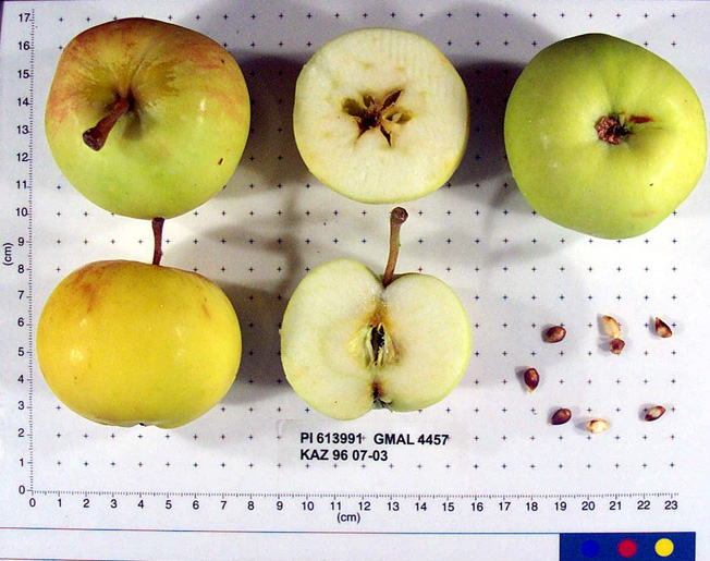 | | 1996 | COLLECTED | 09/08/1996 | 15km east of Topelevka-Djungarsky Range. 3 km southeast of Topelevka Forestry Camp. Collections made in radius around camp. Incline 10%, northwest. | 45.40722222, 80.43944444 | 1460 | Fertile. Dominant tree sp: Malus sierversii; Assoc.-Betula, Crataegus, Acer, Quercus, Tilia, Populus, Betula. Dom. Shrub Sp: Berberis, Lonicera: Assoc.-Cotoneaster, Rubus, Berberis, Ribes. Dom. herb.:Fragaria,Grasses,Humulus:Assoc.-Dianthus | Wild material | Elite scion material. sampled 80 fruits from 1 tree. Flesh is subacid. Fruit size is larger than 50mm. Free of disease and insects. Nice apple, 50 year old tree. Scion also collected. | 1531534 | PI 613991 |
| 140 | PI 613992 | KAZ 96 07-04 | Malus sieversii (Ledeb.) M. Roem. | Kazakhstan | GEN |  | | 1996 | COLLECTED | 09/08/1996 | 15 km southeast of Topelevka-Djungarski Range. 3km of Topelevka Forestry Camp. Collected further east of camp at higher elevations. | 45.40027778, 80.44083333 | 1540 | Dominant tree sp: M. sieversii; Assoc-Betula, Crataegus, Acer, Quercus, Tilia, Populus, Rhamnus. Dom. shrub sp: Berberis, Lonicera; Assoc-Cotoneaster, Rubus, Ribes. Dom. herb:Fragaria, Grasses, Humulus; Assoc-Dianthus, Fragaria, Chelidonium | Wild material | Sampled 8 fruits from 54 trees. Flesh flavor is subacid. scab is absent. Genetic Dwarf. Same as 07-04. | 1531535 | PI 613992 |
| 141 | PI 613993 | KAZ 96 07-05 | Malus sieversii (Ledeb.) M. Roem. | Kazakhstan | GEN |  | | 1996 | COLLECTED | 09/08/1996 | 15 km southeast of Topelevka-Djungarski Range. 3km of Topelevka Forestry Camp. Collected further east of camp at higher elevations. | 45.40027778, 80.44083333 | 1580 | Dominant tree sp: M. sieversii; Assoc-Betula, Crataegus, Acer, Quercus, Tilia, Populus, Rhamnus. Dom. shrub sp: Berberis, Lonicera; Assoc-Cotoneaster, Rubus, Ribes. Dom. herb:Fragaria, Grasses, Humulus; Assoc-Dianthus, Fragaria, Chelidonium | Wild material | Sampled 8 fruits from 54 trees. Flesh flavor is subacid. Scab is absent. Genetic Dwarfs. Same as 07-05. | 1531536 | PI 613993 |
| 142 | PI 599801 | KAZ 96 02-01P | Malus sieversii (Ledeb.) M. Roem. | Kazakhstan | GEN | | | 1996 | COLLECTED | 08/30/1996 | Zielisky Alatau. 17 km SSw of Almaty center-Aksay river. West side of Zieliesky Apple Belt. Landform: Valley near river. | 43.11916667, 76.79833333 | 1260 | Soil: Gravely loam, good drainage, some stone. Incline flat + 15%, NW. Rainfall 700mm. Dominant tree sp: Malus sieversii; Assoc-Apricot, Crataegus. Dominant shrub sp: Berberis, Hippophae; Assoc-Rubus, Rosa. Dom. herb-Hops; Assoc-Geranium. | Wild material | | 1551098 | PI 599801 |
| 143 | PI 599805 | KAZ 96 06-01P | Malus sieversii (Ledeb.) M. Roem. | Kazakhstan | GEN | | | 1996 | COLLECTED | 09/06/1996 | 9km south east of Lepsinsk, 2km southeast of Lepsinsk Forestry Camp. Collected in site 14 area of 1995. | 43.51722222, 80.72777778 | 1220 | Excellent drainage, mostly N-NE. Rainfall 700mm. Dominant tree sp: Malus sieversii; Assoc-Populus, Padus. Dominant shrub sp: Rubus; Assoc-Lonicera. Dominant herbaceous: Urtica; Assoc-Cirscium, Geranium, Aster, Malva, Rumex. | Wild material | | 1551105 | PI 599805 |
| 144 | PI 599806 | KAZ 96 07-01P | Malus sieversii (Ledeb.) M. Roem. | Kazakhstan | GEN | | | 1996 | COLLECTED | 09/07/1996 | 15 km southeast of Topelevka-Djungarski Range. 3km of Topelevka Forestry Camp. Collected east of camp. | 45.40833333, 80.43000000 | 1250 | Dominant tree sp: M. sieversii; Assoc-Betula, Crataegus, Acer, Quercus, Tilia, Populus, Rhamnus. Dom. shrub sp: Berberis, Lonicera; Assoc-Cotoneaster, Rubus, Ribes. Dom. herb:Fragaria, Grasses, Humulus; Assoc-Dianthus, Fragaria, Chelidonium | Wild material | | 1551100 | PI 599806 |
| 145 | PI 600603 | KAZ 96 06-02 | Malus sieversii (Ledeb.) M. Roem. | Kazakhstan | GEN | | | 1996 | COLLECTED | 09/06/1996 | 9 km southeast of Lepinsk, 2 km southeast of Lepsinsk Forestry Camp. Incline 20%. | 45.51722222, 80.72777778 | 1230 | Excellent drainage, mostly N-Ne, rainfall 700mm. Dominant Tree sp: Malus sieversii: Assoc-Populus tremula. Dominant shrub sp: Rubus caesius: Assoc-Lonicera. Dominant Herbaceous: Urtica; Assoc-Cirscium. | Wild material | | 1550524 | PI 600603 |
| 146 | PI 600604 | KAZ 96 06-03 | Malus sieversii (Ledeb.) M. Roem. | Kazakhstan | GEN | | | 1996 | COLLECTED | 09/06/1996 | 9 km southeast of Lepinsk, 2 km southeast of Lepsinsk Forestry Camp. Incline 20%. | 45.51722222, 80.72777778 | 1230 | Excellent drainage, mostly N-Ne, rainfall 700mm. Dominant Tree sp: Malus sieversii: Assoc-Populus tremula. Dominant shrub sp: Rubus caesius: Assoc-Lonicera. Dominant Herbaceous: Urtica; Assoc-Cirscium. | Wild material | | 1550525 | PI 600604 |
| 147 | PI 600605 | KAZ 96 07-02 | Malus sieversii (Ledeb.) M. Roem. | Kazakhstan | GEN | | | 1996 | COLLECTED | 09/07/1996 | 15km east of Topelevka-Djungarsky Range. 3 km southeast of Topelevka Forestry Camp. Collections made in radius around camp. Incline 10%, east. | 45.41222222, 80.41222222 | 1250 | Fertile. Dominant tree sp: Malus sierversii; Assoc.-Betula, Crataegus, Acer, Quercus, Tilia, Populus, Betula. Dom. Shrub Sp: Berberis, Lonicera: Assoc.-Cotoneaster, Rubus, Berberis, Ribes. Dom. herb.:Fragaria,Grasses,Humulus:Assoc.-Dianthus | Wild material | | 1550549 | PI 600605 |
| 148 | PI 600606 | KAZ 96 07-03 | Malus sieversii (Ledeb.) M. Roem. | Kazakhstan | GEN | | | 1996 | COLLECTED | 09/08/1996 | 15km east of Topelevka-Djungarsky Range. 3 km southeast of Topelevka Forestry Camp. Collections made in radius around camp. Incline 10%, northwest. | 45.40722222, 80.43944444 | 1460 | Fertile. Dominant tree sp: Malus sierversii; Assoc.-Betula, Crataegus, Acer, Quercus, Tilia, Populus, Betula. Dom. Shrub Sp: Berberis, Lonicera: Assoc.-Cotoneaster, Rubus, Berberis, Ribes. Dom. herb.:Fragaria,Grasses,Humulus:Assoc.-Dianthus | Wild material | | 1550526 | PI 600606 |
| 149 | PI 600607 | KAZ 96 07-06 | Malus sieversii (Ledeb.) M. Roem. | Kazakhstan | GEN | | | 1996 | COLLECTED | 09/08/1996 | 15km east of Topelevka-Djungarsky Range. 3 km southeast of Topelevka Forestry Camp. Collections made in radius around camp. Aspect west. | 45.40333333, 80.40611111 | 1500 | Fertile. Dominant tree sp: Malus sierversii; Assoc.-Betula, Crataegus, Acer, Quercus, Tilia, Populus, Betula. Dom. Shrub Sp: Berberis, Lonicera: Assoc.-Cotoneaster, Rubus, Berberis, Ribes. Dom. herb.:Fragaria,Grasses,Humulus:Assoc.-Dianthus | Wild material | | 1550527 | PI 600607 |
| 150 | PI 600608 | KAZ 96 07-08 | Malus sieversii (Ledeb.) M. Roem. | Kazakhstan | GEN | | | 1996 | COLLECTED | 09/09/1996 | 15km east of Topelevka-Djungarsky Range. 3 km southeast of Topelevka Forestry Camp. Collections made in radius around camp. | 45.40472222, 80.40694444 | 1220 | Fertile. Dominant tree sp: Malus sierversii; Assoc.-Betula, Crataegus, Acer, Quercus, Tilia, Populus, Betula. Dom. Shrub Sp: Berberis, Lonicera: Assoc.-Cotoneaster, Rubus, Berberis, Ribes. Dom. herb.:Fragaria,Grasses,Humulus:Assoc.-Dianthus | Wild material | | 1550545 | PI 600608 |
| 151 | PI 600609 | KAZ 96 07-09 | Malus sieversii (Ledeb.) M. Roem. | Kazakhstan | GEN | | | 1996 | COLLECTED | 09/09/1996 | 15km east of Topelevka-Djungarsky Range. 3 km southeast of Topelevka Forestry Camp. Collections made in radius around camp. Aspect southeast. | 45.41027778, 80.40527778 | 1240 | Fertile. Dominant tree sp: Malus sierversii; Assoc.-Betula, Crataegus, Acer, Quercus, Tilia, Populus, Betula. Dom. Shrub Sp: Berberis, Lonicera: Assoc.-Cotoneaster, Rubus, Berberis, Ribes. Dom. herb.:Fragaria,Grasses,Humulus:Assoc.-Dianthus | Wild material | | 1550528 | PI 600609 |
| 152 | PI 600610 | KAZ 96 07-10 | Malus sieversii (Ledeb.) M. Roem. | Kazakhstan | GEN | | | 1996 | COLLECTED | 09/09/1996 | 15km east of Topelevka-Djungarsky Range. 3 km southeast of Topelevka Forestry Camp. Collections made in radius around camp. Aspect flat. | 85.41527778, 80.40277778 | 1250 | Fertile. Dominant tree sp: Malus sierversii; Assoc.-Betula, Crataegus, Acer, Quercus, Tilia, Populus, Betula. Dom. Shrub Sp: Berberis, Lonicera: Assoc.-Cotoneaster, Rubus, Berberis, Ribes. Dom. herb.:Fragaria,Grasses,Humulus:Assoc.-Dianthus | Wild material | | 1550529 | PI 600610 |
| 153 | PI 600611 | KAZ 96 07-11 | Malus sieversii (Ledeb.) M. Roem. | Kazakhstan | GEN | | | 1996 | COLLECTED | 09/09/1996 | 15 miles east of the village of Topelevka. Djungarsky Mt. Range. Collections made in radius around camp. | 45.42000000, 80.39722222 | 1210 | NW, open. Dominant Tree sp: malus sieversii; Assoc.-Betula, Crataegus, Acer, Quercus, Tilia. Dom. shrub sp: Berberis, Lonicera; Assoc.-Cotoneaster, Rubus, Ribes. Dom. Herb.: Fragaria, Grasses, Humulus; Assoc.-Dianthus, Chelidonium, Urtica. | Wild material | | 1550541 | PI 600611 |
| 154 | PI 633803 | KAZ 96 02-01P-11 | Malus sieversii (Ledeb.) M. Roem. | Kazakhstan | GEN | 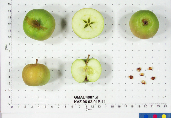 | | 1996 | COLLECTED | 08/30/1996 | Zielisky Alatau. 17 km SSw of Almaty center-Aksay river. West side of Zieliesky Apple Belt. Landform: Valley near river. | 43.11916667, 76.79833333 | 1260 | Soil: Gravely loam, good drainage, some stone. Incline flat + 15%, NW. Rainfall 700mm. Dominant tree sp: Malus sieversii; Assoc-Apricot, Crataegus. Dominant shrub sp: Berberis, Hippophae; Assoc-Rubus, Rosa. Dom. herb-Hops; Assoc-Geranium. | Wild material | Sampled 8 fruits from 20 trees. Flesh flavor is acid. Light scab. | 1652454 | PI 633803 |
| 155 | PI 633923 | KAZ 96 06-01P-28 | Malus sieversii (Ledeb.) M. Roem. | Kazakhstan | GEN |  | | 1996 | COLLECTED | 09/06/1996 | 9km southeast of Lepsinsk, 3km southwest of Lepsinsk Forestry Camp. Sampled area down the bank, along the river and up the bank on the other side. Collected in site 15 area of 1995. | 45.51305556, 80.71944444 | 1250 | Soil: Gravely loam, excellent drainage. N-S ridge, open. Dominant tree sp: Malus sieversii: Assoc-Populus, Crateagus. Dominant shrub sp: Rosa: Assoc-Rubus. Dominant herbaceous: Grasses; Assoc-Aster, Cirscium. | Wild material | Sampled 8 fruits from 30 trees. Flesh flavor is acid. Scab is light to moderate, spur-type. Same as site 15 in 1995. Excellent fruiting in 1996. | 1653309 | PI 633923 |
| 156 | PI 657089 | KAZ 96 07-03 | Malus hybr. | Kazakhstan | GEN | 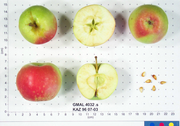 | | 1996 | COLLECTED | 09/08/1996 | 15km east of Topelevka-Djungarsky Range. 3 km southeast of Topelevka Forestry Camp. Collections made in radius around camp. Incline 10%, northwest. | 45.40722222, 80.43944444 | 1460 | Fertile. Dominant tree sp: Malus sierversii; Assoc.-Betula, Crataegus, Acer, Quercus, Tilia, Populus, Betula. Dom. Shrub Sp: Berberis, Lonicera: Assoc.-Cotoneaster, Rubus, Berberis, Ribes. Dom. herb.:Fragaria,Grasses,Humulus:Assoc.-Dianthus | Uncertain improvement status | Sampled 80 fruits from 1 tree. Flesh flavor is subacid. Fruit size is larger than 50mm. Free of disease and insects. Nice apple, 50 year old tree. Scion collected also. ---Malus sieversii hybrid. Domestic introgression intentified using 20K Illumina Infinium apple SNP array--Gold_Reinette is a likely grandparent | 1693368 | PI 657089 |
| 157 | PI 657091 | KAZ 96 07-08 | Malus sieversii (Ledeb.) M. Roem. | Kazakhstan | GEN | | | 1996 | COLLECTED | 09/09/1996 | 15km east of Topelevka-Djungarsky Range. 3 km southeast of Topelevka Forestry Camp. Collections made in radius around camp. | 45.40472222, 80.40694444 | 1220 | Fertile. Dominant tree sp: Malus sierversii; Assoc.-Betula, Crataegus, Acer, Quercus, Tilia, Populus, Betula. Dom. Shrub Sp: Berberis, Lonicera: Assoc.-Cotoneaster, Rubus, Berberis, Ribes. Dom. herb.:Fragaria,Grasses,Humulus:Assoc.-Dianthus | Wild material | Sampled 70 fruits from 1 tree. Flesh flavor is aromatic. Fruit size is larger than 50mm. Free of disease and insects. White transparent type. Heavy crop load. | 1693446 | PI 657091 |
| 158 | PI 657093 | KAZ 96 07-10 | Malus hybr. | Kazakhstan | GEN | 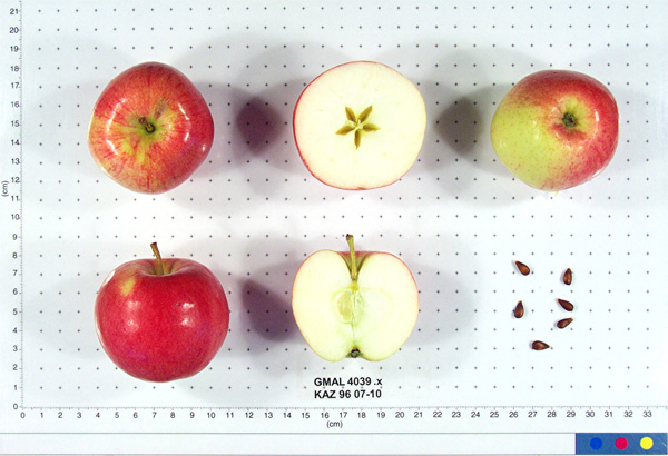 | | 1996 | COLLECTED | 09/09/1996 | 15km east of Topelevka-Djungarsky Range. 3 km southeast of Topelevka Forestry Camp. Collections made in radius around camp. Aspect flat. | 85.41527778, 80.40277778 | 1250 | Fertile. Dominant tree sp: Malus sierversii; Assoc.-Betula, Crataegus, Acer, Quercus, Tilia, Populus, Betula. Dom. Shrub Sp: Berberis, Lonicera: Assoc.-Cotoneaster, Rubus, Berberis, Ribes. Dom. herb.:Fragaria,Grasses,Humulus:Assoc.-Dianthus | Uncertain improvement status | Sampled 60 fruits from 1 tree. Flesh flavor is aromatic. Over color is 70% red. Fruit size is larger than 50mm. Free of disease and insects. Best apple so far, great. ---Malus sieversii hybrid. Domestic introgression intentified using 20K Illumina Infinium apple SNP array--Gold_Reinette is a grandparent | 1693493 | PI 657093 |
| 159 | PI 657106 | KAZ 96 02-01P-6 | Malus sieversii (Ledeb.) M. Roem. | Kazakhstan | GEN | | | 1996 | COLLECTED | 08/30/1996 | Zielisky Alatau. 17 km SSw of Almaty center-Aksay river. West side of Zieliesky Apple Belt. Landform: Valley near river. | 43.11916667, 76.79833333 | 1260 | Soil: Gravely loam, good drainage, some stone. Incline flat + 15%, NW. Rainfall 700mm. Dominant tree sp: Malus sieversii; Assoc-Apricot, Crataegus. Dominant shrub sp: Berberis, Hippophae; Assoc-Rubus, Rosa. Dom. herb-Hops; Assoc-Geranium. | Wild material | Sampled 8 fruits from 20 trees. Flesh flavor is astringent. No scab, slightly ribbed. | 1693683 | PI 657106 |
| 160 | PI 657109 | KAZ 96 06-01P-23 | Malus hybr. | Kazakhstan | GEN |  | | 1996 | COLLECTED | 09/06/1996 | 9km southeast of Lepsinsk, 3km southwest of Lepsinsk Forestry Camp. Sampled area down the bank, along the river and up the bank on the other side. Collected in site 15 area of 1995. | 45.51916667, 80.71555556 | 1110 | Soil: Gravely loam, excellent drainage. N-S ridge, open. Dominant tree sp: Malus sieversii: Assoc-Populus, Crateagus. Dominant shrub sp: Rosa: Assoc-Rubus. Dominant herbaceous: Grasses; Assoc-Aster, Cirscium. | Uncertain improvement status | Sampled 8 fruits from 30 trees. Flesh flavor is acid. Over color is 80% red. Scab is heavy. Stem end overgrowth. Same as site 15 in 1995. Excellent fruiting in 1996. ---Malus sieversii hybrid. Domestic introgression intentified using 20K Illumina Infinium apple SNP array--Lowland_Raspberry is a grandparent | 1694003 | PI 657109 |
| 161 | PI 657111 | KAZ 96 07-01P-24 | Malus sieversii (Ledeb.) M. Roem. | Kazakhstan | GEN | | | 1996 | COLLECTED | 09/08/1996 | 15 km southeast of Topelevka-Djungarski Range. 3km of Topelevka Forestry Camp. Collected further east of camp at higher elevations. | 45.40027778, 80.44083333 | 1540 | Dominant tree sp: M. sieversii; Assoc-Betula, Crataegus, Acer, Quercus, Tilia, Populus, Rhamnus. Dom. shrub sp: Berberis, Lonicera; Assoc-Cotoneaster, Rubus, Ribes. Dom. herb:Fragaria, Grasses, Humulus; Assoc-Dianthus, Fragaria, Chelidonium | Wild material | Sampled 8 fruits from 54 trees. Flesh flavor is subacid. scab is absent. Genetic Dwarf. Same as 07-04. | 1694029 | PI 657111 |
| 162 | PI 682768 | KAZ 96 07-03 | Malus hybr. | Kazakhstan | GEN | | | 1996 | COLLECTED | 09/08/1996 | 15km east of Topelevka-Djungarsky Range. 3 km southeast of Topelevka Forestry Camp. Collections made in radius around camp. Incline 10%, northwest. | 45.40722222, 80.43944444 | 1460 | Fertile. Dominant tree sp: Malus sierversii; Assoc.-Betula, Crataegus, Acer, Quercus, Tilia, Populus, Betula. Dom. Shrub Sp: Berberis, Lonicera: Assoc.-Cotoneaster, Rubus, Berberis, Ribes. Dom. herb.:Fragaria,Grasses,Humulus:Assoc.-Dianthus | Uncertain improvement status | Sampled 80 fruits from 1 tree. Flesh flavor is subacid. Fruit size is larger than 50mm. Free of disease and insects. Nice apple, 50 year old tree. Scion collected also. ---Malus sieversii hybrid. Domestic introgression intentified using 20K Illumina Infinium apple SNP array--Gold_Reinette likely a grandparent | 1693381 | PI 682768 |
| 163 | PI 682769 | KAZ 96 07-03 | Malus sieversii (Ledeb.) M. Roem. | Kazakhstan | GEN |  | | 1996 | COLLECTED | 09/08/1996 | 15km east of Topelevka-Djungarsky Range. 3 km southeast of Topelevka Forestry Camp. Collections made in radius around camp. Incline 10%, northwest. | 45.40722222, 80.43944444 | 1460 | Fertile. Dominant tree sp: Malus sierversii; Assoc.-Betula, Crataegus, Acer, Quercus, Tilia, Populus, Betula. Dom. Shrub Sp: Berberis, Lonicera: Assoc.-Cotoneaster, Rubus, Berberis, Ribes. Dom. herb.:Fragaria,Grasses,Humulus:Assoc.-Dianthus | Wild material | Sampled 80 fruits from 1 tree. Flesh flavor is subacid. Fruit size is larger than 50mm. Free of disease and insects. Nice apple, 50 year old tree. Scion collected also. | 1693369 | PI 682769 |
| 164 | PI 682770 | KAZ 96 07-03 | Malus hybr. | Kazakhstan | GEN | 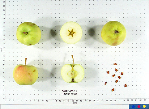 | | 1996 | COLLECTED | 09/08/1996 | 15km east of Topelevka-Djungarsky Range. 3 km southeast of Topelevka Forestry Camp. Collections made in radius around camp. Incline 10%, northwest. | 45.40722222, 80.43944444 | 1460 | Fertile. Dominant tree sp: Malus sierversii; Assoc.-Betula, Crataegus, Acer, Quercus, Tilia, Populus, Betula. Dom. Shrub Sp: Berberis, Lonicera: Assoc.-Cotoneaster, Rubus, Berberis, Ribes. Dom. herb.:Fragaria,Grasses,Humulus:Assoc.-Dianthus | Uncertain improvement status | Sampled 80 fruits from 1 tree. Flesh flavor is subacid. Fruit size is larger than 50mm. Free of disease and insects. Nice apple, 50 year old tree. Scion collected also. ---Malus sieversii hybrid. Domestic introgression intentified using 20K Illumina Infinium apple SNP array--Gold_Reinette likely a grandparent | 1693367 | PI 682770 |
| 165 | PI 682772 | KAZ 96 07-07 | Malus hybr. | Kazakhstan | | 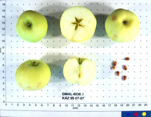 | Historic | 1996 | COLLECTED | 09/09/1996 | 15km east of Topelevka-Djungarsky Range. 3 km southeast of Topelevka Forestry Camp. Collections made in radius around camp. Collected near GMAL 4256. | 45.40472222, 80.40694444 | 1220 | Fertile. Dominant tree sp: Malus sierversii; Assoc.-Betula, Crataegus, Acer, Quercus, Tilia, Populus, Betula. Dom. Shrub Sp: Berberis, Lonicera: Assoc.-Cotoneaster, Rubus, Berberis, Ribes. Dom. herb.:Fragaria,Grasses,Humulus:Assoc.-Dianthus | Uncertain improvement status | Sampled 7 fruits form 1 tree. Flesh flavor is sweet. Fruit size is larger than 50mm. Free of disease and insects. Has water core. Strange hazelnutbananna flavor. Scion collected also. ---Malus sieversii hybrid. Domestic introgression intentified using 20K Illumina Infinium apple SNP array-- | 1693415 | PI 682772 |
| 166 | PI 682773 | KAZ 96 07-07 | Malus sieversii (Ledeb.) M. Roem. | Kazakhstan | GEN |  | | 1996 | COLLECTED | 09/09/1996 | 15km east of Topelevka-Djungarsky Range. 3 km southeast of Topelevka Forestry Camp. Collections made in radius around camp. Collected near GMAL 4256. | 45.40472222, 80.40694444 | 1220 | Fertile. Dominant tree sp: Malus sierversii; Assoc.-Betula, Crataegus, Acer, Quercus, Tilia, Populus, Betula. Dom. Shrub Sp: Berberis, Lonicera: Assoc.-Cotoneaster, Rubus, Berberis, Ribes. Dom. herb.:Fragaria,Grasses,Humulus:Assoc.-Dianthus | Wild material | Sampled 7 fruits form 1 tree. Flesh flavor is sweet. Fruit size is larger than 50mm. Free of disease and insects. Has water core. Strange hazelnut-bananna flavor. Scion collected also. | 1693414 | PI 682773 |
| 167 | PI 682774 | KAZ 96 07-09 | Malus sieversii (Ledeb.) M. Roem. | Kazakhstan | GEN | | | 1996 | COLLECTED | 09/09/1996 | 15km east of Topelevka-Djungarsky Range. 3 km southeast of Topelevka Forestry Camp. Collections made in radius around camp. Aspect southeast. | 45.41027778, 80.40527778 | 1240 | Fertile. Dominant tree sp: Malus sierversii; Assoc.-Betula, Crataegus, Acer, Quercus, Tilia, Populus, Betula. Dom. Shrub Sp: Berberis, Lonicera: Assoc.-Cotoneaster, Rubus, Berberis, Ribes. Dom. herb.:Fragaria,Grasses,Humulus:Assoc.-Dianthus | Wild material | Sampled 80 fruits from 1 tree. Flesh flavor is subacid. Over color is 50% red. Fruit size is larger than 50mm. Free of disease and insects. Crop load is heavy. Large apples with hugh green leaves that are clean, look like triploid. Apples could even be larger of smaller crop. Scion collected also. | 1693464 | PI 682774 |
| 168 | PI 682778 | KAZ 96 07-10 | Malus sieversii (Ledeb.) M. Roem. | Kazakhstan | GEN | 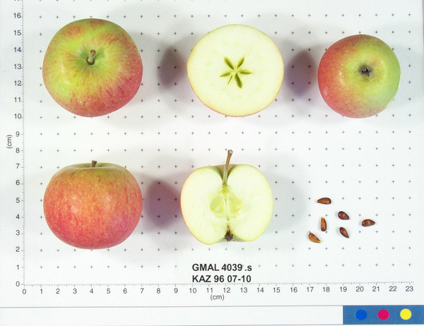 | | 1996 | COLLECTED | 09/09/1996 | 15km east of Topelevka-Djungarsky Range. 3 km southeast of Topelevka Forestry Camp. Collections made in radius around camp. Aspect flat. | 85.41527778, 80.40277778 | 1250 | Fertile. Dominant tree sp: Malus sierversii; Assoc.-Betula, Crataegus, Acer, Quercus, Tilia, Populus, Betula. Dom. Shrub Sp: Berberis, Lonicera: Assoc.-Cotoneaster, Rubus, Berberis, Ribes. Dom. herb.:Fragaria,Grasses,Humulus:Assoc.-Dianthus | Wild material | Sampled 60 fruits from 1 tree. Flesh flavor is aromatic. Over color is 70% red. Fruit size is larger than 50mm. Free of disease and insects. Best apple so far, great. | 1693476 | PI 682778 |
| 169 | PI 682779 | KAZ 96 07-10 | Malus hybr. | Kazakhstan | GEN | 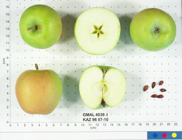 | | 1996 | COLLECTED | 09/09/1996 | 15km east of Topelevka-Djungarsky Range. 3 km southeast of Topelevka Forestry Camp. Collections made in radius around camp. Aspect flat. | 85.41527778, 80.40277778 | 1250 | Fertile. Dominant tree sp: Malus sierversii; Assoc.-Betula, Crataegus, Acer, Quercus, Tilia, Populus, Betula. Dom. Shrub Sp: Berberis, Lonicera: Assoc.-Cotoneaster, Rubus, Berberis, Ribes. Dom. herb.:Fragaria,Grasses,Humulus:Assoc.-Dianthus | Uncertain improvement status | Sampled 60 fruits from 1 tree. Flesh flavor is aromatic. Over color is 70% red. Fruit size is larger than 50mm. Free of disease and insects. Best apple so far, great. ---Malus sieversii hybrid. Domestic introgression intentified using 20K Illumina Infinium apple SNP array--Gold_Reinette is a grandparent | 1693477 | PI 682779 |
| 170 | PI 682780 | KAZ 96 07-10 | Malus sieversii (Ledeb.) M. Roem. | Kazakhstan | GEN | 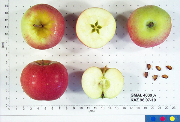 | | 1996 | COLLECTED | 09/09/1996 | 15km east of Topelevka-Djungarsky Range. 3 km southeast of Topelevka Forestry Camp. Collections made in radius around camp. Aspect flat. | 85.41527778, 80.40277778 | 1250 | Fertile. Dominant tree sp: Malus sierversii; Assoc.-Betula, Crataegus, Acer, Quercus, Tilia, Populus, Betula. Dom. Shrub Sp: Berberis, Lonicera: Assoc.-Cotoneaster, Rubus, Berberis, Ribes. Dom. herb.:Fragaria,Grasses,Humulus:Assoc.-Dianthus | Wild material | Sampled 60 fruits from 1 tree. Flesh flavor is aromatic. Over color is 70% red. Fruit size is larger than 50mm. Free of disease and insects. Best apple so far, great. | 1693479 | PI 682780 |
| 171 | PI 682781 | KAZ 96 07-10 | Malus hybr. | Kazakhstan | GEN | 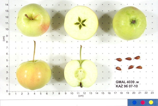 | | 1996 | COLLECTED | 09/09/1996 | 15km east of Topelevka-Djungarsky Range. 3 km southeast of Topelevka Forestry Camp. Collections made in radius around camp. Aspect flat. | 85.41527778, 80.40277778 | 1250 | Fertile. Dominant tree sp: Malus sierversii; Assoc.-Betula, Crataegus, Acer, Quercus, Tilia, Populus, Betula. Dom. Shrub Sp: Berberis, Lonicera: Assoc.-Cotoneaster, Rubus, Berberis, Ribes. Dom. herb.:Fragaria,Grasses,Humulus:Assoc.-Dianthus | Uncertain improvement status | Sampled 60 fruits from 1 tree. Flesh flavor is aromatic. Over color is 70% red. Fruit size is larger than 50mm. Free of disease and insects. Best apple so far, great. ---Malus sieversii hybrid. Domestic introgression intentified using 20K Illumina Infinium apple SNP array--Gold_Reinette is a grandparent | 1693492 | PI 682781 |
| 172 | PI 682791 | KAZ 96 02-01P-6 | Malus sieversii (Ledeb.) M. Roem. | Kazakhstan | GEN |  | | 1996 | COLLECTED | 08/30/1996 | Zielisky Alatau. 17 km SSw of Almaty center-Aksay river. West side of Zieliesky Apple Belt. Landform: Valley near river. | 43.11916667, 76.79833333 | 1260 | Soil: Gravely loam, good drainage, some stone. Incline flat + 15%, NW. Rainfall 700mm. Dominant tree sp: Malus sieversii; Assoc-Apricot, Crataegus. Dominant shrub sp: Berberis, Hippophae; Assoc-Rubus, Rosa. Dom. herb-Hops; Assoc-Geranium. | Wild material | Sampled 8 fruits from 20 trees. Flesh flavor is astringent. No scab, slightly ribbed. | 1693685 | PI 682791 |
| 173 | PI 682796 | KAZ 96 06-01P-15 | Malus sieversii (Ledeb.) M. Roem. | Kazakhstan | GEN | | | 1996 | COLLECTED | 09/06/1996 | 9km southeast of Lepsinsk, 2km southeast of Lepsinsk Forestry Camp. | 45.52444444, 80.73388889 | 1360 | Excellent drainage, mostly N-NE. Rainfall 700mm. Dominant tree sp: Malus sieversii; Assoc-Populus, Padus. Dominant shrub sp: Rubus; Assoc-Lonicera. Dominant herbaceous: Urtica; Assoc-Cirscium, Geranium, Aster, Malva, Rumex. | Wild material | Sampled 8 fruits from 30 trees. Flesh flavor is acid. Scab is light moderate. Same as site 14 in 1995. Excellent fruiting in 1996. | 1693995 | PI 682796 |
| 174 | PI 703085 | KAZ 96 06-01P-28 | Malus sieversii (Ledeb.) M. Roem. | Kazakhstan | | | Historic | 1996 | COLLECTED | 09/06/1996 | 9km southeast of Lepsinsk, 3km southwest of Lepsinsk Forestry Camp. Sampled area down the bank, along the river and up the bank on the other side. Collected in site 15 area of 1995. | 45.51305556, 80.71944444 | 1250 | Soil: Gravely loam, excellent drainage. N-S ridge, open. Dominant tree sp: Malus sieversii: Assoc-Populus, Crateagus. Dominant shrub sp: Rosa: Assoc-Rubus. Dominant herbaceous: Grasses; Assoc-Aster, Cirscium. | Wild material | Sampled 8 fruits from 30 trees. Flesh flavor is acid. Scab is light to moderate, spur-type. Same as site 15 in 1995. Excellent fruiting in 1996. | 1694020 | PI 703085 |
| 175 | PI 611049 | VIR 281 | Dactylis glomerata L. | Russian Federation | W6 | | | 1996 | COLLECTED | 09/14/1995 | Krasnodarskiy kray. Nearest village Dachovskaya. | 44.15055556, 40.19666667 | 1100 | Area logged. Slope 6-10%, aspect NE. Light 1/4 shade. Soil loam, pH 5.4-5.6. Moist, upper slope. Vegetation closed, deciduous forest primary, closed scrub with scattered trees. | Wild material | Dominant tree species Carpinus betulus, Quercus robur, Acer campestre. Dominant shrub species Rosa sp., Rubus caesius, Salix caprea, Rhododendron luteum. Dominant herb/grass species Deschampsia caespitosa, Molinia caerulea, Calamagrostis sp., Doricnium graecum, Trifolium medium. Population distribution uniform, abundance occasional. Growth habit erect. Extensive regional climate data available in spreadsheet format or image maps in raster format suitable for GIS analysis. Contact Dr. Stephanie L. Greene (sgreene@ars-grin.gov). | 1517975 | PI 611049 |
| 176 | PI 611053 | VIR 278B | Dactylis glomerata L. | Russian Federation | W6 | | | 1996 | COLLECTED | 09/14/1995 | Krasnodarskiy kray. Nearest village Dachovskaya. | 44.15055556, 40.19666667 | 1100 | Area logged. Slope 6-10%, aspect NE. Light 1/4 shade. Soil loam, pH 5.4-5.6. Moist, upper slope. Vegetation closed, deciduous forest primary, closed scrub with scattered trees. | Wild material | Dominant tree species Carpinus betulus, Quercus robur, Acer campestre. Dominant shrub species Rosa sp., Rubus caesius, Salix caprea, Rhododendron luteum. Dominant herb/grass species Deschampsia caespitosa, Molina caerulea, Calamagrostis sp., Doricnium graecum, Trifolium medium. Population distribution uniform, abundance occasional. Growth habit erect. Flower gray. Extensive regional climate data available in spreadsheet format or image maps in raster format suitable for GIS analysis. Contact Dr. Stephanie L. Greene (sgreene@ars-grin.gov). | 1517973 | PI 611053 |
| 177 | PI 631669 | D113 | Medicago sativa L. subsp. falcata (L.) Arcang. | Krasnodar, Russian Federation | W6 | | | 1996 | COLLECTED | 08/16/1995 | Province Krasnodar, 8 km south of site 61, village Kaluzhskaya. | 44.69388889, 38.95388889 | 260 | Logged/cleared. Slope 0-5%, aspect SE. Light 1/4 shade. Soil loam to clay, limestones in profile, pH 7.0. Seasonally dry, lower slope, pasture/meadow. Vegetation closed, seasonal broad-leafed herb vegetation. | Wild material | Surrounding vegetation open deciduous forest with closed lower layers. Dominant shrub species Prunus, Ribes. Dominant herb/grass species broadleaves, Elytrigia sp., Rubus sp., Lycopus sp., some grasses, poor in legumes, some Lathyrus sp., T. hybridum, T. medium, T. pratense, Artemisia sp. Population distribution patchy, abundance occasional. Growth habit erect. Flower yellow. Extensive regional climate data available in spreadsheet format or image maps in raster format suitable for GIS analysis. Contact Dr. Stephanie L. Greene (sgreene@ars-grin.gov). | 1531062 | PI 631669 |
| 178 | PI 641474 | 279 | Lotus corniculatus L. | Krasnodar, Russian Federation | W6 |  | | 1996 | COLLECTED | 09/14/1995 | Krasnodarskiy kray, nearest village is Dachovskaya. | | | Now logged. Slope 6-10%, aspect NE. 1/4 shade. Soil loam. Moist, upper slope. Vegetation closed, deciduous forest, closed scrub with scattered trees. | Wild material | Dominant tree species Carpinus betulus, Quercus robur, Acer campestre. Dominant shrub species Rosa sp., Rubus caesius, Salix caprea, Rhododendron luteum. Dominant herb/grass species Deschampsia caespitosa, Molinia caerulea, Calamogrostis graecum, Trifolium medium. Population distribution uniform, abundance occasional. Growth habit spreading. Extensive regional climate data available in spreadsheet format or image maps in raster format suitable for GIS analysis. Contact Dr. Stephanie L. Greene (sgreene@ars-grin.gov). | 1531013 | PI 641474 |
| 179 | PI 641475 | 282 | Trifolium medium L. | Krasnodar, Russian Federation | W6 | | | 1996 | COLLECTED | 09/14/1995 | Krasnodarskiy kray, nearest village is Dachovskaya. | | | Now logged. Slope 6-10%, aspect NE. 1/4 shade. Soil loam. Moist, upper slope. Vegetation closed, deciduous forest, scrub with scattered trees. | Wild material | Dominant tree species Carpinus betulus, Quercus robur, Acer campestre. Dominant shrub species Rosa sp., Rubus caesius, Salix caprea, Rhododendron luteum. Dominant herb/grass species Deschampsia caespitosa, Molinia caerulea, Calamogrostis sp., Doricnium graecum, Trifolium medium. Population distribution patchy, abundance frequent. Growth habit spreading. Extensive regional climate data available in spreadsheet format or image maps in raster format suitable for GIS analysis. Contact Dr. Stephanie L. Greene (sgreene@ars-grin.gov). | 1531014 | PI 641475 |
| 180 | PI 641476 | 285 | Lotus corniculatus L. | Krasnodar, Russian Federation | W6 |  | | 1996 | COLLECTED | 09/14/1995 | Krasnodarskiy kray, nearest village is Dachovskaya. | | | Now logged. Slope 6-10%, aspect NE. 1/4 shade. Soil loam. Moist, upper slope. Vegetation closed, deciduous forest, scrub with scattered trees. | Wild material | Dominant tree species Carpinus betulus, Quercus robur, Acer campestre. Dominant shrub species Rosa sp., Rubus caesius, Salix caprea, Rhododendron luteum. Dominant herb/grass species Deschampsia caespitosa, Molinia caerulea, Calamogrostis sp., Doricnium graecum, Trifolium medium. Population distribution uniform, abundance occasional. Growth habit spreading. Extensive regional climate data available in spreadsheet format or image maps in raster format suitable for GIS analysis. Contact Dr. Stephanie L. Greene (sgreene@ars-grin.gov). | 1531016 | PI 641476 |
| 181 | PI 655818 | 284 | Trifolium hybridum L. | Krasnodar, Russian Federation | W6 |  | | 1996 | COLLECTED | 09/14/1995 | Krasnodarskiy kray, nearest village is Dachovskaya. | | | Now logged. Slope 6-10%, aspect NE. 1/4 shade. Soil loam. Moist, upper slope. Vegetation closed, deciduous forest, scrub with scattered trees. | Wild material | Dominant tree species Carpinus betulus, Quercus robur, Acer campestre. Dominant shrub species Rosa sp., Rubus caesius, Salix caprea, Rhododendron luteum. Dominant herb/grass species Deschampsia caespitosa, Molinia caerulea, Calamogrostis sp., Doricnium graecum, Trifolium medium. Population distribution uniform-patchy, abundance occasional. Growth habit spreading. Extensive regional climate data available in spreadsheet format or image maps in raster format suitable for GIS analysis. Contact Dr. Stephanie L. Greene (sgreene@ars-grin.gov). | 1531015 | PI 655818 |
| 182 | PI 599790 | Kaz 95 01-01P-1 | Malus sieversii (Ledeb.) M. Roem. | Kazakhstan | GEN | | | 1995 | COLLECTED | 08/26/1995 | Zielisky Alatau Province. Almaty village. 17 km South to Southwest of Almaty Center. Aksay river West side of Zielisky Apple Belt. Land form - valley near river. | 43.11611111, 76.79611111 | 1400 | Gravely loam soil, some stoniness. Good drainage. Slope incline flat. Dominant tree sp: M. sieversii; Assoc.-Apricot, Crataegus. Dom. shrub sp: Berberis, Hippophae; Assoc.-Rubus, Rosa. Dominant herbaceous: Hops; Assoc.-Geranium, Fragaria. | Wild material | Sampled 5 fruits from 1 tree. | 1551087 | PI 599790 |
| 183 | PI 599794 | Kaz 95 09-01P-1 | Malus sieversii (Ledeb.) M. Roem. | Kazakhstan | GEN | | | 1995 | COLLECTED | 08/31/1995 | Semipalitinsk Region (Tarbagatai Mountain Range). 20 km. North of Urdzhar, 6 km. East-Northeast of Alekseyevka, on separate jeep trail. East Valley collection site. Collected on north end on flat by East River. | 47.27805556, 81.59972222 | 1120 | Aspect: Mainly East. Landform: flat valley and East slope. Dominant tree sp.: M. sieversii. Dominant shrub sp.: Rosa; Associated-Lonicera, Rubus. Dominant herbaceous: Malva; Assoc.-Fragaria. | Wild material | Sampled 5 fruits from 1 tree. Fruit is firm with aromatic flesh flavor. | 1551089 | PI 599794 |
| 184 | PI 599795 | Kaz 95 11-01P-1 | Malus sieversii (Ledeb.) M. Roem. | Kazakhstan | GEN | | | 1995 | COLLECTED | 09/03/1995 | Topolevka village. 15 km. East of Topolevka - Djungarsky Range. 3 km. Southeast of Topolevka Forestry Camp. | 45.38916667, 80.41416667 | 1690 | Aspect: West. Dominant tree sp.: M. sieversii; Associated-Betula, Crataegus, Padus, Sorbus. Dominant shrub sp.: Berberis; Assoc.-Cotoneaster, Rubus. Dominant herbaceous: Fragaria; Assoc.-Dianthus. | Wild material | Sampled 8 fruits from 1 tree. Light to moderate scab. Collected at 1700 m. | 1551090 | PI 599795 |
| 185 | PI 599796 | Kaz 95 12-01P-1 | Malus sieversii (Ledeb.) M. Roem. | Kazakhstan | GEN | | | 1995 | COLLECTED | 09/03/1995 | Topolevka village. 15 km. East of Topolevka - Djungarsky Mountain Range. 1.5 km. Southeast of Topolevka Forestry Camp. Elevation: 1220-1450 m. | 45.39611111, 80.40777778 | 1220 | Aspect: Northwest. Dominant tree sp.: M. sieversii; Associated-Acer, Quercus, Tilia, Populus, Rhamnus. Dominant shrub sp.: Lonicera; Assoc.-Berberis, Cotoneaster, Rubus. Dominant herbaceous: Grasses; Assoc.-Fragaria, Chelidonium, Urtica. | Wild material | Sampled 8 fruits from 1 tree. Collected at 1450 m. | 1551093 | PI 599796 |
| 186 | PI 599797 | Kaz 95 14-01P-1 | Malus sieversii (Ledeb.) M. Roem. | Kazakhstan | GEN | | | 1995 | COLLECTED | 09/05/1995 | Lepsinsk village. 9 km. Southeast of Lepsinsk. 2 km. Southeast of Lepsinsk Forestry Camp. Elevation: 1190-1360 m. | 45.52055556, 80.73194444 | 1190 | Excellent drainage. Aspect: Mostly N-NE. Temp: min -40c, max +45c. Rainfall: 700 mm. Dom. tree sp: M. sieversii; Assoc-Populus, Padus. Dom. shrub sp: Rubus; Assoc-Lonicera. Dom. herb: Urtica; Assoc-Cirscium, Geranium, Aster, Malva, Rumex. | Wild material | Sampled 5 fruits from 1 tree. Collected at 1360 m. | 1551091 | PI 599797 |
| 187 | PI 599798 | Kaz 95 17-02P-1 | Malus sieversii (Ledeb.) M. Roem. | Kazakhstan | GEN | | | 1995 | COLLECTED | 09/09/1995 | Karatau Province. Boraldy River Forest area. 2 km. South of Boraldy Forest Camp which is 80 km. North of Chimkent. Stream bed area. | 42.87416667, 69.89027778 | 620 | Rocky soil, dry. Slope incline: Flat. Dominant tree sp: Crataegus; Associated-M. sieversii, Prunus, Morus, Rhamnus. Dominant shrub sp: Clematis; Assoc-Rubus. Dominant herbaceous: Grasses. | Wild material | Sampled 8 fruits from 1 tree. Flesh flavor is aromatic. | 1551092 | PI 599798 |
| 188 | PI 600485 | Kaz 95 01-02 | Malus sieversii (Ledeb.) M. Roem. | Kazakhstan | GEN | | | 1995 | COLLECTED | 08/26/1995 | Zielisky Alatau Province. Almaty village. 17 km South to Southwest of Almaty Center. Aksay river West side of Zielisky Apple Belt. Landform - valley near river. | 43.11611111, 76.79611111 | 1400 | Gravely loam soil, some stoniness. Good drainage. Slope incline flat. Dominant tree sp: M. sieversii; Assoc.-Apricot, Crataegus. Dom. shrub sp: Berberis, Hippophae; Assoc.-Rubus, Rosa. Dominant herbaceous: Hops; Assoc.-Geranium, Fragaria. | Wild material | Sampled 150 fruits from 1 tree. Flesh flavor is aromatic. Bruises easily. Over color is 80% red, moderate scab. Low seed count (infertile). | 1550628 | PI 600485 |
| 189 | PI 600486 | Kaz 95 01-03 | Malus sieversii (Ledeb.) M. Roem. | Kazakhstan | GEN | | | 1995 | COLLECTED | 08/26/1995 | Zielisky Alatau Province. Almaty village. 17 km South to Southwest of Almaty Center. Aksay river West side of Zielisky Apple Belt. Landform - valley near river. | 43.11611111, 76.79611111 | 1400 | Gravely loam soil, some stoniness. Good drainage. Slope incline flat. Dominant tree sp: M. sieversii; Assoc.-Apricot, Crataegus. Dom. shrub sp: Berberis, Hippophae; Assoc.-Rubus, Rosa. Dominant herbaceous: Hops; Assoc.-Geranium, Fragaria. | Wild material | Sampled 150 fruits from 1 tree. Fruit size is larger than 50mm, low scab. A bit immature - low seed set. Some codling moth damage. | 1550629 | PI 600486 |
| 190 | PI 600487 | Kaz 95 01-04 | Malus sieversii (Ledeb.) M. Roem. | Kazakhstan | GEN | | | 1995 | COLLECTED | 08/26/1995 | Zielisky Alatau Province. Almaty village. 17 km South to Southwest of Almaty Center. Aksay river West side of Zielisky Apple Belt. Landform - valley near river. | 43.11611111, 76.79611111 | 1400 | Gravely loam soil, some stoniness. Good drainage. Slope incline flat. Dominant tree sp: M. sieversii; Assoc.-Apricot, Crataegus. Dom. shrub sp: Berberis, Hippophae; Assoc.-Rubus, Rosa. Dominant herbaceous: Hops; Assoc.-Geranium, Fragaria. | Wild material | Sampled 150 fruits from 1 tree. Flesh flavor is aromatic. Over color is 95% red, light scab. Unique shape at calyx and pedicel. | 1550630 | PI 600487 |
| 191 | PI 600489 | Kaz 95 03-01 | Malus sieversii (Ledeb.) M. Roem. | Kazakhstan | GEN | | | 1995 | COLLECTED | 08/27/1995 | Zielisky Alatau Province. 40 km East of the Almatinka River, near stream bed. Forest region of Talgar - 188 hectares. Mikushina area, 1100-1800 m. | 43.29333333, 77.39555556 | 1490 | Clay loam soil, limited stoniness. Good drainage. Flat slope, next to W. slope. Dom. tree sp.: Malus; Assoc-Crataegus, Rhamnus, Populus, Salix. Dom. shrub sp: Rosa. Assoc-Rubus, Berberis. Dom. herb.: Humulus; Assoc-Origanum, Malva, Geranium | Wild material | Sampled 150 fruits from 1 tree. White seeds, immature fruit. Upright tree. Not real healthy-somewhat defoliated. Fruit over color is 90% red, scab detected. | 1550632 | PI 600489 |
| 192 | PI 600490 | Kaz 95 03-02 | Malus sieversii (Ledeb.) M. Roem. | Kazakhstan | GEN | | | 1995 | COLLECTED | 08/27/1995 | Zielisky Alatau Province. 40 km East of the Almatinka River, near stream bed. Forest region of Talgar - 188 hectares. Mikushina area, 1100-1800 m. | 43.29333333, 77.39555556 | 1490 | Clay loam soil, limited stoniness. Good drainage. Flat slope, next to W. slope. Dom. tree sp.: Malus; Assoc-Crataegus, Rhamnus, Populus, Salix. Dom. shrub sp: Rosa. Assoc-Rubus, Berberis. Dom. herb.: Humulus; Assoc-Origanum, Malva, Geranium | Wild material | Sampled 150 fruits from 1 tree. Spreading habit. | 1550633 | PI 600490 |
| 193 | PI 600497 | Kaz 95 06-01 | Malus sieversii (Ledeb.) M. Roem. | Kazakhstan | GEN | | | 1995 | COLLECTED | 08/29/1995 | Semipalitinsk Region (Tarbagatai Mountain Range). 20 km. North of Urdzhar. 7 km. Northeast of Alekseyevka. Landform mostly hillside. Collected in North end of West Valley, upstream 3 km. from site 05 (GMAL's 3604-3607, GMAL's 3760-3789). | 47.27000000, 81.57361111 | 990 | Silt to clay loam soil. Aspect: Mostly East. Dominant tree sp.: M. sieversii; Associated-Populus, Pyrus, Acer. Dominant shrub sp.: Rosa; Assoc.-Lonicera, Amygdalus, Rubus. Dominant herbaceous: Grasses; Assoc.-Potentilla, Fragaria. | Wild material | Sampled 150 fruits from 1 tree. Flesh flavor is aromatic. Over color is 90% red. Fruit size is larger than 50mm, no scab. Spur type tree. Scion also collected. | 1550639 | PI 600497 |
| 194 | PI 600498 | Kaz 95 06-03 | Malus sieversii (Ledeb.) M. Roem. | Kazakhstan | GEN | | | 1995 | COLLECTED | 08/29/1995 | Semipalitinsk Region (Tarbagatai Mountain Range). 20 km. North of Urdzhar. 7 km. Northeast of Alekseyevka. Landform mostly hillside. Collected in North end of West Valley, upstream 3 km. from site 05 (GMAL's 3604-3607, GMAL's 3760-3789). | 47.27000000, 81.57361111 | 990 | Silt to clay loam soil. Slope incline: 5%. Aspect: West. Dominant tree sp: M. sieversii; Associated-Populus, Pyrus, Acer. Dominant shrub sp: Rosa; Assoc.-Lonicera, Amygdalus, Rubus. Dominant herbaceous: Grasses; Assoc.-Potentilla, Fragaria. | Wild material | Sampled 150 fruits from 1 tree. Scab detected. Very heavy cropload. Spur tpye tree. | 1550640 | PI 600498 |
| 195 | PI 600518 | Kaz 95 09-05F | Malus sieversii (Ledeb.) M. Roem. | Kazakhstan | GEN | | | 1995 | COLLECTED | 08/31/1995 | Semipalitinsk Region (Tarbagatai Mountain Range). 20 km. North of Urdzhar, 6 km. East-Northeast of Alekseyevka, on separate jeep trail. East Valley collection site. Collected on north end on flat by East River. | 47.27805556, 81.59972222 | 1120 | Flat slope. Dominant tree sp.: M. sieversii. Dominant shrub sp.: Rosa; Associated-Lonicera, Rubus. Dominant herbaceous: Malva; Assoc.-Fragaria. | Wild material | Sampled 30 fruits from 1 tree. Fruit is firm with aromatic flesh flavor. Fruit size is larger than 50mm. Very heavy cropload. Same as accession GMAL 3829. | 1550660 | PI 600518 |
| 196 | PI 600539 | Kaz 95 11-02 | Malus sieversii (Ledeb.) M. Roem. | Kazakhstan | GEN | | | 1995 | COLLECTED | 09/03/1995 | Topolevka village. 15 km. East of Topolevka - Djungarsky Range. 3 km. Southeast of Topolevka Forestry Camp. Elevation: 1500-1690 m. | 45.38916667, 80.41416667 | 1640 | Slope incline: 30 degrees. Aspect: Southwest. Dominant tree sp.: M. sieversii; Associated-Betula, Crataegus, Padus, Sorbus. Dominant shrub sp.: Berberis; Assoc.-Cotoneaster, Rubus. Dominant herbaceous: Fragaria; Assoc.-Dianthus. | Wild material | Sampled 150 fruits from 1 tree. Two trees - cloned of each other together. Tree dwarfed by high elevation. Scab on fruit. | 1550568 | PI 600539 |
| 197 | PI 600540 | Kaz 95 11-03 | Malus sieversii (Ledeb.) M. Roem. | Kazakhstan | GEN | | | 1995 | COLLECTED | 09/03/1995 | Topolevka village. 15 km. East of Topolevka - Djungarsky Range. 3 km. Southeast of Topolevka Forestry Camp. Elevation: 1500-1690 m. | 45.38916667, 80.41416667 | 1610 | Slope incline: 40 degrees. Aspect: Northeast. Dominant tree sp.: M. sieversii; Associated-Betula, Crataegus, Padus, Sorbus. Dominant shrub sp.: Berberis; Assoc.-Cotoneaster, Rubus. Dominant herbaceous: Fragaria; Assoc.-Dianthus. | Wild material | Sampled 150 fruits from 1 tree. Flesh flavor is aromatic, bruises easily. Over color is 60% red, scab present. Hail damage. Fifty year old tree. | 1550569 | PI 600540 |
| 198 | PI 600541 | Kaz 95 11-04 | Malus sieversii (Ledeb.) M. Roem. | Kazakhstan | GEN | | | 1995 | COLLECTED | 09/03/1995 | Topolevka village. 15 km. East of Topolevka - Djungarsky Range. 3 km. Southeast of Topolevka Forestry Camp. Landform: By rock outcrop. Elevation: 1500-1690 m. | 45.38916667, 80.41416667 | 1550 | Sandy/gravelly soil, shallow, low PH. Slope incline: 35 degrees. Aspect: NW. Dominant tree sp.: M. sieversii; Assoc-Betula, Crataegus, Padus, Sorbus. Dom. shrub sp.: Berberis; Assoc-Cotoneaster, Rubus. Dom. herb.: Fragaria; Assoc-Dianthus. | Wild material | Sampled 150 fruits from 1 tree. Fruit is firm. Scab present. Hail marks. Tree dwarfed by elevation and poor soil. | 1550570 | PI 600541 |
| 199 | PI 600542 | Kaz 95 11-05 | Malus sieversii (Ledeb.) M. Roem. | Kazakhstan | GEN | | | 1995 | COLLECTED | 09/03/1995 | Topolevka village. 15 km. East of Topolevka - Djungarsky Range. 3 km. Southeast of Topolevka Forestry Camp. Elevation: 1500-1690 m. | 45.39277778, 80.40861111 | 1500 | Sandy, very rocky soil. Slope incline: 15 degrees. Aspect: West. Dominant tree sp.: M. sieversii; Assoc-Betula, Crataegus, Padus, Sorbus. Dominant shrub sp.: Berberis; Assoc-Cotoneaster, Rubus. Dominant herbaceous: Fragaria; Assoc-Dianthus. | Wild material | Sampled 150 fruits from 1 tree. Fruits very soft. Scab present. 100 year old tree. | 1550571 | PI 600542 |
| 200 | PI 600543 | Kaz 95 12-02 | Malus sieversii (Ledeb.) M. Roem. | Kazakhstan | GEN | | | 1995 | COLLECTED | 09/03/1995 | Topolevka village. 15 km. East of Topolevka - Djungarsky Range. 1.5 km. Southeast of Topolevka Forestry Camp. Elevation: 1220-1450 m. | 45.39611111, 80.40777778 | 1450 | Aspect: Northwest. Dominant tree sp.: M. sieversii; Assoc.-Acer, Quercus, Tilia, Populus, Rhamnus. Dominant shrub sp.: Lonicera; Assoc-Berberis, Cotoneaster, Rubus. Dominant herbaceous: Grasses; Assoc.-Fragaria, Chelidonium, Urtica. | Wild material | Sampled 150 frts from 1 tree. Fruit is firm, largest in Djangarsky. Some codling moth eggs visible in seed. Quite clean of scab. Tree sets fruit in clusters; has clonal offshoots. Scion also coll. Spur type tree. Same accession as GMAL 3890 | 1550572 | PI 600543 |
| 201 | PI 600544 | Kaz 95 12-03 | Malus sieversii (Ledeb.) M. Roem. | Kazakhstan | GEN | | | 1995 | COLLECTED | 09/03/1995 | Topolevka village. 15 km. East of Topolevka - Djungarsky Range. 1.5 km. Southeast of Topolevka Forestry Camp. Landform: Plateau. Elevation: 1220-1450 m. | 45.39611111, 80.40777778 | 1500 | Aspect: Northwest. Dominant tree sp.: M. sieversii; Assoc.-Acer, Quercus, Tilia, Populus, Rhamnus. Dominant shrub sp.: Lonicera; Assoc-Berberis, Cotoneaster, Rubus. Dominant herbaceous: Grasses; Assoc.-Fragaria, Chelidonium, Urtica. | Wild material | Sampled 150 fruits from 1 tree. Fruit is hard. Slight scab. 100 year old tree. | 1550573 | PI 600544 |
| 202 | PI 600545 | Kaz 95 12-04 | Malus sieversii (Ledeb.) M. Roem. | Kazakhstan | GEN | | | 1995 | COLLECTED | 09/03/1995 | Topolevka village. 15 km. East of Topolevka - Djungarsky Range. 1.5 km. Southeast of Topolevka Forestry Camp. Elevation: 1220-1450 m. | 45.39611111, 80.40777778 | 1500 | Aspect: East. Dominant tree sp.: M. sieversii; Assoc.-Acer, Quercus, Tilia, Populus, Rhamnus. Dominant shrub sp.: Lonicera; Assoc-Berberis, Cotoneaster, Rubus. Dominant herbaceous: Grasses; Assoc.-Fragaria, Chelidonium, Urtica. | Wild material | Sampled 100 fruits from 1 tree. Flesh flavor is aromatic. Scab present. Fruit contains insect eggs in seed area. Tree tall and thin. | 1550574 | PI 600545 |
| 203 | PI 600546 | Kaz 95 12-05 | Malus sieversii (Ledeb.) M. Roem. | Kazakhstan | GEN | | | 1995 | COLLECTED | 09/03/1995 | Topolevka village. 15 km. East of Topolevka - Djungarsky Range. 1.5 km. Southeast of Topolevka Forestry Camp. Elevation: 1220-1450 m. | 45.39611111, 80.40777778 | 1220 | Dominant tree sp.: M. sieversii; Assoc.-Acer, Quercus, Tilia, Populus, Rhamnus. Dominant shrub sp.: Lonicera; Assoc-Berberis, Cotoneaster, Rubus. Dominant herbaceous: Grasses; Assoc.-Fragaria, Chelidonium, Urtica. | Wild material | Sampled 150 fruits from 1 tree. Fruit is firm with aromatic flesh flavor. Fruit size is larger than 50mm, very little scab. Collected very close to GMAL 3554 in 1993. Maybe near M. x domestica source. | 1550575 | PI 600546 |
| 204 | PI 600553 | Kaz 95 14-02 | Malus sieversii (Ledeb.) M. Roem. | Kazakhstan | GEN | | | 1995 | COLLECTED | 09/05/1995 | Lepsinsk village. 9 km. Southeast of Lepsinsk. 2 km. Southeast of Lepsinsk Forestry Camp. Landform: Ridge. Elevation: 1190-1360 m. | 45.52055556, 80.73194444 | 1190 | Slope incline: 10 degrees. Aspect: Temp: max. +45, min. -40. West. Dominant tree sp: M. sieversii; Assoc-Populus, Padus. Dom. shrub sp: Rubus; Assoc-Lonicera. Dom. herb: Urtica; Assoc-Cirscium, Geranium, Aster, Malva, Rumex. | Wild material | Sampled 150 fruits from 1 tree. Flesh flavor is aromatic. Bruises very easily. Scab detected. Very heavy cropload. | 1550582 | PI 600553 |
| 205 | PI 600554 | Kaz 95 14-03 | Malus sieversii (Ledeb.) M. Roem. | Kazakhstan | GEN | | | 1995 | COLLECTED | 09/05/1995 | Lepsinsk village. 9 km. Southeast of Lepsinsk. 2 km. Southeast of Lepsinsk Forestry Camp. Elevation: 1190-1360 m. | 45.52055556, 80.73194444 | 1190 | Slope incline: 20 degrees. Aspect: North. Temp: max. +45, min. -40. Dominant tree sp: M. sieversii; Assoc-Populus, Padus. Dom. shrub sp: Rubus; Assoc-Lonicera. Dom. herb: Urtica; Assoc-Cirscium, Geranium, Aster, Malva, Rumex. | Wild material | Sampled 150 fruits from 1 tree. Fruit is firm, scab present. | 1550583 | PI 600554 |
| 206 | PI 600555 | Kaz 95 14-05 | Malus sieversii (Ledeb.) M. Roem. | Kazakhstan | GEN | | | 1995 | COLLECTED | 09/05/1995 | Lepsinsk village. 9 km. Southeast of Lepsinsk. 2 km. Southeast of Lepsinsk Forestry Camp. Elevation: 1190-1360 m. | 45.52055556, 80.73194444 | 1190 | Slope incline: 20 degrees. Aspect: Northeast. Temp: max. +45, min. -40. Dominant tree sp: M. sieversii; Assoc-Populus, Padus. Dom. shrub sp: Rubus; Assoc-Lonicera. Dom. herb: Urtica; Assoc-Cirscium, Geranium, Aster, Malva, Rumex. | Wild material | Fruit bruises easily, scab present. | 1550584 | PI 600555 |
| 207 | PI 600556 | Kaz 95 14-06 | Malus sieversii (Ledeb.) M. Roem. | Kazakhstan | GEN | | | 1995 | COLLECTED | 09/05/1995 | Lepsinsk village. 9 km. Southeast of Lepsinsk. 2 km. Southeast of Lepsinsk Forestry Camp. Elevation: 1190-1360 m. | 45.52194444, 80.71944444 | 1190 | Aspect: Northwest. Lowest elevation in this population. Temp: max. +45, min. -40. Dominant tree sp: M. sieversii; Assoc-Populus, Padus. Dom. shrub sp: Rubus; Assoc-Lonicera. Dom. herb: Urtica; Assoc-Cirscium, Geranium, Aster, Malva, Rumex. | Wild material | Sampled 150 fruits from 1 tree. One of few red fruited trees in area. Fruit is firm. Much collected apple in area. Same accession as GMAL 3929. | 1550585 | PI 600556 |
| 208 | PI 600557 | Kaz 95 15-01 | Malus sieversii (Ledeb.) M. Roem. | Kazakhstan | GEN | | | 1995 | COLLECTED | 09/05/1995 | Lepsinsk village. 9 km. Southeast of Lepsinsk. 3 km. Southwest of Lepsinsk Forestry Camp. Landform: Ridge. | 45.51083333, 80.71583333 | 1270 | Gravely loam soil. Excellent drainage. Aspect N-S. Dominant tree sp: M. sieversii; Assoc-Populus, Crataegus. Dominant shrub sp: Rosa; Assoc-Rubus. Dominant herbaceous:Grasses; Assoc-Aster, Cirscium. | Wild material | Sampled 150 fruits from 1 tree. Fruit is firm. Area where trees were nearly defoliated in 1993, looks much better in 1995. | 1550586 | PI 600557 |
| 209 | PI 600558 | Kaz 95 15-02 | Malus sieversii (Ledeb.) M. Roem. | Kazakhstan | GEN | | | 1995 | COLLECTED | 09/05/1995 | Lepsinsk village. 9 km. Southeast of Lepsinsk. 3 km. Southwest of Lepsinsk Forestry Camp. Landform: Ridge. | 45.51083333, 80.71583333 | 1270 | Excellant drainage. Slope incline 5 degrees. Aspect West. Dominant tree sp: M. sieversii; Assoc-Populus, Crataegus. Dominant shrub sp: Rosa; Assoc-Rubus. Dominant herbaceous:Grasses; Assoc-Aster, Cirscium. | Wild material | Sampled 150 fruits from 1 tree. Fruit is firm. Scab present. | 1550587 | PI 600558 |
| 210 | PI 600559 | Kaz 95 15-03 | Malus sieversii (Ledeb.) M. Roem. | Kazakhstan | GEN | | | 1995 | COLLECTED | 09/05/1995 | Lepsinsk village. 9 km. Southeast of Lepsinsk. 3 km. Southwest of Lepsinsk Forestry Camp. Landform: Ridge. | 45.51083333, 80.71583333 | 1270 | Excellant drainage. Slope incline 10 degrees. Aspect Northwest. Dominant tree sp: M. sieversii; Assoc-Populus, Crataegus. Dominant shrub sp: Rosa; Assoc-Rubus. Dominant herbaceous:Grasses; Assoc-Aster, Cirscium. | Wild material | Sampled 150 fruits from 1 tree. Fruit is firm with aromatic flesh flavor. Scab present. | 1550588 | PI 600559 |
| 211 | PI 600560 | Kaz 95 15-04 | Malus sieversii (Ledeb.) M. Roem. | Kazakhstan | GEN | | | 1995 | COLLECTED | 09/05/1995 | Lepsinsk village. 9 km. Southeast of Lepsinsk. 3 km. Southwest of Lepsinsk Forestry Camp. Landform: On cliff of ridge. | 45.51083333, 80.71583333 | 1270 | Excellant drainage. Slope incline 70 degrees. Aspect East. Collected on edge of cliff. Dominant tree sp: M. sieversii; Assoc-Populus, Crataegus. Dominant shrub sp: Rosa; Assoc-Rubus. Dominant herbaceous:Grasses; Assoc-Aster, Cirscium. | Wild material | Sampled 60 fruits from 1 tree. Selected for leaf form that stood out (thick, dark green, disease free). Clean of scab. | 1550589 | PI 600560 |
| 212 | PI 600561 | Kaz 95 17-01 | Malus sieversii (Ledeb.) M. Roem. | Kazakhstan | GEN | | | 1995 | COLLECTED | 09/09/1995 | Karatau Province. Boraldy River Forest area. 2 km. South of Boraldy Forest Camp which is 80 km. North of Chimkent. Stream bed area. | 42.87416667, 69.89027778 | 620 | Rocky soil, dry. Slope incline: flat. Dominant tree sp: Crataegus; Associated-M. sieversii, Prunus, Morus, Rhamnus. Dominant shrub sp: Clematis; Assoc-Rubus. Dominant herbaceous: Grasses. | Wild material | Sampled 60 fruits from 1 tree. Fruit is firm. Early season. Shows drought stress. | 1550590 | PI 600561 |
| 213 | PI 600562 | Kaz 95 17-03 | Malus sieversii (Ledeb.) M. Roem. | Kazakhstan | GEN | | | 1995 | COLLECTED | 09/09/1995 | Karatau Province. Boraldy River Forest area. 2 km. South of Boraldy Forest Camp which is 80 km. North of Chimkent. Stream bed area. | 42.87416667, 69.89027778 | 620 | Rocky soil, dry. Slope incline: flat. Dominant tree sp: Crataegus; Associated-M. sieversii, Prunus, Morus, Rhamnus. Dominant shrub sp: Clematis; Assoc-Rubus. Dominant herbaceous: Grasses. | Wild material | Sampled 60 fruits from 1 tree. Same accession as GMAL 3951. | 1550591 | PI 600562 |
| 214 | PI 600563 | Kaz 95 17-04 | Malus sieversii (Ledeb.) M. Roem. | Kazakhstan | GEN | | | 1995 | COLLECTED | 09/09/1995 | Karatau Province. Boraldy River Forest area. 2 km. South of Boraldy Forest Camp which is 80 km. North of Chimkent. Stream bed area. | 42.87416667, 69.89027778 | 620 | Rocky soil, dry. Slope incline: 20%. Aspect: North. Dominant tree sp: Crataegus; Associated-M. sieversii, Prunus, Morus, Rhamnus. Dominant shrub sp: Clematis; Assoc-Rubus. Dominant herbaceous: Grasses. | Wild material | Sampled 60 fruits from 1 tree. Flesh flavor is aromatic. Over color is 90% red. Clean of scab. | 1550592 | PI 600563 |
| 215 | PI 600564 | Kaz 95 17-05 | Malus sieversii (Ledeb.) M. Roem. | Kazakhstan | GEN | | | 1995 | COLLECTED | 09/09/1995 | Karatau Province. Boraldy River Forest area. 2 km. South of Boraldy Forest Camp which is 80 km. North of Chimkent. Stream bed area. | 42.87416667, 69.89027778 | 620 | Rocky soil, dry. Slope incline: flat. Dominant tree sp: Crataegus; Associated-M. sieversii, Prunus, Morus, Rhamnus. Dominant shrub sp: Clematis; Assoc-Rubus. Dominant herbaceous: Grasses. | Wild material | Sampled 60 fruits from 1 tree. Fruit is hard. | 1550593 | PI 600564 |
| 216 | PI 600566 | Kaz 95 17-10 | Malus sieversii (Ledeb.) M. Roem. | Kazakhstan | GEN | | | 1995 | COLLECTED | 09/09/1995 | Karatau Province. Boraldy River Forest area. 2 km. South of Boraldy Forest Camp which is 80 km. North of Chimkent. Stream bed area. | 42.87416667, 69.89027778 | 620 | Rocky soil, dry. Slope incline: 10 degrees. Aspect: North. Dominant tree sp: Crataegus; Associated-M. sieversii, Prunus, Morus, Rhamnus. Dominant shrub sp: Clematis; Assoc-Rubus. Dominant herbaceous: Grasses. | Wild material | Sampled 150 fruits from 1 tree. Fruit is firm with aromatic flesh flavor. Very clean. | 1550595 | PI 600566 |
| 217 | PI 613971 | KAZ 95 06-01 | Malus hybr. | Kazakhstan | GEN | | | 1995 | COLLECTED | 08/29/1995 | Semipalitinsk Region (Tarbagatai Mountain Range). 20 km. North of Urdzhar. 7 km. Northeast of Alekseyevka. Landform mostly hillside. Collected in North end of West Valley, upstream 3 km. from site 05 (GMAL's 3604-3607, GMAL's 3760-3789). | 47.27000000, 81.57361111 | 990 | Silt to clay loam soil. Aspect: Mostly East. Dominant tree sp.: M. sieversii; Associated-Populus, Pyrus, Acer. Dominant shrub sp.: Rosa; Assoc.-Lonicera, Amygdalus, Rubus. Dominant herbaceous: Grasses; Assoc.-Potentilla, Fragaria. | Uncertain improvement status | Wild. Additional habitat data: Nearest M. domestica 5 km. Collection tree height 3 meters. DBH 7 cm. multiple trunk. Habit type: I spar. sampled 150 fruits from 1 tree. Flesh flavor is aromatic. Over color is 90%. Fruit size is larger than 50mm, no scab. Spur type tree. Clone of tree from which GMAL 3608 seed were collected. -- One fully domesticated parent intentified using 20K Illumina Infinium apple SNP array. Parent is Charlamoff. | 1498666 | PI 613971 |
| 218 | PI 613972 | KAZ 95 06-08 | Malus hybr. | Kazakhstan | GEN |  | | 1995 | COLLECTED | 08/29/1995 | Semipalitinsk Region (Tarbagatai Mountain Range). 20 km. North of Urdzhar. 7 km. Northeast of Alekseyevka. Landform mostly hillside. Collected in North end of West Valley, upstream 3 km. from site 05 (GMAL's 3604-3607, GMAL's 3760-3789). | 47.27000000, 81.57361111 | 990 | Silt to clay loam soil. Aspect: West. Dominant tree sp.: M. sieversii; Associated-Populus, Pyrus, Acer. Dominant shrub sp.: Rosa; Assoc.-Lonicera, Amygdalus, Rubus. Dominant herbaceous: Grasses; Assoc.-Potentilla, Fragaria. | Uncertain improvement status | Wild. Additional habitat data: Habit type: II semispur. Leaves very clean from disease; nice shape tree. Sampled 30 fruits from 1 tree. Fruit collected from tree with nice shape. Fruit is firm with aromatic flesh flavor. Fruit size is larger than 50mm. Very clean and free of disease. Clone of tree from which GMAL 3614 seed were collected. -- One fully domesticated parent intentified using 20K Illumina Infinium apple SNP array. Parent is Charlamoff. | 1498667 | PI 613972 |
| 219 | PI 613980 | KAZ 95 12-02 | Malus sieversii (Ledeb.) M. Roem. | Kazakhstan | GEN |  | | 1995 | COLLECTED | 09/12/1995 | Topolevka village. 15 km. East of Topolevka - Djungarsky Range. 1.5 km. Southeast of Topolevka Forestry Camp. Elevation: 1220-1450 m. | 45.39611111, 80.40777778 | 1450 | Aspect: Northwest. Dominant tree sp.: M. sieversii; Assoc.-Acer, Quercus, Tilia, Populus, Rhamnus. Dominant shrub sp.: Lonicera; Assoc-Berberis, Cotoneaster, Rubus. Dominant herbaceous: Grasses; Assoc.-Fragaria, Chelidonium, Urtica. | Wild material | Elite scion material. Wild. Additional habitat data: Tree ht. 3.5 m, DBH 8 cm., habit type I spur-nice. Crop load very heavy. Leaves: very clean (from disease). Scab: quite clean. Insects: some codling moth, eggs visible in seed. General notes: Largest fruit in Djungarsky so far, sets fruit in clusters, has clonal offshoots. Same accession as GMAL 3890. | 1498677 | PI 613980 |
| 220 | PI 657002 | Kaz 95 06-01 | Malus hybr. | Kazakhstan | GEN |  | | 1995 | COLLECTED | 08/29/1995 | Semipalitinsk Region (Tarbagatai Mountain Range). 20 km. North of Urdzhar. 7 km. Northeast of Alekseyevka. Landform mostly hillside. Collected in North end of West Valley, upstream 3 km. from site 05 (GMAL's 3604-3607, GMAL's 3760-3789). | 47.27000000, 81.57361111 | 990 | Silt to clay loam soil. Aspect: Mostly East. Dominant tree sp.: M. sieversii; Associated-Populus, Pyrus, Acer. Dominant shrub sp.: Rosa; Assoc.-Lonicera, Amygdalus, Rubus. Dominant herbaceous: Grasses; Assoc.-Potentilla, Fragaria. | Uncertain improvement status | Sampled 150 fruits from 1 tree. Flesh flavor is aromatic. Over color is 90% red. Fruit size is larger than 50mm, no scab. Spur type tree. Scion also collected. ---Malus sieversii hybrid. Domestic introgression intentified using 20K Illumina Infinium apple SNP array-- | 1692586 | PI 657002 |
| 221 | PI 657004 | Kaz 95 06-04 | Malus hybr. | Kazakhstan | GEN |  | | 1995 | COLLECTED | 08/29/1995 | Semipalitinsk Region (Tarbagatai Mountain Range). 20 km. North of Urdzhar. 7 km. Northeast of Alekseyevka. Landform mostly hillside. Collected in North end of West Valley, upstream 3 km. from site 05 (GMAL's 3604-3607, GMAL's 3760-3789). | 47.27000000, 81.57361111 | 990 | Silt to clay loam soil. Slope incline: 5%. Aspect: West. Dominant tree sp: M. sieversii; Associated-Populus, Pyrus, Acer. Dominant shrub sp: Rosa; Assoc.-Lonicera, Amygdalus, Rubus. Dominant herbaceous: Grasses; Assoc.-Potentilla, Fragaria. | Uncertain improvement status | Sampled 30 fruits from 1 tree. Fruit is firm, bruises easily. Fruit size is larger than 50mm, free of scab. Spur type tree. ---Malus sieversii hybrid. Domestic introgression intentified using 20K Illumina Infinium apple SNP array--Charlamoff is a grandparent | 1692611 | PI 657004 |
| 222 | PI 657005 | Kaz 95 06-08 | Malus hybr. | Kazakhstan | GEN | | | 1995 | COLLECTED | 08/29/1995 | Semipalitinsk Region (Tarbagatai Mountain Range). 20 km. North of Urdzhar. 7 km. Northeast of Alekseyevka. Landform mostly hillside. Collected in North end of West Valley, upstream 3 km. from site 05 (GMAL's 3604-3607, GMAL's 3760-3789). | 47.27000000, 81.57361111 | 990 | Silt to clay loam soil. Aspect: West. Dominant tree sp.: M. sieversii; Associated-Populus, Pyrus, Acer. Dominant shrub sp.: Rosa; Assoc.-Lonicera, Amygdalus, Rubus. Dominant herbaceous: Grasses; Assoc.-Potentilla, Fragaria. | Uncertain improvement status | Sampled 30 fruits from 1 tree. Fruit collected from tree with nice shape. Fruit is firm with aromatic flesh flavor. Fruit size is larger than 50mm. Very clean and free of disease. Scion also collected. ---Malus sieversii hybrid. Domestic introgression intentified using 20K Illumina Infinium apple SNP array-- | 1692612 | PI 657005 |
| 223 | PI 657006 | Kaz 95 06-08 | Malus hybr. | Kazakhstan | GEN | | | 1995 | COLLECTED | 08/29/1995 | Semipalitinsk Region (Tarbagatai Mountain Range). 20 km. North of Urdzhar. 7 km. Northeast of Alekseyevka. Landform mostly hillside. Collected in North end of West Valley, upstream 3 km. from site 05 (GMAL's 3604-3607, GMAL's 3760-3789). | 47.27000000, 81.57361111 | 990 | Silt to clay loam soil. Aspect: West. Dominant tree sp.: M. sieversii; Associated-Populus, Pyrus, Acer. Dominant shrub sp.: Rosa; Assoc.-Lonicera, Amygdalus, Rubus. Dominant herbaceous: Grasses; Assoc.-Potentilla, Fragaria. | Uncertain improvement status | Sampled 30 fruits from 1 tree. Fruit collected from tree with nice shape. Fruit is firm with aromatic flesh flavor. Fruit size is larger than 50mm. Very clean and free of disease. Scion also collected. ---Malus sieversii hybrid. Domestic introgression intentified using 20K Illumina Infinium apple SNP array-- | 1692615 | PI 657006 |
| 224 | PI 657013 | Kaz 95 08-01 | Malus hybr. | Kazakhstan | GEN | | | 1995 | COLLECTED | 08/30/1995 | Semipalitinsk Region (Tarbagatai Mountain Range). 20 km. North of Urdzhar. 5 km. Northeast of Alekseyevka. Collected mainly on west slopes in center of West Valley. Equidistant between sites 05 & 06 (GMAL's 3604-3615, GMAL's 3760-3789). | 47.25555556, 81.57222222 | 920 | Silt to clay loam soil. Aspect: West. Landform mostly hillside. Dominant tree sp.: M. sieversii. Dominant shrub sp.: Rosa; Associated-Lonicera, Rubus. Dominant herbaceous: Malva; Assoc.-Fragaria. | Uncertain improvement status | Sampled 15 fruits from 1 tree. Flesh flavor is aromatic. Fruit size is larger than 50mm obtained from a small tree. ---Malus sieversii hybrid. Domestic introgression intentified using 20K Illumina Infinium apple SNP array--Charlamoff is a grandparent | 1692657 | PI 657013 |
| 225 | PI 657015 | Kaz 95 08-01 | Malus sieversii (Ledeb.) M. Roem. | Kazakhstan | GEN | | | 1995 | COLLECTED | 08/30/1995 | Semipalitinsk Region (Tarbagatai Mountain Range). 20 km. North of Urdzhar. 5 km. Northeast of Alekseyevka. Collected mainly on west slopes in center of West Valley. Equidistant between sites 05 & 06 (GMAL's 3604-3615, GMAL's 3760-3789). | 47.25555556, 81.57222222 | 920 | Silt to clay loam soil. Aspect: West. Landform mostly hillside. Dominant tree sp.: M. sieversii. Dominant shrub sp.: Rosa; Associated-Lonicera, Rubus. Dominant herbaceous: Malva; Assoc.-Fragaria. | Wild material | Sampled 15 fruits from 1 tree. Flesh flavor is aromatic. Fruit size is larger than 50mm obtained from a small tree. | 1692665 | PI 657015 |
| 226 | PI 657016 | Kaz 95 08-03 | Malus hybr. | Kazakhstan | GEN | | | 1995 | COLLECTED | 08/30/1995 | Semipalitinsk Region (Tarbagatai Mountain Range). 20 km. North of Urdzhar. 5 km. Northeast of Alekseyevka. Collected mainly on west slopes in center of West Valley. Equidistant between sites 05 & 06 (GMAL's 3604-3615, GMAL's 3760-3789). | 47.25555556, 81.57222222 | 920 | Silt to clay loam soil. Aspect: West. Landform mostly hillside. Dominant tree sp.: M. sieversii. Dominant shrub sp.: Rosa; Associated-Lonicera, Rubus. Dominant herbaceous: Malva; Assoc.-Fragaria. | Uncertain improvement status | Sampled 40 fruits from 1 tree. Flesh flavor is aromatic. Over color is 90% red. Fruit size is larger than 50mm. Spur type tree. ---Malus sieversii hybrid. Domestic introgression intentified using 20K Illumina Infinium apple SNP array--Charlamoff is a grandparent | 1692677 | PI 657016 |
| 227 | PI 657019 | Kaz 95 08-06 | Malus sieversii (Ledeb.) M. Roem. | Kazakhstan | GEN |  | | 1995 | COLLECTED | 08/30/1995 | Semipalitinsk Region (Tarbagatai Mountain Range). 20 km. North of Urdzhar. 5 km. Northeast of Alekseyevka. Collected mainly on west slopes in center of West Valley. Equidistant between sites 05 & 06 (GMAL's 3604-3615, GMAL's 3760-3789). | 47.25555556, 81.57222222 | 920 | Silt to clay loam soil. Aspect: West. Landform mostly hillside. Dominant tree sp.: M. sieversii. Dominant shrub sp.: Rosa; Associated-Lonicera, Rubus. Dominant herbaceous: Malva; Assoc.-Fragaria. | Wild material | Sampled 15 fruits from 1 tree. Fruit is firm with aromatic flesh flavor. Over color is 80% red. Fruit size is larger than 50mm. Small amount of scab detected. Very column-shaped tree. Scion also collected. | 1692694 | PI 657019 |
| 228 | PI 657020 | Kaz 95 09-03F | Malus sieversii (Ledeb.) M. Roem. | Kazakhstan | GEN | | | 1995 | COLLECTED | 08/31/1995 | Semipalitinsk Region (Tarbagatai Mountain Range). 20 km. North of Urdzhar, 6 km. East-Northeast of Alekseyevka, on separate jeep trail. East Valley collection site. Collected on north end on flat by East River. | 47.27805556, 81.59972222 | 1120 | Flat slope. Dominant tree sp.: M. sieversii. Dominant shrub sp.: Rosa; Associated-Lonicera, Rubus. Dominant herbaceous: Malva; Assoc.-Fragaria. | Wild material | Sampled 60 fruits from 1 tree. Fruit is hard with aromatic flesh flavor. Over color is 90% red. Fruit size is larger than 50mm, free of scab. Very heavy cropload. | 1692719 | PI 657020 |
| 229 | PI 657022 | Kaz 95 09-03F | Malus hybr. | Kazakhstan | GEN |  | | 1995 | COLLECTED | 08/31/1995 | Semipalitinsk Region (Tarbagatai Mountain Range). 20 km. North of Urdzhar, 6 km. East-Northeast of Alekseyevka, on separate jeep trail. East Valley collection site. Collected on north end on flat by East River. | 47.27805556, 81.59972222 | 1120 | Flat slope. Dominant tree sp.: M. sieversii. Dominant shrub sp.: Rosa; Associated-Lonicera, Rubus. Dominant herbaceous: Malva; Assoc.-Fragaria. | Uncertain improvement status | Sampled 60 fruits from 1 tree. Fruit is hard with aromatic flesh flavor. Over color is 90% red. Fruit size is larger than 50mm, free of scab. Very heavy cropload. ---Malus sieversii hybrid. Domestic introgression intentified using 20K Illumina Infinium apple SNP array--Shares extended haplotypes with 'Yellow Transparent' (possibly 3-4 generations removed) | 1692730 | PI 657022 |
| 230 | PI 657023 | Kaz 95 09-05F | Malus hybr. | Kazakhstan | GEN |  | | 1995 | COLLECTED | 08/31/1995 | Semipalitinsk Region (Tarbagatai Mountain Range). 20 km. North of Urdzhar, 6 km. East-Northeast of Alekseyevka, on separate jeep trail. East Valley collection site. Collected on north end on flat by East River. | 47.27805556, 81.59972222 | 1120 | Flat slope. Dominant tree sp.: M. sieversii. Dominant shrub sp.: Rosa; Associated-Lonicera, Rubus. Dominant herbaceous: Malva; Assoc.-Fragaria. | Uncertain improvement status | Sampled 30 fruits from 1 tree. Fruit is firm with aromatic flesh flavor. Fruit size is larger than 50mm. Very heavy cropload. Same as accession GMAL 3829. ---Malus sieversii hybrid. Domestic introgression intentified using 20K Illumina Infinium apple SNP array--Gold_Reinette is a grandparent | 1692735 | PI 657023 |
| 231 | PI 657024 | Kaz 95 09-05F | Malus hybr. | Kazakhstan | GEN | | | 1995 | COLLECTED | 08/31/1995 | Semipalitinsk Region (Tarbagatai Mountain Range). 20 km. North of Urdzhar, 6 km. East-Northeast of Alekseyevka, on separate jeep trail. East Valley collection site. Collected on north end on flat by East River. | 47.27805556, 81.59972222 | 1120 | Flat slope. Dominant tree sp.: M. sieversii. Dominant shrub sp.: Rosa; Associated-Lonicera, Rubus. Dominant herbaceous: Malva; Assoc.-Fragaria. | Uncertain improvement status | Sampled 30 fruits from 1 tree. Fruit is firm with aromatic flesh flavor. Fruit size is larger than 50mm. Very heavy cropload. Same as accession GMAL 3829. ---Malus sieversii hybrid. Domestic introgression intentified using 20K Illumina Infinium apple SNP array--Gold_Reinette is a grandparent | 1692745 | PI 657024 |
| 232 | PI 666150 | Kaz 95 09-05F | Malus hybr. | Kazakhstan | GEN | | | 1995 | COLLECTED | 08/31/1995 | Semipalitinsk Region (Tarbagatai Mountain Range). 20 km. North of Urdzhar, 6 km. East-Northeast of Alekseyevka, on separate jeep trail. East Valley collection site. Collected on north end on flat by East River. | 47.27805556, 81.59972222 | 1120 | Flat slope. Dominant tree sp.: M. sieversii. Dominant shrub sp.: Rosa; Associated-Lonicera, Rubus. Dominant herbaceous: Malva; Assoc.-Fragaria. | Uncertain improvement status | Sampled 30 fruits from 1 tree. Fruit is firm with aromatic flesh flavor. Fruit size is larger than 50mm. Very heavy cropload. Susceptible to P. expansum and C. acutatum. ---Malus sieversii hybrid. Domestic introgression intentified using 20K Illumina Infinium apple SNP array--Gold_Reinette is a grandparent | 1905424 | PI 666150 |
| 233 | PI 666153 | Kaz 95 01-01P-4 | Malus hybr. | Kazakhstan | GEN |  | | 1995 | COLLECTED | 08/26/1995 | Zielisky Alatau Province. Almaty village. 17 km South to Southwest of Almaty Center. Aksay river West side of Zielisky Apple Belt. Land form - valley near river. | 43.11611111, 76.79611111 | 1400 | Gravely loam soil, some stoniness. Good drainage. Slope incline flat. Dominant tree sp: M. sieversii; Assoc.-Apricot, Crataegus. Dom. shrub sp: Berberis, Hippophae; Assoc.-Rubus, Rosa. Dominant herbaceous: Hops; Assoc.-Geranium, Fragaria. | Uncertain improvement status | Sampled 5 fruits from 1 tree. Susceptible to P. expansum. ---Malus sieversii hybrid. Domestic introgression intentified using 20K Illumina Infinium apple SNP array--Kaiser_Alexander is a grandparent or great-grandparent | 1905466 | PI 666153 |
| 234 | PI 682749 | Kaz 95 06-01 | Malus sieversii (Ledeb.) M. Roem. | Kazakhstan | GEN |  | | 1995 | COLLECTED | 08/29/1995 | Semipalitinsk Region (Tarbagatai Mountain Range). 20 km. North of Urdzhar. 7 km. Northeast of Alekseyevka. Landform mostly hillside. Collected in North end of West Valley, upstream 3 km. from site 05 (GMAL's 3604-3607, GMAL's 3760-3789). | 47.27000000, 81.57361111 | 990 | Silt to clay loam soil. Aspect: Mostly East. Dominant tree sp.: M. sieversii; Associated-Populus, Pyrus, Acer. Dominant shrub sp.: Rosa; Assoc.-Lonicera, Amygdalus, Rubus. Dominant herbaceous: Grasses; Assoc.-Potentilla, Fragaria. | Wild material | Sampled 150 fruits from 1 tree. Flesh flavor is aromatic. Over color is 90% red. Fruit size is larger than 50mm, no scab. Spur type tree. Scion also collected. | 1692587 | PI 682749 |
| 235 | PI 682752 | Kaz 95 09-05F | Malus hybr. | Kazakhstan | GEN |  | | 1995 | COLLECTED | 08/31/1995 | Semipalitinsk Region (Tarbagatai Mountain Range). 20 km. North of Urdzhar, 6 km. East-Northeast of Alekseyevka, on separate jeep trail. East Valley collection site. Collected on north end on flat by East River. | 47.27805556, 81.59972222 | 1120 | Flat slope. Dominant tree sp.: M. sieversii. Dominant shrub sp.: Rosa; Associated-Lonicera, Rubus. Dominant herbaceous: Malva; Assoc.-Fragaria. | Uncertain improvement status | Sampled 30 fruits from 1 tree. Fruit is firm with aromatic flesh flavor. Fruit size is larger than 50mm. Very heavy cropload. Same as accession GMAL 3829. ---Malus sieversii hybrid. Domestic introgression intentified using 20K Illumina Infinium apple SNP array--Gold_Reinette is a grandparent | 1692740 | PI 682752 |
| 236 | PI 682753 | Kaz 95 09-03L | Malus sieversii (Ledeb.) M. Roem. | Kazakhstan | GEN |  | | 1995 | COLLECTED | 08/31/1995 | Semipalitinsk Region (Tarbagatai Mountain Range). 20 km. North of Urdzhar, 6 km. East-Northeast of Alekseyevka, on separate jeep trail. East Valley collection site. Collected on north end on flat by East River. | 47.27805556, 81.59972222 | 1120 | Slope incline 10 degrees. Aspect: East. Dominant tree sp.: M. sieversii. Dominant shrub sp.: Rosa; Associated-Lonicera, Rubus. Dominant herbaceous: Malva; Assoc.-Fragaria. | Wild material | Sampled 30 fruits from 1 tree. Fruit is firm with aromatic flesh flavor. Fruit size is larger than 50mm. Looks clean of scab. Hail damage detected. | 1692758 | PI 682753 |
| 237 | PI 598832 | MO20.CPG94 | Festuca arundinacea Schreb. | Morocco | W6 | | | 1994 | COLLECTED | 07/13/1994 | Near Aknoul, 10 km west of Aknoul on road S304, 9 km. west of intersection with S312. | 34.71055556, -3.92222222 | 1400 | Grazed. Slope 11-40%, aspect NE. 1/4 shade. Soil loam, heavy, on calcareous shale, pH 9.0-9.5. Rainfall 500 mm. Moist, ravine by irr. orchard/alfalfa crops. Vegetation closed, seasonal tall grass. Surrounding veg. cereal-vineyard-orchard. | Wild material | Dominant tree species Quercus ilex on slopes, Poplar and Salix spp. in ravine. Dom. shrub sp. Calycotome villosus. Dom. herb/grass sp. annual/perennial grass, Avena, Festuca arundinacea. Population distribution patchy, abundance frequent. Growth habit erect. | 1480211 | PI 598832 |
| 238 | PI 598833 | MO21.CPG94 | Dactylis glomerata L. | Morocco | W6 | | | 1994 | COLLECTED | 07/13/1994 | Near Aknoul, 10 km west of Aknoul on road S304, 9 km. west of intersection with S312. | 34.71055556, -3.92222222 | 1400 | Grazed. Slope 11-40%, aspect NE. 1/4 shade. Soil loam, pH 9.0-9.5. Rainfall 500 mm. Seasonally dry, upper slope. Vegetation closed, seasonal tall grass. Surrounding veg. cereal-vineyard-orchard agriculture. | Wild material | Dominant tree species Quercus ilex on slpe, Poplar and Salix spp. in ravine. Dom. shrub sp. Calycotome villosus. Dom. herb/grass sp. annual/perennial grass, Avena, Festuca arundinacea. Population distribution patchy, abundance frequent. Growth habit erect. | 1480212 | PI 598833 |
| 239 | PI 655779 | T126.CPG94 | Trifolium repens L. | Tunisia | W6 | | | 1994 | COLLECTED | 06/30/1994 | Near Siddi Mechrig, 15 k north of P7 Hw. on road to Sidi Mechrig (2 k on dirt road off paved road, isolated habitat). | 37.14583333, 9.13000000 | 65 | Grazed. Slope 0-5%, aspect NE. Area open. Soil loam, hydromorphic, pH 5.0. Rainfall 650 mm. Seasonally inundated, stream terrace. Vegetation closed, seasonal tall grass. Surrounding veg. closed evergreen scrub with scattered trees. | Wild material | Population abundance frequent, distribution patchy. Growth habit prostrate. Flower white. | 1480072 | PI 655779 |
| 240 | PI 692255 | T125.CPG94 | Festuca arundinacea Schreb. | Tunisia | W6 | | | 1994 | COLLECTED | 06/30/1994 | Near Sidi Mechrig, 15 k north of P7 Hw. on road to Sidi Mechrig (2 k on dirt road off paved road, isolated habitat). | 37.14583333, 9.13000000 | 65 | Grazed. Slope 0-5%, aspect NE. Area open. soil loam, hydromorphic, pH 5.0. Rainfall 650 mm. Seasonally inundated, stream terrace. Vegetation closed, seasonal tall grass. Surrounding veg. closed evergreen scrub with scattered trees. | Wild material | Population abundance rare, distribution patchy. Growth habit erect. | 1480071 | PI 692255 |
| 241 | PI 568062 | CTM 46 | Medicago ruthenica (L.) Trautv. | Nei Mongol Zizhiqu, China | W6 | | | 1992 | COLLECTED | 08/30/1991 | 40km SE of Xlinhot, Nei Monggol, China. | | 1128 | Hilly area on Mongolian Plateau. Sandy loam, few stones, good drainage, pH 7.6. Full sun, 45 deg. slope, 200 deg. aspect. Grassland with large rolling hills. Bank of dry stream, some grazing. 40% ground cover. (PI 202) | Wild material | Plants procumbent to upright. 4 M. ruthenica/m. (PI 202) | 1463033 | PI 568062 |
| 242 | PI 631909 | CTM 12 | Medicago ruthenica (L.) Trautv. | Nei Mongol Zizhiqu, China | W6 | | | 1992 | COLLECTED | 08/23/1991 | Rolling dunes and hills. Sand, few stones, good drainage, pH 6.8. Full sun to par. shade, 15 deg. slope, 194 deg. aspect. Shiao Qing Valley, nr elm grove, many shrubs, sparse under veg., many open spaces. 30% ground cover. 80km S of Tonglia | 42.91666667, 122.33333333 | 183 | | Wild material | Roots demonstrate characteristic darkening of the stele indicating crown and root rot. Plants most likely quite old. Associated with Filifolium sibericum, Artemisia sp., Rubus sp., Setaria sp., Agrostis sp., Stipa sp., Agropyron cristatum, Solanum sp. 2 M. ruthenica/m | 1050621 | PI 631909 |
| 243 | PI 631917 | CTM 23 | Medicago ruthenica (L.) Trautv. | Nei Mongol Zizhiqu, China | W6 | | | 1992 | COLLECTED | 08/27/1991 | Grassland, flat. Sandy loam, few stones, good drainage. Full sun, 0 slope. Pasture grazed, 10 ha. 20 SE of Hohhot, Grassland Res. Inst. Exp. Sta. | 40.71666667, 111.83333333 | 282 | | Wild material | Plants procumbent. Associated with Setaria sp., Rubus sp., Ambrose sp., Artemisia sp. 100 plants sampled. 1 M. ruthenica/m | 1050678 | PI 631917 |
| 244 | PI 613184 | V. macrocarpon MD Allen 11 | Vaccinium macrocarpon Aiton | Maryland, United States | COR |  | | 1991 | COLLECTED | 10/29/1991 | Six to Eight acres of Sedge/Shrub minerotophic acidic fen on Snaggy Mountain rd, Garrett county, MD, Murley Run Bog, Potomic-Garrett State Forest | 39.47833000, -79.46083000 | 813 | Associated vegatation, Carex Stricta, C. Folliculata, Gaultheria procumbens, Rubus hispicus, Arbutus spp., Calamogrostis canadensid, hypercum densiflorum, Sphagnum sp. Small streams flowing through out | Wild material | (This accession was part of the PL,SD 'breakout' - 1992) | 1009965 | PI 613184 |
| 245 | PI 613185 | V. macrocarpon MD Allen 12 | Vaccinium macrocarpon Aiton | Maryland, United States | COR |  | | 1991 | COLLECTED | 10/29/1991 | "The Glades" minerotrophic fen, near Grantsville, Garrett county, MD | 39.55767000, -79.27967000 | 817 | greater than 100 acres, sedge/grass dominated minerotrophic fen, bordered by scattered white pine and spruce, also with Sphagnum spp., Solidago uliginosa, Glyceria canadensis, Calamogrostis canadensis, Carex Rostrata, C. Folliculata, | Wild material | Associated with Rubus Hispidus, Polytrichum sp., Alnus Rugosa. (This accession was part of the PL,SD 'breakout' - 1992) | 1009975 | PI 613185 |
| 246 | PI 618015 | V. macrocarpon WV Allen 7 | Vaccinium macrocarpon Aiton | West Virginia, United States | COR | 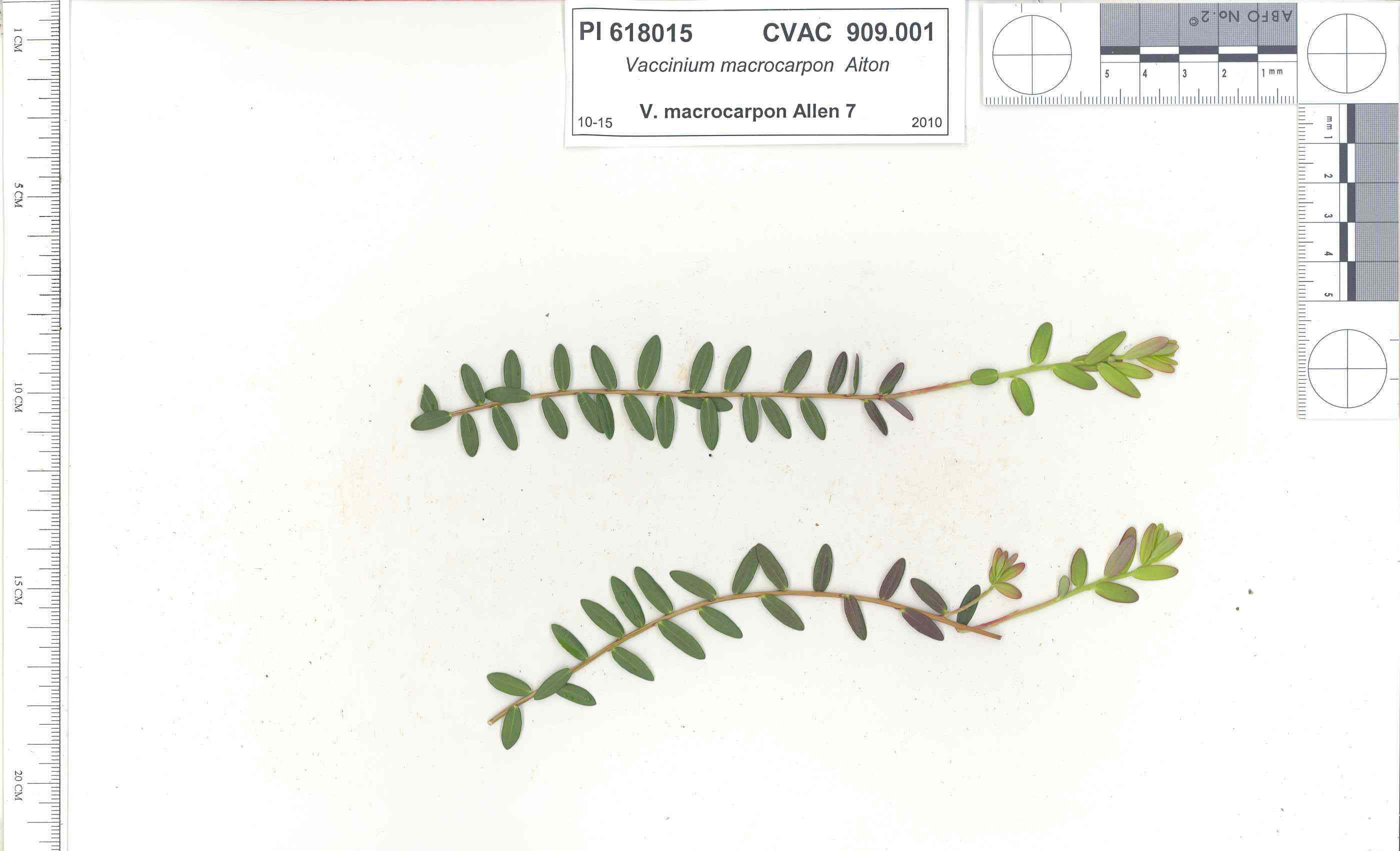 | | 1991 | COLLECTED | 10/29/1991 | Oligotrophic fen near WV/MD border in Preston county, WV, owned by the nature conservancy, WV, known as Cranesville Swamp | 39.51950000, -79.48233000 | 786 | 2 acres fen, bordered by Typha sp., Acer rubrum, Prunus serotina, Hemlock, Sotuhern most population of American Larch (Tamarack), also has Sphagnum spp., Rubus hispidus, Solidago uliginosa, Eripphorum virginicum, Pyrus melanocarpa | Wild material | Site holding moisture well in a regional drought, designated as a National Natural Landmark Additional plants are Hypericum densiflorum, Carex folliculata, Juncus effusus, J. canadensis, Bartonia virginica, Gaultheria procumbens | 1009919 | PI 618015 |
| 247 | PI 618017 | V. oxycoccos MD Allen 13 | Vaccinium oxycoccos L. | Maryland, United States | COR |  | | 1991 | COLLECTED | 10/30/1991 | "The Glades" minerotrophic fen, near Grantsville, Garrett county, MD | 39.55767000, -79.27967000 | 817 | greater than 100 acres, sedge/grass dominated minerotrophic fen, bordered by scattered white pine and spruce, also with Sphagnum spp., Solidago uliginosa, Glyceria canadensis, Calamogrostis canadensis, Carex Rostrata, C. Folliculata, | Wild material | Associated with Rubus Hispidus, Polytrichum sp., Alnus Rugosa. (This accession was part of the PL,SD 'breakout' - 1992) | 1009989 | PI 618017 |
| 248 | PI 618018 | V. macrocarpon MD Allen 14 | Vaccinium macrocarpon Aiton | Maryland, United States | COR |  | | 1991 | COLLECTED | 10/30/1991 | "Anvil Bog" Oligotrophic fen on Glotflety property, McHenry, Garrett county, MD | 39.56700000, -79.30483000 | 817 | Approximately 50 acres oligotrophic fen, bordered by cattail , hemlock, red sprucem and red maple, plants associated with Lycopodium inundatum (rare in MD), Eriphorium virginicum, Rubus hispidus, Sphagnum spp., Solidage uliginosa, | Wild material | Very dry site, V. macrocarpon fruits few and scattered. additional associated plants Pyrus melanocarpa, Gaultheria procumbens, Rhodedron sp.(This accession was part of the PL,SD 'breakout' - 1992) | 1009995 | PI 618018 |
| 249 | PI 618019 | V. oxycoccos Allen 15 | Vaccinium oxycoccos L. | Maryland, United States | COR | | | 1991 | COLLECTED | 10/30/1991 | "Anvil Bog" Oligotrophic fen on Glotflety property, McHenry, Garrett county, MD | 39.56700000, -79.30483000 | 817 | Approximately 50 acres oligotrophic fen, bordered by cattail , hemlock, red sprucem and red maple, plants associated with Lycopodium inundatum (rare in MD), Eriphorium virginicum, Rubus hispidus, Sphagnum spp., Solidage uliginosa, | Wild material | Very dry site, V. macrocarpon fruits few and scattered. additional associated plants Pyrus melanocarpa, Gaultheria procumbens, Rhodedron sp.(This accession was part of the PL,SD 'breakout' - 1992) | 1010008 | PI 618019 |
| 250 | PI 618020 | V. macrocarpon WV Allen 16 | Vaccinium macrocarpon Aiton | West Virginia, United States | COR |  | | 1991 | COLLECTED | 10/30/1991 | Minerotrophic fen in large basin between 2 ridges, Tucker Co Big Run Bog (A.K.A. Olson Bog), Monongahela National Forest | 39.11750000, -79.58333000 | 0 | associated plants Sphagnum sp., Rubus hispidus, Eripphorium virginicum, Carex sp., Juncus sp., Sarracenia purpurea (introduced), Ilex verticillata | Wild material | Site proposed as a research natural area. (This accession was part of the PL,SD 'breakout' - 1992) | 1010011 | PI 618020 |
| 251 | PI 618021 | V. oxycoccos Allen 17 | Vaccinium oxycoccos L. | West Virginia, United States | COR | | | 1991 | COLLECTED | 10/30/1991 | Minerotrophic fen in large basin between 2 ridges, Tucker Co Big Run Bog (A.K.A. Olson Bog), Monongahela National Forest | 39.11750000, -79.58333000 | 0 | associated plants Sphagnum sp., Rubus hispidus, Eripphorium virginicum, Carex sp., Juncus sp., Sarracenia purpurea (introduced), Ilex verticillata | Wild material | Site proposed as a research natural area. (This accession was part of the PL,SD 'breakout' - 1992) | 1010027 | PI 618021 |
| 252 | PI 618022 | V. macrocarpon WV Allen 18 | Vaccinium macrocarpon Aiton | West Virginia, United States | COR |  | | 1991 | COLLECTED | 10/30/1991 | Canaan mountain, Tucker county, Red Run Headwaters Bog, Monongahela National Forest | 39.07333000, -79.47316000 | 341 | 50A area intermediate between bog and fen, surrounded by Red spruce and Eastern Hemlock, also with Sphagnum spp., Rubus h hispidus, Eripphorium virginicum, Pyrus sp., Polytrichum sp. , Cares trisperma, Kalmia sp., Viburnum sp., Nemophanthus | Wild material | a very small population of V. oxycoccos was found across the road from this site, too few plants to collect. (This accession was part of the PL,SD 'breakout' - 1992) | 1010029 | PI 618022 |
| 253 | PI 560088 | MPW-WWR 218 | Cuphea viscosissima Jacq. | Tennessee, United States | NC7 | | | 1989 | COLLECTED | 09/14/1989 | On old railroad ballast with Cassia nictitans, Rubus argutus Rhus copallina, and Cirsium sp. Christian Camp, 1.25 mi S Hampton center, on old ET & WNCRR r.o.w., near Doe River Gorge, Elizabethton quad. Hampton city, in Carter Cty. | 36.26666667, -82.16666667 | 576 | | Wild material | Population of 8 scattered plants. | 1455060 | PI 560088 |
| 254 | NA 89345 | HOHO25-24 | Weigela coraeensis Thunb. | Honshu, Japan | NA | | | 2026 | COLLECTED | 09/26/2025 | Kanagawa Prefecture, Yokosuka City: Kamoi: Kannonzaki Park. | 35.25655415, 139.74562420 | 7 | Growing on tops of steep rocky cliffs and vegetation-covered cliff walls above the ocean. Slope: 90 percent. Aspect: North. | Wild material | | 2197564 | NA 89345 |
| 255 | Ames 36698 | Smith Cemetery NP | Echinacea simulata McGregor | Indiana, United States | NC7 |  | | 2025 | COLLECTED | 08/25/2025 | Smith Cemetery Nature Preserve located approximately 2.0 miles southwest of Perrysville on the southwest corner of SR 63 and a private lane, T18N R9W NE 1/4 NE 1/4 NE 1/4 Sec. 8. | 40.02625000, -87.45092000 | 167 | Prairie remnant (cemetery). | Wild material | Specimens at collection site in nature with drooping, pink to rose colored rays measuring 3.0-5.2 mm in width and 30.00-41.00 mm in length with bright yellow pollen. Plants measuring approximately 30" (762 mm) in height. Note: seed heads during threshing were extremely difficult to work with in order to extract seeds. | 2192821 | Ames 36698 |
| 256 | Ames 36697 | APS/JC/2025/XXX/XXX | Juniperus communis L. | Iowa, United States | NC7 |  | | 2025 | COLLECTED | 09/15/2025 | Located off Iowa River Drive approximately 2.5 miles southwest of New Albin, T100N R4W NE 1/4 NW 1/4 Sec. 21. | 43.46830000, -91.32128000 | 207 | Sandy ridge of a power line cut. | Wild material | | 2192820 | Ames 36697 |
| 257 | W6 62528 | FWS0300-131 | Symphyotrichum urophyllum (Lindl.) G. L. Nesom | Michigan, United States | W6 | 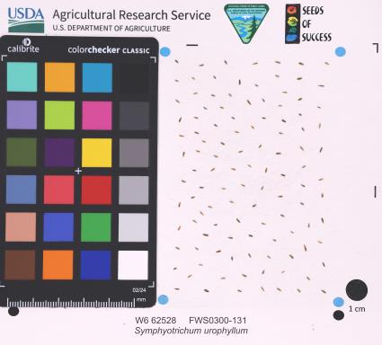 | | 2025 | | | | | | | Wild material | | 2192226 | W6 62528 |
| 258 | W6 62539 | FWS0300-154 | Liatris cylindracea Michx. | Michigan, United States | W6 |  | | 2025 | | | | | | | Wild material | The vegetative part of the population is likely dormant, though it is not possible to discern dormant individuals. Consequently, the above population size may be an underestimate. | 2192237 | W6 62539 |
| 259 | W6 62710 | CA360-240 | Verbena lasiostachys Link | California, United States | W6 |  | | 2025 | | | | | | | Wild material | | 2192928 | W6 62710 |
| 260 | W6 62724 RE | CA360A-22 | Asclepias fascicularis Decne. | California, United States | W6 |  | | 2025 | | | | | | | Wild material | RECOLLECTION. Surrounding berm of Paynes Creek Crossing, some in central portion of evaporated water drainage/ephemeral poolage. Roughly 1/4 still vegetative without any sign of infloresence or floral meristems. Some slight variation in developed follicle size. Beloved by praying mantises. | 2192942 | W6 62724 RE |
| 261 | NA 89114 | TLM25-03 | Zanthoxylum clava-herculis L. | Texas, United States | NA | | | 2025 | COLLECTED | 07/09/2025 | Jackson County Road 113, Bergston Road, approximately 2.1 kilometers north of the junction with Jackson County Road 234; growing on the west side of the road along a fenceline running parallel to the road. | 29.00576600, -96.76298500 | 24 | Plants are growing in full sun to light shade along a fence line near where cattle graze and the dirt road. The area is disturbed, but somewhat overgrown since there is very little traffic on the road that is primarily used by farmers and ranchers to access their fields. Slope: 0 to 1 percent. Aspect: N/A. Soils: The soils of this area sampled are classified as Laewest clay, 0 to 1 percent slopes (LaA). The Laewest Series consists of very deep, moderately well drained soils that formed in clayey flood basin deposits on alluvial plains or deltas of the Beaumont Formation of Pleistocene Age. These nearly level to gently sloping soils are on broad flat coastal plains. Slope ranges from 0 to 8 percent. The solum thickness is more than 200 cm and ranges from slightly acidic on the surface to neutral in deeper pedons. This is a cyclic soil and undisturbed areas have gilgai microrelief with microhighs 15 to 30 cm higher than microlows. Distance from the center of the microhighs to the center of the microlows ranges from about 1.2 to 4.9 m. The microhigh makes up about 20 percent, the intermediate, or area between the knoll and depression about 50 percent, and the microlow about 30 percent. The amplitude of waviness between mollic colored materials in the upper part of the solum and the higher value colors in the lower part ranges from about 30 to 150 cm. When dry, the soil has cracks 1 to 5 cm wide at the surface and commonly 1 cm wide cracks extend to a depth of 1.2 m during the summer. The cracks remain open for less than 90 cumulative days in most years. Some pedons have an overwash of calcareous clay or silty clay 20 to 51 cm thick. (Source: California Soil Resource Lab/NRCS Official Soil Series Descriptions). Geology: The underlying geology of this area is Lizzie Formation of Quaternary, Middle Pleistocene age. It is comprised of sand, silt, clay, and minor amount of gravel. Iron oxide and iron-manganese nodules are common in zones of weathering; locally calcareous. Surface is fairly flat and featureless except for many shallow depressions and pimple mounds. Moore and Wermund (1993a) mapped three units--(1) alluvium undifferentiated as to texture and origin--includes meander belt, levee, crevasse splay, and distributary sand, and flood-basin mud deposits, about 60 m thick, (2) fine-grained channel facies (alluvial sand, silt, and clay) about 10-25 m thick, thicker seaward, and (3) fine-grained overbank facies (alluvial silt and clay) about 55-65 m thick, thicker seaward. Together, these deposits form a deltaic plain that parallels the Gulf Coast. Unit contains Pleistocene vertebrate fauna, dips seaward beneath the Beaumont Fm. and disconformably overlies deposits of the Pliocene and early Pleistocene Willis Formation. The deltaic plain is entrenched as much as 7 m by streams. In Hidalgo County (southernmost part of Texas) the unit underlies a semiarid plain, widely irrigated and cultivated. Unit is locally veneered with thin, discontinuous stabilized eolian sand. (Source: USGS Texas Geologic Map Data). | Wild material | | 2191653 | NA 89114 |
| 262 | NA 89115 | TLM25-04a | Hamamelis ovalis S. W. Leonard | Texas, United States | NA | | | 2025 | COLLECTED | 07/10/2025 | State Highway 87 approximately 3.25 kilometers north of the crossroad junction with Texas Recreational Road 255 (RE 255); plants were growing in the narrow buffer woods along the east side of the highway. | 31.12051300, -93.72628100 | 138 | The habitat is an upland mixed coniferous and deciduous woodlands in part to full shade and dry conditions, often under drought stress. Plants seem to always occur on the top of dry ridges or well-drained slopes. Slope: 0 to 1 percent. Aspect: N/A. Soils: The soils of this collection area are classified as Tehran-Letney Association, hilly (TLE) soils. The Tehran Series (55%) consists of deep, somewhat excessively drained, moderately rapidly permeable soils on uplands. They formed in thick loamy and sandy sediments on the Western Coastal Plain. These soils are on gently sloping to moderately steep uplands with slopes ranging from 1 to 20 percent. The Letney Series (30%) consists of deep, well drained, moderately rapidly permeable, upland soils. They formed in thick sandy and loamy sediments of the coastal plains. These soils are on gently sloping to moderately steep uplands with slopes ranging from 1 to 20 percent. Soil pH ranges from 4.5 to 6.0. The minor soil components include Doucette Series (10%) and Boykin Series (5%) soils. (Source: California Soil Resource Lab/NRCS Official Soil Series Descriptions). Geology: The underlying geology of this area is of Oligocene origin and characterized as Catahoula Formation. This formation is extensive and deep in Texas, up to 185 meters thick. In the area of the collection the Catahoula Formation is primarily mudstone and sand. The upper 90-150 meters is mudstone that is tuffaceous, and sandy; also, occasionally, with some bentonitic clay. (Source: USGS Texas Geologic Map Data). | Wild material | | 2191654 | NA 89115 |
| 263 | Ames 36327 | Lick Creek Unit | Amelanchier arborea (F. Michx.) Fernald | Iowa, United States | NC7 |  | | 2025 | COLLECTED | 06/10/2025 | Shimek State Forest Lick Creek Unit just east of Farmington, T67N R7W NE ¼ Sec. 8 and Sec. 7 and also T68N R8W Sec. 25. | 40.62024500, -91.70427700 | 214 | Woodland edges. | Wild material | The native range of Amelanchier arborea is concentrated in the eastern half of the U.S. (Little, 1977). This accession represents a collection of A. arborea germplasm from the western region of the species native range, specifically the extreme southeastern corner of Iowa. Specimens sampled in nature ranging 15-35' in height. Typically smoothish bark, light grey in color. Peak flowering (white flowers) occuring usually in early April with orange, orange-red fall colors peaking typically end of September (southeastern Iowa). | 2191464 | Ames 36327 |
| 264 | NA 89193 | DLSP-SB | Hamamelis virginiana L. | Wisconsin, United States | NA | | | 2025 | COLLECTED | 08/21/2024 | Devil's Lake State Park: South Bluff. | 43.41164210, -89.74057740 | 327 | Shade to partial shade in clayey, organic, mesic material on boulders. Slope: 45 degrees. Aspect: Northwest. White oak-sugar maple vegetative community. | Wild material | | 2171014 | NA 89193 |
| 265 | NA 89194 | DLSP-WB | Hamamelis virginiana L. | Wisconsin, United States | NA | | | 2025 | COLLECTED | 08/21/2024 | Devil's Lake State Park: West Bluff. | 43.41418510, -89.73993600 | 332 | Shade to part shade/sun to full sun in thin layer of clayey organic matter on boulder field. Slope: 60 degrees. Aspect: East. Red oak-sugar maple-linden vegetative community. | Wild material | | 2171015 | NA 89194 |
| 266 | NA 89196 | KVR | Hamamelis virginiana L. | Wisconsin, United States | NA | | | 2025 | COLLECTED | 08/22/2024 | Kickapoo Valley Reserve. | 43.62650770, -90.64627490 | 299 | Shade in thick, clayey, organic soil with sand. Slope: 45 degrees. Aspect: Northeast. Silver maple-boxelder-elm vegetative community. | Wild material | | 2171017 | NA 89196 |
| 267 | NA 88582 | 2024RJLFL-013 | Cornus florida L. | Florida, United States | NA | | | 2024 | COLLECTED | 11/13/2024 | Woodland edge along the south side of Bud Bass Road (DOF B48), 0.30 kilometers east of the junction with Norman Riley Road. | 30.75753300, -86.80457600 | 39 | Mixed evergreen and deciduous forests in part shade in a mesic- to mesic-dry situation. Slope: 0 percent. Aspect: North. The underlying geology of this area is characterized as Citronelle Formation of the Pliocene period. The Citronelle Formation is widespread in the Gulf Coastal Plain. The type section for the Citronelle Formation, named by Matson (1916), is near Citronelle, Alabama. The Citronelle Formation grades laterally, through a broad facies transition, into the Miccosukee Formation of the eastern Florida panhandle. Coe (1979) investigated the Citronelle Formation in portions of the western Florida panhandle. The Citronelle Formation is a siliciclastic, deltaic deposit that is lithologically similar to, and time equivalent with, the Cypresshead Formation and, at least in part, the Long Key Formation (Cunningham et al., 1998) of the peninsula. In the western panhandle, some of the sediments mapped as Citronelle Formation may be reworked Citronelle. The lithologies are the same and there are few fossils present to document a possible younger age. The Citronelle Formation consists of gray to orange, often mottled, unconsolidated to poorly consolidated, very fine to very coarse, poorly sorted, clean to clayey sands. It contains significant amounts of clay, silt and gravel which may occur as beds and lenses and may vary considerably over short distances. Limonite nodules and limonite-cemented beds are common. Marine fossils are rare but fossil pollen, plant remains and occasional vertebrates are found. Much of the Citronelle Formation is highly permeable. It forms the Sand and Gravel Aquifer of the surficial aquifer system contain organics. The dominant fossils in the freshwater carbonates are mollusks. (Source: USGS Florida Geologic Map Data). The soils of this are characterized as Troup Series loamy sand, 0 to 5 percent slopes. The Troup series consists of very deep, somewhat excessively drained soils that formed in unconsolidated sandy and loamy marine sediments. Troup soils are on ridges and hillslopes. Slopes predominantly range from 0 to 15 percent but range to 45 percent. The soil pH is generally strongly acid. (Source: California Soil Resource Lab/NRCS Official Soil Series Descriptions). | Wild material | | 2169919 | NA 88582 |
| 268 | NA 88588 | 2024RM-001 | Hydrangea radiata Walter | Georgia, United States | NA | | | 2024 | COLLECTED | 10/24/2024 | Chattahoochee National Forest: Warwoman Wildlife Management Area: north side of Overflow Creek Road just west of the bridge over the Chattooga River. | 34.94956600, -83.20652000 | 498 | Mixed evergreen and deciduous moist mesic forest in part shade. The underlying geology of this area is characterized as Metagraywacke/Mica Schist Formation of the Precambrian-Paleozoic period. (Source: USGS Georgia Geologic Map Data). The soils of this are characterized as Tusquitee Series Loam, 10 to 25 percent slopes. The Tusquitee Series consists of very deep, well drained soils on gently sloping to very steep benches, foot slopes, toe slopes, and fans in coves in the Southern Blue Ridge mountains, MLRA 130B. These soils formed in colluvium derived from materials weathered from igneous and high-grade metamorphic crystalline rocks such as granite, mica gneiss, hornblende gneiss, and schist. Slope ranges from 2 to 95 percent. Solum thickness ranges from 1 to 3+ meters. Reaction is very strongly acid to slightly acid, in the A horizon. The Bw and lower horizons are very strongly acid to moderately acid. In the upper 1 meter, content of rock fragments, dominantly of gravel to stone size, ranges up to 35 percent. Below 1 meter, rock fragment content may range up to 60 percent. Content of mica flakes ranges from few to common. (Source: California Soil Resource Lab/NRCS Official Soil Series Descriptions). | Wild material | | 2169925 | NA 88588 |
| 269 | NA 88589 | 2024RM-002 | Lyonia ferruginea (Walter) Nutt. | Florida, United States | NA | | | 2024 | COLLECTED | 11/21/2024 | Eglin Air Force Base: collected along an unnamed sand road that leads to the former Flowers Boat Landing (now permanently closed) along the Yellow River. Accessed by boat. | 30.60823600, -86.83595500 | 6 | Mixed evergreen and deciduous open habitat in part shade to full sun. Slope: 0 to 1 percent. Aspect: N/A. The underlying geology of this area is characterized as Alluvium from undifferentiated Quaternary Sediments. Much of Florida's surface is covered by a varying thickness of undifferentiated sediments consisting of siliciclastics, organics and freshwater carbonates. Where these sediments exceed 20 feet (6.1 meters) thick, they were mapped as discrete units. To subdivide the undifferentiated sediments, those sediments occurring in flood plains were mapped as alluvial and flood plain deposits (Qal). Sediments showing surficial expression of beach ridges and dunes were mapped separately (Qbd) as were the sediments composing Trail Ridge (Qtr). Terrace sands were not mapped (refer to Healy [1975] for a discussion of the terraces in Florida). The subdivisions of the Undifferentiated Quaternary Sediments (Qu) are not lithostratigraphic units but are utilized to facilitate a better understanding of the State's geology. The siliciclastics are light gray, tan, brown to black, unconsolidated to poorly consolidated, clean to clayey, silty, unfossiliferous, variably organic-bearing sands to blue green to olive green, poorly to moderately consolidated, sandy, silty clays. Gravel is occasionally present in the panhandle. Organics occur as plant debris, roots, disseminated organic matrix and beds of peat. Freshwater carbonates, often referred to as marls in the literature, are scattered over much of the State. In southern Florida, freshwater carbonates are nearly ubiquitous in the Everglades. These sediments are buff colored to tan, unconsolidated to poorly consolidated, fossiliferous carbonate muds. Sand, silt and clay may be present in limited quantities. These carbonates often contain organics. The dominant fossils in the freshwater carbonates are mollusks. (Source: USGS Florida Geologic Map Data). The soils of this are characterized as Dorovan-Pamlico Series association. The Dorovan Series consists of very deep, very poorly drained, moderately permeable soils on densely forested flood plains, hardwood swamps, and depressions in the Atlantic Coast Flatwoods (153A), Eastern Gulf Coast Flatwoods (152A), and Southern Coastal Plain Major (133A) Land Resource Areas. They formed in highly decomposed acid-organic materials. Slopes are less than 1 percent. The organic material ranges from 1.3 to 2 meters or more thick. Reaction is extremely acid to very strongly acid in the organic layers and very strongly acid or strongly acid in the mineral layers. The Pamlico Series consists of very poorly drained soils that formed in decomposed organic material underlain by dominantly sandy sediment. The soils are on nearly level flood plains, bays, and depressions of the Coastal Plain. Slopes are less than 1 percent. Pamlico soils have 0.4 to 1.3 meters of organic material over dominantly sandy sediments. Reaction is extremely acid (less than 4.5 in 0.01 M calcium chloride) in the organic layers, and ranges from extremely acid to strongly acid in the underlying mineral layers. | Wild material | | 2169926 | NA 88589 |
| 270 | NA 88593 | 2024RJLNJ-001 | Ilex glabra (L.) A. Gray | New Jersey, United States | NA | | | 2024 | COLLECTED | 11/24/2024 | Mullica Township: Both sides of Duerer Street, approximately 0.37 kilometers southeast of 4th Avenue. | 39.55885000, -74.66442500 | 21 | Shade to almost full sun on compacted seasonally moist to temporarily wet areas of a mixed evergreen and deciduous woodland dominated by Pinus rigida. Vegetation of this area is very much defined by small changes in elevation that go from wet to very dry. Ilex glabra remains abundant throughout, though. Slope: N/A. Aspect: N/A. The underlying geology of this area is the Cohansey Formation of middle Miocene origin and comprised of sand, white to yellow with local gravel and clay. It is sometimes locally stained red or orange brown by iron oxides and (or) cemented into large blocks of ironstone. Unweathered clay is typically dark gray, but commonly weathers white where it is interbedded with thin beds of ironstone. Sand is typically medium grained and moderately sorted although it ranges from fine to very coarse grained and from poorly to well sorted. Sand consists of quartz and siliceous rock fragments. Some beds are locally micaceous. Maximum thickness in the map area is about 60 meters; however, thickness is difficult to determine because of the irregular basal contact and extensive post-depositional erosion. (Source: USGS New Jersey Geologic Map Data). The primary soil type in the area of this collection is classified as Mullica Series sandy loam, 0 to 2 percent slopes. These soils are typically coarse-loamy, siliceous, semiactive, and mesic typic humaquepts that are strongly to extremely acidic throughout the profile. The typical solum thickness ranges from 50-150+ cm. These soils are generally considered to be poorly drained. (Source: NRCS Web Soil Survey). | Wild material | | 2169930 | NA 88593 |
| 271 | Ames 36284 | Oak Creek Canyon | Alnus oblongifolia Torr. | Arizona, United States | NC7 |  | | 2024 | COLLECTED | 10/18/2024 | Oak Creek Canyon, approximately five miles north-northeast of Sedona in the Coconino National Forest, T18N R6E Sec. 8 and Sec. 21 and also T19N R6E Sec. 22 and Sec. 27. | 35.01694800, -111.73755900 | 1538 | Creek beds in canyon bottom. | Wild material | Plants sampled in nature had dark green, glossy leaves. Young bark is smooth and light grey, becoming dark and scaly with age. Approximately 50 feet in height. | 2169812 | Ames 36284 |
| 272 | NA 89075 | 2024RJLPA-001 | Rhododendron maximum L. | Pennsylvania, United States | NA | | | 2024 | COLLECTED | 09/18/2024 | Fieldstone Farm Tank Creek Nature Preserve (a property of the Pocono Heritage Land Trust): Collected along Tank Creek. The property is accessed from a parking area located on Devil's Hole Road. | 41.13862300, -75.34562700 | 493 | Mostly found in mixed deciduous forest with occasional conifers and evergreen shrubs generally on steep slopes above Tank Creek in rocky well-drained soils in shade to part-shade. The slopes are abundant in decomposed organic matter and runoff soils. Slope: 5 to 30 percent. Aspect: various. Geology: The underlying geology of this area is of Devonian origin and characterized as the Long Run Member of Catskill Formation. It is comprised of gray and grayish-red sandstone and grayish-red siltstone and mudstone in fining-upward cycles. (Source: USGS Pennsylvania Geologic Map Data). Soils: The primary soil type found here is classified as Alluvial Land. In geology, alluvial land refers to areas of land that are formed by the deposition of sediments carried by rivers, or other surface water. EPA Ecoregion (Level III): North Central Appalachians (62). EPA Ecoregion (Level IV): Low Poconos (62b). | Wild material | | 2169039 | NA 89075 |
| 273 | NA 89076 | 2024RJLPA-002 | Kalmia latifolia L. | Pennsylvania, United States | NA | | | 2024 | COLLECTED | 09/18/2024 | Fieldstone Farm Tank Creek Nature Preserve (a property of the Pocono Heritage Land Trust): Collected along Tank Creek. The property is accessed from a parking area located on Devil's Hole Road. | 41.13862300, -75.34562700 | 493 | Mostly found in mixed deciduous forest with occasional conifers and evergreen shrubs generally on sloping sites as an understory shrub in rocky well-drained soils in shade to part-shade. Slope: 5 to 15 percent. Aspect: various. Geology: The underlying geology of this area is of Devonian origin and characterized as the Long Run Member of Catskill Formation. It is comprised of gray and grayish-red sandstone and grayish-red siltstone and mudstone in fining-upward cycles. (Source: USGS Pennsylvania Geologic Map Data). Soils: The primary soil type found here is classified as Alluvial Land. In geology, alluvial land refers to areas of land that are formed by the deposition of sediments carried by rivers, or other surface water. EPA Ecoregion (Level III): North Central Appalachians (62). EPA Ecoregion (Level IV): Low Poconos (62b). | Wild material | | 2169040 | NA 89076 |
| 274 | NA 89077 | 2024RJLPA-003 | Viburnum acerifolium L. | Pennsylvania, United States | NA | | | 2024 | COLLECTED | 09/19/2024 | Birdell Road, near parking lot to trail where the road ends at Chambers Lake, which is part of Hibernia County Park. | 40.03559500, -75.85708600 | 187 | Plants are growing in deep shade of a dry deciduous forest dominated by Fagus grandifolia. Slope: 0 percent. Aspect: N/A. Geology: The underlying geology of this area is of Precambrian origin and characterized as Banded Mafic Gneiss. It is characterized as dark and fine to medium grained. This formation includes rocks of probable sedimentary origin; may be equivalent to "PZmgh." (Source: USGS Pennsylvania Geologic Map Data). Soils: The primary soil type in the area of this collection is classified as Neshaminy Series Silt Loam, very deep over mafic gneiss, 3 to 8 percent slopes (NvB). (Source: USDA-NRCS Official Soil Series Descriptions). EPA Ecoregion (Level III): Northern Piedmont (64). EPA Ecoregion (Level IV): Piedmont Uplands (64c). | Wild material | | 2169041 | NA 89077 |
| 275 | NA 89078 | 2024RJLPA-004 | Staphylea trifolia L. | Pennsylvania, United States | NA | | | 2024 | COLLECTED | 09/20/2024 | Along gated road about 0.33 kilometers southwest of the Lake Ontelaunee Trail parking lot. | 40.49850800, -75.89121300 | 94 | Plants are growing on well-drained steep slopes in shade to part shade of a deciduous forest. Slope: 35 to 50 percent. Aspect: East-southeast. Geology: The underlying geology of this area is of Ordovician origin and characterized as Shale and graywacke of Hamburg sequence. It is characterized by shale containing zones of conspicuous graywacke. (Source: USGS Pennsylvania Geologic Map Data). Soils: The primary soil type in the area of this collection is classified as Berks-Weikert Complex, 25 to 60% slopes (BkF). Dominantly sloping to very steep, moderately deep and shallow, well drained soils underlain by acid shale bedrock. (Source: UPenn State University Soil Info Website). EPA Ecoregion (Level III): Ridge and Valley (67). EPA Ecoregion (Level IV): Northern Shale Valleys (67b). | Wild material | | 2169042 | NA 89078 |
| 276 | NA 89080 | 2024RJLPA-006 | Ilex montana Torr. & A. Gray | Pennsylvania, United States | NA | | | 2024 | COLLECTED | 09/20/2024 | Berks and Schuylkill Counties: Hawk Mountain Sanctuary. | 40.64162200, -75.99122600 | 418 | Plants are growing from shade to full sun on a dry-mesic to very dry, well-drained upland/montane habitat characterized by an upland mixed deciduous and evergreen forest that is very rocky. All the plants found in this habitat go through periods of drought during the growing season due to the limited litter/soil layer in which moisture can be held. Elevation: 405 to 430 meters. Slope: 5 to 25 percent. Aspect: various. Geology: The underlying geology of this area is of Silurian origin and comprised of Shawangunk Formation. This formation is primarily light- to dark-gray, fine- to very coarse-grained sandstone and conglomerate containing thin shale interbeds. (Source: USGS Pennsylvania Geologic Map Data). Soils: The surface soil profile of this area is characterized as the Hazleton Series which consists of deep and very deep, well drained soils formed in residuum of acid gray, brown or red sandstone on uplands. The matrix includes a considerable accumulation of thin, flat, coarse fragments of sandstone, limestone, or schist with diameters up to 15 cm. Slope ranges from 0-80%. Permeability is moderately rapid to rapid. (Source: USDA-NRCS Official Soil Series Descriptions). EPA Ecoregion (Level III): Ridge and Valley (67). EPA Ecoregion (Level IV): Northern Sandstone Ridges (67c). | Wild material | | 2169044 | NA 89080 |
| 277 | NA 89081 | 2024RJLPA-009 | Rosa carolina L. | Pennsylvania, United States | NA | | | 2024 | COLLECTED | 09/22/2024 | Lancaster and York Counties: outcrops along the Susquehanna River, accessed from the Historic Lock 12 parking lot off of Pennsylvania Road 372. | 39.81483500, -76.32762200 | 34 | Plants are growing from part-sun to full sun in crevices of the outcrops and where organic debris has accumulated in between boulders along the Susquehanna River. The sites range from nearly xeric to dry mesic, at least on the surface. Plants are generally growing 4-10 m above the normal flow of the river; however, the Holtwood Dam is less than 1 kilometer upstream and debris found trapped in the boulders indicates that there is periodic flooding, at least, in the lower zone of 4+ meters or so above normal river flow. This habitat has a diverse assemblage of deciduous trees and shrubs as well as abundant herbaceous taxa. Slope: 0 to 60 percent. Aspect: Northeast (generally). Geology: The underlying geology of this area is probably of lower Paleozoic age and characterized as the Octoraro Formation. It includes albite-chlorite schist, phyllite, some hornblende gneiss, and granitized members. Soils: The area where this species occurs is right on the edge of two soil zones that transition from the river’s edge to mesic conditions upslope. The first is generally referred to as Rock Outcrop. This terrestrial matrix in which plants grow is largely exposed underlying rock geology with accumulated outwash, rock decomposition, and organic debris buildup. The second is Mt. Airy (80%) and Manor (20%) Series soils, 25 to 60 percent slopes, extremely stony (MRF). (Source: California Soil Resource Lab/NRCS Official Soil Series Descriptions). EPA Ecoregion (Level III): Northern Piedmont (64). EPA Ecoregion (Level IV): Piedmont Uplands (64c). | Wild material | | 2169045 | NA 89081 |
| 278 | NA 89082 | 2024RJLPA-010 | Amorpha fruticosa L. | Pennsylvania, United States | NA | | | 2024 | COLLECTED | 09/22/2024 | Outcrops along the Susquehanna River, accessed from the Historic Lock 12 parking lot off of Pennsylvania Road 372. | 39.81481500, -76.32757900 | 34 | Plants are growing from part-sun to full sun in crevices of the outcrops and where organic debris has accumulated in between boulders along the Susquehanna River. The sites range from nearly xeric to dry mesic, at least on the surface. Plants are generally growing 4-10 m above the normal flow of the river; however, the Holtwood Dam is less than 1 kilometer upstream and debris found trapped in the boulders indicates that there is periodic flooding, at least, in the lower zone of 4+ meters or so above normal river flow. This habitat has a diverse assemblage of deciduous trees and shrubs as well as abundant herbaceous taxa. Slope: 0 to 25 percent. Aspect: Northeast (generally). Geology: The underlying geology of this area is probably of lower Paleozoic age and characterized as the Octoraro Formation. It includes albite-chlorite schist, phyllite, some hornblende gneiss, and granitized members. Soils: The area where this species occurs is right on the edge of two soil zones that transition from the river’s edge to mesic conditions upslope. The first is generally referred to as Rock Outcrop. This terrestrial matrix in which plants grow is largely exposed underlying rock geology with accumulated outwash, rock decomposition, and organic debris buildup. The second is Mt. Airy (80%) and Manor (20%) Series soils, 25 to 60 percent slopes, extremely stony (MRF). (Source: California Soil Resource Lab/NRCS Official Soil Series Descriptions). EPA Ecoregion (Level III): Northern Piedmont (64). EPA Ecoregion (Level IV): Piedmont Uplands (64c). | Wild material | | 2169046 | NA 89082 |
| 279 | NA 89083 | 2024RJLPA-012 | Rhododendron periclymenoides (Michx.) Shinners | Pennsylvania, United States | NA | | | 2024 | COLLECTED | 09/22/2024 | Outcrops along the Susquehanna River, accessed from the Historic Lock 12 parking lot off of Pennsylvania Road 372. | 39.81477400, -76.32807300 | 35 | Plants are growing from shade to part-sun and occasionally full sun in crevices of the outcrops and where organic debris has accumulated in between boulders along the Susquehanna River. The sites range from nearly xeric to mesic, at least on the surface. Plants are generally growing 4-10 m above the normal flow of the river; however, the Holtwood Dam is less than 1 kilometer upstream and debris found trapped in the boulders indicates that there is periodic flooding, at least, in the lower zone of 4+ meters or so above normal river flow. This habitat has a diverse assemblage of deciduous trees and shrubs as well as abundant herbaceous taxa. Slope: 0 to 60 percent. Aspect: Northeast (generally). Geology: The underlying geology of this area is probably of lower Paleozoic age and characterized as the Octoraro Formation. It includes albite-chlorite schist, phyllite, some hornblende gneiss, and granitized members. Soils: The area where this species occurs is right on the edge of two soil zones that transition from the river’s edge to mesic conditions upslope. The first is generally referred to as Rock Outcrop. This terrestrial matrix in which plants grow is largely exposed underlying rock geology with accumulated outwash, rock decomposition, and organic debris buildup. The second is Mt. Airy (80%) and Manor (20%) Series soils, 25 to 60 percent slopes, extremely stony (MRF). (Source: California Soil Resource Lab/NRCS Official Soil Series Descriptions). EPA Ecoregion (Level III): Northern Piedmont (64). EPA Ecoregion (Level IV): Piedmont Uplands (64c). | Wild material | | 2169047 | NA 89083 |
| 280 | NA 89084 | 2024RJLPA-013 | Physocarpus opulifolius (L.) Maxim. | Pennsylvania, United States | NA | | | 2024 | COLLECTED | 09/22/2024 | Outcrops along the Susquehanna River, accessed from the Historic Lock 12 parking lot off of Pennsylvania Road 372. | 39.81466300, -76.32833900 | 36 | Plants are growing from shade to part-sun where organic debris has accumulated in between boulders as well as further upslope in deeper mesic soils along the Susquehanna River. This habitat has a diverse assemblage of deciduous trees and shrubs as well as abundant herbaceous taxa. Slope: 10 to 25 percent. Aspect: Northeast (generally). Geology: The underlying geology of this area is probably of lower Paleozoic age and characterized as the Octoraro Formation. It includes albite-chlorite schist, phyllite, some hornblende gneiss, and granitized members. Soils: The area where this species occurs is right on the edge of two soil zones that transition from the river’s edge to mesic conditions upslope. The first is generally referred to as Rock Outcrop. This terrestrial matrix in which plants grow is largely exposed underlying rock geology with accumulated outwash, rock decomposition, and organic debris buildup. The second is Mt. Airy (80%) and Manor (20%) Series soils, 25 to 60 percent slopes, extremely stony (MRF). (Source: California Soil Resource Lab/NRCS Official Soil Series Descriptions). EPA Ecoregion (Level III): Northern Piedmont (64). EPA Ecoregion (Level IV): Piedmont Uplands (64c). | Wild material | | 2169048 | NA 89084 |
| 281 | NA 89085 | 2024RJLPA-014 | Rhododendron arborescens (Pursh) Torr. | Pennsylvania, United States | NA | | | 2024 | COLLECTED | 09/22/2024 | Outcrops along the Susquehanna River, accessed from the Historic Lock 12 parking lot off of Pennsylvania Road 372. | 39.81618100, -76.33069800 | 38 | Plants are growing from shade to part-sun and occasionally full sun in crevices of the outcrops and where organic debris has accumulated in between boulders along the Susquehanna River. The sites range from nearly xeric to mesic, at least on the surface. Plants are generally growing 4-10 m above the normal flow of the river; however, the Holtwood Dam is less than 1 kilometer upstream and debris found trapped in the boulders indicates that there is periodic flooding, at least, in the lower zone of 4+ meters or so above normal river flow. This habitat has a diverse assemblage of deciduous trees and shrubs as well as abundant herbaceous taxa. Slope: 0 to 75 percent. Aspect: Northeast (generally). Geology: The underlying geology of this area is probably of lower Paleozoic age and characterized as the Octoraro Formation. It includes albite-chlorite schist, phyllite, some hornblende gneiss, and granitized members. Soils: The area where this species occurs is right on the edge of two soil zones that transition from the river’s edge to mesic conditions upslope. The first is generally referred to as Rock Outcrop. This terrestrial matrix in which plants grow is largely exposed underlying rock geology with accumulated outwash, rock decomposition, and organic debris buildup. The second is Mt. Airy (80%) and Manor (20%) Series soils, 25 to 60 percent slopes, extremely stony (MRF). (Source: California Soil Resource Lab/NRCS Official Soil Series Descriptions). EPA Ecoregion (Level III): Northern Piedmont (64). EPA Ecoregion (Level IV): Piedmont Uplands (64c). | Wild material | | 2169049 | NA 89085 |
| 282 | NA 89086 | 2024RJLPA-015 | Ilex verticillata (L.) A. Gray | Pennsylvania, United States | NA | | | 2024 | COLLECTED | 09/22/2024 | Outcrops along the Susquehanna River, accessed from the Historic Lock 12 parking lot off of Pennsylvania Road 372. | 39.81656600, -76.33136600 | 38 | Plants are growing from part-sun to full sun in crevices of the outcrops and where organic debris has accumulated in between boulders along the Susquehanna River. The sites range from nearly xeric to dry mesic, at least on the surface. Plants are generally growing 4-10 m above the normal flow of the river; however, the Holtwood Dam is less than 1 kilometer upstream and debris found trapped in the boulders indicates that there is periodic flooding, at least, in the lower zone of 4+ meters or so above normal river flow. This habitat has a diverse assemblage of deciduous trees and shrubs as well as abundant herbaceous taxa. Slope: 0 to 10 percent. Aspect: Northeast (generally). Geology: The underlying geology of this area is probably of lower Paleozoic age and characterized as the Octoraro Formation. It includes albite-chlorite schist, phyllite, some hornblende gneiss, and granitized members. Soils: The area where this species occurs is right on the edge of two soil zones that transition from the river’s edge to mesic conditions upslope. The first is generally referred to as Rock Outcrop. This terrestrial matrix in which plants grow is largely exposed underlying rock geology with accumulated outwash, rock decomposition, and organic debris buildup. The second is Mt. Airy (80%) and Manor (20%) Series soils, 25 to 60 percent slopes, extremely stony (MRF). (Source: California Soil Resource Lab/NRCS Official Soil Series Descriptions). EPA Ecoregion (Level III): Northern Piedmont (64). EPA Ecoregion (Level IV): Piedmont Uplands (64c). | Wild material | | 2169050 | NA 89086 |
| 283 | Ames 36263 | Chippewa National Forest (Itasca) | Viburnum opulus L. var. americanum Aiton | Minnesota, United States | NC7 |  | | 2024 | COLLECTED | 09/15/2024 | Chippewa National Forest between Alder and Suomi including Bowstring River, Turtle River, and Potato Creek watersheds. | 47.56968000, -93.68815400 | 407 | Roadside edges with most samples near open water (creek/rivers). | Wild material | Formerly known as Viburnum trilobum, American highbush cranberry (V. opulus var. americanum) is a North American native shrub that is utilized as an important ornamental and conservation plant that is also harvested as a minor fruit crop (jams/jellies). In nature, this variety is generally found in moist habitats typically along stream banks and swamps where ample moisture is readily available. The native range of V. opulus var. americana is concentrated in the northeastern United States and into Canada (Little, E. L. Jr. 1977). Attractive ornamental characteristics includes showy lacecap flowers in spring and bright red fruits and foliage in the fall. Fruits are tart with a hint of sweetness. The European highbush cranberry (V. opulus var. opulus) is nearly identical to American highbush cranberry other than small glands (<1 mm) on the petiole making the exact determination very challenging resulting in common misidentifications. A major difference between the American and European highbush cranberries is that the European variety produces unpalatable fruit. Recent research has shown that American and European highbush cranberries are genetically distinct and that plants of hybrid origin are uncommon (Tork et. al 2025). Genetics of this accession represents a very broad collection area stretching nearly 7.0 miles near Alder in central Itasca County of north central Minnesota. In August of 2022, a total of 23 leaf samples from this same area were sampled (OB001-OB012 and OB0015-OB025) and all samples were genetically confirmed as American highbush cranberry, V. opulus var. americanum (Tork et. al 2025). | 2168987 | Ames 36263 |
| 284 | Ames 36251 | JDC/UT/2024/008/1130 | Ulmus thomasii Sarg. | Minnesota, United States | NC7 | 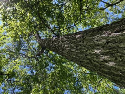 | | 2024 | COLLECTED | 06/05/2024 | Near southeast edge of Kasota Lake approximately 9.0 miles east, southeast of Willmar, T119N R34W SE 1/4 NE 1/4 Sec. 36 and also Robbins Island Park in Wilmar, T119N R35W Sec. 11. | 45.07399600, -94.88484100 | 352 | Deciduous woods | Wild material | Ulmus thomasii (Rock elm) is an underutilized tree species both in conservation and in the urban landscape. Described by Charles Sprague Sargent (first director for the Arnold Arborteum) as "heavy, hard, very strong and tough, closely grained, and susceptible of receiving a beautiful polish". Historically noted for a variety of uses in woodworking including furniture, heavy agricultural implements, timber frame buildings, pianos, hockey sticks, and hand tools. Ulmus thomasii is extremely drought tolerant, adaptable to very calcareous soils, and compared to U. americana or U. rubra has a very conservative growth rate requiring minimal attention in regards to pruning. Rock elm naturally tends to develop into a nice structural specimen in the landscape, unlike other fast growing cultivars in the nursery trade needing frequent attention. Rock elm has very fissured bark and is well known for maintaining a strong central leader resulting in a very attractive, pyramidal form. Despite many literature sources stating that "wings" on the stems are a key identifiying characteristic, this trait is not reliable and many genotypes may completely lack "wings" on the stems. While growth habit and morphology of dormant buds (very pointy) are good traits to help aid in identification, fruits are the best way to confirm identity. Fruits are densly pubescent, often described as "inflated" and generally reach maturity a couple weeks after Ulmus rubra and Ulmus americana. U. thomasii inflorescences are rather distinguishable from other Ulmus in being pendulous. Fruits are extremely prized treats for many birds, where fruits are often "robbed" prior to full maturity. Fruits are also highly prized by many other animals such as mice, squirrels, chipmunks, turkeys, etc. and are generally consumed within hours after fruit abscission. The native range of U. thomasii is concentrated in the northeastern United States and into Canada with disjunct populations documented in northwestern Missouri and northwestern Arkansas (Little, E. L. Jr. 1971). In the 1895 Silva of North America (vol. 7) it was stated that, “The value of the wood of the Rock Elm threatens its extinction and most of the large trees have already been cut.” Today, while rock elm is rather rare, especially in areas near the edges of its range, many states list the species as endangered or threatened warranting preservation efforts. Genetics of this accession would be representative of the species northwestern edge of its native range. Majority of specimens noted did not have characteristic "wings" on the stems and measured approximately 20" DBH or more with a few specimens nearing 30". Heights estimated between 70-90'. Rock elm in this area could be classified as locally abundant. | 2167953 | Ames 36251 |
| 285 | W6 61510 | CA180-280 | Erythranthe guttata (DC.) G. L. Nesom | California, United States | W6 |  | | 2024 | | | | | | | | | 2167609 | W6 61510 |
| 286 | W6 61543 | CA330-222 | Urtica dioica L. | California, United States | W6 |  | | 2024 | | | | | | | Wild material | pendant infl serrate margins Stem with angles stinging trichomes | 2167992 | W6 61543 |
| 287 | WLP 3432 | RM2023-001 | Rhododendron minus Michx. | Georgia, United States | NA | | | 2024 | COLLECTED | 10/21/2023 | Plants growing along Patterson Gap Road. | 34.96995500, -83.47722800 | 1005 | Plants growing in part shade to sun in an upland, very dry and rocky, mostly deciduous habitat. The site is steeply sloped, underlain by rock, with rocky outcrops. Slope: 15 to 65 percent. Aspect: Variable. The underlying geology of this area is Quartzite/Mica Schist, primarily of Precambrian-Paleozoic origin. (Source: USGS North Carolina Geologic Map Data.) The primary soil type in the collection area is classified as Ashe Series that is stony and very steep. The Ashe series consists of moderately deep, somewhat excessively drained soils on gently sloping to very steep ridges and side slopes of the Blue Ridge. They formed in residuum that is affected by soil creep in the upper part, and weathered from felsic or mafic igneous and high-grade metamorphic rocks such as granite, hornblende gneiss, granodiorite, biotite gneiss, and high-grade metagraywacke. Slope ranges from 2 to 95 percent. The surface layer to 5cm deep is comprised of moderately decomposed organic matter and leaves, twigs, and roots. Layers to 70cm deep range from very dark grayish brown to brown sandy loam with weak medium and coarse granular structure that is friable. A few fine flakes of mica can be found and these soils are very strongly acid. (Source: NRCS Web Soil Survey.) | Wild material | | 2166141 | WLP 3432 |
| 288 | WLP 3433 | RM2023-002 | Clethra acuminata Michx. | Georgia, United States | NA | | | 2024 | COLLECTED | 10/21/2023 | Plants growing along Patterson Gap Road. | 34.97299200, -83.46003100 | 789 | Plants growing in part shade in a very dry and rocky, mostly deciduous habitat. The site is steeply sloped, underlain by rock, with rocky outcrops. Slope: 15 percent. Aspect: Variable. The underlying geology of this area is Biotite Gneiss, primarily of Precambrian-Paleozoic origin. (Source: USGS North Carolina Geologic Map Data.) The primary soil type in the collection area is classified as Tusquitee loam, 10 to 25 percent slopes. The Tusquitee series consists of very deep, well drained soils on gently sloping to very steep benches, foot slopes, toe slopes, and fans in coves in the Southern Blue Ridge mountains, MLRA 130B. These soils formed in colluvium derived from materials weathered from igneous and high-grade metamorphic crystalline rocks such as granite, mica gneiss, hornblende gneiss, and schist. Slope ranges from 2 to 95 percent. The surface layer to 5cm deep is comprised of moderately decomposed organic matter and leaves, twigs, and roots. Layers to 2m deep range from very dark grayish brown to brown sandy loam with weak medium and coarse granular structure that is friable. A few fine flakes of mica can be found and these soils are very strongly acid. (Source: NRCS Web Soil Survey.) | Wild material | | 2166142 | WLP 3433 |
| 289 | WLP 3434 | RM2023-003 | Hydrangea arborescens L. | Georgia, United States | NA | | | 2024 | COLLECTED | 10/21/2023 | Plants growing along Patterson Gap Road. | 34.97369800, -83.46276600 | 809 | Plants growing in part shade in a very dry and rocky, mostly deciduous habitat. Slope: 25 percent. Aspect: variable. The underlying geology of this area is Biotite Gneiss, primarily of Precambrian-Paleozoic origin. (Source: USGS North Carolina Geologic Map Data.) The primary soil type in the collection area is classified as Porters Series which is stony and steep. The Porters series consists of deep, well drained, moderately permeable soils on cool, north- to east-facing or shaded ridges and side slopes in the Southern Blue Ridge mountains. These soils formed in residuum, affected by soil creep in the upper part, that has weathered from felsic to mafic, high-grade metamorphic and igneous rocks such as granite, gneiss, hornblende gneiss, mica gneiss, and amphibolite. Slope ranges from 2 to 95 percent. The surface layer to 18cm deep is very dark grayish brown loam; moderate fine and medium granular structure; very friable; many fine roots; few fine mica flakes; slightly acid. From 18 to 90 cm soil range from brown loam with weak fine and medium subangular blocky structure, few mica flakes, and few medium gneiss and quartz fragments that is moderately acid to sandy loam with gneiss saprolite with quartz, weathered feldspar, hornblende, mica and other minerals that is slightly acid and grades into hard rock. (Source: NRCS Web Soil Survey.) | Wild material | | 2166143 | WLP 3434 |
| 290 | WLP 3411 | TJK2023FL-044 | Cyrilla racemiflora L. | Florida, United States | NA |  | | 2024 | COLLECTED | 12/26/2023 | Forest Hill Cemetery, east fence line, 0.4 mi north of Hwy 98, off Twine Rd. | 29.78030000, -85.27160000 | 7 | Growing on the edge of a wet pine savanna/flatwood. Slope: flat. Aspect: Southeast. Elevation: 23 feet. | Wild material | | 2165704 | WLP 3411 |
| 291 | WLP 3412 | TJK2023FL-045 | Lyonia lucida (Lam.) K. Koch | Florida, United States | NA | | | 2024 | COLLECTED | 12/26/2023 | East backwoods adjacent to Forest Hill Cemetery, 0.4 mi north of Hwy 98, off Twine Rd. | 29.78030000, -85.27160000 | 7 | Edge of a wet pine savanna/flatwood. Slope: flat. Aspect: Southeast. Elevation: 23 feet. | Wild material | | 2165705 | WLP 3412 |
| 292 | NA 88827 | RJL-RM2023FLAL-001 | Ilex ambigua Torr. | Florida, United States | NA | | | 2023 | COLLECTED | 12/05/2023 | Yellow River Wildlife Management Area, along DOF [Department of Forestry] Y9 dirt road 0.08 kilometers east of Miller Bluff Road. | 30.65289100, -86.87602800 | 44 | Growing in part shade to sun in very dry, highly competitive site still recovering from the logging of pines in the past decade. This young woodland is comprised of a combination of evergreen and deciduous species competing for available resources and light before the young sand pines begin to dominate the upper canopy. Slope: 0 percent. Aspect: N/A. The underlying geology of this area is the Citronelle Formation, of Pliocene origin, and consists of gray to orange, often mottled, unconsolidated to poorly consolidated, very fine to very coarse, poorly sorted, clean to clayey sands. It contains significant amounts of clay, silt and gravel which may occur as beds and lenses and may vary considerably over short distances. Limonite nodules and limonite-cemented beds are common. (Source: USGS Florida Geologic Map Data.) The primary soil type in the collection area is classified as Lakeland Sand soils (0 to 5 percent slopes). The surface soil profile of this area is primarily the Lakeland series which consists of very deep, excessively drained, rapid to very rapidly permeable soils on uplands. They formed in thick beds of eolian or marine and/or fluvio-marine sands. Thickness of the sand exceeds 2 meters. Silt plus clay in the upper meter ranges from 5-10 percent. Reaction ranges from very strongly acid to moderately acid throughout. (Source: NRCS Web Soil Survey.) | Wild material | | 2165657 | NA 88827 |
| 293 | NA 88828 | RJL-RM2023FLAL-002 | Vaccinium arboreum Marshall | Florida, United States | NA | | | 2023 | COLLECTED | 12/05/2023 | Yellow River Wildlife Management Area, along DOF [Department of Forestry] Y9 dirt road 0.08 kilometers east of Miller Bluff Road. | 30.65289100, -86.87608500 | 44 | Growing in part shade to sun in very dry, highly competitive site still recovering from the logging of pines in the past decade. This young woodland is comprised of a combination of evergreen and deciduous species competing for available resources and light before the young sand pines begin to dominate the upper canopy. Slope: 0 percent. Aspect: N/A. The underlying geology of this area is the Citronelle Formation, of Pliocene origin, and consists of gray to orange, often mottled, unconsolidated to poorly consolidated, very fine to very coarse, poorly sorted, clean to clayey sands. It contains significant amounts of clay, silt and gravel which may occur as beds and lenses and may vary considerably over short distances. Limonite nodules and limonite-cemented beds are common. (Source: USGS Florida Geologic Map Data.) The primary soil type in the collection area is classified as Lakeland Sand soils (0 to 5 percent slopes). The surface soil profile of this area is primarily the Lakeland series which consists of very deep, excessively drained, rapid to very rapidly permeable soils on uplands. They formed in thick beds of eolian or marine and/or fluvio-marine sands. Thickness of the sand exceeds 2 meters. Silt plus clay in the upper meter ranges from 5-10 percent. Reaction ranges from very strongly acid to moderately acid throughout. (Source: NRCS Web Soil Survey.) | Wild material | | 2165658 | NA 88828 |
| 294 | NA 88829 | RJL-RM2023FLAL-003 | Oxydendrum arboreum (L.) DC. | Florida, United States | NA | | | 2023 | COLLECTED | 12/05/2023 | Yellow River Wildlife Management Area, along DOF [Department of Forestry] Y15 dirt road 0.06 kilometers north of Fisher Old Mill Road. | 30.62728600, -86.83824600 | 7 | Growing in part shade to sun in moist to wet flat woods of the longleaf pine forest. The woodland is comprised mostly of open habitat of longleaf pine and an understory tree and shrub layer of evergreen and deciduous species. There is also a wealth of herbaceous species in moist to wet conditions of the habitat where there is rich organic matter in the surface layer. Slope: 0 percent. Aspect: N/A. The underlying geology of this area is classified as Alluvium, of Pleistocene/Holocene origin and consists of undifferentiated Quaternary sediments of varying thickness including siliciclastics, organics and freshwater carbonates. The siliciclastics are light gray, tan, brown to black, unconsolidated to poorly consolidated, clean to clayey, silty, unfossiliferous, variably organic-bearing sands to blue green to olive green, poorly to moderately consolidated, sandy, silty clays. Organics occur as plant debris, roots, disseminated organic matrix and beds of peat. Freshwater carbonates, often referred to as marls in the literature, are scattered. (Source: USGS Florida Geologic Map Data.) The primary soil types in the collection area are classified as Pactolus Loamy Sand soils (0 to 5 percent slopes). The Pactolus Series consists of very deep, moderately well to somewhat poorly drained soils. Permeability is rapid. These Coastal Plain soils, typically found with streams and marine terraces and were formed by loamy and sandy fluvial sediments and marine sediments. The strata is, generally, uniformly loamy sand that is very friable and strongly acid from the surface to a depth of 1.8 meters. (Source: NRCS Web Soil Survey.) | Wild material | | 2165659 | NA 88829 |
| 295 | NA 88836 | RJL-RM2023FLAL-010 | Leucothoe axillaris (Lam.) D. Don | Florida, United States | NA | | | 2023 | COLLECTED | 12/08/2023 | Along Gin/Camp Road at the bridge over Thomas Creek on the east side of the road. | 30.75018700, -87.23492900 | 21 | Growing in shade of the moist to wet habitat along Thomas Creek. Plants receive regular moisture and are occasionally flooded in this habitat. Slope: N/A. Aspect: N/A. The underlying geology of this area is the Citronelle Formation of Pliocene origin and consists of gray to orange, often mottled, unconsolidated to poorly consolidated, very fine to very coarse, poorly sorted, clean to clayey sands. It contains significant amounts of clay, silt and gravel which may occur as beds and lenses and may vary considerably over short distances. Limonite nodules and limonite-cemented beds are common. (Source: USGS Florida Geologic Map Data.) The surface soil profile of this area is primarily Bibb-Kinston series association. Bibb series soils are coarse-loamy, sandy, acid soils that are poorly drained. They are soils of flood plains and streams subject to frequent flooding. These are found in association with Kinston series soils that are fine-loamy, sandy, acid soils of flood plains and stream subject to frequent flooding. The Bibb-Kinston association ranges from 1-1.5 meters thick and is strongly acid. (Source: NRCS Web Soil Survey.) | Wild material | | 2165666 | NA 88836 |
| 296 | NA 88838 | RJL-RM2023FLAL-012 | Ilex opaca Aiton | Florida, United States | NA | | | 2023 | COLLECTED | 12/08/2023 | North side of Sid Hayes Road approximately 65 m southeast of the junction with Watson Road. | 30.83277400, -87.24324500 | 32 | Growing in shade, part shade and light shade in dry mesic to moist, occasionally wet, habitats along the edge of the road and in the woodland interior. This species is remarkably adaptable. The only drawback to the range of habitats is that in deep shade, very few fruit can be found, presumably because there is far less flower production and/or fewer pollinators. Slope: 0 to 3 percent. Aspect: South. The underlying geology of this area is the Citronelle Formation of Pliocene origin and consists of gray to orange, often mottled, unconsolidated to poorly consolidated, very fine to very coarse, poorly sorted, clean to clayey sands. It contains significant amounts of clay, silt and gravel which may occur as beds and lenses and may vary considerably over short distances. Limonite nodules and limonite-cemented beds are common. (Source: USGS Florida Geologic Map Data.) The surface soil profile of this area is Dothan Series fine sandy loam soils (5 to 8 percent slopes). The Dothan Series consists of very deep, well drained soils that formed in thick beds of unconsolidated, medium to fine-textured marine sediments. Dothan soils are on interfluves. The surface 0-33 cm is characterized by sandy-loam, well-drained soils that are strongly acid. From 33-200 cm they are characterized by sandy clay loam soils that are more moisture retentive and strongly acid. (Source: NRCS Web Soil Survey.) | Wild material | | 2165668 | NA 88838 |
| 297 | NA 88840 | RJL-RM2023FLAL-014 | Rhododendron viscosum (L.) Torr. | Florida, United States | NA | | | 2023 | COLLECTED | 12/11/2023 | Property of Floyd Griffith off View Drive on the southwest side of McCormick Lake. | 30.63247000, -85.33718200 | 56 | Plants are growing primarily in part shade a few meters above the lake, generally in areas that appear dry, but clearly are associated with hillside seeps. While much of the area has been cultivated, the remnant native flora are largely broadleaved evergreen shrub and deciduous shrub and tree species. Slope: 10 to 15 percent. Aspect: Northeast. The underlying geology of this area is the Citronelle Formation of Pliocene origin and consists of gray to orange, often mottled, unconsolidated to poorly consolidated, very fine to very coarse, poorly sorted, clean to clayey sands. It contains significant amounts of clay, silt and gravel which may occur as beds and lenses and may vary considerably over short distances. Limonite nodules and limonite-cemented beds are common. (Source: USGS Florida Geologic Map Data.) The surface soil profile of this area is primarily Pamlico-Pantego-Rutlege Association. The Pamlico series consists of very poorly drained soils that formed in decomposed organic material underlain by dominantly sandy sediment. The soils are on nearly level flood plains, bays, and depressions of the Coastal Plain. Slopes are less than 1 percent. Pamlico soils have 0.4-1.3 meters of organic material over dominantly sandy sediments. Reaction is extremely in the organic layers and ranges from extremely acid to strongly acid in the underlying mineral layers. The Pantego series consists of very deep, very poorly drained, moderately permeable soils that formed in thick loamy sediments on the Southern Coastal Plain and Atlantic Coast Flatwoods. Slopes are less than 2 percent. This soil is strongly acid. The Rutlege series comprises very deep, very poorly drained persistently wet soils on flats, depressions and floodplains where shallow ponding is common. They are of marine or fluvial sediment origin. Thickness of these loamy sandy soils is greater than 1.5 meters and a reaction from extremely acid to strongly acid. (Source: NRCS Web Soil Survey.) | Wild material | | 2165670 | NA 88840 |
| 298 | NA 88844 | RJL-RM2023FLAL-018 | Clethra alnifolia L. | Florida, United States | NA | | | 2023 | COLLECTED | 12/13/2023 | Yellow River Water Management Area, accessed off of Old River Road by vehicle on an unmaintained sand road for approximately 1.68 kilometers. Upon reaching the destination, plants are accessed by foot along unmaintained trail to the east. | 30.83495500, -86.62005400 | 27 | Plants are growing primarily in part shade as understory shrubs in mixed evergreen and deciduous, moist to wet, acidic woodlands. Plants form large colonies and appear to have been subjected to prescribed fire in recent years. Slope: 10 to 15 percent. Aspect: Northeast. The underlying geology of this area is the Citronelle Formation of Pliocene origin and consists of gray to orange, often mottled, unconsolidated to poorly consolidated, very fine to very coarse, poorly sorted, clean to clayey sands. It contains significant amounts of clay, silt and gravel which may occur as beds and lenses and may vary considerably over short distances. Limonite nodules and limonite-cemented beds are common. (Source: USGS Florida Geologic Map Data.) The soil profile for this area is classified as the Bonifay Soil Series. Bonifay soil consists of very deep, well drained, moderately slowly permeable soils on ridges and side slopes in the Southern Coastal Plain. They formed in thick beds of sandy and loamy marine sediments. Solum thickness ranges from 1.5-2.0 m. Soil reaction ranges from very strongly acid to moderately acid throughout, except where the surface has been limed. Ironstone pebbles, 2 to 15 mm in size, range from 0 to 5 percent, by volume. Depth to the plinthic horizon ranges from 1.1-1.7 m. Some horizons contain up to 25 percent plinthite by volume. (Source: NRCS Web Soil Survey.) | Wild material | | 2165674 | NA 88844 |
| 299 | NA 88820 | TJK2023AL-005 | Hydrangea arborescens L. | Alabama, United States | NA | | | 2023 | COLLECTED | 12/07/2023 | Between Monroe County Route 1 and Tom Hayles Road. | 31.40575900, -87.54924000 | 22 | In woodlands on limestone outcrop. While the upper area of slopes is covered by a thin soil layer, the exposed limestone rock outcrop on the northwestern edge of this area is a low competition niche for plants like the Hydrangea to gain a foothold. Slope: 60% (plus). Aspect: Northwest. Elevation: 72 feet. | Wild material | | 2165649 | NA 88820 |
| 300 | NA 88821 | TJK2023AL-006 | Hydrangea quercifolia W. Bartram | Alabama, United States | NA | | | 2023 | COLLECTED | 12/07/2023 | Between Monroe County Route 1 and Tom Hayles Road. | 31.40580000, -87.54890000 | 22 | In woodlands on limestone outcrop. While the upper area of slopes is covered by a thin soil layer, the exposed limestone rock outcrop on the northwestern edge of this area is a low competition niche for plants like the Hydrangea to gain a foothold. Slope: 60% (plus). Aspect: Northwest. Elevation: 72 feet. | Wild material | | 2165650 | NA 88821 |
| 301 | NA 88689 | RJL2023NJ-002 | Kalmia latifolia L. | New Jersey, United States | NA | | | 2023 | COLLECTED | 11/10/2023 | Franklin Township: Piney Hollow Preservation Area (the site is owned by Franklin Township). Plants accessed by foot along trails throughout property. | 39.57400900, -74.93602400 | 32 | Plants growing in shade to part-shade of a mesic to mesic-dry woodland habitat that is mostly deciduous, but also includes pine overstory. Slope: N/A. Aspect: N/A. Soils: The underlying geology of this area is of Middle Miocene, Serravallian origin and characterized as an Cohansey Formation. It is comprised of sand, white to yellow with local gravel and clay. Locally stained red or orange brown by iron oxides and (or) cemented into large blocks of ironstone. Unweathered clay is typically dark gray, but commonly weathers white where interbedded with thin beds of ironstone. Unit is a complex of interfingering marine and nonmarine facies. Sand is typically medium grained and moderately sorted although it ranges from fine to very coarse grained and from poorly to well sorted. Sand consists of quartz and siliceous rock fragments. Some beds are locally micaceous. In general, the sand is crossbedded, although the style of crossbedding varies significantly with the paleoenvironment. Trough crossbedding predominates, especially in the nonmarine channel fill deposits, and the scale of the crossbeds varies from small to large. Maximum thickness in the map area is about 60 m; however, thickness is difficult to determine because of the irregular basal contact and extensive post-depositional erosion. There is as much as 18 m of relief along the basal contact. The basal contact is sharp, undulatory, and directly overlain by a thin gravel bed. The Cohansey Formation unconformably overlies the Kirkwood Formation and is found in channels cut down into the Kirkwood. Where the Kirkwood consists of sandy, light-colored sediments, the basal contact of the Cohansey is drawn below crossbedded sediments. Where the Kirkwood consists of dark-colored silty beds, the basal contact is drawn between light-colored Cohansey sediments and the underlying dark-colored sediments. The Cohansey was markedly thinned because of erosion prior to deposition of overlying units in the western and southern parts of the southern sheet. The unit has been extensively eroded and stripped from large areas of the New Jersey Coastal Plain, particularly in the central sheet where outliers are common. In spite of its widespread nature, the Cohansey is poorly exposed because of its loose sandy composition, which causes it to erode easily. (Source: USGS New Jersey Geologic Map Data.) The primary soil type in the location of this collection is classified as Downer loamy sand, 0 to 5 percent slopes, Northern Coastal Plain. Downer Series soils are very deep, well-drained soils that are coarse-loamy, siliceous, semiactive, mesic Typic Hapludults. The upper strata of Downer Series from 0 to 25 cm is dark grayish brown, brown loamy sand that is dry with weak fine granular structure. It is very friable and strongly acid. Lower strata from 25 to 76 cm are yellowish brown single grain, loose loamy sand with few extremely weakly cemented masses of oxidized iron in the lower part. This layer is very strongly acid. (Source: NRCS Web Soil Survey.) | Wild material | | 2159117 | NA 88689 |
| 302 | NA 88693 | RJL2023NJ-006 | Clethra alnifolia L. | New Jersey, United States | NA | | | 2023 | COLLECTED | 11/10/2023 | Franklin Township: Piney Hollow Preservation Area (the site is owned by Franklin Township). Plants accessed by foot along trails throughout property. | 39.57319800, -74.92908900 | 29 | Plants growing in shade to part-shade over a wide range of habitats from mesic to mesic-dry as well as moist to wetland habitats. The woodlands are mostly deciduous, but also include occasional pine overstory. Slope: N/A. Aspect: N/A. The underlying geology of this area is of Middle Miocene, Serravallian origin and characterized as an Cohansey Formation. It is comprised of sand, white to yellow with local gravel and clay. Locally stained red or orange brown by iron oxides and (or) cemented into large blocks of ironstone. Unweathered clay is typically dark gray, but commonly weathers white where interbedded with thin beds of ironstone. Unit is a complex of interfingering marine and nonmarine facies. Sand is typically medium grained and moderately sorted although it ranges from fine to very coarse grained and from poorly to well sorted. Sand consists of quartz and siliceous rock fragments. Some beds are locally micaceous. In general, the sand is crossbedded, although the style of crossbedding varies significantly with the paleoenvironment. Trough crossbedding predominates, especially in the nonmarine channel fill deposits, and the scale of the crossbeds varies from small to large. Maximum thickness in the map area is about 60 m; however, thickness is difficult to determine because of the irregular basal contact and extensive post-depositional erosion. There is as much as 18 m of relief along the basal contact. The basal contact is sharp, undulatory, and directly overlain by a thin gravel bed. The Cohansey Formation unconformably overlies the Kirkwood Formation and is found in channels cut down into the Kirkwood. Where the Kirkwood consists of sandy, light-colored sediments, the basal contact of the Cohansey is drawn below crossbedded sediments. Where the Kirkwood consists of dark-colored silty beds, the basal contact is drawn between light-colored Cohansey sediments and the underlying dark-colored sediments. The Cohansey was markedly thinned because of erosion prior to deposition of overlying units in the western and southern parts of the southern sheet. The unit has been extensively eroded and stripped from large areas of the New Jersey Coastal Plain, particularly in the central sheet where outliers are common. In spite of its widespread nature, the Cohansey is poorly exposed because of its loose sandy composition, which causes it to erode easily. (Source: USGS New Jersey Geologic Map Data.) The primary soil types in the area of this collection is classified as Atsion sand, 0 to 2 percent slopes, Northern Tidewater Area and Downer loamy sand, 0 to 5 percent slopes, Northern Coastal Plain. Atsion Series soils are very deep, poorly drained with moderate to rapid permeability above 70 cm and slower beneath. They are classified as sandy, siliceous, mesic Aeric Alaquods. The upper stratum from 0 to 25 cm is dark gray sand, dry, single grained and lose with many fine roots. It is extremely acid. Lower strata are light gray to dark brown with small percentages of rounded quartzose pebbles and are extremely acid. Downer Series soils are very deep, well-drained soils that are coarse-loamy, siliceous, semiactive, mesic Typic Hapludults. The upper stratum of Downer Series from 0 to 25 cm is dark grayish brown, brown loamy sand that is dry with weak fine granular structure. It is very friable and strongly acid. Lower strata from 25 to 76 cm are yellowish brown single grain, loose loamy sand with few extremely weakly cemented masses of oxidized iron in the lower part. This layer is very strongly acid. (Source: NRCS Web Soil Survey.) | Wild material | | 2159121 | NA 88693 |
| 303 | NA 88694 | RJL2023NJ-007 | Spiraea tomentosa L. | New Jersey, United States | NA | | | 2023 | COLLECTED | 11/10/2023 | Franklin Township: Piney Hollow Preservation Area (the site is owned by Franklin Township). Plants accessed by foot along trails throughout property. | 39.57318200, -74.92673700 | 28 | Plants growing in part-shade to sun along the edges of McCarthys Lakes in moist-mesic to wet areas dominated by herbaceous plants. Slope: N/A. Aspect: N/A. | Wild material | | 2159122 | NA 88694 |
| 304 | NA 88695 | RJL2023NJ-008 | Aronia arbutifolia (L.) Pers. | New Jersey, United States | NA | | | 2023 | COLLECTED | 11/10/2023 | Franklin Township: Piney Hollow Preservation Area (the site is owned by Franklin Township). Plants accessed by foot along trails throughout property. | 39.57262400, -74.92606900 | 28 | Plants growing in part-shade to sun along the edges of McCarthys Lakes and in the understory of a mixed deciduous and evergreen forest in moist-mesic to wet conditions. Slope: N/A. Aspect: N/A. | Wild material | | 2159123 | NA 88695 |
| 305 | NA 88697 | RJL2023NCSC-002 | Ilex amelanchier M. A. Curtis ex Chapm. | North Carolina, United States | NA | | | 2023 | COLLECTED | 11/12/2023 | Goose Pond Bay (Nature Conservancy-owned site): wetlands on the south side of McNeil Road approximately 0.64 kilometers west of junction with McIntosh Road. | 34.88254100, -79.09915700 | 60 | Plants are growing in part-shade to sun of a Carolina Bay habitat with seasonally moist to wet, acidic conditions. Slope: N/A. Aspect: N/A. The underlying geology of this area is of Cretaceous origin and characterized as Black Creek Formation. The formation is comprised of clay that is gray to black and lignitic. It contains thin beds and laminae of fine-grained micaceous sand and thick lenses of cross-bedded sand. This formation has glauconitic, fossiliferous clayey sand lenses in the upper part. (Source: USGS North Carolina Geologic Map Data.) The primary soil type in the collection area is classified as McColl loam soil. The McColl Series consists of poorly drained, slowly permeable soils that are shallow or moderately deep to a fragipan and very deep to bedrock. They formed in loamy sediments in oval depressions on the Coastal Plain. The soils are nearly level or concave. Runoff is frequently ponded. Slopes are less than 2 percent. These soils are strongly acid. (Source: NRCS Web Soil Survey.) | Wild material | | 2159125 | NA 88697 |
| 306 | NA 88704 | RJL2023NCSC-009 | Rhododendron viscosum (L.) Torr. | North Carolina, United States | NA | | | 2023 | COLLECTED | 11/13/2023 | Sandhills Game Land: wetlands and moist depressions along Hoffman Road, Scotland County Road 1328, | 34.95510000, -79.51769700 | 112 | Plants are growing in sun in an acidic wetland habitat rich in sphagnum and other wetland species. The habitat is moist to wet year-round and periodically has surface runoff occurring; even so, this habitat can become quite dry during seasonal periods without rainfall. Slope: 2 to 3 percent. Aspect: Northeast. The underlying geology of this area is of Tertiary origin and characterized as Pinehurst Formation. It is comprised of medium- to coarse-grained sand as well as cross-bedding and rhythmic bands of clayey sand that are unconsolidated. (Source: USGS North Carolina Geologic Map Data.) The primary soil type in the collection area is classified as Pelion Loamy Sand (2 to 6 percent slopes). The Pelion Loamy Sand series consists of very deep, moderately well-drained marine deposits, fluviomarine deposits, and sand sheets. Permeability is moderately slow or slow. Surface layers 0-25 cm deep are comprised of loamy sand with a weak fine granular structure and are very friable. Deeper horizons are comprised of sandy loam, sandy clay loam, or clay loam in the upper part and includes sandy clay or clay in the deepest part. Soils are extremely acid to strongly acid. (Source: NRCS Web Soil Survey.) | Wild material | | 2159132 | NA 88704 |
| 307 | NA 88705 | RJL2023NCSC-010 | Zenobia pulverulenta (W. Bartram ex Willd.) Pollard | North Carolina, United States | NA | | | 2023 | COLLECTED | 11/13/2023 | Sandhills Game Land: wetlands and moist depressions along Hoffman Road, Scotland County Road 1328, | 34.95510000, -79.51769700 | 112 | Plants are growing in part-shade to sun in an acidic wetland habitat rich in sphagnum and other obligate wetland species. The habitat is moist to wet year-round and periodically has surface runoff occurring; even so, this habitat can become quite dry during seasonal periods without rainfall. Slope: 2 to 3 percent. Aspect: Northeast. The underlying geology of this area is of Tertiary origin and characterized as Pinehurst Formation. It is comprised of medium- to coarse-grained sand as well as cross-bedding and rhythmic bands of clayey sand that are unconsolidated. (Source: USGS North Carolina Geologic Map Data.) The primary soil type in the collection area is classified as Pelion Loamy Sand (2 to 6 percent slopes). The Pelion Loamy Sand series consists of very deep, moderately well-drained marine deposits, fluviomarine deposits, and sand sheets. Permeability is moderately slow or slow. Surface layers 0-25 cm deep are comprised of loamy sand with a weak fine granular structure and are very friable. Deeper horizons are comprised of sandy loam, sandy clay loam, or clay loam in the upper part and includes sandy clay or clay in the deepest part. Soils are extremely acid to strongly acid. (Source: NRCS Web Soil Survey.) | Wild material | | 2159133 | NA 88705 |
| 308 | NA 88706 | RJL2023NCSC-011 | Smilax laurifolia L. | North Carolina, United States | NA | | | 2023 | COLLECTED | 11/13/2023 | Sandhills Game Land: wetland associated with the West Prong of Juniper Creek on the north side of Whisky Still Road approximately 0.63 kilometers northeast of Hoffman Road, Scotland County Road 1328. | 34.95683200, -79.51146200 | 103 | Plants are growing in part-shade to sun in an acidic wetland habitat rich in sphagnum and other wetland species. The habitat is moist to wet year-round and periodically has surface runoff occurring; even so, this habitat can become quite dry during seasonal periods without rainfall. Slope: N/A. Aspect: N/A. The underlying geology of this area is of Tertiary origin and characterized as Pinehurst Formation. It is comprised of medium- to coarse-grained sand as well as cross-bedding and rhythmic bands of clayey sand that are unconsolidated. (Source: USGS North Carolina Geologic Map Data.) The primary soil type in the collection area is classified as Johnston Series soils, 0 to 2 percent slopes, frequently flooded. The Johnson Series consists of very deep, very poorly drained coarse-loamy, siliceous, active, acid, thermic Cumulic Humaquepts. The upper 0-75 cm is black, mucky loam that is friable and very strongly acid. The lower strata to 1.75 m is dark gray, loamy fine sand, single grained, loose and very strongly acid. (Source: NRCS Web Soil Survey.) | Wild material | | 2159134 | NA 88706 |
| 309 | NA 88707 | RJL2023NCSC-012 | Rhododendron viscosum (L.) Torr. | North Carolina, United States | NA | | | 2023 | COLLECTED | 11/13/2023 | Sandhills Game Land: wetland associated with the West Prong of Juniper Creek on the north side of Whisky Still Road approximately 0.63 kilometers northeast of Hoffman Road, Scotland County Road 1328. | 34.95683200, -79.51146200 | 103 | Plants are growing in part-shade to sun in an acidic wetland habitat rich in sphagnum and other wetland species. The habitat is moist to wet year-round and periodically has surface runoff occurring; even so, this habitat can become quite dry during seasonal periods without rainfall. Slope: N/A. Aspect: N/A. The underlying geology of this area is of Tertiary origin and characterized as Pinehurst Formation. It is comprised of medium- to coarse-grained sand as well as cross-bedding and rhythmic bands of clayey sand that are unconsolidated. (Source: USGS North Carolina Geologic Map Data.) The primary soil type in the collection area is classified as Johnston Series soils, 0 to 2 percent slopes, frequently flooded. The Johnson Series consists of very deep, very poorly drained coarse-loamy, siliceous, active, acid, thermic Cumulic Humaquepts. The upper 0-75 cm is black, mucky loam that is friable and very strongly acid. The lower strata to 1.75 m is dark gray, loamy fine sand, single grained, loose and very strongly acid. (Source: NRCS Web Soil Survey.) | Wild material | | 2159135 | NA 88707 |
| 310 | NA 88718 | RJL2023NCSC-023 | Ilex decidua Walter | South Carolina, United States | NA | | | 2023 | COLLECTED | 11/15/2023 | Waccamaw National Wildlife Refuge: U.S. Highway 701, Yauhannah Landing on the east side of the Great Pee Dee River. Plants growing in low woods on the north side of the landing. | 33.66208900, -79.15305000 | 2 | Plants growing in shade to part-shade of a moist to wet woodland habitat that is mostly deciduous and evergreen. Portions of the woodland have depressions with year-round standing water. Slope: N/A. Aspect: N/A. The underlying geology of this area is of Quaternary origin and characterized as Alluvial Valley Swamp. This formation is unconformable on all underlying units. It is composed of fluvial sand and gravel at base, grading upwards into fine sands and silts, and local occasional peat. May be overrun with recent sediments from forest cutting and agriculture. (Source: USGS South Carolina Geologic Map Data.) The primary soil type in this collection area is classified as Johnston Series loam. The Johnson Series consists of very deep, very poorly drained coarse-loamy, siliceous, active, acid, thermic Cumulic Humaquepts. The upper 0-75 cm is black, mucky loam that is friable and very strongly acid. The lower stratum to 1.75 m is dark gray, loamy fine sand, single grained, loose and very strongly acid. (Source: NRCS Web Soil Survey.) | Wild material | | 2159146 | NA 88718 |
| 311 | NA 88671 | RJL2023PA-005 | Rhododendron maximum L. | Pennsylvania, United States | NA | | | 2023 | COLLECTED | 10/16/2023 | Appalachian National Scenic Trail: Pulpit Rock and Pinnacle Loop. Rocky woodlands along Furnace Creek as well as steep rocky slopes above Pulpit Rock Reservoir associated with the Pulpit Rock and Pinnacle Loop Trail. | 40.59226100, -75.94588800 | 301 | Well-drained and very rocky dry deciduous woodlands in part shade to full shade. Slope: 0-30%. Aspect: variable. The underlying geology of this area is of Silurian origin and characterized as the Shawangunk Formation. It is characterized by light- to dark-gray, fine- to very coarse-grained sandstone and conglomerate containing thin shale interbeds. Includes four members, in descending order: Tammany--conglomerate and sandstone; Lizard Creek--sandstone and red or green shale; Minsi--sandstone and conglomerate; Weiders--conglomerate. Tammany and Lizard Creek Members together are approximately equivalent to Clinton Group to the west; Minsi and Weiders Members together are equivalent to Tuscarora Formation to the west. (Source: USGS Pennsylvania Geologic Map Data). The primary soil type in the collection area is classified as Hazleton Series. The Hazleton series consists of deep and very deep, well drained soils formed in residuum of acid gray, brown or red sandstone on uplands. Slope ranges from 0 to 80 percent. Permeability is moderately rapid to rapid. Solum thickness ranges from 60 to 120 centimeters. Depth to lithic contact ranges from 1 to 2 meters. Rock fragments of angular sandstone, dominantly less than 25 cm in size, range from 5 to 70 percent in individual horizons. Boulders, stones, flags and channers cover about 5 to 60 percent of the surface of some pedons. Reaction ranges from strongly acid through extremely acid throughout. (Source: NRCS Web Soil Survey). | Wild material | | 2159062 | NA 88671 |
| 312 | NA 88672 | RJL2023PA-006 | Rhododendron periclymenoides (Michx.) Shinners | Pennsylvania, United States | NA | | | 2023 | COLLECTED | 10/16/2023 | Appalachian National Scenic Trail: Pulpit Rock and Pinnacle Loop. Rocky woodland edges above Furnace Creek around Pulpit Rock and Pinnacle Loop Trail. | 40.58668200, -75.94269600 | 247 | Well-drained and very rocky dry deciduous woodlands in part shade to full shade. Slope: 10%. Aspect: East. The underlying geology of this area is of Silurian origin and characterized as the Shawangunk Formation. It is characterized by light- to dark-gray, fine- to very coarse-grained sandstone and conglomerate containing thin shale interbeds. Includes four members, in descending order: Tammany--conglomerate and sandstone; Lizard Creek--sandstone and red or green shale; Minsi--sandstone and conglomerate; Weiders--conglomerate. Tammany and Lizard Creek Members together are approximately equivalent to Clinton Group to the west; Minsi and Weiders Members together are equivalent to Tuscarora Formation to the west. (Source: USGS Pennsylvania Geologic Map Data). The primary soil type in the collection area is classified as Hazleton Series. The Hazleton series consists of deep and very deep, well drained soils formed in residuum of acid gray, brown or red sandstone on uplands. Slope ranges from 0 to 80 percent. Permeability is moderately rapid to rapid. Solum thickness ranges from 60 to 120 centimeters. Depth to lithic contact ranges from 1 to 2 meters. Rock fragments of angular sandstone, dominantly less than 25 cm in size, range from 5 to 70 percent in individual horizons. Boulders, stones, flags and channers cover about 5 to 60 percent of the surface of some pedons. Reaction ranges from strongly acid through extremely acid throughout. (Source: NRCS Web Soil Survey). | Wild material | | 2159063 | NA 88672 |
| 313 | NA 88673 | RJL2023PA-007 | Rhododendron pilosum (Michx.) Craven | Pennsylvania, United States | NA | | | 2023 | COLLECTED | 10/25/2023 | Ned Smith Center for Art and Nature. | 40.53367300, -76.92715700 | 147 | Well-drained and very rocky, dry slopes above 10-50 meters above Wiconisco Creek in mixed deciduous and evergreen woodlands in part shade to full shade. Slope: 10-40%. Aspect: North. The underlying geology of this area is of Mississippian origin and characterized as the Pocono Formation. It is comprised of light-gray to buff or light-olive-gray, medium-grained, crossbedded sandstone and minor siltstone; commonly conglomeratic at base and in middle; medial conglomerate, where present, is used to divide into Mount Carbon and Beckville Members; equivalent to Burgoon Sandstone of Allegheny Plateau. (Source: USGS Pennsylvania Geologic Map Data). The primary soil type in the collection area is classified as Laidig Series. The Laidig series consists of very deep, well drained soils formed in colluvium from sandstone, siltstone, and some shale. They are gently sloping to very steep soils on benches and foot slopes. Permeability is moderate or moderately rapid above the fragipan and moderately slow or slow in the fragipan. Slope ranges from 0 to 55 percent. Solum thickness ranges from 1.25 to 2.0 meters or more. Depth to the fragipan ranges from 0.75 to 1.25 meters. The particle-size control section averages less than 35 percent rock fragments. Rock fragments range from 5 to 50 percent in individual subhorizons of the A, E, BE, BA and Bt horizons; 15 to 70 percent in individual subhorizons of the Btx horizon; and 20 to 70 percent in the C horizon. Rock fragments are mostly sandstone but include siltstone and shale. Rock fragments include channers, cobbles, flagstones, and stones. Soils range from extremely acid through strongly acid throughout. (Source: NRCS Web Soil Survey). | Wild material | | 2159064 | NA 88673 |
| 314 | NA 88674 | RJL2023PA-008 | Kalmia latifolia L. | Pennsylvania, United States | NA | | | 2023 | COLLECTED | 10/25/2023 | Ned Smith Center for Art and Nature. | 40.53463500, -76.92616300 | 130 | Well-drained and very rocky, dry slopes above 10-50 meters above Wiconisco Creek in mixed deciduous and evergreen woodlands in part shade to full shade. Slope: 10-40%. Aspect: North. The underlying geology of this area is of Mississippian origin and characterized as the Pocono Formation. It is comprised of light-gray to buff or light-olive-gray, medium-grained, crossbedded sandstone and minor siltstone; commonly conglomeratic at base and in middle; medial conglomerate, where present, is used to divide into Mount Carbon and Beckville Members; equivalent to Burgoon Sandstone of Allegheny Plateau. (Source: USGS Pennsylvania Geologic Map Data). The primary soil type in the collection area is classified as Laidig Series. The Laidig series consists of very deep, well drained soils formed in colluvium from sandstone, siltstone, and some shale. They are gently sloping to very steep soils on benches and foot slopes. Permeability is moderate or moderately rapid above the fragipan and moderately slow or slow in the fragipan. Slope ranges from 0 to 55 percent. Solum thickness ranges from 1.25 to 2.0 meters or more. Depth to the fragipan ranges from 0.75 to 1.25 meters. The particle-size control section averages less than 35 percent rock fragments. Rock fragments range from 5 to 50 percent in individual subhorizons of the A, E, BE, BA and Bt horizons; 15 to 70 percent in individual subhorizons of the Btx horizon; and 20 to 70 percent in the C horizon. Rock fragments are mostly sandstone but include siltstone and shale. Rock fragments include channers, cobbles, flagstones, and stones. Soils range from extremely acid through strongly acid throughout. (Source: NRCS Web Soil Survey). | Wild material | | 2159065 | NA 88674 |
| 315 | NA 88675 | RJL2023PA-009 | Viburnum acerifolium L. | Pennsylvania, United States | NA | | | 2023 | COLLECTED | 10/25/2023 | Ned Smith Center for Art and Nature. | 40.53539200, -76.92313500 | 136 | Well-drained and very rocky dry deciduous woodlands in part shade to full shade. Slope: 10-30%. Aspect: North. The underlying geology of this area is of Mississippian origin and characterized as the Pocono Formation. It is comprised of light-gray to buff or light-olive-gray, medium-grained, crossbedded sandstone and minor siltstone; commonly conglomeratic at base and in middle; medial conglomerate, where present, is used to divide into Mount Carbon and Beckville Members; equivalent to Burgoon Sandstone of Allegheny Plateau. (Source: USGS Pennsylvania Geologic Map Data). The primary soil type in the collection area is classified as Laidig Series. The Laidig series consists of very deep, well drained soils formed in colluvium from sandstone, siltstone, and some shale. They are gently sloping to very steep soils on benches and foot slopes. Permeability is moderate or moderately rapid above the fragipan and moderately slow or slow in the fragipan. Slope ranges from 0 to 55 percent. Solum thickness ranges from 1.25 to 2.0 meters or more. Depth to the fragipan ranges from 0.75 to 1.25 meters. The particle-size control section averages less than 35 percent rock fragments. Rock fragments range from 5 to 50 percent in individual subhorizons of the A, E, BE, BA and Bt horizons; 15 to 70 percent in individual subhorizons of the Btx horizon; and 20 to 70 percent in the C horizon. Rock fragments are mostly sandstone but include siltstone and shale. Rock fragments include channers, cobbles, flagstones, and stones. Soils range from extremely acid through strongly acid throughout. (Source: NRCS Web Soil Survey). | Wild material | | 2159066 | NA 88675 |
| 316 | NA 88676 | RJL2023PA-010 | Staphylea trifolia L. | Pennsylvania, United States | NA | | | 2023 | COLLECTED | 10/25/2023 | Seed collected along the Appalachian National Scenic Trail, accessed from the Duncannon Entrance. | 40.38132600, -77.02965700 | 103 | Well-drained and very rocky deciduous woodlands where soil has accumulated in part shade to full shade. Slope: 0-30%. Aspect: variable. The underlying geology of this area is of Devonian origin and characterized as the Duncannon Member of Catskill Formation. It is characterized by grayish-red sandstone, siltstone, and mudstone in fining-upward cycles; conglomerate occurs at base of some cycles. The sandstones which comprise the Duncannon Member are fine to very coarse grained and grayish red to grayish red-purple in color. The Duncannon Member is known to be crossbedded to planar bedded in beds anywhere from 3 to 9 meters thick. Conglomerates have been spotted at the base of the Duncannon Member. The Duncannon Member is poorly exposed in most areas except along the Lehigh River. The conglomerate portion of this member has been known to form ridges and ledges with thicknesses approaching 228 meters. (Source: USGS Pennsylvania Geologic Map Data). The primary soil type in the collection area is classified as Hazleton Series. The Hazleton series consists of deep and very deep, well drained soils formed in residuum of acid gray, brown or red sandstone on uplands. Slope ranges from 0 to 80 percent. Permeability is moderately rapid to rapid. Solum thickness ranges from 60 to 120 centimeters. Depth to lithic contact ranges from 1 to 2 meters. Rock fragments of angular sandstone, dominantly less than 25 cm in size, range from 5 to 70 percent in individual horizons. Boulders, stones, flags and channers cover about 5 to 60 percent of the surface of some pedons. Reaction ranges from strongly acid through extremely acid throughout. (Source: NRCS Web Soil Survey). | Wild material | | 2159067 | NA 88676 |
| 317 | NA 88677 | RJL2023PA-011 | Hydrangea arborescens L. | Pennsylvania, United States | NA | | | 2023 | COLLECTED | 10/25/2023 | Seed collected along the Appalachian National Scenic Trail, accessed from the Duncannon Entrance. | 40.37735300, -77.03997300 | 239 | Well-drained and very rocky dry deciduous woodlands in part shade to full shade. Slope: 20-50%. Aspect: Northwest. The underlying geology of this area is of Devonian origin and characterized as the Duncannon Member of Catskill Formation. It is characterized by grayish-red sandstone, siltstone, and mudstone in fining-upward cycles; conglomerate occurs at base of some cycles. The sandstones which comprise the Duncannon Member are fine to very coarse grained and grayish red to grayish red-purple in color. The Duncannon Member is known to be crossbedded to planar bedded in beds anywhere from 3 to 9 meters thick. Conglomerates have been spotted at the base of the Duncannon Member. The Duncannon Member is poorly exposed in most areas except along the Lehigh River. The conglomerate portion of this member has been known to form ridges and ledges with thicknesses approaching 228 meters. (Source: USGS Pennsylvania Geologic Map Data). The primary soil type in the collection area is classified as Dystrochrepts, boulder soils. These soils are characterized by coarse-silty loess over residuum weathered from sedimentary rock and located on steep ridges along the upper third of the mountainflank. These soils are comprised of cobbles, stones or boulders (9%), well-drained, and approximately 1 meter or less to lithic bedrock. (Source: NRCS Web Soil Survey). | Wild material | | 2159068 | NA 88677 |
| 318 | NA 88678 | RJL2023PA-012 | Viburnum acerifolium L. | Pennsylvania, United States | NA | | | 2023 | COLLECTED | 10/27/2023 | Slopes on the east side of Creek Road above the North Branch of White Clay Creek. | 39.78552600, -75.80251900 | 90 | Well-drained mesic-dry to rocky dry deciduous woodlands in part shade to full shade. Slope: 15-35%. Aspect: West to northwest. The underlying geology of this area includes two formations. The first and primary formation is Lower Paleozoic Glenarm Wissahickon Formation, lithologically similar to oligoclase-mica schist of the Wissahickon Formation, but also includes lenticular amphibolite bodies having ocean-floor basalt chemistry. The second formation is Lower Paleozoic Mafic Gneiss Formation that is dark and medium grained. It includes rocks of probable sedimentary origin. (Sources: USGS Pennsylvania Geologic Map Data). The primary soil type in the collection area is classified as Manor Series. The Manor Series consists of well-drained residuum weathered from micaceous schist. Soils in the upper pedon (0-33 cm) are very dark grayish brown loam with strong fine granular structure; also, very friable with fine mica flakes and strongly acid. Lower pedon soils (34-56 cm) are strong brown, sandy loams. They have weak medium sub-angular blocky structure, are friable with many fine and a few medium mica flakes; this pedon is very strongly acid. (Source: NRCS Web Soil Survey). | Wild material | | 2159069 | NA 88678 |
| 319 | NA 88679 | RJL2023PA-013 | Rhododendron prinophyllum (Small) Millais | Pennsylvania, United States | NA | | | 2023 | COLLECTED | 10/30/2023 | Southwest side of Dutch Mountain Road north of Pine Marsh Creek in Pennsylvania State Game Lands Number 66. | 41.48201500, -76.27286000 | 602 | Moist, well-drained habitat with good organic matter in part shade on a wooded slope next to the road. Slope: 5-10%. Aspect: East. The underlying geology of this area is of Mississippian origin and characterized as the Burgoon Formation. It is comprised of buff, medium-grained, cross bedded sandstone that includes shale and coal. In some places, it contains conglomerate at base as well as occasionally contains plant fossils; equivalent to Pocono Formation of Ridge and Valley province. (Source: USGS Pennsylvania Geologic Map Data). The primary soil type in the collection area is classified as Wellsboro Series. The Wellsboro Series consists of very deep, moderately well- and somewhat poorly-drained soils formed in till derived from red sandstone, siltstone, and shale. Slope ranges from 0 to 50 percent. Saturated hydraulic conductivity is moderately high or high in the mineral surface layer, subsurface layer, and upper part of the subsoil; and low or moderately low in the lower part of the subsoil (fragipan) and the substratum. Solum thickness is greater than 102 cm. Depth to the fragipan ranges from 36 to 76 cm. Depth to bedrock is 152 cm or more. Rock fragments of subangular and rounded sandstone, siltstone or shale range from 5 to 40 percent in the A and B horizons, and from 15 to 50 percent in the Bx and C horizons. Typically, rock fragments average about 5 to 25 percent by volume above the fragipan and 15 to 40 percent by volume in and below the fragipan. Reaction commonly ranges from very strongly acid through moderately acid. (Source: NRCS Web Soil Survey). | Wild material | | 2159070 | NA 88679 |
| 320 | NA 88681 | RJL2023PA-015 | Ilex verticillata (L.) A. Gray | Pennsylvania, United States | NA | | | 2023 | COLLECTED | 10/30/2023 | Wetlands near Phillips Creek: seed collected from plants on the north and south (further east) side of Pennsylvania Route 188 approximately 6.9 kilometers east of the junction with Pennsylvania Route 487. | 41.30353100, -76.22452800 | 381 | Boggy to moist habitats associated with wetlands of Phillips Creek in shade to full sun next to the road. Slope: 0%. Aspect: various. The underlying geology of this area is of Devonian origin and characterized as the Catskill Formation. It is comprised of grayish-red sandstone, siltstone, shale, and mudstone; units of gray sandstone occur in upper part; lithologies in upper part arranged in fining-upward cycles. In the Altoona area, the Catskill Formation is mapped as the Duncannon, Sherman Creek, and Irish Valley Members, which are described under "Central and Eastern Pennsylvania" provinces. (Source: USGS Pennsylvania Geologic Map Data). The primary soil type in the collection area is classified as Wellsboro Series. The Wellsboro Series consists of very deep, moderately well- and somewhat poorly-drained soils formed in till derived from red sandstone, siltstone, and shale. Slope ranges from 0 to 50 percent. Saturated hydraulic conductivity is moderately high or high in the mineral surface layer, subsurface layer, and upper part of the subsoil; and low or moderately low in the lower part of the subsoil (fragipan) and the substratum. Solum thickness is greater than 102 cm. Depth to the fragipan ranges from 36 to 76 cm. Depth to bedrock is 152 cm or more. Rock fragments of subangular and rounded sandstone, siltstone or shale range from 5 to 40 percent in the A and B horizons, and from 15 to 50 percent in the Bx and C horizons. Typically, rock fragments average about 5 to 25 percent by volume above the fragipan and 15 to 40 percent by volume in and below the fragipan. Reaction commonly ranges from very strongly acid through moderately acid. (Source: NRCS Web Soil Survey). | Wild material | | 2159072 | NA 88681 |
| 321 | WLP 3277 | TJK2023FL-025 | Oxydendrum arboreum (L.) DC. | Florida, United States | NA | | | 2023 | COLLECTED | 11/01/2023 | Blackwater River State Forest. Forest road Y15, north of Fischer Old Mill Rd. | 30.62731000, -86.83844000 | 7 | Wet Pine Flatwood. Slope: 2%. Aspect: East-southeast. Elevation: 23 feet. | Wild material | | 2159057 | WLP 3277 |
| 322 | WLP 3278 | TJK2023FL-026 | Aronia arbutifolia (L.) Pers. | Florida, United States | NA | | | 2023 | COLLECTED | 11/01/2023 | Blackwater River State Forest. Forest road Y15, north of Fischer Old Mill Rd. Within the Yellow River drainage. | 30.62806000, -86.83870000 | 6 | Wet Pine Flatwood. Slope: 2%. Aspect: Southwest. Elevation: 20 feet. | Wild material | | 2159058 | WLP 3278 |
| 323 | WLP 3279 | Serrulatum Group | Rhododendron viscosum (L.) Torr. | Florida, United States | NA | | | 2023 | COLLECTED | 11/01/2023 | Blackwater River State Forest. Forest road Y15, north of Fischer Old Mill Rd. Within the Yellow River drainage. | 30.62832000, -86.83976000 | 6 | Wet Pine Flatwood. Slope: 5%. Aspect: West. Elevation: 20 feet. | Wild material | Full name: Rhododendron viscosum Serrulatum Group. Received as Rhododendron serrulatum. | 2159059 | WLP 3279 |
| 324 | Ames 36185 | APS/BP/2023/076/286 | Betula populifolia Marshall | Indiana, United States | NC7 |  | | 2023 | COLLECTED | 11/02/2023 | Indiana Dunes State Park just 3.40 miles northeast of Chesterton, T37N R5W NE 1/4 SE 1/4 SW 1/4 Sec. 18 | 41.65352700, -87.03831500 | 186 | Low depressions with some standing water. Woodland edge. | Wild material | Represents a disjunct population in northwest Indiana and the extreme western edge of the species native range. Trees sampled in nature averaging 30-45' in height with trunks ranging from 3" up to 8" DBH. Bark dull-white to grey. Typically multi-stemmed trunks. Leaves with acuminate tips and branches with typically one male catkin at terminal end of branches, but occassionally two male catkins. | 2159042 | Ames 36185 |
| 325 | NA 89013 | TJK2023FL-021 | Smilax pumila Walter | Florida, United States | NA | | | 2023 | COLLECTED | 10/15/2023 | Collected at 1985 Reagan Rd in Navarre, Florida. | 30.40680000, -86.93090000 | 9 | Disturbed native residential woods. Elevation: 32 feet. Slope: 3%. Aspect: Southeast. | Wild material | | 2158906 | NA 89013 |
| 326 | NA 88667 | RJL2023PA-004 | Viburnum acerifolium L. | Pennsylvania, United States | NA | | | 2023 | | | | | | | Wild material | | 2158816 | NA 88667 |
| 327 | NA 88666 | RJL2023PA-003 | Hamamelis virginiana L. | Pennsylvania, United States | NA | | | 2023 | COLLECTED | 10/01/2023 | Collected primarily along the woodland edge along Northside Road on Pennsylvania State Gamelands No. 43 as well as a few on nearby roads. | 40.17974200, -75.76790700 | 176 | Plants were growing in mesic well-drained conditions on moderately sloping sites of a deciduous upland forest. This species grows well in shade to part-sun. Most abundant fruit development is found where plants are exposed to sunlight for a portion of the day. Slope: 15%. Aspect: North-northwest. The underlying geology of this area is of Precambrian origin and characterized as the Graphitic Felsic Gneiss. This includes Pickering Gneiss and small areas of marble; dominantly quartz and feldspar with varying amounts of graphite and various metamorphic minerals; medium grained, light to dark gray and greenish gray; sedimentary origin. (Source: USGS Pennsylvania Geologic Map Data.) The primary soil type in the area of this collection is classified as Gladstone Gravelly Loam Series (8 to 15 percent slopes). The Gladstone Series consists of very deep, well drained soils formed in residuum and colluvium from granitic gneiss. Saturated hydraulic conductivity is moderately high to high. Solum thickness ranges from 75 to 125 cm. Depth to granitic gneiss bedrock is 1.6 meters or more. The bedrock may be strongly weathered in the upper part. Gravel content ranges from 5 to 35 percent throughout the solum, and 10 to 40 percent in the C horizons. Fragments, larger than 3 inches in diameter, range from 0 to 20 percent by volume in the surface layer and 0 to 10 percent in the subsoil and substratum layers. Reaction is strongly or very strongly acid throughout the soil, unless limed. Areas that have been limed range to moderately acid in the upper part of the profile. (Source: NRCS Web Soil Survey.) | Wild material | | 2158815 | NA 88666 |
| 328 | NA 88665 | RJL2023PA-002 | Ilex verticillata (L.) A. Gray | Pennsylvania, United States | NA | | | 2023 | COLLECTED | 10/01/2023 | Woodlands along Pine Creek near the Harmonyville Road bridge. | 40.18764500, -75.76732200 | 141 | Moist to mucky, wet woodland conditions along Pine Creek. Much of the site is very wet due to recent rains; though, earlier in the year, the soils were only moist. Plants grow in both well-drained mesic conditions as well as seasonally wet conditions. They do not grow in standing water anywhere in this location. Plants in this population are found mostly in the shade and partial shade of deciduous trees; there are occasional gaps that offer higher light conditions as well. Slope: 0-2%. Aspect: N/A. The underlying geology of this area is of Precambrian origin and characterized as the Graphitic Felsic Gneiss. This includes Pickering Gneiss and small areas of marble; dominantly quartz and feldspar with varying amounts of graphite and various metamorphic minerals; medium grained, light to dark gray and greenish gray; sedimentary origin. (Source: USGS Pennsylvania Geologic Map Data). The primary soil type in the area of this collection is classified as Hatboro Silt Loam Series. The Hatboro Series consists of very deep and poorly drained soils formed in alluvium derived from metamorphic and crystalline rock. They are on flood plains. Slopes range from 0 to 3 percent. Saturated hydraulic conductivity is moderately high to high. Solum thickness ranges from 50 to 150 cm. Depth to bedrock ranges from 1.5 to 3 meters or more. Organic carbon decreases irregularly with depth or is greater than 0.2 percent directly above any strongly contrasting C horizon. The depth to strongly contrasting sand and gravel is more than 100 cm or the transition is greater than 12.5 cm. Content of gravel ranges from 0 to 10 percent in the solum and from 0 to 80 percent in the C horizon. Mica flakes are common in the solum, and the C horizon contains thin lenses of mica. Reaction ranges from very strongly acid through neutral to a depth of 75 cm and from moderately acid through slightly acid below 75 cm. (Source: NRCS Web Soil Survey.) | Wild material | | 2158814 | NA 88665 |
| 329 | NA 88664 | RJL2023PA-001 | Viburnum acerifolium L. | Pennsylvania, United States | NA | | | 2023 | COLLECTED | 10/01/2023 | Seed collected from plants growing along a two-mile stretch of Harmonyville Road on the woodland edge next to the road. [Note: latitude and longitude were collected at the location of the largest seed collection.] | 40.18482200, -75.78145100 | 158 | Plants were growing in well-drained and rocky mesic-dry woodlands from part shade along the road edge to full shade in the understory of the woodlands. Slope: 2-10%. Aspect: Variable. The underlying geology of this area is of Triassic origin and characterized as the Stockton Formation. It is characterized by light-gray to buff, coarse-grained, arkosic sandstone; includes reddish-brown to grayish-purple sandstone, siltstone, and mudstone. (Source: USGS Pennsylvania Geologic Map Data.) The primary soil type in the area of this collection is classified as Edgemont Channery Sandy Loam Series (8 to 25 percent slopes), extremely stony. The Edgemont Series consists of deep and very deep, well drained soils formed in the weathered residuum of quartzitic rocks. They have moderately high to high saturated hydraulic conductivity. Slopes range from 0 to 70 percent. Solum thickness ranges from 50 to 10 cm. Depth to bedrock ranges from about 1.5 to 2.2 meters. Kaolinite is the dominant mineral in the clay fraction with detectable amounts of illite, vermiculite, montmorillonite, chlorite and interstratified clays. Gravel, channers, and stone size fragments of quartzite and quartz are present throughout the profile. Rock fragments range from 5 to 40 percent in the horizons of the solum and from 10 to 90 percent in the C horizon. Reaction ranges from extremely acid to strongly acid throughout. (Source: NRCS Web Soil Survey.) | Wild material | | 2158813 | NA 88664 |
| 330 | NA 88663 | TJK2023FL-017 | Rhododendron austrinum (Small) Rehder | Florida, United States | NA | | | 2023 | COLLECTED | 09/17/2023 | Lower Yellow River, below the Old Land Place. | 30.55513000, -86.94659000 | 0 | An area with very nice Pink R. austrinum. Elevation: 0. Slope: 0 percent. Aspect: South-southwest. | Wild material | | 2158797 | NA 88663 |
| 331 | NA 88606 | KY23-008 | Ilex montana Torr. & A. Gray | Kentucky, United States | NA | | | 2023 | COLLECTED | 09/09/2023 | Black Mountain summit (second location, bulked with the first: Black Mountain; lat/long 36. 91614, -82. 89873) | 36.91434000, -82.89463000 | 1261 | Moist woods. Elevation: 4138 feet. Aspect: West. (Second location, bulked with first: Elevation: 4071 feet. Aspect: West.) | Wild material | | 2158698 | NA 88606 |
| 332 | NA 88607 | KY23-009 | Hydrangea arborescens L. | Kentucky, United States | NA | | | 2023 | COLLECTED | 09/09/2023 | Black Mountain summit. | 36.91312000, -82.89516000 | 1257 | Moist woods. Elevation: 4124 feet. Aspect: South. | Wild material | | 2158699 | NA 88607 |
| 333 | Ames 36168 | Mount Magazine | Ptelea trifoliata L. | Arkansas, United States | NC7 |  | | 2023 | COLLECTED | 08/26/2023 | Mount Magazine State Park primarily localized to the northwest rim of the mountain along the trails heading west from Brown's Spring, T6N R25W Sec. 21. | 35.17130900, -93.65582200 | 786 | Top of sky-island mountain. Localized along the rims just above steep cliffs on north facing slopes. | Wild material | Plants in nature ranging from three to fifteen feet in height with peak bloom observed during the first week of May (2023). | 2158787 | Ames 36168 |
| 334 | OPGC 8803 | CBG- 10754 | Aquilegia canadensis L. | Illinois, United States | OPGC | | | 2023 | | | | | | | Wild material | | 2142225 | OPGC 8803 |
| 335 | OPGC 8810 | CBG- 10773 | Penstemon pallidus Small | Illinois, United States | OPGC | | | 2023 | | | | | | | Wild material | | 2142241 | OPGC 8810 |
| 336 | OPGC 8813 | CBG- 10781 | Hieracium scabrum Michx. | Illinois, United States | OPGC | | | 2023 | | | | | | | Wild material | | 2142247 | OPGC 8813 |
| 337 | OPGC 8840 | CBG- 10848 | Symphyotrichum shortii (Lindl.) G. L. Nesom | Illinois, United States | OPGC | | | 2023 | | | | | | | Wild material | | 2142296 | OPGC 8840 |
| 338 | W6 61344 | CBG- 10756 | Perideridia americana (Nutt. ex DC.) Rchb. ex Steud. | Illinois, United States | W6 |  | | 2023 | | | | | | | Wild material | | 2142226 | W6 61344 |
| 339 | W6 61364 | CBG- 10780 | Ceanothus americanus L. | Illinois, United States | W6 |  | | 2023 | | | | | | | Wild material | | 2142246 | W6 61364 |
| 340 | W6 61366 | CBG- 10782 | Paronychia canadensis (L.) Alph. Wood | Illinois, United States | W6 |  | | 2023 | | | | | | | Wild material | | 2142248 | W6 61366 |
| 341 | W6 61375 | CBG- 10798 | Desmodium perplexum B. G. Schub. | Illinois, United States | W6 |  | | 2023 | | | | | | | Wild material | | 2142257 | W6 61375 |
| 342 | W6 61391 | CBG- 10816 | Crocanthemum canadense (L.) Britton | Illinois, United States | W6 |  | | 2023 | | | | | | | Wild material | | 2142273 | W6 61391 |
| 343 | W6 61393 | CBG- 10818 | Linum sulcatum Riddell | Illinois, United States | W6 |  | | 2023 | | | | | | | Wild material | | 2142275 | W6 61393 |
| 344 | W6 61403 | CBG- 10836 | Triosteum aurantiacum E. P. Bicknell | Wisconsin, United States | W6 |  | | 2023 | | | | | | | Wild material | | 2142285 | W6 61403 |
| 345 | W6 61417 | CBG- 10852 | Verbesina alternifolia (L.) Britton ex Kearney | Illinois, United States | W6 |  | | 2023 | | | | | | | Wild material | | 2142299 | W6 61417 |
| 346 | W6 61418 | CBG- 10853 | Agastache scrophulariifolia (Willd.) Kuntze | Illinois, United States | W6 |  | | 2023 | | | | | | | Wild material | | 2142300 | W6 61418 |
| 347 | Ames 36027 | Marietta Sand Prairie | Salix petiolaris Sm. | Iowa, United States | NC7 |  | | 2023 | COLLECTED | 03/15/2023 | Marietta Sand Prairie State Preserve approximately 7.5 miles northwest of Marshalltown on east side of Knapp Avenue, T84N R19W W 1/2 Sec. 11. | 42.09951000, -93.03668800 | 299 | Remnant sand prairie in areas with likely high water table. | Wild material | Slender-leaved willow, Salix petiolaris, is a somewhat dense suckering shrub that can reach up to 10' in height with slender stems that branch minimally, but typically maintains a height of 5-8'. Native to North America, the native range covers mostly the northeastern US stretching from Maine to western North Dakota and Canada south to central Iowa (Little, E. L. Jr. 1977). Salix petiolaris typically dominates wetland areas including sedge meadows, marshes, riverbanks, and lake shores. Despite favoring wet habitats, it can also be found in dry, upland areas, especially those with high-water tables. However, longevity is generally limited in upland habitats. S. petiolaris, similar to other willow species, responds well to fire, coppicing, or heavy browsing (highly favored by deer) by sprouting new stems close to the crown. In cultivation, plants after five years will encompass a 5' x 5' area due to stems that arch from the main base of the plant. Coppicing of plants to ground level is highly recommended either annually or once every 3-5 years to maintain vigorous growth and plant health. This species requires substantial to full sun exposure and is an excellent choice for streambank stabilizations and windbreaks to reduce soil erosion and drifting snow, respectively. This accession represents genetics from central Iowa and thus the southwestern edge of the species native range. Plants sampled in nature measuring at most 5' in height. Clump-type growth habit with minimal branching, but dense suckering (e.g. 50+ ramets per genet - typically encompassing 5' x 5' area) with winter stem colors ranging from red, orange-red, yellow, dark-green, green-brown, and yellow-green. Stems glabrous. Dormant buds occassionally black, but often reddish. | 2141651 | Ames 36027 |
| 348 | Ames 36017 | AS/GD/2023/002/212 | Gymnocladus dioicus (L.) K. Koch | Wisconsin, United States | NC7 |  | | 2023 | | | | | | | Wild material | Kentucky coffeetree in Wisconsin is rather rare. The Wisconsin Natural Heritage Inventory Program currently (2023) lists this taxon in Wisconsin as a species of concern with a state rank of S2 (Imperiled in Wisconsin due to a restricted range, few populations or occurrences, steep declines, severe threats, or other factors.) This accession represents genetics from a localized population with a near equal porportion of male and female specimens. While there are other known locations along the Wisconsin River, this population is producing seeds. The other known locations represent single clones that are distant enough from other existing clones that prevent the transfer of pollen and thus lack the ability to produce seed or will rarely produce. | 2141550 | Ames 36017 |
| 349 | Ames 36021 | AS/SP/2023/006/216 | Salix petiolaris Sm. | Wisconsin, United States | NC7 |  | | 2023 | COLLECTED | 02/25/2023 | Located just west of Kempster approximately 5.25 miles along County Road J (floodplain between Sucker Creek and West Branch Eau Claire River), T33N R10E Sec. 32 and 33 (extreme southern edges). | 45.29239600, -89.27583700 | 478 | Wetland | Wild material | Slender-leaved willow, Salix petiolaris, is a somewhat dense suckering shrub that can reach up to 10' in height with slender stems that branch minimally, but typically maintains a height of 5-8'. Native to North America, the native range covers mostly the northeastern US stretching from Maine to western North Dakota and Canada south to central Iowa (Little, E. L. Jr. 1977). Salix petiolaris typically dominates wetland areas including sedge meadows, marshes, riverbanks, and lake shores. Despite favoring wet habitats, it can also be found in dry, upland areas, especially those with high-water tables. However, longevity is generally limited in upland habitats. S. petiolaris, similar to other willow species, responds well to fire, coppicing, or heavy browsing (highly favored by deer) by sprouting new stems close to the crown. In cultivation, plants after five years will encompass a 5' x 5' area due to stems that arch from the main base of the plant. Coppicing of plants to ground level is highly recommended either annually or once every 3-5 years to maintain vigorous growth and plant health. This species requires substantial to full sun exposure and is an excellent choice for streambank stabilizations and windbreaks to reduce soil erosion and drifting snow, respectively. This accession represents genetics from central Wisconsin. Plants noted in nature measuring up to 6' in height. Very densely suckering clumps occassionally reaching up to 10' in diameter. Stem colors on most recent year's growth varied from orange-yellow, red (predominate), to yellow. Petioles are minutely hairy. | 2141554 | Ames 36021 |
| 350 | Ames 36024 | AS/FN/2023/011/221 | Fraxinus nigra Marshall | Wisconsin, United States | NC7 |  | | 2023 | COLLECTED | 02/26/2023 | Located just north of Leland approximately 0.70 miles along Hemlock Road, T10N R5E SW 1/4 NW 1/4 Sec. 18 | 43.34472800, -89.95099700 | 242 | Floodplain | Wild material | Single mother tree sample with signs of wood pecker damage on trunk. | 2141557 | Ames 36024 |
| 351 | NA 88599 | RJL2023NC-001 | Ilex decidua Walter | North Carolina, United States | NA | | | 2023 | COLLECTED | 02/18/2023 | Plants growing along a fenceline on a hillside about 10 meters from Interstate 85 (south bound) and approximately 0.65 kilometers south of the North Carolina-Virginia border. | 36.53904800, -78.18822500 | 86 | The plant was growing on the upper shoulder of a slope about 7 meters above the highway in part-shade to sun of an upland, well-drained, dry mesic somewhat disturbed site on the fenceline boundary of Interstate 85 (south bound). The area was originally cleared of all vegetation and now, many years later, native and non-native plant species have aggressively recolonized the area. This early successional habitat is dominated by Juniperus virginiana and Liquidambar styraciflua, as well as, non-native species such as Ligustrum sinense, Lonicera japonica, and Ailanthus altissima. The underlying geology of this area is of Permian/Pennsylvanian origin and characterized as the Granitic Rock Formation. It is characterized by megacrystic to equigranular components and includs Castalia and Wilton intrusives. | Wild material | | 2141480 | NA 88599 |
| 352 | NA 87774 | RM2023-001 | Kosteletzkya pentacarpos (L.) Ledeb. | Florida, United States | NA | | | 2023 | COLLECTED | 09/01/2022 | This plant is growing in emergent wetlands along pipeline right-of-way on the Simpson River in the Yellow River estuary. The species is common along the Yellow River. | 30.59297000, -87.21380000 | 1 | This plant was found growing in full sun in permanently saturated to submersed conditions along the edge of the Simpson River, in dense herbaceous aquatic islands.
Soils: The underlying geology of this area is classified as Alluvium, of Pleistocene/Holocene origin and consists of undifferentiated Quaternary sediments of varying thickness including siliciclastics, organics and freshwater carbonates. The siliciclastics are light gray, tan, brown to black, unconsolidated to poorly consolidated, clean to clayey, silty, unfossiliferous, variably organic-bearing sands to blue green to olive green, poorly to moderately consolidated, sandy, silty clays. Organics occur as plant debris, roots, disseminated organic matrix and beds of peat. Freshwater carbonates, often referred to as marls in the literature, are scattered.
Source: USGS Florida Geologic Map Data (https://mrdata.usgs.gov/geology/state/state.php?state=fl)
The surface soil profile of this area is primarily Chewacla-Wahee-Riverview Association. The Chewacla Series soils are dark yellowish brown silty clay loam soils, that are strongly acidic and somewhat poorly drained. They are soils of flood plains and streams subject to frequent flooding. The Wahee Series soils are dark gray clayey and loamy marine or fluviomarine sediments that are strongly acidic and somewhat poorly drained. The Riverview series consists of very deep, well drained, moderately permeable soils that formed in loamy alluvium on flood plains. Slopes range from 0 to 5 percent.
Source: NRCS Web Soil Survey (https://websoilsurvey.sc.egov.usda.gov/App/WebSoilSurvey.aspx) | Wild material | | 2141437 | NA 87774 |
| 353 | WLP 3085 | RM2023-003 | Hibiscus laevis All. | Florida, United States | NA | | | 2023 | COLLECTED | 10/01/2022 | This species is growing along the Escambia River and accessed by boat. | 30.62930000, -87.25830000 | 1 | The plants were growing on stumps in full sun on the edge of a semi-alluvial area of the river.
Soils: The underlying geology of this area is classified as Alluvium, of Pleistocene/Holocene origin and consists of undifferentiated Quaternary sediments of varying thickness including siliciclastics, organics and freshwater carbonates. The siliciclastics are light gray, tan, brown to black, unconsolidated to poorly consolidated, clean to clayey, silty, unfossiliferous, variably organic-bearing sands to blue green to olive green, poorly to moderately consolidated, sandy, silty clays. Organics occur as plant debris, roots, disseminated organic matrix and beds of peat. Freshwater carbonates, often referred to as marls in the literature, are scattered.
Source: USGS Florida Geologic Map Data (https://mrdata.usgs.gov/geology/state/state.php?state=fl)
The surface soil profile of this area is primarily Chewacla-Wahee-Riverview Association. The Chewacla Series soils are dark yellowish brown silty clay loam soils, that are strongly acidic and somewhat poorly drained. They are soils of flood plains and streams subject to frequent flooding. The Wahee Series soils are dark gray clayey and loamy marine or fluviomarine sediments that are strongly acidic and somewhat poorly drained. The Riverview series consists of very deep, well drained, moderately permeable soils that formed in loamy alluvium on flood plains. Slopes range from 0 to 5 percent.
Source: NRCS Web Soil Survey (https://websoilsurvey.sc.egov.usda.gov/App/WebSoilSurvey.aspx) | Wild material | | 2141439 | WLP 3085 |
| 354 | WLP 3086 | RM2023-004 | Lilium iridollae M. G. Henry | Florida, United States | NA | | | 2023 | COLLECTED | 11/05/2022 | This species is growing along the East Bay River and accessed by boat. | 30.43340000, -86.83730000 | 1 | The semi-aquatic plants were growing in part-shade to shade along the wooded swampy edges of the East Bay River and associated brown water streams feeding it.
Soils: The underlying geology of this area is classified as Alluvium, of Pleistocene/Holocene origin and consists of undifferentiated Quaternary sediments of varying thickness including siliciclastics, organics and freshwater carbonates. The siliciclastics are light gray, tan, brown to black, unconsolidated to poorly consolidated, clean to clayey, silty, unfossiliferous, variably organic-bearing sands to blue green to olive green, poorly to moderately consolidated, sandy, silty clays. Organics occur as plant debris, roots, disseminated organic matrix and beds of peat. Freshwater carbonates, often referred to as marls in the literature, are scattered.
Source: USGS Florida Geologic Map Data (https://mrdata.usgs.gov/geology/state/state.php?state=fl)
The primary soil type in the collection area is classified as Pickney Loamy Sand soils. The Pickney Series consists of very deep, very poorly drained soils. Permeability is rapid. These nearly level soils have negligible runoff and were formed by marine or fluvial sediments in the lower coastal plain on flats, depressions, stream terraces, and flood plains. Slopes range from 0 to 2 percent. The soils of this series are loamy fine sand that is very friable and extremely acid in the upper 0-25 cm. The lower strata are similar, while the lower strata from 0.8-2 meters are comprised of fine sand.
Source: NRCS Web Soil Survey (https://websoilsurvey.sc.egov.usda.gov/App/WebSoilSurvey.aspx) | Wild material | | 2141440 | WLP 3086 |
| 355 | WLP 3091 | RM2023-009 | Pinckneya bracteata (W. Bartram) Raf. | Florida, United States | NA | | | 2023 | COLLECTED | 01/09/2023 | This plant is growing in a bog to the west and south of the junction of Marville Drive and Fairway Drive. | 30.60688400, -85.32575300 | 79 | The plants were growing in part shade in a bog with gray muck and running clear tea-colored water.
Soils: The underlying geology of this area is the Citronelle Formation, of Pliocene origin, and consists of gray to orange, often mottled, unconsolidated to poorly consolidated, very fine to very coarse, poorly sorted, clean to clayey sands. It contains significant amounts of clay, silt and gravel which may occur as beds and lenses and may vary considerably over short distances. Limonite nodules and limonite-cemented beds are common.
Source: USGS Florida Geologic Map Data (https://mrdata.usgs.gov/geology/state/state.php?state=fl)
The surface soil profile of this area is primarily Pamlico-Pantego-Rutlege Association. The Pamlico series consists of very poorly drained soils that formed in decomposed organic material underlain by dominantly sandy sediment. The soils are on nearly level flood plains, bays, and depressions of the Coastal Plain. Slopes are less than 1 percent. Pamlico soils have 0.4-1.3 meters of organic material over dominantly sandy sediments. Reaction is extremely in the organic layers and ranges from extremely acid to strongly acid in the underlying mineral layers. The Pantego series consists of very deep, very poorly drained, moderately permeable soils that formed in thick loamy sediments on the Southern Coastal Plain and Atlantic Coast Flatwoods. Slopes are less than 2 percent. This soil is strongly acid. The Rutlege series comprises very deep, very poorly drained persistently wet soils on flats, depressions and floodplains where shallow ponding is common. They are of marine or fluvial sediment origin. Thickness of these loamy sandy soils is greater than 1.5 meters and a reaction from extremely acid to strongly acid.
Source: NRCS Web Soil Survey (https://websoilsurvey.sc.egov.usda.gov/App/WebSoilSurvey.aspx) | Wild material | | 2141445 | WLP 3091 |
| 356 | NA 87352 | (open-pollinated seed of Lowei Group) | Ilex myrtifolia Walter | Florida, United States | NA | | | 2023 | COLLECTED | 12/31/2022 | Santa Rosa County: Midway: Pensacola State College, South Santa Rosa Center (Santa Rosa County School District), 1/4 mile south of Highway 98. Coordinates for two plants given; second plant's coordinates are 30.3959 deg. N, 87.0097 deg. W. | 30.39570000, -87.01290000 | 0 | Very interesting site. Interior flooded wetland dominated by Ilex cassine and Ilex myrtifolia. Xeric ridges in wetland have both Cladonia cristella and Cladonia perforata, xeric edges dominated by Pinus clausa. Cyrilla, in seed, consistently dwarfed 16 inches to 6 feet tall, probably due to hydrological and edaphic factors. | Wild material | Received as Ilex myrtifolia (yellow fruit); accessioned at USNA as Ilex myrtifolia (open-pollinated seed of Lowei Group). Note: while these seeds were collected from yellow-fruited individuals, the parent plants were open-pollinated. The yellow fruit trait is likely to be recessive, so some seedlings may be only heterogeneous for yellow fruit. -SBL [As of late November 2025, all three female seedlings at USNA that have borne fruit are red-fruited; one might be a lighter, more orange-red tone than the other two.] | 2141643 | NA 87352 |
| 357 | NA 88523 | RM-TK2022-011 | Ilex ambigua Torr. | Florida, United States | NA | | | 2023 | COLLECTED | 10/16/2022 | Blackwater River State Park: growing along unnamed dirt road approximately 0.26 kilometers north of the intersection with Boundary Line Road. | 30.68790000, -86.86230000 | 56 | Plants are growing in hot, dry, full sun conditions. Soils: The underlying geology of this area is the Citronelle Formation of Pliocene origin and consists of gray to orange, often mottled, unconsolidated to poorly consolidated, very fine to very coarse, poorly sorted, clean to clayey sands. It contains significant amounts of clay, silt and gravel which may occur as beds and lenses and may vary considerably over short distances. Limonite nodules and limonite-cemented beds are common. (Source: USGS Florida Geologic Map Data). The primary soil type in the collection area is classified as Lakeland Sand soils (5 to 12 percent slopes). The surface soil profile of this area is primarily the Lakeland series which consists of very deep, excessively drained, rapid to very rapidly permeable soils on uplands. They formed in thick beds of eolian or marine and/or fluvio-marine sands. Thickness of the sand exceeds 2 meters. Silt plus clay in the upper meter ranges from 5-10 percent. Reaction ranges from very strongly acid to moderately acid throughout. (Source: NRCS Web Soil Survey). | Wild material | | 2140804 | NA 88523 |
| 358 | NA 88534 | RJLSEUS2022-005 | Leucothoe axillaris (Lam.) D. Don | North Carolina, United States | NA | | | 2023 | COLLECTED | 12/06/2022 | Plants growing in the wetlands and other moist depressions along Scotland Co. Road 1328 in the Sandhills Game Lands. Common at this site This plant is somewhat sporadic in its distribution, but abundant in places where it is found in moist to wet habitats of bottomlands in this area. | 34.88545200, -79.44597500 | 71 | Plants are growing in shade of acid bottomland wet woodlands along streams or adjoining wetlands with constant sub-surface moisture. It prefers areas above the permanently wet conditions and can go through periods of drought.
Soils: The underlying geology of this area is of Cretaceous origin and characterized as Mittendorf Formation. The formation is comprised of sand, sandstone, and mudstone, gray to pale gray with an orange cast, and mottled. Clay balls and iron-cemented concretions are common, beds are laterally discontinuous, and cross-bedding is common.
Source: USGS North Carolina Geologic Map Data (https://mrdata.usgs.gov/geology/state/sgmc-unit.php?unit=NCKm%3B11)
The primary soil type in the collection area is classified as Paxville loam soil (0 to 1 percent slopes, rarely flooded). The Paxville Series consists of very deep, very poorly drained soils. Permeability is moderate. These nearly level soils formed from marine deposits, fluviomarine deposits, and alluvium. They range from 0 to 2 percent slopes. The frequency of flooding is typically very rare to brief periods. The upper strata, 0-1.2 meters, is comprised of fine sandy loam that is friable, non-sticky and non-plastic; it does contain small amounts clean quartz grains and is strongly acid. Lower strata to a depth of 2.5 meters are similar with fine sandy loam in the upper portions and progressively more sandy loam to fine sand in the deepest strata.
Source: NRCS Web Soil Survey (https://websoilsurvey.sc.egov.usda.gov/App/WebSoilSurvey.aspx) | Wild material | | 2140763 | NA 88534 |
| 359 | NA 88536 | RJLSEUS2022-007 | Leucothoe axillaris (Lam.) D. Don | South Carolina, United States | NA | | | 2023 | COLLECTED | 12/07/2022 | Plants growing along the margin of Sandy Run and its associated wetland on the north side of Paradise Rd. (State Rd. S-15-403). Common at this site and throughout the drainage of Sandy Run and its associated wetland. | 32.83900000, -80.81014400 | 27 | Plants are growing in part-shade to shade of a moist mesic woodland habitat along a small wetland associated with Sandy Run. Plants are located in an area that occasionally floods, but is not permanently wet.
Soils: The underlying geology of this area is of Pliocene origin and characterized as Bear Bluff Formation. This formation is considered one of the older coastal terrace sequences in the Carolinas. Bear Bluff Formation consists of gray to cream, fossiliferous, coarse-grained calcareous sand, and sandy limestone. It is typically 3-40 meters thick.
Source: USGS South Carolina Geologic Map Data (https://mrdata.usgs.gov/geology/state/sgmc-unit.php?unit=SCTbb%3B1)
The primary soil type in the collection area is classified as Pickney Loamy Sand soils. The Pickney Series consists of very deep, very poorly drained soils. Permeability is rapid. These nearly level soils have negligible runoff and were formed by marine or fluvial sediments in the lower coastal plain on flats, depressions, stream terraces, and flood plains. Slopes range from 0 to 2 percent. The soils of this series are loamy fine sand that is very friable and extremely acid in the upper 0-25 cm. The lower strata are similar, while the lower strata from 0.8-2 meters are comprised of fine sand.
Source: NRCS Web Soil Survey (https://websoilsurvey.sc.egov.usda.gov/App/WebSoilSurvey.aspx) | Wild material | Leucothoe axillaris/fontanesiana | 2140764 | NA 88536 |
| 360 | NA 88537 | RJLSEUS2022-009 | Rhododendron canescens (Michx.) Sweet | South Carolina, United States | NA | | | 2023 | COLLECTED | 12/07/2022 | Plants growing along the upper margin of a small stream and associated wetland on the northwest side of Paradise Rd. (State Rd. S-15-403). Common at this site and throughout the drainage of the stream and associated wetland. | 32.83868100, -80.81099200 | 28 | Plants are growing in part-shade to shade of a moist mesic woodland habitat along a small wetland associated with a creek. Plants are located in an area that occasionally floods, but is not permanently wet.
Soils: The underlying geology of this area is of Pliocene origin and characterized as Bear Bluff Formation. This formation is considered one of the older coastal terrace sequences in the Carolinas. Bear Bluff Formation consists of gray to cream, fossiliferous, coarse-grained calcareous sand, and sandy limestone. It is typically 3-4 meters thick.
Source: USGS South Carolina Geologic Map Data (https://mrdata.usgs.gov/geology/state/sgmc-unit.php?unit=SCTbb%3B1)
The primary soil type in the collection area is classified as Pickney Loamy Sand soils. The Pickney Series consists of very deep, very poorly drained soils. Permeability is rapid. These nearly level soils have negligible runoff and were formed by marine or fluvial sediments in the lower coastal plain on flats, depressions, stream terraces, and flood plains. Slopes range from 0 to 2 percent. The soils of this series are loamy fine sand that is very friable and extremely acid in the upper 0-25 cm. The lower strata are similar, while the lower strata from 0.8-2 meters are comprised of fine sand.
Source: NRCS Web Soil Survey (https://websoilsurvey.sc.egov.usda.gov/App/WebSoilSurvey.aspx) | Wild material | | 2140765 | NA 88537 |
| 361 | NA 88538 | RJLSEUS2022-010 | Ilex glabra (L.) A. Gray | Georgia, United States | NA | | | 2023 | COLLECTED | 12/08/2022 | Junction of Old Whitley Rd & Irwinville Hwy (GA 125). | 31.64601300, -83.33625800 | 111 | Low woods, a remnant woodland/low moist habitat between agricultural fields. Growing in part shade to shade of a moist mesic (occasionally temporarily wet) mixed evergreen and deciduous woodland along the edge where light conditions are slightly higher. The underlying geology of this area is of Neogene origin and characterized as Neogene Undifferentiated. It includes poorly sorted clayey sand and gravel deposited in a fluvial environment in South Carolina but becoming more fluvio-marine in Georgia. This unit is characterized by in situ weathered feldspar and an abundance of quartzite gravel and cobbles. (Source: USGS Georgia Geologic Map Data). The primary soil types in the collection area are classified as Alapaha Loamy Sand soil (0 to 2 percent slopes, occasionally flooded). The Alapaha Series consists of very deep, poorly drained, moderately slow to slowly permeable soils in small drainageways, flats, seepage areas, and depressions. They formed in sandy and loamy marine deposits of the Southern Coastal Plain. Slopes range from 0 to 5 percent. This series consists of deep, somewhat poorly drained soils. Permeability is very slow. These nearly level to gently sloping soils formed in clayey alluvium on flood plains of streams that drain uplands of the Southern Coastal Plain. The water table ranges from 0-25 cm below the surface and the soils are strongly acid. (Source: NRCS Web Soil Survey). | Wild material | | 2140816 | NA 88538 |
| 362 | NA 88540 | RJLSEUS2022-012 | Rhododendron austrinum (Small) Rehder | Georgia, United States | NA | | | 2023 | COLLECTED | 12/09/2022 | Plants growing along the edge of a moist woodland habitat on the property at the end of the Lavender Lane cul-de-sac adjoining that of Monica Williams, in Albany, Georgia. Infrequent on the woodland edge at this site. | 31.63812300, -84.14066500 | 64 | Plants are growing in part-shade of a moist mesic, mostly deciduous, woodland along the upper fringes of seasonally moist to wet drainage area leading to a large pond and wetland habitat further downstream.
Soils: The underlying geology of this area is of Eocene origin and characterized as Ocala Limestone. The Ocala Limestone consists of almost pure limestones with occasional dolomites. It can be subdivided into both lower and upper facies with the lower facies composed of a whitish to cream-colored, fine to medium grained, poorly to moderately hard, fossil rich grainstone and packstone. The upper Ocala is white and somewhat weak and poorly sorted. It is extremely fossil rich grainstone, packstone and wackestone and some chert is common in the upper facies.
Source: USGS Georgia Geologic Map Data (https://mrdata.usgs.gov/geology/state/sgmc-unit.php?unit=GANu%3B1)
The primary soil types in the collection area are classified as Herod and Muckalee Series soils. The Herod Series consists of poorly drained moderately permeable soils formed in loamy alluvium. These soils are on flood plains of streams in the Coastal Plain. Slopes range from 0 to 2 percent. The Muckalee Series consists of poorly drained moderately permeable soils formed in loamy and sandy alluvium. These soils are on flood plains of streams in the Coastal Plain. Slopes range from 0 to 2 percent.
Source: NRCS Web Soil Survey (https://websoilsurvey.sc.egov.usda.gov/App/WebSoilSurvey.aspx) | Wild material | | 2140767 | NA 88540 |
| 363 | NA 88559 | RJLSEUS2022-032 | Rhododendron colemanii R. F. Mill. | Alabama, United States | NA | | | 2023 | COLLECTED | 12/12/2022 | Plants growing in bottomland mostly deciduous woodlands on the south side of Lena Landegger Hwy (Monroe County Road 39) about 0.5 kilometers south of the entrance to the Alabama River Cellulose plant. Common at this site. | 31.56879700, -87.49589500 | 10 | Plants are growing in shade of a moist mesic (occasionally temporarily wet) deciduous woodland less than 1 meter above wetland habitats associated with the nearby Alabama River.
Soils: The underlying geology of this area is of Holocene origin and characterized as Alluvial, coastal and low terrace deposits. Varicolored fine to coarse quartz sand containing clay lenses and gravel in places.
Source: USGS Alabama Geologic Map Data (https://mrdata.usgs.gov/geology/state/sgmc-unit.php?unit=ALHalt%3B0)
The primary soil types in the collection area are classified as Chrysler Silt Loam soils (0 to 5 percent slopes, occasionally flooded). The Chrysler Series consists of deep, moderately well drained, slowly permeable soils that formed in clayey fluvial or alluvial sediments. These soils are on stream terraces of the Coastal Plain. They are strongly acid. The rate at which water runs off the surface is medium to rapid. Slopes range from 0 to 5 percent.
Source: NRCS Web Soil Survey (https://websoilsurvey.sc.egov.usda.gov/App/WebSoilSurvey.aspx) | Wild material | | 2140784 | NA 88559 |
| 364 | NA 88561 | RJLSEUS2022-034 | Hydrangea quercifolia W. Bartram | Alabama, United States | NA | | | 2023 | COLLECTED | 12/12/2022 | Plants growing in the woodlands at Haines Island Park at the foot of Tallahatta cuesta, accessed by foot via Ferry Road. Common at this site. | 31.72178200, -87.46589600 | 66 | Plants are growing in part-shade to shade of a moist mesic, well-drained conditions on rocks and in the eroding matrix of the Tallahatta Questa.
Soils: The underlying geology of this area is Claiborne Group, Tallahatta Formation, of Eocene origin, with white to very light-greenish-gray thin-bedded to massive siliceous claystone; interbedded with thin layers of fossiliferous clay, sandy clay, and glauconitic sand and sandstone.
Source: USGS Alabama Geological Map Data (https://mrdata.usgs.gov/geology/state/state.php?state=AL)
The primary soil type in the collection area is classified as Arundel Loam soil (8 to 35 percent slopes). The Arundel Series consists of moderately deep, well drained, very slowly permeable soils on dissected uplands of the Southern Coastal Plain. They formed in marine deposits consisting of acid clays underlain by horizontally bedded sandstone, buhrstone and siltstone. These soils are strongly acid. Slopes range from 2 to 60 percent.
Source: NRCS Web Soil Survey (https://websoilsurvey.sc.egov.usda.gov/App/WebSoilSurvey.aspx) | Wild material | | 2140786 | NA 88561 |
| 365 | NA 88565 | RJLSEUS2022-038 | Ilex ambigua Torr. | Florida, United States | NA | | | 2023 | COLLECTED | 12/14/2022 | Eglin Air Force Base: growing along the east side of Eglin AFB Choctaw Nolf Road northwest of Choctaw Navy Outlying Field. This road goes west and takes circuitous route to the north around the Field en route to Escribano Point Wildlife Management Area. | 30.51507900, -86.96767100 | 14 | Full sun on the top of the roadside slope in well-drained to dry conditions, 1-2 meters above surrounding lower, moist area. The underlying geology of this area is the Citronelle Formation, of Pliocene origin, and consists of gray to orange, often mottled, unconsolidated to poorly consolidated, very fine to very coarse, poorly sorted, clean to clayey sands. It contains significant amounts of clay, silt and gravel which may occur as beds and lenses and may vary considerably over short distances. Limonite nodules and limonite-cemented beds are common. (Source: USGS Florida Geologic Map Data). The primary soil type in the collection area is classified as Lakeland Sand soils (5 to 12 percent slopes). The surface soil profile of this area is primarily the Lakeland series which consists of very deep, excessively drained, rapid to very rapidly permeable soils on uplands. They formed in thick beds of eolian or marine and/or fluvio-marine sands. Thickness of the sand exceeds 2 meters. Silt plus clay in the upper meter ranges from 5-10 percent. Reaction ranges from very strongly acid to moderately acid throughout. (Source: NRCS Web Soil Survey). | Wild material | | 2140822 | NA 88565 |
| 366 | NA 88566 | RJLSEUS2022-039 | Rhododendron viscosum (L.) Torr. | Florida, United States | NA | | | 2023 | COLLECTED | 12/14/2022 | Plants growing in woodlands at Escribano Point Bayou Campground not far from the parking lot. Occasional. | 30.50990400, -87.00414900 | 1 | Plants are growing in shade to part-shade of dense mesic vegetation only a few meters from the edge of mixed evergreen and deciduous woodland associated with the Yellow River Marsh Aquatic Preserve. While this habitat is typical mesic and well-drained, it is clearly subject to periods of inundation from high tides or storms as it is a meter or less above the marsh habitat. Additionally, it seems likely that there is plentiful moisture further down in the soil profile based on some of the plant associates.
Soils: The underlying geology of this area is classified as Alluvium, of Pleistocene/Holocene origin and consists of undifferentiated Quaternary sediments of varying thickness including siliciclastics, organics and freshwater carbonates. The siliciclastics are light gray, tan, brown to black, unconsolidated to poorly consolidated, clean to clayey, silty, unfossiliferous, variably organic-bearing sands to blue green to olive green, poorly to moderately consolidated, sandy, silty clays. Organics occur as plant debris, roots, disseminated organic matrix and beds of peat. Freshwater carbonates, often referred to as marls in the literature, are scattered.
Source: USGS FL Map Data (https://mrdata.usgs.gov/geology/state/state.php?state=fl)
The primary soil types in the collection area are classified as Ortega Sand soils (0 to 5 percent slopes). The Ortega Series consists of very deep, moderately well drained soils that formed in a sandy deposit on marine terraces. These soils are on nearly level to strongly sloping upland landscapes. Slopes range from 0 to 12 percent. They are extremely acid to slightly acid throughout. They are fine sand or sand to depths of more than 2 meters. Silt plus clay totals less than 5 percent between 25 cm and 1 meter depth.
Source: NRCS Web Soil Survey (https://websoilsurvey.sc.egov.usda.gov/App/WebSoilSurvey.aspx) | Wild material | | 2140788 | NA 88566 |
| 367 | NA 88567 | RJLSEUS2022-040 | Chamaecyparis thyoides (L.) Britton et al. | Florida, United States | NA | | | 2023 | COLLECTED | 12/14/2022 | Plants growing in woodlands at Escribano Point Bayou Campground not far from the parking lot. Occasional. | 30.51018200, -87.00448800 | 1 | Plants are growing in part-shade of dense mesic vegetation only a few meters from the edge of mixed evergreen and deciduous woodland associated with the Yellow River Marsh Aquatic Preserve. While this habitat surface is typical mesic and well-drained, it is clearly subject to periods of inundation from high tides or storms as it is a meter or less above the marsh habitat. Additionally, it seems likely that there is plentiful moisture further down in the soil profile based on some of the plant associates.
Soils: The underlying geology of this area is classified as Alluvium, of Pleistocene/Holocene origin and consists of undifferentiated Quaternary sediments of varying thickness including siliciclastics, organics and freshwater carbonates. The siliciclastics are light gray, tan, brown to black, unconsolidated to poorly consolidated, clean to clayey, silty, unfossiliferous, variably organic-bearing sands to blue green to olive green, poorly to moderately consolidated, sandy, silty clays. Organics occur as plant debris, roots, disseminated organic matrix and beds of peat. Freshwater carbonates, often referred to as marls in the literature, are scattered.
Source: USGS FL Map Data (https://mrdata.usgs.gov/geology/state/state.php?state=fl)
The primary soil types in the collection area are classified as Ortega Sand soils (0 to 5 percent slopes). The Ortega Series consists of very deep, moderately well drained soils that formed in a sandy deposit on marine terraces. These soils are on nearly level to strongly sloping upland landscapes. Slopes range from 0 to 12 percent. They are extremely acid to slightly acid throughout. They are fine sand or sand to depths of more than 2 meters. Silt plus clay totals less than 5 percent between 25 cm and 1 meter depth.
Source: NRCS Web Soil Survey (https://websoilsurvey.sc.egov.usda.gov/App/WebSoilSurvey.aspx) | Wild material | | 2140789 | NA 88567 |
| 368 | NA 88568 | RJLSEUS2022-041 | Oxydendrum arboreum (L.) DC. | Florida, United States | NA | | | 2023 | COLLECTED | 12/14/2022 | Plants growing along the south side of Eglin AFB Choctaw Nolf Road northwest of Choctaw Navy Outlying Field. This road goes west and takes circuitous route to the north around the Field enroute to Escribano Point Wildlife Management Area. Common at the location; infrequent, otherwise. | 30.51525300, -87.00563800 | 2 | Trees are growing in full sun to part-shade in mesic habitat associate with a nearby wet depression, less than 0.2 meters above the high moisture zone. The trees also extend into slightly drier mesic to the marginally xeric zone.
Soils: The underlying geology of this area is classified as Alluvium, of Pleistocene/Holocene origin and consists of undifferentiated Quaternary sediments of varying thickness including siliciclastics, organics and freshwater carbonates. The siliciclastics are light gray, tan, brown to black, unconsolidated to poorly consolidated, clean to clayey, silty, unfossiliferous, variably organic-bearing sands to blue green to olive green, poorly to moderately consolidated, sandy, silty clays. Organics occur as plant debris, roots, disseminated organic matrix and beds of peat. Freshwater carbonates, often referred to as marls in the literature, are scattered.
The primary soil types in the collection area are classified as Leon Sand soils (0 to 2 percent slopes). The Leon Series consists of very deep, very poorly and poorly drained, moderately rapid to moderately slowly permeable soils on upland flats, depressions, stream terraces and tidal areas. They formed in sandy marine sediments of the Eastern Gulf Coast Flatwoods, the Atlantic Coast Flatwoods, and to a lesser extent in the Southern Coastal Plain, and the North-Central Florida Ridge. Slopes range from 0 to 5 percent. Leon series is comprised of 95%+ sand in the strata to 3+ meters deep.
Source: NRCS Web Soil Survey (https://websoilsurvey.sc.egov.usda.gov/App/WebSoilSurvey.aspx) | Wild material | | 2140790 | NA 88568 |
| 369 | NA 88574 | RJLSEUS2022-047 | Rhododendron austrinum (Small) Rehder | Florida, United States | NA | | | 2023 | COLLECTED | 12/15/2022 | Plants are growing along a several mile stretch of the Yellow River and accessed by boat via the Yellow River Boat Ramp on the east side of Florida State Hwy 87. The species is found frequently along several miles of the Yellow River. | 30.58133600, -86.89953900 | 2 | Plants are found growing in part-shade to shade along areas of the river where natural levies, 1-3 meters tall, have formed, depositing sand and organic matter. The plants grow well-above normal flow of the river in well-drained to dry conditions. Even so, they are periodically subjected to inundation from floodwaters.
Soils: The underlying geology of this area is classified as Alluvium, of Pleistocene/Holocene origin and consists of undifferentiated Quaternary sediments of varying thickness including siliciclastics, organics and freshwater carbonates. The siliciclastics are light gray, tan, brown to black, unconsolidated to poorly consolidated, clean to clayey, silty, unfossiliferous, variably organic-bearing sands to blue green to olive green, poorly to moderately consolidated, sandy, silty clays. Organics occur as plant debris, roots, disseminated organic matrix and beds of peat. Freshwater carbonates, often referred to as marls in the literature, are scattered.
Source: USGS Florida Geologic Map Data (https://mrdata.usgs.gov/geology/state/state.php?state=fl)
The surface soil profile of this area is primarily Bibb-Kinston Series Association. Bibb Series soils are coarse-loamy, sandy, acid soils that are poorly drained. They are soils of flood plains and streams subject to frequent flooding. These are found in association with Kinston Series soils that are fine-loamy, sandy, acid soils of flood plains and stream subject to frequent flooding. The Bibb-Kinston Association ranges from 1-1.5 meters thick and is strongly acid.
Source: Soil Survey of Santa Rosa County and NRCS Web Soil Survey (https://www.nrcs.usda.gov/Internet/FSE_MANUSCRIPTS/florida/FL113/0/SantaRosa.pdf and https://websoilsurvey.sc.egov.usda.gov/App/WebSoilSurvey.aspx) | Wild material | Yellow River Pink Austrinum | 2140792 | NA 88574 |
| 370 | NA 88506 | RJL2022TX-001 | Itea virginica L. | Texas, United States | NA | | | 2022 | COLLECTED | 10/31/2022 | Plants growing at Shangri La Botanical Gardens and Nature Center, Orange, TX along Adams Bayou, accessed via internal service roads. Plant is infrequent at this site. | 30.10322000, -93.76271700 | 1 | Plants are growing in shade to part-shade of a Taxodium distichum-Nyssa aquatica dominated forested swampland associated with Adams Bayou in a wet low-lying area that is frequently inundated.
Soils: The underlying geology of this area is of Quaternary to Late Pleistocene origin and comprised of the Beaumont Formation. This formation is yellowish- to brownish-gray, locally reddish orange with very fine to fine quartz sand, silt, and minor fine gravel, intermixed and interbedded. It also includes stream channel, point-bar, cravasse-splay, and natural levee ridge deposits, and clayey fill in abandoned channels. Channel fill is dark brown to brownish-gray with laminated clay and silt that is organic-rich. Includes marine delta-front sand, lagoonal clay, and near-shore marine sand beneath and landward of bays along the coast. Depth of this unconsolidated outwash ranges from 3-100 meters thick.
Source: USGS Texas Geologic Map Data (https://mrdata.usgs.gov/geology/state/sgmc-unit.php?unit=TXQbs%3B0)
The primary soil types in the collection area are classified as Cowmarsh series. The Cowmarsh series consists of very deep, very poorly drained soils that formed in mucky silty clayey alluvial deposits of Holocene age. These depressional soils are oxbows and relict channels of rivers where flooding and ponding is frequent. Slope ranges from 0 to 1 percent but mainly less than 1 percent. very poorly drained. Runoff is negligible. Frequently flooded for very long periods from February through May and surface remains saturated for very long periods once flood waters have receded.
Source: NRCS Web Soil Survey (https://websoilsurvey.sc.egov.usda.gov/App/WebSoilSurvey.aspx) | Wild material | | 2139813 | NA 88506 |
| 371 | NA 88507 | RJL2022TX-002 | Fraxinus caroliniana Mill. | Texas, United States | NA | | | 2022 | COLLECTED | 10/31/2022 | Plants growing at Shangri La Botanical Gardens and Nature Center, Orange, TX along Adams Bayou, accessed via internal service roads. Plant is relatively common along Adams Bayou but scattered. | 30.09989400, -93.75239700 | 1 | Plants are growing in part-shade to sun of a Taxodium distichum-Nyssa aquatica dominated forested swampland associated with Adams Bayou in a wet low-lying area that is frequently inundated. While found as an occasional understory element, it is more common on the edge of the swampland forest where there are high light conditions.
Soils: The underlying geology of this area is of Quaternary to Late Pleistocene origin and comprised of the Beaumont Formation. This formation is yellowish- to brownish-gray, locally reddish orange with very fine to fine quartz sand, silt, and minor fine gravel, intermixed and interbedded. It also includes stream channel, point-bar, cravasse-splay, and natural levee ridge deposits, and clayey fill in abandoned channels. Channel fill is dark brown to brownish-gray with laminated clay and silt that is organic-rich. Includes marine delta-front sand, lagoonal clay, and near-shore marine sand beneath and landward of bays along the coast. Depth of this unconsolidated outwash ranges from 3-100 meters thick.
Source: USGS Texas Geologic Map Data (https://mrdata.usgs.gov/geology/state/sgmc-unit.php?unit=TXQbs%3B0)
The primary soil types in the collection area are classified as Cowmarsh series. The Cowmarsh series consists of very deep, very poorly drained soils that formed in mucky silty clayey alluvial deposits of Holocene age. These depressional soils are oxbows and relict channels of rivers where flooding and ponding is frequent. Slope ranges from 0 to 1 percent but mainly less than 1 percent. very poorly drained. Runoff is negligible. Frequently flooded for very long periods from February through May and surface remains saturated for very long periods once flood waters have receded.
Source: NRCS Web Soil Survey (https://websoilsurvey.sc.egov.usda.gov/App/WebSoilSurvey.aspx) | Wild material | | 2139814 | NA 88507 |
| 372 | NA 88508 | RJL2022TX-003 | Morella cerifera (L.) Small | Texas, United States | NA | | | 2022 | COLLECTED | 10/31/2022 | Plants growing at Shangri La Botanical Gardens and Nature Center Orange, TX along Adams Bayou, accessed via internal service roads. Plant is relatively common along Adams Bayou but scattered in the understory. | 30.10035500, -93.75288700 | 1 | Plants are growing in part-shade to shade of a Taxodium distichum-Nyssa aquatica dominated forested swampland associated with Adams Bayou in a wet low-lying area that is frequently inundated.
Soils: The underlying geology of this area is of Quaternary to Late Pleistocene origin and comprised of the Beaumont Formation. This formation is yellowish- to brownish-gray, locally reddish orange with very fine to fine quartz sand, silt, and minor fine gravel, intermixed and interbedded. It also includes stream channel, point-bar, cravasse-splay, and natural levee ridge deposits, and clayey fill in abandoned channels. Channel fill is dark brown to brownish-gray with laminated clay and silt that is organic-rich. Includes marine delta-front sand, lagoonal clay, and near-shore marine sand beneath and landward of bays along the coast. Depth of this unconsolidated outwash ranges from 3-100 meters thick.
Source: USGS Texas Geologic Map Data (https://mrdata.usgs.gov/geology/state/sgmc-unit.php?unit=TXQbs%3B0)
The primary soil types in the collection area are classified as Cowmarsh series. The Cowmarsh series consists of very deep, very poorly drained soils that formed in mucky silty clayey alluvial deposits of Holocene age. These depressional soils are oxbows and relict channels of rivers where flooding and ponding is frequent. Slope ranges from 0 to 1 percent but mainly less than 1 percent. very poorly drained. Runoff is negligible. Frequently flooded for very long periods from February through May and surface remains saturated for very long periods once flood waters have receded.
Source: NRCS Web Soil Survey (https://websoilsurvey.sc.egov.usda.gov/App/WebSoilSurvey.aspx) | Wild material | | 2139815 | NA 88508 |
| 373 | NA 88509 | RJL2022TX-004 | Ilex decidua Walter | Texas, United States | NA | | | 2022 | COLLECTED | 11/01/2022 | Low woodlands along the north side of Texas State Hwy 190 between the highway and an unnamed paved service road that leads down to the Sabine River; the turn for the service road is approximately 0.62 kilometers west of the Sabine River. Near the bridge over the Sabine River. | 30.74730000, -93.61568900 | 20 | Plants are growing in part-shade to shade of a moist mesic (occasionally temporarily wet) woodland. Ilex decidua can be in the low woods most of the way down to the river. Plant is a common understory shrub in the moist woodland habitat not far from the Sabine River. Soils: The underlying geology of this area is of Holocene origin and characterized as Alluvium. The alluvium and low terrace deposits along streams include sand, silt, clay, and gravel. Thickness is variable. In this case alluvium is from the Sabine River. (Source: USGS Texas Geologic Map Data). The primary soil types in the collection area are classified as Urbo and Mantachie soils. The Urbo series consists of deep, somewhat poorly drained soils. Permeability is very slow. These nearly level to gently sloping soils formed in clayey alluvium on flood plains of streams that drain uplands of the Southern Coastal Plain. Slopes range from 0 to 3 percent. In wet seasons late in winter and early in spring, the water table is at a depth of 1 to 2 feet and most areas of Urbo soils are subject to either occasional or frequent flooding of brief to long duration. The Mantachie series consists of very deep, somewhat poorly drained, moderately permeable soils on flood plains of the Southern Coastal Plain. They formed in loamy alluvium and considered acidic. Mantachie soils are subject to rare to frequent flooding in the winter and early spring for brief to long duration, unless protected. The seasonal high water table ranges from 1.0 to 1.5 feet of the surface during periods of high rainfall. (Source: NRCS Web Soil Survey). | Wild material | | 2139816 | NA 88509 |
| 374 | NA 88513 | RJL2022TX-008 | Cephalanthus occidentalis L. | Texas, United States | NA | | | 2022 | COLLECTED | 11/01/2022 | Plants growing in moist sites on the north and south side of Clarktown Road approximately 0.5 kilometers west of Texas State Hwy 87 in Sabine National Forest. Plant is relatively common in the moist-wet and seasonally wet locations; absent elsewhere. | 31.17294500, -93.74133900 | 92 | Plants are growing in part-shade to part-sun in moist-wet areas with low competition. The area generally retains moisture throughout the growing season.
Soils: The underlying geology of this area is of Oligocene origin and characterized as Catahoula Formation. This formation is extensive and deep in Texas, up to 185 meters thick. In the area of the collection the Catahoula Formation is primarily mudstone and sand. The upper 90-150 meters is mudstone that is tuffaceous, and sandy; also, occasionally, with some bentonitic clay.
Source: USGS Texas Geologic Map Data (https://mrdata.usgs.gov/geology/state/sgmc-unit.php?unit=TXQbs%3B0
The primary soil types in the collection area are classified as Mattex-Iulus complex soils. The Mattex series consists of very deep, somewhat poorly drained, slowly permeable, acidic loamy soils. They formed in loamy and clayey alluvium. These are nearly level soils on flood plains. Slopes range from 0 to 1 percent. The Iulus series consists of very deep, moderately well drained, moderately permeable, soils on flood plains. These soils formed in recent alluvium derived from coastal plain sediments, often containing fine sandy elements and are extremely acidic. The slope ranges from 0 to 1 percent.
Source: NRCS Web Soil Survey (https://websoilsurvey.sc.egov.usda.gov/App/WebSoilSurvey.aspx) | Wild material | | 2139820 | NA 88513 |
| 375 | NA 88514 | RJL2022MD-019 | Kalmia latifolia L. | Maryland, United States | NA | | | 2022 | COLLECTED | 11/04/2022 | Plants are growing on both sides of a fire road on Maryland Heights along the edge with Harpers Ferry National Historic Park. This location was accessed from the east where Miller Avenue meets the fire road, approximately 2 kilometers away. There is no vehicular access to the collecting area. Becoming locally uncommon. This local population is likely to be extirpated in the next 20-30 years. This collector has hiked through this area for more than 35 years and seen dramatic changes in the population. When first observed, Kalmia latifolia was a dominant understory shrub on south- to west-facing slopes beneath a mature forest canopy. Over the years, at least one forest fire has significantly reduced the population, along with a continuing increase in deer populations, resulting in catastrophic browse damage. The absence of a mature forest canopy and periods of drought have almost certainly also resulted in decline of this population. While collecting seed from scattered mature plants well above deer browse levels, this collector also noted that there was virtually no recruitment taking place. | 39.32811200, -77.72242400 | 287 | Plants are growing in part-shade to shade of a deciduous upland, very rocky, and dry forest community. Plants are frequently found growing among boulders, rock outcrops, and steep-slope erosional areas, although, not exclusively.
Soils: The underlying geology of this area is of Late Cambrian to Cambrian origin and comprised of Chilhowee Group; Weverton Formation. This includes interbedded white to dark gray, thin-bedded, micaceous, ferruginous, and sericitic quartzites, phyllites, and white, thick-bedded, ledge-making quartzites; some gray to brown ferruginous quartz conglomerate and purple-banded phyllite.
Source: USGS Maryland Geologic Map Data https://mrdata.usgs.gov/geology/state/sgmc-unit.php?unit=MDKp%3B5
The primary soil types in the collection area are classified as Dekalb-Bagtown-Rock outcrop complex, 25 to 65 percent slopes. The Dekalb series consists of moderately deep, excessively drained soils formed in material weathered from gray and brown acid sandstone in places interbedded with shale and graywacke. Slope ranges from 0 to 80 percent. Permeability is rapid. Solum thickness and depth to bedrock range from 50 to 100 cm. Flat, subangular or angular, sandstone fragments, 2.5-25 cm across increase with depth and range from 10-60 percent in individual horizons of the solum and from 50-90 percent or more in the C horizon. The amount of rock fragments typically increases with depth. Cobbly, channery, and very stony phases are common. Reaction ranges from extremely through strongly acid.
Source: NRCS Web Soil Survey (https://websoilsurvey.sc.egov.usda.gov/App/WebSoilSurvey.aspx) | Wild material | | 2139821 | NA 88514 |
| 376 | WLP 2677 | RJL2022NJ-008 | Lyonia ligustrina (L.) DC. | New Jersey, United States | NA | | | 2022 | COLLECTED | 10/24/2022 | Plants growing along Burlington County Road 563, Green Bank Chatsworth Road, on the west side of the road, 16.22 kilometers south of the intersection with New Jersey Hwy 72. Plants are common at this location. | 39.73274000, -74.53449000 | 15 | Plants growing in a depression wetland habitat in full sun. This location seems somewhat historically disturbed by development of cranberry bogs surrounding the wet site.
Soils: The underlying geology of this area is the Cohansey Formation of middle Miocene origin and comprised of sand, white to yellow with local gravel and clay. It is sometimes locally stained red or orange brown by iron oxides and (or) cemented into large blocks of ironstone. Unweathered clay is typically dark gray, but commonly weathers white where it is interbedded with thin beds of ironstone. Sand is typically medium grained and moderately sorted although it ranges from fine to very coarse grained and from poorly to well sorted. Sand consists of quartz and siliceous rock fragments. Some beds are locally micaceous. Maximum thickness in the map area is about 60 meters; however, thickness is difficult to determine because of the irregular basal contact and extensive post-depositional erosion.
Source: USGS New Jersey Geologic Map Data (https://mrdata.usgs.gov/geology/state/sgmc-unit.php?unit=NJTch%3B1)
The primary soil type in the area of this collection is classified as Atsion sand, 0 to 2 percent slopes, Northern Tidewater Area. The area is close and probably overlapping with Lakehurst sand series soil. Atsion series soil is poor to slowly draining and comprised primarily of sandy marine sediments. Surface runoff is slow to very slow. This soil is strongly to extremely acid throughout the profile. This soil is generally 50-100 cm deep.
Source: NRCS Web Soil Survey (https://websoilsurvey.sc.egov.usda.gov/App/WebSoilSurvey.aspx) | Wild material | | 2139668 | WLP 2677 |
| 377 | WLP 2673 | RJL2022NJ-004 | Lyonia mariana (L.) D. Don | New Jersey, United States | NA | | | 2022 | COLLECTED | 10/24/2022 | Plants growing on both sides of Duerer Street approximately 0.37 kilometers southeast of 4th Avenue, Mullica Township, New Jersey. Plants are common but scattered on both sides of the road at this site. | 39.55730700, -74.66376100 | 22 | Plants grow from part shade to full sun throughout the habit from the upper edges of the ditches through the herbaceous grass dominant buffer and all the way to the part shade of the woodland edge. Plants transition through moist/wet conditions in full sun to quite dry conditions in part shade and seem equally adapted.
Soils: The underlying geology of this area is the Cohansey Formation of middle Miocene origin and comprised of sand, white to yellow with local gravel and clay. It is sometimes locally stained red or orange brown by iron oxides and (or) cemented into large blocks of ironstone. Unweathered clay is typically dark gray, but commonly weathers white where it is interbedded with thin beds of ironstone. Sand is typically medium grained and moderately sorted although it ranges from fine to very coarse grained and from poorly to well sorted. Sand consists of quartz and siliceous rock fragments. Some beds are locally micaceous. Maximum thickness in the map area is about 60 meters; however, thickness is difficult to determine because of the irregular basal contact and extensive post-depositional erosion.
Source: USGS New Jersey Geologic Map Data (https://mrdata.usgs.gov/geology/state/sgmc-unit.php?unit=NJTch%3B1)
The primary soil type in the area of this collection is classified as Mullica sandy loam, 0 to 2 percent slopes. These soils are typically coarse-loamy, siliceous, semiactive, and mesic typic humaquepts that are strongly to extremely acidic throughout the profile. The typical solum thickness ranges from 50-150+ cm. These soils are generally considered to be poorly drained.
Source: NRCS Web Soil Survey (https://websoilsurvey.sc.egov.usda.gov/App/WebSoilSurvey.aspx) | Wild material | | 2139664 | WLP 2673 |
| 378 | NA 88500 | RJL2022NJ-002 | Ilex glabra (L.) A. Gray | New Jersey, United States | NA | | | 2022 | COLLECTED | 10/24/2022 | Mullica Township: both sides of Duerer Street, approximately 0.37 kilometers southeast of 4th Avenue. | 39.55885000, -74.66442500 | 21 | Plants growing in shade to almost full sun on compacted seasonally moist to temporarily wet areas of a mixed evergreen and deciduous woodland dominated by Pinus rigida. Vegetation of this area is very much defined by small changes in elevation that go from wet to very dry. Ilex glabra remains abundant throughout, though. Plants are abundant on the edge of the woodlands as well as the understory of the woodlands. Soils: The underlying geology of this area is the Cohansey Formation of middle Miocene origin and comprised of sand, white to yellow with local gravel and clay. It is sometimes locally stained red or orange brown by iron oxides and (or) cemented into large blocks of ironstone. Unweathered clay is typically dark gray, but commonly weathers white where it is interbedded with thin beds of ironstone. Sand is typically medium grained and moderately sorted although it ranges from fine to very coarse grained and from poorly to well sorted. Sand consists of quartz and siliceous rock fragments. Some beds are locally micaceous. Maximum thickness in the map area is about 60 meters; however, thickness is difficult to determine because of the irregular basal contact and extensive post-depositional erosion. (Source: USGS New Jersey Geologic Map Data). The primary soil type in the area of this collection is classified as Mullica sandy loam, 0 to 2 percent slopes. These soils are typically coarse-loamy, siliceous, semiactive, and mesic typic humaquepts that are strongly to extremely acidic throughout the profile. The typical solum thickness ranges from 50-150+ cm. These soils are generally considered to be poorly drained. (Source: NRCS Web Soil Survey). | Wild material | | 2139663 | NA 88500 |
| 379 | WLP 2670 | RJL2022PA-016 | Acer negundo L. | Pennsylvania, United States | NA | | | 2022 | COLLECTED | 10/21/2022 | Plants growing in woodlands above a small unnamed creek that dumps into the Middle Branch White Clay Creek in Goddard Park, West Grove Pennsylvania, off of Wickerton Road, Chester County. Plants are found regularly but scattered in the understory of the woodlands. | 39.80426000, -75.82609300 | 105 | Plants growing in a mesic, well-drained habitat of deciduous woodlands along streams and above the riparian zone that drains toward a small unnamed creek that feeds into the Middle Branch White Clay Creek. Plants generally grow in part shade to full sun, but perform best and fruit more heavily in full sun where there is abundant access to moisture. The remnant woodlands exist mostly along the steep slopes, wetlands and seeps of seasonal and year-round creeks flowing into the Middle Branch White Clay Creek. The woodlands are bordered by numerous housing developments and land converted to meadows; hence there is significant first order edge that is heavily impacted by invasive plant intrusion. Despite this fact, Acer negundo is highly competitive and competes well.
Soils: The underlying geology of this area is the Glenarm Wissahickon Formation of lower Paleozoic origin and lithologically similar to oligoclase-mica schist of the Wissahickon Formation (PZw), but also includes lenticular amphibolite bodies having ocean-floor basalt chemistry.
Source: USGS Pennsylvania Geologic Map Data (https://mrdata.usgs.gov/geology/state/sgmc-unit.php?unit=PAPZgw%3B0)
The primary soil type in the area of this collection is classified as Glenelg silt loam, 3 to 8 percent slopes. This series consists of very deep, well drained soils formed in residuum weathered from micaceous schist on uplands of the Blue Ridge and the Northern Piedmont. Saturated hydraulic conductivity is moderately high in the subsoil and moderately high to high in the substratum. This upper horizon of this soil is undifferentiated, mostly poorly drained sandy bottomland soils intermingled with decomposing organic litter and eroded silts and clays due to erosion.
Source: NRCS Web Soil Survey (https://websoilsurvey.sc.egov.usda.gov/App/WebSoilSurvey.aspx) | Wild material | | 2139661 | WLP 2670 |
| 380 | NA 89047 | RJL2022PA-015 | Cephalanthus occidentalis L. | Pennsylvania, United States | NA | | | 2022 | COLLECTED | 10/09/2022 | Plants growing in the floodplain of Octoraro Creek near 698 Lees Bridge Road, West Nottingham Township, Pennsylvania on the south side of the road. Plants are locally common and spread out in the floodplain area along the Octoraro Creek. | 39.73540700, -76.09226500 | 60 | Plants of this species are growing in full sun to part shade of a moist to seasonally mucky and wide flood plain area adjacent to Octoraro Creek. The area is dominated by deciduous herbaceous plants, scrambling vines, shrubs and occasional small trees. Much of this wet “meadow” is dominated by aggressive stands of grasses and members of the sedge family.
Soils: The underlying geology of this area is estimated to be of lower Paleozoic origin and comprised of Peters Creek Schist. This is comprised of chlorite-sericite schist containing interbedded quartzite. Interestingly, this area is very close to and may interface with the adjacent formation of Ultramafic Rocks that includes serpentine, steatite, and other products of alteration of peridotites and pyroxenites.
Source: USGS Pennsylvania Geologic Map Data (https://mrdata.usgs.gov/geology/state/sgmc-unit.php?unit=PAPZpc%3B0)
The primary soil types in the collection area are classified as Hatboro Silt Loam which consists of soils formed in alluvium derived from metamorphic and crystalline rock. They are on flood plains. Slopes range from 0 to 3 percent. Hatboro Silt Loam soils are poorly drained and have a high to very high surface runoff index. These soils are subject to periodic stream overflow, which usually occurs during the winter and spring months. The A and B horizons are moderately acidic to neutral, generally to a depth of 1-2 meters; the C horizon below ranges from a depth of 2-3 meters with uniformly acidic soils.
Source: NRCS Web Soil Survey (https://websoilsurvey.sc.egov.usda.gov/App/WebSoilSurvey.aspx) | Wild material | | 2139612 | NA 89047 |
| 381 | NA 89046 | RJL2022PA-014 | Alnus serrulata (Aiton) Willd. | Pennsylvania, United States | NA | | | 2022 | COLLECTED | 10/09/2022 | Plants growing in the floodplain of Octoraro Creek near 698 Lees Bridge Road, West Nottingham Township, Pennsylvania on the south side of the road. Plants are locally common and spread out in the floodplain area along the Octoraro Creek. | 39.73579900, -76.09238300 | 60 | Plants of this species are growing in full sun of a moist to seasonally mucky and wide flood plain area adjacent to Octoraro Creek. The area is dominated by deciduous herbaceous plants, scrambling vines, shrubs and occasional small trees. Much of this wet “meadow” is dominated by aggressive stands of grasses and members of the sedge family.
Soils: The underlying geology of this area is estimated to be of lower Paleozoic origin and comprised of Peters Creek Schist. This is comprised of chlorite-sericite schist containing interbedded quartzite. Interestingly, this area is very close to and may interface with the adjacent formation of Ultramafic Rocks that includes serpentine, steatite, and other products of alteration of peridotites and pyroxenites.
Source: USGS Pennsylvania Geologic Map Data (https://mrdata.usgs.gov/geology/state/sgmc-unit.php?unit=PAPZpc%3B0)
The primary soil types in the collection area are classified as Hatboro Silt Loam which consists of soils formed in alluvium derived from metamorphic and crystalline rock. They are on flood plains. Slopes range from 0 to 3 percent. Hatboro Silt Loam soils are poorly drained and have a high to very high surface runoff index. These soils are subject to periodic stream overflow, which usually occurs during the winter and spring months. The A and B horizons are moderately acidic to neutral, generally to a depth of 1-2 meters; the C horizon below ranges from a depth of 2-3 meters with uniformly acidic soils.
Source: NRCS Web Soil Survey (https://websoilsurvey.sc.egov.usda.gov/App/WebSoilSurvey.aspx) | Wild material | | 2139611 | NA 89046 |
| 382 | NA 89039 | RJL2022IL-001 | Ptelea trifoliata L. | Illinois, United States | NA | | | 2022 | COLLECTED | 09/28/2022 | Site of plant habitat is located at 823 E Co Rd 1220, Hamilton, IL 62341 which is the property where Jacob's Geode Shop and Mine is located. This species is scattered and relatively common throughout the woodlands on this site. | 40.37848400, -91.35390200 | 175 | Plants growing in shade to part-shade of deciduous woodlands above a small creek.
Soils: The underlying geology of this area is of Mississippian origin and comprised of Warsaw Formation and Salem Limestone. Major lithological components include limestone that can be shaly, oolitic, bioclastic, or cherty. Minor lithological components include siltstone that can contain geodes or drusy quartz and can be calcareous.
Source: USGS Illinois Geologic Map Data (https://mrdata.usgs.gov/geology/state/sgmc-unit.php?unit=ILMws%3B0)
The surface soil profile of this area is Coffeen silt loam, 0 to 2 percent slopes, that are frequently flooded. The Coffeen series consists of very deep, somewhat poorly drained, moderately permeable soils on flood plains, low terraces or benches, toe slopes, and alluvial fans. They formed in silty alluvium. Much of the alluvium is of local origin derived from the nearby loess-covered uplands.
Source: NRCS Web Soil Survey (https://websoilsurvey.sc.egov.usda.gov/App/WebSoilSurvey.aspx) | Wild material | | 2139604 | NA 89039 |
| 383 | NA 89033 | RJL2022MD-010 | Clethra alnifolia L. | Maryland, United States | NA | | | 2022 | COLLECTED | 09/15/2022 | Plants growing in low woodlands at the end of Greenway Avenue near a boat dock that leads to the Pocomoke River, adjacent to Winter Quarters Golf Course, Pocomoke City. Plants common throughout the wetland area as well as mesic edges of the woodlands. | 38.08305100, -75.56527800 | | Plants growing in the flood plain of the Pocomoke River in shade to part sun of a mixed deciduous and evergreen bottomland habitat about 10 meters from the edge of the golf course fairway. The habitat is a mucky swamp edge habitat next to the Pocomoke River, most of which seems wet year-round and grades slightly upslope to more mesic conditions.
The underlying geology of this area is comprised of Quaternary Deposits of Wisconsin to Holocene origin. The composition is primarily undifferentiated gray to buff sand and gravel, gray to brown lignitic silt and clay, occasional boulders, and rare shell beds. Surficial deposits occur as shell-bearing estuarine clays and silts.
Source: USGS Maryland Geologic Map Data https://mrdata.usgs.gov/geology/state/sgmc-unit.php?unit=MDQdu%3B5
The surface soil profile of this habitat is classified as Puckum Muck which is frequently flooded. These highly saturated soils are found in flats, depressions and swales. The soil reaction of Puckum Muck is extremely acid to strongly acid throughout the profile. The depth to bedrock is generally greater than 150 cm. Wood fragments comprise 0-25%, by volume of the Puckum Muck throughout the profile which includes mostly twigs, branches, logs, or stumps and are 1.5-30 cm in diameter. The composition of these highly saturated soils, are classified as muck (sapric soil material) or mucky peat (hemic soil material) throughout most of the upper 150 cm and may contain thin layers of mucky silt loam, silty clay loam, sandy loam and/or sand.
Source: NRCS Web Soil Survey (https://websoilsurvey.sc.egov.usda.gov/App/WebSoilSurvey.aspx) | Wild material | | 2139598 | NA 89033 |
| 384 | NA 89032 | RJL2022MD-009 | Rhododendron viscosum (L.) Torr. | Maryland, United States | NA | | | 2022 | COLLECTED | 09/15/2022 | Plants growing in low woodlands at the end of Greenway Avenue near a boat dock that leads to the Pocomoke River, adjacent to Winter Quarters Golf Course, Pocomoke City. Plants scattered throughout the wetland area. Infrequent, but regularly found. | 38.08235200, -75.56566500 | 1 | Plants growing in the flood plain of the Pocomoke River in part shade to shade of a mixed deciduous and evergreen bottomland habitat about 10 meters from the edge of the golf course fairway. The habitat is a mucky swamp edge habitat next to the Pocomoke River, most of which seems wet year-round.
The underlying geology of this area is comprised of Quaternary Deposits of Wisconsin to Holocene origin. The composition is primarily undifferentiated gray to buff sand and gravel, gray to brown lignitic silt and clay, occasional boulders, and rare shell beds. Surficial deposits occur as shell-bearing estuarine clays and silts.
Source: USGS Maryland Geologic Map Data https://mrdata.usgs.gov/geology/state/sgmc-unit.php?unit=MDQdu%3B5
The surface soil profile of this habitat is classified as Puckum Muck which is frequently flooded. These highly saturated soils are found in flats, depressions and swales. The soil reaction of Puckum Muck is extremely acid to strongly acid throughout the profile. The depth to bedrock is generally greater than 150 cm. Wood fragments comprise 0-25%, by volume of the Puckum Muck throughout the profile which includes mostly twigs, branches, logs, or stumps and are 1.5-30 cm in diameter. The composition of these highly saturated soils, are classified as muck (sapric soil material) or mucky peat (hemic soil material) throughout most of the upper 150 cm and may contain thin layers of mucky silt loam, silty clay loam, sandy loam and/or sand.
Source: NRCS Web Soil Survey (https://websoilsurvey.sc.egov.usda.gov/App/WebSoilSurvey.aspx) | Wild material | | 2139597 | NA 89032 |
| 385 | Ames 35924 | AS/FN/2022/073/204 | Fraxinus nigra Marshall | Wisconsin, United States | NC7 |  | | 2022 | COLLECTED | 09/29/2022 | Chequamegon National Forest, approximately 4.5 miles south-southeast of Clam Lake along County Highway GG and adjacent Forest Service roads, T42N R4W Sec. 21. | 46.10020200, -90.87459600 | 431 | Wet to saturated soils in northern hardwood forest. | Wild material | | 2139687 | Ames 35924 |
| 386 | Ames 35925 | AS/FN/2022/075/206 | Fraxinus nigra Marshall | Wisconsin, United States | NC7 |  | | 2022 | COLLECTED | 09/30/2022 | Approximately 9.3 miles north-northwest of Hayward along State Road 27, Wozny Road, John Waggoner Road and State Road 77. Collected in both Washburn and Sawyer Counties. Coordinates listed refer to the first plant sampled; coordinates for each specimen may be provided upon request. T42N R9W SW 1/4 SW 1/4 Sec. 5. | 46.14354200, -91.52893600 | 384 | Bogs and saturated soils in northern hardwood forest. | Wild material | | 2139688 | Ames 35925 |
| 387 | NA 88481 | RJL2022MD-002 | Kalmia latifolia L. | Maryland, United States | NA | | | 2022 | COLLECTED | 09/04/2022 | Plants growing at Elkton State Forest along roads and woodlands over a distance of approximately 5 kilometers labelled as the address of 717 Irishtown Rd, North East, MD 21901. Kalmia is very common along the unnamed gravel road as well as the understory of the upland woodlands. | 39.58852900, -75.90452900 | 60 | Plants are growing in a mesic to dry, well-drained habitat of mixed deciduous and evergreen woodlands comprised primarily of acid-loving plants. Plants are growing in shade to part shade along the unnamed road as well as the woodlands. The soils in the collection area are generally described as a complex series of fluviomarine deposits. The soils range from a thin loam layer at the surface to varying levels of loam to sandy loam and/or extremely gravelly sandy clay loam strata, depending upon geographical location (ie. Hillslope summits, slopes, footslopes, swales, etc.). The primary soil types in the collection area are classified as Russett-Christiana-Hambrook Complex and/or Sassafras and Croom Soils; though, others may intersect and overlay in specific areas. | Wild material | | 2139360 | NA 88481 |
| 388 | NA 88482 | RJL2022MD-003 | Rhododendron periclymenoides (Michx.) Shinners | Maryland, United States | NA | | | 2022 | COLLECTED | 09/04/2022 | Plants growing at Elkton State Forest along roads and woodlands over a distance of approximately 5 kilometers labelled as the address of 717 Irishtown Rd, North East, MD 21901. Plants are found infrequently and scattered along the unnamed gravel road | 39.58852900, -75.90452900 | 51 | Plants are growing in a mesic to dry, well-drained habitat of mixed deciduous and evergreen woodlands comprised primarily of acid-loving plants. Plants are growing in part shade. The soils in the collection area are generally described as a complex series of fluviomarine deposits. The soils range from a thin loam layer at the surface to varying levels of loam to sandy loam and/or extremely gravelly sandy clay loam strata, depending upon geographical location (ie. Hillslope summits, slopes, footslopes, swales, etc.). The primary soil types in the collection area are classified as Russett-Christiana-Hambrook Complex and/or Sassafras and Croom Soils; though, others may intersect and overlay in specific areas. | Wild material | | 2139361 | NA 88482 |
| 389 | NA 88483 | RJL2022MD-004 | Clethra alnifolia L. | Maryland, United States | NA | | | 2022 | COLLECTED | 09/04/2022 | Plants growing at Elkton State Forest along roads and woodlands over a distance of approximately 5 kilometers labelled as the address of 717 Irishtown Rd, North East, MD 21901. Plants are found regularly but scattered along the unnamed gravel road as well as in open understory of the upland woodlands. | 39.58531200, -75.89566100 | 47 | Plants are growing in a mesic to moist, well-drained habitat of mixed deciduous and evergreen woodlands comprised primarily of acid-loving plants. Plants are growing in part shade and open understory shade. The soils in the collection area are generally described as a complex series of fluviomarine deposits. The soils range from a thin loam layer at the surface to varying levels of loam to sandy loam and/or extremely gravelly sandy clay loam strata, depending upon geographical location (ie. Hillslope summits, slopes, footslopes, swales, etc.). The primary soil types in the collection area are classified as Russett-Christiana-Hambrook Complex and/or Sassafras and Croom Soils; though, others may intersect and overlay in specific areas. | Wild material | | 2139362 | NA 88483 |
| 390 | NA 88484 | RJL2022MD-005 | Aronia melanocarpa (Michx.) Elliott | Maryland, United States | NA | | | 2022 | COLLECTED | 09/04/2022 | Plants growing at Elkton State Forest on Elk Neck Trail #3 (Starkey Lane) labelled as the address of 717 Irishtown Rd, North East, MD 21901. This was the only plant observed during several visits to Elk Neck State Forest during early and mid-summer | 39.58531200, -75.89566100 | 55 | Plants are growing in a mesic to dry, well-drained habitat of mixed deciduous and evergreen woodlands comprised primarily of acid-loving plants. Plants are growing in part shade to part-sun. The soils in the collection area are generally described as a complex series of fluviomarine deposits. The soils range from a thin loam layer at the surface to varying levels of loam to sandy loam and/or extremely gravelly sandy clay loam strata, depending upon geographical location (ie. Hillslope summits, slopes, footslopes, swales, etc.). The primary soil types in the collection area are classified as Russett-Christiana-Hambrook Complex and/or Sassafras and Croom Soils; though, others may intersect and overlay in specific areas.
Source: NRCS Web Soil Survey (https://websoilsurvey.sc.egov.usda.gov/App/WebSoilSurvey.aspx) | Wild material | received as A. prunifolia, on further examination by collector it was determined to be A. melanocarpa | 2139363 | NA 88484 |
| 391 | NA 88485 | RJL2022MD-006 | Hamamelis virginiana L. | Maryland, United States | NA | | | 2022 | COLLECTED | 09/04/2022 | Plants growing at Elkton State Forest on Elk Neck Trail #3 (Starkey Lane) labelled as the address of 717 Irishtown Rd, North East, MD 21901. This species was infrequent throughout most of Elk Neck State Park, but relatively common. | 39.58790000, -75.88853100 | 54 | Plants are growing in a mesic to dry, well-drained habitat of mixed deciduous and evergreen woodlands comprised primarily of acid-loving plants. Plants are growing in part shade to shade. The soils in the collection area are generally described as a complex series of fluviomarine deposits. The soils range from a thin loam layer at the surface to varying levels of loam to sandy loam and/or extremely gravelly sandy clay loam strata, depending upon geographical location (ie. Hillslope summits, slopes, footslopes, swales, etc.). The primary soil types in the collection area are classified as Russett-Christiana-Hambrook Complex and/or Sassafras and Croom Soils; though, others may intersect and overlay in specific areas.
Source: NRCS Web Soil Survey (https://websoilsurvey.sc.egov.usda.gov/App/WebSoilSurvey.aspx) | Wild material | | 2139364 | NA 88485 |
| 392 | NA 88488 | RJL2022PA-004 | Viburnum acerifolium L. | Pennsylvania, United States | NA | | | 2022 | COLLECTED | 09/03/2022 | Plants growing in woodlands on the east side of Shed Road in French Creek State Park. Plants are common and found scattered along the edges of the road and into the woodlands. | 40.21969200, -75.77373600 | 238 | Plants are growing in a mesic to dry, well-drained habitat of upland deciduous forest which is very rocky. The understory layer is generally not as rich due to the rock-laden ground layer. Plants are growing in part shade to shade. The underlying geology of this area is comprised of Hammer Creek Conglomerate, characterized by cobble and pebble quartz conglomerate interbedded with red sandstone.
Source: USGS Pennsylvania Geologic Map Data (https://mrdata.usgs.gov/geology/state/sgmc-unit.php?unit=PATRhc%3B2) The surface soil profile of this area is Joanna Loam (JpD), 8 to 25 percent slopes which is extremely stony. It is represented by residuum weathered from sandstone and/or residuum weathered from conglomerate. Joanna Loam is moderately to well-drained and 1.8 meters to 2.5 meters to the lithic bedrock described above.
Source: NRCS Web Soil Survey (https://websoilsurvey.sc.egov.usda.gov/App/WebSoilSurvey.aspx) | Wild material | | 2139367 | NA 88488 |
| 393 | NA 88489 | RJL2022PA-005 | Kalmia latifolia L. | Pennsylvania, United States | NA | | | 2022 | COLLECTED | 09/10/2022 | Plants are growing on the lands of Hawk Mountain Sanctuary. This species is very common and abundant. It is one of the most dominant understory plants in woodlands. This species is a common understory shrub throughout the entire region in upland dry woodland habitats. | 40.63862000, -75.99071200 | 430 | Plants are growing primarily in shade to part-shade on a dry-mesic to very dry, well-drained upland/montane habitat characterized by upland mixed deciduous and evergreen forest that is very rocky. All of the plants found in this habitat go through periods of drought during the growing season due to the limited litter/soil layer in which moisture can be held. The underlying geology of this area is of Silurian origin and comprised of Shawangunk Formation. This formation is primarily light- to dark-gray, fine- to very coarse-grained sandstone and conglomerate containing thin shale interbeds.
Source: USGS Pennsylvania Geologic Map Data (https://mrdata.usgs.gov/geology/state/sgmc-unit.php?unit=PASs%3B14)
The surface soil profile of this area is the Hazleton series consists of deep and very deep, well drained soils formed in residuum of acid gray, brown or red sandstone on uplands. The matrix includes a considerable accumulation of thin, flat, coarse fragments of sandstone, limestone, or schist with diameters up to 15 cm. Slope ranges from 0-80%. Permeability is moderately rapid to rapid.
Source: NRCS Web Soil Survey (https://websoilsurvey.sc.egov.usda.gov/App/WebSoilSurvey.aspx) | Wild material | | 2139368 | NA 88489 |
| 394 | NA 88490 | RJL2022PA-006 | Ilex montana Torr. & A. Gray | Pennsylvania, United States | NA | | | 2022 | COLLECTED | 09/10/2022 | Hawk Mountain Sanctuary. | 40.64162200, -75.99122600 | 420 | Plants are growing from shade to full sun on a dry-mesic to very dry, well-drained upland/montane habitat characterized by an upland mixed deciduous and evergreen forest that is very rocky. All of the plants found in this habitat go through periods of drought during the growing season due to the limited litter/soil layer in which moisture can be held. The underlying geology of this area is of Silurian origin and comprised of Shawangunk Formation. This formation is primarily light- to dark-gray, fine- to very coarse-grained sandstone and conglomerate containing thin shale interbeds. (Source: USGS Pennsylvania Geologic Map Data). The surface soil profile of this area is the Hazleton series consists of deep and very deep, well drained soils formed in residuum of acid gray, brown or red sandstone on uplands. The matrix includes a considerable accumulation of thin, flat, coarse fragments of sandstone, limestone, or schist with diameters up to 15 cm. Slope ranges from 0-80%. Permeability is moderately rapid to rapid. (Source: NRCS Web Soil Survey). | Wild material | | 2139369 | NA 88490 |
| 395 | NA 88491 | RJL2022PA-007 | Rhododendron maximum L. | Pennsylvania, United States | NA | | | 2022 | COLLECTED | 09/10/2022 | Plants are growing on the lands of Hawk Mountain Sanctuary. This species was common, but generally restricted to steep rocky outcrops. | 40.63813900, -75.98835200 | 420 | Plants are growing from shade to full sun on a dry-mesic to very dry, well-drained upland/montane habitat characterized by an upland mixed deciduous and evergreen forest that is very rocky. Even so, most heavily fruited plants were growing in part shade to almost full sun. All of the plants found in this habitat go through periods of drought during the growing season due to the limited litter/soil layer in which moisture can be held. The underlying geology of this area is of Silurian origin and comprised of Shawangunk Formation. This formation is primarily light- to dark-gray, fine- to very coarse-grained sandstone and conglomerate containing thin shale interbeds.
Source: USGS Pennsylvania Geologic Map Data (https://mrdata.usgs.gov/geology/state/sgmc-unit.php?unit=PASs%3B14)
The surface soil profile of this area is the Hazleton series consists of deep and very deep, well drained soils formed in residuum of acid gray, brown or red sandstone on uplands. The matrix includes a considerable accumulation of thin, flat, coarse fragments of sandstone, limestone, or schist with diameters up to 15 cm. Slope ranges from 0-80%. Permeability is moderately rapid to rapid.
Source: NRCS Web Soil Survey (https://websoilsurvey.sc.egov.usda.gov/App/WebSoilSurvey.aspx) | Wild material | | 2139370 | NA 88491 |
| 396 | NA 88495 | RJL2022PA-011 | Sorbus americana Marshall | Pennsylvania, United States | NA | | | 2022 | COLLECTED | 09/10/2022 | Plants are growing on the lands of Hawk Mountain Sanctuary. This plant is frequent but scattered on the exposed north, northeast, and east-facing steep slopes and ridge areas. | 40.63793500, -75.98778000 | 430 | part sun to full sun on a dry-mesic to very dry, well-drained upland/montane habitat characterized by an upland mixed deciduous and evergreen forest that is very rocky. All of the plants found in this habitat go through periods of drought during the growing season due to the limited litter/soil layer in which moisture can be held.
The underlying geology of this area is of Silurian origin and comprised of Shawangunk Formation. This formation is primarily light- to dark-gray, fine- to very coarse-grained sandstone and conglomerate containing thin shale interbeds.
Source: USGS Pennsylvania Geologic Map Data (https://mrdata.usgs.gov/geology/state/sgmc-unit.php?unit=PASs%3B14)
The surface soil profile of this area is the Hazleton series consists of deep and very deep, well drained soils formed in residuum of acid gray, brown or red sandstone on uplands. The matrix includes a considerable accumulation of thin, flat, coarse fragments of sandstone, limestone, or schist with diameters up to 15 cm. Slope ranges from 0-80%. Permeability is moderately rapid to rapid.
Source: NRCS Web Soil Survey (https://websoilsurvey.sc.egov.usda.gov/App/WebSoilSurvey.aspx) | Wild material | | 2139374 | NA 88495 |
| 397 | Ames 35907 | Oak Creek Canyon | Fraxinus velutina Torr. | Arizona, United States | NC7 | 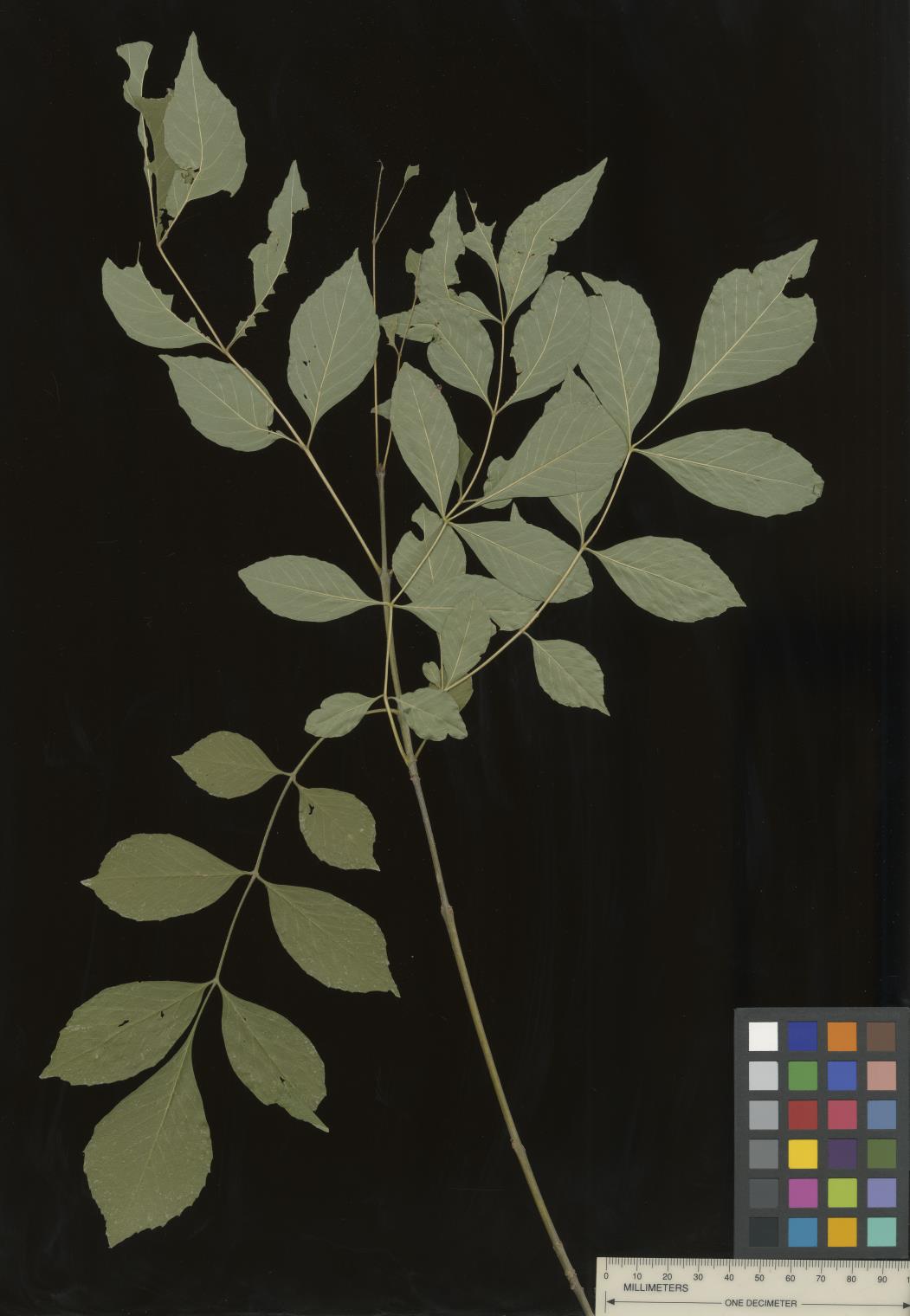 | | 2022 | COLLECTED | 09/02/2022 | Oak Creek Canyon, approximately five miles north-northeast of Sedona in the Coconino National Forest. T18N R6E NE 1/4 NW 1/4 Sec. 21 . | 34.93600300, -111.74436900 | 1464 | Floodplain and riverbanks, growing in gravely soil. | Wild material | Most of the velvet ash in this population are small trees (10-25 feet in height and approximately 5 inches DBH). Variation was noted for leaflet pubescence but with the petioles of all trees in the population being pubescent. | 2139669 | Ames 35907 |
| 398 | WLP 2705 | Eagle Creek | Crataegus wootoniana Eggl. | New Mexico, United States | NA |  | | 2022 | COLLECTED | 09/08/2022 | Eagle Creek, along Upper Eagle Creek Road (past gate to cabins) approximately 1.5 miles northwest of intersection with Ski Run Road. T10S R12E N 1/2 S 1/4 Sec. 35. | 33.40777700, -105.73980900 | 2422 | Canyon bottom above creek. | Wild material | Shrubs to approximately 15 feet in height with a tight clump forming growth habit and arching stems. | 2139678 | WLP 2705 |
| 399 | WLP 2596 | RJL2022FLAL-018 | Viburnum nitidum Aiton | Florida, United States | NA | | | 2022 | COLLECTED | 08/02/2022 | Along Gin/Camp Road at the bridge over Thomas Creek on the east side of the road. | 30.75027700, -87.23473700 | 21 | Growing in part shade on the sandy bench about a meter above the creek in mixed evergreen and deciduous riparian habitat. Plants have ample access to moisture, but are not obligate wetland plants. Fruiting is occurring where increased sunlight is available; however, most plants appear to be middle understory in this habitat. The underlying geology of this area is the Citronelle Formation, of Pliocene origin, and consists of gray to orange, often mottled, unconsolidated to poorly consolidated, very fine to very coarse, poorly sorted, clean to clayey sands. It contains significant amounts of clay, silt and gravel which may occur as beds and lenses and may vary considerably over short distances. Limonite nodules and limonite-cemented beds are common. | Wild material | | 2138706 | WLP 2596 |
| 400 | Ames 35886 | Hook Larson Prairie | Heuchera richardsonii R. Br. | Illinois, United States | NC7 |  | | 2022 | COLLECTED | 06/22/2022 | Nachusa Grasslands (Hook Larson Prairie) located approximately 5.07 miles northwest of Franklin Grove just north of West Stone Barn Road, T22N R10E NE 1/4 SE 1/4 NE 1/4 Sec. 17. | 41.89738600, -89.36123100 | 236 | High-quality prairie remnant with thick vegetation managed with infrequent burning. Various small remnants within immediate area. | Wild material | | 2138219 | Ames 35886 |
| 401 | Ames 35883 | Waterworks Park Prairie | Heuchera richardsonii R. Br. | Iowa, United States | NC7 |  | | 2022 | COLLECTED | 07/05/2022 | Waterworks Park on west side of Bonnifield Lake located 1.00 mile north, northeast of Fairfield, T72N R10W SE ¼ Sec. 24. | 41.02135000, -91.95665000 | 227 | High-quality prairie remnant managed with infrequent burning. Various small remnants within immediate area. | Wild material | | 2138216 | Ames 35883 |
| 402 | Ames 35877 | Gallagher Fen | Salix myricoides Muhl. | Ohio, United States | NC7 |  | | 2022 | COLLECTED | 06/28/2022 | Gallagher Fen State Nature Preserve located just east, northeast of Springfield approximately 4.5 miles, T5E R9N NE 1/4 NE 1/4 Sec. 11 | 39.93209100, -83.72390500 | 307 | Remnant wetland occurring primarily where the marl meadow meets the stream and marl mud flats. | Wild material | Bayberry willow is native to areas of the northeastern U.S. and north into Canada, localized around the Great Lakes region. Known to occur on shorelines/dunes but also in swamps, fens, and on talus (Haines 2004) with the potential to reach six meters in height (Dorn 1995). Ornamental characteristics include glaucous lower leaf blades that appear chalky white. This disjunct population was sampled in southwestern Ohio (Gallagher Fen) where the species is currently (2022) designated as a potentially threatened species in the state. Specimens observed in nature were low, mounding shrubs measuruing 16-24" (40-60 cm) tall; stems were slender, red and glossy with prominent lenticles; bud scales red, darkening following opening; flowers on staminate individuals with dense whitish bracts opening to reveal stamens tipped with bright yellow anthers and pistillate flowers with pale green pistils tipped with paler stigmas. | 2138175 | Ames 35877 |
| 403 | Ames 35881 | Reichelt Unit | Heuchera richardsonii R. Br. | Iowa, United States | NC7 |  | | 2022 | COLLECTED | 06/30/2022 | Reichelt Unit of Rock Creek State Park on south side of US highway 6 located 7.70 miles west, southwest of Grinnell, T80N R17W SE ¼ SE ¼ Sec. 30. | 41.70311300, -92.86569100 | 274 | Prairie remnant. Hilltop/knoll. | Wild material | Plants in nature measuring approximately six to eight inches in height with flowering stalks reaching up to three feet in height. | 2138180 | Ames 35881 |
| 404 | WLP 2576 | RJL2022-001 | Amelanchier arborea (F. Michx.) Fernald | Maryland, United States | NA | | | 2022 | COLLECTED | 05/25/2022 | Plants growing in open woodlands and part shade along unnamed Elkton State Forest gravel road over a distance of approximately 5 kilometers labelled as the address of 717 Irishtown Rd, North East, MD 21901. | 39.58089500, -75.91505900 | 73 | Plants are found regularly but scattered along the unnamed gravel road as well as in open understory of the upland woodlands. Plants growing in a mesic to dry, well-drained habitat of mixed deciduous and evergreen woodlands comprised primarily of acid-loving plants. Plants are growing in part shade and open understory shade. The soils in the collection area are generally described as a complex series of fluviomarine deposits. The soils range from a thin loam layer at the surface to varying levels of loam to sandy loam and/or extremely gravelly sandy clay loam strata, depending upon geographical location (ie. Hillslope summits, slopes, footslopes, swales, etc.). The primary soil types in the collection area are classified as Russett-Christiana-Hambrook Complex and/or Sassafras and Croom Soils; though, others may intersect and overlay in specific areas. | Wild material | | 2138095 | WLP 2576 |
| 405 | W6 60611 | CA330-207 | Lomatium dasycarpum (Torr. & A. Gray) J. M. Coult. & Rose | California, United States | W6 |  | | 2022 | | | | | | | Wild material | Densely wooly leaves and schizocarps, all basal leaves, no cauline, leaves dissected, small segments, fruit hairy, petals tomentose, plant with long taproot | 2138549 | W6 60611 |
| 406 | W6 60637 | CA930E-30 | Scrophularia californica Cham. & Schltdl. | California, United States | W6 | 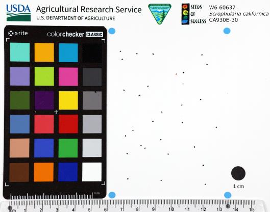 | | 2022 | | | | | | | Wild material | Flowers red. | 2138756 | W6 60637 |
| 407 | Ames 35806 | Reichelt Prairie | Salix humilis Marshall var. tristis (Aiton) Griggs | Iowa, United States | NC7 |  | | 2022 | COLLECTED | 05/16/2022 | Reichelt Unit of Rock Creek State Park on south side of US highway 6 approximately 7.70 miles west, southwest of Grinnell, T80N R17W SE ¼ SE ¼ Sec. 30. | 41.70311300, -92.86569100 | 274 | Xeric prairie remnant. Hilltop/knoll. | Wild material | Plants sampled in nature measuring 2.0-4.0 feet in height. Specimens noted during peak flowering and seed dispersal on 21 April and 17 May (2022), respectively. Some plants upright and some rather prostrate. Site was mowed in winter 2020/2021 winter resulting in significant flowering in 2022. In cultivation (central Iowa), plants are extremely short and compact where after two field seasons plants are rather uniform and topping out at a height of 2.5'. Dense suckering immediately surrounding clump/base of plant. Peak fall color (central Iowa) occurring in mid-November. | 2137912 | Ames 35806 |
| 408 | WLP 2568 | APS/HA/2022/028/490 | Hydrangea arborescens L. | Arkansas, United States | NA | 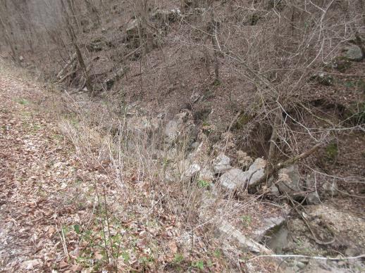 | | 2022 | COLLECTED | 03/15/2022 | Located approximately 3.75 miles east of Allison just off Round Bottom Road. | 35.93357000, -92.05110000 | 144 | Moist, low deciduous forest with scattered rock outcrops, growing along base of hill and bank of seasonal stream. | Wild material | | 2137430 | WLP 2568 |
| 409 | OPGC 8543 | NEWFS-822 | Asclepias syriaca L. | Massachusetts, United States | OPGC | | | 2021 | | | | | | | Wild material | Simple opposite leaves leaf a rounded oval pods green grey dehisces at maturity to release seeds | 2138879 | OPGC 8543 |
| 410 | W6 60197 | NEWFS-729 | Scirpus atrovirens Willd. | New Hampshire, United States | W6 | | | 2021 | | | | | | | Wild material | Tightly clumped termil inflorescences. | 2138823 | W6 60197 |
| 411 | NA 88301 | NCBG-753 | Clethra alnifolia L. | North Carolina, United States | NA | | | 2021 | | | | | | | Wild material | | 2132950 | NA 88301 |
| 412 | OPGC 8518 | MARSB-405 | Euthamia caroliniana (L.) Greene ex Porter & Britton | New York, United States | OPGC | | | 2021 | | | | | | | Wild material | | 2137174 | OPGC 8518 |
| 413 | W6 59994 | NCBG-388 | Sorghastrum nutans (L.) Nash | Maryland, United States | W6 | | | 2021 | | | | | | | Wild material | | 2132876 | W6 59994 |
| 414 | W6 60042 | NCBG-568 | Tridens flavus (L.) Hitchc. | Maryland, United States | W6 | | | 2021 | | | | | | | Wild material | | 2132924 | W6 60042 |
| 415 | W6 60048 | NCBG-580 | Schizachyrium scoparium (Michx.) Nash | Maryland, United States | W6 | | | 2021 | | | | | | | Wild material | | 2132929 | W6 60048 |
| 416 | W6 60090 | MARSB-410 | Tridens flavus (L.) Hitchc. | New York, United States | W6 | | | 2021 | | | | | | | Wild material | | 2137175 | W6 60090 |
| 417 | W6 60129 | NEWFS-452 | Eriophorum virginicum L. | Maine, United States | W6 | | | 2021 | | | | | | | Wild material | | 2137214 | W6 60129 |
| 418 | W6 60131 | NEWFS-464 | Rhus typhina L. | Massachusetts, United States | W6 | | | 2021 | | | | | | | Wild material | | 2137216 | W6 60131 |
| 419 | WLP 1747 | RJL2021PA-005 | Rosa palustris Marshall | Pennsylvania, United States | NA | | | 2021 | COLLECTED | 11/20/2021 | Plants growing in wetland seeps surrounded by mown hayfields just west of the Middle Branch White Clay Creek in Goddard Park, West Grove Pennsylvania, off of Wickerton Road, Chester County. | 39.80090528, -75.82383250 | 100 | Habitat Notes: Plants are growing in permanently saturated to moist soils in wetland habitats. Plants appear to be obligate wetland plants and are found only in permanent to nearly permanent wet habitats observed. Generally, the shrubs are found in part shade to full sun. Soils: Soils found in the areas where this collection was made are comprised primarily of Hatboro silt loam (Ha). Hatboro silt loam consists of very deep and poorly drained soils formed in deposited alluvium derived from metamorphic and crystalline rock. They are on flood plains. Slopes range from 0 to 3 percent. Slope: 0 to 3% Aspect: Variable. | Wild material | | 2123715 | WLP 1747 |
| 420 | OPGC 7574 | Ledges State Park | Solidago ulmifolia Muhl. ex Willd. | Iowa, United States | OPGC |  | | 2021 | COLLECTED | 09/15/2021 | Ledges State Park, approximately 4.5 miles south of Boone, T83N R26W Sec. 20 | 41.98266200, -93.89314800 | 287 | Understory of hardwood forest. | Wild material | Plants in nature were generally two to three feet in height, growing in sparsely spreading colonies. This population has a large amount of diversity for flowering time with the first plants in the population beginning to flower on 22 July 2021 and the last plants to flower were still blooming at the end of September. Some plants in the population had a muted red fall foliage color at the end of October 2021. This accession represents genetics from near the northwest edge of the species range of occurence. | 2132828 | OPGC 7574 |
| 421 | OPGC 7575 | Ledges State Park | Solidago flexicaulis L. | Iowa, United States | OPGC |  | | 2021 | COLLECTED | 10/03/2021 | Ledges State Park, approximately 4.5 miles south of Boone, T83N R26W Sec. 21 | 41.98338100, -93.89052800 | 288 | Understory of hardwood forest. | Wild material | Plants in nature ranged in height from approximately one to three feet, growing in sparsely spreading colonies. Peak bloom in 2021 occurred near 15 September. Several specimens had branched inflorescences. | 2132829 | OPGC 7575 |
| 422 | OPGC 7576 | McFarland Park | Solidago flexicaulis L. | Iowa, United States | OPGC |  | | 2021 | COLLECTED | 09/26/2021 | McFarland Park just north, northeast of Ames, T84N R23W Sec. 7 | 42.09667500, -93.57083500 | 288 | Moist areas near streambanks and bottomlands in hardwood forest understory. | Wild material | Plants in nature ranged in height from approximately one to three feet, growing as spreading clumps. Peak flowering in 2021 occurred near 18 September. | 2132830 | OPGC 7576 |
| 423 | Ames 35750 | Ames 35750 | Blephilia ciliata (L.) Benth. | Iowa, United States | NC7 |  | | 2021 | COLLECTED | 09/27/2021 | Located approximately 3 miles south, southeast of Fairfield, T71N R9W SW1/4 Sec. 7 | 40.96338000, -91.94686900 | 223 | Woodland openings/edges, disturbed areas | Wild material | | 2122068 | Ames 35750 |
| 424 | NA 88421 | CBG-10737 | Prunus americana Marshall | | NA |  | | 2021 | | | | | | | Wild material | Spatially discreet collection for a clonal species. Counts made approximately every 6 feet. Fruits collected from the plant and the ground. | 2137989 | NA 88421 |
| 425 | Ames 35734 | Ledges State Park | Teucrium canadense L. | Iowa, United States | NC7 |  | | 2021 | COLLECTED | 08/23/2021 | Ledges State Park located approximately 4.75 miles south of Boone T83N R26W Sec. 16 & 21 | 41.99262400, -93.87724800 | 330 | Edges of woods | Wild material | | 2120338 | Ames 35734 |
| 426 | NA 88320 | CBG-10190 | Hydrangea arborescens L. | Illinois, United States | NA | | | 2021 | | | | | | | Wild material | | 2120058 | NA 88320 |
| 427 | NA 88321 | CBG-10546 | Hydrangea arborescens L. | Illinois, United States | NA | | | 2021 | | | | | | | Wild material | Plant numbers estimated. | 2120147 | NA 88321 |
| 428 | NA 88439 | CBG-10597 | Rosa setigera Michx. | Illinois, United States | NA | | | 2021 | | | | | | | Wild material | Plant numbers sampled estimated. | 2120182 | NA 88439 |
| 429 | OPGC 8277 | CBG-9703 | Pedicularis canadensis L. | Illinois, United States | OPGC | | | 2021 | | | | | | | Wild material | plant habit: forb | 2120016 | OPGC 8277 |
| 430 | OPGC 8320 | CBG-10493 | Vernonia missurica Raf. | Illinois, United States | OPGC | | | 2021 | | | | | | | Wild material | | 2120118 | OPGC 8320 |
| 431 | OPGC 8321 | CBG-10498 | Euthamia gymnospermoides Greene | Illinois, United States | OPGC | | | 2021 | | | | | | | Wild material | | 2120121 | OPGC 8321 |
| 432 | OPGC 8342 | CBG-10574 | Euthamia gymnospermoides Greene | Illinois, United States | OPGC | | | 2021 | | | | | | | Wild material | Plant numbers sampled estimated. | 2120165 | OPGC 8342 |
| 433 | OPGC 8343 | CBG-10575 | Euthamia graminifolia (L.) Nutt. | Illinois, United States | OPGC | | | 2021 | | | | | | | Wild material | Plant numbers sampled estimated. | 2120166 | OPGC 8343 |
| 434 | OPGC 8352 | CBG-10600 | Scutellaria lateriflora L. | Illinois, United States | OPGC | | | 2021 | | | | | | | Wild material | Received as Scutellaria lateriflora var. lateriflora. | 2120185 | OPGC 8352 |
| 435 | OPGC 8355 | CBG-10605 | Solidago nemoralis Aiton | Illinois, United States | OPGC | | | 2021 | | | | | | | Wild material | Also collected elsewhere in SCCA. Plant numbers sampled estimated. | 2120226 | OPGC 8355 |
| 436 | OPGC 8356 | CBG-10606 | Solidago ulmifolia Muhl. ex Willd. | Illinois, United States | OPGC | | | 2021 | | | | | | | Wild material | Plant numbers sampled estimated. | 2120227 | OPGC 8356 |
| 437 | W6 59098 | CBG-9772 | Carex swanii (Fernald) Mack. | Illinois, United States | W6 | | | 2021 | | | | | | | Wild material | | 2120027 | W6 59098 |
| 438 | W6 59135 | CBG-10230 | Eupatorium perfoliatum L. | Illinois, United States | W6 | | | 2021 | | | | | | | Wild material | | 2120061 | W6 59135 |
| 439 | W6 59186 | CBG-10477 | Juncus greenei Oakes & Tuck. | Illinois, United States | W6 | | | 2021 | | | | | | | Wild material | | 2120105 | W6 59186 |
| 440 | W6 59201 | CBG-10497 | Lespedeza hirta (L.) Hornem. | Illinois, United States | W6 | | | 2021 | | | | | | | Wild material | | 2120120 | W6 59201 |
| 441 | W6 59234 | CBG-10548 | Dasistoma macrophyllum (Nutt.) Raf. | Illinois, United States | W6 | | | 2021 | | | | | | | Wild material | Received as Dasistoma macrophylla. Plant numbers estimated. Few this year; abundant other years in numerous locations. | 2120206 | W6 59234 |
| 442 | W6 59267 | CBG-10590 | Muhlenbergia glabrifloris Scribn. | Illinois, United States | W6 | | | 2021 | | | | | | | Wild material | Received as: Muhlenbergia glabriflora. Plant numbers sampled estimated. | 2120210 | W6 59267 |
| 443 | W6 59006 | NCBG-458 | Juncus effusus L. | Virginia, United States | W6 | | | 2021 | | | | | | | Wild material | | 2116324 | W6 59006 |
| 444 | W6 59035 | NCBG-589 | Sorghastrum nutans (L.) Nash | Virginia, United States | W6 | | | 2021 | | | | | | | Wild material | | 2116351 | W6 59035 |
| 445 | W6 59041 | NCBG-623 | Sorghastrum nutans (L.) Nash | North Carolina, United States | W6 | | | 2021 | | | | | | | Wild material | | 2116357 | W6 59041 |
| 446 | Ames 35668 | Iroquois County Conservation Area | Aronia ×prunifolia (Marshall) Rehder | Illinois, United States | NC7 |  | | 2021 | COLLECTED | 05/05/2021 | Iroquois County Conservation Area located approximately 4.5 miles northeast of Beaverville in Beaverville Township, T29N R11W NE1/4 Sec. 22 | 40.99154700, -87.58073200 | 198 | Woodland edge of wet sand prairie | Wild material | Wide variety of genotypes noted in nature averaging 3.5-7' in height. Some growing in shade of oak forest were sparse suckering and open branching compared to open grown specimens that were extremely dense with suckers. | 2115977 | Ames 35668 |
| 447 | OPGC 8180 | NEWFS-473 | Solidago rugosa Mill. | Massachusetts, United States | OPGC | | | 2021 | | | | | | | Wild material | | 2115663 | OPGC 8180 |
| 448 | OPGC 8181 | NEWFS-474 | Solidago altissima L. | Massachusetts, United States | OPGC | | | 2021 | | | | | | | Wild material | Leaves primarily three-veined, toothing infrequent and not flared. Plants often tall. | 2115664 | OPGC 8181 |
| 449 | OPGC 8182 | NEWFS-475 | Solidago canadensis L. | Massachusetts, United States | OPGC | | | 2021 | | | | | | | Wild material | Three-veined leaves with frequent, flared teeth. | 2115665 | OPGC 8182 |
| 450 | OPGC 8203 | NEWFS-558 | Solidago canadensis L. | Massachusetts, United States | OPGC | | | 2021 | | | | | | | Wild material | Teeth at leaf margins are extremely flared, stems pubescent from top to bottom. | 2115698 | OPGC 8203 |
| 451 | OPGC 8223 | NEWFS-824 | Solidago rugosa Mill. | Massachusetts, United States | OPGC | | | 2021 | | | | | | | Wild material | Spreading and slightly nodding inflorescence; leaves are pubescent on both the adaxial and abaxial leaf surfaces; leaves have a prominent mid vein and are sharply serrated; leave feel and look very wrinkly. | 2115733 | OPGC 8223 |
| 452 | W6 58796 | NEWFS-826 | Spiraea tomentosa L. | Massachusetts, United States | W6 | | | 2021 | | | | | | | Wild material | Conical inflorescence, with five-pointed stars whorling around it in an upward spiral. Underside of leaves covered in pubescence. | 2115735 | W6 58796 |
| 453 | NA 88188 | MARSB-745 | Baccharis halimifolia L. | New York, United States | NA | | | 2021 | | | | | | | Wild material | Simple, alternate, toothed leaves. White flowers that become conspicuously fluffy when ripe. | 2113601 | NA 88188 |
| 454 | NA 88282 | MARSB-698 | Cephalanthus occidentalis L. | Delaware, United States | NA | | | 2021 | | | | | | | Wild material | Multi-stemmed shrub. Leaves in pairs or in threes, petiolate. Long, ovate narrow leaves with pointed tip and rounded to tapered at base. Small white flowers born in distinctive round clusters. | 2113592 | NA 88282 |
| 455 | OPGC 8157 | MARSB-746 | Euthamia graminifolia (L.) Nutt. | New York, United States | OPGC | | | 2021 | | | | | | | Wild material | Simple, entire, alternate, linear leaves, 3-12 mm wide. Radiate yelow flower heads.û | 2113602 | OPGC 8157 |
| 456 | W6 58578 | MARSB-339 | Scirpus cyperinus (L.) Kunth | New Jersey, United States | W6 | | | 2021 | | | | | | | Wild material | | 2113508 | W6 58578 |
| 457 | W6 58628 | MARSB-553 | Avenella flexuosa (L.) Parl. | New York, United States | W6 | | | 2021 | | | | | | | Wild material | Round stem, inflorescence with thin wiry branches and tan seed. Large tufts of straight, wiry basal leaves. | 2113558 | W6 58628 |
| 458 | W6 58629 | MARSB-554 | Danthonia spicata (L.) P. Beauv. ex Roem. & Schult. | New York, United States | W6 | | | 2021 | | | | | | | Wild material | Round stem, narrow inflorescence with tan seed, inflorescence branches point upwards and hug the stem. Tufts of curly basal leaves. | 2113559 | W6 58629 |
| 459 | W6 58637 | MARSB-601 | Pluchea odorata (L.) Cass. | New York, United States | W6 | | | 2021 | | | | | | | Wild material | Simple alternate leaves. Fragrant, pink, discoid heads. | 2113567 | W6 58637 |
| 460 | W6 58652 | MARSB-664 | Coleataenia anceps (Michx.) Soreng subsp. anceps | Delaware, United States | W6 | | | 2021 | | | | | | | Wild material | Rhizomatous perennial grass, stems up to 4 feet tall, blades are erect, inflorescence is a panicle bearing pale green or yellowish spikelets. | 2113582 | W6 58652 |
| 461 | W6 58653 | MARSB-665 | Tridens flavus (L.) Hitchc. | Delaware, United States | W6 | | | 2021 | | | | | | | Wild material | Bunchgrass with purple/ reddish panicle inflorescence. | 2113583 | W6 58653 |
| 462 | W6 58654 | MARSB-668 | Rhus copallinum L. | Delaware, United States | W6 | | | 2021 | | | | | | | Wild material | Woody plant with compound leaves and wings along rachis. Leaves are dark green and bark is dark brown. Terminal panicle with showy red flower cluster and later sticky, dark red fruit. | 2113584 | W6 58654 |
| 463 | W6 58661 | MARSB-696 | Eupatorium hyssopifolium L. | Delaware, United States | W6 | | | 2021 | | | | | | | Wild material | | 2113591 | W6 58661 |
| 464 | Ames 35635 | Wildcat Den | Pinus strobus L. | Iowa, United States | NC7 |  | | 2021 | COLLECTED | 03/02/2021 | Wildcat Den State Preserve near Muscatine, T77N R1E SW1/4 SW1/4 Sec. 17 | 41.46735000, -90.88171000 | 185 | Canyon edges and valleys. | Wild material | The native range of Pinus strobus is concentrated in the northeastern United States extending south into the northern edge of Georgia and west to central Minnesota. In Iowa, there are scattered populations in a few northeastern counties and also a very small disjunct population in central Iowa (Hardin County, Ames 32758) and one in southeastern Iowa (Muscatine County). This accession represents genetics from five mother "legacy" trees located in Wildcat Den State Park (Muscatine County). Although a significant number of P. strobus were planted at this park in the early 1900's a significant number of native specimens still exist as a localized grouping within the central portion of the park in the deep valleys and also one specimen on an extreme rock outcropping. P. strobus from this site represents the extreme southwestern edge of the species native range. Genetics may likely be adapted/tolerant to drought and also late winter/early spring extreme temperature fluctuations. Specimen #1 sampled at this site is currently ranked as the 6th largest Pinus strobus in the state (M. Rouw, pers. comm. 28 February 2021) measuring 11'6" circumference; 127.5' height; and 45' crown spread (Total Points: 276.75). Accession was collected as scions in winter to capture genetics that are of known origin. | 2113335 | Ames 35635 |
| 465 | Ames 35546 | Beat Prairie | Echinacea pallida (Nutt.) Nutt. | Iowa, United States | NC7 |  | | 2020 | COLLECTED | 08/14/2020 | Beat Prairie located approximately 3.25 miles northwest of Knoxville, T76N R20W SW 1/4 SW 1/4 NW 1/4 and also NW 1/4 NW 1/4 SW 1/4 Sec. 26, Marion County | 41.35610200, -93.13748600 | 255 | Tallgrass prairie remnant. | Wild material | | 2106725 | Ames 35546 |
| 466 | W6 58123 | OR090A-339 | Carex obnupta L. H. Bailey | Oregon, United States | W6 | | | 2020 | | | | | | | Wild material | | 2107508 | W6 58123 |
| 467 | NA 87036 | Site 3A/Live Oak Landing/Holmes Creek Site | Magnolia ashei Weath. | Florida, United States | NA | | | 2020 | COLLECTED | 07/15/2020 | Along Holmes Creek at Live Oak Landing. | 30.59208000, -85.83750000 | 11 | Shade to partial shade of bluffs above the creek in well-drained mesic to dry deciduous woodlands with a few broadleaved and coniferous evergreens. | Wild material | Although these were collected without any field collection number, seeds from individual trees were separated with letter identifiers that will be maintained with the qualifier (seedling) records. The relationships are as follows: 1. Maternal letter G, NA 87036-J, L, P, and T; maternal letter H, NA 87036-V; maternal letter K, NA 87036-X, Z, and H1; maternal letter N, NA 87036-H2. In addition, three seedlings' maternal letters were lost, and these will be NA 87036-H3, H4, and H5. See the following accessions for earlier collections from this same site/population, listed in our records as "Site 3A/Live Oak Landing/Holmes Creek Site": NA 81555 (2013), NA 82745 (2015), and NA 82745.01 (2019). | 2109403 | NA 87036 |
| 468 | W6 57642 | OR080-64 | Spiraea douglasii Hook. | Oregon, United States | W6 | | | 2020 | | | | | | | Wild material | SOS 92nd Shipment | 2104940 | W6 57642 |
| 469 | W6 57644 | OR080-67 | Lupinus polyphyllus Lindl. var. polyphyllus | Oregon, United States | W6 | | | 2020 | | | | | | | Wild material | | 2104942 | W6 57644 |
| 470 | W6 57661 | CA180-208 | Prunella vulgaris L. | California, United States | W6 | | | 2020 | | | | | | | Wild material | SOS 92nd Shipment | 2104959 | W6 57661 |
| 471 | NA 86434 | Pulverulentus Group | Styrax americanus Lam. | Texas, United States | NA | | | 2020 | COLLECTED | 09/08/2018 | Near Gum Slough, on the edges of woodlands along the north side of road FM 2246. | 30.33332000, -93.94704000 | 15 | Plants are found along the edges and moist to wet areas of Gum Slough in part shade to full sun of a mixed deciduous and broadleaved evergreen woodlands. Soils are generally acidic with loamy to clayey sediments, but with some areas consisting of deep, nearly level loamy, poorly drained soil. | Wild material | Species occurrence is infrequent at this location. Collector's note on the name under which this material was gathered, Styrax americanus var. pulverulentus: "In general, the var. pulverulentus is considered "taxonomically inconsequential" by many botanists. Even so, this densely pubescent characteristic is highly uniform across every plant I observed in the sampled population. Weakley notes that "true" var. pulverulentus can be found as far west as East Texas and, in my humble opinion, the population sampled herein represents this "taxon". Regardless, for the purposes of drawing distinction between "typical" Styrax americanus and the densely pubescent form, I've chosen to use this varietal name. It will be interesting to observe whether the seedling progeny are uniformly similar to their parents when they germinate." [Actual altitude recorded was 14.8 m, but decimals can't be used in the database, so the number was rounded.] | 2109219 | NA 86434 |
| 472 | Ames 35288 | APS/MF/2020/003/406 | Monarda fistulosa L. | Kansas, United States | NC7 |  | | 2020 | COLLECTED | 02/05/2020 | Eisenhower State Park on north side of Melvern Lake approximately 5.25 miles west, northwest of Melvern, T18S R15E NE1/4 Sec. 3, Osage County | 38.51966000, -95.73352000 | 323 | Edge of woods with limestone substrate. | Wild material | | 2101394 | Ames 35288 |
| 473 | WLP 2023 | MARSB-987 | Viburnum dentatum L. | New York, United States | NA | | | 2019 | COLLECTED | 08/21/2019 | Cattaraugus County; Red House; Public park land; wetland/lake shore. | 42.10720000, -78.75137000 | | Wetland/lake shore, in full sun; growing in wet sand/clay soil. | | Seed harvested from 10 individuals in a population of 25+. Scattered distribution. Seed 95 percent healthy; seed maturation late. | 2109172 | WLP 2023 |
| 474 | WLP 2046 | MARS-1015 | Viburnum lentago L. | New York, United States | NA | | | 2019 | COLLECTED | 09/25/2019 | Jefferson County; Fort Drum; Fort Drum Range, along Borland Rd. | 44.08464000, -75.75658000 | | Roadside shrubland in full sun; growing in moist to dry, well-drained silt/sand soil. | | Seeds collected from 25+ individuals in a population of 100+ plants; common. 85 percent healthy seed. Seed maturation: middle, late. | 2109195 | WLP 2046 |
| 475 | WLP 2047 | MARS-1016 | Viburnum dentatum L. | New York, United States | NA | | | 2019 | COLLECTED | 09/25/2019 | Jefferson County; Antwerp; Fort Drum Range, along Fort Drum Rd. | 44.17690000, -75.62162000 | | Roadside shrubland in full sun; growing in moist to dry, well-drained silt/sand soil. | | Seeds collected from 5+ individuals in a population of 15+ plants; common. 95 percent healthy seed. Seed maturation: late. | 2109196 | WLP 2047 |
| 476 | WLP 2048 | MARS-1017 | Viburnum lentago L. | New York, United States | NA | | | 2019 | COLLECTED | 09/25/2019 | Jefferson County; Antwerp; Fort Drum Range, along Fort Drum Rd. | 44.17821000, -75.61840000 | | Roadside shrubland in full sun; growing in moist to dry, well-drained silt/sand soil. | | Seeds collected from 10+ individuals in a population of 30+ plants; common. 85 percent healthy seed. Seed maturation: middle, late. | 2109197 | WLP 2048 |
| 477 | WLP 2049 | MARS-1018 | Viburnum lentago L. | New York, United States | NA | | | 2019 | COLLECTED | 09/25/2019 | Jefferson County; Philadelphia; Fort Drum Range, along Antwerp Rd. | 44.12215000, -75.67027000 | | Roadside shrubland in full sun; growing in moist to dry, well-drained silt/sand soil. | | Seeds collected from 5+ individuals in a population of 15+ plants; common. 90 percent healthy seed. Seed maturation: early, middle. | 2109198 | WLP 2049 |
| 478 | WLP 2052 | MARSB-1021 | Viburnum lentago L. | New York, United States | NA | | | 2019 | COLLECTED | 10/14/2019 | Madison County; Cazenovia; Nelson Swamp Unique Area (entrance/parking area on Constine Bridge Rd [originally listed as Stone Quarry Rd]); collected along old railroad trail, edge of wetland. | 42.88834000, -75.82258000 | | Along trail, edge of wetland; forest, marsh habitat in partial shade; growing in moist, well-drained silt/clay soil. | | Seeds collected from 5+ individuals in a population of 20+ plants; scattered distribution. 80 percent healthy seed. Seed maturation: late. | 2109201 | WLP 2052 |
| 479 | NA 88142 | NCBG-284 | Ilex verticillata (L.) A. Gray | Virginia, United States | NA |  | | 2019 | COLLECTED | 09/21/2015 | Voorhees Nature Preserve (Rappahanock River): from I-95 N, take exit 104 and continue onto VA-207 , continue onto US 301 N, right at state RTE 623, right at RTE 647 at VA 3E, right on Claymont Rd, right on RTE 637, right on Berry Farm Lane, park at Westmoreland Berry Farm Store and hike to trailhead. | 38.14833000, -77.04913000 | 2 | Swamp. | Wild material | | 2098391 | NA 88142 |
| 480 | NA 88155 | NCBG-324 | Clethra alnifolia L. | North Carolina, United States | NA |  | | 2019 | | | | | | | Wild material | | 2098415 | NA 88155 |
| 481 | NA 88164 | NCBG-427 | Pinus virginiana Mill. | Maryland, United States | NA |  | | 2019 | | | | | | | Wild material | | 2098446 | NA 88164 |
| 482 | NA 88172 | NCBG-668 | Kalmia latifolia L. | Maryland, United States | NA |  | | 2019 | | | | | | | Wild material | | 2098507 | NA 88172 |
| 483 | OPGC 7974 | NCBG-413 | Rhexia nashii Small | Virginia, United States | OPGC |  | | 2019 | | | | | | | Wild material | | 2098438 | OPGC 7974 |
| 484 | OPGC 7982 | NCBG-599 | Rhexia mariana L. | Maryland, United States | OPGC |  | | 2019 | | | | | | | Wild material | | 2098480 | OPGC 7982 |
| 485 | W6 57555 | NCBG-598 | Andropogon gerardi Vitman | Virginia, United States | W6 |  | | 2019 | | | | | | | Wild material | | 2098479 | W6 57555 |
| 486 | W6 57562 | NCBG-611 | Alnus serrulata (Aiton) Willd. | Virginia, United States | W6 |  | | 2019 | | | | | | | Wild material | | 2098486 | W6 57562 |
| 487 | W6 57584 | NCBG-671 | Ageratina altissima (L.) R. M. King & H. Rob. var. altissima | Maryland, United States | W6 |  | | 2019 | | | | | | | Wild material | | 2098508 | W6 57584 |
| 488 | W6 57402 | NEWFS-330 | Carex annectens (E. P. Bicknell) E. P. Bicknell | Rhode Island, United States | W6 |  | | 2019 | | | | | | | Wild material | | 2098199 | W6 57402 |
| 489 | GPRU 167 | MARSB-281 | Prunus serotina Ehrh. | New Jersey, United States | GEN |  | | 2019 | | | | | | | Wild material | | 2097554 | GPRU 167 |
| 490 | GPRU 168 | MARSB-577 | Prunus serotina Ehrh. | New York, United States | GEN |  | | 2019 | | | | | | | Wild material | | 2097661 | GPRU 168 |
| 491 | NA 88118 | MARSB-573 | Viburnum dentatum L. | New York, United States | NA |  | | 2019 | | | | | | | Wild material | | 2097660 | NA 88118 |
| 492 | NA 88119 | MARSB-650 | Viburnum dentatum L. | Delaware, United States | NA |  | | 2019 | | | | | | | Wild material | | 2097671 | NA 88119 |
| 493 | NA 88440 | MARSB-419 | Rosa virginiana Mill. | New York, United States | NA |  | | 2019 | | | | | | | Wild material | | 2097623 | NA 88440 |
| 494 | OPGC 7902 | MARSB-405 | Euthamia caroliniana (L.) Greene ex Porter & Britton | New York, United States | OPGC |  | | 2019 | | | | | | | Wild material | | 2097616 | OPGC 7902 |
| 495 | OPGC 7903 | MARSB-411 | Asclepias tuberosa L. | New York, United States | OPGC |  | | 2019 | | | | | | | Wild material | | 2097619 | OPGC 7903 |
| 496 | W6 57055 | MARSB-130 | Danthonia spicata (L.) P. Beauv. ex Roem. & Schult. | New Jersey, United States | W6 |  | | 2019 | | | | | | | Wild material | | 2097494 | W6 57055 |
| 497 | W6 57073 | MARSB-191 | Eupatorium hyssopifolium L. | Delaware, United States | W6 |  | | 2019 | | | | | | | Wild material | | 2097512 | W6 57073 |
| 498 | W6 57099 | MARSB-246 | Tridens flavus (L.) Hitchc. | New York, United States | W6 |  | | 2019 | | | | | | | Wild material | | 2097538 | W6 57099 |
| 499 | W6 57143 | MARSB-333 | Eupatorium hyssopifolium L. | New Jersey, United States | W6 |  | | 2019 | | | | | | | Wild material | | 2097582 | W6 57143 |