| 0 | PI 704813 sos | R. spectabilis OR080-30 | Rubus spectabilis Pursh | Oregon, United States | COR |  | | 2018 | | | | | | | Wild material | | 1957613 | PI 704813 sos |
| 1 | PI 704843 sos | R. leucodermis OR080-34 | Rubus leucodermis Douglas ex Torr. & A. Gray | Oregon, United States | COR |  | | 2018 | | | | | | | Wild material | | 1957617 | PI 704843 sos |
| 2 | PI 704844 sos | R. parviflorus Nutt. OR080-35 | Rubus parviflorus Nutt. | Oregon, United States | COR |  | | 2018 | | | | | | | Wild material | | 1957618 | PI 704844 sos |
| 3 | PI 684959 | R. malifolius VN-2017-17 Phìa Oặc, Cao Bằng | Rubus malifolius Focke | Cao Bằng, Vietnam | COR |  | | 2017 | COLLECTED | 2017 | | 22.50381000, 105.90002000 | 1500 | | Wild material | Vietnam 2017
This species is known from China. This is a first report for presence of this species in Vietnam. 2017. | 1954907 | PI 684959 |
| 4 | PI 684801 | R. ursinus Snow Camp | Rubus ursinus Cham. & Schltdl. | Oregon, United States | COR | | | 2017 | COLLECTED | 08/01/2017 | South facing, rocky slope; with manzanita, lupine, grasses, Lathyrus, rose, Douglas-fir, coffeeberry, red huckleberry (ripe fruit) | 43.35841670, -124.16495000 | 1193 | Full sun, roadcut, rocky, well drained, little organic matter, dry | Wild material | Snow Camp Botanical Area, Curry County, OR, Forest Service Road 1326, N 42.21.505, W 124.09.897, 1193 m (Garmin etrex 30x GPS); approx. 3 Km from Snow Camp Lookout. South facing, rocky slope; with manzanita, lupine, grasses, Lathyrus, rose, Douglas-fir, coffeeberry, red huckleberry (ripe fruit). Plants sprawling, clumping, canes about 3 m long; fruit in early stages of ripening, a few fruit collected. Potentially highest elevation for this species at this location.Fruit collected from a second population at 1145 m elevation (bag JK-2017-1b). | 1950044 | PI 684801 |
| 5 | PI 679792 | R. clinocephalus Ba Bể, Bắc Kạn 085 | Rubus clinocephalus Focke | Bắc Kạn, Vietnam | COR | | | 2015 | COLLECTED | 11/09/2015 | Near one of the inlets of Ba Be Lake, on path above Bac Ngai Village Nam Mau Camun, uphill above houses. This species was frequent on the side of the trail. | 22.38723333, 105.63851670 | 179 | | Wild material | Vietnam 2015 | 1930090 | PI 679792 |
| 6 | PI 672694 | R. sanctus AZB-2008-031 | Rubus sanctus Schreb. | Azerbaijan | COR | | | 2013 | COLLECTED | 09/18/2008 | Azerbaijan, Davachi District | 41.31666667, 48.86666667 | 47 | Roadside across from Baki Ristoran (restaurant). Coordinates are only approximate. | Wild material | Plant with especially tasty fruit; everblooming species with pink flowers, common in area; collected as Rubus sp. Distributed to Corvallis and assigned PI number 672694, with Corvallis number CRUB 2655. | 1906484 | PI 672694 |
| 7 | PI 654994 | 'Onyx' | Rubus hybr. | Oregon, United States | COR | | | 2008 | DONATED | 04/29/2008 | | | | | Cultivar | http://hortsci.ashspublications.org/content/46/4/657.full
‘Onyx’ is a new trailing blackberry (Rubus subg. Rubus Watson) cultivar from the U.S. Department of Agriculture–Agricultural Research Service (USDA-ARS) breeding program in Corvallis, OR, released in cooperation with the Oregon Agricultural Experiment Station. ‘Onyx’ is a vigorous, somewhat erect, thorny, trailing blackberry that produces moderate yields of uniform, firm, and sweet high quality fruit with excellent flavor that are suited for the local and wholesale fresh market. ‘Onyx’ is being released primarily as a result of its outstanding fresh fruit quality in the late season.
‘Onyx’, tested as ORUS 1523-4, was selected in Corvallis, OR, in 1997 from a cross made in 1995 of OSC 1466 and ORUS 1117-11. OSC 1466 was selected in 1966 and has always been noted for its productivity and outstanding fruit quality, especially flavor, but its fruit are small. ORUS 1117-11 is a thornless selection with high yields of late-ripening fruit with excellent quality. ‘Onyx’ is being released
primarily as a result of its outstanding fresh fruit quality in the late season.
https://patents.google.com/patent/USPP22358P2/en
Description and specifications of a new and distinct blackberry cultivar which originated from seed produced by a hand pollinated cross of OSC 1466 (non-patented)×ORUS 1117-11 (non-patented) is provided. This new trailing blackberry cultivar can be distinguished by its high yields, large fruit size, excellent fresh fruit quality, mid-late season fruit ripening, and healthy plants.
BACKGROUND OF THE INVENTION
The present invention relates to the discovery of a new and distinct cultivar of blackberry hybrid plant botanically know as a Rubus subgenus Rubus hybrid and herein referred to as ‘ONYX’, as herein described and illustrated.
The new and distinct cultivar of blackberry originated from a hand pollinated cross of OSC 1466 (non-patented)×ORUS 1117-11 (non-patented).
Plants and fruit of this new cultivar differ phenotypically from its parents. The new cultivar is later ripening and larger in fruit size than the female parent OSC 1466 (non-patented) and has firmer, more uniformly shaped fruit than the male parent ORUS 1117-11 (non-patented). The new cultivar also has thorny canes, unlike the ORUS 1117-11 (non-patented) parent. The new cultivar has higher yields of firmer fruit than either of the parent blackberries. Although blackberries (Rubus subgenus Rubus) are highly heterogeneous and outcrossing, and most clones contain genes from more than one species, the new cultivar and its progenitor lines phenotypically exhibit characters predominately of the trailing western United States species, Rubus ursinus Cham et. Schltdl. (western trailing blackberry). Rubus idaeus L., (red raspberry), R. armeniacus Focke (Himalaya blackberry). R. baileyanus Britton, and R. argutus Link Porter (highbush blackberry) can all be found in the pedigree of this new cultivar.
The seeds resulting from this controlled hybridization were germinated in a greenhouse in the winter of 1995 and planted in a field in Corvallis, Oreg. in the spring. The seedlings fruited during the summer of 1997 and one, designated ORUS 1523-4, was selected for its mid-late season ripening, large fruit size, excellent fruit quality, and excellent plant health.
During 1997, the original plant selection was propagated asexually from dormant, hardwood cane cuttings from the above noted location. An observational plot of 3 plants was established at the above noted location and at Aurora, Oreg. in the spring of 1998. Subsequently, larger replicated plantings were established Aurora, Oreg. with asexually multiplied plants.
The new cultivar has been asexually multiplied annually since 1997 by the use of cane cuttings. The new cultivar was established in vitro from a cane cutting and microcuttings have been taken and rooted from this sort of culture. During all asexual multiplication, the characteristics of the original plant have been maintained and no aberrant phenotypes have appeared.
Test plantings over a wide geographic area have shown this new cultivar to be adapted to differing soil and climatic conditions although it is best adapted to Mediterranean type climates where trailing blackberries are typically grown.
Plants of the new cultivar are vigorous and prolific and establish well after planting. Primocanes and floricanes have typical trailing blackberry growth habit. The plants are thorny with size and density of thorns being less than ‘Marion’ (non-patented) at the base, comparable at midpoint, and more thorny at the terminus. The primocanes emerge and grow vertically for 30-60 cm before arching to the ground and growing along the ground. Primocanes are typically lifted and tied onto a trellis system and after going through the dormant period break bud, flower and fruit as floricanes. Plants show no particular susceptibility to anthracnose [Elsinoe veneta (Burkh.) Jenkins], septoria (Septoria rubi Westend), cane blight (Leptosphaeria coniothyrium ([Fuckel] Sacc.) spur blight (Didymella applanata [Niessl] Sacc.), and purple blotch (Septocyta ruborum [Lib.] Petr.) nor have they tested positive for Raspberry bushy dwarf virus. The bloom period of the new cultivar averages 4-5 days later than the ‘Marion’ (non-patented) and 8-11 days later than ‘Black Diamond’ (non-patented).
Fruit of the new cultivar begin ripening 19 days later than ‘Siskiyou’ (non-patented) and 9 days later than ‘Marion’ (non-patented). The average harvest date of 5% ripe fruit is 9 July, of 50% ripe fruit is 16 July, and 1 August for 95% ripe fruit in the Willamette Valley of Oregon and the midpoint of harvest is 7 days later than for ‘Marion’ (non-patented). Fruit yields of the new cultivar are usually around 14, 309 kg/hectare (6.39 tons/acre) and are comparable to those for ‘Marion’ (non-patented). Yields are consistent from year to year.
The fruit is conical, with very uniformly sized, shaped and arranged drupelets giving the fruit a very uniform, attractive shape. The fruit are bright glossy black. The fruit is medium large (6.1 g) and typically 1 g larger than ‘Marion’ (non-patented) and 0.5 g smaller than ‘Siskiyou’ (non-patented). The new cultivar maintains a uniform fruit size throughout the harvest season. The new cultivar exhibits excellent fruit fertility with full drupelet set in contrast to ‘Siskiyou’ (non-patented), which can have poorly set fruit tips; it also has much better drupelet set than ‘Marion’ (non-patented). The fruit is firm at maturity, rating much higher than ‘Marion’ (non-patented) and comparable to ‘Metolius’ (non-patented) and ‘Siskiyou’ (non-patented).
The fresh fruit rates very good in flavor, being comparable to ‘Obsidian’ (non-patented), ‘Metolius’ (non-patented), and ‘Kotata’ (non-patented) but slightly lower than ‘Marion’ (non-patented) or ‘Siskiyou’ (non-patented). The flavor is sweet with a nice acidic balance with aroma typical of western blackberries. The fruit texture is comparable to ‘Marion’ (non-patented), ‘Metolius’ (non-patented), ‘Obsidian’ (non-patented), and ‘Siskiyou’ (non-patented) and the seeds are much less noticeable than in ‘Chester Thornless’ (non-patented) and ‘Ouachita’ (U.S. Plant Pat. No. 17,162). The soluble solids concentration averages 13.7% on shiny black fruit, similar to ‘Marion’ (non-patented) (13.3%) and lower than ‘Navaho’ (U.S. Plant Pat. No. 6,679), (15.6%). Dry seed weight averages 3.28 mg/seed, and seeds are smaller than those of ‘Marion’ (non-patented) and ‘Black Diamond’ (non-patented) (each 3.95 mg seed).
Fruit clusters are medium-long (similar to ‘Marion’ (non-patented)), cymose, and are mostly borne on the periphery of the plant canopy, providing easy access to harvest. Flower fertility is high and clusters are well filled.
The new cultivar has been named the ONYX cultivar.
| 1777901 | PI 654994 |
| 8 | PI 653108 | 'Josephine' | Rubus idaeus L. subsp. idaeus | Maryland, United States | COR |  | | 2006 | DEVELOPED | 1993 | | | | | Cultivar | A large-fruited primocane raspberry. Origin: University of Maryland by H.J. Swartz; Amity x Scotish Crop Research Institute 18E6; cross made in 1989; selected 1993 at Rutgers Fruit Research Station, Cream Ridge, New Jursey; tested as JEF-f1 as part of University of Maryland, Rutgers, Wisconsin River Falls, and Virginia Polytechnical Institute Bramble Breeding Program; USPPAF. Fruit: very large, firm; round; reasonable flavor; ripens on primocanes 10 days later than Caroline. Plant: very productive; vigorous; abundant numbers of promocanes. Resistant to late rust and to several leaf hopper species. - Hugh Daubeny, HortScience 2002
| 1699240 | PI 653108 |
| 9 | PI 638283 | R. mesogaeus J04 | Rubus mesogaeus Focke | Hokkaidô, Japan | COR |  | | 2004 | COLLECTED | 07/09/2004 | In Bibai at the Hokkaido Forestry Research Institute. | 43.29019000, 141.85420000 | 33 | Originally collected from the wild but seed of this accession was collected from cultivated plants at the HFRI in Bibai. | Wild material | Hokkaido Forestry Research Institute and Greenery Research and Information Center is a state run facility by the Prefecture of Hokkaido. Native woody plants of Hokkaido are studied at this center. Dr. Takao Sato is a senior research scientist at this center and has written a book on 'Trees and Shrubs of Hokkaido' . Dr. Sato guided us through the collections at the HFRI. This accession was collected from cultivated plants of originally wild collected species growing in the experimental gardens. This accession was collected under the auspices of a bilateral agreement between the National Institute of Agrobiological Sciences, Ministry of Agriculture Fisheries and Foods, Japan, and the U. S. Department of Agriculture, Agricultural Reseach Service, USA, prepared in May 2004. | 1661980 | PI 638283 |
| 10 | PI 638284 | R. crataegifolius J05 | Rubus crataegifolius Bunge | Hokkaidô, Japan | COR | | | 2004 | COLLECTED | 07/09/2004 | In Bibai at the Hokkaido Forestry Research Institute. | 43.29019000, 141.85420000 | 33 | Originally collected from the wild but seed of this accession was collected from cultivated plants at the HFRI in Bibai. | Wild material | Hokkaido Forestry Research Institute and Greenery Research and Information Center is a state run facility by the Prefecture of Hokkaido. Native woody plants of Hokkaido are studied at this center. Dr. Takao Sato is a senior research scientist at this center and has written a book on 'Trees and Shrubs of Hokkaido' . Dr. Sato guided us through the collections at the HFRI. This accession was collected from cultivated plants of originally wild collected species growing in the experimental gardens. This accession was collected under the auspices of a bilateral agreement between the National Institute of Agrobiological Sciences, Ministry of Agriculture Fisheries and Foods, Japan, and the U. S. Department of Agriculture, Agricultural Reseach Service, USA, prepared in May 2004. | 1661981 | PI 638284 |
| 11 | PI 638292 | R. sachalinensis | Rubus sachalinensis H. Lév. | Hokkaidô, Japan | COR |  | | 2004 | COLLECTED | 07/15/2004 | North of Otoineppu-mura on forest trail off of route 275. | 44.81610000, 142.26299000 | 171 | Edge of road, open light exposure. Associated species: bamboo, Betula platyphylla, big leaf(Petasites giganteus), Hackweed, Rhus and white clover. | Wild material | Hokkaido Forestry Research Institute and Greenery Research and Information Center is a state run facility by the Prefecture of Hokkaido. Native woody plants of Hokkaido are studied at this center. Dr. Takao Sato is a senior research scientist at this center and has written a book on 'Trees and Shrubs of Hokkaido' . Dr. Sato guided us through the collections at the HFRI. This accession was collected from cultivated plants of originally wild collected species growing in the experimental gardens. This accession was collected under the auspices of a bilateral agreement between the National Institute of Agrobiological Sciences, Ministry of Agriculture Fisheries and Foods, Japan, and the U. S. Department of Agriculture, Agricultural Reseach Service, USA, prepared in May 2004. | 1661990 | PI 638292 |
| 12 | PI 638293 | R. pseudojaponicus J51 | Rubus pseudojaponicus Koidz. | Hokkaidô, Japan | COR |  | | 2004 | COLLECTED | 07/16/2004 | North of Otoineppu-mura, Mt. Pankesan, Nakagawa Experimental Forest, on the way down the mountain. Fruit were a bit back on a slope down to the road edge. | 44.86241000, 142.15062000 | 513 | Growing under the protection of bamboo. Associated species: bamboo, Alnus, plantain, Ilex and Cirsium (thisle). | Wild material | This accession was collected under the auspices of a bilateral agreement between the National Institute of Agrobiological Sciences, Ministry of Agriculture Fisheries and Foods, Japan, and the U. S. Department of Agriculture, Agricultural Reseach Service, USA, prepared in May 2004. | 1661993 | PI 638293 |
| 13 | PI 638295 | R. sachalinensis J56 | Rubus sachalinensis H. Lév. | Hokkaidô, Japan | COR | | | 2004 | COLLECTED | 07/17/2004 | Shimararagy River, about 2 km N of Monbetsu, back from edge of road on hill leading away from road. | 44.09428000, 143.36197000 | 95 | Associated species: bamboo, Vaccinium hirtum, Vaccinium vitis-idaea, lycopodium and azalea. Growing under oak. | Wild material | This accession was collected under the auspices of a bilateral agreement between the National Institute of Agrobiological Sciences, Ministry of Agriculture Fisheries and Foods, Japan, and the U. S. Department of Agriculture, Agricultural Reseach Service, USA, prepared in May 2004. | 1661995 | PI 638295 |
| 14 | PI 638296 | R. pseudojaponicus J62 | Rubus pseudojaponicus Koidz. | Hokkaidô, Japan | COR |  | | 2004 | COLLECTED | 07/18/2004 | North end of tunnel near Kinshinotaki on provencial route 39 growing along the side of the road. Growing on the south side of the tunnel, on steep slope under Abies sachalinensis. | 43.66522000, 143.10464000 | 933 | Associated species: Abies sachalinensis, bamboo, Alnus, Artemesia and Ribes horridum. | Wild material | This accession was collected under the auspices of a bilateral agreement between the National Institute of Agrobiological Sciences, Ministry of Agriculture Fisheries and Foods, Japan, and the U. S. Department of Agriculture, Agricultural Reseach Service, USA, prepared in May 2004. | 1661997 | PI 638296 |
| 15 | PI 638297 | R. pseudojaponicus J65 | Rubus pseudojaponicus Koidz. | Hokkaidô, Japan | COR |  | | 2004 | COLLECTED | 07/18/2004 | Sekihoka Pass, on provencial route 39, behind the shrine to the wood gods. | 43.65495000, 143.16525000 | 1070 | Associated species: moss. | Wild material | This accession was collected under the auspices of a bilateral agreement between the National Institute of Agrobiological Sciences, Ministry of Agriculture Fisheries and Foods, Japan, and the U. S. Department of Agriculture, Agricultural Reseach Service, USA, prepared in May 2004. | 1661998 | PI 638297 |
| 16 | PI 638299 | R. sachalinensis J75 | Rubus sachalinensis H. Lév. | Hokkaidô, Japan | COR | | | 2004 | COLLECTED | 07/19/2004 | Barasato Lake, about 5 km inland from highway 244 up the Nishibetsu River valley. | 43.42363000, 145.25227000 | 11 | Edge of road - open light, disturbed location. Associated species: Potentilla, grass and Artemesia. | Wild material | This accession was collected under the auspices of a bilateral agreement between the National Institute of Agrobiological Sciences, Ministry of Agriculture Fisheries and Foods, Japan, and the U. S. Department of Agriculture, Agricultural Reseach Service, USA, prepared in May 2004. | 1662001 | PI 638299 |
| 17 | PI 638300 | R. pseudojaponicus J81 | Rubus pseudojaponicus Koidz. | Hokkaidô, Japan | COR | | | 2004 | COLLECTED | 07/21/2004 | Akkeshi-wan peninsula, on darker side of forest. | 42.96858000, 144.72676000 | 53 | Associated species: growing under Abes sachalinensis, braken fern, Rhus, big leaf, Vitis and Artemesia. | Wild material | This accession was collected under the auspices of a bilateral agreement between the National Institute of Agrobiological Sciences, Ministry of Agriculture Fisheries and Foods, Japan, and the U. S. Department of Agriculture, Agricultural Reseach Service, USA, prepared in May 2004. | 1662002 | PI 638300 |
| 18 | PI 638304 | R. sachalinensis J93 | Rubus sachalinensis H. Lév. | Hokkaidô, Japan | COR | | | 2004 | COLLECTED | 07/23/2004 | Near Mt. Apoi, section 91, Toyukinazawa valley, along road edge. | 42.15338000, 143.00992000 | 298 | Associated species: under Acer, white clover, Artemesia, and Big leaf. | Wild material | This accession was collected under the auspices of a bilateral agreement between the National Institute of Agrobiological Sciences, Ministry of Agriculture Fisheries and Foods, Japan, and the U. S. Department of Agriculture, Agricultural Reseach Service, USA, prepared in May 2004. | 1662006 | PI 638304 |
| 19 | PI 638305 | R. crataegifolius J94 | Rubus crataegifolius Bunge | Hokkaidô, Japan | COR |  | | 2004 | COLLECTED | 07/23/2004 | Near Mt. Apoi, section 91, Toyukinazawa valley, along road edge. | 42.15338000, 143.00992000 | 298 | Filtered light. Associated species: under Acer, white clover, Artemesia and Big leaf. | Wild material | This accession was collected under the auspices of a bilateral agreement between the National Institute of Agrobiological Sciences, Ministry of Agriculture Fisheries and Foods, Japan, and the U. S. Department of Agriculture, Agricultural Reseach Service, USA, prepared in May 2004. | 1662007 | PI 638305 |
| 20 | PI 638308 | R. parvifolius J100 | Rubus parvifolius L. | Hokkaidô, Japan | COR | | | 2004 | COLLECTED | 07/09/2004 | Totabetsu River, near Mt. Tottabetsudake, about 10 km east of Obihiro, edge of road. | 42.74451000, 142.84723000 | 513 | Associated species: Pachysandra, fern and nettles. | Wild material | This accession was collected under the auspices of a bilateral agreement between the National Institute of Agrobiological Sciences, Ministry of Agriculture Fisheries and Foods, Japan, and the U. S. Department of Agriculture, Agricultural Reseach Service, USA, prepared in May 2004. | 1662010 | PI 638308 |
| 21 | PI 643956 | R. sachalinensis J69 | Rubus sachalinensis H. Lév. | Hokkaidô, Japan | COR | | | 2004 | COLLECTED | 07/18/2004 | Lake Abashiri, edge of trail and lake. | 43.99088000, 144.20384000 | 28 | Associated species: white clover, Equisetum, under Juglans mandscurica, Alnus and Corylus sieboldi. | Wild material | This accession was collected under the auspices of a bilateral agreement between the National Institute of Agrobiological Sciences, Ministry of Agriculture Fisheries and Foods, Japan, and the U. S. Department of Agriculture, Agricultural Reseach Service, USA, prepared in May 2004. | 1662000 | PI 643956 |
| 22 | PI 641303 | R. rosifolius Hawaii | Rubus rosifolius Sm. | Hawaii, United States | COR | | | 2004 | COLLECTED | 03/22/2004 | Near one mile marker, Napoli Coast Trail, northwest coast of Kauai Island. About 0.8 mile NE of Hanakapiai Beasch. | 22.21370000, -159.58990000 | 200 | Distrubed soil along uphill edge of hiking trail, exposed to sun. | Wild material | Rubus rosifolius ia an alien species not native to the Hawaiian islands, however it has become widely established. Local common name is Thimbleberry. Fruit is orange-red, medium size, with many small drupelets; seedy and not particularly tasty. Flowers white. | 1656333 | PI 641303 |
| 23 | PI 672603 | R. armeniacus from Armenia 02-010 | Rubus armeniacus Focke | Armenia | COR | | | 2002 | COLLECTED | 09/01/2002 | From open market in Kapan, Syunik Marz provence. Collected from around Kapan. | 39.20861000, 46.40361000 | 810 | Purchased in open market; collected in wild around Kapan - possibly a mix of species. Blackberry that grows like a shrub. | Wild material | | 1642345 | PI 672603 |
| 24 | PI 618415 | R. biflorus seedling #1 | Rubus biflorus Buch.-Ham. ex Sm. | Yunnan Sheng, China | COR |  | | 1997 | COLLECTED | 11/09/1996 | | 27.51667000, 99.50000000 | 3300 | | Wild material | The plant that I would like to be 'better known' is the ghost bramble, Rubus biflorus, to my mind the best of the white-stemmed brambles. Its strong-growing, apparently white-washed stems provide the garden with one of its most striking winter features.There are several, Rubus species grown for their bloomy stems of which R. cockburnianus, coreanus, koehneanus, lasiostylus and thibetanus are the most accessible and ornamental. The first is perhaps the best known, a strong growing species up to 1.8m (6ft) or more, its vigorous far-reaching underground stems throwing up thickets of dark, prickle-clad stems covered with a white bloom. It is a fine species, but needs a lot of room and, in my opinion, is less spectacular as a winter feature than R. biflorus. The same can be said of R. coreanus, while R. koehneanus is on a smaller scale, a bushier plant, its stems covered with a bloom more purplish than white.I first came to know R. biflorus at the University Botanic Garden Cambridge where it grew in the old Winter Garden. It shared a border with R. cockburnianus and there was never any doubt in the minds of my fellow students as to which was the most decorative. We sometimes went round the garden at night with flashlights, shining them on the bark and foliage of a whole range of plants among which the eerie white stems of R. biflorus were sensational. Today, this species occupies an important place in the new Winter Garden where its stems contrast effectively with red and yellow-twigged dogwoods and willows.In the wild, R. biflorus is found along the Himalaya from Kashmir in the west to Bhutan as well as in south-east Tibet and west China where it is represented by the variety quinqueflorus differing only in minor characters of inflorescence. xg Ernest Wilson introduced the variety from Above: Rubus bifforus - whiter than white stems stand out in the crowd. Below. Rubus; lasiostylus towering and very prickly Tachienlu (now Kangding) in west Sichuan in 1908 but the type was already in cultivation from a Himalayan source. According to Bean, it had first been introduced in 1818. It is usually found in thickets on hillsides and by streams where it readily copes with the crush of other plants, especially those of a woody nature such as Philadelphus, Deutzia, Buddleia and Lonicera. I first encountered it in just such a situation in east Nepal in 1971 during a seed collecting trip with the late Len Beer. We were working one of the side valleys of the Upper Arun river one day when we lost our way in a bamboo jungle. Our track entered on one side and when we emerged at the other we were way off course having lost some 152m (500ft) in altitude. On looking into the belly of the valley we saw several bamboo huts set in what appeared to be an area of rough grassland. It was getting late and knowing that a village would offer food and rest for the night we headed down-hill. Too late we realised that what had appeared as rough grass was in reality ground formerly cultivated and now covered with scrub of such tangled complexity that we spent the next hour fighting our way through in fading light to where the village beckoned. Being heavily laden and tired we were several times sent sprawling, tripped by trailing vines and at regular intervals we found ourselves blundering into the thorny ghostly embrace of - you've guessed it - Rubus biflorus.-Roy Lancaster | 1544518 | PI 618415 |
| 25 | PI 604626 | R. leucodermis LIG-3 | Rubus leucodermis Douglas ex Torr. & A. Gray | Washington, United States | COR | | | 1995 | COLLECTED | 08/08/1993 | Olympic National Forest. US 101 to Lord's Lake Loop Road, travel northwest along FR 28. T28N R3W Sec 14 and Sec 15. Jefferson County. | 47.91500000, -123.03556000 | 762 | Moist coastal forest. Lots of light along road and adjacent to clear cut. Associated species: Pseudotsuga menziesii, Thuja plicata. | Wild material | | 1517486 | PI 604626 |
| 26 | PI 618398 | R. rugosus New Zealand | Rubus rugosus Sm. | New Zealand | COR |  | | 1993 | COLLECTED | | | | | | Breeding material | common name for this species in New Zealand
| 1015669 | PI 618398 |
| 27 | PI 618460 | R. parvifolius MT92171 | Rubus parvifolius L. | Guizhou Sheng, China | COR | | | 1992 | COLLECTED | 06/19/1992 | drive from Xingyi to Anlong, Anlong County near Wen Jia Po village, about 6 km west of Anlong | 25.03333000, 105.38333000 | 1268 | open rocky slope beside road with scattered shrubs | Wild material | Other species seen at this site but not collected include: Rubus echinoides with flower budsRubus lambertianus with vegetative parts only. | 1015327 | PI 618460 |
| 28 | PI 618529 | R. parvifolius MT 92220 | Rubus parvifolius L. | Guizhou Sheng, China | COR | | | 1992 | COLLECTED | 06/03/1992 | Near Lu Si Zui village, a few km from Zai Ma, in Rongjjiang County | 26.06667000, 108.70000000 | 584 | on side of road through a mixed forest. Many plants of these species along roadside. | Wild material | Additional information is forthcoming | 1015338 | PI 618529 |
| 29 | PI 618535 | R. sp. 92169 | Rubus sp. | Guizhou Sheng, China | COR | | | 1992 | COLLECTED | 06/19/1992 | near Wen Jia Po village, about 6-8 km west of Anlong | 25.03333000, 105.38333000 | 1268 | open rocky slope beside road with scattered shrubs with Rubus niveus, Rubus parvifolius | Wild material | The Chinese collaborators could not identify the species. We suspected that these may be interspecific hybrids, but this needs verification. Mature fruits medium to small (12 mm x 9.5 mm), purple-red with bloom, drupelets adhere to each other and detach from the receptacle. Acceptable taste. Looks similar to 92186. Seeds collected from few plants, and herbarium specimens with flowers. | 1015427 | PI 618535 |
| 30 | PI 553774 | R. occidentalis | Rubus occidentalis L. | Russian Federation | COR | | | 1991 | COLLECTED | 08/10/1990 | | | | | Breeding material | | 1448746 | PI 553774 |
| 31 | PI 548913 | R. floribundus 14096 Ecuador | Rubus floribundus Kunth | Carchi, Ecuador | COR | | | 1990 | COLLECTED | 11/13/1990 | Gualaceo-Limon road, approx. 3.4km E of Gualaceo, Azuay province. | -2.08333000, -78.71667000 | 2462 | Roadsides and slopes along edge of cultivated fields. Disturbed rubble. | Wild material | Typical for the species. Petals white. Fruit black. Scattered | 1443849 | PI 548913 |
| 32 | PI 553207 | Red Quito | Rubus glaucus Benth. | Ecuador | COR | 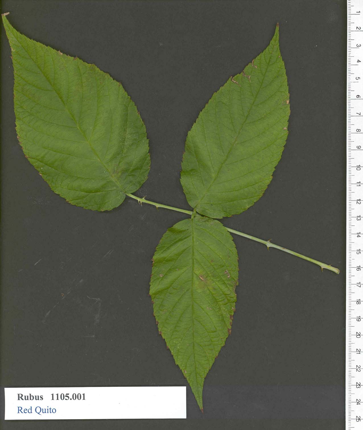 | | 1989 | COLLECTED | | | -0.25000000, -78.58333000 | 500 | | Breeding material | This is a reddish fruited Rubus glaucus from Ecuador.
Cultivar Synonym= Red Quito
| 1448179 | PI 553207 |
| 33 | PI 553208 | R. glaucus | Rubus glaucus Benth. | Ecuador | COR |  | | 1989 | COLLECTED | | | 0.21667000, -78.33333000 | 2500 | | Breeding material | This is a nearly black-fruited species
Cultivar Synonym= Black Otavalo
NAMED FOR= Otavalo, Ecuador which is the collection location. | 1448180 | PI 553208 |
| 34 | PI 553851 | R. slesvicensis | Rubus slesvicensis Lange | Denmark | COR | | | 1989 | COLLECTED | 1989 | | | | | Breeding material | No passport information provided by donor | 1448823 | PI 553851 |
| 35 | PI 553517 | 'Southland' | Rubus idaeus L. subsp. idaeus | North Carolina, United States | COR | | | 1988 | DEVELOPED | 1968 | | | | | Cultivar | Orig. in Raleigh, N.C., by C.F. Williams, Agr. Expt. Sta. and Crops Res. Div., U.S. Dept. of Agriculture. N.C. 237 x Md. S420-5, a complex hybrid involving several raspberry species; cross made in 1950; selected in 1953; introd. in 1968. Fruit: medium size; symmetric and conic; light red, does not darken on maturity; firm; does not crumble; flavor slightly acid with good dessert quality, but color may be too light for frozen pack; ripens early, 2 to 3 days after Sunrise, also has substantial primocane fruit in early or mid-August. Plant: moderate vigor; multiplies freely, thrives with high soil fertility and good drainage; under these conditions, plants need to be maintained in thin narrow rows or grown in the hill system; winter hardy. Highly resistant to leaf spot, powdery mil-dew, and cane spot.Recommended for home garden and commercial use in the upper and mid-South regions
named for the southern states of the U.S.
WHY NAMED= Vigorous and productive in southern Arkansas
| 1448489 | PI 553517 |
| 36 | PI 553191 | R. erythrops New Zealand | Rubus erythrops Edees & A. Newton | New Zealand | COR |  | | 1986 | COLLECTED | | | -41.00000000, 174.00000000 | | | Wild material | From species collection of Harvey Hall | 1448163 | PI 553191 |
| 37 | PI 553489 | R. idaeus Finland 529 | Rubus idaeus L. subsp. idaeus | Finland | COR | | | 1985 | COLLECTED | 08/14/1985 | Biological Research Station, near Konnevesi | 63.00000000, 28.00000000 | 100 | Biological Research Station, near Konnevesi | Wild material | Typical of species, 2m tall, some variation in thornyness | 1448461 | PI 553489 |
| 38 | PI 553491 | R. idaeus Norway 555 | Rubus idaeus L. subsp. idaeus | Norway | COR |  | | 1985 | COLLECTED | 08/18/1985 | Storfjord, at edge of roadway above bay | 65.00000000, 20.00000000 | 5 | Storfjord, at edge of roadway above bay | Wild material | Typical of species, about 1.5 M tall, few fruit | 1448463 | PI 553491 |
| 39 | PI 553690 | R. leucodermis BL-58-1 | Rubus leucodermis Douglas ex Torr. & A. Gray | Washington, United States | COR | | | 1985 | COLLECTED | 08/05/1985 | Wind River Ranger Station along roadside | 46.00000000, -122.00000000 | 1300 | Wind River Ranger Station along roadside | Wild material | Typical fruit and plant for species | 1448662 | PI 553690 |
| 40 | PI 553803 | R. nutkanus BL-60-2 | Rubus parviflorus Nutt. | Washington, United States | COR | | | 1985 | COLLECTED | 08/05/1985 | Gifford Pinchot Nat' Forest, near Wind River Forest Nursery | 46.00000000, -122.00000000 | 1230 | Gifford Pinchot Nat' Forest, near Wind River Forest Nursery | Wild material | Fruit population typical for species | 1448775 | PI 553803 |
| 41 | PI 554080 | R. ursinus BL 58-2 | Rubus ursinus Cham. & Schltdl. | Washington, United States | COR | | | 1985 | COLLECTED | 08/05/1985 | Along roadbanks, near Wind River, Washington | 46.00000000, -122.00000000 | 1300 | Along roadbanks, near Wind River, Washington | Wild material | Typical fruit for species, population sample | 1449052 | PI 554080 |
| 42 | PI 553677 | R. leucodermis BLJ-5-1 | Rubus leucodermis Douglas ex Torr. & A. Gray | Oregon, United States | COR | | | 1985 | COLLECTED | 07/22/1985 | Siuslaw Nat'l Forest, associated with maple, fir, and cedar | 44.00000000, -123.83333000 | 280 | Siuslaw Nat'l Forest, associated with maple, fir, and cedar | Wild material | Plants and fruit typical for species | 1448649 | PI 553677 |
| 43 | PI 553799 | R. nutkanus BLJ0301 | Rubus parviflorus Nutt. | Oregon, United States | COR | | | 1985 | COLLECTED | 07/22/1985 | Siuslaw Nat'l Forest, growing along roadside | 44.00000000, -123.83333000 | 120 | Siuslaw Nat'l Forest, growing along roadside | Wild material | Typical morphology for species | 1448771 | PI 553799 |
| 44 | PI 553802 | R. nutkanus BLJ-9-3 | Rubus parviflorus Nutt. | Oregon, United States | COR | | | 1985 | COLLECTED | 07/23/1985 | Siuslaw Nat'l Forest in mature old-growth forest | 44.00000000, -123.83333000 | 10 | Siuslaw Nat'l Forest in mature old-growth forest | Wild material | Fruit typical of species, variable size, population sample | 1448774 | PI 553802 |
| 45 | PI 554078 | R. ursinus BLJ-9-2 | Rubus ursinus Cham. & Schltdl. | Oregon, United States | COR | | | 1985 | COLLECTED | 07/23/1985 | Suislaw Nat'l Forest in mature old-growth forest | 44.00000000, -123.83333000 | 200 | Suislaw Nat'l Forest in mature old-growth forest | Wild material | Fruit and plant typical for species, population sample | 1449050 | PI 554078 |
| 46 | PI 553798 | R. nutkanus | Rubus parviflorus Nutt. | Oregon, United States | COR | | | 1985 | COLLECTED | 07/07/1985 | Camp Tadmor, McDowell Creek Park | 44.66667000, -123.33333000 | | Camp Tadmor, McDowell Creek Park | Wild material | Typical for species | 1448770 | PI 553798 |
| 47 | PI 553651 | Thornless Evergreen | Rubus laciniatus Willd. | Oregon, United States | COR |  | | 1981 | COLLECTED | | | | | | Cultivar | Late to very late season, excellent vigor. Fruits medium sized, very dark to black, glossy. Tart flavor
Named for thornless clone of the species.
Cultivar Synonym= Thornless Evergreen
WHY NAMED= Thornless habit
NAMED FOR= the State of Oregon | 1448623 | PI 553651 |
| 48 | PI 613647 | V. parvifolium BB-3 | Vaccinium parvifolium Sm. | Washington, United States | COR | | | 1995 | COLLECTED | 08/22/1995 | Near Sultan, Snohomish county, Washington. Along side of gravel road near public campsite. | 47.83333000, -121.86667000 | 100 | Within 5-10 ft of established gravel road in public campsite. Other vegetation: Salal, Douglas Fir, Western Red Cedar, Vaccinium ssp., (huckleberry), other Rubus ssp. | Wild material | Bruce Bartlett collection
| 1508048 | PI 613647 |
| 49 | PI 548943 | V. floribundum 14135 | Vaccinium floribundum Kunth | Azuay, Ecuador | COR | | | 1990 | COLLECTED | 11/13/1990 | Paramo de Tinajillas, approx. 64.7km S of Cuenca, along road to Loja. | -3.28333000, -79.16667000 | 3323 | Shrub paramo with Befaria, Gaultheria, Macleania, Rubus, Vaccinium, Proteaceae and bracken fern. | Wild material | Terrestrial shrub, variable in habit, up to 1 m tall, but often low and spreading. Corolla pink and white. Scattered | 1443879 | PI 548943 |
| 50 | PI 704845 sos | V. parvifolium OR080-49 | Vaccinium parvifolium Sm. | Oregon, United States | COR |  | | 2018 | | | | | | | Wild material | | 1957632 | PI 704845 sos |
| 51 | PI 679664 | V. macrocarpon USFA-ANF-2014-1 | Vaccinium macrocarpon Aiton | Pennsylvania, United States | COR | | | 2014 | COLLECTED | 11/06/2014 | McKean County, Allegheny National Forest, Bradford Ranger District. Along both sides of FR320, approximately 0.2 miles south of junction with FR455. | 41.81790828, -78.73479570 | 629 | Fen. Mixed mosaic of grass/sedge meadow, sphagnum lawn and dry upland mounds. Eriophorum virginicum, Scirpus cyperinus, Glyceria canadensis, Lycopodiella inundata, Vaccinium macrocarpon and numerous Carex and Juncus spp. dominate the saturated portions, while Rubus hispidus and Lycopodium spp. dominate the drier mounds. Population size 1215 m2. | Wild material | Improvement status: wild
Frequency: Occasional to rare
Population distribution: irregular
Altitude: 629
Altimeter make\model: Trimble Geoexplorer 6000
Latitude: 41.817908283 ? N
Longitude: 78.734795701 ? W
GPS make\model: Trimble Geoexplorer 6000
GPS geodetic datum: WGS 1984
GPS uncertainty: 0.6
Slope: 0 ? 5%
Habitat: Fen. Mixed mosaic of grass/sedge meadow, sphagnum lawn and dry upland mounds ? Eriophorum virginicum, Scirpus cyperinus, Glyceria canadensis, Lycopodiella inundata, Vaccinium macrocarpon and numerous Carex and Juncus spp. dominate the saturated portions, while Rubus hispidus and Lycopodium spp. dominate the drier mounds. Population size 1215 m2.
Plant description: Typical for species. Plants present many upright shoots. No flowers. Abundant fruit. Fruit ranges from about 9 to 17 mm in diameter. Fruit shape ranges from pear-shaped to spherical. Fruit color ranges from salmon-pink to nearly black. Fruit consistency ranges from firm and waxy to soft and non-waxy. Vigor and productiveness of plants varies throughout population, though, in general, those in the southern half of the site are denser and bearing substantially more fruit. The densest fruit set tends to be right along road margins.
Type of propagule collected: Seed
Notes: This site is part of a brownwater upland wetland complex heavily impacted by historic Oil, Gas, and Mineral Activity and bisected by a maintained forest road. It drains into an unnamed tributary to Turnup Run. One small disjunct population (4.5 sq meters) is located approximately 1.15 miles NE of this site along the edge of FR305. The nearest sizeable population is located approximately 8.8 miles E of this site.
Collectors: Susan Dube
Comment: CRANBERRY IGRR PROJECT | 1922212 | PI 679664 |
| 52 | PI 679627 | V. macrocarpon Big Run Bog FR 18 | Vaccinium macrocarpon Aiton | West Virginia, United States | COR | | | 2014 | COLLECTED | 04/22/2014 | Big Run Bog, Backbone Mountain, Monogahela National Forest, Tucker County. Next to Forest Road 18 | 39.11812000, -79.58452000 | 983 | Minerotrophic fen in a shallow basin. Many hummocks with standing water between. Fen dissected by many sloughs. A large area of open water within the fen has active beaver dams. Hummocks support small trees and shrubs | Wild material | Plants in fen include Spaghnum sp., Rubus hispidus, Solidago uliginosa, Eriphorum virginicum, Juncus sp., Carex spp., Scirpus sp. Gaultheria hispidula, Aronia melanocarpa, Sarracenia purpurea (introduced). Hummocks supported Picea rubens, Rhododendron maximum, Kalmia latifolia, and ferns including Osmundastrum cinnamomea. Vegetation on surrounding slopes includes Picea rubens, Tsuga canadensis, Amelanchier sp. and Pinus rigida.
Plant description: Reddish leaves. Prolific fruit production. Fruit shape, size and color typical for species. Voucher colleted. Type of propagule collected: seed
Collectors: Williams, KA; Garvey, E; Polgar, R. CRANBERRY IGRR PROJECT | 1919345 | PI 679627 |
| 53 | PI 679628 | V. oxycoccos Big Run Bog FR 18 | Vaccinium oxycoccos L. | West Virginia, United States | COR | | | 2014 | COLLECTED | 04/22/2014 | Big Run Bog, Backbone Mountain, Monogahela National Forest, Tucker County. Next to Forest Road 18 | 39.11812000, -79.58452000 | 983 | Minerotrophic fen in a shallow basin. Many hummocks with standing water between. Fen dissected by many sloughs. A large area of open water within the fen has active beaver dams. Hummocks support small trees and shrubs | Wild material | Plants in fen include Spaghnum sp., Rubus hispidus, Solidago uliginosa, Eriphorum virginicum, Juncus sp., Carex spp., Scirpus sp. Gaultheria hispidula, Aronia melanocarpa, Sarracenia purpurea (introduced). Hummocks supported Picea rubens, Rhododendron maximum, Kalmia latifolia, and ferns including Osmundastrum cinnamomea. Vegetation on surrounding slopes includes Picea rubens, Tsuga canadensis, Amelanchier sp. and Pinus rigida.
Plant description: Plant prostrate. Fruit shape, size and color typical for species. Voucher collected Type of propagule collected: seed
Collectors: Williams, KA; Garvey, E; Polgar, R. CRANBERRY IGRR PROJECT | 1919346 | PI 679628 |
| 54 | PI 679629 | V. oxycoccos Red Run Bog FR 13 | Vaccinium oxycoccos L. | West Virginia, United States | COR | | | 2014 | COLLECTED | 04/23/2014 | Red Run Bog, Monongahela National Forest. Tucker County. The bog is bisected by Canaan Loop Road (Forest Road 13) | 39.07228000, -79.47363000 | 1110 | Bog with two main areas (east and west) separated by forest which is interspersed with smaller boggy areas. Road runs through forested area. Gentle slope from 1115 m in the east to 1105 m in the west. The total area is approximately 100 acres. | Wild material | Plants in bog include Spaghnum sp., Lycopodium sp., Rubus hispidus, Solidago uliginosa, Eriphorum virginicum, Pteridium aquilinum, Juncus sp., Carex spp., Aronia melanocarpa, and Vaccinium macrocarpon . Vegetation on surrounding slopes includes Picea rubens, Tsuga canadensis, Rhododendron maximum, Kalmia latifolia, Ilex montana, Gaultheria sp., and Viburnum prunifolium. Abies balsamea occurs on the edge of the bog.
Plant description: Abundant fruit. Fruit shape, size and color typical for species. Voucher collected Type of propagule collected: seed
Collectors: Williams, KA; Garvey, E; Polgar, R. CRANBERRY IGRR PROJECT | 1919347 | PI 679629 |
| 55 | PI 679630 | V. macrocarpon Red Run Bog FR 13 | Vaccinium macrocarpon Aiton | West Virginia, United States | COR | | | 2014 | COLLECTED | 04/23/2014 | Red Run Bog, Monongahela National Forest. Tucker County. The bog is bisected by Canaan Loop Road (Forest Road 13) | 39.07228000, -79.47363000 | 1110 | Bog with two main areas (east and west) separated by forest which is interspersed with smaller boggy areas. Road runs through forested area. Gentle slope from 1115 m in the east to 1105 m in the west. The total area is approximately 100 acres. | Wild material | Plants in bog include Spaghnum sp., Lycopodium sp., Rubus hispidus, Solidago uliginosa, Eriphorum virginicum, Pteridium aquilinum, Juncus sp., Carex spp., Aronia melanocarpa, and Vaccinium oxycoccos . Vegetation on surrounding slopes includes Picea rubens, Tsuga canadensis, Rhododendron maximum, Kalmia latifolia, Ilex montana, Gaultheria sp., and Viburnum prunifolium. Abies balsamea occurs on the edge of the bog.
Plant description: Abundant fruit. Fruit shape, size and color typical for species. Voucher collected Type of propagule collected: seed
Collectors: Williams, KA; Garvey, E; Polgar, R. CRANBERRY IGRR PROJECT | 1919348 | PI 679630 |
| 56 | PI 679631 | V. oxycoccos Bear Rocks Bog FR 75 | Vaccinium oxycoccos L. | West Virginia, United States | COR | | | 2014 | COLLECTED | 04/23/2014 | Bear Rocks Bog, Dolly Sods Wilderness Area, Monongahela National Forest. Tucker County. Accessed from Forest Road 75. | 39.06700800, -79.30496600 | 1196 | Fen with spongy, saturated uneven survace and many hummocks. Water level | Wild material | Plants in bog include Spaghnum sp., and other mosses. Lycopodium sp., Rubus hispidus, Eriphorum virginicum, Juncus sp., Carex spp., Gaultheria sp., and Vaccinium macrocarpon . Vegetation on surrounding slopes includes Picea rubens, Rhododendron maximum, Kalmia latifolia, and Vaccinium spp.
Plant description: Plants occasionally upright but mostly prostrate. Fruit shape, size, and color typical for species. Heavy fruit production. Voucher collected Type of propagule collected: seed
Collectors: Williams, KA; Garvey, E; Polgar, R. CRANBERRY IGRR PROJECT | 1919349 | PI 679631 |
| 57 | PI 679632 | V. macrocarpon Bear Rocks Bog FR 75 | Vaccinium macrocarpon Aiton | West Virginia, United States | COR | | | 2014 | COLLECTED | 04/23/2014 | Bear Rocks Bog, Dolly Sods Wilderness Area, Monongahela National Forest. Tucker County. Accessed from Forest Road 75. | 39.06700800, -79.30496600 | 1196 | Fen with spongy, saturated uneven survace and many hummocks. Water level | Wild material | Plants in bog include Spaghnum sp., and other mosses. Lycopodium sp., Rubus hispidus, Eriphorum virginicum, Juncus sp., Carex spp., Gaultheria sp., and Vaccinium oxycoccos . Vegetation on surrounding slopes includes Picea rubens, Rhododendron maximum, Kalmia latifolia, and Vaccinium spp.
Plant description: Plants occasionally upright but mostly prostrate. Fruit shape, size, and color typical for species. Heavy fruit production. Voucher collected Type of propagule collected: seed
Collectors: Williams, KA; Garvey, E; Polgar, R. CRANBERRY IGRR PROJECT | 1919350 | PI 679632 |
| 58 | PI 678917 | BH2007 09056 | Epilobium sp. | Georgia | W6 | | | 2007 | COLLECTED | 09/02/2007 | Behind Elia Mountain Ecological Field Station of the Institute of Botany, Kazbegi. East up the Mountain. Mtkheta Province. | 42.65583333, 44.65416667 | 1894 | Along field road in shrub thicket. | Wild material | collected from population of 20+ plants. | 1740632 | PI 678917 |
| 59 | PI 656861 | V. parvifolium 178604 | Vaccinium parvifolium Sm. | Oregon, United States | COR |  | | 2005 | COLLECTED | 08/21/2002 | | | 152 | Pacific coastal forest region with douglas fir as a dominant species interspersed with red alder on forest edge. Associated with Salix spp., Rubus parviflorus, Rubus discolor, Rubus spectabilis, Holodiscus discolor, Sambucus | Wild material | Seeds of Success (SOS) program germplasm. | 1674067 | PI 656861 |
| 60 | PI 637965 | F. iinumae HD-2004-25 | Fragaria iinumae Makino | Hokkaidô, Japan | COR |  | | 2004 | COLLECTED | 07/13/2004 | North Forest Research Laboratory (Tokuda 250 Nayoro) 2.5 km NE of main building complex, growing on edge of road in research forest. | 44.39814000, 142.20561000 | 520 | Associated species: Plantain, Rhus, Polygonum, Artemesia, Bamboo and Rubus idaeus var. aculeatissimus. | Wild material | This accession was collected under the auspices of a bilateral agreement between the National Institute of Agrobiological Sciences, Ministry of Agriculture Fisheries and Foods, Japan, and the U. S. Department of Agriculture, Agricultural Reseach Service, USA, prepared in May 2004. Collected by the sign of the road down to the marshy section. The fruit of these plants were mostly past. Old dried fruits were present on the plant or on the ground underneath the plant and were collected. The site was fragmented; small patches of Fragaria were found up to a distance of 10 meters. In some cases single plants were present on both sides of the road. | 1661599 | PI 637965 |
| 61 | PI 637981 | F. nipponica HD-2004-83 | Fragaria nipponica Makino | Hokkaidô, Japan | COR | | | 2004 | COLLECTED | 07/21/2004 | Akkeshi-wan peninsula, along side of road pull off. | 42.96858000, 144.72676000 | 50 | In open sun. Associated species: Rubus idaeus, Potentilla, grass, bigleaf. Poison ivy was also present. | Wild material | This accession was collected under the auspices of a bilateral agreement between the National Institute of Agrobiological Sciences, Ministry of Agriculture Fisheries and Foods, Japan, and the U. S. Department of Agriculture, Agricultural Reseach Service, USA, prepared in May 2004. | 1661616 | PI 637981 |
| 62 | PI 662010 | JDC/CA/2008/013/083 | Cornus alternifolia L. f. | Iowa, United States | NC7 |  | | 2003 | COLLECTED | 09/15/2003 | West side of Fortune Road, just north of 38558 Fortune, near entrance to Bixby State Park, north of Edgewood, SW corner of SE 1/4 of NW 1/4 of Section 26, T91N, R5W, Edgewood Quad, Clayton County. | 42.66694444, -91.40333333 | 329 | Woodland. Steep bank along creek. 100% filtered shade. Soil consisted of organic matter and rock fill with many stones, well drained. | Wild material | Small tree. Very late fruiting. | 1649455 | PI 662010 |
| 63 | PI 662031 | NA 67802 | Spiraea miyabei Koidz. | Shaanxi Sheng, China | NC7 | | | 1997 | COLLECTED | 09/25/1996 | Ningxi Forest Bureau, Caiziping Forest Station, Xi Gou, Ning Shan District. | 33.71916667, 108.21138890 | 2090 | Shade at the base of a moist cliff with water seepage. 15% slope with a north facing aspect. | Wild material | Deciduous, multi-stemmed shrub; 1.5 m tall; fruit borne in large clusters on current season's growth. | 1537440 | PI 662031 |
| 64 | PI 611049 | VIR 281 | Dactylis glomerata L. | Russian Federation | W6 | | | 1996 | COLLECTED | 09/14/1995 | Krasnodarskiy kray. Nearest village Dachovskaya. | 44.15055556, 40.19666667 | 1100 | Area logged. Slope 6-10%, aspect NE. Light 1/4 shade. Soil loam, pH 5.4-5.6. Moist, upper slope. Vegetation closed, deciduous forest primary, closed scrub with scattered trees. | Wild material | Dominant tree species Carpinus betulus, Quercus robur, Acer campestre. Dominant shrub species Rosa sp., Rubus caesius, Salix caprea, Rhododendron luteum. Dominant herb/grass species Deschampsia caespitosa, Molinia caerulea, Calamagrostis sp., Doricnium graecum, Trifolium medium. Population distribution uniform, abundance occasional. Growth habit erect. Extensive regional climate data available in spreadsheet format or image maps in raster format suitable for GIS analysis. Contact Dr. Stephanie L. Greene (sgreene@ars-grin.gov). | 1517975 | PI 611049 |
| 65 | PI 611053 | VIR 278B | Dactylis glomerata L. | Russian Federation | W6 | | | 1996 | COLLECTED | 09/14/1995 | Krasnodarskiy kray. Nearest village Dachovskaya. | 44.15055556, 40.19666667 | 1100 | Area logged. Slope 6-10%, aspect NE. Light 1/4 shade. Soil loam, pH 5.4-5.6. Moist, upper slope. Vegetation closed, deciduous forest primary, closed scrub with scattered trees. | Wild material | Dominant tree species Carpinus betulus, Quercus robur, Acer campestre. Dominant shrub species Rosa sp., Rubus caesius, Salix caprea, Rhododendron luteum. Dominant herb/grass species Deschampsia caespitosa, Molina caerulea, Calamagrostis sp., Doricnium graecum, Trifolium medium. Population distribution uniform, abundance occasional. Growth habit erect. Flower gray. Extensive regional climate data available in spreadsheet format or image maps in raster format suitable for GIS analysis. Contact Dr. Stephanie L. Greene (sgreene@ars-grin.gov). | 1517973 | PI 611053 |
| 66 | PI 631669 | D113 | Medicago sativa L. subsp. falcata (L.) Arcang. | Krasnodar, Russian Federation | W6 | | | 1996 | COLLECTED | 08/16/1995 | Province Krasnodar, 8 km south of site 61, village Kaluzhskaya. | 44.69388889, 38.95388889 | 260 | Logged/cleared. Slope 0-5%, aspect SE. Light 1/4 shade. Soil loam to clay, limestones in profile, pH 7.0. Seasonally dry, lower slope, pasture/meadow. Vegetation closed, seasonal broad-leafed herb vegetation. | Wild material | Surrounding vegetation open deciduous forest with closed lower layers. Dominant shrub species Prunus, Ribes. Dominant herb/grass species broadleaves, Elytrigia sp., Rubus sp., Lycopus sp., some grasses, poor in legumes, some Lathyrus sp., T. hybridum, T. medium, T. pratense, Artemisia sp. Population distribution patchy, abundance occasional. Growth habit erect. Flower yellow. Extensive regional climate data available in spreadsheet format or image maps in raster format suitable for GIS analysis. Contact Dr. Stephanie L. Greene (sgreene@ars-grin.gov). | 1531062 | PI 631669 |
| 67 | PI 641474 | 279 | Lotus corniculatus L. | Krasnodar, Russian Federation | W6 |  | | 1996 | COLLECTED | 09/14/1995 | Krasnodarskiy kray, nearest village is Dachovskaya. | | | Now logged. Slope 6-10%, aspect NE. 1/4 shade. Soil loam. Moist, upper slope. Vegetation closed, deciduous forest, closed scrub with scattered trees. | Wild material | Dominant tree species Carpinus betulus, Quercus robur, Acer campestre. Dominant shrub species Rosa sp., Rubus caesius, Salix caprea, Rhododendron luteum. Dominant herb/grass species Deschampsia caespitosa, Molinia caerulea, Calamogrostis graecum, Trifolium medium. Population distribution uniform, abundance occasional. Growth habit spreading. Extensive regional climate data available in spreadsheet format or image maps in raster format suitable for GIS analysis. Contact Dr. Stephanie L. Greene (sgreene@ars-grin.gov). | 1531013 | PI 641474 |
| 68 | PI 641475 | 282 | Trifolium medium L. | Krasnodar, Russian Federation | W6 | | | 1996 | COLLECTED | 09/14/1995 | Krasnodarskiy kray, nearest village is Dachovskaya. | | | Now logged. Slope 6-10%, aspect NE. 1/4 shade. Soil loam. Moist, upper slope. Vegetation closed, deciduous forest, scrub with scattered trees. | Wild material | Dominant tree species Carpinus betulus, Quercus robur, Acer campestre. Dominant shrub species Rosa sp., Rubus caesius, Salix caprea, Rhododendron luteum. Dominant herb/grass species Deschampsia caespitosa, Molinia caerulea, Calamogrostis sp., Doricnium graecum, Trifolium medium. Population distribution patchy, abundance frequent. Growth habit spreading. Extensive regional climate data available in spreadsheet format or image maps in raster format suitable for GIS analysis. Contact Dr. Stephanie L. Greene (sgreene@ars-grin.gov). | 1531014 | PI 641475 |
| 69 | PI 641476 | 285 | Lotus corniculatus L. | Krasnodar, Russian Federation | W6 |  | | 1996 | COLLECTED | 09/14/1995 | Krasnodarskiy kray, nearest village is Dachovskaya. | | | Now logged. Slope 6-10%, aspect NE. 1/4 shade. Soil loam. Moist, upper slope. Vegetation closed, deciduous forest, scrub with scattered trees. | Wild material | Dominant tree species Carpinus betulus, Quercus robur, Acer campestre. Dominant shrub species Rosa sp., Rubus caesius, Salix caprea, Rhododendron luteum. Dominant herb/grass species Deschampsia caespitosa, Molinia caerulea, Calamogrostis sp., Doricnium graecum, Trifolium medium. Population distribution uniform, abundance occasional. Growth habit spreading. Extensive regional climate data available in spreadsheet format or image maps in raster format suitable for GIS analysis. Contact Dr. Stephanie L. Greene (sgreene@ars-grin.gov). | 1531016 | PI 641476 |
| 70 | PI 655818 | 284 | Trifolium hybridum L. | Krasnodar, Russian Federation | W6 |  | | 1996 | COLLECTED | 09/14/1995 | Krasnodarskiy kray, nearest village is Dachovskaya. | | | Now logged. Slope 6-10%, aspect NE. 1/4 shade. Soil loam. Moist, upper slope. Vegetation closed, deciduous forest, scrub with scattered trees. | Wild material | Dominant tree species Carpinus betulus, Quercus robur, Acer campestre. Dominant shrub species Rosa sp., Rubus caesius, Salix caprea, Rhododendron luteum. Dominant herb/grass species Deschampsia caespitosa, Molinia caerulea, Calamogrostis sp., Doricnium graecum, Trifolium medium. Population distribution uniform-patchy, abundance occasional. Growth habit spreading. Extensive regional climate data available in spreadsheet format or image maps in raster format suitable for GIS analysis. Contact Dr. Stephanie L. Greene (sgreene@ars-grin.gov). | 1531015 | PI 655818 |
| 71 | PI 612569 | F. virginiana subsp. grayana NC 95-21-1 | Fragaria virginiana Mill. subsp. grayana (Vilm. ex J. Gay) Staudt | Mississippi, United States | COR |  | Out of Season | 1995 | COLLECTED | 07/12/1995 | Mississippi, Pontotoc county. Trace State Park (just outside Tupelo) | 33.85528000, -88.53917000 | 0 | Along roadside in grassy areas. Found in shade under trees. Scattered and morphologically diverse popl. | Wild material | Update on 1995 F. virginiana Collections in the Southeastern USA James R. Ballington and Jerry A. Payne South Carolina was extremely frustrating, by the middle of the week we had only verified the existence of one location for Fragaria virginiana inthe Coastal Plain. Three accessions were located in the Edgefield District of Sumter National Forest and four in Greenwood State Park. Fragaria virginiana from the one verified Coastal Plain location is currently growing in a garden near Lexington, SC. Twelve accessions of Vaccinium spp., four of Gaylussacia frondosa, and one of Rubus argutus were also collected.In southeastern Louisiana and in Mississippi, Fragaria virginiana was not abundant either, and no accessions were found south of Starkville, MS. Specific previous sites were visited near Hattisburg and Laurel, MS, but F. virginiana was no longer present. A total 33 accessions of F. viriniana were collected from east central and northeastern Mississippi. Occurring in small outcroppings of prairie in these regions. Characterized by a very thin layer of 'usually' sticky black soil over decaying limestone, and a scattered to dense overstory of Juniperus virginiana. Within such prairies, F. virginiana was often found growing directly under J. virginiana where little other vegetation occurred. In addition to F. virginiana, 14 accessions of Vaccinium spp. and two accessions Rubus flagellaris were also collected. The collecting trips raised serious questions concerning the statusof Fragaria virginiana in the southeastern US. Is it really as rare as it appears to be in areas such as the coastal plain of South Carolina, southern Mississippi and southeastern Louisiana? People in almost every area told us how abundant wild strawberries were on their property or generally in their region, but these almost always turned out to be either Duchesnea indica, or Potentilla canadensis. The abundance of these two species was about what we had hoped for F. virginiana. | 1507734 | PI 612569 |
| 72 | PI 616689 | F. virginiana subsp. virginiana NC 95-4-1 | Fragaria virginiana Mill. subsp. virginiana | South Carolina, United States | COR | | Out of Season | 1995 | COLLECTED | 06/12/1995 | South Carolina, Williamsburg county, Creel Farm, Henry community. South from Hemingway on SC 41 to county road 121 , left on 121 for 4.5 miles to SC 512 in Henry. Just across SC 512 on 121, to Creel farm. | 34.32111000, -79.28556000 | 0 | Woodland, currently w/ a heavy canopy of mostly deciduous trees. V. tenellum, R. trivialis and R. flagellans occasionally in the woods and along the field edge. | Wild material | South Carolina was extremely frustrating, by the middle of the week we had only verified the existence of one location for Fragaria virginiana in the Coastal Plain, so we moved over into the southern piedmont. Three accessions were located in the Edgefield District of Sumter National Forest and four in Greenwood State Park. The one verified Coastal Plain location is in a garden near Lexington, SC. Twelve accessions of Vaccinium spp., four of Gaylussacia frondosa, and one of Rubus argutus were also collected. Southeastern Louisiana and Mississippi were more successful, but not abundant in these areas either. No accessions were found south of Starkville, MS. Specific previous sites were visited near Hattisburg and Laurel, MS, but F. virginiana was no longer present. A total 33 accessions of F. virginiana were collected from east central and northeastern MS, occurring in small outcroppings of prairie; characterized by a very thin layer of 'usually' sticky black soil over decaying limestone with scattered to dense overstory of Juniperus virginiana. Fragaria virginiana was often found growing directly under J. virginiana where little other vegetation occurred. Dr. Sidney McDaniel of Mississippi State University refers to these areas as 'cedar prairie woodlands'. In addition to F. virginiana, 14 accessions of Vaccinium spp. and two accessions Rubus flagellaris were also collected. These trips raise serious questions concerning the status of Fragaria virginiana in the southeastern US. Is it really as rare as it appears to be? In Greenwood State Park in South Carolina, the species was pioneering on bare ground two years after clearcutting. In Mississippi it was not found in such areas, although one herbarium specimen came from the edged of wildlife food plot. People in almost every area told us how abundant wild strawberries were on their property or in their region, but these almost always turned out to be either Duchesnea indica, or Potentilla canadensis. | 1507705 | PI 616689 |
| 73 | PI 616691 | F. virginiana subsp. virginiana NC 95-11-1 | Fragaria virginiana Mill. subsp. virginiana | South Carolina, United States | COR |  | Out of Season | 1995 | COLLECTED | 06/16/1995 | South Carolina, Abbeville county, Sumter National Forest. FS Road 520 at White Creek Bridge. | 34.08972000, -82.41028000 | 0 | Modest colony of F. virginiana in shade in shallow ditch by road side (above creek). Good moisture and moisture holding capacity. Sig. comp. from grasses & lugumes + Lonicera hallii & tree sdlg. | Wild material | South Carolina was extremely frustrating, by the middle of the week we had only verified the existence of one location for Fragaria virginiana in the Coastal Plain, so we moved over into the southern piedmont. Three accessions were located in the Edgefield District of Sumter National Forest and four in Greenwood State Park. The one verified Coastal Plain location is in a garden near Lexington, SC. Twelve accessions of Vaccinium spp., four of Gaylussacia frondosa, and one of Rubus argutus were also collected. Southeastern Louisiana and Mississippi were more successful, but not abundant in these areas either. No accessions were found south of Starkville, MS. Specific previous sites were visited near Hattisburg and Laurel, MS, but F. virginiana was no longer present. A total 33 accessions of F. virginiana were collected from east central and northeastern MS, occurring in small outcroppings of prairie; characterized by a very thin layer of 'usually' sticky black soil over decaying limestone with scattered to dense overstory of Juniperus virginiana. Fragaria virginiana was often found growing directly under J. virginiana where little other vegetation occurred. Dr. Sidney McDaniel of Mississippi State University refers to these areas as 'cedar prairie woodlands'. In addition to F. virginiana, 14 accessions of Vaccinium spp. and two accessions Rubus flagellaris were also collected. These trips raise serious questions concerning the status of Fragaria virginiana in the southeastern US. Is it really as rare as it appears to be? In Greenwood State Park in South Carolina, the species was pioneering on bare ground two years after clearcutting. In Mississippi it was not found in such areas, although one herbarium specimen came from the edged of wildlife food plot. People in almost every area told us how abundant wild strawberries were on their property or in their region, but these almost always turned out to be either Duchesnea indica, or Potentilla canadensis. | 1507708 | PI 616691 |
| 74 | PI 616695 | F. virginiana subsp. virginiana NC 95-12-4 | Fragaria virginiana Mill. subsp. virginiana | South Carolina, United States | COR |  | Out of Season | 1995 | COLLECTED | 06/17/1995 | South Carolina, Greenwood county, Greenwood State Park. Along road 207 that fronts the Park boundary. | 34.18944000, -82.96528000 | 0 | Upland - very disturbed area, apparently clearcut 2 yrs ago. Some areas of bare soil. Clearcut cornered with established 30 year old pines. | Wild material | South Carolina was extremely frustrating, by the middle of the week we had only verified the existence of one location for Fragaria virginiana in the Coastal Plain, so we moved over into the southern piedmont. Three accessions were located in the Edgefield District of Sumter National Forest and four in Greenwood State Park. The one verified Coastal Plain location is in a garden near Lexington, SC. Twelve accessions of Vaccinium spp., four of Gaylussacia frondosa, and one of Rubus argutus were also collected. Southeastern Louisiana and Mississippi were more successful, but not abundant in these areas either. No accessions were found south of Starkville, MS. Specific previous sites were visited near Hattisburg and Laurel, MS, but F. virginiana was no longer present. A total 33 accessions of F. virginiana were collected from east central and northeastern MS, occurring in small outcroppings of prairie; characterized by a very thin layer of 'usually' sticky black soil over decaying limestone with scattered to dense overstory of Juniperus virginiana. Fragaria virginiana was often found growing directly under J. virginiana where little other vegetation occurred. Dr. Sidney McDaniel of Mississippi State University refers to these areas as 'cedar prairie woodlands'. In addition to F. virginiana, 14 accessions of Vaccinium spp. and two accessions Rubus flagellaris were also collected. These trips raise serious questions concerning the status of Fragaria virginiana in the southeastern US. Is it really as rare as it appears to be? In Greenwood State Park in South Carolina, the species was pioneering on bare ground two years after clearcutting. In Mississippi it was not found in such areas, although one herbarium specimen came from the edged of wildlife food plot. People in almost every area told us how abundant wild strawberries were on their property or in their region, but these almost always turned out to be either Duchesnea indica, or Potentilla canadensis. | 1507712 | PI 616695 |
| 75 | PI 616700 | F. virginiana NC 95-16-6 | Fragaria virginiana Mill. subsp. grayana (Vilm. ex J. Gay) Staudt | Mississippi, United States | COR |  | Out of Season | 1995 | COLLECTED | 07/10/1995 | Mississippi, Oktibbeha county. From Starkville, E on Hwy 82/182 2.2 mi to sec rd 16. L on sec rd 16 4.6 mi to Rock Hill Rd. Righton Rock Hill Rd for 1.6 mi. | 33.54611000, -88.71472000 | 0 | On right: almost excl in shade of Juniperus virgiana, shallow soil over exposed chalk - shade appeared critical for survival. On left: more or less open, competing w/ grasses & R. trivialis. | Wild material | South Carolina was extremely frustrating, by the middle of the week we had only verified the existence of one location for Fragaria virginiana in the Coastal Plain, so we moved over into the southern piedmont. Three accessions were located in the Edgefield District of Sumter National Forest and four in Greenwood State Park. The one verified Coastal Plain location is in a garden near Lexington, SC. Twelve accessions of Vaccinium spp., four of Gaylussacia frondosa, and one of Rubus argutus were also collected. Southeastern Louisiana and Mississippi were more successful, but not abundant in these areas either. No accessions were found south of Starkville, MS. Specific previous sites were visited near Hattisburg and Laurel, MS, but F. virginiana was no longer present. A total 33 accessions of F. virginiana were collected from east central and northeastern MS, occurring in small outcroppings of prairie; characterized by a very thin layer of 'usually' sticky black soil over decaying limestone with scattered to dense overstory of Juniperus virginiana. Fragaria virginiana was often found growing directly under J. virginiana where little other vegetation occurred. Dr. Sidney McDaniel of Mississippi State University refers to these areas as 'cedar prairie woodlands'. In addition to F. virginiana, 14 accessions of Vaccinium spp. and two accessions Rubus flagellaris were also collected. These trips raise serious questions concerning the status of Fragaria virginiana in the southeastern US. Is it really as rare as it appears to be? In Greenwood State Park in South Carolina, the species was pioneering on bare ground two years after clearcutting. In Mississippi it was not found in such areas, although one herbarium specimen came from the edged of wildlife food plot. People in almost every area told us how abundant wild strawberries were on their property or in their region, but these almost always turned out to be either Duchesnea indica, or Potentilla canadensis. | 1507717 | PI 616700 |
| 76 | PI 616701 | F. virginiana NC 95-17-1 | Fragaria virginiana Mill. subsp. grayana (Vilm. ex J. Gay) Staudt | Mississippi, United States | COR | | Out of Season | 1995 | COLLECTED | 07/10/1995 | Mississippi, Oktibbeha county. E on Hwy 82 to Old Mayhew Road. Right on Old Mayhew 0.8 mi to unpaved road heading uphill to left. Left on unpaved rd 0.5 mi to nat'l gas pipeling right of way. | 33.45778000, -88.77056000 | 0 | A significant popl of F. virginiana occurred under J. virginiana trees in an extended cedar glade on slopes above a meadow. | Wild material | South Carolina was extremely frustrating, by the middle of the week we had only verified the existence of one location for Fragaria virginiana in the Coastal Plain, so we moved over into the southern piedmont. Three accessions were located in the Edgefield District of Sumter National Forest and four in Greenwood State Park. The one verified Coastal Plain location is in a garden near Lexington, SC. Twelve accessions of Vaccinium spp., four of Gaylussacia frondosa, and one of Rubus argutus were also collected. Southeastern Louisiana and Mississippi were more successful, but not abundant in these areas either. No accessions were found south of Starkville, MS. Specific previous sites were visited near Hattisburg and Laurel, MS, but F. virginiana was no longer present. A total 33 accessions of F. virginiana were collected from east central and northeastern MS, occurring in small outcroppings of prairie; characterized by a very thin layer of 'usually' sticky black soil over decaying limestone with scattered to dense overstory of Juniperus virginiana. Fragaria virginiana was often found growing directly under J. virginiana where little other vegetation occurred. Dr. Sidney McDaniel of Mississippi State University refers to these areas as 'cedar prairie woodlands'. In addition to F. virginiana, 14 accessions of Vaccinium spp. and two accessions Rubus flagellaris were also collected. These trips raise serious questions concerning the status of Fragaria virginiana in the southeastern US. Is it really as rare as it appears to be? In Greenwood State Park in South Carolina, the species was pioneering on bare ground two years after clearcutting. In Mississippi it was not found in such areas, although one herbarium specimen came from the edged of wildlife food plot. People in almost every area told us how abundant wild strawberries were on their property or in their region, but these almost always turned out to be either Duchesnea indica, or Potentilla canadensis. | 1507718 | PI 616701 |
| 77 | PI 616702 | F. virginiana NC 95-17-2 | Fragaria virginiana Mill. subsp. grayana (Vilm. ex J. Gay) Staudt | Mississippi, United States | COR | | Out of Season | 1995 | COLLECTED | 07/10/1995 | Mississippi, Oktibbeha county. E on Hwy 82 to Old Mayhew Road. Right on Old Mayhew 0.8 mi to unpaved road heading uphill to left. Left on unpaved rd 0.5 mi to nat'l gas pipeling right of way. | 33.45778000, -88.77056000 | 0 | A significant popl of F. virginiana occurred under J. virginiana trees in an extended cedar glade on slopes above a meadow. | Wild material | South Carolina was extremely frustrating, by the middle of the week we had only verified the existence of one location for Fragaria virginiana in the Coastal Plain, so we moved over into the southern piedmont. Three accessions were located in the Edgefield District of Sumter National Forest and four in Greenwood State Park. The one verified Coastal Plain location is in a garden near Lexington, SC. Twelve accessions of Vaccinium spp., four of Gaylussacia frondosa, and one of Rubus argutus were also collected. Southeastern Louisiana and Mississippi were more successful, but not abundant in these areas either. No accessions were found south of Starkville, MS. Specific previous sites were visited near Hattisburg and Laurel, MS, but F. virginiana was no longer present. A total 33 accessions of F. virginiana were collected from east central and northeastern MS, occurring in small outcroppings of prairie; characterized by a very thin layer of 'usually' sticky black soil over decaying limestone with scattered to dense overstory of Juniperus virginiana. Fragaria virginiana was often found growing directly under J. virginiana where little other vegetation occurred. Dr. Sidney McDaniel of Mississippi State University refers to these areas as 'cedar prairie woodlands'. In addition to F. virginiana, 14 accessions of Vaccinium spp. and two accessions Rubus flagellaris were also collected. These trips raise serious questions concerning the status of Fragaria virginiana in the southeastern US. Is it really as rare as it appears to be? In Greenwood State Park in South Carolina, the species was pioneering on bare ground two years after clearcutting. In Mississippi it was not found in such areas, although one herbarium specimen came from the edged of wildlife food plot. People in almost every area told us how abundant wild strawberries were on their property or in their region, but these almost always turned out to be either Duchesnea indica, or Potentilla canadensis. | 1507719 | PI 616702 |
| 78 | PI 616703 | F. virginiana NC 95-17-3 | Fragaria virginiana Mill. subsp. grayana (Vilm. ex J. Gay) Staudt | Mississippi, United States | COR | | Out of Season | 1995 | COLLECTED | 07/10/1995 | Mississippi, Oktibbeha county. E on Hwy 82 to Old Mayhew Road. Right on Old Mayhew 0.8 mi to unpaved road heading uphill to left. Left on unpaved rd 0.5 mi to nat'l gas pipeling right of way. | 33.45778000, -88.77056000 | 0 | A significant popl of F. virginiana occurred under J. virginiana trees in an extended cedar glade on slopes above a meadow. | Wild material | South Carolina was extremely frustrating, by the middle of the week we had only verified the existence of one location for Fragaria virginiana in the Coastal Plain, so we moved over into the southern piedmont. Three accessions were located in the Edgefield District of Sumter National Forest and four in Greenwood State Park. The one verified Coastal Plain location is in a garden near Lexington, SC. Twelve accessions of Vaccinium spp., four of Gaylussacia frondosa, and one of Rubus argutus were also collected. Southeastern Louisiana and Mississippi were more successful, but not abundant in these areas either. No accessions were found south of Starkville, MS. Specific previous sites were visited near Hattisburg and Laurel, MS, but F. virginiana was no longer present. A total 33 accessions of F. virginiana were collected from east central and northeastern MS, occurring in small outcroppings of prairie; characterized by a very thin layer of 'usually' sticky black soil over decaying limestone with scattered to dense overstory of Juniperus virginiana. Fragaria virginiana was often found growing directly under J. virginiana where little other vegetation occurred. Dr. Sidney McDaniel of Mississippi State University refers to these areas as 'cedar prairie woodlands'. In addition to F. virginiana, 14 accessions of Vaccinium spp. and two accessions Rubus flagellaris were also collected. These trips raise serious questions concerning the status of Fragaria virginiana in the southeastern US. Is it really as rare as it appears to be? In Greenwood State Park in South Carolina, the species was pioneering on bare ground two years after clearcutting. In Mississippi it was not found in such areas, although one herbarium specimen came from the edged of wildlife food plot. People in almost every area told us how abundant wild strawberries were on their property or in their region, but these almost always turned out to be either Duchesnea indica, or Potentilla canadensis. | 1507720 | PI 616703 |
| 79 | PI 616706 | F. virginiana subsp. grayana NC 95-17-6 | Fragaria virginiana Mill. subsp. grayana (Vilm. ex J. Gay) Staudt | Mississippi, United States | COR | | Out of Season | 1995 | COLLECTED | 07/10/1995 | Mississippi, Oktibbeha county. E on Hwy 82 to Old Mayhew Road. Right on Old Mayhew 0.8 mi to unpaved road heading uphill to left. Left on unpaved rd 0.5 mi to nat'l gas pipeling right of way. | 33.45778000, -88.77056000 | 0 | A significant popl of F. virginiana occurred under J. virginiana trees in an extended cedar glade on slopes above a meadow. | Wild material | South Carolina was extremely frustrating, by the middle of the week we had only verified the existence of one location for Fragaria virginiana in the Coastal Plain, so we moved over into the southern piedmont. Three accessions were located in the Edgefield District of Sumter National Forest and four in Greenwood State Park. The one verified Coastal Plain location is in a garden near Lexington, SC. Twelve accessions of Vaccinium spp., four of Gaylussacia frondosa, and one of Rubus argutus were also collected. Southeastern Louisiana and Mississippi were more successful, but not abundant in these areas either. No accessions were found south of Starkville, MS. Specific previous sites were visited near Hattisburg and Laurel, MS, but F. virginiana was no longer present. A total 33 accessions of F. virginiana were collected from east central and northeastern MS, occurring in small outcroppings of prairie; characterized by a very thin layer of 'usually' sticky black soil over decaying limestone with scattered to dense overstory of Juniperus virginiana. Fragaria virginiana was often found growing directly under J. virginiana where little other vegetation occurred. Dr. Sidney McDaniel of Mississippi State University refers to these areas as 'cedar prairie woodlands'. In addition to F. virginiana, 14 accessions of Vaccinium spp. and two accessions Rubus flagellaris were also collected. These trips raise serious questions concerning the status of Fragaria virginiana in the southeastern US. Is it really as rare as it appears to be? In Greenwood State Park in South Carolina, the species was pioneering on bare ground two years after clearcutting. In Mississippi it was not found in such areas, although one herbarium specimen came from the edged of wildlife food plot. People in almost every area told us how abundant wild strawberries were on their property or in their region, but these almost always turned out to be either Duchesnea indica, or Potentilla canadensis. | 1507723 | PI 616706 |
| 80 | PI 616707 | F. virginiana NC 95-18-1 | Fragaria virginiana Mill. subsp. grayana (Vilm. ex J. Gay) Staudt | Mississippi, United States | COR | | Out of Season | 1995 | COLLECTED | 07/11/1995 | Mississippi, Monroe county. Hwy 45 north to Hwy 278. E on Hwy 278to Central Grove Rd. Right on Peacely Ferry Rd. 1.1 mi. | 33.45750000, -88.77056000 | 0 | Cedar glade on both roadsides, with F. virginiana scattered on the site under J. virginiana, always under heavy shade. | Wild material | South Carolina was extremely frustrating, by the middle of the week we had only verified the existence of one location for Fragaria virginiana in the Coastal Plain, so we moved over into the southern piedmont. Three accessions were located in the Edgefield District of Sumter National Forest and four in Greenwood State Park. The one verified Coastal Plain location is in a garden near Lexington, SC. Twelve accessions of Vaccinium spp., four of Gaylussacia frondosa, and one of Rubus argutus were also collected. Southeastern Louisiana and Mississippi were more successful, but not abundant in these areas either. No accessions were found south of Starkville, MS. Specific previous sites were visited near Hattisburg and Laurel, MS, but F. virginiana was no longer present. A total 33 accessions of F. virginiana were collected from east central and northeastern MS, occurring in small outcroppings of prairie; characterized by a very thin layer of 'usually' sticky black soil over decaying limestone with scattered to dense overstory of Juniperus virginiana. Fragaria virginiana was often found growing directly under J. virginiana where little other vegetation occurred. Dr. Sidney McDaniel of Mississippi State University refers to these areas as 'cedar prairie woodlands'. In addition to F. virginiana, 14 accessions of Vaccinium spp. and two accessions Rubus flagellaris were also collected. These trips raise serious questions concerning the status of Fragaria virginiana in the southeastern US. Is it really as rare as it appears to be? In Greenwood State Park in South Carolina, the species was pioneering on bare ground two years after clearcutting. In Mississippi it was not found in such areas, although one herbarium specimen came from the edged of wildlife food plot. People in almost every area told us how abundant wild strawberries were on their property or in their region, but these almost always turned out to be either Duchesnea indica, or Potentilla canadensis. | 1507724 | PI 616707 |
| 81 | PI 616708 | F. virginiana NC 95-18-2 | Fragaria virginiana Mill. subsp. grayana (Vilm. ex J. Gay) Staudt | Mississippi, United States | COR | | Out of Season | 1995 | COLLECTED | 07/11/1995 | Mississippi, Monroe county. Hwy 45 north to Hwy 278. E on Hwy 278to Central Grove Rd. Right on Peacely Ferry Rd. 1.1 mi. | 33.45750000, -88.77056000 | 0 | Cedar glade on both roadsides, with F. virginiana scattered on the site under J. virginiana, always under heavy shade. | Wild material | South Carolina was extremely frustrating, by the middle of the week we had only verified the existence of one location for Fragaria virginiana in the Coastal Plain, so we moved over into the southern piedmont. Three accessions were located in the Edgefield District of Sumter National Forest and four in Greenwood State Park. The one verified Coastal Plain location is in a garden near Lexington, SC. Twelve accessions of Vaccinium spp., four of Gaylussacia frondosa, and one of Rubus argutus were also collected. Southeastern Louisiana and Mississippi were more successful, but not abundant in these areas either. No accessions were found south of Starkville, MS. Specific previous sites were visited near Hattisburg and Laurel, MS, but F. virginiana was no longer present. A total 33 accessions of F. virginiana were collected from east central and northeastern MS, occurring in small outcroppings of prairie; characterized by a very thin layer of 'usually' sticky black soil over decaying limestone with scattered to dense overstory of Juniperus virginiana. Fragaria virginiana was often found growing directly under J. virginiana where little other vegetation occurred. Dr. Sidney McDaniel of Mississippi State University refers to these areas as 'cedar prairie woodlands'. In addition to F. virginiana, 14 accessions of Vaccinium spp. and two accessions Rubus flagellaris were also collected. These trips raise serious questions concerning the status of Fragaria virginiana in the southeastern US. Is it really as rare as it appears to be? In Greenwood State Park in South Carolina, the species was pioneering on bare ground two years after clearcutting. In Mississippi it was not found in such areas, although one herbarium specimen came from the edged of wildlife food plot. People in almost every area told us how abundant wild strawberries were on their property or in their region, but these almost always turned out to be either Duchesnea indica, or Potentilla canadensis. | 1507725 | PI 616708 |
| 82 | PI 616710 | F. virginiana subsp. grayana NC 95-18-6 | Fragaria virginiana Mill. subsp. grayana (Vilm. ex J. Gay) Staudt | Mississippi, United States | COR |  | Out of Season | 1995 | COLLECTED | 07/11/1995 | Mississippi, Monroe county. Hwy 45 north to Hwy 278. E on Hwy 278to Central Grove Rd. Right on Peacely Ferry Rd. 1.1 mi. | 33.45750000, -88.77056000 | 0 | Cedar glade on both roadsides, with F. virginiana scattered on the site under J. virginiana, always under heavy shade. | Wild material | South Carolina was extremely frustrating, by the middle of the week we had only verified the existence of one location for Fragaria virginiana in the Coastal Plain, so we moved over into the southern piedmont. Three accessions were located in the Edgefield District of Sumter National Forest and four in Greenwood State Park. The one verified Coastal Plain location is in a garden near Lexington, SC. Twelve accessions of Vaccinium spp., four of Gaylussacia frondosa, and one of Rubus argutus were also collected. Southeastern Louisiana and Mississippi were more successful, but not abundant in these areas either. No accessions were found south of Starkville, MS. Specific previous sites were visited near Hattisburg and Laurel, MS, but F. virginiana was no longer present. A total 33 accessions of F. virginiana were collected from east central and northeastern MS, occurring in small outcroppings of prairie; characterized by a very thin layer of 'usually' sticky black soil over decaying limestone with scattered to dense overstory of Juniperus virginiana. Fragaria virginiana was often found growing directly under J. virginiana where little other vegetation occurred. Dr. Sidney McDaniel of Mississippi State University refers to these areas as 'cedar prairie woodlands'. In addition to F. virginiana, 14 accessions of Vaccinium spp. and two accessions Rubus flagellaris were also collected. These trips raise serious questions concerning the status of Fragaria virginiana in the southeastern US. Is it really as rare as it appears to be? In Greenwood State Park in South Carolina, the species was pioneering on bare ground two years after clearcutting. In Mississippi it was not found in such areas, although one herbarium specimen came from the edged of wildlife food plot. People in almost every area told us how abundant wild strawberries were on their property or in their region, but these almost always turned out to be either Duchesnea indica, or Potentilla canadensis. | 1507727 | PI 616710 |
| 83 | PI 616712 | F. virginiana NC 95-19-3 | Fragaria virginiana Mill. subsp. grayana (Vilm. ex J. Gay) Staudt | Mississippi, United States | COR | | Out of Season | 1995 | COLLECTED | 07/11/1995 | Mississippi, Monroe county. Hwy 278 1.8 mi from Lake Monroe Rd to Wrenwood Rd. L on Wrenwood (an unpaved rd to Presbyterian Church Camp). Site 0.75 mi off road to the right, behind caretakers home. | 34.00750000, -88.57139000 | 0 | Cedar glade with occasional F. virginiana, mostly in heavy shade, but with several colonies extending out into open areas. | Wild material | South Carolina was extremely frustrating, by the middle of the week we had only verified the existence of one location for Fragaria virginiana in the Coastal Plain, so we moved over into the southern piedmont. Three accessions were located in the Edgefield District of Sumter National Forest and four in Greenwood State Park. The one verified Coastal Plain location is in a garden near Lexington, SC. Twelve accessions of Vaccinium spp., four of Gaylussacia frondosa, and one of Rubus argutus were also collected. Southeastern Louisiana and Mississippi were more successful, but not abundant in these areas either. No accessions were found south of Starkville, MS. Specific previous sites were visited near Hattisburg and Laurel, MS, but F. virginiana was no longer present. A total 33 accessions of F. virginiana were collected from east central and northeastern MS, occurring in small outcroppings of prairie; characterized by a very thin layer of 'usually' sticky black soil over decaying limestone with scattered to dense overstory of Juniperus virginiana. Fragaria virginiana was often found growing directly under J. virginiana where little other vegetation occurred. Dr. Sidney McDaniel of Mississippi State University refers to these areas as 'cedar prairie woodlands'. In addition to F. virginiana, 14 accessions of Vaccinium spp. and two accessions Rubus flagellaris were also collected. These trips raise serious questions concerning the status of Fragaria virginiana in the southeastern US. Is it really as rare as it appears to be? In Greenwood State Park in South Carolina, the species was pioneering on bare ground two years after clearcutting. In Mississippi it was not found in such areas, although one herbarium specimen came from the edged of wildlife food plot. People in almost every area told us how abundant wild strawberries were on their property or in their region, but these almost always turned out to be either Duchesnea indica, or Potentilla canadensis. | 1507730 | PI 616712 |
| 84 | PI 616713 | F. virginiana NC 95-19-4 | Fragaria virginiana Mill. subsp. grayana (Vilm. ex J. Gay) Staudt | Mississippi, United States | COR | | Out of Season | 1995 | COLLECTED | 07/11/1995 | Mississippi, Monroe county. Hwy 278 1.8 mi from Lake Monroe Rd to Wrenwood Rd. L on Wrenwood (an unpaved rd to Presbyterian Church Camp). Site 0.75 mi off road to the right, behind caretakers home. | 34.00750000, -88.57139000 | 0 | Cedar glade with occasional F. virginiana, mostly in heavy shade, but with several colonies extending out into open areas. | Wild material | South Carolina was extremely frustrating, by the middle of the week we had only verified the existence of one location for Fragaria virginiana in the Coastal Plain, so we moved over into the southern piedmont. Three accessions were located in the Edgefield District of Sumter National Forest and four in Greenwood State Park. The one verified Coastal Plain location is in a garden near Lexington, SC. Twelve accessions of Vaccinium spp., four of Gaylussacia frondosa, and one of Rubus argutus were also collected. Southeastern Louisiana and Mississippi were more successful, but not abundant in these areas either. No accessions were found south of Starkville, MS. Specific previous sites were visited near Hattisburg and Laurel, MS, but F. virginiana was no longer present. A total 33 accessions of F. virginiana were collected from east central and northeastern MS, occurring in small outcroppings of prairie; characterized by a very thin layer of 'usually' sticky black soil over decaying limestone with scattered to dense overstory of Juniperus virginiana. Fragaria virginiana was often found growing directly under J. virginiana where little other vegetation occurred. Dr. Sidney McDaniel of Mississippi State University refers to these areas as 'cedar prairie woodlands'. In addition to F. virginiana, 14 accessions of Vaccinium spp. and two accessions Rubus flagellaris were also collected. These trips raise serious questions concerning the status of Fragaria virginiana in the southeastern US. Is it really as rare as it appears to be? In Greenwood State Park in South Carolina, the species was pioneering on bare ground two years after clearcutting. In Mississippi it was not found in such areas, although one herbarium specimen came from the edged of wildlife food plot. People in almost every area told us how abundant wild strawberries were on their property or in their region, but these almost always turned out to be either Duchesnea indica, or Potentilla canadensis. | 1507731 | PI 616713 |
| 85 | PI 616716 | F. virginiana NC 95-21-2 | Fragaria virginiana Mill. subsp. grayana (Vilm. ex J. Gay) Staudt | Mississippi, United States | COR | | Out of Season | 1995 | COLLECTED | 07/12/1995 | Mississippi, Pontotoc county. Trace State Park (just outside Tupelo) | 33.85528000, -88.53917000 | 0 | Along roadside in grassy areas. Found in shade under trees. Scattered and morphologically diverse popl. | Wild material | South Carolina was extremely frustrating, by the middle of the week we had only verified the existence of one location for Fragaria virginiana in the Coastal Plain, so we moved over into the southern piedmont. Three accessions were located in the Edgefield District of Sumter National Forest and four in Greenwood State Park. The one verified Coastal Plain location is in a garden near Lexington, SC. Twelve accessions of Vaccinium spp., four of Gaylussacia frondosa, and one of Rubus argutus were also collected. Southeastern Louisiana and Mississippi were more successful, but not abundant in these areas either. No accessions were found south of Starkville, MS. Specific previous sites were visited near Hattisburg and Laurel, MS, but F. virginiana was no longer present. A total 33 accessions of F. virginiana were collected from east central and northeastern MS, occurring in small outcroppings of prairie; characterized by a very thin layer of 'usually' sticky black soil over decaying limestone with scattered to dense overstory of Juniperus virginiana. Fragaria virginiana was often found growing directly under J. virginiana where little other vegetation occurred. Dr. Sidney McDaniel of Mississippi State University refers to these areas as 'cedar prairie woodlands'. In addition to F. virginiana, 14 accessions of Vaccinium spp. and two accessions Rubus flagellaris were also collected. These trips raise serious questions concerning the status of Fragaria virginiana in the southeastern US. Is it really as rare as it appears to be? In Greenwood State Park in South Carolina, the species was pioneering on bare ground two years after clearcutting. In Mississippi it was not found in such areas, although one herbarium specimen came from the edged of wildlife food plot. People in almost every area told us how abundant wild strawberries were on their property or in their region, but these almost always turned out to be either Duchesnea indica, or Potentilla canadensis. | 1507735 | PI 616716 |
| 86 | PI 616717 | F. virginiana NC 95-21-3 | Fragaria virginiana Mill. subsp. grayana (Vilm. ex J. Gay) Staudt | Mississippi, United States | COR |  | Out of Season | 1995 | COLLECTED | 07/12/1995 | Mississippi, Pontotoc county. Trace State Park (just outside Tupelo) | 33.85528000, -88.53917000 | 0 | Along roadside in grassy areas. Found in shade under trees. Scattered and morphologically diverse popl. | Wild material | South Carolina was extremely frustrating, by the middle of the week we had only verified the existence of one location for Fragaria virginiana in the Coastal Plain, so we moved over into the southern piedmont. Three accessions were located in the Edgefield District of Sumter National Forest and four in Greenwood State Park. The one verified Coastal Plain location is in a garden near Lexington, SC. Twelve accessions of Vaccinium spp., four of Gaylussacia frondosa, and one of Rubus argutus were also collected. Southeastern Louisiana and Mississippi were more successful, but not abundant in these areas either. No accessions were found south of Starkville, MS. Specific previous sites were visited near Hattisburg and Laurel, MS, but F. virginiana was no longer present. A total 33 accessions of F. virginiana were collected from east central and northeastern MS, occurring in small outcroppings of prairie; characterized by a very thin layer of 'usually' sticky black soil over decaying limestone with scattered to dense overstory of Juniperus virginiana. Fragaria virginiana was often found growing directly under J. virginiana where little other vegetation occurred. Dr. Sidney McDaniel of Mississippi State University refers to these areas as 'cedar prairie woodlands'. In addition to F. virginiana, 14 accessions of Vaccinium spp. and two accessions Rubus flagellaris were also collected. These trips raise serious questions concerning the status of Fragaria virginiana in the southeastern US. Is it really as rare as it appears to be? In Greenwood State Park in South Carolina, the species was pioneering on bare ground two years after clearcutting. In Mississippi it was not found in such areas, although one herbarium specimen came from the edged of wildlife food plot. People in almost every area told us how abundant wild strawberries were on their property or in their region, but these almost always turned out to be either Duchesnea indica, or Potentilla canadensis. | 1507736 | PI 616717 |
| 87 | PI 616718 | F. virginiana NC 95-21-4A | Fragaria virginiana Mill. subsp. grayana (Vilm. ex J. Gay) Staudt | Mississippi, United States | COR |  | Out of Season | 1995 | COLLECTED | 07/12/1995 | Mississippi, Pontotoc county. Trace State Park (just outside Tupelo) | 33.85528000, -88.53917000 | 0 | Along roadside in grassy areas. Found in shade under trees. Scattered and morphologically diverse popl. | Wild material | South Carolina was extremely frustrating, by the middle of the week we had only verified the existence of one location for Fragaria virginiana in the Coastal Plain, so we moved over into the southern piedmont. Three accessions were located in the Edgefield District of Sumter National Forest and four in Greenwood State Park. The one verified Coastal Plain location is in a garden near Lexington, SC. Twelve accessions of Vaccinium spp., four of Gaylussacia frondosa, and one of Rubus argutus were also collected. Southeastern Louisiana and Mississippi were more successful, but not abundant in these areas either. No accessions were found south of Starkville, MS. Specific previous sites were visited near Hattisburg and Laurel, MS, but F. virginiana was no longer present. A total 33 accessions of F. virginiana were collected from east central and northeastern MS, occurring in small outcroppings of prairie; characterized by a very thin layer of 'usually' sticky black soil over decaying limestone with scattered to dense overstory of Juniperus virginiana. Fragaria virginiana was often found growing directly under J. virginiana where little other vegetation occurred. Dr. Sidney McDaniel of Mississippi State University refers to these areas as 'cedar prairie woodlands'. In addition to F. virginiana, 14 accessions of Vaccinium spp. and two accessions Rubus flagellaris were also collected. These trips raise serious questions concerning the status of Fragaria virginiana in the southeastern US. Is it really as rare as it appears to be? In Greenwood State Park in South Carolina, the species was pioneering on bare ground two years after clearcutting. In Mississippi it was not found in such areas, although one herbarium specimen came from the edged of wildlife food plot. People in almost every area told us how abundant wild strawberries were on their property or in their region, but these almost always turned out to be either Duchesnea indica, or Potentilla canadensis. | 1507737 | PI 616718 |
| 88 | PI 616720 | F. virginiana subsp. grayana NC 95-21-5 | Fragaria virginiana Mill. subsp. grayana (Vilm. ex J. Gay) Staudt | Mississippi, United States | COR |  | Out of Season | 1995 | COLLECTED | 07/12/1995 | Mississippi, Pontotoc county. Trace State Park (just outside Tupelo) | 33.85528000, -88.53917000 | 0 | Along roadside in grassy areas. Found in shade under trees. Scattered and morphologically diverse popl. | Wild material | South Carolina was extremely frustrating, by the middle of the week we had only verified the existence of one location for Fragaria virginiana in the Coastal Plain, so we moved over into the southern piedmont. Three accessions were located in the Edgefield District of Sumter National Forest and four in Greenwood State Park. The one verified Coastal Plain location is in a garden near Lexington, SC. Twelve accessions of Vaccinium spp., four of Gaylussacia frondosa, and one of Rubus argutus were also collected. Southeastern Louisiana and Mississippi were more successful, but not abundant in these areas either. No accessions were found south of Starkville, MS. Specific previous sites were visited near Hattisburg and Laurel, MS, but F. virginiana was no longer present. A total 33 accessions of F. virginiana were collected from east central and northeastern MS, occurring in small outcroppings of prairie; characterized by a very thin layer of 'usually' sticky black soil over decaying limestone with scattered to dense overstory of Juniperus virginiana. Fragaria virginiana was often found growing directly under J. virginiana where little other vegetation occurred. Dr. Sidney McDaniel of Mississippi State University refers to these areas as 'cedar prairie woodlands'. In addition to F. virginiana, 14 accessions of Vaccinium spp. and two accessions Rubus flagellaris were also collected. These trips raise serious questions concerning the status of Fragaria virginiana in the southeastern US. Is it really as rare as it appears to be? In Greenwood State Park in South Carolina, the species was pioneering on bare ground two years after clearcutting. In Mississippi it was not found in such areas, although one herbarium specimen came from the edged of wildlife food plot. People in almost every area told us how abundant wild strawberries were on their property or in their region, but these almost always turned out to be either Duchesnea indica, or Potentilla canadensis. | 1507739 | PI 616720 |
| 89 | PI 616721 | F. virginiana subsp. grayana NC 95-21-6 | Fragaria virginiana Mill. subsp. grayana (Vilm. ex J. Gay) Staudt | Mississippi, United States | COR | | Out of Season | 1995 | COLLECTED | 07/12/1995 | Mississippi, Pontotoc county. Trace State Park (just outside Tupelo) | 33.85528000, -88.53917000 | 0 | Along roadside in grassy areas. Found in shade under trees. Scattered and morphologically diverse popl. | Wild material | South Carolina was extremely frustrating, by the middle of the week we had only verified the existence of one location for Fragaria virginiana in the Coastal Plain, so we moved over into the southern piedmont. Three accessions were located in the Edgefield District of Sumter National Forest and four in Greenwood State Park. The one verified Coastal Plain location is in a garden near Lexington, SC. Twelve accessions of Vaccinium spp., four of Gaylussacia frondosa, and one of Rubus argutus were also collected. Southeastern Louisiana and Mississippi were more successful, but not abundant in these areas either. No accessions were found south of Starkville, MS. Specific previous sites were visited near Hattisburg and Laurel, MS, but F. virginiana was no longer present. A total 33 accessions of F. virginiana were collected from east central and northeastern MS, occurring in small outcroppings of prairie; characterized by a very thin layer of 'usually' sticky black soil over decaying limestone with scattered to dense overstory of Juniperus virginiana. Fragaria virginiana was often found growing directly under J. virginiana where little other vegetation occurred. Dr. Sidney McDaniel of Mississippi State University refers to these areas as 'cedar prairie woodlands'. In addition to F. virginiana, 14 accessions of Vaccinium spp. and two accessions Rubus flagellaris were also collected. These trips raise serious questions concerning the status of Fragaria virginiana in the southeastern US. Is it really as rare as it appears to be? In Greenwood State Park in South Carolina, the species was pioneering on bare ground two years after clearcutting. In Mississippi it was not found in such areas, although one herbarium specimen came from the edged of wildlife food plot. People in almost every area told us how abundant wild strawberries were on their property or in their region, but these almost always turned out to be either Duchesnea indica, or Potentilla canadensis. | 1507740 | PI 616721 |
| 90 | PI 616723 | NC 95-22-4 | Fragaria virginiana Mill. subsp. grayana (Vilm. ex J. Gay) Staudt | Mississippi, United States | COR |  | Out of Season | 1995 | COLLECTED | 07/13/1995 | Mississippi, Tishomingo county, Tishomingo State Park. | 34.26028000, -88.88583000 | 0 | Upper piedmont vegetation on ridges and in deep shady ravines; closely resembling the Applachians where rock outcrops occur. V. arboreum, V. elliotii fairly abundant. Scattering of Rubus spp | Wild material | South Carolina was extremely frustrating, by the middle of the week we had only verified the existence of one location for Fragaria virginiana in the Coastal Plain, so we moved over into the southern piedmont. Three accessions were located in the Edgefield District of Sumter National Forest and four in Greenwood State Park. The one verified Coastal Plain location is in a garden near Lexington, SC. Twelve accessions of Vaccinium spp., four of Gaylussacia frondosa, and one of Rubus argutus were also collected. Southeastern Louisiana and Mississippi were more successful, but not abundant in these areas either. No accessions were found south of Starkville, MS. Specific previous sites were visited near Hattisburg and Laurel, MS, but F. virginiana was no longer present. A total 33 accessions of F. virginiana were collected from east central and northeastern MS, occurring in small outcroppings of prairie; characterized by a very thin layer of 'usually' sticky black soil over decaying limestone with scattered to dense overstory of Juniperus virginiana. Fragaria virginiana was often found growing directly under J. virginiana where little other vegetation occurred. Dr. Sidney McDaniel of Mississippi State University refers to these areas as 'cedar prairie woodlands'. In addition to F. virginiana, 14 accessions of Vaccinium spp. and two accessions Rubus flagellaris were also collected. These trips raise serious questions concerning the status of Fragaria virginiana in the southeastern US. Is it really as rare as it appears to be? In Greenwood State Park in South Carolina, the species was pioneering on bare ground two years after clearcutting. In Mississippi it was not found in such areas, although one herbarium specimen came from the edged of wildlife food plot. People in almost every area told us how abundant wild strawberries were on their property or in their region, but these almost always turned out to be either Duchesnea indica, or Potentilla canadensis. | 1507742 | PI 616723 |
| 91 | PI 616724 | F. virginiana NC 95-22-5 | Fragaria virginiana Mill. subsp. grayana (Vilm. ex J. Gay) Staudt | Mississippi, United States | COR |  | Out of Season | 1995 | COLLECTED | 07/13/1995 | Mississippi, Tishomingo county, Tishomingo State Park. | 34.26028000, -88.88583000 | 0 | Upper piedmont vegetation on ridges and in deep shady ravines; closely resembling the Applachians where rock outcrops occur. V. arboreum, V. elliotii fairly abundant. Scattering of Rubus spp | Wild material | South Carolina was extremely frustrating, by the middle of the week we had only verified the existence of one location for Fragaria virginiana in the Coastal Plain, so we moved over into the southern piedmont. Three accessions were located in the Edgefield District of Sumter National Forest and four in Greenwood State Park. The one verified Coastal Plain location is in a garden near Lexington, SC. Twelve accessions of Vaccinium spp., four of Gaylussacia frondosa, and one of Rubus argutus were also collected. Southeastern Louisiana and Mississippi were more successful, but not abundant in these areas either. No accessions were found south of Starkville, MS. Specific previous sites were visited near Hattisburg and Laurel, MS, but F. virginiana was no longer present. A total 33 accessions of F. virginiana were collected from east central and northeastern MS, occurring in small outcroppings of prairie; characterized by a very thin layer of 'usually' sticky black soil over decaying limestone with scattered to dense overstory of Juniperus virginiana. Fragaria virginiana was often found growing directly under J. virginiana where little other vegetation occurred. Dr. Sidney McDaniel of Mississippi State University refers to these areas as 'cedar prairie woodlands'. In addition to F. virginiana, 14 accessions of Vaccinium spp. and two accessions Rubus flagellaris were also collected. These trips raise serious questions concerning the status of Fragaria virginiana in the southeastern US. Is it really as rare as it appears to be? In Greenwood State Park in South Carolina, the species was pioneering on bare ground two years after clearcutting. In Mississippi it was not found in such areas, although one herbarium specimen came from the edged of wildlife food plot. People in almost every area told us how abundant wild strawberries were on their property or in their region, but these almost always turned out to be either Duchesnea indica, or Potentilla canadensis. | 1507743 | PI 616724 |
| 92 | PI 616725 | F. virginiana NC 95-16-1 | Fragaria virginiana Mill. subsp. grayana (Vilm. ex J. Gay) Staudt | Mississippi, United States | COR |  | Out of Season | 1995 | COLLECTED | 07/10/1995 | Mississippi, Oktibbeha county. From Starkville, E on Hwy 82/182 2.2 mi to sec rd 16. L on sec rd 16 4.6 mi to Rock Hill Rd. Righton Rock Hill Rd for 1.6 mi. | 33.54611000, -88.71472000 | 0 | On right: almost excl in shade of Juniperus virgiana, shallow soil over exposed chalk - shade appeared critical for survival. On left: more or less open, competing w/ grasses & R. trivialis. | Wild material | South Carolina was extremely frustrating, by the middle of the week we had only verified the existence of one location for Fragaria virginiana in the Coastal Plain, so we moved over into the southern piedmont. Three accessions were located in the Edgefield District of Sumter National Forest and four in Greenwood State Park. The one verified Coastal Plain location is in a garden near Lexington, SC. Twelve accessions of Vaccinium spp., four of Gaylussacia frondosa, and one of Rubus argutus were also collected. Southeastern Louisiana and Mississippi were more successful, but not abundant in these areas either. No accessions were found south of Starkville, MS. Specific previous sites were visited near Hattisburg and Laurel, MS, but F. virginiana was no longer present. A total 33 accessions of F. virginiana were collected from east central and northeastern MS, occurring in small outcroppings of prairie; characterized by a very thin layer of 'usually' sticky black soil over decaying limestone with scattered to dense overstory of Juniperus virginiana. Fragaria virginiana was often found growing directly under J. virginiana where little other vegetation occurred. Dr. Sidney McDaniel of Mississippi State University refers to these areas as 'cedar prairie woodlands'. In addition to F. virginiana, 14 accessions of Vaccinium spp. and two accessions Rubus flagellaris were also collected. These trips raise serious questions concerning the status of Fragaria virginiana in the southeastern US. Is it really as rare as it appears to be? In Greenwood State Park in South Carolina, the species was pioneering on bare ground two years after clearcutting. In Mississippi it was not found in such areas, although one herbarium specimen came from the edged of wildlife food plot. People in almost every area told us how abundant wild strawberries were on their property or in their region, but these almost always turned out to be either Duchesnea indica, or Potentilla canadensis. | 1507744 | PI 616725 |
| 93 | PI 616726 | F. virginiana NC 95-18-4 | Fragaria virginiana Mill. subsp. grayana (Vilm. ex J. Gay) Staudt | Mississippi, United States | COR |  | Out of Season | 1995 | COLLECTED | 07/11/1995 | Mississippi, Monroe county. Hwy 45 north to Hwy 278. E on Hwy 278to Central Grove Rd. Right on Peacely Ferry Rd. 1.1 mi. | 33.45750000, -88.77056000 | 0 | Cedar glade on both roadsides, with F. virginiana scattered on the site under J. virginiana, always under heavy shade. | Wild material | South Carolina was extremely frustrating, by the middle of the week we had only verified the existence of one location for Fragaria virginiana in the Coastal Plain, so we moved over into the southern piedmont. Three accessions were located in the Edgefield District of Sumter National Forest and four in Greenwood State Park. The one verified Coastal Plain location is in a garden near Lexington, SC. Twelve accessions of Vaccinium spp., four of Gaylussacia frondosa, and one of Rubus argutus were also collected. Southeastern Louisiana and Mississippi were more successful, but not abundant in these areas either. No accessions were found south of Starkville, MS. Specific previous sites were visited near Hattisburg and Laurel, MS, but F. virginiana was no longer present. A total 33 accessions of F. virginiana were collected from east central and northeastern MS, occurring in small outcroppings of prairie; characterized by a very thin layer of 'usually' sticky black soil over decaying limestone with scattered to dense overstory of Juniperus virginiana. Fragaria virginiana was often found growing directly under J. virginiana where little other vegetation occurred. Dr. Sidney McDaniel of Mississippi State University refers to these areas as 'cedar prairie woodlands'. In addition to F. virginiana, 14 accessions of Vaccinium spp. and two accessions Rubus flagellaris were also collected. These trips raise serious questions concerning the status of Fragaria virginiana in the southeastern US. Is it really as rare as it appears to be? In Greenwood State Park in South Carolina, the species was pioneering on bare ground two years after clearcutting. In Mississippi it was not found in such areas, although one herbarium specimen came from the edged of wildlife food plot. People in almost every area told us how abundant wild strawberries were on their property or in their region, but these almost always turned out to be either Duchesnea indica, or Potentilla canadensis. | 1507745 | PI 616726 |
| 94 | PI 618245 | V. ovatum GP3 | Vaccinium ovatum Pursh | Oregon, United States | COR | | | 1994 | COLLECTED | 08/23/1993 | Siskiyou National Forest, near Agness, Take F.S. 33 east and south over Rouge River from county road 375. West on F.S. 2308 which runs, at first, along Snout Creek. Collection site along F.S. 2308 from just past F.S. 260 to F.S. 3577. | 42.56467000, -124.00567000 | 535 | Coast forest but many drier species. Arbutus, Quercus, Pseudotsuga, Abies and Rubus ursinus. | Wild material | Chad Finn collection
| 1583760 | PI 618245 |
| 95 | PI 598832 | MO20.CPG94 | Festuca arundinacea Schreb. | Morocco | W6 | | | 1994 | COLLECTED | 07/13/1994 | Near Aknoul, 10 km west of Aknoul on road S304, 9 km. west of intersection with S312. | 34.71055556, -3.92222222 | 1400 | Grazed. Slope 11-40%, aspect NE. 1/4 shade. Soil loam, heavy, on calcareous shale, pH 9.0-9.5. Rainfall 500 mm. Moist, ravine by irr. orchard/alfalfa crops. Vegetation closed, seasonal tall grass. Surrounding veg. cereal-vineyard-orchard. | Wild material | Dominant tree species Quercus ilex on slopes, Poplar and Salix spp. in ravine. Dom. shrub sp. Calycotome villosus. Dom. herb/grass sp. annual/perennial grass, Avena, Festuca arundinacea. Population distribution patchy, abundance frequent. Growth habit erect. | 1480211 | PI 598832 |
| 96 | PI 598833 | MO21.CPG94 | Dactylis glomerata L. | Morocco | W6 | | | 1994 | COLLECTED | 07/13/1994 | Near Aknoul, 10 km west of Aknoul on road S304, 9 km. west of intersection with S312. | 34.71055556, -3.92222222 | 1400 | Grazed. Slope 11-40%, aspect NE. 1/4 shade. Soil loam, pH 9.0-9.5. Rainfall 500 mm. Seasonally dry, upper slope. Vegetation closed, seasonal tall grass. Surrounding veg. cereal-vineyard-orchard agriculture. | Wild material | Dominant tree species Quercus ilex on slpe, Poplar and Salix spp. in ravine. Dom. shrub sp. Calycotome villosus. Dom. herb/grass sp. annual/perennial grass, Avena, Festuca arundinacea. Population distribution patchy, abundance frequent. Growth habit erect. | 1480212 | PI 598833 |
| 97 | PI 655779 | T126.CPG94 | Trifolium repens L. | Tunisia | W6 | | | 1994 | COLLECTED | 06/30/1994 | Near Siddi Mechrig, 15 k north of P7 Hw. on road to Sidi Mechrig (2 k on dirt road off paved road, isolated habitat). | 37.14583333, 9.13000000 | 65 | Grazed. Slope 0-5%, aspect NE. Area open. Soil loam, hydromorphic, pH 5.0. Rainfall 650 mm. Seasonally inundated, stream terrace. Vegetation closed, seasonal tall grass. Surrounding veg. closed evergreen scrub with scattered trees. | Wild material | Population abundance frequent, distribution patchy. Growth habit prostrate. Flower white. | 1480072 | PI 655779 |
| 98 | PI 692255 | T125.CPG94 | Festuca arundinacea Schreb. | Tunisia | W6 | | | 1994 | COLLECTED | 06/30/1994 | Near Sidi Mechrig, 15 k north of P7 Hw. on road to Sidi Mechrig (2 k on dirt road off paved road, isolated habitat). | 37.14583333, 9.13000000 | 65 | Grazed. Slope 0-5%, aspect NE. Area open. soil loam, hydromorphic, pH 5.0. Rainfall 650 mm. Seasonally inundated, stream terrace. Vegetation closed, seasonal tall grass. Surrounding veg. closed evergreen scrub with scattered trees. | Wild material | Population abundance rare, distribution patchy. Growth habit erect. | 1480071 | PI 692255 |
| 99 | PI 550943 | JM-3668 | Aegilops biuncialis Vis. | Dytikí Makedonía, Greece | NSGC |  | | 1984 | COLLECTED | 07/07/1984 | 8km from Kipourio on old Grevena-Kipourio road, Grevena. | 40.03333333, 21.38333333 | 520 | Plants growing at riverbank and margin of forest. Loam soil with good drainage. Plants growing with 3 other Aegilops species, Platanus, Scirpus, Rubus, Quercus. | Wild material | | 1445879 | PI 550943 |
| 100 | PI 550944 | JM-3671 | Aegilops biuncialis Vis. | Dytikí Makedonía, Greece | NSGC |  | | 1984 | COLLECTED | 07/07/1984 | 7km from Kipourio on old Grevena-Kipourio road, Grevena. | 40.01666667, 21.38333333 | 520 | Plants growing at riverbank or margin of forest. Loam soil with good drainage. Plants growing with 3 other Aegilops species, Platanus, Scirpus, Rubus, Quercus. | Wild material | | 1445880 | PI 550944 |
| 101 | PI 551086 | JM-3665 | Aegilops geniculata Roth | Dytikí Makedonía, Greece | NSGC |  | | 1984 | COLLECTED | 07/07/1984 | 8km from Kipourio on old road from Grevena, Grevena. | 40.03333333, 21.38333333 | 520 | Plants growing at riverbank and margin of forest. Loam soil with good drainage. Plants growing with 3 other Aegilops species, partially intermixed populations, Platanus, Scirpus, Rubus, Quercus. | Wild material | | 1446022 | PI 551086 |
| 102 | PI 551165 | JM-3685 | Aegilops neglecta Req. ex Bertol. | Dytikí Makedonía, Greece | NSGC |  | | 1984 | COLLECTED | 07/08/1984 | 2km before Milia on Grevena-Kozani road, Grevena | 40.16666667, 21.50000000 | 670 | Plants growing on slopes. Clay soil with few stones and good drainage. Plants growing with several Aegilops species, Triticum boeoticum, other annual and perennial grasses, scattered oak trees, and Rubus. | Wild material | 2n=42. | 1446101 | PI 551165 |
| 103 | PI 551191 | JM-3667 | Aegilops triuncialis L. | Dytikí Makedonía, Greece | NSGC |  | | 1984 | COLLECTED | 07/07/1984 | 8km from Kipourio on old road to Grevena. | 40.03333333, 21.38333333 | 520 | Plants growing at river bank and margin of forest. Loam soil with good drainage. Plants growing with 3 other Aegilops species, Platanus, Scirpus, Rubus, Quercus. | Wild material | | 1446127 | PI 551191 |
| 104 | PI 551192 | JM-3670 | Aegilops triuncialis L. | Dytikí Makedonía, Greece | NSGC |  | | 1984 | COLLECTED | 07/07/1984 | 7km from Kipourio on old road to Grevena. | 40.01666667, 21.38333333 | 520 | Plants growing at riverbank and margins of forest. Loam soil with good drainage. Plants growing with 3 other Aegilops species, Platanus, Scirpus, Rubus, Quercus. | Wild material | | 1446128 | PI 551192 |
| 105 | PI 598396 | JM 3687 | Dasypyrum villosum (L.) P. Candargy | Greece | W6 | | | 1984 | COLLECTED | 07/08/1984 | Plants growing on hills in clay with low stones and good drainage, 2km before Milia, on road from Grevena to Kozani, Grevena, West Macedonia | | 670 | | Wild material | Plants growing with other Aegilops species among scattered oak trees, annual and perennial grasses, Pyrus spinosa, Rubus, and Triticum boeoticum | 1039241 | PI 598396 |
| 106 | NA 89114 | TLM25-03 | Zanthoxylum clava-herculis L. | Texas, United States | NA | | | 2025 | COLLECTED | 07/09/2025 | Jackson County Road 113, Bergston Road, approximately 2.1 kilometers north of the junction with Jackson County Road 234; growing on the west side of the road along a fenceline running parallel to the road. | 29.00576600, -96.76298500 | 24 | Plants are growing in full sun to light shade along a fence line near where cattle graze and the dirt road. The area is disturbed, but somewhat overgrown since there is very little traffic on the road that is primarily used by farmers and ranchers to access their fields. Slope: 0 to 1 percent. Aspect: N/A. Soils: The soils of this area sampled are classified as Laewest clay, 0 to 1 percent slopes (LaA). The Laewest Series consists of very deep, moderately well drained soils that formed in clayey flood basin deposits on alluvial plains or deltas of the Beaumont Formation of Pleistocene Age. These nearly level to gently sloping soils are on broad flat coastal plains. Slope ranges from 0 to 8 percent. The solum thickness is more than 200 cm and ranges from slightly acidic on the surface to neutral in deeper pedons. This is a cyclic soil and undisturbed areas have gilgai microrelief with microhighs 15 to 30 cm higher than microlows. Distance from the center of the microhighs to the center of the microlows ranges from about 1.2 to 4.9 m. The microhigh makes up about 20 percent, the intermediate, or area between the knoll and depression about 50 percent, and the microlow about 30 percent. The amplitude of waviness between mollic colored materials in the upper part of the solum and the higher value colors in the lower part ranges from about 30 to 150 cm. When dry, the soil has cracks 1 to 5 cm wide at the surface and commonly 1 cm wide cracks extend to a depth of 1.2 m during the summer. The cracks remain open for less than 90 cumulative days in most years. Some pedons have an overwash of calcareous clay or silty clay 20 to 51 cm thick. (Source: California Soil Resource Lab/NRCS Official Soil Series Descriptions). Geology: The underlying geology of this area is Lizzie Formation of Quaternary, Middle Pleistocene age. It is comprised of sand, silt, clay, and minor amount of gravel. Iron oxide and iron-manganese nodules are common in zones of weathering; locally calcareous. Surface is fairly flat and featureless except for many shallow depressions and pimple mounds. Moore and Wermund (1993a) mapped three units--(1) alluvium undifferentiated as to texture and origin--includes meander belt, levee, crevasse splay, and distributary sand, and flood-basin mud deposits, about 60 m thick, (2) fine-grained channel facies (alluvial sand, silt, and clay) about 10-25 m thick, thicker seaward, and (3) fine-grained overbank facies (alluvial silt and clay) about 55-65 m thick, thicker seaward. Together, these deposits form a deltaic plain that parallels the Gulf Coast. Unit contains Pleistocene vertebrate fauna, dips seaward beneath the Beaumont Fm. and disconformably overlies deposits of the Pliocene and early Pleistocene Willis Formation. The deltaic plain is entrenched as much as 7 m by streams. In Hidalgo County (southernmost part of Texas) the unit underlies a semiarid plain, widely irrigated and cultivated. Unit is locally veneered with thin, discontinuous stabilized eolian sand. (Source: USGS Texas Geologic Map Data). | Wild material | | 2191653 | NA 89114 |
| 107 | Ames 36327 | Lick Creek Unit | Amelanchier arborea (F. Michx.) Fernald | Iowa, United States | NC7 |  | | 2025 | COLLECTED | 06/10/2025 | Shimek State Forest Lick Creek Unit just east of Farmington, T67N R7W NE ¼ Sec. 8 and Sec. 7 and also T68N R8W Sec. 25. | 40.62024500, -91.70427700 | 214 | Woodland edges. | Wild material | The native range of Amelanchier arborea is concentrated in the eastern half of the U.S. (Little, 1977). This accession represents a collection of A. arborea germplasm from the western region of the species native range, specifically the extreme southeastern corner of Iowa. Specimens sampled in nature ranging 15-35' in height. Typically smoothish bark, light grey in color. Peak flowering (white flowers) occuring usually in early April with orange, orange-red fall colors peaking typically end of September (southeastern Iowa). | 2191464 | Ames 36327 |
| 108 | NA 89196 | KVR | Hamamelis virginiana L. | Wisconsin, United States | NA | | | 2025 | COLLECTED | 08/22/2024 | Kickapoo Valley Reserve. | 43.62650770, -90.64627490 | 299 | Shade in thick, clayey, organic soil with sand. Slope: 45 degrees. Aspect: Northeast. Silver maple-boxelder-elm vegetative community. | Wild material | | 2171017 | NA 89196 |
| 109 | NA 89081 | 2024RJLPA-009 | Rosa carolina L. | Pennsylvania, United States | NA | | | 2024 | COLLECTED | 09/22/2024 | Lancaster and York Counties: outcrops along the Susquehanna River, accessed from the Historic Lock 12 parking lot off of Pennsylvania Road 372. | 39.81483500, -76.32762200 | 34 | Plants are growing from part-sun to full sun in crevices of the outcrops and where organic debris has accumulated in between boulders along the Susquehanna River. The sites range from nearly xeric to dry mesic, at least on the surface. Plants are generally growing 4-10 m above the normal flow of the river; however, the Holtwood Dam is less than 1 kilometer upstream and debris found trapped in the boulders indicates that there is periodic flooding, at least, in the lower zone of 4+ meters or so above normal river flow. This habitat has a diverse assemblage of deciduous trees and shrubs as well as abundant herbaceous taxa. Slope: 0 to 60 percent. Aspect: Northeast (generally). Geology: The underlying geology of this area is probably of lower Paleozoic age and characterized as the Octoraro Formation. It includes albite-chlorite schist, phyllite, some hornblende gneiss, and granitized members. Soils: The area where this species occurs is right on the edge of two soil zones that transition from the river’s edge to mesic conditions upslope. The first is generally referred to as Rock Outcrop. This terrestrial matrix in which plants grow is largely exposed underlying rock geology with accumulated outwash, rock decomposition, and organic debris buildup. The second is Mt. Airy (80%) and Manor (20%) Series soils, 25 to 60 percent slopes, extremely stony (MRF). (Source: California Soil Resource Lab/NRCS Official Soil Series Descriptions). EPA Ecoregion (Level III): Northern Piedmont (64). EPA Ecoregion (Level IV): Piedmont Uplands (64c). | Wild material | | 2169045 | NA 89081 |
| 110 | NA 89082 | 2024RJLPA-010 | Amorpha fruticosa L. | Pennsylvania, United States | NA | | | 2024 | COLLECTED | 09/22/2024 | Outcrops along the Susquehanna River, accessed from the Historic Lock 12 parking lot off of Pennsylvania Road 372. | 39.81481500, -76.32757900 | 34 | Plants are growing from part-sun to full sun in crevices of the outcrops and where organic debris has accumulated in between boulders along the Susquehanna River. The sites range from nearly xeric to dry mesic, at least on the surface. Plants are generally growing 4-10 m above the normal flow of the river; however, the Holtwood Dam is less than 1 kilometer upstream and debris found trapped in the boulders indicates that there is periodic flooding, at least, in the lower zone of 4+ meters or so above normal river flow. This habitat has a diverse assemblage of deciduous trees and shrubs as well as abundant herbaceous taxa. Slope: 0 to 25 percent. Aspect: Northeast (generally). Geology: The underlying geology of this area is probably of lower Paleozoic age and characterized as the Octoraro Formation. It includes albite-chlorite schist, phyllite, some hornblende gneiss, and granitized members. Soils: The area where this species occurs is right on the edge of two soil zones that transition from the river’s edge to mesic conditions upslope. The first is generally referred to as Rock Outcrop. This terrestrial matrix in which plants grow is largely exposed underlying rock geology with accumulated outwash, rock decomposition, and organic debris buildup. The second is Mt. Airy (80%) and Manor (20%) Series soils, 25 to 60 percent slopes, extremely stony (MRF). (Source: California Soil Resource Lab/NRCS Official Soil Series Descriptions). EPA Ecoregion (Level III): Northern Piedmont (64). EPA Ecoregion (Level IV): Piedmont Uplands (64c). | Wild material | | 2169046 | NA 89082 |
| 111 | NA 89083 | 2024RJLPA-012 | Rhododendron periclymenoides (Michx.) Shinners | Pennsylvania, United States | NA | | | 2024 | COLLECTED | 09/22/2024 | Outcrops along the Susquehanna River, accessed from the Historic Lock 12 parking lot off of Pennsylvania Road 372. | 39.81477400, -76.32807300 | 35 | Plants are growing from shade to part-sun and occasionally full sun in crevices of the outcrops and where organic debris has accumulated in between boulders along the Susquehanna River. The sites range from nearly xeric to mesic, at least on the surface. Plants are generally growing 4-10 m above the normal flow of the river; however, the Holtwood Dam is less than 1 kilometer upstream and debris found trapped in the boulders indicates that there is periodic flooding, at least, in the lower zone of 4+ meters or so above normal river flow. This habitat has a diverse assemblage of deciduous trees and shrubs as well as abundant herbaceous taxa. Slope: 0 to 60 percent. Aspect: Northeast (generally). Geology: The underlying geology of this area is probably of lower Paleozoic age and characterized as the Octoraro Formation. It includes albite-chlorite schist, phyllite, some hornblende gneiss, and granitized members. Soils: The area where this species occurs is right on the edge of two soil zones that transition from the river’s edge to mesic conditions upslope. The first is generally referred to as Rock Outcrop. This terrestrial matrix in which plants grow is largely exposed underlying rock geology with accumulated outwash, rock decomposition, and organic debris buildup. The second is Mt. Airy (80%) and Manor (20%) Series soils, 25 to 60 percent slopes, extremely stony (MRF). (Source: California Soil Resource Lab/NRCS Official Soil Series Descriptions). EPA Ecoregion (Level III): Northern Piedmont (64). EPA Ecoregion (Level IV): Piedmont Uplands (64c). | Wild material | | 2169047 | NA 89083 |
| 112 | NA 89084 | 2024RJLPA-013 | Physocarpus opulifolius (L.) Maxim. | Pennsylvania, United States | NA | | | 2024 | COLLECTED | 09/22/2024 | Outcrops along the Susquehanna River, accessed from the Historic Lock 12 parking lot off of Pennsylvania Road 372. | 39.81466300, -76.32833900 | 36 | Plants are growing from shade to part-sun where organic debris has accumulated in between boulders as well as further upslope in deeper mesic soils along the Susquehanna River. This habitat has a diverse assemblage of deciduous trees and shrubs as well as abundant herbaceous taxa. Slope: 10 to 25 percent. Aspect: Northeast (generally). Geology: The underlying geology of this area is probably of lower Paleozoic age and characterized as the Octoraro Formation. It includes albite-chlorite schist, phyllite, some hornblende gneiss, and granitized members. Soils: The area where this species occurs is right on the edge of two soil zones that transition from the river’s edge to mesic conditions upslope. The first is generally referred to as Rock Outcrop. This terrestrial matrix in which plants grow is largely exposed underlying rock geology with accumulated outwash, rock decomposition, and organic debris buildup. The second is Mt. Airy (80%) and Manor (20%) Series soils, 25 to 60 percent slopes, extremely stony (MRF). (Source: California Soil Resource Lab/NRCS Official Soil Series Descriptions). EPA Ecoregion (Level III): Northern Piedmont (64). EPA Ecoregion (Level IV): Piedmont Uplands (64c). | Wild material | | 2169048 | NA 89084 |
| 113 | NA 89085 | 2024RJLPA-014 | Rhododendron arborescens (Pursh) Torr. | Pennsylvania, United States | NA | | | 2024 | COLLECTED | 09/22/2024 | Outcrops along the Susquehanna River, accessed from the Historic Lock 12 parking lot off of Pennsylvania Road 372. | 39.81618100, -76.33069800 | 38 | Plants are growing from shade to part-sun and occasionally full sun in crevices of the outcrops and where organic debris has accumulated in between boulders along the Susquehanna River. The sites range from nearly xeric to mesic, at least on the surface. Plants are generally growing 4-10 m above the normal flow of the river; however, the Holtwood Dam is less than 1 kilometer upstream and debris found trapped in the boulders indicates that there is periodic flooding, at least, in the lower zone of 4+ meters or so above normal river flow. This habitat has a diverse assemblage of deciduous trees and shrubs as well as abundant herbaceous taxa. Slope: 0 to 75 percent. Aspect: Northeast (generally). Geology: The underlying geology of this area is probably of lower Paleozoic age and characterized as the Octoraro Formation. It includes albite-chlorite schist, phyllite, some hornblende gneiss, and granitized members. Soils: The area where this species occurs is right on the edge of two soil zones that transition from the river’s edge to mesic conditions upslope. The first is generally referred to as Rock Outcrop. This terrestrial matrix in which plants grow is largely exposed underlying rock geology with accumulated outwash, rock decomposition, and organic debris buildup. The second is Mt. Airy (80%) and Manor (20%) Series soils, 25 to 60 percent slopes, extremely stony (MRF). (Source: California Soil Resource Lab/NRCS Official Soil Series Descriptions). EPA Ecoregion (Level III): Northern Piedmont (64). EPA Ecoregion (Level IV): Piedmont Uplands (64c). | Wild material | | 2169049 | NA 89085 |
| 114 | NA 89086 | 2024RJLPA-015 | Ilex verticillata (L.) A. Gray | Pennsylvania, United States | NA | | | 2024 | COLLECTED | 09/22/2024 | Outcrops along the Susquehanna River, accessed from the Historic Lock 12 parking lot off of Pennsylvania Road 372. | 39.81656600, -76.33136600 | 38 | Plants are growing from part-sun to full sun in crevices of the outcrops and where organic debris has accumulated in between boulders along the Susquehanna River. The sites range from nearly xeric to dry mesic, at least on the surface. Plants are generally growing 4-10 m above the normal flow of the river; however, the Holtwood Dam is less than 1 kilometer upstream and debris found trapped in the boulders indicates that there is periodic flooding, at least, in the lower zone of 4+ meters or so above normal river flow. This habitat has a diverse assemblage of deciduous trees and shrubs as well as abundant herbaceous taxa. Slope: 0 to 10 percent. Aspect: Northeast (generally). Geology: The underlying geology of this area is probably of lower Paleozoic age and characterized as the Octoraro Formation. It includes albite-chlorite schist, phyllite, some hornblende gneiss, and granitized members. Soils: The area where this species occurs is right on the edge of two soil zones that transition from the river’s edge to mesic conditions upslope. The first is generally referred to as Rock Outcrop. This terrestrial matrix in which plants grow is largely exposed underlying rock geology with accumulated outwash, rock decomposition, and organic debris buildup. The second is Mt. Airy (80%) and Manor (20%) Series soils, 25 to 60 percent slopes, extremely stony (MRF). (Source: California Soil Resource Lab/NRCS Official Soil Series Descriptions). EPA Ecoregion (Level III): Northern Piedmont (64). EPA Ecoregion (Level IV): Piedmont Uplands (64c). | Wild material | | 2169050 | NA 89086 |
| 115 | Ames 36251 | JDC/UT/2024/008/1130 | Ulmus thomasii Sarg. | Minnesota, United States | NC7 | 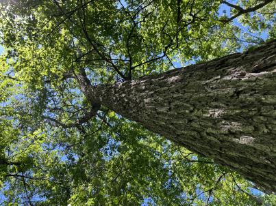 | | 2024 | COLLECTED | 06/05/2024 | Near southeast edge of Kasota Lake approximately 9.0 miles east, southeast of Willmar, T119N R34W SE 1/4 NE 1/4 Sec. 36 and also Robbins Island Park in Wilmar, T119N R35W Sec. 11. | 45.07399600, -94.88484100 | 352 | Deciduous woods | Wild material | Ulmus thomasii (Rock elm) is an underutilized tree species both in conservation and in the urban landscape. Described by Charles Sprague Sargent (first director for the Arnold Arborteum) as "heavy, hard, very strong and tough, closely grained, and susceptible of receiving a beautiful polish". Historically noted for a variety of uses in woodworking including furniture, heavy agricultural implements, timber frame buildings, pianos, hockey sticks, and hand tools. Ulmus thomasii is extremely drought tolerant, adaptable to very calcareous soils, and compared to U. americana or U. rubra has a very conservative growth rate requiring minimal attention in regards to pruning. Rock elm naturally tends to develop into a nice structural specimen in the landscape, unlike other fast growing cultivars in the nursery trade needing frequent attention. Rock elm has very fissured bark and is well known for maintaining a strong central leader resulting in a very attractive, pyramidal form. Despite many literature sources stating that "wings" on the stems are a key identifiying characteristic, this trait is not reliable and many genotypes may completely lack "wings" on the stems. While growth habit and morphology of dormant buds (very pointy) are good traits to help aid in identification, fruits are the best way to confirm identity. Fruits are densly pubescent, often described as "inflated" and generally reach maturity a couple weeks after Ulmus rubra and Ulmus americana. U. thomasii inflorescences are rather distinguishable from other Ulmus in being pendulous. Fruits are extremely prized treats for many birds, where fruits are often "robbed" prior to full maturity. Fruits are also highly prized by many other animals such as mice, squirrels, chipmunks, turkeys, etc. and are generally consumed within hours after fruit abscission. The native range of U. thomasii is concentrated in the northeastern United States and into Canada with disjunct populations documented in northwestern Missouri and northwestern Arkansas (Little, E. L. Jr. 1971). In the 1895 Silva of North America (vol. 7) it was stated that, “The value of the wood of the Rock Elm threatens its extinction and most of the large trees have already been cut.” Today, while rock elm is rather rare, especially in areas near the edges of its range, many states list the species as endangered or threatened warranting preservation efforts. Genetics of this accession would be representative of the species northwestern edge of its native range. Majority of specimens noted did not have characteristic "wings" on the stems and measured approximately 20" DBH or more with a few specimens nearing 30". Heights estimated between 70-90'. Rock elm in this area could be classified as locally abundant. | 2167953 | Ames 36251 |
| 116 | Ames 36248 | Robert's Creek | Salix bebbiana Sarg. | Iowa, United States | NC7 |  | | 2024 | COLLECTED | 05/15/2024 | Robert’s Creek Preserve just north of Forest Road approximately 4.2 miles north, northeast of Elkader, T94N R5W near center of Sec. 36. | 42.91366500, -91.37990600 | 260 | Mixed hardwood forest. Very steep, moist, north-facing slope. | Wild material | Bebb's willow, Salix bebbiana, is a tight, clump forming, multi-stemmed shrub that can reach up to 25' in height that forms a rather distinct, mounded growth habit. Native to North America, the native range covers mostly Canada, but extending south into the northeastern US and also the Rocky Mountains range stretching as far south as New Mexico and Arizona (Little, E. L. Jr. 1977). In Iowa, this species seems to only be known from northeastern Iowa. Salix bebbiana can be found in a variety of habitats from pond margins/swamps to even moderately well-drained open fields. The female capsules are long (5-9 mm) with a very slender beak held on the longest stalk of any N. American Salix. This accession represents genetics from northeastern Iowa at the southern edge of its range in northeastern N. America. Specimens sampled were estimated at 30' in height. Some of the oldest, largest specimens sampled measuring approximately 8" DBH were showing signs of decline. Immature leaves are reddish or yellow green and rather rugose. | 2167645 | Ames 36248 |
| 117 | NA 88827 | RJL-RM2023FLAL-001 | Ilex ambigua Torr. | Florida, United States | NA | | | 2023 | COLLECTED | 12/05/2023 | Yellow River Wildlife Management Area, along DOF [Department of Forestry] Y9 dirt road 0.08 kilometers east of Miller Bluff Road. | 30.65289100, -86.87602800 | 44 | Growing in part shade to sun in very dry, highly competitive site still recovering from the logging of pines in the past decade. This young woodland is comprised of a combination of evergreen and deciduous species competing for available resources and light before the young sand pines begin to dominate the upper canopy. Slope: 0 percent. Aspect: N/A. The underlying geology of this area is the Citronelle Formation, of Pliocene origin, and consists of gray to orange, often mottled, unconsolidated to poorly consolidated, very fine to very coarse, poorly sorted, clean to clayey sands. It contains significant amounts of clay, silt and gravel which may occur as beds and lenses and may vary considerably over short distances. Limonite nodules and limonite-cemented beds are common. (Source: USGS Florida Geologic Map Data.) The primary soil type in the collection area is classified as Lakeland Sand soils (0 to 5 percent slopes). The surface soil profile of this area is primarily the Lakeland series which consists of very deep, excessively drained, rapid to very rapidly permeable soils on uplands. They formed in thick beds of eolian or marine and/or fluvio-marine sands. Thickness of the sand exceeds 2 meters. Silt plus clay in the upper meter ranges from 5-10 percent. Reaction ranges from very strongly acid to moderately acid throughout. (Source: NRCS Web Soil Survey.) | Wild material | | 2165657 | NA 88827 |
| 118 | NA 88828 | RJL-RM2023FLAL-002 | Vaccinium arboreum Marshall | Florida, United States | NA | | | 2023 | COLLECTED | 12/05/2023 | Yellow River Wildlife Management Area, along DOF [Department of Forestry] Y9 dirt road 0.08 kilometers east of Miller Bluff Road. | 30.65289100, -86.87608500 | 44 | Growing in part shade to sun in very dry, highly competitive site still recovering from the logging of pines in the past decade. This young woodland is comprised of a combination of evergreen and deciduous species competing for available resources and light before the young sand pines begin to dominate the upper canopy. Slope: 0 percent. Aspect: N/A. The underlying geology of this area is the Citronelle Formation, of Pliocene origin, and consists of gray to orange, often mottled, unconsolidated to poorly consolidated, very fine to very coarse, poorly sorted, clean to clayey sands. It contains significant amounts of clay, silt and gravel which may occur as beds and lenses and may vary considerably over short distances. Limonite nodules and limonite-cemented beds are common. (Source: USGS Florida Geologic Map Data.) The primary soil type in the collection area is classified as Lakeland Sand soils (0 to 5 percent slopes). The surface soil profile of this area is primarily the Lakeland series which consists of very deep, excessively drained, rapid to very rapidly permeable soils on uplands. They formed in thick beds of eolian or marine and/or fluvio-marine sands. Thickness of the sand exceeds 2 meters. Silt plus clay in the upper meter ranges from 5-10 percent. Reaction ranges from very strongly acid to moderately acid throughout. (Source: NRCS Web Soil Survey.) | Wild material | | 2165658 | NA 88828 |
| 119 | NA 88829 | RJL-RM2023FLAL-003 | Oxydendrum arboreum (L.) DC. | Florida, United States | NA | | | 2023 | COLLECTED | 12/05/2023 | Yellow River Wildlife Management Area, along DOF [Department of Forestry] Y15 dirt road 0.06 kilometers north of Fisher Old Mill Road. | 30.62728600, -86.83824600 | 7 | Growing in part shade to sun in moist to wet flat woods of the longleaf pine forest. The woodland is comprised mostly of open habitat of longleaf pine and an understory tree and shrub layer of evergreen and deciduous species. There is also a wealth of herbaceous species in moist to wet conditions of the habitat where there is rich organic matter in the surface layer. Slope: 0 percent. Aspect: N/A. The underlying geology of this area is classified as Alluvium, of Pleistocene/Holocene origin and consists of undifferentiated Quaternary sediments of varying thickness including siliciclastics, organics and freshwater carbonates. The siliciclastics are light gray, tan, brown to black, unconsolidated to poorly consolidated, clean to clayey, silty, unfossiliferous, variably organic-bearing sands to blue green to olive green, poorly to moderately consolidated, sandy, silty clays. Organics occur as plant debris, roots, disseminated organic matrix and beds of peat. Freshwater carbonates, often referred to as marls in the literature, are scattered. (Source: USGS Florida Geologic Map Data.) The primary soil types in the collection area are classified as Pactolus Loamy Sand soils (0 to 5 percent slopes). The Pactolus Series consists of very deep, moderately well to somewhat poorly drained soils. Permeability is rapid. These Coastal Plain soils, typically found with streams and marine terraces and were formed by loamy and sandy fluvial sediments and marine sediments. The strata is, generally, uniformly loamy sand that is very friable and strongly acid from the surface to a depth of 1.8 meters. (Source: NRCS Web Soil Survey.) | Wild material | | 2165659 | NA 88829 |
| 120 | NA 88836 | RJL-RM2023FLAL-010 | Leucothoe axillaris (Lam.) D. Don | Florida, United States | NA | | | 2023 | COLLECTED | 12/08/2023 | Along Gin/Camp Road at the bridge over Thomas Creek on the east side of the road. | 30.75018700, -87.23492900 | 21 | Growing in shade of the moist to wet habitat along Thomas Creek. Plants receive regular moisture and are occasionally flooded in this habitat. Slope: N/A. Aspect: N/A. The underlying geology of this area is the Citronelle Formation of Pliocene origin and consists of gray to orange, often mottled, unconsolidated to poorly consolidated, very fine to very coarse, poorly sorted, clean to clayey sands. It contains significant amounts of clay, silt and gravel which may occur as beds and lenses and may vary considerably over short distances. Limonite nodules and limonite-cemented beds are common. (Source: USGS Florida Geologic Map Data.) The surface soil profile of this area is primarily Bibb-Kinston series association. Bibb series soils are coarse-loamy, sandy, acid soils that are poorly drained. They are soils of flood plains and streams subject to frequent flooding. These are found in association with Kinston series soils that are fine-loamy, sandy, acid soils of flood plains and stream subject to frequent flooding. The Bibb-Kinston association ranges from 1-1.5 meters thick and is strongly acid. (Source: NRCS Web Soil Survey.) | Wild material | | 2165666 | NA 88836 |
| 121 | NA 88838 | RJL-RM2023FLAL-012 | Ilex opaca Aiton | Florida, United States | NA | | | 2023 | COLLECTED | 12/08/2023 | North side of Sid Hayes Road approximately 65 m southeast of the junction with Watson Road. | 30.83277400, -87.24324500 | 32 | Growing in shade, part shade and light shade in dry mesic to moist, occasionally wet, habitats along the edge of the road and in the woodland interior. This species is remarkably adaptable. The only drawback to the range of habitats is that in deep shade, very few fruit can be found, presumably because there is far less flower production and/or fewer pollinators. Slope: 0 to 3 percent. Aspect: South. The underlying geology of this area is the Citronelle Formation of Pliocene origin and consists of gray to orange, often mottled, unconsolidated to poorly consolidated, very fine to very coarse, poorly sorted, clean to clayey sands. It contains significant amounts of clay, silt and gravel which may occur as beds and lenses and may vary considerably over short distances. Limonite nodules and limonite-cemented beds are common. (Source: USGS Florida Geologic Map Data.) The surface soil profile of this area is Dothan Series fine sandy loam soils (5 to 8 percent slopes). The Dothan Series consists of very deep, well drained soils that formed in thick beds of unconsolidated, medium to fine-textured marine sediments. Dothan soils are on interfluves. The surface 0-33 cm is characterized by sandy-loam, well-drained soils that are strongly acid. From 33-200 cm they are characterized by sandy clay loam soils that are more moisture retentive and strongly acid. (Source: NRCS Web Soil Survey.) | Wild material | | 2165668 | NA 88838 |
| 122 | NA 88840 | RJL-RM2023FLAL-014 | Rhododendron viscosum (L.) Torr. | Florida, United States | NA | | | 2023 | COLLECTED | 12/11/2023 | Property of Floyd Griffith off View Drive on the southwest side of McCormick Lake. | 30.63247000, -85.33718200 | 56 | Plants are growing primarily in part shade a few meters above the lake, generally in areas that appear dry, but clearly are associated with hillside seeps. While much of the area has been cultivated, the remnant native flora are largely broadleaved evergreen shrub and deciduous shrub and tree species. Slope: 10 to 15 percent. Aspect: Northeast. The underlying geology of this area is the Citronelle Formation of Pliocene origin and consists of gray to orange, often mottled, unconsolidated to poorly consolidated, very fine to very coarse, poorly sorted, clean to clayey sands. It contains significant amounts of clay, silt and gravel which may occur as beds and lenses and may vary considerably over short distances. Limonite nodules and limonite-cemented beds are common. (Source: USGS Florida Geologic Map Data.) The surface soil profile of this area is primarily Pamlico-Pantego-Rutlege Association. The Pamlico series consists of very poorly drained soils that formed in decomposed organic material underlain by dominantly sandy sediment. The soils are on nearly level flood plains, bays, and depressions of the Coastal Plain. Slopes are less than 1 percent. Pamlico soils have 0.4-1.3 meters of organic material over dominantly sandy sediments. Reaction is extremely in the organic layers and ranges from extremely acid to strongly acid in the underlying mineral layers. The Pantego series consists of very deep, very poorly drained, moderately permeable soils that formed in thick loamy sediments on the Southern Coastal Plain and Atlantic Coast Flatwoods. Slopes are less than 2 percent. This soil is strongly acid. The Rutlege series comprises very deep, very poorly drained persistently wet soils on flats, depressions and floodplains where shallow ponding is common. They are of marine or fluvial sediment origin. Thickness of these loamy sandy soils is greater than 1.5 meters and a reaction from extremely acid to strongly acid. (Source: NRCS Web Soil Survey.) | Wild material | | 2165670 | NA 88840 |
| 123 | NA 88704 | RJL2023NCSC-009 | Rhododendron viscosum (L.) Torr. | North Carolina, United States | NA | | | 2023 | COLLECTED | 11/13/2023 | Sandhills Game Land: wetlands and moist depressions along Hoffman Road, Scotland County Road 1328, | 34.95510000, -79.51769700 | 112 | Plants are growing in sun in an acidic wetland habitat rich in sphagnum and other wetland species. The habitat is moist to wet year-round and periodically has surface runoff occurring; even so, this habitat can become quite dry during seasonal periods without rainfall. Slope: 2 to 3 percent. Aspect: Northeast. The underlying geology of this area is of Tertiary origin and characterized as Pinehurst Formation. It is comprised of medium- to coarse-grained sand as well as cross-bedding and rhythmic bands of clayey sand that are unconsolidated. (Source: USGS North Carolina Geologic Map Data.) The primary soil type in the collection area is classified as Pelion Loamy Sand (2 to 6 percent slopes). The Pelion Loamy Sand series consists of very deep, moderately well-drained marine deposits, fluviomarine deposits, and sand sheets. Permeability is moderately slow or slow. Surface layers 0-25 cm deep are comprised of loamy sand with a weak fine granular structure and are very friable. Deeper horizons are comprised of sandy loam, sandy clay loam, or clay loam in the upper part and includes sandy clay or clay in the deepest part. Soils are extremely acid to strongly acid. (Source: NRCS Web Soil Survey.) | Wild material | | 2159132 | NA 88704 |
| 124 | NA 88705 | RJL2023NCSC-010 | Zenobia pulverulenta (W. Bartram ex Willd.) Pollard | North Carolina, United States | NA | | | 2023 | COLLECTED | 11/13/2023 | Sandhills Game Land: wetlands and moist depressions along Hoffman Road, Scotland County Road 1328, | 34.95510000, -79.51769700 | 112 | Plants are growing in part-shade to sun in an acidic wetland habitat rich in sphagnum and other obligate wetland species. The habitat is moist to wet year-round and periodically has surface runoff occurring; even so, this habitat can become quite dry during seasonal periods without rainfall. Slope: 2 to 3 percent. Aspect: Northeast. The underlying geology of this area is of Tertiary origin and characterized as Pinehurst Formation. It is comprised of medium- to coarse-grained sand as well as cross-bedding and rhythmic bands of clayey sand that are unconsolidated. (Source: USGS North Carolina Geologic Map Data.) The primary soil type in the collection area is classified as Pelion Loamy Sand (2 to 6 percent slopes). The Pelion Loamy Sand series consists of very deep, moderately well-drained marine deposits, fluviomarine deposits, and sand sheets. Permeability is moderately slow or slow. Surface layers 0-25 cm deep are comprised of loamy sand with a weak fine granular structure and are very friable. Deeper horizons are comprised of sandy loam, sandy clay loam, or clay loam in the upper part and includes sandy clay or clay in the deepest part. Soils are extremely acid to strongly acid. (Source: NRCS Web Soil Survey.) | Wild material | | 2159133 | NA 88705 |
| 125 | NA 88706 | RJL2023NCSC-011 | Smilax laurifolia L. | North Carolina, United States | NA | | | 2023 | COLLECTED | 11/13/2023 | Sandhills Game Land: wetland associated with the West Prong of Juniper Creek on the north side of Whisky Still Road approximately 0.63 kilometers northeast of Hoffman Road, Scotland County Road 1328. | 34.95683200, -79.51146200 | 103 | Plants are growing in part-shade to sun in an acidic wetland habitat rich in sphagnum and other wetland species. The habitat is moist to wet year-round and periodically has surface runoff occurring; even so, this habitat can become quite dry during seasonal periods without rainfall. Slope: N/A. Aspect: N/A. The underlying geology of this area is of Tertiary origin and characterized as Pinehurst Formation. It is comprised of medium- to coarse-grained sand as well as cross-bedding and rhythmic bands of clayey sand that are unconsolidated. (Source: USGS North Carolina Geologic Map Data.) The primary soil type in the collection area is classified as Johnston Series soils, 0 to 2 percent slopes, frequently flooded. The Johnson Series consists of very deep, very poorly drained coarse-loamy, siliceous, active, acid, thermic Cumulic Humaquepts. The upper 0-75 cm is black, mucky loam that is friable and very strongly acid. The lower strata to 1.75 m is dark gray, loamy fine sand, single grained, loose and very strongly acid. (Source: NRCS Web Soil Survey.) | Wild material | | 2159134 | NA 88706 |
| 126 | NA 88707 | RJL2023NCSC-012 | Rhododendron viscosum (L.) Torr. | North Carolina, United States | NA | | | 2023 | COLLECTED | 11/13/2023 | Sandhills Game Land: wetland associated with the West Prong of Juniper Creek on the north side of Whisky Still Road approximately 0.63 kilometers northeast of Hoffman Road, Scotland County Road 1328. | 34.95683200, -79.51146200 | 103 | Plants are growing in part-shade to sun in an acidic wetland habitat rich in sphagnum and other wetland species. The habitat is moist to wet year-round and periodically has surface runoff occurring; even so, this habitat can become quite dry during seasonal periods without rainfall. Slope: N/A. Aspect: N/A. The underlying geology of this area is of Tertiary origin and characterized as Pinehurst Formation. It is comprised of medium- to coarse-grained sand as well as cross-bedding and rhythmic bands of clayey sand that are unconsolidated. (Source: USGS North Carolina Geologic Map Data.) The primary soil type in the collection area is classified as Johnston Series soils, 0 to 2 percent slopes, frequently flooded. The Johnson Series consists of very deep, very poorly drained coarse-loamy, siliceous, active, acid, thermic Cumulic Humaquepts. The upper 0-75 cm is black, mucky loam that is friable and very strongly acid. The lower strata to 1.75 m is dark gray, loamy fine sand, single grained, loose and very strongly acid. (Source: NRCS Web Soil Survey.) | Wild material | | 2159135 | NA 88707 |
| 127 | NA 88678 | RJL2023PA-012 | Viburnum acerifolium L. | Pennsylvania, United States | NA | | | 2023 | COLLECTED | 10/27/2023 | Slopes on the east side of Creek Road above the North Branch of White Clay Creek. | 39.78552600, -75.80251900 | 90 | Well-drained mesic-dry to rocky dry deciduous woodlands in part shade to full shade. Slope: 15-35%. Aspect: West to northwest. The underlying geology of this area includes two formations. The first and primary formation is Lower Paleozoic Glenarm Wissahickon Formation, lithologically similar to oligoclase-mica schist of the Wissahickon Formation, but also includes lenticular amphibolite bodies having ocean-floor basalt chemistry. The second formation is Lower Paleozoic Mafic Gneiss Formation that is dark and medium grained. It includes rocks of probable sedimentary origin. (Sources: USGS Pennsylvania Geologic Map Data). The primary soil type in the collection area is classified as Manor Series. The Manor Series consists of well-drained residuum weathered from micaceous schist. Soils in the upper pedon (0-33 cm) are very dark grayish brown loam with strong fine granular structure; also, very friable with fine mica flakes and strongly acid. Lower pedon soils (34-56 cm) are strong brown, sandy loams. They have weak medium sub-angular blocky structure, are friable with many fine and a few medium mica flakes; this pedon is very strongly acid. (Source: NRCS Web Soil Survey). | Wild material | | 2159069 | NA 88678 |
| 128 | Ames 36185 | APS/BP/2023/076/286 | Betula populifolia Marshall | Indiana, United States | NC7 |  | | 2023 | COLLECTED | 11/02/2023 | Indiana Dunes State Park just 3.40 miles northeast of Chesterton, T37N R5W NE 1/4 SE 1/4 SW 1/4 Sec. 18 | 41.65352700, -87.03831500 | 186 | Low depressions with some standing water. Woodland edge. | Wild material | Represents a disjunct population in northwest Indiana and the extreme western edge of the species native range. Trees sampled in nature averaging 30-45' in height with trunks ranging from 3" up to 8" DBH. Bark dull-white to grey. Typically multi-stemmed trunks. Leaves with acuminate tips and branches with typically one male catkin at terminal end of branches, but occassionally two male catkins. | 2159042 | Ames 36185 |
| 129 | NA 88666 | RJL2023PA-003 | Hamamelis virginiana L. | Pennsylvania, United States | NA | | | 2023 | COLLECTED | 10/01/2023 | Collected primarily along the woodland edge along Northside Road on Pennsylvania State Gamelands No. 43 as well as a few on nearby roads. | 40.17974200, -75.76790700 | 176 | Plants were growing in mesic well-drained conditions on moderately sloping sites of a deciduous upland forest. This species grows well in shade to part-sun. Most abundant fruit development is found where plants are exposed to sunlight for a portion of the day. Slope: 15%. Aspect: North-northwest. The underlying geology of this area is of Precambrian origin and characterized as the Graphitic Felsic Gneiss. This includes Pickering Gneiss and small areas of marble; dominantly quartz and feldspar with varying amounts of graphite and various metamorphic minerals; medium grained, light to dark gray and greenish gray; sedimentary origin. (Source: USGS Pennsylvania Geologic Map Data.) The primary soil type in the area of this collection is classified as Gladstone Gravelly Loam Series (8 to 15 percent slopes). The Gladstone Series consists of very deep, well drained soils formed in residuum and colluvium from granitic gneiss. Saturated hydraulic conductivity is moderately high to high. Solum thickness ranges from 75 to 125 cm. Depth to granitic gneiss bedrock is 1.6 meters or more. The bedrock may be strongly weathered in the upper part. Gravel content ranges from 5 to 35 percent throughout the solum, and 10 to 40 percent in the C horizons. Fragments, larger than 3 inches in diameter, range from 0 to 20 percent by volume in the surface layer and 0 to 10 percent in the subsoil and substratum layers. Reaction is strongly or very strongly acid throughout the soil, unless limed. Areas that have been limed range to moderately acid in the upper part of the profile. (Source: NRCS Web Soil Survey.) | Wild material | | 2158815 | NA 88666 |
| 130 | Ames 36027 | Marietta Sand Prairie | Salix petiolaris Sm. | Iowa, United States | NC7 |  | | 2023 | COLLECTED | 03/15/2023 | Marietta Sand Prairie State Preserve approximately 7.5 miles northwest of Marshalltown on east side of Knapp Avenue, T84N R19W W 1/2 Sec. 11. | 42.09951000, -93.03668800 | 299 | Remnant sand prairie in areas with likely high water table. | Wild material | Slender-leaved willow, Salix petiolaris, is a somewhat dense suckering shrub that can reach up to 10' in height with slender stems that branch minimally, but typically maintains a height of 5-8'. Native to North America, the native range covers mostly the northeastern US stretching from Maine to western North Dakota and Canada south to central Iowa (Little, E. L. Jr. 1977). Salix petiolaris typically dominates wetland areas including sedge meadows, marshes, riverbanks, and lake shores. Despite favoring wet habitats, it can also be found in dry, upland areas, especially those with high-water tables. However, longevity is generally limited in upland habitats. S. petiolaris, similar to other willow species, responds well to fire, coppicing, or heavy browsing (highly favored by deer) by sprouting new stems close to the crown. In cultivation, plants after five years will encompass a 5' x 5' area due to stems that arch from the main base of the plant. Coppicing of plants to ground level is highly recommended either annually or once every 3-5 years to maintain vigorous growth and plant health. This species requires substantial to full sun exposure and is an excellent choice for streambank stabilizations and windbreaks to reduce soil erosion and drifting snow, respectively. This accession represents genetics from central Iowa and thus the southwestern edge of the species native range. Plants sampled in nature measuring at most 5' in height. Clump-type growth habit with minimal branching, but dense suckering (e.g. 50+ ramets per genet - typically encompassing 5' x 5' area) with winter stem colors ranging from red, orange-red, yellow, dark-green, green-brown, and yellow-green. Stems glabrous. Dormant buds occassionally black, but often reddish. | 2141651 | Ames 36027 |
| 131 | Ames 36017 | AS/GD/2023/002/212 | Gymnocladus dioicus (L.) K. Koch | Wisconsin, United States | NC7 |  | | 2023 | | | | | | | Wild material | Kentucky coffeetree in Wisconsin is rather rare. The Wisconsin Natural Heritage Inventory Program currently (2023) lists this taxon in Wisconsin as a species of concern with a state rank of S2 (Imperiled in Wisconsin due to a restricted range, few populations or occurrences, steep declines, severe threats, or other factors.) This accession represents genetics from a localized population with a near equal porportion of male and female specimens. While there are other known locations along the Wisconsin River, this population is producing seeds. The other known locations represent single clones that are distant enough from other existing clones that prevent the transfer of pollen and thus lack the ability to produce seed or will rarely produce. | 2141550 | Ames 36017 |
| 132 | Ames 36019 | AS/SD/2023/004/214 | Salix discolor Muhl. | Wisconsin, United States | NC7 |  | | 2023 | COLLECTED | 02/25/2023 | Located along County Road J west of Kempster and County Road T/County Road H west of Summit Lake. | 45.29210300, -89.27334900 | 478 | Wetland | Wild material | The native range of Salix discolor is concentrated in the northeastern United States and also throughout southern Canada (Little, E. L. Jr. 1977). Generally adapted/tolerant to wet soils this species is often found in meadows, fens, swamps, and streambanks. Attractive ornamental characteristics includes early spring, showy flowers and yellow foliage in the fall. Salix discolor provides a critical source of pollen at the beginning of the growing season for a plethora of pollinators and also serves as a larval host to many insect species. Salix discolor are commonly used in the cut flower industry for both their showy catkins and colorful, dormant winter stems. This accession represents genetics from central Wisconsin. Plants in nature measuring approximately 8-10' in height occassionally up to 25' with brown to red-brown stem colors on most recent year's growth. Some genotypes with dense pubescence on stems while others are glabrous. | 2141552 | Ames 36019 |
| 133 | Ames 36021 | AS/SP/2023/006/216 | Salix petiolaris Sm. | Wisconsin, United States | NC7 |  | | 2023 | COLLECTED | 02/25/2023 | Located just west of Kempster approximately 5.25 miles along County Road J (floodplain between Sucker Creek and West Branch Eau Claire River), T33N R10E Sec. 32 and 33 (extreme southern edges). | 45.29239600, -89.27583700 | 478 | Wetland | Wild material | Slender-leaved willow, Salix petiolaris, is a somewhat dense suckering shrub that can reach up to 10' in height with slender stems that branch minimally, but typically maintains a height of 5-8'. Native to North America, the native range covers mostly the northeastern US stretching from Maine to western North Dakota and Canada south to central Iowa (Little, E. L. Jr. 1977). Salix petiolaris typically dominates wetland areas including sedge meadows, marshes, riverbanks, and lake shores. Despite favoring wet habitats, it can also be found in dry, upland areas, especially those with high-water tables. However, longevity is generally limited in upland habitats. S. petiolaris, similar to other willow species, responds well to fire, coppicing, or heavy browsing (highly favored by deer) by sprouting new stems close to the crown. In cultivation, plants after five years will encompass a 5' x 5' area due to stems that arch from the main base of the plant. Coppicing of plants to ground level is highly recommended either annually or once every 3-5 years to maintain vigorous growth and plant health. This species requires substantial to full sun exposure and is an excellent choice for streambank stabilizations and windbreaks to reduce soil erosion and drifting snow, respectively. This accession represents genetics from central Wisconsin. Plants noted in nature measuring up to 6' in height. Very densely suckering clumps occassionally reaching up to 10' in diameter. Stem colors on most recent year's growth varied from orange-yellow, red (predominate), to yellow. Petioles are minutely hairy. | 2141554 | Ames 36021 |
| 134 | NA 88599 | RJL2023NC-001 | Ilex decidua Walter | North Carolina, United States | NA | | | 2023 | COLLECTED | 02/18/2023 | Plants growing along a fenceline on a hillside about 10 meters from Interstate 85 (south bound) and approximately 0.65 kilometers south of the North Carolina-Virginia border. | 36.53904800, -78.18822500 | 86 | The plant was growing on the upper shoulder of a slope about 7 meters above the highway in part-shade to sun of an upland, well-drained, dry mesic somewhat disturbed site on the fenceline boundary of Interstate 85 (south bound). The area was originally cleared of all vegetation and now, many years later, native and non-native plant species have aggressively recolonized the area. This early successional habitat is dominated by Juniperus virginiana and Liquidambar styraciflua, as well as, non-native species such as Ligustrum sinense, Lonicera japonica, and Ailanthus altissima. The underlying geology of this area is of Permian/Pennsylvanian origin and characterized as the Granitic Rock Formation. It is characterized by megacrystic to equigranular components and includs Castalia and Wilton intrusives. | Wild material | | 2141480 | NA 88599 |
| 135 | NA 87774 | RM2023-001 | Kosteletzkya pentacarpos (L.) Ledeb. | Florida, United States | NA | | | 2023 | COLLECTED | 09/01/2022 | This plant is growing in emergent wetlands along pipeline right-of-way on the Simpson River in the Yellow River estuary. The species is common along the Yellow River. | 30.59297000, -87.21380000 | 1 | This plant was found growing in full sun in permanently saturated to submersed conditions along the edge of the Simpson River, in dense herbaceous aquatic islands.
Soils: The underlying geology of this area is classified as Alluvium, of Pleistocene/Holocene origin and consists of undifferentiated Quaternary sediments of varying thickness including siliciclastics, organics and freshwater carbonates. The siliciclastics are light gray, tan, brown to black, unconsolidated to poorly consolidated, clean to clayey, silty, unfossiliferous, variably organic-bearing sands to blue green to olive green, poorly to moderately consolidated, sandy, silty clays. Organics occur as plant debris, roots, disseminated organic matrix and beds of peat. Freshwater carbonates, often referred to as marls in the literature, are scattered.
Source: USGS Florida Geologic Map Data (https://mrdata.usgs.gov/geology/state/state.php?state=fl)
The surface soil profile of this area is primarily Chewacla-Wahee-Riverview Association. The Chewacla Series soils are dark yellowish brown silty clay loam soils, that are strongly acidic and somewhat poorly drained. They are soils of flood plains and streams subject to frequent flooding. The Wahee Series soils are dark gray clayey and loamy marine or fluviomarine sediments that are strongly acidic and somewhat poorly drained. The Riverview series consists of very deep, well drained, moderately permeable soils that formed in loamy alluvium on flood plains. Slopes range from 0 to 5 percent.
Source: NRCS Web Soil Survey (https://websoilsurvey.sc.egov.usda.gov/App/WebSoilSurvey.aspx) | Wild material | | 2141437 | NA 87774 |
| 136 | WLP 3085 | RM2023-003 | Hibiscus laevis All. | Florida, United States | NA | | | 2023 | COLLECTED | 10/01/2022 | This species is growing along the Escambia River and accessed by boat. | 30.62930000, -87.25830000 | 1 | The plants were growing on stumps in full sun on the edge of a semi-alluvial area of the river.
Soils: The underlying geology of this area is classified as Alluvium, of Pleistocene/Holocene origin and consists of undifferentiated Quaternary sediments of varying thickness including siliciclastics, organics and freshwater carbonates. The siliciclastics are light gray, tan, brown to black, unconsolidated to poorly consolidated, clean to clayey, silty, unfossiliferous, variably organic-bearing sands to blue green to olive green, poorly to moderately consolidated, sandy, silty clays. Organics occur as plant debris, roots, disseminated organic matrix and beds of peat. Freshwater carbonates, often referred to as marls in the literature, are scattered.
Source: USGS Florida Geologic Map Data (https://mrdata.usgs.gov/geology/state/state.php?state=fl)
The surface soil profile of this area is primarily Chewacla-Wahee-Riverview Association. The Chewacla Series soils are dark yellowish brown silty clay loam soils, that are strongly acidic and somewhat poorly drained. They are soils of flood plains and streams subject to frequent flooding. The Wahee Series soils are dark gray clayey and loamy marine or fluviomarine sediments that are strongly acidic and somewhat poorly drained. The Riverview series consists of very deep, well drained, moderately permeable soils that formed in loamy alluvium on flood plains. Slopes range from 0 to 5 percent.
Source: NRCS Web Soil Survey (https://websoilsurvey.sc.egov.usda.gov/App/WebSoilSurvey.aspx) | Wild material | | 2141439 | WLP 3085 |
| 137 | WLP 3086 | RM2023-004 | Lilium iridollae M. G. Henry | Florida, United States | NA | | | 2023 | COLLECTED | 11/05/2022 | This species is growing along the East Bay River and accessed by boat. | 30.43340000, -86.83730000 | 1 | The semi-aquatic plants were growing in part-shade to shade along the wooded swampy edges of the East Bay River and associated brown water streams feeding it.
Soils: The underlying geology of this area is classified as Alluvium, of Pleistocene/Holocene origin and consists of undifferentiated Quaternary sediments of varying thickness including siliciclastics, organics and freshwater carbonates. The siliciclastics are light gray, tan, brown to black, unconsolidated to poorly consolidated, clean to clayey, silty, unfossiliferous, variably organic-bearing sands to blue green to olive green, poorly to moderately consolidated, sandy, silty clays. Organics occur as plant debris, roots, disseminated organic matrix and beds of peat. Freshwater carbonates, often referred to as marls in the literature, are scattered.
Source: USGS Florida Geologic Map Data (https://mrdata.usgs.gov/geology/state/state.php?state=fl)
The primary soil type in the collection area is classified as Pickney Loamy Sand soils. The Pickney Series consists of very deep, very poorly drained soils. Permeability is rapid. These nearly level soils have negligible runoff and were formed by marine or fluvial sediments in the lower coastal plain on flats, depressions, stream terraces, and flood plains. Slopes range from 0 to 2 percent. The soils of this series are loamy fine sand that is very friable and extremely acid in the upper 0-25 cm. The lower strata are similar, while the lower strata from 0.8-2 meters are comprised of fine sand.
Source: NRCS Web Soil Survey (https://websoilsurvey.sc.egov.usda.gov/App/WebSoilSurvey.aspx) | Wild material | | 2141440 | WLP 3086 |
| 138 | NA 88574 | RJLSEUS2022-047 | Rhododendron austrinum (Small) Rehder | Florida, United States | NA | | | 2023 | COLLECTED | 12/15/2022 | Plants are growing along a several mile stretch of the Yellow River and accessed by boat via the Yellow River Boat Ramp on the east side of Florida State Hwy 87. The species is found frequently along several miles of the Yellow River. | 30.58133600, -86.89953900 | 2 | Plants are found growing in part-shade to shade along areas of the river where natural levies, 1-3 meters tall, have formed, depositing sand and organic matter. The plants grow well-above normal flow of the river in well-drained to dry conditions. Even so, they are periodically subjected to inundation from floodwaters.
Soils: The underlying geology of this area is classified as Alluvium, of Pleistocene/Holocene origin and consists of undifferentiated Quaternary sediments of varying thickness including siliciclastics, organics and freshwater carbonates. The siliciclastics are light gray, tan, brown to black, unconsolidated to poorly consolidated, clean to clayey, silty, unfossiliferous, variably organic-bearing sands to blue green to olive green, poorly to moderately consolidated, sandy, silty clays. Organics occur as plant debris, roots, disseminated organic matrix and beds of peat. Freshwater carbonates, often referred to as marls in the literature, are scattered.
Source: USGS Florida Geologic Map Data (https://mrdata.usgs.gov/geology/state/state.php?state=fl)
The surface soil profile of this area is primarily Bibb-Kinston Series Association. Bibb Series soils are coarse-loamy, sandy, acid soils that are poorly drained. They are soils of flood plains and streams subject to frequent flooding. These are found in association with Kinston Series soils that are fine-loamy, sandy, acid soils of flood plains and stream subject to frequent flooding. The Bibb-Kinston Association ranges from 1-1.5 meters thick and is strongly acid.
Source: Soil Survey of Santa Rosa County and NRCS Web Soil Survey (https://www.nrcs.usda.gov/Internet/FSE_MANUSCRIPTS/florida/FL113/0/SantaRosa.pdf and https://websoilsurvey.sc.egov.usda.gov/App/WebSoilSurvey.aspx) | Wild material | Yellow River Pink Austrinum | 2140792 | NA 88574 |
| 139 | WLP 2673 | RJL2022NJ-004 | Lyonia mariana (L.) D. Don | New Jersey, United States | NA | | | 2022 | COLLECTED | 10/24/2022 | Plants growing on both sides of Duerer Street approximately 0.37 kilometers southeast of 4th Avenue, Mullica Township, New Jersey. Plants are common but scattered on both sides of the road at this site. | 39.55730700, -74.66376100 | 22 | Plants grow from part shade to full sun throughout the habit from the upper edges of the ditches through the herbaceous grass dominant buffer and all the way to the part shade of the woodland edge. Plants transition through moist/wet conditions in full sun to quite dry conditions in part shade and seem equally adapted.
Soils: The underlying geology of this area is the Cohansey Formation of middle Miocene origin and comprised of sand, white to yellow with local gravel and clay. It is sometimes locally stained red or orange brown by iron oxides and (or) cemented into large blocks of ironstone. Unweathered clay is typically dark gray, but commonly weathers white where it is interbedded with thin beds of ironstone. Sand is typically medium grained and moderately sorted although it ranges from fine to very coarse grained and from poorly to well sorted. Sand consists of quartz and siliceous rock fragments. Some beds are locally micaceous. Maximum thickness in the map area is about 60 meters; however, thickness is difficult to determine because of the irregular basal contact and extensive post-depositional erosion.
Source: USGS New Jersey Geologic Map Data (https://mrdata.usgs.gov/geology/state/sgmc-unit.php?unit=NJTch%3B1)
The primary soil type in the area of this collection is classified as Mullica sandy loam, 0 to 2 percent slopes. These soils are typically coarse-loamy, siliceous, semiactive, and mesic typic humaquepts that are strongly to extremely acidic throughout the profile. The typical solum thickness ranges from 50-150+ cm. These soils are generally considered to be poorly drained.
Source: NRCS Web Soil Survey (https://websoilsurvey.sc.egov.usda.gov/App/WebSoilSurvey.aspx) | Wild material | | 2139664 | WLP 2673 |
| 140 | NA 89047 | RJL2022PA-015 | Cephalanthus occidentalis L. | Pennsylvania, United States | NA | | | 2022 | COLLECTED | 10/09/2022 | Plants growing in the floodplain of Octoraro Creek near 698 Lees Bridge Road, West Nottingham Township, Pennsylvania on the south side of the road. Plants are locally common and spread out in the floodplain area along the Octoraro Creek. | 39.73540700, -76.09226500 | 60 | Plants of this species are growing in full sun to part shade of a moist to seasonally mucky and wide flood plain area adjacent to Octoraro Creek. The area is dominated by deciduous herbaceous plants, scrambling vines, shrubs and occasional small trees. Much of this wet “meadow” is dominated by aggressive stands of grasses and members of the sedge family.
Soils: The underlying geology of this area is estimated to be of lower Paleozoic origin and comprised of Peters Creek Schist. This is comprised of chlorite-sericite schist containing interbedded quartzite. Interestingly, this area is very close to and may interface with the adjacent formation of Ultramafic Rocks that includes serpentine, steatite, and other products of alteration of peridotites and pyroxenites.
Source: USGS Pennsylvania Geologic Map Data (https://mrdata.usgs.gov/geology/state/sgmc-unit.php?unit=PAPZpc%3B0)
The primary soil types in the collection area are classified as Hatboro Silt Loam which consists of soils formed in alluvium derived from metamorphic and crystalline rock. They are on flood plains. Slopes range from 0 to 3 percent. Hatboro Silt Loam soils are poorly drained and have a high to very high surface runoff index. These soils are subject to periodic stream overflow, which usually occurs during the winter and spring months. The A and B horizons are moderately acidic to neutral, generally to a depth of 1-2 meters; the C horizon below ranges from a depth of 2-3 meters with uniformly acidic soils.
Source: NRCS Web Soil Survey (https://websoilsurvey.sc.egov.usda.gov/App/WebSoilSurvey.aspx) | Wild material | | 2139612 | NA 89047 |
| 141 | NA 89046 | RJL2022PA-014 | Alnus serrulata (Aiton) Willd. | Pennsylvania, United States | NA | | | 2022 | COLLECTED | 10/09/2022 | Plants growing in the floodplain of Octoraro Creek near 698 Lees Bridge Road, West Nottingham Township, Pennsylvania on the south side of the road. Plants are locally common and spread out in the floodplain area along the Octoraro Creek. | 39.73579900, -76.09238300 | 60 | Plants of this species are growing in full sun of a moist to seasonally mucky and wide flood plain area adjacent to Octoraro Creek. The area is dominated by deciduous herbaceous plants, scrambling vines, shrubs and occasional small trees. Much of this wet “meadow” is dominated by aggressive stands of grasses and members of the sedge family.
Soils: The underlying geology of this area is estimated to be of lower Paleozoic origin and comprised of Peters Creek Schist. This is comprised of chlorite-sericite schist containing interbedded quartzite. Interestingly, this area is very close to and may interface with the adjacent formation of Ultramafic Rocks that includes serpentine, steatite, and other products of alteration of peridotites and pyroxenites.
Source: USGS Pennsylvania Geologic Map Data (https://mrdata.usgs.gov/geology/state/sgmc-unit.php?unit=PAPZpc%3B0)
The primary soil types in the collection area are classified as Hatboro Silt Loam which consists of soils formed in alluvium derived from metamorphic and crystalline rock. They are on flood plains. Slopes range from 0 to 3 percent. Hatboro Silt Loam soils are poorly drained and have a high to very high surface runoff index. These soils are subject to periodic stream overflow, which usually occurs during the winter and spring months. The A and B horizons are moderately acidic to neutral, generally to a depth of 1-2 meters; the C horizon below ranges from a depth of 2-3 meters with uniformly acidic soils.
Source: NRCS Web Soil Survey (https://websoilsurvey.sc.egov.usda.gov/App/WebSoilSurvey.aspx) | Wild material | | 2139611 | NA 89046 |
| 142 | NA 89039 | RJL2022IL-001 | Ptelea trifoliata L. | Illinois, United States | NA | | | 2022 | COLLECTED | 09/28/2022 | Site of plant habitat is located at 823 E Co Rd 1220, Hamilton, IL 62341 which is the property where Jacob's Geode Shop and Mine is located. This species is scattered and relatively common throughout the woodlands on this site. | 40.37848400, -91.35390200 | 175 | Plants growing in shade to part-shade of deciduous woodlands above a small creek.
Soils: The underlying geology of this area is of Mississippian origin and comprised of Warsaw Formation and Salem Limestone. Major lithological components include limestone that can be shaly, oolitic, bioclastic, or cherty. Minor lithological components include siltstone that can contain geodes or drusy quartz and can be calcareous.
Source: USGS Illinois Geologic Map Data (https://mrdata.usgs.gov/geology/state/sgmc-unit.php?unit=ILMws%3B0)
The surface soil profile of this area is Coffeen silt loam, 0 to 2 percent slopes, that are frequently flooded. The Coffeen series consists of very deep, somewhat poorly drained, moderately permeable soils on flood plains, low terraces or benches, toe slopes, and alluvial fans. They formed in silty alluvium. Much of the alluvium is of local origin derived from the nearby loess-covered uplands.
Source: NRCS Web Soil Survey (https://websoilsurvey.sc.egov.usda.gov/App/WebSoilSurvey.aspx) | Wild material | | 2139604 | NA 89039 |
| 143 | NA 88485 | RJL2022MD-006 | Hamamelis virginiana L. | Maryland, United States | NA | | | 2022 | COLLECTED | 09/04/2022 | Plants growing at Elkton State Forest on Elk Neck Trail #3 (Starkey Lane) labelled as the address of 717 Irishtown Rd, North East, MD 21901. This species was infrequent throughout most of Elk Neck State Park, but relatively common. | 39.58790000, -75.88853100 | 54 | Plants are growing in a mesic to dry, well-drained habitat of mixed deciduous and evergreen woodlands comprised primarily of acid-loving plants. Plants are growing in part shade to shade. The soils in the collection area are generally described as a complex series of fluviomarine deposits. The soils range from a thin loam layer at the surface to varying levels of loam to sandy loam and/or extremely gravelly sandy clay loam strata, depending upon geographical location (ie. Hillslope summits, slopes, footslopes, swales, etc.). The primary soil types in the collection area are classified as Russett-Christiana-Hambrook Complex and/or Sassafras and Croom Soils; though, others may intersect and overlay in specific areas.
Source: NRCS Web Soil Survey (https://websoilsurvey.sc.egov.usda.gov/App/WebSoilSurvey.aspx) | Wild material | | 2139364 | NA 88485 |
| 144 | NA 88489 | RJL2022PA-005 | Kalmia latifolia L. | Pennsylvania, United States | NA | | | 2022 | COLLECTED | 09/10/2022 | Plants are growing on the lands of Hawk Mountain Sanctuary. This species is very common and abundant. It is one of the most dominant understory plants in woodlands. This species is a common understory shrub throughout the entire region in upland dry woodland habitats. | 40.63862000, -75.99071200 | 430 | Plants are growing primarily in shade to part-shade on a dry-mesic to very dry, well-drained upland/montane habitat characterized by upland mixed deciduous and evergreen forest that is very rocky. All of the plants found in this habitat go through periods of drought during the growing season due to the limited litter/soil layer in which moisture can be held. The underlying geology of this area is of Silurian origin and comprised of Shawangunk Formation. This formation is primarily light- to dark-gray, fine- to very coarse-grained sandstone and conglomerate containing thin shale interbeds.
Source: USGS Pennsylvania Geologic Map Data (https://mrdata.usgs.gov/geology/state/sgmc-unit.php?unit=PASs%3B14)
The surface soil profile of this area is the Hazleton series consists of deep and very deep, well drained soils formed in residuum of acid gray, brown or red sandstone on uplands. The matrix includes a considerable accumulation of thin, flat, coarse fragments of sandstone, limestone, or schist with diameters up to 15 cm. Slope ranges from 0-80%. Permeability is moderately rapid to rapid.
Source: NRCS Web Soil Survey (https://websoilsurvey.sc.egov.usda.gov/App/WebSoilSurvey.aspx) | Wild material | | 2139368 | NA 88489 |
| 145 | NA 88491 | RJL2022PA-007 | Rhododendron maximum L. | Pennsylvania, United States | NA | | | 2022 | COLLECTED | 09/10/2022 | Plants are growing on the lands of Hawk Mountain Sanctuary. This species was common, but generally restricted to steep rocky outcrops. | 40.63813900, -75.98835200 | 420 | Plants are growing from shade to full sun on a dry-mesic to very dry, well-drained upland/montane habitat characterized by an upland mixed deciduous and evergreen forest that is very rocky. Even so, most heavily fruited plants were growing in part shade to almost full sun. All of the plants found in this habitat go through periods of drought during the growing season due to the limited litter/soil layer in which moisture can be held. The underlying geology of this area is of Silurian origin and comprised of Shawangunk Formation. This formation is primarily light- to dark-gray, fine- to very coarse-grained sandstone and conglomerate containing thin shale interbeds.
Source: USGS Pennsylvania Geologic Map Data (https://mrdata.usgs.gov/geology/state/sgmc-unit.php?unit=PASs%3B14)
The surface soil profile of this area is the Hazleton series consists of deep and very deep, well drained soils formed in residuum of acid gray, brown or red sandstone on uplands. The matrix includes a considerable accumulation of thin, flat, coarse fragments of sandstone, limestone, or schist with diameters up to 15 cm. Slope ranges from 0-80%. Permeability is moderately rapid to rapid.
Source: NRCS Web Soil Survey (https://websoilsurvey.sc.egov.usda.gov/App/WebSoilSurvey.aspx) | Wild material | | 2139370 | NA 88491 |
| 146 | WLP 2596 | RJL2022FLAL-018 | Viburnum nitidum Aiton | Florida, United States | NA | | | 2022 | COLLECTED | 08/02/2022 | Along Gin/Camp Road at the bridge over Thomas Creek on the east side of the road. | 30.75027700, -87.23473700 | 21 | Growing in part shade on the sandy bench about a meter above the creek in mixed evergreen and deciduous riparian habitat. Plants have ample access to moisture, but are not obligate wetland plants. Fruiting is occurring where increased sunlight is available; however, most plants appear to be middle understory in this habitat. The underlying geology of this area is the Citronelle Formation, of Pliocene origin, and consists of gray to orange, often mottled, unconsolidated to poorly consolidated, very fine to very coarse, poorly sorted, clean to clayey sands. It contains significant amounts of clay, silt and gravel which may occur as beds and lenses and may vary considerably over short distances. Limonite nodules and limonite-cemented beds are common. | Wild material | | 2138706 | WLP 2596 |
| 147 | Ames 35877 | Gallagher Fen | Salix myricoides Muhl. | Ohio, United States | NC7 |  | | 2022 | COLLECTED | 06/28/2022 | Gallagher Fen State Nature Preserve located just east, northeast of Springfield approximately 4.5 miles, T5E R9N NE 1/4 NE 1/4 Sec. 11 | 39.93209100, -83.72390500 | 307 | Remnant wetland occurring primarily where the marl meadow meets the stream and marl mud flats. | Wild material | Bayberry willow is native to areas of the northeastern U.S. and north into Canada, localized around the Great Lakes region. Known to occur on shorelines/dunes but also in swamps, fens, and on talus (Haines 2004) with the potential to reach six meters in height (Dorn 1995). Ornamental characteristics include glaucous lower leaf blades that appear chalky white. This disjunct population was sampled in southwestern Ohio (Gallagher Fen) where the species is currently (2022) designated as a potentially threatened species in the state. Specimens observed in nature were low, mounding shrubs measuruing 16-24" (40-60 cm) tall; stems were slender, red and glossy with prominent lenticles; bud scales red, darkening following opening; flowers on staminate individuals with dense whitish bracts opening to reveal stamens tipped with bright yellow anthers and pistillate flowers with pale green pistils tipped with paler stigmas. | 2138175 | Ames 35877 |
| 148 | OPGC 5812 | 210638 | Lobelia cardinalis L. | Texas, United States | OPGC |  | | 2021 | | | | | | | Wild material | | 1895309 | OPGC 5812 |
| 149 | WLP 1747 | RJL2021PA-005 | Rosa palustris Marshall | Pennsylvania, United States | NA | | | 2021 | COLLECTED | 11/20/2021 | Plants growing in wetland seeps surrounded by mown hayfields just west of the Middle Branch White Clay Creek in Goddard Park, West Grove Pennsylvania, off of Wickerton Road, Chester County. | 39.80090528, -75.82383250 | 100 | Habitat Notes: Plants are growing in permanently saturated to moist soils in wetland habitats. Plants appear to be obligate wetland plants and are found only in permanent to nearly permanent wet habitats observed. Generally, the shrubs are found in part shade to full sun. Soils: Soils found in the areas where this collection was made are comprised primarily of Hatboro silt loam (Ha). Hatboro silt loam consists of very deep and poorly drained soils formed in deposited alluvium derived from metamorphic and crystalline rock. They are on flood plains. Slopes range from 0 to 3 percent. Slope: 0 to 3% Aspect: Variable. | Wild material | | 2123715 | WLP 1747 |
| 150 | OPGC 7574 | Ledges State Park | Solidago ulmifolia Muhl. ex Willd. | Iowa, United States | OPGC |  | | 2021 | COLLECTED | 09/15/2021 | Ledges State Park, approximately 4.5 miles south of Boone, T83N R26W Sec. 20 | 41.98266200, -93.89314800 | 287 | Understory of hardwood forest. | Wild material | Plants in nature were generally two to three feet in height, growing in sparsely spreading colonies. This population has a large amount of diversity for flowering time with the first plants in the population beginning to flower on 22 July 2021 and the last plants to flower were still blooming at the end of September. Some plants in the population had a muted red fall foliage color at the end of October 2021. This accession represents genetics from near the northwest edge of the species range of occurence. | 2132828 | OPGC 7574 |
| 151 | NA 88421 | CBG-10737 | Prunus americana Marshall | | NA |  | | 2021 | | | | | | | Wild material | Spatially discreet collection for a clonal species. Counts made approximately every 6 feet. Fruits collected from the plant and the ground. | 2137989 | NA 88421 |
| 152 | Ames 35635 | Wildcat Den | Pinus strobus L. | Iowa, United States | NC7 |  | | 2021 | COLLECTED | 03/02/2021 | Wildcat Den State Preserve near Muscatine, T77N R1E SW1/4 SW1/4 Sec. 17 | 41.46735000, -90.88171000 | 185 | Canyon edges and valleys. | Wild material | The native range of Pinus strobus is concentrated in the northeastern United States extending south into the northern edge of Georgia and west to central Minnesota. In Iowa, there are scattered populations in a few northeastern counties and also a very small disjunct population in central Iowa (Hardin County, Ames 32758) and one in southeastern Iowa (Muscatine County). This accession represents genetics from five mother "legacy" trees located in Wildcat Den State Park (Muscatine County). Although a significant number of P. strobus were planted at this park in the early 1900's a significant number of native specimens still exist as a localized grouping within the central portion of the park in the deep valleys and also one specimen on an extreme rock outcropping. P. strobus from this site represents the extreme southwestern edge of the species native range. Genetics may likely be adapted/tolerant to drought and also late winter/early spring extreme temperature fluctuations. Specimen #1 sampled at this site is currently ranked as the 6th largest Pinus strobus in the state (M. Rouw, pers. comm. 28 February 2021) measuring 11'6" circumference; 127.5' height; and 45' crown spread (Total Points: 276.75). Accession was collected as scions in winter to capture genetics that are of known origin. | 2113335 | Ames 35635 |
| 153 | Ames 35588 | Ekalaka Hills #2 | Agastache foeniculum (Pursh) Kuntze | Montana, United States | NC7 |  | | 2020 | | | | | | | Wild material | Agastache foeniculum in Montana has been minimally reported and is currently under review by the Montana Natural Heritage Program (20 October 2020). A total of eighteen herbarium specimens from Montana have been deposited (Consortium of Pacific Northwest Herbaria, accessed 20 October 2020) with twelve being collected since the year 2000. The species is rather restricted to the extreme eastern border and especially the southeastern corner of Montana with majority (12 herbarium specimens) being collected in Carter County. Genetics of this accession would represent the northwestern edge of the species native range. In nature, plants measured approximately 30-48 inches tall. | 2107751 | Ames 35588 |
| 154 | Ames 35589 | Ekalaka Hills #3 | Agastache foeniculum (Pursh) Kuntze | Montana, United States | NC7 | | | 2020 | | | | | | | Wild material | Agastache foeniculum in Montana has been minimally reported and is currently under review by the Montana Natural Heritage Program (20 October 2020). A total of eighteen herbarium specimens from Montana have been deposited (Consortium of Pacific Northwest Herbaria, accessed 20 October 2020) with twelve being collected since the year 2000. The species is rather restricted to the extreme eastern border and especially the southeastern corner of Montana with majority (12 herbarium specimens) being collected in Carter County. Genetics of this accession would represent the northwestern edge of the species native range. In nature, plants measured approximately 24-45 inches tall and were still green at time of collection (19 September 2020). | 2107752 | Ames 35589 |
| 155 | NA 86434 | Pulverulentus Group | Styrax americanus Lam. | Texas, United States | NA | | | 2020 | COLLECTED | 09/08/2018 | Near Gum Slough, on the edges of woodlands along the north side of road FM 2246. | 30.33332000, -93.94704000 | 15 | Plants are found along the edges and moist to wet areas of Gum Slough in part shade to full sun of a mixed deciduous and broadleaved evergreen woodlands. Soils are generally acidic with loamy to clayey sediments, but with some areas consisting of deep, nearly level loamy, poorly drained soil. | Wild material | Species occurrence is infrequent at this location. Collector's note on the name under which this material was gathered, Styrax americanus var. pulverulentus: "In general, the var. pulverulentus is considered "taxonomically inconsequential" by many botanists. Even so, this densely pubescent characteristic is highly uniform across every plant I observed in the sampled population. Weakley notes that "true" var. pulverulentus can be found as far west as East Texas and, in my humble opinion, the population sampled herein represents this "taxon". Regardless, for the purposes of drawing distinction between "typical" Styrax americanus and the densely pubescent form, I've chosen to use this varietal name. It will be interesting to observe whether the seedling progeny are uniformly similar to their parents when they germinate." [Actual altitude recorded was 14.8 m, but decimals can't be used in the database, so the number was rounded.] | 2109219 | NA 86434 |
| 156 | Ames 35235 | JDC/AF/2019/017/896 | Agastache foeniculum (Pursh) Kuntze | Wisconsin, United States | NC7 |  | | 2019 | COLLECTED | 09/25/2019 | Brule River watershed located along E. Jersett Road appproximately 4.92 miles northeast of Solon Springs,T45N R11W: NE ¼ NW ¼ Sec. 13; NW ¼ NW ¼ Sec. 14; and NW ¼ Sec. 15. | 46.38906900, -91.68919500 | 357 | Roadside, sandy soils | Wild material | Plants measuring approximately 3-4' in height with attractive pale lavender to lilac colored flowers. Spikes measuring circa 5" in length. Leaves with undersides whitish in color. Peak flowering occurred 5 August 2019 in nature. Species rather rare in immediate area and county. | 2097771 | Ames 35235 |
| 157 | WLP 1685 | JDC/RS/2019/036/915 | Rosa setigera Michx. | Iowa, United States | NA |  | | 2019 | COLLECTED | 10/17/2019 | Ledges State Park located approximately 4.75 miles south of Boone, just south of the Oakwoods Shelter/Picnic area, T83N R26W NE1/4 NE1/4 and also NW1/4 NE1/4 Sec. 21, Boone County | 41.99262400, -93.87724800 | 330 | Edges of woods (adjacent to prairie) and also within 20-25 yards from woods in prairie. Noted in east, west, and south-facing edges of woods (no specimens noted on north-facing woodland edges) | Wild material | Woody shrub/vine stretching up to 12' in length. Alternate compound leaves usually consisting of five lealets. Leaf rachis and stipule margins glandular. Mature hypanthium and pedicel with stipitate glandular hairs. Mature hypanthium mostly bright to dark red in color with a few dark orange noted at time of harvest (17 October 2019). Leaves rather to somewhat glossy. This collection represents genetics from the northwestern edge of the species range, likely suggesting good cold-hardiness (USDA Zone 5a). | 2097769 | WLP 1685 |
| 158 | Ames 35221 | JDC/AF/2019/019/898 | Agastache foeniculum (Pursh) Kuntze | Wisconsin, United States | NC7 |  | | 2019 | COLLECTED | 09/17/2019 | Crex Meadows Wildlife Management Area located along N. Refuge Road approximately 7.0 miles north of Grantsburg (sampled within T39N R19W SW 1/4 Sec. 12; T39N R18W NE1/4 Sec. 8; T39N R18W NW1/4 Sec. 9; and T39N R18W SE1/4 Sec. 5), Burnett County | 45.88440500, -92.61196900 | 290 | Prairie remnant with sandy soils | Wild material | Plants measuring approximately 3-4' in height with attractive blue flowers circa 5-6" spikes and leaves with undersides whitish in color. Peak flowering occurred 5 August 2019 in nature. Species locally abundant in area. | 2097757 | Ames 35221 |
| 159 | Ames 35222 | JDC/MF/2019/032/911 | Monarda fistulosa L. | Wisconsin, United States | NC7 |  | | 2019 | COLLECTED | 09/17/2019 | Crex Meadows Wildlife Management Area located along N. Refuge Road approximately 7.0 miles north of Grantsburg (sampled within T39N R19W SW 1/4 Sec. 12; T39N R18W NE1/4 Sec. 8; T39N R18W NW1/4 Sec. 9; and T39N R18W SE1/4 Sec. 5), Burnett County | 45.88440500, -92.61196900 | 290 | Prairie remnant with sandy soils. | Wild material | Plants measuring approximately 2-3' in height with attractive pink flowers. Peak flowering occurred circa 28 July 2019 in nature. Species locally abundant to infrequent in area. | 2097758 | Ames 35222 |
| 160 | WLP 2012 | MARSB-982 | Viburnum dentatum L. | New York, United States | NA | | | 2019 | COLLECTED | 08/08/2019 | Onondaga County; Phoenix; Three Rivers Wildlife Management Area. | 43.20187000, -76.33883000 | | Shrubland and meadow/grassland in moist to dry, well-drained, clay loam soil. | | Seeds collected directly from plants. Species common in area; 100+ individuals in population, 30+ individuals sampled. Seed quality good, 100 percent healthy seed. The second of two collections made in two areas of Three Rivers WMA [see NA 86004, MARSB-981/MARSB_IL_006 for the previous one] due to the large size of the area. | 2109108 | WLP 2012 |
| 161 | WLP 1549 | OWE-031 | Philadelphus lewisii Pursh | Oregon, United States | NA | | | 2019 | COLLECTED | 09/04/2018 | Clackamas County; ; Mount Hood National Forest: Clackamas Highway (Rote 224) past Moore Creek, east side of Clackamas River. | 45.19593000, -122.18031000 | 294 | Dry river bank slope; open [full sun]. | | Approximately 250 seeds collected from one individual. Species frequent, with patchy distribution. | 2109062 | WLP 1549 |
| 162 | WLP 224 | OWE-029 | Tsuga heterophylla (Raf.) Sarg. | Oregon, United States | NA | | | 2019 | COLLECTED | 09/04/2018 | Clackamas County; ; Mount Hood National Forest: Clackamas River Trail #715, east of Fish Creek Campground on Fish Creek Road. | 45.16386000, -122.14081000 | 325 | Mesic forest, mix of conifer and deciduous; open [full sun]. | | 200 seeds collected from one individual. Species common, with uniform distribution. | 2109060 | WLP 224 |
| 163 | WLP 243 | OWE-005 | Abies grandis (Douglas ex D. Don) Lindl. | Oregon, United States | NA | | | 2019 | COLLECTED | 08/31/2018 | Josephine County; ; Rogue River-Siskiyou National Forest: Page Mountain, north of National Forest Service Road 015. | 42.01076000, -123.56506000 | 1420 | Coniferous forest; 1/4 shade. | | Old A. grandis scattered, including occasional snags, in old Pseudotsuga menziesii forest. Many of the oldest trees scarred by fires. 200 seeds collected from one individual (collected from ground). Species common, with uniform distribution. | 2109042 | WLP 243 |
| 164 | WLP 886 | OWE-007 | Chamaecyparis lawsoniana (A. Murray bis) Parl. | Oregon, United States | NA | | | 2019 | COLLECTED | 08/31/2018 | Josephine County; ; Rogue River-Siskiyou National Forest: Page Mountain, west of National Forest Service Road 015. | 42.01631000, -123.57191000 | 1398 | Dry, mixed coniferous forest, area recently logged; open [full sun]. | | Recently logged area with C. lawsoniana and P. menziesii left in place. C. lawsoniana marked with yellow paint, presumably to be saved. 200 seeds collected from two individuals. Species occasional, with patchy distribution. | 2109044 | WLP 886 |
| 165 | NA 88054 | OR110-1051 | Aralia californica S. Watson | Oregon, United States | NA |  | | 2018 | | | | | | | Wild material | | 1970522 | NA 88054 |
| 166 | NA 87973 | OR080-36 | Amelanchier alnifolia (Nutt.) Nutt. ex M. Roem. | Oregon, United States | NA |  | | 2018 | COLLECTED | 07/22/2016 | Collected off the roadside of Hwy 22, approx. 10 miles south of the junction of hwy 22 and hwy 130. | 45.08000000, -123.63111000 | 109 | Valley bottom roadside with a mix of conifer trees as dominant species (most likely planted), deciduous trees, as well as shrubby understory. Additional shrub and grass species including invasives such as Rubus armeniacus. Slight slopes, 0-5 degrees. Basalt derived clay soil. | Wild material | | 1957619 | NA 87973 |
| 167 | W6 53273 | OR080-40 | Elymus glaucus Buckley | Oregon, United States | W6 |  | | 2018 | | | | | | | Wild material | | 1957623 | W6 53273 |
| 168 | W6 51793 | OR110-838 | Alnus rhombifolia Nutt. | Oregon, United States | W6 | | | 2017 | | | | | | | Wild material | | 1943640 | W6 51793 |
| 169 | OPGC 7157 | CBG-5314 | Geum aleppicum Jacq. | Wisconsin, United States | OPGC | | | 2016 | | | | | | | Wild material | | 1942769 | OPGC 7157 |
| 170 | W6 51581 | CBG-4157 | Heracleum sphondylium L. subsp. montanum (Schleich. ex Gaudin) Briq. | Illinois, United States | W6 | | | 2016 | | | | | | | Wild material | | 1942711 | W6 51581 |
| 171 | W6 51623 | CBG-4797 | Juncus interior Wiegand | Illinois, United States | W6 | | | 2016 | | | | | | | Wild material | | 1942753 | W6 51623 |
| 172 | W6 51634 | CBG-5267 | Chamaenerion angustifolium (L.) Scop. subsp. circumvagum (Mosquin) Moldenke | Wisconsin, United States | W6 | | | 2016 | | | | | | | Wild material | | 1942764 | W6 51634 |
| 173 | W6 51644 | CBG-5428 | Chamaenerion angustifolium (L.) Scop. subsp. angustifolium | Colorado, United States | W6 | | | 2016 | | | | | | | Wild material | | 1942774 | W6 51644 |
| 174 | Ames 33736 | JDC/BA/2016/028/743 | Betula alleghaniensis Britton | Iowa, United States | NC7 |  | | 2016 | COLLECTED | 09/02/2016 | Fallen Rock State Preserve approximately 1.9 miles southwest of Steamboat Rock, T88N R19W NW ¼ Sec. 32. | 42.39459000, -93.09423600 | 310 | High-quality, native, mesic deciduous woods on loose, loamy sandstone amongst very large boulders. North-facing with variable 10-50 degree slopes. Majority of specimens located at base of bluff or near water’s edge (Iowa River). | Wild material | The native range of Betula alleghaniensis is concentrated in the northeastern U.S. with disjunct populations in Iowa (Little, 1971). This accession represents a collection of Betula alleghaniensis germplasm from the extreme western edge of the species native range. The next closest occurrence is in Mitchell County, Iowa (60 miles). As of 2025, two trees at Fallen Rock State Preserve currently represent the state of Iowa's 1st and 2nd largest yellow birch specimens measuring 22.76" DBH; 70.83' height; 40' average crow spread (151.83 points) and 17.18" DBH; 65.33' height; 33.75' average crow spread (127.76 points), respectively (Rouw, M., personal communication, 13 May 2018). | 1942689 | Ames 33736 |
| 175 | W6 48941 | AK930-466 | Heracleum sphondylium L. subsp. montanum (Schleich. ex Gaudin) Briq. | Alaska, United States | W6 |  | | 2015 | | | | | | | Wild material | | 1923856 | W6 48941 |
| 176 | W6 48942 | AK930-467 | Juncus castaneus Sm. | Alaska, United States | W6 |  | | 2015 | | | | | | | Wild material | | 1923857 | W6 48942 |
| 177 | W6 48946 | AK930-471 | Rumex arcticus Trautv. | Alaska, United States | W6 |  | | 2015 | | | | | | | Wild material | | 1923861 | W6 48946 |
| 178 | W6 48947 | AK930-472 | Polemonium caeruleum L. subsp. villosum (Rudolph ex Georgi) Brand | Alaska, United States | W6 |  | | 2015 | | | | | | | Wild material | | 1923862 | W6 48947 |
| 179 | W6 48948 | AK930-473 | Calamagrostis canadensis (Michx.) P. Beauv. | Alaska, United States | W6 |  | | 2015 | | | | | | | Wild material | | 1923863 | W6 48948 |
| 180 | W6 48949 | AK930-474 | Eriophorum angustifolium Honck. | Alaska, United States | W6 |  | | 2015 | | | | | | | Wild material | | 1923864 | W6 48949 |
| 181 | W6 48950 | AK930-475 | Comarum palustre L. | Alaska, United States | W6 |  | | 2015 | | | | | | | Wild material | | 1923865 | W6 48950 |
| 182 | W6 48951 | AK930-476 | Spiraea stevenii (C. K. Schneid.) Rydb. | Alaska, United States | W6 |  | | 2015 | | | | | | | Wild material | | 1923866 | W6 48951 |
| 183 | W6 48958 | AK930-486 | Calamagrostis canadensis (Michx.) P. Beauv. | Alaska, United States | W6 |  | | 2015 | | | | | | | Wild material | | 1923873 | W6 48958 |
| 184 | W6 48959 | AK930-487 | Koenigia alpina (All.) T. M. Schust. & Reveal | Alaska, United States | W6 |  | | 2015 | | | | | | | Wild material | | 1923874 | W6 48959 |
| 185 | W6 48968 | AK930-498 | Arctagrostis latifolia (R. Br.) Griseb. | Alaska, United States | W6 |  | | 2015 | | | | | | | Wild material | | 1923882 | W6 48968 |
| 186 | W6 48969 | AK930-499 | Chamaenerion angustifolium (L.) Scop. subsp. angustifolium | Alaska, United States | W6 | 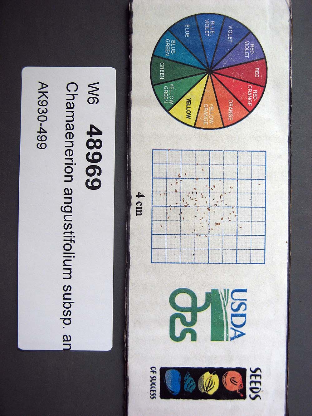 | | 2015 | | | | | | | Wild material | | 1923883 | W6 48969 |
| 187 | W6 48972 | AK930-502 | Barbarea orthoceras Ledeb. | Alaska, United States | W6 |  | | 2015 | | | | | | | Wild material | | 1923886 | W6 48972 |
| 188 | WLP 2435 | CBG-1797 | Prunus virginiana L. | Wyoming, United States | NA |  | | 2013 | COLLECTED | 09/06/2011 | | | 1727 | Stream gulch with wetter soils within Western Rocky Mountain foothills. | Wild material | | 1908924 | WLP 2435 |
| 189 | OPGC 7627 | MSB210557 | Agalinis edwardsiana Pennell | Texas, United States | OPGC |  | | 2011 | | | | | | | Wild material | | 1895192 | OPGC 7627 |
| 190 | WLP 2480 | 210568 | Malvaviscus arboreus Cav. | Texas, United States | NA |  | | 2011 | COLLECTED | 09/30/2003 | | | | | Wild material | | 1895410 | WLP 2480 |
| 191 | W6 30378 | KGZ-06-03-017 | Poa remota Forselles | Chüy, Kyrgyzstan | W6 | | | 2007 | COLLECTED | 08/06/2006 | Kemin Region. Zailiisky Alatau, Kechi-Kemin River, Ak-Tyuz Settlement, 34 km ENE of Bystrovka, below Ak-Tyuz Mine | 42.87166667, 76.07777778 | 1900 | Along creek margin at interface with Picea forest, steep lower slopes of valley, N exposure, gravelly loam | Wild material | | 1721510 | W6 30378 |
| 192 | OPGC 4272 | 173034 | Boykinia occidentalis Torr. & A. Gray | Oregon, United States | OPGC |  | | 2005 | COLLECTED | 08/13/2002 | | | 950 | Seasonal road. Young douglas fir overstory with Acer circinatum, Salix sitchensis. Shrub lay of Gaultheria, Polystichum, Rubus spectabilis. Herbaceous species Hypericum, Leucanthemum, Elymus glaucus, Equisetum. | Wild material | Forb 0.3-1 meters tall. | 1673937 | OPGC 4272 |
| 193 | DMOR 61 | M. australis J70 | Morus australis Poir. | Hokkaidô, Japan | DAV |  | | 2004 | COLLECTED | 07/19/2004 | Lake Abashiri, at trail head to lake and walking down the trails. | 43.99083333, 144.20361111 | 28 | Associated species: Corylus, Quercus Alnus, Rubus idaeus var. aculeatissimus (R. sachalinensis). | Wild material | | 1662103 | DMOR 61 |
| 194 | Ames 27962 | Quercus Wilderness Area | Amelanchier arborea (F. Michx.) Fernald | Iowa, United States | NC7 |  | | 2003 | COLLECTED | 05/26/2003 | Quercus Wilderness Area located 6.75 miles south, southwest of Oskaloosa, T74N R16W SE ¼ NE ¼ of Sec. 23. | 41.19888889, -92.66111111 | 244 | Mature woods on very sandy soils. Typically restricted to east, west or south facing slopes at either summits or mid-slopes. | Wild material | The native range of Amelanchier arborea is concentrated in the eastern half of the U.S. (Little, 1977). This accession represents a collection of A. arborea germplasm from the western edge of the species native range, specifically the southern portion of Iowa. As of 2025, the top ten largest specimens in the state of Iowa are located at Quercus Wilderness where this accession was collected. Iowa’s largest specimen of A. arborea specimen at Quercus Wilderness was measured at 14.17" DBH, 51.83’ in height, and 27.00’ average crown spread for a total of 102.955 points (Rouw, M., personal communication, 12 December 2023). Fall color (orange-red) tends to peak in the middle of September (Iowa) with peak fruiting occurring in early May. Bark smooth, grey. | 1700483 | Ames 27962 |
| 195 | NA 67796 | QLG166 | Syringa pubescens Turcz. subsp. microphylla (Diels) M. C. Chang & X. L. Chen | Shaanxi Sheng, China | NA | | | 1996 | COLLECTED | 10/18/1996 | Ningxi Preserve, Caiziping Forest Station, Xi Gou | 33.71694444, 108.20027778 | 1985 | Shade at the base of a moist cliff with seepage; 35% N slope; sandy loam soil; growing w/ Rubus, Philadelphus, ferns, Acer, Betula, Sinacalcia tangutica, Populus, Euonymus and several herbaceous species. | Wild material | 3 meters; multi-stemmed, deciduous shrub with spreading habit | 1579579 | NA 67796 |
| 196 | NA 67846 | QLG215 | Acer davidii Franch. | Shaanxi Sheng, China | NA | | | 1996 | COLLECTED | 10/18/1996 | Ningxi Preserve, enroute to Caiziping Forest Station town | 33.76694444, 108.33361111 | 2105 | Full sun along roadside in dry, well-drained site; 35% E slope; growing w/ Salix, Sinacalcia tangutica, Rubus, Aralia, Ulmus, Populus, and numerous herbaceous species. | Wild material | 5-6 meters; single-stemmed, deciduous, upright vase-shaped tree with spreading arching branches; D.B.H. 12 cm; bark green even on mature stems | 1579634 | NA 67846 |
| 197 | NA 67884 | QLG252 | Buddleja davidii Franch. | Gansu Sheng, China | NA | | | 1996 | COLLECTED | 10/18/1996 | Xiao Long Shan Forest Bureau, Guang Ying Forest Station, Da Feng Shan | 34.38333333, 106.03361111 | 1470 | Sunny site on a steep slope along road edge; 60% SE slope; growing w/ Acer sp., Neillia sinensis, Quercus sp., Rubus sp., Smilax sp., Salix sp. and numerous herbaceous species. | Wild material | 2-3 meters; multi-stemmed, deciduous shrub with upright arching, spreading habit | 1579778 | NA 67884 |
| 198 | W6 18649 | Al 099 | Beta sp. | Albania | W6 |  | | 1996 | COLLECTED | 08/29/1996 | Mokra subdistrict. Berzesht mountains. | 40.96583333, 20.51222222 | 570 | Scattered along ditch bank and edge of fields. Dominant tree species, Robinia, Quercus, and Prunus. Dominant shrub specie, Rubus. Dominant grass specie, Avena. | Wild material | Height 50-60cm. Mature. Frequent. | 1532237 | W6 18649 |