| 0 | PI 673995 | IS2012.131 | Rudbeckia hirta L. | Michigan, United States | OPGC | | | 2012 | DONATED | 01/24/2012 | | | | | | | 1906861 | PI 673995 |
| 1 | PI 667469 | TX-20 | Rudbeckia hirta L. | Texas, United States | OPGC |  | | 2010 | COLLECTED | 05/27/2010 | Upper West Gulf Coastal Plain. Jasper County. Northwest corner of R255 and CR 60. | 31.04216700, -94.16030600 | 52 | Roadside ROW/forest edge. Land form: Flat. Land Use: Roadside ROW. Geology: Sandstone. Soil Texture: Sandy. Soil Color: Tan. | Wild material | Plant 70 cm tall, unusual pale green-yellow ray petals. | 1897301 | PI 667469 |
| 2 | PI 667470 | TX-21 | Rudbeckia hirta L. | Texas, United States | OPGC |  | | 2010 | COLLECTED | 05/27/2010 | Upper West Gulf Coastal Plain. Jasper County. Northwest corner of R255 and CR 60. | 31.04216700, -94.16030600 | 52 | Roadside ROW/forest edge. Land form: Flat. Land Use: Roadside ROW. Geology: Sandstone. Soil Texture: Sandy. Soil Color: Tan. | Wild material | Plant 70 cm tall, normal gold-yellow ray petals. | 1897302 | PI 667470 |
| 3 | PI 667471 | TX-25 | Rudbeckia hirta L. | Texas, United States | OPGC |  | | 2010 | COLLECTED | 05/27/2010 | Upper West Gulf Coastal Plain. Newton County. CR 1090 Roadside approx. 0.25 miles south of Little Cow Creek. Collection made in Indian Hills area. | 31.04819400, -93.78247200 | 116 | Roadside ROW/forest edge. Land form: Rolling hills. Land Use: Roadside ROW. Geology: Sandstone. Soil Texture: Sandy. Soil color: Reddish-tan. | Wild material | Plant to 70 cm tall, gold-yellow ray petals. | 1897306 | PI 667471 |
| 4 | PI 673982 | JDC/RH/2009/025/175 | Rudbeckia hirta L. | Wisconsin, United States | OPGC |  | | 2009 | COLLECTED | 09/21/2009 | Near the Blue River, Snow Bottoms State Natural Area, SW 1/4 of SW 1/4 of Section 35, T7N, R1W, Highland West Quad, Grant County. | 43.03611111, -90.46777778 | 262 | Riverbank. Associated with Achillea millefolium, Agrimonia, Monarda fistulosa, Prunella vulgaris, Trifolium pratense, and Ulmus. | Wild material | | 1819750 | PI 673982 |
| 5 | PI 667464 | OPGC 2868 | Rudbeckia hirta L. | Missouri, United States | OPGC | | | 2008 | COLLECTED | 09/25/2006 | Sullivan, Missouri. | | | | Wild material | | 1792387 | PI 667464 |
| 6 | PI 667441 | SEUS 2008-11 | Rudbeckia hirta L. | Virginia, United States | OPGC |  | | 2008 | COLLECTED | 10/22/2008 | South of Clover, VA, along north side of Secondary State Route 719 | 36.79333333, -78.74555556 | 115 | Full sun, slightly gravelly; N36.79338 W-78.74566, 10m accuracy per Garmin GPS map 60CSx. | Wild material | Well branched flower stalks. Yellow petals persist. Seed not 100% ripe about 75%. | 1792317 | PI 667441 |
| 7 | PI 667443 | SEUS 2008-14 | Rudbeckia hirta L. | North Carolina, United States | OPGC | | | 2008 | COLLECTED | 10/23/2008 | On Highway 638, just north of Blue Ridge Parkway near Hillsville, NC | 36.66277778, -80.48000000 | 833 | West exposure. On a slight slope. Growing among brambles; N36.66276 W-80.47998, Garmin GPS 60CSx. | Wild material | | 1792320 | PI 667443 |
| 8 | PI 667446 | SEUS 2008-19 | Rudbeckia hirta L. | North Carolina, United States | OPGC | | | 2008 | COLLECTED | 10/23/2008 | Along Highway 18. | 36.55916667, -80.94861111 | 823 | North exposure. On a steep slope. Plants growing on bank along roadside with Asclepias,Coreopsis auriculata, Oenothera, Spotted knapweed and Daucus carota; N36.55904 W-80.94861, 5m accuracy per Garmin GPS map 60CSx. | Wild material | Many younger seedlings growing. Many dried flower heads from earlier in the year. Some plants just starting to flower. | 1792325 | PI 667446 |
| 9 | PI 667453 | SEUS 2008-49 | Rudbeckia hirta L. | Alabama, United States | OPGC |  | | 2008 | COLLECTED | 10/28/2008 | North on Interstate 65, take exit 83, turn left off of exit 83 onto County Road 6. On the inside corner of intersection, North side of road. | 31.33166667, -87.12777778 | 96 | Area had been mown. Seedheads found scattered under mown grass. South exposure. On a slight slope; N31.33153 W-87.12782, 4m accuracy per Garmin GPS 60CSx. | Wild material | Basal foliage rosettes found. Seed heads that were found are very old and dry. | 1792347 | PI 667453 |
| 10 | PI 667454 | SEUS 2008-51 | Rudbeckia hirta L. | Alabama, United States | OPGC | | | 2008 | COLLECTED | 10/28/2008 | North on Highway 41. Between Franklin, AL and Hybart, AL. About 0.4 miles south of mile marker 68. About 6 miles south of County Road 56. | 31.75805556, -87.42027778 | 53 | East exposure. On a slight slope. Sandy soil. Found growing with Tradescantia, Callicarpa, Lobelia and Coreopsis; N31.75819 W-87.42037, 4m accuracy per Garmin GPS 60CSx. | Wild material | 2-3 feet tall plants with basal foliage rosette. Seed and flowering stems dry, Some plants with new growth and flowers. | 1792349 | PI 667454 |
| 11 | PI 667455 | SEUS 2008-53 | Rudbeckia hirta L. | Alabama, United States | OPGC | | | 2008 | COLLECTED | 10/29/2008 | On County Road 41, east of County Road 28, near Forkland, AL. | 32.66944444, -87.84111111 | 23 | North exposure. On a slight slope. Found growing with Coreopsis auriculata and Helianthus angustifolius; N32.66952 W-87.84124, 2m accuracy per Garmin GPS 60CSx. | Wild material | 2 foot tall plants. Some young plants just flowering. 3 inch diameter flowers, yellow/orange rays, dark brown disk. | 1792351 | PI 667455 |
| 12 | PI 667458 | SEUS 2008-57 | Rudbeckia hirta L. | Alabama, United States | OPGC | | | 2008 | COLLECTED | 10/29/2008 | On west side of Highway 69, 1.6 miles south of (northernmost) County Road 32; North of Greensboro, AL if coming from south on Highway 69, about 25 yards south of mile marker 115. From the north about a 1/4 mile south of mailbox 25643. | 32.79722222, -87.59194444 | 84 | East exposure. On a slight slope. Growing under trees in part shade. A sandy loam soil. Found growing with Helianthus angustifolius, Coreopsis and Oaks; N32.79712 W-87.59185, 4m accuracy per Garmin GPS 60CSx. | Wild material | 3-4 feet tall. | 1792355 | PI 667458 |
| 13 | PI 673962 | SEUS 2008-16 | Rudbeckia hirta L. | North Carolina, United States | OPGC | | | 2008 | COLLECTED | 10/23/2008 | Along north side of Highway 18. Southwest of mailbox 11432. | 36.55250000, -80.96611111 | 781 | North exposure. On a moderate slope. Growing along roadside with Solidago, Asters and Pines; N36.55242 W-80.96602, 3m accuracy per Garmin GPS 60CSx. | Wild material | 18 inches tall. Yellow petals. Area had been mown, several seedling rosettes starting. | 1792322 | PI 673962 |
| 14 | PI 667425 | OPGC 2668 | Rudbeckia hirta L. | Nebraska, United States | OPGC | | | 2006 | COLLECTED | 08/01/2006 | Gage County, south-southwest of Virginia. NE.7 miles south on Liberty Road (S 162 Rd) from northwest corner Virginia and NE 04/Liberty Road
intersection to “Stop” sign on B-Line Rd, 1 mile west on B-Line Rd to intersection with Rd S 148; 1
mile north on Rd S 148 to E. Osage Rd, 0.5 mile west on E. Osage Rd; Prairie located on north side of
E. Osage Rd (E. Osage Rd is a minimum use “minimum maintenance road”) | | | WILDCAT CREEK TALLGRASS PRAIRIE
32 acres of upland and lowland prairie plus approx. 48 acres of cropland and woodland near Virginia. | Wild material | | 1717126 | PI 667425 |
| 15 | PI 667426 | OPGC 2669 | Rudbeckia hirta L. | Nebraska, United States | OPGC | | | 2006 | COLLECTED | 08/01/2006 | Johnson County, southwest of Sterling NE. 2 miles west from Sterling west end on NE41/43 to Ave 608 (Lutheran Church on north side road at
intersection), 2 miles south across BNSF RR tracks to intersection with Rd 732; Prairie in the northeast
corner of the northeast quarter section, and, southwest corner of intersection. | | | IVAN A. & IVAN F. LAMB TALLGRASS PRAIRIE
4 acres of upland prairie near Sterling
| Wild material | | 1717127 | PI 667426 |
| 16 | PI 667423 | OPGC 2666 | Rudbeckia hirta L. | Nebraska, United States | OPGC | | | 2006 | COLLECTED | 07/25/2006 | | | | | Wild material | 1 ft tall. Small flowers. | 1717124 | PI 667423 |
| 17 | PI 667424 | OPGC 2667 | Rudbeckia hirta L. | Nebraska, United States | OPGC | | | 2006 | COLLECTED | 07/25/2006 | | | | | Wild material | | 1717125 | PI 667424 |
| 18 | PI 667418 | KT 38 | Rudbeckia hirta L. | Ohio, United States | OPGC | | | 2005 | COLLECTED | 10/04/2005 | Kitty Todd Nature Preserve. Oak Openings Region, Lucas County, southwest of Toledo - managed by the Nature Conservancy | 41.62222222, -83.78722222 | 61 | Black oak savanna | Wild material | | 1691105 | PI 667418 |
| 19 | PI 667415 | GC 2 | Rudbeckia hirta L. | Ohio, United States | OPGC | | | 2005 | COLLECTED | 09/21/2005 | Green Camp Railroad Prairie, managed by the Marion County Historical Society, Marion County, | 40.54833333, -83.19138889 | 284 | | Wild material | | 1691050 | PI 667415 |
| 20 | PI 667413 | EOAHP Sept 05 9 | Rudbeckia hirta L. | Ohio, United States | OPGC | | | 2005 | COLLECTED | 09/07/2005 | Hanging Prairie, Edge of Appalachia Preserve, managed by The Nature Conservancy, Adams County | 38.75083333, -83.44250000 | | | Wild material | | 1691044 | PI 667413 |
| 21 | PI 673961 | PRN 2 | Rudbeckia hirta L. | Ohio, United States | OPGC | | | 2005 | COLLECTED | 06/27/2005 | Plum Run Road (North), Adams County | | | | Wild material | | 1690950 | PI 673961 |
| 22 | PI 667420 | OPGC 2572 | Rudbeckia hirta L. | Ohio, United States | OPGC | | | 2004 | DONATED | 11/05/2004 | | | | | Wild material | | 1717052 | PI 667420 |
| 23 | PI 667392 | Darby Plains 15 | Rudbeckia hirta L. | Ohio, United States | OPGC | | | 2004 | COLLECTED | | Battelle-Darby Creek Metro Park, Franklin County | | | | Wild material | | 1680160 | PI 667392 |
| 24 | PI 667385 | LC 20 | Rudbeckia hirta L. | Ohio, United States | OPGC | | | 2004 | COLLECTED | 10/19/2004 | Louis Campbell State Nature Preserve, Lucas County | 41.59083333, -83.76194444 | | | Wild material | | 1690658 | PI 667385 |
| 25 | PI 667387 | IR 51 | Rudbeckia hirta L. | Ohio, United States | OPGC | | | 2004 | COLLECTED | 10/19/2004 | Irwin Prairie State Nature Preserve, Lucas County | 41.65722222, -83.78194444 | | | Wild material | | 1690685 | PI 667387 |
| 26 | PI 667378 | ALP 17 | Rudbeckia hirta L. | Ohio, United States | OPGC | | | 2004 | COLLECTED | 10/07/2004 | Adams Lake Prairie State Nature Preserve, within Adams Lake State Park, Adams County | 38.81083333, -83.53027778 | | Prairie remnant. Sun. Slope: Slight. | Wild material | 2-3'. Sample size: 10. Population size: 30. Site size (sqm): 15. | 1690589 | PI 667378 |
| 27 | PI 667380 | CP15 | Rudbeckia hirta L. | Ohio, United States | OPGC | | | 2004 | COLLECTED | 10/07/2004 | Chaparral Prairie State Nature Preserve, Adams County, 3 miles NW of West Union | 38.83583333, -83.57361111 | | Cedar barrens prairie. 67 acre total area. Sun. Slope: Slight. | Wild material | Sample size: 10. Population size: 20. Site size (sqm): 15. | 1690612 | PI 667380 |
| 28 | PI 667375 | PRF 7 | Rudbeckia hirta L. | Ohio, United States | OPGC | | | 2004 | COLLECTED | 09/30/2004 | Prairie Road Fen State Nature Preserve, Clark County | 39.99777778, -83.71361111 | | Drainage(1-well, 4-poor): 4 Sun. Slope: Slight. | Wild material | 1-3'. Sample size: 10. Population size: 20. Site size (sqm): 5. | 1690551 | PI 667375 |
| 29 | PI 667376 | PRF 17 | Rudbeckia hirta L. | Ohio, United States | OPGC | | | 2004 | COLLECTED | 09/30/2004 | Prairie Road Fen State Nature Preserve, Clark County | 39.99777778, -83.71361111 | | Drainage(1-well, 4-poor): 2 Sun. Slope: Slight. | Wild material | 2-3'. Sample size: 10. Population size: 20. Site size (sqm): 5. | 1690560 | PI 667376 |
| 30 | PI 667363 | OPGC 1016 | Rudbeckia hirta L. | Wisconsin, United States | OPGC |  | | 2004 | DONATED | 03/04/2004 | | | | | Wild material | | 1658927 | PI 667363 |
| 31 | PI 421671 | 'Golden Jubilee' | Rudbeckia hirta L. | Vermont, United States | OPGC | | | 2004 | COLLECTED | PRE 1980 | Route 91, road marker 2910, south of Westminster, Windham County, Vermont. | | | | Wild material | | 1694129 | PI 421671 |
| 32 | PI 667328 | LK1 | Rudbeckia hirta L. | Ohio, United States | OPGC | | | 2004 | COLLECTED | 10/17/2003 | Fairfield County, near Lancaster and Sugar Grove Ohio. Take RT 33 to RT 793, follow to old BIS (state prison). | 39.64083333, -82.62111111 | 241 | On flat ground at top of hill which slopes steeply into a ravine behind; well-drained. Partial sun, southeast exposure, growing at edge of woods with some natives, some non-natives. | Wild material | Single-stemmed, very pubescent, fully in bloom but sparse overall flowering, 1 foot tall, ovate elliptical leaf with mottling possibly due to nutrient deficiency, frost damage, insects, etc. Flowers golden yellow with brown centers. | 1658891 | PI 667328 |
| 33 | PI 667329 | LK2 | Rudbeckia hirta L. | Ohio, United States | OPGC | | | 2004 | COLLECTED | 10/17/2003 | Fairfield Count, Ohio, Near Lancaster and Sugar Grove; Route 33 to Route 796, follow to old BIS (state prison) | 39.64083333, -82.62027778 | 241 | On flat ground at top of hill which slopes steeply into a ravine behind; well-drained. Partial sun, southeast exposure, growing at edge of woods with some natives, some non-natives. | Wild material | Petals nearly brown when collected, some still yellow; flowers 1.25 inches in diameter. Good branching, multiple blooms on same stem (up to 5). Ovate/elliptical pubescent leaves are small and sparse. Four plants found, two plants sampled. | 1658892 | PI 667329 |
| 34 | PI 667335 | LK10 | Rudbeckia hirta L. | Ohio, United States | OPGC | | | 2004 | COLLECTED | 10/20/2003 | Franklin County, Ohio, Whetstone Park along bike path; directly west of Park of Roses. | 40.04138889, -83.03055556 | 208 | Mix of herbaceous wildflowers and weeds growing in full sun approximately 50 feet away fron the Olentangy River. Trees surrounding the open area. | Wild material | Plants very lanky with very pubescent stems. Small ovate pubescent leaves, flowers about 2 inches in diameter with golden-yellow ray petals, brown center cone. Some reddis color on stem. 5 plants found, 2 plants sampled. | 1658895 | PI 667335 |
| 35 | PI 667336 | LK11 | Rudbeckia hirta L. | Ohio, United States | OPGC | | | 2004 | COLLECTED | 10/25/2003 | Lucas County, Ohio, outside Toledo on Old State Line Road, 3/4 mile west of Kitty Todd Nature Preserve office, across the road from house addressed 11155 on right side of road. | 41.61722222, -83.81083333 | 194 | Growing in native prairie in full sun, about 50 feet from the road; very flat open area. Growing with other prairie plants including Coreopsis, grasses, Monarda, Liatris, rushes. 25 plants found, 4 sampled. | Wild material | Basal leaves pubescent, single stemmed, 1.5 to 2 feet tall. | 1658896 | PI 667336 |
| 36 | PI 667340 | LK16 | Rudbeckia hirta L. | Florida, United States | OPGC | | | 2004 | COLLECTED | 10/12/2003 | Northern Florida/southern Georgia ecotype. | | | | Wild material | | 1658901 | PI 667340 |
| 37 | PI 667344 | LK21 | Rudbeckia hirta L. | Ohio, United States | OPGC | | | 2004 | COLLECTED | 10/31/2003 | Marion County, Ohio, along Route 23 north of Route 98 and past Bethlehem Road but before Newmans-Cardington Road. 1.25 hour from OPGC. | 40.49000000, -83.07416667 | 301 | About 15 away from wet ditch, 30 feet from highway. Growing on southwest side of mild slope; woods with maples and oaks nearby. Growing among grasses, weeds, Achillea, thistle, Solidago canadensis, Aster. | Wild material | Plants 1.5 to 2 feet tall, very long and narrow leaves, very pubeschent stems and leaves. Leaves 1 inch wide and up to 4 inches long. Much basal growth, good branching, some redness to stem, many plants still in flower. Population of 30 plants, 4 plants sampled. Similar patches of Rudbeckia hirta seen about every 5 minutes going 65 mph along highway for 15 minutes. | 1658906 | PI 667344 |
| 38 | PI 667348 | LK30 | Rudbeckia hirta L. | Ohio, United States | OPGC | | | 2004 | COLLECTED | 11/21/2003 | Fayetteville in Brown County, Ohio. Near intersection of 50 and 68. | 39.18583333, -83.93888889 | 267 | Southeast side of edge of weeds on 45 degree slope going down to woods and Little Miami River; slope facing northwest. Growing with grasses, weeds, Lonicera, Solidago canadensis, dogwood. Well-drained soil. | Wild material | Very long, narrow leaves with long veins parallel to leaf margin. Very soft pubescence, basal rosettes present. One plant found and sampled. | 1658911 | PI 667348 |
| 39 | PI 667349 | LK31 | Rudbeckia hirta L. | Ohio, United States | OPGC | | | 2004 | COLLECTED | 11/22/2003 | Ross County, Ohio on Mt. Tabler Road. Take 166 off Route 23, 235 to Rozell Creek Road, 184 turns into Mt. Tabler. | 39.20277778, -83.03555556 | 266 | On northwest edge of road in full sun along edge of a Christmas tree farm opening. Growing among Solidago canadensis, grasses, Monarda, Christmas pine trees. Growing in clay, poor drainage. | Wild material | Narrow, pubescent, light green leaves up to 2 inches long. One plant found and sampled | 1658912 | PI 667349 |
| 40 | PI 667350 | LK32 | Rudbeckia hirta L. | Ohio, United States | OPGC | | | 2004 | COLLECTED | 11/22/2003 | Hamilton Township, Lawrence County, Ohio. 25 Feet off of 52 W, 1117 Patrick Street. | 38.56416667, -82.75305556 | 162 | Ditch along road with very sloped woodland on west side. Growing with Lonicera, grasses, Solidago canadensis; creeping into turf along road. | Wild material | Very soft pubescence, long ovate light green leaves, rosette growth. 15 plants found, 3 sampled. | 1658913 | PI 667350 |
| 41 | PI 667351 | LK33 | Rudbeckia hirta L. | Ohio, United States | OPGC | | | 2004 | COLLECTED | 11/22/2003 | Near Cadmus, Lawrence County, Ohio. Route 141 on east side of road, south of Cadmus sighn approximately 300 feet. | 38.76250000, -82.43500000 | 186 | Ditch along edge of road adjacent to cow pasture. Growing with Leucanthemum, aster, wild roses, grasses and weeds. | Wild material | Very large leaves, soft pubescence, leaves turning reddish, long veins. Purple cones in center, flat top. Flowers 1 to 1.5 inches in diameter. 40 plants found, 4 sampled. | 1658914 | PI 667351 |
| 42 | PI 667355 | LK37 | Rudbeckia hirta L. | Ohio, United States | OPGC | | | 2004 | COLLECTED | 10/15/2003 | Hamilton County, Ohio. | | | | Wild material | | 1658918 | PI 667355 |
| 43 | PI 667359 | LK41 | Rudbeckia hirta L. | Florida, United States | OPGC | | | 2004 | COLLECTED | 11/01/2003 | Suwannee county, Florida | | | | Wild material | | 1658922 | PI 667359 |
| 44 | PI 667361 | LK43 | Rudbeckia hirta L. | Ohio, United States | OPGC | | | 2004 | COLLECTED | 11/15/2003 | Kirtland Township, Lake County, Ohio | | | | Wild material | | 1658924 | PI 667361 |
| 45 | PI 673951 | LK18 | Rudbeckia hirta L. | Georgia, United States | OPGC | | | 2004 | COLLECTED | 07/12/1996 | Thomas County, Georgia. | | | Upland pine plantation. | Wild material | | 1658903 | PI 673951 |
| 46 | W6 62516 | FWS0300-106 | Rudbeckia hirta L. | Michigan, United States | W6 |  | | 2025 | | | | | | | Wild material | | 2192214 | W6 62516 |
| 47 | OPGC 5109 | JDC/RH/2018/007/820 | Rudbeckia hirta L. | Oklahoma, United States | OPGC | | | 2018 | COLLECTED | 03/12/2018 | Private property approximately 4.8 miles southeast of Mulhall, north side of Cimarron River, T18N R2W SW 1/4 SW 1/4 NE 1/4 Sec. 36, Logan County | 35.99313500, -97.36204100 | 287 | High knoll, sandy soils. | Wild material | | 1957956 | OPGC 5109 |
| 48 | OPGC 6423 | NM930-226 | Rudbeckia hirta L. | New Mexico, United States | OPGC |  | | 2018 | | | | | | | Wild material | | 1957524 | OPGC 6423 |
| 49 | OPGC 5401 | CBG-4826 | Rudbeckia hirta L. | Illinois, United States | OPGC | | | 2016 | | | | | | | Wild material | | 1942756 | OPGC 5401 |
| 50 | OPGC 5382 | CBG2014-3338 | Rudbeckia hirta L. | Colorado, United States | OPGC | | | 2015 | | | | | | | Wild material | | 1932048 | OPGC 5382 |
| 51 | OPGC 4967 | MARSB-067 | Rudbeckia hirta L. | Virginia, United States | OPGC |  | | 2015 | COLLECTED | 08/07/2013 | | | 524 | | Wild material | | 1922880 | OPGC 4967 |
| 52 | OPGC 4796 | CBG-1794 | Rudbeckia hirta L. | Illinois, United States | OPGC |  | | 2013 | COLLECTED | 08/31/2011 | | | 217 | mesic prairie | Wild material | | 1908940 | OPGC 4796 |
| 53 | OPGC 4549 | 172901 | Rudbeckia hirta L. | Texas, United States | OPGC |  | | 2011 | COLLECTED | 05/23/2002 | | | | | Wild material | | 1895358 | OPGC 4549 |
| 54 | OPGC 3155 | OPGC 3155 | Rudbeckia hirta L. | Florida, United States | OPGC |  | | 2010 | DONATED | 12/12/2010 | | | | | | | 1896965 | OPGC 3155 |
| 55 | OPGC 3218 | TX-39 | Rudbeckia hirta L. | Texas, United States | OPGC |  | | 2010 | COLLECTED | 05/28/2010 | East Central Texas Plain. Caldwell County. 2.4 miles ESE of Luling Barbecue Diner; Whisper Road (County Road 135) near Atlanta Cemetery (shown as Plum Creek Cemetery on topographic map). | 29.65967000, -97.58450000 | 116 | Savannah. Land form: Ridge. Land Use: Roadside easement. Geology:Residuum weathered from sandstone of Eocene age. Soil Texture: Fine sand. Ecological Site Descriptor: Deep Sand. | Wild material | Plant 70 cm tall, showy flowers to 10 cm diameter, gold-yellow ray petals. | 1897318 | OPGC 3218 |
| 56 | OPGC 3221 | TX-44 | Rudbeckia hirta L. | Texas, United States | OPGC |  | | 2010 | COLLECTED | 05/28/2010 | East Central Texas Plain. Lee County. Farm-to-Market Road 969, 1.3 miles east of Blue, near Center point Cemetry. | 30.39580000, -97.11800000 | 142 | Savannah. Land form: Ridge. Land Use: Roadside easment. Geology:Residuum weathered from sandstone. Soil Texture: Loamy sand. Ecological Site Descriptor: Sandy Loam. | Wild material | Plants to 60 cm tall. | 1897321 | OPGC 3221 |
| 57 | OPGC 3222 | TX-45 | Rudbeckia hirta L. | Texas, United States | OPGC |  | | 2010 | COLLECTED | 05/28/2010 | East Central Texas Plain. Lee County. Farm-to-Market Road 969, 1.3 miles east of Blue, near Center point Cemetry. | 30.39580000, -97.11800000 | 142 | Savannah. Land form: Ridge. Land Use: Roadside easment. Geology:Residuum weathered from sandstone. Soil Texture: Loamy sand. Ecological Site Descriptor: Sandy Loam. | Wild material | Plant 60 cm tall, this plant selected from population of TX-44 unique for long pale green-yellow ray petals. | 1897322 | OPGC 3222 |
| 58 | OPGC 3223 | TX-46 | Rudbeckia hirta L. | Texas, United States | OPGC |  | | 2010 | COLLECTED | 05/28/2010 | East Central Texas Plain. Lee County. Farm-to-Market Road 969, 1.3 miles east of Blue, near Center point Cemetry. | 30.39580000, -97.11800000 | 142 | Savannah. Land form: Ridge. Land Use: Roadside easment. Geology:Residuum weathered from sandstone. Soil Texture: Loamy sand. Ecological Site Descriptor: Sandy Loam. | Wild material | Plant 60 cm tall, two plants selected from population of TX-44 unique for gold ray petals with wide burgundy band at base. | 1897323 | OPGC 3223 |
| 59 | OPGC 2763 | OPGC 2763 | Rudbeckia hirta L. | Wisconsin, United States | OPGC | | | 2008 | COLLECTED | 09/10/2008 | 9984 Winats Road. Woodruff,Wisconsin 54568 | 45.90527778, -89.61694444 | 492 | | Wild material | | 1792291 | OPGC 2763 |
| 60 | OPGC 2586 | Toto Gold | Rudbeckia hirta L. | Niedersachsen, Germany | OPGC | | | 2004 | DONATED | 01/14/2004 | | | | | Cultivar | | 1717059 | OPGC 2586 |
| 61 | OPGC 2587 | Rustic | Rudbeckia hirta L. | Niedersachsen, Germany | OPGC | | | 2004 | DONATED | 01/14/2004 | | | | | Cultivar | | 1717060 | OPGC 2587 |
| 62 | OPGC 2590 | Cordoba | Rudbeckia hirta L. | Niedersachsen, Germany | OPGC | | | 2004 | DONATED | 01/14/2004 | | | | | Cultivar | | 1717063 | OPGC 2590 |
| 63 | OPGC 2591 | Marmelade | Rudbeckia hirta L. | Niedersachsen, Germany | OPGC | | | 2004 | DONATED | 01/14/2004 | | | | | Cultivar | | 1717064 | OPGC 2591 |
| 64 | OPGC 2592 | Gloriosa Double Daisy | Rudbeckia hirta L. | Niedersachsen, Germany | OPGC | | | 2004 | DONATED | 01/14/2004 | | | | | Cultivar | | 1717065 | OPGC 2592 |
| 65 | OPGC 330 | 'Goldilocks' | Rudbeckia hirta L. | Ohio, United States | OPGC | | | 2003 | DONATED | 04/01/2004 | | | | | Cultivar | | 1658389 | OPGC 330 |
| 66 | OPGC 318 | 'Prairie Sun' | Rudbeckia hirta L. | Ohio, United States | OPGC |  | | 2003 | DONATED | 12/03/2003 | | | | | Cultivar | | 1658382 | OPGC 318 |
| 67 | OPGC 319 | 'Toto (TM) Rustic' | Rudbeckia hirta L. | Ohio, United States | OPGC | | | 2003 | DONATED | 12/03/2003 | | | | | Cultivar | | 1658383 | OPGC 319 |
| 68 | OPGC 320 | 'Toto (TM) Lemon' | Rudbeckia hirta L. | Ohio, United States | OPGC | | | 2003 | DONATED | 12/03/2003 | | | | | Cultivar | | 1658384 | OPGC 320 |
| 69 | OPGC 321 | 'Autumn Colors' | Rudbeckia hirta L. | Ohio, United States | OPGC | | | 2003 | DONATED | 12/03/2003 | | | | | Cultivar | | 1658385 | OPGC 321 |
| 70 | NSL 423113 | MSB20020008 | Rudbeckia hirta L. | Texas, United States | OPGC | | | 2002 | COLLECTED | 06/18/2002 | | | | Moist or mesic, arid, 0-5 degree slope, associated species: Nassella leuchotricha, Gaillardia pulchella. | Wild material | | 1642595 | NSL 423113 |
| 71 | OPGC 12 | 'Becky Mix' | Rudbeckia hirta L. | Ohio, United States | OPGC | | | 2001 | DONATED | 12/17/2001 | | | | | Cultivar | | 1658138 | OPGC 12 |
| 72 | OPGC 13 | 'Toto (TM)' | Rudbeckia hirta L. | Ohio, United States | OPGC | | | 2000 | DONATED | 12/17/2001 | | | | | Cultivar | | 1658139 | OPGC 13 |
| 73 | OPGC 14 | 'Indian Summer' | Rudbeckia hirta L. | Ohio, United States | OPGC | | | 2000 | DONATED | 12/17/2001 | | | | | Cultivar | | 1658140 | OPGC 14 |
| 74 | PI 673988 | TX-08 | Rudbeckia maxima Nutt. | Texas, United States | OPGC |  | | 2010 | COLLECTED | 05/26/2010 | Upper West Gulf Coastal Plain. Harrison County.SH 43 between Marshall and Karnack Texas. | 32.63652800, -94.18847200 | 90 | Maintained Roadside ROW adjacent to mixed pine forest. Land form: Rolling hills to flat. Land Use: Roadside ROW. Geology: Sandstone. Soil Texture: Sandy. Soil Color: Tan. | Wild material | Large blue-green leathery leaves mostly basal, plants to 2 m tall, yellow ray florets. | 1897290 | PI 673988 |
| 75 | OPGC 3498 | JDC/RH/2010/042/312 | Rudbeckia missouriensis Engelm. ex C. L. Boynton & Beadle | Missouri, United States | OPGC | | | 2010 | COLLECTED | 09/15/2010 | Near Cass and CR38 intersection, just east of Duncan, Wright County. | 37.26659000, -92.65054000 | 425 | Associated with Bidens polylepis, Corylus americana, Daucus carota, Pycnanthemum virginianum, Rudbeckia hirta, Sorghastrum nutans, and Toxicodendron radicans. | Wild material | | 1848911 | OPGC 3498 |
| 76 | PI 710733 | Ringgold Prairie | Dalea purpurea Vent. | Iowa, United States | NC7 |  | | 2020 | COLLECTED | 08/05/2020 | Ringgold Wildlife Management Area located approximately 13 miles east of Redding, Ringgold County | 40.59150000, -94.14190000 | 350 | Dry hillside prairie. | Wild material | Plants sampled in nature measuring less than one meter in height. At time of collection (5 August 2020), seeds had not quite peaked maturity. | 2107719 | PI 710733 |
| 77 | PI 699445 | W!-1 | Coreopsis lanceolata L. | Wisconsin, United States | OPGC | | | 2017 | COLLECTED | 7/20/2017 12:00:00 AM | Collected at The Clearing. Ellison Bay, Wisconsin. | 45.26098100, -87.07092900 | | Meadow habitat. Growing in association with Rudbeckia hirta, Asclepias syriaca, Juniperus communis, assorted grasses and sedges. | Wild material | | 1964669 | PI 699445 |
| 78 | PI 661255 | TX-040 | Daucus pusillus Michx. | Texas, United States | NC7 |  | | 2011 | COLLECTED | 05/28/2010 | Atlanta Cemetery (Plum Creek Cemetery), County Road 135 (Whisper Road), Caldwell County. | 29.65967000, -97.58450000 | 116 | Savannah, cemetery mowed several times most years. Full sun. No slope. Associated with Cnidoscolus texanus, Engelmannia peristenia, Gaillardia pulchella, Helianthus debilis, Monarda punctata, Quercus stellata, and Rudbeckia hirta. | Wild material | | 1862437 | PI 661255 |
| 79 | PI 661256 | TX-041 | Daucus pusillus Michx. | Texas, United States | NC7 |  | | 2011 | COLLECTED | 05/28/2010 | Along Route 713 (Farm to Market Raod), 5 miles south of Rockne, Bastrop County. | 29.84366000, -97.43164000 | 153 | Roadside/savannah. Full sun. No slope. Associated with Gaillardia pulchella, Quercus stellata, Rudbeckia hirta, and Sabatia campestris. | Wild material | | 1862438 | PI 661256 |
| 80 | PI 673987 | TX-07 | Coreopsis lanceolata L. | Texas, United States | OPGC | | | 2010 | COLLECTED | 05/26/2010 | Upper West Gulf Coastal Plain. Harrison County.SH 43 between Marshall and Karnack Texas. | 32.63652800, -94.18847200 | 90 | Maintained Roadside ROW adjacent to mixed pine forest. Land form: Rolling hills to flat. Land Use: Roadside ROW. Geology: Sandstone. Soil Texture: Sandy. Soil Color: Tan. | Wild material | Erect, clumped, glabrous to 70 cm tall. Flowers numerous, yellow ray florets. | 1897289 | PI 673987 |
| 81 | PI 673992 | TX-30 | Coreopsis lanceolata L. | Texas, United States | OPGC | | | 2010 | COLLECTED | 05/27/2010 | Upper West Gulf Coastal Plain. Newton County. Roadside approx. 1.5 miles south of 1416 on SH 87. | 30.58986100, -93.79430600 | 27 | Roadside ROW/forest edge. Land form: Flat. Land Use: Roadside ROW. Geology: Sandstone. Soil Texture: Sandy to clay. Soil color: Greyish-brown. | Wild material | Erect, clumped, glabrous to 70 cm tall. Flowers with yellow ray florets, mostly gone to seed. | 1897309 | PI 673992 |
| 82 | PI 667445 | SEUS 2008-18 | Coreopsis pubescens Elliott | North Carolina, United States | OPGC | | | 2008 | COLLECTED | 10/23/2008 | Along Highway 18. | 36.55916667, -80.94861111 | 823 | North exposure. On a steep slope. Plants growing on bank along roadside with Asclepias,Rudbeckia hirta, Oenothera, Sotted knapweed and Daucus carota; N36.55904 W-80.94861, 5m accuracy per Garmin GPS map 60CSx. | Wild material | 12-18 inches tall, sporadic flowering. Many dried and empty seed heads, are some immature seed heads. | 1792324 | PI 667445 |
| 83 | PI 664646 | CP39 | Helianthus occidentalis Riddell | Ohio, United States | NC7 |  | | 2004 | COLLECTED | 10/07/2004 | Chaparral Prairie State Nature Preserve, 3 miles northwest of West Union, Adams County. | 38.83583333, -83.57361111 | | Cedar barrens prairie. Sun. Slight slope. Site size 5 square meters; 67 acre total area. Associated with Baptisia australis, Coreopsis tripteris, Eryngium yuccafolium, Liatris spicata, Physostegia virginiana, Pycnanthemum tenuifolium, Ratibida pinnata, and Rudbeckia hirta. | Wild material | 2-5 feet tall | 1690634 | PI 664646 |
| 84 | PI 631257 | 006 | Echinacea sanguinea Nutt. | Louisiana, United States | NC7 |  | | 1997 | COLLECTED | 08/07/1997 | Kisatchie National Forest, near Leesville, Vernon Parish. Please contact curator for specific site location. | 30.96666667, -93.21666667 | 140 | Open long-leaf pine savannah/flat woods. Partial shade with ~70% exposure and flat ground. Fine sandy soil over impermeable clay with no stones and poor drainage. | Wild material | Plants were 2-2.5 feet tall in frequent abundance with light pink flowers and some branching. | 1547197 | PI 631257 |
| 85 | PI 631258 | 007 | Echinacea sanguinea Nutt. | Louisiana, United States | NC7 |  | | 1997 | COLLECTED | 08/07/1997 | Kisatchie National Forest, near Rosepine, Vernon Parish. Please contact curator for specific site location. | 30.95000000, -93.18333333 | 130 | Upland long-leaf pine savannah/flat woods. ~70% exposure on level ground. Fine sandy soil over impermeable clay with no stones and fair drainage. | Wild material | Plants were 2-2.5 feet tall in frequent abundance with light pink flowers and some branching. | 1547198 | PI 631258 |
| 86 | PI 649042 | 004 | Echinacea sanguinea Nutt. | Louisiana, United States | NC7 |  | | 1997 | COLLECTED | 08/06/1997 | Near Starks, Calcasieu Parish. Please contact curator for specific site location. | 30.28333333, -93.65000000 | 110 | Roadside. Full exposure on level ground. Sandy soil with low stoniness and good drainage. | Wild material | Plants were 1-2 feet high in frequent abundance with some branching near base. | 1547195 | PI 649042 |
| 87 | PI 649043 | 005 | Echinacea sanguinea Nutt. | Louisiana, United States | NC7 |  | | 1997 | COLLECTED | 08/06/1997 | Near Fields, Beauregard Parish. Please contact curator for specific site location. | 30.46666667, -93.63333333 | 120 | Sloping roadbank. Full exposure with ~30 degrees of slope facing east and west. Clay/sand soil with high stoniness and fair drainage. | Wild material | Plants were 1-2 feet tall in frequent abundance with very light pink (almost white) flowers and occasional branching near base. | 1547196 | PI 649043 |
| 88 | PI 649044 | 008 | Echinacea sanguinea Nutt. | Louisiana, United States | NC7 |  | | 1997 | COLLECTED | 08/07/1997 | Kisatchie National Forest, near Leesville, Vernon Parish. Please contact curator for specific site location. | 31.00000000, -93.16666667 | 160 | Upland long-leaf pine. ~70% exposure on level ground. Sandy soil with no stones and fair drainage. | Wild material | Plants were 2-2.5 feet tall in occasional abundance with light pink flowers and some branching. | 1547199 | PI 649044 |
| 89 | W6 62523 | FWS0300-116 | Doellingeria umbellata (Mill.) Nees | Michigan, United States | W6 |  | | 2025 | | | | | | | Wild material | Poison sumac present | 2192221 | W6 62523 |
| 90 | W6 62529 | FWS0300-132 | Symphyotrichum oolentangiense (Riddell) G. L. Nesom | Michigan, United States | W6 |  | | 2025 | | | | | | | Wild material | | 2192227 | W6 62529 |
| 91 | W6 62531 | FWS0300-137 | Eutrochium maculatum (L.) E. E. Lamont | Michigan, United States | W6 |  | | 2025 | | | | | | | Wild material | The above acreage and population size are for the dense patch near the gate, including the portion of the patch not on sanctuary property. | 2192229 | W6 62531 |
| 92 | W6 62536 | FWS0300-150 | Solidago ohioensis Riddell | Michigan, United States | W6 |  | | 2025 | | | | | | | Wild material | Poison sumac present | 2192234 | W6 62536 |
| 93 | W6 62539 | FWS0300-154 | Liatris cylindracea Michx. | Michigan, United States | W6 |  | | 2025 | | | | | | | Wild material | The vegetative part of the population is likely dormant, though it is not possible to discern dormant individuals. Consequently, the above population size may be an underestimate. | 2192237 | W6 62539 |
| 94 | OPGC 8857 | Marietta Sand Prairie | Verbena stricta Vent. | Iowa, United States | OPGC | | | 2024 | COLLECTED | 09/04/2024 | Marietta Sand Prairie State Preserve located 7.5 miles northwest of Marshalltown on Knapp Avenue, T84N R19W SW ¼ Sec. 11. | 42.09711200, -93.03873400 | 297 | Remnant sand prairie. | Wild material | | 2170474 | OPGC 8857 |
| 95 | OPGC 8810 | CBG- 10773 | Penstemon pallidus Small | Illinois, United States | OPGC | | | 2023 | | | | | | | Wild material | | 2142241 | OPGC 8810 |
| 96 | OPGC 8811 | CBG- 10775 | Penstemon pallidus Small | Illinois, United States | OPGC | | | 2023 | | | | | | | Wild material | | 2142242 | OPGC 8811 |
| 97 | OPGC 8829 | CBG- 10834 | Penstemon tubaeflorus Nutt. | Arkansas, United States | OPGC | | | 2023 | | | | | | | Wild material | | 2142283 | OPGC 8829 |
| 98 | Ames 35883 | Waterworks Park Prairie | Heuchera richardsonii R. Br. | Iowa, United States | NC7 |  | | 2022 | COLLECTED | 07/05/2022 | Waterworks Park on west side of Bonnifield Lake located 1.00 mile north, northeast of Fairfield, T72N R10W SE ¼ Sec. 24. | 41.02135000, -91.95665000 | 227 | High-quality prairie remnant managed with infrequent burning. Various small remnants within immediate area. | Wild material | | 2138216 | Ames 35883 |
| 99 | W6 60029 | NCBG-539 | Phytolacca americana L. | Maryland, United States | W6 | | | 2021 | | | | | | | Wild material | | 2132911 | W6 60029 |
| 100 | W6 59931 | CBG-10654 | Cyperus schweinitzii Torr. | Illinois, United States | W6 | | | 2021 | | | | | | | Wild material | | 2132510 | W6 59931 |
| 101 | W6 59935 | CBG-10658 | Carex bebbii (L. H. Bailey) Olney ex Fernald | Illinois, United States | W6 |  | | 2021 | | | | | | | Wild material | | 2132514 | W6 59935 |
| 102 | Ames 36061 | CBG-10739 | Linum medium (Planch.) Britton | Illinois, United States | NC7 |  | | 2021 | | | | | | | Wild material | | 2137990 | Ames 36061 |
| 103 | OPGC 8308 | CBG-10449 | Krigia biflora (Walter) S. F. Blake | Wisconsin, United States | OPGC | | | 2021 | | | | | | | Wild material | | 2120088 | OPGC 8308 |
| 104 | OPGC 8309 | CBG-10450 | Heuchera richardsonii R. Br. | Wisconsin, United States | OPGC | | | 2021 | | | | | | | Wild material | | 2120089 | OPGC 8309 |
| 105 | W6 59171 | CBG-10456 | Carex annectens (E. P. Bicknell) E. P. Bicknell | Illinois, United States | W6 | | | 2021 | | | | | | | Wild material | | 2120093 | W6 59171 |
| 106 | W6 59267 | CBG-10590 | Muhlenbergia glabrifloris Scribn. | Illinois, United States | W6 | | | 2021 | | | | | | | Wild material | Received as: Muhlenbergia glabriflora. Plant numbers sampled estimated. | 2120210 | W6 59267 |
| 107 | W6 60351 | CBG-10731 | Erigeron philadelphicus L. | | W6 |  | | 2021 | | | | | | | Wild material | Sub population B included under this accession number. 64/100 plants sampled over 1 acre. | 2137983 | W6 60351 |
| 108 | W6 58575 | MARSB-215 | Juncus secundus P. Beauv. ex Poir. | New York, United States | W6 | | | 2021 | | | | | | | Wild material | Plants are in seed. The inflorescences are straw colored. The inflorescences are at the top of the stem, not spreading. It is taller than Juncus tenuis. | 2113505 | W6 58575 |
| 109 | OPGC 5946 | CBG-1707 | Heterotheca fulcrata (Greene) Shinners | Colorado, United States | OPGC |  | | 2021 | | | | | | | Wild material | | 1909010 | OPGC 5946 |
| 110 | Ames 35557 | Ringgold Prairie | Drymocallis arguta (Pursh) Rydb. | Iowa, United States | NC7 |  | | 2020 | COLLECTED | 08/05/2020 | Ringgold Wildlife Management Area located approximately 13 miles east of Redding, Ringgold County | 40.60160000, -94.13390000 | 350 | Degraded prairie remnant. | Wild material | | 2107720 | Ames 35557 |
| 111 | Ames 35541 | NAO/MB/2020/01/53 | Monarda bradburiana L. C. Beck | Illinois, United States | NC7 |  | | 2020 | COLLECTED | 07/16/2020 | Eagle Point Bay area located at southwest portion of Lake of Egypt, T11S R2E NE1/4 Sec. 1 and T11S R2E NW1/4 Sec. 6, Johnson County | 37.59183900, -88.93008100 | 168 | Roadside, wooded rocky hillside. | Wild material | | 2106720 | Ames 35541 |
| 112 | W6 57381 | NEWFS-264 | Scirpus atrovirens Willd. | New Hampshire, United States | W6 |  | | 2019 | | | | | | | Wild material | | 2098178 | W6 57381 |
| 113 | W6 57084 | MARSB-216 | Carex annectens (E. P. Bicknell) E. P. Bicknell | New York, United States | W6 |  | | 2019 | | | | | | | Wild material | | 2097523 | W6 57084 |
| 114 | NA 88206 | CBG-9427 | Ceanothus americanus L. | Illinois, United States | NA |  | | 2019 | | | | | | | Wild material | | 2092801 | NA 88206 |
| 115 | Ames 34337 | Doolittle Prairie | Drymocallis arguta (Pursh) Rydb. | Iowa, United States | NC7 |  | | 2018 | COLLECTED | 08/17/2018 | Doolittle Prairie State Preserve located approximately 2.5 miles south of Story City, T85N R24W NW 1/4 NE 1/4 Sec. 25, Story County | 42.15048400, -93.58989700 | 303 | Prairie remnant. | Wild material | | 1967539 | Ames 34337 |
| 116 | Ames 34308 | JDC/ES/2018/031/844 | Echinacea sanguinea Nutt. | Arkansas, United States | NC7 |  | | 2018 | COLLECTED | 07/17/2018 | Near state line off Miller Road 154 approximately 4.40 miles northwest of Brightstar, Miller County | 33.16569700, -94.03712900 | 109 | Roadside. | Wild material | Variation in leaf petiole length noted (some sessile), all leaves and stems observed hairy. Plants in peak flower on 22 May 2018 and seeds likely reached peak maturity around 1 July 2018. Peduncles at time of collection (17 July 2018) were showing 12-18" of brown/dead tissue. Plants ranging from 2-3.5' in height. Pollen yellow. | 1964615 | Ames 34308 |
| 117 | Ames 34309 | JDC/ES/2018/036/849 | Echinacea sanguinea Nutt. | Texas, United States | NC7 |  | | 2018 | COLLECTED | 07/18/2018 | Private property located 4.35 miles south, southwest of Daingerfield off County Road 2215. Locally known as "Kennedy Mountain", Morris County | 32.97217700, -94.74721600 | 152 | Open, dry, recently clear cut area. | Wild material | Plants in peak flower on 22 May 2018 and seeds likely reached peak maturity around 1 July 2018. Peduncles at time of collection (17 July 2018) were showing 6-18" of brown/dead tissue. Plants ranging from 2-4.0' in height. | 1964616 | Ames 34309 |
| 118 | Ames 34315 | JDC/ML/2018/039/852 | Monarda luteola Singhurst & W. C. Holmes | Texas, United States | NC7 |  | | 2018 | COLLECTED | 07/18/2018 | Located 4.10 miles east of Mineola on west side of County Road 2650 just 0.88 miles north of intersection with FM 1801, Wood County | 32.66918400, -95.41726400 | 139 | Very diverse vegetation. Roadside. | Wild material | Plants with lemon scent, pubescent stems and leaves with faint yellow flowers measuring circa 1.0-2.5' in height. Plants likely reached peak flower on 15 May 2018. Seeds likely reached full maturity around first week in July (2018). | 1964622 | Ames 34315 |
| 119 | Ames 34205 | JDC/PV/2018/038/851 | Prunella vulgaris L. | Texas, United States | NC7 | _thumbnail.jpg "Click for 4 image(s) for this accession.") | | 2018 | COLLECTED | 05/23/2018 | Located 4.10 miles east of Mineola along County Road 2650 just 1.00 miles north of intersection with FM 1801, Wood County | 32.67184300, -95.41677700 | 142 | Roadside. Very diverse vegetation. | Wild material | Plants approximately 10" tall. Seeds collected right at peak maturity (23 May 2018). | 1963388 | Ames 34205 |
| 120 | Ames 34031 | JDC/MF/2017/058/812 | Monarda fistulosa L. | Iowa, United States | NC7 |  | | 2017 | COLLECTED | 10/12/2017 | Doolittle Prairie State Preserve located approximately 2.5 miles south of Story City, T85N R24W NW 1/4 NE 1/4 Sec. 25, Story County | 42.15048400, -93.58989700 | 303 | Prairie pothole wetland complex. | Wild material | Population sampled at collection site consisted of approximately half of the specimens being void of foliage likely due to susceptibility to mildew, while the remaining half still had some green foliage at time of sampling (10/12/2017). Plants sampled generally 3' in height. | 1954320 | Ames 34031 |
| 121 | Ames 34282 | CBG2014-3342 | Monarda fistulosa L. | Colorado, United States | NC7 |  | | 2015 | COLLECTED | 10/24/2014 | Near North Gate Air Force Academy Entrance, New Santa Fe Trail: North of Colorado Springs, El Paso County | 39.02973000, -104.83986000 | 2020 | | Wild material | | 1932051 | Ames 34282 |
| 122 | W6 49551 | CBG-2498 | Juncus articulatus L. | Illinois, United States | W6 |  | | 2015 | | | | | | | Wild material | | 1926024 | W6 49551 |
| 123 | W6 49667 | CBG-2704 | Elymus villosus Muhl. ex Willd. | Illinois, United States | W6 |  | | 2015 | | | | | | | Wild material | | 1926127 | W6 49667 |
| 124 | NA 87924 | CBG-1701 | Dasiphora fruticosa (L.) Rydb. | Colorado, United States | NA |  | | 2013 | | | | | | | Wild material | | 1908827 | NA 87924 |
| 125 | OPGC 3567 | JDC/PP/2012/008/401 | Phlox pilosa L. subsp. fulgida (Wherry) Wherry | Iowa, United States | OPGC |  | | 2012 | COLLECTED | 07/06/2012 | Population located in Doolittle Prairie state Preserve. Prairie pothole wetland complex. | 42.15066600, -93.58886700 | 303 | Associated with Asclepias tuberosa, Geum aleppicum, Rudbeckia hirta,Silphium laciniatum, Echinacea pallida, Monarda fistulosa. | Wild material | Three color variants noted in equal porportions, including white, white with purple center and purple-pink. | 1903202 | OPGC 3567 |
| 126 | W6 42748 | MSB231198 | Plectocephalus americana (Nutt.) D. Don | Texas, United States | W6 | 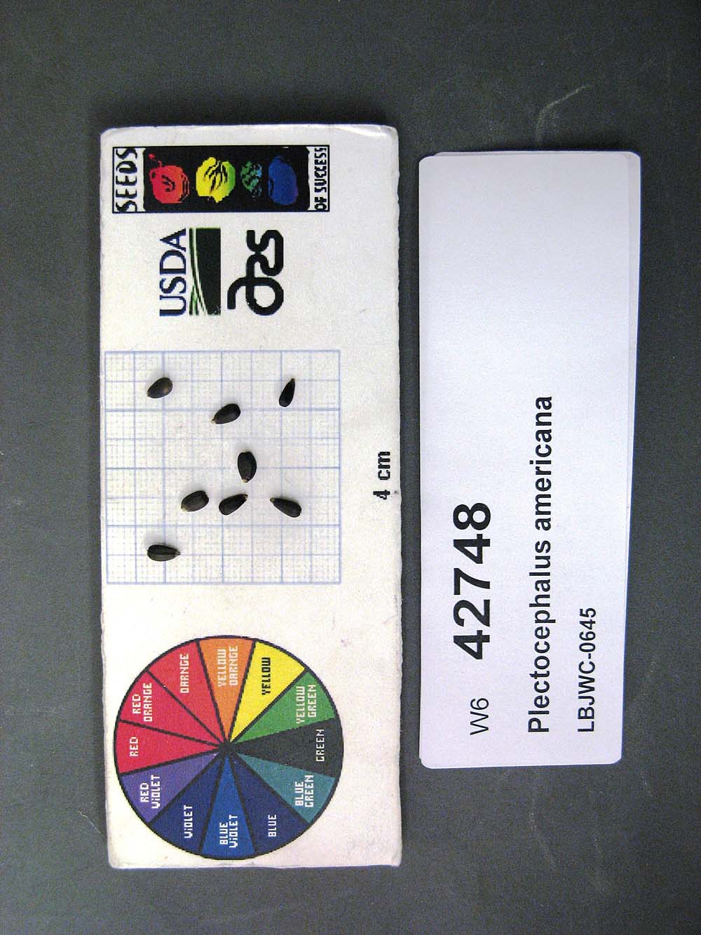 | | 2011 | | | | | | | Wild material | | 1895222 | W6 42748 |
| 127 | W6 42763 | MSB245588 | Cladium mariscus (L.) Pohl | Texas, United States | W6 |  | | 2011 | | | | | | | Wild material | | 1895236 | W6 42763 |
| 128 | W6 42878 | MSB231372 | Phacelia congesta Hook. | Texas, United States | W6 |  | | 2011 | | | | | | | Wild material | | 1895336 | W6 42878 |
| 129 | W6 42930 | MSB245577 | Tetragonotheca texana (A. Gray) Engelm. & A. Gray | Texas, United States | W6 |  | | 2011 | | | | | | | Wild material | | 1895381 | W6 42930 |
| 130 | OPGC 3219 | TX-42 | Coreopsis wrightii (A. Gray) H. M. Parker | Texas, United States | OPGC | | | 2010 | COLLECTED | 05/28/2010 | East Central Texas Plain. Bastrop County. Five miles ESE of Rockne; Horse farm near end of John Craft Road. | 29.94180000, -97.37818000 | 147 | Savannah. Land form: Ridge. Land Use: Pasture. Geology:Residuum weathered from sandstone of Eocene age. Soil Texture: Fine sand. Ecological Site Descriptor: Deep Sand. | Wild material | Plants to 80 cm tall. | 1897319 | OPGC 3219 |
| 131 | Ames 30389 | JDC/PV/2009/116/266 | Prunella vulgaris L. | Ohio, United States | NC7 |  | | 2009 | COLLECTED | 10/19/2009 | Erie Sand Barrens State Nature Preserve, Kimball Quad, Erie County. | 41.35861111, -82.70805556 | 209 | Sandy, dry soils. | Wild material | | 1823941 | Ames 30389 |
| 132 | Ames 30160 | JDC/MF/2009/027/177 | Monarda fistulosa L. | Wisconsin, United States | NC7 |  | | 2009 | COLLECTED | 09/21/2009 | Snow Bottoms State Natural Area, SW 1/4 of SW 1/4 of Section 35, T7N, R1W, Highland West Quad, Grant County. | 43.03277778, -90.46777778 | 262 | Gravel path. 30% slope; south and west facing. | Wild material | | 1819741 | Ames 30160 |
| 133 | Ames 30163 | LQ/PV/2009/001/001 | Prunella vulgaris L. | Wisconsin, United States | NC7 |  | | 2009 | COLLECTED | 09/21/2009 | Snow Bottoms State Natural Area, SW 1/4 of SW 1/4 of Section 35, T7N, R1W, Highland West Quad, Grant County. | 43.03277778, -90.46777778 | 262 | Gravel path. 30% slope; south and west facing. | Wild material | | 1819744 | Ames 30163 |
| 134 | Ames 28230 | CP12 | Helenium autumnale L. | Ohio, United States | NC7 | | | 2004 | COLLECTED | 10/07/2004 | Chaparral Prairie State Nature Preserve, 3 miles northwest of West Union, Adams County. | 38.83583333, -83.57361111 | | Cedar barrens prairie; along pond edge. Site size 10 square meters; 67 acre total area. Associated with Baptisia australis, Coreopsis tripteris, Eryngium yuccafolium, Liatris spicata, Physostegia virginiana, Pycnanthemum tenuifolium, Ratibida pinnata, and Rudbeckia hirta. | Wild material | 2-3 feet in height. | 1690609 | Ames 28230 |