| 0 | PI 667468 | AZ2010-29 | Rudbeckia laciniata L. | Arizona, United States | OPGC | | | 2010 | COLLECTED | 09/22/2010 | By East Turkey Run Road, northwest of the Mt. Lemmon Community Center, also across the street from Mt. Lemmon General Store, Mt. Lemmon Estates, Pima County. | 32.44688000, -110.76480000 | 2455 | Streambank or beside road. | Wild material | Foliage to 1 meter. Flower stems to 1.5 meters. | 1854599 | PI 667468 |
| 1 | PI 667466 | JDC/RL/2009/071/221 | Rudbeckia laciniata L. | Illinois, United States | OPGC | 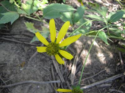 | | 2009 | COLLECTED | 09/25/2009 | Along Messmer Road, NE 1/4 of SW 1/4 of Section 30, T24N, R4E, Pleasant Valley Quad, Carroll County. | 42.12888889, -90.08444444 | 204 | Roadside. 45% slope; north and east facing. Associated with Fraxinus americana, Lonicera reticulata, and Physocarpus opulifolius. | Wild material | | 1819753 | PI 667466 |
| 2 | PI 673983 | JDC/RL/2009/028/178 | Rudbeckia laciniata L. | Wisconsin, United States | OPGC |  | | 2009 | COLLECTED | 09/21/2009 | Along Blue River, near bridge on Bowers Road, Snow Bottoms State Natural Area, SW 1/4 of SW 1/4 of Section 35, T7N, R1W, Highland West Quad, Grant County. | 43.03166667, -90.46500000 | 262 | Riverbank. Associated with Acer negundo and Salix. | Wild material | | 1819751 | PI 673983 |
| 3 | PI 673984 | JDC/RL/2009/067/217 | Rudbeckia laciniata L. | Illinois, United States | OPGC | | | 2009 | COLLECTED | 09/25/2009 | Along Rush Road, NW 1/4 of NW 1/4 of NE 1/4 of Section 36, T26N, R2E, Blackhawk (IL-IA) Quad, Jo Daviess County. | 42.21000000, -90.22472222 | 192 | Roadside. Associated with Clematis virginiana, Cornus amomum subsp. obliqua, C. drummondii, Juglans nigra, and Viburnum lentago. | Wild material | | 1819752 | PI 673984 |
| 4 | PI 673977 | OPGC 2869 | Rudbeckia laciniata L. | Missouri, United States | OPGC | | | 2008 | COLLECTED | 09/13/2006 | Shaw Nature Reserve. Franklin County, Missouri. | | | | Wild material | | 1792388 | PI 673977 |
| 5 | PI 667444 | SEUS 2008-15 | Rudbeckia laciniata L. | North Carolina, United States | OPGC | | | 2008 | COLLECTED | 10/23/2008 | State Route 1508, east side of road. South off of Highway 18. | 36.55222222, -80.97361111 | 776 | Plants along roadside; N36.55210 W-80.97350, Garmin GPS map 60CSx. | Wild material | | 1792321 | PI 667444 |
| 6 | PI 667429 | OPGC 2723 | Rudbeckia laciniata L. | Illinois, United States | OPGC | | | 2006 | COLLECTED | 10/15/2006 | | | | | Wild material | | 1717149 | PI 667429 |
| 7 | PI 667467 | OPGC 3066 | Rudbeckia laciniata L. | Ohio, United States | OPGC |  | | 2004 | DONATED | 09/24/2004 | | | | | | | 1831945 | PI 667467 |
| 8 | PI 667366 | Lot 7085 | Rudbeckia laciniata L. var. ampla (A. Nelson) Cronquist | Pennsylvania, United States | OPGC | | | 2004 | DONATED | 05/20/2004 | | | | | Wild material | | 1659334 | PI 667366 |
| 9 | PI 667330 | LK3 | Rudbeckia laciniata L. | Ohio, United States | OPGC | | | 2004 | COLLECTED | 10/17/2003 | Hocking County, Ohio, Near Sugar Grove and Lancaster. Route 33 to Clear Creek Road, 1.5 miles west of 33 | 39.59166667, -82.56972222 | 240 | Along a roadside creek surrounded by other herbaceous plants including rushes, Solidago canadensis, oak, sycamore, birch. Moist soil sloping to creek receiving partial sun. | Wild material | Lobed leaves, usually single-stemmed and pubescent. Few flowers, done blooming, about 3 feet tall. 5 plants found, 3 sampled | 1684779 | PI 667330 |
| 10 | PI 667332 | LK5 | Rudbeckia laciniata L. | Ohio, United States | OPGC |  | | 2004 | COLLECTED | 10/19/2003 | Hocking County, Ohio. Route 216, 1.1 mile southeast of New Straitsville, right after Hocking County Line. | 39.55722222, -82.21861111 | 287 | Along roadside near edge of woods, bottom of a slope. Moist soil. Surrounded by maples, birches, oaks. | Wild material | About 3 feet tall, very lobed leaves, sturdy stem. Leaves green but starting to yellow, pubescent. Single stemmed. Two plants found, one plant sampled. | 1690222 | PI 667332 |
| 11 | PI 667333 | LK6 | Rudbeckia laciniata L. | Ohio, United States | OPGC | | | 2004 | COLLECTED | 10/19/2003 | Hocking County, Ohio. Route 216, 1.1 mile southeast of New Straitsville, right after Hocking County Line. | 39.55666667, -82.21722222 | 287 | Along roadside near edge of woods, bottom of a slope. Moist soil. Surrounded by sugar maples, birches, oaks. | Wild material | Plants about 5 feet tall, 2 main stems sturdy. Leaves still green and with much lobing and sandy pubescence on lower leaves, upper leaves not lobed. One plant found and sampled. | 1684780 | PI 667333 |
| 12 | PI 667356 | LK38 | Rudbeckia laciniata L. | Ohio, United States | OPGC | | | 2004 | COLLECTED | 11/05/2003 | Meigs County, Ohio. | | | | Wild material | | 1658919 | PI 667356 |
| 13 | PI 667360 | LK42 | Rudbeckia laciniata L. | Ohio, United States | OPGC |  | | 2004 | COLLECTED | 11/29/2003 | Cuyahoga County, Ohio. Cedar Road along Chagrin River just north off Hunting Valley; 200 yards on east side of road. | 41.50611111, -81.40027778 | 214 | Edge of weeds and road; very wet flood plains. Growing near ash, sycamore, coneflowers, maple, hemlocks. | Wild material | Sandy pubescence, large lobed leaves with 5 leaflets. Large root system, green growth at plant base. Numerous plants found, 2 plants sampled. | 1658923 | PI 667360 |
| 14 | OPGC 7494 | CBG-9541 | Rudbeckia laciniata L. | Kansas, United States | OPGC |  | | 2019 | | | | | | | Wild material | | 2092810 | OPGC 7494 |
| 15 | OPGC 6655 | NM930-412 | Rudbeckia laciniata L. | New Mexico, United States | OPGC |  | | 2018 | | | | | | | Wild material | Rudbeckia laciniata | 1966141 | OPGC 6655 |
| 16 | OPGC 6656 | NM930-413 | Rudbeckia laciniata L. | New Mexico, United States | OPGC |  | | 2018 | | | | | | | Wild material | Rudbeckia laciniata | 1966142 | OPGC 6656 |
| 17 | OPGC 6657 | NM930-416 | Rudbeckia laciniata L. | New Mexico, United States | OPGC |  | | 2018 | | | | | | | Wild material | Rudbeckia laciniata | 1966145 | OPGC 6657 |
| 18 | OPGC 6658 | NM930-417 | Rudbeckia laciniata L. | New Mexico, United States | OPGC |  | | 2018 | | | | | | | Wild material | Rudbeckia laciniata | 1966146 | OPGC 6658 |
| 19 | OPGC 6659 | NM930-418 | Rudbeckia laciniata L. | New Mexico, United States | OPGC |  | | 2018 | | | | | | | Wild material | Rudbeckia laciniata | 1966147 | OPGC 6659 |
| 20 | OPGC 5006 | CBG-2577 | Rudbeckia laciniata L. | Colorado, United States | OPGC |  | | 2015 | COLLECTED | 08/31/2013 | | | 2557 | | Wild material | | 1926062 | OPGC 5006 |
| 21 | OPGC 3020 | 178224 | Rudbeckia laciniata L. var. ampla (A. Nelson) Cronquist | Colorado, United States | OPGC |  | | 2005 | COLLECTED | 09/27/2002 | | | 2255 | Streambank - montane riparian community. Associated with Alnus tenuifolia, Cornus sericea, Ribes sp., Rubus sp., Salix sp. | Wild material | Forb 1-2 meters tall. | 1674037 | OPGC 3020 |
| 22 | PI 656841 | 7 | Prunella vulgaris L. | Iowa, United States | NC7 | | | 2006 | COLLECTED | 09/26/2006 | Parking lot on deadend farm driveway through woods to Boone River, Department of Natural Resources public area, 0.5 mile west of 305th Street, T87N R26W NW 1/4 of SE 1/4 of NE 1/4 of Sec. 15, Webster Township, Hamilton County | 42.34916667, -93.85916667 | 289 | Bottom ground field. Partial to full sun. Moist soil. Site extends 0.25 mile along driveway | Wild material | Plants up to 24-26 inches tall. | 1712927 | PI 656841 |
| 23 | PI 654402 | 2 | Angelica atropurpurea L. | Iowa, United States | NC7 |  | | 2003 | COLLECTED | 09/13/2003 | 4 miles southeast of Mitchell, SE 1/4 of SE 1/4 of SE 1/4 of Section 8, T98N, R17W, Osage Quad, Mitchell County. | 43.31361111, -92.87166667 | 331 | Floodplain. Alluvial soil with some stoniness, well drained. Associated with Fraxinus pennsylvanica, Acer saccharinum, Sambucus canadensis, and Rudbeckia laciniata. | Wild material | 2.5 meters tall. Most seeds had fallen at time of collection. | 1649450 | PI 654402 |
| 24 | NA 88588 | 2024RM-001 | Hydrangea radiata Walter | Georgia, United States | NA | | | 2024 | COLLECTED | 10/24/2024 | Chattahoochee National Forest: Warwoman Wildlife Management Area: north side of Overflow Creek Road just west of the bridge over the Chattooga River. | 34.94956600, -83.20652000 | 498 | Mixed evergreen and deciduous moist mesic forest in part shade. The underlying geology of this area is characterized as Metagraywacke/Mica Schist Formation of the Precambrian-Paleozoic period. (Source: USGS Georgia Geologic Map Data). The soils of this are characterized as Tusquitee Series Loam, 10 to 25 percent slopes. The Tusquitee Series consists of very deep, well drained soils on gently sloping to very steep benches, foot slopes, toe slopes, and fans in coves in the Southern Blue Ridge mountains, MLRA 130B. These soils formed in colluvium derived from materials weathered from igneous and high-grade metamorphic crystalline rocks such as granite, mica gneiss, hornblende gneiss, and schist. Slope ranges from 2 to 95 percent. Solum thickness ranges from 1 to 3+ meters. Reaction is very strongly acid to slightly acid, in the A horizon. The Bw and lower horizons are very strongly acid to moderately acid. In the upper 1 meter, content of rock fragments, dominantly of gravel to stone size, ranges up to 35 percent. Below 1 meter, rock fragment content may range up to 60 percent. Content of mica flakes ranges from few to common. (Source: California Soil Resource Lab/NRCS Official Soil Series Descriptions). | Wild material | | 2169925 | NA 88588 |
| 25 | Ames 36193 | Mounds SP | Monarda sp. | Indiana, United States | NC7 |  | | 2023 | COLLECTED | 09/17/2023 | Mounds State Park located approximately 3.15 miles east of Anderson, T19N R8E NE 1/4 Sec. 16. | 40.10142600, -85.62065300 | 258 | Floodplain. | Wild material | This taxa is currently undescribed and according to Campbell and Medley in The atlas of vascular plants in Kentucky (Accessed 06 September 2019) was provisionally named Monarda serotina by R.T. Simmers. Described as a broad-leaved form of M. fistulosa, generally intermediate between M. fistulosa and M. clinopodia, with probable hybrid origin. Typcial habitat is mesic woods and edges on lowlands. In contrast to M. fistulosa, this taxon has longer petioles (usually 2-3 cm versus 0.5-2.0 cm), lower leaf surfaces with scattered spreading hairs, and corollas are paler pink at tips to almost white with peak flowering occurring prior to M. fistulosa by approximately 1-2 weeks. Leaves are rather rugose, where upper leaf tissue between veins is visibly raised. This accession represents genetics from central Indiana (Mounds State Park). Plants at the collection site in nature peaked flower 8 July (2023). Plants in nature generally reaching 1.0-1.3 meters in height with about 10 percent having stacked heads. Majority of plants unbranched. | 2159165 | Ames 36193 |
| 26 | Ames 36209 | JDC/EM/2023/089/1121 | Eutrochium maculatum (L.) E. E. Lamont | Iowa, United States | NC7 | | | 2023 | COLLECTED | 10/19/2023 | Located approximately 3.15 miles west of Grinnell, T80N R17W SE 1/4 SE 1/4 NE 1/4 Sec. 14. | 41.73894000, -92.78670000 | 271 | Wet, remnant prairie. | Wild material | Plants in nature at collection site measuring approximately 3.5-5.0 feet in height. | 2165627 | Ames 36209 |
| 27 | Ames 35736 | Horn Prairie Early Blooming | Monarda fistulosa L. | Illinois, United States | NC7 |  | | 2021 | COLLECTED | 08/27/2021 | Horn Prairie Grove located 3.91 miles east, southeast of Ramsey, T8N R1E SE ¼ SW ¼ Sec. 13 | 39.12960100, -89.03759800 | 166 | Very diverse remnant prairie. | Wild material | Accession represents an “early” flowering variant of Monarda fistulosa. Majority of specimens noted have pubescent stems and leaves; peaking flower on 6 June (2021); and measuring 34-36" in height. Generally found in more open, drier habitats in comparison to the “late” flowering more typical form of Monarda fistulosa. Majority of the “late” variants noted at the same locality (Ames 35737) have glabrous stems and leaves; measuring 4-4.5’ in height; peaking flower approximately five weeks later; and typically found in slightly wetter habitats. | 2120340 | Ames 35736 |
| 28 | Ames 35737 | Horn Prairie Late Blooming | Monarda fistulosa L. | Illinois, United States | NC7 |  | | 2021 | COLLECTED | 08/27/2021 | Horn Prairie Grove located 3.91 miles east, southeast of Ramsey, T8N R1E SE ¼ SW ¼ Sec. 13 | 39.12913900, -89.03924000 | 166 | Very diverse remnant prairie. | Wild material | Accession represents genetics from the typical form of M. fistulosa at the collection site. Majority of the specimens sampled display the typical morphological characters of the species including glabrous stems and leaves; measuring 4-4.5’ in height; peaking flower approximately 10 July (2021); and at the collection site typically, in slightly wetter habitats. Majority of the “early” variants noted at the same locality (Ames 35736) have pubescent stems and leaves; peaking flower on 6 June (2021); measuring 3’ in height or less; and are typically found in more open, drier habitats. | 2120341 | Ames 35737 |
| 29 | NA 88321 | CBG-10546 | Hydrangea arborescens L. | Illinois, United States | NA | | | 2021 | | | | | | | Wild material | Plant numbers estimated. | 2120147 | NA 88321 |
| 30 | OPGC 8359 | CBG-10615 | Symphyotrichum drummondii (Lindl.) G. L. Nesom | Illinois, United States | OPGC | | | 2021 | | | | | | | Wild material | Plant numbers sampled estimated. | 2120231 | OPGC 8359 |
| 31 | W6 59093 | CBG-9712 | Carex normalis Mack. | Illinois, United States | W6 | | | 2021 | | | | | | | Wild material | | 2120022 | W6 59093 |
| 32 | Ames 35729 | Woodside Prairie | Ceanothus americanus L. | Iowa, United States | NC7 | | | 2021 | COLLECTED | 08/31/2020 | Woodside Praire located 8.0 miles south and 2.0 miles west of Fontanelle | 41.17130000, -94.60140000 | 380 | Remnant prairie. | Wild material | | 2120333 | Ames 35729 |
| 33 | Ames 35234 | JDC/AS/2019/041/920 | Agastache scrophulariifolia (Willd.) Kuntze | Minnesota, United States | NC7 |  | | 2019 | COLLECTED | 10/24/2019 | Private property approximately 4.94 miles south, southwest of Cannon Falls, T111N R18W NW1/4 Sec. 13, Goodhue County | 44.42498900, -92.93729200 | 346 | Woodland edges, slightly disturbed. | Wild material | Plants measuring approximately 5-6' in height with 4-5" spikes pale pink in color. Stems and petioles tomentose. Peak flowering occurred circa 1 September 2019 and fruiting circa 1 October 2019 in nature. | 2097770 | Ames 35234 |
| 34 | Ames 35227 | Castor River Floodplain | Monarda sp. | Missouri, United States | NC7 |  | | 2019 | COLLECTED | 09/10/2019 | Castor River floodplain (private property) located approximately 5.2 miles southwest of Grassy, T29N R8E NW 1/4 Sec. 5. | 37.21733000, -90.20170000 | 128 | Floodplain. Deep sandy top of natural levee in open-partial shade. | Wild material | This taxa is currently undescribed and according to Campbell and Medley in The atlas of vascular plants in Kentucky (Accessed 06 September 2019) was provisionally named Monarda serotina by R.T. Simmers. Described as a broad-leaved form of M. fistulosa, generally intermediate between M. fistulosa and M. clinopodia, with probable hybrid origin. Typcial habitat is mesic woods and edges on lowlands. In contrast to M. fistulosa, this taxon has longer petioles (usually 2-3 cm versus 0.5-2.0 cm), lower leaf surfaces with scattered spreading hairs, and corollas are paler pink at tips to almost white with peak flowering occurring prior to M. fistulosa by approximately 1-2 weeks. Leaves are rather rugose, where upper leaf tissue between veins is visibly raised. This accession represents genetics from southeastern Missouri (Castor River watershed). Plants at the collection site in nature encompassed a 10 m x 10 m area and exhibited pink-purple corollas and darker spots on plants measuring approximately 1.5 m tall. In cultivation, this accession is extremely vigorous (rhizomatous) spreading to approximately two meters wide within one year after planting. | 2097763 | Ames 35227 |
| 35 | Ames 35216 | Potato Creek SP | Monarda sp. | Indiana, United States | NC7 |  | | 2019 | COLLECTED | 09/02/2019 | Potato Creek State Park located approximately 2.6 miles northeast of North Liberty, T36N R1E extreme eastern edge of NW 1/4 SW 1/4 Sec. 23. | 41.55439400, -86.38375900 | 222 | Degraded floodplain, along sides of elevated road bed. | Wild material | This taxa is currently undescribed and according to Campbell and Medley in The atlas of vascular plants in Kentucky (Accessed 06 September 2019) was provisionally named Monarda serotina by R.T. Simmers. Described as a broad-leaved form of M. fistulosa, generally intermediate between M. fistulosa and M. clinopodia, with probable hybrid origin. Typcial habitat is mesic woods and edges on lowlands. In contrast to M. fistulosa, this taxon has longer petioles (usually 2-3 cm versus 0.5-2.0 cm), lower leaf surfaces with scattered spreading hairs, and corollas are paler pink at tips to almost white with peak flowering occurring prior to M. fistulosa by approximately 1-2 weeks. Leaves are rather rugose, where upper leaf tissue between veins is visibly raised. This accession represents genetics from northern Indiana (Potato Creek State Park). Plants at the collection site in nature peaked flowering near 8 July 2019 where flower colors were more lavender in sun but pale in shade (Namestnik, S., personal communication, 15 July 2020). Peak fruiting occurs mid-August. Average height of plants sampled in nature estimated at 4.5' in height. | 2097752 | Ames 35216 |
| 36 | WLP 155 | NACPEC19-014 | Platanus occidentalis L. | Kentucky, United States | NA | | | 2019 | COLLECTED | 09/08/2019 | Wolfe County; ; Daniel Boone National Forest: Red River Gorge Area: 1/2 mile west of where Sheltowee Trace crosses Red River, on south bank of Red River. | 37.82370000, -83.62590000 | 254 | Mixed mesophytic forest on south bank of river, edge of river bed; growing in alluvial, sandy soil. | | Seeds collected from one plant. Four herbarium specimens collected; photographed. DNA sample collection number: DENG8217. | 2109143 | WLP 155 |
| 37 | W6 53003 | CBG-7115 | Angelica atropurpurea L. | Illinois, United States | W6 |  | | 2017 | | | | | | | Wild material | | 1954754 | W6 53003 |
| 38 | WLP 2485 | JDC/VL/2009/066/216 | Viburnum lentago L. | Illinois, United States | NA |  | | 2009 | COLLECTED | 09/25/2009 | Along Airhart Road, Blackhawk (IL-IA) Quad. T26N R2E NE1/4 NE1/4 Sec. 36 | 42.20833333, -90.21500000 | 196 | Roadside | Wild material | | 1819762 | WLP 2485 |
| 39 | WLP 857 | JDC/CV/2009/068/218 | Clematis virginiana L. | Illinois, United States | NA | | | 2009 | COLLECTED | 09/25/2009 | Illinois: Jo Daviess County; Along Airhart Road, NE 1/4 of NE 1/4 of Section 36, T26N, R2E, Blackhawk (IL-IA) Quad. | 42.20833333, -90.21500000 | 196 | Roadside. Associated with Cornus amomum subsp. obliqua, C. drummondii, Juglans nigra, Rudbeckia laciniata, and Viburnum lentago. | Wild material | | 1819712 | WLP 857 |