| 0 | Ames 36219 | Egyptian Tract | Salix sericea Marshall | Missouri, United States | NC7 |  | | 2024 | COLLECTED | 01/19/2024 | LAD Foundation Egyptian Tract Wet Hollow Seep/Fen Complex located 7.52 miles west, southwest of Annapolis just northwest of intersection of CR 338 and CR 334, T31N R2E SW 1/4 SE 1/4 SE 1/4 Sec. 21 (Lesterville SE Quad.). | 37.34429700, -90.83361600 | 217 | Perched wet fen/seep complex with standing water supporting both obligate calciphilic and obligate acidophilic plant species. | Wild material | The native range of Salix sericea is concentrated througout the northeastern and eastern central United States ranging from Maine south to South Carolina, west to Illinois with a relatively large disjunct area in southeastern Missouri (Little, E. L. Jr. 1977). This accession represents genetics from southeastern Missouri in Reynolds County. Shrubs noted at the collection site in nature ranging in height from 2-7 feet and typically twice as wide as tall. Multi-stemmed shrubs expanding vegetatively via layering. Dormant stem colors noted at collection site ranging from mostly greenish to occassionally brownish red and/or copper tones. Dormant buds rather red and often bright red in color. Salix sericea is native to areas of the northeastern U.S. and north into Canada, reaching its western extent in Missouri. Classified as an obligate wetland plant that typically occurs on wet seeps, sedge meadows, streambanks, fens, etc. that are usually slightly acidic. Known to have the potential to reach up to four meters in height, but always much wider than tall. Ornamental characteristics include dark green leaves that are hairless above with undersides that are densely minutely-hairy making them rather white in appearance. Flowering occurs before or during leaf expansion. This species is known to serve as a larval host plant for the Arcadian Hairstreak, Satyrium acadica. | 2165775 | Ames 36219 |
| 1 | Ames 36018 | AS/SL/2023/003/213 | Salix lucida Muhl. | Wisconsin, United States | NC7 |  | | 2023 | COLLECTED | 02/25/2023 | Located just west of Kempster approximately 4.65 miles along County Road J (floodplains of Sucker Creek and West Branch Eau Claire River), T33N R10E Sec. 32, 33, and 34 (extreme southern edges) | 45.29205000, -89.27304100 | 479 | Wetland | Wild material | Salix lucida (shining willow) is referenced as a tall shrub or small tree with multiple trunks with the potential to reach 6 meters in height. Shining willow frequents wetland habitats such as swampy lakes, wet meadows and along rivers. Noted for it's extremely shiny, long (e.g. 7-14 cm) leaves with very elongated, acumiate leaf tips and conspicuous, enlarged glands clustered at the end of the petiole. First year branches are very glabrous and bright yellow to bright orange in color. Flowering tends to occur later in spring in comparison to other shrubby willows e.g. Salix discolor, Salix humilis, Salix petiolaris, and Salix eriocephala. Shining willow can often be confused with Salix serissima, but the presence of glands at the base of the petiole, the colorful first year stems (most noticeable in winter) of Salix lucida can be used to separate them. The native distribution of Salix lucida is concentrated in the northeastern U.S. with scattered disjuncts as far west as North Dakota and as far south as the northern tier of counties in Illinois, Indiana, and Ohio (Little, E. L. Jr. 1977). This accession represents genetics from northeastern Wisconsin. Specimens sampled in nature measuring approximately 6' in height with bright orange-yellowish stem colors on most recent year's growth. | 2141551 | Ames 36018 |
| 2 | Ames 36019 | AS/SD/2023/004/214 | Salix discolor Muhl. | Wisconsin, United States | NC7 |  | | 2023 | COLLECTED | 02/25/2023 | Located along County Road J west of Kempster and County Road T/County Road H west of Summit Lake. | 45.29210300, -89.27334900 | 478 | Wetland | Wild material | The native range of Salix discolor is concentrated in the northeastern United States and also throughout southern Canada (Little, E. L. Jr. 1977). Generally adapted/tolerant to wet soils this species is often found in meadows, fens, swamps, and streambanks. Attractive ornamental characteristics includes early spring, showy flowers and yellow foliage in the fall. Salix discolor provides a critical source of pollen at the beginning of the growing season for a plethora of pollinators and also serves as a larval host to many insect species. Salix discolor are commonly used in the cut flower industry for both their showy catkins and colorful, dormant winter stems. This accession represents genetics from central Wisconsin. Plants in nature measuring approximately 8-10' in height occassionally up to 25' with brown to red-brown stem colors on most recent year's growth. Some genotypes with dense pubescence on stems while others are glabrous. | 2141552 | Ames 36019 |
| 3 | Ames 36021 | AS/SP/2023/006/216 | Salix petiolaris Sm. | Wisconsin, United States | NC7 |  | | 2023 | COLLECTED | 02/25/2023 | Located just west of Kempster approximately 5.25 miles along County Road J (floodplain between Sucker Creek and West Branch Eau Claire River), T33N R10E Sec. 32 and 33 (extreme southern edges). | 45.29239600, -89.27583700 | 478 | Wetland | Wild material | Slender-leaved willow, Salix petiolaris, is a somewhat dense suckering shrub that can reach up to 10' in height with slender stems that branch minimally, but typically maintains a height of 5-8'. Native to North America, the native range covers mostly the northeastern US stretching from Maine to western North Dakota and Canada south to central Iowa (Little, E. L. Jr. 1977). Salix petiolaris typically dominates wetland areas including sedge meadows, marshes, riverbanks, and lake shores. Despite favoring wet habitats, it can also be found in dry, upland areas, especially those with high-water tables. However, longevity is generally limited in upland habitats. S. petiolaris, similar to other willow species, responds well to fire, coppicing, or heavy browsing (highly favored by deer) by sprouting new stems close to the crown. In cultivation, plants after five years will encompass a 5' x 5' area due to stems that arch from the main base of the plant. Coppicing of plants to ground level is highly recommended either annually or once every 3-5 years to maintain vigorous growth and plant health. This species requires substantial to full sun exposure and is an excellent choice for streambank stabilizations and windbreaks to reduce soil erosion and drifting snow, respectively. This accession represents genetics from central Wisconsin. Plants noted in nature measuring up to 6' in height. Very densely suckering clumps occassionally reaching up to 10' in diameter. Stem colors on most recent year's growth varied from orange-yellow, red (predominate), to yellow. Petioles are minutely hairy. | 2141554 | Ames 36021 |
| 4 | W6 56093 | AK930-689 | Poa glauca Vahl | Alaska, United States | W6 |  | | 2019 | | | | | | | Wild material | | 1975834 | W6 56093 |
| 5 | W6 54505 | AK930-723 | Poa glauca Vahl | Alaska, United States | W6 |  | | 2018 | | | | | | | Wild material | Poa glauca | 1965731 | W6 54505 |
| 6 | W6 54605 | AK930-823 | Poa glauca Vahl | Alaska, United States | W6 |  | | 2018 | | | | | | | Wild material | Poa glauca | 1965831 | W6 54605 |
| 7 | PI 704858 sos | V. uliginosum AK930-900 | Vaccinium uliginosum L. | Alaska, United States | COR | | | 2021 | | | | | | | Wild material | | 2116042 | PI 704858 sos |
| 8 | PI 704817 sos | V. uliginosum AK930-843 | Vaccinium uliginosum L. | Alaska, United States | COR |  | | 2018 | | | | | | | Wild material | Vaccinium uliginosum | 1965851 | PI 704817 sos |
| 9 | PI 649701 | 02-017 | Physocarpus opulifolius (L.) Maxim. | Minnesota, United States | NC7 |  | | 2003 | COLLECTED | 2002 | Shovel Point of Tettegouche State Park located just southeast of Illgen City | 47.33972222, -91.18527778 | 200 | Rocky outcrop. | Wild material | | 1644319 | PI 649701 |
| 10 | PI 697278 | 98HV-221 | Poa pratensis L. | Mongolia | W6 | | | 1999 | COLLECTED | 09/1998 | Hovsgol Sum, Hovsgol Aimag, 49 km SW of Hatgal, about 8 km south of Tsagan-Chuluut Phosphate Mine | 50.30472222, 99.75444444 | 2103 | Sub-Alpine mountain meadow, ridge-top and upper slope, shallow dark brown soil-stoney | Wild material | Associated vegetation:Kobresia bellardii, Ptilagrostis mongolica, Salix glauca, Pedicularis sp., Festuca ovina, Campanula sibirica, Sanguisorba officinalis, Anemone crinita, Helictotrichon schellianum, Vicia nervata (high mountains) | 1577951 | PI 697278 |
| 11 | W6 62358 | AK930-1182 | Beckmannia syzigachne (Steud.) Fernald | Alaska, United States | W6 | | | 2025 | | | | | | | Wild material | RECOLLECTION of AK930-929 | 2172712 | W6 62358 |
| 12 | W6 62361 | AK930-1185 | Calamagrostis canadensis (Michx.) P. Beauv. | Alaska, United States | W6 | | | 2025 | | | | | | | Wild material | NA | 2172715 | W6 62361 |
| 13 | W6 62369 | AK930-1193 | Hedysarum alpinum L. | Alaska, United States | W6 | | | 2025 | | | | | | | Wild material | RECOLLECTION of AK930-779 | 2172723 | W6 62369 |
| 14 | W6 62370 | AK930-1195 | Sanguisorba officinalis L. | Alaska, United States | W6 | | | 2025 | | | | | | | Wild material | RECOLLECTION of AK930-866 | 2172724 | W6 62370 |
| 15 | W6 62372 | AK930-1197 | Parnassia palustris L. | Alaska, United States | W6 | | | 2025 | | | | | | | Wild material | NA | 2172726 | W6 62372 |
| 16 | W6 62373 | AK930-1199 | Castilleja caudata (Pennell) Rebrist. | Alaska, United States | W6 | | | 2025 | | | | | | | Wild material | NA | 2172727 | W6 62373 |
| 17 | W6 62374 | AK930-1201 | Artemisia tilesii Ledeb. | Alaska, United States | W6 | | | 2025 | | | | | | | Wild material | NA | 2172728 | W6 62374 |
| 18 | W6 62375 | AK930-1202 | Carex aquatilis Wahlenb. | Alaska, United States | W6 | | | 2025 | | | | | | | Wild material | NA | 2172729 | W6 62375 |
| 19 | W6 62376 | AK930-1203 | Erigeron acris L. subsp. politus (Fr.) H. Lindb. | Alaska, United States | W6 | | | 2025 | | | | | | | Wild material | corymb glandular involucrum | 2172730 | W6 62376 |
| 20 | W6 62377 | AK930-1204 | Erigeron lonchophyllus Hook. | Alaska, United States | W6 | | | 2025 | | | | | | | Wild material | cauline leaves linear | 2172731 | W6 62377 |
| 21 | W6 62378 | AK930-1205 | Parnassia palustris L. | Alaska, United States | W6 | | | 2025 | | | | | | | Wild material | NA | 2172732 | W6 62378 |
| 22 | W6 62379 | AK930-1206 | Chamaenerion angustifolium (L.) Scop. subsp. angustifolium | Alaska, United States | W6 | | | 2025 | | | | | | | Wild material | NA | 2172733 | W6 62379 |
| 23 | W6 62380 | AK930-1207 | Gentianella propinqua (Richardson) J. M. Gillett | Alaska, United States | W6 | | | 2025 | | | | | | | Wild material | NA | 2172734 | W6 62380 |
| 24 | W6 62389 | AK930-1216 | Elymus trachycaulus (Link) Gould subsp. trachycaulus | Alaska, United States | W6 | | | 2025 | | | | | | | Wild material | NA | 2172743 | W6 62389 |
| 25 | W6 62390 | AK930-1217 | Hedysarum boreale Nutt. subsp. mackenziei (Richardson) S. L. Welsh | Alaska, United States | W6 | | | 2025 | | | | | | | Wild material | RECOLLECTION of AK930-887 | 2172744 | W6 62390 |
| 26 | W6 62391 | AK930-1218 | Chamaenerion latifolium (L.) Sweet | Alaska, United States | W6 | | | 2025 | | | | | | | Wild material | RECOLLECTION of AK930-562 | 2172745 | W6 62391 |
| 27 | W6 62392 | AK930-1219 | Erigeron lonchophyllus Hook. | Alaska, United States | W6 | | | 2025 | | | | | | | Wild material | RECOLLECTION of AK930-564 | 2172746 | W6 62392 |
| 28 | W6 62393 | AK930-1220 | Castilleja caudata (Pennell) Rebrist. | Alaska, United States | W6 | | | 2025 | | | | | | | Wild material | RECOLLECTION of AK930-560 | 2172747 | W6 62393 |
| 29 | W6 62396 | AK930A-10 | Arnica griscomii Fernald subsp. frigida (C. A. Mey. ex Iljin) S. J. Wolf | Alaska, United States | W6 | | | 2025 | | | | | | | Wild material | Most plants have lost petals but seeds holding on | 2172750 | W6 62396 |
| 30 | OPGC 8848 | CBG- 10860 | Solidago riddellii Frank | Illinois, United States | OPGC | | | 2023 | | | | | | | Wild material | | 2142306 | OPGC 8848 |
| 31 | OPGC 8849 | CBG- 10861 | Chelone glabra L. | Illinois, United States | OPGC | | | 2023 | | | | | | | Wild material | | 2142307 | OPGC 8849 |
| 32 | NA 88506 | RJL2022TX-001 | Itea virginica L. | Texas, United States | NA | | | 2022 | COLLECTED | 10/31/2022 | Plants growing at Shangri La Botanical Gardens and Nature Center, Orange, TX along Adams Bayou, accessed via internal service roads. Plant is infrequent at this site. | 30.10322000, -93.76271700 | 1 | Plants are growing in shade to part-shade of a Taxodium distichum-Nyssa aquatica dominated forested swampland associated with Adams Bayou in a wet low-lying area that is frequently inundated.
Soils: The underlying geology of this area is of Quaternary to Late Pleistocene origin and comprised of the Beaumont Formation. This formation is yellowish- to brownish-gray, locally reddish orange with very fine to fine quartz sand, silt, and minor fine gravel, intermixed and interbedded. It also includes stream channel, point-bar, cravasse-splay, and natural levee ridge deposits, and clayey fill in abandoned channels. Channel fill is dark brown to brownish-gray with laminated clay and silt that is organic-rich. Includes marine delta-front sand, lagoonal clay, and near-shore marine sand beneath and landward of bays along the coast. Depth of this unconsolidated outwash ranges from 3-100 meters thick.
Source: USGS Texas Geologic Map Data (https://mrdata.usgs.gov/geology/state/sgmc-unit.php?unit=TXQbs%3B0)
The primary soil types in the collection area are classified as Cowmarsh series. The Cowmarsh series consists of very deep, very poorly drained soils that formed in mucky silty clayey alluvial deposits of Holocene age. These depressional soils are oxbows and relict channels of rivers where flooding and ponding is frequent. Slope ranges from 0 to 1 percent but mainly less than 1 percent. very poorly drained. Runoff is negligible. Frequently flooded for very long periods from February through May and surface remains saturated for very long periods once flood waters have receded.
Source: NRCS Web Soil Survey (https://websoilsurvey.sc.egov.usda.gov/App/WebSoilSurvey.aspx) | Wild material | | 2139813 | NA 88506 |
| 33 | NA 88507 | RJL2022TX-002 | Fraxinus caroliniana Mill. | Texas, United States | NA | | | 2022 | COLLECTED | 10/31/2022 | Plants growing at Shangri La Botanical Gardens and Nature Center, Orange, TX along Adams Bayou, accessed via internal service roads. Plant is relatively common along Adams Bayou but scattered. | 30.09989400, -93.75239700 | 1 | Plants are growing in part-shade to sun of a Taxodium distichum-Nyssa aquatica dominated forested swampland associated with Adams Bayou in a wet low-lying area that is frequently inundated. While found as an occasional understory element, it is more common on the edge of the swampland forest where there are high light conditions.
Soils: The underlying geology of this area is of Quaternary to Late Pleistocene origin and comprised of the Beaumont Formation. This formation is yellowish- to brownish-gray, locally reddish orange with very fine to fine quartz sand, silt, and minor fine gravel, intermixed and interbedded. It also includes stream channel, point-bar, cravasse-splay, and natural levee ridge deposits, and clayey fill in abandoned channels. Channel fill is dark brown to brownish-gray with laminated clay and silt that is organic-rich. Includes marine delta-front sand, lagoonal clay, and near-shore marine sand beneath and landward of bays along the coast. Depth of this unconsolidated outwash ranges from 3-100 meters thick.
Source: USGS Texas Geologic Map Data (https://mrdata.usgs.gov/geology/state/sgmc-unit.php?unit=TXQbs%3B0)
The primary soil types in the collection area are classified as Cowmarsh series. The Cowmarsh series consists of very deep, very poorly drained soils that formed in mucky silty clayey alluvial deposits of Holocene age. These depressional soils are oxbows and relict channels of rivers where flooding and ponding is frequent. Slope ranges from 0 to 1 percent but mainly less than 1 percent. very poorly drained. Runoff is negligible. Frequently flooded for very long periods from February through May and surface remains saturated for very long periods once flood waters have receded.
Source: NRCS Web Soil Survey (https://websoilsurvey.sc.egov.usda.gov/App/WebSoilSurvey.aspx) | Wild material | | 2139814 | NA 88507 |
| 34 | NA 88508 | RJL2022TX-003 | Morella cerifera (L.) Small | Texas, United States | NA | | | 2022 | COLLECTED | 10/31/2022 | Plants growing at Shangri La Botanical Gardens and Nature Center Orange, TX along Adams Bayou, accessed via internal service roads. Plant is relatively common along Adams Bayou but scattered in the understory. | 30.10035500, -93.75288700 | 1 | Plants are growing in part-shade to shade of a Taxodium distichum-Nyssa aquatica dominated forested swampland associated with Adams Bayou in a wet low-lying area that is frequently inundated.
Soils: The underlying geology of this area is of Quaternary to Late Pleistocene origin and comprised of the Beaumont Formation. This formation is yellowish- to brownish-gray, locally reddish orange with very fine to fine quartz sand, silt, and minor fine gravel, intermixed and interbedded. It also includes stream channel, point-bar, cravasse-splay, and natural levee ridge deposits, and clayey fill in abandoned channels. Channel fill is dark brown to brownish-gray with laminated clay and silt that is organic-rich. Includes marine delta-front sand, lagoonal clay, and near-shore marine sand beneath and landward of bays along the coast. Depth of this unconsolidated outwash ranges from 3-100 meters thick.
Source: USGS Texas Geologic Map Data (https://mrdata.usgs.gov/geology/state/sgmc-unit.php?unit=TXQbs%3B0)
The primary soil types in the collection area are classified as Cowmarsh series. The Cowmarsh series consists of very deep, very poorly drained soils that formed in mucky silty clayey alluvial deposits of Holocene age. These depressional soils are oxbows and relict channels of rivers where flooding and ponding is frequent. Slope ranges from 0 to 1 percent but mainly less than 1 percent. very poorly drained. Runoff is negligible. Frequently flooded for very long periods from February through May and surface remains saturated for very long periods once flood waters have receded.
Source: NRCS Web Soil Survey (https://websoilsurvey.sc.egov.usda.gov/App/WebSoilSurvey.aspx) | Wild material | | 2139815 | NA 88508 |
| 35 | NA 89037 | RJL2022KS-004 | Fraxinus pennsylvanica Marshall | Kansas, United States | NA |  for this accession.") | | 2022 | COLLECTED | 09/21/2022 | Coronado Heights Park, Smoky View, Kansas hillsides surrounding the historic WPA circa 1932 Coronado Heights Castle located about 91 meters above the surrounding land. This plant is scattered and infrequent on the slopes of this site. | 38.61065700, -97.70408300 | 448 | Plants growing in full sun, under extreme exposure, rocky, dry and thin soils of this short grass prairie habitat on the slopes surrounding the summit of Coronado Heights Park. Plants tend
Soils: The underlying geology of this area is of Upper Cretaceous origin and comprised of Kiowa Shale or FM- light -gray to black illitic shale with thin coquinoidal limestone beds at the base; sandstone lenses are common. Cheyenne Sandstone-massive to cross-bedded, light-gray to buff fine-grained sandstone with lenses to be found in runoff zones where moisture is temporarily more abundant.of gray sandy shale and conglomerate.
Source: USGS Kansas Geologic Map Data (https://mrdata.usgs.gov/geology/state/sgmc-unit.php?unit=KSKkc%3B0)
The surface soil profile of this area is Lancaster-Hedville complex, 3 to 20 percent slopes. The Lancaster series consists of moderately deep, well drained soils that formed in residuum from sandstone and sandy shales; it can be up to 200 cm deep. Slopes range from 1-20%. Hedville soils have bedrock within 50 centimeters of the surface and occur on similar hillslope positions.
Source: NRCS Web Soil Survey (https://websoilsurvey.sc.egov.usda.gov/App/WebSoilSurvey.aspx) | Wild material | | 2139602 | NA 89037 |
| 36 | NA 89036 | RJL2022KS-003 | Cornus drummondii C. A. Mey. | Kansas, United States | NA | | | 2022 | COLLECTED | 09/21/2022 | Coronado Heights Park, Smoky View, Kansas hillsides surrounding the historic WPA circa 1932 Coronado Heights Castle located about 91 meters above the surrounding land. This plant is common and abundant on the slopes of this site. | 38.61348400, -97.70343100 | 475 | Plants growing in part shade to full sun, under extreme exposure, rocky, dry and thin soils of this short grass prairie habitat on the slopes surrounding the summit of Coronado Heights Park. The underlying geology of this area is of Upper Cretaceous origin and comprised of Kiowa Shale or FM- light -gray to black illitic shale with thin coquinoidal limestone beds at the base; sandstone lenses are common. Cheyenne Sandstone-massive to cross-bedded, light-gray to buff fine-grained sandstone with lenses of gray sandy shale and conglomerate.
Source: USGS Kansas Geologic Map Data (https://mrdata.usgs.gov/geology/state/sgmc-unit.php?unit=KSKkc%3B0)
The surface soil profile of this area is Lancaster-Hedville complex, 3 to 20 percent slopes. The Lancaster series consists of moderately deep, well drained soils that formed in residuum from sandstone and sandy shales; it can be up to 200 cm deep. Slopes range from 1-20%. Hedville soils have bedrock within 50 centimeters of the surface and occur on similar hillslope positions.
Source: NRCS Web Soil Survey (https://websoilsurvey.sc.egov.usda.gov/App/WebSoilSurvey.aspx)
Slope: 5-20% Aspect: all | Wild material | | 2139601 | NA 89036 |
| 37 | NA 89035 | RJL2022KS-002 | Rosa arkansana Porter | Kansas, United States | NA | | | 2022 | COLLECTED | 09/20/2022 | Coronado Heights Park, Smoky View, Kansas hillsides surrounding the historic WPA circa 1932 Coronado Heights Castle located about 91 meters above the surrounding land. This plant is quite abundant on the slopes of this site and highly competitive. | 38.61158800, -97.70427000 | 475 | Plants growing in part-sun to full sun, under extreme exposure, rocky, dry and thin soils of this short grass prairie habitat on the slopes surrounding the summit of Coronado Heights Park.
The underlying geology of this area is of Upper Cretaceous origin and comprised of Kiowa Shale or FM- light -gray to black illitic shale with thin coquinoidal limestone beds at the base; sandstone lenses are common. Cheyenne Sandstone-massive to cross-bedded, light-gray to buff fine-grained sandstone with lenses of gray sandy shale and conglomerate.
Source: USGS Kansas Geologic Map Data (https://mrdata.usgs.gov/geology/state/sgmc-unit.php?unit=KSKkc%3B0)
The surface soil profile of this area is Lancaster-Hedville complex, 3 to 20 percent slopes. The Lancaster series consists of moderately deep, well drained soils that formed in residuum from sandstone and sandy shales; it can be up to 200 cm deep. Slopes range from 1-20%. Hedville soils have bedrock within 50 centimeters of the surface and occur on similar hillslope positions.
Source: NRCS Web Soil Survey (https://websoilsurvey.sc.egov.usda.gov/App/WebSoilSurvey.aspx) | Wild material | | 2139600 | NA 89035 |
| 38 | Ames 35921 | Bear Creek Hemlocks State Natural Area | Fraxinus nigra Marshall | Wisconsin, United States | NC7 |  | | 2022 | COLLECTED | 09/28/2022 | Chequamegon National Forest, approximately 14 miles west of Medford. Along Winter Sports Road, north from intersection with State Highway 64, T31N R2W East edge of Sec. 32. | 45.11911600, -90.64690200 | 403 | Edges of swamps; wet peat soil. | Wild material | | 2139684 | Ames 35921 |
| 39 | Ames 35923 | AS/FN/2022/072/203 | Fraxinus nigra Marshall | Wisconsin, United States | NC7 |  | | 2022 | COLLECTED | 09/29/2022 | Chequamegon National Forest, approximately ten miles southeast of Park Falls. Collected along North Gates Lake Road, Sailor Lake Road and State Highway 70, T38N R2E and T39N R1E. | 45.81027500, -90.27504800 | 483 | Saturated soils in northern hardwood forest. | Wild material | Accession represents materials collected across a 15 x 15 square mile area sampled by Carstens, Sherwood, and Brandtner. Same area as where FSNS 5000 was collected. | 2139686 | Ames 35923 |
| 40 | Ames 35924 | AS/FN/2022/073/204 | Fraxinus nigra Marshall | Wisconsin, United States | NC7 |  | | 2022 | COLLECTED | 09/29/2022 | Chequamegon National Forest, approximately 4.5 miles south-southeast of Clam Lake along County Highway GG and adjacent Forest Service roads, T42N R4W Sec. 21. | 46.10020200, -90.87459600 | 431 | Wet to saturated soils in northern hardwood forest. | Wild material | | 2139687 | Ames 35924 |
| 41 | Ames 35925 | AS/FN/2022/075/206 | Fraxinus nigra Marshall | Wisconsin, United States | NC7 |  | | 2022 | COLLECTED | 09/30/2022 | Approximately 9.3 miles north-northwest of Hayward along State Road 27, Wozny Road, John Waggoner Road and State Road 77. Collected in both Washburn and Sawyer Counties. Coordinates listed refer to the first plant sampled; coordinates for each specimen may be provided upon request. T42N R9W SW 1/4 SW 1/4 Sec. 5. | 46.14354200, -91.52893600 | 384 | Bogs and saturated soils in northern hardwood forest. | Wild material | | 2139688 | Ames 35925 |
| 42 | W6 60699 | AK930-1032 | Calamagrostis canadensis (Michx.) P. Beauv. | Alaska, United States | W6 | | | 2022 | | | | | | | Wild material | | 2138996 | W6 60699 |
| 43 | W6 60700 | AK930-1033 | Chamaenerion angustifolium (L.) Scop. subsp. angustifolium | Alaska, United States | W6 | | | 2022 | | | | | | | Wild material | | 2138997 | W6 60700 |
| 44 | OPGC 8239 | AK930-922 | Castilleja caudata (Pennell) Rebrist. | Alaska, United States | OPGC | | | 2021 | | | | | | | Wild material | | 2116060 | OPGC 8239 |
| 45 | W6 58849 | AK930-887 | Hedysarum boreale Nutt. subsp. mackenziei (Richardson) S. L. Welsh | Alaska, United States | W6 | | | 2021 | | | | | | | Wild material | Received as Hedysarum boreale ssp. mackenziei | 2116032 | W6 58849 |
| 46 | W6 58855 | AK930-895 | Eriophorum scheuchzeri Hoppe | Alaska, United States | W6 | | | 2021 | | | | | | | Wild material | | 2116037 | W6 58855 |
| 47 | W6 58857 | AK930-897 | Carex aquatilis Wahlenb. | Alaska, United States | W6 | | | 2021 | | | | | | | Wild material | | 2116039 | W6 58857 |
| 48 | Ames 35230 | Gabel #7103 | Agastache foeniculum (Pursh) Kuntze | South Dakota, United States | NC7 |  | | 2019 | COLLECTED | 09/22/2019 | Black Hills National Forest known as Ranger Draw located approximately 10.3 miles west, southwest of Lead on south side of Roughlock Falls Road, T4N R1E SE1/4 NE1/4 NE1/4 Sec. 10 and T4N R1E NW1/4 NW1/4 Sec. 11 (circa 3.9 miles from Wyoming border), Lawrence County | 44.32706700, -103.97398300 | 1703 | Mixed spruce/pine forest. | Wild material | Plants ranging in height from 0.5 to 1 m tall. Flower color mostly lavender, with some specimens having very dark, vibrant purple (e.g. samples 45, 45, 49 and 53) and some rather blue in color (samples 41 and 46). Terminal flower spikes averaged 6 cm in length (average 60 specimens) ranging from 0.6 to 13.3 cm. | 2097766 | Ames 35230 |
| 49 | OPGC 7452 | CP4-33 | Heterotheca villosa (Pursh) Shinners | Colorado, United States | OPGC |  | | 2019 | | | | | | | Wild material | | 2092030 | OPGC 7452 |
| 50 | W6 56056 | AK930-645 | Carex siccata Dewey | Alaska, United States | W6 |  | | 2019 | | | | | | | Wild material | | 1975854 | W6 56056 |
| 51 | W6 56106 | AK930-703 | Carex utriculata Boott | Alaska, United States | W6 |  | | 2019 | | | | | | | Wild material | | 1975847 | W6 56106 |
| 52 | W6 56090 | AK930-686 | Carex capillaris L. | Alaska, United States | W6 |  | | 2019 | | | | | | | Wild material | | 1975831 | W6 56090 |
| 53 | OPGC 7377 | AK930-685 | Gentianella propinqua (Richardson) J. M. Gillett | Alaska, United States | OPGC |  | | 2019 | | | | | | | Wild material | | 1975830 | OPGC 7377 |
| 54 | W6 56070 | AK930-663 | Oxytropis campestris (L.) DC. var. spicata Hook. | Alaska, United States | W6 |  | | 2019 | | | | | | | Wild material | | 1975811 | W6 56070 |
| 55 | W6 56057 | AK930-646 | Elymus trachycaulus (Link) Gould subsp. trachycaulus | Alaska, United States | W6 |  | | 2019 | | | | | | | Wild material | | 1975798 | W6 56057 |
| 56 | W6 54599 | AK930-817 | Artemisia borealis Pall. | Alaska, United States | W6 |  | | 2018 | | | | | | | Wild material | Artemisia campestris ssp. borealis | 1965825 | W6 54599 |
| 57 | W6 54600 | AK930-818 | Chamaenerion latifolium (L.) Sweet | Alaska, United States | W6 |  | | 2018 | | | | | | | Wild material | Chamerion latifolium | 1965826 | W6 54600 |
| 58 | W6 54601 | AK930-819 | Carex membranacea Hook. | Alaska, United States | W6 |  | | 2018 | | | | | | | Wild material | Carex membranacea | 1965827 | W6 54601 |
| 59 | W6 54602 | AK930-820 | Festuca rubra L. subsp. arctica (Hack.) Govor. | Alaska, United States | W6 |  | | 2018 | | | | | | | Wild material | Festuca rubra ssp. arctica | 1965828 | W6 54602 |
| 60 | W6 54604 | AK930-822 | Calamagrostis canadensis (Michx.) P. Beauv. | Alaska, United States | W6 |  | | 2018 | | | | | | | Wild material | Calamagrostis canadensis | 1965830 | W6 54604 |
| 61 | W6 54606 | AK930-824 | Deschampsia cespitosa (L.) P. Beauv. | Alaska, United States | W6 |  | | 2018 | | | | | | | Wild material | Deschampsia cespitosa | 1965832 | W6 54606 |
| 62 | W6 54608 | AK930-826 | Carex aquatilis Wahlenb. | Alaska, United States | W6 |  | | 2018 | | | | | | | Wild material | Carex aquatilis | 1965834 | W6 54608 |
| 63 | W6 54609 | AK930-827 | Agrostis scabra Willd. | Alaska, United States | W6 |  | | 2018 | | | | | | | Wild material | Agrostis scabra | 1965835 | W6 54609 |
| 64 | W6 54610 | AK930-828 | Juncus castaneus Sm. | Alaska, United States | W6 |  | | 2018 | | | | | | | Wild material | Juncus castaneus | 1965836 | W6 54610 |
| 65 | W6 54611 | AK930-829 | Chamaenerion latifolium (L.) Sweet | Alaska, United States | W6 |  | | 2018 | | | | | | | Wild material | Chamerion latifolium | 1965837 | W6 54611 |
| 66 | Ames 33747 | BB160101 and BB160102 | Betula pumila L. | North Dakota, United States | NC7 |  | | 2016 | COLLECTED | 09/06/2016 | Kidder County approximately 3.0 miles south, southeast of Pettibone near 47th Ave SE, T142N R70W SW 1/4 NE 1/4 NW 1/4 Sec. 36. | 47.07949100, -99.49548600 | 536 | Native, remnant fen. Growing in association with Cornus sericea, Typha x glauca, Urtica dioica, Carex spp., Juncus sp., Scirpus sp., Potentilla anserine, Rumex fueginus, Rumex triangulivalvis, Salix exigua, Salix candida, Salix sp., and Ribes americanum, Vallers loam and Markey muck soils. | Wild material | | 1942833 | Ames 33747 |
| 67 | Ames 33733 | JDC/BP/2016/039/754 | Betula pumila L. | Iowa, United States | NC7 |  | | 2016 | COLLECTED | 08/29/2016 | Clear Creek Wildlife Management Area located approximately 4.5 miles east, southeast of Dorchester just off Golden Ridge Road. T100N R5W NW ¼ SE ¼ NW ¼ Sec. 27 Allamakee County. | 43.45316700, -91.42476900 | 215 | High-quality, wetland fen of Clear Creek watershed. Growing in association with Solidago speciosa, Gentiana alba, Salix candida, Salix pedicellaris, Spiranthes (either cernua or magnicamporum), Parnassia (likely glauca), Monarda fistulosa, Eutrochium maculatum, Prunella vulgaris, Impatiens capensis, Betula papyrifera (2 specimens noted), Betula hybrid (1 specimen noted, likely B. x sandbergii), and Helianthus grosseserratus. | Wild material | | 1942684 | Ames 33733 |
| 68 | Ames 34773 | AK930-483 | Potentilla norvegica L. | Alaska, United States | NC7 |  | | 2015 | COLLECTED | 09/11/2012 | Elliot Highway just south of Highway 2 and 11 intersection (Mile marker 78.5, pulloff). | 65.44436000, -148.78236000 | 268 | Disturbed margin of road at edge of mixed broadleaf/white spruce forest | Wild material | | 1923870 | Ames 34773 |
| 69 | W6 48940 | AK930-464 | Chamaenerion angustifolium (L.) Scop. subsp. angustifolium | Alaska, United States | W6 |  | | 2015 | | | | | | | Wild material | | 1923855 | W6 48940 |
| 70 | W6 48941 | AK930-466 | Heracleum sphondylium L. subsp. montanum (Schleich. ex Gaudin) Briq. | Alaska, United States | W6 |  | | 2015 | | | | | | | Wild material | | 1923856 | W6 48941 |
| 71 | W6 48942 | AK930-467 | Juncus castaneus Sm. | Alaska, United States | W6 |  | | 2015 | | | | | | | Wild material | | 1923857 | W6 48942 |
| 72 | W6 48943 | AK930-468 | Artemisia norvegica Fr. subsp. saxatilis (Besser) H. M. Hall & Clem. | Alaska, United States | W6 |  | | 2015 | | | | | | | Wild material | | 1923858 | W6 48943 |
| 73 | W6 48945 | AK930-470 | Carex podocarpa R. Br. | Alaska, United States | W6 |  | | 2015 | | | | | | | Wild material | | 1923860 | W6 48945 |
| 74 | W6 48953 | AK930-481 | Sanguisorba officinalis L. | Alaska, United States | W6 |  | | 2015 | | | | | | | Wild material | | 1923868 | W6 48953 |
| 75 | W6 48958 | AK930-486 | Calamagrostis canadensis (Michx.) P. Beauv. | Alaska, United States | W6 |  | | 2015 | | | | | | | Wild material | | 1923873 | W6 48958 |
| 76 | W6 48959 | AK930-487 | Koenigia alpina (All.) T. M. Schust. & Reveal | Alaska, United States | W6 |  | | 2015 | | | | | | | Wild material | | 1923874 | W6 48959 |
| 77 | W6 48964 | AK930-493 | Arctagrostis latifolia (R. Br.) Griseb. | Alaska, United States | W6 |  | | 2015 | | | | | | | Wild material | | 1923878 | W6 48964 |
| 78 | W6 48965 | AK930-494 | Chamaenerion angustifolium (L.) Scop. subsp. angustifolium | Alaska, United States | W6 | 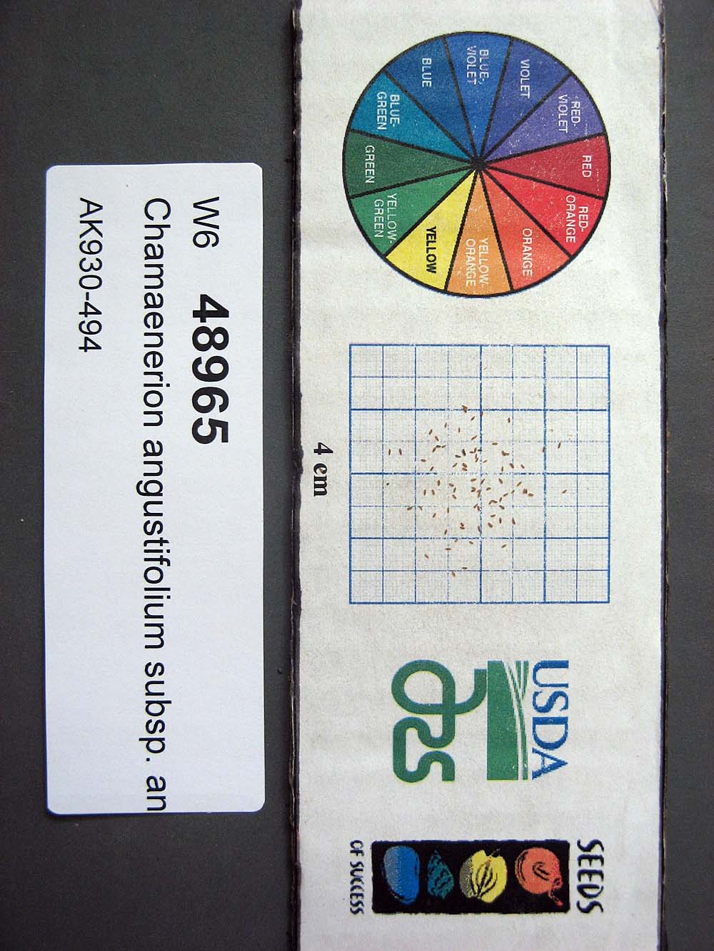 | | 2015 | | | | | | | Wild material | | 1923879 | W6 48965 |
| 79 | W6 48966 | AK930-495 | Calamagrostis canadensis (Michx.) P. Beauv. | Alaska, United States | W6 |  | | 2015 | | | | | | | Wild material | | 1923880 | W6 48966 |
| 80 | W6 48968 | AK930-498 | Arctagrostis latifolia (R. Br.) Griseb. | Alaska, United States | W6 |  | | 2015 | | | | | | | Wild material | | 1923882 | W6 48968 |
| 81 | W6 48969 | AK930-499 | Chamaenerion angustifolium (L.) Scop. subsp. angustifolium | Alaska, United States | W6 | 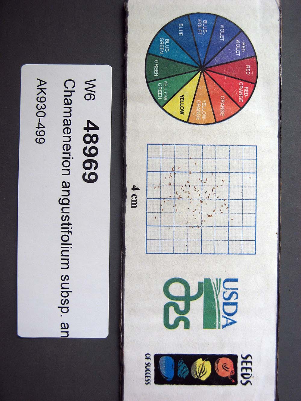 | | 2015 | | | | | | | Wild material | | 1923883 | W6 48969 |
| 82 | W6 48972 | AK930-502 | Barbarea orthoceras Ledeb. | Alaska, United States | W6 |  | | 2015 | | | | | | | Wild material | | 1923886 | W6 48972 |
| 83 | Ames 32096 | BA13009001 | Fraxinus nigra Marshall | Minnesota, United States | NC7 |  | | 2013 | COLLECTED | 09/23/2013 | T144N R38W, Clearwater County. | 47.25711000, -95.49000667 | 543 | Edges of lakes and forest edges. Growing in association with Fraxinus pennsylvanica, Quercus macrocarpa, Ulmus americana, Populus tremuloides, Populus balsamifera, Acer saccharum, Betula papyrifera, Salix sp., Larix laricina, Quercus rubra, Abies balsamea, Picea glauca, Sambucus canadensis, Cornus rugosa, Acer spicatum, Rosa sp., Viburnum opulus var. americanum, Viburnum dentatum, Alnus sp., Cornus canadensis, Corylus sp., Prunus virginiana, Ribes sp., Prunus pensylvanica, Rhamnus alnifolia, Equisetum sp., Carex sp., Rubus sp., Impatiens capensis, Bromus sp., and Thalictrum dasycarpum. | Wild material | D.B.H. ranged between 3 and 6 inches. | 1914713 | Ames 32096 |
| 84 | Ames 32618 | AK930-131 | Potentilla bimundorum Soják | Alaska, United States | NC7 |  | | 2012 | COLLECTED | 08/17/2010 | Glenn Highway Mile 149, both sides of the road, Nelchina. | 62.02825000, -146.63390000 | 763 | Sandy, gravelly soil (2.5Y 3/3). | Wild material | | 1900710 | Ames 32618 |
| 85 | Ames 32627 | AK930-269 | Potentilla norvegica L. | Alaska, United States | NC7 |  | | 2012 | COLLECTED | 09/09/2010 | West end of Circle Hot Springs Air Strip. | 65.48548000, -144.62135000 | 271 | Parking area margins. Silty loam soil (2.5Y 3/6). | Wild material | | 1900616 | Ames 32627 |
| 86 | Ames 32634 | AK930-207 | Rumex arcticus Trautv. | Alaska, United States | NC7 |  | | 2012 | COLLECTED | 08/26/2010 | Bureau of Land Management Salmon Lake Campground. | 64.91615000, -164.96486000 | 134 | Loam soil (2.5YR 2.5/3). | Wild material | | 1900626 | Ames 32634 |
| 87 | Ames 34802 | AK930-211 | Spiraea stevenii (C. K. Schneid.) Rydb. | Alaska, United States | NC7 |  | | 2012 | COLLECTED | 08/26/2010 | BLM Salmon Lake Campground. | 64.91615000, -164.96486000 | 138 | Soil type: Loam - 2.5YR 2.5/3 | Wild material | | 1900642 | Ames 34802 |
| 88 | Ames 32631 | AK930-288 | Potentilla pensylvanica L. | Alaska, United States | NC7 |  | | 2012 | COLLECTED | 09/11/2010 | Bluffs east of Birch Creek crossing, Steese Highway. | 65.71155000, -144.31697000 | 239 | Silt, sand, and pebbles soil (2.5Y 4/4). | Wild material | | 1901064 | Ames 32631 |
| 89 | WLP 2073 | 177375 | Clematis ligusticifolia Nutt. | Colorado, United States | NA | 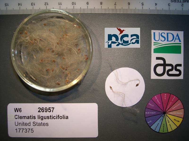 | | 2005 | COLLECTED | 09/12/2002 | | | 2409 | Pinyon-juniper woodland. Associated with Salix, Rosa woodsii, Populus tremuloides, Rhus aromatica, Yucca glauca, Cercocarpus montanus, Chrysothamnus spp. | Wild material | Forb 1.8 meters tall. | 1673995 | WLP 2073 |