| 0 | NA 88140 | NCBG-280 | Aralia spinosa L. | North Carolina, United States | NA |  | | 2019 | | | | | | | Wild material | | 2098388 | NA 88140 |
| 1 | NA 88141 | NCBG-281 | Aralia spinosa L. | Virginia, United States | NA |  | | 2019 | | | | | | | Wild material | | 2098389 | NA 88141 |
| 2 | NA 88146 | NCBG-309 | Aralia spinosa L. | Virginia, United States | NA |  | | 2019 | | | | | | | Wild material | | 2098406 | NA 88146 |
| 3 | NA 88834 | RJL-RM2023FLAL-008 | Rhododendron canescens (Michx.) Sweet | Florida, United States | NA | | | 2023 | COLLECTED | 12/06/2023 | Blackwater State Forest: plants are growing in wetlands accessed by foot from Buddy Hardy Road. The collection site is approximately 0.14 kilometers west and downhill from the road. | 30.80736700, -86.95784700 | 53 | Growing in shade to part-shade of the well-drained moist mesic habitat about 1 m above the wetland which appears to be formed by a nearby hillside seepage area. In this zone there are numerous facultative wetland species as well as high competition from facultative upland plants. Slope: 5 to 10 percent. Aspect: Variable. The underlying geology of this area is the Citronelle Formation of Pliocene origin and consists of gray to orange, often mottled, unconsolidated to poorly consolidated, very fine to very coarse, poorly sorted, clean to clayey sands. It contains significant amounts of clay, silt and gravel which may occur as beds and lenses and may vary considerably over short distances. Limonite nodules and limonite-cemented beds are common. (Source: USGS Florida Geologic Map Data.) The Troup Series (5 to 8% slopes) consists of very deep, somewhat excessively drained soil formed in unconsolidated sandy and loamy marine sediments. Troup soils are on ridges and hillslopes. The upper 0-13 cm is comprised primarily of decomposing sphagnum peat with a significant amount of fibrous root content. From 15-112 cm the soil is comprised primarily of fine-grained yellowish-brown sand with varying amounts of root content; this zone is strongly acid. From 112-203 cm the soil is comprised of light-red to red sandy clay loam that is discontinuous, generally friable, and strongly acid. (Source: NRCS Web Soil Survey.) | Wild material | | 2165664 | NA 88834 |
| 4 | NA 88835 | RJL-RM2023FLAL-009 | Rhododendron viscosum (L.) Torr. | Florida, United States | NA | | | 2023 | COLLECTED | 12/06/2023 | Blackwater State Forest: plants are growing in wetlands accessed by foot from Buddy Hardy Road. The collection site is approximately 0.14 kilometers west and downhill from the road. | 30.80841000, -86.96283300 | 43 | Growing in part-shade of the well-drained moist-dry mesic habitat about 2-3 m above the wetland. In this zone there are numerous facultative wetland species as well as high competition from facultative upland plants. Slope: 5 to 10 percent. Aspect: Variable. The underlying geology of this area is the Citronelle Formation of Pliocene origin and consists of gray to orange, often mottled, unconsolidated to poorly consolidated, very fine to very coarse, poorly sorted, clean to clayey sands. It contains significant amounts of clay, silt and gravel which may occur as beds and lenses and may vary considerably over short distances. Limonite nodules and limonite-cemented beds are common. (Source: USGS Florida Geologic Map Data.) The Troup Series (5 to 8% slopes) consists of very deep, somewhat excessively drained soil formed in unconsolidated sandy and loamy marine sediments. Troup soils are on ridges and hillslopes. The upper 0-13 cm is comprised primarily of decomposing sphagnum peat with a significant amount of fibrous root content. From 15-112 cm the soil is comprised primarily of fine-grained yellowish-brown sand with varying amounts of root content; this zone is strongly acid. From 112-203 cm the soil is comprised of light-red to red sandy clay loam that is discontinuous, generally friable, and strongly acid. (Source: NRCS Web Soil Survey.) | Wild material | | 2165665 | NA 88835 |
| 5 | NA 88820 | TJK2023AL-005 | Hydrangea arborescens L. | Alabama, United States | NA | | | 2023 | COLLECTED | 12/07/2023 | Between Monroe County Route 1 and Tom Hayles Road. | 31.40575900, -87.54924000 | 22 | In woodlands on limestone outcrop. While the upper area of slopes is covered by a thin soil layer, the exposed limestone rock outcrop on the northwestern edge of this area is a low competition niche for plants like the Hydrangea to gain a foothold. Slope: 60% (plus). Aspect: Northwest. Elevation: 72 feet. | Wild material | | 2165649 | NA 88820 |
| 6 | NA 88821 | TJK2023AL-006 | Hydrangea quercifolia W. Bartram | Alabama, United States | NA | | | 2023 | COLLECTED | 12/07/2023 | Between Monroe County Route 1 and Tom Hayles Road. | 31.40580000, -87.54890000 | 22 | In woodlands on limestone outcrop. While the upper area of slopes is covered by a thin soil layer, the exposed limestone rock outcrop on the northwestern edge of this area is a low competition niche for plants like the Hydrangea to gain a foothold. Slope: 60% (plus). Aspect: Northwest. Elevation: 72 feet. | Wild material | | 2165650 | NA 88821 |
| 7 | NA 88561 | RJLSEUS2022-034 | Hydrangea quercifolia W. Bartram | Alabama, United States | NA | | | 2023 | COLLECTED | 12/12/2022 | Plants growing in the woodlands at Haines Island Park at the foot of Tallahatta cuesta, accessed by foot via Ferry Road. Common at this site. | 31.72178200, -87.46589600 | 66 | Plants are growing in part-shade to shade of a moist mesic, well-drained conditions on rocks and in the eroding matrix of the Tallahatta Questa.
Soils: The underlying geology of this area is Claiborne Group, Tallahatta Formation, of Eocene origin, with white to very light-greenish-gray thin-bedded to massive siliceous claystone; interbedded with thin layers of fossiliferous clay, sandy clay, and glauconitic sand and sandstone.
Source: USGS Alabama Geological Map Data (https://mrdata.usgs.gov/geology/state/state.php?state=AL)
The primary soil type in the collection area is classified as Arundel Loam soil (8 to 35 percent slopes). The Arundel Series consists of moderately deep, well drained, very slowly permeable soils on dissected uplands of the Southern Coastal Plain. They formed in marine deposits consisting of acid clays underlain by horizontally bedded sandstone, buhrstone and siltstone. These soils are strongly acid. Slopes range from 2 to 60 percent.
Source: NRCS Web Soil Survey (https://websoilsurvey.sc.egov.usda.gov/App/WebSoilSurvey.aspx) | Wild material | | 2140786 | NA 88561 |
| 8 | WLP 2610 | 2022VA-01 | Stewartia malacodendron L. | Virginia, United States | NA | | | 2022 | COLLECTED | 09/12/2022 | Woodlands adjacent to and bounded by the interchange of Business Route 168 (N. Battlefield Avenue) and Route 168, next to a detention basin and shopping plaza on the west side of Battlefield Avenue. Accessed by parking in the cul-de-sac at the south end of Kingsborough Square Street. This plant is a very common and abundant component of this woodland with significant recruitment continuing | 36.73888200, -76.24327700 | 9 | Plants growing in rich mesic, moist but well-drained conditions in the high understory shade of a mixed deciduous and evergreen woodland, primarily comprised of deciduous trees in the over-story and a mixture of deciduous and evergreen species in the sub-canopy.
Soils: The underlying geology of this area is the Tabb Formation of Quaternary origin which is comprised of undifferentiated sand, silt, and peat and subdivided into three members. Within the Tabb Formation lies the Sedgefield Member, a pebbly to bouldery, clayey sand and fine to medium, shell-rich sand that grades upward into sandy and clayey silt; locally, channel fill at the base of unit includes as much as 15 meters of fine to coarse, cross-bedded sand and clayey silt and peat containing in-situ tree stumps. Sandy bay facies commonly contain numerous mollusks as well as coral. Thickness is 0 to 15.8 meters.
Source: USGS Virginia Geologic Map Data (https://mrdata.usgs.gov/geology/state/sgmc-unit.php?unit=VAQts%3B0)
The surface soil profile of this area is Tetotum fine sandy loam, 0 to 2 percent slopes. Forming primarily terraces, these soils are moderately well-drained and highly acidic. They are generally 100-150 cm thick, the upper 20 inches of the horizon averages more than 30 percent silt or more than 40 percent silt plus very fine sand.
Source: NRCS Web Soil Survey (https://websoilsurvey.sc.egov.usda.gov/App/WebSoilSurvey.aspx) | Wild material | | 2139348 | WLP 2610 |
| 9 | WLP 2568 | APS/HA/2022/028/490 | Hydrangea arborescens L. | Arkansas, United States | NA | 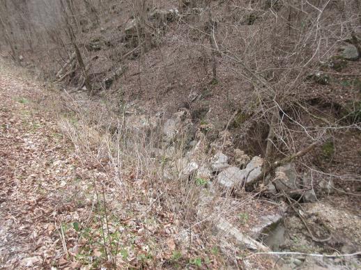 | | 2022 | COLLECTED | 03/15/2022 | Located approximately 3.75 miles east of Allison just off Round Bottom Road. | 35.93357000, -92.05110000 | 144 | Moist, low deciduous forest with scattered rock outcrops, growing along base of hill and bank of seasonal stream. | Wild material | | 2137430 | WLP 2568 |
| 10 | NA 88155 | NCBG-324 | Clethra alnifolia L. | North Carolina, United States | NA |  | | 2019 | | | | | | | Wild material | | 2098415 | NA 88155 |
| 11 | WLP 2504 | De Soto National Forest. | Hydrangea quercifolia W. Bartram | Mississippi, United States | NA |  | | 2019 | COLLECTED | 12/17/2017 | De Soto National Forest, Perry County. 1.5 miles southwest of New Augusta. Approximately 1 mile west of Highway 29 along unnumbered Forest Service road at bridge over Milky Creek. | 31.18151000, -89.05029900 | | Roadside embankments near stream. | Wild material | Specimens in nature noted with fairly sparse flowering (2017). Almost all plants in the population had persistent leaves on 17 December 2017. | 2106214 | WLP 2504 |
| 12 | Ames 34787 | NCBG-330 | Rhus copallinum L. | North Carolina, United States | NC7 |  | | 2018 | COLLECTED | 10/07/2015 | Dismal Swamp State Park areas of Laurel Hill Trail and Corapeake Road. | 36.54783000, -76.42763000 | 5 | Hardwood swamp roadside | Wild material | | 1965913 | Ames 34787 |