| 0 | W6 62411 | AK930A-26 | Solidago canadensis L. | Alaska, United States | W6 | | | 2025 | | | | | | | Wild material | This population is growing in close proximity to invasive plan species Be cautious when collecting | 2172765 | W6 62411 |
| 1 | W6 62076 | AK930A-1 | Solidago canadensis L. | Alaska, United States | W6 |  | | 2024 | | | | | | | Wild material | SOCA6 found in an open meadow | 2168838 | W6 62076 |
| 2 | OPGC 8182 | NEWFS-475 | Solidago canadensis L. | Massachusetts, United States | OPGC | | | 2021 | | | | | | | Wild material | Three-veined leaves with frequent, flared teeth. | 2115665 | OPGC 8182 |
| 3 | OPGC 8197 | NEWFS-532 | Solidago canadensis L. | Massachusetts, United States | OPGC | | | 2021 | | | | | | | Wild material | | 2115684 | OPGC 8197 |
| 4 | OPGC 8203 | NEWFS-558 | Solidago canadensis L. | Massachusetts, United States | OPGC | | | 2021 | | | | | | | Wild material | Teeth at leaf margins are extremely flared, stems pubescent from top to bottom. | 2115698 | OPGC 8203 |
| 5 | OPGC 8160 | MARSB-763 | Solidago canadensis L. | New Jersey, United States | OPGC | | | 2021 | | | | | | | Wild material | Leaf typeûleaves are simple (i.e., lobed or unlobed but not separated into leaflets)ûLeaf arrangementûalternate: there is one leaf per node along the stemûLeaf blade edgesûthe edge of the leaf blade has no teeth or lobesûthe edge of the leaf blade has teethûFlower type in flower headsûthe flower head has tubular disk flowers in the center and ray flowers, these often strap-shaped, around the peripheryûRay flower colorûyellowûTuft or plume on fruitûat least a part of the plume is made up of fine bristlesûSpines on plantûthe plant has no spinesûLeaf blade lengthû30–190 mmûDisk flower numberû1-5û6-10 | 2113609 | OPGC 8160 |
| 6 | OPGC 7924 | NEWFS-82 | Solidago canadensis L. | Massachusetts, United States | OPGC |  | | 2019 | | | | | | | Wild material | | 2098114 | OPGC 7924 |
| 7 | OPGC 8831 | CBG- 10837 | Solidago sciaphila E. Steele | Wisconsin, United States | OPGC | | | 2023 | | | | | | | Wild material | | 2142286 | OPGC 8831 |
| 8 | OPGC 7574 | Ledges State Park | Solidago ulmifolia Muhl. ex Willd. | Iowa, United States | OPGC |  | | 2021 | COLLECTED | 09/15/2021 | Ledges State Park, approximately 4.5 miles south of Boone, T83N R26W Sec. 20 | 41.98266200, -93.89314800 | 287 | Understory of hardwood forest. | Wild material | Plants in nature were generally two to three feet in height, growing in sparsely spreading colonies. This population has a large amount of diversity for flowering time with the first plants in the population beginning to flower on 22 July 2021 and the last plants to flower were still blooming at the end of September. Some plants in the population had a muted red fall foliage color at the end of October 2021. This accession represents genetics from near the northwest edge of the species range of occurence. | 2132828 | OPGC 7574 |
| 9 | OPGC 7575 | Ledges State Park | Solidago flexicaulis L. | Iowa, United States | OPGC |  | | 2021 | COLLECTED | 10/03/2021 | Ledges State Park, approximately 4.5 miles south of Boone, T83N R26W Sec. 21 | 41.98338100, -93.89052800 | 288 | Understory of hardwood forest. | Wild material | Plants in nature ranged in height from approximately one to three feet, growing in sparsely spreading colonies. Peak bloom in 2021 occurred near 15 September. Several specimens had branched inflorescences. | 2132829 | OPGC 7575 |
| 10 | OPGC 8180 | NEWFS-473 | Solidago rugosa Mill. | Massachusetts, United States | OPGC | | | 2021 | | | | | | | Wild material | | 2115663 | OPGC 8180 |
| 11 | OPGC 8208 | NEWFS-576 | Solidago rugosa Mill. | New Hampshire, United States | OPGC | | | 2021 | | | | | | | Wild material | | 2115708 | OPGC 8208 |
| 12 | OPGC 8209 | NEWFS-579 | Solidago rugosa Mill. | New Hampshire, United States | OPGC | | | 2021 | | | | | | | Wild material | | 2115709 | OPGC 8209 |
| 13 | OPGC 7960 | NEWFS-600 | Solidago rugosa Mill. | Massachusetts, United States | OPGC |  | | 2019 | | | | | | | Wild material | | 2098237 | OPGC 7960 |
| 14 | OPGC 7477 | CBG-9136 | Solidago rigida L. | Nebraska, United States | OPGC |  | | 2019 | | | | | | | Wild material | | 2092774 | OPGC 7477 |
| 15 | OPGC 6401 | CBG-8086 | Solidago rigida L. | Illinois, United States | OPGC |  | | 2017 | | | | | | | Wild material | | 1954839 | OPGC 6401 |
| 16 | OPGC 6411 | CBG-8084 | Solidago patula Muhl. ex Willd. | Illinois, United States | OPGC |  | | 2017 | | | | | | | Wild material | | 1954874 | OPGC 6411 |
| 17 | PI 688332 | R. cascadensis VA-2018-023 Spruce Knob | Rubus canadensis L. | West Virginia, United States | COR |  | | 2018 | COLLECTED | 08/24/2018 | Spruce Knob, Public Road 112, Monongahela National Forest, Pendleton, Co. WV | 38.70266700, -79.52476700 | 1309 | Steep east-facing road cut with dense vegetation of Solidago, Rubus strigosus, alder, Fragaria, bamboo grass, maple | Wild material | West Virginia 2018 | 1965279 | PI 688332 |
| 18 | PI 675239 | UT030-021 | Elymus canadensis L. | Utah, United States | W6 | 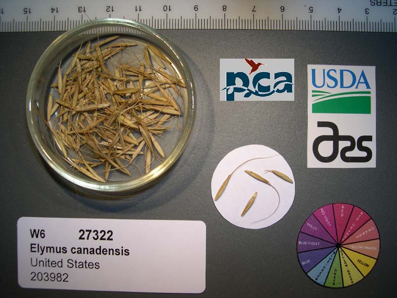 | | 2005 | | | | | | | Wild material | Grasslike 0.6-1.2 meters tall. | 1674353 | PI 675239 |
| 19 | W6 61366 | CBG- 10782 | Paronychia canadensis (L.) Alph. Wood | Illinois, United States | W6 |  | | 2023 | | | | | | | Wild material | | 2142248 | W6 61366 |
| 20 | W6 58706 | NEWFS-403 | Glyceria canadensis (Michx.) Trin. | New Hampshire, United States | W6 | | | 2021 | | | | | | | Wild material | | 2115645 | W6 58706 |
| 21 | W6 58771 | NEWFS-580 | Juncus canadensis J. Gay ex Laharpe | New Hampshire, United States | W6 | | | 2021 | | | | | | | Wild material | | 2115710 | W6 58771 |
| 22 | W6 57396 | NEWFS-311 | Juncus canadensis J. Gay ex Laharpe | New Hampshire, United States | W6 |  | | 2019 | | | | | | | Wild material | | 2098193 | W6 57396 |
| 23 | OPGC 7466 | CBG-8640 | Anemone canadensis L. | Wisconsin, United States | OPGC |  | | 2019 | | | | | | | Wild material | | 2092691 | OPGC 7466 |
| 24 | W6 48821 | MARSB-65 | Calamagrostis canadensis (Michx.) P. Beauv. | West Virginia, United States | W6 |  | | 2015 | | | | | | | Wild material | | 1922837 | W6 48821 |
| 25 | WLP 229 | NA 80349 | Tsuga canadensis (L.) Carrière | New York, United States | NA | | | 2011 | COLLECTED | 09/10/2011 | Along Emery Hill Road. | 42.07700000, -79.08400000 | 433 | Roadside. East-facing slope. Rocky substrate with very tiny spring creek at base of slope. Associated with Acer saccharum, Asarum canadense, Diervilla lonicera, Fraxinus americana, Hamamelis virginiana, Impatiens capensis, Rubus, Solidago, and Tilia americana. | Wild material | | 1891488 | WLP 229 |
| 26 | WLP 920 | 35 | Cercis canadensis L. | Iowa, United States | NA |  | | 2003 | COLLECTED | 09/24/2003 | Bluff Park, Keokuk, South of Park Street at G, T65N R5W, Section 35, Keokuk Quad, Lee County. | 40.38861111, -91.40277778 | 194 | Bluff edge along Mississippi River. Sunny. 0-25% slope w/ S aspect. Soil well to good drainage. Assoc w/ Campsis radicans, Quercus muehlenbergii, Eupatorium (white snakeroot and tall boneset), Solidago, Lonicera maackii, and Catalpa. | Wild material | Small trees. Possibly wild, possibly originally cultivated, but Cercis very common in area, growing in city park. | 1649668 | WLP 920 |
| 27 | PI 702708 | MARSB-314 | Panicum virgatum L. | New Jersey, United States | S9 |  | | 2019 | | | | | | | Wild material | | 2097568 | PI 702708 |
| 28 | PI 710511 | CBG-9428 | Apocynum cannabinum L. | Illinois, United States | S9 |  | | 2019 | | | | | | | Wild material | | 2092802 | PI 710511 |
| 29 | PI 688393 | V. corymbosum (constablaei) VA-2018-051 Mt. Rogers | Vaccinium corymbosum L. | Virginia, United States | COR | | | 2018 | COLLECTED | 08/28/2018 | Mt. Rogers Grayson Highlands State Park, Twin Pinnacles trail, Grayson Co. VA | 36.62674000, -81.50373000 | 1556 | Rocky outcrop along Twin Pinnacles trail, a single plant at edge of outcrop with V. erythrocarpum, V. simulatum, on edge of dense forest of yellow birch, red maple, striped maple, witchhazel, fir, red spruce, cherry, beech, Solidago, Menziezia, Rubus canadensis, lycopodium, Ribes, Smilax, aster, grasses, various herbs and weeds | Wild material | Virginia 2018 | 1965668 | PI 688393 |
| 30 | PI 688394 | V. erythrocarpum VA-2018-052 Mt. Rogers | Vaccinium erythrocarpum Michx. subsp. erythrocarpum | Virginia, United States | COR |  | | 2018 | COLLECTED | 08/26/2018 | Mt. Rogers Grayson Highlands State Park, Twin Pinnacles trail, Grayson Co. VA | 36.62674000, -81.50373000 | 1556 | Rocky outcrop along Twin Pinnacles trail, a single plant at edge of outcrop with V. simulatum, on edge of dense forest of yellow birch, red maple, striped maple, witchhazel, fir, red spruce, cherry, beech, Solidago, Menziezia, Rubus canadensis, lycopodium, Ribes, Smilax, aster, grasses, various herbs and weeds | Wild material | Virginia 2018 | 1965669 | PI 688394 |
| 31 | PI 688397 | V. simulatum VA-2018-054 Massie | Vaccinium simulatum Small | Virginia, United States | COR | | | 2018 | COLLECTED | 08/28/2018 | Mt. Rogers Grayson Highlands State Park, Massie parking area entrance to Rhododendron trail, Grayson Co., VA | 36.63343000, -81.50892000 | 1426 | Massie Trail parking area in lawn and along Rhododendron trail. Rocky, moist trail; low-growing shrubs and trees with isolated areas of conifers (fir and spruce), shrubs generally Crataegus, Mt. laurel, maple, with heavily armed R. canadensis, joe pye weed, Solidago, sneeze weed, strawberry, potentilla. Japanese beetle seen. | Wild material | Virginia 2018 | 1965672 | PI 688397 |
| 32 | PI 688398 | V. corymbosum VA-2018-055 Mt. Rogers | Vaccinium corymbosum L. | Virginia, United States | COR |  | | 2018 | COLLECTED | 08/28/2018 | Mt. Rogers Grayson Highlands State Park, Rhododendron trail, Grayson Co., VA | 36.63607000, -81.51034000 | 1450 | Rhododendron trail rocky, moist trail; low-growing shrubs and trees with isolated areas of conifers (fir and spruce), shrubs generally Crataegus, Mt. laurel, maple, with heavily armed R. canadensis, joe pye weed, Solidago, sneeze weed, strawberry, potentilla. | Wild material | Virginia 2018 | 1965673 | PI 688398 |
| 33 | PI 688399 | V. erythrocarpum VA-2018-056 Rhododendron trail | Vaccinium erythrocarpum Michx. subsp. erythrocarpum | Virginia, United States | COR | | | 2018 | COLLECTED | 08/28/2018 | Mt. Rogers Grayson Highlands State Park, Rhododendron trail, Grayson Co., VA | 36.63623000, -81.51009000 | 1453 | Rhododendron trail rocky, moist trail; low-growing shrubs and trees with isolated areas of conifers (fir and spruce), shrubs generally Crataegus, Mt. laurel, maple, with heavily armed R. canadensis, joe pye weed, Solidago, sneeze weed, strawberry, potentilla. | Wild material | Virginia 2018 | 1965674 | PI 688399 |
| 34 | PI 688401 | V. simulatum VA-2018-058 Rhododendron trail | Vaccinium simulatum Small | Virginia, United States | COR | | | 2018 | COLLECTED | 08/28/2018 | Mt. Rogers Grayson Highlands State Park, Rhododendron trail, Grayson Co., VA | 36.63633000, -81.50948000 | 1450 | Rhododendron trail rocky, moist trail; low-growing shrubs and trees with isolated areas of conifers (fir and spruce), shrubs generally Crataegus, Mt. laurel, maple, with heavily armed R. canadensis, joe pye weed, Solidago, sneeze weed, strawberry, potentilla. | Wild material | Virginia 2018 | 1965676 | PI 688401 |
| 35 | PI 688404 | V. simulatum VA-2018-061 White Top | Vaccinium simulatum Small | Virginia, United States | COR | | | 2018 | COLLECTED | 08/29/2018 | Whitetop Mountain, Mud Creek Lane, Grayson Co. VA | 36.63828000, -81.60551000 | 1673 | Top of Whitetop Mountain along Mud Creek Lane. Found on rocky, moist, dark soiled, weedy road cuts and in open meadow with Crataegus, fir, Sorbus, yellow birch, wild cherry, azalea, Rubus canadensis, rush, grass, Eupatorium, Prunella, Solidago, sneezeweed, Gentian, Erigeron, various herbs; one or two large clones of V. erythrocarpum found across Mud Creek Lane. | Wild material | Virginia 2018 | 1965679 | PI 688404 |
| 36 | PI 688405 | V. erythrocarpum VA-2018-062 White Top | Vaccinium erythrocarpum Michx. subsp. erythrocarpum | Virginia, United States | COR | | | 2018 | COLLECTED | 08/29/2018 | Whitetop Mountain, Mud Creek Lane, Grayson Co. VA | 36.63781000, -81.60879000 | 1657 | Top of Whitetop Mountain along Mud Creek Lane; one or two large clones on rocky, moist road cut; Crataegus, fir, Rubus canadensis, rush, grass, Eupatorium, Prunella, Solidago; Ribes rotundifolium, strawberry, weeds | Wild material | Virginia 2018 | 1965680 | PI 688405 |
| 37 | PI 688406 | V. erythrocarpum VA-2018-063 White Top | Vaccinium erythrocarpum Michx. subsp. erythrocarpum | Virginia, United States | COR | | | 2018 | COLLECTED | 08/29/2018 | Whitetop Mountain, Mud Creek Lane, Grayson Co. VA | 36.63269000, -81.60374000 | 1563 | Top of Whitetop Mountain along Mud Creek Lane; one or two large clones on rocky, moist road cut; Crataegus, fir, Rubus canadensis, rush, grass, Eupatorium, Prunella, Solidago; Ribes rotundifolium, strawberry, weeds | Wild material | Virginia 2018 | 1965681 | PI 688406 |
| 38 | PI 688407 | V. simulatum VA-2018-064 late ripening | Vaccinium simulatum Small | Virginia, United States | COR |  | | 2018 | COLLECTED | 08/29/2018 | Whitetop Mountain, Mud Creek Lane, Grayson Co. VA | 36.63390000, -81.60403000 | 1590 | Top of Whitetop Mountain along Mud Creek Lane. Found on rocky, moist, dark soiled, weedy road cuts and in open meadow with Crataegus, fir, Sorbus, yellow birch, wild cherry, azalea, Rubus canadensis, rush, grass, Eupatorium, Prunella, Solidago, sneezeweed, Gentian, Erigeron, various herbs; one or two large clones of V. erythrocarpum found across Mud Creek Lane. | Wild material | Virginia 2018 | 1965682 | PI 688407 |
| 39 | PI 688408 | V. simulatum VA-2018-065 Mud Creek Lane | Vaccinium simulatum Small | Virginia, United States | COR |  | | 2018 | COLLECTED | 08/29/2018 | Whitetop Mountain, Mud Creek Lane, Grayson Co. VA | 36.63273000, -81.60430000 | 1572 | Top of Whitetop Mountain along Mud Creek Lane. Found on rocky, moist, dark soiled, weedy road cuts and in open meadow with Crataegus, fir, Sorbus, yellow birch, wild cherry, azalea, Rubus canadensis, rush, grass, Eupatorium, Prunella, Solidago, sneezeweed, Gentian, Erigeron, various herbs; one or two large clones of V. erythrocarpum found across Mud Creek Lane. | Wild material | Virginia 2018 | 1965683 | PI 688408 |
| 40 | PI 710482 | CBG-7511 | Desmanthus illinoensis (Michx.) MacMill. ex B. L. Rob. & Fernald | Nebraska, United States | S9 |  | | 2017 | | | | | | | Wild material | | 1954797 | PI 710482 |
| 41 | PI 710483 | CBG-7661 | Desmanthus illinoensis (Michx.) MacMill. ex B. L. Rob. & Fernald | Iowa, United States | S9 |  | | 2017 | | | | | | | Wild material | | 1954798 | PI 710483 |
| 42 | PI 679627 | V. macrocarpon Big Run Bog FR 18 | Vaccinium macrocarpon Aiton | West Virginia, United States | COR | | | 2014 | COLLECTED | 04/22/2014 | Big Run Bog, Backbone Mountain, Monogahela National Forest, Tucker County. Next to Forest Road 18 | 39.11812000, -79.58452000 | 983 | Minerotrophic fen in a shallow basin. Many hummocks with standing water between. Fen dissected by many sloughs. A large area of open water within the fen has active beaver dams. Hummocks support small trees and shrubs | Wild material | Plants in fen include Spaghnum sp., Rubus hispidus, Solidago uliginosa, Eriphorum virginicum, Juncus sp., Carex spp., Scirpus sp. Gaultheria hispidula, Aronia melanocarpa, Sarracenia purpurea (introduced). Hummocks supported Picea rubens, Rhododendron maximum, Kalmia latifolia, and ferns including Osmundastrum cinnamomea. Vegetation on surrounding slopes includes Picea rubens, Tsuga canadensis, Amelanchier sp. and Pinus rigida.
Plant description: Reddish leaves. Prolific fruit production. Fruit shape, size and color typical for species. Voucher colleted. Type of propagule collected: seed
Collectors: Williams, KA; Garvey, E; Polgar, R. CRANBERRY IGRR PROJECT | 1919345 | PI 679627 |
| 43 | PI 679628 | V. oxycoccos Big Run Bog FR 18 | Vaccinium oxycoccos L. | West Virginia, United States | COR | | | 2014 | COLLECTED | 04/22/2014 | Big Run Bog, Backbone Mountain, Monogahela National Forest, Tucker County. Next to Forest Road 18 | 39.11812000, -79.58452000 | 983 | Minerotrophic fen in a shallow basin. Many hummocks with standing water between. Fen dissected by many sloughs. A large area of open water within the fen has active beaver dams. Hummocks support small trees and shrubs | Wild material | Plants in fen include Spaghnum sp., Rubus hispidus, Solidago uliginosa, Eriphorum virginicum, Juncus sp., Carex spp., Scirpus sp. Gaultheria hispidula, Aronia melanocarpa, Sarracenia purpurea (introduced). Hummocks supported Picea rubens, Rhododendron maximum, Kalmia latifolia, and ferns including Osmundastrum cinnamomea. Vegetation on surrounding slopes includes Picea rubens, Tsuga canadensis, Amelanchier sp. and Pinus rigida.
Plant description: Plant prostrate. Fruit shape, size and color typical for species. Voucher collected Type of propagule collected: seed
Collectors: Williams, KA; Garvey, E; Polgar, R. CRANBERRY IGRR PROJECT | 1919346 | PI 679628 |
| 44 | PI 679629 | V. oxycoccos Red Run Bog FR 13 | Vaccinium oxycoccos L. | West Virginia, United States | COR | | | 2014 | COLLECTED | 04/23/2014 | Red Run Bog, Monongahela National Forest. Tucker County. The bog is bisected by Canaan Loop Road (Forest Road 13) | 39.07228000, -79.47363000 | 1110 | Bog with two main areas (east and west) separated by forest which is interspersed with smaller boggy areas. Road runs through forested area. Gentle slope from 1115 m in the east to 1105 m in the west. The total area is approximately 100 acres. | Wild material | Plants in bog include Spaghnum sp., Lycopodium sp., Rubus hispidus, Solidago uliginosa, Eriphorum virginicum, Pteridium aquilinum, Juncus sp., Carex spp., Aronia melanocarpa, and Vaccinium macrocarpon . Vegetation on surrounding slopes includes Picea rubens, Tsuga canadensis, Rhododendron maximum, Kalmia latifolia, Ilex montana, Gaultheria sp., and Viburnum prunifolium. Abies balsamea occurs on the edge of the bog.
Plant description: Abundant fruit. Fruit shape, size and color typical for species. Voucher collected Type of propagule collected: seed
Collectors: Williams, KA; Garvey, E; Polgar, R. CRANBERRY IGRR PROJECT | 1919347 | PI 679629 |
| 45 | PI 679630 | V. macrocarpon Red Run Bog FR 13 | Vaccinium macrocarpon Aiton | West Virginia, United States | COR | | | 2014 | COLLECTED | 04/23/2014 | Red Run Bog, Monongahela National Forest. Tucker County. The bog is bisected by Canaan Loop Road (Forest Road 13) | 39.07228000, -79.47363000 | 1110 | Bog with two main areas (east and west) separated by forest which is interspersed with smaller boggy areas. Road runs through forested area. Gentle slope from 1115 m in the east to 1105 m in the west. The total area is approximately 100 acres. | Wild material | Plants in bog include Spaghnum sp., Lycopodium sp., Rubus hispidus, Solidago uliginosa, Eriphorum virginicum, Pteridium aquilinum, Juncus sp., Carex spp., Aronia melanocarpa, and Vaccinium oxycoccos . Vegetation on surrounding slopes includes Picea rubens, Tsuga canadensis, Rhododendron maximum, Kalmia latifolia, Ilex montana, Gaultheria sp., and Viburnum prunifolium. Abies balsamea occurs on the edge of the bog.
Plant description: Abundant fruit. Fruit shape, size and color typical for species. Voucher collected Type of propagule collected: seed
Collectors: Williams, KA; Garvey, E; Polgar, R. CRANBERRY IGRR PROJECT | 1919348 | PI 679630 |
| 46 | PI 664878 | JM20060801 | Prunella vulgaris L. | Iowa, United States | NC7 | | | 2006 | COLLECTED | 08/31/2006 | 1 mile north of 150th on 560th Avenue (1 mile west of Interstate 35 and 1 mile south of County Road E-18), Doolittle Prairie State Preserve, Story County. | 42.14910000, -93.58920000 | 255 | Mesic prairie (pothole). 0-10 degrees of slope. | Wild material | Plants 25-30 cm in height. | 1707772 | PI 664878 |
| 47 | PI 664832 | L.K. 24 | Echinacea purpurea (L.) Moench | Ohio, United States | NC7 |  | | 2004 | COLLECTED | 11/15/2003 | State Route 161 West from Columbus, south on Rosedale Road, Bigelow Cemetery State Nature Preserve, Madison County. | 40.10972222, -83.41916667 | 301 | Full sun (except for shading from taller prairie plants) on flat ground. Dark, loamy soil with some gravel and a little clay, fair to good drainage. | Wild material | Somewhat clump forming. Toothed/serrated margin, long petioles, pubescent, impressed veins. 3-4 feet in height. Rays reddish purple. Flower heads 3-4 inches in diameter; bristly central disk. | 1655342 | PI 664832 |
| 48 | PI 667330 | LK3 | Rudbeckia laciniata L. | Ohio, United States | OPGC | | | 2004 | COLLECTED | 10/17/2003 | Hocking County, Ohio, Near Sugar Grove and Lancaster. Route 33 to Clear Creek Road, 1.5 miles west of 33 | 39.59166667, -82.56972222 | 240 | Along a roadside creek surrounded by other herbaceous plants including rushes, Solidago canadensis, oak, sycamore, birch. Moist soil sloping to creek receiving partial sun. | Wild material | Lobed leaves, usually single-stemmed and pubescent. Few flowers, done blooming, about 3 feet tall. 5 plants found, 3 sampled | 1684779 | PI 667330 |
| 49 | PI 667331 | LK4 | Rudbeckia triloba L. | Ohio, United States | OPGC | | | 2004 | COLLECTED | 10/17/2003 | Hocking County, Ohio, Near Sugar Grove and Lancaster. Route 33 to Clear Creek Road, 1.5 miles west of 33 | 39.59194444, -82.56916667 | 240 | Along a roadside creek surrounded by other herbaceous plants including rushes, Solidago canadensis, oak, sycamore, birch. Moist soil sloping to creek receiving partial sun. | Wild material | | 1658893 | PI 667331 |
| 50 | PI 667344 | LK21 | Rudbeckia hirta L. | Ohio, United States | OPGC | | | 2004 | COLLECTED | 10/31/2003 | Marion County, Ohio, along Route 23 north of Route 98 and past Bethlehem Road but before Newmans-Cardington Road. 1.25 hour from OPGC. | 40.49000000, -83.07416667 | 301 | About 15 away from wet ditch, 30 feet from highway. Growing on southwest side of mild slope; woods with maples and oaks nearby. Growing among grasses, weeds, Achillea, thistle, Solidago canadensis, Aster. | Wild material | Plants 1.5 to 2 feet tall, very long and narrow leaves, very pubeschent stems and leaves. Leaves 1 inch wide and up to 4 inches long. Much basal growth, good branching, some redness to stem, many plants still in flower. Population of 30 plants, 4 plants sampled. Similar patches of Rudbeckia hirta seen about every 5 minutes going 65 mph along highway for 15 minutes. | 1658906 | PI 667344 |
| 51 | PI 667348 | LK30 | Rudbeckia hirta L. | Ohio, United States | OPGC | | | 2004 | COLLECTED | 11/21/2003 | Fayetteville in Brown County, Ohio. Near intersection of 50 and 68. | 39.18583333, -83.93888889 | 267 | Southeast side of edge of weeds on 45 degree slope going down to woods and Little Miami River; slope facing northwest. Growing with grasses, weeds, Lonicera, Solidago canadensis, dogwood. Well-drained soil. | Wild material | Very long, narrow leaves with long veins parallel to leaf margin. Very soft pubescence, basal rosettes present. One plant found and sampled. | 1658911 | PI 667348 |
| 52 | PI 667349 | LK31 | Rudbeckia hirta L. | Ohio, United States | OPGC | | | 2004 | COLLECTED | 11/22/2003 | Ross County, Ohio on Mt. Tabler Road. Take 166 off Route 23, 235 to Rozell Creek Road, 184 turns into Mt. Tabler. | 39.20277778, -83.03555556 | 266 | On northwest edge of road in full sun along edge of a Christmas tree farm opening. Growing among Solidago canadensis, grasses, Monarda, Christmas pine trees. Growing in clay, poor drainage. | Wild material | Narrow, pubescent, light green leaves up to 2 inches long. One plant found and sampled | 1658912 | PI 667349 |
| 53 | PI 667350 | LK32 | Rudbeckia hirta L. | Ohio, United States | OPGC | | | 2004 | COLLECTED | 11/22/2003 | Hamilton Township, Lawrence County, Ohio. 25 Feet off of 52 W, 1117 Patrick Street. | 38.56416667, -82.75305556 | 162 | Ditch along road with very sloped woodland on west side. Growing with Lonicera, grasses, Solidago canadensis; creeping into turf along road. | Wild material | Very soft pubescence, long ovate light green leaves, rosette growth. 15 plants found, 3 sampled. | 1658913 | PI 667350 |
| 54 | PI 613185 | V. macrocarpon MD Allen 12 | Vaccinium macrocarpon Aiton | Maryland, United States | COR |  | | 1991 | COLLECTED | 10/29/1991 | "The Glades" minerotrophic fen, near Grantsville, Garrett county, MD | 39.55767000, -79.27967000 | 817 | greater than 100 acres, sedge/grass dominated minerotrophic fen, bordered by scattered white pine and spruce, also with Sphagnum spp., Solidago uliginosa, Glyceria canadensis, Calamogrostis canadensis, Carex Rostrata, C. Folliculata, | Wild material | Associated with Rubus Hispidus, Polytrichum sp., Alnus Rugosa. (This accession was part of the PL,SD 'breakout' - 1992) | 1009975 | PI 613185 |
| 55 | PI 618015 | V. macrocarpon WV Allen 7 | Vaccinium macrocarpon Aiton | West Virginia, United States | COR | 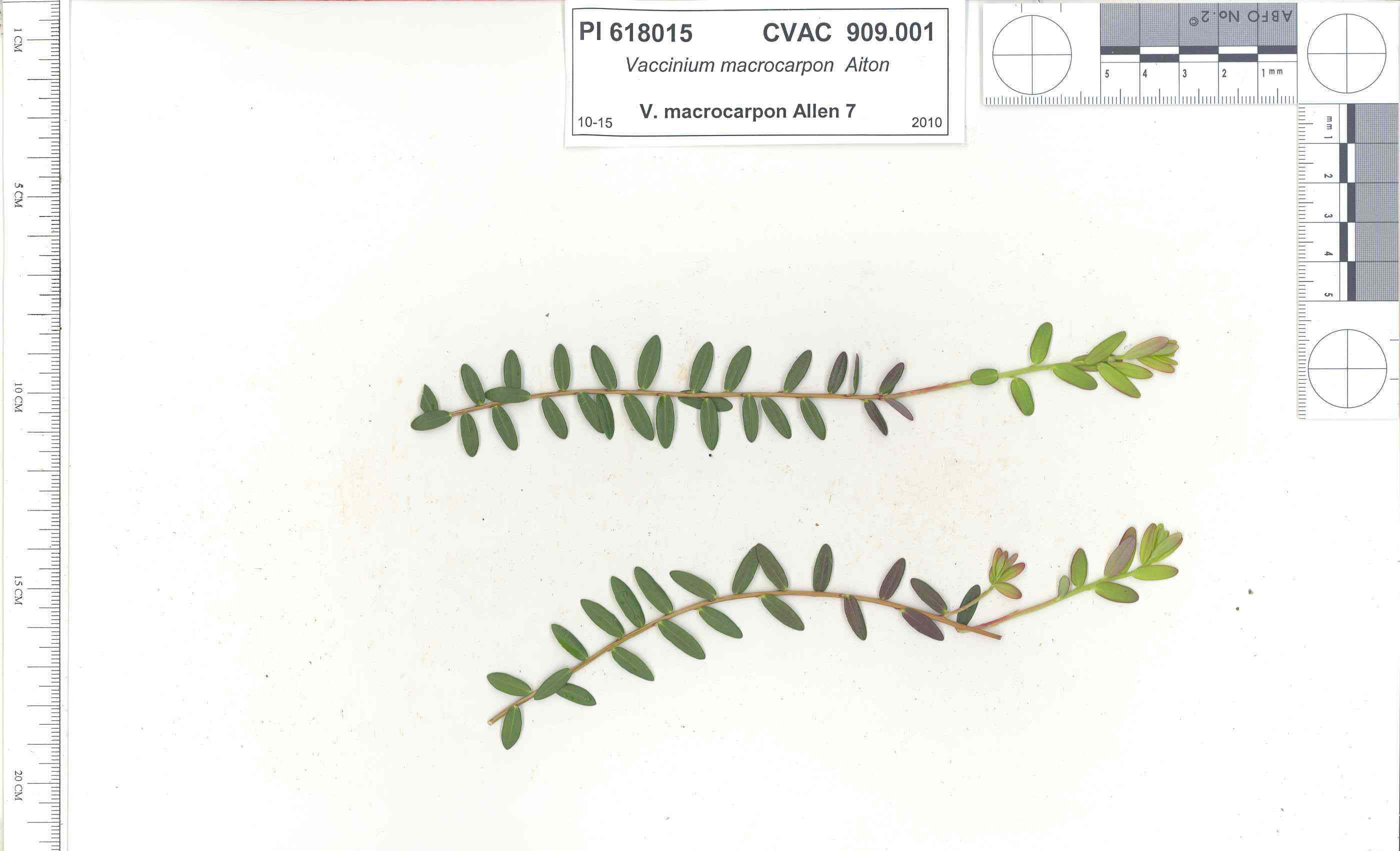 | | 1991 | COLLECTED | 10/29/1991 | Oligotrophic fen near WV/MD border in Preston county, WV, owned by the nature conservancy, WV, known as Cranesville Swamp | 39.51950000, -79.48233000 | 786 | 2 acres fen, bordered by Typha sp., Acer rubrum, Prunus serotina, Hemlock, Sotuhern most population of American Larch (Tamarack), also has Sphagnum spp., Rubus hispidus, Solidago uliginosa, Eripphorum virginicum, Pyrus melanocarpa | Wild material | Site holding moisture well in a regional drought, designated as a National Natural Landmark Additional plants are Hypericum densiflorum, Carex folliculata, Juncus effusus, J. canadensis, Bartonia virginica, Gaultheria procumbens | 1009919 | PI 618015 |
| 56 | PI 618017 | V. oxycoccos MD Allen 13 | Vaccinium oxycoccos L. | Maryland, United States | COR |  | | 1991 | COLLECTED | 10/30/1991 | "The Glades" minerotrophic fen, near Grantsville, Garrett county, MD | 39.55767000, -79.27967000 | 817 | greater than 100 acres, sedge/grass dominated minerotrophic fen, bordered by scattered white pine and spruce, also with Sphagnum spp., Solidago uliginosa, Glyceria canadensis, Calamogrostis canadensis, Carex Rostrata, C. Folliculata, | Wild material | Associated with Rubus Hispidus, Polytrichum sp., Alnus Rugosa. (This accession was part of the PL,SD 'breakout' - 1992) | 1009989 | PI 618017 |
| 57 | W6 62519 | FWS0300-109 | Sibbaldia tridentata (Aiton) Paule & Soják | Michigan, United States | W6 |  | | 2025 | | | | | | | Wild material | Received as: Sibbaldiopsis tridentata | 2192217 | W6 62519 |
| 58 | W6 62528 | FWS0300-131 | Symphyotrichum urophyllum (Lindl.) G. L. Nesom | Michigan, United States | W6 | 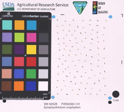 | | 2025 | | | | | | | Wild material | | 2192226 | W6 62528 |
| 59 | W6 62558 | FWS0502-80 | Eutrochium fistulosum (Barratt) E. E. Lamont | Pennsylvania, United States | W6 |  | | 2025 | | | | | | | Wild material | SCOUTING ID CHANGE. Ripe plants mostly withered but whorled leaves still hanging on | 2192256 | W6 62558 |
| 60 | NA 89095 | SNR2024 | Ilex decidua Walter | Missouri, United States | NA | | | 2024 | COLLECTED | 12/03/2024 | Shaw Nature Reserve: near Shaw Nature Reserve's Trail House. | 38.46697200, -90.81925000 | | Upland site. | Wild material | | 2169943 | NA 89095 |
| 61 | NA 88588 | 2024RM-001 | Hydrangea radiata Walter | Georgia, United States | NA | | | 2024 | COLLECTED | 10/24/2024 | Chattahoochee National Forest: Warwoman Wildlife Management Area: north side of Overflow Creek Road just west of the bridge over the Chattooga River. | 34.94956600, -83.20652000 | 498 | Mixed evergreen and deciduous moist mesic forest in part shade. The underlying geology of this area is characterized as Metagraywacke/Mica Schist Formation of the Precambrian-Paleozoic period. (Source: USGS Georgia Geologic Map Data). The soils of this are characterized as Tusquitee Series Loam, 10 to 25 percent slopes. The Tusquitee Series consists of very deep, well drained soils on gently sloping to very steep benches, foot slopes, toe slopes, and fans in coves in the Southern Blue Ridge mountains, MLRA 130B. These soils formed in colluvium derived from materials weathered from igneous and high-grade metamorphic crystalline rocks such as granite, mica gneiss, hornblende gneiss, and schist. Slope ranges from 2 to 95 percent. Solum thickness ranges from 1 to 3+ meters. Reaction is very strongly acid to slightly acid, in the A horizon. The Bw and lower horizons are very strongly acid to moderately acid. In the upper 1 meter, content of rock fragments, dominantly of gravel to stone size, ranges up to 35 percent. Below 1 meter, rock fragment content may range up to 60 percent. Content of mica flakes ranges from few to common. (Source: California Soil Resource Lab/NRCS Official Soil Series Descriptions). | Wild material | | 2169925 | NA 88588 |
| 62 | NA 88593 | 2024RJLNJ-001 | Ilex glabra (L.) A. Gray | New Jersey, United States | NA | | | 2024 | COLLECTED | 11/24/2024 | Mullica Township: Both sides of Duerer Street, approximately 0.37 kilometers southeast of 4th Avenue. | 39.55885000, -74.66442500 | 21 | Shade to almost full sun on compacted seasonally moist to temporarily wet areas of a mixed evergreen and deciduous woodland dominated by Pinus rigida. Vegetation of this area is very much defined by small changes in elevation that go from wet to very dry. Ilex glabra remains abundant throughout, though. Slope: N/A. Aspect: N/A. The underlying geology of this area is the Cohansey Formation of middle Miocene origin and comprised of sand, white to yellow with local gravel and clay. It is sometimes locally stained red or orange brown by iron oxides and (or) cemented into large blocks of ironstone. Unweathered clay is typically dark gray, but commonly weathers white where it is interbedded with thin beds of ironstone. Sand is typically medium grained and moderately sorted although it ranges from fine to very coarse grained and from poorly to well sorted. Sand consists of quartz and siliceous rock fragments. Some beds are locally micaceous. Maximum thickness in the map area is about 60 meters; however, thickness is difficult to determine because of the irregular basal contact and extensive post-depositional erosion. (Source: USGS New Jersey Geologic Map Data). The primary soil type in the area of this collection is classified as Mullica Series sandy loam, 0 to 2 percent slopes. These soils are typically coarse-loamy, siliceous, semiactive, and mesic typic humaquepts that are strongly to extremely acidic throughout the profile. The typical solum thickness ranges from 50-150+ cm. These soils are generally considered to be poorly drained. (Source: NRCS Web Soil Survey). | Wild material | | 2169930 | NA 88593 |
| 63 | NA 89080 | 2024RJLPA-006 | Ilex montana Torr. & A. Gray | Pennsylvania, United States | NA | | | 2024 | COLLECTED | 09/20/2024 | Berks and Schuylkill Counties: Hawk Mountain Sanctuary. | 40.64162200, -75.99122600 | 418 | Plants are growing from shade to full sun on a dry-mesic to very dry, well-drained upland/montane habitat characterized by an upland mixed deciduous and evergreen forest that is very rocky. All the plants found in this habitat go through periods of drought during the growing season due to the limited litter/soil layer in which moisture can be held. Elevation: 405 to 430 meters. Slope: 5 to 25 percent. Aspect: various. Geology: The underlying geology of this area is of Silurian origin and comprised of Shawangunk Formation. This formation is primarily light- to dark-gray, fine- to very coarse-grained sandstone and conglomerate containing thin shale interbeds. (Source: USGS Pennsylvania Geologic Map Data). Soils: The surface soil profile of this area is characterized as the Hazleton Series which consists of deep and very deep, well drained soils formed in residuum of acid gray, brown or red sandstone on uplands. The matrix includes a considerable accumulation of thin, flat, coarse fragments of sandstone, limestone, or schist with diameters up to 15 cm. Slope ranges from 0-80%. Permeability is moderately rapid to rapid. (Source: USDA-NRCS Official Soil Series Descriptions). EPA Ecoregion (Level III): Ridge and Valley (67). EPA Ecoregion (Level IV): Northern Sandstone Ridges (67c). | Wild material | | 2169044 | NA 89080 |
| 64 | NA 89081 | 2024RJLPA-009 | Rosa carolina L. | Pennsylvania, United States | NA | | | 2024 | COLLECTED | 09/22/2024 | Lancaster and York Counties: outcrops along the Susquehanna River, accessed from the Historic Lock 12 parking lot off of Pennsylvania Road 372. | 39.81483500, -76.32762200 | 34 | Plants are growing from part-sun to full sun in crevices of the outcrops and where organic debris has accumulated in between boulders along the Susquehanna River. The sites range from nearly xeric to dry mesic, at least on the surface. Plants are generally growing 4-10 m above the normal flow of the river; however, the Holtwood Dam is less than 1 kilometer upstream and debris found trapped in the boulders indicates that there is periodic flooding, at least, in the lower zone of 4+ meters or so above normal river flow. This habitat has a diverse assemblage of deciduous trees and shrubs as well as abundant herbaceous taxa. Slope: 0 to 60 percent. Aspect: Northeast (generally). Geology: The underlying geology of this area is probably of lower Paleozoic age and characterized as the Octoraro Formation. It includes albite-chlorite schist, phyllite, some hornblende gneiss, and granitized members. Soils: The area where this species occurs is right on the edge of two soil zones that transition from the river’s edge to mesic conditions upslope. The first is generally referred to as Rock Outcrop. This terrestrial matrix in which plants grow is largely exposed underlying rock geology with accumulated outwash, rock decomposition, and organic debris buildup. The second is Mt. Airy (80%) and Manor (20%) Series soils, 25 to 60 percent slopes, extremely stony (MRF). (Source: California Soil Resource Lab/NRCS Official Soil Series Descriptions). EPA Ecoregion (Level III): Northern Piedmont (64). EPA Ecoregion (Level IV): Piedmont Uplands (64c). | Wild material | | 2169045 | NA 89081 |
| 65 | NA 89082 | 2024RJLPA-010 | Amorpha fruticosa L. | Pennsylvania, United States | NA | | | 2024 | COLLECTED | 09/22/2024 | Outcrops along the Susquehanna River, accessed from the Historic Lock 12 parking lot off of Pennsylvania Road 372. | 39.81481500, -76.32757900 | 34 | Plants are growing from part-sun to full sun in crevices of the outcrops and where organic debris has accumulated in between boulders along the Susquehanna River. The sites range from nearly xeric to dry mesic, at least on the surface. Plants are generally growing 4-10 m above the normal flow of the river; however, the Holtwood Dam is less than 1 kilometer upstream and debris found trapped in the boulders indicates that there is periodic flooding, at least, in the lower zone of 4+ meters or so above normal river flow. This habitat has a diverse assemblage of deciduous trees and shrubs as well as abundant herbaceous taxa. Slope: 0 to 25 percent. Aspect: Northeast (generally). Geology: The underlying geology of this area is probably of lower Paleozoic age and characterized as the Octoraro Formation. It includes albite-chlorite schist, phyllite, some hornblende gneiss, and granitized members. Soils: The area where this species occurs is right on the edge of two soil zones that transition from the river’s edge to mesic conditions upslope. The first is generally referred to as Rock Outcrop. This terrestrial matrix in which plants grow is largely exposed underlying rock geology with accumulated outwash, rock decomposition, and organic debris buildup. The second is Mt. Airy (80%) and Manor (20%) Series soils, 25 to 60 percent slopes, extremely stony (MRF). (Source: California Soil Resource Lab/NRCS Official Soil Series Descriptions). EPA Ecoregion (Level III): Northern Piedmont (64). EPA Ecoregion (Level IV): Piedmont Uplands (64c). | Wild material | | 2169046 | NA 89082 |
| 66 | NA 89083 | 2024RJLPA-012 | Rhododendron periclymenoides (Michx.) Shinners | Pennsylvania, United States | NA | | | 2024 | COLLECTED | 09/22/2024 | Outcrops along the Susquehanna River, accessed from the Historic Lock 12 parking lot off of Pennsylvania Road 372. | 39.81477400, -76.32807300 | 35 | Plants are growing from shade to part-sun and occasionally full sun in crevices of the outcrops and where organic debris has accumulated in between boulders along the Susquehanna River. The sites range from nearly xeric to mesic, at least on the surface. Plants are generally growing 4-10 m above the normal flow of the river; however, the Holtwood Dam is less than 1 kilometer upstream and debris found trapped in the boulders indicates that there is periodic flooding, at least, in the lower zone of 4+ meters or so above normal river flow. This habitat has a diverse assemblage of deciduous trees and shrubs as well as abundant herbaceous taxa. Slope: 0 to 60 percent. Aspect: Northeast (generally). Geology: The underlying geology of this area is probably of lower Paleozoic age and characterized as the Octoraro Formation. It includes albite-chlorite schist, phyllite, some hornblende gneiss, and granitized members. Soils: The area where this species occurs is right on the edge of two soil zones that transition from the river’s edge to mesic conditions upslope. The first is generally referred to as Rock Outcrop. This terrestrial matrix in which plants grow is largely exposed underlying rock geology with accumulated outwash, rock decomposition, and organic debris buildup. The second is Mt. Airy (80%) and Manor (20%) Series soils, 25 to 60 percent slopes, extremely stony (MRF). (Source: California Soil Resource Lab/NRCS Official Soil Series Descriptions). EPA Ecoregion (Level III): Northern Piedmont (64). EPA Ecoregion (Level IV): Piedmont Uplands (64c). | Wild material | | 2169047 | NA 89083 |
| 67 | NA 89084 | 2024RJLPA-013 | Physocarpus opulifolius (L.) Maxim. | Pennsylvania, United States | NA | | | 2024 | COLLECTED | 09/22/2024 | Outcrops along the Susquehanna River, accessed from the Historic Lock 12 parking lot off of Pennsylvania Road 372. | 39.81466300, -76.32833900 | 36 | Plants are growing from shade to part-sun where organic debris has accumulated in between boulders as well as further upslope in deeper mesic soils along the Susquehanna River. This habitat has a diverse assemblage of deciduous trees and shrubs as well as abundant herbaceous taxa. Slope: 10 to 25 percent. Aspect: Northeast (generally). Geology: The underlying geology of this area is probably of lower Paleozoic age and characterized as the Octoraro Formation. It includes albite-chlorite schist, phyllite, some hornblende gneiss, and granitized members. Soils: The area where this species occurs is right on the edge of two soil zones that transition from the river’s edge to mesic conditions upslope. The first is generally referred to as Rock Outcrop. This terrestrial matrix in which plants grow is largely exposed underlying rock geology with accumulated outwash, rock decomposition, and organic debris buildup. The second is Mt. Airy (80%) and Manor (20%) Series soils, 25 to 60 percent slopes, extremely stony (MRF). (Source: California Soil Resource Lab/NRCS Official Soil Series Descriptions). EPA Ecoregion (Level III): Northern Piedmont (64). EPA Ecoregion (Level IV): Piedmont Uplands (64c). | Wild material | | 2169048 | NA 89084 |
| 68 | NA 89085 | 2024RJLPA-014 | Rhododendron arborescens (Pursh) Torr. | Pennsylvania, United States | NA | | | 2024 | COLLECTED | 09/22/2024 | Outcrops along the Susquehanna River, accessed from the Historic Lock 12 parking lot off of Pennsylvania Road 372. | 39.81618100, -76.33069800 | 38 | Plants are growing from shade to part-sun and occasionally full sun in crevices of the outcrops and where organic debris has accumulated in between boulders along the Susquehanna River. The sites range from nearly xeric to mesic, at least on the surface. Plants are generally growing 4-10 m above the normal flow of the river; however, the Holtwood Dam is less than 1 kilometer upstream and debris found trapped in the boulders indicates that there is periodic flooding, at least, in the lower zone of 4+ meters or so above normal river flow. This habitat has a diverse assemblage of deciduous trees and shrubs as well as abundant herbaceous taxa. Slope: 0 to 75 percent. Aspect: Northeast (generally). Geology: The underlying geology of this area is probably of lower Paleozoic age and characterized as the Octoraro Formation. It includes albite-chlorite schist, phyllite, some hornblende gneiss, and granitized members. Soils: The area where this species occurs is right on the edge of two soil zones that transition from the river’s edge to mesic conditions upslope. The first is generally referred to as Rock Outcrop. This terrestrial matrix in which plants grow is largely exposed underlying rock geology with accumulated outwash, rock decomposition, and organic debris buildup. The second is Mt. Airy (80%) and Manor (20%) Series soils, 25 to 60 percent slopes, extremely stony (MRF). (Source: California Soil Resource Lab/NRCS Official Soil Series Descriptions). EPA Ecoregion (Level III): Northern Piedmont (64). EPA Ecoregion (Level IV): Piedmont Uplands (64c). | Wild material | | 2169049 | NA 89085 |
| 69 | NA 89086 | 2024RJLPA-015 | Ilex verticillata (L.) A. Gray | Pennsylvania, United States | NA | | | 2024 | COLLECTED | 09/22/2024 | Outcrops along the Susquehanna River, accessed from the Historic Lock 12 parking lot off of Pennsylvania Road 372. | 39.81656600, -76.33136600 | 38 | Plants are growing from part-sun to full sun in crevices of the outcrops and where organic debris has accumulated in between boulders along the Susquehanna River. The sites range from nearly xeric to dry mesic, at least on the surface. Plants are generally growing 4-10 m above the normal flow of the river; however, the Holtwood Dam is less than 1 kilometer upstream and debris found trapped in the boulders indicates that there is periodic flooding, at least, in the lower zone of 4+ meters or so above normal river flow. This habitat has a diverse assemblage of deciduous trees and shrubs as well as abundant herbaceous taxa. Slope: 0 to 10 percent. Aspect: Northeast (generally). Geology: The underlying geology of this area is probably of lower Paleozoic age and characterized as the Octoraro Formation. It includes albite-chlorite schist, phyllite, some hornblende gneiss, and granitized members. Soils: The area where this species occurs is right on the edge of two soil zones that transition from the river’s edge to mesic conditions upslope. The first is generally referred to as Rock Outcrop. This terrestrial matrix in which plants grow is largely exposed underlying rock geology with accumulated outwash, rock decomposition, and organic debris buildup. The second is Mt. Airy (80%) and Manor (20%) Series soils, 25 to 60 percent slopes, extremely stony (MRF). (Source: California Soil Resource Lab/NRCS Official Soil Series Descriptions). EPA Ecoregion (Level III): Northern Piedmont (64). EPA Ecoregion (Level IV): Piedmont Uplands (64c). | Wild material | | 2169050 | NA 89086 |
| 70 | W6 62049 | AK930-1134 | Chamaenerion angustifolium (L.) Scop. subsp. angustifolium | Alaska, United States | W6 |  | | 2024 | | | | | | | Wild material | | 2168811 | W6 62049 |
| 71 | NA 88696 | RJL2023NCSC-001 | Rhododendron catawbiense Michx. | North Carolina, United States | NA | | | 2023 | COLLECTED | 11/12/2023 | Duke Forest property along New Hope Creek. The collection site is accesses by foot along trails. | 35.98317700, -79.01856200 | 103 | Plants growing in shade to part-shade of an upland very dry woodland habitat that is mostly deciduous. The site is steeply sloped underlain by rocky outcrop. Slope: 15 to 25 percent. Aspect: Northwest. The underlying geology of this area is of Cambrian/Late Proterozoic origin and characterized as a Metamorphosed Granitic Rock. It is megacrystic and well foliated; locally contains hornblende. Chapel Hill, Chatham, Farrington, Meadow Flats, Mt. Moriah, Parks Crossroads plutons, and Roxboro and Vance County suites. (Source: USGS North Carolina Geologic Map Data.) The primary soil type in the collection area is classified as Wedowee sandy loam, 15 to 25 percent slopes. Wedowee Series consists of very deep, well drained, moderately permeable soils that formed in residuum weathered from felsic igneous and metamorphic rocks of the Piedmont uplands. These soils are on narrow ridges and on side slopes of uplands. Slopes are dominantly 6 to 25 percent but ranges from 0 to 60 percent. The strata range from dark brown and brownish yellow to strong brown. They are mostly sandy loam; moderate fine granular structure; very friable; strongly acid. (Source: NRCS Web Soil Survey.) | Wild material | | 2159124 | NA 88696 |
| 72 | NA 88671 | RJL2023PA-005 | Rhododendron maximum L. | Pennsylvania, United States | NA | | | 2023 | COLLECTED | 10/16/2023 | Appalachian National Scenic Trail: Pulpit Rock and Pinnacle Loop. Rocky woodlands along Furnace Creek as well as steep rocky slopes above Pulpit Rock Reservoir associated with the Pulpit Rock and Pinnacle Loop Trail. | 40.59226100, -75.94588800 | 301 | Well-drained and very rocky dry deciduous woodlands in part shade to full shade. Slope: 0-30%. Aspect: variable. The underlying geology of this area is of Silurian origin and characterized as the Shawangunk Formation. It is characterized by light- to dark-gray, fine- to very coarse-grained sandstone and conglomerate containing thin shale interbeds. Includes four members, in descending order: Tammany--conglomerate and sandstone; Lizard Creek--sandstone and red or green shale; Minsi--sandstone and conglomerate; Weiders--conglomerate. Tammany and Lizard Creek Members together are approximately equivalent to Clinton Group to the west; Minsi and Weiders Members together are equivalent to Tuscarora Formation to the west. (Source: USGS Pennsylvania Geologic Map Data). The primary soil type in the collection area is classified as Hazleton Series. The Hazleton series consists of deep and very deep, well drained soils formed in residuum of acid gray, brown or red sandstone on uplands. Slope ranges from 0 to 80 percent. Permeability is moderately rapid to rapid. Solum thickness ranges from 60 to 120 centimeters. Depth to lithic contact ranges from 1 to 2 meters. Rock fragments of angular sandstone, dominantly less than 25 cm in size, range from 5 to 70 percent in individual horizons. Boulders, stones, flags and channers cover about 5 to 60 percent of the surface of some pedons. Reaction ranges from strongly acid through extremely acid throughout. (Source: NRCS Web Soil Survey). | Wild material | | 2159062 | NA 88671 |
| 73 | NA 88672 | RJL2023PA-006 | Rhododendron periclymenoides (Michx.) Shinners | Pennsylvania, United States | NA | | | 2023 | COLLECTED | 10/16/2023 | Appalachian National Scenic Trail: Pulpit Rock and Pinnacle Loop. Rocky woodland edges above Furnace Creek around Pulpit Rock and Pinnacle Loop Trail. | 40.58668200, -75.94269600 | 247 | Well-drained and very rocky dry deciduous woodlands in part shade to full shade. Slope: 10%. Aspect: East. The underlying geology of this area is of Silurian origin and characterized as the Shawangunk Formation. It is characterized by light- to dark-gray, fine- to very coarse-grained sandstone and conglomerate containing thin shale interbeds. Includes four members, in descending order: Tammany--conglomerate and sandstone; Lizard Creek--sandstone and red or green shale; Minsi--sandstone and conglomerate; Weiders--conglomerate. Tammany and Lizard Creek Members together are approximately equivalent to Clinton Group to the west; Minsi and Weiders Members together are equivalent to Tuscarora Formation to the west. (Source: USGS Pennsylvania Geologic Map Data). The primary soil type in the collection area is classified as Hazleton Series. The Hazleton series consists of deep and very deep, well drained soils formed in residuum of acid gray, brown or red sandstone on uplands. Slope ranges from 0 to 80 percent. Permeability is moderately rapid to rapid. Solum thickness ranges from 60 to 120 centimeters. Depth to lithic contact ranges from 1 to 2 meters. Rock fragments of angular sandstone, dominantly less than 25 cm in size, range from 5 to 70 percent in individual horizons. Boulders, stones, flags and channers cover about 5 to 60 percent of the surface of some pedons. Reaction ranges from strongly acid through extremely acid throughout. (Source: NRCS Web Soil Survey). | Wild material | | 2159063 | NA 88672 |
| 74 | NA 88673 | RJL2023PA-007 | Rhododendron pilosum (Michx.) Craven | Pennsylvania, United States | NA | | | 2023 | COLLECTED | 10/25/2023 | Ned Smith Center for Art and Nature. | 40.53367300, -76.92715700 | 147 | Well-drained and very rocky, dry slopes above 10-50 meters above Wiconisco Creek in mixed deciduous and evergreen woodlands in part shade to full shade. Slope: 10-40%. Aspect: North. The underlying geology of this area is of Mississippian origin and characterized as the Pocono Formation. It is comprised of light-gray to buff or light-olive-gray, medium-grained, crossbedded sandstone and minor siltstone; commonly conglomeratic at base and in middle; medial conglomerate, where present, is used to divide into Mount Carbon and Beckville Members; equivalent to Burgoon Sandstone of Allegheny Plateau. (Source: USGS Pennsylvania Geologic Map Data). The primary soil type in the collection area is classified as Laidig Series. The Laidig series consists of very deep, well drained soils formed in colluvium from sandstone, siltstone, and some shale. They are gently sloping to very steep soils on benches and foot slopes. Permeability is moderate or moderately rapid above the fragipan and moderately slow or slow in the fragipan. Slope ranges from 0 to 55 percent. Solum thickness ranges from 1.25 to 2.0 meters or more. Depth to the fragipan ranges from 0.75 to 1.25 meters. The particle-size control section averages less than 35 percent rock fragments. Rock fragments range from 5 to 50 percent in individual subhorizons of the A, E, BE, BA and Bt horizons; 15 to 70 percent in individual subhorizons of the Btx horizon; and 20 to 70 percent in the C horizon. Rock fragments are mostly sandstone but include siltstone and shale. Rock fragments include channers, cobbles, flagstones, and stones. Soils range from extremely acid through strongly acid throughout. (Source: NRCS Web Soil Survey). | Wild material | | 2159064 | NA 88673 |
| 75 | NA 88674 | RJL2023PA-008 | Kalmia latifolia L. | Pennsylvania, United States | NA | | | 2023 | COLLECTED | 10/25/2023 | Ned Smith Center for Art and Nature. | 40.53463500, -76.92616300 | 130 | Well-drained and very rocky, dry slopes above 10-50 meters above Wiconisco Creek in mixed deciduous and evergreen woodlands in part shade to full shade. Slope: 10-40%. Aspect: North. The underlying geology of this area is of Mississippian origin and characterized as the Pocono Formation. It is comprised of light-gray to buff or light-olive-gray, medium-grained, crossbedded sandstone and minor siltstone; commonly conglomeratic at base and in middle; medial conglomerate, where present, is used to divide into Mount Carbon and Beckville Members; equivalent to Burgoon Sandstone of Allegheny Plateau. (Source: USGS Pennsylvania Geologic Map Data). The primary soil type in the collection area is classified as Laidig Series. The Laidig series consists of very deep, well drained soils formed in colluvium from sandstone, siltstone, and some shale. They are gently sloping to very steep soils on benches and foot slopes. Permeability is moderate or moderately rapid above the fragipan and moderately slow or slow in the fragipan. Slope ranges from 0 to 55 percent. Solum thickness ranges from 1.25 to 2.0 meters or more. Depth to the fragipan ranges from 0.75 to 1.25 meters. The particle-size control section averages less than 35 percent rock fragments. Rock fragments range from 5 to 50 percent in individual subhorizons of the A, E, BE, BA and Bt horizons; 15 to 70 percent in individual subhorizons of the Btx horizon; and 20 to 70 percent in the C horizon. Rock fragments are mostly sandstone but include siltstone and shale. Rock fragments include channers, cobbles, flagstones, and stones. Soils range from extremely acid through strongly acid throughout. (Source: NRCS Web Soil Survey). | Wild material | | 2159065 | NA 88674 |
| 76 | NA 88675 | RJL2023PA-009 | Viburnum acerifolium L. | Pennsylvania, United States | NA | | | 2023 | COLLECTED | 10/25/2023 | Ned Smith Center for Art and Nature. | 40.53539200, -76.92313500 | 136 | Well-drained and very rocky dry deciduous woodlands in part shade to full shade. Slope: 10-30%. Aspect: North. The underlying geology of this area is of Mississippian origin and characterized as the Pocono Formation. It is comprised of light-gray to buff or light-olive-gray, medium-grained, crossbedded sandstone and minor siltstone; commonly conglomeratic at base and in middle; medial conglomerate, where present, is used to divide into Mount Carbon and Beckville Members; equivalent to Burgoon Sandstone of Allegheny Plateau. (Source: USGS Pennsylvania Geologic Map Data). The primary soil type in the collection area is classified as Laidig Series. The Laidig series consists of very deep, well drained soils formed in colluvium from sandstone, siltstone, and some shale. They are gently sloping to very steep soils on benches and foot slopes. Permeability is moderate or moderately rapid above the fragipan and moderately slow or slow in the fragipan. Slope ranges from 0 to 55 percent. Solum thickness ranges from 1.25 to 2.0 meters or more. Depth to the fragipan ranges from 0.75 to 1.25 meters. The particle-size control section averages less than 35 percent rock fragments. Rock fragments range from 5 to 50 percent in individual subhorizons of the A, E, BE, BA and Bt horizons; 15 to 70 percent in individual subhorizons of the Btx horizon; and 20 to 70 percent in the C horizon. Rock fragments are mostly sandstone but include siltstone and shale. Rock fragments include channers, cobbles, flagstones, and stones. Soils range from extremely acid through strongly acid throughout. (Source: NRCS Web Soil Survey). | Wild material | | 2159066 | NA 88675 |
| 77 | NA 88677 | RJL2023PA-011 | Hydrangea arborescens L. | Pennsylvania, United States | NA | | | 2023 | COLLECTED | 10/25/2023 | Seed collected along the Appalachian National Scenic Trail, accessed from the Duncannon Entrance. | 40.37735300, -77.03997300 | 239 | Well-drained and very rocky dry deciduous woodlands in part shade to full shade. Slope: 20-50%. Aspect: Northwest. The underlying geology of this area is of Devonian origin and characterized as the Duncannon Member of Catskill Formation. It is characterized by grayish-red sandstone, siltstone, and mudstone in fining-upward cycles; conglomerate occurs at base of some cycles. The sandstones which comprise the Duncannon Member are fine to very coarse grained and grayish red to grayish red-purple in color. The Duncannon Member is known to be crossbedded to planar bedded in beds anywhere from 3 to 9 meters thick. Conglomerates have been spotted at the base of the Duncannon Member. The Duncannon Member is poorly exposed in most areas except along the Lehigh River. The conglomerate portion of this member has been known to form ridges and ledges with thicknesses approaching 228 meters. (Source: USGS Pennsylvania Geologic Map Data). The primary soil type in the collection area is classified as Dystrochrepts, boulder soils. These soils are characterized by coarse-silty loess over residuum weathered from sedimentary rock and located on steep ridges along the upper third of the mountainflank. These soils are comprised of cobbles, stones or boulders (9%), well-drained, and approximately 1 meter or less to lithic bedrock. (Source: NRCS Web Soil Survey). | Wild material | | 2159068 | NA 88677 |
| 78 | NA 88679 | RJL2023PA-013 | Rhododendron prinophyllum (Small) Millais | Pennsylvania, United States | NA | | | 2023 | COLLECTED | 10/30/2023 | Southwest side of Dutch Mountain Road north of Pine Marsh Creek in Pennsylvania State Game Lands Number 66. | 41.48201500, -76.27286000 | 602 | Moist, well-drained habitat with good organic matter in part shade on a wooded slope next to the road. Slope: 5-10%. Aspect: East. The underlying geology of this area is of Mississippian origin and characterized as the Burgoon Formation. It is comprised of buff, medium-grained, cross bedded sandstone that includes shale and coal. In some places, it contains conglomerate at base as well as occasionally contains plant fossils; equivalent to Pocono Formation of Ridge and Valley province. (Source: USGS Pennsylvania Geologic Map Data). The primary soil type in the collection area is classified as Wellsboro Series. The Wellsboro Series consists of very deep, moderately well- and somewhat poorly-drained soils formed in till derived from red sandstone, siltstone, and shale. Slope ranges from 0 to 50 percent. Saturated hydraulic conductivity is moderately high or high in the mineral surface layer, subsurface layer, and upper part of the subsoil; and low or moderately low in the lower part of the subsoil (fragipan) and the substratum. Solum thickness is greater than 102 cm. Depth to the fragipan ranges from 36 to 76 cm. Depth to bedrock is 152 cm or more. Rock fragments of subangular and rounded sandstone, siltstone or shale range from 5 to 40 percent in the A and B horizons, and from 15 to 50 percent in the Bx and C horizons. Typically, rock fragments average about 5 to 25 percent by volume above the fragipan and 15 to 40 percent by volume in and below the fragipan. Reaction commonly ranges from very strongly acid through moderately acid. (Source: NRCS Web Soil Survey). | Wild material | | 2159070 | NA 88679 |
| 79 | NA 88681 | RJL2023PA-015 | Ilex verticillata (L.) A. Gray | Pennsylvania, United States | NA | | | 2023 | COLLECTED | 10/30/2023 | Wetlands near Phillips Creek: seed collected from plants on the north and south (further east) side of Pennsylvania Route 188 approximately 6.9 kilometers east of the junction with Pennsylvania Route 487. | 41.30353100, -76.22452800 | 381 | Boggy to moist habitats associated with wetlands of Phillips Creek in shade to full sun next to the road. Slope: 0%. Aspect: various. The underlying geology of this area is of Devonian origin and characterized as the Catskill Formation. It is comprised of grayish-red sandstone, siltstone, shale, and mudstone; units of gray sandstone occur in upper part; lithologies in upper part arranged in fining-upward cycles. In the Altoona area, the Catskill Formation is mapped as the Duncannon, Sherman Creek, and Irish Valley Members, which are described under "Central and Eastern Pennsylvania" provinces. (Source: USGS Pennsylvania Geologic Map Data). The primary soil type in the collection area is classified as Wellsboro Series. The Wellsboro Series consists of very deep, moderately well- and somewhat poorly-drained soils formed in till derived from red sandstone, siltstone, and shale. Slope ranges from 0 to 50 percent. Saturated hydraulic conductivity is moderately high or high in the mineral surface layer, subsurface layer, and upper part of the subsoil; and low or moderately low in the lower part of the subsoil (fragipan) and the substratum. Solum thickness is greater than 102 cm. Depth to the fragipan ranges from 36 to 76 cm. Depth to bedrock is 152 cm or more. Rock fragments of subangular and rounded sandstone, siltstone or shale range from 5 to 40 percent in the A and B horizons, and from 15 to 50 percent in the Bx and C horizons. Typically, rock fragments average about 5 to 25 percent by volume above the fragipan and 15 to 40 percent by volume in and below the fragipan. Reaction commonly ranges from very strongly acid through moderately acid. (Source: NRCS Web Soil Survey). | Wild material | | 2159072 | NA 88681 |
| 80 | Ames 36193 | Mounds SP | Monarda sp. | Indiana, United States | NC7 |  | | 2023 | COLLECTED | 09/17/2023 | Mounds State Park located approximately 3.15 miles east of Anderson, T19N R8E NE 1/4 Sec. 16. | 40.10142600, -85.62065300 | 258 | Floodplain. | Wild material | This taxa is currently undescribed and according to Campbell and Medley in The atlas of vascular plants in Kentucky (Accessed 06 September 2019) was provisionally named Monarda serotina by R.T. Simmers. Described as a broad-leaved form of M. fistulosa, generally intermediate between M. fistulosa and M. clinopodia, with probable hybrid origin. Typcial habitat is mesic woods and edges on lowlands. In contrast to M. fistulosa, this taxon has longer petioles (usually 2-3 cm versus 0.5-2.0 cm), lower leaf surfaces with scattered spreading hairs, and corollas are paler pink at tips to almost white with peak flowering occurring prior to M. fistulosa by approximately 1-2 weeks. Leaves are rather rugose, where upper leaf tissue between veins is visibly raised. This accession represents genetics from central Indiana (Mounds State Park). Plants at the collection site in nature peaked flower 8 July (2023). Plants in nature generally reaching 1.0-1.3 meters in height with about 10 percent having stacked heads. Majority of plants unbranched. | 2159165 | Ames 36193 |
| 81 | NA 88666 | RJL2023PA-003 | Hamamelis virginiana L. | Pennsylvania, United States | NA | | | 2023 | COLLECTED | 10/01/2023 | Collected primarily along the woodland edge along Northside Road on Pennsylvania State Gamelands No. 43 as well as a few on nearby roads. | 40.17974200, -75.76790700 | 176 | Plants were growing in mesic well-drained conditions on moderately sloping sites of a deciduous upland forest. This species grows well in shade to part-sun. Most abundant fruit development is found where plants are exposed to sunlight for a portion of the day. Slope: 15%. Aspect: North-northwest. The underlying geology of this area is of Precambrian origin and characterized as the Graphitic Felsic Gneiss. This includes Pickering Gneiss and small areas of marble; dominantly quartz and feldspar with varying amounts of graphite and various metamorphic minerals; medium grained, light to dark gray and greenish gray; sedimentary origin. (Source: USGS Pennsylvania Geologic Map Data.) The primary soil type in the area of this collection is classified as Gladstone Gravelly Loam Series (8 to 15 percent slopes). The Gladstone Series consists of very deep, well drained soils formed in residuum and colluvium from granitic gneiss. Saturated hydraulic conductivity is moderately high to high. Solum thickness ranges from 75 to 125 cm. Depth to granitic gneiss bedrock is 1.6 meters or more. The bedrock may be strongly weathered in the upper part. Gravel content ranges from 5 to 35 percent throughout the solum, and 10 to 40 percent in the C horizons. Fragments, larger than 3 inches in diameter, range from 0 to 20 percent by volume in the surface layer and 0 to 10 percent in the subsoil and substratum layers. Reaction is strongly or very strongly acid throughout the soil, unless limed. Areas that have been limed range to moderately acid in the upper part of the profile. (Source: NRCS Web Soil Survey.) | Wild material | | 2158815 | NA 88666 |
| 82 | NA 88665 | RJL2023PA-002 | Ilex verticillata (L.) A. Gray | Pennsylvania, United States | NA | | | 2023 | COLLECTED | 10/01/2023 | Woodlands along Pine Creek near the Harmonyville Road bridge. | 40.18764500, -75.76732200 | 141 | Moist to mucky, wet woodland conditions along Pine Creek. Much of the site is very wet due to recent rains; though, earlier in the year, the soils were only moist. Plants grow in both well-drained mesic conditions as well as seasonally wet conditions. They do not grow in standing water anywhere in this location. Plants in this population are found mostly in the shade and partial shade of deciduous trees; there are occasional gaps that offer higher light conditions as well. Slope: 0-2%. Aspect: N/A. The underlying geology of this area is of Precambrian origin and characterized as the Graphitic Felsic Gneiss. This includes Pickering Gneiss and small areas of marble; dominantly quartz and feldspar with varying amounts of graphite and various metamorphic minerals; medium grained, light to dark gray and greenish gray; sedimentary origin. (Source: USGS Pennsylvania Geologic Map Data). The primary soil type in the area of this collection is classified as Hatboro Silt Loam Series. The Hatboro Series consists of very deep and poorly drained soils formed in alluvium derived from metamorphic and crystalline rock. They are on flood plains. Slopes range from 0 to 3 percent. Saturated hydraulic conductivity is moderately high to high. Solum thickness ranges from 50 to 150 cm. Depth to bedrock ranges from 1.5 to 3 meters or more. Organic carbon decreases irregularly with depth or is greater than 0.2 percent directly above any strongly contrasting C horizon. The depth to strongly contrasting sand and gravel is more than 100 cm or the transition is greater than 12.5 cm. Content of gravel ranges from 0 to 10 percent in the solum and from 0 to 80 percent in the C horizon. Mica flakes are common in the solum, and the C horizon contains thin lenses of mica. Reaction ranges from very strongly acid through neutral to a depth of 75 cm and from moderately acid through slightly acid below 75 cm. (Source: NRCS Web Soil Survey.) | Wild material | | 2158814 | NA 88665 |
| 83 | NA 88664 | RJL2023PA-001 | Viburnum acerifolium L. | Pennsylvania, United States | NA | | | 2023 | COLLECTED | 10/01/2023 | Seed collected from plants growing along a two-mile stretch of Harmonyville Road on the woodland edge next to the road. [Note: latitude and longitude were collected at the location of the largest seed collection.] | 40.18482200, -75.78145100 | 158 | Plants were growing in well-drained and rocky mesic-dry woodlands from part shade along the road edge to full shade in the understory of the woodlands. Slope: 2-10%. Aspect: Variable. The underlying geology of this area is of Triassic origin and characterized as the Stockton Formation. It is characterized by light-gray to buff, coarse-grained, arkosic sandstone; includes reddish-brown to grayish-purple sandstone, siltstone, and mudstone. (Source: USGS Pennsylvania Geologic Map Data.) The primary soil type in the area of this collection is classified as Edgemont Channery Sandy Loam Series (8 to 25 percent slopes), extremely stony. The Edgemont Series consists of deep and very deep, well drained soils formed in the weathered residuum of quartzitic rocks. They have moderately high to high saturated hydraulic conductivity. Slopes range from 0 to 70 percent. Solum thickness ranges from 50 to 10 cm. Depth to bedrock ranges from about 1.5 to 2.2 meters. Kaolinite is the dominant mineral in the clay fraction with detectable amounts of illite, vermiculite, montmorillonite, chlorite and interstratified clays. Gravel, channers, and stone size fragments of quartzite and quartz are present throughout the profile. Rock fragments range from 5 to 40 percent in the horizons of the solum and from 10 to 90 percent in the C horizon. Reaction ranges from extremely acid to strongly acid throughout. (Source: NRCS Web Soil Survey.) | Wild material | | 2158813 | NA 88664 |
| 84 | Ames 36152 | JDC/MM/2023/048/1080 | Monarda maxmedleyi J. J. N. Campb. & Floden | Kentucky, United States | NC7 |  | | 2023 | COLLECTED | 08/10/2023 | Owsley Fork Road (roadsides) just 2.3 miles east, southeast of Big Hill, along the north edge of the reservior. | 37.54038300, -84.17209500 | 252 | Moist and dry slopes. Woodland edges; open woods; densely shaded woods; and wooded roadsides. | Wild material | Plants measuring 12-18" in height. Spreading vegetatively via rhizomes. Flower color on the majority of specimens is mostly white with some specimens having a hint of pink. Peak flowering at collection site occurred near 28th of May (2023). Some specimens flowering in heavy shade. | 2158357 | Ames 36152 |
| 85 | Ames 36153 | JDC/MM/2023/049/1081 | Monarda maxmedleyi J. J. N. Campb. & Floden | Kentucky, United States | NC7 |  | | 2023 | COLLECTED | 08/10/2023 | Lily Mountain Preserve located 6.92 miles west, southwest of South Irvine | 37.63661300, -84.09026400 | 432 | Open dry, woods. Localized at highest elevations of preserve. | Wild material | Plants measuring 12-18" in height. Spreading vegetatively via rhizomes. Majority of specimens with mostly white flowers. Peak flowering at collection site occurred near 26th of May (2023). | 2158358 | Ames 36153 |
| 86 | Ames 36154 | JDC/MM/2023/051/1083 | Monarda maxmedleyi J. J. N. Campb. & Floden | Kentucky, United States | NC7 |  | | 2023 | COLLECTED | 08/08/2023 | Located just east of highway 213 (Morris Creek Road) near Powell and Montgomery County line. Population in both counties. | 37.90554800, -83.86808700 | 359 | Dry, steep hillside (roadside). Localized to south-facing slopes. | Wild material | Plants measuring 12-18" in height. Peak flowering at collection site occurred near 24th of May (2023). Some specimens extremely vigorous forming dense clonal patches covering a 5' x 5' area. Majority of specimens with mostly white flowers. | 2158359 | Ames 36154 |
| 87 | Ames 36161 | JDC/MM/2023/066/1098 | Monarda maxmedleyi J. J. N. Campb. & Floden | Kentucky, United States | NC7 | 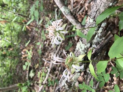 | | 2023 | COLLECTED | 08/09/2023 | Daniel Boone National Forest on west and east side of NF-227 (Sweet Lick Road) just north (0.65 miles) of intersection with Henry Ridge Road | 37.74303300, -83.93589700 | 387 | Ridge tops/highest elevations, dry open woods. | Wild material | Plants measuring 8-14" in height. Spreading vegetatively via rhizomes. Population mostly represented as specimens with white flowers. Peak flowering at collection site occurred near 27th of May (2023). | 2158366 | Ames 36161 |
| 88 | OPGC 8784 | OR080-105 | Anaphalis margaritacea (L.) Benth. & Hook. f. | Oregon, United States | OPGC | | | 2023 | | | | | | | Wild material | Plants have erect stems with alternate, lance-shaped leaves. Compound flowers form dense umbels at meristems with a lasting white color. | 2142716 | OPGC 8784 |
| 89 | OPGC 8809 | CBG- 10771 | Silene stellata W. T. Aiton | Illinois, United States | OPGC | | | 2023 | | | | | | | Wild material | | 2142239 | OPGC 8809 |
| 90 | OPGC 8810 | CBG- 10773 | Penstemon pallidus Small | Illinois, United States | OPGC | | | 2023 | | | | | | | Wild material | | 2142241 | OPGC 8810 |
| 91 | OPGC 8821 | CBG- 10803 | Rhexia virginica L. | Illinois, United States | OPGC | | | 2023 | | | | | | | Wild material | | 2142262 | OPGC 8821 |
| 92 | W6 61358 | CBG- 10772 | Carex cephalophora Muhl. ex Willd. | Wisconsin, United States | W6 |  | | 2023 | | | | | | | Wild material | | 2142240 | W6 61358 |
| 93 | W6 61381 | CBG- 10804 | Carex eburnea Boott | Wisconsin, United States | W6 |  | | 2023 | | | | | | | Wild material | | 2142263 | W6 61381 |
| 94 | W6 61398 | CBG- 10826 | Helianthus pauciflorus Nutt. | Illinois, United States | W6 |  | | 2023 | | | | | | | Wild material | | 2142280 | W6 61398 |
| 95 | W6 61417 | CBG- 10852 | Verbesina alternifolia (L.) Britton ex Kearney | Illinois, United States | W6 |  | | 2023 | | | | | | | Wild material | | 2142299 | W6 61417 |
| 96 | W6 61418 | CBG- 10853 | Agastache scrophulariifolia (Willd.) Kuntze | Illinois, United States | W6 |  | | 2023 | | | | | | | Wild material | | 2142300 | W6 61418 |
| 97 | WLP 2673 | RJL2022NJ-004 | Lyonia mariana (L.) D. Don | New Jersey, United States | NA | | | 2022 | COLLECTED | 10/24/2022 | Plants growing on both sides of Duerer Street approximately 0.37 kilometers southeast of 4th Avenue, Mullica Township, New Jersey. Plants are common but scattered on both sides of the road at this site. | 39.55730700, -74.66376100 | 22 | Plants grow from part shade to full sun throughout the habit from the upper edges of the ditches through the herbaceous grass dominant buffer and all the way to the part shade of the woodland edge. Plants transition through moist/wet conditions in full sun to quite dry conditions in part shade and seem equally adapted.
Soils: The underlying geology of this area is the Cohansey Formation of middle Miocene origin and comprised of sand, white to yellow with local gravel and clay. It is sometimes locally stained red or orange brown by iron oxides and (or) cemented into large blocks of ironstone. Unweathered clay is typically dark gray, but commonly weathers white where it is interbedded with thin beds of ironstone. Sand is typically medium grained and moderately sorted although it ranges from fine to very coarse grained and from poorly to well sorted. Sand consists of quartz and siliceous rock fragments. Some beds are locally micaceous. Maximum thickness in the map area is about 60 meters; however, thickness is difficult to determine because of the irregular basal contact and extensive post-depositional erosion.
Source: USGS New Jersey Geologic Map Data (https://mrdata.usgs.gov/geology/state/sgmc-unit.php?unit=NJTch%3B1)
The primary soil type in the area of this collection is classified as Mullica sandy loam, 0 to 2 percent slopes. These soils are typically coarse-loamy, siliceous, semiactive, and mesic typic humaquepts that are strongly to extremely acidic throughout the profile. The typical solum thickness ranges from 50-150+ cm. These soils are generally considered to be poorly drained.
Source: NRCS Web Soil Survey (https://websoilsurvey.sc.egov.usda.gov/App/WebSoilSurvey.aspx) | Wild material | | 2139664 | WLP 2673 |
| 98 | NA 88500 | RJL2022NJ-002 | Ilex glabra (L.) A. Gray | New Jersey, United States | NA | | | 2022 | COLLECTED | 10/24/2022 | Mullica Township: both sides of Duerer Street, approximately 0.37 kilometers southeast of 4th Avenue. | 39.55885000, -74.66442500 | 21 | Plants growing in shade to almost full sun on compacted seasonally moist to temporarily wet areas of a mixed evergreen and deciduous woodland dominated by Pinus rigida. Vegetation of this area is very much defined by small changes in elevation that go from wet to very dry. Ilex glabra remains abundant throughout, though. Plants are abundant on the edge of the woodlands as well as the understory of the woodlands. Soils: The underlying geology of this area is the Cohansey Formation of middle Miocene origin and comprised of sand, white to yellow with local gravel and clay. It is sometimes locally stained red or orange brown by iron oxides and (or) cemented into large blocks of ironstone. Unweathered clay is typically dark gray, but commonly weathers white where it is interbedded with thin beds of ironstone. Sand is typically medium grained and moderately sorted although it ranges from fine to very coarse grained and from poorly to well sorted. Sand consists of quartz and siliceous rock fragments. Some beds are locally micaceous. Maximum thickness in the map area is about 60 meters; however, thickness is difficult to determine because of the irregular basal contact and extensive post-depositional erosion. (Source: USGS New Jersey Geologic Map Data). The primary soil type in the area of this collection is classified as Mullica sandy loam, 0 to 2 percent slopes. These soils are typically coarse-loamy, siliceous, semiactive, and mesic typic humaquepts that are strongly to extremely acidic throughout the profile. The typical solum thickness ranges from 50-150+ cm. These soils are generally considered to be poorly drained. (Source: NRCS Web Soil Survey). | Wild material | | 2139663 | NA 88500 |
| 99 | WLP 2670 | RJL2022PA-016 | Acer negundo L. | Pennsylvania, United States | NA | | | 2022 | COLLECTED | 10/21/2022 | Plants growing in woodlands above a small unnamed creek that dumps into the Middle Branch White Clay Creek in Goddard Park, West Grove Pennsylvania, off of Wickerton Road, Chester County. Plants are found regularly but scattered in the understory of the woodlands. | 39.80426000, -75.82609300 | 105 | Plants growing in a mesic, well-drained habitat of deciduous woodlands along streams and above the riparian zone that drains toward a small unnamed creek that feeds into the Middle Branch White Clay Creek. Plants generally grow in part shade to full sun, but perform best and fruit more heavily in full sun where there is abundant access to moisture. The remnant woodlands exist mostly along the steep slopes, wetlands and seeps of seasonal and year-round creeks flowing into the Middle Branch White Clay Creek. The woodlands are bordered by numerous housing developments and land converted to meadows; hence there is significant first order edge that is heavily impacted by invasive plant intrusion. Despite this fact, Acer negundo is highly competitive and competes well.
Soils: The underlying geology of this area is the Glenarm Wissahickon Formation of lower Paleozoic origin and lithologically similar to oligoclase-mica schist of the Wissahickon Formation (PZw), but also includes lenticular amphibolite bodies having ocean-floor basalt chemistry.
Source: USGS Pennsylvania Geologic Map Data (https://mrdata.usgs.gov/geology/state/sgmc-unit.php?unit=PAPZgw%3B0)
The primary soil type in the area of this collection is classified as Glenelg silt loam, 3 to 8 percent slopes. This series consists of very deep, well drained soils formed in residuum weathered from micaceous schist on uplands of the Blue Ridge and the Northern Piedmont. Saturated hydraulic conductivity is moderately high in the subsoil and moderately high to high in the substratum. This upper horizon of this soil is undifferentiated, mostly poorly drained sandy bottomland soils intermingled with decomposing organic litter and eroded silts and clays due to erosion.
Source: NRCS Web Soil Survey (https://websoilsurvey.sc.egov.usda.gov/App/WebSoilSurvey.aspx) | Wild material | | 2139661 | WLP 2670 |
| 100 | Ames 35924 | AS/FN/2022/073/204 | Fraxinus nigra Marshall | Wisconsin, United States | NC7 |  | | 2022 | COLLECTED | 09/29/2022 | Chequamegon National Forest, approximately 4.5 miles south-southeast of Clam Lake along County Highway GG and adjacent Forest Service roads, T42N R4W Sec. 21. | 46.10020200, -90.87459600 | 431 | Wet to saturated soils in northern hardwood forest. | Wild material | | 2139687 | Ames 35924 |
| 101 | NA 88489 | RJL2022PA-005 | Kalmia latifolia L. | Pennsylvania, United States | NA | | | 2022 | COLLECTED | 09/10/2022 | Plants are growing on the lands of Hawk Mountain Sanctuary. This species is very common and abundant. It is one of the most dominant understory plants in woodlands. This species is a common understory shrub throughout the entire region in upland dry woodland habitats. | 40.63862000, -75.99071200 | 430 | Plants are growing primarily in shade to part-shade on a dry-mesic to very dry, well-drained upland/montane habitat characterized by upland mixed deciduous and evergreen forest that is very rocky. All of the plants found in this habitat go through periods of drought during the growing season due to the limited litter/soil layer in which moisture can be held. The underlying geology of this area is of Silurian origin and comprised of Shawangunk Formation. This formation is primarily light- to dark-gray, fine- to very coarse-grained sandstone and conglomerate containing thin shale interbeds.
Source: USGS Pennsylvania Geologic Map Data (https://mrdata.usgs.gov/geology/state/sgmc-unit.php?unit=PASs%3B14)
The surface soil profile of this area is the Hazleton series consists of deep and very deep, well drained soils formed in residuum of acid gray, brown or red sandstone on uplands. The matrix includes a considerable accumulation of thin, flat, coarse fragments of sandstone, limestone, or schist with diameters up to 15 cm. Slope ranges from 0-80%. Permeability is moderately rapid to rapid.
Source: NRCS Web Soil Survey (https://websoilsurvey.sc.egov.usda.gov/App/WebSoilSurvey.aspx) | Wild material | | 2139368 | NA 88489 |
| 102 | NA 88490 | RJL2022PA-006 | Ilex montana Torr. & A. Gray | Pennsylvania, United States | NA | | | 2022 | COLLECTED | 09/10/2022 | Hawk Mountain Sanctuary. | 40.64162200, -75.99122600 | 420 | Plants are growing from shade to full sun on a dry-mesic to very dry, well-drained upland/montane habitat characterized by an upland mixed deciduous and evergreen forest that is very rocky. All of the plants found in this habitat go through periods of drought during the growing season due to the limited litter/soil layer in which moisture can be held. The underlying geology of this area is of Silurian origin and comprised of Shawangunk Formation. This formation is primarily light- to dark-gray, fine- to very coarse-grained sandstone and conglomerate containing thin shale interbeds. (Source: USGS Pennsylvania Geologic Map Data). The surface soil profile of this area is the Hazleton series consists of deep and very deep, well drained soils formed in residuum of acid gray, brown or red sandstone on uplands. The matrix includes a considerable accumulation of thin, flat, coarse fragments of sandstone, limestone, or schist with diameters up to 15 cm. Slope ranges from 0-80%. Permeability is moderately rapid to rapid. (Source: NRCS Web Soil Survey). | Wild material | | 2139369 | NA 88490 |
| 103 | NA 88491 | RJL2022PA-007 | Rhododendron maximum L. | Pennsylvania, United States | NA | | | 2022 | COLLECTED | 09/10/2022 | Plants are growing on the lands of Hawk Mountain Sanctuary. This species was common, but generally restricted to steep rocky outcrops. | 40.63813900, -75.98835200 | 420 | Plants are growing from shade to full sun on a dry-mesic to very dry, well-drained upland/montane habitat characterized by an upland mixed deciduous and evergreen forest that is very rocky. Even so, most heavily fruited plants were growing in part shade to almost full sun. All of the plants found in this habitat go through periods of drought during the growing season due to the limited litter/soil layer in which moisture can be held. The underlying geology of this area is of Silurian origin and comprised of Shawangunk Formation. This formation is primarily light- to dark-gray, fine- to very coarse-grained sandstone and conglomerate containing thin shale interbeds.
Source: USGS Pennsylvania Geologic Map Data (https://mrdata.usgs.gov/geology/state/sgmc-unit.php?unit=PASs%3B14)
The surface soil profile of this area is the Hazleton series consists of deep and very deep, well drained soils formed in residuum of acid gray, brown or red sandstone on uplands. The matrix includes a considerable accumulation of thin, flat, coarse fragments of sandstone, limestone, or schist with diameters up to 15 cm. Slope ranges from 0-80%. Permeability is moderately rapid to rapid.
Source: NRCS Web Soil Survey (https://websoilsurvey.sc.egov.usda.gov/App/WebSoilSurvey.aspx) | Wild material | | 2139370 | NA 88491 |
| 104 | NA 88495 | RJL2022PA-011 | Sorbus americana Marshall | Pennsylvania, United States | NA | | | 2022 | COLLECTED | 09/10/2022 | Plants are growing on the lands of Hawk Mountain Sanctuary. This plant is frequent but scattered on the exposed north, northeast, and east-facing steep slopes and ridge areas. | 40.63793500, -75.98778000 | 430 | part sun to full sun on a dry-mesic to very dry, well-drained upland/montane habitat characterized by an upland mixed deciduous and evergreen forest that is very rocky. All of the plants found in this habitat go through periods of drought during the growing season due to the limited litter/soil layer in which moisture can be held.
The underlying geology of this area is of Silurian origin and comprised of Shawangunk Formation. This formation is primarily light- to dark-gray, fine- to very coarse-grained sandstone and conglomerate containing thin shale interbeds.
Source: USGS Pennsylvania Geologic Map Data (https://mrdata.usgs.gov/geology/state/sgmc-unit.php?unit=PASs%3B14)
The surface soil profile of this area is the Hazleton series consists of deep and very deep, well drained soils formed in residuum of acid gray, brown or red sandstone on uplands. The matrix includes a considerable accumulation of thin, flat, coarse fragments of sandstone, limestone, or schist with diameters up to 15 cm. Slope ranges from 0-80%. Permeability is moderately rapid to rapid.
Source: NRCS Web Soil Survey (https://websoilsurvey.sc.egov.usda.gov/App/WebSoilSurvey.aspx) | Wild material | | 2139374 | NA 88495 |
| 105 | W6 60086 | MARSB-387 | Sorghastrum nutans (L.) Nash | Delaware, United States | W6 | | | 2021 | | | | | | | Wild material | | 2137171 | W6 60086 |
| 106 | W6 60122 | NEWFS-378 | Eragrostis spectabilis (Pursh) Steud. | New Hampshire, United States | W6 | | | 2021 | | | | | | | Wild material | Pinkish purple seeds, multiple florets per spikelet. | 2137207 | W6 60122 |
| 107 | W6 60131 | NEWFS-464 | Rhus typhina L. | Massachusetts, United States | W6 | | | 2021 | | | | | | | Wild material | | 2137216 | W6 60131 |
| 108 | WLP 1747 | RJL2021PA-005 | Rosa palustris Marshall | Pennsylvania, United States | NA | | | 2021 | COLLECTED | 11/20/2021 | Plants growing in wetland seeps surrounded by mown hayfields just west of the Middle Branch White Clay Creek in Goddard Park, West Grove Pennsylvania, off of Wickerton Road, Chester County. | 39.80090528, -75.82383250 | 100 | Habitat Notes: Plants are growing in permanently saturated to moist soils in wetland habitats. Plants appear to be obligate wetland plants and are found only in permanent to nearly permanent wet habitats observed. Generally, the shrubs are found in part shade to full sun. Soils: Soils found in the areas where this collection was made are comprised primarily of Hatboro silt loam (Ha). Hatboro silt loam consists of very deep and poorly drained soils formed in deposited alluvium derived from metamorphic and crystalline rock. They are on flood plains. Slopes range from 0 to 3 percent. Slope: 0 to 3% Aspect: Variable. | Wild material | | 2123715 | WLP 1747 |
| 109 | W6 59935 | CBG-10658 | Carex bebbii (L. H. Bailey) Olney ex Fernald | Illinois, United States | W6 |  | | 2021 | | | | | | | Wild material | | 2132514 | W6 59935 |
| 110 | Ames 35735 | Steele Prairie State Preserve | Ceanothus americanus L. | Iowa, United States | NC7 |  | | 2021 | COLLECTED | 08/24/2021 | Steele Prairie State Preserve located approximately 8.75 miles north, northwest of Cherokee, T93N R40W NW1/4 Sec. 16 and also NW1/4 SW1/4 Sec. 15. | 42.87981600, -95.57948900 | 434 | Remnant sand prairie. | Wild material | Ceanothus americanus is abundant throughout the upland areas of Steele Prairie State Preserve. Plants sampled in nature were approximately 0.5 meters in height. At the time of sampling, variation was observed for plant growth habit, inflorescence size, and fruit maturity. Peak seed ripening in 2021 occurred on approximately 24 August. | 2120339 | Ames 35735 |
| 111 | Ames 36049 | CBG-9991 | Helianthus mollis Lam. | Illinois, United States | NC7 | | | 2021 | | | | | | | Wild material | | 2120041 | Ames 36049 |
| 112 | NA 88199 | CBG-10062 | Callicarpa americana L. | Oklahoma, United States | NA | | | 2021 | | | | | | | Wild material | | 2120043 | NA 88199 |
| 113 | OPGC 8342 | CBG-10574 | Euthamia gymnospermoides Greene | Illinois, United States | OPGC | | | 2021 | | | | | | | Wild material | Plant numbers sampled estimated. | 2120165 | OPGC 8342 |
| 114 | W6 59136 | CBG-10266 | Dasiphora fruticosa (L.) Rydb. | Wisconsin, United States | W6 | | | 2021 | | | | | | | Wild material | | 2120062 | W6 59136 |
| 115 | W6 59137 | CBG-10267 | Muhlenbergia glomerata (Willd.) Trin. | Wisconsin, United States | W6 | | | 2021 | | | | | | | Wild material | | 2120195 | W6 59137 |
| 116 | W6 59206 | CBG-10504 | Muhlenbergia sobolifera (Muhl. ex Willd.) Trin. | Illinois, United States | W6 | | | 2021 | | | | | | | Wild material | | 2120201 | W6 59206 |
| 117 | W6 59234 | CBG-10548 | Dasistoma macrophyllum (Nutt.) Raf. | Illinois, United States | W6 | | | 2021 | | | | | | | Wild material | Received as Dasistoma macrophylla. Plant numbers estimated. Few this year; abundant other years in numerous locations. | 2120206 | W6 59234 |
| 118 | OPGC 8192 | NEWFS-519 | Euthamia graminifolia (L.) Nutt. | New Hampshire, United States | OPGC | | | 2021 | | | | | | | Wild material | | 2115677 | OPGC 8192 |
| 119 | OPGC 8210 | NEWFS-581 | Euthamia graminifolia (L.) Nutt. | New Hampshire, United States | OPGC | | | 2021 | | | | | | | Wild material | | 2115711 | OPGC 8210 |
| 120 | OPGC 8211 | NEWFS-583 | Mimulus ringens L. | New Hampshire, United States | OPGC | | | 2021 | | | | | | | Wild material | | 2115712 | OPGC 8211 |
| 121 | W6 58739 | NEWFS-521 | Scirpus cyperinus (L.) Kunth | New Hampshire, United States | W6 | | | 2021 | | | | | | | Wild material | | 2115678 | W6 58739 |
| 122 | OPGC 8161 | MARSB-764 | Euthamia graminifolia (L.) Nutt. | New Jersey, United States | OPGC | | | 2021 | | | | | | | Wild material | Leaf typeûleaves are simple (i.e., lobed or unlobed but not separated into leaflets)ûLeaf arrangementûalternate: there is one leaf per node along the stemûLeaf blade edgesûthe edge of the leaf blade has no teeth or lobesûFlower type in flower headsûthe flower head has tubular disk flowers in the center and ray flowers, these often strap-shaped, around the peripheryûRay flower colorûyellowûTuft or plume on fruitûat least a part of the plume is made up of fine bristlesûSpines on plantûthe plant has no spinesûLeaf blade lengthû37–130 mmûDisk flower numberû1-5û11-20û6-10 | 2113610 | OPGC 8161 |
| 123 | OPGC 8162 | MARSB-765 | Apocynum cannabinum L. | New Jersey, United States | OPGC | | | 2021 | | | | | | | Wild material | Flower petal colorûgreen to brownûwhiteûyellowûLeaf typeûthe leaves are simple (i.e., lobed or unlobed but not separated into leaflets)ûLeaf arrangementûopposite: there are two leaves per node along the stemûLeaf blade edgesûthe edge of the leaf blade is entire (has no teeth or lobes)ûFlower symmetryûthere are two or more ways to evenly divide the flower (the flower is radially symmetrical)ûNumber of sepals, petals or tepalsûthere are five petals, sepals, or tepals in the flowerûFusion of sepals and petalsûthe petals or the sepals are fused into a cup or tubeûStamen numberû5ûFruit type (general)ûthe fruit is dry and splits open when ripeûFruit lengthû50–200 mm | 2113611 | OPGC 8162 |
| 124 | Ames 35601 | Ames 35601 | Blephilia hirsuta (Pursh) Benth. | Iowa, United States | NC7 |  | | 2020 | COLLECTED | 10/16/2020 | Trout Run Trail along the Upper Iowa River located on the western edge of Decorah, T98N R8W SW1/4 Sec. 16, Winneshiek County | 43.30129700, -91.79717100 | 265 | Low woods | Wild material | Leaves with a pleasant minty odor when crushed. Stems, peitoles, and leaves very pubescent. Plants in nature (northeast Iowa) peaked flower on 11 July 2020. | 2107897 | Ames 35601 |
| 125 | WLP 2026 | MARSB-993 | Viburnum acerifolium L. | New York, United States | NA | | | 2019 | COLLECTED | 09/06/2019 | Tompkins County; ; Cornell Botanical Gardens: Cayuga Monkey Run Trail. | 42.45601000, -76.45154000 | | Hillside forest in full shade; growing in moist, well-drained silt/clay soil. | | Seed harvested from 10+ individuals in a population of 40+. Common. Seed 85 percent healthy; seed maturation middle, late. | 2109175 | WLP 2026 |
| 126 | WLP 2028 | MARSB-995 | Viburnum acerifolium L. | New York, United States | NA | | | 2019 | COLLECTED | 09/11/2019 | Lewis County; Diana; Sand Bay: forest adjacent to parking area. [Originally listed as Alpina, but appears to be in Diana, NY; appears from GPS coordinates to be either part of Sand Bay State Forest or Bonaparte's Cave State Forest.] | 44.16153000, -75.39006000 | | Forest in partial shade; growing in moist, well-drained silt/sand soil. | | Seed harvested from 10+ individuals in a population of 30+. Common. Seed 85 percent healthy; seed maturation middle, late. | 2109177 | WLP 2028 |
| 127 | W6 57417 | NEWFS-400 | Scirpus cyperinus (L.) Kunth | New Hampshire, United States | W6 |  | | 2019 | | | | | | | Wild material | | 2098214 | W6 57417 |
| 128 | W6 57383 | NEWFS-272 | Carex crinita Lam. | Massachusetts, United States | W6 |  | | 2019 | | | | | | | Wild material | | 2098180 | W6 57383 |
| 129 | W6 57381 | NEWFS-264 | Scirpus atrovirens Willd. | New Hampshire, United States | W6 |  | | 2019 | | | | | | | Wild material | | 2098178 | W6 57381 |
| 130 | W6 57340 | NEWFS-154 | Eupatorium perfoliatum L. | Massachusetts, United States | W6 |  | | 2019 | | | | | | | Wild material | | 2098137 | W6 57340 |
| 131 | NA 88118 | MARSB-573 | Viburnum dentatum L. | New York, United States | NA |  | | 2019 | | | | | | | Wild material | | 2097660 | NA 88118 |
| 132 | Ames 35234 | JDC/AS/2019/041/920 | Agastache scrophulariifolia (Willd.) Kuntze | Minnesota, United States | NC7 |  | | 2019 | COLLECTED | 10/24/2019 | Private property approximately 4.94 miles south, southwest of Cannon Falls, T111N R18W NW1/4 Sec. 13, Goodhue County | 44.42498900, -92.93729200 | 346 | Woodland edges, slightly disturbed. | Wild material | Plants measuring approximately 5-6' in height with 4-5" spikes pale pink in color. Stems and petioles tomentose. Peak flowering occurred circa 1 September 2019 and fruiting circa 1 October 2019 in nature. | 2097770 | Ames 35234 |
| 133 | Ames 35232 | Ames 35232 | Ptelea trifoliata L. | Illinois, United States | NC7 |  | | 2019 | COLLECTED | 10/01/2019 | Rock Creek watershed located approximately 4.5 miles southwest of Athens, T17N R6W SE1/4 SW1/4 Sec. 8 | 39.93164600, -89.80193000 | 159 | Creek banks, floodplain, and fence rows (north and west facing slopes) | Wild material | | 2097768 | Ames 35232 |
| 134 | WLP 167 | NACPEC19-053 | Mitchella repens L. | Georgia, United States | NA | | | 2019 | COLLECTED | 09/14/2019 | Walker County; Lula Lake Land Trust: Middle Trail near top, also collected along Connector Trail to Middle Trail from parking lot. | 34.93141800, -85.36991400 | 469 | Mesic, sandy, rocky Oak-Hickory woodland slope - likely acidic | Wild material | | 2110479 | WLP 167 |
| 135 | WLP 168 | NACPEC19-054 | Viburnum acerifolium L. | Georgia, United States | NA | | | 2019 | COLLECTED | 09/14/2019 | Walker County; Lula Lake Land Trust: Middle Trail near top. | 34.93146200, -85.37018800 | 449 | Mesic, sandy, rocky Oak-Hickory woodland slope - likely acidic | Wild material | | 2110480 | WLP 168 |
| 136 | Ames 35226 | Ocoee Gorge | Monarda austroappalachiana Floden | Tennessee, United States | NC7 |  | | 2019 | COLLECTED | 09/12/2019 | Located just east of Lake Ocoee along highway 74 approximately 9.8 miles east, southeast of Ocoee, Polk County | 35.09659000, -84.54762000 | 269 | Steep (some vertical) rocky cliffs and bluffs, predominately shale. | Wild material | Described by Aaron Floden (2015) as an erect perennial (30-50 cm tall) with a strong Oregano (thymol) scent, minute retrorse to spreading trichomes at internodes and large, emaculate, white corollas. Typically flowers in late May into early June, which is earlier than both M. fistulosa and M. clinopodia where sympatric. Species is endemic to the Southern Appalachians (northern Georgia, southwest North Carolina, and southeast Tennessee) and limited to calcareous phyllite and limestone, glade-like/talus slope habitats. | 2097762 | Ames 35226 |
| 137 | Ames 35216 | Potato Creek SP | Monarda sp. | Indiana, United States | NC7 |  | | 2019 | COLLECTED | 09/02/2019 | Potato Creek State Park located approximately 2.6 miles northeast of North Liberty, T36N R1E extreme eastern edge of NW 1/4 SW 1/4 Sec. 23. | 41.55439400, -86.38375900 | 222 | Degraded floodplain, along sides of elevated road bed. | Wild material | This taxa is currently undescribed and according to Campbell and Medley in The atlas of vascular plants in Kentucky (Accessed 06 September 2019) was provisionally named Monarda serotina by R.T. Simmers. Described as a broad-leaved form of M. fistulosa, generally intermediate between M. fistulosa and M. clinopodia, with probable hybrid origin. Typcial habitat is mesic woods and edges on lowlands. In contrast to M. fistulosa, this taxon has longer petioles (usually 2-3 cm versus 0.5-2.0 cm), lower leaf surfaces with scattered spreading hairs, and corollas are paler pink at tips to almost white with peak flowering occurring prior to M. fistulosa by approximately 1-2 weeks. Leaves are rather rugose, where upper leaf tissue between veins is visibly raised. This accession represents genetics from northern Indiana (Potato Creek State Park). Plants at the collection site in nature peaked flowering near 8 July 2019 where flower colors were more lavender in sun but pale in shade (Namestnik, S., personal communication, 15 July 2020). Peak fruiting occurs mid-August. Average height of plants sampled in nature estimated at 4.5' in height. | 2097752 | Ames 35216 |
| 138 | NA 88206 | CBG-9427 | Ceanothus americanus L. | Illinois, United States | NA |  | | 2019 | | | | | | | Wild material | | 2092801 | NA 88206 |
| 139 | OPGC 7480 | CBG-9191 | Verbena stricta Vent. | Nebraska, United States | OPGC |  | | 2019 | | | | | | | Wild material | | 2092778 | OPGC 7480 |
| 140 | OPGC 7495 | CBG-9545 | Symphyotrichum shortii (Lindl.) G. L. Nesom | Illinois, United States | OPGC |  | | 2019 | | | | | | | Wild material | | 2092813 | OPGC 7495 |
| 141 | OPGC 7845 | CBG-8187 | Polemonium reptans L. | Wisconsin, United States | OPGC |  | | 2019 | | | | | | | Wild material | SOS 7th transfer. | 2092671 | OPGC 7845 |
| 142 | Ames 34606 | JDC/MB/2019/011/890 | Monarda brevis (Fosberg & Artz) Floden | West Virginia, United States | NC7 |  | | 2019 | | | | | | | Wild material | Variation in flower color present from near white, faint pink to faint "smoky" purple. Majority of specimens noted at collection site in nature were approximately 3-5 days past peak flower on 10 June 2019 with seeds reaching maturity approximately 55 days later. Majority of specimens observed were approximately 10" in height. Very healthy, dark-green leaves that maintained quality throughout the season (observed mid-August 2019). Some specimens consisting of 25-30 flowering stems encompassing a 1.5 sq. ft. area. | 2092642 | Ames 34606 |
| 143 | Ames 34607 | JDC/MB/2019/012/891 | Monarda brevis (Fosberg & Artz) Floden | West Virginia, United States | NC7 |  | | 2019 | | | | | | | Wild material | This accession likely represents the holotype for Monarda brevis that was vouchered by Lena Artz in 1953 (Catalog No. 2097485). Variation in flower color present from near white, faint pink to faint "smoky" purple. Majority of specimens noted at collection site in nature were approximately 3-5 days past peak flower on 10 June 2019 with seeds reaching maturity approximately 55 days later. Majority of specimens observed were apprxoimately 10" in height. Very healthy, dark-green leaves that maintained quality throughout the season (observed mid-August 2019). | 2092643 | Ames 34607 |
| 144 | Ames 34610 | JDC/MB/2019/015/894 | Monarda brevis (Fosberg & Artz) Floden | West Virginia, United States | NC7 |  | | 2019 | | | | | | | Wild material | Many genets noted at collection site in nature consisted of 25-30 stems, but individual stems are widely spaced (e.g. 1-5") apart compared to other populations (four) noted (2019 reconnaisance) where stem spacing was typically observed at 0.25-0.5" apart. Very healthy, dark-green leaves noted in early/mid June, but leaf quality greatly declined when observed in mid-August in contrast to other populations observed in nature that seemed to maintain leaf quality throughout the season. Many plants at this site were defoliated likely due to disease (leaf spot) or tattered likely due to possible insect feeding. Specimens noted were circa 10-12 days from initiation of flowering on 12 June 2019 and during mid-August a few specimens were still observed flowering with about 10-20% of infructescences were still green. The overall phenology of this M. brevis population at this site is quite different in comparison to other populations (four) observed in 2019, with flowering being much later (e.g. 10-25 days); leaf quality lower; and synchronization of flowering extremely variable within genets of this population. | 2092646 | Ames 34610 |
| 145 | OPGC 7388 | NEWFS-221 | Asclepias syriaca L. | Massachusetts, United States | OPGC |  | | 2019 | | | | | | | Wild material | | 1976181 | OPGC 7388 |
| 146 | OPGC 7397 | NEWFS-420 | Oenothera biennis L. | Massachusetts, United States | OPGC |  | | 2019 | | | | | | | Wild material | | 1976254 | OPGC 7397 |
| 147 | OPGC 7398 | NEWFS-431 | Rhexia virginica L. | Massachusetts, United States | OPGC |  | | 2019 | | | | | | | Wild material | | 1976259 | OPGC 7398 |
| 148 | OPGC 7400 | NEWFS-447 | Asclepias syriaca L. | Maine, United States | OPGC |  | | 2019 | | | | | | | Wild material | | 1976265 | OPGC 7400 |
| 149 | OPGC 7409 | NEWFS-578 | Asclepias syriaca L. | New Hampshire, United States | OPGC |  | | 2019 | | | | | | | Wild material | | 1976293 | OPGC 7409 |
| 150 | OPGC 7824 | NEWFS-419 | Eutrochium dubium (Willd. ex Poir.) E. E. Lamont | Massachusetts, United States | OPGC |  | | 2019 | | | | | | | Wild material | | 1976253 | OPGC 7824 |
| 151 | W6 56183 | NEWFS-315 | Carex comosa Boott | New Hampshire, United States | W6 |  | | 2019 | | | | | | | Wild material | | 1976218 | W6 56183 |
| 152 | W6 56235 | NEWFS-464 | Rhus typhina L. | Massachusetts, United States | W6 |  | | 2019 | | | | | | | Wild material | | 1976270 | W6 56235 |
| 153 | W6 56247 | NEWFS-511 | Rhus typhina L. | New Hampshire, United States | W6 |  | | 2019 | | | | | | | Wild material | | 1976282 | W6 56247 |
| 154 | OPGC 7311 | AZ930-363 | Aquilegia chrysantha A. Gray | Arizona, United States | OPGC |  | | 2018 | | | | | | | Wild material | | 1970379 | OPGC 7311 |
| 155 | W6 55806 | OR110-1043 | Agastache urticifolia (Benth.) Kuntze | Oregon, United States | W6 |  | | 2018 | | | | | | | Wild material | Agastache urticifolia | 1970517 | W6 55806 |
| 156 | W6 55825 | OR110-1066 | Holodiscus discolor (Pursh) Maxim. | Oregon, United States | W6 |  | | 2018 | | | | | | | Wild material | Holodiscus discolor | 1970536 | W6 55825 |
| 157 | W6 55285 | OR135-31 | Artemisia ludoviciana Nutt. | Washington, United States | W6 |  | | 2018 | | | | | | | Wild material | Artemisia ludoviciana | 1967837 | W6 55285 |
| 158 | W6 54492 | AK930-710 | Antennaria friesiana (Trautv.) Ekman | Alaska, United States | W6 |  | | 2018 | | | | | | | Wild material | | 1965718 | W6 54492 |
| 159 | OPGC 7773 | CBG-7497 | Eutrochium maculatum (L.) E. E. Lamont | Wisconsin, United States | OPGC |  | | 2017 | | | | | | | Wild material | | 1954809 | OPGC 7773 |
| 160 | OPGC 7774 | CBG-7496 | Senecio suaveolens (L.) Elliott | Wisconsin, United States | OPGC |  | | 2017 | | | | | | | Wild material | | 1954811 | OPGC 7774 |
| 161 | NA 87954 | MARSB-574 | Morella pensylvanica (Mirb.) Kartesz | New York, United States | NA |  | | 2017 | | | | | | | Wild material | | 1954652 | NA 87954 |
| 162 | NA 87956 | NEWFS-285 | Viburnum dentatum L. | Massachusetts, United States | NA |  | | 2017 | | | | | | | Wild material | | 1954734 | NA 87956 |
| 163 | NA 87957 | NEWFS-367 | Viburnum dentatum L. | Massachusetts, United States | NA |  | | 2017 | | | | | | | Wild material | | 1954735 | NA 87957 |
| 164 | Ames 34151 | MARSB-813 | Monarda fistulosa L. | New York, United States | NC7 |  | | 2017 | COLLECTED | 09/20/2017 | Beaver Dam Sanctuary located just southeast of Katonah. Area sampled known as Sheep Dip Meadow just north of parking area, Westchester County | 41.24605600, -73.67036100 | 85 | Early successional, undulating meadow. Paxton fine sandy loam. | Wild material | 3-4' tall forbe, light purple flowers. | 1954952 | Ames 34151 |
| 165 | Ames 34038 | Ames 34038 | Monarda punctata L. | Illinois, United States | NC7 |  | | 2017 | COLLECTED | 10/29/2017 | Nachusa Grasslands located approximately 4.17 miles northwest of Franklin Grove just west of Lowden Road, T22N R10E NW 1/4 NW 1/4 SE 1/4 Sec. 16, Ogle County. | 41.89120000, -89.34490000 | 225 | Newly disturbed ground (fenceline installation 2015) consisting of almost level sandy soil with a very slight slope. | Wild material | Plants ranging between 16-22" in height, branched with numerous seed heads. | 1954327 | Ames 34038 |
| 166 | WLP 1180 | NA 83893 | Euonymus americanus L. | Kentucky, United States | NA | | | 2016 | COLLECTED | 09/27/2016 | Cumberland Falls State Park, Trail #6 (Cumberland Falls Trail). Stairs above visitor center entrance at Trail #6 trailhead. | 36.83700000, -84.34300000 | 273 | | | | 1951485 | WLP 1180 |
| 167 | WLP 147 | NA 83890 | Mitchella repens L. | Kentucky, United States | NA | | | 2016 | COLLECTED | 09/27/2016 | Whitley County; Cumberland Falls State Park, Trail #6 | 36.83700000, -84.34000000 | 301 | | Wild material | | 2110320 | WLP 147 |
| 168 | Ames 34803 | CBG-5442 | Spiraea tomentosa L. | Illinois, United States | NC7 |  | | 2016 | COLLECTED | 09/30/2015 | Iroquois County Conservation Area | 40.99082000, -87.56577000 | 199 | Wet prairie, sedge meadow. | Wild material | | 1942778 | Ames 34803 |
| 169 | OPGC 7744 | CBG-6301 | Agalinis auriculata (Michx.) S. F. Blake | Illinois, United States | OPGC | | | 2016 | | | | | | | Wild material | | 1942816 | OPGC 7744 |
| 170 | W6 51581 | CBG-4157 | Heracleum sphondylium L. subsp. montanum (Schleich. ex Gaudin) Briq. | Illinois, United States | W6 | | | 2016 | | | | | | | Wild material | | 1942711 | W6 51581 |
| 171 | Ames 34282 | CBG2014-3342 | Monarda fistulosa L. | Colorado, United States | NC7 |  | | 2015 | COLLECTED | 10/24/2014 | Near North Gate Air Force Academy Entrance, New Santa Fe Trail: North of Colorado Springs, El Paso County | 39.02973000, -104.83986000 | 2020 | | Wild material | | 1932051 | Ames 34282 |
| 172 | Ames 34276 | CBG-2706 | Lythrum alatum Pursh var. alatum | Illinois, United States | NC7 |  | | 2015 | COLLECTED | 09/10/2013 | | | 207 | | Wild material | | 1926175 | Ames 34276 |
| 173 | Ames 34281 | CBG-2812 | Monarda fistulosa L. | Illinois, United States | NC7 |  | | 2015 | COLLECTED | 09/07/2013 | IDNR RR prairie between Litchfield and Gillespie along IL Route 16, Macoupin County | 39.16025000, -89.76463900 | 202 | Mesic prairie. | Wild material | | 1926147 | Ames 34281 |
| 174 | OPGC 6156 | CBG-2639 | Doellingeria umbellata (Mill.) Nees | Illinois, United States | OPGC |  | | 2015 | | | | | | | Wild material | | 1926091 | OPGC 6156 |
| 175 | W6 49603 | CBG-2602 | Elymus virginicus L. var. virginicus | Illinois, United States | W6 |  | | 2015 | | | | | | | Wild material | | 1926166 | W6 49603 |
| 176 | W6 49640 | CBG-2664 | Tridens flavus (L.) Hitchc. | Illinois, United States | W6 |  | | 2015 | | | | | | | Wild material | | 1926105 | W6 49640 |
| 177 | W6 49643 | CBG-2667 | Lycopus americanus Muhl. ex W. P. C. Barton | Illinois, United States | W6 |  | | 2015 | | | | | | | Wild material | | 1926108 | W6 49643 |
| 178 | Ames 34773 | AK930-483 | Potentilla norvegica L. | Alaska, United States | NC7 |  | | 2015 | COLLECTED | 09/11/2012 | Elliot Highway just south of Highway 2 and 11 intersection (Mile marker 78.5, pulloff). | 65.44436000, -148.78236000 | 268 | Disturbed margin of road at edge of mixed broadleaf/white spruce forest | Wild material | | 1923870 | Ames 34773 |
| 179 | W6 48941 | AK930-466 | Heracleum sphondylium L. subsp. montanum (Schleich. ex Gaudin) Briq. | Alaska, United States | W6 |  | | 2015 | | | | | | | Wild material | | 1923856 | W6 48941 |
| 180 | W6 48942 | AK930-467 | Juncus castaneus Sm. | Alaska, United States | W6 |  | | 2015 | | | | | | | Wild material | | 1923857 | W6 48942 |
| 181 | W6 48943 | AK930-468 | Artemisia norvegica Fr. subsp. saxatilis (Besser) H. M. Hall & Clem. | Alaska, United States | W6 |  | | 2015 | | | | | | | Wild material | | 1923858 | W6 48943 |
| 182 | W6 48945 | AK930-470 | Carex podocarpa R. Br. | Alaska, United States | W6 |  | | 2015 | | | | | | | Wild material | | 1923860 | W6 48945 |
| 183 | Ames 33731 | MARSB-070 | Rhus typhina L. | Pennsylvania, United States | NC7 | 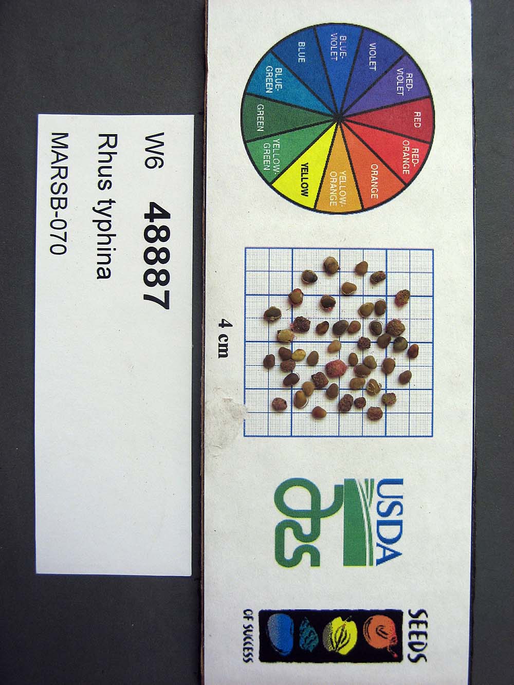 | | 2015 | COLLECTED | 08/22/2013 | Tioga State Forest near Arnot, Tioga County | 41.63745000, -77.21233000 | 1280 | | Wild material | | 1922876 | Ames 33731 |
| 184 | Ames 34697 | MARSB-080 | Cornus amomum Mill. | Pennsylvania, United States | NC7 |  | | 2015 | COLLECTED | 09/11/2013 | Allegheny National Forest -Minister Creek watershed just south of Minister. | 41.61593000, -79.15109000 | 369 | | Wild material | | 1922851 | Ames 34697 |
| 185 | W6 48836 | MARSB-63 | Carex vulpinoidea Michx. | West Virginia, United States | W6 |  | | 2015 | | | | | | | Wild material | | 1922848 | W6 48836 |
| 186 | W6 48866 | MARSB-76 | Juncus effusus L. | Pennsylvania, United States | W6 | 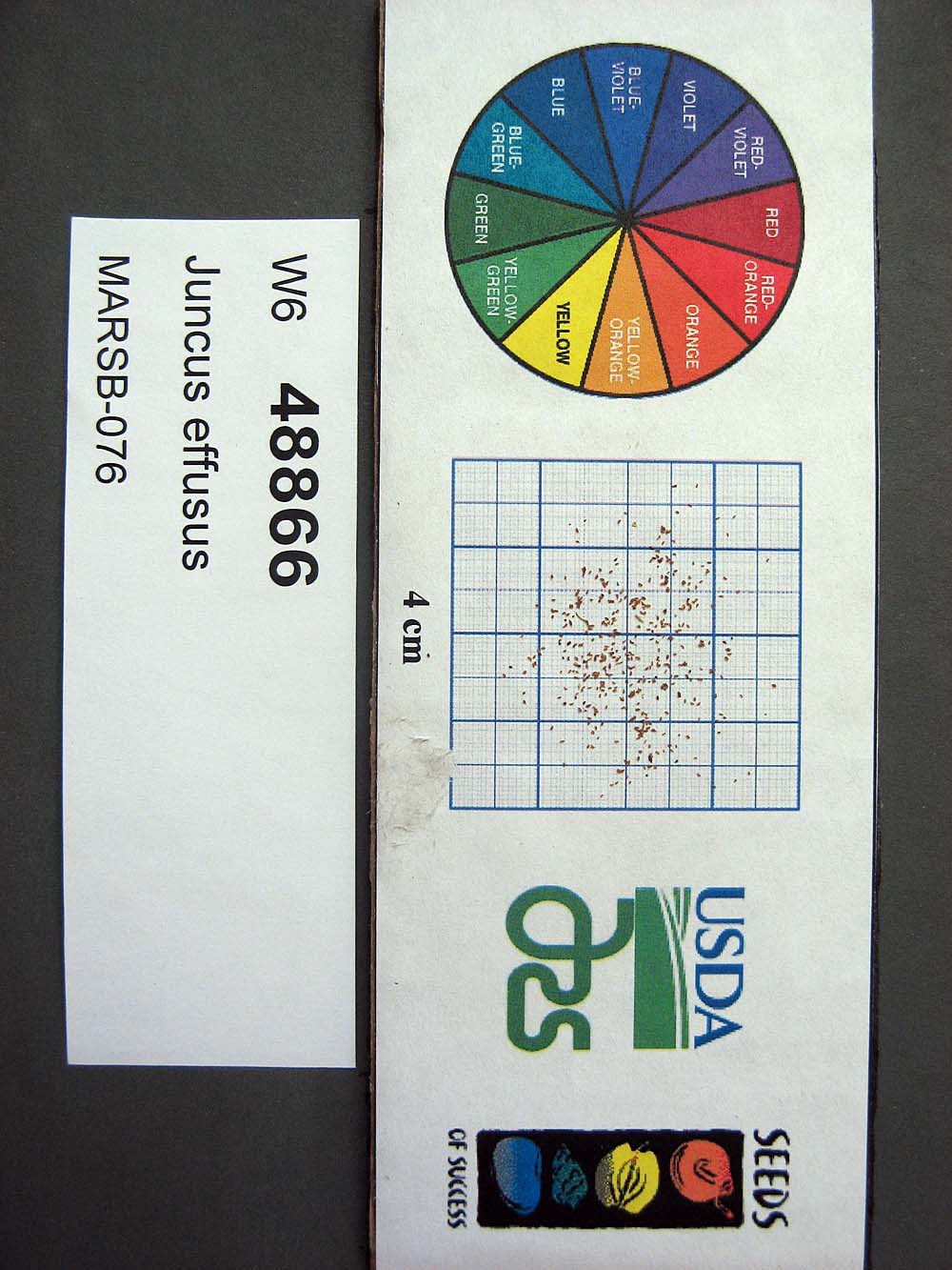 | | 2015 | | | | | | | Wild material | | 1922867 | W6 48866 |
| 187 | W6 48896 | MARSB-92 | Scirpus cyperinus (L.) Kunth | West Virginia, United States | W6 |  | | 2015 | | | | | | | Wild material | | 1922883 | W6 48896 |
| 188 | W6 48905 | MARSB-99 | Tridens flavus (L.) Hitchc. | Virginia, United States | W6 |  | | 2015 | | | | | | | Wild material | | 1922891 | W6 48905 |
| 189 | Ames 34280 | MARSB-073 | Monarda fistulosa L. | New Jersey, United States | NC7 |  | | 2015 | COLLECTED | 08/27/2013 | Sparta Mountain WMA near Ogdensburg, Sussex County | 41.06376000, -74.58098000 | 1261 | Utility powerline cut. | Wild material | | 1922924 | Ames 34280 |
| 190 | W6 48843 | MARSB-60 | Danthonia compressa Austin | Pennsylvania, United States | W6 |  | | 2015 | | | | | | | Wild material | | 1922912 | W6 48843 |
| 191 | WLP 1967 | HBC1401 | Viburnum opulus L. var. americanum Aiton | North Dakota, United States | NA | | | 2014 | COLLECTED | 09/29/2014 | Jay Wessels Wildlife Management Area located in Pembina County. | 48.80000000, -97.83000000 | 312 | Diverse habitats including edge of swamp and also upland sandy soils. Growing in association Fraxinus pennsylvanica, Fraxinus nigra, Quercus macrocarpa, Acer negundo, Ulmus americana, Populus tremuloides, Populus balsamifera, Toxicodendron radicans, Cornus sericea, Rosa sp., Corylus sp., Prunus virginiana, Ribes sp., Equisetum sp., Rubus sp., IMpatiens capensis, Thalictrum dasycarpum, Fragaria virginiana, Asarum canadense, Calamagrostis canadensis, Sium suave, Solidago gigantea, Poa pratensis, and Bromus inermis. | Wild material | | 1921830 | WLP 1967 |
| 192 | Ames 32828 | Clay Prairie | Spiraea alba Du Roi | Iowa, United States | NC7 | | | 2014 | COLLECTED | 10/30/2014 | Clay Prairie State Preserve located approximately 4 miles south of Allison, Iowa T91 R16W NE 1/4 NE 1/4 NE 1/4 Sec. 18. | 42.69979200, -92.77152200 | 307 | Virgin, wet remnant prairie. Floyd loam (1-4 percent slopes) depth to water table 12-42 inches, 0-24 inches: loam, somewhat poorly drained | Wild material | | 1921788 | Ames 32828 |
| 193 | Ames 32760 | JDC/AB/2014/040/542 | Abies balsamea (L.) Mill. | Iowa, United States | NC7 | | | 2014 | COLLECTED | 09/03/2014 | Bluffton Fir State Preserve, near Bluffton, Winneshiek County. | 43.40106767, -91.90659200 | 326 | High quality, native woods. Steep slope, northwest-facing, and relatively flat portion on top of bluff (powerline) | Wild material | | 1921308 | Ames 32760 |
| 194 | Ames 32630 | AK930-178 | Potentilla pensylvanica L. | Alaska, United States | NC7 |  | | 2012 | COLLECTED | 08/21/2010 | | 61.98275000, -145.35290000 | 386 | Gravelly and sandy soil (2.5Y 3/4). | Wild material | | 1900713 | Ames 32630 |
| 195 | Ames 32569 | AK930-176 | Linum lewisii Pursh var. lewisii | Alaska, United States | NC7 |  | | 2012 | COLLECTED | 08/21/2010 | | | 386 | Steep gravel slope by roadside. Gravelly and sandy soil (2.5Y 3/2). Associated with Achillea millefolium, Androsace septentrionalis, Anemone multifida, Arabis holboellii, A. x divaricarpa, Arctostaphylos, Artemisia frigida, Astragalus, Calamagrostis purpurascens, Carex, Elymus agropyroides, Eurybia sibirica, Galium boreale, Linum lewisii, Poa glauca, Polemonium pulcherrimum, Populus tremuloides, Potentilla hookeriana, P. pensylvanica, Pulsatilla, Rosa acicularis, Shepherdia canadensis, and Solidago multiradiata. | Wild material | | 1900586 | Ames 32569 |
| 196 | WLP 2206 | AK930-128 | Amelanchier alnifolia (Nutt.) Nutt. ex M. Roem. | Alaska, United States | NA |  | | 2012 | COLLECTED | 08/10/2010 | Off the Seward Highway, Windy Trailhead, mile marker 106. Chugach State Park. | 61.24780000, -149.32671000 | 9 | vegetated rocky mountainside Soil type: sand, loam, rocks - 2.5/1 2.5Y. South facing slope, 10 degrees. | Wild material | | 1900462 | WLP 2206 |
| 197 | Ames 31065 | 354 | Diervilla lonicera Mill. | New York, United States | NC7 |  | | 2011 | COLLECTED | 09/10/2011 | Along Emery Hill Road | 42.07700000, -79.08400000 | 446 | Roadside. East-facing slope. Rocky substrate with very tiny spring creek at base of slope. | Wild material | | 1891451 | Ames 31065 |
| 198 | Ames 31074 | 697 | Fraxinus americana L. | New York, United States | NC7 |  | | 2011 | COLLECTED | 09/13/2011 | Two Mile Road, Allegany County. | 42.03800000, -78.46400000 | 524 | | Wild material | | 1891460 | Ames 31074 |
| 199 | WLP 830 | 381 | Carpinus caroliniana Walter | Pennsylvania, United States | NA | | | 2011 | COLLECTED | 09/15/2011 | Along Valentine Run Road, near small tributary to Rhine Run Creek, Warren County. | 41.92500000, -79.18800000 | 475 | Roadside. Mixed hardwood forest and open rangeland (Solidago). Associated with Acer, Carya ovata, Cornus racemosa, Fagus grandifolia, Hamamelis virginiana, Quercus, Rosa, Rubus, and Tsuga canadensis. | Wild material | | 1891442 | WLP 830 |
| 200 | NA 80067 | NA 80067 | Cladrastis kentukea (Dum. Cours.) Rudd | Kentucky, United States | NA | | | 2011 | COLLECTED | 10/02/2001 | Palisades (a locally used term to describe the sheer cliffs along the Kentucky River); along the west side of Kentucky Route 27 just north of Hall, Kentucky. | 37.79288000, -84.60705000 | 300 | Growing on the thin soils of the sheer limestone cliffs just below the top of the cliffs. | | | 1953441 | NA 80067 |
| 201 | W6 37466 | ID931-180 | Leymus cinereus (Scribn. & Merr.) Á. Löve | Idaho, United States | W6 |  | | 2010 | | | | | | | Wild material | | 1833599 | W6 37466 |
| 202 | WLP 2307 | LBJWC-MLE-036 | Ostrya virginiana (Mill.) K. Koch | Texas, United States | NA | | | 2008 | COLLECTED | 09/28/2006 | Approximately 7 miles south of Alto, Texas on 294. | 31.63803000, -95.21316000 | 94 | Mixed hardwood and pine/forest roadside; rolling hills. Reddish tan colored, sandy soil over sandstone. | Wild material | | 1781863 | WLP 2307 |
| 203 | Ames 28352 | 11 | Hypericum punctatum Lam. | Iowa, United States | NC7 |  | | 2006 | COLLECTED | 09/19/2006 | 150 yards west of boat ramp, west side of dam, Don Williams County Park, SW 1/4 of NE 1/4 of SW 1/4 of Section 5, T84N, R27W, Yell Township, Boone County. | 42.11194444, -94.02138889 | 313 | Open, grassy hilltop and hillside. Partial-full sun. Dry-moist soil. | Wild material | | 1712922 | Ames 28352 |
| 204 | OPGC 4300 | 202653 | Ipomopsis aggregata (Pursh) V. E. Grant | Oregon, United States | OPGC |  | | 2005 | COLLECTED | 08/07/2003 | | | 1566 | Growing on rocky slopes just above Rock Creek. Associated with Pinus ponderosa, Pinus contorta, Symphoricarpos sp., Solidago canadensis, Achillea millefolium and Geranium sp. | Wild material | Forb 0.6 meters tall. | 1674307 | OPGC 4300 |