| 0 | PI 618718 | 860013 | Staphylea trifolia L. f. pyriformis Dore | Ontario, Canada | NC7 | | | 1988 | COLLECTED | | Ottawa, Nepean Township, Carleton Region | 45.26666667, -75.75000000 | 94 | | Wild material | | 1042223 | PI 618718 |
| 1 | PI 495619 | 21 | Staphylea trifolia L. | Nebraska, United States | NC7 |  | | 1984 | COLLECTED | 09/23/1984 | Indian Cave State Park, T3N R17E NE 1/4 of NW 1/4 of Section 9, Richardson County | 40.24527778, -95.51527778 | 265 | Base of bluff. Population of approximately 10 | Wild material | Plants to 3 meters tall. Heavy seed production. | 1390555 | PI 495619 |
| 2 | NA 89078 | 2024RJLPA-004 | Staphylea trifolia L. | Pennsylvania, United States | NA | | | 2024 | COLLECTED | 09/20/2024 | Along gated road about 0.33 kilometers southwest of the Lake Ontelaunee Trail parking lot. | 40.49850800, -75.89121300 | 94 | Plants are growing on well-drained steep slopes in shade to part shade of a deciduous forest. Slope: 35 to 50 percent. Aspect: East-southeast. Geology: The underlying geology of this area is of Ordovician origin and characterized as Shale and graywacke of Hamburg sequence. It is characterized by shale containing zones of conspicuous graywacke. (Source: USGS Pennsylvania Geologic Map Data). Soils: The primary soil type in the area of this collection is classified as Berks-Weikert Complex, 25 to 60% slopes (BkF). Dominantly sloping to very steep, moderately deep and shallow, well drained soils underlain by acid shale bedrock. (Source: UPenn State University Soil Info Website). EPA Ecoregion (Level III): Ridge and Valley (67). EPA Ecoregion (Level IV): Northern Shale Valleys (67b). | Wild material | | 2169042 | NA 89078 |
| 3 | NA 88676 | RJL2023PA-010 | Staphylea trifolia L. | Pennsylvania, United States | NA | | | 2023 | COLLECTED | 10/25/2023 | Seed collected along the Appalachian National Scenic Trail, accessed from the Duncannon Entrance. | 40.38132600, -77.02965700 | 103 | Well-drained and very rocky deciduous woodlands where soil has accumulated in part shade to full shade. Slope: 0-30%. Aspect: variable. The underlying geology of this area is of Devonian origin and characterized as the Duncannon Member of Catskill Formation. It is characterized by grayish-red sandstone, siltstone, and mudstone in fining-upward cycles; conglomerate occurs at base of some cycles. The sandstones which comprise the Duncannon Member are fine to very coarse grained and grayish red to grayish red-purple in color. The Duncannon Member is known to be crossbedded to planar bedded in beds anywhere from 3 to 9 meters thick. Conglomerates have been spotted at the base of the Duncannon Member. The Duncannon Member is poorly exposed in most areas except along the Lehigh River. The conglomerate portion of this member has been known to form ridges and ledges with thicknesses approaching 228 meters. (Source: USGS Pennsylvania Geologic Map Data). The primary soil type in the collection area is classified as Hazleton Series. The Hazleton series consists of deep and very deep, well drained soils formed in residuum of acid gray, brown or red sandstone on uplands. Slope ranges from 0 to 80 percent. Permeability is moderately rapid to rapid. Solum thickness ranges from 60 to 120 centimeters. Depth to lithic contact ranges from 1 to 2 meters. Rock fragments of angular sandstone, dominantly less than 25 cm in size, range from 5 to 70 percent in individual horizons. Boulders, stones, flags and channers cover about 5 to 60 percent of the surface of some pedons. Reaction ranges from strongly acid through extremely acid throughout. (Source: NRCS Web Soil Survey). | Wild material | | 2159067 | NA 88676 |
| 4 | Ames 32958 | APS/ST/2013/024/109 | Staphylea trifolia L. | Indiana, United States | NC7 | | | 2015 | COLLECTED | 03/06/2013 | Charlestown State Park, near Fourteen Mile Creek along trail going to Rose Island, Clark County | 38.42531000, -85.62371000 | 159 | Upland bluffs | Wild material | | 1927428 | Ames 32958 |
| 5 | WLP 1843 | RL 08233 | Staphylea trifolia L. | Georgia, United States | NA | | | 2008 | COLLECTED | 10/19/2008 | Georgia: Walker County, Pigeon Mountain, along North Pocket Trail. | | | | | | 1922724 | WLP 1843 |
| 6 | Ames 27763 | 51 | Staphylea trifolia L. | Missouri, United States | NC7 |  | | 2005 | COLLECTED | 10/21/2004 | Top of steep concave sinkhole, Roaring River Hollow, Roaring River State Park, Barry County | 36.61111111, -93.82083333 | 367 | Oak/hickory sinkhole on a 45-55% slope with a western aspect on rocky soil | Wild material | 7-10 feet tall. | 1682259 | Ames 27763 |
| 7 | Ames 27331 | 26 | Staphylea trifolia L. | Iowa, United States | NC7 |  | | 2003 | COLLECTED | 09/22/2003 | North of Ely Ford, Lacey-Keosauqua State Park near Keosauqua, T68N R10W SE corner of SE 1/4 of NE 1/4 of Sec. 3, Van Buren County | 40.71861111, -91.98861111 | 177 | Slope down to Des Moines River. Mostly shaded. 20% slope with a southeastern aspect | Wild material | Medium sized shrubs. Pods to 7 cm long. | 1649677 | Ames 27331 |
| 8 | Ames 27332 | 41 | Staphylea trifolia L. | Iowa, United States | NC7 |  | | 2003 | COLLECTED | 09/24/2003 | Stoney Hollow, halfway between Burlington and Kingston, T71N R2W NW corner of NE 1/4 of SW 1/4 of Sec. 35, Des Moines County | 40.90611111, -91.05972222 | 186 | Along creek. Shady. Steep banks with various aspects. Rocky, just above shale layer on limestone and alluvium | Wild material | Large shrubs to 4 meters tall. | 1649678 | Ames 27332 |
| 9 | Ames 27312 | 6 | Staphylea trifolia L. | Iowa, United States | NC7 |  | | 2003 | COLLECTED | 09/13/2003 | Malanaphy Springs State Preserve near Decorah, T99N R8W NW 1/4 of SE 1/4 and SW 1/4 of NE 1/4 of Sec. 31, Winneshiek County | 43.34888889, -91.83638889 | 293 | Along trail near spring, half shaded. Gradual slope with a northwestern aspect. Organic soil over limestone with high stoniness, well to good drainage | Wild material | Shrubs to small trees to 3 meters tall. Some plants had very large pods. | 1649469 | Ames 27312 |
| 10 | Ames 27313 | 22 | Staphylea trifolia L. | Iowa, United States | NC7 |  | | 2003 | COLLECTED | 09/15/2003 | Backbone State Park Cave near Strawberry Point, T90N, R6W NE corner of NW 1/4 of SW 1/4 of Sec. 4, Delaware County | 42.63694444, -91.56194444 | 317 | Alluvium below limestone cave. Nearly full shade. Slight slope w/ SE aspect. Loam soil w/ some stoniness, good drainage | Wild material | Medium to large shrubs. Heavy fruit production. | 1649470 | Ames 27313 |
| 11 | Ames 19063 | WLP 331 | Staphylea trifolia L. | Illinois, United States | NC7 | | | 1992 | COLLECTED | PRE 1992 | Will County, Illinois. | 41.46980200, -88.03250300 | 199 | | Wild material | | 1082316 | Ames 19063 |
| 12 | PI 649023 | NY2 | Actaea racemosa L. | New York, United States | NC7 |  | | 2005 | | | | | | | Wild material | | 1698893 | PI 649023 |
| 13 | PI 662022 | Ames 27628 | Euonymus atropurpureus Jacq. | Iowa, United States | NC7 | | | 2004 | COLLECTED | 10/09/2004 | Point on southwest side at the top of Rattlesnake Bluff, Van Buren County. | 40.76361111, -91.90361111 | 195 | | Wild material | | 1665916 | PI 662022 |
| 14 | Ames 38800 | Camp Mitigwa | Amelanchier arborea (F. Michx.) Fernald | Iowa, United States | NC7 |  | | 2026 | COLLECTED | 06/01/2026 | Mitigwa Scout Camp located on west side of Des Moines River watershed approximately 7.50 miles south, southwest of Boone, T82N R26W N 1/4 Sec. 5 and T83N R26W S 1/4 Sec. 32. | 41.94894500, -93.90537200 | 310 | High-quality white oak - ironwood, mature woods. | Wild material | The native range of Amelanchier arborea is concentrated in the eastern half of the U.S. (Little, 1977). This accession represents a collection of A. arborea germplasm from the western edge of the species native range, specifically central Iowa. Specimens sampled at the collection site in nature were small to medium understory or woodland edge single and/or multi-trunked trees with a few trees getting close to being deemed as canopy specimens. Bark smooth and light grey in color. Specimens sampled in nature ranging 15-50' in height. Peak flowering occurred on 8 April 2026 with white flowers appearing prior to leaf expansion. Fall colors ranging from orange to orange-red peaking typically at the end of September (central Iowa). Fruits, dark-pink to red, maturing in early June (peak in 2026 occurred on 2 June) averaging 8 mm in diameter, except for mother tree #6 that had rather large fruits at 11 mm in diameter. | 2197049 | Ames 38800 |
| 15 | Ames 36251 | JDC/UT/2024/008/1130 | Ulmus thomasii Sarg. | Minnesota, United States | NC7 | 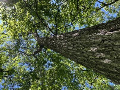 | | 2024 | COLLECTED | 06/05/2024 | Near southeast edge of Kasota Lake approximately 9.0 miles east, southeast of Willmar, T119N R34W SE 1/4 NE 1/4 Sec. 36 and also Robbins Island Park in Wilmar, T119N R35W Sec. 11. | 45.07399600, -94.88484100 | 352 | Deciduous woods | Wild material | Ulmus thomasii (Rock elm) is an underutilized tree species both in conservation and in the urban landscape. Described by Charles Sprague Sargent (first director for the Arnold Arborteum) as "heavy, hard, very strong and tough, closely grained, and susceptible of receiving a beautiful polish". Historically noted for a variety of uses in woodworking including furniture, heavy agricultural implements, timber frame buildings, pianos, hockey sticks, and hand tools. Ulmus thomasii is extremely drought tolerant, adaptable to very calcareous soils, and compared to U. americana or U. rubra has a very conservative growth rate requiring minimal attention in regards to pruning. Rock elm naturally tends to develop into a nice structural specimen in the landscape, unlike other fast growing cultivars in the nursery trade needing frequent attention. Rock elm has very fissured bark and is well known for maintaining a strong central leader resulting in a very attractive, pyramidal form. Despite many literature sources stating that "wings" on the stems are a key identifiying characteristic, this trait is not reliable and many genotypes may completely lack "wings" on the stems. While growth habit and morphology of dormant buds (very pointy) are good traits to help aid in identification, fruits are the best way to confirm identity. Fruits are densly pubescent, often described as "inflated" and generally reach maturity a couple weeks after Ulmus rubra and Ulmus americana. U. thomasii inflorescences are rather distinguishable from other Ulmus in being pendulous. Fruits are extremely prized treats for many birds, where fruits are often "robbed" prior to full maturity. Fruits are also highly prized by many other animals such as mice, squirrels, chipmunks, turkeys, etc. and are generally consumed within hours after fruit abscission. The native range of U. thomasii is concentrated in the northeastern United States and into Canada with disjunct populations documented in northwestern Missouri and northwestern Arkansas (Little, E. L. Jr. 1971). In the 1895 Silva of North America (vol. 7) it was stated that, “The value of the wood of the Rock Elm threatens its extinction and most of the large trees have already been cut.” Today, while rock elm is rather rare, especially in areas near the edges of its range, many states list the species as endangered or threatened warranting preservation efforts. Genetics of this accession would be representative of the species northwestern edge of its native range. Majority of specimens noted did not have characteristic "wings" on the stems and measured approximately 20" DBH or more with a few specimens nearing 30". Heights estimated between 70-90'. Rock elm in this area could be classified as locally abundant. | 2167953 | Ames 36251 |
| 16 | WLP 3492 | St. Francois State Park | Hydrangea arborescens L. | Missouri, United States | NA |  | | 2024 | COLLECTED | 01/19/2024 | St. Francois State Park, 8920 US Highway 67 North, approximately 3.2 miles north-northeast of Bonne Terre. | 37.96381000, -90.53403000 | 202 | Rocky outcrops above Big River and rocky areas on bank of Big River. | Wild material | | 2166135 | WLP 3492 |
| 17 | WLP 3402 | DL024 | Acer spicatum Lam. | Wisconsin, United States | NA | | | 2023 | COLLECTED | 09/22/2023 | Baraboo, Wisconsin: South Bluff / Devil's Nose State Natural Area: South Bluff, north of social trail. | 43.41029960, -89.73989180 | | Growing in part sun in boulder field with layers of organic matter. Slope: 40. Aspect: north-facing. Linden-oak-maple vegetation community. | Wild material | | 2165693 | WLP 3402 |
| 18 | NA 88673 | RJL2023PA-007 | Rhododendron pilosum (Michx.) Craven | Pennsylvania, United States | NA | | | 2023 | COLLECTED | 10/25/2023 | Ned Smith Center for Art and Nature. | 40.53367300, -76.92715700 | 147 | Well-drained and very rocky, dry slopes above 10-50 meters above Wiconisco Creek in mixed deciduous and evergreen woodlands in part shade to full shade. Slope: 10-40%. Aspect: North. The underlying geology of this area is of Mississippian origin and characterized as the Pocono Formation. It is comprised of light-gray to buff or light-olive-gray, medium-grained, crossbedded sandstone and minor siltstone; commonly conglomeratic at base and in middle; medial conglomerate, where present, is used to divide into Mount Carbon and Beckville Members; equivalent to Burgoon Sandstone of Allegheny Plateau. (Source: USGS Pennsylvania Geologic Map Data). The primary soil type in the collection area is classified as Laidig Series. The Laidig series consists of very deep, well drained soils formed in colluvium from sandstone, siltstone, and some shale. They are gently sloping to very steep soils on benches and foot slopes. Permeability is moderate or moderately rapid above the fragipan and moderately slow or slow in the fragipan. Slope ranges from 0 to 55 percent. Solum thickness ranges from 1.25 to 2.0 meters or more. Depth to the fragipan ranges from 0.75 to 1.25 meters. The particle-size control section averages less than 35 percent rock fragments. Rock fragments range from 5 to 50 percent in individual subhorizons of the A, E, BE, BA and Bt horizons; 15 to 70 percent in individual subhorizons of the Btx horizon; and 20 to 70 percent in the C horizon. Rock fragments are mostly sandstone but include siltstone and shale. Rock fragments include channers, cobbles, flagstones, and stones. Soils range from extremely acid through strongly acid throughout. (Source: NRCS Web Soil Survey). | Wild material | | 2159064 | NA 88673 |
| 19 | NA 88674 | RJL2023PA-008 | Kalmia latifolia L. | Pennsylvania, United States | NA | | | 2023 | COLLECTED | 10/25/2023 | Ned Smith Center for Art and Nature. | 40.53463500, -76.92616300 | 130 | Well-drained and very rocky, dry slopes above 10-50 meters above Wiconisco Creek in mixed deciduous and evergreen woodlands in part shade to full shade. Slope: 10-40%. Aspect: North. The underlying geology of this area is of Mississippian origin and characterized as the Pocono Formation. It is comprised of light-gray to buff or light-olive-gray, medium-grained, crossbedded sandstone and minor siltstone; commonly conglomeratic at base and in middle; medial conglomerate, where present, is used to divide into Mount Carbon and Beckville Members; equivalent to Burgoon Sandstone of Allegheny Plateau. (Source: USGS Pennsylvania Geologic Map Data). The primary soil type in the collection area is classified as Laidig Series. The Laidig series consists of very deep, well drained soils formed in colluvium from sandstone, siltstone, and some shale. They are gently sloping to very steep soils on benches and foot slopes. Permeability is moderate or moderately rapid above the fragipan and moderately slow or slow in the fragipan. Slope ranges from 0 to 55 percent. Solum thickness ranges from 1.25 to 2.0 meters or more. Depth to the fragipan ranges from 0.75 to 1.25 meters. The particle-size control section averages less than 35 percent rock fragments. Rock fragments range from 5 to 50 percent in individual subhorizons of the A, E, BE, BA and Bt horizons; 15 to 70 percent in individual subhorizons of the Btx horizon; and 20 to 70 percent in the C horizon. Rock fragments are mostly sandstone but include siltstone and shale. Rock fragments include channers, cobbles, flagstones, and stones. Soils range from extremely acid through strongly acid throughout. (Source: NRCS Web Soil Survey). | Wild material | | 2159065 | NA 88674 |
| 20 | NA 88675 | RJL2023PA-009 | Viburnum acerifolium L. | Pennsylvania, United States | NA | | | 2023 | COLLECTED | 10/25/2023 | Ned Smith Center for Art and Nature. | 40.53539200, -76.92313500 | 136 | Well-drained and very rocky dry deciduous woodlands in part shade to full shade. Slope: 10-30%. Aspect: North. The underlying geology of this area is of Mississippian origin and characterized as the Pocono Formation. It is comprised of light-gray to buff or light-olive-gray, medium-grained, crossbedded sandstone and minor siltstone; commonly conglomeratic at base and in middle; medial conglomerate, where present, is used to divide into Mount Carbon and Beckville Members; equivalent to Burgoon Sandstone of Allegheny Plateau. (Source: USGS Pennsylvania Geologic Map Data). The primary soil type in the collection area is classified as Laidig Series. The Laidig series consists of very deep, well drained soils formed in colluvium from sandstone, siltstone, and some shale. They are gently sloping to very steep soils on benches and foot slopes. Permeability is moderate or moderately rapid above the fragipan and moderately slow or slow in the fragipan. Slope ranges from 0 to 55 percent. Solum thickness ranges from 1.25 to 2.0 meters or more. Depth to the fragipan ranges from 0.75 to 1.25 meters. The particle-size control section averages less than 35 percent rock fragments. Rock fragments range from 5 to 50 percent in individual subhorizons of the A, E, BE, BA and Bt horizons; 15 to 70 percent in individual subhorizons of the Btx horizon; and 20 to 70 percent in the C horizon. Rock fragments are mostly sandstone but include siltstone and shale. Rock fragments include channers, cobbles, flagstones, and stones. Soils range from extremely acid through strongly acid throughout. (Source: NRCS Web Soil Survey). | Wild material | | 2159066 | NA 88675 |
| 21 | NA 89235 | UK Arb. 2023-0061-A | Cladrastis kentukea (Dum. Cours.) Rudd | Kentucky, United States | NA | | | 2023 | COLLECTED | 08/22/2023 | Tom Dorman State Nature Preserve: trees growing adjacent to west side of loop trail going down towards Kentucky River. | 37.77180000, -84.63011000 | | Calcareous, rocky woods, mid-slope down towards river. | Wild material | | 2158478 | NA 89235 |
| 22 | Ames 36073 | JDC/UT/2022/028/1009 | Ulmus thomasii Sarg. | Iowa, United States | NC7 |  | | 2023 | COLLECTED | 06/05/2023 | Ledges State Park approximately 4.75 miles south of Boone, T83N R26W (Madrid NW Quad.) near center of SE ¼ Sec. 16 and also NW ¼ SW ¼ Sec. 21. | 41.99780200, -93.87967900 | 288 | Moist deciduous woods typically on mid-slopes to base of slopes and also well-drained floodplains. | Wild material | Ulmus thomasii (Rock elm) is an underutilized tree species both in conservation and in the urban landscape. Charles Sprague Sargent (first director of the Arnold Arboretum of Harvard University, Boston, MA) described the wood of Rock Elm as "heavy, hard, very strong and tough, closely grained, and susceptible of receiving a beautiful polish". Historically noted for a variety of uses in woodworking including furniture, heavy agricultural implements, timber frame buildings, pianos, hockey sticks, and hand tools. U. thomasii is extremely drought tolerant, adaptable to very calcareous soils, and compared to U. americana or U. rubra has a very conservative growth rate requiring minimal attention in regards to pruning. Rock elm naturally tends to develop into a nice structural specimen in the landscape, unlike other fast growing U. americana cultivars in the nursery trade needing frequent attention. Rock elm has very fissured bark and is well known for maintaining a strong central leader resulting in a very attractive, pyramidal form. Despite many literature sources stating that "wings" on the stems are a key identifiying characteristic, this trait is not reliable and many genotypes may completely lack "wings" on the stems. While growth habit and morphology of dormant buds (very pointy) are good traits to help aid in identification, fruits are the best way to confirm identity. Fruits are densly pubescent, often described as "inflated" and generally reach maturity a couple weeks after U. rubra and U. americana. U. thomasii flowering in central Iowa typically occurs the last week in April into the first week in May and are rather distinguishable from other Ulmus in being pendulous. Fruits are extremely prized treats for many birds, where fruits are often "robbed" prior to full maturity. Fruits are also highly prized by many other animals such as mice, squirrels, chipmunks, turkeys, etc. and are generally consumed within hours after fruit abscission. The native range of U. thomasii is concentrated in the northeastern United States and into Canada with disjunct populations documented in northwestern Missouri and northwestern Arkansas (Little, E. L. Jr. 1971). In the 1895 Silva of North America (vol. 7) it was stated that, “The value of the wood of the Rock Elm threatens its extinction and most of the large trees have already been cut.” Today, since rock elm is rather rare, especially in areas near the edges of its range, many states list the species as endangered or threatened warranting preservation efforts. Genetics of this accession would be representative of the species southwestern edge of its native range. At the collection site in nature (Ledges State Park), out of approximately 100 specimens noted only 1-2% of specimens had characteristic "wings" on the stems. Research was executed (Moore, P., 2024) involving the core sampling of U. thomasii and U. americana specimens in Ledges State Park to make growth ring widths and basal area increment comparisons. Results determined that the average age of cored trees U. thomasii (n=4) and U. americana (n=4) of both species was roughly 80 years, excluding the exceptional case of tree #007 (Ames 36073 23ncao02 SD). Tree #007 was aged at 300 years of age and currently (2025) ranks as the 14th largest U. thomasii in Iowa measuring 21" DBH with a height of 75' 5" and a spread of 43' 5" totalling 152.21 points (Rouw, M., personal communication, 4 May 2022). The computed mean density at 𝑀𝑀 = 12% for U. thomasii was 0.80 g/cm3, and for U. americana was 0.672 g/cm3. These values are both higher than the representative values inferred from the Woods Database which are 0.755 g/cm3 for U. thomasii and 0.56 g/cm3 for U. americana. To date, there is little to no information regarding U. thomasii resistance to Dutch Elm Disease. Collections of U. thomasii at the Arnold Arboretum have over-time succumbed to DED (Pruka, B., 2016). However, data recorded by Moore (2024) indicates that U. thomasii growing in central Iowa can surpass 300 years in age verifying it's long-term utilization in the landscape. | 2142915 | Ames 36073 |
| 23 | Ames 36016 | Sugar Creek | Platanus occidentalis L. | Iowa, United States | NC7 |  | | 2023 | COLLECTED | 02/20/2023 | Scattered along Sugar Creek between 3.1 miles north and also 1.3 miles northeast of Franklin, T68N R6W Sections 2, 11, 12, 13 and 24. | 40.70277500, -91.51065900 | 185 | River banks and floodplains. | Wild material | This accession of American sycamore includes the sampling from several very large specimens found in the state of Iowa including specimen #211-12 currently (2023) ranking 13th largest measuring 14' 9" circumference; 106' 8" in height; and a calculated spread of 114' 8" totalling 312.346 points (measured 23 April 2023 by Mark Rouw); specimen #211-10 currently (2023) ranking as the 9th largest measuring 16' 2" circumference; 97' 5" in height; and a calculated spread of 134' 3" totalling 322.983 points (measured 21 April 2020 by Mark Rouw); and specimen #211-6 currently (2023) ranking 2nd largest measuring 20' 2.5" circumference; 109' 6" in height; and a calculated spread of 148' 9" totalling 389.188 points (measured 23 April 2023 by Mark Rouw). Numerous specimens noted in nature with extremely white, superior, ornamental bark characteristics, specifically specimen #211-13. | 2141476 | Ames 36016 |
| 24 | Ames 35649 | Backbone | Pinus strobus L. | Iowa, United States | NC7 |  | | 2021 | COLLECTED | 03/04/2021 | Backbone State Park located approximately 5.15 miles south, southwest of Strawberry Point, T90N R6W NW1/4 Sec. 16 | 42.61131500, -91.56098900 | 316 | Cliff edges and steep slopes above the Maquoketa River, including the ridge known as the "Backbone". | Wild material | The native range of Pinus strobus is concentrated in the northeastern United States extending south into the northern edge of Georgia and west to central Minnesota. In Iowa, there are scattered populations in a few northeastern counties and also a very small disjunct population in central Iowa (Hardin County, Ames 32758) and also one in southeastern Iowa (Muscatine County, Ames 35635). This accession represents genetics from "legacy" specimens from northeastern Iowa in Backbone State Park (Delaware County). Although a significant number of P. strobus were planted at this park in the 1920's a significant number of native specimens still exist throughout the park typically found on extreme topographical features such as steep slopes and rock outcroppings. Genetics from this site likely represents the extreme southwestern edge of the species native range. Genetics may likely be adapted/tolerant to drought and also late winter/early spring extreme temperature fluctuations. Accession was collected as scions in winter to capture genetics that are of known origin. | 2113351 | Ames 35649 |
| 25 | Ames 35650 | Bixby | Pinus strobus L. | Iowa, United States | NC7 |  | | 2021 | COLLECTED | 03/04/2021 | Bixby State Preserve on slopes above Bear Creek, located approximately 6.25 miles east of Strawberry Point, T91N R5W SE1/4 Sec. 22 | 42.67534800, -91.41301000 | 324 | Cliff edges and steep slopes. | Wild material | The native range of Pinus strobus is concentrated in the northeastern United States extending south into the northern edge of Georgia and west to central Minnesota. In Iowa, there are scattered populations in a few northeastern counties and also a very small disjunct population in central Iowa (Hardin County, Ames 32758) and also one in southeastern Iowa (Muscatine County, Ames 35635). This accession represents genetics from "legacy" specimens from northeastern Iowa in Bixby State Preserve (Clayton County). Genetics from this site likely represents the extreme southwestern edge of the species native range. Genetics may likely be adapted/tolerant to drought and also late winter/early spring extreme temperature fluctuations. Accession was collected as scions in winter to capture genetics that are of known origin. | 2113352 | Ames 35650 |
| 26 | OPGC 7855 | CBG-9538 | Eutrochium purpureum (L.) E. E. Lamont | Illinois, United States | OPGC |  | | 2019 | | | | | | | Wild material | | 2092807 | OPGC 7855 |
| 27 | W6 56710 | CBG-9540 | Scrophularia marilandica L. | Illinois, United States | W6 |  | | 2019 | | | | | | | Wild material | | 2092809 | W6 56710 |
| 28 | WLP 1190 | NA 85118 | Dirca palustris L. | Iowa, United States | NA |  | | 2018 | COLLECTED | 05/31/2018 | Private property located 3.35 miles southwest of Luther near Des Moines River, T82N R26W SW 1/4 SW 1/4 Sec. 3, Boone County | 41.93795800, -93.87109500 | 317 | Dense shade of mature oak forest. Deep ravines. | Wild material | Specimens measuring approximately 2-5' in height. Noticeable new growth (5-8") at time of seed collection. Population was in peak bloom 24 April 2018 with peak fruit maturity occuring on 30 May 2018. Fruits readily dropping when distrubed. Very slight tinge of white color to fully mature fruits. Seeds measuring approximately 0.5-0.7 cm in length. | 1963390 | WLP 1190 |
| 29 | Ames 33357 | JDC/UT/2016/018/733 | Ulmus thomasii Sarg. | Iowa, United States | NC7 |  | | 2016 | COLLECTED | 06/03/2016 | Malanaphy Springs State Preserve just northwest of Decorah, T99N R8W SW ¼ NW ¼ SE ¼ Sec. 31 | 43.34713800, -91.83840000 | 302 | Deciduous woods. Rocky substrate. 20 degree northwest-facing slope | Wild material | Ulmus thomasii (Rock elm) is an underutilized tree species both in conservation and in the urban landscape. Charles Sprague Sargent (first director of the Arnold Arboretum of Harvard University, Boston, MA) described the wood of Rock Elm as "heavy, hard, very strong and tough, closely grained, and susceptible of receiving a beautiful polish". Historically noted for a variety of uses in woodworking including furniture, heavy agricultural implements, timber frame buildings, pianos, hockey sticks, and hand tools. U. thomasii is extremely drought tolerant, adaptable to very calcareous soils, and compared to U. americana or U. rubra has a very conservative growth rate requiring minimal attention in regards to pruning. Rock elm naturally tends to develop into a nice structural specimen in the landscape, unlike other fast growing U. americana cultivars in the nursery trade needing frequent attention. Rock elm has very fissured bark and is well known for maintaining a strong central leader resulting in a very attractive, pyramidal form. Despite many literature sources stating that "wings" on the stems are a key identifiying characteristic, this trait is not reliable and many genotypes may completely lack "wings" on the stems. While growth habit and morphology of dormant buds (very pointy) are good traits to help aid in identification, fruits are the best way to confirm identity. Fruits are densly pubescent, often described as "inflated" and generally reach maturity a couple weeks after U. rubra and U. americana. U. thomasii flowering in central Iowa typically occurs the last week in April into the first week in May and are rather distinguishable from other Ulmus in being pendulous. Fruits are extremely prized treats for many birds, where fruits are often "robbed" prior to full maturity. Fruits are also highly prized by many other animals such as mice, squirrels, chipmunks, turkeys, etc. and are generally consumed within hours after fruit abscission. The native range of U. thomasii is concentrated in the northeastern United States and into Canada with disjunct populations documented in northwestern Missouri and northwestern Arkansas (Little, E. L. Jr. 1971). In the 1895 Silva of North America (vol. 7) it was stated that, “The value of the wood of the Rock Elm threatens its extinction and most of the large trees have already been cut.” Today, since rock elm is rather rare, especially in areas near the edges of its range, many states list the species as endangered or threatened warranting preservation efforts. This accession represents genetics from northeast Iowa (Winneshiek County). In an assessment of some of the largest Ulmus thomasii (native and cultivated) across Iowa, four of the nine largest specimens in Iowa are present in Malanaphy Springs State Preserve where this accession was sampled. The second largest U. thomasii in the state located in Malanaphy Springs was measured on 22 May 2020 with a circumference of 6.42', height of 86.58', and an average crown spread of 68.00' (180 points) (Rouw, M., personal communication, 8 February 2021). | 1940580 | Ames 33357 |
| 30 | Ames 33289 | APS/GD/2016/010/245 | Gymnocladus dioicus (L.) K. Koch | Michigan, United States | NC7 |  | | 2016 | COLLECTED | 04/05/2016 | Ionia County: T5N R5W SW 1/4 SW 1/4 SE 1/4 Sec. 21; T5N R5W NE 1/4 NW 1/4 NW 1/4 Sec. 20; and T5N R5W SW 1/4 SW 1/4 SE 1/4 Sec. 20 along Grand River approximately 4.80 miles south and slightly west of Portland. | 42.80296200, -84.91275400 | 231 | Floodplain. | Wild material | | 1940346 | Ames 33289 |
| 31 | Ames 33290 | APS/GD/2016/012/247 | Gymnocladus dioicus (L.) K. Koch | Michigan, United States | NC7 |  | | 2016 | COLLECTED | 04/06/2016 | Gratiot and Clinton Counties: T9N R3W SW 1/4 Sec. 35 (Gratiot County) and T8N R4W NW 1/4 NW 1/4 Sec. 14 (Clinton County) along Maple River both northeast (approximately 3.34 miles (Clinton County)) and southwest (approximately 3.00 miles (Gratiot County)) of Maple Rapids. | 43.10603700, -84.70504200 | 205 | Floodplain. | Wild material | | 1940347 | Ames 33290 |
| 32 | Ames 33291 | APS/GD/2016/015/250 | Gymnocladus dioicus (L.) K. Koch | Michigan, United States | NC7 |  | | 2016 | COLLECTED | 04/07/2016 | Shiawassee County: T6N R4E SE 1/4 SE 1/4 SW 1/4 Sec. 30; T5N R4E SE 1/4 NW 1/4 Sec. 7; and T6N R3E SE 1/4 SE 1/4 NE 1/4 Sec. 25 along Shiawassee River both northeast (approximately 1.35 miles) and southeast (approximately 2.63 miles) of Bancroft. | 42.87985700, -84.03461800 | 244 | Floodplain. | Wild material | | 1940348 | Ames 33291 |
| 33 | Ames 32959 | JDC/FN/2015/045/702 | Fraxinus nigra Marshall | Iowa, United States | NC7 | | | 2015 | COLLECTED | 09/11/2015 | Ruby Woodland, T88N R19W NW 1/4 Sec. 8 Hardin County. | 42.45105400, -93.09686700 | 318 | Mid portions of north-facing slope (45 degrees) in cool, moist deciduous woods. Growing in association with Betula papyrifera, Staphylea trifolia, Carpinus caroliniana, Quercus rubra, Fraxinus americana, Acer saccharum, Cornus alternifolia, Carya ovata, Urtica dioica, Amelanchier arborea, Ostrya virginiana, Hepatica sp., and Allium tricoccum. | Wild material | | 1927429 | Ames 32959 |
| 34 | Ames 32960 | JDC/BP/2015/046/703 | Betula papyrifera Marshall | Iowa, United States | NC7 | | | 2015 | COLLECTED | 09/11/2015 | Ruby Woodland, T88N R19W NW 1/4 Sec. 8 Hardin County. | 42.45099600, -93.09671200 | 328 | Mid portions of north-facing slope (45-60 degrees) in cool, moist deciduous woods. Growing in association with Fraxinus nigra, Staphylea trifolia, Carpinus caroliniana, Quercus rubra, Fraxinus americana, Acer saccharum, Cornus alternifolia, Carya ovata, Urtica dioica, Amelanchier arborea, Ostrya virginiana, Hepatica sp., Smilax rotudifolia, Prunus Virginiana, Betula papyrifera, Betula alleghaniensis, Populus deltoides, Tilia americana, and Allium tricoccum. | Wild material | | 1927430 | Ames 32960 |
| 35 | Ames 32965 | JDC/BA/2015/051/708 | Betula alleghaniensis Britton | Iowa, United States | NC7 | | | 2015 | COLLECTED | 09/15/2015 | Yellow River State Forest, T97N R4W northern edge of SW 1/4 NW 1/4 Sec. 36 | 43.17782100, -91.26584600 | 227 | North-facing algific talus slope (45-60 degrees) adjacent to Paint Creek. Moist deciduous woods. Growing in association with Fraxinus nigra, Staphylea trifolia, Carpinus caroliniana, Quercus rubra, Acer saccharum, Cornus alternifolia, Amelanchier arborea, Ostrya virginiana, Viburnum opulus var. americanum, Cornus rugosa, Cornus alternifolia, Zanthoxylum americanum, Viburnum rafinesqueanum, Cypripedium pubescens, Ribes sp.,Corylus sp., Juniperus virginiana, Dirca palustris, Ulmus thomasii, Prunella vulgaris, Diervilla lonicera, Quercus macrocarpa, Carya cordiformis, Taxus canadensis, Tilia americana, Adiantum pedatum, and Aconitum noveboracense. | Wild material | | 1927435 | Ames 32965 |
| 36 | Ames 32966 | JDC/VA/2015/052/709 | Viburnum opulus L. var. americanum Aiton | Iowa, United States | NC7 |  | | 2015 | COLLECTED | 09/15/2015 | Yellow River State Forest, T97N R4W northern edge of SW ¼ NW ¼ Sec. 36. | 43.17778200, -91.26642800 | 239 | North-facing algific talus slope (45-60 degrees) adjacent to Paint Creek. Moist deciduous woods. | Wild material | Formerly known as Viburnum trilobum, American highbush cranberry (V. opulus var. americanum) is a North American native shrub that is utilized as an important ornamental and conservation plant that is also harvested as a minor fruit crop (jams/jellies). In nature, this variety is generally found in moist habitats typically along stream banks and swamps where ample moisture is readily available. The native range of V. opulus var. americana is concentrated in the northeastern United States and into Canada (Little, E. L. Jr. 1977). Attractive ornamental characteristics includes showy lacecap flowers in spring and bright red fruits and foliage in the fall. Fruits are tart with a hint of sweetness. The European highbush cranberry (V. opulus var. opulus) is nearly identical to American highbush cranberry other than small glands (<1 mm) on the petiole making the exact determination very challenging resulting in common misidentifications. A major difference between the American and European highbush cranberries is that the European variety produces unpalatable fruit. Recent research has shown that American and European highbush cranberries are genetically distinct and that plants of hybrid origin are uncommon (Tork et al. 2025). Vigorous early spring growth and good tolerance to late spring frosts. Genetic analysis from Tork et al. 2025 confirmed that genetics of this accession represents American highbush Cranberry (Viburnum opulus var. americanum). This accession represents genetics from northeast Iowa and thus the extreme western edge of the species native range. | 1927436 | Ames 32966 |
| 37 | WLP 683 | JDC/AA/2015/040/697 | Amelanchier arborea (F. Michx.) Fernald | Iowa, United States | NA |  | | 2015 | COLLECTED | 06/16/2015 | Elk Rock State Park approximately 6.25 miles north of Knoxville. Extreme northern point of park. T76N R19W SW 1/4 SW 1/4 Sec. 5 Marion County | 41.40879000, -93.07958000 | 219 | Relatively steep, north-facing slopes (55 degrees). Growing in association with Diervilla lonicera (rare), Tilia americana (large and abundant), Rosa multiflora, Lonicera maackia, Eleagnus umbellata, Quercus rubra, Viburnum rafinesqueanum, Sanguinaria canadensis, Staphylea trifolia, and Ostrya virginiana. | Wild material | Fruits harvested at peak maturity. Numerous fruits were soft and/or dropped when distrurbed. Fruit color ranged from dark red with tinge of blue/purple to light red. Fruit diameter averaged 10.28 mm (0.83 stdev), range min 9.00 mm to max 12.00 mm (random sample of 20 fruits). Stalk length (fruits) averaged 22.08 mm (5.28 stdev), range min 13.89 mm to max 35.00 mm (random sample of 20 fruits with intact stalks). | 1926845 | WLP 683 |
| 38 | WLP 1097 | JDC/CO/2015/026/682 | Cotinus obovatus Raf. | Missouri, United States | NA | | | 2015 | COLLECTED | 05/19/2015 | T22N R20W N1/2 Sec. 33 and SW 1/4 Sec. 27 Taney County. Gunnison Road, adjacent to Bee Creek, a tributary to Fox Creek and also surrounding area. | 36.52401500, -93.09755700 | 350 | Steep, west-facing slope on rocky, loose substrate. Growing in association with Fraxinus quadrangulata, Quercus muehlenbergii, Hydrangea arborescens, Physocarpus opulifolius, Viburnum rufidulum, Cornus florida, Carpinus caroliniana (abundant), Rhus aromatica, Lonicera sp. (vine), Cornus sp., Salix sp., Juniperus virginiana, Tilia americana, Hamamelis sp. (abundant) and Staphylea trifolia. | Wild material | | 1926259 | WLP 1097 |
| 39 | Ames 32891 | APS/GD/2015/010/192 | Gymnocladus dioicus (L.) K. Koch | Oklahoma, United States | NC7 |  | | 2015 | COLLECTED | 03/12/2015 | Nowata County: T25N R16E NW 1/4 NE 1/4 Sec. 3. Oologah Wildlife Management Area approximately 3 miles east of Nowata. | 36.68401000, -95.58207800 | 208 | Transition zone between higher elevations and bottomlands. | Wild material | | 1925357 | Ames 32891 |
| 40 | Ames 32225 | APS/GD/2014/008/139 | Gymnocladus dioicus (L.) K. Koch | Indiana, United States | NC7 | | | 2014 | COLLECTED | 03/21/2014 | Grindstone Creek watershed, Sections 19 and 20, T22N, R6W, and Section 26, T22N, R7W, just northeast of Attica, Fountain County. | 40.33906400, -87.12104600 | 173 | Floodplain. | Wild material | | 1917829 | Ames 32225 |
| 41 | WLP 1079 | NA 81742 | Cornus florida L. | Missouri, United States | NA | | | 2013 | COLLECTED | 09/26/2013 | Springfield Township: NW 1/4 of Section 20. | 38.41792000, -93.60433000 | | Growing in and around sandstone ravines. | Wild material | Voucher specimen being processed at time of accessioning; will be forwarded to USNA once prepared. | 1922751 | WLP 1079 |
| 42 | Ames 31998 | APS/GD/2013/026/111 | Gymnocladus dioicus (L.) K. Koch | Indiana, United States | NC7 |  | | 2013 | COLLECTED | 03/07/2013 | Tunnelton, Lawrence County. | 38.76121800, -86.35236900 | 179 | East Fork White River Watershed. Mid-elevation of east-facing limestone bluffs. | Wild material | | 1908276 | Ames 31998 |
| 43 | Ames 31516 | JDC/CR/2012/014/407 | Cornus rugosa Lam. | Iowa, United States | NC7 |  | | 2012 | COLLECTED | 07/13/2012 | Bluffton Fir State Preserve, SW 1/4 of Section 10, T99N, R9W, Bluffton Quad, near Bluffton, Winneshiek County. | 43.41080200, -91.93845200 | 343 | Mixed hardwood forest. Very steep, northwest-facing slope. | Wild material | | 1903743 | Ames 31516 |
| 44 | Ames 31518 | JDC/DL/2012/018/411 | Diervilla lonicera Mill. | Iowa, United States | NC7 |  | | 2012 | COLLECTED | 07/14/2012 | Edge of Echo Valley State Park just southeast of West Union, T94N R8W NE 1/4 NE 1/4 SW 1/4 West Union Quad Sec. 22 | 42.94188100, -91.77707300 | 334 | Mixed hardwood forest. Very steep, northeast-facing slopes. | Wild material | | 1903745 | Ames 31518 |
| 45 | WLP 1043 | JDC/CF/2010/044/314 | Cornus florida L. | Missouri, United States | NA |  | | 2010 | COLLECTED | 09/15/2010 | Odin Access Conservation Area, Wright County. | 37.26709000, -92.61271000 | 388 | South-southeast facing slope (50%). Associated with Hydrangea arborescens, Morus rubra, Quercus, Staphylea trifolia, and Viburnum prunifolium. | Wild material | Very large flowering dogwoods, approximately 5-6 inches d.b.h. and 25-30 feet tall. | 1848889 | WLP 1043 |
| 46 | WLP 1949 | JDC/VM/2010/022/292 | Viburnum molle Michx. | Illinois, United States | NA |  | | 2010 | COLLECTED | 09/06/2010 | Along Senachwine Creek, SE 1/4 of Section 12, Rome Quad, Peoria County. | 40.94680000, -89.52970000 | 183 | Along steep (75%) west-northwest facing slope. Associated with Cornus, Fraxinus, Ostrya virginiana, Platanus occidentalis, Quercus rubra, Staphylea trifolia, Tilia americana, and Vitis riparia. | Wild material | Plants up to 15 feet in height. Reddish fall color on apical stems. Peeling bark on older stems. | 1847248 | WLP 1949 |
| 47 | Ames 30552 | Ames 30552 | Cornus alternifolia L. f. | Missouri, United States | NC7 |  | | 2010 | COLLECTED | 06/29/2010 | Along North River, Callaghan Mound Access Conservation Area, near Heather, SW 1/4 of Section 15, T58N, R8W, Emden Quad. | 39.82140000, -91.78680000 | 190 | Northeast facing slope. | Wild material | | 1843106 | Ames 30552 |
| 48 | Ames 30491 | APS/GD/2010/013/048 | Gymnocladus dioicus (L.) K. Koch | Illinois, United States | NC7 |  | | 2010 | COLLECTED | 02/23/2010 | Near Deans Hills State Nature Preserve, approximately 7 miles east of Ramsey, T8N R2E Sec. 10 and NE 1/4 of Sec. 16, Fayette County. | 39.13970000, -88.97490000 | 172 | Gentle rolling hills of deciduous woods. | Wild material | #157 measured 9.5" and 50', #158 measured 11.5" d.b.h. and 50', #159 measured 16" and 60', #160 measured 15" and 80', and #161 measured 16.5" and 90'. | 1831350 | Ames 30491 |
| 49 | Ames 30492 | APS/GD/2010/014/049 | Gymnocladus dioicus (L.) K. Koch | Illinois, United States | NC7 |  | | 2010 | COLLECTED | 02/24/2010 | Marshall State Fish and Wildlife Area, along Illinois State Highway 26, Illinois River Watershed, approximately 18.5 miles north of Peoria, NW 1/4 of SW 1/4 of Sec. 35, NE 1/4 of SE 1/4 of Sec. 27, and SE 1/4 of NE 1/4 of Sec. 23, Marshall County. | 40.92820000, -89.42690000 | 158 | Mostly transisition zone at base of slopes or on gentle slopes and floodplain. | Wild material | | 1831351 | Ames 30492 |
| 50 | WLP 1951 | JDC/VR/2009/110/260 | Viburnum rufidulum Raf. | Ohio, United States | NA | | | 2009 | COLLECTED | 10/18/2009 | Along Ohio County Highway 106 (Suck Run Road), just south of Neel, Decatur Quad, Brown County. | 39.00000000, -84.00000000 | 224 | 45% slope, southeast and east facing. Associated with Acer saccharum, Celtis occidentalis, Cercis canadensis, Cornus florida, Fraxinus quadrangulata, Quercus, Staphylea trifolia, Viburnum molle, and V. prunifolium. | Wild material | | 1823957 | WLP 1951 |
| 51 | Ames 30061 | JDC/CA/2009/015/165 | Cornus alternifolia L. f. | Illinois, United States | NC7 |  | | 2009 | COLLECTED | 08/06/2009 | Southwest edge of Pierce Lake, Rock Cut State Park, SW 1/4 of SE 1/4 of Section 27, T45N, R2E, Caledonia Quad, Rockford, Winnebago County. | 42.34333333, -88.98638889 | 259 | Rich woods. | Wild material | Up to 20-30 feet in height. | 1812364 | Ames 30061 |
| 52 | Ames 30062 | JDC/CR/2009/011/161 | Cornus rugosa Lam. | Wisconsin, United States | NC7 |  | | 2009 | COLLECTED | 08/03/2009 | Along Highway 133, Lower Wisconsin Riverway State Wildlife Area, SE 1/4 of NW 1/4 of Section 14, T7N, R4W, Wauzeka East Quad, Woodman, Grant County. | 43.08527778, -90.81638889 | 201 | Wisconsin River watershed. | Wild material | | 1812365 | Ames 30062 |
| 53 | Ames 30065 | JDC/FQ/2009/018/168 | Fraxinus quadrangulata Michx. | Iowa, United States | NC7 |  | | 2009 | COLLECTED | 08/08/2009 | Private Property of David and Nan Horst, SE 1/4 of NE 1/4 of Section 30, T84N, R7E, Savanna (IA-IL) Quad, Sabula, Jackson County. | 42.05777778, -90.18305556 | 213 | Dense canopy. Rich organic soil in limestone scree. Steep east facing slope. | Wild material | | 1812368 | Ames 30065 |
| 54 | Ames 29974 | JDC/GD/2009/003/153 | Gymnocladus dioicus (L.) K. Koch | Iowa, United States | NC7 |  | | 2009 | COLLECTED | 03/19/2009 | Stone State Park, just northwest of Sioux City, T89N R48W west 1/2 of Sec. 1 and east 1/2 of Sec. 2 Sioux City Quad., extreme northwest corner of Woodbury County. | 42.55805556, -96.46861111 | 390 | Variable-wet bottomland and dry slopes; a few small creeks with running water. Variable exposure. 0-45 degrees of slope with southern and eastern aspects. | Wild material | Plants between 40 and 65 feet in height and 6 to 17 inches DBH. | 1798766 | Ames 29974 |
| 55 | WLP 1369 | JDC/LB/2008/044/114 | Lindera benzoin (L.) Blume | Missouri, United States | NA |  | | 2008 | COLLECTED | 10/09/2008 | Missouri: Bollinger County; Amidon Memorial Conservation Area, near Stannett Creek, south edge of NE 1/4 of SE 1/4 of Section 10. | 37.56027778, -90.13972222 | 232 | Common in understory/fairly shaded areas. Associated with Acer saccharum, Carpinus caroliniana, Cercis canadensis, Fraxinus americana, Juglans nigra, Quercus muhlenbergii, Staphylea trifolia, Ulmus, and Viburnum prunifolium. | Wild material | Some original plants with yellow fall color. | 1788215 | WLP 1369 |
| 56 | Ames 29532 | JDC/CA/2008/008/078 | Cornus alternifolia L. f. | Illinois, United States | NC7 |  | | 2008 | COLLECTED | 08/25/2008 | Black Hawk Forest Nature Preserve, Rock Island, Rock Island County. | 41.46583333, -90.57277778 | 186 | Wooded understory. Essentially full shade. Generally located along north facing 40% slope. | Wild material | Majority of specimens exhibited strong central leaders at time of collection. Tallest specimen was approximately 25 feet in height. | 1783446 | Ames 29532 |