| 0 | PI 613037 | Index Seminum 19 | Symphoricarpos occidentalis Hook. | Manitoba, Canada | NC7 | | | 1990 | COLLECTED | | | 50.33333333, -99.00000000 | | | Wild material | | 1063766 | PI 613037 |
| 1 | W6 46970 | CO932-309 | Symphoricarpos occidentalis Hook. | Colorado, United States | W6 | | | 2013 | | | | | | | Wild material | | 1914530 | W6 46970 |
| 2 | Ames 31463 | SYOC-SOS-CO932-252-10 | Symphoricarpos occidentalis Hook. | Colorado, United States | NC7 |  | | 2011 | COLLECTED | PRE 2011 | | 39.01686111, -104.26938890 | | | Wild material | | 1861364 | Ames 31463 |
| 3 | Ames 27794 | Trapper Germplasm | Symphoricarpos occidentalis Hook. | Montana, United States | NC7 |  | | 2005 | DEVELOPED | | | | | | Cultivar | A conservation plant release (2004) by the USDA NRCS Bridger Plant Materials Center, Bridger, MT. Trapper Germplasm was selected for superior seedling survival and vigor for use in a variety of conservation applications. Represents genetics of 14 parent plants consisting of 5 seed sources from Montana and Wyoming. Fully adapted to USDA Plant Hardiness Zone 4a and has been observed growing in Zone 3a. Based on the species native range and sources of germplasm used for selection, Trapper snowberry should perform well in most of central and eastern Montana between elevations of 1,950 to 4,000 feet. In northwestern Montana, and eastern Wyoming, it should grow well at elevations between 7,525 to 9,900 feet. It should also perform well in western North Dakota and South Dakota at elevations between 800 to 1,800 feet and in northeastern Colorado at elevations between 3,500 to 8,500 feet. Western snowberry is a perennial, woody, deciduous shrub native to broad areas of the United States. It forms dense colonies or thickets from widely spreading roots and rhizomes. The species is an erect to semi-erect shrub that normally grows 2 to 4 feet tall. The average mature height under wildland conditions is 3 feet. Trapper Germplasm western snowberry reaches 5 feet in height within 6 to 8 years under cultivated conditions with supplemental moisture on productive sites. The fruit are greenish white to white drupes containing two white nutlets that ripen in the fall. | 1684139 | Ames 27794 |
| 4 | PI 649745 | 44 | Symphoricarpos orbiculatus Moench | Iowa, United States | NC7 | | | 2003 | COLLECTED | 10/21/2003 | Chichaqua Wildlife Habitat Park bottoms, Elkhart, NW corner of SE 1/4 of SE 1/4 of Section 29, T81N, R22W, Loring Quad, Polk County. | 41.79472222, -93.42972222 | 250 | Alluvial soil. Understory of green ash, Cornus drummondii, Rubus occidentalis, and Smilax. | Wild material | Low, suckering shrubs to 1 meter tall. Good fruit and foliage quality. | 1649921 | PI 649745 |
| 5 | Ames 33229 | JDC/SO/2016/001/716 | Symphoricarpos orbiculatus Moench | Missouri, United States | NC7 | | | 2016 | COLLECTED | 01/13/2016 | Access road near Scobee Lake, NE 1/4 of NE 1/4 of Section 32, T64N R16W, approximately 10.5 miles northwest of Kirksville, Adair County. | 40.30655000, -92.71615200 | | | Wild material | Plants approximately 4 feet in height. Fruits red in color. Variation noted in fruits ranging from bright red to dark red in color. | 1936479 | Ames 33229 |
| 6 | Ames 32094 | Ames 32094 | Symphoricarpos orbiculatus Moench | Iowa, United States | NC7 |  | | 2013 | COLLECTED | PRE 10/25/2013 | Bluffs along Des Moines River, SE 1/4 of Section 9, T82N R26W, Madrid NW Quad, Boone County. | 41.92480000, -93.87550000 | 328 | Edge of dry woods. Western exposure. | Wild material | Plants donated were grown from original seed. | 1914038 | Ames 32094 |
| 7 | Ames 36016 | Sugar Creek | Platanus occidentalis L. | Iowa, United States | NC7 |  | | 2023 | COLLECTED | 02/20/2023 | Scattered along Sugar Creek between 3.1 miles north and also 1.3 miles northeast of Franklin, T68N R6W Sections 2, 11, 12, 13 and 24. | 40.70277500, -91.51065900 | 185 | River banks and floodplains. | Wild material | This accession of American sycamore includes the sampling from several very large specimens found in the state of Iowa including specimen #211-12 currently (2023) ranking 13th largest measuring 14' 9" circumference; 106' 8" in height; and a calculated spread of 114' 8" totalling 312.346 points (measured 23 April 2023 by Mark Rouw); specimen #211-10 currently (2023) ranking as the 9th largest measuring 16' 2" circumference; 97' 5" in height; and a calculated spread of 134' 3" totalling 322.983 points (measured 21 April 2020 by Mark Rouw); and specimen #211-6 currently (2023) ranking 2nd largest measuring 20' 2.5" circumference; 109' 6" in height; and a calculated spread of 148' 9" totalling 389.188 points (measured 23 April 2023 by Mark Rouw). Numerous specimens noted in nature with extremely white, superior, ornamental bark characteristics, specifically specimen #211-13. | 2141476 | Ames 36016 |
| 8 | WLP 1385 | OWE-023 | Larix occidentalis Nutt. | Oregon, United States | NA | | | 2019 | COLLECTED | 09/03/2018 | Crook County; ; Ochoco National Forest: Ochoco Mountains, west of Route 22. | 44.42541000, -120.35060000 | 1520 | Mixed coniferous forest; 1/2 shade. | | Presumed to be one of the most heat-tolerant populations of Larix occidentalis, according to expedition collaborators Sean Hogan and Preston Pew of Cistus Nursery (Portland, OR). 200 seeds collected from one individual. Species solitary, with patchy distribution. | 2109056 | WLP 1385 |
| 9 | W6 50132 | OR110-823 | Ageratina occidentalis (Hook.) R. M. King & H. Rob. | Oregon, United States | W6 |  | | 2015 | | | | | | | Wild material | | 1927444 | W6 50132 |
| 10 | W6 50249 | NV040-220 | Lappula occidentalis (S. Watson) Greene | Nevada, United States | W6 |  | | 2015 | | | | | | | Wild material | | 1927553 | W6 50249 |
| 11 | W6 62860 | DMT01-7 | Nassella viridula (Trin.) Barkworth | Montana, United States | W6 |  | | 2025 | | | | | | | Wild material | | 2193157 | W6 62860 |
| 12 | Ames 36179 | AS/JS/2023/073/283 | Juniperus scopulorum Sarg. | North Dakota, United States | NC7 |  | | 2023 | COLLECTED | 09/18/2023 | Little Missouri National Grassland approximately two miles south of Medora along the Maah Daah Hey National Recreation Trail, starting 0.2 miles south of Sully Creek State Recreation Area, T139N R102W Sec. 3. | 46.88356500, -103.53189100 | 761 | Badlands hillsides, north and east facing. | Wild material | Variation was noted for growth habit (upright to rounded) and foliage color (green to bluish). | 2159011 | Ames 36179 |
| 13 | W6 61403 | CBG- 10836 | Triosteum aurantiacum E. P. Bicknell | Wisconsin, United States | W6 |  | | 2023 | | | | | | | Wild material | | 2142285 | W6 61403 |
| 14 | NA 89037 | RJL2022KS-004 | Fraxinus pennsylvanica Marshall | Kansas, United States | NA |  for this accession.") | | 2022 | COLLECTED | 09/21/2022 | Coronado Heights Park, Smoky View, Kansas hillsides surrounding the historic WPA circa 1932 Coronado Heights Castle located about 91 meters above the surrounding land. This plant is scattered and infrequent on the slopes of this site. | 38.61065700, -97.70408300 | 448 | Plants growing in full sun, under extreme exposure, rocky, dry and thin soils of this short grass prairie habitat on the slopes surrounding the summit of Coronado Heights Park. Plants tend
Soils: The underlying geology of this area is of Upper Cretaceous origin and comprised of Kiowa Shale or FM- light -gray to black illitic shale with thin coquinoidal limestone beds at the base; sandstone lenses are common. Cheyenne Sandstone-massive to cross-bedded, light-gray to buff fine-grained sandstone with lenses to be found in runoff zones where moisture is temporarily more abundant.of gray sandy shale and conglomerate.
Source: USGS Kansas Geologic Map Data (https://mrdata.usgs.gov/geology/state/sgmc-unit.php?unit=KSKkc%3B0)
The surface soil profile of this area is Lancaster-Hedville complex, 3 to 20 percent slopes. The Lancaster series consists of moderately deep, well drained soils that formed in residuum from sandstone and sandy shales; it can be up to 200 cm deep. Slopes range from 1-20%. Hedville soils have bedrock within 50 centimeters of the surface and occur on similar hillslope positions.
Source: NRCS Web Soil Survey (https://websoilsurvey.sc.egov.usda.gov/App/WebSoilSurvey.aspx) | Wild material | | 2139602 | NA 89037 |
| 15 | NA 89036 | RJL2022KS-003 | Cornus drummondii C. A. Mey. | Kansas, United States | NA | | | 2022 | COLLECTED | 09/21/2022 | Coronado Heights Park, Smoky View, Kansas hillsides surrounding the historic WPA circa 1932 Coronado Heights Castle located about 91 meters above the surrounding land. This plant is common and abundant on the slopes of this site. | 38.61348400, -97.70343100 | 475 | Plants growing in part shade to full sun, under extreme exposure, rocky, dry and thin soils of this short grass prairie habitat on the slopes surrounding the summit of Coronado Heights Park. The underlying geology of this area is of Upper Cretaceous origin and comprised of Kiowa Shale or FM- light -gray to black illitic shale with thin coquinoidal limestone beds at the base; sandstone lenses are common. Cheyenne Sandstone-massive to cross-bedded, light-gray to buff fine-grained sandstone with lenses of gray sandy shale and conglomerate.
Source: USGS Kansas Geologic Map Data (https://mrdata.usgs.gov/geology/state/sgmc-unit.php?unit=KSKkc%3B0)
The surface soil profile of this area is Lancaster-Hedville complex, 3 to 20 percent slopes. The Lancaster series consists of moderately deep, well drained soils that formed in residuum from sandstone and sandy shales; it can be up to 200 cm deep. Slopes range from 1-20%. Hedville soils have bedrock within 50 centimeters of the surface and occur on similar hillslope positions.
Source: NRCS Web Soil Survey (https://websoilsurvey.sc.egov.usda.gov/App/WebSoilSurvey.aspx)
Slope: 5-20% Aspect: all | Wild material | | 2139601 | NA 89036 |
| 16 | Ames 35887 | JDC/MR/2022/034/1014 | Morus rubra L. | Iowa, United States | NC7 |  | | 2022 | COLLECTED | 07/12/2022 | Waubonsie State Park located north, northwest of Hamburg, T68N R42W Sec. 29 and Sec. 32. | 40.67552500, -95.68690400 | 355 | Mid slope (ranging from 10-30 degrees) to base of slopes and along all drainages and valleys of deciduous woods. | Wild material | The native range for Red Mulberry is reported from the eastern margin of the Great Plains, extending north to southern Ontario, Canada, and distributed as far south as southern Florida (Little, 1971). Conservation assessments in North America indicate current (2026) and future concern for the species including Michigan (threatened); Massachusetts (endangered); Ontario Canada (endangered); with NatureServe's 2025 global G5 rank due to genetic swamping and habitat pressure. Red Mulberry seems to be extremely localized to moist, floodplain areas that are high-quality bottomland forests. This accession represents genetics collected from the northwestern edge of the species native range. Specimens sampled in nature displayed the following morphological characters: acuminate leaf tips, impressed veins, pubescent upper and lower leaves, flaky bark (often with tiny pin holes (insect emergence holes)), cordate leaf base, and umbrella-shaped growth habit. M. rubra specimens noted ranged in size from 1"-23" inches DBH with some of the tallest specimens reaching 70' in height. The largest specimen sampled (#172-13) measuring 23.25" DBH. Estimated hundreds, perhaps a thousand specimens of M. rubra noted within the park with very little representation of hybrids or Morus alba. Representation of M. rubra outside of park boundaries is near completely absent and the presence of hybrids and M. alba is extremely evident. Soluble solids content from fruits collected in the wild ranged from 19.0-32.9 degrees Brix. This range of Brix values is likely a result of genetic diversity and also variation in maturity of fruits. Fruits selected for Brix measurements were black in color. The specimen sampled with the highest Brix value was #172-9. All M. rubra specimens noted at time of sampling (12 July 2022) were exhibiting determinate growth compared to local hybrids and M. alba, which were still actively growing with newly emerging leaves. The first study (Adhikari et al. 2026) on the mitogenome of M. rubra utilized sample #172-13 (Ames 35887 Tree #13) reporting 359,221 base pairs (bp) long with 45.8% GC content, comprising 57 genes: 32 protein-coding, 21 transfer, and four ribosomal RNAs. | 2138220 | Ames 35887 |
| 17 | Ames 35757 | KH017 | Drymocallis arguta (Pursh) Rydb. | Montana, United States | NC7 |  | | 2021 | COLLECTED | 08/14/2021 | Custer Gallatin National Forest - Ashland Ranger District located south of Hwy 212 adjacent to FR4785 at Camps Pass, T3S R47E SE1/4 Sec. 23 | 45.55210000, -105.89600000 | 1189 | Ponderosa pine forest. Partially shaded area. | Wild material | | 2122098 | Ames 35757 |
| 18 | Ames 35750 | Ames 35750 | Blephilia ciliata (L.) Benth. | Iowa, United States | NC7 | 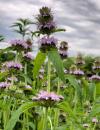 | | 2021 | COLLECTED | 09/27/2021 | Located approximately 3 miles south, southeast of Fairfield, T71N R9W SW1/4 Sec. 7 | 40.96338000, -91.94686900 | 223 | Woodland openings/edges, disturbed areas | Wild material | | 2122068 | Ames 35750 |
| 19 | Ames 35746 | Guye Woods | Acer saccharum Marshall subsp. nigrum (F. Michx.) Desmarais | Iowa, United States | NC7 |  | | 2021 | COLLECTED | 09/08/2021 | Guye Woods County Park located 6.0 miles northeast of Winterset, T76N R27W NE1/4 Sec. 4 | 41.41235000, -93.96373000 | 278 | Moist deciduous maple, oak, hickory forest, northwest facing slope above the North River. | Wild material | Multiple specimens in this population were observed to be 24" diameter at breast height (DBH) or larger with the largest specimen encountered at the time of collection measuring 36.5" DBH.
Morphological traits of leaves suggests sampled specimens are true to type of Acer saccharum subsp. nigrum including leaves with three distinct points, leathery/thick, and drooping in appearance. On September 25, 2020 (Schmitz, A., personal communication, 31 January 2022), peak fall color on Acer saccharum subsp. nigrum at Guye Woods was observed with specimens having a clean yellow fall color, also indicative of Acer saccharum subsp. nigrum.
| 2122010 | Ames 35746 |
| 20 | Ames 35734 | Ledges State Park | Teucrium canadense L. | Iowa, United States | NC7 |  | | 2021 | COLLECTED | 08/23/2021 | Ledges State Park located approximately 4.75 miles south of Boone T83N R26W Sec. 16 & 21 | 41.99262400, -93.87724800 | 330 | Edges of woods | Wild material | | 2120338 | Ames 35734 |
| 21 | Ames 35586 | Long Pines #6 | Agastache foeniculum (Pursh) Kuntze | Montana, United States | NC7 |  | | 2020 | | | | | | | Wild material | Agastache foeniculum in Montana has been minimally reported and is currently under review by the Montana Natural Heritage Program (20 October 2020). A total of eighteen herbarium specimens from Montana have been deposited (Consortium of Pacific Northwest Herbaria, accessed 20 October 2020) with twelve being collected since the year 2000. The species is rather restricted to the extreme eastern border and especially the southeastern corner of Montana with majority (12 herbarium specimens) being collected in Carter County. Genetics of this accession would represent the northwestern edge of the species native range. In nature, plants of this accession measured approximately 30-36 inches tall and were still green with a few flowering specimens noted at time of collection (12 September 2020). | 2107749 | Ames 35586 |
| 22 | Ames 35587 | Long Pines #7 | Agastache foeniculum (Pursh) Kuntze | Montana, United States | NC7 |  | | 2020 | | | | | | | Wild material | Agastache foeniculum in Montana has been minimally reported and is currently under review by the Montana Natural Heritage Program (20 October 2020). A total of eighteen herbarium specimens from Montana have been deposited (Consortium of Pacific Northwest Herbaria, accessed 20 October 2020) with twelve being collected since the year 2000. The species is rather restricted to the extreme eastern border and especially the southeastern corner of Montana with majority (12 herbarium specimens) being collected in Carter County. Genetics of this accession would represent the northwestern edge of the species native range. | 2107750 | Ames 35587 |
| 23 | OPGC 8059 | ID310-42 | Asclepias speciosa Torr. | Idaho, United States | OPGC | | | 2020 | | | | | | | Wild material | Petiolate leaves, oblong-lanceolate leaves. | 2107488 | OPGC 8059 |
| 24 | W6 58090 | ID230-56 | Pyrrocoma insecticruris (L. F. Hend.) A. Heller | Idaho, United States | W6 | | | 2020 | | | | | | | Wild material | Serrated, oblanceolate leaves, "scaly" involucre (phyllaries less than or equal to 3 mm), leaves alternate. | 2107694 | W6 58090 |
| 25 | W6 57744 | CA170-250 | Poa secunda J. Presl | California, United States | W6 | | | 2020 | | | | | | | Wild material | SOS 92nd Shipment | 2105042 | W6 57744 |
| 26 | Ames 35288 | APS/MF/2020/003/406 | Monarda fistulosa L. | Kansas, United States | NC7 |  | | 2020 | COLLECTED | 02/05/2020 | Eisenhower State Park on north side of Melvern Lake approximately 5.25 miles west, northwest of Melvern, T18S R15E NE1/4 Sec. 3, Osage County | 38.51966000, -95.73352000 | 323 | Edge of woods with limestone substrate. | Wild material | | 2101394 | Ames 35288 |
| 27 | WLP 1686 | APS/RS/2019/067/396 | Rosa setigera Michx. | Arkansas, United States | NA |  | | 2019 | COLLECTED | 11/07/2019 | Located near intersection of Smith Mountain Road and Newton County 8828 Road approximately 6.00 miles north of Deer, Newton County | 35.91212000, -93.21112000 | 636 | Roadside, upland with rocky soils | Wild material | | 2097789 | WLP 1686 |
| 28 | Ames 35236 | SF_ID:24690/EO-ID:17843 | Agastache foeniculum (Pursh) Kuntze | Nebraska, United States | NC7 |  | | 2019 | | | | | | | Wild material | Plants measuring approximately 60 cm in height. Infructescences fully mature at time of collection (23 October 2019), likely past peak maturity by approximately 4 weeks. Population (EC-ID: 17843) was originally documented by Steven B. Rolfsmeier on 8 June 2015 (Nebraska Pine Ridge Plant Resurvey, 2015: Report submitted to the Nebraska Natural Heritage Program) noting “ Agastache foeniculum was located in a ravine bottom that burned in 2012. Estimated population size: 200-300 stems covering approximately 125 sq. meters”. A. foeniculum in Nebraska is currently tracked by the Nebraska Natural Heritage Program and is listed (6 November 2019) as a S1 (Critically Imperiled - at very high risk of extirpation in the state due to very restricted range, few populations or occurrences, steep declines, severe threats or other factors) and Tier 2 species (Tier 2 - species are typically those that are not at-risk from a global or national perspective but are rare or imperiled within Nebraska). | 2097772 | Ames 35236 |
| 29 | WLP 1685 | JDC/RS/2019/036/915 | Rosa setigera Michx. | Iowa, United States | NA |  | | 2019 | COLLECTED | 10/17/2019 | Ledges State Park located approximately 4.75 miles south of Boone, just south of the Oakwoods Shelter/Picnic area, T83N R26W NE1/4 NE1/4 and also NW1/4 NE1/4 Sec. 21, Boone County | 41.99262400, -93.87724800 | 330 | Edges of woods (adjacent to prairie) and also within 20-25 yards from woods in prairie. Noted in east, west, and south-facing edges of woods (no specimens noted on north-facing woodland edges) | Wild material | Woody shrub/vine stretching up to 12' in length. Alternate compound leaves usually consisting of five lealets. Leaf rachis and stipule margins glandular. Mature hypanthium and pedicel with stipitate glandular hairs. Mature hypanthium mostly bright to dark red in color with a few dark orange noted at time of harvest (17 October 2019). Leaves rather to somewhat glossy. This collection represents genetics from the northwestern edge of the species range, likely suggesting good cold-hardiness (USDA Zone 5a). | 2097769 | WLP 1685 |
| 30 | Ames 35231 | Va101 | Agastache parvifolia Eastw. | California, United States | NC7 |  | | 2019 | COLLECTED | 09/26/2019 | Area between Bogard Buttes and Caribou Wilderness approximately 20 miles west of Eagle Lake, on USGS Bogard Buttes 7.5-minute quad map T31N R7E including SW1/4 Sec. 11, NE1/4 Sec. 13, N1/2 Sec. 14 and NE1/4 NE1/4 Sec. 15, Lassen County | 40.55202800, -121.15888900 | 1980 | Margins and interiors of (+/-) dry, volcanic rock fields. Talus outcroppings, among boulders in fissures and on low ridges, across variable slopes (5-40 degrees) and aspects (east, west, south and northeast) with majority of sites in low-relief, except for irregular surfaces within lava fields. Elevations ranging from 1944 to 2023 (meters). Full sun or patchy shade. | Wild material | Perennial aromatic herb of mint family, basally branched with small, triangular crenate/serrate leaves and small pink-rose flowers in dense, elongate, terminal spikes. Plants in nature ranged from one to three feet high, few-branched up to ten or so branches. At time of collection (26 September 2019), plants were mostly late in phenology, though a few plants showed a flush of corolla color. | 2097767 | Ames 35231 |
| 31 | W6 56772 | NV040-326 | Leymus cinereus (Scribn. & Merr.) Á. Löve | Nevada, United States | W6 |  | | 2019 | | | | | | | Wild material | | 2094578 | W6 56772 |
| 32 | W6 56339 | CA170-223 | Crepis acuminata Nutt. | California, United States | W6 |  | | 2019 | | | | | | | Wild material | Crepis acuminata | 2091524 | W6 56339 |
| 33 | W6 55248 | NV930A-10 | Leymus cinereus (Scribn. & Merr.) Á. Löve | Nevada, United States | W6 | 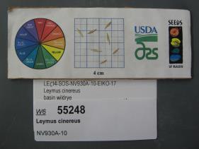 | | 2018 | | | | | | | Wild material | Leymus cinereus | 1967800 | W6 55248 |
| 34 | W6 53658 | CA370-246 | Achillea millefolium L. | Nevada, United States | W6 | | | 2018 | | | | | | | Wild material | | 1964236 | W6 53658 |
| 35 | NA 85021 | JDC/SS/2018/004/817 | Sapindus saponaria L. var. drummondii (Hook. & Arn.) L. D. Benson | Oklahoma, United States | NA |  | | 2018 | COLLECTED | 03/12/2018 | Private property approximately 4.8 miles southeast of Mulhall, north side of Cimarron River, T18N R2W, Logan County | 35.99972000, -97.39735900 | 210 | Transition zone between higher elevations and bottomlands. | Wild material | | 1957958 | NA 85021 |
| 36 | Ames 33918 | APS/GD/2017/008/267 | Gymnocladus dioicus (L.) K. Koch | Minnesota, United States | NC7 |  | | 2017 | COLLECTED | 03/16/2017 | Minnesota River watershed covering approximately 9.0 river miles between Redwood Falls and Vicksburg Park, Renville County | 44.61447700, -95.14878600 | 254 | Mixed habitats, both upland dry sites, wet sites, and rocky sites. | Wild material | | 1946985 | Ames 33918 |
| 37 | Ames 33752 | Ames 33752 | Maclura pomifera (Raf.) C. K. Schneid. | Iowa, United States | NC7 |  | | 2016 | COLLECTED | 10/05/2016 | Deer Creek watershed, T80N R23W E1/2 Sec. 18. | 41.73813000, -93.56296400 | 295 | Mixed deciduous woods, distrubed areas and also managed areas. Gentle slopes and wetlands | Uncertain improvement status | The native range for Osage-orange is reported from eastern Texas, southeastern Oklahoma, southwestern Arkansas, and the northwestern corner of Louisiana (Little, 1971). Historically and presently known for its extreme value as bow-wood and fence posts, Osage-orange represents one of the most widely planted tree species in the lower 48 US states as a living fence starting in the mid-1800's, in the late 1900's as a landscape tree for difficult sites, and most recently its chemical properties. Detailed history of Osage-orange and it's economic uses are well documented (Smith and Perino, 1981 and J. T. Winberry 1979). Osage wood is highly-prized for its use as fence posts (both living and non-living) and durable wood for wood working. Osage is an extremely drought and heat tolerant tree and is recommended for use in USDA cold-hardiness zones 5b or warmer. Although the species is commonly known for its stout thorns and large, globular fruits, the species is dioecious and the degree of thorns on individual genotypes can be extremely variable. This accession represents germplasm from a naturalizing, reproductive population collected in central Iowa (Polk County). Majority of specimens averaged approximately 40-50’ in height with multiple (e.g. 4-5) trunks. Specimens 03-1 and 03-2 were upright in form with tighter branch angles, while 03-10 was the widest spreading of all trees. Some yellow fall color (yellow) was apparent at time of fruit collection (10/05/2016). Size of fruits ranged from 9.00 to 10.75 inches circumference except for tree 03-5 with fruits averaging 7.33 inches circumference. | 1942949 | Ames 33752 |
| 38 | W6 51589 | CBG-4169 | Nassella viridula (Trin.) Barkworth | South Dakota, United States | W6 | | | 2016 | | | | | | | Wild material | | 1942719 | W6 51589 |
| 39 | W6 50306 | NV040-225 | Purshia tridentata (Pursh) DC. | Nevada, United States | W6 |  | | 2015 | | | | | | | Wild material | | 1927606 | W6 50306 |
| 40 | W6 50341 | NV040-229 | Wyethia amplexicaulis (Nutt.) Nutt. | Nevada, United States | W6 |  | | 2015 | | | | | | | Wild material | | 1927636 | W6 50341 |
| 41 | Ames 32958 | APS/ST/2013/024/109 | Staphylea trifolia L. | Indiana, United States | NC7 | | | 2015 | COLLECTED | 03/06/2013 | Charlestown State Park, near Fourteen Mile Creek along trail going to Rose Island, Clark County | 38.42531000, -85.62371000 | 159 | Upland bluffs | Wild material | | 1927428 | Ames 32958 |
| 42 | W6 49810 | UT933-377 | Ligusticum porteri J. M. Coult. & Rose | Utah, United States | W6 |  | | 2015 | | | | | | | Wild material | | 1926743 | W6 49810 |
| 43 | Ames 32891 | APS/GD/2015/010/192 | Gymnocladus dioicus (L.) K. Koch | Oklahoma, United States | NC7 |  | | 2015 | COLLECTED | 03/12/2015 | Nowata County: T25N R16E NW 1/4 NE 1/4 Sec. 3. Oologah Wildlife Management Area approximately 3 miles east of Nowata. | 36.68401000, -95.58207800 | 208 | Transition zone between higher elevations and bottomlands. | Wild material | | 1925357 | Ames 32891 |
| 44 | Ames 32893 | APS/GD/2015/016/198 | Gymnocladus dioicus (L.) K. Koch | Oklahoma, United States | NC7 |  | | 2015 | COLLECTED | 03/14/2015 | Creek County: West Fork Sandy Creek watershed and small tributaries. T14N R9E SW 1/4 SE 1/4 Sec. 21. Private property approximately 11 miles south of Bristow. | 35.66820200, -96.35882500 | 216 | Floodplain. | Wild material | | 1925359 | Ames 32893 |
| 45 | Ames 32894 | APS/GD/2015/017/199 | Gymnocladus dioicus (L.) K. Koch | Oklahoma, United States | NC7 |  | | 2015 | COLLECTED | 03/14/2015 | Cleveland County: T10N R5W SW 1/4 SW 1/4 Sec. 7. John Nichols Camp located on north side of Canadian River approxiamtely 4.25 miles south and southeast of Mustang. | 35.35029600, -97.66952200 | 395 | Higher elevations. Dry, relatively thin soils. | Wild material | | 1925360 | Ames 32894 |
| 46 | Ames 32901 | APS/GD/2015/029/211 | Gymnocladus dioicus (L.) K. Koch | Oklahoma, United States | NC7 |  | | 2015 | COLLECTED | 03/18/2015 | Major County: T20N R15W NE 1/4 Sec. 36. Canton Wildlife Management Area approxiamtely 9.5 miles east of Seiling. | 36.16760000, -98.74597300 | 503 | Transition zone between higher elevations and bottomlands. | Wild material | This collection represents genetics from the far western range of Kentucky coffeetree. Numerous large specimens were noted throughout this area and specimens 674-4 and 674-5 were collected in the vicinity of the current (2019) Oklahoma State Champion Gymnocladus dioicus which was nominated by Carstens and Schmitz in 2015. The state champion specimen (likely a male) was officially measured on 21 April 2015 by Riley Coy (Oklahoma Forestry Services): 100.5" circumference, 90' in height, 51.5' crown spread totalling 203 points. | 1925367 | Ames 32901 |
| 47 | Ames 32903 | APS/GD/2015/031/213 | Gymnocladus dioicus (L.) K. Koch | Oklahoma, United States | NC7 |  | | 2015 | COLLECTED | 03/19/2015 | Osage County: Arkansas River watershed area known as Souters Bend, T21N R7E. Keystone Wildlife Management Area (John Lowery Unit) approximatley 3 miles west of Cleveland. | 36.30185300, -96.53051000 | 222 | Floodplain, but one specimen sampled was located on dry, rocky (large boulders) bluff. | Wild material | | 1925369 | Ames 32903 |
| 48 | Ames 32904 | APS/GD/2015/032/214 | Gymnocladus dioicus (L.) K. Koch | Oklahoma, United States | NC7 |  | | 2015 | COLLECTED | 03/19/2015 | Osage County: Sand Creek watershed area, T27N R8E SE 1/4 NW 1/4 Sec. 10. Tallgrass Prairie Preserve approximately 13 miles northwest of Pawhuska. | 36.83425300, -96.43091600 | 307 | Dry, rocky outcroppings and floodplain. | Wild material | | 1925370 | Ames 32904 |
| 49 | Ames 32820 | APS/EA/2013/041/126 | Euonymus atropurpureus Jacq. | Iowa, United States | NC7 |  | | 2014 | COLLECTED | 10/10/2014 | Midland Trail Road near North Racoon River watershed. Dallas County T80N R27W SW 1/4 NW 1/4 Sec. 30 | 41.71142000, -94.04538000 | 299 | Wooded roadside. | Wild material | | 1921780 | Ames 32820 |
| 50 | Ames 32389 | JDC/BN/2014/016/518 | Betula nigra L. | Iowa, United States | NC7 |  | | 2014 | COLLECTED | 06/06/2014 | Clemmons Creek Wildlife Management Area, T75N R8W NE 1/4 Sec. 14. | 41.30388300, -91.74342500 | 208 | Wet, floodplain. | Wild material | | 1919310 | Ames 32389 |
| 51 | Ames 32470 | ECAN2-SOS-WY080-12-CUSTER-12 | Echinacea angustifolia DC. | South Dakota, United States | NC7 |  | | 2013 | COLLECTED | 08/10/2012 | Located approximately 16.6 miles west of Custer along Forest Service Road 668 just north of highway 16, T3S R2E NW 1/4 Sec. 31, Custer County. | 43.74830000, -103.93117000 | 1600 | Valley composed of grazed and burned areas with eastern aspect. Growing in association with Ratibida columnifera, Pinus ponderosa, Liatris punctata, Grindelia squarrosa, Rosa sp., and Symphoricarpos occidentalis. | Wild material | | 1914390 | Ames 32470 |
| 52 | Ames 32018 | APS/GD/2013/032/117 | Gymnocladus dioicus (L.) K. Koch | Missouri, United States | NC7 |  | | 2013 | COLLECTED | 04/09/2013 | Poosey Conservation Area, Livingston County. | 39.94995200, -93.71471700 | 267 | Floodplain. | Wild material | A total of four areas containing Gymnocladus dioicus were noted throughout Poosey Conservation Area. Each area was represented by approximately 2-6 specimens. Specimens ranged between 14-22.5 inches d.b.h. and approximately 90-110 feet in height. Pod production during the 2012 growing season was minimal/below average. Samples 473-1 and 473-2 were very close together (approximately 10 feet apart) and samples 473-3 and 473-4 were also very close together (approximately 48 feet apart). Samples this close together may potentially represent material from a single clone due to the clonal suckering habit of Gymnocladus dioicus. | 1908307 | Ames 32018 |
| 53 | Ames 31993 | APS/GD/2013/019/104 | Gymnocladus dioicus (L.) K. Koch | Kentucky, United States | NC7 |  | | 2013 | COLLECTED | 03/04/2013 | Griffith Woods, Harrison County. | 38.33023200, -84.35127800 | 285 | Upland site. | Wild material | | 1908271 | Ames 31993 |
| 54 | Ames 31995 | APS/GD/2013/021/106 | Gymnocladus dioicus (L.) K. Koch | Kentucky, United States | NC7 |  | | 2013 | COLLECTED | 03/05/2013 | Blue Grass Sportsmen's League, Jessamine County. | 37.79418400, -84.66744000 | 276 | Upland site. Gentle rolling hills and ravines. | Wild material | | 1908273 | Ames 31995 |
| 55 | Ames 31996 | APS/GD/2013/022/107 | Gymnocladus dioicus (L.) K. Koch | Kentucky, United States | NC7 |  | | 2013 | COLLECTED | 03/06/2013 | Along Bluegrass Parkway (median), just west of Lexington, Nelson County. | 37.87488800, -85.27995500 | 228 | Dry, shallow soils. | Wild material | | 1908274 | Ames 31996 |
| 56 | Ames 31997 | APS/GD/2013/023/108 | Gymnocladus dioicus (L.) K. Koch | Indiana, United States | NC7 |  | | 2013 | COLLECTED | 03/06/2013 | Charlestown State Park, Clark County. | 38.43612400, -85.62875800 | 159 | Upland bluffs. | Wild material | | 1908275 | Ames 31997 |
| 57 | Ames 32585 | CBG-1842 | Monarda fistulosa L. var. fistulosa | Wyoming, United States | NC7 |  | | 2013 | COLLECTED | 09/07/2011 | Moiser Gulch Recreational picnic area, located approximately 5.5 miles west of Buffalo on highway 16 (Cloud Peak Scenic Byway) in northern Wyoming | 44.33220000, -106.81660000 | 1727 | Stream gulch with wetter soils within Western Rocky Mountain foothills. | Wild material | | 1909018 | Ames 32585 |
| 58 | WLP 2435 | CBG-1797 | Prunus virginiana L. | Wyoming, United States | NA |  | | 2013 | COLLECTED | 09/06/2011 | | | 1727 | Stream gulch with wetter soils within Western Rocky Mountain foothills. | Wild material | | 1908924 | WLP 2435 |
| 59 | Ames 31982 | APS/GD/2013/004/089 | Gymnocladus dioicus (L.) K. Koch | Kansas, United States | NC7 |  | | 2013 | COLLECTED | 02/18/2013 | Walnut Creek watershed, southwest of Marysville, Sections 5, 8, and 17, T3S R6E, Marshall County. | 39.79300943, -96.78506600 | 382 | Dry floodplain. | Wild material | | 1907535 | Ames 31982 |
| 60 | Ames 31984 | APS/GD/2013/007/092 | Gymnocladus dioicus (L.) K. Koch | Kansas, United States | NC7 |  | | 2013 | COLLECTED | 02/19/2013 | Salt Creek, west of Minneapolis, Sections 4 and 11, T11S R4W, Ottawa County. | 39.12575800, -97.75880300 | 384 | Floodplain. | Wild material | | 1907537 | Ames 31984 |
| 61 | Ames 31988 | APS/GD/2013/012/097 | Gymnocladus dioicus (L.) K. Koch | Kansas, United States | NC7 |  | | 2013 | COLLECTED | 02/21/2013 | Canville Creek, west of Savonburg, SW 1/4 of Section 25, T26S R20E, Allen County. | 37.74857200, -95.17660125 | 304 | Dry floodplain. | Wild material | Largest Gymnocladus dioicus specimen was 29.5 inches d.b.h. | 1907541 | Ames 31988 |
| 62 | Ames 31989 | APS/GD/2009/001/010 | Gymnocladus dioicus (L.) K. Koch | Kansas, United States | NC7 |  | | 2013 | COLLECTED | 02/21/2013 | Clinton State Park, west of Lawrence, Section 12, T13S R18E, Douglas County. | 38.93730038, -95.36213950 | 282 | Fairly dry, upland site. Majority of specimens found on upland areas. | Wild material | | 1907542 | Ames 31989 |
| 63 | Ames 31990 | APS/GD/2013/013/098 | Gymnocladus dioicus (L.) K. Koch | Missouri, United States | NC7 |  | | 2013 | COLLECTED | 02/22/2013 | Peavine Creek, south of Concordia, SW 1/4 of SE 1/4 of Section 20, SW 1/4 of NW 1/4 of Section 21, and NE 1/4 of NW 1/4 of Section 28, T48N R24W, Lafayette and Johnson Counties. | 38.93429000, -93.57204500 | 205 | Floodplain. | Wild material | | 1907543 | Ames 31990 |
| 64 | Ames 31677 | GA12001001 | Fraxinus pennsylvanica Marshall | Minnesota, United States | NC7 |  | | 2012 | COLLECTED | 09/24/2012 | Southwest Becker County near Lake Cormorant and Lake Maud.. | 46.73903330, -95.97883330 | 415 | Edge of slough and forest. | Wild material | | 1906588 | Ames 31677 |
| 65 | Ames 31678 | GA12003001 | Fraxinus pennsylvanica Marshall | Minnesota, United States | NC7 |  | | 2012 | COLLECTED | NEAR 09/26/2012 | Buffalo River State Park along the Buffalo River, east of Glyndon, Clay County. | 46.86481660, -96.46406660 | 302 | Floodplain. Transistion zone between prairie and forest | Wild material | | 1906589 | Ames 31678 |
| 66 | Ames 31256 | APS/GD/2008/005/005 | Gymnocladus dioicus (L.) K. Koch | Iowa, United States | NC7 |  | | 2012 | COLLECTED | 01/10/2012 | Ledges State Park, SW 1/4 of SW 1/4 of Section 21, T83N, R26W, Madrid NW Quad, Boone County | 41.98110000, -93.89010000 | 328 | Upland woods. 30% slope with a western aspect. | Wild material | Largest specimen noted was 22" d.b.h. | 1897494 | Ames 31256 |
| 67 | W6 41321 | CA170-71 | Leymus cinereus (Scribn. & Merr.) Á. Löve | California, United States | W6 |  | | 2011 | | | | | | | Wild material | | 1868841 | W6 41321 |
| 68 | NA 80368 | NA 80368 | Rosa acicularis Lindl. subsp. sayi (Schwein.) W. H. Lewis | Wyoming, United States | NA | | | 2010 | COLLECTED | 07/29/2010 | Dugout Gulch, Black Hills National Forest; old Forest Service road bed | 44.47781000, -104.10819000 | 1230 | Old road bed | Wild material | | 1951717 | NA 80368 |
| 69 | Ames 32398 | AGUR-SOS-OR030-75-09 | Agastache urticifolia (Benth.) Kuntze | Oregon, United States | NC7 |  | | 2010 | COLLECTED | 08/18/2009 | Lookout Mountain, Malheur county, OR. | 44.54266667, -117.27980560 | 1592 | Pine forest on edge of sagebrush steppe. | Wild material | | 1842419 | Ames 32398 |
| 70 | Ames 34026 | Ames 34026 | Monarda fistulosa L. var. menthifolia (Graham) Fernald | South Dakota, United States | NC7 |  | | 2010 | COLLECTED | 05/20/2010 | Black Hills National Forest along Reno Gulch Road (FS Road T317) near confluence of Coon Creek and Long Draw approximately 5.75 miles southwest of Hill City, Pennington County | 43.90025000, -103.68300000 | 1805 | Grassy upland meadow in full sun. Open meadow area area near stream, deep, coarse alluvial soil. | Wild material | Plants to height of 3'. Most plants in this accession have pink flowers, however, two out of 84 plants grown at NCRPIS were discovered to have white flowers. | 1953281 | Ames 34026 |
| 71 | Ames 30518 | APS/GD/2009/020/029 | Gymnocladus dioicus (L.) K. Koch | Iowa, United States | NC7 |  | | 2010 | COLLECTED | 04/11/2010 | North Raccoon River Watershed, Section 6, Section 7, and NW 1/4 of NW 1/4 of Section 18, between Iowa Highway 44 (240th Street) and Adel, Dallas County. | 41.67297500, -94.03777500 | 320 | Bottomland/floodplain forest. | Wild material | Plants ranged from 60-75 feet tall and averaged 20 inches d.b.h. Seeds seemed very small and round. | 1836761 | Ames 30518 |
| 72 | Ames 30511 | JDC/GD/2010/015/285 | Gymnocladus dioicus (L.) K. Koch | Iowa, United States | NC7 |  | | 2010 | COLLECTED | 03/21/2010 | Along 170th Street, east of Old Lincoln Highway, SE 1/4 of Section 24, NE1/4 of NW 1/4 of Section 11, SE 1/4 of NE 1/4 of Section 25, NW 1/4 of Section 25, NW 1/4 of SE 1/4 of Section 14, NW 1/4 of NE 1/4 of Section 14, T77N, R44W, Honey Creek Quad and SW 1/4 of SW 1/4 of SW 1/4 of Section 2, SE 1/4 of SE 1/4 of Section 3, T77N, R44W, Loveland Quad, south-southeast of Loveland, Pottawattamie County. | 41.46948600, -95.86295900 | 353 | Bluffs of Loess Hills. Slope generally 30-40%, variation in aspect. Elevation ranged between 323 and 379 meters. | Wild material | Average plant height was approximately 55 feet (range 40-70 feet). Average diameter at breast height was approximately 12 inches. (range 7-26 inches). Two specimens measured in the 23-26 inches d.b.h. range. | 1836389 | Ames 30511 |
| 73 | Ames 30481 | APS/GD/2010/001/036 | Gymnocladus dioicus (L.) K. Koch | Missouri, United States | NC7 |  | | 2010 | COLLECTED | 02/17/2010 | Mark Twain Lake Project (Army Corp of Engineers), Mark Twain Lake, T54N R8W SE 1/4 of NW 1/4 of Section 2 and west 1/2 of Sec. 11, Florida Quad, Monroe County. | 39.49270000, -91.76510000 | 199 | Northwest-facing bluff; woods. | Wild material | #106 measured 14.5" d.b.h and 70-80'; #107 measured 9.5" and 70-80'; #108 measured 11" d.b.h. and 60-70'; #109 measured 9.5" d.b.h. and 40-50'; #110 measured 11" d.b.h. at 30-40'; and #111 measured 6" d.b.h. and 30'. | 1831340 | Ames 30481 |
| 74 | W6 35287 | UT931-BEND73 | Juncus ensifolius Wikstr. | Utah, United States | W6 | 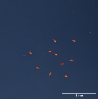 | | 2009 | | | | | | | Wild material | | 1802263 | W6 35287 |
| 75 | Ames 29976 | JDC/GD/2009/005/155 | Gymnocladus dioicus (L.) K. Koch | Nebraska, United States | NC7 |  | | 2009 | COLLECTED | 03/20/2009 | Wiseman Wildlife Management Area, approximately 3 miles northeast of Wynot, T32N R3E Sec. 8 and Sec. 9 Meckling Quad., Cedar County. | 42.76055556, -97.09472222 | 363 | Hillside. 100% filtered exposure. 40 degrees of slope with a northern aspect. | Wild material | Plants sampled measured between 30 and 45 feet in height and 8 to 16 inches DBH. | 1798768 | Ames 29976 |
| 76 | Ames 29861 | APS/GD/2009/002/011 | Gymnocladus dioicus (L.) K. Koch | Kansas, United States | NC7 |  | | 2009 | COLLECTED | 02/17/2009 | Trees 1-3: Woodson Cove Road, Holiday Hill area; Trees 4-5: Sandstone Campground; Tree 6: Campground 16, Toronto Point area; Tree 7: Lake Hills Road 400; Cross Timbers State Park, Toronto, extreme southwest corner of Woodson County. | 37.74277778, -95.91194444 | 290 | Trees 1-3: Wooded area. Flat; Trees 4-5: 20-30 yards from lake shore, east side of lake; Tree 6: Edge of wooded area, north side of Toronto Lake, Flat; Tree 7: Roadside ditch in a fence row. | Wild material | Trees 1-3: 5.5 to 7 inches d.b.h and 50 feet in height; Trees 4-5: 9 to 10.5 inches d.b.h. and 40 feet in height; Tree 6: 14 inches d.b.h. and 40 feet in height; Tree 7: 2 to 6 inches d.b.h. and 10 to 25 feet in height. | 1796426 | Ames 29861 |
| 77 | Ames 29863 | APS/GD/2009/006/015 | Gymnocladus dioicus (L.) K. Koch | Missouri, United States | NC7 |  | | 2009 | COLLECTED | 02/19/2009 | Along Highway 215 and road to beach, Stockton State Park, approximately 11 miles northwest of Dadeville, Cedar County. | 37.62388889, -93.75527778 | 287 | Tree 1: Upland. Top of west facing slope to lake; Trees 2-5: Open grassy area. 10% southwest slope. | Wild material | 4.5 to 14.5 inches d.b.h. and 70 feet in height. | 1796428 | Ames 29863 |
| 78 | W6 27331 | OR050-31 | Geum macrophyllum Willd. | Oregon, United States | W6 |  | | 2005 | | | | | | | Wild material | | 1674362 | W6 27331 |
| 79 | Ames 27329 | 34 | Ptelea trifoliata L. | Iowa, United States | NC7 |  | | 2003 | COLLECTED | 09/24/2003 | Bluff Park, Keokuk, South of Park Street at G, T65N R5W, Section 35, Keokuk Quad. | 40.38861111, -91.40277778 | 194 | Bluff edge along Mississippi River. Sunny. 25% slope with a southern aspect. Soil well to good drainage. | Wild material | | 1649675 | Ames 27329 |