| 0 | WLP 214 | RL 08096 | Tsuga caroliniana Engelm. | | NA | | | 2008 | COLLECTED | PRE 09/15/2008 | North Carolina, Henderson County, Bearwallow Mountain, along edge of woodland and pasture. | 35.46346000, -82.35933000 | | | Wild material | | 1896020 | WLP 214 |
| 1 | WLP 205 | NA 63134 | Tsuga caroliniana Engelm. | North Carolina, United States | NA | | | 1991 | COLLECTED | 09/23/1991 | 450 feet east of Dix Creek on north side of Cold Mt. | | 5150 | On ridge crest., | Wild material | | 1494881 | WLP 205 |
| 2 | PI 693240 | 'Crossroad' | Tsuga hybr. | District of Columbia, United States | NA | | | 2012 | DEVELOPED | 1998 | | | | | Cultivar | Seedling number 1 from 1998 cross between T. caroliniana (Blandy Farm 84-2069, female parent, code no. 20) and T. chinensis NA 12347 (male parent, code no. 5, died approx. 2007). This accession is under evaluation for future release as of 2017. | 2102024 | PI 693240 |
| 3 | NA 89045 | RJL2022PA-013 | Tsuga canadensis (L.) Carrière | Pennsylvania, United States | NA | | | 2022 | COLLECTED | 10/07/2022 | Plants growing on the steep banks along Octoraro Creek accessed by canoe. Plants are locally common but generally infrequent along the Octoraro Creek. | 39.74442700, -76.08856400 | 66 | Plants are growing in part-shade to sun of mixed deciduous and evergreen forests on steep rocky habitats overlain by relatively deep soil over occasionally exposed geology along the Octoraro Creek.
Soils: The underlying geology of this area is estimated to be of lower Paleozoic origin and comprised of Peters Creek Schist. This is comprised of chlorite-sericite schist containing interbedded quartzite.
Source: USGS Pennsylvania Geologic Map Data (https://mrdata.usgs.gov/geology/state/sgmc-unit.php?unit=PAPZpc%3B0)
The primary soil types in the collection area are classified as Manor loam, 25 to 35 percent slopes, very stony. The soils in the collecting area originated as residuum, weathered from the micaceous schist exposed geology and are generally considered coarse-loamy, micaceous, mesic typic dystrudepts that are very acidic and well-drained. There is a variable depth of soil depending upon the steepness of slopes. Some areas contain significant exposed Peters Creek Schist overlain by a highly decomposed organic mat intermingled with a dense root mat of woody and herbaceous plants.
Source: NRCS Web Soil Survey (https://websoilsurvey.sc.egov.usda.gov/App/WebSoilSurvey.aspx) | Wild material | | 2139610 | NA 89045 |
| 4 | WLP 217 | 379 | Tsuga canadensis (L.) Carrière | Pennsylvania, United States | NA | | | 2011 | COLLECTED | 09/15/2011 | State Game Lands #282, floodplain of Conewango Creek Watershed, Warren County. | 41.98300000, -79.13400000 | 392 | Mixed hardwood forest and wetlands. Associated with Betula alleghaniensis, Carpinus caroliniana, Cornus amomum, Fraxinus, Magnolia acuminata, Spiraea alba, Viburnum dentatum, and Viburnum lentago. | Wild material | | 1891489 | WLP 217 |
| 5 | WLP 830 | 381 | Carpinus caroliniana Walter | Pennsylvania, United States | NA | | | 2011 | COLLECTED | 09/15/2011 | Along Valentine Run Road, near small tributary to Rhine Run Creek, Warren County. | 41.92500000, -79.18800000 | 475 | Roadside. Mixed hardwood forest and open rangeland (Solidago). Associated with Acer, Carya ovata, Cornus racemosa, Fagus grandifolia, Hamamelis virginiana, Quercus, Rosa, Rubus, and Tsuga canadensis. | Wild material | | 1891442 | WLP 830 |
| 6 | NA 88696 | RJL2023NCSC-001 | Rhododendron catawbiense Michx. | North Carolina, United States | NA | | | 2023 | COLLECTED | 11/12/2023 | Duke Forest property along New Hope Creek. The collection site is accesses by foot along trails. | 35.98317700, -79.01856200 | 103 | Plants growing in shade to part-shade of an upland very dry woodland habitat that is mostly deciduous. The site is steeply sloped underlain by rocky outcrop. Slope: 15 to 25 percent. Aspect: Northwest. The underlying geology of this area is of Cambrian/Late Proterozoic origin and characterized as a Metamorphosed Granitic Rock. It is megacrystic and well foliated; locally contains hornblende. Chapel Hill, Chatham, Farrington, Meadow Flats, Mt. Moriah, Parks Crossroads plutons, and Roxboro and Vance County suites. (Source: USGS North Carolina Geologic Map Data.) The primary soil type in the collection area is classified as Wedowee sandy loam, 15 to 25 percent slopes. Wedowee Series consists of very deep, well drained, moderately permeable soils that formed in residuum weathered from felsic igneous and metamorphic rocks of the Piedmont uplands. These soils are on narrow ridges and on side slopes of uplands. Slopes are dominantly 6 to 25 percent but ranges from 0 to 60 percent. The strata range from dark brown and brownish yellow to strong brown. They are mostly sandy loam; moderate fine granular structure; very friable; strongly acid. (Source: NRCS Web Soil Survey.) | Wild material | | 2159124 | NA 88696 |
| 7 | NA 88671 | RJL2023PA-005 | Rhododendron maximum L. | Pennsylvania, United States | NA | | | 2023 | COLLECTED | 10/16/2023 | Appalachian National Scenic Trail: Pulpit Rock and Pinnacle Loop. Rocky woodlands along Furnace Creek as well as steep rocky slopes above Pulpit Rock Reservoir associated with the Pulpit Rock and Pinnacle Loop Trail. | 40.59226100, -75.94588800 | 301 | Well-drained and very rocky dry deciduous woodlands in part shade to full shade. Slope: 0-30%. Aspect: variable. The underlying geology of this area is of Silurian origin and characterized as the Shawangunk Formation. It is characterized by light- to dark-gray, fine- to very coarse-grained sandstone and conglomerate containing thin shale interbeds. Includes four members, in descending order: Tammany--conglomerate and sandstone; Lizard Creek--sandstone and red or green shale; Minsi--sandstone and conglomerate; Weiders--conglomerate. Tammany and Lizard Creek Members together are approximately equivalent to Clinton Group to the west; Minsi and Weiders Members together are equivalent to Tuscarora Formation to the west. (Source: USGS Pennsylvania Geologic Map Data). The primary soil type in the collection area is classified as Hazleton Series. The Hazleton series consists of deep and very deep, well drained soils formed in residuum of acid gray, brown or red sandstone on uplands. Slope ranges from 0 to 80 percent. Permeability is moderately rapid to rapid. Solum thickness ranges from 60 to 120 centimeters. Depth to lithic contact ranges from 1 to 2 meters. Rock fragments of angular sandstone, dominantly less than 25 cm in size, range from 5 to 70 percent in individual horizons. Boulders, stones, flags and channers cover about 5 to 60 percent of the surface of some pedons. Reaction ranges from strongly acid through extremely acid throughout. (Source: NRCS Web Soil Survey). | Wild material | | 2159062 | NA 88671 |
| 8 | NA 88672 | RJL2023PA-006 | Rhododendron periclymenoides (Michx.) Shinners | Pennsylvania, United States | NA | | | 2023 | COLLECTED | 10/16/2023 | Appalachian National Scenic Trail: Pulpit Rock and Pinnacle Loop. Rocky woodland edges above Furnace Creek around Pulpit Rock and Pinnacle Loop Trail. | 40.58668200, -75.94269600 | 247 | Well-drained and very rocky dry deciduous woodlands in part shade to full shade. Slope: 10%. Aspect: East. The underlying geology of this area is of Silurian origin and characterized as the Shawangunk Formation. It is characterized by light- to dark-gray, fine- to very coarse-grained sandstone and conglomerate containing thin shale interbeds. Includes four members, in descending order: Tammany--conglomerate and sandstone; Lizard Creek--sandstone and red or green shale; Minsi--sandstone and conglomerate; Weiders--conglomerate. Tammany and Lizard Creek Members together are approximately equivalent to Clinton Group to the west; Minsi and Weiders Members together are equivalent to Tuscarora Formation to the west. (Source: USGS Pennsylvania Geologic Map Data). The primary soil type in the collection area is classified as Hazleton Series. The Hazleton series consists of deep and very deep, well drained soils formed in residuum of acid gray, brown or red sandstone on uplands. Slope ranges from 0 to 80 percent. Permeability is moderately rapid to rapid. Solum thickness ranges from 60 to 120 centimeters. Depth to lithic contact ranges from 1 to 2 meters. Rock fragments of angular sandstone, dominantly less than 25 cm in size, range from 5 to 70 percent in individual horizons. Boulders, stones, flags and channers cover about 5 to 60 percent of the surface of some pedons. Reaction ranges from strongly acid through extremely acid throughout. (Source: NRCS Web Soil Survey). | Wild material | | 2159063 | NA 88672 |
| 9 | NA 88673 | RJL2023PA-007 | Rhododendron pilosum (Michx.) Craven | Pennsylvania, United States | NA | | | 2023 | COLLECTED | 10/25/2023 | Ned Smith Center for Art and Nature. | 40.53367300, -76.92715700 | 147 | Well-drained and very rocky, dry slopes above 10-50 meters above Wiconisco Creek in mixed deciduous and evergreen woodlands in part shade to full shade. Slope: 10-40%. Aspect: North. The underlying geology of this area is of Mississippian origin and characterized as the Pocono Formation. It is comprised of light-gray to buff or light-olive-gray, medium-grained, crossbedded sandstone and minor siltstone; commonly conglomeratic at base and in middle; medial conglomerate, where present, is used to divide into Mount Carbon and Beckville Members; equivalent to Burgoon Sandstone of Allegheny Plateau. (Source: USGS Pennsylvania Geologic Map Data). The primary soil type in the collection area is classified as Laidig Series. The Laidig series consists of very deep, well drained soils formed in colluvium from sandstone, siltstone, and some shale. They are gently sloping to very steep soils on benches and foot slopes. Permeability is moderate or moderately rapid above the fragipan and moderately slow or slow in the fragipan. Slope ranges from 0 to 55 percent. Solum thickness ranges from 1.25 to 2.0 meters or more. Depth to the fragipan ranges from 0.75 to 1.25 meters. The particle-size control section averages less than 35 percent rock fragments. Rock fragments range from 5 to 50 percent in individual subhorizons of the A, E, BE, BA and Bt horizons; 15 to 70 percent in individual subhorizons of the Btx horizon; and 20 to 70 percent in the C horizon. Rock fragments are mostly sandstone but include siltstone and shale. Rock fragments include channers, cobbles, flagstones, and stones. Soils range from extremely acid through strongly acid throughout. (Source: NRCS Web Soil Survey). | Wild material | | 2159064 | NA 88673 |
| 10 | NA 88674 | RJL2023PA-008 | Kalmia latifolia L. | Pennsylvania, United States | NA | | | 2023 | COLLECTED | 10/25/2023 | Ned Smith Center for Art and Nature. | 40.53463500, -76.92616300 | 130 | Well-drained and very rocky, dry slopes above 10-50 meters above Wiconisco Creek in mixed deciduous and evergreen woodlands in part shade to full shade. Slope: 10-40%. Aspect: North. The underlying geology of this area is of Mississippian origin and characterized as the Pocono Formation. It is comprised of light-gray to buff or light-olive-gray, medium-grained, crossbedded sandstone and minor siltstone; commonly conglomeratic at base and in middle; medial conglomerate, where present, is used to divide into Mount Carbon and Beckville Members; equivalent to Burgoon Sandstone of Allegheny Plateau. (Source: USGS Pennsylvania Geologic Map Data). The primary soil type in the collection area is classified as Laidig Series. The Laidig series consists of very deep, well drained soils formed in colluvium from sandstone, siltstone, and some shale. They are gently sloping to very steep soils on benches and foot slopes. Permeability is moderate or moderately rapid above the fragipan and moderately slow or slow in the fragipan. Slope ranges from 0 to 55 percent. Solum thickness ranges from 1.25 to 2.0 meters or more. Depth to the fragipan ranges from 0.75 to 1.25 meters. The particle-size control section averages less than 35 percent rock fragments. Rock fragments range from 5 to 50 percent in individual subhorizons of the A, E, BE, BA and Bt horizons; 15 to 70 percent in individual subhorizons of the Btx horizon; and 20 to 70 percent in the C horizon. Rock fragments are mostly sandstone but include siltstone and shale. Rock fragments include channers, cobbles, flagstones, and stones. Soils range from extremely acid through strongly acid throughout. (Source: NRCS Web Soil Survey). | Wild material | | 2159065 | NA 88674 |
| 11 | NA 88675 | RJL2023PA-009 | Viburnum acerifolium L. | Pennsylvania, United States | NA | | | 2023 | COLLECTED | 10/25/2023 | Ned Smith Center for Art and Nature. | 40.53539200, -76.92313500 | 136 | Well-drained and very rocky dry deciduous woodlands in part shade to full shade. Slope: 10-30%. Aspect: North. The underlying geology of this area is of Mississippian origin and characterized as the Pocono Formation. It is comprised of light-gray to buff or light-olive-gray, medium-grained, crossbedded sandstone and minor siltstone; commonly conglomeratic at base and in middle; medial conglomerate, where present, is used to divide into Mount Carbon and Beckville Members; equivalent to Burgoon Sandstone of Allegheny Plateau. (Source: USGS Pennsylvania Geologic Map Data). The primary soil type in the collection area is classified as Laidig Series. The Laidig series consists of very deep, well drained soils formed in colluvium from sandstone, siltstone, and some shale. They are gently sloping to very steep soils on benches and foot slopes. Permeability is moderate or moderately rapid above the fragipan and moderately slow or slow in the fragipan. Slope ranges from 0 to 55 percent. Solum thickness ranges from 1.25 to 2.0 meters or more. Depth to the fragipan ranges from 0.75 to 1.25 meters. The particle-size control section averages less than 35 percent rock fragments. Rock fragments range from 5 to 50 percent in individual subhorizons of the A, E, BE, BA and Bt horizons; 15 to 70 percent in individual subhorizons of the Btx horizon; and 20 to 70 percent in the C horizon. Rock fragments are mostly sandstone but include siltstone and shale. Rock fragments include channers, cobbles, flagstones, and stones. Soils range from extremely acid through strongly acid throughout. (Source: NRCS Web Soil Survey). | Wild material | | 2159066 | NA 88675 |
| 12 | NA 88677 | RJL2023PA-011 | Hydrangea arborescens L. | Pennsylvania, United States | NA | | | 2023 | COLLECTED | 10/25/2023 | Seed collected along the Appalachian National Scenic Trail, accessed from the Duncannon Entrance. | 40.37735300, -77.03997300 | 239 | Well-drained and very rocky dry deciduous woodlands in part shade to full shade. Slope: 20-50%. Aspect: Northwest. The underlying geology of this area is of Devonian origin and characterized as the Duncannon Member of Catskill Formation. It is characterized by grayish-red sandstone, siltstone, and mudstone in fining-upward cycles; conglomerate occurs at base of some cycles. The sandstones which comprise the Duncannon Member are fine to very coarse grained and grayish red to grayish red-purple in color. The Duncannon Member is known to be crossbedded to planar bedded in beds anywhere from 3 to 9 meters thick. Conglomerates have been spotted at the base of the Duncannon Member. The Duncannon Member is poorly exposed in most areas except along the Lehigh River. The conglomerate portion of this member has been known to form ridges and ledges with thicknesses approaching 228 meters. (Source: USGS Pennsylvania Geologic Map Data). The primary soil type in the collection area is classified as Dystrochrepts, boulder soils. These soils are characterized by coarse-silty loess over residuum weathered from sedimentary rock and located on steep ridges along the upper third of the mountainflank. These soils are comprised of cobbles, stones or boulders (9%), well-drained, and approximately 1 meter or less to lithic bedrock. (Source: NRCS Web Soil Survey). | Wild material | | 2159068 | NA 88677 |
| 13 | NA 88679 | RJL2023PA-013 | Rhododendron prinophyllum (Small) Millais | Pennsylvania, United States | NA | | | 2023 | COLLECTED | 10/30/2023 | Southwest side of Dutch Mountain Road north of Pine Marsh Creek in Pennsylvania State Game Lands Number 66. | 41.48201500, -76.27286000 | 602 | Moist, well-drained habitat with good organic matter in part shade on a wooded slope next to the road. Slope: 5-10%. Aspect: East. The underlying geology of this area is of Mississippian origin and characterized as the Burgoon Formation. It is comprised of buff, medium-grained, cross bedded sandstone that includes shale and coal. In some places, it contains conglomerate at base as well as occasionally contains plant fossils; equivalent to Pocono Formation of Ridge and Valley province. (Source: USGS Pennsylvania Geologic Map Data). The primary soil type in the collection area is classified as Wellsboro Series. The Wellsboro Series consists of very deep, moderately well- and somewhat poorly-drained soils formed in till derived from red sandstone, siltstone, and shale. Slope ranges from 0 to 50 percent. Saturated hydraulic conductivity is moderately high or high in the mineral surface layer, subsurface layer, and upper part of the subsoil; and low or moderately low in the lower part of the subsoil (fragipan) and the substratum. Solum thickness is greater than 102 cm. Depth to the fragipan ranges from 36 to 76 cm. Depth to bedrock is 152 cm or more. Rock fragments of subangular and rounded sandstone, siltstone or shale range from 5 to 40 percent in the A and B horizons, and from 15 to 50 percent in the Bx and C horizons. Typically, rock fragments average about 5 to 25 percent by volume above the fragipan and 15 to 40 percent by volume in and below the fragipan. Reaction commonly ranges from very strongly acid through moderately acid. (Source: NRCS Web Soil Survey). | Wild material | | 2159070 | NA 88679 |
| 14 | NA 88665 | RJL2023PA-002 | Ilex verticillata (L.) A. Gray | Pennsylvania, United States | NA | | | 2023 | COLLECTED | 10/01/2023 | Woodlands along Pine Creek near the Harmonyville Road bridge. | 40.18764500, -75.76732200 | 141 | Moist to mucky, wet woodland conditions along Pine Creek. Much of the site is very wet due to recent rains; though, earlier in the year, the soils were only moist. Plants grow in both well-drained mesic conditions as well as seasonally wet conditions. They do not grow in standing water anywhere in this location. Plants in this population are found mostly in the shade and partial shade of deciduous trees; there are occasional gaps that offer higher light conditions as well. Slope: 0-2%. Aspect: N/A. The underlying geology of this area is of Precambrian origin and characterized as the Graphitic Felsic Gneiss. This includes Pickering Gneiss and small areas of marble; dominantly quartz and feldspar with varying amounts of graphite and various metamorphic minerals; medium grained, light to dark gray and greenish gray; sedimentary origin. (Source: USGS Pennsylvania Geologic Map Data). The primary soil type in the area of this collection is classified as Hatboro Silt Loam Series. The Hatboro Series consists of very deep and poorly drained soils formed in alluvium derived from metamorphic and crystalline rock. They are on flood plains. Slopes range from 0 to 3 percent. Saturated hydraulic conductivity is moderately high to high. Solum thickness ranges from 50 to 150 cm. Depth to bedrock ranges from 1.5 to 3 meters or more. Organic carbon decreases irregularly with depth or is greater than 0.2 percent directly above any strongly contrasting C horizon. The depth to strongly contrasting sand and gravel is more than 100 cm or the transition is greater than 12.5 cm. Content of gravel ranges from 0 to 10 percent in the solum and from 0 to 80 percent in the C horizon. Mica flakes are common in the solum, and the C horizon contains thin lenses of mica. Reaction ranges from very strongly acid through neutral to a depth of 75 cm and from moderately acid through slightly acid below 75 cm. (Source: NRCS Web Soil Survey.) | Wild material | | 2158814 | NA 88665 |
| 15 | WLP 164 | NACPEC19-047 | Kalmia latifolia L. | Georgia, United States | NA | | | 2019 | COLLECTED | 09/14/2019 | Walker County; Lula Lake Land Trust: Off of South Creek trail on North side of bridge from parking lot | 34.92134100, -85.38051100 | 373 | Riparian zone, wet slope of creek, moist, sandy banks | Wild material | | 2110476 | WLP 164 |
| 16 | Ames 33363 | JDC/MB/2016/022/737 | Monarda bradburiana L. C. Beck | Missouri, United States | NC7 | | | 2016 | COLLECTED | 06/28/2016 | Spring Creek Gap Conservation Area approximately 3.54 miles northwest of Vichy, T39N R8W Sec. 4, Maries County. | 38.14201800, -91.81278200 | 209 | Cedar glade remnant. | Wild material | | 1940865 | Ames 33363 |
| 17 | Ames 34697 | MARSB-080 | Cornus amomum Mill. | Pennsylvania, United States | NC7 |  | | 2015 | COLLECTED | 09/11/2013 | Allegheny National Forest -Minister Creek watershed just south of Minister. | 41.61593000, -79.15109000 | 369 | | Wild material | | 1922851 | Ames 34697 |
| 18 | OPGC 6119 | MARSB-088 | Lobelia cardinalis L. | New York, United States | OPGC | 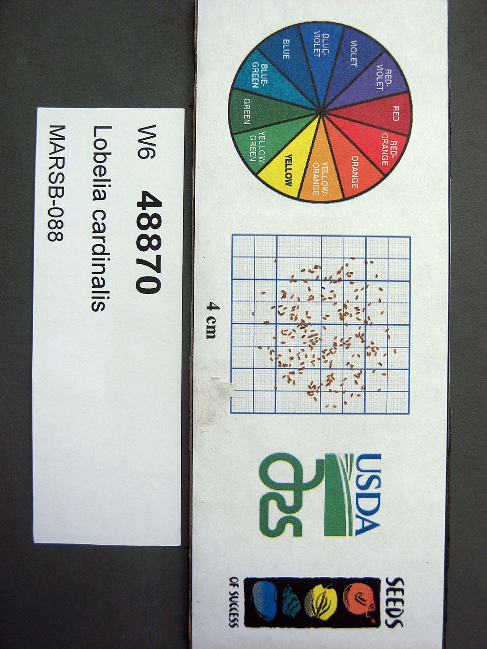 | | 2015 | | | | | | | Wild material | | 1922920 | OPGC 6119 |
| 19 | OPGC 6121 | MARSB-089 | Mimulus ringens L. | New York, United States | OPGC |  | | 2015 | | | | | | | Wild material | | 1922922 | OPGC 6121 |
| 20 | W6 48843 | MARSB-60 | Danthonia compressa Austin | Pennsylvania, United States | W6 |  | | 2015 | | | | | | | Wild material | | 1922912 | W6 48843 |
| 21 | WLP 1966 | JDC/VA/2014/096/598 | Viburnum acerifolium L. | Alabama, United States | NA | | | 2014 | COLLECTED | 09/23/2014 | Alabama: Lawrence County; William B. Bankhead National Forest, small tributary to Sipsey Fork near Cranal Road. | 34.28161300, -87.40651600 | 199 | Growing in association with Tsuga canadensis, Cornus florida, Magnolia macrophylla, Castanea dentata, Carpinus caroliniana, Quercus alba, and Pinus sp. | Wild material | Limited fruit production. Very shaded. Fruits black. | 1922367 | WLP 1966 |
| 22 | Ames 31053 | 380 | Betula alleghaniensis Britton | Pennsylvania, United States | NC7 |  | | 2011 | COLLECTED | 09/15/2011 | State Game Lands #282, floodplain of Conewango Creek Watershed, Warren County. | 41.98200000, -79.13500000 | 389 | Mixed hardwood forest and wetlands. | Wild material | | 1891439 | Ames 31053 |
| 23 | WLP 1956 | 378 | Viburnum lentago L. | Pennsylvania, United States | NA | | | 2011 | COLLECTED | 09/15/2011 | State Game Lands #282, floodplain of Conewango Creek Watershed, Warren County. | 41.98700000, -79.13100000 | 379 | Mixed hardwood forest and wetlands. Associated with Betula alleghaniensis, Carpinus caroliniana, Cornus amomum, Fraxinus, Magnolia acuminata, Spiraea alba, Tsuga canadensis, and Viburnum dentatum. | Wild material | | 1891494 | WLP 1956 |
| 24 | WLP 1218 | JDC/HA/2009/081/231 | Hydrangea arborescens L. | Ohio, United States | NA | | | 2009 | COLLECTED | 10/15/2009 | Near Wahkeena Nature Preserve, near Sugar Grove, SW 1/4 of NW 1/4 Section 4, T13N, R18W, Lancaster Quad, Fairfield County. | 39.62972222, -82.56750000 | 253 | Associated with Carpinus caroliniana, Fagus sylvatica, Ilex verticillata, Quercus, Rhododendron maximum, Tsuga canadensis, and Viburnum acerifolium. | Wild material | | 1823925 | WLP 1218 |
| 25 | WLP 1415 | JDC/OA/2009/103/253 | Oxydendrum arboreum (L.) DC. | Ohio, United States | NA | | | 2009 | COLLECTED | 10/17/2009 | Snake Hollow, Shawnee State Forest, Otway Quad, Scioto County. | 38.80722222, -83.15555556 | 239 | Cool moist woods. Associated with with Carpinus caroliniana, Carya, Corylus americana, Fagus sylvatica, Lindera benzoin, Nyssa sylvatica, Picea abies, Platanus occidentalis, Sassafras albidum, Tsuga canadensis, and Viburnum dentatum. | Wild material | | 1823938 | WLP 1415 |
| 26 | WLP 1650 | JDC/RM/2009/080/230 | Rhododendron maximum L. | Ohio, United States | NA | | | 2009 | COLLECTED | 10/15/2009 | Near Wahkeena Nature Preserve, near Sugar Grove, SW 1/4 of NW 1/4 Section 4, T13N, R18W, Lancaster Quad, Fairfield County. | 39.62972222, -82.56750000 | 253 | Roadside. Rocky. Steep (80%) slope, north facing. Associated with Carpinus caroliniana, Fagus sylvatica, Ilex verticillata, Quercus, Rhododendron maximum, Tsuga canadensis, and Viburnum acerifolium. | Wild material | | 1823942 | WLP 1650 |