| 0 | OPGC 8600 | OR080-91 | Typha latifolia L. | Oregon, United States | OPGC | 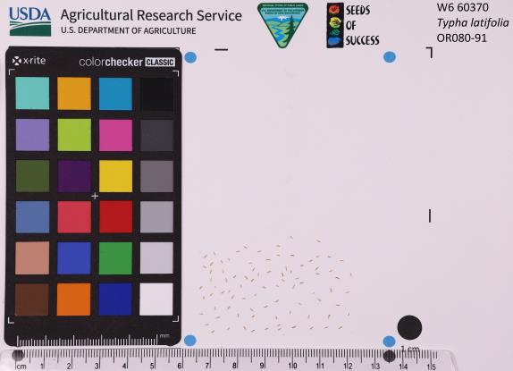 | | 2022 | | | | | | | Wild material | Huge, brown seed heads on top of grass-like leaves. Seed heads have a male terminus. | 2138308 | OPGC 8600 |
| 1 | OPGC 8491 | NCBG-235 | Typha latifolia L. | North Carolina, United States | OPGC | | | 2021 | | | | | | | Wild material | | 2132858 | OPGC 8491 |
| 2 | OPGC 8492 | NCBG-237 | Typha latifolia L. | North Carolina, United States | OPGC | | | 2021 | | | | | | | Wild material | Wider leaves than T angustifolia. | 2132859 | OPGC 8492 |
| 3 | OPGC 8493 | NCBG-239 | Typha latifolia L. | North Carolina, United States | OPGC | | | 2021 | | | | | | | Wild material | | 2132860 | OPGC 8493 |
| 4 | OPGC 8494 | NCBG-242 | Typha latifolia L. | North Carolina, United States | OPGC | | | 2021 | | | | | | | Wild material | Wide heads that are red brown in color. | 2132861 | OPGC 8494 |
| 5 | OPGC 8495 | NCBG-247 | Typha latifolia L. | North Carolina, United States | OPGC | | | 2021 | | | | | | | Wild material | | 2132862 | OPGC 8495 |
| 6 | OPGC 8496 | NCBG-262 | Typha latifolia L. | Virginia, United States | OPGC | | | 2021 | | | | | | | Wild material | Wide leaf blades. | 2132863 | OPGC 8496 |
| 7 | OPGC 8512 | NCBG-552 | Typha latifolia L. | North Carolina, United States | OPGC | | | 2021 | | | | | | | Wild material | | 2132917 | OPGC 8512 |
| 8 | OPGC 8514 | NCBG-579 | Typha latifolia L. | Maryland, United States | OPGC | | | 2021 | | | | | | | Wild material | | 2132928 | OPGC 8514 |
| 9 | OPGC 8429 | NV030-1517 | Typha latifolia L. | Nevada, United States | OPGC | | | 2021 | | | | | | | Wild material | | 2120791 | OPGC 8429 |
| 10 | OPGC 8432 | NV030-1530 | Typha latifolia L. | Nevada, United States | OPGC | | | 2021 | | | | | | | Wild material | | 2120802 | OPGC 8432 |
| 11 | OPGC 8207 | NEWFS-572 | Typha latifolia L. | New Hampshire, United States | OPGC | | | 2021 | | | | | | | Wild material | | 2115706 | OPGC 8207 |
| 12 | OPGC 8148 | MARSB-496 | Typha latifolia L. | New Jersey, United States | OPGC | | | 2021 | | | | | | | Wild material | Stem shape in cross-sectionûthe stem is round or oval in cross-sectionûLeaf blade widthû5–29 mmûLeaf blade cross-sectionûthe leaf blade is flat or rolled in at the edgesûInflorescence positionûthe inflorescence is at the tip of the plantûInflorescence branchingûthe inflorescence is on one or more stems with no branchesûFruit type (general)ûthe fruit is like a seed, and surrounded by hairsûFruit lengthû10–15 mmûLeaf position on plantûsome leaf attachment points are above the midpoint of the stemûPerianth compositionûthere are long, thin hairs attached at the base of the acheneûthere are three bristles and three scales on narrow stalks, attached at the base of the acheneûFruit cross-sectionûthe fruit is triangular to terete (circular) in cross-section | 2113541 | OPGC 8148 |
| 13 | OPGC 8152 | MARSB-608 | Typha latifolia L. | New York, United States | OPGC | | | 2021 | | | | | | | Wild material | Round stem, wide cylindrical infloresences at the tip of the stem | 2113570 | OPGC 8152 |
| 14 | OPGC 8153 | MARSB-645 | Typha latifolia L. | Delaware, United States | OPGC | | | 2021 | | | | | | | Wild material | Tall green stem (reed-like) with long, thick, brown, cat-tail like inflorescence. | 2113578 | OPGC 8153 |
| 15 | OPGC 7957 | NEWFS-502 | Typha latifolia L. | Massachusetts, United States | OPGC |  | | 2019 | | | | | | | Wild material | | 2098227 | OPGC 7957 |
| 16 | OPGC 7935 | NEWFS-173 | Typha latifolia L. | Rhode Island, United States | OPGC |  | | 2019 | | | | | | | Wild material | | 2098146 | OPGC 7935 |
| 17 | OPGC 7353 | NV030-1341 | Typha latifolia L. | Nevada, United States | OPGC |  | | 2018 | | | | | | | Wild material | | 1970665 | OPGC 7353 |
| 18 | OPGC 7360 | NV030-1361 | Typha latifolia L. | Nevada, United States | OPGC |  | | 2018 | | | | | | | Wild material | | 1970685 | OPGC 7360 |
| 19 | OPGC 7187 | NV030-1151 | Typha latifolia L. | Nevada, United States | OPGC |  | | 2017 | | | | | | | Wild material | | 1949776 | OPGC 7187 |
| 20 | OPGC 7158 | NM930N-164 | Typha latifolia L. | New Mexico, United States | OPGC | | | 2017 | | | | | | | Wild material | | 1943612 | OPGC 7158 |
| 21 | OPGC 7112 | NV030-860 | Typha latifolia L. | California, United States | OPGC |  | | 2014 | | | | | | | Wild material | | 1920691 | OPGC 7112 |
| 22 | OPGC 7063 | AK930-301 | Typha latifolia L. | Alaska, United States | OPGC |  | | 2012 | | | | | | | Wild material | | 1900649 | OPGC 7063 |
| 23 | OPGC 7050 | WY040-75 | Typha latifolia L. | Wyoming, United States | OPGC |  | | 2012 | | | | | | | Wild material | | 1897996 | OPGC 7050 |
| 24 | OPGC 7052 | WY040-82 | Typha latifolia L. | Wyoming, United States | OPGC |  | | 2012 | | | | | | | Wild material | | 1897998 | OPGC 7052 |
| 25 | OPGC 7047 | MSB210579 | Typha latifolia L. | Texas, United States | OPGC |  | | 2011 | | | | | | | Wild material | | 1895403 | OPGC 7047 |
| 26 | OPGC 8502 | NCBG-509 | Typha angustifolia L. | North Carolina, United States | OPGC | | | 2021 | | | | | | | Wild material | | 2132892 | OPGC 8502 |
| 27 | OPGC 8503 | NCBG-513 | Typha angustifolia L. | Maryland, United States | OPGC | | | 2021 | | | | | | | Wild material | Narrow leaves and inflorescense. | 2132895 | OPGC 8503 |
| 28 | OPGC 8504 | NCBG-518 | Typha angustifolia L. | Maryland, United States | OPGC | | | 2021 | | | | | | | Wild material | | 2132898 | OPGC 8504 |
| 29 | OPGC 8508 | NCBG-536 | Typha angustifolia L. | Virginia, United States | OPGC | | | 2021 | | | | | | | Wild material | | 2132909 | OPGC 8508 |
| 30 | OPGC 8509 | NCBG-543 | Typha angustifolia L. | Virginia, United States | OPGC | | | 2021 | | | | | | | Wild material | | 2132912 | OPGC 8509 |
| 31 | OPGC 8513 | NCBG-575 | Typha angustifolia L. | Maryland, United States | OPGC | | | 2021 | | | | | | | Wild material | | 2132926 | OPGC 8513 |
| 32 | OPGC 7226 | NCBG-225 | Typha angustifolia L. | North Carolina, United States | OPGC |  | | 2018 | | | | | | | Wild material | | 1965873 | OPGC 7226 |
| 33 | OPGC 7227 | NCBG-236 | Typha angustifolia L. | North Carolina, United States | OPGC |  | | 2018 | | | | | | | Wild material | | 1965879 | OPGC 7227 |
| 34 | OPGC 7228 | NCBG-241 | Typha angustifolia L. | North Carolina, United States | OPGC |  | | 2018 | | | | | | | Wild material | | 1965881 | OPGC 7228 |
| 35 | OPGC 7229 | NCBG-248 | Typha angustifolia L. | North Carolina, United States | OPGC |  | | 2018 | | | | | | | Wild material | | 1965885 | OPGC 7229 |
| 36 | W6 59032 | NCBG-574 | Sagittaria latifolia Willd. | Maryland, United States | W6 | | | 2021 | | | | | | | Wild material | | 2116349 | W6 59032 |
| 37 | W6 56635 | CBG-8953 | Sagittaria latifolia Willd. | Nebraska, United States | W6 |  | | 2019 | | | | | | | Wild material | | 2092734 | W6 56635 |
| 38 | PI 702717 | NCBG-648 | Sacciolepis striata (L.) Nash | Virginia, United States | S9 |  | | 2019 | | | | | | | Wild material | | 2098499 | PI 702717 |
| 39 | PI 710499 | NCBG-752 | Sesbania exaltata (Raf.) Rydb. | North Carolina, United States | S9 |  | | 2018 | | | | | | | Wild material | | 1966044 | PI 710499 |
| 40 | PI 698949 | CBG-7492 | Echinochloa walteri (Pursh) A. Heller | Illinois, United States | NC7 |  | | 2017 | | | | | | | Wild material | | 1954806 | PI 698949 |
| 41 | PI 710484 | CBG-7972 | Desmanthus illinoensis (Michx.) MacMill. ex B. L. Rob. & Fernald | South Dakota, United States | S9 |  | | 2017 | | | | | | | Wild material | | 1954799 | PI 710484 |
| 42 | PI 693864 | AM-2014-01 | Spinacia tetrandra Steven ex M. Bieb. | Armenia | NC7 |  | | 2014 | COLLECTED | 06/08/2014 | Kotajk region, vicinity of Nubarashen town. | 40.11836000, 44.54822000 | 1050 | Growing on red clay near a small spring. Water-marsh vegetation in the semi-desert belt. Edificators: Phragmites australis, Typha latifolia, and Mentha longifolia | Wild material | Annual, glabrous, 40-50 cm high, stems erect, simple, slightly branched. Seed-units falling together with leaves, spiny-corniculate, 1 cm in diameter. | 1922164 | PI 693864 |
| 43 | PI 693865 | AM-2014-02 | Spinacia tetrandra Steven ex M. Bieb. | Armenia | NC7 |  | | 2014 | COLLECTED | 06/08/2014 | Ararat region, vicinity of Khor Virap monastery. | 39.88806000, 44.57167000 | 860 | Growing near wet place along an irrigation channel. Water-marsh vegetation in the semi-desert belt. Edificators: Phragmites australis, Typha latifolia, and Salsola dendroides. | Wild material | Annual, glabrous, 40-60 cm high, stems erect, simple, slightly branched. Seed-units falling together with leaves, spiny-corniculate, 1 cm in diameter. | 1922165 | PI 693865 |
| 44 | PI 688898 sos | M. arvensis 178143 | Mentha arvensis L. | Utah, United States | COR |  | | 2005 | COLLECTED | 09/19/2002 | | | 2058 | Herbaceous riparian meadow dominated by Stachys palustris, Carex nebrascensis, Agrostis stolonifera, Typha latifolia. | Wild material | Forb .15 meters tall. | 1674029 | PI 688898 sos |
| 45 | Ames 36705 | State Line Fen | Agastache scrophulariifolia (Willd.) Kuntze | Missouri, United States | NC7 |  | | 2025 | COLLECTED | 10/17/2025 | State Line Fen just east of the Chariton River approximately 2.75 miles west of Coatsville just south of the Missouri/Iowa border, T67N R16W SW 1/4 Sec. 22 | 40.58924000, -92.68834100 | 257 | Moist, mucky soils. Degraded fen near small creek. | Wild material | Purple Giant Hyssop is a tall (e.g. up to 6') perennial forb native to the northeastern US. Blooms extend for several weeks in the fall typically August through September and are visited by many pollinators. This accession was collected in northern Missouri and thus represents genetics from the southwestern edge of the species native range. At the collection site, most specimens had white blooms, while some showed light lavender coloration with plants averaging 4.5-5.5' in height. In Missouri, the Natural Heritage Program currently tracks this species ranked as an S1 (Critically imperiled in the state because of extreme rarity or because of some factor(s) such as very steep declines making it especially vulnerable to extirpation from the state.) and has been documented in only six Missouri counties including Adair, Atchison, Clark, Harrison, Schuyler, and Worth. | 2192996 | Ames 36705 |
| 46 | Ames 36292 | Faith-Moccasin WMA | Salix petiolaris Sm. | Minnesota, United States | NC7 |  | | 2024 | COLLECTED | 09/07/2024 | Faith Wildlife Management Area and Moccassin State Wildlife Management Area east of Twin Valley approximately 8.25 miles. | 47.26010700, -96.09171700 | 351 | Wetland, shrub-carr complex. | Wild material | Slender-leaved willow, Salix petiolaris, is a somewhat dense suckering shrub that can reach up to 10' in height with slender stems that branch minimally, but typically maintains a height of 5-8'. Native to North America, the native range covers mostly the northeastern US stretching from Maine to western North Dakota and Canada south to central Iowa (Little, E. L. Jr. 1977). Salix petiolaris typically dominates wetland areas including sedge meadows, marshes, riverbanks, and lake shores. Despite favoring wet habitats, it can also be found in dry, upland areas, especially those with high-water tables. However, longevity is generally limited in upland habitats. S. petiolaris, similar to other willow species, responds well to fire, coppicing, or heavy browsing (highly favored by deer) by sprouting new stems close to the crown. In cultivation, plants after five years will encompass a 5' x 5' area due to stems that arch from the main base of the plant. Coppicing of plants to ground level is highly recommended either annually or once every 3-5 years to maintain vigorous growth and plant health. This species requires substantial to full sun exposure and is an excellent choice for streambank stabilizations and windbreaks to reduce soil erosion and drifting snow, respectively. This accession represents genetics from northwestern Minnesota. Plants sampled in nature averaging 6-8' in height. Clump-type growth habit with minimal branching, but dense suckering (e.g. 50+ ramets per genet - typically encompassing 5' x 5' area). Dormant, winter stem are rather uniform/consistent orange-brown/mahogany colors. | 2169827 | Ames 36292 |
| 47 | W6 61522 | CA180-292 | Eryngium castrense Jeps. | California, United States | W6 |  | | 2024 | | | | | | | | | 2167621 | W6 61522 |
| 48 | W6 61524 | CA180-294 | Chlorogalum pomeridianum (DC.) Kunth | California, United States | W6 |  | | 2024 | | | | | | | | | 2167623 | W6 61524 |
| 49 | W6 61562 | CA340-52 | Asclepias fascicularis Decne. | California, United States | W6 |  | | 2024 | | | | | | | Wild material | | 2168011 | W6 61562 |
| 50 | NA 88690 | RJL2023NJ-003 | Ilex verticillata (L.) A. Gray | New Jersey, United States | NA | | | 2023 | COLLECTED | 11/10/2023 | Franklin Township: Piney Hollow Preservation Area (the site is owned by Franklin Township). This species was found below the dam at the far end of McCarthys Lakes. Plants accessed by foot along trails throughout property. | 39.57407200, -74.92518600 | 28 | Plants growing in part-shade to sun of the moist to saturated areas below the McCarthys Lakes dam in the wetlands associated with the New Squankum Branch. The area appears to be inundated year-round with plants growing on low mounds surrounded by obligate wetland species. Slope: N/A. Aspect: N/A. The underlying geology of this area is of Middle Miocene, Serravallian origin and characterized as an Cohansey Formation. It is comprised of sand, white to yellow with local gravel and clay. Locally stained red or orange brown by iron oxides and (or) cemented into large blocks of ironstone. Unweathered clay is typically dark gray, but commonly weathers white where interbedded with thin beds of ironstone. Unit is a complex of interfingering marine and nonmarine facies. Sand is typically medium grained and moderately sorted although it ranges from fine to very coarse grained and from poorly to well sorted. Sand consists of quartz and siliceous rock fragments. Some beds are locally micaceous. In general, the sand is crossbedded, although the style of crossbedding varies significantly with the paleoenvironment. Trough crossbedding predominates, especially in the nonmarine channel fill deposits, and the scale of the crossbeds varies from small to large. Maximum thickness in the map area is about 60 m; however, thickness is difficult to determine because of the irregular basal contact and extensive post-depositional erosion. There is as much as 18 m of relief along the basal contact. The basal contact is sharp, undulatory, and directly overlain by a thin gravel bed. The Cohansey Formation unconformably overlies the Kirkwood Formation and is found in channels cut down into the Kirkwood. Where the Kirkwood consists of sandy, light-colored sediments, the basal contact of the Cohansey is drawn below crossbedded sediments. Where the Kirkwood consists of dark-colored silty beds, the basal contact is drawn between light-colored Cohansey sediments and the underlying dark-colored sediments. The Cohansey was markedly thinned because of erosion prior to deposition of overlying units in the western and southern parts of the southern sheet. The unit has been extensively eroded and stripped from large areas of the New Jersey Coastal Plain, particularly in the central sheet where outliers are common. In spite of its widespread nature, the Cohansey is poorly exposed because of its loose sandy composition, which causes it to erode easily. (Source: USGS New Jersey Geologic Map Data.) The primary soil type in the collection area is classified as Manahawkin Series muck, 0 to 2 percent slopes, frequently flooded, Northern Coastal Plain. Manahawkin Series soils are very deep, very poorly drained soils that are sandy or sandy-skeletal, siliceous, dysic, mesic Terric Haplosaprists high in organic deposits that are found in lake basins, back swamps, floodplains, and freshwater channels. The soils are classified in the dysic reaction class because pH in water dominantly ranges from 4.5 to 5.0. The zone from the soil surface to a depth of 200 cm is continuously saturated (endosaturation). The upper strata of Manahawkin Series from 0 to 76 cm is black broken face and rubbed muck; 10 percent fibers, less than 2 percent rubbed; moderate medium granular structure; mat of many fine roots; identifiable material is primarily herbaceous with a trace of woody fragments; 85-95 percent organic matter; extremely acid. Lower strata to 200 cm are gray sand, single grained and loose; strongly acid. (Source: NRCS Web Soil Survey.) | Wild material | | 2159118 | NA 88690 |
| 51 | NA 88691 | RJL2023NJ-004 | Ilex laevigata (Pursh) A. Gray | New Jersey, United States | NA | | | 2023 | COLLECTED | 11/10/2023 | Franklin Township: Piney Hollow Preservation Area (the site is owned by Franklin Township). This species was found below the dam at the far end of McCarthys Lakes. Plants accessed by foot along trails throughout property. | 39.57404200, -74.92523700 | 28 | Plants growing in part-shade to sun of the moist to saturated areas below the McCarthys Lakes dam in the wetlands associated with the New Squankum Branch. The area appears to be inundated year-round with plants growing on low mounds surrounded by obligate wetland species. Slope: N/A. Aspect: N/A. The underlying geology of this area is of Middle Miocene, Serravallian origin and characterized as an Cohansey Formation. It is comprised of sand, white to yellow with local gravel and clay. Locally stained red or orange brown by iron oxides and (or) cemented into large blocks of ironstone. Unweathered clay is typically dark gray, but commonly weathers white where interbedded with thin beds of ironstone. Unit is a complex of interfingering marine and nonmarine facies. Sand is typically medium grained and moderately sorted although it ranges from fine to very coarse grained and from poorly to well sorted. Sand consists of quartz and siliceous rock fragments. Some beds are locally micaceous. In general, the sand is crossbedded, although the style of crossbedding varies significantly with the paleoenvironment. Trough crossbedding predominates, especially in the nonmarine channel fill deposits, and the scale of the crossbeds varies from small to large. Maximum thickness in the map area is about 60 m; however, thickness is difficult to determine because of the irregular basal contact and extensive post-depositional erosion. There is as much as 18 m of relief along the basal contact. The basal contact is sharp, undulatory, and directly overlain by a thin gravel bed. The Cohansey Formation unconformably overlies the Kirkwood Formation and is found in channels cut down into the Kirkwood. Where the Kirkwood consists of sandy, light-colored sediments, the basal contact of the Cohansey is drawn below crossbedded sediments. Where the Kirkwood consists of dark-colored silty beds, the basal contact is drawn between light-colored Cohansey sediments and the underlying dark-colored sediments. The Cohansey was markedly thinned because of erosion prior to deposition of overlying units in the western and southern parts of the southern sheet. The unit has been extensively eroded and stripped from large areas of the New Jersey Coastal Plain, particularly in the central sheet where outliers are common. In spite of its widespread nature, the Cohansey is poorly exposed because of its loose sandy composition, which causes it to erode easily. (Source: USGS New Jersey Geologic Map Data.) The primary soil type in the collection area is classified as Manahawkin Series muck, 0 to 2 percent slopes, frequently flooded, Northern Coastal Plain. Manahawkin Series soils are very deep, very poorly drained soils that are sandy or sandy-skeletal, siliceous, dysic, mesic Terric Haplosaprists high in organic deposits that are found in lake basins, back swamps, floodplains, and freshwater channels. The soils are classified in the dysic reaction class because pH in water dominantly ranges from 4.5 to 5.0. The zone from the soil surface to a depth of 200 cm is continuously saturated (endosaturation). The upper strata of Manahawkin Series from 0 to 76 cm is black broken face and rubbed muck; 10 percent fibers, less than 2 percent rubbed; moderate medium granular structure; mat of many fine roots; identifiable material is primarily herbaceous with a trace of woody fragments; 85-95 percent organic matter; extremely acid. Lower strata to 200 cm are gray sand, single grained and loose; strongly acid. (Source: NRCS Web Soil Survey.) | Wild material | | 2159119 | NA 88691 |
| 52 | NA 88692 | RJL2023NJ-005 | Ilex opaca Aiton | New Jersey, United States | NA | | | 2023 | COLLECTED | 11/10/2023 | Franklin Township: Piney Hollow Preservation Area (the site is owned by Franklin Township). This species was found on as well as below the dam at the far end of McCarthys Lakes. Plants accessed by foot along trails throughout property. | 39.57423200, -74.92525600 | 29 | Plants growing in part-shade to sun of the moist to saturated areas below the McCarthys Lakes dam in the wetlands associated with the New Squankum Branch. Plants were also found growing on the slopes of the dam in well-drained mesic to dry-mesic conditions. This species is clearly adaptable to a variety of conditions. Slope: 0 to 15 percent. Aspect: East. Elevation: 28 to 30 meters. NOTE: In addition to the soil type described below, this species was also growing on the slopes of a constructed earthen dam of unknown soil origin. The underlying geology of this area is of Middle Miocene, Serravallian origin and characterized as an Cohansey Formation. It is comprised of sand, white to yellow with local gravel and clay. Locally stained red or orange brown by iron oxides and (or) cemented into large blocks of ironstone. Unweathered clay is typically dark gray, but commonly weathers white where interbedded with thin beds of ironstone. Unit is a complex of interfingering marine and nonmarine facies. Sand is typically medium grained and moderately sorted although it ranges from fine to very coarse grained and from poorly to well sorted. Sand consists of quartz and siliceous rock fragments. Some beds are locally micaceous. In general, the sand is crossbedded, although the style of crossbedding varies significantly with the paleoenvironment. Trough crossbedding predominates, especially in the nonmarine channel fill deposits, and the scale of the crossbeds varies from small to large. Maximum thickness in the map area is about 60 m; however, thickness is difficult to determine because of the irregular basal contact and extensive post-depositional erosion. There is as much as 18 m of relief along the basal contact. The basal contact is sharp, undulatory, and directly overlain by a thin gravel bed. The Cohansey Formation unconformably overlies the Kirkwood Formation and is found in channels cut down into the Kirkwood. Where the Kirkwood consists of sandy, light-colored sediments, the basal contact of the Cohansey is drawn below crossbedded sediments. Where the Kirkwood consists of dark-colored silty beds, the basal contact is drawn between light-colored Cohansey sediments and the underlying dark-colored sediments. The Cohansey was markedly thinned because of erosion prior to deposition of overlying units in the western and southern parts of the southern sheet. The unit has been extensively eroded and stripped from large areas of the New Jersey Coastal Plain, particularly in the central sheet where outliers are common. In spite of its widespread nature, the Cohansey is poorly exposed because of its loose sandy composition, which causes it to erode easily. (Source: USGS New Jersey Geologic Map Data.) The primary soil type in the collection area is classified as Manahawkin Series muck, 0 to 2 percent slopes, frequently flooded, Northern Coastal Plain. Manahawkin Series soils are very deep, very poorly drained soils that are sandy or sandy-skeletal, siliceous, dysic, mesic Terric Haplosaprists high in organic deposits that are found in lake basins, back swamps, floodplains, and freshwater channels. The soils are classified in the dysic reaction class because pH in water dominantly ranges from 4.5 to 5.0. The zone from the soil surface to a depth of 200 cm is continuously saturated (endosaturation). The upper strata of Manahawkin Series from 0 to 76 cm is black broken face and rubbed muck; 10 percent fibers, less than 2 percent rubbed; moderate medium granular structure; mat of many fine roots; identifiable material is primarily herbaceous with a trace of woody fragments; 85-95 percent organic matter; extremely acid. Lower strata to 200 cm are gray sand, single grained and loose; strongly acid. (Source: NRCS Web Soil Survey.) | Wild material | | 2159120 | NA 88692 |
| 53 | NA 88693 | RJL2023NJ-006 | Clethra alnifolia L. | New Jersey, United States | NA | | | 2023 | COLLECTED | 11/10/2023 | Franklin Township: Piney Hollow Preservation Area (the site is owned by Franklin Township). Plants accessed by foot along trails throughout property. | 39.57319800, -74.92908900 | 29 | Plants growing in shade to part-shade over a wide range of habitats from mesic to mesic-dry as well as moist to wetland habitats. The woodlands are mostly deciduous, but also include occasional pine overstory. Slope: N/A. Aspect: N/A. The underlying geology of this area is of Middle Miocene, Serravallian origin and characterized as an Cohansey Formation. It is comprised of sand, white to yellow with local gravel and clay. Locally stained red or orange brown by iron oxides and (or) cemented into large blocks of ironstone. Unweathered clay is typically dark gray, but commonly weathers white where interbedded with thin beds of ironstone. Unit is a complex of interfingering marine and nonmarine facies. Sand is typically medium grained and moderately sorted although it ranges from fine to very coarse grained and from poorly to well sorted. Sand consists of quartz and siliceous rock fragments. Some beds are locally micaceous. In general, the sand is crossbedded, although the style of crossbedding varies significantly with the paleoenvironment. Trough crossbedding predominates, especially in the nonmarine channel fill deposits, and the scale of the crossbeds varies from small to large. Maximum thickness in the map area is about 60 m; however, thickness is difficult to determine because of the irregular basal contact and extensive post-depositional erosion. There is as much as 18 m of relief along the basal contact. The basal contact is sharp, undulatory, and directly overlain by a thin gravel bed. The Cohansey Formation unconformably overlies the Kirkwood Formation and is found in channels cut down into the Kirkwood. Where the Kirkwood consists of sandy, light-colored sediments, the basal contact of the Cohansey is drawn below crossbedded sediments. Where the Kirkwood consists of dark-colored silty beds, the basal contact is drawn between light-colored Cohansey sediments and the underlying dark-colored sediments. The Cohansey was markedly thinned because of erosion prior to deposition of overlying units in the western and southern parts of the southern sheet. The unit has been extensively eroded and stripped from large areas of the New Jersey Coastal Plain, particularly in the central sheet where outliers are common. In spite of its widespread nature, the Cohansey is poorly exposed because of its loose sandy composition, which causes it to erode easily. (Source: USGS New Jersey Geologic Map Data.) The primary soil types in the area of this collection is classified as Atsion sand, 0 to 2 percent slopes, Northern Tidewater Area and Downer loamy sand, 0 to 5 percent slopes, Northern Coastal Plain. Atsion Series soils are very deep, poorly drained with moderate to rapid permeability above 70 cm and slower beneath. They are classified as sandy, siliceous, mesic Aeric Alaquods. The upper stratum from 0 to 25 cm is dark gray sand, dry, single grained and lose with many fine roots. It is extremely acid. Lower strata are light gray to dark brown with small percentages of rounded quartzose pebbles and are extremely acid. Downer Series soils are very deep, well-drained soils that are coarse-loamy, siliceous, semiactive, mesic Typic Hapludults. The upper stratum of Downer Series from 0 to 25 cm is dark grayish brown, brown loamy sand that is dry with weak fine granular structure. It is very friable and strongly acid. Lower strata from 25 to 76 cm are yellowish brown single grain, loose loamy sand with few extremely weakly cemented masses of oxidized iron in the lower part. This layer is very strongly acid. (Source: NRCS Web Soil Survey.) | Wild material | | 2159121 | NA 88693 |
| 54 | NA 88694 | RJL2023NJ-007 | Spiraea tomentosa L. | New Jersey, United States | NA | | | 2023 | COLLECTED | 11/10/2023 | Franklin Township: Piney Hollow Preservation Area (the site is owned by Franklin Township). Plants accessed by foot along trails throughout property. | 39.57318200, -74.92673700 | 28 | Plants growing in part-shade to sun along the edges of McCarthys Lakes in moist-mesic to wet areas dominated by herbaceous plants. Slope: N/A. Aspect: N/A. | Wild material | | 2159122 | NA 88694 |
| 55 | NA 88695 | RJL2023NJ-008 | Aronia arbutifolia (L.) Pers. | New Jersey, United States | NA | | | 2023 | COLLECTED | 11/10/2023 | Franklin Township: Piney Hollow Preservation Area (the site is owned by Franklin Township). Plants accessed by foot along trails throughout property. | 39.57262400, -74.92606900 | 28 | Plants growing in part-shade to sun along the edges of McCarthys Lakes and in the understory of a mixed deciduous and evergreen forest in moist-mesic to wet conditions. Slope: N/A. Aspect: N/A. | Wild material | | 2159123 | NA 88695 |
| 56 | NA 88681 | RJL2023PA-015 | Ilex verticillata (L.) A. Gray | Pennsylvania, United States | NA | | | 2023 | COLLECTED | 10/30/2023 | Wetlands near Phillips Creek: seed collected from plants on the north and south (further east) side of Pennsylvania Route 188 approximately 6.9 kilometers east of the junction with Pennsylvania Route 487. | 41.30353100, -76.22452800 | 381 | Boggy to moist habitats associated with wetlands of Phillips Creek in shade to full sun next to the road. Slope: 0%. Aspect: various. The underlying geology of this area is of Devonian origin and characterized as the Catskill Formation. It is comprised of grayish-red sandstone, siltstone, shale, and mudstone; units of gray sandstone occur in upper part; lithologies in upper part arranged in fining-upward cycles. In the Altoona area, the Catskill Formation is mapped as the Duncannon, Sherman Creek, and Irish Valley Members, which are described under "Central and Eastern Pennsylvania" provinces. (Source: USGS Pennsylvania Geologic Map Data). The primary soil type in the collection area is classified as Wellsboro Series. The Wellsboro Series consists of very deep, moderately well- and somewhat poorly-drained soils formed in till derived from red sandstone, siltstone, and shale. Slope ranges from 0 to 50 percent. Saturated hydraulic conductivity is moderately high or high in the mineral surface layer, subsurface layer, and upper part of the subsoil; and low or moderately low in the lower part of the subsoil (fragipan) and the substratum. Solum thickness is greater than 102 cm. Depth to the fragipan ranges from 36 to 76 cm. Depth to bedrock is 152 cm or more. Rock fragments of subangular and rounded sandstone, siltstone or shale range from 5 to 40 percent in the A and B horizons, and from 15 to 50 percent in the Bx and C horizons. Typically, rock fragments average about 5 to 25 percent by volume above the fragipan and 15 to 40 percent by volume in and below the fragipan. Reaction commonly ranges from very strongly acid through moderately acid. (Source: NRCS Web Soil Survey). | Wild material | | 2159072 | NA 88681 |
| 57 | Ames 36209 | JDC/EM/2023/089/1121 | Eutrochium maculatum (L.) E. E. Lamont | Iowa, United States | NC7 | | | 2023 | COLLECTED | 10/19/2023 | Located approximately 3.15 miles west of Grinnell, T80N R17W SE 1/4 SE 1/4 NE 1/4 Sec. 14. | 41.73894000, -92.78670000 | 271 | Wet, remnant prairie. | Wild material | Plants in nature at collection site measuring approximately 3.5-5.0 feet in height. | 2165627 | Ames 36209 |
| 58 | Ames 36181 | Turtlehead Fen | Eutrochium maculatum (L.) E. E. Lamont | Iowa, United States | NC7 | | | 2023 | COLLECTED | 09/29/2023 | Turtlehead Fen (Chichaqua Bottoms Greenbelt) located 1.75 miles southeast of Farrar just north of highway 65, T81N R21W SW ¼ NW ¼ Sec. 31. | 41.78610000, -93.34730000 | 290 | Remnant fen with extremely wet, spongy soils and surface water visible at time of collection. | Wild material | Plants in nature ranged in height from three to eight feet. Variation was also noted for phenology with some plants mostly dispersed and some just ripening at the time of collection. | 2159013 | Ames 36181 |
| 59 | W6 61261 | OR010-453 | Schoenoplectus acutus (Muhl. ex Bigelow) Á. Löve & D. Löve | Oregon, United States | W6 | | | 2023 | | | | | | | Wild material | Tall round-stemmed wetland graminoid. Branching clusters of florets at top of stem. Floret scales pale grey-tan with distinct red-brown lines. Single bract that appears to be a continuation of the stem. | 2142216 | W6 61261 |
| 60 | W6 61267 | OR010-460 | Schoenoplectus acutus (Muhl. ex Bigelow) Á. Löve & D. Löve | Oregon, United States | W6 |  | | 2023 | | | | | | | Wild material | Tall round-stemmed wetland graminoid. Branching clusters of florets at top of stem. Floret scales pale grey-tan with distinct red-brown lines. Single bract that appears to be a continuation of the stem. | 2142222 | W6 61267 |
| 61 | OPGC 8848 | CBG- 10860 | Solidago riddellii Frank | Illinois, United States | OPGC | | | 2023 | | | | | | | Wild material | | 2142306 | OPGC 8848 |
| 62 | OPGC 8849 | CBG- 10861 | Chelone glabra L. | Illinois, United States | OPGC | | | 2023 | | | | | | | Wild material | | 2142307 | OPGC 8849 |
| 63 | W6 61417 | CBG- 10852 | Verbesina alternifolia (L.) Britton ex Kearney | Illinois, United States | W6 |  | | 2023 | | | | | | | Wild material | | 2142299 | W6 61417 |
| 64 | W6 61418 | CBG- 10853 | Agastache scrophulariifolia (Willd.) Kuntze | Illinois, United States | W6 |  | | 2023 | | | | | | | Wild material | | 2142300 | W6 61418 |
| 65 | Ames 36018 | AS/SL/2023/003/213 | Salix lucida Muhl. | Wisconsin, United States | NC7 |  | | 2023 | COLLECTED | 02/25/2023 | Located just west of Kempster approximately 4.65 miles along County Road J (floodplains of Sucker Creek and West Branch Eau Claire River), T33N R10E Sec. 32, 33, and 34 (extreme southern edges) | 45.29205000, -89.27304100 | 479 | Wetland | Wild material | Salix lucida (shining willow) is referenced as a tall shrub or small tree with multiple trunks with the potential to reach 6 meters in height. Shining willow frequents wetland habitats such as swampy lakes, wet meadows and along rivers. Noted for it's extremely shiny, long (e.g. 7-14 cm) leaves with very elongated, acumiate leaf tips and conspicuous, enlarged glands clustered at the end of the petiole. First year branches are very glabrous and bright yellow to bright orange in color. Flowering tends to occur later in spring in comparison to other shrubby willows e.g. Salix discolor, Salix humilis, Salix petiolaris, and Salix eriocephala. Shining willow can often be confused with Salix serissima, but the presence of glands at the base of the petiole, the colorful first year stems (most noticeable in winter) of Salix lucida can be used to separate them. The native distribution of Salix lucida is concentrated in the northeastern U.S. with scattered disjuncts as far west as North Dakota and as far south as the northern tier of counties in Illinois, Indiana, and Ohio (Little, E. L. Jr. 1977). This accession represents genetics from northeastern Wisconsin. Specimens sampled in nature measuring approximately 6' in height with bright orange-yellowish stem colors on most recent year's growth. | 2141551 | Ames 36018 |
| 66 | Ames 36019 | AS/SD/2023/004/214 | Salix discolor Muhl. | Wisconsin, United States | NC7 |  | | 2023 | COLLECTED | 02/25/2023 | Located along County Road J west of Kempster and County Road T/County Road H west of Summit Lake. | 45.29210300, -89.27334900 | 478 | Wetland | Wild material | The native range of Salix discolor is concentrated in the northeastern United States and also throughout southern Canada (Little, E. L. Jr. 1977). Generally adapted/tolerant to wet soils this species is often found in meadows, fens, swamps, and streambanks. Attractive ornamental characteristics includes early spring, showy flowers and yellow foliage in the fall. Salix discolor provides a critical source of pollen at the beginning of the growing season for a plethora of pollinators and also serves as a larval host to many insect species. Salix discolor are commonly used in the cut flower industry for both their showy catkins and colorful, dormant winter stems. This accession represents genetics from central Wisconsin. Plants in nature measuring approximately 8-10' in height occassionally up to 25' with brown to red-brown stem colors on most recent year's growth. Some genotypes with dense pubescence on stems while others are glabrous. | 2141552 | Ames 36019 |
| 67 | Ames 36021 | AS/SP/2023/006/216 | Salix petiolaris Sm. | Wisconsin, United States | NC7 |  | | 2023 | COLLECTED | 02/25/2023 | Located just west of Kempster approximately 5.25 miles along County Road J (floodplain between Sucker Creek and West Branch Eau Claire River), T33N R10E Sec. 32 and 33 (extreme southern edges). | 45.29239600, -89.27583700 | 478 | Wetland | Wild material | Slender-leaved willow, Salix petiolaris, is a somewhat dense suckering shrub that can reach up to 10' in height with slender stems that branch minimally, but typically maintains a height of 5-8'. Native to North America, the native range covers mostly the northeastern US stretching from Maine to western North Dakota and Canada south to central Iowa (Little, E. L. Jr. 1977). Salix petiolaris typically dominates wetland areas including sedge meadows, marshes, riverbanks, and lake shores. Despite favoring wet habitats, it can also be found in dry, upland areas, especially those with high-water tables. However, longevity is generally limited in upland habitats. S. petiolaris, similar to other willow species, responds well to fire, coppicing, or heavy browsing (highly favored by deer) by sprouting new stems close to the crown. In cultivation, plants after five years will encompass a 5' x 5' area due to stems that arch from the main base of the plant. Coppicing of plants to ground level is highly recommended either annually or once every 3-5 years to maintain vigorous growth and plant health. This species requires substantial to full sun exposure and is an excellent choice for streambank stabilizations and windbreaks to reduce soil erosion and drifting snow, respectively. This accession represents genetics from central Wisconsin. Plants noted in nature measuring up to 6' in height. Very densely suckering clumps occassionally reaching up to 10' in diameter. Stem colors on most recent year's growth varied from orange-yellow, red (predominate), to yellow. Petioles are minutely hairy. | 2141554 | Ames 36021 |
| 68 | NA 88506 | RJL2022TX-001 | Itea virginica L. | Texas, United States | NA | | | 2022 | COLLECTED | 10/31/2022 | Plants growing at Shangri La Botanical Gardens and Nature Center, Orange, TX along Adams Bayou, accessed via internal service roads. Plant is infrequent at this site. | 30.10322000, -93.76271700 | 1 | Plants are growing in shade to part-shade of a Taxodium distichum-Nyssa aquatica dominated forested swampland associated with Adams Bayou in a wet low-lying area that is frequently inundated.
Soils: The underlying geology of this area is of Quaternary to Late Pleistocene origin and comprised of the Beaumont Formation. This formation is yellowish- to brownish-gray, locally reddish orange with very fine to fine quartz sand, silt, and minor fine gravel, intermixed and interbedded. It also includes stream channel, point-bar, cravasse-splay, and natural levee ridge deposits, and clayey fill in abandoned channels. Channel fill is dark brown to brownish-gray with laminated clay and silt that is organic-rich. Includes marine delta-front sand, lagoonal clay, and near-shore marine sand beneath and landward of bays along the coast. Depth of this unconsolidated outwash ranges from 3-100 meters thick.
Source: USGS Texas Geologic Map Data (https://mrdata.usgs.gov/geology/state/sgmc-unit.php?unit=TXQbs%3B0)
The primary soil types in the collection area are classified as Cowmarsh series. The Cowmarsh series consists of very deep, very poorly drained soils that formed in mucky silty clayey alluvial deposits of Holocene age. These depressional soils are oxbows and relict channels of rivers where flooding and ponding is frequent. Slope ranges from 0 to 1 percent but mainly less than 1 percent. very poorly drained. Runoff is negligible. Frequently flooded for very long periods from February through May and surface remains saturated for very long periods once flood waters have receded.
Source: NRCS Web Soil Survey (https://websoilsurvey.sc.egov.usda.gov/App/WebSoilSurvey.aspx) | Wild material | | 2139813 | NA 88506 |
| 69 | NA 88507 | RJL2022TX-002 | Fraxinus caroliniana Mill. | Texas, United States | NA | | | 2022 | COLLECTED | 10/31/2022 | Plants growing at Shangri La Botanical Gardens and Nature Center, Orange, TX along Adams Bayou, accessed via internal service roads. Plant is relatively common along Adams Bayou but scattered. | 30.09989400, -93.75239700 | 1 | Plants are growing in part-shade to sun of a Taxodium distichum-Nyssa aquatica dominated forested swampland associated with Adams Bayou in a wet low-lying area that is frequently inundated. While found as an occasional understory element, it is more common on the edge of the swampland forest where there are high light conditions.
Soils: The underlying geology of this area is of Quaternary to Late Pleistocene origin and comprised of the Beaumont Formation. This formation is yellowish- to brownish-gray, locally reddish orange with very fine to fine quartz sand, silt, and minor fine gravel, intermixed and interbedded. It also includes stream channel, point-bar, cravasse-splay, and natural levee ridge deposits, and clayey fill in abandoned channels. Channel fill is dark brown to brownish-gray with laminated clay and silt that is organic-rich. Includes marine delta-front sand, lagoonal clay, and near-shore marine sand beneath and landward of bays along the coast. Depth of this unconsolidated outwash ranges from 3-100 meters thick.
Source: USGS Texas Geologic Map Data (https://mrdata.usgs.gov/geology/state/sgmc-unit.php?unit=TXQbs%3B0)
The primary soil types in the collection area are classified as Cowmarsh series. The Cowmarsh series consists of very deep, very poorly drained soils that formed in mucky silty clayey alluvial deposits of Holocene age. These depressional soils are oxbows and relict channels of rivers where flooding and ponding is frequent. Slope ranges from 0 to 1 percent but mainly less than 1 percent. very poorly drained. Runoff is negligible. Frequently flooded for very long periods from February through May and surface remains saturated for very long periods once flood waters have receded.
Source: NRCS Web Soil Survey (https://websoilsurvey.sc.egov.usda.gov/App/WebSoilSurvey.aspx) | Wild material | | 2139814 | NA 88507 |
| 70 | NA 88508 | RJL2022TX-003 | Morella cerifera (L.) Small | Texas, United States | NA | | | 2022 | COLLECTED | 10/31/2022 | Plants growing at Shangri La Botanical Gardens and Nature Center Orange, TX along Adams Bayou, accessed via internal service roads. Plant is relatively common along Adams Bayou but scattered in the understory. | 30.10035500, -93.75288700 | 1 | Plants are growing in part-shade to shade of a Taxodium distichum-Nyssa aquatica dominated forested swampland associated with Adams Bayou in a wet low-lying area that is frequently inundated.
Soils: The underlying geology of this area is of Quaternary to Late Pleistocene origin and comprised of the Beaumont Formation. This formation is yellowish- to brownish-gray, locally reddish orange with very fine to fine quartz sand, silt, and minor fine gravel, intermixed and interbedded. It also includes stream channel, point-bar, cravasse-splay, and natural levee ridge deposits, and clayey fill in abandoned channels. Channel fill is dark brown to brownish-gray with laminated clay and silt that is organic-rich. Includes marine delta-front sand, lagoonal clay, and near-shore marine sand beneath and landward of bays along the coast. Depth of this unconsolidated outwash ranges from 3-100 meters thick.
Source: USGS Texas Geologic Map Data (https://mrdata.usgs.gov/geology/state/sgmc-unit.php?unit=TXQbs%3B0)
The primary soil types in the collection area are classified as Cowmarsh series. The Cowmarsh series consists of very deep, very poorly drained soils that formed in mucky silty clayey alluvial deposits of Holocene age. These depressional soils are oxbows and relict channels of rivers where flooding and ponding is frequent. Slope ranges from 0 to 1 percent but mainly less than 1 percent. very poorly drained. Runoff is negligible. Frequently flooded for very long periods from February through May and surface remains saturated for very long periods once flood waters have receded.
Source: NRCS Web Soil Survey (https://websoilsurvey.sc.egov.usda.gov/App/WebSoilSurvey.aspx) | Wild material | | 2139815 | NA 88508 |
| 71 | WLP 2677 | RJL2022NJ-008 | Lyonia ligustrina (L.) DC. | New Jersey, United States | NA | | | 2022 | COLLECTED | 10/24/2022 | Plants growing along Burlington County Road 563, Green Bank Chatsworth Road, on the west side of the road, 16.22 kilometers south of the intersection with New Jersey Hwy 72. Plants are common at this location. | 39.73274000, -74.53449000 | 15 | Plants growing in a depression wetland habitat in full sun. This location seems somewhat historically disturbed by development of cranberry bogs surrounding the wet site.
Soils: The underlying geology of this area is the Cohansey Formation of middle Miocene origin and comprised of sand, white to yellow with local gravel and clay. It is sometimes locally stained red or orange brown by iron oxides and (or) cemented into large blocks of ironstone. Unweathered clay is typically dark gray, but commonly weathers white where it is interbedded with thin beds of ironstone. Sand is typically medium grained and moderately sorted although it ranges from fine to very coarse grained and from poorly to well sorted. Sand consists of quartz and siliceous rock fragments. Some beds are locally micaceous. Maximum thickness in the map area is about 60 meters; however, thickness is difficult to determine because of the irregular basal contact and extensive post-depositional erosion.
Source: USGS New Jersey Geologic Map Data (https://mrdata.usgs.gov/geology/state/sgmc-unit.php?unit=NJTch%3B1)
The primary soil type in the area of this collection is classified as Atsion sand, 0 to 2 percent slopes, Northern Tidewater Area. The area is close and probably overlapping with Lakehurst sand series soil. Atsion series soil is poor to slowly draining and comprised primarily of sandy marine sediments. Surface runoff is slow to very slow. This soil is strongly to extremely acid throughout the profile. This soil is generally 50-100 cm deep.
Source: NRCS Web Soil Survey (https://websoilsurvey.sc.egov.usda.gov/App/WebSoilSurvey.aspx) | Wild material | | 2139668 | WLP 2677 |
| 72 | WLP 2674 | RJL2022NJ-005 | Alnus serrulata (Aiton) Willd. | New Jersey, United States | NA | | | 2022 | COLLECTED | 10/24/2022 | Plants growing on the east side of Atlantic County Road 543, Green Bank Road, in wetlands of the Mullica River, approximately 1.01 kilometers southwest of the intersection with River Road in Green Bank, New Jersey. Plants are common but scattered on the east side of the road at this location. | 39.60472300, -74.59378100 | 2 | Plants grow in full sun to light shade throughout this permanently wet to inundated habitat that is comprised mostly of emergent and obligate wetland herbaceous plants, deciduous shrubs, and Chamaecyparis thyoides, none reaching more than 5-10 meters tall. There are small elevation changes throughout this wetland, but the location is surrounded by water year-round.
Soils: The underlying geology of this area is the Cohansey Formation of middle Miocene origin and comprised of sand, white to yellow with local gravel and clay. It is sometimes locally stained red or orange brown by iron oxides and (or) cemented into large blocks of ironstone. Unweathered clay is typically dark gray, but commonly weathers white where it is interbedded with thin beds of ironstone. Sand is typically medium grained and moderately sorted although it ranges from fine to very coarse grained and from poorly to well sorted. Sand consists of quartz and siliceous rock fragments. Some beds are locally micaceous. Maximum thickness in the map area is about 60 meters; however, thickness is difficult to determine because of the irregular basal contact and extensive post-depositional erosion.
Source: USGS New Jersey Geologic Map Data (https://mrdata.usgs.gov/geology/state/sgmc-unit.php?unit=NJTch%3B1)
The primary soil type in the area of this collection is classified as Manahawkin muck, 0 to 2 percent slopes, frequently flooded. This soil is moderately high to high in the organic layers and high in the mineral layers comprised of sandy or sandy-skeletal, siliceous, dysic, mesic terric haplosaprists. This soil is considered extremely acid or very strongly acid in the surface tier and very strongly acid or strongly acid in the lower tiers and in the mineral substratum. The mineral content of organic layers ranges from 5 to 80 percent. Organic layers consist of mostly sapric material. Some pedons have subhorizons or a surface horizon of hemic material up to 25 cm. Woody fragments range from 0 to 50 percent, by volume, in the organic layers. These fragments are mostly twigs, branches, or logs ranging in size from 3 mm to 51 cm in diameter and completely break down when rubbed or crushed. The depth of this soil ranges from 0.2-2 meters. This soil is considered wet to inundated year-round.
Source: NRCS Web Soil Survey (https://websoilsurvey.sc.egov.usda.gov/App/WebSoilSurvey.aspx) | Wild material | | 2139665 | WLP 2674 |
| 73 | NA 89047 | RJL2022PA-015 | Cephalanthus occidentalis L. | Pennsylvania, United States | NA | | | 2022 | COLLECTED | 10/09/2022 | Plants growing in the floodplain of Octoraro Creek near 698 Lees Bridge Road, West Nottingham Township, Pennsylvania on the south side of the road. Plants are locally common and spread out in the floodplain area along the Octoraro Creek. | 39.73540700, -76.09226500 | 60 | Plants of this species are growing in full sun to part shade of a moist to seasonally mucky and wide flood plain area adjacent to Octoraro Creek. The area is dominated by deciduous herbaceous plants, scrambling vines, shrubs and occasional small trees. Much of this wet “meadow” is dominated by aggressive stands of grasses and members of the sedge family.
Soils: The underlying geology of this area is estimated to be of lower Paleozoic origin and comprised of Peters Creek Schist. This is comprised of chlorite-sericite schist containing interbedded quartzite. Interestingly, this area is very close to and may interface with the adjacent formation of Ultramafic Rocks that includes serpentine, steatite, and other products of alteration of peridotites and pyroxenites.
Source: USGS Pennsylvania Geologic Map Data (https://mrdata.usgs.gov/geology/state/sgmc-unit.php?unit=PAPZpc%3B0)
The primary soil types in the collection area are classified as Hatboro Silt Loam which consists of soils formed in alluvium derived from metamorphic and crystalline rock. They are on flood plains. Slopes range from 0 to 3 percent. Hatboro Silt Loam soils are poorly drained and have a high to very high surface runoff index. These soils are subject to periodic stream overflow, which usually occurs during the winter and spring months. The A and B horizons are moderately acidic to neutral, generally to a depth of 1-2 meters; the C horizon below ranges from a depth of 2-3 meters with uniformly acidic soils.
Source: NRCS Web Soil Survey (https://websoilsurvey.sc.egov.usda.gov/App/WebSoilSurvey.aspx) | Wild material | | 2139612 | NA 89047 |
| 74 | NA 89046 | RJL2022PA-014 | Alnus serrulata (Aiton) Willd. | Pennsylvania, United States | NA | | | 2022 | COLLECTED | 10/09/2022 | Plants growing in the floodplain of Octoraro Creek near 698 Lees Bridge Road, West Nottingham Township, Pennsylvania on the south side of the road. Plants are locally common and spread out in the floodplain area along the Octoraro Creek. | 39.73579900, -76.09238300 | 60 | Plants of this species are growing in full sun of a moist to seasonally mucky and wide flood plain area adjacent to Octoraro Creek. The area is dominated by deciduous herbaceous plants, scrambling vines, shrubs and occasional small trees. Much of this wet “meadow” is dominated by aggressive stands of grasses and members of the sedge family.
Soils: The underlying geology of this area is estimated to be of lower Paleozoic origin and comprised of Peters Creek Schist. This is comprised of chlorite-sericite schist containing interbedded quartzite. Interestingly, this area is very close to and may interface with the adjacent formation of Ultramafic Rocks that includes serpentine, steatite, and other products of alteration of peridotites and pyroxenites.
Source: USGS Pennsylvania Geologic Map Data (https://mrdata.usgs.gov/geology/state/sgmc-unit.php?unit=PAPZpc%3B0)
The primary soil types in the collection area are classified as Hatboro Silt Loam which consists of soils formed in alluvium derived from metamorphic and crystalline rock. They are on flood plains. Slopes range from 0 to 3 percent. Hatboro Silt Loam soils are poorly drained and have a high to very high surface runoff index. These soils are subject to periodic stream overflow, which usually occurs during the winter and spring months. The A and B horizons are moderately acidic to neutral, generally to a depth of 1-2 meters; the C horizon below ranges from a depth of 2-3 meters with uniformly acidic soils.
Source: NRCS Web Soil Survey (https://websoilsurvey.sc.egov.usda.gov/App/WebSoilSurvey.aspx) | Wild material | | 2139611 | NA 89046 |
| 75 | Ames 35924 | AS/FN/2022/073/204 | Fraxinus nigra Marshall | Wisconsin, United States | NC7 |  | | 2022 | COLLECTED | 09/29/2022 | Chequamegon National Forest, approximately 4.5 miles south-southeast of Clam Lake along County Highway GG and adjacent Forest Service roads, T42N R4W Sec. 21. | 46.10020200, -90.87459600 | 431 | Wet to saturated soils in northern hardwood forest. | Wild material | | 2139687 | Ames 35924 |
| 76 | W6 60371 | OR080-93 | Carex aquatilis Wahlenb. | Oregon, United States | W6 |  | | 2022 | | | | | | | Wild material | Grass-like leaves with triangular stems. Seed heads 3-5 cm long with prominent, acute scales. | 2138309 | W6 60371 |
| 77 | OPGC 8536 | NEWFS-786 | Verbena hastata L. | Massachusetts, United States | OPGC | | | 2021 | | | | | | | Wild material | Leaves are simple, sometimes lobed and sometimes unlobed. Flowers purple with petals that are fused into a floral tube. Iinflorescence ranges from open, showy flowers at the base of the cone shaped inflorescence to smaller florets at the tip of the inflorescence. | 2138853 | OPGC 8536 |
| 78 | W6 60226 | NEWFS-785 | Scirpus cyperinus (L.) Kunth | Massachusetts, United States | W6 | | | 2021 | | | | | | | Wild material | Branching inflorescence with rounded, fluffy spikelets on long, drooping peduncles. Although the girdle has slightly anthocyanic pigments this is S. cyperinus. | 2138852 | W6 60226 |
| 79 | W6 60229 | NEWFS-789 | Bolboschoenus maritimus (L.) Palla | Massachusetts, United States | W6 | | | 2021 | | | | | | | Wild material | Long bract subtends axillary inflorescence. | 2138855 | W6 60229 |
| 80 | OPGC 8499 | NCBG-489 | Hibiscus moscheutos L. | Maryland, United States | OPGC | | | 2021 | | | | | | | Wild material | | 2132887 | OPGC 8499 |
| 81 | OPGC 8520 | MARSB-607 | Symphyotrichum subulatum (Michx.) G. L. Nesom | New York, United States | OPGC | | | 2021 | | | | | | | Wild material | Simple, alternate leaves radiate heads with white pink rays. | 2137181 | OPGC 8520 |
| 82 | W6 60019 | NCBG-523 | Cyperus flavicomus Michx. | Virginia, United States | W6 | | | 2021 | | | | | | | Wild material | Conspicuous hyaline margin on spikelets. | 2132901 | W6 60019 |
| 83 | W6 60040 | NCBG-563 | Pluchea odorata (L.) Cass. | Virginia, United States | W6 | | | 2021 | | | | | | | Wild material | | 2132922 | W6 60040 |
| 84 | W6 60046 | NCBG-576 | Leersia oryzoides (L.) Sw. | Maryland, United States | W6 | | | 2021 | | | | | | | Wild material | | 2132927 | W6 60046 |
| 85 | W6 60059 | NCBG-724 | Bolboschoenus robustus (Pursh) Soják | Maryland, United States | W6 | | | 2021 | | | | | | | Wild material | | 2132940 | W6 60059 |
| 86 | W6 60093 | MARSB-486 | Rhynchospora capitellata (Michx.) Vahl | New Jersey, United States | W6 | | | 2021 | | | | | | | Wild material | The stem is roughly triangular in cross section. Leaf blade width 1 5 3 mm Leaf blade cross section the leaf blade is flat or rolled in at the edges Inflorescence position the inflorescence emerges from an axil or most of its parts do so the inflorescence is at the tip of the plant Inflorescence branching the inflorescence is branched Fruit type general the fruit is like a seed and surrounded by scales Fruit length 2 3 mm Leaf position on plant some leaf attachment points are above the midpoint of the stem Perianth composition there are bristles attached at the base of the achene Fruit cross section the fruit is biconvex or elliptic widest in the middle and tapering to both ends in cross section. | 2137178 | W6 60093 |
| 87 | W6 60095 | MARSB-606 | Pluchea odorata (L.) Cass. | New York, United States | W6 | | | 2021 | | | | | | | Wild material | Fragrant, pink, discoid heads. Simple alternate leaves. Received as: Pluchea odorata. | 2137180 | W6 60095 |
| 88 | W6 60097 | MARSB-610 | Triadenum virginicum (L.) Raf. | New York, United States | W6 | | | 2021 | | | | | | | Wild material | Simple opposite leaves flowers with 5 light pink petals and 9 stamens | 2137182 | W6 60097 |
| 89 | WLP 1747 | RJL2021PA-005 | Rosa palustris Marshall | Pennsylvania, United States | NA | | | 2021 | COLLECTED | 11/20/2021 | Plants growing in wetland seeps surrounded by mown hayfields just west of the Middle Branch White Clay Creek in Goddard Park, West Grove Pennsylvania, off of Wickerton Road, Chester County. | 39.80090528, -75.82383250 | 100 | Habitat Notes: Plants are growing in permanently saturated to moist soils in wetland habitats. Plants appear to be obligate wetland plants and are found only in permanent to nearly permanent wet habitats observed. Generally, the shrubs are found in part shade to full sun. Soils: Soils found in the areas where this collection was made are comprised primarily of Hatboro silt loam (Ha). Hatboro silt loam consists of very deep and poorly drained soils formed in deposited alluvium derived from metamorphic and crystalline rock. They are on flood plains. Slopes range from 0 to 3 percent. Slope: 0 to 3% Aspect: Variable. | Wild material | | 2123715 | WLP 1747 |
| 90 | Ames 35753 | #470 | Alnus incana (L.) Moench subsp. rugosa (Du Roi) R. T. Clausen | Iowa, United States | NC7 |  | | 2021 | COLLECTED | 09/29/2021 | Freeport Marsh located on west side of Clay Hill Road adjacent to the Upper Iowa River just 0.75 miles north of Freeprort, T98N R8W NE1/4 NE1/4 NE1/4 Sec. 14 | 43.31297000, -91.74380000 | 77 | Wet marsh with running water | Wild material | Clump, multi-stemmed specimens noted in nature measuring approximately 15-20 feet in height. | 2122094 | Ames 35753 |
| 91 | OPGC 8433 | NV030-1531 | Euthamia occidentalis Nutt. | Nevada, United States | OPGC | | | 2021 | | | | | | | Wild material | | 2120803 | OPGC 8433 |
| 92 | OPGC 8434 | NV030-1532 | Euthamia occidentalis Nutt. | Nevada, United States | OPGC | | | 2021 | | | | | | | Wild material | | 2120804 | OPGC 8434 |
| 93 | OPGC 8365 | CA170-255 | Apocynum cannabinum L. | California, United States | OPGC | | | 2021 | | | | | | | Wild material | Perennial forb with white flowers and opposite petioled leaves; milky latex; fruits are pairs of long slender capsules that dehisce and release wind dispersed seeds at maturity. | 2120350 | OPGC 8365 |
| 94 | OPGC 8367 | CA170-259 | Solidago spectabilis (D. C. Eaton) A. Gray | California, United States | OPGC | | | 2021 | | | | | | | Wild material | Perennial forb with linear petioled leaves the largest toward the base of plant; inflorescence panicle-shaped; leaves and heads glabrous; phyllaries lanceolate | 2120354 | OPGC 8367 |
| 95 | NA 88330 | CBG-10583 | Hypericum mutilum L. | Illinois, United States | NA | | | 2021 | | | | | | | Wild material | Plant numbers sampled estimated. | 2120174 | NA 88330 |
| 96 | W6 59131 | CBG-10191 | Saururus cernuus L. | Illinois, United States | W6 | | | 2021 | | | | | | | Wild material | Received as: Saururus cernuus | 2120193 | W6 59131 |
| 97 | W6 59168 | CBG-10452 | Carex scoparia Schkuhr ex Willd. | Illinois, United States | W6 | | | 2021 | | | | | | | Wild material | | 2120090 | W6 59168 |
| 98 | W6 58984 | NCBG-394 | Sagittaria lancifolia L. subsp. media (Micheli) Bogin | North Carolina, United States | W6 | | | 2021 | | | | | | | Wild material | Received as: Sagittaria lancifolia ssp. media | 2116419 | W6 58984 |
| 99 | W6 58995 | NCBG-443 | Juncus roemerianus Scheele | Virginia, United States | W6 | | | 2021 | | | | | | | Wild material | sharply pointed culm | 2116313 | W6 58995 |
| 100 | W6 58997 | NCBG-445 | Glyceria striata (Lam.) Hitchc. | Maryland, United States | W6 | | | 2021 | | | | | | | Wild material | drooping inflorescence | 2116315 | W6 58997 |
| 101 | W6 59014 | NCBG-470 | Cladium mariscoides (Muhl.) Torr. | North Carolina, United States | W6 | | | 2021 | | | | | | | Wild material | | 2116332 | W6 59014 |
| 102 | W6 59016 | NCBG-472 | Schoenoplectus pungens (Vahl) Palla | North Carolina, United States | W6 | | | 2021 | | | | | | | Wild material | | 2116334 | W6 59016 |
| 103 | W6 58706 | NEWFS-403 | Glyceria canadensis (Michx.) Trin. | New Hampshire, United States | W6 | | | 2021 | | | | | | | Wild material | | 2115645 | W6 58706 |
| 104 | W6 58792 | NEWFS-790 | Schoenoplectus americanus (Pers.) Volkart ex Schinz & R. Keller | Massachusetts, United States | W6 | | | 2021 | | | | | | | Wild material | There is an awn present that subtends the scales/ bracts of the cone; also differs from S. pungens by a nook or divot at the tip of the bract where the awn resides. | 2115731 | W6 58792 |
| 105 | NA 88281 | MARSB-497 | Cephalanthus occidentalis L. | New Jersey, United States | NA | | | 2021 | | | | | | | Wild material | Growth formûthe plant is a shrub (i.e., a woody plant with several stems growing from the base)ûLeaf typeûthe leaf blade is simple (i.e., lobed or unlobed but not separated into leaflets)ûLeaves per nodeûthere are three leaves per node along the stemûthere are two leaves per node along the stemûLeaf blade edgesûthe edge of the leaf blade has teethûLeaf durationûthe leaves drop off in winter (or they wither but persist on the plant)ûarmature on plantûthe plant does not have spines, prickles, or thornsûLeaf blade lengthû80–150 mmûLeaf blade widthû23–150 mmûLeaf stalkûthe leaves have leaf stalksûFruit type (general)ûthe fruit is dry but does not split open when ripeûBark textureûthe bark of an adult plant is ridged or platedûthe bark of an adult plant is thin and smoothûTwig winter colorûbrownûgrayûredûBud scale numberûthere are no scales on the winter buds | 2113542 | NA 88281 |
| 106 | NA 88285 | MARSB-766 | Cephalanthus occidentalis L. | New Jersey, United States | NA | | | 2021 | | | | | | | Wild material | Growth formûthe plant is a shrub (i.e., a woody plant with several stems growing from the base)ûLeaf typeûthe leaf blade is simple (i.e., lobed or unlobed but not separated into leaflets)ûLeaves per nodeûthere are three leaves per node along the stemûthere are two leaves per node along the stemûLeaf blade edgesûthe edge of the leaf blade has teethûLeaf durationûthe leaves drop off in winter (or they wither but persist on the plant)ûarmature on plantûthe plant does not have spines, prickles, or thornsûLeaf blade lengthû80–150 mmûLeaf blade widthû23–150 mmûLeaf stalkûthe leaves have leaf stalksûFruit type (general)ûthe fruit is dry but does not split open when ripeûBark textureûthe bark of an adult plant is ridged or platedûthe bark of an adult plant is thin and smoothûTwig winter colorûbrownûgrayûredûBud scale numberûthere are no scales on the winter buds | 2113612 | NA 88285 |
| 107 | OPGC 8147 | MARSB-487 | Rhexia mariana L. | New Jersey, United States | OPGC | | | 2021 | | | | | | | Wild material | Flower petal colorûblue to purpleûwhiteûLeaf typeûthe leaves are simple (i.e., lobed or unlobed but not separated into leaflets)ûLeaf arrangementûopposite: there are two leaves per node along the stemûLeaf blade edgesûthe edge of the leaf blade is entire (has no teeth or lobes)ûFlower symmetryûthere are two or more ways to evenly divide the flower (the flower is radially symmetrical)ûthere is only one way to evenly divide the flower (the flower is bilaterally symmetrical)ûNumber of sepals, petals or tepalsûthere are four petals, sepals, or tepals in the flowerûFusion of sepals and petalsûboth the petals and sepals are separate and not fusedûthe petals or the sepals are fused into a cup or tubeûStamen numberû8ûFruit type (general)ûthe fruit is dry and splits open when ripe | 2113538 | OPGC 8147 |
| 108 | W6 58602 | MARSB-471 | Elymus virginicus L. var. virginicus | New Jersey, United States | W6 | | | 2021 | | | | | | | Wild material | Tufted perennial 5-12 dm, lvs mostly 6-10 per stem, scabrous on both sides. spikes rigidly erect. spikelets mostly paired, disarticulating below the glumes. glumes subequal, 10-30 mm, firm, bowed-out at the base. long awned up to 4 cm. | 2113532 | W6 58602 |
| 109 | W6 58606 | MARSB-484 | Scirpus cyperinus (L.) Kunth | New Jersey, United States | W6 | | | 2021 | | | | | | | Wild material | forms dense tussocks on short rhizomes. leaf blades dark green, 3-10mm wide. glomerular inflorescence of orange, wooly spikelets. seeds very small, white. | 2113536 | W6 58606 |
| 110 | W6 58607 | MARSB-485 | Chasmanthium laxum (L.) H. O. Yates | New Jersey, United States | W6 | | | 2021 | | | | | | | Wild material | tufted on short rhizomes. sheaths glabrous with ciliate margins. virgate inflorescence. spikelets v-shaped. widely spreading lemmas and paleas at maturity. | 2113537 | W6 58607 |
| 111 | W6 58613 | MARSB-498 | Scirpus cyperinus (L.) Kunth | New Jersey, United States | W6 | | | 2021 | | | | | | | Wild material | Stem shape in cross-sectionûthe stem is roughly triangular in cross-sectionûthe stem is round or oval in cross-sectionûLeaf blade widthû3–10 mmûLeaf blade cross-sectionûthe leaf blade is flat or rolled in at the edgesûInflorescence positionûthe inflorescence is at the tip of the plantûInflorescence branchingûthe inflorescence is branchedûFruit type (general)ûthe fruit is like a seed, and surrounded by hairsûthe fruit is like a seed, and surrounded by scalesûFruit lengthû0.6–0.9 mmûLeaf position on plantûsome leaf attachment points are above the midpoint of the stemûthe attachment points of all the leaves are at or near the base of the plantûPerianth compositionûthere are bristles attached at the base of the acheneûFruit cross-sectionûthe fruit is lenticular (lens-shaped) in cross-sectionûthe fruit is triangular to terete (circular) in cross-section | 2113543 | W6 58613 |
| 112 | W6 58641 | MARSB-609 | Scirpus cyperinus (L.) Kunth | New York, United States | W6 | | | 2021 | | | | | | | Wild material | Vaguely triangular stem, branches radiate from one point at the top of the stem, flowers are in three-dimensional, woolly egg-shaped clusters. The end stalks of the flower clusters droop and the inflorescence has long leafy bracts. | 2113571 | W6 58641 |
| 113 | W6 58678 | MARSB-762 | Mikania scandens (L.) Willd. | New Jersey, United States | W6 | | | 2021 | | | | | | | Wild material | Leaf typeûleaves are simple (i.e., lobed or unlobed but not separated into leaflets)ûLeaf arrangementûopposite: there are two leaves per node along the stemûLeaf blade edgesûthe edge of the leaf blade has no teeth or lobesûthe edge of the leaf blade has teethûFlower type in flower headsûthe flower head has disk flowers only, and lacks the strap-shaped flowersûRay flower colorûNAûTuft or plume on fruitûat least a part of the plume is made up of fine bristlesûSpines on plantûthe plant has no spinesûLeaf blade lengthû30–150 mmûDisk flower numberû1-5 | 2113608 | W6 58678 |
| 114 | WLP 2054 | MARSB-1023 | Viburnum nudum L. | New York, United States | NA | | | 2020 | COLLECTED | 12/19/2019 | Orange County; Warwick; West St, on residential property. | | 61 | Wet meadow in full sun; growing in moist loamy sand. | | Seeds collected from 35+ individuals in a population of 50+ individuals, growing over an area 500 meters by 500 meters in size. Common. Seed maturation: late. | 2109215 | WLP 2054 |
| 115 | NA 88138 | NCBG-253 | Juniperus virginiana L. | North Carolina, United States | NA |  | | 2019 | | | | | | | Wild material | | 2098380 | NA 88138 |
| 116 | W6 57451 | NCBG-227 | Mikania scandens (L.) Willd. | North Carolina, United States | W6 |  | | 2019 | | | | | | | Wild material | | 2098375 | W6 57451 |
| 117 | W6 57455 | NCBG-240 | Mikania scandens (L.) Willd. | North Carolina, United States | W6 |  | | 2019 | | | | | | | Wild material | | 2098379 | W6 57455 |
| 118 | W6 57474 | NCBG-294 | Mikania scandens (L.) Willd. | Maryland, United States | W6 |  | | 2019 | | | | | | | Wild material | | 2098398 | W6 57474 |
| 119 | W6 57537 | NCBG-496 | Eleocharis tuberculosa (Michx.) Roem. & Schult. | North Carolina, United States | W6 |  | | 2019 | | | | | | | Wild material | | 2098461 | W6 57537 |
| 120 | W6 57539 | NCBG-498 | Carex glaucescens Elliott | North Carolina, United States | W6 |  | | 2019 | | | | | | | Wild material | | 2098463 | W6 57539 |
| 121 | W6 57547 | NCBG-557 | Cyperus haspan L. | North Carolina, United States | W6 |  | | 2019 | | | | | | | Wild material | | 2098471 | W6 57547 |
| 122 | W6 57551 | NCBG-578 | Saururus cernuus L. | Maryland, United States | W6 |  | | 2019 | | | | | | | Wild material | | 2098475 | W6 57551 |
| 123 | W6 57554 | NCBG-590 | Sparganium americanum Nutt. | Maryland, United States | W6 |  | | 2019 | | | | | | | Wild material | | 2098478 | W6 57554 |
| 124 | W6 57586 | NCBG-678 | Saccharum giganteum (Walter) Pers. | North Carolina, United States | W6 |  | | 2019 | | | | | | | Wild material | | 2098510 | W6 57586 |
| 125 | WLP 3096 | NCBG-435 | Acer rubrum L. | North Carolina, United States | NA |  | | 2019 | | | | | | | Wild material | | 2098450 | WLP 3096 |
| 126 | OPGC 7963 | NEWFS-791 | Solidago sempervirens L. | Massachusetts, United States | OPGC |  | | 2019 | | | | | | | Wild material | | 2098245 | OPGC 7963 |
| 127 | W6 57413 | NEWFS-373 | Cornus amomum Mill. | Massachusetts, United States | W6 |  | | 2019 | | | | | | | Wild material | | 2098210 | W6 57413 |
| 128 | W6 57409 | NEWFS-350 | Juncus effusus L. | New Hampshire, United States | W6 |  | | 2019 | | | | | | | Wild material | | 2098206 | W6 57409 |
| 129 | W6 57408 | NEWFS-348 | Glyceria canadensis (Michx.) Trin. | New Hampshire, United States | W6 |  | | 2019 | | | | | | | Wild material | | 2098205 | W6 57408 |
| 130 | W6 57385 | NEWFS-281 | Juncus gerardi Loisel. | Maine, United States | W6 | | | 2019 | | | | | | | Wild material | | 2098182 | W6 57385 |
| 131 | W6 57380 | NEWFS-256 | Carex scoparia Schkuhr ex Willd. | Massachusetts, United States | W6 |  | | 2019 | | | | | | | Wild material | | 2098177 | W6 57380 |
| 132 | W6 57376 | NEWFS-245 | Elymus virginicus L. | Massachusetts, United States | W6 |  | | 2019 | | | | | | | Wild material | | 2098173 | W6 57376 |
| 133 | W6 57113 | MARSB-279 | Eupatorium perfoliatum L. | New York, United States | W6 |  | | 2019 | | | | | | | Wild material | | 2097552 | W6 57113 |
| 134 | W6 57163 | MARSB-377 | Eupatorium perfoliatum L. | New Jersey, United States | W6 | | | 2019 | | | | | | | Wild material | | 2097602 | W6 57163 |
| 135 | WLP 1553 | TK2019-02 | Populus ×canescens (Aiton) Sm. | Mtskheta-Mtianeti, Georgia | NA | | | 2019 | COLLECTED | 05/08/2019 | Mtskheta (municipality/district); ; Armazi gorge to the west of Dzegvi village. | 41.83866000, 44.68065000 | 466 | Fragmented riparian woodland. | | 3000+ seeds collected from 13 individuals. | 2109130 | WLP 1553 |
| 136 | OPGC 7472 | CBG-9061 | Verbena hastata L. | Nebraska, United States | OPGC |  | | 2019 | | | | | | | Wild material | | 2092740 | OPGC 7472 |
| 137 | W6 56634 | CBG-8952 | Schoenoplectus acutus (Muhl. ex Bigelow) Á. Löve & D. Löve | South Dakota, United States | W6 |  | | 2019 | | | | | | | Wild material | | 2092733 | W6 56634 |
| 138 | W6 56639 | CBG-9059 | Schoenoplectus tabernaemontani (C. C. Gmel.) Palla | Nebraska, United States | W6 |  | | 2019 | | | | | | | Wild material | | 2092738 | W6 56639 |
| 139 | W6 56640 | CBG-9060 | Sagittaria cuneata E. Sheld. | South Dakota, United States | W6 |  | | 2019 | | | | | | | Wild material | | 2092739 | W6 56640 |
| 140 | NA 88433 | NEWFS-237 | Rosa palustris Marshall | Connecticut, United States | NA |  | | 2019 | | | | | | | Wild material | | 1976186 | NA 88433 |
| 141 | W6 56194 | NEWFS-347 | Carex comosa Boott | New Hampshire, United States | W6 |  | | 2019 | | | | | | | Wild material | | 1976229 | W6 56194 |
| 142 | Ames 34360 | Ames 34360 | Salix serissima (L. H. Bailey) Fernald | Minnesota, United States | NC7 |  | | 2018 | COLLECTED | 11/12/2018 | Kunkel State Wildlife Management Area located just west of Princeton approximately 4.75 miles off 160th St. NW along south side of a tributary that runs northeast into Battle Brook Creek, T36N R27W SE 1/4 SE 1/4 Sec. 34. | 45.56065600, -93.67933500 | 301 | Marsh | Wild material | Salix serissima (autumn willow) is a boreal willow and an obligate wetland species whose distribution is concentrated in the northeastern United States and in Canada from Newfoundland to British Columbia. A deciduous shrub that grows from 1 to 5 m tall. Bark color ranges from olive-brown or gray in older branches to yellowish-brown in younger branches, and the youngest twigs are glossy red-brown. The leaves of mature branches are dark green and shining on the top surface with a broad whitish midrib, and paler on the bottom surface. Leaves are elliptic or lanceolate with minutely toothed margins and the distinguishing presence of glands on the petiole near the base of the leaf blade. S. serissima flowers from May to July, and fruits mature from June to September (Decker 2006). Staminate flowers are rather showy and stout measuring approximately 45-55 mm in length and 15 mm in width that peak well after leaves have emerged; anthers yellow and dense. Pistillate catkins are rather loosely flowered and slightly shorter (e.g. 25-30 mm in length) in comparison to staminate flowers; green and inconspicuous. | 1968259 | Ames 34360 |
| 143 | W6 54633 | NCBG-208 | Bolboschoenus robustus (Pursh) Soják | North Carolina, United States | W6 | | | 2018 | | | | | | | Wild material | Bolboschoenus robustus | 1965859 | W6 54633 |
| 144 | W6 54639 | NCBG-214 | Carex lurida Wahlenb. | North Carolina, United States | W6 | | | 2018 | | | | | | | Wild material | Carex lurida | 1965865 | W6 54639 |
| 145 | W6 54666 | NCBG-258 | Schoenoplectus pungens (Vahl) Palla | North Carolina, United States | W6 |  | | 2018 | | | | | | | Wild material | Schoenoplectus pungens | 1965892 | W6 54666 |
| 146 | W6 54704 | NCBG-362 | Alnus serrulata (Aiton) Willd. | Virginia, United States | W6 |  | | 2018 | | | | | | | Wild material | Alnus serrulata | 1965930 | W6 54704 |
| 147 | W6 54725 | NCBG-457 | Bolboschoenus robustus (Pursh) Soják | Virginia, United States | W6 |  | | 2018 | | | | | | | Wild material | Bolboschoenus robustus | 1965951 | W6 54725 |
| 148 | W6 54730 | NCBG-476 | Schoenoplectus pungens (Vahl) Palla | North Carolina, United States | W6 |  | | 2018 | | | | | | | Wild material | Schoenoplectus pungens | 1965956 | W6 54730 |
| 149 | W6 54731 | NCBG-477 | Bolboschoenus robustus (Pursh) Soják | North Carolina, United States | W6 |  | | 2018 | | | | | | | Wild material | Bolboschoenus robustus | 1965957 | W6 54731 |
| 150 | W6 54732 | NCBG-478 | Schoenoplectus pungens (Vahl) Palla | North Carolina, United States | W6 |  | | 2018 | | | | | | | Wild material | Schoenoplectus pungens | 1965958 | W6 54732 |
| 151 | W6 54737 | NCBG-491 | Bolboschoenus robustus (Pursh) Soják | Virginia, United States | W6 |  | | 2018 | | | | | | | Wild material | Bolboschoenus robustus | 1965963 | W6 54737 |
| 152 | W6 54738 | NCBG-495 | Bolboschoenus robustus (Pursh) Soják | North Carolina, United States | W6 |  | | 2018 | | | | | | | Wild material | Bolboschoenus robustus | 1965964 | W6 54738 |
| 153 | W6 54740 | NCBG-502 | Pluchea odorata (L.) Cass. | North Carolina, United States | W6 |  | | 2018 | | | | | | | Wild material | Pluchea odorata | 1965966 | W6 54740 |
| 154 | W6 54803 | NCBG-720 | Cakile edentula (Bigelow) Hook. | Virginia, United States | W6 |  | | 2018 | | | | | | | Wild material | Cakile edentula | 1966029 | W6 54803 |
| 155 | W6 54006 | MARSB-131 | Juncus effusus L. | Delaware, United States | W6 |  | | 2018 | | | | | | | Wild material | Juncus effusus | 1964722 | W6 54006 |
| 156 | W6 54024 | MARSB-221 | Bolboschoenus robustus (Pursh) Soják | New York, United States | W6 |  | | 2018 | | | | | | | Wild material | Schoenoplectus robustus | 1964740 | W6 54024 |
| 157 | W6 54052 | MARSB-378 | Scirpus cyperinus (L.) Kunth | New Jersey, United States | W6 |  | | 2018 | | | | | | | Wild material | Scirpus cyperinus | 1964768 | W6 54052 |
| 158 | W6 54072 | MARSB-530 | Pluchea odorata (L.) Cass. | New Jersey, United States | W6 |  | | 2018 | | | | | | | Wild material | Pluchea odorata | 1964788 | W6 54072 |
| 159 | W6 54099 | MARSB-644 | Schoenoplectus tabernaemontani (C. C. Gmel.) Palla | Delaware, United States | W6 |  | | 2018 | | | | | | | Wild material | Schoenoplectus tabernaemontani | 1964815 | W6 54099 |
| 160 | W6 54116 | MARSB-706 | Bolboschoenus robustus (Pursh) Soják | Delaware, United States | W6 |  | | 2018 | | | | | | | Wild material | Bolboschoenus robustus | 1964832 | W6 54116 |
| 161 | W6 54139 | MARSB-807 | Bolboschoenus robustus (Pursh) Soják | Delaware, United States | W6 |  | | 2018 | | | | | | | Wild material | Bolboschoenus robustus | 1964855 | W6 54139 |
| 162 | OPGC 6506 | UT030-274 | Asclepias speciosa Torr. | Utah, United States | OPGC |  | | 2018 | | | | | | | Wild material | | 1964416 | OPGC 6506 |
| 163 | OPGC 7191 | CBG-7464 | Epilobium ciliatum Raf. | Colorado, United States | OPGC |  | | 2017 | | | | | | | Wild material | | 1954807 | OPGC 7191 |
| 164 | W6 53111 | CBG-7103 | Schoenoplectus acutus (Muhl. ex Bigelow) Á. Löve & D. Löve | South Dakota, United States | W6 |  | | 2017 | | | | | | | Wild material | | 1954862 | W6 53111 |
| 165 | W6 53112 | CBG-7288 | Schoenoplectus acutus (Muhl. ex Bigelow) Á. Löve & D. Löve var. acutus | Iowa, United States | W6 |  | | 2017 | | | | | | | Wild material | | 1954863 | W6 53112 |
| 166 | W6 52960 | NEWFS-236 | Triadenum virginicum (L.) Raf. | Connecticut, United States | W6 |  | | 2017 | | | | | | | Wild material | | 1954703 | W6 52960 |
| 167 | WLP 2057 | NEWFS-270 | Viburnum dentatum L. | Maine, United States | NA |  | | 2017 | COLLECTED | 08/11/2015 | Scarborough Marsh WMA just off Pine Point Road along trail across from Audubon Center, Cumberland County | 43.56536400, -70.37482700 | 1 | Saltmarsh | Wild material | | 1954666 | WLP 2057 |
| 168 | OPGC 5075 | JDC/PP/2017/022/776 | Phlox pilosa L. subsp. fulgida (Wherry) Wherry | Iowa, United States | OPGC | | | 2017 | COLLECTED | 06/24/2017 | Located approximately 3.52 miles east of Boone, T84N R26W Sec. 25, Sec. 29, and Sec. 30. | 42.05267600, -93.82164600 | 350 | High-quality wet and dry prairie, railroad right-of-way remnant. Biologically diverse. Growing in association with Asclepias incarnata, Asclepia syriaca, Asclepias sullivantii, Coreopsis palmata (rare), Eryngium yuccafolium, Helianthus spp., Echinacea pallida, Liatris pcynostachya, Apocynum cannabinum, Toxicodendron radicans, Carex sartwellii, Cares spp., Salix humilis, Iris virginica, Rosa sp., Astragulus sp., Bromus inermis, Typha latifolia, Pastinaca sativa, Silphium laciniatum, Anemone canadensis, Cicuta maculata, and Schizachyrium scoparium. | Wild material | Flower color for population is dark purple (90%) or white with purple/pink centers (10%). | 1950051 | OPGC 5075 |
| 169 | W6 51905 | OR010-294 | Leymus triticoides (Buckley) Pilg. | Ohio, United States | W6 | | | 2017 | | | | | | | Wild material | | 1947038 | W6 51905 |
| 170 | Ames 33900 | JDC/SA/2017/001/755 | Spiraea alba Du Roi | Minnesota, United States | NC7 |  | | 2017 | COLLECTED | 02/17/2017 | Located approximately 5.88 miles east of Bethel along Fawn Lake Drive just east of Fish Lake, T34N R23W SE 1/4 NE 1/4 and also NE 1/4 SE 1/4 Sec. 25, Anoka County | 45.40641500, -93.14546800 | 275 | Wetland | Wild material | | 1946796 | Ames 33900 |
| 171 | W6 51676 | CBG-6228 | Lycopus americanus Muhl. ex W. P. C. Barton | Iowa, United States | W6 | | | 2016 | | | | | | | Wild material | | 1942806 | W6 51676 |
| 172 | W6 51687 | CBG-6303 | Lycopus uniflorus Michx. | Colorado, United States | W6 | | | 2016 | | | | | | | Wild material | | 1942817 | W6 51687 |
| 173 | W6 51688 | CBG-6304 | Carex scoparia Schkuhr ex Willd. | Colorado, United States | W6 | | | 2016 | | | | | | | Wild material | | 1942818 | W6 51688 |
| 174 | NA 82794 | JDC/QE/2014/132/635 | Quercus ellipsoidalis E. J. Hill | Iowa, United States | NA | | | 2015 | COLLECTED | 10/21/2014 | Pilot Knob State Park just east of Forest City. T97N R23W Ellington Township SW 1/4 SW 1/4 NE 1/4 Sec. 4 Hancock County. | 43.24931400, -93.56681800 | 399 | Near floating bog, transition area from edge of floating bog and incline to upland habitat. Growing in association with Cephalanthus occidentalis, Salix sp., Asclepias incarnata, Typha latifolia, Spiraea alba, Populus tremuloides, Quercus rubra, Rhamnus cathartica, Carex lacustris, Carex lupulina, and Carex spp. | Wild material | Acorns harvested from forest floor. Attractive, red fall color noted (peak - October 21, 2014). | 1928362 | NA 82794 |
| 175 | W6 50141 | CA650-70 | Anemopsis californica (Nutt.) Hook. & Arn. | California, United States | W6 |  | | 2015 | | | | | | | Wild material | | 1927453 | W6 50141 |
| 176 | W6 50001 | NV030-1022 | Schoenoplectus acutus (Muhl. ex Bigelow) Á. Löve & D. Löve | Nevada, United States | W6 |  | | 2015 | | | | | | | Wild material | | 1927024 | W6 50001 |
| 177 | W6 49577 | CBG-2562 | Sparganium eurycarpum Engelm. | Illinois, United States | W6 |  | | 2015 | | | | | | | Wild material | | 1926048 | W6 49577 |
| 178 | Ames 34696 | MARSB-074 | Cornus amomum Mill. | New Jersey, United States | NC7 |  | | 2015 | COLLECTED | 08/29/2013 | West Essex Park just southeast of Pine Brook. | 40.84291000, -74.31341000 | 51 | | Wild material | | 1922850 | Ames 34696 |
| 179 | WLP 1746 | Ames 32838 | Viburnum opulus L. var. americanum Aiton | North Dakota, United States | NA | | | 2014 | COLLECTED | 10/31/2014 | Turtle Mountains - Bottineau County. | 48.95000000, -100.43000000 | 692 | Wet, aspen forest. Growing in association with Sanicula marilandica, Fragaria virginiana, Trifolium repens, Rubus sp., Typha latifolia, Prunus pensylvanica, Prunus virginiana, Corylus sp., Crataegus sp., Viburnum lentago, Rosa sp., Cornus sericea, Amelanchier sp., Symphoricarpos sp., Salix sp., Betula papyrifera, Populus tremuloides, Ulmus americana, Acer negundo, Quercus macrocarpa, and Fraxinus pennsylvanica. | Wild material | | 1921831 | WLP 1746 |
| 180 | Ames 32811 | JDC/SA/2014/130/633 | Spiraea alba Du Roi | Iowa, United States | NC7 |  | | 2014 | COLLECTED | 10/21/2014 | Pilot Knob State Park located just east of Forest City, T97N R23W SW 1/4 of SW 1/4 of NE 1/4 of Sec. 4, Ellington Township. | 43.24931400, -93.56681800 | 400 | Floating bog. Palms muck, ponded (0-1 percent slopes) depth to water table: 0-12 inches, 0-35 inches: muck, Very poorly drained | Wild material | | 1921821 | Ames 32811 |
| 181 | WLP 859 | JDC/CO/2014/133/636 | Cephalanthus occidentalis L. | Iowa, United States | NA | | | 2014 | COLLECTED | 10/21/2014 | Pilot Knob State Park, SW 1/4 of SW 1/4 of NE 1/4 of Section 4, T97N, R23W, Ellington Township, just east of Forest City, Hancock County. | 43.24930800, -93.56627600 | 400 | Floating bog. Growing in association with Asclepias incarnata, Carex lacustris, Salix, Spiraea alba, and Typha latifolia. | Wild material | | 1921818 | WLP 859 |
| 182 | W6 46120 | CBG-1874 | Scirpus cyperinus (L.) Kunth | Missouri, United States | W6 |  | | 2013 | | | | | | | Wild material | | 1908952 | W6 46120 |
| 183 | W6 44475 | UT080-69 | Sporobolus airoides (Torr.) Torr. | Utah, United States | W6 |  | | 2012 | | | | | | | Wild material | | 1901264 | W6 44475 |
| 184 | W6 42805 | MSB245692 | Fuirena simplex Vahl | Texas, United States | W6 |  | | 2011 | | | | | | | Wild material | | 1895269 | W6 42805 |
| 185 | Ames 31101 | 373 | Spiraea alba Du Roi | New York, United States | NC7 |  | | 2011 | COLLECTED | 09/14/2011 | Beaver Meadow Brook Watershed, along Route 426, Chautauqua County | 42.03600000, -79.69900000 | 418 | Marsh | Wild material | | 1891487 | Ames 31101 |
| 186 | W6 33741 | UJO 53176 | Medicago minima (L.) Bartal. | Krym, Ukraine | W6 | | | 2008 | COLLECTED | 06/28/2008 | 1.59 Km W of Teplivka village, | 45.02263400, 33.70138100 | | Depression adjacent to a small earthen dam and pond, along a road way; Associated Species: Elaeagnus angustifolia, Phragmites communis, Typha latifolia, Scirpus lacustris, various sedges, grasses, clover; Land Element: open depression; Aspect: unknown; Exposure: open; Slope: 0-5%; Soil pH: unknown; Soil Moisture: moist; Soil Texture: silt loam | Wild material | | 1790379 | W6 33741 |
| 187 | OPGC 2888 | 177434 | Asclepias speciosa Torr. | Idaho, United States | OPGC |  | | 2005 | COLLECTED | 09/13/2002 | | | 700 | Pond edge. Associated with Typha latifolia, Helianthus annuus, Kochia scoparia, Melilotus alba, Setaria viridis. | Wild material | Forb .3-1.2 meters tall. | 1674001 | OPGC 2888 |
| 188 | W6 26840 | ID BFO 33 | Juncus balticus Willd. | Idaho, United States | W6 |  | | 2005 | | | | | | | Wild material | Grasslike .45 meters tall. | 1673879 | W6 26840 |
| 189 | W6 26848 | GSENM-017 | Schoenoplectus pungens (Vahl) Palla var. longispicatus (Britton) S. G. Sm. | Utah, United States | W6 |  | | 2005 | | | | | | | Wild material | Grasslike 0.3-0.6 meters tall. | 1673887 | W6 26848 |
| 190 | W6 26916 | GSENM-040 | Juncus alpinoarticulatus Chaix | Utah, United States | W6 |  | | 2005 | | | | | | | Wild material | Grasslike 0.15-0.3 meters tall. | 1673955 | W6 26916 |
| 191 | W6 26927 | GSENM-042 | Schoenoplectus lacustris (L.) Palla | United States | W6 |  | | 2005 | | | | | | | Wild material | Grasslike 1.2-1.8 meters tall. | 1673966 | W6 26927 |
| 192 | W6 27158 | OR090-13 | Juncus bolanderi Engelm. | Oregon, United States | W6 |  | | 2005 | | | | | | | Wild material | Grasslike 0.45 meters tall. | 1674193 | W6 27158 |
| 193 | DLEG 900380 | DLEG 900380 | Mimosa asperata L. | Texas, United States | |  | Historic | 1990 | COLLECTED | 07/09/1990 | Hidalgo Co., Along road at Boundry of Santa Ana National Wildlife Refuge. | | | Moist soil at base of levee. Disturbed vegetation including grasses, Typha latifolia, Salix sp., Parkinsonia aculeata. | Wild material | Spiny shrubs to 3 m tall; prickly stems; pink flowers in round heads. M. Johnson 90-106. Accession has been regenerated. | 1526467 | DLEG 900380 |