| 0 | Ames 34201 | NAO/UR/2018/22/47 | Ulmus rubra Muhl. | Iowa, United States | NC7 |  | | 2018 | COLLECTED | 05/24/2018 | Private property located 5.0 miles west of Grinnell off N 39th Ave E., T80N R17W NW ¼ SW ¼ Sec. 15, Jasper County | 41.73626700, -92.82183600 | 325 | Dry ridge top. Old-growth remnant woods historically and currently utilized as cattle pasture. | Wild material | Mature 20-26" d.b.h. (inches) specimens with little to no signs of decline. | 1963308 | Ames 34201 |
| 1 | Ames 36251 | JDC/UT/2024/008/1130 | Ulmus thomasii Sarg. | Minnesota, United States | NC7 | 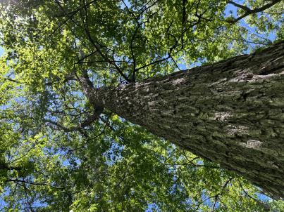 | | 2024 | COLLECTED | 06/05/2024 | Near southeast edge of Kasota Lake approximately 9.0 miles east, southeast of Willmar, T119N R34W SE 1/4 NE 1/4 Sec. 36 and also Robbins Island Park in Wilmar, T119N R35W Sec. 11. | 45.07399600, -94.88484100 | 352 | Deciduous woods | Wild material | Ulmus thomasii (Rock elm) is an underutilized tree species both in conservation and in the urban landscape. Described by Charles Sprague Sargent (first director for the Arnold Arborteum) as "heavy, hard, very strong and tough, closely grained, and susceptible of receiving a beautiful polish". Historically noted for a variety of uses in woodworking including furniture, heavy agricultural implements, timber frame buildings, pianos, hockey sticks, and hand tools. Ulmus thomasii is extremely drought tolerant, adaptable to very calcareous soils, and compared to U. americana or U. rubra has a very conservative growth rate requiring minimal attention in regards to pruning. Rock elm naturally tends to develop into a nice structural specimen in the landscape, unlike other fast growing cultivars in the nursery trade needing frequent attention. Rock elm has very fissured bark and is well known for maintaining a strong central leader resulting in a very attractive, pyramidal form. Despite many literature sources stating that "wings" on the stems are a key identifiying characteristic, this trait is not reliable and many genotypes may completely lack "wings" on the stems. While growth habit and morphology of dormant buds (very pointy) are good traits to help aid in identification, fruits are the best way to confirm identity. Fruits are densly pubescent, often described as "inflated" and generally reach maturity a couple weeks after Ulmus rubra and Ulmus americana. U. thomasii inflorescences are rather distinguishable from other Ulmus in being pendulous. Fruits are extremely prized treats for many birds, where fruits are often "robbed" prior to full maturity. Fruits are also highly prized by many other animals such as mice, squirrels, chipmunks, turkeys, etc. and are generally consumed within hours after fruit abscission. The native range of U. thomasii is concentrated in the northeastern United States and into Canada with disjunct populations documented in northwestern Missouri and northwestern Arkansas (Little, E. L. Jr. 1971). In the 1895 Silva of North America (vol. 7) it was stated that, “The value of the wood of the Rock Elm threatens its extinction and most of the large trees have already been cut.” Today, while rock elm is rather rare, especially in areas near the edges of its range, many states list the species as endangered or threatened warranting preservation efforts. Genetics of this accession would be representative of the species northwestern edge of its native range. Majority of specimens noted did not have characteristic "wings" on the stems and measured approximately 20" DBH or more with a few specimens nearing 30". Heights estimated between 70-90'. Rock elm in this area could be classified as locally abundant. | 2167953 | Ames 36251 |
| 2 | Ames 36073 | JDC/UT/2022/028/1009 | Ulmus thomasii Sarg. | Iowa, United States | NC7 |  | | 2023 | COLLECTED | 06/05/2023 | Ledges State Park approximately 4.75 miles south of Boone, T83N R26W (Madrid NW Quad.) near center of SE ¼ Sec. 16 and also NW ¼ SW ¼ Sec. 21. | 41.99780200, -93.87967900 | 288 | Moist deciduous woods typically on mid-slopes to base of slopes and also well-drained floodplains. | Wild material | Ulmus thomasii (Rock elm) is an underutilized tree species both in conservation and in the urban landscape. Charles Sprague Sargent (first director of the Arnold Arboretum of Harvard University, Boston, MA) described the wood of Rock Elm as "heavy, hard, very strong and tough, closely grained, and susceptible of receiving a beautiful polish". Historically noted for a variety of uses in woodworking including furniture, heavy agricultural implements, timber frame buildings, pianos, hockey sticks, and hand tools. U. thomasii is extremely drought tolerant, adaptable to very calcareous soils, and compared to U. americana or U. rubra has a very conservative growth rate requiring minimal attention in regards to pruning. Rock elm naturally tends to develop into a nice structural specimen in the landscape, unlike other fast growing U. americana cultivars in the nursery trade needing frequent attention. Rock elm has very fissured bark and is well known for maintaining a strong central leader resulting in a very attractive, pyramidal form. Despite many literature sources stating that "wings" on the stems are a key identifiying characteristic, this trait is not reliable and many genotypes may completely lack "wings" on the stems. While growth habit and morphology of dormant buds (very pointy) are good traits to help aid in identification, fruits are the best way to confirm identity. Fruits are densly pubescent, often described as "inflated" and generally reach maturity a couple weeks after U. rubra and U. americana. U. thomasii flowering in central Iowa typically occurs the last week in April into the first week in May and are rather distinguishable from other Ulmus in being pendulous. Fruits are extremely prized treats for many birds, where fruits are often "robbed" prior to full maturity. Fruits are also highly prized by many other animals such as mice, squirrels, chipmunks, turkeys, etc. and are generally consumed within hours after fruit abscission. The native range of U. thomasii is concentrated in the northeastern United States and into Canada with disjunct populations documented in northwestern Missouri and northwestern Arkansas (Little, E. L. Jr. 1971). In the 1895 Silva of North America (vol. 7) it was stated that, “The value of the wood of the Rock Elm threatens its extinction and most of the large trees have already been cut.” Today, since rock elm is rather rare, especially in areas near the edges of its range, many states list the species as endangered or threatened warranting preservation efforts. Genetics of this accession would be representative of the species southwestern edge of its native range. At the collection site in nature (Ledges State Park), out of approximately 100 specimens noted only 1-2% of specimens had characteristic "wings" on the stems. Research was executed (Moore, P., 2024) involving the core sampling of U. thomasii and U. americana specimens in Ledges State Park to make growth ring widths and basal area increment comparisons. Results determined that the average age of cored trees U. thomasii (n=4) and U. americana (n=4) of both species was roughly 80 years, excluding the exceptional case of tree #007 (Ames 36073 23ncao02 SD). Tree #007 was aged at 300 years of age and currently (2025) ranks as the 14th largest U. thomasii in Iowa measuring 21" DBH with a height of 75' 5" and a spread of 43' 5" totalling 152.21 points (Rouw, M., personal communication, 4 May 2022). The computed mean density at 𝑀𝑀 = 12% for U. thomasii was 0.80 g/cm3, and for U. americana was 0.672 g/cm3. These values are both higher than the representative values inferred from the Woods Database which are 0.755 g/cm3 for U. thomasii and 0.56 g/cm3 for U. americana. To date, there is little to no information regarding U. thomasii resistance to Dutch Elm Disease. Collections of U. thomasii at the Arnold Arboretum have over-time succumbed to DED (Pruka, B., 2016). However, data recorded by Moore (2024) indicates that U. thomasii growing in central Iowa can surpass 300 years in age verifying it's long-term utilization in the landscape. | 2142915 | Ames 36073 |
| 3 | Ames 34208 | NAO/UT/2018/23/48 | Ulmus thomasii Sarg. | Illinois, United States | NC7 |  | | 2018 | COLLECTED | 05/31/2018 | Private property located 2.0 miles northeast of Plano along Big Rock Creek just off Needham Road, T37N R6E SW 1/4 NE 1/4 Sec. 14 | 41.68543300, -88.51368600 | 188 | Flat open (mowed) areas and edge of woods. | Wild material | Ulmus thomasii (Rock elm) is an underutilized tree species both in conservation and in the urban landscape. Charles Sprague Sargent (first director of the Arnold Arboretum of Harvard University, Boston, MA) described the wood of Rock Elm as "heavy, hard, very strong and tough, closely grained, and susceptible of receiving a beautiful polish". Historically noted for a variety of uses in woodworking including furniture, heavy agricultural implements, timber frame buildings, pianos, hockey sticks, and hand tools. U. thomasii is extremely drought tolerant, adaptable to very calcareous soils, and compared to U. americana or U. rubra has a very conservative growth rate requiring minimal attention in regards to pruning. Rock elm naturally tends to develop into a nice structural specimen in the landscape, unlike other fast growing U. americana cultivars in the nursery trade needing frequent attention. Rock elm has very fissured bark and is well known for maintaining a strong central leader resulting in a very attractive, pyramidal form. Despite many literature sources stating that "wings" on the stems are a key identifiying characteristic, this trait is not reliable and many genotypes may completely lack "wings" on the stems. While growth habit and morphology of dormant buds (very pointy) are good traits to help aid in identification, fruits are the best way to confirm identity. Fruits are densly pubescent, often described as "inflated" and generally reach maturity a couple weeks after U. rubra and U. americana. U. thomasii inflorescences are rather distinguishable from other Ulmus in being pendulous. Fruits are extremely prized treats for many birds, where fruits are often "robbed" prior to full maturity. Fruits are also highly prized by many other animals such as mice, squirrels, chipmunks, turkeys, etc. and are generally consumed within hours after fruit abscission. The native range of U. thomasii is concentrated in the northeastern United States and into Canada with disjunct populations documented in northwestern Missouri and northwestern Arkansas (Little, E. L. Jr. 1971). In the 1895 Silva of North America (vol. 7) it was stated that, “The value of the wood of the Rock Elm threatens its extinction and most of the large trees have already been cut.” Today, since rock elm is rather rare, especially in areas near the edges of its range, many states list the species as endangered or threatened warranting preservation efforts. Genetics of this accession were collected on private property in north central Illinois (Kendall County) from a localized population in nature represented by 10-16" DBH specimens with little to no signs of decline. | 1963391 | Ames 34208 |
| 4 | Ames 34198 | 8226 | Ulmus americana L. | Illinois, United States | NC7 |  | | 2018 | COLLECTED | 05/05/2018 | Private property located 2.95 miles northwest of Carbondale just off Glen Road between Mud Creek and Orchard Creek watersheds, T9S R1W SE ¼ Sec. 6, Jackson County | 37.76076800, -89.25075300 | 122 | | Wild material | Germplasm from a single mother tree specimen identified as a likely having Dutch Elm Disease resistance due to its immense size and age. Specimen measuring 13.2 feet circumference, 146 feet height and 81.8 feet spread for a total of 324 points. Current (18 May 2018) state champion in Illinois is listed at 329 points. Specimen has an upright and spreading growth habit with large distinct alternate branches which appear nearly as large as the main trunk, distributed alternately up the length of the tree beginning roughly 30 feet above the ground. A fully crowned, mature specimen. Fruits measuring 0.7-0.9 cm. Registered with the U.S. Forest Service American elm “survivor” tree as Elm ID No. 8226. | 1962795 | Ames 34198 |
| 5 | Ames 34187 | JDC/UA/2018/011/824 | Ulmus americana L. | Oklahoma, United States | NC7 |  | | 2018 | COLLECTED | 03/13/2018 | Thurmond Ranch approximately 3.80 miles southwest of Cheyenne, T13N R24W SW 1/4 NW 1/4 of Sec. 27, Roger Mills County | 35.57587400, -99.74476300 | 639 | | Wild material | | 1957965 | Ames 34187 |
| 6 | Ames 33357 | JDC/UT/2016/018/733 | Ulmus thomasii Sarg. | Iowa, United States | NC7 |  | | 2016 | COLLECTED | 06/03/2016 | Malanaphy Springs State Preserve just northwest of Decorah, T99N R8W SW ¼ NW ¼ SE ¼ Sec. 31 | 43.34713800, -91.83840000 | 302 | Deciduous woods. Rocky substrate. 20 degree northwest-facing slope | Wild material | Ulmus thomasii (Rock elm) is an underutilized tree species both in conservation and in the urban landscape. Charles Sprague Sargent (first director of the Arnold Arboretum of Harvard University, Boston, MA) described the wood of Rock Elm as "heavy, hard, very strong and tough, closely grained, and susceptible of receiving a beautiful polish". Historically noted for a variety of uses in woodworking including furniture, heavy agricultural implements, timber frame buildings, pianos, hockey sticks, and hand tools. U. thomasii is extremely drought tolerant, adaptable to very calcareous soils, and compared to U. americana or U. rubra has a very conservative growth rate requiring minimal attention in regards to pruning. Rock elm naturally tends to develop into a nice structural specimen in the landscape, unlike other fast growing U. americana cultivars in the nursery trade needing frequent attention. Rock elm has very fissured bark and is well known for maintaining a strong central leader resulting in a very attractive, pyramidal form. Despite many literature sources stating that "wings" on the stems are a key identifiying characteristic, this trait is not reliable and many genotypes may completely lack "wings" on the stems. While growth habit and morphology of dormant buds (very pointy) are good traits to help aid in identification, fruits are the best way to confirm identity. Fruits are densly pubescent, often described as "inflated" and generally reach maturity a couple weeks after U. rubra and U. americana. U. thomasii flowering in central Iowa typically occurs the last week in April into the first week in May and are rather distinguishable from other Ulmus in being pendulous. Fruits are extremely prized treats for many birds, where fruits are often "robbed" prior to full maturity. Fruits are also highly prized by many other animals such as mice, squirrels, chipmunks, turkeys, etc. and are generally consumed within hours after fruit abscission. The native range of U. thomasii is concentrated in the northeastern United States and into Canada with disjunct populations documented in northwestern Missouri and northwestern Arkansas (Little, E. L. Jr. 1971). In the 1895 Silva of North America (vol. 7) it was stated that, “The value of the wood of the Rock Elm threatens its extinction and most of the large trees have already been cut.” Today, since rock elm is rather rare, especially in areas near the edges of its range, many states list the species as endangered or threatened warranting preservation efforts. This accession represents genetics from northeast Iowa (Winneshiek County). In an assessment of some of the largest Ulmus thomasii (native and cultivated) across Iowa, four of the nine largest specimens in Iowa are present in Malanaphy Springs State Preserve where this accession was sampled. The second largest U. thomasii in the state located in Malanaphy Springs was measured on 22 May 2020 with a circumference of 6.42', height of 86.58', and an average crown spread of 68.00' (180 points) (Rouw, M., personal communication, 8 February 2021). | 1940580 | Ames 33357 |
| 7 | Ames 27341 | JDC/UT/2017/021/775 | Ulmus thomasii Sarg. | Nebraska, United States | NC7 | 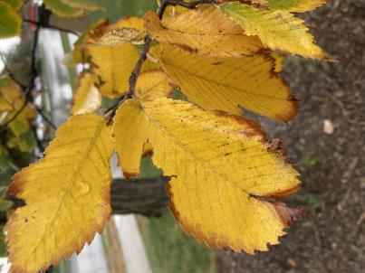 | | 2003 | COLLECTED | | Ponca State Park just north of Ponca approximately 2.75 miles T30N R6E N1/3 SE 1/4 Sec. 3 | 42.60173800, -96.71222100 | 383 | Eastern slopes and ridges of loess bluffs | Wild material | Ulmus thomasii (Rock elm) is an underutilized tree species both in conservation and in the urban landscape. Charles Sprague Sargent (first director of the Arnold Arboretum of Harvard University, Boston, MA) described the wood of Rock Elm as "heavy, hard, very strong and tough, closely grained, and susceptible of receiving a beautiful polish". Historically noted for a variety of uses in woodworking including furniture, heavy agricultural implements, timber frame buildings, pianos, hockey sticks, and hand tools. U. thomasii is extremely drought tolerant, adaptable to very calcareous soils, and compared to U. americana or U. rubra has a very conservative growth rate requiring minimal attention in regards to pruning. Rock elm naturally tends to develop into a nice structural specimen in the landscape, unlike other fast growing U. americana cultivars in the nursery trade needing frequent attention. Rock elm has very fissured bark and is well known for maintaining a strong central leader resulting in a very attractive, pyramidal form. Despite many literature sources stating that "wings" on the stems are a key identifiying characteristic, this trait is not reliable and many genotypes may completely lack "wings" on the stems. While growth habit and morphology of dormant buds (very pointy) are good traits to help aid in identification, fruits are the best way to confirm identity. Fruits are densly pubescent, often described as "inflated" and generally reach maturity a couple weeks after U. rubra and U. americana. U. thomasii inflorescences are rather distinguishable from other Ulmus in being pendulous. Fruits are extremely prized treats for many birds, where fruits are often "robbed" prior to full maturity. Fruits are also highly prized by many other animals such as mice, squirrels, chipmunks, turkeys, etc. and are generally consumed within hours after fruit abscission. The native range of U. thomasii is concentrated in the northeastern United States and into Canada with disjunct populations documented in northwestern Missouri and northwestern Arkansas (Little, E. L. Jr. 1971). In the 1895 Silva of North America (vol. 7) it was stated that, “The value of the wood of the Rock Elm threatens its extinction and most of the large trees have already been cut.” Today, since rock elm is rather rare, especially in areas near the edges of its range, many states list the species as endangered or threatened warranting preservation efforts. This accession was collected in northeast Nebraska (Dixon County) at Ponca State Park representing genetics from the extreme northwestern edge of the species native range and includes genetics (#775-6) from the current (2022) state champion. In an assessment of seedlings from all mother trees sampled (Carstens, J., personal communication, 12 April 2022), #775-4 produces the most vigorous seedlings which also consistently exhibited extremely corky/winged stems on new seedlings. Seedlings from other maternal lines show both winged and non-winged seedlings within the same maternal line and seedlings from some maternal lines have no wings. | 1649925 | Ames 27341 |
| 8 | NA 89008 | WLP 3120 | Morus rubra L. | Kentucky, United States | NA | | | 2023 | COLLECTED | 06/05/2023 | Swan Pond Bottom. Riparian buffer and historic floodplain of Cumberland River, approximately 4 river miles downstream of Wolf Creek Dam. | 36.90259500, -85.13557900 | | Riparian buffer and historic river floodplain. Slope: <5%. Aspect: North. | Wild material | | 2158092 | NA 89008 |
| 9 | Ames 36139 | Berea College Forest | Morus rubra L. | Kentucky, United States | NA |  | | 2023 | COLLECTED | 05/31/2023 | Between West and East Pinnacles of Berea College Forest just 3.25 miles east, southeast of Berea | 37.55656100, -84.23777600 | 338 | Mid-lower slopes of moist, deciduous woods. | Wild material | Species rather abundant throughout site with little to no presence of Morus alba. Majority of specimens noted measuring 8" DBH or smaller. Largest specimen noted reaching approximately 60' in height. | 2158344 | Ames 36139 |
| 10 | Ames 35884 | AS/MR/2022/003/133 | Morus rubra L. | Iowa, United States | NC7 |  | | 2022 | COLLECTED | 07/06/2022 | Chichaqua Bottoms Greenbelt located northeast of Bondurant, T81N R22W Sec. 33 and also T80N R22W Sec. 10. | 41.78917100, -93.41777300 | 247 | Floodplain. | Wild material | Specimens sampled in nature displayed the following morphological characters: elongated acuminate leaf tips, impressed veins, pubescent upper and lower leaves, flaky bark (often with tiny pin holes (insect emergence holes)), cordate leaf base, and umbrella-shaped growth habit. Majority of specimens were approximately 30-50' in height with the largest diameter specimen (133-6) measuring 19.5" DBH. All M. rubra specimens noted were exhibiting determinate growth compared to local hybrids and M. alba, which were still actively growing with newly emerging leaves. Soluble solids content for fruit samples collected in nature ranged from 12.8-22.8 degrees Brix. This range of Brix values is likely a result of genetic diversity and also variation in maturity of fruits. The highest Brix value was from specimen 133-4. | 2138217 | Ames 35884 |
| 11 | PI 702701 | MARSB-249 | Dichanthelium clandestinum (L.) Gould | New York, United States | S9 |  | | 2019 | | | | | | | Wild material | | 2097541 | PI 702701 |
| 12 | PI 675142 | ccc-021 | Actaea racemosa L. | West Virginia, United States | NC7 | | | 2009 | | | | | | | Wild material | Plants 5-8 feet in height; 3 ternately divided leaves; primary leaflet pinnately compound, odd, opposite; terminal pinnule 3x4 inch palmate with deep sinus; opposite pinnules 2x3 inch palmate with 4 sinus/4 lobes; rounded base; acuminate apex; margin doubly serrate/twice incised; venation palmate/textured beneath; dark brown above; brown below; glabrous hair; blue black petiole; ripe green to brown ovules of fruit; 8 brown/black crescent-shaped seeds within each tiny dried black orb, hanging in two rows on upper stalk. | 1829509 | PI 675142 |
| 13 | PI 664869 | JDC/HP/2008/030/100 | Hypericum prolificum L. | Missouri, United States | NC7 |  | | 2008 | COLLECTED | 10/06/2008 | Rudolf Bennitt Conservation Area, NE 1/4 of NE 1/4 of Section 25, T52N, R14W, Renick Quad, Randolph County. | 39.27527778, -92.43388889 | 256 | | Wild material | | 1788211 | PI 664869 |
| 14 | PI 664885 | JM20061020 | Prunella vulgaris L. | South Carolina, United States | NC7 | | | 2006 | COLLECTED | 09/28/2006 | East side of State Road 1149, north of Highway 11, Pickens, Pickens County. | 34.93500000, -82.88750000 | 262 | Cove hardwood forest, roadside. | Wild material | | 1715758 | PI 664885 |
| 15 | PI 616939 | F. virginiana subsp. virginiana NC 98-2-2 | Fragaria virginiana Mill. subsp. virginiana | Tennessee, United States | COR | | Out of Season | 2000 | COLLECTED | 09/25/1998 | From I-40 take Strawberry Plains PIke north for 1.9 miles to McCubbins Cemetary Lane. Turn right and go 0.1 mile to Mcubbins Cemetary. Site is McCubbins Cemetary grounds. Knox county. | 36.01917000, -83.74694000 | 425 | Dry uplands, silty topsoil, shale underneath. Quercus alba, Pinus virginiana, Pespalum subsp., Potentilla canadensis, Andropogon sp., Plantogo sp., Ulmus sp., Acer rubra and Acer barbatum. Mosses, lichens and grasses. | Wild material | | 1603151 | PI 616939 |
| 16 | PI 616940 | F. virginiana subsp. virginiana NC 98-2-3 | Fragaria virginiana Mill. subsp. virginiana | Tennessee, United States | COR | | Out of Season | 2000 | COLLECTED | 09/25/1998 | From I-40 take Strawberry Plains PIke north for 1.9 miles to McCubbins Cemetary Lane. Turn right and go 0.1 mile to Mcubbins Cemetary. Site is McCubbins Cemetary grounds. Knox county. | 36.01917000, -83.74694000 | 425 | Dry uplands, silty topsoil, shale underneath. Quercus alba, Pinus virginiana, Pespalum subsp., Potentilla canadensis, Andropogon sp., Plantogo sp., Ulmus sp., Acer rubra and Acer barbatum. Mosses, lichens and grasses. | Wild material | | 1603152 | PI 616940 |
| 17 | PI 616941 | F. virginiana subsp. virginiana NC 98-2-3 | Fragaria virginiana Mill. subsp. virginiana | Tennessee, United States | COR | | Out of Season | 2000 | COLLECTED | 09/25/1998 | From I-40 take Strawberry Plains PIke north for 1.9 miles to McCubbins Cemetary Lane. Turn right and go 0.1 mile to Mcubbins Cemetary. Site is McCubbins Cemetary grounds. Knox county. | 36.01917000, -83.74694000 | 425 | Dry uplands, silty topsoil, shale underneath. Quercus alba, Pinus virginiana, Pespalum subsp., Potentilla canadensis, Andropogon sp., Plantogo sp., Ulmus sp., Acer rubra and Acer barbatum. Mosses, lichens and grasses. | Wild material | | 1603153 | PI 616941 |
| 18 | PI 495604 | 8 | Cornus drummondii C. A. Mey. | Iowa, United States | NC7 |  | | 1984 | COLLECTED | 09/21/1984 | Along south end of parking area, Lake of Three Fires State Park, extreme NW corner of Section 7, T68N, R33W, Bedford Quad, Taylor County. | 40.71194444, -94.68583333 | 360 | | Wild material | Perennial woody. Plants in wide thicket to 2 meters tall, heavy fruiting. Very clean foliage with nice white fruits. | 1390540 | PI 495604 |
| 19 | Ames 38800 | Camp Mitigwa | Amelanchier arborea (F. Michx.) Fernald | Iowa, United States | NC7 |  | | 2026 | COLLECTED | 06/01/2026 | Mitigwa Scout Camp located on west side of Des Moines River watershed approximately 7.50 miles south, southwest of Boone, T82N R26W N 1/4 Sec. 5 and T83N R26W S 1/4 Sec. 32. | 41.94894500, -93.90537200 | 310 | High-quality white oak - ironwood, mature woods. | Wild material | The native range of Amelanchier arborea is concentrated in the eastern half of the U.S. (Little, 1977). This accession represents a collection of A. arborea germplasm from the western edge of the species native range, specifically central Iowa. Specimens sampled at the collection site in nature were small to medium understory or woodland edge single and/or multi-trunked trees with a few trees getting close to being deemed as canopy specimens. Bark smooth and light grey in color. Specimens sampled in nature ranging 15-50' in height. Peak flowering occurred on 8 April 2026 with white flowers appearing prior to leaf expansion. Fall colors ranging from orange to orange-red peaking typically at the end of September (central Iowa). Fruits, dark-pink to red, maturing in early June (peak in 2026 occurred on 2 June) averaging 8 mm in diameter, except for mother tree #6 that had rather large fruits at 11 mm in diameter. | 2197049 | Ames 38800 |
| 20 | NA 89158 | 2025RJLSEUS-06 | Cornus florida L. | Alabama, United States | NA | | | 2025 | COLLECTED | 10/01/2025 | Coosa Wildlife Management Area: along the edge of gated dirt road on the west side of Coosa County Road 29, 0.3 kilometers north of Hatchet Creek. | 32.86402200, -86.33871400 | 108 | Plants are growing in part sun to shade on dry-mesic slopes above the road cut on the gated dirt road; most likely a road for access for fire control/forest management. The forest is a combination of deciduous and evergreen with evergreens primarily comprised of Pinus taeda. The habitat was quite dry during this time of year. Slope: 5 to 20 percent. Aspect: North. Soils: The primary soil in the area of this collection is classified as Madison-Louisa Series complex, 15 to 30 percent slopes, moderately eroded (MdE2). The Madison Series soils are very deep, well drained soils with medium runoff found on Piedmont uplands in interstream divides, ridges and side slopes. They are comprised of residuum weathered from felsic or intermediate, high-grade metamorphic or igneous rocks high in content of mica. Slopes range from 2 to 60 percent and soil is typically strongly acidic. Louisa Series soils The Louisa Series soils consist of shallow, somewhat excessively drained soils which formed over mica gneiss and schist bedrock. They occur on Piedmont uplands. Slopes are 6 to 80 percent. This soil is moderately acid. (Source: California Soil Resource Lab/NRCS Official Soil Series Descriptions). Geology: The underlying geology of this area is of Precambrian to Paleozoic origin and characterized as Hatchet Creek Group; Pinchoulee Gneiss Formation. It is characterized by medium to fine-grained migmatitic, locally garnetiferous biotite-feldspar gneiss, commonly saturated with granitic pods. (Source: USGS Alabama Geologic Map Data). | Wild material | | 2193004 | NA 89158 |
| 21 | Ames 36697 | APS/JC/2025/XXX/XXX | Juniperus communis L. | Iowa, United States | NC7 |  | | 2025 | COLLECTED | 09/15/2025 | Located off Iowa River Drive approximately 2.5 miles southwest of New Albin, T100N R4W NE 1/4 NW 1/4 Sec. 21. | 43.46830000, -91.32128000 | 207 | Sandy ridge of a power line cut. | Wild material | | 2192820 | Ames 36697 |
| 22 | NA 89115 | TLM25-04a | Hamamelis ovalis S. W. Leonard | Texas, United States | NA | | | 2025 | COLLECTED | 07/10/2025 | State Highway 87 approximately 3.25 kilometers north of the crossroad junction with Texas Recreational Road 255 (RE 255); plants were growing in the narrow buffer woods along the east side of the highway. | 31.12051300, -93.72628100 | 138 | The habitat is an upland mixed coniferous and deciduous woodlands in part to full shade and dry conditions, often under drought stress. Plants seem to always occur on the top of dry ridges or well-drained slopes. Slope: 0 to 1 percent. Aspect: N/A. Soils: The soils of this collection area are classified as Tehran-Letney Association, hilly (TLE) soils. The Tehran Series (55%) consists of deep, somewhat excessively drained, moderately rapidly permeable soils on uplands. They formed in thick loamy and sandy sediments on the Western Coastal Plain. These soils are on gently sloping to moderately steep uplands with slopes ranging from 1 to 20 percent. The Letney Series (30%) consists of deep, well drained, moderately rapidly permeable, upland soils. They formed in thick sandy and loamy sediments of the coastal plains. These soils are on gently sloping to moderately steep uplands with slopes ranging from 1 to 20 percent. Soil pH ranges from 4.5 to 6.0. The minor soil components include Doucette Series (10%) and Boykin Series (5%) soils. (Source: California Soil Resource Lab/NRCS Official Soil Series Descriptions). Geology: The underlying geology of this area is of Oligocene origin and characterized as Catahoula Formation. This formation is extensive and deep in Texas, up to 185 meters thick. In the area of the collection the Catahoula Formation is primarily mudstone and sand. The upper 90-150 meters is mudstone that is tuffaceous, and sandy; also, occasionally, with some bentonitic clay. (Source: USGS Texas Geologic Map Data). | Wild material | | 2191654 | NA 89115 |
| 23 | NA 89077 | 2024RJLPA-003 | Viburnum acerifolium L. | Pennsylvania, United States | NA | | | 2024 | COLLECTED | 09/19/2024 | Birdell Road, near parking lot to trail where the road ends at Chambers Lake, which is part of Hibernia County Park. | 40.03559500, -75.85708600 | 187 | Plants are growing in deep shade of a dry deciduous forest dominated by Fagus grandifolia. Slope: 0 percent. Aspect: N/A. Geology: The underlying geology of this area is of Precambrian origin and characterized as Banded Mafic Gneiss. It is characterized as dark and fine to medium grained. This formation includes rocks of probable sedimentary origin; may be equivalent to "PZmgh." (Source: USGS Pennsylvania Geologic Map Data). Soils: The primary soil type in the area of this collection is classified as Neshaminy Series Silt Loam, very deep over mafic gneiss, 3 to 8 percent slopes (NvB). (Source: USDA-NRCS Official Soil Series Descriptions). EPA Ecoregion (Level III): Northern Piedmont (64). EPA Ecoregion (Level IV): Piedmont Uplands (64c). | Wild material | | 2169041 | NA 89077 |
| 24 | NA 89078 | 2024RJLPA-004 | Staphylea trifolia L. | Pennsylvania, United States | NA | | | 2024 | COLLECTED | 09/20/2024 | Along gated road about 0.33 kilometers southwest of the Lake Ontelaunee Trail parking lot. | 40.49850800, -75.89121300 | 94 | Plants are growing on well-drained steep slopes in shade to part shade of a deciduous forest. Slope: 35 to 50 percent. Aspect: East-southeast. Geology: The underlying geology of this area is of Ordovician origin and characterized as Shale and graywacke of Hamburg sequence. It is characterized by shale containing zones of conspicuous graywacke. (Source: USGS Pennsylvania Geologic Map Data). Soils: The primary soil type in the area of this collection is classified as Berks-Weikert Complex, 25 to 60% slopes (BkF). Dominantly sloping to very steep, moderately deep and shallow, well drained soils underlain by acid shale bedrock. (Source: UPenn State University Soil Info Website). EPA Ecoregion (Level III): Ridge and Valley (67). EPA Ecoregion (Level IV): Northern Shale Valleys (67b). | Wild material | | 2169042 | NA 89078 |
| 25 | NA 89079 | 2024RJLPA-005 | Viburnum prunifolium L. | Pennsylvania, United States | NA | | | 2024 | COLLECTED | 09/20/2024 | Along gated road about 0.33 kilometers southwest of the Lake Ontelaunee Trail parking lot. | 40.50062600, -75.89004900 | 94 | Plants are growing on moist, well-drained in part shade of a deciduous forest. Slope: 0 percent. Aspect: N/A. Geology: The underlying geology of this area is of Ordovician origin and characterized as Shale and graywacke of Hamburg sequence. It is characterized by shale containing zones of conspicuous graywacke. (Source: USGS Pennsylvania Geologic Map Data). Soils: The primary soil type in the area of this collection is classified as Holly Series Silt Loam (Ho). The Holly Series consists of very deep, very poorly and poorly drained soils formed in loamy alluvium on flood plains. Saturated hydraulic conductivity is moderately high through high in the mineral soil. Slope ranges from 0 through 3 percent. (Source: USDA-NRCS Official Soil Series Descriptions). EPA Ecoregion (Level III): Ridge and Valley (67). EPA Ecoregion (Level IV): Northern Shale Valleys (67b). | Wild material | | 2169043 | NA 89079 |
| 26 | NA 89081 | 2024RJLPA-009 | Rosa carolina L. | Pennsylvania, United States | NA | | | 2024 | COLLECTED | 09/22/2024 | Lancaster and York Counties: outcrops along the Susquehanna River, accessed from the Historic Lock 12 parking lot off of Pennsylvania Road 372. | 39.81483500, -76.32762200 | 34 | Plants are growing from part-sun to full sun in crevices of the outcrops and where organic debris has accumulated in between boulders along the Susquehanna River. The sites range from nearly xeric to dry mesic, at least on the surface. Plants are generally growing 4-10 m above the normal flow of the river; however, the Holtwood Dam is less than 1 kilometer upstream and debris found trapped in the boulders indicates that there is periodic flooding, at least, in the lower zone of 4+ meters or so above normal river flow. This habitat has a diverse assemblage of deciduous trees and shrubs as well as abundant herbaceous taxa. Slope: 0 to 60 percent. Aspect: Northeast (generally). Geology: The underlying geology of this area is probably of lower Paleozoic age and characterized as the Octoraro Formation. It includes albite-chlorite schist, phyllite, some hornblende gneiss, and granitized members. Soils: The area where this species occurs is right on the edge of two soil zones that transition from the river’s edge to mesic conditions upslope. The first is generally referred to as Rock Outcrop. This terrestrial matrix in which plants grow is largely exposed underlying rock geology with accumulated outwash, rock decomposition, and organic debris buildup. The second is Mt. Airy (80%) and Manor (20%) Series soils, 25 to 60 percent slopes, extremely stony (MRF). (Source: California Soil Resource Lab/NRCS Official Soil Series Descriptions). EPA Ecoregion (Level III): Northern Piedmont (64). EPA Ecoregion (Level IV): Piedmont Uplands (64c). | Wild material | | 2169045 | NA 89081 |
| 27 | NA 89082 | 2024RJLPA-010 | Amorpha fruticosa L. | Pennsylvania, United States | NA | | | 2024 | COLLECTED | 09/22/2024 | Outcrops along the Susquehanna River, accessed from the Historic Lock 12 parking lot off of Pennsylvania Road 372. | 39.81481500, -76.32757900 | 34 | Plants are growing from part-sun to full sun in crevices of the outcrops and where organic debris has accumulated in between boulders along the Susquehanna River. The sites range from nearly xeric to dry mesic, at least on the surface. Plants are generally growing 4-10 m above the normal flow of the river; however, the Holtwood Dam is less than 1 kilometer upstream and debris found trapped in the boulders indicates that there is periodic flooding, at least, in the lower zone of 4+ meters or so above normal river flow. This habitat has a diverse assemblage of deciduous trees and shrubs as well as abundant herbaceous taxa. Slope: 0 to 25 percent. Aspect: Northeast (generally). Geology: The underlying geology of this area is probably of lower Paleozoic age and characterized as the Octoraro Formation. It includes albite-chlorite schist, phyllite, some hornblende gneiss, and granitized members. Soils: The area where this species occurs is right on the edge of two soil zones that transition from the river’s edge to mesic conditions upslope. The first is generally referred to as Rock Outcrop. This terrestrial matrix in which plants grow is largely exposed underlying rock geology with accumulated outwash, rock decomposition, and organic debris buildup. The second is Mt. Airy (80%) and Manor (20%) Series soils, 25 to 60 percent slopes, extremely stony (MRF). (Source: California Soil Resource Lab/NRCS Official Soil Series Descriptions). EPA Ecoregion (Level III): Northern Piedmont (64). EPA Ecoregion (Level IV): Piedmont Uplands (64c). | Wild material | | 2169046 | NA 89082 |
| 28 | NA 89083 | 2024RJLPA-012 | Rhododendron periclymenoides (Michx.) Shinners | Pennsylvania, United States | NA | | | 2024 | COLLECTED | 09/22/2024 | Outcrops along the Susquehanna River, accessed from the Historic Lock 12 parking lot off of Pennsylvania Road 372. | 39.81477400, -76.32807300 | 35 | Plants are growing from shade to part-sun and occasionally full sun in crevices of the outcrops and where organic debris has accumulated in between boulders along the Susquehanna River. The sites range from nearly xeric to mesic, at least on the surface. Plants are generally growing 4-10 m above the normal flow of the river; however, the Holtwood Dam is less than 1 kilometer upstream and debris found trapped in the boulders indicates that there is periodic flooding, at least, in the lower zone of 4+ meters or so above normal river flow. This habitat has a diverse assemblage of deciduous trees and shrubs as well as abundant herbaceous taxa. Slope: 0 to 60 percent. Aspect: Northeast (generally). Geology: The underlying geology of this area is probably of lower Paleozoic age and characterized as the Octoraro Formation. It includes albite-chlorite schist, phyllite, some hornblende gneiss, and granitized members. Soils: The area where this species occurs is right on the edge of two soil zones that transition from the river’s edge to mesic conditions upslope. The first is generally referred to as Rock Outcrop. This terrestrial matrix in which plants grow is largely exposed underlying rock geology with accumulated outwash, rock decomposition, and organic debris buildup. The second is Mt. Airy (80%) and Manor (20%) Series soils, 25 to 60 percent slopes, extremely stony (MRF). (Source: California Soil Resource Lab/NRCS Official Soil Series Descriptions). EPA Ecoregion (Level III): Northern Piedmont (64). EPA Ecoregion (Level IV): Piedmont Uplands (64c). | Wild material | | 2169047 | NA 89083 |
| 29 | NA 89084 | 2024RJLPA-013 | Physocarpus opulifolius (L.) Maxim. | Pennsylvania, United States | NA | | | 2024 | COLLECTED | 09/22/2024 | Outcrops along the Susquehanna River, accessed from the Historic Lock 12 parking lot off of Pennsylvania Road 372. | 39.81466300, -76.32833900 | 36 | Plants are growing from shade to part-sun where organic debris has accumulated in between boulders as well as further upslope in deeper mesic soils along the Susquehanna River. This habitat has a diverse assemblage of deciduous trees and shrubs as well as abundant herbaceous taxa. Slope: 10 to 25 percent. Aspect: Northeast (generally). Geology: The underlying geology of this area is probably of lower Paleozoic age and characterized as the Octoraro Formation. It includes albite-chlorite schist, phyllite, some hornblende gneiss, and granitized members. Soils: The area where this species occurs is right on the edge of two soil zones that transition from the river’s edge to mesic conditions upslope. The first is generally referred to as Rock Outcrop. This terrestrial matrix in which plants grow is largely exposed underlying rock geology with accumulated outwash, rock decomposition, and organic debris buildup. The second is Mt. Airy (80%) and Manor (20%) Series soils, 25 to 60 percent slopes, extremely stony (MRF). (Source: California Soil Resource Lab/NRCS Official Soil Series Descriptions). EPA Ecoregion (Level III): Northern Piedmont (64). EPA Ecoregion (Level IV): Piedmont Uplands (64c). | Wild material | | 2169048 | NA 89084 |
| 30 | NA 89085 | 2024RJLPA-014 | Rhododendron arborescens (Pursh) Torr. | Pennsylvania, United States | NA | | | 2024 | COLLECTED | 09/22/2024 | Outcrops along the Susquehanna River, accessed from the Historic Lock 12 parking lot off of Pennsylvania Road 372. | 39.81618100, -76.33069800 | 38 | Plants are growing from shade to part-sun and occasionally full sun in crevices of the outcrops and where organic debris has accumulated in between boulders along the Susquehanna River. The sites range from nearly xeric to mesic, at least on the surface. Plants are generally growing 4-10 m above the normal flow of the river; however, the Holtwood Dam is less than 1 kilometer upstream and debris found trapped in the boulders indicates that there is periodic flooding, at least, in the lower zone of 4+ meters or so above normal river flow. This habitat has a diverse assemblage of deciduous trees and shrubs as well as abundant herbaceous taxa. Slope: 0 to 75 percent. Aspect: Northeast (generally). Geology: The underlying geology of this area is probably of lower Paleozoic age and characterized as the Octoraro Formation. It includes albite-chlorite schist, phyllite, some hornblende gneiss, and granitized members. Soils: The area where this species occurs is right on the edge of two soil zones that transition from the river’s edge to mesic conditions upslope. The first is generally referred to as Rock Outcrop. This terrestrial matrix in which plants grow is largely exposed underlying rock geology with accumulated outwash, rock decomposition, and organic debris buildup. The second is Mt. Airy (80%) and Manor (20%) Series soils, 25 to 60 percent slopes, extremely stony (MRF). (Source: California Soil Resource Lab/NRCS Official Soil Series Descriptions). EPA Ecoregion (Level III): Northern Piedmont (64). EPA Ecoregion (Level IV): Piedmont Uplands (64c). | Wild material | | 2169049 | NA 89085 |
| 31 | NA 89086 | 2024RJLPA-015 | Ilex verticillata (L.) A. Gray | Pennsylvania, United States | NA | | | 2024 | COLLECTED | 09/22/2024 | Outcrops along the Susquehanna River, accessed from the Historic Lock 12 parking lot off of Pennsylvania Road 372. | 39.81656600, -76.33136600 | 38 | Plants are growing from part-sun to full sun in crevices of the outcrops and where organic debris has accumulated in between boulders along the Susquehanna River. The sites range from nearly xeric to dry mesic, at least on the surface. Plants are generally growing 4-10 m above the normal flow of the river; however, the Holtwood Dam is less than 1 kilometer upstream and debris found trapped in the boulders indicates that there is periodic flooding, at least, in the lower zone of 4+ meters or so above normal river flow. This habitat has a diverse assemblage of deciduous trees and shrubs as well as abundant herbaceous taxa. Slope: 0 to 10 percent. Aspect: Northeast (generally). Geology: The underlying geology of this area is probably of lower Paleozoic age and characterized as the Octoraro Formation. It includes albite-chlorite schist, phyllite, some hornblende gneiss, and granitized members. Soils: The area where this species occurs is right on the edge of two soil zones that transition from the river’s edge to mesic conditions upslope. The first is generally referred to as Rock Outcrop. This terrestrial matrix in which plants grow is largely exposed underlying rock geology with accumulated outwash, rock decomposition, and organic debris buildup. The second is Mt. Airy (80%) and Manor (20%) Series soils, 25 to 60 percent slopes, extremely stony (MRF). (Source: California Soil Resource Lab/NRCS Official Soil Series Descriptions). EPA Ecoregion (Level III): Northern Piedmont (64). EPA Ecoregion (Level IV): Piedmont Uplands (64c). | Wild material | | 2169050 | NA 89086 |
| 32 | NA 89087 | 2024RJLPA-016 | Hydrangea arborescens L. | Pennsylvania, United States | NA | | | 2024 | COLLECTED | 09/22/2024 | Outcrops along the Susquehanna River, accessed from the Historic Lock 12 parking lot off of Pennsylvania Road 372. | 39.81489000, -76.32912200 | 43 | Plants are growing in deep shade of the deciduous woodlands on outcrops and the steep slopes where organic debris and detritus has accumulated. This habitat has a diverse assemblage of deciduous trees and shrubs as well as abundant herbaceous taxa. Slope: 30 to 90 percent. Aspect: Northeast (generally). Geology: The underlying geology of this area is probably of lower Paleozoic age and characterized as the Octoraro Formation. It includes albite-chlorite schist, phyllite, some hornblende gneiss, and granitized members. (Source: Source: USGS Pennsylvania Geologic Map Data). Soils: The area where this species occurs is right on the edge of two soil zones that transition from the river’s edge to mesic conditions upslope. The first is generally referred to as Rock Outcrop. This terrestrial matrix in which plants grow is largely exposed underlying rock geology with accumulated outwash, rock decomposition, and organic debris buildup. The second is Mt. Airy (80%) and Manor (20%) Series soils, 25 to 60 percent slopes, extremely stony (MRF). (Source: California Soil Resource Lab/NRCS Official Soil Series Descriptions). EPA Ecoregion (Level III): Northern Piedmont (64). EPA Ecoregion (Level IV): Piedmont Uplands (64c). | Wild material | | 2169051 | NA 89087 |
| 33 | Ames 36260 | Thomson Causeway Recreation Area | Cornus drummondii C. A. Mey. | Illinois, United States | NC7 |  | | 2024 | COLLECTED | 08/19/2024 | Thomson Causeway Recreation Area, approximately 1 mile southwest of Thomson. Scattered along Potter Road starting just east of the causeway heading west, and along the gravel service road to the south. T23N R3E SE 1/4 Sec. 26. | 41.94919700, -90.11822100 | 179 | Floodplain of wetland complex along east bank of Mississippi River. Soils are moist and seasonally inundated with high organic matter content. | Wild material | Shrubs in nature measuring approximately 10 feet in height (to 15 feet) with varying degrees of red pigmentation on the pedicles. Peak fruit ripening occurred in late August 2024. Minor foliar disease noted at the time of collection. Growing as individual shrubs in shadier locations and forming thickets in sunnier sites. | 2168984 | Ames 36260 |
| 34 | Ames 36248 | Robert's Creek | Salix bebbiana Sarg. | Iowa, United States | NC7 |  | | 2024 | COLLECTED | 05/15/2024 | Robert’s Creek Preserve just north of Forest Road approximately 4.2 miles north, northeast of Elkader, T94N R5W near center of Sec. 36. | 42.91366500, -91.37990600 | 260 | Mixed hardwood forest. Very steep, moist, north-facing slope. | Wild material | Bebb's willow, Salix bebbiana, is a tight, clump forming, multi-stemmed shrub that can reach up to 25' in height that forms a rather distinct, mounded growth habit. Native to North America, the native range covers mostly Canada, but extending south into the northeastern US and also the Rocky Mountains range stretching as far south as New Mexico and Arizona (Little, E. L. Jr. 1977). In Iowa, this species seems to only be known from northeastern Iowa. Salix bebbiana can be found in a variety of habitats from pond margins/swamps to even moderately well-drained open fields. The female capsules are long (5-9 mm) with a very slender beak held on the longest stalk of any N. American Salix. This accession represents genetics from northeastern Iowa at the southern edge of its range in northeastern N. America. Specimens sampled were estimated at 30' in height. Some of the oldest, largest specimens sampled measuring approximately 8" DBH were showing signs of decline. Immature leaves are reddish or yellow green and rather rugose. | 2167645 | Ames 36248 |
| 35 | NA 88678 | RJL2023PA-012 | Viburnum acerifolium L. | Pennsylvania, United States | NA | | | 2023 | COLLECTED | 10/27/2023 | Slopes on the east side of Creek Road above the North Branch of White Clay Creek. | 39.78552600, -75.80251900 | 90 | Well-drained mesic-dry to rocky dry deciduous woodlands in part shade to full shade. Slope: 15-35%. Aspect: West to northwest. The underlying geology of this area includes two formations. The first and primary formation is Lower Paleozoic Glenarm Wissahickon Formation, lithologically similar to oligoclase-mica schist of the Wissahickon Formation, but also includes lenticular amphibolite bodies having ocean-floor basalt chemistry. The second formation is Lower Paleozoic Mafic Gneiss Formation that is dark and medium grained. It includes rocks of probable sedimentary origin. (Sources: USGS Pennsylvania Geologic Map Data). The primary soil type in the collection area is classified as Manor Series. The Manor Series consists of well-drained residuum weathered from micaceous schist. Soils in the upper pedon (0-33 cm) are very dark grayish brown loam with strong fine granular structure; also, very friable with fine mica flakes and strongly acid. Lower pedon soils (34-56 cm) are strong brown, sandy loams. They have weak medium sub-angular blocky structure, are friable with many fine and a few medium mica flakes; this pedon is very strongly acid. (Source: NRCS Web Soil Survey). | Wild material | | 2159069 | NA 88678 |
| 36 | NA 88666 | RJL2023PA-003 | Hamamelis virginiana L. | Pennsylvania, United States | NA | | | 2023 | COLLECTED | 10/01/2023 | Collected primarily along the woodland edge along Northside Road on Pennsylvania State Gamelands No. 43 as well as a few on nearby roads. | 40.17974200, -75.76790700 | 176 | Plants were growing in mesic well-drained conditions on moderately sloping sites of a deciduous upland forest. This species grows well in shade to part-sun. Most abundant fruit development is found where plants are exposed to sunlight for a portion of the day. Slope: 15%. Aspect: North-northwest. The underlying geology of this area is of Precambrian origin and characterized as the Graphitic Felsic Gneiss. This includes Pickering Gneiss and small areas of marble; dominantly quartz and feldspar with varying amounts of graphite and various metamorphic minerals; medium grained, light to dark gray and greenish gray; sedimentary origin. (Source: USGS Pennsylvania Geologic Map Data.) The primary soil type in the area of this collection is classified as Gladstone Gravelly Loam Series (8 to 15 percent slopes). The Gladstone Series consists of very deep, well drained soils formed in residuum and colluvium from granitic gneiss. Saturated hydraulic conductivity is moderately high to high. Solum thickness ranges from 75 to 125 cm. Depth to granitic gneiss bedrock is 1.6 meters or more. The bedrock may be strongly weathered in the upper part. Gravel content ranges from 5 to 35 percent throughout the solum, and 10 to 40 percent in the C horizons. Fragments, larger than 3 inches in diameter, range from 0 to 20 percent by volume in the surface layer and 0 to 10 percent in the subsoil and substratum layers. Reaction is strongly or very strongly acid throughout the soil, unless limed. Areas that have been limed range to moderately acid in the upper part of the profile. (Source: NRCS Web Soil Survey.) | Wild material | | 2158815 | NA 88666 |
| 37 | NA 88665 | RJL2023PA-002 | Ilex verticillata (L.) A. Gray | Pennsylvania, United States | NA | | | 2023 | COLLECTED | 10/01/2023 | Woodlands along Pine Creek near the Harmonyville Road bridge. | 40.18764500, -75.76732200 | 141 | Moist to mucky, wet woodland conditions along Pine Creek. Much of the site is very wet due to recent rains; though, earlier in the year, the soils were only moist. Plants grow in both well-drained mesic conditions as well as seasonally wet conditions. They do not grow in standing water anywhere in this location. Plants in this population are found mostly in the shade and partial shade of deciduous trees; there are occasional gaps that offer higher light conditions as well. Slope: 0-2%. Aspect: N/A. The underlying geology of this area is of Precambrian origin and characterized as the Graphitic Felsic Gneiss. This includes Pickering Gneiss and small areas of marble; dominantly quartz and feldspar with varying amounts of graphite and various metamorphic minerals; medium grained, light to dark gray and greenish gray; sedimentary origin. (Source: USGS Pennsylvania Geologic Map Data). The primary soil type in the area of this collection is classified as Hatboro Silt Loam Series. The Hatboro Series consists of very deep and poorly drained soils formed in alluvium derived from metamorphic and crystalline rock. They are on flood plains. Slopes range from 0 to 3 percent. Saturated hydraulic conductivity is moderately high to high. Solum thickness ranges from 50 to 150 cm. Depth to bedrock ranges from 1.5 to 3 meters or more. Organic carbon decreases irregularly with depth or is greater than 0.2 percent directly above any strongly contrasting C horizon. The depth to strongly contrasting sand and gravel is more than 100 cm or the transition is greater than 12.5 cm. Content of gravel ranges from 0 to 10 percent in the solum and from 0 to 80 percent in the C horizon. Mica flakes are common in the solum, and the C horizon contains thin lenses of mica. Reaction ranges from very strongly acid through neutral to a depth of 75 cm and from moderately acid through slightly acid below 75 cm. (Source: NRCS Web Soil Survey.) | Wild material | | 2158814 | NA 88665 |
| 38 | Ames 36170 | Lake Catherine State Park | Ptelea trifoliata L. | Arkansas, United States | NC7 |  | | 2023 | COLLECTED | 08/27/2023 | Lake Catherine State Park approximately 10 miles southeast of Hot Springs. Localized to the ridge top of Dam Mountain on the south shore of the southeast arm of the reservior, starting approximately 0.25 miles southwest of the dam. T3S R18W Sec. 35. | 34.42452200, -92.90218400 | 199 | Dry ridge top. Predominantly on the north facing edge of ridge. | Wild material | A localized but very dense population. Ptelea is the dominant understory species in this location. | 2158789 | Ames 36170 |
| 39 | Ames 36017 | AS/GD/2023/002/212 | Gymnocladus dioicus (L.) K. Koch | Wisconsin, United States | NC7 |  | | 2023 | | | | | | | Wild material | Kentucky coffeetree in Wisconsin is rather rare. The Wisconsin Natural Heritage Inventory Program currently (2023) lists this taxon in Wisconsin as a species of concern with a state rank of S2 (Imperiled in Wisconsin due to a restricted range, few populations or occurrences, steep declines, severe threats, or other factors.) This accession represents genetics from a localized population with a near equal porportion of male and female specimens. While there are other known locations along the Wisconsin River, this population is producing seeds. The other known locations represent single clones that are distant enough from other existing clones that prevent the transfer of pollen and thus lack the ability to produce seed or will rarely produce. | 2141550 | Ames 36017 |
| 40 | NA 88599 | RJL2023NC-001 | Ilex decidua Walter | North Carolina, United States | NA | | | 2023 | COLLECTED | 02/18/2023 | Plants growing along a fenceline on a hillside about 10 meters from Interstate 85 (south bound) and approximately 0.65 kilometers south of the North Carolina-Virginia border. | 36.53904800, -78.18822500 | 86 | The plant was growing on the upper shoulder of a slope about 7 meters above the highway in part-shade to sun of an upland, well-drained, dry mesic somewhat disturbed site on the fenceline boundary of Interstate 85 (south bound). The area was originally cleared of all vegetation and now, many years later, native and non-native plant species have aggressively recolonized the area. This early successional habitat is dominated by Juniperus virginiana and Liquidambar styraciflua, as well as, non-native species such as Ligustrum sinense, Lonicera japonica, and Ailanthus altissima. The underlying geology of this area is of Permian/Pennsylvanian origin and characterized as the Granitic Rock Formation. It is characterized by megacrystic to equigranular components and includs Castalia and Wilton intrusives. | Wild material | | 2141480 | NA 88599 |
| 41 | NA 88509 | RJL2022TX-004 | Ilex decidua Walter | Texas, United States | NA | | | 2022 | COLLECTED | 11/01/2022 | Low woodlands along the north side of Texas State Hwy 190 between the highway and an unnamed paved service road that leads down to the Sabine River; the turn for the service road is approximately 0.62 kilometers west of the Sabine River. Near the bridge over the Sabine River. | 30.74730000, -93.61568900 | 20 | Plants are growing in part-shade to shade of a moist mesic (occasionally temporarily wet) woodland. Ilex decidua can be in the low woods most of the way down to the river. Plant is a common understory shrub in the moist woodland habitat not far from the Sabine River. Soils: The underlying geology of this area is of Holocene origin and characterized as Alluvium. The alluvium and low terrace deposits along streams include sand, silt, clay, and gravel. Thickness is variable. In this case alluvium is from the Sabine River. (Source: USGS Texas Geologic Map Data). The primary soil types in the collection area are classified as Urbo and Mantachie soils. The Urbo series consists of deep, somewhat poorly drained soils. Permeability is very slow. These nearly level to gently sloping soils formed in clayey alluvium on flood plains of streams that drain uplands of the Southern Coastal Plain. Slopes range from 0 to 3 percent. In wet seasons late in winter and early in spring, the water table is at a depth of 1 to 2 feet and most areas of Urbo soils are subject to either occasional or frequent flooding of brief to long duration. The Mantachie series consists of very deep, somewhat poorly drained, moderately permeable soils on flood plains of the Southern Coastal Plain. They formed in loamy alluvium and considered acidic. Mantachie soils are subject to rare to frequent flooding in the winter and early spring for brief to long duration, unless protected. The seasonal high water table ranges from 1.0 to 1.5 feet of the surface during periods of high rainfall. (Source: NRCS Web Soil Survey). | Wild material | | 2139816 | NA 88509 |
| 42 | WLP 2670 | RJL2022PA-016 | Acer negundo L. | Pennsylvania, United States | NA | | | 2022 | COLLECTED | 10/21/2022 | Plants growing in woodlands above a small unnamed creek that dumps into the Middle Branch White Clay Creek in Goddard Park, West Grove Pennsylvania, off of Wickerton Road, Chester County. Plants are found regularly but scattered in the understory of the woodlands. | 39.80426000, -75.82609300 | 105 | Plants growing in a mesic, well-drained habitat of deciduous woodlands along streams and above the riparian zone that drains toward a small unnamed creek that feeds into the Middle Branch White Clay Creek. Plants generally grow in part shade to full sun, but perform best and fruit more heavily in full sun where there is abundant access to moisture. The remnant woodlands exist mostly along the steep slopes, wetlands and seeps of seasonal and year-round creeks flowing into the Middle Branch White Clay Creek. The woodlands are bordered by numerous housing developments and land converted to meadows; hence there is significant first order edge that is heavily impacted by invasive plant intrusion. Despite this fact, Acer negundo is highly competitive and competes well.
Soils: The underlying geology of this area is the Glenarm Wissahickon Formation of lower Paleozoic origin and lithologically similar to oligoclase-mica schist of the Wissahickon Formation (PZw), but also includes lenticular amphibolite bodies having ocean-floor basalt chemistry.
Source: USGS Pennsylvania Geologic Map Data (https://mrdata.usgs.gov/geology/state/sgmc-unit.php?unit=PAPZgw%3B0)
The primary soil type in the area of this collection is classified as Glenelg silt loam, 3 to 8 percent slopes. This series consists of very deep, well drained soils formed in residuum weathered from micaceous schist on uplands of the Blue Ridge and the Northern Piedmont. Saturated hydraulic conductivity is moderately high in the subsoil and moderately high to high in the substratum. This upper horizon of this soil is undifferentiated, mostly poorly drained sandy bottomland soils intermingled with decomposing organic litter and eroded silts and clays due to erosion.
Source: NRCS Web Soil Survey (https://websoilsurvey.sc.egov.usda.gov/App/WebSoilSurvey.aspx) | Wild material | | 2139661 | WLP 2670 |
| 43 | NA 88488 | RJL2022PA-004 | Viburnum acerifolium L. | Pennsylvania, United States | NA | | | 2022 | COLLECTED | 09/03/2022 | Plants growing in woodlands on the east side of Shed Road in French Creek State Park. Plants are common and found scattered along the edges of the road and into the woodlands. | 40.21969200, -75.77373600 | 238 | Plants are growing in a mesic to dry, well-drained habitat of upland deciduous forest which is very rocky. The understory layer is generally not as rich due to the rock-laden ground layer. Plants are growing in part shade to shade. The underlying geology of this area is comprised of Hammer Creek Conglomerate, characterized by cobble and pebble quartz conglomerate interbedded with red sandstone.
Source: USGS Pennsylvania Geologic Map Data (https://mrdata.usgs.gov/geology/state/sgmc-unit.php?unit=PATRhc%3B2) The surface soil profile of this area is Joanna Loam (JpD), 8 to 25 percent slopes which is extremely stony. It is represented by residuum weathered from sandstone and/or residuum weathered from conglomerate. Joanna Loam is moderately to well-drained and 1.8 meters to 2.5 meters to the lithic bedrock described above.
Source: NRCS Web Soil Survey (https://websoilsurvey.sc.egov.usda.gov/App/WebSoilSurvey.aspx) | Wild material | | 2139367 | NA 88488 |
| 44 | WLP 2704 | AS/CV/2022/028/159 | Chionanthus virginicus L. | Arkansas, United States | NA |  | | 2022 | COLLECTED | 08/08/2022 | Just south and southwest of Potter Junction by approximately 1.1 miles; along Highway 59 and Highway 78 | 34.53717900, -94.31379200 | 336 | Roadside, moist woods. | Wild material | Specimens in nature peaked flower on 29 April (2022). | 2140549 | WLP 2704 |
| 45 | NA 86885 | RJL2021PA-004 | Ilex verticillata (L.) A. Gray | Pennsylvania, United States | NA | | | 2021 | COLLECTED | 11/16/2021 | Plants growing in woodlands along a small unnamed creek corridor dumping into the Middle Branch White Clay Creek in Goddard Park, West Grove Pennsylvania, off of Wickerton Road, Chester County. | 39.81063861, -75.82750806 | 124 | Plants are growing in a range of habitats from mesic woodlands to saturated streamside settings of deciduous woodlands that drain toward the Middle Branch White Clay Creek. Plants grow in high understory shade with dappled to indirect sunlight. The only female (fruiting) plants were found in areas along the creek where soils are moist to saturated. Numerous male specimens were found in the areas described above. Soils: Soils found in the areas where this collection was made are comprised primarily of Baile silt loam (Ba), Hatboro silt loam (Ha), and Glenelg silt loam, 8 to 15 percent slopes (GgC). Baile silt loam consists of very deep, poorly drained, moderately low to moderately high saturated hydraulic conductivity, soils on upland depressions and footslopes that were formed in local alluvium over residuum from acid crystalline rocks, chiefly mica schist and granitized schist and gneiss; slope ranges from 0 to 8 percent. Hatboro silt loam consists of very deep and poorly drained soils formed in deposited alluvium derived from metamorphic and crystalline rock. They are on flood plains. Slopes range from 0 to 3 percent. Glenelg silt loam, 8 to 15 percent slopes consists of very deep, well drained soils formed in residuum weathered from micaceous schist on uplands of the Blue Ridge and the Northern Piedmont. This soil is undifferentiated, mostly poorly drained sandy bottomland soils intermingled with decomposing organic litter and eroded silts and clays due to erosion. Slope: 0 to 15% Aspect: Variable. | Wild material | | 2123125 | NA 86885 |
| 46 | WLP 1731 | RJL2021PA-001 | Viburnum acerifolium L. | Pennsylvania, United States | NA | | | 2021 | COLLECTED | 11/05/2021 | Plants growing in woodlands above a small unnamed creek that dumps into the Middle Branch White Clay Creek in Goddard Park, West Grove Pennsylvania, off of Wickerton Road, Chester County. | 39.80462083, -75.82888750 | 103 | Plants growing in a mesic, well-drained habitat of deciduous woodlands, for the most part, above the riparian zone that drains toward a small unnamed creek that feeds into the Middle Branch White Clay Creek. Plants are growing in high understory shade with very little direct sun during most of the day. The remnant woodlands exist mostly along the steep slopes, wetlands and seeps of seasonal and year-round creeks flowing into the Middle Branch White Clay Creek. The woodlands are bordered by numerous housing developments and land converted to meadows; hence there is significant first order edge that is heavily impacted by invasive plant intrusion. Soils: Soils are classified as Glenelg silt loam, 8 to 15% slopes (GgC); this series consists of very deep, well drained soils formed in residuum weathered from micaceous schist on uplands of the Blue Ridge and the Northern Piedmont. Saturated hydraulic conductivity is moderately high in the subsoil and moderately high to high in the substratum. This upper horizon of this soil is undifferentiated, mostly poorly drained sandy bottomland soils intermingled with decomposing organic litter and eroded silts and clays due to erosion. Slope: 8 to 15% Aspect: West. | Wild material | | 2123080 | WLP 1731 |
| 47 | WLP 1732 | RJL2021PA-002 | Viburnum prunifolium L. | Pennsylvania, United States | NA | | | 2021 | COLLECTED | 11/05/2021 | Plants growing in woodlands along a small unnamed creek corridor dumping into the Middle Branch White Clay Creek in Goddard Park, West Grove Pennsylvania, off of Wickerton Road, Chester County. | 39.80462083, -75.82888750 | 102 | Plants are growing in a range of habitats from drier upland woods to moist creekside settings of deciduous woodlands that drain toward the Middle Branch White Clay Creek. Plants grow in part shade to high understory shade with dappled to indirect direct sunlight. Plants achieve their largest size and fruiting potential in part sun of the riparian zone of the creek where woodland canopy is thinner. Soils: Soils found in the areas where this collection was made are comprised primarily of flood plain Hatboro silt loam (Ha) and well-drained, upland Glenelg silt loam, 8 to 15 percent slopes (GgC). Hatboro silt loam consists of very deep and poorly drained soils formed in deposited alluvium derived from metamorphic and crystalline rock. They are on flood plains. Slopes range from 0 to 3 percent. Glenelg silt loam, 8 to 15 percent slopes consists of very deep, well drained soils formed in residuum weathered from micaceous schist on uplands of the Blue Ridge and the Northern Piedmont. This soil is undifferentiated, mostly poorly drained sandy bottomland soils intermingled with decomposing organic litter and eroded silts and clays due to erosion. Slope: 0 to 15% Aspect: Variable. | Wild material | | 2123098 | WLP 1732 |
| 48 | WLP 1733 | RJL2021PA-003 | Viburnum dentatum L. | Pennsylvania, United States | NA | | | 2021 | COLLECTED | 11/05/2021 | Plants growing in woodlands along a small unnamed creek corridor dumping into the Middle Branch White Clay Creek in Goddard Park, West Grove Pennsylvania, off of Wickerton Road, Chester County. | 39.80522167, -75.82928139 | 107 | Plants are growing in a range of habitats from mesic woodland to moist creekside settings of deciduous woodlands that drain toward the Middle Branch White Clay Creek. Plants grow in high understory shade with dappled to indirect sunlight. Soils: Soils found in the areas where this collection was made are comprised primarily of flood plain Hatboro silt loam (Ha) and well-drained, upland Glenelg silt loam, 8 to 15 percent slopes (GgC). Hatboro silt loam consists of very deep and poorly drained soils formed in deposited alluvium derived from metamorphic and crystalline rock. They are on flood plains. Slopes range from 0 to 3 percent. Glenelg silt loam, 8 to 15 percent slopes consists of very deep, well drained soils formed in residuum weathered from micaceous schist on uplands of the Blue Ridge and the Northern Piedmont. This soil is undifferentiated, mostly poorly drained sandy bottomland soils intermingled with decomposing organic litter and eroded silts and clays due to erosion. Slope: 0 to 15% Aspect: Variable. | Wild material | | 2123124 | WLP 1733 |
| 49 | Ames 35752 | #476-477 | Rhus glabra L. | Iowa, United States | NC7 | 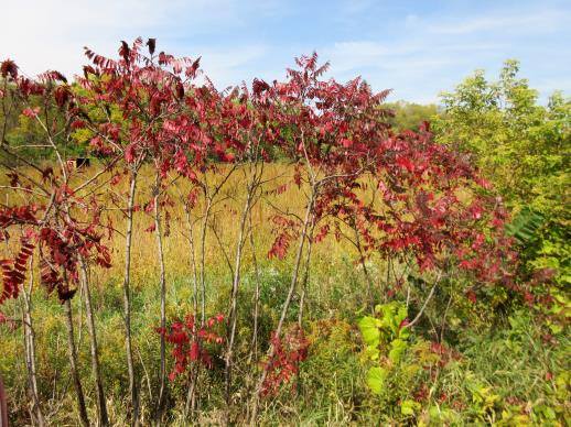 | | 2021 | COLLECTED | 09/29/2021 | Upper Iowa River area near Bluffton, T99N R9W NE1/4 Sec. 9 and S1/2 Sec. 10 | 43.40275000, -91.90494000 | 299 | High bluffs, roadside and stream banks | Wild material | Plants sampled in nature (29 September 2021) during peak fall color displaying bright reds to maroonish colors while measuring approximately 12-15 feet in height. One clonal patch noted was estimated to have 1,000+ ramets. | 2122093 | Ames 35752 |
| 50 | Ames 35754 | Pinicon Alders Wildlife Area | Ilex verticillata (L.) A. Gray | Iowa, United States | NC7 |  | | 2021 | COLLECTED | 09/29/2021 | Pinicon Alders Wildlife Area, 1.5 miles northwest of McIntire, Iowa. | 43.45277000, -92.61128000 | 393 | Moist deciduous forest; flood plain of Wapsinpinicon River. Rhamnus cathartica dominant forest. | Wild material | The native range of Ilex verticillata is concentrated throughout the eastern third of the United States as far north as northern Maine west to Minnesota and south to Louisiana and east to the Carolinas (Little, E. L. Jr. 1977). Common winterberry is typically a multi-stemmed shrub that can be trained into a tree potentially reaching 15' in height. The species is dioecious (requiring male representation for fruit set). This species is largely known to inhabit swamps, low woods, and along ponds and streams. Fruits are red and typically persist well into late-winter. White flowers are extremely small, inconspicuous. This accession represents genetics from north, northeastern Iowa, which would be the western extent of the species native range. As of 2026, the current Iowa Department of Natural Resources list of Endangered, Threatened, and Special Concern species currently has Ilex verticillata in Iowa listed as Endangered. Plants sampled in nature were either single stemmed or multistemmed shrubs with bright red fruit at the time of sampling. | 2122095 | Ames 35754 |
| 51 | OPGC 7576 | McFarland Park | Solidago flexicaulis L. | Iowa, United States | OPGC |  | | 2021 | COLLECTED | 09/26/2021 | McFarland Park just north, northeast of Ames, T84N R23W Sec. 7 | 42.09667500, -93.57083500 | 288 | Moist areas near streambanks and bottomlands in hardwood forest understory. | Wild material | Plants in nature ranged in height from approximately one to three feet, growing as spreading clumps. Peak flowering in 2021 occurred near 18 September. | 2132830 | OPGC 7576 |
| 52 | Ames 35746 | Guye Woods | Acer saccharum Marshall subsp. nigrum (F. Michx.) Desmarais | Iowa, United States | NC7 |  | | 2021 | COLLECTED | 09/08/2021 | Guye Woods County Park located 6.0 miles northeast of Winterset, T76N R27W NE1/4 Sec. 4 | 41.41235000, -93.96373000 | 278 | Moist deciduous maple, oak, hickory forest, northwest facing slope above the North River. | Wild material | Multiple specimens in this population were observed to be 24" diameter at breast height (DBH) or larger with the largest specimen encountered at the time of collection measuring 36.5" DBH.
Morphological traits of leaves suggests sampled specimens are true to type of Acer saccharum subsp. nigrum including leaves with three distinct points, leathery/thick, and drooping in appearance. On September 25, 2020 (Schmitz, A., personal communication, 31 January 2022), peak fall color on Acer saccharum subsp. nigrum at Guye Woods was observed with specimens having a clean yellow fall color, also indicative of Acer saccharum subsp. nigrum.
| 2122010 | Ames 35746 |
| 53 | W6 59183 | CBG-10474 | Leersia virginica Willd. | Illinois, United States | W6 | | | 2021 | | | | | | | Wild material | | 2120104 | W6 59183 |
| 54 | Ames 35614 | F017 | Physocarpus opulifolius (L.) Maxim. | Pennsylvania, United States | NC7 |  | | 2020 | COLLECTED | 09/29/2020 | Camp Shand located approximately 1.97 miles south, southeast of Cornwall, Lebanon County | 40.24719440, -76.39194440 | 231 | Powerline cut. Edge of woods | Wild material | | 2109481 | Ames 35614 |
| 55 | NA 88470 | F018 | Viburnum prunifolium L. | Pennsylvania, United States | NA | | | 2020 | COLLECTED | 09/29/2020 | Camp Rocky Creek (YMCA), Cornwall/Lebanon, PA. [originally listed as Camp Shand.] | 40.24719440, -76.39194440 | | | Wild material | | 2109482 | NA 88470 |
| 56 | Ames 35547 | White Pine Hollow | Pinus strobus L. | Iowa, United States | NC7 |  | | 2020 | COLLECTED | 08/20/2020 | White Pine Hollow State Preserve located approximately 2.65 miles northwest of Luxemburg, T90N R2W SE 1/4 Sec. 7, Dubuque County | 42.61954600, -91.11933000 | 308 | High-quality remant mixed woods | Wild material | The native range of Pinus strobus is concentrated in the northeastern United States extending south into the northern edge of Georgia and west to central Minnesota. In Iowa, there are scattered populations in a few northeastern counties and also a very small disjunct population in central Iowa (Hardin County, Ames 32758) and also in southeastern Iowa (Muscatine County, Ames 35635). This accession represents genetics from northesastern Iowa in White Pine Hollow (WPH) in Dubuque County and is known to harbor the largest stand of white pine in Iowa dating back to the 1870's. WPH was the first woodland in Iowa to be dedicated (1967) as a state preserve and was previously known to contain Iowa's oldest white oak with a core date estimated back to the year 1580 (Duvick and Blasing 1983). WPH is home to the largest native specimen of Pinus strobus measuring 11’1.5” circumference, 142’ tall, and 44’ spread for a total of 286.3 points (Rouw, M., personal communication, 21 September 2020). “In an assessment of 92 of the largest white pines (native and cultivated) across Iowa, 68 occur in WPH. Out of 40 that exceed a height of 130', 38 are found in WPH with seven of those exceeding 140' and two surpassing 147' (Rouw, M., personal communication, 18 September 2020). The site is also the location of height records (Iowa) for several tree species including Ulmus americana 108', Tilia americana 105.5', Acer saccharum 109', Quercus alba 107', and Carya ovata 109’ (Rouw, M., personal communication, 18 September 2020). P. strobus in WPH is the dominant overstory species specifically in areas next to ravines/valleys and some immediately adjacent uplands. P. strobus from this site represents the extreme western edge of the species native range. Genetics may likely be adapted/tolerant to drought and also late winter/early spring extreme temperature fluctuations. Accession was collected both as seeds (2020) and as scions (2021). | 2106728 | Ames 35547 |
| 57 | WLP 156 | NACPEC19-022 | Oxydendrum arboreum (L.) DC. | Kentucky, United States | NA | | | 2019 | COLLECTED | 09/09/2019 | Madison County; Berea College Forest: Around the corner from Upper Indian Fort Trail Junction, on top of the Davis Hollow "holler" | 37.56414400, -84.23341800 | 477 | Sandstone outcrop, incredibly thin, low pH <4. Very heavy foot traffic | Wild material | | 2110468 | WLP 156 |
| 58 | Ames 35229 | JDC/AS/2019/020/899 | Agastache scrophulariifolia (Willd.) Kuntze | Iowa, United States | NC7 |  | | 2019 | COLLECTED | 10/01/2019 | Hertz Family Woods & Nature Preserve just 2.25 miles south of Nevada (T83N R22W NW1/4 NW1/4 Sec. 20) and Robison Wildlife Acres just 6.75 miles south of Nevada (T82N R22W NE1/4 SW1/4 Sec. 8), Story County | 41.99070000, -93.44186700 | 285 | Moist, semi-shaded, deciduous woods. | Wild material | Plants measuring approximately 6' in height with somewhat short (perhaps due to dense shade) 2-3" spikes rather white or extremely pale pink in color. Peak flowering occurred circa 26 August 2019 in nature. | 2097765 | Ames 35229 |
| 59 | OPGC 7495 | CBG-9545 | Symphyotrichum shortii (Lindl.) G. L. Nesom | Illinois, United States | OPGC |  | | 2019 | | | | | | | Wild material | | 2092813 | OPGC 7495 |
| 60 | OPGC 7496 | CBG-9546 | Solidago ulmifolia Muhl. ex Willd. | Illinois, United States | OPGC |  | | 2019 | | | | | | | Wild material | | 2092814 | OPGC 7496 |
| 61 | NA 85022 | JDC/SS/2018/008/821 | Sapindus saponaria L. var. drummondii (Hook. & Arn.) L. D. Benson | Oklahoma, United States | NA |  | | 2018 | COLLECTED | 03/13/2018 | Thurmond Ranch approximately 3.80 miles southwest of Cheyenne, T13N R24W, Roger Mills County | 35.59226100, -99.69600600 | 554 | Bottomlands and immediate higher elevations of Sergeant Major Creek and surrounding tributaries. | Wild material | | 1957959 | NA 85022 |
| 62 | Ames 34023 | Ames 34023 | Viburnum prunifolium L. | Iowa, United States | NC7 |  | | 2017 | COLLECTED | 09/27/2017 | Shimek State Forest, Donnellson Unit, approximately 6.0 miles west of Donnellson. | 40.64796000, -91.67764000 | 219 | Oak-hickory upland forest. | Wild material | Plants at collection site ranging between 10-15' tall. Fruits dark purple, leaves on some stems were turning red fall color at time of collection (09/27/2017). | 1953995 | Ames 34023 |
| 63 | Ames 33979 | JDC/FQ/2017/031/785 | Fraxinus quadrangulata Michx. | Tennessee, United States | NC7 |  | | 2017 | COLLECTED | 07/08/2017 | Along highway 52 approximately 2.30 miles northwest of Celina, Clay County | 36.57174000, -85.53638800 | 190 | Dry, rocky soils. | Wild material | | 1950062 | Ames 33979 |
| 64 | Ames 33980 | JDC/FQ/2017/035/789 | Fraxinus quadrangulata Michx. | Kentucky, United States | NC7 |  | | 2017 | COLLECTED | 07/09/2017 | North Rolling Rock watershed and nearby tributaries approximately 3.3 miles south of Mitchellsburg, Boyle County | 37.55385900, -84.96328900 | 267 | Mixed wooded deciduous forests, including dry, rocky areas with shallow substrate, steep (65 degree +) slopes, and base of slopes, generally with underground seeps. | Wild material | | 1950063 | Ames 33980 |
| 65 | Ames 33981 | JDC/FQ/2017/036/790 | Fraxinus quadrangulata Michx. | Kentucky, United States | NC7 |  | | 2017 | COLLECTED | 07/10/2017 | Two areas sampled just south and southwest of Wilmore, including Sally Brown Preserve/Bowmans Bend on south side of Kentucky River, Garrard County and along Corman Lane approximately 0.86 miles from junction with Route 1268 on north side of Kentucky River, Jessamine County | 37.80093600, -84.70302000 | 231 | Deciduous forest, rocky substrate. | Wild material | | 1950064 | Ames 33981 |
| 66 | Ames 33984 | JDC/FQ/2017/040/794 | Fraxinus quadrangulata Michx. | Kentucky, United States | NC7 |  | | 2017 | COLLECTED | 07/11/2017 | Near county line approximately 6.3 miles northwest of Carlisle, Nicholas County | 38.35854300, -83.94605900 | 188 | Scattered hillside, deciduous woods. | Wild material | | 1950067 | Ames 33984 |
| 67 | Ames 33985 | JDC/FQ/2017/041/795 | Fraxinus quadrangulata Michx. | Kentucky, United States | NC7 |  | | 2017 | COLLECTED | 07/12/2017 | Carter Caves State Resort Park near Smoky Valley Lake just 4.46 miles south of Carter, Carter County | 38.36772700, -83.12512200 | 230 | Deciduous woods. | Wild material | | 1950068 | Ames 33985 |
| 68 | Ames 33990 | JDC/FQ/2017/046/800 | Fraxinus quadrangulata Michx. | Ohio, United States | NC7 |  | | 2017 | COLLECTED | 07/15/2017 | Sharon Woods Metro Park within city limits of Columbus, T2N R18W, Franklin County | 40.12267100, -82.96668000 | 275 | Deciduous woods. | Wild material | | 1950073 | Ames 33990 |
| 69 | Ames 33991 | JDC/FQ/2017/047/801 | Fraxinus quadrangulata Michx. | Ohio, United States | NC7 | 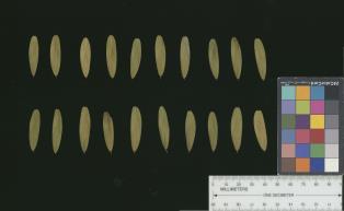 | | 2017 | COLLECTED | 07/15/2017 | Near Seymour Woods State Preserve along Olentangy River watershed approximately 4.7 miles south of Delaware, T4N R19W, Delaware County | 40.24709800, -83.05712000 | 252 | Deciduous woods, mostly found along steep (45-50 degree) slopes adjacent to watershed. | Wild material | | 1950074 | Ames 33991 |
| 70 | Ames 33965 | JDC/PG/2017/013/767 | Populus grandidentata Michx. | Iowa, United States | NC7 |  | | 2017 | COLLECTED | 05/07/2017 | Private property approximately 2.98 miles west of Luther, T83N R26W NE 1/4 SE 1/4 NE 1/4 Sec. 28., Boone County | 41.97486900, -93.87548500 | 328 | Woodland. Deciduous forest. | Wild material | The native range of Populus grandidentata is concentrated througout the northeastern United States with disjunct populations in far south as Kentucky and as far west as central Iowa (Little, E. L. Jr. 1971). Bigtooth aspens are known to be fast-growing trees, making for a quick source of shade in the landscape. As a pioneer species in nature, P. grandidentata is adaptable to a wide range of environments but is considered to be slightly less adaptable than quaking aspen. However, bigtooth aspen is more resistant to canker diseases than quaking aspen (Laidly 1990), potentially making it slightly longer-lived. Bark on big-tooth aspens is generally greyish to greyish-yellow or olive-green compared to quaking aspens where bark is typically white to greyish-white. Leaves and leaf serrations are larger, and the degree of suckering is lower in big-tooth aspens. Both species are well known for their leaves to quake or tremble as the lengthy petioles allow leaves to swivel in the slightest amount of wind. Populus use is well-documented throughout the world and encompasses a wide range of products including energy feedstock, wood chips for pulping fibers, veneer logs, agro-forestry, and phyto-remediation as well as several other environmental applications. Interspecific hybrids of P. grandidentata and P. canescens have superior performance in yield; Hypoxylon canker resistance; and rooting ability compared to pure, N. American aspen genetics. This accession represents genetics acquired from the Des Moines River Valley of central Iowa and considered a disjunct population. P. grandidentata is infrequent to somewhat common throughout parts of the Des Moines River Valley, but very localized. The next closest, native population would be found in Hardin County (Iowa) approximately 50 miles to the northeast near Eldora. In central Iowa, this accession has been noted to have excellent, yellow fall color that typically peaks in mid-October (e.g. 21 October 2015). Fruits usually mature in early May (e.g. 3 May 2017) coinciding with flower initiation on local genotypes of Prunus virginiana. Specimens sampled in nature measuring approximately 60' in height and 16-22" dbh. Due to this accession originating from the western and southern edge of the species native range, it is suspected that this accession would have excellent heat and drought tolerance compared to genetics from areas in the northeastern U.S. | 1949856 | Ames 33965 |
| 71 | Ames 33918 | APS/GD/2017/008/267 | Gymnocladus dioicus (L.) K. Koch | Minnesota, United States | NC7 |  | | 2017 | COLLECTED | 03/16/2017 | Minnesota River watershed covering approximately 9.0 river miles between Redwood Falls and Vicksburg Park, Renville County | 44.61447700, -95.14878600 | 254 | Mixed habitats, both upland dry sites, wet sites, and rocky sites. | Wild material | | 1946985 | Ames 33918 |
| 72 | Ames 33752 | Ames 33752 | Maclura pomifera (Raf.) C. K. Schneid. | Iowa, United States | NC7 |  | | 2016 | COLLECTED | 10/05/2016 | Deer Creek watershed, T80N R23W E1/2 Sec. 18. | 41.73813000, -93.56296400 | 295 | Mixed deciduous woods, distrubed areas and also managed areas. Gentle slopes and wetlands | Uncertain improvement status | The native range for Osage-orange is reported from eastern Texas, southeastern Oklahoma, southwestern Arkansas, and the northwestern corner of Louisiana (Little, 1971). Historically and presently known for its extreme value as bow-wood and fence posts, Osage-orange represents one of the most widely planted tree species in the lower 48 US states as a living fence starting in the mid-1800's, in the late 1900's as a landscape tree for difficult sites, and most recently its chemical properties. Detailed history of Osage-orange and it's economic uses are well documented (Smith and Perino, 1981 and J. T. Winberry 1979). Osage wood is highly-prized for its use as fence posts (both living and non-living) and durable wood for wood working. Osage is an extremely drought and heat tolerant tree and is recommended for use in USDA cold-hardiness zones 5b or warmer. Although the species is commonly known for its stout thorns and large, globular fruits, the species is dioecious and the degree of thorns on individual genotypes can be extremely variable. This accession represents germplasm from a naturalizing, reproductive population collected in central Iowa (Polk County). Majority of specimens averaged approximately 40-50’ in height with multiple (e.g. 4-5) trunks. Specimens 03-1 and 03-2 were upright in form with tighter branch angles, while 03-10 was the widest spreading of all trees. Some yellow fall color (yellow) was apparent at time of fruit collection (10/05/2016). Size of fruits ranged from 9.00 to 10.75 inches circumference except for tree 03-5 with fruits averaging 7.33 inches circumference. | 1942949 | Ames 33752 |
| 73 | Ames 33736 | JDC/BA/2016/028/743 | Betula alleghaniensis Britton | Iowa, United States | NC7 |  | | 2016 | COLLECTED | 09/02/2016 | Fallen Rock State Preserve approximately 1.9 miles southwest of Steamboat Rock, T88N R19W NW ¼ Sec. 32. | 42.39459000, -93.09423600 | 310 | High-quality, native, mesic deciduous woods on loose, loamy sandstone amongst very large boulders. North-facing with variable 10-50 degree slopes. Majority of specimens located at base of bluff or near water’s edge (Iowa River). | Wild material | The native range of Betula alleghaniensis is concentrated in the northeastern U.S. with disjunct populations in Iowa (Little, 1971). This accession represents a collection of Betula alleghaniensis germplasm from the extreme western edge of the species native range. The next closest occurrence is in Mitchell County, Iowa (60 miles). As of 2025, two trees at Fallen Rock State Preserve currently represent the state of Iowa's 1st and 2nd largest yellow birch specimens measuring 22.76" DBH; 70.83' height; 40' average crow spread (151.83 points) and 17.18" DBH; 65.33' height; 33.75' average crow spread (127.76 points), respectively (Rouw, M., personal communication, 13 May 2018). | 1942689 | Ames 33736 |
| 74 | Ames 33290 | APS/GD/2016/012/247 | Gymnocladus dioicus (L.) K. Koch | Michigan, United States | NC7 |  | | 2016 | COLLECTED | 04/06/2016 | Gratiot and Clinton Counties: T9N R3W SW 1/4 Sec. 35 (Gratiot County) and T8N R4W NW 1/4 NW 1/4 Sec. 14 (Clinton County) along Maple River both northeast (approximately 3.34 miles (Clinton County)) and southwest (approximately 3.00 miles (Gratiot County)) of Maple Rapids. | 43.10603700, -84.70504200 | 205 | Floodplain. | Wild material | | 1940347 | Ames 33290 |
| 75 | Ames 32965 | JDC/BA/2015/051/708 | Betula alleghaniensis Britton | Iowa, United States | NC7 | | | 2015 | COLLECTED | 09/15/2015 | Yellow River State Forest, T97N R4W northern edge of SW 1/4 NW 1/4 Sec. 36 | 43.17782100, -91.26584600 | 227 | North-facing algific talus slope (45-60 degrees) adjacent to Paint Creek. Moist deciduous woods. Growing in association with Fraxinus nigra, Staphylea trifolia, Carpinus caroliniana, Quercus rubra, Acer saccharum, Cornus alternifolia, Amelanchier arborea, Ostrya virginiana, Viburnum opulus var. americanum, Cornus rugosa, Cornus alternifolia, Zanthoxylum americanum, Viburnum rafinesqueanum, Cypripedium pubescens, Ribes sp.,Corylus sp., Juniperus virginiana, Dirca palustris, Ulmus thomasii, Prunella vulgaris, Diervilla lonicera, Quercus macrocarpa, Carya cordiformis, Taxus canadensis, Tilia americana, Adiantum pedatum, and Aconitum noveboracense. | Wild material | | 1927435 | Ames 32965 |
| 76 | Ames 32966 | JDC/VA/2015/052/709 | Viburnum opulus L. var. americanum Aiton | Iowa, United States | NC7 |  | | 2015 | COLLECTED | 09/15/2015 | Yellow River State Forest, T97N R4W northern edge of SW ¼ NW ¼ Sec. 36. | 43.17778200, -91.26642800 | 239 | North-facing algific talus slope (45-60 degrees) adjacent to Paint Creek. Moist deciduous woods. | Wild material | Formerly known as Viburnum trilobum, American highbush cranberry (V. opulus var. americanum) is a North American native shrub that is utilized as an important ornamental and conservation plant that is also harvested as a minor fruit crop (jams/jellies). In nature, this variety is generally found in moist habitats typically along stream banks and swamps where ample moisture is readily available. The native range of V. opulus var. americana is concentrated in the northeastern United States and into Canada (Little, E. L. Jr. 1977). Attractive ornamental characteristics includes showy lacecap flowers in spring and bright red fruits and foliage in the fall. Fruits are tart with a hint of sweetness. The European highbush cranberry (V. opulus var. opulus) is nearly identical to American highbush cranberry other than small glands (<1 mm) on the petiole making the exact determination very challenging resulting in common misidentifications. A major difference between the American and European highbush cranberries is that the European variety produces unpalatable fruit. Recent research has shown that American and European highbush cranberries are genetically distinct and that plants of hybrid origin are uncommon (Tork et al. 2025). Vigorous early spring growth and good tolerance to late spring frosts. Genetic analysis from Tork et al. 2025 confirmed that genetics of this accession represents American highbush Cranberry (Viburnum opulus var. americanum). This accession represents genetics from northeast Iowa and thus the extreme western edge of the species native range. | 1927436 | Ames 32966 |
| 77 | Ames 32893 | APS/GD/2015/016/198 | Gymnocladus dioicus (L.) K. Koch | Oklahoma, United States | NC7 |  | | 2015 | COLLECTED | 03/14/2015 | Creek County: West Fork Sandy Creek watershed and small tributaries. T14N R9E SW 1/4 SE 1/4 Sec. 21. Private property approximately 11 miles south of Bristow. | 35.66820200, -96.35882500 | 216 | Floodplain. | Wild material | | 1925359 | Ames 32893 |
| 78 | Ames 32894 | APS/GD/2015/017/199 | Gymnocladus dioicus (L.) K. Koch | Oklahoma, United States | NC7 |  | | 2015 | COLLECTED | 03/14/2015 | Cleveland County: T10N R5W SW 1/4 SW 1/4 Sec. 7. John Nichols Camp located on north side of Canadian River approxiamtely 4.25 miles south and southeast of Mustang. | 35.35029600, -97.66952200 | 395 | Higher elevations. Dry, relatively thin soils. | Wild material | | 1925360 | Ames 32894 |
| 79 | Ames 32895 | APS/GD/2015/018/200 | Gymnocladus dioicus (L.) K. Koch | Oklahoma, United States | NC7 |  | | 2015 | COLLECTED | 03/15/2015 | Canadian County: Near/adjacent to unnamed creek that empties into the Canadian River, T12N R10W SW 1/4 Sec. 20. Private property approximately 4 miles northeast of Hinton. | 35.49409300, -98.28655400 | 434 | Bottomland. | Wild material | | 1925361 | Ames 32895 |
| 80 | Ames 32903 | APS/GD/2015/031/213 | Gymnocladus dioicus (L.) K. Koch | Oklahoma, United States | NC7 |  | | 2015 | COLLECTED | 03/19/2015 | Osage County: Arkansas River watershed area known as Souters Bend, T21N R7E. Keystone Wildlife Management Area (John Lowery Unit) approximatley 3 miles west of Cleveland. | 36.30185300, -96.53051000 | 222 | Floodplain, but one specimen sampled was located on dry, rocky (large boulders) bluff. | Wild material | | 1925369 | Ames 32903 |
| 81 | Ames 32886 | APS/GD/2015/002/184 | Gymnocladus dioicus (L.) K. Koch | Missouri, United States | NC7 |  | | 2015 | COLLECTED | 03/03/2015 | Douglas County: North Fork River watershed, T26N R12W Sec. 13. Private property approximately 5.3 miles east, southeast of Vanzant. | 36.93971400, -92.21469500 | 264 | Floodplain. Riverbank in pure sand. | Wild material | | 1924364 | Ames 32886 |
| 82 | Ames 32889 | APS/GD/2015/006/188 | Gymnocladus dioicus (L.) K. Koch | Missouri, United States | NC7 |  | | 2015 | COLLECTED | 03/05/2015 | St Charles County: T46N R2E Sec. 24. August Busch Conservation Area near Weldon Spring. | 38.72724100, -90.74923500 | 166 | Deciduous, mesic woods. | Wild material | | 1924367 | Ames 32889 |
| 83 | Ames 32820 | APS/EA/2013/041/126 | Euonymus atropurpureus Jacq. | Iowa, United States | NC7 |  | | 2014 | COLLECTED | 10/10/2014 | Midland Trail Road near North Racoon River watershed. Dallas County T80N R27W SW 1/4 NW 1/4 Sec. 30 | 41.71142000, -94.04538000 | 299 | Wooded roadside. | Wild material | | 1921780 | Ames 32820 |
| 84 | NA 82071 | JDC/QM/2014/103/605 | Quercus michauxii Nutt. | Mississippi, United States | NA | | | 2014 | COLLECTED | 09/25/2014 | Chinchahoma Creek watershed near Ennis Road. | 33.38574900, -88.92255600 | 98 | Wet, deciduous woods. | Wild material | Specimen sampled measured 26.75" d.b.h. and approximately 110' in height. Fruits still green. | 1922372 | NA 82071 |
| 85 | Ames 32760 | JDC/AB/2014/040/542 | Abies balsamea (L.) Mill. | Iowa, United States | NC7 | | | 2014 | COLLECTED | 09/03/2014 | Bluffton Fir State Preserve, near Bluffton, Winneshiek County. | 43.40106767, -91.90659200 | 326 | High quality, native woods. Steep slope, northwest-facing, and relatively flat portion on top of bluff (powerline) | Wild material | | 1921308 | Ames 32760 |
| 86 | Ames 32758 | Fallen Rock | Pinus strobus L. | Iowa, United States | NC7 |  | | 2014 | COLLECTED | 08/21/2014 | Fallen Rock State Preserve and adjacent private property just north of Eldora, T88N R19W SW ¼ Sec. 28 and N ¼ Sec. 32 and also T87N R19W N ½ Sec. 5. | 42.39548900, -93.09165200 | 311 | Cool moist woods. Slopes averaging 60 degrees. Northern and eastern aspects. Localized to bluffs above Iowa River. | Wild material | The native range of Pinus strobus is concentrated in the northeastern United States extending south into the northern edge of Georgia and west to central Minnesota. In Iowa, scattered native populations exist in a few northeastern counties as well as small disjunct populations in central and southeastern counties (Little, 1971). This accession includes genetics from legacy mother trees located in Fallen Rock State Preserve and nearby private property to the south. This area is near Pine Lake State Park, which in 2009 was devastated by a severe hailstorm of "supersized softballs" resulting in significant cambial damage to many species of trees. Damage to the majority of P. strobus specimens throughout the area was so severe that losses occurred immediately. Additional losses in subsequent years continued to occur likely due to additional stress by drought and destruction by bark beetles. The loss of approximately 75% of the P. strobus specimens at Pine Lake State Park was attributed to the 2009 hailstorm prompted efforts to preserve genetics of the white pines here. In 2014, specimens in parts of Pine Lake State Park and also one specimen at Fallen Rock State Preserve were sampled (Carstens, J.) as seeds from specimens ranging in size from 9.25 inches to 31.75 inches d.b.h. However, in 2021, it was determined (Place, A. pers. comm. 24 February 2021 and Carstens, J. & Sherwood, A., pers. observations 1 March 2021) that likely most if not all of the specimens in Pine Lake State Park are planted specimens of unknown origin because P. strobus specimens located at the far east end of Lower Lake (south side) were noted (Carstens and Sherwood, pers. observations 1 March 2021) growing with uncharacteristic associated taxa including Acer saccharinum and Gymnocladus dioicus. Two documents that support these observations includes: 1. Letter signed by Louis H. Pammel (March 25, 1925) to G.B. McDonald of the Iowa State University Forestry Department asking for 200 white pine to be planted at Pine Lake. 2. "Trees to Be Set Out by CCC Workers" in the Eldora Herald (May 9, 1935) referencing the CCC (Civilian Conservation Corps) to plant “1,000 white pines at Pine Lake State Park". Therefore, if obtained, increment borer measurements of specimens that are 94 years of age at present (2014) or older would suggest those as being true, native remnants. Documents that supports the position of remnant specimens at Fallen Rock State Preserve includes: 1. "Picturesque Drives About Eldora", in the Eldora Herald (December 8, 1910) by Clara Estabrook stating "Miss Stoddard of the Iowa Falls school says these (only 11 trees left) are the only native pines (those restricted to the sandstone cliffs) found in Hardin County" and suggested a movement to have them preserved. 2. Forest Flora of Hardin County (1899) by L. H. Pammel stating that the Iowa valley serves as the western limits for white pine and also refers to David D. Owen's geological report from 1839 indicating the occurrences of white pines on the summits of the hills along the Iowa River. In addition, a photo of white pines growing at Steamboat Rock taken by L. H. Pammel was featured on the front page of the 1919 report of the State Board of Conservation titled "Iowa Parks: Conservation of Iowa Historic, Scenic and Scientific Areas." Due to the significant presence of planted specimens of unknown origin in Pine Lake State Park and surrounding private properties, samples collected in 2014 as seeds may likely contain genetics (pollen donors) from specimens of unknown origin. This resulted in the resampling of specimens in 2021 (USFS - IAHA#'s) and 2023 as dormant scions that are from locations known to be untouched by the CCC and thus represent true, remnant specimens. To date (2021), there are only eight legacy specimens left in this population (four specimens at Fallen Rock State Preserve and four specimens at the nearby private property). The largest specimen of P. strobus (Ames 32758) is #IAHA-08 located at (42.395489, -93.091652) measuring (13 May 2018) 35.65" DBH with a height of 78.33' and a spread of 26' totalling 197 points (Rouw, M., personal communication, 8 February 2023). This germplasm represents the southwestern most population of native P. strobus in Iowa and one of the western most populations in North America. Germplasm likely is adapted to Midwestern climatic extremes and potentially very drought tolerant in comparison to other provenances from the eastern or northeastern U.S. | 1921270 | Ames 32758 |
| 87 | NA 81696 | SOIL-014 | Crataegus phaenopyrum (L. f.) Medik. | Illinois, United States | NA | | | 2014 | COLLECTED | 10/2013 | Horseshoe Lake Nature Preserve. Roadside edge of wildlife management area. | 37.13025000, -89.28953000 | 99 | Mesic forest, growing in 1/2 shade in highly organic soil. | Wild material | | 1953201 | NA 81696 |
| 88 | Ames 32197 | GA13009001 | Fraxinus pennsylvanica Marshall | Minnesota, United States | NC7 |  | | 2014 | COLLECTED | 09/23/2013 | Clearwater County. | 47.18397220, -95.47407220 | | Mixed upland deciduous forest. | Wild material | | 1917223 | Ames 32197 |
| 89 | Ames 32096 | BA13009001 | Fraxinus nigra Marshall | Minnesota, United States | NC7 |  | | 2013 | COLLECTED | 09/23/2013 | T144N R38W, Clearwater County. | 47.25711000, -95.49000667 | 543 | Edges of lakes and forest edges. Growing in association with Fraxinus pennsylvanica, Quercus macrocarpa, Ulmus americana, Populus tremuloides, Populus balsamifera, Acer saccharum, Betula papyrifera, Salix sp., Larix laricina, Quercus rubra, Abies balsamea, Picea glauca, Sambucus canadensis, Cornus rugosa, Acer spicatum, Rosa sp., Viburnum opulus var. americanum, Viburnum dentatum, Alnus sp., Cornus canadensis, Corylus sp., Prunus virginiana, Ribes sp., Prunus pensylvanica, Rhamnus alnifolia, Equisetum sp., Carex sp., Rubus sp., Impatiens capensis, Bromus sp., and Thalictrum dasycarpum. | Wild material | D.B.H. ranged between 3 and 6 inches. | 1914713 | Ames 32096 |
| 90 | Ames 32093 | JDC/CC/2013/048/492 | Carpinus caroliniana Walter | Iowa, United States | NC7 | | | 2013 | COLLECTED | 10/25/2013 | Ledges State Park mostly from specimens adjacent to Peas Creek, NE ¼ of SE ¼ of Sec. 16, T83N R26W, Des Moines Quad. | 41.99910000, -93.87880000 | 328 | North and northwest-facing slopes. | Wild material | The native range of Carpinus caroliniana is concentrated in the eastern half of the U.S. with a very small disjunct population in central Iowa (Little, 1971). This accession represents a collection of C. caroliniana germplasm from the extreme western edge of the species native range, specifically the central Iowa disjunct population at Ledges State Park. The next closest occurrence is in eastern Iowa (100-150 miles). As of 2025, one specimen at Ledges State Park (McCoy Wildlife Area) currently represents the state of Iowa's largest C. caroliniana specimen measuring 6.68" DBH, 41.67’ in height, and 23.75’ average crown spread for a total of 68.608 points (Rouw, M., personal communication, 4 May 2022). This accession does include genotypes that do tend to sucker/form clonal colonies. Fall color (red/orange) tends to peak in the last week of October (central Iowa) with peak fruiting occurring simultaneously. Bark smooth, grey. | 1914037 | Ames 32093 |
| 91 | Ames 32092 | Ames 32092 | Viburnum rufidulum Raf. | Missouri, United States | NC7 | | | 2013 | COLLECTED | 10/13/2013 | Private property, north of 27640 EE Highway, NE 1/4 of SE 1/4 of Section 4, T47N R15W, Prairie Home, Prairie Home Quad, Cooper County. | 38.85910000, -92.56030000 | 236 | Wooded hillside. North-facing slope. | Wild material | | 1914036 | Ames 32092 |
| 92 | Ames 32018 | APS/GD/2013/032/117 | Gymnocladus dioicus (L.) K. Koch | Missouri, United States | NC7 |  | | 2013 | COLLECTED | 04/09/2013 | Poosey Conservation Area, Livingston County. | 39.94995200, -93.71471700 | 267 | Floodplain. | Wild material | A total of four areas containing Gymnocladus dioicus were noted throughout Poosey Conservation Area. Each area was represented by approximately 2-6 specimens. Specimens ranged between 14-22.5 inches d.b.h. and approximately 90-110 feet in height. Pod production during the 2012 growing season was minimal/below average. Samples 473-1 and 473-2 were very close together (approximately 10 feet apart) and samples 473-3 and 473-4 were also very close together (approximately 48 feet apart). Samples this close together may potentially represent material from a single clone due to the clonal suckering habit of Gymnocladus dioicus. | 1908307 | Ames 32018 |
| 93 | Ames 31989 | APS/GD/2009/001/010 | Gymnocladus dioicus (L.) K. Koch | Kansas, United States | NC7 |  | | 2013 | COLLECTED | 02/21/2013 | Clinton State Park, west of Lawrence, Section 12, T13S R18E, Douglas County. | 38.93730038, -95.36213950 | 282 | Fairly dry, upland site. Majority of specimens found on upland areas. | Wild material | | 1907542 | Ames 31989 |
| 94 | Ames 31256 | APS/GD/2008/005/005 | Gymnocladus dioicus (L.) K. Koch | Iowa, United States | NC7 |  | | 2012 | COLLECTED | 01/10/2012 | Ledges State Park, SW 1/4 of SW 1/4 of Section 21, T83N, R26W, Madrid NW Quad, Boone County | 41.98110000, -93.89010000 | 328 | Upland woods. 30% slope with a western aspect. | Wild material | Largest specimen noted was 22" d.b.h. | 1897494 | Ames 31256 |
| 95 | Ames 31079 | 707 | Fraxinus americana L. | Pennsylvania, United States | NC7 |  | | 2011 | COLLECTED | 09/16/2011 | PA 120, Cameron County. | 41.47000000, -78.39200000 | 430 | Rich woods. | Wild material | | 1891465 | Ames 31079 |
| 96 | Ames 30679 | JDC/FP/2010/064/334 | Fraxinus pennsylvanica Marshall | Wisconsin, United States | NC7 |  | | 2010 | COLLECTED | 09/27/2010 | Floodplain along railroad, adjacent to Perrot State Park, S 1/2 of Section 20, T18N R9W, Trempealeau Quad, just west of Trempealeau, Trempealeau County. | 44.01496000, -91.47822000 | 208 | | Wild material | | 1853837 | Ames 30679 |
| 97 | Ames 30600 | JDC/FA/2010/050/320 | Fraxinus americana L. | Arkansas, United States | NC7 |  | | 2010 | COLLECTED | 09/16/2010 | Along Push Mountain Road, Sylamore Wildlife Management Area, Baxter County. | 36.20005000, -92.32758000 | 264 | Rolling hillsides with varying aspects; generally restricted to higher elevations. | Wild material | | 1848895 | Ames 30600 |
| 98 | Ames 30552 | Ames 30552 | Cornus alternifolia L. f. | Missouri, United States | NC7 |  | | 2010 | COLLECTED | 06/29/2010 | Along North River, Callaghan Mound Access Conservation Area, near Heather, SW 1/4 of Section 15, T58N, R8W, Emden Quad. | 39.82140000, -91.78680000 | 190 | Northeast facing slope. | Wild material | | 1843106 | Ames 30552 |
| 99 | Ames 30137 | JDC/EM/2009/020/170 | Eutrochium maculatum (L.) E. E. Lamont var. maculatum | Wisconsin, United States | NC7 | | | 2009 | COLLECTED | 09/21/2009 | Bridgeport Landing, Lower Wisconsin State Riverway, near Bridgeport, SW 1/4 of NE 1/4 of Section 14, T6N, R6W, Brodtville Quad, Grant County. | 42.99833333, -91.05055556 | 189 | Wisconsin River watershed/floodplain. Associated with Betula nigra, Cephalanthus occidentalis, Quercus bicolor, Ulmus rubra, and Urtica dioica. | Wild material | | 1819718 | Ames 30137 |
| 100 | Ames 30144 | JDC/FP/2009/019/169 | Fraxinus pennsylvanica Marshall | Wisconsin, United States | NC7 |  | | 2009 | COLLECTED | 09/21/2009 | Bridgeport Landing, Lower Wisconsin State Riverway, near Bridgeport, SW 1/4 of NE 1/4 of Section 14, T6N, R6W, Brodtville Quad, Grant County. | 42.99833333, -91.05055556 | 189 | Wisconsin River watershed/floodplain. | Wild material | | 1819725 | Ames 30144 |
| 101 | Ames 30146 | JDC/FP/2009/033/183 | Fraxinus pennsylvanica Marshall | Wisconsin, United States | NC7 |  | | 2009 | COLLECTED | 09/22/2009 | Blackhawk Unit, Lower Wisconsin State Riverway, NW 1/4 of SE 1/4 of Section 23, T9N, R6E, Black Earth Quad, Dane County. | 43.24361111, -89.73972222 | 226 | Wisconsin River watershed/floodplain | Wild material | | 1819727 | Ames 30146 |
| 102 | Ames 30174 | JDC/SA/2009/034/184 | Spiraea alba Du Roi | Wisconsin, United States | NC7 |  | | 2009 | COLLECTED | 09/22/2009 | Blackhawk Unit, Lower Wisconsin State Riverway, T9N R6E SE 1/4 of NE 1/4 of Sec. 23, Black Earth Quad, Dane County | 43.24361111, -89.73972222 | 226 | Wisconsin River watershed/floodplain | Wild material | | 1819755 | Ames 30174 |
| 103 | WLP 2486 | JDC/VL/2009/023/173 | Viburnum lentago L. | Wisconsin, United States | NA |  | | 2009 | COLLECTED | 09/21/2009 | Along Bowers Road west of Snow Bottoms State Natural Area, Highland West Quad. T7N R1W SW1/4 SW /4 SE1/4 Sec. 34 | 43.03200000, -90.47680000 | 267 | Roadside | Wild material | Variation in leaf thickness, fall color (mostly reddish tones) and degree of powdery mildew was noted across population sampled in nature. At time of collection (12 September) fruits were at various stages of maturity including green, red, blue/black. | 1819759 | WLP 2486 |
| 104 | WLP 855 | JDC/CO/2009/021/171 | Cephalanthus occidentalis L. | Wisconsin, United States | NA | | | 2009 | COLLECTED | 09/21/2009 | Wisconsin: Grant County; Wisconsin River watershed/flood plain; Wisconsin River flood plain. Bridgeport Landing, Lower Wisconsin State Riverway, near Bridgeport, SW 1/4 of NE 1/4 of Section 14, T6N, R6W, Brodtville Quad. | 42.99833333, -91.05055556 | 189 | Wisconsin River watershed/floodplain. Associated with Betula nigra, Fraxinus pennsylvanica, Quercus bicolor, Ulmus rubra, and Urtica dioica. | Wild material | | 1819710 | WLP 855 |
| 105 | Ames 29981 | APS/GD/2009/019/028 | Gymnocladus dioicus (L.) K. Koch | Iowa, United States | NC7 |  | | 2009 | COLLECTED | 04/04/2009 | Near the confluence of the West Fork Cedar River and Shell Rock River, approximatley 2 miles east of Finchford, T90N R14W SE 1/4 SE 1/4 SE 1/4 and also SE 1/4 SW 1/4 Sec. 4 Shell Rock Quad., Black Hawk County. | 42.62888889, -92.49666667 | 272 | Gentle, east-facing slopes and also floodplain. | Wild material | Trees ranging from 13.5 to 18 inches DBH and 50 to 70 feet in height. | 1799101 | Ames 29981 |
| 106 | Ames 29975 | JDC/GD/2009/004/154 | Gymnocladus dioicus (L.) K. Koch | Nebraska, United States | NC7 |  | | 2009 | COLLECTED | 03/20/2009 | Ponca State Park, approximately 2 miles north of Ponca, T30N R6E Sec. 3 Ponca Quad., Dixon County. | 42.60166667, -96.71444444 | 365 | Variable from mid-level elevation sloped area to bottomland type. Variable exposure. 0-60 degrees of slope with variable aspects. | Wild material | Plants between 40 and 75 feet in height and 8 to 26 inches DBH. | 1798767 | Ames 29975 |
| 107 | Ames 29628 | JDC/FA/2008/029/099 | Fraxinus americana L. | Missouri, United States | NC7 |  | | 2008 | COLLECTED | 10/06/2008 | Rudolf Bennitt Conservation Area, NE 1/4 of NE 1/4 of Section 25, T52N, R14W, Renick Quad, Randolph County. | 39.27527778, -92.43388889 | 256 | | Wild material | Original specimens ranged from 6-10 inches d.b.h. and 30-50 feet in height. Reddish-orange fall color more apparent in males. | 1788183 | Ames 29628 |
| 108 | Ames 29650 | JDC/FP/2008/050/120 | Fraxinus pennsylvanica Marshall | Illinois, United States | NC7 |  | | 2008 | COLLECTED | 10/10/2008 | Along Illinois Highway 37, near Olmsted, NE 1/4 of NW 1/4 of Section 27, T15S, R1E, Olmsted Quad, Pulaski County. | 37.17972222, -89.09472222 | 102 | | Wild material | | 1788205 | Ames 29650 |
| 109 | Ames 29652 | JDC/FP/2008/058/128 | Fraxinus pennsylvanica Marshall | Illinois, United States | NC7 |  | | 2008 | COLLECTED | 10/12/2008 | Along E. Herrin Road, west of Interstate 57 exit, N edge of NW 1/4 of NE 1/4 of Section 23, T8S, R2E, Johnston City Quad, Williamson County. | 37.81694444, -88.94972222 | 120 | | Wild material | | 1788207 | Ames 29652 |
| 110 | Ames 29653 | JDC/FP/2008/062/132 | Fraxinus pennsylvanica Marshall | Illinois, United States | NC7 |  | | 2008 | COLLECTED | 10/13/2008 | Along 100N Road, near north fork of Kaskaskia River, NE 1/4 of NW 1/4 of Section 35, T4N, R1W, Wildcat Lake Quad, Fayette County. | 38.75250000, -89.16750000 | 140 | | Wild material | | 1788208 | Ames 29653 |
| 111 | Ames 29616 | JDC/FN/2008/019/089 | Fraxinus americana L. | Iowa, United States | NC7 |  | | 2008 | COLLECTED | 10/01/2008 | Perimeter and adjacent areas of Honey Creek Golf Course, Boone, N 1/2 of Section 8, Boone West Quad, Boone County. | 42.01777778, -93.90694444 | 328 | Majority collected from higher elevations, but also lower valleys. Course constructed by clearing existing trees; all collections from native specimens; no trees have been planted on course. | Wild material | At time of collection, ~1/5 of population had some orangish-red fall color; remaining population exhibited greenish-yellow fall colors; some specimens were completely defoliated. | 1786595 | Ames 29616 |
| 112 | Ames 29525 | JDC-0712008 | Amelanchier arborea (F. Michx.) Fernald | Iowa, United States | NC7 |  | | 2008 | COLLECTED | 07/13/2008 | Pine Lake State Park along east shoreline of Upper Lake, T87N R19W NE1/4 of SE 1/4 Sec. 4 | 42.37472222, -93.06277778 | 316 | Mature woods. | Wild material | Ovary summits glabrous; newly expanding leaves densely pubescent; pubescent sepals; and also pubescent peduncles. Petals white with a slight tinge of pink. | 1782748 | Ames 29525 |
| 113 | Ames 29210 | JDC-0242007 | Fraxinus americana L. | Maine, United States | NC7 |  | | 2007 | COLLECTED | 09/26/2007 | Approximately 1.5 miles southwest from Rumford Center on Highway 2, adjacent to the Androscoggin River, Oxford County. | 44.50111111, -70.63472222 | 189 | | Wild material | Approximately 60 feet in height. | 1743314 | Ames 29210 |
| 114 | Ames 28427 | JM20061017 | Hypericum gentianoides (L.) Britton et al. | South Carolina, United States | NC7 |  | | 2006 | COLLECTED | 09/28/2006 | Intersection of Highway 11 and Highway 133, Poe Creek State Forest, Pickens, Pickens County. | 34.93166667, -82.87722222 | 248 | Pine-oak heath, roadside of dirt road. | Wild material | | 1715748 | Ames 28427 |
| 115 | Ames 28428 | JM20061016 | Hypericum hypericoides (L.) Crantz | South Carolina, United States | NC7 |  | | 2006 | COLLECTED | 09/28/2006 | Intersection of Highway 11 and Highway 133, Poe Creek State Forest, Pickens, Pickens County. | 34.93166667, -82.87722222 | 248 | Pine-oak heath. | Wild material | | 1715749 | Ames 28428 |
| 116 | Ames 28429 | JM20061018 | Hypericum hypericoides (L.) Crantz subsp. multicaule (Michx. ex Willd.) N. Robson | South Carolina, United States | NC7 |  | | 2006 | COLLECTED | 09/28/2006 | Intersection of Highway 11 and Highway 133, Poe Creek State Forest, Pickens, Pickens County. | 34.93166667, -82.87722222 | 248 | Pine-oak heath, roadside of dirt road. | Wild material | | 1715750 | Ames 28429 |
| 117 | Ames 28434 | JM20061019 | Hypericum crux-andreae (L.) Crantz | South Carolina, United States | NC7 |  | | 2006 | COLLECTED | 09/28/2006 | Intersection of Highway 11 and Highway 133, Poe Creek State Forest, Pickens, Pickens County. | 34.93166667, -82.87722222 | 248 | Pine-oak heath, roadside of dirt road. | Wild material | | 1715755 | Ames 28434 |
| 118 | WLP 2487 | JDC-0112006 | Viburnum prunifolium L. | Iowa, United States | NA |  | | 2006 | COLLECTED | 09/12/2006 | Lake of Three Fires State Park, Bedford Quad.T68N R33W extreme NW corner of Sec. 7 | 40.71194444, -94.68583333 | 360 | Moderately shaded deciduous woods. | Wild material | Noted in nature as small understory trees, approximately 15-20 feet in height with clean foliage under moderate to heavy shade. In cultivation, fall color seems to vary from year to year ranging from dark purplish to bright red with peak fall color occurring around the later part of October (central Iowa). Flowers are white with peak flowering occurring in early-mid May. The range of this North American native is noted throughout the eastern and southeastern U.S. This accession represents genetics from the extreme northwestern corner of the species native range. Viburnum prunifolium in Iowa is rather rare and generally restricted and more commonly found in the extreme southeast corner of the state. This disjunct population in Taylor County (southwest Iowa) has been questioned as to whether it is a true native population or a naturalized escape. Additional V. prunifolium elsewhere in southwest Iowa has not been reported/documented. Immediately to the south of Taylor County, V. prunifolium is documented throughout most of Missouri and thus it is suspected that these genetics do represent a true native population. | 1708694 | WLP 2487 |
| 119 | Ames 27331 | 26 | Staphylea trifolia L. | Iowa, United States | NC7 |  | | 2003 | COLLECTED | 09/22/2003 | North of Ely Ford, Lacey-Keosauqua State Park near Keosauqua, T68N R10W SE corner of SE 1/4 of NE 1/4 of Sec. 3, Van Buren County | 40.71861111, -91.98861111 | 177 | Slope down to Des Moines River. Mostly shaded. 20% slope with a southeastern aspect | Wild material | Medium sized shrubs. Pods to 7 cm long. | 1649677 | Ames 27331 |
| 120 | NA 82188 | 27 | Aesculus glabra Willd. | Iowa, United States | NA |  | | 2003 | COLLECTED | 09/22/2003 | Lacey-Keosauqua State Park, Keosauqua, SE corner of SE 1/4 of NE 1/4 and NE 1/4 of SE 1/4 of Section 3, T68N, R10W, Keosauqua Quad, Van Buren County | 40.71777770, -91.98972220 | 177 | Floodplain. Half shaded. Associated with Rhamnus lanceolata, Cercis, Ulmus rubra, Ostrya, and Celtis | Wild material | Medium sized. | 1923816 | NA 82188 |
| 121 | Ames 27311 | 18 | Rhus typhina L. | Iowa, United States | NC7 | | | 2003 | COLLECTED | 09/15/2003 | Edge of road, north side of creek, Bixby State Park, Edgewood, T91N R5W SE 1/4 of SW 1/4 of Sec. 23, Edgewood Quad, Clayton County | 42.67527778, -91.40111111 | 303 | Road edge. Mostly sunny. Slight slope with a southern aspect. | Wild material | Tall shrubs to 5 meters tall. | 1649468 | Ames 27311 |
| 122 | Ames 27312 | 6 | Staphylea trifolia L. | Iowa, United States | NC7 |  | | 2003 | COLLECTED | 09/13/2003 | Malanaphy Springs State Preserve near Decorah, T99N R8W NW 1/4 of SE 1/4 and SW 1/4 of NE 1/4 of Sec. 31, Winneshiek County | 43.34888889, -91.83638889 | 293 | Along trail near spring, half shaded. Gradual slope with a northwestern aspect. Organic soil over limestone with high stoniness, well to good drainage | Wild material | Shrubs to small trees to 3 meters tall. Some plants had very large pods. | 1649469 | Ames 27312 |
| 123 | Ames 27313 | 22 | Staphylea trifolia L. | Iowa, United States | NC7 |  | | 2003 | COLLECTED | 09/15/2003 | Backbone State Park Cave near Strawberry Point, T90N, R6W NE corner of NW 1/4 of SW 1/4 of Sec. 4, Delaware County | 42.63694444, -91.56194444 | 317 | Alluvium below limestone cave. Nearly full shade. Slight slope w/ SE aspect. Loam soil w/ some stoniness, good drainage | Wild material | Medium to large shrubs. Heavy fruit production. | 1649470 | Ames 27313 |
| 124 | WLP 769 | NA 73812 | Celastrus scandens L. | Iowa, United States | NA |  | | 2003 | COLLECTED | 09/14/2003 | Quandahl Road, Bear Creek Wildlife Area, Highlandville, T100N R7W, NE 1/4 of NW 1/4, Section 36, Dorchester Quad, Winneshiek County. | 43.44055556, -91.62388889 | 268 | Mostly sunny. Steep slope with a southeastern aspect. Thin soil over limestone with high stoniness, well drained. Associated with Juniperus communis, J. virginiana, Ulmus rubra, Lespedeza capitata, Monarda fistulosa, and Rhus glabra. | Wild material | Vine to 4 meters tall. | 1649454 | WLP 769 |