| 0 | PI 691215 | V. arboreum GN2018 Manatee Springs State Park1 | Vaccinium arboreum Marshall | Florida, United States | COR | | | 2019 | COLLECTED | 12/06/2018 | Manatee Springs State Park | 29.49358600, -82.97336900 | 23 | NNW exposure/aspect. Next to driving road by gate to the north trail.Vegetation nearby included; Crowngrass (Paspalum spp.), water oak (Quercus nigra), saw palmetto (Serenoa repens), longleaf pine (Pinus palustris), slash pine (pinus elliottii). | Wild material | Gerardo Nunez USDA plant collecting trip to Florida 2018, 2019 | 2094707 | PI 691215 |
| 1 | PI 691216 | V. arboreum GN2018 Manatee Springs State Park 2 | Vaccinium arboreum Marshall | Florida, United States | COR | | | 2019 | COLLECTED | 12/06/2018 | Manatee Springs State Park | 29.49414000, -82.97347400 | 19 | 200 m past north trail gate. Evidence of recent fire. Fallen trees around. Flood prone area. Not flooded at the time of collection. Vegetation nearby included; Water oak (Quercus nigra), saw palmetto (Serenoa repens), dollarweed (Hydrocotyle spp.), crowngrass (Paspalum spp.), bald cypress (Taxodium distichum). Native soil pH = 5.41. NNW exposure/aspect.
| Wild material | Gerardo Nunez USDA plant collecting trip to Florida 2018, 2019 | 2094708 | PI 691216 |
| 2 | PI 691217 | V. arboreum GN2018 Manatee Springs State Park 4 | Vaccinium arboreum Marshall | Florida, United States | COR | | | 2019 | COLLECTED | 12/06/2018 | Manatee Springs State Park | 29.49653600, -82.97595700 | 13 | Partially Shaded area. Side of the trail. North Exposure/aspect. Nearby vegetation included; Saw palmetto (Serenoa repens), bald cypress (Taxodium distichum). Native soil pH = 5.52 | Wild material | Gerardo Nunez USDA plant collecting trip to Florida 2018, 2019 | 2094709 | PI 691217 |
| 3 | PI 691218 | V. arboreum GN2018 Manatee Springs State Park 6 | Vaccinium arboreum Marshall | Florida, United States | COR | | | 2019 | COLLECTED | 12/06/2018 | Manatee Springs State Park | 29.49854500, -82.97458300 | 18 | Partial sun. Side of the road. Broadleaf leaf litter. Nearby vegetation included; Laurel oak (Quercus laurifolia), bald cypress (Taxodium distichum), loblolly pine (Pinus taeda), Rhododendron spp., saw palmetto (Serenoa repens). Native soil pH = 5.03. NNE exposure/aspect. | Wild material | Gerardo Nunez USDA plant collecting trip to Florida 2018, 2019 | 2094710 | PI 691218 |
| 4 | PI 691219 | V. arboreum GN2018 Manatee Springs State Park 7 | Vaccinium arboreum Marshall | Florida, United States | COR | | | 2019 | COLLECTED | 12/06/2019 | Manatee Springs State Park | 29.50007400, -82.96526200 | 11 | Post #15 on shacklefoot trail. Partial shade. Vegetation nearby included; Hardwood forest, saw palmetto (Serenoa repens), slash pine (Pinus elliottii). Native soil pH = 5.71. SSW exposure/aspect
| Wild material | Gerardo Nunez USDA plant collecting trip to Florida 2018, 2019 | 2094711 | PI 691219 |
| 5 | PI 691220 | V. arboreum GN2018 Manatee Springs State Park 8 | Vaccinium arboreum Marshall | Florida, United States | COR | | | 2019 | COLLECTED | 12/06/2018 | Manatee Springs State Park | 29.49911800, -82.96626100 | 18 | Partial Shade on trail. NNW exsposure/aspect. Near Wax myrtle (Myrica cerifera), saw palmettow (Serenoa repens). Native soil pH= 5.58 | Wild material | Gerardo Nunez USDA plant collecting trip to Florida 2018, 2019 | 2094712 | PI 691220 |
| 6 | PI 691224 | V. arboreum GN2018 Silver Springs State Park 5 | Vaccinium arboreum Marshall | Florida, United States | COR | | | 2019 | COLLECTED | 11/06/2018 | Silver Springs State Park | 29.20794900, -82.03667100 | 18 | SSE exposure/aspect. Return loop on Swamp trail (headed south). Scarce vegetation and leaf litter. Native soil pH = 5. Nearby vegetation included; Crowngrass (Paspalum spp.), laurel oak (Quercus laurifolia), water oak (Quercus nigra), V. myrsinites. | Wild material | Gerardo Nunez USDA plant collecting trip to Florida 2018, 2019 | 2094716 | PI 691224 |
| 7 | PI 666897 | V. arboreum tetraploid | Vaccinium arboreum Marshall | Florida, United States | COR | | | 2012 | DEVELOPED | 11/26/2012 | | | | | Breeding material | These seeds are from open-pollination of two tetraploid V. arboreum plants in my home garden. There were 5 different tetraploid V. arboreum clones flowering in this garden, which was more or less isolated from other V. arboreum plants. When I have grown O.P. seed from these clones in this garden in previous years, most of the seedlings have been tetraploid but there have been some diploid seedlings mixed in, most likely because some branches of the mother plants were diploid. I have been eliminating these branches as soon as I recognize them and the garden is becoming increasingly pure tetraploid. Some of the seedlings have been dwarfs, maybe from self pollination. An easy way to separate any diploid seedlings from the tetraploid seedlings would be to make stomate prints from the leaves. The seedlings grown from the seeds in these packets should not be chimeral and whatever is the ploidy of the epidermis should be true of all layers and parts of the plant. Packet 1: 06-754 Open Pollinated. The mother (FL06-754) was grown from colchicine-treated seed and was selected for large pollen. The seed that gave rise to 06-754 came from a forest in north Florida. 06-754 is vigorous but not highly fertile, which explains why the seed to sclerid ratio in this sample is low. Paul Lyrene 11/27/2012 notes | 1905636 | PI 666897 |
| 8 | PI 666898 | V. arboreum tetraploid | Vaccinium arboreum Marshall | Florida, United States | COR | | | 2012 | DEVELOPED | 11/26/2012 | | | | | Breeding material | These seeds are from open-pollination of two tetraploid V. arboreum plants in my home garden. There were 5 different tetraploid V. arboreum clones flowering in this garden, which was more or less isolated from other V. arboreum plants. When I have grown O.P. seed from these clones in this garden in previous years, most of the seedlings have been tetraploid but there have been some diploid seedlings mixed in, most likely because some branches of the mother plants were diploid. I have been eliminating these branches as soon as I recognize them and the garden is becoming increasingly pure tetraploid. Some of the seedlings have been dwarfs, maybe from self pollination. An easy way to separate any diploid seedlings from the tetraploid seedlings would be to make stomate prints from the leaves. The seedlings grown from the seeds in these packets should not be chimeral and whatever is the ploidy of the epidermis should be true of all layers and parts of the plant. Packet 2: 07-544 Open Pollinated. The mother (FL07-544) was grown from colchicine-treated seed and was selected for large pollen. The seed that gave rise to 07-544 came from north Florida. 07-544 is highly vigorous, produces thousands of berries, and is one of the most fertile of my colchiploid V. arboreum plants. The berries are unusually large, averaging over 600 mg per berry. Paul Lyrene notes 11/27/2012 | 1905637 | PI 666898 |
| 9 | PI 657237 | V. arboreum HD-2007-068 | Vaccinium arboreum Marshall | Mississippi, United States | COR | 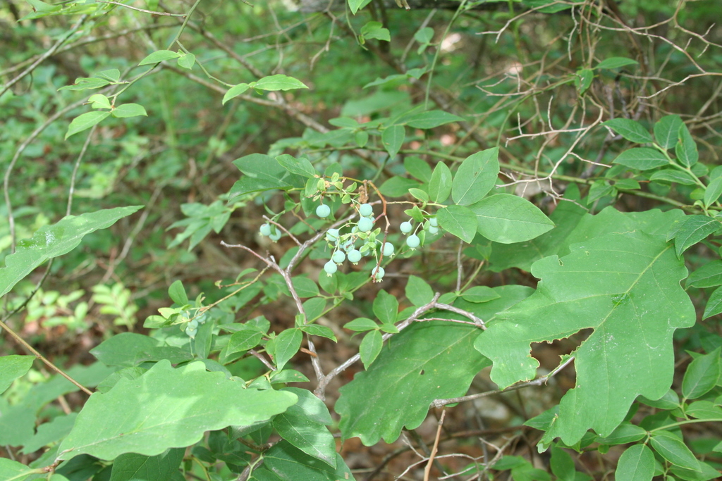 | | 2007 | COLLECTED | 06/09/2007 | Potts Camp, Marshall County, North bound off-ramp of US 78 and Bypass Road. | 34.65562000, -89.30115000 | 143 | In a Hickory-oak forest at the edge of abandoned field. Red clay soil. Associated with: Carya, Quercus nigra and Vaccinium pallidum. | Wild material | Kim Hummer, Michael Dossett collected from Mississippi.
| 1730131 | PI 657237 |
| 10 | PI 618120 | V. arboreum NC 3524 | Vaccinium arboreum Marshall | Texas, United States | COR | | | 1993 | COLLECTED | | College Station, Texas | 35.66667000, -96.45000000 | 1 | College Station, Texas | Wild material | Glaucous leaves and fruit, nice ornamental | 1011696 | PI 618120 |
| 11 | PI 638760 | V. arboreum | Vaccinium arboreum Marshall | Missouri, United States | COR | | | 1993 | COLLECTED | 10/1992 | T36N, R2E, Sec 9, E 1/2 (along east side of road) Site just north of Belgrade, Missouri, Washington County. | 37.00000000, -90.00000000 | 0 | As understory plants with Vaccinium stamineum and V. vacillans. Cornus florida present as understory tree. Highly orgnaic duff layer. Plants straggly and not in their prime due to poor light penetration. | Wild material | Fruits ripen at this site from late August until a hard freeze. Green fruits have been seen late October. Plants show only shrub habit. Fruiting plants typically approximately 1.2 m tall. Foliage glossy and dark green. Fruit glossy and black, about 0.6 cm in diameter. No visible winter injury or insect damage. Minimal disease problems: Ophiodothella spp., which doesn't appear to affect the plant; some fruit appeared to have mummyberry (Monilinia spp.). For best germination of dry seed, Ballington (NC State) and Lyrene (U. of Florida) suggest soaking the seeds for 24 hrs. in 500ppm GA4+7 prior to germination. | 1011314 | PI 638760 |
| 12 | PI 638761 | V. arboreum | Vaccinium arboreum Marshall | Missouri, United States | COR | | | 1993 | COLLECTED | 10/1992 | T29N, R3W, SW 1/4, NW 1/4. Near Two Rivers State Park at junction Current River and Jacks Fork, Shannon County, MO | 36.00000000, -91.00000000 | 0 | Site is a series of falls and pools surrounded by cliffs. Population was growing from the top of the exposed rock, down the cliffs in crevices, and to the stream bed; ca 25 m. V. arboreum and V. stamineum dominant are woody shrubs here. | Wild material | Fruit ripens on this plant from late August until a hard freeze. Green fruits have been seen late October. Fruiting plants from 1.5-2.4 m tall. Foliage glossy and dark green. Fruit ranging from dark blue to black, 0.4-0.8 cm in diameter. Location in crevices suggests drought tolerance. No visible winter injury or insect damage. Minimal disease problems: Ophiodothella spp., which doesn't appear to affect the plant; some fruit appeared to have mummyberry (Monilinia spp.). For best germination of dry seed, Ballington (NC State) and Lyrene (U. of Florida) suggest soaking the seeds for 24 hrs. in 500ppm GA4+7 prior to germination. | 1011317 | PI 638761 |
| 13 | PI 613194 | V. arboreum Missouri | Vaccinium arboreum Marshall | Missouri, United States | COR |  | | 1993 | COLLECTED | 10/1992 | T34N R3E, See. 15, NE 1/4 and Sec. 16, NW 1/4. Elephant Rocks State Park, Iron County, Missouri. | 37.65000000, -90.68333000 | 0 | Plants growing in exposed granite rocky area and extending into the understory of the surrounding forest at the base of the rocks. | Wild material | Elephant Rocks are an exposed 1.6-2.0 ha of granite rising 30 m above surrounding landscape. Large population of plants, predominant species in the rocky area and population extended into the understory of the surrounding forest at the base of the rocks. Fruit ripen at this site from late August until a hard freeze. Green fruit have been seen in late October at this site. The fruit was collected in early October 1992. Fruiting plants ranging from 1.2-4.6 m tall. Both shrub and small tree habit; trunks up to 10 cm in diameter. Leaves were glossy and dark green. Fruit ranging from dark blue to black. Fruit size from 0.4-1.0 cm in diameter. Location in crevices suggest drought tolerance; during an extreme drought in 1991, oaks (Quercus alba and Q. macrocarpa) in the area appeared to be dying from drought while the V. arboreum appeared unaffected. No visible winter injury or insect damage. Minimal disease problems; Ophiodothella spp. which doesn't appear to affect the plant and som fruit that appeared to have mummyberry (Monilinia spp.). Seed from this population were germinated and several seedlings submitted to the NCGR. | 1011294 | PI 613194 |
| 14 | PI 285274 | Farkelberry, Sparkleberry | Vaccinium arboreum Marshall | Georgia, United States | COR | | | 1990 | COLLECTED | | | | | | Uncertain improvement status | W-6 collection
| 1213634 | PI 285274 |
| 15 | PI 554682 | NC 78-8 | Vaccinium arboreum Marshall | North Carolina, United States | COR | | | 1987 | DEVELOPED | | | | | | Wild material | Population segregates for blue fruit | 1449654 | PI 554682 |
| 16 | PI 554683 | NC 86-49 | Vaccinium arboreum Marshall | North Carolina, United States | COR | | | 1987 | DEVELOPED | | | | | | Wild material | Expected 20% germination or less | 1449655 | PI 554683 |
| 17 | PI 554684 | NC 86-50 | Vaccinium arboreum Marshall | North Carolina, United States | COR | | | 1987 | DEVELOPED | | | | | | Breeding material | Expected 20% germination or less | 1449656 | PI 554684 |
| 18 | PI 554685 | V. arboreum NC 86-56-4 | Vaccinium arboreum Marshall | North Carolina, United States | COR | | | 1987 | DEVELOPED | | | | | | Breeding material | Expected 20% germination or less | 1449657 | PI 554685 |
| 19 | PI 554686 | NC 86-59 | Vaccinium arboreum Marshall | North Carolina, United States | COR | | | 1987 | DEVELOPED | | | | | | Breeding material | Most western extension for this species | 1449658 | PI 554686 |
| 20 | PI 554687 | V. arboreum Poplarville MS | Vaccinium arboreum Marshall | Mississippi, United States | COR | | | 1987 | COLLECTED | | Poplarville | 30.75000000, 89.50000000 | | Poplarville | Wild material | Expected 20% germination or less | 1449659 | PI 554687 |
| 21 | PI 554688 | V. arboreum Clarksville, AR | Vaccinium arboreum Marshall | Arkansas, United States | COR | | | 1987 | COLLECTED | | Clarksville | 35.50000000, -93.50000000 | | Clarksville | Wild material | Expected 20% germination or less, segregation for blue fruit | 1449660 | PI 554688 |
| 22 | PI 554689 | V. arboreum College Station, TX | Vaccinium arboreum Marshall | Texas, United States | COR | | | 1987 | COLLECTED | | Longbrake, College Station, Texas | 30.33333000, -96.20000000 | | Longbrake, College Station, Texas | Wild material | Expected 20% germination or less | 1449661 | PI 554689 |
| 23 | PI 554690 | V. arboreum Peach County, GA | Vaccinium arboreum Marshall | Georgia, United States | COR | | | 1987 | COLLECTED | | Peach County | 32.50000000, -83.75000000 | | Peach County | Wild material | Expected 20% germination or less | 1449662 | PI 554690 |
| 24 | PI 554691 | V. arbordum Alachua County, FL | Vaccinium arboreum Marshall | Florida, United States | COR | | | 1987 | COLLECTED | | Boulware Springs, Alachua County | 29.66667000, -82.50000000 | | Boulware Springs, Alachua County | Wild material | Expected 20% germination or less | 1449663 | PI 554691 |
| 25 | PI 554681 | V. arboreum Texas | Vaccinium arboreum Marshall | Texas, United States | COR | | | 1986 | COLLECTED | 10/30/1986 | Sabine watershed, Quinlan | 33.00000000, -95.66667000 | 160 | Sabine watershed, Quinlan | Wild material | Shrub to 2 M, fruit black, about 0.5 cm diam., edible | 1449653 | PI 554681 |
| 26 | PI 554678 | V. arboreum T15 | Vaccinium arboreum Marshall | Texas, United States | COR | | | 1983 | COLLECTED | 10/14/1983 | Zavalla, edge of open area in pine forest by small creek | 31.00000000, -94.08333000 | 46 | Zavalla, edge of open area in pine forest by small creek | Wild material | Single shrub, much branched at top, leaves small,dark green | 1449650 | PI 554678 |
| 27 | PI 554677 | V. arboreum Texas | Vaccinium arboreum Marshall | Texas, United States | COR | | | 1983 | COLLECTED | 05/24/1982 | | 31.66667000, -98.50000000 | 200 | | Wild material | Texas Plant Materials Center collection
| 1449649 | PI 554677 |
| 28 | PI 554676 | V. arboreum Nash County NC | Vaccinium arboreum Marshall | United States | COR | | | 1983 | COLLECTED | 01/01/1963 | Nash County | 36.00000000, -78.00000000 | | Nash County | Wild material | Jim Ballington collection
| 1449648 | PI 554676 |
| 29 | PI 554675 | V. arboreum Pike County, Mississippi | Vaccinium arboreum Marshall | Mississippi, United States | COR | | | 1982 | COLLECTED | | Pike County | 29.00000000, -90.00000000 | | Pike County | Wild material | Jim Ballington Collection | 1449647 | PI 554675 |
| 30 | NA 88586 | 2024RJLFL-020 | Vaccinium arboreum Marshall | Florida, United States | NA | | | 2024 | COLLECTED | 11/14/2024 | Woodland edge off of Ralf Laurant Road, above the wetland/headwaters of Danley Branch along the edge of a young longleaf pine plantation. | 30.90104300, -86.78878100 | 61 | Edge of a mixed evergreen and deciduous forest in part shade to full sun on a mesic to mesic-dry slope, adjacent to a young longleaf pine plantation. Slope: 3 to 8 percent. Aspect: West. The underlying geology of this area is characterized as Citronelle Formation of the Pliocene period. The Citronelle Formation is widespread in the Gulf Coastal Plain. The type section for the Citronelle Formation, named by Matson (1916), is near Citronelle, Alabama. The Citronelle Formation grades laterally, through a broad facies transition, into the Miccosukee Formation of the eastern Florida panhandle. Coe (1979) investigated the Citronelle Formation in portions of the western Florida panhandle. The Citronelle Formation is a siliciclastic, deltaic deposit that is lithologically similar to, and time equivalent with, the Cypresshead Formation and, at least in part, the Long Key Formation (Cunningham et al., 1998) of the peninsula. In the western panhandle, some of the sediments mapped as Citronelle Formation may be reworked Citronelle. The lithologies are the same and there are few fossils present to document a possible younger age. The Citronelle Formation consists of gray to orange, often mottled, unconsolidated to poorly consolidated, very fine to very coarse, poorly sorted, clean to clayey sands. It contains significant amounts of clay, silt and gravel which may occur as beds and lenses and may vary considerably over short distances. Limonite nodules and limonite-cemented beds are common. Marine fossils are rare but fossil pollen, plant remains and occasional vertebrates are found. Much of the Citronelle Formation is highly permeable. It forms the Sand and Gravel Aquifer of the surficial aquifer system. The dominant fossils in the freshwater carbonates are mollusks. (Source: USGS Florida Geologic Map Data). The surface soil profile is classified as Troup Series loamy sand, 5 to 8 percent slopes. The Troup series consists of very deep, somewhat excessively drained soils formed in unconsolidated sandy and loamy marine sediments. Troup soils are found on ridges and hillslopes. These soils are very strongly acid to strongly acid. (Source: California Soil Resource Lab/NRCS Official Soil Series Descriptions). | Wild material | | 2169923 | NA 88586 |
| 31 | NA 88828 | RJL-RM2023FLAL-002 | Vaccinium arboreum Marshall | Florida, United States | NA | | | 2023 | COLLECTED | 12/05/2023 | Yellow River Wildlife Management Area, along DOF [Department of Forestry] Y9 dirt road 0.08 kilometers east of Miller Bluff Road. | 30.65289100, -86.87608500 | 44 | Growing in part shade to sun in very dry, highly competitive site still recovering from the logging of pines in the past decade. This young woodland is comprised of a combination of evergreen and deciduous species competing for available resources and light before the young sand pines begin to dominate the upper canopy. Slope: 0 percent. Aspect: N/A. The underlying geology of this area is the Citronelle Formation, of Pliocene origin, and consists of gray to orange, often mottled, unconsolidated to poorly consolidated, very fine to very coarse, poorly sorted, clean to clayey sands. It contains significant amounts of clay, silt and gravel which may occur as beds and lenses and may vary considerably over short distances. Limonite nodules and limonite-cemented beds are common. (Source: USGS Florida Geologic Map Data.) The primary soil type in the collection area is classified as Lakeland Sand soils (0 to 5 percent slopes). The surface soil profile of this area is primarily the Lakeland series which consists of very deep, excessively drained, rapid to very rapidly permeable soils on uplands. They formed in thick beds of eolian or marine and/or fluvio-marine sands. Thickness of the sand exceeds 2 meters. Silt plus clay in the upper meter ranges from 5-10 percent. Reaction ranges from very strongly acid to moderately acid throughout. (Source: NRCS Web Soil Survey.) | Wild material | | 2165658 | NA 88828 |
| 32 | NA 88806 | TJK2023LA/TX-006 | Vaccinium arboreum Marshall | Texas, United States | NA | | | 2023 | COLLECTED | 11/21/2023 | Interstate 20, westbound, approximately 2.2 miles west of FM (farm-to-market road) 2015 and 0.8 miles east of FM 14. | 32.45250000, -95.26960000 | 10 | Xeric shortleaf pine-post oak-blackjack oak uplands. Slope: flat. Aspect: West. Elevation: 32 feet. | Wild material | | 2159189 | NA 88806 |
| 33 | NA 88683 | TJK2023FL-030 | Vaccinium arboreum Marshall | Florida, United States | NA | | | 2023 | COLLECTED | 11/16/2023 | Pensacola State College, Midway Campus, 1/8 mile south of Highway 98. | 30.39710000, -87.01040000 | 10 | Sand Pine Scrub, old remnant sand dune. Slope: flat. Aspect: West. Elevation: 32 feet. | Wild material | | 2159095 | NA 88683 |
| 34 | WLP 1973 | NA 83918 | Vaccinium arboreum Marshall | Kentucky, United States | NA | | | 2016 | COLLECTED | 09/28/2016 | Cumberland Falls State Park; Cumberland Falls Trail #2 (Cumberland River Trail) at river's edge. | 36.83800000, -84.33200000 | 272 | River's edge below Juniperus virginiana and above rock. | Wild material | | 1952084 | WLP 1973 |
| 35 | WLP 1938 | RL 07045 | Vaccinium arboreum Marshall | Kentucky, United States | NA | | | 2007 | COLLECTED | | Kentucky: McCreary County, Along Divide Road, west of Big South Fork, north of Stepping Rock, along dry forests on west side of road. | | | | | | 1922671 | WLP 1938 |
| 36 | PI 672092 | V. elliottii hybrid | Vaccinium hybr. | Louisiana, United States | COR | | | 2014 | COLLECTED | | Palmetto Flat- Sebal minor(Louisiana palmetto) with mixed q. nigra(water oak), p. taeda(Loblolly Pine and a. rubrum (Red Maple) Growing in Very wet clay soil most of year. Can be very dry during months of Aug., Sept., Oct. | 30.48411000, -90.80511000 | 10 | | Wild material | possibly hybrid of V. elliottii and V. arboreum | 1917778 | PI 672092 |
| 37 | PI 666899 | Lyrene Packet 3 | Vaccinium hybr. | Florida, United States | COR | | | 2012 | DEVELOPED | 11/26/2012 | | | | | Breeding material | Packet 3: FL08-467 x FL10-675. Each parent is an F-1 hybrid (probably tetraploid) of a highbush blueberry cultivar and a tetraploid V. arboreum plant. These seeds are the equivalent of an F-2 population with respect to sections Cyanococcus and Batodendron. FL08-467 is Primadonna x V. arboreum clone 06-753. FL10-675 is FL04-202 (a highbush advanced selection) x V. arboreum 07-544. Paul Lyrene notes 11/27/2012 | 1905846 | PI 666899 |
| 38 | PI 666900 | Lyrene Packet 4 | Vaccinium hybr. | Florida, United States | COR | | | 2012 | DEVELOPED | 11/26/2012 | | | | | Breeding material | Packet 4. FL08-488 x FL12-604. Another F-2 type population. The parents are as follows. FL08-488 is 91-333MIK x V. arboreum 06-754. FL12-604 is FL02-106 (an advanced highbush selection) x V. arboreum 06-730. The grandparent 91-333 MIK is not pure highbush. Its mother was a V.darrowi x V.arboreum seedling and its father was highbush. | 1905847 | PI 666900 |
| 39 | PI 666901 | Lyrene Packet 5 | Vaccinium hybr. | Florida, United States | COR | | | 2012 | DEVELOPED | 11/26/2012 | | | | | Breeding material | Packet 5. FL10-672 x FL08-189. This is a backcross to highbush. FL10-672 is an F-1 hybrid between highbush clone FL04-202 and V. arboreum clone 07-544. FL08-189 is an advanced highbush selection. Paul Lyrene notes 11/27/2012 | 1905848 | PI 666901 |
| 40 | PI 666902 | Lyrene Packet 6 | Vaccinium hybr. | Florida, United States | COR | | | 2012 | DEVELOPED | 11/26/2012 | | | | | Breeding material | Packet 6. Another BC-1 to highbush. FL10-546 x FL05-603. FL10-546 is an F-1 hybrid between FL95-138 (a highbush selection) and 06-730 (a tetraploid V. arboreum). FL05-603 is a highbush selection. | 1905849 | PI 666902 |
| 41 | PI 666903 | Lyrene Packet 7 | Vaccinium hybr. | Florida, United States | COR | | | 2012 | DEVELOPED | 11/26/2012 | | | | | Breeding material | Packet 7. Another BC-1 to highbush. FL10-507 x FL08-308. FL10-507 is an F-1 hybrid between FL95-138 (a highbush selection) and V. arboreum 06-730. FL08-308 is a highbush selection. Paul Lyrene notes 11/27/2012 | 1905850 | PI 666903 |
| 42 | PI 657222 | V. tenellum HD-2007-013 | Vaccinium tenellum Aiton | North Carolina, United States | COR | 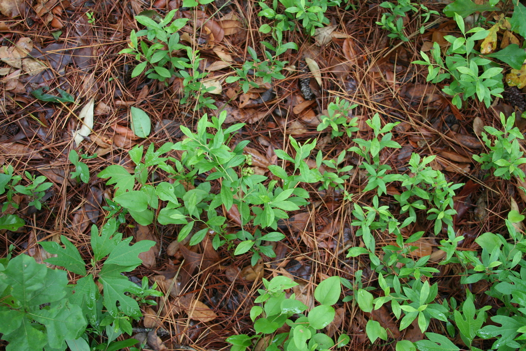 | | 2007 | COLLECTED | 06/02/2007 | Wahoo Willy's restaurant northeast of Willmington on US 17 (Market Street), New Hanover County. Woody forest to right (southwest) of the restaurant. | 34.28500000, -77.80620000 | 7 | Associated with: Smilax, Dryopterus, Castanea, Pinus and Vaccinium arboreum. | Wild material | Kim Hummer, Michael Dossett collected from North Carolina.
| 1730113 | PI 657222 |
| 43 | PI 657224 | V. fuscatum Glassy Mt. HD-2007-021 | Vaccinium fuscatum Aiton | South Carolina, United States | COR |  | | 2007 | COLLECTED | 06/04/2007 | Glassy Mountain at home number 3786 Glassy Mountain Road, Greenville County. Edge of road. | 35.13435000, -82.36098000 | 675 | Sandy loam duff associated with: Acer rubrum, Vitis palmata, Erigeron annuus, Commelina virginiaca, Oxydendron arboreum, Platanus occidentalis, Phytolacca americana, Quercus nigra, Rubus argutus and R. trivialis. 45 degree southeast slope. | Wild material | Kim Hummer, Michael Dossett collected from South Carolina.
Jim Ballington reidentified this accession as V. fuscatum. Personal communication from 2 August 2021:
From the leaf shape, general yellow-green color of the leaves, and the distinctive size (relative to the size of the berries) and shape of the calyx, my conclusion is that this accession is probably not V. simulatum, but rather the blue-fruited Carolina foothills form of V. fuscatum. | 1730115 | PI 657224 |
| 44 | PI 657226 | V. pallidum Stumphouse HD-2007-025 | Vaccinium pallidum Aiton | South Carolina, United States | COR |  | | 2007 | COLLECTED | 06/04/2007 | Stumphouse Mountain, Oconee County. Northwest of Walhalla off SR-107, Ross Mountain Road, near Gramling Drive, edge of trail. | 34.82217000, -83.10895000 | 487 | Red sandy loam associated with: Liriodendron tulipifera, Oxydendron arboreum, Kalmia latifolia, Acer rubrum, Quercus nigra, Cornus florida and Prunus virginiana. | Wild material | Kim Hummer, Michael Dossett collected from South Carolina.
| 1730117 | PI 657226 |
| 45 | PI 657238 | V. stamineum HD-2007-069 | Vaccinium stamineum L. | Mississippi, United States | COR |  | | 2007 | COLLECTED | 06/09/2007 | Potts Camp, Marshall County, North bound off-ramp of US 78 and Bypass Road. | 34.65562000, -89.30115000 | 143 | In a Hickory-oak forest at the edge of abandoned field. Red clay soil. Associated with: Carya, Quercus nigra and Vaccinium arboreum. | Wild material | Kim Hummer, Michael Dossett collected from Mississippi. re-identification - leaves narrow lanceolate
| 1730132 | PI 657238 |
| 46 | PI 657239 | V. fuscatum HD-2007-056 | Vaccinium fuscatum Aiton | Alabama, United States | COR | | | 2007 | COLLECTED | 06/07/2007 | Calhoun County, Anniston Museum of Natural History grounds. Woodland trail 0.5 mile from visitors center. Found in the moister areas, such as dried up stream beds. | 33.69411000, -85.82097000 | 230 | Grey loam - from sandstone. South slope 20 percent. Open woods. Associated with: Quercus nigra, Q. stellata, Q. prinus, Vaccinium arboreum, Pinus taeda and Carya. | Wild material | Kim Hummer, Michael Dossett collected from Alabama.
| 1730134 | PI 657239 |
| 47 | PI 618183 | V. elliottii | Vaccinium elliottii Chapm. | North Carolina, United States | COR | | | 1998 | COLLECTED | 05/29/1998 | Pender county, Moore's Creek National Battlefield, at the edge of a shaded trail near parking lot. | 34.43333000, -78.11667000 | 0 | Long leaf pine, oak and Vaccinium arboreum present. Soil: organic duff over black peat, with good drainage. | Wild material | Kim Hummer collection
| 1558941 | PI 618183 |
| 48 | PI 618173 | V. stamineum NC96-38-1 | Vaccinium stamineum L. | Alabama, United States | COR | | | 1997 | COLLECTED | | Chilton county road 24, 2.7 miles east of city road 37. | 32.72167000, -86.67139000 | 0 | Mostly dry uplands along roadsides and powerline right-of-way. Scattered V. stamineum and V. arboreum. | Wild material | Jim Ballington collection
| 1548793 | PI 618173 |
| 49 | NA 89271 | TJK2023FL-009 | Vaccinium stamineum L. | Florida, United States | NA | | | 2023 | COLLECTED | 07/16/2023 | Eglin Air Force Base: Weaver Creek area west of Highway 87, north of Choctaw Nolf Airfield Road (Escrobano Point). | 30.50710000, -86.91220000 | 33 | Xeric oak-pine uplands above Weaver Creek Bayhead. Slope: 5%. Aspect: Northwest. Elevation recorded as 107 feet. | Wild material | WLPGR contract collection. | 2158254 | NA 89271 |
| 50 | WLP 1972 | NA 83906 | Vaccinium sp. | Kentucky, United States | NA | | | 2016 | COLLECTED | 09/27/2016 | Daniel Boone National Forest, Forest Service Road 828/Route 927, Panoramic View Trail #528. | 36.84300000, -84.52800000 | 406 | Ridgetop trail. | Wild material | | 1950956 | WLP 1972 |
| 51 | NA 88829 | RJL-RM2023FLAL-003 | Oxydendrum arboreum (L.) DC. | Florida, United States | NA | | | 2023 | COLLECTED | 12/05/2023 | Yellow River Wildlife Management Area, along DOF [Department of Forestry] Y15 dirt road 0.06 kilometers north of Fisher Old Mill Road. | 30.62728600, -86.83824600 | 7 | Growing in part shade to sun in moist to wet flat woods of the longleaf pine forest. The woodland is comprised mostly of open habitat of longleaf pine and an understory tree and shrub layer of evergreen and deciduous species. There is also a wealth of herbaceous species in moist to wet conditions of the habitat where there is rich organic matter in the surface layer. Slope: 0 percent. Aspect: N/A. The underlying geology of this area is classified as Alluvium, of Pleistocene/Holocene origin and consists of undifferentiated Quaternary sediments of varying thickness including siliciclastics, organics and freshwater carbonates. The siliciclastics are light gray, tan, brown to black, unconsolidated to poorly consolidated, clean to clayey, silty, unfossiliferous, variably organic-bearing sands to blue green to olive green, poorly to moderately consolidated, sandy, silty clays. Organics occur as plant debris, roots, disseminated organic matrix and beds of peat. Freshwater carbonates, often referred to as marls in the literature, are scattered. (Source: USGS Florida Geologic Map Data.) The primary soil types in the collection area are classified as Pactolus Loamy Sand soils (0 to 5 percent slopes). The Pactolus Series consists of very deep, moderately well to somewhat poorly drained soils. Permeability is rapid. These Coastal Plain soils, typically found with streams and marine terraces and were formed by loamy and sandy fluvial sediments and marine sediments. The strata is, generally, uniformly loamy sand that is very friable and strongly acid from the surface to a depth of 1.8 meters. (Source: NRCS Web Soil Survey.) | Wild material | | 2165659 | NA 88829 |
| 52 | WLP 3277 | TJK2023FL-025 | Oxydendrum arboreum (L.) DC. | Florida, United States | NA | | | 2023 | COLLECTED | 11/01/2023 | Blackwater River State Forest. Forest road Y15, north of Fischer Old Mill Rd. | 30.62731000, -86.83844000 | 7 | Wet Pine Flatwood. Slope: 2%. Aspect: East-southeast. Elevation: 23 feet. | Wild material | | 2159057 | WLP 3277 |
| 53 | WLP 3089 | RM2023-007 | Oxydendrum arboreum (L.) DC. | Alabama, United States | NA | | | 2023 | COLLECTED | 12/29/2022 | This plant is growing along the edges of Gantt Lake, accessed by boat. Occasional around Gantt Lake. | 31.41156000, -86.46920000 | 70 | The plants were growing in open sunny conditions on a steep east-facing bluff above Gantt Lake.
Soils: The underlying geology of this area is Claiborne Group, Tallahatta Formation, of Eocene origin, with white to very light-greenish-gray thin-bedded to massive siliceous claystone; interbedded with thin layers of fossiliferous clay, sandy clay, and glauconitic sand and sandstone.
Source: USGS Alabama Geological Map Data (https://mrdata.usgs.gov/geology/state/state.php?state=AL)
The surface soil profile of this area is primarily Eunola Series Loamy Fine Sand (0 to 2 percent slopes, rarely flooded). The Eunola series consists of very deep, moderately well drained, moderately permeable loamy soils that formed in fluvial or marine sediments. They are on low stream or marine terraces of the Southern Coastal Plain. They are strongly acid. Slopes are dominantly 0 to 3 percent but range up to 6 percent.
Source: NRCS Web Soil Survey (https://websoilsurvey.sc.egov.usda.gov/App/WebSoilSurvey.aspx) | Wild material | | 2141443 | WLP 3089 |
| 54 | NA 88526 | RM-TK2022-014 | Oxydendrum arboreum (L.) DC. | Florida, United States | NA | | | 2023 | COLLECTED | 11/06/2022 | Growing along an unnamed dirt road leading to “Old Land Place” on the edge of Eglin AFB accessed from the Yellow River. | 30.55320000, -86.93730000 | 2 | The underlying geology of this area is classified as Alluvium of Pleistocene/Holocene origin and consists of undifferentiated Quaternary sediments of varying thickness including siliciclastics, organics and freshwater carbonates. The siliciclastics are light gray, tan, brown to black, unconsolidated to poorly consolidated, clean to clayey, silty, unfossiliferous, variably organic-bearing sands to blue green to olive green, poorly to moderately consolidated, sandy, silty clays. Organics occur as plant debris, roots, disseminated organic matrix and beds of peat. Freshwater carbonates, often referred to as marls in the literature, are scattered.
Source: USGS Florida Geologic Map Data (https://mrdata.usgs.gov/geology/state/state.php?state=fl)
The surface soil profile of this area is primarily Bibb-Kinston Series Association. Bibb Series soils are coarse-loamy, sandy, acid soils that are poorly drained. They are soils of flood plains and streams subject to frequent flooding. These are found in association with Kinston Series soils that are fine-loamy, sandy, acid soils of flood plains and stream subject to frequent flooding. The Bibb-Kinston association ranges from 1-1.5 meters thick and is strongly acid.
Source: Soil Survey of Santa Rosa County and NRCS Web Soil Survey (https://www.nrcs.usda.gov/Internet/FSE_MANUSCRIPTS/florida/FL113/0/SantaRosa.pdf and https://websoilsurvey.sc.egov.usda.gov/App/WebSoilSurvey.aspx) | Wild material | | 2140807 | NA 88526 |
| 55 | NA 88530 | RJLSEUS2022-001 | Oxydendrum arboreum (L.) DC. | North Carolina, United States | NA | | | 2023 | COLLECTED | 12/06/2022 | Plants growing around a wetland on both sides of Scotland Lake Road, approximately 1.1 kilometers southwest of the junction with Hoffman Road (Scotland Co. Road 1328) in the Sandhills Game Lands. This plant is a common component along the mesic/moist boundary on the upper edge of the understory shrub in the moist woodland habitat not far from the wetland. | 34.98402000, -79.54267200 | 116 | Plants are growing in full sun to part-shade in the moist, well-drained, mesic conditions just above a wetland area occupied by obligate wetland species. The underlying geology of this area is of Tertiary origin and characterized as Pinehurst Formation. It is composed of medium- to coarse-grained sand as well as cross-bedding and rhythmic bands of clayey sand that are unconsolidated.
Source: USGS North Carolina Geologic Map Data (https://mrdata.usgs.gov/geology/state/sgmc-unit.php?unit=NCTp%3B11)
The primary soil type in the collection area is Pelion Loamy Sand soil (6 to 10 percent slopes). The Pelion Loamy Sand series consists of very deep, moderately well-drained marine deposits, fluviomarine deposits, and sand sheets. Permeability is moderately slow or slow. Surface layers 0-25 cm deep are comprised of loamy sand with a weak fine granular structure and are very friable. Deeper horizons are comprised of sandy loam, sandy clay loam, or clay loam in the upper part and include sandy clay or clay in the deepest strata. Soils are extremely acid to strongly acid.
Source: NRCS Web Soil Survey (https://websoilsurvey.sc.egov.usda.gov/App/WebSoilSurvey.aspx) | Wild material | | 2140759 | NA 88530 |
| 56 | NA 88568 | RJLSEUS2022-041 | Oxydendrum arboreum (L.) DC. | Florida, United States | NA | | | 2023 | COLLECTED | 12/14/2022 | Plants growing along the south side of Eglin AFB Choctaw Nolf Road northwest of Choctaw Navy Outlying Field. This road goes west and takes circuitous route to the north around the Field enroute to Escribano Point Wildlife Management Area. Common at the location; infrequent, otherwise. | 30.51525300, -87.00563800 | 2 | Trees are growing in full sun to part-shade in mesic habitat associate with a nearby wet depression, less than 0.2 meters above the high moisture zone. The trees also extend into slightly drier mesic to the marginally xeric zone.
Soils: The underlying geology of this area is classified as Alluvium, of Pleistocene/Holocene origin and consists of undifferentiated Quaternary sediments of varying thickness including siliciclastics, organics and freshwater carbonates. The siliciclastics are light gray, tan, brown to black, unconsolidated to poorly consolidated, clean to clayey, silty, unfossiliferous, variably organic-bearing sands to blue green to olive green, poorly to moderately consolidated, sandy, silty clays. Organics occur as plant debris, roots, disseminated organic matrix and beds of peat. Freshwater carbonates, often referred to as marls in the literature, are scattered.
The primary soil types in the collection area are classified as Leon Sand soils (0 to 2 percent slopes). The Leon Series consists of very deep, very poorly and poorly drained, moderately rapid to moderately slowly permeable soils on upland flats, depressions, stream terraces and tidal areas. They formed in sandy marine sediments of the Eastern Gulf Coast Flatwoods, the Atlantic Coast Flatwoods, and to a lesser extent in the Southern Coastal Plain, and the North-Central Florida Ridge. Slopes range from 0 to 5 percent. Leon series is comprised of 95%+ sand in the strata to 3+ meters deep.
Source: NRCS Web Soil Survey (https://websoilsurvey.sc.egov.usda.gov/App/WebSoilSurvey.aspx) | Wild material | | 2140790 | NA 88568 |
| 57 | WLP 156 | NACPEC19-022 | Oxydendrum arboreum (L.) DC. | Kentucky, United States | NA | | | 2019 | COLLECTED | 09/09/2019 | Madison County; Berea College Forest: Around the corner from Upper Indian Fort Trail Junction, on top of the Davis Hollow "holler" | 37.56414400, -84.23341800 | 477 | Sandstone outcrop, incredibly thin, low pH <4. Very heavy foot traffic | Wild material | | 2110468 | WLP 156 |
| 58 | WLP 1437 | NA 84027 | Oxydendrum arboreum (L.) DC. | Florida, United States | NA | | | 2016 | COLLECTED | 11/11/2016 | Woodlands associated with Miller Bayou, south of housing subdivision off of Pearl Court. | 30.46413000, -86.92804000 | 2 | Full sun to partial shade in mixed coniferous/broadleaved evergreen woodlands, with a mixture of deciduous plants in highly acidic sandy soils approximately 100-300 ft. from the salt marsh edge associated with Miller Bayou. | | | 1950372 | WLP 1437 |
| 59 | PI 643962 | R. trivialiis HL-2006-001 | Rubus trivialis Michx. | Florida, United States | COR |  | | 2006 | COLLECTED | 05/22/2006 | 65 miles east of Tallahassee, Florida; rest area pull off on Interstate 10 W. Between Suwannee River and Madison, near Twin Rivers State Forest. Scatered throughout, around perimeter of wooded walking area near parking. | 30.36910000, -83.24517000 | 21 | Sandy soil, under loblolly pine forest. Associated with Vaccinium arboreum, Vaccinium stamineum, Vitis, poison ivy (Rhus). Plants plentiful where light came through wooded area. | Wild material | | 1702609 | PI 643962 |
| 60 | PI 616828 | F. virginiana subsp. virginiana NC 96-43-2 | Fragaria virginiana Mill. subsp. virginiana | South Carolina, United States | COR | | Out of Season | 1996 | COLLECTED | 07/19/1996 | Both roadsides along SC 34, 2.8 miles east of Chappells , Newberry county, South Carolina. | 34.20111000, -81.82528000 | | Gray sandy loam soil. Strawberries growing with competitive grasses, honeysuckle, Virginia creeper and poison ivy. Wild rose also growing with 2 of 3 colonies collected. Scattered Vaccinium stamineum and V. arboreum on drier areas of site | Wild material | USDA Sponsored plant collecting expedition, 1996 | 1535621 | PI 616828 |
| 61 | PI 616829 | F. virginiana subsp. virginiana NC 96-43-3 | Fragaria virginiana Mill. subsp. virginiana | South Carolina, United States | COR | | Out of Season | 1996 | COLLECTED | 07/19/1996 | Both roadsides along SC 34, 2.8 miles east of Chappells , Newberry county, South Carolina. | 34.20111000, -81.82528000 | | Gray sandy loam soil. Strawberries growing with competitive grasses, honeysuckle, Virginia creeper and poison ivy. Wild rose also growing with 2 of 3 colonies collected. Scattered Vaccinium stamineum and V. arboreum on drier areas of site | Wild material | USDA Sponsored plant collecting expedition, 1996 | 1535622 | PI 616829 |
| 62 | PI 616841 | F. virginiana subsp. virginiana NC 96-49-1 | Fragaria virginiana Mill. subsp. virginiana | South Carolina, United States | COR | | Out of Season | 1996 | COLLECTED | 07/21/1996 | Roadside on the right above Camp Creek, 1.2 miles down SC 97 , east of the junction with SC 200, on the east side of the Catawba River Bridge. | 34.58833000, -80.86944000 | | Growing in part shade on the dry shoulder of the road. Occasional Vaccinium arboreum, V. elliottii and V. stamineum occurred on top of roadbanks and in dry woods. | Wild material | USDA Sponsored plant collecting expedition, 1996 | 1535635 | PI 616841 |
| 63 | PI 616723 | NC 95-22-4 | Fragaria virginiana Mill. subsp. grayana (Vilm. ex J. Gay) Staudt | Mississippi, United States | COR |  | Out of Season | 1995 | COLLECTED | 07/13/1995 | Mississippi, Tishomingo county, Tishomingo State Park. | 34.26028000, -88.88583000 | 0 | Upper piedmont vegetation on ridges and in deep shady ravines; closely resembling the Applachians where rock outcrops occur. V. arboreum, V. elliotii fairly abundant. Scattering of Rubus spp | Wild material | South Carolina was extremely frustrating, by the middle of the week we had only verified the existence of one location for Fragaria virginiana in the Coastal Plain, so we moved over into the southern piedmont. Three accessions were located in the Edgefield District of Sumter National Forest and four in Greenwood State Park. The one verified Coastal Plain location is in a garden near Lexington, SC. Twelve accessions of Vaccinium spp., four of Gaylussacia frondosa, and one of Rubus argutus were also collected. Southeastern Louisiana and Mississippi were more successful, but not abundant in these areas either. No accessions were found south of Starkville, MS. Specific previous sites were visited near Hattisburg and Laurel, MS, but F. virginiana was no longer present. A total 33 accessions of F. virginiana were collected from east central and northeastern MS, occurring in small outcroppings of prairie; characterized by a very thin layer of 'usually' sticky black soil over decaying limestone with scattered to dense overstory of Juniperus virginiana. Fragaria virginiana was often found growing directly under J. virginiana where little other vegetation occurred. Dr. Sidney McDaniel of Mississippi State University refers to these areas as 'cedar prairie woodlands'. In addition to F. virginiana, 14 accessions of Vaccinium spp. and two accessions Rubus flagellaris were also collected. These trips raise serious questions concerning the status of Fragaria virginiana in the southeastern US. Is it really as rare as it appears to be? In Greenwood State Park in South Carolina, the species was pioneering on bare ground two years after clearcutting. In Mississippi it was not found in such areas, although one herbarium specimen came from the edged of wildlife food plot. People in almost every area told us how abundant wild strawberries were on their property or in their region, but these almost always turned out to be either Duchesnea indica, or Potentilla canadensis. | 1507742 | PI 616723 |
| 64 | PI 616724 | F. virginiana NC 95-22-5 | Fragaria virginiana Mill. subsp. grayana (Vilm. ex J. Gay) Staudt | Mississippi, United States | COR |  | Out of Season | 1995 | COLLECTED | 07/13/1995 | Mississippi, Tishomingo county, Tishomingo State Park. | 34.26028000, -88.88583000 | 0 | Upper piedmont vegetation on ridges and in deep shady ravines; closely resembling the Applachians where rock outcrops occur. V. arboreum, V. elliotii fairly abundant. Scattering of Rubus spp | Wild material | South Carolina was extremely frustrating, by the middle of the week we had only verified the existence of one location for Fragaria virginiana in the Coastal Plain, so we moved over into the southern piedmont. Three accessions were located in the Edgefield District of Sumter National Forest and four in Greenwood State Park. The one verified Coastal Plain location is in a garden near Lexington, SC. Twelve accessions of Vaccinium spp., four of Gaylussacia frondosa, and one of Rubus argutus were also collected. Southeastern Louisiana and Mississippi were more successful, but not abundant in these areas either. No accessions were found south of Starkville, MS. Specific previous sites were visited near Hattisburg and Laurel, MS, but F. virginiana was no longer present. A total 33 accessions of F. virginiana were collected from east central and northeastern MS, occurring in small outcroppings of prairie; characterized by a very thin layer of 'usually' sticky black soil over decaying limestone with scattered to dense overstory of Juniperus virginiana. Fragaria virginiana was often found growing directly under J. virginiana where little other vegetation occurred. Dr. Sidney McDaniel of Mississippi State University refers to these areas as 'cedar prairie woodlands'. In addition to F. virginiana, 14 accessions of Vaccinium spp. and two accessions Rubus flagellaris were also collected. These trips raise serious questions concerning the status of Fragaria virginiana in the southeastern US. Is it really as rare as it appears to be? In Greenwood State Park in South Carolina, the species was pioneering on bare ground two years after clearcutting. In Mississippi it was not found in such areas, although one herbarium specimen came from the edged of wildlife food plot. People in almost every area told us how abundant wild strawberries were on their property or in their region, but these almost always turned out to be either Duchesnea indica, or Potentilla canadensis. | 1507743 | PI 616724 |
| 65 | NA 89173 | 2025RJLSEUS-14 | Chionanthus sp. | Florida, United States | NA | | | 2026 | COLLECTED | 10/03/2025 | Choctawhatchee National Forest: the collection site is reached by foot (~0.5 km) along a loose sand road/firebreak from Martin Luther King, Jr. Boulevard, just east of the boundary for Hurlburt Field in Hurlburt Field/Ft. Walton Beach, FL. Collected from 30 deg. 26.859', -86 deg. 39.577' to 30 deg. 27.137', -86 deg. 39.580'; latitude and longitude of record calculated at the midpoint of these coordinates. | 30.44996000, -86.65965000 | 10 | Dry to xeric conditions of well-drained, deep sandy soils on a relatively level area bordering a powerline in an open mixed mostly mixed evergreen and deciduous, somewhat disturbed habitat in sun to part shade. In areas “broadleaved scrub” vegetation is so dense, that it is almost impenetrable. Elevation: 9 to 11 meters. Slope: 0 to 3 percent. Aspect: Variable. Soil: The soils of this area are characterized as Foxworth Series (95 percent) sand, 0 to 5 percent slopes (8). Other soil series interbedded with the Foxworth Series, vary in percentages from 1-4 percent including Lakeland and Chipley. The Foxworth Series consists of very deep, moderately well to somewhat excessively drained, rapid to very rapid permeable soils on broad uplands and side slopes. They formed in sandy marine or eolian sediments in the Southern Coastal Plain (MLRA 133A), The Eastern Gulf Coast Flatwoods (MLRA 152A), The Atlantic Coast Flatwoods (153A) and the Tidewater Area (153B). Thickness of the grayish brown to light yellowish-brown sand exceeds 2 meters. Reaction ranges from very strongly acid to slightly acid throughout. (Source: California Soil Resource Lab/NRCS Official Soil Series Descriptions). Geology: The underlying geology of this area is characterized as undifferentiated Quaternary Sediments. Much of Florida's surface is covered by a varying thickness of undifferentiated sediments consisting of siliciclastics, organics and freshwater carbonates. Where these sediments exceed 6.1 meters thick, they were mapped as discrete units. To subdivide the undifferentiated sediments, those sediments occurring in flood plains were mapped as alluvial and flood plain deposits (Qal). Sediments showing surficial expression of beach ridges and dunes were mapped separately (Qbd) as were the sediments composing Trail Ridge (Qtr). Terrace sands were not mapped (refer to Healy [1975] for a discussion of the terraces in Florida). The subdivisions of the Undifferentiated Quaternary Sediments (Qu) are not lithostratigraphic units but are utilized to facilitate a better understanding of the State's geology. The siliciclastics are light gray, tan, brown to black, unconsolidated to poorly consolidated, clean to clayey, silty, unfossiliferous, variably organic-bearing sands to blue green to olive green, poorly to moderately consolidated, sandy, silty clays. Gravel is occasionally present in the panhandle. Organics occur as plant debris, roots, disseminated organic matrix and beds of peat. Freshwater carbonates, often referred to as marls in the literature, are scattered over much of the State. In southern Florida, freshwater carbonates are nearly ubiquitous in the Everglades. These sediments are buff colored to tan, unconsolidated to poorly consolidated, fossiliferous carbonate muds. Sand, silt and clay may be present in limited quantities. These carbonates often contain organics. The dominant fossils in the freshwater carbonates are mollusks. (Source: USGS Florida Geologic Map Data). | Wild material | Received as C. cf. henryae | 2193307 | NA 89173 |
| 66 | NA 89171 | 2025RJLSEUS-04 | Rhododendron catawbiense Michx. | Alabama, United States | NA | | | 2026 | COLLECTED | 09/30/2025 | Scarham Creek: southeast of the Pea Ridge Road bridge, approximately 50-80 meters on the south side of the creek. | 34.32559600, -86.16054600 | 266 | Growing near the base of the slopes above the riparian zone, generally on the exposed geology under very well-drained conditions. The woodlands are primarily deciduous with a few evergreens infrequently mixed. Slope: 15 to 30 percent. Aspect: Northeast. Soil: The primary soil type in the area of this collection is classified as Rockland Series sandstone (Rc). The Rockland series consists of well drained soils formed in loamy colluvium from rotational landslides on slopes of stream valleys and dissections of ground moraines. Saturated hydraulic conductivity is moderate in the upper part of the profile and moderately slow in the lower part. Slopes range from 18 to 70 percent. Some pedons have buried leaves, twigs, and moss. Mass soil movement has left random remnants of soil structure from prior upslope soil development and has buried tree branches, leaves and moss. The upper 0-2 cm of soil contains slightly decomposed organic matter while lower soils layers to a depth of 58 cm are comprised of dark reddish-brown to brown silt loam and are moderately acidic. Below 58 cm the soils are generally dark reddish-brown silt loam and strongly to moderately alkaline. (Source:California Soil Resource Lab/NRCS Official Soil Series Descriptions). Geology: The underlying geology of this area is of Pennsylvanian origin and characterized as Pottsville Formation. It is characterized by light-gray thin to thick-bedded quartzose sandstone and conglomerate containing interbedded dark-gray shale, siltstone, and coal. Mapped on Lookout Mountain, Blount and Chandler Mountains, and Sand Mountain northeast of Blount County, and on the mountains of Jackson, Marshall, and Madison Counties north and west of the TN river. (Source: USGS Alabama Geologic Map Data). | Wild material | Received as R. catawbiense vsr. insularis | 2193305 | NA 89171 |
| 67 | NA 89155 | 2025RJLSEUS-02 | Ilex longipes Chapm. ex Trel. | Alabama, United States | NA | | | 2025 | COLLECTED | 09/30/2025 | Scarham Creek: southeast of the Pea Ridge Road bridge, approximately 50-80 meters on the south side of the creek. | 34.32520700, -86.15967000 | 261 | Plants are growing on relatively steep woodland slopes in shade. The woodlands are primarily deciduous with a few evergreens infrequently mixed. Slope: 15 to 30 percent. Aspect: Northeast. Soil: The primary soil type in the area of this collection is classified as Rockland Series sandstone (Rc). The Rockland series consists of well drained soils formed in loamy colluvium from rotational landslides on slopes of stream valleys and dissections of ground moraines. Saturated hydraulic conductivity is moderate in the upper part of the profile and moderately slow in the lower part. Slopes range from 18 to 70 percent. Some pedons have buried leaves, twigs, and moss. Mass soil movement has left random remnants of soil structure from prior upslope soil development and has buried tree branches, leaves and moss. The upper 0-2 cm of soil contains slightly decomposed organic matter while lower soils layers to a depth of 58 cm are comprised of dark reddish-brown to brown silt loam and are moderately acidic. Below 58 cm the soils are generally dark reddish-brown silt loam and strongly to moderately alkaline. (Source: California Soil Resource Lab/NRCS Official Soil Series Descriptions). Geology: The underlying geology of this area is of Pennsylvanian origin and characterized as Pottsville Formation. It is characterized by light-gray thin to thick-bedded quartzose sandstone and conglomerate containing interbedded dark-gray shale, siltstone, and coal. Mapped on Lookout Mountain, Blount and Chandler Mountains, and Sand Mountain northeast of Blount County, and on the mountains of Jackson, Marshall, and Madison Counties north and west of the TN river. (Source: USGS Alabama Geologic Map Data). | Wild material | | 2193001 | NA 89155 |
| 68 | NA 89156 | 2025RJLSEUS-03 | Euonymus americanus L. | Alabama, United States | NA | | | 2025 | COLLECTED | 09/30/2025 | Scarham Creek: southeast of the Pea Ridge Road bridge, approximately 50-80 meters on the south side of the creek. | 34.32577600, -86.16071000 | 260 | Plants are growing on relatively steep woodland slopes in shade. The woodlands are primarily deciduous with a few evergreens infrequently mixed. Slope: 15 to 30 percent. Aspect: Northeast. Soil: The primary soil type in the area of this collection is classified as Rockland Series sandstone (Rc). The Rockland series consists of well drained soils formed in loamy colluvium from rotational landslides on slopes of stream valleys and dissections of ground moraines. Saturated hydraulic conductivity is moderate in the upper part of the profile and moderately slow in the lower part. Slopes range from 18 to 70 percent. Some pedons have buried leaves, twigs, and moss. Mass soil movement has left random remnants of soil structure from prior upslope soil development and has buried tree branches, leaves and moss. The upper 0-2 cm of soil contains slightly decomposed organic matter while lower soils layers to a depth of 58 cm are comprised of dark reddish-brown to brown silt loam and are moderately acidic. Below 58 cm the soils are generally dark reddish-brown silt loam and strongly to moderately alkaline. (Source: California Soil Resource Lab/NRCS Official Soil Series Descriptions). Geology: The underlying geology of this area is of Pennsylvanian origin and characterized as Pottsville Formation. It is characterized by light-gray thin to thick-bedded quartzose sandstone and conglomerate containing interbedded dark-gray shale, siltstone, and coal. Mapped on Lookout Mountain, Blount and Chandler Mountains, and Sand Mountain northeast of Blount County, and on the mountains of Jackson, Marshall, and Madison Counties north and west of the TN river. (Source: USGS Alabama Geologic Map Data). | Wild material | | 2193002 | NA 89156 |
| 69 | NA 89158 | 2025RJLSEUS-06 | Cornus florida L. | Alabama, United States | NA | | | 2025 | COLLECTED | 10/01/2025 | Coosa Wildlife Management Area: along the edge of gated dirt road on the west side of Coosa County Road 29, 0.3 kilometers north of Hatchet Creek. | 32.86402200, -86.33871400 | 108 | Plants are growing in part sun to shade on dry-mesic slopes above the road cut on the gated dirt road; most likely a road for access for fire control/forest management. The forest is a combination of deciduous and evergreen with evergreens primarily comprised of Pinus taeda. The habitat was quite dry during this time of year. Slope: 5 to 20 percent. Aspect: North. Soils: The primary soil in the area of this collection is classified as Madison-Louisa Series complex, 15 to 30 percent slopes, moderately eroded (MdE2). The Madison Series soils are very deep, well drained soils with medium runoff found on Piedmont uplands in interstream divides, ridges and side slopes. They are comprised of residuum weathered from felsic or intermediate, high-grade metamorphic or igneous rocks high in content of mica. Slopes range from 2 to 60 percent and soil is typically strongly acidic. Louisa Series soils The Louisa Series soils consist of shallow, somewhat excessively drained soils which formed over mica gneiss and schist bedrock. They occur on Piedmont uplands. Slopes are 6 to 80 percent. This soil is moderately acid. (Source: California Soil Resource Lab/NRCS Official Soil Series Descriptions). Geology: The underlying geology of this area is of Precambrian to Paleozoic origin and characterized as Hatchet Creek Group; Pinchoulee Gneiss Formation. It is characterized by medium to fine-grained migmatitic, locally garnetiferous biotite-feldspar gneiss, commonly saturated with granitic pods. (Source: USGS Alabama Geologic Map Data). | Wild material | | 2193004 | NA 89158 |
| 70 | NA 89161 | 2025RJLSEUS-10 | Stewartia malacodendron L. | Florida, United States | NA | | | 2025 | COLLECTED | 10/02/2025 | Eglin Air Force Base: woodlands along Weaver Creek accessed from unnamed dirt road, 0.82 kilometers west of junction with Eglin AFB 720; approximately 0.73 kilometers north of junction with Choctaw Nolf Airfield Road and Eglin AFB 720. | 30.51708000, -86.91515000 | 11 | Moist, well-drained, sandy soils above Weaver Creek in a mixed broadleaved evergreen and deciduous woodland habitat in part shade to shade of west facing slopes several meters above the wetland zone. A high-competition, richly diverse environment. Elevation: 7 to 15 meters. Slope: 1 to 15 percent. Aspect: West. Soils: The soils of this area are characterized as Lakeland Series which consist of very deep, excessively drained, rapid to very rapidly permeable soils on uplands. They formed in thick beds of eolian or marine and/or fluvio-marine sands. Thickness of the sand exceeds 2 meters. Silt plus clay in the upper meter ranges from 5-10 percent. Reaction ranges from very strongly acid to moderately acid throughout. (Source: USDA-NRCS Official Soil Series Descriptions). Geology: The underlying geology of this area is the Citronelle Formation, of Pliocene origin, and consists of gray to orange, often mottled, unconsolidated to poorly consolidated, very fine to very coarse, poorly sorted, clean to clayey sands. It contains significant amounts of clay, silt and gravel which may occur as beds and lenses and may vary considerably over short distances. Limonite nodules and limonite-cemented beds are common. (Source: USGS Florida Geologic Map Data). | Wild material | | 2193007 | NA 89161 |
| 71 | NA 89115 | TLM25-04a | Hamamelis ovalis S. W. Leonard | Texas, United States | NA | | | 2025 | COLLECTED | 07/10/2025 | State Highway 87 approximately 3.25 kilometers north of the crossroad junction with Texas Recreational Road 255 (RE 255); plants were growing in the narrow buffer woods along the east side of the highway. | 31.12051300, -93.72628100 | 138 | The habitat is an upland mixed coniferous and deciduous woodlands in part to full shade and dry conditions, often under drought stress. Plants seem to always occur on the top of dry ridges or well-drained slopes. Slope: 0 to 1 percent. Aspect: N/A. Soils: The soils of this collection area are classified as Tehran-Letney Association, hilly (TLE) soils. The Tehran Series (55%) consists of deep, somewhat excessively drained, moderately rapidly permeable soils on uplands. They formed in thick loamy and sandy sediments on the Western Coastal Plain. These soils are on gently sloping to moderately steep uplands with slopes ranging from 1 to 20 percent. The Letney Series (30%) consists of deep, well drained, moderately rapidly permeable, upland soils. They formed in thick sandy and loamy sediments of the coastal plains. These soils are on gently sloping to moderately steep uplands with slopes ranging from 1 to 20 percent. Soil pH ranges from 4.5 to 6.0. The minor soil components include Doucette Series (10%) and Boykin Series (5%) soils. (Source: California Soil Resource Lab/NRCS Official Soil Series Descriptions). Geology: The underlying geology of this area is of Oligocene origin and characterized as Catahoula Formation. This formation is extensive and deep in Texas, up to 185 meters thick. In the area of the collection the Catahoula Formation is primarily mudstone and sand. The upper 90-150 meters is mudstone that is tuffaceous, and sandy; also, occasionally, with some bentonitic clay. (Source: USGS Texas Geologic Map Data). | Wild material | | 2191654 | NA 89115 |
| 72 | NA 89117 | TLM25-06 | Magnolia virginiana L. | Louisiana, United States | NA | | | 2025 | COLLECTED | 07/11/2025 | Natchitoches Parish Road 380, approximately 0.30 km south of the junction with Bayou Camp Forest Route 321 just past the sign for a natural water spring; the site is located on the west side of hte road. | 31.48284200, -93.07549400 | 88 | This habitat is comprised of a botanically rich full sun, hillside seepage area with masses of wetland plant species, dominated by Sarracenia alata. The seepage area, which is 40-60 meters wide, is ultimately funneled downslope, to create the headwaters for a small stream that flows into and through the high understory shade of a longleaf pine forest. This streamside habitat, created by erosion, forms a series of sloping terraces that are home to plant communities ranging from obligate upland species on the upper terraces to facultative wetland species found at the base of the terraces along the stream edge. The range of plant communities and niches created in just a short distance from upper hillside seepage area to the emergent stream, offers a remarkably array of plant diversity. Magnolia virginiana can be found throughout the habitat as well as along the more mesic edge of this site. Slope: 10 to 15 percent. Aspect: southwest. Soils: The primary soil type in the collection area is Kisatchie Series clay, 1 to 15 percent slopes, severely eroded (Kt). The Kisatchie Series soil consists of moderately deep, well drained, very slowly permeable soils that formed clayey sediments over siltstone or sandstone on Tertiary age uplands. These soils are on moderately sloping to steep coastal plains. They are not saturated with water. Water runs off the surface at a moderate to rapid rate. Slope ranges from 1 to 40 percent. The solum is 50 to 100 cm thick over siltstone or sandstone and ranges from moderately to extremely acidic. (Source: California Soil Resource Lab/NRCS Official Soil Series Descriptions). Geology: The underlying geology of this area is of Oligocene origin and characterized as Catahoula Formation. In the area of the collection the Catahoula Formation is primarily gray to white sandstones; loose quartz sand, tuffaceous sandstone, volcanic ash, and brown sandy clays; petrified wood locally. (Source: USGS Louisiana Geologic Map Data). | Wild material | | 2191656 | NA 89117 |
| 73 | NA 88928 | 24Flam6 | Rhododendron minus Michx. | Georgia, United States | NA | | | 2025 | COLLECTED | 09/09/2024 | Cumming, GA: Sawnee Mountain Preserve: primarily downslope of Mountainside Trail, with a fwe plants upslope of trail. | 34.23730000, -84.15298000 | 489 | Growing in half shade. Slope: 30 to 40 degrees. Aspect: East-northeast. | Wild material | | 2172811 | NA 88928 |
| 74 | NA 88936 | 24Flam54 | Kalmia latifolia L. | Georgia, United States | NA | | | 2025 | COLLECTED | 09/12/2025 | Clyo, GA: Metzger Farm, on a shelf above Savannah River. GPS points are a general location for the population, not individual plants [note: collections were combined into this USNA accession.] | 32.49317000, -81.22832000 | 50 | Wet woods on a steep, steep shelf above Savannah River. Growing in 3/4 shade. Slope: 45 to 60 degrees. Aspect: Northeast. | Wild material | | 2172819 | NA 88936 |
| 75 | NA 88578 | 2024RJLFL-004 | Ilex vomitoria Aiton | Florida, United States | NA | | | 2024 | COLLECTED | 11/12/2024 | Collected along Florida National Scenic Trail/Eglin Air Force Base unnamed road. | 30.44526100, -86.86094700 | 4 | Mixed evergreen and deciduous forests in part shade to full sun. Slope: 5 to 10 percent. Aspect: Various. The underlying geology of this area is characterized as Citronelle Formation of the Pliocene period. The Citronelle Formation is widespread in the Gulf Coastal Plain. The type section for the Citronelle Formation, named by Matson (1916), is near Citronelle, Alabama. The Citronelle Formation grades laterally, through a broad facies transition, into the Miccosukee Formation of the eastern Florida panhandle. Coe (1979) investigated the Citronelle Formation in portions of the western Florida panhandle. The Citronelle Formation is a siliciclastic, deltaic deposit that is lithologically similar to, and time equivalent with, the Cypresshead Formation and, at least in part, the Long Key Formation (Cunningham et al., 1998) of the peninsula. In the western panhandle, some of the sediments mapped as Citronelle Formation may be reworked Citronelle. The lithologies are the same and there are few fossils present to document a possible younger age. The Citronelle Formation consists of gray to orange, often mottled, unconsolidated to poorly consolidated, very fine to very coarse, poorly sorted, clean to clayey sands. It contains significant amounts of clay, silt and gravel which may occur as beds and lenses and may vary considerably over short distances. Limonite nodules and limonite-cemented beds are common. Marine fossils are rare but fossil pollen, plant remains and occasional vertebrates are found. Much of the Citronelle Formation is highly permeable. It forms the Sand and Gravel Aquifer of the surficial aquifer system contain organics. The dominant fossils in the freshwater carbonates are mollusks. (Source: USGS Florida Geologic Map Data). The soils of this are characterized as Lakeland Series Sand, 5 to 12 percent slopes. The Lakeland series consists of very deep, excessively drained, rapid to very rapidly permeable soils on uplands. They formed in thick beds of eolian or marine and/or fluvio-marine sands in the Southern Coastal Plain MLRA (133A), the Carolina and Georgia Sandhills (MLRA 137), the Eastern Gulf Coast Flatwoods (MLRA 152A) and the Atlantic Coast Flatwoods (MLRA 153A). Slopes are dominantly from 0 to 12 percent but can range to 85 percent in dissected areas. Thickness of the sand exceeds 200 cm. Silt plus clay in the 25 to 100 cm control section ranges from 5 to 10 percent. Reaction ranges from very strongly acid to moderately acid throughout. (Source: California Soil Resource Lab/NRCS Official Soil Series Descriptions). | Wild material | | 2169915 | NA 88578 |
| 76 | NA 88582 | 2024RJLFL-013 | Cornus florida L. | Florida, United States | NA | | | 2024 | COLLECTED | 11/13/2024 | Woodland edge along the south side of Bud Bass Road (DOF B48), 0.30 kilometers east of the junction with Norman Riley Road. | 30.75753300, -86.80457600 | 39 | Mixed evergreen and deciduous forests in part shade in a mesic- to mesic-dry situation. Slope: 0 percent. Aspect: North. The underlying geology of this area is characterized as Citronelle Formation of the Pliocene period. The Citronelle Formation is widespread in the Gulf Coastal Plain. The type section for the Citronelle Formation, named by Matson (1916), is near Citronelle, Alabama. The Citronelle Formation grades laterally, through a broad facies transition, into the Miccosukee Formation of the eastern Florida panhandle. Coe (1979) investigated the Citronelle Formation in portions of the western Florida panhandle. The Citronelle Formation is a siliciclastic, deltaic deposit that is lithologically similar to, and time equivalent with, the Cypresshead Formation and, at least in part, the Long Key Formation (Cunningham et al., 1998) of the peninsula. In the western panhandle, some of the sediments mapped as Citronelle Formation may be reworked Citronelle. The lithologies are the same and there are few fossils present to document a possible younger age. The Citronelle Formation consists of gray to orange, often mottled, unconsolidated to poorly consolidated, very fine to very coarse, poorly sorted, clean to clayey sands. It contains significant amounts of clay, silt and gravel which may occur as beds and lenses and may vary considerably over short distances. Limonite nodules and limonite-cemented beds are common. Marine fossils are rare but fossil pollen, plant remains and occasional vertebrates are found. Much of the Citronelle Formation is highly permeable. It forms the Sand and Gravel Aquifer of the surficial aquifer system contain organics. The dominant fossils in the freshwater carbonates are mollusks. (Source: USGS Florida Geologic Map Data). The soils of this are characterized as Troup Series loamy sand, 0 to 5 percent slopes. The Troup series consists of very deep, somewhat excessively drained soils that formed in unconsolidated sandy and loamy marine sediments. Troup soils are on ridges and hillslopes. Slopes predominantly range from 0 to 15 percent but range to 45 percent. The soil pH is generally strongly acid. (Source: California Soil Resource Lab/NRCS Official Soil Series Descriptions). | Wild material | | 2169919 | NA 88582 |
| 77 | NA 88585 | 2024RJLFL-018 | Rhododendron canescens (Michx.) Sweet | Florida, United States | NA | | | 2024 | COLLECTED | 11/14/2024 | Woodlands in the riparian zone of a headwater spring and wetland leading to Panther Creek. The area is accessed from High Bridge Road by turning south on an unnamed dirt/sand road and driving about 0.27 kilometers to a pond. | 30.90865300, -86.69107200 | 49 | Mostly deciduous woodlands in the riparian zone of a headwater spring and wetland in shade to part shade. Slope: 5 to 8 percent. Aspect: N/A. The underlying geology of this area is characterized as Citronelle Formation of the Pliocene period. The Citronelle Formation is widespread in the Gulf Coastal Plain. The type section for the Citronelle Formation, named by Matson (1916), is near Citronelle, Alabama. The Citronelle Formation grades laterally, through a broad facies transition, into the Miccosukee Formation of the eastern Florida panhandle. Coe (1979) investigated the Citronelle Formation in portions of the western Florida panhandle. The Citronelle Formation is a siliciclastic, deltaic deposit that is lithologically similar to, and time equivalent with, the Cypresshead Formation and, at least in part, the Long Key Formation (Cunningham et al., 1998) of the peninsula. In the western panhandle, some of the sediments mapped as Citronelle Formation may be reworked Citronelle. The lithologies are the same and there are few fossils present to document a possible younger age. The Citronelle Formation consists of gray to orange, often mottled, unconsolidated to poorly consolidated, very fine to very coarse, poorly sorted, clean to clayey sands. It contains significant amounts of clay, silt and gravel which may occur as beds and lenses and may vary considerably over short distances. Limonite nodules and limonite-cemented beds are common. Marine fossils are rare but fossil pollen, plant remains and occasional vertebrates are found. Much of the Citronelle Formation is highly permeable. It forms the Sand and Gravel Aquifer of the surficial aquifer system contain organics. The dominant fossils in the freshwater carbonates are mollusks. (Source: USGS Florida Geologic Map Data). The surface soil profile is classified as Troup-Orangeburg-Cowarts complex, 5 to 12 percent slopes. The Troup series consists of very deep, somewhat excessively drained soils formed in unconsolidated sandy and loamy marine sediments. Troup soils are found on ridges and hillslopes. The Orangeburg series consists of very deep, well drained, moderately permeable soils on uplands of the Southern Coastal Plain. They formed in loamy and clayey marine sediments. The Cowarts series consists of very deep, moderately well and well drained soils on ridge tops and side slopes on uplands of the Coastal Plain Major Land Resource Area. They formed in loamy marine sediments. The reaction of all these soils ranges from very strongly acid to strongly acid. (Source: USDA-NRCS Official Soil Series Descriptions). | Wild material | | 2169922 | NA 88585 |
| 78 | NA 88588 | 2024RM-001 | Hydrangea radiata Walter | Georgia, United States | NA | | | 2024 | COLLECTED | 10/24/2024 | Chattahoochee National Forest: Warwoman Wildlife Management Area: north side of Overflow Creek Road just west of the bridge over the Chattooga River. | 34.94956600, -83.20652000 | 498 | Mixed evergreen and deciduous moist mesic forest in part shade. The underlying geology of this area is characterized as Metagraywacke/Mica Schist Formation of the Precambrian-Paleozoic period. (Source: USGS Georgia Geologic Map Data). The soils of this are characterized as Tusquitee Series Loam, 10 to 25 percent slopes. The Tusquitee Series consists of very deep, well drained soils on gently sloping to very steep benches, foot slopes, toe slopes, and fans in coves in the Southern Blue Ridge mountains, MLRA 130B. These soils formed in colluvium derived from materials weathered from igneous and high-grade metamorphic crystalline rocks such as granite, mica gneiss, hornblende gneiss, and schist. Slope ranges from 2 to 95 percent. Solum thickness ranges from 1 to 3+ meters. Reaction is very strongly acid to slightly acid, in the A horizon. The Bw and lower horizons are very strongly acid to moderately acid. In the upper 1 meter, content of rock fragments, dominantly of gravel to stone size, ranges up to 35 percent. Below 1 meter, rock fragment content may range up to 60 percent. Content of mica flakes ranges from few to common. (Source: California Soil Resource Lab/NRCS Official Soil Series Descriptions). | Wild material | | 2169925 | NA 88588 |
| 79 | NA 88589 | 2024RM-002 | Lyonia ferruginea (Walter) Nutt. | Florida, United States | NA | | | 2024 | COLLECTED | 11/21/2024 | Eglin Air Force Base: collected along an unnamed sand road that leads to the former Flowers Boat Landing (now permanently closed) along the Yellow River. Accessed by boat. | 30.60823600, -86.83595500 | 6 | Mixed evergreen and deciduous open habitat in part shade to full sun. Slope: 0 to 1 percent. Aspect: N/A. The underlying geology of this area is characterized as Alluvium from undifferentiated Quaternary Sediments. Much of Florida's surface is covered by a varying thickness of undifferentiated sediments consisting of siliciclastics, organics and freshwater carbonates. Where these sediments exceed 20 feet (6.1 meters) thick, they were mapped as discrete units. To subdivide the undifferentiated sediments, those sediments occurring in flood plains were mapped as alluvial and flood plain deposits (Qal). Sediments showing surficial expression of beach ridges and dunes were mapped separately (Qbd) as were the sediments composing Trail Ridge (Qtr). Terrace sands were not mapped (refer to Healy [1975] for a discussion of the terraces in Florida). The subdivisions of the Undifferentiated Quaternary Sediments (Qu) are not lithostratigraphic units but are utilized to facilitate a better understanding of the State's geology. The siliciclastics are light gray, tan, brown to black, unconsolidated to poorly consolidated, clean to clayey, silty, unfossiliferous, variably organic-bearing sands to blue green to olive green, poorly to moderately consolidated, sandy, silty clays. Gravel is occasionally present in the panhandle. Organics occur as plant debris, roots, disseminated organic matrix and beds of peat. Freshwater carbonates, often referred to as marls in the literature, are scattered over much of the State. In southern Florida, freshwater carbonates are nearly ubiquitous in the Everglades. These sediments are buff colored to tan, unconsolidated to poorly consolidated, fossiliferous carbonate muds. Sand, silt and clay may be present in limited quantities. These carbonates often contain organics. The dominant fossils in the freshwater carbonates are mollusks. (Source: USGS Florida Geologic Map Data). The soils of this are characterized as Dorovan-Pamlico Series association. The Dorovan Series consists of very deep, very poorly drained, moderately permeable soils on densely forested flood plains, hardwood swamps, and depressions in the Atlantic Coast Flatwoods (153A), Eastern Gulf Coast Flatwoods (152A), and Southern Coastal Plain Major (133A) Land Resource Areas. They formed in highly decomposed acid-organic materials. Slopes are less than 1 percent. The organic material ranges from 1.3 to 2 meters or more thick. Reaction is extremely acid to very strongly acid in the organic layers and very strongly acid or strongly acid in the mineral layers. The Pamlico Series consists of very poorly drained soils that formed in decomposed organic material underlain by dominantly sandy sediment. The soils are on nearly level flood plains, bays, and depressions of the Coastal Plain. Slopes are less than 1 percent. Pamlico soils have 0.4 to 1.3 meters of organic material over dominantly sandy sediments. Reaction is extremely acid (less than 4.5 in 0.01 M calcium chloride) in the organic layers, and ranges from extremely acid to strongly acid in the underlying mineral layers. | Wild material | | 2169926 | NA 88589 |
| 80 | NA 88731 | RonMiller2022-Old Land Place | Gordonia lasianthus (L.) J. Ellis | Florida, United States | NA | | | 2024 | COLLECTED | 04/2022 | Yellow River Marsh State Aquatic Preserve, "Old Land Place" along Weaver River, 1.47 miles south of the confluence with the Yellow River. | 30.55318000, -87.93656000 | 3 | Moist to wet areas in wetland adjacent to the river in association with a range of evergreen and deciduous forest elements. | Wild material | From open-pollinated, but presumed isolated, seeds of NA 87342-H, -J, and -L (three young plants flowering in containers in production during 2024). Seed was harvested over a period roughly from October through December 2024 as fruits matured. From the record of the parent accession, NA 87342: Exact date of collection unknown. | 2170992 | NA 88731 |
| 81 | NA 87842 | TRX241117-08SC | Ilex opaca Aiton | South Carolina, United States | NA | | | 2024 | COLLECTED | 11/17/2024 | Francis Marion National Forest. | 33.15167000, -79.60253000 | 31 | | Wild material | | 2169895 | NA 87842 |
| 82 | NA 87844 | TRX241118-02GA | Ilex cassine L. | Georgia, United States | NA | | | 2024 | COLLECTED | 11/18/2024 | St. Simons Island: Frederica Park. | 31.23766000, -81.35638000 | 6 | | Wild material | | 2169897 | NA 87844 |
| 83 | NA 87845 | TRX241119-01GA | Ilex coriacea (Pursh) Chapm. | Georgia, United States | NA | | | 2024 | COLLECTED | 11/19/2024 | St. Simons Island: Guale Preserve. | 31.21861000, -81.36872000 | 6 | | Wild material | | 2169898 | NA 87845 |
| 84 | NA 89088 | 2024RM-TK-001 | Viburnum acerifolium L. | Alabama, United States | NA | | | 2024 | COLLECTED | 09/19/2024 | Haines Island Park. Follow Ferry Road to the top of the hill entering the park where a picnic shelter is located. Plants are growing along trails to the north of the picnic shelter. | 31.72132026, -87.46408910 | 81 | Plants are growing from part-sun to full shade in the understory of a mixed deciduous and coniferous forest on very dry upland habitat. Slope: 10 to 20 percent. Aspect: North. Geology: The underlying geology of this area is probably of Eocene age and characterized as the Claiborne Group: Tallahatta Formation. It is comprised of white to very light-greenish-gray thin-bedded to massive siliceous claystone; interbedded with thin layers of fossiliferous clay, sandy clay, and glauconitic sand and sandstone. White to light-greenish-gray fine to coarse sand and fine gravel occur at the base of the formation in southwest Alabama (Meridian Sand Member). (Source: USGS Alabama Geologic Map Data). Soils: The area of this occurrence is characterized as Arundel Series Loam, 8 to 35 percent slopes (ArF). The Arundel series consists of moderately deep, well drained, very slowly permeable soils on dissected uplands of the Southern Coastal Plain Major Land Resource Area (MLRA 133A). They formed in marine deposits consisting of acid clays underlain by horizontally bedded sandstone, buhrstone and siltstone. Slopes range from 2 to 60 percent. (Source: California Soil Resource Lab/NRCS Official Soil Series Descriptions). EPA Ecoregion (Level III): Southeastern Plains (65). EPA Ecoregion (Level IV): Buhrstone/Lime Hills (65q). | Wild material | | 2169052 | NA 89088 |
| 85 | NA 89089 | 2024RM-TK-002 | Viburnum acerifolium L. | Alabama, United States | NA | | | 2024 | COLLECTED | 09/19/2024 | Woodland slopes around and below the hilltop parking area leading down to the Silver Creek Lake Campground off of Silver Creek Lake Road. | 31.66612294, -87.57569860 | 49 | Plants are growing in shade of upland dry mesic, mature mixed deciduous and evergreen woodland. Generally, the overstory is thinner and there is less leaf litter cover, making the surface soil conditions drier. Slope: 5 to 10 percent. Aspect: Southeast. Geology: The underlying geology of this area is Claiborne Group, Tallahatta Formation, of Eocene origin, with white to very light-greenish-gray thin-bedded to massive siliceous claystone; interbedded with thin layers of fossiliferous clay, sandy clay, and glauconitic sand and sandstone. (Source: USGS Alabama Geologic Map Data). Soils: The primary soil types in the collection area are classified as Arundel-Cantuche Complex soils (15 to 35 percent slopes). The Arundel Series consists of moderately deep, well drained, very slowly permeable soils on dissected uplands of the Southern Coastal Plain. They formed in marine deposits consisting of acid clays underlain by horizontally bedded sandstone, buhrstone and siltstone. These soils are strongly acid. Slopes range from 2 to 60 percent. The Cantuche Series consists of shallow, well drained, moderately permeable soils that formed over horizontally bedded claystone. These soils are on narrow ridgetops and narrow benches on steep side-slopes of dissected landscapes in the Coastal Plain. They are strongly acid. Slopes range from 2 to 35 percent. (Source: California Soil Resource Lab/NRCS Official Soil Series Descriptions). EPA Ecoregion (Level III): Southeastern Plains (65). EPA Ecoregion (Level IV): Buhrstone/Lime Hills (65q). | Wild material | | 2169053 | NA 89089 |
| 86 | NA 89091 | 2024RM-TK-004 | Prunus sp. | Florida, United States | NA | | | 2024 | COLLECTED | 09/05/2024 | Blackwater River Wildlife Management Area: on the south side of Boundary Line Road about 0.32 kilometers west of Deaton Bridge Road along an area edged by a barbed wire fence. | 30.68579800, -86.87964300 | 45 | Plants are growing from part-sun to full sun. Plants are growing in an area that is frequently burned with a lot of [Prunus sp. (orig. listed as Prunus alabamensis)] scattered throughout. This habitat is a longleaf pine-wiregrass community with scattered turkey (Quercus laevis) and blackjack oaks (Quercus incana). There is a slight slope downward. The line of [Prunus sp.] goes along a semi-ditch on the side of a dirt road. The plants probably get a bit more water than the plants out in the open forest. The [Prunus sp.] are most often without any other close woody companions. Slope: 0 percent. Aspect: North. Geology: The underlying geology of this area is probably of lower Pliocene age and characterized as the Citronelle Formation. The Citronelle Formation is widespread in the Gulf Coastal Plain. The type section for the Citronelle Formation, named by Matson (1916), is near Citronelle, Alabama. The Citronelle Formation grades laterally, through a broad facies transition, into the Miccosukee Formation of the eastern Florida panhandle. Coe (1979) investigated the Citronelle Formation in portions of the western Florida panhandle. The Citronelle Formation is a siliciclastic, deltaic deposit that is lithologically similar to, and time equivalent with, the Cypresshead Formation and, at least in part, the Long Key Formation (Cunningham et al., 1998) of the peninsula. In the western panhandle, some of the sediments mapped as Citronelle Formation may be reworked Citronelle. The lithologies are the same and there are few fossils present to document a possible younger age. The Citronelle Formation consists of gray to orange, often mottled, unconsolidated to poorly consolidated, very fine to very coarse, poorly sorted, clean to clayey sands. It contains significant amounts of clay, silt and gravel which may occur as beds and lenses and may vary considerably over short distances. Limonite nodules and limonite-cemented beds are common. Marine fossils are rare but fossil pollen, plant remains and occasional vertebrates are found. Much of the Citronelle Formation is highly permeable. It forms the Sand and Gravel Aquifer of the surficial aquifer system. (Source: USGS Florida Geologic Map Data). Soils: The soil of this area is characterized as Lakeland Series Sand, 0 to 5 percent slopes (21). The Lakeland Series consists of very deep, excessively drained, rapid to very rapidly permeable soils on uplands. They formed in thick beds of eolian or marine and/or fluvio-marine sands in the Southern Coastal Plain MLRA (133A), the Carolina and Georgia Sandhills (MLRA 137), the Eastern Gulf Coast Flatwoods (MLRA 152A) and the Atlantic Coast Flatwoods (MLRA 153A). (Source: California Soil Resource Lab/NRCS Official Soil Series Descriptions). EPA Ecoregion (Level III): Southeastern Plains (65). EPA Ecoregion (Level IV): Southern Pine Plains and Hills (65f). | Wild material | Received as Prunus alabamensis; other collections of this material have proven not to be Prunus serotina var. alabamensis, but actually a species of plum; this will likewise be treated as unidentified material until its species can be ascertained. Collectors' notes refer to the plant by the name under which it was collected. | 2169055 | NA 89091 |
| 87 | NA 88827 | RJL-RM2023FLAL-001 | Ilex ambigua Torr. | Florida, United States | NA | | | 2023 | COLLECTED | 12/05/2023 | Yellow River Wildlife Management Area, along DOF [Department of Forestry] Y9 dirt road 0.08 kilometers east of Miller Bluff Road. | 30.65289100, -86.87602800 | 44 | Growing in part shade to sun in very dry, highly competitive site still recovering from the logging of pines in the past decade. This young woodland is comprised of a combination of evergreen and deciduous species competing for available resources and light before the young sand pines begin to dominate the upper canopy. Slope: 0 percent. Aspect: N/A. The underlying geology of this area is the Citronelle Formation, of Pliocene origin, and consists of gray to orange, often mottled, unconsolidated to poorly consolidated, very fine to very coarse, poorly sorted, clean to clayey sands. It contains significant amounts of clay, silt and gravel which may occur as beds and lenses and may vary considerably over short distances. Limonite nodules and limonite-cemented beds are common. (Source: USGS Florida Geologic Map Data.) The primary soil type in the collection area is classified as Lakeland Sand soils (0 to 5 percent slopes). The surface soil profile of this area is primarily the Lakeland series which consists of very deep, excessively drained, rapid to very rapidly permeable soils on uplands. They formed in thick beds of eolian or marine and/or fluvio-marine sands. Thickness of the sand exceeds 2 meters. Silt plus clay in the upper meter ranges from 5-10 percent. Reaction ranges from very strongly acid to moderately acid throughout. (Source: NRCS Web Soil Survey.) | Wild material | | 2165657 | NA 88827 |
| 88 | NA 88834 | RJL-RM2023FLAL-008 | Rhododendron canescens (Michx.) Sweet | Florida, United States | NA | | | 2023 | COLLECTED | 12/06/2023 | Blackwater State Forest: plants are growing in wetlands accessed by foot from Buddy Hardy Road. The collection site is approximately 0.14 kilometers west and downhill from the road. | 30.80736700, -86.95784700 | 53 | Growing in shade to part-shade of the well-drained moist mesic habitat about 1 m above the wetland which appears to be formed by a nearby hillside seepage area. In this zone there are numerous facultative wetland species as well as high competition from facultative upland plants. Slope: 5 to 10 percent. Aspect: Variable. The underlying geology of this area is the Citronelle Formation of Pliocene origin and consists of gray to orange, often mottled, unconsolidated to poorly consolidated, very fine to very coarse, poorly sorted, clean to clayey sands. It contains significant amounts of clay, silt and gravel which may occur as beds and lenses and may vary considerably over short distances. Limonite nodules and limonite-cemented beds are common. (Source: USGS Florida Geologic Map Data.) The Troup Series (5 to 8% slopes) consists of very deep, somewhat excessively drained soil formed in unconsolidated sandy and loamy marine sediments. Troup soils are on ridges and hillslopes. The upper 0-13 cm is comprised primarily of decomposing sphagnum peat with a significant amount of fibrous root content. From 15-112 cm the soil is comprised primarily of fine-grained yellowish-brown sand with varying amounts of root content; this zone is strongly acid. From 112-203 cm the soil is comprised of light-red to red sandy clay loam that is discontinuous, generally friable, and strongly acid. (Source: NRCS Web Soil Survey.) | Wild material | | 2165664 | NA 88834 |
| 89 | NA 88835 | RJL-RM2023FLAL-009 | Rhododendron viscosum (L.) Torr. | Florida, United States | NA | | | 2023 | COLLECTED | 12/06/2023 | Blackwater State Forest: plants are growing in wetlands accessed by foot from Buddy Hardy Road. The collection site is approximately 0.14 kilometers west and downhill from the road. | 30.80841000, -86.96283300 | 43 | Growing in part-shade of the well-drained moist-dry mesic habitat about 2-3 m above the wetland. In this zone there are numerous facultative wetland species as well as high competition from facultative upland plants. Slope: 5 to 10 percent. Aspect: Variable. The underlying geology of this area is the Citronelle Formation of Pliocene origin and consists of gray to orange, often mottled, unconsolidated to poorly consolidated, very fine to very coarse, poorly sorted, clean to clayey sands. It contains significant amounts of clay, silt and gravel which may occur as beds and lenses and may vary considerably over short distances. Limonite nodules and limonite-cemented beds are common. (Source: USGS Florida Geologic Map Data.) The Troup Series (5 to 8% slopes) consists of very deep, somewhat excessively drained soil formed in unconsolidated sandy and loamy marine sediments. Troup soils are on ridges and hillslopes. The upper 0-13 cm is comprised primarily of decomposing sphagnum peat with a significant amount of fibrous root content. From 15-112 cm the soil is comprised primarily of fine-grained yellowish-brown sand with varying amounts of root content; this zone is strongly acid. From 112-203 cm the soil is comprised of light-red to red sandy clay loam that is discontinuous, generally friable, and strongly acid. (Source: NRCS Web Soil Survey.) | Wild material | | 2165665 | NA 88835 |
| 90 | NA 88836 | RJL-RM2023FLAL-010 | Leucothoe axillaris (Lam.) D. Don | Florida, United States | NA | | | 2023 | COLLECTED | 12/08/2023 | Along Gin/Camp Road at the bridge over Thomas Creek on the east side of the road. | 30.75018700, -87.23492900 | 21 | Growing in shade of the moist to wet habitat along Thomas Creek. Plants receive regular moisture and are occasionally flooded in this habitat. Slope: N/A. Aspect: N/A. The underlying geology of this area is the Citronelle Formation of Pliocene origin and consists of gray to orange, often mottled, unconsolidated to poorly consolidated, very fine to very coarse, poorly sorted, clean to clayey sands. It contains significant amounts of clay, silt and gravel which may occur as beds and lenses and may vary considerably over short distances. Limonite nodules and limonite-cemented beds are common. (Source: USGS Florida Geologic Map Data.) The surface soil profile of this area is primarily Bibb-Kinston series association. Bibb series soils are coarse-loamy, sandy, acid soils that are poorly drained. They are soils of flood plains and streams subject to frequent flooding. These are found in association with Kinston series soils that are fine-loamy, sandy, acid soils of flood plains and stream subject to frequent flooding. The Bibb-Kinston association ranges from 1-1.5 meters thick and is strongly acid. (Source: NRCS Web Soil Survey.) | Wild material | | 2165666 | NA 88836 |
| 91 | NA 88838 | RJL-RM2023FLAL-012 | Ilex opaca Aiton | Florida, United States | NA | | | 2023 | COLLECTED | 12/08/2023 | North side of Sid Hayes Road approximately 65 m southeast of the junction with Watson Road. | 30.83277400, -87.24324500 | 32 | Growing in shade, part shade and light shade in dry mesic to moist, occasionally wet, habitats along the edge of the road and in the woodland interior. This species is remarkably adaptable. The only drawback to the range of habitats is that in deep shade, very few fruit can be found, presumably because there is far less flower production and/or fewer pollinators. Slope: 0 to 3 percent. Aspect: South. The underlying geology of this area is the Citronelle Formation of Pliocene origin and consists of gray to orange, often mottled, unconsolidated to poorly consolidated, very fine to very coarse, poorly sorted, clean to clayey sands. It contains significant amounts of clay, silt and gravel which may occur as beds and lenses and may vary considerably over short distances. Limonite nodules and limonite-cemented beds are common. (Source: USGS Florida Geologic Map Data.) The surface soil profile of this area is Dothan Series fine sandy loam soils (5 to 8 percent slopes). The Dothan Series consists of very deep, well drained soils that formed in thick beds of unconsolidated, medium to fine-textured marine sediments. Dothan soils are on interfluves. The surface 0-33 cm is characterized by sandy-loam, well-drained soils that are strongly acid. From 33-200 cm they are characterized by sandy clay loam soils that are more moisture retentive and strongly acid. (Source: NRCS Web Soil Survey.) | Wild material | | 2165668 | NA 88838 |
| 92 | NA 88839 | RJL-RM2023FLAL-013 | Rhododendron austrinum (Small) Rehder | Florida, United States | NA | | | 2023 | COLLECTED | 12/10/2023 | Along the Florida Trail, accessed from Miller Bluff Road. Plants were found infrequently but regularly along the trail over 1 kilometer or more. | 30.61991500, -86.86521000 | 4 | Plants are growing primarily in shade to dappled shade, above a small stream in moist mesic conditions along and below the Florida Trail. The mixed evergreen and deciduous forest is quite diverse with an excellent litter layer. Slope: 2 to 8 percent. Aspect: South. The underlying geology of this area is classified as Alluvium, of Pleistocene/Holocene origin and consists of undifferentiated Quaternary sediments of varying thickness including siliciclastics, organics and freshwater carbonates. The siliciclastics are light gray, tan, brown to black, unconsolidated to poorly consolidated, clean to clayey, silty, unfossiliferous, variably organic-bearing sands to blue green to olive green, poorly to moderately consolidated, sandy, silty clays. Organics occur as plant debris, roots, disseminated organic matrix and beds of peat. Freshwater carbonates, often referred to as marls in the literature, are scattered. (Source: USGS Florida Geologic Map Data.) The surface soil profile of this area is primarily Bibb-Kinston Series Association. Bibb Series soils are coarse-loamy, sandy, acid soils that are poorly drained. They are soils of flood plains and streams subject to frequent flooding. These are found in association with Kinston Series soils that are fine-loamy, sandy, acid soils of flood plains and stream subject to frequent flooding. The Bibb-Kinston association ranges from 1-1.5 meters thick and is strongly acid. (Source: NRCS Web Soil Survey.) | Wild material | | 2165669 | NA 88839 |
| 93 | NA 88843 | RJL-RM2023FLAL-017 | Rhododendron austrinum (Small) Rehder | Florida, United States | NA | | | 2023 | COLLECTED | 12/11/2023 | Holmes Creek at Live Oak Landing: plants found on the low bluff along the south side of Holmes Creek accessed by foot from a parking lot on Live Oak Landing Road that dead ends into the creek. | 30.59043500, -85.83899800 | 7 | Plants are growing in part shade to shade on the top and slope of the low bluff overlooking Holmes Creek in a mixed deciduous and evergreen forest. The dry mesic habitat has relatively low competition and is quite acidic. Slope: 0 to 45 percent. Aspect: Northwest. The underlying geology of this area is classified as Alluvium, of Pleistocene/Holocene origin and consists of undifferentiated Quaternary sediments of varying thickness including siliciclastics, organics and freshwater carbonates. The siliciclastics are light gray, tan, brown to black, unconsolidated to poorly consolidated, clean to clayey, silty, unfossiliferous, variably organic-bearing sands to blue green to olive green, poorly to moderately consolidated, sandy, silty clays. Organics occur as plant debris, roots, disseminated organic matrix and beds of peat. Freshwater carbonates, often referred to as marls in the literature, are scattered. (Source: USGS Florida Geologic Map Data.) The surface soil profile of this area is primarily Nankin-Cowarts-Lakeland Complex. The Nankin Series consists of very deep, well drained, moderately slowly permeable soils on uplands of the Coastal Plain. They formed in stratified loamy and clayey marine sediments. Slopes range from 0 to 60 percent. Soils are comprised of sandy loam in the upper 25 cm to sandy clay loam and sandy clay in lower strata to about 1.7 meters deep; these soils are strongly acid. The Cowarts Series consists of very deep, moderately well and well drained soils on ridge tops and side slopes on uplands of the Coastal Plain Major Land Resource Area. They formed in loamy marine sediments. Slopes range from 1 to 60 percent. The Lakeland series consists of very deep, excessively drained, rapid to very rapidly permeable soils on uplands. They formed in thick beds of eolian or marine and/or fluvio-marine sands. Thickness of the sand exceeds 2 meters. Silt plus clay in the upper meter ranges from 5-10 percent. Reaction ranges from very strongly acid to moderately acid throughout. (Source: NRCS Web Soil Survey.) | Wild material | | 2165673 | NA 88843 |
| 94 | NA 88844 | RJL-RM2023FLAL-018 | Clethra alnifolia L. | Florida, United States | NA | | | 2023 | COLLECTED | 12/13/2023 | Yellow River Water Management Area, accessed off of Old River Road by vehicle on an unmaintained sand road for approximately 1.68 kilometers. Upon reaching the destination, plants are accessed by foot along unmaintained trail to the east. | 30.83495500, -86.62005400 | 27 | Plants are growing primarily in part shade as understory shrubs in mixed evergreen and deciduous, moist to wet, acidic woodlands. Plants form large colonies and appear to have been subjected to prescribed fire in recent years. Slope: 10 to 15 percent. Aspect: Northeast. The underlying geology of this area is the Citronelle Formation of Pliocene origin and consists of gray to orange, often mottled, unconsolidated to poorly consolidated, very fine to very coarse, poorly sorted, clean to clayey sands. It contains significant amounts of clay, silt and gravel which may occur as beds and lenses and may vary considerably over short distances. Limonite nodules and limonite-cemented beds are common. (Source: USGS Florida Geologic Map Data.) The soil profile for this area is classified as the Bonifay Soil Series. Bonifay soil consists of very deep, well drained, moderately slowly permeable soils on ridges and side slopes in the Southern Coastal Plain. They formed in thick beds of sandy and loamy marine sediments. Solum thickness ranges from 1.5-2.0 m. Soil reaction ranges from very strongly acid to moderately acid throughout, except where the surface has been limed. Ironstone pebbles, 2 to 15 mm in size, range from 0 to 5 percent, by volume. Depth to the plinthic horizon ranges from 1.1-1.7 m. Some horizons contain up to 25 percent plinthite by volume. (Source: NRCS Web Soil Survey.) | Wild material | | 2165674 | NA 88844 |
| 95 | NA 88845 | RJL-RM2023FLAL-019 | Ilex opaca Aiton | Florida, United States | NA | | | 2023 | COLLECTED | 12/13/2023 | Yellow River Water Management Area, found along an unnamed unpaved road leading down to the Yellow River. This unpaved road is accessed from Old River Road to the east near the junction with Shockley Springs Road. | 30.87382600, -86.60221300 | 35 | Plants are growing along the road on the woodland edge on a small bluff above a creek in well-drained to dry habitat in part shade. They are also found sporadically in areas along the Yellow River where occasional inundation occurs. Slope: N/A. Aspect: N/A. The underlying geology of this area is the Alum Bluff Group of Miocene origin. It includes the Chipola Formation, Oak Grove Sand, Shoal River Formation, Choctawhatchee Formation and the Jackson Bluff Formation. The formations included in this group are generally defined on the basis of their molluscan faunas and stratigraphic position. Puri (1953) described sediment facies as they relate to the formations of the Alum Bluff Group. These sediments are lithologically distinct as a group, not as individual units. The Alum Bluff Group crops out or is beneath a thin overburden in the western panhandle from river valleys in Okaloosa County eastward to western Jackson County. The Alum Bluff Group consists of clays, sands and shell beds which may vary from fossiliferous, sandy clays to unfossiliferous sands and clays and occasional carbonate beds. Mica is a common constituent and glauconite and phosphate occur sporadically. Induration varies from essentially nonindurated in sands to well indurated in carbonate lenses. Colors range from cream to olive gray with mottled reddish brown in weathered sections. Sand grain size varies from very fine to very coarse with sporadic occurrences of gravel. These sediments generally have low permeabilities and are part of the intermediate confining unit/aquifer system. (Source: USGS Florida Geologic Map Data.) The surface soil profile of this area is primarily Bonifay-Dothan-Angie complex (5 to 12 percent slopes). Bonifay soil consists of very deep, well drained, moderately slowly permeable soils on ridges and side slopes in the Southern Coastal Plain. They formed in thick beds of sandy and loamy marine sediments. Solum thickness ranges from 1.5-2.0 m. Soil reaction ranges from very strongly acid to moderately acid throughout, except where the surface has been limed. Ironstone pebbles, 2 to 15 mm in size, range from 0 to 5 percent, by volume. Depth to the plinthic horizon ranges from 1.1-1.7 m. Some horizons contain up to 25 percent plinthite by volume. The Dothan Series consists of very deep, well drained soils that formed in thick beds of unconsolidated, medium to fine-textured marine sediments. Dothan soils are on interfluves. The surface 0-33 cm is characterized by sandy-loam, well-drained soils that are strongly acid. From 33-200 cm they are characterized by sandy clay loam soils that are more moisture retentive and strongly acid. The Angie series consists of very deep, moderately well drained, slowly permeable soils that formed in loamy and clayey sediment on Tertiary-aged uplands. These soils are on broad, level to strongly sloping coastal plains. Slope is dominantly 1 to 5 percent, but the range is 0 to 12 percent. (Source: NRCS Web Soil Survey.) | Wild material | | 2165675 | NA 88845 |
| 96 | NA 88850 | RJL-RM2023FLAL-024 | Rhododendron austrinum (Small) Rehder | Florida, United States | NA | | | 2023 | COLLECTED | 12/13/2023 | Yellow River Water Management Area, found in an area where an unnamed unpaved road winds along the edges of the Yellow River. This unpaved road is accessed from Old River Road to the east near the junction with Shockley Springs Road. Individuals are found along the roadside for at least 6 kilometers from the point where the unnamed road splits and turns south. | 30.82647700, -86.60892000 | 23 | Plants are growing primarily in part shade to shade in mesic conditions in a mixed evergreen and deciduous forest. Fruiting plants are more abundant where plants receive more sunlight. Slope: 0 to 2 percent. Aspect: Various. The underlying geology of this area is the Alum Bluff Group of Miocene origin. It includes the Chipola Formation, Oak Grove Sand, Shoal River Formation, Choctawhatchee Formation and the Jackson Bluff Formation. The formations included in this group are generally defined on the basis of their molluscan faunas and stratigraphic position. Puri (1953) described sediment facies as they relate to the formations of the Alum Bluff Group. These sediments are lithologically distinct as a group, not as individual units. The Alum Bluff Group crops out or is beneath a thin overburden in the western panhandle from river valleys in Okaloosa County eastward to western Jackson County. The Alum Bluff Group consists of clays, sands and shell beds which may vary from fossiliferous, sandy clays to unfossiliferous sands and clays and occasional carbonate beds. Mica is a common constituent and glauconite and phosphate occur sporadically. Induration varies from essentially nonindurated in sands to well indurated in carbonate lenses. Colors range from cream to olive gray with mottled reddish brown in weathered sections. Sand grain size varies from very fine to very coarse with sporadic occurrences of gravel. These sediments generally have low permeabilities and are part of the intermediate confining unit/aquifer system. (Source: USGS Florida Geologic Map Data.) The surface soil profile of this area is primarily Yemassee, Garcon, and Bigbee soils that are occasionally flooded. The Yemassee Series consists of very deep, somewhat poorly drained, moderately permeable, loamy soils that formed in marine sediments. These soils are on terraces and broad flats of the lower Coastal Plain and very strongly acid. Slopes range from 0 to 2 percent. The Garcon Series consists of very deep, somewhat poorly drained, moderately permeable soils on terraces and in the broad flats of the lower Coastal Plain. They formed in sandy and loamy marine sediments. This soil ranges from very strongly acid to extremely acid. The Bigbee series consists of very deep, excessively drained, rapidly permeable soils that are on natural levees and higher positions in flood plains along stream flood plains in the Southern Coastal Plain (MLRA 133A) and the Eastern Gulf Coast Flatwoods (MLRA 152A). They formed in thick sandy alluvial sediments. They range from strongly acid to very strongly acid. (Source: NRCS Web Soil Survey.) | Wild material | | 2165680 | NA 88850 |
| 97 | WLP 3377 | TXWL2023-024 | Viburnum dentatum L. | Texas, United States | NA | | | 2023 | COLLECTED | 12/13/2023 | Roadside between Big Cow Creek and Hardy Cemetery. | 31.03548900, -93.85086800 | | Roadside; mesic, mixed hardwood/pine forest. | Wild material | | 2165656 | WLP 3377 |
| 98 | NA 88696 | RJL2023NCSC-001 | Rhododendron catawbiense Michx. | North Carolina, United States | NA | | | 2023 | COLLECTED | 11/12/2023 | Duke Forest property along New Hope Creek. The collection site is accesses by foot along trails. | 35.98317700, -79.01856200 | 103 | Plants growing in shade to part-shade of an upland very dry woodland habitat that is mostly deciduous. The site is steeply sloped underlain by rocky outcrop. Slope: 15 to 25 percent. Aspect: Northwest. The underlying geology of this area is of Cambrian/Late Proterozoic origin and characterized as a Metamorphosed Granitic Rock. It is megacrystic and well foliated; locally contains hornblende. Chapel Hill, Chatham, Farrington, Meadow Flats, Mt. Moriah, Parks Crossroads plutons, and Roxboro and Vance County suites. (Source: USGS North Carolina Geologic Map Data.) The primary soil type in the collection area is classified as Wedowee sandy loam, 15 to 25 percent slopes. Wedowee Series consists of very deep, well drained, moderately permeable soils that formed in residuum weathered from felsic igneous and metamorphic rocks of the Piedmont uplands. These soils are on narrow ridges and on side slopes of uplands. Slopes are dominantly 6 to 25 percent but ranges from 0 to 60 percent. The strata range from dark brown and brownish yellow to strong brown. They are mostly sandy loam; moderate fine granular structure; very friable; strongly acid. (Source: NRCS Web Soil Survey.) | Wild material | | 2159124 | NA 88696 |
| 99 | NA 88698 | RJL2023NCSC-003 | Ilex laevigata (Pursh) A. Gray | North Carolina, United States | NA | | | 2023 | COLLECTED | 11/13/2023 | Sandhills Game Land: north side of Pulpwood Road approximately 0.11 km southwest of the junction with Tyner Road. | 34.95939500, -79.48676300 | 114 | Plants growing in shade to part-shade of a spring fed wetland that is a mixed evergreen and deciduous woodland habitat. Slope: 3 to 10 percent. Aspect: Northeast. The underlying geology of this area is of Tertiary origin and characterized as Pinehurst Formation. It is comprised of sand that is medium- to coarse-grained, cross-bedding and rhythmic bands of clayey sand common, unconsolidated. (Source: USGS North Carolina Geologic Map Data.) The primary soil type in the area of this collection is classified as Pelion loamy sand, 6 to 10 percent slopes. Pelion Series soils are very deep, moderately well-drained soils with moderately slow to slow permeability. The upper 30 cm of the strata is sandy loam to sandy clay loam ranging from grayish brown to reddish yellow. This stratum has a weak fine granular structure and is very friable. It contains many fine roots and is moderately acid. Deeper strata to 2 m range from yellow to yellowish red sandy clay, often with masses of oxidized iron and few fine prominent light gray iron depletions; they are strongly acid. (Source: NRCS Web Soil Survey.) | Wild material | | 2159126 | NA 88698 |
| 100 | NA 88699 | RJL2023NCSC-004 | Lyonia ligustrina (L.) DC. | North Carolina, United States | NA | | | 2023 | COLLECTED | 11/13/2023 | Sandhills Game Land: north side of Pulpwood Road approximately 0.11 km southwest of the junction with Tyner Road. | 34.95949000, -79.48665600 | 107 | Plants growing in part-shade to sun on the moist margins of a spring fed wetland that is a mixed evergreen and deciduous woodland habitat. The underlying soils are moist even during dry periods due to seepage from the wetland. Slope: 3 to 10 percent. Aspect: Northeast. The underlying geology of this area is of Tertiary origin and characterized as Pinehurst Formation. It is comprised of sand that is medium- to coarse-grained, cross-bedding and rhythmic bands of clayey sand common, unconsolidated. (Source: USGS North Carolina Geologic Map Data.) The primary soil type in the area of this collection is classified as Pelion loamy sand, 6 to 10 percent slopes. Pelion Series soils are very deep, moderately well-drained soils with moderately slow to slow permeability. The upper 30 cm of the strata is sandy loam to sandy clay loam ranging from grayish brown to reddish yellow. This stratum has a weak fine granular structure and is very friable. It contains many fine roots and is moderately acid. Deeper strata to 2 m range from yellow to yellowish red sandy clay, often with masses of oxidized iron and few fine prominent light gray iron depletions; they are strongly acid. (Source: NRCS Web Soil Survey.) | Wild material | | 2159127 | NA 88699 |
| 101 | NA 88700 | RJL2023NCSC-005 | Clethra alnifolia L. | North Carolina, United States | NA | | | 2023 | COLLECTED | 11/13/2023 | Sandhills Game Land: north side of Pulpwood Road approximately 0.11 km southwest of the junction with Tyner Road. | 34.96008500, -79.48751100 | 108 | Plants growing in shade to part-shade as well as sun (when moisture is abundant) of a spring fed wetland that is comprised of a mixed evergreen and deciduous woodland habitat. Slope: 3 to 10 percent. Aspect: Various. : The underlying geology of this area is of Cretaceous origin and characterized as Middendorf Formation. It is characterized by sand, sandstone, and mudstone, gray to pale gray with an orange cast, mottled; clay balls and iron-cemented concretions common, beds laterally discontinuous, cross-bedding common. (Source: USGS North Carolina Geologic Map Data.) The primary soil type in the area of this collection is classified as Pelion loamy sand, 6 to 10 percent slopes. Pelion Series soils are very deep, moderately well-drained soils with moderately slow to slow permeability. The upper 30 cm of the strata is sandy loam to sandy clay loam ranging from grayish brown to reddish yellow. This stratum has a weak fine granular structure and is very friable. It contains many fine roots and is moderately acid. Deeper strata to 2 m range from yellow to yellowish red sandy clay, often with masses of oxidized iron and few fine prominent light gray iron depletions; they are strongly acid. (Source: NRCS Web Soil Survey.) | Wild material | | 2159128 | NA 88700 |
| 102 | NA 88701 | RJL2023NCSC-006 | Zenobia pulverulenta (W. Bartram ex Willd.) Pollard | North Carolina, United States | NA | | | 2023 | COLLECTED | 11/13/2023 | Sandhills Game Land: north side of Pulpwood Road approximately 0.11 km southwest of the junction with Tyner Road. | 34.96066900, -79.48735300 | 111 | Plants growing in moist-mesic to seasonally saturated soils in part-shade of a spring fed wetland that is a mixed evergreen and deciduous woodland habitat. Slope: 0 to 5 percent. Aspect: Northeast. The underlying geology of this area is of Tertiary origin and characterized as Pinehurst Formation. It is comprised of sand that is medium- to coarse-grained, cross-bedding and rhythmic bands of clayey sand common, unconsolidated. (Source: USGS North Carolina Geologic Map Data.) The primary soil type in the area of this collection is classified as Pelion loamy sand, 6 to 10 percent slopes. Pelion Series soils are very deep, moderately well-drained soils with moderately slow to slow permeability. The upper 30 cm of the strata is sandy loam to sandy clay loam ranging from grayish brown to reddish yellow. This stratum has a weak fine granular structure and is very friable. It contains many fine roots and is moderately acid. Deeper strata to 2 m range from yellow to yellowish red sandy clay, often with masses of oxidized iron and few fine prominent light gray iron depletions; they are strongly acid. (Source: NRCS Web Soil Survey.) | Wild material | | 2159129 | NA 88701 |
| 103 | NA 88702 | RJL2023NCSC-007 | Rhododendron viscosum (L.) Torr. | North Carolina, United States | NA | | | 2023 | COLLECTED | 11/13/2023 | Sandhills Game Land: north side of Pulpwood Road approximately 0.11 km southwest of the junction with Tyner Road. | 34.96080300, -79.48730200 | 113 | Plants growing in moist-mesic to seasonally saturated soils in shade to part-shade of a spring fed wetland that is a mixed evergreen and deciduous woodland habitat. Prescribed fires have burned a portion of the wetland edge where plants are resprouting vigorously. Slope: 0 to 5 percent. Aspect: Norhteast. The underlying geology of this area is of Tertiary origin and characterized as Pinehurst Formation. It is comprised of sand that is medium- to coarse-grained, cross-bedding and rhythmic bands of clayey sand common, unconsolidated. (Source: USGS North Carolina Geologic Map Data.) The primary soil type in the area of this collection is classified as Pelion loamy sand, 6 to 10 percent slopes. Pelion Series soils are very deep, moderately well-drained soils with moderately slow to slow permeability. The upper 30 cm of the strata is sandy loam to sandy clay loam ranging from grayish brown to reddish yellow. This stratum has a weak fine granular structure and is very friable. It contains many fine roots and is moderately acid. Deeper strata to 2 m range from yellow to yellowish red sandy clay, often with masses of oxidized iron and few fine prominent light gray iron depletions; they are strongly acid. (Source: NRCS Web Soil Survey.) | Wild material | | 2159130 | NA 88702 |
| 104 | NA 88703 | RJL2023NCSC-008 | Lyonia lucida (Lam.) K. Koch | North Carolina, United States | NA | | | 2023 | COLLECTED | 11/13/2023 | Sandhills Game Land: north side of Pulpwood Road approximately 0.11 km southwest of the junction with Tyner Road. | 34.95848900, -79.48618700 | 101 | Plants growing in moist-mesic to seasonally saturated soils in shade to part-shade of a spring fed wetland that is a mixed evergreen and deciduous woodland habitat. Slope: 0 to 5 percent. Aspect: Various. The underlying geology of this area is of Tertiary origin and characterized as Pinehurst Formation. It is comprised of sand that is medium- to coarse-grained, cross-bedding and rhythmic bands of clayey sand common, unconsolidated. (Source: USGS North Carolina Geologic Map Data.) The primary soil type in the area of this collection is classified as Pelion loamy sand, 6 to 10 percent slopes. Pelion Series soils are very deep, moderately well-drained soils with moderately slow to slow permeability. The upper 30 cm of the strata is sandy loam to sandy clay loam ranging from grayish brown to reddish yellow. This stratum has a weak fine granular structure and is very friable. It contains many fine roots and is moderately acid. Deeper strata to 2 m range from yellow to yellowish red sandy clay, often with masses of oxidized iron and few fine prominent light gray iron depletions; they are strongly acid. (Source: NRCS Web Soil Survey.) | Wild material | | 2159131 | NA 88703 |
| 105 | NA 88706 | RJL2023NCSC-011 | Smilax laurifolia L. | North Carolina, United States | NA | | | 2023 | COLLECTED | 11/13/2023 | Sandhills Game Land: wetland associated with the West Prong of Juniper Creek on the north side of Whisky Still Road approximately 0.63 kilometers northeast of Hoffman Road, Scotland County Road 1328. | 34.95683200, -79.51146200 | 103 | Plants are growing in part-shade to sun in an acidic wetland habitat rich in sphagnum and other wetland species. The habitat is moist to wet year-round and periodically has surface runoff occurring; even so, this habitat can become quite dry during seasonal periods without rainfall. Slope: N/A. Aspect: N/A. The underlying geology of this area is of Tertiary origin and characterized as Pinehurst Formation. It is comprised of medium- to coarse-grained sand as well as cross-bedding and rhythmic bands of clayey sand that are unconsolidated. (Source: USGS North Carolina Geologic Map Data.) The primary soil type in the collection area is classified as Johnston Series soils, 0 to 2 percent slopes, frequently flooded. The Johnson Series consists of very deep, very poorly drained coarse-loamy, siliceous, active, acid, thermic Cumulic Humaquepts. The upper 0-75 cm is black, mucky loam that is friable and very strongly acid. The lower strata to 1.75 m is dark gray, loamy fine sand, single grained, loose and very strongly acid. (Source: NRCS Web Soil Survey.) | Wild material | | 2159134 | NA 88706 |
| 106 | NA 88707 | RJL2023NCSC-012 | Rhododendron viscosum (L.) Torr. | North Carolina, United States | NA | | | 2023 | COLLECTED | 11/13/2023 | Sandhills Game Land: wetland associated with the West Prong of Juniper Creek on the north side of Whisky Still Road approximately 0.63 kilometers northeast of Hoffman Road, Scotland County Road 1328. | 34.95683200, -79.51146200 | 103 | Plants are growing in part-shade to sun in an acidic wetland habitat rich in sphagnum and other wetland species. The habitat is moist to wet year-round and periodically has surface runoff occurring; even so, this habitat can become quite dry during seasonal periods without rainfall. Slope: N/A. Aspect: N/A. The underlying geology of this area is of Tertiary origin and characterized as Pinehurst Formation. It is comprised of medium- to coarse-grained sand as well as cross-bedding and rhythmic bands of clayey sand that are unconsolidated. (Source: USGS North Carolina Geologic Map Data.) The primary soil type in the collection area is classified as Johnston Series soils, 0 to 2 percent slopes, frequently flooded. The Johnson Series consists of very deep, very poorly drained coarse-loamy, siliceous, active, acid, thermic Cumulic Humaquepts. The upper 0-75 cm is black, mucky loam that is friable and very strongly acid. The lower strata to 1.75 m is dark gray, loamy fine sand, single grained, loose and very strongly acid. (Source: NRCS Web Soil Survey.) | Wild material | | 2159135 | NA 88707 |
| 107 | NA 88709 | RJL2023NCSC-014 | Rhododendron minus Michx. | South Carolina, United States | NA | | | 2023 | COLLECTED | 11/13/2023 | Northwest side of the junction of Wire Road and Prichard Horse Road. | 34.49925200, -80.27470600 | 146 | Plants growing in shade to part-shade of dry steep slope woodland habitat that is primarily composed of Pinus palustris. Slope: 2 to 20 percent. Aspect: North. The underlying geology of this area is of Cretaceous origin and characterized as Peedee Formation - Black Creek Group, undivided. The Peedee Formation is primarily unconsolidated, coarse-detrital, sand that is dark-green or gray, finely micaceous, more or less glauconitic and argillitic sand, many layers of which are calcareous (impure limestone). Irregular concretionary masses of impure calcium carbonate occur in places. Dark marine clays are interstratified with sand. The Black Creek Group consists of irregularly bedded, laminated, carbonaceous clays and thin laminae and lenses of sand; lignite and pyrite present; glauconitic in places; massive interbedded layers of glauconitic sand present toward top of unit. Light-colored clays and coarse arkosic sands also found. (Source: USGS South Carolina Geologic Map Data.) The primary soil type in the collection area is classified as Ailey Series sand, moderately wet, 2 to 6 percent slopes. The Ailey Series consists of moderately deep or deep to fragic soil properties and deep or very deep to densic materials. This soil is well drained or somewhat excessively drained. The upper layer (0-12.5 cm) of this soil is dark grayish brown loamy sand that is frequently dry. It has a weak fine granular structure, is very friable, non-sticky, non-plastic, and is strongly acid. The lower strata soils (12.5-90 cm) are yellowish brown loamy sand, with weak fine granular structure, very friable, non-sticky, non-plastic, and moderately acid. Deeper depths (below 90 cm) are characterized by slightly greater clay content that is slightly more plastic and strongly acid. (Source: NRCS Web Soil Survey.) | Wild material | | 2159137 | NA 88709 |
| 108 | NA 88716 | RJL2023NCSC-021 | Ilex myrtifolia Walter | South Carolina, United States | NA | | | 2023 | COLLECTED | 11/14/2023 | Francis Marion National Forest: plants growing in a pond cypress-water tupelo swamp on the west side of Thompson Branch Road just south of the junction with Round Pond Road B. | 33.15167800, -79.60253700 | 31 | Plants are growing in part-shade to shade as understory trees among the pond cypress-water tupelo forest throughout the acid swamp which is seasonally inundated. The overstory is largely deciduous and comprised of pond cypress and water tupelo, while the understory is a mix of evergreen and deciduous broadleaved shrubs and understory trees. Slope: N/A. Aspect: N/A. The underlying geology of this area is of Pleistocene origin and characterized as a Socastee Formation. This is a low coastal formation in the Carolinas like Penholoway but younger and lower in altitude. It is comprised primarily of unconsolidated, fine-detrital clay. It is described as variegated quartzose sands, argillaceous sands, and clays, 5 m thick at the type section near Socastee Swamp. (Source: USGS South Carolina Geologic Map Data.) The primary soil type in this collection area is classified as Pickney Series loamy fine sand. The Pickney Series consists of very deep, very poorly drained, persistently wet, permeable soils that formed from marine or fluvial sediments. Slopes range from 0 to 2 percent. The upper strata soil, 0-75 cm, is black loamy fine sand that is very friable and extremely acid. The lower strata, 75-120 cm is dark gray fine sand with occasional white mottling, loose, and moderately acid. (Source: NRCS Web Soil Survey.) | Wild material | | 2159144 | NA 88716 |
| 109 | NA 88717 | RJL2023NCSC-022 | Ilex opaca Aiton | South Carolina, United States | NA | | | 2023 | COLLECTED | 11/14/2023 | Francis Marion National Forest: plants growing in a pond cypress-water tupelo swamp on the west side of Thompson Branch Road just south of the junction with Round Pond Road B. | 33.15161300, -79.60217900 | 22 | Plants are growing in part-shade to shade as understory trees among the pond cypress-water tupelo forest, mostly along the edges of the acid swamp which is seasonally inundated. The overstory is largely deciduous and comprised of pond cypress and water tupelo, while the understory is a mix of evergreen and deciduous broadleaved shrubs and understory trees. Slope: N/A. Aspect: N/A. The underlying geology of this area is of Pleistocene origin and characterized as a Socastee Formation. This is a low coastal formation in the Carolinas like Penholoway but younger and lower in altitude. It is comprised primarily of unconsolidated, fine-detrital clay. It is described as variegated quartzose sands, argillaceous sands, and clays, 5 m thick at the type section near Socastee Swamp. (Source: USGS South Carolina Geologic Map Data.) The primary soil type in this collection area is classified as Pickney Series loamy fine sand. The Pickney Series consists of very deep, very poorly drained, persistently wet, permeable soils that formed from marine or fluvial sediments. Slopes range from 0 to 2 percent. The upper strata soil, 0-75 cm, is black loamy fine sand that is very friable and extremely acid. The lower strata, 75-120 cm is dark gray fine sand with occasional white mottling, loose, and moderately acid. (Source: NRCS Web Soil Survey.) | Wild material | | 2159145 | NA 88717 |
| 110 | NA 88718 | RJL2023NCSC-023 | Ilex decidua Walter | South Carolina, United States | NA | | | 2023 | COLLECTED | 11/15/2023 | Waccamaw National Wildlife Refuge: U.S. Highway 701, Yauhannah Landing on the east side of the Great Pee Dee River. Plants growing in low woods on the north side of the landing. | 33.66208900, -79.15305000 | 2 | Plants growing in shade to part-shade of a moist to wet woodland habitat that is mostly deciduous and evergreen. Portions of the woodland have depressions with year-round standing water. Slope: N/A. Aspect: N/A. The underlying geology of this area is of Quaternary origin and characterized as Alluvial Valley Swamp. This formation is unconformable on all underlying units. It is composed of fluvial sand and gravel at base, grading upwards into fine sands and silts, and local occasional peat. May be overrun with recent sediments from forest cutting and agriculture. (Source: USGS South Carolina Geologic Map Data.) The primary soil type in this collection area is classified as Johnston Series loam. The Johnson Series consists of very deep, very poorly drained coarse-loamy, siliceous, active, acid, thermic Cumulic Humaquepts. The upper 0-75 cm is black, mucky loam that is friable and very strongly acid. The lower stratum to 1.75 m is dark gray, loamy fine sand, single grained, loose and very strongly acid. (Source: NRCS Web Soil Survey.) | Wild material | | 2159146 | NA 88718 |
| 111 | NA 88719 | RJL2023NCSC-024 | Ilex laevigata (Pursh) A. Gray | South Carolina, United States | NA | | | 2023 | COLLECTED | 11/15/2023 | Little Pee Dee Heritage Preserve/Wildlife Management Area (South Carolina Department of Natural Resources Public Lands, on South Carolina Highway 917). | 34.14123300, -79.19532100 | 13 | Plants growing in high understory shade to part-shade of a moist to relatively dry pine forest with occasional deciduous trees. The litter layer in the woodlands is very deep with longleaf pine needles, while the edges of the woodlands are much drier with exposed white sand and little to no litter layer. Slope: N/A. Aspect: N/A. The underlying geology of this area is of Pleistocene origin and characterized as Waccamaw Formation. This formation is another Carolina coastalized terrace that is deeply weathered. It is characterized by unconsolidated, coarse-detrital, soft sand limestones and loose gray to buff fine quartz sands in which occasional small quartz pebbles are present. It also includes sedimentary, carbonate, soft limestones. (Source: USGS South Carolina Geologic Map Data.) The primary soil type in this collection area is classified as Lynn Haven Series sand. The Lynn Haven Series consists of very deep, poorly and very poorly drained, moderate or moderately rapid, permeable soils in low areas and depressions in Atlantic Flatwoods and the Gulf. They formed in thick deposits of sandy marine sediments. Th Lynn Haven Series soil is approximately 2 m thick and ranges from black near the surface to yellow brown in the deepest strata. Most of the strata are comprised of fine sands that are friable with the deepest strata also including a small percentage of organic matter. Reaction ranges from extremely acid to strongly acid throughout the profile. The water table is at 0-15 cm for periods of 2 to 6 months annually and within a depth 1 m for more than 6 months during most years; during extended dry periods it is below 1 meter. Depressional areas are ponded for long duration in most years. (Source: NRCS Web Soil Survey.) | Wild material | | 2159147 | NA 88719 |
| 112 | NA 88720 | RJL2023NCSC-025 | Zenobia pulverulenta (W. Bartram ex Willd.) Pollard | South Carolina, United States | NA | | | 2023 | COLLECTED | 11/15/2023 | Little Pee Dee Heritage Preserve/Wildlife Management Area (South Carolina Department of Natural Resources Public Lands, on South Carolina Highway 917). | 34.13990000, -79.19691700 | 14 | Plants growing in high understory shade to part-shade of a moist to relatively dry pine forest with occasional deciduous trees. The litter layer in the woodlands is very deep with longleaf pine needles, while the edges of the woodland are much drier with exposed white sand and little to no litter layer. Slope: N/A. Aspect: N/A. The underlying geology of this area is of Pleistocene origin and characterized as Waccamaw Formation. This formation is another Carolina coastalized terrace that is deeply weathered. It is characterized by unconsolidated, coarse-detrital, soft sand limestones and loose gray to buff fine quartz sands in which occasional small quartz pebbles are present. It also includes sedimentary, carbonate, soft limestones. (Source: USGS South Carolina Geologic Map Data.) The primary soil type in this collection area is classified as Lynn Haven Series sand. The Lynn Haven Series consists of very deep, poorly and very poorly drained, moderate or moderately rapid, permeable soils in low areas and depressions in Atlantic Flatwoods and the Gulf. They formed in thick deposits of sandy marine sediments. Th Lynn Haven Series soil is approximately 2 m thick and ranges from black near the surface to yellow brown in the deepest strata. Most of the strata are comprised of fine sands that are friable with the deepest strata also including a small percentage of organic matter. Reaction ranges from extremely acid to strongly acid throughout the profile. The water table is at 0-15 cm for periods of 2 to 6 months annually and within a depth 1 m for more than 6 months during most years; during extended dry periods it is below 1 meter. Depressional areas are ponded for long duration in most years. (Source: NRCS Web Soil Survey.) | Wild material | | 2159148 | NA 88720 |
| 113 | NA 88721 | RJL2023NCSC-026 | Ilex opaca Aiton | South Carolina, United States | NA | | | 2023 | COLLECTED | 11/15/2023 | Little Pee Dee Heritage Preserve/Wildlife Management Area (South Carolina Department of Natural Resources Public Lands, on South Carolina Highway 917). | 34.14091500, -79.19555200 | 13 | Plants growing in high understory shade to part-shade of a moist to relatively dry pine forest with occasional deciduous trees. The litter layer in the woodlands is very deep with longleaf pine needles, while the edges of the woodlands are much drier with exposed white sand and little to no litter layer. Slope: N/A. Aspect: N/A. The underlying geology of this area is of Pleistocene origin and characterized as Waccamaw Formation. This formation is another Carolina coastalized terrace that is deeply weathered. It is characterized by unconsolidated, coarse-detrital, soft sand limestones and loose gray to buff fine quartz sands in which occasional small quartz pebbles are present. It also includes sedimentary, carbonate, soft limestones. (Source: USGS South Carolina Geologic Map Data.) The primary soil type in this collection area is classified as Lynn Haven Series sand. The Lynn Haven Series consists of very deep, poorly and very poorly drained, moderate or moderately rapid, permeable soils in low areas and depressions in Atlantic Flatwoods and the Gulf. They formed in thick deposits of sandy marine sediments. Th Lynn Haven Series soil is approximately 2 m thick and ranges from black near the surface to yellow brown in the deepest strata. Most of the strata are comprised of fine sands that are friable with the deepest strata also including a small percentage of organic matter. Reaction ranges from extremely acid to strongly acid throughout the profile. The water table is at 0-15 cm for periods of 2 to 6 months annually and within a depth 1 m for more than 6 months during most years; during extended dry periods it is below 1 meter. Depressional areas are ponded for long duration in most years. (Source: NRCS Web Soil Survey.) | Wild material | | 2159149 | NA 88721 |
| 114 | NA 88727 | RJL2023NCSC-032 | Quercus margarettiae (Ashe) Small | South Carolina, United States | NA | | | 2023 | COLLECTED | 11/13/2023 | Carolina Sandhills National Wildlife Refuge: plants growing in woodland on the northwest side of the junction of Wire Road and Prichard Horse Road. | 34.49936000, -80.27449300 | 140 | Plants growing in shade to part-shade of dry steep slope woodland habitat that is primarily composed of Pinus palustris. Slope: 2 to 20 percent. Aspect: North. The underlying geology of this area is of Cretaceous origin and characterized as Peedee Formation - Black Creek Group, undivided. The Peedee Formation is primarily unconsolidated, coarse-detrital, sand that is dark-green or gray, finely micaceous, more or less glauconitic, and argillitic sand, many layers of which are calcareous (impure limestone). Irregular concretionary masses of impure calcium carbonate occur in places. Dark marine clays are interstratified with sand. The Black Creek Group consists of irregularly bedded, laminated, carbonaceous clays and thin laminae and lenses of sand; lignite and pyrite present; glauconitic in places; massive interbedded layers of glauconitic sand present toward top of unit. Light-colored clays and coarse arkosic sands also found. (Source: USGS South Carolina Geologic Map Data.) The primary soil type in the collection area is classified as Ailey Series sand, moderately wet, 2 to 6 percent slopes. The Ailey Series consists of moderately deep or deep to fragic soil properties and deep or very deep to densic materials. This soil is well drained or somewhat excessively drained. The upper layer (0-12.5 cm) of this soil is dark grayish brown loamy sand that is frequently dry. It has a weak fine granular structure, is very friable, non-sticky, non-plastic, and is strongly acid. The lower strata soils (12.5-90 cm) are yellowish brown loamy sand, with weak fine granular structure, very friable, non-sticky, non-plastic, and moderately acid. Deeper depths (below 90 cm) are characterized by slightly greater clay content that is slightly more plastic and strongly acid. (Source: NRCS Web Soil Survey.) | Wild material | | 2159155 | NA 88727 |
| 115 | WLP 3278 | TJK2023FL-026 | Aronia arbutifolia (L.) Pers. | Florida, United States | NA | | | 2023 | COLLECTED | 11/01/2023 | Blackwater River State Forest. Forest road Y15, north of Fischer Old Mill Rd. Within the Yellow River drainage. | 30.62806000, -86.83870000 | 6 | Wet Pine Flatwood. Slope: 2%. Aspect: Southwest. Elevation: 20 feet. | Wild material | | 2159058 | WLP 3278 |
| 116 | WLP 3279 | Serrulatum Group | Rhododendron viscosum (L.) Torr. | Florida, United States | NA | | | 2023 | COLLECTED | 11/01/2023 | Blackwater River State Forest. Forest road Y15, north of Fischer Old Mill Rd. Within the Yellow River drainage. | 30.62832000, -86.83976000 | 6 | Wet Pine Flatwood. Slope: 5%. Aspect: West. Elevation: 20 feet. | Wild material | Full name: Rhododendron viscosum Serrulatum Group. Received as Rhododendron serrulatum. | 2159059 | WLP 3279 |
| 117 | NA 88964 | CF-Qboy-14 | Quercus boyntonii Beadle | Alabama, United States | NA | | | 2023 | COLLECTED | | Nearest town: Gadsden, AL. | 34.05885000, -86.54281000 | 207 | Sandstone glade. Elevation: 681 ft. Aspect: South (170 degrees). | Wild material | 10 acorns received. | 2159025 | NA 88964 |
| 118 | NA 88967 | CF-Qboy-55 | Quercus boyntonii Beadle | Alabama, United States | NA | | | 2023 | COLLECTED | | Nearest town: Gadsden, AL. | 34.05960900, -86.54452900 | 171 | Sandstone glade. Elevation: 562 ft. Aspect: South (180 degrees). | Wild material | 16 acorns received. | 2159028 | NA 88967 |
| 119 | NA 88971 | SC-Qboy-03 | Quercus boyntonii Beadle | Alabama, United States | NA | | | 2023 | COLLECTED | | Nearest town: Pell City, AL. | 33.76418000, -86.24443000 | 262 | Sandstone glade. Elevation: 861 ft. Aspect: South (180 degrees). | Wild material | 10 acorns received. | 2159032 | NA 88971 |
| 120 | NA 88974 | SC-Qboy-25 | Quercus boyntonii Beadle | Alabama, United States | NA | | | 2023 | COLLECTED | | Nearest town: Pell City, AL. | 33.76363000, -86.24612000 | 242 | Sandstone glade. Elevation: 796 ft. Aspect: South-southeast (160 degrees). | Wild material | 5 acorns received. | 2159035 | NA 88974 |
| 121 | NA 88977 | SC-Qboy-53 | Quercus boyntonii Beadle | Alabama, United States | NA | | | 2023 | COLLECTED | | Nearest town: Pell City, AL. | 33.76468400, -86.23974100 | 247 | Sandstone glade. Elevation: 813 ft. Aspect: South (190 degrees). | Wild material | 9 acorns received. | 2159038 | NA 88977 |
| 122 | NA 89010 | TJK2023FL-018 | Aesculus pavia L. | Florida, United States | NA | | | 2023 | COLLECTED | PRE 1990 | Scattered along roadside around Blackwater State Forest. | 30.86456200, -86.81052300 | 61 | Roadside; moist, but not wet Pinus palustris & Aristida forest. Elevation: 203 feet. | Cultivated material | Seed from a cultivated plant that was originally from material collected directly from the wild. | 2158903 | NA 89010 |
| 123 | NA 88660 | TJK2023FL-014 | Rhododendron austrinum (Small) Rehder | Florida, United States | NA | | | 2023 | COLLECTED | 09/15/2023 | Lower Yellow River, Grimes Lake. | 30.61930000, -86.81490000 | 3 | Elevation: 13 feet. Slope: 0 percent. Aspect: West-southwest. | Wild material | | 2158794 | NA 88660 |
| 124 | NA 88663 | TJK2023FL-017 | Rhododendron austrinum (Small) Rehder | Florida, United States | NA | | | 2023 | COLLECTED | 09/17/2023 | Lower Yellow River, below the Old Land Place. | 30.55513000, -86.94659000 | 0 | An area with very nice Pink R. austrinum. Elevation: 0. Slope: 0 percent. Aspect: South-southwest. | Wild material | | 2158797 | NA 88663 |
| 125 | WLP 3345 | AS/SG/2023/025/235 | Styrax grandifolius Aiton | Arkansas, United States | NA |  | | 2023 | COLLECTED | 08/27/2023 | Ouachita National Forest - Winona Wildlife Management Area/South Fourche Botanical Area. Approximately 20 miles southwest of Danville, along County Road 362, east of Scenic Highway 7. T3N R20W Sec. 23. | 34.89619000, -93.10769400 | 275 | Uplands and on bluffs; understory of pine-hardwood forest. | Wild material | Plants in nature are large, clonally spreading colonies to 20 feet in height and similar width. Peak bloom occurred the last week of April (2023). | 2158786 | WLP 3345 |
| 126 | WLP 3142 | WLP 3142 | Amelanchier arborea (F. Michx.) Fernald | Kentucky, United States | NA | | | 2023 | COLLECTED | 05/31/2023 | Berea College Forest on Indian Fort Lookout. | 37.56437000, -84.23348000 | | On sandstone cliffs. | Wild material | WLPGR contract collection. | 2158474 | WLP 3142 |
| 127 | WLP 3084 | RM2023-002 | Rhododendron viscosum (L.) Torr. | Florida, United States | NA | | | 2023 | COLLECTED | 09/15/2022 | This species is growing in the Blackwater River State Forest approximately 0.24 kilometers north of Wof W20 and approximately 0.93 kilometers west of the junction of 3 Notch Trail/Road. | 30.84510000, -86.94940000 | 38 | The plants were growing in part shade of a moist mesic transition slope between a dry upland habitat and a bog.
Soils: The underlying geology of this area is the Citronelle Formation, of Pliocene origin, and consists of gray to orange, often mottled, unconsolidated to poorly consolidated, very fine to very coarse, poorly sorted, clean to clayey sands. It contains significant amounts of clay, silt and gravel which may occur as beds and lenses and may vary considerably over short distances. Limonite nodules and limonite-cemented beds are common. Source: USGS Florida Geologic Map Data (https://mrdata.usgs.gov/geology/state/state.php?state=fl)
The surface soil profile found in this area is primarily Troup Series. These soils are sandy and loamy marine deposits. They are well drained and typically on the tops and sides of broad and narrow ridges on uplands typically with 0-12% slopes. These soils are very strongly acid with a depth of 2-3 meters. Pactolus Series soils comprise a minor, but important percentage of the lower slopes that are nearly level to gently sloping and account for the somewhat poorly drained, yet, sandy conditions. These soils are also strongly acid with very dark gray loamy sands.
Source: Soil Survey of Santa Rosa County and NRCS Web Soil Survey (https://www.nrcs.usda.gov/Internet/FSE_MANUSCRIPTS/florida/FL113/0/SantaRosa.pdf and https://websoilsurvey.sc.egov.usda.gov/App/WebSoilSurvey.aspx) | Wild material | | 2141438 | WLP 3084 |
| 128 | WLP 3085 | RM2023-003 | Hibiscus laevis All. | Florida, United States | NA | | | 2023 | COLLECTED | 10/01/2022 | This species is growing along the Escambia River and accessed by boat. | 30.62930000, -87.25830000 | 1 | The plants were growing on stumps in full sun on the edge of a semi-alluvial area of the river.
Soils: The underlying geology of this area is classified as Alluvium, of Pleistocene/Holocene origin and consists of undifferentiated Quaternary sediments of varying thickness including siliciclastics, organics and freshwater carbonates. The siliciclastics are light gray, tan, brown to black, unconsolidated to poorly consolidated, clean to clayey, silty, unfossiliferous, variably organic-bearing sands to blue green to olive green, poorly to moderately consolidated, sandy, silty clays. Organics occur as plant debris, roots, disseminated organic matrix and beds of peat. Freshwater carbonates, often referred to as marls in the literature, are scattered.
Source: USGS Florida Geologic Map Data (https://mrdata.usgs.gov/geology/state/state.php?state=fl)
The surface soil profile of this area is primarily Chewacla-Wahee-Riverview Association. The Chewacla Series soils are dark yellowish brown silty clay loam soils, that are strongly acidic and somewhat poorly drained. They are soils of flood plains and streams subject to frequent flooding. The Wahee Series soils are dark gray clayey and loamy marine or fluviomarine sediments that are strongly acidic and somewhat poorly drained. The Riverview series consists of very deep, well drained, moderately permeable soils that formed in loamy alluvium on flood plains. Slopes range from 0 to 5 percent.
Source: NRCS Web Soil Survey (https://websoilsurvey.sc.egov.usda.gov/App/WebSoilSurvey.aspx) | Wild material | | 2141439 | WLP 3085 |
| 129 | WLP 3087 | RM2023-005 | Rhododendron minus Michx. var. minus | Alabama, United States | NA | | | 2023 | COLLECTED | 12/29/2022 | This plant is growing along the edges of Gantt Lake, accessed by boat. Occasional in shaded areas around Gantt Lake. | 31.40780000, -86.46770000 | 68 | The plants were growing in open conditions on a steep north-facing bluff above Gantt Lake.
Soils: The underlying geology of this area is Claiborne Group, Tallahatta Formation, of Eocene origin, with white to very light-greenish-gray thin-bedded to massive siliceous claystone; interbedded with thin layers of fossiliferous clay, sandy clay, and glauconitic sand and sandstone.
Source: USGS Alabama Geological Map Data (https://mrdata.usgs.gov/geology/state/state.php?state=AL)
The surface soil profile of this area is primarily Eunola Series Loamy Fine Sand (0 to 2 percent slopes, rarely flooded). The Eunola series consists of very deep, moderately well drained, moderately permeable loamy soils that formed in fluvial or marine sediments. They are on low stream or marine terraces of the Southern Coastal Plain. They are strongly acid. Slopes are dominantly 0 to 3 percent but range up to 6 percent.
Source: NRCS Web Soil Survey (https://websoilsurvey.sc.egov.usda.gov/App/WebSoilSurvey.aspx) | Wild material | | 2141441 | WLP 3087 |
| 130 | WLP 3088 | RM2023-006 | Kalmia latifolia L. | Alabama, United States | NA | | | 2023 | COLLECTED | 12/29/2022 | This plant is growing along the edges of Gantt Lake, accessed by boat. Occasional in shaded areas around Gantt Lake. | 31.40780000, -86.46770000 | 68 | The plants were growing in open conditions on a steep north-facing bluff above Gantt Lake.
Soils: The underlying geology of this area is Claiborne Group, Tallahatta Formation, of Eocene origin, with white to very light-greenish-gray thin-bedded to massive siliceous claystone; interbedded with thin layers of fossiliferous clay, sandy clay, and glauconitic sand and sandstone.
Source: USGS Alabama Geological Map Data (https://mrdata.usgs.gov/geology/state/state.php?state=AL)
The surface soil profile of this area is primarily Eunola Series Loamy Fine Sand (0 to 2 percent slopes, rarely flooded). The Eunola series consists of very deep, moderately well drained, moderately permeable loamy soils that formed in fluvial or marine sediments. They are on low stream or marine terraces of the Southern Coastal Plain. They are strongly acid. Slopes are dominantly 0 to 3 percent but range up to 6 percent.
Source: NRCS Web Soil Survey (https://websoilsurvey.sc.egov.usda.gov/App/WebSoilSurvey.aspx) | Wild material | | 2141442 | WLP 3088 |
| 131 | WLP 3090 | RM2023-008 | Lyonia lucida (Lam.) K. Koch | Alabama, United States | NA | | | 2023 | COLLECTED | 12/29/2022 | This plant is growing along the steep edges of Gantt Lake, accessed by boat. Occasional in shaded areas around Gantt Lake. | 31.40780000, -86.46770000 | 68 | The plants were growing in open conditions on a steep north-facing bluff above Gantt Lake.
Soils: The underlying geology of this area is Claiborne Group, Tallahatta Formation, of Eocene origin, with white to very light-greenish-gray thin-bedded to massive siliceous claystone; interbedded with thin layers of fossiliferous clay, sandy clay, and glauconitic sand and sandstone.
Source: USGS Alabama Geological Map Data (https://mrdata.usgs.gov/geology/state/state.php?state=AL)
The surface soil profile of this area is primarily Bibb-Kinston Series Association. Bibb Series soils are coarse-loamy, sandy, acid soils that are poorly drained. They are soils of flood plains and streams subject to frequent flooding. These are found in association with Kinston Series soils that are fine-loamy, sandy, acid soils of flood plains and stream subject to frequent flooding. The Bibb-Kinston association ranges from 1-1.5 meters thick and is strongly acid.
Source: Soil Survey of Santa Rosa County and NRCS Web Soil Survey (https://www.nrcs.usda.gov/Internet/FSE_MANUSCRIPTS/florida/FL113/0/SantaRosa.pdf and https://websoilsurvey.sc.egov.usda.gov/App/WebSoilSurvey.aspx) | Wild material | | 2141444 | WLP 3090 |
| 132 | WLP 3092 | RJLSEUS2022-021 | Rhododendron prunifolium (Small) Millais | Alabama, United States | NA | | | 2023 | COLLECTED | 12/10/2023 | Slopes along Poke Springs Branch inlet accessed by boat from Walter F. George Reservoir. Generally uncommon, but frequent at this site. | 31.72318400, -85.12907800 | 69 | Plants are growing in part-shade to shade on the well-drained mostly deciduous woodland slopes approximately 3-6 meters above the inlet.
Soils: The underlying geology of this area is of Cretaceous origin and characterized as Selma Group; Providence Sand. The upper part of the profile consists of cross-bedded fine to coarse sand and white, dark-gray and pale-red-purple mottled clay containing lignite, sand, and kaolin. The lower part consists of dark-gray laminated to thin-bedded silty clay and abundantly micaceous, carbonaceous, fossiliferous very fine to fine sand.
Source: USGS Alabama Geologic Map Data (https://mrdata.usgs.gov/geology/state/sgmc-unit.php?unit=ALKp%3B1)
The primary soil types in the collection area are classified as Nankin-Lucy Complex soil (20 to 60 percent slopes). The Nankin Series consists of very deep, well drained, moderately slowly permeable soils on uplands of the Coastal Plain. They formed in stratified loamy and clayey marine sediments. Slopes range from 0 to 60 percent. Soils are comprised of sandy loam in the upper 25 cm to sandy clay loam and sandy clay in lower strata to about 1.7 meters deep; these soils are strongly acid. The Lucy Series consists of very deep, well drained, moderately permeable soils on uplands. They formed in sandy and loamy marine and fluvial sediments of the Southern Coastal Plain. Slopes vary from 0 to 45 percent. These soils are generally loamy to sandy loam in the upper 25 cm and sandy clay loam in the lower strata to 2 meters; these are strongly acid soils.
Source: NRCS Web Soil Survey (https://websoilsurvey.sc.egov.usda.gov/App/WebSoilSurvey.aspx) | Wild material | | 2141446 | WLP 3092 |
| 133 | NA 87814 | RM-TK2022-003 | Nyssa ogeche W. Bartram ex Marshall | Florida, United States | NA | | | 2023 | COLLECTED | 09/06/2022 | Hightower Landing on Holmes Creek, off of Hightower Road. This location is off of Florida State Hwy. 79. | 30.60539000, -85.76513400 | 5 | Trees growing on the edge of the water along Holmes Creek.
Soils: The underlying geology of this area is classified as Alluvium of Pleistocene/Holocene origin and consists of undifferentiated Quaternary sediments of varying thickness including siliciclastics, organics and freshwater carbonates. The siliciclastics are light gray, tan, brown to black, unconsolidated to poorly consolidated, clean to clayey, silty, unfossiliferous, variably organic-bearing sands to blue green to olive green, poorly to moderately consolidated, sandy, silty clays. Organics occur as plant debris, roots, disseminated organic matrix and beds of peat. Freshwater carbonates, often referred to as marls in the literature, are scattered.
Source: USGS Florida Geologic Map Data (https://mrdata.usgs.gov/geology/state/state.php?state=fl)
The primary soil types in the collection area are classified as Rutlege, Pickney and Pamlico soils, frequently flooded. The Rutlege series comprises very deep, very poorly drained persistently wet soils on flats, depressions and floodplains where shallow ponding is common. They are of marine or fluvial sediment origin. Thickness of these loamy sandy soils is greater than 1.5 meters and a reaction from extremely acid to strongly acid. The Pickney Series consists of very deep, very poorly drained soils. Permeability is rapid. These nearly level soils have negligible runoff and were formed by marine or fluvial sediments in the lower coastal plain on flats, depressions, stream terraces, and flood plains. Slopes range from 0 to 2 percent. The soils of this series are loamy fine sand that is very friable and extremely acid in the upper 0-25 cm. The lower strata are similar, while the lower strata from 0.8-2 meters are comprised of fine sand. The Pamlico series consists of very poorly drained soils that formed in decomposed organic material underlain by dominantly sandy sediment. The soils are on nearly level flood plains, bays, and depressions of the Coastal Plain. Slopes are less than 1 percent. Pamlico soils have 0.4-1.3 meters of organic material over dominantly sandy sediments. Reaction is extremely in the organic layers and ranges from extremely acid to strongly acid in the underlying mineral layers.
Source: NRCS Web Soil Survey (https://websoilsurvey.sc.egov.usda.gov/App/WebSoilSurvey.aspx) | Wild material | | 2140796 | NA 87814 |
| 134 | NA 88522 | RM-TK2022-010 | Viburnum dentatum L. var. scabrellum Torr. & A. Gray | Florida, United States | NA | | | 2023 | COLLECTED | 10/10/2022 | Plants growing in woodlands via an unnamed dirt road accessed from Old Ferry Road. | 30.91880000, -87.25990000 | 43 | Plants are growing in an upland habitat on the edge of south-facing woodland in part-shade.
Soils: The underlying geology of this area is classified as Alluvium of Pleistocene/Holocene origin and consists of undifferentiated Quaternary sediments of varying thickness including siliciclastics, organics and freshwater carbonates. The siliciclastics are light gray, tan, brown to black, unconsolidated to poorly consolidated, clean to clayey, silty, unfossiliferous, variably organic-bearing sands to blue green to olive green, poorly to moderately consolidated, sandy, silty clays. Organics occur as plant debris, roots, disseminated organic matrix and beds of peat. Freshwater carbonates, often referred to as marls in the literature, are scattered.
Source: USGS Florida Geologic Map Data (https://mrdata.usgs.gov/geology/state/sgmc-unit.php?unit=FLPSHal%3B0)
The primary soil type in the collection area is classified as Orangeburg sandy loam soil (2 to 5 percent slopes). The Orangeburg Series consists of very deep, well drained, moderately permeable soils on uplands of the Southern Coastal Plain. They formed in loamy and clayey marine sediments. The reaction of all this soil ranges from very strongly acid to strongly acid.
Source: NRCS Web Soil Survey (https://websoilsurvey.sc.egov.usda.gov/App/WebSoilSurvey.aspx) | Wild material | | 2140803 | NA 88522 |
| 135 | NA 88531 | RJLSEUS2022-002 | Cyrilla racemiflora L. | North Carolina, United States | NA | | | 2023 | COLLECTED | 12/06/2022 | Plants growing around a wetland on both sides of Scotland Lake Road, approximately 1.1 kilometers southwest of the junction with Hoffman Road (Scotland Co. Road 1328) in the Sandhills Game Lands. This plant is a common component of moist to wet areas of the wetland habitats in this area. | 34.98418000, -79.54079800 | 120 | Plants are growing in part-shade to sun in a wetland habitat as well as nearby seasonally drier mesic habitat.
Soils: The underlying geology of this area is of Tertiary origin and characterized as Pinehurst Formation. It is comprised of medium- to coarse-grained sand as well as cross-bedding and rhythmic bands of clayey sand that are unconsolidated.
Source: USGS North Carolina Geologic Map Data (https://mrdata.usgs.gov/geology/state/sgmc-unit.php?unit=NCTp%3B11)
The primary soil type in the collection area is classified as Johnston Series soils (0 to 2 percent slopes, frequently flooded). The Johnston series consists of very deep, very poorly drained soils that are occasionally to frequently flooded for short to extended periods. Permeability is moderate to rapid. These nearly level soils are alluvial in origin and typical of floodplains and swamp. Slopes range from 0 to 2 percent. Johnston Series soils are comprised of mucky loam that is friable with siliceous elements in the upper 0-75 cm. Lower strata range in percentages of mucky loam and loamy fine sand.
Source: NRCS Web Soil Survey (https://websoilsurvey.sc.egov.usda.gov/App/WebSoilSurvey.aspx) | Wild material | | 2140760 | NA 88531 |
| 136 | NA 88532 | RJLSEUS2022-003 | Alnus serrulata (Aiton) Willd. | North Carolina, United States | NA | | | 2023 | COLLECTED | 12/06/2022 | Plants growing around a wetland on both sides of Scotland Lake Road, approximately 1.1 kilometers southwest of the junction with Hoffman Road (Scotland Co. Road 1328) in the Sandhills Game Lands. This plant is a common component of the moist to wet areas of the wetland habitats in this area. | 34.98413200, -79.54196300 | 118 | Plants are growing in part-shade to sun in a wet to inundated habitat that contains standing water and/or significant moisture year-round.
Soils: The underlying geology of this area is of Tertiary origin and characterized as Pinehurst Formation. It is comprised of medium- to coarse-grained sand as well as cross-bedding and rhythmic bands of clayey sand that are unconsolidated.
Source: USGS North Carolina Geologic Map Data (https://mrdata.usgs.gov/geology/state/sgmc-unit.php?unit=NCTp%3B11)
The primary soil type in the collection area is classified as Johnston Series soils (0 to 2 percent slopes, frequently flooded). The Johnston series consists of very deep, very poorly drained soils that are occasionally to frequently flooded for short to extended periods. Permeability is moderate to rapid. These nearly level soils are alluvial in origin and typical of floodplains and swamp. Slopes range from 0 to 2 percent. Johnston Series soils are comprised of mucky loam that is friable with siliceous elements in the upper 0-75 cm. Lower strata range in percentages of mucky loam and loamy fine sand.
Source: NRCS Web Soil Survey (https://websoilsurvey.sc.egov.usda.gov/App/WebSoilSurvey.aspx) | Wild material | | 2140761 | NA 88532 |
| 137 | NA 88533 | RJLSEUS2022-004 | Zenobia pulverulenta (W. Bartram ex Willd.) Pollard | North Carolina, United States | NA | | | 2023 | COLLECTED | 12/06/2022 | Plants growing in the wetlands and moist depressions along Scotland Co. Road 1328 in the Sandhills Game Lands. This plant is somewhat infrequent and sporadic, but abundant in places with moist to wet habitats in this area. | 34.95510000, -79.51769700 | 112 | Plants are growing in part-shade to sun in an acidic wetland habitat rich in sphagnum and other obligate wetland species. The habitat is moist to wet year-round and periodically has surface runoff occurring; even so, this habitat can become quite dry during seasonal periods without rainfall.
Soils: The underlying geology of this area is of Tertiary origin and characterized as Pinehurst Formation. It is comprised of medium- to coarse-grained sand as well as cross-bedding and rhythmic bands of clayey sand that are unconsolidated.
Source: USGS North Carolina Geologic Map Data (https://mrdata.usgs.gov/geology/state/sgmc-unit.php?unit=NCTp%3B11)
The primary soil type in the collection area is classified as Pelion Loamy Sand (2 to 6 percent slopes). The Pelion Loamy Sand series consists of very deep, moderately well-drained marine deposits, fluviomarine deposits, and sand sheets. Permeability is moderately slow or slow. Surface layers 0-25 cm deep are comprised of loamy sand with a weak fine granular structure and are very friable. Deeper horizons are comprised of sandy loam, sandy clay loam, or clay loam in the upper part and includes sandy clay or clay in the deepest part. Soils are extremely acid to strongly acid.
Source: NRCS Web Soil Survey (https://websoilsurvey.sc.egov.usda.gov/App/WebSoilSurvey.aspx) | Wild material | | 2140762 | NA 88533 |
| 138 | NA 88543 | RJLSEUS2022-015 | Rhododendron alabamense Rehder | Georgia, United States | NA | | | 2023 | COLLECTED | 12/09/2022 | Plants growing above a pond in drier upland conditions as well as along the banks of the Muckalee Creek on the property of Monica Williams north of Albany, Georgia. Infrequent, but occasionally seen in drier woods; more common along Muckalee Creek. | 31.63566400, -84.13379600 | 61 | Plants are growing in part-shade to shade of well-drained to drier understory conditions of a mixed evergreen and deciduous woodland, approximately 2 meters above Muckalee Creek, on sandy benches where occasional scouring has resulted in lower competition. Plants are occasionally impacted by flooding; however, they are not subjected to extended periods of high moisture on a regular basis.
Soils: The underlying geology of this area is of Eocene origin and characterized as Ocala Limestone. The Ocala Limestone consists of almost pure limestones with occasional dolomites. It can be subdivided into both lower and upper facies with the lower facies composed of a whitish to cream-colored, fine to medium grained, poorly to moderately hard, fossil rich grainstone and packstone. The upper Ocala is white and somewhat weak and poorly sorted. It is extremely fossil rich grainstone, packstone and wackestone and some chert is common in the upper facies.
Source: USGS Georgia Geologic Map Data (https://mrdata.usgs.gov/geology/state/sgmc-unit.php?unit=GANu%3B1)
The primary soil types in the collection area are classified as Herod and Muckalee Series soils. The Herod Series consists of poorly drained moderately permeable soils formed in loamy alluvium. These soils are on flood plains of streams in the Coastal Plain. Slopes range from 0 to 2 percent. The Muckalee Series consists of poorly drained moderately permeable soils formed in loamy and sandy alluvium. These soils are on flood plains of streams in the Coastal Plain. Slopes range from 0 to 2 percent.
Source: NRCS Web Soil Survey (https://websoilsurvey.sc.egov.usda.gov/App/WebSoilSurvey.aspx) | Wild material | | 2140769 | NA 88543 |
| 139 | NA 88549 | RJLSEUS2022-022 | Rhododendron minus Michx. var. minus | Georgia, United States | NA | | | 2023 | COLLECTED | 12/10/2022 | East side of Georgia State Hwy. 39, on the south side of Kolomoki Creek approximately 11 kilometers south of Fort Gaines, Georgia. Common on this site, but otherwise infrequent. This species is near the southernmost end of its natural range. | 31.52053400, -85.02351600 | 53 | Plants are growing in part-shade to shade of deciduous upland, dry, deciduous woodlands on steep slopes 10-15 meters above Kolomoki Creek.
Soils: The underlying geology of this area is of Paleocene origin and characterized as Tuscahoma Sand. As mapped this formation includes lower Eocene Bashi Marl Member of the Hatchetigbee Formation. This formation consists of light-gray to light-olive-gray laminated and thin-bedded carbonaceous silt and clay interbedded with fine sand; thin lignite beds occur locally. Lower part of the formation includes beds of fossiliferous, glauconitic fine quartz sand containing spheroidal sandstone concretions, gravel and clay pebbles.
Source: USGS Georgia Geologic Map Data (https://mrdata.usgs.gov/geology/state/sgmc-unit.php?unit=GANu%3B1)
The primary soil types in the collection area are classified as Ailey-Cowarts Complex Series soils (8 to 25 percent slopes). The Ailey Series consists of well drained or somewhat excessively drained soils formed by fluviomarine and marine deposits. These soils are found marine terraces and low hills of the upper coastal plain and sandhills; they are strongly acidic. The Cowarts Series consists of very deep, moderately well and well drained soils on ridge tops and side slopes on uplands of the Coastal Plain Major Land Resource Area. They formed in loamy marine sediments. Slopes range from 1 to 60 percent.
Source: NRCS Web Soil Survey (https://websoilsurvey.sc.egov.usda.gov/App/WebSoilSurvey.aspx) | Wild material | | 2140776 | NA 88549 |
| 140 | NA 88550 | RJLSEUS2022-023 | Kalmia latifolia L. | Georgia, United States | NA | | | 2023 | COLLECTED | 12/10/2022 | East side of Georgia State Hwy. 39, on the south side of Kolomoki Creek approximately 11 kilometers south of Fort Gaines, Georgia. Common on this site, but otherwise infrequent. This species is near the southernmost end of its natural range. | 31.52053400, -85.02351600 | 53 | Plants are growing in part-shade to shade of deciduous upland, dry, deciduous woodlands on steep slopes 10-15 meters above Kolomoki Creek.
Soils: The underlying geology of this area is of Paleocene origin and characterized as Tuscahoma Sand. As mapped this formation includes lower Eocene Bashi Marl Member of the Hatchetigbee Formation. This formation consists of light-gray to light-olive-gray laminated and thin-bedded carbonaceous silt and clay interbedded with fine sand; thin lignite beds occur locally. Lower part of the formation includes beds of fossiliferous, glauconitic fine quartz sand containing spheroidal sandstone concretions, gravel and clay pebbles.
Source: USGS Georgia Geologic Map Data (https://mrdata.usgs.gov/geology/state/sgmc-unit.php?unit=GANu%3B1)
The primary soil types in the collection area are classified as Ailey-Cowarts Complex Series soils (8 to 25 percent slopes). The Ailey Series consists of well drained or somewhat excessively drained soils formed by fluviomarine and marine deposits. These soils are found marine terraces and low hills of the upper coastal plain and sandhills; they are strongly acidic. The Cowarts Series consists of very deep, moderately well and well drained soils on ridge tops and side slopes on uplands of the Coastal Plain Major Land Resource Area. They formed in loamy marine sediments. Slopes range from 1 to 60 percent.
Source: NRCS Web Soil Survey (https://websoilsurvey.sc.egov.usda.gov/App/WebSoilSurvey.aspx) | Wild material | | 2140777 | NA 88550 |
| 141 | NA 88551 | RJLSEUS2022-024 | Rhododendron minus Michx. var. minus | Alabama, United States | NA | | | 2023 | COLLECTED | 12/10/2022 | Plants growing on the west side of George H. Grimsley Highway (Alabama State Hwy. 95) on the bluffs above the south side of Abbie Creek. Common on this site, but otherwise infrequent. This species is near the southernmost end of its natural range. | 31.47254800, -85.16304800 | 67 | Plants are growing in part-shade to shade of a mixed evergreen and deciduous woodland on the dry well-drained bluffs 4-5 meters above Abbie Creek.
Soils: The underlying geology of this area is of Holocene origin and characterized as Alluvial, coastal and low terrace deposits. Varicolored fine to coarse quartz sand containing clay lenses and gravel in places.
Source: USGS Alabama Geologic Map Data (https://mrdata.usgs.gov/geology/state/sgmc-unit.php?unit=ALHalt%3B0)
The primary soil types in the collection area are classified as Bonneau Loamy Fine Sand soil (0 to 2 percent slopes). The Bonneau Series consists of very deep, well drained, moderately permeable soils on the middle and upper coastal plain. They were formed by marine and fluviomarine deposits. Slopes range from 0 to 12 percent. Soils are comprised of very friable loamy sand that is strongly acid in the upper 0.7 meters. The lower strata to 2 meters are comprised of sandy clay loam that is friable, sometimes with oxidized iron, and strongly acid.
Source: NRCS Web Soil Survey (https://websoilsurvey.sc.egov.usda.gov/App/WebSoilSurvey.aspx) | Wild material | | 2140778 | NA 88551 |
| 142 | NA 88552 | RJLSEUS2022-025 | Hydrangea quercifolia W. Bartram | Alabama, United States | NA | | | 2023 | COLLECTED | 12/12/2022 | Claiborne Bluffs area along unnamed road to boat ramp on the east side of the Alabama River at the U.S. Highway 84 bridge over the river. Common at this location and along the nearby Alabama River. | 31.54879700, -87.51416400 | 40 | Plants are growing in part-shade to shade of mesic, well-drained, circum-neutral slopes and benches in mature mixed deciduous and evergreen woodlands with good litter layer. Soils: The underlying geology of this area is the Jackson Group Undifferentiated. The units of the Jackson Group are the Yazoo Clay and Crystal River and Moodys Branch Formations. Descriptions of the members of the Yazoo Clay follow in descending order. Shubuta Member - in western Alabama consists of light-greenish-gray to white plastic fossiliferous, calcareous clay containing irregular calcareous nodules. From the Tombigbee River eastward, the Shubuta becomes more calcareous and grades into massive clayey glauconitic limestone. Eastward from the Alabama River, equivalent beds grade into the Crystal River Formation. Pachuta Marl Member - light-greenish-grey glauconitic, fossiliferous clayey sand and sandy limestone traceable from western Alabama eastward to Covington County where it grades into the Crystal River Formation. Cocoa Sand Member - yellowish-gray firm calcareous, fossiliferous fine to medium sand or sandy limestone or greenish-grey micaceous, calcareous, very clayey sand. Calcareous and clayey sand equivalent to the Cocoa is traceable from western Alabama to the Conecuh River area. (Source: USGS Alabama Geological Map Data). The surface soil profile of this portion of the bluffs along the Alabama River are characterized as Saffell-Lucy (Flomaton) Series Complex soils. The Saffell Series consists of very deep, well drained, moderately permeable soils that formed in loamy and gravelly marine sediments of the Tertiary Age and have acid reaction. These soils are found on the upper portion of the bluffs along the Alabama River. The Lucy Series consists of very deep, well drained, moderately permeable soils on uplands. They formed in sandy and loamy marine and fluvial sediments of the Southern Coastal Plain Major Land Resource Area. Soil reaction runs from strongly to moderately acid. The Flomaton Series consists of very deep, excessively drained, rapidly permeable soils on uplands of the Southern Coastal Plain Major Land Resource Area. They formed in gravelly sandy marine sediments and also have an acid reaction. The remainder of soils are of miscellaneous origin. (Source: USDA-NRCS Official Soil Series Descriptions). | Wild material | | 2140779 | NA 88552 |
| 143 | NA 88553 | RJLSEUS2022-026 | Hydrangea arborescens L. | Alabama, United States | NA | | | 2023 | COLLECTED | 12/12/2022 | Claiborne Bluffs area along unnamed road to boat ramp on the east side of the Alabama River at the U.S. Highway 84 bridge over the river. Occasionally found in the woodlands. | 31.54940700, -87.51366200 | 25 | Plants are growing in part-shade to shade of mesic, well-drained, circum-neutral slopes mature mixed deciduous and evergreen woodlands where slopes are exposed and detritus does not build up.
Soils: The underlying geology of this area is the Jackson Group Undifferentiated. The units of the Jackson Group are the Yazoo Clay and Crystal River and Moodys Branch Formations. Descriptions of the members of the Yazoo Clay follow in descending order. Shubuta Member - in western Alabama consists of light-greenish-gray to white plastic fossiliferous, calcareous clay containing irregular calcareous nodules. From the Tombigbee River eastward, the Shubuta becomes more calcareous and grades into massive clayey glauconitic limestone. Eastward from the Alabama River, equivalent beds grade into the Crystal River Formation. Pachuta Marl Member - light-greenish-grey glauconitic, fossiliferous clayey sand and sandy limestone traceable from western Alabama eastward to Covington County where it grades into the Crystal River Formation. Cocoa Sand Member - yellowish-gray firm calcareous, fossiliferous fine to medium sand or sandy limestone or greenish-grey micaceous, calcareous, very clayey sand. Calcareous and clayey sand equivalent to the Cocoa is traceable from western Alabama to the Conecuh River area.
Source: USGS Alabama Geological Map Data (https://mrdata.usgs.gov/geology/state/state.php?state=AL)
The surface soil profile of this portion of the bluffs along the Alabama River are characterized by Saffell-Lucy (Flomaton) Series Complex soils. The Saffell Series consists of very deep, well drained, moderately permeable soils that formed in loamy and gravelly marine sediments of the Tertiary Age and have acid reaction. These soils are found on the upper portion of the bluffs along the Alabama River. The Lucy Series consists of very deep, well drained, moderately permeable soils on uplands. They formed in sandy and loamy marine and fluvial sediments of the Southern Coastal Plain Major Land Resource Area. Soil reaction runs from strongly to moderately acid. The Flomaton Series consists of very deep, excessively drained, rapidly permeable soils on uplands of the Southern Coastal Plain Major Land Resource Area. They formed in gravelly sandy marine sediments and also have an acid reaction. The remainder of soils are of miscellaneous origin.
Source: USDA-NRCS Official Soil Series Descriptions (https://soilseries.sc.egov.usda.gov/osdname.aspx) | Wild material | | 2140780 | NA 88553 |
| 144 | NA 88554 | RJLSEUS2022-027 | Rhododendron alabamense Rehder | Alabama, United States | NA | | | 2023 | COLLECTED | 12/12/2022 | Plants growing on woodland slopes around and below the hilltop parking area leading down to the Silver Creek Lake Campground off of Silver Creek Lake Road. Occasional in the upland woodlands. | 31.66613100, -87.57625700 | 49 | Plants are growing in shade of upland dry mesic mature mixed deciduous and evergreen woodland. Generally, the overstory is thinner and there is less leaf litter cover, making the surface soil conditions drier.
Soils: The underlying geology of this area is Claiborne Group, Tallahatta Formation, of Eocene origin, with white to very light-greenish-gray thin-bedded to massive siliceous claystone; interbedded with thin layers of fossiliferous clay, sandy clay, and glauconitic sand and sandstone.
Source: USGS Alabama Geological Map Data (https://mrdata.usgs.gov/geology/state/state.php?state=AL)
The primary soil types in the collection area are classified as Smithdale-Boykin Complex soils (2 to 5 percent slopes). The Smithdale Series consists of very deep, well drained, moderately permeable soils on ridge tops and hill slopes in dissected uplands of the Southern Coastal Plain and in the Western Coastal Plain. They formed in thick beds of loamy marine sediments and are strongly acid. Slopes range from 1 to 60 percent. The Boykin Series consists of deep, well drained, moderately permeable soils that formed in sandy and loamy coastal plain sediments of Pleistocene age. These soils are on gently sloping to moderately steep uplands. Slopes range from 1 to 20 percent.
Source: NRCS Web Soil Survey (https://websoilsurvey.sc.egov.usda.gov/App/WebSoilSurvey.aspx) | Wild material | | 2140781 | NA 88554 |
| 145 | NA 88559 | RJLSEUS2022-032 | Rhododendron colemanii R. F. Mill. | Alabama, United States | NA | | | 2023 | COLLECTED | 12/12/2022 | Plants growing in bottomland mostly deciduous woodlands on the south side of Lena Landegger Hwy (Monroe County Road 39) about 0.5 kilometers south of the entrance to the Alabama River Cellulose plant. Common at this site. | 31.56879700, -87.49589500 | 10 | Plants are growing in shade of a moist mesic (occasionally temporarily wet) deciduous woodland less than 1 meter above wetland habitats associated with the nearby Alabama River.
Soils: The underlying geology of this area is of Holocene origin and characterized as Alluvial, coastal and low terrace deposits. Varicolored fine to coarse quartz sand containing clay lenses and gravel in places.
Source: USGS Alabama Geologic Map Data (https://mrdata.usgs.gov/geology/state/sgmc-unit.php?unit=ALHalt%3B0)
The primary soil types in the collection area are classified as Chrysler Silt Loam soils (0 to 5 percent slopes, occasionally flooded). The Chrysler Series consists of deep, moderately well drained, slowly permeable soils that formed in clayey fluvial or alluvial sediments. These soils are on stream terraces of the Coastal Plain. They are strongly acid. The rate at which water runs off the surface is medium to rapid. Slopes range from 0 to 5 percent.
Source: NRCS Web Soil Survey (https://websoilsurvey.sc.egov.usda.gov/App/WebSoilSurvey.aspx) | Wild material | | 2140784 | NA 88559 |
| 146 | NA 88562 | RJLSEUS2022-035 | Kalmia latifolia L. | Alabama, United States | NA | | | 2023 | COLLECTED | 12/12/2022 | Plants growing on both sides of River Ridge Road accessed from Alabama State Hwy 41 via Tin Cup Alley Road. Common at this site | 31.73823700, -87.35821100 | 132 | Plants are growing in part-shade to full sun on top of a very exposed ridge top under dry conditions.
Soils: The underlying geology of this area is of Eocene origin and characterized as Claiborne Group; Gosport Sand and Lisbon Formation Undifferentiated in part. Greenish-gray calcareous, glauconitic, fossiliferous clayey sand; marl; carbonaceous sand; carbonaceous silty clay; and coarse glauconitic, fossiliferous, quartz sand.
Source: USGS Alabama Geological Map Data (https://mrdata.usgs.gov/geology/state/state.php?state=AL)
The primary soil types in the collection area are classified as Saffell Very Gravelly Sandy Loam soil (5 to 8 percent slopes). The Saffell Series consists of very deep, well drained, moderately permeable soils that formed in loamy and gravelly marine sediments of the Tertiary Age and have acid reaction. These soils are found on the upper portion of the bluffs along the Alabama River.
Source: NRCS Web Soil Survey (https://websoilsurvey.sc.egov.usda.gov/App/WebSoilSurvey.aspx) | Wild material | | 2140787 | NA 88562 |
| 147 | NA 88565 | RJLSEUS2022-038 | Ilex ambigua Torr. | Florida, United States | NA | | | 2023 | COLLECTED | 12/14/2022 | Eglin Air Force Base: growing along the east side of Eglin AFB Choctaw Nolf Road northwest of Choctaw Navy Outlying Field. This road goes west and takes circuitous route to the north around the Field en route to Escribano Point Wildlife Management Area. | 30.51507900, -86.96767100 | 14 | Full sun on the top of the roadside slope in well-drained to dry conditions, 1-2 meters above surrounding lower, moist area. The underlying geology of this area is the Citronelle Formation, of Pliocene origin, and consists of gray to orange, often mottled, unconsolidated to poorly consolidated, very fine to very coarse, poorly sorted, clean to clayey sands. It contains significant amounts of clay, silt and gravel which may occur as beds and lenses and may vary considerably over short distances. Limonite nodules and limonite-cemented beds are common. (Source: USGS Florida Geologic Map Data). The primary soil type in the collection area is classified as Lakeland Sand soils (5 to 12 percent slopes). The surface soil profile of this area is primarily the Lakeland series which consists of very deep, excessively drained, rapid to very rapidly permeable soils on uplands. They formed in thick beds of eolian or marine and/or fluvio-marine sands. Thickness of the sand exceeds 2 meters. Silt plus clay in the upper meter ranges from 5-10 percent. Reaction ranges from very strongly acid to moderately acid throughout. (Source: NRCS Web Soil Survey). | Wild material | | 2140822 | NA 88565 |
| 148 | NA 88574 | RJLSEUS2022-047 | Rhododendron austrinum (Small) Rehder | Florida, United States | NA | | | 2023 | COLLECTED | 12/15/2022 | Plants are growing along a several mile stretch of the Yellow River and accessed by boat via the Yellow River Boat Ramp on the east side of Florida State Hwy 87. The species is found frequently along several miles of the Yellow River. | 30.58133600, -86.89953900 | 2 | Plants are found growing in part-shade to shade along areas of the river where natural levies, 1-3 meters tall, have formed, depositing sand and organic matter. The plants grow well-above normal flow of the river in well-drained to dry conditions. Even so, they are periodically subjected to inundation from floodwaters.
Soils: The underlying geology of this area is classified as Alluvium, of Pleistocene/Holocene origin and consists of undifferentiated Quaternary sediments of varying thickness including siliciclastics, organics and freshwater carbonates. The siliciclastics are light gray, tan, brown to black, unconsolidated to poorly consolidated, clean to clayey, silty, unfossiliferous, variably organic-bearing sands to blue green to olive green, poorly to moderately consolidated, sandy, silty clays. Organics occur as plant debris, roots, disseminated organic matrix and beds of peat. Freshwater carbonates, often referred to as marls in the literature, are scattered.
Source: USGS Florida Geologic Map Data (https://mrdata.usgs.gov/geology/state/state.php?state=fl)
The surface soil profile of this area is primarily Bibb-Kinston Series Association. Bibb Series soils are coarse-loamy, sandy, acid soils that are poorly drained. They are soils of flood plains and streams subject to frequent flooding. These are found in association with Kinston Series soils that are fine-loamy, sandy, acid soils of flood plains and stream subject to frequent flooding. The Bibb-Kinston Association ranges from 1-1.5 meters thick and is strongly acid.
Source: Soil Survey of Santa Rosa County and NRCS Web Soil Survey (https://www.nrcs.usda.gov/Internet/FSE_MANUSCRIPTS/florida/FL113/0/SantaRosa.pdf and https://websoilsurvey.sc.egov.usda.gov/App/WebSoilSurvey.aspx) | Wild material | Yellow River Pink Austrinum | 2140792 | NA 88574 |
| 149 | WLP 2610 | 2022VA-01 | Stewartia malacodendron L. | Virginia, United States | NA | | | 2022 | COLLECTED | 09/12/2022 | Woodlands adjacent to and bounded by the interchange of Business Route 168 (N. Battlefield Avenue) and Route 168, next to a detention basin and shopping plaza on the west side of Battlefield Avenue. Accessed by parking in the cul-de-sac at the south end of Kingsborough Square Street. This plant is a very common and abundant component of this woodland with significant recruitment continuing | 36.73888200, -76.24327700 | 9 | Plants growing in rich mesic, moist but well-drained conditions in the high understory shade of a mixed deciduous and evergreen woodland, primarily comprised of deciduous trees in the over-story and a mixture of deciduous and evergreen species in the sub-canopy.
Soils: The underlying geology of this area is the Tabb Formation of Quaternary origin which is comprised of undifferentiated sand, silt, and peat and subdivided into three members. Within the Tabb Formation lies the Sedgefield Member, a pebbly to bouldery, clayey sand and fine to medium, shell-rich sand that grades upward into sandy and clayey silt; locally, channel fill at the base of unit includes as much as 15 meters of fine to coarse, cross-bedded sand and clayey silt and peat containing in-situ tree stumps. Sandy bay facies commonly contain numerous mollusks as well as coral. Thickness is 0 to 15.8 meters.
Source: USGS Virginia Geologic Map Data (https://mrdata.usgs.gov/geology/state/sgmc-unit.php?unit=VAQts%3B0)
The surface soil profile of this area is Tetotum fine sandy loam, 0 to 2 percent slopes. Forming primarily terraces, these soils are moderately well-drained and highly acidic. They are generally 100-150 cm thick, the upper 20 inches of the horizon averages more than 30 percent silt or more than 40 percent silt plus very fine sand.
Source: NRCS Web Soil Survey (https://websoilsurvey.sc.egov.usda.gov/App/WebSoilSurvey.aspx) | Wild material | | 2139348 | WLP 2610 |
| 150 | WLP 2611 | 2022VA-02 | Euonymus americanus L. | Virginia, United States | NA | | | 2022 | COLLECTED | 09/12/2022 | Woodlands adjacent to and bounded by the interchange of Business Route 168 (N. Battlefield Avenue) and Route 168, next to a detention basin and shopping plaza on the west side of Battlefield Avenue. Accessed by parking in the cul-de-sac at the south end of Kingsborough Square Street. This plant is uncommon at this location. | 36.73888200, -76.24327700 | 9 | Plant is growing in rich mesic, moist but well-drained conditions in the high understory shade of a mixed deciduous and evergreen woodland, primarily comprised of deciduous trees in the over-story and a mixture of deciduous and evergreen species in the sub-canopy.
Soils: The underlying geology of this area is the Tabb Formation of Quaternary origin which is comprised of undifferentiated sand, silt, and peat and subdivided into three members. Within the Tabb Formation lies the Sedgefield Member, a pebbly to bouldery, clayey sand and fine to medium, shell-rich sand that grades upward into sandy and clayey silt; locally, channel fill at the base of unit includes as much as 15 meters of fine to coarse, cross-bedded sand and clayey silt and peat containing in-situ tree stumps. Sandy bay facies commonly contain numerous mollusks as well as coral. Thickness is 0 to 15.8 meters.
Source: USGS Virginia Geologic Map Data (https://mrdata.usgs.gov/geology/state/sgmc-unit.php?unit=VAQts%3B0)
The surface soil profile of this area is Tetotum fine sandy loam, 0 to 2 percent slopes. Forming primarily terraces, these soils are moderately well-drained and highly acidic. They are generally 100-150 cm thick, the upper 20 inches of the horizon averages more than 30 percent silt or more than 40 percent silt plus very fine sand. | Wild material | | 2139349 | WLP 2611 |
| 151 | WLP 2612 | 2022VA-03 | Styrax grandifolius Aiton | Virginia, United States | NA | | | 2022 | COLLECTED | 09/12/2022 | Northwest River Park on the south side of Indian Springs Road behind the Equestrian Center along a bridle trail. This plant is a common in the mesic woodlands at this location. | 36.58361100, -76.16277800 | 21 | Plants growing in shade to part-shade of the mixed deciduous and evergreen mesic woodland about 1 to 2 meters above a nearby wetland area.
The underlying geology of this area is the Tabb Formation of Quaternary origin which is comprised of undifferentiated sand, silt, and peat and subdivided into three members. Within the Tabb Formation lies the Lynnhaven Member with pebbly and cobbly, fine to coarse gray sand grades upward into clayey and silty fine sand and sandy silt. Extensive low lands bounded on the landward side by river-, bay-, and ocean-facing scarps having toe altitudes of 5-6 meters. Thickness is 0 to 6.5 meters.
Source: USGS Virginia Geologic Map Data (https://mrdata.usgs.gov/geology/state/sgmc-unit.php?unit=VAQtl%3B0)
The surface soil profile of this area is Chapanoke-Yeopim complex, 0 to 3 percent slopes. These soil as somewhat poorly to moderately drained, acidic, and found on marine terraces and summits of low elevation coastal plain areas. They are comprised of silt loam, silty clay loam, sandy clay loam and loam in varying quantities across the profile; the depth to parent geology is approximately 200 cm.
Source: NRCS Web Soil Survey (https://websoilsurvey.sc.egov.usda.gov/App/WebSoilSurvey.aspx | Wild material | | 2139350 | WLP 2612 |
| 152 | WLP 2614 | 2022VA-05 | Euonymus americanus L. | Virginia, United States | NA | | | 2022 | COLLECTED | 09/12/2022 | In Colonial Williamsburg, park in the Providence Hall Directors Wing parking lot and enter the Bassett Trace Nature Trail; this species is found in the woodlands on either side of the trail and over a bridge until the it turns right. This plant is infrequent, but occasionally found in the mesic woodlands throughout this location. | 37.26681600, -76.69252800 | 21 | Plants growing in shade to part-shade of the mixed deciduous and evergreen mesic woodland. This species is generally growing in areas with an abundant organic, mature woodland that is relatively undisturbed.
The underlying geology of this area is Windsor Formation of Tertiary-Quaternary origin (lower Pleistocene or upper Pliocene). It is comprised of gray and yellowish- to reddish-brown sand, gravel, silt, and clay. It constitutes surficial deposits of extensive plain and fluvial-estuarine terraces above elevations of 10 meters. The thickness of the Windsor Formation is 0 to 12.5 meters.
Source: USGS Virginia Geologic Map Data (https://mrdata.usgs.gov/geology/state/sgmc-unit.php?unit=VAQTw%3B0)
The surface soil profile of this area is Emporia Complex, 15 to 25 percent slopes. This soil as moderately well-drained, acidic, and found on sloping and elevated terraces. They are comprised of fine sandy loam, loam, and sandy clay loam in varying quantities across the profile; the depth to parent geology is approximately 200 cm.
Source: NRCS Web Soil Survey (https://websoilsurvey.sc.egov.usda.gov/App/WebSoilSurvey.aspx) | Wild material | | 2139352 | WLP 2614 |
| 153 | WLP 2599 | RJL2022FLAL-028 | Viburnum nitidum Aiton | Florida, United States | NA | | | 2022 | COLLECTED | 08/07/2022 | Eglin AFB, in woodlands along Weaver Creek accessed from unnamed dirt road, 0.82 kilometers west of junction with Eglin AFB 720; approximately 0.73 kilometers north of junction with Choctaw Nolf Airfield Road and Eglin AFB 720. | 30.51753300, -86.91490000 | 13 | Plants are found growing in part shade to nearly full sun of a mixed deciduous and broadleaved evergreen woodland along Weaver Creek where there is a wider stream edge with low to flat slopes above the normal creek flow. The underlying geology of this area is the Citronelle Formation, of Pliocene origin, and consists of gray to orange, often mottled, unconsolidated to poorly consolidated, very fine to very coarse, poorly sorted, clean to clayey sands. It contains significant amounts of clay, silt and gravel which may occur as beds and lenses and may vary considerably over short distances. Limonite nodules and limonite-cemented beds are common. | Wild material | | 2138709 | WLP 2599 |
| 154 | WLP 2600 | RJL2022FLAL-029 | Stewartia malacodendron L. | Florida, United States | NA | | | 2022 | COLLECTED | 08/07/2022 | Eglin AFB, in woodlands along Weaver Creek accessed from unnamed dirt road, 0.82 kilometers west of junction with Eglin AFB 720; approximately 0.73 kilometers north of junction with Choctaw Nolf Airfield Road and Eglin AFB 720. | 30.51680000, -86.91469400 | 15 | Growing in moist, well-drained sandy soils above Weaver Creek in mixed broadleaved evergreen and deciduous woodland habitat in part shade to shade of west facing slopes several meters above the wetland zone. The Stewartia is growing in a high competition habitat. The underlying geology of this area is the Citronelle Formation, of Pliocene origin, and consists of gray to orange, often mottled, unconsolidated to poorly consolidated, very fine to very coarse, poorly sorted, clean to clayey sands. It contains significant amounts of clay, silt and gravel which may occur as beds and lenses and may vary considerably over short distances. Limonite nodules and limonite-cemented beds are common. | Wild material | | 2138710 | WLP 2600 |
| 155 | NA 87204 | RJL2022FLAL-019 | Ilex coriacea (Pursh) Chapm. | Florida, United States | NA | | | 2022 | COLLECTED | 08/02/2022 | Corner of San Jose Street and South 28th Avenue just east of Avalon Beach, FL. | 30.53172700, -87.09058900 | 3 | Growing in full sun to part shade in moist to wet areas, often with sphagnum moss along the edges, just above the water in ditches and waterways. Population is so dense that plants are crowding out other species. The underlying geology of this area is classified as Alluvium, of Pleistocene/Holocene origin and consists of undifferentiated Quaternary sediments of varying thickness including siliciclastics, organics and freshwater carbonates. The siliciclastics are light gray, tan, brown to black, unconsolidated to poorly consolidated, clean to clayey, silty, unfossiliferous, variably organic-bearing sands to blue green to olive green, poorly to moderately consolidated, sandy, silty clays. Organics occur as plant debris, roots, disseminated organic matrix and beds of peat. Freshwater carbonates, often referred to as marls in the literature, are scattered. | Wild material | | 2138707 | NA 87204 |
| 156 | WLP 2594 | RJL2022FLAL-016 | Stewartia malacodendron L. | Florida, United States | NA | | | 2022 | COLLECTED | 08/01/2022 | Woodlands at the north end of the parking lot at Chumukla Springs Boat Ramp to the Escambia River. | 30.83077100, -87.29754900 | 9 | Growing as an understory element in high understory dappled shade under well-drained conditions in mixed deciduous and evergreen flatwoods, surrounded by drainage areas and nearby marshlands of the Escambia River. The underlying geology of this area is classified as Alluvium, of Pleistocene/Holocene origin and consists of undifferentiated Quaternary sediments of varying thickness including siliciclastics, organics and freshwater carbonates. The siliciclastics are light gray, tan, brown to black, unconsolidated to poorly consolidated, clean to clayey, silty, unfossiliferous, variably organic-bearing sands to blue green to olive green, poorly to moderately consolidated, sandy, silty clays. Organics occur as plant debris, roots, disseminated organic matrix and beds of peat. Freshwater carbonates, often referred to as marls in the literature, are scattered. | Wild material | | 2138704 | WLP 2594 |
| 157 | WLP 2595 | RJL2022FLAL-017 | Rhododendron austrinum (Small) Rehder | Florida, United States | NA | | | 2022 | COLLECTED | 08/01/2022 | Woodlands at the north end of the parking lot at Chumukla Springs Boat Ramp to the Escambia River. | 30.83079400, -87.29756200 | 9 | Growing as an understory element in high understory dappled shade under well-drained conditions in mixed deciduous and evergreen flatwoods, surrounded by drainage areas and nearby marshlands of the Escambia River. The underlying geology of this area is classified as Alluvium, of Pleistocene/Holocene origin and consists of undifferentiated Quaternary sediments of varying thickness including siliciclastics, organics and freshwater carbonates. The siliciclastics are light gray, tan, brown to black, unconsolidated to poorly consolidated, clean to clayey, silty, unfossiliferous, variably organic-bearing sands to blue green to olive green, poorly to moderately consolidated, sandy, silty clays. Organics occur as plant debris, roots, disseminated organic matrix and beds of peat. Freshwater carbonates, often referred to as marls in the literature, are scattered. | Wild material | | 2138705 | WLP 2595 |
| 158 | WLP 2596 | RJL2022FLAL-018 | Viburnum nitidum Aiton | Florida, United States | NA | | | 2022 | COLLECTED | 08/02/2022 | Along Gin/Camp Road at the bridge over Thomas Creek on the east side of the road. | 30.75027700, -87.23473700 | 21 | Growing in part shade on the sandy bench about a meter above the creek in mixed evergreen and deciduous riparian habitat. Plants have ample access to moisture, but are not obligate wetland plants. Fruiting is occurring where increased sunlight is available; however, most plants appear to be middle understory in this habitat. The underlying geology of this area is the Citronelle Formation, of Pliocene origin, and consists of gray to orange, often mottled, unconsolidated to poorly consolidated, very fine to very coarse, poorly sorted, clean to clayey sands. It contains significant amounts of clay, silt and gravel which may occur as beds and lenses and may vary considerably over short distances. Limonite nodules and limonite-cemented beds are common. | Wild material | | 2138706 | WLP 2596 |
| 159 | W6 60054 | NCBG-703 | Piptochaetium avenaceum (L.) Parodi | North Carolina, United States | W6 | | | 2021 | | | | | | | Wild material | | 2132935 | W6 60054 |
| 160 | NA 87611 | ZARKS-030 | Rhododendron prinophyllum (Small) Millais | Arkansas, United States | NA | | | 2020 | COLLECTED | 10/05/2014 | King's River Falls Natural Area; King's River, downstream of junction of county roads 3415 and 3500 along trail leading from parking area and trail sign. | 35.90106000, -93.57456000 | 514 | Mesic, mixed deciduous forest; growing on ledge along river, in rocky soil. | Wild material | See NA 84645 for material received from the Arnold Arboretum in 2017. | 2115796 | NA 87611 |
| 161 | NA 87036 | Site 3A/Live Oak Landing/Holmes Creek Site | Magnolia ashei Weath. | Florida, United States | NA | | | 2020 | COLLECTED | 07/15/2020 | Along Holmes Creek at Live Oak Landing. | 30.59208000, -85.83750000 | 11 | Shade to partial shade of bluffs above the creek in well-drained mesic to dry deciduous woodlands with a few broadleaved and coniferous evergreens. | Wild material | Although these were collected without any field collection number, seeds from individual trees were separated with letter identifiers that will be maintained with the qualifier (seedling) records. The relationships are as follows: 1. Maternal letter G, NA 87036-J, L, P, and T; maternal letter H, NA 87036-V; maternal letter K, NA 87036-X, Z, and H1; maternal letter N, NA 87036-H2. In addition, three seedlings' maternal letters were lost, and these will be NA 87036-H3, H4, and H5. See the following accessions for earlier collections from this same site/population, listed in our records as "Site 3A/Live Oak Landing/Holmes Creek Site": NA 81555 (2013), NA 82745 (2015), and NA 82745.01 (2019). | 2109403 | NA 87036 |
| 162 | WLP 2531 | Hugh's Spring | Hydrangea quercifolia W. Bartram | Alabama, United States | NA |  | | 2019 | COLLECTED | 12/15/2018 | Near Hugh's Spring, Morgan County. North side of Pine Ridge Road, approximately 8.5 miles west-northwest of Union Grove. | 34.41760600, -86.59334500 | | Shady roadsides, and adjacent ravine. | Wild material | Measurements of sampled specimens taken in nature: Height 36 to 101 in.; width 65 to 113 in. Measurements for each specimen sampled may be provided upon request. | 2106241 | WLP 2531 |
| 163 | WLP 175 | NACPEC19-084 | Crataegus sp. | North Carolina, United States | NA | | | 2019 | COLLECTED | 09/18/2019 | Clay County; Nantahala National Forest: Forest Road 6269: Buck Creek Serpentine Barrens: main trail | 35.08578100, -83.61498800 | 1036 | Pinus rigida-Quercus alba / Sporobulus heterolepis-Andropogon gerardii Woodland OR Southern Blue Ridge Ultramafic Outcrop Barren | Wild material | | 2110489 | WLP 175 |
| 164 | WLP 176 | NACPEC19-085 | Viburnum cassinoides L. | North Carolina, United States | NA | | | 2019 | COLLECTED | 09/18/2019 | Clay County; Nantahala National Forest: Forest Road 6269: Buck Creek Serpentine Barrens: main trail | 35.08593700, -83.61539800 | 1057 | Pinus rigida-Quercus alba / Sporobulus heterolepis-Andropogon gerardii Woodland OR Southern Blue Ridge Ultramafic Outcrop Barren | Wild material | | 2110490 | WLP 176 |
| 165 | WLP 684 | NA 85860 | Amelanchier arborea (F. Michx.) Fernald | Kentucky, United States | NA | | | 2019 | COLLECTED | 06/15/2019 | Powell County; ; Red River Gorge (west), ridge west of Nada Tunnel Road, along about 200 m of sandstone cliffline. [GPS coordinates provided for four out of seven total separate collection sites, all within 200 m of one another; only the first represented in the primary record. The rest are provided later.] | 37.82341000, -83.66703000 | | Along sandstone cliffline; collections made from plants growing within 10 m of the edge of the cliff. | | Additional GPS coordinates provided for three other sites: 37.82342, -83.66722; 37.82331, -83.66708; 37.82303, -83.66656 [all sites within 200 m of one another.] | 2109076 | WLP 684 |
| 166 | NA 85961 | PCC15-SEUSA025 | Quercus boyntonii Beadle | Alabama, United States | NA | | | 2017 | COLLECTED | 10/28/2015 | Shelby County; Birmingham; Off parking lot of EBSCO Industries, Inc., located at 5724 US-280, Birmingham, Alabama. | 33.37888000, -86.67333000 | | Ridge of Appalachian forest. | Wild material | | 2109093 | NA 85961 |
| 167 | NA 84645 | ZARKS-030 | Rhododendron prinophyllum (Small) Millais | Arkansas, United States | NA | | | 2017 | COLLECTED | 10/05/2014 | King's River Falls Natural Area; King's River, downstream of junction of county roads 3415 and 3500 along trail leading from parking area and trail sign. | 35.90106000, -93.57456000 | 514 | Mesic, mixed deciduous forest; growing on ledge along river, in rocky soil. | Wild material | See NA 87611 for plants of the same collection received from Morris Arboretum in 2020. | 2108758 | NA 84645 |
| 168 | NA 86648 | SE-2017-001 | Quercus boyntonii Beadle | Alabama, United States | NA | | | 2017 | COLLECTED | 10/12/2017 | Birmingham: Off parking lot of EBSCO Industries, Inc.; along loop trail from back of parking lot. | 33.37797000, -86.67400000 | 352 | Ridge of Appalachian forest. | Wild material | Full name as recorded at U.S. National Arboretum: Quercus boyntonii. | 2154816 | NA 86648 |
| 169 | WLP 1375 | NA 83887 | Kalmia latifolia L. | Kentucky, United States | NA | | | 2016 | COLLECTED | 09/27/2016 | Cumberland Falls State Park, Trail #6 (Cumberland Falls Trail). | 36.83700000, -84.34000000 | 302 | Break in canopy along trail near telephone pole. | | | 1953494 | WLP 1375 |
| 170 | WLP 1701 | NA 83909 | Rhododendron maximum L. | Kentucky, United States | NA | | | 2016 | COLLECTED | 09/27/2016 | Daniel Boone National Forest, Forest Service Road 828/Route 927, Panoramic View Trail #528. | 36.84400000, -84.52800000 | 401 | Ridgetop trail. | | | 1953294 | WLP 1701 |
| 171 | WLP 1703 | NA 83921 | Rhododendron maximum L. | Kentucky, United States | NA | | | 2016 | COLLECTED | 09/28/2016 | Cumberland Falls State Park; Cumberland Falls Trail #2 (Cumberland River Trail) at river's edge. | 36.83800000, -84.33200000 | 302 | River's edge on uphill side. | | | 1952964 | WLP 1703 |
| 172 | NA 82746 | Site 3B/Hightower Road at Holmes Creek | Magnolia ashei Weath. | Florida, United States | NA | | | 2015 | COLLECTED | 07/31/2015 | Along Holmes Creek 0.2 miles west-southwest of Hard Castle Landing boat ramp at hte end of Hightower Road. | 30.60401000, -85.76883000 | 11 | Shade to partial shade of deciduous woodlands 10 to 15 feet above the creek, surrounded by low lying swampy area. | Wild material | Originally just called Site 3, but the "A/B" has been added to distinguish the Live Oak Landing (3A) and Hightower Road (3B) material. For previous collections of this population, see NA 81556 (2013); for later collection, see NA 82746.01 (2019). | 1950860 | NA 82746 |
| 173 | NA 81984 | Lactea Group | Callicarpa americana L. | Texas, United States | NA | | | 2014 | COLLECTED | 08/30/2013 | Woodlands above Boykin Spring Lake. | 31.06266000, -94.27565000 | 56 | Growing in partial shade of mixed deciduous and evergreen woodlands in well-drained to dry conditions. | | | 1951711 | NA 81984 |
| 174 | Ames 30541 | UC 105 | Aronia arbutifolia (L.) Pers. | North Carolina, United States | NC7 |  | | 2010 | COLLECTED | 10/21/2009 | Near West End, Moore County | 35.25260000, -79.49096700 | 149 | Powerline easement. Mixed hardwood woods. Sandy soil overlaying a moist seep. | Wild material | Received as plants grown from seed collected from native/wild population. Accession is extremely vigorous with an upright growth habit. Low fruit/seed production in cultivation in central Iowa. | 1843095 | Ames 30541 |
| 175 | Ames 30542 | UC 106 | Aronia arbutifolia (L.) Pers. | North Carolina, United States | NC7 |  | | 2010 | COLLECTED | 10/21/2009 | Near Hoffman Road, Jackson Springs | 35.21046700, -79.57120000 | 140 | Re-established longleaf pine ecosystem. Sandy soil overlaying moist seeps. | Wild material | Received as plants grown from seed collected from native/wild population. Accession is extremely vigorous and uniform displaying a very prostrate growth habit. Foliage is dense with leaves that are larger than the average A. arbutifolia. | 1843096 | Ames 30542 |
| 176 | Ames 30543 | UC 109 | Aronia arbutifolia (L.) Pers. | Tennessee, United States | NC7 |  | | 2010 | COLLECTED | 10/22/2009 | Near Rock Quarry Road, Newcomb, Campbell County | 36.53751700, -84.15580000 | 541 | Very dry, exposed rock spine with primarily organic soil and plants growing in cracks and pockets. | Wild material | Received as plants grown from seed collected from native/wild population. Accession is extremely vigorous and dense, with a relatively upright growth habit that is broad. Leaves are larger than the average A. arbutifolia. | 1843097 | Ames 30543 |
| 177 | Ames 32070 | UC 105 | Aronia arbutifolia (L.) Pers. | North Carolina, United States | NC7 |  | | 2010 | COLLECTED | 10/21/2009 | Near West End, Moore County | 35.25260000, -79.49096700 | 149 | Powerline easement. Mixed hardwood woods. Sandy soil overlaying a moist seep. | Wild material | Separated from Ames 30541 due to its extremely tight, upright growth habit. This new accession will be maintained as a uniform accession. | 1912823 | Ames 32070 |
| 178 | Ames 32072 | UC 106 | Aronia arbutifolia (L.) Pers. | North Carolina, United States | NC7 |  | | 2010 | COLLECTED | 10/21/2009 | Near Hoffman Road, Jackson Springs | 35.21046700, -79.57120000 | 140 | Re-established longleaf pine ecosystem. Sandy soil overlaying moist seeps. | Wild material | Separated from Ames 30542 due to open, spreading growth habit. This accession will be maintained as a uniform accession. | 1912825 | Ames 32072 |
| 179 | NA 78035 | AL #44 | Philadelphus inodorus L. | Alabama, United States | NA | | | 2008 | COLLECTED | 09/17/2008 | Just above the Cahaba River, near end of road and Caffee Creek. | | | | Wild material | | 1913895 | NA 78035 |
| 180 | NA 78052 | NA 78052 | Ilex longipes Chapm. ex Trel. | Alabama, United States | NA | | | 2008 | COLLECTED | 09/19/2008 | Little River Canyon National Preserve, Little River Canyon, on trail near Lynn Overlook tributary. | | | Rocky woodland on trail near Lynn Overlook tributary. | | | 1950410 | NA 78052 |
| 181 | DVIT 3151 | RJL VA2003-005 | Vitis rotundifolia Michx. | Virginia, United States | DAV | | | 2003 | COLLECTED | 09/05/2003 | Collected from Chesapeake, VA at the interchange of Business Route 168 (Battlefield Ave) and Route 168, next to a detention basin and shopping plaza on the west side of Battlefield Ave. | 36.73861111, -76.24250000 | 5 | Mixed deciduous and evergreen woodland, primarily comprised of deciduous trees in the over-story and a mixture of deciduous and evergreen species in the sub-canopy. Plants growing in part-shade to full sun where they produce abundant fruit. | Breeding material | Seed collected from many individuals and massed. Associated plants: Acer rubrum, Carpinus caroliniana, Clethra alnifolia, fagus grandifolia, gelsemium nudiflorum, Hamamelis virginiana, Ilex opaca, Leucothoe racemosa, liquidambar styraciflua, Liriodendron tulipfera, Nyssa sylvatica, Oxydendrum arboreum, Persea borbonia, Quercus falcata, Quercus michauxii, Smilax sp., Stewartia malacodendron, Symplocos tinctoria and Vaccinium sp. | 1651338 | DVIT 3151 |
| 182 | Ames 27058 | Index Seminum 22 | Cornus amomum Mill. | Tennessee, United States | NC7 | | | 2003 | COLLECTED | 2002 | Morgan County. Lily Bridge Wild River Access to Clear Creek from Ridge Road, ca. 8.2km west-southwest of Wartburg. | 36.10288300, -84.71795000 | 360 | River bank. Growing in association with Rhododendron arborescens, Leucothoe recurva, Aronia arbutifolia, Hypericum prolificum, Vaccinium arboreum, Conradina verticillata, and Calycanthus | Wild material | | 1645452 | Ames 27058 |