| 0 | WLP 3377 | TXWL2023-024 | Viburnum dentatum L. | Texas, United States | NA | | | 2023 | COLLECTED | 12/13/2023 | Roadside between Big Cow Creek and Hardy Cemetery. | 31.03548900, -93.85086800 | | Roadside; mesic, mixed hardwood/pine forest. | Wild material | | 2165656 | WLP 3377 |
| 1 | NA 88522 | RM-TK2022-010 | Viburnum dentatum L. var. scabrellum Torr. & A. Gray | Florida, United States | NA | | | 2023 | COLLECTED | 10/10/2022 | Plants growing in woodlands via an unnamed dirt road accessed from Old Ferry Road. | 30.91880000, -87.25990000 | 43 | Plants are growing in an upland habitat on the edge of south-facing woodland in part-shade.
Soils: The underlying geology of this area is classified as Alluvium of Pleistocene/Holocene origin and consists of undifferentiated Quaternary sediments of varying thickness including siliciclastics, organics and freshwater carbonates. The siliciclastics are light gray, tan, brown to black, unconsolidated to poorly consolidated, clean to clayey, silty, unfossiliferous, variably organic-bearing sands to blue green to olive green, poorly to moderately consolidated, sandy, silty clays. Organics occur as plant debris, roots, disseminated organic matrix and beds of peat. Freshwater carbonates, often referred to as marls in the literature, are scattered.
Source: USGS Florida Geologic Map Data (https://mrdata.usgs.gov/geology/state/sgmc-unit.php?unit=FLPSHal%3B0)
The primary soil type in the collection area is classified as Orangeburg sandy loam soil (2 to 5 percent slopes). The Orangeburg Series consists of very deep, well drained, moderately permeable soils on uplands of the Southern Coastal Plain. They formed in loamy and clayey marine sediments. The reaction of all this soil ranges from very strongly acid to strongly acid.
Source: NRCS Web Soil Survey (https://websoilsurvey.sc.egov.usda.gov/App/WebSoilSurvey.aspx) | Wild material | | 2140803 | NA 88522 |
| 2 | NA 88118 | MARSB-573 | Viburnum dentatum L. | New York, United States | NA |  | | 2019 | | | | | | | Wild material | | 2097660 | NA 88118 |
| 3 | WLP 1982 | MARSB-787 | Viburnum dentatum L. | New York, United States | NA | | | 2017 | COLLECTED | 08/07/2017 | Suffolk County; ; Bayard Cutting Arboretum: Paradise Island. Population is along northern paths. | 40.74363000, -73.15444000 | 1 | Atlantic coastal forest; bogs. Sand soil (Swansea series). Land used for historic preservation. | Wild material | Seeds collected from 50 plants; 50 plants found in an area of three acres. Two herbarium vouchers collected on 7 Aug. 2017; held at Smithsonian and MARSB. Material identified by Clara Holmes from pressed specimen on 16 Nov. 2017. Ecoregion: 84E -- Atlantic Coastal Pine Barrens (Omernik). | 2108826 | WLP 1982 |
| 4 | NA 88590 | 2024RM-003 | Ilex verticillata (L.) A. Gray | Florida, United States | NA | | | 2024 | COLLECTED | 11/21/2024 | Along the west/north side of the Yellow River about 0.33 kilometers (as the crow flies) upstream from the channel that leads the Fisher Old Mill Road Boat Ramp. This site was accessed by boat. | 30.62868600, -86.80748000 | 4 | Plants are found growing primarily in permanently saturated to submersed conditions along the edge of the Yellow River in part shade. The riverine habitat is comprised of a wide array of deciduous and evergreen trees, shrubs, and perennial plant species. Most of the plants along the river are adapted to acidic conditions and, while the aquatic habitat is generally fresh water, there is occasionally tidal or hurricane-caused saltwater intrusions. Slope: 0 percent. Aspect: East-southeast. The underlying geology of this area is characterized as Alluvium from undifferentiated Quaternary Sediments. Much of Florida's surface is covered by a varying thickness of undifferentiated sediments consisting of siliciclastics, organics and freshwater carbonates. Where these sediments exceed 20 feet (6.1 meters) thick, they were mapped as discrete units. To subdivide the undifferentiated sediments, those sediments occurring in flood plains were mapped as alluvial and flood plain deposits (Qal). Sediments showing surficial expression of beach ridges and dunes were mapped separately (Qbd) as were the sediments composing Trail Ridge (Qtr). Terrace sands were not mapped (refer to Healy [1975] for a discussion of the terraces in Florida). The subdivisions of the Undifferentiated Quaternary Sediments (Qu) are not lithostratigraphic units but are utilized to facilitate a better understanding of the State's geology. The siliciclastics are light gray, tan, brown to black, unconsolidated to poorly consolidated, clean to clayey, silty, unfossiliferous, variably organic-bearing sands to blue green to olive green, poorly to moderately consolidated, sandy, silty clays. Gravel is occasionally present in the panhandle. Organics occur as plant debris, roots, disseminated organic matrix and beds of peat. Freshwater carbonates, often referred to as marls in the literature, are scattered over much of the State. In southern Florida, freshwater carbonates are nearly ubiquitous in the Everglades. These sediments are buff colored to tan, unconsolidated to poorly consolidated, fossiliferous carbonate muds. Sand, silt and clay may be present in limited quantities. These carbonates often contain organics. The dominant fossils in the freshwater carbonates are mollusks. (Source: USGS Florida Geologic Map Data). The soils of this are characterized as Bibb-Kinston Series association. The Bibb Series consists of very deep, poorly drained, moderately permeable soils on flood plains of streams in the Southern Coastal Plain (133A) Major Land Resource Area. They formed in stratified loamy and sandy alluvium that are commonly and frequently flooded and water runs off the surface very slowly. Slopes range from 0 to 2 percent. Reaction ranges from extremely acid to strongly acid throughout. Content of mica flakes ranges from none to common. Content of rounded gravel typically ranges from 0 to 10 percent throughout, but may range to 50 percent in thin strata below a depth of 1 meter. Buried soil horizons, present in many pedons have the same range in color and texture as the surface horizon which has iron and organic matter concentrations in shades of brown and yellow ranging from none to common. Texture is sand, loamy sand, loamy fine sand, fine sandy loam, sandy loam, loam or silt loam. The Kinston Series consists of very deep, poorly drained, moderately permeable soils found on flood plains. They were formed in alluvial depositions. Slopes range from 0 to 2 percent. Soil reaction ranges from strongly acid to very strongly acid. Typical texture across the pedons is loamy, gravelly loam, sandy loam, and clay loam with dark concretions often present. (Source: California Soil Resource Lab/NRCS Official Soil Series Descriptions). | Wild material | | 2169927 | NA 88590 |
| 5 | NA 88591 | 2024RM-004 | Ilex opaca Aiton | Florida, United States | NA | | | 2024 | COLLECTED | 11/21/2024 | Along the west/north side of the Yellow River about 5.5 kilometers upstream from the State Highway 87 boat ramp. This site was accessed by boat. | 30.59986000, -86.87936000 | 2 | Plants are found growing primarily in permanently saturated to submersed conditions along the edge of the Yellow River in part shade. The riverine habitat is comprised of a wide array of deciduous and evergreen trees, shrubs, and perennial plant species. Most of the plants along the river are adapted to acidic conditions and, while the aquatic habitat is generally fresh water, there is occasionally tidal or hurricane-caused saltwater intrusions. Slope: 0 percent. Aspect: East-southeast. The underlying geology of this area is characterized as Alluvium from undifferentiated Quaternary Sediments. Much of Florida's surface is covered by a varying thickness of undifferentiated sediments consisting of siliciclastics, organics and freshwater carbonates. Where these sediments exceed 20 feet (6.1 meters) thick, they were mapped as discrete units. To subdivide the undifferentiated sediments, those sediments occurring in flood plains were mapped as alluvial and flood plain deposits (Qal). Sediments showing surficial expression of beach ridges and dunes were mapped separately (Qbd) as were the sediments composing Trail Ridge (Qtr). Terrace sands were not mapped (refer to Healy [1975] for a discussion of the terraces in Florida). The subdivisions of the Undifferentiated Quaternary Sediments (Qu) are not lithostratigraphic units but are utilized to facilitate a better understanding of the State's geology. The siliciclastics are light gray, tan, brown to black, unconsolidated to poorly consolidated, clean to clayey, silty, unfossiliferous, variably organic-bearing sands to blue green to olive green, poorly to moderately consolidated, sandy, silty clays. Gravel is occasionally present in the panhandle. Organics occur as plant debris, roots, disseminated organic matrix and beds of peat. Freshwater carbonates, often referred to as marls in the literature, are scattered over much of the State. In southern Florida, freshwater carbonates are nearly ubiquitous in the Everglades. These sediments are buff colored to tan, unconsolidated to poorly consolidated, fossiliferous carbonate muds. Sand, silt and clay may be present in limited quantities. These carbonates often contain organics. The dominant fossils in the freshwater carbonates are mollusks. (Source: USGS Florida Geologic Map Data). The soils of this are characterized as Bibb-Kinston Series association. The Bibb Series consists of very deep, poorly drained, moderately permeable soils on flood plains of streams in the Southern Coastal Plain (133A) Major Land Resource Area. They formed in stratified loamy and sandy alluvium that are commonly and frequently flooded and water runs off the surface very slowly. Slopes range from 0 to 2 percent. Reaction ranges from extremely acid to strongly acid throughout. Content of mica flakes ranges from none to common. Content of rounded gravel typically ranges from 0 to 10 percent throughout, but may range to 50 percent in thin strata below a depth of 1 meter. Buried soil horizons, present in many pedons have the same range in color and texture as the surface horizon which has iron and organic matter concentrations in shades of brown and yellow ranging from none to common. Texture is sand, loamy sand, loamy fine sand, fine sandy loam, sandy loam, loam or silt loam. The Kinston Series consists of very deep, poorly drained, moderately permeable soils found on flood plains. They were formed in alluvial depositions. Slopes range from 0 to 2 percent. Soil reaction ranges from strongly acid to very strongly acid. Typical texture across the pedons is loamy, gravelly loam, sandy loam, and clay loam with dark concretions often present. (Source: California Soil Resource Lab/NRCS Official Soil Series Descriptions). | Wild material | | 2169928 | NA 88591 |
| 6 | NA 88592 | 2024RM-005 | Ilex sp. | Florida, United States | NA | | | 2024 | COLLECTED | 11/21/2024 | Along the west/north side of the Yellow River about 1.1 kilometers upstream from the State Highway 87 boat ramp. This site was accessed by boat. | 30.57956000, -86.91916400 | 1 | Plants are found growing primarily in permanently saturated to submersed conditions along the edge of the Yellow River in part shade. The riverine habitat is comprised of a wide array of deciduous and evergreen trees, shrubs, and perennial plant species. Most of the plants along the river are adapted to acidic conditions and, while the aquatic habitat is generally fresh water, there is occasionally tidal or hurricane-caused saltwater intrusions. Slope: 0 percent. Aspect: North. The underlying geology of this area is characterized as Alluvium from undifferentiated Quaternary Sediments. Much of Florida's surface is covered by a varying thickness of undifferentiated sediments consisting of siliciclastics, organics and freshwater carbonates. Where these sediments exceed 20 feet (6.1 meters) thick, they were mapped as discrete units. To subdivide the undifferentiated sediments, those sediments occurring in flood plains were mapped as alluvial and flood plain deposits (Qal). Sediments showing surficial expression of beach ridges and dunes were mapped separately (Qbd) as were the sediments composing Trail Ridge (Qtr). Terrace sands were not mapped (refer to Healy [1975] for a discussion of the terraces in Florida). The subdivisions of the Undifferentiated Quaternary Sediments (Qu) are not lithostratigraphic units but are utilized to facilitate a better understanding of the State's geology. The siliciclastics are light gray, tan, brown to black, unconsolidated to poorly consolidated, clean to clayey, silty, unfossiliferous, variably organic-bearing sands to blue green to olive green, poorly to moderately consolidated, sandy, silty clays. Gravel is occasionally present in the panhandle. Organics occur as plant debris, roots, disseminated organic matrix and beds of peat. Freshwater carbonates, often referred to as marls in the literature, are scattered over much of the State. In southern Florida, freshwater carbonates are nearly ubiquitous in the Everglades. These sediments are buff colored to tan, unconsolidated to poorly consolidated, fossiliferous carbonate muds. Sand, silt and clay may be present in limited quantities. These carbonates often contain organics. The dominant fossils in the freshwater carbonates are mollusks. (Source: USGS Florida Geologic Map Data). The soils of this are characterized as Bibb-Kinston Series association. The Bibb Series consists of very deep, poorly drained, moderately permeable soils on flood plains of streams in the Southern Coastal Plain (133A) Major Land Resource Area. They formed in stratified loamy and sandy alluvium that are commonly and frequently flooded and water runs off the surface very slowly. Slopes range from 0 to 2 percent. Reaction ranges from extremely acid to strongly acid throughout. Content of mica flakes ranges from none to common. Content of rounded gravel typically ranges from 0 to 10 percent throughout, but may range to 50 percent in thin strata below a depth of 1 meter. Buried soil horizons, present in many pedons have the same range in color and texture as the surface horizon which has iron and organic matter concentrations in shades of brown and yellow ranging from none to common. Texture is sand, loamy sand, loamy fine sand, fine sandy loam, sandy loam, loam or silt loam. The Kinston Series consists of very deep, poorly drained, moderately permeable soils found on flood plains. They were formed in alluvial depositions. Slopes range from 0 to 2 percent. Soil reaction ranges from strongly acid to very strongly acid. Typical texture across the pedons is loamy, gravelly loam, sandy loam, and clay loam with dark concretions often present. (Source: California Soil Resource Lab/NRCS Official Soil Series Descriptions). | Wild material | | 2169929 | NA 88592 |
| 7 | NA 89081 | 2024RJLPA-009 | Rosa carolina L. | Pennsylvania, United States | NA | | | 2024 | COLLECTED | 09/22/2024 | Lancaster and York Counties: outcrops along the Susquehanna River, accessed from the Historic Lock 12 parking lot off of Pennsylvania Road 372. | 39.81483500, -76.32762200 | 34 | Plants are growing from part-sun to full sun in crevices of the outcrops and where organic debris has accumulated in between boulders along the Susquehanna River. The sites range from nearly xeric to dry mesic, at least on the surface. Plants are generally growing 4-10 m above the normal flow of the river; however, the Holtwood Dam is less than 1 kilometer upstream and debris found trapped in the boulders indicates that there is periodic flooding, at least, in the lower zone of 4+ meters or so above normal river flow. This habitat has a diverse assemblage of deciduous trees and shrubs as well as abundant herbaceous taxa. Slope: 0 to 60 percent. Aspect: Northeast (generally). Geology: The underlying geology of this area is probably of lower Paleozoic age and characterized as the Octoraro Formation. It includes albite-chlorite schist, phyllite, some hornblende gneiss, and granitized members. Soils: The area where this species occurs is right on the edge of two soil zones that transition from the river’s edge to mesic conditions upslope. The first is generally referred to as Rock Outcrop. This terrestrial matrix in which plants grow is largely exposed underlying rock geology with accumulated outwash, rock decomposition, and organic debris buildup. The second is Mt. Airy (80%) and Manor (20%) Series soils, 25 to 60 percent slopes, extremely stony (MRF). (Source: California Soil Resource Lab/NRCS Official Soil Series Descriptions). EPA Ecoregion (Level III): Northern Piedmont (64). EPA Ecoregion (Level IV): Piedmont Uplands (64c). | Wild material | | 2169045 | NA 89081 |
| 8 | NA 89082 | 2024RJLPA-010 | Amorpha fruticosa L. | Pennsylvania, United States | NA | | | 2024 | COLLECTED | 09/22/2024 | Outcrops along the Susquehanna River, accessed from the Historic Lock 12 parking lot off of Pennsylvania Road 372. | 39.81481500, -76.32757900 | 34 | Plants are growing from part-sun to full sun in crevices of the outcrops and where organic debris has accumulated in between boulders along the Susquehanna River. The sites range from nearly xeric to dry mesic, at least on the surface. Plants are generally growing 4-10 m above the normal flow of the river; however, the Holtwood Dam is less than 1 kilometer upstream and debris found trapped in the boulders indicates that there is periodic flooding, at least, in the lower zone of 4+ meters or so above normal river flow. This habitat has a diverse assemblage of deciduous trees and shrubs as well as abundant herbaceous taxa. Slope: 0 to 25 percent. Aspect: Northeast (generally). Geology: The underlying geology of this area is probably of lower Paleozoic age and characterized as the Octoraro Formation. It includes albite-chlorite schist, phyllite, some hornblende gneiss, and granitized members. Soils: The area where this species occurs is right on the edge of two soil zones that transition from the river’s edge to mesic conditions upslope. The first is generally referred to as Rock Outcrop. This terrestrial matrix in which plants grow is largely exposed underlying rock geology with accumulated outwash, rock decomposition, and organic debris buildup. The second is Mt. Airy (80%) and Manor (20%) Series soils, 25 to 60 percent slopes, extremely stony (MRF). (Source: California Soil Resource Lab/NRCS Official Soil Series Descriptions). EPA Ecoregion (Level III): Northern Piedmont (64). EPA Ecoregion (Level IV): Piedmont Uplands (64c). | Wild material | | 2169046 | NA 89082 |
| 9 | NA 89083 | 2024RJLPA-012 | Rhododendron periclymenoides (Michx.) Shinners | Pennsylvania, United States | NA | | | 2024 | COLLECTED | 09/22/2024 | Outcrops along the Susquehanna River, accessed from the Historic Lock 12 parking lot off of Pennsylvania Road 372. | 39.81477400, -76.32807300 | 35 | Plants are growing from shade to part-sun and occasionally full sun in crevices of the outcrops and where organic debris has accumulated in between boulders along the Susquehanna River. The sites range from nearly xeric to mesic, at least on the surface. Plants are generally growing 4-10 m above the normal flow of the river; however, the Holtwood Dam is less than 1 kilometer upstream and debris found trapped in the boulders indicates that there is periodic flooding, at least, in the lower zone of 4+ meters or so above normal river flow. This habitat has a diverse assemblage of deciduous trees and shrubs as well as abundant herbaceous taxa. Slope: 0 to 60 percent. Aspect: Northeast (generally). Geology: The underlying geology of this area is probably of lower Paleozoic age and characterized as the Octoraro Formation. It includes albite-chlorite schist, phyllite, some hornblende gneiss, and granitized members. Soils: The area where this species occurs is right on the edge of two soil zones that transition from the river’s edge to mesic conditions upslope. The first is generally referred to as Rock Outcrop. This terrestrial matrix in which plants grow is largely exposed underlying rock geology with accumulated outwash, rock decomposition, and organic debris buildup. The second is Mt. Airy (80%) and Manor (20%) Series soils, 25 to 60 percent slopes, extremely stony (MRF). (Source: California Soil Resource Lab/NRCS Official Soil Series Descriptions). EPA Ecoregion (Level III): Northern Piedmont (64). EPA Ecoregion (Level IV): Piedmont Uplands (64c). | Wild material | | 2169047 | NA 89083 |
| 10 | NA 89084 | 2024RJLPA-013 | Physocarpus opulifolius (L.) Maxim. | Pennsylvania, United States | NA | | | 2024 | COLLECTED | 09/22/2024 | Outcrops along the Susquehanna River, accessed from the Historic Lock 12 parking lot off of Pennsylvania Road 372. | 39.81466300, -76.32833900 | 36 | Plants are growing from shade to part-sun where organic debris has accumulated in between boulders as well as further upslope in deeper mesic soils along the Susquehanna River. This habitat has a diverse assemblage of deciduous trees and shrubs as well as abundant herbaceous taxa. Slope: 10 to 25 percent. Aspect: Northeast (generally). Geology: The underlying geology of this area is probably of lower Paleozoic age and characterized as the Octoraro Formation. It includes albite-chlorite schist, phyllite, some hornblende gneiss, and granitized members. Soils: The area where this species occurs is right on the edge of two soil zones that transition from the river’s edge to mesic conditions upslope. The first is generally referred to as Rock Outcrop. This terrestrial matrix in which plants grow is largely exposed underlying rock geology with accumulated outwash, rock decomposition, and organic debris buildup. The second is Mt. Airy (80%) and Manor (20%) Series soils, 25 to 60 percent slopes, extremely stony (MRF). (Source: California Soil Resource Lab/NRCS Official Soil Series Descriptions). EPA Ecoregion (Level III): Northern Piedmont (64). EPA Ecoregion (Level IV): Piedmont Uplands (64c). | Wild material | | 2169048 | NA 89084 |
| 11 | NA 89085 | 2024RJLPA-014 | Rhododendron arborescens (Pursh) Torr. | Pennsylvania, United States | NA | | | 2024 | COLLECTED | 09/22/2024 | Outcrops along the Susquehanna River, accessed from the Historic Lock 12 parking lot off of Pennsylvania Road 372. | 39.81618100, -76.33069800 | 38 | Plants are growing from shade to part-sun and occasionally full sun in crevices of the outcrops and where organic debris has accumulated in between boulders along the Susquehanna River. The sites range from nearly xeric to mesic, at least on the surface. Plants are generally growing 4-10 m above the normal flow of the river; however, the Holtwood Dam is less than 1 kilometer upstream and debris found trapped in the boulders indicates that there is periodic flooding, at least, in the lower zone of 4+ meters or so above normal river flow. This habitat has a diverse assemblage of deciduous trees and shrubs as well as abundant herbaceous taxa. Slope: 0 to 75 percent. Aspect: Northeast (generally). Geology: The underlying geology of this area is probably of lower Paleozoic age and characterized as the Octoraro Formation. It includes albite-chlorite schist, phyllite, some hornblende gneiss, and granitized members. Soils: The area where this species occurs is right on the edge of two soil zones that transition from the river’s edge to mesic conditions upslope. The first is generally referred to as Rock Outcrop. This terrestrial matrix in which plants grow is largely exposed underlying rock geology with accumulated outwash, rock decomposition, and organic debris buildup. The second is Mt. Airy (80%) and Manor (20%) Series soils, 25 to 60 percent slopes, extremely stony (MRF). (Source: California Soil Resource Lab/NRCS Official Soil Series Descriptions). EPA Ecoregion (Level III): Northern Piedmont (64). EPA Ecoregion (Level IV): Piedmont Uplands (64c). | Wild material | | 2169049 | NA 89085 |
| 12 | NA 89086 | 2024RJLPA-015 | Ilex verticillata (L.) A. Gray | Pennsylvania, United States | NA | | | 2024 | COLLECTED | 09/22/2024 | Outcrops along the Susquehanna River, accessed from the Historic Lock 12 parking lot off of Pennsylvania Road 372. | 39.81656600, -76.33136600 | 38 | Plants are growing from part-sun to full sun in crevices of the outcrops and where organic debris has accumulated in between boulders along the Susquehanna River. The sites range from nearly xeric to dry mesic, at least on the surface. Plants are generally growing 4-10 m above the normal flow of the river; however, the Holtwood Dam is less than 1 kilometer upstream and debris found trapped in the boulders indicates that there is periodic flooding, at least, in the lower zone of 4+ meters or so above normal river flow. This habitat has a diverse assemblage of deciduous trees and shrubs as well as abundant herbaceous taxa. Slope: 0 to 10 percent. Aspect: Northeast (generally). Geology: The underlying geology of this area is probably of lower Paleozoic age and characterized as the Octoraro Formation. It includes albite-chlorite schist, phyllite, some hornblende gneiss, and granitized members. Soils: The area where this species occurs is right on the edge of two soil zones that transition from the river’s edge to mesic conditions upslope. The first is generally referred to as Rock Outcrop. This terrestrial matrix in which plants grow is largely exposed underlying rock geology with accumulated outwash, rock decomposition, and organic debris buildup. The second is Mt. Airy (80%) and Manor (20%) Series soils, 25 to 60 percent slopes, extremely stony (MRF). (Source: California Soil Resource Lab/NRCS Official Soil Series Descriptions). EPA Ecoregion (Level III): Northern Piedmont (64). EPA Ecoregion (Level IV): Piedmont Uplands (64c). | Wild material | | 2169050 | NA 89086 |
| 13 | NA 88843 | RJL-RM2023FLAL-017 | Rhododendron austrinum (Small) Rehder | Florida, United States | NA | | | 2023 | COLLECTED | 12/11/2023 | Holmes Creek at Live Oak Landing: plants found on the low bluff along the south side of Holmes Creek accessed by foot from a parking lot on Live Oak Landing Road that dead ends into the creek. | 30.59043500, -85.83899800 | 7 | Plants are growing in part shade to shade on the top and slope of the low bluff overlooking Holmes Creek in a mixed deciduous and evergreen forest. The dry mesic habitat has relatively low competition and is quite acidic. Slope: 0 to 45 percent. Aspect: Northwest. The underlying geology of this area is classified as Alluvium, of Pleistocene/Holocene origin and consists of undifferentiated Quaternary sediments of varying thickness including siliciclastics, organics and freshwater carbonates. The siliciclastics are light gray, tan, brown to black, unconsolidated to poorly consolidated, clean to clayey, silty, unfossiliferous, variably organic-bearing sands to blue green to olive green, poorly to moderately consolidated, sandy, silty clays. Organics occur as plant debris, roots, disseminated organic matrix and beds of peat. Freshwater carbonates, often referred to as marls in the literature, are scattered. (Source: USGS Florida Geologic Map Data.) The surface soil profile of this area is primarily Nankin-Cowarts-Lakeland Complex. The Nankin Series consists of very deep, well drained, moderately slowly permeable soils on uplands of the Coastal Plain. They formed in stratified loamy and clayey marine sediments. Slopes range from 0 to 60 percent. Soils are comprised of sandy loam in the upper 25 cm to sandy clay loam and sandy clay in lower strata to about 1.7 meters deep; these soils are strongly acid. The Cowarts Series consists of very deep, moderately well and well drained soils on ridge tops and side slopes on uplands of the Coastal Plain Major Land Resource Area. They formed in loamy marine sediments. Slopes range from 1 to 60 percent. The Lakeland series consists of very deep, excessively drained, rapid to very rapidly permeable soils on uplands. They formed in thick beds of eolian or marine and/or fluvio-marine sands. Thickness of the sand exceeds 2 meters. Silt plus clay in the upper meter ranges from 5-10 percent. Reaction ranges from very strongly acid to moderately acid throughout. (Source: NRCS Web Soil Survey.) | Wild material | | 2165673 | NA 88843 |
| 14 | NA 88845 | RJL-RM2023FLAL-019 | Ilex opaca Aiton | Florida, United States | NA | | | 2023 | COLLECTED | 12/13/2023 | Yellow River Water Management Area, found along an unnamed unpaved road leading down to the Yellow River. This unpaved road is accessed from Old River Road to the east near the junction with Shockley Springs Road. | 30.87382600, -86.60221300 | 35 | Plants are growing along the road on the woodland edge on a small bluff above a creek in well-drained to dry habitat in part shade. They are also found sporadically in areas along the Yellow River where occasional inundation occurs. Slope: N/A. Aspect: N/A. The underlying geology of this area is the Alum Bluff Group of Miocene origin. It includes the Chipola Formation, Oak Grove Sand, Shoal River Formation, Choctawhatchee Formation and the Jackson Bluff Formation. The formations included in this group are generally defined on the basis of their molluscan faunas and stratigraphic position. Puri (1953) described sediment facies as they relate to the formations of the Alum Bluff Group. These sediments are lithologically distinct as a group, not as individual units. The Alum Bluff Group crops out or is beneath a thin overburden in the western panhandle from river valleys in Okaloosa County eastward to western Jackson County. The Alum Bluff Group consists of clays, sands and shell beds which may vary from fossiliferous, sandy clays to unfossiliferous sands and clays and occasional carbonate beds. Mica is a common constituent and glauconite and phosphate occur sporadically. Induration varies from essentially nonindurated in sands to well indurated in carbonate lenses. Colors range from cream to olive gray with mottled reddish brown in weathered sections. Sand grain size varies from very fine to very coarse with sporadic occurrences of gravel. These sediments generally have low permeabilities and are part of the intermediate confining unit/aquifer system. (Source: USGS Florida Geologic Map Data.) The surface soil profile of this area is primarily Bonifay-Dothan-Angie complex (5 to 12 percent slopes). Bonifay soil consists of very deep, well drained, moderately slowly permeable soils on ridges and side slopes in the Southern Coastal Plain. They formed in thick beds of sandy and loamy marine sediments. Solum thickness ranges from 1.5-2.0 m. Soil reaction ranges from very strongly acid to moderately acid throughout, except where the surface has been limed. Ironstone pebbles, 2 to 15 mm in size, range from 0 to 5 percent, by volume. Depth to the plinthic horizon ranges from 1.1-1.7 m. Some horizons contain up to 25 percent plinthite by volume. The Dothan Series consists of very deep, well drained soils that formed in thick beds of unconsolidated, medium to fine-textured marine sediments. Dothan soils are on interfluves. The surface 0-33 cm is characterized by sandy-loam, well-drained soils that are strongly acid. From 33-200 cm they are characterized by sandy clay loam soils that are more moisture retentive and strongly acid. The Angie series consists of very deep, moderately well drained, slowly permeable soils that formed in loamy and clayey sediment on Tertiary-aged uplands. These soils are on broad, level to strongly sloping coastal plains. Slope is dominantly 1 to 5 percent, but the range is 0 to 12 percent. (Source: NRCS Web Soil Survey.) | Wild material | | 2165675 | NA 88845 |
| 15 | NA 88850 | RJL-RM2023FLAL-024 | Rhododendron austrinum (Small) Rehder | Florida, United States | NA | | | 2023 | COLLECTED | 12/13/2023 | Yellow River Water Management Area, found in an area where an unnamed unpaved road winds along the edges of the Yellow River. This unpaved road is accessed from Old River Road to the east near the junction with Shockley Springs Road. Individuals are found along the roadside for at least 6 kilometers from the point where the unnamed road splits and turns south. | 30.82647700, -86.60892000 | 23 | Plants are growing primarily in part shade to shade in mesic conditions in a mixed evergreen and deciduous forest. Fruiting plants are more abundant where plants receive more sunlight. Slope: 0 to 2 percent. Aspect: Various. The underlying geology of this area is the Alum Bluff Group of Miocene origin. It includes the Chipola Formation, Oak Grove Sand, Shoal River Formation, Choctawhatchee Formation and the Jackson Bluff Formation. The formations included in this group are generally defined on the basis of their molluscan faunas and stratigraphic position. Puri (1953) described sediment facies as they relate to the formations of the Alum Bluff Group. These sediments are lithologically distinct as a group, not as individual units. The Alum Bluff Group crops out or is beneath a thin overburden in the western panhandle from river valleys in Okaloosa County eastward to western Jackson County. The Alum Bluff Group consists of clays, sands and shell beds which may vary from fossiliferous, sandy clays to unfossiliferous sands and clays and occasional carbonate beds. Mica is a common constituent and glauconite and phosphate occur sporadically. Induration varies from essentially nonindurated in sands to well indurated in carbonate lenses. Colors range from cream to olive gray with mottled reddish brown in weathered sections. Sand grain size varies from very fine to very coarse with sporadic occurrences of gravel. These sediments generally have low permeabilities and are part of the intermediate confining unit/aquifer system. (Source: USGS Florida Geologic Map Data.) The surface soil profile of this area is primarily Yemassee, Garcon, and Bigbee soils that are occasionally flooded. The Yemassee Series consists of very deep, somewhat poorly drained, moderately permeable, loamy soils that formed in marine sediments. These soils are on terraces and broad flats of the lower Coastal Plain and very strongly acid. Slopes range from 0 to 2 percent. The Garcon Series consists of very deep, somewhat poorly drained, moderately permeable soils on terraces and in the broad flats of the lower Coastal Plain. They formed in sandy and loamy marine sediments. This soil ranges from very strongly acid to extremely acid. The Bigbee series consists of very deep, excessively drained, rapidly permeable soils that are on natural levees and higher positions in flood plains along stream flood plains in the Southern Coastal Plain (MLRA 133A) and the Eastern Gulf Coast Flatwoods (MLRA 152A). They formed in thick sandy alluvial sediments. They range from strongly acid to very strongly acid. (Source: NRCS Web Soil Survey.) | Wild material | | 2165680 | NA 88850 |
| 16 | NA 88710 | RJL2023NCSC-015 | Cephalanthus occidentalis L. | South Carolina, United States | NA | | | 2023 | COLLECTED | 11/14/2023 | Francis Marion National Forest: plants growing in wetlands/swamps on US Forest Service Road 223 approximately 0.57 kilometers southeast from the junction with Halfway Creek Road. | 33.06771000, -79.67769700 | 20 | Plants are growing in part-shade to sun along the edges of the swamp in seasonally inundated acidic wetland habitat. Slope: N/A. Aspect: N/A. The underlying geology of this area is of Pleistocene origin and characterized as an Socastee Formation. This is a low coastal formation in the Carolinas like Penholoway but younger and lower in altitude. It is comprised primarily of unconsolidated, fine-detrital clay. It is described as variegated quartzose sands, argillaceous sands, and clays, 5 m thick at the type section near Socastee Swamp. (Source: USGS South Carolina Geologic Map Data.) The primary soil type in this collection area is classified as Rutlege Series loamy fine sand. Rutlege Series soils are very deep, very poorly drained soils that are sandy, siliceous, thermic Typic Humaquepts. Upper strata soils (0-38 cm) are black loamy sand with weak medium granular structure. They are loose and very strongly acid. Lower strata (38-175 cm) range from dark gray to dark brown sand that is single grained, loose, and very strongly acid. (Source: NRCS Web Soil Survey.) | Wild material | | 2159138 | NA 88710 |
| 17 | NA 88711 | RJL2023NCSC-016 | Ilex myrtifolia Walter | South Carolina, United States | NA | | | 2023 | COLLECTED | 11/14/2023 | Francis Marion National Forest: plants growing in wetlands/swamps on US Forest Service Road 223 approximately 0.57 kilometers southeast from the junction with Halfway Creek Road. | 33.06786200, -79.67761800 | 11 | Plants are growing in shade to part-shade in the swamp in seasonally inundated acidic wetland habitat. Slope: N/A. Aspect: N/A. The underlying geology of this area is of Pleistocene origin and characterized as an Socastee Formation. This is a low coastal formation in the Carolinas like Penholoway but younger and lower in altitude. It is comprised primarily of unconsolidated, fine-detrital clay. It is described as variegated quartzose sands, argillaceous sands, and clays, 5 m thick at the type section near Socastee Swamp. (Source: USGS South Carolina Geologic Map Data.) The primary soil type in this collection area is classified as Rutlege Series loamy fine sand. Rutlege Series soils are very deep, very poorly drained soils that are sandy, siliceous, thermic Typic Humaquepts. Upper strata soils (0-38 cm) are black loamy sand with weak medium granular structure. They are loose and very strongly acid. Lower strata (38-175 cm) range from dark gray to dark brown sand that is single grained, loose, and very strongly acid. (Source: NRCS Web Soil Survey.) | Wild material | | 2159139 | NA 88711 |
| 18 | NA 88712 | RJL2023NCSC-017 | Itea virginica L. | South Carolina, United States | NA | | | 2023 | COLLECTED | 11/14/2023 | Francis Marion National Forest: plants growing in wetlands/swamps on US Forest Service Road 223 approximately 0.57 kilometers southeast from the junction with Halfway Creek Road. | 33.06755600, -79.67789100 | 11 | Plants are growing in the understory of the acidic swamp that is seasonally inundated in shade. Slope: N/A. Aspect: N/A. The underlying geology of this area is of Pleistocene origin and characterized as an Socastee Formation. This is a low coastal formation in the Carolinas like Penholoway but younger and lower in altitude. It is comprised primarily of unconsolidated, fine-detrital clay. It is described as variegated quartzose sands, argillaceous sands, and clays, 5 m thick at the type section near Socastee Swamp. (Source: USGS South Carolina Geologic Map Data.) The primary soil type in this collection area is classified as Rutlege Series loamy fine sand. Rutlege Series soils are very deep, very poorly drained soils that are sandy, siliceous, thermic Typic Humaquepts. Upper strata soils (0-38 cm) are black loamy sand with weak medium granular structure. They are loose and very strongly acid. Lower strata (38-175 cm) range from dark gray to dark brown sand that is single grained, loose, and very strongly acid. (Source: NRCS Web Soil Survey.) | Wild material | | 2159140 | NA 88712 |
| 19 | NA 88713 | RJL2023NCSC-018 | Ilex opaca Aiton | South Carolina, United States | NA | | | 2023 | COLLECTED | 11/14/2023 | Francis Marion National Forest: plants growing in wetlands/swamps on US Forest Service Road 223 approximately 0.57 kilometers southeast from the junction with Halfway Creek Road. | 33.06783000, -79.67749100 | 11 | Plants are growing in part shade to shade of a swamp in seasonally inundated acidic wetland habitat. Slope: N/A. Aspect: N/A. The underlying geology of this area is of Pleistocene origin and characterized as an Socastee Formation. This is a low coastal formation in the Carolinas like Penholoway but younger and lower in altitude. It is comprised primarily of unconsolidated, fine-detrital clay. It is described as variegated quartzose sands, argillaceous sands, and clays, 5 m thick at the type section near Socastee Swamp. (Source: USGS South Carolina Geologic Map Data.) The primary soil type in this collection area is classified as Rutlege Series loamy fine sand. Rutlege Series soils are very deep, very poorly drained soils that are sandy, siliceous, thermic Typic Humaquepts. Upper strata soils (0-38 cm) are black loamy sand with weak medium granular structure. They are loose and very strongly acid. Lower strata (38-175 cm) range from dark gray to dark brown sand that is single grained, loose, and very strongly acid. (Source: NRCS Web Soil Survey.) | Wild material | | 2159141 | NA 88713 |
| 20 | NA 88714 | RJL2023NCSC-019 | Smilax walteri Pursh | South Carolina, United States | NA | | | 2023 | COLLECTED | 11/14/2023 | Francis Marion National Forest: plants growing in wetlands/swamps on US Forest Service Road 223 approximately 0.57 kilometers southeast from the junction with Halfway Creek Road. | 33.06757700, -79.67792800 | 11 | Plants are growing in shade, part-shade and sun in the acid soils of a swamp and along the edges of the swamp where the soils are seasonally inundated. Slope: N/A. Aspect: N/A. The underlying geology of this area is of Pleistocene origin and characterized as a Socastee Formation. This is a low coastal formation in the Carolinas like Penholoway but younger and lower in altitude. It is comprised primarily of unconsolidated, fine-detrital clay. It is described as variegated quartzose sands, argillaceous sands, and clays, 5 m thick at the type section near Socastee Swamp. (Source: USGS South Carolina Geologic Map Data.) The primary soil type in this collection area is classified as Rutlege Series loamy fine sand. Rutlege Series soils are very deep, very poorly drained soils that are sandy, siliceous, thermic Typic Humaquepts. Upper strata soils (0-38 cm) are black loamy sand with weak medium granular structure. They are loose and very strongly acid. Lower strata (38-175 cm) range from dark gray to dark brown sand that is single grained, loose, and very strongly acid. (Source: NRCS Web Soil Survey.) | Wild material | | 2159142 | NA 88714 |
| 21 | NA 88667 | RJL2023PA-004 | Viburnum acerifolium L. | Pennsylvania, United States | NA | | | 2023 | | | | | | | Wild material | | 2158816 | NA 88667 |
| 22 | NA 88665 | RJL2023PA-002 | Ilex verticillata (L.) A. Gray | Pennsylvania, United States | NA | | | 2023 | COLLECTED | 10/01/2023 | Woodlands along Pine Creek near the Harmonyville Road bridge. | 40.18764500, -75.76732200 | 141 | Moist to mucky, wet woodland conditions along Pine Creek. Much of the site is very wet due to recent rains; though, earlier in the year, the soils were only moist. Plants grow in both well-drained mesic conditions as well as seasonally wet conditions. They do not grow in standing water anywhere in this location. Plants in this population are found mostly in the shade and partial shade of deciduous trees; there are occasional gaps that offer higher light conditions as well. Slope: 0-2%. Aspect: N/A. The underlying geology of this area is of Precambrian origin and characterized as the Graphitic Felsic Gneiss. This includes Pickering Gneiss and small areas of marble; dominantly quartz and feldspar with varying amounts of graphite and various metamorphic minerals; medium grained, light to dark gray and greenish gray; sedimentary origin. (Source: USGS Pennsylvania Geologic Map Data). The primary soil type in the area of this collection is classified as Hatboro Silt Loam Series. The Hatboro Series consists of very deep and poorly drained soils formed in alluvium derived from metamorphic and crystalline rock. They are on flood plains. Slopes range from 0 to 3 percent. Saturated hydraulic conductivity is moderately high to high. Solum thickness ranges from 50 to 150 cm. Depth to bedrock ranges from 1.5 to 3 meters or more. Organic carbon decreases irregularly with depth or is greater than 0.2 percent directly above any strongly contrasting C horizon. The depth to strongly contrasting sand and gravel is more than 100 cm or the transition is greater than 12.5 cm. Content of gravel ranges from 0 to 10 percent in the solum and from 0 to 80 percent in the C horizon. Mica flakes are common in the solum, and the C horizon contains thin lenses of mica. Reaction ranges from very strongly acid through neutral to a depth of 75 cm and from moderately acid through slightly acid below 75 cm. (Source: NRCS Web Soil Survey.) | Wild material | | 2158814 | NA 88665 |
| 23 | NA 88664 | RJL2023PA-001 | Viburnum acerifolium L. | Pennsylvania, United States | NA | | | 2023 | COLLECTED | 10/01/2023 | Seed collected from plants growing along a two-mile stretch of Harmonyville Road on the woodland edge next to the road. [Note: latitude and longitude were collected at the location of the largest seed collection.] | 40.18482200, -75.78145100 | 158 | Plants were growing in well-drained and rocky mesic-dry woodlands from part shade along the road edge to full shade in the understory of the woodlands. Slope: 2-10%. Aspect: Variable. The underlying geology of this area is of Triassic origin and characterized as the Stockton Formation. It is characterized by light-gray to buff, coarse-grained, arkosic sandstone; includes reddish-brown to grayish-purple sandstone, siltstone, and mudstone. (Source: USGS Pennsylvania Geologic Map Data.) The primary soil type in the area of this collection is classified as Edgemont Channery Sandy Loam Series (8 to 25 percent slopes), extremely stony. The Edgemont Series consists of deep and very deep, well drained soils formed in the weathered residuum of quartzitic rocks. They have moderately high to high saturated hydraulic conductivity. Slopes range from 0 to 70 percent. Solum thickness ranges from 50 to 10 cm. Depth to bedrock ranges from about 1.5 to 2.2 meters. Kaolinite is the dominant mineral in the clay fraction with detectable amounts of illite, vermiculite, montmorillonite, chlorite and interstratified clays. Gravel, channers, and stone size fragments of quartzite and quartz are present throughout the profile. Rock fragments range from 5 to 40 percent in the horizons of the solum and from 10 to 90 percent in the C horizon. Reaction ranges from extremely acid to strongly acid throughout. (Source: NRCS Web Soil Survey.) | Wild material | | 2158813 | NA 88664 |
| 24 | NA 87814 | RM-TK2022-003 | Nyssa ogeche W. Bartram ex Marshall | Florida, United States | NA | | | 2023 | COLLECTED | 09/06/2022 | Hightower Landing on Holmes Creek, off of Hightower Road. This location is off of Florida State Hwy. 79. | 30.60539000, -85.76513400 | 5 | Trees growing on the edge of the water along Holmes Creek.
Soils: The underlying geology of this area is classified as Alluvium of Pleistocene/Holocene origin and consists of undifferentiated Quaternary sediments of varying thickness including siliciclastics, organics and freshwater carbonates. The siliciclastics are light gray, tan, brown to black, unconsolidated to poorly consolidated, clean to clayey, silty, unfossiliferous, variably organic-bearing sands to blue green to olive green, poorly to moderately consolidated, sandy, silty clays. Organics occur as plant debris, roots, disseminated organic matrix and beds of peat. Freshwater carbonates, often referred to as marls in the literature, are scattered.
Source: USGS Florida Geologic Map Data (https://mrdata.usgs.gov/geology/state/state.php?state=fl)
The primary soil types in the collection area are classified as Rutlege, Pickney and Pamlico soils, frequently flooded. The Rutlege series comprises very deep, very poorly drained persistently wet soils on flats, depressions and floodplains where shallow ponding is common. They are of marine or fluvial sediment origin. Thickness of these loamy sandy soils is greater than 1.5 meters and a reaction from extremely acid to strongly acid. The Pickney Series consists of very deep, very poorly drained soils. Permeability is rapid. These nearly level soils have negligible runoff and were formed by marine or fluvial sediments in the lower coastal plain on flats, depressions, stream terraces, and flood plains. Slopes range from 0 to 2 percent. The soils of this series are loamy fine sand that is very friable and extremely acid in the upper 0-25 cm. The lower strata are similar, while the lower strata from 0.8-2 meters are comprised of fine sand. The Pamlico series consists of very poorly drained soils that formed in decomposed organic material underlain by dominantly sandy sediment. The soils are on nearly level flood plains, bays, and depressions of the Coastal Plain. Slopes are less than 1 percent. Pamlico soils have 0.4-1.3 meters of organic material over dominantly sandy sediments. Reaction is extremely in the organic layers and ranges from extremely acid to strongly acid in the underlying mineral layers.
Source: NRCS Web Soil Survey (https://websoilsurvey.sc.egov.usda.gov/App/WebSoilSurvey.aspx) | Wild material | | 2140796 | NA 87814 |
| 25 | NA 88559 | RJLSEUS2022-032 | Rhododendron colemanii R. F. Mill. | Alabama, United States | NA | | | 2023 | COLLECTED | 12/12/2022 | Plants growing in bottomland mostly deciduous woodlands on the south side of Lena Landegger Hwy (Monroe County Road 39) about 0.5 kilometers south of the entrance to the Alabama River Cellulose plant. Common at this site. | 31.56879700, -87.49589500 | 10 | Plants are growing in shade of a moist mesic (occasionally temporarily wet) deciduous woodland less than 1 meter above wetland habitats associated with the nearby Alabama River.
Soils: The underlying geology of this area is of Holocene origin and characterized as Alluvial, coastal and low terrace deposits. Varicolored fine to coarse quartz sand containing clay lenses and gravel in places.
Source: USGS Alabama Geologic Map Data (https://mrdata.usgs.gov/geology/state/sgmc-unit.php?unit=ALHalt%3B0)
The primary soil types in the collection area are classified as Chrysler Silt Loam soils (0 to 5 percent slopes, occasionally flooded). The Chrysler Series consists of deep, moderately well drained, slowly permeable soils that formed in clayey fluvial or alluvial sediments. These soils are on stream terraces of the Coastal Plain. They are strongly acid. The rate at which water runs off the surface is medium to rapid. Slopes range from 0 to 5 percent.
Source: NRCS Web Soil Survey (https://websoilsurvey.sc.egov.usda.gov/App/WebSoilSurvey.aspx) | Wild material | | 2140784 | NA 88559 |
| 26 | NA 88569 | RJLSEUS2022-042 | Ilex hybr. | Florida, United States | NA | | | 2023 | COLLECTED | 12/15/2022 | Yellow River: this plant is growing on the edge of the Yellow River and accessed by boat. This collection located approximately 0.4 kilometers north of the Yellow River Boat Ramp on the east side of Florida State Hwy 87. | 30.57317600, -86.92367500 | 1 | This plant was found growing in full sun in permanently saturated to submersed conditions along the edge of the Yellow River, growing in an open river edge with no overstory. Like most of the plants along the river, this collection is adapted to acidic conditions and while the aquatic habitats are generally fresh water, there can occasionally be tidal or hurricane-caused saltwater intrusions. The underlying geology of this area is classified as Alluvium, of Pleistocene/Holocene origin and consists of undifferentiated Quaternary sediments of varying thickness including siliciclastics, organics and freshwater carbonates. The siliciclastics are light gray, tan, brown to black, unconsolidated to poorly consolidated, clean to clayey, silty, unfossiliferous, variably organic-bearing sands to blue green to olive green, poorly to moderately consolidated, sandy, silty clays. Organics occur as plant debris, roots, disseminated organic matrix and beds of peat. Freshwater carbonates, often referred to as marls in the literature, are scattered. (Source: USGS Florida Geologic Map Data). The surface soil profile of this area is primarily Bibb-Kinston Series Association. Bibb Series soils are coarse-loamy, sandy, acid soils that are poorly drained. They are soils of flood plains and streams subject to frequent flooding. These are found in association with Kinston Series soils that are fine-loamy, sandy, acid soils of flood plains and stream subject to frequent flooding. The Bibb-Kinston association ranges from 1-1.5 meters thick and is strongly acid. (Source: Soil Survey of Santa Rosa County and NRCS Web Soil Survey). | Wild material | Ilex putative natural hybrid (I. myrtifolia x I. opaca) | 2140823 | NA 88569 |
| 27 | NA 88570 | RJLSEUS2022-043 | Ilex myrtifolia Walter | Florida, United States | NA | | | 2023 | COLLECTED | 12/15/2022 | Yellow River: plants are growing along a several mile stretch of the Yellow River and accessed by boat via the Yellow River Boat Ramp on the east side of Florida State Hwy 87. | 30.58148800, -86.91121900 | 1 | Plants are typically found growing in full sun to part shade in permanently saturated to submersed conditions along the edge of the Yellow River, growing in association with a wide array of deciduous and evergreen trees, shrubs and perennial plant species. Most of the plants along the river are adapted to acidic conditions and, while the aquatic habitats are generally fresh water, there is occasionally tidal or hurricane-caused saltwater intrusions. The underlying geology of this area is classified as Alluvium, of Pleistocene/Holocene origin and consists of undifferentiated Quaternary sediments of varying thickness including siliciclastics, organics and freshwater carbonates. The siliciclastics are light gray, tan, brown to black, unconsolidated to poorly consolidated, clean to clayey, silty, unfossiliferous, variably organic-bearing sands to blue green to olive green, poorly to moderately consolidated, sandy, silty clays. Organics occur as plant debris, roots, disseminated organic matrix and beds of peat. Freshwater carbonates, often referred to as marls in the literature, are scattered. (Source: USGS Florida Geologic Map Data). The surface soil profile of this area is primarily Bibb-Kinston Series association. Bibb Series soils are coarse-loamy, sandy, acid soils that are poorly drained. They are soils of flood plains and streams subject to frequent flooding. These are found in association with Kinston Series soils that are fine-loamy, sandy, acid soils of flood plains and stream subject to frequent flooding. The Bibb-Kinston association ranges from 1-1.5 meters thick and is strongly acid. (Source: Soil Survey of Santa Rosa County and NRCS Web Soil Survey). | Wild material | | 2140824 | NA 88570 |
| 28 | NA 88572 | RJLSEUS2022-045 | Ilex verticillata (L.) A. Gray | Florida, United States | NA | | | 2023 | COLLECTED | 12/15/2022 | Yellow River: plants are growing along a several mile stretch of the Yellow River and accessed by boat via the Yellow River Boat Ramp on the east side of Florida State Hwy 87. | 30.57947400, -86.91906100 | 1 | Plants are typically found growing in full sun to part shade in permanently saturated to submersed conditions along the edge of the Yellow River, growing in association with a wide array of deciduous and evergreen trees, shrubs and perennial plant species. Most of the plants along the river are adapted to acidic conditions and, while the aquatic habitats are generally fresh water, there is occasionally tidal or hurricane-caused saltwater intrusions. The underlying geology of this area is classified as Alluvium, of Pleistocene/Holocene origin and consists of undifferentiated Quaternary sediments of varying thickness including siliciclastics, organics and freshwater carbonates. The siliciclastics are light gray, tan, brown to black, unconsolidated to poorly consolidated, clean to clayey, silty, unfossiliferous, variably organic-bearing sands to blue green to olive green, poorly to moderately consolidated, sandy, silty clays. Organics occur as plant debris, roots, disseminated organic matrix and beds of peat. Freshwater carbonates, often referred to as marls in the literature, are scattered. (Source: USGS Florida Geologic Map Data). The surface soil profile of this area is primarily Bibb-Kinston Series association. Bibb Series soils are coarse-loamy, sandy, acid soils that are poorly drained. They are soils of flood plains and streams subject to frequent flooding. These are found in association with Kinston Series soils that are fine-loamy, sandy, acid soils of flood plains and stream subject to frequent flooding. The Bibb-Kinston association ranges from 1-1.5 meters thick and is strongly acid. (Source: Soil Survey of Santa Rosa County and NRCS Web Soil Survey). | Wild material | | 2140825 | NA 88572 |
| 29 | NA 88573 | RJLSEUS2022-046 | Ilex myrtifolia Walter | Florida, United States | NA | | | 2023 | COLLECTED | 12/15/2022 | Yellow River: this plant is growing on the edge of the Yellow River and accessed by boat. This collection is located approximately 3.2 kilometers by boat north and east of the Yellow River Boat Ramp on the east side of Florida State Hwy 87. | 30.58188200, -86.91220500 | 1 | This plant is growing in full sun in permanently saturated conditions along the edge of the Yellow River, growing in association with a wide array of deciduous and evergreen trees, shrubs and perennial plant species. Most of the plants along the river are adapted to acidic conditions and, while the aquatic habitats are generally fresh water, there is occasionally tidal or hurricane-caused saltwater intrusions. The underlying geology of this area is classified as Alluvium, of Pleistocene/Holocene origin and consists of undifferentiated Quaternary sediments of varying thickness including siliciclastics, organics and freshwater carbonates. The siliciclastics are light gray, tan, brown to black, unconsolidated to poorly consolidated, clean to clayey, silty, unfossiliferous, variably organic-bearing sands to blue green to olive green, poorly to moderately consolidated, sandy, silty clays. Organics occur as plant debris, roots, disseminated organic matrix and beds of peat. Freshwater carbonates, often referred to as marls in the literature, are scattered. (Source: USGS Florida Geologic Map Data). The surface soil profile of this area is primarily Bibb-Kinston Series Association. Bibb Series soils are coarse-loamy, sandy, acid soils that are poorly drained. They are soils of flood plains and streams subject to frequent flooding. These are found in association with Kinston Series soils that are fine-loamy, sandy, acid soils of flood plains and stream subject to frequent flooding. The Bibb-Kinston Association ranges from 1-1.5 meters thick and is strongly acid. (Source: Soil Survey of Santa Rosa County and NRCS Web Soil Survey). | Wild material | orange-fruited form | 2140826 | NA 88573 |
| 30 | NA 89045 | RJL2022PA-013 | Tsuga canadensis (L.) Carrière | Pennsylvania, United States | NA | | | 2022 | COLLECTED | 10/07/2022 | Plants growing on the steep banks along Octoraro Creek accessed by canoe. Plants are locally common but generally infrequent along the Octoraro Creek. | 39.74442700, -76.08856400 | 66 | Plants are growing in part-shade to sun of mixed deciduous and evergreen forests on steep rocky habitats overlain by relatively deep soil over occasionally exposed geology along the Octoraro Creek.
Soils: The underlying geology of this area is estimated to be of lower Paleozoic origin and comprised of Peters Creek Schist. This is comprised of chlorite-sericite schist containing interbedded quartzite.
Source: USGS Pennsylvania Geologic Map Data (https://mrdata.usgs.gov/geology/state/sgmc-unit.php?unit=PAPZpc%3B0)
The primary soil types in the collection area are classified as Manor loam, 25 to 35 percent slopes, very stony. The soils in the collecting area originated as residuum, weathered from the micaceous schist exposed geology and are generally considered coarse-loamy, micaceous, mesic typic dystrudepts that are very acidic and well-drained. There is a variable depth of soil depending upon the steepness of slopes. Some areas contain significant exposed Peters Creek Schist overlain by a highly decomposed organic mat intermingled with a dense root mat of woody and herbaceous plants.
Source: NRCS Web Soil Survey (https://websoilsurvey.sc.egov.usda.gov/App/WebSoilSurvey.aspx) | Wild material | | 2139610 | NA 89045 |
| 31 | NA 89033 | RJL2022MD-010 | Clethra alnifolia L. | Maryland, United States | NA | | | 2022 | COLLECTED | 09/15/2022 | Plants growing in low woodlands at the end of Greenway Avenue near a boat dock that leads to the Pocomoke River, adjacent to Winter Quarters Golf Course, Pocomoke City. Plants common throughout the wetland area as well as mesic edges of the woodlands. | 38.08305100, -75.56527800 | | Plants growing in the flood plain of the Pocomoke River in shade to part sun of a mixed deciduous and evergreen bottomland habitat about 10 meters from the edge of the golf course fairway. The habitat is a mucky swamp edge habitat next to the Pocomoke River, most of which seems wet year-round and grades slightly upslope to more mesic conditions.
The underlying geology of this area is comprised of Quaternary Deposits of Wisconsin to Holocene origin. The composition is primarily undifferentiated gray to buff sand and gravel, gray to brown lignitic silt and clay, occasional boulders, and rare shell beds. Surficial deposits occur as shell-bearing estuarine clays and silts.
Source: USGS Maryland Geologic Map Data https://mrdata.usgs.gov/geology/state/sgmc-unit.php?unit=MDQdu%3B5
The surface soil profile of this habitat is classified as Puckum Muck which is frequently flooded. These highly saturated soils are found in flats, depressions and swales. The soil reaction of Puckum Muck is extremely acid to strongly acid throughout the profile. The depth to bedrock is generally greater than 150 cm. Wood fragments comprise 0-25%, by volume of the Puckum Muck throughout the profile which includes mostly twigs, branches, logs, or stumps and are 1.5-30 cm in diameter. The composition of these highly saturated soils, are classified as muck (sapric soil material) or mucky peat (hemic soil material) throughout most of the upper 150 cm and may contain thin layers of mucky silt loam, silty clay loam, sandy loam and/or sand.
Source: NRCS Web Soil Survey (https://websoilsurvey.sc.egov.usda.gov/App/WebSoilSurvey.aspx) | Wild material | | 2139598 | NA 89033 |
| 32 | NA 89032 | RJL2022MD-009 | Rhododendron viscosum (L.) Torr. | Maryland, United States | NA | | | 2022 | COLLECTED | 09/15/2022 | Plants growing in low woodlands at the end of Greenway Avenue near a boat dock that leads to the Pocomoke River, adjacent to Winter Quarters Golf Course, Pocomoke City. Plants scattered throughout the wetland area. Infrequent, but regularly found. | 38.08235200, -75.56566500 | 1 | Plants growing in the flood plain of the Pocomoke River in part shade to shade of a mixed deciduous and evergreen bottomland habitat about 10 meters from the edge of the golf course fairway. The habitat is a mucky swamp edge habitat next to the Pocomoke River, most of which seems wet year-round.
The underlying geology of this area is comprised of Quaternary Deposits of Wisconsin to Holocene origin. The composition is primarily undifferentiated gray to buff sand and gravel, gray to brown lignitic silt and clay, occasional boulders, and rare shell beds. Surficial deposits occur as shell-bearing estuarine clays and silts.
Source: USGS Maryland Geologic Map Data https://mrdata.usgs.gov/geology/state/sgmc-unit.php?unit=MDQdu%3B5
The surface soil profile of this habitat is classified as Puckum Muck which is frequently flooded. These highly saturated soils are found in flats, depressions and swales. The soil reaction of Puckum Muck is extremely acid to strongly acid throughout the profile. The depth to bedrock is generally greater than 150 cm. Wood fragments comprise 0-25%, by volume of the Puckum Muck throughout the profile which includes mostly twigs, branches, logs, or stumps and are 1.5-30 cm in diameter. The composition of these highly saturated soils, are classified as muck (sapric soil material) or mucky peat (hemic soil material) throughout most of the upper 150 cm and may contain thin layers of mucky silt loam, silty clay loam, sandy loam and/or sand.
Source: NRCS Web Soil Survey (https://websoilsurvey.sc.egov.usda.gov/App/WebSoilSurvey.aspx) | Wild material | | 2139597 | NA 89032 |
| 33 | NA 88481 | RJL2022MD-002 | Kalmia latifolia L. | Maryland, United States | NA | | | 2022 | COLLECTED | 09/04/2022 | Plants growing at Elkton State Forest along roads and woodlands over a distance of approximately 5 kilometers labelled as the address of 717 Irishtown Rd, North East, MD 21901. Kalmia is very common along the unnamed gravel road as well as the understory of the upland woodlands. | 39.58852900, -75.90452900 | 60 | Plants are growing in a mesic to dry, well-drained habitat of mixed deciduous and evergreen woodlands comprised primarily of acid-loving plants. Plants are growing in shade to part shade along the unnamed road as well as the woodlands. The soils in the collection area are generally described as a complex series of fluviomarine deposits. The soils range from a thin loam layer at the surface to varying levels of loam to sandy loam and/or extremely gravelly sandy clay loam strata, depending upon geographical location (ie. Hillslope summits, slopes, footslopes, swales, etc.). The primary soil types in the collection area are classified as Russett-Christiana-Hambrook Complex and/or Sassafras and Croom Soils; though, others may intersect and overlay in specific areas. | Wild material | | 2139360 | NA 88481 |
| 34 | NA 88482 | RJL2022MD-003 | Rhododendron periclymenoides (Michx.) Shinners | Maryland, United States | NA | | | 2022 | COLLECTED | 09/04/2022 | Plants growing at Elkton State Forest along roads and woodlands over a distance of approximately 5 kilometers labelled as the address of 717 Irishtown Rd, North East, MD 21901. Plants are found infrequently and scattered along the unnamed gravel road | 39.58852900, -75.90452900 | 51 | Plants are growing in a mesic to dry, well-drained habitat of mixed deciduous and evergreen woodlands comprised primarily of acid-loving plants. Plants are growing in part shade. The soils in the collection area are generally described as a complex series of fluviomarine deposits. The soils range from a thin loam layer at the surface to varying levels of loam to sandy loam and/or extremely gravelly sandy clay loam strata, depending upon geographical location (ie. Hillslope summits, slopes, footslopes, swales, etc.). The primary soil types in the collection area are classified as Russett-Christiana-Hambrook Complex and/or Sassafras and Croom Soils; though, others may intersect and overlay in specific areas. | Wild material | | 2139361 | NA 88482 |
| 35 | NA 88483 | RJL2022MD-004 | Clethra alnifolia L. | Maryland, United States | NA | | | 2022 | COLLECTED | 09/04/2022 | Plants growing at Elkton State Forest along roads and woodlands over a distance of approximately 5 kilometers labelled as the address of 717 Irishtown Rd, North East, MD 21901. Plants are found regularly but scattered along the unnamed gravel road as well as in open understory of the upland woodlands. | 39.58531200, -75.89566100 | 47 | Plants are growing in a mesic to moist, well-drained habitat of mixed deciduous and evergreen woodlands comprised primarily of acid-loving plants. Plants are growing in part shade and open understory shade. The soils in the collection area are generally described as a complex series of fluviomarine deposits. The soils range from a thin loam layer at the surface to varying levels of loam to sandy loam and/or extremely gravelly sandy clay loam strata, depending upon geographical location (ie. Hillslope summits, slopes, footslopes, swales, etc.). The primary soil types in the collection area are classified as Russett-Christiana-Hambrook Complex and/or Sassafras and Croom Soils; though, others may intersect and overlay in specific areas. | Wild material | | 2139362 | NA 88483 |
| 36 | NA 88488 | RJL2022PA-004 | Viburnum acerifolium L. | Pennsylvania, United States | NA | | | 2022 | COLLECTED | 09/03/2022 | Plants growing in woodlands on the east side of Shed Road in French Creek State Park. Plants are common and found scattered along the edges of the road and into the woodlands. | 40.21969200, -75.77373600 | 238 | Plants are growing in a mesic to dry, well-drained habitat of upland deciduous forest which is very rocky. The understory layer is generally not as rich due to the rock-laden ground layer. Plants are growing in part shade to shade. The underlying geology of this area is comprised of Hammer Creek Conglomerate, characterized by cobble and pebble quartz conglomerate interbedded with red sandstone.
Source: USGS Pennsylvania Geologic Map Data (https://mrdata.usgs.gov/geology/state/sgmc-unit.php?unit=PATRhc%3B2) The surface soil profile of this area is Joanna Loam (JpD), 8 to 25 percent slopes which is extremely stony. It is represented by residuum weathered from sandstone and/or residuum weathered from conglomerate. Joanna Loam is moderately to well-drained and 1.8 meters to 2.5 meters to the lithic bedrock described above.
Source: NRCS Web Soil Survey (https://websoilsurvey.sc.egov.usda.gov/App/WebSoilSurvey.aspx) | Wild material | | 2139367 | NA 88488 |
| 37 | WLP 2576 | RJL2022-001 | Amelanchier arborea (F. Michx.) Fernald | Maryland, United States | NA | | | 2022 | COLLECTED | 05/25/2022 | Plants growing in open woodlands and part shade along unnamed Elkton State Forest gravel road over a distance of approximately 5 kilometers labelled as the address of 717 Irishtown Rd, North East, MD 21901. | 39.58089500, -75.91505900 | 73 | Plants are found regularly but scattered along the unnamed gravel road as well as in open understory of the upland woodlands. Plants growing in a mesic to dry, well-drained habitat of mixed deciduous and evergreen woodlands comprised primarily of acid-loving plants. Plants are growing in part shade and open understory shade. The soils in the collection area are generally described as a complex series of fluviomarine deposits. The soils range from a thin loam layer at the surface to varying levels of loam to sandy loam and/or extremely gravelly sandy clay loam strata, depending upon geographical location (ie. Hillslope summits, slopes, footslopes, swales, etc.). The primary soil types in the collection area are classified as Russett-Christiana-Hambrook Complex and/or Sassafras and Croom Soils; though, others may intersect and overlay in specific areas. | Wild material | | 2138095 | WLP 2576 |
| 38 | NA 87036 | Site 3A/Live Oak Landing/Holmes Creek Site | Magnolia ashei Weath. | Florida, United States | NA | | | 2020 | COLLECTED | 07/15/2020 | Along Holmes Creek at Live Oak Landing. | 30.59208000, -85.83750000 | 11 | Shade to partial shade of bluffs above the creek in well-drained mesic to dry deciduous woodlands with a few broadleaved and coniferous evergreens. | Wild material | Although these were collected without any field collection number, seeds from individual trees were separated with letter identifiers that will be maintained with the qualifier (seedling) records. The relationships are as follows: 1. Maternal letter G, NA 87036-J, L, P, and T; maternal letter H, NA 87036-V; maternal letter K, NA 87036-X, Z, and H1; maternal letter N, NA 87036-H2. In addition, three seedlings' maternal letters were lost, and these will be NA 87036-H3, H4, and H5. See the following accessions for earlier collections from this same site/population, listed in our records as "Site 3A/Live Oak Landing/Holmes Creek Site": NA 81555 (2013), NA 82745 (2015), and NA 82745.01 (2019). | 2109403 | NA 87036 |
| 39 | W6 57380 | NEWFS-256 | Carex scoparia Schkuhr ex Willd. | Massachusetts, United States | W6 |  | | 2019 | | | | | | | Wild material | | 2098177 | W6 57380 |
| 40 | W6 57085 | MARSB-218 | Scirpus atrovirens Willd. | New York, United States | W6 |  | | 2019 | | | | | | | Wild material | | 2097524 | W6 57085 |
| 41 | W6 54021 | MARSB-217 | Scirpus cyperinus (L.) Kunth | New York, United States | W6 |  | | 2018 | | | | | | | Wild material | Scirpus cyperinus | 1964737 | W6 54021 |
| 42 | Ames 35808 | Damariscotta Lake | Aronia melanocarpa (Michx.) Elliott | Maine, United States | NC7 |  | | 2015 | COLLECTED | PRE 07/2008 | Damariscotta Lake just north of Damariscotta | 44.14888900, -69.48166700 | 17 | Edge of lake. | Wild material | This accession represents genetics sampled from three areas of Damariscotta Lake originally collected as Ames 33071, Ames 33072, and Ames 29679. These three diploid clonal accessions were combined in order to execute a successful seed increase requiring cross pollination by other diploid genotypes. | 2138040 | Ames 35808 |
| 43 | NA 82746 | Site 3B/Hightower Road at Holmes Creek | Magnolia ashei Weath. | Florida, United States | NA | | | 2015 | COLLECTED | 07/31/2015 | Along Holmes Creek 0.2 miles west-southwest of Hard Castle Landing boat ramp at hte end of Hightower Road. | 30.60401000, -85.76883000 | 11 | Shade to partial shade of deciduous woodlands 10 to 15 feet above the creek, surrounded by low lying swampy area. | Wild material | Originally just called Site 3, but the "A/B" has been added to distinguish the Live Oak Landing (3A) and Hightower Road (3B) material. For previous collections of this population, see NA 81556 (2013); for later collection, see NA 82746.01 (2019). | 1950860 | NA 82746 |
| 44 | W6 48822 | MARSB-46 | Carex atlantica L. H. Bailey | New Jersey, United States | W6 | 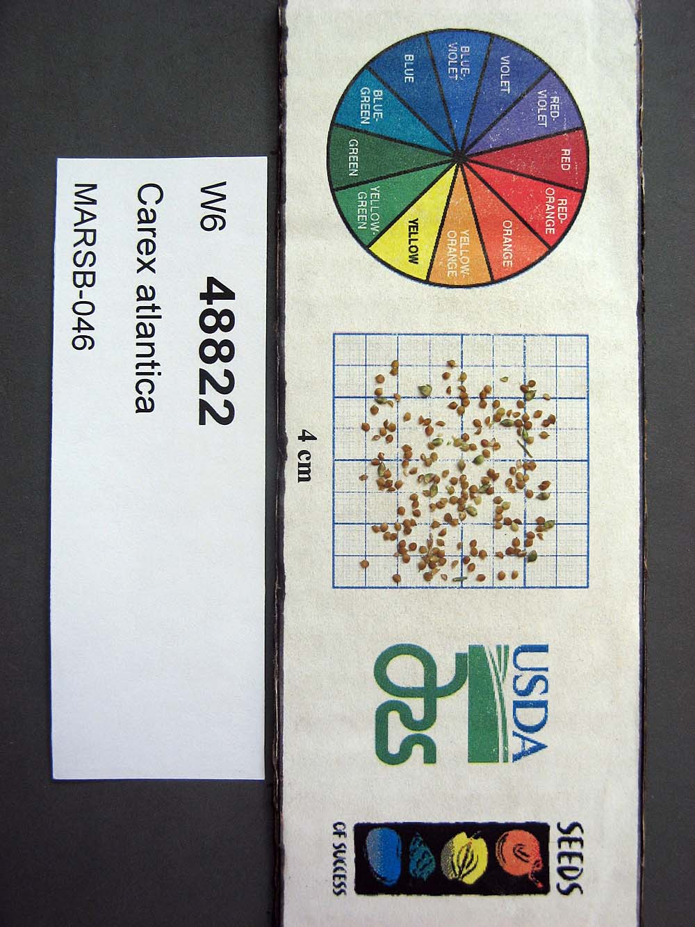 | | 2015 | | | | | | | Wild material | | 1922838 | W6 48822 |
| 45 | NA 81571 | (clear light pink) | Rhododendron austrinum (Small) Rehder | Florida, United States | NA | | | 2013 | COLLECTED | 03/31/2013 | White River approximately 1.1 miles north of the confluence with Buzzard�s Lake River in the Escambia River State Wildlife Management Area. | 30.60490000, -87.22261000 | 2 | Part shade along the river on a small sandy berm above the stream in mixed deciduous and broadleaved evergreen maritime forest occasionally inundated by tidal salt water. | Wild material | | 1952627 | NA 81571 |
| 46 | Ames 30087 | 3 | Cornus amomum Mill. | Maine, United States | NC7 |  | | 2009 | COLLECTED | NEAR 09/2009 | Damariscotta Lake, Nobleboro. | 44.14777778, -69.48000000 | 18 | Backwater area between dirt road and edge of water. | Wild material | | 1813034 | Ames 30087 |