| 0 | PI 688373 | V. stamineum VA-2018-031 FR 75 | Vaccinium stamineum L. | West Virginia, United States | COR | | | 2018 | COLLECTED | 08/25/2018 | Dolly Sods FR 75, Monongahela National Forest, Tucker Co. WV | 39.05760000, -79.28478300 | 908 | Open forest, south-facing rocky slope; oak, maple, black locust, hickory, dense understory of Gaylussacia baccata, Vaccinium angustifolium, partridge berry, grasses, moss, various weeds and herbs | Wild material | West Virginia 2018 | 1965648 | PI 688373 |
| 1 | PI 688379 | V. stamineum VA-2018-037 Seneca St Forest | Vaccinium stamineum L. | West Virginia, United States | COR |  | | 2018 | COLLECTED | 08/26/2018 | Hwy 28 to Thorny Mountain Road (Rt 11/2), Pocahontas Co. WV | 38.26423300, -79.98148300 | 767 | SW-facing slope on very steep roadside; hemlock, maple, oak, Kalmia, Vaccinium pallidum, V. stamineum | Wild material | West Virginia 2018 | 1965654 | PI 688379 |
| 2 | PI 657238 | V. stamineum HD-2007-069 | Vaccinium stamineum L. | Mississippi, United States | COR |  | | 2007 | COLLECTED | 06/09/2007 | Potts Camp, Marshall County, North bound off-ramp of US 78 and Bypass Road. | 34.65562000, -89.30115000 | 143 | In a Hickory-oak forest at the edge of abandoned field. Red clay soil. Associated with: Carya, Quercus nigra and Vaccinium arboreum. | Wild material | Kim Hummer, Michael Dossett collected from Mississippi. re-identification - leaves narrow lanceolate
| 1730132 | PI 657238 |
| 3 | PI 618172 | V. stamineum NC96-31-1 | Vaccinium stamineum L. | Alabama, United States | COR | | | 1997 | COLLECTED | | Roadsides and woods edges along county road 7 at Tick Hill Cemetary, 8 miles north of U.S. 29. | 31.92861000, -85.91361000 | 0 | Very dry sandy uplands (were topsoil remains). Much of the vegetation typical for the southern U.S. inner coastal plain. Quercus stellata var. margareta (running post oak) found on top of the hill. Ironstone layer in siol profile. | Wild material | Jim Ballington collection
| 1548792 | PI 618172 |
| 4 | PI 618173 | V. stamineum NC96-38-1 | Vaccinium stamineum L. | Alabama, United States | COR | | | 1997 | COLLECTED | | Chilton county road 24, 2.7 miles east of city road 37. | 32.72167000, -86.67139000 | 0 | Mostly dry uplands along roadsides and powerline right-of-way. Scattered V. stamineum and V. arboreum. | Wild material | Jim Ballington collection
| 1548793 | PI 618173 |
| 5 | PI 618155 | V. stamineum NC 95-8-3 | Vaccinium stamineum L. | South Carolina, United States | COR | | | 1995 | COLLECTED | 06/14/1995 | South Carolina, McCormick county, Modoc, Hamilton Branch State Park. | 33.75528000, -82.20361000 | 0 | Overgrown old fields in the piedmont - essentially all dry uplands - pine overstory. Roadside w/ R. flagellans, R. argutus, Potentilla canadensis fairly abundant. | Wild material | Jim Ballington and Jerry Payne collection
| 1508038 | PI 618155 |
| 6 | PI 618157 | V. stamineum NC 95-14-1 | Vaccinium stamineum L. | Mississippi, United States | COR | | | 1995 | COLLECTED | 07/07/1995 | Mississippi, Green county. Old River Road, 6 mi off Hwy 63 south, south of Leaksville. | 31.21139000, -89.15361000 | 0 | Sandy mixed woodland, mainly Quercus, along and unpaved field road. Scattered V. elliottii and crown-forming V. stamineum on the site. | Wild material | Jim Ballington and Jerry Payne collection
| 1508041 | PI 618157 |
| 7 | PI 618158 | V. stamineum NC 95-23-3 | Vaccinium stamineum L. | Mississippi, United States | COR | | | 1995 | COLLECTED | 07/14/1995 | Mississippi, Lafayette county, Holly Springs National Forest. FS Rd 841, 1.1 mi south of jct with city road 244 (244 turns off Hwy 7 between Oxford and Holly Springs). | 34.60694000, -88.20472000 | 0 | Open woodland in the National Forest, control-burned 3 yrs ago. Dry uplands. | Wild material | Jim Ballington and Jerry Payne collection
| 1508042 | PI 618158 |
| 8 | PI 555322 | NC 78-2 | Vaccinium stamineum L. | North Carolina, United States | COR | | | 1983 | COLLECTED | 1979 | Newton Grove, open cut-over pine and oak woodland | 35.25000000, -78.33333000 | | Newton Grove, open cut-over pine and oak woodland | Breeding material | Population collection of open pollinated seed | 1450294 | PI 555322 |
| 9 | PI 555323 | V. stamineum NC 78-8 | Vaccinium stamineum L. | South Carolina, United States | COR | | | 1983 | COLLECTED | 11/25/1978 | Lexington, open xeric woodland and old field | 34.00000000, -81.16667000 | | Lexington, open xeric woodland and old field | Breeding material | Jim Ballington collection
| 1450295 | PI 555323 |
| 10 | PI 555324 | Common Deerberry | Vaccinium stamineum L. | North Carolina, United States | COR | | | 1983 | COLLECTED | 09/16/1980 | Jackson Co, dry upland woods | 35.33333000, -83.16667000 | | Jackson Co, dry upland woods | Breeding material | Select clone, about 1 m tall, large reddish-subglaucous frt | 1450296 | PI 555324 |
| 11 | NA 88625 | KY23-028 | Vaccinium stamineum L. | Kentucky, United States | NA | | | 2023 | COLLECTED | 09/10/2023 | The Gulf - Natural Arch Scenic Area Panoramic Trail. | 36.84384000, -84.52836000 | 395 | Ridgeline, trailside, near trailhead / parking lot, Panoramic Trail at Natural Arch Scenic Area ('The Gulf'). Elevation: 1295 feet. Aspect: South. | Wild material | Initial identification: Vaccinium corymbosum aff.; in situ this collection was far hairier than typical V. stamineum, but still within the description for the species. | 2158717 | NA 88625 |
| 12 | NA 89271 | TJK2023FL-009 | Vaccinium stamineum L. | Florida, United States | NA | | | 2023 | COLLECTED | 07/16/2023 | Eglin Air Force Base: Weaver Creek area west of Highway 87, north of Choctaw Nolf Airfield Road (Escrobano Point). | 30.50710000, -86.91220000 | 33 | Xeric oak-pine uplands above Weaver Creek Bayhead. Slope: 5%. Aspect: Northwest. Elevation recorded as 107 feet. | Wild material | WLPGR contract collection. | 2158254 | NA 89271 |
| 13 | PI 688387 | V. corymbosum VA-2018-045 MLBS | Vaccinium corymbosum L. | Virginia, United States | COR |  | | 2018 | COLLECTED | 08/27/2018 | Mountain Lake Biological Research Station, Hedwig trail, Jefferson National Forest, Giles Co., VA | 37.37726700, -80.51816700 | 1154 | semi-open hardwood forest; maple, oak, birch, ferns, Vaccinium palllidum, V. angustifolium, dwarf V. stamineum, Gaultheria procumbens, Galax, herbs, ferns, mosses, lichens | Wild material | West Virginia 2018 | 1965662 | PI 688387 |
| 14 | PI 688388 | V. erythrocarpum VA-2018-046 MLBS | Vaccinium erythrocarpum Michx. subsp. erythrocarpum | Virginia, United States | COR | | | 2018 | COLLECTED | 08/27/2018 | Mountain Lake Biological Research Station, Hedwig trail between Crazy Rocks and intersection with Spruce Bog trail, Jefferson National Forest, Giles Co., VA | 37.37753300, -80.51725000 | 1154 | semi-open hardwood forest; maple, oak, birch, ferns, Vaccinium palllidum, V. angustifolium, dwarf V. stamineum, Gaultheria procumbens, Galax, herbs, ferns, mosses, lichens | Wild material | Virginia 2018 | 1965663 | PI 688388 |
| 15 | PI 657235 | V. pallidum Scenic HWY HD 2007-59 | Vaccinium pallidum Aiton | Alabama, United States | COR | 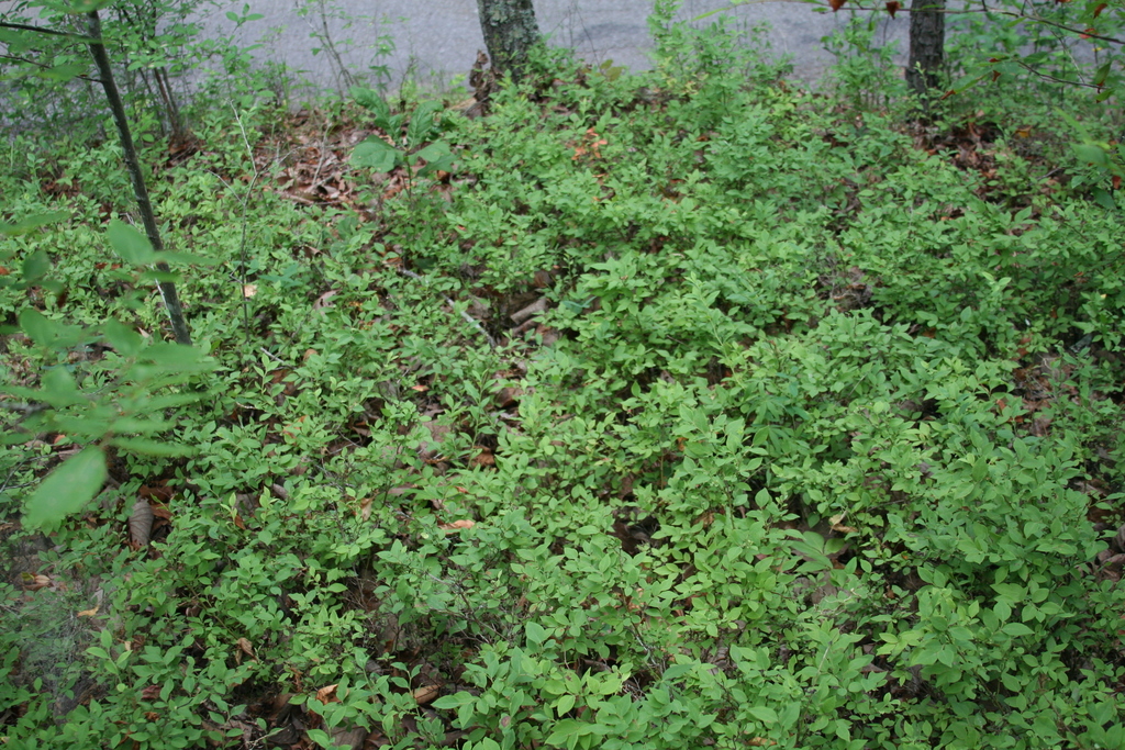 | | 2007 | COLLECTED | 06/08/2007 | East of Keener, Etwah County, Keener Gap. Woods at intersection of Keener Gap Road and Scenic Highway. On ridge above road. | 34.15484000, -85.93371000 | 300 | Soil sandy brown red limestone, with a layer of oak-hickory leaf duff on top. Associated with: Carya, Quercus nigra, Vaccinium stamineum, Liriodendron tulipifera, Liquidambar styraciflua and Acer rubrum. | Wild material | Kim Hummer, Michael Dossett collected from Alabama.
| 1730127 | PI 657235 |
| 16 | PI 657236 | V. corymbosum Mentone Seed | Vaccinium corymbosum L. | Alabama, United States | COR | 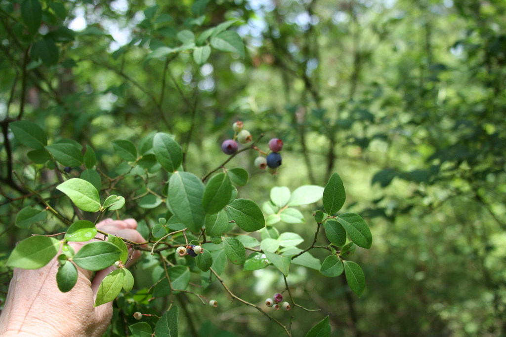 | | 2007 | COLLECTED | 06/08/2007 | Mentone, Dekalb County, off Linchpney Road. | 34.57729000, -85.59305000 | 523 | Open hickory-oak woods, oak leaf duff on top of red-brown clay. Associated with: Carya, Quercus nigra, Liriodendron tulipifera, Acer rubrum and Vaccinium stamineum (glabrous dark green leaf form). | Wild material | Kim Hummer, Michael Dossett collected from Alabama.
| 1730129 | PI 657236 |
| 17 | PI 657242 | V. simulatum Mentone HDF 2007-62B | Vaccinium simulatum Small | Alabama, United States | COR | | | 2007 | COLLECTED | | Mentone, Dekalb County, off Linchpney Road. | 34.57729000, -85.59305000 | 523 | Open hickory-oak woods, oak leaf duff on top of red-brown clay. Associated with: Carya, Quercus nigra, Liriodendron tulipifera, Acer rubrum and Vaccinium stamineum (glabrous dark green leaf form). | Wild material | Kim Hummer, Michael Dossett collected from Alabama.
| 1753281 | PI 657242 |
| 18 | PI 657206 | V. darrowii HL-2006-056 | Vaccinium darrowii Camp | Florida, United States | COR |  | | 2006 | COLLECTED | 05/27/2006 | Ocala National Forest, south of highway 40 on route 19 and westward on NFS 595 to Farles Prairie Campground. | 29.10500000, -81.67552000 | 20 | Associated with Vaccinium stamineum. | Wild material | Collected by Kim Hummer and Paul Lyrene
| 1702659 | PI 657206 |
| 19 | PI 638760 | V. arboreum | Vaccinium arboreum Marshall | Missouri, United States | COR | | | 1993 | COLLECTED | 10/1992 | T36N, R2E, Sec 9, E 1/2 (along east side of road) Site just north of Belgrade, Missouri, Washington County. | 37.00000000, -90.00000000 | 0 | As understory plants with Vaccinium stamineum and V. vacillans. Cornus florida present as understory tree. Highly orgnaic duff layer. Plants straggly and not in their prime due to poor light penetration. | Wild material | Fruits ripen at this site from late August until a hard freeze. Green fruits have been seen late October. Plants show only shrub habit. Fruiting plants typically approximately 1.2 m tall. Foliage glossy and dark green. Fruit glossy and black, about 0.6 cm in diameter. No visible winter injury or insect damage. Minimal disease problems: Ophiodothella spp., which doesn't appear to affect the plant; some fruit appeared to have mummyberry (Monilinia spp.). For best germination of dry seed, Ballington (NC State) and Lyrene (U. of Florida) suggest soaking the seeds for 24 hrs. in 500ppm GA4+7 prior to germination. | 1011314 | PI 638760 |
| 20 | PI 638761 | V. arboreum | Vaccinium arboreum Marshall | Missouri, United States | COR | | | 1993 | COLLECTED | 10/1992 | T29N, R3W, SW 1/4, NW 1/4. Near Two Rivers State Park at junction Current River and Jacks Fork, Shannon County, MO | 36.00000000, -91.00000000 | 0 | Site is a series of falls and pools surrounded by cliffs. Population was growing from the top of the exposed rock, down the cliffs in crevices, and to the stream bed; ca 25 m. V. arboreum and V. stamineum dominant are woody shrubs here. | Wild material | Fruit ripens on this plant from late August until a hard freeze. Green fruits have been seen late October. Fruiting plants from 1.5-2.4 m tall. Foliage glossy and dark green. Fruit ranging from dark blue to black, 0.4-0.8 cm in diameter. Location in crevices suggests drought tolerance. No visible winter injury or insect damage. Minimal disease problems: Ophiodothella spp., which doesn't appear to affect the plant; some fruit appeared to have mummyberry (Monilinia spp.). For best germination of dry seed, Ballington (NC State) and Lyrene (U. of Florida) suggest soaking the seeds for 24 hrs. in 500ppm GA4+7 prior to germination. | 1011317 | PI 638761 |
| 21 | PI 613193 | F2 V. stamineum x V. vitis-idaea | Vaccinium hybr. | New Hampshire, United States | COR | | | 1992 | DEVELOPED | | | | | | Breeding material | Must be cross-pollenated to set seed E. Meader made this backcross because he wanted to make a red fruited cranberry he could pick from a bush the way blueberries are picked. He chose deerberry (Vaccinium stamineum) because it was diploid and would cross readily with V. vitis-idaea, the red fruited mountain cranberry, also called the lingonberry. Then he backcrossed the F1 to V. vitis-idaea. - notes from Kim Hummer's trip to New Hampshire in 1991.
Elwin Meader selection
| 1011286 | PI 613193 |
| 22 | NA 89269 | TJK2023FL-007 | Vaccinium darrowii Camp | Florida, United States | NA | | | 2023 | COLLECTED | 06/10/2023 | Blackwater State Forest: Wolfe Creek. | 30.80560000, -86.95770000 | 60 | Beautiful xeric pine-oak upland community. Transitions to mesic slopes and then to seepage bottom, stringer wetland community adjacent to the Wolfe Creek. Area is on a regular 2-4[-year] burn cycle. Slope: 2%. Aspect: West-northwest. Elevation recorded as 197 feet. | Wild material | WLPGR contract collection. | 2158252 | NA 89269 |
| 23 | PI 643962 | R. trivialiis HL-2006-001 | Rubus trivialis Michx. | Florida, United States | COR |  | | 2006 | COLLECTED | 05/22/2006 | 65 miles east of Tallahassee, Florida; rest area pull off on Interstate 10 W. Between Suwannee River and Madison, near Twin Rivers State Forest. Scatered throughout, around perimeter of wooded walking area near parking. | 30.36910000, -83.24517000 | 21 | Sandy soil, under loblolly pine forest. Associated with Vaccinium arboreum, Vaccinium stamineum, Vitis, poison ivy (Rhus). Plants plentiful where light came through wooded area. | Wild material | | 1702609 | PI 643962 |
| 24 | PI 616828 | F. virginiana subsp. virginiana NC 96-43-2 | Fragaria virginiana Mill. subsp. virginiana | South Carolina, United States | COR | | Out of Season | 1996 | COLLECTED | 07/19/1996 | Both roadsides along SC 34, 2.8 miles east of Chappells , Newberry county, South Carolina. | 34.20111000, -81.82528000 | | Gray sandy loam soil. Strawberries growing with competitive grasses, honeysuckle, Virginia creeper and poison ivy. Wild rose also growing with 2 of 3 colonies collected. Scattered Vaccinium stamineum and V. arboreum on drier areas of site | Wild material | USDA Sponsored plant collecting expedition, 1996 | 1535621 | PI 616828 |
| 25 | PI 616829 | F. virginiana subsp. virginiana NC 96-43-3 | Fragaria virginiana Mill. subsp. virginiana | South Carolina, United States | COR | | Out of Season | 1996 | COLLECTED | 07/19/1996 | Both roadsides along SC 34, 2.8 miles east of Chappells , Newberry county, South Carolina. | 34.20111000, -81.82528000 | | Gray sandy loam soil. Strawberries growing with competitive grasses, honeysuckle, Virginia creeper and poison ivy. Wild rose also growing with 2 of 3 colonies collected. Scattered Vaccinium stamineum and V. arboreum on drier areas of site | Wild material | USDA Sponsored plant collecting expedition, 1996 | 1535622 | PI 616829 |
| 26 | PI 616841 | F. virginiana subsp. virginiana NC 96-49-1 | Fragaria virginiana Mill. subsp. virginiana | South Carolina, United States | COR | | Out of Season | 1996 | COLLECTED | 07/21/1996 | Roadside on the right above Camp Creek, 1.2 miles down SC 97 , east of the junction with SC 200, on the east side of the Catawba River Bridge. | 34.58833000, -80.86944000 | | Growing in part shade on the dry shoulder of the road. Occasional Vaccinium arboreum, V. elliottii and V. stamineum occurred on top of roadbanks and in dry woods. | Wild material | USDA Sponsored plant collecting expedition, 1996 | 1535635 | PI 616841 |
| 27 | NA 89115 | TLM25-04a | Hamamelis ovalis S. W. Leonard | Texas, United States | NA | | | 2025 | COLLECTED | 07/10/2025 | State Highway 87 approximately 3.25 kilometers north of the crossroad junction with Texas Recreational Road 255 (RE 255); plants were growing in the narrow buffer woods along the east side of the highway. | 31.12051300, -93.72628100 | 138 | The habitat is an upland mixed coniferous and deciduous woodlands in part to full shade and dry conditions, often under drought stress. Plants seem to always occur on the top of dry ridges or well-drained slopes. Slope: 0 to 1 percent. Aspect: N/A. Soils: The soils of this collection area are classified as Tehran-Letney Association, hilly (TLE) soils. The Tehran Series (55%) consists of deep, somewhat excessively drained, moderately rapidly permeable soils on uplands. They formed in thick loamy and sandy sediments on the Western Coastal Plain. These soils are on gently sloping to moderately steep uplands with slopes ranging from 1 to 20 percent. The Letney Series (30%) consists of deep, well drained, moderately rapidly permeable, upland soils. They formed in thick sandy and loamy sediments of the coastal plains. These soils are on gently sloping to moderately steep uplands with slopes ranging from 1 to 20 percent. Soil pH ranges from 4.5 to 6.0. The minor soil components include Doucette Series (10%) and Boykin Series (5%) soils. (Source: California Soil Resource Lab/NRCS Official Soil Series Descriptions). Geology: The underlying geology of this area is of Oligocene origin and characterized as Catahoula Formation. This formation is extensive and deep in Texas, up to 185 meters thick. In the area of the collection the Catahoula Formation is primarily mudstone and sand. The upper 90-150 meters is mudstone that is tuffaceous, and sandy; also, occasionally, with some bentonitic clay. (Source: USGS Texas Geologic Map Data). | Wild material | | 2191654 | NA 89115 |
| 28 | NA 89080 | 2024RJLPA-006 | Ilex montana Torr. & A. Gray | Pennsylvania, United States | NA | | | 2024 | COLLECTED | 09/20/2024 | Berks and Schuylkill Counties: Hawk Mountain Sanctuary. | 40.64162200, -75.99122600 | 418 | Plants are growing from shade to full sun on a dry-mesic to very dry, well-drained upland/montane habitat characterized by an upland mixed deciduous and evergreen forest that is very rocky. All the plants found in this habitat go through periods of drought during the growing season due to the limited litter/soil layer in which moisture can be held. Elevation: 405 to 430 meters. Slope: 5 to 25 percent. Aspect: various. Geology: The underlying geology of this area is of Silurian origin and comprised of Shawangunk Formation. This formation is primarily light- to dark-gray, fine- to very coarse-grained sandstone and conglomerate containing thin shale interbeds. (Source: USGS Pennsylvania Geologic Map Data). Soils: The surface soil profile of this area is characterized as the Hazleton Series which consists of deep and very deep, well drained soils formed in residuum of acid gray, brown or red sandstone on uplands. The matrix includes a considerable accumulation of thin, flat, coarse fragments of sandstone, limestone, or schist with diameters up to 15 cm. Slope ranges from 0-80%. Permeability is moderately rapid to rapid. (Source: USDA-NRCS Official Soil Series Descriptions). EPA Ecoregion (Level III): Ridge and Valley (67). EPA Ecoregion (Level IV): Northern Sandstone Ridges (67c). | Wild material | | 2169044 | NA 89080 |
| 29 | NA 89081 | 2024RJLPA-009 | Rosa carolina L. | Pennsylvania, United States | NA | | | 2024 | COLLECTED | 09/22/2024 | Lancaster and York Counties: outcrops along the Susquehanna River, accessed from the Historic Lock 12 parking lot off of Pennsylvania Road 372. | 39.81483500, -76.32762200 | 34 | Plants are growing from part-sun to full sun in crevices of the outcrops and where organic debris has accumulated in between boulders along the Susquehanna River. The sites range from nearly xeric to dry mesic, at least on the surface. Plants are generally growing 4-10 m above the normal flow of the river; however, the Holtwood Dam is less than 1 kilometer upstream and debris found trapped in the boulders indicates that there is periodic flooding, at least, in the lower zone of 4+ meters or so above normal river flow. This habitat has a diverse assemblage of deciduous trees and shrubs as well as abundant herbaceous taxa. Slope: 0 to 60 percent. Aspect: Northeast (generally). Geology: The underlying geology of this area is probably of lower Paleozoic age and characterized as the Octoraro Formation. It includes albite-chlorite schist, phyllite, some hornblende gneiss, and granitized members. Soils: The area where this species occurs is right on the edge of two soil zones that transition from the river’s edge to mesic conditions upslope. The first is generally referred to as Rock Outcrop. This terrestrial matrix in which plants grow is largely exposed underlying rock geology with accumulated outwash, rock decomposition, and organic debris buildup. The second is Mt. Airy (80%) and Manor (20%) Series soils, 25 to 60 percent slopes, extremely stony (MRF). (Source: California Soil Resource Lab/NRCS Official Soil Series Descriptions). EPA Ecoregion (Level III): Northern Piedmont (64). EPA Ecoregion (Level IV): Piedmont Uplands (64c). | Wild material | | 2169045 | NA 89081 |
| 30 | NA 89082 | 2024RJLPA-010 | Amorpha fruticosa L. | Pennsylvania, United States | NA | | | 2024 | COLLECTED | 09/22/2024 | Outcrops along the Susquehanna River, accessed from the Historic Lock 12 parking lot off of Pennsylvania Road 372. | 39.81481500, -76.32757900 | 34 | Plants are growing from part-sun to full sun in crevices of the outcrops and where organic debris has accumulated in between boulders along the Susquehanna River. The sites range from nearly xeric to dry mesic, at least on the surface. Plants are generally growing 4-10 m above the normal flow of the river; however, the Holtwood Dam is less than 1 kilometer upstream and debris found trapped in the boulders indicates that there is periodic flooding, at least, in the lower zone of 4+ meters or so above normal river flow. This habitat has a diverse assemblage of deciduous trees and shrubs as well as abundant herbaceous taxa. Slope: 0 to 25 percent. Aspect: Northeast (generally). Geology: The underlying geology of this area is probably of lower Paleozoic age and characterized as the Octoraro Formation. It includes albite-chlorite schist, phyllite, some hornblende gneiss, and granitized members. Soils: The area where this species occurs is right on the edge of two soil zones that transition from the river’s edge to mesic conditions upslope. The first is generally referred to as Rock Outcrop. This terrestrial matrix in which plants grow is largely exposed underlying rock geology with accumulated outwash, rock decomposition, and organic debris buildup. The second is Mt. Airy (80%) and Manor (20%) Series soils, 25 to 60 percent slopes, extremely stony (MRF). (Source: California Soil Resource Lab/NRCS Official Soil Series Descriptions). EPA Ecoregion (Level III): Northern Piedmont (64). EPA Ecoregion (Level IV): Piedmont Uplands (64c). | Wild material | | 2169046 | NA 89082 |
| 31 | NA 89083 | 2024RJLPA-012 | Rhododendron periclymenoides (Michx.) Shinners | Pennsylvania, United States | NA | | | 2024 | COLLECTED | 09/22/2024 | Outcrops along the Susquehanna River, accessed from the Historic Lock 12 parking lot off of Pennsylvania Road 372. | 39.81477400, -76.32807300 | 35 | Plants are growing from shade to part-sun and occasionally full sun in crevices of the outcrops and where organic debris has accumulated in between boulders along the Susquehanna River. The sites range from nearly xeric to mesic, at least on the surface. Plants are generally growing 4-10 m above the normal flow of the river; however, the Holtwood Dam is less than 1 kilometer upstream and debris found trapped in the boulders indicates that there is periodic flooding, at least, in the lower zone of 4+ meters or so above normal river flow. This habitat has a diverse assemblage of deciduous trees and shrubs as well as abundant herbaceous taxa. Slope: 0 to 60 percent. Aspect: Northeast (generally). Geology: The underlying geology of this area is probably of lower Paleozoic age and characterized as the Octoraro Formation. It includes albite-chlorite schist, phyllite, some hornblende gneiss, and granitized members. Soils: The area where this species occurs is right on the edge of two soil zones that transition from the river’s edge to mesic conditions upslope. The first is generally referred to as Rock Outcrop. This terrestrial matrix in which plants grow is largely exposed underlying rock geology with accumulated outwash, rock decomposition, and organic debris buildup. The second is Mt. Airy (80%) and Manor (20%) Series soils, 25 to 60 percent slopes, extremely stony (MRF). (Source: California Soil Resource Lab/NRCS Official Soil Series Descriptions). EPA Ecoregion (Level III): Northern Piedmont (64). EPA Ecoregion (Level IV): Piedmont Uplands (64c). | Wild material | | 2169047 | NA 89083 |
| 32 | NA 89084 | 2024RJLPA-013 | Physocarpus opulifolius (L.) Maxim. | Pennsylvania, United States | NA | | | 2024 | COLLECTED | 09/22/2024 | Outcrops along the Susquehanna River, accessed from the Historic Lock 12 parking lot off of Pennsylvania Road 372. | 39.81466300, -76.32833900 | 36 | Plants are growing from shade to part-sun where organic debris has accumulated in between boulders as well as further upslope in deeper mesic soils along the Susquehanna River. This habitat has a diverse assemblage of deciduous trees and shrubs as well as abundant herbaceous taxa. Slope: 10 to 25 percent. Aspect: Northeast (generally). Geology: The underlying geology of this area is probably of lower Paleozoic age and characterized as the Octoraro Formation. It includes albite-chlorite schist, phyllite, some hornblende gneiss, and granitized members. Soils: The area where this species occurs is right on the edge of two soil zones that transition from the river’s edge to mesic conditions upslope. The first is generally referred to as Rock Outcrop. This terrestrial matrix in which plants grow is largely exposed underlying rock geology with accumulated outwash, rock decomposition, and organic debris buildup. The second is Mt. Airy (80%) and Manor (20%) Series soils, 25 to 60 percent slopes, extremely stony (MRF). (Source: California Soil Resource Lab/NRCS Official Soil Series Descriptions). EPA Ecoregion (Level III): Northern Piedmont (64). EPA Ecoregion (Level IV): Piedmont Uplands (64c). | Wild material | | 2169048 | NA 89084 |
| 33 | NA 89085 | 2024RJLPA-014 | Rhododendron arborescens (Pursh) Torr. | Pennsylvania, United States | NA | | | 2024 | COLLECTED | 09/22/2024 | Outcrops along the Susquehanna River, accessed from the Historic Lock 12 parking lot off of Pennsylvania Road 372. | 39.81618100, -76.33069800 | 38 | Plants are growing from shade to part-sun and occasionally full sun in crevices of the outcrops and where organic debris has accumulated in between boulders along the Susquehanna River. The sites range from nearly xeric to mesic, at least on the surface. Plants are generally growing 4-10 m above the normal flow of the river; however, the Holtwood Dam is less than 1 kilometer upstream and debris found trapped in the boulders indicates that there is periodic flooding, at least, in the lower zone of 4+ meters or so above normal river flow. This habitat has a diverse assemblage of deciduous trees and shrubs as well as abundant herbaceous taxa. Slope: 0 to 75 percent. Aspect: Northeast (generally). Geology: The underlying geology of this area is probably of lower Paleozoic age and characterized as the Octoraro Formation. It includes albite-chlorite schist, phyllite, some hornblende gneiss, and granitized members. Soils: The area where this species occurs is right on the edge of two soil zones that transition from the river’s edge to mesic conditions upslope. The first is generally referred to as Rock Outcrop. This terrestrial matrix in which plants grow is largely exposed underlying rock geology with accumulated outwash, rock decomposition, and organic debris buildup. The second is Mt. Airy (80%) and Manor (20%) Series soils, 25 to 60 percent slopes, extremely stony (MRF). (Source: California Soil Resource Lab/NRCS Official Soil Series Descriptions). EPA Ecoregion (Level III): Northern Piedmont (64). EPA Ecoregion (Level IV): Piedmont Uplands (64c). | Wild material | | 2169049 | NA 89085 |
| 34 | NA 89086 | 2024RJLPA-015 | Ilex verticillata (L.) A. Gray | Pennsylvania, United States | NA | | | 2024 | COLLECTED | 09/22/2024 | Outcrops along the Susquehanna River, accessed from the Historic Lock 12 parking lot off of Pennsylvania Road 372. | 39.81656600, -76.33136600 | 38 | Plants are growing from part-sun to full sun in crevices of the outcrops and where organic debris has accumulated in between boulders along the Susquehanna River. The sites range from nearly xeric to dry mesic, at least on the surface. Plants are generally growing 4-10 m above the normal flow of the river; however, the Holtwood Dam is less than 1 kilometer upstream and debris found trapped in the boulders indicates that there is periodic flooding, at least, in the lower zone of 4+ meters or so above normal river flow. This habitat has a diverse assemblage of deciduous trees and shrubs as well as abundant herbaceous taxa. Slope: 0 to 10 percent. Aspect: Northeast (generally). Geology: The underlying geology of this area is probably of lower Paleozoic age and characterized as the Octoraro Formation. It includes albite-chlorite schist, phyllite, some hornblende gneiss, and granitized members. Soils: The area where this species occurs is right on the edge of two soil zones that transition from the river’s edge to mesic conditions upslope. The first is generally referred to as Rock Outcrop. This terrestrial matrix in which plants grow is largely exposed underlying rock geology with accumulated outwash, rock decomposition, and organic debris buildup. The second is Mt. Airy (80%) and Manor (20%) Series soils, 25 to 60 percent slopes, extremely stony (MRF). (Source: California Soil Resource Lab/NRCS Official Soil Series Descriptions). EPA Ecoregion (Level III): Northern Piedmont (64). EPA Ecoregion (Level IV): Piedmont Uplands (64c). | Wild material | | 2169050 | NA 89086 |
| 35 | NA 88680 | RJL2023PA-014 | Kalmia latifolia L. | Pennsylvania, United States | NA | | | 2023 | COLLECTED | 10/30/2023 | West side of Pennsylvania Route 487 within the boundary of Ricketts Glen State Park. | 41.31733100, -76.30259500 | 699 | Growing in dense thickets in well-drained habitat in a mixed evergreen and deciduous woodland on shallow to moderate slopes. Slope: 3-8%. Aspect: various. The underlying geology of this area is of Mississippian and Devonian origin and characterized as the Huntley Mountain Formation. It is comprised of greenish-gray and light-olive-gray, flaggy, fine-grained sandstone, siltstone, and a few red shale interbeds; includes lower "Pocono" plus "Oswayo" of earlier workers. This formation forms a transition between Catskill Formation and Burgoon Sandstone. (Source: USGS Pennsylvania Geologic Map Data). The primary soil type in the collection area is classified as Oquaga and Lordstown Series. The Oquaga Series consists of moderately deep, somewhat excessively drained and well drained soils formed in a thin mantle of till over sandstone, siltstone, and shale bedrock on nearly level to very steep uplands. Slope ranges from 0 to 70 percent. Depth to bedrock ranges from 50 to 100 cm. Content of rock fragments ranges from 15 to 60 percent in surface horizons and from 25 to 70 percent in the subsoil, and 25 to 85 percent in the substratum. Soil reaction ranges from extremely acid to moderately acid. The Lordstown series consists of moderately deep, well drained soils formed in till and cryoturbated material derived from siltstone and sandstone on bedrock-controlled landforms of glaciated dissected plateaus. They are nearly level to very steep soils on hillsides and hilltops in glaciated bedrock-controlled uplands. Slope ranges from 0 to 90 percent. Thickness of solum and depth to bedrock ranges from 51 to 102 cm. Rock fragments are dominantly flat angular fragments and flagstones and occupy 10 to 35 percent of the volume in the Ap horizon and 20 to 60 percent in the B and C horizons. Reaction is very strongly acid through neutral in the surface layer, very strongly acid to moderately acid in the subsoil and strongly acid or moderately acid in the substratum. (Source: NRCS Web Soil Survey). | Wild material | | 2159071 | NA 88680 |
| 36 | NA 88667 | RJL2023PA-004 | Viburnum acerifolium L. | Pennsylvania, United States | NA | | | 2023 | | | | | | | Wild material | | 2158816 | NA 88667 |
| 37 | NA 88666 | RJL2023PA-003 | Hamamelis virginiana L. | Pennsylvania, United States | NA | | | 2023 | COLLECTED | 10/01/2023 | Collected primarily along the woodland edge along Northside Road on Pennsylvania State Gamelands No. 43 as well as a few on nearby roads. | 40.17974200, -75.76790700 | 176 | Plants were growing in mesic well-drained conditions on moderately sloping sites of a deciduous upland forest. This species grows well in shade to part-sun. Most abundant fruit development is found where plants are exposed to sunlight for a portion of the day. Slope: 15%. Aspect: North-northwest. The underlying geology of this area is of Precambrian origin and characterized as the Graphitic Felsic Gneiss. This includes Pickering Gneiss and small areas of marble; dominantly quartz and feldspar with varying amounts of graphite and various metamorphic minerals; medium grained, light to dark gray and greenish gray; sedimentary origin. (Source: USGS Pennsylvania Geologic Map Data.) The primary soil type in the area of this collection is classified as Gladstone Gravelly Loam Series (8 to 15 percent slopes). The Gladstone Series consists of very deep, well drained soils formed in residuum and colluvium from granitic gneiss. Saturated hydraulic conductivity is moderately high to high. Solum thickness ranges from 75 to 125 cm. Depth to granitic gneiss bedrock is 1.6 meters or more. The bedrock may be strongly weathered in the upper part. Gravel content ranges from 5 to 35 percent throughout the solum, and 10 to 40 percent in the C horizons. Fragments, larger than 3 inches in diameter, range from 0 to 20 percent by volume in the surface layer and 0 to 10 percent in the subsoil and substratum layers. Reaction is strongly or very strongly acid throughout the soil, unless limed. Areas that have been limed range to moderately acid in the upper part of the profile. (Source: NRCS Web Soil Survey.) | Wild material | | 2158815 | NA 88666 |
| 38 | NA 88664 | RJL2023PA-001 | Viburnum acerifolium L. | Pennsylvania, United States | NA | | | 2023 | COLLECTED | 10/01/2023 | Seed collected from plants growing along a two-mile stretch of Harmonyville Road on the woodland edge next to the road. [Note: latitude and longitude were collected at the location of the largest seed collection.] | 40.18482200, -75.78145100 | 158 | Plants were growing in well-drained and rocky mesic-dry woodlands from part shade along the road edge to full shade in the understory of the woodlands. Slope: 2-10%. Aspect: Variable. The underlying geology of this area is of Triassic origin and characterized as the Stockton Formation. It is characterized by light-gray to buff, coarse-grained, arkosic sandstone; includes reddish-brown to grayish-purple sandstone, siltstone, and mudstone. (Source: USGS Pennsylvania Geologic Map Data.) The primary soil type in the area of this collection is classified as Edgemont Channery Sandy Loam Series (8 to 25 percent slopes), extremely stony. The Edgemont Series consists of deep and very deep, well drained soils formed in the weathered residuum of quartzitic rocks. They have moderately high to high saturated hydraulic conductivity. Slopes range from 0 to 70 percent. Solum thickness ranges from 50 to 10 cm. Depth to bedrock ranges from about 1.5 to 2.2 meters. Kaolinite is the dominant mineral in the clay fraction with detectable amounts of illite, vermiculite, montmorillonite, chlorite and interstratified clays. Gravel, channers, and stone size fragments of quartzite and quartz are present throughout the profile. Rock fragments range from 5 to 40 percent in the horizons of the solum and from 10 to 90 percent in the C horizon. Reaction ranges from extremely acid to strongly acid throughout. (Source: NRCS Web Soil Survey.) | Wild material | | 2158813 | NA 88664 |
| 39 | NA 89264 | TJK2023FL-002 | Gaylussacia frondosa (L.) Torr. & A. Gray var. nana A. Gray | Florida, United States | NA | | | 2023 | COLLECTED | 05/19/2023 | Blackwater State Forest: Wolfe Creek. | 30.80760000, -86.96250000 | 49 | Beautiful xeric pine-oak upland community. Transitions to mesic slopes and then to seepage bottom, stringer wetland community adjacent to the Wolfe Creek. Area is on a regular 2-4[-year] burn cycle. Slope: 5%. Aspect: Northwest. Elevation recorded as 161 feet. | Wild material | WLPGR contract collection. Received as Gaylussacia tomentosa (nana). | 2158247 | NA 89264 |
| 40 | NA 89265 | TJK2023FL-003 | Ceanothus sp. | Florida, United States | NA | | | 2023 | COLLECTED | 05/19/2023 | Blackwater State Forest: Wolfe Creek. | 30.80650000, -86.95840000 | 49 | Beautiful xeric pine-oak upland community. Transitions to mesic slopes and then to seepage bottom, stringer wetland community adjacent to the Wolfe Creek. Slope: 20%. Aspect: Northwest. Elevation recorded as 162 feet. | Wild material | WLPGR contract collection. Received as Ceanothus microphyllus. | 2158248 | NA 89265 |
| 41 | NA 89266 | TJK2023FL-004 | Gaylussacia dumosa (Andrews) Torr. & A. Gray | Florida, United States | NA | | | 2023 | COLLECTED | 05/31/2023 | Blackwater State Forest: Wolfe Creek. | 30.80560000, -86.95890000 | 49 | Beautiful xeric pine-oak upland community. Transitions to mesic slopes and then to seepage bottom, stringer wetland community adjacent to the Wolfe Creek. Slope: 15%. Aspect: Northwest. Elevation recorded as 160 feet. | Wild material | WLPGR contract collection. | 2158249 | NA 89266 |
| 42 | NA 89267 | TJK2023FL-005 | Ceanothus americanus L. | Florida, United States | NA | | | 2023 | COLLECTED | 06/10/2023 | Blackwater State Forest: Wolfe Creek. | 30.80760000, -86.96250000 | 49 | Beautiful xeric pine-oak upland community. Transitions to mesic slopes and then to seepage bottom, stringer wetland community adjacent to the Wolfe Creek. Area is on a regular 2-4[-year] burn cycle. Slope: 5%. Aspect: Northwest. Elevation recorded as 161 feet. | Wild material | WLPGR contract collection. | 2158250 | NA 89267 |
| 43 | NA 88576 | RJLSEUS2022-049 | Rhododendron atlanticum (Ashe) Rehder | South Carolina, United States | NA | | | 2023 | COLLECTED | 12/16/2022 | Plants growing in mixed evergreen and deciduous woods on the east side of Ip Canal Road approximately 0.33 kilometers south of Pleasant Hill Drive (Georgetown County Road 251). Frequent at this location. | 33.63226900, -79.25831700 | 8 | Plants are growing in part-shade to shade of a dry to periodically moist mesic woodland. Given some of the plant associates, there may be an impermeable subsurface soil layer to add moisture availability.
Soils: The underlying geology of this area is of Pleistocene origin and characterized as Socastee Formation. This is a low coastal formation in the Carolinas like Penholoway but younger and lower in altitude. The Socastee Formation lies seaward of the Penholoway and Canepatch Formations and is the next younger surficial unit. It is exposed in a belt approximately 25 km wide at elevations between 9 and 15 m above sea level. It is described as variegated quartzose sands, argillaceous sands, and clays, 5 m thick at the type section near Socastee Swamp. Unconformably overlies Canepatch Formation; unconformably underlies Waiter Island Formation and Ocean Forest Peat.
Source: USGS Texas Geologic Map Data (https://mrdata.usgs.gov/geology/state/sgmc-unit.php?unit=SCQso%3B1)
The primary soil type in the collection area is classified as Centenary Fine Sand. The Centenary Fine Sand Series consists of deep, well drained or somewhat excessively drained single-grained sand that is loose and moderately acid. The upper layer ranges from 7.5cm to 25cm thick. Deeper layers vary in percentage of single-grained sands and clay.
Source: NRCS Web Soil Survey (https://websoilsurvey.sc.egov.usda.gov/App/WebSoilSurvey.aspx) | Wild material | | 2140794 | NA 88576 |
| 44 | NA 88481 | RJL2022MD-002 | Kalmia latifolia L. | Maryland, United States | NA | | | 2022 | COLLECTED | 09/04/2022 | Plants growing at Elkton State Forest along roads and woodlands over a distance of approximately 5 kilometers labelled as the address of 717 Irishtown Rd, North East, MD 21901. Kalmia is very common along the unnamed gravel road as well as the understory of the upland woodlands. | 39.58852900, -75.90452900 | 60 | Plants are growing in a mesic to dry, well-drained habitat of mixed deciduous and evergreen woodlands comprised primarily of acid-loving plants. Plants are growing in shade to part shade along the unnamed road as well as the woodlands. The soils in the collection area are generally described as a complex series of fluviomarine deposits. The soils range from a thin loam layer at the surface to varying levels of loam to sandy loam and/or extremely gravelly sandy clay loam strata, depending upon geographical location (ie. Hillslope summits, slopes, footslopes, swales, etc.). The primary soil types in the collection area are classified as Russett-Christiana-Hambrook Complex and/or Sassafras and Croom Soils; though, others may intersect and overlay in specific areas. | Wild material | | 2139360 | NA 88481 |
| 45 | NA 88482 | RJL2022MD-003 | Rhododendron periclymenoides (Michx.) Shinners | Maryland, United States | NA | | | 2022 | COLLECTED | 09/04/2022 | Plants growing at Elkton State Forest along roads and woodlands over a distance of approximately 5 kilometers labelled as the address of 717 Irishtown Rd, North East, MD 21901. Plants are found infrequently and scattered along the unnamed gravel road | 39.58852900, -75.90452900 | 51 | Plants are growing in a mesic to dry, well-drained habitat of mixed deciduous and evergreen woodlands comprised primarily of acid-loving plants. Plants are growing in part shade. The soils in the collection area are generally described as a complex series of fluviomarine deposits. The soils range from a thin loam layer at the surface to varying levels of loam to sandy loam and/or extremely gravelly sandy clay loam strata, depending upon geographical location (ie. Hillslope summits, slopes, footslopes, swales, etc.). The primary soil types in the collection area are classified as Russett-Christiana-Hambrook Complex and/or Sassafras and Croom Soils; though, others may intersect and overlay in specific areas. | Wild material | | 2139361 | NA 88482 |
| 46 | NA 88484 | RJL2022MD-005 | Aronia melanocarpa (Michx.) Elliott | Maryland, United States | NA | | | 2022 | COLLECTED | 09/04/2022 | Plants growing at Elkton State Forest on Elk Neck Trail #3 (Starkey Lane) labelled as the address of 717 Irishtown Rd, North East, MD 21901. This was the only plant observed during several visits to Elk Neck State Forest during early and mid-summer | 39.58531200, -75.89566100 | 55 | Plants are growing in a mesic to dry, well-drained habitat of mixed deciduous and evergreen woodlands comprised primarily of acid-loving plants. Plants are growing in part shade to part-sun. The soils in the collection area are generally described as a complex series of fluviomarine deposits. The soils range from a thin loam layer at the surface to varying levels of loam to sandy loam and/or extremely gravelly sandy clay loam strata, depending upon geographical location (ie. Hillslope summits, slopes, footslopes, swales, etc.). The primary soil types in the collection area are classified as Russett-Christiana-Hambrook Complex and/or Sassafras and Croom Soils; though, others may intersect and overlay in specific areas.
Source: NRCS Web Soil Survey (https://websoilsurvey.sc.egov.usda.gov/App/WebSoilSurvey.aspx) | Wild material | received as A. prunifolia, on further examination by collector it was determined to be A. melanocarpa | 2139363 | NA 88484 |
| 47 | NA 88485 | RJL2022MD-006 | Hamamelis virginiana L. | Maryland, United States | NA | | | 2022 | COLLECTED | 09/04/2022 | Plants growing at Elkton State Forest on Elk Neck Trail #3 (Starkey Lane) labelled as the address of 717 Irishtown Rd, North East, MD 21901. This species was infrequent throughout most of Elk Neck State Park, but relatively common. | 39.58790000, -75.88853100 | 54 | Plants are growing in a mesic to dry, well-drained habitat of mixed deciduous and evergreen woodlands comprised primarily of acid-loving plants. Plants are growing in part shade to shade. The soils in the collection area are generally described as a complex series of fluviomarine deposits. The soils range from a thin loam layer at the surface to varying levels of loam to sandy loam and/or extremely gravelly sandy clay loam strata, depending upon geographical location (ie. Hillslope summits, slopes, footslopes, swales, etc.). The primary soil types in the collection area are classified as Russett-Christiana-Hambrook Complex and/or Sassafras and Croom Soils; though, others may intersect and overlay in specific areas.
Source: NRCS Web Soil Survey (https://websoilsurvey.sc.egov.usda.gov/App/WebSoilSurvey.aspx) | Wild material | | 2139364 | NA 88485 |
| 48 | NA 88489 | RJL2022PA-005 | Kalmia latifolia L. | Pennsylvania, United States | NA | | | 2022 | COLLECTED | 09/10/2022 | Plants are growing on the lands of Hawk Mountain Sanctuary. This species is very common and abundant. It is one of the most dominant understory plants in woodlands. This species is a common understory shrub throughout the entire region in upland dry woodland habitats. | 40.63862000, -75.99071200 | 430 | Plants are growing primarily in shade to part-shade on a dry-mesic to very dry, well-drained upland/montane habitat characterized by upland mixed deciduous and evergreen forest that is very rocky. All of the plants found in this habitat go through periods of drought during the growing season due to the limited litter/soil layer in which moisture can be held. The underlying geology of this area is of Silurian origin and comprised of Shawangunk Formation. This formation is primarily light- to dark-gray, fine- to very coarse-grained sandstone and conglomerate containing thin shale interbeds.
Source: USGS Pennsylvania Geologic Map Data (https://mrdata.usgs.gov/geology/state/sgmc-unit.php?unit=PASs%3B14)
The surface soil profile of this area is the Hazleton series consists of deep and very deep, well drained soils formed in residuum of acid gray, brown or red sandstone on uplands. The matrix includes a considerable accumulation of thin, flat, coarse fragments of sandstone, limestone, or schist with diameters up to 15 cm. Slope ranges from 0-80%. Permeability is moderately rapid to rapid.
Source: NRCS Web Soil Survey (https://websoilsurvey.sc.egov.usda.gov/App/WebSoilSurvey.aspx) | Wild material | | 2139368 | NA 88489 |
| 49 | NA 88490 | RJL2022PA-006 | Ilex montana Torr. & A. Gray | Pennsylvania, United States | NA | | | 2022 | COLLECTED | 09/10/2022 | Hawk Mountain Sanctuary. | 40.64162200, -75.99122600 | 420 | Plants are growing from shade to full sun on a dry-mesic to very dry, well-drained upland/montane habitat characterized by an upland mixed deciduous and evergreen forest that is very rocky. All of the plants found in this habitat go through periods of drought during the growing season due to the limited litter/soil layer in which moisture can be held. The underlying geology of this area is of Silurian origin and comprised of Shawangunk Formation. This formation is primarily light- to dark-gray, fine- to very coarse-grained sandstone and conglomerate containing thin shale interbeds. (Source: USGS Pennsylvania Geologic Map Data). The surface soil profile of this area is the Hazleton series consists of deep and very deep, well drained soils formed in residuum of acid gray, brown or red sandstone on uplands. The matrix includes a considerable accumulation of thin, flat, coarse fragments of sandstone, limestone, or schist with diameters up to 15 cm. Slope ranges from 0-80%. Permeability is moderately rapid to rapid. (Source: NRCS Web Soil Survey). | Wild material | | 2139369 | NA 88490 |
| 50 | NA 88491 | RJL2022PA-007 | Rhododendron maximum L. | Pennsylvania, United States | NA | | | 2022 | COLLECTED | 09/10/2022 | Plants are growing on the lands of Hawk Mountain Sanctuary. This species was common, but generally restricted to steep rocky outcrops. | 40.63813900, -75.98835200 | 420 | Plants are growing from shade to full sun on a dry-mesic to very dry, well-drained upland/montane habitat characterized by an upland mixed deciduous and evergreen forest that is very rocky. Even so, most heavily fruited plants were growing in part shade to almost full sun. All of the plants found in this habitat go through periods of drought during the growing season due to the limited litter/soil layer in which moisture can be held. The underlying geology of this area is of Silurian origin and comprised of Shawangunk Formation. This formation is primarily light- to dark-gray, fine- to very coarse-grained sandstone and conglomerate containing thin shale interbeds.
Source: USGS Pennsylvania Geologic Map Data (https://mrdata.usgs.gov/geology/state/sgmc-unit.php?unit=PASs%3B14)
The surface soil profile of this area is the Hazleton series consists of deep and very deep, well drained soils formed in residuum of acid gray, brown or red sandstone on uplands. The matrix includes a considerable accumulation of thin, flat, coarse fragments of sandstone, limestone, or schist with diameters up to 15 cm. Slope ranges from 0-80%. Permeability is moderately rapid to rapid.
Source: NRCS Web Soil Survey (https://websoilsurvey.sc.egov.usda.gov/App/WebSoilSurvey.aspx) | Wild material | | 2139370 | NA 88491 |
| 51 | WLP 2576 | RJL2022-001 | Amelanchier arborea (F. Michx.) Fernald | Maryland, United States | NA | | | 2022 | COLLECTED | 05/25/2022 | Plants growing in open woodlands and part shade along unnamed Elkton State Forest gravel road over a distance of approximately 5 kilometers labelled as the address of 717 Irishtown Rd, North East, MD 21901. | 39.58089500, -75.91505900 | 73 | Plants are found regularly but scattered along the unnamed gravel road as well as in open understory of the upland woodlands. Plants growing in a mesic to dry, well-drained habitat of mixed deciduous and evergreen woodlands comprised primarily of acid-loving plants. Plants are growing in part shade and open understory shade. The soils in the collection area are generally described as a complex series of fluviomarine deposits. The soils range from a thin loam layer at the surface to varying levels of loam to sandy loam and/or extremely gravelly sandy clay loam strata, depending upon geographical location (ie. Hillslope summits, slopes, footslopes, swales, etc.). The primary soil types in the collection area are classified as Russett-Christiana-Hambrook Complex and/or Sassafras and Croom Soils; though, others may intersect and overlay in specific areas. | Wild material | | 2138095 | WLP 2576 |
| 52 | NA 87036 | Site 3A/Live Oak Landing/Holmes Creek Site | Magnolia ashei Weath. | Florida, United States | NA | | | 2020 | COLLECTED | 07/15/2020 | Along Holmes Creek at Live Oak Landing. | 30.59208000, -85.83750000 | 11 | Shade to partial shade of bluffs above the creek in well-drained mesic to dry deciduous woodlands with a few broadleaved and coniferous evergreens. | Wild material | Although these were collected without any field collection number, seeds from individual trees were separated with letter identifiers that will be maintained with the qualifier (seedling) records. The relationships are as follows: 1. Maternal letter G, NA 87036-J, L, P, and T; maternal letter H, NA 87036-V; maternal letter K, NA 87036-X, Z, and H1; maternal letter N, NA 87036-H2. In addition, three seedlings' maternal letters were lost, and these will be NA 87036-H3, H4, and H5. See the following accessions for earlier collections from this same site/population, listed in our records as "Site 3A/Live Oak Landing/Holmes Creek Site": NA 81555 (2013), NA 82745 (2015), and NA 82745.01 (2019). | 2109403 | NA 87036 |
| 53 | WLP 175 | NACPEC19-084 | Crataegus sp. | North Carolina, United States | NA | | | 2019 | COLLECTED | 09/18/2019 | Clay County; Nantahala National Forest: Forest Road 6269: Buck Creek Serpentine Barrens: main trail | 35.08578100, -83.61498800 | 1036 | Pinus rigida-Quercus alba / Sporobulus heterolepis-Andropogon gerardii Woodland OR Southern Blue Ridge Ultramafic Outcrop Barren | Wild material | | 2110489 | WLP 175 |
| 54 | WLP 176 | NACPEC19-085 | Viburnum cassinoides L. | North Carolina, United States | NA | | | 2019 | COLLECTED | 09/18/2019 | Clay County; Nantahala National Forest: Forest Road 6269: Buck Creek Serpentine Barrens: main trail | 35.08593700, -83.61539800 | 1057 | Pinus rigida-Quercus alba / Sporobulus heterolepis-Andropogon gerardii Woodland OR Southern Blue Ridge Ultramafic Outcrop Barren | Wild material | | 2110490 | WLP 176 |
| 55 | WLP 684 | NA 85860 | Amelanchier arborea (F. Michx.) Fernald | Kentucky, United States | NA | | | 2019 | COLLECTED | 06/15/2019 | Powell County; ; Red River Gorge (west), ridge west of Nada Tunnel Road, along about 200 m of sandstone cliffline. [GPS coordinates provided for four out of seven total separate collection sites, all within 200 m of one another; only the first represented in the primary record. The rest are provided later.] | 37.82341000, -83.66703000 | | Along sandstone cliffline; collections made from plants growing within 10 m of the edge of the cliff. | | Additional GPS coordinates provided for three other sites: 37.82342, -83.66722; 37.82331, -83.66708; 37.82303, -83.66656 [all sites within 200 m of one another.] | 2109076 | WLP 684 |
| 56 | WLP 685 | NA 85861 | Amelanchier arborea (F. Michx.) Fernald | Kentucky, United States | NA | | | 2019 | COLLECTED | 06/15/2019 | Powell County; ; Red River Gorge (south), southeast end of Gritter Ridge, near the edge of a dry sandstone cliff. [GPS coordinates provided for four out of seven total separate collection sites, all within 200 m of one another; only the first represented in the primary record. The rest are provided later.] | 37.76731000, -83.74755000 | | Located near the edge of a dry sandstone cliff. Growth location was exposed and in full sun for much of the day. | Wild material | The berries were harvested predominantly from one plant located near the edge of a dry sandstone cliff. | 2109077 | WLP 685 |