| 0 | Ames 32092 | Ames 32092 | Viburnum rufidulum Raf. | Missouri, United States | NC7 | | | 2013 | COLLECTED | 10/13/2013 | Private property, north of 27640 EE Highway, NE 1/4 of SE 1/4 of Section 4, T47N R15W, Prairie Home, Prairie Home Quad, Cooper County. | 38.85910000, -92.56030000 | 236 | Wooded hillside. North-facing slope. | Wild material | | 1914036 | Ames 32092 |
| 1 | WLP 1948 | RL 10057 | Viburnum rufidulum Raf. | | NA | | | 2010 | COLLECTED | PRE 11/15/2010 | Florida, Liberty County, Torreya State Park, along trail to Rock Bluff Primitive Camp, west from Weeping Ridge Trail, top of prominent hill. | | | | Wild material | | 1896381 | WLP 1948 |
| 2 | WLP 1959 | RL 10028 | Viburnum rufidulum Raf. | Texas, United States | NA | | | 2010 | COLLECTED | 11/15/2010 | Texas: Shelby County, Sabine National Forest, west of F.S. Rd. 168. | 31.74186000, -93.91446000 | | | Wild material | | 1914178 | WLP 1959 |
| 3 | WLP 1950 | JDC/VR/2010/057/327 | Viburnum rufidulum Raf. | Kansas, United States | NA |  | | 2010 | COLLECTED | 09/19/2010 | Elk City Lake State Park, Montgomery County. | 37.27016000, -95.81703000 | 278 | Hilldside on north-northwest side of lake. Associated with Celtis, Eryngium leavenworthii, Juniperus virginiana, Liatris, Opuntia humifusa, and Quercus muhlenbergii. | Wild material | | 1848913 | WLP 1950 |
| 4 | WLP 1951 | JDC/VR/2009/110/260 | Viburnum rufidulum Raf. | Ohio, United States | NA | | | 2009 | COLLECTED | 10/18/2009 | Along Ohio County Highway 106 (Suck Run Road), just south of Neel, Decatur Quad, Brown County. | 39.00000000, -84.00000000 | 224 | 45% slope, southeast and east facing. Associated with Acer saccharum, Celtis occidentalis, Cercis canadensis, Cornus florida, Fraxinus quadrangulata, Quercus, Staphylea trifolia, Viburnum molle, and V. prunifolium. | Wild material | | 1823957 | WLP 1951 |
| 5 | NA 80751 | RL 08230 | Viburnum rufidulum Raf. | Georgia, United States | NA | | | 2008 | COLLECTED | 11/15/2008 | | | | | Wild material | | 1914149 | NA 80751 |
| 6 | NA 77545 | Wiegrefe 98-343 | Viburnum rufidulum Raf. | Kentucky, United States | NA | | | 2008 | COLLECTED | 1998 | | 37.54583000, -84.17666000 | | | Wild material | | 1896024 | NA 77545 |
| 7 | NA 77548 | Wiegrefe 98-345 | Viburnum rufidulum Raf. | Kentucky, United States | NA | | | 2008 | COLLECTED | 1998 | | 37.54583000, -84.17666000 | | | Wild material | | 1896027 | NA 77548 |
| 8 | NA 65468 | NA 65468 | Viburnum rufidulum Raf. | Oklahoma, United States | NA | | | 1993 | COLLECTED | | Oklahoma, Le Flore County | | | | Wild material | | 1492860 | NA 65468 |
| 9 | WLP 3377 | TXWL2023-024 | Viburnum dentatum L. | Texas, United States | NA | | | 2023 | COLLECTED | 12/13/2023 | Roadside between Big Cow Creek and Hardy Cemetery. | 31.03548900, -93.85086800 | | Roadside; mesic, mixed hardwood/pine forest. | Wild material | | 2165656 | WLP 3377 |
| 10 | NA 82648 | NA 82648 | Viburnum acerifolium L. | Texas, United States | NA | | | 2015 | COLLECTED | 08/31/2013 | West side of the road along Texas Route 87 north of Burkeville, Texas. | 31.11950000, -93.72656000 | 141 | Dry, acidic woodlands in full shade beneath trees; soils sandy loam and are very loose and drought prone. | Wild material | | 1953129 | NA 82648 |
| 11 | NA 89115 | TLM25-04a | Hamamelis ovalis S. W. Leonard | Texas, United States | NA | | | 2025 | COLLECTED | 07/10/2025 | State Highway 87 approximately 3.25 kilometers north of the crossroad junction with Texas Recreational Road 255 (RE 255); plants were growing in the narrow buffer woods along the east side of the highway. | 31.12051300, -93.72628100 | 138 | The habitat is an upland mixed coniferous and deciduous woodlands in part to full shade and dry conditions, often under drought stress. Plants seem to always occur on the top of dry ridges or well-drained slopes. Slope: 0 to 1 percent. Aspect: N/A. Soils: The soils of this collection area are classified as Tehran-Letney Association, hilly (TLE) soils. The Tehran Series (55%) consists of deep, somewhat excessively drained, moderately rapidly permeable soils on uplands. They formed in thick loamy and sandy sediments on the Western Coastal Plain. These soils are on gently sloping to moderately steep uplands with slopes ranging from 1 to 20 percent. The Letney Series (30%) consists of deep, well drained, moderately rapidly permeable, upland soils. They formed in thick sandy and loamy sediments of the coastal plains. These soils are on gently sloping to moderately steep uplands with slopes ranging from 1 to 20 percent. Soil pH ranges from 4.5 to 6.0. The minor soil components include Doucette Series (10%) and Boykin Series (5%) soils. (Source: California Soil Resource Lab/NRCS Official Soil Series Descriptions). Geology: The underlying geology of this area is of Oligocene origin and characterized as Catahoula Formation. This formation is extensive and deep in Texas, up to 185 meters thick. In the area of the collection the Catahoula Formation is primarily mudstone and sand. The upper 90-150 meters is mudstone that is tuffaceous, and sandy; also, occasionally, with some bentonitic clay. (Source: USGS Texas Geologic Map Data). | Wild material | | 2191654 | NA 89115 |
| 12 | OPGC 8855 | JDC/RM/2024/019/1141 | Rudbeckia missouriensis Engelm. ex C. L. Boynton & Beadle | Missouri, United States | OPGC |  | | 2024 | COLLECTED | 09/28/2024 | Danville Glade Conservation Area located 3.60 miles south, southeast of Danville, T47N R5W SW 1/4 SW 1/4 Sec. 5. | 38.86583400, -91.50779400 | 222 | Remnant glade. | Wild material | | 2169019 | OPGC 8855 |
| 13 | NA 88820 | TJK2023AL-005 | Hydrangea arborescens L. | Alabama, United States | NA | | | 2023 | COLLECTED | 12/07/2023 | Between Monroe County Route 1 and Tom Hayles Road. | 31.40575900, -87.54924000 | 22 | In woodlands on limestone outcrop. While the upper area of slopes is covered by a thin soil layer, the exposed limestone rock outcrop on the northwestern edge of this area is a low competition niche for plants like the Hydrangea to gain a foothold. Slope: 60% (plus). Aspect: Northwest. Elevation: 72 feet. | Wild material | | 2165649 | NA 88820 |
| 14 | NA 88821 | TJK2023AL-006 | Hydrangea quercifolia W. Bartram | Alabama, United States | NA | | | 2023 | COLLECTED | 12/07/2023 | Between Monroe County Route 1 and Tom Hayles Road. | 31.40580000, -87.54890000 | 22 | In woodlands on limestone outcrop. While the upper area of slopes is covered by a thin soil layer, the exposed limestone rock outcrop on the northwestern edge of this area is a low competition niche for plants like the Hydrangea to gain a foothold. Slope: 60% (plus). Aspect: Northwest. Elevation: 72 feet. | Wild material | | 2165650 | NA 88821 |
| 15 | NA 88812 | TXWL2023-018 | Ilex ambigua Torr. | Texas, United States | NA | | | 2023 | COLLECTED | 12/05/2023 | Davy Crockett National Forest: Forest Service Road 526 roadside. | 31.49017400, -95.22343300 | | Roadside. Shortleaf mixed upland hardwood forest; dry-mesic. | Wild material | | 2165615 | NA 88812 |
| 16 | NA 88806 | TJK2023LA/TX-006 | Vaccinium arboreum Marshall | Texas, United States | NA | | | 2023 | COLLECTED | 11/21/2023 | Interstate 20, westbound, approximately 2.2 miles west of FM (farm-to-market road) 2015 and 0.8 miles east of FM 14. | 32.45250000, -95.26960000 | 10 | Xeric shortleaf pine-post oak-blackjack oak uplands. Slope: flat. Aspect: West. Elevation: 32 feet. | Wild material | | 2159189 | NA 88806 |
| 17 | Ames 36170 | Lake Catherine State Park | Ptelea trifoliata L. | Arkansas, United States | NC7 |  | | 2023 | COLLECTED | 08/27/2023 | Lake Catherine State Park approximately 10 miles southeast of Hot Springs. Localized to the ridge top of Dam Mountain on the south shore of the southeast arm of the reservior, starting approximately 0.25 miles southwest of the dam. T3S R18W Sec. 35. | 34.42452200, -92.90218400 | 199 | Dry ridge top. Predominantly on the north facing edge of ridge. | Wild material | A localized but very dense population. Ptelea is the dominant understory species in this location. | 2158789 | Ames 36170 |
| 18 | WLP 3345 | AS/SG/2023/025/235 | Styrax grandifolius Aiton | Arkansas, United States | NA |  | | 2023 | COLLECTED | 08/27/2023 | Ouachita National Forest - Winona Wildlife Management Area/South Fourche Botanical Area. Approximately 20 miles southwest of Danville, along County Road 362, east of Scenic Highway 7. T3N R20W Sec. 23. | 34.89619000, -93.10769400 | 275 | Uplands and on bluffs; understory of pine-hardwood forest. | Wild material | Plants in nature are large, clonally spreading colonies to 20 feet in height and similar width. Peak bloom occurred the last week of April (2023). | 2158786 | WLP 3345 |
| 19 | WLP 3137 | TJK2023AL-001 | Cornus alternifolia L. f. | Alabama, United States | NA | | | 2023 | COLLECTED | 08/15/2023 | Claiborne Bluffs, above the Alabama River. | 31.54883000, -87.51417000 | 16 | Slope: 35%. Aspect: West-northwest. Elevation recorded as 52 feet. | Wild material | WLPGR contract collection. | 2158469 | WLP 3137 |
| 20 | Ames 36152 | JDC/MM/2023/048/1080 | Monarda maxmedleyi J. J. N. Campb. & Floden | Kentucky, United States | NC7 |  | | 2023 | COLLECTED | 08/10/2023 | Owsley Fork Road (roadsides) just 2.3 miles east, southeast of Big Hill, along the north edge of the reservior. | 37.54038300, -84.17209500 | 252 | Moist and dry slopes. Woodland edges; open woods; densely shaded woods; and wooded roadsides. | Wild material | Plants measuring 12-18" in height. Spreading vegetatively via rhizomes. Flower color on the majority of specimens is mostly white with some specimens having a hint of pink. Peak flowering at collection site occurred near 28th of May (2023). Some specimens flowering in heavy shade. | 2158357 | Ames 36152 |
| 21 | Ames 36153 | JDC/MM/2023/049/1081 | Monarda maxmedleyi J. J. N. Campb. & Floden | Kentucky, United States | NC7 |  | | 2023 | COLLECTED | 08/10/2023 | Lily Mountain Preserve located 6.92 miles west, southwest of South Irvine | 37.63661300, -84.09026400 | 432 | Open dry, woods. Localized at highest elevations of preserve. | Wild material | Plants measuring 12-18" in height. Spreading vegetatively via rhizomes. Majority of specimens with mostly white flowers. Peak flowering at collection site occurred near 26th of May (2023). | 2158358 | Ames 36153 |
| 22 | Ames 36161 | JDC/MM/2023/066/1098 | Monarda maxmedleyi J. J. N. Campb. & Floden | Kentucky, United States | NC7 | 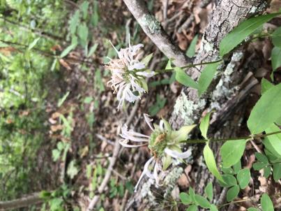 | | 2023 | COLLECTED | 08/09/2023 | Daniel Boone National Forest on west and east side of NF-227 (Sweet Lick Road) just north (0.65 miles) of intersection with Henry Ridge Road | 37.74303300, -83.93589700 | 387 | Ridge tops/highest elevations, dry open woods. | Wild material | Plants measuring 8-14" in height. Spreading vegetatively via rhizomes. Population mostly represented as specimens with white flowers. Peak flowering at collection site occurred near 27th of May (2023). | 2158366 | Ames 36161 |
| 23 | WLP 3092 | RJLSEUS2022-021 | Rhododendron prunifolium (Small) Millais | Alabama, United States | NA | | | 2023 | COLLECTED | 12/10/2023 | Slopes along Poke Springs Branch inlet accessed by boat from Walter F. George Reservoir. Generally uncommon, but frequent at this site. | 31.72318400, -85.12907800 | 69 | Plants are growing in part-shade to shade on the well-drained mostly deciduous woodland slopes approximately 3-6 meters above the inlet.
Soils: The underlying geology of this area is of Cretaceous origin and characterized as Selma Group; Providence Sand. The upper part of the profile consists of cross-bedded fine to coarse sand and white, dark-gray and pale-red-purple mottled clay containing lignite, sand, and kaolin. The lower part consists of dark-gray laminated to thin-bedded silty clay and abundantly micaceous, carbonaceous, fossiliferous very fine to fine sand.
Source: USGS Alabama Geologic Map Data (https://mrdata.usgs.gov/geology/state/sgmc-unit.php?unit=ALKp%3B1)
The primary soil types in the collection area are classified as Nankin-Lucy Complex soil (20 to 60 percent slopes). The Nankin Series consists of very deep, well drained, moderately slowly permeable soils on uplands of the Coastal Plain. They formed in stratified loamy and clayey marine sediments. Slopes range from 0 to 60 percent. Soils are comprised of sandy loam in the upper 25 cm to sandy clay loam and sandy clay in lower strata to about 1.7 meters deep; these soils are strongly acid. The Lucy Series consists of very deep, well drained, moderately permeable soils on uplands. They formed in sandy and loamy marine and fluvial sediments of the Southern Coastal Plain. Slopes vary from 0 to 45 percent. These soils are generally loamy to sandy loam in the upper 25 cm and sandy clay loam in the lower strata to 2 meters; these are strongly acid soils.
Source: NRCS Web Soil Survey (https://websoilsurvey.sc.egov.usda.gov/App/WebSoilSurvey.aspx) | Wild material | | 2141446 | WLP 3092 |
| 24 | NA 87353 | TJK2022TX-001 | Frangula caroliniana (Walter) A. Gray | Texas, United States | NA | | | 2023 | COLLECTED | 11/29/2022 | Kendall County: Kendalia: Old Blanco Road, about 0.7 miles north of intersection with Crabapple Creek, 2.3 miles from FM 474 at Kendalia. | 29.99990000, -98.51500000 | 480 | Rural roadside, collected between fence and road, east side of road. | Wild material | | 2141644 | NA 87353 |
| 25 | NA 88551 | RJLSEUS2022-024 | Rhododendron minus Michx. var. minus | Alabama, United States | NA | | | 2023 | COLLECTED | 12/10/2022 | Plants growing on the west side of George H. Grimsley Highway (Alabama State Hwy. 95) on the bluffs above the south side of Abbie Creek. Common on this site, but otherwise infrequent. This species is near the southernmost end of its natural range. | 31.47254800, -85.16304800 | 67 | Plants are growing in part-shade to shade of a mixed evergreen and deciduous woodland on the dry well-drained bluffs 4-5 meters above Abbie Creek.
Soils: The underlying geology of this area is of Holocene origin and characterized as Alluvial, coastal and low terrace deposits. Varicolored fine to coarse quartz sand containing clay lenses and gravel in places.
Source: USGS Alabama Geologic Map Data (https://mrdata.usgs.gov/geology/state/sgmc-unit.php?unit=ALHalt%3B0)
The primary soil types in the collection area are classified as Bonneau Loamy Fine Sand soil (0 to 2 percent slopes). The Bonneau Series consists of very deep, well drained, moderately permeable soils on the middle and upper coastal plain. They were formed by marine and fluviomarine deposits. Slopes range from 0 to 12 percent. Soils are comprised of very friable loamy sand that is strongly acid in the upper 0.7 meters. The lower strata to 2 meters are comprised of sandy clay loam that is friable, sometimes with oxidized iron, and strongly acid.
Source: NRCS Web Soil Survey (https://websoilsurvey.sc.egov.usda.gov/App/WebSoilSurvey.aspx) | Wild material | | 2140778 | NA 88551 |
| 26 | NA 88552 | RJLSEUS2022-025 | Hydrangea quercifolia W. Bartram | Alabama, United States | NA | | | 2023 | COLLECTED | 12/12/2022 | Claiborne Bluffs area along unnamed road to boat ramp on the east side of the Alabama River at the U.S. Highway 84 bridge over the river. Common at this location and along the nearby Alabama River. | 31.54879700, -87.51416400 | 40 | Plants are growing in part-shade to shade of mesic, well-drained, circum-neutral slopes and benches in mature mixed deciduous and evergreen woodlands with good litter layer. Soils: The underlying geology of this area is the Jackson Group Undifferentiated. The units of the Jackson Group are the Yazoo Clay and Crystal River and Moodys Branch Formations. Descriptions of the members of the Yazoo Clay follow in descending order. Shubuta Member - in western Alabama consists of light-greenish-gray to white plastic fossiliferous, calcareous clay containing irregular calcareous nodules. From the Tombigbee River eastward, the Shubuta becomes more calcareous and grades into massive clayey glauconitic limestone. Eastward from the Alabama River, equivalent beds grade into the Crystal River Formation. Pachuta Marl Member - light-greenish-grey glauconitic, fossiliferous clayey sand and sandy limestone traceable from western Alabama eastward to Covington County where it grades into the Crystal River Formation. Cocoa Sand Member - yellowish-gray firm calcareous, fossiliferous fine to medium sand or sandy limestone or greenish-grey micaceous, calcareous, very clayey sand. Calcareous and clayey sand equivalent to the Cocoa is traceable from western Alabama to the Conecuh River area. (Source: USGS Alabama Geological Map Data). The surface soil profile of this portion of the bluffs along the Alabama River are characterized as Saffell-Lucy (Flomaton) Series Complex soils. The Saffell Series consists of very deep, well drained, moderately permeable soils that formed in loamy and gravelly marine sediments of the Tertiary Age and have acid reaction. These soils are found on the upper portion of the bluffs along the Alabama River. The Lucy Series consists of very deep, well drained, moderately permeable soils on uplands. They formed in sandy and loamy marine and fluvial sediments of the Southern Coastal Plain Major Land Resource Area. Soil reaction runs from strongly to moderately acid. The Flomaton Series consists of very deep, excessively drained, rapidly permeable soils on uplands of the Southern Coastal Plain Major Land Resource Area. They formed in gravelly sandy marine sediments and also have an acid reaction. The remainder of soils are of miscellaneous origin. (Source: USDA-NRCS Official Soil Series Descriptions). | Wild material | | 2140779 | NA 88552 |
| 27 | NA 88553 | RJLSEUS2022-026 | Hydrangea arborescens L. | Alabama, United States | NA | | | 2023 | COLLECTED | 12/12/2022 | Claiborne Bluffs area along unnamed road to boat ramp on the east side of the Alabama River at the U.S. Highway 84 bridge over the river. Occasionally found in the woodlands. | 31.54940700, -87.51366200 | 25 | Plants are growing in part-shade to shade of mesic, well-drained, circum-neutral slopes mature mixed deciduous and evergreen woodlands where slopes are exposed and detritus does not build up.
Soils: The underlying geology of this area is the Jackson Group Undifferentiated. The units of the Jackson Group are the Yazoo Clay and Crystal River and Moodys Branch Formations. Descriptions of the members of the Yazoo Clay follow in descending order. Shubuta Member - in western Alabama consists of light-greenish-gray to white plastic fossiliferous, calcareous clay containing irregular calcareous nodules. From the Tombigbee River eastward, the Shubuta becomes more calcareous and grades into massive clayey glauconitic limestone. Eastward from the Alabama River, equivalent beds grade into the Crystal River Formation. Pachuta Marl Member - light-greenish-grey glauconitic, fossiliferous clayey sand and sandy limestone traceable from western Alabama eastward to Covington County where it grades into the Crystal River Formation. Cocoa Sand Member - yellowish-gray firm calcareous, fossiliferous fine to medium sand or sandy limestone or greenish-grey micaceous, calcareous, very clayey sand. Calcareous and clayey sand equivalent to the Cocoa is traceable from western Alabama to the Conecuh River area.
Source: USGS Alabama Geological Map Data (https://mrdata.usgs.gov/geology/state/state.php?state=AL)
The surface soil profile of this portion of the bluffs along the Alabama River are characterized by Saffell-Lucy (Flomaton) Series Complex soils. The Saffell Series consists of very deep, well drained, moderately permeable soils that formed in loamy and gravelly marine sediments of the Tertiary Age and have acid reaction. These soils are found on the upper portion of the bluffs along the Alabama River. The Lucy Series consists of very deep, well drained, moderately permeable soils on uplands. They formed in sandy and loamy marine and fluvial sediments of the Southern Coastal Plain Major Land Resource Area. Soil reaction runs from strongly to moderately acid. The Flomaton Series consists of very deep, excessively drained, rapidly permeable soils on uplands of the Southern Coastal Plain Major Land Resource Area. They formed in gravelly sandy marine sediments and also have an acid reaction. The remainder of soils are of miscellaneous origin.
Source: USDA-NRCS Official Soil Series Descriptions (https://soilseries.sc.egov.usda.gov/osdname.aspx) | Wild material | | 2140780 | NA 88553 |
| 28 | NA 88510 | RJL2022TX-005 | Crataegus marshallii Eggl. | Texas, United States | NA | | | 2022 | COLLECTED | 11/01/2022 | Plants growing along the west side of Texas State Hwy 87 on the edge of the woodlands. Plant is infrequently found, but a regular member of the woodlands as well as forest edge communities along the highway. | 31.15847300, -93.73852000 | 115 | Plants are growing in part-shade to sun on upland dry hills. In shade they survive, but in part-shade to sun they develop excellent flowering and fruiting.
Soils: The underlying geology of this area is of Oligocene origin and characterized as Catahoula Formation. This formation is extensive and deep in Texas, up to 185 meters thick. In the area of the collection the Catahoula Formation is primarily mudstone and sand. The upper 90-150 meters is mudstone that is tuffaceous, and sandy; also, occasionally, with some bentonitic clay.
Source: USGS Texas Geologic Map Data (https://mrdata.usgs.gov/geology/state/sgmc-unit.php?unit=TXQbs%3B0
The primary soil types in the collection area are classified as Letney-Tehran soils. These soils consist of deep, somewhat excessively drained, moderately rapidly permeable soils on uplands. They were formed in thick loamy and sandy sediments on the Western Coastal Plain. The Letney-Tehran soils are on gently sloping to moderately steep uplands with slopes ranging from 1 to 20 percent. They are typically strongly acidic.
Source: NRCS Web Soil Survey (https://websoilsurvey.sc.egov.usda.gov/App/WebSoilSurvey.aspx) | Wild material | | 2139817 | NA 88510 |
| 29 | Ames 35957 | AS/ML/2022/026/157 | Monarda luteola Singhurst & W. C. Holmes | Texas, United States | NC7 |  | | 2022 | COLLECTED | 08/05/2022 | Located north of Palestine approximately 3.60 miles on AN Country Road 404 (west side) just 0.7 miles north from intersection with AN Country Road 403 | 31.81051200, -95.63928400 | 185 | Roadside, woodland edge. | Wild material | Lemon-scented foliage when crushed. Population in nature noted slightly prior to peak flowering on 28 April (2022) at collection site. | 2140547 | Ames 35957 |
| 30 | WLP 2704 | AS/CV/2022/028/159 | Chionanthus virginicus L. | Arkansas, United States | NA |  | | 2022 | COLLECTED | 08/08/2022 | Just south and southwest of Potter Junction by approximately 1.1 miles; along Highway 59 and Highway 78 | 34.53717900, -94.31379200 | 336 | Roadside, moist woods. | Wild material | Specimens in nature peaked flower on 29 April (2022). | 2140549 | WLP 2704 |
| 31 | Ames 35792 | APS/ID/2022/027/489 | Ilex decidua Walter | Arkansas, United States | NC7 |  | | 2022 | COLLECTED | 03/15/2022 | Located approximately 3.75 miles east of Allison just off Round Bottom Road. | 35.93670000, -92.04891000 | 133 | Dry west facing slope in a pine, oak, and hickory forest. | Wild material | Plants sampled in nature with bright red fruits measuring 7-9 mm in diameter. | 2137431 | Ames 35792 |
| 32 | WLP 2568 | APS/HA/2022/028/490 | Hydrangea arborescens L. | Arkansas, United States | NA | 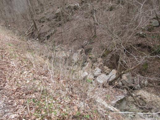 | | 2022 | COLLECTED | 03/15/2022 | Located approximately 3.75 miles east of Allison just off Round Bottom Road. | 35.93357000, -92.05110000 | 144 | Moist, low deciduous forest with scattered rock outcrops, growing along base of hill and bank of seasonal stream. | Wild material | | 2137430 | WLP 2568 |
| 33 | Ames 34313 | JDC/ML/2018/034/847 | Monarda luteola Singhurst & W. C. Holmes | Texas, United States | NC7 |  | | 2018 | COLLECTED | 07/18/2018 | Private property located 4.35 miles south, southwest of Daingerfield off County Road 2215. Locally known as "Kennedy Mountain", Morris County | 32.97217700, -94.74721600 | 152 | Open, dry woods, edge of woods and open clear cut areas with prairie grasses/forbes. | Wild material | Plants with lemon scent, pubescent stems and leaves with faint yellow flowers measuring circa 1.0-2.5' in height. Plants likely reached peak flower on 15 May 2018. At time of collection, plants had 2-4" of stem dieback from seed head. Seeds likely reached full maturity around first week in July (2018). Collection represents genetics from where Monarda luteola holotype (W.C. Holmes #14012 & J.R. Singhurst) was collected 24 May 2008. | 1964620 | Ames 34313 |
| 34 | Ames 34316 | JDC/ML/2018/040/853 | Monarda luteola Singhurst & W. C. Holmes | Texas, United States | NC7 |  | | 2018 | COLLECTED | 07/18/2018 | Located between 7.7 and 8.60 miles east of Mineola locally known as "Salesmanship Club Property" just north of County Road 2694, Wood County | 32.67938700, -95.34237100 | 149 | Open, dry woods, edge of woods and open clear cut areas with prairie grasses/forbes. | Wild material | Plants with lemon scent, pubescent stems and leaves with faint yellow flowers measuring circa 2.0-2.5' in height. Plants likely reached peak flower on 10 May 2018. Seeds likely reached full maturity around first week in July (2018). | 1964623 | Ames 34316 |
| 35 | Ames 34318 | JDC/ML/2018/042/855 | Monarda luteola Singhurst & W. C. Holmes | Texas, United States | NC7 |  | | 2018 | COLLECTED | 07/18/2018 | Tyler State Park located 8.40 miles north of Tyler. Population concentrated around Blackjack Nature Trail (southwest corner of state park), Smith County | 32.46893000, -95.30335000 | 163 | Open, dry woods. | Wild material | Plants with lemon scent, pubescent stems and leaves with faint yellow flowers measuring circa 1.0-2.5' in height. Plants likely reached peak flower on 10 May 2018. Seeds likely reached full maturity around first week in July (2018). | 1964625 | Ames 34318 |
| 36 | Ames 33979 | JDC/FQ/2017/031/785 | Fraxinus quadrangulata Michx. | Tennessee, United States | NC7 |  | | 2017 | COLLECTED | 07/08/2017 | Along highway 52 approximately 2.30 miles northwest of Celina, Clay County | 36.57174000, -85.53638800 | 190 | Dry, rocky soils. | Wild material | | 1950062 | Ames 33979 |
| 37 | Ames 33981 | JDC/FQ/2017/036/790 | Fraxinus quadrangulata Michx. | Kentucky, United States | NC7 |  | | 2017 | COLLECTED | 07/10/2017 | Two areas sampled just south and southwest of Wilmore, including Sally Brown Preserve/Bowmans Bend on south side of Kentucky River, Garrard County and along Corman Lane approximately 0.86 miles from junction with Route 1268 on north side of Kentucky River, Jessamine County | 37.80093600, -84.70302000 | 231 | Deciduous forest, rocky substrate. | Wild material | | 1950064 | Ames 33981 |
| 38 | Ames 33989 | JDC/FQ/2017/045/799 | Fraxinus quadrangulata Michx. | Ohio, United States | NC7 |  | | 2017 | COLLECTED | 07/14/2017 | Battelle-Darby Creek Metro Park approximately 11.7 miles southwest of Columbus, Franklin County | 39.89846500, -83.21273600 | 282 | High-quality deciduous woods. | Wild material | | 1950072 | Ames 33989 |
| 39 | WLP 1096 | JDC/CO/2015/025/681 | Cotinus obovatus Raf. | Missouri, United States | NA |  | | 2015 | COLLECTED | 05/19/2015 | T24N R16W NW 1/4 Sec. 4, SW 1/4 SW 1/4 Sec. 17, and SW 1/4 Sec. 9 Ozark County. Mark Twain National Forest Caney Picnic Area (County Road 935) | 36.79873000, -92.71575700 | 407 | Rocky, very shallow soils. Growing in association with Quercus muehlenbergii, Diospyros virginiana, Cercis canadensis, Viburnum rufidulum, Delphinium carolinianum, Penstemon cobea, Rudbeckia sp., Fraxinus americana, Fraxinus quadrangulata (few), Cornus florida, Oenothera macrocarpa, Juniperus virginiana, Tradescantia sp., and Silphium terebinthinaceum. | Wild material | | 1926254 | WLP 1096 |
| 40 | WLP 1097 | JDC/CO/2015/026/682 | Cotinus obovatus Raf. | Missouri, United States | NA | | | 2015 | COLLECTED | 05/19/2015 | T22N R20W N1/2 Sec. 33 and SW 1/4 Sec. 27 Taney County. Gunnison Road, adjacent to Bee Creek, a tributary to Fox Creek and also surrounding area. | 36.52401500, -93.09755700 | 350 | Steep, west-facing slope on rocky, loose substrate. Growing in association with Fraxinus quadrangulata, Quercus muehlenbergii, Hydrangea arborescens, Physocarpus opulifolius, Viburnum rufidulum, Cornus florida, Carpinus caroliniana (abundant), Rhus aromatica, Lonicera sp. (vine), Cornus sp., Salix sp., Juniperus virginiana, Tilia americana, Hamamelis sp. (abundant) and Staphylea trifolia. | Wild material | | 1926259 | WLP 1097 |
| 41 | WLP 1100 | JDC/CO/2015/034/690 | Cotinus obovatus Raf. | Arkansas, United States | NA | | | 2015 | COLLECTED | 05/21/2015 | T10N R20W SE 1/4 NW 1/4 Sec. 6 Pope County. Long Pool Recreation Area between Big Piney Creek and Newton Hill. | 35.54962900, -93.15052600 | 229 | Rocky, likely somewhat acidic substrate on north-facing slopes. Growing in association with Acer saccharum, Juniperus virginiana, Vaccinum sp., Quercus stellata, Rhododendron spp, Viburnum rufidulum, Castanea ozarkensis, Amelanchier sp., Ostrya virginiana, Nyssa sylvatica, Quercus alba, and Pinus sp.. | Wild material | | 1926262 | WLP 1100 |
| 42 | NA 80067 | NA 80067 | Cladrastis kentukea (Dum. Cours.) Rudd | Kentucky, United States | NA | | | 2011 | COLLECTED | 10/02/2001 | Palisades (a locally used term to describe the sheer cliffs along the Kentucky River); along the west side of Kentucky Route 27 just north of Hall, Kentucky. | 37.79288000, -84.60705000 | 300 | Growing on the thin soils of the sheer limestone cliffs just below the top of the cliffs. | | | 1953441 | NA 80067 |
| 43 | Ames 30604 | JDC/FQ/2010/037/307 | Fraxinus quadrangulata Michx. | Missouri, United States | NC7 |  | | 2010 | COLLECTED | 09/14/2010 | Fiddlers Ford Conservation Area, Dade County. | 37.38418300, -93.79576000 | 294 | Rock outcropping. South facing slope (40%). | Wild material | | 1848899 | Ames 30604 |
| 44 | Ames 30609 | JDC/FQ/2010/053/323 | Fraxinus quadrangulata Michx. | Missouri, United States | NC7 |  | | 2010 | COLLECTED | 09/17/2010 | Drury-Mincey Conservation Area, Taney County. | 36.57464000, -93.08651000 | 266 | Large population along steep (70%), southeast facing slope. | Wild material | | 1848904 | Ames 30609 |
| 45 | Ames 30614 | JDC/MX/2010/046/316 | Blephilia ciliata (L.) Benth. | Missouri, United States | NC7 |  | | 2010 | COLLECTED | 09/16/2010 | Norfork Lake Wildlife Area near Bridges Creek, Ozark County | 36.56451000, -92.25092000 | 227 | East facing slope (65%) with chert and limestone | Wild material | | 1848909 | Ames 30614 |