| 0 | PI 588677 | JEG 3 | Vitis aestivalis Michx. var. bicolor Deam | Missouri, United States | GEN |  | | 1990 | DEVELOPED | | | | | | Wild material | Female flower. | 1013427 | PI 588677 |
| 1 | PI 483137 | Rem 46-77 | Vitis aestivalis Michx. var. bicolor Deam | Pennsylvania, United States | GEN | 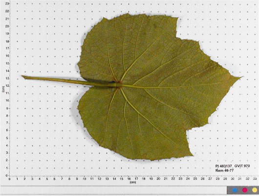 | | 1988 | COLLECTED | 01/01/1976 | Appalachian Trail, Schuykill County, Pennsylvania | | | | Wild material | Plants cold resistant. Flowers functionally staminate. Local name Blue grape. Received as Vitis argentifolia. | 1378073 | PI 483137 |
| 2 | PI 483138 | Rem 48-77 | Vitis aestivalis Michx. var. bicolor Deam | Pennsylvania, United States | GEN |  | | 1988 | COLLECTED | 01/01/1976 | Appalachian Trail, Schuykill County, Pennsylvania | | | | Wild material | Plants cold resistant. Flowers functionally staminate. Local name Blue grape. Received as Vitis argentifolia. | 1378074 | PI 483138 |
| 3 | PI 483143 | Rem 59-77 | Vitis aestivalis Michx. var. bicolor Deam | Pennsylvania, United States | GEN | 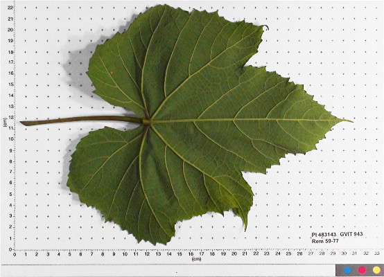 | | 1988 | COLLECTED | 01/01/1977 | Nesquehonig, Route 54, Carbon County, Pennsylvania | | | | Wild material | Plants strong, productive. Flowers functionally pistillate. Local name Blue grape. Received as Vitis argentifolia. | 1378079 | PI 483143 |
| 4 | GVIT 1675 | Winnebago | Vitis aestivalis Michx. var. bicolor Deam | Minnesota, United States | GEN | | | 2006 | COLLECTED | | Collected in Winnebago Township, Houston County, Minnesota | | | | Wild material | It turns color 10-14 days earlier than the rest of the local population. It is more resistant to black rot and botrytis than the local population. It has some susceptibility to downy mildew when grown close to the ground in the vineyard. On 9-21-2005 brix was 25 and 1.3 TA in the woods. | 1692105 | GVIT 1675 |
| 5 | GVIT 1664 | 33/03 | Vitis aestivalis Michx. var. bicolor Deam | New York, United States | GEN | | | 2005 | DONATED | 03/09/2005 | | | | | | | 1671496 | GVIT 1664 |
| 6 | GVIT 1665 | 34/03 | Vitis aestivalis Michx. var. bicolor Deam | New York, United States | GEN | | | 2005 | DONATED | 03/09/2005 | | | | | | | 1671497 | GVIT 1665 |
| 7 | GVIT 928 | V. argentifolia (GBC 17) | Vitis aestivalis Michx. var. bicolor Deam | United States | | | Historic | 1988 | DONATED | 01/26/1988 | | | | | Cultivated material | | 1010106 | GVIT 928 |
| 8 | NA 89081 | 2024RJLPA-009 | Rosa carolina L. | Pennsylvania, United States | NA | | | 2024 | COLLECTED | 09/22/2024 | Lancaster and York Counties: outcrops along the Susquehanna River, accessed from the Historic Lock 12 parking lot off of Pennsylvania Road 372. | 39.81483500, -76.32762200 | 34 | Plants are growing from part-sun to full sun in crevices of the outcrops and where organic debris has accumulated in between boulders along the Susquehanna River. The sites range from nearly xeric to dry mesic, at least on the surface. Plants are generally growing 4-10 m above the normal flow of the river; however, the Holtwood Dam is less than 1 kilometer upstream and debris found trapped in the boulders indicates that there is periodic flooding, at least, in the lower zone of 4+ meters or so above normal river flow. This habitat has a diverse assemblage of deciduous trees and shrubs as well as abundant herbaceous taxa. Slope: 0 to 60 percent. Aspect: Northeast (generally). Geology: The underlying geology of this area is probably of lower Paleozoic age and characterized as the Octoraro Formation. It includes albite-chlorite schist, phyllite, some hornblende gneiss, and granitized members. Soils: The area where this species occurs is right on the edge of two soil zones that transition from the river’s edge to mesic conditions upslope. The first is generally referred to as Rock Outcrop. This terrestrial matrix in which plants grow is largely exposed underlying rock geology with accumulated outwash, rock decomposition, and organic debris buildup. The second is Mt. Airy (80%) and Manor (20%) Series soils, 25 to 60 percent slopes, extremely stony (MRF). (Source: California Soil Resource Lab/NRCS Official Soil Series Descriptions). EPA Ecoregion (Level III): Northern Piedmont (64). EPA Ecoregion (Level IV): Piedmont Uplands (64c). | Wild material | | 2169045 | NA 89081 |
| 9 | NA 89082 | 2024RJLPA-010 | Amorpha fruticosa L. | Pennsylvania, United States | NA | | | 2024 | COLLECTED | 09/22/2024 | Outcrops along the Susquehanna River, accessed from the Historic Lock 12 parking lot off of Pennsylvania Road 372. | 39.81481500, -76.32757900 | 34 | Plants are growing from part-sun to full sun in crevices of the outcrops and where organic debris has accumulated in between boulders along the Susquehanna River. The sites range from nearly xeric to dry mesic, at least on the surface. Plants are generally growing 4-10 m above the normal flow of the river; however, the Holtwood Dam is less than 1 kilometer upstream and debris found trapped in the boulders indicates that there is periodic flooding, at least, in the lower zone of 4+ meters or so above normal river flow. This habitat has a diverse assemblage of deciduous trees and shrubs as well as abundant herbaceous taxa. Slope: 0 to 25 percent. Aspect: Northeast (generally). Geology: The underlying geology of this area is probably of lower Paleozoic age and characterized as the Octoraro Formation. It includes albite-chlorite schist, phyllite, some hornblende gneiss, and granitized members. Soils: The area where this species occurs is right on the edge of two soil zones that transition from the river’s edge to mesic conditions upslope. The first is generally referred to as Rock Outcrop. This terrestrial matrix in which plants grow is largely exposed underlying rock geology with accumulated outwash, rock decomposition, and organic debris buildup. The second is Mt. Airy (80%) and Manor (20%) Series soils, 25 to 60 percent slopes, extremely stony (MRF). (Source: California Soil Resource Lab/NRCS Official Soil Series Descriptions). EPA Ecoregion (Level III): Northern Piedmont (64). EPA Ecoregion (Level IV): Piedmont Uplands (64c). | Wild material | | 2169046 | NA 89082 |
| 10 | NA 89083 | 2024RJLPA-012 | Rhododendron periclymenoides (Michx.) Shinners | Pennsylvania, United States | NA | | | 2024 | COLLECTED | 09/22/2024 | Outcrops along the Susquehanna River, accessed from the Historic Lock 12 parking lot off of Pennsylvania Road 372. | 39.81477400, -76.32807300 | 35 | Plants are growing from shade to part-sun and occasionally full sun in crevices of the outcrops and where organic debris has accumulated in between boulders along the Susquehanna River. The sites range from nearly xeric to mesic, at least on the surface. Plants are generally growing 4-10 m above the normal flow of the river; however, the Holtwood Dam is less than 1 kilometer upstream and debris found trapped in the boulders indicates that there is periodic flooding, at least, in the lower zone of 4+ meters or so above normal river flow. This habitat has a diverse assemblage of deciduous trees and shrubs as well as abundant herbaceous taxa. Slope: 0 to 60 percent. Aspect: Northeast (generally). Geology: The underlying geology of this area is probably of lower Paleozoic age and characterized as the Octoraro Formation. It includes albite-chlorite schist, phyllite, some hornblende gneiss, and granitized members. Soils: The area where this species occurs is right on the edge of two soil zones that transition from the river’s edge to mesic conditions upslope. The first is generally referred to as Rock Outcrop. This terrestrial matrix in which plants grow is largely exposed underlying rock geology with accumulated outwash, rock decomposition, and organic debris buildup. The second is Mt. Airy (80%) and Manor (20%) Series soils, 25 to 60 percent slopes, extremely stony (MRF). (Source: California Soil Resource Lab/NRCS Official Soil Series Descriptions). EPA Ecoregion (Level III): Northern Piedmont (64). EPA Ecoregion (Level IV): Piedmont Uplands (64c). | Wild material | | 2169047 | NA 89083 |
| 11 | NA 89084 | 2024RJLPA-013 | Physocarpus opulifolius (L.) Maxim. | Pennsylvania, United States | NA | | | 2024 | COLLECTED | 09/22/2024 | Outcrops along the Susquehanna River, accessed from the Historic Lock 12 parking lot off of Pennsylvania Road 372. | 39.81466300, -76.32833900 | 36 | Plants are growing from shade to part-sun where organic debris has accumulated in between boulders as well as further upslope in deeper mesic soils along the Susquehanna River. This habitat has a diverse assemblage of deciduous trees and shrubs as well as abundant herbaceous taxa. Slope: 10 to 25 percent. Aspect: Northeast (generally). Geology: The underlying geology of this area is probably of lower Paleozoic age and characterized as the Octoraro Formation. It includes albite-chlorite schist, phyllite, some hornblende gneiss, and granitized members. Soils: The area where this species occurs is right on the edge of two soil zones that transition from the river’s edge to mesic conditions upslope. The first is generally referred to as Rock Outcrop. This terrestrial matrix in which plants grow is largely exposed underlying rock geology with accumulated outwash, rock decomposition, and organic debris buildup. The second is Mt. Airy (80%) and Manor (20%) Series soils, 25 to 60 percent slopes, extremely stony (MRF). (Source: California Soil Resource Lab/NRCS Official Soil Series Descriptions). EPA Ecoregion (Level III): Northern Piedmont (64). EPA Ecoregion (Level IV): Piedmont Uplands (64c). | Wild material | | 2169048 | NA 89084 |
| 12 | NA 89085 | 2024RJLPA-014 | Rhododendron arborescens (Pursh) Torr. | Pennsylvania, United States | NA | | | 2024 | COLLECTED | 09/22/2024 | Outcrops along the Susquehanna River, accessed from the Historic Lock 12 parking lot off of Pennsylvania Road 372. | 39.81618100, -76.33069800 | 38 | Plants are growing from shade to part-sun and occasionally full sun in crevices of the outcrops and where organic debris has accumulated in between boulders along the Susquehanna River. The sites range from nearly xeric to mesic, at least on the surface. Plants are generally growing 4-10 m above the normal flow of the river; however, the Holtwood Dam is less than 1 kilometer upstream and debris found trapped in the boulders indicates that there is periodic flooding, at least, in the lower zone of 4+ meters or so above normal river flow. This habitat has a diverse assemblage of deciduous trees and shrubs as well as abundant herbaceous taxa. Slope: 0 to 75 percent. Aspect: Northeast (generally). Geology: The underlying geology of this area is probably of lower Paleozoic age and characterized as the Octoraro Formation. It includes albite-chlorite schist, phyllite, some hornblende gneiss, and granitized members. Soils: The area where this species occurs is right on the edge of two soil zones that transition from the river’s edge to mesic conditions upslope. The first is generally referred to as Rock Outcrop. This terrestrial matrix in which plants grow is largely exposed underlying rock geology with accumulated outwash, rock decomposition, and organic debris buildup. The second is Mt. Airy (80%) and Manor (20%) Series soils, 25 to 60 percent slopes, extremely stony (MRF). (Source: California Soil Resource Lab/NRCS Official Soil Series Descriptions). EPA Ecoregion (Level III): Northern Piedmont (64). EPA Ecoregion (Level IV): Piedmont Uplands (64c). | Wild material | | 2169049 | NA 89085 |
| 13 | NA 89086 | 2024RJLPA-015 | Ilex verticillata (L.) A. Gray | Pennsylvania, United States | NA | | | 2024 | COLLECTED | 09/22/2024 | Outcrops along the Susquehanna River, accessed from the Historic Lock 12 parking lot off of Pennsylvania Road 372. | 39.81656600, -76.33136600 | 38 | Plants are growing from part-sun to full sun in crevices of the outcrops and where organic debris has accumulated in between boulders along the Susquehanna River. The sites range from nearly xeric to dry mesic, at least on the surface. Plants are generally growing 4-10 m above the normal flow of the river; however, the Holtwood Dam is less than 1 kilometer upstream and debris found trapped in the boulders indicates that there is periodic flooding, at least, in the lower zone of 4+ meters or so above normal river flow. This habitat has a diverse assemblage of deciduous trees and shrubs as well as abundant herbaceous taxa. Slope: 0 to 10 percent. Aspect: Northeast (generally). Geology: The underlying geology of this area is probably of lower Paleozoic age and characterized as the Octoraro Formation. It includes albite-chlorite schist, phyllite, some hornblende gneiss, and granitized members. Soils: The area where this species occurs is right on the edge of two soil zones that transition from the river’s edge to mesic conditions upslope. The first is generally referred to as Rock Outcrop. This terrestrial matrix in which plants grow is largely exposed underlying rock geology with accumulated outwash, rock decomposition, and organic debris buildup. The second is Mt. Airy (80%) and Manor (20%) Series soils, 25 to 60 percent slopes, extremely stony (MRF). (Source: California Soil Resource Lab/NRCS Official Soil Series Descriptions). EPA Ecoregion (Level III): Northern Piedmont (64). EPA Ecoregion (Level IV): Piedmont Uplands (64c). | Wild material | | 2169050 | NA 89086 |
| 14 | NA 89039 | RJL2022IL-001 | Ptelea trifoliata L. | Illinois, United States | NA | | | 2022 | COLLECTED | 09/28/2022 | Site of plant habitat is located at 823 E Co Rd 1220, Hamilton, IL 62341 which is the property where Jacob's Geode Shop and Mine is located. This species is scattered and relatively common throughout the woodlands on this site. | 40.37848400, -91.35390200 | 175 | Plants growing in shade to part-shade of deciduous woodlands above a small creek.
Soils: The underlying geology of this area is of Mississippian origin and comprised of Warsaw Formation and Salem Limestone. Major lithological components include limestone that can be shaly, oolitic, bioclastic, or cherty. Minor lithological components include siltstone that can contain geodes or drusy quartz and can be calcareous.
Source: USGS Illinois Geologic Map Data (https://mrdata.usgs.gov/geology/state/sgmc-unit.php?unit=ILMws%3B0)
The surface soil profile of this area is Coffeen silt loam, 0 to 2 percent slopes, that are frequently flooded. The Coffeen series consists of very deep, somewhat poorly drained, moderately permeable soils on flood plains, low terraces or benches, toe slopes, and alluvial fans. They formed in silty alluvium. Much of the alluvium is of local origin derived from the nearby loess-covered uplands.
Source: NRCS Web Soil Survey (https://websoilsurvey.sc.egov.usda.gov/App/WebSoilSurvey.aspx) | Wild material | | 2139604 | NA 89039 |
| 15 | Ames 33358 | 730-1 | Betula nigra L. | Illinois, United States | NC7 |  | | 2016 | COLLECTED | 06/07/2016 | Momence wetlands - Kankakee River watershed, Kankakee County | 41.16335000, -87.52944100 | | Floodplain | Wild material | | 1940581 | Ames 33358 |
| 16 | NA 83060 | NA 83060 | Prunus hortulana L. H. Bailey | | NA | | | 2015 | | | | | | | | | 1950570 | NA 83060 |
| 17 | DPRU 3196 | DPRU 3196 | Prunus hortulana L. H. Bailey | Missouri, United States | DAV |  | | 2013 | COLLECTED | 08/14/2013 | Specimen 1 along South Rangeline Road, SW 1/4 of Section 30; Specimen 2 along State Road H (East Englewood Road), NW 1/4 of SE 1/4 of Section 30; Specimen 3 near State Road H (East Englewood Road), SE 1/4 of NE 1/4 of SE 1/4 of Section 30; Specimen 4 along South Rangeline Road, near airport, NW 1/4 of NW 1/4 of NW 1/4 of Section 30; Millersburg SW Quad, Boone County. | 38.82384400, -92.20357575 | 267 | Specimen 1 growing roadside, associated with Festuca and Solidago. Specinen 2 growing roadside, associated with Quercus bicolor, Toxicodendron radicans, and Ulmus. Specimen 3 growing in windbreak, associated with Celtis occidentalis, Juniperus virginiana, Lonicera maackia, Toxicodendron radicans, and Ulmus. Specimen 4 growing roadside associated with Celtis occidentalis, Diospyros virginiana, Euonymus atropurpueraus, Juniperus virginiana, Lonicera maackia, Salix, Toxicodendron radicans, Ulmus, and Vitis riparia. | Wild material | Specimen 1: fruit diameter ranged between 18 mm and 20 mm; fruits approximately 1 mm wider than long; approximately 10 feet in height and 6 feet in spread; leaves papery thin to the touch and glabrous; purple-copper colored bark with obvious lenticels. Specimen 2: fruit diameter ranged between 19 mm and 22 mm; approximately 15 feet in height and 10 feet in spread; leaves papery thin to the touch and glabrous; purple-copper colored bark on younger branches with exfoliating grayish bark on trunk. Specimen 3: fruit diameter ranged between 21 mm and 25 mm; approximately 20 feet in height and 10 feet in spread; leaves papery thin to the touch and glabrous; greyish, exfoliating bark. Specimen 4: fruit diameter ranged between 19 mm and 20 mm; approximately 20 feet in height and 10 feet in spread; leaves papery thin to the touch and glabrous; greyish, exfoliating bark. | 1912773 | DPRU 3196 |