| 0 | DVIT 3505 | MS2006-2-2 | Vitis rotundifolia Michx. | New York, United States | DAV | | | 2007 | DONATED | 07/18/2007 | | | | | Wild material | | 1790924 | DVIT 3505 |
| 1 | DVIT 3441 | MS2006-3-3 | Vitis rotundifolia Michx. | New York, United States | DAV | | | 2007 | DONATED | 07/18/2007 | | | | | Wild material | | 1790860 | DVIT 3441 |
| 2 | DVIT 3151 | RJL VA2003-005 | Vitis rotundifolia Michx. | Virginia, United States | DAV | | | 2003 | COLLECTED | 09/05/2003 | Collected from Chesapeake, VA at the interchange of Business Route 168 (Battlefield Ave) and Route 168, next to a detention basin and shopping plaza on the west side of Battlefield Ave. | 36.73861111, -76.24250000 | 5 | Mixed deciduous and evergreen woodland, primarily comprised of deciduous trees in the over-story and a mixture of deciduous and evergreen species in the sub-canopy. Plants growing in part-shade to full sun where they produce abundant fruit. | Breeding material | Seed collected from many individuals and massed. Associated plants: Acer rubrum, Carpinus caroliniana, Clethra alnifolia, fagus grandifolia, gelsemium nudiflorum, Hamamelis virginiana, Ilex opaca, Leucothoe racemosa, liquidambar styraciflua, Liriodendron tulipfera, Nyssa sylvatica, Oxydendrum arboreum, Persea borbonia, Quercus falcata, Quercus michauxii, Smilax sp., Stewartia malacodendron, Symplocos tinctoria and Vaccinium sp. | 1651338 | DVIT 3151 |
| 3 | DVIT 3079 | Gallo 83 | Vitis rotundifolia Michx. | Florida, United States | DAV | | | 2002 | COLLECTED | | | | | | Breeding material | | 1641332 | DVIT 3079 |
| 4 | DVIT 2974 | 9999 | Vitis rotundifolia Michx. | Louisiana, United States | DAV | | | 2000 | COLLECTED | | Landry Parish. 1.8 miles south of intersection of Jack Fox Rd. and frontage of Hwy 49 | 30.44333333, -92.07000000 | | | Wild material | | 1616297 | DVIT 2974 |
| 5 | DVIT 2719 | 'Marsh' | Vitis rotundifolia Michx. var. munsoniana (J. H. Simpson ex Planch.) M. O. Moore | Florida, United States | DAV | | | 1997 | DONATED | 08/18/1997 | | | | | Cultivated material | Type = Species. Flower = Female, black berries, cluster weight=8.4, and berry weight=0.9. | 1564735 | DVIT 2719 |
| 6 | DVIT 2622 | 'Dearing' | Vitis rotundifolia Michx. | Florida, United States | DAV | | | 1996 | DONATED | 12/17/1996 | | | | | Cultivated material | Type = Rotundifolia. Flower = Hermaphrodite. Greenish, yellow, high TSS, productive. | 1564570 | DVIT 2622 |
| 7 | DVIT 2623 | 'Magoon' | Vitis rotundifolia Michx. | Florida, United States | DAV | | | 1996 | DONATED | 12/17/1996 | | | | | Cultivated material | Type = Rotundifolia. Flower = Hermaphrodite. Purplish, black, high TSS, high aromatic flavor, productive. | 1564571 | DVIT 2623 |
| 8 | DVIT 2624 | 'Meridian 11-14' | Vitis rotundifolia Michx. | Florida, United States | DAV | | | 1996 | DONATED | 12/17/1996 | | | | | Cultivated material | Type = Rotundifolia. Flower = Female. Vigorous, healthy female hybrid of Jaeger 52 (V. Lincecumis) x V. Shuttleworthi. Produced by Horace Loomis when he was a grape breeder at the USDA Meridian, Miss. station. | 1564572 | DVIT 2624 |
| 9 | DVIT 2435 | 'Barrett Mn-1' | Vitis rotundifolia Michx. var. munsoniana (J. H. Simpson ex Planch.) M. O. Moore | Florida, United States | DAV | | | 1993 | DONATED | 01/05/1993 | | | | | Cultivated material | Type = Rotundifolia. Flower type = Female. A female selction of V. munsoniana. Has beet red leaves, tendrils, canes with color persisting a long time. A strikingly handsome vine- otherwise appears to be a typical munsoniana which is our most common wild grade from here southward. | 1564067 | DVIT 2435 |
| 10 | DVIT 2436 | 'Thornhill' | Vitis rotundifolia Michx. var. munsoniana (J. H. Simpson ex Planch.) M. O. Moore | Florida, United States | DAV | | | 1993 | DONATED | 01/05/1993 | | | | | Cultivated material | Type = Rotundifolia. Flower type = Male. Per Barrett: "The existence of this vine was brought to my attention in the summer of 1988 by Larry Clinton, Larry learned of this vine from his uncle, Mr. C.L. Thornhill, who found the vine growing in his cattle pasture near Winter Haven, Florida. Very vigorous V. munsoniana. One of the largest Vines Barrett had observed in the wild. He measured the circumference as 27 inches at breast height. Named after Mr. C. Thornhill (owner of cattle pasture where found) who first noticed this vine and brought it to Barrett's attention. In January 1989, this vine was oberved growing through the limbs and branches of several, oak trees in a partly wooded section of Mr. Thornhill's cattle pasture. | 1564068 | DVIT 2436 |
| 11 | DVIT 2438 | 'Loomis' | Vitis rotundifolia Michx. | Florida, United States | DAV | | | 1993 | DONATED | 01/05/1993 | | | | | Cultivated material | Type = Rotundifolia. Flower type = Female. A female selection of V. rotundifolia introduced by Ron Lane of the Georgia Station. Original cross - creek x US #15 made by Horace Loomis when he was stationed at Meridian, Miss., station of USDA. A black with rather good quality. Full description and write-up in Hort Science. | 1564070 | DVIT 2438 |
| 12 | DVIT 2439 | 'Tara' | Vitis rotundifolia Michx. | Florida, United States | DAV | | | 1993 | DONATED | 01/05/1993 | | | | | Cultivated material | Type = Rotundifolia. Flower type = Hermaphrodite. Introduced by Ron Lane of the Georgia Station. Vines sent to Barrett by Ron. This is sib cross since the parents are derived from the same cross. Supposed to be larger than Triumph, not quite as sweet as Summit, but very good quality. | 1564071 | DVIT 2439 |
| 13 | DVIT 2241 | DVIT 2241 | Vitis rotundifolia Michx. var. munsoniana (J. H. Simpson ex Planch.) M. O. Moore | Florida, United States | DAV | | | 1987 | COLLECTED | 07/27/1986 | Florida, St. Lucie County, 4.6 miles East of ??? Okeechobee ??? Hwy 70 | | | | Wild material | Type = Rotundifolia. Per Munson (see citation) [DESCRIPTION]: "Plant: Very slender growth, much more slender than V. rotundifolia; often branching, tips extending rapidly, appearing naked, owing to slow expansion of leaves. Roots: Large, little fibrous, pale yellow, covered with thick, firm warty bark, transversely wrinkled, possessing a fiery pungency, penetrating. Wood: When young 6 to 7 angled, dark red or crimson, nearly smooth or thinly set with silky hairs, with age becoming covered with numerous minute punctate dots or lenticose cells, like warts set in rows on the fine unequal striae, becoming more distinct and increasing with age until the vine has a rasp-like feeling as though covered with coarse sand, and acquiring a dark gray color; bark with little checking, no thready fiber, closely persistent; transverse section of ripe wood oval, with age becoming elliptical or even depressed elliptical, dense but less so than V. rotundifolia. [...] Leaves: Stipules very small, 1/12' long, orbicular, margin ciliate, pale pinkish; petiole usually as long as half the width of blade, sometimes more, more slender than in V. rotundifolia and proportionately shorter, deeply and distinctly grooved above, finely pubescent, purplish crimson, attached to blade at right or more acute angle; [...] Cluster: Forked cyme-like, from the node of the tendril; divisions obscurely striated, warty, pale rusty brown when mature; pedicels 1/4' to 1/3' long, medium thick, little enlarged upward, warty. Flowers: 12 to 50 in fertile clusters; stamens and petals usually 5, often 6 and sometimes 7; in fertile, stamens about 1/12' long, recurved and bent laterally, little or no perceptible disc; ovary small, broad and short; style very short, about half the thickness of ovary, in length; [...] Berries: 12 to 30 small, 1/5' to 1/3' in diameter, round, shining black, covered with numerous small brown punctate, or lenticose dots, but never having prunose bloom, quite persistent; very little pulp, juicy, with crimson or violet coloring matter next skin, which is thin; vinous, sometimes quite good but generally acid and devoid of the peculiar Muscadine flavor and odor common in V. Rotundifolia. Seeds: 3 to 4 each berry, small, 1/6' to 1/5' long by 1/10' to 1/16' broad, being not more than 1/4 or 1/5 as large in bulk on the average as in V. rotundifolia, sides often unequal, surface glossy, dark greenish-brown coffee color, much darker than in V. rotundifolia, beak very small, short, acute, or none; [...] [APTITUDES]: Vigorous but slender, more upright when young than V. rotundifolia, which is less branched and more sprawling in young vines, but becomes much more drooping, or weeping on trellis than V. rotundifolia, the lateral branches very slender, almost filiform. The ever-blooming character of this species, with its smaller seeds, larger clusters, more vinous and acid than V. rotundifolia, and its freedom from disease, may render it an excellent material with thich the hybridize the finer V. vinifera varieties to secure valuable grapes for the extreme south and the tropics. [...] V. munsonia is rarely found north of Central Florida, but in all Southern Florida it is by far the most abundant species. It grows equally well in various locations and soils in South Florida from near streams to the poorest pine soils, though found chiefly in thick woods." | 1019114 | DVIT 2241 |
| 14 | DVIT 2242 | DVIT 2242 | Vitis rotundifolia Michx. var. munsoniana (J. H. Simpson ex Planch.) M. O. Moore | Texas, United States | DAV | | | 1987 | DONATED | 04/06/1987 | | | | | Wild material | Type = Rotundifolia. Per Munson (see citation) [DESCRIPTION]: "Plant: Very slender growth, much more slender than V. rotundifolia; often branching, tips extending rapidly, appearing naked, owing to slow expansion of leaves. Roots: Large, little fibrous, pale yellow, covered with thick, firm warty bark, transversely wrinkled, possessing a fiery pungency, penetrating. Wood: When young 6 to 7 angled, dark red or crimson, nearly smooth or thinly set with silky hairs, with age becoming covered with numerous minute punctate dots or lenticose cells, like warts set in rows on the fine unequal striae, becoming more distinct and increasing with age until the vine has a rasp-like feeling as though covered with coarse sand, and acquiring a dark gray color; bark with little checking, no thready fiber, closely persistent; transverse section of ripe wood oval, with age becoming elliptical or even depressed elliptical, dense but less so than V. rotundifolia. [...] Leaves: Stipules very small, 1/12' long, orbicular, margin ciliate, pale pinkish; petiole usually as long as half the width of blade, sometimes more, more slender than in V. rotundifolia and proportionately shorter, deeply and distinctly grooved above, finely pubescent, purplish crimson, attached to blade at right or more acute angle; [...] Cluster: Forked cyme-like, from the node of the tendril; divisions obscurely striated, warty, pale rusty brown when mature; pedicels 1/4' to 1/3' long, medium thick, little enlarged upward, warty. Flowers: 12 to 50 in fertile clusters; stamens and petals usually 5, often 6 and sometimes 7; in fertile, stamens about 1/12' long, recurved and bent laterally, little or no perceptible disc; ovary small, broad and short; style very short, about half the thickness of ovary, in length; [...] Berries: 12 to 30 small, 1/5' to 1/3' in diameter, round, shining black, covered with numerous small brown punctate, or lenticose dots, but never having prunose bloom, quite persistent; very little pulp, juicy, with crimson or violet coloring matter next skin, which is thin; vinous, sometimes quite good but generally acid and devoid of the peculiar Muscadine flavor and odor common in V. Rotundifolia. Seeds: 3 to 4 each berry, small, 1/6' to 1/5' long by 1/10' to 1/16' broad, being not more than 1/4 or 1/5 as large in bulk on the average as in V. rotundifolia, sides often unequal, surface glossy, dark greenish-brown coffee color, much darker than in V. rotundifolia, beak very small, short, acute, or none; [...] [APTITUDES]: Vigorous but slender, more upright when young than V. rotundifolia, which is less branched and more sprawling in young vines, but becomes much more drooping, or weeping on trellis than V. rotundifolia, the lateral branches very slender, almost filiform. The ever-blooming character of this species, with its smaller seeds, larger clusters, more vinous and acid than V. rotundifolia, and its freedom from disease, may render it an excellent material with thich the hybridize the finer V. vinifera varieties to secure valuable grapes for the extreme south and the tropics. [...] V. munsonia is rarely found north of Central Florida, but in all Southern Florida it is by far the most abundant species. It grows equally well in various locations and soils in South Florida from near streams to the poorest pine soils, though found chiefly in thick woods." | 1019117 | DVIT 2242 |
| 15 | DVIT 2246 | DVIT 2246 | Vitis rotundifolia Michx. var. munsoniana (J. H. Simpson ex Planch.) M. O. Moore | Florida, United States | DAV | | | 1987 | COLLECTED | | | | | | Wild material | Type = Rotundifolia. Per Munson (see citation) [DESCRIPTION]: "Plant: Very slender growth, much more slender than V. rotundifolia; often branching, tips extending rapidly, appearing naked, owing to slow expansion of leaves. Roots: Large, little fibrous, pale yellow, covered with thick, firm warty bark, transversely wrinkled, possessing a fiery pungency, penetrating. Wood: When young 6 to 7 angled, dark red or crimson, nearly smooth or thinly set with silky hairs, with age becoming covered with numerous minute punctate dots or lenticose cells, like warts set in rows on the fine unequal striae, becoming more distinct and increasing with age until the vine has a rasp-like feeling as though covered with coarse sand, and acquiring a dark gray color; bark with little checking, no thready fiber, closely persistent; transverse section of ripe wood oval, with age becoming elliptical or even depressed elliptical, dense but less so than V. rotundifolia. [...] Leaves: Stipules very small, 1/12' long, orbicular, margin ciliate, pale pinkish; petiole usually as long as half the width of blade, sometimes more, more slender than in V. rotundifolia and proportionately shorter, deeply and distinctly grooved above, finely pubescent, purplish crimson, attached to blade at right or more acute angle; [...] Cluster: Forked cyme-like, from the node of the tendril; divisions obscurely striated, warty, pale rusty brown when mature; pedicels 1/4' to 1/3' long, medium thick, little enlarged upward, warty. Flowers: 12 to 50 in fertile clusters; stamens and petals usually 5, often 6 and sometimes 7; in fertile, stamens about 1/12' long, recurved and bent laterally, little or no perceptible disc; ovary small, broad and short; style very short, about half the thickness of ovary, in length; [...] Berries: 12 to 30 small, 1/5' to 1/3' in diameter, round, shining black, covered with numerous small brown punctate, or lenticose dots, but never having prunose bloom, quite persistent; very little pulp, juicy, with crimson or violet coloring matter next skin, which is thin; vinous, sometimes quite good but generally acid and devoid of the peculiar Muscadine flavor and odor common in V. Rotundifolia. Seeds: 3 to 4 each berry, small, 1/6' to 1/5' long by 1/10' to 1/16' broad, being not more than 1/4 or 1/5 as large in bulk on the average as in V. rotundifolia, sides often unequal, surface glossy, dark greenish-brown coffee color, much darker than in V. rotundifolia, beak very small, short, acute, or none; [...] [APTITUDES]: Vigorous but slender, more upright when young than V. rotundifolia, which is less branched and more sprawling in young vines, but becomes much more drooping, or weeping on trellis than V. rotundifolia, the lateral branches very slender, almost filiform. The ever-blooming character of this species, with its smaller seeds, larger clusters, more vinous and acid than V. rotundifolia, and its freedom from disease, may render it an excellent material with thich the hybridize the finer V. vinifera varieties to secure valuable grapes for the extreme south and the tropics. [...] V. munsonia is rarely found north of Central Florida, but in all Southern Florida it is by far the most abundant species. It grows equally well in various locations and soils in South Florida from near streams to the poorest pine soils, though found chiefly in thick woods." | 1019145 | DVIT 2246 |
| 16 | DVIT 2248 | DVIT 2248 | Vitis rotundifolia Michx. var. munsoniana (J. H. Simpson ex Planch.) M. O. Moore | Florida, United States | DAV | | | 1987 | COLLECTED | | | | | | Wild material | Type = Rotundifolia. Per Munson (see citation) [DESCRIPTION]: "Plant: Very slender growth, much more slender than V. rotundifolia; often branching, tips extending rapidly, appearing naked, owing to slow expansion of leaves. Roots: Large, little fibrous, pale yellow, covered with thick, firm warty bark, transversely wrinkled, possessing a fiery pungency, penetrating. Wood: When young 6 to 7 angled, dark red or crimson, nearly smooth or thinly set with silky hairs, with age becoming covered with numerous minute punctate dots or lenticose cells, like warts set in rows on the fine unequal striae, becoming more distinct and increasing with age until the vine has a rasp-like feeling as though covered with coarse sand, and acquiring a dark gray color; bark with little checking, no thready fiber, closely persistent; transverse section of ripe wood oval, with age becoming elliptical or even depressed elliptical, dense but less so than V. rotundifolia. [...] Leaves: Stipules very small, 1/12' long, orbicular, margin ciliate, pale pinkish; petiole usually as long as half the width of blade, sometimes more, more slender than in V. rotundifolia and proportionately shorter, deeply and distinctly grooved above, finely pubescent, purplish crimson, attached to blade at right or more acute angle; [...] Cluster: Forked cyme-like, from the node of the tendril; divisions obscurely striated, warty, pale rusty brown when mature; pedicels 1/4' to 1/3' long, medium thick, little enlarged upward, warty. Flowers: 12 to 50 in fertile clusters; stamens and petals usually 5, often 6 and sometimes 7; in fertile, stamens about 1/12' long, recurved and bent laterally, little or no perceptible disc; ovary small, broad and short; style very short, about half the thickness of ovary, in length; [...] Berries: 12 to 30 small, 1/5' to 1/3' in diameter, round, shining black, covered with numerous small brown punctate, or lenticose dots, but never having prunose bloom, quite persistent; very little pulp, juicy, with crimson or violet coloring matter next skin, which is thin; vinous, sometimes quite good but generally acid and devoid of the peculiar Muscadine flavor and odor common in V. Rotundifolia. Seeds: 3 to 4 each berry, small, 1/6' to 1/5' long by 1/10' to 1/16' broad, being not more than 1/4 or 1/5 as large in bulk on the average as in V. rotundifolia, sides often unequal, surface glossy, dark greenish-brown coffee color, much darker than in V. rotundifolia, beak very small, short, acute, or none; [...] [APTITUDES]: Vigorous but slender, more upright when young than V. rotundifolia, which is less branched and more sprawling in young vines, but becomes much more drooping, or weeping on trellis than V. rotundifolia, the lateral branches very slender, almost filiform. The ever-blooming character of this species, with its smaller seeds, larger clusters, more vinous and acid than V. rotundifolia, and its freedom from disease, may render it an excellent material with thich the hybridize the finer V. vinifera varieties to secure valuable grapes for the extreme south and the tropics. [...] V. munsonia is rarely found north of Central Florida, but in all Southern Florida it is by far the most abundant species. It grows equally well in various locations and soils in South Florida from near streams to the poorest pine soils, though found chiefly in thick woods." | 1019159 | DVIT 2248 |
| 17 | DVIT 2178 | Regale | Vitis rotundifolia Michx. | California, United States | DAV | | | 1987 | DONATED | 01/01/1983 | | | | | Cultivated material | Type = Rotundifolia. | 1018696 | DVIT 2178 |
| 18 | DVIT 2183 | Triumph | Vitis rotundifolia Michx. | Georgia, United States | DAV | | | 1986 | DONATED | POST 05/29/1986 | | | | | Cultivated material | Type = Rotundifolia. Per U.P. Hedrick (see citation): "[APTITUDES:] When quality, color, shape and size of bunch and berry are all considered, Triumph is one of the finest dessert grapes of highest quality, esteemed even in southern Europe where it must compete with the best of the Viniferas, though unfortunately it is nearly as susceptible in that region to phylloxera as the Old World varieties, a defect which has caused its relegation there from commercial vineyards to the collections of experimenters and amateurs. In America its commercial importance is curtailed by the fact that it requires a long season for its proper development and the variety justifies its name only in the South and more particularly in the Southwest. In the latitude on New York it is doubtfully hardy and the short summer season never permits it to attain the quality and beauty which characterize it further south. Triumph has, in general, the vine characteristics of the Labrusca parent Concord, especially its habit of growth, vigor, productiveness and foliage characters, falling short in hardiness, resistance to fungal diseases and earliness of maturity. [...] [DESCRIPTION:] Vine vigorous, doubtfully hardy, medium to very productive, somewhat subject to attacks of mildew. Canes medium to long, intermediate in number and thickness, moderately dark brown, surface covered with a slight amount of bloom; nodes enlarged, variable in shape; internodes medium to above in length; diaphragm thick; pith medium in size; shoots slightly pubescent; tendrils intermittent, medium to long, trifid, sometimes bifid. Leaf-buds large to medium, long and thick, obtuse to conical, open late. Young leaves tinged on under side and along margin of upper side with brownish-carmine. Leaves large, of average thickness; upper surface light green, dull, medium to slightly rugose; lower surface grayish-white, pubescent; veins distinct; leaf usually not lobed with terminous obtuse to acute; petiolar sinus medium to deep, narrow, often closed and overlapping; basal sinus absent; lateral sinus shallow and narrow when present; teeth deep, wide to medium. Flowers fertile, open late; stamens upright. Fruit ripens with Catawba of later, does not rank among the best keepers. Clusters very large to medium, long, broad, tapering to cylindrical, sometimes single-shouldered, compact; peduncle short to medium, above average thickness; pedicel medium to short, pale yellowish-green. Berries medium to above in size, oval, pale green or golden yellow, glossy, covered with heavy bloom, persistant, firm. Skin thin, variable in toughness, sometimes inclined to crack, adheres considerably to the pulp, contains no pigment, slightly astringent. Flesh light green, tranlucent, juicy, fine-grained, tender, somewhat vinous, good to very good. Seeds seperate easily from the pulp, one to five, average three, below medium to small, intermediate in width, long, brownish; raphe sometimes visible being partly submerged in the short shallow groove chalaza of average size, above center, oval to circular, distinct." | 1018729 | DVIT 2183 |
| 19 | DVIT 2184 | Pride | Vitis rotundifolia Michx. | Georgia, United States | DAV | | | 1986 | DONATED | POST 05/29/1986 | | | | | Cultivated material | Type = Rotundifolia. Per U.P. Hedrick (see citation): "[APTITUDES:] When quality, color, shape and size of bunch and berry are all considered, Triumph is one of the finest dessert grapes of highest quality, esteemed even in southern Europe where it must compete with the best of the Viniferas, though unfortunately it is nearly as susceptible in that region to phylloxera as the Old World varieties, a defect which has caused its relegation there from commercial vineyards to the collections of experimenters and amateurs. In America its commercial importance is curtailed by the fact that it requires a long season for its proper development and the variety justifies its name only in the South and more particularly in the Southwest. In the latitude on New York it is doubtfully hardy and the short summer season never permits it to attain the quality and beauty which characterize it further south. Triumph has, in general, the vine characteristics of the Labrusca parent Concord, especially its habit of growth, vigor, productiveness and foliage characters, falling short in hardiness, resistance to fungal diseases and earliness of maturity. [...] [DESCRIPTION:] Vine vigorous, doubtfully hardy, medium to very productive, somewhat subject to attacks of mildew. Canes medium to long, intermediate in number and thickness, moderately dark brown, surface covered with a slight amount of bloom; nodes enlarged, variable in shape; internodes medium to above in length; diaphragm thick; pith medium in size; shoots slightly pubescent; tendrils intermittent, medium to long, trifid, sometimes bifid. Leaf-buds large to medium, long and thick, obtuse to conical, open late. Young leaves tinged on under side and along margin of upper side with brownish-carmine. Leaves large, of average thickness; upper surface light green, dull, medium to slightly rugose; lower surface grayish-white, pubescent; veins distinct; leaf usually not lobed with terminous obtuse to acute; petiolar sinus medium to deep, narrow, often closed and overlapping; basal sinus absent; lateral sinus shallow and narrow when present; teeth deep, wide to medium. Flowers fertile, open late; stamens upright. Fruit ripens with Catawba of later, does not rank among the best keepers. Clusters very large to medium, long, broad, tapering to cylindrical, sometimes single-shouldered, compact; peduncle short to medium, above average thickness; pedicel medium to short, pale yellowish-green. Berries medium to above in size, oval, pale green or golden yellow, glossy, covered with heavy bloom, persistant, firm. Skin thin, variable in toughness, sometimes inclined to crack, adheres considerably to the pulp, contains no pigment, slightly astringent. Flesh light green, tranlucent, juicy, fine-grained, tender, somewhat vinous, good to very good. Seeds seperate easily from the pulp, one to five, average three, below medium to small, intermediate in width, long, brownish; raphe sometimes visible being partly submerged in the short shallow groove chalaza of average size, above center, oval to circular, distinct." | 1018734 | DVIT 2184 |
| 20 | DVIT 2185 | Summit | Vitis rotundifolia Michx. | Georgia, United States | DAV | | | 1986 | DONATED | POST 05/29/1986 | | | | | Cultivated material | Type = Rotundifolia. Per Olien (see citation): Average vine vigor high, flower type female, fruit color bronze, Large berry size, Average yield high, Harvest period mid-season (10-24 Sept.), Primary uses: juice, process, fresh. | 1018741 | DVIT 2185 |
| 21 | DVIT 2186 | Noble | Vitis rotundifolia Michx. | Georgia, United States | DAV | | | 1986 | DONATED | POST 05/29/1986 | | | | | Cultivated material | Type = Rotundifolia. Per Olien (see citation): Average vigor high, flower type perfect, fruit color black, berry size small, Average yield high, Harvest period early (25 Aug.-9 Sept.). Primary uses: wine, process, fresh. | 1018746 | DVIT 2186 |
| 22 | DVIT 2187 | Regale | Vitis rotundifolia Michx. | Georgia, United States | DAV | | | 1986 | DONATED | POST 05/29/1986 | | | | | Cultivated material | Type = Rotundifolia. | 1018753 | DVIT 2187 |
| 23 | DVIT 2188 | Jumbo | Vitis rotundifolia Michx. | Georgia, United States | DAV | | | 1986 | DONATED | POST 05/29/1986 | | | | | Cultivated material | Type = Rotundifolia. Per Hedrick (see citation): "Probably a Concord seedling; from Reuben Rose, Marlboro, New York. Vigorous, hardy, productive; bunches and berries vary in size from year to year; ripens a week earlier than Concord." Information taken from www.wine-lovers-page.com: "Recommended for use in the southern states of the USA as a tablegrape. Not to be confused with a similarly named V. labrusca variety that is reported to be a Concord O.P. derived cultivar with the synonym name Big Concord." | 1018758 | DVIT 2188 |
| 24 | DVIT 2189 | Cowart | Vitis rotundifolia Michx. | Georgia, United States | DAV | | | 1986 | DONATED | POST 05/29/1986 | | | | | Cultivated material | Type = Rotundifolia. Per Brooks and Olmo (see citation): "ORIGIN: in Experiment, Georgia, by B.O. Fry, Ga. Agr. Exp. Sta. Introd. and named in 1968. Higgins x Ga. 28; selected in 1960; tested as Ga. 12-2-2. Fruit; cluster size good; berry large; skin black; flavor good; ripens Sept. 12. Vine: vigorous; very productive; self-fertile; moderately tolerant of disease and insects; adapted throughout southeastern U.S. Muscadine type." Per Andersen (see citation): "Muscadine grapes (Vitis rotundifolia Michx.) are indigenous to the southeastern United States. Currently 4,000 acres are under cultivation, and the muscadine industry in Florida is stable with about 400-500 acres. Olien summarized the strenghths of the muscadine industry to include a greater resistance to insects and diseases, increased vine longevity and increased market diversity compared to Euvitis table grapes. Poor tolerance to wet soils, uneven fruit ripening, wet stem scar, lack of seedlessness, unstable markets and low prices for processed fruit were cited as weaknesses of the muscadine industry. [...] In addition to high yield, berry size and soluable solids, other important characteristics of muscadine grapes are a high percentage of dry scar, rapid speed for harvest and uniform ripening especially for mechanical harvesting. Since berries were harvested by hand shaking the vines, % dry scar...would be lower than if the grapes were mechanically harvested or pulled off by hand. Muscadine grapes generally ripen more unevenly than Euvitis grapes which is a disadvantage when once-over harvesting or mechanically harvesting. Mortensen and Harris determined that 'Carlos,' 'Cowart,' [etc.] were cultivars that had the best combinations of speed of harvest (sec/lb), % marketable fruit, and % dry scar for fresh market grapes. [...] 'Cowart,' [etc. has] been identified as the best cultivars for the fresh fresh market." | 1018765 | DVIT 2189 |
| 25 | DVIT 2190 | Fry | Vitis rotundifolia Michx. | Georgia, United States | DAV | | | 1986 | DONATED | POST 05/29/1986 | | | | | Cultivated material | Type = Rotundifolia. Per Olien (see citation): Average vine vigor low, Flower type female, Fruit color bronze, Berry size large, Average yield high, Harvest period Mid-Late (between 10 Sept. and 5 Oct.). Primary use: fresh. | 1018770 | DVIT 2190 |
| 26 | DVIT 2192 | Carlos | Vitis rotundifolia Michx. | Georgia, United States | DAV | | | 1986 | DONATED | POST 05/29/1986 | | | | | Cultivated material | Type = Rotundifolia. Per Brooks and Olmo (see citation): "Orig. in Raleigh, North Carolina, by W.B. Nesbitt, V.H. Underwood and D.E. Carroll, North Carolina Agr. Exp. Sta. Introd. in 1970. Howard x N.C. 11-173 (Topsail x Tarheel). Cross made in 1951 by Carlos F. Williams; selected in 1954 by C.F. Williams (USDA-NCSU). Tested as NC 57-56. [DESCRIPTION]: Fruit: cluster intermediate; berry 1/2 in. in diam.; round; skin bronze, attractive; dry stem scar; flavor similar to Scuppernong; ripens midseason with Scuppernong; for wine or fresh fruit. Vine: vigorous; very productive; hardy; perfect flowered, self-fruitful, intermediate resistance to Melanaonium fuliginum, Myaospaere angulata and Unoinula neoator; susceptible to Guignardia bidwellii and Physopella ampelosidis. Suitable for mechanical harvesting." Per Andersen (see citation): "Muscadine grapes (Vitis rotundifolia Michx.) are indigenous to the southeastern United States. Currently 4,000 acres are under cultivation, and the muscadine industry in Florida is stable with about 400-500 acres. Olien summarized the strenghths of the muscadine industry to include a greater resistance to insects and diseases, increased vine longevity and increased market diversity compared to Euvitis table grapes. Poor tolerance to wet soils, uneven fruit ripening, wet stem scar, lack of seedlessness, unstable markets and low prices for processed fruit were cited as weaknesses of the muscadine industry. [...] In addition to high yield ['Carlos' exceeded 7.0 tons/acre], berry size and soluable solids, other important characteristics of muscadine grapes are a high percentage of dry scar [at least 90% for 'Carlos,'] rapid speed for harvest and uniform ripening especially for mechanical harvesting. Since berries were harvested by hand shaking the vines, % dry scar...would be lower than if the grapes were mechanically harvested or pulled off by hand. Muscadine grapes generally ripen more unevenly than Euvitis grapes which is a disadvantage when once-over harvesting or mechanically harvesting. Mortensen and Harris determined that 'Carlos,' 'Cowart,' [etc.] were cultivars that had the best combinations of speed of harvest (sec/lb), % marketable fruit, and % dry scar for fresh market grapes. [...] 'Carlos,' [etc.] were the best choice for juice or wine. [...] All of the above cultivars had at least average yield, vine vigor, soluable solids and berry weight greater thatn 10 g except . . . 'Carlos' (6.6 g). The best cultivars for wine, juice or processing must be high in yield and soluble solids and at least average in respect to vine vigor and speed of harvest. 'Carlos,' [etc.] have been identified as superior in these characteristics." | 1018782 | DVIT 2192 |
| 27 | DVIT 2193 | Dixie | Vitis rotundifolia Michx. | Georgia, United States | DAV | | | 1986 | DONATED | POST 05/29/1986 | | | | | Cultivated material | Type = Rotundifolia. Per Andersen (see citation): "Muscadine grapes (Vitis rotundifolia Michx.) are indigenous to the southeastern United States. Currently 4,000 acres are under cultivation, and the muscadine industry in Florida is stable with about 400-500 acres. Olien summarized the strenghths of the muscadine industry to include a greater resistance to insects and diseases, increased vine longevity and increased market diversity compared to Euvitis table grapes. Poor tolerance to wet soils, uneven fruit ripening, wet stem scar, lack of seedlessness, unstable markets and low prices for processed fruit were cited as weaknesses of the muscadine industry. [...] 'Dixie' and most of the Georgia selections had an average soluble solids exceeding 16.0%. [...] For juice, wine, or processing . . . 'Dixie' [etc.] had the best combination of of yield, soluble solids and speed of harvest. . . . 'Dixie' [etc.] have been identified as the best cultivars for the fresh market. [...] The best cultivars for wine, juice or processing must be high in yield and soluble solids and at least average in respect to vine vigor and speed of harvest. . . . 'Dixie' [etc.] have been identified as superior in these characteristics." | 1018790 | DVIT 2193 |
| 28 | DVIT 2194 | Sterling | Vitis rotundifolia Michx. | Georgia, United States | DAV | | | 1986 | DONATED | POST 05/29/1986 | | | | | Cultivated material | Type = Rotundifolia. Per Hedrick (see citation): "From E.P. Fisher, Sterling, Kansas, about 1904. Moderate grower, healthy and hardy; bunch small to medium, irregular in shape; berry large, round; ripens with Concord; good keeper." Per Olien (see citation): Average vine vigor medium, Flower type perfect, Fruit color bronze, Berry size medium (4.1 to 6.0 g), Average yield high, Harvest period mid-season (10-24 Sept.), Primary use: juice, Secondary: wine and fresh. | 1018796 | DVIT 2194 |
| 29 | DVIT 2195 | Nesbitt | Vitis rotundifolia Michx. | Georgia, United States | DAV | | | 1986 | DONATED | POST 05/29/1986 | | | | | Cultivated material | Type = Rotundifolia. Per Galet (see citation) "Growing tip: open, flat, faintly cobwebby and very lightly pubescent...Leaf:small, cuneiform-truncate...thick, glossy, nearly glabrous on both sides...Shoot: very thin, green, short internodes, glabrous. Flower cluster: small with an average of twelve flowers; male with five or six stamens. Cluster: small, with a small number of berries which ripen unevenly and fall off when ripe; berries round, medium to large, black or white depending on the cultivar; very thick skin, tough, elastic pulp, and a characteristic musky flavor...Growth habit: very vigorous, climbing or may be bushy; strong trunk with hard wood; sometimes developing aerial roots...Rotundifolia is resistant to phylloxera, downy mildew, powdery mildew, black rot, and Pierce's disease. However, due to the difficulties of rooting it and hybridizing it with other species, this resistance has not yet been exploited outside of rotundifolia's native territory." | 1018804 | DVIT 2195 |
| 30 | DVIT 2196 | Scuppernong | Vitis rotundifolia Michx. | Georgia, United States | DAV | | | 1986 | DONATED | POST 05/29/1986 | | | | | Cultivated material | Type = Rotundifolia. Per Hedrick (see citation): "The Scuppernong is preeminently the grape of the South. It is the chief representative of the great species Vitis rotundifolia, which runs riot in natural luxurience from Delaware and Maryland to the Gulf, and westward from the Atlantic to Arkansas and Texas. [...] Scuppernong is said to have been found on Roanoke island at the time of the landing of Sir Walter Raleigh's colony. There is a tradition that an old vine now growing on this island is the original vine. [...] Scuppernong vines are to be found on arbors, or half wild, on trees and fences on nearly every farm in the South Atlantic States. As a rule, these vines receive little cultivation, are unpruned, and are given no care of any kind, but even under neglect they produce large and sure crops, are almost immune to mildew, rot, phylloxera, or other fungal or insect pests. The plants give not only and abundance of fruit but on arbors and trellises are much prized for their shade and beauty. [...] The fruit to a palate accustomed to other grapes, is not very acceptable, having a musky flavor and a somewhat repugnant odor, which, however, becomes with familiararity, it is said, quite agreeable. The pulp is sweet and juicy but is lacking in sprightliness. [...] Vine vigorous to rank, not hardy in the North, very productive. Canes long, numerous, slender, vary from ash-gray to grayish-brown; surface smooth, thickly covered with small, light brown dots; pith greenish; tendrils intermittent, simple. Leaves small, thin; upper surface light green, smooth; lower surface very pale green, slightly pubescent along the ribs, otherwise smooth; veins inconspicuous. Flowers open very late; stamens reflexed. Fruit ripens late, even in the South, often ripening unevenly, appears to keep well but berries drop as they mature. Clusters small, roundish, not shouldered, loose. Berries very few per cluster, large, roundish, dull green often with brownish tinge, not persistent, firm. Skin very thick and tough, covered with many small russet dots; no pigment. Flesh pale green, juicy, tender and soft, fine-grained, very foxy, sweet to agreeably tart, fair to good in quality. Seeds slightly adherent to pulp, large, medium to short, often very broad, not notched, quite blunt, plump, surface unusually smooth, brownish; raphe buried in a narrow, shallow groove; chalaza small, nearly central, elongated, rather obscure. Must 88 degrees." | 1018808 | DVIT 2196 |
| 31 | DVIT 2197 | Magnolia | Vitis rotundifolia Michx. | Georgia, United States | DAV | | | 1986 | DONATED | POST 05/29/1986 | | | | | Cultivated material | Type = Rotundifolia. Per Andersen (see citation): "Muscadine grapes (Vitis rotundifolia Michx.) are indigenous to the southeastern United States. Currently 4,000 acres are under cultivation, and the muscadine industry in Florida is stable with about 400-500 acres. Olien summarized the strenghths of the muscadine industry to include a greater resistance to insects and diseases, increased vine longevity and increased market diversity compared to Euvitis table grapes. Poor tolerance to wet soils, uneven fruit ripening, wet stem scar, lack of seedlessness, unstable markets and low prices for processed fruit were cited as weaknesses of the muscadine industry. [...] Cultivars with a soluble solids less than 14.0% were 'Magnolia.' [...] Cultivars that had less than 75% dry scar, indicative of a poorly formed abscission layer at the point of berry attachment, included . . . 'Magnolia' [etc.]" | 1018815 | DVIT 2197 |
| 32 | DVIT 1689 | Olmo (U62-56) | Vitis rotundifolia Michx. | California, United States | DAV | | | 1983 | DONATED | 01/01/1983 | | | | | Breeding material | Type = Rotundifolia | 1015509 | DVIT 1689 |
| 33 | DVIT 1690 | Olmo (U62-61) | Vitis rotundifolia Michx. | California, United States | DAV | | | 1983 | DONATED | 01/01/1983 | | | | | Breeding material | Type = Rotundifolia | 1015514 | DVIT 1690 |
| 34 | DVIT 1691 | Olmo (U66-35) | Vitis rotundifolia Michx. | Florida, United States | DAV | | | 1983 | DONATED | 09/07/1954 | | | | | Breeding material | Type = Rotundifolia. Per Hedrick (see citation): "Vine variable in vigor, usually very vigorous, climbing high, sometimes, when without support, shrubby and only three or four feet high; when growing in the shade often sending down aerial roots. Wood hard, bark smooth, not scaling off except in old age, with prominent warty lenticels; shoots short-jointed, angled, with fine scurfy pubescence; diaphragms absent; tendrils intermittent, simple. Leaves below medium in size, broadly cordate or roundish; petiolar sinus rather wide, usually shallow; margin with obtuse, wide teeth; not lobed; dense in texture, rather light green color, glabrous above, glabrous or sometimes pubescent along veins below. Cluster small (6-24 berries), loose; peduncle short; pedicels short, rather thick. Berries large, globular or somewhat oblate, black or greenish-yellow; skin usually thick, tough, and with a musky odor; pulp rather tough; ripening unevenly and dropping as soon as ripe. Seeds two to four, very large to medium, shaped something like a coffee-berry, somewhat flattened, shallowly and broadly notched; beak very short; chalaza rather narrow, slightly depressed with radiating ridges and furrows; raphe a narrow groove. Leafing, flowering and ripening very late. The habitat of this species is southern Delaware, west through Tennessee, southern Illinois, southeastern Missouri, Arkansas (except the northwestern portions), to Grayson County, Texas, as a northern and western boundaryry, to the Atlantic Ocean and the Gulf on the east and south. It becomes rare as one approaches the western limit but is common in many sections of the great region named above, being most abundant on sandy, well-drained bottom lands and along river banks and in swamps, thick woodlands and thickets. [...] The climate most suitable for Rotundifolia is that in which cotton grows and it thrives best in the lower portions of the cotton belt of the United States. On account of the late ripening of the fruit it requires a long season. Vines of Rotundifolia have been known to withstand a winter temperature as low as 12 degrees below zero, but under ordinary conditions this would undoubtedly be much too severe for most Rotundifolias. They do not suffer from the effects of hot summers but will not withstand drought and are not well adapted to semi-arid conditions. All growers of varieties of this species agree that it does best on light sandy or alluvial soils; and while it may grow on rather heavy clays, if all other conditions are favorable, its vigor will be lessened. [...] Rotundifolia is remarkably resistant to the attacks of all insects and to fungal diseases. The phylloxera do not attack its roots and it is considered as resistant as any other, if not the most resistant of all American species. It is grown from cuttings only with difficulty. However, under favorable circumstances and with skilful handling, this is a successful method of propagation." | 1015519 | DVIT 1691 |
| 35 | DVIT 1694 | Olmo (U66-49) | Vitis rotundifolia Michx. | Florida, United States | DAV | | | 1983 | DONATED | 09/07/1954 | | | | | Breeding material | Type = Rotundifolia. Per Hedrick (see citation): "Vine variable in vigor, usually very vigorous, climbing high, sometimes, when without support, shrubby and only three or four feet high; when growing in the shade often sending down aerial roots. Wood hard, bark smooth, not scaling off except in old age, with prominent warty lenticels; shoots short-jointed, angled, with fine scurfy pubescence; diaphragms absent; tendrils intermittent, simple. Leaves below medium in size, broadly cordate or roundish; petiolar sinus rather wide, usually shallow; margin with obtuse, wide teeth; not lobed; dense in texture, rather light green color, glabrous above, glabrous or sometimes pubescent along veins below. Cluster small (6-24 berries), loose; peduncle short; pedicels short, rather thick. Berries large, globular or somewhat oblate, black or greenish-yellow; skin usually thick, tough, and with a musky odor; pulp rather tough; ripening unevenly and dropping as soon as ripe. Seeds two to four, very large to medium, shaped something like a coffee-berry, somewhat flattened, shallowly and broadly notched; beak very short; chalaza rather narrow, slightly depressed with radiating ridges and furrows; raphe a narrow groove. Leafing, flowering and ripening very late. The habitat of this species is southern Delaware, west through Tennessee, southern Illinois, southeastern Missouri, Arkansas (except the northwestern portions), to Grayson County, Texas, as a northern and western boundaryry, to the Atlantic Ocean and the Gulf on the east and south. It becomes rare as one approaches the western limit but is common in many sections of the great region named above, being most abundant on sandy, well-drained bottom lands and along river banks and in swamps, thick woodlands and thickets. [...] The climate most suitable for Rotundifolia is that in which cotton grows and it thrives best in the lower portions of the cotton belt of the United States. On account of the late ripening of the fruit it requires a long season. Vines of Rotundifolia have been known to withstand a winter temperature as low as 12 degrees below zero, but under ordinary conditions this would undoubtedly be much too severe for most Rotundifolias. They do not suffer from the effects of hot summers but will not withstand drought and are not well adapted to semi-arid conditions. All growers of varieties of this species agree that it does best on light sandy or alluvial soils; and while it may grow on rather heavy clays, if all other conditions are favorable, its vigor will be lessened. [...] Rotundifolia is remarkably resistant to the attacks of all insects and to fungal diseases. The phylloxera do not attack its roots and it is considered as resistant as any other, if not the most resistant of all American species. It is grown from cuttings only with difficulty. However, under favorable circumstances and with skilful handling, this is a successful method of propagation." | 1015534 | DVIT 1694 |
| 36 | DVIT 1695 | 'Olmo (U66-55)' | Vitis rotundifolia Michx. var. munsoniana (J. H. Simpson ex Planch.) M. O. Moore | Florida, United States | DAV | | | 1983 | DONATED | 09/07/1954 | | | | | Breeding material | Type = species. Per Hedrick (see citation): "[about V. munsonia] Vine not very vigorous, a slender grower, usually running on the ground or over low bushes. Canes slightly angular; internodes short; tendrils intermittent, simple. Leaves smaller and thinner than Rotundifolia and rather more circular in outline; not lobed; teeth rather open and spreading; petiolar sinus V-shaped; both surfaces smooth, rather light green. Cluster with more berries but about the same size as Rotundifolia. Berry one-third to one-half the diameter, with thinner and more tender skin; black shining; pulp less solid, more acid and without muskiness. Seeds about one-half the size of Rotundifolia, similar in other respects. Leafing, flowering, and ripening fruit very late. [...] Its habitat is central and southern Florida and the Florida Keys, and it is said to be the only grape growing on these Keys. It extends south of the habitat of Rotundifolia and blends into this species at their point of meeting. Munsonia appears to be a variation of Rotundifolia, fitted to sub-tropical conditions. It is tender, not enduring a lower temperature than zero. In the matter of multiplication it differs from Vitis rotundifolia in that it can be propigated readily from cuttings. Like Rotundifolia it is resistant to phylloxera. The species is of no value horticulturally." | 1015541 | DVIT 1695 |
| 37 | DVIT 1696 | 'Olmo (U67-2)' | Vitis rotundifolia Michx. var. munsoniana (J. H. Simpson ex Planch.) M. O. Moore | Florida, United States | DAV | | | 1983 | DONATED | 09/07/1954 | | | | | Breeding material | Type = species. Per Hedrick (see citation): "[about V. munsonia] Vine not very vigorous, a slender grower, usually running on the ground or over low bushes. Canes slightly angular; internodes short; tendrils intermittent, simple. Leaves smaller and thinner than Rotundifolia and rather more circular in outline; not lobed; teeth rather open and spreading; petiolar sinus V-shaped; both surfaces smooth, rather light green. Cluster with more berries but about the same size as Rotundifolia. Berry one-third to one-half the diameter, with thinner and more tender skin; black shining; pulp less solid, more acid and without muskiness. Seeds about one-half the size of Rotundifolia, similar in other respects. Leafing, flowering, and ripening fruit very late. [...] Its habitat is central and southern Florida and the Florida Keys, and it is said to be the only grape growing on these Keys. It extends south of the habitat of Rotundifolia and blends into this species at their point of meeting. Munsonia appears to be a variation of Rotundifolia, fitted to sub-tropical conditions. It is tender, not enduring a lower temperature than zero. In the matter of multiplication it differs from Vitis rotundifolia in that it can be propigated readily from cuttings. Like Rotundifolia it is resistant to phylloxera. The species is of no value horticulturally." | 1015544 | DVIT 1696 |
| 38 | DVIT 1697 | 'Olmo (U67-12)' | Vitis rotundifolia Michx. var. munsoniana (J. H. Simpson ex Planch.) M. O. Moore | Florida, United States | DAV | | | 1983 | DONATED | 09/07/1954 | | | | | Breeding material | Type = species. Per Hedrick (see citation): "[about V. munsonia] Vine not very vigorous, a slender grower, usually running on the ground or over low bushes. Canes slightly angular; internodes short; tendrils intermittent, simple. Leaves smaller and thinner than Rotundifolia and rather more circular in outline; not lobed; teeth rather open and spreading; petiolar sinus V-shaped; both surfaces smooth, rather light green. Cluster with more berries but about the same size as Rotundifolia. Berry one-third to one-half the diameter, with thinner and more tender skin; black shining; pulp less solid, more acid and without muskiness. Seeds about one-half the size of Rotundifolia, similar in other respects. Leafing, flowering, and ripening fruit very late. [...] Its habitat is central and southern Florida and the Florida Keys, and it is said to be the only grape growing on these Keys. It extends south of the habitat of Rotundifolia and blends into this species at their point of meeting. Munsonia appears to be a variation of Rotundifolia, fitted to sub-tropical conditions. It is tender, not enduring a lower temperature than zero. In the matter of multiplication it differs from Vitis rotundifolia in that it can be propigated readily from cuttings. Like Rotundifolia it is resistant to phylloxera. The species is of no value horticulturally." | 1015549 | DVIT 1697 |
| 39 | DVIT 1706 | Olmo (U68-14) | Vitis rotundifolia Michx. | California, United States | DAV | | | 1983 | DONATED | 01/01/1983 | | | | | Breeding material | | 1015599 | DVIT 1706 |
| 40 | DVIT 1707 | Olmo (U68-13) | Vitis rotundifolia Michx. | California, United States | DAV | | | 1983 | DONATED | 01/01/1983 | | | | | Breeding material | Flower type = female | 1015603 | DVIT 1707 |
| 41 | DVIT 1723 | Sanrubba | Vitis rotundifolia Michx. | California, United States | DAV | | | 1983 | DONATED | 01/01/1983 | | | | | Cultivated material | Per Hedrick (see citation): "A cross between San Jacinto and Brilliant; from Munson, about 1906. Very vigorous, productive; cluster medium; berry not quite as large as Scuppernong but mroe persistent; melting, sweet, of good quality; skin thin, tough." | 1015688 | DVIT 1723 |
| 42 | DVIT 1728 | Tarheel | Vitis rotundifolia Michx. | North Carolina, United States | DAV | | | 1983 | DEVELOPED | NEAR 1912 | | | | | Cultivated material | Per Brooks and Olmo: "Fruit: cluster large, loose, open, generally 8-10 berries; berry small, round, good adherence; skin shiny black, thin; flavor distinctive; ripens in midseason; resembles Eden. Vine: very vigorous and productive; foliage dense; resistant to black rot but susceptible ot mildew; flower perfect, serves as good pollinator." Information taken from www.wine-lovers-page.com: "Mainly grown in the South and Gulf States of the U.S.A. where it is recommended as a suitable wine or tablegrape variety, having good Pierce's Disease restance." | 1015714 | DVIT 1728 |
| 43 | DVIT 1729 | Yuga | Vitis rotundifolia Michx. | Georgia, United States | DAV | | | 1983 | DEVELOPED | | | | | | Cultivated material | Per Brooks and Olmo (see citation): "Fruit: skin reddish-bronze, thin; flavor sweet; quality excellent; ripens late and irregular; for the home vineyard. Not recommended for commercial plantings by Muscadine Grape Com., Southern Section, of the Ameri. Soc. Hort. Sci." | 1015727 | DVIT 1729 |
| 44 | DVIT 1739 | Chief | Vitis rotundifolia Michx. | California, United States | DAV | | | 1983 | DONATED | 01/01/1983 | | | | | Cultivated material | Per Brooks and Olmo (see citation): "Orig. in Meridian Mississippi, by U.S. Dept. of Agr. Introd. in 1967...Fruit: slightly larger than Bountiful, about 140 berries per lb.; skin darker and less tendency to shatter when ripe than Bountiful; flavor less pronounced than Bountiful; sugar content 19-20%. Vine: very vigorous; productive; has produced very well in the central and southern portions of the Gulf Coast States and Georgia; suggested for trial commericially, for home use and pollinizer for vars. having imperfect flowers." | 1015798 | DVIT 1739 |
| 45 | DVIT 1740 | Dawn | Vitis rotundifolia Michx. | Georgia, United States | DAV | | | 1983 | DEVELOPED | NEAR 1938 | | | | | Cultivated material | Per Brooks and Olmo (see citation): "Fruit: earliest ripening var.; resembles Scuppernong. Not recommended by Muscadine Grape Com., Southern Section, of the Amer. Soc. Hort. Sci." | 1015800 | DVIT 1740 |
| 46 | DVIT 1743 | Stucky | Vitis rotundifolia Michx. | Georgia, United States | DAV | | | 1983 | DEVELOPED | NEAR 1918 | | | | | Cultivated material | Per Brooks and Olmo (see citation): "Fruit: cluster small, berry adherence good; berry size medium, spherical; skin medium thick, russet bronze; pulp soft, fair quality; ripens after Scuppernong. Vine: vigor very poor, low yield, foliage very susceptible to black rot; flower pistillate. No longer recommended." | 1015827 | DVIT 1743 |
| 47 | DVIT 1744 | Brownie | Vitis rotundifolia Michx. | California, United States | DAV | | | 1983 | DONATED | 01/01/1983 | | | | | Cultivated material | Per Brooks and Olmo (see citation): "Fruit: very high sugar content, one of the highest muscadine vars. quality excellent. Not recommended for commercial planting by Muscadine Grape Committee, Southern Section, Amer. Soc. Hort. Sci." | 1015828 | DVIT 1744 |
| 48 | DVIT 1745 | Chowan | Vitis rotundifolia Michx. | California, United States | DAV | | | 1983 | DONATED | 01/01/1983 | | | | | Cultivated material | Per Brooks and Olmo (see citation): "Orig. in Raleigh, N.C. by the U.S. Dept. Agr., and the N.C. Agr. Exp. Sta. Introd. in 1962. Creswell X Burgaw; muscadine type; selected in 1952; tested as NC 29-193. Fruit: clusters loose; berry large; skin light brown to bronze, appearance attractive; flesh subacid, aromatic, flavor good, soluble solids about 19%, ro 3% higher than Scuppernong; ripens in early midseason, about 1 week before Scuppernong, which it resembles. Vine: vigorous, productive, with good foliage; flower eprfect, self-fruitful; superior to Wallace and Willard in flavor, soluble solids, appearance, production, fruit size and attractiveness. Suggested uses: as a white pollinator; for commercial plantings; for home gardens where a single vine is wanted." | 1015841 | DVIT 1745 |
| 49 | DVIT 1746 | Creswell | Vitis rotundifolia Michx. | North Carolina, United States | DAV | | | 1983 | COLLECTED | 1915 | | | | | Cultivated material | Per Brooks and Olmo (see citation): "Fruit: cluster round, compact, of 1-15 berries; berry large, round, good adherence; skin dark red, turning black when fully ripe, medium thick, tough; high sugar content, very good flavor; late in ripening. Vine: average vigor and productivity; growth drooping; average disease resistance; growing tips reddish-green; flower pistillate." | 1015843 | DVIT 1746 |
| 50 | DVIT 1747 | Dulcet | Vitis rotundifolia Michx. | Georgia, United States | DAV | | | 1983 | DEVELOPED | 1934 | | | | | Cultivated material | Per Brooks and Olmo (see citation): "Fruit: excellent quality; persistent; resembles Thomas. Vine: foliage very resistant to black rot. Recommended for the home vineyard by the Muscadine Grape Com., Southern Section, Amer. Soc. Hort. Sci." | 1015857 | DVIT 1747 |
| 51 | DVIT 1749 | Flowers | Vitis rotundifolia Michx. | California, United States | DAV | | | 1983 | DONATED | 01/01/1983 | | | | | Cultivated material | Per Our Native Grape (see citation): "A variety of the Scuppernong type. Berries large, growing in clusters of ten to twelve, black, sweet; ripens very late; hangs upon the vine until frost; good only for wine; Southern Grape." | 1015871 | DVIT 1749 |
| 52 | DVIT 1750 | Male | Vitis rotundifolia Michx. | California, United States | DAV | | | 1983 | DONATED | 01/01/1983 | | | | | Cultivated material | Type = rotundifolia | 1015872 | DVIT 1750 |
| 53 | DVIT 1751 | Irene | Vitis rotundifolia Michx. | Georgia, United States | DAV | | | 1983 | DEVELOPED | 1920 | | | | | Cultivated material | | 1015886 | DVIT 1751 |
| 54 | DVIT 1752 | James | Vitis rotundifolia Michx. | California, United States | DAV | | | 1983 | DONATED | 01/01/1983 | | | | | Cultivated material | Per Chadha and Randhawa (see citation): "Vines medium in vigour...Full-grown leaves cuneiform,k 3-lobed, sometimes 5-lobed or entire, small, thin, rough, downy above and felted below...Flowers hermaphrodite, stamens upright, anthers higher than stigma...Bunches small, short, regular, glovular to short conical, neither shouldered nor winged, loose to well filled...Berries dark purple, spherical, also ellipsoidal, small, size moderately variable; bloom thin, easily removable; apex truncate, adherence medium strong. Skin very thick, slip skin type, tough, transparancy poor. Pulp melting, leathery, juicy, foxy flavor, veins prominent. Juice turbid, insipid...Ripening is not uniform, very late, few berries turn colour, others remain unripe and green even till October...Not susceptible to cracking. IT is resistant to anthracnose and Cercospora leaf spot." Per Hedrick (see citation): "Originated by J. Van Lindley of Pitt County, Norh Carolina...Vine vigorous, healthy, productive. Flowers open very late; stamens reflexed. Fruit ripens late, hangs on the vines for three weeks, keeps well. Clusters small, contating from four to twelve berries, irregular, loose. Berries large, three-fourths to one and one-quarter inches in diameter, roundish, black or blue-black. Skin very thin. Pulp juicy, sweet, good to best in quality." | 1015887 | DVIT 1752 |
| 55 | DVIT 1753 | La Salle | Vitis rotundifolia Michx. | United States | DAV | | | 1983 | DEVELOPED | 1891 | | | | | Cultivated material | Per Hedrick (see citation): "Vigorous and comparatively hardy; stamens depressed; cluster medium, ovate, short; berries loarge to very large, black with white specks; juicy; 'better than Scuppernong'". Per Munson (see citation): "...clusters to have 15 to 30 berries when set full, berry large, round, black, skin much thinner, and pulp tenderer than Scuppernong, ripens about a week earlier." | 1015899 | DVIT 1753 |
| 56 | DVIT 1754 | Lucida | Vitis rotundifolia Michx. | Georgia, United States | DAV | | | 1983 | DEVELOPED | NEAR 1933 | | | | | Cultivated material | Per Brooks and Olmo (see citation): "Fruit: very large bronze colored var. Not reccommended by Muscadine Grape Com., Southern Section, of the Amer. Soc. Hort. Sci." | 1015900 | DVIT 1754 |
| 57 | DVIT 1755 | Memory | Vitis rotundifolia Michx. | California, United States | DAV | | | 1983 | DONATED | 01/01/1983 | | | | | Cultivated material | Per Hedrick (see citation): "Vigorous, very productive, tender; cluster small, cnotaining four to twelve large, round, brownish-black berries; skin thick; flesh tender, juicy, sweet; good to best; ripens early for a Rotundifolia." | 1015909 | DVIT 1755 |
| 58 | DVIT 1758 | November | Vitis rotundifolia Michx. | California, United States | DAV | | | 1983 | DEVELOPED | NEAR 1920 | | | | | Cultivated material | | 1015922 | DVIT 1758 |
| 59 | DVIT 1760 | Sanalba | Vitis rotundifolia Michx. | California, United States | DAV | | | 1983 | DONATED | 01/01/1983 | | | | | Cultivated material | Per Hedrick (see citation): "Said to be very vigorous, prolific; cluster larger than Scuppernong; berry large, white, rich in sugar, tender, of good quality; skin thin" | 1015937 | DVIT 1760 |
| 60 | DVIT 1761 | San Jacinto | Vitis rotundifolia Michx. | United States | DAV | | | 1983 | DEVELOPED | NEAR 1898 | | | | | Cultivated material | Per Hedrick (see citation): "Medium in vigor, prolific; bunch three times as large as Scuppernong; berry about same size, sweeter, black." | 1015946 | DVIT 1761 |
| 61 | DVIT 1762 | Bountiful | Vitis rotundifolia Michx. | California, United States | DAV | | | 1983 | DONATED | 01/01/1983 | | | | | Cultivated material | Per Brooks and Olmo (see citation): "Orig. in Meridian Mississippi, by U.S. Dept. Agr...Fruit: slightly larger than Creek or Thomas, about 150 berries per lb.; skin purple; glossy; rich vinous flavor, quality high; sugar content 10-20%; ripens 5-8 days later than Southland, Sept. 15-18 at place of origin, tends to shatter when fully ripe; excellent as fresh fruit and good for culinary use. Vine: very vigorous; productive; has produced very well in the central and southern portions of the Gulf Coast States and Georgia; suggested for trial commercially, for home use and pollinizer for vars. having imperfect flowers." | 1015951 | DVIT 1762 |
| 62 | DVIT 1763 | Dixie Red | Vitis rotundifolia Michx. | California, United States | DAV | | | 1983 | DONATED | 01/01/1983 | | | | | Cultivated material | Information taken from www.wine-lovers-page.com: "Regarded as a vigorous, good quality and high yielding cultivar whose fruit is mainly used as tablegrapes. Usually ripens mid-season where grown in the deep southern regions of the USA". | 1015959 | DVIT 1763 |
| 63 | DVIT 1764 | Fry | Vitis rotundifolia Michx. | California, United States | DAV | | | 1983 | DONATED | 01/01/1983 | | | | | Cultivated material | | 1015961 | DVIT 1764 |
| 64 | DVIT 1765 | Jumbo | Vitis rotundifolia Michx. | California, United States | DAV | | | 1983 | DONATED | 01/01/1983 | | | | | Cultivated material | Per Hedrick (see citation): "Probably a Concord seedling; from Reuben Rose, Marlboro, New York. Vigorous, hardy, productive; bunches and berries vary in size from year to year; ripens a week earlier than Concord." Information taken from www.wine-lovers-page.com: "Recommended for use in the southern states of the USA as a tablegrape. Not to be confused with a similarly named V. labrusca variety that is reported to be a Concord O.P. derived cultivar with the synonym name Big Concord." | 1015970 | DVIT 1765 |
| 65 | DVIT 1766 | Pride | Vitis rotundifolia Michx. | California, United States | DAV | | | 1983 | DONATED | 01/01/1983 | | | | | Cultivated material | | 1015973 | DVIT 1766 |
| 66 | DVIT 1767 | Redgate | Vitis rotundifolia Michx. | California, United States | DAV | | | 1983 | DONATED | 01/01/1983 | | | | | Cultivated material | | 1015983 | DVIT 1767 |
| 67 | DVIT 1768 | Southland | Vitis rotundifolia Michx. | California, United States | DAV | | | 1983 | DONATED | 01/01/1983 | | | | | Cultivated material | Per Brooks and Olmo (see citation): "Orig. in Meridian, Mississippi, by U.S. Dept. Agr. Introd. in 1967...Fruit: large, about 100 berries per lb.; skin purple, non-glossy; flavor good, quality high; sugar content 18-18.8% or about 3 points higher than Scuppernong; ripens midseason, Sept. 10 at place of origin. Vine: moderately vigorous; productive; perfect flowered; has produced very well in the central and southern portions of the Gulf Coast States and Georgia; suggested for trial commercialy, for home use and as pollinizer for vars. having imperfect flowers." | 1015985 | DVIT 1768 |
| 68 | DVIT 1769 | Sugargate | Vitis rotundifolia Michx. | California, United States | DAV | | | 1983 | DONATED | 01/01/1893 | | | | | Cultivated material | Information taken from www.wine-lovers-page.com: "Black fruited, female-pollinate V. rotundifolia variety...Reported to be unsuitable for the US Gulf Coast region (no details yet), this vine is claimed to be very vigorous, with large fruit clusters that usually ripen in early season. 'Girdle' (aka dry scar) for consistency. Fruit has up to 23% sugar content." | 1015997 | DVIT 1769 |
| 69 | DVIT 1770 | Watergate | Vitis rotundifolia Michx. | California, United States | DAV | | | 1983 | DONATED | 01/01/1983 | | | | | Cultivated material | | 1016000 | DVIT 1770 |
| 70 | DVIT 1771 | Welder | Vitis rotundifolia Michx. | California, United States | DAV | | | 1983 | DONATED | 01/01/1983 | | | | | Cultivated material | Type = rotundifolia | 1016005 | DVIT 1771 |
| 71 | DVIT 1772 | Thomas | Vitis rotundifolia Michx. | South Carolina, United States | DAV | | | 1983 | COLLECTED | NEAR 1845 | | | | | Cultivated material | Per Hedrick (see citation): "Vigorous, very productive; stamens erect; berries growing in clusters of from four to ten; very large; skin thin, varies in color from a reddish-purple to a deep black; pulp tender, sweet, vinous; good to very good; ripens about with Scuppernong or a little earlier. One of the best of this species for wine." | 1016011 | DVIT 1772 |
| 72 | DVIT 1773 | Creek | Vitis rotundifolia Michx. | Georgia, United States | DAV | | | 1983 | DEVELOPED | NEAR 1938 | | | | | Cultivated material | Per Brooks and Olmo (see citation): "Fruit: skin very thin; very high percentage of free-run juice; high in sugar and acidity; ripens late; recommended for commercial planting in southern half of muscadine region by Muscadine grape Com., Southern Section, of the Amer. Soc. Hort. Sci." | 1016017 | DVIT 1773 |
| 73 | DVIT 1774 | Higgins | Vitis rotundifolia Michx. | Georgia, United States | DAV | | | 1983 | DEVELOPED | NEAR 1955 | | | | | Cultivated material | Per Brooks and Olmo (see citation): "Fruit: cluster large, compact; berry large; skin bronze, moderately tyhick yet tender; flesh soft, flavor good; ripens in midseason, a few day before Hunt; muscadine type. Vine: moderately vigorous; yields outstanding; moderately resistant to black rot; self-unfruitful, requiring a pollinator. Named in honor of Dr. B.B. Higgins, Head, Georgia Exp. Sta., Botany Dept. for 42 yrs." Information taken from www.wine-lovers-page.com: "Complex pink to reddish bronze V. rotundifolia (i.e. Muscadine) female pollinate culotivar derived from a Yuga Xd Unknown white male pollinator cross. Has synonym name Georgia 3. Grown in the Southern Gulf States of the U.S.A. where it usually ripens in mid-late season wiht good (16%) fruit sugars. Reported to be vigorous with a thick, edible skin. Has good resistance to Pierce's Disease and is recommended for tablegrape use." | 1016021 | DVIT 1774 |
| 74 | DVIT 1779 | Arkansas 1 | Vitis rotundifolia Michx. | California, United States | DAV | | | 1983 | DONATED | 01/01/1983 | | | | | Wild material | | 1016058 | DVIT 1779 |
| 75 | DVIT 1780 | Arkansas 2 | Vitis rotundifolia Michx. | California, United States | DAV | | | 1983 | DONATED | 01/01/1983 | | | | | Wild material | Type = rotundifolia | 1016059 | DVIT 1780 |
| 76 | DVIT 1783 | Arkansas 12 | Vitis rotundifolia Michx. | California, United States | DAV | | | 1983 | DONATED | 01/01/1983 | | | | | Wild material | Type = rotundifolia | 1016080 | DVIT 1783 |
| 77 | DVIT 1785 | Arkansas 16 | Vitis rotundifolia Michx. | California, United States | DAV | | | 1983 | DONATED | 01/01/1983 | | | | | Wild material | Type = rotundifolia | 1016094 | DVIT 1785 |
| 78 | DVIT 1787 | Arkansas 19 | Vitis rotundifolia Michx. | California, United States | DAV | | | 1983 | DONATED | 01/01/1983 | | | | | Wild material | | 1016102 | DVIT 1787 |
| 79 | DVIT 1791 | 'Arkansas 29 (f15-5)' | Vitis rotundifolia Michx. | California, United States | DAV | | | 1983 | DONATED | 01/01/1983 | | | | | Wild material | | 1016119 | DVIT 1791 |
| 80 | DVIT 2096 | Regale | Vitis rotundifolia Michx. | California, United States | DAV | | | 1983 | DONATED | 01/01/1983 | | | | | Cultivated material | Type = Rotundifolia. Per Galet (see citation) "Growing tip: open, flat, faintly cobwebby and very lightly pubescent...Leaf:small, cuneiform-truncate...thick, glossy, nearly glabrous on both sides...Shoot: very thin, green, short internodes, glabrous. Flower cluster: small with an average of twelve flowers; male with five or six stamens. Cluster: small, with a small number of berries which ripen unevenly and fall off when ripe; berries round, medium to large, black or white depending on the cultivar; very thick skin, tough, elastic pulp, and a characteristic musky flavor...Growth habit: very vigorous, climbing or may be bushy; strong trunk with hard wood; sometimes developing aerial roots...Rotundifolia is resistant to phylloxera, downy mildew, powdery mildew, black rot, and Pierce's disease. However, due to the difficulties of rooting it and hybridizing it with other species, this resistance has not yet been exploited outside of rotundifolia's native territory." | 1018186 | DVIT 2096 |
| 81 | DVIT 1693 | Olmo (U66-46) | Vitis rotundifolia Michx. | Florida, United States | DAV | | | 1900 | DONATED | 09/07/1954 | | | | | Breeding material | Type = Rotundifolia. Per Hedrick (see citation): "Vine variable in vigor, usually very vigorous, climbing high, sometimes, when without support, shrubby and only three or four feet high; when growing in the shade often sending down aerial roots. Wood hard, bark smooth, not scaling off except in old age, with prominent warty lenticels; shoots short-jointed, angled, with fine scurfy pubescence; diaphragms absent; tendrils intermittent, simple. Leaves below medium in size, broadly cordate or roundish; petiolar sinus rather wide, usually shallow; margin with obtuse, wide teeth; not lobed; dense in texture, rather light green color, glabrous above, glabrous or sometimes pubescent along veins below. Cluster small (6-24 berries), loose; peduncle short; pedicels short, rather thick. Berries large, globular or somewhat oblate, black or greenish-yellow; skin usually thick, tough, and with a musky odor; pulp rather tough; ripening unevenly and dropping as soon as ripe. Seeds two to four, very large to medium, shaped something like a coffee-berry, somewhat flattened, shallowly and broadly notched; beak very short; chalaza rather narrow, slightly depressed with radiating ridges and furrows; raphe a narrow groove. Leafing, flowering and ripening very late. The habitat of this species is southern Delaware, west through Tennessee, southern Illinois, southeastern Missouri, Arkansas (except the northwestern portions), to Grayson County, Texas, as a northern and western boundaryry, to the Atlantic Ocean and the Gulf on the east and south. It becomes rare as one approaches the western limit but is common in many sections of the great region named above, being most abundant on sandy, well-drained bottom lands and along river banks and in swamps, thick woodlands and thickets. [...] The climate most suitable for Rotundifolia is that in which cotton grows and it thrives best in the lower portions of the cotton belt of the United States. On account of the late ripening of the fruit it requires a long season. Vines of Rotundifolia have been known to withstand a winter temperature as low as 12 degrees below zero, but under ordinary conditions this would undoubtedly be much too severe for most Rotundifolias. They do not suffer from the effects of hot summers but will not withstand drought and are not well adapted to semi-arid conditions. All growers of varieties of this species agree that it does best on light sandy or alluvial soils; and while it may grow on rather heavy clays, if all other conditions are favorable, its vigor will be lessened. [...] Rotundifolia is remarkably resistant to the attacks of all insects and to fungal diseases. The phylloxera do not attack its roots and it is considered as resistant as any other, if not the most resistant of all American species. It is grown from cuttings only with difficulty. However, under favorable circumstances and with skilful handling, this is a successful method of propagation." | 1015531 | DVIT 1693 |
| 82 | DVIT 1726 | Sanmonta | Vitis rotundifolia Michx. | United States | DAV | | | 1900 | DEVELOPED | 1906 | | | | | Cultivated material | Per Hedrick (see citation): "Vigorous, very prolific; bunch above medium; berry black; very juicy, melting, sprightly; skin thin; seeds small." | 1015703 | DVIT 1726 |
| 83 | DVIT 1727 | Spalding | Vitis rotundifolia Michx. | Georgia, United States | DAV | | | 1900 | DEVELOPED | 1920 | | | | | Cultivated material | Per Brooks and Olmo (see citation): "Fruit: cluster size medium, compact; berry smaller than Hunt, skin jet black, medium thick; ripens over a long season, persistent, quality fair. Vine: vigor medium, productivity fair, flower pistallate. Not widely recommended." | 1015712 | DVIT 1727 |
| 84 | DVIT 1759 | Onslow | Vitis rotundifolia Michx. | North Carolina, United States | DAV | | | 1900 | DONATED | NEAR 1946 | | | | | Cultivated material | Per Brooks and Olmo (see citation): "Fruit: cluster flat, loose, 3-5 berries; berry size medium, slightly oval, dull black, adherence good, very small attachment area; skin thin, tough; seed small and broad; early ripening. Vine: vigor medium; canes short, growing tipes reddish with red tendrils; flowers pistillate. Named for Onslow County." | 1015931 | DVIT 1759 |
| 85 | DVIT 1782 | Arkansas 9 | Vitis rotundifolia Michx. | California, United States | DAV | | | 1900 | DONATED | 01/01/1983 | | | | | Wild material | Type = rotundifolia | 1016070 | DVIT 1782 |
| 86 | DVIT 3324 | Fresno USDA 3-6A | Vitis hybr. | California, United States | DAV | | | 2006 | DONATED | 03/17/2006 | | | | | Breeding material | Per Donor: "Possible R. rotundifolia hybrid." | 1703700 | DVIT 3324 |
| 87 | DVIT 3092 | 'Dunstan DRX-60-40' | Vitis hybr. | North Carolina, United States | DAV | | | 2003 | DEVELOPED | | | | | | Breeding material | | 1643694 | DVIT 3092 |
| 88 | DVIT 3094 | 'Dunstan DRX-73-27' | Vitis hybr. | North Carolina, United States | DAV | | | 2003 | DEVELOPED | | | | | | Breeding material | | 1643718 | DVIT 3094 |
| 89 | DVIT 2956 | 5378 | Vitis cinerea (Engelm.) Millardet | Louisiana, United States | DAV | | | 2000 | COLLECTED | 08/28/1992 | West Baton Rouge, LA. 1.7 miles northeast of intersection of Hwy 77 and 76, 0.2 mile northeast of intersection with Iberville Parish line, S side 76. | | | Wet. Vining to 25 feet into Live Oak, Rotundifolia. | Wild material | 5378-1, 5378-2, and 5378-3 | 1616310 | DVIT 2956 |
| 90 | DVIT 2842 | 'Olmo m6-59' | Vitis hybr. | California, United States | DAV | | | 1999 | COLLECTED | | | | | | Breeding material | Fruit type: Interspecific hybrid grape | 1619810 | DVIT 2842 |
| 91 | DVIT 2843 | 'Olmo m6-119' | Vitis hybr. | California, United States | DAV | | | 1999 | COLLECTED | | | | | | Breeding material | Fruit type: Interspecific hybrid grape | 1619811 | DVIT 2843 |
| 92 | DVIT 2396 | FLA DB6-4 | Vitis hybr. | United States | DAV | | | 1991 | COLLECTED | | | | | | Breeding material | Type = Hybrid. Vigorous, black, highly productive, large cluster. | 1020164 | DVIT 2396 |
| 93 | DVIT 2359 | Fennels 3-way Hybrid | Vitis hybr. | South Carolina, United States | DAV | | | 1990 | DONATED | 01/19/1990 | | | | | Cultivated material | Type = Hybrid. Per Munson (see citation): "Plant: Very slender growth, much more slender than V. rotundifolia; often branching, tips extending rapidly, appearing naked, owing to slow expansion of leaves. Roots: Large, little fibrous, pale yellow, covered with thick, firm warty bark, transversely wrinkled, possessing a fiery pungency, penetrating. Wood: When young 6 to 7 angled, dark red or crimson, nearly smooth or thinly set with silky hairs, with age becoming covered with numerous minute punctate dots or lenticose cells, like warts set in rows on the fine unequal striae, becoming more distinct and increasing with age till the vine has a rasp-like feeling as though covered with coarse sand, and acquiring a dark gray color; bark with little checking, no thready fiber, closely persistant; transverse section of ripe wood oval, with age becoming elliptical or even depressed elliptical, dense but less so than V. rotundifolia; [...] Leaves: Stipules very small, 1/12' long, orbicular, margin ciliate, pale pinkish; petiole usually as long as half the width of blade, sometimes more, more slender than in V. rotundifolia and proportionately shorter, deeply and distinctly grooved above, finely pubescent, purplish crimson, attached to blade at right or more acute angle; [...] Cluster: Forked, cyme-like, from the node of the tendril; divisions obscurely striated, warty, pale rusty brown when mature; pedicels 1/4' to 1/3' long, medium thick, little enlarged upward, warty. Flowers: 12 to 50 in fertile clusters; stamens and petals usually 5, often 6 and sometimes 7; in fertile, stamens about 1/12' long, recurved and bent laterally, little or no perceptible disc; ovary small, broad and short; style very short, about half the thickness of ovary, in length; stigma very small, semi-globose, nearly sessile,--stamens long, straight, ascending at an angle of 45 [degrees] to 50 [degrees] from axis of receptacle extended. Berries: 12 to 30, small, 1/5' to 1/3' in diameter, round, shining black, covered with numerous small brown punctate, or lenticose dots, but never having prunose bloom, quite persistent; very little pulp, juicy, with crimson or violet coloring mater next skin, which is thin; vinous, sometimes quite good but generally acid and devoid of the peculiar Muscadine flavor and odor common in V. rotundifolia. Seeds: 3 to 4 in each berry, small, 1/6' to 1/5' long by 1/10' to 1/16' broad, being not more than 1/4 or 1/5 as large in bulk on the average as in V. rotundifolia, sides often unequal, surface glossy, dark greenish-brown coffee color, much darker than in V. rotundifolia, beak very small, short, acute, or none; raphe plainly or obscurely visible but not prominent within the notch at top of seed till it reaches the inner face, there hair-like; [...] Vigorous but slender, more upright when young than V. rotundifolia, which is less branched and more sprawling in young vines, but becomes much more drooping, or weeping or trellis than V. rotundifolia, the lateral branches very slender, almost filiform. The ever-blooming character of this species, with its smaller seeds, larger clusters, more vinous and acid than V. rotundifolia, and its freedom from disease, may render it an excellent material with which to hybridize the finer V. vinifera, varieties to secure valuable grapes for the extreme south and and the tropics. Hybrids of this with V. coriacea and probably with other species have been found." The original collection was unsuccesful. It was received on 01/19/90 from Robert Zehnder. | 1019914 | DVIT 2359 |
| 94 | DVIT 1724 | '4-73' | Vitis hybr. | California, United States | DAV | | | 1983 | DONATED | 01/01/1983 | | | | | Cultivated material | Type = interspecific hybrid. | 1015696 | DVIT 1724 |
| 95 | DVIT 1734 | 'NC B4-50' | Vitis hybr. | California, United States | DAV | | | 1983 | DONATED | 01/01/1983 | | | | | Cultivated material | Type = interspecific hybrid. One of the first V. rotundifolia X V. vinfera crosses made by Charles Dearing at the Coastal Plains Research Station in Willard North Carolina on June 20, 1917 | 1015760 | DVIT 1734 |
| 96 | DVIT 1735 | 'B4-52' | Vitis hybr. | California, United States | DAV | | | 1983 | DONATED | 01/01/1983 | | | | | Cultivated material | Type = interspecific hybrid | 1015762 | DVIT 1735 |
| 97 | DVIT 1736 | DVIT 1736 | Vitis hybr. | California, United States | DAV | | | 1983 | DONATED | 01/01/1983 | | | | | Uncertain improvement status | Type = interspecific hybrid. | 1015775 | DVIT 1736 |
| 98 | DVIT 1737 | DVIT 1737 | Vitis hybr. | California, United States | DAV | | | 1983 | DONATED | 01/01/1983 | | | | | Uncertain improvement status | Type = interspecific hybrid. Selfer. | 1015778 | DVIT 1737 |
| 99 | DVIT 1741 | NC 6-15 | Vitis hybr. | California, United States | DAV | | | 1983 | DONATED | 01/01/1983 | | | | | Cultivated material | Type = interspecific hybrid. Flower type = selfer. | 1015809 | DVIT 1741 |
| 100 | DVIT 1742 | NC 244-13 | Vitis hybr. | California, United States | DAV | | | 1983 | DONATED | 01/01/1983 | | | | | Cultivated material | Type = interspecific hybrid. Flower type = selfer. | 1015821 | DVIT 1742 |
| 101 | DVIT 1733 | 'B-45' | Vitis hybr. | California, United States | DAV | | | 1900 | DONATED | 01/01/1983 | | | | | Cultivated material | Type = interspecific hybrid. | 1015750 | DVIT 1733 |
| 102 | PI 652976 | R. occidentalis HDF-2007-034 | Rubus occidentalis L. | Georgia, United States | COR |  | | 2007 | COLLECTED | 06/05/2007 | About 100 m west from junction of Warwoman Road with Henry Page Road, Rabun County. | 34.90115000, -83.27334000 | 508 | In drainage ditch by creek, brown sandy loam, in shade under deciduous trees. Associated with: Carya, Vitis rotundifolia, Eupatorium fistulosum. Hemerocalis, Parthenocissus quinquefolia, Rhus radicans and Polygonum. | Wild material | Kim Hummer, Michael Dossett collection from Georgia.
| 1730093 | PI 652976 |
| 103 | PI 653291 | R. argutus Lumberton | Rubus argutus Link | North Carolina, United States | COR |  | | 2007 | COLLECTED | 06/03/2007 | Robeson County, Lumberton, west of I-95 on SR 1536 (Carthage Road), east bank at crossing over Saddletree Swamp (Five Mile Branch of Lumber River). | 34.63527000, -79.02874000 | 18 | Dark organic sandy muck soil. Associated Plants: Quercus velutina, Campsus radicans, Pinus echinata, Acer rubrum, Vitis rotundifolia, Juglans nigra, Liquidamber and Juncus. | Wild material | Kim Hummer, Michael Dossett collection from North Carolina.
| 1730084 | PI 653291 |
| 104 | PI 653293 | R. occidentalis HDF-2007-032 | Rubus occidentalis L. | Georgia, United States | COR | | | 2007 | COLLECTED | 06/05/2007 | Near were William Bartram Trail crosses Warwoman Road, Warwoman Dell, about 4 miles east of Clayton, Rabun County. On slope down to the creek (Becky Branch) below. | 34.88280000, -83.35170000 | 595 | East facing slope, Associated Plants: Smilax bona-nox, Rhus typhina, Potentilla, Liriodendron tulipifera, Hydrangea arborescens, Lonicera japonica, Rhododendron, Sambucus canadensis and Vitis rotundifolia. | Wild material | Kim Hummer, Michael Dossett collection from Georgia.
| 1730092 | PI 653293 |
| 105 | PI 653297 | R. argutus HD-2007-070 | Rubus argutus Link | Mississippi, United States | COR | | | 2007 | COLLECTED | 06/09/2007 | Marshall County, northwest of Potts Camp off route 178 onto George Mann Road onto Lake Shore Drive at a drainage ditch in the community of Lake Center. | 34.69310000, -89.36150000 | 120 | Open area in drainage ditch growing on the perimeter road of a lake. Associated Plants: Rhus typhina, Vitis rotundifolia, Pinus taeda, Salix sp., Lonicera japonica, Liquidambar styraciflua and Acer negundo. | Wild material | Kim Hummer, Michael Dossett collection from Mississippi.
| 1730104 | PI 653297 |
| 106 | PI 657201 | V. darrowii HL-2006-051 | Vaccinium darrowii Camp | Florida, United States | COR |  | | 2006 | COLLECTED | 05/27/2006 | Ocala National Forest, south of highway 40 on route 19 and westward on NFS 595 to Farles Prairie Campground. | 29.10343000, -81.67486000 | 20 | Muscadine grape, Vitis rotundifolia nearby. | Wild material | Collected by Kim Hummer and Paul Lyrene
| 1702654 | PI 657201 |
| 107 | PI 606509 | R. spectabilis KHCW 96-04-04 | Rubus spectabilis Pursh | Alaska, United States | COR | | | 1996 | COLLECTED | 07/30/1996 | Whitshed road, about 6 miles east of Cordova. | 60.49139000, -145.87056000 | 30 | Peat bog on east side of road. | Wild material | USDA Plant Exploration Expedition, 1996. Associated plants: V. uliginosum, Spiranthes romanzoffiana, Geum calthifolium, Festuca rubra, Carex, Drosera rotundifolia, Salix, Alnus, V. oxycoccus, V. vitis-idaea. | 1536577 | PI 606509 |
| 108 | PI 613679 | V. uliginosum KHCW 96-04-01 | Vaccinium uliginosum L. | Alaska, United States | COR | | | 1996 | COLLECTED | 07/30/1996 | Whitshed Road Extended, about 8 miles southwest of Cordova | 60.49139000, -145.87056000 | 10 | Exposured Peat bog, a few scattered scrub spruce. Associated plants: Vaccinium uliginosum, Spiranthes romanzoa, Carex, Vaccinium oxycoccus, V. vitis-idaea, Rubus spectabilis, Drosera rotundifolia, Cornus canadensis, Salix and Alnus. | Wild material | USDA Sponsored plant collecting expedition, 1996. Typical Fragaria chiloensis subsp. pacifica with spreading hairs on pedioles. Fruit past ripe on 29 August 1996. One flower in bloom. | 1536523 | PI 613679 |
| 109 | PI 613680 | V. vitis-idaea KHCW 96-04-02 | Vaccinium vitis-idaea L. | Alaska, United States | COR |  | | 1996 | COLLECTED | 07/30/1996 | Whitshed Road Extended, about 8 miles southwest of Cordova | 60.49139000, -145.87056000 | 10 | Exposured Peat bog, a few scattered scrub spruce. Associated plants: Vaccinium uliginosum, Spiranthes romanzoa, Carex, Vaccinium oxycoccus, V. vitis-idaea, Rubus spectabilis, Drosera rotundifolia, Cornus canadensis, Salix and Alnus. | Wild material | USDA Sponsored plant collecting expedition, 1996. | 1536524 | PI 613680 |
| 110 | NA 89173 | 2025RJLSEUS-14 | Chionanthus sp. | Florida, United States | NA | | | 2026 | COLLECTED | 10/03/2025 | Choctawhatchee National Forest: the collection site is reached by foot (~0.5 km) along a loose sand road/firebreak from Martin Luther King, Jr. Boulevard, just east of the boundary for Hurlburt Field in Hurlburt Field/Ft. Walton Beach, FL. Collected from 30 deg. 26.859', -86 deg. 39.577' to 30 deg. 27.137', -86 deg. 39.580'; latitude and longitude of record calculated at the midpoint of these coordinates. | 30.44996000, -86.65965000 | 10 | Dry to xeric conditions of well-drained, deep sandy soils on a relatively level area bordering a powerline in an open mixed mostly mixed evergreen and deciduous, somewhat disturbed habitat in sun to part shade. In areas “broadleaved scrub” vegetation is so dense, that it is almost impenetrable. Elevation: 9 to 11 meters. Slope: 0 to 3 percent. Aspect: Variable. Soil: The soils of this area are characterized as Foxworth Series (95 percent) sand, 0 to 5 percent slopes (8). Other soil series interbedded with the Foxworth Series, vary in percentages from 1-4 percent including Lakeland and Chipley. The Foxworth Series consists of very deep, moderately well to somewhat excessively drained, rapid to very rapid permeable soils on broad uplands and side slopes. They formed in sandy marine or eolian sediments in the Southern Coastal Plain (MLRA 133A), The Eastern Gulf Coast Flatwoods (MLRA 152A), The Atlantic Coast Flatwoods (153A) and the Tidewater Area (153B). Thickness of the grayish brown to light yellowish-brown sand exceeds 2 meters. Reaction ranges from very strongly acid to slightly acid throughout. (Source: California Soil Resource Lab/NRCS Official Soil Series Descriptions). Geology: The underlying geology of this area is characterized as undifferentiated Quaternary Sediments. Much of Florida's surface is covered by a varying thickness of undifferentiated sediments consisting of siliciclastics, organics and freshwater carbonates. Where these sediments exceed 6.1 meters thick, they were mapped as discrete units. To subdivide the undifferentiated sediments, those sediments occurring in flood plains were mapped as alluvial and flood plain deposits (Qal). Sediments showing surficial expression of beach ridges and dunes were mapped separately (Qbd) as were the sediments composing Trail Ridge (Qtr). Terrace sands were not mapped (refer to Healy [1975] for a discussion of the terraces in Florida). The subdivisions of the Undifferentiated Quaternary Sediments (Qu) are not lithostratigraphic units but are utilized to facilitate a better understanding of the State's geology. The siliciclastics are light gray, tan, brown to black, unconsolidated to poorly consolidated, clean to clayey, silty, unfossiliferous, variably organic-bearing sands to blue green to olive green, poorly to moderately consolidated, sandy, silty clays. Gravel is occasionally present in the panhandle. Organics occur as plant debris, roots, disseminated organic matrix and beds of peat. Freshwater carbonates, often referred to as marls in the literature, are scattered over much of the State. In southern Florida, freshwater carbonates are nearly ubiquitous in the Everglades. These sediments are buff colored to tan, unconsolidated to poorly consolidated, fossiliferous carbonate muds. Sand, silt and clay may be present in limited quantities. These carbonates often contain organics. The dominant fossils in the freshwater carbonates are mollusks. (Source: USGS Florida Geologic Map Data). | Wild material | Received as C. cf. henryae | 2193307 | NA 89173 |
| 111 | NA 89171 | 2025RJLSEUS-04 | Rhododendron catawbiense Michx. | Alabama, United States | NA | | | 2026 | COLLECTED | 09/30/2025 | Scarham Creek: southeast of the Pea Ridge Road bridge, approximately 50-80 meters on the south side of the creek. | 34.32559600, -86.16054600 | 266 | Growing near the base of the slopes above the riparian zone, generally on the exposed geology under very well-drained conditions. The woodlands are primarily deciduous with a few evergreens infrequently mixed. Slope: 15 to 30 percent. Aspect: Northeast. Soil: The primary soil type in the area of this collection is classified as Rockland Series sandstone (Rc). The Rockland series consists of well drained soils formed in loamy colluvium from rotational landslides on slopes of stream valleys and dissections of ground moraines. Saturated hydraulic conductivity is moderate in the upper part of the profile and moderately slow in the lower part. Slopes range from 18 to 70 percent. Some pedons have buried leaves, twigs, and moss. Mass soil movement has left random remnants of soil structure from prior upslope soil development and has buried tree branches, leaves and moss. The upper 0-2 cm of soil contains slightly decomposed organic matter while lower soils layers to a depth of 58 cm are comprised of dark reddish-brown to brown silt loam and are moderately acidic. Below 58 cm the soils are generally dark reddish-brown silt loam and strongly to moderately alkaline. (Source:California Soil Resource Lab/NRCS Official Soil Series Descriptions). Geology: The underlying geology of this area is of Pennsylvanian origin and characterized as Pottsville Formation. It is characterized by light-gray thin to thick-bedded quartzose sandstone and conglomerate containing interbedded dark-gray shale, siltstone, and coal. Mapped on Lookout Mountain, Blount and Chandler Mountains, and Sand Mountain northeast of Blount County, and on the mountains of Jackson, Marshall, and Madison Counties north and west of the TN river. (Source: USGS Alabama Geologic Map Data). | Wild material | Received as R. catawbiense vsr. insularis | 2193305 | NA 89171 |
| 112 | NA 89155 | 2025RJLSEUS-02 | Ilex longipes Chapm. ex Trel. | Alabama, United States | NA | | | 2025 | COLLECTED | 09/30/2025 | Scarham Creek: southeast of the Pea Ridge Road bridge, approximately 50-80 meters on the south side of the creek. | 34.32520700, -86.15967000 | 261 | Plants are growing on relatively steep woodland slopes in shade. The woodlands are primarily deciduous with a few evergreens infrequently mixed. Slope: 15 to 30 percent. Aspect: Northeast. Soil: The primary soil type in the area of this collection is classified as Rockland Series sandstone (Rc). The Rockland series consists of well drained soils formed in loamy colluvium from rotational landslides on slopes of stream valleys and dissections of ground moraines. Saturated hydraulic conductivity is moderate in the upper part of the profile and moderately slow in the lower part. Slopes range from 18 to 70 percent. Some pedons have buried leaves, twigs, and moss. Mass soil movement has left random remnants of soil structure from prior upslope soil development and has buried tree branches, leaves and moss. The upper 0-2 cm of soil contains slightly decomposed organic matter while lower soils layers to a depth of 58 cm are comprised of dark reddish-brown to brown silt loam and are moderately acidic. Below 58 cm the soils are generally dark reddish-brown silt loam and strongly to moderately alkaline. (Source: California Soil Resource Lab/NRCS Official Soil Series Descriptions). Geology: The underlying geology of this area is of Pennsylvanian origin and characterized as Pottsville Formation. It is characterized by light-gray thin to thick-bedded quartzose sandstone and conglomerate containing interbedded dark-gray shale, siltstone, and coal. Mapped on Lookout Mountain, Blount and Chandler Mountains, and Sand Mountain northeast of Blount County, and on the mountains of Jackson, Marshall, and Madison Counties north and west of the TN river. (Source: USGS Alabama Geologic Map Data). | Wild material | | 2193001 | NA 89155 |
| 113 | NA 89156 | 2025RJLSEUS-03 | Euonymus americanus L. | Alabama, United States | NA | | | 2025 | COLLECTED | 09/30/2025 | Scarham Creek: southeast of the Pea Ridge Road bridge, approximately 50-80 meters on the south side of the creek. | 34.32577600, -86.16071000 | 260 | Plants are growing on relatively steep woodland slopes in shade. The woodlands are primarily deciduous with a few evergreens infrequently mixed. Slope: 15 to 30 percent. Aspect: Northeast. Soil: The primary soil type in the area of this collection is classified as Rockland Series sandstone (Rc). The Rockland series consists of well drained soils formed in loamy colluvium from rotational landslides on slopes of stream valleys and dissections of ground moraines. Saturated hydraulic conductivity is moderate in the upper part of the profile and moderately slow in the lower part. Slopes range from 18 to 70 percent. Some pedons have buried leaves, twigs, and moss. Mass soil movement has left random remnants of soil structure from prior upslope soil development and has buried tree branches, leaves and moss. The upper 0-2 cm of soil contains slightly decomposed organic matter while lower soils layers to a depth of 58 cm are comprised of dark reddish-brown to brown silt loam and are moderately acidic. Below 58 cm the soils are generally dark reddish-brown silt loam and strongly to moderately alkaline. (Source: California Soil Resource Lab/NRCS Official Soil Series Descriptions). Geology: The underlying geology of this area is of Pennsylvanian origin and characterized as Pottsville Formation. It is characterized by light-gray thin to thick-bedded quartzose sandstone and conglomerate containing interbedded dark-gray shale, siltstone, and coal. Mapped on Lookout Mountain, Blount and Chandler Mountains, and Sand Mountain northeast of Blount County, and on the mountains of Jackson, Marshall, and Madison Counties north and west of the TN river. (Source: USGS Alabama Geologic Map Data). | Wild material | | 2193002 | NA 89156 |
| 114 | NA 89158 | 2025RJLSEUS-06 | Cornus florida L. | Alabama, United States | NA | | | 2025 | COLLECTED | 10/01/2025 | Coosa Wildlife Management Area: along the edge of gated dirt road on the west side of Coosa County Road 29, 0.3 kilometers north of Hatchet Creek. | 32.86402200, -86.33871400 | 108 | Plants are growing in part sun to shade on dry-mesic slopes above the road cut on the gated dirt road; most likely a road for access for fire control/forest management. The forest is a combination of deciduous and evergreen with evergreens primarily comprised of Pinus taeda. The habitat was quite dry during this time of year. Slope: 5 to 20 percent. Aspect: North. Soils: The primary soil in the area of this collection is classified as Madison-Louisa Series complex, 15 to 30 percent slopes, moderately eroded (MdE2). The Madison Series soils are very deep, well drained soils with medium runoff found on Piedmont uplands in interstream divides, ridges and side slopes. They are comprised of residuum weathered from felsic or intermediate, high-grade metamorphic or igneous rocks high in content of mica. Slopes range from 2 to 60 percent and soil is typically strongly acidic. Louisa Series soils The Louisa Series soils consist of shallow, somewhat excessively drained soils which formed over mica gneiss and schist bedrock. They occur on Piedmont uplands. Slopes are 6 to 80 percent. This soil is moderately acid. (Source: California Soil Resource Lab/NRCS Official Soil Series Descriptions). Geology: The underlying geology of this area is of Precambrian to Paleozoic origin and characterized as Hatchet Creek Group; Pinchoulee Gneiss Formation. It is characterized by medium to fine-grained migmatitic, locally garnetiferous biotite-feldspar gneiss, commonly saturated with granitic pods. (Source: USGS Alabama Geologic Map Data). | Wild material | | 2193004 | NA 89158 |
| 115 | NA 89161 | 2025RJLSEUS-10 | Stewartia malacodendron L. | Florida, United States | NA | | | 2025 | COLLECTED | 10/02/2025 | Eglin Air Force Base: woodlands along Weaver Creek accessed from unnamed dirt road, 0.82 kilometers west of junction with Eglin AFB 720; approximately 0.73 kilometers north of junction with Choctaw Nolf Airfield Road and Eglin AFB 720. | 30.51708000, -86.91515000 | 11 | Moist, well-drained, sandy soils above Weaver Creek in a mixed broadleaved evergreen and deciduous woodland habitat in part shade to shade of west facing slopes several meters above the wetland zone. A high-competition, richly diverse environment. Elevation: 7 to 15 meters. Slope: 1 to 15 percent. Aspect: West. Soils: The soils of this area are characterized as Lakeland Series which consist of very deep, excessively drained, rapid to very rapidly permeable soils on uplands. They formed in thick beds of eolian or marine and/or fluvio-marine sands. Thickness of the sand exceeds 2 meters. Silt plus clay in the upper meter ranges from 5-10 percent. Reaction ranges from very strongly acid to moderately acid throughout. (Source: USDA-NRCS Official Soil Series Descriptions). Geology: The underlying geology of this area is the Citronelle Formation, of Pliocene origin, and consists of gray to orange, often mottled, unconsolidated to poorly consolidated, very fine to very coarse, poorly sorted, clean to clayey sands. It contains significant amounts of clay, silt and gravel which may occur as beds and lenses and may vary considerably over short distances. Limonite nodules and limonite-cemented beds are common. (Source: USGS Florida Geologic Map Data). | Wild material | | 2193007 | NA 89161 |
| 116 | NA 89114 | TLM25-03 | Zanthoxylum clava-herculis L. | Texas, United States | NA | | | 2025 | COLLECTED | 07/09/2025 | Jackson County Road 113, Bergston Road, approximately 2.1 kilometers north of the junction with Jackson County Road 234; growing on the west side of the road along a fenceline running parallel to the road. | 29.00576600, -96.76298500 | 24 | Plants are growing in full sun to light shade along a fence line near where cattle graze and the dirt road. The area is disturbed, but somewhat overgrown since there is very little traffic on the road that is primarily used by farmers and ranchers to access their fields. Slope: 0 to 1 percent. Aspect: N/A. Soils: The soils of this area sampled are classified as Laewest clay, 0 to 1 percent slopes (LaA). The Laewest Series consists of very deep, moderately well drained soils that formed in clayey flood basin deposits on alluvial plains or deltas of the Beaumont Formation of Pleistocene Age. These nearly level to gently sloping soils are on broad flat coastal plains. Slope ranges from 0 to 8 percent. The solum thickness is more than 200 cm and ranges from slightly acidic on the surface to neutral in deeper pedons. This is a cyclic soil and undisturbed areas have gilgai microrelief with microhighs 15 to 30 cm higher than microlows. Distance from the center of the microhighs to the center of the microlows ranges from about 1.2 to 4.9 m. The microhigh makes up about 20 percent, the intermediate, or area between the knoll and depression about 50 percent, and the microlow about 30 percent. The amplitude of waviness between mollic colored materials in the upper part of the solum and the higher value colors in the lower part ranges from about 30 to 150 cm. When dry, the soil has cracks 1 to 5 cm wide at the surface and commonly 1 cm wide cracks extend to a depth of 1.2 m during the summer. The cracks remain open for less than 90 cumulative days in most years. Some pedons have an overwash of calcareous clay or silty clay 20 to 51 cm thick. (Source: California Soil Resource Lab/NRCS Official Soil Series Descriptions). Geology: The underlying geology of this area is Lizzie Formation of Quaternary, Middle Pleistocene age. It is comprised of sand, silt, clay, and minor amount of gravel. Iron oxide and iron-manganese nodules are common in zones of weathering; locally calcareous. Surface is fairly flat and featureless except for many shallow depressions and pimple mounds. Moore and Wermund (1993a) mapped three units--(1) alluvium undifferentiated as to texture and origin--includes meander belt, levee, crevasse splay, and distributary sand, and flood-basin mud deposits, about 60 m thick, (2) fine-grained channel facies (alluvial sand, silt, and clay) about 10-25 m thick, thicker seaward, and (3) fine-grained overbank facies (alluvial silt and clay) about 55-65 m thick, thicker seaward. Together, these deposits form a deltaic plain that parallels the Gulf Coast. Unit contains Pleistocene vertebrate fauna, dips seaward beneath the Beaumont Fm. and disconformably overlies deposits of the Pliocene and early Pleistocene Willis Formation. The deltaic plain is entrenched as much as 7 m by streams. In Hidalgo County (southernmost part of Texas) the unit underlies a semiarid plain, widely irrigated and cultivated. Unit is locally veneered with thin, discontinuous stabilized eolian sand. (Source: USGS Texas Geologic Map Data). | Wild material | | 2191653 | NA 89114 |
| 117 | NA 89115 | TLM25-04a | Hamamelis ovalis S. W. Leonard | Texas, United States | NA | | | 2025 | COLLECTED | 07/10/2025 | State Highway 87 approximately 3.25 kilometers north of the crossroad junction with Texas Recreational Road 255 (RE 255); plants were growing in the narrow buffer woods along the east side of the highway. | 31.12051300, -93.72628100 | 138 | The habitat is an upland mixed coniferous and deciduous woodlands in part to full shade and dry conditions, often under drought stress. Plants seem to always occur on the top of dry ridges or well-drained slopes. Slope: 0 to 1 percent. Aspect: N/A. Soils: The soils of this collection area are classified as Tehran-Letney Association, hilly (TLE) soils. The Tehran Series (55%) consists of deep, somewhat excessively drained, moderately rapidly permeable soils on uplands. They formed in thick loamy and sandy sediments on the Western Coastal Plain. These soils are on gently sloping to moderately steep uplands with slopes ranging from 1 to 20 percent. The Letney Series (30%) consists of deep, well drained, moderately rapidly permeable, upland soils. They formed in thick sandy and loamy sediments of the coastal plains. These soils are on gently sloping to moderately steep uplands with slopes ranging from 1 to 20 percent. Soil pH ranges from 4.5 to 6.0. The minor soil components include Doucette Series (10%) and Boykin Series (5%) soils. (Source: California Soil Resource Lab/NRCS Official Soil Series Descriptions). Geology: The underlying geology of this area is of Oligocene origin and characterized as Catahoula Formation. This formation is extensive and deep in Texas, up to 185 meters thick. In the area of the collection the Catahoula Formation is primarily mudstone and sand. The upper 90-150 meters is mudstone that is tuffaceous, and sandy; also, occasionally, with some bentonitic clay. (Source: USGS Texas Geologic Map Data). | Wild material | | 2191654 | NA 89115 |
| 118 | NA 88931 | 24Flam27 | Rhododendron flammeum (Michx.) Sarg. | Georgia, United States | NA | | | 2025 | COLLECTED | 09/10/2024 | DeKalb County: Stone Mountain: Stone Mountain Park along Evergreen Trail by resort, growing within 40 feet of Venable Lake. GPS coordinates a general locality for population and each seed lot for 24Flam27-30 was collected progressively further west). | 33.79769000, -84.13420000 | 291 | Dry, somewhat shady forest adjacent to lake, some plants hanging over edge. Primarily close to the water on flat ground, though some on slope. Growing in half shade. Slope: Flat to 30 degrees. Aspect: North. | Wild material | Note: Seeds from three different lots collected at the same spot were bulked together in this accession; the lowest field collection number (24Flam27) has been chosen as the primary for this record. | 2172814 | NA 88931 |
| 119 | NA 88579 | 2024RJLFL-007 | Ilex myrtifolia Walter | Florida, United States | NA | | | 2024 | COLLECTED | 11/13/2024 | Wetlands accessed from Miller Bluff Road. | 30.62251200, -86.86030700 | 8 | Open, wet areas and woodland edge slightly above permanently wet habitat in part shade to full sun. Slope: 0 percent. Aspect: N/A. | Wild material | | 2169916 | NA 88579 |
| 120 | NA 88580 | 2024RJLFL-009 | Ilex myrtifolia Walter | Florida, United States | NA | | | 2024 | COLLECTED | 11/13/2024 | Woodlands on the north side of Fisher Old Mill Road about 0.10 kilometers west of intersection with DOF Y12. | 30.62693800, -86.83962200 | 6 | Mixed evergreen and deciduous moist to wet forest in part shade to full sun. From the associated taxa, this site can be quite wet during the growing season; however, it was dry during this collection time; likely due to extended drought. Slope: 0 percent. Aspect: South. | Wild material | | 2169917 | NA 88580 |
| 121 | NA 88582 | 2024RJLFL-013 | Cornus florida L. | Florida, United States | NA | | | 2024 | COLLECTED | 11/13/2024 | Woodland edge along the south side of Bud Bass Road (DOF B48), 0.30 kilometers east of the junction with Norman Riley Road. | 30.75753300, -86.80457600 | 39 | Mixed evergreen and deciduous forests in part shade in a mesic- to mesic-dry situation. Slope: 0 percent. Aspect: North. The underlying geology of this area is characterized as Citronelle Formation of the Pliocene period. The Citronelle Formation is widespread in the Gulf Coastal Plain. The type section for the Citronelle Formation, named by Matson (1916), is near Citronelle, Alabama. The Citronelle Formation grades laterally, through a broad facies transition, into the Miccosukee Formation of the eastern Florida panhandle. Coe (1979) investigated the Citronelle Formation in portions of the western Florida panhandle. The Citronelle Formation is a siliciclastic, deltaic deposit that is lithologically similar to, and time equivalent with, the Cypresshead Formation and, at least in part, the Long Key Formation (Cunningham et al., 1998) of the peninsula. In the western panhandle, some of the sediments mapped as Citronelle Formation may be reworked Citronelle. The lithologies are the same and there are few fossils present to document a possible younger age. The Citronelle Formation consists of gray to orange, often mottled, unconsolidated to poorly consolidated, very fine to very coarse, poorly sorted, clean to clayey sands. It contains significant amounts of clay, silt and gravel which may occur as beds and lenses and may vary considerably over short distances. Limonite nodules and limonite-cemented beds are common. Marine fossils are rare but fossil pollen, plant remains and occasional vertebrates are found. Much of the Citronelle Formation is highly permeable. It forms the Sand and Gravel Aquifer of the surficial aquifer system contain organics. The dominant fossils in the freshwater carbonates are mollusks. (Source: USGS Florida Geologic Map Data). The soils of this are characterized as Troup Series loamy sand, 0 to 5 percent slopes. The Troup series consists of very deep, somewhat excessively drained soils that formed in unconsolidated sandy and loamy marine sediments. Troup soils are on ridges and hillslopes. Slopes predominantly range from 0 to 15 percent but range to 45 percent. The soil pH is generally strongly acid. (Source: California Soil Resource Lab/NRCS Official Soil Series Descriptions). | Wild material | | 2169919 | NA 88582 |
| 122 | NA 88584 | 2024RJLFL-016 | Cornus florida L. | Florida, United States | NA | | | 2024 | COLLECTED | 11/14/2024 | Both sides of Kennedy Bridge Road approximately 0.27 kilometers west of the junction with Hurricane Lake South Entrance Road. | 30.93159700, -86.74928000 | 43 | Mesic to mesic-moist conditions in a mixed and deciduous evergreen forest in part shade. Slope: 5 to 10 percent. Aspect: Various. The underlying geology of this area is characterized as Citronelle Formation of the Pliocene period. The Citronelle Formation is widespread in the Gulf Coastal Plain. The type section for the Citronelle Formation, named by Matson (1916), is near Citronelle, Alabama. The Citronelle Formation grades laterally, through a broad facies transition, into the Miccosukee Formation of the eastern Florida panhandle. Coe (1979) investigated the Citronelle Formation in portions of the western Florida panhandle. The Citronelle Formation is a siliciclastic, deltaic deposit that is lithologically similar to, and time equivalent with, the Cypresshead Formation and, at least in part, the Long Key Formation (Cunningham et al., 1998) of the peninsula. In the western panhandle, some of the sediments mapped as Citronelle Formation may be reworked Citronelle. The lithologies are the same and there are few fossils present to document a possible younger age. The Citronelle Formation consists of gray to orange, often mottled, unconsolidated to poorly consolidated, very fine to very coarse, poorly sorted, clean to clayey sands. It contains significant amounts of clay, silt and gravel which may occur as beds and lenses and may vary considerably over short distances. Limonite nodules and limonite-cemented beds are common. Marine fossils are rare but fossil pollen, plant remains and occasional vertebrates are found. Much of the Citronelle Formation is highly permeable. It forms the Sand and Gravel Aquifer of the surficial aquifer system contain organics. The dominant fossils in the freshwater carbonates are mollusks. (Source: USGS Florida Geologic Map Data). The soils of this are characterized as Dothan Series loamy sand, 5 to 8 percent slopes. The Dothan Series consists of very deep, well drained soils that formed in thick beds of unconsolidated, medium to fine-textured marine sediments. Dothan soils are on interfluves. Slopes range from 0 to 15 percent. The surface 0-33 cm is characterized by sandy-loam, well-drained soils that are strongly acid. From 33-200 cm they are characterized by sandy clay loam soils that are more moisture retentive and strongly acid. (Source: California Soil Resource Lab/NRCS Official Soil Series Descriptions). | Wild material | | 2169921 | NA 88584 |
| 123 | NA 88590 | 2024RM-003 | Ilex verticillata (L.) A. Gray | Florida, United States | NA | | | 2024 | COLLECTED | 11/21/2024 | Along the west/north side of the Yellow River about 0.33 kilometers (as the crow flies) upstream from the channel that leads the Fisher Old Mill Road Boat Ramp. This site was accessed by boat. | 30.62868600, -86.80748000 | 4 | Plants are found growing primarily in permanently saturated to submersed conditions along the edge of the Yellow River in part shade. The riverine habitat is comprised of a wide array of deciduous and evergreen trees, shrubs, and perennial plant species. Most of the plants along the river are adapted to acidic conditions and, while the aquatic habitat is generally fresh water, there is occasionally tidal or hurricane-caused saltwater intrusions. Slope: 0 percent. Aspect: East-southeast. The underlying geology of this area is characterized as Alluvium from undifferentiated Quaternary Sediments. Much of Florida's surface is covered by a varying thickness of undifferentiated sediments consisting of siliciclastics, organics and freshwater carbonates. Where these sediments exceed 20 feet (6.1 meters) thick, they were mapped as discrete units. To subdivide the undifferentiated sediments, those sediments occurring in flood plains were mapped as alluvial and flood plain deposits (Qal). Sediments showing surficial expression of beach ridges and dunes were mapped separately (Qbd) as were the sediments composing Trail Ridge (Qtr). Terrace sands were not mapped (refer to Healy [1975] for a discussion of the terraces in Florida). The subdivisions of the Undifferentiated Quaternary Sediments (Qu) are not lithostratigraphic units but are utilized to facilitate a better understanding of the State's geology. The siliciclastics are light gray, tan, brown to black, unconsolidated to poorly consolidated, clean to clayey, silty, unfossiliferous, variably organic-bearing sands to blue green to olive green, poorly to moderately consolidated, sandy, silty clays. Gravel is occasionally present in the panhandle. Organics occur as plant debris, roots, disseminated organic matrix and beds of peat. Freshwater carbonates, often referred to as marls in the literature, are scattered over much of the State. In southern Florida, freshwater carbonates are nearly ubiquitous in the Everglades. These sediments are buff colored to tan, unconsolidated to poorly consolidated, fossiliferous carbonate muds. Sand, silt and clay may be present in limited quantities. These carbonates often contain organics. The dominant fossils in the freshwater carbonates are mollusks. (Source: USGS Florida Geologic Map Data). The soils of this are characterized as Bibb-Kinston Series association. The Bibb Series consists of very deep, poorly drained, moderately permeable soils on flood plains of streams in the Southern Coastal Plain (133A) Major Land Resource Area. They formed in stratified loamy and sandy alluvium that are commonly and frequently flooded and water runs off the surface very slowly. Slopes range from 0 to 2 percent. Reaction ranges from extremely acid to strongly acid throughout. Content of mica flakes ranges from none to common. Content of rounded gravel typically ranges from 0 to 10 percent throughout, but may range to 50 percent in thin strata below a depth of 1 meter. Buried soil horizons, present in many pedons have the same range in color and texture as the surface horizon which has iron and organic matter concentrations in shades of brown and yellow ranging from none to common. Texture is sand, loamy sand, loamy fine sand, fine sandy loam, sandy loam, loam or silt loam. The Kinston Series consists of very deep, poorly drained, moderately permeable soils found on flood plains. They were formed in alluvial depositions. Slopes range from 0 to 2 percent. Soil reaction ranges from strongly acid to very strongly acid. Typical texture across the pedons is loamy, gravelly loam, sandy loam, and clay loam with dark concretions often present. (Source: California Soil Resource Lab/NRCS Official Soil Series Descriptions). | Wild material | | 2169927 | NA 88590 |
| 124 | NA 88591 | 2024RM-004 | Ilex opaca Aiton | Florida, United States | NA | | | 2024 | COLLECTED | 11/21/2024 | Along the west/north side of the Yellow River about 5.5 kilometers upstream from the State Highway 87 boat ramp. This site was accessed by boat. | 30.59986000, -86.87936000 | 2 | Plants are found growing primarily in permanently saturated to submersed conditions along the edge of the Yellow River in part shade. The riverine habitat is comprised of a wide array of deciduous and evergreen trees, shrubs, and perennial plant species. Most of the plants along the river are adapted to acidic conditions and, while the aquatic habitat is generally fresh water, there is occasionally tidal or hurricane-caused saltwater intrusions. Slope: 0 percent. Aspect: East-southeast. The underlying geology of this area is characterized as Alluvium from undifferentiated Quaternary Sediments. Much of Florida's surface is covered by a varying thickness of undifferentiated sediments consisting of siliciclastics, organics and freshwater carbonates. Where these sediments exceed 20 feet (6.1 meters) thick, they were mapped as discrete units. To subdivide the undifferentiated sediments, those sediments occurring in flood plains were mapped as alluvial and flood plain deposits (Qal). Sediments showing surficial expression of beach ridges and dunes were mapped separately (Qbd) as were the sediments composing Trail Ridge (Qtr). Terrace sands were not mapped (refer to Healy [1975] for a discussion of the terraces in Florida). The subdivisions of the Undifferentiated Quaternary Sediments (Qu) are not lithostratigraphic units but are utilized to facilitate a better understanding of the State's geology. The siliciclastics are light gray, tan, brown to black, unconsolidated to poorly consolidated, clean to clayey, silty, unfossiliferous, variably organic-bearing sands to blue green to olive green, poorly to moderately consolidated, sandy, silty clays. Gravel is occasionally present in the panhandle. Organics occur as plant debris, roots, disseminated organic matrix and beds of peat. Freshwater carbonates, often referred to as marls in the literature, are scattered over much of the State. In southern Florida, freshwater carbonates are nearly ubiquitous in the Everglades. These sediments are buff colored to tan, unconsolidated to poorly consolidated, fossiliferous carbonate muds. Sand, silt and clay may be present in limited quantities. These carbonates often contain organics. The dominant fossils in the freshwater carbonates are mollusks. (Source: USGS Florida Geologic Map Data). The soils of this are characterized as Bibb-Kinston Series association. The Bibb Series consists of very deep, poorly drained, moderately permeable soils on flood plains of streams in the Southern Coastal Plain (133A) Major Land Resource Area. They formed in stratified loamy and sandy alluvium that are commonly and frequently flooded and water runs off the surface very slowly. Slopes range from 0 to 2 percent. Reaction ranges from extremely acid to strongly acid throughout. Content of mica flakes ranges from none to common. Content of rounded gravel typically ranges from 0 to 10 percent throughout, but may range to 50 percent in thin strata below a depth of 1 meter. Buried soil horizons, present in many pedons have the same range in color and texture as the surface horizon which has iron and organic matter concentrations in shades of brown and yellow ranging from none to common. Texture is sand, loamy sand, loamy fine sand, fine sandy loam, sandy loam, loam or silt loam. The Kinston Series consists of very deep, poorly drained, moderately permeable soils found on flood plains. They were formed in alluvial depositions. Slopes range from 0 to 2 percent. Soil reaction ranges from strongly acid to very strongly acid. Typical texture across the pedons is loamy, gravelly loam, sandy loam, and clay loam with dark concretions often present. (Source: California Soil Resource Lab/NRCS Official Soil Series Descriptions). | Wild material | | 2169928 | NA 88591 |
| 125 | NA 88592 | 2024RM-005 | Ilex sp. | Florida, United States | NA | | | 2024 | COLLECTED | 11/21/2024 | Along the west/north side of the Yellow River about 1.1 kilometers upstream from the State Highway 87 boat ramp. This site was accessed by boat. | 30.57956000, -86.91916400 | 1 | Plants are found growing primarily in permanently saturated to submersed conditions along the edge of the Yellow River in part shade. The riverine habitat is comprised of a wide array of deciduous and evergreen trees, shrubs, and perennial plant species. Most of the plants along the river are adapted to acidic conditions and, while the aquatic habitat is generally fresh water, there is occasionally tidal or hurricane-caused saltwater intrusions. Slope: 0 percent. Aspect: North. The underlying geology of this area is characterized as Alluvium from undifferentiated Quaternary Sediments. Much of Florida's surface is covered by a varying thickness of undifferentiated sediments consisting of siliciclastics, organics and freshwater carbonates. Where these sediments exceed 20 feet (6.1 meters) thick, they were mapped as discrete units. To subdivide the undifferentiated sediments, those sediments occurring in flood plains were mapped as alluvial and flood plain deposits (Qal). Sediments showing surficial expression of beach ridges and dunes were mapped separately (Qbd) as were the sediments composing Trail Ridge (Qtr). Terrace sands were not mapped (refer to Healy [1975] for a discussion of the terraces in Florida). The subdivisions of the Undifferentiated Quaternary Sediments (Qu) are not lithostratigraphic units but are utilized to facilitate a better understanding of the State's geology. The siliciclastics are light gray, tan, brown to black, unconsolidated to poorly consolidated, clean to clayey, silty, unfossiliferous, variably organic-bearing sands to blue green to olive green, poorly to moderately consolidated, sandy, silty clays. Gravel is occasionally present in the panhandle. Organics occur as plant debris, roots, disseminated organic matrix and beds of peat. Freshwater carbonates, often referred to as marls in the literature, are scattered over much of the State. In southern Florida, freshwater carbonates are nearly ubiquitous in the Everglades. These sediments are buff colored to tan, unconsolidated to poorly consolidated, fossiliferous carbonate muds. Sand, silt and clay may be present in limited quantities. These carbonates often contain organics. The dominant fossils in the freshwater carbonates are mollusks. (Source: USGS Florida Geologic Map Data). The soils of this are characterized as Bibb-Kinston Series association. The Bibb Series consists of very deep, poorly drained, moderately permeable soils on flood plains of streams in the Southern Coastal Plain (133A) Major Land Resource Area. They formed in stratified loamy and sandy alluvium that are commonly and frequently flooded and water runs off the surface very slowly. Slopes range from 0 to 2 percent. Reaction ranges from extremely acid to strongly acid throughout. Content of mica flakes ranges from none to common. Content of rounded gravel typically ranges from 0 to 10 percent throughout, but may range to 50 percent in thin strata below a depth of 1 meter. Buried soil horizons, present in many pedons have the same range in color and texture as the surface horizon which has iron and organic matter concentrations in shades of brown and yellow ranging from none to common. Texture is sand, loamy sand, loamy fine sand, fine sandy loam, sandy loam, loam or silt loam. The Kinston Series consists of very deep, poorly drained, moderately permeable soils found on flood plains. They were formed in alluvial depositions. Slopes range from 0 to 2 percent. Soil reaction ranges from strongly acid to very strongly acid. Typical texture across the pedons is loamy, gravelly loam, sandy loam, and clay loam with dark concretions often present. (Source: California Soil Resource Lab/NRCS Official Soil Series Descriptions). | Wild material | | 2169929 | NA 88592 |
| 126 | NA 87836 | TRX241117-01VA | Ilex vomitoria Aiton | Virginia, United States | NA | | | 2024 | COLLECTED | 11/17/2024 | Eastern Shore of Virginia National Wildlife Refuge. | 37.13092000, -75.96253000 | 6 | | Wild material | | 2169889 | NA 87836 |
| 127 | NA 87837 | TRX241117-02VA | Campsis radicans (L.) Seem. ex Bureau | Virginia, United States | NA | | | 2024 | COLLECTED | 11/17/2024 | Eastern Shore of Virginia National Wildlife Refuge. | 37.13092000, -75.96253000 | 6 | | Wild material | | 2169890 | NA 87837 |
| 128 | NA 88834 | RJL-RM2023FLAL-008 | Rhododendron canescens (Michx.) Sweet | Florida, United States | NA | | | 2023 | COLLECTED | 12/06/2023 | Blackwater State Forest: plants are growing in wetlands accessed by foot from Buddy Hardy Road. The collection site is approximately 0.14 kilometers west and downhill from the road. | 30.80736700, -86.95784700 | 53 | Growing in shade to part-shade of the well-drained moist mesic habitat about 1 m above the wetland which appears to be formed by a nearby hillside seepage area. In this zone there are numerous facultative wetland species as well as high competition from facultative upland plants. Slope: 5 to 10 percent. Aspect: Variable. The underlying geology of this area is the Citronelle Formation of Pliocene origin and consists of gray to orange, often mottled, unconsolidated to poorly consolidated, very fine to very coarse, poorly sorted, clean to clayey sands. It contains significant amounts of clay, silt and gravel which may occur as beds and lenses and may vary considerably over short distances. Limonite nodules and limonite-cemented beds are common. (Source: USGS Florida Geologic Map Data.) The Troup Series (5 to 8% slopes) consists of very deep, somewhat excessively drained soil formed in unconsolidated sandy and loamy marine sediments. Troup soils are on ridges and hillslopes. The upper 0-13 cm is comprised primarily of decomposing sphagnum peat with a significant amount of fibrous root content. From 15-112 cm the soil is comprised primarily of fine-grained yellowish-brown sand with varying amounts of root content; this zone is strongly acid. From 112-203 cm the soil is comprised of light-red to red sandy clay loam that is discontinuous, generally friable, and strongly acid. (Source: NRCS Web Soil Survey.) | Wild material | | 2165664 | NA 88834 |
| 129 | NA 88835 | RJL-RM2023FLAL-009 | Rhododendron viscosum (L.) Torr. | Florida, United States | NA | | | 2023 | COLLECTED | 12/06/2023 | Blackwater State Forest: plants are growing in wetlands accessed by foot from Buddy Hardy Road. The collection site is approximately 0.14 kilometers west and downhill from the road. | 30.80841000, -86.96283300 | 43 | Growing in part-shade of the well-drained moist-dry mesic habitat about 2-3 m above the wetland. In this zone there are numerous facultative wetland species as well as high competition from facultative upland plants. Slope: 5 to 10 percent. Aspect: Variable. The underlying geology of this area is the Citronelle Formation of Pliocene origin and consists of gray to orange, often mottled, unconsolidated to poorly consolidated, very fine to very coarse, poorly sorted, clean to clayey sands. It contains significant amounts of clay, silt and gravel which may occur as beds and lenses and may vary considerably over short distances. Limonite nodules and limonite-cemented beds are common. (Source: USGS Florida Geologic Map Data.) The Troup Series (5 to 8% slopes) consists of very deep, somewhat excessively drained soil formed in unconsolidated sandy and loamy marine sediments. Troup soils are on ridges and hillslopes. The upper 0-13 cm is comprised primarily of decomposing sphagnum peat with a significant amount of fibrous root content. From 15-112 cm the soil is comprised primarily of fine-grained yellowish-brown sand with varying amounts of root content; this zone is strongly acid. From 112-203 cm the soil is comprised of light-red to red sandy clay loam that is discontinuous, generally friable, and strongly acid. (Source: NRCS Web Soil Survey.) | Wild material | | 2165665 | NA 88835 |
| 130 | NA 88839 | RJL-RM2023FLAL-013 | Rhododendron austrinum (Small) Rehder | Florida, United States | NA | | | 2023 | COLLECTED | 12/10/2023 | Along the Florida Trail, accessed from Miller Bluff Road. Plants were found infrequently but regularly along the trail over 1 kilometer or more. | 30.61991500, -86.86521000 | 4 | Plants are growing primarily in shade to dappled shade, above a small stream in moist mesic conditions along and below the Florida Trail. The mixed evergreen and deciduous forest is quite diverse with an excellent litter layer. Slope: 2 to 8 percent. Aspect: South. The underlying geology of this area is classified as Alluvium, of Pleistocene/Holocene origin and consists of undifferentiated Quaternary sediments of varying thickness including siliciclastics, organics and freshwater carbonates. The siliciclastics are light gray, tan, brown to black, unconsolidated to poorly consolidated, clean to clayey, silty, unfossiliferous, variably organic-bearing sands to blue green to olive green, poorly to moderately consolidated, sandy, silty clays. Organics occur as plant debris, roots, disseminated organic matrix and beds of peat. Freshwater carbonates, often referred to as marls in the literature, are scattered. (Source: USGS Florida Geologic Map Data.) The surface soil profile of this area is primarily Bibb-Kinston Series Association. Bibb Series soils are coarse-loamy, sandy, acid soils that are poorly drained. They are soils of flood plains and streams subject to frequent flooding. These are found in association with Kinston Series soils that are fine-loamy, sandy, acid soils of flood plains and stream subject to frequent flooding. The Bibb-Kinston association ranges from 1-1.5 meters thick and is strongly acid. (Source: NRCS Web Soil Survey.) | Wild material | | 2165669 | NA 88839 |
| 131 | NA 88843 | RJL-RM2023FLAL-017 | Rhododendron austrinum (Small) Rehder | Florida, United States | NA | | | 2023 | COLLECTED | 12/11/2023 | Holmes Creek at Live Oak Landing: plants found on the low bluff along the south side of Holmes Creek accessed by foot from a parking lot on Live Oak Landing Road that dead ends into the creek. | 30.59043500, -85.83899800 | 7 | Plants are growing in part shade to shade on the top and slope of the low bluff overlooking Holmes Creek in a mixed deciduous and evergreen forest. The dry mesic habitat has relatively low competition and is quite acidic. Slope: 0 to 45 percent. Aspect: Northwest. The underlying geology of this area is classified as Alluvium, of Pleistocene/Holocene origin and consists of undifferentiated Quaternary sediments of varying thickness including siliciclastics, organics and freshwater carbonates. The siliciclastics are light gray, tan, brown to black, unconsolidated to poorly consolidated, clean to clayey, silty, unfossiliferous, variably organic-bearing sands to blue green to olive green, poorly to moderately consolidated, sandy, silty clays. Organics occur as plant debris, roots, disseminated organic matrix and beds of peat. Freshwater carbonates, often referred to as marls in the literature, are scattered. (Source: USGS Florida Geologic Map Data.) The surface soil profile of this area is primarily Nankin-Cowarts-Lakeland Complex. The Nankin Series consists of very deep, well drained, moderately slowly permeable soils on uplands of the Coastal Plain. They formed in stratified loamy and clayey marine sediments. Slopes range from 0 to 60 percent. Soils are comprised of sandy loam in the upper 25 cm to sandy clay loam and sandy clay in lower strata to about 1.7 meters deep; these soils are strongly acid. The Cowarts Series consists of very deep, moderately well and well drained soils on ridge tops and side slopes on uplands of the Coastal Plain Major Land Resource Area. They formed in loamy marine sediments. Slopes range from 1 to 60 percent. The Lakeland series consists of very deep, excessively drained, rapid to very rapidly permeable soils on uplands. They formed in thick beds of eolian or marine and/or fluvio-marine sands. Thickness of the sand exceeds 2 meters. Silt plus clay in the upper meter ranges from 5-10 percent. Reaction ranges from very strongly acid to moderately acid throughout. (Source: NRCS Web Soil Survey.) | Wild material | | 2165673 | NA 88843 |
| 132 | NA 88844 | RJL-RM2023FLAL-018 | Clethra alnifolia L. | Florida, United States | NA | | | 2023 | COLLECTED | 12/13/2023 | Yellow River Water Management Area, accessed off of Old River Road by vehicle on an unmaintained sand road for approximately 1.68 kilometers. Upon reaching the destination, plants are accessed by foot along unmaintained trail to the east. | 30.83495500, -86.62005400 | 27 | Plants are growing primarily in part shade as understory shrubs in mixed evergreen and deciduous, moist to wet, acidic woodlands. Plants form large colonies and appear to have been subjected to prescribed fire in recent years. Slope: 10 to 15 percent. Aspect: Northeast. The underlying geology of this area is the Citronelle Formation of Pliocene origin and consists of gray to orange, often mottled, unconsolidated to poorly consolidated, very fine to very coarse, poorly sorted, clean to clayey sands. It contains significant amounts of clay, silt and gravel which may occur as beds and lenses and may vary considerably over short distances. Limonite nodules and limonite-cemented beds are common. (Source: USGS Florida Geologic Map Data.) The soil profile for this area is classified as the Bonifay Soil Series. Bonifay soil consists of very deep, well drained, moderately slowly permeable soils on ridges and side slopes in the Southern Coastal Plain. They formed in thick beds of sandy and loamy marine sediments. Solum thickness ranges from 1.5-2.0 m. Soil reaction ranges from very strongly acid to moderately acid throughout, except where the surface has been limed. Ironstone pebbles, 2 to 15 mm in size, range from 0 to 5 percent, by volume. Depth to the plinthic horizon ranges from 1.1-1.7 m. Some horizons contain up to 25 percent plinthite by volume. (Source: NRCS Web Soil Survey.) | Wild material | | 2165674 | NA 88844 |
| 133 | NA 88850 | RJL-RM2023FLAL-024 | Rhododendron austrinum (Small) Rehder | Florida, United States | NA | | | 2023 | COLLECTED | 12/13/2023 | Yellow River Water Management Area, found in an area where an unnamed unpaved road winds along the edges of the Yellow River. This unpaved road is accessed from Old River Road to the east near the junction with Shockley Springs Road. Individuals are found along the roadside for at least 6 kilometers from the point where the unnamed road splits and turns south. | 30.82647700, -86.60892000 | 23 | Plants are growing primarily in part shade to shade in mesic conditions in a mixed evergreen and deciduous forest. Fruiting plants are more abundant where plants receive more sunlight. Slope: 0 to 2 percent. Aspect: Various. The underlying geology of this area is the Alum Bluff Group of Miocene origin. It includes the Chipola Formation, Oak Grove Sand, Shoal River Formation, Choctawhatchee Formation and the Jackson Bluff Formation. The formations included in this group are generally defined on the basis of their molluscan faunas and stratigraphic position. Puri (1953) described sediment facies as they relate to the formations of the Alum Bluff Group. These sediments are lithologically distinct as a group, not as individual units. The Alum Bluff Group crops out or is beneath a thin overburden in the western panhandle from river valleys in Okaloosa County eastward to western Jackson County. The Alum Bluff Group consists of clays, sands and shell beds which may vary from fossiliferous, sandy clays to unfossiliferous sands and clays and occasional carbonate beds. Mica is a common constituent and glauconite and phosphate occur sporadically. Induration varies from essentially nonindurated in sands to well indurated in carbonate lenses. Colors range from cream to olive gray with mottled reddish brown in weathered sections. Sand grain size varies from very fine to very coarse with sporadic occurrences of gravel. These sediments generally have low permeabilities and are part of the intermediate confining unit/aquifer system. (Source: USGS Florida Geologic Map Data.) The surface soil profile of this area is primarily Yemassee, Garcon, and Bigbee soils that are occasionally flooded. The Yemassee Series consists of very deep, somewhat poorly drained, moderately permeable, loamy soils that formed in marine sediments. These soils are on terraces and broad flats of the lower Coastal Plain and very strongly acid. Slopes range from 0 to 2 percent. The Garcon Series consists of very deep, somewhat poorly drained, moderately permeable soils on terraces and in the broad flats of the lower Coastal Plain. They formed in sandy and loamy marine sediments. This soil ranges from very strongly acid to extremely acid. The Bigbee series consists of very deep, excessively drained, rapidly permeable soils that are on natural levees and higher positions in flood plains along stream flood plains in the Southern Coastal Plain (MLRA 133A) and the Eastern Gulf Coast Flatwoods (MLRA 152A). They formed in thick sandy alluvial sediments. They range from strongly acid to very strongly acid. (Source: NRCS Web Soil Survey.) | Wild material | | 2165680 | NA 88850 |
| 134 | NA 88710 | RJL2023NCSC-015 | Cephalanthus occidentalis L. | South Carolina, United States | NA | | | 2023 | COLLECTED | 11/14/2023 | Francis Marion National Forest: plants growing in wetlands/swamps on US Forest Service Road 223 approximately 0.57 kilometers southeast from the junction with Halfway Creek Road. | 33.06771000, -79.67769700 | 20 | Plants are growing in part-shade to sun along the edges of the swamp in seasonally inundated acidic wetland habitat. Slope: N/A. Aspect: N/A. The underlying geology of this area is of Pleistocene origin and characterized as an Socastee Formation. This is a low coastal formation in the Carolinas like Penholoway but younger and lower in altitude. It is comprised primarily of unconsolidated, fine-detrital clay. It is described as variegated quartzose sands, argillaceous sands, and clays, 5 m thick at the type section near Socastee Swamp. (Source: USGS South Carolina Geologic Map Data.) The primary soil type in this collection area is classified as Rutlege Series loamy fine sand. Rutlege Series soils are very deep, very poorly drained soils that are sandy, siliceous, thermic Typic Humaquepts. Upper strata soils (0-38 cm) are black loamy sand with weak medium granular structure. They are loose and very strongly acid. Lower strata (38-175 cm) range from dark gray to dark brown sand that is single grained, loose, and very strongly acid. (Source: NRCS Web Soil Survey.) | Wild material | | 2159138 | NA 88710 |
| 135 | NA 88711 | RJL2023NCSC-016 | Ilex myrtifolia Walter | South Carolina, United States | NA | | | 2023 | COLLECTED | 11/14/2023 | Francis Marion National Forest: plants growing in wetlands/swamps on US Forest Service Road 223 approximately 0.57 kilometers southeast from the junction with Halfway Creek Road. | 33.06786200, -79.67761800 | 11 | Plants are growing in shade to part-shade in the swamp in seasonally inundated acidic wetland habitat. Slope: N/A. Aspect: N/A. The underlying geology of this area is of Pleistocene origin and characterized as an Socastee Formation. This is a low coastal formation in the Carolinas like Penholoway but younger and lower in altitude. It is comprised primarily of unconsolidated, fine-detrital clay. It is described as variegated quartzose sands, argillaceous sands, and clays, 5 m thick at the type section near Socastee Swamp. (Source: USGS South Carolina Geologic Map Data.) The primary soil type in this collection area is classified as Rutlege Series loamy fine sand. Rutlege Series soils are very deep, very poorly drained soils that are sandy, siliceous, thermic Typic Humaquepts. Upper strata soils (0-38 cm) are black loamy sand with weak medium granular structure. They are loose and very strongly acid. Lower strata (38-175 cm) range from dark gray to dark brown sand that is single grained, loose, and very strongly acid. (Source: NRCS Web Soil Survey.) | Wild material | | 2159139 | NA 88711 |
| 136 | NA 88712 | RJL2023NCSC-017 | Itea virginica L. | South Carolina, United States | NA | | | 2023 | COLLECTED | 11/14/2023 | Francis Marion National Forest: plants growing in wetlands/swamps on US Forest Service Road 223 approximately 0.57 kilometers southeast from the junction with Halfway Creek Road. | 33.06755600, -79.67789100 | 11 | Plants are growing in the understory of the acidic swamp that is seasonally inundated in shade. Slope: N/A. Aspect: N/A. The underlying geology of this area is of Pleistocene origin and characterized as an Socastee Formation. This is a low coastal formation in the Carolinas like Penholoway but younger and lower in altitude. It is comprised primarily of unconsolidated, fine-detrital clay. It is described as variegated quartzose sands, argillaceous sands, and clays, 5 m thick at the type section near Socastee Swamp. (Source: USGS South Carolina Geologic Map Data.) The primary soil type in this collection area is classified as Rutlege Series loamy fine sand. Rutlege Series soils are very deep, very poorly drained soils that are sandy, siliceous, thermic Typic Humaquepts. Upper strata soils (0-38 cm) are black loamy sand with weak medium granular structure. They are loose and very strongly acid. Lower strata (38-175 cm) range from dark gray to dark brown sand that is single grained, loose, and very strongly acid. (Source: NRCS Web Soil Survey.) | Wild material | | 2159140 | NA 88712 |
| 137 | NA 88713 | RJL2023NCSC-018 | Ilex opaca Aiton | South Carolina, United States | NA | | | 2023 | COLLECTED | 11/14/2023 | Francis Marion National Forest: plants growing in wetlands/swamps on US Forest Service Road 223 approximately 0.57 kilometers southeast from the junction with Halfway Creek Road. | 33.06783000, -79.67749100 | 11 | Plants are growing in part shade to shade of a swamp in seasonally inundated acidic wetland habitat. Slope: N/A. Aspect: N/A. The underlying geology of this area is of Pleistocene origin and characterized as an Socastee Formation. This is a low coastal formation in the Carolinas like Penholoway but younger and lower in altitude. It is comprised primarily of unconsolidated, fine-detrital clay. It is described as variegated quartzose sands, argillaceous sands, and clays, 5 m thick at the type section near Socastee Swamp. (Source: USGS South Carolina Geologic Map Data.) The primary soil type in this collection area is classified as Rutlege Series loamy fine sand. Rutlege Series soils are very deep, very poorly drained soils that are sandy, siliceous, thermic Typic Humaquepts. Upper strata soils (0-38 cm) are black loamy sand with weak medium granular structure. They are loose and very strongly acid. Lower strata (38-175 cm) range from dark gray to dark brown sand that is single grained, loose, and very strongly acid. (Source: NRCS Web Soil Survey.) | Wild material | | 2159141 | NA 88713 |
| 138 | NA 88714 | RJL2023NCSC-019 | Smilax walteri Pursh | South Carolina, United States | NA | | | 2023 | COLLECTED | 11/14/2023 | Francis Marion National Forest: plants growing in wetlands/swamps on US Forest Service Road 223 approximately 0.57 kilometers southeast from the junction with Halfway Creek Road. | 33.06757700, -79.67792800 | 11 | Plants are growing in shade, part-shade and sun in the acid soils of a swamp and along the edges of the swamp where the soils are seasonally inundated. Slope: N/A. Aspect: N/A. The underlying geology of this area is of Pleistocene origin and characterized as a Socastee Formation. This is a low coastal formation in the Carolinas like Penholoway but younger and lower in altitude. It is comprised primarily of unconsolidated, fine-detrital clay. It is described as variegated quartzose sands, argillaceous sands, and clays, 5 m thick at the type section near Socastee Swamp. (Source: USGS South Carolina Geologic Map Data.) The primary soil type in this collection area is classified as Rutlege Series loamy fine sand. Rutlege Series soils are very deep, very poorly drained soils that are sandy, siliceous, thermic Typic Humaquepts. Upper strata soils (0-38 cm) are black loamy sand with weak medium granular structure. They are loose and very strongly acid. Lower strata (38-175 cm) range from dark gray to dark brown sand that is single grained, loose, and very strongly acid. (Source: NRCS Web Soil Survey.) | Wild material | | 2159142 | NA 88714 |
| 139 | NA 88718 | RJL2023NCSC-023 | Ilex decidua Walter | South Carolina, United States | NA | | | 2023 | COLLECTED | 11/15/2023 | Waccamaw National Wildlife Refuge: U.S. Highway 701, Yauhannah Landing on the east side of the Great Pee Dee River. Plants growing in low woods on the north side of the landing. | 33.66208900, -79.15305000 | 2 | Plants growing in shade to part-shade of a moist to wet woodland habitat that is mostly deciduous and evergreen. Portions of the woodland have depressions with year-round standing water. Slope: N/A. Aspect: N/A. The underlying geology of this area is of Quaternary origin and characterized as Alluvial Valley Swamp. This formation is unconformable on all underlying units. It is composed of fluvial sand and gravel at base, grading upwards into fine sands and silts, and local occasional peat. May be overrun with recent sediments from forest cutting and agriculture. (Source: USGS South Carolina Geologic Map Data.) The primary soil type in this collection area is classified as Johnston Series loam. The Johnson Series consists of very deep, very poorly drained coarse-loamy, siliceous, active, acid, thermic Cumulic Humaquepts. The upper 0-75 cm is black, mucky loam that is friable and very strongly acid. The lower stratum to 1.75 m is dark gray, loamy fine sand, single grained, loose and very strongly acid. (Source: NRCS Web Soil Survey.) | Wild material | | 2159146 | NA 88718 |
| 140 | NA 88673 | RJL2023PA-007 | Rhododendron pilosum (Michx.) Craven | Pennsylvania, United States | NA | | | 2023 | COLLECTED | 10/25/2023 | Ned Smith Center for Art and Nature. | 40.53367300, -76.92715700 | 147 | Well-drained and very rocky, dry slopes above 10-50 meters above Wiconisco Creek in mixed deciduous and evergreen woodlands in part shade to full shade. Slope: 10-40%. Aspect: North. The underlying geology of this area is of Mississippian origin and characterized as the Pocono Formation. It is comprised of light-gray to buff or light-olive-gray, medium-grained, crossbedded sandstone and minor siltstone; commonly conglomeratic at base and in middle; medial conglomerate, where present, is used to divide into Mount Carbon and Beckville Members; equivalent to Burgoon Sandstone of Allegheny Plateau. (Source: USGS Pennsylvania Geologic Map Data). The primary soil type in the collection area is classified as Laidig Series. The Laidig series consists of very deep, well drained soils formed in colluvium from sandstone, siltstone, and some shale. They are gently sloping to very steep soils on benches and foot slopes. Permeability is moderate or moderately rapid above the fragipan and moderately slow or slow in the fragipan. Slope ranges from 0 to 55 percent. Solum thickness ranges from 1.25 to 2.0 meters or more. Depth to the fragipan ranges from 0.75 to 1.25 meters. The particle-size control section averages less than 35 percent rock fragments. Rock fragments range from 5 to 50 percent in individual subhorizons of the A, E, BE, BA and Bt horizons; 15 to 70 percent in individual subhorizons of the Btx horizon; and 20 to 70 percent in the C horizon. Rock fragments are mostly sandstone but include siltstone and shale. Rock fragments include channers, cobbles, flagstones, and stones. Soils range from extremely acid through strongly acid throughout. (Source: NRCS Web Soil Survey). | Wild material | | 2159064 | NA 88673 |
| 141 | NA 88674 | RJL2023PA-008 | Kalmia latifolia L. | Pennsylvania, United States | NA | | | 2023 | COLLECTED | 10/25/2023 | Ned Smith Center for Art and Nature. | 40.53463500, -76.92616300 | 130 | Well-drained and very rocky, dry slopes above 10-50 meters above Wiconisco Creek in mixed deciduous and evergreen woodlands in part shade to full shade. Slope: 10-40%. Aspect: North. The underlying geology of this area is of Mississippian origin and characterized as the Pocono Formation. It is comprised of light-gray to buff or light-olive-gray, medium-grained, crossbedded sandstone and minor siltstone; commonly conglomeratic at base and in middle; medial conglomerate, where present, is used to divide into Mount Carbon and Beckville Members; equivalent to Burgoon Sandstone of Allegheny Plateau. (Source: USGS Pennsylvania Geologic Map Data). The primary soil type in the collection area is classified as Laidig Series. The Laidig series consists of very deep, well drained soils formed in colluvium from sandstone, siltstone, and some shale. They are gently sloping to very steep soils on benches and foot slopes. Permeability is moderate or moderately rapid above the fragipan and moderately slow or slow in the fragipan. Slope ranges from 0 to 55 percent. Solum thickness ranges from 1.25 to 2.0 meters or more. Depth to the fragipan ranges from 0.75 to 1.25 meters. The particle-size control section averages less than 35 percent rock fragments. Rock fragments range from 5 to 50 percent in individual subhorizons of the A, E, BE, BA and Bt horizons; 15 to 70 percent in individual subhorizons of the Btx horizon; and 20 to 70 percent in the C horizon. Rock fragments are mostly sandstone but include siltstone and shale. Rock fragments include channers, cobbles, flagstones, and stones. Soils range from extremely acid through strongly acid throughout. (Source: NRCS Web Soil Survey). | Wild material | | 2159065 | NA 88674 |
| 142 | NA 88675 | RJL2023PA-009 | Viburnum acerifolium L. | Pennsylvania, United States | NA | | | 2023 | COLLECTED | 10/25/2023 | Ned Smith Center for Art and Nature. | 40.53539200, -76.92313500 | 136 | Well-drained and very rocky dry deciduous woodlands in part shade to full shade. Slope: 10-30%. Aspect: North. The underlying geology of this area is of Mississippian origin and characterized as the Pocono Formation. It is comprised of light-gray to buff or light-olive-gray, medium-grained, crossbedded sandstone and minor siltstone; commonly conglomeratic at base and in middle; medial conglomerate, where present, is used to divide into Mount Carbon and Beckville Members; equivalent to Burgoon Sandstone of Allegheny Plateau. (Source: USGS Pennsylvania Geologic Map Data). The primary soil type in the collection area is classified as Laidig Series. The Laidig series consists of very deep, well drained soils formed in colluvium from sandstone, siltstone, and some shale. They are gently sloping to very steep soils on benches and foot slopes. Permeability is moderate or moderately rapid above the fragipan and moderately slow or slow in the fragipan. Slope ranges from 0 to 55 percent. Solum thickness ranges from 1.25 to 2.0 meters or more. Depth to the fragipan ranges from 0.75 to 1.25 meters. The particle-size control section averages less than 35 percent rock fragments. Rock fragments range from 5 to 50 percent in individual subhorizons of the A, E, BE, BA and Bt horizons; 15 to 70 percent in individual subhorizons of the Btx horizon; and 20 to 70 percent in the C horizon. Rock fragments are mostly sandstone but include siltstone and shale. Rock fragments include channers, cobbles, flagstones, and stones. Soils range from extremely acid through strongly acid throughout. (Source: NRCS Web Soil Survey). | Wild material | | 2159066 | NA 88675 |
| 143 | NA 88666 | RJL2023PA-003 | Hamamelis virginiana L. | Pennsylvania, United States | NA | | | 2023 | COLLECTED | 10/01/2023 | Collected primarily along the woodland edge along Northside Road on Pennsylvania State Gamelands No. 43 as well as a few on nearby roads. | 40.17974200, -75.76790700 | 176 | Plants were growing in mesic well-drained conditions on moderately sloping sites of a deciduous upland forest. This species grows well in shade to part-sun. Most abundant fruit development is found where plants are exposed to sunlight for a portion of the day. Slope: 15%. Aspect: North-northwest. The underlying geology of this area is of Precambrian origin and characterized as the Graphitic Felsic Gneiss. This includes Pickering Gneiss and small areas of marble; dominantly quartz and feldspar with varying amounts of graphite and various metamorphic minerals; medium grained, light to dark gray and greenish gray; sedimentary origin. (Source: USGS Pennsylvania Geologic Map Data.) The primary soil type in the area of this collection is classified as Gladstone Gravelly Loam Series (8 to 15 percent slopes). The Gladstone Series consists of very deep, well drained soils formed in residuum and colluvium from granitic gneiss. Saturated hydraulic conductivity is moderately high to high. Solum thickness ranges from 75 to 125 cm. Depth to granitic gneiss bedrock is 1.6 meters or more. The bedrock may be strongly weathered in the upper part. Gravel content ranges from 5 to 35 percent throughout the solum, and 10 to 40 percent in the C horizons. Fragments, larger than 3 inches in diameter, range from 0 to 20 percent by volume in the surface layer and 0 to 10 percent in the subsoil and substratum layers. Reaction is strongly or very strongly acid throughout the soil, unless limed. Areas that have been limed range to moderately acid in the upper part of the profile. (Source: NRCS Web Soil Survey.) | Wild material | | 2158815 | NA 88666 |
| 144 | NA 88665 | RJL2023PA-002 | Ilex verticillata (L.) A. Gray | Pennsylvania, United States | NA | | | 2023 | COLLECTED | 10/01/2023 | Woodlands along Pine Creek near the Harmonyville Road bridge. | 40.18764500, -75.76732200 | 141 | Moist to mucky, wet woodland conditions along Pine Creek. Much of the site is very wet due to recent rains; though, earlier in the year, the soils were only moist. Plants grow in both well-drained mesic conditions as well as seasonally wet conditions. They do not grow in standing water anywhere in this location. Plants in this population are found mostly in the shade and partial shade of deciduous trees; there are occasional gaps that offer higher light conditions as well. Slope: 0-2%. Aspect: N/A. The underlying geology of this area is of Precambrian origin and characterized as the Graphitic Felsic Gneiss. This includes Pickering Gneiss and small areas of marble; dominantly quartz and feldspar with varying amounts of graphite and various metamorphic minerals; medium grained, light to dark gray and greenish gray; sedimentary origin. (Source: USGS Pennsylvania Geologic Map Data). The primary soil type in the area of this collection is classified as Hatboro Silt Loam Series. The Hatboro Series consists of very deep and poorly drained soils formed in alluvium derived from metamorphic and crystalline rock. They are on flood plains. Slopes range from 0 to 3 percent. Saturated hydraulic conductivity is moderately high to high. Solum thickness ranges from 50 to 150 cm. Depth to bedrock ranges from 1.5 to 3 meters or more. Organic carbon decreases irregularly with depth or is greater than 0.2 percent directly above any strongly contrasting C horizon. The depth to strongly contrasting sand and gravel is more than 100 cm or the transition is greater than 12.5 cm. Content of gravel ranges from 0 to 10 percent in the solum and from 0 to 80 percent in the C horizon. Mica flakes are common in the solum, and the C horizon contains thin lenses of mica. Reaction ranges from very strongly acid through neutral to a depth of 75 cm and from moderately acid through slightly acid below 75 cm. (Source: NRCS Web Soil Survey.) | Wild material | | 2158814 | NA 88665 |
| 145 | NA 88664 | RJL2023PA-001 | Viburnum acerifolium L. | Pennsylvania, United States | NA | | | 2023 | COLLECTED | 10/01/2023 | Seed collected from plants growing along a two-mile stretch of Harmonyville Road on the woodland edge next to the road. [Note: latitude and longitude were collected at the location of the largest seed collection.] | 40.18482200, -75.78145100 | 158 | Plants were growing in well-drained and rocky mesic-dry woodlands from part shade along the road edge to full shade in the understory of the woodlands. Slope: 2-10%. Aspect: Variable. The underlying geology of this area is of Triassic origin and characterized as the Stockton Formation. It is characterized by light-gray to buff, coarse-grained, arkosic sandstone; includes reddish-brown to grayish-purple sandstone, siltstone, and mudstone. (Source: USGS Pennsylvania Geologic Map Data.) The primary soil type in the area of this collection is classified as Edgemont Channery Sandy Loam Series (8 to 25 percent slopes), extremely stony. The Edgemont Series consists of deep and very deep, well drained soils formed in the weathered residuum of quartzitic rocks. They have moderately high to high saturated hydraulic conductivity. Slopes range from 0 to 70 percent. Solum thickness ranges from 50 to 10 cm. Depth to bedrock ranges from about 1.5 to 2.2 meters. Kaolinite is the dominant mineral in the clay fraction with detectable amounts of illite, vermiculite, montmorillonite, chlorite and interstratified clays. Gravel, channers, and stone size fragments of quartzite and quartz are present throughout the profile. Rock fragments range from 5 to 40 percent in the horizons of the solum and from 10 to 90 percent in the C horizon. Reaction ranges from extremely acid to strongly acid throughout. (Source: NRCS Web Soil Survey.) | Wild material | | 2158813 | NA 88664 |
| 146 | WLP 3140 | TJK2023AL-004 | Viburnum acerifolium L. | Alabama, United States | NA | | | 2023 | COLLECTED | 08/15/2023 | Haines Island Park; overlooks the Alabama River. | 31.72057000, -87.46543000 | 86 | Beautiful Pine-Oak forest sits atop the Buhrstone Questa, an escarpment that rises over 350 feet. Southern Red Hills Region. Slope: 10%. Aspect: North. Elevation recorded as 281 feet. | Wild material | WLPGR contract collection. | 2158472 | WLP 3140 |
| 147 | WLP 3138 | TJK2023AL-002 | Hamamelis virginiana L. | Alabama, United States | NA | | | 2023 | COLLECTED | 08/15/2023 | Haines Island Park; overlooks the Alabama River. | 31.72074000, -87.46362000 | 94 | Beautiful Pine-Oak forest sits atop the Buhrstone Questa, an escarpment that rises over 350 feet. Southern Red Hills Region. Slope: 12%. Aspect: West. Elevation recorded as 308 feet. | Wild material | WLPGR contract collection. | 2158470 | WLP 3138 |
| 148 | NA 87814 | RM-TK2022-003 | Nyssa ogeche W. Bartram ex Marshall | Florida, United States | NA | | | 2023 | COLLECTED | 09/06/2022 | Hightower Landing on Holmes Creek, off of Hightower Road. This location is off of Florida State Hwy. 79. | 30.60539000, -85.76513400 | 5 | Trees growing on the edge of the water along Holmes Creek.
Soils: The underlying geology of this area is classified as Alluvium of Pleistocene/Holocene origin and consists of undifferentiated Quaternary sediments of varying thickness including siliciclastics, organics and freshwater carbonates. The siliciclastics are light gray, tan, brown to black, unconsolidated to poorly consolidated, clean to clayey, silty, unfossiliferous, variably organic-bearing sands to blue green to olive green, poorly to moderately consolidated, sandy, silty clays. Organics occur as plant debris, roots, disseminated organic matrix and beds of peat. Freshwater carbonates, often referred to as marls in the literature, are scattered.
Source: USGS Florida Geologic Map Data (https://mrdata.usgs.gov/geology/state/state.php?state=fl)
The primary soil types in the collection area are classified as Rutlege, Pickney and Pamlico soils, frequently flooded. The Rutlege series comprises very deep, very poorly drained persistently wet soils on flats, depressions and floodplains where shallow ponding is common. They are of marine or fluvial sediment origin. Thickness of these loamy sandy soils is greater than 1.5 meters and a reaction from extremely acid to strongly acid. The Pickney Series consists of very deep, very poorly drained soils. Permeability is rapid. These nearly level soils have negligible runoff and were formed by marine or fluvial sediments in the lower coastal plain on flats, depressions, stream terraces, and flood plains. Slopes range from 0 to 2 percent. The soils of this series are loamy fine sand that is very friable and extremely acid in the upper 0-25 cm. The lower strata are similar, while the lower strata from 0.8-2 meters are comprised of fine sand. The Pamlico series consists of very poorly drained soils that formed in decomposed organic material underlain by dominantly sandy sediment. The soils are on nearly level flood plains, bays, and depressions of the Coastal Plain. Slopes are less than 1 percent. Pamlico soils have 0.4-1.3 meters of organic material over dominantly sandy sediments. Reaction is extremely in the organic layers and ranges from extremely acid to strongly acid in the underlying mineral layers.
Source: NRCS Web Soil Survey (https://websoilsurvey.sc.egov.usda.gov/App/WebSoilSurvey.aspx) | Wild material | | 2140796 | NA 87814 |
| 149 | NA 88552 | RJLSEUS2022-025 | Hydrangea quercifolia W. Bartram | Alabama, United States | NA | | | 2023 | COLLECTED | 12/12/2022 | Claiborne Bluffs area along unnamed road to boat ramp on the east side of the Alabama River at the U.S. Highway 84 bridge over the river. Common at this location and along the nearby Alabama River. | 31.54879700, -87.51416400 | 40 | Plants are growing in part-shade to shade of mesic, well-drained, circum-neutral slopes and benches in mature mixed deciduous and evergreen woodlands with good litter layer. Soils: The underlying geology of this area is the Jackson Group Undifferentiated. The units of the Jackson Group are the Yazoo Clay and Crystal River and Moodys Branch Formations. Descriptions of the members of the Yazoo Clay follow in descending order. Shubuta Member - in western Alabama consists of light-greenish-gray to white plastic fossiliferous, calcareous clay containing irregular calcareous nodules. From the Tombigbee River eastward, the Shubuta becomes more calcareous and grades into massive clayey glauconitic limestone. Eastward from the Alabama River, equivalent beds grade into the Crystal River Formation. Pachuta Marl Member - light-greenish-grey glauconitic, fossiliferous clayey sand and sandy limestone traceable from western Alabama eastward to Covington County where it grades into the Crystal River Formation. Cocoa Sand Member - yellowish-gray firm calcareous, fossiliferous fine to medium sand or sandy limestone or greenish-grey micaceous, calcareous, very clayey sand. Calcareous and clayey sand equivalent to the Cocoa is traceable from western Alabama to the Conecuh River area. (Source: USGS Alabama Geological Map Data). The surface soil profile of this portion of the bluffs along the Alabama River are characterized as Saffell-Lucy (Flomaton) Series Complex soils. The Saffell Series consists of very deep, well drained, moderately permeable soils that formed in loamy and gravelly marine sediments of the Tertiary Age and have acid reaction. These soils are found on the upper portion of the bluffs along the Alabama River. The Lucy Series consists of very deep, well drained, moderately permeable soils on uplands. They formed in sandy and loamy marine and fluvial sediments of the Southern Coastal Plain Major Land Resource Area. Soil reaction runs from strongly to moderately acid. The Flomaton Series consists of very deep, excessively drained, rapidly permeable soils on uplands of the Southern Coastal Plain Major Land Resource Area. They formed in gravelly sandy marine sediments and also have an acid reaction. The remainder of soils are of miscellaneous origin. (Source: USDA-NRCS Official Soil Series Descriptions). | Wild material | | 2140779 | NA 88552 |
| 150 | NA 88565 | RJLSEUS2022-038 | Ilex ambigua Torr. | Florida, United States | NA | | | 2023 | COLLECTED | 12/14/2022 | Eglin Air Force Base: growing along the east side of Eglin AFB Choctaw Nolf Road northwest of Choctaw Navy Outlying Field. This road goes west and takes circuitous route to the north around the Field en route to Escribano Point Wildlife Management Area. | 30.51507900, -86.96767100 | 14 | Full sun on the top of the roadside slope in well-drained to dry conditions, 1-2 meters above surrounding lower, moist area. The underlying geology of this area is the Citronelle Formation, of Pliocene origin, and consists of gray to orange, often mottled, unconsolidated to poorly consolidated, very fine to very coarse, poorly sorted, clean to clayey sands. It contains significant amounts of clay, silt and gravel which may occur as beds and lenses and may vary considerably over short distances. Limonite nodules and limonite-cemented beds are common. (Source: USGS Florida Geologic Map Data). The primary soil type in the collection area is classified as Lakeland Sand soils (5 to 12 percent slopes). The surface soil profile of this area is primarily the Lakeland series which consists of very deep, excessively drained, rapid to very rapidly permeable soils on uplands. They formed in thick beds of eolian or marine and/or fluvio-marine sands. Thickness of the sand exceeds 2 meters. Silt plus clay in the upper meter ranges from 5-10 percent. Reaction ranges from very strongly acid to moderately acid throughout. (Source: NRCS Web Soil Survey). | Wild material | | 2140822 | NA 88565 |
| 151 | WLP 2670 | RJL2022PA-016 | Acer negundo L. | Pennsylvania, United States | NA | | | 2022 | COLLECTED | 10/21/2022 | Plants growing in woodlands above a small unnamed creek that dumps into the Middle Branch White Clay Creek in Goddard Park, West Grove Pennsylvania, off of Wickerton Road, Chester County. Plants are found regularly but scattered in the understory of the woodlands. | 39.80426000, -75.82609300 | 105 | Plants growing in a mesic, well-drained habitat of deciduous woodlands along streams and above the riparian zone that drains toward a small unnamed creek that feeds into the Middle Branch White Clay Creek. Plants generally grow in part shade to full sun, but perform best and fruit more heavily in full sun where there is abundant access to moisture. The remnant woodlands exist mostly along the steep slopes, wetlands and seeps of seasonal and year-round creeks flowing into the Middle Branch White Clay Creek. The woodlands are bordered by numerous housing developments and land converted to meadows; hence there is significant first order edge that is heavily impacted by invasive plant intrusion. Despite this fact, Acer negundo is highly competitive and competes well.
Soils: The underlying geology of this area is the Glenarm Wissahickon Formation of lower Paleozoic origin and lithologically similar to oligoclase-mica schist of the Wissahickon Formation (PZw), but also includes lenticular amphibolite bodies having ocean-floor basalt chemistry.
Source: USGS Pennsylvania Geologic Map Data (https://mrdata.usgs.gov/geology/state/sgmc-unit.php?unit=PAPZgw%3B0)
The primary soil type in the area of this collection is classified as Glenelg silt loam, 3 to 8 percent slopes. This series consists of very deep, well drained soils formed in residuum weathered from micaceous schist on uplands of the Blue Ridge and the Northern Piedmont. Saturated hydraulic conductivity is moderately high in the subsoil and moderately high to high in the substratum. This upper horizon of this soil is undifferentiated, mostly poorly drained sandy bottomland soils intermingled with decomposing organic litter and eroded silts and clays due to erosion.
Source: NRCS Web Soil Survey (https://websoilsurvey.sc.egov.usda.gov/App/WebSoilSurvey.aspx) | Wild material | | 2139661 | WLP 2670 |
| 152 | WLP 2568 | APS/HA/2022/028/490 | Hydrangea arborescens L. | Arkansas, United States | NA | 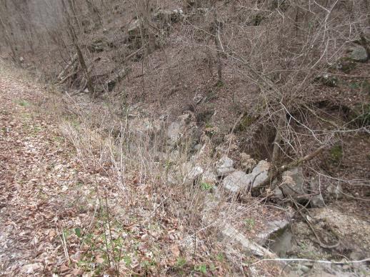 | | 2022 | COLLECTED | 03/15/2022 | Located approximately 3.75 miles east of Allison just off Round Bottom Road. | 35.93357000, -92.05110000 | 144 | Moist, low deciduous forest with scattered rock outcrops, growing along base of hill and bank of seasonal stream. | Wild material | | 2137430 | WLP 2568 |
| 153 | NA 88301 | NCBG-753 | Clethra alnifolia L. | North Carolina, United States | NA | | | 2021 | | | | | | | Wild material | | 2132950 | NA 88301 |
| 154 | NA 86885 | RJL2021PA-004 | Ilex verticillata (L.) A. Gray | Pennsylvania, United States | NA | | | 2021 | COLLECTED | 11/16/2021 | Plants growing in woodlands along a small unnamed creek corridor dumping into the Middle Branch White Clay Creek in Goddard Park, West Grove Pennsylvania, off of Wickerton Road, Chester County. | 39.81063861, -75.82750806 | 124 | Plants are growing in a range of habitats from mesic woodlands to saturated streamside settings of deciduous woodlands that drain toward the Middle Branch White Clay Creek. Plants grow in high understory shade with dappled to indirect sunlight. The only female (fruiting) plants were found in areas along the creek where soils are moist to saturated. Numerous male specimens were found in the areas described above. Soils: Soils found in the areas where this collection was made are comprised primarily of Baile silt loam (Ba), Hatboro silt loam (Ha), and Glenelg silt loam, 8 to 15 percent slopes (GgC). Baile silt loam consists of very deep, poorly drained, moderately low to moderately high saturated hydraulic conductivity, soils on upland depressions and footslopes that were formed in local alluvium over residuum from acid crystalline rocks, chiefly mica schist and granitized schist and gneiss; slope ranges from 0 to 8 percent. Hatboro silt loam consists of very deep and poorly drained soils formed in deposited alluvium derived from metamorphic and crystalline rock. They are on flood plains. Slopes range from 0 to 3 percent. Glenelg silt loam, 8 to 15 percent slopes consists of very deep, well drained soils formed in residuum weathered from micaceous schist on uplands of the Blue Ridge and the Northern Piedmont. This soil is undifferentiated, mostly poorly drained sandy bottomland soils intermingled with decomposing organic litter and eroded silts and clays due to erosion. Slope: 0 to 15% Aspect: Variable. | Wild material | | 2123125 | NA 86885 |
| 155 | WLP 1731 | RJL2021PA-001 | Viburnum acerifolium L. | Pennsylvania, United States | NA | | | 2021 | COLLECTED | 11/05/2021 | Plants growing in woodlands above a small unnamed creek that dumps into the Middle Branch White Clay Creek in Goddard Park, West Grove Pennsylvania, off of Wickerton Road, Chester County. | 39.80462083, -75.82888750 | 103 | Plants growing in a mesic, well-drained habitat of deciduous woodlands, for the most part, above the riparian zone that drains toward a small unnamed creek that feeds into the Middle Branch White Clay Creek. Plants are growing in high understory shade with very little direct sun during most of the day. The remnant woodlands exist mostly along the steep slopes, wetlands and seeps of seasonal and year-round creeks flowing into the Middle Branch White Clay Creek. The woodlands are bordered by numerous housing developments and land converted to meadows; hence there is significant first order edge that is heavily impacted by invasive plant intrusion. Soils: Soils are classified as Glenelg silt loam, 8 to 15% slopes (GgC); this series consists of very deep, well drained soils formed in residuum weathered from micaceous schist on uplands of the Blue Ridge and the Northern Piedmont. Saturated hydraulic conductivity is moderately high in the subsoil and moderately high to high in the substratum. This upper horizon of this soil is undifferentiated, mostly poorly drained sandy bottomland soils intermingled with decomposing organic litter and eroded silts and clays due to erosion. Slope: 8 to 15% Aspect: West. | Wild material | | 2123080 | WLP 1731 |
| 156 | WLP 1732 | RJL2021PA-002 | Viburnum prunifolium L. | Pennsylvania, United States | NA | | | 2021 | COLLECTED | 11/05/2021 | Plants growing in woodlands along a small unnamed creek corridor dumping into the Middle Branch White Clay Creek in Goddard Park, West Grove Pennsylvania, off of Wickerton Road, Chester County. | 39.80462083, -75.82888750 | 102 | Plants are growing in a range of habitats from drier upland woods to moist creekside settings of deciduous woodlands that drain toward the Middle Branch White Clay Creek. Plants grow in part shade to high understory shade with dappled to indirect direct sunlight. Plants achieve their largest size and fruiting potential in part sun of the riparian zone of the creek where woodland canopy is thinner. Soils: Soils found in the areas where this collection was made are comprised primarily of flood plain Hatboro silt loam (Ha) and well-drained, upland Glenelg silt loam, 8 to 15 percent slopes (GgC). Hatboro silt loam consists of very deep and poorly drained soils formed in deposited alluvium derived from metamorphic and crystalline rock. They are on flood plains. Slopes range from 0 to 3 percent. Glenelg silt loam, 8 to 15 percent slopes consists of very deep, well drained soils formed in residuum weathered from micaceous schist on uplands of the Blue Ridge and the Northern Piedmont. This soil is undifferentiated, mostly poorly drained sandy bottomland soils intermingled with decomposing organic litter and eroded silts and clays due to erosion. Slope: 0 to 15% Aspect: Variable. | Wild material | | 2123098 | WLP 1732 |
| 157 | WLP 1733 | RJL2021PA-003 | Viburnum dentatum L. | Pennsylvania, United States | NA | | | 2021 | COLLECTED | 11/05/2021 | Plants growing in woodlands along a small unnamed creek corridor dumping into the Middle Branch White Clay Creek in Goddard Park, West Grove Pennsylvania, off of Wickerton Road, Chester County. | 39.80522167, -75.82928139 | 107 | Plants are growing in a range of habitats from mesic woodland to moist creekside settings of deciduous woodlands that drain toward the Middle Branch White Clay Creek. Plants grow in high understory shade with dappled to indirect sunlight. Soils: Soils found in the areas where this collection was made are comprised primarily of flood plain Hatboro silt loam (Ha) and well-drained, upland Glenelg silt loam, 8 to 15 percent slopes (GgC). Hatboro silt loam consists of very deep and poorly drained soils formed in deposited alluvium derived from metamorphic and crystalline rock. They are on flood plains. Slopes range from 0 to 3 percent. Glenelg silt loam, 8 to 15 percent slopes consists of very deep, well drained soils formed in residuum weathered from micaceous schist on uplands of the Blue Ridge and the Northern Piedmont. This soil is undifferentiated, mostly poorly drained sandy bottomland soils intermingled with decomposing organic litter and eroded silts and clays due to erosion. Slope: 0 to 15% Aspect: Variable. | Wild material | | 2123124 | WLP 1733 |
| 158 | WLP 1747 | RJL2021PA-005 | Rosa palustris Marshall | Pennsylvania, United States | NA | | | 2021 | COLLECTED | 11/20/2021 | Plants growing in wetland seeps surrounded by mown hayfields just west of the Middle Branch White Clay Creek in Goddard Park, West Grove Pennsylvania, off of Wickerton Road, Chester County. | 39.80090528, -75.82383250 | 100 | Habitat Notes: Plants are growing in permanently saturated to moist soils in wetland habitats. Plants appear to be obligate wetland plants and are found only in permanent to nearly permanent wet habitats observed. Generally, the shrubs are found in part shade to full sun. Soils: Soils found in the areas where this collection was made are comprised primarily of Hatboro silt loam (Ha). Hatboro silt loam consists of very deep and poorly drained soils formed in deposited alluvium derived from metamorphic and crystalline rock. They are on flood plains. Slopes range from 0 to 3 percent. Slope: 0 to 3% Aspect: Variable. | Wild material | | 2123715 | WLP 1747 |
| 159 | NA 86881 | ASA-009A | Ilex vomitoria Aiton | Virginia, United States | NA | | | 2021 | COLLECTED | 01/13/2020 | Virginia Beach: First Landing State Park. Collected in the park campground, near the location of VIRG-015. One plant at campsite #166, the other near site #73 | 36.91886900, -76.05188900 | 2 | 15 deg slope; SE-facing; sand. Dunes with live oaks | Wild material | | 2116470 | NA 86881 |
| 160 | W6 59063 | NCBG-681 | Pityopsis graminifolia (Michx.) Nutt. var. latifolia (Fernald) Semple & F. D. Bowers | Virginia, United States | W6 | | | 2021 | | | | | | | Wild material | | 2116425 | W6 59063 |
| 161 | W6 59064 | NCBG-682 | Chasmanthium laxum (L.) H. O. Yates | Virginia, United States | W6 | | | 2021 | | | | | | | Wild material | | 2116377 | W6 59064 |
| 162 | NA 87036 | Site 3A/Live Oak Landing/Holmes Creek Site | Magnolia ashei Weath. | Florida, United States | NA | | | 2020 | COLLECTED | 07/15/2020 | Along Holmes Creek at Live Oak Landing. | 30.59208000, -85.83750000 | 11 | Shade to partial shade of bluffs above the creek in well-drained mesic to dry deciduous woodlands with a few broadleaved and coniferous evergreens. | Wild material | Although these were collected without any field collection number, seeds from individual trees were separated with letter identifiers that will be maintained with the qualifier (seedling) records. The relationships are as follows: 1. Maternal letter G, NA 87036-J, L, P, and T; maternal letter H, NA 87036-V; maternal letter K, NA 87036-X, Z, and H1; maternal letter N, NA 87036-H2. In addition, three seedlings' maternal letters were lost, and these will be NA 87036-H3, H4, and H5. See the following accessions for earlier collections from this same site/population, listed in our records as "Site 3A/Live Oak Landing/Holmes Creek Site": NA 81555 (2013), NA 82745 (2015), and NA 82745.01 (2019). | 2109403 | NA 87036 |
| 163 | Ames 35687 | NCBG-503 | Monarda punctata L. | North Carolina, United States | NC7 |  | | 2019 | | | | | | | Wild material | | 2098465 | Ames 35687 |
| 164 | NA 88140 | NCBG-280 | Aralia spinosa L. | North Carolina, United States | NA |  | | 2019 | | | | | | | Wild material | | 2098388 | NA 88140 |
| 165 | NA 88141 | NCBG-281 | Aralia spinosa L. | Virginia, United States | NA |  | | 2019 | | | | | | | Wild material | | 2098389 | NA 88141 |
| 166 | NA 88155 | NCBG-324 | Clethra alnifolia L. | North Carolina, United States | NA |  | | 2019 | | | | | | | Wild material | | 2098415 | NA 88155 |
| 167 | NA 88158 | NCBG-331 | Callicarpa americana L. | North Carolina, United States | NA | 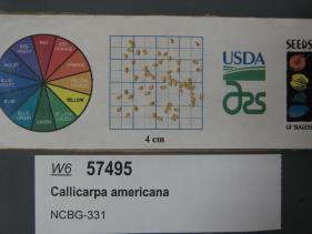 | | 2019 | | | | | | | Wild material | | 2098419 | NA 88158 |
| 168 | W6 57099 | MARSB-246 | Tridens flavus (L.) Hitchc. | New York, United States | W6 |  | | 2019 | | | | | | | Wild material | | 2097538 | W6 57099 |
| 169 | WLP 171 | NACPEC19-063 | Itea virginica L. | Georgia, United States | NA | | | 2019 | COLLECTED | 09/15/2019 | Walker County; Lula Lake Land Trust: Lula Lake Land Trust Falls: West Side of Falls | 34.93319200, -85.37178900 | 477 | Stream bank, mesic wood forest | Wild material | | 2110485 | WLP 171 |
| 170 | WLP 173 | NACPEC19-075 | Euonymus americanus L. | Georgia, United States | NA | | | 2019 | COLLECTED | 09/17/2019 | Rabun County; Chattahoochee-Oconee National Forest: Chattooga River Trail approximately 1/4 mile down trail from parking lot (off of Highway 76). About 0.09 miles North of Long Creek Highway (2) as the crow flies; Township unicorporated | 34.81549600, -83.30747100 | 393 | Trail edge, steep slope, 400 feet up the slope on West bank (Georgia side): Mixed mesophytic Maple-Hickory-Oak woodland | Wild material | | 2110487 | WLP 173 |
| 171 | WLP 174 | NACPEC19-076 | Clethra acuminata Michx. | Georgia, United States | NA | | | 2019 | COLLECTED | 09/17/2019 | Rabun County; Chattahoochee-Oconee National Forest: Chattooga River Trail approximately 1/2 mile down trail from parking lot (off of Highway 76); Township unicorporated | 34.81757600, -83.30720600 | 423 | Trail edge, steep slope, 400 feet up the slope on West bank (Georgia side): Mixed mesophytic Maple-Hickory-Oak woodland | Wild material | | 2110488 | WLP 174 |
| 172 | GPRU 165 | NCBG-218 | Prunus serotina Ehrh. | North Carolina, United States | GEN | | | 2018 | | | | | | | Wild material | | 1965868 | GPRU 165 |
| 173 | NA 88035 | NCBG-622 | Ilex glabra (L.) A. Gray | North Carolina, United States | NA |  | | 2018 | COLLECTED | 10/27/2016 | From Roanoke Island, head SW on US-64 W, turn left onto US-264 W, population on left for approximately 12 miles. | 35.71316000, -75.76819000 | 1 | Pine-inkberry swamp. | Wild material | | 1965992 | NA 88035 |
| 174 | NA 84577 | RJL-RM001 | Halesia diptera J. Ellis | Texas, United States | NA | | | 2017 | COLLECTED | 07/22/2017 | Along either side of a clear creek on private property approximately 1.42 kilometers north of Texas Recreational Road 255 in northeastern Jasper County. | 31.07135000, -93.94985000 | 107 | Plants growing along the embankments of the clear creek just above normal flood stage in primarily deciduous woodlands with some broadleaved evergreens and conifers. Plants are growing in part shade; some direct sunlight occurs during mid-day hours for 1-2 hours. Soils sandy and topped with a generous undisturbed decomposed litter layer. Slope: 10 percent. Aspect: variable. | Wild material | | 1953812 | NA 84577 |
| 175 | NA 84578 | RJL-RM002 | Magnolia pyramidata W. Bartram | Texas, United States | NA | | | 2017 | COLLECTED | 07/22/2017 | Newton County Road 425, about 2.8 miles south of Texas Recreational Road 255. | 30.85996000, -93.89596000 | 105 | Along roadsides and among young loblolly pines in forestry plantation. Plants growing in part shade to full sun in heavily regenerating roadside woodlands associated with loblolly pine plantations. Plants are growing in well drained, highly sandy soils. | Wild material | | 1953814 | NA 84578 |
| 176 | WLP 1437 | NA 84027 | Oxydendrum arboreum (L.) DC. | Florida, United States | NA | | | 2016 | COLLECTED | 11/11/2016 | Woodlands associated with Miller Bayou, south of housing subdivision off of Pearl Court. | 30.46413000, -86.92804000 | 2 | Full sun to partial shade in mixed coniferous/broadleaved evergreen woodlands, with a mixture of deciduous plants in highly acidic sandy soils approximately 100-300 ft. from the salt marsh edge associated with Miller Bayou. | | | 1950372 | WLP 1437 |
| 177 | NA 83681 | Ron Miller 08302014 | Viburnum obovatum Walter | Florida, United States | NA | | | 2016 | COLLECTED | 08/30/2014 | Along Holmes Creek not far from the boat ramp on Hightowers Road. | 30.60560000, -85.76490000 | 5 | Boggy edge of creek in mixed deciduous and evergreen bottomland woodlands that are periodically inundated for extended periods. | Wild material | | 1951230 | NA 83681 |
| 178 | NA 82746 | Site 3B/Hightower Road at Holmes Creek | Magnolia ashei Weath. | Florida, United States | NA | | | 2015 | COLLECTED | 07/31/2015 | Along Holmes Creek 0.2 miles west-southwest of Hard Castle Landing boat ramp at hte end of Hightower Road. | 30.60401000, -85.76883000 | 11 | Shade to partial shade of deciduous woodlands 10 to 15 feet above the creek, surrounded by low lying swampy area. | Wild material | Originally just called Site 3, but the "A/B" has been added to distinguish the Live Oak Landing (3A) and Hightower Road (3B) material. For previous collections of this population, see NA 81556 (2013); for later collection, see NA 82746.01 (2019). | 1950860 | NA 82746 |
| 179 | NA 82643 | NA 82643 | Lonicera sempervirens L. | Texas, United States | NA | | | 2015 | COLLECTED | 07/20/2014 | East side of Texas Route 87 approximately 0.52 miles south of Trout Creek, Texas. | 30.61156000, -93.80506000 | 21 | Southwest-facing edge of mature woodland in part to full sun; well-drained, seasonally moist soils that are sandy loam; surface has an excellent organic litter layer. | | | 1952603 | NA 82643 |
| 180 | NA 82648 | NA 82648 | Viburnum acerifolium L. | Texas, United States | NA | | | 2015 | COLLECTED | 08/31/2013 | West side of the road along Texas Route 87 north of Burkeville, Texas. | 31.11950000, -93.72656000 | 141 | Dry, acidic woodlands in full shade beneath trees; soils sandy loam and are very loose and drought prone. | Wild material | | 1953129 | NA 82648 |
| 181 | NA 83069 | NA 83069 | Rhododendron prunifolium (Small) Millais | Georgia, United States | NA | | | 2015 | COLLECTED | 10/09/2014 | Callaway Gardens. Callaway natural lands; restricted entrance on Rt. 116 (Blue Springs Rd.) approx. 3.6 west of Hamilton, GA. | 32.75538000, -84.94025000 | 251 | | | | 1952271 | NA 83069 |
| 182 | W6 48943 | AK930-468 | Artemisia norvegica Fr. subsp. saxatilis (Besser) H. M. Hall & Clem. | Alaska, United States | W6 |  | | 2015 | | | | | | | Wild material | | 1923858 | W6 48943 |
| 183 | W6 48945 | AK930-470 | Carex podocarpa R. Br. | Alaska, United States | W6 |  | | 2015 | | | | | | | Wild material | | 1923860 | W6 48945 |
| 184 | NA 81570 | (orange suffused with rose) | Rhododendron austrinum (Small) Rehder | Florida, United States | NA | | | 2013 | COLLECTED | 03/31/2013 | Little Simpson River approximately 0.53 miles southeast of the confluence with Buzzards Lake River [and White River] in the Escambia River State Wildlife Management Area. | 30.59421000, -87.21575000 | 2 | Light shade along the river on a small sandy berm above the stream in mixed deciduous and broadleaved evergreen maritime forest occasionally inundated by tidal salt water. | Wild material | | 1951291 | NA 81570 |
| 185 | NA 81571 | (clear light pink) | Rhododendron austrinum (Small) Rehder | Florida, United States | NA | | | 2013 | COLLECTED | 03/31/2013 | White River approximately 1.1 miles north of the confluence with Buzzard�s Lake River in the Escambia River State Wildlife Management Area. | 30.60490000, -87.22261000 | 2 | Part shade along the river on a small sandy berm above the stream in mixed deciduous and broadleaved evergreen maritime forest occasionally inundated by tidal salt water. | Wild material | | 1952627 | NA 81571 |
| 186 | NA 81603 | (seedling of pink form) | Rhododendron austrinum (Small) Rehder | Florida, United States | NA | | | 2013 | COLLECTED | 2013 | On the Escambia river near the mouth of the Yellow River. [GPS coordinates are actually at the confluence of the White River, the Little Simpson River, and the Buzzard Lake River (and gas line canal). -SBL] | 30.59699000, -87.22295000 | | Plants were collected along along the sandy berms along river delta. | | | 1950972 | NA 81603 |
| 187 | Ames 30518 | APS/GD/2009/020/029 | Gymnocladus dioicus (L.) K. Koch | Iowa, United States | NC7 |  | | 2010 | COLLECTED | 04/11/2010 | North Raccoon River Watershed, Section 6, Section 7, and NW 1/4 of NW 1/4 of Section 18, between Iowa Highway 44 (240th Street) and Adel, Dallas County. | 41.67297500, -94.03777500 | 320 | Bottomland/floodplain forest. | Wild material | Plants ranged from 60-75 feet tall and averaged 20 inches d.b.h. Seeds seemed very small and round. | 1836761 | Ames 30518 |
| 188 | NA 78052 | NA 78052 | Ilex longipes Chapm. ex Trel. | Alabama, United States | NA | | | 2008 | COLLECTED | 09/19/2008 | Little River Canyon National Preserve, Little River Canyon, on trail near Lynn Overlook tributary. | | | Rocky woodland on trail near Lynn Overlook tributary. | | | 1950410 | NA 78052 |